Naval History Homepage and Site Search
Naval History Homepage and Site Search
|
||||||||
|
||||||||
|
Armed Merchant Cruiser, mercantile conversion Pendant Nos. MI.69 (on coming into service), MI.64 (1.18), MI.42 (9.18). Built 1907, 8917grt, 15.5kts. Armament: 8-6in, 2-6pdr AA. In service 8.1.16-8.7.19. Of over 60 commissioned AMC's employed on patrol and later convoy protection, 33 served with 10th CS on Northern Patrol. (British Warships 1914-1919) |
||||||||
|
||||||||
|
Notes: 1. Latitude/longitude, including for days in port, show representative decimal positions for each day, as calculated by the Old Weather project's analysis program. As such, they differ by varying amounts from the positions recorded, usually at noon, in the log pages. In addition, some latitudes/longitudes have been amended in edited logs for errors in the logs, for errors in identifying locations by the analysis program, or simply for greater accuracy. In all cases, refer to the log-page scans for the positions as originally recorded. Not all log pages contain this information and the ships' positions have therefore often been estimated. 2. Full account of any day is available by clicking on the link above that day. Groups of links refer to log book covers and introductory information; some may be blank. Editor’s notes: Positions (Latitude and Longitude) are given for noon each day, correcting or estimating the position when appropriate. If exact times are not indicated in the log they have, when appropriate, been estimated from the position of the entries (which show times on the left hand side of the log page). Information about sea state is based on the Sea Disturbance Scale where “rough to very rough” indicates waves 5 to 10 feet from peak to trough, “high” indicates waves of 11 to 15 feet, “very high” indicates wave height of 16 to 35 feet and “phenomenal” indicates waves of 36 feet and above. A note is made of numbers on the sick list where this is 5 or more. This and other information from the log is included in square brackets [not in italics] if it is not to be found under “Remarks” on the right hand side of the page. Additional information about geographical locations, terminology and about merchant and foreign naval ships encountered has been provided where identification is reasonably certain, by means of embedded links within the text. There is more information about the ship here. |
||||||||
|
THE VOYAGES OF HMS CITY OF LONDON 1916-1918
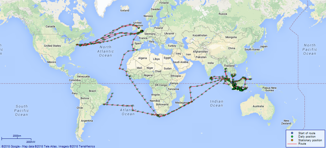
(Maps prepared using Journey Plotter, developed by Maikel. The Plots can only be approximate. They are made by joining-up positions on successive days, and sometimes positions are not given. There will therefore be occasions when the ship appears to have travelled overland) LOGS FOR MARCH 1916 4caf855dcadfd3419700e746: (http://oldweather.s3.amazonaws.com/ADM53-37880/C2-ADM53-37880-0001_0.jpg) [Left hand side of brown, hard cover of Log from 27 March 1916 to 21 June 1916] 4caf855dcadfd3419700e747: (http://oldweather.s3.amazonaws.com/ADM53-37880/C2-ADM53-37880-0001_1.jpg) [Right hand side of cover] 4caf855dcadfd3419700e748: (http://oldweather.s3.amazonaws.com/ADM53-37880/C2-ADM53-37880-0002_0.jpg) [Blank page] 4caf855dcadfd3419700e749: (http://oldweather.s3.amazonaws.com/ADM53-37880/C2-ADM53-37880-0002_1.jpg) [Blank page, apart from some handwritten numbers] 4caf855dcadfd3419700e74a: (http://oldweather.s3.amazonaws.com/ADM53-37880/C2-ADM53-37880-0003_0.jpg) [Blank page] 4caf855dcadfd3419700e74b: (http://oldweather.s3.amazonaws.com/ADM53-37880/C2-ADM53-37880-0003_1.jpg) [Printed page for Deck Log Book, with indications as to how the log is to be completed, together with Figures to indicate the Force of the Wind, Letters to denote the State of the Weather, Scale of Fog Intensity and Sea Disturbance Scale.] 4caf855dcadfd3419700e74c: (http://oldweather.s3.amazonaws.com/ADM53-37880/C2-ADM53-37880-0004_0.jpg) 4caf855dcadfd3419700e74d: (http://oldweather.s3.amazonaws.com/ADM53-37880/C2-ADM53-37880-0004_1.jpg 27 March 1916 At London Lat 51.51, Long 0.06 [estimated] 8.0am: Ship’s Company from HMS “Vivid” arrived on board. 1.30pm: Divisions and hoisted Pennant and Ensign. 1.45pm: Exercised “Abandon Ship” and General Quarters. 4caf855dcadfd3419700e74e: (http://oldweather.s3.amazonaws.com/ADM53-37880/C2-ADM53-37880-0005_0.jpg) 4caf855dcadfd3419700e74f: (http://oldweather.s3.amazonaws.com/ADM53-37880/C2-ADM53-37880-0005_1.jpg) 28 March 1916 At RA [Royal Albert] Docks London Lat 51.51, Long 0.06 5.40am: Hands fell in. am: Hands employed scrubbing decks and preparing to take in Ammunition. 1.0pm: Ammunition Lighter came alongside. 1.15pm: Ammunitioning ship. 5.30pm: Ceased work and locked up Magazine and Shell rooms. pm: Strong snow and hail squall from Northward. 4caf855dcadfd3419700e750: (http://oldweather.s3.amazonaws.com/ADM53-37880/C2-ADM53-37880-0006_0.jpg) 4caf855dcadfd3419700e751: (http://oldweather.s3.amazonaws.com/ADM53-37880/C2-ADM53-37880-0006_1.jpg) 29 March 1916 At London Lat 51.51, Long 0.06 5.0am: Call Hands. 5.40am: Hands fall in and continued Ammunitioning ship. Employed Cleaning up decks. 7.40am: Quarters Clean Guns. Tanks and wells sounded. 9.0am: Divisions. Hands Employed taking in Ammunition and preparing ship for sea 1.15pm: Hands fall in. Employed taking in Ammunition and as requisite. 4.0pm: Evening Quarters. 7.0pm: Covered Guns and searchlights. 9.0pm and Midnight: First Lieutenant’s rounds. 4caf855dcadfd3419700e752: (http://oldweather.s3.amazonaws.com/ADM53-37880/C2-ADM53-37880-0007_0.jpg) 4caf855dcadfd3419700e753: (http://oldweather.s3.amazonaws.com/ADM53-37880/C2-ADM53-37880-0007_1.jpg) 30 March 1916 From RA [Royal Albert] Docks London to Nore Lat 51.50, Long -0.70 [estimated] 7.0am: Hands at Stations. Cast off from quay. Docking Pilot Cullem. Two tugs in attendance. 9.0am: Made fast in lock. 9.15am: Left lock. Name of tugs, Scotia [Scotia (2) listed here] and Nestor [listed here]. River Pilot Eddgley. 9.25am: Tug Nestor left. 9.35am: Tug Scotia left. 10.3am: Passed Coal Harbour Point. 10.35am: Passed Store Ness Point. 10.45am: Passed Gravesend. Courses to Pilot Orders. 11.5am: River and Docking Pilot left. Sea Pilot came on board. Name Holland. 11.30am: Passed Mucking Lighthouse. 0.5pm: Passed Southend Pier. 0.20pm: Passed Nore Lightship. 0.35pm: Examination Boat alongside, stopped. 0.41pm: Slow ahead. 1.19pm: Entered booms. Engines to order. 2.40pm: Made fast to buoy. 4.40pm: Evening quarters. 5.0pm: General quarters. 5.30pm: Covered guns etc. 6.20pm: Sunset. 6.51pm: Darkened ship. 8.0pm: Tanks and wells sounded. [Note: Tug “Scotia” (Scotia (2)) was a steel screw tug built in Newcastle in 1893 and owned by John S and Alfred Watkins, London, then William Watkins Ltd; she was laid up in 1934 and sold for scrap in 1935. Tug “Nestor” was built in 1883 in Low Walker, Newcastle, as “Africa” and used as a trawler; she changed hands several times and was based in Swansea from 1891 to 1903, when she was sold to Lawson Steam Tug Company, Newcastle; she was renamed “Nestor” in 1906. She was chartered by Watkins, London in 1915; in 1918 she was requisitioned by the Admiralty and was renamed “Velmar”, returning to Lawson’s at the end of 1918 and becoming “Nestor” again; she was sold for demolition in 1937.] 4caf855dcadfd3419700e754: (http://oldweather.s3.amazonaws.com/ADM53-37880/C2-ADM53-37880-0008_0.jpg) 4caf855dcadfd3419700e755: (http://oldweather.s3.amazonaws.com/ADM53-37880/C2-ADM53-37880-0008_1.jpg) 31 March 1916 At Nore Lat 51.47, Long 0.75 [rough estimate] [No 7 Buoy] 4.0am: Light breeze. Blue sky. Smooth sea. 6.5am: Called hands. 9.30am: Divisions. 10.0am: Exercised abandon ship, lowered boats and rowed round steamer. 11.15am: Set sails. 11.30am: Hoisted boats. 1.0pm: Light breeze, smooth sea, clear. 6.23pm: Sunset. 6.30pm: Darkened ship. [Weather mostly misty or fine and quiet, noon temperature 57F] LOGS FOR APRIL 1916 4caf855dcadfd3419700e756: (http://oldweather.s3.amazonaws.com/ADM53-37880/C2-ADM53-37880-0009_0.jpg) 4caf855dcadfd3419700e757: (http://oldweather.s3.amazonaws.com/ADM53-37880/C2-ADM53-37880-0009_1.jpg) 1 April 1916 At Nore Lat 51.48, Long 0.78 [rough estimate] [No 7 Buoy] 11.45am: Left Moorings and proceeded down river. 0.30pm: Hands at station for Action. 1.0pm: Gun Trials. 2.40pm: Finished gun trials. 3.40pm: Let go port Anchor, 9 fathoms water. Veering Cable to 45 fathoms. [Anchored off Nore Light Vessel] 6.30pm: Sunset. Darkened ship. 9.0pm: First Lieutenants rounds. Extinguished riding lights. 11.0pm: [HMS] Zephyr’s boat alongside for letter. 4caf855dcadfd3419700e758: (http://oldweather.s3.amazonaws.com/ADM53-37880/C2-ADM53-37880-0010_0.jpg) 4caf855dcadfd3419700e759: (http://oldweather.s3.amazonaws.com/ADM53-37880/C2-ADM53-37880-0010_1.jpg) 2 April 1916 At Nore Lat 51.47, Long 0.76 [rough estimate] [Port Anchor 45 fathoms 1.0am: Ship regularly visited. 2.0am: Anchor cable visited. 3.0am: Anchor Bearings checked. 4.0am: Riding lights lighted. 6.0am: Called Hands. 6.5am: Hands fall in. [Anchored off Nore] 10.0am: Divisions and inspection. 10.15am: Boat alongside. 10.30am: Divine Service. Noon: Boat alongside. 2.0pm: Anchor cable inspected. Fine and clear, hazy. 2.35pm: Steamer “Alexandra” [there was a large number of ships of this name at this time] alongside with Chief Gunner, Postman, mails and books. 3.0pm: Anchor Bearings checked. Hands at leisure. 4.0pm: Light Breeze, smooth sea, hazy. 6.29pm: Sunset. Ship Darkened and covered guns. 9.0pm: Extinguished Riding lights. Visited anchor cable. 10.0pm: Fine clear, smooth glassy sea. Midnight: No atmospherical change. Anchor Bearings checked. 4caf855dcadfd3419700e75a: (http://oldweather.s3.amazonaws.com/ADM53-37880/C2-ADM53-37880-0011_0.jpg) 4caf855dcadfd3419700e75b: (http://oldweather.s3.amazonaws.com/ADM53-37880/C2-ADM53-37880-0011_1.jpg) 3 April 1916 From Nore Lat 51.50, Long 1.32 [rough estimate] [Port Anchor to 45 fathoms] 2.30am: Morse signals to and from Nore Lightship. 4.0am: Call hands. 4.45pm: Hands fell in and washed down decks. 6.0am: Fog signals attended to. 8.40am: Uncovered guns and searchlights and cleaned them. 9.22am: Stand by. 9.25am: Hove up anchor. 9.26am: Slow ahead. 9.30am: Reduced speed. 9.45am: Dropped starboard anchor. Hoisted black ball at foremast. 10.30am: Hove up anchor. Slow ahead. Course S78E Standard Compass. 10.35am: Full speed ahead. 10.55am: Course S87E Steering Compass. 10.56am: Passed West Oaze Buoy. 0.20pm: Tongue Light Vessel abeam. 1.3pm: Elbow Buoy No 1 abeam. 1.16pm: Elbow Buoy No 2 abeam. Stand by engines. 1.50pm: Stop. Upper Examination tug alongside. 2.0pm: Full speed ahead. 2.15pm: Passed and signalled Upper Guardship. 2.35pm: Stop. Signalled to [HMS] “Duchess of Devonshire” Lower Guardship. 2.53pm: Stop. Let go port anchor 45 fathoms of cable in 10 fathoms of water. [Port Anchor to 45 fathoms. Bearings: Deal Pier N70.5W true, Goodwin fort buoy N44.5E true] 4.0pm: Evening quarters. 4.10pm: Exercises for fire stations. 6.25pm: Sunset, darkened ship and covered guns. 7.0pm: Hove up anchor Port and 7.5 slow ahead. 7.25pm: South Goodwin lightship abeam. 8.10pm: Passed through gateway. Set Course S58W Standard. Streamed log. 9.8pm: Dungeness Light abeam 2 miles, altered course S73W Standard, Steering S74W. Log 12. 11.6pm: Royal Sovereign abeam 1.5 miles, altered course S84W Standard, Steering S86W. 4caf855dcadfd3419700e75c: (http://oldweather.s3.amazonaws.com/ADM53-37880/C2-ADM53-37880-0012_0.jpg) 4caf855dcadfd3419700e75d: (http://oldweather.s3.amazonaws.com/ADM53-37880/C2-ADM53-37880-0012_1.jpg) 4 April 1916 At Sea Lat 49.42, Long -3.87 3.15am: St Catherine’s light abeam bearing N6W, 16.5 miles, log 96.5 miles. 5.50am: Met Norwegian barque “Alexandra” [possibly this ship]. 6.0am: Courses irregular Zig Zag. Commenced to Zig Zagg [sic]. 7.0am: In company with SS “Mervyn” [probably the ship listed here for 1908]. 8.0am: Fresh breeze moderate sea. Fine and clear. 11.40am: Spoke SS JLWN [or TLWN ‒ presumably a call sign] bound for Havre. am: ZZ various. Gun’s crews and Control Parties to drill. pm: Zigzagging per Captain’s orders. 3.0pm: Lat DR 49 02 N, long DR 4 32 W, long observed 4 29.5 W, Compass deviation 13W, 3.5E. 4.0pm: Set Electric log. 6.28pm: Sunset. Darkened ship. 7.0pm: Ushant light abeam. [Bearing and Distance to Position 10 miles off Ushant Light S48W true 71 miles] [Course and Distance made good] [Various 230 miles] [Wind north westerly force 4 to 5 all day; weather fine] [Note: “Alexandra” was a barque built in Glasgow in 1885 as “Forfarshire” for Thomas Law and Company; she was sold to a Norwegian company in 1911 and was renamed “Alexandra”; at this time she was owned by A/S Alexandra, Sandefjord; she was broken up in 1925. SS “Mervyn” was a British cargo ship built in Sunderland in 1908 for Mervyn Steam Shipping Company, Newport; she was to sink after a collision with HMS Plucky off Land’s End in February 1917 (more details here and here. It has not been possible to trace the ship mentioned at 11.40am.] 4caf855dcadfd3419700e75e: (http://oldweather.s3.amazonaws.com/ADM53-37880/C2-ADM53-37880-0013_0.jpg) 4caf855dcadfd3419700e75f: (http://oldweather.s3.amazonaws.com/ADM53-37880/C2-ADM53-37880-0013_1.jpg) 5 April 1916 At Sea Lat 44.98, Long -8.80 1.0am: Fine and clear up till 3.0am. 3.0am and 4.0am: Squally. 6.0am: Boats crew exercised. 9.30am: Divisions and Physical drill. 11.0am: Gun’s crews to drill at loader. 3.35pm: In company with Norwegian SS “Hugin”. 4.0pm: Evening Quaterers [Quarters] and Physical drill. 7.0pm: Position star [symbol] lat 43 35 N, long 10 18 W. Midnight: Fresh breeze, rough sea. Cloudy and fine. [Note: SS “Hugin” was a cargo ship built in 1901 by a German company in Danzig and owned by a company in Bergen; she was to be sunk by a German submarine off northern France in March 1917 (more details here).] 4caf855dcadfd3419700e760: (http://oldweather.s3.amazonaws.com/ADM53-37880/C2-ADM53-37880-0014_0.jpg) 4caf855dcadfd3419700e761: (http://oldweather.s3.amazonaws.com/ADM53-37880/C2-ADM53-37880-0014_1.jpg) 6 April 1916 At Sea Lat 40.67, Long -10.57 5.5am: Lat observed star 41 57.5 N, Long observed star 10 38 W. Noon: Moderate wind and sea, cloudy and clear. 3.20pm: Lat DR 40 10 N, Long observed 10 40 W. 8.0pm: Cloudy. Moderate Wind and Sea, clear. [True Bearing and Distance] [To 48 miles W off Rocas Light House S1E, 112 miles] [Course and Distance made good] [Various 284 miles] 4caf855dcadfd3419700e762: (http://oldweather.s3.amazonaws.com/ADM53-37880/C2-ADM53-37880-0015_0.jpg) 4caf855dcadfd3419700e763: (http://oldweather.s3.amazonaws.com/ADM53-37880/C2-ADM53-37880-0015_1.jpg) 7 April 1916 At Sea Lat 37.03, Long -9.05 am: Prisoner inspected and found correct. Various Courses approaching Cape St Vincent. 0.40pm: Sagres Light House abeam 2 miles, log 37 miles. 4.0pm: Men received pay. 6.30pm: Darkened ship. 6.37pm: Sunset. Midnight: Moderate breeze and sea. Cloudy and fine. [True Bearing and Distance] [To 2 miles off St Vincent Light House S55E, 3 miles] [Course and Distance made good] [Various 241 miles] 4caf855dcadfd3419700e764: (http://oldweather.s3.amazonaws.com/ADM53-37880/C2-ADM53-37880-0016_0.jpg) 4caf855dcadfd3419700e765: (http://oldweather.s3.amazonaws.com/ADM53-37880/C2-ADM53-37880-0016_1.jpg) 8 April 1916 At Sea [and Gibraltar, though not stated in Log] Lat 36.14, Long -5.37 [rough estimate] 3.35am: Hauled in Patent Log. Log 91 4.0am: Cape Spartel abeam, distant 6.5 miles, log hauled in. 6.47am: St Bartolome Light House abeam bearing N10W (true) 5.5 miles. 7.6am: Cape Tarifa light abeam bearing N5W 2.2 miles. 8.14am: Half Speed. 8.16am: Stand by. 8.28am: Slow. 8.30am: Stop. 8.45am: Let go port anchor, 75 fathoms cable, 25 fathoms water. [Port Anchor to 75 fathoms, 20 fathoms water] 11.30am: Sent Hospital Party ashore with Electrician. Noon: Light breeze, smooth and clear. 0.45pm: No 1 Warrant read and prisoner sent ashore to detention barracks. 1.15pm: Cleaned guns. 5.30pm: Hove up anchor to 45 fathoms. 5.38pm: Signal confirmed for leaving, resumed heaving up. 5.45pm: Anchor aweigh. 5.50pm: Slow ahead. 6.0pm: Full ahead. 6.20pm: Sunset. Log streamed. 6.52pm: Set course S87W. 7.20pm: Tarifa light abeam bearing N3W 1.75 miles, log 4. 9.3pm: Altered course to N80W, Spartel abeam distant 5 miles log 25. 10.30pm: Wind freshened. Squally and rain. Midnight: Fresh Southerly wind. Cloudy. Squally and rain. [Course and Distance made good] [Various 198 miles] 4caf855dcadfd3419700e766: (http://oldweather.s3.amazonaws.com/ADM53-37880/C2-ADM53-37880-0017_0.jpg) 4caf855dcadfd3419700e767: (http://oldweather.s3.amazonaws.com/ADM53-37880/C2-ADM53-37880-0017_1.jpg) 9 April 1916 At Sea Lat 35.50, Long -9.50 4.0am: Fresh breeze and moderate sea. Cloudy with rain squalls and vivid lightning. 7.0am: Exercised sea boats crew. Guns crews dismissed. 8.0am: Spraying over bows. 1.0pm: Squalls passed off. 4.0pm: Fresh wind, moderate rough sea. Cloudy and clear. 6.0pm: Taking spray over bows. 7.0pm: Clock put back 23 minutes. 8.0pm: Shipping spray over forward. [True Bearing and Distance] [To position [lat] 34 38 N, long 17 30 W, S82.5W, 396 miles] [Distance made good] [Indirect 207 miles] [Wind south westerly, then north westerly, then northerly, force 5 all day, sea rough from noon; rain in middle of day; noon air temperature 53F, sea temperature 56F] 4caf855dcadfd3419700e768: (http://oldweather.s3.amazonaws.com/ADM53-37880/C2-ADM53-37880-0018_0.jpg) 4caf855ecadfd3419700e769: (http://oldweather.s3.amazonaws.com/ADM53-37880/C2-ADM53-37880-0018_1.jpg) 10 April 1916 At Sea Lat 34.90, Long -15.25 4.0am: Fresh wind, strong gusts at times. Moderate rough sea. Fine. 8.0am: Moderate breeze and sea. Cloudy and fine. am: Exercised Control with Port Battery. pm: 6 inch Gun’s crews to loader. 3.55pm: Sighted sailing ship 4 points on starboard bow, close-hauled on port tack. 5.0pm: Shipping spray forward. 6.0pm: Moderate breeze and sea. Cloudy and clear. 8.0pm: Fresh breeze, overcast, rough Sea. [True Bearing and Distance] [To position 33 17 N, 19 13 W, S64W, 220 miles] [Course and Distance made good] [S82.5W, 285 Miles from noon] 4caf855ecadfd3419700e76a: (http://oldweather.s3.amazonaws.com/ADM53-37880/C2-ADM53-37880-0019_0.jpg) 4caf855ecadfd3419700e76b: (http://oldweather.s3.amazonaws.com/ADM53-37880/C2-ADM53-37880-0019_1.jpg) 11 April 1916 At Sea [though not stated at top of page] Lat 31.80, Long -19.77 8.0am: Overcast, fine and clear. Moderate NE sea. am: Exercised control with starboard battery and Forward Supply of ammunition to 6 inch guns. pm: Gun’s crews to loader. Light following wind and sea, clear. 6.20pm: Cover and Secure guns. 8.0pm: Moderate to fresh breeze. Moderate sea. [True Bearing and Distance] [To St Antonia [St Antonio ‒ Santo Antão, Cape Verde] Light S18W, 926 miles] [Course and Distance made good] [From Noon to Noon Various 318 miles] 4caf855ecadfd3419700e76c: (http://oldweather.s3.amazonaws.com/ADM53-37880/C2-ADM53-37880-0020_0.jpg) 4caf855ecadfd3419700e76d: (http://oldweather.s3.amazonaws.com/ADM53-37880/C2-ADM53-37880-0020_1.jpg) 12 April 1916 At Sea Lat 26.38, Long -21.77 am: Ship's company spreading awnings. Noon: Moderate free wind and sea, cloudy and clear. 4.0pm: Moderate breeze and sea. Cloudy and fine. Evening Quarters and Abandon Ship Stations, boat lowered into chocks. Midnight: Moderate breeze, fine and clear. Moderate sea. [Course and Distance made good] [S18W, 342 miles from Noon] [Weather fine, noon temperature 70F, sea temperature 67F] 4caf855ecadfd3419700e76e: (http://oldweather.s3.amazonaws.com/ADM53-37880/C2-ADM53-37880-0021_0.jpg) 4caf855ecadfd3419700e76f: (http://oldweather.s3.amazonaws.com/ADM53-37880/C2-ADM53-37880-0021_1.jpg) 13 April 1916 At Sea Lat 21.03, Long -23.65 4.0am: Moderate breeze and sea. Fine clear weather. 4.0pm: Light breeze, fine, clear weather. Slight sea. 6.35pm: Passed and signaled [sic] to British SS “Wordsworth”. [True Bearing and Distance] [To St Antonio S17W, 247 miles] [Course and Distance made good] [From noon S17W, 338 miles] [Note: SS “Wordsworth” was a cargo ship built in Sunderland in 1915 and owned by Shakespear Shipping Company, London; she was to be scuttled by a German naval vessel in the Indian Ocean in March 1917.] 4caf855ecadfd3419700e770: (http://oldweather.s3.amazonaws.com/ADM53-37880/C2-ADM53-37880-0022_0.jpg) 4caf855ecadfd3419700e771: (http://oldweather.s3.amazonaws.com/ADM53-37880/C2-ADM53-37880-0022_1.jpg) 14 April 1916 From Gibraltar to St Vincent [São Vicente, Cape Verde] Lat 16.89, Long -25.01 [estimated] 4.0am: Light breeze and sea, fine clear weather. Slight sea. 5.30am: Sighted Bull Rock St Antonio. 6.10am: Handed Patent Log 49. 6.46am: Bull Rock Light House abeam 2.5 miles. 7.43am: Bird Island Light House abeam 3 cables. 7.45am: Stand by. 7.45am: Passed Bird Island. 7.46am: Half speed. 8.0am: Medical Inspecter [Inspector] came on board. 8.48am: Stop. 8.50am: Full astern, saluted the flagship. 8.53am: Let go anchor. Stop. Slow ahead. Stop. [Port Anchor to 30 fathoms] 9.30am: Divisions. 10.0am: Both Watches fall in for exercise. Noon: Dinner. Slight Breeze and clear weather. 4.0pm: Very fine and clear. Evening Quarters. 4.45pm: Veered Cable to 45 fathoms. [Port Anchor to 45 fathoms] 5.50pm: Flagship [HMS] “King Alfred” [see also her log for this date] under weigh proceeded South. 5.55pm: Sunset. 6.0pm: No atmospherical change. Hoisted port sea-boat. 6.30pm: Hoisted starboard sea-boat and No 10 lifeboat. Darkened ship. 8.15pm: Night boats crew to muster. 10.0pm: Pipe down. 4caf855ecadfd3419700e772: (http://oldweather.s3.amazonaws.com/ADM53-37880/C2-ADM53-37880-0023_0.jpg) 4caf855ecadfd3419700e773: (http://oldweather.s3.amazonaws.com/ADM53-37880/C2-ADM53-37880-0023_1.jpg) 15 April 1916 At St Vincent Lat 16.89, Long -25.01 [Port Anchor to 45 fathoms. Anchor Bearings: ship's Head N60E, Error 20.25 W. Ponta Columna [Ponta da Coluna] N38E, Passaro Island Light House N5.5E, Ponta do Moro [Morro] Branco N71W] 6.0am: Fine slight haze. Light detached clouds. 7.6am: HMS “Sutleby” [Sutlej ‒ see also her log for this date] Arrived and Anchored. Anchors bearing checked. Cable visited. 8.0am: No atmospherical change. Watches for Exercise fall in. Noon: Moderate breeze and slight haze. Sea routine. 0.45pm: Anchor bearings checked. Ship’s head N45E. Deviation 1.5 degrees W. 1.0pm: Out pipes. 1.15pm: Quarters clean guns. 1.40pm: Respread awnings. 2.0pm: Hands make and mend clothes. 3.0pm: Starboard Watch hoisted 10th cutter. All Gun sights converged. 4.30pm: Hoisted port cutter. 5.15am: [HMS] Avoca weighed and proceeded [see also her log for this date]. 5.53pm: “Avoca” Anchored. 6.30pm: Hoisted Starboard cutter and steam boat. 4caf855ecadfd3419700e774: (http://oldweather.s3.amazonaws.com/ADM53-37880/C2-ADM53-37880-0024_0.jpg) 4caf855ecadfd3419700e775: (http://oldweather.s3.amazonaws.com/ADM53-37880/C2-ADM53-37880-0024_1.jpg) 16 April 1916 At St Vincent Lat 16.89, Long -25.01 [Port Anchor to 46 fathoms. Anchor Bearings: ship's head N47E, Ponta Columna N38E, Passaro Island N5E, Ponta do Moro Branco N71W] 10.0am: Divisions and Prayers. pm: Hands at rest. 3.0pm: Strong North Easterly wind and moderate sea. Anchor bearings checked. 5.30pm: Hoisted Port Sea boat. 6.0pm: Sunset. Bearings checked. 7.0pm: Hoisted Starboard cutter. 4caf855ecadfd3419700e776: (http://oldweather.s3.amazonaws.com/ADM53-37880/C2-ADM53-37880-0025_0.jpg) 4caf855ecadfd3419700e777: (http://oldweather.s3.amazonaws.com/ADM53-37880/C2-ADM53-37880-0025_1.jpg) 17 April 1916 At St Vincent Lat 16.89, Long -25.01 [Port Anchor to 45 fathoms. Anchor Bearings: ship's head NExN, Ponta Columna N38E, Passaro Island N5E, Ponta do Moro Branco N72W] 4.0am: Strong NE wind. Fine weather, moderate rough sea. 8.0am: Hoisted colors [sic]. Hands fall in. 3.0pm: Moderate wind and sea, fine weather. 4.45pm: HMS Marmora left harbour [though this is at odds with information in her log for this date]. 5.0pm: Cable ship left harbour. 5.52pm: Stand by. 5.53pm: Weighed anchor. 6.0pm: Slow ahead. 6.5pm: Full ahead. Streamed the log. 6.10pm: Bird island abeam. 6.30pm: Set electric log 49 miles. 7.0pm: Set course S72E, Log 53. 11.50pm: Clock put ahead 20 minutes. 4caf855ecadfd3419700e778: (http://oldweather.s3.amazonaws.com/ADM53-37880/C2-ADM53-37880-0026_0.jpg) 4caf855ecadfd3419700e779: (http://oldweather.s3.amazonaws.com/ADM53-37880/C2-ADM53-37880-0026_1.jpg) 18 April 1916 From St Vincent to Dakar Lat 16.23, Long -21.52 3.40am: Sighted North Point Light Sal Island Bearing S53E (Standard), log 156 miles. 4.0am: Fresh breeze. Cloudy and fine. Moderate sea. 4.47am: North Point Light of Sal Island abeam 3.75 [miles], log 71, altered course S48E. am: Port Battery at Control, Starboard Battery at Divisional Drill. 4.0pm: Evening Quarters and exercise at fire stations. 8.0pm: Nights sea boats crews mustered. [True Bearing and Distance] [To 5 miles off Cape Verde Light House S67.5W, 247 miles] [Course and Distance made good] [From St Vincent Various 212 miles] 4caf855ecadfd3419700e77a: (http://oldweather.s3.amazonaws.com/ADM53-37880/C2-ADM53-37880-0027_0.jpg) 4caf855ecadfd3419700e77b: (http://oldweather.s3.amazonaws.com/ADM53-37880/C2-ADM53-37880-0027_1.jpg) 19 April 1916 From St Vincent to Dakar Lat 13.83, Long -17.12 7.44am: Stand by. 7.50am: Slow ahead. 7.56am: Let go anchor. Stop. 8.12am: Stand by. Hove up anchor. 8.20am: Full ahead. 10.0am: Took cast in 19 fathoms, sandy bottom, Log 58. 11.0am: Took cast in 22 fathoms, sandy bottom, Log 72. Noon: Light beam wind and sea. 0.30pm: Took cast of lead in 17 fathoms, Log 93.5. 1.0pm: Sounded to 14.5 fathoms, sand, Log 99.5. 2.10pm: Various courses and hauled in Log 12 miles. 2.48pm: Let go Starboard anchor 30 fathoms chain. A1 at Divisional Drill, B1 at Loader. 4.28pm: Stand by. 4.33pm: Anchor up. Slow ahead. 4.39pm: Full ahead. Set Course S61W. 8.0pm: Moderate breeze, fine weather. Hazy. Slight sea. 11.0pm: Altered course South. Midnight: Gentle breeze, slight sea. Fine clear weather. [True Bearing and Distance] [To Outer Bouy [sic] Gambia River Various 15 miles S21E] [Course and Distance made good] [Position at Noon Various 311 miles] [Weather fine in am, misty at times in pm, noon air temperature 72F, sea temperature 68F] 4caf855ecadfd3419700e77c: (http://oldweather.s3.amazonaws.com/ADM53-37880/C2-ADM53-37880-0028_0.jpg) 4caf855ecadfd3419700e77d: (http://oldweather.s3.amazonaws.com/ADM53-37880/C2-ADM53-37880-0028_1.jpg) 20 April 1916 From Dakar to Freetown, at Sea Lat 9.57, Long -16.85 am: Guns crews to Divisional Drill and Loader. 4.0pm: Light breeze and slight sea. Fine and clear. Midnight: Light airs and fine weather. Smooth sea. [True Bearing and Distance] [To Sierra Leone Light House S73E, 220 miles] [Current set: SW 10 miles] [Course and Distance made good] [From Noon to Noon Various 298 miles] 4caf855ecadfd3419700e77e: (http://oldweather.s3.amazonaws.com/ADM53-37880/C2-ADM53-37880-0029_0.jpg) 4caf855ecadfd3419700e77f: (http://oldweather.s3.amazonaws.com/ADM53-37880/C2-ADM53-37880-0029_1.jpg) 21 April 1916 At Sierra Leone Lat 8.50, Long -13.24 [estimated] 3.43am: Altered course S56E for searchlights. 4.0am: Light breeze, slight breeze [sea], cloudy with showers. 4.35am: Sounded to 10 fathoms, Log 94. 4.50am: Handed patent Log 96 miles. 6.10am: Stopped for examination vessel. 6.30am: Half ahead. 6.37am: Stop. 6.38am: Let go port anchor to 45 fathoms in 12 fathoms of water. [Port Anchor 45 fathoms. [Anchor Bearings] Ship’s Head NW/W, Cathedral S3E, Farran Point S64E] 8.0am: Water lighter alongside. am: Sunday Routine [on this Friday]. Bearings checked. [Draft on arrival: 19’ 9” Forward, 23’ 10” Aft] 5.45pm: Starboard lighter left. 6.30pm: Hoisted Port and Starboard cutters. 7.0pm: Furled Top bridge and Fore Deck awnings. 8.0pm: Water Lighter shoved off. Awnings slacked up. 11.0pm: Heavy rain squall. 4caf855ecadfd3419700e780: (http://oldweather.s3.amazonaws.com/ADM53-37880/C2-ADM53-37880-0030_0.jpg) 4caf855ecadfd3419700e781: (http://oldweather.s3.amazonaws.com/ADM53-37880/C2-ADM53-37880-0030_1.jpg) 22 April 1916 From Freetown to Cape Town Lat 8.55, Long -13.58 [Port Anchor 45 fathoms] 4.0am: Calm and fine weather. Smooth sea. 8.0am: Light variable breeze, fine clear weather. 9.0am: Man overboard. 1 Deck Bucket lost overboard. 10.7am: Stand by. Hove up anchor. 10.15am: Half ahead. 10.22am: Anchor secured. 10.25am: Full ahead. 10.34am: Cape Sierra Leone Lighthouse abeam 0.5 miles. 10.35am: Set course N71W. 1.20pm: Stopped and lowered Cutter for experimental purposes, using Engines and helm to Captain’s orders. 4.20pm: Hoisted Port sea cutter. Full speed. Set Course S87W. Streamed log. 8.0pm: Light breeze, smooth sea. Lightning. 8.30pm: Altered course S16E, log 43. [Course and Distance made good] [To noon Courses Various 20 miles] 4caf855ecadfd3419700e782: (http://oldweather.s3.amazonaws.com/ADM53-37880/C2-ADM53-37880-0031_0.jpg) 4caf855ecadfd3419700e783: (http://oldweather.s3.amazonaws.com/ADM53-37880/C2-ADM53-37880-0031_1.jpg) 23 April 1916 From Freetown to Capetown, at Sea Lat 5.45, Long -13.00 6.0am: Fine and clear. Smooth glassy sea. 8.0am: No atmospherical change. 8.30am - 8.50am: Passing through discoloured water. Noon: Light breeze, fair clear weather. 5.50pm: Furled top Bridge awnings. Clocks +14 minutes to AT [Apparent Time] Noon 24th. 8.0pm: Fine and clear. Light clouds. Slight SE sea. Midnight: Light breeze, fine and clear, occasional showers. [True Bearing and Distance] [To Cape Good Hope S36.5E, 2983 miles] [Course and Distance made good] [From NOON to NOON Various 264 miles] [Noon temperature 81F, sea temperature 83F] 4caf855ecadfd3419700e784: (http://oldweather.s3.amazonaws.com/ADM53-37880/C2-ADM53-37880-0032_0.jpg) 4caf855ecadfd3419700e785: (http://oldweather.s3.amazonaws.com/ADM53-37880/C2-ADM53-37880-0032_1.jpg) 24 April 1916 From Sierra Leone to Cape Town, at Sea Lat 1.73, Long -10.18 5.35am: Star [symbol] Position, log 31 miles: lat 2 45 N, long 11 05 W, Course S35.5E, 199 miles, Average per hour 11.5 miles. am: Rove new falls in Port and Starboard Sea Cutters. 4.0pm: Light breeze, fine weather. 6.13pm: Lat DR 0 47 N, Long 9 29 W, Lat observed 0 47 N, Long 9 32 W. Midnight: Fresh wind, passing showers. Cloudy. Slight sea. [True Bearing and Distance] [To Cape of Good Hope S36.75E, 2703 miles] [Course and Distance made good] [From NOON to NOON S37E, 280 miles] 4caf855ecadfd3419700e786: (http://oldweather.s3.amazonaws.com/ADM53-37880/C2-ADM53-37880-0033_0.jpg) 4caf855ecadfd3419700e787: (http://oldweather.s3.amazonaws.com/ADM53-37880/C2-ADM53-37880-0033_1.jpg) 25 April 1916 From Sierra Leone to Cape Town, at Sea Lat -2.10, Long -7.45 4.0am: Gentle breeze, slight sea. Cloudy and fine. 8.0pm: Clock put on 12 minutes. [Course and Distance made good] [From Noon to Noon S35.5E, 283 miles] 4caf855ecadfd3419700e788: (http://oldweather.s3.amazonaws.com/ADM53-37880/C2-ADM53-37880-0034_0.jpg) 4caf855ecadfd3419700e789: (http://oldweather.s3.amazonaws.com/ADM53-37880/C2-ADM53-37880-0034_1.jpg) 26 April 1916 From Sierra Leone to Capetown Lat -6.17, Long -4.83 am: Guns crews at Divisional drill. pm: Ship’s Company cleaning and painting holds. 6.0pm: Guns covered, moderate head wind and sea, cloudy. [Course and Distance made good] [From NOON to NOON S33E, 290 miles] 4caf855ecadfd3419700e78a: (http://oldweather.s3.amazonaws.com/ADM53-37880/C2-ADM53-37880-0035_0.jpg) 4caf855ecadfd3419700e78b: (http://oldweather.s3.amazonaws.com/ADM53-37880/C2-ADM53-37880-0035_1.jpg) 27 April 1916 From Sierra Leone to Cape Town Lat -10.17, Long -2.03 6.0am: Fine and clear. Light detached clouds. Moderate SE sea. Noon: Similar weather. pm: Ship's company cleaning and painting holds. 8.0pm: Clocks put on 11 minutes. [True Bearing and Distance] [To Cape of Good Hope S 37 51 E, 1838 miles] [Course and Distance made good: From NOON to NOON S35.5E, 293 miles] 4caf855ecadfd3419700e78c: (http://oldweather.s3.amazonaws.com/ADM53-37880/C2-ADM53-37880-0036_0.jpg) 4caf855ecadfd3419700e78d: (http://oldweather.s3.amazonaws.com/ADM53-37880/C2-ADM53-37880-0036_1.jpg) 28 April 1916 From Sierra Leone to Cape Town Lat -14.00, Long 0.97 5.30am: Passed steamer bound North. 9.30am: Divisions. Exercised action, Fire and casualties, all batteries engaged. 11.0am: Passed steamer bound North. 4.0pm: Gentle breeze, slight sea, Southerly swell. Cloudy with showers. Evening Quarters and Physical Drill. [Course and Distance made good] [Noon to Noon S37.5E, 291 miles] 4caf855ecadfd3419700e78e: (http://oldweather.s3.amazonaws.com/ADM53-37880/C2-ADM53-37880-0037_0.jpg) 4caf855ecadfd3419700e78f: (http://oldweather.s3.amazonaws.com/ADM53-37880/C2-ADM53-37880-0037_1.jpg) 29 April 1916 From Sierra Leone to Cape Town, at Sea Lat -17.90, Long 3.93 4.0am: Gentle breeze, Southerly swell. Overcast. 6.0pm: Gentle breeze, Southerly swell. Overcast and cloudy. Clock put ahead 17 minutes. [True Bearing and Distance] [Green Point Light House S39E, 1234 miles] [Course and Distance made good] [Noon to Noon S36E, 290 miles] 4caf855ecadfd3419700e790: (http://oldweather.s3.amazonaws.com/ADM53-37880/C2-ADM53-37880-0038_0.jpg) 4caf855ecadfd3419700e791: (http://oldweather.s3.amazonaws.com/ADM53-37880/C2-ADM53-37880-0038_1.jpg) 30 April 1916 From Sierra Leone to Cape Town Lat -21.77, Long 7.03 10.0am: Divisions. Divine service. Passed SS bound North. pm: Hands at rest. 6.0pm: Strong head wind and sea, clear. 8.0pm: Fresh breeze, Southerly swell. Cloudy. Clock put on 14 minutes. Midnight: Rolling moderately at times. [True Bearing and Distance] [To Cape Town S39.5E, 943 miles] [Course and Distance made good] [Noon to Noon S37E, 291 miles] LOGS FOR MAY 1916 4caf855ecadfd3419700e792: (http://oldweather.s3.amazonaws.com/ADM53-37880/C2-ADM53-37880-0039_0.jpg) 4caf855ecadfd3419700e793: (http://oldweather.s3.amazonaws.com/ADM53-37880/C2-ADM53-37880-0039_1.jpg) 1 May 1916 From Freetown to Cape Town Lat -25.65, Long 10.48 8.0am: Long SSW swell. Hands turned to. 9.0am: Long SSW swell. Hands clean guns. Noon: Fresh breeze, Southerly swell. Cloudy and fine. 6.30pm: Clock put ahead 12 minutes. 8.0pm: South westerly swell. Midnight: Fresh breeze and Southerly swell. [True Bearing and Distance] [To Cape Town S39.5E, 644 Miles] [Course and Distance made good] [Noon to Noon S38.5E, 300 miles] 4caf855ecadfd3419700e794: (http://oldweather.s3.amazonaws.com/ADM53-37880/C2-ADM53-37880-0040_0.jpg) 4caf855ecadfd3419700e795: (http://oldweather.s3.amazonaws.com/ADM53-37880/C2-ADM53-37880-0040_1.jpg) 2 May 1916 At Sea Lat -29.60, Long 13.90 am: Examining Fore Magazine and Shell Room, Party at Supply, 6 pounders to Divisional Drill. Starboard battery to loader. Port battery to Control. 11.30am: Passed Steamer bound North. 3.0pm: Gentle breeze, cloudy, South Westerly Swell. 7.0pm: Clock put ahead 18 minutes. [True Bearing and Distance] [To Cape Town S41.5E, 345 miles] [Course and Distance made good] [Noon to Noon S38.5E, 299 miles] 4caf855ecadfd3419700e796: (http://oldweather.s3.amazonaws.com/ADM53-37880/C2-ADM53-37880-0041_0.jpg) 4caf855ecadfd3419700e797: (http://oldweather.s3.amazonaws.com/ADM53-37880/C2-ADM53-37880-0041_1.jpg) 3 May 1916 At Sea [and at Cape Town, though not stated at top of page] Lat -33.68, Long 18.15 3.0am: Strong breeze, cloudy with lightning. am: Preparing ship for coaling. Struck down all ammunition. 10.58am: Dassen Island light House abeam bearing N78E (Magnetic) 5 miles, log 88, altered course S8E. [11.30am: Handed log] 1.20pm: Stand by and worked engines as requisite. 3.0pm: Entered Dock. 3.35pm: Made fast to dock. [Alongside Wharf No 6] 6.5pm: Sunset. 6.10pm: Cover guns. 6.30pm: Commenced to coal from Wharf. 11.0pm: Coaling party knocked off. 80 tons in. [True Bearing and Distance] [To Cape Town S40E, 17 miles] [Course and Distance made good] [Noon to Noon S41.5E, 328 miles. To go 17 miles] [Wind south westerly force 6 from 4 to 8am, with rough sea, wind and sea then reducing; weather fine after early cloud; noon air temperature 58F, sea temperature 54F] 4caf855ecadfd3419700e798: (http://oldweather.s3.amazonaws.com/ADM53-37880/C2-ADM53-37880-0042_0.jpg) 4caf855ecadfd3419700e799: (http://oldweather.s3.amazonaws.com/ADM53-37880/C2-ADM53-37880-0042_1.jpg) 4 May 1916 At Capetown Lat -33.91, Long 18.44 [estimated] 1.45am, 3.45am, 4.45am, 5.40am: Rounds and Magazine Sentries Correct. 2.0am, 3.50am: Bow and Stern Hawsers Correct. 8.0am: Liberty men landed. Starboard Watch. 9.0am: Commenced coaling from lighter from Port side. Remainder of hands painting and cleaning outside of ship. Noon: Dinner. Patrol and Liberty men landed. Stopped coaling 242 tons. 1.0pm: Restarted coaling. 1.15pm: Hands fall in. Stopped coaling to shift trucks 1.47. 2.0pm: Restarted coaling. 3.25pm: Lighter on Port side finished. 3.30pm: Stores arrived on board. 4.0pm: Picket leaves ship. 4.30pm: Afternoon Patrol returns. 5.0pm: Finish coaling for tea. 6.0pm: Resume coaling on Port and Starboard side. Shifted gangway aft. 6.50pm: Stores arrived on board. 8.0pm: Liberty Men returned on Board. 9.0pm: Patrol Returned on Board. Rounds Correct. 11.0pm: Knocked of [off] Coaling, 850 Tons on board. Midnight: Hawsers Correct and Boats. [Draft on arrival at Cape Town: 17’ 9” Fore, 23’ 9” Aft] 4caf855ecadfd3419700e79a: (http://oldweather.s3.amazonaws.com/ADM53-37880/C2-ADM53-37880-0043_0.jpg) 4caf855ecadfd3419700e79b: (http://oldweather.s3.amazonaws.com/ADM53-37880/C2-ADM53-37880-0043_1.jpg) 5 May 1916 At Capetown Lat -33.91, Long 18.44 7.0am: Started Coaling. 10.0am: Captain came aboard. 0.25pm: Picket Left in charge of Sub Lieutenant Leece. 4.0pm: Picket Left in charge of Sub Lieutenant Davis. 4.28pm: Captain went ashore. 4.50pm: Picket returned in charge of Sub Lieutenant Leece. 8.0pm: Liberty Men and Picket returned. 11.0pm: Rounds and Magazine Sentries Correct. Stopped coaling. 4caf855ecadfd3419700e79c: (http://oldweather.s3.amazonaws.com/ADM53-37880/C2-ADM53-37880-0044_0.jpg) 4caf855ecadfd3419700e79d: (http://oldweather.s3.amazonaws.com/ADM53-37880/C2-ADM53-37880-0044_1.jpg) 6 May 1916 At Capetown Lat -33.91, Long 18.44 6.0am: Rounds sentries and Magazines correct. Absentee Rodney Returned. 7.0am: Rounds Hawesers [Hawsers] correct. Started coaling. 8.0am: Hands employed cleaning ship and getting in casks of brandy. 10.30am: Captain came onboard. Noon: Dinner. Coal in 150 tons. 1.0pm: 1 Case of Petrol for Captain’s Stores for Paymaster, 4 packages for Ship Stationery, hands Employed as Requisite. 1.30pm: Received 33 SOK Brandy from GC Base Supply Cape Town and Liberty Men Landed, Starboard Watch until 8pm and both watches of Boys, 4 Steam pipes and Conections [Connections] for Navagating [Navigating] Officer. 3.0pm: Hoisted in second Life Boat. 3.30pm: Finished Coaling 1885 tons. 4.0pm: Patrol Landed. Hawsers Correct. 6.0pm: Captain ashore. Boys returned off leave. 8.0pm: Liberty men return on board. 9.0pm: Round and Magazine Sentries Correct. Patrol returned on board. 10.0pm: Morrison Broke out of Ship by Bow Hawser. 11.0pm: Returned on board. 4caf855ecadfd3419700e79e: (http://oldweather.s3.amazonaws.com/ADM53-37880/C2-ADM53-37880-0045_0.jpg) 4caf855ecadfd3419700e79f: (http://oldweather.s3.amazonaws.com/ADM53-37880/C2-ADM53-37880-0045_1.jpg) 7 May 1916 At Capetown [and to Simonstown, though not stated at top of page] Lat -34.41, Long 18.50 [rough estimate] 6.30am: AB Morrison placed under Sentry. Charge Breaking out of Ship. 7.54am Stand by. Worked engines as required. 8.30am: Passed through Dock gates. 8.35am: Full ahead. 8.43am: Streamed log. 8.50am: Altered course S73W, Slang Kop abeam. 10.20am: 10 miles off, Log 17.5. 10.24am: Altered course South. 11.42am: Altered course S49E. Noon: Cape of Good Hope abeam. 0.15pm: Passed Small Trawler CT72 [CT is the registration for Cape Town]. 0.20pm: Altered Course N78E. 2.3pm: Let go anchor 10 fathoms with Chain 60 fathoms. 2.10pm: Anchor secured. [Port Anchor to 60 fathoms] [Anchor Bearings: Ship’s Head SE, Search Light South Head S11E, Red light Dockyard S43W] 3.30pm: Liberty men to Clean. 3.45pm: Left for shore. 6.15pm: Liberty men returned. No absentees. 7.0pm: Hoisted Starboard Cutter and Steamboat. 4caf855ecadfd3419700e7a0: (http://oldweather.s3.amazonaws.com/ADM53-37880/C2-ADM53-37880-0046_0.jpg) 4caf855ecadfd3419700e7a1: (http://oldweather.s3.amazonaws.com/ADM53-37880/C2-ADM53-37880-0046_1.jpg) 8 May 1916 At Simonstown Lat -34.18, Long 18.44 [estimated] [Port Anchor 60 fathoms] 7.0am: Away Port Cutter with Engineers working party. 8.45am: Hands employed as requisite. Dockyards party eft ship. 9.25am: Captain of “Kent” and officers came aboard to attend court martial. 10.0am: Lighter came alongside for casks of brandy. 10.30am: Captain left ship for Admirals house. 10.40am: Captain and officers attending Court Martial left ship. 11.50am: Lighter with brandy left ship. Noon: Dinner. Leave to Starboard Watch from 3.30 till 6.15pm. 1.0pm: Dockyard’s stores received on board. 2.0pm: Two cruisers arrived in harbour, Renaldo [Rinaldo ‒ see also her log for this date] and Sirius [see also her log for this date]. 2.15pm: Dockyard working party went ashore. 3.0pm: Liberty men put ashore. 8.0pm: Hoisted Port and Starboard cutters, No 5 Lifeboat and steam boat. [Anchor bearings: Ship Head N52E, Red Light Mole S45W, Search Light North N19W. Port Anchor 30 fathoms] 8.55pm: Darken ship. Searchlights crews to stations. 9.0pm: Hove to 30 fathoms chain. Hands to night defence stations. 10.0pm: Set night defence watches. Red Watch to be relieved at 12.40am, White at 3.30, blue at 6.0am. 4caf855ecadfd3419700e7a2: (http://oldweather.s3.amazonaws.com/ADM53-37880/C2-ADM53-37880-0047_0.jpg) 4caf855ecadfd3419700e7a3: (http://oldweather.s3.amazonaws.com/ADM53-37880/C2-ADM53-37880-0047_1.jpg) 9 May 1916 From Simonstown Lat -34.80, Long 19.45 [Port Anchor 30 fathoms] 0.30am: Anchor watch throughout. 0.40am: White watch relieved, Red at night defence stations. 3.20am: Blue watch relieved, White at night defence stations. 6.0am: Dispersed night defence stations. Roused all hands. 7.0am: Stand by. 7.6am: Anchor aweigh. 7.7am: Half ahead 7.15am: Full ahead. 7.17am: Roman Rock Light abeam. 8.10am: Cape Hangklip abeam 4.5 miles, log 14. 10.50am: Danger Point Light House abeam 9 miles, log 44, altered course S52E. 11.5am: Met British SS “Gryfevale”. am: AI and BI Guns at Divisional drill. Noon: Light variable breezes. Fine weather. 2.0pm: Cape Agulhas abeam, Log 81, altered course S76E, 6 miles off. 2.15pm: Passed SS “Agnar” [listed here as 84616] of Cape Town bound West. 4.0pm: Evening Quarters. Warrant No 2 read. 4.5pm: Stopped and lowered Port and Starboard Cutters for exercise. 4.30pm: Full Ahead. Hoisted Cutters. 6.0pm: Cover guns and searchlights. Midnight: Light breeze, clear sky with hazy horizon. [True Bearing and Distance] [To 5 miles off Cape Agulhas S76E, 27.5 miles] [Course and Distance made good] [From Simons Town to Noon Various 65 miles] [Weather mostly fine and quiet, noon air temperature 62F, sea temperature 60F] [Note: SS “Gryfevale” was a cargo ship built in Greenock, Scotland, in 1906 and owned by Barr, Crombie and Company, Glasgow; she was to be sunk be a German submarine in the Mediterranean in October 1917. SS “Agnar” was a mail packet and cargo ship built in Stavanger in Norway in 1895 and registered in Cape Town in 1896, she was owned by the Thesen family (details here), was used as a troop carrier in the Boer War and by the German government from 1904 to 1907; she was taken over by a business in Madagascar in 1934 and was lost in a cyclone off Mauritius in 1938 (more details here).] 4caf855ecadfd3419700e7a4: (http://oldweather.s3.amazonaws.com/ADM53-37880/C2-ADM53-37880-0048_0.jpg) 4caf855ecadfd3419700e7a5: (http://oldweather.s3.amazonaws.com/ADM53-37880/C2-ADM53-37880-0048_1.jpg) 10 May 1916 From Simonstown, at Sea Lat -34.38, Long 24.90 6.0am: Signalled “SS Flawyl” Sigon [Saigon?] to Havre. 9.0am: Cape St Francis abeam 8 miles, log 15. 9.35am: Lowered Starboard and Port steam cutters. 10.0am: Exercised Abandon Ship, all boats lowered and crews exercised pulling and hoisting Sails. 11.50am: All boats hoisted and secured. 11.58am: Full Speed. Streamed log 19. Set Course S89E. Noon: Fine clear weather, smooth Sea. 2.50pm: Cape Recife abeam (N23W true). Distant 10 miles, altered course N84E, Log 55. 5.27pm: Bird Island Light House abeam 8 miles, Log 86. 9.33pm: Fish Point Light abeam bearing N6W, 12 miles, log 33, altered course N81E. 11.45pm: Signalled SS “Aboyne” [possibly this ship] Melbourne to UK. [True Bearing and Distance: To 2 miles SE Bird Island S72E, 77 miles] [Course and Distance made good] [Noon to Noon Various 275 miles] [Note: SS “Flawyl” was a British cargo ship built in Sunderland in 1906 and owned by Amyl Steamship Company, Hull; she was to be torpedoed and sunk in the Mediterranean in May 1918, with the loss of 1 life. SS “Aboyne” was a trawler built in Aberdeen, Scotland, in 1908 and was requisitioned by the Admiralty in 1914 and converted to a minesweeper (listed here); she was returned to her owners in 1918 (registered as A183). At some point she was renamed “Libra”; she was scrapped in 1952. It seems, however, rather unlikely that this type of ship would be travelling from Melbourne to UK. A possible alternative is that this was a mis-spelling for “Ardoyne”, a cargo ship built in Sunderland in 1912 and owned by Adam Steamship Company, Aberdeen; she was sold to Stella Shipping Company in 1918 and to companies in Cardiff in 1922 (when she was renamed “Airway”) and 1925 (when she was renamed “Charterhaven”); she was sold for disposal in 1932 and was broken up in 1933 (more details here).] 4caf855ecadfd3419700e7a6: (http://oldweather.s3.amazonaws.com/ADM53-37880/C2-ADM53-37880-0049_0.jpg) 4caf855ecadfd3419700e7a7: (http://oldweather.s3.amazonaws.com/ADM53-37880/C2-ADM53-37880-0049_1.jpg) 11 May 1916 From Simons Town to Port Louis Lat -32.72, Long 30.15 1.45am: Observed glare Hood point Light N12W (True). 2.17am: Hood Point abeam. 4.0am: Light breeze, slight sea. Cloudy. 9.30am: Divisions and prayers. Naval discipline act read to ship’s company. 10.25am: Connected aft control steering gear and steered there. Marines at drill. 3.30pm: Resumed steering in bridge wheel house. Awnings washed and spread. 4.5pm: Engines Stopped and hauled in Log 6.5. Exercised Sea-boats. 5.25pm: Resumed full ahead. 5.30pm: Log streamed 65. 9.30pm: Piped down. Rounds Correct. [True Bearing and Distance] [To 40 miles off Cape St Mary [Cap Sainte-Marie, Madagascar] N63.5E, 888 Miles] [Course and Distance made good] [From Noon to Noon Various 281 Miles] 4caf855ecadfd3419700e7a8: (http://oldweather.s3.amazonaws.com/ADM53-37880/C2-ADM53-37880-0050_0.jpg) 4caf855ecadfd3419700e7a9: (http://oldweather.s3.amazonaws.com/ADM53-37880/C2-ADM53-37880-0050_1.jpg) 12 May 1916 At Sea Lat -30.60, Long 35.02 8.15am: Disconnected bridge wheel and steered by after wheel. 8.45am: Man jumped overboard (Mahammed Hossenn, native trimmer). Full astern. 8.50am: Stop. Worked engines as required. 9.0am: Man picked up by Port Seaboat. 9.20am: Full ahead. Noon: Altered course N77E. 4.30pm: Changed steering from After Control to Bridge wheel. 5.40pm: Sunset, “Covered guns” and Searchlights. Compasses compared, Wheel House N75E. 7.5pm: Clocks +20 minutes to AT [Apparent Time] NOON 13th. 8.0pm: Slight North Easterly swell. 10.0pm: Met SS bound SW. Midnight: Gentle breeze, slight sea. Cloudy and fine. [True Bearing and Distance] [To 10 miles off Cape St Mary N63.5E, 616 miles] [Course and Distance made good] [From Noon to Noon N63E, 280 miles] 4caf855ecadfd3419700e7aa: (http://oldweather.s3.amazonaws.com/ADM53-37880/C2-ADM53-37880-0051_0.jpg) 4caf855ecadfd3419700e7ab: (http://oldweather.s3.amazonaws.com/ADM53-37880/C2-ADM53-37880-0051_1.jpg) 13 May 1916 From Simons Town to Port Louis Lat -28.57, Long 40.32 am: Hands Cleaning Ship. Noon: Altered course N70E. 3.0pm: Compasses compared, Wheel House N68E. Hands make and mend. 7.0pm: Clocks +20 minutes to AT Noon 14th. [True Bearing and Distance] [To Cape St Mary 30 miles off N61E 302 miles] [Course and Distance made good] [From Noon to Noon N66E, 307 miles] 4caf855ecadfd3419700e7ac: (http://oldweather.s3.amazonaws.com/ADM53-37880/C2-ADM53-37880-0052_0.jpg) 4caf855ecadfd3419700e7ad: (http://oldweather.s3.amazonaws.com/ADM53-37880/C2-ADM53-37880-0052_1.jpg) 14 May 1916 From Simonstown to Port Louis Lat -26.27, Long 45.12 10.0am: Divisions and Divine service. Sabbath Day ‒ hands at leisure. Noon: Slight South Easterly swell. 0.40pm: Sighted Cape St Mary 4.5 points on port bow. 1.45pm: Cape St Mary abeam. 7.0pm: Clocks put ahead 21 minutes. 11.15pm: Iftipire [probably Itaperina] Light abeam 12.5 miles, Log 1. Altered course N66E. Exercised sea boats crew. [True Bearing and Distance] [To Reunion Island N60E, 640 Miles] [Course and Distance made good] [From NOON to NOON N61E, 290 Miles] 4caf855ecadfd3419700e7ae: (http://oldweather.s3.amazonaws.com/ADM53-37880/C2-ADM53-37880-0053_0.jpg) 4caf855ecadfd3419700e7af: (http://oldweather.s3.amazonaws.com/ADM53-37880/C2-ADM53-37880-0053_1.jpg) 15 May 1916 From Simonstown to Mauritius, at Sea Lat -23.98, Long 49.57 7.0pm: Clock put ahead 20 minutes. [Apart from this, log records routine matters] [Number on sick list: 5] [True Bearing and Distance] [To N off [of] Reunion Island N59E, 366 miles] [Course and Distance made good] [From NOON to NOON N60.5E, 279 miles] 4caf855ecadfd3419700e7b0: (http://oldweather.s3.amazonaws.com/ADM53-37880/C2-ADM53-37880-0054_0.jpg) 4caf855ecadfd3419700e7b1: (http://oldweather.s3.amazonaws.com/ADM53-37880/C2-ADM53-37880-0054_1.jpg) 16 May 1916 From Simons Town to Mauritius, at Sea Lat -21.43, Long 54.08 Noon: Passed SS “Cluny Castle” [listed here] bound East. pm: Rove new falls in Life Boats No 9 and 10. 5.54pm: Point des Galets Light [Pointe des Galets Light] abeam 1 mile, Log 38. Altered course N69E. 5.54pm: Signalled SS Clan Frazer bound Mauritius. 6.39pm: Point Des Jardines abeam 2 miles, log 38, altered course N82E, (Wheel House N82E). Squally. “Down all washing”. 7.20pm: Quarter Deck furled Aft Well Deck Awning. Midnight: South Easterly Swell. [Weather fine, noon air temperature 78F, sea temperature 75F] [Note: SS “Cluny Castle” was British ship built in Glasgow in 1903 and owned by Union-Castle Mail Steamship Company, London; in 1924 she was transferred to Bullard King and was renamed “Umkuzi”; she was scrapped in 1939. SS “Clan Frazer” (or “Clan Fraser”) was a British cargo ship built in Sunderland in 1900 and owned by Clan Line Steamers, London; in 1920 she was sold to a Greek company and renamed “Aghia Paraskevi”; she was to capsize and sink off Brazil in 1920.] 4caf855ecadfd3419700e7b2: (http://oldweather.s3.amazonaws.com/ADM53-37880/C2-ADM53-37880-0055_0.jpg) 4caf855ecadfd3419700e7b3: (http://oldweather.s3.amazonaws.com/ADM53-37880/C2-ADM53-37880-0055_1.jpg) 17 May 1916 At Black River Bay, Mauritius [though not stated at top of page] Lat -20.36, Long 57.36 [estimated] 3.15am: Observed Caves Point Light bearing N43E (True), altered course 16 points, log 45. 3.55am: Altered course 16 points. 7.0am: Stop. 7.3am: Let go anchor in 21 fathoms water and veered Cable to 75 fathoms. 8.45am: Hands Employed cleaning Ship’s Side etc. At Anchor Black River Bay. [At Anchor Black River Bay, Ship’s Head South] pm: Hands employed cleaning ship outside. 4.15pm: Hoisted and secured all boats used for cleaning purposes. 5.31pm: Sunset. [Course and Distance made good] [Course Various 196 miles] [Noon Position] [Black Water Bay] [should be Black River Bay] [7.30am: Admonished Mr Hamilton for leaving his place of duty, also for leaving Wireless Room unlocked and unattended contrary to orders. [Signed] Wm T Hamilton] 4caf855ecadfd3419700e7b4: (http://oldweather.s3.amazonaws.com/ADM53-37880/C2-ADM53-37880-0056_0.jpg) 4caf855ecadfd3419700e7b5: (http://oldweather.s3.amazonaws.com/ADM53-37880/C2-ADM53-37880-0056_1.jpg) 18 May 1916 From Black River Bay to Port Louis, at Mauritius Lat -20.15, Long 57.49 [rough estimate] [At Single Anchor Black River Bay] 6.27am: Stand by. 6.29am: Hove up anchor to 45 fathoms. 6.48am: Anchor aweigh. 6.52am: Full ahead. 7.0am: Set Course N7E. 8.2am: Caves Light [Pointe aux Caves Light] abeam Distant 1.5 miles, altered course N54E. 8.25am: Stand by. 8.33am: Stop. Pilot came on board. 8.50am: Full astern. 8.52am: Stop. Let go port anchor. 8.59am: Let go starboard anchor. Noon: Dinner. Leave to Starboard Watch from 1.30 till 6.30. 1.45pm: Boats with liberty men leave ship. 4.0pm: Picket leaves ship. 7.0pm: Liberty men and Picket returned. 9.0pm: Rounds and Prisoner Correct. [Moored at Port Louis] 11.30pm: Rounds, Sentries’ Prisoner Correct. [Draft on Arrival 20’ 07” Forward, 24’ 5” Aft] 4caf855ecadfd3419700e7b6: (http://oldweather.s3.amazonaws.com/ADM53-37880/C2-ADM53-37880-0057_0.jpg) 4caf855ecadfd3419700e7b7: (http://oldweather.s3.amazonaws.com/ADM53-37880/C2-ADM53-37880-0057_1.jpg) 19 May 1916 At Mauritius Lat -20.15, Long 57.49 [Moored Port Louis] am: Crew employed washing decks. 1.30pm: Boats with liberty men leave ship. pm: All gun sights converged. 4.0pm: Patrol, football party and liberty men leave ship. 7.0pm: Liberty men and picket returned. No absentees. 4caf855ecadfd3419700e7b8: (http://oldweather.s3.amazonaws.com/ADM53-37880/C2-ADM53-37880-0058_0.jpg) 4caf855ecadfd3419700e7b9: (http://oldweather.s3.amazonaws.com/ADM53-37880/C2-ADM53-37880-0058_1.jpg) 20 May 1916 At Mauritius [and at Sea] Lat -20.15, Long 57.49 [Moored at Port Louis] 7.0am: Watches for Exercise “Clean ship”. Away 5, 6, 7, 8 Life Boats. 11.0am: Hoisted 3, 4, 5, 6, 7, 8 Life Boats. 1.30pm: Football party left 1.30pm. Returned at 3.30pm. 3.30pm: Pilot aboard and tug arrived and commenced unmooring. 3.56pm: Stand by. 4.11pm: Hove up both anchors and worked engines as required. 4.55pm: Let go starboard anchor to 45 fathoms in 8 fathoms of water. 5.30pm: Sunset. 6.25pm: Stand by. 6.30pm: Hove up anchor. 6.37pm: Anchor secure. Full ahead. Mustered Sea boats crew. 6.45pm: Altered course N2W, set log. 7.10pm: Cononnier light [Pointe aux Canonniers Light] abeam, log 8, distant 5 miles. 7.32pm: Palisade light Bay [Palisade Bay Light] abeam distant 10 miles, log 13. 4caf855ecadfd3419700e7ba: (http://oldweather.s3.amazonaws.com/ADM53-37880/C2-ADM53-37880-0059_0.jpg) 4caf855ecadfd3419700e7bb: (http://oldweather.s3.amazonaws.com/ADM53-37880/C2-ADM53-37880-0059_1.jpg) 21 May 1916 From Mauritius to Seychelles Lat -16.12, Long 56.90 2.0am: Rounds correct. South Easterly swell. 10.0am: Divisions and Divine Service. am: Hands at Leisure. Noon: Slight South Westerly swell. 5.40pm: Sunset. Covered guns and searchlights. Compared Compasses, Wheel House N5W. [True Bearing and Distance] [To 3 miles E off Mahi [Mahé] Island Light N7W, 684 miles] [Course and Distance made good] [From Mauritius to Noon N7W, 243 miles] [Showers in am, fine in pm, noon air temperature 80F, sea temperature 79F] 4caf855ecadfd3419700e7bc: (http://oldweather.s3.amazonaws.com/ADM53-37880/C2-ADM53-37880-0060_0.jpg) 4caf855ecadfd3419700e7bd: (http://oldweather.s3.amazonaws.com/ADM53-37880/C2-ADM53-37880-0060_1.jpg) 22 May 1916 From Mauritius to Seychelles Lat -10.30, Long 56.15 2.0am: Rounds correct. Easterly swell. 9.30am: “Divisions”. 10.0am: Exercised Starboard Battery Control. X1 and Y1 at Divisional Drill. 11.0am: Captain’s defaulters. Compasses Wheel House N5W. Noon: Slight SE swell. pm: Hands variously employed. Boys to Instruction. All Gunlayers to Dotter. [True Bearing and Distance] [To Mahi Island Light N6W, 332 Miles] [Course and Distance made good] [From Noon to Noon N7W, 352 Miles] 4caf855ecadfd3419700e7be: (http://oldweather.s3.amazonaws.com/ADM53-37880/C2-ADM53-37880-0061_0.jpg) 4caf855ecadfd3419700e7bf: (http://oldweather.s3.amazonaws.com/ADM53-37880/C2-ADM53-37880-0061_1.jpg) 23 May 1916 From Mauritius to Seychelles Lat -4.61, Long 55.48 [estimated] 10.40am: Capucin Rock abeam 5 miles. 10.45am: Handed Patent Log 23. am: All guns crews to loader. 11.39am: Half speed. 11.53am: Slow ahead. 11.54am: Stop. 11.55am: Full astern. 11.56am: Let go port X anchor to 60 fathoms in 14.5 fathoms water. 11.57pm: Stop. 0.3pm: Anchor secure. 6.30pm: Steam boat left ship. 7.0pm: Steam boat returned. [Anchored at Port Victoria] [Draft Arriving: 19’ 06” Fore, 23’ 06” Aft] 4caf855ecadfd3419700e7c0: (http://oldweather.s3.amazonaws.com/ADM53-37880/C2-ADM53-37880-0062_0.jpg) 4caf855ecadfd3419700e7c1: (http://oldweather.s3.amazonaws.com/ADM53-37880/C2-ADM53-37880-0062_1.jpg) 24 May 1916 At Seychelles Lat -4.61, Long 55.48 [Port Anchor 60 fathoms] [ship's Head S25W. Light House S35W, Signal Hill S78W, Church S8E: Compass Bearings] 1.15pm: Hands employed at various jobs. 2.0pm: Water lighter left ship. 8.45pm: Exercised Search lights. 9.30pm: Steamboat left for Shore. [Port Anchor at Port Victoria] 11.15pm: Steamboat returned and moored up. 4caf855ecadfd3419700e7c2: (http://oldweather.s3.amazonaws.com/ADM53-37880/C2-ADM53-37880-0063_0.jpg) 4caf855ecadfd3419700e7c3: (http://oldweather.s3.amazonaws.com/ADM53-37880/C2-ADM53-37880-0063_1.jpg) 25 May 1916 At Seychelles Lat -4.61, Long 55.48 am: Hands painting ship. pm: Hands Employed painting Ship Side etc. 4.0pm: Hands returning staging. 6.45pm: Moored up Cutters and Steamboat. 8.0pm: Mustered Sea-boat’s Crew. 4caf855ecadfd3419700e7c4: (http://oldweather.s3.amazonaws.com/ADM53-37880/C2-ADM53-37880-0064_0.jpg) 4caf855ecadfd3419700e7c5: (http://oldweather.s3.amazonaws.com/ADM53-37880/C2-ADM53-37880-0064_1.jpg) 26 May 1916 At Seychelles Lat -4.61, Long 55.48 [Port Anchor at Port Victoria] am: Hands painting Ship. 10.45am: Port Cutter Called Away. 10.50am: Steamboat called away. 11.15am: Steamboat left for shore. Noon: Steamboat returned. Hands to dinner. 1.45pm: Port Cutter Called away. Steam boat called away. 2.40pm: Returned to ship Steam Boat. 3.30pm: Steam boat called away. 4.35pm: Steam Boat returned to Ship. 5.20pm: Steam Boat Call away. 6.0pm: Cutter Returned. 6.35pm: Steam Boat returned to Ship and left for shore again. 7.30pm: Returned to ship. 8.0pm: Mustered Sea Boats crew. Made fast steam boat. Steam boat employed during day between ship and shore. 4caf855ecadfd3419700e7c6: (http://oldweather.s3.amazonaws.com/ADM53-37880/C2-ADM53-37880-0065_0.jpg) 4caf855ecadfd3419700e7c7: (http://oldweather.s3.amazonaws.com/ADM53-37880/C2-ADM53-37880-0065_1.jpg) 27 May 1916 At Seychelles [and at Sea] Lat -4.61, Long 55.48 [At Anchor at Port Victoria] 7.0am: Water tank came alongside. 9.15am: Steam boat called away. Hands employed in cleaning ship. 10.0am: Port sea boat called away. 10.10am: Steam boat returned. 0.20pm: Port sea boat returned. 1.0pm: Port Sea boat away. 1.30pm: Steam Boat called away. 2.25pm: Water Tank Boat left Ship. 3.0pm: Port Seaboat Returned. 3.25pm: Steam Boat returned. 3.30pm: Hoist all Boats. 4.28pm: Hove up port anchor. 4.31pm: Stand by engines. 4.32pm: Slow ahead. 4.33pm: Stop. 4.40pm: Anchor aweigh slow ahead. 4.44pm: Full ahead. 4.45pm: Anchor secure. 5.0pm: Set course N76E. 5.10pm: Streamed Electric Log 96. 6.10pm: Recif Island abeam 3.5 miles, Log 9.5. 6.48pm: Chimney Rocks abeam 1.5 miles, Log 17. Clock put ahead 5 minutes. Midnight: Gentle breeze, fine and clear. [Draft Leaving: 20’ 3” Fore, 24’ 3” Aft] 4caf855ecadfd3419700e7c8: (http://oldweather.s3.amazonaws.com/ADM53-37880/C2-ADM53-37880-0066_0.jpg) 4caf855ecadfd3419700e7c9: (http://oldweather.s3.amazonaws.com/ADM53-37880/C2-ADM53-37880-0066_1.jpg) 28 May 1916 From Seychelles to Singapore Lat -3.57, Long 56.10 9.15am: Hands Mustered for Open List. 10.15am: Held Divine Service. am: Hands at leisure. 0.15pm: Altered course N77E, Wheel House Compass N77E. 6.0pm: Covered guns and searchlights. 8.0pm: Light breeze, fine and clear, SSE Swell. Midnight: Mustered sea boat’s crew. [True Bearing and Distance] [To position in 0 Lat and 73 10 E, N76E, 870 Miles] [Course and Distance made good] [From Mahe to Noon N74.5E, 225 Miles] 4caf855ecadfd3419700e7ca: (http://oldweather.s3.amazonaws.com/ADM53-37880/C2-ADM53-37880-0067_0.jpg) 4caf855ecadfd3419700e7cb: (http://oldweather.s3.amazonaws.com/ADM53-37880/C2-ADM53-37880-0067_1.jpg) 29 May 1916 From Seychelles to Singapore Lat -2.82, Long 63.87 2.0am: Passed SS Alderdey [probably Alderney] from (Port Said?). 6.45am: Watches for Exercise. Observed 2 masts of 1 funnel SS port horizon [?] abeam. 11.0am: Captain’s defaulters. 4.0pm: Light breeze, cloudy and fine. Evening Quarters. 6.0pm: Covered guns. Clock put ahead 22 minutes. [True Bearing and Distance] [To 5 miles S off Maldive Islands N75.5E, 586 Miles] [Course and Distance made good] [From Noon to Noon N81E, 289 Miles] [Weather fine and quiet, noon air and sea temperature 82F] [Note: SS “Alderney” was a Norwegian cargo ship built in Sunderland in 1899 as “Drumbain” for a British company but sold to Wilhelm Wilhelmsen during outfitting (more information here) and renamed “Alderney”; she was sold to a Danish company in 1920 and was renamed “Hvidehavet”; in 1923 she was sold to a British company and was renamed “Essex Chase” and in 1929 she went to a Latvian company and became “Evergunar”; she was to run aground off Norway in 1932 and was later broken up.] 4caf855ecadfd3419700e7cc: (http://oldweather.s3.amazonaws.com/ADM53-37880/C2-ADM53-37880-0068_0.jpg) 4caf855ecadfd3419700e7cd: (http://oldweather.s3.amazonaws.com/ADM53-37880/C2-ADM53-37880-0068_1.jpg) 30 May 1916 From Seychelles to Singapore Lat -1.62, Long 69.12 4.0am: Mustered seaboats crew. 9.30am: Divisions. Noon: Light breeze, cloudy and fine. 7.0pm: Clock put ahead 22 minutes. Midnight: Mustered sea boat’s Crew. [True Bearing and Distance] [To 3 miles S off Maldive Islands N66.5E, 265 miles] [Course and Distance made good] [From Noon to Noon N77E, 322 miles] 4caf855ecadfd3419700e7ce: (http://oldweather.s3.amazonaws.com/ADM53-37880/C2-ADM53-37880-0069_0.jpg) 4caf855ecadfd3419700e7cf: (http://oldweather.s3.amazonaws.com/ADM53-37880/C2-ADM53-37880-0069_1.jpg) 31 May 1916 From Seychelles to Singapore Lat 0.27, Long 74.35 7.16am: Fera Mulaka [presumably Fuvahmulah] abeam 12 miles, log 59.5. 9.50am: Signalled SS Cooeyanna [listed here] bound Mombassa. [True Bearing and Distance] [To 15 miles off Pulo Bras N75E, 1274 Miles] [Course and Distance made good] [From Noon to Noon N70E, 334 Miles] [Note: SS “Cooeyanna” was built on the Tyne in 1902 for a company in Melbourne, Australia; in 1913 she was sold to British India Steam Navigation Company, Glasgow; in 1923 she was sold to an Italian company and was renamed “Tasmania”; she was abandoned and sank in the Bay of Biscay after a fire in 1924 (more information here and here).]
THE VOYAGES OF HMS CITY OF LONDON
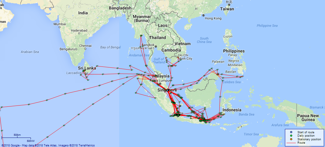
LOGS FOR JUNE 1916 4caf855ecadfd3419700e7d0: (http://oldweather.s3.amazonaws.com/ADM53-37880/C2-ADM53-37880-0070_0.jpg) 4caf855ecadfd3419700e7d1: (http://oldweather.s3.amazonaws.com/ADM53-37880/C2-ADM53-37880-0070_1.jpg) 1 June 1916 From Seychelles to Singapore Lat 1.53, Long 79.83 4.0am: Light breeze, cloudy and fine. 9.30am: Divisions and Captain’s inspection. am: Marines at Drill. Captain’s defaulters. Noon: Altered course N74E. Handed Patent Log. [Log in during Gun practice] 1.35pm: Stopped for target practice, ship manoeuvred, and engines as required during gun practice. 4.10pm: Finished target practice. 5.0pm: Target aboard. 5.5pm: Full away and streamed Log reading 78, Set course N73E (Standard), Wheel House Compass N73E. Read Warrant No 3. [True Bearing and Distance] [To 15 miles off Pulo Bras N74E, 936 miles] [Course and Distance made good] [From Noon to Noon N77E, 338 miles] 4caf855ecadfd3419700e7d2: (http://oldweather.s3.amazonaws.com/ADM53-37880/C2-ADM53-37880-0071_0.jpg) 4caf855ecadfd3419700e7d3: (http://oldweather.s3.amazonaws.com/ADM53-37880/C2-ADM53-37880-0071_1.jpg) 2 June 1916 From Seychelles to Singapore Lat 2.62, Long 84.23 10.24am: Stop. Ship manoeuvred and engines as required during target practice. [Log in during target Practice. Helm and Engines to OOW [Officer of the Watch] orders] 1.35pm: Commenced First Run. 3.35pm: Finish target Practice and commenced to get target aboard. 5.28pm: Target aboard. 5.48pm: Full ahead. 5.50pm: Log streamed 88 miles. 6.0pm: Clock put ahead 17 minutes. Midnight: Moderate breeze and sea. Cloudy and fine. [True Bearing and Distance] [To Pulo Bras N73E, 664 miles] [Course and Distance made good] [Noon to Noon N76E, 272 miles] 4caf855ecadfd3419700e7d4: (http://oldweather.s3.amazonaws.com/ADM53-37880/C2-ADM53-37880-0072_0.jpg) 4caf855ecadfd3419700e7d5: (http://oldweather.s3.amazonaws.com/ADM53-37880/C2-ADM53-37880-0072_1.jpg) 3 June 1916 From Seychelles to Singapore Lat 3.88, Long 87.80 am: Hands cleaning and painting various parts of ship. 11.40am: Covered guns and searchlights, occasional showers. 5.0pm: Altered course 16 points. 6.0pm: Altered course 16 points. 7.0pm: Clock forward 20 minutes. 8.0pm: Moderate breeze and sea. Cloudy and fine. [True Bearing and Distance] [To 15 miles off Pulo Bras N74E, 438 miles] [Course and Distance made good] [Noon to Noon N71E, 226 miles] [Wind north westerly force 4 for most of am, south westerly force 5 from noon and sea rough in pm; weather cloudy or fine; noon air temperature 86F, sea temperature 82F] 4caf855ecadfd3419700e7d6: (http://oldweather.s3.amazonaws.com/ADM53-37880/C2-ADM53-37880-0073_0.jpg) 4caf855ecadfd3419700e7d7: (http://oldweather.s3.amazonaws.com/ADM53-37880/C2-ADM53-37880-0073_1.jpg) 4 June 1916 From Seychelles to Singapore Lat 4.97, Long 92.08 10.0am: Divisions and Divine Service. 1.20pm: Heavy rain squall. 4.0pm: Gentle breeze, moderate confused swell. 6.10pm: Sunset. 7.0pm: Clock advanced 18 minutes. 9.15pm: Passed large SS, no reply to signal. Midnight: Slight Westerly Swell. Mustered sea boats Crew. [True Bearing and Distance] [To 15 miles off Pulo Bras N72E, 175 Miles] [Course and Distance made good] [Noon to Noon N75E, 265 Miles] 4caf855ecadfd3419700e7d8: (http://oldweather.s3.amazonaws.com/ADM53-37880/C2-ADM53-37880-0074_0.jpg) 4caf855ecadfd3419700e7d9: (http://oldweather.s3.amazonaws.com/ADM53-37880/C2-ADM53-37880-0074_1.jpg) 5 June 1916 From Seychelles to Singapore Lat 5.80, Long 96.22 0.30am: Pulo Bras [Pulau Bras] light observed bearing N84E, altered course N55E. 1.17am: Pulo Bras light Bearing S80E, log 73.5 (4 points). 2.22am: Willemstoren Light abeam 14 miles, Patent Log 87, altered course N82E. 3.45am: Observed Tapa Gaja Light S59E (True) x Storen Light S30W (True). 4.35am: Tapa Gaja Light abeam 4 miles, Log 13. 9.39am: Log hauled in 76. 9.40am: Stop, full astern. 9.46am: Dropped target. Courses and engines as required during target practice. Noon: Engines slow, keeping target close to. pm: Exercise, at Target practice. 3.15pm: Inspection of Hammocks. 3.27pm: Proceeded full speed, Log Streamed (76.5). 7.0pm: Clocks put ahead 17 minutes, altered course S74E. 9.30pm: Diamond Point light S54E, 18 miles. 11.3pm: Diamond light abeam bearing S13W, 7.5 miles, log 68, altered course S56E. [True Bearing and Distance] [To 9 miles off Diamond Point Light S74E, 81 Miles] [Course and Distance made good] [Noon to Noon Various 261 Miles] 4caf855ecadfd3419700e7da: (http://oldweather.s3.amazonaws.com/ADM53-37880/C2-ADM53-37880-0075_0.jpg) 4caf855ecadfd3419700e7db: (http://oldweather.s3.amazonaws.com/ADM53-37880/C2-ADM53-37880-0075_1.jpg) 6 June 1916 From Seychelles to Singapore Lat 3.90, Long 99.58 0.25am: Observed Edi Rajut Light S6E (True) x Diamond Light N78E (True). 0.10pm: Pulo Berhala abeam, Distant 9 miles, log 30. 1.30pm: Passed “Nordic-Sverige” [Nordic] (Swedish). 3.40pm: Passed French troop-ship. 7.10pm: One Fathom light bearing S66E, 18 miles, altered course S60E. Clock put ahead 20 minutes. 8.48pm: One fathom Light abeam N30E (True) 2 miles. 9.40pm: Pulo Gedong Light N30E (True) 11 miles x One fathom Light N48W, Patent Log 44.5. “Piped down”. 11.4pm: Observed Rachado Light S67E (True) 30 miles, altered course S61E. Rounds and Sentries correct. [True Bearing and Distance] [To Singapore Various 304 Miles] [Course and Distance made good] [Noon to Noon Various 239 Miles] [Note: SS “Nordic” (which had “Nordic-Sverige” painted on the side) was a cargo ship built in Sunderland, UK, in 1914 and owned by Rederi A/B Transatlantic, Gothenburg; she was sold to a company in Stockholm in 1938 and was renamed “Radmanso”; she was broken up in 1958 (more details here).] 4caf855fcadfd3419700e7dc: (http://oldweather.s3.amazonaws.com/ADM53-37880/C2-ADM53-37880-0076_0.jpg) 4caf855fcadfd3419700e7dd: (http://oldweather.s3.amazonaws.com/ADM53-37880/C2-ADM53-37880-0076_1.jpg) 7 June 1916 From Seychelles to Singapore and at Singapore [though not stated at top of page] Lat 1.22, Long 103.47 1.25am: Rachado Light abeam distant 5 miles, Log 90, altered course S56E. 2.0am: Rounds and prisoner correct. 4.0am: Heavy rain squall. 4.37am: Undan Light abeam 4.5 miles off, altered course S58E. 5.30am: Heavy ENE squall, deluge rain, thunder and lightning. 10.23am: Pulo Pisang Light House abeam 6 miles, log 98. 10.10am: Sighted 3 Destroyers at target practice and 1 Boarding steamer (Japanese). Ship’s position frequently checked by cross Bearings. 11.30am: Brothers Light House abeam 4 miles, log 13. 1.20pm: Stop. 1.25pm: Pilot aboard, full ahead. 1.55pm: Along Quay. 2.0pm: Finish with engines and mooring ship. 2.20pm: Ship moored. 3.35pm: Started coaling. 6.0pm: Liberty for CPOs and POs1 until 9pm. 6.10pm: Sunset. Covered guns. Anchor lights exhibited. 8.0pm: Coaling ship continues throughout. 8.20pm: Signed Singapore Harbour Board’s Book night rounds. [True Bearing and Distance] [To Singapore Various 20 miles] [Draft on arrival: 19’ 2” Forward, 23’ 5” Aft] [Course and Distance made good] [Noon to Noon 204 miles, various] [Weather fine after early rain and lightning, noon air and sea temperature 80F] 4caf855fcadfd3419700e7de: (http://oldweather.s3.amazonaws.com/ADM53-37880/C2-ADM53-37880-0077_0.jpg) 4caf855fcadfd3419700e7df: (http://oldweather.s3.amazonaws.com/ADM53-37880/C2-ADM53-37880-0077_1.jpg) 8 June 1916 At Singapore Lat 1.27, Long 103.84 [estimated] [At Wharf Coaling] 1.45am: Wind to North. 4.0am: Coaling in progress. 6.50am: Heavy rain squall which stopped coaling. 7.15am: Coaling proceeding slowly. Hands variously employed. 11.25am: Started coaling. 2.0pm: Two men joined ship for Vitaling [victualling]. 3.30pm: 2 men from Sailors Home Aboard, also one from Tanglin Hospital. Liberty Men to clean. 4.0pm: Liberty men to fall in ashore. Lieutenant of Watch inspected Liberty men. 7.0pm: Picket inspected and leaves ship. 8.0pm: Nights seaboats crew fall in. 9.0pm: Libertymen returned (2 absentees). 9.30pm: Patrol returned. Midnight: Coaling continued. 4caf855fcadfd3419700e7e0: (http://oldweather.s3.amazonaws.com/ADM53-37880/C2-ADM53-37880-0078_0.jpg) 4caf855fcadfd3419700e7e1: (http://oldweather.s3.amazonaws.com/ADM53-37880/C2-ADM53-37880-0078_1.jpg) 9 June 1916 At Singapore Lat 1.27, Long 103.84 [estimated] 1.30am: Two absentees returned. 5.0am: Finished coaling (1919 tons). Call hands. 5.30am: All officers. 5.45am: Pilot on board. 6.0am: Stand by and tugs alongside. 6.15am: Commenced to take lines aboard. 6.16am: Cast off and left Quay. 6.25am: Cast off Tug “Varuna” [listed here as 123869]. Used engines as requested by pilot. 6.48am: Let go Port Anchor, paid out 49 fathoms in 11 fathoms of Water. 6.53am: Finish with Engines. 0.15pm: Stand by on Engines. 0.30pm: Anchor Aweigh and Engines slow ahead. 0.40pm: Full ahead. 1.3pm: Peak Island abeam. 1.30pm: Altered course 16 points and returned to anchorage. 2.0pm: Peak Island abeam. 2.29pm: Stop. 2.30pm: Let go Starboard Anchor, paid out 45 fathoms in 12 fathoms of water. 2.33pm: Finish with Engines. 4.0pm: Evening Quarters. Steamboat takes Captain ashore. Returned 4.50. 6.20pm: Steam-boat called away. 7.40pm: Steam-boat returned. 7.45pm: Steam-boat drew fires and moored at Starboard Boom. Steam Boat in use between Ship and shore. [Draft leaving wharf: 22’ 03” Forward, 25’ 02” Aft] [Note: Tug “Varuna” was built in Singapore in 1907 and owned by The Singapore Harbour Board, Tanjong Pagar, Singapore.] 4caf855fcadfd3419700e7e2: (http://oldweather.s3.amazonaws.com/ADM53-37880/C2-ADM53-37880-0079_0.jpg) 4caf855fcadfd3419700e7e3: (http://oldweather.s3.amazonaws.com/ADM53-37880/C2-ADM53-37880-0079_1.jpg) 10 June 1916 At Singapore Bay Lat 1.26, Long 103.85 [estimated] [At Anchor Singapore to 45 fathoms] 8.0am: Colours. 8.40am: Captain French Sloop paid a visit to Captain. 9.30am: Steam boat left for shore. 10.25am: Captain returned Visit. 10.35am: Steam boat returned. 11.0am: Captain returned. 11.30am: Steam boat left ship for shore. 11.35am: Magazine and shell room party getting up ammunition. 0.45pm: Steam boat returns. 2.0pm: Heavy rain storms. Lowered Port Sea boat and No 3 Lifeboat. 4.15pm: Both sea-boat[s] called away and steam-boat. 4.40pm: Steam-boat, and starboard sea-boat left ship with liberty men, other sea-boat not required. 5.40pm: Steam-boat and sea-boat returned. 6.10pm: Six ratings from HMS “Venus”. 6.20pm: One discharge HMS “Laurentic”. 8.15pm: Steam Boat with cutter in tow left ship for shore. 9.0pm: First Lieutenants Rounds. Steam boat and cutter returned to ship with liberty men. 10.0pm: Steam boat left ship for shore. Cutter moored at Starboard Boom. 10.35pm: Three absentees returned off leave. 11.0pm: Steamboat returned to ship with liberty men. 11.15pm: Moored Port Boom. 4caf855fcadfd3419700e7e4: (http://oldweather.s3.amazonaws.com/ADM53-37880/C2-ADM53-37880-0080_0.jpg) 4caf855fcadfd3419700e7e5: (http://oldweather.s3.amazonaws.com/ADM53-37880/C2-ADM53-37880-0080_1.jpg) 11 June 1916 At Singapore Lat 1.26, Long 103.85 [Anchored Singapore Harbour] 10.0am: Captain and Flag Lieutenant of Japanese Warship Came on Boat. Left 10.20. 10.25am: Divisions. 11.0am: Divine Service. 2.45pm: Steam boat left ship for Japanese ship. 2.50pm: Steam boat returned. 3.0pm: Steam boat left ship for shore with liberty boys. 3.30pm: Steam boat returned. 3.55pm: Steam boat left ship for shore with liberty men. 5.0pm: Steam boat left ship for liberty boys on shore. 6.30pm: Steam boat returned. 7.25pm: Collier “SS Katoa” [listed here] left HMS Diana. 8.15pm: Steam boat Left for shore; Returned 9.25 liberty men. 10.15pm: Left, returned 11.0 five men short, left for remainder 11.5. Returned 11.35 and moored starboard boom for night. [Note: SS “Katoa” was a cargo ship built in Sunderland in 1912 and owned by Union Steam Ship Company of New Zealand, Dunedin, NZ; in 1933 she was sold to Moller & Company, Shanghai, and renamed “Winifred Moller”; in 1946 she was sold to another company in Shanghai and was renamed “Tsze Yung”; her subsequent fate is unknown (more details here).] 4caf855fcadfd3419700e7e6: (http://oldweather.s3.amazonaws.com/ADM53-37880/C2-ADM53-37880-0081_0.jpg) 4caf855fcadfd3419700e7e7: (http://oldweather.s3.amazonaws.com/ADM53-37880/C2-ADM53-37880-0081_1.jpg) 12 June 1916 At Singapore Lat 1.26, Long 103.85 [At Anchor (Starboard) to 45 fathoms. Singapore Harbour] 6.0am: Hands fall in. Away all boats for exercise. 8.0am: Boats returned. Hands to breakfast. 9.30am: Hoisted life boats. Noon: Steam Boat Returned. Cutter Returned 12.15. 1.45pm: Steam Boat Left Ship for shore with officers. 1.50pm: Cutter with ship's Visitors to [HMS] Diana. 6 Men and Coxswain. 2.35pm: Steam Boat Returned. 3.15pm: Visitors to “Diana” returned. 3.30pm: Liberty men left ship in Steam Launch. 4.0pm: Cutter left ship with liberty men for shore. Tea. 5.45pm: Six ratings left ship for “Diana”. 6.10pm: Cutter returned from “Diana”. 9.30pm: Port cutter left for shore. 10pm returned with liberty men. 10.30pm: Cutter Starboard left for shore. 4caf855fcadfd3419700e7e8: (http://oldweather.s3.amazonaws.com/ADM53-37880/C2-ADM53-37880-0082_0.jpg) 4caf855fcadfd3419700e7e9: (http://oldweather.s3.amazonaws.com/ADM53-37880/C2-ADM53-37880-0082_1.jpg) 13 June 1916 At Singapore Lat 1.26, Long 103.85 [At Anchor Singapore Starboard 45 fathoms] 0.5am: Cutter returned with Liverty [Liberty] Men and Moored for Night Starboard Boom. 6.30am: Both cutters left ship with memorial party for shore. 7.0am: Steam boat with Captain left ship for shore. 9.40am: Memorial party returned. 11.20am: Port cutter left for shore with officers. 3.5pm: Steamboat left ship with Captain for Shore. 4.0pm: Steamboat and Cutter left with Liberty Men. 4.45pm: Chinese Boilers Cleaners left Ship. 5.40pm: Steam Boat Returned with boys. 9.40pm and 11.0pm: Cutter returned to ship with liberty men. 11.15pm: Both cutters and steam boat moored at booms. [Weather fine and quiet, noon temperature 86F] 4caf855fcadfd3419700e7ea: (http://oldweather.s3.amazonaws.com/ADM53-37880/C2-ADM53-37880-0083_0.jpg) 4caf855fcadfd3419700e7eb: (http://oldweather.s3.amazonaws.com/ADM53-37880/C2-ADM53-37880-0083_1.jpg) 14 June 1916 At Singapore Lat 1.26, Long 103.85 [At Anchor Singapore] 5.15am: Call hands. Memorial Party to Clean. 6.35am: Memorial party Left Ship in 2 Cutters and 2 Life Boats for Shore. 7.10am: Captain and Officers Left Ship in Life Boat for Memorial Service on Shore. 9.10am: Captain and officers returned from memorial service. 9.40am: Memorial Party returned to ship. 1.30pm: No 3 lifeboat with Officers and Boys on Leave left Ship, hoisted No 8 Life Boat. Hands employed as requisite. 3.30pm: No. 3 Lifeboat returned. 4.0pm: Liberty Men left for Shore in No 3 Lifeboat and starboard cutter. 6.0pm: Port sea boat moored at Starboard Boom. 6.20pm: No 3 lifeboat and cutter returned with liberty boys. 8.15pm: Cutters left ship for shore. 9.30pm: Cutter returned and moored at Port Boom. 10.30pm: Captain came aboard by “Diana” steam boat. 4caf855fcadfd3419700e7ec: (http://oldweather.s3.amazonaws.com/ADM53-37880/C2-ADM53-37880-0084_0.jpg) 4caf855fcadfd3419700e7ed: (http://oldweather.s3.amazonaws.com/ADM53-37880/C2-ADM53-37880-0084_1.jpg) 15 June 1916 At Singapore Lat 1.26, Long 103.85 [At Anchor Singapore] 7.15am: No 3 Lifeboat and Starboard seaboat left ship for shore with native Liberty men. 7.45am: Uncover guns and searchlights. 8.5am: Japanese cruiser heaved up anchor and left harbour. 8.35am: Liberty men returned on board. 9.0am: Postman ashore and Water boat alongside. 9.20am: Port cutter left for shore. 10.20am: Captain of Laurentic [? writing very faint] on board, left 10.40. 10.30am: No 3 lifeboat left for SS Ontario. 10.45am: Returned with Warrant Officer. 11.50am: Captain left for Shore in Starboard Cutter. Noon: 2 Bags of Mail came on board, Starboard Cutter Returned with Postman. 1.15pm: Water Boat left. 2.30pm: 2 mailbags, 3 packages come on board for HMS Cornwall. 3.30pm: Wine stores came aboard. 4.0pm: Liberty men left for shore in Starboard Sea Cutter and No 3 Lifeboat. 4.45pm: Three ratings left for Laurentic. 5.10pm: Port cutter left for Shore. 7.0pm: Returned. 7.20pm: Captain returned. 8.0pm: Port Cutter and No. 3 lifeboat left for shore to bring Liberty men off. 9.30pm: Boats returned (3 Ratings Ex “Psyche” joined for victualling). [Note: There were several ships named “Ontario” at this time, perhaps the most likely is listed here ‒ built in 1904 in USA and owned by Merchants & Miners Transportation, Baltimore; she was sold to United Fruit Company in 1941 and sailed under a Honduran flag; she was to be sunk by a German submarine in 1942 in the Gulf of Mexico (more details here).] 4caf855fcadfd3419700e7ee: (http://oldweather.s3.amazonaws.com/ADM53-37880/C2-ADM53-37880-0085_0.jpg) 4caf855fcadfd3419700e7ef: (http://oldweather.s3.amazonaws.com/ADM53-37880/C2-ADM53-37880-0085_1.jpg) 16 June 1916 At Singapore Lat 1.17, Long 103.78 [At Anchor to 45 fathoms] 6.45am: Away Cutter and life boat for libertymen. 10.40am: 3 bags mail received for City of London, 5 bags for [HMS] Cornwall. 10.49am: Clear Lower Deck. 10.50am: Hoisted Port Seaboat. 10.52am: Commenced to heave short. 11.5am: Stand By. 11.8am: Anchor aweigh, engines ahead. 11.16am: Full away. 0.10pm: Abeam Raffles Lighthouse, altered course N81W. 0.39pm: Tree island light abeam. 1.49pm: Altered course S8W, streamed log. 3.35pm: North Brothers Light House abeam 0.75 miles, Log 61. 9.50pm: Muchi [Muci] Light abeam 3 miles, Log 34.5, altered course S52E, Wheel House Compass S48E. 11.20pm: Observed Berhala Light S58E (True), altered course S58E, Wheel House Compass S54E. [True Bearing and Distance] [To Raffles Light House S84W, 2 miles] [Course and Distance made good] [To Noon Various 9 miles] 4caf855fcadfd3419700e7f0: (http://oldweather.s3.amazonaws.com/ADM53-37880/C2-ADM53-37880-0086_0.jpg) 4caf855fcadfd3419700e7f1: (http://oldweather.s3.amazonaws.com/ADM53-37880/C2-ADM53-37880-0086_1.jpg) 17 June 1916 From Singapore Lat -2.30, Long 105.48 0.56am: Berhala Light abeam 1 mile, Log 70, altered course S82E. 5.0am: Round Island abeam distant 20 miles. 8.31am: Ular Light House abeam 4 miles, Log 61. 9.20am: Kalian Light Abeam. 9.44am: Kalian light House abeam 4 miles, log 76.5. 10.54am: Amilia [Amelia] Bank Buoy abeam 1.25 miles, Log 90, altered course S79E. 0.56pm: Buoy abeam 0.5 miles, Log 15. 2.30pm: Covered guns for Heavy rain squall. 2.45pm: “GRS Buoy” [?] Sounded whistle. 3.0pm: “Cleared”. Full ahead, observed Wreck [symbol for buoy] S60E (True). 3.21pm: Wreck buoy [symbol] abeam 1.5 miles, Patent Log 45 miles. 5.45pm: Pulo Besar [Pulau Besar] Light abeam Distant 3 miles. 6.5pm: Sonits [?] Bank Light House abeam 1.5 miles, Log 77, altered course S61E, increased speed to 13 knots. 6.15pm: Pulo Bawan [?] abeam 3 miles, Log 80. 6.53pm: Gas Buoy abeam 1 mile, Log 88, altered course S51E. 7.0pm: Eased awnings for rain squall. Clock put ahead 16 minutes. 7.30pm: Cleared. 7.52pm: Dapur Point Light 4 points, log 98.25. 8.10pm: Dapur Light abeam distant 4 miles, log 102. 8.35pm: Dapur bearing N12W (true) 7 miles, Log 108, altered course S12E Standard Compass. Midnight: Overcast and cloudy during watch. [True Bearing and Distance] [To 2 miles NW off West Nangka Light House S76E, 13 miles [Course and Distance made good] [Noon to Noon 269 miles, Course Various] [Weather fine in am, rain at times in pm, noon temperature 81F, sea temperature 83F] 4caf855fcadfd3419700e7f2: (http://oldweather.s3.amazonaws.com/ADM53-37880/C2-ADM53-37880-0087_0.jpg) 4caf855fcadfd3419700e7f3: (http://oldweather.s3.amazonaws.com/ADM53-37880/C2-ADM53-37880-0087_1.jpg) 18 June 1916 From Singapore, at Sea Lat -5.68, Long 107.52 0.45am: Passed steamer bound North. 4.20am: Observed Etna Bank Light S16E, altered course S21E. Reduced to 63 revs. 5.23am: Etna Light abeam 1 mile, altered course S40W, Patent Log 27 miles, Wheel House Compass S44W. 6.0am: Observed Cruiser [HMS] “Cornwall” port bow. Handed Patent Log. 6.10am: Observed Cruiser [HMS] “Venus” ahead, altered course S20W. 6.38am: Half Speed and worked engines as required. 7.0am: Lowered Starboard cutter. Captain to “Venus”. Lieutenant Harrison WO and 2 marines with mail to “Cornwall”. 3 Ratings and stores to “Venus”. 7.45am: “Cornwall” proceeded North. 8.15am: Captain returned and hoisted starboard sea boat. 8.30am: Full ahead, altered course S78E, speed to 12 knots, streamed Log. 10.0am: Divisions and Divine Service. am: Hands at Leisure. 4.53pm: Boompjees [Boompjes] Light House abeam 2.5 miles, Log 37, altered course S88E, Wheel House S87E. 7.0pm: Clock advanced 20 minutes. [True Bearing and Distance] [To Semerang [Semarang, Indonesia] Various 195 miles] [Course and Distance made good] [Noon to Noon Various 276 miles] 4caf855fcadfd3419700e7f4: (http://oldweather.s3.amazonaws.com/ADM53-37880/C2-ADM53-37880-0088_0.jpg) 4caf855fcadfd3419700e7f5: (http://oldweather.s3.amazonaws.com/ADM53-37880/C2-ADM53-37880-0088_1.jpg) 19 June 1916 From Singapore to Madura Straits, at Patrol Lat -6.42, Long 112.07 4.30am: Observed Mandaliki [Mandalika] Light bearing S64E Compass, Log 72. 5.11am: Mandaliki Light bearing S52E 4 Points, Log 79. 6.10am: Mandaliki Light abeam distant 12 miles, Log 91. 7.30am: Passed barque bound west. 10.45am: Passed 3 masted barque bound north. pm: Gunlayers and Trainers to Dotter, Boys to Instruction. 7.10am: Clocks +10 minutes to AT [Apparent Time] Noon 20th. 10.0pm: Darkened all lights not necessary. 11.55pm: Tribong [Tribung] Light Bearing S14E, altered course S1W, Wheel House Compass S7W. [True Bearing and Distance] [To position off Sepudi [Sapudi] Island Various 168 miles] [Course and Distance made good] [Noon to Noon Various 278 miles] 4caf855fcadfd3419700e7f6: (http://oldweather.s3.amazonaws.com/ADM53-37880/C2-ADM53-37880-0089_0.jpg) 4caf855fcadfd3419700e7f7: (http://oldweather.s3.amazonaws.com/ADM53-37880/C2-ADM53-37880-0089_1.jpg) 20 June 1916 At Patrol Lat -7.48, Long 114.02 1.8am: Sapudi Light abeam 1.5 miles, Log 108. 1.30am: Boarded log. 3.35am: Tribung Light obscured Bearing N38W. 4.30am: Turned 16 points to Starboard. Set Course S87W. 9.10am: Full ahead SS sighted Starboard bow. 9.25am: Helm and Engines OOW [Officer of the Watch] orders. 9.50am: Stop. 9.52am: Sea-boat away. 9.54am: Dutch SS President Bodemeyer [see Laurens Pit listed here] boarded. 10.5am: Boarding party returned, reported “ALL correct”. 10.6am: Hoisted sea-boat, slow ahead. 10.25am: Set course N80E ‒ Wheel House Compass N81E. [No Log Total Distance 20 miles] Noon: Hands to dinner. Mount Cunchir [Gunung Kuncir] S42E (True) 30 miles (DAB). 2.35pm: Reduced speed to 29 revs, ship at required position: Lat 7 10 N [should be S], Long 114 14 E. 2.50pm: Swung round and set course S25E. 3.50pm: Position: Lat 7 14 S, Long 114 14 E: Distance made at 28 revs in one hour = 4 miles. Altered course N23W (Magnetic). Destroyed 8 Cartridges Cordite 6 inch lot K923, GO No 92, 1-5-16. [4.0pm: Distance run for watch 27 miles approximately] 5.15pm: Sight Steamer to the Southward and Westward and commenced to close in. 5.55pm: British SS “Strathbeg” [listed here] Boarded. 6.14pm: Boarding parted [party] returned. 6.24pm: Hoisted Sea boat, proceed, Half Speed, Course S69E. 8.0pm: Sapudi Island [Pulau Sapudi] bearing N1W (Compass), altered course S18E. [8.0pm: Approximate distance run for watch 29 miles] 9.0pm: Altered course N20W (Standard Compass). 11.25pm: Tribung Light bearing N7E (True), altered course S18E (Standard Compass). [11.25pm: Approximate distance run for watch 17 miles] [True Bearing and Distance] [On Patrol duty Madura Straits] [Course and Distance made good] [Noon to Noon Various 219 miles] [Note: SS “President Bodemeyer” was built in Amsterdam in 1902 as “Laurens Pit” for KPM, Amsterdam, and went to Indonesia in 1903; in 1913 she was sold to Madoera Stoomtram Maatschappij, Netherlands East Indies, and renamed “President Bodemeyer” (though details here show “Resident Bodemeijer”); she reverted to KPM in 1937 and was scrapped in 1940. SS “Strathbeg” was a cargo ship built in Glasgow in 1909 and owned by Burrell & Sons, Glasgow; she was owned by Commonwealth Government Line of Steamers, Sydney, from 1916, when she was renamed “Australbush”; she was sold to a Japanese company in 1923 and was renamed “Asaka Maru”; she was to be sunk by US aircraft off Formosa (Taiwan) in 1944 (more details here).] 4caf855fcadfd3419700e7f8: (http://oldweather.s3.amazonaws.com/ADM53-37880/C2-ADM53-37880-0090_0.jpg) 4caf855fcadfd3419700e7f9: (http://oldweather.s3.amazonaws.com/ADM53-37880/C2-ADM53-37880-0090_1.jpg) 21 June 1916 At Patrol Lat -6.95, Long 114.20 2.30am: Observed Karang Mas Light S35E (True) x Tribung Light N2W (True). 3.30am: Karang Mas Light S49E (True), altered course N20W. 7.0am: Turned 16 points to Starboard and set Course S18E. am: Gun’s crews to Loader, X1 and Y1 to Divisional drill. 9.30am: Turned round, N14W altered course, Full ahead. 10.30am: Altered course N11W. Sapudi Island Light N1E Compass. 11.15am: Sapudi Light abeam 1.5 miles, altered course N16W. Noon: North Point of Sapudi abeam 1.5 miles. 3.0pm: Passing rain shower. 10.30pm: Rounds and Sentries correct. Tested both searchlights. [True Bearing and Distance] [To position: 6 47 S, 114 10 E: N13W, 10 miles] [Course and Distance made good] [From Noon to Noon Various 150 miles] 4caf855fcadfd3419700e7fa: (http://oldweather.s3.amazonaws.com/ADM53-37880/C2-ADM53-37880-0091_0.jpg) [Left hand side of partly completed log page, crossed through] 4caf855fcadfd3419700e7fb: (http://oldweather.s3.amazonaws.com/ADM53-37880/C2-ADM53-37880-0091_1.jpg) [Blank page, inside of cover] 4caf855fcadfd3419700e7fc: (http://oldweather.s3.amazonaws.com/ADM53-37880/C2-ADM53-37880-0092_0.jpg) [Blank page, inside of cover] 4caf855fcadfd3419700e7fd: (http://oldweather.s3.amazonaws.com/ADM53-37880/C2-ADM53-37880-0092_1.jpg) [Blank page apart from handwritten “City of London” and some numbers, inside of cover] 4caf855fcadfd3419700e7fe: (http://oldweather.s3.amazonaws.com/ADM53-37880/C2-ADM53-37880-0093_0.jpg) [Left hand side of hard, multi-coloured back cover] 4caf855fcadfd3419700e7ff: (http://oldweather.s3.amazonaws.com/ADM53-37880/C2-ADM53-37880-0093_1.jpg) [Right hand side of hard, multi-coloured back cover] 4caf855fcadfd3419700e800: (http://oldweather.s3.amazonaws.com/ADM53-37881/C2-ADM53-37881-0001_0.jpg) [Left hand side of multi-coloured front cover of Deck Log Book from 22-6-16 to 16-9-16] 4caf855fcadfd3419700e801: (http://oldweather.s3.amazonaws.com/ADM53-37881/C2-ADM53-37881-0001_1.jpg) [Right hand side of cover] 4caf855fcadfd3419700e802: (http://oldweather.s3.amazonaws.com/ADM53-37881/C2-ADM53-37881-0002_0.jpg) [Blank page, inside of cover] 4caf855fcadfd3419700e803: (http://oldweather.s3.amazonaws.com/ADM53-37881/C2-ADM53-37881-0002_1.jpg) [Blank page apart from “ADM 53/37881”, inside of cover] 4caf855fcadfd3419700e804: (http://oldweather.s3.amazonaws.com/ADM53-37881/C2-ADM53-37881-0003_0.jpg) [Blank page, inside of cover] 4caf855fcadfd3419700e805: (http://oldweather.s3.amazonaws.com/ADM53-37881/C2-ADM53-37881-0003_1.jpg) [Printed page indicating how the Deck Log Book is to be used at Sea and in Harbour] 4caf855fcadfd3419700e806: (http://oldweather.s3.amazonaws.com/ADM53-37881/C2-ADM53-37881-0004_0.jpg) 4caf855fcadfd3419700e807: (http://oldweather.s3.amazonaws.com/ADM53-37881/C2-ADM53-37881-0004_1.jpg) 22 June 1916 At Patrol Lat -6.88, Long 112.68 [very rough estimate] 0.45am: Altered course to S55E and turning 12.75 points to starboard, Wheel House Compass S51E. 3.0am: Squally with rain showers. 4.0am: Similar weather. 5.15am: Altered course N87E (Standard Compass). 5.35am: Observed Light Vessel on Starboard bow, altered course S55E. 6.45am: Hands fall in. Opposite Light Vessel. Eased engines. 7.15am: Eased down to 36 revs, altered course 16 points. 8.0am: Altered course 16 points. 9.10am: Sighted SS on starboard bow. 9.30am: Engines worked as required. 9.35am: Lowered Starboard seaboat and boarded Dutch SS “Besitang” of Batavia. 9.50am: Sea boat returned and reported “all correct”. 10.10am: Set Course N3W. 10.45am: Sighted SS on Starboard bow. 11.15am: Lowered Starboard Sea boat and boarded British SS “Ikala” [details here under a previous name]. 11.55am: Altered course to East. 0.45pm: Surabaya [also spelled Sourabaya and variants in this log]Light Vessel S (True) 1.5 miles, altered course N3W. 1.3pm: Sighted SS LOUDON (Dutch) Batavia on Port bow. 1.53pm: Lowered Port Sea cutter and board. 2.20pm: Sea cutter returned and Hoisted. Set Course N3W, proceeded at 29 Revs. 4.19pm: Away Sea Cutter, Boarded SS “Gleneden”. 4.45pm: Sea cutter returned and hoisted, and proceeded half speed S71E. 6.15pm: Set Course N10E, speed 64 revs. 6.20pm: Streamed Log reading 12. 7.0pm: Clock advanced 5 minutes. Midnight: Weather fine and clear. [Noon Position: Surabaya Light Vessel bearing S3E (True) 7 miles] [On Patrol] [Course and Distance made good] [Noon to Noon 240 miles on Various Courses] [Note: SS “Besitang” was an oil tanker built in Rotterdam in 1897 and owned from 1904 by Nederlandsche-Indische Tankstoomboot Maatschappij, Netherlands East Indies; she was sold to a Chinese company in 1919; her subsequent fate is not known. SS “Ikala” was a cargo ship built in Scotland in 1901 as “Planet Neptune” for Leyland Shipping, Liverpool; she was renamed “Ikala” in 1910; in 1929 she was sold to an Italian company and was renamed “Sanzorzu” and was broken up in 1933. SS “Loudon” was a passenger/cargo ship built in Rotterdam in 1913 and owned by Koninklijke Paketvaart-Maatschappij (KPM), Batavia; she was dismantled in 1934 and her hulk was sunk as a breakwater in Singapore. SS “Gleneden” was a British cargo ship built in Scotland in 1909 for Western Steamship Company and Indian Steamship Company, Glasgow; from 1910 she was owned by Gleneden Steamship Company (John Napier), Glasgow; she was to run aground and be wrecked near Anglesey in 1940.] 4caf855fcadfd3419700e808: (http://oldweather.s3.amazonaws.com/ADM53-37881/C2-ADM53-37881-0005_0.jpg) 4caf855fcadfd3419700e809: (http://oldweather.s3.amazonaws.com/ADM53-37881/C2-ADM53-37881-0005_1.jpg) 23 June 1916 On Patrol Lat -7.42, Long 113.30 3.35am: Observed Sapudi light bearing S38E, log 17 miles. 4.12am: Altered course S17E. Handed Patent Log. 5.26am: Sapudi Light abeam N70E (True) 1.5 miles. 7.0am: Set course S86W. 8.50am: Passed SS Pesident Bordemaya [see President Bodemeyer 20 June 1916 in this log] (Dutch). 11.15am: Sub Lieutenants and Midshipmen at squad Drill. 1.10pm: Zwaantjes light abeam. 1.27pm: Turned about and steered S83W Standard Compass and Wheel House Compass. 1.35pm: Zwaanjes [sic] abeam 0.75 miles. Set Course N83E, 12 knots by revs, wind east. 3.50pm: Signalled Dutch steamer. [True Bearing and Distance] [On Patrol. Koko Island bearing S71W (True) 11 miles] [Course and Distance made good] [Noon to Noon various 250 miles] 4caf855fcadfd3419700e80a: (http://oldweather.s3.amazonaws.com/ADM53-37881/C2-ADM53-37881-0006_0.jpg) 4caf855fcadfd3419700e80b: (http://oldweather.s3.amazonaws.com/ADM53-37881/C2-ADM53-37881-0006_1.jpg) 24 June 1916 Eastern JAVA Patrol Lat -6.73, Long 113.85 1.25am: Sapudi Light N18W (True), 12 miles, altered course S18E (Standard). 3.20am: Sighted Karang Maas [Mas] Light Bearing S17E (true). [4.0am: Distance for Watch 20 miles] 4.15am: Half ahead, altered course S25E in pursuit of supposed steamer. 4.45am: Turned round and slowed down again, N20W. 7.15am: Stood up for Sapudi Island Light house at full speed. 8.0am: Passed Dutch SS “Loewoek” [?]. Streamed Log Reading 28. 8.30am: Tribung Light abeam distant 2 miles, altered course N7W, Log 30. 9.5am: North End of Island abeam 2 miles, Log 38.5, altered course N14W. 9.45am: Altered course to intercept schooner. 9.57am: Slow ahead. 9.59am: Stop, worked engines as required. 10.8am: Cutter away. 10.21am: Cutter returned and hoisted. 10.26am: Full ahead 63 revolutions. 11.20am: Clean Guns. 4.50pm: Sighted Steamer on Starboard bow. 5.35pm: Log hauled in. 5.45pm: Orders and half speed, engines as required. 5.50pm: Stopped, lowered starboard sea boat and boarded British SS “Charon” [Charon (1) listed here] of Fremantle. 6.9pm: Boat returned with Boarding Officers. 6.12pm: Boat hoisted and Engine slow ahead, set course N80W (Wheel House Compass) N79W. [8.0pm: Distance for Watch 34 miles] 9.25pm: Passed close by SS “Spilbergen” [probably Van Spilbergen] towing a larger Barque. Courses and Distance altered for this manoeuvre N84W 5 miles. [Midnight: Distance for Watch 45 miles] [On Patrol] [Course and Distance made good] [Noon to Noon Various 214 miles] [Note: It has not been possible to identify the ship passed at 8.0am. SS “Charon” was built in Dundee in 1903 and registered in Fremantle, Australia, in that year, jointly owned by Ocean Steam Ship Company, Liverpool and West Australian Steam Navigation Company; she was sold to a Chinese company in 1925 and was renamed “Yuan Lee”. SS “Van Spilbergen” was a passenger/cargo ship built in Rotterdam in 1908 and owned by KPM, Batavia; she was sold for disposal in 1949.] 4caf855fcadfd3419700e80c: (http://oldweather.s3.amazonaws.com/ADM53-37881/C2-ADM53-37881-0007_0.jpg) 4caf855fcadfd3419700e80d: (http://oldweather.s3.amazonaws.com/ADM53-37881/C2-ADM53-37881-0007_1.jpg) 25 June 1916 At Patrol Lat -6.82, Long 110.45 [Bearings] 3.45am: Observed Mandaliki [Mandalika] Light bearing S61W, altered course S84W. 5.30am: Mandaliki light abeam bearing N6W, 10.5 miles, altered course S55W. 1.0pm: Full speed, headed for Dutch SS. Engines as required. 1.10pm: Stop, lowered Port Sea boat and boarded Dutch SS “Timor” of Amsterdam. 1.30pm: Seaboat returned and hoisted. Set course West, speed to 30 revs. Position now by Cross Bearings Lat 6 47 S, Long 110 28 E, depth water 11 fathoms. 3.0pm: Stop, lowered Starboard Seaboat and boarded British SS “Pasha” of Liverpool. Engines worked as required. 3.20pm: Sea Boat returned and hoisted. 3.30pm: Position by Cross bearings at 3.30 Lat 6 48.5 S, Long 110 23 E. Set course N10E Standard, speed to 30 revs. [4.0pm: Distance for watch 16 miles] 5.0pm: Altered course N4W Standard, N5W Wheel House Compass. Samarang [sic] Light S4E (Compass), Mount Genut [?] N60E (Compass). Speed 4 knots per hour. 6.45pm: Full ahead, altered course N38E Standard, N37E Wheel House Compass. 7.18pm: Observed Mandaliki Light bearing N80E Compass. 7.48pm: Mandaliki Light 4 points. 9.5pm: Mandaliki Light abeam distant 15 miles, altered course N87E. 10.5pm: Mandaliki Light abeam distant 12 miles. Rounds and sentries correct. 11.20pm: Sighted steamer on starboard bow, altered course to investigate. Engines as required. Midnight: Stopped and lowered Port Sea boat, boarded Dutch SS Van Waerwijck. [Midnight: Distance for watch 46 miles] [On Patrol duty off Simarang [Semarang]] [Course and Distance made good] [From Noon to Noon Various 270 miles] [Note: SS “Timor” was a cargo ship built in Amsterdam in 1900 and owned by Stoomvaart Maatschappij “Nederland”, Amsterdam; she was sold to a Belgian company in 1920 and was renamed “Tabora”, then returned to Dutch ownership; in 1923 she was sold to a British company in Cardiff (no name change); in 1929 she was sold to a German company and was renamed “Lichtenstein”; she was broken up in Hamburg in 1934. SS “Pasha” was a cargo ship built in Scotland in 1905 and owned by Asiatic Steam Navigation Company, London; she was to be sunk by a German submarine in the Mediterranean in June 1917, with the loss of 3 lives. SS “Van Waerwijck” was a passenger/cargo ship built in Rotterdam in 1910 and owned by KPM, Batavia; she was seized by the British Government in Hong Kong in 1918 but returned to KPM in 1919; she was sunk in Batavia/Jakarta harbour in 1942 to prevent seizure by the Japanese but they lifted and repaired her and she sailed under the Japanese flag as “Harukiku Maru”; she was to be torpedoed and sunk by a British submarine off North Sumatra in 1944, with the loss of 178 prisoners of war.] 4caf855fcadfd3419700e80e: (http://oldweather.s3.amazonaws.com/ADM53-37881/C2-ADM53-37881-0008_0.jpg) 4caf855fcadfd3419700e80f: (http://oldweather.s3.amazonaws.com/ADM53-37881/C2-ADM53-37881-0008_1.jpg) 26 June 1916 [though not indicated at top of page] On Patrol [though not stated at top of page] Lat -6.13, Long 110.40 0.30am: Sea boat returned and hoisted. Slow ahead and set course N3W. 1.30am: Took cast of hand lead in 28 fathoms. 2.50am: Mandaliki Light S58W (True), altered course S1E (Wheel House Compass) S3W. Rounds and sentries correct. 4.0am: Mustered Sea Boats crew. Soundings ./30 Fathoms. Madaliki observed. 5.0am: Turned 16 points to port. Course set N3W standard and N4W wheel house, Mandaliki Light Observed. 8.0am: Log Streamed (Log 33). Full ahead, altered course West Standard Compass. 9.41am: Mandaliki Light House abeam 10 miles, log 52, altered course N84W. Noon: Krimon Java [Crimon Java/Karimunjava Islands] abeam log 79. Distance 17 miles. 7.50pm: Observed Boompjes Light, altered course S88W, West Wheel House Compass. 8.30pm: Signalled passenger SS abeam 2 miles, NO REPLY. Reduced to 60 Revs. 9.13pm: Boompjes Light abeam N (True) 2.5 miles, altered course N80W. 10.0pm: Signalled SS “Van Hoorn” Priok to Soerabaya. [True Bearing and Distance] [To Boompjees Island N85W, 123 miles] [Course and Distance made good] [Noon to Noon Various 190 miles] [Note: SS “Van Hoorn” was a Dutch passenger/cargo ship built in Amsterdam in 1908 and owned by KPM, Batavia; in 1934 she was sold to a company in Singapore and was renamed “Ban Hong Liong”; in 1954 she went to a company in Hong Kong and became “Winhope”. She was wrecked but repaired later in 1954; in 1955 she was sold to a Japanese company and was renamed “Shoei Maru”; she was scrapped in 1960.] 4caf855fcadfd3419700e810: (http://oldweather.s3.amazonaws.com/ADM53-37881/C2-ADM53-37881-0009_0.jpg) 4caf855fcadfd3419700e811: (http://oldweather.s3.amazonaws.com/ADM53-37881/C2-ADM53-37881-0009_1.jpg) 27 June 1916 On Patrol Lat -5.92, Long 106.95 [Bearings] 1.15am: Signalled SS Singkara (Dutch). 3.50am: Observed Edam Island Light S57E, Log 69. Rounds and sentries correct. 5.25am: Observed HMS Venus. 6.0am: Stopped. Venus boat alongside. 6.35am: Venus boat left. 6.45am: Venus underweigh. 7.0am: Half speed. Set Course S18W. 8.30am: Edam Light abeam. 10.30am: Krawang Point abeam 4 miles. 10.35am: Stopped engines. 11.10am: Wind to North. 11.58am: Stop. 1.15pm: “Watches fall in”. Slight rain. Covered Guns and Search Lights. pm: Hands employed cleaning out boats, painting and chipping. 2.0pm: Observed small Dutch SS (SW 7 miles) steering NNW. [Drifted SW 2.5 miles] 3.30pm: Edam Light House S77W (True) x Alkmaar Island S59W (True) x Krawang Point N89E (True). [Steamed 5 miles] 5.50pm: Boarded SS “Dundrennan” [Dundrennan (1) listed here] with starboard sea boat. 6.40am: Returned and hoisted boat. 7.5am: Slow ahead Course N52E. 7.40pm: Stopped and position as shown by chart with Bearings. [Stop, making NW 0.5 knots per hour] 11.55pm: Boarded Dutch Steamer Rondo. [On Patrol off Krawang Point] [Course and Distance made good] [Distance of Noon to Noon 242 miles] [Note: SS “Singkara” was a cargo ship built in Netherlands in 1914 and owned by KPM, Batavia; in 1936 she was sold to a company in Singapore and was renamed “Banka”; in 1940 she was taken over by the Royal Navy as “HMS Banka” and used as an auxiliary minesweeper or patrol boat; she struck a mine off Malaysia in 1941, with the loss of 43 lives (more details here). SS “Dundrennan” was a cargo ship built in Scotland in 1912 and owned by Scottish Navigation Company, Glasgow; in 1935 she was sold to a Greek company and was renamed “Argentina”; she was to run aground and be wrecked at Sharpness in UK in 1936; she was broken up the following year (more details here). SS “Rondo” was a Dutch cargo ship built in Rotterdam in 1914 and owned by Stoomvaart Maatschappij “Nederland”, Amsterdam; she was seized in New York by the US government in March 1918 and returned to her owners in June 1919; she was sold for scrapping in 1933.] 4caf855fcadfd3419700e812: (http://oldweather.s3.amazonaws.com/ADM53-37881/C2-ADM53-37881-0010_0.jpg) 4caf855fcadfd3419700e813: (http://oldweather.s3.amazonaws.com/ADM53-37881/C2-ADM53-37881-0010_1.jpg) 28 June 1916 Batavia Roads Patrol Lat -5.83, Long 106.45 0.10am: Boat returned and hoisted. Rounds correct. 2.10am: Signalled SS “Knight of Thistle” [Knight of the Thistle] from Miki Japan to Batavia. 5.10am: Signalled SS “Dardanus” (Amsterdam) for Batavia. 5.15am: Edam Light S72W (True) x Batavia Occulting Light S22W (True). 7.30am: Proceeded half speed, set course S21W. Passed Dutch Government Vessel. 9.10am: Edam Light abeam. 9.15am: Altered course to intercept a SS. 9.30am: Vessel found to be Dutch so altered course to N73E. Ship's position frequently checked by cross bearings as shown on chart. 11.0am: Junk Reef buoy [symbol] abeam Distant 2.5 miles, altered course S84W. Hands variously employed. 11.30am: Payung Light House Abeam Distant 1 mile, altered course N89W, Wheel House Compass N88W. 0.36pm: Babi Light House abeam 0.75 miles. 1.14pm: Passed Dutch SS “Ombinin” [probably Ombilin]. 2.15pm: Altered course S46W, St Nicolas Point abeam 1.5 miles. 3.25pm: Passed through Straits Sunda, Altered course S66W. 3.25pm: Thwartway Abeam. 5.31pm: Krakatoa Island abeam 1 mile. 5.50pm: Sunset, covered guns and searchlights. Clock put back 9 minutes. 8.25pm: Observed Flat Cape Light bearing N61W, altered course N74W. [True Bearing and Distance] [To Babi Island Light N89W, 10 miles] [Course and Distance made good] [Noon to Noon Various 80 miles] [Note: SS “Knight of the Thistle” was a British cargo ship built in Scotland in 1903 and owned by Knight Steamship Company, Liverpool, until 1917 when she went to China Mutual Steam Navigation Company, Liverpool; she was to founder off Nova Scotia in December 1917. SS “Dardanus” was a cargo ship built in Scotland in 1894 for Oceam Steam Ship Company, Liverpool; in 1911 she was sold to Nederlandsche Stoomvaart Maatschappij “Oceaan”, Amsterdam; in 1923 she was sold to a German company and was renamed “Fingal”; in 1926 she was sold to an Italian company and became “Fortunato Secondo”; she was broken up later that year. SS “Ombilin” was a cargo ship built in Amsterdam in 1916 and owned by KPM, Amsterdam; in 1918 she was transferred to KPM, Batavia; she was to be torpedoed and sunk off Brazil by an Italian submarine in 1942 (more details here).] 4caf855fcadfd3419700e814: (http://oldweather.s3.amazonaws.com/ADM53-37881/C2-ADM53-37881-0011_0.jpg) 4caf855fcadfd3419700e815: (http://oldweather.s3.amazonaws.com/ADM53-37881/C2-ADM53-37881-0011_1.jpg) 29 June 1916 Sunda Strait Patrol Lat -6.18, Long 104.55 0.15am: Altered course South. 2.30am: Turned 16 points to port and set course N4W standard, Wheel House Compass N5W. 4.5am: Turned round and stood away South, revs 33 per minute. 6.35am: Turned and stood up for Lighthouse [?] N3W. 8.40am: Turned 16 points to Starboard, Course South. 5.50pm: Sunset. Covered guns and Search Lights. Navigation Lights shaded. 6.25pm: Altered course N2W (Wheel House Compass) N3W. 9.50pm: Turned 16 points to Port, set course South, Wheel House S4W. 10.50pm: Altered course to East. Midnight: Position as steered on chart, Wheel House Compass S89E. [On Patrol off Flat Cape] [Course and Distance made good] [Noon to Noon Various 160 miles] 4caf855fcadfd3419700e816: (http://oldweather.s3.amazonaws.com/ADM53-37881/C2-ADM53-37881-0012_0.jpg) 4caf855fcadfd3419700e817: (http://oldweather.s3.amazonaws.com/ADM53-37881/C2-ADM53-37881-0012_1.jpg) 30 June 1916 At Patrol Lat -6.15, Long 105.53 0.30am: Held up ship, name given “Bellatrip” [probably Bellatrix] Government, Long 104 40 E, Lat 6 2.5 S. 3.35am: Flat Cape Light bearing N2W, distant 14 miles, altered course N2W. 7.30am: Stopped and signalled Dutch SS “Timor”. 7.35am: Full ahead, set course S79E. 11.30am: Krakatoa Island abeam 2 miles. 1.40pm: Altered course N74E (standard) N72E (Wheel House). Fourth Point Light abeam Distant 3 miles. 2.30pm: Tuppers Island abeam Distant 1 mile. 2.55pm: St Nicholas Point abeam 2 miles. 4.15pm: Babi Island abeam 1.25 miles. 5.45pm: Payung Island abeam 1 mile. 6.20pm: Altered course to S78E. Man taken off lookout. 7.30pm: Edam Island Light bearing 4 points on bow. 8.58pm: Edam Light abeam distant 4.25 miles. 9.18pm: Engine Stopped. 11.15pm: Stopped Dutch SS Pijnackerhordijk [Pijnacker Hordijk], lowered boat and boarded. 11.45pm: Boat returned and hoisted. [True Bearing and Distance] [To Thwartway Island 1.5 miles off N65E, 22 miles] [Course and Distance made good] [Noon to Noon Various 129 miles] [Note: SS “Bellatrix” was a Dutch cargo ship built in Rotterdam in 1915 and owned by Van Nievelt, Goudriaan and Company’s Stoomvaart-Maatschappij, Rotterdam; she was seized by the US Government in New York in March 1918 and returned to her owners in June 1919; she was sold to a Russian company in 1934 and was renamed “Pskov”; in 1935 she went to another Russian company and became “Otto Schmidt”; she was broken up in 1978. For details of SS “Timor” see 25 June 1916 in this log. SS “Pijnacker Hordijk was a Dutch passenger/cargo ship built in Rotterdam in 1914 and owned by KPM, Batavia; she was seized by the British Government in March 1918 in Singapore and returned to her owners in February 1919; she was to be torpedoed and sunk off southern Java by a Japanese submarine in 1942 (more details here).] LOGS FOR JULY 1916 4caf855fcadfd3419700e818: (http://oldweather.s3.amazonaws.com/ADM53-37881/C2-ADM53-37881-0013_0.jpg) 4caf855fcadfd3419700e819: (http://oldweather.s3.amazonaws.com/ADM53-37881/C2-ADM53-37881-0013_1.jpg) 1 July 1916 Batavia Roads Patrol Lat -5.22, Long 106.65 2.15am: Set course S14W. Engines and helm to OOW [Officer of the Watch] orders for POSITION. 3.8am: Observed Batavia Occulting Light S18W (True) x Edam Light N83W ‒ “Stopped”. Rounds and Sentries correct. 4.0am: Batavia occulting Light S20W (True) x Edam Light N77W. Mustered Sea Boats crew. [Distance made 2 to 4am 5 miles] 6.15am: Slow ahead, set course S11W, WHC [Wheel House Compass] S14W. 6.45am: Boarded “Matapan” [just possibly Metapan]. 7.5am: Boat returned. Hands variously employed. [Distance 4-8 [am] = 8 miles] 8.17am: Babi Island abeam (S87W compass) distant 2 miles. 9.4am: Passed Japanese SS “Peking Maru” [listed here]. 9.35am: Altered course N31W. 10.20am: Passed Dutch SS “Attaka”, set course N21W. 11.30am: Sighted HMS Cornwall and signalled [see also her log for this date]. 0.30pm: Arrived alongside Cornwall and lowered port seaboat and gangway, boat from HMS Cornwall alongside. Stopped Engines. 0.35pm: Ship stopped. 0.40pm: Boat left for “Cornwall”. Boat arrived from Cornwall with 5 bags mail. 2.10pm: Boat returned and hoisted. Engines full ahead, speed 12 knots. 2.25pm: Set Course S2E. 5.0pm: South Watcher abeam. 5.56pm: Payung Island abeam, altered course S88W. 7.30pm: Engines stoped [sic]. 7.40pm: Away port seaboat With First Lieutenant. 8.25pm: Sea boat hoisted. [Distance steamed 2.6 miles] 9.45pm: Babi Light N36W (True) x Payung Light N84E. 10.5pm: Slow ahead. Engines as required for position. 10.19pm: Stop. Rounds and Sentries correct. 11.15pm: Slow ahead. 11.35pm: “Stop”. Midnight: Babi Light N28W (True) x Payung Light N75E (True). Mustered Seaboats crew. [8pm - Midnight] [Distance steamed 2.5 miles] [True Bearing and Distance] [Arnenuiden [Arnemuiden] Rock Light House bearing East (True) 5 miles] [Course and Distance made good] [Noon to Noon Various 157 miles] [Note: SS “Metapan” was a cargo ship built in 1912 in Belfast and owned by Tropical Fruit Steamship Company; from 1914 she sailed under a US flag and in 1923 was owned by United Fruit Steamship Company, New York; she was to be mined and sunk in the Mediterranean in 1943 (also listed here as “Metapan (1)). SS “Peking Maru” was a cargo ship built in Osaka, Japan, in 1914 and owned by Osaka Shosen KK; she was mined (by the US Air Force) and sunk off Japan in 1945 (more details here). SS “Attaka” was built in Scotland in 1883 as hopper barge “Sublime” for Suez Canal Company, Port Said, Egypt; in 1897 she was renamed “Attaka”; she was purchased by Shell Transport & Trading Company, Colombo, in 1899/1900 and converted to an oil tanker; in 1906 she was bought by Nederlandsch-Indische Industrie & Handel-Maatschappij, The Hague, Netherlands, and based in Netherlands East Indies; in 1907 was owned by De Bataafsche Petroleum Maatschappij, The Hague, and was in service until 1929; she was sold to the Dutch Navy in 1933 to be used as a target for gun practice.] 4caf855fcadfd3419700e81a: (http://oldweather.s3.amazonaws.com/ADM53-37881/C2-ADM53-37881-0014_0.jpg) 4caf855fcadfd3419700e81b: (http://oldweather.s3.amazonaws.com/ADM53-37881/C2-ADM53-37881-0014_1.jpg) 2 July 1916 Sunda Strait Patrol Lat -5.88, Long 106.38 1.0am: Babi Island Light Bearing N27W and Payung Island Light N75E (true). 1.55am: Babi Island Light Bearing N18W and Payung Island Light N76E (true). Slow ahead course N82E to get back to position. 4.0am: Rounds and sentries correct. Babi Island N87W True, Payung Island N76E True. 5.50am: Sighted steamer bearing West, bound East, 2 masts, 1 funnel. 6.10am: SS approximately distant 4 miles. Observed to Steam to Eastward. Lat 5 52 S, Long 106 17 E. 10.0am: Divisions and Captain’s inspection. 10.30am: Divine Service. 11.45am: Proceeded full Speed, steadied on N68E. Various Courses 0.10pm: Set Course N10E. 0.20pm: Stop. Engines and Helm to OOW. 0.30pm: Lowered Starboard Seaboat and boarded SS Stagpool [Stagpool (1) listed here] of West Hartlepool. 0.50pm: Observed Warship S88W (True). 1.0pm: Set Course S36E (True). [Distance Noon ‒ 4 6 miles] 1.35pm: Stop. 1.40pm: Babi Island N65W (True) x Hoorm [Hoorn] Island N53E (True). 2.15pm: Passed “Noordbrabant” (Dutch Warship). 3.15pm: “Ikala” of Liverpool from Cheribon to Mauritius. 4.15pm: Babi Island Bearing N41W and Hoorn Light N58E. 6.0pm: Babi Island Bearing N45E and Hoorn Light N57E. 6.10pm: Slow ahead and manoeuvred ship for to board SS De Errens [De Eerens] Dutch. 6.30pm: Boat away. 6.55pm: Boat returned. 7.25pm: Signalled SS Daranaanus [name corrected in log to add “aan” but could be “Dardanus”]. 9.0pm: Signalled SS Daranus to proceed on her voyage and resumed original position. Midnight: Payung Island N46W true, Babi Island N78E. Engines stopped. [On Patrol] [Course and Distance made good] [Noon to Noon various 72 miles] [Note: SS “Stagpool” was a British cargo ship built in Stockton-on-Tees in 1905 for Pool Shipping Company (R Ropner and Company), West Hartlepool; she was broken up in 1935. HNLMS “Noordbrabant” was a Holland class protected cruiser built in Flushing, Netherlands, in 1899 and in commission with the Royal Netherlands Navy from 1900; she was decommissioned in 1920 and rebuilt as an accommodation ship; she was set on fire and scuttled in 1940 to prevent capture by German forces. For details of SS “Ikala” see 22 June 1916 in this log. SS “De Eerens” was a passenger/cargo ship built in Flushing, Netherlands, in 1903 and owned by KPM, Batavia; she was in service until 1932 and was sold for scrap in 1935. For details of SS “Dardanus” see 28 June 1916 in this log.] 4caf855fcadfd3419700e81c: (http://oldweather.s3.amazonaws.com/ADM53-37881/C2-ADM53-37881-0015_0.jpg) 4caf855fcadfd3419700e81d: (http://oldweather.s3.amazonaws.com/ADM53-37881/C2-ADM53-37881-0015_1.jpg) 3 July 1916 On Patrol Lat -5.85, Long 106.35 1.10am: Engines slow, steamed to position. 2.40am: Arrive position observed by cross bearings. Engines stopped. 5.0am: Babi Light N37W (True) x Payung Light N74E (True). 6.13am: Slow ahead East standard ‒ for position. 7.30am: Set course N15E. Engines slow to intercept SS Yanksee [probably Yang-Tsze listed here]. 8.20am: Lowered Starboard Seaboat and Boarded SS Yangsze of Liverpool. Engines and Helm to OOW. Set Course South (True). Slow ahead. 9.0am: Babi light N80W (True) x Westerly Point Hoorn Island N75E (True). 9.30am: Stopped. AII and BII Gun’s Crews to Divisional Drill. Marines to Loader. Boys to Signal Instruction. Remainder Variously employed. 10.0am: Sub Lieutenants and Midshipmen at Divisional Gun Drill. 10.30am: Stopped. Position Babi Island Light House Bearing N52W and Hoorn Island West End N51E true. 11.30am: Boat away to small fishing boat. Engines manoeuvred as required. 11.40am: Position Babi Island East End Bearing N55W and Hoorn Island North End Bearing N54E (true). Port Boat in the water. 11.45am: Boat returned and Engines stopped. Noon: Ship Stopped. Position as at 11.40. 1.40pm: Slow ahead, engines and helm as required, heading for Dutch SS Van Swoll. 2.0pm: St Nicolas Point S86W (True), Babi Island light House N75E (True), Payung Island N80E (True), True bearings. Ship’s head by Compass N70W. 3.30pm: Babi Island Light N75W (True), Payung Island N84E, True Bearings, Ship’s head N50W. 3.40pm: Slow ahead, heading for Dutch SS “Tasman” [possibly this ship], helm and engines as required. 4.15pm: Away Port Seaboat and boarded SS Tasman of Batavia (Dutch). Engines and Helm to OOW. 4.30pm: Boat Returned. 6.30pm: Slow ahead to position. 6.45pm: Stop. 8.51pm: Slow ahead and manoeuvred as required for boarding ship. Various Courses. 11.47pm: Stopped. [Number on sick list: 6] [True Bearing and Distance] [Babi Island Light House bearing N68W, 4 miles] [Note: SS “Yang-Tsze” (or “Yangtsze”) was built in Belfast in 1899 and owned by China Mutual Steam Navigation Company, Liverpool, which was taken over by Blue Funnel Line in 1902; in 1927 she was sold to a company in Philippines and was renamed “Macaris”. SS “Van Swoll” was a passenger/cargo ship built in Newcastle on Tyne in 1897 and owned by KPM, Batavia; in 1930 she was sold to a company in Singapore and was renamed “Edendale”; she went to a company in Hong Kong in 1951; she was to be sunk in an air raid by Chinese Nationalists in 1955 at Swatow (now Shantou), China (more details here). SS “Tasman” was a passenger/cargo vessel built in Hull, UK, in 1912 and owned by KPM, Batavia; in 1918 she was seized by the British Government in Brisbane; she was to be torpedoed and sunk by a German submarine in the Bay of Biscay in September 1918, with the loss of 14 lives (more details here).] 4caf855fcadfd3419700e81e: (http://oldweather.s3.amazonaws.com/ADM53-37881/C2-ADM53-37881-0016_0.jpg) 4caf855fcadfd3419700e81f: (http://oldweather.s3.amazonaws.com/ADM53-37881/C2-ADM53-37881-0016_1.jpg) 4 July 1916 Sunda Straits Patrol Lat -4.73, Long 106.68 1.45am: Babi Light N37W (True) x Payung Light N78E (True). 2.45am: Babi Island Light N31W and Paytung Island Light N80E true. 3.40am: Stopped. 4.0am: Babi Island Light N39W, [Paytung Island Light] N80E true. Port Boat being hoisted by steam. 4.13am: Got under way, full speed, hoisted port sea boat with winches. 5.40am: Payung Island abeam 1 mile, altered course S80E. 6.0am: Sighted HMS Cornwall. 6.45am: Met HMS Cornwall and exercised signals. 6.50am: HMS Cornwall’s boat alongside. 7.25am: Full away. 7.35am: Stream log showing 75 at 7.35. 8.56am: South Watcher abeam distant 1 mile, altered course N5E, Log 82. 9.45am: AI and BI Gun’s crews at divisional drill. Boys to instruction. Hands variously employed. 10.5am: Arnemuiden Rock Light abeam distant 1.5 miles, Log 10 miles, altered course N8W. 1.15pm: Signalled SS Ceram of Amsterdam. All Gunlayers and Trainers to Dotter. Boys to Seamanship Instruction and School. Hands Variously employed. 5.0pm: Observed Dapur Light House N10W (True). 6.3pm: Sunset. “Colours dipped”. Entered Stanton Channel. 6.58pm: First Buoy (Stanton Channel) abeam 0.75 miles, altered course N57W. 7.32pm: Second Buoy (Stanton Channel abeam) 0.75 miles, altered course N69W. 8.13pm: Third buoy (Stanton Channel) abeam 0.75 miles, altered course N67W, Log 57. 9.10pm: Passed Fourth Buoy 0.5 miles, altered course N28W. 10.25pm: West Nangkar [Nangka] Light abeam 3 miles. 10.55pm: Third Point buoy abeam 2 miles. [Number on sick list: 8] [8.0pm: Banka Point bearing E (True) 7 miles] [True Bearing and Distance] [To 6 miles off Dapur Light N5W, 90 Miles] [Course and Distance made good] [Noon to Noon 106 miles] [Note: SS “Ceram” was a cargo ship built in Glasgow in 1904 as “Scottish Monarch” for Monarch Steamship Company, Glasgow; she was sold to Stoomvaart Maatschappij “Nederland”, Amsterdam, in 1905 and was renamed “Ceram”; she was sold for scrapping in 1926.] 4caf855fcadfd3419700e820: (http://oldweather.s3.amazonaws.com/ADM53-37881/C2-ADM53-37881-0017_0.jpg) 4caf855fcadfd3419700e821: (http://oldweather.s3.amazonaws.com/ADM53-37881/C2-ADM53-37881-0017_1.jpg) 5 July 1916 From Patrol to Singapore Lat 0.47, Long 104.65 0.24am: Amilia [Amelia] Bank Buoy abeam 1 mile. 1.12am: Kalian Light abeam 4.5 miles Log 28.5. 1.32am: Altered course N1W. Kalian Point N81E true, Ular N35E True. 2.5am: Tanjung Ular abeam distant 5 miles. Log 41. 6.35am: Saya Island abeam bearing East (magnetic) 10 miles. 8.26am: Tang Light House abeam 6 miles x Selentung Island N30W (True). Patent Log 33.5, altered course N21W, 8.45am: Signalled “Edendale” [2 possible ships listed here] bound South. 9.10am: Selentung Island abeam 2.25 miles, Tang Light House S12E (True). am: Hands preparing SS for harbour. XI and YII Gun’s crews to divisional drill. Boys to Signals. 1.29pm: Little Karas abeam distant 1 mile, log 5.5. Hands variously employed. 3.9pm: Pulau Tunjuk abeam. 3.35pm: Passed Pan Reef Buoys. 3.45pm: Pas Op [?] Reef buoy abeam. 4.30pm: Half Speed. Pilot Boat ahead. 5.8pm: Stop. 5.15pm: Pilot aboard. 5.18pm: Slow ahead. 5.20pm: Full ahead. 5.55pm: Slow ahead and engines as required. 6.18pm: Stop. 6.20pm: Finished with engines, made fast to wharf. Preparations for coaling started immediately. 7.0pm: Started coaling Ship. Leave for both watches until 9.0pm. 7.15pm: Liberty men left ship. 7.30pm: Patrol left ship. 8.0pm: Coaling continued. 11.0pm: Coaling in progress. [Coaling at Wharf] [True Bearing and Distance] [To Singapore Various 70 miles] [Course and Distance made good] [Noon to Noon Various 378 miles] [Draft arriving: 21’ 2” Fore, 23’ 0” Aft] [Note: There were 2 British ships named “Edendale” at this time. The first was a cargo ship built in Sunderland in 1879 for Dixon & Wilson, Sunderland; she was sold to a company in Vladivostok in 1881 and was renamed “Baikal” or “Baykal”; in 1903 she was sold to a company in Singapore and was renamed “Edendale”; she was owned by Heap Eng Moh Steamship Company, Singapore, from 1913 and in 1930 was renamed “Giang Bee”; she was broken up in 1931 (details here). The second “Edendale” was also a cargo ship built in Sunderland, in 1888 for PH Laing, Sunderland; in 1903 she was owned by Weardale Steam Shipping Company, Sunderland; in 1921 she was sold to Alfred Calvert Shipping in Goole and was broken up in 1923 (more details here).] 4caf855fcadfd3419700e822: (http://oldweather.s3.amazonaws.com/ADM53-37881/C2-ADM53-37881-0018_0.jpg) 4caf855fcadfd3419700e823: (http://oldweather.s3.amazonaws.com/ADM53-37881/C2-ADM53-37881-0018_1.jpg) 6 July 1916 At Singapore Lat 1.26, Long 103.81 [estimated] 0.30am: Eased Bow and spring hawsers. 8.15am: Cutter returned with Sand. 9.15am: No 9 Life Boat and Starboard Life Boat Getting Sand. Hands Employed as Required. 10.0am: 1 Marine, 1 Midshipman and 3 ratings Sent to C Hospital. 11.15am: Hoisted Starboard Cutter and No 9 Life Boat. 11.45am: Finished coaling 986 tons. Pilot came on Board. 0.15pm: Tug came alongside. 1.0pm: Hands to Stations for going out of harbour. 1.5pm: Stand by Tug Pitho [listed here as 136489]. 1.15pm: Left the wharf. 1.18pm: Slow ahead. 1.19pm: Full ahead. 1.38pm: Stop. 1.40pm: Let go Starboard Anchor in 10 fathoms. 1.43pm: Stop and finished with Engines. [Starboard Anchor to 60 fathoms, 10 fathoms water] 4.15pm: Ward Room Stores came on board. 5.20pm: Received 0.75 tons of Oil, steam boat running, liberty men landed. 6.15pm: Captain of “Presidente Sarmiento” [probably this ship] paid Captain a Visit. 6.30pm: Captain of Argentina Man of War left ship. 6.45pm: Patrol left ship. 7.0pm: Steam boat returned. 8.15pm: Called Steam Boat and Cutter away for liverty [liberty] Men, returned with Liverty Men. 9.30pm: Steam Boat left with Lieutenant with Message for Captain of Presidente Sarmiento from Admiral. Returned 10.0. 10.30pm: Left Ship with Cutter and Liverty [sic] Men. Midnight: Steam Boat and Cutter returned with Liverty Men. Moored for night. [Fresh Beef Received: 6000 lbs Mutton, 1000 lbs] [Draft leaving wharf: 22’ 3” Fore, 25’ 2” Aft] [Note: Tug “Pitho” was built in 1914 in Singapore and was owned by Singapore Harbour Board. ARA “Presidente Sarmiento” was an Argentinian Naval training ship built in Birkenhead, UK, in 1897; she went out of service in 1961 and became a museum ship in Buenos Aires.] 4caf855fcadfd3419700e824: (http://oldweather.s3.amazonaws.com/ADM53-37881/C2-ADM53-37881-0019_0.jpg) 4caf855fcadfd3419700e825: (http://oldweather.s3.amazonaws.com/ADM53-37881/C2-ADM53-37881-0019_1.jpg) 7 July 1916 At Singapore Lat 1.26, Long 103.86 [estimated] [Anchored Singapore Roads] 6.45am: Hands fall in usual routine, both cutters cleaning out. 9.10am: Captain left ship paid return visit to “Presidente Sarmiento”. 9.30am: Captain returned to ship. Monthly money paid to ship’s company. 10.15am: Hands employed cleaning ship’s side. 11.0am: Steam [boat] left ship for shore. 11.30am: Returned. 1.15pm: Steam boat employed taking Officers on Shore. 1.30pm: Ward Room and Engine room Stores received. 3.0pm: Steam boat Took Captain on Shore. 3.45pm: Liverty [Liberty] Men fall in. 4.0pm: Steam Boat with Timber for Carpenter. Compredor [Comprador] Men on Board Working. 4.15pm: Steam Boat, cutter and lifeboat left ship with liberty men and football party. 5.0pm: Steam boat with boats in tow returned. 6.0pm: Steam boat with patrol left ship. 6.50pm: Steam boat returned with officers. 8.45pm: Steam boat with life boat in tow left ship for shore. 9.40pm: Boats returned with Captain, Officers and patrol. [Ward Room Stores received] [Weather mostly fine, though showers in early pm; noon temperature 86F] 4caf855fcadfd3419700e826: (http://oldweather.s3.amazonaws.com/ADM53-37881/C2-ADM53-37881-0020_0.jpg) 4caf855fcadfd3419700e827: (http://oldweather.s3.amazonaws.com/ADM53-37881/C2-ADM53-37881-0020_1.jpg) 8 July 1916 At Singapore Lat 1.26, Long 103.86 [Anchored Singapore Roads] 6.45am: Hands fall in. Employed cleaning ship’s side. 7.10am: Steam boat with cutter and life boat in tow left ship for shore. 8.0am: Liverty [Liberty] Men returned. 10.50am: Naval rating joined ship from Penang Hospital. 11.0am: Captain went in Steam Boat in answer to C&C. 11.15am: Captain of Japanese Cruiser Visited Ship. 0.50pm: Steam boat Returned. 1.10pm: Steam boat left for Shore with 5 rating[s] for [HMS] Psyche. 2.15pm: Steam boat Returned. 4.0pm: Steam Boat left for Captain and Officers. 4.15pm: Stores received on Board. 4.30pm: Captain and Officers Returned. 4.45pm: Hoisted Steam Boat. 5.50pm: Hoisted Port Seaboat and Accommodation Ladder. 6.15pm: Shortened Cable. 6.45pm: Stand by. 6.52pm: Anchor awash and half Speed ahead. 7.0pm: Full ahead and Both Anchors Secured. 8.0pm: Raffles Light abeam 1 mile. Mustered Seaboats Crew. 8.22pm: Rounds Light abeam 0.5 miles. 10.0pm: Melville Light abeam 1 mile (approximately). 10.30pm: Pelangat abeam 0.5 miles, altered course S57E. 11.0pm: South Passage Island abeam 0.25 miles. Rounds and Sentries correct. 11.53pm: North Brothers Light abeam 0.5 miles. [Distance to Midnight 54 miles] 4caf855fcadfd3419700e828: (http://oldweather.s3.amazonaws.com/ADM53-37881/C2-ADM53-37881-0021_0.jpg) 4caf855fcadfd3419700e829: (http://oldweather.s3.amazonaws.com/ADM53-37881/C2-ADM53-37881-0021_1.jpg) 9 July 1916 From Singapore to Patrol Lat -1.20, Long 104.77 0.30am: South Brothers Bearing S65W (true), altered course S9E standard and S4E WHC. 4.30am: Observed Muchi Island Light House ahead, altered course S8E. 6.45am: Muchi Island abeam distant 2.5 miles. 9.25am: Berhala light abeam Distant 0.75 miles, Bearing N44E. 10.0am: Captain's inspection. 11.0am: Divine Service. 2.0pm: Observed HMS Cornwall’s masts. 2.45pm: Stop. 2.55pm: Started discharging 360 lbs Meat to “Cornwall”. 3.15pm: Discharged Beef. 3.27pm: Full ahead, set course S71W. 6.18pm: Cross bearings: Round Island N37E, Mount Si Bulu S48E, Menumbing Hill [Gunung Menumbing] S8E: Long 105 7 E, Lat 1 29 S. 7.28pm: Cape Ular Bearing S13E true, Distance 15 miles approximately. 7.50pm: Ular Light bearing S20E. 8.45pm: Altered course S3E, Ular Light abeam 5.5 miles. 11.0pm: S79E Amelia Buoy abeam. 11.20pm: Observed West Nangka Light bearing S77E Compass, altered course S80E. [Course and Distance made good] [Noon to Noon Various 189 miles] [True Bearing and Distance] [To Position 1 4 S, 105 15 E: N75E, 30 miles] 4caf855fcadfd3419700e82a: (http://oldweather.s3.amazonaws.com/ADM53-37881/C2-ADM53-37881-0022_0.jpg) 4caf855fcadfd3419700e82b: (http://oldweather.s3.amazonaws.com/ADM53-37881/C2-ADM53-37881-0022_1.jpg) 10 July 1916 From Singapore to Patrol Lat -3.87, Long 106.60 1.3am: Third Point buoy [symbol] abeam distant 1 mile. 1.18am: Third Point buoy [symbol] Bearing S88W (standard), altered course S25E. 1.37am: West Nangka Light abeam distant 3 miles. 3.15am: Second Buoy abeam bearing N65E (magnetic) 1.5 miles. 3.55am: Heavy rain squall. “Stand By”. 4.0am: Slow. Quarter Master in chains [a platform at the side of the ship] “No Bottom”. 4.30am: Altered course NNW, Engines to Navigators orders. 5.15am: Observed Besar Light S77E, altered course S25E, “Full ahead”. 5.30am: Altered course S70E. 6.21am: Besar Light abeam 1.5 miles. 6.45am: Hands washing and cocoanutting decks. am and 1.0pm: Saturday’s routine, cleaning ship. 6.15pm: Observed North Watcher Light bearing S55E. 6.50pm: Observed Etna Light 1 point Starboard bow. 8.0pm: Mustered sea boat’s crew. Eased down to “Slow”. 8.5pm: Etna Light abeam bearing S48W, 2 miles, altered course S3W. 8.13pm: Etna Light abeam N87W 2 miles. 11.10pm: Observed Edam light bearing S8W, 22 miles, altered course South. [True Bearing and Distance] [To position Etna Island S13E (True) 96 miles] [Course and Distance made good] [Noon to Noon Various 252 miles] 4caf855fcadfd3419700e82c: (http://oldweather.s3.amazonaws.com/ADM53-37881/C2-ADM53-37881-0023_0.jpg) 4caf855fcadfd3419700e82d: (http://oldweather.s3.amazonaws.com/ADM53-37881/C2-ADM53-37881-0023_1.jpg) 11 July 1916 From Singapore to Patrol at Batavia Roads Lat -5.98, Long 106.91 1.55am: Observed Batavia occulting Light South (True) x Edam Light S25W (True). 3.10am: Flashing Light Bearing S3E, Occulting Light S28W, Edam S79W (true). Turned 16 points to Port, set course N. 4.10am: Occulting S25W true, Edam Light S42W true, turned 16 points to Port. Mustered sea boats crew. 5.15am: Edam Light bearing West (True) distant 4 miles. 5.25am: Turned 16 points to Starboard N3W Compass. 6.15am: Turned 16 points to starboard and stood to. 7.40am: Stopped. 8.0am: Slow ahead, altered course 16 points. 10.0am: Lowered Starboard Seaboat and 10.10am: Boarded SS Chung Sang [Chun Sang listed here] of London. 10.45am: Signalled SS Sygna, Norwegian, no reply. Stopped by firing two Blank shots. 11.0am: Lowered Port Sea boat and boarded SS Cygna [sic] at 11.10am. 11.55am: Sea boats returned, hoisted Starboard sea boat. Port towing alongside. Slow ahead. Set Course N21E. 0.53pm: Stop Engines. Hands employed Variously. pm: Gun layers and trainers to dotter exercise. 5.55pm: Port seaboat boarded British SS Kamoursko [probably Kamouraska] of Liverpool. Lat 5 56 S, Long 106 57 E. 6.55pm: Seaboat returned. 7.10pm: Slow ahead and steadied on S11W. Batavia occulting Light S12W (True) x Edam Light S84W (True). [On Patrol in Batavia Roads] [Course and Distance made good] [Noon to Noon Various 142 miles] [Note: SS “Chun Sang” was built in 1896 in Middlesbrough, UK and owned by Indo-China Steam Navigation Company, London; in 1925 she was sold to Moller and Company, Shanghai, and was renamed “Kwang Foh”. SS “Sygna” was built in Middlesbrough, UK, in 1907 and owned by J Ludwig Mowinckel, Bergen; she was taken over by British Indian Steam Navigation Company in 1941 and returned to her owner in 1945; she was sold to an Indian company in 1946 and renamed “Bharathamata”; she was broken up in 1954. SS “Kamouraska” was a cargo ship built on the Tyne in 1911 for Sydney, Cape Breton, and Montreal Steamship Company, Liverpool; in 1915 she went to Laurentian Steamship Company, Liverpool; in 1920 she went to a company in Halifax, Nova Scotia; in 1931 she was owned by Ropner Shipping Company, West Hartlepool, and was renamed “Coalby”; she changed hands again several times before being broken up in 1937.] 4caf855fcadfd3419700e82e: (http://oldweather.s3.amazonaws.com/ADM53-37881/C2-ADM53-37881-0024_0.jpg) 4caf855fcadfd3419700e82f: (http://oldweather.s3.amazonaws.com/ADM53-37881/C2-ADM53-37881-0024_1.jpg) 12 July 1916 At Batavia Roads Lat -5.93, Long 106.93 0.30am: Signalled SS Comeric [listed here]. 2.0am: Rounds and sentries correct. Edam N64W (True), Flashing Light on mole S21W. 5.35am: Slow ahead, turned 8 points to Port and Set Course S12W. 6.20am: Turned 16 points to port and Set Course N10E. 7.20am: Boarded British SS “Chun Sang” [as seen the day before]. 8.10am: Slow ahead to a position. 8.30am: Stop Engines. 8.55am: Half ahead. 9.5am: Stop. 9.10am: Boarded American Government Vessel “Mindanao” [?]. 9.15am Cutter returned and Engines Slow ahead. 9.20am: Stop. 9.55am: Stop. Boarded Dutch SS “Schouter” [Schouten]. 10.0am: Cutter Returned Slow ahead. Krawang Point S66E (True), Leiden Island S47W (True): Boarding Position. 1.0pm: Edam Island Bearing S82W. Leiden Island S47W and Krawang Point N84E true. 1.45pm: Manoeuvred ship to Board Dutch SS “Mijer”. 2.0pm: Boarded. 2.20pm: Boat returned, half speed ahead and set course South standard. Position Edam Island S34W, Leiden Island S16W and K [Krawang] Point S70E. Range finder unshipped. 3.30pm: Turned 10 points to port. Having taken note of all ships in Batavia. Stopped. Position Edam Island N47W, Leiden Island S70W. K Point N56E true. 5.25pm: Stopped. 7.10pm: Edam Light S64W (True), Batavia Light S31W (True). 8.45pm: Slow ahead, manoeuvred ship to position, Course N75E Standard. 9.20pm: Stopped engines. Edam Light Bearing S67E (True), Batavia Light Bearing S33E (True). 10.10pm: Spoke SS Tantalus Dutch, Liverpool to Batavia, general cargo. Inside 3 mile limit. 11.25pm: Slow ahead, manoeuvring to position. [On Patrol] [Course and Distance made good] [Noon to Noon Various 28 miles] [Note: SS “Comeric” was built in Scotland in 1898 for Andrew Weir and Company; in 1916 she was sold to Christian Salvesen and Company, Leith; in 1918 she was sold to Britain Steam Ship Company, London, and was renamed “Petersham”; in 1929 she was sold to McAllum and Company, London, and was renamed “Ashenden”; later in 1929 she was sold to a company in Riga and was renamed “Margarete”; in 1932 she went to another company in Riga and was scrapped in 1933. SS “Mindanao” is referred to here. SS “Schouten” was a passenger/cargo ship built in Rotterdam in 1912 and owned by KPM, Batavia; in 1941 she was taken over by the Dutch Navy as an air protection ship; in 1942 she was sunk to avoid capture by the Japanese but they raised and repaired her and renamed her “Suiten Maru”; she was torpedoed and sunk by an American submarine in the Java Sea in 1945. SS “Mijer” was a passenger/cargo vessel built in Rotterdam in 1915 and owned by KPM, Batavia; she was damaged in a Japanese air raid in 1942 and was later sunk to avoid capture by the Japanese but was raised and repaired and renamed “Hasshu Maru”; she was torpedoed and sunk by a US submarine in the Flores Sea (Indonesia) in 1943. SS “Tantalus” was a cargo ship built in 1892 in Scotland and owned by Ocean Steam Ship Company, Liverpool; in 1904 she was sold to Nederlandsche Stoomvaart Maatschappij “Oceaan”, Amsterdam; she was seized by the British in August 1917 in Hong Kong and returned to her owners in February 1919; in 1922 she was sold to a German company and was renamed “Florian Geyer” and was broken up in 1924.] 4caf855fcadfd3419700e830: (http://oldweather.s3.amazonaws.com/ADM53-37881/C2-ADM53-37881-0025_0.jpg) 4caf855fcadfd3419700e831: (http://oldweather.s3.amazonaws.com/ADM53-37881/C2-ADM53-37881-0025_1.jpg) 13 July 1916 To Rendezvous off Batavia Lat -5.95, Long 106.93 0.35am: Stopped Engines. 1.10am: Signalled SS Van Lansberge Bound Batavia (3 mile limit). 4.0am: Edam Light S64W (True) x Batavia Flashing Light buoy S13W (True). Mustered Sea boats Crew. 4.40am: Slow ahead to intercept SS. 5.0am: Position Occulting Light S36W and Edam Light S81W true. Rounds and sentries correct. 5.10am: Stopped as other vessel inside 3 mile limit. am: Captain’s inspection, boat pulling instruction for ship’s company. 11.45am: Slow ahead, engines as required by OOW while manoeuvring to Stop British SS. Noon: Cross Bearings Leiden Island S43E (True), Edam Island East (True), Lat 5 58 S, Long 106 55 E. 0.30pm: Stopped. 0.35pm: Port Seaboat left Ship and boarded SS Otto Trechmann (British). 0.50pm: Port Seaboat Returned. 0.55pm: Half Speed ahead. 1.5pm: Stopped. 1.15pm: Ship's company to boat pulling Instruction. 2.55pm: Signalled SS Gambia River bound Batavia. 6.30pm: Stopped and Boarded Dutch SS “Schouter” [Schouten]. 6.34pm: Full astern. 6.35pm: Stop. 6.55pm: Boat returned. 7.2pm: Stopped British SS “Fluent” and Boarded. 7.20pm: Sea Cutter Returned. 7.30pm: Hoisted Port Sea Boat. 7.50pm: Full ahead, set course N67E, N66E WH. Mustered sea boats crew. 9.45pm: Edam Light S54W (True) 21 miles (dipped), altered course S84E. [On Patrol] [Course and Distance made good] [Noon to Noon Various 42 miles] [Note: SS “Van Lansberge” was a passenger/cargo ship built in Rotterdam in 1913 and owned by KPM, Batavia; in 1942 she was torpedoed by a Japanese submarine in the Java Sea, with the loss of 20 lives and was later scuttled (more details here). SS “Otto Trechmann” was a British cargo ship built in Sunderland in 1911 and owned by Trechmann Steamship Company, Sunderland; in 1919 she was sold to a company in Cardiff and was renamed “Marshal Haig”; in 1922 she went to another Cardiff company and became “Highway”; in 1926 she moved again (still Cardiff) and became “Charterhythe”; in 1933 she was sold to a Greek company and became “Mount Parnes”; she was to run aground and be wrecked off north west Spain in 1935. SS “Gambia River” was a British cargo ship built in Sunderland in 1915 and owned by Houlder Line, London; she was to be torpedoed and sunk by a German submarine off Algeria in September 1917. For details of SS Schouten see previous day in this log. SS “Fluent” was a British cargo ship built in Sunderland in 1911 and owned by Westwick Steamship Company, Sunderland; she was to be sunk by a German submarine in the English Channel in July 1917.] 4caf855fcadfd3419700e832: (http://oldweather.s3.amazonaws.com/ADM53-37881/C2-ADM53-37881-0026_0.jpg) 4caf855fcadfd3419700e833: (http://oldweather.s3.amazonaws.com/ADM53-37881/C2-ADM53-37881-0026_1.jpg) 14 July 1916 From Batavia Patrol to Surabaya Patrol Lat -6.12, Long 109.90 2.20am: Sighted Boompes [Boompjes] Island Light S83E Compass. 3.0am: Heavy rain during watch. 4.10am: Boomgies [sic] Island Light abeam distant 2 miles. 5.0pm: Rain passed away. 9.45am: Port Battery to Control. pm: Gunlayers and Trainers to dotter, Boys to School. Hands overhauling Boat sails. Forecastlemen scrubbing forecastle deck. 3.30pm: Krimon Java Island (high land) N3E (True) x Mount Genuk S69E (True), altered course East. 4.0pm: Inspection of bedding at Evening Quarters. 5.50pm: Sunset. Covered guns and Searchlights. 6.8pm: Mandaliker [sic] Light abeam S7E true distant 7 miles. 11.45pm: Signalled Dutch ship Konigen [?]. [True Bearing and Distance] [To Mandaliki S82E, 61 miles] [Course and Distance made good] [Noon to Noon 195 Various] [Weather fine after early rain, thunder and lightning, winds light, noon air and sea temperature 82F] [Note: It is probable that the name of the ship signalled at 11.45pm is incomplete ‒ there were a number of ships whose names started “Koningin”.] 4caf855fcadfd3419700e834: (http://oldweather.s3.amazonaws.com/ADM53-37881/C2-ADM53-37881-0027_0.jpg) 4caf855fcadfd3419700e835: (http://oldweather.s3.amazonaws.com/ADM53-37881/C2-ADM53-37881-0027_1.jpg) 15 July 1916 From Batavia Patrol to Surabaya Patrol Lat -6.78, Long 112.72 3.35am: Occulting Buoy light S7E (magnetic) 12 miles. Reduced to “Slow”. 6.25am: Observed vessel flying GUA (International [?] pilot vessel) S23W (True). 6.35am: On patrol. Pilot vessel S22W (True) distant 1 mile, altered course N3W. 8.45am: Turned 16 points to starboard, set course N2W. Pilot vessel bearing S5W (true), Distant 1 mile. am: Saturday routine being carried out. 10.38am: Turned 14 points to Port, set course S20W to intercept SS. 11.19am: Slow and Signalled to British SS Chun Sang set course [blank]. 11.25am: Turned 16 points to Port, set course N15E standard and N13E WH. 0.28pm: Turned 14.5 points to Starboard, set course South Standard and S4W WHC. 2.0pm: Turned round and set course N3W Standard. 3.40pm: Half speed ahead, altered course S64W, 52 Revs, Sighted steamer bound to Sourabaya.. 4.5pm: Signalled SS Fluent of Sunderland (British). 6.22pm: Full ahead, altered course N3W (Standard). Surabaya Light Vessel abeam distant 3 miles. [On Patrol Surabaya Strait] [Course and Distance made good] [Noon to Noon Various 203 miles] [Note: For details of SS “Chun Sang” see 11 July 1916 in this log. SS “Fluent” was previously seen on 13 July 1916.] 4caf855fcadfd3419700e836: (http://oldweather.s3.amazonaws.com/ADM53-37881/C2-ADM53-37881-0028_0.jpg) 4caf855fcadfd3419700e837: (http://oldweather.s3.amazonaws.com/ADM53-37881/C2-ADM53-37881-0028_1.jpg) 16 July 1916 From Soerabaya [sic] to Madura Straits Patrol Lat -7.42, Long 114.28 2.0am: Rounds and Sentries correct. Mount Burwan S10W. 2.40am: Sighted Tribung Light (Sapudi) Bearing S33E (true). 4.30am: South end Giliang [?] Island abeam distant 3 miles. 5.12am: Sapudi Island Light abeam 2 miles distant. 5.30am: Engines slow. Commenced to patrol. Revs 37. 7.0am: Sapudi Island Light N9E, South end of Island N58E, Mount Baluran S12E, Gili Lawak N71W. 9.25am: Turned 16 points to Port, altered course S12E. Tribung Light bearing N13E (True), Sapudi Island South end N77E (True). 10.0am: Inspection by Open List. 10.30am: Divine Service. 0.45pm: Stopped. 3.10pm: Mount Kunchir S8E (Magnetic) Distant 26 miles. 6.0pm: South East extreme Sapudi Island N25E (True) x Tribung Light N7W (True). 9.16pm: Turned 10 points to port to signal SS. 9.25pm: Signalled SS “Knight of the Thistle” Macassar to Pasuruan. Exercised Sea boats crew. 11.30pm: Turned 15 points to port, set course S10E standard, WHC S5E. Sapudi Island Light Bearing N10W true, 19 miles. 11.54pm: Turned 10 points to Port to signal SS. Mustered sea boats crew. [On Patrol ‒ Madura Strait] [Course and Distance made good] [Noon to Noon Various 184 miles] [Note: For details of SS “Knight of the Thistle” see 28 June 1916 in this log.] 4caf855fcadfd3419700e838: (http://oldweather.s3.amazonaws.com/ADM53-37881/C2-ADM53-37881-0029_0.jpg) 4caf855fcadfd3419700e839: (http://oldweather.s3.amazonaws.com/ADM53-37881/C2-ADM53-37881-0029_1.jpg) 17 July 1916 On Madura Strait Patrol Lat -7.40, Long 114.25 0.5am: De Carpentier bound Macassar to Sourabaya signalled. 1.0am: Sapudi Island Light bearing N10W true, altered course S10E. Rounds and sentries correct. 2.20am: Tribung dipped bearing N5E (True). Observed Karang Light bearing N33E (True). 3.50am: Observed Tribung Light bearing N8E True, Karang Light dipped bearing S32E True. Mustered sea boats crew. 9.45am: SE extreme Sapudi Island N29E (True) x Tribung Light House N7W (True). 10.0am: Away 3 and 4 Life Boats for Sailing exercise. Engines and helm to OOW orders. 11.20am: Boats recalled. 11.50am: No 3 returned. Noon: No 4 returned. Hands to dinner. 0.10pm: Boats fast to lower booms. Slow ahead, set course S25E. Boys to School, Oiling Winches Fore and Aft. 1.20pm: Position By Cross Bearings Lat 7 27 S, Long 114 16 E, set course N85E. 1.30pm: No 3 and 4 life boats away boat sailing with Boys and RNVR. 1.50pm: Recalled No 4 Boat. 2.0pm: Full ahead to intercept SS. 2.35pm: Turned 16 points to starboard, SS unknown inside 3 mile limit. 2.40pm: Half speed. 2.50pm: Slow, position as shown by chart. 3.45pm: Rina [?] S57E (True), Mount Kunchir S14E (True), Sapudi N4E (True) (aft). 8.40pm: Observed Tribung Light ahead. 8.55pm: Karang Light dipped Bearing S16E (True). 9.45pm: Observed Karang Light bearing S19E. 10.5pm: Tribung Light dipped Bearing N16E (True). [Surabaya Patrol] [Course and Distance made good] [Noon to Noon Various 72 miles] [Note: SS “De Carpentier” was a passenger/cargo ship built in Rotterdam in 1890 and owned by KPM; she was hulked at Singapore in 1924 and used as a quarantine station; she was scrapped in 1932 (see also listing here).] 4caf855fcadfd3419700e83a: (http://oldweather.s3.amazonaws.com/ADM53-37881/C2-ADM53-37881-0030_0.jpg) 4caf855fcadfd3419700e83b: (http://oldweather.s3.amazonaws.com/ADM53-37881/C2-ADM53-37881-0030_1.jpg) 18 July 1916 Patrolling Sapudi Straits Lat -7.39, Long 114.26 2.42am: Observed Karang Mas Light S24E, 16 miles, altered course S25E. 4.0am: Mas Light S24E (True) x Sugar Factory Light S33W. Mustered sea boat crew. 9.30am: Divisions. Boys and RNVR away boat sailing. Forecastle and Fore Top at Small arm Drill. 9.35am: Stop. Lowered No 4, 5 Lifeboats. 11.20am: Boats recalled. Noon: No 4 and 5 Life boats alongside. Hands to Dinner. 1.20pm: Stopped. No 4 and 5 lifeboats away with boys and RNVR for boat sailing. Remainder of boys and RNVR to rifle drill. 3.15pm: Stopped. 3.20pm: No 5 lifeboat returned and hoisted, engines to order of OOW whilst manoeuvring for No 4 lifeboat. 3.45pm: No 4 lifeboat returned and hoisted. 8.40pm: Altered course S60W (standard). Navigation lights extinguished. 10.25pm: Observed Karang Mars [Mas] Light S61W (True) 16 miles, altered course S62W. Midnight: Mustered seaboats crew. Karang Mas S51W (True) x Baluran Mountains S33W (True). [On Patrol Surabaya] [Course and Distance made good] [Noon to Noon Various 106 miles] 4caf855fcadfd3419700e83c: (http://oldweather.s3.amazonaws.com/ADM53-37881/C2-ADM53-37881-0031_0.jpg) 4caf855fcadfd3419700e83d: (http://oldweather.s3.amazonaws.com/ADM53-37881/C2-ADM53-37881-0031_1.jpg) 19 July 1916 Patrolling off Madura Straits Lat -7.42, Long 114.63 0.30am: Altered course to south station [?] vessel setting N20W 4 knots. 1.15am: Helm put to 30 degrees starboard. 1.30am: Vessel swung to S80E. Vessel not under command. 1.45am: At slow. Engines put half and set course to N60E. 2.0am: Engines slow and set course N45E. Krang Maas [sic] Light S54E true 8 miles approximately. 2.50am: Karang Mas Light dipped bearing S52W (true) distant 16 miles. Turned 12 points to Starboard. 4.50am: Karang Light House Bearing S70W True, Mount Merapi Bearing S41W True, altered course N3W. 6.45am: Sapudi Island N43W True, Mount Rangit Bearing S71W True, altered course West. 9.0am: Rove new falls (3.75 inch) on Port and Starboard Seaboats. 9.30am: Divisions. Fore Top boys to signals. 10.0am: Guns Crews to Loader. Boys to signal Instruction. Remainder of hands cleaning holds. 10.30am: Court of Inquiry held. 1.0pm: Observed SS bearing West 13 miles, Mount Kelosot S33W (True) 28 miles. 1.45pm: Signalled US Revenue Cutter “Mindanao” [previously seen 12 July 1916] for Markassar [Makassar]. 2.45pm: Mount Kelosot S33W (True) 26.4 miles. Rove new falls Starboard Seaboat. 6.15pm: Turned 14.5 points to Starboard and Set Course S75W, WHC S77W. Shaded all lights. 7.35pm: Clocks advanced 27 minutes. 9.35pm: Observed Karang Mas Light bearing S56W (true). Increased Revs to 34. 10.0pm: Sighted Steamer bound to Eastward and gave chase. 10.30pm: Karang Mas Light dipped bearing S40.5W (true). 11.30pm: Passed steamer bound West. Midnight: Rounds and Sentries correct. Still in pursuit. Ship's position by DR Lat 7 19.5 S, Long 114 52 E. [Number on sick list: 6] [On Patrol] [Course and Distance made good] [Noon to Noon Various 104 miles] 4caf855fcadfd3419700e83e: (http://oldweather.s3.amazonaws.com/ADM53-37881/C2-ADM53-37881-0032_0.jpg) 4caf855fcadfd3419700e83f: (http://oldweather.s3.amazonaws.com/ADM53-37881/C2-ADM53-37881-0032_1.jpg) 20 July 1916 Patrolling Madura Straits Lat -7.33, Long 114.27 1.50am: Stopped and lowered No 4 Lifeboat. Boarded SS “De Carpentier” Dutch. 2.30am: Hoisted lifeboat. 2.50am: Full Ahead. Set Course S82W. 5.50am: “Daylight”. Kesolot Mount S30W (True) x high land Sapudi N52W (True) x Tundu N9E (True), altered course West. 6.17am: Eased down for patrol position. 9.45am: Boys and RNVR to Boat Sailing. Main-top-men and Quarter Deck to Small Arm Drill. 9.50am: Main Top Boys to Signals. 10.15am: No 4 and 5 Life Boats left Ship for Sailing Instruction. 10.40am: Slow ahead, set course S75W. 11.0am: Altered course towards Boats to N20E. 11.15am: Hoisted Boats recall. 11.45am: Boats made fast both Booms. Slow ahead and set course S50E. 0.15pm: Speed to 23 revs as boats are not properly secured. 0.30pm: Stopped as boats are breaking adrift. 1.15pm: Stop. Boys and RNVR away boat sailing. 3.20pm: No 5 Lifeboat hoisted. 3.30pm: No 4 Lifeboat hoisted. 10.24pm: Sighted Steamer. Full Ahead. Various Courses per Captain’s orders. 11.10pm: Half Speed Set Course N11W. 11.26pm: “Slow”. [Number on sick list: 7] [On Surabaya Patrol] [Course and Distance made good] [Noon to Noon Various 148 miles] [Note: For details of SS “De Carpentier” see 17 July 1916 in this log.] 4caf855fcadfd3419700e840: (http://oldweather.s3.amazonaws.com/ADM53-37881/C2-ADM53-37881-0033_0.jpg) 4caf855fcadfd3419700e841: (http://oldweather.s3.amazonaws.com/ADM53-37881/C2-ADM53-37881-0033_1.jpg) 21 July 1916 At Madura Straits Patrol Lat -7.35, Long 114.27 [Log records only routine matters and bearings as City of London patrols to and fro] [Number on sick list: 7] [On Surabaya Patrol] [Course and Distance made good] [Noon to Noon ‒ Various 101 miles] 4caf855fcadfd3419700e842: (http://oldweather.s3.amazonaws.com/ADM53-37881/C2-ADM53-37881-0034_0.jpg) 4caf855fcadfd3419700e843: (http://oldweather.s3.amazonaws.com/ADM53-37881/C2-ADM53-37881-0034_1.jpg) 22 July 1916 From Madura Straits to Batavia Lat -6.42, Long 112.13 1.29am: Sapudi Island Light abeam distant 1.25 miles, S83E (true). Rounds and Sentries correct. 2.40am: Altered course N80W. Sapudi Island S7E (True). 3.20am: Tribung Light dipped bearing S32E (True). am: Hands employed cleaning Ship (routine). Magazine vents tended. 11.0am: Quarters Clean guns. 1.0pm: Hands make and mend clothes. 4.11pm: Altered course West. 4.45pm: Mandaliki Light House abeam distant 10 miles, bearings N9E (true). 7.0pm: Clocks retarded 30 minutes. [True Bearing and Distance] [To 10 miles off Mandiliki [sic] N80W, 72 miles] [Course and Distance made good] [Noon to Noon Various 215 miles] 4caf855fcadfd3419700e844: (http://oldweather.s3.amazonaws.com/ADM53-37881/C2-ADM53-37881-0035_0.jpg) 4caf855fcadfd3419700e845: (http://oldweather.s3.amazonaws.com/ADM53-37881/C2-ADM53-37881-0035_1.jpg) 23 July 1916 From Madura Straits to Batavia Lat -5.83, Long 107.13 2.50am: Observed Boomjies [sic] Light N74W (True) Distant 24 miles, altered course N80W. 3.50am: Boompjes Light N68W (True) 12 miles. 4.42am: Boompkes [sic] Light N10E (true) 1.5 miles. 6.40am: Altered course S80W to signal SS Otto Trechmann. 9.45am: Starboard Watch Rig Church. 10.0am: Service and divisions. 1.5pm: Boat from [HMS] Venus alongside. 1.8pm: Lowered Starboard sea cutter. 1.15pm: Port cutter left for “Venus”. 2.35pm: Cutter Returned from Venus. 2.40pm: Hoisted Cutter full away, set course N69W (standard). 3.34pm: Gosong buoy abeam distant 3 miles. 7.0pm: Hands to Night defence Stations. B1 and A2 and 6 pounder (projectiles in guns). 10.0pm: Stopped. 10.30pm: Position Edam Island Bearing S44E, East Mole occulting [light] S29E and Batavia S6E true. Midnight: Night Defence Stations all correct. [Number on sick list: 6] [True Bearing and Distance] [To Edam Island Light House S54W (True) 11 miles] [Course and Distance made good] [Noon to Noon Various 312 miles] [Note: For details of SS “Otto Trechmann” see 13 July 1916 in this log.] 4caf855fcadfd3419700e846: (http://oldweather.s3.amazonaws.com/ADM53-37881/C2-ADM53-37881-0037_0.jpg) 4caf855fcadfd3419700e847: (http://oldweather.s3.amazonaws.com/ADM53-37881/C2-ADM53-37881-0037_1.jpg) 24 July 1916 At Batavia Patrol Lat -5.92, Long 106.93 [Engines Stopped] 6.55am: Received signal from “Venus” to Stop and remain until she closed with us. 9.30am: Divisions and Physical Drill. Small arm party at Drill. Boys to signal exercise. pm: Boys to gunnery and school. Gunlayers and trainers to dotter. 3.10pm: Full speed to Dutch SS Speelman. 3.25pm: Stop. 3.45pm: Krawang Point S76E (True), Leiden Island S48W. 4.15pm: Slow ahead for position. 4.30pm: Stop. 4.45pm: Edam Light House S65W x Krawang Point S42E (True). 6.0pm: Stop. Engines as required for boarding. 6.20pm: Away Port Seaboat, boarded Dutch “Hogenorp” [Van Hogendorp] (Dutch). 7.0pm: Port Seaboat Returned and hoisted. 8.13pm: Slow ahead, set course S40W standard to get to position. 8.50pm: Stopped. 9.10pm: Position Edam Island S72E and East Mole S34E and Batavia S6E true. 10.45pm: Anchored in 14 fathoms water with Port anchor 45 fathoms. Position Edam N89E and Batavia S23E. Rounds and Sentries Reported Correct. Midnight: Anchor Bearings All Correct. Mustered Sea boats Crew. [Number on sick list: 6] [Batavia Roads] [Course and Distance made good] [Noon to Noon Various 106 miles] [Note: SS “Speelman” was a passenger/cargo ship built in Amsterdam in 1890 and owned by KPM, Batavia; in 1923 she went to a company in Saigon, French Indochina, and was renamed “Gouverneur-Général Maurice Long”; in 1926 she went to a company in Shanghai and was renamed “Haichang”; in 1940 she may have come under Japanese control and her fate after 1949 is unknown. SS “Van Hogendorp” was a passenger/cargo ship built in Rotterdam in 1903 for KPM, Amsterdam; she was sold to the Government of Netherlands Indies in 1930 and was renamed “Hoofdinspecteur Van Der Does De Bye”; she was scuttled in Indonesian Borneo in 1942 but may have been taken over by the Japanese after that.] 4caf855fcadfd3419700e848: (http://oldweather.s3.amazonaws.com/ADM53-37881/C2-ADM53-37881-0038_0.jpg) 4caf855fcadfd3419700e849: (http://oldweather.s3.amazonaws.com/ADM53-37881/C2-ADM53-37881-0038_1.jpg) 25 July 1916 Batavia Patrol Lat -5.85, Long 106.92 [Anchor watch. Bearings: Edam Island N89E (true), Old Batavia Light S23E (true) 3.0am: Cross Bearings checked half hourly. 5.0am: Commenced to heave in. 5.11am: Anchor Aweigh. Slow Ahead. Set Course N57E. 7.25am: Stopped and used engines as required to board American SS Charltonhall [Charlton Hall] of New York. 7.50am: Cutter returned and slow ahead to intercept SS Kumchow [Kum Chow], not Boarded. 8.40am: Edam Light House S61W (True) x Karang Point S13W (True), set course WSW, “Slow”. am: RNR and RNVR to small arm drill, boys and marines to instruction in boat pulling and signalling. 9.15am: Stop. 9.30am: Lowered No 3, 4 and 5 lifeboats: slow ahead engines as required whilst board steamers. 9.40am: Lowered Port Sea boat and boarded British SS Van Whatt Hin [Ban Whatt Hin] and Dutch SS Blandan [probably Brandan]. 9.45am: Starboard seaboat boarded Dutch SS De Klark [De Klerk]. 11.30am: Cross Bearings Edam Light S31E (True), Krawang Point S45W: Lat 5 51 S, Long 106 55 E. 11.35am: Boats recalled. 11.40am: Boats returned. 11.50am: Slow ahead, set course SE (standard). 0.30pm: Stopped. 0.40pm: Starboard seaboat left and boarded SS Tarakan (Dutch). 1.10pm: Seaboat Returned. 1.30pm: Boys to Seamanship and Gunnery Instruction. RNVR to Boat Pulling Instruction. 3.30pm: Slow Ahead. 3.45pm: Prepared A1 and B1 Guns for Night Defence. 4.30pm: Signal SS “Gambia River” of Liverpool. 6.20pm: Manoeuvred ship on Course to Stop Dutch SS “Van Cloon”. 6.35pm: Altered course and Speed to signal Dutch SS “Vanderlyn” [Van Der Lijn]. 7.20pm: Boarded Dutch “Van Cloon”. 7.40pm: Cutter Returned and hoisted. 8.0pm: Proceeded to an anchorage at half speed, altered course S60W (true). 10.5pm: Let go Starboard anchor 13 fathoms water, 45 fathoms cable. Lat 5 57.25 S, Long 106 44.5 [E]: Edam Island Light S89E (compass), Old Batavia Light S26E (compass). [Number on sick list: 5] [Batavia Patrol] [Course and Distance made good] [Various 43 miles] [Note: SS “Charlton Hall” was built in Scotland in 1907 for CG Dunn and Company Liverpool; in 1914 she was sold to US Steel Products Company, New York; she was assigned to the US Army in December 1917, then taken over by the US Navy she was returned to her owners in January 1919; in 1929 she was sold to a Greek company and was renamed “Atlantis”; in 1930 she went to another Greek company and became “Anastasis”; she was broken up in 1934. SS “Kum Chow” was a passenger/cargo ship built in Hamburg for Woermann Linie, Hamburg, as “Aline Woerman”; in 1908 she was sold to a company in Hong Kong and became “Aline”; in 1910 she was renamed “Kum Chow” and sold to Thai Thuan, Hong Kong; she went missing in December 1918 after leaving Rangoon bound for Calcutta and Colombo. SS “Ban Whatt Hin” was built in Scotland in 1885, for Lee Keng Yong and partners, Singapore; the ship then changed hands a number of times (all Singapore owners), until 1927 when she was sold for breaking up. Information here indicates she used by the Royal Navy as a minesweeper and was taken up in India; she was in service in the Indian Ocean from 1917 to 1919. SS “Brandan” was a cargo ship built in Rotterdam in 1907 for KPM, Batavia; she was dismantled in 1929 and her hull was sunk off Edam Island in 1930. SS “De Klerk” was a passenger/cargo ship built in Amsterdam in 1900 for KPM, Amsterdam; she was sunk in 1942 to prevent seizure by the Japanese but was raised and renamed “Imaji Maru”; in 1944 she was mined and sunk in the Sunda Strait (more details here). SS “Tarakan” was an oil tanker built in Rotterdam in 1913 and owned by KPM, Batavia; she was in service until 1930 and sold for scrapping in 1934. For details of SS “Gambia River” see 13 July 1916 in this log. SS “Van Cloon” was a passenger/cargo ship built in Amsterdam in 1912 and owned by KPM, Batavia; she was attacked by a Japanese submarine in 1942 and sank in the Java Sea. SS “Van der Lijn” was a passenger/cargo ship built in Newcastle on Tyne in 1897 for KPM, Batavia; she ran aground in 1927 in the Java Sea, was taken to Singapore and sold for scrapping later that year.] 4caf855fcadfd3419700e84a: (http://oldweather.s3.amazonaws.com/ADM53-37881/C2-ADM53-37881-0039_0.jpg) 4caf855fcadfd3419700e84b: (http://oldweather.s3.amazonaws.com/ADM53-37881/C2-ADM53-37881-0039_1.jpg) 26 July 1916 Batavia Patrol Lat -6.03, Long 106.92 2.0am: Bearings checked constantly. 4.45am: Anchor party to stations. 5.5am: Anchor aweigh “Slow” to patrol position. 8.40am: Eased down and manoeuvred for position for “Venus”. 8.50am: Venus alongside. 9.10am: Finished Signals with Venus. Slow ahead. 0.50pm: Stopped and boarded Dutch SS “Schouten”. 1.6pm: Cutter Returned and Reported all correct. Boys and RNVR away boat pulling. 1.30pm: Stopped and Boarded Dutch SS “~~” [writing very faint]. 1.45pm: Boat Returned and Signalled Dutch SS “Tjikini”. 2.40pm: Half Speed. 3.20pm: Stopped to hoist boats. 6.20pm: Half ahead and set course S68W to anchorage. 8.0pm: Edam Island Light S89E (True) x Batavia occulting Light S25E (True). Let go Port Bower in 14 fathoms. 8.15pm: Brought up with 45 fathoms cable. Edam Island bearing East (True), Batavia Light bearing S26.5E (True). 9.15pm: Lowered Starboard cutter, Boarding Officer away. 10.40pm: Cutter returned. 11.0pm: Hoisted cutter. Rounds and sentries correct. Midnight: Bearings checked. Mustered sea boats crew. [Number on sick list: 5] [Batavia Patrol] [Course and Distance made good] [Noon to Noon 60 miles] [Note: For details of SS “Schouten” see 12 July 1916 in this log. A possible identity for the ship mentioned at 1.30pm is the British ship SS “Benarty” (given the fact that she was seen in these waters in December 1916 ‒ see log of HMS Cadmus for 15 December 1916); she was a cargo ship built in Sunderland in 1902 and owned by Ben Line; she was sold to Egypt & Levant Steam Navigation Company in 1924 and was renamed “Antinoe”; she was to be flooded and sink in the North Atlantic in 1926. SS “Tjikini” was a cargo ship built in Flushing in 1907 for Java-China-Japan Lijn, Batavia; she was sold to Japan for scrapping in 1931.] 4caf855fcadfd3419700e84c: (http://oldweather.s3.amazonaws.com/ADM53-37881/C2-ADM53-37881-0040_0.jpg) 4caf855fcadfd3419700e84d: (http://oldweather.s3.amazonaws.com/ADM53-37881/C2-ADM53-37881-0040_1.jpg) 27 July 1916 Batavia Patrol Lat -5.87, Long 106.97 5.0am: Weighed anchor and proceeded to Krawang Point Patrol at half speed. 6.10am: Challenged by HMS Venus. 7.0am: Engines stopped. 10.6am: Stopped and boarded Dutch SS “Van Neck”. 10.30am: Slow astern, 10.34am: Stop. 10.40am: Boat returned with two Germans. 11.45am: Sighted Man of War Bearing NW0.5N. Noon: Communicated with “Venus”. 0.10pm: Engines Full speed and Proceeded to join Venus. 0.30pm: Challenged Man of War. 0.40pm: Communicated with HMS Diana. 1.0pm: Stop. 1.10pm: Edam Light S88W (True), Leiden Island S43W (True). 2.10pm: HMS Diana arrived. 2.20pm: Mail received on board. 2.30pm: Diana’s seaboat alongside for fresh meat and ice. 3.5pm: Full speed proceeding to Singapore. 6.44pm: Etna light abeam distant 2 miles, altered course N13W. [Batavia Patrol] [Course and Distance made good] [Noon to Noon Various 48 miles] [Note: SS “Van Neck” was a passenger/cargo ship built in Amsterdam in 1913 for KPM, Batavia; she was under control of the Dutch Navy from February 1942 and was sunk in March 1942 to prevent seizure by the Japanese; she was probably put back into service by the Japanese in 1944 but her final fate is not known.] 4caf855fcadfd3419700e84e: (http://oldweather.s3.amazonaws.com/ADM53-37881/C2-ADM53-37881-0041_0.jpg) 4caf855fcadfd3419700e84f: (http://oldweather.s3.amazonaws.com/ADM53-37881/C2-ADM53-37881-0041_1.jpg) 28 July 1916 From Batavia Patrol to Singapore Lat -2.43, Long 105.72 4.45am: Observed Dapur Light N35W (Compass) distant 20 miles. 5.30am: Dapur Island 3.5 miles N34E (Compass). 7.46am: First Buoy (Stanton Channel) abeam 1.25 miles. 9.30am: Nemesis Bank buoy abeam distant 0.5 miles, divisions and physical drill. 10.0am: Signalled SS Halaban bound for Batavia. 10.40am: Second Point buoy abeam distant 1.5 miles, altered course N27E. am: Small arms party to firing exercise. Boats breakers [barricoes, small water barrels] refilled with fresh water. Ship’s company preparing ship for coaling. 0.7pm: West Nangka Light abeam distant 5 miles. 2.28pm: Altered course N54W, Amelia Bank buoy abeam 2 miles. 3.41pm: Kalian Light abeam 3 miles. 10.15pm: Observed Berhala Island Light N45W (True) 18 miles. Rounds and Sentries correct. 11.32pm: Berhala Light abeam 1 mile. Midnight: Mustered Seaboat’s crew. Observed Muchi Light N53W. [True Bearing and Distance] [To Singapore Various 291 miles] [Course and Distance made good] [5 miles West off Edam Light to Noon Various 240 miles] [Note: SS “Halaban” was an oil tanker built in Rotterdam in 1897 for Koninklijle Nederlandsche Maatsch. tot Expl. van Petroleumbronnen in Nederlansch-Indie; in 1904 she was owned by Nederlandsch-Indische Tankstoomboot Maatschappik, Batavia; she was taken out of service in 1922 and hulked; she was then sold to a Japanese company in 1926, was renamed “Halaban Maru” and returned to service; she was taken by the British in Singapore in 1945 and was eventually sunk in Singapore in 1947.] 4caf855fcadfd3419700e850: (http://oldweather.s3.amazonaws.com/ADM53-37881/C2-ADM53-37881-0042_0.jpg) 4caf855fcadfd3419700e851: (http://oldweather.s3.amazonaws.com/ADM53-37881/C2-ADM53-37881-0042_1.jpg) 29 July 1916 From Batavia Patrol to Singapore Lat 1.30, Long 103.65 [estimated] 1.59am: Muchi Light Bearing N47E (true) Distant 3 miles, altered course N9W standard. 5.20am: Observed South Brothers Light bearing N26W (True). 8.20am: South Passage Island Abeam Distant 1 mile. 9.12am: Middelburg Reef Light abeam Distant 1.5 miles. 9.35am: Passed SS Aldebaron [probably Aldebaran, shown here] (Dutch). 10.40am: Raffles Light abeam Distant 6.5 miles. 10.42am: Tree Island Light Abeam 1.5 miles. 11.21am: Sultan Light abeam 1.5 miles. 11.25am: Buoy abeam distant 0.5 miles. 0.21pm: Slow ahead. 0.30pm: Half speed and engines as required whilst getting alongside wharf. 0.47pm: Stop. 0.50pm: Finished with engines and made fast to wharf. 1.40pm: First Part Port Watch working Stores. 2.20pm: 2 Germans leave ship under Military Armed Guard. 2.35pm: Engineer Sub Lieutenant to Hospital. Coal Gangways rigged and commenced coaling. 4.0pm: Starboard watch Liberty men on leave to 10pm. 4.10pm: All stores on board. Coaling being continued. 6.16pm: Sunset. Covered guns and Searchlights. 8.0pm: Coaling alongside. 9.0pm: Libertymen returned. Coaling throughout. [Noon position] [Keppel Harbour] [Draft arriving: 21’ 5” Fore, 23’ 0” Aft] [Course and Distance made good] [Noon to Noon Various 291 miles] [Note: SS “Aldebaran” was built for the Dutch government in Surabaya in 1913 and was used as a station ship and general purpose ship and later an accommodation ship in Surabaya; she was sunk by her crew in 1942 to avoid capture by the Japanese; they lifted her in 1943 but she was not repaired (see also pictures here). 4caf8560cadfd3419700e852: (http://oldweather.s3.amazonaws.com/ADM53-37881/C2-ADM53-37881-0043_0.jpg) 4caf8560cadfd3419700e853: (http://oldweather.s3.amazonaws.com/ADM53-37881/C2-ADM53-37881-0043_1.jpg) 30 July 1916 At Singapore Lat 1.30, Long 103.65 [estimated] [At Wharf] 1.45am: Finished coaling. 6.10am: Started heaving in fore and aft. 6.25am: Let go and slow astern. 6.30am: Full speed to anchorage. 7.10am: Stop, let go starboard anchor 45 fathoms cable in 11 fathoms of water. Lowered Starboard Seaboat. 7.13am: Finished with engines. [Starboard anchor to 45 fathoms] 8.15am: Japanese Officer of the Guard visited ship. 8.19am: Left. 8.45am: Starboard Cutter with Officer of Guard visited Japanese Cruiser. 9.35am: Cutter Returned. 9.12am: Starboard Cutter with Captain visited Russian Battleship. 10.10am: Returned. 11.20am: Captain leave with Steam Launch for the shore. 11.25am: Japanese Flagship arrived. 11.50am: Officer of Guard visited Japanese Flagship in Steam Launch. 12.5pm: Steam boat Returned. 1.15pm: Boat leaves with officers on liberty. 1.45pm: Covered Guns and searchlights. 2.15pm: Steam boat returned. 3.45pm: Liverty [Liberty] Men fall in, Lowered No 3 Life Boat. 4.0pm: Steam Boat, Cutter and No 3 life Boat left with Liverty Men. 4.45pm: Steam Boat returned. 6.0pm: Steam Boat left Ship with Patrol. 6.45pm: Steam boat returned. 8.35pm: Steam Boat left for liberty men. 9.20pm: Steam Boat returned with Captain and liberty men. 9.30pm: Left again for Patrol and returned with Patrol at 10.0 o’clock. 10.30pm: Steam Boat left for liberty men, Signalled on return passage (Broke down) but managed to get back unaided. Midnight: Steam boat, cutter and life boats made fast to boom. [Draft leaving wharf: 22’ 02” Fore, 25’ 01” Aft] 4caf8560cadfd3419700e854: (http://oldweather.s3.amazonaws.com/ADM53-37881/C2-ADM53-37881-0044_0.jpg) 4caf8560cadfd3419700e855: (http://oldweather.s3.amazonaws.com/ADM53-37881/C2-ADM53-37881-0044_1.jpg) 31 July 1916 At Singapore Lat 1.30, Long 103.65 [At Anchorage. Starboard anchor to 45 fathoms] 5.55am: Roused Hands (Steamboat called away at 6.40am and left at 7.15 with Starboard Cutter and No 3 lifeboat at 7.15 for liberty men). 7.45am: Uncovered guns and Searchlights. 8.15am: Steam Boat with Cutter and No 3 Life Boat returned with liverty [sic] men. 9.40am: Steam Boat left for Shore, returned 10.50. 10.5am: Japanese Captain Visited Ship. 10.35am: Russian Admiral Visited Ship. 11.0am: Captain returned Visit to Japanese Cruiser Ashie [probably Akashi] Steam Boat left 11.40 with Captain on Shore. Chinese workmen in gallery repairs. 0.15pm: Steam Boat returned. 1.0pm: Engineers Stores aboard. 1.30pm: Carpenters stores aboard and workmen. 1.45pm: Steam boat and Cutter left with Officers and mail. 2.30pm: Paymasters and Wine Stores alongside. 2.45pm: Steam boat and cutter returned. 3.15pm: Football Party leave ship for shore. 4.0pm: Liberty men Fall in, Steam boat and cutter left with liberty men. 5.0pm: Workmen went ashore. 6.0pm: Steamboat left with Picket. 6.20pm: Sunset. Covered Guns and Searchlights. 6.50pm: Steamboat returned. [Note: “Akashi” was a Japanese Suma-class protected cruiser in service from 1899 to 1928; in 1916 she was based in Singapore; she was redesignated as a second class coastal defence vessel from 1921 and decommissioned in 1928; she was used as a target for dive bombers in 1930.] LOGS FOR AUGUST 1916 4caf8560cadfd3419700e856: (http://oldweather.s3.amazonaws.com/ADM53-37881/C2-ADM53-37881-0045_0.jpg) 4caf8560cadfd3419700e857: (http://oldweather.s3.amazonaws.com/ADM53-37881/C2-ADM53-37881-0045_1.jpg) 1 August 1916 At Singapore Lat 1.29, Long 103.66 [estimated] [Starboard Anchor to 45 fathoms] 8.35am: Engine Room Stores and Workmen arrived. Hands employed in cleaning ship side for painting. 9.30am: Boys on Liberty left in Steam boat and No 3 Lifeboat. 10.25am: Returned. 10.40am: Steamboat and No 3 Lifeboat left with Officers and Lascars. Noon: Russian Battleship and cruiser left Harbour. 0.2pm: Steamboat returned with Postman with 1 bag of Mail. 1.20pm: Steam-boat left with captain. 1.55pm: Port cutter left with officers, watch keepers and postman. 3.0pm: Seaboat left with First Lieutenant. 3.50pm: Steamboat and No 3 Lifeboat left with Liberty Men. 4.45pm: Chinese Workmen left Ship, received 9 pieces of Cooking Utensils been retined [?]. 5.0pm: Steam Boat and 3 Life Boat returned with liverty [sic] Boys. 5.30pm: Steam Boat with No 3 life Boat to Bring off Lascars. 6.30pm: Steam Boat and No 3 Life boat returns with Lascars. 7.0pm: Steam boat leaves with Patrol. 7.50pm: Steam boat returned with Captain. 8.30pm: Steam Boat and No 3 Life Boat for liverty Men. Round[s] Correct. 9.40pm: Steam Boat and No 3 Life Boat returned with Liverty Men. 10.30pm: Steam Boat and No 3 Life Boat for Officers and Petty Officers, returned 11.50. 4caf8560cadfd3419700e858: (http://oldweather.s3.amazonaws.com/ADM53-37881/C2-ADM53-37881-0046_0.jpg) 4caf8560cadfd3419700e859: (http://oldweather.s3.amazonaws.com/ADM53-37881/C2-ADM53-37881-0046_1.jpg) 2 August 1916 At Singapore Lat 1.29, Long 103.66 [At Anchor. Starboard Anchor to 45 fathoms] 0.30am: Rounds Correct. Magazines open. 6.45am: Japanese Cruiser arrived. 8.0am: Hoisted Colours. 8.30am: Covered Guns and Searchlights. 9.0am: Awnings eased. 9.50am: Steamboat leaves with postman and Officers. 10.45am: Duty Cutter leaves ship with Officer of the Guard. 11.0am: Hands Carry on. Chinese Workmen leave ship. Officers of the Guard returned in Duty Cutter. 11.20am: Duty Cutter leaves ship with Officers. Noon: Japanese Captain visits ship and leaves immediately. 1.30pm: Officers and Watchkeepers left in Steam Cutter. 1.50pm: Workmen arrived on board. 3.10pm: Cutter returned and left with Lascars to “City of Naples”. 3.15pm: Stewards Stores arrive alongside. 4.0pm: Steam boat and cutter left with liberty men. 4.25pm: Chinese workmen left ship. 6.10pm: Steam boat and No 3 lifeboat left with picket. 6.30pm: Starboard Cutter left for SS City of Naples to bring off Lascars. 10.0pm: Liberty men returned on board. Midnight: Petty Officers and Chief POs Returned from Leave. Boats moored up for the night. [Note: SS “City of Naples” was a British cargo ship built in Wallsend, UK, in 1908 and owned by Ellerman Lines, Liverpool; she was to run aground and be wrecked in the Philippine Sea in 1926.] 4caf8560cadfd3419700e85a: (http://oldweather.s3.amazonaws.com/ADM53-37881/C2-ADM53-37881-0047_0.jpg) 4caf8560cadfd3419700e85b: (http://oldweather.s3.amazonaws.com/ADM53-37881/C2-ADM53-37881-0047_1.jpg) 3 August 1916 At Singapore Lat 1.29, Long 103.66 [At Anchor. Starboard Anchor to 45 fathoms] 9.30am: Steam-boat left with postman. 11.15am: Admiral arrived on board. Noon: Admiral left. 0.5pm: Steam-boat returned with postman. 1.30pm: Steamboat left with Captain. 1.40pm: Officers and Liberty men left in Duty Cutter and No 3 Lifeboat. 4.20pm: Chinese Workman [men?] left ship. 9.5pm: Lascar visitors leave ship in sand pan [sampan]. 9.50pm: Steamboat, Duty Cutter and No 3 lifeboat returns with Officers and Liberty men. 11.30pm: Steamboat and Duty Cutter with POs returns. Midnight: Boats moored securely for the night. 4caf8560cadfd3419700e85c: (http://oldweather.s3.amazonaws.com/ADM53-37881/C2-ADM53-37881-0048_0.jpg) 4caf8560cadfd3419700e85d: (http://oldweather.s3.amazonaws.com/ADM53-37881/C2-ADM53-37881-0048_1.jpg) 4 August 1916 At Singapore Lat 1.29, Long 103.66 [At Anchor. Starboard Anchor to 45 fathoms] 5.55am: Steamboat leaves for P&O Steamer with Cheif [Chief] Steward and Lamptr [Lamptrimmer]. 6.0am: Call Hands Piped to clean in Painting Rig. Usual Routine, hands Paint Ship. 8.40am: Chinese Workmen on board. 9.0am: Captain visited Japanese Cruiser. 9.50am: Returned. 10.40am: Captain left in Starboard steamboat. 10.55am: Japanese Captain visited ship. Hands employed painting ship. 11.5am: Duty cutter Left under sail to meet Postman. Noon: Duty Cutter returned with Postman. 1.35pm: Steam-boat left with watch-keepers, and Lascars and stores for [HMS] Minerva. 3.15pm: Cutter returned with stores from “Minerva”. Hands employed painting ship. 4.8pm: Steam boat and duty cutter left with liberty men and football party. 4.55pm: Steam boat and cutter returned with carpenter from hospital and Lascars. 6.0pm: Steam boat left with picket. 7.0pm: Steam boat arrived with officers and Lascars and left immediately for Captain. Midnight: Magazines Open. Rounds and Sentry Correct. Boats Correct. [Weather fine and quiet, noon temperature 85F] 4caf8560cadfd3419700e85e: (http://oldweather.s3.amazonaws.com/ADM53-37881/C2-ADM53-37881-0049_0.jpg) 4caf8560cadfd3419700e85f: (http://oldweather.s3.amazonaws.com/ADM53-37881/C2-ADM53-37881-0049_1.jpg) 5 August 1916 At Singapore Lat 1.29, Long 103.66 [At Anchor. Starboard Anchor to 45 fathoms] 8.0am: Chinese workmen arrived on board. 9.35am: Steam-boat left with Captain, Officers and postman. 10.35am: Chinese Workmen left. 1.20pm: Lascar Firemen leave ship in Native Boat. Chinese workmen arrive. 1.30pm: Steamboat and Duty Cutter leave with Officers and Postman. 3.15pm: Chinese workmen left. 3.30pm: Pipe down. 4.0pm: Steamboat and No 3 Lifeboat leaves with Officers and liberty men. 4.30pm: Cabin Stores arrived. 6.0pm: Steamboat and Cutter left with picket. 7.0pm: Steamboat and Duty Cutter returned with lascars. 9.45pm: Steamboat and Duty Cutter Returned with Liverty [sic] Men. Wilson (Steward) put under arrest. 4caf8560cadfd3419700e860: (http://oldweather.s3.amazonaws.com/ADM53-37881/C2-ADM53-37881-0050_0.jpg) 4caf8560cadfd3419700e861: (http://oldweather.s3.amazonaws.com/ADM53-37881/C2-ADM53-37881-0050_1.jpg) 6 August 1916 At Singapore Lat 1.29, Long 103.66 [At Anchor. Starboard Anchor to 45 fathoms] 0.40am: Captain returns. Boats moored securely. 6.0am: Released (Steward) Wilson. 8.5am: Stewards stores on board. 9.20am: Steamboat and Duty Cutter leaves ship. 10.30am: Steamboat and Duty Cutter return with Archdeacon Swindell on Board. 10.40am: Hands at Church. 11.30am: Holy Communion conducted by Archdeacon Swindell. Noon: Steamboat left with Archdeacon Swindell and officers. 1.30pm: Leave to Starboard Watch. Steamboat left with Captain and officers. 1.40pm: No 3 Lifeboat left with liberty men. 3.0pm: Steamboat and Lifeboat returned 3pm. Water and oil for steamboat. 4caf8560cadfd3419700e862: (http://oldweather.s3.amazonaws.com/ADM53-37881/C2-ADM53-37881-0051_0.jpg) 4caf8560cadfd3419700e863: (http://oldweather.s3.amazonaws.com/ADM53-37881/C2-ADM53-37881-0051_1.jpg) 7 August 1916 At Singapore Lat 1.29, Long 103.66 [At Anchor. Starboard Anchor to 45 fathoms] 5.55am: Called Hammock stores. am: Hands employed painting ship's side and scrubbing decks. Pipe Breakfast, duty boats crew fall in for Inspection. 9.40am: Captain of Minerva and engineer Commander came aboard. am: Held a Court of Inquiry. 0.10pm: Captain of Minerva and Commander left. 1.15pm: Hands fall in. Hands employed painting Ship. 1.40pm: Steamboat and cutter left with Officers and Lascars. Overhauling riding chocks on Windlass. 2.30pm: Water boat left. 2.50pm: Steamboat and cutter returned. 3.0pm: Left with Gunner for “Minerva”. 4.0pm: Evening Quarters and two warrants read. 7.20pm: Steamboat leaves for Captain. 8.0pm: Steamboat returned with Captain. 9.45pm: Steamboat and No 3 Lifeboat returned with liberty men. (Steamboat reported to be leaking badly, crew having difficulty to keep fires in boiler. Chief Carpenter Report Stern Gland leaking. 4caf8560cadfd3419700e864: (http://oldweather.s3.amazonaws.com/ADM53-37881/C2-ADM53-37881-0052_0.jpg) 4caf8560cadfd3419700e865: (http://oldweather.s3.amazonaws.com/ADM53-37881/C2-ADM53-37881-0052_1.jpg) 8 August 1916 At Singapore Lat 1.29, Long 103.66 [At Anchor] 2.0am and 3.30am: Rounds, Prisoners and Sentries Correct, Magazines Correct. 8.45am: Steamboat leaves for Dockyard. 9.5am: Cutter left with postman. 11.15am: Cutter returned with Officers. 11.30am: Hoisted starboard cutter. 0.5pm: Captain on board with Motor Car [?]. 0.10pm: Lowered Port cutter and left for Postman. 1.25pm: Postman returned with 16 bags of mail. 1.30pm: Commenced to heave up anchor. 1.40pm: Anchor aweigh. 1.43pm: Full ahead. 2.30pm: Raffles Light Abeam Distant 2 miles. 2.59pm: Round Light Abeam Distant 1 mile. 4.14pm: Melville Light House abeam 1 mile, altered course S6E. 4.45pm: Princes Island Light S84W, 1.5 miles, altered course S31E. 5.40pm: False Durian Light House abeam 0.5 miles. 6.0pm: Covered guns and searchlights. 6.5pm: South Brothers S64W, 5 miles, altered course S9E. 8.30pm: Passed steamer De-Errens [De Eerens] bound to Northward. 9.35pm: Muchi Island Light bearing S10E, altered course S5E. 11.26pm: Muchi Light N85E Compass distant 2 miles. Midnight: Sea boats crew mustered (2 men short). Rounds and sentries Correct. [Note: For details of SS “De Eerens” see 2 July 1916 in this log.] 4caf8560cadfd3419700e866: (http://oldweather.s3.amazonaws.com/ADM53-37881/C2-ADM53-37881-0053_0.jpg) 4caf8560cadfd3419700e867: (http://oldweather.s3.amazonaws.com/ADM53-37881/C2-ADM53-37881-0053_1.jpg) 9 August 1916 From Singapore to Patrol Lat -2.38, Long 105.68 0.5am: Observed Berhala Light ahead. 1.45am: Berhala Light abeam distant 1 mile, altered course S52E. 3.5am: Berhala Light dipped distance 16 miles. 6.0am: Boy Crouch completed 15 mastheads. Roused hands. Vents tended. 7.55am: Ular Light House 4 points. 10.10am: Amelia Buoy. 11.45am: Third Point Buoy abeam. Hands engaged painting ship. 1.41pm: Gas buoy abeam. 2.50pm: Passed buoy distant 0.5 miles Nemesis Reef. 3.32pm: Pulo Besar Light abeam distant 2.5 miles bearing N20E Compass. 4.28pm: Stanton channel Buoy abeam 0.75 miles. 5.30pm: Dapur Light House abeam distant 3 miles. 6.55pm: Dapur Light dipped Bearing N21W (True). 8.0pm: Mustered Sea boat’s crew and furled bridge awning. [True Bearing and Distance] [To Second point buoy S29E, 20 miles] [Course and Distance made good] [Singapore to Noon Various 297 miles] 4caf8560cadfd3419700e868: (http://oldweather.s3.amazonaws.com/ADM53-37881/C2-ADM53-37881-0054_0.jpg) 4caf8560cadfd3419700e869: (http://oldweather.s3.amazonaws.com/ADM53-37881/C2-ADM53-37881-0054_1.jpg) 10 August 1916 From Singapore to Patrol Lat -5.95, Long 106.94 2.0am: Rounds and Sentries correct. Observed Etna S4W (True) 16 miles. 3.0am: Etna Island Light Bearing S79W true 3 miles, altered course S2W, WHC [Wheel House Compass] S7W. 4.35am: Observed Edam Island S20W. Sighted HMS Diana. 6.15am: Signalled HMS Diana. Engines as required. 7.30am: Rendezvous with Diana. Cutter alongside for stores and mail. Captain to Diana. 8.0am: Cutter returned with Captain and hoisted. 8.55am: Lowered Cutter. 9.0am: Boarded SS Tarakan Dutch. 9.10am: Boarded small sailing boat. 9.30am: Cutter returned. Hands employed Painting Ship. 10.5am: Investigated two native sailing crafts. 11.0am: Signalled Svet van de Beele [Sloet Van De Beele] Dutch. 11.20am: Cutter left. Boarded Dutch SS S van de B: Lat 5 56.5 S, Long 106 56.5 E. 0.10pm: Cutter Returned. 1.25pm: Starboard Cutter left to board Dutch SS Rembrandt of Amsterdam. 1.45pm: Cutter returned. 2.45pm: Slow ahead closing in on Batavia, Course S by E. 3.35pm: Stop to board British SS Edendale. 3.45pm: Leiden Island S55W (True), Edam Light N65W (True), engines as required. 7.25pm: Let go Port anchor in 9 fathoms of Water. 7.55pm: Hoisted cutter. [At Anchor. Edam Island N42W, Blinking Bill S24W] 9.30pm: Piped down. Anchor Bearings checked. Anchor Lights burning. [On Batavia Patrol] [Course and Distance made good] [Noon to Noon Various 246 miles] [Note: SS “Sloet van de Beele” was a passenger/cargo ship built in Rotterdam in 1914 and owned by KPM, Batavia; she was used as a troop transport in WWII and was sunk by a Japanese aircraft in the Java Sea in 1942, with the loss of 5 lives (more details here). SS “Rembrandt” was a passenger/cargo ship built in Amsterdam in 1906 and owned by Stoomvaart Maatschappij “Netherland”, Amsterdam; she was sold for scrapping in 1928. For details of SS “Edendale” see 5 July 1916 in this log.] 4caf8560cadfd3419700e86a: (http://oldweather.s3.amazonaws.com/ADM53-37881/C2-ADM53-37881-0055_0.jpg) 4caf8560cadfd3419700e86b: (http://oldweather.s3.amazonaws.com/ADM53-37881/C2-ADM53-37881-0055_1.jpg) 11 August 1916 At Batavia Patrol Lat -5.88, Long 106.97 5.30am: Hove up anchor, carried on patrol. Engines as required. Dispersed night defence stations. 9.22am: “Stopped”. 1.48pm: Observed SS NWxN 10 miles. Slow. Engines and helm to OOW. 2.45pm: Boarded SS Artemis (Norge). Karawang Point S61E (True) x Edam Light House S28W (True). 3.10pm: Cutter returned and made fast for towing. 3.30pm: Observed SS leaving Priok. 4.0pm: Evening Quarters and Warrant No 6 read to ship's company. 4.20pm: Stop, cutter left to board Dutch SS Tjilatjap, engines as required. 4.50pm: Cutter returned. 6.45pm: Cutter left to board SS Calcutta, Dutch. 7.0pm: Full ahead and manoeuvred into position for picking up boat. 7.15pm: Boat returned. 7.30pm: A2 guns crew mustered and hoisted seaboat. 11.45pm: British SS Charon passed North bound Singapore inside 3 mile limit. Midnight: Edam Island bearing N77W true, Batavia Flashing Light S15W true. Deviation Nil. [Batavia Patrol] [Course and Distance made good] [Noon to Noon Various 25 miles] [Note: SS “Artemis” was a Norwegian cargo ship built in Stockton-on-Tees, UK, in 1910 and owned by Michelsen Chr and Company, Bergen until 1915; she then went to Wilhelm Wilhelmsen, Tønsberg; in 1921 she was renamed “Yarra” (same owner); she was to catch fire and be wrecked in the Solomon Islands in 1927, was refloated in 1928 and sent to Japan for breaking. SS “Tjilatjap” was a cargo ship built in Middlesbrough, UK in 1903 for Java-China-Japan Lijn, Batavia; in 1926 she was sold to an Italian company and was renamed “Salento”; she was to run aground and be wrecked off Netherlands in 1928 with the loss of all 29 crew (more details here). SS “Calcutta” was a cargo ship built in Dumbarton, UK, in 1911 for Stoomvaart Maatschappil “Nederland”, Amsterdam; she was to sink in the Hooghly River near Calcutta after a collision with a German steamship in 1927 (more details here). For details of SS “Charon” see 24 June 1916 in this log.] 4caf8560cadfd3419700e86c: (http://oldweather.s3.amazonaws.com/ADM53-37881/C2-ADM53-37881-0056_0.jpg) 4caf8560cadfd3419700e86d: (http://oldweather.s3.amazonaws.com/ADM53-37881/C2-ADM53-37881-0056_1.jpg) 12 August 1916 Batavia Patrol Lat -5.89, Long 106.94 [Ship’s Head East. Edam light S87W True, Old Batavia light S42W True] 5.10am: Slow to patrol position. 5.15am: Signalled Dutch SS “Rumphius” from Soerabaya [sic]. 7.30am: Observed all ships OK in roads and proceeded to position off Krawang Point. 8.15am: Stopped. Hands employed painting and cleaning ship. 9.30am: Stopped and Lowered Starboard Sea Cutter, 9.46am: Using engines as required, stopped and Boarded Dutch SS “Gouvern Gen Daendels” [Gouverneur-Generaal Daendels]. 10.0am: Cutter returned. 10.15am: Hoisted steamboat. Noon: Edam Light House S54W, Krawang Light S52E, Alkmaar Island S44W (True). Setting S40W 0.5 knots. 1.5pm: Slow ahead. 1.20pm: Full ahead. 1.30pm: Stop. Full astern. Signalled to Japanese steamer “Borneo Maru”. 1.37pm: Slow ahead. 2.15pm: Stop. 4.0pm: Cleared away AI and BI 6 inch for Night Defence. 4.45pm: Boarded ships Elgin [possibly this ship]. 7.15pm: Van Lansberg [Van Lansberge] (Dutch), Ban What Hind [Ban Whatt Hin] (British). Ship’s Position approximately 5 53 S, 106 52 E x Cross bearings. 7.40pm: Hoisted starboard Seaboat. 7.53pm: Slow ahead, set course N87E (Standard), N88E (WHC). 8.20pm: Engines Stopped. 9.30pm: Piped down. B2 guns crew at night defence stations. [Batavia Patrol] [Course and Distance made good] [Noon to Noon Various 35 miles] [Note: SS “Rumphius” was a passenger/cargo ship built in Amsterdam in 1908 for KPM, Batavia; she was taken out of service in 1934 and was scrapped in 1937. SS “Gouverneur-Generaal Daendels” was a passenger/cargo ship built in Amsterdam in 1902 and owned by KPM, Batavia; in 1931 she was sold to Heap Eng Moh Steamship Company, Singapore, and was renamed “Giang Ann”; in 1950 she went to a company in Hong Kong and was renamed “Jeep Hee”; she was to strike a mine and sink off Woosung, China in 1950 (more details here). It has not been possible to trace an SS “Borneo Maru” at this date. SS “Elgin” was a British cargo ship built in Sunderland in 1906 and owned by BJ Sutherland, Newcastle; then, from 1911 Sutherland Steamship Company; she went to Western Counties Shipping, Cardiff in 1920 and was renamed “Gwynmead”, returning to Sutherland in 1921; in 1929 she was sold to a Swedish company and was renamed “Virgo”; in 1932 she went to a Finnish company and was sold to breakers in 1936. For details of SS “Van Lansberge” see 13 July 1916 in this log. For details of SS “Ban Whatt Hin” see 25 July 1916 in this log.] 4caf8560cadfd3419700e86e: (http://oldweather.s3.amazonaws.com/ADM53-37881/C2-ADM53-37881-0057_0.jpg) 4caf8560cadfd3419700e86f: (http://oldweather.s3.amazonaws.com/ADM53-37881/C2-ADM53-37881-0057_1.jpg) 13 August 1916 At Batavia Patrol Lat -5.88, Long 106.90 5.45am: Signalled SS “Batavia?” Dutch inside 3 mile limit. 7.20am: Set course for Batavia Light and proceeded into Roads, half speed. 8.35am: Arrived on 3 mile limit of harbour and Reduced speed, manoeuvred alongside small sailing craft. 9.15am: Stood out NxE at half Speed. 10.0am: Inspection by open list. 10.30am: Divine Service. 11.30am: Manoeuvred alongside small craft at anchor. 11.40am: Stopped engines. 2.12pm: Lowered Port cutter. 2.20pm: Boarded Dutch SS “Ombilin”. 2.36pm: Cutter returned. Edam Light House bearing S40W, Leiden Island S23W (True). 4.28pm: Lowered port cutter. 4.30pm: Stopped and boarded British SS “Giang Seng” [listed here]. Krawang bearing S38.5E (True) 3 miles. 5.15pm: 5.15 to 5.30 Swung Ship for deviation. Engines and helm as required. 6.30pm: Sighted SS coming from Batavia. 7.0pm: Stopped and Boarded SS [blank] Dutch. 7.5pm: Signalled SS Singkara Dutch. 8.20pm: Slow ahead for SS. 8.30pm: Krawang Point N79E x Batavia occulting Light S21W (True), set course NORTH. Signalled Dutch SS “Tasman” (3 mile limit). 11.0pm: Guns crew challenged half hourly. Rounds and Sentries correct. [8.30pm - Midnight: Distance Steamed 5 miles, Drifted 2 miles] [Batavia Patrol] [Course and Distance made good] [Noon to Noon Various 44 miles] [Note: There is some doubt about the ship signalled at 5.45am because there is a “?” in the log after her name ‒ this could be the port of registration or possibly SS “Batavier” (there were no Dutch ships named “Batavia” at this time). “Batavier I” was a cargo ship built in Rotterdam in 1915 for Scheepvaart-Maatschappij v/h Smith and Company, Rotterdam; in 1937 she was renamed “Sandenburgh”; she was sold for breaking in 1954. For details of SS “Ombilin” see 28 June 1916 in this log. SS “Giang Seng” was built in Kinghorn, Scotland, in 1896 and registered in Singapore in 1913, when she was owned by Heap Eng Moh Steamship Company, Singapore. For details of SS “Singkara” see 27 June 1916 in this log. For details of SS “Tasman” see 3 July 1916 in this log.] 4caf8560cadfd3419700e870: (http://oldweather.s3.amazonaws.com/ADM53-37881/C2-ADM53-37881-0058_0.jpg) 4caf8560cadfd3419700e871: (http://oldweather.s3.amazonaws.com/ADM53-37881/C2-ADM53-37881-0058_1.jpg) 14 August 1916 Batavia Patrol Lat -5.90, Long 106.93 [Lat corrected from 6 to 5] 0.25am: A1 Gun’s crew reported mustered for Night Defence Stations. 1.15am: Rounds, Sentries and Prisoners reported correct. 7.0am: Proceeded into harbour, “No changes”. 8.29am: “Stopped”. 9.45am: Exercised abandon ship, lowered and manned all boats. 10.30am: Boarded SS Edendale. 11.45am: Boats returned and hoisted. 0.50pm: Stop. At abandon ship exercise, all boats in water 10 minutes after first pipe. 1.30pm: Hoisted Starboard Seaboat and turned in remainder of boats. pm: Hands chipping and painting various parts of ship. 5.55pm: Slow ahead. Signal Dutch SS “Boeton” inside 3 miles limit. 6.15pm: Boarded SS Elgin (British). 6.30pm: Signalled SS Billiton (Dutch), engines slowed. 6.55pm: Called away Searchlight and 6 pounder guns crew. 7.0pm: Signalled SS Palembang (Dutch). 7.30pm: Boarded Palembang. 7.45pm: Boat returned. Edam Bearing S49W and occulting Light S5W, signalled SS Loudon (Dutch). Proceeded at full speed N71W. 8.0pm: Secured lifeboats. 10.0pm: Turned Round and proceeded back. Midnight: Rounded Edam Island distant 4 miles and stood in towards Batavia. Reduced speed to half. [Batavia Patrol] [Course and Distance made good] [Noon to Noon Various 32 miles] [Note: For details of SS “Edendale” see 5 July 1916 in this log. SS “Boeton” was a cargo ship built in West Hartlepool, UK, in 1913 for Stoomvaart Maatschappij “Nederland”, Amsterdam; in 1927 she was sold to Java-China-Japan Lijn, Batavia, and was renamed “Tjimenteng”; in 1932 she was sold to a Russian company in Vladivostok and was renamed “Postyshev”; she was to be wrecked near Horomushiro Island (Kuril Islands) in 1933 (more details here). For details of SS “Elgin” see 12 August 1916 in this log. SS “Billiton” was a cargo ship built in Flushing in 1908 for Stoomvaart Maatschappil “Nederland”, Amsterdam; she was sold for scrapping in 1931. SS “Palembang” was an oil tanker built in Amsterdam in 1905 and owned by Koninklijke Nederlandsche Maatschappij tot Exploitatie van Petroleumbronnen in Nederlandsch-Indie, Netherlands East Indies, and in 1908 went to De Bataafsche Petroleum Maatschappij, Batavia; she was sold for scrapping in 1931. For details of SS “Loudon” see 22 June 1916 in this log.] 4caf8560cadfd3419700e872: (http://oldweather.s3.amazonaws.com/ADM53-37881/C2-ADM53-37881-0059_0.jpg) 4caf8560cadfd3419700e873: (http://oldweather.s3.amazonaws.com/ADM53-37881/C2-ADM53-37881-0059_1.jpg) 15 August 1916 Batavia Patrol Lat -6.03, Long 106.92 0.20am: Arrived off Batavia. Engine stopped. 1.50am: Signalled SS Celebes, Dutch inside 3 mile limit. Bound Batavia from London, general cargo. 3.15am: Slow ahead. 4.0am: Stopped. 6.0am: Stop. Observed “Marie” [?] and “Maverick” position unchanged. 9.0am: Signalled SS Picton (British). 10.30am: Lowered Port Seaboat. pm: Kept position as nearly as possible 3 miles outside Batavia Harbour. 4.0pm: Batavia Occulting Light S33W (true) distant 3.5 miles. Evening Quarters, Drill. 6.20pm: Stopped and boarded British SS “Caldy”. 6.25pm: Signal British SS “Baron Dalmeny”. 6.35pm: Cutter returned and hoisted and engines slow ahead. 7.20pm: Signalled Dutch SS Gorontalo inside 3 mile limit. Stop. 7.30pm: Position 7.30 Lat 6 1 56 S, Long 106 54 46 E. 8.48pm: Engine half speed proceeding to position West of Edam Island. Darkened ship. 10.0pm: Rounded Edam Light. 10.25pm: Stopped. Let go Starboard anchor 30 fathoms cable in 15 fathoms water. Rounds and sentries correct. [Anchor Bearings: Edam Island Light S79E True, East Mole Light S41E True, Ship’s Head NE] 11.50pm: Commenced heaving up anchor. Mustered sea boats crew. [Batavia Patrol] [Course and Distance made good] [Noon to Noon Various 75 miles] [Note: SS “Celebes” was a cargo ship built in West Hartlepool, UK in 1907 and owned by Stoomvaart Maatschappij “Nederland”, Amsterdam; she was seized by US authorities in March 1918 in Norfolk, Virginia and returned to her owners in April 1919; she went to another Dutch company in 1926 and was renamed “Rijperkerk”; she was scrapped in 1931. It has not been possible to firmly identify SS “Marie” mentioned at 6.0am without further information, though it seems possible she was German, in which case it is just possible she was this ship ‒ a cargo ship built in Sunderland in 1897 as “Heronspool” for Japp & Kirby, London; in 1898 she went to Strick Line and was renamed “Shahristan”; in 1905 she was sold to a German company and became “Florian Hetne”; in 1908 she went to another German company and became “Haardt”; in 1913 she was renamed “Nicolas Kirzis” and in 1914 she became “Marie”; she went to another German company in 1918 and was renamed “Stor” and was to run aground and be wrecked off Sweden in October 1918. SS “Maverick” was an oil tanker built in Baltimore, USA in 1890 for Standard Oil of New York; she was used in WWI as part of the Hindu-German Conspiracy to incite rebellion in India; she arrived in Batavia in August 1915 and stayed there until the end of the war, though information here suggests she sank in the Pacific in August 1917. SS “Picton” was a cargo ship built in Stockton-on-Tees in 1906 for Picton Steamship Company, Cardiff; in 1927 she went to Carrington Steamship Company and was renamed “Seven Seas Transport”; in 1929 she was sold to a German company and became “Heinz W Kunstmann”; in 1938 she went to another German company and was renamed “Herta Engeline Fritzen”; she was to run aground and be wrecked off the Netherlands in 1941. SS “Caldy” was a cargo ship built in Stockton-on-Tees in 1913 and owned by Fargrove Steam Navigation Company, London; in 1918 she went to Griffiths Lewis Steam Navigation Company, Cardiff, and was renamed “Grelcaldy”; she was with Derwen Shipping Company, London, from 1925 to 1931; she was sold to a Greek company in 1931 and was renamed “Taxiarchis”; she was to run aground and be wrecked off north east England in 1952. SS “Baron Dalmeny” was a cargo ship built in Glasgow in 1900 and owned by Hogarth Shipping Company, Glasgow; in 1919 she was sold to a Norwegian company and was renamed “Nanna Stub”; in 1922 she went to another Norwegian company and was renamed “Elvenes”; she appears to have been renamed “Elven” in 1925 and was to be abandoned, presumed sunk, in the North Atlantic in that year. SS “Gorontalo” was a cargo ship built in Rotterdam in 1909 and owned by Rotterdamsche Lloyd; she was seized by the US authorities in Newport, Virginia, in March 1918 and returned to her owners in May 1919; she was sold for scrapping in 1931.] 4caf8560cadfd3419700e874: (http://oldweather.s3.amazonaws.com/ADM53-37881/C2-ADM53-37881-0060_0.jpg) 4caf8560cadfd3419700e875: (http://oldweather.s3.amazonaws.com/ADM53-37881/C2-ADM53-37881-0060_1.jpg) 16 August 1916 Batavia Roads to Babi Island Lat -5.88, Long 106.33 0.5am: Anchor aweigh, half speed. 0.7am: Full speed. 0.35am: Altered course N71W, observed Payung Light N87W (True). 1.15am: Altered course West. Challenged “A1” [gun crew], NO Reply. 1.45am: Prayung [sic] Island abeam 1 mile. 2.20am: Stopped. 2.30am: Position Babi Island N76W, Hoorn N46E and Payung N79E (true). 3.5am: Stopped, heavy rain. 3.30am: Cast lead, showed 18.5 fathoms. 5.0am: Rounds and sentries correct. Shifted position towards Eastward to Engines and helm as required. Continuous rain. 9.15am: Rain Cleared. 4.30pm: “Stop”. Hoorn Island N68E (True) x Babi Island Light N23W (True). 5.30pm: Hoorn Island N71E (True) x Babi Island N37W. Dutch destroyer disposed port beam 5 miles distant NExE. 6.10pm: Dutch TBD proceeded Eastwards. 9.10pm: Lowered starboard sea boat and Boarded SS Jackatara [just possibly Jacatra] (Dutch). 9.25pm: Boat returned and cleared lower [?] Deck and hoisted Boat. [Patrol off Babi Island] [Course and Distance made good] [Noon to Noon Various 73 miles] [Note: SS “Jacatra” was a cargo ship built in Scotland in 1912 for Rotterdamsche Lloyd, Rotterdam; she was torpedoed by a German submarine near the Isles of Scilly in February 1917 (more information here and here).] 4caf8560cadfd3419700e876: (http://oldweather.s3.amazonaws.com/ADM53-37881/C2-ADM53-37881-0061_0.jpg) 4caf8560cadfd3419700e877: (http://oldweather.s3.amazonaws.com/ADM53-37881/C2-ADM53-37881-0061_1.jpg) 17 August 1916 At Patrol Lat -5.90, Long 106.92 0.30am: Guns crew correct. (Set and drift experienced N85W 0.5 miles per hour). 5.50am: Sighted SS Bearing West. Slow Ahead. 7.5am: Stop. 7.30am: 5 55 S, 106 22 E: Stopped and boarded Dutch SS “De Klerk”. 8.22am: Stop alongside Dutch SS. 8.30am: Boat returned from SS “De Klerk” (Dutch) with 1 Dutchman. 8.55am: Hoisted Starboard Seaboat. Noon: Dinner. Signalled Japanese SS “Yermino Maru” [probably Yerimo Maru listed here]. 4.0pm: Signalled Dutch Ship “Roggevien” [Roggeveen] but did not board. 6.30pm: Slow ahead and engines as required whilst boarding Dutch SS Riendjik [Rijndijk] and Governor General Daendels [Gouverneur-Generaal Daendels]. 10.45pm: Stopped. Lowered Starboard cutter. Boarded SS Hogendorp Wiring Barge [possibly Van Hogendorp] (Dutch). 11.5pm: Boat returned and hoisted. [Batavia Roads] [Course and Distance made good] [Noon to Noon Various 66 miles] [Note: For details of SS “De Klerk” see 25 July 1916 in this log. SS “Yerimo Maru” was built as “Siam” in 1893 for an Austrian/Hungarian company; in 1905 she was captured by a Japanese cruiser off Japan and was renamed “Kinsho Maru”; she went to Osaka Shosen KK in 1906 and was renamed “Yerimo Maru”; she was sold to a Spanish company in 1920 and became “Ignacio”; she was scrapped in 1924. SS “Roggeveen” was a passenger/cargo ship built in Netherlands in 1915 for KPM, Batavia; she was requisitioned by the Dutch East Indies Government in 1941 and taken over by the Royal Netherlands Navy; she was sunk in 1942 at Surabaya to avoid capture by the Japanese; she was raised and scrapped in 1951. SS “Rijndijk” was a cargo ship built in Rotterdam in 1915 for Solleveld, Van der Meer and TH van Hattum’s Stoomvaart Maatschappij, Rotterdam; she was seized by the US Government in March 1918 and returned to her owners in June 1919; she was sold to a Greek company in 1930; she was sunk in the North Atlantic by a German submarine in 1940 (details here). For details of SS “Gouverneur Generaal Daendels” see 12 August 1916 in this log. For details of SS “Van Hogendorp” see 24 July 1916 in this log.] 4caf8560cadfd3419700e878: (http://oldweather.s3.amazonaws.com/ADM53-37881/C2-ADM53-37881-0062_0.jpg) 4caf8560cadfd3419700e879: (http://oldweather.s3.amazonaws.com/ADM53-37881/C2-ADM53-37881-0062_1.jpg) 18 August 1916 At Patrol Lat -5.90, Long 106.92 2.5am: Observed SS NNW 4 miles. 2.10am: Slow ahead. Engines and helm to OOW. 3.30am: Away Seaboats crew. 3.35am: Boarded “Java” of Amsterdam. 3.45am: Edam Light S18W distant 10 miles (approximately). 4.0am: Seaboat returned. 4.15am: Seaboat hoisted by steam. 6.45am: Signalled SS “Van Riebeek” (Dutch) [Van Riebeeck]. 7.0am: Edam Island Bearing S55W and Karawang Point South true. Boarded. 7.10am: Boat returned. 7.30am: Boarded Dutch SS Princes Juliana [Prinses Juliana ‒ possibly this ship]. 8.0am: Hoisted Starboard sea boat. Hands employed in painting. 8.5am: Slow ahead, proceeded into harbour to observe movements of vessels. 9.8am: Turned about and proceeded outwards WHC N0.5W. 9.55am: Stop. 10.10am: Lowered target. 10.30am - 0.45pm: Target practice, engines used as required. 11.40am: Ceased firing. Noon: Steamed slow ahead to get in vicinity of target. 0.10pm: Stopped. Position: Lat 5 52 01 S, Long 106 55 E, 1.15pm: Half speed to get in Position. 1.30pm: Guns Layers and Trainers at firing exercises, Officers at Spotting. 2.7pm: Finished shooting exercises and commenced to pick up Target. 3.0pm: Target hoisted on board. 3.20pm: Stop. 3.25pm: Lowered Starboard seaboat. 3.35pm: Seaboat returned. Edam Island S47W, Leiden S24W (True). 5.50pm: Engines as required for Closing with SS Hollington. 6.30pm: Boarded SS Hollington in 5 55 S and 106 57 33 E. 7.0pm: Cutter returned. 7.30pm: Hoisted Cutter (Starboard). Y1 Gun’s Crew Reported present. 9.45pm: “Stop”. Away Seaboat. 9.55pm: Boarded Dutch Tug “Kraus”. 10.10pm: Seaboat returned and hoisted. A1 challenged half hourly. [Batavia Patrol] [Course and Distance made good] [Noon to Noon Various 68 miles] [Note: SS “Java” was a cargo ship built in Amsterdam in 1902 and owned by Stoomvaart Maatschappij “Nederland”, Amsterdam; she was sold to an Italian company in 1927 and renamed “Giava”, being renamed again later that year as “Anfitrite”; she was scrapped after running aground in 1934. SS “Van Riebeeck” was a passenger/cargo ship built in Amsterdam in 1902 and owned by KPM, Batavia; she was to be sunk by a Japanese submarine in the Indian Ocean in 1942 (more details here). There were several ships named SS “Prinses Juliana” ‒ this may have been the passenger ship built in Amsterdam in 1910 and owned by Stoomvaart Maatschappij “Nederland”, Amsterdam; she was seized by the British in Hong Kong in March 1918 and returned to her owners in September 1919; she went to another Dutch company in 1930 and was renamed “Costa Rica”; she was to bombed and sunk by German aircraft in the Mediterranean in 1941 (more details here). SS “Hollington” was a British cargo ship built in Howdon-on-Tyne in 1912 and owned by Francis S Holland, London; she was to be torpedoed and sunk by a German submarine south of the Faroe Islands in June 1917, with the loss of 30 lives. It has not been possible to trace Tug “Kraus”.] 4caf8560cadfd3419700e87a: (http://oldweather.s3.amazonaws.com/ADM53-37881/C2-ADM53-37881-0063_0.jpg) 4caf8560cadfd3419700e87b: (http://oldweather.s3.amazonaws.com/ADM53-37881/C2-ADM53-37881-0063_1.jpg) 19 August 1916 At Batavia Patrol Lat -5.87, Long 106.97 3.30am: Engines as required to regain position. Rounds and Sentries correct. 3.45am: Stopped. 6.25am: Stopped. Lowered Starboard cutter and boarded SS Schouten Dutch: Transferred Mr Koster [? writing very faint], Dutchman to SS Schouten. 6.40am: Cutter returned and hoisted, proceeded full speed towards Harbour to observe movement of vessels. 7.30am: Hostile ship's positions unchanged. Turned North to position. 8.40am: Half speed ahead and engines and helm as required whilst boarding British SS Van Whatt Hin [Ban Whatt Hin]. Port cutter lowered. 2.50pm: Engine Room Stand By. 2.55pm: Half ahead, proceeded into harbour S9W. 4.0pm: East Pier Light S21W and Leiden Island S89W and Edam Island N40W. 5.30pm: Signalled SS Delagoa (Danish). 5.55pm: Signalled SS Van Lansberge (Dutch). 6.30pm: Hoisted Port Sea boat. Position Edam N68W, occulting Light S26W and Old Pier S49W. 7.45pm: Furled all awnings. 11.0pm: Steamer passed west. Rounds and sentries correct. [Batavia Patrol] [Course and Distance made good] [Noon to Noon Various 38 miles] [Note: For details of SS “Schouten” see 12 July 1916 in this log. For details of SS “Ban Whatt Hin” see 25 July 1916 in this log. SS “Delagoa” was a Danish cargo ship built in Newcastle-upon-Tyne in 1914; from 1915 she was owned by Orient D/S A/S, Copenhagen; in 1923 she was sold to a Greek company and was renamed “Georgios”; she was to run aground and be wrecked in the Gulf of Bothnia in 1932. For details of SS “Van Lansberge” see 13 July 1916 in this log.] 4caf8560cadfd3419700e87c: (http://oldweather.s3.amazonaws.com/ADM53-37881/C2-ADM53-37881-0064_0.jpg) 4caf8560cadfd3419700e87d: (http://oldweather.s3.amazonaws.com/ADM53-37881/C2-ADM53-37881-0064_1.jpg) 20 August 1916 From Batavia Patrol to Madura Patrol Lat -6.23, Long 110.48 0.30am: Observed Boompjes Light Bearing S89E standard. 2.0am: Boompjes Light bearing N51E standard (4 points). 2.10am: Boompjes Light Abeam distant 2 miles, altered course S86E. 3.50am: Boompjes light dipped bearing S78E (true), 23 miles. 7.0am: Spread all awnings. am: Hands at leisure. 10.0am: Divisions and Captain’s Inspection. 10.30am: Divine Service. 0.35pm: Mandaliki Light house bearing S68.5E, altered course N71E. 2.20pm: Mandaliki Light house bearing South distant 15 miles, altered course S81E. 5.25pm: Lasene [?] Mountains abeam. 7.30pm: Clocks advanced 30 minutes. [True Bearing and Distance] [To Mandaliki Light House S72E (True) 26 miles] [Course and Distance made good] [Noon to Noon Various 141 miles] 4caf8560cadfd3419700e87e: (http://oldweather.s3.amazonaws.com/ADM53-37881/C2-ADM53-37881-0065_0.jpg) 4caf8560cadfd3419700e87f: (http://oldweather.s3.amazonaws.com/ADM53-37881/C2-ADM53-37881-0065_1.jpg) 21 August 1916 From Batavia to Madura Patrol Lat -7.50, Long 114.42 7.35am: Sapudi Island Light house abeam 1 mile, altered course South. Reduced to half speed. 9.28am: Arrived position Sapudi Island Light House bearing N10E True, Balaran Mountains S17E True, Ringit Mountains bearing S48W True, Speed 4 knots. 1.17pm: Hands employed Painting Ship. 7.30pm: Clock advanced 5 minutes. 8.0pm: Mustered sea boats crew. Sapudi Island Light N12W (True) x Sugar Factory S20W (True). 11.30pm: Range finder tested with Planet “Jupiter”. [Madura Patrol] [Course and Distance made good] [Noon to Noon Various 263 miles] 4caf8560cadfd3419700e880: (http://oldweather.s3.amazonaws.com/ADM53-37881/C2-ADM53-37881-0066_0.jpg) 4caf8560cadfd3419700e881: (http://oldweather.s3.amazonaws.com/ADM53-37881/C2-ADM53-37881-0066_1.jpg) 22 August 1916 Madura Strait Patrol [though top of page shows question marks] Lat -7.32, Long 114.63 0.45am: Sapudi Island Light dipped N14W true distant 23 miles, Karang Maas bearing S14W true, Sugar Factory S39W true, altered course N30W. 9.22am: Stopped British SS “Kentoa” [possibly Katoa, seen previously] of NZ [New Zealand]. 9.24am: Lowered Starboard seaboat. 9.55am: Seaboat returned and hoisted. Guns Layers and Trainers to 1 inch Aiming Exercise. 10.25am: Slow. Engines and helm for Manoeuvring. 10.48am: “Opened fire”. 11.45am: “Cease firing”. Proceeded to target, “Slow ahead”. Noon: Dinner. Port Seaboat on slip-hooks for painting same. 0.10pm: Alongside target “Stopped”. 1.20pm: Manoeuvring into position for picking up target. 1.40pm: Target on board. 2.0pm: Slow ahead, set course West Standard. 7.40pm: Stopped and lowered target into water (Position 7 18 S, 114 22 E). 7.55pm: Turned around and set course West. Lost target. Mustered sea boat’s crew. 8.20pm: Abandoned search for Target, set course WSW. 9.45pm: Sapudi Light bearing North and distant 11 miles, altered course West True. Engines Half Speed. [Madura Strait Patrol [Course and Distance made good] [Noon to Noon Various 98 miles] [Note: For details of SS “Katoa” see 11 July 1916 in this log.] 4caf8560cadfd3419700e882: (http://oldweather.s3.amazonaws.com/ADM53-37881/C2-ADM53-37881-0067_0.jpg) 4caf8560cadfd3419700e883: (http://oldweather.s3.amazonaws.com/ADM53-37881/C2-ADM53-37881-0067_1.jpg) 23 August 1916 Madura Straits Patrol Lat -7.32, Long 114.43 3.0am: Tribung Light N35E (True). 3.30am: Testing Range Finder for infinity. 7.0am: Tribung Light House N32W, E End N3E, Hill (161) N53E true. Noon: Sapudi eastern point bearing N13W (True), Western point N42W (True), Baluran east peak S8W (True). 5.58pm: Sighted Steamer bearing S70W. Full Speed to intercept SS. 6.40pm: Boarded SS De Capentier [De Carpentier], Dutch. 7.0pm: Cutter returned and hoisted. 7.45pm: Lowered Target and Engine half ahead. 8.0pm: Commenced Firing. 8.5pm: Stop Firing. 8.22pm: Using Engines as required hoisted Target. 8.35pm: Set target upright. 8.40pm: Helm and Engines for manoeuvring. 8.45pm: “Opened fire”. 9.45pm: Ceased firing. 9.55pm: Target aboard. 11.13pm: Tribung Light E (True) 1.5 miles. [Madura Strait Patrol] [Course and Distance made good] [Noon to Noon Various 119 miles] [Note: For details of SS “De Carpentier” see 17 July 1916 in this log.] 4caf8560cadfd3419700e884: (http://oldweather.s3.amazonaws.com/ADM53-37881/C2-ADM53-37881-0068_0.jpg) 4caf8560cadfd3419700e885: (http://oldweather.s3.amazonaws.com/ADM53-37881/C2-ADM53-37881-0068_1.jpg) 24 August 1916 From Madura Straits Patrol to Surabaya North Patrol Lat -6.78, Long 112.73 2.30am: Passed SS Charon bound Australia. Mustered sea boat’s crew. 10.0am: Captain’s inspection, hands employed painting ship. 0.55pm: Altered course N5W (standard) (N6W), Surabaya Light Vessel S (True) 1 mile. 1.19pm: Turned about ready for lowering target. 1.25pm: Target in water testing same for stability. 1.47pm: Slow ahead, resumed course N5W. Target aboard. 4.30pm: Manoeuvred ship to comply with Captain’s instructions. Light House S77E, Bulu Point S7E. 7.25pm: Position = Bulu Point Light Dipped S8W 23 miles. Clock Retarded 25 minutes. 7.30pm: Dropped target and carried out 1 inch aiming exercise with gunlayers and trainers. 8.6pm: Secured B2 guns and commenced to pick up Target. 8.25pm: Stopped and picked up Target. Used Engines as required. 8.50pm: Full ahead, altered course North 1 degree East. 9.0pm: Sourabaya Light vessel S4W (true) Distant 15 miles, altered course N77W. [True Bearing and Distance] [Sourabaya Light Ship South (True) 5 miles] [Course and Distance made good] [Noon to Noon Various 182 miles] [Note: For details of SS “Charon” see 24 June 1916 in this log.] 4caf8560cadfd3419700e886: (http://oldweather.s3.amazonaws.com/ADM53-37881/C2-ADM53-37881-0069_0.jpg) 4caf8560cadfd3419700e887: (http://oldweather.s3.amazonaws.com/ADM53-37881/C2-ADM53-37881-0069_1.jpg) 25 August 1916 From Surabaya Patrol to Batavia Patrol Lat -6.07, Long 110.05 5.15am: Observed Mandaliki Light S60W (True) 25 miles, altered course West. 6.45am: Mount Rahtau S12W (True) 24.5 miles (DAB). 1.0pm: Admonished and suspended from duty Lieutenant Tugwell RNR for making a remark (in the hearing of other officers) about Lieutenant FC Beavan RNR (executive officer) calculated to bring the latter officer into contempt. [Signed] UL [?] Tugwell. 10.20pm: Boompjes light dipped bearing S85E, 23 miles. 11.10pm: Signalled British SS Orietes [just possibly Orestes, listed here] (5 53 S, 107 52 E) bound Samarang. [True Bearing and Distance] [To Boompjes Light N82E 100 miles] [Course and Distance made good] [Noon to Noon Various 169 miles] [Surabaya to Midnight 37 miles; Midnight to Noon 132 miles] [Note: SS “Orestes” was a British ship built in Scotland in 1894 and owned by Ocean Steamship Company, Liverpool; she was in service between UK and Australia until she was scrapped in 1925.] 4caf8560cadfd3419700e888: (http://oldweather.s3.amazonaws.com/ADM53-37881/C2-ADM53-37881-0070_0.jpg) 4caf8560cadfd3419700e889: (http://oldweather.s3.amazonaws.com/ADM53-37881/C2-ADM53-37881-0070_1.jpg) 26 August 1916 From Madura to Batavia Roads Lat -5.83, Long 106.92 3.50am: Edam Island Light S60W 23 miles approximately. Mustered Sea boats crew. 7.0am: Proceeded to position 3 miles off harbour to make observations. 7.30am: All ships OK, turned N and proceeded to position off Krawang Point. 8.50am: Stopped. Edam Light bearing S58W. Krawang Point bearing S33E. 9.30am: Observed steamer bearing NW. Full speed to intercept. 10.12am: Stop. 10.15am: Lowered cutter and boarded SS “Van Linschoten” (Dutch). 10.30am: Cutter returned. 10.45am: Half speed to position. 11.10am: Stopped. 1.0pm: Stopped and boarded SS “Daldorch” of Glasgow, 5 53 S, 107 E. 1.10pm: Cutter returned. 2.30pm: Heavy rain. Whistle as per Regulations. 3.10pm: Boarded SS Dagfin, Norwegian. Cutter proceeded to SS Java, Dutch. Alkmaar Island S59W (True), Edam Island S73W (True) x Krawang Light S81E (True): Lat 5 50 30 S, Long 106 57 E: Position of Boarding three vessels. 4.50pm: Engines and helm for boarding position. 5.10pm: Boarded SS “Rumphius” (Dutch) (one bag of mail taken aboard for Singapore). 5.30pm: Seaboat returned. 6.10pm: Hoisted Starboard Seaboat. [Batavia Roads] [Course and Distance made good] [Noon to Noon Various 206 miles] [Weather mostly fine but heavy rain for a time in early pm; noon air and sea temperature 81F] [Note: SS “Van Linschoten” was a passenger/cargo ship built in Amsterdam in 1910 and owned by KPM, Batavia; in 1939 she was owned by French company Société des Affréteurs Maritimes Indochinois, Saigon, and was renamed “Gouverneur-Général Alexandre Varenne”; she was seized by the Japanese in 1942 and was renamed “Teiren Maru”; she was sunk by American aircraft at Hong Kong in December 1942 (see also here). SS “Daldorch” was a British cargo ship built in Scotland in 1907 and owned by John M Campbell, Glasgow, until 1916 when she went to Mondrich Steamship Company, London, and was renamed “Spital”; she was to be torpedoed and sunk by a German submarine off Cornwall in January 1918. SS “Dagfin” was a Norwegian ship built in Fredrikstad in 1902 for John P Pedersen & Son, Kristiania; she had several Norwegian owners and was to run aground and be wrecked off Ghana in 1919. For details of SS “Java” see 18 August 1916 in this log. For details of SS “Rumphius” see 12 August 1916 in this log.] 4caf8560cadfd3419700e88a: (http://oldweather.s3.amazonaws.com/ADM53-37881/C2-ADM53-37881-0071_0.jpg) 4caf8560cadfd3419700e88b: (http://oldweather.s3.amazonaws.com/ADM53-37881/C2-ADM53-37881-0071_1.jpg) 27 August 1916 From Batavia Patrol to Gaspar Straits and Patrol Lat -3.28, Long 107.33 8.15am: Altered course NW0.5W for stopping a SS distant 12 miles. 8.40am: Full ahead to intercept SS. 9.25am: Boarded Dutch SS “Tjituroon” [Tjitaroem]. 10.0am: Sea boat returned with a Basket of Potatoes. 10.10am: Slow ahead. Course N3W on patrol. 10.15am: Captain inspected Divisions and Divine Service. 3.40pm: Shoalwater Light House S69W and Saddle Island N26W and Haycocks N78E true. 5.15pm: Boarded SS Van Den Bosch (Dutch). 6.5pm: Hoisted Starboard sea boat. Full ahead, altered course N4W. 7.30pm: West Point abeam distant 2.5 miles, altered course N2E. 9.20pm: Anchored Starboard anchor in 20 fathoms water with 60 fathoms cable. [True Bearing and Distance] [Shoalwater Light S68W, 7.5 miles] [Course and Distance made good] [Noon to noon Various 157 miles] [Note: SS “Tjitaroem” was a cargo ship built in Amsterdam in 1910 and owned by Java-China-Japan Lijn, Batavia; she was seized by the British authorities in March 1918 in Hong Kong and was returned to her owners in June 1919; she was sold to Japan for scrapping in 1931. SS “Van den Bosch” was a passenger/cargo ship built in Amsterdam in 1903 and owned by KPM, Batavia; she was broken up in Hong Kong in 1952.] 4caf8560cadfd3419700e88c: (http://oldweather.s3.amazonaws.com/ADM53-37881/C2-ADM53-37881-0072_0.jpg) 4caf8560cadfd3419700e88d: (http://oldweather.s3.amazonaws.com/ADM53-37881/C2-ADM53-37881-0072_1.jpg) 28 August 1916 At Sea [though not stated at top of page] Lat -2.10, Long 107.20 [Starboard Anchor to 60 fathoms, 20 fathoms water. Bearings, Ship’s Head ExS: West Point light S25W, Languas [Langkuas] light N52E, Red light S65E] 6.0am: Weighed Anchor and proceeded at Speed 53 revs. 6.50am: 3 funnelled Cruiser Sighted. Eased to slow, 34 revs. 6.55am: Langkuas Light Bearing East (true) 10.5 miles. 7.0am: Eased down to 30 revs. Received signals from HMS “Cornwall”. 8.59am: Stop. 9.0am: Lowered sea-boat. 9.3am: Captain left for “Cornwall”. 9.55am: Captain returned. Hoisted sea-boat. 10.7am: Full ahead. 10.10am: Log streamed 42.2. Set course NW. Noon: Gaspar Island bearing S18W distant 20 miles, altered course N3W. Fine hazy weather. pm: Hands employed painting ship. 10.0pm: Altered course N28W (standard), (WHC) N27W, Patent Log 73 miles. [True Bearing and Distance] [Gaspar Island S18W (True) 20 miles] [Course and Distance made good] [Noon to Noon various 102 miles] 4caf8560cadfd3419700e88e: (http://oldweather.s3.amazonaws.com/ADM53-37881/C2-ADM53-37881-0073_0.jpg) 4caf8560cadfd3419700e88f: (http://oldweather.s3.amazonaws.com/ADM53-37881/C2-ADM53-37881-0073_1.jpg) 29 August 1916 From Gaspar Strait Patrol to Singapore Lat 1.30, Long 104.72 7.45am: Altered course N58W, log 82. Observed Merapas Island N80W (True). 8.51am: Merapas Island on 4 points. 10.0am: Merapas Island abeam distant 12.5 miles, log 5.5, Bearing S34W (magnetic). 2.0pm: Observed highland of Pulo Aor Island N7E distant 52 miles. 2.37pm: Observed SS, altered course NW (standard), Patent Log 52 miles. 3.10pm: Signalled British SS “Brisbane”. 3.45pm: Pulo Aor N5W (True) x Tingi Island N42W (True). 4.0pm: Evening Quarters and presented three medals. 6.30pm: Stopped for to board SS Castlegeda [?]. 6.55pm: Lowered Port seaboat and boarded. 7.15pm: Boat returned and hoisted. 9.0pm: Turned 16 points to port, Set Course S9E, Log 97. [True Bearing and Distance] [To Horsburugh [Horsburgh] Lighthouse N84W (True) 20 miles] [Course and Distance made good] [Noon to Noon Various 257 miles] [Note: SS “Brisbane” was a passenger/cargo ship built in Scotland in 1882 for Alexander Shipping Company, Cardiff; in 1885 she was sold to Melbourne Coal Company, Melbourne, Australia, and was renamed “Beeswing”; in 1893 she went to Melbourne Steamship Company and became “Brisbane” again; she was sold to a company in Hong Kong in 1915 and was to founder off China in 1920 (see also listing here under name of Beeswing). The identity of the ship boarded at 6.55pm is unclear.] 4caf8560cadfd3419700e890: (http://oldweather.s3.amazonaws.com/ADM53-37881/C2-ADM53-37881-0074_0.jpg) 4caf8560cadfd3419700e891: (http://oldweather.s3.amazonaws.com/ADM53-37881/C2-ADM53-37881-0074_1.jpg) 30 August 1916 Patrolling off Singapore Lat 1.31, Long 103.64 [estimated] 1.45am: Observed glare of searchlights to Starboard Bearing S72W standard. 3.0am: Horsburgh light S70W, 23 miles, log 38. 7.50am: Stop, buoy Bearing N65W. 8.8am: Full, using engines to Navigator orders, proceed into anchorage. 8.24am: Stop and Pilot came on board. 8.26am: Pilot left and Slow ahead. 9.31am: Stopped and Pilot came on board. 9.55am: Alongside Dock. 10.0am: Using engines and helm to Pilot orders proceeded through dock gates assisted by Tug. 9.6am [10.6]: Let go tug. 10.10am: Finished with Engines. 10.30am: Moored inside the docks. 0.30pm: Discharging Beef to Singapore Cold Storage. Captain came on board. 1.10pm: All Meat etc ashore. 1.35pm: Covered guns and searchlights. [In Dry Dock] 1.45pm: Ship on chocks. 3.30pm: Steward arrived back from Hospital. 4.0pm: Liberty men fell in to Go ashore. 5.30pm: Liberty men go ashore. 7.0pm: Patrol go ashore. 11.0pm: Liberty men returned on board. 11.15pm: Finished work in the Dock. Midnight: Rounds and Sentries correct. Magazines open. [Course and Distance made good] [Noon to Singapore various 171 miles] 4caf8560cadfd3419700e892: (http://oldweather.s3.amazonaws.com/ADM53-37881/C2-ADM53-37881-0075_0.jpg) 4caf8560cadfd3419700e893: (http://oldweather.s3.amazonaws.com/ADM53-37881/C2-ADM53-37881-0075_1.jpg) 31 August 1916 In dry Dock Singapore Lat 1.31, Long 103.64 7.15am: Started work on ship in dock. 9.20am: Wardroom stores arrived. Ship in dry dock, bottom exceedingly foul and given two coats of Holzapfels [company details here] paint. Hands variously employed. 10.30am: Commenced to take in Potatoes. 10.55am: Finished and commenced to take in Wardroom stores. Noon: Finished wardroom Stores. Dinner. 4.30pm and 6.0pm: Liberty men ashore. LOGS FOR SEPTEMBER 1916 [Note: the Deck Log Book has pages for 1 to 16 September 1916; these are followed by a Copy Log Book for 1 to 30 September 1916. Where these coincide (1 - 16 September) they have been compared. Generally the Deck Log is more detailed but occasionally there are entries which only appear in the Copy Log ‒ the transcriptions below are for the Deck Log with additional information from the Copy Log shown in double square brackets and italics.] 4caf8560cadfd3419700e894: (http://oldweather.s3.amazonaws.com/ADM53-37881/C2-ADM53-37881-0076_0.jpg) 4caf8560cadfd3419700e895: (http://oldweather.s3.amazonaws.com/ADM53-37881/C2-ADM53-37881-0076_1.jpg) 1 September 1916 At Singapore Lat 1.29, Long 103.74 [estimated] [In Dry Dock] 11.0am: Hands to stations for going out of Port [[dry dock]]. 11.10am: Started to leave dry dock. 11.30am: Clear of dry dock. 11.35am: Slow ahead and engines as required. 0.10pm: Stop and let go Port anchor in 15 fathoms. 0.15pm: Anchor secured and finished with engines. [At Anchor in Singapore Roads] 1.30pm: Crew received payment. 1.45pm: Water boat alongside. 3.10pm: Guard Officer left to pay official visit to Japanese Man-of-War. 4.0pm: Liberty men left. 8.0pm: Mustered sea boats crew. 8.15pm: Duty cutter left ship. 9.45pm: Duty cutter returned with Patrol and Liberty men. 10.0pm: Piped down, boats moored securely. [Draft leaving Dry Dock: 23’ 3” Aft, 19’ 11” Fore] [[Fuel Remaining: Coal 1742 tons]] 4caf8560cadfd3419700e896: (http://oldweather.s3.amazonaws.com/ADM53-37881/C2-ADM53-37881-0077_0.jpg) 4caf8560cadfd3419700e897: (http://oldweather.s3.amazonaws.com/ADM53-37881/C2-ADM53-37881-0077_1.jpg) 2 September 1916 At Singapore Lat 1.29, Long 103.74 [At Anchor] 6.55am: Duty cutter and No 3 leave ship. 8.5am: Liberty men returned. Steam boat returned from [[after repairs at]] dockyard. 9.0am: Duty cutter left for Captain. 10.30am: Returned without Captain. 11.0am: Cutter left for Postman. 11.30am: Water Boat left, Hoisted No 9 Lifeboat. 1.40pm: Liberty men left for shore in No 3 Lifeboat, Cutter left with Officer of Guard for Japanese ship [[Man of war]]. 2.0pm: Officers Left in No 10 Boat. 3.45pm: Cutter left with Officer of Guard to [[pay Official visit to]] Japanese Flag Ship. 4.10pm: Duty cutter left with Liberty men POs and officers. 7.0pm: Steam boat left for Captain. 7.50pm: Steam Boat Returned with Captain. 9.30pm: Liberty men returned. 11.30pm: POs and officers returned. 4caf8560cadfd3419700e898: (http://oldweather.s3.amazonaws.com/ADM53-37881/C2-ADM53-37881-0078_0.jpg) 4caf8560cadfd3419700e899: (http://oldweather.s3.amazonaws.com/ADM53-37881/C2-ADM53-37881-0078_1.jpg) 3 September 1916 At Singapore Lat 1.29, Long 103.74 [At Anchor] 6.45am: RCs [[Roman Catholics]] Landed [[for service ashore]]. Hands fell in. 8.30am: Chink [[Chinese]] workmen arrived on board. 8.40am: RCs [[Roman Catholics]] returned. 10.0am: Divisions [[and Captain’s inspection]] and [[10.30am]] Divine Service. 1.30pm: Steam boat left with captain. Liberty men left in Duty cutter and No 3 Lifeboat. 3.1pm: Meat and ice arrived [[Stores arrived on board]]. 4.0pm: Steam boat left with officers and Duty cutter with Liberty men. [[Cutter and steam-boat engaged between Ship and shore.]] 6.30pm: Steamboat left with Patrol. 7.30pm: Steamboat returned with Captain. 4caf8560cadfd3419700e89a: (http://oldweather.s3.amazonaws.com/ADM53-37881/C2-ADM53-37881-0079_0.jpg) 4caf8560cadfd3419700e89b: (http://oldweather.s3.amazonaws.com/ADM53-37881/C2-ADM53-37881-0079_1.jpg) 4 September 1916 At Singapore Lat 1.29, Long 103.74 [At Anchor] [[At Anchor Singapore Roads]] 8.0am: Breakfast. Japanese Destroyer leaves harbour. 9.0am: Steamboat leaves with Officers and Postman. 9.30am: Divisions. Physical Drill. Steamboat returned. 9.45pm: Steamboat left for Dry Dock. Marines at Divisional Drill. 11.10pm: Cutter left for Postman. Japanese Destroyer leaves Harbour. 1.30pm: Steamboat left with Captain and Officers. Boys to Seamanship Instruction. 4.0pm: Steam boat left with Officers. Liberty men left. 5.10pm: Steam boat returned towed by cutter. 6.0pm: No 3 Lifeboat left. 7.0pm: Cutter left for Captain. 4caf8560cadfd3419700e89c: (http://oldweather.s3.amazonaws.com/ADM53-37881/C2-ADM53-37881-0080_0.jpg) 4caf8560cadfd3419700e89d: (http://oldweather.s3.amazonaws.com/ADM53-37881/C2-ADM53-37881-0080_1.jpg) 5 September 1916 At Singapore Lat 1.29, Long 103.74 [[At Anchor]] [Log records only routine matters while in port] 4caf8560cadfd3419700e89e: (http://oldweather.s3.amazonaws.com/ADM53-37881/C2-ADM53-37881-0081_0.jpg) 4caf8560cadfd3419700e89f: (http://oldweather.s3.amazonaws.com/ADM53-37881/C2-ADM53-37881-0081_1.jpg) 6 September 1916 At Singapore Lat 1.29, Long 103.74 [At Anchor] 5.30am: Squall struck up (South Westerly), awnings and Boats attended. 7.0am: Japaneese [sic] Cruiser left Harbour. 8.20am: Chink [[Chinese]] workmen arrived on board. 9.30am: Duty cutter left with Officers and Postman. Divisions. Guns crews to divisional Drill. [[11.0am: Boats engaged between Ship and shore.]] 11.0am: No 3 Lifeboat left for Postman and Duty cutter returned. 1.30pm: Duty cutter left with Officers and Postman. [[1]] Rating left for Hospital. 3.20pm: Hoisted No 4 and 5 lifeboats. 4caf8560cadfd3419700e8a0: (http://oldweather.s3.amazonaws.com/ADM53-37881/C2-ADM53-37881-0082_0.jpg) 4caf8560cadfd3419700e8a1: (http://oldweather.s3.amazonaws.com/ADM53-37881/C2-ADM53-37881-0082_1.jpg) 7 September 1916 At Singapore Lat 1.29, Long 103.74 [At Anchor] 9.45am: Away Steamboat. [[10.0am]] Captain’s and First Lieutenants inspection. 1.15pm: Warrant Read. Hands employed variously, Cleaning searchlight, 6 pounders, and hoisting boats. [[1.30pm: Rating left for Tanglin Barracks for ninety days detention. Boats engaged between ship and shore.]] 5.10pm: Chinese workmen arrived on board. 6.0pm: Covered Guns and Searchlights. Midnight: All boats securely moored for the night. [Provisions received: Fresh Meat 4366 lbs Beef, 3835 lbs Mutton; Vegetables 7992 lbs Potatoes, 2560 lbs Various] 4caf8560cadfd3419700e8a2: (http://oldweather.s3.amazonaws.com/ADM53-37881/C2-ADM53-37881-0083_0.jpg) 4caf8560cadfd3419700e8a3: (http://oldweather.s3.amazonaws.com/ADM53-37881/C2-ADM53-37881-0083_1.jpg) 8 September 1916 At Singapore Lat 1.27, Long 103.84 [estimated] [At Anchor] 6.30am: Anchor aweigh and slow ahead. 6.35am: Full speed using engines as required. 7.15am: Stop. 7.20am: Made fast to Borneo Wharf and finished with engines. 8.0am: Breakfast. Commenced Coaling. 9.10am: Commenced to take stores on board. 10.10am: Finished stores. 11.50am: Cutter returned with Stone. 0.50pm: All boys ashore on leave. 1.0pm: Taking stores on board. 1.30pm: Finished taking stores on board. 4.15pm: Liberty men fell in and left. 5.0pm: Boys returned. 11.0pm: Liberty men returned. [[Fuel Remaining: Coal 1685 tons]] 4caf8560cadfd3419700e8a4: (http://oldweather.s3.amazonaws.com/ADM53-37881/C2-ADM53-37881-0084_0.jpg) 4caf8560cadfd3419700e8a5: (http://oldweather.s3.amazonaws.com/ADM53-37881/C2-ADM53-37881-0084_1.jpg) 9 September 1916 At Singapore Lat 1.29, Long 103.74 [estimated] [At Anchor] 6.15am: Hands to stations for leaving quay [[wharf]]. 6.35am: Let go moorings and slow ahead. 6.45am: Full ahead and use engines as required. 7.0am: Stop. 7.3am: Let go Starboard anchor to 45 fathoms. 7.4am: Finished with engines. 7.10am: Anchor secured. [[9.0am: Boats engaged between ship and shore. am: Hands variously employed. Cleaned out No 5 Fresh Water Tank and gave it two coats of cement wash.]] 0.30pm: Three bags of Mails arrived [[on board]]. [[pm: Boats engaged between Ship and Shore.]] 1.30pm: Steamboat left with Captain and Officers. 4.10pm: Steamboat and Duty cutter left with officers and Liberty men. 4.35pm: Left with First Lieutenant. 5.20pm: Duty cutter returned with Parcel Mail. 6.5pm: Steam boat left with Patrol and Officers. 7.10pm: Steamboat left for SS Recorder [entry not in Copy Log]. 8.0pm: Nights Duty boats crew muster. 8.20pm: Duty cutter left. 10.0pm: Returned with Liberty men and Patrol. Steamboat left for Captain. 10.20pm: Large conflagration observed Eastern of Singapore [not mentioned in Copy Log]. [Fuel Remaining: Coal 3021 tons] [Note: SS “Recorder” was a British cable ship built in Glasgow in 1885 and owned by Eastern Extension Telegraph Company, London; in 1925 she was sold, converted to a cargo ship and renamed “Foo Ching”; she was to be destroyed by fire near Woosung, China in 1932.] 4caf8560cadfd3419700e8a6: (http://oldweather.s3.amazonaws.com/ADM53-37881/C2-ADM53-37881-0085_0.jpg) 4caf8560cadfd3419700e8a7: (http://oldweather.s3.amazonaws.com/ADM53-37881/C2-ADM53-37881-0085_1.jpg) 10 September 1916 At Singapore Lat 1.29, Long 103.74 [At Anchor] 8.30am: Steamboat left ship with Paymaster for Stores. 10.30am: Divine Service. 10.50am: Provision Lighter [[barge]] came alongside. 11.0am: Watch employed getting in provisions. Noon: Finished. Dinner. 0.20pm: Provision barge left. [Provisions received: Corned Beef 1400 lbs, Salt Pork 800 lbs] 4caf8560cadfd3419700e8a8: (http://oldweather.s3.amazonaws.com/ADM53-37881/C2-ADM53-37881-0086_0.jpg) 4caf8560cadfd3419700e8a9: (http://oldweather.s3.amazonaws.com/ADM53-37881/C2-ADM53-37881-0086_1.jpg) 11 September 1916 At [and from] Singapore Lat 1.05, Long 103.70 [At Anchor] 8.30am: Steamboat left. 9.15am: Hoisted Starboard seaboat Boat [sic]. 9.30am: Steamboat returned. 9.45am: Hoisted steamboat. 10.20am: Anchor aweigh and slow ahead. 10.27am: Full away. 10.30am: Anchor Secured. 11.26am: Raffles Light House abeam distant 2 miles, altered course S42W Standard. 11.40am: Round Island abeam distant 0.5 miles. 0.53pm: Mantanus [[Montarus]] light abeam. 1.18pm: North Passage Island abeam, altered course S32E (standard). 2.15pm: North Brothers Abeam. 2.42pm: South Brothers bearing S61W, log 75.5, altered course S9E. 5.35pm: Tanjung Datu Light house bearing West (True) Distant 8 miles, log 10. 5.55pm: Covered guns and searchlights. 6.45pm: Furled Upper and Lower Bridge Awnings. 8.27pm: Muchi Island Light Bearing East, 2.5 miles, Log 45. 11.27pm: Berhala Light N36E Distant 2 miles, altered course S54E standard, WHC S50E [this entry not in Copy Log]. [True Bearing and Distance] [To Middleburg S40W (True) 17.5 miles] [Course and Distance made good] [Singapore Roads to Noon 20 miles] 4caf8560cadfd3419700e8aa: (http://oldweather.s3.amazonaws.com/ADM53-37881/C2-ADM53-37881-0087_0.jpg) 4caf8560cadfd3419700e8ab: (http://oldweather.s3.amazonaws.com/ADM53-37881/C2-ADM53-37881-0087_1.jpg) 12 September 1916 From Singapore to Patrol Lat -2.30, Long 105.52 1.5am: Berhala Light dipped bearing N45W (Standard Compass), Log 99. 5.3am: Observed Tanjung Ular S11W, log 48, altered course S6W. 6.20am: Stopped. 6.22am: Slow Ahead, sighted HMS “Cornwall”. 6.50am: Stop. Captain, Surgeon Shearer [name unclear in Deck Log but clear in Copy Log, see also log of HMS Cornwall for this date], mails and stores to “Cornwall”. Staff Surgeon transferred [[came aboard]]. 8.25am: Cornwall left. 8.37am: Full ahead. 8.40am: Set course S19E (Standard). 9.25am: Kalian light abeam 6 miles, log 55, altered course S57E (Standard). am: Port sea boat’s falls turned end for end. Painting various parts of ship. 10.43am: Altered course S80E (Standard). A1 and B1 crews at divisional drill. Noon: Hands to dinner. Guns’ Crews to divisional drill. 0.50pm: Third Point buoy abeam distant 1.5 miles, altered course to S30E (Standard). 1.20pm: Passed Dutch Man of War. pm: Hands variously employed, changed Starboard cutter’s falls end for end. 3.10pm: Second Point buoy Bearing N60E (true) 1.5 miles. Streamed Log reading 51, altered course S24E standard. 5.30pm: Passed Banka point Light distant 2 miles. 7.48pm: Dapur [Dapa in Copy Log] Island Light abeam 4 miles, log 6. 8.40pm: Dapur Light bearing S35E, altered course S11E, Log 16.5. 9.25pm: Dapur Light dipped bearing N22W, Log 25.5 miles. [True Bearing and Distance] [To Third Point Buoy S76E (True) 7 miles] [Course and Distance made good] [Noon to Noon Various 256 miles] 4caf8560cadfd3419700e8ac: (http://oldweather.s3.amazonaws.com/ADM53-37881/C2-ADM53-37881-0088_0.jpg) 4caf8560cadfd3419700e8ad: (http://oldweather.s3.amazonaws.com/ADM53-37881/C2-ADM53-37881-0088_1.jpg) 13 September 1916 From Singapore [to Patrol] Lat -5.58, Long 106.90 6.22am: Etna Light House Bearing West true 2 miles, altered course S3W, WHC S8W. Increased speed for a trial run to Edam Island [[Light]] Revs 80. 8.57am: Edam lighthouse abeam Bearing N87W. Distance 5 miles. am: Small arm party at drill. 1.25pm: Signalled SS Djember [Djeniber in Copy Log] Dutch bound to Samarang [[Semarang]]. 1.40pm: Stopped. 5.50pm: Stopped and boarded “Gouv Gen Daendels” [Gouverneur-Generaal Daendels] and SS Vam-Im-Hoff [Van Imhoff]. Engines as required. 6.30pm: Hoisted port sea-boat. 6.40pm: Slow ahead, set course N19E (standard). 11.30pm: Occulting [light] Batavia S (True) x Edam Light S32W (True). [Batavia Roads] [Course and Distance made good] [Noon to Noon various 277 miles] [Note: SS “Djember” was a cargo ship built in Rotterdam in 1914 and owned by Rotterdamsche Lloyd; she was broken up in Scotland in 1936. For details of Gouverneur-Generaal Daendels see 12 August 1916 in this log. SS “Van Imhoff” was a passenger/cargo ship built in Rotterdam in 1914 and owned by KPM, Batavia; she was sunk by Japanese aircraft in the Indian Ocean west of Sumatra in 1942 with German internees on board, of whom 413 died (more details here and here).] 4caf8560cadfd3419700e8ae: (http://oldweather.s3.amazonaws.com/ADM53-37881/C2-ADM53-37881-0089_0.jpg) 4caf8560cadfd3419700e8af: (http://oldweather.s3.amazonaws.com/ADM53-37881/C2-ADM53-37881-0089_1.jpg) 14 September 1916 At Batavia Patrol Lat -5.88, Long 106.85 1.0am: Stopped. 3.0am: Boarded ship [[Dutch SS]] Van Lansberge, lowered Starboard boat. 3.20am: Boat returned. 3.45am: Boat hoisted. [[4.0am]] Position Long 106 54 E, Lat 5 52 S. 5.48am: Signalled SS Taryo Maru [possibly Toryu Maru as other ships of this name]. [entry not in Copy Log] 6.0am: Proceeded towards Batavia to observe movements of vessels [[to observe Shipping]]. 6.50am: No change in position of Enemy ships, turned to Northward to pick up position, set course N25E. 7.40am: Stopped. 8.59am: Stopped. Engines as Required. 9.0am: Boarded SS Ban Whatt Hin (British). 10.10am: Lowered No 6, 7 and 8 Life boats. 10.15am: Boys to Boat Sailing instruction. 10.45am: Boarded SS Huelva [Heuslva in Copy Log] (British). 11.25am: Signalled SS Van Reebeeck [Van Riebeeck] (Dutch). Noon: Boats returned to Ship. 0.10pm: Slow ahead. 1.45pm: Cleared Lower Decks to hoist No 6, 7, and 8 Lifeboats. 3.11pm: Stop. 3.30pm: Edam Light House S60W (True) x Krawang Point S62E (True). Fore derrick topped on “Maverick”. 4.0pm: Inspected beding [bedding] and hammocks. 5.10pm: Slow ahead, set course S70E and manoeuvred to position for boarding. 5.25pm: Lowered Starboard Sea-boat and boarded British SS Clan Murray. 6.15pm: Boat [[Cutter proceeded]] alongside British SS Bretanier. 6.25pm: Returned. 6.30pm: Bearings Edam Light N86W x Old Batavia S36W x East Pier S12W. 6.50pm: Hoisted Starboard Sea-boat. 7.0pm: Slow ahead and set course N35E, WHC N33E. 11.40pm: Sighted Dutch Steamer Ornije [Orinje in Copy Log] [Oranje ‒ see next page of log] and proceeded to close. 11.45pm: Signalled. Engines as required. [Batavia Patrol] [Course and Distance made good] [Noon to Noon Various 50 miles] [Note: For details of SS “Van Lansberge” see 13 July 1916 in this log. The identity of the ship signalled at 5.48am is unclear. For details of “Ban Whatt Hin” see 25 July 1916 in this log. SS “Huelva” was a British cargo ship built in Stockton-on-Tees in 1915 for English & American Shipping Company (CT Bowring), London; she was torpedoed and sunk by a German submarine in the North Atlantic in July 1917 (more details here). For details of SS “Van Riebeeck” see 18 August 1916 in this log. For details of SS “Maverick” see 15 August 1916 in this log. SS “Clan Murray” was a British cargo ship built in Sunderland in 1897 for Clan Line Steamers, London; she was to be torpedoed and sunk by a German submarine to the south west of Ireland in May 1917, with the loss of 64 lives. SS “Bretanier” was built in 1900 in Stockton-on-Tees as “Chulmleigh” for Tatem Steam Navigation Company, Cardiff; she was sold to Lloyd Royal Belge, London, in 1915 and renamed “Bretanier”; in 1922 she was sold to an Italian company and was renamed “Fidelitas”; in 1926 she was sold to a company in Yugoslavia and was renamed “Drina”; she was wrecked off Gibraltar in 1931 (more details here). SS “Oranje” was a passenger/cargo ship built in Rotterdam in 1903 for Stoomvaart Maatschappij “Nederland”, Amsterdam; she was sold to a French company in Marseilles in 1924 and was renamed “Anfa”; she was broken up in 1936.] 4caf8560cadfd3419700e8b0: (http://oldweather.s3.amazonaws.com/ADM53-37881/C2-ADM53-37881-0090_0.jpg) 4caf8560cadfd3419700e8b1: (http://oldweather.s3.amazonaws.com/ADM53-37881/C2-ADM53-37881-0090_1.jpg) 15 September 1916 Batavia Patrol Lat -5.87, Long 106.95 0.30am: Lowered Starboard cutter and boarded Oranjie [Oranje but Orinjes in Copy Log] Dutch. 1.25am: Cutter returned and hoisted. Rounds and sentries correct. 5.40am: Slow ahead. OOW orders for closing SS bearing ENE. 6.0am: Revéllé. Edam Island S62W (True) x Krawang S30E (True). Signalled Dutch SS Roggeveen (3 mile limit) [this entry not in Copy Log]. 6.55am: Half ahead, proceeded towards harbour SWxS. 8.0am: Stopped. 8.45am: Slow ahead, proceeded towards harbour. 10.55am: Turned 16 points to port and stopped. pm: Wniches [winches] run and oiled. Gun layers and trainers exercised at dotter. 3.0pm: Closed with Soon Ann [writing indistinct in Deck Log but clear in Copy Log ‒ ship listed here] to stop and board. 3.20pm: Boat left ship. 3.45pm: Boat returned. 5.10pm: Boarded SS Ban Whatt Hin (British). 5.30pm: Cutter returned. 5.35pm: SS Yamato [probably Yamato Maru] (Japanese) passed, bound North [entry not in Copy Log]. 6.5pm: Half ahead to pick up position. Cover guns and searchlights. 6.30pm: Stopped. 7.0pm: Hoisted Starboard Cutter. 10.0pm: “Slow Ahead”. Set Course N53E. 11.0pm: “Stopped”. 11.15pm: Batavia Occulting light S16.5W, Edam light S52W: Compass. [Batavia Patrol] [Course and Distance made good] [Noon to Noon Various 58 miles] [Note: For details of SS Roggeveen see 17 August 1916 in this log. SS “Soon Ann” was built in Vegesack, Germany, in 1882 as “Wilhelm” and was registered in Singapore as “Soon Ann” in 1895, owned by Heap Eng Moh Steamship Company, Singapore. For details of SS “Van Whatt Hin” see 25 July 1916 in this log. SS “Yamato Maru” was a Japanese cargo ship built in Middlesbrough in 1894 as “Ceylon” for Peninsular & Oriental Steam Navigation Company; in 1913 she was sold to a Japanese company and renamed “Yamato Maru”; she then had several Japanese owners and in 1917 was sold to a Spanish company and became “Moncada”; later in 1917 she went to a French company and then the French Government, being renamed “Député Pierre Goujon”; she was to be torpedoed and sunk by a German submarine off Belle Ile, France, in November 1917 (more details here).] 4caf8560cadfd3419700e8b2: (http://oldweather.s3.amazonaws.com/ADM53-37881/C2-ADM53-37881-0091_0.jpg) 4caf8560cadfd3419700e8b3: (http://oldweather.s3.amazonaws.com/ADM53-37881/C2-ADM53-37881-0091_1.jpg) 16 September 1916 Batavia Patrol Lat -5.92, Long 106.92 1.0am: Signalled Dutch SS “Camphuys” (Ran into 3 mile limit) [entry not in Copy Log]. 6.0am: Boarded SS Melchoir Treub [Melchior Treub ‒ Melchor Treub in Copy Log]. 6.30am: Boat returned. Lat 5 58.5 S, Long 106 55.5 E. 7.30am: Standing out to Northward. 8.0am: Stopped. Position Lat 5 52 10 S, Long 106 50 E. 9.40am: Half ahead, set course N80E (Standard), sighted SS “Dykland” [entry not in Copy Log]. 10.37am: Starboard seaboat left. [[10.45am: Boarded British SS Dykland.]] 11.20am: Seaboat returned. 0.45pm: Signalled Dutch SS Van der Capellen towing two lighters and bound for Pelembang. Signalled “Any Germans or Austrians aboard”, Reply “No”. 1.50pm: Half Speed ahead. Signalled Dutch SS De Klerke [De Klerk] (inside three mile limit) [entry not in Copy Log]. 2.15pm: Slow ahead. Turned 16 points. 2.35pm: Stop. 4.30pm: Sighted SS leaving Batavia. 5.5pm: Passed SS Melchior Traub [Treub] bound North [entries not in Copy Log]. 5.15pm: Engines as required. Turned 16 points to Starboard. 5.45pm: Boarded SS Brandan [Brandon in Copy Log] (Dutch). 8.55pm: Slow ahead steering to OOW for SS “Van Lansberge”. 9.7pm: “Stop”. 9.25pm: Boarded SS. 10.0pm: Slow ahead NExE for position. Cutter fast for towing. 10.30pm: Stopped. 11.15pm: Edam Light S53W (True) x Occulting Batavia S16W (True). [Batavia Patrol] [Course and Distance made good] [Noon to Noon Various 39 miles] [Note: SS “Camphuys” (or Camphuijs) was a passenger/cargo ship built in Amsterdam in 1904 for KPM, Batavia; she was used as an auxiliary ship for the Dutch Navy from 1914 to 1918 and was in reserve from 1937 to 1940; she was to be torpedoed and sunk by a Japanese submarine in the Java Sea in 1942 (more details here). SS “Melchior Treub” was a passenger/cargo ship built in Rotterdam in 1913 and owned by KPM, Batavia; she was sold for scrapping in Hong Kong in 1948. SS “Dykland” was a British cargo ship built in Sunderland in 1914 for Fred Drughorn, London; she was to be torpedoed and sunk by a German submarine in the North Atlantic near Ireland in April 1917 (more details here). SS “Van der Capellen” was a passenger/cargo ship built in Amsterdam in 1902 for KPM, Batavia; she was scrapped in 1933. For details of SS “De Klerk” see 25 July 1916 in this log. For details of SS “Brandan” see 25 July 1916 in this log. For details of SS “Van Lansberge” see 13 July 1916 in this log.] 4caf8560cadfd3419700e8b4: (http://oldweather.s3.amazonaws.com/ADM53-37881/C2-ADM53-37881-0092_0.jpg) [Left hand side of log page, partly completed] 4caf8560cadfd3419700e8b5: (http://oldweather.s3.amazonaws.com/ADM53-37881/C2-ADM53-37881-0092_1.jpg) [Blank page, inside cover] 4caf8560cadfd3419700e8b6: (http://oldweather.s3.amazonaws.com/ADM53-37881/C2-ADM53-37881-0093_0.jpg) [Blank page, inside cover] 4caf8560cadfd3419700e8b7: (http://oldweather.s3.amazonaws.com/ADM53-37881/C2-ADM53-37881-0093_1.jpg) [Inside cover, blank apart from handwritten numbers, positions and calculations and “HMS City of London Royal Navy Portsmouth England”] 4caf8560cadfd3419700e8b8: (http://oldweather.s3.amazonaws.com/ADM53-37881/C2-ADM53-37881-0094_0.jpg) [Left hand side of coloured back cover, in poor condition] 4caf8560cadfd3419700e8b9: (http://oldweather.s3.amazonaws.com/ADM53-37881/C2-ADM53-37881-0094_1.jpg) [Right hand side of coloured back cover, in poor condition] 4caf8560cadfd3419700e8ba: (http://oldweather.s3.amazonaws.com/ADM53-37882/C2-ADM53-37882-0001_0.jpg) [Right hand side of white cover of Copy of Log for September 1916] 4caf8560cadfd3419700e8bb: (http://oldweather.s3.amazonaws.com/ADM53-37882/C2-ADM53-37882-0001_1.jpg) [Left hand side of cover, signed by John Brown, Navigating Officer and GM Keane, Captain] 4caf8560cadfd3419700e8bc: (http://oldweather.s3.amazonaws.com/ADM53-37882/C2-ADM53-37882-0002_0.jpg) [Blank page] 4caf8560cadfd3419700e8bd: (http://oldweather.s3.amazonaws.com/ADM53-37882/C2-ADM53-37882-0002_1.jpg) [Page not completed] 4caf8560cadfd3419700e8be: (http://oldweather.s3.amazonaws.com/ADM53-37882/C2-ADM53-37882-0003_0.jpg) [Page for details of Barometer and Thermometers, not filled in] 4caf8560cadfd3419700e8bf: (http://oldweather.s3.amazonaws.com/ADM53-37882/C2-ADM53-37882-0003_1.jpg) [Log page for 1 September 1916] 4caf8560cadfd3419700e8c0: (http://oldweather.s3.amazonaws.com/ADM53-37882/C2-ADM53-37882-0004_0.jpg) [Log page for 2 September 1916] 4caf8560cadfd3419700e8c1: (http://oldweather.s3.amazonaws.com/ADM53-37882/C2-ADM53-37882-0004_1.jpg) [Log page for 3 September 1916] 4caf8560cadfd3419700e8c2: (http://oldweather.s3.amazonaws.com/ADM53-37882/C2-ADM53-37882-0005_0.jpg) [Log page for 4 September 1916] 4caf8560cadfd3419700e8c3: (http://oldweather.s3.amazonaws.com/ADM53-37882/C2-ADM53-37882-0005_1.jpg) [Log page for 5 September 1916] 4caf8560cadfd3419700e8c4: (http://oldweather.s3.amazonaws.com/ADM53-37882/C2-ADM53-37882-0006_0.jpg) [Log page for 6 September 1916] 4caf8560cadfd3419700e8c5: (http://oldweather.s3.amazonaws.com/ADM53-37882/C2-ADM53-37882-0006_1.jpg) [Log page for 7 September 1916] 4caf8560cadfd3419700e8c6: (http://oldweather.s3.amazonaws.com/ADM53-37882/C2-ADM53-37882-0007_0.jpg) [Log page for 8 September 1916] 4caf8560cadfd3419700e8c7: (http://oldweather.s3.amazonaws.com/ADM53-37882/C2-ADM53-37882-0007_1.jpg) [Log page for 9 September 1916] 4caf8560cadfd3419700e8c8: (http://oldweather.s3.amazonaws.com/ADM53-37882/C2-ADM53-37882-0008_0.jpg) [Log page for 10 September 1916] 4caf8560cadfd3419700e8c9: (http://oldweather.s3.amazonaws.com/ADM53-37882/C2-ADM53-37882-0008_1.jpg) [Log page for 11 September 1916] 4caf8560cadfd3419700e8ca: (http://oldweather.s3.amazonaws.com/ADM53-37882/C2-ADM53-37882-0009_0.jpg) [Log page for 12 September 1916] 4caf8560cadfd3419700e8cb: (http://oldweather.s3.amazonaws.com/ADM53-37882/C2-ADM53-37882-0009_1.jpg) [Log page for 13 September 1916] 4caf8561cadfd3419700e8cc: (http://oldweather.s3.amazonaws.com/ADM53-37882/C2-ADM53-37882-0010_0.jpg) [Log page for 14 September 1916] 4caf8561cadfd3419700e8cd: (http://oldweather.s3.amazonaws.com/ADM53-37882/C2-ADM53-37882-0010_1.jpg) [Log page for 15 September 1916] 4caf8561cadfd3419700e8ce: (http://oldweather.s3.amazonaws.com/ADM53-37882/C2-ADM53-37882-0011_0.jpg) [Log page for 16 September 1916] 4caf8561cadfd3419700e8cf: (http://oldweather.s3.amazonaws.com/ADM53-37882/C2-ADM53-37882-0011_1.jpg) 17 September 1916 At Patrol Lat -5.88, Long 106.92 2.30am: Slow ahead to pick up position. 3.0am: Stopped. 6.15am: Slow ahead, engines and helm as required. 6.30am: Boarded British SS Haworth. 7.0am: Proceeded into harbour to inspect shipping. No change. 10.0am: Divisions. 10.15am: Divine Service. 1.35pm: Full ahead to intercept SS. Engines and helm as required. 2.0pm: Boarded Dutch SS Karimata. 3.46pm: Stopped and boarded Dutch SS Tarakan. 6.0pm: Stop. 6.10pm: Edam Island S57W x Krawang Point S57E (true). 6.45pm: Hoisted Seaboat. [Course and Distance made good: Various 52 miles] [True Bearing and Distance: Batavia Patrol] [Note: SS “Haworth” was a British cargo ship built in Sunderland in 1912 and owned by Dalgliesh Steam Shipping Company, Newcastle; she was to be torpedoed and sunk in July 1917 near southern Ireland. SS “Karimata” was a Dutch cargo ship built in Scotland in 1911 for Stoomvaart Maatschappil “Nederland”, Amsterdam; in 1931 she went to another Dutch company and was renamed “Westerkerk”; she was sold for scrapping in 1933. For details of SS “Tarakan” see 25 July 1916 in this log.] 4caf8561cadfd3419700e8d0: (http://oldweather.s3.amazonaws.com/ADM53-37882/C2-ADM53-37882-0012_0.jpg) 18 September 1916 At Patrol Lat -5.83, Long 106.50 3.0am: Engines as required to keep position. 5.15am: Boarded Dutch SS Rion [just possibly Orion]. 6.0am: Steamed towards Batavia to inspect shipping. 6.25am: No change, turned 16 points and steamed back to position. 7.30am: Stop. 9.20am: Hoisted Starboard seaboat. 9.40am: Full ahead, covered guns and searchlights. 11.45am: Stopped and Boarded British SS “Livingstonia”. 1.8pm: Stop, in position. 2.0pm: No 10 lifeboat lowered for sailing exercise. Gunlayers and Trainers to dotter. 4.0pm: Hoorn Island N65E x Babi Island N69W (true). 5.15pm: Slow ahead, turned 16 points and stopped. 6.0pm: Hoisted Cutter, covered guns and searchlights. 6.10pm: Full ahead, set course N80W. 8.41pm: Fourth Point Light abeam distant 2 miles, altered course S62W. 10.45pm: Karakaton [Krakatoa?] Island abeam 6 miles, altered course N79W. [Course and Distance made good: Various 54 miles] [True Bearing and Distance: Batavia Patrol] [Note: SS “Orion” was a Dutch cargo ship built in the Netherlands in 1914 and owned by Koninklijke Nederlandsche Stoomboot-Maatschappij, Amsterdam; she was taken over by the German Navy in Rotterdam in 1940 and released in 1942, being managed by Deutsche Afrika Line; she was to be bombed by Russian aircraft in the Baltic Sea in 1945 (more details here). SS “Livingstonia” was a British cargo ship built in Scotland in 1906 and owned by Maclay & McIntyre, Glasgow; in 1929 she was sold to an Italian company, then changing hands several times (still in Italy), she was renamed “Dottor Paolo” in 1932 and “Niger” in 1933; she was broken up in 1934.] 4caf8561cadfd3419700e8d1: (http://oldweather.s3.amazonaws.com/ADM53-37882/C2-ADM53-37882-0012_1.jpg) 19 September 1916 From Batavia Roads to Sunda Strait Lat -6.10, Long 104.82 3.30am: Stopped at Flat Cape distant 10 miles. 4.27am: Slow ahead. 7.50am: Stopped and boarded Dutch SS Kesida [?]. 8.10am: LS William Gribble died from heart failure following epilepsy. [Signature in margin: GRM Barber, Staff Surgeon] [Entry on Casualty List for 19 September reads: City of London, armed merchant cruiser. GRIBBLE, William, Leading Seaman (Pens), 138677 (Ply), illness.] 8.40am: Colours half mast. 7.30am: Boarded Dutch SS Dugmear Van Twist [Duymaer Van Twist]. 10.10am: Cutter Returned with 2 Austrians and 1 German. 10.15am: Full ahead, set course S78E. 1.40pm: Stopped. 1.45pm: Committed LS Gribble’s body to the deep, in Lat 6 11 45 S, Long 105 46 50 E. 1.50pm: Full ahead, set course East. Hands piped down. 3.40pm: Krakatoa Island bearing S89W x Sabesi N48W x Fourth Point N78E (true). 5.15pm: Batten Island abeam, log 79. 6.48pm: Babi Island Light abeam distant 2.25 miles. 7.11pm: Played port Searchlight into the air. 8.1pm: Payung Island Light abeam 1 mile, log 21. 8.51pm: Edam Island Light abeam distant 14.5 miles, log 34. 10.52pm: Etna Light abeam, log 63, distant 5 miles, altered course N11E. [Course and Distance made good: Various 166 miles] [True Bearing and Distance: To Krakatoa Island S85E (True), 37 miles] [Note: It has not been possible to trace the ship boarded at 7.50am. SS “Duymaer Van Twist” was a passenger/cargo ship built in Amsterdam in 1905 for KPM, Batavia; she was to be sunk after a fire off Indonesia in 1922.] 4caf8561cadfd3419700e8d2: (http://oldweather.s3.amazonaws.com/ADM53-37882/C2-ADM53-37882-0013_0.jpg) 20 September 1916 From Sunda Straits to Gasper [Gaspar] Straits Lat -3.38, Long 107.30 5.50am: Observed high land N26E (True) (Beluru Mountain), log 65. 7.23am: Shoalwater Light Bearing West (True) (log), altered course N3W. 8.45am: Karenga Island N12E x Saddle Island N58W x Shoalwater S32W (True). 8.55am: Turned 16 points to Port and set course S2E (True). 11.45am: Shoalwater Light N54W x Gunong Bols N63E (True), altered course S15E. 0.30pm: Turned 16 points to Starboard and set course North. 3.30pm: Turned 16 points and set course South. West Point Light House bearing North 17 miles. 7.25pm: Shoalwater Island Light dipped bearing N14W (True). Gun’s Crew to Night Defence. [Course and Distance made good: Various 313 miles] [True Bearing and Distance: Shoalwater N45W (True) 8 miles] 4caf8561cadfd3419700e8d3: (http://oldweather.s3.amazonaws.com/ADM53-37882/C2-ADM53-37882-0013_1.jpg) 21 September 1916 From Sunda Straits to Gaspar Straits Lat -5.93, Long 106.93 [mean of 8am and 8pm positions because noon information in log appears to be for the wrong day ‒ see note at end of transcript of next page] 1.50am: Observed Etna Light bearing S27.5W 16 miles. 3.50am: Etna Light abeam 4 miles, altered course S7W. 6.10am: Stopped and boarded Dutch SS Mijer. 8.0am: Edam Island N83W x Leiden Island S56W (True). 8.45am: Boarded Dutch Tug “Kraus”. am: Engines and helm as required to keep position. Small Arm Party and Marines to Rifle drill. Boys boats pulling. pm: Boys to Small arm drill. 2.40pm: Slow ahead to position, engines and helm as required. 3.30pm: Boarded Dutch SS Bengkalis. 6.55pm: Boarded Dutch SS Schouten. 7.10pm: Edam Light S28W x Occulting Light S18W. 8.0pm: Hoisted Cutter. 10.35pm: Full ahead. 11.0pm: Streamed log and set course N52E. [Course and Distance made good: Various 220 miles] [True Bearing and Distance: To Mandalike Light House S79E (True), 77 miles] [Weather fine and quiet, noon temperature 83F, sea temperature 82F] [Note: For details of SS “Mijer” see 12 July 1916 in this log. SS “Bengkalis” was a cargo ship built in Netherlands in 1916 for KPM, Batavia; she was sunk in Surabaya in 1942 to prevent capture by the Japanese. For details of SS “Schouten” see 12 July 1916 in this log.] 4caf8561cadfd3419700e8d4: (http://oldweather.s3.amazonaws.com/ADM53-37882/C2-ADM53-37882-0014_0.jpg) 22 September 1916 From Batavia to Soerabaya Lat -6.13, Long 109.67 4.30am: Bornifies Light bearing S85E, altered course S79E. 6.25am: Bornifies Light abeam 2 miles, log 45, altered course S85E. am: Port Battery to Control. Boys to instruction. pm: Boys to gunnery instruction. Winches run and oiled. 4.0pm: Inspection of bedding. 6.17pm: Mandalike [Mandalika] Light abeam distant 12 miles, log 38. 7.30pm: Clock advanced 20 minutes. [Course and Distance made good: Various 220 miles] [True Bearing and Distance: To Mandalike Light S79E, 77 miles] [The information about distances and the noon position are suspiciously identical to that for the day before; looking at the 8.0am and 8.0pm positions it is probable that the information is correct for this date and incorrect for the day before.] 4caf8561cadfd3419700e8d5: (http://oldweather.s3.amazonaws.com/ADM53-37882/C2-ADM53-37882-0014_1.jpg) 23 September 1916 From Batavia Patrol to Soerabaya Lat -6.65, Long 113.03 5.10am: Soeraby Light Vessel abeam distant 10 miles, slow ahead, set course N88W. 7.0am: Boarded British SS Pak Ling [listed here]. 7.30am: Boarded small sailing vessel. Engines and helm as required. 9.51am: Hoisted cutter and slow ahead. 10.15am: Streamed log. 11.5am: Altered course N14E to intercept Dutch barque Albertine Beatrice. 11.45am: Boarded Same. 0.5pm: Hoisted cutter and Full ahead, set course S83E. Streamed log reading 66. 5.10pm: Passed British SS bound West. 6.26pm: Sapudi Light East (True) 1 mile. 7.0pm: Clock advanced 20 minutes. 8.45pm: Sapudi Light N38W, approximately 23 miles. 11.45pm: Bulebang [Buleleng] Light S18E, log 16 miles, distant 16 miles, altered course S73E. [Course and Distance made good: Various 244 miles] [True Bearing and Distance: To Sapudi Various 73.5 miles] [Note: SS “Pak Ling” was built in Belfast in 1895 and was taken over by Blue Funnel Line with the China Mutual Steam Navigation fleet in 1902; she was scrapped in 1923. “Albertine Beatrice” was a barque built in Dundee, Scotland, in 1885 as “Thetis” for Alexander Stephen, Glasgow; she went to a Norwegian company and was renamed “Hippalos” in 1911; in 1913 she went to P Landberg & Sons, Batavia, and became “Albertine Beatrice”; she was to be sunk by a German submarine to the south west of Ireland in June 1917 (more details here).] 4caf8561cadfd3419700e8d6: (http://oldweather.s3.amazonaws.com/ADM53-37882/C2-ADM53-37882-0015_0.jpg) 24 September 1916 From Soerabaya Roads to Lombok Island Lat -7.95, Long 115.87 0.50am: Buleling Light abeam (S17W) distant 10.5 miles, log 28.5. 1.20am: Buleling Light Obscured, log 34. 6.15am: Handed log reading 83 miles. 9.30am: Log Streamed. 10.0am: Divisions and Captain’s inspection. 10.24am: Trewangen abeam distant 4 miles. 10.30am: Divine Service. pm: Magazine and galley vents attended. 3.32pm: East Point of Payung Island abeam distant 7 miles, log 75. 4.15pm: Boarded Dutch SS De Carpentier. 4.45pm: Cutter returned and hoisted. 5.0pm: Full ahead and set course N66E. 5.50pm: Sakala abeam distant 10.5 miles. 7.0pm: Clock advanced 20 minutes. [Course and Distance made good: Variable 270 miles] [True Bearings and Distance: Position: Lat 7 21 S, Long 115 44 E: S13W (True), 38 miles] [Note: For details of SS “De Carpentier” see 17 July 1916 in this log.] 4caf8561cadfd3419700e8d7: (http://oldweather.s3.amazonaws.com/ADM53-37882/C2-ADM53-37882-0015_1.jpg) 25 September 1916 From Lombok Island to Makassar Lat -5.22, Long 119.30 1.0am: Compasses compared. Error by star 4 degrees E. 6.0am: Observed Taka Reivataja [Karang Takarewataya] Light House N15E, 15 miles. 7.16am: Taka Rewataja abeam 2.5 miles, log 79 miles, altered course N25E. 9.27am: Observed Pulau Dajang Dajangan [Pulau Dayangdayangan] Light bearing N12E (True), altered course N11E. 10.30am: Dajangan Light West (True) 1 mile. 11.40am: Turned 16 points and stopped. 1.30pm: Great Beir Island bearing N58W and Little Beir N19W and Mariso Light House N79E (True). 1.40pm: Slow ahead, turned 16 points to Starboard, set course S18W. 2.20pm: Stopped. Forecastle Division mustered bags. Gunlayers and trainers to dotter. 3.0pm: Full speed, set course S26W (standard). 3.10pm: Streamed log 11. 3.40pm: Dafang Light S33W, 6 miles. 4.6pm: Dajang Dajangan Light House abeam 1 mile, log 22.5. 6.30pm: Sighted Taka Rewataja. 6.53pm: Taka Rewataja on 4 points, log 63. 7.0pm: Clock (advanced) put back 20 minutes. 7.5pm: Altered course to intercept SS. 7.50pm: Boarded Dutch SS Lombok. 8.5pm: Cutter returned and hoisted. 8.15pm: Full ahead, set course S66W, log 70. 9.0pm: Taka Rewataja dipped bearing N88E (True), Log 78, distant 17 miles. 11.30pm: Error by star [symbol] 1.25 degrees W. [Course and Distance made good: Various 328 miles] [True Bearing and Distance: Makassa Patrol] [Note: SS “Lombok” was a cargo ship built in Scotland in 1907 for Stoomvaart Maatschappij “Nederland”, Amsterdam; she was seized by the British in March 1918 at Freetown, Sierra Leone and returned to her owners in January 1919; in 1926 she went to Hollandsche Stoomboot Maatschappij, Amsterdam and was renamed “Ijstroom”; she was sold for scrapping in Belgium in 1934.] 4caf8561cadfd3419700e8d8: (http://oldweather.s3.amazonaws.com/ADM53-37882/C2-ADM53-37882-0016_0.jpg) 26 September 1916 From Makussa to Madura Straits Lat -7.28, Long 115.45 6.40am: Observed loom of Panjang Light WxN. 7.45am: Hastings Island abeam 7 miles, log 21. 9.25am: W End of Panjang Island Bearing N65W x NE end N22W (True), altered course S87W. 10.0am: Marines to Parade drill in marching Order. Fore Top boys to signal exercise. 11.0am: Defaulters. 0.50pm: Kimarian abeam log 89. pm: Gunlayers to dotter. Boys to School. Fore Top Divisions mustered bags. 2.36pm: Goa Goa Island abeam distant 12 miles. 3.15pm: Altered course N74W, log 20. Tundi Island abeam distant 11 miles. 3.35pm: Sapudi Island abeam 1.5 miles, log 53. 6.10pm: Giliang Island abeam 3.5 miles, log 60.5. 7.0pm: Clock put back 20 minutes. [True Bearing and Distance: Position Sapudi Island bearing N (True) S87W (True), 60 miles] 4caf8561cadfd3419700e8d9: (http://oldweather.s3.amazonaws.com/ADM53-37882/C2-ADM53-37882-0016_1.jpg) 27 September 1916 From Makassa to Madura Straits Lat -3.74, Long 114.50 6.55am: Tanjong [Tanjung] Selatan Light House bearing N55E x Hill (522) N26E, altered course N3W. Handed log 43. 9.30am: Stop, and let go port anchor paid out 45 fathoms. 9.30am: Divisional Guns’ crews to loader. Boys to signal instruction. Anchor bearings: Barito Light Vessel N9E (True) x Sarang Monina [?] N85E (True). [At Anchor in 8 Fathoms] [At Anchor with 30 fathoms on Starboard Bower in 9 fathoms] 3.0pm: Hove anchor and proceeded half speed. 3.5pm: Full away, set course S3W, log 42. Anchor Secured. 5.18pm: Selatan Light House abeam, Log 70. 7.0pm: Clock put back 20 minutes. [Course and Distance made good: Various 299 miles] [True Bearing and Distance: Anchored off Barito Light Vessel N9E, 4.5 miles] 4caf8561cadfd3419700e8da: (http://oldweather.s3.amazonaws.com/ADM53-37882/C2-ADM53-37882-0017_0.jpg) 28 September 1916 From Banjermasin [Banjarmasin] Roads to Batavia Roads Lat -5.15, Long 110.73 8.2am: Slow. Handed log 64. 8.10am: Stop. 8.15am: Starboard seaboat lowered, cutter left for HMAS Pioneer. 8.30am: Returned with Pioneer’s Commander. 8.55am: Cutter left with ice and meat for “Pioneer”. 9.5am: Cutter left with Commander. 9.15am: Cutter returned and hoisted. 9.20am: Full ahead, set course S75W (Standard). 9.18pm: Observed Boompjes Light bearing S25W (True) 24 miles. [Course and Distance made good: Various 269 miles] [True Bearing and Distance: To Boompjes Light S72W (True), 150 miles] 4caf8561cadfd3419700e8db: (http://oldweather.s3.amazonaws.com/ADM53-37882/C2-ADM53-37882-0017_1.jpg) 29 September 1916 From Banjermasin Roads to Batavia Roads Lat -5.86, Long 106.93 3.45am: Observed Edam Island bearing S57E log 99, distant 22 miles. 5.20am: Stopped. 5.30am: Helm and engines as required to intercept SS. 6.10am: Boarded SS “Soon Ann” British. Ship swung for Compass deviations. 9.15am: Dutch Man of War passed into Batavia. 9.30am: Divisions and Physical drill. Engines and helm as required whilst boarding. 10.10am: Starboard cutter left to board Dutch SS Gov Gen Daendels. 11.15am: Cutter returned. 0.50pm: Stopped. 0.5pm [probably 1.5pm]: Half ahead to intercept SS. Engines and helm as required. 4.20pm: Challenged and replied to HMS Cornwall. 5.33pm: Cutter left with Captain for “Cornwall”. Engines as required. 3 bags of mails received from “Cornwall”. 6.0pm: Port cutter left for Cornwall. 6.15pm: Cutters returned and hoisted. Leiden Island bearing S33W x Edam Light S75W. 6.20pm: Full ahead, set course N2E. 6.36pm: Log Streamed 6 miles regtd [?]. 9.14pm: Etna Light N78W (True) distant 4.5 miles, log 40, altered course N14W. 10.25pm: Etna Light bearing S9W (True) 15 miles. [Course and Distance made good: Various 256 miles] [True Bearing and Distance: Batavia Patrol] [Note: For details of SS “Soon Ann” see 15 September 1916 in this log.] 4caf8561cadfd3419700e8dc: (http://oldweather.s3.amazonaws.com/ADM53-37882/C2-ADM53-37882-0018_0.jpg) 30 September 1916 From Batavia Patrol to Singapore Lat -2.58, Long 105.78 6.30am: Observed land ahead. 7.20am: Dapur Island Light abeam distant 3 miles, log 69. 7.30am: Luerpara bearing S81W (True) x Dapudi Islands bearing N45E (True), altered course S55W (True), Log 71.5. 8.32am: Stanton Buoy (bearing) abeam distant 1 mile, log 84. 9.30am: Pesur Light abeam distant 2.5 miles. 10.20am: Signalled British SS Ban Whatt Hin. 11.45am: Signalled Dutch SS Van Diemon [Van Diemen]. 1.0pm: Hands fell in for payment. 1.15pm: Third Point buoy abeam, altered course N78W, log 45. 1.30pm: Passed Dutch SS Rumphius. 2.58pm: Passed Amelia Bank buoy, log 66. 3.55pm: Kalian Light House abeam distant 3.5 miles, log 78.5. 4.0pm: Clear lower deck and AB Robinson RNR presented with “RD” [Reserve Decoration]. 4.20pm: Kalian Point bearing N85E distant 6.5 miles and altered course N2W. 4.25pm: Ular Light N49E x Kalian Point bearing S73E (True), log 85. 10.0pm: Observed Berhala Light bearing N59W, Log 55.5. 11.25pm: Berhala Light abeam N26E distant 1 mile, log 72.2 11.50pm: Observed Muchi Light N46W, log 79. [Course and Distance made good: Various 236 miles] [True Bearing and Distance: To Third Point Buoy N38W (True), 15.5 miles] [Squally north westerly wind force 3 to 5 in am, rain from 8am to 2pm, then overcast; noon temperature 74F, sea temperature 76F] [Note: For details of SS “Ban Whatt Hin” see 25 July 1916 in this log. SS “Van Diemen” was a cargo ship built in Rotterdam in 1890 for KPM, Batavia; in 1925 she went to a French company in Saigon and was renamed “Ream”; she went to another company in Saigon in 1926 and became “Saint Pierre Des Lacs”; changing hands again in 1929 she became “Gouverneur-General Maurice Long II”; in 1932 she went to a company in Canton, China and was renamed “Tin Seng” and in 1941 was seized by the Japanese and was renamed “Mikazuki Maru”; she hit a mine in China and sank in 1945 (see also here). For details of SS “Rumphius” see 12 August 1916 in this log.] 4caf8561cadfd3419700e8dd: (http://oldweather.s3.amazonaws.com/ADM53-37882/C2-ADM53-37882-0018_1.jpg) [Log page not filled in] 4caf8561cadfd3419700e8de: (http://oldweather.s3.amazonaws.com/ADM53-37882/C2-ADM53-37882-0019_0.jpg) [Log page not filled in] 4caf8561cadfd3419700e8df: (http://oldweather.s3.amazonaws.com/ADM53-37882/C2-ADM53-37882-0019_1.jpg) [Blank page] 4caf8561cadfd3419700e8e0: (http://oldweather.s3.amazonaws.com/ADM53-37882/C2-ADM53-37882-0020_0.jpg) [Half blank page] 4caf8561cadfd3419700e8e1: (http://oldweather.s3.amazonaws.com/ADM53-37882/C2-ADM53-37882-0020_1.jpg) [Half blank page] LOGS FOR OCTOBER 1916 4caf8561cadfd3419700e8e2: (http://oldweather.s3.amazonaws.com/ADM53-37883/C2-ADM53-37883-0001_0.jpg) [Left hand side of cover of Copy of Log for October 1916] 4caf8561cadfd3419700e8e3: (http://oldweather.s3.amazonaws.com/ADM53-37883/C2-ADM53-37883-0001_1.jpg) [Right hand side of cover, signed by Navigating Officer and Captain, as before] 4caf8561cadfd3419700e8e4: (http://oldweather.s3.amazonaws.com/ADM53-37883/C2-ADM53-37883-0002_0.jpg) [Blank page] 4caf8561cadfd3419700e8e5: (http://oldweather.s3.amazonaws.com/ADM53-37883/C2-ADM53-37883-0002_1.jpg) [Page not filled in] 4caf8561cadfd3419700e8e6: (http://oldweather.s3.amazonaws.com/ADM53-37883/C2-ADM53-37883-0003_0.jpg) [Page for details of Barometer and Thermometers, not filled in] 4caf8561cadfd3419700e8e7: (http://oldweather.s3.amazonaws.com/ADM53-37883/C2-ADM53-37883-0003_1.jpg) 1 October 1916 From Batavia to Singapore Lat 1.26, Long 103.83 [estimated] [8.0am Position: Darian [Durian] Strait] 1.55am: Muchi Island abeam N84E (True), distant 2.5 miles, log 4. 4.30am: Muchi Light dipped bearing S15E, 24 miles. 4.35am: Tanjung Datu Light abeam, 6 miles, log 38. 7.45am: North Brothers Light bearing N74W, altered course N63W, log 77.5. 7.55am: North Brothers Light abeam distant 0.5 miles, Log 79. 8.30am: South Passage abeam distant 0.75 miles. 9.11am: Flik [?] Reefs Buoy abeam distant 1.25 miles. 10.0am: Divisions and Divine Service. 10.30am: Round Island abeam. 10.45am: Raffles Light House abeam, altered course N64E. 11.25am: Stop. 11.30am: Pilot on board and slow ahead. Hands to Stations. Engines and helm as required. 0.5pm: Stop. 0.8pm: Touch astern and Stop. 0.10pm: Finished with engines. Made fast alongside West Wharf. [Alongside Wharf] 0.30pm: Two bags of mail received on board. 0.40pm: Commenced coaling. 2.0pm: Hands employed getting Stores aboard. 3.20pm: Prisoners left. 4.30pm: Both Watch fell in. Hands employed getting stores aboard. 7.0pm: Finished getting Stores aboard. 7.5pm: Liberty men ashore. 11.0pm: Liberty men returned. [Course and Distance made good: Various 317 miles] [Noon Position: Singapore] 4caf8561cadfd3419700e8e8: (http://oldweather.s3.amazonaws.com/ADM53-37883/C2-ADM53-37883-0004_0.jpg) 2 October 1916 At Singapore Lat 1.25, Long 103.86 [estimated] [Alongside West Wharf] 3.30pm: Finished coaling. 6.0am: Hands to Stations for going out of harbour. 6.15am: Let go Shore lines and slow astern. Engines as required whilst proceeding to anchorage. 6.55am: Let go starboard anchor. 6.58am: Stop and Finished with Engines. 7.0am: Anchor secured. [At Anchor in Singapore Roads] 7.30am: Chinese workmen arrived aboard (Engine Department). 9.0am: Steamboat hoisted aboard. am: Post Cutter engagened [engaged] between Ship and shore. Noon: Three bags of Parcel mails arrived aboard. 1.35pm: 1 Steward and 1 Marine left for Hospital. 2.0pm: Two lighters alongside with Stores. Ship’s boats engaged between Ship and Shore. 4.0pm: Liberty Men left. 5.57pm: Sunset, covered guns and searchlights. 6.15pm: Patrol left. 4caf8561cadfd3419700e8e9: (http://oldweather.s3.amazonaws.com/ADM53-37883/C2-ADM53-37883-0004_1.jpg) 3 October 1916 At Singapore Lat 1.25, Long 103.86 [At Anchor] 7.45am: Liberty men returned. 9.0am: No 4 lifeboat left for [blank] with ammunition. am: Boats engaged between Ship and Shore. pm: Duty cutter and lifeboats enganged [sic] between Ship and Shore. 4.0pm: Liberty men left. 8.0pm: Mustered Seaboats crew. 9.30pm: Liberty men returned. 11.40pm: Petty Officers returned. Midnight: Boats made fast for night. 4caf8561cadfd3419700e8ea: (http://oldweather.s3.amazonaws.com/ADM53-37883/C2-ADM53-37883-0005_0.jpg) 4 October 1916 At Singapore Lat 1.25, Long 103.86 [At Anchor] 7.30am: Liberty men returned. 9.30am: Boys left for shore. 9.35am: Engineer Commander of HMS Diana for survey of steam launch’s boiler. am: Boats engaged between Ship and Shore. 11.45am: Stores alongside. 2.5pm: Covered guns and searchlights, eased all awnings. Boats engaged between Ship and Shore. 4.45pm: Boys returned. [Number on sick list: 5] 4caf8561cadfd3419700e8eb: (http://oldweather.s3.amazonaws.com/ADM53-37883/C2-ADM53-37883-0005_1.jpg) 5 October 1916 At Singapore Lat 1.25, Long 103.86 5.15am: Marines left for Shore march. Called hands. 7.45am: Marines returned. 9.0am: Boys left for shore. am: Hands variously employed. Boats engaged between Ship and shore. Noon: Steamboat engaged from shore arrived. 1.30pm: Steamboat left with officers. 2.30pm: Officer (Bos’un) for HMS Cornwall came aboard. 7.15pm: Boys returned. 8.0pm: Mustered night boats crew. 8.30pm: Entertainment for Ship’s company. 4caf8561cadfd3419700e8ec: (http://oldweather.s3.amazonaws.com/ADM53-37883/C2-ADM53-37883-0006_0.jpg) 6 October 1916 At Singapore Lat 1.25, Long 103.86 [At Anchor] 11.40am: Two bags of mail arrived aboard. 1.30pm: Boys left in No 4 lifeboat for a swim. 3.45pm: Hoisted No 9 lifeboat. 5.57pm: Sunset. Covered guns and searchlights. 6.0pm: Patrol left ship. 6.5pm: Boys returned. 4caf8561cadfd3419700e8ed: (http://oldweather.s3.amazonaws.com/ADM53-37883/C2-ADM53-37883-0006_1.jpg) 7 October 1916 At Singapore Lat 1.25, Long 103.86 [At Anchor] 4.30am: Sailor from Japanese Man of War swam aboard. 10.0am: Steam launch left for repairs. 10.10am: Cutter left with officers for Japanese Man of War. 10.30am: Japanese Officers arrived aboard to identify and take back sailor who swam across to this ship. [Number on sick list: 5] 4caf8561cadfd3419700e8ee: (http://oldweather.s3.amazonaws.com/ADM53-37883/C2-ADM53-37883-0007_0.jpg) 8 October 1916 At Singapore Lat 1.25, Long 103.86 [At Anchor] 7.0am: Roman Catholics left ship for Service ashore. 10.0am: Divisions and Captain's inspection. 10.30am: Archdeacon Swindle [Swindell ‒ see 6 August 1916 in this log] arrived. 11.0am: Divine Service followed by Holy Communion conducted by Archdeacon Swindle. 1.30pm: Liberty men left. 4.0pm: Remainder of liberty men left. 10.0pm: Liberty men returned. One man drunk and put into cell for night. 11.30pm: Petty Officers returned. [Number on sick list: 6] 4caf8561cadfd3419700e8ef: (http://oldweather.s3.amazonaws.com/ADM53-37883/C2-ADM53-37883-0007_1.jpg) 9 October 1916 At [and from] Singapore Lat 1.25, Long 103.86 [At Anchor] 5.0am: Rounds, boats and prisoner correct. 9.0am: Port cutter left with Chief Cook and mails for HMS Diana. 10.0am: Hoisted No 4 lifeboats. 11.15am: Cleared lower decks and hoisted Port Seaboat and No 10 and No 3 lifeboats. 11.30am: Cable officers. 11.50am: Stand by. Noon: Anchor secured and slow ahead. 0.15pm: Full away on S70E (Standard). 1.12pm: Raffles Light abeam distant 1 mile, altered course N84E (Standard). 1.35pm: Tree Island abeam, log 99. 2.45pm: The Brothers Light House S45W, 2 miles, altered course N47W, log 16. 3.44pm: Pisang Light abeam N43E, distant 5.25 miles, log 31, altered course N56W. 5.35pm: Pulau Shiels [?] Light House abeam 9 miles, log 59. 7.30pm: Clock retarded 17 minutes. 7.55pm: Undarn [Undan] Light abeam 1.75 miles, log 96.75. 8.35pm: Malacca Light abeam distant 8 miles, log 6. 10.15pm: Cape Rachada [Rachado] distant 2 miles, log 31, altered course N62W. [Number on sick list: 6] 4caf8561cadfd3419700e8f0: (http://oldweather.s3.amazonaws.com/ADM53-37883/C2-ADM53-37883-0008_0.jpg) 10 October 1916 From Singapore to Western Sumatra Lat 4.37, Long 98.90 1.55am: One Fathom Bank Light abeam bearing N29E (magnetic), Distant 2 miles. 3.0am: Compared Compasses. 7.15am: Pulau Jara bearing N30E x Pulau Berkala N69W (True). 8.44am: Pulau Varela abeam distant 6.5 miles, log 85.5. am: Forecastle Boys to Signal instruction. Continuous rain during Watch. Hands variously employed. 5.2pm: Edi Rajut [Edie Rajut] Light abeam distant 8 miles, log 9.5. 6.16pm: Diamond Point Light on 4 points, log 27. 6.35pm: Diamond Light abeam distant 5 miles, log 32. 7.5pm: Altered course N75W (Standard). Clock retarded 6 minutes. [Course and Distance made good: Various 367 miles] [True Bearing and Distance: To 8 miles off Diamond Point N54W, 104 miles] 4caf8561cadfd3419700e8f1: (http://oldweather.s3.amazonaws.com/ADM53-37883/C2-ADM53-37883-0008_1.jpg) 11 October 1916 From Singapore to Western Sumatra Lat 4.63, Long 95.20 2.30am: Golden Hill S10E x Tanjon Capa S58W. 3.21am: Tanjong Capa S15W distant 5 miles, log 63, altered course N89W. 4.40am: Altered course S64W, Log 82. Pulo Bras Light bearing S1E distant 15 miles. 6.35am: Pulo Bras Light bearing S85E, altered course S21E, log 8. am: Boys to Signal instruction. All 6 inch Guns’ crews to loader. pm: Nos 4 and 5 lifeboats falls renewed. 8.20pm: Sinabang Light S3W (True) 23 miles, log 8, altered course S40E. [Course and Distance made good: Various 362 miles] [True Bearing and Distance: To 15 miles NE (True) of Sinwabang S35E (True), 141 miles] [Wind westerly or south westerly force 4 or 5 for most of pm; showers or rain all day; noon temperature 77F, sea temperature 80F] 4caf8561cadfd3419700e8f2: (http://oldweather.s3.amazonaws.com/ADM53-37883/C2-ADM53-37883-0009_0.jpg) 12 October 1916 From Singapore to Western Sumatra Lat 2.89, Long 96.05 [estimated position, corrected from that shown in log which is on land] 4.55am: Observed Tapa Tuan N30E, 16 miles, log 53. 9.30am: Half ahead, altered course S16W. Divisions. Rove off new falls for Starboard and Port Seaboats. Small arm party to drill. Captain's inspection. 11.0am: Increased speed to intercept SS. 0.42pm: Stop. 0.45pm: Lowered Port cutter and boarded Dutch SS Siam [listed here as Houtman (1), more details here]. 1.10pm: Cutter returned. 1.15pm: Full ahead on S4W (Standard). 5.50pm: Observed Pulo Bunga bearing S80E (True), distant 15 miles, log 76. 7.35pm: Observed Naku Light bearing N77E, Log 11. 8.10pm: Naku Light N58E 15 miles, log 15.5. [Course and Distance made good: Various 227 miles] [True Bearing and Distance: To Sinabang Light S57W (True), 37 miles] [Rain or showers for most of day] [Note: SS “Siam” was a cargo ship built in Rotterdam in 1901 as “Houtman” for KPM, Batavia; she was renamed “Siam” in 1913; she was sold to a Japanese company in 1929 and was then scrapped.] 4caf8561cadfd3419700e8f3: (http://oldweather.s3.amazonaws.com/ADM53-37883/C2-ADM53-37883-0009_1.jpg) 13 October 1916 From Singapore to Padang Lat -1.00, Long 100.31 0.30am: Observed Sigata Light bearing N80E (Magnetic), North End of Suium [?] W28E, altered course S53E. 1.35am: Sigata Light abeam distant 20 miles log 97. 3.10am: Pulau Bojo bearing N75E (True), log 22 miles, altered course N88E. 4.0am: Pulau Bojo Light abeam bearing North (True) 4 miles, log 33, altered course N78E. 5.20am: Altered course S75E, Log 52 miles. 8.5am: Eased down to 12 knots. Log handed. 11.0am: Pulo Padang Light abeam distant 1.5 miles. 11.15am: Slow ahead, turned 16 points to Starboard. 11.42am: Full away at 12 knots. 0.35pm: Pulo Padang Light abeam distant 1.25 miles, altered course N75W. 0.40pm: Pulo Padang bearing N55E, Pulo Pic N8W, Pulo Banda N28W. 7.30pm: Altered course N30W, sighted Pulo Bojo Light bearing N88W, 14 miles. 10.5pm: Pulo Bojo Light abeam distant 3 miles, log 28. [Course and Distance made good: Various 339 miles] [True Bearing and Distance: Pulau Padang West (True), 6 miles] [Northerly or north westerly wind force 4 or 5 all day; rain in late am and late pm] 4caf8561cadfd3419700e8f4: (http://oldweather.s3.amazonaws.com/ADM53-37883/C2-ADM53-37883-0010_0.jpg) 14 October 1916 From Padang to Telok Dalem [Teluk Dalam] Lat 0.51, Long 94.66 0.30am: Observed Sigata Light N12E (True) 30 miles. 0.50am: Sigata Light bearing N15E (True), altered course N2W. 3.25am: Sigata Light abeam distant 7 miles, log 90. 8.25am: Slow ahead, turned to NE. 8.30am: Stopped, hauled log in. 9.0am: Telok Dalam bearing N63.5W x Majinga N4.5W (True). Noon: Chaunic [?] bearing N3W (True) x Telock [sic] Dalam N72W (True), Majinga bearing N14.5W x Denobs [?] N80W (True). 3.30pm: Chauni bearing N14W x Majinga N54W, Telok Dalam S86W. 3.35pm: Half speed ahead, set course S80W (Standard). 4.12pm: Streamed log 36. 9.10pm: Naku Light abeam distant 15 miles, log 91. [Course and Distance made good: Various 228 miles] [True Bearing and Distance: Majinga Point N24W, 10 miles. 4caf8561cadfd3419700e8f5: (http://oldweather.s3.amazonaws.com/ADM53-37883/C2-ADM53-37883-0010_1.jpg) 15 October 1916 From Padang to Position off Sinabang Lat 2.98, Long 96.33 1.15am: Observed Goss Bashi [probably Pulau Gosobaohi] Light bearing East, log 46. 1.45am: Goss Bashi Light bearing S63E, altered course N9W, log 52. Increased speed to 80 revs. 3.30am: South end of Pulo Bang Karn abeam bearing N82E (Magnetic) 12 miles. 5.30am: North end Babu Island S38W x Hill 1876 N64W (True), observed Babang Light N64W (True) 23 miles. 7.0am: Stopped. 8.0am: Babang Light House S73W (True) x Suimat Island N46W (True), 9.25am: Lowered Seaboat and boarded Dutch SS Rochussen. 9.45am: Cutter returned and hoisted. 9.53am: Full speed, set course N13W. 10.0am: Divisions and Captain's inspection. 10.30am: Divine Service. 10.39am: Pulo Suimat bearing S77W, altered course N34W, log 25.5. Noon: Luga Biga Mountain S80W x Pulo Suimat S7E (True). pm: Hands at leisure. 7.0pm: Clock advanced 10 minutes. [Course and Distance made good: Various 238 miles] [True Bearing and Distance: Pula Sa Laut [Pulau Salaut] West (True), 55 miles] [Note: SS “Rochussen” was a passenger/cargo ship built in Amsterdam in 1904 for KPM, Batavia; she was seized by the British Government in Singapore in March 1918 and returned to her owners in 1919; she was to be sunk in Surabaya in 1942 to prevent seizure by the Japanese but was raised and renamed “Chusan Maru”; she was sunk as a block ship in Surabaya in 1945.] 4caf8561cadfd3419700e8f6: (http://oldweather.s3.amazonaws.com/ADM53-37883/C2-ADM53-37883-0011_0.jpg) 16 October 1916 From Western Sumatra to Singapore Lat 5.58, Long 96.97 1.40am: Altered course West to intercept Steamer. 1.57am: Resumed Course N56E. 3.10am: Willemstrone S12W x Sabang Light S70E (True). Rounds and sentries correct. 4.0am: Mustered Seaboats crew. 7.30am: Mount Churno [?] bearing S88W x Golden Mount S57W x Elephant Mount S36W (True). 2.10pm: Observed Diamond Light House S45E (True) 16 miles. 3.25pm: Diamond Light House abeam 7 miles, log 32, altered course S57E. 5.38pm: Edi Rejut [Edie Rajut] Light House abeam bearing S33W (magnetic) 10 miles, log 59, altered course S58E. [Entry in Deviation of Standard Compass column from 8pm to Midnight: Mac Nab Indicator Not working] [Course and Distance made good: Various 342 miles] [True Bearing and Distance: To Diamond Point Light House N36E, 7 miles, S70E, 35.5 miles] 4caf8561cadfd3419700e8f7: (http://oldweather.s3.amazonaws.com/ADM53-37883/C2-ADM53-37883-0011_1.jpg) 17 October 1916 From Western Sumatra to Singapore Lat 2.98, Long 100.88 3.55am: Pulo Berhala bearing S32W (True) 9.5 miles, log 86. 5.38am: Jasak Rock [?] bearing N36E (True), log 7, distant 21 miles, altered course S56E. 11.17am: Observed One Fathom Bank Light House, altered course S37E. 0.50pm: One Fathom Bank Light abeam 3 miles, log 91, altered course S61E. 6.45pm: Cape Rachado Light abeam, 3 miles, log 58, altered course S56E. 7.0pm: Clock advanced 17 minutes. 9.24pm: Malacca Light bearing N34E x Undan Light S74E (True). 10.10pm: Undan Light abeam N30E, distant 3 miles. [Course and Distance made good: Various 294 miles] [True Bearing and Distance: To 1 Fathom Bank Light House S52E, 9 miles] 4caf8561cadfd3419700e8f8: (http://oldweather.s3.amazonaws.com/ADM53-37883/C2-ADM53-37883-0012_0.jpg) 18 October 1916 Patrol to [and at] Singapore Lat 1.26, Long 103.83 [estimated] 0.10am: Tanjung Johor Light bearing N33E, 5.5 miles, log 15. 0.50am: Johor Light bearing N18W and Sterlo N53E (True). Covered Magazine. 4.0am: Position by cross bearings Lat 1 3 4.5 N, Long 103 13 E. 5.20am: Brothers Light abeam distant 3.5 miles. 7.30am: Took cast of lead in 17.5 fathoms. 7.35am: Observed Sultan Shoal Light, proceeded at full speed. 8.15am: Sultan Shoal Light abeam. 8.45am: Half speed and engines as required. 9.0am: Pilot aboard. 9.3am: Full ahead. 9.24am: Slow ahead and engines as required whilst going alongside Wharf. 9.36am: Stop. 9.37am: Finished with engines, made fast alongside. [Alongside West Wharf] 10.10am: Commenced coaling. 11.10am: 2 bags of mail arrived. 2.30pm: 3 Cases of 6 inch and 1 case of 6 pounders cartridges returned from heat test. 4.15pm: Liberty men left. 11.0pm: Liberty men returned. [Course and Distance made good: Various 209 miles] 4caf8561cadfd3419700e8f9: (http://oldweather.s3.amazonaws.com/ADM53-37883/C2-ADM53-37883-0012_1.jpg) 19 October 1916 At Singapore Lat 1.25, Long 103.86 [estimated] [Alongside Wharf] 1.0am: Finished Coaling. 6.0am: Hands to Stations. 6.20am: Slow ahead. 6.59am: Stop, let go Starboard anchor to 3 Shackles. 7.6am: Finished with engines, anchor Secured. [At Anchor in Singapore Roads] 10.0am: Dr Baker and Mr Flynn transferred to HMS Cornwall and Dr Shearer transferred to this ship. 11.25am: Dr Williams arrived aboard. 1.50pm: Stores arrived from Cold Storage. Boats engaged between Ship and Shore. 4.0pm: Liberty men left. 9.40pm: Liberty men returned. 11.30pm: Petty officers returned. Midnight: Boats moored securely for night. 4caf8561cadfd3419700e8fa: (http://oldweather.s3.amazonaws.com/ADM53-37883/C2-ADM53-37883-0013_0.jpg) 20 October 1916 At Singapore Lat 1.25, Long 103.86 [At Anchor in Singapore Roads] 5.45am: Hands fell in and detailed for painting ship. am: Hands painting ship. Boats engaged between ship and shore. 2.30pm: Received 4 ratings from HMS Diana. 3.30pm: Received 4 bags of parcel mails. 4.0pm: Liberty men left. 7.20pm: Patrol left. 9.30pm: Liberty men returned. 11.30pm: Petty officers returned. 4caf8561cadfd3419700e8fb: (http://oldweather.s3.amazonaws.com/ADM53-37883/C2-ADM53-37883-0013_1.jpg) 21 October 1916 At Singapore Lat 1.25, Long 103.86 [At Anchor Singapore Roads] 5.45am: Hands fall in for painting ship. am: Hands painting ship. Boats engaged between ship and shore. 1.35pm: Liberty men left ship. 4.0pm: Remainder of Liberty men left. 5.20pm: Seaman Dobbie RNR absentee from HMS Diana joined this ship. 5.35pm: 1 Warrant Officer and 2 Naval ratings joined ship. 5.50pm: Sunset. Covered guns and searchlights. [Weather mostly fine and quiet, noon temperature 83F, sea temperature 82F] 4caf8561cadfd3419700e8fc: (http://oldweather.s3.amazonaws.com/ADM53-37883/C2-ADM53-37883-0014_0.jpg) 22 October 1916 At Singapore Lat 1.25, Long 103.86 [At Anchor in Singapore Roads] 6.55am: Roman Catholics left ship for Divine Service ashore. 8.0am: Remainder of liberty men returned. 9.50am: RCs returned. 10.0am: Captain’s inspection and divine Service. 11.30am: Cornwall’s pinnace alongside with absentees kits. 1.30pm: Liberty men left. 4.0pm: Remainder of liberty men left. 11.30pm: Petty Officers returned. 4caf8561cadfd3419700e8fd: (http://oldweather.s3.amazonaws.com/ADM53-37883/C2-ADM53-37883-0014_1.jpg) 23 October 1916 At Singapore Lat 1.25, Long 103.86 [At Anchor in Singapore Roads] 8.0am: Remainder of liberty men returned. am: Hands painting ship. Ordinary Seamans training class to instruction. Duty Cutter out for sailing practice. Boats engaged between Ship and Shore. 1.30pm: Liberty boys left. Duty Cutter out for Sailing exercise. 5.35pm: Liberty (men) boys returned. 5.50pm: Naval rating absentees from Cornwall joined. 6.30pm: 1 Case of periodicals arrived from HMS “Syche” [Psyche]. 8.0pm: Mustered night boats crew. First Lieutenant’s rounds. 4caf8561cadfd3419700e8fe: (http://oldweather.s3.amazonaws.com/ADM53-37883/C2-ADM53-37883-0015_0.jpg) 24 October 1916 At Singapore Lat 1.25, Long 103.86 1.0am: Rounds and sentries correct. 3.30am: Boats and cables correct. 5.0am: Lifeboat left with marines for route march. 7.0am: Cutter left with hospital cases for shore. 8.30am: Marines returned. am: Hands painting ship. Ordinary Seamen to training class. Boats engaged between Ship and Shore. 11.15am: Lighter arrived alongside with provisions etc. 1.20pm: Lifeboat left with boys. 2.25pm: Native interpreter arrived aboard. 5.35pm: Liberty boys returned. Midnight: Boats moored securely. 4caf8561cadfd3419700e8ff: (http://oldweather.s3.amazonaws.com/ADM53-37883/C2-ADM53-37883-0015_1.jpg) 25 October 1916 From Singapore to Batavia Patrol Lat 1.25, Long 103.86 9.15am: Discharged steward to hospital. 10.45am: Hoisted Nos 3 and 10 lifeboats. 11.20am: Cutter hoisted. 11.48am: Stand by. 11.54am: Anchor aweigh and full away on S70E. 0.2pm: Anchor secured. 0.30pm: Log streamed 88 miles. 1.0pm: Buffalo Rocks abeam. 1.22pm: Raffles Light abeam, log 99.5, altered course S44W. 1.39pm: Round Island abeam 0.75 miles. 2.48pm: Altered course S7E. Passed between Melvill and Middleburg Reefs’ lights. 3.38pm: Pulo Pelengket Light House abeam log 28, altered course S35E. 5.15pm: North Brother bearing N65W x South Brother S59W, altered course S10E (True). 7.5pm: South Brothers Light bearing N17.5W. 7.20pm: Altered course to intercept SS. 7.33pm: Resumed course. 9.0pm: Observed Muchi Light S14E distant 23 miles, log 92. 11.0pm: Muchi Island Light abeam 3.25 miles, log 16.25, altered course S53E. [Provisions received: Total for October: Mutton 6047 lbs, Beef 8744 lbs, Vegetables Mixed 13900 lbs] 4caf8561cadfd3419700e900: (http://oldweather.s3.amazonaws.com/ADM53-37883/C2-ADM53-37883-0016_0.jpg) 26 October 1916 From Singapore to Batavia Roads Lat -2.32, Long 105.60 0.10am: Observed Berhala Light House Bearing S60E (True) 18 miles, altered course S54E. 1.40am: Berhala Island Light abeam 2 miles, log 49. 8.43am: Kalian Light House abeam log 36, distant 5.5 miles. 10.22am: Amelia buoy abeam log 56.5. Hands painting various parts of ship. 0.9pm: Third Point Buoy abeam distant 1 mile. 2.5pm: Passed Second Point buoy distant 1.5 miles, log 2, altered course S26E. 3.20pm: Passed Nemesis buoy 0.75 miles, log 19. 4.17pm: Smits Bank buoy abeam distant 1 mile, log 30, altered course S56E. 6.5pm: Dapur Island Light N34E, 3.25 miles, log 51.5. [Course and Distance made good: Various 292 miles] [True Bearing and Distance: To Third Point Buoy S49E (True), 3 miles] [Number on sick list: 5] 4caf8561cadfd3419700e901: (http://oldweather.s3.amazonaws.com/ADM53-37883/C2-ADM53-37883-0016_1.jpg) 27 October 1916 From Singapore Towards and at Batavia Patrol Lat -6.03, Long 106.93 4.56am: Observed Etna Light S3E (True) distant 16 miles, log 70, altered course S16E. 6.0am: Altered course S5W. Handed log. 6.15am: Etna abeam distant 2 miles. 7.55am: Observed Edam Light House and masts of HMS Diana. 8.15am: Challenged and made reply. Edam Light House bearing S17W and South Watcher N88W (True). 8.35am: Half speed and engines as required. 9.25pm: Stop, lowered Starboard cutter. 9.38am: Cutter left for HMS Diana with prisoner, two naval ratings and mails. 9.45am: Diana’s cutter left with meat and ice. 10.0am: Boat returned and hoisted. 10.38am: Half ahead and proceeded towards harbour to inspect Shipping. 11.45am: Edam Light House N49W x Leiden Island S73W. Noon: Turned 16 points to Starboard and set course N11E. 0.25pm: Edam Island N60W x Leiden S75W (True). 1.52pm: Stopped Engines. 2.0pm: Edam Island bearing S35.5W (True) x Leiden Island S20.5W (True) x Krawang Point S49.5E (True). 2.5pm: Slow ahead on S67E. 3.10pm: Altered course to intercept SS. Engines as required. SS inside 3 mile Limit. No 9 lifeboat’s falls turned end for end. 7.15pm: Set course N70W. Edam Island Light bearing S20W (True) 3.5 miles. 7.45pm: Payung Light N75W x Old Batavier [Batavia] S7E x Edam S41E. 9.30pm: Payung Light abeam distant 0.5 miles. 10.26pm: Babi Light bearing N68W x Payung Light N78E. 10.33pm: Stopped. [Course and Distance made good: Various 261 miles] [True Bearing and Distance: Batavia Patrol] [Number on sick list: 5] 4caf8561cadfd3419700e902: (http://oldweather.s3.amazonaws.com/ADM53-37883/C2-ADM53-37883-0017_0.jpg) 28 October 1916 At Batavia Patrol Lat -5.88, Long 106.94 1.0am: Stopped and boarded SS Patroclas [Patroclus]. Engines as required. 3.20am: Slow ahead for SS Reael (Dutch). 3.50am: Stop. 3.55am: Lowered cutter and boarded her. 4.0am: Payung Light N86E x Babi Light N73E. 4.15am: Boat returned. 4.30am: Slow ahead. 4.55am: Stop. 5.0am: Position by cross bearings. Babi Island N63W x Hoorn Island N59E x Laki S59E. 8.59am: Full ahead on N88E (Standard). 9.51am: Payung Light abeam. 11.15am: Slow, arrived at Batavia Roads. Noon: Edam Island bearing S55W (True); Leiden Island bearing S23W (True). 2.30pm: Altered course 16 points to port, set course S88W. 3.25pm: Altered course 16 points to port, set course N88E. 6.30pm: Altered course to intercept SS. 6.45pm: Stop and boarded British SS Giang Seng. 7.10pm: Cutter returned. Position by cross bearings Lat 5 53.5 S, Long 106 58.5 E. 7.19am: Half ahead. 9.30pm: Engines Stopped. 11.0pm: Slow ahead. 11.45pm: Stopped. [Course and Distance made good: Various 112 miles] [True Bearing and Distance: Batavia Roads] [Number on sick list: 5] [Note: SS “Patroclus” was a cargo ship built in Belfast in 1896 for Ocean Steamship Company, Liverpool; she was sold to Nederlandsche Stoomvaart Maatschappij “Oceaan”, Amsterdam in 1914; she was seized by the British Government in May 1917 and returned to Dutch ownership in January 1919; in 1923 she was renamed “Palamed”; in 1924 she was sold to an Italian company and became “Australia”; she was sold for scrapping in Italy in 1929. SS “Reael” was a passenger/cargo vessel built in Flushing in 1890 for KPM, Batavia; she was taken out of service in 1930 and sold for scrapping in Singapore in 1932. For details of SS “Giang Seng” see 13 August 1916 in this log.] 4caf8561cadfd3419700e903: (http://oldweather.s3.amazonaws.com/ADM53-37883/C2-ADM53-37883-0017_1.jpg) 29 October 1916 At Batavia Patrol Lat -5.87, Long 106.91 1.0am: Edam Light S43W x Occulting Batavia Light S12W (True). Rounds and Sentries Correct. 1.10am: Slow ahead to pick up position, set course S51W. 1.50am: Stop. 4.0am: Edam S34W, Occulting Light S22W x Blinker South (True). 5.40am: Proceeded at Slow Speed towards harbour. 6.35am: Turned 16 points to pick up original position. 7.30am: Stop. 7.50am: Leiden Light bearing S17W x Edam Light S34W (True). am: Ship’s position checked by compass every half hour. 10.0am: Captain’s inspection. 10.30am: Divine Service. pm: Hands at Leisure. Ship’s position checked every half hour. 4.30pm: Full ahead to intercept SS. 4.45pm: Slow, SS inside 3 mile limit. 5.0am: Full ahead to intercept Dutch SS and engines as required. 5.30am: Stop and boarded Pelembang [Palembang]. 6.0pm: Cutter returned and hoisted. 6.15pm: Half ahead and engines as required. 7.35pm: Stop. 8.0pm: Edam Light S56W x Old Batavia Light S31W x New Roadstead Light S14W (true). 11.0pm: Ship’s position checked every half hour. [Course and Distance made good: Various 60 miles] [True Bearing and Distance: Batavia Patrol] [Note: For details of SS “Palembang” see 14 August 1916 in this log] 4caf8561cadfd3419700e904: (http://oldweather.s3.amazonaws.com/ADM53-37883/C2-ADM53-37883-0018_0.jpg) 30 October 1916 Batavia Patrol Lat -5.98, Long 106.92 1.0am: Edam Light S50W and Pier Light S19W (True). 3.0am: Steamed Slow towards Batavia lights for position. Rounds and sentries correct. 6.30am: Boarded SS Mataran [probably Mataram listed here] (British). 7.0am: Engines and helm as required. am: Ordinary Seamens training class to instruction. Forecastle and Fore Top men to Small arm drill. Boys to signal instruction. Engines as required whilst manoeuvring for position. pm: Gunlayers and trainers to dotter. Ordinary Seamens training class to instruction. 1.30pm: Hoisted Seaboat. 2.0pm: Full ahead. 2.10pm: Set course N65W. 3.45pm: Altered course S89W Payung abeam. 5.0pm: Babi Island Light House abeam distant 1.5 miles. 5.50pm: Courses to Navigator’s orders. 7.11pm: Fourth Point Light abeam, 2.5 miles, altered course S60W. 8.40pm: Fourth Point Light N70E x Krakatoa S67W (True). 9.10pm: Krakatoa Island bearing N30W, altered course N80W. 10.50pm: Set course N15W and manoeuvred to board SV Rainbow. 11.45pm: Boat returned and hoisted. 11.55pm: Full speed and N80W. [Course and Distance made good: Various 50 miles] [True Bearing and Distance: Batavia Patrol] [Note: SS “Mataram” was a passenger ship built in Glasgow in 1909 and owned by Burns, Philp and Company, Sydney; in 1935 she was sold to a Chinese company and was renamed “Kwan Ho”; she was sold to a Japanese company in 1938 and became “Kowa Maru”; she was to be torpedoed and sunk by an American submarine off China in 1943. It has not been possible to trace SV “Rainbow”.] 4caf8561cadfd3419700e905: (http://oldweather.s3.amazonaws.com/ADM53-37883/C2-ADM53-37883-0018_1.jpg) 31 October 1916 From Batavia Patrol to Flat Cape Lat -6.17, Long 105.33 1.20am: Observed Flat Cape Light bearing N61W approximately 20 miles. 1.35pm: Altered course West. 2.5pm: Flat Cape bearing NW distant 20 miles. Engines to slow speed. 3.30pm: Flat Cape abeam N (True) 8 miles, altered course N2W. 7.0am: Sighted Dutch SS and altered course to intercept her. 7.30am: Signalled SS Duijmear Van Twist [Duymaer Van Twist] inside 3 mile limit. Full speed. 8.30am: Slow and engines as required whilst boarding SS Van Twist. 8.35am: Lowered seaboat. 9.30am: Seaboat returned and hoisted. 9.40am: Full speed on S79E (Standard). 0.47pm: Krakatoa abeam. 2.40pm: Fourth Point Light House abeam 5 miles, altered course N40E. 3.30pm: Steering to Navigator’s orders, rounding Cape Nicolas. 4.55pm: Babi Light bearing N (True) 1 mile, altered course N80E. 6.5pm: Payung Light House abeam distant 1 mile. 7.0pm: Edam Light S40E x Old Batavia S7E (True). 7.24pm: Stopped at Edam Patrol. 11.20pm: Boarded SS Donggala. 11.50pm: Cutter Returned and hoisted. [Course and Distance made good: Various 232 miles] [True Bearing and Distance: To Krakatoa S85E, 5.5 miles] [Weather mostly fine, noon air and sea temperature 85F] [Note: For details of SS “Duymaer Van Twist” see 20 September 1916 in this log. SS “Donggala” was a cargo ship built in Rotterdam in 1909 for KPM, Batavia; she was sold for scrapping in Singapore in 1930.] 4caf8561cadfd3419700e906: (http://oldweather.s3.amazonaws.com/ADM53-37883/C2-ADM53-37883-0019_0.jpg) [Log page not filled in] 4caf8561cadfd3419700e907: (http://oldweather.s3.amazonaws.com/ADM53-37883/C2-ADM53-37883-0019_1.jpg) [Blank page] 4caf8561cadfd3419700e908: (http://oldweather.s3.amazonaws.com/ADM53-37883/C2-ADM53-37883-0020_0.jpg) [Half blank page] 4caf8561cadfd3419700e909: (http://oldweather.s3.amazonaws.com/ADM53-37883/C2-ADM53-37883-0020_1.jpg) [Half blank page] LOGS FOR NOVEMBER 1916 4caf8561cadfd3419700e90a: (http://oldweather.s3.amazonaws.com/ADM53-37884/C2-ADM53-37884-0001_0.jpg) [Left hand side of cover of Copy of Log for November 1916] 4caf8561cadfd3419700e90b: (http://oldweather.s3.amazonaws.com/ADM53-37884/C2-ADM53-37884-0001_1.jpg) [Right hand side of cover, signed by Navigating Officer and Captain, as before] 4caf8561cadfd3419700e90c: (http://oldweather.s3.amazonaws.com/ADM53-37884/C2-ADM53-37884-0002_0.jpg) [Blank page] 4caf8561cadfd3419700e90d: (http://oldweather.s3.amazonaws.com/ADM53-37884/C2-ADM53-37884-0002_1.jpg) [Page not filled in] 4caf8561cadfd3419700e90e: (http://oldweather.s3.amazonaws.com/ADM53-37884/C2-ADM53-37884-0003_0.jpg) [Page for details of Barometer and Thermometers, not filled in] 4caf8561cadfd3419700e90f: (http://oldweather.s3.amazonaws.com/ADM53-37884/C2-ADM53-37884-0003_1.jpg) 1 November 1916 At Batavia Patrol Lat -5.90, Long 106.92 2.30am: Signalled SS “Tarakan” Dutch. 3.15am: Lowered Starboard cutter and boarded SS Van “Swool” [Van Swoll] Dutch. 4.10am: Boat returned and hoisted. 7.0am: Engines and helm as required throughout. 11.0am: Lowered Starboard Seaboat and boarded Dutch SS “Van Goens”. Edam Light House S29W, Krawang S45E (True). 11.34am: Hoisted Starboard seaboat. 0.30pm: Boarded Dutch SS Tjikini [? - writing indistinct]. 3.15pm: Edam Light S48W, Leiden Island S27W, Krawang Point S62E (True). 3.30pm: Signalled Dutch SS “Patroclus”. 6.15pm: Signalled to Japanese SS. 11.45pm: Boarded Dutch SS “Alting”. [Course and Distance made good: Various 153 miles] [True Bearing and Distance: Batavia Patrol] [Note: For details of SS “Tarakan” see 25 July 1916 in this log. For details of SS “Van Swoll” see 3 July 1916 in this log. SS “Van Goens” was a passenger/cargo ship built in Amsterdam in 1890 for KPM, Batavia; she was sold to a company in Saigon in 1923 and was renamed “Gouverneur-Général Paul Beau”; she was sold for scrapping in China in 1936. SS “Tikini” was a cargo ship built in Flushing in 1907 for Java-China-Japan Lijn, Batavia; she was broken up in Japan in 1931. For details of SS “Patroclus” see 28 October 1916. SS “Alting” was a passenger/cargo ship built in Amsterdam in 1900 for KPM, Batavia; she was sold for scrapping in Singapore in 1935.] 4caf8561cadfd3419700e910: (http://oldweather.s3.amazonaws.com/ADM53-37884/C2-ADM53-37884-0004_0.jpg) 2 November 1916 At Batavia Patrol Lat -5.88, Long 106.90 0.15am: Boat returned and hoisted. 5.10am: Boarded Dutch SS Sloet Van de Beele. Edam S37W x Krawang S54E (True). 5.50am: Boarded Dutch SS “Van Hogendorp”. 10.0am: Ordinary Seamen to Signals. Marines to infantry Drill. 11.0am: Defaulters. 1.15pm: Dutch Man of War leaves Batavia bound North. 6.45pm: Boarded Dutch SS “Loudon”. 7.40pm: Edam Light S32W, Blinker S2W (True). Engines and helm as required throughout. 8.30pm: First Lieutenants Rounds. Stop, let go Port Anchor in 17 fathoms of water, paid out 45 fathoms of Cable. [At Anchor] 10.30pm: Signalled Dutch SS “Tarakan”. Edam S47W, Old Batavia S27E, East Mole S9W (True). [Course and Distance made good: Various 59 miles] [True Bearing and Distance: Batavia Patrol] [Note: For details of SS “Sloet Van de Beele” see 10 August 1916 in this log. For details of “Van Hogendorp” see 24 July 1916 in this log. For details of SS “Loudon” see 22 June 1916 in this log. For details of SS “Tarakan” see 25 July 1916 in this log.] 4caf8561cadfd3419700e911: (http://oldweather.s3.amazonaws.com/ADM53-37884/C2-ADM53-37884-0004_1.jpg) 3 November 1916 At Batavia Patrol Lat -5.89, Long 106.88 [At Anchor] 1.0am: Bearings attended to. Anchor Bearing checked and lights burning. 3.0am: Position Edam S50W (True), Blinking Billy S12W. 7.15am: Anchor Position checked. 9.40am: Anchor aweigh and proceeded half speed towards harbour. 10.45am: Turned round and proceeded out to patrol having examined German ship from 3 mile limit. 1.0pm: Boarded Dutch Schooner “Monopijn” [?]. 3.0pm: Engines and helm as required throughout. 4.0pm: Full ahead towards Babi Island. 7.15pm: Stop. 7.30pm: Babi N52W (True), Payung N84E. [Course and Distance made good: Various 54 miles] [True Bearing and Distance: Batavia Patrol] [Note: SV “Monopijn” was a schooner possibly registered in Muntok, Netherlands East Indies (listed here); the name “Monopijn” is the old Dutch name for Mount Menumbing, Bangka Island.] 4caf8561cadfd3419700e912: (http://oldweather.s3.amazonaws.com/ADM53-37884/C2-ADM53-37884-0005_0.jpg) 4 November 1916 At Babi Island Patrol Lat -5.92, Long 106.92 0.30am: Ship’s position frequently checked. 3.0am: Babi Island N82W x Payung N85E (True). 3.35am: Away Starboard Cutter and boarded Dutch SS “Reael”. 4.30am: Seaboat returned and hoisted. 7.45am: Proceeded to Batavia. 8.52am: Payung Island Light abeam 0.5 miles. 9.50am: Junk reef Buoy abeam, altered course S70E. 10.30am: Half speed, Edam Light abeam, proceeded into harbour to inspect shipping. No change. 11.0am: Turned 16 point to pick up position. pm: Hands make and mend. 2.0pm: Edam S59.5W x Krawang S47.5E (True). 2.30pm: Signalled Japanese SS “Borneo Maru”. 4.45pm: Passed Dutch SS Rumphius. 6.15pm: Lowered Port seaboat and boarded Dutch SS “Van Lansberg” [Van Lansberge]. 6.55pm: Seaboat returned and hoisted. 8.45pm: Boarded Dutch SS “Boeroe”. Edam S62W x Blinking Billy S28W (True). 11.30pm: Signalled SS “Easthampton” British. [Course and Distance made good: Various 100 miles] [True Bearing and Distance: Batavia Patrol] [Note: For details of SS “Reael” see 28 October 1916 in this log. For details of SS “Rumphius” see 12 August 1916 in this log. For details of SS “Van Lansberge” see 13 July 1916 in this log. SS “Boeroe” was a cargo ship built in West Hartlepool in 1914 for Stoomvaart Maatschappil “Nederland”, Amsterdam; she was seized by the British Government in Hong Kong in March 1918 and returned to her owners in January 1919; she was sold to another Dutch company in 1927 and renamed “Grijpskerk”; she was broken up in France in 1933. It has not been possible to trace a British SS “Easthampton” (as mentioned at 11.30pm).] 4caf8561cadfd3419700e913: (http://oldweather.s3.amazonaws.com/ADM53-37884/C2-ADM53-37884-0005_1.jpg) 5 November 1916 At Batavia Patrol Lat -5.93, Long 106.90 0.10am: Edam S46W, Old Batavia S26W (True), Blinker S8W. 3.0am: Engines and helm as required throughout. 5.15am: Boarded SS “Ban What Him” [Ban Whatt Hin] British. 5.25am: Signalled SS “Van de Capellen” [Van der Capellen] (3 mile limit). 8.30am: Sighted HMS “Diana” bearing NNW 15 miles. 9.0am: Used Engines and helm as required. 9.30am: Captain left for “Diana”. 10.10am: Chinese servants arrived on board. 10.15am: Captain returned. Edam Island S58W True x Krawang S82E True, Leiden Island S26W True. 0.30pm: Lieutenant Lewis [?, name indistinct] RNR Operated on for Appendicitis, Surgeon Williams assisting Surgeon HMS “Dinia” [Diana]. 2.45pm: Operation Completed. 4.45pm: Signalled Dutch SS Melchion Triub [Melchior Treub] (3 mile limit). 6.0pm: Y2 guns crew at night defence. Shaded all lights. Using Engines and helm as required proceeded to anchorage. 7.40pm: Let go anchor, paid out 45 fathoms. Position Edam S52E, Old Batavia S6E (True). [At Anchor] 9.0pm: Guns crews reported closed up hourly. 10.0pm: Anchor Bearing frequently checked. [Course and Distance made good: Various 49 miles] [True Bearing and Distance: Batavia Patrol] [Note: For details of SS “Ban Whatt Hin” see 25 July 1916 in this log. For details of SS “Van der Capellen” see 16 September 1916 in this log. For details of SS “Melchior Treub” see 16 September in this log.] 4caf8561cadfd3419700e914: (http://oldweather.s3.amazonaws.com/ADM53-37884/C2-ADM53-37884-0006_0.jpg) 6 November 1916 At Babi Island Patrol Lat -5.88, Long 106.38 0.30am: Y1 crew relieved Y2 guns crew. 4.0pm: Guns crew challenged hourly. Mustered seaboats crew. 4.45am: Commenced to shorten Cable. 4.47am: Anchor aweigh, set course N58W. 6.15am: Payung Light abeam 0.5 miles, altered course West. 7.20am: Stopped. 10.0am: Port Battery to control and Signal Exercise. 11.30am: Position checked frequently by Station Points. Noon: Hoorn Island 100 degrees Babi Island 87 degrees Mount Karang. pm: Ordinary Seaman training class to instruction. Gunlayers and Trainers to dotter. 1.15pm: Using Engines and helm to OOW orders, stop and boarded Dutch SS Duijmaer Van Twist [Duymaer Van Twist]. 1.30pm: Boat returned and left with Navigator for Sailing Exercise. 3.20pm: Returned. 4.40pm: Full ahead towards Batavia. 6.15pm: Boarded SS “Bathampton” [listed here] British. Ship Darkened. 7.15pm: Signalled Dutch SS Reaels [Reael]. 7.50pm: Let go Starboard Anchor 45 fathoms in 16 fathoms of water. 8.0pm: Old Batavia S5E True, Edam S48E True. [Course and Distance made good: Various 49 miles] [True Bearing and Distance: Babi Island Patrol] [Note: For details of SS “Duymaer Van Twist” see 20 September 1916 in this log. SS “Bathampton” was probably the ship built in Hull in 1912 as “Withernsea” for Sea Steamship Company; in 1916 she was sold to Bathampton Steam Navigation Company, Cardiff, and was renamed “Bathampton”; later in 1916 she was sold to West Hartlepool Steam Navigation Company and was renamed “Ardenhall”; in 1920 she was sold to Hazelwood Shipping, Cardiff, and was renamed “Northborough”; in 1933 she was sold to a Greek company and became “Vassilios Destounis”; in 1941 she was sold to Irish Shipping and renamed “Irish Poplar”; in 1949 she went to a Turkish company and became “Taskopru”; she was sold again in 1951 (still Turkish) and became “Mehmet”; she was broken up in 1961 (more details here, under “Irish Poplar”). For details of SS “Reael” see 28 October 1916 in this log.] 4caf8561cadfd3419700e915: (http://oldweather.s3.amazonaws.com/ADM53-37884/C2-ADM53-37884-0006_1.jpg) 7 November 1916 At Babi Island Patrol Lat -5.88, Long 106.33 1.0am: Night defence stations throughout the night. Anchor Bearing Edam S44.5E True, Old Batavia S1E True, Payung N67W True. 4.45am: Commenced to shorten cable. 5.5am: Anchor aweigh, Full ahead, set course N58W. 7.20am: Stop. Mount Karang S40W, Babi Island N76W, Hoorn N58E (true). 10.0am: Starboard Battery to control. 11.0am: Finished Control. Babi Island W N42W, Babi Island E N12W True, Hoorn Island bearing N59E. 4.30pm: Full ahead, altered course East. 5.30pm: Observed Masts of HMS “Diana” East, 18 miles. 6.25pm: Signalled Dutch SS “Boeroe”. Reduced Speed for Anchoring. 6.45pm: Let go starboard anchor, paid out 45 fathoms cable in 16 fathoms water. [At Anchor] 8.0pm: Anchor Bearings Edam Light S46E True, Old Batavia Light S2E True. 8.30pm: Signalled SS “Radja” Dutch. 10.0pm: Bearings attended to. Night defence stations throughout. [Course and Distance made good: Various 78 miles] [True Bearing and Distance: Babi Island Patrol] [Weather fine and quiet, noon temperature 88F, sea temperature 87F] [Note: For details of SS “Boeroe” see 4 November 1916 in this log. SS “Radja” was a cargo ship built in Scotland in 1913 for Stoomvaart Maatschappij “Nederland”, Amsterdam; she was seized by the US Government in March 1918 but released shortly afterwards; she was sold for scrapping in Japan in 1933.] 4caf8561cadfd3419700e916: (http://oldweather.s3.amazonaws.com/ADM53-37884/C2-ADM53-37884-0007_0.jpg) 8 November 1916 At Batavia Patrol Lat -5.97, Long 106.92 [At Anchor] 4.15am: Hove up anchor and proceeded to Eastward using Engines and helm as required. 1.30pm: Signalled SS “De Klerk” Dutch. 2.30pm: Target floated. 2.45pm: Hoisted on board. 2.55pm: Observed Masts of HMS Diana Bearing NW by N 18 miles. 4.10pm: Captain went aboard “Diana”. 5.0pm: Returned. 5.47pm: Full ahead, set course N83W. 6.35pm: Stop. 6.40pm: Let go Starboard Anchor, 45 fathoms in 16 fathoms Water. 7.30pm: X1 guns crew to night defence. Anchor Bearing Edam S50E True, Old Batavia S2E. 9.10pm: Signalled SS Van Cloon (Dutch). 11.00pm: Signalled Dutch SS “Telegraaf” [there were a number of ships of this name]. [Course and Distance made good: Various 59 miles] [True Bearing and Distance: Batavia Patrol] [Note: For details of SS “De Klerk” see 25 July 1916 in this log. For details of SS “Van Cloon” see 25 July 1916 in this log. SS “Telegraaf” may have been “Telegraaf V”, a cargo ship built in the Netherlands in 1901, with several Dutch owners from 1906 to 1910; she was sunk in The Netherlands in 1940 and was later lifted and returned to her owners in 1945; she was reconfigured in 1947 and in 1963 was converted to a sand dredger and renamed “De Hoop II”; she was probably scrapped in the 1970s.] 4caf8561cadfd3419700e917: (http://oldweather.s3.amazonaws.com/ADM53-37884/C2-ADM53-37884-0007_1.jpg) 9 November 1916 At Patrol Lat -5.85, Long 106.37 [At Anchor] 4.30am: Signalled By HMS “Diana”. 4.40am: Commenced to weigh anchor. Dismissed Night Defence guns crews. 4.45am: Anchor secured and proceeded to Babi Patrol. 6.30am: Payung Light abeam 1 mile. 9.30am: Divisions. Boy[s] to Sailing Exercise in Starboard seaboat. 10.10am: Using Engines and helm as required Boarded Dutch SS Dardanus. Babi Island bearing N74W True, Hoorn Island N60E True. 11.15am: Port Cutter returned. 11.25am: Starboard Cutter returned. 2.0pm: Engines and helm as required for manoeuvring ship. 3.45pm: Hoisted Cutters. 4.25pm: Full speed, set course East. 5.20pm: Payung Light abeam, altered course N80E. 5.50pm: Junk reef buoy abeam, altered course S70E. Used Engines as required proceeded to Anchorage. 6.45pm: Let go anchor 45 fathoms, 18 fathoms of Water. Position Old Batavia S3E x Edam Light S45E (True). [Course and Distance made good: Various 54 miles] [True Bearing and Distance: Babi Island Patrol] [Note: For details of SS “Dardanus” see 28 June 1916 in this log.] 4caf8561cadfd3419700e918: (http://oldweather.s3.amazonaws.com/ADM53-37884/C2-ADM53-37884-0008_0.jpg) 10 November 1916 At Batavia Patrol Lat -5.83, Long 106.28 [At Anchor] 0.30am: Guns crews relieved at Night Defence stations and challenged half hourly. 4.45am: Commenced heaving anchor. 4.55am: Anchor Aweigh, Full ahead, set course N58W. 6.15am: Payung Light abeam 0.75 miles. 7.8am: Stop. Observed SS port bow. 7.38am: Slow to intercept SS Dutch. 8.30am: Using Engines and helm as required, stop and Boarded SS “Bamd” [possibly “Baud”, listed here as Baud (1)] Dutch. 10.0am: Port Battery to Control. 11.0am: Engines as required manoeuvring. 3.30pm: Position Babi N55W x Mount Karang S35W x Payung N85E true. 4.0pm: Evening Quarters and Physical Drill. Proceeded to Anchorage. 6.10pm: Darken ship. 6.30pm: Signalled SS “Rochoussen” [Rochussen] Dutch. A2 Guns crew closed up night defence. 7.20pm: Old Batavia S6E, Edam S52E true, stopped. 8.0pm: Mustered seaboats crew. HMS “Diana” Bearing S53E. 9.30pm: Engines and helm as required for keeping Position. 11.0pm: A1 Guns crew closed up for night defence. 2 SS entered Batavia East of Edam. [Course and Distance made good: Various 84 miles] [True Bearing and Distance: Babi Island Patrol] [Weather fine and quiet; lightning in evening; noon air and sea temperature 84F] [Note: SS “Baud” was a passenger/cargo ship built in Amsterdam in 1903 for KPM, Batavia; she was to run aground and be wrecked off Kei Islands in Indonesia in 1938 (more details here and here). For details of SS “Rochussen” see 15 October 1916 in this log.] 4caf8561cadfd3419700e919: (http://oldweather.s3.amazonaws.com/ADM53-37884/C2-ADM53-37884-0008_1.jpg) 11 November 1916 At Batavia Patrol Lat -5.93, Long 106.79 0.10am: Action Stations. 0.40am: Dismissed. 2.30am: Engines and helm as required for Keeping Position. 4.0am: Old Batavia S8.5E True x Payung N70W True. 4.58am: Full ahead proceeded to Babi Island Patrol. 5.0am: HMS Diana bearing S50E. 5.10am: Signalled Dutch SS “Reael”. 5.40am: Junk reef buoy abeam, altered course West. 6.50am: Challenged 2 Japanese Destroyers. 7.25am: Stop. 8.45am: Turned 16 points to Starboard, set course N82E at full speed and proceeded to position off Edam Island. 10.6am: Payung Light abeam distant 0.5 miles. 11.30am: Stopped. Noon: Edam Island S57E True, Hoorn S8W True, Dapur N87W True. 2.50pm: Boarded SS Singapore. 3.25pm: Cutter returned and hoisted. 3.26pm: Proceeded to meet HMS “Diana”. 4.30pm: Signalled HMS “Diana”. 4.45pm: Left HMS “Diana” to Position. 7.0pm: Signalled HMS “Diana”. 7.15pm: Signalled British SS Deucalion [Deucalion (2) listed here]. [Course and Distance made good: Various 116 miles] [True Bearing and Distance: Batavia Patrol] [Note: SS “Singapore” was probably the Dutch cargo ship built in Amsterdam in 1912 for KPM, Batavia; in 1939 she was bought by Soon Bee Steamship Company, Singapore, and was renamed “Indragiri”; she was broken up in Hong Kong in 1955. SS “Deucalion” was a passenger/cargo ship built in Scotland in 1900 and owned by Ocean Steamship Company, Liverpool; she was sold to a company in Italy in 1930 and renamed “Aquitania”; she was broken up in Italy in 1933 (more details here).] 4caf8561cadfd3419700e91a: (http://oldweather.s3.amazonaws.com/ADM53-37884/C2-ADM53-37884-0009_0.jpg) 12 November 1916 At Batavia Patrol Lat -5.85, Long 106.25 4.20am: Signalled SS “Rumphius”. 7.15am: Edam Light S31E True x Dapur S73W True. Full ahead and proceeded to Babi Island Patrol. 8.49am: Sighted 2 Japanese Destroyers. 10.0am: Divisions. 10.30am: Divine Service. 1.0pm: Covered guns and searchlights. 2.35pm: Slow ahead to take up Position. 3.20pm: Stopped. 3.30pm: St Nicholas Point S80W True x Babi Island N70W True. 3.40pm: Slow ahead, set course N88E. 3.55pm: Full speed. 4.20pm: Babi Island Light abeam 1 mile. 6.50pm: Stop. Engines as required for anchoring. 6.59pm: Let go Starboard anchor 45 fathoms, 18 fathoms water. 7.0pm: Brought up. [At Anchor] [Course and Distance made good: Various 60 miles] [True Bearing and Distance: Babi Island Patrol] [Note: For details of SS “Rumphius” see 12 August 1916 in this log.] 4caf8561cadfd3419700e91b: (http://oldweather.s3.amazonaws.com/ADM53-37884/C2-ADM53-37884-0009_1.jpg) 13 November 1916 At Batavia Patrol Lat -5.91, Long 106.92 [At Anchor] 7.0am: Signalled SS “Othello” [possibly Othello (2) listed here] passed to Northward and Westward. 7.30an: Passed 2 Japanese destroyers bound towards Edam. 9.5am: Commenced to weigh anchor. 9.15am: Anchor aweigh and Proceeded to close HMS “Diana” using Engines and helm as required. 9.30am: Divisions and Physical Drill. 6 inch Guns crews to divisional Drill, Ordinary Seamen’s training class to instruction. Rove new 3 inch falls for Quarter Accommodation Ladder. 10.30am: Captain left for “Diana”. 11.0am: Supplied 240 lbs of Meats, and ice to “Diana”. 11.20am: Captain returned. 11.30am: Hoisted Port seaboat. 0.10pm: Proceeded to anchorage at slow speed, set course West. 1.15pm: Stop. 1.25pm: Let go anchor in 18 fathoms of water to 4 shackles. [At Anchor] 6.35pm: Signalled SS “Reael” Dutch. 8.30pm: Signalled SS “Hoofdinspecteurzeemaar” [probably Hoofdinspecteur Zeeman, shown here] Government vessel. 9.30pm: Signalled SS “Alting” Dutch. [Course and Distance made good: Various 62 miles] [True Bearing and Distance: Batavia Patrol] [South westerly wind increasing in early am ‒ up to force 7 at 4am then reducing to force 3; weather overcast or cloudy for most of day] [Note: There were several ships named SS “Othello” at this time ‒ probably the most likely was built in Hull in 1897 and owned by Thomas Wilson, Sons and Company, Hull; in 1926 she was sold to a Belgian company and was renamed “Scheldepas”; she was to sink off Tunisia in 1929 (more details here). For details of SS “Reael” see 28 October 1916 in this log. Dutch Government SS “Hoofdinspecteur Zeeman” was built in Amsterdam in 1909 and was based in Batavia in WW1 working on demarcation and coastal lighting; she was to be bombed and sunk by Japanese aircraft in Tjilatjap in 1942 (more details here). For details of SS “Alting” see 1 November 1916 in this log.] 4caf8561cadfd3419700e91c: (http://oldweather.s3.amazonaws.com/ADM53-37884/C2-ADM53-37884-0010_0.jpg) 14 November 1916 At Anchor, Batavia Lat -5.87, Long 106.95 [At Anchor] 0.15am: SS “Myrmidion” [Myrmidon (2) listed here] bound Falmouth passed West. 4.45am: Hove up Anchor and proceeded half speed inside Roads. 5.0am: HMS “Diana” proceeded North. 6.30am: No change in shipping in the Roads, Stopped. 8.17am: Signalled Dutch SS Tjimanoek, Engines and helm as required for Position. 0.10pm: Observed Fore Control of “Diana” NWxW0.5W, 18 miles. 2.30pm: Half ahead, proceeded to close with “Diana”. Using Engines and helm as required closed with “Diana” and gave her fresh provisions. 4.15pm: Anchored Port anchor to 4 shackles 18 fathoms of water. Edam Bearing S56E True x Dapur S84W True. 6.0pm: Covered guns and searchlights. [Course and Distance made good: Various 29 miles] [True Bearing and Distance: Batavia Patrol] [Note: SS “Myrmidon” was a cargo ship built in Newcastle-upon-Tyne in 1905 or 1906 and owned by China Mutual Steam Navigation Company, Liverpool; she was twice damaged by torpedoes from German submarines in 1917 but was repaired; she was sold to an Italian company in 1930 and was renamed “Rubicone”; she was broken up in Yugoslavia in 1959 (more details here). SS “Tjimanoek” was a cargo ship built in Rotterdam in 1911 for Java-China-Japan Lijn, Batavia; she was broken up in Belgium in 1948.] 4caf8561cadfd3419700e91d: (http://oldweather.s3.amazonaws.com/ADM53-37884/C2-ADM53-37884-0010_1.jpg) 15 November 1916 From Batavia Patrol to Singapore Lat -4.01, Long 106.63 3.10am: Hove anchor and proceeded 15 knots to position off South Watcher. 3.45am: Payung Island N83W x South Watcher N10W. 4.25am: Fired blank (port 6 pounder). Engines as required. 4.31am: Signalled collier “Hang-Sang” [Hang Sang (2) listed here]. 4.45am: Set course N3E Full ahead. 5.0am: Streamed Patent Log. 6.25am: Arnemuiden Light House abeam 2 miles, log 97, altered course N8W. 7.30am: Sighted large Sail Bearing North. 8.30am: Signalled barque “Dee”. 2.30pm: Dapur Light N14W, 15 miles. 2.50pm: Dapur Light N6W and Lucipara Island N66W (True), Log 15. 3.45pm: Dapur Light abeam 6 miles. 4.45pm: First Buoy abeam 1.5 miles, log 42.5. 5.29pm: Second Buoy abeam, Log 52.5, altered course N68W. 5.44pm: Banka Light House abeam, log 56.5. 6.26pm: Nemesis Bank buoy abeam, log 66, 0.5 miles. 9.21pm: Third buoy abeam 1.5 miles, log 8.5. 11.10pm: Armelia [Amelia] Bank Buoy abeam 2 miles, log 34. 11.30pm: Kalian Light N31W (True) x Batampang Light House N80W (True). [Course and Distance made good: North 108 miles] [True Bearing and Distance: To Dapur Light N5W True, 48 miles] [Note: SS “Hang Sang” was a cargo ship built in Scotland in 1901 and owned by Indo-China Steam Navigation Company, London; she was sold to a company in Hong Kong in 1939 and was renamed “Taiposhan”; she was broken up in Hong Kong in 1950 (more details here). SV “Dee” was a three-masted barque built in Scotland in 1885 and owned by Peter MacFarlane, Glasgow; she was later registered in Post Louis, Mauritius, and was to be sunk off Western Australia in March 1917, with the loss of 64 lives (more details here).] 4caf8561cadfd3419700e91e: (http://oldweather.s3.amazonaws.com/ADM53-37884/C2-ADM53-37884-0011_0.jpg) 16 November 1916 From Batavia Patrol to Singapore [and at Singapore] Lat 0.43, Long 104.70 0.30am: Ular Light N4E (True) x Kalian Light N83E (True), altered course North, log 52 miles. 3.45am: Observed loom of Katjangan Island N60E (True). 8.25am: Tanjung Jung bearing N88W (True) distant 5 miles, log 67.5. 9.12am: Seletang [Selentang] Bearing S16E (True) x Kentar S52W (True) x Meroding [Merodong] N65W (True). 1.51pm: Little Karas Light House abeam 1 mile, log 48. 3.8pm: Isabella shoal [?] buoy abeam log 64.5, altered course N6W. 3.10pm: Hauled log in 66. 5.5pm: Engines as required for proceeding to anchorage. 5.30pm: Stop and let go Port anchor in 12 fathoms of water to 3 shackles. 5.35pm: Anchor secured and finished with Engines. [At Anchor. Bearings: Red Buoy N14W, Fort Canning Flag Staff N44W, Mount Faber N85W] 8.0pm and Midnight: Mustered seaboats crew. [Course and Distance made good: Various 342 miles] [True Bearing and Distance: To Little Karas Light House N47W (True) 27.5 miles] [Fuel Remaining: Coal 1969 tons] 4caf8561cadfd3419700e91f: (http://oldweather.s3.amazonaws.com/ADM53-37884/C2-ADM53-37884-0011_1.jpg) 17 November 1916 At Singapore Lat 1.27, Long 103.84 [estimated] [At Anchor Singapore Roads] 7.0am: Boats engaged between Ship and shore. am: Ordinary Seamen training Class to instruction. Hands preparing ship for coaling. 10.55am: Anchor Aweigh and slow ahead, Engines as required proceeding to Borneo Wharf. 11.40am: Made fast to Wharf and finished with Engines. [Alongside Wharf] Noon: Commenced coaling. [Draft Arriving: 21’ 7” Forward, 23’ 2” Aft] 1.30pm: Seamen to swimming Exercise. 2.0pm: Received 2006 lbs of Meat. 3.45pm: Swimming Party returned. 4.0pm: Liberty men fell in. 4.30pm: Boys to Swimming. 5.30pm: Returned. Liberty men fell in, Seamen to Swimming. 6.30pm: Ward Room stores arrived. 7.0pm: Patrol left and Swimming party returned and secured cutter for the night. [Provisions received: Fresh Meat 7120 lbs, Vegetables 10200 lbs] [Fuel Remaining: Coal 2835 tons] 4caf8561cadfd3419700e920: (http://oldweather.s3.amazonaws.com/ADM53-37884/C2-ADM53-37884-0012_0.jpg) 18 November 1916 At Singapore Lat 1.27, Long 103.84 [Alongside Wharf] 2.30am: Finished coaling. 6.0am: Hands fell in to clean ship. am: Hands employed getting Naval stores on board. 11.0am: Hoisted No 9 Lifeboat. 1.15pm: Hands employed getting stores on board. 3.30pm: Liberty men fell in. 3.55pm: Hands to stations for leaving wharf. 4.10pm: Let go all moorings and slow ahead. Engines as required whilst proceeding to anchorage. 4.38pm: Let go port anchor to 3 shackles. 4.40pm: Finished with Engines. [At Anchor Singapore Roads] 6.0pm: Boats engaged between ship and shore. 9.45pm and 11.30pm: Liberty men returned. 4caf8561cadfd3419700e921: (http://oldweather.s3.amazonaws.com/ADM53-37884/C2-ADM53-37884-0012_1.jpg) 19 November 1916 At Singapore Lat 1.25, Long 103.87 [estimated] [At Anchor Singapore Roads] 6.45am: Duty Cutter and No 3 lifeboat left for Shore with RCs [Roman Catholics]. 7.45am: Liberty men returned. 9.50am: Cutter returned with RCs. am and pm: Boats engaged between shore and ship. Noon: Stores arrived on board. 1.30pm and 4.0pm: Liberty men left. 5.55pm: Sunset. 9.40pm: Liberty men returned. 11.30pm: Liberty men returned. Boats secured for the night. 4caf8561cadfd3419700e922: (http://oldweather.s3.amazonaws.com/ADM53-37884/C2-ADM53-37884-0013_0.jpg) 20 November 1916 At Singapore Lat 1.25, Long 103.87 [At Anchor Singapore Roads] 7.20am: Duty Cutter left with Officer of Guard for Japanese Flagship. 7.30am: Returned. am: Boats engaged between Shore and Ship. Ordinary Seaman training class to instruction. 1.30pm: Boys left for swimming. 4caf8561cadfd3419700e923: (http://oldweather.s3.amazonaws.com/ADM53-37884/C2-ADM53-37884-0013_1.jpg) 21 November 1916 At Singapore Lat 1.25, Long 103.87 [At Anchor Singapore Roads] 3.0am: Let go Starboard anchor. 4.15am: Weighed Starboard anchor. 5.30am: Called fumagation [fumigation] party. 9.15am: Liberty Boys left. am: Boats engaged between Ship and Shore. 10.45am: Stores arrived alongside. 1.15pm: Fumagation [sic] Boat left. 5.10pm: Boys returned. 7.0pm: Boats engaged between ship and Shore. 4caf8561cadfd3419700e924: (http://oldweather.s3.amazonaws.com/ADM53-37884/C2-ADM53-37884-0014_0.jpg) 22 November 1916 At Singapore Lat 1.25, Long 103.87 [At Anchor Singapore Roads] 8.0am and pm: Boats engaged between ship and Shore. 11.20am: Diana’s cutter alongside for rating from Detention Barracks. 7.40pm: Cutter left with Captain for Japanese “Tone”. [Note: “Tone” was a Japanese Cruiser built in Japan in 1907 and completed in 1910; during WW1 she was part of the Japanese Second Fleet, then the Third Fleet, based out of Singapore; she was a station ship on the Yangtze River from 1924 to 1929 and was then placed in reserve; she was removed from the Navy List in 1931 and renamed “Haikan No 2” and used as an aircraft target in 1933.] 4caf8561cadfd3419700e925: (http://oldweather.s3.amazonaws.com/ADM53-37884/C2-ADM53-37884-0014_1.jpg) 23 November 1916 At Singapore Lat 1.25, Long 103.87 [At Anchor Singapore Roads] 7.0am: Boats engaged between ship and shore. 11.50am: Mail arrived on board. 3.40pm: Hoisted Boats. 5.30pm: Cable officers call. 5.50pm: Anchor awash and Full ahead. 6.0pm: Anchor secured. 6.14pm: Set course N80E, log 67. 9.7pm: Horsburg [Horsburgh] Light S20E 0.75 miles, log 0, altered course N88E. 10.46pm: Horsburg Light N88W 20 miles. 4caf8561cadfd3419700e926: (http://oldweather.s3.amazonaws.com/ADM53-37884/C2-ADM53-37884-0015_0.jpg) 24 November 1916 From Singapore to Madura Strait Patrol Lat -0.20, Long 106.97 10.6am: Pejantan Island 4 points, log 47. Noon: Pejantan abeam log 69 Distant 22 miles. 5.30pm: Covered Guns and Searchlights. 8.20pm: Serutu Island Light S46E, altered course S25E. 11.30pm: Serutu Island Light abeam log 94.5 Distant 6.5 miles. [Course and Distance made good: Various 184 miles] [True Bearing and Distance: To Pejantan Island Bearing N35E 23 miles, S58E 1 mile] 4caf8561cadfd3419700e927: (http://oldweather.s3.amazonaws.com/ADM53-37884/C2-ADM53-37884-0015_1.jpg) 25 November 1916 From Singapore to Madura Strait Patrol Lat -3.67, Long 110.12 1.45am: Passed Steamer steering to North and West. 5.0am: Sighted steamer bound SE. 9.0am: Using Engines and helm to Navigator’s Orders. 9.55am: Boarded Dutch SS “Van Linschotea” [probably Van Linschoten]. 10.30am: Seaboat returned and hoisted. 10.35am: Full ahead, set course S42E. 11.30am: Covered guns and searchlights, eased all awnings. 0.15pm: Altered course East to intercept SS. 0.37pm: Stopped and boarded British SS “Waitomo” [Waitomo (1) listed here]. 1.2pm: Hoisted seaboat. Full ahead, set course S44E. 1.5pm: Streamed log 43.2. 9.34pm: Boarded SS “Reigust” [probably Reijnst] Dutch. 10.5pm: Hoisted seaboat and proceeded on course S24E. [Course and Distance made good: Various 276 miles] [True Bearing and Distance: Tor [?] Bank Light House East, 13 miles] [Note: For details of SS “Van Linschoten” see 26 August 1916 in this log. SS “Waitomo” was a cargo ship built in 1911 in Howdon-on-Tyne as “Gifford”, owned by Gifford Trading company; she was sold in 1913, was renamed “Waitomo” and registered in London in 1914, owned by Union Steam Ship Company of New Zealand; she was sold to China Pacific Steam Navigation Company in 1933 and was renamed “Meishun”; she was broken up in Japan late in 1933 (more details here). SS “Reijnst” was a passenger/cargo ship built in Rotterdam in 1896 for KPM, Batavia; she was damaged by fire in 1926 and was broken up in Singapore in 1927.] 4caf8561cadfd3419700e928: (http://oldweather.s3.amazonaws.com/ADM53-37884/C2-ADM53-37884-0016_0.jpg) 26 November 1916 From Singapore to Madura Strait Lat -6.60, Long 113.52 2.30am: Observed Bawean Island S78E (True) log 91. 3.45am: Clock put ahead 30 minutes. 7.3am: Bawean Island High Point bearing N4E (True) 24 miles. 9.15am: Observed High land of Madura Island Starboard bow. 10.0am: Inspected Ship and Captains Divisions. 10.30am: Divine Service. 11.43am: Sun [symbol] Observed 6 35 S (Log 93) x Mount Pola S31E (True). pm: Hands at leisure. 5.6pm: Sapudi Light abeam 2.5 miles, log 55.5, altered course S47W. 6.10pm: Gilli Lawak [Gili Lawak] abeam distant 4.5 miles, log 78. 11.45pm: Clock advanced 30 minutes. Koka Island Light N67W (True) x Probolingo [Probolinggo] S21W (True). [Course and Distance made good: Various 286 miles] [True Bearing and Distance: Mount Pola S31E (True) 23 miles] 4caf8561cadfd3419700e929: (http://oldweather.s3.amazonaws.com/ADM53-37884/C2-ADM53-37884-0016_1.jpg) 27 November 1916 At Madura Patrol Lat -7.43, Long 113.10 1.45am: Signalled Shibitoro Maru [Shibetoro Maru, listed here]. 3.45am: Koko Light N65W, Probolingo S33W (True). 7.30am: Mount Simeria S35W (True) x Mount Aigopura [Argapura] S29E (True). 8.40am: Boarded SS De Carpentier Dutch. 3.5pm: Position Probolingo Light S15W true Distant 10 miles. 4.35pm: Boarded Swedish SS “New Sweden”. 11.50pm: Koko Light N64W x Probolingo S25W (true). [Course and Distance made good: Various 169 miles] [True Bearing and Distance: Lwaantjes [probably Zwaantjes] S32E, 1 mile] [Note: SS “Shibetoro Maru” was a Japanese cargo ship built in Sunderland, UK, in 1894 as “Severus” for Andersen Brothers, Hamburg; she was captured by the Imperial Japanese Navy in 1905 and was renamed “Shibetoro Maru”; she went to Osaka Shosen Kaisha in 1907; she was to run aground after a fire off Tawian in February 1918. For details of SS “De Carpentier” see 17 July 1916 in this log. SS “New Sweden” was a cargo ship built in Hull, UK, in 1913 for Swedish company SAML, Gothenburg; she went to Svenska Ostasiatiska Kompaniet, Gothenburg, in 1916 and was to be torpedoed and sunk off southern Spain in May 1918.] 4caf8561cadfd3419700e92a: (http://oldweather.s3.amazonaws.com/ADM53-37884/C2-ADM53-37884-0017_0.jpg) 28 November 1916 At Madura Strait Patrol Lat -7.62, Long 113.47 1.20am: Engines as required for Manoeuvring for SS. 2.0am: Boarded Dutch SS Van Linschoten. 6.30am: Probolingo Light S6W, 7.5 miles. 3.0pm: Lwaantjus [Lwaantjes] Light N35W x Probolingo S10E (True). 5.0pm: Mount Semeria S28W (True) 37.5 miles. 7.5pm: Probolingo Light S36W, Mount Tarut [Tarub] S1E, Koko Light N69W (True). 8.20pm: Half ahead to intercept SS Langholm [listed here as Madras City (1)]. 8.45pm: Boarded SS, 7 35 S, 113 13 E. [Course and Distance made good: Various 157 miles] [True Bearing and Distance: Probolingo Light bearing S (True) 6 miles; West (True) 15 miles] [Note: For details of SS “Van Linschoten” see 26 August 1916 in this log. SS “Langholm” was built in West Hartlepool in 1911 and owned by London and Northern Steamship Company, London; in 1917 she was sold to William Reardon Smith and Sons and was renamed “Madras City”; in 1933 she was sold to a Greek company and was renamed “Epsilon”; in 1938 she was sold to a Yugoslavian company and was renamed “Balkan”; in 1941 she was sold to Panama and renamed “Armando”; in 1941 she went to a Swiss company and became “St Gotthard”; in 1955 she went to an Italian company and was renamed “San Gottardo”; she was scrapped in 1960.] 4caf8561cadfd3419700e92b: (http://oldweather.s3.amazonaws.com/ADM53-37884/C2-ADM53-37884-0017_1.jpg) 29 November 1916 At Madura Strait Patrol Lat -7.55, Long 113.12 1.0am: Lwaantjis [sic] Light N38W, 7.5 miles. 4.0am: Lwaantjes Light N62W, 12.5 miles. 2.10pm: Koko Light N35W x Reef Buoy N81E (true). 2.50pm: Lowered boat and boarded Dutch SS “De Carpentier”. 3.15pm: Boat returned. 4.50pm: Stopped and boarded SS Eurydamos [Eurydamus listed here] British. Engine as required whilst boarding. 5.30pm: Stopped and boarded SS Tjiponsis [probably Tjipanas] Dutch. 6.45pm: Stopped and boarded SS Van Riemsdyk Dutch. Position Koko S67W (True) x Mount Saing S35E (True). 7.30pm: Hoisted cutter. 10.45pm: Furled Forecastle Awning. 11.15pm: Probolingo Light S16W (True), 10 miles. [Course and Distance made good: Various 156 miles] [True Bearing and Distance: Koko Light North (True) 4 miles] [Note: For details of SS “De Carpentier” see 17 July 1916 in this log. SS “Eurydamus” was a cargo ship built in Scotland in 1901 as “Indrasamha” for Indra Line; she was taken over by China Mutual Steam Navigation Company, Liverpool, in 1915 and renamed “Eurydamus” in 1916; she was sold to a Yugoslavian company in 1924 and was renamed “Jugoslavija”; she was broken up in Italy in 1934 (more details here). SS “Tjipanas” was a passenger/cargo ship built in Amsterdam in 1903 for Java-China-Japan Lijn, Batavia; she was broken up in Japan in 1932. SS “Van Riemsdyk” was a passenger/cargo ship built in Amsterdam in 1900 for KPM, Batavia; she was taken out of service in 1930 and was broken up in 1937.] 4caf8561cadfd3419700e92c: (http://oldweather.s3.amazonaws.com/ADM53-37884/C2-ADM53-37884-0018_0.jpg) 30 November 1916 At Madura Strait Patrol Lat -7.58, Long 113.22 3.0am: Proceeded Full speed to intercept SS “Ridieck”. 4.40am: Stopped and boarded Dutch SS “Ridieck”. 4.55am: Seaboat returned. am: Small arm Company to drill. Ordinary Seamen training class to instruction. 11.15am: Probolingo Light S22W, Koko Light N59W (true). pm: Gunlayers and trainers to dotter. Ordinary Seamen training class to instruction. Full ahead on passage. 2.18pm: Log streamed, reading 15 miles. 6.45pm: Sapudi Light N40E (True) x Gili Lawak N70W (True). 7.43pm: Sapudi Light abeam 2 miles, log 78. 9.15pm: Altered course N86W, Sapudi Light S17E (True) 23 miles, log 100. [Course and Distance made good: Various 142 miles] [True Bearing and Distance: Probolingo South (True) 8 miles] [Note: It has not been possible to trace the ship mentioned at 3.0am and 4.40am.] 4caf8561cadfd3419700e92d: (http://oldweather.s3.amazonaws.com/ADM53-37884/C2-ADM53-37884-0018_1.jpg) [Log page not filled in] 4caf8561cadfd3419700e92e: (http://oldweather.s3.amazonaws.com/ADM53-37884/C2-ADM53-37884-0019_0.jpg) [Log page not filled in] 4caf8561cadfd3419700e92f: (http://oldweather.s3.amazonaws.com/ADM53-37884/C2-ADM53-37884-0019_1.jpg) [Blank page] 4caf8561cadfd3419700e930: (http://oldweather.s3.amazonaws.com/ADM53-37884/C2-ADM53-37884-0020_0.jpg) [Half blank page] 4caf8561cadfd3419700e931: (http://oldweather.s3.amazonaws.com/ADM53-37884/C2-ADM53-37884-0020_1.jpg) [Half blank page] LOGS FOR DECEMBER 1916 4caf8561cadfd3419700e932: (http://oldweather.s3.amazonaws.com/ADM53-37885/C2-ADM53-37885-0001_0.jpg) [Left hand side of cover of Copy of Log for December 1916] 4caf8561cadfd3419700e933: (http://oldweather.s3.amazonaws.com/ADM53-37885/C2-ADM53-37885-0001_1.jpg) [Right hand side of cover, signed by Navigating Officer and Captain, as before] 4caf8561cadfd3419700e934: (http://oldweather.s3.amazonaws.com/ADM53-37885/C2-ADM53-37885-0002_0.jpg) [Blank page] 4caf8561cadfd3419700e935: (http://oldweather.s3.amazonaws.com/ADM53-37885/C2-ADM53-37885-0002_1.jpg) [Page not filled in] 4caf8561cadfd3419700e936: (http://oldweather.s3.amazonaws.com/ADM53-37885/C2-ADM53-37885-0003_0.jpg) [Page for details of Barometer and Thermometers, not filled in] 4caf8561cadfd3419700e937: (http://oldweather.s3.amazonaws.com/ADM53-37885/C2-ADM53-37885-0003_1.jpg) 1 December 1916 From Madura Strait to Soerabaya (North Entrance) Lat -6.71, Long 112.74 7.30am: Pilot Vessel S15W, 5 miles. 8.0am: Pilot Vessel South 2 miles. 9.30am: Slow ahead to intercept SS. 10.45am: Boarded SS Bandogen [probably Bandoeng] Dutch in (6 49 S, 112 44 E). Noon: Soerabaya Light Vessel 3 miles bearing (South) (True). 3.40pm: Soerabaya Light Vessel S66W Distant 3.75 miles. 4.30pm: Log streamed. Soerabaya Light Vessel abeam, SS N3E distant 3 miles. 5.15pm: 2 Dutch TBDs passed in towards Soerabaya. 6.0pm: Proceeded on passage, altered course N78W, Full Speed, log 90. 11.15pm: Signalled SS Montero [possibly Montoro (1) listed here] British. [Course and Distance made good: Various 206 miles] [True Bearing and Distance: Soerabaya Light Vessel [no distance given]] [Note: SS “Bandoeng” was a cargo ship built in Rotterdam in 1910 for Rotterdamsche Lloyd, Rotterdam; she was to be torpedoed and sunk by a German submarine off south west England in February 1917; more details here. SS “Montoro” was a passenger/cargo ship built in Scotland in 1911 and owned by Burns Philp and Company, Sydney, Australia; she was sold to a Chinese company in 1948 and was renamed “Haven”; she was broken up in 1955 (more details here).] 4caf8561cadfd3419700e938: (http://oldweather.s3.amazonaws.com/ADM53-37885/C2-ADM53-37885-0004_0.jpg) 2 December 1916 From Soerabaya to Batavia Patrol Lat -6.08, Long 109.43 1.30am: Sighted Mandalike [Mandalika] Light. 3.52am: Mandalike Light S31W Distant 12.5 miles, altered course N89W. 6.0am: Krimon Java N21W (True) x Geting N8E (True). 6.33pm: Boompjes Light abeam 2 miles, log 78. 7.0pm: Clock retarded 30 minutes. 8.10pm: Boompjes Light S83E true 23.5 miles. 10.0pm: Signalled SS “De Haan” Dutch. [Course and Distance made good: Various 221 miles] [True Bearing and Distance: Boompjes N82.5W (True), 65 miles] [Note: SS “De Haan” was a passenger/cargo ship built in Rotterdam in 1908 for KPM, Batavia; in 1935 she went to another company in Netherlands East Indies or to one in Singapore and was renamed “Ban Ho Guan”; she was to be torpedoed and sunk by a Japanese submarine south of Java in 1942 (more details here).] 4caf8561cadfd3419700e939: (http://oldweather.s3.amazonaws.com/ADM53-37885/C2-ADM53-37885-0004_1.jpg) 3 December 1916 From Sourabaya to Rendezvous Lat -5.85, Long 106.42 0.45am: Observed glare Edam Light S55W (True). 1.6am: Edam Light S47W (True), 23 miles. 2.40am: Observed Edam Light N3E (True) 16 miles, altered course N39W. 3.20am: “Melchoir Trueb” [Melchior Treub] Signals exchanged. 4.0pm: North Watcher Light N64W (True) x Etna Light N73W (True). 5.30am: Sighted HMS Venus. 6.55am: Seaboat from “Venus” alongside. 7.25am: Left. 7.28am: Full ahead, set course S1W. 10.12am: South Watcher abeam 1.5 miles. 10.15am: Divine Service. 11.40am: Hoorn Island abeam 3 miles. Noon: Babi Island N76W (True) x Hoorn Island (West) N42E (True). 4.25pm: Signalled SS “Calchas” British. 6.0pm: Mount Gedek Bearing S78W (True) 19 miles. [Stopped] 7.20pm: Babi Light N61W (True) x Payung Light N74E (True). [(Set and Drift S57E 1.3 knots per hour)] Midnight: Payung N80E (True) x Babi N58W (True). [Course and Distance made good: Various 257 miles] [True Bearing and Distance: Babi Island Patrol] [Note: For details of SS “Melchior Treub” see 16 September 1916 in this log. SS “Calchas” was a cargo ship built in Scotland in 1899 for Ocean Steamship Company, Liverpool; she was to be sunk by a German submarine off southern Ireland in May 1915.] 4caf8561cadfd3419700e93a: (http://oldweather.s3.amazonaws.com/ADM53-37885/C2-ADM53-37885-0005_0.jpg) 4 December 1916 At Patrol Lat -5.85, Long 106.35 [Stopped] 8.0am: Engines and helm as required for keeping position. am: Rove off new 3.5 inch falls for No 6, 7 and 8 lifeboats. Ordinary Seamen training class to instruction. 11.0am: Signalled British SS “King Edward” [King Edward (1) listed here]. 1.15pm: Using Engines as required stopped and boarded Dutch SS “De Klerk”. pm: Ordinary Seamen training class to instruction. Gunlayers and trainers to dotter. 3.30pm: Babi Island N60W (True) x Hoorn N69E (True) x Mount Gedeh S72W (True). 9.15pm: Stopped and boarded Dutch SS “Reael”. 9.55pm: Hoisted Cutter. 11.30pm: Babi Island N51W (True); Payung Island N84E. [Course and Distance made good: Various 42 miles] [True Bearing and Distance: Babi Island Patrol] [Weather mostly overcast, heavy rain in evening, then clearing, noon temperature 79F, sea temperature 82F] [Note: There were a number of ships named “King Edward” at this time; the most likely was a cargo ship built in Newcastle-upon-Tyne in 1906 for King Line, London; she was sold to Redcroft Steam Navigation Company, Cardiff in 1924 and was renamed “Marchioness of Bute”; she was scrapped in 1932 (more details here). For details of SS “De Klerk” see 25 July 1916 in this log.] 4caf8561cadfd3419700e93b: (http://oldweather.s3.amazonaws.com/ADM53-37885/C2-ADM53-37885-0005_1.jpg) 5 December 1916 At Patrol Lat -5.87, Long 106.28 [Stopped] 6.0am: Engines and helm as required to keep position. 9.0am: All boats away from ship. 10.0am: Signalled British SS “Oakfield” [listed here]. 11.40am: Boats returned and hoisted. Noon: Full ahead, set course N86E. 0.15pm: Log streamed reading 83. 1.30pm: Payung Island abeam, log 98. 1.35pm: Altered course N44E. 2.30pm: South Watcher abeam 4 miles, log 10 miles. 5.5pm: Arnemuiden Light abeam 2 miles, log 41, altered course N9W. [Course and Distance made good: Various 55 miles] [True Bearing and Distance: Babi Island Light (N) (True), 3.5 miles] [Note: SS “Oakfield” was a cargo ship built in West Hartlepool in 1912 and was owned by Doughty Shipping Company, West Hartlepool; she was sold to a company in Cardiff in 1920; in 1933 she went to a Greek company and was renamed “Michalis”; in 1937 she went to a Uruguayan company and was renamed “Presidente Terra”; she was bombed by German aircraft and wrecked off eastern England in 1941 (more details here).] 4caf8561cadfd3419700e93c: (http://oldweather.s3.amazonaws.com/ADM53-37885/C2-ADM53-37885-0006_0.jpg) 6 December 1916 From Babi Island Patrol to Singapore Lat -2.20, Long 105.18 2.0am: Observed Dapur Light N15W (True) 20 miles, altered course N17W. 3.27am: Dapur Light abeam 5 miles, log 73, altered course N49W. 5.30am: Banka Light House N22E, 2.5 miles. 6.15am: Passed Nemesis buoy. 7.30am: Second point buoy abeam 1 mile, altered course N30W. 8.40pm: Passed Dutch SS “Van Lansberge”. 9.10am: West Nangka Light House abeam 4 miles, log 52, altered course N40W. 9.40am: Third point buoy abeam, altered course N78W. 11.30am: Amelia Bank buoy abeam. 0.33pm: Kalian Point abeam 4.5 miles. 2.30pm: Signalled Dutch SS “Sari Boeneo” [Sarie Borneo]. 6.40pm: Observed Behala [Berhala] Light Log 84 Bearing N64W, 17 miles, altered course N70W. 8.30pm: Observed Muchi Island Light abeam 4 miles, Log 32, altered course N4W. 11.0pm: Signalled Dutch SS bound Surabaya. [Course and Distance made good: Various 287 miles] [Note: For details of SS “Van Lansberge” see 13 July 1916 in this log. SS “Sarie Borneo” was a cargo ship built in Singapore in 1897 for Ang Eng Tjo and Company, Netherlands East Indies; she then changed hands several times (all companies in Bandjermasin); she was to sink off Borneo in 1924 with the loss of 67 lives.] 4caf8561cadfd3419700e93d: (http://oldweather.s3.amazonaws.com/ADM53-37885/C2-ADM53-37885-0006_1.jpg) 7 December 1916 From Babi Island Patrol to Singapore [and at Singapore] Lat 1.27, Long 103.84 [estimated] 1.50am: South Brothers N26W, 23.5 miles. 3.27am: South Brothers S70W (True) 3.5 miles, Log 7, altered course N79W. 3.55am: North Brothers S11W (True) 1 mile, Log 13 miles. 4.44am: Princes Island Light abeam. 5.5am: Manturus Light abeam, altered course N4W. 6.3am: Challenged Fort Canning. 6.15am: Handed Log 46 miles. 6.40am: Passed Sulla [Pulau Cula] Light House. 7.15am: Pilot on board and Engines and helm as required for going along side Wharf. 7.45am: Made fast to Wharf and finished with Engines. 8.0am: Started Coaling. [Alongside Wharf Coaling] am: Cutter and lifeboat engaged getting sand. 1.0pm: Liberty Boys left. 1.15pm: Fresh meat arrived. 1.40pm: Non swimmers to swimming Exercise. 2.45pm: Stores arrived on board. 2.50pm: PO “Potham” received from Hospital. 3.0pm: 9 gallon Barrel of rum Sent to SS “Malta” [probably Malta (2) listed here]. 4.0pm: Liberty men leave. 4.30pm: Marines left for Fort Canning. 10.0pm and Midnight: Rounds and Sentries Correct. [Provisions received: Fresh Meat 5198 lbs, Vegetables 6300 lbs] [Fuel Remaining: Coal 2005 tons] [Note: There were a number of ships named “Malta” at this time ‒ the most likely was a passenger/cargo ship built in Scotland in 1895 and owned by Peninsular and Oriental Steam Navigation Company, London; she was scrapped in Italy in 1922 (more details here).] 4caf8561cadfd3419700e93e: (http://oldweather.s3.amazonaws.com/ADM53-37885/C2-ADM53-37885-0007_0.jpg) 8 December 1916 At Singapore Lat 1.25, Long 103.87 [estimated] [Alongside Wharf] 1.30am: Finished Coaling. 6.10am: Stand By on engines. 6.19am: Cast off mooring lines and proceeded to anchorage. Engines and helm as required. 6.49am: Let go Port Anchor to 3 shackles in 10 fathoms of Water. [Anchor Bearings: Town Hall Tower N54W, West End of Breakwater S84W] am: Boats engaged between ship and shore. 11.10am: Stores alongside. pm: Hands employed Scrubbing Awnings. [At Anchor, Singapore Roads] 4.10pm: Liberty men left in No 9 Lifeboat and Cutter. 7.30pm: Landed Patrol and Liberty men. 9.35pm: Liberty men returned. 11.30pm: POs returned and Boat moored. [Fuel Remaining: Coal 2923 tons] 4caf8561cadfd3419700e93f: (http://oldweather.s3.amazonaws.com/ADM53-37885/C2-ADM53-37885-0007_1.jpg) 9 December 1916 At Singapore Lat 1.25, Long 103.87 [At Anchor, Singapore Roads] 6.0am: Boats engaged between ship and shore. 7.55am: Liberty men returned. am: Hands engaged cleaning Ship. 10.20am: Taking stores on board. 1.30pm: Liberty men left. Hands fall in and employed getting rum [?] on board. 3.0pm: Boats engaged between Ship and Shore. 7.20pm: Landed Patrol. 9.20pm: Liberty men returned. 11.35pm: POs returned. 4caf8561cadfd3419700e940: (http://oldweather.s3.amazonaws.com/ADM53-37885/C2-ADM53-37885-0008_0.jpg) 10 December 1916 At Singapore Lat 1.25, Long 103.87 [At Anchor, Singapore Roads] 6.0am: Boats engaged between Shore and Ship. 10.30am: Divisions. 10.40am: Divine Service. pm: Hands Make and Mend. 5.55pm: Sunset. Covered guns and Searchlights. 4caf8561cadfd3419700e941: (http://oldweather.s3.amazonaws.com/ADM53-37885/C2-ADM53-37885-0008_1.jpg) 11 December 1916 At Singapore Lat 1.25, Long 103.87 [At Anchor, Singapore Roads] 6.0am: Boats engaged between Ship and Shore. 8.15am: Native Workmen arrived on board. 10.45am: 8 Ratings left for HMS Cornwall. 1.30pm: 36 Native Stokers discharged PO SS “Japan” [Japan (2) listed here]. 4.10pm: Liberty men left. Native Stokers arrived. 4.30pm: Memorial Party left from “Japan”. [Note: SS “Japan” was built in Belfast in 1906 and owned by British India Steam Navigation Company, London (which merged with P&O in 1914); she was scrapped in Japan in 1926.] 4caf8562cadfd3419700e942: (http://oldweather.s3.amazonaws.com/ADM53-37885/C2-ADM53-37885-0009_0.jpg) 12 December 1916 At Singapore Lat 1.25, Long 103.87 [At Anchor, Singapore Roads] 4.30am: Marine Landing party left. 7.0am: Boats engaged between Ship and Shore. 9.10am: Liberty Boys left. Noon: Steam boat returned from “Cornwall” in tow. 4.0pm: Liberty men left. 5.10pm: Boys returned. 8.20pm: Patrol Landed. 9.40pm: Liberty men returned. 11.30pm: POs returned. Boats moored for night. 4caf8562cadfd3419700e943: (http://oldweather.s3.amazonaws.com/ADM53-37885/C2-ADM53-37885-0009_1.jpg) 13 December 1916 At Singapore Lat 1.25, Long 103.87 [At Anchor, Singapore Roads] 8.0am: Boats engaged between Ship and Shore. 11.30am: HMS Cornwall left harbour steering South. 4caf8562cadfd3419700e944: (http://oldweather.s3.amazonaws.com/ADM53-37885/C2-ADM53-37885-0010_0.jpg) 14 December 1916 At Singapore Lat 1.25, Long 103.87 [At Anchor, Singapore Roads] 6.0am: Boats engaged between Ship and Shore. 2.5pm: Rating left for Hospital. 4caf8562cadfd3419700e945: (http://oldweather.s3.amazonaws.com/ADM53-37885/C2-ADM53-37885-0010_1.jpg) 15 December 1916 At Singapore Lat 1.25, Long 103.87 [At Anchor, Singapore Roads] 6.0am: Boats engaged between Ship and Shore. 9.0am and pm: Ordinary Seaman training Class and Officers left for HMS Fame for torpedo Instruction. 3.15pm: Both Watches employed getting stores on board. 8.0pm: Mustered Nights boats crew. 4caf8562cadfd3419700e946: (http://oldweather.s3.amazonaws.com/ADM53-37885/C2-ADM53-37885-0011_0.jpg) 16 December 1916 At Singapore Lat 1.25, Long 103.87 [At Anchor, Singapore Roads] 6.0am: Boats engaged between Ship and Shore. 8.30am: Officers and Ordinary Seaman training class to HMS Fame for instruction. pm: Hands Make and Mend. 4caf8562cadfd3419700e947: (http://oldweather.s3.amazonaws.com/ADM53-37885/C2-ADM53-37885-0011_1.jpg) 17 December 1916 At Singapore Lat 1.25, Long 103.87 [At Anchor, Singapore Roads] 6.45am: RCs Landed. 8.0am: Boats engaged between Ship and Shore. 10.0am: Divine Service. 10.20am: RCs returned. 1.30pm: Landed Liberty men. 8.15pm: Patrol Landed. 9.50pm: Liberty Men and Patrol returned. 11.50pm: Boats moored for night. 4caf8562cadfd3419700e948: (http://oldweather.s3.amazonaws.com/ADM53-37885/C2-ADM53-37885-0012_0.jpg) 18 December 1916 At Singapore Lat 1.25, Long 103.87 [At Anchor, Singapore Roads] 5.50am: Marines landed for route march. 8.30am: Marines returned. 11.0am: Boats engaged between ship and shore. 3.30pm: Football party landed. 5.45pm: HMS Cornwall anchored in Roads. 4caf8562cadfd3419700e949: (http://oldweather.s3.amazonaws.com/ADM53-37885/C2-ADM53-37885-0012_1.jpg) 19 December 1916 At Singapore Lat 1.25, Long 103.87 [At Anchor, Singapore Roads] 6.0am: Boats engaged between ship and shore. 2.0pm: Anchor aweigh. 2.20pm: Full away, set course S33W. 2.57pm: St Johns abeam, altered course S67W. 3.15pm: Raffles Light abeam, altered course N78W. 3.45pm: Tree Island Light abeam. 5.10pm: Brothers Light abeam Distant 2 miles. 6.0pm: Stopped. Let go Port Anchor 4 shackles in 7 fathoms of water. [Anchor Bearings: Ship’s Head WNW, Pulo [Pulau] Pisang N15E (True), The Brothers S54E (True)] 8.0pm and Midnight: Mustered Seaboats crew. 4caf8562cadfd3419700e94a: (http://oldweather.s3.amazonaws.com/ADM53-37885/C2-ADM53-37885-0013_0.jpg) 20 December 1916 From Singapore to Long Bank Firing Range (Malacca Straits) Lat 1.41, Long 103.05 [rough estimate] [At Anchor, Long Bank] 7.0am: Commenced to heave up. HMS Fame closed and anchored. 7.30am: Moored target. 7.45am: Proceeded to initial position at slow speed. 8.45am: Stop. 9.10am: Turned and full ahead. 9.30am: Commenced firing Starboard Guns. Engines and helm as required by Navigator. 10.15am: Ceased fire. 11.0am: Commenced firing Port Guns. 11.50am: Ceased fire. 0.10pm: Stop. 0.45pm: Full ahead for position. 1.30pm: Commenced firing. 2.0pm: Ceased fire and cleaned guns. 4.23pm: Let go Port Anchor 45 fathoms of cable in 7 fathoms of Water. 4.53pm: Target hoisted inboard. 5.30pm: Lost 14 cwt Kedge, 4.5 [inch] hemp cable carring [sic] away from target and when weighing with 3.5 manilla buoy rope this also parted when breaking anchor out of soft mud bottom. Nature of bottom and position of anchor made loss complete. [Signed] JC Brown 1st Lieutenant. [Anchor Bearings: Ship’s Head NNW, Brothers Light House S55E (True), Pulo Pisang Light House N15E (True). [Weather mostly fine and quiet, though rain from 10pm; noon temperature 79F, sea temperature 81F] 4caf8562cadfd3419700e94b: (http://oldweather.s3.amazonaws.com/ADM53-37885/C2-ADM53-37885-0013_1.jpg) 21 December 1916 At Long Bank [and Singapore] Lat 1.27, Long 103.87 [estimated] [At Anchor, Long Bank] 4.30am: Weighed anchor and proceeded Full speed. 5.15am: Brothers Light S20W (True) 4.5 miles. 6.35am: Tree Island S10W (True) 1.5 miles. 7.5am: Raffles N20W (True) 0.75 miles, altered course N63E. 7.40am: Peak Abeam 0.5 miles. 8.0am: Anchored 45 fathoms of cable in Singapore Roads. [Anchor Bearings: Peak Island S11W, South end of Breakwater West (True), Fort Canning Light House N47W. 10.0am: Boats engaged between ship and shore. [At Anchor Singapore Roads] 2.15pm: Two Ratings returned from hospital. 3.50pm: Shortened in cable to 15 fathoms. 4.0pm: Anchor Aweigh and slow ahead. 4.2pm: Full ahead, set course S74E. 4.40pm: Log streamed Reading 46. 5.40pm: Pan Light [?] abeam 7 miles, Log 57, altered course N66E. 6.48pm: Horsborough [Horsburgh] abeam 1 mile, Log 72, altered course N88E. 9.45pm: Altered course S57E, Log 9. 4caf8562cadfd3419700e94c: (http://oldweather.s3.amazonaws.com/ADM53-37885/C2-ADM53-37885-0014_0.jpg) 22 December 1916 From Singapore to Patrol Lat -0.67, Long 107.45 6.40am: Pejantan N74E (True) 29 miles. 8.40am: Pejantan Island abeam 30 miles Log 42.5, altered course S53E. 2.55pm: Observed highland of Carimata Island S57E (True). 7.22pm: Serutu Light abeam 5 miles, Log 74.5. [Course and Distance made good: Various 259 miles] [True Bearing and Distance: To Serutu Islands S51E (True) 98 miles] 4caf8562cadfd3419700e94d: (http://oldweather.s3.amazonaws.com/ADM53-37885/C2-ADM53-37885-0014_1.jpg) 23 December 1916 From Singapore to Patrol Lat -4.63, Long 110.75 2.30am: Passed SS steering NE. 11.45pm: Advanced clocks 30 minutes. [Course and Distance made good: Various 298 miles] [True Bearing and Distance: To Sourabaya S41E, 184 miles] 4caf8562cadfd3419700e94e: (http://oldweather.s3.amazonaws.com/ADM53-37885/C2-ADM53-37885-0015_0.jpg) 24 December 1916 From Singapore to North Surabaya Patrol Lat -6.84, Long 112.73 2.12am: Slow. Observed Surabaya West Light bearing S20E. 7.15am: Observed SS near Light Vessel, full speed to intercept. 8.0am: Engines and helm as required throughout. 10.0am: Divisions and Divine Service. 0.17pm: Half speed to intercept SS. 0.55pm: Boarded Dutch SS “Tjokini” [Tjikini]. 4.30pm: Stopped and hoisted seaboat. 5.0pm: Surabaya Light Vessel bearing S2W Distant 7 miles RF [Range Finder]. 5.10pm: Full ahead, set course N87E. 5.15pm: Streamed Log reading 34. 10.30pm: Observed Sapudi Island Light on Starboard bow. [Course and Distance made good: Various 220 miles] [True Bearing and Distance: Surabaya Pilot Vessel S29E, 2 miles] [Note: For details of SS “Tjikini” see 26 July 1916 in this log.] 4caf8562cadfd3419700e94f: (http://oldweather.s3.amazonaws.com/ADM53-37885/C2-ADM53-37885-0015_1.jpg) 25 December 1916 From Surabaya North to Surabaya South Lat -7.40, Long 113.25 0.20am: Sapudi Light abeam 2.5 miles. 5.40am: Eased down and handed Log. 6.0am: Stopped and boarded SS “Coen” Dutch: Lat 7 26 S, Long 113 16 E. 6.20am: 14 bags and 1 Loose bag of mails transferred from SS “Coen” for inspection. Engines and helm as required whilst boarding. 8.0am: Tug “Regina” towing barque “Bassending Osira” [possibly Barendina Osiria, listed here] observed. 8.54pm: 14 bags and 1 Loose bag of mails returned to SS “Coen”. 10.0am: Divisions and Xmas Service. Noon: Kambing Island (West) N26W (True); Koko Light S58W (True). 1.15pm: Hoisted Port seaboat. 4.0pm: Kambing Island (West) N34W (True); Koko Light S69W (True). Midnight: Koko Light S62W (True) distant 12 miles. Mustered seaboats crew. [Course and Distance made good: Various 227 miles] [True Bearing and Distance: Koko Light Vessel S58W, 9 miles] [Note: SS “Coen” was a passenger/cargo ship built in Flushing in 1890 for KPM, Batavia; she was taken out of service in 1930 and broken up in Singapore in 1933. It has not been possible to trace Tug “Regina”. Barque “Barendina Osiria” (sometimes referred to as “Barendina Osinia” ‒ see picture here, or “Barendine Osiria” ‒ mentioned in an article here) was likely to be in this area around this time; she was built in Amsterdam in 1874 as “Amstel”, ran aground in the Java Sea in 1885 and was sold and repaired and renamed (see also here).] 4caf8562cadfd3419700e950: (http://oldweather.s3.amazonaws.com/ADM53-37885/C2-ADM53-37885-0016_0.jpg) 26 December 1916 From Surabaya South to Surabaya North Lat -6.75, Long 114.13 0.5am: Slow ahead to intercept SS “Schouten”. 1.10am: Stopped and boarded SS Schouten. Engines and helm as required. 4.0am: Koko Light S85W 16 miles. Mustered seaboats crew. 6.0am: Set course N73E, Full speed. 10.22am: Sapudi Island Light abeam distant 1.5 miles, altered course North. 11.55am: Altered course N85W. 0.20pm: Altered course to intercept SS. 0.40pm: Slow while Signalling to KPM [Koninklijke Paketvaart-Maatschappij] SS. 1.25pm: Altered course N55W to close Cable ship. 1.45pm: Altered course N87W Signalled EETCo [Eastern Extension, Australasia and China Telegraph Company] “Patrol”. 6.0pm: Eased to half speed, altered course WSW. 6.2pm: Slow. 6.25pm: Altered course N89W. Stop. 11.45pm: Observed SS leaving Surabaya, half speed to intercept, set course West. Rounds and Sentries correct. [Course and Distance made good: Various 141 miles] [True Bearing and Distance: To Sapudi Island Light S24E, 21 miles] [Note: For details of SS “Schouten” see 12 July 1916 in this log. SS “Patrol” was a cable ship built in Newcastle-Upon-Tyne in 1903 for EETCo; she was transferred to Imperial and International Communications in 1929 and was based in Singapore; she was broken up in Japan in 1933.] 4caf8562cadfd3419700e951: (http://oldweather.s3.amazonaws.com/ADM53-37885/C2-ADM53-37885-0016_1.jpg) 27 December 1916 At Surabaya North Lat -6.87, Long 114.15 1.30am: Slow to intercept SS. 1.50am: Boarded SS “Loudon” Dutch. 3.0am: Cutter returned with 10 bags of mail. 3.22am: Full ahead in company with “Loudon” to Bawean Island. 3.53am: Surabaya Light Vessel S9W (True) 15 miles (dipped). 5.18am: Cutter away with 10 bags of mails to “Louden” [Loudon]. 5.55am: Full ahead, set course S70E. 0.12pm: Giliang Island abeam 2 miles, altered course S13E. 0.51pm: Sapudi abeam Distant 2 miles. 2.15pm: Stopped. Position: Gili Lawak N53W (True), East end of Sapudi N43E (True). 5.0pm: Engines and helm as required to intercept SS “Coen” Dutch. 6.10pm: Stopped and boarded. 6.30pm: Received 22 bags of mail on board. 8.15pm: Returned 22 bags of mails to SS “Coen”. 8.40pm: Full ahead, set course N3W. 10.23pm: Sapudi Islands Light abeam Log 33.5, Distant 2 miles. [Course and Distance made good: Various 196 miles] [True Bearing and Distance: Sapudi Islands Patrol] [Note: For details of SS “Loudon” see 22 June 1916 in this log. For details of SS “Coen” see 25 December 1916 in this log.] 4caf8562cadfd3419700e952: (http://oldweather.s3.amazonaws.com/ADM53-37885/C2-ADM53-37885-0017_0.jpg) 28 December 1916 From Madura Straits Lat -5.80, Long 112.17 0.39am: Sapudi Light S18E (True) 24 miles. 9.58am: Bawean Island abeam distant 13 miles, Log 75. [Course and Distance made good: Various 227 miles] [True Bearing and Distance: Bawean Island N86E, 25 miles] 4caf8562cadfd3419700e953: (http://oldweather.s3.amazonaws.com/ADM53-37885/C2-ADM53-37885-0017_1.jpg) 29 December 1916 On Patrol Lat -4.22, Long 114.48 1.15pm: Stand by engines. 1.30pm: Log in. 1.50pm: Anchored 60 fathoms Port Anchor in 11 fathoms of Water. Ordinary Seaman training class to instruction. [At Anchor: Lat 4 10 S; Long 114 10 45 E] 7.0pm: Cast lead in 11.5 fathoms of water. 11.30pm: Cast lead 12.5 fathoms. [Course and Distance made good: Various 286 miles] [True Bearing and Distance: Selatan Light House N76E (True), 11 miles] 4caf8562cadfd3419700e954: (http://oldweather.s3.amazonaws.com/ADM53-37885/C2-ADM53-37885-0018_0.jpg) 30 December 1916 On Patrol Lat -5.53, Long 113.72 1.10am: Commenced to heave Anchor. 1.25am: Anchor up, set course S33W slow ahead. 3.0am: Signalled Dutch SS “Loudon”. 1.25pm: Altered course S37W Dutch SS Louden [Loudon] on Port Quarter distant 5 miles. 8.50pm: Altered course West to Signal SS. 10.30pm: Surabaya Light Vessel S85W. Stop. [Course and Distance made good: Various 103 miles] [True Bearing and Distance: Surabaya Light Vessel S37W, 98 miles] [Wind mostly westerly or north westerly, force 4 or 5 all day; mostly fine until late am, then rain at times and lightning in evening; noon temperature 75F, sea temperature 77F] [Note: For details of SS “Loudon” see 22 June 1916 in this log.] 4caf8562cadfd3419700e955: (http://oldweather.s3.amazonaws.com/ADM53-37885/C2-ADM53-37885-0018_1.jpg) 31 December 1916 From Surabaya to Madura Strait Lat -7.33, Long 114.83 0.20am: Turned 16 points to starboard, set course East, Log 17. Surabaya Light Vessel bearing South (True) 12 miles. 7.0am: Giliang Island S16E (True) 8.5 miles. 8.14am: Sapudi Light abeam 3 miles, Log 98. 10.0am: Divisions and Captain's inspection. 10.15am: Divine Service. 11.45am: Goa Goa Islands N20W (True) x Tunda N46W (True) x Ras Ras N76W (True). 3.50pm: Reduced to Half speed. Log in reading 85.5. 3.55pm: Slow. 4.0pm: Stopped. 4.30pm: West end Panjang Islands N27.5W (True); East end Panjang Islands N18.5E (True). 6.50pm: Full ahead to intercept SS. 8.0pm: Engines and helm as required whilst boarding. 8.10pm: Boarded Dutch SS “Coen”. 8.45pm: Boat returned with mails. 9.0pm: Proceeded in company of “Coen”. 11.4pm: Boat returned to SS Coen with mails. [Course and Distance made good: Various 232 miles] [True Bearing and Distance: N87E, 67 miles To Position off Panjang Islands] [Note: For details of SS “Coen” see 25 December 1916 in this log.] 4caf8562cadfd3419700e956: (http://oldweather.s3.amazonaws.com/ADM53-37885/C2-ADM53-37885-0019_0.jpg) [Log page not filled in] 4caf8562cadfd3419700e957: (http://oldweather.s3.amazonaws.com/ADM53-37885/C2-ADM53-37885-0019_1.jpg) [Blank page] LOGS FOR JANUARY 1917 4caf8562cadfd3419700e958: (http://oldweather.s3.amazonaws.com/ADM53-37886/C2-ADM53-37886-0001_0.jpg) [Left hand side of cover of Copy of Log for January 1917] 4caf8562cadfd3419700e959: (http://oldweather.s3.amazonaws.com/ADM53-37886/C2-ADM53-37886-0001_1.jpg) [Right hand side of cover, signed by Navigating Officer and Captain, as before] 4caf8562cadfd3419700e95a: (http://oldweather.s3.amazonaws.com/ADM53-37886/C2-ADM53-37886-0002_0.jpg) [Blank page] 4caf8562cadfd3419700e95b: (http://oldweather.s3.amazonaws.com/ADM53-37886/C2-ADM53-37886-0002_1.jpg) [Page not filled in] 4caf8562cadfd3419700e95c: (http://oldweather.s3.amazonaws.com/ADM53-37886/C2-ADM53-37886-0003_0.jpg) [Page for details of Barometer and Thermometers, not filled in] 4caf8562cadfd3419700e95d: (http://oldweather.s3.amazonaws.com/ADM53-37886/C2-ADM53-37886-0003_1.jpg) 1 January 1917 At Madura Straits Patrol Lat -7.35, Long 115.88 1.0am: Slow ahead and set course S47W. 6.55am: Mount Agung S56W (True) x Bali West end S8E (True). am: Ordinary Seamen training class to instruction. RNRs and RNVRs to small arm drill. 0.30pm: Set course S88W, Revs 68. 10.0pm: Stopped. Sapudi Light bearing N (True) 15 miles. [Course and Distance made good: Various 146 miles] [True Bearing and Distance: East end of Panjang N2W, 8 miles] [Thunder, lightning and rain at times in am; noon temperature 84F, sea temperature 79F] 4caf8562cadfd3419700e95e: (http://oldweather.s3.amazonaws.com/ADM53-37886/C2-ADM53-37886-0004_0.jpg) 2 January 1917 At Madura Straits Patrol Lat -6.72, Long 113.55 1.10am: Slow Ahead, set course South. 1.53am: Stopped. 2.0am: Sapudi Light N15W, 18 miles. 6.15am: Revs to 68. 6.40am: Streamed log 85.5. 6.48am: Sapudi Light abeam 1.5 miles, Log 86.5. 7.30am: Giliang Islands abeam 2.5 miles, Log 95. 4.30pm: Stopped: Lat 6 39 S, Long 112 51 E. 6.20pm: Slow ahead, set course West. 7.0pm: Surabaya Light Vessel bearing S19W (True). 7.30pm: Stopped, Light Vessel bearing S (True), 12 miles. 11.0pm: Surabaya Light Vessel S20W (True), 13 miles. Midnight: Light Vessel S1W, 10 miles. Mustered sea boats crew. [Course and Distance made good: Various 195 miles] [True Bearing and Distance: Mount Polo S35W, 16 miles] 4caf8562cadfd3419700e95f: (http://oldweather.s3.amazonaws.com/ADM53-37886/C2-ADM53-37886-0004_1.jpg) 3 January 1917 At Madura Straits Patrol Lat -7.10, Long 114.23 1.0am: No 3 Lifeboat left ship and attempted to board SS “Loudon” Dutch. 1.45am: Boat returned. Light Vessel S47W (True) x Bulu Light S27W. 6.0am: Discovered starboard lower boom washed away. 11.55am: Signalled SS “Houtman” Dutch. Noon: Sapudi Light House abeam 2 miles. 1.10pm: Gili Lawak abeam, Log 91. 3.30pm: Altered course S55W to intercept SS. 4.5pm: Boarded SS “Coen” Dutch. 4.25pm: Cutter returned with 55 bags of mail in: Lat 7 23 S, Long 115 45 E. 4.49pm: Full ahead in company with SS “Coen”. 7.0pm: Cutter left with 55 bags of mail for SS “Coen”. Sapudi Light bearing N46E, 22 miles. 8.35pm: Signalled Dutch SS “Both” to stop. 8.45pm: Boarded SS “Both”. 9.23pm: Cutter arrived with 7 bags of Mails. 10.11pm: Cutter left with 7 bags of Mails. 11.0pm: Panarukan Light S18E (True), 12 miles. [Course and Distance made good: Various 165 miles] [True Bearing and Distance: Sapudi Light House East, 2 miles] [Note: For details of SS “Loudon” see 22 June 1916 in this log. SS “Houtman” was a passenger/cargo ship built in Amsterdam in 1913 for KPM, Batavia; she was broken up in 1938 in the Netherlands. For details of SS “Coen” see 25 December 1916 in this log. SS “Both” was a passenger cargo ship built in Flushing in 1890 for KPM, Batavia; she was taken out of service in 1929 and hulked in 1931; she was sold for breaking in 1938.] 4caf8562cadfd3419700e960: (http://oldweather.s3.amazonaws.com/ADM53-37886/C2-ADM53-37886-0005_0.jpg) 4 January 1917 At Madura Straits Patrol Lat -7.47, Long 114.32 1.30am: Panarukan Light bearing South, 14 miles. 4.0am: Panarukan Light S22W, 12 miles. 9.30am: Divisions and Prayers. Physical drill. Ordinary Seamen training class to instruction. Boys to signals. 11.45am: Mount Argopura bearing S50W (True) x Mount Ruang S11W. 3.30pm: Mount Kelscot S21E, 22.5 miles. 6.10pm: Stop. Mount Ranu S14W (True) x Kunchir S51E (True). 6.20pm: Observed Panarukan Light S10E. 6.30pm: Darken ship. 11.0pm: Signalled SS “Tarnate” [probably Ternate] Dutch. [Course and Distance made good: Various 88 miles] [True Bearing and Distance: Madura Patrol] [Note: SS “Ternate” was a cargo ship built in Scotland in 1908 for Rotterdamsche Lloyd, Rotterdam; she was seized by the US Government in New York in March 1918 and returned to her owners in June 1919; she was sold for scrapping in Japan in 1930.] 4caf8562cadfd3419700e961: (http://oldweather.s3.amazonaws.com/ADM53-37886/C2-ADM53-37886-0005_1.jpg) 5 January 1917 At Sea [though not stated at top of page] Lat -6.73, Long 113.73 0.32am: Half Speed to intercept SS. 1.30am: Altered course N60E. Panarukan Light S28E. 2.5am: Signalled SS Van “Linschoten”. 2.35am: Boarded. 2.53am: Boat Arrived with mail. 3.10am: Proceeded at half speed. 4.0am: Stopped. 4.20am: Mails returned to SS “Van Linschoten”. 4.40am: Cutter returned with suspect for inspection. 5.40am: Cutter left with detained man and ship ordered to proceed. 6.8am: Mount Kunchir S68E (True) x Mount Laros S43W (True). Speed to 14 knots, set course N47E, streamed log reading 1. 8.15am: Gili Lawak abeam N47W, 5 miles, log 29. 9.0am: Sapudi Light House N55E, 3.5 miles. 9.45am: North end Giliang Island West (True), 3 miles. Noon: Mount Paruan [?] S34E (True) 12.5 miles. 1.0pm: Altered course S88W. pm: Ordinary Seamen training class to instruction. Seaboats crew overhauled sailing gear of Nos 3 and 4 Boats. 5.10pm: Stopped. Handed Log. 5.30pm: Boarded Sourabaya Light Vessel. 5.45pm: Set Course N46W, Log 40. 7.0pm: Sourabaya Light Vessel Light dipped bearing S38E, distant 15 miles, log 59. [Course and Distance made good: Various 136 miles] [True Bearing and Distance: To Surabaya Light Vessel S82W, 66 miles] [Note: For details of SS “Van Linschoten” see 26 August 1916 in this log.] 4caf8562cadfd3419700e962: (http://oldweather.s3.amazonaws.com/ADM53-37886/C2-ADM53-37886-0006_0.jpg) 6 January 1917 From Surabaya to Singapore Lat -3.85, Long 109.97 8.52pm: Observed Surata [Serutu] Light ahead 33 miles, log 22, altered course N42W. 10.0pm: Overhauled SS “Gleniffer” British. 11.27pm: Serutu Light N47E, 5 miles, Log 58, altered course N45W. [Course and Distance made good: Various 300 miles] [True Bearing and Distance: Surata [sic] Light House N31W, 149 miles. [Note: SS “Gleniffer” was a passenger/cargo ship built in Hebburn on the Tyne in 1914 for Glen Line, London; she was broken up in UK in 1947.] 4caf8562cadfd3419700e963: (http://oldweather.s3.amazonaws.com/ADM53-37886/C2-ADM53-37886-0006_1.jpg) 7 January 1917 From Madura Straits Patrol to Singapore Lat 0.08, Long 106.82 0.10am: Signalled SS “Poleric” [listed here] Calcutta to Batavia. 10.40am: Pejatan Island abeam 19 miles, Log 13, altered course N55W. 7.0pm: Time retarded 15 minutes. [Course and Distance made good: Various 325 miles] [True Bearing and Distance: To 36 miles E of Horsburgh N55W, 133 miles] [Note: SS “Poleric” was a cargo ship built in 1900 at Wallsend-on-Tyne as “Consuelo” for T Wilson, Sons and Company, Hull; she went to Cairn Line of Steamships, Newcastle, in 1908 and was renamed “Cairnrona”; in 1911 she went to Cunard Steamship Company and was renamed “Albania”; she was sold to Bank Line, Glasgow, in 1912 and was renamed “Poleric”; she was scrapped in Japan in 1929 (more details here).] 4caf8562cadfd3419700e964: (http://oldweather.s3.amazonaws.com/ADM53-37886/C2-ADM53-37886-0007_0.jpg) 8 January 1917 From Madura Straits Patrol to Singapore [and at Singapore] Lat 1.26, Long 103.83 [estimated] 0.50am: Turned 16 points to port, set course N87E. 1.0am: Signalled SS “Benavon”. 3.54am: Observed Horsburgh Light S76W (True), 24 miles. 5.15am: Horsburgh Light abeam 0.75 miles, altered course S60W. 6.55am: Log in. 8.40am: Stop. 8.45am: Pilot on board and full ahead. 9.43am: Stop. 9.52am: Finished with engines, made fast to the Wharf. 11.0am: Received 32 foot steam cutter from NGSO [?]. [Alongside West Wharf] 1.0pm: Two Rating arrived on board. 2.0pm: Stores arrived alongside. pm: Coaling. 4.15pm: Liberty men fell in. 4.50pm: Cutter returned with ammunition. 6.0pm: 100 Lyddite shells onboard. [Course and Distance made good: Various 251 miles] [Provisions received: Fresh Meat 7035 lbs, Vegetables 6500 lbs] [Fuel Remaining: Coal 1571 tons] [Note: SS “Benavon” was a cargo ship built in Sunderland in 1905 for W Thomson and Company, Leith; in 1923 she went to Ben Line Steamers, Leith; she was sold to a Russian company in 1930 and became “Pyatiy Krabolov” and was used as a floating cannery; in 1936 she was renamed “Anastas Mikoyan” and ceased trading in about 1950.] 4caf8562cadfd3419700e965: (http://oldweather.s3.amazonaws.com/ADM53-37886/C2-ADM53-37886-0007_1.jpg) 9 January 1917 At Singapore [and at Sea] Lat 1.15, Long 103.73 8.45am: Fresh meat and stores work on board. 9.30am: Steamboat hoisted on board. 10.0am: Hands to stations for leaving harbour. 10.17am: Stand by. 10.25am: Let go all moorings. 10.50am: Dropped Pilot. 10.52am: Full away, set course S64W. 11.56am: Raffles abeam 0.75 miles, Log 65, altered course N77W. 0.20pm: Tree Island abeam 1 mile, Log 70.5. 1.40pm: Brothers abeam 2.5 miles, Log 88.5, altered course N54W. 2.50pm: Pulo Pisang abeam 6.75 miles, 98.5 Log, altered course N56W. 5.30pm: Signalled SS “Serapum” [Serapeum] Dutch, Mount Bukit Maru [or Marie?] N33E (True), 13.4 miles. 6.15pm: Signalled SS “Van Diemen”. 6.45pm: Signalled SS “Querimba” [listed here] British. 6.58pm: Point Undan Light abeam, Log 56.75. 7.0pm: Clock retarded 30 minutes. 9.15pm: Rachado Light abeam 2.5 miles, Log 93.5, altered course N60W. 11.13pm: Rachado Light S66E (True), 30 miles. [Course and Distance made good: Various 19 miles] [True Bearing and Distance: Raffles N62E (True) 1 mile] [Fuel Remaining: Coal 2692 tons] [Note: SS “Serapeum” was a barge hopper built in Scotland in 1884 for Suez Canal Company; in 1899 she went to Shell Transport and Trading Company, Balikpapan; in 1903 she was converted to an oil tanker and in 1908 she went to Nederlandsche-Indische Industrie; in 1923 she went to Bataafsche Petroleum, Balikpapan; in 1926 she was sold to a Japanese company and was renamed “Serapeum Maru”; she was scrapped in Singapore in 1933 (more details here). SS “Van Diemen” was a passenger/cargo ship built in 1890 in Rotterdam for KPM, Batavia; in 1924 she went to a company in Saigon, French Indochina, and was renamed “Ream”; she went to another company in Saigon in 1926 and became “Saint Pierre des Lacs”; in 1929 she changed hands again and became “Gouverneur-General Maurice Long II”; in 1932 she was sold to a company in China and became “Tin Seng”; she was seized by the Japanese in 1941 and was renamed “Mikazuki Maru”; she hit a mine and sank in China in 1945 (more details here). SS “Querimba” was a cargo ship built in Sunderland in 1905 and was owned by British India Steam Navigation Company, London; she was sold to an Italian company in 1923 and was renamed “Maria Enrica”; she was broken up in Italy in 1933 (more details here).] 4caf8562cadfd3419700e966: (http://oldweather.s3.amazonaws.com/ADM53-37886/C2-ADM53-37886-0008_0.jpg) 10 January 1917 From Singapore Lat 4.02, Long 99.40 0.30am: Observed one fathom Light N54W (True), 19 miles, altered course N62W. 1.14am: One fathom Light abeam 2 miles, Log 47, altered course N55W. 3.0am: Passed Large quantities of drift wood. 7.56am: North Brother abeam 12 miles, Log 23, altered course N47W. 8.25am: Pulo Jarak abeam 23.5 miles, log 28, altered course N55W. 10.14am: Pulo Berhala abeam 8 miles, Log 48. 7.0pm: Clock retard 14 minutes. 9.3pm: Edi Rajut [Edie Rajut] abeam 13 miles, Log 72. Cast Lead 35 fathoms mud. 10.1pm: Observed Diamond Light bearing S82W, 19 miles, Log 83. 11.14pm: Diamond Point Abeam 9 miles, Log 96, N74W. [Course and Distance made good: Various 320 miles] [True Bearing and Distance: 11 miles North Diamond Point N52W, 148 miles] [North easterly wind force 5 from 10pm; rain, heavy at times, in am, otherwise cloudy; noon temperature 74F, sea temperature 76F] 4caf8562cadfd3419700e967: (http://oldweather.s3.amazonaws.com/ADM53-37886/C2-ADM53-37886-0008_1.jpg) 11 January 1917 From Singapore Lat 5.98, Long 95.05 10.34am: Pulo Rondo N65W (True) x Tapagaja [?] South (true), altered course N88W, Log 22. 1.40pm: Signalled to British SS Queen Helena. 7.0pm: Clock retard 18 minutes. 8.50pm: Lat Polaris 5 57 N. [Course and Distance made good: Various 300 miles] [True Bearing and Distance: To 5 miles South Dondra Head S89.5W, 864 miles] [North easterly wind force 5 or 6 all day, sea very rough in am, more moderate in pm; weather fine; noon temperature 81F, sea temperature 80F] [Note: SS “Queen Helena” was a cargo ship built in Howdon-on-Tyne in 1904 for Dunlop Steamship Company, Glasgow; in 1919 she went to General Maritime Trust, Glasgow; in 1922 she went to a company in Guernsey, Channel Islands, and was renamed “Otterburn”; she was to run aground off Marseilles after a fire and explosion in 1923 (more details here).] 4caf8562cadfd3419700e968: (http://oldweather.s3.amazonaws.com/ADM53-37886/C2-ADM53-37886-0009_0.jpg) 12 January 1917 From Singapore [though not stated at top of page] Lat 6.05, Long 89.75 7.15am: Observed HMS [HMAS] Brisbane bearing ESE steering West. 9.15am: Changed to after steering gear. 9.30am: Dutch SS Sindoro bound West. am: Ordinary Seamen training class to instruction. Turned over all shells in magazines. Hands painting ship. 11.30am: Signalled SS Sindoro. pm: Ordinary Seamen training class to instruction. Hands employed painting ship and oiling shells in shells room. 4.30pm: Turned into bridge gear. 7.0pm: Clock retarded 20 minutes. [Course and Distance made good: Various 317 miles] [True Bearing and Distance: 5 miles S off Dondra Head S88.5W, 547 miles] [Note: SS “Sindoro” was a passenger/cargo ship built in Flushing in 1900 for Rotterdamsche Lloyd, Rotterdam; in 1922 she was sold to a Portuguese company and was renamed “Pedro Gomes”; she was sold for scrapping in 1931 and was broken up in Japan in 1932.] 4caf8562cadfd3419700e969: (http://oldweather.s3.amazonaws.com/ADM53-37886/C2-ADM53-37886-0009_1.jpg) 13 January 1917 From Singapore Lat 5.85, Long 85.17 9.45am: Changed over After steering gear. 4.30pm: Turned into Bridge gear. 7.0pm: Clock retarded 18 minutes. [Course and Distance made good: S87.5W, 273 miles] [True Bearing and Distance: To SW of Dondra West, 273 miles] 4caf8562cadfd3419700e96a: (http://oldweather.s3.amazonaws.com/ADM53-37886/C2-ADM53-37886-0010_0.jpg) 14 January 1917 From Singapore Lat 5.85, Long 80.21 7.50am: Observed Dondra Light House N60W (True), 16 miles, altered course N70W. 9.20am: Dondra Light House Abeam 6 miles, altered course N54W. 10.0am: Divisions and Divine Service. 11.0am: Point de Gille [Galle] N22W x Dondra Head N65.5E, altered course N44W. 11.50am: Signalled Point de Gille. 2.0pm: Signalled SS Sindon [probably Sindoro] bound Rotterdam. 4.55pm: Signalled British SS Bylands. 5.0pm: Ship swing for deviation. 6.0pm: Dondra Head N55E x Red Cliff N40E. 7.0pm: Clock to standard time, advanced 17 minutes. 9.30pm: Signalled SS “Poseidon” [2 main possibilities ‒ here and here]. 11.5pm: Dondra Head N25W, 12 miles. [Distance run through the Water: 249 miles] [Course and Distance made good: Various 391 miles [presumably 291 miles]] [True Bearing and Distance: Point De Galle N4E (True), 10.5 miles] [Note: For details of SS “Sindoro” see 12 January 1917 in this log. SS “Bylands” was a cargo ship built in Stockton-on-Tees in 1899 for Joseph Wilson and Company, West Hartlepool; she was to be sunk by a German submarine in the Bay of Biscay in October 1918. There appear to have been two Dutch ships named “Poseidon” at this time ‒ one was a cargo ship built in Scotland in 1914 for Koninklijke Nederlandsche Stoomboot-Maatschappij, Amsterdam; she was seized by the US Government in March 1918 and was to sink after a collision off New Jersey, USA (more details here). The other, and perhaps more likely, “Poseidon” was an oil tanker built in UK in 1914 for Nederlandsch-Indische Tankstoomboot Maatschappij, Batavia; she was seized by the US Government in March 1918 and returned to her owners in 1919; she was sunk by her crew in 1942 to avoid capture by the Japanese but was raised in 1943 and renamed “Hosei Maru”; she was to be sunk by a Dutch submarine in the Sunda Strait in 1945 (more details here).] 4caf8562cadfd3419700e96b: (http://oldweather.s3.amazonaws.com/ADM53-37886/C2-ADM53-37886-0010_1.jpg) 15 January 1917 From Singapore to Colombo [and at Colombo] Lat 6.95, Long 79.85 [estimated] 1.40am: Galle Light N31W (True) x Dondra Head N56E (True), altered course N51W. 3.20am: Point de Galle Light abeam 7 miles, Log 23.5. 4.10am: Point de Galle S84E, log 35. 6.15am: Boarded Log. 8.27am: Mount Lavinia Hotel abeam 3.5 miles, altered course North. 9.20am: Pilot on board and Engines and helm as requisite. 9.55am: Let go Port Anchor to 7 shackles and manoeuvred as required. 10.10am: Made fast to buoys and finished with Engines. [Moored in Colombo Harbour] 11.0am: Coal lighters alongside. Noon: Water tank alongside. pm: Boats engaged between Ship and Shore. 4.15pm: Liberty men left. 7.15pm: Liberty men returned. [Fuel Remaining: Coal 2325 tons] 4caf8562cadfd3419700e96c: (http://oldweather.s3.amazonaws.com/ADM53-37886/C2-ADM53-37886-0011_0.jpg) 16 January 1917 At Colombo Lat 6.95, Long 79.85 [Moored in Colombo Harbour] 9.30am: Finished coaling. 10.25am: Surgeon from [HMAS] Brisbane and Staff Surgeon from [HMS] Venus in medical survey of Mr Hartnett (Gunner) [listed here]. 10.35am: Captains from Brisbane and Venus arrived. 11.15am: Surgeons left. 11.35am: Captains left. pm: Boats engaged between ship and Shore. 4.15pm: Liberty men Left. 7.0pm: Liberty men returned. [Fuel Remaining: Coal 3003 tons] 4caf8562cadfd3419700e96d: (http://oldweather.s3.amazonaws.com/ADM53-37886/C2-ADM53-37886-0011_1.jpg) 17 January 1917 At Colombo Lat 6.95, Long 79.85 [Moored Colombo Harbour] 7.40am: Sub Lieutenant Nicholas, 4 Midshipmen and Gunner Mr Hartnet [Hartnett] left to join HMAS Brisbane for passage home. am: Steam Cutters Employed between Ship and Shore. 4.0pm: Liberty men left for shore. 6.30pm: Steam Cutter and Boats left for Liberty men. 7.15pm: Liberty men returned to ship. 9.0pm: All Boats moored up for the night. 4caf8562cadfd3419700e96e: (http://oldweather.s3.amazonaws.com/ADM53-37886/C2-ADM53-37886-0012_0.jpg) 18 January 1917 At Colombo Lat 6.95, Long 79.85 [Moored Colombo Harbour] 6.45am: Hands fall in Paint Ship. am: Hands Employed painting and cleaning Ship. Steam Cutters Employed between Ship and Shore. pm: Hands Employed painting and cleaning Ship. Boys at Training class. Midnight: All Boats moored up. 4caf8562cadfd3419700e96f: (http://oldweather.s3.amazonaws.com/ADM53-37886/C2-ADM53-37886-0012_1.jpg) 19 January 1917 At Colombo Lat 6.95, Long 79.85 [Moored Colombo Harbour] am: Hands Employed painting and cleaning ship. Steam Cutters Employed between Ship and Shore. 8.0pm: All Boats moored up for the night. [Weather fine, noon air and sea temperature 80F] 4caf8562cadfd3419700e970: (http://oldweather.s3.amazonaws.com/ADM53-37886/C2-ADM53-37886-0013_0.jpg) 20 January 1917 At Colombo Lat 6.95, Long 79.85 [Moored Colombo Harbour] 8.40am: Hands fall in Employed painting and cleaning Ship. am and pm: Steam Cutters Employed between Ship and Shore. 1.30pm: Liberty men left for Shore. pm: Hands make and mend. 6.45pm: Boats left for Liberty men. 7.15pm: Liberty men returned to Ship. 4caf8562cadfd3419700e971: (http://oldweather.s3.amazonaws.com/ADM53-37886/C2-ADM53-37886-0013_1.jpg) 21 January 1917 At Colombo Lat 6.95, Long 79.85 [Moored Colombo Harbour] 7.0am: Liberty men returned. 8.0am: Steam cutters employed between Ship and Shore. Hands piped down. 10.0am: Divisions and Captains Inspection. 1.30pm: Liberty men left for Shore. 7.0pm: Liberty men returned to Ship. 4caf8562cadfd3419700e972: (http://oldweather.s3.amazonaws.com/ADM53-37886/C2-ADM53-37886-0014_0.jpg) 22 January 1917 At Colombo Lat 6.95, Long 79.85 [Moored Colombo Harbour] 9.15am: Hands Employed painting and cleaning Ship. Ordinary Seamen to Training Class. am and pm: Steam Cutters Employed between Ship and Shore. 4caf8562cadfd3419700e973: (http://oldweather.s3.amazonaws.com/ADM53-37886/C2-ADM53-37886-0014_1.jpg) 23 January 1917 At Colombo Lat 6.95, Long 79.85 [Moored Colombo Harbour] 5.15am: All Hands left Ship for Route march. 8.30am: Landing party returned to Ship. 10.0am: Hands fall in Employed painting and cleaning Ship. 1.0pm: Boys landed for Liberty. 4caf8562cadfd3419700e974: (http://oldweather.s3.amazonaws.com/ADM53-37886/C2-ADM53-37886-0015_0.jpg) 24 January 1917 At Colombo Lat 6.95, Long 79.85 [Moored Colombo Harbour] [Log records only routine matters] 4caf8562cadfd3419700e975: (http://oldweather.s3.amazonaws.com/ADM53-37886/C2-ADM53-37886-0015_1.jpg) 25 January 1917 At Colombo Lat 6.95, Long 79.85 [Moored Colombo Harbour] [Log records only routine matters] 4caf8562cadfd3419700e976: (http://oldweather.s3.amazonaws.com/ADM53-37886/C2-ADM53-37886-0016_0.jpg) 26 January 1917 At Colombo Lat 6.95, Long 79.85 [Moored Colombo Harbour] [Log records only routine matters] 4caf8562cadfd3419700e977: (http://oldweather.s3.amazonaws.com/ADM53-37886/C2-ADM53-37886-0016_1.jpg) 27 January 1917 At Colombo Lat 6.95, Long 79.85 [Moored Colombo Harbour] [A typical Saturday in port; all entries shown here as example:] 1.0am and 3.0am: Rounds and Sentries Correct. 2.0am: Boats Moorings Correct. 6.45am: Hands fall in and Commenced to clean ship. 8.0am: Piped all hands to Breakfast. 8.45am: Hands resumed Washing Deck. 11.0am: Hands Clean Guns. am and pm: Steam Cutters employed between Ship and Shore. Noon: Piped down and Dinner. pm: Hands Make and Mend. 1.30pm: Liberty men left for shore. 9.0pm: First Lieutenants Rounds Correct. 10.0pm: Liberty men returned to Ship. 11.0pm and Midnight: Rounds and Sentries Correct. 11.30pm: Boats moorings Correct. 4caf8562cadfd3419700e978: (http://oldweather.s3.amazonaws.com/ADM53-37886/C2-ADM53-37886-0017_0.jpg) 28 January 1917 At Colombo Lat 6.95, Long 79.85 [Moored Colombo Harbour] 8.30am: RCs for Service on Shore. 10.0am: All hands fall in Captain's inspection, Divine Service and Muster by open list. 4caf8562cadfd3419700e979: (http://oldweather.s3.amazonaws.com/ADM53-37886/C2-ADM53-37886-0017_1.jpg) 29 January 1917 At Colombo Lat 6.95, Long 79.85 [Moored Colombo Harbour] [Log records only routine matters] 4caf8562cadfd3419700e97a: (http://oldweather.s3.amazonaws.com/ADM53-37886/C2-ADM53-37886-0018_0.jpg) 30 January 1917 At Colombo Lat 6.95, Long 79.85 [Moored Colombo Harbour] 10.30am: Shifted Ship from Buoy 21 to Buoy No 3. [Apart from this, log records routine matters] 4caf8562cadfd3419700e97b: (http://oldweather.s3.amazonaws.com/ADM53-37886/C2-ADM53-37886-0018_1.jpg) 31 January 1917 At Colombo Lat 6.95, Long 79.85 [Moored Colombo Harbour] 5.30am: Party left for Route March. 8.20am: Party returned to Ship and piped breakfast. [Provisions received: Fresh Meat 7897 lbs, Vegetables 7580 lbs] 4caf8562cadfd3419700e97c: (http://oldweather.s3.amazonaws.com/ADM53-37886/C2-ADM53-37886-0019_0.jpg) [Log page not filled in] 4caf8562cadfd3419700e97d: (http://oldweather.s3.amazonaws.com/ADM53-37886/C2-ADM53-37886-0019_1.jpg) [Blank page] 4caf8562cadfd3419700e97e: (http://oldweather.s3.amazonaws.com/ADM53-37886/C2-ADM53-37886-0020_0.jpg) [Half blank page] 4caf8562cadfd3419700e97f: (http://oldweather.s3.amazonaws.com/ADM53-37886/C2-ADM53-37886-0020_1.jpg) [Half blank page] LOGS FOR FEBRUARY 1917 4caf8562cadfd3419700e980: (http://oldweather.s3.amazonaws.com/ADM53-37887/ADM53-37887-001_0.jpg) [Left hand side of cover of Copy of Log for February 1917] 4caf8562cadfd3419700e981: (http://oldweather.s3.amazonaws.com/ADM53-37887/ADM53-37887-001_1.jpg) [Right hand side of cover, signed by Navigating Officer and Captain, as before] 4caf8562cadfd3419700e982: (http://oldweather.s3.amazonaws.com/ADM53-37887/ADM53-37887-002_0.jpg) [Blank page] 4caf8562cadfd3419700e983: (http://oldweather.s3.amazonaws.com/ADM53-37887/ADM53-37887-002_1.jpg) [Page not filled in] 4caf8562cadfd3419700e984: (http://oldweather.s3.amazonaws.com/ADM53-37887/ADM53-37887-003_0.jpg) [Page for details of Barometer and Thermometers, not filled in] 4caf8562cadfd3419700e985: (http://oldweather.s3.amazonaws.com/ADM53-37887/ADM53-37887-003_1.jpg) 1 February 1917 At Colombo Lat 6.95, Long 79.85 [Moored Colombo Harbour] [Log records only routine matters] 4caf8562cadfd3419700e986: (http://oldweather.s3.amazonaws.com/ADM53-37887/ADM53-37887-004_0.jpg) 2 February 1917 At Colombo Lat 6.95, Long 79.85 [Moored Colombo Harbour] 9.30am: Boys left for leave on Shore. Hands Employed at Various jobs and Ordinary Seamen Training Class. 1.15pm: Hands fall in and Employed at Various jobs. OS At Training Class. 6.0pm: Boys returned on board. 7.30pm: Steam Cutter returned with officers. 4caf8562cadfd3419700e987: (http://oldweather.s3.amazonaws.com/ADM53-37887/ADM53-37887-004_1.jpg) 3 February 1917 At Colombo Lat 6.95, Long 79.85 [Moored Colombo Harbour] 2.5pm: Ratings discharged to SS Eurapides [Euripides listed here] for passage to Australia. [Note: SS “Euripides” was built in Belfast in 1914 and was owned by George Thompson and Company, London (Aberdeen Line); she was taken over by Shaw, Savill and Albion Line in 1932 and was renamed “Akaroa”; she was scrapped in 1954.] 4caf8562cadfd3419700e988: (http://oldweather.s3.amazonaws.com/ADM53-37887/ADM53-37887-005_0.jpg) 4 February 1917 At Colombo Lat 6.95, Long 79.85 [Moored Colombo Harbour] 8.30am: RC church party left for Shore. 10.0am: Hands fall in Captain's inspection and Divine Service. 10.30am: RC Church party returned. pm: No Work done on board this day being Sunday. 4caf8562cadfd3419700e989: (http://oldweather.s3.amazonaws.com/ADM53-37887/ADM53-37887-005_1.jpg) 5 February 1917 At Colombo Lat 6.95, Long 79.85 [Moored Colombo Harbour] 9.20am: Divisions, Physical drill and prayers. 9.45am: Air All Bedding. Hands employed at Various jobs. OS and Boys at Training Class. 4caf8562cadfd3419700e98a: (http://oldweather.s3.amazonaws.com/ADM53-37887/ADM53-37887-006_0.jpg) 6 February 1917 At Colombo Lat 6.95, Long 79.85 [Moored Colombo Harbour] 6.0am: Lowered all Boats, Port watch away for Boat Exercise. Starboard Watch Commenced Washing down and cleaning Ship. 8.0am: All Boats returned to Ship and piped breakfast. 4caf8562cadfd3419700e98b: (http://oldweather.s3.amazonaws.com/ADM53-37887/ADM53-37887-006_1.jpg) 7 February 1917 At Colombo Lat 6.95, Long 79.85 [Moored Colombo Harbour] 6.0am: Lowered all Boats and Starboard Watch left for Exercise. Port Watch commenced Washing down and cleaning Ship. 7.55am: All Boats returned on board. 1.30pm: Boys left of [sic] Liberty. 4.0pm: Piped down and Liberty men left for shore. 4.30pm: Boys returned on board. 6.0pm: Officer left for Harbour patrol on Police Launch. 7.30pm: Officers Boat returned. 10.30pm: Liberty men returned on board. 4caf8562cadfd3419700e98c: (http://oldweather.s3.amazonaws.com/ADM53-37887/ADM53-37887-007_0.jpg) 8 February 1917 At Colombo Lat 6.95, Long 79.85 [Moored Colombo Harbour] 6.0am: Officer on Harbour patrol returned. 6.0pm: Officer on Harbour patrol left on Police Launch. 4caf8562cadfd3419700e98d: (http://oldweather.s3.amazonaws.com/ADM53-37887/ADM53-37887-007_1.jpg) 9 February 1917 At Colombo Lat 6.95, Long 79.85 [Moored Colombo Harbour] [Log records only routine matters] 4caf8562cadfd3419700e98e: (http://oldweather.s3.amazonaws.com/ADM53-37887/ADM53-37887-008_0.jpg) 10 February 1917 At Colombo Lat 6.95, Long 79.85 [Moored Colombo Harbour] [Log records only routine matters] 4caf8562cadfd3419700e98f: (http://oldweather.s3.amazonaws.com/ADM53-37887/ADM53-37887-008_1.jpg) 11 February 1917 At Colombo Lat 6.95, Long 79.85 [Moored Colombo Harbour] 8.30am: RC and CE church party left for shore. 10.0am: Captain's inspection. 10.45am: Church party returned on board. pm: No work done on board this day being Sunday. 6.0pm: Harbour patrol officer left. 4caf8562cadfd3419700e990: (http://oldweather.s3.amazonaws.com/ADM53-37887/ADM53-37887-009_0.jpg) 12 February 1917 At Colombo Lat 6.95, Long 79.85 [Moored Colombo Harbour] [Log records only routine matters] 4caf8562cadfd3419700e991: (http://oldweather.s3.amazonaws.com/ADM53-37887/ADM53-37887-009_1.jpg) 13 February 1917 At Colombo Lat 6.95, Long 79.85 [Moored Colombo Harbour] 5.30am: Called all hands. Lowered all all [sic] Boats. 6.0am: Starboard Watch maned [manned] all Boats for Exercise. Harbour patrol officer returned. Port Watch Washing down and cleaning ship. 7.50am: All Boats returned. 9.0am: Hoisted all Boats. 6.0pm: Harbour patrol officer left. 10.30pm: Liberty men returned to ship. All Boats moored up for the night. 4caf8562cadfd3419700e992: (http://oldweather.s3.amazonaws.com/ADM53-37887/ADM53-37887-010_0.jpg) 14 February 1917 At Colombo Lat 6.95, Long 79.85 [Moored Colombo Harbour] 6.0am: Port Watch away for Boat Exercise. Starboard Watch Clean ship. Harbour patrol officer returned on board. 7.55am: All Boats returned and piped breakfast. [Apart from this, log records routine matters] 4caf8562cadfd3419700e993: (http://oldweather.s3.amazonaws.com/ADM53-37887/ADM53-37887-010_1.jpg) 15 February 1917 At Colombo Lat 6.95, Long 79.85 [Moored Colombo Harbour] [Log records only routine matters] 4caf8562cadfd3419700e994: (http://oldweather.s3.amazonaws.com/ADM53-37887/ADM53-37887-011_0.jpg) 16 February 1917 At Colombo Lat 6.95, Long 79.85 [Moored Colombo Harbour] [Log records only routine matters] 4caf8562cadfd3419700e995: (http://oldweather.s3.amazonaws.com/ADM53-37887/ADM53-37887-011_1.jpg) 17 February 1917 From Colombo to Patrol, at Sea Lat 6.73, Long 79.52 5.30am: Called all hands and up all Boats. 7.0am: Draft Leaving Forward 22’ 2”, Aft 24’ 6”. 9.0am: Hove up Anchor, let go moorings and proceeded to Sea. 9.10am: Pilot Left and proceeded full speed. Set Course S87W, streamed Log Reading 56. 10.30am: Altered course S30W And swung all Boats out ready for lowering. 1.0pm: Received Signal to return to assistance of SS Worcestershire position SSW 16 miles from Colombo Clock Tower. 1.3. Turned and proceeded full power, Course N64E. 1.15pm: Hands fall in to get Towing gear ready. 3.45pm: Arrived alongside SS Worcestershire in Tow of Tug Goliath. 3.55pm: Worcestershire Sank position Mount Lavinia Bearing N67E (True) 7.25 miles. Lowered Cutters and picked up 7 Natives of Wreck. 4.30pm: Up Starboard Cutter. 4.50pm: Port Cutter up. Set Course S5E. 5.3pm: Streamed Log. 6.15pm: Guns prepared for Night defence. White Watch on the Guns. 6.53pm: Barberym [Barberyn] Light abeam 10 miles off. 7.30pm: Red Watch to Night Defence Stations. 8.0pm: Blue Watch on night defence stations. 10.0pm: Tested Telepads and Voice pipes all Correct. 10.7pm: Ponte De Galle Light abeam 12 miles, Log 66. 11.0pm: Altered Course East. [Course and Distance made good: Various 30 miles] [True Bearing and Distance: To Position 5 40 N, 79 00 E, S25W, 70 miles] [Note: SS “Worcestershire” was a passenger/cargo ship built in Belfast in 1904 and owned by Bibby Line, Liverpool; she was sunk by a mine laid by a German ship, 10 miles SW of Colombo, 17 January 1917; 2 crew members were probably lost. Tug “Goliath” was probably the ship built as a buoy and lighthouse tender on the Tyne in 1906 for Rangoon Port Commissioners, Rangoon; she was to sink (probably scuttled) in Rangoon harbour in 1942.] 4caf8562cadfd3419700e996: (http://oldweather.s3.amazonaws.com/ADM53-37887/ADM53-37887-012_0.jpg) 18 February 1917 On Patrol Lat 4.23, Long 80.93 0.30am: Changed Watches, White Watch taking on at Night Defence Stations. 2.0am: Dondra Head Light abeam 14.5 miles, Log 7.5. 4.0am: White watch relieved by Red Watch. 10.0am: Hands fall in Divisions and Divine Service. 11.0am: Captain's inspection. 6.0pm: Sounded off Night Defence Stations, Red Watch on. 7.0pm and 10.0pm: Tested telepads all Correct. 8.0pm: White Watch on Night Defence Stations. Midnight: Changed Gun watches. [Course and Distance made good: Various 239 miles] [True Bearing and Distance: To position 3 40 N, 81 00 E, South, 34 Miles] 4caf8562cadfd3419700e997: (http://oldweather.s3.amazonaws.com/ADM53-37887/ADM53-37887-012_1.jpg) 19 February 1917 On Patrol Lat 5.68, Long 78.87 6.0am: Dispersed Night Defence Stations. 9.15am: Divisions, Prayers and Physical drill. Hands Employed at Various jobs. Ordinary Seamen and Boys at Training Class. pm: Hands Make and mend. 9.0pm: Observed Glare of Colombo Lights. 10.50pm: Slow. Set Course S4W. [Course and Distance made good: Various 269 miles] [True Bearing and Distance: 14 miles West of Colombo Light N31E, 83 miles] [Weather mostly fine and quiet, though rain in evening; noon air and sea temperature 80F] 4caf8562cadfd3419700e998: (http://oldweather.s3.amazonaws.com/ADM53-37887/ADM53-37887-013_0.jpg) 20 February 1917 At Colombo Lat 6.94, Long 79.85 [estimated] 4.0am: Altered course N89E Towards Colombo. 6.7am: Stopped off Breakwater for pilot. 6.20am: Pilot boarded. 6.30am: Entered Harbour. 6.45am: Alongside Guide Pier and finished with Engines. Dock not ready. 8.30am: Entered Colombo Dry Dock. 9.30am: Ship in position for Blocks. Divers placing Bilge chocks. am: Natives Commenced cleaning Bottom and painting Boot Topping. [Dry Dock Colombo] 3.0pm: Ship took Blocks. Natives commenced scraping and cleaning. Sentries placed on Shore. 4.0pm: Piped down, Liberty men landed. 6.20pm: Ship Dry. 10.0pm, 11.0pm and Midnight: Rounds and Sentries Correct. [Course and Distance made good: Various 122 miles] 4caf8562cadfd3419700e999: (http://oldweather.s3.amazonaws.com/ADM53-37887/ADM53-37887-013_1.jpg) 21 February 1917 At Colombo Lat 6.94, Long 79.85 [Colombo Dry Dock] am: Ship’s bottom very foul with Shell and coral. 3.0am: Finished scraping and Commenced painting First Coat of Red Hand Anti Corrosive. 5.30am: All Ship Cable hove out for examination. 8.0am: All Cable out and piped all hands to breakfast. 8.45am: Quarters Clean Guns. 9.15am: Hands fall in for Divisions and Physical drill. Hands employed at various jobs And passing all Fresh Meat on Shore for to be stowed in Cold Storage. 3.0pm: All Cable pins knocked out and Examined and replaced. 4.0pm: All Cable hove in and stowed in Chain Locker. Hands pipe down. Liberty men landed. pm: Natives painting Ship’s bottom all night. 5.0pm: Commenced second Coat of Red Hand Anti fouling. 4caf8562cadfd3419700e99a: (http://oldweather.s3.amazonaws.com/ADM53-37887/ADM53-37887-014_0.jpg) 22 February 1917 At Colombo Lat 6.94, Long 79.85 [Colombo Dry Dock] 11.0am: Finished painting Ship Bottom. 0.30pm: All work on bottom finished and commenced flooding Dock. 5.0pm: All painting finished. 6.0pm: Officer left Ship for outside patrol. 4caf8562cadfd3419700e99b: (http://oldweather.s3.amazonaws.com/ADM53-37887/ADM53-37887-014_1.jpg) 23 February 1917 At Colombo Lat 6.95, Long 79.85 [estimated] [Moored Colombo Harbour] 6.0am: Officer returned from patrol. 9.0am: Ship floated. 9.15am: Hands fall in and preparing ship for leaving Dry Dock. 10.30am: Pilot on boarded [sic]. 10.50am: Ship left Dry Dock and proceeded to No 3 Mooring Buoys. 11.50am: Arrived at Moorings. Hands employed Mooring Ship fore and aft. 0.25pm: Finished mooring Ship and piped All hands to Dinner. 2.0pm: Hands fall in Employed at Various jobs. Hands preparing Ship for Coaling. 4.0pm: Piped down and Liberty men left for Shore. 6.0pm: Steam Cutter Employed between Ship and Shore. 7.30pm: Officers boat returned to ship. 10.30pm: Liberty men Returned on board. [Fuel Remaining: Coal 2341 tons] 4caf8562cadfd3419700e99c: (http://oldweather.s3.amazonaws.com/ADM53-37887/ADM53-37887-015_0.jpg) 24 February 1917 At Colombo Lat 6.95, Long 79.85 [Moored Colombo Harbour] 5.30am: Officer left for patrol duty. 7.0am: Coal alongside and commenced coaling. Hands employed at Various jobs. pm: Hands Make and Mend. Natives Coaling ship. 4caf8562cadfd3419700e99d: (http://oldweather.s3.amazonaws.com/ADM53-37887/ADM53-37887-015_1.jpg) 25 February 1917 At Colombo Lat 6.95, Long 79.85 [Moored Colombo Harbour] 5.30am: Officer and Signal man left for patrol. 6.15am: Finished Coaling. 6.30am: All hand[s] commenced Washing deck and cleaning up Coal Gear. 9.0am: RC and EC [C of E] Church party left. 10.0am: Captain's inspection. 10.30am: Church party returned. [Fuel Remaining: Coal 3011 tons] 4caf8562cadfd3419700e99e: (http://oldweather.s3.amazonaws.com/ADM53-37887/ADM53-37887-016_0.jpg) 26 February 1917 [At Colombo and] On Patrol Lat 6.95, Long 79.85 [Moored Colombo Harbour] 6.45am: Hands fall in Wash down and Hoist all Boats ready for sea. 11.0am: Fresh Meat alongside from Cold Storage. Hands taking on board. 0.5pm: Pilot on board. Hove up Anchor and proceeded on patrol. 0.15pm: Cleared Breakwater. 0.30pm: Full speed. 1.25pm: Stopped. Engines used as required. 6.0pm: Proceeded 10 knots all night on patrol. Set Night defence stations. 8.0pm: Boarded [HMAT] Seang Bee with orders. 8.30pm: Proceeded on patrol. 9.30pm: Turned 16 points and Steered N2E. 11.30pm: Turned 16 points and Steered S4W. [Note: SS “Seang Bee” was built in 1891 in Belfast as “Shropshire” for Bibby Line; in 1909 she was sold to Lin Chin Tsong, Rangoon, and was renamed “Seang Bee”; she was chartered as an Australian troopship in 1915 (at this date she was en route from Adelaide, Australia, to Europe) and was returned to her owners in May 1917; she was broken up in 1931.] 4caf8562cadfd3419700e99f: (http://oldweather.s3.amazonaws.com/ADM53-37887/ADM53-37887-016_1.jpg) 27 February 1917 On Patrol Lat 6.85, Long 79.66 [rough estimate] 0.40am: Turned 16 points Steered S8W. 1.30am: Watch closed up at Guns. Tested Telepads found correct. 6.0am: Dispersed Guns Crews. am: Boarding officer boarded 6 Steamers. pm: Hands Make and Mend. 2.0pm: Received Signal regarding Submarine. Set a Submarine Watch. 6.0pm: Proceeded Half speed. Set Watch for NDS [Night Defence Stations], Guns Crews closed up. 8.0pm: Proceeded full speed. Changed Watch on Guns. [Course and Distance made good: Various 176 miles] [Noon Position] [Outside Colombo] [True Bearing and Distance: Colombo Light N62W [should presumably be N62E], 14 miles] 4caf8562cadfd3419700e9a0: (http://oldweather.s3.amazonaws.com/ADM53-37887/ADM53-37887-017_0.jpg) 28 February 1917 On Patrol Lat 7.03, Long 79.62 [Long estimated as incorrect in log] pm: Hands Make and Mend. Submarine Lookout placed fore and aft. 6.0pm: Guns Crews Closed up. Tested Telepads found Correct. [Course and Distance made good: Various 152 miles] [True Bearing and Distance: Clock Tower Light S61E, 16 miles] [Provisions received: Fresh Meat 6950 lbs, Vegetables 10254 lbs] [presumably figures for the month] 4caf8562cadfd3419700e9a1: (http://oldweather.s3.amazonaws.com/ADM53-37887/ADM53-37887-017_1.jpg) [Log page not filled in] 4caf8562cadfd3419700e9a2: (http://oldweather.s3.amazonaws.com/ADM53-37887/ADM53-37887-018_0.jpg) [Log page not filled in] 4caf8562cadfd3419700e9a3: (http://oldweather.s3.amazonaws.com/ADM53-37887/ADM53-37887-018_1.jpg) [Blank page] 4caf8562cadfd3419700e9a4: (http://oldweather.s3.amazonaws.com/ADM53-37887/ADM53-37887-019_0.jpg) [Half blank page, stained] 4caf8562cadfd3419700e9a5: (http://oldweather.s3.amazonaws.com/ADM53-37887/ADM53-37887-019_1.jpg) [Half blank page] LOGS FOR MARCH 1917 4caf8562cadfd3419700e9a6: (http://oldweather.s3.amazonaws.com/ADM53-37888/C2-ADM53-37888-0001_0.jpg) [Left hand side of cover of Copy of Log for March 1917] 4caf8562cadfd3419700e9a7: (http://oldweather.s3.amazonaws.com/ADM53-37888/C2-ADM53-37888-0001_1.jpg) [Right hand side of cover, signed by Navigating Officer and Captain, as before] 4caf8562cadfd3419700e9a8: (http://oldweather.s3.amazonaws.com/ADM53-37888/C2-ADM53-37888-0002_0.jpg) [Blank page] 4caf8562cadfd3419700e9a9: (http://oldweather.s3.amazonaws.com/ADM53-37888/C2-ADM53-37888-0002_1.jpg) [Page not filled in] 4caf8562cadfd3419700e9aa: (http://oldweather.s3.amazonaws.com/ADM53-37888/C2-ADM53-37888-0003_0.jpg) [Page for details of Barometer and Thermometers, not filled in] 4caf8562cadfd3419700e9ab: (http://oldweather.s3.amazonaws.com/ADM53-37888/C2-ADM53-37888-0003_1.jpg) 1 March 1917 At Patrol Lat 6.95, Long 79.85 [estimated] 0.30am: Barberyn Light bore East approximately. 2.35am: Searchlight N67E (True). 3.35am: Clock Tower light S87E (True). 5.30am: Altered course Course N57W, Zig Zagging. Guns crews closed up throughout. 6.0am: Commenced Zig Zagging. 8.46am: Entered swept channel, S60E. 9.10am: Secured guns. 10.0am: Pilot boarded, passed in through breakwater. Engines as required. 11.30am: Ship moored to bouys [sic] at Colombo. [Moored in Colombo Harbour] 1.10pm: Hands to abandon ship stations, hoisted and covered all boats. Piped leave for the Port watch from 4.0 to 10.30pm. 1.45pm: Piped down. Usual boat routine from ship to shore etc. 10.30pm: Liberty men returned on board. 11.10pm: All boats moored up for the night. [Noon Position] Colombo Harbour [Distance run through the Water: 202 miles] 4caf8563cadfd3419700e9ac: (http://oldweather.s3.amazonaws.com/ADM53-37888/C2-ADM53-37888-0004_0.jpg) 2 March 1917 At Colombo [though not stated at top of page] Lat 6.95, Long 79.85 [Moored in Colombo Harbour] 5.30am: Sub Lieutenant Leece and Corporal Allen left ship to take up duties on Lady Inchcape [listed here]. 8.0am: Colours. Hands to breakfast and clean. Usual boat routine to and from ship. 9.30am: Water boat alongside. am: Leave for the Starboard watch from 4pm until 10.30pm. Leave for all the boys from 1.30pm until 4.30pm. 4.30pm: Liberty boys returned. HMS Sapphire left. 6.40pm: Hands darken ship. 6.45pm: Sub Lieutenant Leece and Corporal Allen returned to ship. 10.50pm: Liberty men returned and all boats moored up for the night. [Note: “Lady Inchcape” was a tug built in Scotland in 1911 and registered in Colombo in 1912, owned by Ceylon Wharfage Company, London; she was used as a patrol boat and minesweeper and was in naval service off Colombo from 1917 to 1919; she was scuttled off Colombo in 1947 (more details here).] 4caf8563cadfd3419700e9ad: (http://oldweather.s3.amazonaws.com/ADM53-37888/C2-ADM53-37888-0004_1.jpg) 3 March 1917 At [and from] Colombo [though not stated at top of page] Lat 6.95, Long 79.85 [Moored in Colombo Harbour] 8.45am: Lighter with 2 coils of 8 inch hawser alongside. 10.0am: Hoisted steamboats inboard. 1.57pm: Cast of[f] from buoys. 2.0pm: Anchor aweigh. 2.4pm: Passed through entrance, pilot left. Red watch Night Defence Stations, white watch stand by. 3.0pm: Altered course N85W, channel buoys abeam, streamed log reading 42. 5.0pm: Gun watches throughout. 6.40pm: Piped secure and cover guns and searchlights, shade all lights. 7.39pm: Altered course S24E, log 2. 4caf8563cadfd3419700e9ae: (http://oldweather.s3.amazonaws.com/ADM53-37888/C2-ADM53-37888-0005_0.jpg) 4 March 1917 From Colombo, at Sea Lat 4.97, Long 80.50 10.0am: Divisions. Divine service. pm: Hands at Leisure. [Course and Distance made good: Various S and E, 270 miles] [True Bearing and Distance: To position in 4 47 N, 81 14 E, East, 45 miles] [Weather mostly cloudy with heavy rain at times; noon temperature 82F, sea temperature 84F] 4caf8563cadfd3419700e9af: (http://oldweather.s3.amazonaws.com/ADM53-37888/C2-ADM53-37888-0005_1.jpg) 5 March 1917 From Colombo to Penang Lat 8.20, Long 83.48 8.30am: Signalled SS Paroo British Calcutta to Colombo. 4.0pm: Swung in and secured all boats. [Course and Distance made good: Various 306 miles] [True Bearing and Distance: To Sombrero Channel S87E (True), 596 miles] [Note: SS “Paroo” was a cargo ship built in Scotland in 1897 as “Cape Leeuwin” for Australasian United Steam Navigation Company, Melbourne; she was renamed “Paroo” in 1903 when she went to West Australian Steam Navigation Company, Fremantle; in 1917 she went to Sun Shipping Company, London, and was renamed “Iran”; she then went to Persian Gulf Steam Navigation Company, Bombay; in 1922 she was sold to a Japanese company and was renamed “Mikage Maru”; she was to be torpedoed and sunk by a US submarine off Korea in 1944 (more details here).] 4caf8563cadfd3419700e9b0: (http://oldweather.s3.amazonaws.com/ADM53-37888/C2-ADM53-37888-0006_0.jpg) 6 March 1917 From Colombo to Penang Lat 7.60, Long 89.35 2.0am: Clock advanced 16 minutes. 2.30pm: Wind to East. 6.0pm: Shade all lights. 7.0pm: Stella [stellar] observation impossible. Clock advanced 16 minutes. [Course and Distance made good: S84E,350 miles] [True Bearing and Distance: To position 7 36 N, 93 24 W, East, 241 miles] 4caf8563cadfd3419700e9b1: (http://oldweather.s3.amazonaws.com/ADM53-37888/C2-ADM53-37888-0006_1.jpg) 7 March 1917 From Colombo to Penang Lat 7.08, Long 93.55 5.30am: Observed Great Nicobar bearing S56E, 35 miles. 6.30am: Little Nicobar S54E, Kutchall [Katchal] (South end) N49E, altered course S82E. 7.31am: Stop engines as required. 7.42am: Let go Port anchor 15 fathoms. 7.55am: Steamboat left ship to inspect Pulo Milo anchorage. 8.40am: Fired blank 6 pounder to recall steamboat. 9.37am: Steamboat returned. Hoisted boat and heave up anchor. 9.50am: Anchor aweigh. 9.54am: Full ahead, set course N88E, Miroe Island bore N (True) out 6 miles, altered course S2E. 11.0am: Dit Dakalm [Dit-dak?] abeam 5 miles. 11.7am: Edinburgh light [?] abeam 5.75 miles. 0.5pm: Pulo Nunyi [possibly Pulo Kunji] abeam 5.5 miles. 2.0pm: Closed up BI and BII guns. 2.10pm: South Bay (True) [sic] N18W (True). 5.30pm: Eased down off Ganges Island, nothing in sight, set course N20W speed 13 knots. 9.40pm: Horris [Horace] Point bearing N85W, Isle of Man N27W (True). 10.30pm: Engines [as] required while of [off] Castle Bay. 10.50pm: Proceeded at 12 knots. [Course and Distance made good: Various 300 miles] [True Bearing and Distance: 27 miles off Parsons Point S27E, 27 miles] 4caf8563cadfd3419700e9b2: (http://oldweather.s3.amazonaws.com/ADM53-37888/C2-ADM53-37888-0007_0.jpg) 8 March 1917 From Colombo to Penang, at Nicobar Island Lat 8.35, Long 92.97 5.4am: Keating Point abeam 6 miles, altered course 16 points. 5.48am: Increased to 15 knots, Keating Point abeam. 6.10am: Sighted RIM Sunbeam [possibly this ship]. 6.37am: Stopped and lowered Starboard cutter. 7.0am: Cutter returned. 7.10am: Full speed 15 knots. 8.45am: Kahana [Kakana] N32E (True) x B Malv Island [Batti Malv] S34E (True). 9.42am: B Malv abeam 2 miles, Log 2.5. Divisions, physical drill. Port battery exercised at control. 11.42am: South end of Chovia [Chowra] Island abeam 5 miles approximately. 3.15pm: Cape Connaught abeam 15 miles, Log 75. 5.0pm: Nurve [?] Island Bearing [S?]36W, Puius [?] Island Bearing S39E, altered course S73E. 7.0pm: Clock advanced 18 minutes. [Course and Distance made good: Various 300 miles] [True Bearing and Distance: South point of Terresa [Teressa] Island S21E, 13 miles] [Note: SV “Sunbeam” was a 3-masted schooner built in UK in 1874; she was lent to the Royal Indian Marine as a hospital ship in 1916 and later lent to the Admiralty; she was presented to Devitt and Moore’s Ocean Training Ships in 1920 but was never used as a training ship; she was used as a private yacht in UK from 1922 and was broken up in 1930.] 4caf8563cadfd3419700e9b3: (http://oldweather.s3.amazonaws.com/ADM53-37888/C2-ADM53-37888-0007_1.jpg) 9 March 1917 From Colombo to Penang, at Sea Lat 6.43, Long 97.30 6.0am: Overcast. Stella [sic] observations impossible. 1.15pm: Swung out all boats. 7.0pm: Clock advanced 13 minutes. 9.0pm: Pulo Perak abeam 5.5 miles, Log 52 miles, altered course S77E. [Course and Distance made good: Various 291 miles] [True Bearing and Distance: To 5 miles off Perak Island S63E, 109 miles] 4caf8563cadfd3419700e9b4: (http://oldweather.s3.amazonaws.com/ADM53-37888/C2-ADM53-37888-0008_0.jpg) 10 March 1917 From Colombo to Penang and at Penang Lat 5.41, Long 100.34 [estimated] 0.35am: Puchat Muka Light N88E. 5.30am: Mucka [Muka] Head Light abeam 3 miles, altered course N45E [end of course off edge of page]. Engines and helm as required. 7.0am: Pilot boarded. 7.45am: 10 bags of mail arrived. 7.54am: Brought to with 60 fathoms on Starboard anchor. 9.30am: Steam raised in Steamboat No 2. 9.40am: Water tank arrived, and coal arrived. [At Anchor in Penang Harbour] 1.0pm: Hands mustered for monthly Payment. 4.30pm: Received Stores and provisions for officers and general messing. Received 3 bags of mail per SS Noil [or possibly Nore]. Watch employed getting in provisions, still coaling. 8.0pm: Still coaling. 11.0pm: All boats moored up for the night. [Course and Distance made good: Various 210 miles] [Noon Position] [Penang Harbour] [Provisions received: Fresh Meat 2638 lbs, Vegetables 6270 lbs] [Fuel Remaining: Coal 2323 tons] [Note: SS “Nore” was a passenger/cargo ship built in Scotland in 1907 and owned by Peninsular & Oriental Steam Navigation Company, Greenock; she was broken up in UK in 1925.] 4caf8563cadfd3419700e9b5: (http://oldweather.s3.amazonaws.com/ADM53-37888/C2-ADM53-37888-0008_1.jpg) 11 March 1917 From Penang to Java Sea and at Penang Lat 5.57, Long 98.22 [At Anchor in Penang Harvbour] 1.0am: Coaling still proceeding. 3.40am: Boat came alongside with message for Captain. 4.15am: Call the hands. 4.30am: Stopped coaling, hands prepare ship for sea and getting in boats. 5.45am: Hands to cocoa. 6.15am: Hands employed cleaning ship. 11.0am: Water boat finish, started getting up anchor. 11.7am: Anchor aweigh, proceeded on voyage. 11.55am: Sighted 2 Japanese Cruisers. Noon: Altered course N47W. 1.10pm: Altered course S2W. Streamed log (27.5). 2.47pm: Pulo Kendi abeam bearing E (True) 8 miles, log 46.5. 6.7pm: Pulo Jarak abeam S2E (True). 8.27pm: Jarak Island abeam 3.5 miles, Log 18, altered course [blank but S40E on left hand side of log]. 11.0pm: Seaboats crew eased awnings. Stella [sic] observations impossible. Midnight: Mustered Seaboats crew. [Course and Distance made good: Various 10 miles] [Provisions received: Fish 500 lbs, ditto 220 lbs] [Fuel Remaining: Coal 2725 tons] 4caf8563cadfd3419700e9b6: (http://oldweather.s3.amazonaws.com/ADM53-37888/C2-ADM53-37888-0009_0.jpg) 12 March 1917 From Penang towards Sunda Straits Lat 1.78, Long 102.63 [Bearings] 2.0am: Challenged Japanese destroyer. 2.15am: Challenged HMAS Swan. 3.30am: One fathom bank Light N54E, 2.5 miles, altered course S61E. 5.55am: Challenged Akachi [Akashi] in company with eight destroyers steaming North. 7.52am: Cape Rachado abeam 4 miles off, LOG 67.5, altered course S58E. 10.17am: Undun [Undan] abeam 3 miles, LOG 98, altered course S59E. 3.5pm: Pulo Pisang abeam 5.5 miles, bearing N32E, altered course S53E, LOG 63. 3.30pm: Met French Djibouti [possibly this ship]. 4.16pm: Brothers Lighthouse abeam 4 miles, Log 78. 6.0pm: Covered guns and Search Lights. 6.25pm: Stop for heavy rain storm. Sounded in 16 fathoms. Log hauled in. 6.45pm: Slow ahead on S42W. 7.5pm: Observed Mantanas Light S11E (True). 8.32pm: Melville Light abeam 2 miles, Log 13.5, altered course S8E. 9.5pm: Princes [?] Island Light abeam 2.5 miles, altered course S30E. 10.24pm: North Brothers Light abeam 0.75 miles, Log 36, altered course S62E. 11.5pm: South Brothers abeam 5 miles. [Course and Distance made good: Various 306 miles] [True Bearing and Distance: 6 miles off Pisang S56E, 43 miles] [Weather fine in am, overcast or heavy rain in pm; noon temperature 82F, sea temperature 81F] [Note: For details of “Akashi” see 31 July 1916 in this log. SS “Djibouti” was a passenger ship built in Sunderland in 1901 for Compagnie Havraise Peninsulaire De Navigation a Vapeur, Le Havre; she was to be torpedoed and sunk by a German submarine off Algeria in January 1918 (more details here).] 4caf8563cadfd3419700e9b7: (http://oldweather.s3.amazonaws.com/ADM53-37888/C2-ADM53-37888-0009_1.jpg) 13 March 1917 From Penang to Sunda Straits Lat -1.87, Long 105.07 2.17am: Muctic [Muci or Mutji] Light S11E 23 miles, Log 83. 4.3am: Muctic Light N79E, 2 miles. 6.35am: Berhala Light abeam distant 1 mile, log 82.5. 10.0am: Starboard battery to control. 11.0am: First Lieutenant’s defaulters. 0.17pm: Tanjung Ular S57E (True), Kalian Light S26E (True). 1.12pm: Kalian Point Light Vessel abeam 5 miles, log 11. 2.38pm: Amelia Buoy abeam 1 mile, log 38. pm: Rove new falls for Starboard Seaboats. 4.14pm: Third Point buoy abeam 1 mile, log 48. 5.45pm: Second point abeam. 6.40pm: Altered course S71E, Banka Point Light bearing S79E. 7.12pm: False First point Buoy abeam log 84. 8.55pm: Stanton channel buoy abeam Log 4.5. 9.55pm: Dapur Light abeam 3 miles, log 16.5. 10.0pm: Rounds and sentries correct. Passed SS bound North. 10.50pm: Dapur Light bearing N30W, altered course S1E, log 29. [Course and Distance made good: Various courses 304 miles] [True Bearing and Distance: To Kalian West 5 miles, South, 12 miles] 4caf8563cadfd3419700e9b8: (http://oldweather.s3.amazonaws.com/ADM53-37888/C2-ADM53-37888-0010_0.jpg) 14 March 1917 From Penang to Sunda Straits Lat -5.83, Long 106.28 [Bearings] 0.45am: Passed unknown SS. 6.25am: North Weitcher [Watcher] Light S49W (True). 7.0am: Arnemuiden S31E (True), North Weitcher [sic] S73E. 7.22am: Arnemuiden abeam 3 miles, log 29. 9.35am: South Weitcher [sic] Island abeam 2 miles, log 55.5. 9.50am: Altered course S50W. Handed Log. Quarterdeck men inspection of Kit. 10.45am: Payung Light abeam, guns crews to loader. 11.0am: Passed SS Veendijk [or Veendyk] bound East. Noon: Babi Light N43W (True), Nicolas Point S82W (True). pm: Exercised Telepad and voicepipe ~. Rove off new falls for port seaboats. Hands variously employed. 6.0pm: Hands to night defence stations. 6.36pm: Babi Island bearing E, altered course N89W. 8.57pm: Fourth point light shut out by Toppers Island [Toppershoedje Eiland]. 9.35pm: Fourth point bore South (True). 9.58pm: Fourth point S10E (True), altered course N89E. 11.21pm: Fourth point shut out by Toppers Island, altered course SE. [Course and Distance made good: Various 312 miles] [True Bearing and Distance: West 16 miles to patrol Sunda Straits] [Note: SS “Veendyk” or “Veendijk” was a cargo ship built in Sunderland in 1914 for Nederlandsch-Amerikaansche Stoomvaart Maatchappij “Holland-Amerika Lijn”, Rotterdam; she was seized by the US Government in March 1918 and returned to her owners in August 1919; she was broken up in 1933 (more details here).] 4caf8563cadfd3419700e9b9: (http://oldweather.s3.amazonaws.com/ADM53-37888/C2-ADM53-37888-0010_1.jpg) 15 March 1917 At Sunda Patrol Lat -5.82, Long 106.22 0.12am: Altered course S82E, Babi Light S84E (True) x Fourth Point Light S31W (True). 3.55am: Mount Rajabasa [Gunung Rajabasa] N81W x Fourth Point Light S4W (True). 5.40am: Piped down night defence stations. 8.30am: Sighted SS bearing NE, increased speed to intercept SS. 9.15am: Stopped, lowered Starboard cutter and boarded SS Islander [possibly this ship though it may be a mis-spelled Islanda] British, Lat 5 49 S, Long 116 00 E. 9.50am: Cutter returned and hoisted, continued patrol to Eastward. Noon: Turned 16 points to port, altered course N89W. 0.30pm: Toppers Island bearing S69W (True), Praimoyan [?] Island S15E. 1.10pm: Wind to SW and freshening. 2.0pm: Toppers Island S53W, Brabands Island S35W. 5.0pm: Courses various to intercept sailing vessel. Various speeds for boarding (American). 5.40pm: Vessel boarded. 6.15pm: Cutter returned for provisions. Guns cleared away for Night Defence Stations. 6.35pm: Cutter left. 6.55pm: Cutter returned. 7.0pm: Hoisted. Slow ahead, altered course ESE. 9.45pm: Observed Babi Island bearing E, altered course N88W. 11.0pm: Observed Fourth point light bearing S36W (True). Midnight: Fourth Light bearing S29W. [Course and Distance made good: Various 132 miles] [True Bearing and Distance: Patrol] [Note: SS “Islander” may have been a passenger/cargo ship built in Glasgow in 1906 for Christmas Island Phosphate Company, London; she was sold to Straits Steamship Company, Singapore in 1930 and was renamed “Moni”; she was broken up in Singapore in 1934. Alternatively, and perhaps more likely, this might have been SS “Islanda”; a cargo ship built in Middlesbrough in 1900 for British India Steam Navigation Company, London; she was to run aground and be wrecked off Malta in December 1917.] 4caf8563cadfd3419700e9ba: (http://oldweather.s3.amazonaws.com/ADM53-37888/C2-ADM53-37888-0011_0.jpg) 16 March 1917 At Patrol Lat -5.83, Long 106.17 1.0am: Fourth Point S10W (True). 1.30am: Fourth Point S1W, altered course S89E. Midnight to 1.30 Current set N, 1.5 knots. 2.30am: Fourth point S19W, altered course South. 3.0am: Altered course East. 3.12am: Fourth point S27W, Babi Island S26E. 4.25am: Altered course N89W (Standard). 9.45am: Exercised action. 11.30am: Dispersed. 6.0pm: Ibut Island S60W, Toppers South. 6.25pm: Toppers S33W (True) x Mount Gedeh S29E (True). Engines stop. 6.37pm: Engines as required to examine SS Peking Maru. 7.0pm: Slow ahead, altered course N89W. Red watch closed up. 9.30pm: Piped down. Vessel manoeuvred to patrol position. Rounds correct. Midnight: Babi Island N87E, Fourth Point S36W (True). White watch closed up. [Course and Distance made good: Various 134 miles] [True Bearing and Distance: Patrol] [Note: For details of SS “Peking Maru” see 1 July 1916 in this log.] 4caf8563cadfd3419700e9bb: (http://oldweather.s3.amazonaws.com/ADM53-37888/C2-ADM53-37888-0011_1.jpg) 17 March 1917 Patrol Sunda Straits Lat -5.78, Long 105.88 0.40am: Babi Island Light did dip. 1.0am: Heavy squall, altered course S88E. 1.15am: Observed Fourth Point light bearing S29W (True). 1.45am: Observed glare Babi Island light bearing ESE, altered course South. 2.40am: Babi Island light bearing E, altered course N88W. 3.24am: SS Ped [?] bound for Batavia. 4.55am: Fourth point and Toppers Island in a line. 7.30am: Merak South, Toppers S4.5W, St Nicolas Point S26E. 9.30am: Engines and helm as required for finding 19 fathom patch. Soundings for patch. 10.10am: North Island N24W (True), Raja Basa S87W (True) in 17 fathoms. 11.40am: Toppers S24E (True) x Ruinaso [Ruinan?] S48W (True), 16 fathoms. 5.55pm: Altered course South. Toppers Island bearing S10W (True), Babi bearing S82E. 10.50pm: Altered course South. 11.5pm: Observed Babi Island Light. 11.30pm: Babi Light S81E (True) x Fourth Point Light S35W (True). [Course and Distance made good: Various 120 miles] [True Bearing and Distance: Patrol] [Note: It has not been possible to trace the ship mentioned at 3.24am.] 4caf8563cadfd3419700e9bc: (http://oldweather.s3.amazonaws.com/ADM53-37888/C2-ADM53-37888-0012_0.jpg) 18 March 1917 Sunda Straits Patrol Lat -5.83, Long 105.85 3.0am: Man and Arm Ship foremost Gun, all correct. 6.0am: Dispersed guns crews and Night Defence Stations, altered course South. 6.15am: Arrived A position, altered course N89E. 7.30am: Babi Island bearing S89E (True), Toppers Island bearing S51W (True). 10.0am: Divisions and Church. 11.0am: Toppers S24W, Ruinan S80W, Raja Bata N82W. 0.5pm: Little Ruinan S71W, West side Thwartway S7W, altered course N88E. 4.30pm to 5.30pm: Swung for deviations. 7.5pm: Fourth point bearing S, altered course S. 7.30pm - 9.0pm: Strong Northerly set. 9.45pm: Babi Island bore E (True), altered course N89W. 11.0pm: Fourth point S35W, Babi Island S8E. [Course and Distance made good: Various 146 miles] [True Bearing and Distance: Patrol] 4caf8563cadfd3419700e9bd: (http://oldweather.s3.amazonaws.com/ADM53-37888/C2-ADM53-37888-0012_1.jpg) 19 March 1917 Sunda Strait Patrol Lat -5.87, Long 106.23 0.50am: Fourth point South (True), altered course S85E. 2.30an: Gedah S11W (True), Babi S84E (True), altered course West. 9.8am: Toppers bearing S27E, altered course N87E. 11.0am: Sighted SS bearing WEST, altered course S87E, increased speed to full. 11.30am: Altered course S85E. 11.55am: Observed SS to be Dutch Destroyer. Noon: Altered course N25W Babi bearing N50E (True). 0.20pm: Altered course N89W, Gedah bearing S50W (True), Babi bearing E (True). 2.34pm: Stop and as required. 2.44pm: Cutter left and boarded British [?] SS “Tacher” [?] to Cape Town. 3.15pm: Cutter returned and made fast for towing. 3.22pm: Slow ahead. 4.5pm: Hoisted cutter. 4.15pm: Slow ahead, altered course N89W. 10.0pm: Altered course N88E, Babi Island light dipped bearing E. 11.0pm: Altered course N89W SS passed bound West. [Course and Distance made good: Various 155 miles] [True Bearing and Distance: Patrol] [Note: It has not been possible to identify the ship boarded at 2.44pm.] 4caf8563cadfd3419700e9be: (http://oldweather.s3.amazonaws.com/ADM53-37888/C2-ADM53-37888-0013_0.jpg) 20 March 1917 Sunda Strait Patrol Lat -5.84, Long 105.96 3.10am: Moon rose. 4.0am: Babi Light East distant 10 miles, altered course N89W. White watch closed up. 6.20am: Dutch TBD proceeded behind Rimau Island. 5.15pm: Turned 16 points to Port and altered course N87E. 5.30pm: Position (Hill 39207) Bearing S88W (True) 15 miles. 5.40pm: Altered course S75E Standard. 9.30pm: Fourth point and Toppers in conjunction. [Course and Distance made good: Indirect 133 miles] [True Bearing and Distance: Patrol] 4caf8563cadfd3419700e9bf: (http://oldweather.s3.amazonaws.com/ADM53-37888/C2-ADM53-37888-0013_1.jpg) 21 March 1917 Sunda Patrol Lat -5.80, Long 106.12 [Cross Bearings] 8.30am: Steamed North to intercept Dutch SS, stopped and boarded SS Seri [?], Lat 5 45.5 S, Long 105 57 E. 9.30am: Cutter returned and hoisted, proceeded back to patrol. 10.53am: SS Oranje passed bound South (Dutch). 11.0am: Babi bearing S87E, Toppers bearing S47W, altered course S89E. 2.20pm: Hill (3920) bearing N82W, 13 miles. Turned 16 points to Port and set course N88E. 6.40pm: Fourth point S53W, Babi Light N88E, altered course West. 11.0pm: Guns crews challenged frequently. Babi S85E (True) x Fourth point S32W (True). [Course and Distance made good: Indirect 150 miles] [True Bearing and Distance: Patrol] [Note: It has not been possible to identify the ship boarded at 8.30am. For details of SS “Oranje” see 14 September 1916 in this log.] 4caf8563cadfd3419700e9c0: (http://oldweather.s3.amazonaws.com/ADM53-37888/C2-ADM53-37888-0014_0.jpg) 22 March 1917 Sunda Straits Lat -5.82, Long 105.93 3.0am: Man and arm ship foremost guns all correct. 4.0am: Rounds correct. Passed SS Osgreve [possibly De Greve] bound West. Noon: Toppers S3E, Hout Island S59W, Little Ruinan S73W. 5.50pm Toppers S2W (True), 6.8 miles. 10.0pm: Man and arm ship. Foremost guns correct. [Course and Distance made good: Various 152 miles] [True Bearing and Distance: Patrol] [Note: SS "De Greve" was a cargo ship built in Scotland in 1907 for KPM, Batavia; in 1924 she went to a Greek company and was renamed “Angelis Cambitsis”; she went to another Greek company in 1934 and was renamed “Despina”; she was be abandoned and wrecked after a fire, in the Red Sea in 1952 (more details here). 4caf8563cadfd3419700e9c1: (http://oldweather.s3.amazonaws.com/ADM53-37888/C2-ADM53-37888-0014_1.jpg) 23 March 1917 Sunda Straits Lat -5.77, Long 105.90 [Log records only routine matters and bearings while patrolling to and fro] [Course and Distance made good: Various 152 miles] [True Bearing and Distance: Patrol] 4caf8563cadfd3419700e9c2: (http://oldweather.s3.amazonaws.com/ADM53-37888/C2-ADM53-37888-0015_0.jpg) 24 March 1917 Sunda Strait Patrol Lat -5.80, Long 105.95 [Log records only routine matters and bearings while patrolling to and fro] [Course and Distance made good: Indirect 145 miles] [True Bearing and Distance: Patrol] 4caf8563cadfd3419700e9c3: (http://oldweather.s3.amazonaws.com/ADM53-37888/C2-ADM53-37888-0015_1.jpg) 25 March 1917 Sunda Patrol Lat -5.79, Long 106.08 [Cross Bearings] [Another fairly typical Sunday on Patrol; all entries shown here as example:] 1.0am: Rounds and sentries correct. 1.30am: Altered course West. 2.0am: Guns crews challenged. 3.15am: Raja Basa N79W, Fourth point S5W (True), altered course N85E. 4.0am: Toppers S21W (True). 5.50am: Piped down Night Defence Stations. 6.30am: Altered course N89W. 7.0am: Called hands. 9.30am: Altered course N87E. 10.0am: Inspection by open list and divine service. 11.30am: Altered course West. 0.5pm: Altered course S80W. pm: Hands at Leisure. 2.10pm: Altered course S80E. 3.30pm: Mount Gedeh S23E 8 miles. 5.30pm: Altered course N88W. 7.0pm: White watch closed up for Night Defence. 7.30pm: Fourth Point S70W (True), altered course East. 9.15pm: Altered course West. 10.0pm: Guns crews challenged frequently. 11.0pm: Rounds and Sentries correct. 11.15pm: Fourth Point South (True), altered course East. Midnight: Blue watch close up. [Course and Distance made good: Indirect 152 miles] [True Bearing and Distance: Patrol] 4caf8563cadfd3419700e9c4: (http://oldweather.s3.amazonaws.com/ADM53-37888/C2-ADM53-37888-0016_0.jpg) 26 March 1917 Sunda Straits Patrol Lat -5.82, Long 106.20 9.50am: Wind to NW. Noon: Babi Light N86W (True) 5 miles, altered course West and full speed to Intercept SS. 0.20pm: Slow. 0.30pm: Wind to WSW. 1.55pm: Boarded Dutch SS Van Noort [see Pahud (1) here] Lat 5 52 S, Long 106 12.5 E. pm: Engine and helm as required. 5.35pm: Toppers S48W (True), 7.5 miles. 7.10pm: Fourth Point South (True), altered course East. [Course and Distance made good: Various 152 miles] [True Bearing and Distance: Patrol] [Note: SS “Van Noort” was a passenger/cargo ship built in Amsterdam in 1906 as “Pahud” for KPM, Batavia; in 1908 she was damaged by fire and in 1909 was repaired and renamed “Van Noort”; in 1936 she went to a company in Saigon, French Indochina, and was renamed “Gouverneur Général Pasquier”; she was mined and sank off French Indochina in 1943 (more information here and here).] 4caf8563cadfd3419700e9c5: (http://oldweather.s3.amazonaws.com/ADM53-37888/C2-ADM53-37888-0016_1.jpg) 27 March 1917 Sunda Straits Patrol Lat -5.82, Long 105.97 2.30am: Observed Fourth point bearing S37W (True). 2.40am: Observed Babi Light bearing S84E, altered course East Standard. Cast of lead 32 fathoms. 8.20am: Stop for fixing Port seaboat jackstay. 9.17am: Slow. Engine and helm as required for intercepting SS. 10.0am: On patrol Course West. 0.40pm: Challenged HMS Venus. 1.30pm: At given Rendezvous. Venus signalled close me further North. 1.50pm: Stopped, away Starboard cutter. 2.35pm: Cutter returned hoisted. 12 ratings as prisoners. 2.40pm: Permission to proceed. 2.46pm: Full speed ahead, 63 revs and streamed log reading 61. 5.53pm: North Watcher abeam 3.5 miles off, log 98.5, altered course N45E. 11.30pm: Stand by. 11.35pm: Slow ahead, squall. 11.50pm: Full ahead. [Course and Distance made good: Various 142 miles] [True Bearing and Distance: Patrol] [Thunder, rain and lightning early and late in day; noon temperature 81F, sea temperature 82F] 4caf8563cadfd3419700e9c6: (http://oldweather.s3.amazonaws.com/ADM53-37888/C2-ADM53-37888-0017_0.jpg) 28 March 1917 From Sunda Straits to Singapore Lat -2.42, Long 105.70 [Bearings] 1.0am: Rounds and prisoners correct. 2.0am: Dapur Light N45W (True), log 18, altered course N41W. 5.38am: Dapur Light abeam 3.5 miles, log 79.5. 7.7am: Melville bank buoy abeam. 0.30pm: Altered course N78W, Third point buoy abeam. 2.25pm: Amelia bank buoy abeam 2 miles, altered course N58W. 3.35pm: Kalian Point Light House abeam 4.25 miles, Log 62. Port side of No 6 tank thoroughly cleaned out and cemented. 4.35pm: Tanjung Ular East (True) 5.5 miles, altered course N17W, log 77. 6.0pm: Hill (436) S86E, 26 miles. 8.13pm: Altered course N55W, log 26. Berhala Light N43W, altered course N48W. 11.20pm: Muchi light Bearing N46W, altered course N56W. [Course and Distance made good: Various 243 miles] [True Bearing and Distance: To third point Buoy N31W, 6 miles] 4caf8563cadfd3419700e9c7: (http://oldweather.s3.amazonaws.com/ADM53-37888/C2-ADM53-37888-0017_1.jpg) 29 March 1917 From Sunda Straits to Singapore Lat 1.57, Long 103.84 [estimated] 1.0am: Altered course N8W, Atkin Light abeam 3.5 miles. 4.42am: Observed South Brothers bearing N22.5W, 23.5 miles, altered course N13W. 6.45am: North Brothers Light House abeam 1 mile, log 70. 7.57am: Melville Rocks abeam 1.25 miles, log 87.5, altered course N2W. 8.15am: Altered course N39E. Handed log. 9.5am: Rounds Island abeam distant 0.5 miles. Signalled Fort Faber need permission to enter port. 10.0am: Stopped, pilot boarded. 10.5am: Proceeded to wharf. 11.0am: Morred [moored] alongside Tangong [Tanjong] Pagars Wharf. [Draft on arrival: Fore 21ft 10ins, Aft 22ft 2ins] 11.40am: Japanese Officer of Guard visited ship. Noon: Dinner. Leave for Port watch from 4pm to 7.30am. [Moored alongside wharf in Singapore Harbour. 0.15pm: Started coaling. 0.25pm: Russian destroyer pass out of harbour in tow of tug. 1.30pm: Remains and effects of Lieutenant Kotaki received by Lieutenant of Japanese cruiser Yahago [Yahagi]. 3.15pm: Ship’s stores arrived. 3.45pm: Liberty men to clean. 4.15pm: Liberty men landed. Harbour Routine. 6.0pm: Liberty men landed. 7.30pm: Patrol landed. 9.0pm: Rounds correct. 9.35pm: Rounds and Magazine sentries correct. 11.15pm: Rounds. Magazine sentries and mooring correct. [Course and Distance made good: Various 240 miles] [Fuel Remaining: Coal 1978 tons] [Note: “Yahagi” was a Japanese Chikuma class protected cruiser built in Nagasaki in 1911 and in commission from 1912; she was based in Singapore from February 1917 and patrolled off Australia and New Zealand from May to October 1917; she was placed in reserve in 1937 and used as a moored training ship; she was redesignated as “Hai Kan No 12” in 1940 and used as a barracks ship; she was scrapped in 1947.] 4caf8563cadfd3419700e9c8: (http://oldweather.s3.amazonaws.com/ADM53-37888/C2-ADM53-37888-0018_0.jpg) 30 March 1917 At Singapore [though not stated at top of page] Lat 1.57, Long 103.84 [Moored alongside wharf in Singapore Harbour] 4.0am: Rounds, sentries and hawsers correct. 6.10am: HM Destroyer Fame under weigh. 7.0am: Dress of the day No 5 no jumpers and sennet hats. 8.45am: Hands working ship's stores as required. Noon: Dinner. Leave for Starboard watch from 4.30pm until 7.30am. 2.30pm: Three ratings discharged to Military Hospital for treatment. 3.25pm: Finished coaling. 4.15pm: Liberty men landed. 5.30pm: Landed patrol. 6.0pm: Liberty men landed. 7.30pm: Patrol landed. Coolies working on ship. 8.45pm: Natives finished for night. 10.0pm: Rounds, sentries and moorings correct. 11.0pm: Sentries and prisoners correct. [Fuel Remaining: Coal 2945 tons] 4caf8563cadfd3419700e9c9: (http://oldweather.s3.amazonaws.com/ADM53-37888/C2-ADM53-37888-0018_1.jpg) 31 March 1917 At Singapore [though not stated at top of page] Lat 1.57, Long 103.84 [Moored alongside in Singapore Harbour] 6.45am: Hands clean ship as required. Rig of the day No 5 no jumpers and sennet hats. 9.5am: Commander for Court of Inquiry came on board. 9.25am: Officers and men of HMAS Fantome came on board for Court of Inquiry. 11.0am: Quarters clean guns. 11.25am: Disperse. Noon: Piped dinner, passed word about leave and dress for liberty men. 1.15pm: Liberty men landed. Starboard watch working ammunition. 3.0pm: Finished working ammunition. Still proceeding with Court of Inquiry. 4.0pm: Liberty men and boys landed. Tea. Hands shift into night clothing. Court adjourned for tea. 4.30pm: Court proceeding. 5.30pm: Coolies working on board. 5.45pm: Court adjourned until morning 9.30 am. Officers and men left ship. 6.10pm: Sunset. 11.0pm: Liberty men returned on board. [Note: HMAS “Fantome” was built in Sheerness, UK, as sloop HMS “Fantome” in 1901; she was converted to a survey ship in 1906/7; she was rearmed as a sloop and commissioned into the Australian Navy in 1915 and served on the East Indies Station until 1918; she returned to RN duty as a survey ship in 1920 and was sold in 1925; she was then used as a barge and was sold for demolition in 1956 (see also here).] 4caf8563cadfd3419700e9ca: (http://oldweather.s3.amazonaws.com/ADM53-37888/C2-ADM53-37888-0019_0.jpg) [Log page not filled in] 4caf8563cadfd3419700e9cb: (http://oldweather.s3.amazonaws.com/ADM53-37888/C2-ADM53-37888-0019_1.jpg) [Blank page] 4caf8563cadfd3419700e9cc: (http://oldweather.s3.amazonaws.com/ADM53-37888/C2-ADM53-37888-0020_0.jpg) [Half blank page] 4caf8563cadfd3419700e9cd: (http://oldweather.s3.amazonaws.com/ADM53-37888/C2-ADM53-37888-0020_1.jpg) [Half blank page] LOGS FOR APRIL 1917 4caf8563cadfd3419700e9ce: (http://oldweather.s3.amazonaws.com/ADM53-37889/C2-ADM53-37889-0001_0.jpg) [Left hand side of cover of Copy of Log for April 1917] 4caf8563cadfd3419700e9cf: (http://oldweather.s3.amazonaws.com/ADM53-37889/C2-ADM53-37889-0001_1.jpg) [Right hand side of cover, signed by Navigating Officer and Captain, as before] 4caf8563cadfd3419700e9d0: (http://oldweather.s3.amazonaws.com/ADM53-37889/C2-ADM53-37889-0002_0.jpg) [Blank page] 4caf8563cadfd3419700e9d1: (http://oldweather.s3.amazonaws.com/ADM53-37889/C2-ADM53-37889-0002_1.jpg) [Page not filled in] 4caf8563cadfd3419700e9d2: (http://oldweather.s3.amazonaws.com/ADM53-37889/C2-ADM53-37889-0003_0.jpg) [Page for details of Barometer and Thermometers, not filled in] 4caf8563cadfd3419700e9d3: (http://oldweather.s3.amazonaws.com/ADM53-37889/C2-ADM53-37889-0003_1.jpg) 1 April 1917 At Singapore [though not stated at top of page] Lat 1.57, Long 103.84 [Moored alongside in Singapore Harbour] 1.0am: Rounds, sentries and prisoners correct, moorings correct. 7.30am: Cancel inquiry until 9.50am tomorrow. 10.0am: Divisions. Noon: Dinner. Leave for Starboard Watch from 1pm until 11pm. 1.15pm: Liberty men landed. 2.0pm: Siamese Gun boat entered harbour. 3.50pm and 6.0pm: Liberty men landed. 11.0pm: Liberty men returned. [Provisions received: Fresh Meat 300 lbs] 4caf8563cadfd3419700e9d4: (http://oldweather.s3.amazonaws.com/ADM53-37889/C2-ADM53-37889-0004_0.jpg) 2 April 1917 At Singapore [though not stated at top of page] Lat 1.57, Long 103.84 [Moored alongside in Singapore Harbour] 9.0am: Officers and men arrived for Court of Inquiry. Hand[s] variously employed. HMS Fame arrived. 9.30am: Court of Inquiry open. 11.45am: Court adjourned for dinner. Noon: Dinner. Leave for port watch from 4.15 to 7.30am. 1.0pm: Hand [sic] fall in for payment. 3.40pm: HMS Fame left Harbour. 5.0pm: Court of Inquiry Left ship. 5.30pm: Patrol landed. 8.0pm: Night boat crew correct. Coolies left ship from work. [Provisions received: Fresh Meat 250 lbs] [Weather fine and quiet; noon temperature 82F, sea temperature 83F] 4caf8563cadfd3419700e9d5: (http://oldweather.s3.amazonaws.com/ADM53-37889/C2-ADM53-37889-0004_1.jpg) 3 April 1917 At Singapore [though not stated at top of page] Lat 1.57, Long 103.84 [Moored alongside in Singapore Harbour] 7.0am: Russian destroyer came alongside. 7.45am: HMAS Swan left Harbour. 9.0am: Liberty boys landed. 9.45am: HMS Cadmus alongside Bornico [Borneo] wharf. am: No 6 Starboard tank cleaned out and cemented. Noon: Dinner. Leave for Starboard watch from 4.15 untill [sic] 7.30am. 1.15pm: Hands employed getting out stores. 4.0pm: Cadmus passed out of Harbour. 9.25pm: 6 bags of mail arrived. 10.30pm: Rounds, magazines stores sentries correct. [Provisions received: Fresh Meat 250 lbs] [Note: HMAS “Swan” was a River-class TPD built in Sydney in 1915 and in commission from August 1916; she left this area for the Mediterranean in July 1917 and returned to Australia in 1919; she was placed in reserve in 1920 and was paid off for the final time in 1928; she was wrecked in Australia in 1934.] 4caf8563cadfd3419700e9d6: (http://oldweather.s3.amazonaws.com/ADM53-37889/C2-ADM53-37889-0005_0.jpg) 4 April 1917 At Singapore [though not stated at top of page] Lat 1.57, Long 103.84 [Moored alongside in Singapore] 8.45am: Hands employed getting out stores. 8.50am: Russian destroyer towed into harbour. 9.15am: Mr Bevan, Gunner joined ship from P&O Lines. 11.0am: 6 cases of wine came on board for ship's use. 11.35am: 2 bags of mail came on board. Noon: Dinner. Leave for Port watch 4pm untill [sic] 11pm. 3.45pm: 1 stoker rating arrived on board from hospital. 6.10pm: Sunset, eased awnings. 7.15pm: Coolies started work. 8.0pm: Night boats crew mustered. 4caf8563cadfd3419700e9d7: (http://oldweather.s3.amazonaws.com/ADM53-37889/C2-ADM53-37889-0005_1.jpg) 5 April 1917 At Singapore [though not stated at top of page] Lat 1.57, Long 103.84 [Moored alongside in Singapore Harbour] am: Leave for the boys from 1pm untill [sic] 5pm. Leave for Starboard watch 4.15pm untill 11pm. pm: Gravity tank over officers smoke room cleaned out and cemented. Non swimmers to instructions. 3.45pm: Swimming class returned. 6.0pm: Hoisted Starboard cutter. 4caf8563cadfd3419700e9d8: (http://oldweather.s3.amazonaws.com/ADM53-37889/C2-ADM53-37889-0006_0.jpg) 6 April 1917 At Singapore [though not stated at top of page] Lat 1.57, Long 103.84 [Moored alongside in Singapore Harbour] 9.30am: 1 bag of mail arrived. am: Leave for the Port watch from 1.15pm untill [sic] 11pm. 10.30pm: Coolies left ship from work. 4caf8563cadfd3419700e9d9: (http://oldweather.s3.amazonaws.com/ADM53-37889/C2-ADM53-37889-0006_1.jpg) 7 April 1917 At Singapore [though not stated at top of page] Lat 1.57, Long 103.84 [Moored alongside in Singapore Harbour] 6.45am: Hands employed getting in stores. 7.0am: British destroyer passed up harbour. 8.45am: Hands working stores as required. Noon: Dinner and piped down. Leave for Starboard watch 1.15pm untill [sic] 11pm. pm: Hands at rest. 3.30pm: One naval rating from HMS Fame arrived. 6.10pm: Sunset. Starboard cutter hoisted. [Provisions received: Fresh Meat 200 lbs] 4caf8563cadfd3419700e9da: (http://oldweather.s3.amazonaws.com/ADM53-37889/C2-ADM53-37889-0007_0.jpg) 8 April 1917 At and from Singapore [though not stated at top of page] Lat 1.57, Long 103.84 [Moored alongside in Singapore Harbour] 8.45am: Cutter returned and hoisted. 9.30am: Lieutenant McCall ex Fame joined ship. 9.45am: Received 7 bags of mail for HMS “Venus”. 10.0am: Postman left with 2 bags of mail. am: Warrant and LTO came on board from HMAS Torence [Torrens] to inspect arch [arc] lamps. 0.50pm: Pilot on board, preparing for sea. 1.25pm: Let go from wharf and proceeded assisted by tug Varna. 1.40pm: Let go tug and proceeded. 1.47pm: Discharged pilot. Engines FSA [Full Steam Ahead]. Course 2 S, altered course S55W, streamed log. 2.40pm: Raffels [Raffles] abeam distant 1.75 miles, log 95, altered course S45W. 2.55pm: Round Island abeam distant 1.5 miles. 6.12pm: North brothers N41W, South Brothers S79W. 8.4pm: South Brothers dipped N17.5W (True), Log 68.5. 8.25pm: Banya [probably Buaja] Island abeam. 11.15pm: Muchi Island abeam distant 3 miles. Midnight: Muchi Island bearing N21W (True). [Note: HMAS “Torrens” was a River-class TBD built in Sydney, Australia, in 1915 and in commission from July 1916; she was operating in Maritime Southeast Asia from September 1916 to May 1917, when she went to the Mediterranean; she was placed in reserve in 1920 and was used for training until 1925; she was used for target practice and sunk in 1930. It has not been possible to trace Tug “Varna” but this may have been “Varuna”, see 9 June 1916 in this log.] 4caf8563cadfd3419700e9db: (http://oldweather.s3.amazonaws.com/ADM53-37889/C2-ADM53-37889-0007_1.jpg) 9 April 1917 From Singapore to Patrol, at Sea Lat -2.53, Long 105.75 [Bearings] 1.46am: Berhela [Berhala] Light at 2.5 miles, log 47.5. 3.7am: Berhela Light N45W (True) distant 21 miles. 7.34am: War Light House abeam 5.5 miles, log 27. 8.6am: Kalian Light abeam 5 miles, log 34.5. 11.8am: Third point buoy abeam 0.5 miles, log 76.75. 0.51pm: Second point abeam 1 mile, log 100. 1.56pm: First point buoy abeam 0.5 miles, log 16. 2.36pm: Pulo Besar Light house abeam 3 miles, log 24. 2.50pm: Smuts bank buoy 7.5 miles, log 27.5, altered course S56E. 3.34pm: Eastern bank buoy abeam 1 mile, log 34. 4.42pm: Dupar Light abeam distant 3.5 miles, log 52.5. 6.45pm: Dupar Light dipped bearing N20W (Compass), log 25. [Course and Distance made good: Indirect 307.5 miles] [True Bearing and Distance: [blank] S28.5E, 22 miles] 4caf8563cadfd3419700e9dc: (http://oldweather.s3.amazonaws.com/ADM53-37889/C2-ADM53-37889-0008_0.jpg) 10 April 1917 From Singapore to Patrol Lat -5.83, Long 105.93 1.55am: North watcher S1E, 21 miles, log 24. 3.45am: Turned 16 points to Starboard and altered course N30E. 6.45am: Two brothers abeam 11 miles, altered course S39W. 9.5am: Communicated with Venus by searchlight. 9.30am: Stopped, challenged and exchanged pendants. 10.0am: Lower both cutters. Port cutter with Captain and mails to Venus. Starboard cutter with prisoners to Venus. Venus cutter took fresh beef etc. 10.50am: Hoisted both cutters, slow ahead. 0.45pm: Altered course N82E: Patrol. 3.20pm: Altered course N84W: Patrol. 8.45pm: Turned 16 points to starboard and altered course N75W. 11.0pm: Turned 16 points to Starboard, altered course N75E. [Course and Distance made good: Indirect 241 miles] [True Bearing and Distance: Patrol] 4caf8563cadfd3419700e9dd: (http://oldweather.s3.amazonaws.com/ADM53-37889/C2-ADM53-37889-0008_1.jpg) 11 April 1917 Sunda Straits Patrol Lat -5.85, Long 106.00 11.0pm: SS passed bound East. [Apart from this, log records changes of course and routine matters] [Course and Distance made good: Indirect 126 miles] [True Bearing and Distance: Patrol] 4caf8563cadfd3419700e9de: (http://oldweather.s3.amazonaws.com/ADM53-37889/C2-ADM53-37889-0009_0.jpg) 12 April 1917 On Patrol at Sunda Straits Lat -5.82, Long 106.08 9.30am: Divisions, away all boats for exercise. 11.0am: Boats returned and hoisted. 11.40am: Slow ahead. 0.35pm: Lowered Port seaboat and boarded SS Pak Ling. 0.50pm: Boat returned and hoisted. 1.0pm: Half speed. 2.25pm: Toppers N50W. 6.0pm: Prepared for Night Defence Stations. 7.15pm: Arrived C position, altered course S62E. 11.0pm: Signalled SS Dyoya [?] bound for Batavia. [Course and Distance made good: Indirect 123 miles] [True Bearing and Distance: on Patrol] [Note: For details of SS “Pak Ling” see 23 September 1916 in this log. It has not been possible to identify the ship signalled at 11.0pm.] 4caf8563cadfd3419700e9df: (http://oldweather.s3.amazonaws.com/ADM53-37889/C2-ADM53-37889-0009_1.jpg) 13 April 1917 On Patrol at Sunda Straits Lat -5.88, Long 105.93 2.40am - 3.45am: Very heavy squalls. 4.0am: Fourth point S74E, distant 4 miles, altered course S38W. White watch closed up. A position, altered course N60W. 7.25am: C position, altered course N65E (standard). 10.0am: Lowered both cutters, marines away for exercise. 11.15am: Both cutters returned and hoisted, proceeded on patrol area North of Sunda Straits, half speed. 9.50pm: Fourth point and Toppers in line, altered course N87E. [Course and Distance made good: Indirect 147 miles] [True Bearing and Distance: on Patrol] 4caf8563cadfd3419700e9e0: (http://oldweather.s3.amazonaws.com/ADM53-37889/C2-ADM53-37889-0010_0.jpg) 14 April 1917 On Patrol at Sunda Straits Lat -5.77, Long 106.05 1.30am: Turned 16 points to Starboard and Signalled SS Reael (Dutch). 3.55am: Turned to Starboard, altered course West. 10.50pm: Turned to East, exercised guns crews, Fourth Light S20W, 16 miles. [Course and Distance made good: Indirect 140 miles] [True Bearing and Distance: on patrol] [Note: For details of SS “Reael” see 28 October 1916 in this log.] 4caf8563cadfd3419700e9e1: (http://oldweather.s3.amazonaws.com/ADM53-37889/C2-ADM53-37889-0010_1.jpg) 15 April 1917 On Patrol at Sunda Straits Lat -5.82, Long 105.92 1.50am: Fourth point Light obscured bearing S36W (True), Babi Island Light bearing N89E (True). 5.45am: Dispersed Night Defence Stations. 6.0am: Signalled SS Nanyo Maru, reduced to 35 revs. 10.0am: Divisions and church. 3.10pm: Altered course N87W (1) SS bearing S80E; (2) SS bearing N60E; (3) SS bearing E. 4.30pm: Signalled SS Rak Ling Bo. 4.55pm: Signalled Dutch government vessel Uratr. 5.15pm: Signalled and boarded SS Eumaeus. 5.30pm: Hoisted port boats, engines as required. [Course and Distance made good: Indirect 164 miles] [True Bearing and Distance: On patrol] [Note: SS “Nanyo Maru” was a cargo ship built in Stockton-on-Tees in 1893 as “Caldy” for Fargrove Steam Navigation Company, London; in 1906 she went to Steam Transport Company, Liverpool, and was renamed “Bentala”; in 1913 she went to a Japanese company and was renamed “Nanyo Maru”: she was to founder off Japan in 1919 (more details here). It has not been possible to trace the ships mentioned at 4.30pm and 4.55pm. SS “Eumaeus” was a British passenger/cargo ship built in Belfast in 1913 for Ocean Steamship Company, Liverpool; she was to be sunk by a German submarine off northern France in February 1918.] 4caf8563cadfd3419700e9e2: (http://oldweather.s3.amazonaws.com/ADM53-37889/C2-ADM53-37889-0011_0.jpg) 16 April 1917 On Patrol at Sunda Straits Lat -5.82, Long 105.87 3.10am: Signalled SS De Greece [possibly De Greve] bound Batavia. 4.30pm: Lowered both cutters, boys away for exercise. 5.45pm: Cutters returned and hoisted, slow. 5.50pm: Set course S70W. 7.0pm: Observed Babi Light, altered course East. 9.45pm: Signalled KPM SS Tarakan from Batavia. 11.30pm: Heavy rain squall. [Course and Distance made good: Indirect 149 miles] [True Bearing and Distance: on Patrol] [Note: For details of SS "De Greve" see 22 March 1917 in this log. For details of SS “Tarakan” see 25 July 1916 in this log.] 4caf8563cadfd3419700e9e3: (http://oldweather.s3.amazonaws.com/ADM53-37889/C2-ADM53-37889-0011_1.jpg) 17 April 1917 On Patrol at Sunda Straits Lat -5.83, Long 105.92 6.30am: Stopped and lowered both cutters. 7.30am: Both cutters returned, made fast alongside. 8.0am: Hoisted cutters. 8.15am: Slow ahead, altered course N80E. 2.45pm: Potters Island abeam 3 cables, altered course S40W. 4.0pm: Lower deck cleared and warrant No 14 read for deprivation of 1 GCB [Good Conduct Badge] and 7 days cells. 9.30pm: South Westerly swell. [Course and Distance made good: Indirect 145 miles] [True Bearing and Distance: On Patrol] 4caf8563cadfd3419700e9e4: (http://oldweather.s3.amazonaws.com/ADM53-37889/C2-ADM53-37889-0012_0.jpg) 18 April 1917 On Krakatoa Patrol, at Sunda Straits Lat -5.93, Long 105.58 2.0am: Flat cape N68W, 24 miles, altered course S80E. 9.30am: Dropped target and carried out cannon aiming practice. 11.0am: Finished. 11.30am: Picked up target. 1.15pm: Hut Island abeam, altered course N43W. 1.45pm: Signalled Dutch SS Reael. 7.30pm: Boarded SS Siam “Dutch”. 8.5pm: Boat returned and hoisted. Blue watch Night Defence Stations. 10.35pm: Babi Island N 7.5 miles. Exercised guns crews. Midnight: Babi Light N87E 10.5 miles. Current S70W 1 knot. Red watch closed up. [Course and Distance made good: 187 miles] [Note: For details of SS “Reael” see 28 October 1916 in this log. For details of SS “Siam” see 12 October 1916 in this log.] 4caf8563cadfd3419700e9e5: (http://oldweather.s3.amazonaws.com/ADM53-37889/C2-ADM53-37889-0012_1.jpg) 19 April 1917 On Patrol at Sunda Straits Lat -5.83, Long 105.95 1.45am: Fourth point bearing N5W, Ruinan Island bearing S65E. 5.30am: Stopped. Lowered both cutters. 6.0am: Seaboats returned and made fast alongside. 8.20am: Altered course N86E. Slow ahead, wind NNW. 4.30pm: Stopped, lowered port cutter for exercise. 5.50pm: Cutter returned and hoisted. 7.0pm: Blue watch closed up. Babi Light N87E, 10 miles. [Course and Distance made good: Indirect 164 miles] [True Bearing and Distance: on patrol] 4caf8563cadfd3419700e9e6: (http://oldweather.s3.amazonaws.com/ADM53-37889/C2-ADM53-37889-0013_0.jpg) 20 April 1917 On Patrol at Sunda Straits [though not stated at top of page] Lat -5.77, Long 106.05 1.40am: Signalled Dutch SS Van der Parra from Batavia. 6.20am: Stopped. 6.40am: Cutters lowered. 8.0am: Hoisted cutters. SBC. 8.10am: Slow ahead, altered course N24W. 9.10am: Stopped. 9.30am: Dropped target for 1 inch aiming, engines as required. [As required for 1 inch aiming] 10.45am: Ceased firing. Noon: Action stations strange ship sighted S35W. 0.15pm: Secured, ship Dutch man o war, speed 6 knots, Course W. 0.17pm: Proceeded in track of ship to observe if possible name. 1.0pm - 3.5pm: Signalled Dutch battleship “Tromp” [possibly Marten Harpertszoon Tromp]. 3.15pm: Signalled Dutch SS Hang sang [probably British SS Hang Sang]. 3.30pm: Boarded SS. 3.50pm: Boat returned. 4.0pm: Hoisted Starboard cutter. 4.15pm: Slow ahead, 36 revs, altered course N80W. [Course and Distance made good: Indirect 135 miles] [True Bearing and Distance: on Patrol] [Note: SS “Van der Parra” was a passenger/cargo ship built in Amsterdam in 1899 for KPM, Batavia; she was sold for use as a storage facility in 1930 and was sunk some time after 1935. HNLMS “Marten Harpertszoon Tromp” was a coastal defence ship built in Amsterdam in 1903 and in commission from 1906; she was decommissioned in 1927 and scrapped in 1932 (see also listing here). For details of SS “Hang Sang” see 15 November 1916 in this log.] 4caf8563cadfd3419700e9e7: (http://oldweather.s3.amazonaws.com/ADM53-37889/C2-ADM53-37889-0013_1.jpg) 21 April 1917 On Patrol at Sunda Straits Lat -5.80, Long 106.03 1.0am: Wind to WSW. 2.0am: Altered course N72E, wind to SE. Current WSW 3.5 knots, midnight to 3[am]. 3.44am: Current West 1.5 knots. 6.20am: Away both cutters. 7.15am: Both cutters returned. 8.0am: Hoisted both cutters. 8.55am: Slow ahead, altered course N89W. 9.0pm: Very heavy rain squall. [Course and Distance made good: Indirect 149 miles] [True Bearing and Distance: On patrol] 4caf8563cadfd3419700e9e8: (http://oldweather.s3.amazonaws.com/ADM53-37889/C2-ADM53-37889-0014_0.jpg) 22 April 1917 On Patrol at Sunda Straits Lat -5.79, Long 106.05 3.40am: Fourth point light S2W, 15.5 miles. 9.30am: Altered course S72E. Divine Service. 3.0pm: Dutch government SS Wrak passed bound North. 7.0pm: Fourth point S6W, 17 miles, altered course East. Blue watch at Night Defence Stations. 11.45pm: Fourth Light 16.5 miles. [Course and Distance made good: Indirect 155 miles] [True Bearing and Distance: on patrol] [Note: It has not been possible to find further information on the SS mentioned at 3.0pm.] 4caf8563cadfd3419700e9e9: (http://oldweather.s3.amazonaws.com/ADM53-37889/C2-ADM53-37889-0014_1.jpg) 23 April 1917 On Patrol at Sunda Straits Lat -5.78, Long 106.12 0.40am: Observed Babi Island bearing East (True), altered course N87E. 2.30am: Altered course N89W, Babi Island bearing East, Mount Gedeh bearing S33W (True). 9.50am: Dropped target. Engines as required to pick up target. 10.25am: Secured target, altered course South, slow ahead. 11.0am: Current ENE .75 knots. 7.10pm: Babi Light N88E and Mount Gedeh S22W true. 11.30pm: SS passed bound South through Straits, 3 mile limit. [Course and Distance made good: Indirect 158 miles] [True Bearing and Distance: on patrol] [Westerly or south westerly wind mostly force 5 until 8pm, rain at times; noon air and sea temperature 82F] 4caf8563cadfd3419700e9ea: (http://oldweather.s3.amazonaws.com/ADM53-37889/C2-ADM53-37889-0015_0.jpg) 24 April 1917 On Patrol at Sunda Straits Lat -5.78, Long 105.97 9.45am: Stopped and closed SS Islander. 10.30am: Stopped lowered and despatched Starboard cutter with boarding officer. 11.30am: Cutter returned. Hoisted and secured. Slow ahead, altered course N89W. 1.30am: Stopped as [at] Rendezvous observed cruiser apparently “Venus”. 1.55pm: Challenged and exchanged pendants with Venus. 2.30pm: Received signal to close. 3.0pm: Rendezvous with Venus, received mail and warrant engineer. 3.30pm: Venus boat left. 3.35pm: Full ahead, set course N29E. Streamed log 82.5 at 3.35. 5.47pm: North Watchers abeam 0.5 miles, log 21.5, altered course N6E. 7.15pm: North Watcher dipped bearing S5W, distant 22 miles. [Course and Distance made good: Indirect 152 miles] [True Bearing and Distance: On patrol] [Note: For information on SS “Islander” see 15 March 1917 in this log.] 4caf8563cadfd3419700e9eb: (http://oldweather.s3.amazonaws.com/ADM53-37889/C2-ADM53-37889-0015_1.jpg) 25 April 1917 From Sunda Straits to Singapore Lat -2.28, Long 105.39 0.30am: Furled bridge awning. 2.6am: Observed Dapur Light bearing N37W, 20 miles, log 32.5. 3.45am: Dapur Light abeam 5.5 miles, log 53. 5.30am: Pulo Darwin abeam 3.75 miles, log 77. 6.20am: Very heavy rain squall, stopped and let go Starboard anchor in 13 fathoms water, Veering cable to 60 fathoms. 7.18am: Stand by to hove up anchor. 7.28am: Full ahead, set Course N72W, streamed log. 8.0am: Passed Dutch man o war De Rutzter [possibly De Royter, listed here] and Destroyer Vos [listed here]. 9.0am: Karang Tembaga buoy abeam 1.5 miles, log 6.5. 10.21am: West Narya abeam, log 25.5. 10.50am: Third point buoy abeam, log 32, altered course N77W. 0.37pm: Amelia Bank buoy abeam [log] 57, altered course N60W. pm: Tested port searchlight. 4.29pm: Round Island N44E (True), log 107, altered course N46.5W. 7.20pm: Berhela [sic] Light N34W (True) at 17 miles, altered course N40W. 8.50pm: Berhela Light N51W, 1 mile, altered course N53W. 10.27pm: Muchi Light N37E, 4 miles, Log 93, altered course N2W. Midnight: Muchi Light S11E, 13 miles. [Course and Distance made good: Indirect 260 miles] [Note: HNLMS “De Ruyter” was a coastal defence ship built in Rotterdam in 1901 and in commission from 1902 until 1923. “Vos” was a Wolf-class destroyer of the Royal Netherlands Navy, completed in 1914 in Rotterdam and stricken in 1928.] 4caf8563cadfd3419700e9ec: (http://oldweather.s3.amazonaws.com/ADM53-37889/C2-ADM53-37889-0016_0.jpg) 26 April 1917 From Sunda Straits patrol to Singapore, at Sea [and at Singapore] Lat 1.27, Long 103.84 [estimated] [Position 8.0am: Off Raffles Light] 1.30am: SS passed bound South. 2.40am: Observed South Brothers bearing N38W, log 42, altered course N27W. 3.25am: Observed North Brothers Light bearing N35W, 16 miles. 4.25am: South Brothers abeam 4.75 miles, Log 66. 5.10am: Great Durian abeam, altered course N50W. 5.30am: South Passage Island abeam. 5.42am: Pulo Pelangal abeam, log 83, altered course N8W. 6.12am: Melville reef abeam, log 89, reduced speed to 12 knots. 7.15am: Round Island abeam 0.5 miles, altered course N57E. 7.50am: Raffles Light abeam. 9.0am: Pilot came on board, course and speed as required. 9.20am: Sentries placed on Magazine and shell room. Entered Keppel harbour and speed as required. 10.15am: Secured alongside No 5 Wharf. [Moored alongside in Singapore Harbour] 11.0am: Natives started coaling. 11.30am: Cutter returned with sand. Noon: Dinner, passed word about Leave. 1.15pm: Hands working as required. Leave for boys from 1.15pm until 5pm. 4.15pm and 6.0pm: Liberty men landed. 6.15am: Sunset. Hoisted cutter. [Course and Distance made good: Indirect 264 miles] [Provisions received: Fresh Meat 4000 lbs] [Fuel Remaining: Coal 2148 tons] 4caf8563cadfd3419700e9ed: (http://oldweather.s3.amazonaws.com/ADM53-37889/C2-ADM53-37889-0016_1.jpg) 27 April 1917 At Singapore [though not stated at top of page] Lat 1.27, Long 103.84 [Moored alongside in Singapore Harbour] 4.0am: Rounds, sentries etc correct, still coaling. 5.30am: Lowered both cutters, boys away pulling. 8.30am: Finished coaling. 9.0am: Shifted berths. 11.0am: Four bags of mail arrived on board. 11.0am: Leave for Starboard watch 4.15pm - 7.15am. 1.15pm: Two Japanese destroyer passed out of harbour. 5.10pm: One rating left for hospital. 5.30pm: Patrol landed. 7.0pm: Patrol landed. 8.0pm: Night boats crew correct. [Provisions received: Vegetables 10000 lbs] [Fuel Remaining: Coal 2958 tons] 4caf8563cadfd3419700e9ee: (http://oldweather.s3.amazonaws.com/ADM53-37889/C2-ADM53-37889-0017_0.jpg) 28 April 1917 At Singapore [though not stated at top of page] Lat 1.27, Long 103.84 [Moored alongside in Singapore Harbour] 8.0am: Hoisted colours, hands to clean in refitting rig. 11.40am: Received 3 bags of parcel mail. Noon: Dinner. Leave for port watch 1.30 - 11pm. 1.15pm: Boys swimming party left ship with Port cutter. 4.15pm: Seamen’s swimming party left ship. 4.20pm: Boys football party left ship. 5.30pm: Swimming party returned. Hoisted port cutter. [Number on sick list: 5] 4caf8563cadfd3419700e9ef: (http://oldweather.s3.amazonaws.com/ADM53-37889/C2-ADM53-37889-0017_1.jpg) 29 April 1917 At Singapore [though not stated at top of page] Lat 1.27, Long 103.84 [Moored alongside in Singapore Harbour] 7.18am: RCs landed for church. 10.0am: Divisions. 10.50am: All church parties returned. Noon: Dinner. Leave for Starboard watch from 1.15pm - 11pm. 1.30pm: Lowered cutter, boys away bathing. 6.15pm: Hoisted cutter. [Provisions received: Fresh Meat 200 lbs] 4caf8563cadfd3419700e9f0: (http://oldweather.s3.amazonaws.com/ADM53-37889/C2-ADM53-37889-0018_0.jpg) 30 April 1917 At Singapore [though not stated at top of page] Lat 1.27, Long 103.84 [Moored alongside in Singapore Harbour] 4.45am: Hands to clean in painting rig. 5.15am: Hands paint ship. 6.50am: HMAS Fantome arrived alongside wharf. 8.45am: Hands carry on paint ship. Noon: Dinner. Leave for port watch 4.15pm - 11pm. 1.15pm: Hands still Painting ship. 8.45pm: Tested searchlight. [Provisions received: Fresh Meat 200 lbs] [Note: For details of HMAS “Fantome” see 31 March 1917 in this log.] 4caf8563cadfd3419700e9f1: (http://oldweather.s3.amazonaws.com/ADM53-37889/C2-ADM53-37889-0018_1.jpg) [Log page not filled in] 4caf8563cadfd3419700e9f2: (http://oldweather.s3.amazonaws.com/ADM53-37889/C2-ADM53-37889-0019_0.jpg) [Log page not filled in] 4caf8563cadfd3419700e9f3: (http://oldweather.s3.amazonaws.com/ADM53-37889/C2-ADM53-37889-0019_1.jpg) [Blank page] 4caf8563cadfd3419700e9f4: (http://oldweather.s3.amazonaws.com/ADM53-37889/C2-ADM53-37889-0020_0.jpg) [Half blank page] 4caf8563cadfd3419700e9f5: (http://oldweather.s3.amazonaws.com/ADM53-37889/C2-ADM53-37889-0020_1.jpg) [Half blank page] LOGS FOR MAY 1917 4caf8563cadfd3419700e9f6: (http://oldweather.s3.amazonaws.com/ADM53-37890/C2-ADM53-37890-0001_0.jpg) [Left hand side of cover of Copy of Log for May 1917] 4caf8563cadfd3419700e9f7: (http://oldweather.s3.amazonaws.com/ADM53-37890/C2-ADM53-37890-0001_1.jpg) [Right hand side of cover, signed by Navigating Officer and Captain, as before] 4caf8563cadfd3419700e9f8: (http://oldweather.s3.amazonaws.com/ADM53-37890/C2-ADM53-37890-0003_0.jpg) [Blank page] 4caf8563cadfd3419700e9f9: (http://oldweather.s3.amazonaws.com/ADM53-37890/C2-ADM53-37890-0003_1.jpg) [Page not filled in] 4caf8563cadfd3419700e9fa: (http://oldweather.s3.amazonaws.com/ADM53-37890/C2-ADM53-37890-0004_0.jpg) [Page for details of Barometer and Thermometers, not filled in] 4caf8563cadfd3419700e9fb: (http://oldweather.s3.amazonaws.com/ADM53-37890/C2-ADM53-37890-0004_1.jpg) [Log page not filled in] 4caf8563cadfd3419700e9fc: (http://oldweather.s3.amazonaws.com/ADM53-37890/C2-ADM53-37890-0005_0.jpg) 1 May 1917 At Singapore [though not stated at top of page] Lat 1.27, Long 103.84 [Moored alongside in Singapore Harbour] 8.30am: Hands employed painting ship. Noon: Dinner. Leave for Starboard watch from 4.15 - 7.15am. 1.0pm: Hands muster for monthly payment. 1.45pm: Hands employed painting ship. 3.10pm: Chinese Baker Joined ship. 5.30pm: 2 Ratings from HMAS Fantome joined ship. 6.25pm: An RNR Seaman met with accident on board. [Provisions received: Fresh Meat 200 lbs] 4caf8563cadfd3419700e9fd: (http://oldweather.s3.amazonaws.com/ADM53-37890/C2-ADM53-37890-0005_1.jpg) 2 May 1917 At Singapore [though not stated at top of page] Lat 1.27, Long 103.84 [Moored alongside in Singapore Harbour] 6.0am: Called all hands. Swimming party left ship for exercise. 8.0am: Hoisted colours, hands to breakfast and clean in painting rig. 8.30am: 1 Rating sent to Tangling [Tanglin] hospital. Torpedo training class left ship for HMAS Huon. Noon: Dinner. Leave for port watch 1.15pm to 7.15am. Leave to boys 1.15 to 5pm. 4.45pm: Swimming party left ship. 5.30pm: Swimmers returned. [Provisions received: Fresh Meat 200 lbs] [Note: HMAS “Huon” was a River-class TBD built in Sydney in 1914 and in commission from 1915 to 1928; she was based in Sandakan and then Singapore from June 1916 to May 1917 before moving to the Mediterranean; she was used for gunnery target practice and was then scuttled in 1931.] 4caf8563cadfd3419700e9fe: (http://oldweather.s3.amazonaws.com/ADM53-37890/C2-ADM53-37890-0006_0.jpg) 3 May 1917 At Singapore [though not stated at top of page] Lat 1.27, Long 103.84 [Moored alongside in Singapore Harbour] 5.0am: Swimming party left ship. 7.20am: Forecastle, Fore Top and Main Top men employed getting 6 months’ stores. 8.30am: Torpedo training class left ship for HMAS Huon. 11.20am: Finished taking in stores. 0.15pm: Training class to instructions. 3.40pm: Evening Quarters with leggings. 4.0pm: Tea, hands shift into night clothing, swimming party left ship. 6.30pm: Swimmers returned. 4caf8563cadfd3419700e9ff: (http://oldweather.s3.amazonaws.com/ADM53-37890/C2-ADM53-37890-0006_1.jpg) 4 May 1917 At Singapore [though not stated at top of page] Lat 1.27, Long 103.84 [Moored alongside in Singapore Harbour] 5.20am: Ship’s company landed for route marching. 7.50am: Ship’s company returned from march. am: Training Class left for torpedo instruction. Hands variously employed. 11.30am: Training Class returned. 0.40pm: Duty hands taking in 6 inch ammunition. 1.45pm: HMS Venus arrived and anchored. 4.30pm: Bathing party to instruction. 4caf8563cadfd3419700ea00: (http://oldweather.s3.amazonaws.com/ADM53-37890/C2-ADM53-37890-0007_0.jpg) 5 May 1917 At Singapore [and at Sea, though not stated at top of page] Lat 1.27, Long 103.84 [Moored alongside in Singapore Harbour] 6.45am: Hands fall in for medical inspection. 10.30am: 3 bags of English mail arrived on board. 10.45am: Quarters Clean guns. 0.50pm: PO Shepherd left ship for hospital. 1.0pm: Ratings left ship for “Venus”. [Draught leaving: Forward 24’ 5”, Aft 22’ 11”] 5.0pm: Pilot aboard. Singled up. 5.40pm: Cast off and proceeded assisted by tug. Engines as required. 5.45pm: Let go tug. 5.52pm: Discharged pilot. 5.54pm: Full Ahead. Streamed log. 6.7pm: Set Course East, log 2. 8.45pm: Horsburgh Light abeam 2 miles, log 35. 10.30pm: Horsburgh light S86W, 23 miles. Midnight: Sea boats Crew to muster. 4caf8563cadfd3419700ea01: (http://oldweather.s3.amazonaws.com/ADM53-37890/C2-ADM53-37890-0007_1.jpg) 6 May 1917 From Singapore, at Sea [though not stated at top of page] Lat -0.35, Long 107.18 10.0am: Divisions and Captain's inspection. 10.30am: Divine Service. 6.45pm: Serutu Island abeam 3 miles, altered course S54E. [Course and Distance made good: Indirect 236 miles] [True Bearing and Distance: S45.5E, 124 miles] [Weather fine, noon temperature 84F, sea temperature 82F] 4caf8563cadfd3419700ea02: (http://oldweather.s3.amazonaws.com/ADM53-37890/C2-ADM53-37890-0008_0.jpg) 7 May 1917 From Singapore to Java Sea Lat -3.73, Long 110.85 2.0am: Clock advanced 14 minutes. 7.45am: Clemencia buoy abeam 7 miles, log 86.5. [Course and Distance made good: Indirect 315 miles] [True Bearing and Distance: S85E, 60 miles] 4caf8563cadfd3419700ea03: (http://oldweather.s3.amazonaws.com/ADM53-37890/C2-ADM53-37890-0008_1.jpg) 8 May 1917 From Singapore to Java Sea Lat -5.50, Long 114.00 2.0am: Clock advanced 10 minutes. 9.30am: Divisions and physical drill. 4.0pm: Evening Quarters. 4.30pm: Exercised Fire stations. 7.15pm: Sourabaya Light S40W, 15 miles. [Course and Distance made good: Indirect 250 miles] [True Bearing and Distance: S44W, 100 miles] 4caf8563cadfd3419700ea04: (http://oldweather.s3.amazonaws.com/ADM53-37890/C2-ADM53-37890-0009_0.jpg) 9 May 1917 From Singapore to Java Sea Lat -7.12, Long 114.22 1.0am: Stopped and boarded SS Louden [Loudon]. Took aboard 12 bags of mails for examination. 1.30am: Slow Ahead. 2.40am: Mails returned. Proceeded Full Speed, Set Course S83E. 10.20am: Lapa Hill abeam 7 miles. 4.45pm: Stopped and boarded SS De Carpentier. Took off 90 bags of mails for examination. Proceeded 10 knots. Course East. 8.45pm: Panarukan light S10E, 15 miles. 9.0pm: Stopped and returned mails, ordered “De Carpentier” to proceed. 10.5pm: Hoisted Cutter, proceeded “Slow”. [Course and Distance made good: Indirect 246 miles] [True Bearing and Distance: S40W, 22 miles] [Note: For details of SS “Loudon” see 22 June 1916 in this log. For details of SS “De Carpentier” see 17 July 1916 in this log.] 4caf8563cadfd3419700ea05: (http://oldweather.s3.amazonaws.com/ADM53-37890/C2-ADM53-37890-0009_1.jpg) 10 May 1917 From Singapore, at Madura Straits Lat -7.63, Long 113.33 0.30am: Stopped and boarded SS “Both” (Dutch). Took off 6 bags of mails for examination. 2.15am: Returned mails. Hoisted Cutter and proceeded “Slow”. Set Course N84W. 4.0pm: Passed Dutch TBD Dutch Class. 5.30pm: Passed five Dutch battleships steering East, “Zeven Provincen” [De Zeven Provincien], “De Ruyter” [De Royter] Heemskerk [probably Jacob Van Heemskerck] and “Tromp” [Marten Harperszoon Tromp] [all ships listed here]. 7.15pm: Koko light S78W, 8.5 miles, altered course S67E. 10.35pm: Sighted Dutch destroyer “Mandavrin” [?]. 10.45pm: Signalled Dutch SS Sloet Van de Beele. [Course and Distance made good: Indirect 167 miles] [Note: For details of SS “Both” see 3 January 1917 in this log. HNLMS “De Zeven Provincien” was a coastal defence warship built in Amsterdam in 1909 and in commission from 1910; she served in Dutch East Indies from 1911 to 1918 and from 1921; she was renamed “Soerabaja” in 1936; she was sunk by Japanese bombers in 1942, was raised by the Japanese and used as a battery ship but was sunk again by Allied aircraft in 1943 (more details here). For details of HNLMS “De Royter” see 25 April 1917 in this log. HNLMS “Jacob van Heemskerck” was a coastal defence ship built in Amsterdam in 1906 and in commission from 1908. It is somewhat mysterious that she is recorded here as being in The Netherlands on 17 May 1917; she was rebuilt as a stationary battery ship and was renamed “Batterijschip Ijmuiden” and recommissioned in 1939; she was scuttled in 1940 to avoid capture by the Germans but was raised and rebuilt as a floating anti-aircraft battery and was renamed “Undine”; after WWII she was rebuilt as an accommodation ship and was recommissioned in 1948 as “Neptunus”; she was decommissioned and broken up in 1974. The identity of the ship sighted at 10.35pm is unclear. For details of SS “Sloet Van De Beele” see 10 August 1916 in this log.] 4caf8563cadfd3419700ea06: (http://oldweather.s3.amazonaws.com/ADM53-37890/C2-ADM53-37890-0010_0.jpg) 11 May 1917 Patrol at Madura Straits Lat -7.33, Long 115.13 [Log records only routine matters while on patrol] [Course and Distance made good: Indirect 128 miles] [True Bearing and Distance: N81E, 42 miles] 4caf8563cadfd3419700ea07: (http://oldweather.s3.amazonaws.com/ADM53-37890/C2-ADM53-37890-0010_1.jpg) 12 May 1917 Patrol at Madura Straits Lat -5.65, Long 119.03 6.30am: Altered course S20E. Signalled Dutch Government SS Dog [?]. Increased speed to 14 knots. 9.45am: Taka Rewataja East 3.75 miles. 4.0pm: Keeping station off Makassar. Courses various. 9.45pm: Full Ahead, Set Course N70W. 10.30pm: Stopped and boarded SS “De Carpentier”. 11.20pm: Boat returned with 27 bags mail. 11.50pm: Proceeded 11 knots. Set Course S57W. [Course and Distance made good: Indirect 290 miles] [True Bearing and Distance: N30.5E, 29 miles] [Note: It has not been possible to firmly identify the ship signalled at 6.30am, though there is a reference to a Dutch SS “Dog” being in the area in 1926, here. For details of SS “De Carpentier” see 17 July 1916 in this log.] 4caf8563cadfd3419700ea08: (http://oldweather.s3.amazonaws.com/ADM53-37890/C2-ADM53-37890-0011_0.jpg) 13 May 1917 Patrol at Makassar Lat -7.08, Long 117.20 1.40am: Stopped and returned mails to SS De Carpentier. 1.57am: Boat returned and hoisted. 2.10am: Full Ahead (70 revs). Set Course South. Streamed log. 10.0am: Divisions and Captains rounds. 10.30am: Divine Service. 3.25pm: Lombok Peak S14W, 48 miles. 11.40pm: Moon rose. [Course and Distance made good: Indirect 212 miles] [True Bearing and Distance: S44.5W, 107 miles] 4caf8563cadfd3419700ea09: (http://oldweather.s3.amazonaws.com/ADM53-37890/C2-ADM53-37890-0011_1.jpg) 14 May 1917 Patrol at Madura Straits Lat -8.02, Long 114.90 7.0am: Mount Rinjani S55E, Mount Agung S69W, altered course N72W, increased to 72 revs. 10.35am: Bunkulan [Bungkulan] Point abeam 1.5 miles, altered course S65W. 11.5am: Bulelong [Buleleng] light House bearing South 1 mile, altered course N74W. 2.32pm: Quiven light House abeam 0.5 miles, altered course S47W. 2.45pm: Entering Bali Straits. 3.20pm: Bangawangi abeam 2 miles, altered course North. 4.30pm: Quiven light House abeam bearing East, 1 mile, altered course N36E. 6.28pm: Karang Mas abeam 5.5 miles, altered course N42W. Reduced speed 34 revs. 8.45pm: Altered course N21W, Sapudi light bearing N14W, 23 miles. [Course and Distance made good: Indirect 270 miles] [True Bearing and Distance: N72W, 34 miles] 4caf8563cadfd3419700ea0a: (http://oldweather.s3.amazonaws.com/ADM53-37890/C2-ADM53-37890-0012_0.jpg) 15 May 1917 Patrol at Madura Straits Lat -6.92, Long 114.18 0.48am: Moon rose. 2.50am: Altered course N35W. Full ahead to intercept SS. 3.50am: Stopped and boarded SS “Van Linschoten”. Took off 62 bags mails for examination. 5.0am: SS Van Linschoten proceeded Full ahead. 5.3am: Full speed (55 revs). Set Course N86E. 7.22am: Stopped and returned mails to SS “Van Linschoten”. 8.8am: SS Van Linschoten proceeded. 8.30am: Hoisted all boats and proceed (70 revs), set Course N67W. 11.2am: Rounded Sapudi 1 mile, Set Course N16W. 6.37pm: Star Regulus Lat 6 43 00 S, Star Sirius Long 112 46 00 E. 7.10pm: Sourabay[a] Light Vessel S5E x Bedu Light S11W. 9.0pm: Sourabaya Light Vessel S3W, 15 miles. 11.0pm: Stopped off Sourabaya Light Vessel. [Course and Distance made good: Indirect 220 miles] [True Bearing and Distance: N44.5W, 11 miles] [Note: For details of SS “Van Linschoten” see 26 August 1916 in this log.] 4caf8563cadfd3419700ea0b: (http://oldweather.s3.amazonaws.com/ADM53-37890/C2-ADM53-37890-0012_1.jpg) 16 May 1917 From Sourabay[a] to Singapore Lat -5.25, Long 111.48 0.5am: Stopped. 0.43am: Lowered Starboard Sea boat and boarded SS “Louden” [Loudon]. Received 12 bags of mails. 2.15am: Up sea boat, speed 64 revs, Course N3W. 3.0am: Returned mails to SS Louden. 3.55am: Sea boat returned. 4.0am: Set course N42W, 72 revs, log 63. 9.42pm: Clemencia buoy East 1 mile, altered course N41.5W. Midnight: Retarded Clocks 28 minutes. [Course and Distance made good: Indirect 251 miles] [True Bearing and Distance: N38W, 119 miles] [Note: For details of SS “Loudon” see 22 June 1916 in this log.] 4caf8563cadfd3419700ea0c: (http://oldweather.s3.amazonaws.com/ADM53-37890/C2-ADM53-37890-0013_0.jpg) 17 May 1917 From Sourabaya to Singapore Lat -0.80, Long 107.52 3.35am: Observed Serutu Light Bearing N42W, 34 miles. 5.55am: Serutu Light abeam 3.5 miles, altered course N52W, log 42.5. 7.0am: Serutu S62.5E, 15 miles. 3.35pm: Pegantan Island abeam N40W, 32 miles. [Course and Distance made good: Indirect 367 miles] [True Bearing and Distance: N50W, 200 miles] 4caf8563cadfd3419700ea0d: (http://oldweather.s3.amazonaws.com/ADM53-37890/C2-ADM53-37890-0013_1.jpg) 18 May 1917 From Sourabaya to Singapore [and at Singapore] Lat 1.27, Long 103.83 [estimated] 1.35am: Signalled SS Ling Kara [possibly Singkara] Dutch. 4.0am: Observed Horsburgh Light S67W, 25 miles. 5.0am: Exchanged challenge and Reply with Destroyer Torrence [Torrens]. 5.40am: Eased to 47 Revs. Horsburgh Light abeam 1.5 miles. 9.0am: Stopped Engines for Pilot. 9.5am: Proceeded into Kepple [Keppel] Harbour. Hands clean Guns. 9.55am: Moored Ship to West Wharf. 10.30am: Commenced Coaling Ship. 11.0am: Lieutenant J Brown N [Navigator] rejoined Ship from Hospital. [Moored West Wharf Kepple [sic] Harbour] 1.15pm: Boys for Liberty left. 4.15pm: Boys returned to Ship. Liberty men left. 8.0pm: Night Boats Crew mustered. Rounds and Sentries Correct. [Course and Distance made good: Indirect 263 miles] [Number on sick list: 6] [Provisions received: Fresh Meat and Mutton 3000 lbs; Vegetables 12000 lbs] [Fuel Remaining: Coal 2006 tons] [Note: For details of SS “Singkara” see 27 June 1916 in this log.] 4caf8563cadfd3419700ea0e: (http://oldweather.s3.amazonaws.com/ADM53-37890/C2-ADM53-37890-0014_0.jpg) 19 May 1917 At Singapore Lat 1.27, Long 103.84 [estimated] [Moored Kepple [sic] Harbour Singapore] 6.0am: Liberty men returned. Coaling finished. Hands Shift Ship. 6.15am: Pilot on board, left Berth assisted by two Tugs. 7.20am: Moored at No 5 Section Main Wharf. 8.15am: Hands clean Guns. Noon: Lieutenant Watts rejoined Ship from Fort Canning. 1.0pm: All hands piped down. [Moored No 5 Section Main Wharf] 4.0pm: Liberty men Landed. [Number on sick list: 5] [Provisions received: Fresh Meat 200 lbs] [Fuel Remaining: Coal 2842 tons] 4caf8563cadfd3419700ea0f: (http://oldweather.s3.amazonaws.com/ADM53-37890/C2-ADM53-37890-0014_1.jpg) 20 May 1917 At Singapore Lat 1.27, Long 103.84 [Moored at No 5 Section Kepple [sic] Harbour] 7.0am: Church party Landed. 9.15am: Divisions. 10.30am: Church party returned. 1.15pm: Liberty men landed. 5.15pm: Service Held by shore Minister. [Number on sick list: 5] [Provisions received: Fresh Meat 200 lbs] 4caf8563cadfd3419700ea10: (http://oldweather.s3.amazonaws.com/ADM53-37890/C2-ADM53-37890-0015_0.jpg) 21 May 1917 At Singapore Lat 1.27, Long 103.84 [Moored at No 5 Section Kepple [sic] Harbour] 5.0am: Steam Cutter Employed for various jobs. 7.0am: Ship lying under Banked fires. am: Boys at Training Class and Swimming. Hands Employed at various jobs and instruction. 1.15pm: Hands employed shifting Ship from No 5 Berth to No 6 Berth. [Moored No 6 Section Kepple Harbour] pm: Boys Training class fall in and Swimming party left for Shore. Hands Employed at various jobs. 4.15pm: Liberty men landed. 4.30pm: No 2 Steam Cutter drew fires. [Number on sick list: 5] [Provisions received: Fresh Meat 200 lbs] 4caf8563cadfd3419700ea11: (http://oldweather.s3.amazonaws.com/ADM53-37890/C2-ADM53-37890-0015_1.jpg) 22 May 1917 At Singapore Lat 1.27, Long 103.84 [Moored No 6 Section Kepple [sic] Harbour] 5.0am: Ship lying under Banked fires. 6.0am: Steam Cutter Employed various jobs. Hands Employed cleaning Ship. am: Hands employed at various jobs and instruction. Boys at Training Class and Swimming party landed. 11.45am: Swimming party returned. 1.0pm: Boys Swimming party landed. 4.0pm: Liberty men landed. [Provisions received: Fresh Meat 200 lbs] 4caf8563cadfd3419700ea12: (http://oldweather.s3.amazonaws.com/ADM53-37890/C2-ADM53-37890-0016_0.jpg) 23 May 1917 At Singapore Lat 1.27, Long 103.84 [Moored No 6 Section Kepple [sic] Harbour] 4.50am: Ship's company landed for route March. 7.30am: Ship's company returned. Ship lying under Banked fires. Steam Cutter Employed at Various jobs. 6.0pm: Boys Football party returned. [Provisions received: Fresh Meat 200 lbs] 4caf8563cadfd3419700ea13: (http://oldweather.s3.amazonaws.com/ADM53-37890/C2-ADM53-37890-0016_1.jpg) 24 May 1917 At Singapore Lat 1.27, Long 103.84 [Moored No 6 Section Kepple [sic] Harbour] 9.0am: Torpedo Training Class left for Destroyer Huon. 11.40am: Torpedo Training class returned. [Provisions received: Fresh Meat 200 lbs, Vegetables 5000 lbs] 4caf8563cadfd3419700ea14: (http://oldweather.s3.amazonaws.com/ADM53-37890/C2-ADM53-37890-0017_0.jpg) 25 May 1917 At Singapore Lat 1.27, Long 103.84 [Moored No 6 Section Kepple [sic] Harbour] 4.45am: Ship's company left for route March. 6.0am: Steamed [sic] raised No 2 Steam Cutter. Ship lying under banked fires. 7.30am: Ship’s Company returned from route march. 3.0pm: Boy Gardner rejoined from Hospital. [Number on sick list: 6] [Provisions received: Fresh Meat 200 lbs] 4caf8563cadfd3419700ea15: (http://oldweather.s3.amazonaws.com/ADM53-37890/C2-ADM53-37890-0017_1.jpg) 26 May 1917 At Singapore Lat 1.27, Long 103.84 [Moored No 6 Section Kepple [sic] Harbour] [Log records only routine matters while in harbour on a Saturday] [Number on sick list: 7] [Provisions received: Fresh Meat 200 lbs] 4caf8563cadfd3419700ea16: (http://oldweather.s3.amazonaws.com/ADM53-37890/C2-ADM53-37890-0018_0.jpg) 27 May 1917 At Singapore Lat 1.27, Long 103.84 [Moored No 6 Section Kepple [sic] Harbour] 7.30am: Church party landed. 8.45am: Quarters clean Guns. 10.0am: Divisions and Captain's inspection. 10.45am: Shifted Ship 300 feet to Westward. 1.15pm: Liberty men landed and Boys Swimming party landed. 5.15pm: Divine Service held by Minister from Shore. [Number on sick list: 7] [Provisions received: Fresh Meat 200 lbs] 4caf8563cadfd3419700ea17: (http://oldweather.s3.amazonaws.com/ADM53-37890/C2-ADM53-37890-0018_1.jpg) 28 May 1917 At Singapore Lat 1.27, Long 103.84 [Moored No 6 Section Kepple [sic] Harbour] 11.45am: CPO John Easten left for Hospital. [Number on sick list: 6] [Provisions received: Fresh Meat 200 lbs] 4caf8563cadfd3419700ea18: (http://oldweather.s3.amazonaws.com/ADM53-37890/C2-ADM53-37890-0019_0.jpg) 29 May 1917 At Singapore Lat 1.27, Long 103.84 [Moored No 6 Section Kepple [sic] Harbour] 4.50am: Ship's company left for route march. 7.30am: Ship's company returned from route march. [Number on sick list: 5] [Provisions received: Fresh Meat 200 lbs] 4caf8564cadfd3419700ea19: (http://oldweather.s3.amazonaws.com/ADM53-37890/C2-ADM53-37890-0019_1.jpg) 30 May 1917 At Singapore Lat 1.27, Long 103.84 [Moored No 6 Section Kepple [sic] Harbour] [Log records only routine matters while in harbour] [Number on sick list: 6] [Provisions received: Fresh Meat 200 lbs] 4caf8564cadfd3419700ea1a: (http://oldweather.s3.amazonaws.com/ADM53-37890/C2-ADM53-37890-0020_0.jpg) 31 May 1917 At Singapore Lat 1.27, Long 103.84 [Moored No 6 Section Kepple [sic] Harbour] [Log records only routine matters while in harbour] [Provisions received: Fresh Meat 200 lbs] 4caf8564cadfd3419700ea1b: (http://oldweather.s3.amazonaws.com/ADM53-37890/C2-ADM53-37890-0020_1.jpg) [Log page not filled in] 4caf8564cadfd3419700ea1c: (http://oldweather.s3.amazonaws.com/ADM53-37890/C2-ADM53-37890-0021_0.jpg) [Log page not filled in] 4caf8564cadfd3419700ea1d: (http://oldweather.s3.amazonaws.com/ADM53-37890/C2-ADM53-37890-0021_1.jpg) [Blank page] 4caf8564cadfd3419700ea1e: (http://oldweather.s3.amazonaws.com/ADM53-37890/C2-ADM53-37890-0022_0.jpg) [Half blank page] 4caf8564cadfd3419700ea1f: (http://oldweather.s3.amazonaws.com/ADM53-37890/C2-ADM53-37890-0022_1.jpg) [Half blank page] LOGS FOR JUNE 1917 4caf8566cadfd3419700eb64: (http://oldweather.s3.amazonaws.com/ADM53-37891/C2-ADM53-37891-0001_0.jpg) [Left hand side of cover of Copy of Log for June 1917] 4caf8566cadfd3419700eb65: (http://oldweather.s3.amazonaws.com/ADM53-37891/C2-ADM53-37891-0001_1.jpg) [Right hand side of cover, signed by Navigating Officer and Captain, as before] 4caf8566cadfd3419700eb66: (http://oldweather.s3.amazonaws.com/ADM53-37891/C2-ADM53-37891-0002_0.jpg) [Blank page] 4caf8566cadfd3419700eb67: (http://oldweather.s3.amazonaws.com/ADM53-37891/C2-ADM53-37891-0002_1.jpg) [Page not filled in] 4caf8566cadfd3419700eb68: (http://oldweather.s3.amazonaws.com/ADM53-37891/C2-ADM53-37891-0003_0.jpg) [Page for details of Barometer and Thermometers, not filled in] 4caf8566cadfd3419700eb69: (http://oldweather.s3.amazonaws.com/ADM53-37891/C2-ADM53-37891-0003_1.jpg) 1 June 1917 At Singapore Lat 1.27, Long 103.84 [Moored No 6 Section Kepple [sic] Harbour] 4.50am: Ship’s Company left for route march. 7.15am: Ship’s Company returned. Ship lying under banked fires. 10.30am: HMS Swan passed West. 1.15pm: Ship’s Company received payment. [Provisions received: Fresh Meat 200 lbs] 4caf8566cadfd3419700eb6a: (http://oldweather.s3.amazonaws.com/ADM53-37891/C2-ADM53-37891-0004_0.jpg) 2 June 1917 At Singapore Lat 1.27, Long 103.84 [Moored No 6 Section Kepple [sic] Harbour] [Log records only routine matters on a Saturday while in harbour] [Provisions received: Fresh Meat 200 lbs] 4caf8566cadfd3419700eb6b: (http://oldweather.s3.amazonaws.com/ADM53-37891/C2-ADM53-37891-0004_1.jpg) 3 June 1917 At Singapore Lat 1.27, Long 103.84 [Moored No 6 Section Kepple [sic] Harbour] [Log records only routine matters for a Sunday in harbour] [Provisions received: Fresh Meat 200 lbs] 4caf8566cadfd3419700eb6c: (http://oldweather.s3.amazonaws.com/ADM53-37891/C2-ADM53-37891-0005_0.jpg) 4 June 1917 At Singapore Lat 1.27, Long 103.84 [Moored No 6 Section Kepple [sic] Harbour] [Another typical day in port, all entries shown here as example:] 1.0am: Rounds and Sentries Correct. Mustered Night boats Crew. 4.0am: Mustered night boats Crew. Rounds and Sentries Correct. 5.0am: Raised Steam on Steam Cutter. Ship lying under banked fires. 7.0am: Hands Employed cleaning Ship. 9.15am: Divisions and prayers. am: Hand[s] Employed at various jobs and Company drill. Boys at Training Class and Company drill. 11.30am: Shifted Ship 200 feet to West. 1.15pm: Hands Employed at various jobs. Liberty Boys landed. 4.15pm: Liberty men landed. 5.30pm: Boys returned to Ship. 6.0pm: Drew fires on Steam Cutter. 8.0pm, 10.0pm and Midnight: Rounds and Sentries Correct. 8.0pm and Midnight: Mustered night boats Crew. [Provisions received: Fresh Meat 200 lbs] 4caf8566cadfd3419700eb6d: (http://oldweather.s3.amazonaws.com/ADM53-37891/C2-ADM53-37891-0005_1.jpg) 5 June 1917 At Singapore Lat 1.27, Long 103.84 [Moored No 6 Section Kepple [sic] Harbour] 6.0am: Port Watch left in Boats for exercise. Starboard Watch cleaning Ship. 7.15am: All Boats returned to Ship. Raised steam on Steam Cutter. [Number on sick list: 5] [Provisions received: Fresh Meat 200 lbs] 4caf8566cadfd3419700eb6e: (http://oldweather.s3.amazonaws.com/ADM53-37891/C2-ADM53-37891-0006_0.jpg) 6 June 1917 At Singapore Lat 1.27, Long 103.84 [Moored No 6 Section Kepple [sic] Harbour] 6.0am: Starboard watch left for boat pulling Exercise. Port Watch Employed cleaning ship. 7.15am: All Boats returned to Ship. 4.0pm: Warrant read before Ship’s Company for 1 Rating. 4.15pm: Left for detention Barracks. Liberty men landed. [Number on sick list: 5] [Provisions received: Fresh Meat 200 lbs] 4caf8566cadfd3419700eb6f: (http://oldweather.s3.amazonaws.com/ADM53-37891/C2-ADM53-37891-0006_1.jpg) 7 June 1917 At Singapore Lat 1.27, Long 103.84 [Moored No 6 Section Kepple [sic] Harbour] 8.0am: HMS Fame arrived. [Provisions received: Fresh Meat 200 lbs] 4caf8566cadfd3419700eb70: (http://oldweather.s3.amazonaws.com/ADM53-37891/C2-ADM53-37891-0007_0.jpg) 8 June 1917 At Singapore Lat 1.27, Long 103.84 [Moored No 6 Section Kepple [sic] Harbour] 5.0am: Ship's company left for route march. 7.30am: Ship's company returned on board. 1.30pm: Chief Carpenter left for Hospital. [Provisions received: Fresh Meat 200 lbs] 4caf8566cadfd3419700eb71: (http://oldweather.s3.amazonaws.com/ADM53-37891/C2-ADM53-37891-0007_1.jpg) 9 June 1917 At Singapore Lat 1.27, Long 103.84 [Moored No 6 Section Kepple [sic] Harbour] [Log records only routine matters on this Saturday] [Provisions received: Fresh Meat 200 lbs] 4caf8566cadfd3419700eb72: (http://oldweather.s3.amazonaws.com/ADM53-37891/C2-ADM53-37891-0008_0.jpg) 10 June 1917 At Singapore Lat 1.27, Long 103.84 [Moored No 6 Section Kepple [sic] Harbour] [Log records only routine matters on this Sunday] [Provisions received: Fresh Meat 200 lbs] 4caf8566cadfd3419700eb73: (http://oldweather.s3.amazonaws.com/ADM53-37891/C2-ADM53-37891-0008_1.jpg) 11 June 1917 From Singapore to Java Sea Patrol Lat 1.27, Long 103.84 [Moored No 6 Section Kepple [sic] Harbour] 5.0am: Ship Raised Steam ready for sea. 10.0am: Hoisted Steam Cutter on board. Hands employed at Various jobs. Boys at Training Class. Noon: All boats hoisted. Ship ready for Sea. 1.0pm: Pilot Ladds boarded. Hands to Stations. 1.35pm: Left Harbour. Full speed. Set Log and Course N83E. 4.32pm: Horsburgh Light House abeam 0.5 miles, Log 9.0, altered course N87E. 7.20pm: Altered course S53E, Log 26. 10.0pm and Midnight: Mustered Sea boats Crew. [Provisions received: Fresh Meat 200 lbs] 4caf8566cadfd3419700eb74: (http://oldweather.s3.amazonaws.com/ADM53-37891/C2-ADM53-37891-0009_0.jpg) 12 June 1917 From Singapore to Java Sea Patrol Lat -0.92, Long 107.83 7.0am: Pejantan Island abeam 28 miles, Log 80. 1.0pm: Very heavy rain Squall. Engines Stand by. 2.11pm: Observed Seruta Island Bearing S49E True. 5.23pm: Seruata [sic] Light House abeam 4 miles, Log 17, altered course S41E. [Course and Distance made good: Various 290 miles] [True Bearing and Distance: To 2 miles off Seruta Light House S47E, 70 miles] 4caf8566cadfd3419700eb75: (http://oldweather.s3.amazonaws.com/ADM53-37891/C2-ADM53-37891-0009_1.jpg) 13 June 1917 From Singapore to Java Sea Patrol Lat -4.83, Long 111.33 9.15am: Divisions, prayers and physical drill. Air all Bedding. am: Hands Employed at Various jobs. Sea boats falls turned End for End. Boys at Training class. pm: Hands Employed at Various jobs and cleaning all Boats. Boys port Watch at instructions. [Course and Distance made good: S41E, 311 miles] [True Bearing and Distance: To 15 miles off Buveau [?] Island S46E, 101 miles] 4caf8566cadfd3419700eb76: (http://oldweather.s3.amazonaws.com/ADM53-37891/C2-ADM53-37891-0010_0.jpg) 14 June 1917 From Singapore to Java Sea Patrol Lat -6.02, Long 113.62 am: Hands Employed at Various jobs. Port Watch Boys Signal instruction. Starboard Watch Gunnery. 1.15pm: Hands Employed Various jobs, Cleaning Life Boats. Boys at Training class and instruction. 6.15pm: Observed Sapudi Light Bearing S36E. 8.45pm: Sapudi Light abeam 2.5 miles. [Course and Distance made good: Various 172 miles] [True Bearing and Distance: To Sapudi Light House S31E, 76 miles] [Weather mostly fine and quiet, noon air and sea temperature 83F] 4caf8566cadfd3419700eb77: (http://oldweather.s3.amazonaws.com/ADM53-37891/C2-ADM53-37891-0010_1.jpg) 15 June 1917 From Singapore to Java Sea Patrol Lat -7.35, Long 114.12 [Bearings] 2.15pm: Tundu Island abeam 10 miles, Log 50. 5.15pm: Urk Island abeam altered course N85E. [Course and Distance made good: Various 184 miles] [True Bearing and Distance: To 7 miles off Paiyang [Payung] Island N86E, 98 miles] 4caf8566cadfd3419700eb78: (http://oldweather.s3.amazonaws.com/ADM53-37891/C2-ADM53-37891-0011_0.jpg) 16 June 1917 From Singapore, On Java Sea Patrol Lat -6.32, Long 118.37 3.5pm: Taka Light House abeam 7 miles, Log 38, altered course N23E. 9.35pm: Signalled SS De Carpentier. 10.0pm: Sent two Cutters for Mail. 10.30pm: Received 44 Bags of Mail. 11.0pm: Proceeded full speed to follow SS De Carpentier. [Course and Distance made good: Various 252 miles] [True Bearing and Distance: To 10 miles off Dajang Light N34E, 71 miles] [Note: For details of SS “De Carpentier” see 17 July 1916 in this log.] 4caf8566cadfd3419700eb79: (http://oldweather.s3.amazonaws.com/ADM53-37891/C2-ADM53-37891-0011_1.jpg) 17 June 1917 On Java Sea Patrol Lat -5.83, Long 119.83 [Bearings] 1.20am: Stopped to return SS Mails. 2.10am: Cutters returned and Hoisted, proceeded on patrol. 5.10am: Stopped SS Siberg Dutch. 5.30am: Cutter left. 6.0am: Cutter returned with 5 Bags of Mails. 7.7am: Cutter returned SS Mails. 7.19am: Cutter returned and Hoisted. 7.22am: Proceeded full speed, Course S4W. 10.0am: Divisions and Captain's inspection. pm: Ship on patrol. 5.0pm: Divine Service. 6.0pm: Proceeded full speed, streamed log, Set Course S89W. 9.35pm: Observed Taka Light Bearing S20W, 18 miles, altered course S65W. 10.30pm: Taka Light abeam 12 miles, Log 26. [Course and Distance made good: Various 177 miles] [True Bearing and Distance: Patrol] [Note: SS “Siberg” was a cargo ship built in Rotterdam in 1915 for KPM, Batavia; in 1942 she was abandoned by her crew and taken over by the Japanese Navy and renamed “Sumerusan Maru”; she was to be lost due to an explosion in Surabaya in 1943 (more details here).] 4caf8566cadfd3419700eb7a: (http://oldweather.s3.amazonaws.com/ADM53-37891/C2-ADM53-37891-0012_0.jpg) 18 June 1917 On Java Sea patrol Lat -7.17, Long 116.20 am: Hands Employed at Various jobs and chipping Forecastle Head and Steam pipe Casings. Boys and Signal men at Signal Exercise. 11.30am: West End Hartings Island abeam 12 miles, Log 69, altered course S70W. 2.50pm: Observed SS, Altered course to intercept him. 3.0pm: Signalled SS Tasman Dutch, Bound to Australia. 3.30pm: Altered course West. 7.30pm: Altered course to intercept SS. 8.20pm: Signalled Japanese SS Sekkai Maru, altered course West. Mustered Sea Boats Crew. 9.23pm: Karang Maas Light abeam. 10.0pm: Reduced speed to 35 Revs, patrol. [Course and Distance made good: Various 268 miles] [True Bearing and Distance: to Sapudi Patrol S87W, 122 miles] [Note: For details of SS “Tasman” see 3 July 1916 in this log. SS “Sekkai Maru” was built in Liverpool in 1888 as “Hydra” for Ocean Steamship Company, Liverpool; in 1899 she was taken over by North German Lloyd Company and was renamed “Kedah” (see listing here); she was sold to a Japanese company in 1902 and was renamed “Sekkai Maru No 2”; she went to another Japanese company in 1918 and became “Kaishin Maru”; she was to run aground and be wrecked off Japan in July 1918.] 4caf8566cadfd3419700eb7b: (http://oldweather.s3.amazonaws.com/ADM53-37891/C2-ADM53-37891-0012_1.jpg) 19 June 1917 On Java Sea patrol Lat -6.92, Long 114.20 9.30am: Divisions, prayers and physical drill. Hands Employed chipping and cleaning Ship. 10.0am: Proceeded full speed to Sourabays [Sourabaya] West Entrance. Exercised Ammunition parties fore and aft. 11.5am: Sapudi Light House abeam 1 mile off, Log 85, altered course N10W. pm: Boys to School. Hands Employed fitting WT spreaders, chipping Forecastle Head and cleaning Ship. 6.30pm: Observed Soerabays [sic] Light Vessel S40W, Distant 16 miles. Reduced Speed to 35 Revs. [Course and Distance made good: Various 204 miles] [True Bearing and Distance: To 10 miles off Soerabaya Light Vessel Various, 90 miles] 4caf8567cadfd3419700eb7c: (http://oldweather.s3.amazonaws.com/ADM53-37891/C2-ADM53-37891-0012a_0.jpg) 20 June 1917 On Java Sea patrol Lat -7.32, Long 113.97 [Cross Bearings] 0.30am: Boarded SS Loudon Dutch. Received 9 Bags Mails. 2.0am: Returned Mails to SS Loudon. 2.30am: Proceeded full speed to Eastern Entrance of Surabaya. 8.45am: Quarters clean Guns and Exercised Guns crews at loader. 10.25am: Sapudi Light House abeam 2.5 miles, altered course S47W. 11.21am: Gilli Lawak Island abeam 2 miles. 1.15pm: Hands Employed Various jobs, painting, chipping and cleaning. Boys Port Watch to instruction. 4.5pm: Boarded SS De Carpentier Dutch and Received 37 Bags of Mails. 4.30pm: Proceeded full speed following De Carpentier. 5.35pm: Stopped. 5.56pm: De Carpentier received Mail and proceeded. 6.0pm: Proceeded to China Point Patrol. 9.20pm: Stopped and boarded SS Van Linschoten, received 8 Bags of Mails. 10.30pm: Returned Mails, Van Linschoten proceeded. 10.45pm: Stopped SS Both Dutch, received 8 Bags Mails. 11.58pm: Returned Mails and SS Both proceeded. [Course and Distance made good: Various 217 miles] [True Bearing and Distance: To Swaanjtes [Zwaantjes] Light S79W, 50 miles] [Note: For details of SS “Loudon” see 22 June 1916 in this log. For details of SS “De Carpentier see 17 July 1916 in this log. For details of SS “Linschoten” see 26 August 1916 in this log. For details of SS “Both” see 3 January 1917 in this log.] 4caf8567cadfd3419700eb7d: (http://oldweather.s3.amazonaws.com/ADM53-37891/C2-ADM53-37891-0012a_1.jpg) 21 June 1917 On Java Sea patrol Lat -7.48, Long 113.48 [Cross Bearings] 1.15pm: Hands Employed chipping, cleaning and renewing Life belts. Boys to School. [Course and Distance made good: Various 146 miles] [True Bearing and Distance: Patrol] 4caf8567cadfd3419700eb7e: (http://oldweather.s3.amazonaws.com/ADM53-37891/C2-ADM53-37891-0013_0.jpg) 22 June 1917 On Java Sea patrol [though not stated at top of page] Lat -7.83, Long 114.62 [Cross Bearings] 3.10am: Full speed to intercept SS. 4.15am: Stopped and boarded SS Van Rees Dutch. Received 7 Bags Mails. Proceeded full speed following Van Rees. 6.0am: Returned Mails and proceeded to Buleling [Buleleng] patrol. 7.58am: Panaruken Light House abeam 10 miles, altered course S84E. 10.0am: Exercised General action Stations and Control party Port Side. Remainder of hands at Various jobs, 10.35am: Altered course S66E. 10.46am: Karang Maas Light House abeam 3 miles. 2.0pm: Stopped and boarded SS Van Heemskerk. 2.30pm: Received 5 Bags of Mails. 3.10pm: Returned Mails. 3.20pm: Proceeded full speed to Makassar patrol. 3.30pm: Buleleng Light House abeam 8 miles, Log 78.5. [Course and Distance made good: Various 178 miles] [True Bearing and Distance: To 10 miles off Buleling Light House S63E, 22 miles] [Note: SS “Van Rees” was a passenger/cargo ship built in Rotterdam in 1914 for KPM, Batavia; she was to be torpedoed and sunk by a Japanese submarine off Java in 1942 (more details here). SS “Van Heemskerk” was a passenger/cargo ship built in Amsterdam in 1909 for KPM, Batavia; she was seized by the British Government in March 1918 in Singapore and returned to her owners in February 1919; she was sunk in a Japanese air raid off Papua New Guinea in 1943 (more details here).] 4caf8567cadfd3419700eb7f: (http://oldweather.s3.amazonaws.com/ADM53-37891/C2-ADM53-37891-0013_1.jpg) 23 June 1917 On Java Sea Patrol Lat -6.22, Long 118.27 am: Hands Employed Washing Decks. pm: Hands Make and Mend. 2.0pm: Observed Taka Light House Bearing S77E 15 miles. 2.52pm: Taka Light House abeam 10 miles, Log 45, altered course N34E. Log in. 5.0pm: Reduced speed to 35 Revs, patrol. 8.30pm: Stopped and boarded SS De Carpentier and received 7 Bags of Mails. 8.35pm: Proceeded full speed following SS De Carpentier. 9.39pm: Mails returned to SS De Carpentier. 10.0pm: Proceeded Slow on patrol. [Course and Distance made good: Various 244 miles] [True Bearing and Distance: To 10 miles off Dajang Light House Various 64 miles] [Note: For details of SS “De Carpentier” see 17 July 1916 in this log.] 4caf8567cadfd3419700eb80: (http://oldweather.s3.amazonaws.com/ADM53-37891/C2-ADM53-37891-0014_0.jpg) 24 June 1917 Java Sea patrol Lat -5.67, Long 119.28 [Cross Bearings] 7.0am: Proceeded full speed to intercept SS. 7.30am: Stopped and boarded Dutch SS Van Spilbergen and received 29 Bags of Mails. 8.15am: SS Van Spilbergen proceeded followed by C of L [City of London]. 9.51am: Stopped and returned Mails to Van Spilbergen. C of L proceeded full speed to intercept Siberg, Course S26E. 5.10pm: Signalled SS Siberg to stop. 5.34pm: Received 8 Bags of Mails. 6.11pm: Returned Mails. 6.20pm: SS Siberg proceeded. 6.31pm: C of L proceeded to Bulekomba Light. 8.0pm: Anchored in Bulekomba bay. Water 17 fathoms, Port Anchor 75 fathoms Chain. Rounds and Sentries Correct. Divine Service. 10.30pm: Ship reported to be dragging anchor. 11.0pm: Anchor up and proceeded to Sea. [Course and Distance made good: Various 187 Miles] [True Bearing and Distance: Patrol] [Note: For details of SS “Van Spilbergen” see 24 June 1916 in this log. For details of SS “Siberg” see 17 June 1917 in this log.] 4caf8567cadfd3419700eb81: (http://oldweather.s3.amazonaws.com/ADM53-37891/C2-ADM53-37891-0014_1.jpg) 25 June 1917 Java Sea patrol Lat -5.63, Long 120.05 [Cross Bearings] 9.0am: Swung out all Boats. 9.5am: Anchored in 13 fathoms water, Starboard Anchor 60 fathoms chain. Pumped out Port Side No 3 Ballast Tank, listed Ship to Starboard. 9.30am: Hands Employed cleaning ship bottom. Boys at Signal class and Boat pulling. [Anchored at Bulekomba Bay] pm: Hands Employed cleaning Ship’s bottom. Boys at instruction, Boat pulling and Sailing. 3.0pm: Work on Ship’s bottom finished. Hoisted all boats. 6.0pm, 9.30pm and Midnight: Cast of Lead 13 fathoms. [Course and Distance made good: Various 106 miles] [True Bearing and Distance: Anchored] 4caf8567cadfd3419700eb82: (http://oldweather.s3.amazonaws.com/ADM53-37891/C2-ADM53-37891-0015_0.jpg) 26 June 1917 On Java Sea patrol Lat -5.63, Long 120.05 [though not stated in log] [At Anchor Bulekomba Bay] 2.30am: Cast of Lead 13 fathoms. 3.50pm: Commenced to weigh Anchor. 4.0pm: Anchor up and proceeded full ahead. Set Course S48W. 9.30pm: Observed Dajang Light. Reduced speed to 35 revs. 4caf8567cadfd3419700eb83: (http://oldweather.s3.amazonaws.com/ADM53-37891/C2-ADM53-37891-0015_1.jpg) 27 June 1917 On Java Sea patrol Lat -6.47, Long 119.07 [Cross Bearings] [Standard Compass Courses: Patrol Officer of Watch orders] 9.50am: Stopped Dutch SS Van Imhoff. 11.0am: Received 47 Bags of Mails. 11.30am: Proceeded to follow Van Imhoff. 0.30pm: Stopped returning Mails to Dutch SS. 1.15pm: Mails returned to Van Imhoff. 1.55pm: Proceeded full speed. Set Course S58W. Streamed Log. 3.48pm: Tonyn Island abeam 11 miles Distant, Log 62.5. 4.32pm: Laars Island abeam 16 miles Distant, Log 72.5. [Course and Distance made good: Various 148 miles] [True Bearing and Distance: To 10 miles off Panjang Island S58.5W, 215 miles] [Note: For details of SS “Van Imhoff” see 13 September 1916 in this log.] 4caf8567cadfd3419700eb84: (http://oldweather.s3.amazonaws.com/ADM53-37891/C2-ADM53-37891-0016_0.jpg) 28 June 1917 On Java Sea patrol Lat -7.43, Long 115.45 7.10am: Stopped Dutch SS De Carpentier. Received 27 Bags Mails. 7.55am: Proceeded with Dutch SS. 8.50am: Returned Mails and proceeded full speed. 1.45pm: Boys to Instruction. Hands Employed at Various jobs and Swung out all Boats. 4.45pm: Buleleng Light House abeam 10 miles. 5.15pm: Reduced speed to 35 Revs. 10.0pm: Ship on Patrol off Buleleng. [Course and Distance made good: Various 268 miles] [True Bearing and Distance: To 10 miles off Buleleng Light House S53W, 50 miles] [Weather fine, noon temperature 83F, sea temperature 85F] 4caf8567cadfd3419700eb85: (http://oldweather.s3.amazonaws.com/ADM53-37891/C2-ADM53-37891-0016_1.jpg) 29 June 1917 From Java Sea Patrol to Singapore Lat -7.95, Long 114.73 [Standard Compass Courses: Patrol Officer of Watch orders] 2.30am: Ship on patrol off Buleleng. 8.45am: Divisions and Away all Boats. am: All Boats crews away for pulling and Sailing Exercise. Remainder of Hands Employed at Various jobs. 11.0am: Recalled all Boats. 11.30am: All Boats Hoisted and proceeded full speed ahead. Noon: Log Streamed. Set Course N43W. 1.15pm: Hands Employed repairing Windsails, cleaning out boats and Shifting Stores. Boys at Torpedo instruction. 2.45pm: Karang Maas Light House abeam 11 miles, Log 96. 5.20pm: Sapudi Light House abeam 3 miles, Log 26, altered course N10W. [Course and Distance made good: Various 144 miles] [True Bearing and Distance: To 3 miles off Sapudi Light House N39W, 70 miles] 4caf8567cadfd3419700eb86: (http://oldweather.s3.amazonaws.com/ADM53-37891/C2-ADM53-37891-0017_0.jpg) 30 June 1917 From Java Sea patrol to Singapore Lat -4.93, Long 111.17 3.0am: Very heavy Rain squall. Reduced speed. 3.28am: Full ahead. 4.55am: Reduced speed in Very heavy rain. 5.15am: Full speed. [Course and Distance made good: Various 302 miles] [True Bearing and Distance: To 10 miles off Clemencia Buoy N39W, 112 miles] 4caf8567cadfd3419700eb87: (http://oldweather.s3.amazonaws.com/ADM53-37891/C2-ADM53-37891-0017_1.jpg) [Log page not filled in] 4caf8567cadfd3419700eb88: (http://oldweather.s3.amazonaws.com/ADM53-37891/C2-ADM53-37891-0018_0.jpg) [Log page not filled in] 4caf8567cadfd3419700eb89: (http://oldweather.s3.amazonaws.com/ADM53-37891/C2-ADM53-37891-0018_1.jpg) [Blank page] 4caf8567cadfd3419700eb8a: (http://oldweather.s3.amazonaws.com/ADM53-37891/C2-ADM53-37891-0019_0.jpg) [Half blank page] 4caf8567cadfd3419700eb8b: (http://oldweather.s3.amazonaws.com/ADM53-37891/C2-ADM53-37891-0019_1.jpg) [Half blank page] LOGS FOR JULY 1917 4caf8564cadfd3419700ea20: (http://oldweather.s3.amazonaws.com/ADM53-37892/C2-ADM53-37892-0001_0.jpg) [Left hand side of cover of Copy of Log for July 1917] 4caf8564cadfd3419700ea21: (http://oldweather.s3.amazonaws.com/ADM53-37892/C2-ADM53-37892-0001_1.jpg) [Right hand side of cover, signed by Navigating Officer and Captain, as before] 4caf8564cadfd3419700ea22: (http://oldweather.s3.amazonaws.com/ADM53-37892/C2-ADM53-37892-0002_0.jpg) [Blank page] 4caf8564cadfd3419700ea23: (http://oldweather.s3.amazonaws.com/ADM53-37892/C2-ADM53-37892-0002_1.jpg) [Page not filled in] 4caf8564cadfd3419700ea24: (http://oldweather.s3.amazonaws.com/ADM53-37892/C2-ADM53-37892-0003_0.jpg) [Page for details of Barometer and Thermometers, not filled in] 4caf8564cadfd3419700ea25: (http://oldweather.s3.amazonaws.com/ADM53-37892/C2-ADM53-37892-0003_1.jpg) 1 July 1917 From Java Sea Patrol to Singapore Lat -0.93, Long 107.67 3.55am: Observed Seruta Light Bearing N34W, altered course N41W. 6.11am: Seruta Light House abeam 3.5 miles, Log 2, altered course N53W. 10.0am: Divisions, Captain's inspection and Muster by Ledger. 4.25am: Pejantan Island abeam 29 miles, Log 38. 8.15pm: Divine Service. [Course and Distance made good: Various 318 miles] [True Bearing and Distance: To 36 miles East off Horsburgh N49.5W, 211 miles] 4caf8564cadfd3419700ea26: (http://oldweather.s3.amazonaws.com/ADM53-37892/C2-ADM53-37892-0004_0.jpg) 2 July 1917 At Singapore Lat 1.28, Long 103.93 [estimated] 4.30am: Observed Horsburgh Light bearing S71W, altered course N76W. 5.58am: Horsburgh Light House abeam 1 mile, Log in. 9.0am: Anchored Man of War Anchorage Singapore Roads. 9.4am: Ship brought up, finished with Engines. am: Steam raised on Steam Cutter. Raised Steam on No 1 Steam Cutter. Hands Employed at Various jobs, [At Single Anchor in Singapore Roads] 8.0pm: All Boats moored up for the night. [Course and Distance made good: Various 260 miles] [Fuel Remaining: Coal 1380 tons] 4caf8564cadfd3419700ea27: (http://oldweather.s3.amazonaws.com/ADM53-37892/C2-ADM53-37892-0004_1.jpg) 3 July 1917 At Singapore Lat 1.27, Long 103.84 [estimated] [At Anchor Singapore Roads] 6.0am: Hands employed preparing Ship for Coaling. Steam Raised on Steam Cutter. 7.0am: Pilot Ladds boarded. 7.30am: Anchor up and proceeded into Harbour. 8.30am: Moored at No 6 Section Main Wharf. 9.0am: Quarters clean Guns. am: Hands Employed at Various jobs. Pay master Case rejoined Ship. [Moored at No 6 Section Kepple [Keppel] Harbour. 1.0pm: Commenced Coaling Ship. All Hands mustered for payment. 4.0pm: Liberty men Landed. 6.0pm: Drew fires on No 2 Steam Cutter. 8.0pm and 11.30pm: Mustered night boats crew. 4caf8564cadfd3419700ea28: (http://oldweather.s3.amazonaws.com/ADM53-37892/C2-ADM53-37892-0005_0.jpg) 4 July 1917 At Singapore Lat 1.27, Long 103.84 [Moored No 6 Section Kepple [sic] Harbour] 4.0am: Coaling Ship. 9.0am: Hands at Various jobs. Boys at Signal Class. 3.0pm: Steam Cutter Hoisted on board. 4.0pm: Liberty men landed. Midnight: Stopped Coaling for the night. [Provisions received: Fresh Meat 6000 lbs] 4caf8564cadfd3419700ea29: (http://oldweather.s3.amazonaws.com/ADM53-37892/C2-ADM53-37892-0005_1.jpg) 5 July 1917 At Singapore Lat 1.27, Long 103.84 [Moored No 6 Section Kepple [sic] Harbour] 7.10am: Resumed Coaling Ship. am: Hands Employed at Various jobs and instruction. Boys at Training class. Swimming party left. 11.0am: Swimming party returned. 4.30pm: Finished Coaling. 5.0pm: Hands Employed washing down Decks. [Fuel Remaining: Coal 2754 tons] 4caf8564cadfd3419700ea2a: (http://oldweather.s3.amazonaws.com/ADM53-37892/C2-ADM53-37892-0006_0.jpg) 6 July 1917 At Singapore Lat 1.27, Long 103.84 [Moored No 6 Section Kepple [sic] Harbour] am: Hands Employed at Various jobs. Washing Ship side and taking in stores. Training classes at instructions. 1.15pm: Hands Employed Washing Ship side and Various jobs. Boys at Torpedo instructions. 4caf8564cadfd3419700ea2b: (http://oldweather.s3.amazonaws.com/ADM53-37892/C2-ADM53-37892-0006_1.jpg) 7 July 1917 At Singapore Lat 1.27, Long 103.84 [Moored No 6 Section Kepple [sic] Harbour] 9.0am: Divisions. Mustered night clothing, resumed work cleaning ship. pm: Hands make and mend. [Provisions received: Vegetables 4000 lbs] 4caf8564cadfd3419700ea2c: (http://oldweather.s3.amazonaws.com/ADM53-37892/C2-ADM53-37892-0007_0.jpg) 8 July 1917 At Singapore Lat 1.27, Long 103.84 [Moored No 6 Section Kepple [sic] Harbour] 7.0am: Church parties landed. 10.0am: Divisions and Captain's inspection. 11.0am: Church parties returned. Noon: 3 Ratings from SS Rhodesian Transport joined. 5.15pm: Divine Service on board. [Provisions received: Fresh Meat 200 lbs] [Note: SS “Rhodesian Transport” was built in West Hartlepool, UK, in 1914 as “Clutha River” for British Empire Steam Navigation Company, West Hartlepool; she was renamed “Rhodesian Transport” in 1915; in 1933 she was sold to Moller Line, Shanghai, and was renamed “Alice Moller”; in 1946 she was sold to a Chinese company and was renamed “Ling Yung”; she was to run aground and be wrecked off Formosa in 1948 (more details here).] 4caf8564cadfd3419700ea2d: (http://oldweather.s3.amazonaws.com/ADM53-37892/C2-ADM53-37892-0007_1.jpg) 9 July 1917 At Singapore Lat 1.27, Long 103.84 [Moored No 6 Section Kepple [sic] Harbour] 5.0am: Ship lying under banked fires. 9.30am: Hands Employed at Various jobs. Boys Starboard Watch at instruction. 11.15am: Shifted ship 100 feet to Westward. 3.35pm: HMS Cadmus arrived alongside jetty. [Provisions received: Fresh Meat 200 lbs, Bread 220 lbs] 4caf8564cadfd3419700ea2e: (http://oldweather.s3.amazonaws.com/ADM53-37892/C2-ADM53-37892-0008_0.jpg) 10 July 1917 At Singapore Lat 1.27, Long 103.84 [Moored No 6 Section Kepple [sic] Harbour] 6.0am: Starboard Watch Boats Crews away for Exercise. 7.30am: Boats returned. All Boats hoisted. 9.15am: Captain left for Fame. 9.30am: Boys left for Torpedo instruction on HMS Fame. 11.30am: Torpedo Class returned. 3.45pm: Read Warrant No 17. 1 Rating Confined to Cells. 4.0pm: Read Warrant No 18. 1 Rating Confined to Cells. 4caf8564cadfd3419700ea2f: (http://oldweather.s3.amazonaws.com/ADM53-37892/C2-ADM53-37892-0008_1.jpg) 11 July 1917 At Singapore Lat 1.27, Long 103.84 [Moored No 6 Section Kepple [sic] Harbour] 6.0am: Port Watch Boats Crews away for Exercise. Remainder of hands Employed cleaning Ship. 7.30am: All Boats returned and hoisted. 2.0pm: Boys landed for Liberty. 6.0pm: Boys returned on board. [Provisions received: Fresh Meat 200 lbs] 4caf8564cadfd3419700ea30: (http://oldweather.s3.amazonaws.com/ADM53-37892/C2-ADM53-37892-0009_0.jpg) 12 July 1917 At Singapore Lat 1.27, Long 103.84 [Moored No 6 Section Kepple [sic] Harbour] 6.0am: All boats crews away for pulling and Sailing instruction. Remainder of hands Employed cleaning Ship. 9.30am: Hands Employed at Various jobs and Company drill. Boys at Signal instruction. 4.15pm: Boys Swimming party landed. 6.0pm: Swimming party returned. [Provisions received: Fresh Meat 150 lbs] 4caf8564cadfd3419700ea31: (http://oldweather.s3.amazonaws.com/ADM53-37892/C2-ADM53-37892-0009_1.jpg) 13 July 1917 At Singapore Lat 1.27, Long 103.84 [Moored No 6 Section Kepple [sic] Harbour] 6.0am: All Boats Crews away for pulling and Sailing Exercise. 7.30am: Boats returned and hoisted. 9.0am: Raised Steam on No 2 Steam Cutter. Quarters clean Guns. 3.45pm: Read Warrant No 20. 1 Rating Confined to Cells. 8.20pm: Drew fires on No 2 Steam Cutter. 4caf8564cadfd3419700ea32: (http://oldweather.s3.amazonaws.com/ADM53-37892/C2-ADM53-37892-0010_0.jpg) 14 July 1917 At Singapore [though not stated at top of page] Lat 1.28, Long 103.93 [estimated] [Moored No 6 Section Kepple [sic] Harbour] 5.0am: Ship Raising Steam to proceed to Anchorage. 9.45am: Pilot Farrel boarded. 10.10am: Left Jetty. 10.40am: Anchored Singapore Man of War Anchorage. Water 11 fathoms, Starboard Anchor Chain 45 fathoms. 10.45am: Ship brought up. [Anchored Singapore Roads] pm: Hands Make and Mend clothing. 2.10pm: No 1 Steam [cutter] left in tow with Tanjong Pagir [Pagar] Tug for repairs. 4.0pm: Liberty [men] landed. 9.30pm: Liberty men returned. 10.30pm: Officers boat returned. 11.0pm: Boats moored up for the night. 4caf8564cadfd3419700ea33: (http://oldweather.s3.amazonaws.com/ADM53-37892/C2-ADM53-37892-0010_1.jpg) 15 July 1917 At Singapore Lat 1.28, Long 103.93 [Anchored in Singapore Roads] 10.0am: Divisions and Captain's inspection. 1.15pm: Landed Liberty men. 5.15pm: Divine Service held on board. 6.40pm: Church party landed. 9.30pm: Liberty men returned on board. 4caf8564cadfd3419700ea34: (http://oldweather.s3.amazonaws.com/ADM53-37892/C2-ADM53-37892-0011_0.jpg) 16 July 1917 At Singapore Lat 1.28, Long 103.93 [Anchored in Singapore Roads] 10.0am and 1.15pm: Hands Employed at various jobs. Boys at instruction. 4.0pm: Liberty men Landed. 9.30pm: Liberty men returned. Engineer ordered to raise steam ready for Sea. 4caf8564cadfd3419700ea35: (http://oldweather.s3.amazonaws.com/ADM53-37892/C2-ADM53-37892-0011_1.jpg) 17 July 1917 From Singapore to Saigon Patrol Lat 1.28, Long 103.93 [Anchored in Singapore Roads] am: Hands Employed at various jobs and Small Arm drill. Boys at instruction. 0.40pm: HMS Fame left bound East. 1.0pm: Hoised [Hoisted] all boats. 1.47pm: Anchor up. 1.49pm: Proceeded full speed ahead. Set Course N88E. Streamed Log. 3.8pm: Johor Hill abeam, altered course N76E, Log 35. 4.0pm: Divisions and physical drill. Read Warrant No 21. 1 Rating confined to Cells. 5.2pm: Horsburgh Light House abeam 1 mile, Log 56. 5.55pm: Altered course N16E, Log 66. 4caf8564cadfd3419700ea36: (http://oldweather.s3.amazonaws.com/ADM53-37892/C2-ADM53-37892-0012_0.jpg) 18 July 1917 From Singapore to Saigon Patrol Lat 4.82, Long 105.03 3.23am: Pulo Manki Light abeam 34 miles, Log 72, altered course N5W. 8.45am: Quarters clean Guns. 9.30am: Hands Employed at various jobs. Port Watch Boys Signal instruction. Starboard Watch Boys Seamanship. 11.0pm: Very heavy Wind and Rain Squall. [Course and Distance made good: Various 247 miles] [True Bearing and Distance: To 12 miles South of Pulo Obi N2.5W, 207 miles] 4caf8564cadfd3419700ea37: (http://oldweather.s3.amazonaws.com/ADM53-37892/C2-ADM53-37892-0012_1.jpg) 19 July 1917 On Saigon Patrol Lat 8.27, Long 104.08 [Cross Bearings] 5.0am: Observed Obi Light Bearing N15W True, altered course N14W. 7.40am: Reduced speed to 40 Revs, Hauled in log and Turned South. 11.0am: Anchored in 17 fathoms Water, Starboard Anchor 45 fathoms Chain. 11.40am: Anchor up to intercept two Steamers. 0.30pm: Signalled SS Cheefoo [possibly Chefoo] and Taiming [Tai Ming listed here]. Both bound for Hong Kong. 0.50pm: Anchored in 16 fathoms Water Starboard Anchor 60 fathoms Chain. 4.0pm: Evening Quarters. Read Warrant No 22. [At Anchor off Pulo Obi [also called Hòn Khoai]] [Anchor Bearings: Pulo Obi Light House N42W True, East Island N31W True, Hull Rock N48W True, Ship’s Head S50W] 7.0pm: Stopped and boarded SS Halvard [listed here], received 2 Bags of Mails. 8.30pm: Returned mails and SS Halvard proceeded. 8.40pm: Cutter Hoisted. 11.0pm: Anchor bearings checked. [Course and Distance made good: N2W, 227 miles] [Note: SS “Chefoo” was a cargo ship built in Scotland in 1876 for China Navigation Company, London; she was sold to a company in Shanghai in 1905 (UK flag); in 1914 she went to a Chinese company; in 1925 she changed hands again and was renamed “Yan On”; she was broken up in 1929. SS “Tai Ming” was built in Hong Kong in 1913 and owned by Kwong Wing Company, Hong Kong. SS “Halvard” was built in Sunderland in 1902 for D/S A/S Halvard, Drammen; she was sold to a company in Hong Kong in 1922; in 1934 she was sold to a Chinese company and was renamed “Hwei Chong”; in 1941 she came under Japanese control and was renamed “Keisho Go” then “Ryokusei Maru”; she was bombed by US aircraft and sunk off Macao in 1942 (more details here and here).] 4caf8564cadfd3419700ea38: (http://oldweather.s3.amazonaws.com/ADM53-37892/C2-ADM53-37892-0013_0.jpg) 20 July 1917 At Anchor Pulo Obi Light House Lat 8.14, Long 105.16 [estimated] [At Single Anchor Pulo Obi Light House] 2.0am, 4.0am, 8.0am and every 4 hours thereafter: Anchor bearings Carefully checked. 9.15am; Divisions, prayers and physical drill. Hands Employed at Various jobs and instruction. Boys Port Watch at Seamanship. Starboard Watch at School. 4.0pm: Evening quarters and physical drill. 8.0pm and Midnight: Mustered Sea boats Crew. 4caf8564cadfd3419700ea39: (http://oldweather.s3.amazonaws.com/ADM53-37892/C2-ADM53-37892-0013_1.jpg) 21 July 1917 From Singapore, At Anchor Pulo Obi Light House Lat 8.14, Long 105.16 [At Anchor Pulo Obi Light House] 1.0pm: Very heavy Wind and Rail Squall. Fore Bridge Awning burst and split. 3.0pm: Furled Awnings. [South westerly wind force 6 or 7 at 3pm and 4pm with rough sea, thunder and rain, weather then moderating] 4caf8564cadfd3419700ea3a: (http://oldweather.s3.amazonaws.com/ADM53-37892/C2-ADM53-37892-0014_0.jpg) 22 July 1917 From Singapore, At Anchor Pulo Obi Light House Lat 8.14, Long 105.16 [At Anchor Pulo Obi Light House] 6.0am: Hands Employed cleaning Ship. Signalled Taiwan Maru, Hong Kong to Bangkok, proceeded. 10.0am: Divisions and Captain's inspection. pm: Hands at rest. 4caf8564cadfd3419700ea3b: (http://oldweather.s3.amazonaws.com/ADM53-37892/C2-ADM53-37892-0014_1.jpg) 23 July 1917 From Pulo Obi to Saigon Lat 9.57, Long 106.95 [Position 8.0pm: Anchor Cape St James] 0.2am: Anchor up and proceeded full speed ahead. Log streamed, Course S41E. 0.35am: Altered course N77E, Log 90. 5.36am: East Brother Island abeam 7 miles, Log 57, altered course N47E. 7.39am: Hoon Tai Island abeam 5 miles, Log 80. 9.40am: General Quarters. 11.20am: Abandon Ship station. 3.20pm: Eased down. Hauled in Log. 3.30pm: Cape St James abeam 1.25 miles. 3.42pm: Anchored in 10 fathoms Water, Port Anchor 30 fathoms chain. [Anchored in Coconut Bay] 4.0pm: Examination officer boarded. 5.0pm: Ship swing to Ebb. [Anchor bearings: Ship’s Head NW, Gauk [Ganh] Rai Bay Light N31W, Breakwater Light N56E] 11.0pm: Ship Swung to Flood. [Course and Distance made good: Various 160 miles] [True Bearing and Distance: To Cape St James N10E, 49 miles] 4caf8564cadfd3419700ea3c: (http://oldweather.s3.amazonaws.com/ADM53-37892/C2-ADM53-37892-0015_0.jpg) 24 July 1917 At Saigon Lat 10.75, Long 106.78 [rough estimate] [At Anchor Cocoanut [Coconut] Bay] 2.10am: French TB alongside with orders. 4.45am: Pilot boarded and Commenced to weigh Anchor. 5.0am: Anchor up and proceeded full speed up the River. 6.0am: Hands Employed cleaning Ship. Engines and Steering to pilots orders. 10.0am: Arrived at No 7 Birth [Berth]. Let go Port Anchor. 10.30am: Moored fore and Aft. No 2 Steam Cutter Hoisted out with steam up. [Moored No 7 Birth [sic] Saigon] 1.15pm: Hands Employed at various job and instruction. Boys at Seamanship. Port Watch Boys landed for liberty. 4.0pm: Liberty men landed. 6.0pm: Liberty Boys returned. 11.0pm: Liberty men returned on board. Midnight: Exercised Night boats crew. Moorings and Boats attended to. 4caf8564cadfd3419700ea3d: (http://oldweather.s3.amazonaws.com/ADM53-37892/C2-ADM53-37892-0015_1.jpg) 25 July 1917 At Saigon Lat 10.75, Long 106.78 [Moored at No 7 Berth Saigon] 4.45am: Steam Cutter raised steam. 8.0am and Noon: Moorings carefully attended to. pm: Boys landed for Liberty. 4.0pm: Liberty men landed. 7.0pm: Boys returned on board. 11.0pm: Drew fires on steam cutter. Liberty men returned on board. 4caf8564cadfd3419700ea3e: (http://oldweather.s3.amazonaws.com/ADM53-37892/C2-ADM53-37892-0016_0.jpg) 26 July 1917 At Saigon Lat 10.75, Long 106.78 [Moored No 7 Berth Saigon] Noon: Hoisted on board all Boats. 3.0pm: Pilot boarded and commenced to unmoor Ship. 3.39pm: Left berth and proceeded up River to turn Ship. 4.0pm: Let go Starboard Anchor. 5.0pm: Flood Tide making Ship, commenced to Swing, Engines used as required. 5.32pm: Ship swung. Hove up Anchor and proceeded full speed. 6.55pm: Anchored in River for the night. 8.20pm: Very heavy Wind and Rain squall. 9.0pm: Ship Swung to flood. [Cloudy for much of day, rain in evening; noon temperature 86F, sea temperature 82F] 4caf8564cadfd3419700ea3f: (http://oldweather.s3.amazonaws.com/ADM53-37892/C2-ADM53-37892-0016_1.jpg) 27 July 1917 From Saigon to Pulo Obi Lat 9.95, Long 107.60 [Anchored Saigon River] 5.0am: Commenced to weigh Anchor. 5.13am: Anchor up and full ahead. 8.13am: Ganh Rai Light House abeam. 8.35am: Pilot left, proceeded full speed Ahead. 9.30am: General Quarters and Abandon Ship Stations. 7.15pm: Hoon Tai Island abeam 5 miles, Log 97. 9.15pm: Altered course S79W, East Brother Island abeam 7 miles, Log 20. [Distance run through the Water: 89 miles] [Course and Distance made good: From Pilot Various 37 miles] [True Bearing and Distance: To Pulo Condor 26W, 65 miles] 4caf8564cadfd3419700ea40: (http://oldweather.s3.amazonaws.com/ADM53-37892/C2-ADM53-37892-0017_0.jpg) 28 July 1917 At Pulo Obi Lat 8.34, Long 105.07 [estimated] 1.25am: Observed Pulo Obi Light bearing N82W. 2.10am: Reduced speed to 41 Revs. Hauled in log. 7.55am: Anchored off Pulo Obi Light House. Water 15 fathoms, 4 shackles Port Anchor. Light House bearing N51W, 8 miles. [Anchored at Pulo Obi] 9.0am: Divisions with night Clothing. 9.30am: Hands resumed work cleaning ship. 10.45am: Quarters clean Guns. pm: Hands Make and Mend. [Anchored off Pulo Obi Light House] 4.30pm: Signalled SS Taiwan Maru Bangkok to Hong Kong. [Course and Distance made good: Various 109 miles] [Note: SS “Taiwan Maru” was a passenger/cargo ship built in Scotland as “Taiwan” in 1882 for China Navigation Company, London; she was sold to a German company in 1905 and was renamed “Plon”; later that year she was sold to a company in Hong Kong and became “Taiwan” again; in 1913, she was sold to a company in Japan and was renamed “Taiwan Maru”; by 1919 she was owned by a Korean company and was to be wrecked off China in that year (more details here).] 4caf8564cadfd3419700ea41: (http://oldweather.s3.amazonaws.com/ADM53-37892/C2-ADM53-37892-0017_1.jpg) 29 July 1917 At Pulo Obi Lat 8.34, Long 106.07 [Anchored off Pulo Obi] 1.50am: Signalled SS Jade French Saigon to Bangkok. 10.0am: Divisions and Captain's inspection. 8.30pm: Divine Service held. [Note: SS “Jade” may have been the cargo ship built in Japan as “Chiyo Maru” in 1916; in 1917 she went to a French company and was renamed “Jade”; in 1923 she went to a German company; in 1925 she went to a Dutch company and was renamed “Scheldestroom”; she was broken up in Belgium in 1933.] 4caf8564cadfd3419700ea42: (http://oldweather.s3.amazonaws.com/ADM53-37892/C2-ADM53-37892-0018_0.jpg) 30 July 1917 At Gulf Siam Patrol Lat 8.34, Long 106.07 [Anchored At Pulo Obi] 10.0pm: Anchor weighed, proceeded full ahead Course West. Log out. 4caf8564cadfd3419700ea43: (http://oldweather.s3.amazonaws.com/ADM53-37892/C2-ADM53-37892-0018_1.jpg) 31 July 1917 At Saracen Bay Lat 9.88, Long 103.55 9.0am: East Island abeam 5 miles, altered course N19W. 4.10pm: Anchored in Saracen Bay. Water 5 fathoms Starboard Anchor 30 fathom chain. 4.15pm: Away all Boats. Landed Ship's company for Swimming Exercise. [At Anchor Saracen Bay [Chhâk Saracen]] 6.10pm: All Hands returned on board. Boats moored up for the night. [Anchor bearings: Boulders on Beach N56W, North Point N2E, Ship’s Head West] [Course and Distance made good: Various 143 miles] [True Bearing and Distance: To Saracen Bay N17W, 52 miles] 4caf8564cadfd3419700ea44: (http://oldweather.s3.amazonaws.com/ADM53-37892/C2-ADM53-37892-0019_0.jpg) [Log page not filled in] 4caf8564cadfd3419700ea45: (http://oldweather.s3.amazonaws.com/ADM53-37892/C2-ADM53-37892-0019_1.jpg) [Blank page] 4caf8564cadfd3419700ea46: (http://oldweather.s3.amazonaws.com/ADM53-37892/C2-ADM53-37892-0020_0.jpg) [Half blank page] 4caf8564cadfd3419700ea47: (http://oldweather.s3.amazonaws.com/ADM53-37892/C2-ADM53-37892-0020_1.jpg) [Half blank page] LOGS FOR AUGUST 1917 4caf8564cadfd3419700ea48: (http://oldweather.s3.amazonaws.com/ADM53-37893/C2-ADM53-37893-0001_0.jpg) [Left hand side of cover of Copy of Log for August 1917] 4caf8564cadfd3419700ea49: (http://oldweather.s3.amazonaws.com/ADM53-37893/C2-ADM53-37893-0001_1.jpg) [Right hand side of cover, signed by Navigating Officer and Captain, as before] 4caf8564cadfd3419700ea4a: (http://oldweather.s3.amazonaws.com/ADM53-37893/C2-ADM53-37893-0002_0.jpg) [Blank page] 4caf8564cadfd3419700ea4b: (http://oldweather.s3.amazonaws.com/ADM53-37893/C2-ADM53-37893-0002_1.jpg) [Page not filled in] 4caf8564cadfd3419700ea4c: (http://oldweather.s3.amazonaws.com/ADM53-37893/C2-ADM53-37893-0003_0.jpg) [Page for details of Barometer and Thermometers, not filled in] 4caf8564cadfd3419700ea4d: (http://oldweather.s3.amazonaws.com/ADM53-37893/C2-ADM53-37893-0003_1.jpg) [Log page not filled in] 4caf8564cadfd3419700ea4e: (http://oldweather.s3.amazonaws.com/ADM53-37893/C2-ADM53-37893-0004_0.jpg) 1 August 1917 At Saracen Bay Lat 10.59, Long 103.32 [estimated] [At Anchor Saracen Bay] 10.0am: Away all Boats, Ship's company landing for Exercise and Swimming. 11.30am: Ship's company returned on board. 1.15pm: Ship's company landed for Exercise and Swimming. 4.0pm: Anchor bearings Carefully attended to. Officers landed for Swimming. 6.0pm: Ship's company returned on board. All boats hoisted. 4caf8564cadfd3419700ea4f: (http://oldweather.s3.amazonaws.com/ADM53-37893/C2-ADM53-37893-0004_1.jpg) 2 August 1917 At Saracen Bay Lat 10.59, Long 103.32 [At Anchor Saracen Bay] 6.30am: Officers landed for Swimming. 1.30pm: Landed Ship's company for Exercise and Bathing. 6.0pm: Ship's company returned on board, all boats hoisted. 9.45pm: Hove short Cable. 10.0pm: Anchor weighed and proceeded to Sea. 10.15pm: Full speed ahead. 10.30pm: Set Course S15E, Streamed Log. Exercised Sea boats Crew. 4caf8564cadfd3419700ea50: (http://oldweather.s3.amazonaws.com/ADM53-37893/C2-ADM53-37893-0005_0.jpg) 3 August 1917 At Pulo Panjang [Dao Tho Chu, Vietnam] Lat 9.33, Long 103.51 [estimated] 4.55am: East Island abeam 4 miles. 5.10am: Altered course S80W. Handed Log. 5.30am: Eased down. 7.15am: Anchor in NE Bay at Pulo Panjang Island. [Anchor Pulo Panjang] 9.30am: Divisions, prayers, and physical drill. 10.0am: General Quarters. 4.0pm: Landed Ship's company for Exercise and Bathing. 6.0pm: Ship's company returned on board. Hoisted all boats. 9.45pm: Hove short. 10.0pm: Anchor up. Set Course S45E. Streamed Log. 11.0pm: Signalled SS Hupeh [Hupeh (1) listed here] British Bangkok to Hong Kong. [Note: SS “Hupeh” was a passenger/cargo ship built in Scotland in 1901 for China Navigation Company, London; in 1931 she was sold to a Chinese company in Shanghai and was renamed “Sungpu”; she was sunk as a blockship in the Yangtze River in 1937 during the Japanese invasion (more details here).] 4caf8564cadfd3419700ea51: (http://oldweather.s3.amazonaws.com/ADM53-37893/C2-ADM53-37893-0005_1.jpg) 4 August 1917 At Pulo Obi Patrol Lat 8.35, Long 104.78 5.30am: Eased down to patrol speed off Pulo Obi. 8.45am: Divisions and Night Clothing to Air. 11.0am: Quarters clean Guns. 0.10pm: Proceeded full speed. Streamed Log. Set Course S2W. pm: Hands Employed Make and Mend. [Course and Distance made good: Various 123 miles] [True Bearing and Distance: To 5 miles off Aor Island [probably Pulau Aur] S2W, 355 miles] 4caf8564cadfd3419700ea52: (http://oldweather.s3.amazonaws.com/ADM53-37893/C2-ADM53-37893-0006_0.jpg) 5 August 1917 From Pulo Obi to Singapore Lat 4.05, Long 104.75 10.0am: Divisions and Captain's inspection. 9.12pm: Pulo Pinang abeam 6 miles, Log 96. [Course and Distance made good: South 258 miles] [True Bearing and Distance: To 5 miles off Aor Island S3W, 97 miles] 4caf8564cadfd3419700ea53: (http://oldweather.s3.amazonaws.com/ADM53-37893/C2-ADM53-37893-0006_1.jpg) 6 August 1917 [To and] At Singapore Lat 1.27, Long 103.84 [estimated] 2.40am: Observed Horsburgh Light Bearing S60W, altered course N57E. 5.50am: Horsburgh Light abeam 1 mile, Log in, altered course S58W. 8.0am: Hands Employed preparing Ship for Coaling. 9.0am: Reduced speed. 9.15am: Pilot boarded and proceeded to Harbour. 10.0am: Made fast fore and Aft at No 5 Section. [Moored No 5 Section Singapore] Noon: Commenced Coaling. pm: Boys on Liberty. 2.30pm: No 2 Steam Cutter raised steam. 3.45pm: Liberty men landed. 5.0pm: Duty hands taking on board stores. 5.30pm: Steam Cutter drew fires. 7.0pm: Liberty Boys returned. 8.0pm and Midnight: Exercised Night boats Crew. [Course and Distance made good: To Singapore Various 213 miles] [Provisions received: Fresh Meat 4800 lbs] [Fuel Remaining: Coal 1865 tons] 4caf8564cadfd3419700ea54: (http://oldweather.s3.amazonaws.com/ADM53-37893/C2-ADM53-37893-0007_0.jpg) 7 August 1917 At Singapore Lat 1.27, Long 103.84 [Moored No 5 Section Singapore] 7.0am: Natives still Coaling Ship. 11.0am: Finished Coaling. 1.0pm: Ship's company received payment. 4.0pm: Liberty men landed. [Fuel Remaining: Coal 2807 tons] 4caf8564cadfd3419700ea55: (http://oldweather.s3.amazonaws.com/ADM53-37893/C2-ADM53-37893-0007_1.jpg) 8 August 1917 At Singapore Lat 1.27, Long 103.84 [Moored No 5 Section Singapore] [Log records only routine matters while in port] 4caf8564cadfd3419700ea56: (http://oldweather.s3.amazonaws.com/ADM53-37893/C2-ADM53-37893-0008_0.jpg) 9 August 1917 At Singapore Lat 1.27, Long 103.84 [Moored No 5 Section Singapore] 0.40pm: 5 American destroyers Anchored. 4caf8564cadfd3419700ea57: (http://oldweather.s3.amazonaws.com/ADM53-37893/C2-ADM53-37893-0008_1.jpg) 10 August 1917 From Singapore to Gasper [Gaspar] Strait Lat 1.27, Long 103.84 [Moored No 5 Section Singapore] 10.0am: HMS Suffock [Suffolk] Arrived Alongside Wharf. 1.0pm: Pilot boarded. 1.40pm: Stations for leaving Harbour. 1.55pm: Left berth and proceeded out of Harbour. 2.32pm: Pilot left, proceeded full speed ahead. 3.0pm: No 1 Beacon abeam, altered course S52W. 3.27pm: Tree Island Light House abeam, altered course S12W. 4.0pm: Read Warrant No 23. 4.55pm: Melville Reef Light House abeam, altered course S9E. 5.27pm: North passage Island abeam, altered course S27E. 6.25pm: North Brother Light House abeam 1 mile, altered course S62E. 7.4pm: South Brother Light House abeam 4 miles, Log 52. 10.35pm: Observed Muchi Light Bearing S4E. 4caf8564cadfd3419700ea58: (http://oldweather.s3.amazonaws.com/ADM53-37893/C2-ADM53-37893-0009_0.jpg) 11 August 1917 From Singapore to Gasper [sic] Strait Lat -2.30, Long 105.40 0.37am: Muchi Light abeam 1.5 miles, Log 21. 1.50am: Observed Berhala Light Bearing S55E, altered course S53E. 3.13am: Berhala Light abeam 1 mile, Log 53. 10.2am: Kalian Light House abeam 5 miles, Log 32, altered course S61E. 0.50pm: Third point Buoy abeam, altered course S32E. 2.41pm: Wreck Buoy abeam, altered course S23E. 4.0pm: Evening Quarters, read Warrants 25 and 26. 4.45pm: Second Buoy abeam, altered course S54E. 6.30pm: Dapur Light abeam 4 miles, Log 29. 9.0pm: Eased down, heavy Rain. 9.50pm: Stopped. Anchored 15 miles West of Shoalwater [Pulau Sumedang] Light House. Starboard Anchor 4 shackles, Water 18 fathoms. [Course and Distance made good: Various 269 miles] [True Bearing and Distance: To Third Point Buoy S75E, 14 miles] [Rain for most of day; noon temperature 75F, sea temperature 80F] 4caf8564cadfd3419700ea59: (http://oldweather.s3.amazonaws.com/ADM53-37893/C2-ADM53-37893-0009_1.jpg) 12 August 1917 Gasper Strait Patrol Lat -3.35, Long 107.28 [Anchored off Shoalwater Light] 7.30am: Hove short. 7.40am: Anchor up and proceeded East of Shoalwater Light House. 9.40am: Anchored 6 miles East of Shoalwater Light House. 10.0am: Divisions and Captain's inspection. [Anchored 6 miles East Shoalwater Light House] 2.0pm: Observed SS Steering South. 2.45pm: Hove up Anchor to intercept SS. 3.35pm: Stopped and boarded SS Van Riebeck [Van Riebeeck], took 8 Bags Mails for Examination. 5.0pm: Returned mails to Van Riebeck and proceeded. 6.41pm: Anchored 9 miles SW of Shoalwater Light House. 8.15pm: Divine Service. [Course and Distance made good: Various 150 miles] 4caf8564cadfd3419700ea5a: (http://oldweather.s3.amazonaws.com/ADM53-37893/C2-ADM53-37893-0010_0.jpg) 13 August 1917 Gasper Strait Patrol Lat -3.37, Long 107.34 [estimated] [Anchored 9 miles SE of Shoalwater Light House] 5.30am: Signalled SS “Riojin Maru” [probably Riojun Maru] [Anchored off Shoalwater Light House] 4caf8564cadfd3419700ea5b: (http://oldweather.s3.amazonaws.com/ADM53-37893/C2-ADM53-37893-0010_1.jpg) 14 August 1917 Gasper Strait Patrol Lat -3.37, Long 107.34 [Anchored off Shoalwater Light House] am: Hands Employed at Various jobs and Boat Sailing instruction. Boys at Small arm drill. 1.15pm: Hands Employed at Various jobs. Boys at Seamanship instruction. 4caf8564cadfd3419700ea5c: (http://oldweather.s3.amazonaws.com/ADM53-37893/C2-ADM53-37893-0011_0.jpg) 15 August 1917 Gasper Strait Patrol Lat -3.37, Long 107.34 [Anchored Shoalwater Light House] 4.50pm Weighed Anchor, intercepted Dutch SS Van Der Capillan [Van Der Cappellen]. 5.36pm: Boarded SS and received 13 Bags Mails. 6.15pm: Returned Mails to SS. 7.45pm: Anchored off Shoalwater Light. 4caf8564cadfd3419700ea5d: (http://oldweather.s3.amazonaws.com/ADM53-37893/C2-ADM53-37893-0011_1.jpg) 16 August 1917 Gasper Strait Patrol Lat -3.37, Long 107.34 [Anchored Shoalwater Light House] [Log records only routine matters while at anchor] [Rain in am, fine in pm; noon air and sea temperature 80F] 4caf8564cadfd3419700ea5e: (http://oldweather.s3.amazonaws.com/ADM53-37893/C2-ADM53-37893-0012_0.jpg) 17 August 1917 Gasper Strait Patrol Lat -3.37, Long 107.34 [Anchored Shoalwater Light House] [Log records only routine matters while at anchor] 4caf8564cadfd3419700ea5f: (http://oldweather.s3.amazonaws.com/ADM53-37893/C2-ADM53-37893-0012_1.jpg) 18 August 1917 Gasper Strait Patrol Lat -3.37, Long 107.34 [Anchored Shoalwater Light House] 11.45pm: Hove short. [Apart from this, Log records only routine matters while at anchor] 4caf8564cadfd3419700ea60: (http://oldweather.s3.amazonaws.com/ADM53-37893/C2-ADM53-37893-0013_0.jpg) 19 August 1917 From Gasper Strait to Singapore Lat -2.22, Long 105.07 0.5am: Anchor weighed and proceeded full speed. Streamed Log. 0.33am: Shoalwater Light abeam 3 miles, Log 66. 3.55am: Observed Dapur Light bearing N, altered course N53W, Log 10. 4.8am: Dapur Light abeam 4 miles, Log 13. 5.17am: First Light Buoy abeam. 7.0am: Third Buoy abeam, Log 50. 10.0am: Third point Buoy abeam 0.5 miles. 11.45am: Amilia [Amelia] Buoy abeam 1 mile, altered course N58W. 0.45pm: Kalian Light House abeam 4 miles, Log 22, altered course N30W. 6.45pm: Observed Berhala Light House Bearing N42W, altered course N47W. 8.13pm: Berhala Light abeam 1 mile, Log 11, altered course N55W. 10.45pm: Muchi Light abeam 4 miles, Log 42, altered course N11W. [Course and Distance made good: Various 154 miles] [True Bearing and Distance: To Singapore Various 255 miles] [Fuel Remaining: Coal 2385 tons] 4caf8564cadfd3419700ea61: (http://oldweather.s3.amazonaws.com/ADM53-37893/C2-ADM53-37893-0013_1.jpg) 20 August 1917 [To and] At Singapore Lat 1.27, Long 103.84 [estimated] 2.30am: Observed South Brother Light bearing N21W. 5.6am: North Brother. 6.0am: Melville Reef Light abeam, altered course N3W. 7.50am: Raffles Light House abeam 1.5 miles, Log in. 8.45am: Pilot Ladds boarded. 9.30am: Moored alongside Wharf. 9.45am: Commenced Coaling. [Moored No 5 Section Singapore] 4.0pm: Liberty men landed. 7.15pm: Finished Coaling. [Provisions received: Fresh Meat 3000 lbs] [Fuel Remaining: Coal 2810 tons] 4caf8564cadfd3419700ea62: (http://oldweather.s3.amazonaws.com/ADM53-37893/C2-ADM53-37893-0014_0.jpg) 21 August 1917 At Singapore Lat 1.26, Long 103.87 [estimated] 11.0am: Pilot Shepherd boarded. 11.27am: Left Wharf. 11.55am: Anchored in Singapore Roads. [Anchored Singapore Roads] 4.0pm: Liberty men landed. 10.30pm: Liberty men returned. 4caf8564cadfd3419700ea63: (http://oldweather.s3.amazonaws.com/ADM53-37893/C2-ADM53-37893-0014_1.jpg) 22 August 1917 At Singapore [though not stated at top of page] Lat 1.26, Long 103.87 [Anchored Singapore Roads] 9.15am: Seamen Gunners Training class left for HM Suffock [Suffolk]. 5.15pm: Twelve prisoners arrived on board from HMS [HMAS] Fantome. 4caf8564cadfd3419700ea64: (http://oldweather.s3.amazonaws.com/ADM53-37893/C2-ADM53-37893-0015_0.jpg) 23 August 1917 At Singapore Lat 1.26, Long 103.87 [Anchored Singapore Roads] [Log records only routine matters] 4caf8564cadfd3419700ea65: (http://oldweather.s3.amazonaws.com/ADM53-37893/C2-ADM53-37893-0015_1.jpg) 24 August 1917 At Singapore Lat 1.26, Long 103.87 [Anchored Singapore Roads] [Log records only routine matters] 4caf8564cadfd3419700ea66: (http://oldweather.s3.amazonaws.com/ADM53-37893/C2-ADM53-37893-0016_0.jpg) 25 August 1917 At Singapore Lat 1.26, Long 103.87 [Anchored Singapore Roads] 5.15pm: Twelve prisoners left for HMS Diana. [Apart from this, Log records only routine matters] 4caf8564cadfd3419700ea67: (http://oldweather.s3.amazonaws.com/ADM53-37893/C2-ADM53-37893-0016_1.jpg) 26 August 1917 From Singapore to Penang Lat 1.26, Long 103.87 [Anchored Singapore Roads] 10.0am: Divisions and Captain's inspection. 11.30am: Steam Cutter on board. 11.45am: Anchor weighed and proceeded full speed. 0.47pm: Raffles Light House abeam 1.5 miles, Log streamed, altered course N76W. 1.15pm: Tree Island Light House abeam 1 mile, Log 47. 2.46pm: Brothers Light House abeam 2.75 miles, Log 60, altered course N53W. 3.56pm: Pisang Light House abeam 7.5 miles, Log 74. 9.0pm: Undine [Undan] Light abeam 2 miles, Log 38. Midnight: Cape Rachado Light abeam 4 miles, Log 75. 4caf8564cadfd3419700ea68: (http://oldweather.s3.amazonaws.com/ADM53-37893/C2-ADM53-37893-0017_0.jpg) 27 August 1917 From Singapore to Penang Lat 3.92, Long 100.02 4.35am: One fathom Light abeam 3 miles, Log 32, altered course N41W. 11.55am: Pulo Jarak abeam 6 miles, Log 20. 8.55pm: Muka Head abeam 4.5 miles, altered course N16E. 9.50pm: Anchored in 10 fathoms Water, Port Anchor 3 Shackles. [Anchored] [Course and Distance made good: Various 299 miles] [True Bearing and Distance: To 9 miles E off Muka Head North, 93 miles] 4caf8564cadfd3419700ea69: (http://oldweather.s3.amazonaws.com/ADM53-37893/C2-ADM53-37893-0017_1.jpg) 28 August 1917 At Penang Lat 5.41, Long 100.35 [estimated] [Anchored] 5.45am: Hove up Anchor and proceeded to Harbour. Raised Steam on Steam cutter. 6.35am: Pilot Davis boarded. 7.50am: Anchored in Man of War Anchorage 15 fathoms Water, Starboard Anchor 4 Shackles. 4.0pm: Liberty men landed. 7.0pm: Liberty men returned. 8.0pm and Midnight: Exercised night boats crew. 10.30pm: Officers returned on board. 4caf8564cadfd3419700ea6a: (http://oldweather.s3.amazonaws.com/ADM53-37893/C2-ADM53-37893-0018_0.jpg) 29 August 1917 At Penang [though not stated at top of page] Lat 5.41, Long 100.35 [Anchored at Penang] [Log records only routine matters while in port] 4caf8564cadfd3419700ea6b: (http://oldweather.s3.amazonaws.com/ADM53-37893/C2-ADM53-37893-0018_1.jpg) 30 August 1917 At Penang [though not stated at top of page] Lat 5.41, Long 100.35 [Anchored at Penang] [Log records only routine matters while in port] 4caf8564cadfd3419700ea6c: (http://oldweather.s3.amazonaws.com/ADM53-37893/C2-ADM53-37893-0019_0.jpg) 31 August 1917 At Penang [though not stated at top of page] Lat 5.41, Long 100.35 [Anchored at Penang] [Log records only routine matters while in port] 4caf8564cadfd3419700ea6d: (http://oldweather.s3.amazonaws.com/ADM53-37893/C2-ADM53-37893-0019_1.jpg) [Log page not filled in] 4caf8564cadfd3419700ea6e: (http://oldweather.s3.amazonaws.com/ADM53-37893/C2-ADM53-37893-0020_0.jpg) [Log page not filled in] 4caf8564cadfd3419700ea6f: (http://oldweather.s3.amazonaws.com/ADM53-37893/C2-ADM53-37893-0020_1.jpg) [Blank page] 4caf8564cadfd3419700ea70: (http://oldweather.s3.amazonaws.com/ADM53-37893/C2-ADM53-37893-0021_0.jpg) [Half blank page] 4caf8564cadfd3419700ea71: (http://oldweather.s3.amazonaws.com/ADM53-37893/C2-ADM53-37893-0021_1.jpg) [Half blank page] LOGS FOR SEPTEMBER 1917 4caf8564cadfd3419700ea72: (http://oldweather.s3.amazonaws.com/ADM53-37894/C2-ADM53-37894-0001_0.jpg) [Left hand side of cover of Copy of Log for September 1917] 4caf8564cadfd3419700ea73: (http://oldweather.s3.amazonaws.com/ADM53-37894/C2-ADM53-37894-0001_1.jpg) [Right hand side of cover, signed by Navigating Officer and Captain, as before] 4caf8564cadfd3419700ea74: (http://oldweather.s3.amazonaws.com/ADM53-37894/C2-ADM53-37894-0002_0.jpg) [Blank page] 4caf8564cadfd3419700ea75: (http://oldweather.s3.amazonaws.com/ADM53-37894/C2-ADM53-37894-0002_1.jpg) [Page not filled in] 4caf8564cadfd3419700ea76: (http://oldweather.s3.amazonaws.com/ADM53-37894/C2-ADM53-37894-0003_0.jpg) [Page for details of Barometer and Thermometers, not filled in] 4caf8564cadfd3419700ea77: (http://oldweather.s3.amazonaws.com/ADM53-37894/C2-ADM53-37894-0003_1.jpg) 1 September 1917 At Penang Lat 5.41, Long 100.35 [Anchored at Penang] [Log records only routine matters while in port on this Saturday] 4caf8564cadfd3419700ea78: (http://oldweather.s3.amazonaws.com/ADM53-37894/C2-ADM53-37894-0004_0.jpg) 2 September 1917 At Penang Lat 5.41, Long 100.35 [Anchored at Penang] [Log records only routine matters while in port on this Sunday] 4caf8564cadfd3419700ea79: (http://oldweather.s3.amazonaws.com/ADM53-37894/C2-ADM53-37894-0004_1.jpg) 3 September 1917 At Penang Lat 5.41, Long 100.35 [Anchored at Penang] [Log records only routine matters while in port] 4caf8564cadfd3419700ea7a: (http://oldweather.s3.amazonaws.com/ADM53-37894/C2-ADM53-37894-0005_0.jpg) 4 September 1917 At Penang Lat 5.41, Long 100.35 [Anchored at Penang] [Another fairly typical day in port, apart from a route march in place of leave ‒ all entries are shown here as an example:] 4.0am: Exercised night boats crew. Raised steam on Steam Cutter. Ship lying under banked fires. 6.0am: Hands Employed Cleaning Ship. 8.45am: Quarters clean Guns. 9.30am: Divisions, prayers and physical drill. 10.0am: Hands Employed at Various jobs and instruction. Boys at Signal drill. 1.15pm: Hands Employed at Various jobs. Boys at instruction. 4.15pm: Ship’s Company fall in. 4.30pm: Landed Ship’s Company for route march. 7.40pm: Ship's company returned on board. 8.0pm: Exercised night boats crew. 10.30pm: Officers returned on board, drew fires on Steam Cutter. Midnight: Exercised night boats Crew. 4caf8564cadfd3419700ea7b: (http://oldweather.s3.amazonaws.com/ADM53-37894/C2-ADM53-37894-0005_1.jpg) 5 September 1917 At Penang Lat 5.41, Long 100.35 [Anchored at Penang] [Log records only routine matters while in port] 4caf8564cadfd3419700ea7c: (http://oldweather.s3.amazonaws.com/ADM53-37894/C2-ADM53-37894-0006_0.jpg) 6 September 1917 At Penang Lat 5.41, Long 100.35 [Anchored at Penang] [Log records only routine matters while in port] 4caf8564cadfd3419700ea7d: (http://oldweather.s3.amazonaws.com/ADM53-37894/C2-ADM53-37894-0006_1.jpg) 7 September 1917 At Penang Lat 5.41, Long 100.35 [At Anchor Penang Roads] [Log records only routine matters while in port] 4caf8564cadfd3419700ea7e: (http://oldweather.s3.amazonaws.com/ADM53-37894/C2-ADM53-37894-0007_0.jpg) 8 September 1917 At [and from] Penang Lat 5.41, Long 100.35 [Anchored at Penang] 5.0am: Raised Steam on Steam Cutter. Ship Raising Steam for Sea. 9.0am: Divisions and Air night clothing. 9.30am: Hands resumed work cleaning ship. 11.0am: Quarters clean Guns. pm: Hands make and mend clothing. 4.0pm: Anchor weighed and proceeded full speed. Steam Cutter on board. 5.10pm: Altered course West. Streamed Log 27. 5.59pm: Muka Head Light House abeam 3 miles, Log 33. 7.30pm: Pulo Kenda abeam 5 miles, Log 50, altered course S8E. 4caf8564cadfd3419700ea7f: (http://oldweather.s3.amazonaws.com/ADM53-37894/C2-ADM53-37894-0007_1.jpg) 9 September 1917 From Penang to Singapore Lat 2.73, Long 101.20 2.47am: Pulo Jarak Island abeam 8 miles, Log 27, altered course S31E. 10.0am: Divisions and Captain's inspection. 10.18am: One fathom Bank Light House abeam 2 miles off, Log 97, altered course S61E. 4.14pm: Cape Rachado Light House abeam 4.5 miles off, Log 53, altered course S59E. 7.17pm: Malacca Light abeam 6.5 miles, Log 81. 7.45pm: Divine Service. 8.15pm: Undine Light abeam 2 miles, Log 90, altered course S54E. 10.5pm: Passed HMS Suffolk. [Course and Distance made good: Various 209 miles] [True Bearing and Distance: To 4 miles off Cape Rachado S60E, 43 miles] 4caf8564cadfd3419700ea80: (http://oldweather.s3.amazonaws.com/ADM53-37894/C2-ADM53-37894-0008_0.jpg) 10 September 1917 From Penang to [and at] Singapore Lat 1.25, Long 103.64 [estimated] 3.10am: Pulo Pisang Light abeam 8 miles, Log 55. 6.2am: Brothers light abeam 3 miles, Log 81, altered course S75E. 9.13am: Anchored Western Examination Anchorage, 16 fathoms Water, 4 shackles Starboard Anchor. 10.0am: Hands employed getting ship ready for dry Dock. 2.55pm: Pilot Rushton boarded. Weighed Anchor and proceeded to Dry Dock. 3.30pm: Entered Dry dock. [In Kings Dry Dock] 4.0pm: Liberty men landed. 5.0pm: Native labour commenced cleaning Ship’s bottom. 7.0pm: Ship on blocks. 8.0pm: Exercised night boats Crew. 10.0pm: Cutter moored outside Dry Dock gates. 11.0pm: Native labour working all night on Ship’s bottom. [Course and Distance made good: Various 183 miles] [Fuel Remaining: Coal 2389 tons] 4caf8564cadfd3419700ea81: (http://oldweather.s3.amazonaws.com/ADM53-37894/C2-ADM53-37894-0008_1.jpg) 11 September 1917 At Singapore Lat 1.26, Long 103.85 [estimated] [In Kings Dry Dock] 2.0am: Ship dry. 3.0am: Native labour finished painting Ship’s bottom. 6.0am: Hands Employed at Various jobs, cleaning out refrigerator and landing Meat. Cleaning out all Sanitary Tanks. 8.0am: Commenced painting ship's bottom with 2 Coats of Red Hand Anti Corrosive and Anti fouling paint. 4.0pm: Liberty men landed. 6.0pm: Native labour finished painting ship's bottom. 9.0pm: Engineers working on propellor. 4caf8564cadfd3419700ea82: (http://oldweather.s3.amazonaws.com/ADM53-37894/C2-ADM53-37894-0009_0.jpg) 12 September 1917 At Singapore Lat 1.26, Long 103.85 [In Kings Dry Dock] 2.0am: Engineers working on Stern post. 10.0am: Commenced flooding Dock. Hands employed at various jobs and instruction. Boys at instruction. 1.15pm: Hands Employed at various jobs and getting ready for leaving Dry Dock. 3.0pm: Ship floated. 4.0pm: Liberty men landed. 4.30pm: Shifted ship to Dry Dock Entrance. 5.0pm: Pilot Rushton Boarded. 5.15pm: Left Dry Dock Entrance. 6.12pm: Moored at Main Wharf. [Moored No 6 Section Kepple [Keppel] Harbour] 4caf8564cadfd3419700ea83: (http://oldweather.s3.amazonaws.com/ADM53-37894/C2-ADM53-37894-0009_1.jpg) 13 September 1917 At Singapore Lat 1.27, Long 103.84 [estimated] [Moored No 6 Section Kepple [Keppel] Harbour] 9.0am: Commenced Coaling ship. 10.0am: Hands Employed at Various jobs taking in Stores and refilling refrigerator with Meat. Boys at instruction. 1.15pm: Hands Employed at Various jobs and taking in Stores. Boys landed for Liberty. 4.0pm: Liberty men landed. 5.0pm: Finished Coaling. 6.0pm: Liberty Boys returned. [Fuel Remaining: Coal 2805 tons] 4caf8564cadfd3419700ea84: (http://oldweather.s3.amazonaws.com/ADM53-37894/C2-ADM53-37894-0010_0.jpg) 14 September 1917 At Singapore Lat 1.27, Long 103.84 [Moored No 6 Section Kepple [sic] Harbour] 10.0am: Hands Employed at Various jobs and taking in Stores. Boys at instruction. 4caf8564cadfd3419700ea85: (http://oldweather.s3.amazonaws.com/ADM53-37894/C2-ADM53-37894-0010_1.jpg) 15 September 1917 At [and from] Singapore Lat 1.27, Long 103.84 [Moored No 6 Section Kepple [sic] Harbour] 5.0am: Ship raising steam ready for Sea. 9.0am: Divisions and Air night clothing. Hands resumed work cleaning ship. 1.30pm: Pilot Rushton boarded. 1.51pm: Left Wharf. 2.10pm: Full speed ahead. 3.38pm: Cap Island abeam 2 miles, Log 92.5. 4.20pm: Heavy Rain squall, reduced speed. 4.34pm: Proceeded full speed. 4.50pm: Melville Reef Light House abeam 1 mile, Log 7. 5.22pm: North passage Island abeam 1 mile, Log 13, altered course S27E. 6.31pm: North Brothers Light abeam 0.5 miles, Log 26.5. 7.16pm: South Brothers Light abeam 4.5 miles, Log 35. 10.55pm: Observed Muchi Light, altered course S5E, Log 80. 4caf8564cadfd3419700ea86: (http://oldweather.s3.amazonaws.com/ADM53-37894/C2-ADM53-37894-0011_0.jpg) 16 September 1917 From Singapore to Patrol [though not stated at top of page] Lat -2.25, Long 105.32 0.46am: Muchi Light abeam 2 miles, Log 1. 1.57am: Heavy rain, reduced speed. 2.15am: Full speed. 3.22am: Berhala Light abeam 2 miles, Log 33. 9.40am: Ular Light House abeam 4 miles, Log 3.5. 10.0am: Divisions and Captain's inspection. 10.30am: Kalian Light House abeam 4 miles, Log 18, altered course S55E. 11.47am: Amelia Buoy abeam 1.5 miles, Log 33. 1.35pm: Third Point Buoy abeam 1 mile, Log 54. 3.42pm: Wreck Buoy abeam 1 mile, Log 80, altered course S23E. 5.5pm: Nemesis Buoy abeam 0.5 miles, Log 97. 6.8pm: Smits Buoy abeam 1 mile, Log 10, altered course S54E. 7.45pm: Divine Service held. 8.5pm: Dapur Light abeam 4 miles, Log 33. [Course and Distance made good: Various 262 miles] [True Bearing and Distance: To Third point Buoy S75E, 19 miles] 4caf8564cadfd3419700ea87: (http://oldweather.s3.amazonaws.com/ADM53-37894/C2-ADM53-37894-0011_1.jpg) 17 September 1917 At Java Sea Patrol Lat -5.08, Long 107.03 7.30am: Reduced speed to patrol. 10.0am: Hands Employed at Various jobs and instruction. Boys at Signal instruction. 1.15pm: Hands Employed at Various jobs and instruction. Boys at Examination papers. 4.0pm: Warrant No 27 read before ship's Company. 10.0pm: Ship on patrol off Etna Light. [Course and Distance made good: Various 254 miles] [True Bearing and Distance: Patrol] 4caf8564cadfd3419700ea88: (http://oldweather.s3.amazonaws.com/ADM53-37894/C2-ADM53-37894-0012_0.jpg) 18 September 1917 At Java Sea Patrol Lat -5.00, Long 106.83 [Log records only routine matters while on patrol] [Course and Distance made good: Patrol 192 miles] [True Bearing and Distance: Patrol] [Weather fine and quiet, noon temperature 84F, sea temperature 82F] 4caf8564cadfd3419700ea89: (http://oldweather.s3.amazonaws.com/ADM53-37894/C2-ADM53-37894-0012_1.jpg) 19 September 1917 At Java Sea Patrol Lat -5.08, Long 106.67 [Position 8.0pm: Off Etna Light House] 5.0pm: Signalled SS Borde [possibly “Baud”] Dutch. [Apart from this, Log records only routine matters] [Course and Distance made good: Patrol 220 miles] [Note: For details of SS “Baud” see 10 November 1916 in this log.] 4caf8564cadfd3419700ea8a: (http://oldweather.s3.amazonaws.com/ADM53-37894/C2-ADM53-37894-0013_0.jpg) 20 September 1917 At Java Sea Patrol Lat -5.15, Long 106.88 [Position 8.0pm: Etna Light House] 7.0am: Signalled Dutch SS Van Neck. 8.0am: Stopped and boarded Dutch SS Lombok. 8.45am: Lombok proceeded. 10.40am: Anchored in 13 fathoms Water, Port Anchor 3 Shackles off Etna Light. [Anchored off Etna Light House] 2.30pm: Swung out all Boats. 4.15pm: Away all Boats for pulling exercise. 5.15pm: All boats returned and hoisted. 7.50pm: Weighed Anchor and proceeded full speed. Set Course N12W, Streamed Log 49. [Course and Distance made good: Patrol 225 miles] [Note: For details of SS “Van Neck” see 27 July 1916 in this log. For details of SS “Lombok” see 25 September 1916 in this log.] 4caf8564cadfd3419700ea8b: (http://oldweather.s3.amazonaws.com/ADM53-37894/C2-ADM53-37894-0013_1.jpg) 21 September 1917 From Java Sea Patrol to Singapore Lat -2.25, Long 105.30 3.35am: Observed Dapur Light bearing N24W. 5.3am: Dapur Light abeam 3.5 miles, Log 67. 6.2am: First Buoy abeam. 7.30am: Nemesis Buoy abeam 0.5 miles, Log 88. 8.32am: Wreck Buoy abeam 1 mile, altered course N32W. 0.5pm: Amilia [Amelia] Buoy abeam 1.5 miles, Log 59. 1.0pm: Kalian Light House abeam 3.5 miles, Log 70.75. 1.15pm: Hands Employed at Various jobs and cleaning out all Boats. Boys at Gunnery instruction. 6.38pm: Observed Berhala Light bearing N47W, altered course N55W. 8.7pm: Berhala Light abeam 2 miles, Log 61. 8.35pm: Observed Muchi Light bearing N45W, altered course N57W. 10.33pm: Muchi Light abeam 4 miles, Log 92, altered course N3W. 10.47pm: Muchi Light abeam on N True 2 miles, altered course N8E. [Course and Distance made good: Various 222 miles] [True Bearing and Distance: To Kalian Light House N55W, 12 miles] [Fuel Remaining: Coal 2436 tons] 4caf8564cadfd3419700ea8c: (http://oldweather.s3.amazonaws.com/ADM53-37894/C2-ADM53-37894-0014_0.jpg) 22 September 1917 From Java Sea Patrol to Singapore [and at Singapore] Lat 1.27, Long 103.84 [estimated] 2.15am: Observed South Brothers Light bearing N20W, 24 miles. 4.10am: South Brothers Light abeam 4.5 miles, Log 68, altered course N38W. 4.50am: North Brothers Light abeam 0.5 miles, Log 72, altered course N74W. 5.33am: South passage Island abeam 1 mile, Log 81, altered course N29W. 5.50am: North passage Island abeam 1 mile, altered course N14W. 6.24am: Melville Reef Light abeam 1 mile, altered course N4W. 7.25am: Cap Island abeam 2 miles, altered course N54E. 7.43am: Round Island Light House abeam 1 mile, altered course N29E. 8.0am: Raffles Light House abeam 1.5 miles, altered course N54E. 8.40am: Reduced speed for pilot. 8.50am: Pilot boarded and proceeded into Harbour. 9.35am: Arrived at Berth. 9.50am: Moored at No 6 Section Kepple [Keppel] Harbour. Commenced Coaling. [Moored No 6 Section Kepple [sic] Harbour] 3.15pm: Finished Coaling. 4.0pm: Liberty men landed. [Course and Distance made good: Various 263 miles] [Fuel Remaining: Coal 2616 tons] 4caf8564cadfd3419700ea8d: (http://oldweather.s3.amazonaws.com/ADM53-37894/C2-ADM53-37894-0014_1.jpg) 23 September 1917 At Singapore Lat 1.27, Long 103.84 [Moored at No 6 Section Kepple [sic] Harbour] 8.0am: Church party landed. 10.0am: Divisions and Captain's inspection. 10.30am: Church party returned on board. 4.0pm: Liberty men landed. 5.0pm: Divine Service held on board. 8.0pm and Midnight: Exercised night boats crew. 4caf8564cadfd3419700ea8e: (http://oldweather.s3.amazonaws.com/ADM53-37894/C2-ADM53-37894-0015_0.jpg) 24 September 1917 At Singapore Lat 1.27, Long 103.84 [Moored at No 6 Section Kepple [sic] Harbour] 1.15pm: Hands employed at Various jobs and painting Boats. Boys at parts of the Ship. 4.0pm: Liberty men landed. 4caf8564cadfd3419700ea8f: (http://oldweather.s3.amazonaws.com/ADM53-37894/C2-ADM53-37894-0015_1.jpg) 25 September 1917 At Singapore Lat 1.26, Long 103.88 [estimated] [Moored No 6 Section Kepple [sic] Harbour] 5.0am: Raised steam on Steam cutter. 7.0am: Pilot boarded. 7.15am: Left Berth. 7.45am: Anchored in Singapore Roads. [Anchored Singapore Roads] 10.0am: All Hands Employed painting Ship. 1.15pm: Hands Employed painting Ship. 4.0pm: Liberty men landed. 10.30pm: Liberty men returned on board. 4caf8564cadfd3419700ea90: (http://oldweather.s3.amazonaws.com/ADM53-37894/C2-ADM53-37894-0016_0.jpg) 26 September 1917 At Singapore Lat 1.26, Long 103.88 [Anchored in Singapore Roads] 8.45am: Quarters clean Guns. 9.0am: Divisions, prayers and physical drill. am: Hands Employed cleaning all paint work and stoning Decks and Employed cleaning out No 5 Fresh Water tank. 1.15pm: Hands Employed at Various jobs and cleaning No 5 Fresh Water Tank. Boys landed for Liberty. 4.0pm: Liberty men landed. 6.0pm: Boys returned on board. 9.0pm: Liberty men returned. 10.30pm: Officers returned on board. Drew fires on Steam Cutter. 4caf8564cadfd3419700ea91: (http://oldweather.s3.amazonaws.com/ADM53-37894/C2-ADM53-37894-0016_1.jpg) 27 September 1917 At Singapore Lat 1.26, Long 103.88 [Anchored in Singapore Roads] 5.0am: Ship lying under banked fires .Raised steam on Steam Cutter. 10.0am and 1.15pm: Hands Employed at Various jobs and cleaning out No 5 tank. Boys at Seamanship instruction. 4caf8564cadfd3419700ea92: (http://oldweather.s3.amazonaws.com/ADM53-37894/C2-ADM53-37894-0017_0.jpg) 28 September 1917 At Singapore Lat 1.26, Long 103.88 [Anchored Singapore Roads] [Log records only routine matters] 4caf8565cadfd3419700ea93: (http://oldweather.s3.amazonaws.com/ADM53-37894/C2-ADM53-37894-0017_1.jpg) 29 September 1917 At Singapore Lat 1.26, Long 103.88 [Anchored Singapore Roads] [Log records only routine matters on this Saturday] 4caf8565cadfd3419700ea94: (http://oldweather.s3.amazonaws.com/ADM53-37894/C2-ADM53-37894-0018_0.jpg) 30 September 1917 At Singapore Lat 1.26, Long 103.88 [Anchored Singapore Roads] 5.0am: Ship Raising Steam for Sea. 10.0am: Divisions and Captain's inspection. 4.0pm: Steam Cutter Hoisted on board. 5.30pm: Weighed Anchor and proceeded full speed ahead. Set Course N87E, Streamed Log. 6.50pm: Observed Horsburgh Light N72E True, altered course N70E. 8.30pm: Horsborough [sic] Light abeam 1 mile, Log 33, altered course N88E. 4caf8565cadfd3419700ea95: (http://oldweather.s3.amazonaws.com/ADM53-37894/C2-ADM53-37894-0018_1.jpg) [Log page not filled in] 4caf8565cadfd3419700ea96: (http://oldweather.s3.amazonaws.com/ADM53-37894/C2-ADM53-37894-0019_0.jpg) [Log page not filled in] 4caf8565cadfd3419700ea97: (http://oldweather.s3.amazonaws.com/ADM53-37894/C2-ADM53-37894-0019_1.jpg) [Blank page] 4caf8565cadfd3419700ea98: (http://oldweather.s3.amazonaws.com/ADM53-37894/C2-ADM53-37894-0020_0.jpg) [Half blank page] 4caf8565cadfd3419700ea99: (http://oldweather.s3.amazonaws.com/ADM53-37894/C2-ADM53-37894-0020_1.jpg) [Half blank page] LOGS FOR OCTOBER 1917 4caf8566cadfd3419700eb12: (http://oldweather.s3.amazonaws.com/ADM53-37895/ADM53-37895-0001_0.jpg) [Left hand side of cover of Copy of Log for October 1917] 4caf8566cadfd3419700eb13: (http://oldweather.s3.amazonaws.com/ADM53-37895/ADM53-37895-0001_1.jpg) [Right hand side of cover, signed by Navigating Officer and Captain, as before] 4caf8566cadfd3419700eb14: (http://oldweather.s3.amazonaws.com/ADM53-37895/ADM53-37895-0002_0.jpg) [Blank page] 4caf8566cadfd3419700eb15: (http://oldweather.s3.amazonaws.com/ADM53-37895/ADM53-37895-0002_1.jpg) [Page not filled in] 4caf8566cadfd3419700eb16: (http://oldweather.s3.amazonaws.com/ADM53-37895/ADM53-37895-0003_0.jpg) [Page for details of Barometer and Thermometers, not filled in] 4caf8566cadfd3419700eb17: (http://oldweather.s3.amazonaws.com/ADM53-37895/ADM53-37895-0003_1.jpg) 1 October 1917 From Singapore to Sandakan Lat 1.60, Long 107.55 6.45am: Kaya Ara Island abeam 4 miles, Log 56, altered course N80E. 1.0pm: Ship’s Company received payment. 3.37pm: Altered course N76E, observed St Pierre Light House bearing N58E, 24 miles. 5.44pm: St Pierre Light abeam 11 miles, altered course N58E, Log 88. 10.35pm: Tanjong Datu S30E, 9 miles, Log 52. [Course and Distance made good: Various 228 miles] [True Bearing and Distance: To 9 miles S St Pierre Light House N81E, 68 miles] [Weather fine, noon temperature 87F, sea temperature 85F] 4caf8566cadfd3419700eb18: (http://oldweather.s3.amazonaws.com/ADM53-37895/ADM53-37895-0004_0.jpg) 2 October 1917 From Singapore to Sandakan Lat 3.37, Long 112.22 8.50pm: Altered course N38E, Log 48. Cast of Lead 42 fathoms and sand. 11.30pm: Cast of Lead 60 fathoms and Sand. [Course and Distance made good: Various 302 miles] [True Bearing and Distance: Course to position Lat 3 42 N, Long 113 2 E, N68E, 53 miles] 4caf8566cadfd3419700eb19: (http://oldweather.s3.amazonaws.com/ADM53-37895/ADM53-37895-0004_1.jpg) 3 October 1917 From Singapore to Sandakan Lat 7.08, Long 115.85 3.30pm: Observed Cape Melville Light House bearing N65E, altered course N72E. 5.20pm: Cape Melville Light House abeam 5 miles, Log 3. 6.30pm: Komiran Light abeam 3 miles, Log 17.5, altered course N86E. [Course and Distance made good: Various 326 miles] [True Bearing and Distance: To 5 miles off Cape Melville N64E, 78 Miles] 4caf8566cadfd3419700eb1a: (http://oldweather.s3.amazonaws.com/ADM53-37895/ADM53-37895-0005_0.jpg) 4 October 1917 From Singapore to Sandakan and at Sandakan Lat 5.83, Long 118.11 [estimated] 3.0am: Muligi Island abeam 2.5 miles, Log 7. 5.38am: Mambahenauhan Island abeam 10 miles. 10.30am: Bahala [Berhala] Island abeam 0.5 miles. 10.45am: Anchored off Government pier Sandakan Harbour. [Anchored Sandakan Roads] 3.0pm: Raised Steam on Steam Cutter. 4.0pm: Liberty men landed. 7.0pm: Liberty men returned. 8.0pm and Midnight: Exercised night boats crew. 10.30pm: Officers returned on board. Drew fires on Steam Cutter. [Course and Distance made good: Various 242 miles] 4caf8566cadfd3419700eb1b: (http://oldweather.s3.amazonaws.com/ADM53-37895/ADM53-37895-0005_1.jpg) 5 October 1917 At Sandakan Lat 5.83, Long 118.11 [Anchored Sandakan Roads] [Log records only routine matters while in port] 4caf8566cadfd3419700eb1c: (http://oldweather.s3.amazonaws.com/ADM53-37895/ADM53-37895-0006_0.jpg) 6 October 1917 At Sandakan Lat 5.83, Long 118.11 [Anchored Sandakan Roads] [Log records only routine matters while in port on this Saturday] 4caf8566cadfd3419700eb1d: (http://oldweather.s3.amazonaws.com/ADM53-37895/ADM53-37895-0006_1.jpg) 7 October 1917 At Sandakan Lat 5.83, Long 118.11 [Anchored Sandakan Roads] 10.0am: Divisions and Captain’s inspection. 10.15am: Divine service on board by Shore Chaplain. 1.30pm and 4.0pm: Liberty men landed. 6.30pm: Liberty men returned on board. 10.30pm: Officers returned on board. 4caf8566cadfd3419700eb1e: (http://oldweather.s3.amazonaws.com/ADM53-37895/ADM53-37895-0007_0.jpg) 8 October 1917 At Sandakan Lat 5.83, Long 118.11 [Anchored Sandakan Roads] 6.30am: Marines left for Range firing. 8.0am: Marines returned on board. 10.0am and 1.15pm: Hands employed at Various jobs and instruction. Boys at Signal instruction. 4caf8566cadfd3419700eb1f: (http://oldweather.s3.amazonaws.com/ADM53-37895/ADM53-37895-0007_1.jpg) 9 October 1917 At Sandakan Lat 5.83, Long 118.11 [Anchored Sandakan Roads] am: Marines left for Range firing practice. Marines returned on board. 10.0am: Hands Employed at Various jobs and instructions. Boys at instruction Target firing. 4caf8566cadfd3419700eb20: (http://oldweather.s3.amazonaws.com/ADM53-37895/ADM53-37895-0008_0.jpg) 10 October 1917 At Sandakan Lat 5.83, Long 118.11 [Anchored Sandakan Roads] [Log entries very similar to previous day] 4caf8566cadfd3419700eb21: (http://oldweather.s3.amazonaws.com/ADM53-37895/ADM53-37895-0008_1.jpg) 11 October 1917 At Sandakan Lat 5.83, Long 118.11 [Anchored Sandakan Harbour] 7.0am: Marine firing party landed. 8.0am: Marine firing party returned. 3.0pm: Ship raising Steam ready for Sea. 4caf8566cadfd3419700eb22: (http://oldweather.s3.amazonaws.com/ADM53-37895/ADM53-37895-0009_0.jpg) 12 October 1917 From Sandakan to Saragani Islands, at Sandakan Lat 5.85, Long 119.35 [Anchored Sandakan Harbour] 5.30am: Anchor Hove short. 5.45am: Anchor weighed and proceeded full speed ahead, streamed Log. 7.46am: Bagwan Island abeam 7 miles. 3.55pm: Bongao Island abeam 5 miles, Log 2. [Course and Distance made good: Various 83 miles] [True Bearing and Distance: To 4 miles off Manak Island S20E, 69 miles] 4caf8566cadfd3419700eb23: (http://oldweather.s3.amazonaws.com/ADM53-37895/ADM53-37895-0009_1.jpg) 13 October 1917 From Sandakan to Saragani Islands, at Patrol Lat 5.27, Long 123.73 4.0pm: Observed Saragani Islands bearing N89E True. 7.0pm: Arrived at position for patrol. Reduced speed to 63 Revs. [Course and Distance made good: Various 298 miles] [True Bearing and Distance: To position off Sarangani Island [also known as Limasawa, Philippines] N81.5E, 87 miles] 4caf8566cadfd3419700eb24: (http://oldweather.s3.amazonaws.com/ADM53-37895/ADM53-37895-0010_0.jpg) 14 October 1917 At Saragani Patrol Lat 5.23, Long 125.36 [rough estimate] [Standard Compass Courses: OOW Orders] 10.0am: Divisions and Captain’s inspection. 5.0pm: Divine Service held. [Course and Distance made good: Patrol 288 miles] [Noon Position] [Off Saragani Islands] 4caf8566cadfd3419700eb25: (http://oldweather.s3.amazonaws.com/ADM53-37895/ADM53-37895-0010_1.jpg) 15 October 1917 At Saragani Patrol Lat 5.23, Long 125.36 [rough estimate] [Standard Compass Courses: OOW Orders] [Log records only routine matters] [Course and Distance made good: 288 miles] [Noon Position] [Saragani Islands patrol] 4caf8566cadfd3419700eb26: (http://oldweather.s3.amazonaws.com/ADM53-37895/ADM53-37895-0011_0.jpg) 16 October 1917 From Saragani Islands to Sandakan Lat 5.03, Long 124.68 9.0am: Left patrol for Sandakan. 3.0pm: All Biscuits and Beef renewed in Life Boats. [Course and Distance made good: Various 288 miles] [True Bearing and Distance: To 18 miles off Sebutu Light S84W, 296 miles] 4caf8566cadfd3419700eb27: (http://oldweather.s3.amazonaws.com/ADM53-37895/ADM53-37895-0011_1.jpg) 17 October 1917 From Saragani Islands to Sandakan Lat 4.83, Long 119.73 11.25am: Altered course N26W. Manuk Island abeam 4 miles. 7.45pm: Signalled SS Mindanao. 10.0pm: Altered course N42E, Log in. [Course and Distance made good: S84W, 313 miles] [True Bearing and Distance: To position in 5 57 N, 119 17 E, N26W, 72 miles] [Note: SS “Mindanao” may have been the ship previously seen on 12 and 19 July 1916.] 4caf8566cadfd3419700eb28: (http://oldweather.s3.amazonaws.com/ADM53-37895/ADM53-37895-0012_0.jpg) 18 October 1917 At Sandakan Lat 5.83, Long 118.11 [estimated] 7.49am: Bagwan Island abeam 7 miles, altered course West. 8.45am: Taganak Island abeam 3 miles. 9.55am: Bahala [Berhala] Island abeam 0.5 miles. 10.14am: Anchored off Sandakan pier, Starboard Anchor 3 Shackles Water 8 fathoms. [Anchored Sandakan] 2.30pm: Water Tank alongside. 4.0pm: Liberty men landed. 6.30pm: Liberty men returned on board. 10.30pm: Officers returned on board. [Course and Distance made good: Various 268 miles] 4caf8566cadfd3419700eb29: (http://oldweather.s3.amazonaws.com/ADM53-37895/ADM53-37895-0012_1.jpg) 19 October 1917 At Sandakan Lat 5.83, Long 118.11 [Anchored Sandakan] 5.30am: Cutters left for pulling Exercises. 7.0am: Marines party left for Target practice on Rifle range. 8.30am: Marines returned on board. 8.45am: Quarters clean Guns. 2.30pm: Seamen left for Rifle range for practice. 4.0pm: Liberty men landed. 5.30pm: Range party returned on board. 6.30pm: Liberty men Returned on board. 10.30pm: Officers returned on board. [Provisions received: Vegetables 700 lbs] 4caf8566cadfd3419700eb2a: (http://oldweather.s3.amazonaws.com/ADM53-37895/ADM53-37895-0013_0.jpg) 20 October 1917 At Sandakan Lat 5.83, Long 118.11 [Anchored Sandakan] 7.0am: Cutters left for pulling Exercise. Marines party left for Rifle Range. 8.30am: Marine party returned on board. 2.30pm: Seamen left for Rifle range. 5.30pm: Rifle range party returned on board. 4caf8566cadfd3419700eb2b: (http://oldweather.s3.amazonaws.com/ADM53-37895/ADM53-37895-0013_1.jpg) 21 October 1917 At Sandakan Lat 5.83, Long 118.11 [Anchored Sandakan] 7.45am: Quarters clean Guns. RC left for Church. 10.0am: Divisions and Captain’s inspection. 10.15am: Divine Service held by Shore Chaplain. 4caf8566cadfd3419700eb2c: (http://oldweather.s3.amazonaws.com/ADM53-37895/ADM53-37895-0014_0.jpg) 22 October 1917 At Sandakan Lat 5.83, Long 118.11 [Anchored Sandakan] 7.0am: Marines party left for practice of Rifle range. 8.30am: Marines returned on board. 2.30pm: Seamen party left for practice on Rifle range. 5.30pm: Seamen party returned from Rifle Range. 4caf8566cadfd3419700eb2d: (http://oldweather.s3.amazonaws.com/ADM53-37895/ADM53-37895-0014_1.jpg) 23 October 1917 At Sandakan Lat 5.83, Long 118.11 [Anchored Sandakan] [Log records only similar matter to previous days in port] 4caf8566cadfd3419700eb2e: (http://oldweather.s3.amazonaws.com/ADM53-37895/ADM53-37895-0015_0.jpg) 24 October 1917 At Sandakan Lat 5.83, Long 118.11 [Anchored Sandakan] [More of the same in log] 4caf8566cadfd3419700eb2f: (http://oldweather.s3.amazonaws.com/ADM53-37895/ADM53-37895-0015_1.jpg) 25 October 1917 At Sandakan Lat 5.83, Long 118.11 [Anchored Sandakan] [Another fairly typical day in port; all log entries are shown here as an example:] 4.0am: Exercised night boats crew. 5.0am: Ship lying under banked fires. Raised Steam on Steam cutter. 6.0am: Hands Employed cleaning ship. 7.0am: Marines party left for Rifle range. 8.30am: Marines party returned on board. 8.45am: Quarters clean Guns. 9.30am: Divisions, prayers and physical drill. 10.0am: Hands Employed at Various jobs and instruction. Boys at instruction various. 1.15pm: Hands Employed at Various jobs and instruction. Boys left for Rifle range. 4.0pm: Liberty men landed. 5.30pm: Boys returned from rifle range. 8.0pm: Exercised night boats crew. 10.0pm: Ship raising Steam for Sea. 10.30pm: Officers returned on board. Midnight: Exercised night boats crew. 4caf8566cadfd3419700eb30: (http://oldweather.s3.amazonaws.com/ADM53-37895/ADM53-37895-0016_0.jpg) 26 October 1917 At Sandakan Lat 5.83, Long 118.11 [Anchored Sandakan] 0.10pm: Anchored [anchor] weighed and proceeded to Taganak Island. 2.9pm: Anchored 4 cables off Taganak Island in 20 fathoms Water, Starboard Anchor 4 shackles. [Anchored Taganak Island] 10.0pm: Ship lying under banked fires. 4caf8566cadfd3419700eb31: (http://oldweather.s3.amazonaws.com/ADM53-37895/ADM53-37895-0016_1.jpg) 27 October 1917 At Taganak Island Lat 6.08, Long 118.30 [rough estimate] [Anchored Taganak Island] 6.0am: Ship's company landed for Bathing Exercise. 7.30am: Ship's company returned on board. 8.45am: Divisions and Air night clothing. 4.0pm: Ship's company landed for Bathing Exercise. 6.0pm: Ship's company returned on board. 4caf8566cadfd3419700eb32: (http://oldweather.s3.amazonaws.com/ADM53-37895/ADM53-37895-0017_0.jpg) 28 October 1917 At Taganak Island Lat 6.08, Long 118.30 [Anchored Taganak Island] 10.0am: Divisions, prayers and Captain's inspection. 4.0pm: Men landed for Bathing. 6.0pm: Bathing party returned. 8.15pm: Divine Service held on board. 4caf8566cadfd3419700eb33: (http://oldweather.s3.amazonaws.com/ADM53-37895/ADM53-37895-0017_1.jpg) 29 October 1917 At Taganak Island Lat 6.08, Long 118.30 [Anchored Taganak Island] 6.0am: Ship’s Company landed for bathing exercise. 7.30am: Ship's company returned on board. 4.0pm: Ship's company landed for Bathing and Exercise. 6.0pm: Ship’s Company returned on board. Hoisted all Boats. 4caf8566cadfd3419700eb34: (http://oldweather.s3.amazonaws.com/ADM53-37895/ADM53-37895-0018_0.jpg) 30 October 1917 At Taganak Island Lat 6.08, Long 118.30 [At Anchor Taganak Island] 5.0am: Ship lying under banked fires. 6.0am: Ship's company landed for bathing Exercise. 8.0am: Ship's company returned on board. 10.0am: Hands Employed at Various jobs and cleaning Water Tanks. Boys at instruction. Steam Cutter being used for instruction in handling. 1.15pm: Hands Employed at Various jobs and cleaning Fresh water Tanks. Boys at instruction. Steam Cutter Employed for instructional purposes. 4.0pm: Ship's company landed for bathing Exercise. 6.0pm: Ship's company returned on board. 4caf8566cadfd3419700eb35: (http://oldweather.s3.amazonaws.com/ADM53-37895/ADM53-37895-0018_1.jpg) 31 October 1917 At Taganak Island Lat 6.08, Long 118.30 [Anchored Taganak Island] 6.0am: Port Watch Landed for bathing Exercise. Starboard Watch cleaning Ship. 8.0am: Port watch returned on board. 10.0am: Hands Employed at Various jobs and instruction and Cleaning out Fresh Water Tanks. Boys at School. pm: Steam Cutter used for instructional purposes. 4.0pm: Ship's company landed for bathing Exercise. 6.0pm: Ship's company returned on board. [Engineer received 35 Tons of Water from Tank] 4caf8566cadfd3419700eb36: (http://oldweather.s3.amazonaws.com/ADM53-37895/ADM53-37895-0019_0.jpg) [Log page not filled in] 4caf8566cadfd3419700eb37: (http://oldweather.s3.amazonaws.com/ADM53-37895/ADM53-37895-0019_1.jpg) [Blank page] 4caf8566cadfd3419700eb38: (http://oldweather.s3.amazonaws.com/ADM53-37895/ADM53-37895-0020_0.jpg) [Half blank page] 4caf8566cadfd3419700eb39: (http://oldweather.s3.amazonaws.com/ADM53-37895/ADM53-37895-0020_1.jpg) [Half blank page] LOGS FOR NOVEMBER 1917 4caf8567cadfd3419700eb8c: (http://oldweather.s3.amazonaws.com/ADM53-37896/ADM53-37896-0001_0.jpg) [Left hand side of cover of Copy of Log for November 1917] 4caf8567cadfd3419700eb8d: (http://oldweather.s3.amazonaws.com/ADM53-37896/ADM53-37896-0001_1.jpg) [Right hand side of cover, signed by Navigating Officer and Captain, as before] 4caf8567cadfd3419700eb8e: (http://oldweather.s3.amazonaws.com/ADM53-37896/ADM53-37896-0002_0.jpg) [Blank page] 4caf8567cadfd3419700eb8f: (http://oldweather.s3.amazonaws.com/ADM53-37896/ADM53-37896-0002_1.jpg) [Page not filled in] 4caf8567cadfd3419700eb90: (http://oldweather.s3.amazonaws.com/ADM53-37896/ADM53-37896-0003_0.jpg) [Page for details of Barometer and Thermometers, not filled in] 4caf8567cadfd3419700eb91: (http://oldweather.s3.amazonaws.com/ADM53-37896/ADM53-37896-0003_1.jpg) 1 November 1917 To Sandakan, at Taganak Island Lat 6.08, Long 118.30 [Anchored Taganak Island] [Log records only routine matters and bathing] 4caf8567cadfd3419700eb92: (http://oldweather.s3.amazonaws.com/ADM53-37896/ADM53-37896-0004_0.jpg) 2 November 1917 To Sandakan, at Taganak Island Lat 6.08, Long 118.30 [Anchored Taganak Island] 7.0am: Port watch landed for bathing Exercise. Starboard watch clean ship. 8.0am: Port watch returned on board. 10.0am: Hands Employed at Various jobs and cleaning Tanks. Boys at Gunnery instruction. Steam Cutter employed for instructional purposes. 4.0pm: Ship's company landed for bathing Exercise. 6.0pm: Ship's company returned on board. 7.0pm: Ship raising Steam to return to Sandakan. 4caf8567cadfd3419700eb93: (http://oldweather.s3.amazonaws.com/ADM53-37896/ADM53-37896-0004_1.jpg) 3 November 1917 At Sandakan Lat 5.83, Long 118.11 [estimated] [Anchored Taganak Island] 6.0am: Ship's company landed for bathing exercise. 8.0am: Ship's company returned on board. 10.0am: Anchor weighed and proceeded to Sandakan. Raised steam on Steam Cutter. 11.32am: Anchored Sandakan Harbour Starboard Anchor 3 Shackles, 9 fathoms Water. [Anchored Sandakan Harbour] 1.30pm and 4.0pm: Liberty men landed. 6.30pm: Liberty men returned on board. 10.30pm: Officers returned on board, drew fires on Steam Cutter. 4caf8567cadfd3419700eb94: (http://oldweather.s3.amazonaws.com/ADM53-37896/ADM53-37896-0005_0.jpg) 4 November 1917 At Sandakan Lat 5.83, Long 118.11 [Anchored Sandakan Harbour] 7.0am: RC church party left for church. 7.45am: Quarters clean Guns. 9.30am: Divisions and Captain's inspection. 10.0am: Divine service held by shore Chaplain. 1.30pm and 4.0pm: Liberty men landed. 6.30pm: Liberty men returned on board. 10.30pm: Officers returned on board. 4caf8567cadfd3419700eb95: (http://oldweather.s3.amazonaws.com/ADM53-37896/ADM53-37896-0005_1.jpg) 5 November 1917 At Sandakan Lat 5.83, Long 118.11 [Anchored Sandakan Harbour] 10.0am: Hands employed at Various jobs, Cleaning out Tanks. Class at Gunnery instruction. Boys at instruction. 8.20pm: Steam cutter lost overboard while being Hoisted on board. [Pumped all Fresh water from No 7 Tank into Engineers Tank] 4caf8567cadfd3419700eb96: (http://oldweather.s3.amazonaws.com/ADM53-37896/ADM53-37896-0006_0.jpg) 6 November 1917 From Sandakan to Singapore Lat 7.17, Long 118.12 [Anchored Sandakan Harbour] 5.5am: Weighed Anchor. 5.9am: Proceeded full speed. Streamed Log. 6.38am: Taganak Island abeam 1 mile, Log 87, altered course North. 10.15am: Mugili Island abeam 4 miles, Log 36, altered course N42W. 5.27pm: Komorin [Comiran] Island Light House abeam 2 miles, Log 35. 6.30pm: Cape Melville Light abeam 5 miles, Log 49. 6.50pm: Cape Melville Light abeam 4 miles, Log 53. [Course and Distance made good: Various 92 miles] [True Bearing and Distance: To position in 7 57 N, 117 29 E N38W, 60 miles] [Wind mostly north westerly, force 4/6 at noon, force 5 at 4pm, then reducing; rain in am, overcast or cloudy in pm; noon temperature 77F, sea temperature 79F] 4caf8567cadfd3419700eb97: (http://oldweather.s3.amazonaws.com/ADM53-37896/ADM53-37896-0006_1.jpg) 7 November 1917 From Sandakan to Singapore Lat 5.43, Long 114.37 4.37pm: Barram [Baram] point Light House abeam 11 miles, Log 33, altered course S58W. [Course and Distance made good: Various 311 miles] [True Bearing and Distance: To 9 miles off Barrum Light House S34W, 54 miles] 4caf8567cadfd3419700eb98: (http://oldweather.s3.amazonaws.com/ADM53-37896/ADM53-37896-0007_0.jpg) 8 November 1917 From Sandakan to Singapore Lat 2.75, Long 110.45 10.0am: Hands Employed at Various jobs. Small arm drill and cleaning out Water tanks. Boys at Seamanship. 4.22pm: Tanjong Datu 9 miles, Log 39. 6.10pm: Tanjong Api 11 miles, Log 61. 9.33pm: Observed Petrus Light bearing N88W. [Course and Distance made good: S55.5W, 286 miles] [True Bearing and Distance: To Merundung Island S63W, 91 Miles] 4caf8567cadfd3419700eb99: (http://oldweather.s3.amazonaws.com/ADM53-37896/ADM53-37896-0007_1.jpg) 9 November 1917 From Sandakan to Singapore Lat 1.63, Long 105.98 [Cross Bearings] 3.55pm: Kayu Ara Island abeam 5 miles, Log 50, altered course N89W. 5.3pm: Pengibu Island abeam 9 miles, Log 61. [Course and Distance made good: Various 226 miles] [True Bearing and Distance: to 4 miles off Kayu Ara Island S71W, 35 miles] 4caf8567cadfd3419700eb9a: (http://oldweather.s3.amazonaws.com/ADM53-37896/ADM53-37896-0008_0.jpg) 10 November 1917 From Sandakan to Singapore [and at Singapore] Lat 1.28, Long 103.93 [estimated] 6.20am: Observed Horsburgh Light Bearing S74W, altered course S80W. 7.32am: Horsburgh Light House abeam 1 mile, altered course S70W. 8.15am: Barbucket Hill abeam, altered course S88W. 10.6am: Anchored Man of War Anchorage, chain 3 Shackles, Water 11 fathoms. [Anchored Singapore Roads] pm: Hands Make and Mend. 1.30pm and 4.0pm: Liberty men landed. 9.30pm: Liberty men returned on board. [Course and Distance made good: Various 180 miles] [Fuel Remaining: Coal 1209 tons] 4caf8567cadfd3419700eb9b: (http://oldweather.s3.amazonaws.com/ADM53-37896/ADM53-37896-0008_1.jpg) 11 November 1917 At Singapore Lat 1.28, Long 103.93 [Anchored Singapore Roads] 10.0am: Divisions, prayers and Captain's inspection. Noon: Surgeon pro [Probationary] Shearer left to join HMS Suffolk [see also her log for this date]. 1.30pm and 4.30pm: Liberty men landed. 8.0pm and Midnight: Exercised night boats crew. 9.30pm: Liberty men returned on board. 4caf8567cadfd3419700eb9c: (http://oldweather.s3.amazonaws.com/ADM53-37896/ADM53-37896-0009_0.jpg) 12 November 1917 At Singapore Lat 1.27, Long 103.84 [estimated] 6.0am: Hands Employed getting ready for going into Harbour. 6.30am: Pilot Stovell boarded. 6.45am: Anchor weighed. 7.25am: Moored at No 6 Section Kepple [Keppel] Harbour. [Moored No 6 Section Kepple [sic] Harbour] 8.0am: Commenced Coaling and Hands taking in Stores and Amunition [Ammunition]. am: Hands Employed taking in Stores and Amunition. Cleaning Boilers. 1.15pm: Hands Employed at Various jobs, taking in Amunition and cleaning out tanks. 4.0pm: Liberty men landed. 6.0pm: Coaling Ship all night. 10.0pm: Liberty men returned on board. 4caf8567cadfd3419700eb9d: (http://oldweather.s3.amazonaws.com/ADM53-37896/ADM53-37896-0009_1.jpg) 13 November 1917 At Singapore Lat 1.27, Long 103.84 [Moored No 6 Section Kepple [sic] Harbour] 5.0am: Ship cleaning Boilers. Finished Coaling. 6.0am: Hands Employed cleaning Ship. 9.30am: Hands Employed at various jobs, cleaning Tanks and Heaving out Cable for Survey. Boys at instruction. 1.0pm: Ship's company received payment. 1.15pm: Hands Employed at Various jobs, cleaning Tanks and Heaving out Cable for Survey. 3.0pm: All Cable hove out and ready for Survey. 4.0pm: Liberty men landed. 10.0pm: Liberty men returned on board. 4caf8567cadfd3419700eb9e: (http://oldweather.s3.amazonaws.com/ADM53-37896/ADM53-37896-0010_0.jpg) 14 November 1917 At Singapore Lat 1.27, Long 103.84 [Moored No 6 Section Kepple [sic] Harbour] 10.0am: Hands Employed at Various jobs, cleaning Tanks and instruction. Chain Cable Surveyed and passed in good condition by Mr Masterton BOT [Board of Trade]. 1.15pm: Hands Employed at various jobs, cleaning out Tanks and heaving in Cable. [Fuel Remaining: 2618 tons] 4caf8567cadfd3419700eb9f: (http://oldweather.s3.amazonaws.com/ADM53-37896/ADM53-37896-0010_1.jpg) 15 November 1917 At Singapore Lat 1.27, Long 103.84 [Moored No 6 Section Kepple [sic] Harbour] 5.0am: Ship cleaning Boilers. 10.0am: Hands Employed at Various jobs cleaning Ship and Cleaning out Tanks. 4caf8567cadfd3419700eba0: (http://oldweather.s3.amazonaws.com/ADM53-37896/ADM53-37896-0011_0.jpg) 16 November 1917 At Singapore Lat 1.27, Long 103.84 [Moored No 6 Section Kepple [sic] Harbour] 6.0am: Hands Employed at Various jobs and cleaning Ship for Admirals inspection. 10.0am: Divisions and Admirals inspection. pm: Hands make and mend. 4caf8567cadfd3419700eba1: (http://oldweather.s3.amazonaws.com/ADM53-37896/ADM53-37896-0011_1.jpg) 17 November 1917 At Singapore Lat 1.27, Long 103.84 [Moored No 6 Section Kepple [sic] Harbour] 9.0am: Divisions and Air night clothing. 0.40pm: Officer and Guard left to board SS Stolt Nielsen Norwegian. 1.15pm: Liberty men landed. Boys landed for Exercise. 6.0pm: Boys returned on board. 10.0pm: Liberty men returned on board. [Note: SS “Stolt Nielsen” was a cargo ship built in Seattle, USA, and owned by a Norwegian company in 1917; she came under The Shipping Controller, London later in 1917; she was to be torpedoed and sunk by an Austrian submarine in the Mediterranean off Malta in March 1918.] 4caf8567cadfd3419700eba2: (http://oldweather.s3.amazonaws.com/ADM53-37896/ADM53-37896-0012_0.jpg) 18 November 1917 At Singapore Lat 1.27, Long 103.84 [Moored No 6 Section Kepple [sic] Harbour] 6.30am: RC Church party landed. 10.0am: Divisions and Divine Service. 4caf8567cadfd3419700eba3: (http://oldweather.s3.amazonaws.com/ADM53-37896/ADM53-37896-0012_1.jpg) 19 November 1917 At Singapore Lat 1.27, Long 103.84 [Moored No 6 Section Kepple [sic] Harbour] [Log records only routine matters while in port] 4caf8567cadfd3419700eba4: (http://oldweather.s3.amazonaws.com/ADM53-37896/ADM53-37896-0013_0.jpg) 20 November 1917 At Singapore Lat 1.27, Long 103.84 [Moored No 6 Section Kepple [sic] Harbour] [Log records only routine matters while in port] [Number on sick list: 5] [Filled No 1 Tank with Fresh Water 162 tons] 4caf8567cadfd3419700eba5: (http://oldweather.s3.amazonaws.com/ADM53-37896/ADM53-37896-0013_1.jpg) 21 November 1917 At Singapore Lat 1.27, Long 103.84 [Moored No 6 Section Kepple [sic] Harbour] 10.0am: Hands Employed at Various jobs, cleaning Tanks and instruction. Boys at Seamanship. Noon: Officer and Guard returned to ship. [Number on sick list: 5] 4caf8567cadfd3419700eba6: (http://oldweather.s3.amazonaws.com/ADM53-37896/ADM53-37896-0014_0.jpg) 22 November 1917 At Singapore Lat 1.27, Long 103.84 [Moored No 6 Section Kepple [sic] Harbour] [Log records only routine matters while in port] [Number on sick list: 5] 4caf8567cadfd3419700eba7: (http://oldweather.s3.amazonaws.com/ADM53-37896/ADM53-37896-0014_1.jpg) 23 November 1917 At Singapore Lat 1.27, Long 103.84 [Moored No 6 Section Kepple [sic] Harbour] [Log records only routine matters while in port] [Number on sick list: 5] 4caf8567cadfd3419700eba8: (http://oldweather.s3.amazonaws.com/ADM53-37896/ADM53-37896-0015_0.jpg) 24 November 1917 At Singapore Lat 1.27, Long 103.84 [Moored No 6 Section Kepple [sic] Harbour] [Log records only routine matters while in port on this Saturday] [Number on sick list: 5] 4caf8567cadfd3419700eba9: (http://oldweather.s3.amazonaws.com/ADM53-37896/ADM53-37896-0015_1.jpg) 25 November 1917 At Singapore Lat 1.27, Long 103.84 [Moored No 6 Section Kepple [sic] Harbour] [Log records only routine matters while in port on this Sunday] [Number on sick list: 6] 4caf8567cadfd3419700ebaa: (http://oldweather.s3.amazonaws.com/ADM53-37896/ADM53-37896-0016_0.jpg) 26 November 1917 At Singapore Lat 1.24, Long 103.64 [estimated] [Moored No 6 Section Kepple [sic] Harbour] 6.0am: Pilot Stovell boarded. 6.15am: Left Berth and proceeded to sea. Hands Employed cleaning Ship. 10.0am: Carried out 1 inch Aiming practise at Moored Target. Noon: Aiming practise finished. [Anchored Sultan Shoal] 1.15pm: Hands Employed at Various jobs cleaning Tanks and instruction. Boys at instruction. 8.0pm: Exercised night boats crew. Carried out 1 inch Aiming practice at Moored Target. 10.0pm: Finished firing. [Number on sick list: 6] 4caf8567cadfd3419700ebab: (http://oldweather.s3.amazonaws.com/ADM53-37896/ADM53-37896-0016_1.jpg) 27 November 1917 At Singapore Lat 1.24, Long 103.64 7.0am: Hove up Anchor and proceeded to firing position. 9.0am: Commenced 1 inch Aiming practise at Target towed by HMS Fame. 10.37am: Anchored off Sultan Shoal Light House. am and 1.15pm: Hands Employed at Various jobs and instruction. Boys at Gunnery instruction. [Anchored Sultan Shoal] 7.30pm: Weighed Anchor. 8.0pm: Commenced 1 inch Aiming practise at Target towed by HMS Fame. 10.5pm: Anchored off Sultan Shoal. [Number on sick list: 5] 4caf8567cadfd3419700ebac: (http://oldweather.s3.amazonaws.com/ADM53-37896/ADM53-37896-0017_0.jpg) 28 November 1917 At Singapore Lat 1.24, Long 103.64 [Anchored Sultan Shoal] 9.30am: Training class left for Fame for Torpedo instruction. 0.45pm: Weighed Anchor. 1.30pm: Commenced 1 inch Aiming practise at Target towed by HMS Fame. 3.0pm: Anchored off Sultan Shoal. [Number on sick list: 6] 4caf8567cadfd3419700ebad: (http://oldweather.s3.amazonaws.com/ADM53-37896/ADM53-37896-0017_1.jpg) 29 November 1917 At Singapore Lat 1.24, Long 103.64 [Anchored Sultan Shoal] 9.0am: Weighed Anchor. 9.30am: Carried out 1 inch Aiming practise at Target Towed HMS Fame. 11.30am: Anchored off Sultan Shoal. 7.30pm: Weighed Anchor. 7.45pm: Carried out 1 inch Aiming practise at target towed by HMS Fame. 9.0pm: Anchored off Sultan Shoal. [Number on sick list: 6] 4caf8567cadfd3419700ebae: (http://oldweather.s3.amazonaws.com/ADM53-37896/ADM53-37896-0018_0.jpg) 30 November 1917 At Singapore Lat 1.24, Long 103.64 [Anchored Sultan Shoal] 8.45am: Weighed Anchor. 10.0am: Carried out 6 inch firing practise at target towed by HMS Fame. Noon: Ceased fire. 1.30pm: Received Target from Fame. 2.0pm: Proceeded to Anchorage. 3.0pm: Anchored off Sultan Shoal. [Number on sick list: 6] 4caf8567cadfd3419700ebaf: (http://oldweather.s3.amazonaws.com/ADM53-37896/ADM53-37896-0018_1.jpg) [Log page not filled in] 4caf8567cadfd3419700ebb0: (http://oldweather.s3.amazonaws.com/ADM53-37896/ADM53-37896-0019_0.jpg) [Log page not filled in] 4caf8567cadfd3419700ebb1: (http://oldweather.s3.amazonaws.com/ADM53-37896/ADM53-37896-0019_1.jpg) [Blank page] 4caf8567cadfd3419700ebb2: (http://oldweather.s3.amazonaws.com/ADM53-37896/ADM53-37896-0020_0.jpg) [Half blank page] 4caf8567cadfd3419700ebb3: (http://oldweather.s3.amazonaws.com/ADM53-37896/ADM53-37896-0020_1.jpg) [Half blank page] LOGS FOR DECEMBER 1917 4caf8565cadfd3419700ea9a: (http://oldweather.s3.amazonaws.com/ADM53-37897/C2-ADM53-37897-0001_0.jpg) [Left hand side of cover of Copy of Log for December 1917] 4caf8565cadfd3419700ea9b: (http://oldweather.s3.amazonaws.com/ADM53-37897/C2-ADM53-37897-0001_1.jpg) [Right hand side of cover, signed by Navigating Officer and Captain, as before] 4caf8565cadfd3419700ea9c: (http://oldweather.s3.amazonaws.com/ADM53-37897/C2-ADM53-37897-0002_0.jpg) [Blank page] 4caf8565cadfd3419700ea9d: (http://oldweather.s3.amazonaws.com/ADM53-37897/C2-ADM53-37897-0002_1.jpg) [Page not filled in] 4caf8565cadfd3419700ea9e: (http://oldweather.s3.amazonaws.com/ADM53-37897/C2-ADM53-37897-0003_0.jpg) [Page for details of Barometer and Thermometers, not filled in] 4caf8565cadfd3419700ea9f: (http://oldweather.s3.amazonaws.com/ADM53-37897/C2-ADM53-37897-0003_1.jpg) 1 December 1917 At [and from] Singapore Lat 1.26, Long 103.87 [estimated] [Anchored Sultan Shoal] 5.0am: Weighed Anchor and proceeded to Singapore Roads. 5.35am: Tree Island Light abeam 1.5 miles, altered course S70E. 6.0am: Raffles Light House abeam 1 mile off, altered course N60E. 7.10am: Anchored Starboard Anchor 3 Shackles, 11 fathoms Water. Water Tanks alongside. [Anchored Singapore Roads] 8.45am: Lascar Crew left Ship. 11.30am: Quarters clean Guns. 2.45pm: Weighed Anchor and proceeded full speed. Set Course N85E. Streamed Log. 5.2pm: Horsburgh Light House abeam 1 mile, Log 17, altered course N88E. [Filled No 7 Water Ballast tank With 225 Tons of Fresh water] 4caf8565cadfd3419700eaa0: (http://oldweather.s3.amazonaws.com/ADM53-37897/C2-ADM53-37897-0004_0.jpg) 2 December 1917 From Singapore to Madura Strait Patrol Lat -0.97, Long 107.82 6.50am: Pejantan Island abeam 27 miles. 10.0am: Divisions and Captain's inspection. 4.46pm: Serutu Light House abeam 4 miles, Log 25. 8.0pm: Exercised Sea boats crew. Divine Service held. [Course and Distance made good: Various 289 miles] [True Bearing and Distance: To Serutu Light House S48E, 69 miles] [Number on sick list: 5] 4caf8565cadfd3419700eaa1: (http://oldweather.s3.amazonaws.com/ADM53-37897/C2-ADM53-37897-0004_1.jpg) 3 December 1917 From Singapore to Madura Strait Patrol Lat -4.72, Long 110.82 10.0am and 1.15pm: Hands Employed at Various jobs and instruction. Boys and Ordinary Seamen at Training class. 9.13pm: Bawean Island abeam 18 miles, altered course S76E. Reduced speed to 32 Revs. [Course and Distance made good: Various 300 miles] [True Bearing and Distance: To 20 miles off Bawean Island S50E, 118 miles] [Number on sick list: 5] [Weather mostly fine, though rain at midnight; noon temperature 76F, sea temperature 83F] 4caf8565cadfd3419700eaa2: (http://oldweather.s3.amazonaws.com/ADM53-37897/C2-ADM53-37897-0005_0.jpg) 4 December 1917 From Singapore to Madura Straits Patrol Lat -6.22, Long 113.78 10.0am: Hands Employed at Various jobs, Small Arm drill and instruction. Boys at Signals. 8.25pm: Sapudi Light abeam 2 miles. Reduced speed to 32 Revs. [Course and Distance made good: Various 199 Miles] [True Bearing and Distance: To Sapudi Light House S25E, 61 Miles] 4caf8565cadfd3419700eaa3: (http://oldweather.s3.amazonaws.com/ADM53-37897/C2-ADM53-37897-0005_1.jpg) 5 December 1917 From Singapore, at Madura Strait Patrol Lat -7.35, Long 113.80 5.50am: Stopped and boarded SS De Wert [De Weert] Dutch. 6.30am: Proceeded on patrol. 4.27pm: Stopped Dutch SS De Carpentier (Boarded). 5.0pm: Proceeded on patrol. 8.0pm: Patroled [sic] off Panarukan Light. Exercised Sea Boats crew. Went to night defense [sic] Station. Blue Watch closed up. [Course and Distance made good: Patrol 147 miles] [True Bearing and Distance: Patrol] [Number on sick list: 5] [Note: SS “De Weert” was a passenger/cargo ship built in Rotterdam in 1912 for KPM, Batavia; she was shelled by a Japanese submarine in 1942 and later sank off Mozambique, with the loss of 69 lives (more details here). For details of SS “De Carpentier” see 17 July 1916 in this log.] 4caf8565cadfd3419700eaa4: (http://oldweather.s3.amazonaws.com/ADM53-37897/C2-ADM53-37897-0006_0.jpg) 6 December 1917 From Madura Strait to Sandakan Lat -7.35, Long 115.08 1.0am: Red Watch closed up at NDS [Night Defence Stations]. 4.0am: Exercised night boats crew. White Watch closed up. 6.0am: Altered course N78E and proceeded full speed. 4.34pm: East end of Panjang Island abeam 4 miles, altered course N59E. 6.45pm: Hasting Island abeam 6.5 miles, Log 87. [Course and Distance made good: Various 177 miles] [True Bearing and Distance: To 4 miles off Panjang Island N81E, 51 miles] [Number on sick list: 5] 4caf8565cadfd3419700eaa5: (http://oldweather.s3.amazonaws.com/ADM53-37897/C2-ADM53-37897-0006_1.jpg) 7 December 1917 From Madura Strait to Sandakan Lat -5.27, Long 118.73 11.2am: Tonyn [?] Island abeam 8 miles, Log 72. 3.8pm: Kapoposang Light house abeam 12 miles, Log 19. 8.55pm: Cape Mandar Light abeam 13 miles, Log 85. [Course and Distance made good: Various 282 miles] [True Bearing and Distance: To 10 miles East off Cape William Light N2W, 160 miles] [Number on sick list: 5] 4caf8565cadfd3419700eaa6: (http://oldweather.s3.amazonaws.com/ADM53-37897/C2-ADM53-37897-0007_0.jpg) 8 December 1917 From Madura Strait to Sandakan Lat -0.60, Long 118.92 1.50am: Cape William Light abeam 10 miles, Log 42, altered course N3E. 7.23pm: Nangkalikat Light abeam 12.5 miles, Log 47, altered course N4E. 11.29pm: Muaras Light abeam 19 miles, Log 95. [Course and Distance made good: Various 283 miles] [True Bearing and Distance: To 10 miles off Nangkalikat Light N9E, 95 miles] 4caf8565cadfd3419700eaa7: (http://oldweather.s3.amazonaws.com/ADM53-37897/C2-ADM53-37897-0007_1.jpg) 9 December 1917 From Singapore to Sandakan Via Madura Strait Lat 4.08, Long 119.63 10.0am: Divisions and Captain's inspection. 3.45pm: Sibutu Light House abeam 6 miles, Log 78, altered course N16W. 5.15pm: Sibutu peak abeam 4 miles, Log 93.5. 6.20pm: Bongao Island abeam. [Course and Distance made good: N8E, 279 miles] [True Bearing and Distance: To 9 miles off Sibutu Light House North, 31 miles] 4caf8565cadfd3419700eaa8: (http://oldweather.s3.amazonaws.com/ADM53-37897/C2-ADM53-37897-0008_0.jpg) 10 December 1917 At Sandakan Lat 5.83, Long 118.11 [estimated] 7.53am: Bagnan Island abeam 6 miles, Log 72.5. 8.32am: Taganak Island abeam 3 miles. 10.10am: Anchored off Sandakan pier, Starboard Anchor 3 Shackles, 8 fathoms Water. [Anchored Sandakan Harbour] 4.0pm: Liberty men Landed. Boys landed for Exercise. 6.30pm: Liberty men and Boys returned on board. 10.30pm: Officers returned on board. [Course and Distance made good: Various 228 miles] 4caf8565cadfd3419700eaa9: (http://oldweather.s3.amazonaws.com/ADM53-37897/C2-ADM53-37897-0008_1.jpg) 11 December 1917 At Sandakan Lat 5.83, Long 118.11 [Anchored Sandakan Harbour] [Log records only routine matters while in port] 4caf8565cadfd3419700eaaa: (http://oldweather.s3.amazonaws.com/ADM53-37897/C2-ADM53-37897-0009_0.jpg) 12 December 1917 At Sandakan Lat 5.83, Long 118.11 [Anchored Sandakan Harbour] [Log records only routine matters while in port] 4caf8565cadfd3419700eaab: (http://oldweather.s3.amazonaws.com/ADM53-37897/C2-ADM53-37897-0009_1.jpg) 13 December 1917 At Sandakan Lat 5.83, Long 118.11 [Anchored Sandakan Harbour] 10.0am: Hands Employed at Various jobs and bending Sails. Boys at instruction bending Sails. 4caf8565cadfd3419700eaac: (http://oldweather.s3.amazonaws.com/ADM53-37897/C2-ADM53-37897-0010_0.jpg) 14 December 1917 At Sandakan Lat 5.83, Long 118.11 [Anchored Sandakan Harbour] [Log records only routine matters while in port] 4caf8565cadfd3419700eaad: (http://oldweather.s3.amazonaws.com/ADM53-37897/C2-ADM53-37897-0010_1.jpg) 15 December 1917 At Sandakan Lat 5.83, Long 118.11 [Anchored Sandakan Harbour] [Log records only routine matters while in port on this Saturday] 4caf8565cadfd3419700eaae: (http://oldweather.s3.amazonaws.com/ADM53-37897/C2-ADM53-37897-0011_0.jpg) 16 December 1917 At Sandakan Lat 5.83, Long 118.11 [Anchored Sandakan Harbour] 7.30am: RC Church party landed. 9.45am: RC church party returned on board. 10.0am: Divisions and Divine Service held by Chaplain from Shore. 1.15pm and 4.0pm: Liberty men landed. 6.30pm: Liberty men returned on board. 10.30pm: Officers returned on board. 4caf8565cadfd3419700eaaf: (http://oldweather.s3.amazonaws.com/ADM53-37897/C2-ADM53-37897-0011_1.jpg) 17 December 1917 At Sandakan Lat 5.83, Long 118.11 [Anchored Sandakan Harbour] 10.0am: Hands Employed at Various jobs and instruction Setting Sail. Boys at instruction on Sail. 4caf8565cadfd3419700eab0: (http://oldweather.s3.amazonaws.com/ADM53-37897/C2-ADM53-37897-0012_0.jpg) 18 December 1917 At Sandakan Lat 5.83, Long 118.11 [Anchored Sandakan Harbour] [Log records only routine matters while in port] 4caf8565cadfd3419700eab1: (http://oldweather.s3.amazonaws.com/ADM53-37897/C2-ADM53-37897-0012_1.jpg) 19 December 1917 At Sandakan Lat 5.83, Long 118.11 [Anchored Sandakan Harbour] [Log records only routine matters while in port] 4caf8565cadfd3419700eab2: (http://oldweather.s3.amazonaws.com/ADM53-37897/C2-ADM53-37897-0013_0.jpg) 20 December 1917 At Sandakan Lat 5.83, Long 118.11 [Anchored Sandakan Harbour] [Log records only routine matters while in port] 4caf8565cadfd3419700eab3: (http://oldweather.s3.amazonaws.com/ADM53-37897/C2-ADM53-37897-0013_1.jpg) 21 December 1917 At Sandakan Lat 5.83, Long 118.11 [Anchored Sandakan Harbour] [Log records only routine matters while in port] 4caf8565cadfd3419700eab4: (http://oldweather.s3.amazonaws.com/ADM53-37897/C2-ADM53-37897-0014_0.jpg) 22 December 1917 At Sandakan Lat 5.83, Long 118.11 [Anchored Sandakan Harbour] [Log records only routine matters while in port on this Saturday] 4caf8565cadfd3419700eab5: (http://oldweather.s3.amazonaws.com/ADM53-37897/C2-ADM53-37897-0014_1.jpg) 23 December 1917 At Sandakan Lat 5.83, Long 118.11 [Anchored Sandakan Harbour] [Log records only routine matters while in port on this Sunday] 4caf8565cadfd3419700eab6: (http://oldweather.s3.amazonaws.com/ADM53-37897/C2-ADM53-37897-0015_0.jpg) 24 December 1917 At Sandakan Lat 5.83, Long 118.11 [Anchored Sandakan Harbour] 5.0am: Ship raising Steam ready for Sea. 4.0pm: Evening quarters and up all boats. 5.12pm: Anchor weighed and proceeded to Sea. 5.20pm: Full speed. 5.36pm: Berhala Island abeam 0.5 miles, Log 79.5. Set Course N32E. 7.4pm: Taganak Island abeam 2 miles, Log 96, altered course N1W. 9.25pm: Mambagenanhan [Mambahenauhan] Island abeam 11 miles, Log 25, altered course N4W. 11.25pm: Mugli Island abeam 4 miles, Log 47, altered course N46W. 4caf8565cadfd3419700eab7: (http://oldweather.s3.amazonaws.com/ADM53-37897/C2-ADM53-37897-0015_1.jpg) 25 December 1917 From Sandakan to Singapore Lat 7.52, Long 116.43 7.50am: Komiran Island abeam 1 mile, Log 47. 8.55am: Cape Melville Light House abeam 5 miles, Log 62, altered course S66W. 11.5am: Position Cape Melville Light House bearing N56E, Peak bearing S68E, Log 90. 3.5pm: Altered course S42W, Log 42.Ship rolling Northerly swell. 8.0pm and Midnight: Ship rolling Northerly swell. Exercised Sea boats crew. [Course and Distance made good: Various 219 miles] [True Bearing and Distance: To position in 7 14 N, 115 51 E, S65W, 37 miles] 4caf8565cadfd3419700eab8: (http://oldweather.s3.amazonaws.com/ADM53-37897/C2-ADM53-37897-0016_0.jpg) 26 December 1917 From Sandakan to Singapore Lat 4.00, Long 112.78 9.30am: Divisions, prayers and Captain's inspection Blue clothing. 6.0pm: Cast of Lead 17 fathoms and Sand, altered course S60W. 8.20pm: Observed Sirik Light bearing S38W, altered course N88W, Log 30. 9.53pm: Sirik Light abeam 18 miles, Log 48, altered course N84W. [Course and Distance made good: Various 305 miles] [True Bearing and Distance: To 14 miles off Cape Sirik Light House S57W, 11 miles] 4caf8565cadfd3419700eab9: (http://oldweather.s3.amazonaws.com/ADM53-37897/C2-ADM53-37897-0016_1.jpg) 27 December 1917 From Sandakan to Singapore Lat 3.02, Long 108.40 5.0am: Ship rolling heavily. 7.45am: Observed Subi Light House bearing N80W, altered course N65W. 9.15am: Subi Light House abeam 5 miles, Log 88. 3.30pm: Midai Island abeam 12 miles, Log 64, altered course S77W. [Course and Distance made good: Various 286 miles] [True Bearing and Distance: To 10 miles off Midai Island S72W, 36 miles] [Northerly wind force 3 or 4 all day, rain through middle of day; noon temperature 78F, sea temperature 82F] 4caf8565cadfd3419700eaba: (http://oldweather.s3.amazonaws.com/ADM53-37897/C2-ADM53-37897-0017_0.jpg) 28 December 1917 From Sandakan to Singapore via Anamba Islands Lat 2.73, Long 105.33 [Position 8.0pm: Patrol off Pulo Domar [Pulau Damar]] 2.15am: Pulo Ripon abeam 10 miles, Log 95, altered course N37W. 3.15am: White Rocks abeam 6 miles, Log 6. 4.30am: Reduced speed to 36 Revs. On patrol off Pulo Domar. 6.50am: Pulo Domar abeam 0.5 miles. [Course and Distance made good: Various 239 miles] [True Bearing and Distance: On Patrol] 4caf8565cadfd3419700eabb: (http://oldweather.s3.amazonaws.com/ADM53-37897/C2-ADM53-37897-0017_1.jpg) 29 December 1917 From Sandakan to Singapore, at Patrol Anamba Islands Lat 2.67, Long 105.37 [Position 8.0am and 8.0pm: Patrol off Pulo Domar] 8.45am: Divisions and Air night clothing. pm: Hands make and Mend. 9.30pm: Streamed Log, Set Course S39W, proceeded full speed for Singapore. [Course and Distance made good: Patrol 195 miles] 4caf8565cadfd3419700eabc: (http://oldweather.s3.amazonaws.com/ADM53-37897/C2-ADM53-37897-0018_0.jpg) 30 December 1917 From Sandakan, at Singapore Lat 1.27, Long 103.84 [estimated] [Position 8.0am: Pulo Domar Patrol. Position 8.0pm: Singapore] 4.20am Observed Horsburgh Light bearing S61W, altered course S70W. 5.51am: Horsburgh Light House abeam 1.5 miles, altered course S67W. 7.0am: Altered course West and reduced speed. 7.30am: Johor Hill abeam 11.5 miles off. 9.0am: Stopped for pilot. 9.10am: Pilot boarded. 9.45am: Fast fore and aft at No 6 Section Kepple [Keppel] Harbour. Shore party rigging Coal stages. [Moored No 6 Section Singapore] 1.30pm: Liberty men landed. Commenced Coaling Ship. [Moored No 6 Section Kepple [sic] Harbour] 4.0pm: Liberty men landed. 11.0pm: Liberty men returned on board. 11.30pm: Stopped Coaling for the night. [Course and Distance made good: Various 136 miles] [Fuel Remaining: Coal 1225 tons] 4caf8565cadfd3419700eabd: (http://oldweather.s3.amazonaws.com/ADM53-37897/C2-ADM53-37897-0018_1.jpg) 31 December 1917 At Singapore Lat 1.27, Long 103.84 [Moored No 6 Section Kepple [sic] Harbour] 5.30am: Resumed Coaling Ship. 6.0am: Hands Employed cleaning ship and Rigging gear for stores. 9.30am and 1.15pm: Hands Employed at Various jobs and taking in stores. 3.0pm: Finished Coaling. 3.30pm: Finished all stores. 4.0pm: Liberty men landed. Boys landed for Exercise. 6.30pm: Boys returned on board. 11.0pm: Liberty men returned on board. [Filled Tanks 1, 4, 5, 6, 7 With fresh Water] [Fuel Remaining: Coal 1814 tons] 4caf8565cadfd3419700eabe: (http://oldweather.s3.amazonaws.com/ADM53-37897/C2-ADM53-37897-0019_0.jpg) [Log page not filled in] 4caf8565cadfd3419700eabf: (http://oldweather.s3.amazonaws.com/ADM53-37897/C2-ADM53-37897-0019_1.jpg) [Blank page] 4caf8565cadfd3419700eac0: (http://oldweather.s3.amazonaws.com/ADM53-37897/C2-ADM53-37897-0020_0.jpg) [Half blank page] 4caf8565cadfd3419700eac1: (http://oldweather.s3.amazonaws.com/ADM53-37897/C2-ADM53-37897-0020_1.jpg) [Half blank page] JANUARY to FEBRUARY 1918 not included LOGS FOR MARCH 1918 4caf8567cadfd3419700ebb4: (http://oldweather.s3.amazonaws.com/ADM53-37900/C2-ADM53-37900-0001_0.jpg) [Left hand side of cover of Copy of Log for March 1918] 4caf8567cadfd3419700ebb5: (http://oldweather.s3.amazonaws.com/ADM53-37900/C2-ADM53-37900-0001_1.jpg) [Right hand side of cover, signed by JH Gaskell, Lieutenant RNR, Navigating Officer, and Captain as before] 4caf8567cadfd3419700ebb6: (http://oldweather.s3.amazonaws.com/ADM53-37900/C2-ADM53-37900-0002_0.jpg) [Blank page] 4caf8567cadfd3419700ebb7: (http://oldweather.s3.amazonaws.com/ADM53-37900/C2-ADM53-37900-0002_1.jpg) [Page not filled in] 4caf8567cadfd3419700ebb8: (http://oldweather.s3.amazonaws.com/ADM53-37900/C2-ADM53-37900-0003_0.jpg) [Page for details of Barometer and Thermometers, not filled in] 4caf8567cadfd3419700ebb9: (http://oldweather.s3.amazonaws.com/ADM53-37900/C2-ADM53-37900-0003_1.jpg) 1 March 1918 From Singapore to Rangoon Lat 1.27, Long 103.84 am: Hands variously employed. ASGs [Acting Seamen Gunners] Class to instructions. pm: Hands Generally employed getting in stores and preparing ship for sea. [Draught Leaving: Forward 20’ 6”, Aft 24’ 8”] 4.15pm: Pilot aboard. Singled up. 4.29pm: Cast of [off] Moorings. Slow ahead, Engines as required. 5.8pm: Pilot left. Full ahead. Set Course S79W. Streamed log. 7.54pm: Brothers light abeam bearing S34W, 3 miles, altered course N56W. 8.45pm: Moon rose. 11.16pm: Pulo Undan N43W, 21 miles. Midnight: Mustered sea boats Crew. [Fuel Remaining: Coal 2166 tons] [Weather cloudy in am, fine in pm; noon temperature 85F, sea temperature 80F] 4caf8567cadfd3419700ebda: (http://oldweather.s3.amazonaws.com/ADM53-37900/C2-ADM53-37900-003a_0.jpg) 2 March 1918 From Singapore to Rangoon Lat 3.85, Long 100.18 0.46am: Pulo Undan Light N35E (True) 2.5 miles, log 49, altered course N55W. 3.8am: Cape Rachado N35E True, 3.5 miles, log 82, altered course N57W. 4.0am: Clock retarded 30 minutes. 4.33am: Rachado bearing S64.5E (dipped) distant 32 miles, log 10 miles. 6.30am: Challenged Japanese destroyer, reply Correct. 6.45am: One Fathom Bank Light House abeam 3 miles, altered course N39W. 11.48am: Sighted HMS “Fame” and Challenged. 0.15pm: Stand By Engines. 0.40pm: Stopped off Pulo Larak. Lowered Cutter and Provisions HMS “Fame”. 5 Ratings ex “Fame” joined ship. 1.15pm: Hoisted Cutter. 1.35pm: Hoisted Cutter. Full ahead. Streamed log (23). Set Course N30W. 3.4pm: Larak S38E, 15.8 miles, log 41. 10.54pm: Pulo Perak S61W (True), 2.5 miles, log 46.5, altered course N29W. 11.15pm: Clock retarded 9 minutes. [Distance run through the Water: 289 miles [True Bearing and Distance: N30W, 7 miles] [Number on sick list: 5] 4caf8567cadfd3419700ebdb: (http://oldweather.s3.amazonaws.com/ADM53-37900/C2-ADM53-37900-003a_1.jpg) 3 March 1918 From Singapore to Rangoon Lat 8.40, Long 97.53 am: Hands at rest. 9.14am: Hill 1750 N88E True, 28 miles. Noon: South Island N40E (True), Great Saya N13E (True). 1.35pm: Perforated Island abeam 19 miles. 2.50pm: Middle Island N80E, 23 miles, log 63. 9.15pm: Clock retarded 6 minutes. [Course and Distance made good: N29W, 316 miles] [True Bearing and Distance: N15W, 442 miles] 4caf8567cadfd3419700ebba: (http://oldweather.s3.amazonaws.com/ADM53-37900/C2-ADM53-37900-0004_0.jpg) 4 March 1918 From Singapore to Rangoon Lat 13.69, Long 96.00 10.30am: Electric log disconnected. 7.18pm: Krishna light N26W, log 68, distant 15 miles. 8.14pm: Krishna light abeam 4.75 miles, altered course N45E, log 98. 9.30pm: Krishna light dipped S65.5E, 15 miles. 11.40pm: China Bakir Light bore N (True), 17 miles, altered course N34E. [Course and Distance made good: N16W, 330 miles] [True Bearing and Distance: Krishna Light Vessel N11W, 118 miles] 4caf8567cadfd3419700ebbb: (http://oldweather.s3.amazonaws.com/ADM53-37900/C2-ADM53-37900-0004_1.jpg) 5 March 1918 From Singapore to [and at] Rangoon Lat 16.77, Long 96.16 [estimated] 0.36am: “Stand By”. 0.42am: Half Speed. 0.50am: Stopped and let go Port anchor in 5 fathoms, Veering Cable to 60 fathoms. 1.12am: Rang off Engines. Pilot Leith boarded. [Port Anchor to 60 fathoms] 5.25am: Weighed anchor and proceeded Full Speed. Engines and helm to orders. 6.45am: Passed Elephant Point, Signalled. 8.11am: Stopped. 8.19am: Let go port anchor in 5 fathoms, veering Cable to 20 fathoms. 8.20am: Finished with Engines. Changed Pilots. Pilot Stretton in Charge. 10.18am: Hove up anchor and proceeded to buoy. Engines to orders. 10.54am: Starboard Cable secured to buoy. Finished with Engines. [Draught Arriving: Forward 19’ 9”, Aft 24’ 3”] pm: Hands employed preparing ship for Cargo. 4.0pm: Leave to Starboard watch. 6.0pm: Coolies Employed preparing ship for Cargo of rice. 7.0pm: Liberty men returned. 10.0pm: Night boats Crew mustered. [Course and Distance made good: Indirect 217 miles] [Fuel Remaining: Coal 1847 tons] 4caf8567cadfd3419700ebbc: (http://oldweather.s3.amazonaws.com/ADM53-37900/C2-ADM53-37900-0005_0.jpg) 6 March 1918 At Rangoon Lat 16.77, Long 96.16 4.0am: Coolies Employed throughout preparing holds for rice Cargo. 6.30am: Hands Employed preparing for Coaling and Cargo. 10.10am: Commenced taking in Cargo and all hatches. ASGs Class to instruction. 4.0pm: Leave to Starboard Watch. 5.0pm: Commenced Coaling. 7.0pm: Liberty men returned. 9.0pm: Working Cargo throughout. [Weather mostly fine, noon temperature 87F, sea temperature 83F] 4caf8567cadfd3419700ebbd: (http://oldweather.s3.amazonaws.com/ADM53-37900/C2-ADM53-37900-0005_1.jpg) 7 March 1918 At Rangoon Lat 16.77, Long 96.16 2.0am: Coaling and working Cargo throughout. 6.30am: Employed Cleaning and Painting ship. 9.0am: Finished Coaling. pm: Hands painting ship. 4.0pm: Leave to Port Watch. 7.0pm: Liberty men returned. 8.0pm: Working Cargo throughout. [Fuel Remaining: Coal 2075 tons] 4caf8567cadfd3419700ebbe: (http://oldweather.s3.amazonaws.com/ADM53-37900/C2-ADM53-37900-0006_0.jpg) 8 March 1918 At Rangoon Lat 16.77, Long 96.16 3.0am: Working Cargo throughout. 5.45am: Hands painting ship. 8.0am: Taking in rice at all hatches. pm: Hands employed painting ship. 4.0pm: Hands piped down. 8.0pm: Working Cargo throughout. 4caf8567cadfd3419700ebbf: (http://oldweather.s3.amazonaws.com/ADM53-37900/C2-ADM53-37900-0006_1.jpg) 9 March 1918 At Rangoon Lat 16.75, Long 96.20 [estimated] Midnight: Pilot aboard, unmoored from buoy. Engines and helm to Pilots orders, proceeded from Rangoon to Hastings buoy. 1.15am: Arrived and moored to buoy, Starboard Cable. 1.30am: Rang off Engines. 2.30am: Resumed Cargo work. 5.0am: Hands employed painting ship. 8.0am: Water lighters alongside and Commenced discharging. 10.0am: Working Cargo throughout. 3.20pm: Starboard No 2 derrick span Carried away, breaking derrick and injuring one Coolie. 4.0pm: Liberty men landed. 7.0pm: Liberty men returned. 9.0pm: Working Cargo throughout. 4caf8567cadfd3419700ebc0: (http://oldweather.s3.amazonaws.com/ADM53-37900/C2-ADM53-37900-0007_0.jpg) 10 March 1918 From Rangoon to Penang, at Rangoon Lat 16.76, Long 96.19 [estimated] 2.0am: Working Cargo throughout. 7.15am: Slip wire carried away. Ship shivering badly. 9.50am: Starboard Cable parted. Let go port anchor veering Cable to 15 fathoms in 5 fathoms water. 10.5am: Pilot aboard. Hove up port anchor. 10.29am: Anchor aweigh, Slow astern. Engines to Pilots orders. 11.32am: Let go Port anchor and veered to 100 fathoms. 11.36am: Let to Starboard anchor and moored with 50 fathoms, 9 fathoms water. 0.30pm: Resumed Cargo work. 2.0pm: Anchor watch throughout. 3.30pm: Liberty men landed. 4.30pm: Completed all Cargo work and battened down hatches. 8.15pm: Rung “Stand By”. Ship shivering badly. QM [Quartermaster] steering ship. 9.30pm: Pilot aboard. 10.10pm: hove up port anchor. 11.26pm: Hove up Starboard anchor. 11.37pm: Half ahead. Proceeded under Pilots orders. 4caf8567cadfd3419700ebc1: (http://oldweather.s3.amazonaws.com/ADM53-37900/C2-ADM53-37900-0007_1.jpg) 11 March 1918 From Rangoon to Penang Lat 13.80, Long 96.72 0.15am: Da Silva Shoal abeam. 1.20am: Passed Elephant Point. 1.35am: Spit Light Vessel. 2.27am: “Stand By”. 2.34pm: Pilot Leith left. 2.36am: Full Ahead. Set Course S9E. 2.45am: Log streamed. 3.16am: Log Carried away. 5.0am: Clock retarded 9 minutes. 7.0am: Hands employed taking down Cargo gear. 3.45pm: Hands piped down. 11.0pm: Mustered Sea boats Crew. [Course and Distance made good: Indirect 184 miles] [True Bearing and Distance: S9E] 4caf8567cadfd3419700ebc2: (http://oldweather.s3.amazonaws.com/ADM53-37900/C2-ADM53-37900-0008_0.jpg) 12 March 1918 From Rangoon to Penang Lat 8.27, Long 97.70 2.20am: Stopped for Engine defect. 2.26am: Full Ahead. 4.0am: Advanced Clock 4 minutes. 8.0am: Hands painting ship. 9.48am: North Island abeam 3.5 miles, altered course South. 10.35am: South Island abeam 3.5 miles, altered course S31E. Reduced to 63 revs. 3.0pm: Pulo Raja S67E (True), 22 miles. 4.36pm: Pulo Raja abeam 11 miles. 4.56pm: South Brothers abeam 2 miles, altered course S34E. 6.12pm: Pulo Raja N7W, 23 miles. 11.25pm: Pulo Bintang N56E, 14 miles. Midnight: Clock advanced 39 minutes. [Course and Distance made good: Indirect 337 miles] [True Bearing and Distance: 2 miles SE of Brothers S35E, 60 miles] 4caf8567cadfd3419700ebc3: (http://oldweather.s3.amazonaws.com/ADM53-37900/C2-ADM53-37900-0008_1.jpg) 13 March 1918 From Penang to Mauritius [and at Penang] Lat 5.41, Long 100.34 [estimated] 8.10am: Muka Head S36E, 8 miles. 8.47am: Muka Light House S50E, 4 miles, altered course N50W. 10.0am: Courses Various Entering harbour. 10.50am: Stopped and let go Starboard anchor veering Cable to 70 fathoms in 13 fathoms water. Captain HMS Diana visited ship. pm: Seven officers for passage to UK joined ship. One Leading Seaman discharged from ship. One marine joined ship for passage. Received 100 tons fresh water aboard. Hands variously employed. [Draught Leaving: Forward 27’ 1”, Aft 27’ 10”] 2.30pm: Hove up Starboard anchor. 2.33pm: Slow ahead. 2.34pm: Full ahead. Courses various. 3.43pm: Muka light House abeam 5.5 miles. 9.19pm: Jerak Island abeam bearing S10W, 5.75 miles, altered course N85W. 11.0pm: Ventilation of Cargo attended to. [Course and Distance made good: Indirect 245 miles] 4caf8567cadfd3419700ebc4: (http://oldweather.s3.amazonaws.com/ADM53-37900/C2-ADM53-37900-0009_0.jpg) 14 March 1918 From Penang to Mauritius Lat 5.90, Long 95.58 1.0am: Clock retarded 30 minutes. 3.0am: Heavy rain, Closed hatches. 4.0am: Clock retarded 15 minutes. am: Hands employed painting ship. Boys to Gunnery and Signal instruction. 1.30pm: Pulo Weh abeam 0.5 miles. Midnight: Mustered Sea boats Crew. [Course and Distance made good: Indirect 291 miles] [Weather wet in early am, then cloudy, fine in pm; noon temperature 83F, sea temperature 84F] 4caf8567cadfd3419700ebc5: (http://oldweather.s3.amazonaws.com/ADM53-37900/C2-ADM53-37900-0009_1.jpg) 15 March 1918 From Penang to Mauritius Lat 3.10, Long 91.08 4.0am: Clock retarded 18 minutes. 9.30am: Divisions and General Quarters. 10.0am: Dispersed. pm: Temperature and Ventilation of Cargo attended to. [Course and Distance made good: Indirect 324 miles] [True Bearing and Distance: S55W, 2403 miles] 4caf8567cadfd3419700ebc6: (http://oldweather.s3.amazonaws.com/ADM53-37900/C2-ADM53-37900-0010_0.jpg) 16 March 1918 From Penang to Mauritius Lat -0.03, Long 86.72 4.0am: Clock retarded 15 minutes. 9.0am: Connected up hand steering gear. pm: Exercised W/T messages. 5.0pm: Disconnected hand steering gear. 10.0pm: Ventilation of Cargo attended to. [Course and Distance made good: S54.5W, 322 miles] 4caf8567cadfd3419700ebc7: (http://oldweather.s3.amazonaws.com/ADM53-37900/C2-ADM53-37900-0010_1.jpg) 17 March 1918 From Penang Lat -2.74, Long 82.35 2.0am: Clock retarded 15 minutes. 10.0am: Divisions and Captain's inspection. Noon: Hands at rest. 0.20pm: Stopped and boarded Japanese steamship. 0.45pm: Full ahead. 4.0pm: Exercised W/T messages throughout watches. [Course and Distance made good: Indirect 320 miles] 4caf8567cadfd3419700ebc9: (http://oldweather.s3.amazonaws.com/ADM53-37900/C2-ADM53-37900-0011_1.jpg) 18 March 1918 From Penang to Mauritius Lat -5.71, Long 78.18 4.0am: Clock retarded 15 minutes. 2.0pm: Ventilation of Cargo attended to. 4.5pm: Exercised Fire stations. 4.10pm: Dispersed. [Course and Distance made good: S54.5W, 307 miles] 4caf8567cadfd3419700ebc8: (http://oldweather.s3.amazonaws.com/ADM53-37900/C2-ADM53-37900-0011_0.jpg) 19 March 1918 From Penang to Mauritius Lat -8.86, Long 74.00 0.15am: Retarded Clock 15 minutes. 8.45am: Quarters Clean guns. 9.0am: Connected up hand steering gear. 10.5am: Action Stations. 10.45am: Fired 3 rounds from A1 Gun. Engines and helm to orders. 10.53am: Dispersed. 10.55am: Full Ahead. 1.18pm: Stopped and slipped target. 1.20pm: Action stations. Full Ahead 1.40pm: Commenced firing. Fired 3 rounds from A2, B1 and 2, X1 and 2, Y1 and 2. Engines as required. 2.30pm: Ceased firing. Full Ahead, departure lat 9 6.5 S, long 73 41 E. Set Course S64W. [Distance run through the Water: 312 miles] [Course and Distance made good: S53W] [True Bearing and Distance: S55W, 1157 miles] 4caf8567cadfd3419700ebca: (http://oldweather.s3.amazonaws.com/ADM53-37900/C2-ADM53-37900-0012_0.jpg) 20 March 1918 From Penang to Mauritius Lat -12.10, Long 69.27 4.0am: Clock retarded 15 minutes. 9.0am: Connected up after steering gear. 9.30am: Divisions and physical drill. Guns’ Crews exercised at loader. 3.45pm: Disconnected after steering gear. 4.0pm: Divisions and physical drill. Midnight: Mustered sea-boats Crew. [Course and Distance made good: S55W, 342 miles] [True Bearing and Distance: S55W, 815 miles] 4caf8567cadfd3419700ebcb: (http://oldweather.s3.amazonaws.com/ADM53-37900/C2-ADM53-37900-0012_1.jpg) 21 March 1918 From Penang to Mauritius Lat -15.20, Long 64.77 4.0am: Clock retarded 19 minutes. 7.45am: Increased to 78 revs for speed trials. 10.50am: Eased down to (68 revs). 11.0am: Captains defaulters. Noon: Streamed log. 4.0pm: Ventilation of Cargo attended to. 6.16pm: Lat Canopus 15 59 South, Long Mars 63 35 East. [Course and Distance made good: S55W, 320 miles] 4caf8567cadfd3419700ebcc: (http://oldweather.s3.amazonaws.com/ADM53-37900/C2-ADM53-37900-0013_0.jpg) 22 March 1918 From Penang to Mauritius Lat -18.15, Long 60.23 4.0am: Clock retarded 18 minutes. 10.0am: Divisions and general quarters. 10.30am: Dispersed. 11.45pm: Observed Mauritius bearing S57W (True). [Course and Distance made good: S56W, 313 miles] [True Bearing and Distance: S56.5W, 180 miles] 4caf8567cadfd3419700ebcd: (http://oldweather.s3.amazonaws.com/ADM53-37900/C2-ADM53-37900-0013_1.jpg) 23 March 1918 From Mauritius to Cape Town [and at Mauritius] Lat -20.15, Long 57.49 [estimated] 0.28am: Altered course S82W, log 13 miles. Flat Island bearing S75W, 70 miles. 2.0am: Clock advanced 7 minutes. 2.5am: Round Island abeam 4.5 miles. 2.50am: Flat Island light abeam 4.5 miles. Eased down to 8 knots, log 32. 5.30pm: Manoeuvred to position for anchoring. 6.20am: Anchored off Fairway buoy. Starboard anchor to 20 fathoms, 7 fathoms water. 6.30am: Pilot aboard, weighed anchor and proceeded into harbour. Engines as required. 7.24am: Let go port anchor and veered to 30 fathoms. 7.45am: Made fast to buoys fore and aft. Finished with Engines. 8.30am: Commenced Coaling and taking aboard fresh water. [Draught Arriving: Forward 25’ 6”, Aft 26’ 6”] [Moorings] 1.30pm and 4.0pm: Liberty men landed. 7.45pm: Liberty men returned. 9.0pm: Hands darken ship. 10.0pm: Piped down. [Course and Distance made good: Indirect 202 miles] [Fuel Remaining: Coal 930 tons] 4caf8567cadfd3419700ebce: (http://oldweather.s3.amazonaws.com/ADM53-37900/C2-ADM53-37900-0014_0.jpg) 24 March 1918 From Mauritius to Cape Town [actually at Mauritius] Lat -20.15, Long 57.49 [Moorings] 0.30am: Finished Coaling for the night. 6.45am: Hands Cleaning ship. Resumed Coaling. 8.30am: Piped down. am: Hands at rest. 2.0pm: Ventilation of Cargo attended to. 4.0pm: Liberty men landed. 7.0pm: Liberty men returned. 8.0pm: Coaling throughout. [Fuel Remaining: Coal 1921 tons] 4caf8567cadfd3419700ebcf: (http://oldweather.s3.amazonaws.com/ADM53-37900/C2-ADM53-37900-0014_1.jpg) 25 March 1918 From Mauritius to Cape Town Lat -20.15, Long 57.49 [Moorings] 0.30am: Completed Coaling. 6.45am: Commenced Cleaning ship. 10.20am: Received four bags of mail for Cape. [Draught Leaving: Forward 27’ 2”, Aft 27’ 8”] 2.50pm: Hoisted boats. 3.45am: Stations. Pilot aboard. Singled up. Received two bags of mails. 4.0pm: Hove up port anchor. Engines as requisite. Cast off moorings and proceeded out of harbour. 4.40pm: Anchored outside fairway buoy. 5.25pm: One ERA for passage joined ship. Hove up anchor. 5.40pm: Full Ahead. 6.0pm: Departure lat 20 08 S, long 57 25 E. Set Course S51W. 7.25pm: The Morn [The Morne] abeam 7 miles, altered course S64W. 4caf8567cadfd3419700ebd0: (http://oldweather.s3.amazonaws.com/ADM53-37900/C2-ADM53-37900-0015_0.jpg) 26 March 1918 From Mauritius to Cape Town Lat -22.38, Long 53.87 2.32am: Clock retarded 32 minutes. 6.5am: Piton des Lieges [Piton des Neiges] (Reunion) bore N15E (True), 46.5 miles. 6.40am: Altered course 16 points to secure port in No 4 hold. 6.54am: Altered course S77W. 7.15am: Wind suddenly shifted from SSE to WNW. 7.30am: Streamed log. 4.15pm: Read warrant No 36 [entry crossed out]. Warrant cancelled [initials]. [Course and Distance made good: Indirect 245 miles] [True Bearing and Distance: S63.5W, 1622 miles] [Heavy rain mid-morning, then overcast or fine; noon temperature 70F, sea temperature 74F] 4caf8567cadfd3419700ebd1: (http://oldweather.s3.amazonaws.com/ADM53-37900/C2-ADM53-37900-0015_1.jpg) 27 March 1918 From Mauritius to Cape Town Lat -24.62, Long 48.83 4.0am: Clock retarded 19 minutes. am: Hands variously employed. Classes to instruction. pm: Hands variously employed. [Course and Distance made good: S64W, 308 miles] 4caf8567cadfd3419700ebd2: (http://oldweather.s3.amazonaws.com/ADM53-37900/C2-ADM53-37900-0016_0.jpg) 28 March 1918 From Mauritius to Cape Town Lat -27.18, Long 43.27 3.0am: Clock retarded 19 minutes. 10.0am: Exercised general quarters. 10.30am: Secure. Noon: Handed log. 1.0pm: Exercised W/T messages. Midnight: Mustered Sea boats Crew. [Course and Distance made good: S63W, 337 miles] [South easterly wind force 4 to 6 all day, sea rough in am; weather fine, noon temperature 80F, sea temperature 78F] 4caf8567cadfd3419700ebd3: (http://oldweather.s3.amazonaws.com/ADM53-37900/C2-ADM53-37900-0016_1.jpg) 29 March 1918 From Mauritius to Cape Town Lat -29.98, Long 37.42 3.0am: Clock retarded 20 minutes. am: Hands at rest. 8.0pm: Exercised W/T messages. [Course and Distance made good: S61.5W, 350 miles] [True Bearing and Distance: S64.5W, 950 miles] 4caf8567cadfd3419700ebd4: (http://oldweather.s3.amazonaws.com/ADM53-37900/C2-ADM53-37900-0017_0.jpg) 30 March 1918 From Mauritius to Cape Town Lat -32.29, Long 31.80 5.0am: Clock retarded 20 minutes. 11.0am: Streamed log. Noon: Hands piped down. [Course and Distance made good: S64W, 312 miles] 4caf8567cadfd3419700ebd5: (http://oldweather.s3.amazonaws.com/ADM53-37900/C2-ADM53-37900-0017_1.jpg) 31 March 1918 From Mauritius to Cape Town Lat -34.25, Long 26.50 3.0am: Wind to NW (4). 3.30am: Furled all awnings. 3.38am: Slow Ahead. 3.57am: Full. 4.40am: Reduced to 12 Knots. 5.0am: Clock retarded 24 minutes. 5.15am: Reduced to 10 Knots. Ariel [aerial] wires Carried away. am: Hands refitting ariels. 1.20pm: Cast of lead 65 fathoms sh [shingle], log 31. 5.15pm: Increased to 68 revs. 7.15pm: Cape St Francais [Cape Saint Francis] N19W True, 6.5 miles. [Course and Distance made good: Indirect 299 miles] [True Bearing and Distance: West 80 miles] [Wind mostly south westerly in am, force 7/8 to 9 from 8am to noon, with sea mostly high to very high from 5am to noon; wind and sea gradually reducing in pm; rain in am, becoming fine in late pm; noon air and sea temperature 72F] 4caf8567cadfd3419700ebd6: (http://oldweather.s3.amazonaws.com/ADM53-37900/C2-ADM53-37900-0018_0.jpg) [Log page not filled in] 4caf8567cadfd3419700ebd7: (http://oldweather.s3.amazonaws.com/ADM53-37900/C2-ADM53-37900-0018_1.jpg) [Blank page] LOGS FOR APRIL 1918 4caf8565cadfd3419700eac2: (http://oldweather.s3.amazonaws.com/ADM53-37901/C2-ADM53-37901-0001_0.jpg) [Left hand side of cover of Copy of Log for April 1918] 4caf8565cadfd3419700eac3: (http://oldweather.s3.amazonaws.com/ADM53-37901/C2-ADM53-37901-0001_1.jpg) [Right hand side of cover, signed by Navigating Officer and Captain, as previous month] 4caf8565cadfd3419700eac4: (http://oldweather.s3.amazonaws.com/ADM53-37901/C2-ADM53-37901-0002_0.jpg) [Blank page] 4caf8565cadfd3419700eac5: (http://oldweather.s3.amazonaws.com/ADM53-37901/C2-ADM53-37901-0002_1.jpg) [Page not filled in] 4caf8565cadfd3419700eac6: (http://oldweather.s3.amazonaws.com/ADM53-37901/C2-ADM53-37901-0003_0.jpg) [Page for details of Barometer and Thermometers, as before] 4caf8565cadfd3419700eac7: (http://oldweather.s3.amazonaws.com/ADM53-37901/C2-ADM53-37901-0003_1.jpg) 1 April 1918 From Mauritius to Simonstown Lat -35.35, Long 20.72 4.0am: Retarded Clock 22 minutes. 9.30am: Hands to stations for abandon ship. Swung out all boats. 9.25pm: Danger Point light N2E (True), 21 miles, log 4 miles. 11.40pm: Danger Point light N59E, 19 miles. Midnight: Clock advanced 42 minutes. [Course and Distance made good: Indirect 295 miles] [True Bearing and Distance: S75W, 36 miles] 4caf8565cadfd3419700eac8: (http://oldweather.s3.amazonaws.com/ADM53-37901/C2-ADM53-37901-0004_0.jpg) 2 April 1918 From Mauritius to [and at] Simonstown Lat -34.19, Long 18.44 [estimated] 2.0am: Courses variable. 3.20am: Altered course N13W, observed Cape Point light N55W. 4.25am: Hangklip abeam 3.5 miles, increased to 13 knots. 6.15am: Stopped. 6.35am: Let go Port anchor in 10 fathoms and veered Cable to 60 fathoms. Breakwater Light House bearing North (magnetic) 4.5 cables. Finished with Engines. 7.48am: OOG [Officer of the Guard] paid official visit. 1.15pm: Hands resumed work preparing stages for painting. 1.30pm: Liberty men landed. Shipwrights from dockyard repairing timbers in No 3 hold. 4.0pm: Starboard watch libertymen landed. 11.0pm: Mustered Sea boats Crews. [Course and Distance made good: Indirect 160 miles] [Fuel Remaining: Coal 1262 tons] 4caf8565cadfd3419700eac9: (http://oldweather.s3.amazonaws.com/ADM53-37901/C2-ADM53-37901-0004_1.jpg) 3 April 1918 At Simonstown Lat -34.19, Long 18.44 [Port Anchor to 60 fathoms] 7.45am: Liberty men returned. am: Captain paid official visit to Japanese Cruiser. Hands painting ship. Noon: Leave Port watch 1.30 to 11pm. 1.15pm: Hands fall in. Employed Cleaning ship. 3.50pm: Officers and Liberty men landed. 5.0pm: Shipwrights Completed work in No 3. 6.0pm: Returned on board, one lighter of stores for UK. 7.30pm: Darkened ship. 11.30pm: Liberty men returned. 4caf8565cadfd3419700eaca: (http://oldweather.s3.amazonaws.com/ADM53-37901/C2-ADM53-37901-0005_0.jpg) 4 April 1918 From Simonstown to Cape Town Lat -34.10, Long 18.27 [rough estimate; no position in log] [Port Anchor to 60 fathoms] 6.25am: Weigh Anchor and proceeded full speed. 6.38am: Roman Rocks Light House N (True) 0.5 miles. Courses variable. 7.10am: Swung out all boats. 9.20am: Altered course N41W, log 76. 1.15pm: Lions Head S70E, 2 miles. 1.55pm: Stopped for Pilot. 2.0pm: Pilot aboard. Proceed into harbour under pilots orders. 2.30pm: Moored alongside. Rang off engines. [At Jetty] [Draught Arriving: Forward 25’ 8”, Aft 26’ 5”] pm: Liberty men landed. Commenced Coaling. 11.0pm: Liberty men returned. [Fuel Remaining: Coal 1216 tons] [Mist or fog in am, fine in pm; noon temperature 58F, sea temperature 62F] 4caf8565cadfd3419700eacb: (http://oldweather.s3.amazonaws.com/ADM53-37901/C2-ADM53-37901-0005_1.jpg) 5 April 1918 At Cape Town Lat -33.90, Long 18.44 [estimated] [Alongside Jetty] 7.0am: Hands painting ship. am: Coaling throughout. pm: Received eight Cases of Charts. 4.0pm: Libertymen landed. 5.0pm: Transferred 3 bags of mail to SS Walmer Castle [Walmer Castle (2) listed here]. 8.0pm: Mustered sea boats Crew. Midnight: Stopped Coaling. [Note: SS “Walmer Castle” was built in Belfast in 1902 for Union Castle Mail Steamship Company, London; she was scrapped in 1932.] 4caf8565cadfd3419700eacc: (http://oldweather.s3.amazonaws.com/ADM53-37901/C2-ADM53-37901-0006_0.jpg) 6 April 1918 At [and from] Cape Town Lat -33.90, Long 18.44 2.0am: Received aboard [blank] packages of Bullion. 3.0am: Resumed Coaling. 7.30am: Liberty men returned. 8.30am: Finished Coaling. am: Hands Cleaning ship. [Draught Leaving: Forward 27’ 9”, Aft 28’ 7”] 10.30am: Received one suspect Prisoner aboard. 11.30am: Pilot aboard. Singled up. 0.15pm: Cast off and proceeded. 0.38pm: Let go Port anchor in 8 fathoms water and veered Cable to 45 fathoms. 0.50pm: Hove up anchor. 1.7pm: Full Ahead. Courses various. 1.15pm: Set Course S87W. 8.0pm: Mustered Sea boats Crew. 10.0pm: Retarded Clock 25 minutes. [Fuel Remaining: Coal 2464 tons] 4caf8565cadfd3419700eacd: (http://oldweather.s3.amazonaws.com/ADM53-37901/C2-ADM53-37901-0006_1.jpg) 7 April 1918 From Cape Town to Rio de Janeiro Lat -33.13, Long 12.83 3.30am and 5.0am: Clock retarded 25 minutes. am and pm: Hands at rest. Midnight: Clocks retarded 20 minutes. [Course and Distance made good: Indirect 291 miles] [True Bearing and Distance: N78W, 2966 miles] 4caf8565cadfd3419700eace: (http://oldweather.s3.amazonaws.com/ADM53-37901/C2-ADM53-37901-0007_0.jpg) 8 April 1918 From Cape Town to Rio de Janeiro Lat -32.18, Long 7.00 4.0am: Mustered Sea boats Crew. 9.10am: Divisions and Physical drill. am: Hands Cleaning and Painting ship. 4.0pm: Evening quarters and Physical drill. 10.0pm: Retarded Clock 12 minutes. Midnight: Mustered Sea boats Crew. [Course and Distance made good: N79W, 301 miles] [Weather cloudy in am, fine in pm, light winds, westerly swell; noon temperature 69F, sea temperature 68F] 4caf8565cadfd3419700eacf: (http://oldweather.s3.amazonaws.com/ADM53-37901/C2-ADM53-37901-0007_1.jpg) 9 April 1918 From Cape Town to Rio de Janeiro Lat -31.13, Long 1.30 1.30am: Retarded Clock 11 minutes. am: Hands employed Cleaning out life-boats. pm: Hands overhauling lifeboats gear. 4.0pm: Warrants Numbers 38, 39, 40 and 37 read to ship's Company. [Course and Distance made good: N78W, 298 miles] 4caf8565cadfd3419700ead0: (http://oldweather.s3.amazonaws.com/ADM53-37901/C2-ADM53-37901-0008_0.jpg) 10 April 1918 From Cape Town to Rio de Janeiro Lat -30.20, Long -4.30 2.0am: Retarded Clock 25 minutes. 4.0am: Ventilation of Cargo attended to. 2.0pm: Wind and Sea freshening, Barometer steady. 10.0pm: Wind shifted to WSW in heavy rain squall. Midnight: Clock retarded 23 minutes. [Course and Distance made good: N79W, 295 miles] [True Bearing and Distance: N78W, 2067 miles] 4caf8565cadfd3419700ead1: (http://oldweather.s3.amazonaws.com/ADM53-37901/C2-ADM53-37901-0008_1.jpg) 11 April 1918 From Cape Town to Rio de Janeiro Lat -29.15, Long -9.78 [Log records only routine matters and small changes in course] [Course and Distance made good: N78.5W, 291 miles] 4caf8565cadfd3419700ead2: (http://oldweather.s3.amazonaws.com/ADM53-37901/C2-ADM53-37901-0009_0.jpg) 12 April 1918 From Cape Town to Rio de Janeiro Lat -24.68, Long -10.53 9.45am: Exercised general quarters. 10.15am; Dispersed. 4.0pm: Evening quarters. Warrant [No 42 crossed out] read No 41. Midnight: Retarded Clock 16 minutes. [Course and Distance made good: Indirect 302 miles] [True Bearing and Distance: N87W, 1728 miles] 4caf8565cadfd3419700ead3: (http://oldweather.s3.amazonaws.com/ADM53-37901/C2-ADM53-37901-0009_1.jpg) 13 April 1918 From Cape Town to Rio de Janeiro Lat -24.50, Long -16.15 [Log records only routine matters] [Course and Distance made good: N88W, 307 miles] 4caf8565cadfd3419700ead4: (http://oldweather.s3.amazonaws.com/ADM53-37901/C2-ADM53-37901-0010_0.jpg) 14 April 1918 From Cape Town to Rio de Janeiro Lat -24.23, Long -21.75 1.0am: Clock retarded 21 minutes. 3.0am: Ship labouring and rolling heavily. pm: Hands at rest. 7.30pm: Divine Service. [Course and Distance made good: N87W, 306 miles] [Wind south then south east, then east, force 3 to 5 all day, sea rough or very rough at times; weather fine but showers in evening; noon air and sea temperature 78F] 4caf8565cadfd3419700ead5: (http://oldweather.s3.amazonaws.com/ADM53-37901/C2-ADM53-37901-0010_1.jpg) 15 April 1918 From Cape Town to Rio de Janeiro Lat -23.98, Long -27.57 1.0am: Clock advanced 23 minutes. Midnight: Retarded Clock 23 minutes. [Course and Distance made good: N87W, 319 miles] [True Bearing and Distance: N86W, 797 miles] 4caf8565cadfd3419700ead6: (http://oldweather.s3.amazonaws.com/ADM53-37901/C2-ADM53-37901-0011_0.jpg) 16 April 1918 From Cape Town to Rio de Janeiro Lat -23.63, Long -33.40 11.30pm: Clock retarded 11 minutes. [Course and Distance made good: N86W, 321 miles] [Number on sick list: 5] 4caf8565cadfd3419700ead7: (http://oldweather.s3.amazonaws.com/ADM53-37901/C2-ADM53-37901-0011_1.jpg) 17 April 1918 From Cape Town to Rio de Janeiro Lat -23.33, Long -39.25 1.0am: Retarded Clock 11 minutes. 1.15pm: Hands to abandon ship stations. Swung out all boats. 4.0pm: Evening quarters. Hands to abandon ship stations. Mustered all life-saving appliances. 4.30pm: Dispersed. 9.10pm: Observed Cape Frio light bearing N73.5W, 33 miles, altered course N77W. 11.34pm: Cape Frio abeam 10.5 miles, log 46.5. Clock retarded 21 minutes. [Course and Distance made good: N86.5W, 322 miles] [Number on sick list: 6] 4caf8565cadfd3419700ead8: (http://oldweather.s3.amazonaws.com/ADM53-37901/C2-ADM53-37901-0012_0.jpg) 18 April 1918 From Cape Town to Rio de Janeiro Lat -22.90, Long -43.16 [estimated] 2.25am: Cape Frio light N79E, 33 miles. 7.40am: Stopped and let go Starboard anchor in 8 fathoms, veering Cable to 45 [fathoms]. 7.50am: Hove up anchor. Half ahead. Entered boom defence and proceeded into harbour. 8.20am: Stopped. 8.25am: Let go Starboard anchor in 45/19.5. [Draught arriving: Forward 26’ 9”, Aft 26’ 9”] [Anchor Bearings: Ship’s Head East, Rat Island [Ilha Fiscal] N69W (True), Villegagnon S27W (True)] 9.0am: Medical Officer visited. 9.15am: Officer of Guard. am: Classes to instruction. Hands variously employed. 1.15pm: Training Classes to Gunnery instruction. Hands part of ship. 4.0pm: Liberty men landed. 5.0pm: Three Naval ratings joined ship for passage. 6.10pm: Landed Patrol. 8.0pm: Mustered night boats Crew. 10.0pm: Liberty men returned. [Course and Distance made good: Indirect 223 miles] [Number on sick list: 6] [Fuel Remaining: Coal 1619 tons] 4caf8565cadfd3419700ead9: (http://oldweather.s3.amazonaws.com/ADM53-37901/C2-ADM53-37901-0012_1.jpg) 19 April 1918 From Cape Town, at Rio de Janeiro Lat -22.90, Long -43.16 [Starboard anchor to 45 fathoms] 2.0am: Bearings attended to. Anchor watch throughout. 7.0am: Prayers. Hands washed down, duty Cutter left ship. am: Hands employed Cleaning ship's side. Classes to instruction. 1.0pm: Lieutenant Brown RNR discharged to HMS Almanzora for passage. 2.0pm: HMS Almanzora sailed. 4.0pm: Liberty men landed. 6.30pm: Patrol landed. 10.0pm: Libertymen returned. [Number on sick list: 7] 4caf8565cadfd3419700eada: (http://oldweather.s3.amazonaws.com/ADM53-37901/C2-ADM53-37901-0013_0.jpg) 20 April 1918 From Cape Town, at Rio de Janeiro Lat -22.90, Long -43.16 [Starboard anchor to 45 fathoms] 10.45am: Captain paid official visit to USS Cruiser Pittsberg [Pittsburgh]. pm: Hands piped down. 3.0pm: Veered Cable to 60 fathoms. 4.15pm: Libertymen landed. 4.30pm: Discharged 3 men to SS Denbigh Hall. 6.30pm: Patrol landed. 10.0pm: Liberty men returned. [Note: USS Pittsburgh was an armoured cruiser built in Philadelphia in 1903 as “USS Pennsylvania” and was in commission from 1905; she was renamed “Pittsburgh” in 1912; she was decommissioned in 1931 and sold for scrap at the end of that year. SS “Denbigh Hall” was a passenger/cargo ship built in Glasgow in 1906 for Ellerman Hall Line, Liverpool; she was to be torpedoed and sunk by a German submarine off the Isles of Scilly in May 1918.] 4caf8565cadfd3419700eadb: (http://oldweather.s3.amazonaws.com/ADM53-37901/C2-ADM53-37901-0013_1.jpg) 21 April 1918 From Cape Town, at Rio de Janeiro Lat -22.90, Long -43.16 [Starboard anchor to 60 fathoms] 10.0am: Captain's inspection. Mustered ship’s Company by ledger. pm: Hands at rest. 3.0pm: Two ratings joined ship for passage. 5.45pm: Sunset. 4caf8565cadfd3419700eadc: (http://oldweather.s3.amazonaws.com/ADM53-37901/C2-ADM53-37901-0014_0.jpg) 22 April 1918 From Cape Town, at Rio de Janeiro Lat -22.90, Long -43.16 [Starboard anchor to 60 fathoms. Position ESE magnetic 6 Cables from Rat Island] am: Training Classes to instruction. Hands employed taking aboard stores. 11.15am: American Admiral visited ship. Noon: Two signal ratings discharged. 1.15pm: Both watched for exercise. Classes to instruction. Hands employed taking aboard stores. 4.0pm: Liberty men landed. 8.0pm: Concert party landed. 10.45pm: Concert party and liberty men returned aboard. [Weather mostly fine and quiet, though showers in evening; noon air temperature 75F, sea temperature 76F] 4caf8565cadfd3419700eadd: (http://oldweather.s3.amazonaws.com/ADM53-37901/C2-ADM53-37901-0014_1.jpg) 23 April 1918 From Cape Town, at Rio de Janeiro Lat -22.90, Long -43.16 [Starboard anchor to 60 fathoms. Position ESE magnetic 6 Cables from Rat Island] 7.0am: Employed preparing ship for Calling [Coaling]. 8.30am: HMS Ovieto [Orvieto] with Convoy sailed. 9.0am: Commenced Coaling. Took aboard 185 tons fresh water. am: Classes to instruction. Hands variously employed. 1.0pm: Captain of HMS Orotava visited ship. Hands piped down. 5.30pm: Stopped Coaling for the day. 4caf8565cadfd3419700eade: (http://oldweather.s3.amazonaws.com/ADM53-37901/C2-ADM53-37901-0015_0.jpg) 24 April 1918 From Cape Town, at Rio de Janeiro Lat -22.90, Long -43.16 [Starboard anchor to 60 fathoms. Position ESE (magnetic) 6 Cables from Rat Island] 2.0am: Resumed Coaling. 5.0am: Completed Coaling. 7.0am: Hands employed Cleaning ship. 8.0am: Two signal ratings left ship for duties ashore. 9.0am: Captains of Convoy visited ship for Conference. am: HMS “Newcastle” arrived and anchored. 1.0pm: Resumed Coaling. Midnight: Coaling throughout. [Number on sick list: 5] [Provisions received; Flour 1100 bags] 4caf8565cadfd3419700eadf: (http://oldweather.s3.amazonaws.com/ADM53-37901/C2-ADM53-37901-0015_1.jpg) 25 April 1918 From Cape Town, at Rio de Janeiro Lat -22.90, Long -43.16 [Starboard anchor to 60 fathoms. Position ESE (magnetic) 6 Cables from Rat Island] am: Cutters away for sailing instruction. 11.0am: Completed Coaling. Noon: Received 35 tons water. 2.0pm: Received mails ex HMS Andes. 4.0pm: Liberty men landed. 5.0pm: Hands employed embarking stores. 6.0pm: 3 Signal Ratings discharged to SS “Desna” [listed here] for duty on board. 8.0pm: Received Confidential books from HMS Newcastle. 9.0pm: 3 Ratings discharged to SS “Argylshire” [Argyllshire, listed here]. 10.20pm: Liberty men returned. [Fuel Remaining: Coal 2459 tons] [Note: SS “Desna” was built in Belfast in 1912 for Royal Mail Steam Packet Company, London; she was scrapped in 1933. SS “Argyllshire” was a passenger/cargo ship built in Scotland in 1911 for Scottish Shire Line, Glasgow; in 1929 she went to Federal Steam Navigation Company, London; in 1933 she was transferred to Clan Line and was renamed “Clan Urquhart”; she was scrapped in 1936 (more details here).] 4caf8565cadfd3419700eae0: (http://oldweather.s3.amazonaws.com/ADM53-37901/C2-ADM53-37901-0016_0.jpg) 26 April 1918 From Cape Town, at Rio de Janeiro Lat -23.25, Long -42.70 [Starboard anchor to 60 fathoms. Position ESE (magnetic) 6 Cables from Rat Island] [Draught: Forward 28ft 4in, Aft 28ft 9in] 7.0am: Hands Cleaning ship and preparing for sea. 7.45am: Weighed anchor. Engines as required. 8.0am: Proceeded out of harbour. 8.45am: Swung ship for deviations. 9.15am: Took up position with Convoy. Set Course S81E, speed 10 knots. 0.13pm: Negra Point abeam 8 miles. 4.0pm: Evening quarters. Warrant 42 read. 5.10pm: N67E Standard. 6.0pm: Darkened ship. 6.50pm: Cape Frio light dipped bearing S82W, 32 miles. 8.0om: Mustered Sea-boats Crew. 10.0pm: Took up position 5 Cables ahead of Convoy. 11.30pm: Advanced Clock 13 minutes. [Course and Distance made good: Indirect 37 miles] [True Bearing and Distance: East (True) 55 miles] 4caf8565cadfd3419700eae1: (http://oldweather.s3.amazonaws.com/ADM53-37901/C2-ADM53-37901-0016_1.jpg) 27 April 1918 From Rio de Janeiro to UK Lat -21.30, Long -38.97 1.0am: Advanced Clock 13 minutes. 9.30am: Commenced Zig Zagging. 11.30am: Finished Zig Zagging. 1.30am: Commenced Zig Zagging. 3.30pm: Finished Zig Zagging. 4.30pm: Commenced Zig Zagging. 5.30pm: Finished Zig Zagging. 11.0pm: Advanced Clock 6 minutes. [Course and Distance made good: Indirect 243 miles] [True Bearing and Distance: N31E, 616 miles] [Wind southerly or south westerly force 3 or 4 all day; weather mostly fine, noon temperature 80F, sea temperature 79F] 4caf8565cadfd3419700eae2: (http://oldweather.s3.amazonaws.com/ADM53-37901/C2-ADM53-37901-0017_0.jpg) 28 April 1918 From Rio de Janeiro to UK Lat -17.95, Long -36.87 2.0am: Advanced Clock 5 minutes. am and pm: Hands at rest. 7.30pm: Divine Service. 8.20pm: Moon rose. Midnight: Advanced Clock 8 minutes. [Course and Distance made good: N30E, 234 miles] [True Bearing and Distance: N32.5E, 364 miles] 4caf8565cadfd3419700eae3: (http://oldweather.s3.amazonaws.com/ADM53-37901/C2-ADM53-37901-0017_1.jpg) 29 April 1918 From Rio de Janeiro to UK Lat -14.77, Long -34.55 9.45am: Exercised zig zag. 10.45am: Ceased Zig Zag. 2.40pm: Commenced Zig-Zagging. 3.10pm: Finished Zig-Zagging. 4.45pm: Resumed Zig-Zagging. 5.30pm: Ceased Zig-Zagging. 6.0pm: Darkened Ship. 10.0pm: Manoeuvred through Convoy to see ships properly darkened. [Course and Distance made good: N36E, 236 miles] [True Bearing and Distance: N16E, 547 miles] 4caf8565cadfd3419700eae4: (http://oldweather.s3.amazonaws.com/ADM53-37901/C2-ADM53-37901-0018_0.jpg) 30 April 1918 From Rio de Janeiro to UK Lat -11.18, Long -33.52 1.0am: Advanced Clock 4 minutes. 2.0am: Manoeuvring ship through Convoy, engines as required. 9.30am: General quarters. Manoeuvred ship as required. 10.30am: Secure. pm: Hands employed parts of ship. Training Classes to instruction. 8.0pm: Mustered Seaboats Crew and Guns Crews. 10.0pm: Manoeuvred through Convoy. 11.0pm: Advanced Clock 5 minutes. [Course and Distance made good: N16E, 224 miles] 4caf8565cadfd3419700eae5: (http://oldweather.s3.amazonaws.com/ADM53-37901/C2-ADM53-37901-0018_1.jpg) [Log page not filled in] 4caf8565cadfd3419700eae6: (http://oldweather.s3.amazonaws.com/ADM53-37901/C2-ADM53-37901-0019_0.jpg) [Log page not filled in] 4caf8565cadfd3419700eae7: (http://oldweather.s3.amazonaws.com/ADM53-37901/C2-ADM53-37901-0019_1.jpg) [Blank page] 4caf8565cadfd3419700eae8: (http://oldweather.s3.amazonaws.com/ADM53-37901/C2-ADM53-37901-0020_0.jpg) [Half blank page] 4caf8565cadfd3419700eae9: (http://oldweather.s3.amazonaws.com/ADM53-37901/C2-ADM53-37901-0020_1.jpg) [Half blank page] MAY to JULY 1918 not included
THE VOYAGES OF HMS CITY OF LONDON
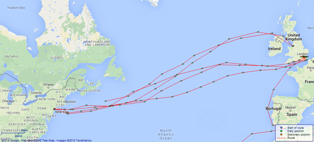
LOGS FOR AUGUST 1918 4caf8565cadfd3419700eaea: (http://oldweather.s3.amazonaws.com/ADM53-37903/C2-ADM53-37903-0001_0.jpg) [Left hand side of cover of Copy of Log for 2 - 31 August 1918] 4caf8565cadfd3419700eaeb: (http://oldweather.s3.amazonaws.com/ADM53-37903/C2-ADM53-37903-0001_1.jpg) [Right hand side of cover, signed by Navigating Officer and Captain, as before] 4caf8565cadfd3419700eaec: (http://oldweather.s3.amazonaws.com/ADM53-37903/C2-ADM53-37903-0003_0.jpg) [Blank page] 4caf8565cadfd3419700eaed: (http://oldweather.s3.amazonaws.com/ADM53-37903/C2-ADM53-37903-0003_1.jpg) [Page not filled in] 4caf8565cadfd3419700eaee: (http://oldweather.s3.amazonaws.com/ADM53-37903/C2-ADM53-37903-0005_0.jpg) [Log page not filled in] 4caf8566cadfd3419700eb11: (http://oldweather.s3.amazonaws.com/ADM53-37903/C2-ADM53-37903-0004_1.jpg) 2 August 1918 At London Lat 51.51, Long 0.06 [estimated, though no indication of which dock in London] 6.30am: Employed in preparing ship for sea, taking in stores, etc. 11.0am: Draft joined ship POs 11, LS 13, ABs RNVR 10, ODs RNVR 34, seamen RNR 26, ABs RFR 2, ABs AS 1 from RN Barracks Devonport, 25 boys from Shotley, 37 Marines from RMLI Barracks Plymouth. 1.10pm: C and M [probably Care and Maintenance] fall in, hands taking in Stores. 4.0pm: Liberty men. 4.30pm: Both Watches for exercise taking in stores. 6.0pm: Finished taking in stores. Liberty men. 9.45pm: 25 Boys from Shotley. 4caf8565cadfd3419700eaef: (http://oldweather.s3.amazonaws.com/ADM53-37903/C2-ADM53-37903-0005_1.jpg) 3 August 1918 At London Lat 51.51, Long 0.06 8.0am: Hands employed taking in stores and clearing up ship. am: 1 AB Devonport Barracks joined ship RNVR. 1.15pm: Exercised general quarters. 2.0pm: Dispersed, exercised abandon [ship]. 3.0pm: Dispersed. 4.25pm: Liberty men ashore. 4.30pm: Hands employed taking in stores. 6.0pm: Liberty men landed. 9.0pm: First Lieutenant’s rounds. [Rain in am, cloudy then fine in pm; noon temperature 66F, sea temperature 63F] 4caf8565cadfd3419700eaf0: (http://oldweather.s3.amazonaws.com/ADM53-37903/C2-ADM53-37903-0006_0.jpg) 4 August 1918 From London to Sheerness Lat 51.50, Long 0.53 [rough estimate] 6.0am: Singled up, pilot (Roseberry) aboard. 6.5am: Cast off, proceeded out of docks, 2 tugs in attendance. 8.20am: Dropped anchor at lock entrance. Stern moorings ashore. 9.10am: Weighed anchor. 9.20am: Entered locks. 9.52am: Left locks. 9.55am: Tugs cast off. 11.15am: Discharged pilot. 11.20am: Stop, arrived Gravesend. Took sea pilot aboard. 11.23am: Full ahead. 0.30pm: Stop Southend [?] for officers. 0.45pm: Slow ahead. 0.50pm: PV [Paravane] tested. 1.20pm: Sheerness pilot aboard. 1.30pm - 2.15pm: Ran and tested PVs. 2.15pm: Proceeded towards Sheerness. 3.0pm: Nearing Sheerness. Draft Forward 14’ 7”, Aft 22’ 9”. 3.45pm: Passed through Sheerness booms. 4.10pm: Tug alongside. 4.45pm: Alongside coaling hulk. 7.0pm: Commenced coaling. 8.0pm: A1 and B1 Guns crews fell in for duty. 11.30pm: Stopped coaling. 4caf8565cadfd3419700eaf1: (http://oldweather.s3.amazonaws.com/ADM53-37903/C2-ADM53-37903-0006_1.jpg) 5 August 1918 At Sheerness Lat 51.43, Long 0.73 [estimated] 1.25am: Carried on coaling. 6.0am: Hands detailed for Coal and Ammunition ship. 6.30am: Stopped coaling. 8.0pm: Resumed coaling. 8.45pm: Hands fall in for exercise. Detailed for Ammunition ship. 9.20am: Duty officer landed. Noon: Stopped coaling. 1.0pm: Resumed coaling. 1.50pm: Water lighter alongside. 2.30pm - 2.40pm: Stopped coaling. 3.35pm - 4.0pm: Stopped coaling. 4.30pm: Loading ammunition resumed. 5.0pm - 6.0pm: Stopped coaling. 6.0pm: Finished loading ammunition. 6.40pm: Case for Gunner’s store arrived. 7.0pm - 7.50pm: Stopped coaling. 8.0pm: A2 and B2 guns crews fall in for duty. Coaling carried on during watch with exception of short delays owing to Feed source being blocked. 11.0pm: Coaling suspended for supper. Mooring and Ammunition lighters correct. X2 and Y2 gun’s crews called for trimming coal. Midnight: Coaling resumed. 4caf8565cadfd3419700eaf2: (http://oldweather.s3.amazonaws.com/ADM53-37903/C2-ADM53-37903-0007_0.jpg) 6 August 1918 At Sheerness Lat 51.43, Long 0.73 3.45am: Y1 and X1 guns crews called for trimming. 4.0am: Moorings and ammunition lighters correct. 6.0am: Hands fall in and detailed for work. 7.30am: Forenoon reliefs to breakfast and clean. 8.45am: Hands told off for taking in ammunition. 11.0am: Tug for shifting alongside. 11.30am: Hands told off for shifting ship stations. Guns crews stand fast. Noon: Finished shifting. A2 and B2 Guns crews called. 1.25pm: Coaling party resumed work. 1.30pm: Both watches for exercise. Hands told off for ammunition ship. 2.0pm: Started taking in ammunition. 4.15pm: Finished taking in ammunition. 5.30pm: Provisioned boats. 6.20pm: Finished provisioning boats. 8.45pm: Two ratings arrived on board. 10.30pm: Pilot on board. 11.30pm: Coaling suspended for supper. Midnight: 2 Signal ratings arrived on board. 4caf8565cadfd3419700eaf3: (http://oldweather.s3.amazonaws.com/ADM53-37903/C2-ADM53-37903-0007_1.jpg) 7 August 1918 To, from and at Sheerness [though not stated at top of page] Lat 51.46, Long 0.82 [very rough estimate; no position information in log] Midnight: Coaling resumed and continued during watch. 4.0am: Rounds and Moorings correct. A2 and B2 guns crews called for Trimming coal. 6.30am: Pilot on board, tug alongside. 7.5am: Cast off from hulk. 7.20am: Let go tug. 7.40am: Passed Garrison Point. Course and speed as requisite to carry on Gun trails [trials]. 10.30am: Finished gun trails [sic]. 2.0pm: Practised abandon ship. 2.45pm: Boats hoisted and gear checked. 4.30pm: Boats squared and crews dismissed. 5.0pm: During afternoon swung ship for correcting deviation. 5.30pm: Cast off buoy. 5.45pm: Cast off tug. 6.5pm: Passed Garrison Point. 6.45pm: Let go Port anchor 4 cables. 10.0pm: Pipe down. 10.30pm: Anchor bearings checked. 4caf8565cadfd3419700eaf4: (http://oldweather.s3.amazonaws.com/ADM53-37903/C2-ADM53-37903-0008_0.jpg) 8 August 1918 From London, at Sea [though not stated at top of page] Lat 50.93, Long -1.10 [Position 8.0am: Off North Foreland] 0.40am: Examination boat closed and communicated. 1.15am: Steamer anchored astern. 4.0am: Commenced heaving up. 4.45am: Anchored [sic] weighed. Half speed ahead. Courses and speed various. 9.50am: Stopped, discharged pilot (Larkin) at Downs. 9.55am: Proceeded, Course S67W. 11.0am: Passed through Folkestone Gate, altered course S52W magnetic. 0.20pm: Off Dungeness manoeuvred into position line abreast. 0.40pm: Dungeness N22W magnetic. 0.44pm: Altered course S38W true. 0.50pm: Zig Zagging. 1.25pm: Hands (except Red Watch and Blue Watches) fell in and told off for cleaning down promenade and boat decks. 2.48pm: Increased speed 0.5 knots. Revs various keeping station. Fuzed 50 Lyddite shells. 10.5pm: Cape Barfleur Light bearing S13W true, 26 miles. 10.44pm: Ceased Zig-Zag and resumed course S87W. 11.55pm: Barfleur Light bears S2E. Midnight; Clock retarded 30 minutes. [Course and Distance made good: 67 miles] 4caf8565cadfd3419700eaf5: (http://oldweather.s3.amazonaws.com/ADM53-37903/C2-ADM53-37903-0008_1.jpg) 9 August 1918 From London to New York Lat 49.53, Long -5.15 2.38am: Quevale Point abeam. 4.10am: Commenced Zig-Zag. 6.48am: Increased speed one rev, Zig-Zag in progress (K). 9.15am: Stopped Zig-Zag ATS 9.20, BST 10.43: altered course N65W. 9.30am: Recommenced Zig-Zag. 3.25pm: Bishops Light N17W. 4.12pm: Altered course N70W. 70 HE [High Explosive] shells fuzed. 4.15pm: Scilly Isles abeam, increase speed to 61 revs. 8.0pm: Mustered sea-boats Crew. 9.16pm: Ceased Zig-Zag. [Course and Distance made good: Indirect 263 miles] [True Bearing and Distance: To 10 miles S of Scilly’s N81W, 51 miles] 4caf8565cadfd3419700eaf6: (http://oldweather.s3.amazonaws.com/ADM53-37903/C2-ADM53-37903-0009_0.jpg) 10 August 1918 From London to New York Lat 49.82, Long -12.28 [position in log corrected in red] 0.30am: Clock retarded 9 minutes. 2.40am: Received signal. Increased speed to 62 revs. 2.48am Commenced to Zig-Zag. 4.40am: “Kildonnan Castle” [HMS Kildonan Castle] ahead of convoy. 5.25am: Came up into station taking “Kildonnan Castle’s” place in convoy. 7.50pm: Ceased Zig-Zag. [Course and Distance made good: N86W, 276 miles] [True Bearing and Distance: To Position 49 50 N, 25 00 W, W, 490 miles] 4caf8565cadfd3419700eaf7: (http://oldweather.s3.amazonaws.com/ADM53-37903/C2-ADM53-37903-0009_1.jpg) 11 August 1918 From London to New York Lat 49.88, Long -18.90 4.5am: Commenced Zig-Zag. 4.8am: Clock retarded 8 minutes. 10.0am: Divisions and Divine service. Noon: Zig-Zag (K) in progress. 2.55pm: Dropped Zig-Zag Time Ball. 6.50pm: Dropped Zig-Zag time ball. 8.12pm: Clock retarded 8 minutes. 8.20pm: Ceased Zig-Zag. [Course and Distance made good: 255 miles] 4caf8565cadfd3419700eaf8: (http://oldweather.s3.amazonaws.com/ADM53-37903/C2-ADM53-37903-0010_0.jpg) 12 August 1918 From London to New York [though not stated at top of page] Lat 50.00, Long -24.87 0.30am: Clock retarded 16 minutes. 3.55am: Commenced Zig Zag. 4.27am: Dropped Zig-Zag Time ball. 6.49am: Dropped Zig Zag Time ball. 10.18am: Dispersed convoy, altered course N80W. Carrying out Zig-Zag (K). 10.33am: Streamed log. 2.0pm: 2 degrees Southerly for leeway. 3.4pm: Heavy weather ceased Zig-Zag. Midnight: Clocks retard 20 minutes. [Course and Distance made good: N88W, 230 miles] [True Bearing and Distance: To Position 49 50 N, 25 0 00, S69W, 214 miles] [Wind south easterly, then southerly, then south westerly force 6 to 6-7 from noon onwards, sea rough at times in pm; mist and rain from 11am, noon temperature 60F, sea temperature 59F] 4caf8565cadfd3419700eaf9: (http://oldweather.s3.amazonaws.com/ADM53-37903/C2-ADM53-37903-0010_1.jpg) 13 August 1918 From London to New York [though not stated at top of page] Lat 48.52, Long -30.20 4.0am: Clock retarded 10 minutes. 5.20am: Reduced to 40 revs to secure gear forward. pm: Seven 6 inch BL cordite charges damaged, thrown overboard, Authority ‒ Gunnery Lieutenant. 6.0pm: Altered course N82W, observed 3 masted schooner. 7.30pm: Passed SS steering N75W approximately. Midnight: Retarded clock 14 minutes. [Course and Distance made good: S67W, 227 miles] [True Bearing and Distance: To Position 47 20 N, 35 00 W, S70W, 205 miles] [Wind variable in direction, squally south westerly then north westerly force 8 or 9 until 3pm, sea very rough to high to very high until 4pm when wind and sea started to reduce] 4caf8565cadfd3419700eafa: (http://oldweather.s3.amazonaws.com/ADM53-37903/C2-ADM53-37903-0011_0.jpg) 14 August 1918 From London to New York [though not stated at top of page] Lat 46.83, Long -36.33 3.5am: SS sighted astern. 3.25am: Commenced Zig-Zag. 2.30pm: Ceased Zig Zag. 4.15pm: Commenced Zig Zag. 5.21pm: Ceased Zig-Zag. 7.0pm: Wind dropped and veered to NWxW, altered course N86W. 10.17pm: Clock retarded 7 minutes. [Course and Distance made good: S68W, 267 miles] [True Bearing and Distance: To Position 45 37 N, 40 00 W, S64.5[W], 169 miles, New York 1790 miles] [Wind and weather variable throughout the day] 4caf8565cadfd3419700eafb: (http://oldweather.s3.amazonaws.com/ADM53-37903/C2-ADM53-37903-0011_1.jpg) 15 August 1918 From London to New York [though not stated at top of page] Lat 44.72, Long -42.22 0.30am: Clock back 14 minutes. 3.30am: Commenced Zig-Zag. 9.0am: Divisions and Prayers. 1.0pm: Zig-Zag (K) in progress. 9.15pm: Ceased Zig-Zag. Midnight: Clock back 14 minutes. [Course and Distance made good: S61W, 279 miles] 4caf8565cadfd3419700eafc: (http://oldweather.s3.amazonaws.com/ADM53-37903/C2-ADM53-37903-0012_0.jpg) 16 August 1918 From London to New York [though not stated at top of page] Lat 42.35, Long -47.22 0.30am: Clock retard 7 minutes. 4.30am: Commenced Zig Zag. 9.34am: Stop, ran out PVs. 9.54am: Full ahead. 11.0am: Slowed down to half speed for taking in PVs. 11.13am: Proceeded at Full ahead, 14 knots. 2.40pm: Eased speed to stream PVs. Manoeuvred, engines as required. 2.46pm: Full ahead. 3.14pm: Stopped to pick up PVs. 3.19pm: Full ahead. 3.23pm: Stop owing to fouling of PV towing wire. 3.34pm: Full ahead. 4.0pm: Evening quarters and exercise Fire stations. 4.14pm: Ceased Zig-Zag, altered course N71W. 4.25pm: Misty weather. Started whistle and Fore head look out. 9.15pm: Resumed Zig-Zag. Fog lifted. 11.0pm: Clock retarded 9 minutes. Midnight: Ceased Zig Zag. [Course and Distance made good: S57W, 259 miles] [True Bearing and Distance: To Nantucket 1012 miles. To New York 1213 miles, S84W] 4caf8565cadfd3419700eafd: (http://oldweather.s3.amazonaws.com/ADM53-37903/C2-ADM53-37903-0012_1.jpg) 17 August 1918 From London to New York [though not stated at top of page] Lat 41.62, Long -54.52 0.30am: Clock back 9 minutes. 4.20am: Fog set in. 4.38am: Commenced Zig Zag. 4.45am: Clock retarded 9 minutes. 4.50am: Fog cleared. 7.15am: Heavy rain. 9.0am: Swung out all boats. 9.3am: Zig Zag on small half [?] (5 degrees). Passed Portuguese 3 masted schooner, Lat 41 42 N, Long 53 38 W. 3.53pm: Commenced Zig Zag. 10.50pm: Wind veered to north. 11.0pm: Clock back 9 minutes. [Course and Distance made good: S82W, 329 miles] 4caf8565cadfd3419700eafe: (http://oldweather.s3.amazonaws.com/ADM53-37903/C2-ADM53-37903-0013_0.jpg) 18 August 1918 From London to New York [though not stated at top of page] Lat 41.18, Long -61.92 0.30am: Clock retarded 9 minutes. 0.50am: Ceased Zig Zag. 3.0am: Commenced Zig Zag. 10.0am: Muster by open list. 10.30am: Divine service. 4.49pm: Stop. PVs out. 4.52pm: Full ahead. 11.30pm: Clock advanced 5 minutes. [Course and Distance made good: S85.5W, 334 miles] [True Bearing and Distance: To Position Nantucket 351 miles, New York 552 miles, S84W] 4caf8565cadfd3419700eaff: (http://oldweather.s3.amazonaws.com/ADM53-37903/C2-ADM53-37903-0013_1.jpg) 19 August 1918 From London to New York Lat 40.65, Long -68.53 2.0am: Clock advanced 5 minutes. 4.0am: Ceased Zig-Zag No 19 and Commenced No 31. Increased to 15 knots. 1.0pm: Altered course N78W. Continuing No 31 ZZ. 3.15pm: Observed Nantucket light Vessel. 3.30pm: Commenced 30 degree Continuous helm ZZ. 4.19pm: Nantucket abeam bearing S, 2 miles, log 13, altered course N87W. 8.35pm: Commenced No 31 ZZ. [Course and Distance made good: S84W, 301 miles] [True Bearing and Distance: To Nantucket Light Vessel S87.5W, 49.5 miles] 4caf8565cadfd3419700eb00: (http://oldweather.s3.amazonaws.com/ADM53-37903/C2-ADM53-37903-0014_0.jpg) 20 August 1918 From London to [and at] New York Lat 40.67, Long -74.05 [rough estimate] 8.58am: Stopped and took Paravanes aboard, Slow ahead. 9.10am: Stopped at Ambrose light Vessel and took Pilot Mates aboard. Engines to orders. 10.53am: Passed through Narrows and boom defence and proceeded towards North River. 0.55pm: Stopped and let go port anchor in 10 fathoms, veering Chain to 60 fathoms. Finished with Engines. [Draught Arriving: Forward 19’ 10”, Aft 22’ 3”] 1.45pm: USN [US Navy] Officer paid official call. pm: Sixteen 6 inch QF Cartridges damaged by sea water at sea. 5.25pm: Swung to flood. 6.30pm: Tugs alongside and dock pilot aboard. Weighed anchor and proceeded. Engines to orders. 7.40pm: Entered dock. 8.7pm: Made fast in dock. Rang off Engines. 10.0pm: Piped down. [Course and Distance made good: Indirect 275 miles] 4caf8565cadfd3419700eb01: (http://oldweather.s3.amazonaws.com/ADM53-37903/C2-ADM53-37903-0014_1.jpg) 21 August 1918 From London, at New York Lat 40.77, Long -74.00 [estimated, based on information in log page for 1 September 1918] am: Hands variously Employed Painting and Cleaning. Classes to instruction. 1.15pm: Hands fell in. Employed painting parts of ship. 3.30pm: Piped down. 4.0pm and 6.0pm: Liberty men landed. 6.25pm: Hospital ship alongside for Hospital party. 9.0am: Eased up moorings. Midnight: Liberty men returned. Rounds and moorings Correct. [Course and Distance made good: Manoeuvring in River 10 miles] [Weather cloudy or fine, noon temperature 77F, sea temperature 72F] 4caf8565cadfd3419700eb03: (http://oldweather.s3.amazonaws.com/ADM53-37903/C2-ADM53-37903-0015_1.jpg) 22 August 1918 At New York Lat 40.77, Long -74.00 9.40am: Commenced taking Cargo at all hatches. 1.15pm: Hands fell in. Cleaning and painting ship. 3.30pm: Hands piped down. 4.0pm and 6.0pm: Liberty men landed. 11.0pm: Stopped Cargo work. Midnight: Liberty men returned. 4caf8565cadfd3419700eb02: (http://oldweather.s3.amazonaws.com/ADM53-37903/C2-ADM53-37903-0015_0.jpg) 23 August 1918 At New York Lat 40.77, Long -74.00 6.0am: Hands fell in and Employed Cleaning and Painting ship. 8.0am: Resumed Cargo work. 11.0am: Boys landed for liberty. 1.15pm: Hands fell in. Side party painting ship's side, remainder part of ship. 4.0pm and 6.0pm: Liberty men landed. 11.0pm: Stopped Cargo work. Midnight: Liberty men returned. 4caf8565cadfd3419700eb04: (http://oldweather.s3.amazonaws.com/ADM53-37903/C2-ADM53-37903-0016_0.jpg) 24 August 1918 At New York Lat 40.77, Long -74.00 am: Hands Employed part of ship. pm: Cargo work throughout. 7.0pm: Stopped Cargo work. 4caf8565cadfd3419700eb05: (http://oldweather.s3.amazonaws.com/ADM53-37903/C2-ADM53-37903-0016_1.jpg) 25 August 1918 At New York [though not stated at top of page] Lat 40.77, Long -74.00 8.30am: Resumed Cargo work. 2.0pm: Cargo work throughout. 5.0pm: Stopped Cargo work. 4caf8565cadfd3419700eb06: (http://oldweather.s3.amazonaws.com/ADM53-37903/C2-ADM53-37903-0017_0.jpg) 26 August 1918 At New York Lat 40.77, Long -74.00 7.0am: Commenced Cargo work and taking in Coal at No 3. am: Divisions and Prayers. Captains defaulters. Hands painting ship and Classes to instruction. pm: Hands painting ship and variously employed. 5.0pm: Finished Cargo work for the day. 11.0pm: Coaling throughout. 4caf8566cadfd3419700eb07: (http://oldweather.s3.amazonaws.com/ADM53-37903/C2-ADM53-37903-0017_1.jpg) 27 August 1918 At New York Lat 40.77, Long -74.00 4.0am: Finished Coaling. 6.0am: Hands fell in and detailed for washing down decks and Cleaning ship. 7.30am: Resumed Cargo work. am: Hands fell in and detailed for Cleaning and Painting ship. 1.30pm: Commenced taking in cargo. 4.0pm and 6.0pm: Liberty men landed. 5.0pm: Stopped loading. 6.20pm: Boys came aboard. 10.0pm: Sentries change over. 11.30pm: Liberty men returned. Midnight: Moorings Correct. 4caf8566cadfd3419700eb08: (http://oldweather.s3.amazonaws.com/ADM53-37903/C2-ADM53-37903-0018_0.jpg) 28 August 1918 At New York Lat 40.77, Long -74.00 1.0am, 2.0am, 3.0am and 4.0am: Sentries in magazines change round. 7.0am: Loading in progress. Hands exercised at physical drill. am: Hands Employed painting ship. pm: Hands painting ship. 5.0pm: Stopped Cargo work. 4caf8566cadfd3419700eb09: (http://oldweather.s3.amazonaws.com/ADM53-37903/C2-ADM53-37903-0018_1.jpg) 29 August 1918 At New York Lat 40.77, Long -74.00 7.0am: Hands physical drill. Commenced Cargo work. am: Hands employed Painting and Cleaning ship. 5.0pm: Finished Cargo work for the day. 4caf8566cadfd3419700eb0a: (http://oldweather.s3.amazonaws.com/ADM53-37903/C2-ADM53-37903-0019_0.jpg) 30 August 1918 At New York Lat 40.77, Long -74.00 8.0am: Resumed Cargo work. am and pm: Hands painting and variously Employed. 5.0pm: Stopped Cargo work for the day. 4caf8566cadfd3419700eb0b: (http://oldweather.s3.amazonaws.com/ADM53-37903/C2-ADM53-37903-0019_1.jpg) 31 August 1918 At New York Lat 40.77, Long -74.00 7.30am: Resumed Cargo work. 5.0pm: Stopped Cargo work for the day. 4caf8566cadfd3419700eb0c: (http://oldweather.s3.amazonaws.com/ADM53-37903/C2-ADM53-37903-0020_0.jpg) [Log page not filled in] 4caf8566cadfd3419700eb0d: (http://oldweather.s3.amazonaws.com/ADM53-37903/C2-ADM53-37903-0020_1.jpg) [Blank page] 4caf8566cadfd3419700eb0e: (http://oldweather.s3.amazonaws.com/ADM53-37903/C2-ADM53-37903-0021_0.jpg) [Half blank page] 4caf8566cadfd3419700eb0f: (http://oldweather.s3.amazonaws.com/ADM53-37903/C2-ADM53-37903-0021_1.jpg) [Half blank page] 4caf8566cadfd3419700eb10: (http://oldweather.s3.amazonaws.com/ADM53-37903/C2-ADM53-37903-0004_0.jpg) [Page for details of Barometer and Thermometers, not filled in] LOGS FOR SEPTEMBER 1918 4caf8566cadfd3419700eb3a: (http://oldweather.s3.amazonaws.com/ADM53-37904/ADM53-37904-0001_0.jpg) [Left hand side of cover of Copy of Log from September 1st to October 4th 1918] 4caf8566cadfd3419700eb3b: (http://oldweather.s3.amazonaws.com/ADM53-37904/ADM53-37904-0001_1.jpg) [Right hand side of cover, signed by Navigating Officer and Captain, as before] 4caf8566cadfd3419700eb3c: (http://oldweather.s3.amazonaws.com/ADM53-37904/ADM53-37904-0002_0.jpg) [Blank page] 4caf8566cadfd3419700eb3d: (http://oldweather.s3.amazonaws.com/ADM53-37904/ADM53-37904-0002_1.jpg) [Page not filled in] 4caf8566cadfd3419700eb3e: (http://oldweather.s3.amazonaws.com/ADM53-37904/ADM53-37904-0003_0.jpg) [Page for details of Barometer and Thermometers, not filled in] 4caf8566cadfd3419700eb3f: (http://oldweather.s3.amazonaws.com/ADM53-37904/ADM53-37904-0003_1.jpg) 1 September 1918 At New York Lat 40.77, Long -74.00 [Alongside Number 55th Street Pier] 8.0am: No Cargo work done this day. 9.30am: RC Church party landed. 10.0am: Divisions and prayers. 11.30am: Church party returned. pm: Hands at rest. Midnight: Moorings attended to. Rounds Correct. [Weather fine, noon temperature 82F] 4caf8566cadfd3419700eb40: (http://oldweather.s3.amazonaws.com/ADM53-37904/ADM53-37904-0004_0.jpg) 2 September 1918 At New York Lat 40.77, Long -74.00 [Alongside Number 55th Street Pier] am: Hands variously employed. No Cargo work done this day. 1.15pm: Ship's company exercised at Field and rifle exercise. 3.30pm: Hands piped down. 5.0pm: Finished Cargo work. 4caf8566cadfd3419700eb41: (http://oldweather.s3.amazonaws.com/ADM53-37904/ADM53-37904-0004_1.jpg) 3 September 1918 At New York [though not stated at top of page] Lat 40.77, Long -74.00 7.0am: Hands to physical drill. Commenced Cargo work. 9.30am: Hands mustered bags. am: Hands variously employed. Classes to instruction. 6.0pm: Finished Cargo work for the day. Mustered sea boats Crew. 4caf8566cadfd3419700eb42: (http://oldweather.s3.amazonaws.com/ADM53-37904/ADM53-37904-0005_0.jpg) 4 September 1918 At New York [though not stated at top of page] Lat 40.77, Long -74.00 [Alongside Number 55 Street Pier] 7.0am: Commenced taking in Cargo. am: Hands employed variously. Classes to instruction. 7.0pm: Completed Cargo work at all hatches. 4caf8566cadfd3419700eb43: (http://oldweather.s3.amazonaws.com/ADM53-37904/ADM53-37904-0005_1.jpg) 5 September 1918 At New York [though not stated at top of page] Lat 40.77, Long -74.00 Noon: Left Wharf, 3 tugs and anchored in 8 fathoms ‒ 4 cables. 3.50pm: Liberty men fall in. 4.0pm: Boat left with Liberty men. 6.0pm: Boat left ship with Liberty men. 6.45pm: Liberty men returned. 8.0pm: Rounds and Anchor correct. 11.0pm: Liberty men returned from leave. 4caf8566cadfd3419700eb44: (http://oldweather.s3.amazonaws.com/ADM53-37904/ADM53-37904-0006_0.jpg) 6 September 1918 At and from New York [though not stated at top of page] Lat 40.68, Long -71.04 [rough estimate; no position in log] 9.15am: Exercised action. 10.20am: Secure. 11.10am: Drifter brought pilot and SB men aboard. 11.15am: Drifter left ship for shore. 11.35am: Weighed anchor. 11.38am: Under way. Noon: Increased to 14 knots. 0.16pm: Robens [Robbins] reef abeam. 0.34pm: Passed defence nets. 0.55pm: Nortons Point abeam. 1.10pm: West Bank light abeam. 1.17pm: Romer Light abeam. 1.44pm: Stop. 1.45pm: Pilot left. 2.7pm: Ambrose Light abeam. 2.10pm: General Quarters, commenced submarine watches. 4.0pm: Convoy proceeding S60E (true), Zig-Zag as required by Captain. Manoeuvring through convoy. Ships getting into station. 6.11pm: Collided with SS Gold Shell causing damage to Starboard side. 6.55pm: Passed floating mine and reported same to escorting destroyer. 11.20pm: Clock retarded 13 minutes. [Note: SS/USS “Gold Shell” was an oil tanker built in USA in 1916; she was chartered by the US Navy in 1916 and was commissioned in August 1917 to transport fuel oil across the Atlantic; she was decommissioned in March 1919 and returned to her owners, Shell Oil Company; she was sold in 1929 and again, to a Norwegian company, in 1930 and was renamed “Willy”; she was sold to a Brazilian company in 1939 and was renamed “Itamarati”; she was scrapped in 1949 after an explosion in dock in Rio de Janeiro (more details here).] 4caf8566cadfd3419700eb45: (http://oldweather.s3.amazonaws.com/ADM53-37904/ADM53-37904-0006_1.jpg) 7 September 1918 From New York [though not stated at top of page] Lat 39.87, Long -70.33 1.30am and 4.0am: Clock retarded 13 minutes. 5.10am: Increased speed of revs to round up convoy ‒ 67. 5.20am: Convoy reduced speed to 7 knots. 10.18am: Convoy increased speed to 8 knots. 11.3am: Increased to 9 knots. 11.5am: Sighted and engaged submarine. 11.45am: Ceased fire and signalled US submarine 5. 4.5pm: Convoy altered course S84E (standard). 4.44pm: Commenced Zig Zag (55). 5.45pm: Handed Log. Ceased ZZ on account of heavy rain. 9.50pm: Clock advanced 10 minutes. Midnight: Heavy dew. Ships keeping better station. [Course and Distance made good: Indirect 197 miles] [True Bearing and Distance: Rendezvous approximately noon September 8th, 40 55 N, 61 16 W] 4caf8566cadfd3419700eb46: (http://oldweather.s3.amazonaws.com/ADM53-37904/ADM53-37904-0007_0.jpg) 8 September 1918 [August in log] From New York [though not stated at top of page] Lat 40.22, Long -66.05 6.18am: Convoy altered course to East (true), S77E (standard). 6.44am: Convoy commenced ZZ. 7.20am: Passed SS Saint Stephen (b) [British] bound for New York: [Lat] 40 05 N, [Long] 66 43 W. 9.45am: Convoy increased to 9.5 knots. 10.0am: Divisions and Divine service. 2.30pm: Eased down to Half speed to communicate with SS Northern [listed here]. 2.40pm: Full speed. 5.39pm: Convoy altered course N76E (true), S88E (standard). 7.2pm: Ceased ZZ and reduced to 9.5 knots, 50 revs. 10.40pm: Advanced clock 10 minutes. [Course and Distance made good: N84E, 198 miles] [True Bearing and Distance: Rendezvous noon September 10th: 41 36 N, 56 51 W; Course E, 49 miles] [Note: SS “Saint Stephen” was a cargo ship built in 1911 in Scotland for British & Foreign Steamship Company, Liverpool; she went to a Finnish company in 1923; in 1942 she went to a Brazilian company, then had a number of Brazilian owners and in 1949 was renamed “Canguera”; in 1952 she was renamed “Guarassu” and in 1959 became “Fernao Dias”; she foundered off Brazil in 1968 (more details here). SS “Northern” was a British cargo ship built in Sunderland in 1912 for Century Shipping Company, London; she was sold to a French company in 1922 and was renamed “Sonora”; she went to a Greek company in 1934 and became “Ariadne”; in 1938 she went to an Italian company and was renamed “Trovatore”; in 1944 she went to a Spanish company and became “Cabo del Agua”; she changed hands again (still Spanish) in 1955 and was renamed “Castillo Manzanares”; she was broken up in 1964 (more details here).] 4caf8566cadfd3419700eb47: (http://oldweather.s3.amazonaws.com/ADM53-37904/ADM53-37904-0007_1.jpg) 9 September 1918 [August in log] From New York [though not stated at top of page] Lat 40.85, Long -61.52 1.0am: Advanced clock 10 minutes. 5.11am: Convoy commenced Zig Zag. 9.42 (GMT). 6.30am: Ceased ZZ. 6.45am: Recommenced Zig Zag (54). Passed SS Mendocinge [possibly Mendocino, listed here] going West: 40 53 N, 62 10 W. 4.10pm: Exercised fire stations. 5.7pm: SS Saeta [probably Saetia] proceeded in SW direction. 5.20pm: Reduced speed of Convoy half knot. 5.56pm: SS Porticello and Minnesotan left convoy. 6.52pm: Convoy ceased Zig Zag. 8.35pm: Sighted 2 lights 4 points on Starboard bow. 10.0pm: Sighted lights to Starboard. Midnight: Clock advanced 9 minutes. [Course and Distance made good: N81E, 210 miles] [True Bearing and Distance: To Rendezvous N76E, 71 miles] [Note: SS “Mendocino” was an oil tanker built in Sunderland in 1917 and initially under British management; in 1919 she was returned to her Norwegian owners, Wilhelm Wilhelmsen; in 1938 she went to a German company and was renamed “Karibisches Meer”; she was requisitioned by the German Navy in 1939; in 1944 she was sunk as a blockship at Rouen; she was refloated and beached for breaking in 1946 (more details here and here). SS “Saetia” was an American cargo ship built in USA in 1918 and requisitioned by US Shipping Board; she was to be sunk by a mine from a German submarine off the east coast of America in November 1918. It has not been possible to find information about SS “Porticello”. SS “Minnesotan” was an American cargo ship built in Maryland in 1912 for American-Hawaiian Steamship Company, New York; at some point after 1949 she was renamed “Maria Luisa R”; she was to run aground and be wrecked off Argentina.] 4caf8566cadfd3419700eb48: (http://oldweather.s3.amazonaws.com/ADM53-37904/ADM53-37904-0008_0.jpg) 10 September 1918 From New York [though not stated at top of page] Lat 41.50, Long -57.30 0.30am: Clock advanced 8 minutes. [Log records numerous changes in speed throughout am] 5.0am: Convoy commenced ZZ (54). 1.15pm: Hands fell in and detailed various employment. Fore Control exercised A1 and A2 guns in cease fire position. 5.30pm: Western Queen [listed here] and Communipaw left Convoy 9pm (GMT). 6.50pm: Ceased ZZ. 7.0pm: Reduced speed to 50 revs and set course ahead of commodore [?]. 11.0pm: Clock advanced 9 minutes. [Course and Distance made good: N78E, 195 miles] [True Bearing and Distance: To Rendezvous: 42 43 N, 47 57 W: N80E, 332 miles] [Note: SS “Western Queen” was built in 1918 in Seattle, for US Shipping Board and was then owned by Lykes Brothers Steam Ship Company; in 1946 she was sold and renamed “Virginia”, then in 1948 “Virginia II”; in 1949 she was sold again and renamed “Elisa”; she was scrapped in Hong Kong in 1954. SS “Communipaw” was an oil tanker built in Stettin, Germany, in 1893 as “Deutschland” for Deutsch-Amerik. Petroleum, Hamburg; she was laid up in Rotterdam in 1914 and later that year went to Standard Oil Company, New Jersey, and was renamed “Communipaw”; she was broken up at Baltimore in 1923.] 4caf8566cadfd3419700eb49: (http://oldweather.s3.amazonaws.com/ADM53-37904/ADM53-37904-0008_1.jpg) 11 September 1918 From New York [though not stated at top of page] Lat 42.10, Long -52.68 0.30am: Clock advanced 9 minutes. 5.25am: Convoy commenced ZZ, increased to 67 (revs). 11.25am: Convoy changed ZZ 54 to ZZ 55. 0.30pm: Altered course S77E escort doing continuous ZZ, revs 58. 3.20pm: Ceased ZZ, reduced to 9.5 (Knots). 4.30pm: Signalled to SS Spondari [?] to take Guide of Convoy. 4.35pm: Fired one blank (6 pounder). 4.42pm: Fired one round 6 inch to attract attention to signal. 9.15pm: Turned on shaded Stern Light. SS Broad Arrow regained position in Convoy. Midnight: Advanced clock 9 minutes. [Course and Distance made good: N80E, 209 miles] [True Bearing and Distance: To RV [Rendezvous]: 43 17 N, 45 04 W: N80E, 584 miles] [North westerly wind force 5 with rough sea through middle of day; noon temperature 67F, sea temperature 70F] [Note: It has not been possible to trace SS “Spondari” (or similar). SS “Broad Arrow” was an oil tanker built in 1918 in New Jersey for US Government; in 1919 she went to Standard Transportation Company, New York, and in 1931 was owned by Standard Vacuum Transportation, New York; she was then owned, from 1935 by Socony-Vacuum Oil Company, New York; she was to be torpedoed and sunk by a German submarine off Brazil in 1943.] 4caf8566cadfd3419700eb4a: (http://oldweather.s3.amazonaws.com/ADM53-37904/ADM53-37904-0009_0.jpg) 12 September 1918 From New York [though not stated at top of page] Lat 42.62, Long -48.27 2.0am: Advanced clock 9 minutes. 9.0am: Divisions and Prayers. Hands detailed for duties. 10.30am: Signalled SS Arcawius [?] (British) bound West: 42 35 N, 48 34 W. am: Admonished Chief Steward William L Underwood (Warrant Steward MMR [Mercantile Marine Reserve]) for making an improper remark to First Lieutenant JC Brown. 0.15pm: Increased to 9.5 [knots]. Convoy commenced ZZ. Altered course to examine sailing ship, course and speed as requisite. 2.23pm: Rejoined convoy, convoy ceased Zig Zag. 2.25pm: Ahead of convoy, revs 52. Midnight: Clock advanced 9 minutes. [Course and Distance made good: N81E, 198 miles] [True Bearing and Distance: To RV N80E, 368 miles] [Note: It has not been possible to trace the ship signalled at 10.30am.] 4caf8566cadfd3419700eb4b: (http://oldweather.s3.amazonaws.com/ADM53-37904/ADM53-37904-0009_1.jpg) 13 September 1918 From New York [though not stated at top of page] Lat 43.04, Long -43.61 [estimated ‒ mean of positions for 12 and 14 September; no position information in log] 0.30am: Advanced clock 9 minutes. 11.55am: Reduced to 8.5 knots. 1.15pm: Hands employed repairing boat gear. 4.20pm: Convoy reduced to 8 knots, revs 46. 6.0pm: Streamed log 1.5. 6.25pm: Log set. Midnight: Clock advanced 9 minutes. [Course and Distance made good: N76E, 219 miles] [True Bearing and Distance: RV September 16: 45 50 N, 34 42 W; N86E] [North westerly wind force 5 or 6 for most of day, with rough sea from noon] 4caf8566cadfd3419700eb4c: (http://oldweather.s3.amazonaws.com/ADM53-37904/ADM53-37904-0010_0.jpg) 14 September 1918 From New York [though not stated at top of page] Lat 43.46, Long -38.95 2.0am: Clock advanced 9 minutes. 6.0am: Hands stoning decks. 2.5pm: Convoy increased speed by half knot. Y2 guns crew cleared away ammunition owing to seas. pm: Cordite box Y2 broke adrift. 6.14pm: Sunset, darken ship. 8.0pm: Clear, at times mountainous seas, frequent rain squalls, ship labouring heavily. Midnight: Advanced clock 9 minutes. [Course and Distance made good: S89.5E, 195 miles] [True Bearing and Distance: To Position RV: 45 47.5 N, 30 24 W: N39E, 756 miles] [Wind still north westerly, force 6 or 7 for most of day, sea very rough in am, high for most of pm; rain at times, noon temperature 63F, sea temperature 64F] 4caf8566cadfd3419700eb4d: (http://oldweather.s3.amazonaws.com/ADM53-37904/ADM53-37904-0010_1.jpg) 15 September 1918 From New York [though not stated at top of page] Lat 44.40, Long -34.58 1.0am: Advanced clock 9 minutes. 8.15am: Log hauled inboard. 10.0am: Divisions, Captain's inspection and Divine Service. Noon: Bright with occasional squalls. 4.15pm: Two-funnelled SS sighted south steering W 16 miles. Midnight: Clock advanced 9 minutes. [Course and Distance made good: N73.5E, 198 miles] [True Bearing and Distance: To RV: 47 02 N, 25 20 W: N67.5E, 566 miles] [North westerly or north easterly wind force 5 or 6 all day, sea very rough or rough until 4pm; weather fine in am, cloudy in pm] 4caf8566cadfd3419700eb4e: (http://oldweather.s3.amazonaws.com/ADM53-37904/ADM53-37904-0011_0.jpg) 16 September 1918 From New York [though not stated at top of page] Lat 45.52, Long -30.53 0.30am: Clock advanced 9 minutes. 7.0am: Sighted SS magnetic south steering W Distant 15 miles approximately. 7.45am: Tested Depth charge release gear and submarine arlarm [alarm]. 9.0am: Divisions and prayers. Parties told off for painting alleyways. 10.26am: Reduced speed to 9 knots, revs 47. 10.30am: Steamer steering W, 12 miles bearing North. 1.15pm: Boys to instruction, Sightsetters and voice pipe numbers to exercise. Remainder of hands variously employed. 1.42pm: Signalled SS Minnie De Larrinaga (British) steering SW bound to Galveston from Liverpool. 3.55pm: Convoy increased to 9.5 knots, revs 50. 5.45pm: Sightsetters platform B1 gun damaged by sea. 9.0pm: Clock advanced 8 minutes. [Course and Distance made good: N69E, 184 miles] [True Bearing and Distance: To Rendezvous: 48 04 N, 21 23 W: N67E, 382 miles] [Note: SS “Minnie de Larrinaga” was a cargo ship built in 1914 in Scotland for Miguel de Larrinaga Steamship Company, Liverpool; she was burnt out in an air raid in 1940 and sunk as a blockship at Dover in 1941 (more details here).] 4caf8566cadfd3419700eb4f: (http://oldweather.s3.amazonaws.com/ADM53-37904/ADM53-37904-0011_1.jpg) 17 September 1918 From New York [though not stated at top of page] Lat 46.60, Long -26.63 0.30am: Clock advanced 8 minutes. 4.0am: Moderate North Easterly swell, ship pitching. 9.15am: Boys and Marines Physical Drill. 1.15pm: Parties told off to paint ship. 3.3pm: “Tottori Maru” not under control. 3.9 Hauled down not under control signal. 5.30pm: Weather moderate, commenced ZZ (55). 9.30pm: Ceased Z Zag, revs 51. 10.5pm: Clock advanced 8 minutes. [Course and Distance made good: N68.5E, 174 miles] [True Bearing and Distance: To RV: 48 31 N, 17 38 W: N66E, 208 miles] [Note: SS “Tottori Maru” was a cargo ship built in Scotland in 1913 or 1914 for Nippon Yusen Kaisha, Tokyo; she was to be torpedoed and sunk by a US submarine in the Gulf of Siam in 1945 (more details here).] 4caf8566cadfd3419700eb50: (http://oldweather.s3.amazonaws.com/ADM53-37904/ADM53-37904-0012_0.jpg) 18 September 1918 From New York [though not stated at top of page] Lat 47.82, Long -22.52 0.30am: Clock advanced 8 minutes. 5.0am: Commenced ZZ. 7.0am: ABs and ODs to Physical Drill. 9.15am: Marines and Boys to Physical drill. 9.20am: Carried [out] fleet manoeuvres. 10.55am: Manoeuvres finished, resumed mean course N65E (True). 3.2pm: Sylvan Arrow not under control. 3.40pm: Sylvan Arrow under control. 11.21pm: Clock advanced 9 minutes. [Course and Distance made good: N67E, 183 miles] [True Bearing and Distance: To RV: 49 02 N, 13 05 W; N60E, 24 miles [this distance incorrect]] [Note: SS “Sylvan Arrow” was an oil tanker built in 1918 in New Jersey for the US Navy; in 1919 she returned to Standard Transportation, New York; in 1942 she was owned by Brilliant Transportation Company, Panama, and was torpedoed and sunk off Grenada in the Caribbean.] 4caf8566cadfd3419700eb51: (http://oldweather.s3.amazonaws.com/ADM53-37904/ADM53-37904-0012_1.jpg) 19 September 1918 From New York [though not stated at top of page] Lat 48.47, Long -17.90 1.15am: Clock advanced 9 minutes. 2.5am: “Tottori Maru” steering very erratically apparently no under control, made no signal. 5.00am: Commenced ZZ (54), GMT 6.5. Noon: Changed ZZ to No 55. 2.12pm: Ceased Zig Zag. 4.48pm: S84E. Ended manoeuvres, resumed mean course. 7.38pm: (C chronometer incorrect), commenced ZZ 55. 8.5pm: Ceased ZZ. 8.10pm: Carried out manoeuvres in accordance Article 157 ASM. 8.30pm: Commenced ZZ 55. 9.30pm: Clock advanced 9 minutes. 10.36pm: Ceased ZZ. [Course and Distance made good: Indirect 191 miles] [True Bearing and Distance: To RV: 49 2 N, 13 2 W: N79E, 206 miles] [Weather relatively quiet, some showers; noon air and sea temperature 58F] [Note: For details of SS “Tottori Maru” see 17 September 1918 in this log.] 4caf8566cadfd3419700eb52: (http://oldweather.s3.amazonaws.com/ADM53-37904/ADM53-37904-0013_0.jpg) 20 September 1918 From New York [though not stated at top of page] Lat 48.90, Long -12.77 1.0am: Clock advanced 10 minutes. 1.5am: Sighted convoy to S steering West. 5.30am: Sighted destroyer American, altered course N85E (True). 5.46am: Streamed log. 5.56am: Altered course S84E (True). 1 TBD [Torpedo Boat Destroyer] stationed on weather beam: Lat N 49 15, Long W 14 18. 9.36am: Commenced ZZ 54. 10.0am GMT: 49 12.5 N, 13 27.5 W: 277 degrees from RV 38 miles, increased speed to 9.00 knots. Noon: Ceased ZZ. 1.30pm: Log handed. 2.0pm: British destroyer escort joined up and received orders from HMTBD Lance. 4.50pm BST [British Summer Time]: Log streamed, commenced ZZ, increased to 48 revs. 5.10pm: All ships’ clocks set to BST (6.53). [Course and Distance made good: Indirect 195 miles] [True Bearing and Distance: To Rendezvous N86E, 16 miles] [Sea rough in am] 4caf8566cadfd3419700eb53: (http://oldweather.s3.amazonaws.com/ADM53-37904/ADM53-37904-0013_1.jpg) 21 September 1918 From New York [though not stated at top of page] Lat 49.09, Long -8.08 3.40am: Sighted destroyer S45E. 7.20am: Despatched French ships and proceeded to take up station No 3 column. 7.50am: In position as guide and signalled SS Aquitania [listed here] bound West. 8.17am: Convoy reduced speed half knot, revs 46. Noon: Convoy reported ahead steering N76E 47 miles. 1.0pm: Commenced ZZ (55). 7.22pm: Commenced ZZ 54. 9.5pm: Bright mast head and side lights shown by SS Polshannon. 9.12pm: Polshannon’s lights extinguished. [Course and Distance made good: N86E, 186 miles] [True Bearing and Distance: To Position: 49 15 N, 5 00 W: N84E, 111.5 miles] [Note: SS “Aquitania” was a passenger liner built in Scotland in 1914 for Cunard Steam Ship Company, Liverpool; she served as an Armed Merchant Cruiser in 1914, as a troopship in 1915 and as a hospital ship in 1916, before being used as a troopship again in 1918/19; she was also used as a troopship from 1939 to 1948; she was broken up in Scotland in 1950 (more details here). SS “Polshannon” was an oil tanker built in Germany in 1910 as “Birkenfels” for Deutsche Dampfshiffahrts Gesellschaft Hansa, Bremen; in 1914 she was seized by the British Ministry of War Transport and was renamed “Tandem”; in 1915 she was renamed “Polshannon”; in 1922 she was sold to Anglo-Saxon Petroleum, London, and became “Pinna”; she was to be hit by a Japanese aircraft and was beached south of Singapore in 1942.] 4caf8566cadfd3419700eb54: (http://oldweather.s3.amazonaws.com/ADM53-37904/ADM53-37904-0014_0.jpg) 22 September 1918 From New York [though not stated at top of page] Lat 50.10, Long -2.55 [position shown in entry at 1.2pm] 0.25am: Ceased ZZ on account of weather. 3.47am: Commenced ZZ (54). 7.50am: Sounding 50 fathoms/S [sand], log 22.7. 9.0am: Sounding 45 fathoms/S, log 33.8. 9.5am: Streamed Port PV, fouled on streaming. Manoeuvred and used Engines as requisite. 9.35am: Streamed Port and Starboard PVs. 10.45am: Dan buoy bearing South distant 2 miles, 49 52.5 N, 3 2 W. 1.2pm: Altered course N62E (True) Position approximately noon: 50 6 N, 2 33 W. 1.17pm: British submarine sighted L3 bearing N52E. 1.44pm: Commenced ZZ (55). 6.10pm: Log handed. 7.10pm: Formed single line ahead, revs 57. 8.4pm: St Catherine’s Light abeam. 8.45pm: Made swept channel, PVs inboard. Full ahead. 11.15pm: Anchored in 8 fathoms with 6 shackles of cable Port anchor. [Anchor bearings: deviation 4 W, Strips [?] Head SSW, Green Light S40W, Nab end buoy S53W] [Course and Distance made good: Indirect 208 miles] [True Bearing and Distance: To 7 miles, 200 degrees from St Catherine’s N62E, 63 miles] 4caf8566cadfd3419700eb55: (http://oldweather.s3.amazonaws.com/ADM53-37904/ADM53-37904-0014_1.jpg) 23 September 1918 From Spithead to Northfleet [though not stated at top of page] Lat 50.79, Long 0.68 [rough estimate, no position in log] [Port anchor off Spithead] 2.0am: Launch alongside with orders. 4.0am: Ship swing to Ebb tide. 6.30am: Weigh anchor. 6.45am: Anchor weighed. Proceeded half speed. 6.53am: Entered channel. 8.7am: Altered course N72E (Standard), Owers abeam. 9.45am: Brighton abeam, altered course S66E standard. 10.40am: Beachy Head abeam 0.8 miles. 11.10am: Royal Sovereign Light vessel abeam. 0.40pm: Dungeness abeam 1.5 miles. 1.30pm: Folkestone Gate. 1.58pm: South Foreland. 2.25pm: Stop. 2.32pm: Pilot aboard (B Foster). 2.35pm: Full ahead. 2.45pm: Gull abeam. Dispersed Gun Watches, unfitted Depth charges. Elbow buoy No 2 abeam. 3.51pm: Tongue abeam. 4.27pm: Knock John abeam. 5.9pm: Mouse abeam. 5.42pm: Nore abeam. 5.47pm: All boats turned in. 6.24pm: Chaplin light abeam. Guns unloaded and ammunition stored. [Hand lead continually in use] 6.50pm: Mucking light abeam. 6.59pm: Stopped for examination. 7.2pm: Proceeded. 7.12pm: Ovens Light abeam. 7.22pm: Stop. 7.35pm: Received pratique. 8.16pm: Stop. 8.17pm: Let go anchor Starboard, 4 shackles in ~~ fathoms at Northfleet. [Starboard anchor off Northfleet] [True Bearing and Distance: Dungeness to Gravesend 92 miles] 4caf8566cadfd3419700eb56: (http://oldweather.s3.amazonaws.com/ADM53-37904/ADM53-37904-0015_0.jpg) 24 September 1918 To London [though not stated at top of page] Lat 51.51, Long 0.06 [estimated] 1.50am: Hove short and made fast tugs “Undaunted” [shown here] and “Timala”. [Pilot’s orders] 2.20am: Swung round and weighed anchor. 3.30am: Made fast tugs forward. 4.0am: Cast off tug Port. 4.45am: Made fast tug aft. 5.0am: Entered Royal Albert Dock. 5.15am: Made fast in lock. 6.14am: Finished with engines. 6.15am: Made fast No 3 berth RA [Royal Albert] Dock. Draft Forward 26’ 6”, Aft 26’ 8”. 8.30am: Commenced taking out cargo. 9.15am: Hands detailed to stow away boats small gear and clear up ship. [No 3 Wharf Royal Albert Docks] 3.50pm: Liberty men fell in. 5.0pm: Stopped discharging for the night. 9.0pm, 10.0pm, 11.0pm and Midnight: Rounds and Moorings correct. [Note: Tug “Undaunted” was built in 1884 in Cornwall; in 1886 she was owned by Gamecock Steam Towing Company, London; she was sold to a company in Cardiff in 1920; she was scrapped in 1947. It has not been possible to trace the other tug mentioned at 1.50am, though it is just possible this was a mis-spelling of “Simla” (listed here) ‒ a tug built in Scotland in 1898 and owned by William Watkins, London; she was requisitioned by the Admiralty from September 1914 to September 1915 and again in 1939; she was scrapped in 1964.] 4caf8566cadfd3419700eb57: (http://oldweather.s3.amazonaws.com/ADM53-37904/ADM53-37904-0015_1.jpg) 25 September 1918 At London [though not stated in log] Lat 51.51, Long 0.04 [estimated] [No 3 Wharf Royal Albert Dock] 7.30am: Commenced discharging cargo. 8.45am: Hands at cleaning Gun quarters. 10.0am: Monthly payment made to Starboard Watch and Boys. 10.30am: Ditto proceeded on leave. 11.15am: Hands to stations for shifting ship. 11.30am: Moorings cast off and proceeded to Victoria Dock, 2 tugs in attendance. 2.15pm: Ship moored alongside B Jetty in Victoria Dock, tugs cast off and resumed discharging cargo at all holds. [B Jetty Victoria Dock] 4.30pm: First part of Port watch on leave. 5.0pm: Finished discharging for the day. Forward 24’, Aft 25’. 4caf8566cadfd3419700eb58: (http://oldweather.s3.amazonaws.com/ADM53-37904/ADM53-37904-0016_0.jpg) 26 September 1918 At London [though not stated in log] Lat 51.51, Long 0.03 [B Jetty Victoria Dock] 7.30am: Commenced discharging cargo All holds. 10.15am: Commenced coaling ship. 1.0pm and 4.0pm: Liberty men landed. 4.30pm: Stopped coaling for the day. 5.0pm: Stopped working cargo for the day. 6.0pm: Liberty men landed. 4caf8566cadfd3419700eb59: (http://oldweather.s3.amazonaws.com/ADM53-37904/ADM53-37904-0016_1.jpg) 27 September 1918 At London [though not stated in log] Lat 51.51, Long 0.03 [B Jetty Victoria Dock] 7.30am: Resumed discharging and coaling ship all hatches. 8.0am: Liberty men returned aboard. 1.0pm: Various workmen stopped for dinner and resumed work 2pm. 1.30pm: Hands fell in and detailed for work. 4.0pm: Liberty men landed. 5.0pm: Stopped working cargo. 7.0pm: Workmen finish for night. 9.30pm: Shipwrights and joiners finished work. 4caf8566cadfd3419700eb5a: (http://oldweather.s3.amazonaws.com/ADM53-37904/ADM53-37904-0017_0.jpg) 28 September 1918 At London Victoria Docks Lat 51.51, Long 0.03 7.20am: Started coaling ship. 7.30am: Commenced discharging Cargo. 8.0am: Liberty men returned aboard. 9.30am: One man discharged to Devonport Depôt. Noon: Finished working Cargo. 1.0pm and 3.50pm: Liberty men landed. 4.0pm: Finished coaling ship for day. Ship’s Draught: Forward 22ft 8”, Aft 25ft 4”. 10.0pm: Pipe Down. 4caf8566cadfd3419700eb5b: (http://oldweather.s3.amazonaws.com/ADM53-37904/ADM53-37904-0017_1.jpg) 29 September 1918 At Victoria Docks London Lat 51.51, Long 0.03 [Alongside B Jetty Victoria Docks] 7.0am: Started Coaling (~~ Contractors Party on board). 9.30am: Divisions. RC Church party landed. 9.45am: Hands at rest. 0.20pm: RC Church Party returned. 0.30pm: C of E Church Party returned. Wesleyan Church Party returned. 1.0pm, 4.0pm and 6.0pm: Liberty men landed. 9.45pm: 13 men joined the ship. 4caf8566cadfd3419700eb5c: (http://oldweather.s3.amazonaws.com/ADM53-37904/ADM53-37904-0018_0.jpg) 30 September 1918 At Victoria Docks London [though not stated at top of page] Lat 51.51, Long 0.03 [Alongside B Jetty Victoria Docks] 7.50am: Started discharging cargo. 9.0am and 1.30pm: Hands fell in and detailed for work. 5.0pm: Finished Working Cargo and Coaling for the night. 6.15pm: Duty Part of Watch Employed getting in Officers’ Bedding. 9.30pm: Shipwrights and Joiners finished work. LOGS FOR OCTOBER 1918 4caf8566cadfd3419700eb5d: (http://oldweather.s3.amazonaws.com/ADM53-37904/ADM53-37904-0018_1.jpg) 1 October 1918 At Victoria Docks London Lat 51.51, Long 0.03 6.15am: Hands turned too [to]. Rig of day No 3 Jerseys and Blue Caps. 7.30am: Started coaling and discharging cargo. 11.30am: 12 Casks of Rum and 6 Bales came on Board. 2.30pm: 4 Brass blinders fell overboard. 4.0pm: Hands fell in to get ship's stores aboard. 5.0pm: Stopped discharging Cargo. 9.30pm: Shipwrights finished for night. 4caf8566cadfd3419700eb5e: (http://oldweather.s3.amazonaws.com/ADM53-37904/ADM53-37904-0019_0.jpg) 2 October 1918 At Victoria Docks London [though not stated at top of page] Lat 51.51, Long 0.03 7.15am: Started taking in Coal. Resumed discharging. 7.30am: 33 new entries joined ship. 5.15pm: Watch for Exercise employed getting in stores. 5.45pm: Finished getting in stores. 9.15pm: Five Stokers joined ship from Portsmouth. 9.30pm: Workmen finished for night. 4caf8566cadfd3419700eb5f: (http://oldweather.s3.amazonaws.com/ADM53-37904/ADM53-37904-0019_1.jpg) 3 October 1918 At Victoria Docks London Lat 51.51, Long 0.03 7.0am and 2.0pm: Hands fell in and detailed for work. 5.0pm: Hands fell in to shift ship. 9.30pm: Workmen finished for night. 4caf8566cadfd3419700eb60: (http://oldweather.s3.amazonaws.com/ADM53-37904/ADM53-37904-0020_0.jpg) 4 October 1918 At Victoria Docks London Lat 51.51, Long 0.03 8.0am: Workmen started work on ship. 11.30am: One CPO and 14 Boys arrived on board. 1.45pm: Engineers stores came aboard also paymasters stores. 3.0pm: Boys gone on leave, 5 long leave, 9 short. 4.45pm: Stopped coaling for day. 5.5pm: Hands fell in to Shift ship. 6.45pm: Workmen went on shore. 8.0pm: Sentries relieved. 4caf8566cadfd3419700eb61: (http://oldweather.s3.amazonaws.com/ADM53-37904/ADM53-37904-0020_1.jpg) [Blank page] 4caf8566cadfd3419700eb62: (http://oldweather.s3.amazonaws.com/ADM53-37904/ADM53-37904-0021_0.jpg) [Half blank page] 4caf8566cadfd3419700eb63: (http://oldweather.s3.amazonaws.com/ADM53-37904/ADM53-37904-0021_1.jpg) [Half blank page] 4caf8567cadfd3419700ebdc: (http://oldweather.s3.amazonaws.com/ADM53-37905/ADM53-37905-0001_0.jpg) [Left hand side of cover of Copy of Log for October 5th to 31st 1918] 4caf8567cadfd3419700ebdd: (http://oldweather.s3.amazonaws.com/ADM53-37905/ADM53-37905-0001_1.jpg) [Right hand side of cover, signed by Navigating Officer and Captain, as before] 4caf8567cadfd3419700ebde: (http://oldweather.s3.amazonaws.com/ADM53-37905/ADM53-37905-0002_0.jpg) [Blank page] 4caf8567cadfd3419700ebdf: (http://oldweather.s3.amazonaws.com/ADM53-37905/ADM53-37905-0002_1.jpg) [Page not filled in] 4caf8567cadfd3419700ebe0: (http://oldweather.s3.amazonaws.com/ADM53-37905/ADM53-37905-0003_0.jpg) [Page for details of Barometer and Thermometers, not filled in] 4caf8567cadfd3419700ebe1: (http://oldweather.s3.amazonaws.com/ADM53-37905/ADM53-37905-0003_1.jpg) 5 October 1918 At Victoria Docks London [though not stated at top of page] Lat 51.51, Long 0.03 8.50am: Hands fall in and detailed work ship. 11.5am: Stewards stores came aboard. 1.40pm: Returned 4 cases of QF 6 inch ammunition to NOO [Naval Ordinance Office] Woolwich. 10.0pm: Rounds and moorings correct. Five ratings joined ship. [Fuel Remaining: Coal 2683 tons] 4caf8567cadfd3419700ebe2: (http://oldweather.s3.amazonaws.com/ADM53-37905/ADM53-37905-0004_0.jpg) 6 October 1918 At Victoria Docks London [though not stated at top of page] Lat 51.51, Long 0.03 6.15am: Five ratings joined ship. 8.30am: Workmen aboard, commenced work. Hands clear up decks. Noon: Sentries relieved. 2.45pm: Two RNR Midshipmen joined ship “Sargent” ‒ “Thus”. 5.0pm: Workmen finish work for the day. 4caf8567cadfd3419700ebe3: (http://oldweather.s3.amazonaws.com/ADM53-37905/ADM53-37905-0004_1.jpg) 7 October 1918 At Victoria Docks London [though not stated at top of page] Lat 51.51, Long 0.03 8.0am: Workmen came aboard and commenced work. 9.0am: Clean guns. 9.30am: Clean ship. Commenced taking in stores. 11.50am: Paymaster’s [stores] came aboard. 1.0pm: Hands detailed off for taking in stores. 4caf8567cadfd3419700ebe4: (http://oldweather.s3.amazonaws.com/ADM53-37905/ADM53-37905-0006_0.jpg) 8 October 1918 At Victoria Docks London [though not stated at top of page] Lat 51.51, Long 0.03 8.0am: Men return from leave. Workmen aboard and commenced work. 9.0am: Hands fall in and detailed off. 27 coils of rope and 1 of marling came aboard. 6.30pm: Quantity of stores alongside. Midnight: Contractors working party working aboard all day. 4caf8567cadfd3419700ebe5: (http://oldweather.s3.amazonaws.com/ADM53-37905/ADM53-37905-0006_1.jpg) 9 October 1918 At Victoria Docks London [though not stated at top of page] Lat 51.51, Long 0.03 4.0am: Workmen aboard all night. 6.45am: 23 Firemen joined ship. 8.45am: Hands fall in and detailed paint ship. 9.0am: Hands returned from leave. 9.15am: 3 ratings join ship. 10.30pm: Pilot aboard and two tugs alongside preparatory to leaving dock. 11.43pm: Commenced moving engines. 11.54pm: Clear of dock. 0.17am: Passed through bridge [?]. 4caf8567cadfd3419700ebe6: (http://oldweather.s3.amazonaws.com/ADM53-37905/ADM53-37905-0007_0.jpg) 10 October 1918 From London, at Sea [though not stated at top of page] Lat 50.98, Long 1.15 [rough estimate, no position in log] [Position 8.0am and 8.0pm: English Channel] 1.28am: Let go Starboard anchor. 1.35am: Up anchor. 1.54am: Let go Starboard anchor. 2.25am: Up anchor. 3.6am: Left lock. Pilot Jones relieved Pilot Bennett. Proceeded down river at Half speed. 4.45am: Boardness abeam. 5.5am: Stop, Gravesend Pilot aboard Mr Holland. 5.15am: Proceeded at Full speed. 5.37am: Mucking abeam. 5.57am: Chaplain light abeam. 6.10am: Southend abeam. 6.12am: Stop, Engines as required. 6.40am: Examination boat abeam. 6.47am: Full speed. 6.51am: Nore abeam. 7.18am: Mouse Light ship abeam. 7.50am: Waiting for Edinburgh channel to open. 8.9am: Permission to pass on. 8.21am: Edinburgh Light abeam. 8.52am: Tongue light abeam. 10.0am: Stopped at Gull Light. 10.4am: Proceeded Full speed. 9.0am: Abeam ship station [?]. Swung out all boats. 9.30am: General Quarters, clear away all guns. 11.20am: Passed Folkestone Gate. 0.25pm: Dungeness abeam. 0.30pm: Dungeness challenged and replied. 2.15pm: Altered course S81W. Passed Royal Sovereign Light Vessel. 2.54pm: Beachy Head abeam. 3.55pm: Rounded Brighton Buoy. 6.0pm: Guns crews fall out. Guns in Cease-fire position. 6.25pm: Stop. 6.28pm: Full astern. 6.30pm: Stop, anchored in 6.5 fathoms with 4 shackles, 60 fathoms. [Anchored Warnes Light N21W, Nabs End S75E, Wreck S40W, Ship’s Head WNW]. 4caf8567cadfd3419700ebe7: (http://oldweather.s3.amazonaws.com/ADM53-37905/ADM53-37905-0007_1.jpg) 11 October 1918 From London, to and at Plymouth [though not stated at top of page] Lat 50.56, Long -2.82 [rough estimate; no position in log] 4.0am: Examination Boat alongside. 5.45am: Shortened up. 5.58am: Anchor weighed. 6.0am: Slow ahead. 6.20am: Passed through Portsmouth Defence Boom. 7.6am: Passed Solent Defence boom. 7.48am: Hurst Light abeam. 8.0am: Needles abeam. 9.0am: Anvil Point buoy abeam, altered course S85W (standard). 9.5am: Commenced ZZ. 9.30am: St Albans Head. 10.35am: Portland Bill. 1.0pm: Beer abeam. 1.32pm: Sidmouth abeam. 2.33pm: Berry Head abeam. 2.44pm: Downend abeam. 2.50pm: Mewstone abeam. 3.21pm: Start Point abeam. 3.37pm: Prawle point abeam. 3.50pm: Bolt Head abeam. 4.26pm: Stoke Point abeam challenged and replied. 5.45pm: Arrived Plymouth sound. Made fast No 1 Buoy with Port cable. 9.0pm: Hospital boat alongside and left with 1 walking case. Midnight: Rounds and Moorings correct. 4caf8567cadfd3419700ebe8: (http://oldweather.s3.amazonaws.com/ADM53-37905/ADM53-37905-0008_0.jpg) 12 October 1918 At and from Plymouth [though not stated at top of page] Lat 50.26, Long -4.21 [rough estimate; no position in log] [Position 8.0pm: Off Wolf Rock Light] [Moored No 1 Buoy Plymouth] 7.30am: 2 Ratings joined ship. 7.45am: Hands abandon ship. 9.15am: All boats return to ship. 9.15am - 9.45am: Hands employed in Hoisting boats. 10.20am: 10 bags of mails aboard. 10.50am: Both watches fall in. 10.55am: Slipped Buoy and proceeded. 0.25pm: Eddystone Light abeam 1.5 miles. 1.5pm: Increased speed convoy to 10 knots, revs 55. 1.34pm: Convoy commenced ZZ (54). 1.53pm: Convoy increased speed to 11 knots, revs 58. 3.7pm: Convoy increase speed to 11.5 knots, revs 62. 5.17pm: Lizard abeam 15 miles. 5.19pm: Cease ZZ. 5.33pm: Altered course N69W (standard), revs 60. 6.7pm: Resumed ZZ, revs 62. 6.40pm: Sighted Wolf rock. 10.6pm: Bishop Rock Light abeam. 10.50pm: Cease ZZ. 10.55pm: Clock retarded 15 minutes. Midnight: Altered course N67W to all change Variation. [Course and Distance made good: Indirect 10 miles] [Noon Position] [Off Eddystone] 4caf8567cadfd3419700ebe9: (http://oldweather.s3.amazonaws.com/ADM53-37905/ADM53-37905-0008_1.jpg) 13 October 1918 At Sea [though not stated at top of page] Lat 49.72, Long -10.53 0.15am: Clock retarded 15 minutes. 4.55am: Commenced ZZ. 6.23am: Ceased ZZ. 6.35am: Altered course N88W, reduced speed half knot. 6.46am: Commenced ZZ and increased half knot. 9.14am: Ceased ZZ. 9.21am: Altered course N67W, reduced to 60 revs. 9.30am: Increased to 62 revs, commenced ZZ. [Zig Zagging on and off from noon to 4.0pm] 5.15pm: Log streamed 0. 5.59pm: Convoy commenced ZZ. 6.56pm (GMT): Destroyer escort left. 9.45pm: Ceased ZZ. [Course and Distance made good: Indirect [blank]] [True Bearing and Distance: To Rendezvous 50 12 N, 17 07 W, Indirect 365 miles] [Squally south westerly then north westerly wind force 5 or 6 from noon, sea rough for part of pm, rain at times; noon air and sea temperature 54F] 4caf8567cadfd3419700ebea: (http://oldweather.s3.amazonaws.com/ADM53-37905/ADM53-37905-0009_0.jpg) 14 October 1918 At Sea [though not stated at top of page] Lat 50.08, Long -17.12 1.0am: Clock retarded 13 minutes. 5.9am: Commenced ZZ (54). [Zig zagging on and off for rest of day] 7.10pm: Three ships dispersed. 10.30pm: Clock retarded 13 minutes. 11.5pm: Outer columns dispersed. 11.54pm: Inner columns dispersed. [Course and Distance made good: N83W, 232 miles] [True Bearing and Distance: To RV N84W, 134 miles] [Wind north westerly force 4 to 6 for most of day, sea rough at times] 4caf8567cadfd3419700ebeb: (http://oldweather.s3.amazonaws.com/ADM53-37905/ADM53-37905-0009_1.jpg) 15 October 1918 At Sea [though not stated at top of page] Lat 50.39, Long -22.83 0.50am: Ceased ZZ. 1.30am: Retarded clock 13 minutes. 5.7am: Commenced ZZ, observed SS Thongwa [listed here] on Starboard side. 6.10am: Ceased ZZ 54, commenced continuous ZZ 20 degrees either side. Noon and 4.0pm: Continuous ZZ throughout Watch. 5.0pm: Passed Green buoy, opened fire and sank same. 8.10pm: Ceased ZZ, altered course S69W (True), commenced continuous ZZ. 10.0pm: Retarded clock 12 minutes. [Course and Distance made good: Indirect 252 miles] [True Bearing and Distance: To Position (A) West, 94 miles] [Note: SS “Thongwa” was a passenger/cargo ship built in Sunderland in 1903 for British India Steam Navigation Company, London; she was scrapped in Italy in 1924 (more details here).] 4caf8567cadfd3419700ebec: (http://oldweather.s3.amazonaws.com/ADM53-37905/ADM53-37905-0010_0.jpg) 16 October 1918 At Sea [though not stated at top of page] Lat 49.28, Long -30.07 1.0am: Retarded clock 12 minutes. 1.50am: Ceased ZZ, moon set. 4.52am: Commenced ZZ. 10.45am: General Quarters. 11.4am: Slipped target, 1 inch aiming practice. 11.45am: Ceased fire. Resumed mean course. 11.56am: Vessel bearing [blank]. 3.35pm: Ceased ZZ, resumed Mean Course. 10.2pm: Commenced ZZ. Log cleared. Midnight: Clock retarded 12 minutes. [Course and Distance made good: Indirect 300 miles] [True Bearing and Distance: To Position (C) S81W, 197 miles] 4caf8567cadfd3419700ebed: (http://oldweather.s3.amazonaws.com/ADM53-37905/ADM53-37905-0010_1.jpg) 17 October 1918 At Sea [though not stated at top of page] Lat 48.07, Long -37.55 1.55am: Misty weather, ceased ZZ. Clock retarded 12 minutes. 4.30am: Clock retarded 12 minutes. 5.45am: Commenced ZZ. 1.25pm: Dropped target and commenced 1 inch aiming practice. 3.5pm: Finished target practice, altered course N84W and ceased ZZ. 3.12pm: Dropped Depth charge. 3.50pm: Commenced continuous ZZ. 6.8pm: Position star [symbol] 47 32.5 N, 39 16 W: To Position “E” S66W, 255 miles. 9.0pm: Clock retarded 15 minutes. Guns crews exercised. [Course and Distance made good: Indirect 306 miles] [True Bearing and Distance: S68.5W, 106 miles] 4caf8568cadfd3419700ebee: (http://oldweather.s3.amazonaws.com/ADM53-37905/ADM53-37905-0011_0.jpg) 18 October 1918 At Sea [though not stated at top of page] Lat 46.20, Long -44.03 1.15am: Clock retarded 15 minutes. 4.20am: Ceased ZZ. 5.30am: Commenced ZZ. 9.15am: Divisions and Prayers. 9.35am: General Quarters. 10.45am: Hands carry on general work. 1.0pm, 4.0pm, 7.0pm and 10.0pm: Exercised guns crews. 6.11pm: Position star [symbol] 45 48 N, 45 35 W: To Position G S69W, 431 miles] 9.30pm: Commenced ZZ (54). 11.0pm: Retarded clock 13 minutes. [Course and Distance made good: S67W, 288 miles] [True Bearing and Distance: S69W, 502 miles] [North westerly wind force 5 for most of day; weather fine or overcast] 4caf8568cadfd3419700ebef: (http://oldweather.s3.amazonaws.com/ADM53-37905/ADM53-37905-0011_1.jpg) 19 October 1918 At Sea [though not stated at top of page] Lat 44.50, Long -50.57 0.45am: Ceased ZZ, clock retarded 13 minutes. 6.0am: Commenced continuous ZZ. Exercised Guns crews. 8.35am: Sighted 3 mast schooner. 8.40am: Altered course N35W to bring schooner ahead. Action Stations. 9.0am: Passed schooner “General Byng” [listed here for 20 March 1928] (British), secure, resumed mean course and ZZ. 9.50am: Ceased ZZ. Exercised guns crews. Sighted steamer on Port beam. 10.0pm: Clock retarded 11 minutes. [Course and Distance made good: S69W, 294 miles] [True Bearing and Distance: S68W, 206 miles] [North easterly then north westerly wind force 5 or 6 for most of day, sea rough until 4pm, rain at times in am; noon temperature 45F, sea temperature 54F] [Note: SV “General Byng” was a schooner built in Newfoundland in 1918 for Marystown Trading Company, Marystown, Newfoundland (see listing here); she was to be abandoned in the Atlantic Ocean in 1928.] 4caf8568cadfd3419700ebf0: (http://oldweather.s3.amazonaws.com/ADM53-37905/ADM53-37905-0012_0.jpg) 20 October 1918 At Sea [though not stated at top of page] Lat 41.40, Long -57.55 1.0am: Clock retarded 11 minutes. 5.0am: Clock retarded 11 minutes. 6.10am: Commenced continuous ZZ. Exercised guns crews. 6.30am: Sighted smoke of SS on horizon bearing S45E (True). 11.0am: Observed smoke on horizon bearing S70W (True). 11.30pm: Retarded clock 13 minutes. [Course and Distance made good: Indirect 328 miles] [True Bearing and Distance: S86W, 109 miles] 4caf8568cadfd3419700ebf1: (http://oldweather.s3.amazonaws.com/ADM53-37905/ADM53-37905-0012_1.jpg) 21 October 1918 At Sea [though not stated at top of page] Lat 41.58, Long -64.53 [mean of 8am and 8pm positions; no noon position in log] 1.0am: Clock retarded 13 minutes. 3.30am: Continuous ZZ. 5.0am: Exercised guns crews at day break. 9.20am: Guns crews commenced 1 inch aiming practice. Ship manoeuvring during practice. [As necessary for Target Practice] 4.20pm: Engines as necessary for launching PVs. 5.3pm: PVs launched. Engines Full ahead. 5.10pm: Log streamed. 5.25pm: Commenced ZZ (31). Midnight: Clock retarded 12 minutes. 4caf8568cadfd3419700ebf2: (http://oldweather.s3.amazonaws.com/ADM53-37905/ADM53-37905-0013_0.jpg) 22 October 1918 At Sea [though not stated at top of page] Lat 40.63, Long -69.23 1.0am: Clock retarded 12 minutes. ZZ 31 throughout watch. 6.0am: Ceased ZZ 31, commenced continuous ZZ, guns crews exercised. 9.35am: Action Stations for 6 inch practice. 9.40am: Dropped target and commenced manoeuvring. 10.50am: Resumed mean course and continuous ZZ. 11.45am: Ceased ZZ. 1.0pm: Observed Nantucket Light S77W, altered course S77W. 1.55pm: Light Vessel abeam, altered course N84W, commenced ZZ 31, streamed log. 5.0pm: Exercised sounding party. 5.55pm: Ceased ZZ 31, commenced continuous ZZ. Midnight: Clock retarded 14 minutes. [Course and Distance made good: Indirect 290 miles] [True Bearing and Distance: To Ambrose 210 miles] [North westerly wind force 3 to 6 all day, weather mostly fine; noon air temperature 49F, sea temperature 52F] 4caf8568cadfd3419700ebf3: (http://oldweather.s3.amazonaws.com/ADM53-37905/ADM53-37905-0013_1.jpg) 23 October 1918 To and at New York [though not stated at top of page] Lat 40.77, Long -74.00 [estimated] 1.0am: Clock retarded 14 minutes. 4.0am: Clock retarded 15 minutes. 6.0am: Log handed. 6.11am: Paravanes inboard. 6.34am: Pilot aboard. 6.35am: Full ahead. 7.20am: No 10 buoy abeam. 8.7am: Engines Full ahead. Engines as required for berthing ship. 9.50am: Clocks advance 1 hour. 10.35am: Let go Starboard anchor off 55th Street Pier for swinging. 10.40am: Weighed anchor. 0.3pm: Finished with engines. Leave piped Port Watch to 7am. 1.45pm: Hands detailed for work. Preparing ship for cargo etc. [Alongside Wharf. West 55th Street New York] pm: Stevedors [stevedores] commenced preparing ship for cargo. 4.0pm and 6.0pm: Liberty men landed. 8.0pm: Ceased working cargo. First Lieutenant’s rounds. 11.0pm: Liberty men returned. Midnight: Moorings correct. [Course and Distance made good: Indirect 235 miles] 4caf8568cadfd3419700ebf4: (http://oldweather.s3.amazonaws.com/ADM53-37905/ADM53-37905-0014_0.jpg) 24 October 1918 At New York [though not stated at top of page] Lat 40.77, Long -74.00 [Alongside Pier West 55th Street New York] 6.20am: Boys to Physical Drill. 6.30am: Hands fell in and detailed for cleaning ship. 7.25am: ABs and ODs to Physical drill. 10.0am - 10.30am: Midshipman Drill. am: Two 6 inch QF extractors lost overboard whilst at drill. 1.0pm: Boys and football party fell in. 1.15pm: Hands fell in and detailed for work. Liberty men Watch keepers fell in. 4 ratings joined ship. 3.45pm: Clear up decks. 3.50pm: Liberty men fell in. 6.0pm: Liberty men landed. Midnight: Magazine sentries relieved. [Fuel Remaining: Coal 1850 tons] 4caf8568cadfd3419700ebf5: (http://oldweather.s3.amazonaws.com/ADM53-37905/ADM53-37905-0014_1.jpg) 25 October 1918 At New York [though not stated at top of page] Lat 40.77, Long -74.00 [Alongside Pier West 55th Street New York] 4.0am: Rounds. Magazine-sentries relieved. 6.20am: Boys to Physical Drill. 7.25am: ABs and ODs Physical Drill. 1.0pm: Hands fell in and mustered stokers. 4.0pm and 6.0pm: Liberty men landed. 11.0pm: Men returned from leave. 4caf8568cadfd3419700ebf6: (http://oldweather.s3.amazonaws.com/ADM53-37905/ADM53-37905-0015_0.jpg) 26 October 1918 At New York [though not stated at top of page] Lat 40.77, Long -74.00 [Alongside Pier West 55th Street New York] 7.0am: Resumed taking in cargo. 8.0am: Breakfast, Colours hoisted. 9.15am: Both watches for exercise. All guns crews exercise loader. Noon: Dinner. Leave piped Starboard Watch. 0.30pm: 22 bags mail go ashore. 1.0pm: Funeral party landed. 1.30pm: Liberty men landed. 3.0pm: 3 Ratings join ship. 4.0pm: Liberty men landed. Lieutenant Orde RN joined ship for passage. 5.0pm: Funeral party returned. 6.0pm: Liberty men landed. 4caf8568cadfd3419700ebf7: (http://oldweather.s3.amazonaws.com/ADM53-37905/ADM53-37905-0015_1.jpg) 27 October 1918 At and from New York [though not stated at top of page] Lat 40.77, Long -74.00 [Alongside Pier West 55th Street New York] 6.20am: Boys to Mast Head drill. 9.40am: Clear decks for hoisting boats. Draft 27ft Aft, 25’ 9” Forward. 11.30am: Pilot aboard. 11.40am: Clear lower deck for hoisting boats. 11.50am: Hands unrig derricks. Noon: Pilot and Tugs alongside. 0.10pm: Left Pier. Engines as necessary. 0.45pm: Let go Port anchor 45 fathoms in 9.5 fathoms. 0.46pm: Finished with engines. 2.12pm: Anchor aweigh. 2.13am: Slow ahead. Course and speed as required. 5.20pm: Log streamed and set at Zero, speed various. 5.35pm: Ambrose Light Vessel abeam. 7.32pm: Navesink Light abeam. 11.0pm: Clock advanced 20 minutes. 4caf8568cadfd3419700ebf8: (http://oldweather.s3.amazonaws.com/ADM53-37905/ADM53-37905-0016_0.jpg) 28 October 1918 From New York, at Sea [though not stated at top of page] Lat 39.62, Long -69.94 1.0am: Advance clock 20 minutes. 3.15am: Dense fog. Streamed fog buoy. 5.50am: Fog lifted. 6.20am: Handed fog buoy. 8.38am: Commenced ZZ. 9.15am: Increased speed of convoy 13 knots. 10.33am: Stopped for Engine repair. 11.30am: Misty rain. 0.15pm: Finished repairs, Full ahead. 1.0pm: Passed SS Alida (Swede) steering East. 2.50pm: Observed convoy ahead. 4.0pm: Evening Quarters, altered course S85E (Standard). Warrants 45 and 46 read. 9.22pm: Observed convoy 6 points on Starboard. [Course and Distance made good: Indirect 205 miles] [True Bearing and Distance: Position of Convoy 39 40 N, 39 35 W] [Note: SS “Alida” was a cargo ship built in West Hartlepool in 1902 as “Atheniana” for British Maritime Trust, West Hartlepool; in 1909 she was sold to a Greek company and was renamed “Athinaia”; in 1911 she was owned by Furness, Withy and Company, West Hartlepool, and became “Atheniana” again; in 1913 she was sold to a company in Sweden and was renamed “Alida”; she went to another Swedish company in 1919 and became “Karlsvik”; she changed hands again in 1934 (still Swedish) and was renamed “Alida Gorthon”; she was to be torpedoed and sunk by a German submarine in the North Atlantic in 1940 (more details here).] 4caf8568cadfd3419700ebf9: (http://oldweather.s3.amazonaws.com/ADM53-37905/ADM53-37905-0016_1.jpg) 29 October 1918 From New York, at Sea [though not stated at top of page] Lat 40.27, Long -63.23 1.0am: Clock advanced 18 minutes. 6.0am: Increased to 13 knots to resumed guide of convoy. 7.25am: Resumed guide of convoy and commenced ZZ, speed 12.5 knots. 9.20am: Warrant No 47 read. 6.10pm: Ceased ZZ. Exercised Guns crews. Position star [symbol] 40 38 N, 61 53 W. Midnight: Clocks advanced 13 minutes [Course and Distance made good: Indirect 311 miles] [True Bearing and Distance: To RV N76E (True), 318 miles] [Weather mostly fine, noon temperature 69F, sea temperature 72F] 4caf8568cadfd3419700ebfa: (http://oldweather.s3.amazonaws.com/ADM53-37905/ADM53-37905-0017_0.jpg) 30 October 1918 From New York, at Sea [though not stated at top of page] Lat 41.45, Long -56.60 1.0am: Clock advance 13 minutes. 3.15am: Moon rose. 5.25am: Convoy commenced ZZ (54). 9.0am: Hands air bedding. 9.30am: Divisions and Prayers. Exercised Guns crews. 1.15pm: Hands fall in for exercise. 4.0pm: Evening Quarters. Inspection of Bedding. 4.28pm: Altered course 3 points Starboard W/T. 4.40pm: Resumed mean course by W/T. Commenced ZZ (54). 6.23pm: Ceased ZZ. 11.0pm: Advance clock 13 minutes. [True Bearing and Distance: To Position N76E, 303 miles] 4caf8568cadfd3419700ebfb: (http://oldweather.s3.amazonaws.com/ADM53-37905/ADM53-37905-0017_1.jpg) 31 October 1918 From New York, at Sea [though not stated at top of page] Lat 42.70, Long -49.78 0.30am: Clock retarded 13 minutes. 6.10am: Commenced ZZ (54). 7.45am: Foggy Rain. 8.10am: Streamed Fog buoy. 10.0am: Exercise manoeuvres by W/T, 3 Points to Port. 10.25am: 3 Points to Starboard. 10.35am: Exercises finished. 3.50pm: Log fouled with fog buoy. 4.0pm: Evening Quarters. Inspection of Lifebelts. 4.20pm: Log handed. 7.30pm: Dense Fog Throughout Watch. 9.35pm: Fog lifted. 11.0pm: Clock advanced 12 minutes. 11.50pm: Dense fog setting in. [Course and Distance made good: Indirect N76E, 313 miles] [Foggy from 8am onwards; noon temperature 57F, sea temperature 55F] 4caf8568cadfd3419700ebfc: (http://oldweather.s3.amazonaws.com/ADM53-37905/ADM53-37905-0018_0.jpg) [Log page not filled in] 4caf8568cadfd3419700ebfd: (http://oldweather.s3.amazonaws.com/ADM53-37905/ADM53-37905-0018_1.jpg) [Blank page] 4caf8568cadfd3419700ebfe: (http://oldweather.s3.amazonaws.com/ADM53-37905/ADM53-37905-0019_0.jpg) [Half blank page] 4caf8568cadfd3419700ebff: (http://oldweather.s3.amazonaws.com/ADM53-37905/ADM53-37905-0019_1.jpg) [Half blank page] LOGS FOR NOVEMBER 1918 4caf8568cadfd3419700ec00: (http://oldweather.s3.amazonaws.com/ADM_53-37906/0001_0.jpg) [Left hand side of cover of Copy of Log for November 1918 (stained)] 4caf8568cadfd3419700ec01: (http://oldweather.s3.amazonaws.com/ADM_53-37906/0001_1.jpg) [Right hand side of cover, signed by Navigating Officer and Captain, as before] 4caf8568cadfd3419700ec02: (http://oldweather.s3.amazonaws.com/ADM_53-37906/0002_0.jpg) [Blank page, wrinkled] 4caf8568cadfd3419700ec03: (http://oldweather.s3.amazonaws.com/ADM_53-37906/0002_1.jpg) [Page not filled in] 4caf8568cadfd3419700ec04: (http://oldweather.s3.amazonaws.com/ADM_53-37906/0003_0.jpg) [Page for details of Barometer and Thermometers, not filled in] 4caf8568cadfd3419700ec05: (http://oldweather.s3.amazonaws.com/ADM_53-37906/0003_1.jpg) 1 November 1918 From New York to Liverpool Lat 45.13, Long -43.96 Midnight: Clock advanced 12 minutes. 0.45am: “Teiresias” stopped. 2.0am: Fog lifted. 2.48am: Foggy. 4.15am: Fog lifted. 7.20am: Reduced speed to 10 knots to enable Teiresias to pick up station in convoy. 8.28am: Commenced ZZ. 9.5am: Ceased ZZ. Noon: Position of Teiresias at approximately noon, altered course N82E: 40 54 N, 44 30 W ‒ 27 miles astern. pm: Midshipman to Instruction. Boys to Rifle Drill. 10.0pm: Clock advanced 13 minutes. [Course and Distance made good: Indirect 293 miles] [True Bearing and Distance: To Position “G” N54E, 343 miles] [Note: SS “Teiresias” was a British cargo ship built in Hebburn-on-Tyne in 1914 for Ocean Steam Ship Company, Liverpool; she was to be bombed and sunk off St Nazaire, France in 1940 (more details here).] 4caf8568cadfd3419700ec06: (http://oldweather.s3.amazonaws.com/ADM_53-37906/0004_0.jpg) 2 November 1918 From New York to Liverpool [though not stated at top of page] Lat 47.68, Long -38.10 2.10am: Foggy, side lights exhibited. 2.25am: Clock advanced 13 minutes. 8.45am: Divisions and Prayers. 9.0am: Hands to Stone decks. 9.30am - 10.30am: Exercised convoy in signals. 11.0am: Guns crews exercised. Noon: Position of SS Teiresisa [Teiresias] at noon 73 degrees 114 from “Grass”, 15 miles from convoy. 1.30pm: Commenced ZZ. Exercised guns crews. 3.41pm: Ceased ZZ. Midnight: Clock advanced 9 minutes. [Course and Distance made good: N57E, 288 miles] [True Bearing and Distance: Nov 3rd: 50 13 N, 32 49 W. Nov 4th: 52 46 N, 27 45 W] 4caf8568cadfd3419700ec07: (http://oldweather.s3.amazonaws.com/ADM_53-37906/0004_1.jpg) 3 November 1918 From New York to Liverpool [though not stated at top of page] Lat 50.35, Long -33.00 1.0am: Clock advanced 9 minutes. 8.15am: Observed SS Teiresias bearing N70W. Commenced ZZ. 9.45am: Ceased ZZ. 11.13am: Commenced ZZ. 11.44am: Ceased ZZ. 3.15pm: Commenced ZZ (54). 4.58pm: Ceased ZZ. Midnight: Clock advanced 12 minutes. [Course and Distance made good: N53E, 251 miles] [True Bearing and Distance: To Destroyer RV 737 miles] [RV Nov 4th: 52 37, 27 38. RV Nov 5th: 52 37, 27 38] 4caf8568cadfd3419700ec08: (http://oldweather.s3.amazonaws.com/ADM_53-37906/0005_0.jpg) 4 November 1918 From New York to Liverpool [though not stated at top of page] Lat 52.45, Long -27.62 1.0am: Clock advanced 12 minutes. 6.28am: Commenced ZZ 54. Exercised guns crews. 10.0am: Increased to 70 revs to take up position of convoy. 11.0am: Course and speed as requisite to take up position. 4.38pm: Ceased ZZ. 5.20pm: Forecastle Head guns secured. 11.0pm: Clock advanced 9 minutes. [Course and Distance made good: N58E, 237 miles] [True Bearing and Distance: To Destroyers 491 miles. Rendezvous Nov 6: 55 54 N, 13 53 W] [Sea rough in pm] 4caf8568cadfd3419700ec09: (http://oldweather.s3.amazonaws.com/ADM_53-37906/0005_1.jpg) 5 November 1918 From New York to Liverpool [though not stated at top of page] Lat 54.68, Long -22.02 1.0am: Clock advanced 9 minutes. 11.30pm: Advance clock 6 minutes. [True Bearing and Distance [or Course and Distance made good]: N45E 241 miles. To Destroyers 250 miles] [Sea rough or very rough all day, rain or showers at times; noon temperature 45F, sea temperature 52F] 4caf8568cadfd3419700ec0a: (http://oldweather.s3.amazonaws.com/ADM_53-37906/0006_0.jpg) 6 November 1918 From New York to Liverpool [though not stated at top of page] Lat 55.88, Long -13.43 2.0am: Clocks advanced 16 minutes. 6.30am: Red watch to submarine defence. 7.43am: Commenced ZZ (54). 9.10am: USS South Dakota left convoy. 0.10pm: Sighted destroyer bearing ENE. 1.0pm: Ceased ZZ. 1.20pm: Altered course 8 points to port. 1.30pm: 8 points to port. 4.0pm: Warrant 48 read. 4.10pm: Altered course 8 points to Starboard. 4.20pm: Altered course 8 points to Starboard, log 58, S86E (True). 8.40pm: Destroyer escort joined convoy. Midnight: Clock advanced 17 minutes. [Course and Distance made good: Indirect 301 miles] [Squally westerly or south westerly wind force 5 or 6 from noon; sea rough all day] [Note: USS South Dakota (ACR-9) was an armoured cruiser built in California in 1904 and in commission from 1908; she was renamed “Huron” in 1920 and was sold for scrap in 1930 but was then used as a floating breakwater in British Colombia; her hulk sank in 1961.] 4caf8568cadfd3419700ec0b: (http://oldweather.s3.amazonaws.com/ADM_53-37906/0006_1.jpg) 7 November 1918 To Liverpool Lat 55.16, Long -5.85 1.0am: Clock advanced 17 minutes. 5.0am: Daylight, joined by Destroyer escort. 6.35am: Cast lead ‒ 47 fathoms. 8.10am: Inistrahull [Inishtrahull] Light abeam distant 8 miles. 9.6am: Convoy increased to 13.5 knots. 11.9am: Altacarry Light abeam 2 miles. 1.5pm: Gubbean [Gobbins] Head abeam, Maidens Light S48W [N48W?]. 2.42pm: Brammery [?] Light S47E, Black Head N34E, Lagger [?] Head N4E. 4.27pm: Mull of Cantyre abeam. 4.55pm: Mull of Galloway abeam. 7.20pm: Great Bass [?] Light abeam 15 miles. 9.10pm: Increased speed to 70 revs to form single line ahead. 9.18pm: Selker Rock Light Vessel. 11.27pm: Wreck light buoy abeam 1 mile. [Course and Distance made good: Indirect 326 miles] [Wind south westerly force 5 to 8 for most of am, south easterly or southerly force 6 to 10 in pm, sea rough or very rough from 8pm] 4caf8568cadfd3419700ec0c: (http://oldweather.s3.amazonaws.com/ADM_53-37906/0007_0.jpg) 8 November 1918 [To and] At Liverpool Lat 53.44, Long -3.01 [estimated] 0.30am: Sighted Bar Light Vessel. 0.45am: Log Handed. Slow waiting for Pilot. 2.0am: Bar Light Vessel abeam N15W 8 points. Convoy turning 16 points in succession. 4.30am: Convoy turn 16 points to Port. 5.30am: Course S36E (True). 7.4am: Full ahead. 8.0am: Manoeuvred to enable Pilot to board. 8.49am: Pilot aboard. Full ahead. 9.8am: Formby Light Vessel abeam. 9.21am: Crosby Light Vessel abeam, received orders regarding docking. [Pilots Orders] 9.48am: Anchored off Canada Dock in 48 feet. 10.10am: Turned in all boats, returned all ammunition. 0.35pm: Weighed anchor. 1.0pm: Entered Dock. 2.16pm: Bridge opened. 2.45pm: Alongside berth and made fast. [Alongside in Alexandra Dock] 4.0pm: Commenced discharging cargo. 9.0pm: Stopped discharging cargo. 10.0pm: Rounds and Moorings correct. [Fuel Remaining: Coal 1085 tons] 4caf8568cadfd3419700ec0d: (http://oldweather.s3.amazonaws.com/ADM_53-37906/0007_1.jpg) 9 November 1918 At Liverpool Lat 53.45, Long -3.01 [estimated] [Alongside Alexandra Dock] 4.0am: Rounds and Moorings correct. Sentries Relieved. 7.0am: Commenced discharging cargo. 9.0am: Hands fall in and detailed for work. Noon: Discharging cargo going on. 1.0pm: Workmen ashore discharging belayed. 2.45pm: 2 Prisoners went ashore. 4.0pm: Rounds correct. Liberty men fall in. 4.50pm: Patrol landed, PO and 4 men. 6.30pm: Coal elevator alongside. 4caf8568cadfd3419700ec0e: (http://oldweather.s3.amazonaws.com/ADM_53-37906/0008_0.jpg) 10 November 1918 At Liverpool Lat 53.45, Long -3.01 [Alongside Alexandra Dock] 7.0am: Workmen aboard, commenced discharging cargo. 9.15am: RCs ashore. 10.30am: C of E party ashore. 11.0am: Stevedors [sic] to dinner. 1.0pm: Resumed discharging cargo. 4.0pm: Liberty men fall [in]. Stopped working cargo for the day. 6.0pm: Liberty men. 4caf8568cadfd3419700ec0f: (http://oldweather.s3.amazonaws.com/ADM_53-37906/0008_1.jpg) 11 November 1918 At Liverpool Lat 53.45, Long -3.01 [Alongside Alexandra Dock] 6.0am: Commenced discharging cargo. Hands fall in and detailed for work. 9.5am: Hands fall in and detailed for work. 11.50am: Finished work and covered hatches. 1.30pm: Leave for second Part of Starboard watch, 2 men left ship for HMS Eaglet. 3.30pm: Liberty men to clean. 4.0pm: Liberty men fall in. 5.0pm: Patrol ashore. 6.0pm: Liberty men. 0.15am: Patrol returned. 4caf8568cadfd3419700ec10: (http://oldweather.s3.amazonaws.com/ADM_53-37906/0009_0.jpg) 12 November 1918 At Liverpool Lat 53.45, Long -3.01 [Alongside Alexandra Dock] 6.30am: Uncovered Hatches. 7.0am: Hands fell in and detailed. Commenced working cargo. 8.0am: Commenced coaling. 1.0pm: Leave for Watch Keepers. 1.15pm: Commenced discharging cargo. 5.0pm: Patrol carry on ashore. 8.0pm: Discharging cargo and coaling. 8.45pm: Finished working cargo for the night. 10.40pm: Prisoner went ashore with escort. 4caf8568cadfd3419700ec11: (http://oldweather.s3.amazonaws.com/ADM_53-37906/0009_1.jpg) 13 November 1918 At Liverpool Lat 53.45, Long -3.01 [Alongside Alexandra Dock] 7.30am: Commenced working cargo. Breakfast. Shore painters commence to paint ship. 11.15am: Clear lower deck to get out stores. 0.50pm: Hospital party ashore 2 men. Watchkeepers liberty men. 5.50pm: Patrol landed. 10.15pm: Coaling grab left ship. Midnight: Patrol returned. 4caf8568cadfd3419700ec12: (http://oldweather.s3.amazonaws.com/ADM_53-37906/0010_0.jpg) 14 November 1918 At Liverpool Lat 53.45, Long -3.01 [Alongside Alexandra Dock] 9.0am: Hands fall in and detailed. 1.0pm: Liberty men fall in. Hands fell in and detailed for work. 4.0pm: Coaling in progress. Liberty men. 5.0pm: Patrol carry on ashore. 6.0pm: Liberty men. 8.0pm: Sentries relieved. Midnight: Patrol returned. [Fuel Remaining: Coal 2302 tons] 4caf8568cadfd3419700ec13: (http://oldweather.s3.amazonaws.com/ADM_53-37906/0010_1.jpg) 15 November 1918 At Liverpool Lat 53.45, Long -3.01 [Alongside Alexandra Dock] 1.0pm: Liberty men Port watch return. 1.15pm: Hands fell in and detailed for cleaning ship. 6.0pm: Starboard watch proceed on long leave 15th to 18th pm. 8.0pm: 22 Stoker ratings joined ship from Eaglet. First Lieutenant’s rounds. 4caf8568cadfd3419700ec14: (http://oldweather.s3.amazonaws.com/ADM_53-37906/0011_0.jpg) 16 November 1918 At Liverpool Lat 53.45, Long -3.01 [Alongside Alexandra Dock] am: 56 Bags Confidential mail came aboard. 1.45pm: Both watches fall in and detailed for shifting ship to No 2 Alexandra Dock. [Alongside No 2 Alexandra Dock] 3.30pm: One carpenter and 4 stoker ratings joined ship. 4.0pm: Stevedors [sic] finished for the night. 4caf8568cadfd3419700ec15: (http://oldweather.s3.amazonaws.com/ADM_53-37906/0011_1.jpg) 17 November 1918 At Liverpool Lat 53.45, Long -3.01 [Alongside No 2 Alexandra Dock] am: Stevedors [sic] commenced discharging ballast. Church Parties landed RCs and C of E. 1 Signal rating joined ship. Noon: Church party returned. 1.0pm: Liberty men landed. 4.0pm: Liberty men landed. Patrol landed. Shipyard workmen finished work for the day. 5.20pm: Liberty men landed. Midnight: Patrol returned. [Weather cloudy in am, misty in pm; noon temperature 36F] 4caf8568cadfd3419700ec16: (http://oldweather.s3.amazonaws.com/ADM_53-37906/0012_0.jpg) 18 November 1918 At Liverpool Lat 53.45, Long -3.01 [Alongside No 2 Alexandra Dock] 7.0am: Commenced discharging ballast. Hands fell in and detailed off. Draft 20’ 6” Forward, 23’ 02” Aft. 8.45am: Hands detailed for cleaning paint work. 11.45pm: Secure. Leave piped 2 part of Port Watch. Bags Confidential Books arrived. 1.45pm: Prisoner left ship under escort. 2.0pm: Ship shifted 20 feet astern. 5.0pm: Workmen resumed discharging ballast. 6.30pm: Boiler makers finished for the night. 4caf8568cadfd3419700ec17: (http://oldweather.s3.amazonaws.com/ADM_53-37906/0012_1.jpg) 19 November 1918 At Liverpool Lat 53.45, Long -3.01 [Alongside No 2 Alexandra Dock] 7.30am: Workmen commenced discharging ballast. 8.45am: Hands fell in and detailed for cleaning and over-hauling boats. 1.25pm: 2 Leading [?] and 13 firemen and 1 signalman left ship. 4.15pm: Finished working ballast. 10.15pm: 2 Firemen joined ship. 4caf8568cadfd3419700ec18: (http://oldweather.s3.amazonaws.com/ADM_53-37906/0013_0.jpg) 20 November 1918 At Liverpool Lat 53.45, Long -3.01 [Alongside No 2 Alexandra Dock] 1.5pm: Hands fall in and detailed off for preparing ship for sea. 2.0pm: Stokers mustered. 2.30pm: Starboard Watch embark ship's stores. 1 CPO and 1 PO1. 7.50pm: Four ratings joined ship from Eaglet. 4caf8568cadfd3419700ec19: (http://oldweather.s3.amazonaws.com/ADM_53-37906/0013_1.jpg) 21 November 1918 At [and from] Liverpool Lat 53.46, Long -3.05 [rough estimate] [Position 8.0pm: Off St Bees Head] [Alongside No 2 Alexandra Dock] 8.55am: Warrant 53 and 54 read. 9.0am: Hands employed unrigging derricks. 9.30am: 3 seaman Ratings joined ship. 10.12am: Pilot aboard. 10.20am: Cast off. 11.45am: Entered lock, 11.55am: Let go anchor, 6 Shackles in pipe. 0.55pm: Lieutenant Caspari returned aboard. 1.20pm: Weighed anchor. Tug cast off. 1.56pm: Crosby Light Vessel abeam. 2.35pm: Stop, discharged Pilot and proceeded Full ahead. Course set N378W, log streamed. 3.0pm: Bar Light Vessel abeam. 3.45pm: Stop. Out PVs. 3.47pm: Full ahead. 3.57pm: Starboard PV derrick carried away. 4.4pm: Otters inboard, Full speed, altered course N2W. 6.24pm: Selker Light abeam. 7.27pm: St Bees Head abeam. 11.13pm: Rounding Mull of Galloway Distant 1 Mile. 11.20pm: Mull of Galloway abeam. Midnight: Retarded clock 10 minutes. [Course and Distance made good: Indirect 2 miles] 4caf8568cadfd3419700ec1a: (http://oldweather.s3.amazonaws.com/ADM_53-37906/0014_0.jpg) 22 November 1918 From Liverpool, at Sea [though not stated at top of page] Lat 55.69, Long -9.25 0.5am: Black Head abeam 1 mile, altered course N31W. Retarded clock 10 minutes. 3.0am: Mull of Cantyre Light abeam 2 miles, altered course N50W Standard. 3.37am: Altacary [Altacarry] Light abeam. 4.49am: Oversay Light abeam 10.75 miles. 5.49am: Innistrahul [Inishtrahull] Light abeam 9.5 miles. 10.0pm: Retarded clock 14 minutes. 11.0pm: Mustered sea boats crew. [Course and Distance made good: Indirect 292.5 miles] [True Bearing and Distance: To Position A West, 96 miles] [Wind southerly or south westerly then, in evening, north westerly, force 5 or 6 for most of day; weather mostly overcast or fine; noon temperature 50F, sea temperature 52F] 4caf8568cadfd3419700ec1b: (http://oldweather.s3.amazonaws.com/ADM_53-37906/0014_1.jpg) 23 November 1918 From Liverpool to New York, at Sea Lat 54.83, Long -18.42 0.30am: Clock retarded 13 minutes. 2.0am: Disallowed leeway. Brilliant Arora Boralis [Aurora Borealis]. 4.40am: Passed SS Cassandra [listed here] from Montreal heading ExS. Retarded clock 14 minutes. 8.45am: Turned in all boats but Sea Boat. 9.0am: Hands fell in and detailed for cleaning ship. pm: Hands to make and mend. 4.50pm: Sea boats crew mustered. 8.0pm: 3 degrees allowed for leeway. 10.25pm: Moon rose. 10.35pm: In company with SS War Prophet bound for Halifax. 11.15pm: Clocks retarded 12 minutes. [Course and Distance made good: Indirect 317 miles] [True Bearing and Distance: To Position C S74W, 56.5 miles. To Ambrose Light Vessel 2465 miles] [Note: SS “Cassandra” was a passenger/cargo ship built in Scotland in 1906 for Donaldson Line, Glasgow; she was renamed “Carmia” in 1925 when she was converted to a livestock and general cargo carrier; she was sold to a company in Hamburg in 1929 and became “Drachenstein”; she was broken up in Germany in 1934 (more details here). SS “War Prophet” was an oil tanker built in Scotland in 1918 for the Shipping Controller, London ‒ Anglo-Saxon Petroleum, London; in 1919 she was converted to a dry cargo vessel and was sold to an Italian company and renamed “Vallarsa”; she changed hands again in 1935 (still Italian) and became “Mirella”; she was to be torpedoed and sunk by a German submarine off eastern England in 1940 (more details here).] 4caf8568cadfd3419700ec1c: (http://oldweather.s3.amazonaws.com/ADM_53-37906/0015_0.jpg) 24 November 1918 From Liverpool to New York, at Sea Lat 53.60, Long -25.18 1.31am: Wind NWxW. 2 degrees allowed for leeway, Steering N80W. Clock retarded 12 minutes. 4.15am: Retarded clock 12 minutes. 7.0am: Hands fell in and detailed for cleaning ship. Disallowed leeway. 11.0am: Weather moderating. 10.0pm: Retarded clock 9 minutes. Midnight: Sea boats crew mustered. [Course and Distance made good: S73W, 250 miles] [True Bearing and Distance: To Position “E” S66W, 190 miles. To Ambrose 2215 miles] [North westerly wind force 5 to 7 in am, with rough or very rough sea] 4caf8568cadfd3419700ec1d: (http://oldweather.s3.amazonaws.com/ADM_53-37906/0015_1.jpg) 25 November 1918 From Liverpool to New York, at Sea Lat 51.73, Long -32.40 0.50am and 5.0am: Clocks retarded 9 minutes. 9.0am: Divisions and prayers. pm: Log not working. Engines racing heavily. 10.50pm: Clocks retarded 6 minutes. [Course and Distance made good: S67W, 286 miles] [True Bearing and Distance: To Position F S61W, 111 miles. To Ambrose 1929 miles] [Wind mostly north westerly, force 5 to 7 in am, force 7-8 or 8 in pm, sea very rough or high from noon; weather fine or overcast, noon temperature 48F, sea temperature 50F] 4caf8568cadfd3419700ec1e: (http://oldweather.s3.amazonaws.com/ADM_53-37906/0016_0.jpg) 26 November 1918 From Liverpool to New York, at Sea Lat 50.10, Long -35.73 1.0am: Clock retarded 6 minutes. 2.40am: Passed steamer steering approximately ENE. 5.0am: Clock retarded 6 minutes. 8.0am: Ship rolling heavily. 2 boxes of Percussion tubes washed overboard from B1 Gun. 4.17pm: Sunset, showed all Navigation lights. 6.0pm: 3 degrees allowed for leeway. 9.10pm: 2 degrees allowed for leeway. 11.0pm: Retarded clock 8 minutes. [Course and Distance made good: S53W, 158 miles] [True Bearing and Distance: To Position G S67W, 181 miles. To Ambrose 1771 miles] [Wind north westerly until 1pm, then south easterly or south westerly, force 7 until 8am, then reducing in middle of day, force 5 or 6 from 8pm, sea high in early am and late pm, rough at times during day; weather fine] 4caf8568cadfd3419700ec1f: (http://oldweather.s3.amazonaws.com/ADM_53-37906/0016_1.jpg) 27 November 1918 From Liverpool to New York, at Sea Lat 48.15, Long -41.97 0.30am: Retarded clock 8 minutes. 2.0am: Altered course S86W. Vessel labouring heavily. 4.0am: Clocks retarded 8 minutes. 6.10am: Exceptionally heavy rain squall, wind force “9”. Noon: Ship labouring heavily. 3.35pm: Ship lost steerage way, increased to full speed ahead, regained steerage-way. Altered course WxN to bring wind and sea ahead. 10.0pm: Retarded clock 4 minutes. 10.30pm: Passed steamer bound East. [Course and Distance made good: Indirect 276 miles] [True Bearing and Distance: To Position I 152 miles. To Ambrose 1495 miles] [Wind variable in direction, force 4-5 to 7-8 in am with rough to high sea, force 7-8 to 10-11 in pm, with high or very high sea] 4caf8568cadfd3419700ec20: (http://oldweather.s3.amazonaws.com/ADM_53-37906/0017_0.jpg) 28 November 1918 From Liverpool to New York, at Sea Lat 46.16, Long -45.73 [mean of 8am and 8pm position as no noon position shown] 0.30am: Clock retarded 4 minutes. 2.30am: Sighted SS bearing N, steering E. 3.30am: Wind and sea moderating. 6.25am: Clock retarded 4 minutes. 6.50am: Passed SS ~~ bound for ~~ [writing very faint]. 6.15pm: Snow commenced, visibility half mile. Sounded syren [siren]. 11.0pm: Retarded clock 2 minutes. [Heavy snow and high sea at midnight] 4caf8568cadfd3419700ec21: (http://oldweather.s3.amazonaws.com/ADM_53-37906/0017_1.jpg) 29 November 1918 From Liverpool to New York, at Sea [though not stated at top of page] Lat 43.58, Long -52.02 3.0am: Weather thick during whole of watch. 5.10am: Retarded clock 10 minutes. Weather cleared. 9.30am: Sounding 40 fathoms. 10.30am: Sounding 40 fathoms. am: Port Sea-boats crew rigging bridge screens. 1.42pm: SS Northern Pacific from France to New York. 10.30pm: Clocks retarded 13 minutes. 11.30pm: Wind freshening. [Course and Distance made good: Indirect 340 miles] [True Bearing and Distance: To Position 806 miles. To Ambrose 993 miles] [North easterly wind force 10 or 8-9 until 8am, sea high all am; wind and sea moderating in pm but south easterly force 7 at midnight; weather mostly overcast; noon temperature 37F, sea temperature 44F] [Note: SS “Northern Pacific” was an American cargo ship built in Philadelphia in 1915 for Great Northern Steamship Company, Seattle; she was taken over by the US Government from 1917 to 1919 and from 1919 to 1921 was a US Army Transport; in 1921 she went to Pacific Steamship Company, New York; she was to capsize after a fire off the entrance to Delaware Bay in 1922.] 4caf8568cadfd3419700ec22: (http://oldweather.s3.amazonaws.com/ADM_53-37906/0018_0.jpg) 30 November 1918 From Liverpool to New York, at Sea Lat 42.51, Long -58.80 1.0am and 4.0am: Retarded clock 13 minutes. 4.40am: Wind freshened, allowed 2 degrees leeway. 7.15am: Passed SS Irishman [Irishman (2) listed here] bound East. 9.0pm: Exercised sea boats crew. 10.0pm: Retarded clocks 10 minutes. [Course and Distance made good: S78W, 304 miles] [True Bearing and Distance: To Ambrose 690 miles] [North westerly wind force 6 until 4pm, with rough sea] [Note: SS “Irishman” was built in Belfast in 1899 as “Michigan” for Atlantic Transport Line; in 1904 she was sold to Dominion Line and was renamed “Irishman”; she was scrapped in 1924.] 4caf8568cadfd3419700ec23: (http://oldweather.s3.amazonaws.com/ADM_53-37906/0018_1.jpg) [Log page not filled in] 4caf8568cadfd3419700ec24: (http://oldweather.s3.amazonaws.com/ADM_53-37906/0019_0.jpg) [Log page not filled in] 4caf8568cadfd3419700ec25: (http://oldweather.s3.amazonaws.com/ADM_53-37906/0019_1.jpg) [Blank page] 4caf8568cadfd3419700ec26: (http://oldweather.s3.amazonaws.com/ADM_53-37906/0020_0.jpg) [Half blank page] 4caf8568cadfd3419700ec27: (http://oldweather.s3.amazonaws.com/ADM_53-37906/0020_1.jpg) [Half blank page] |
||||||||
|
Revised 10/04/2018 |
||||||||
 Project
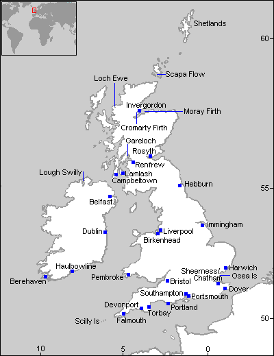
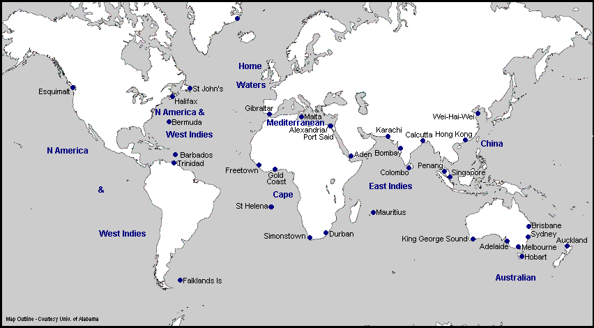
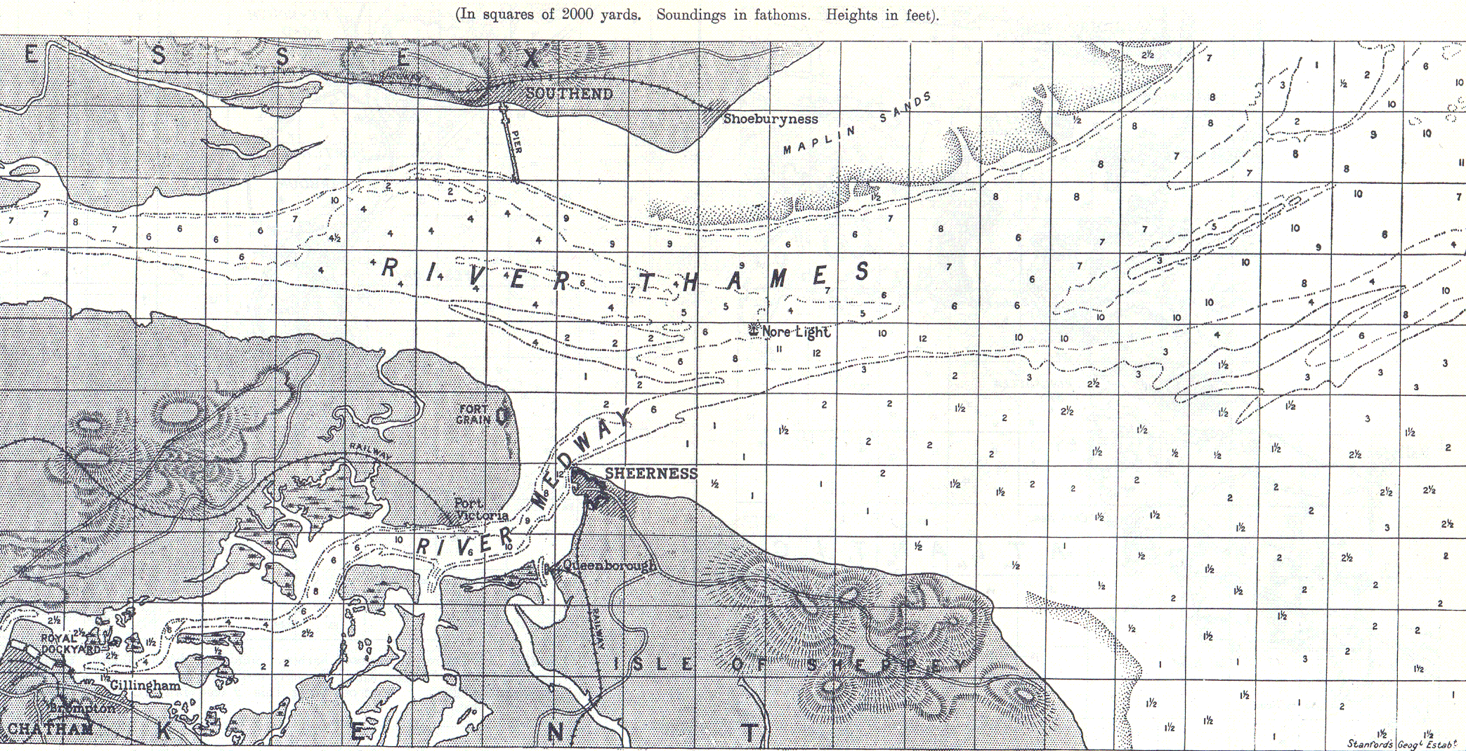
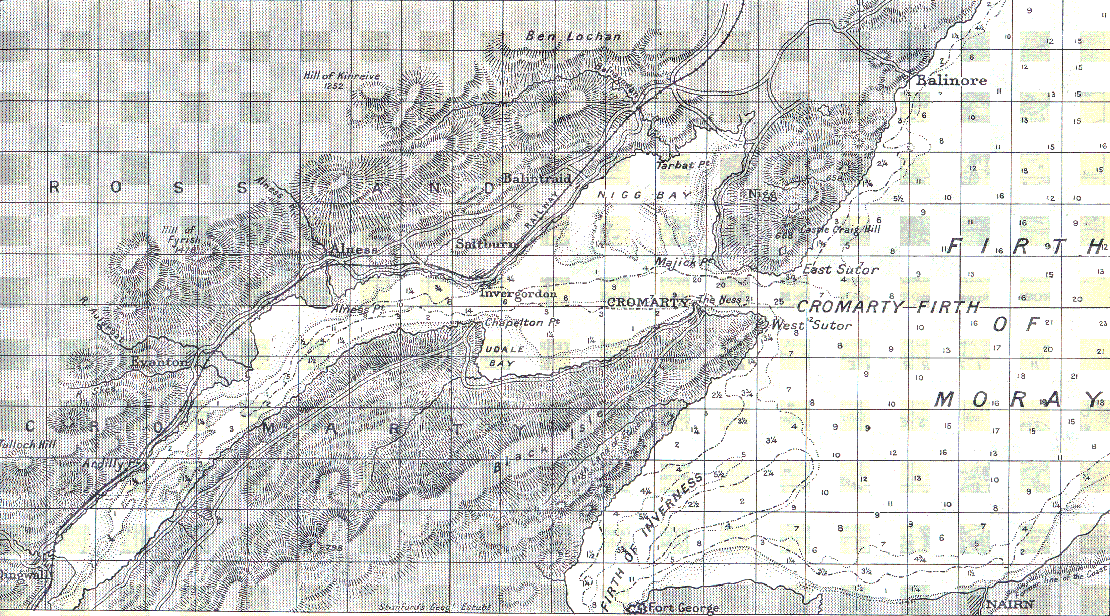
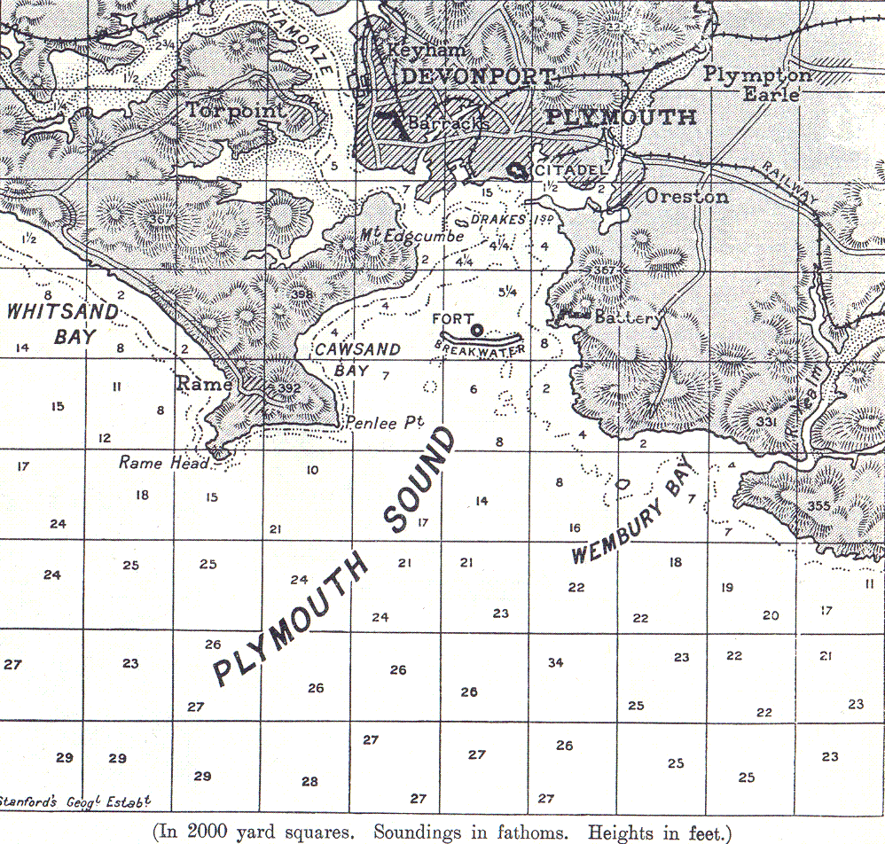
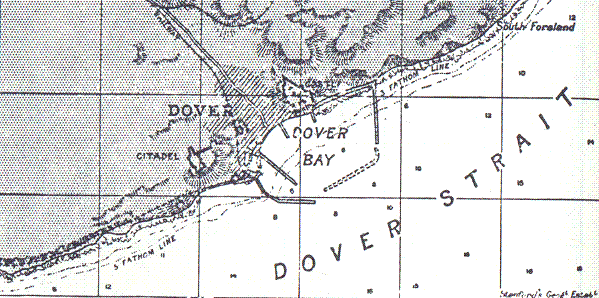
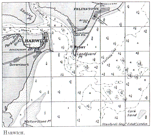
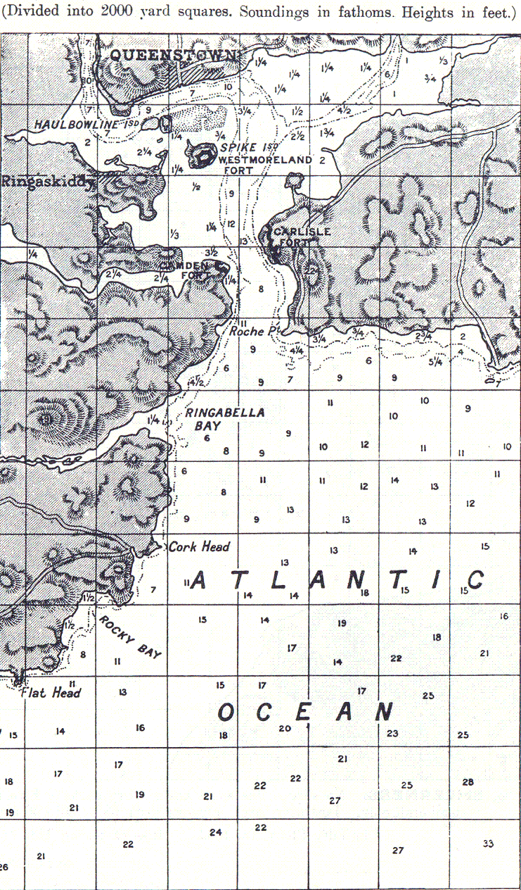
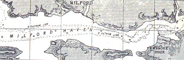
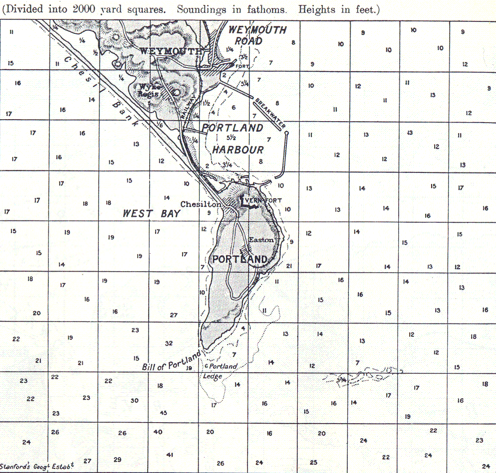
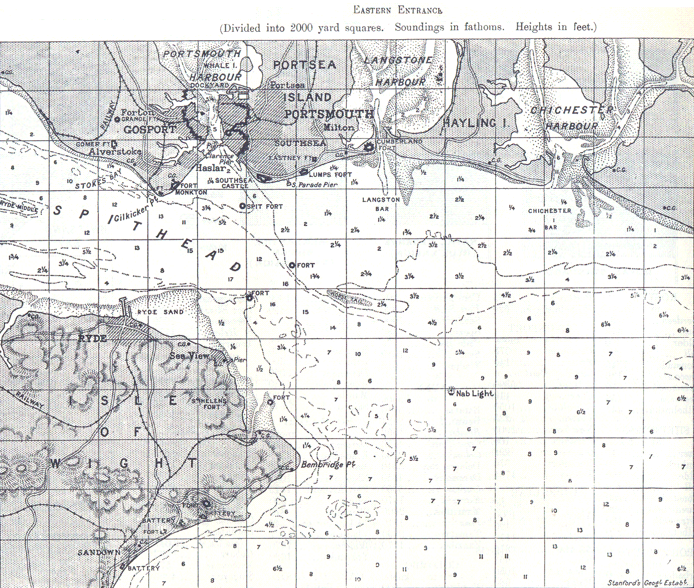
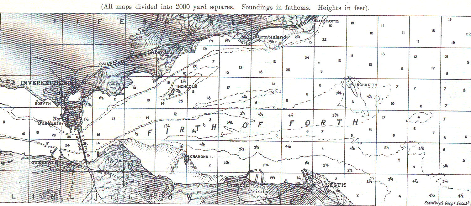
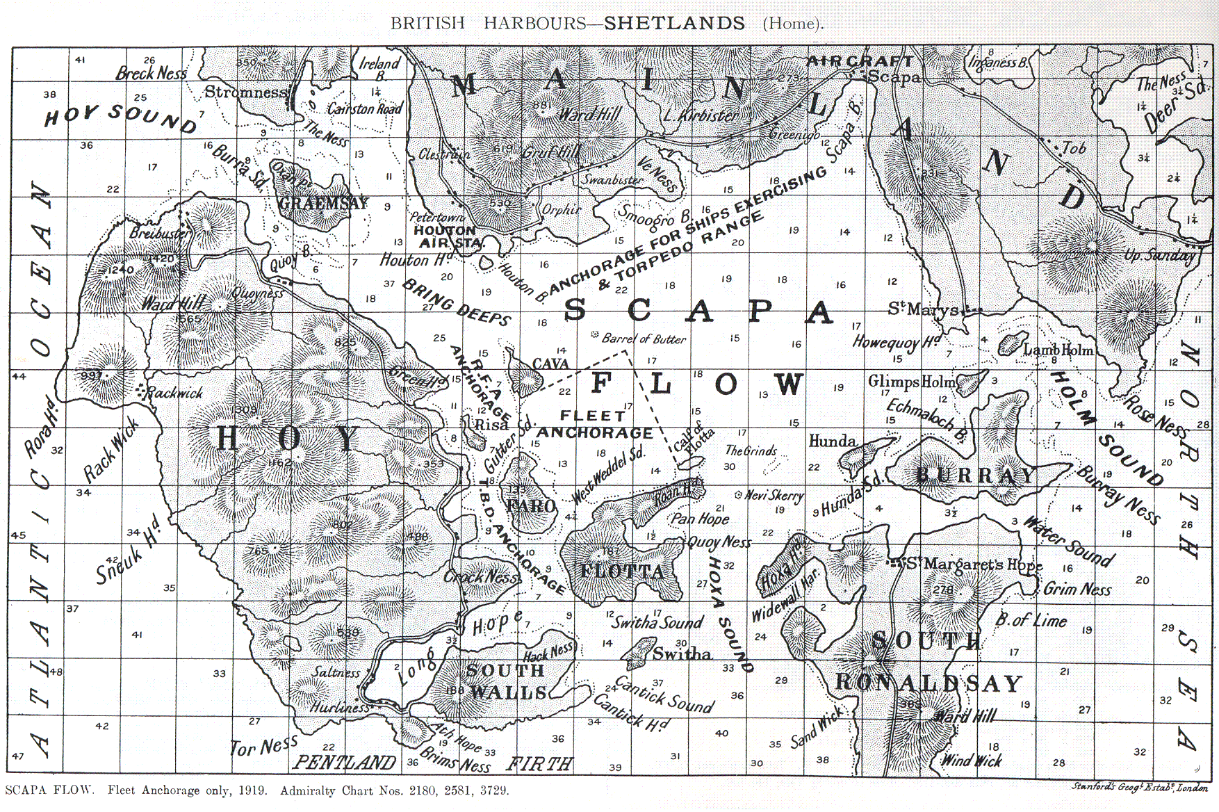
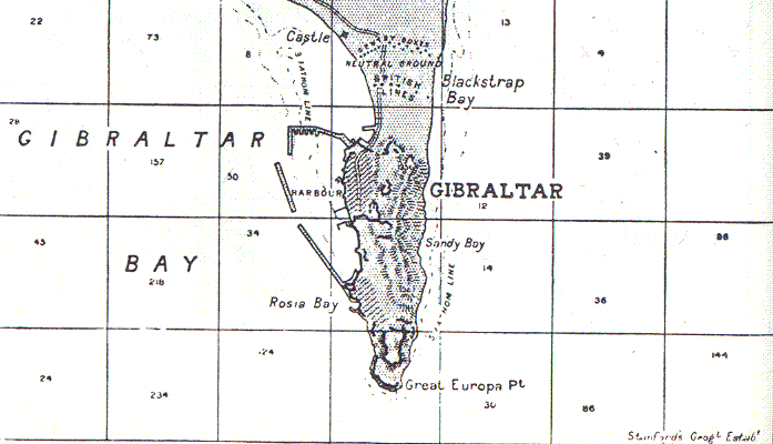
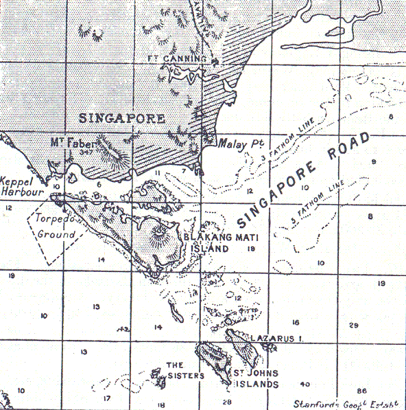
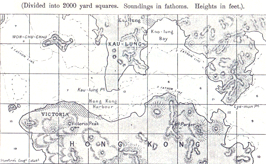
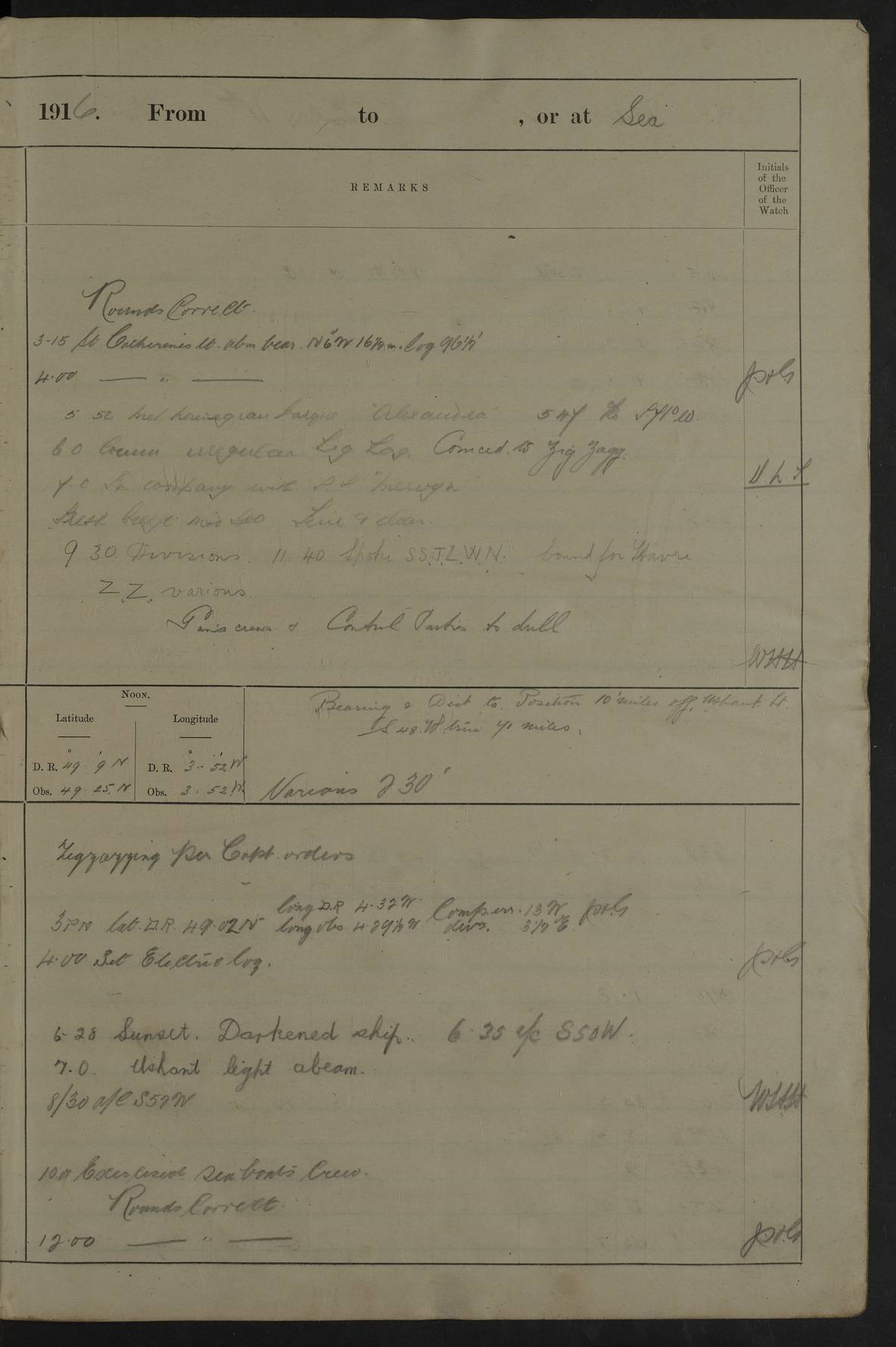
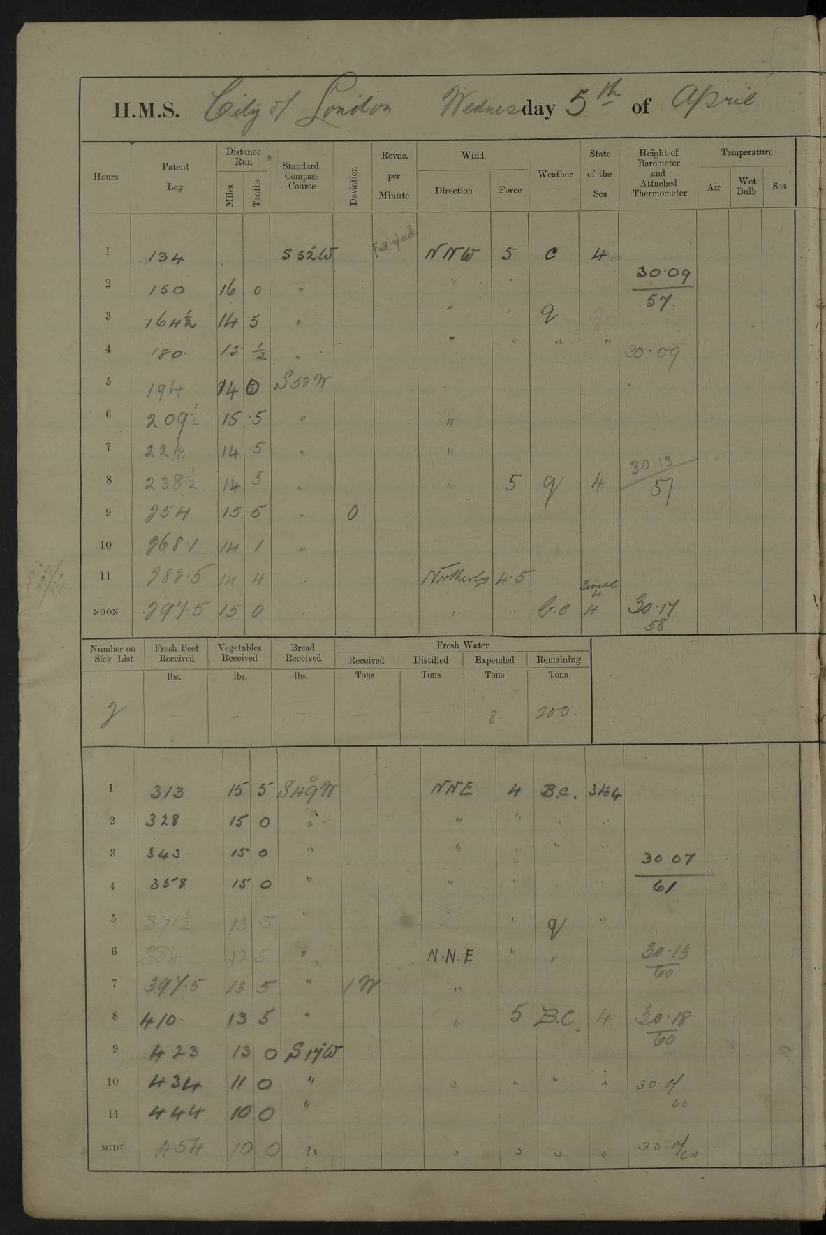
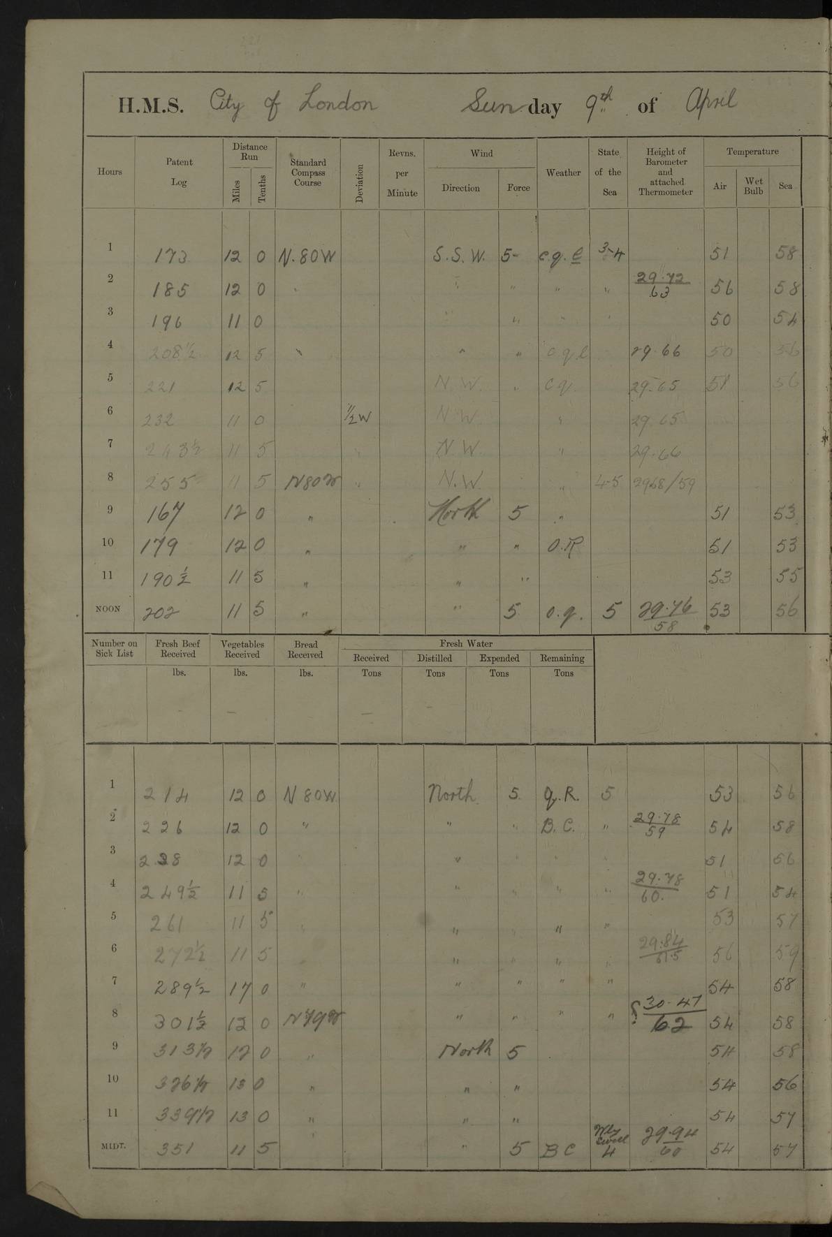
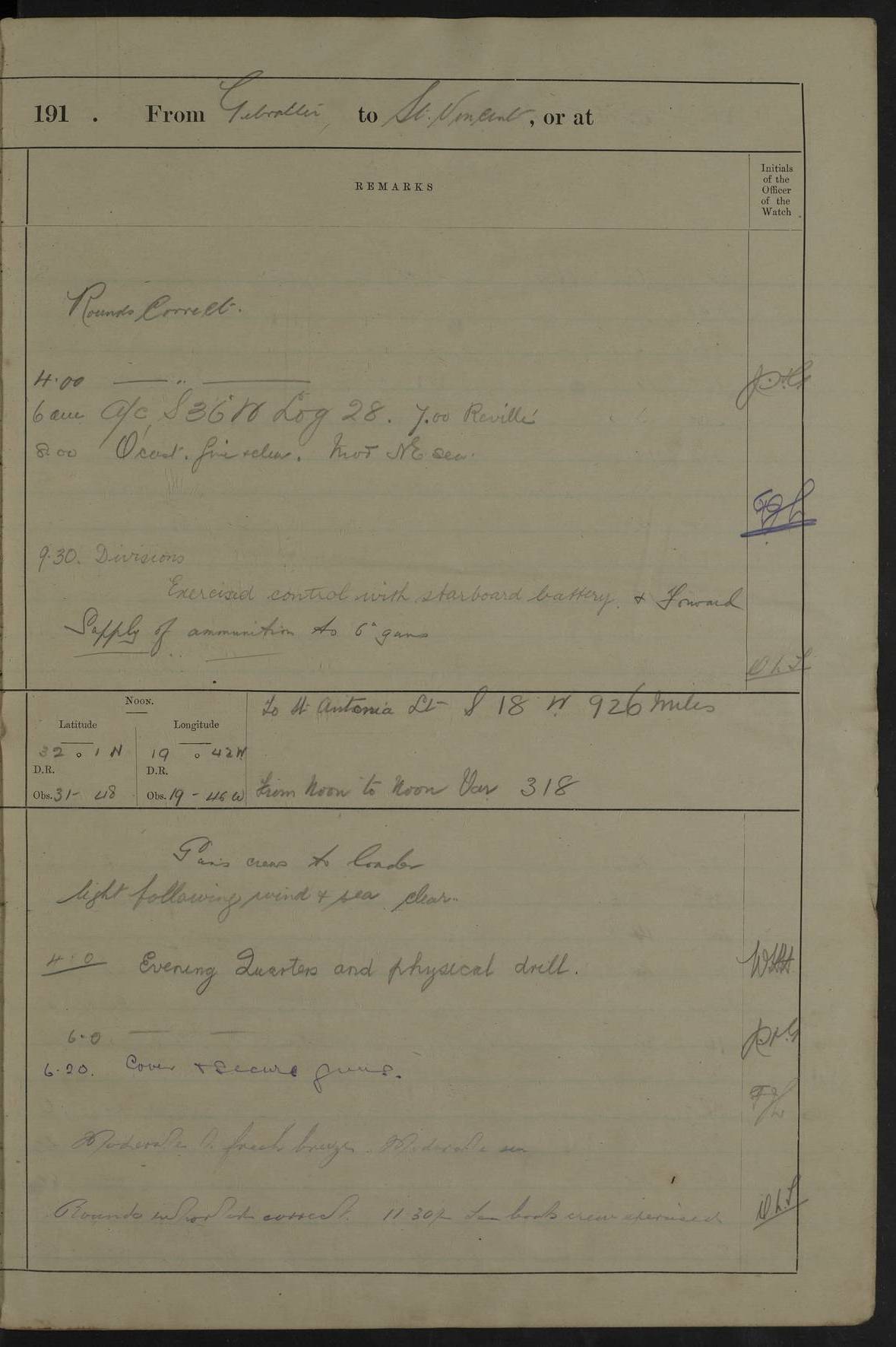
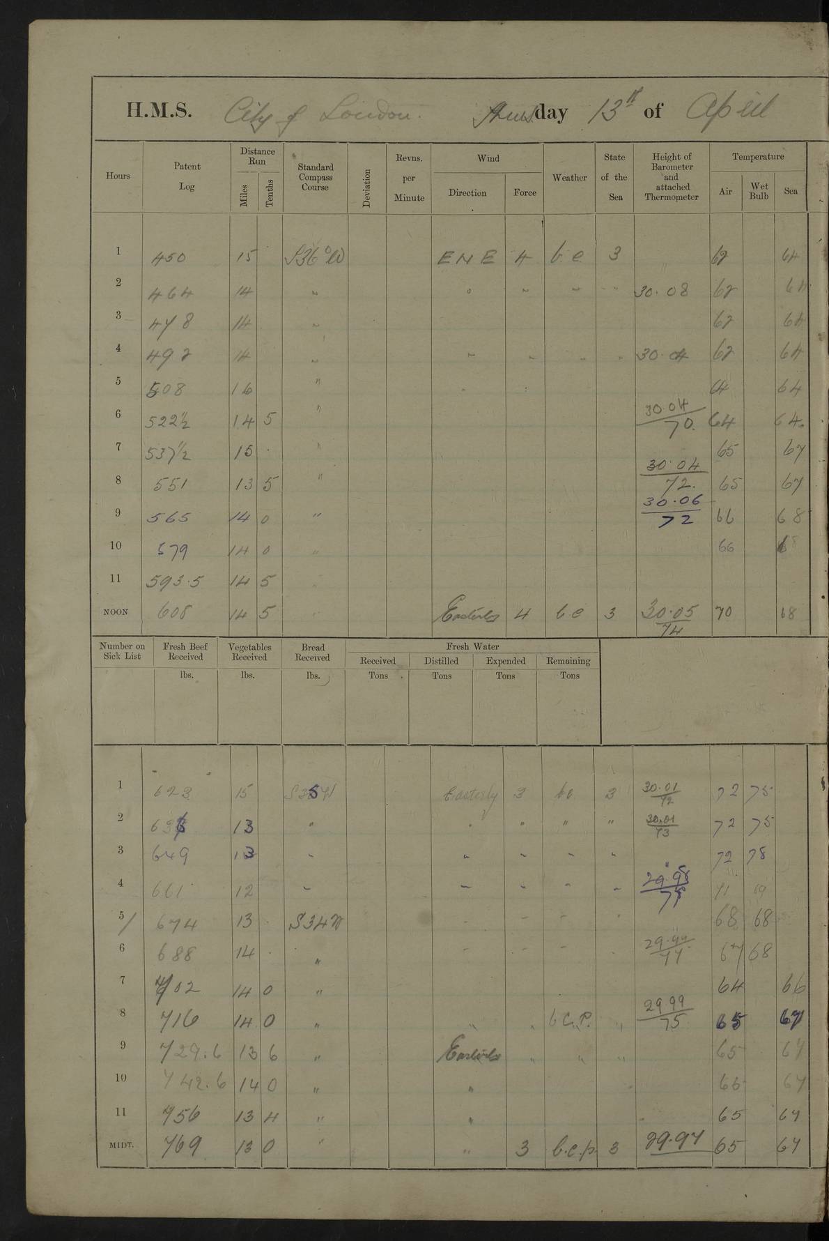
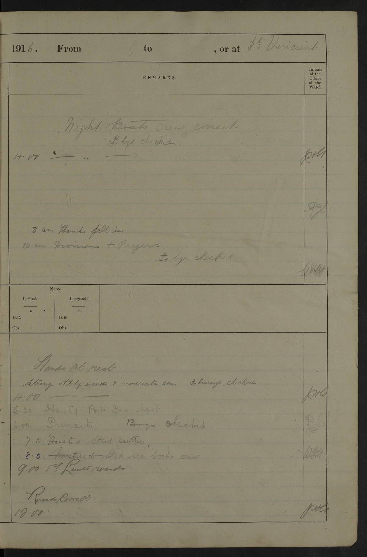
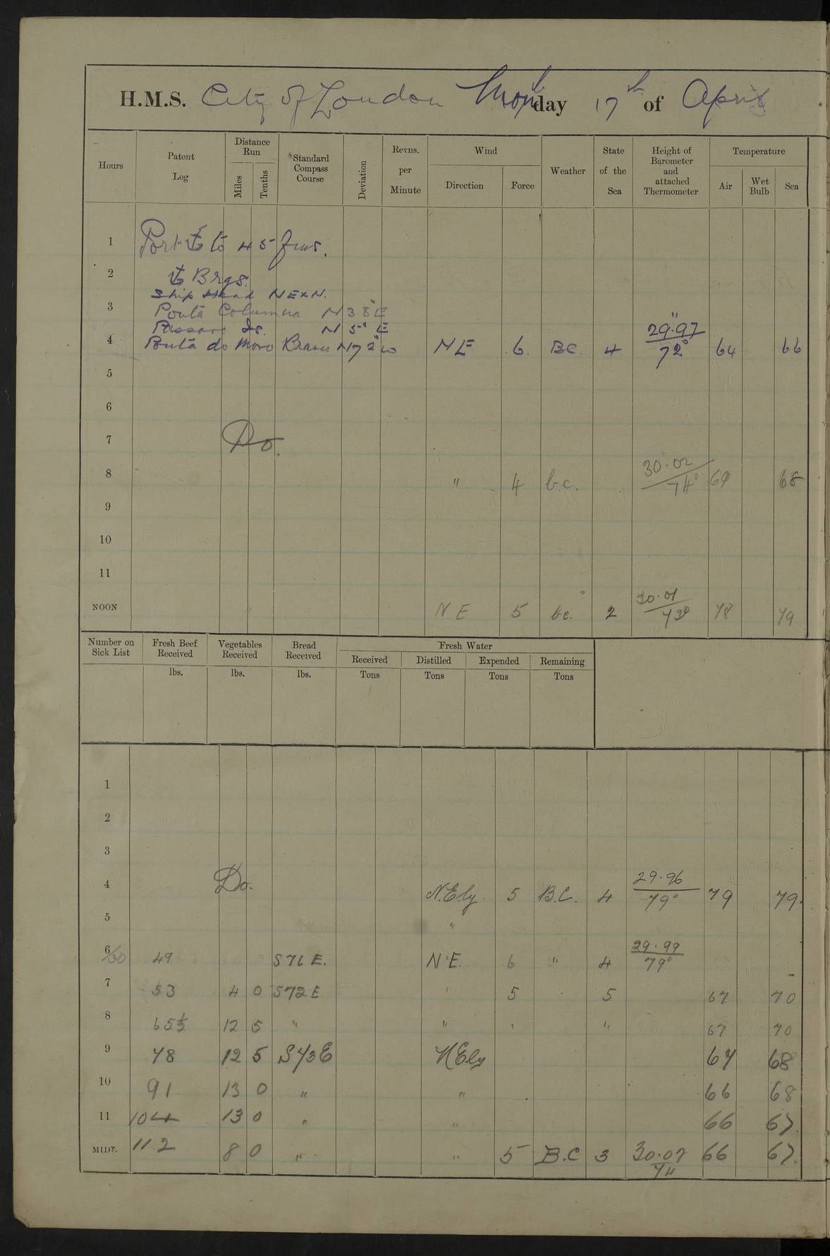
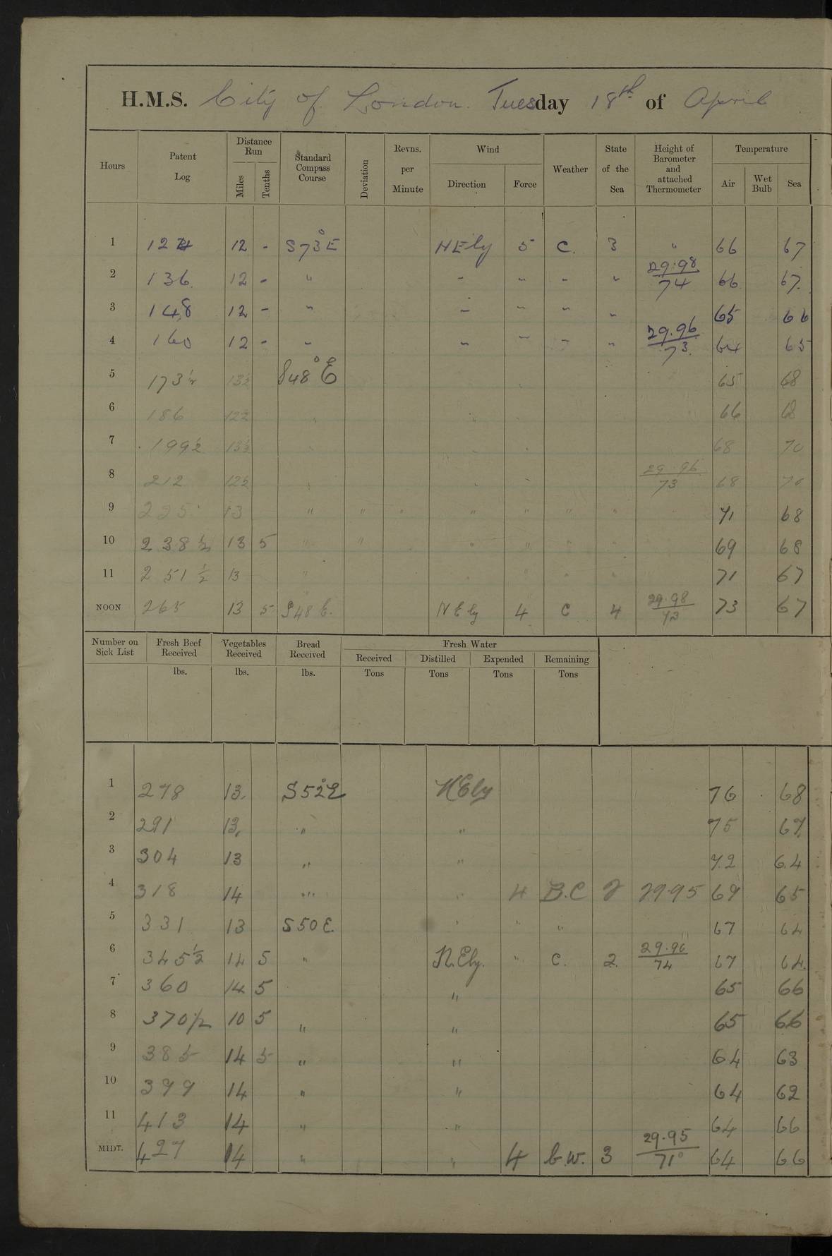
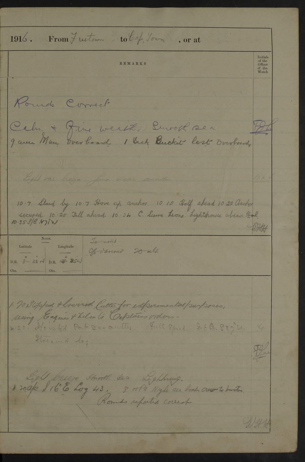
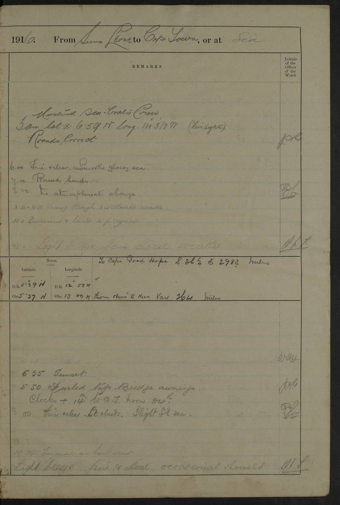
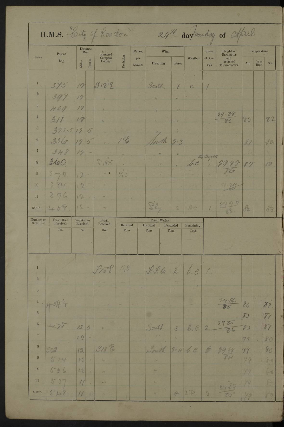
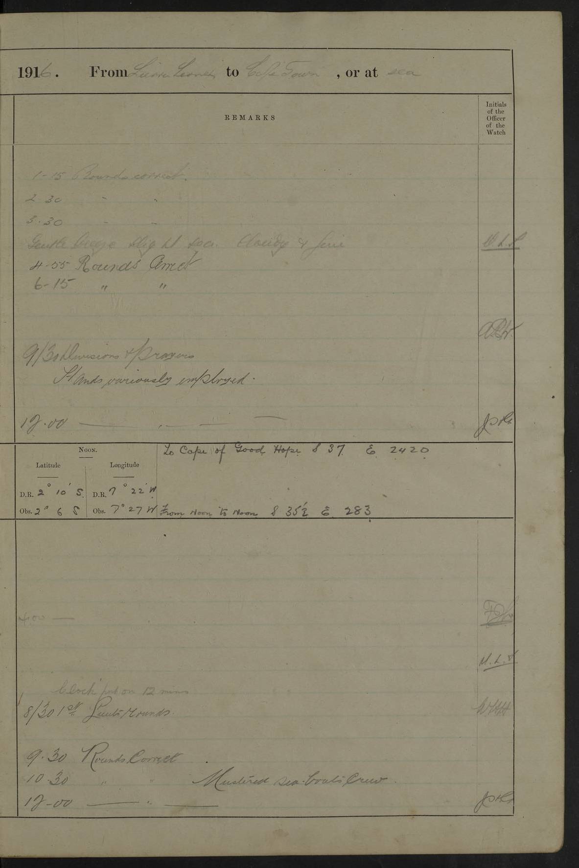
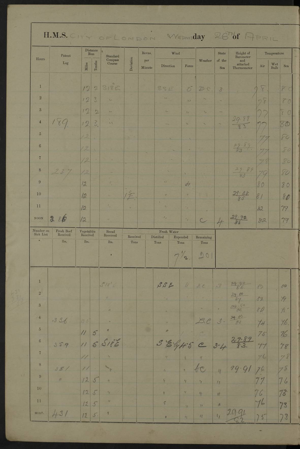
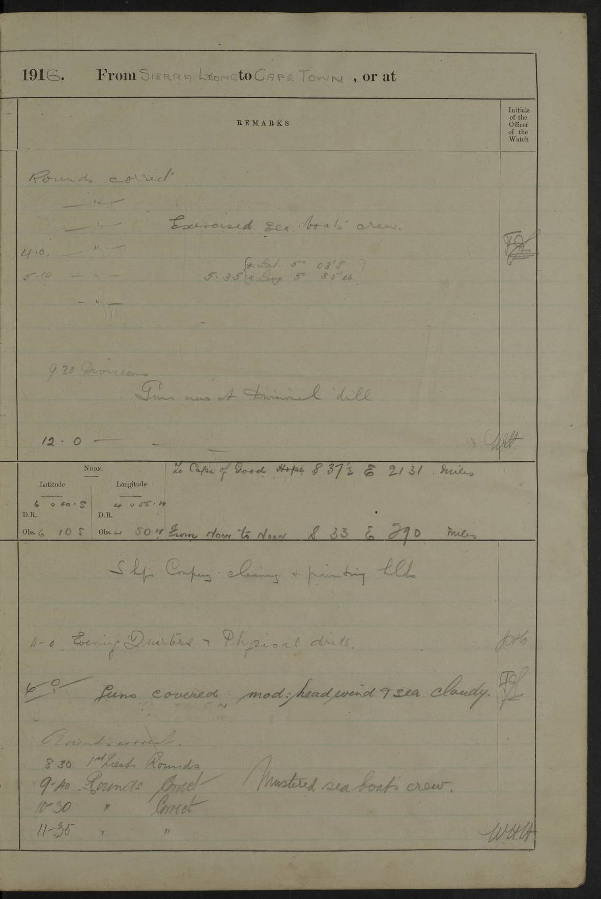
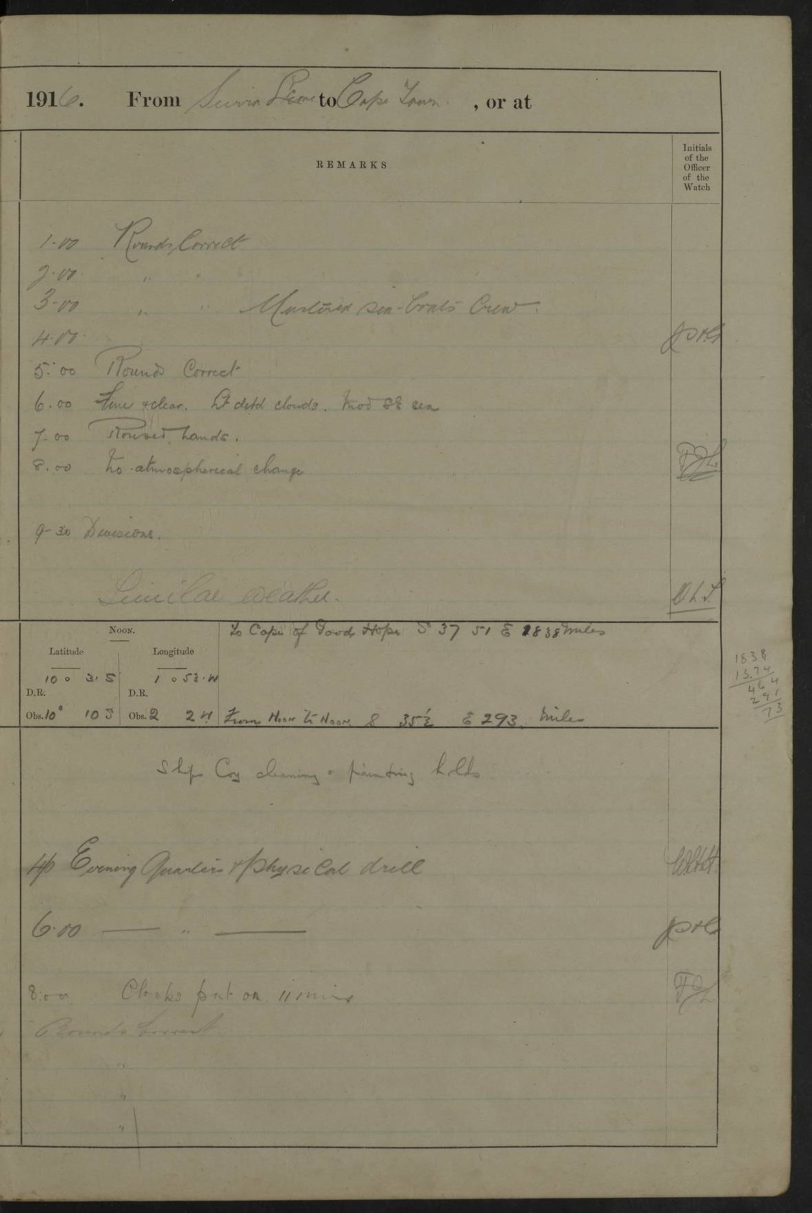
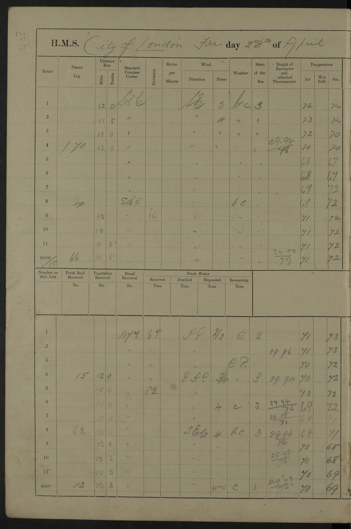
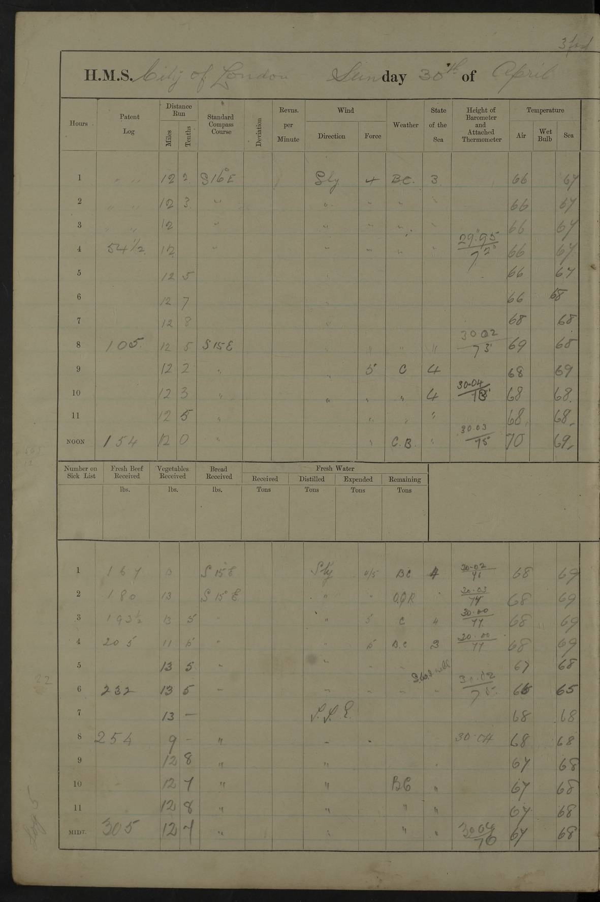
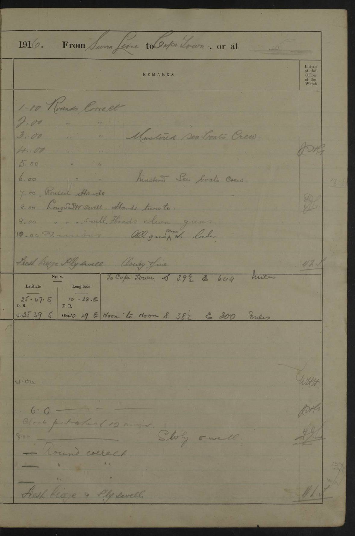
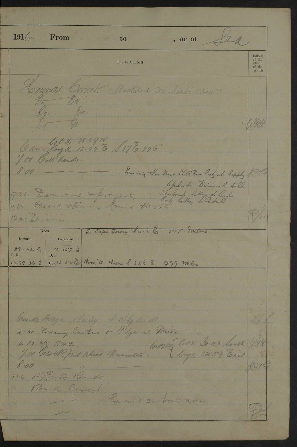
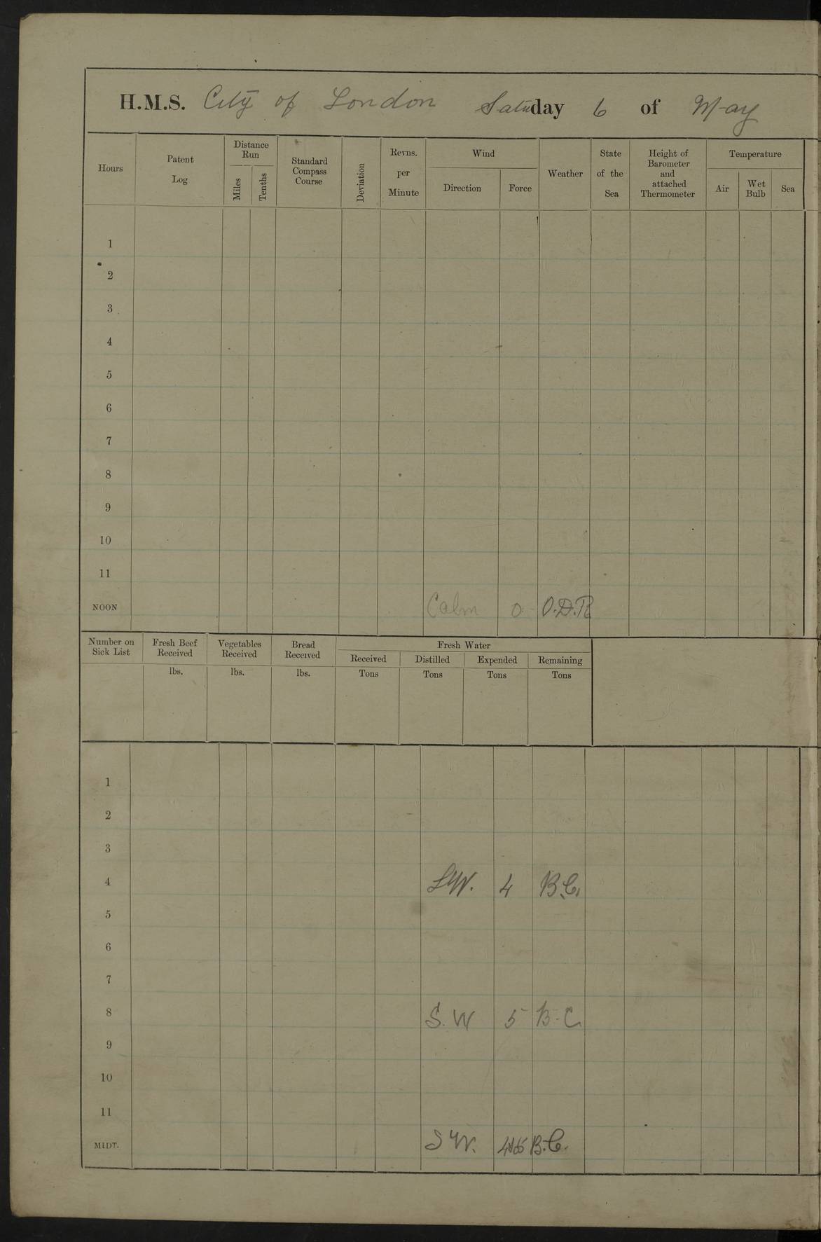
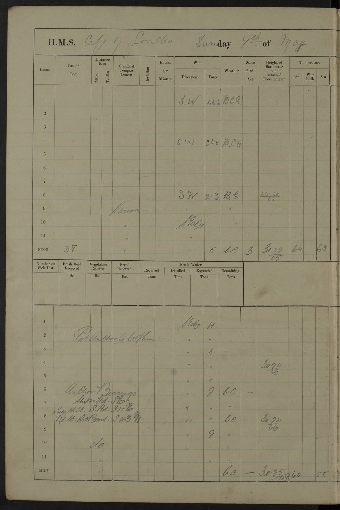
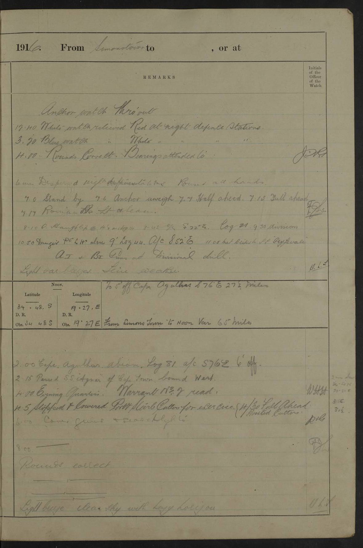
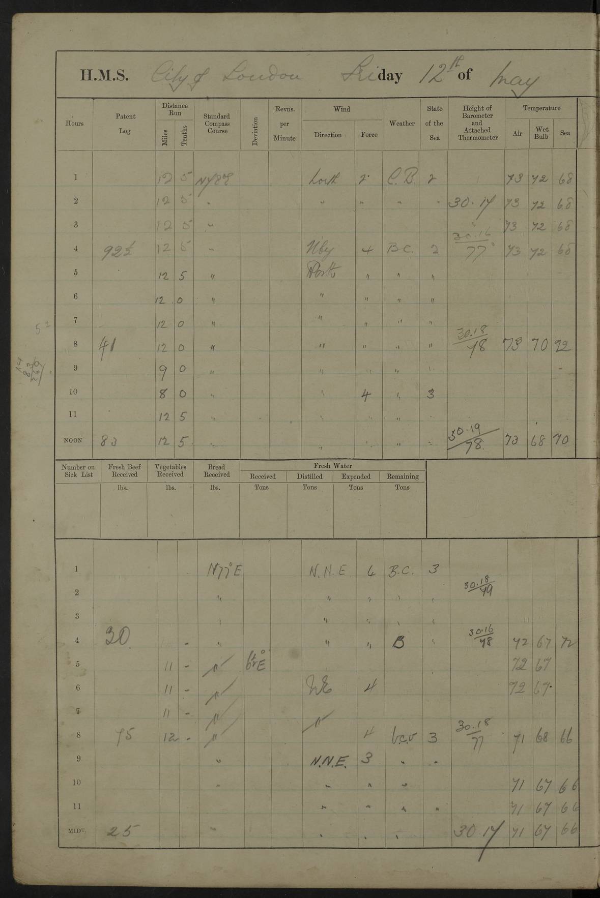
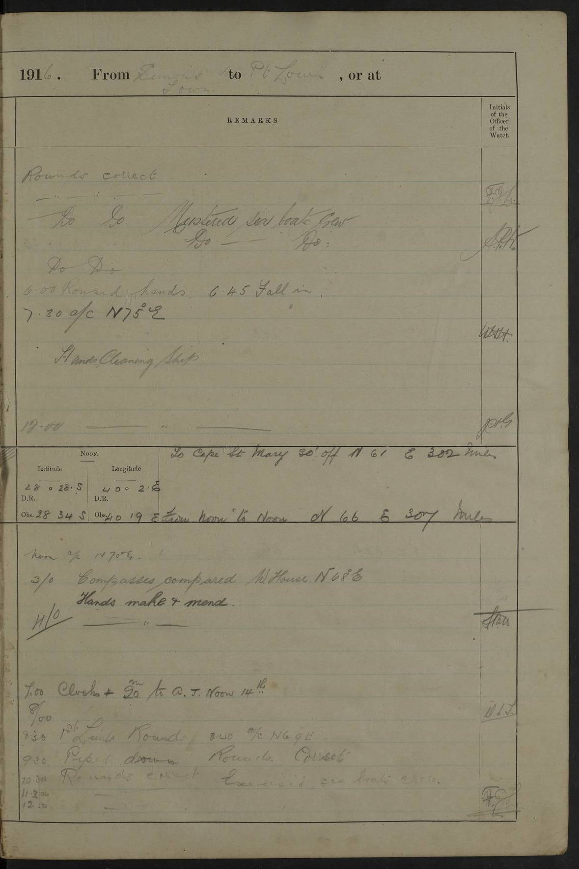
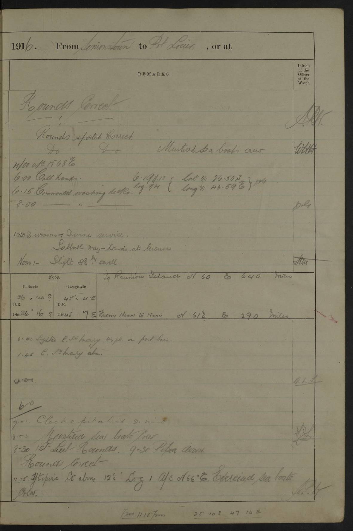
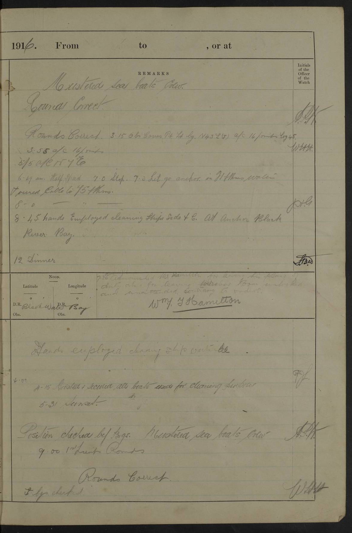
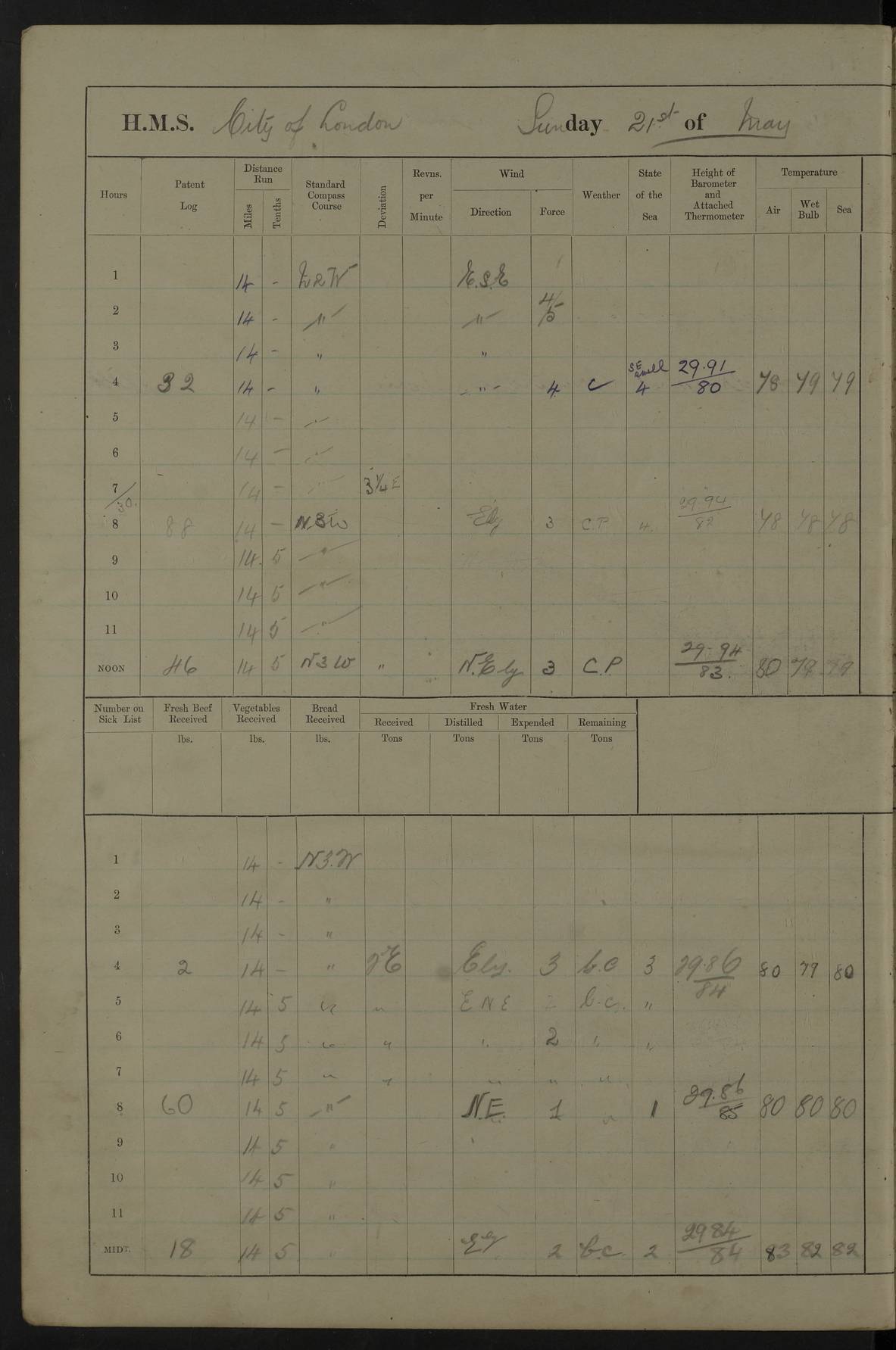
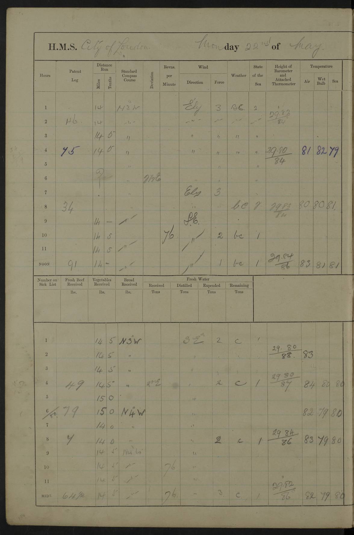
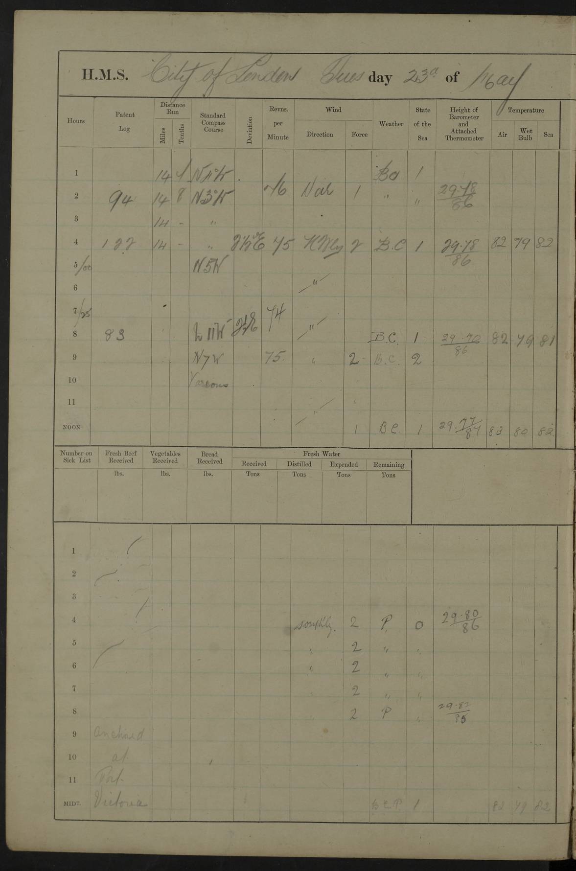
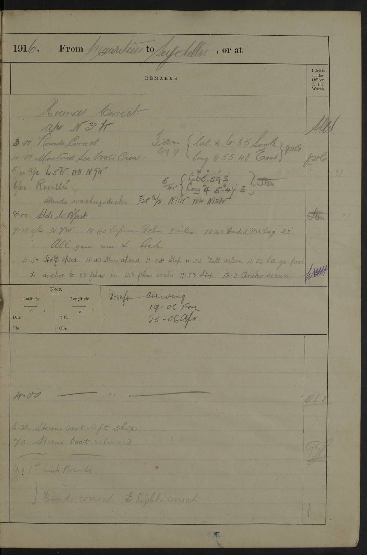
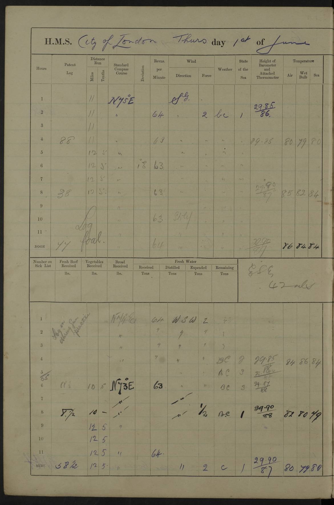
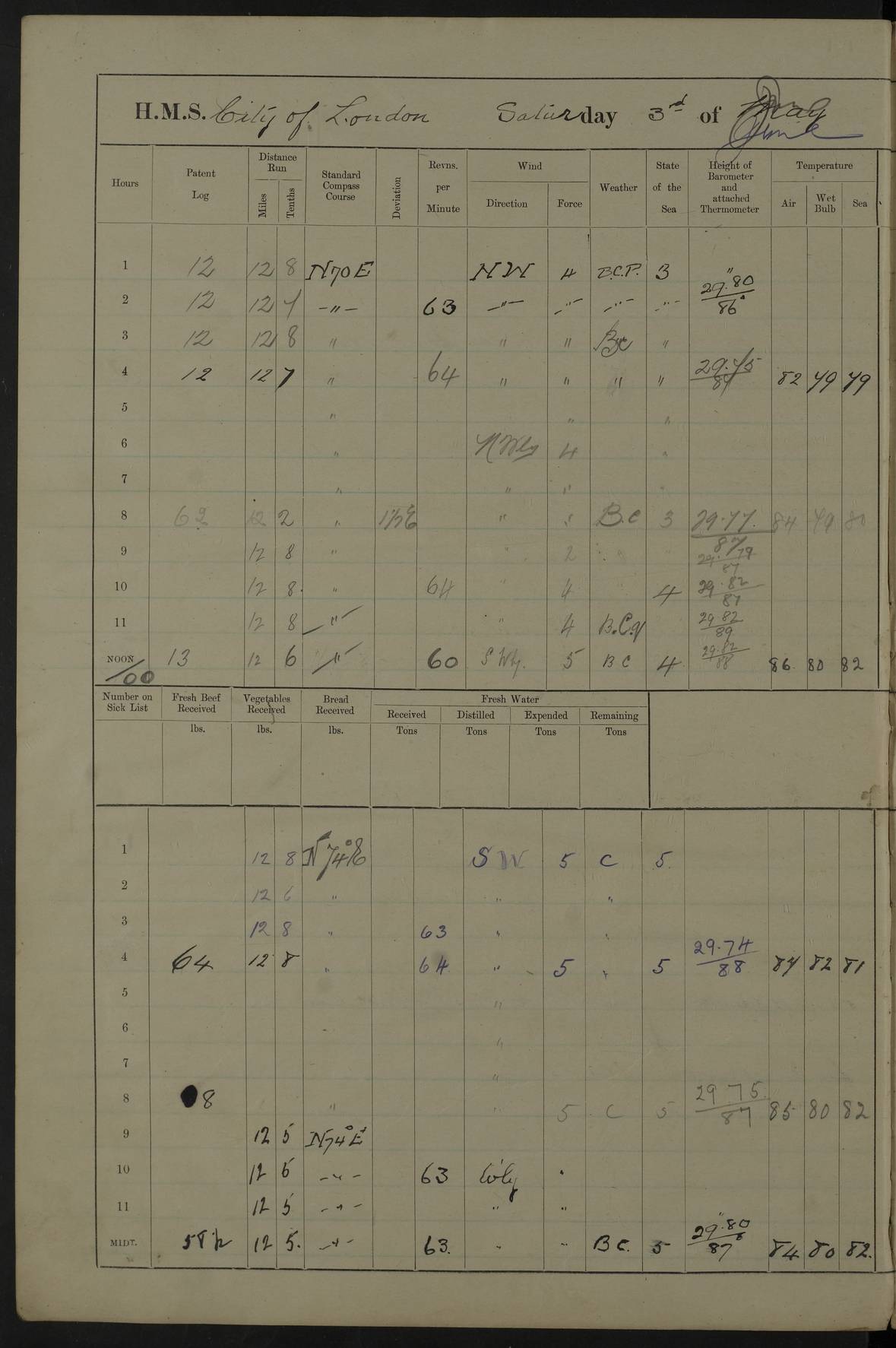
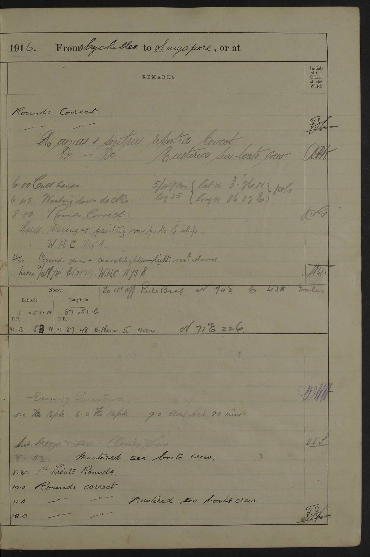
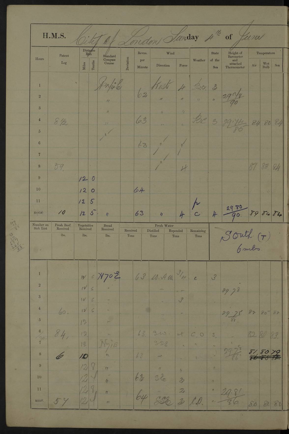
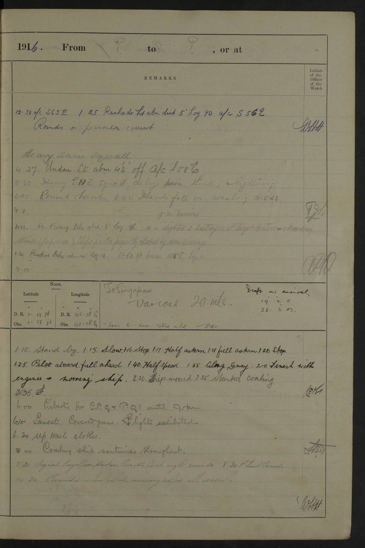
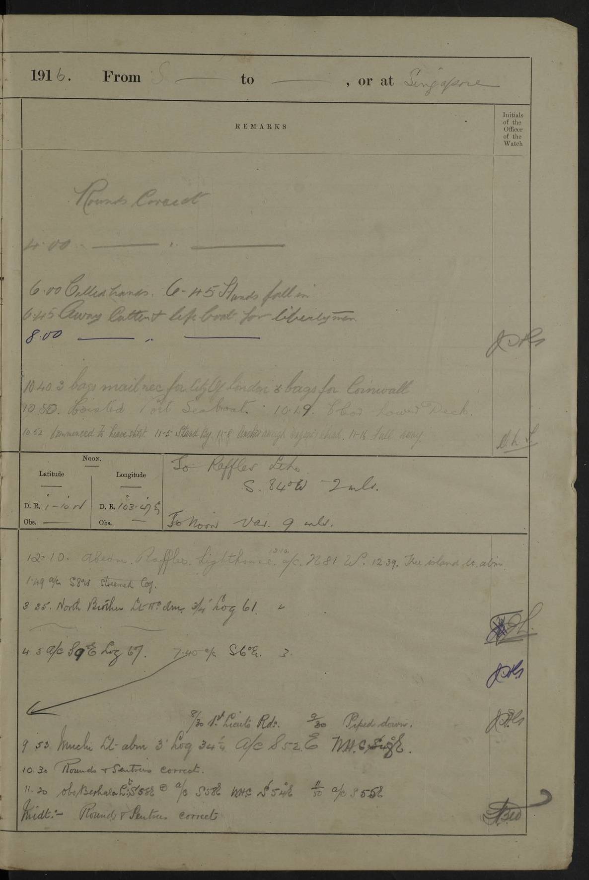
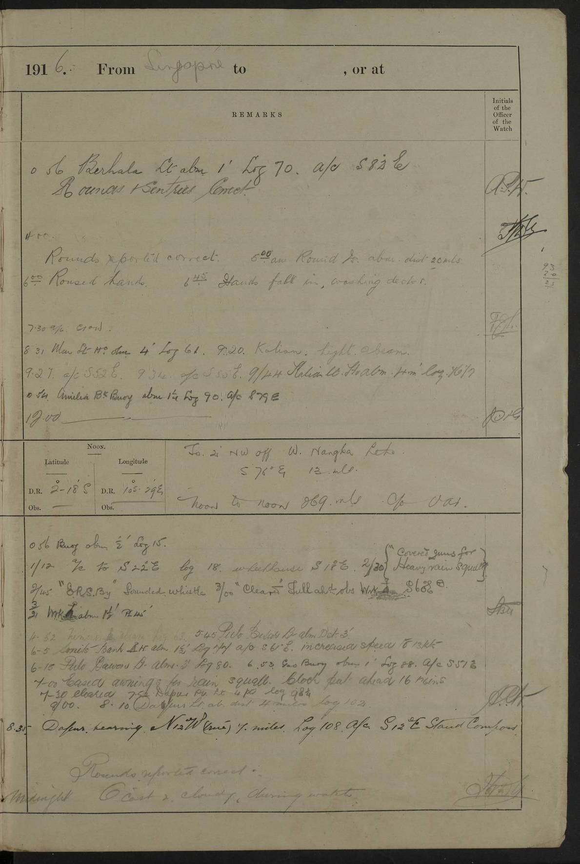
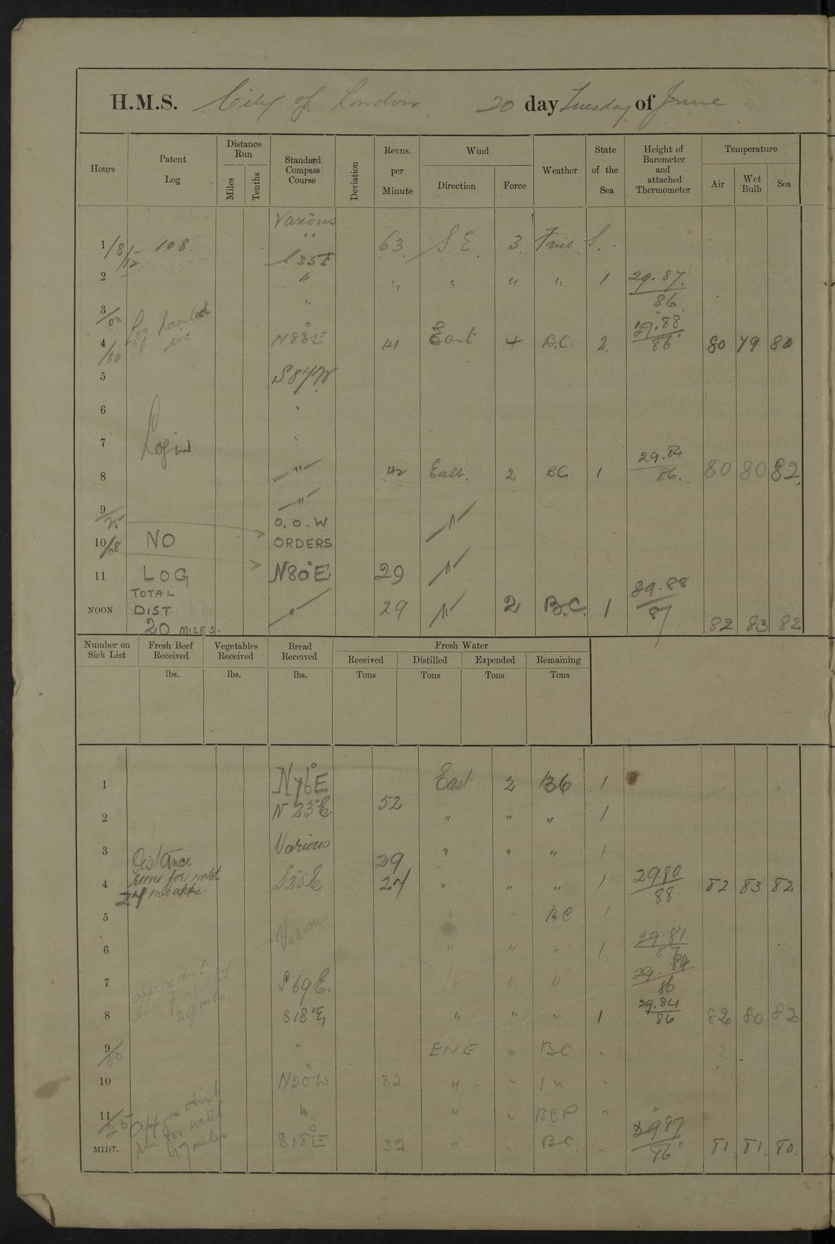
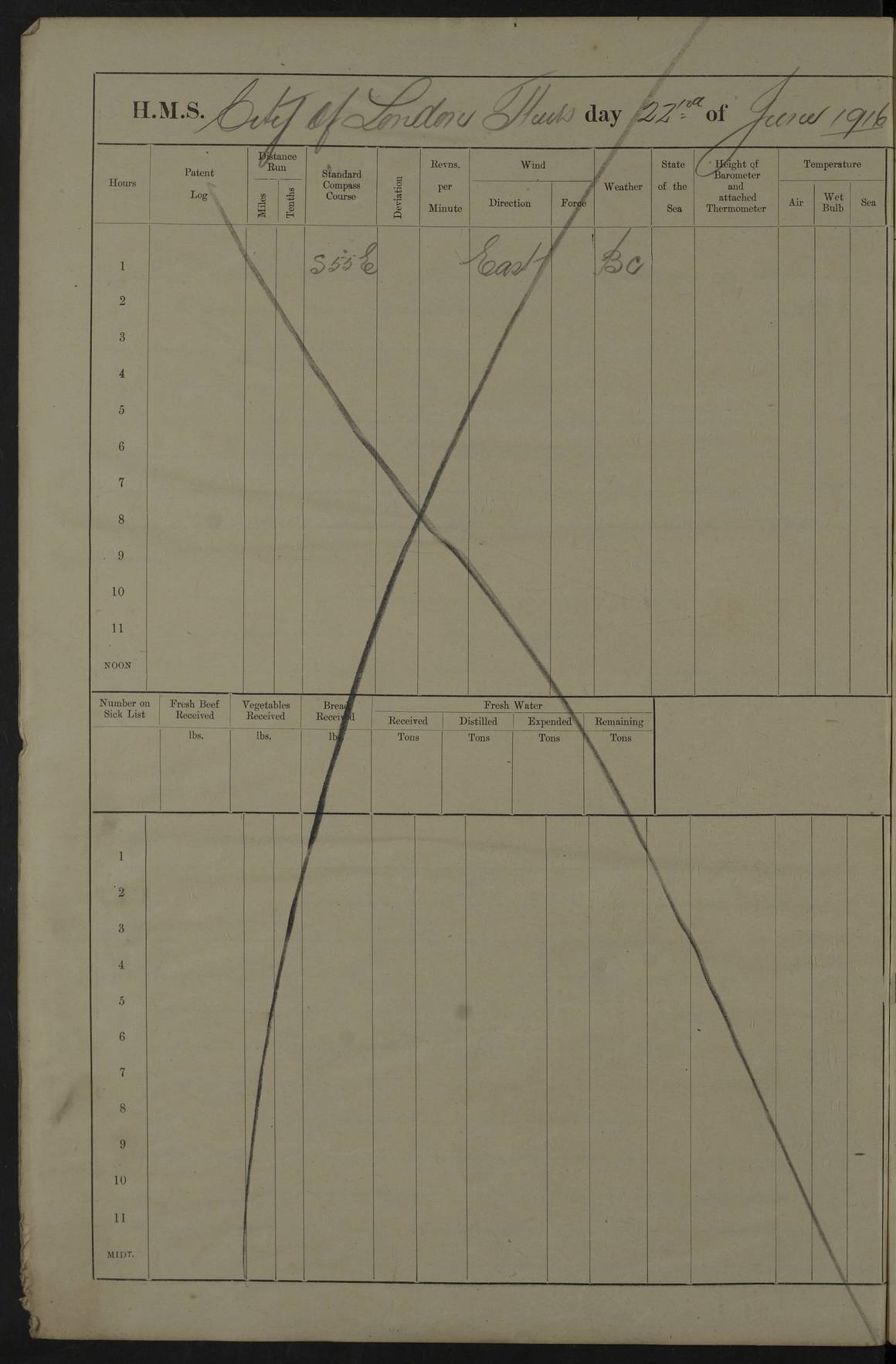
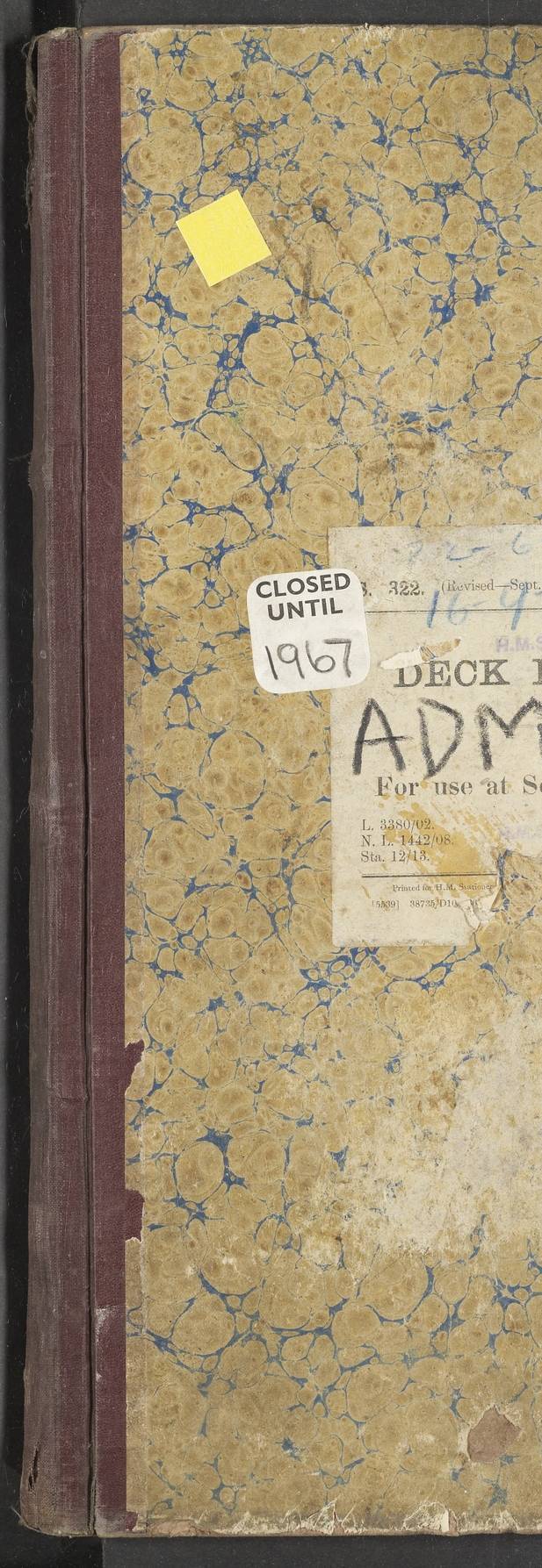
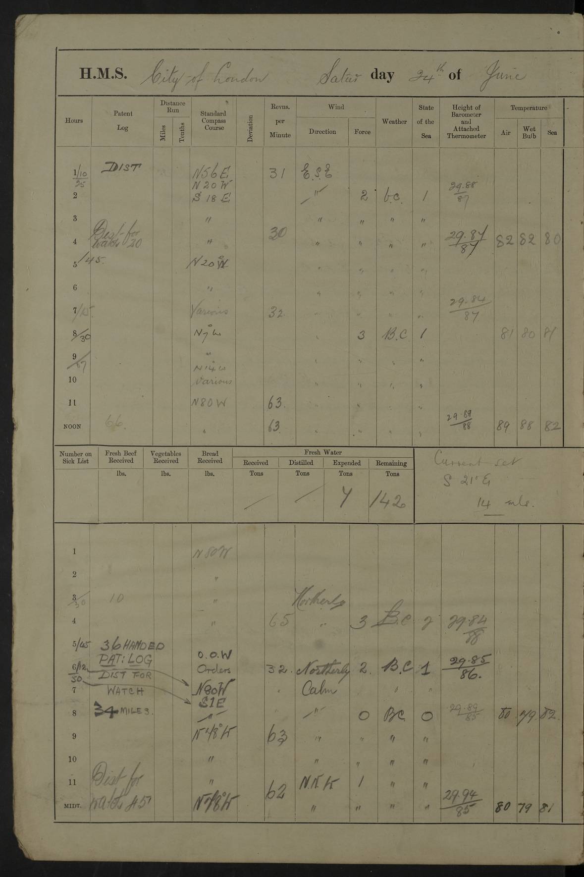
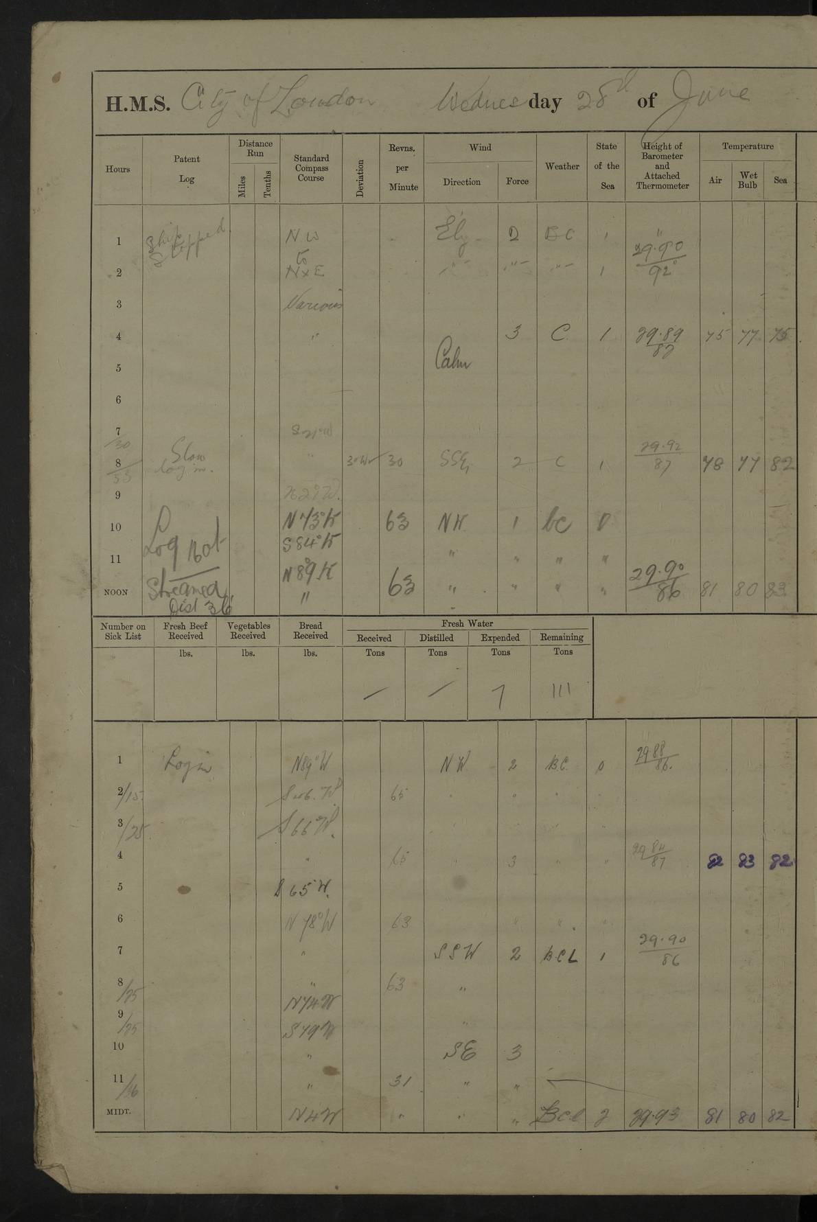
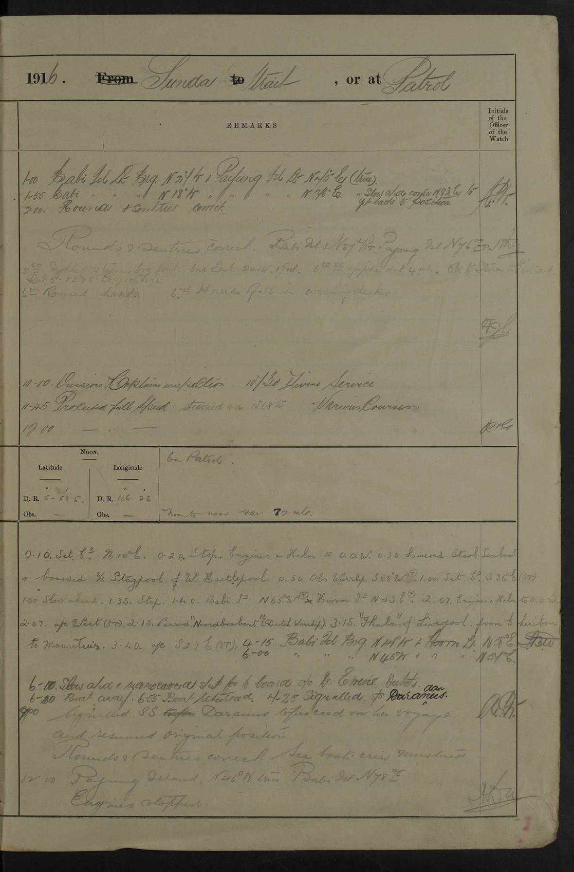
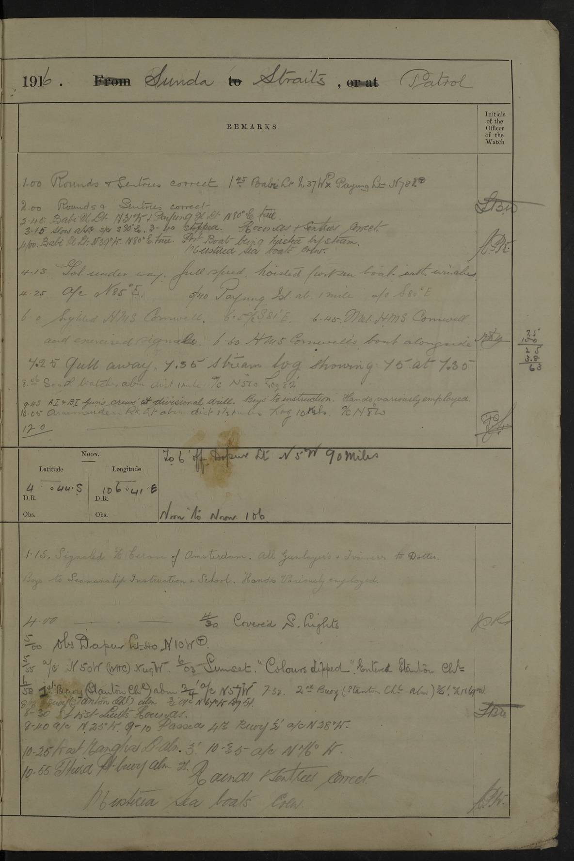
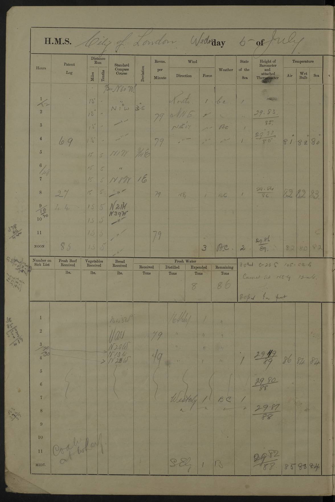
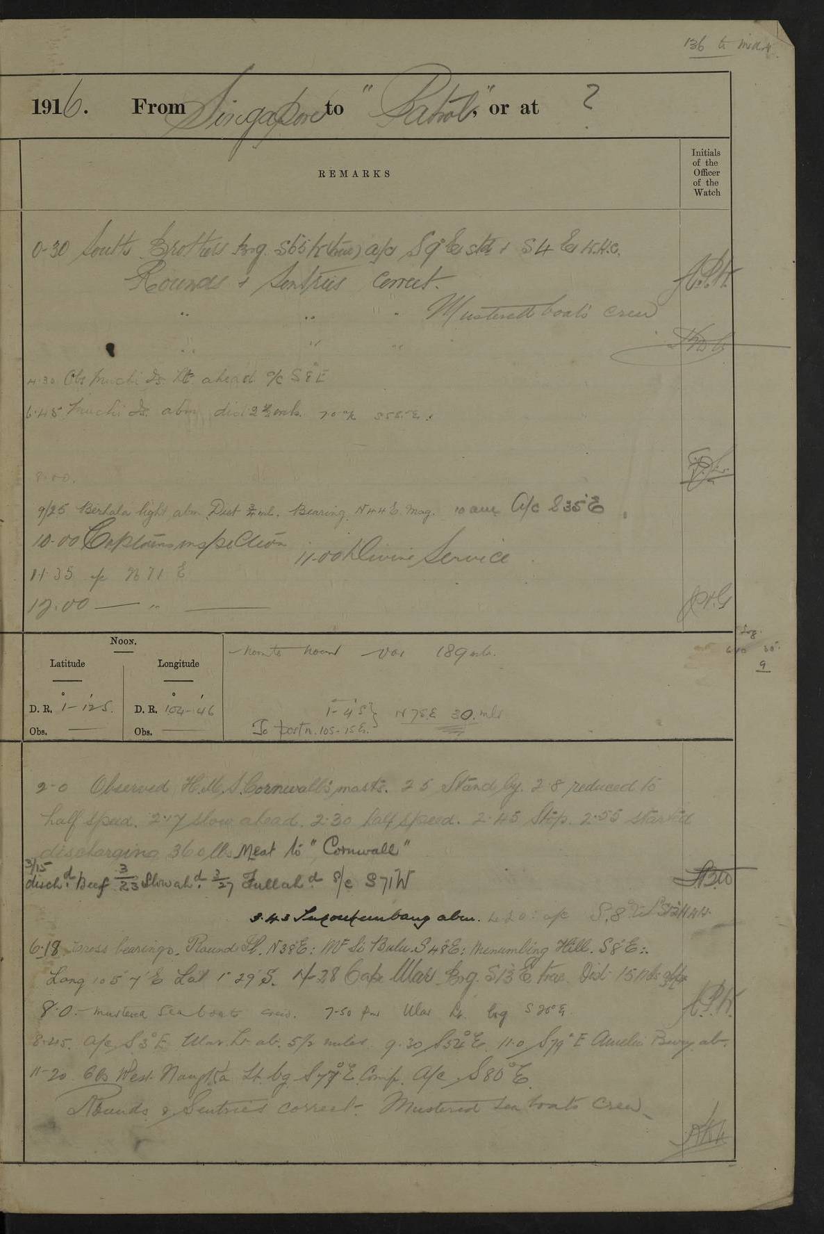
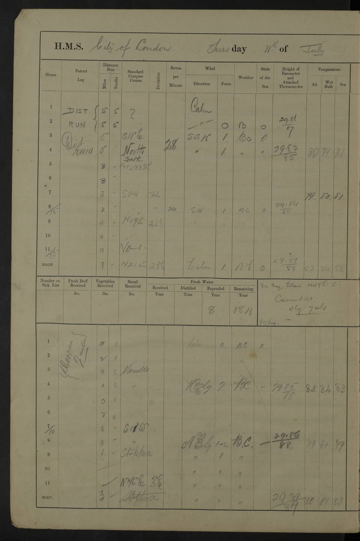
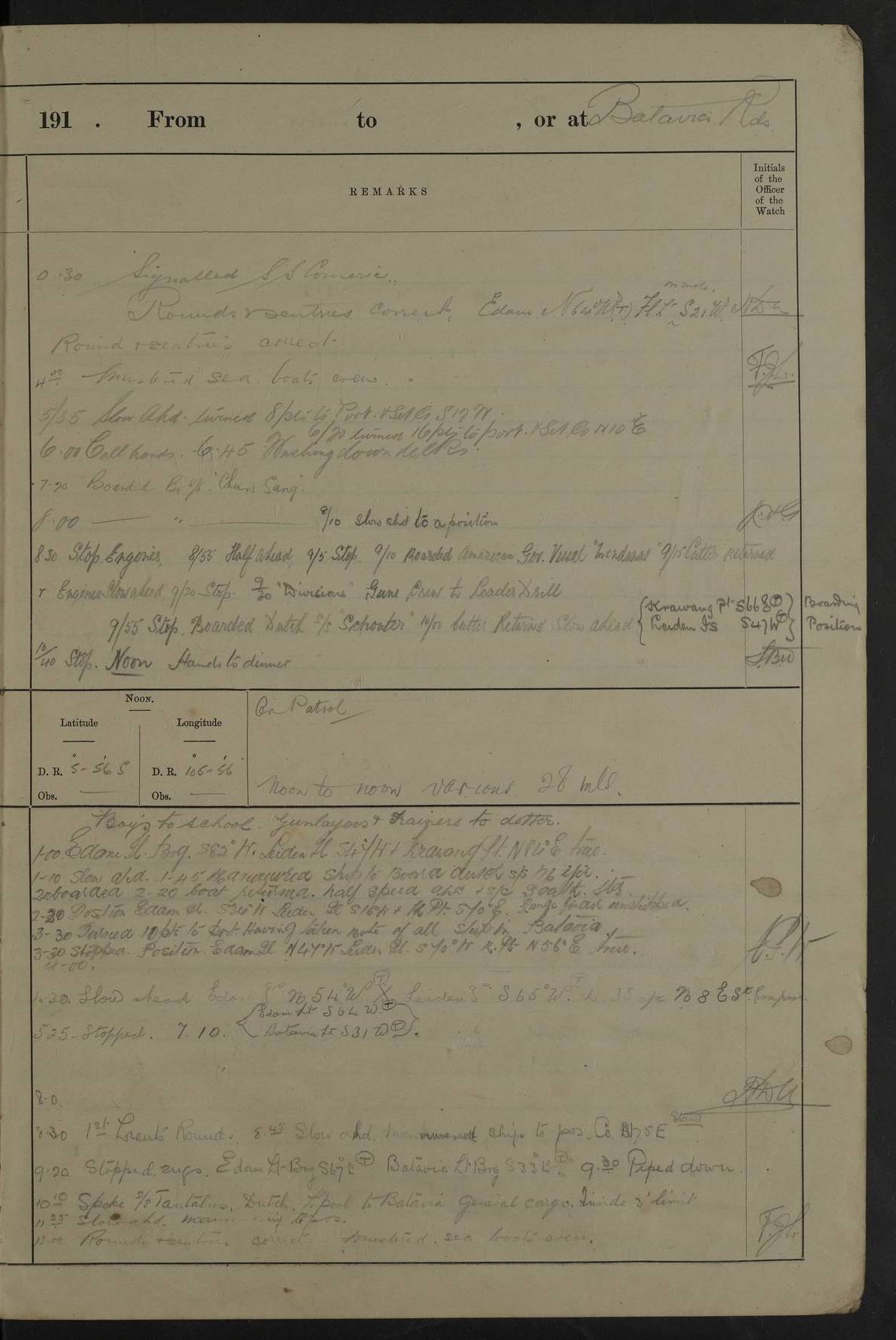
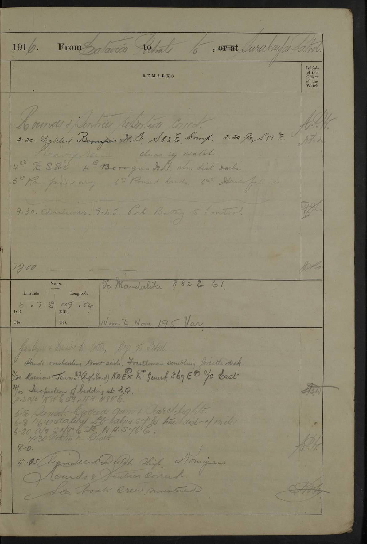
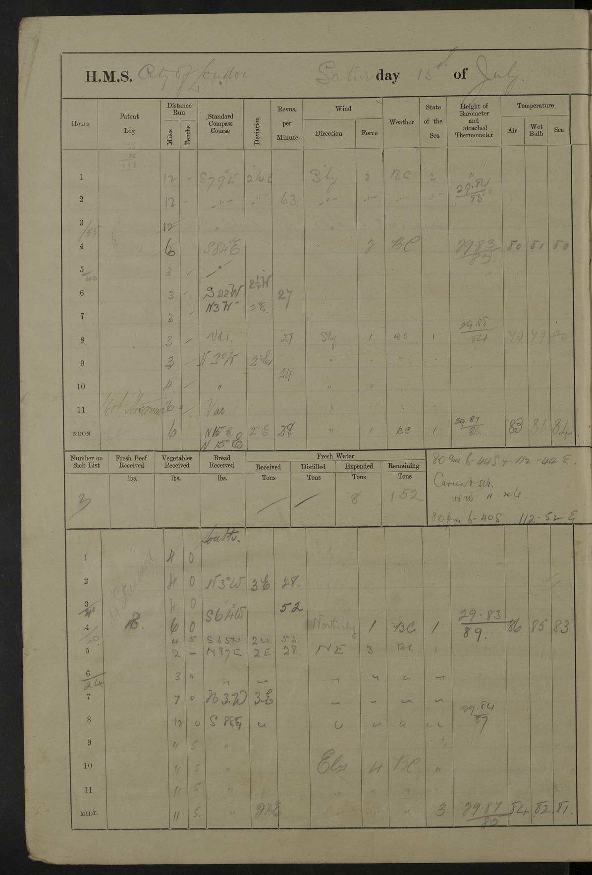
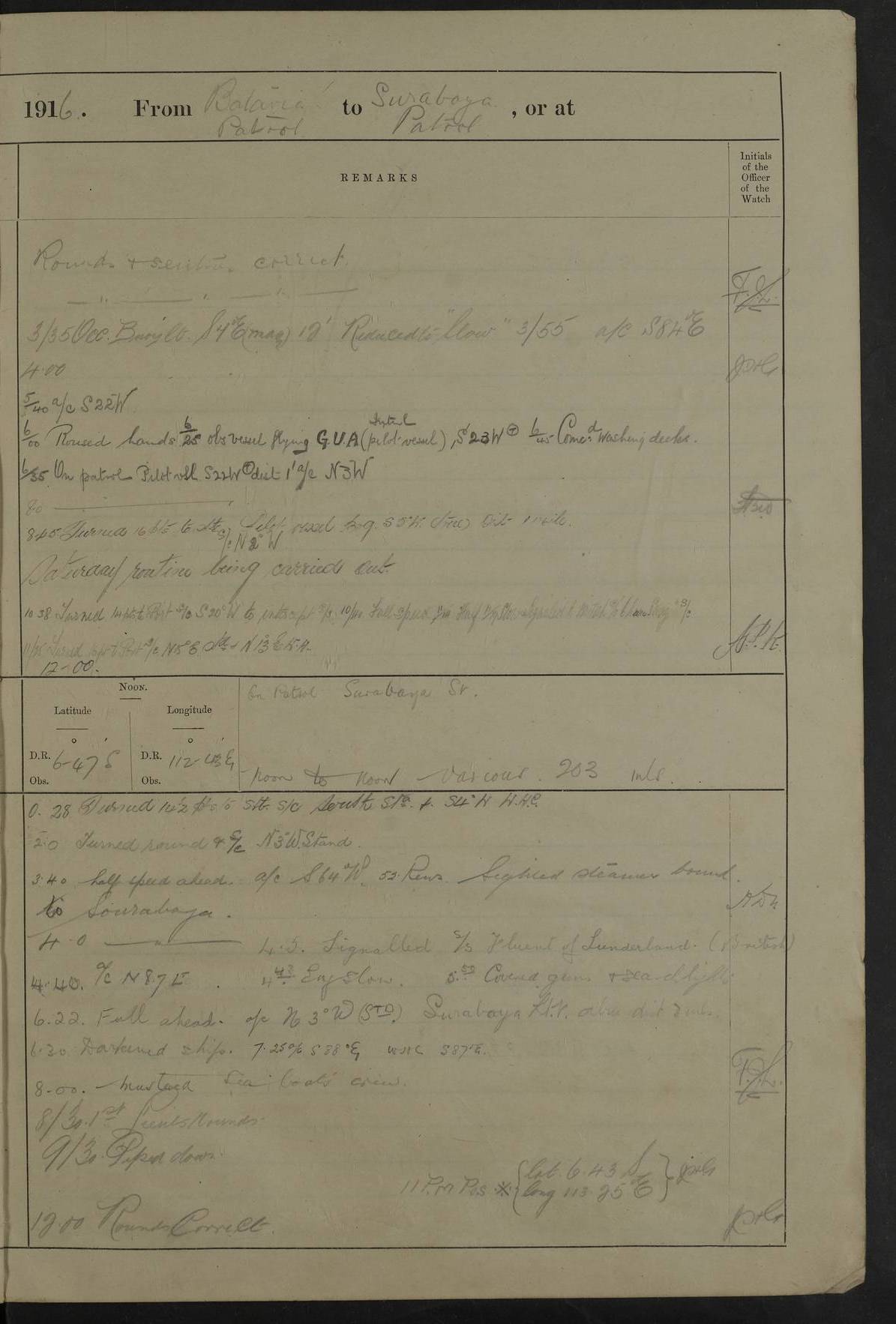
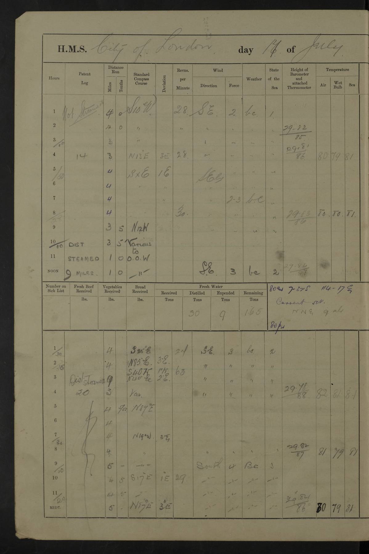
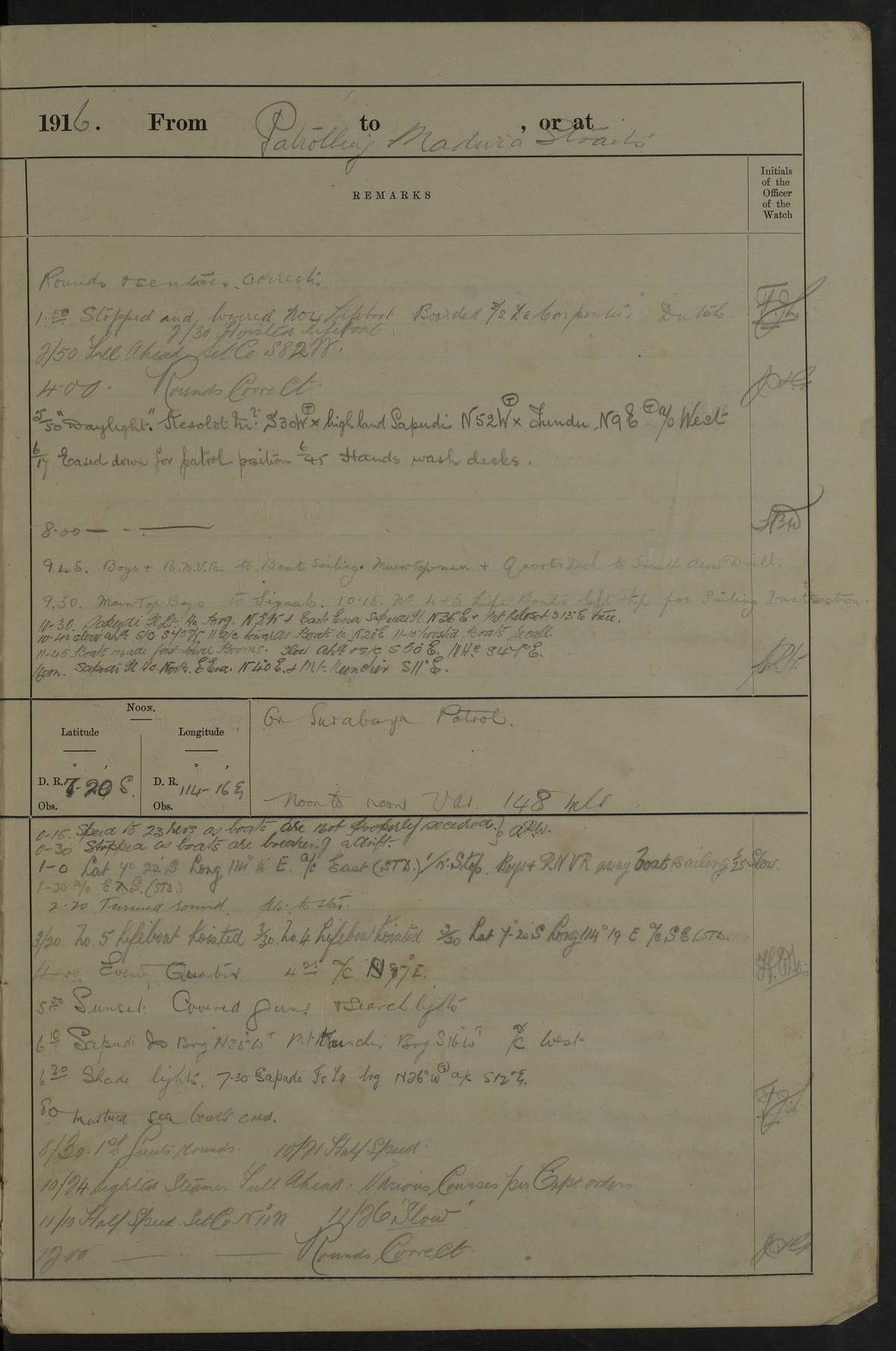
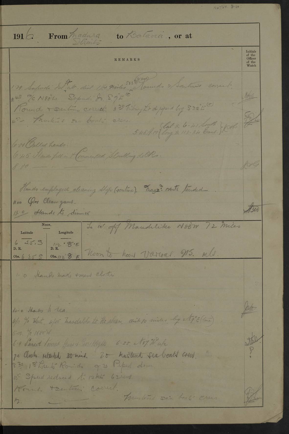
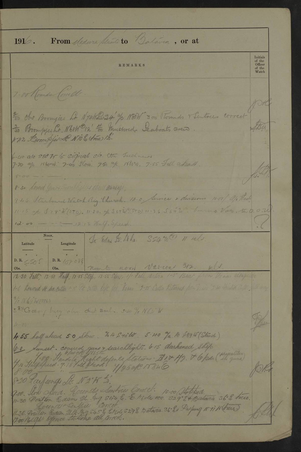
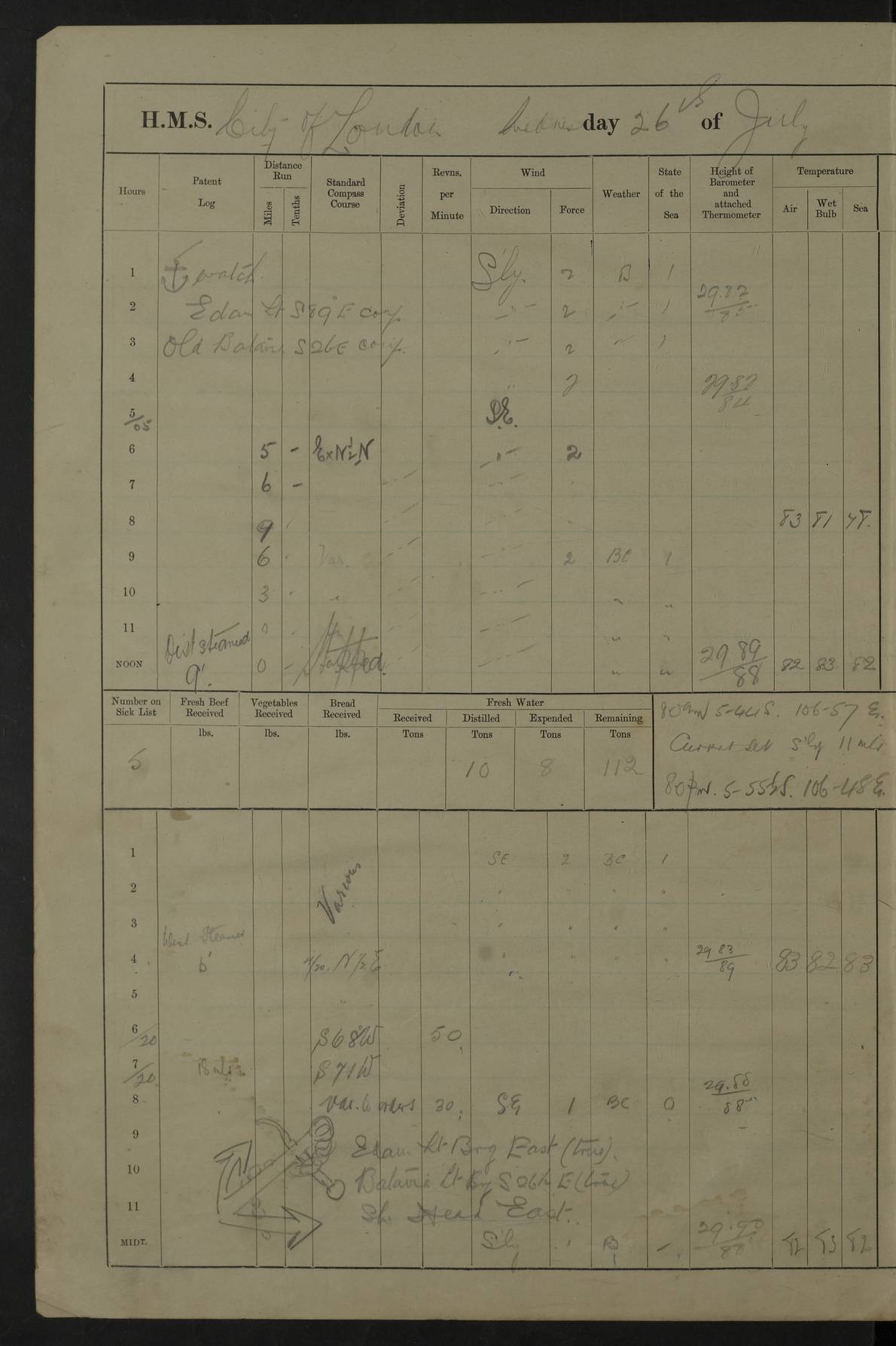
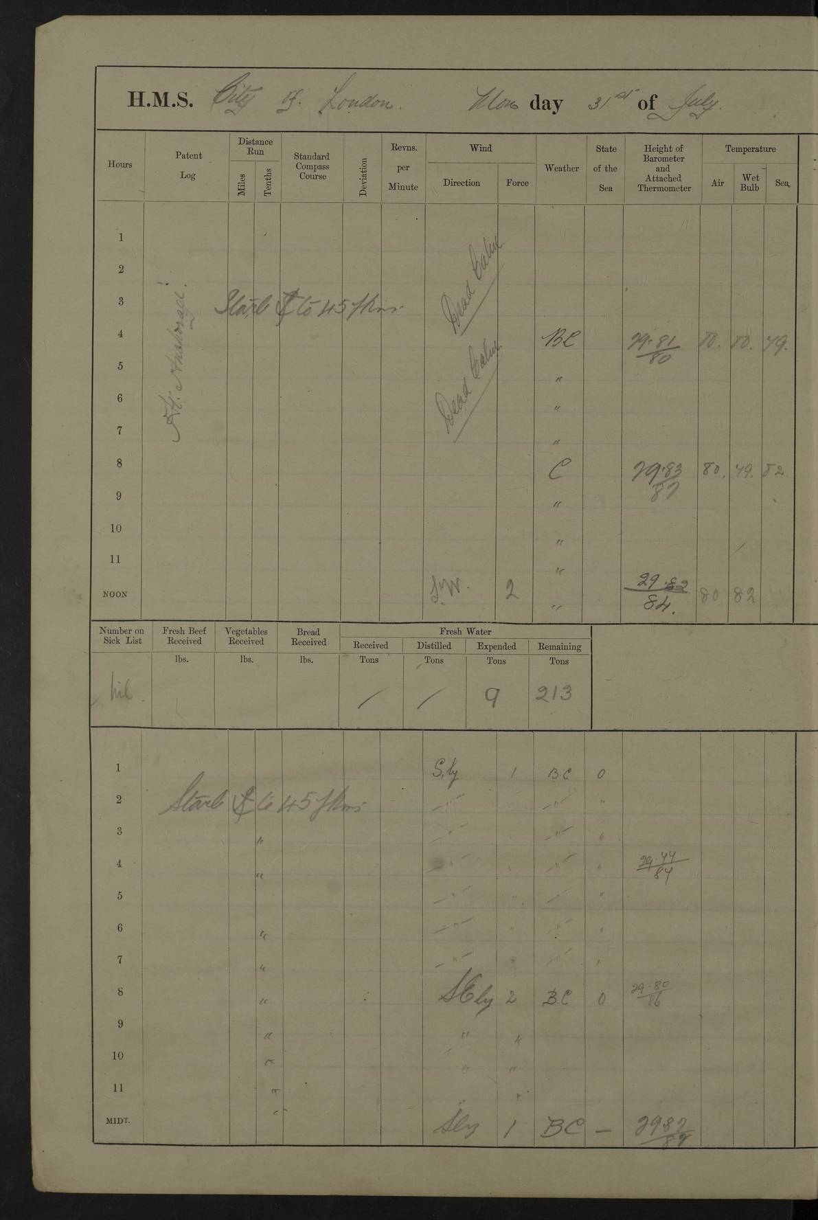
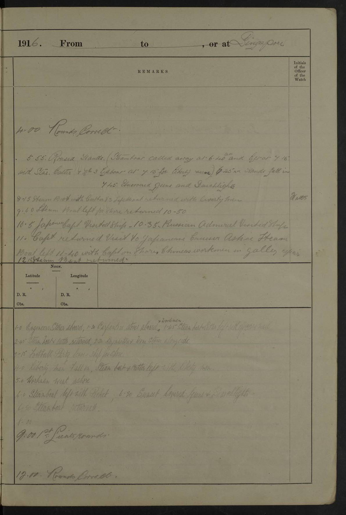
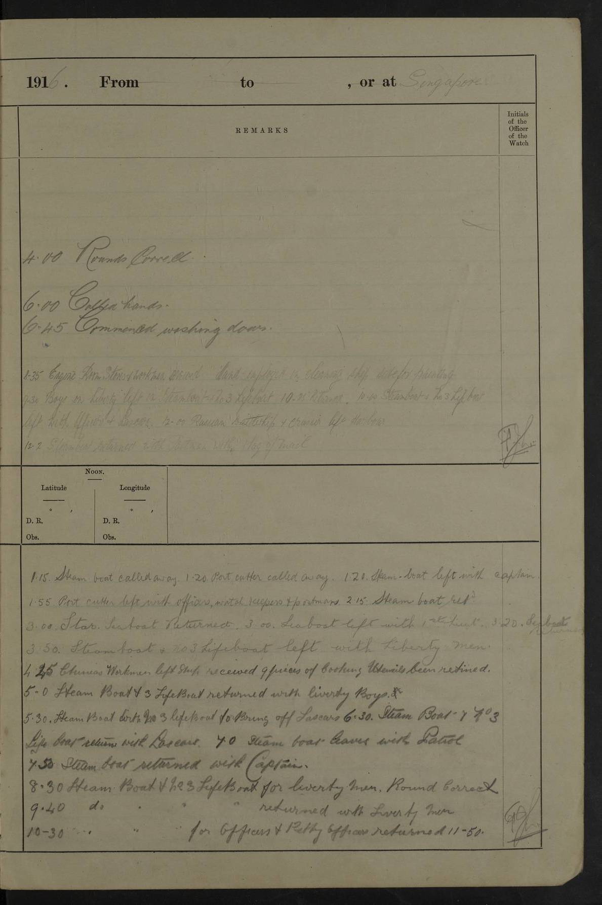
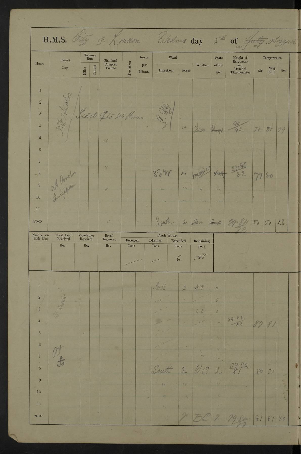
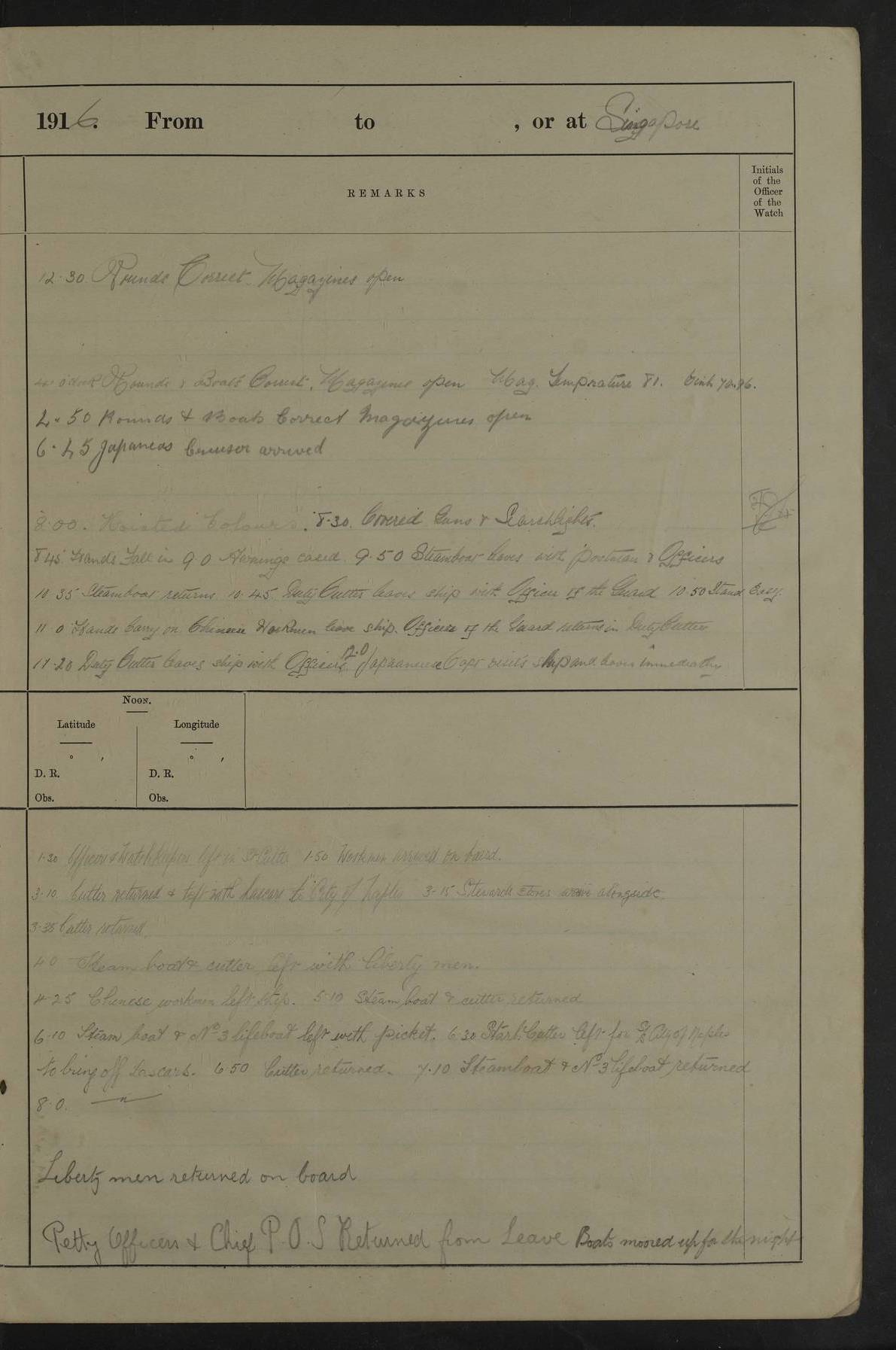
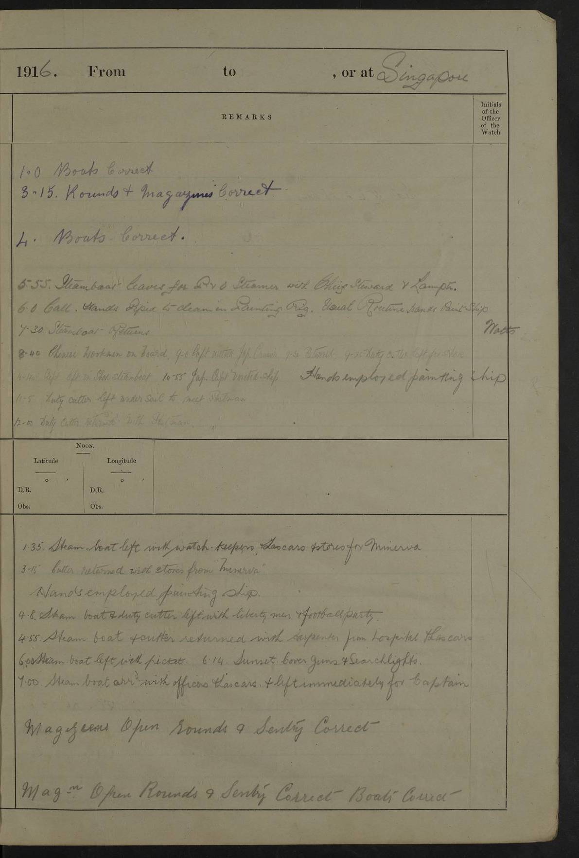
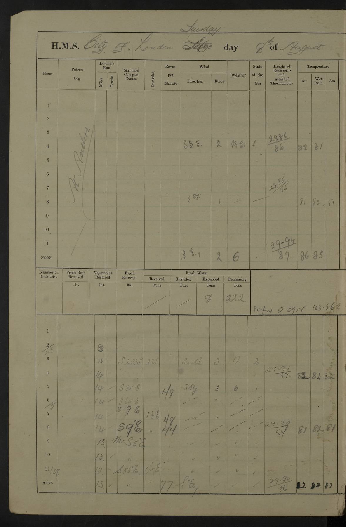
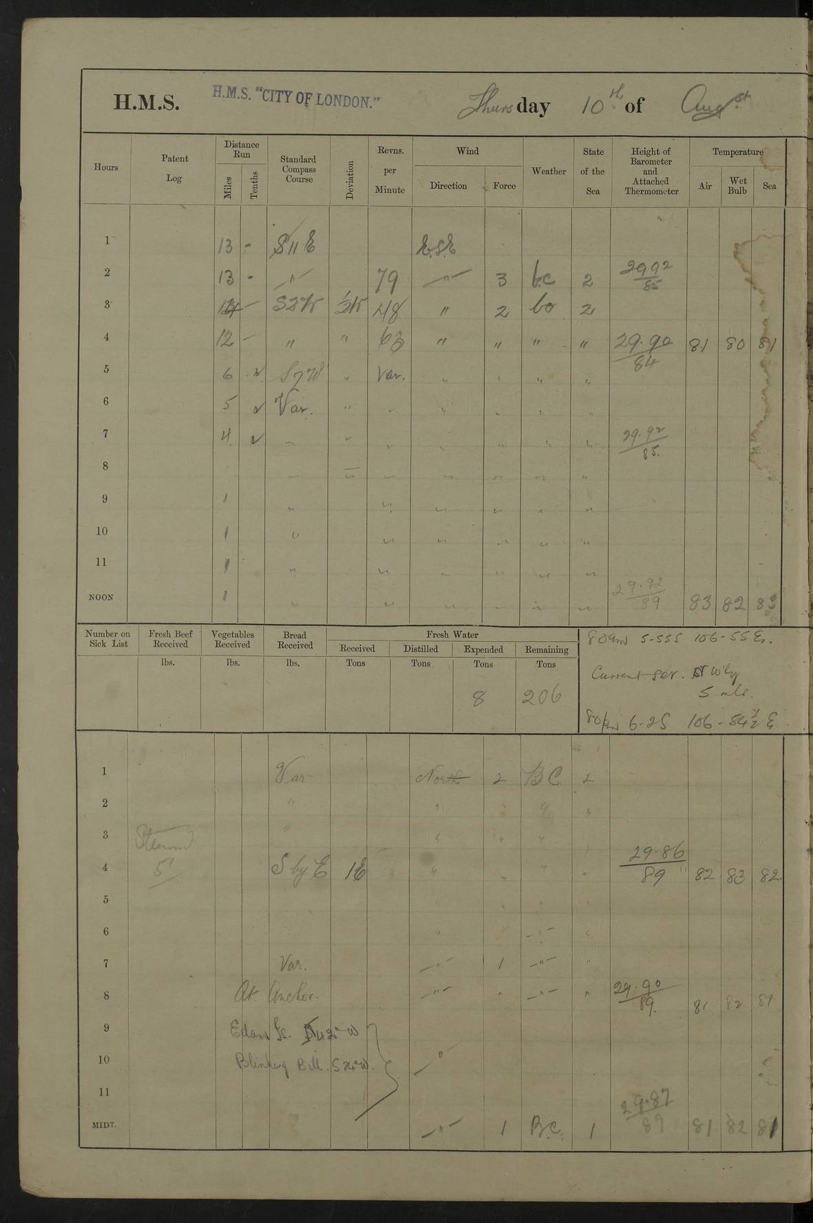
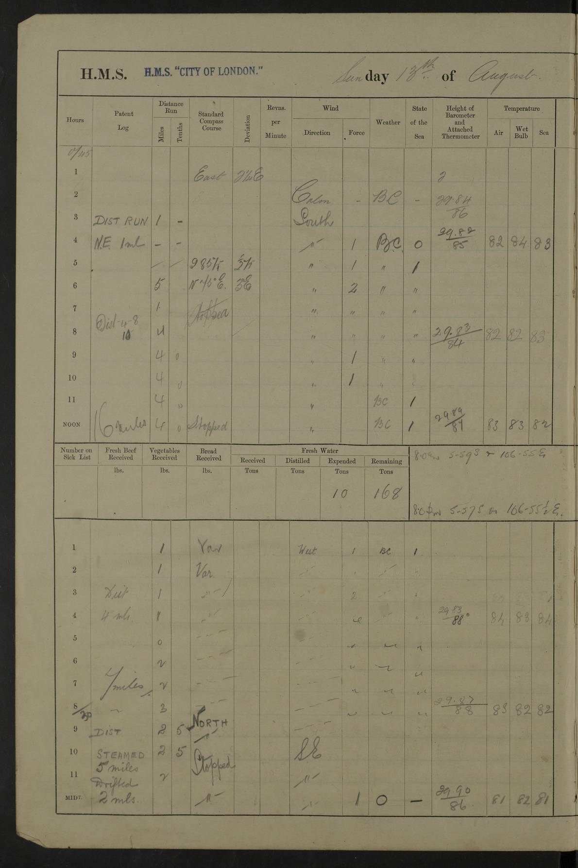
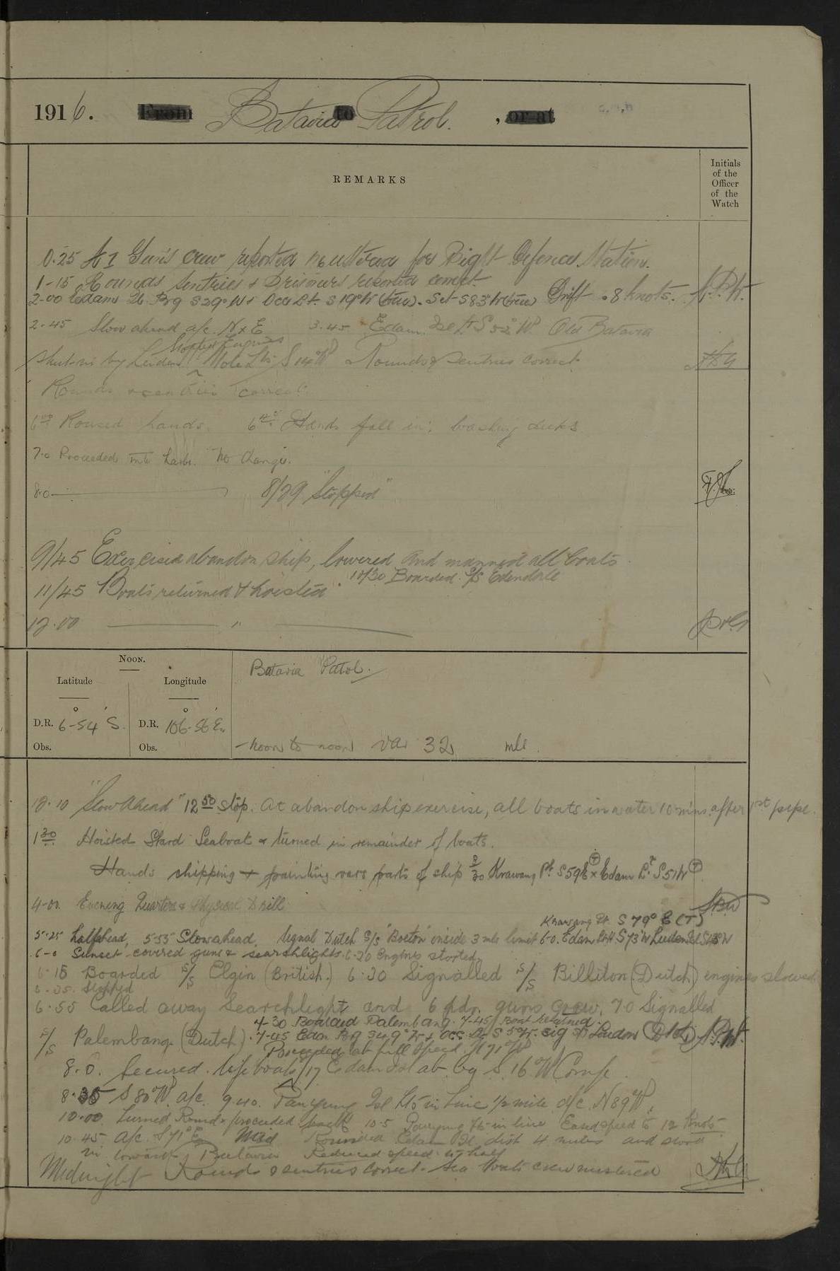
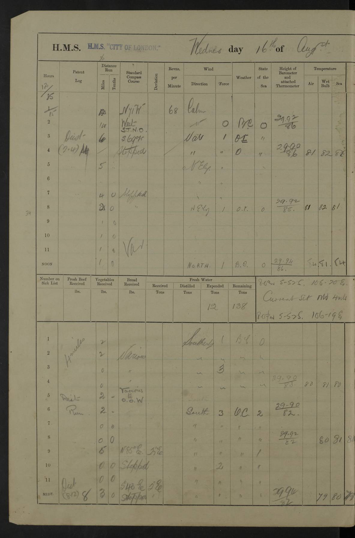
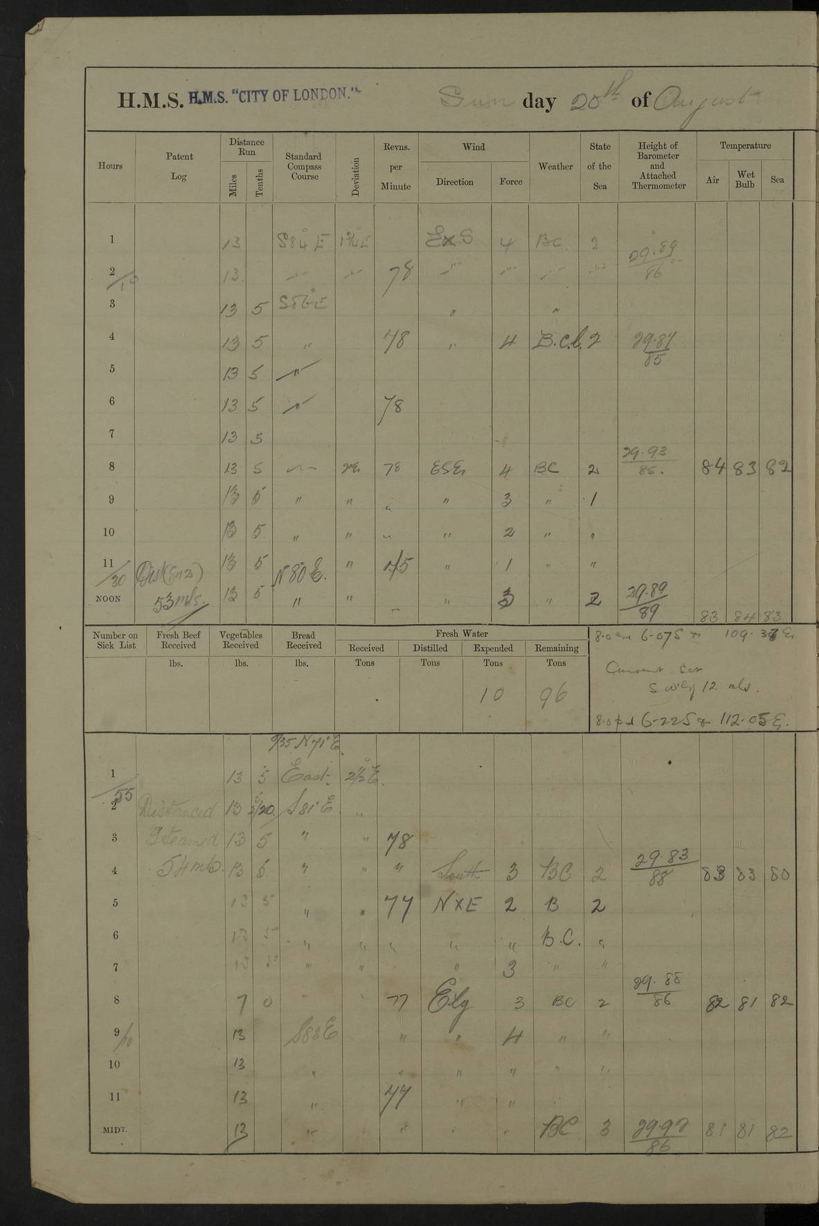
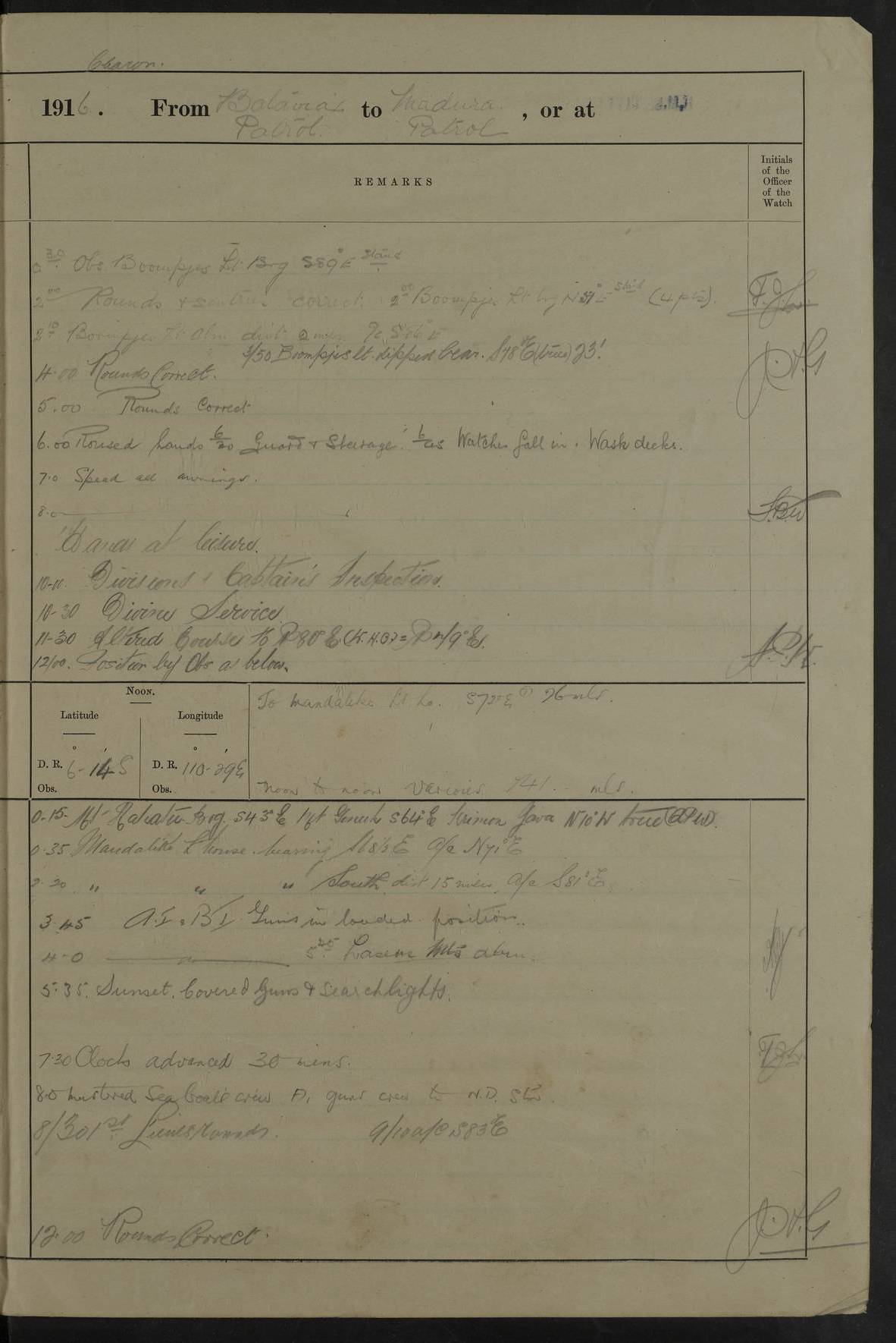
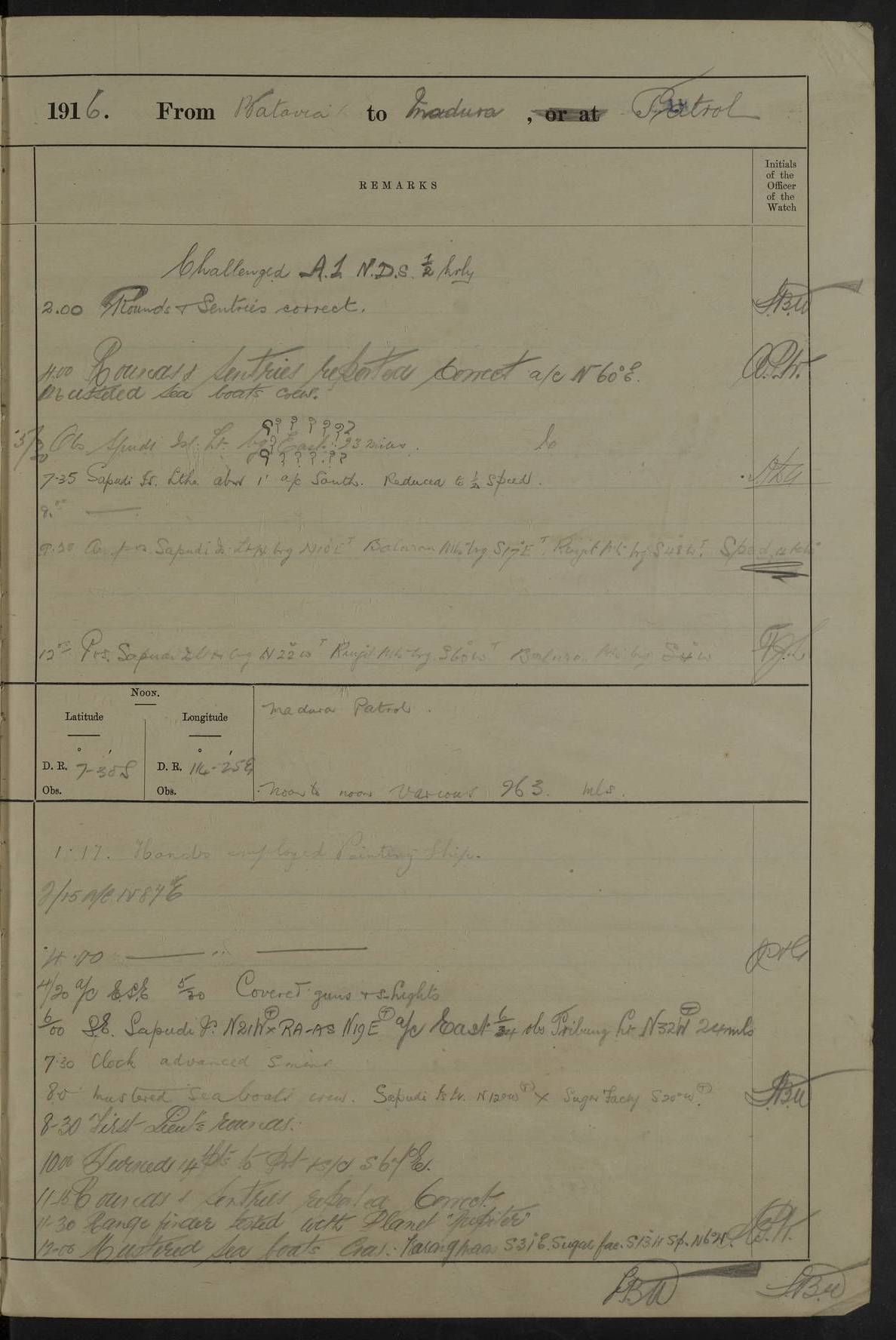
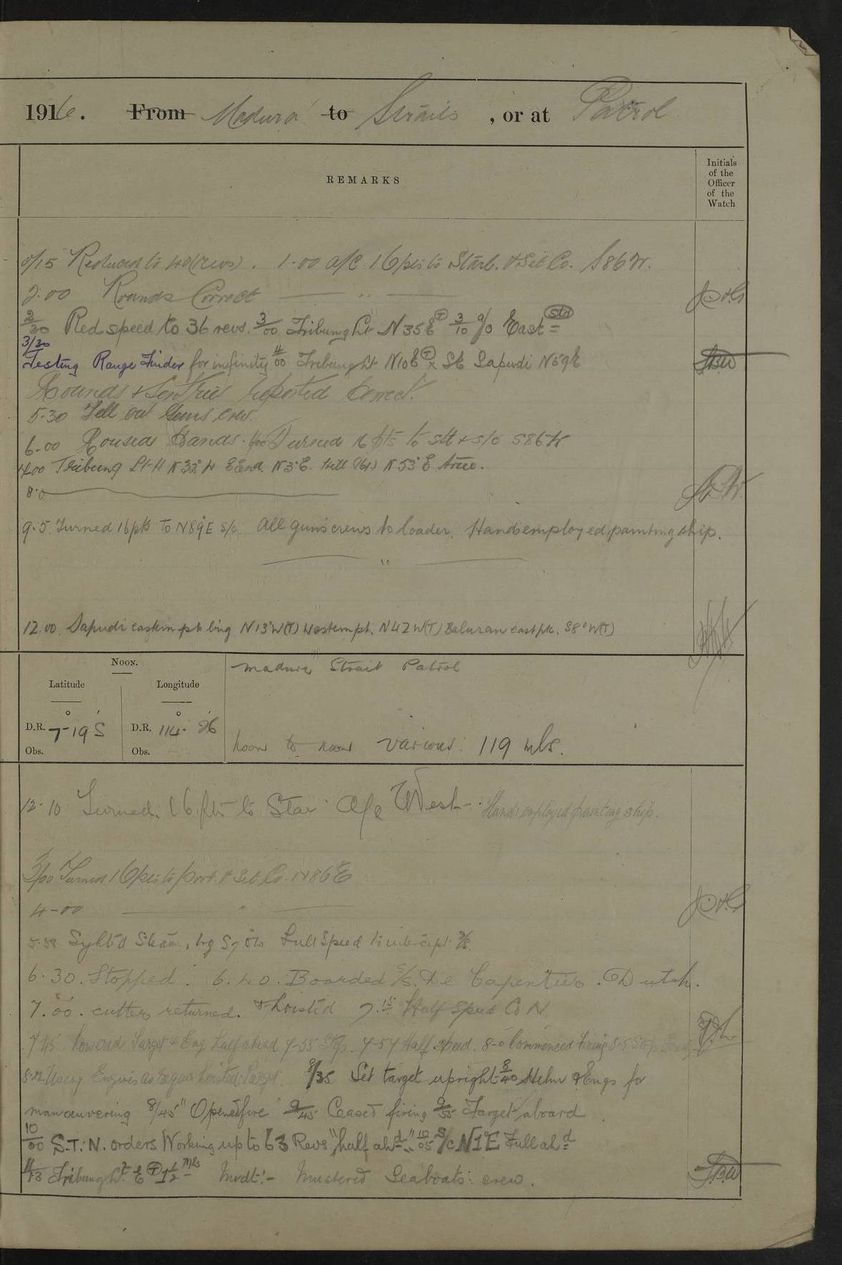
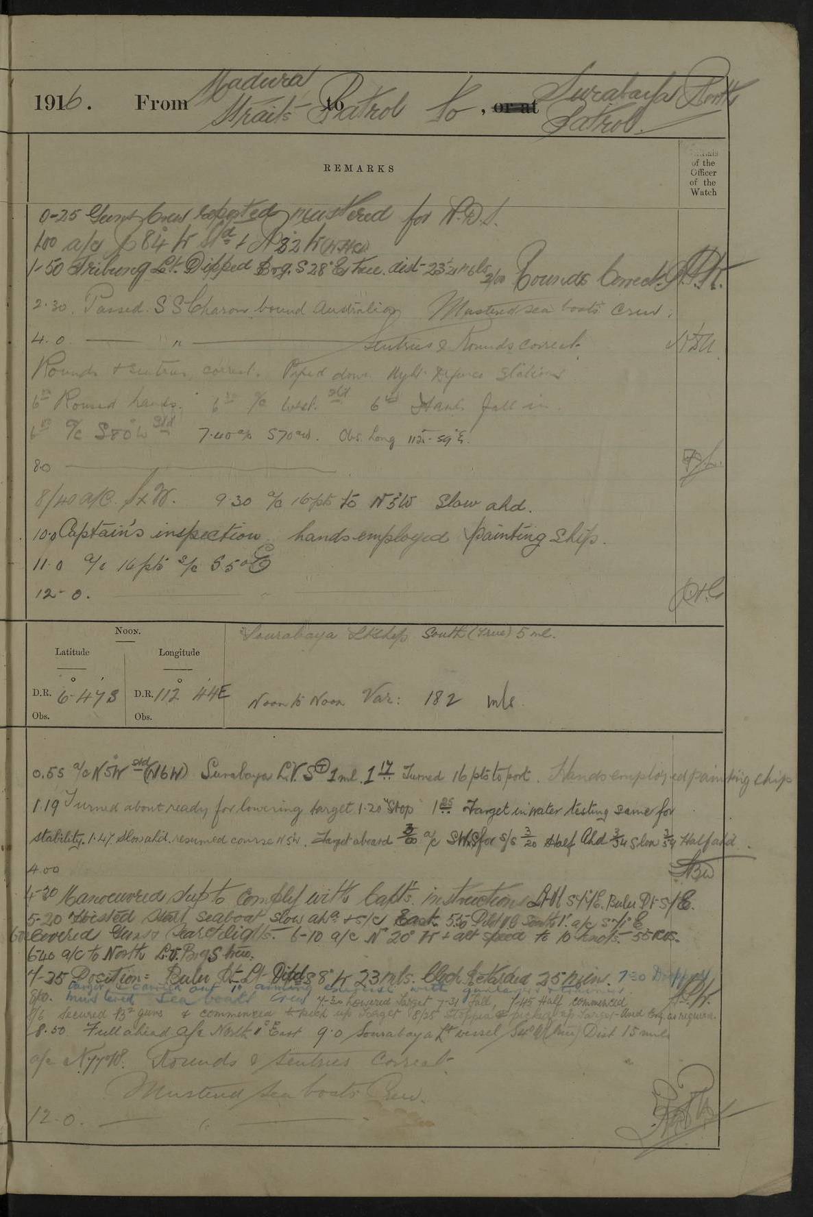
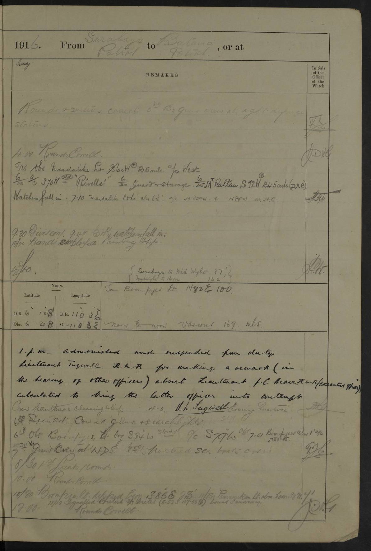
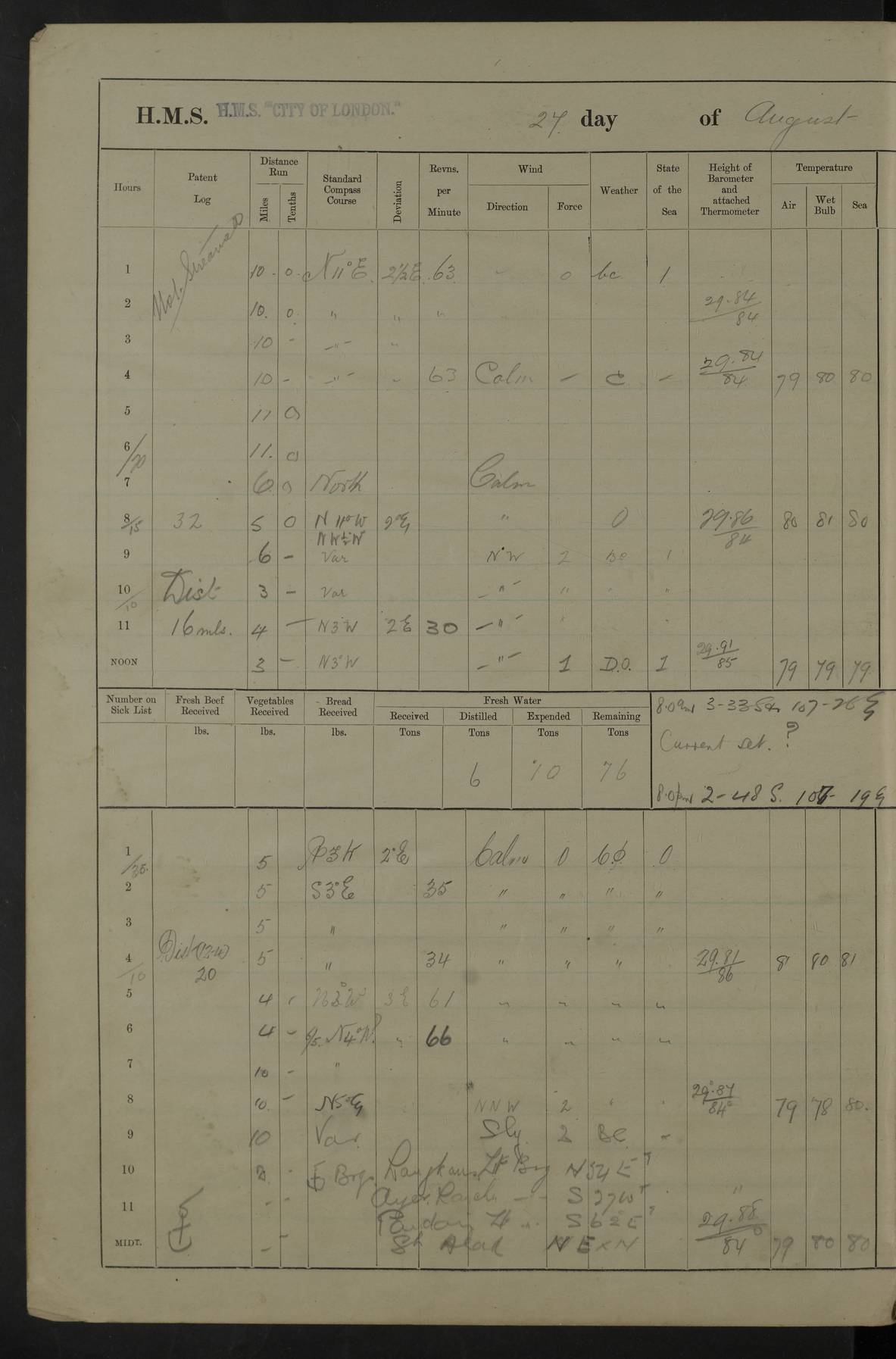
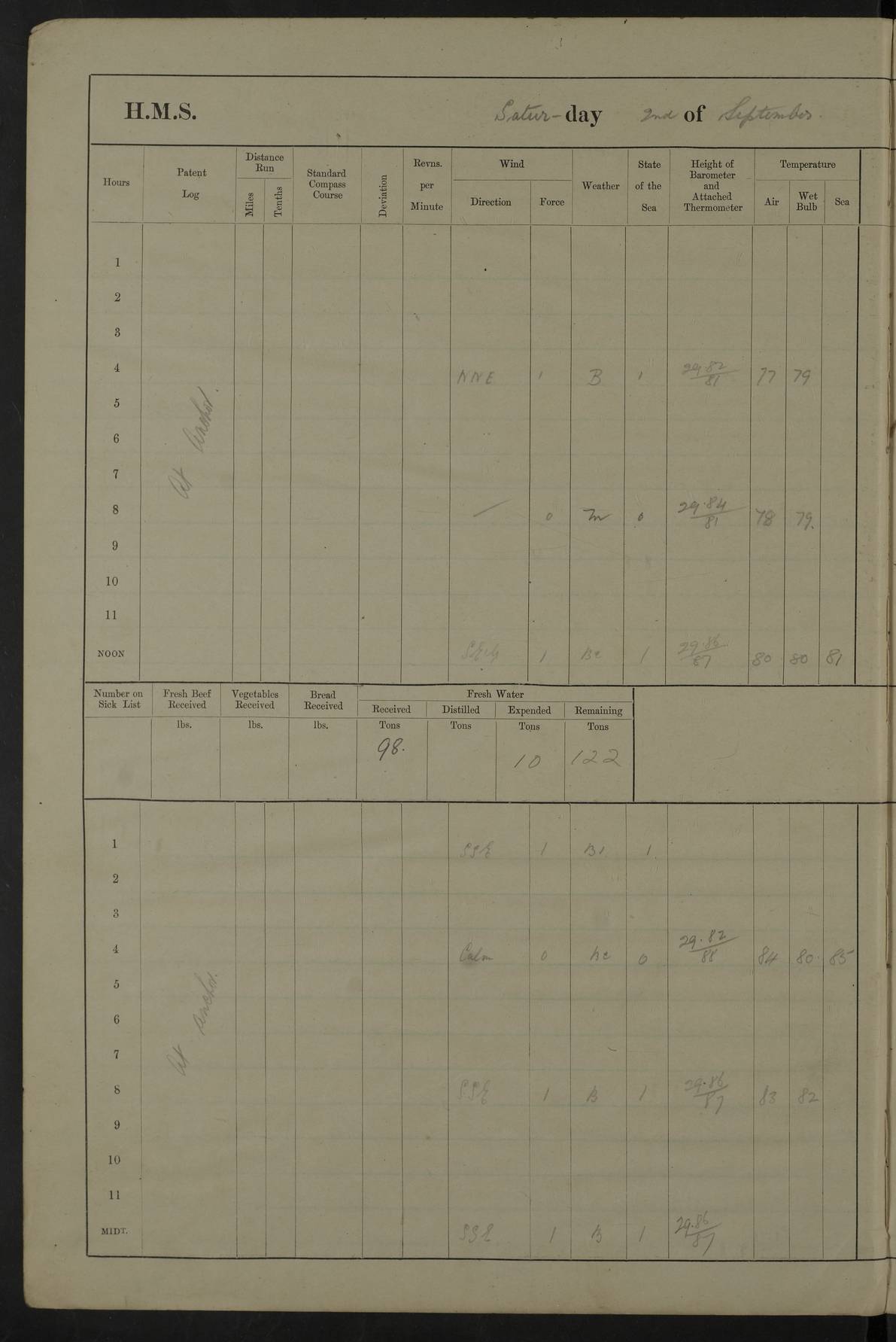
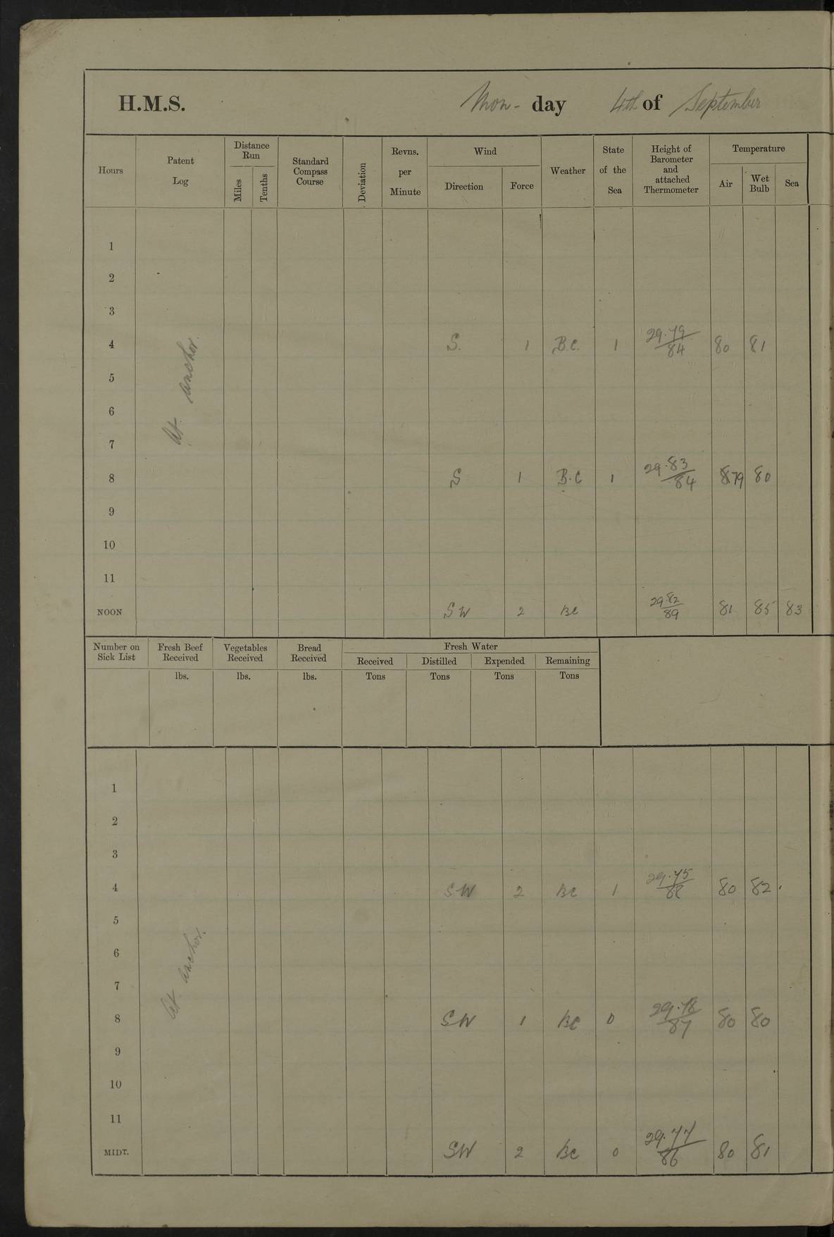
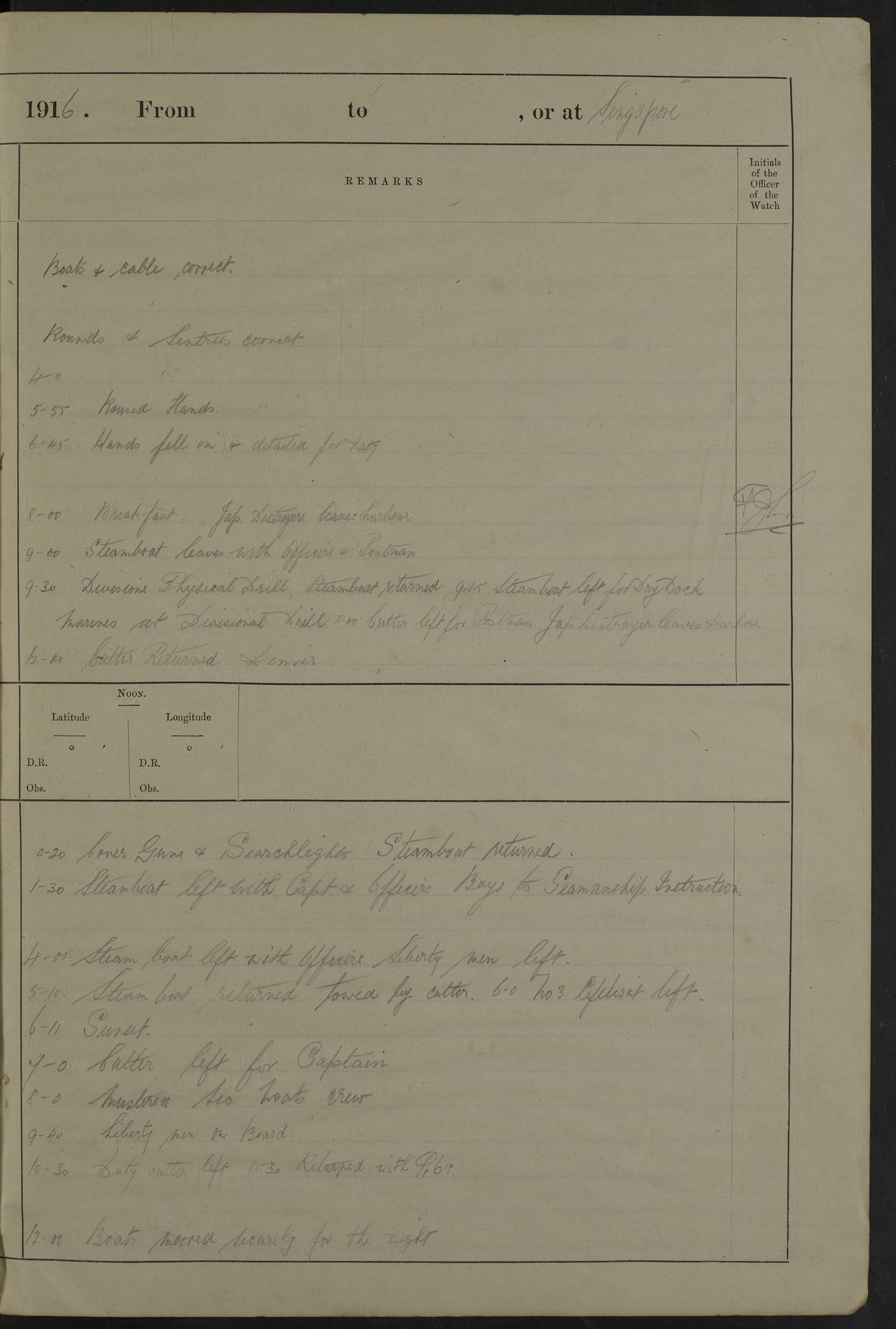
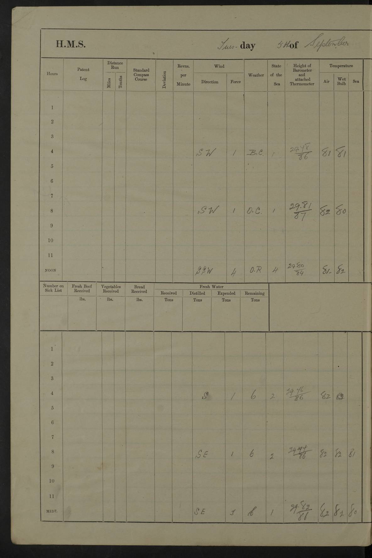
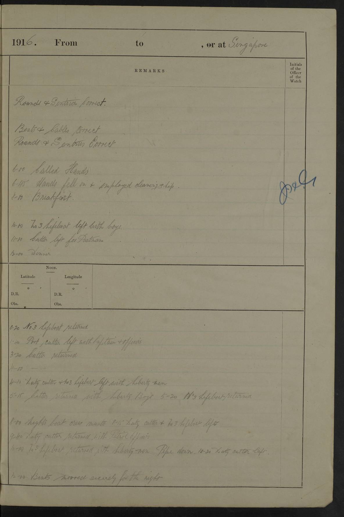
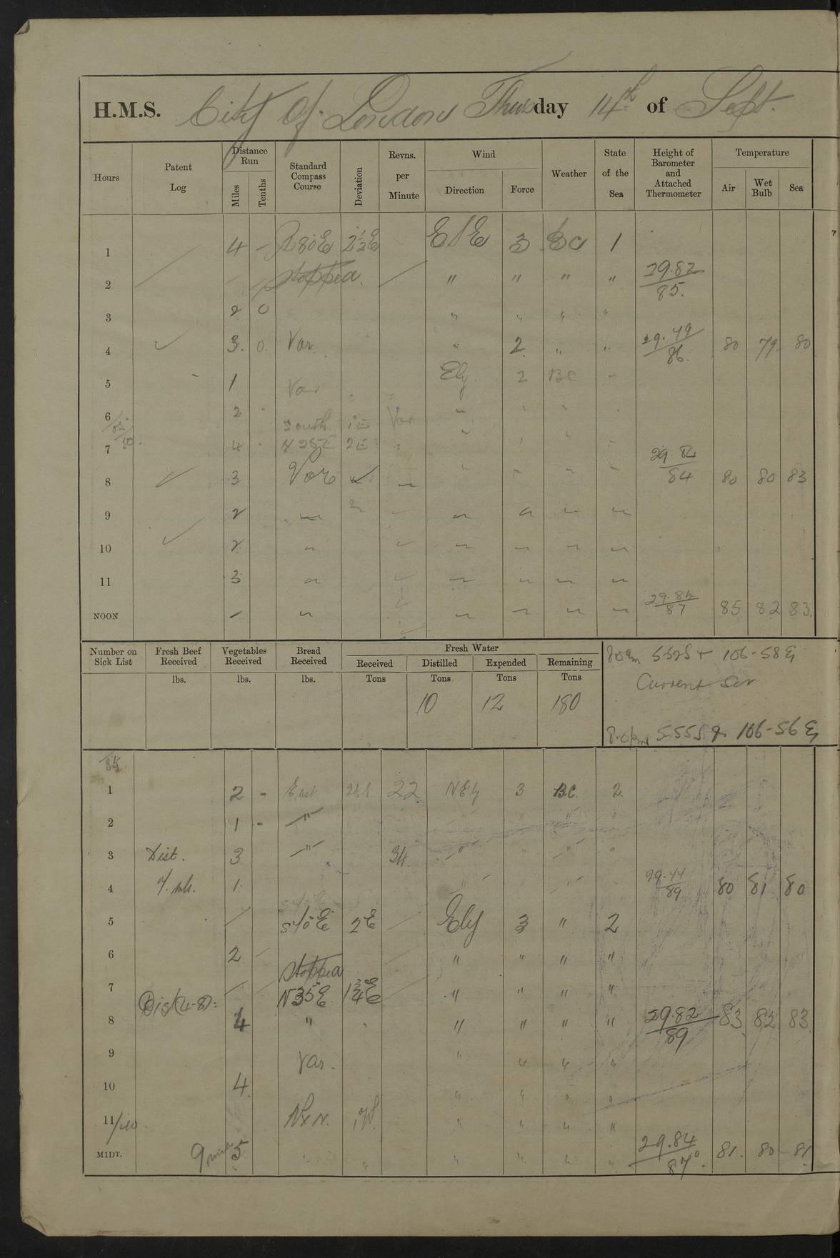
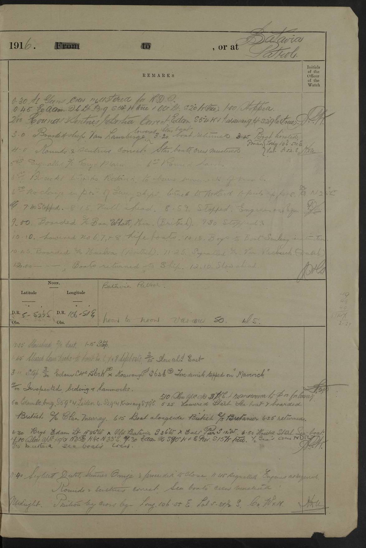
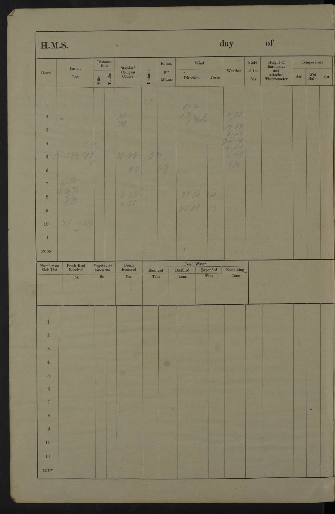
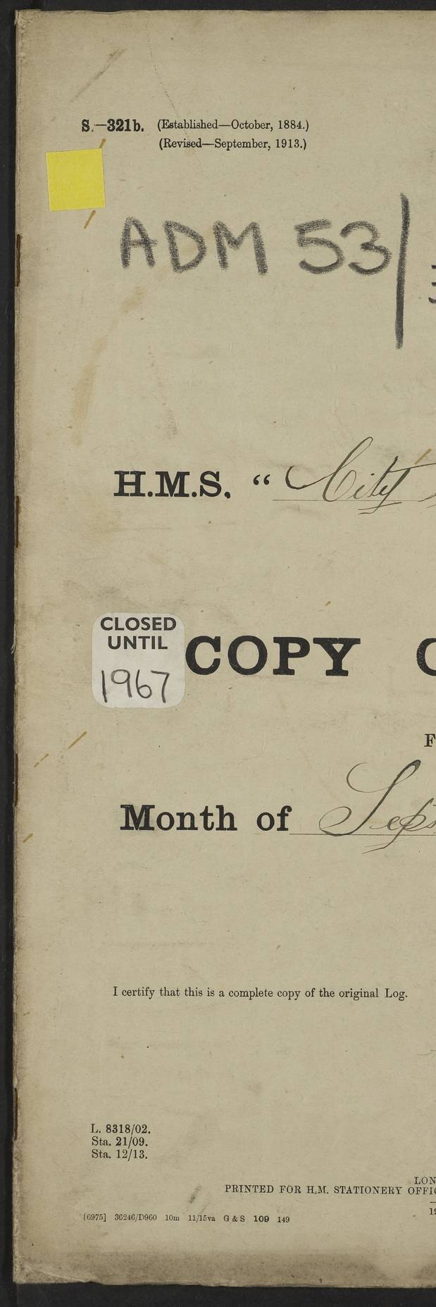
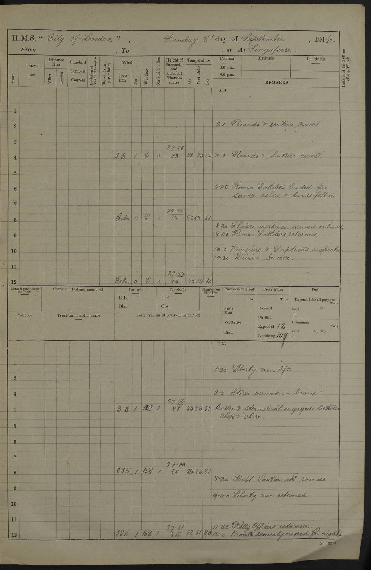
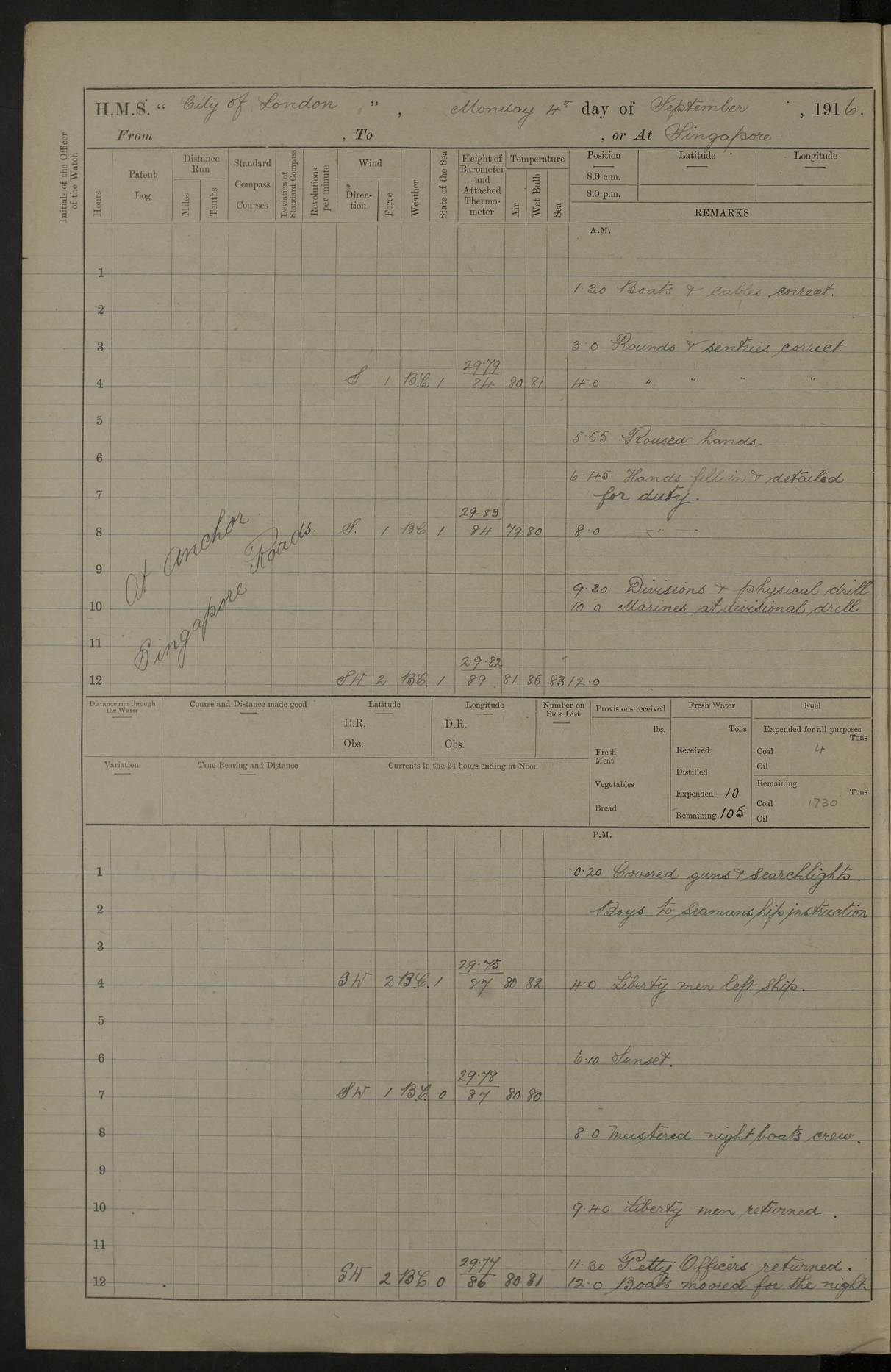
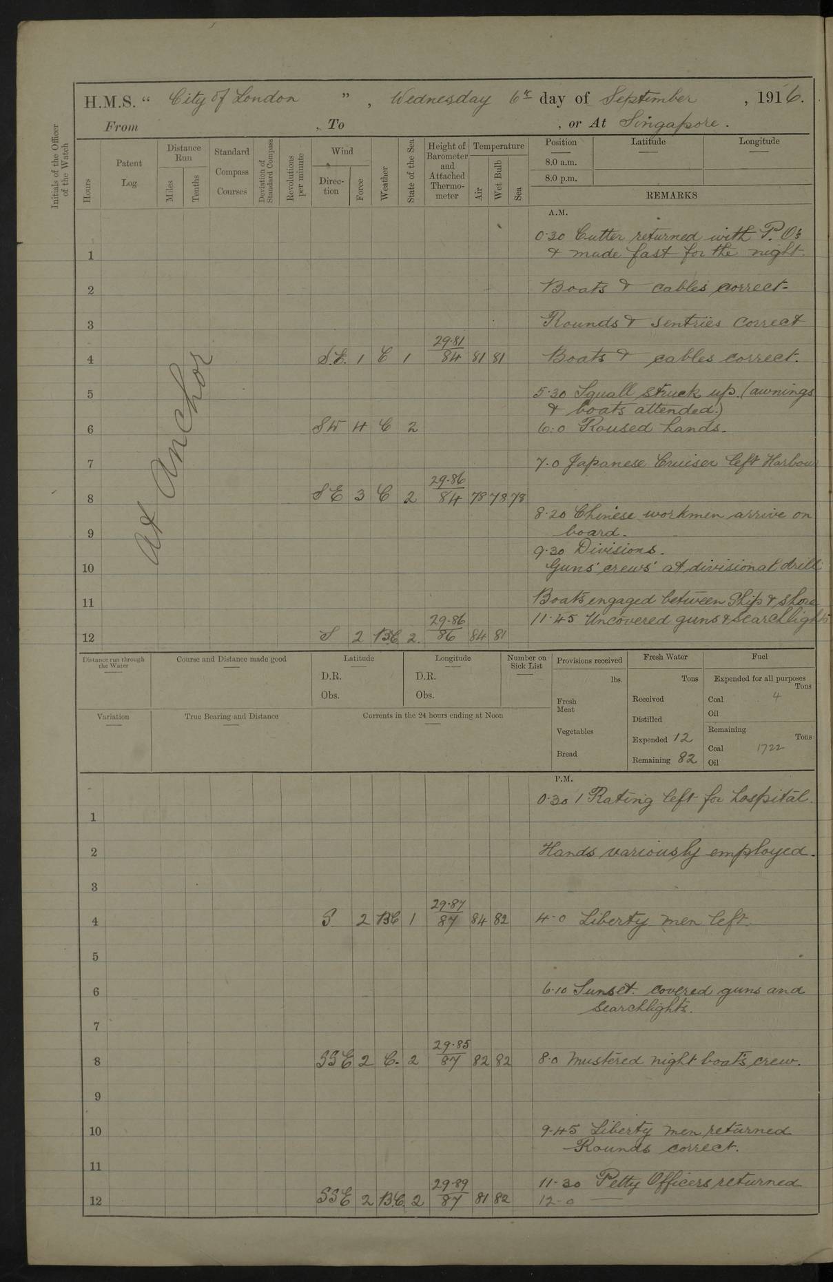
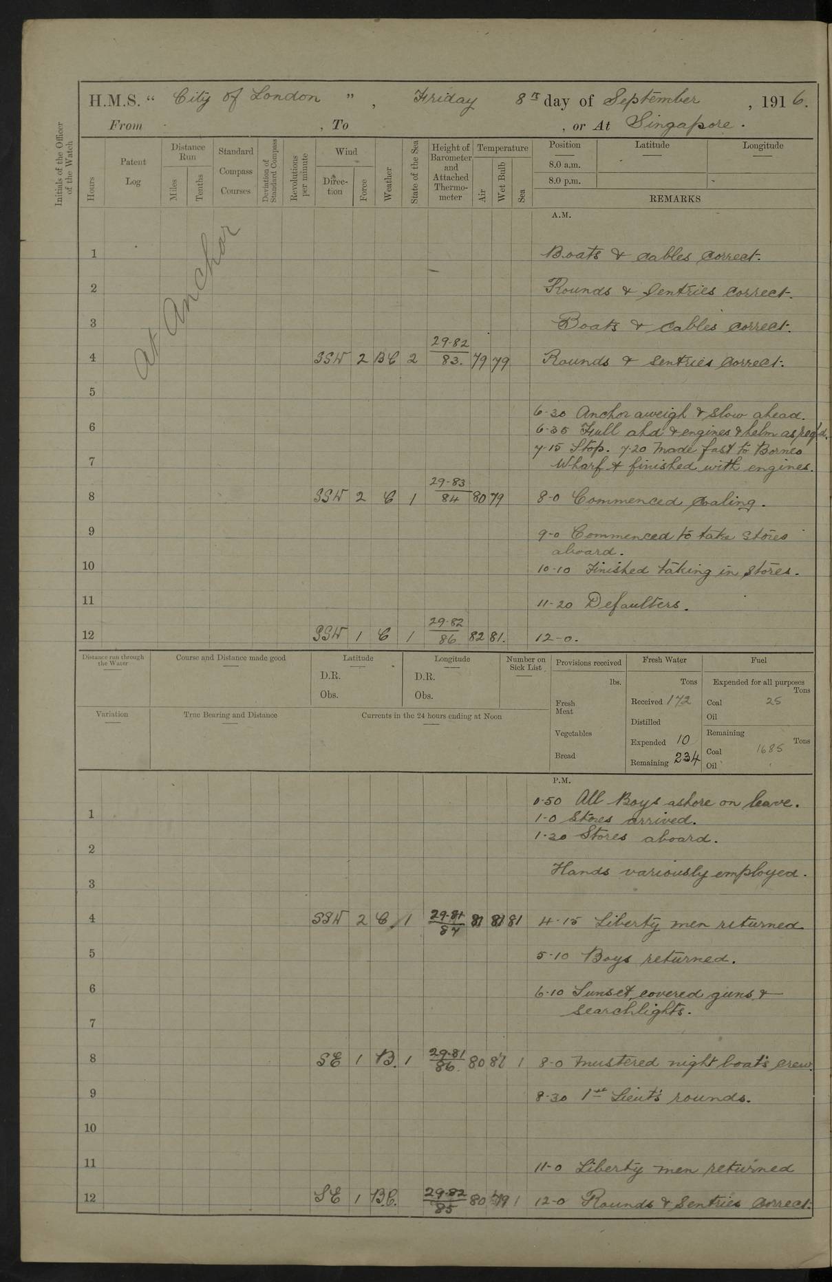
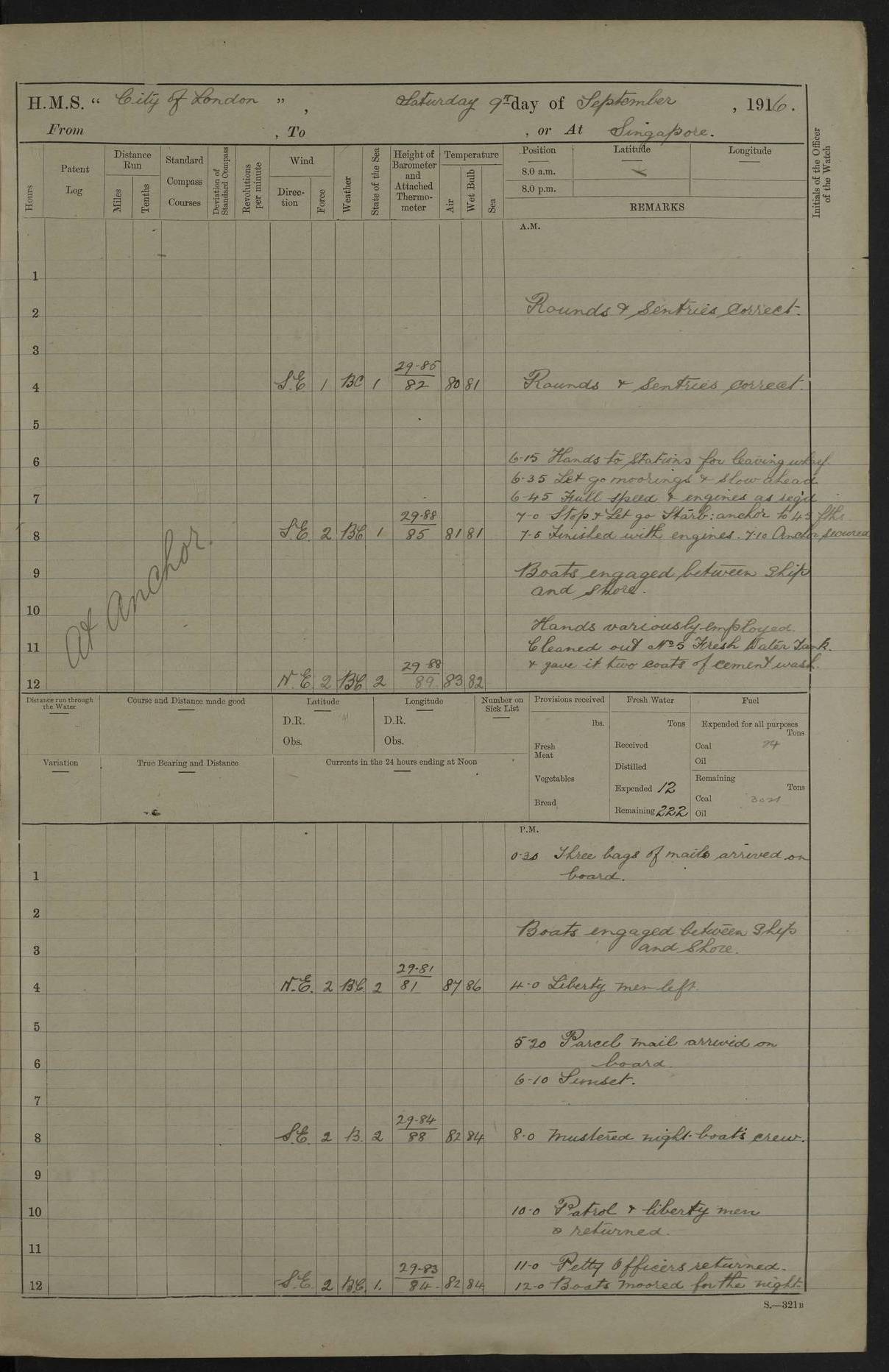
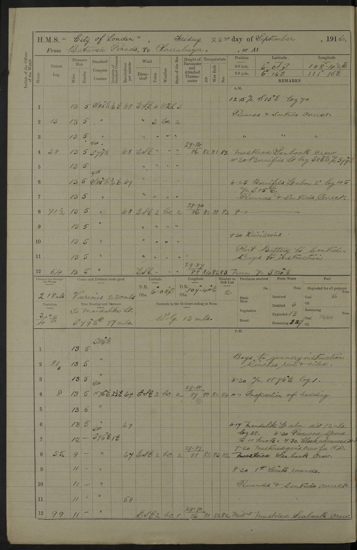
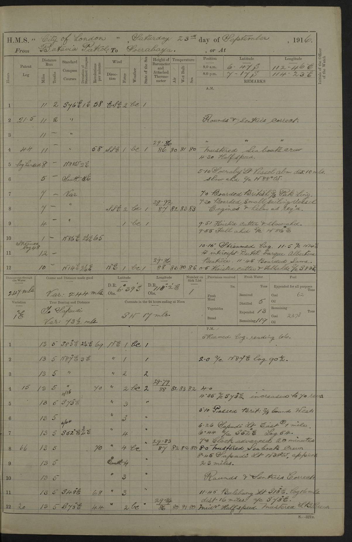
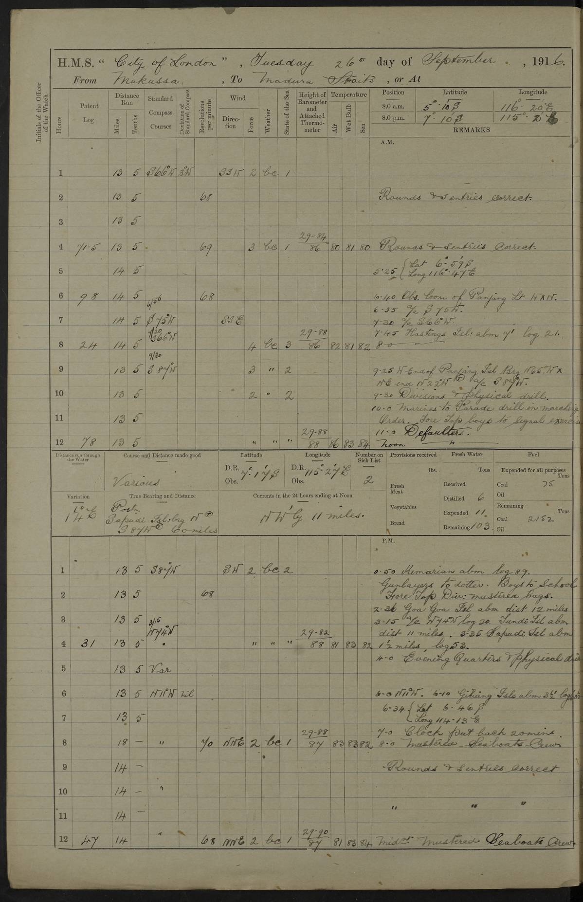
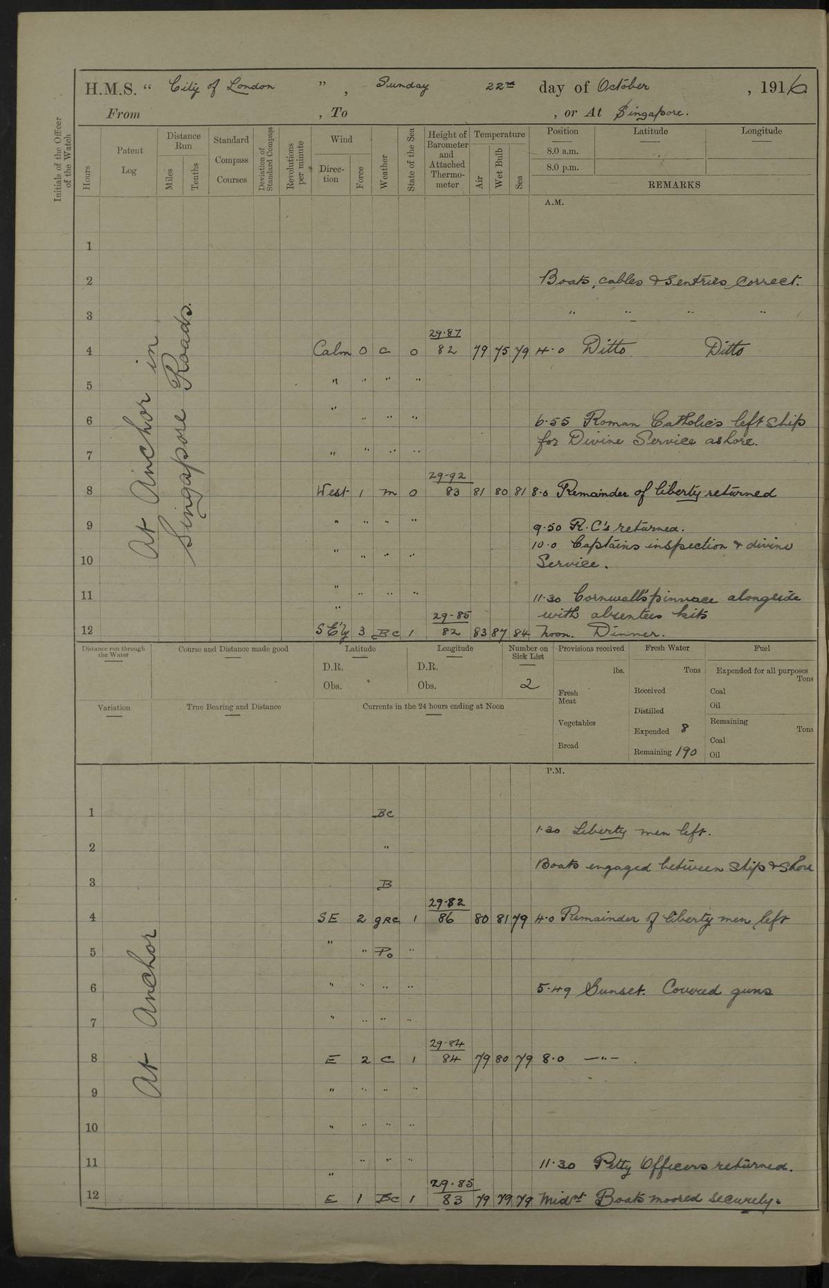
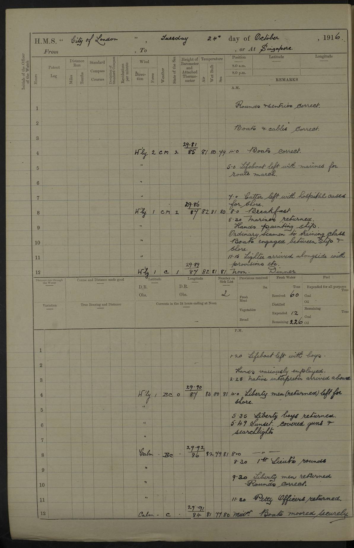
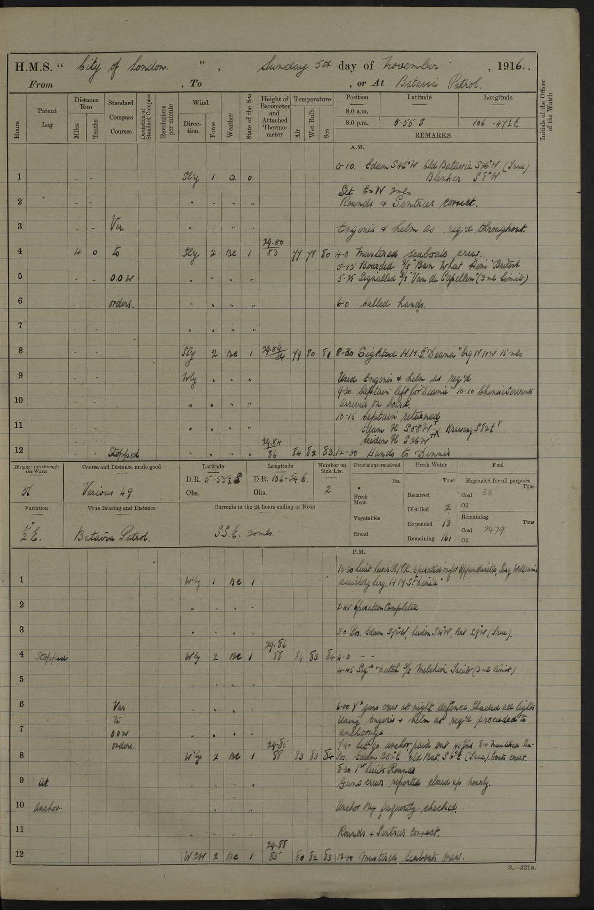
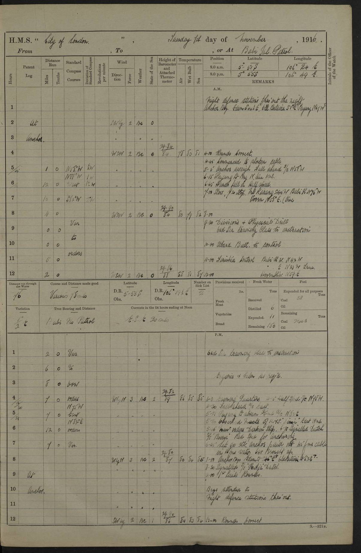
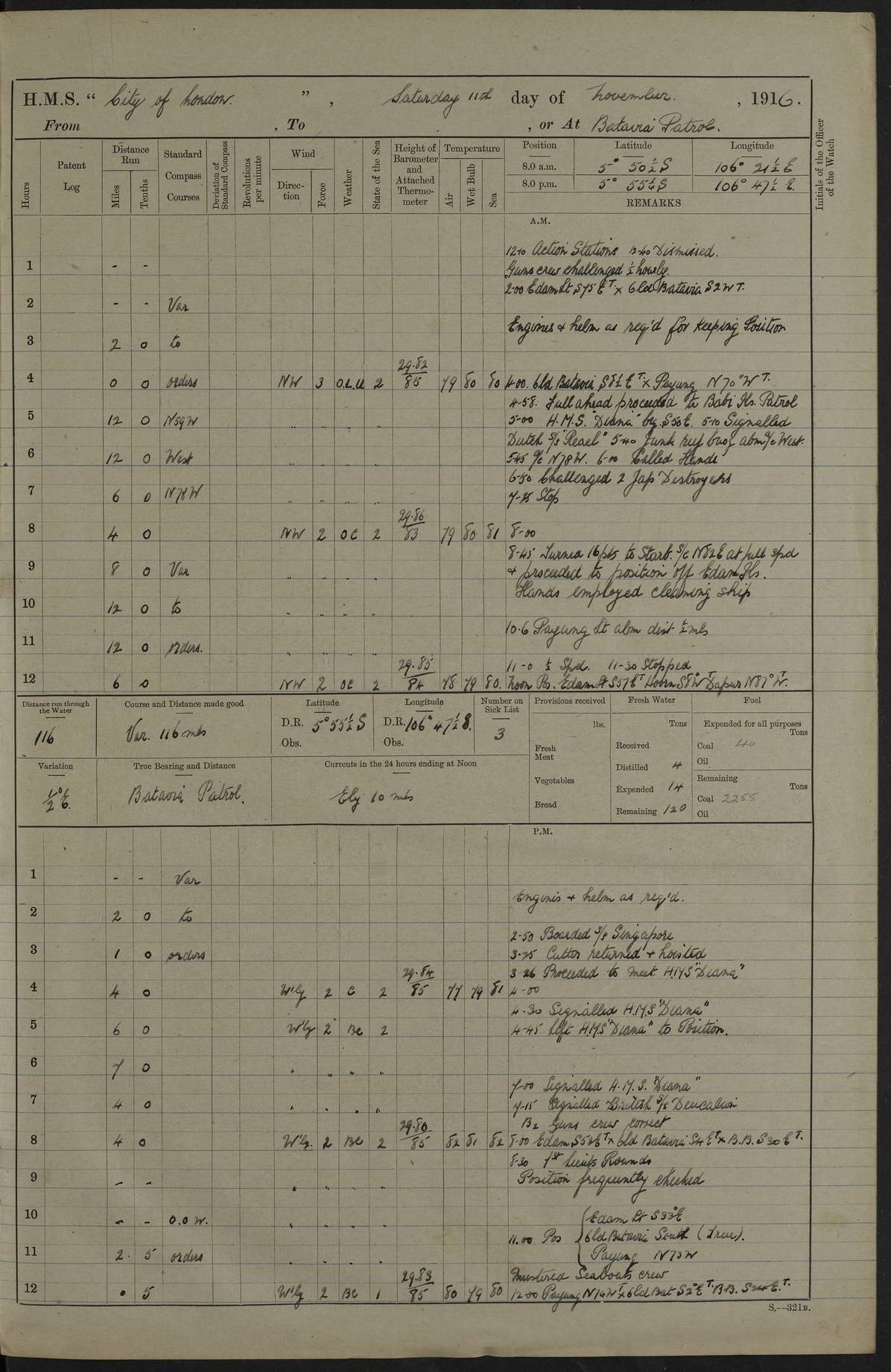
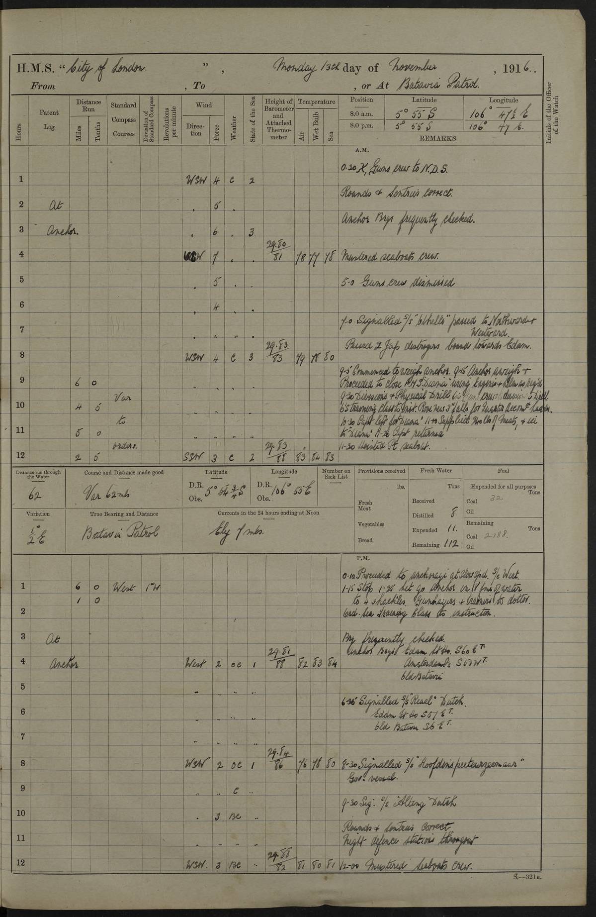
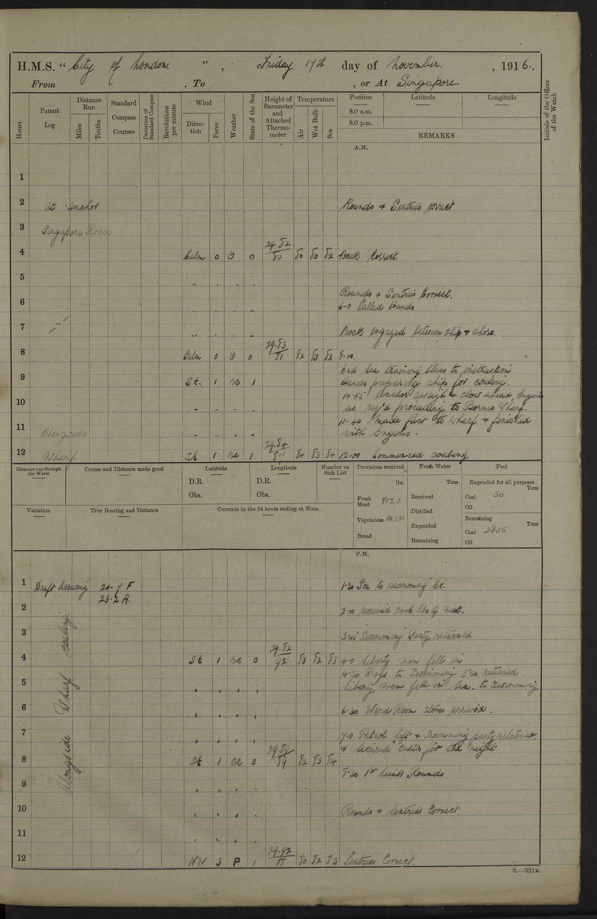
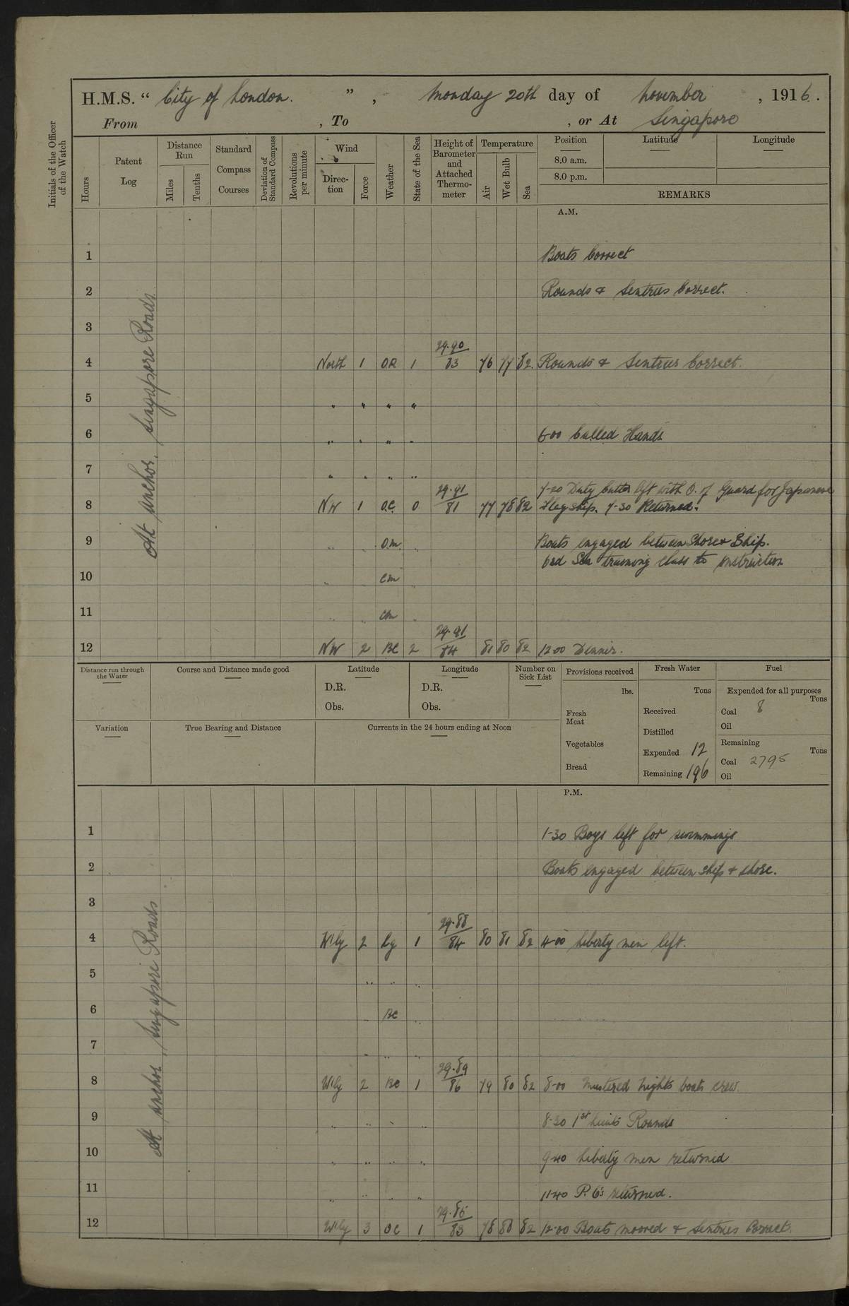
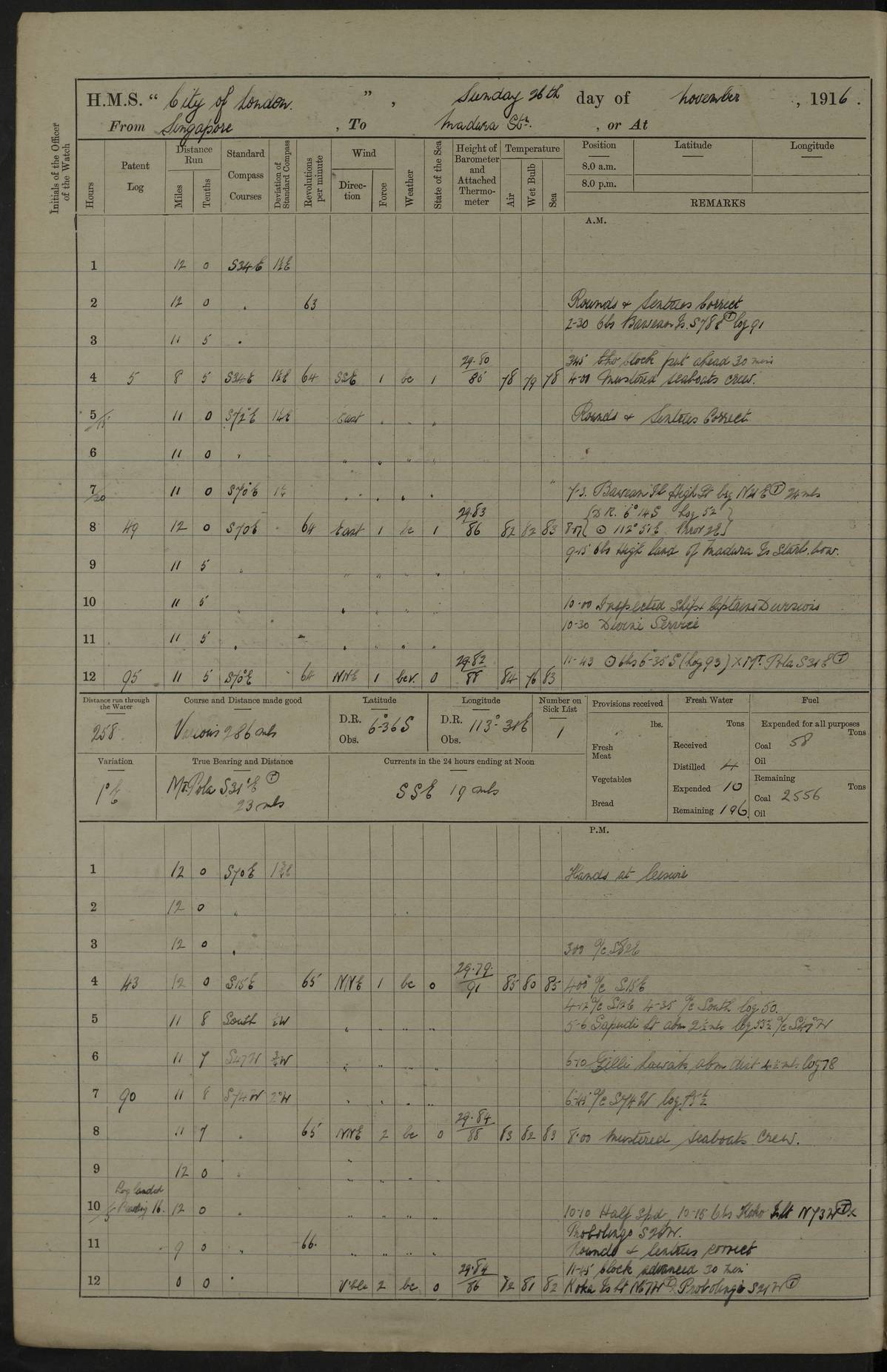
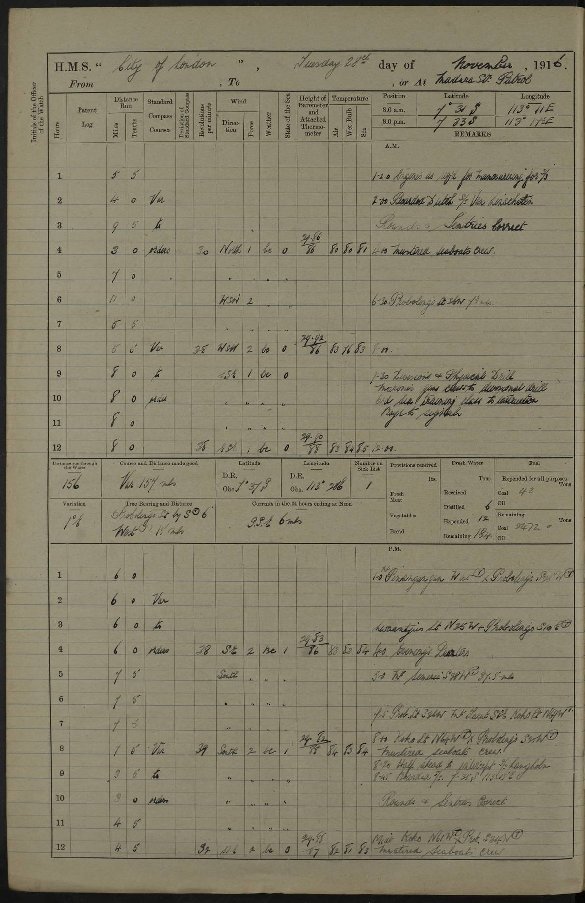
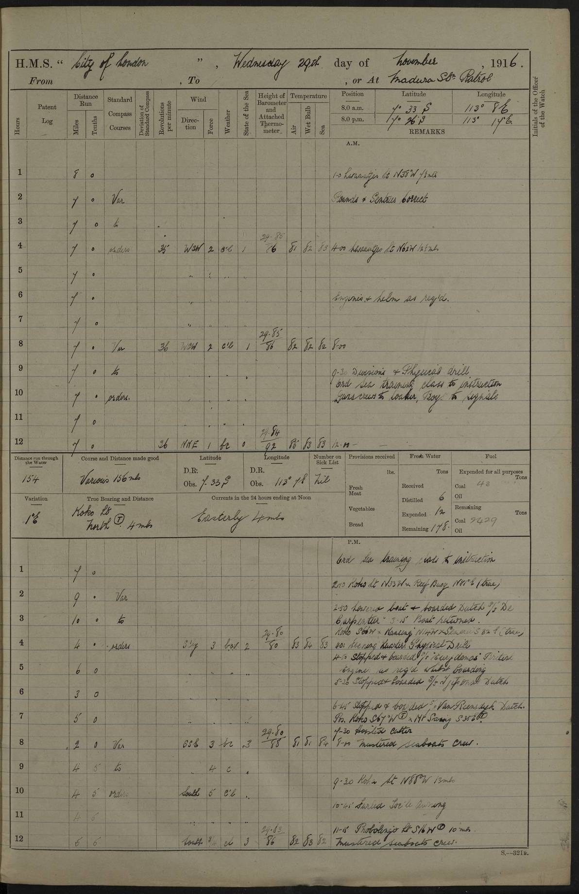
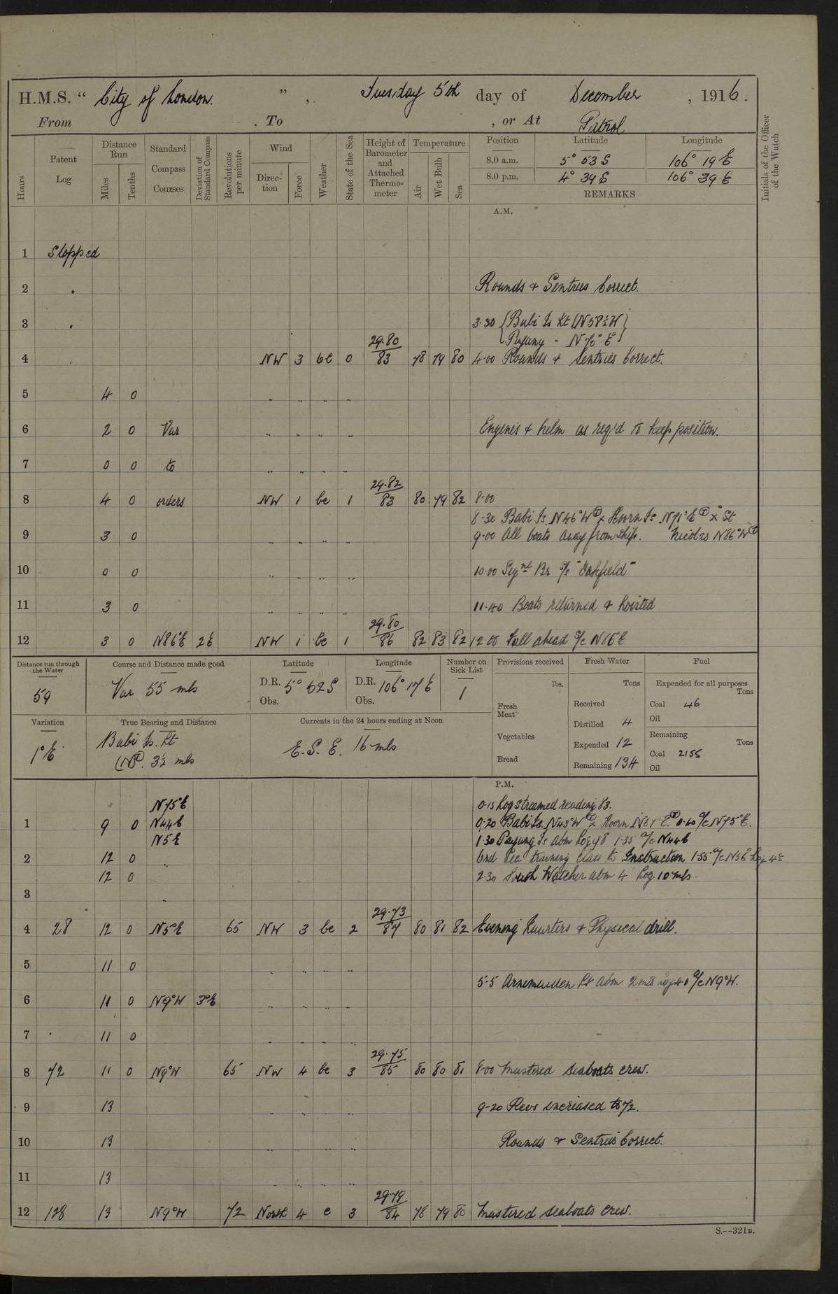
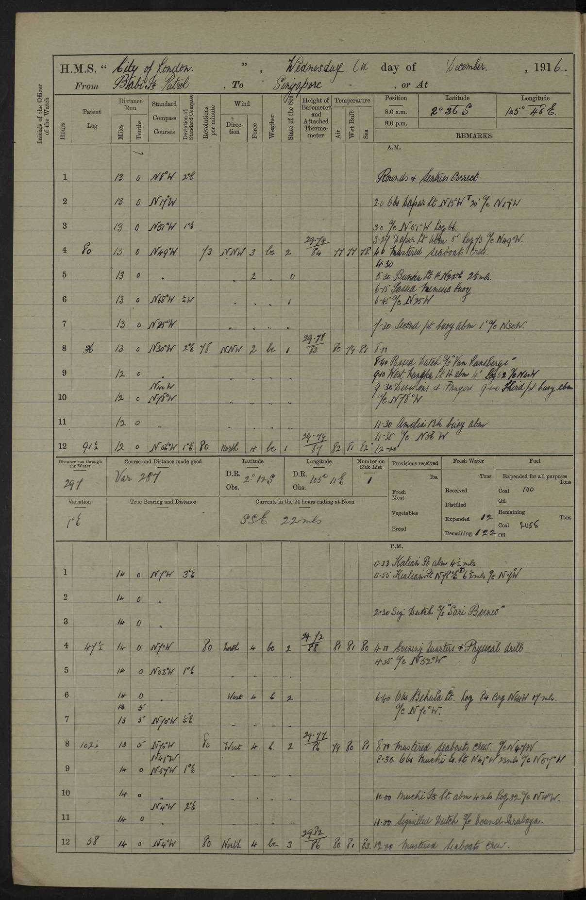
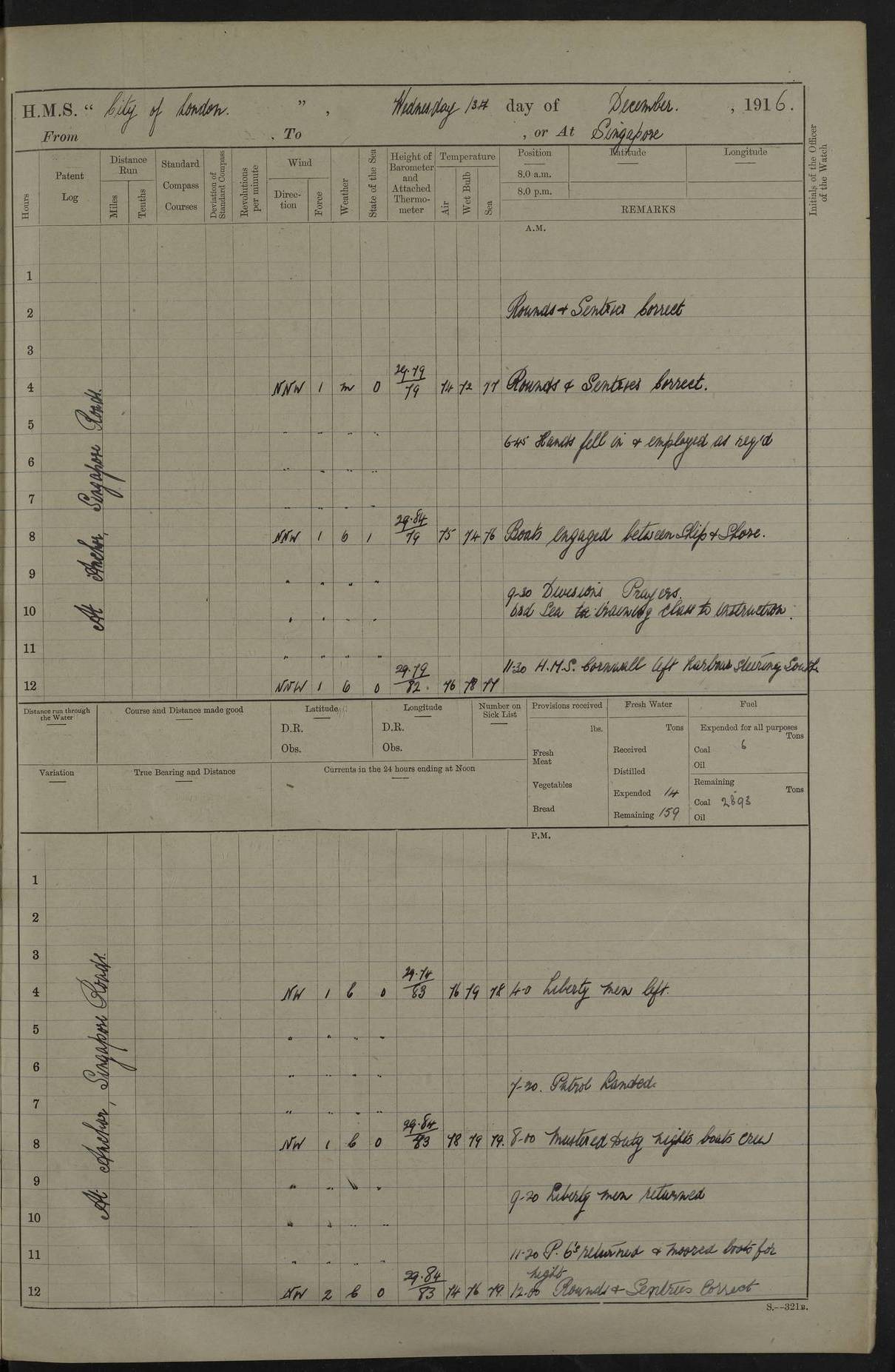
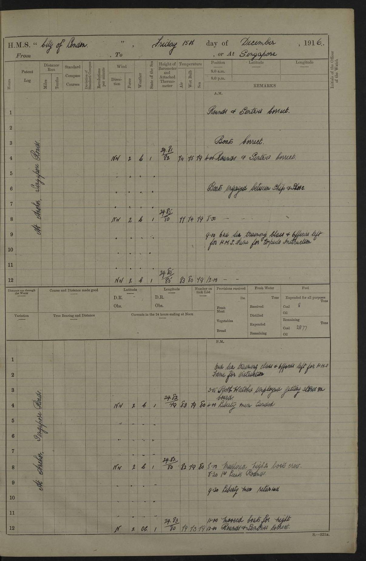
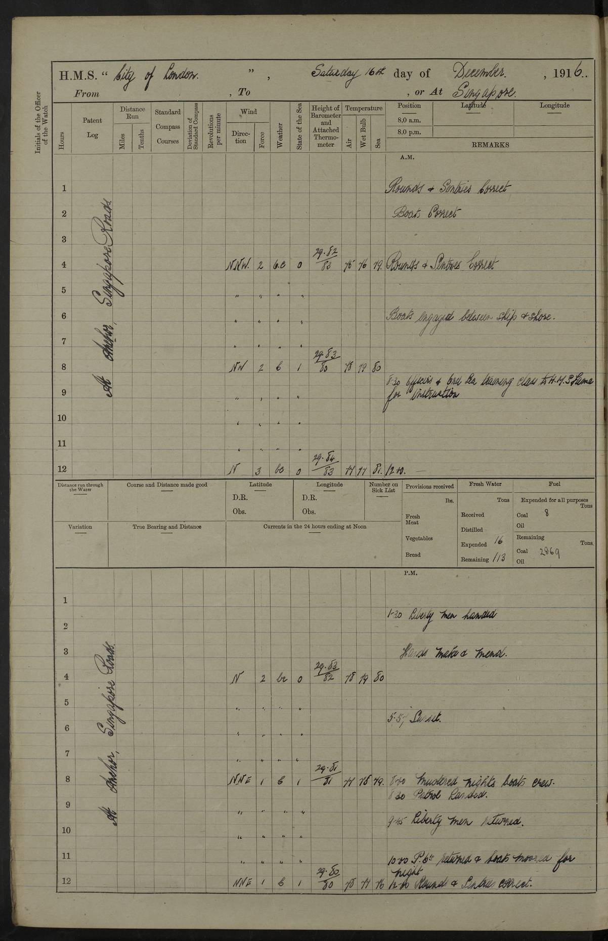
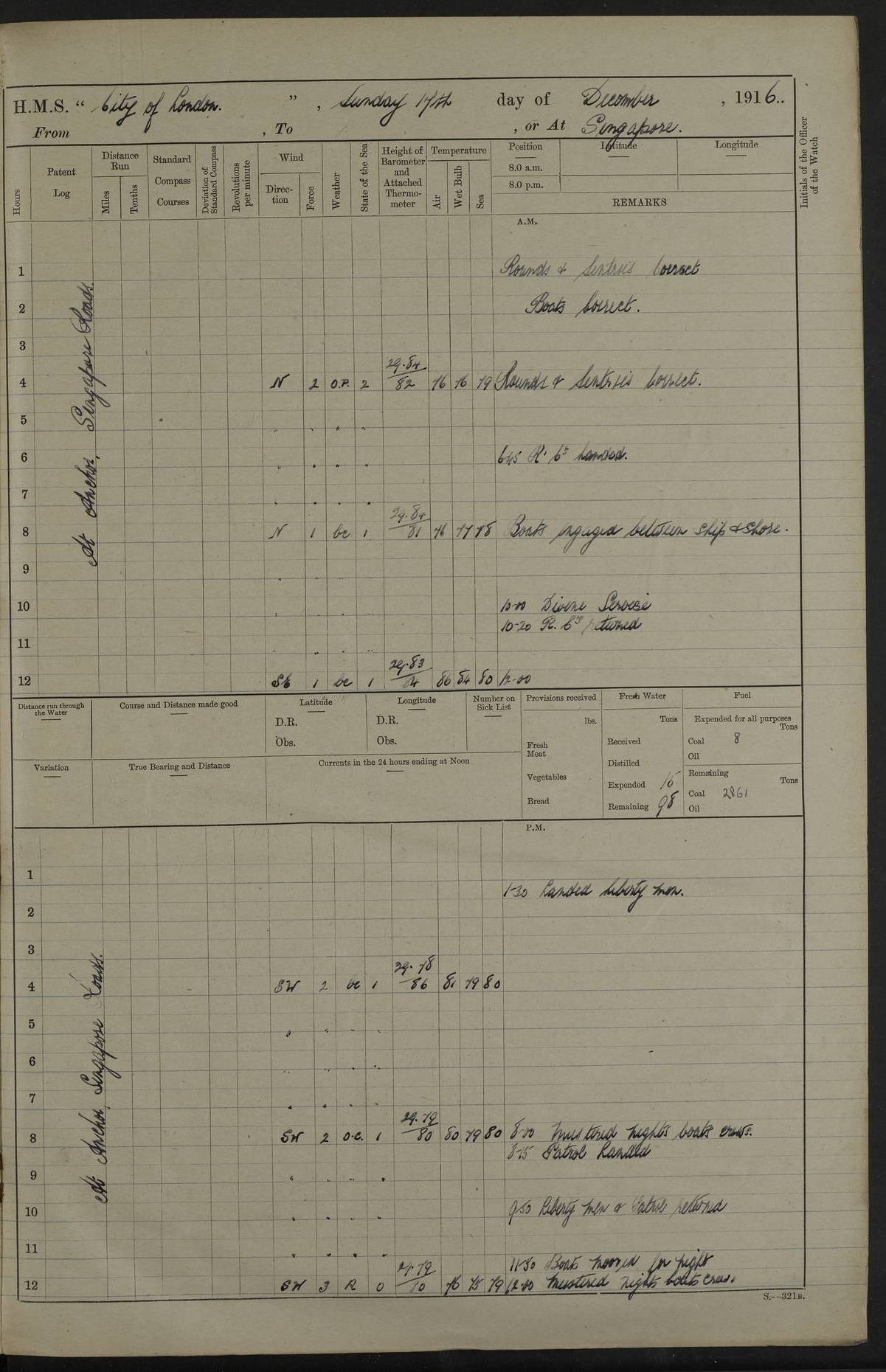
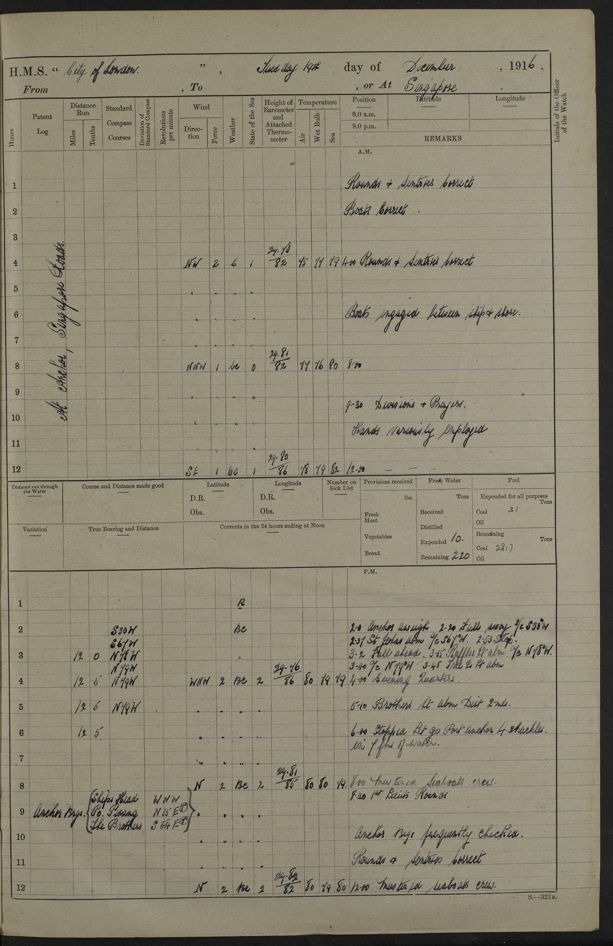
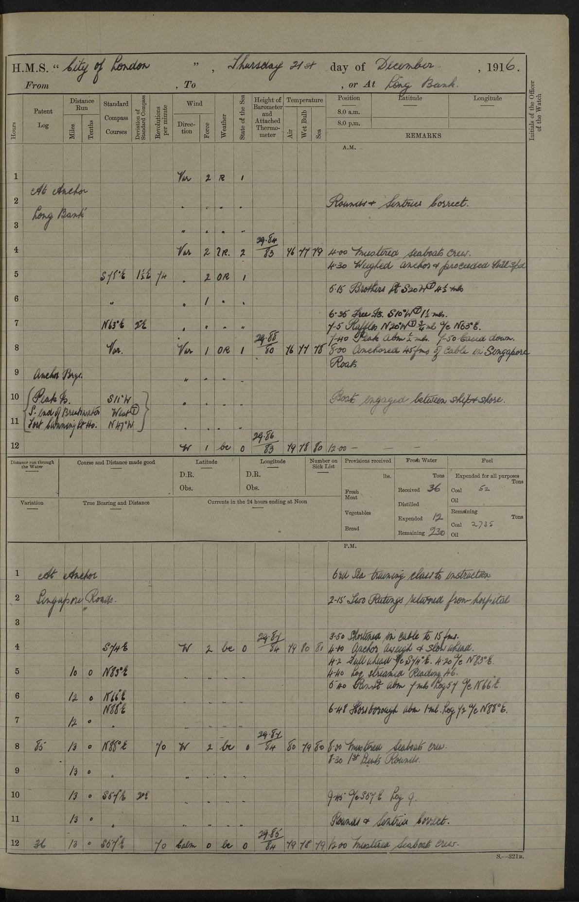
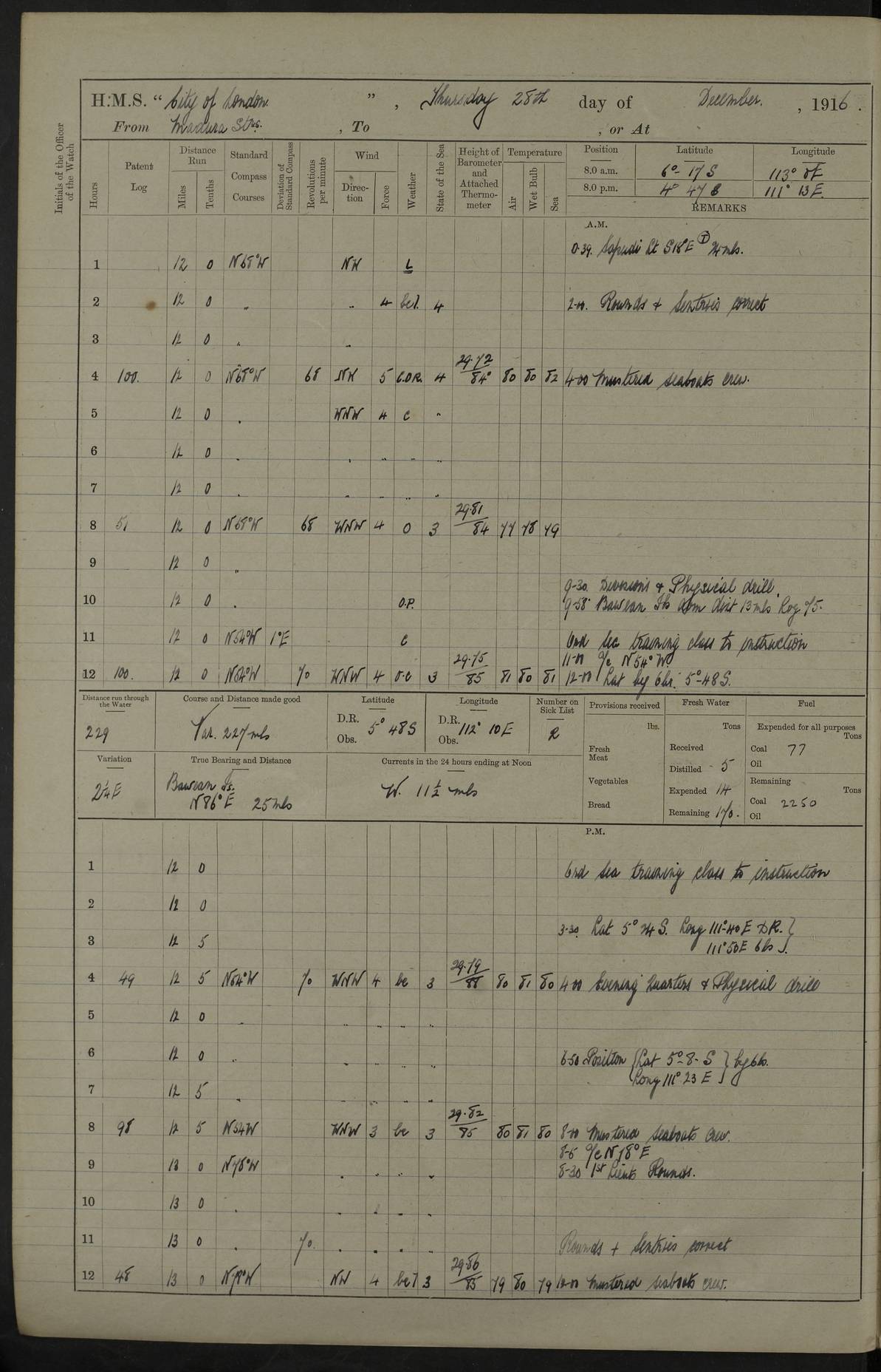
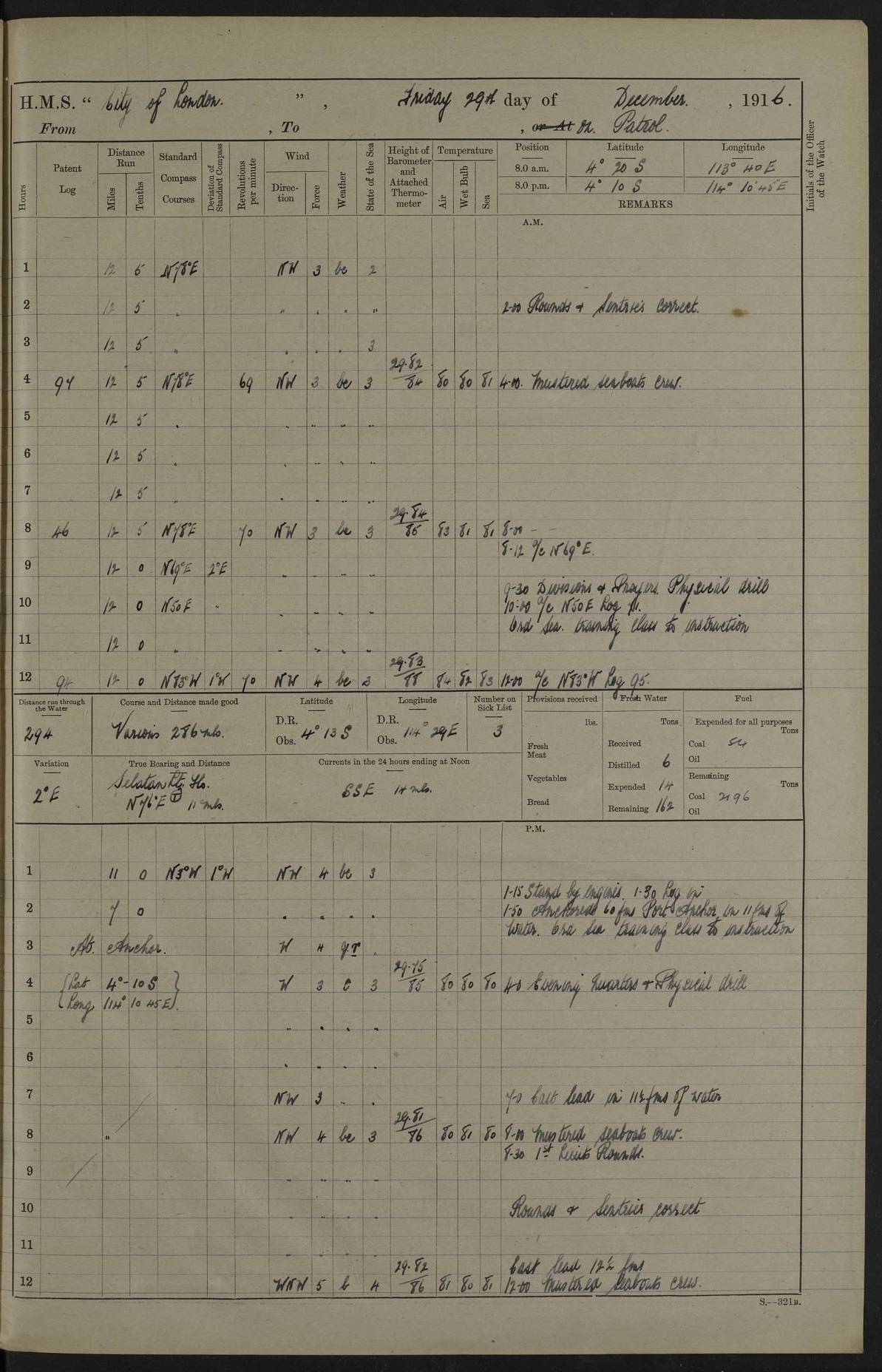
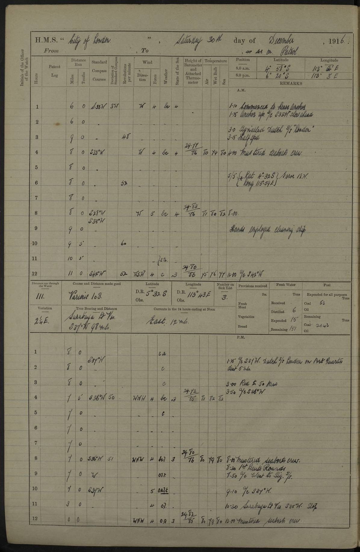
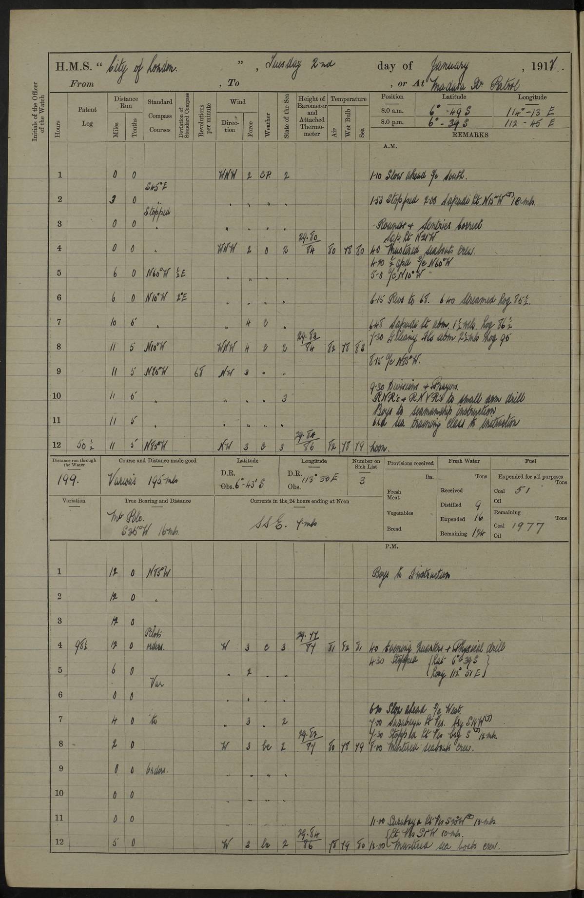
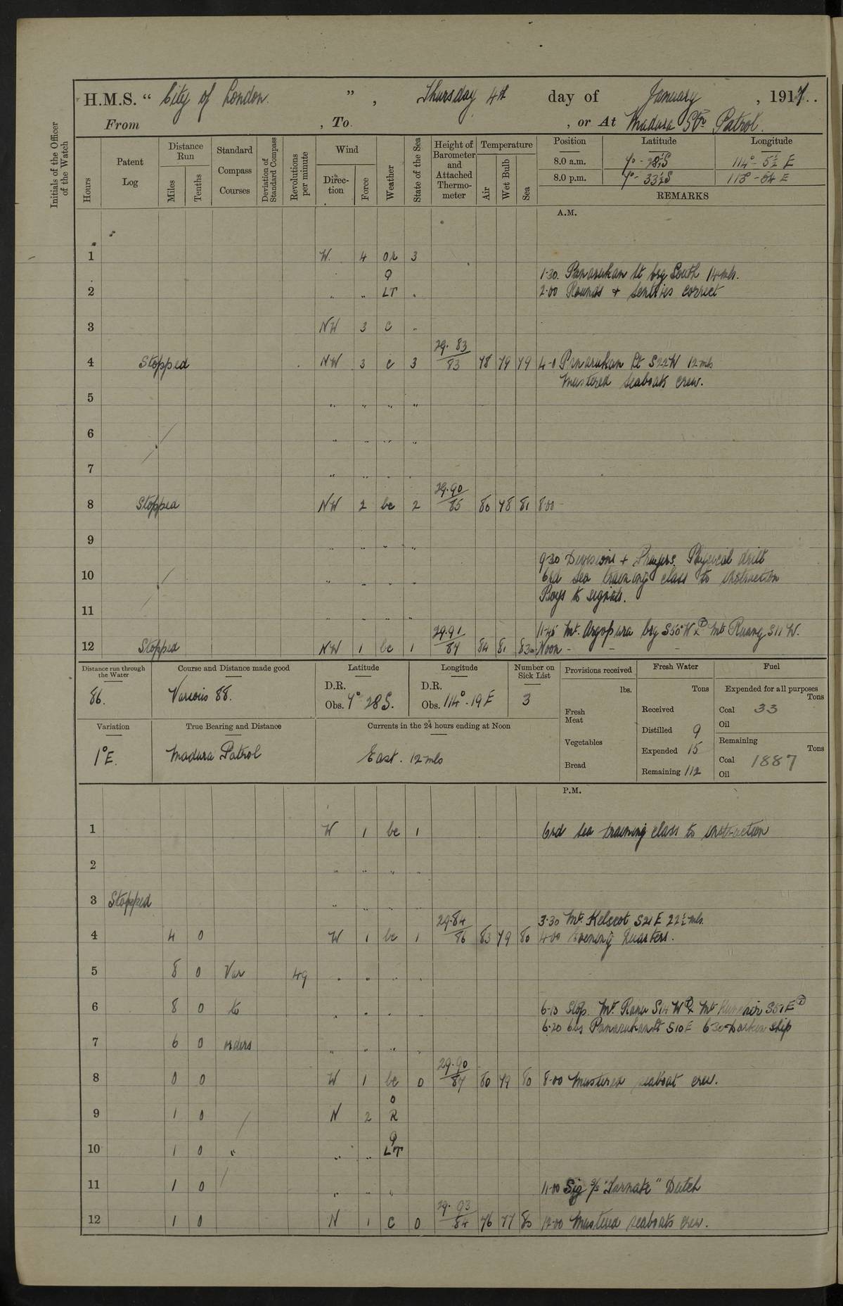
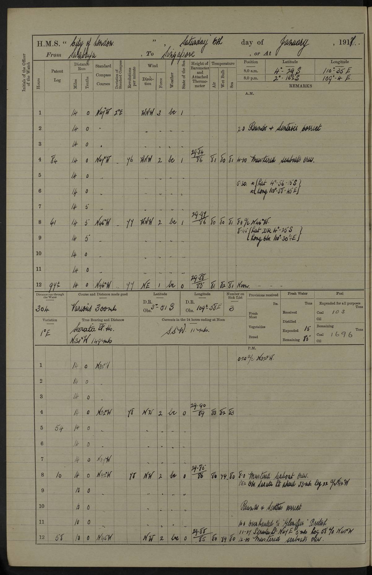
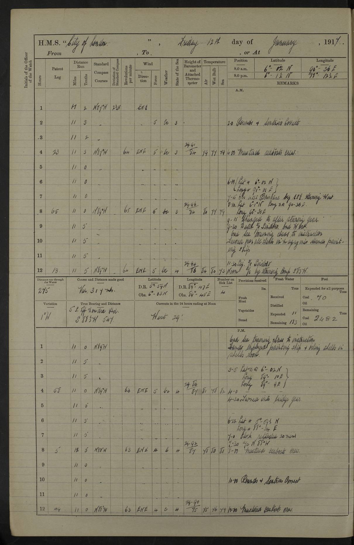
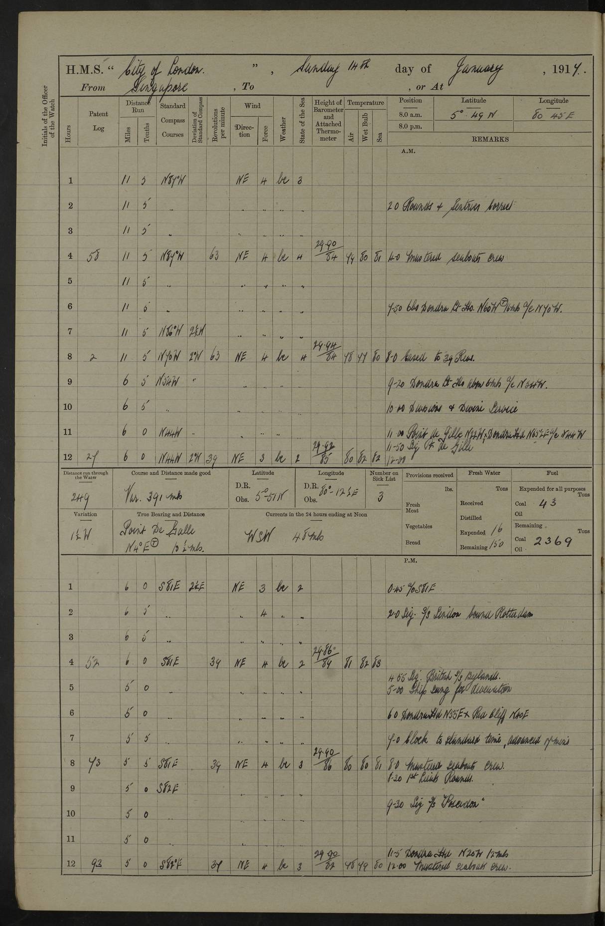
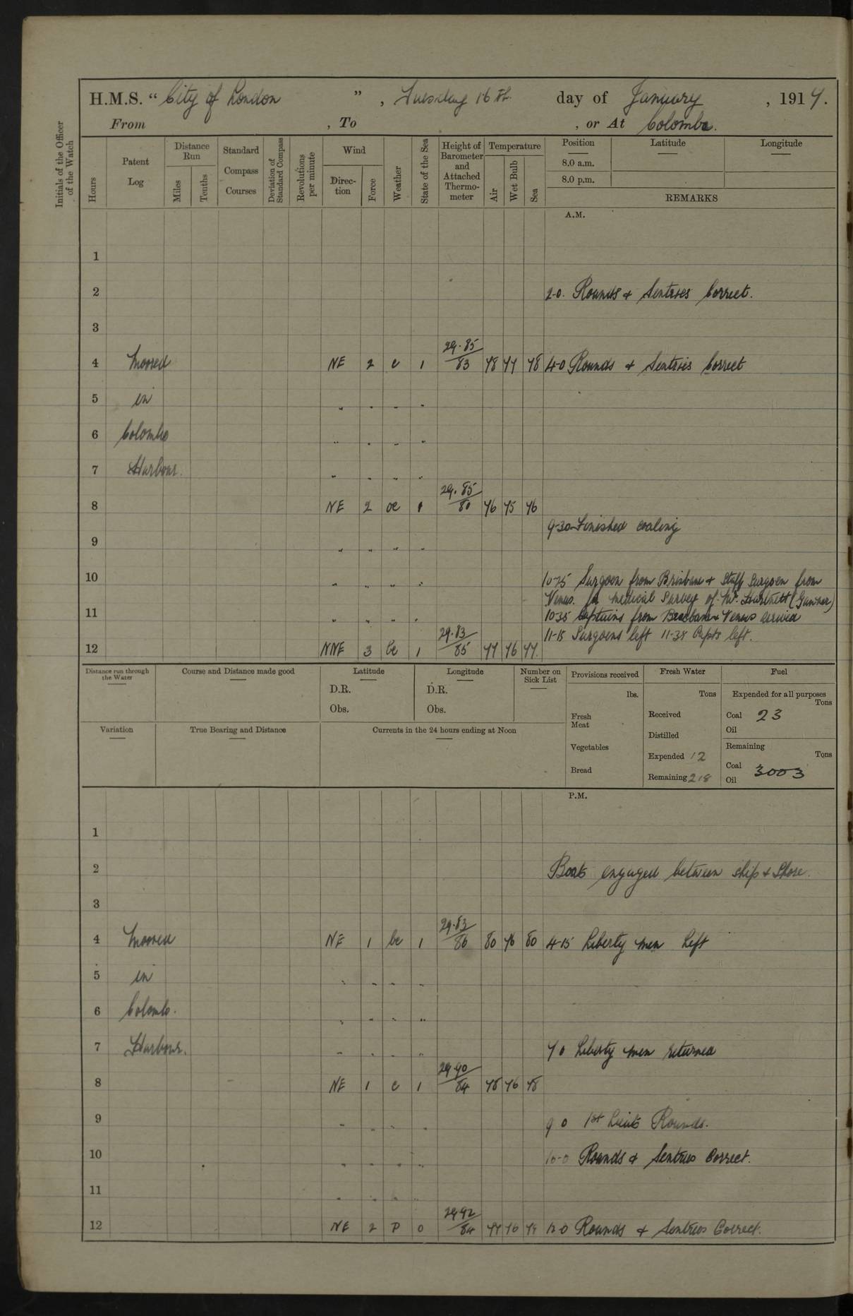
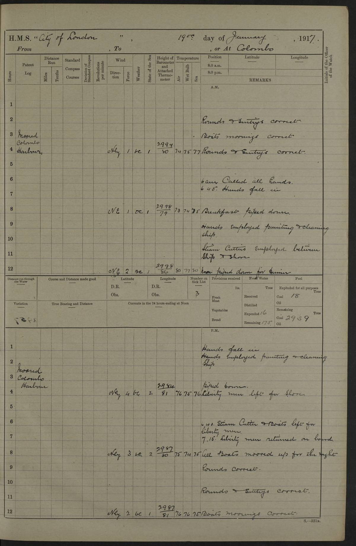
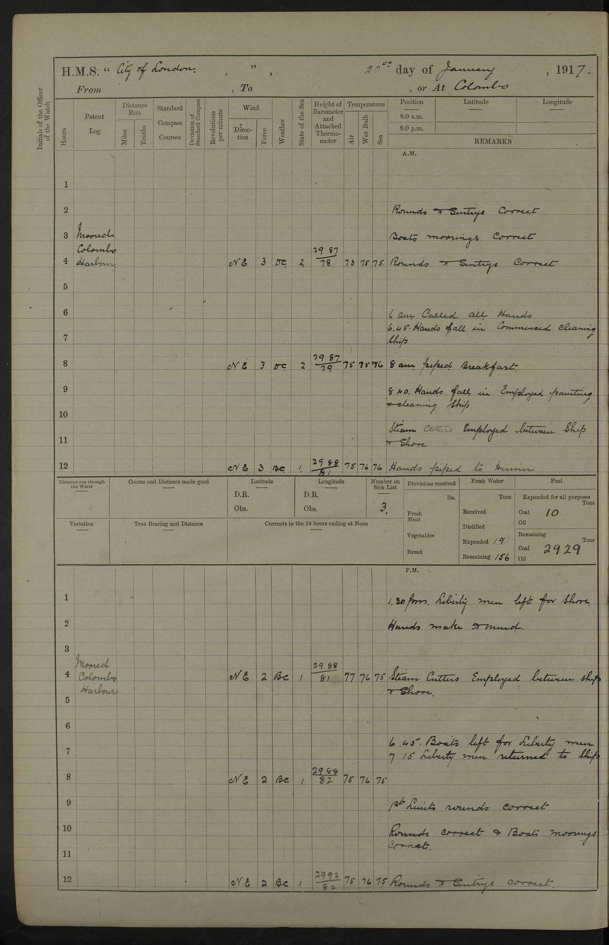
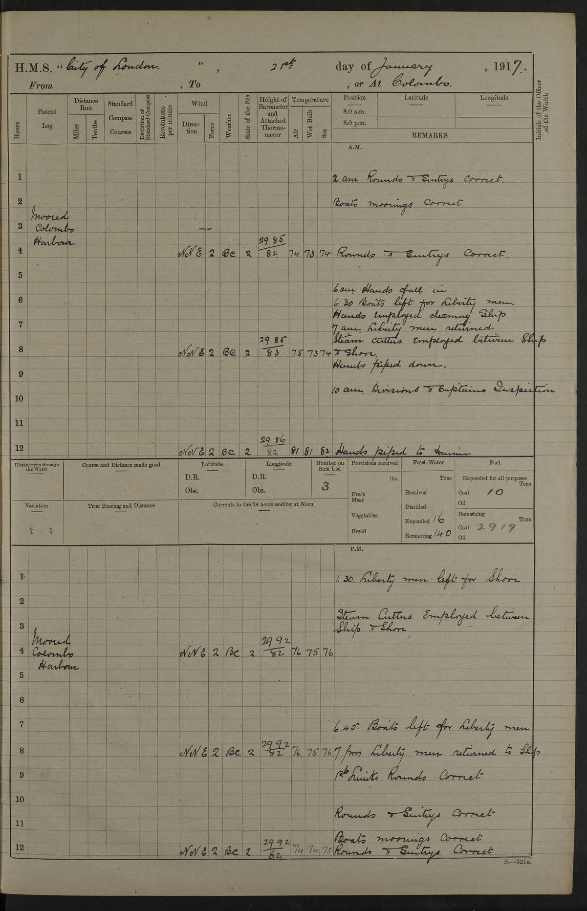
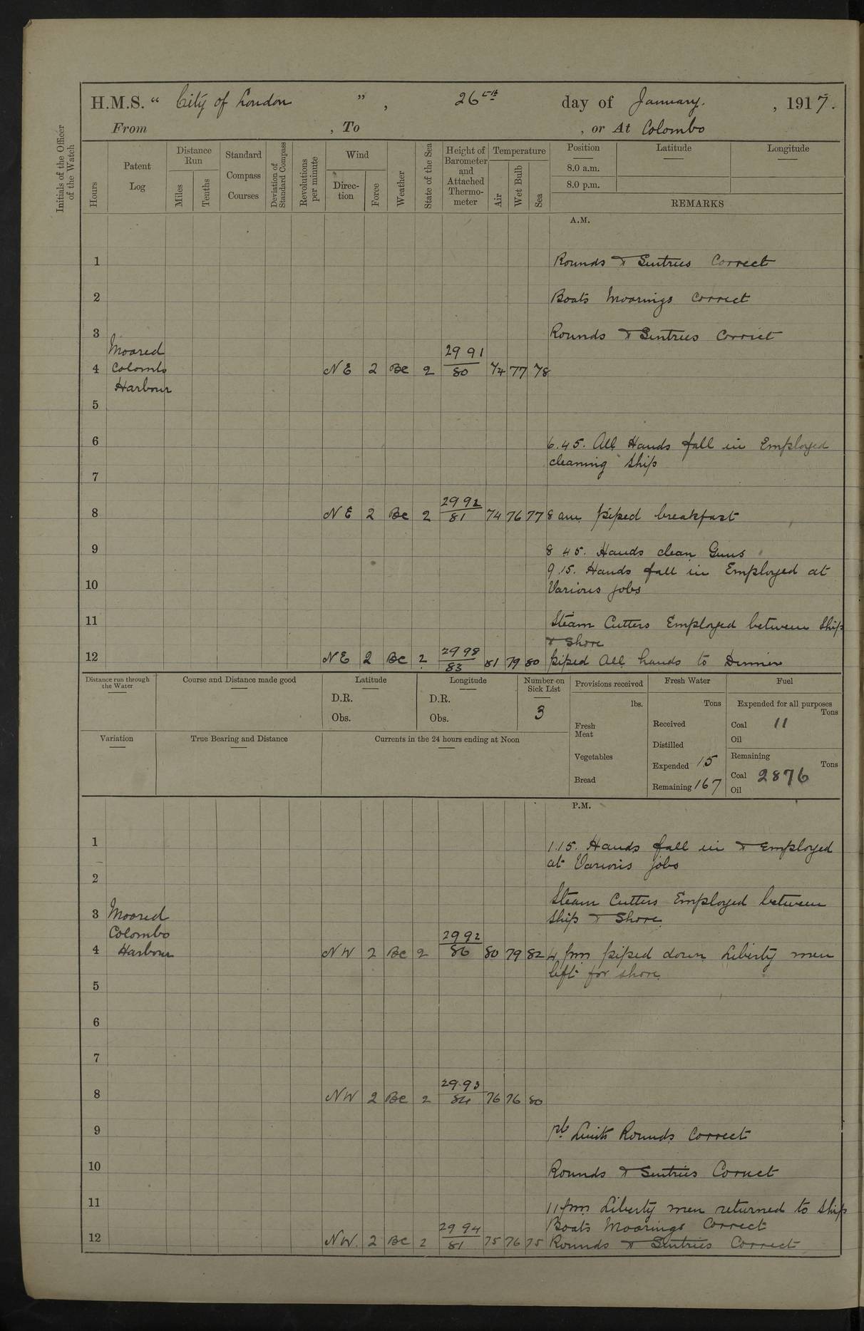
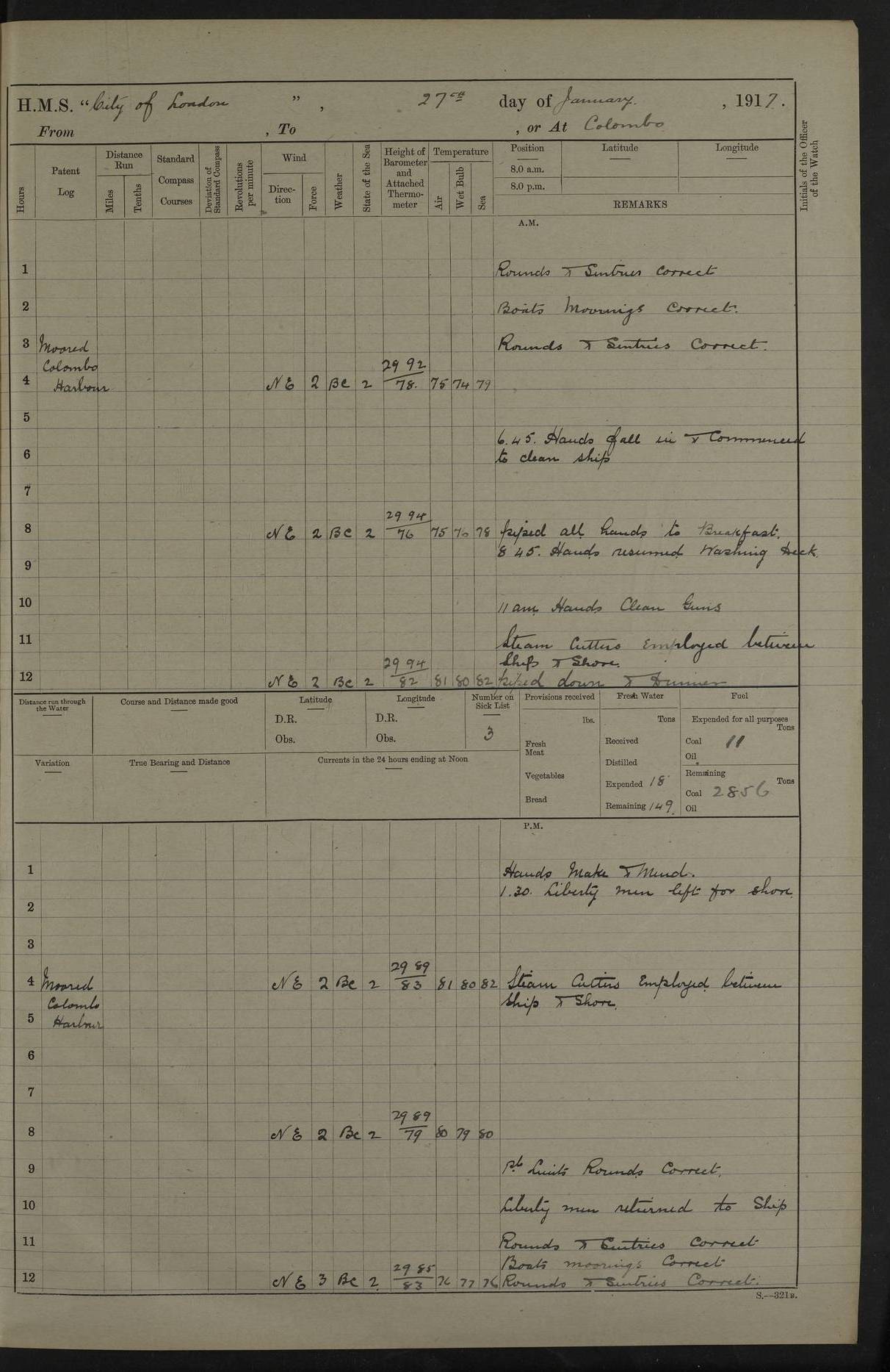
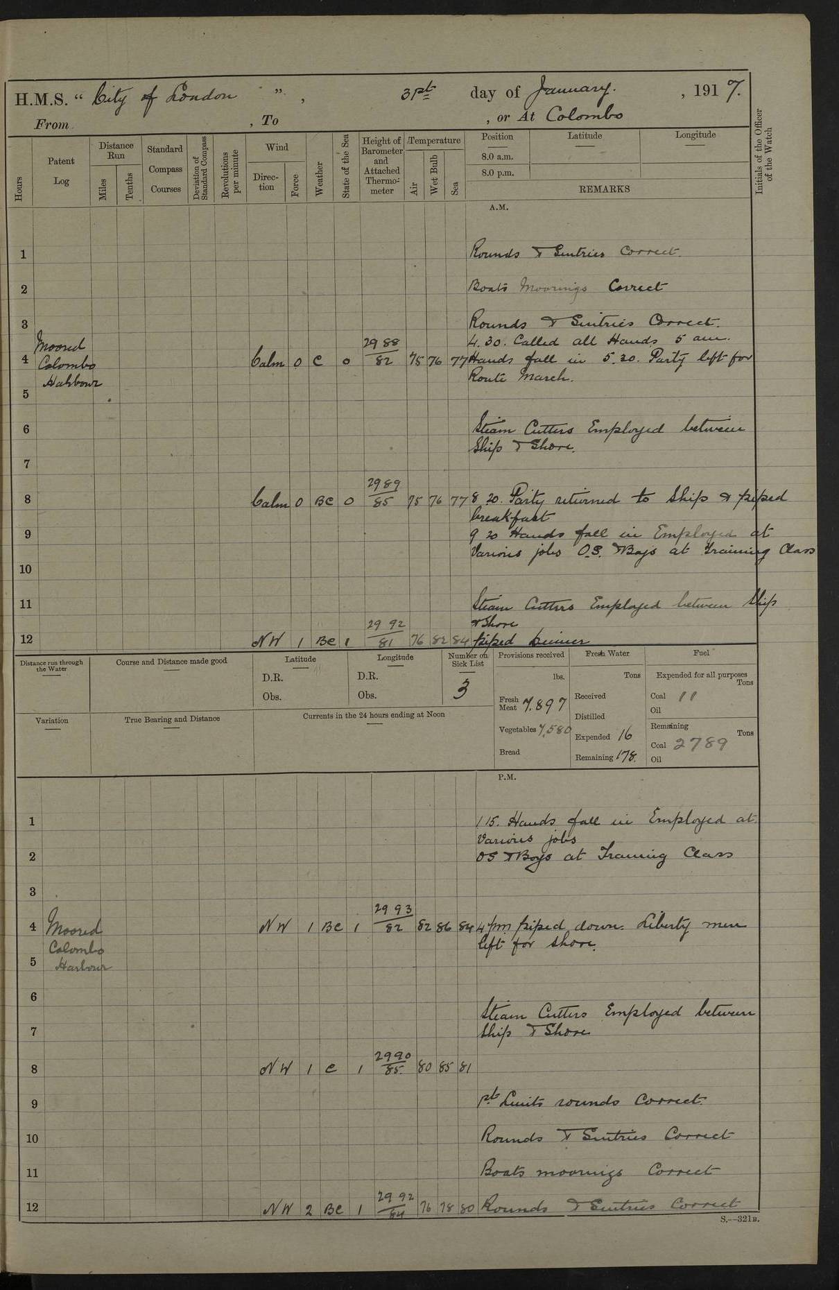
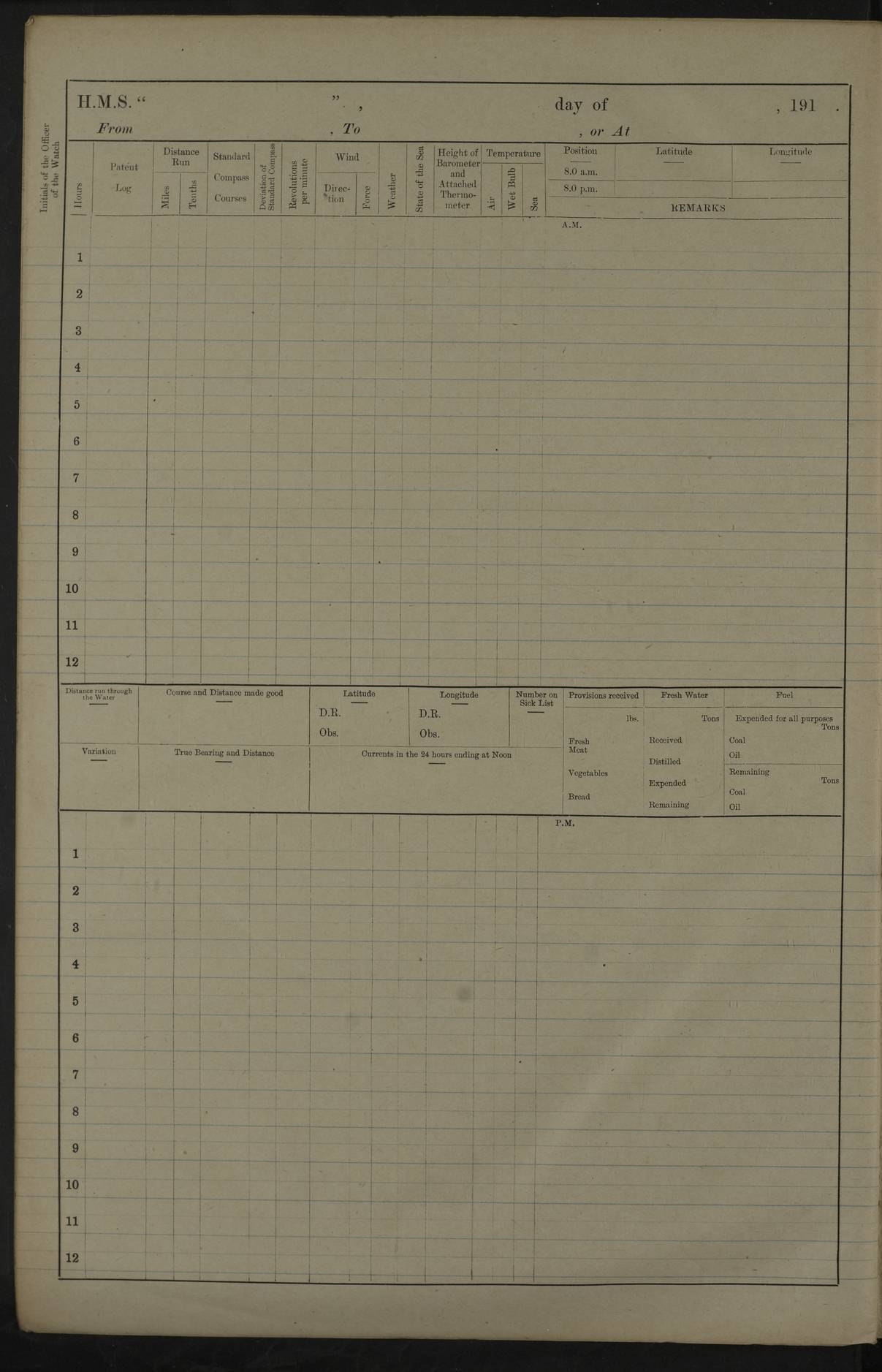
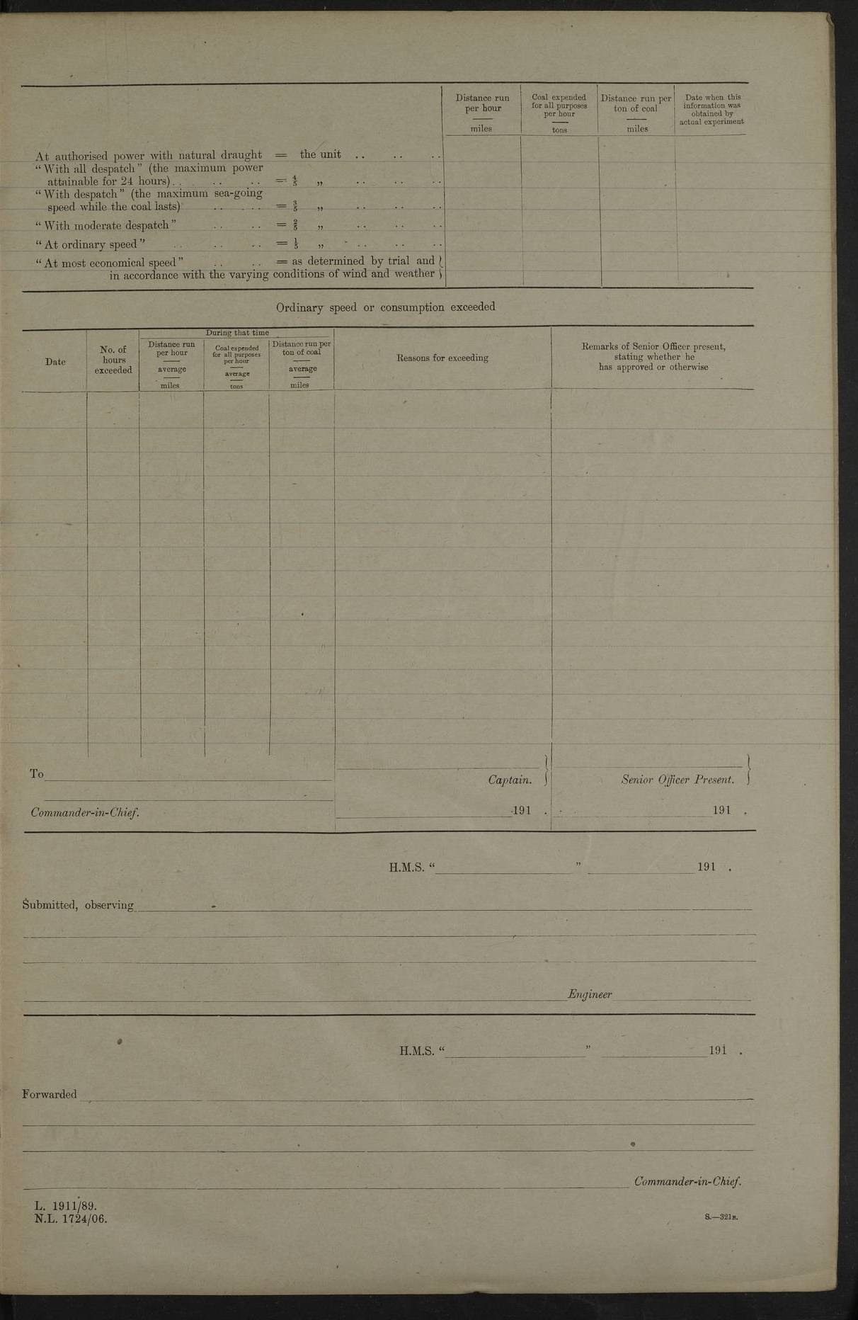
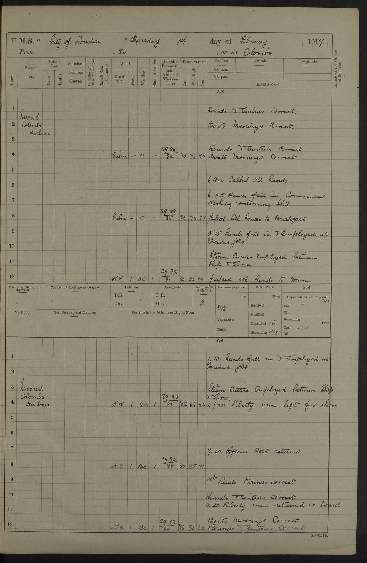
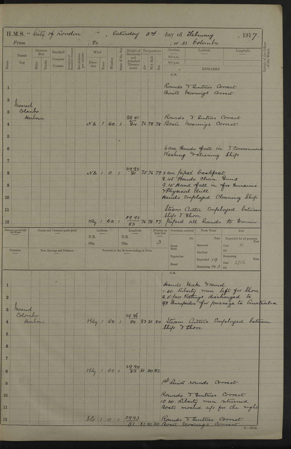
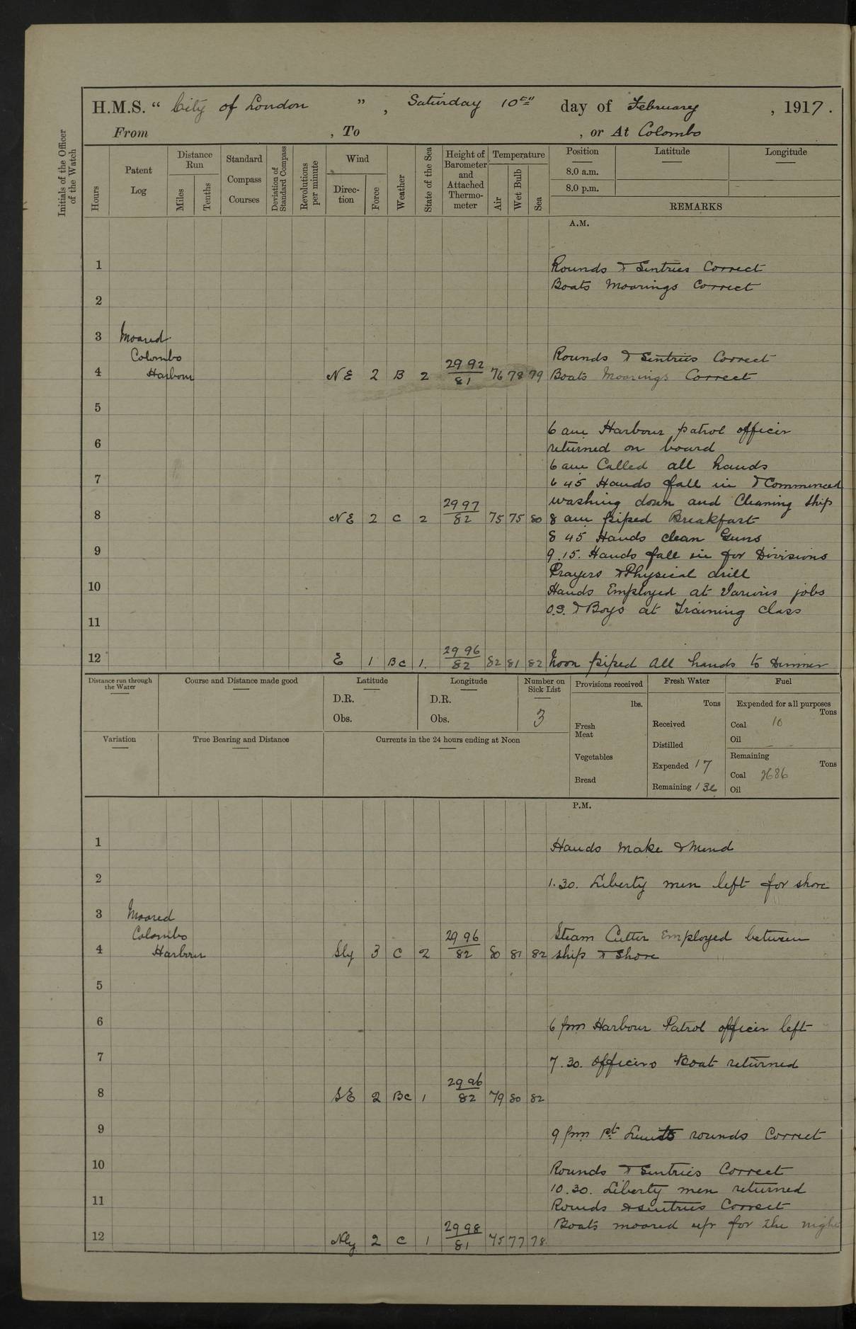
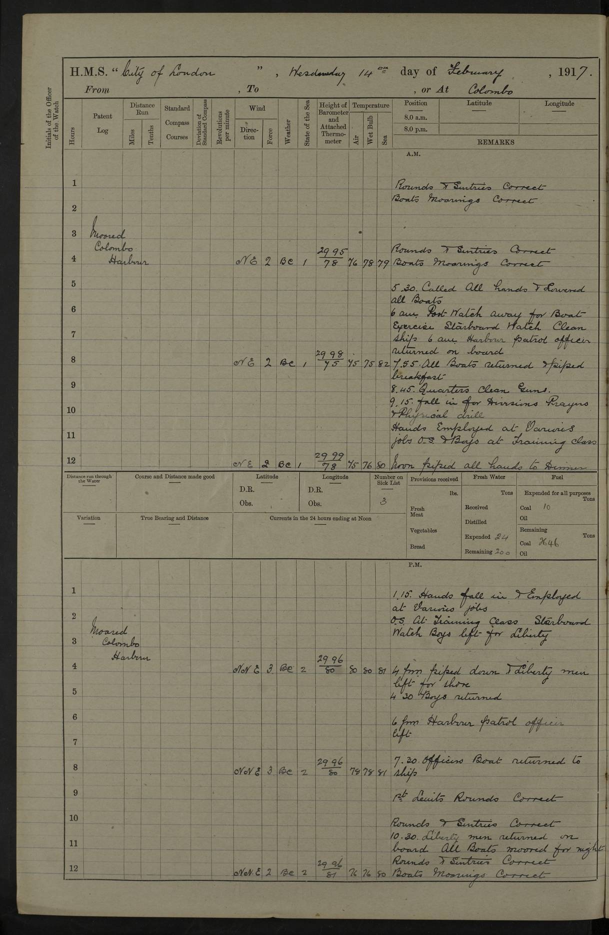
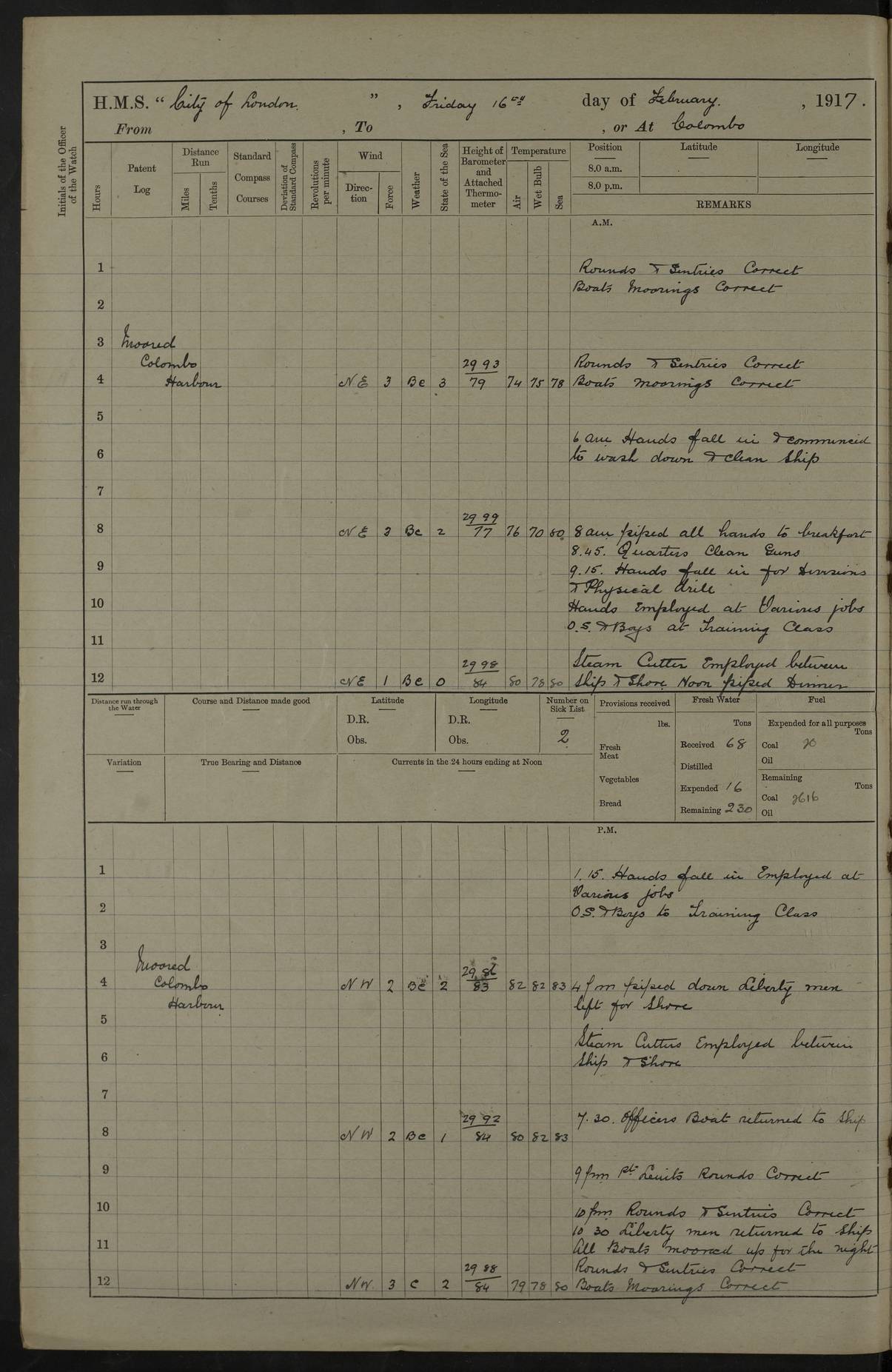
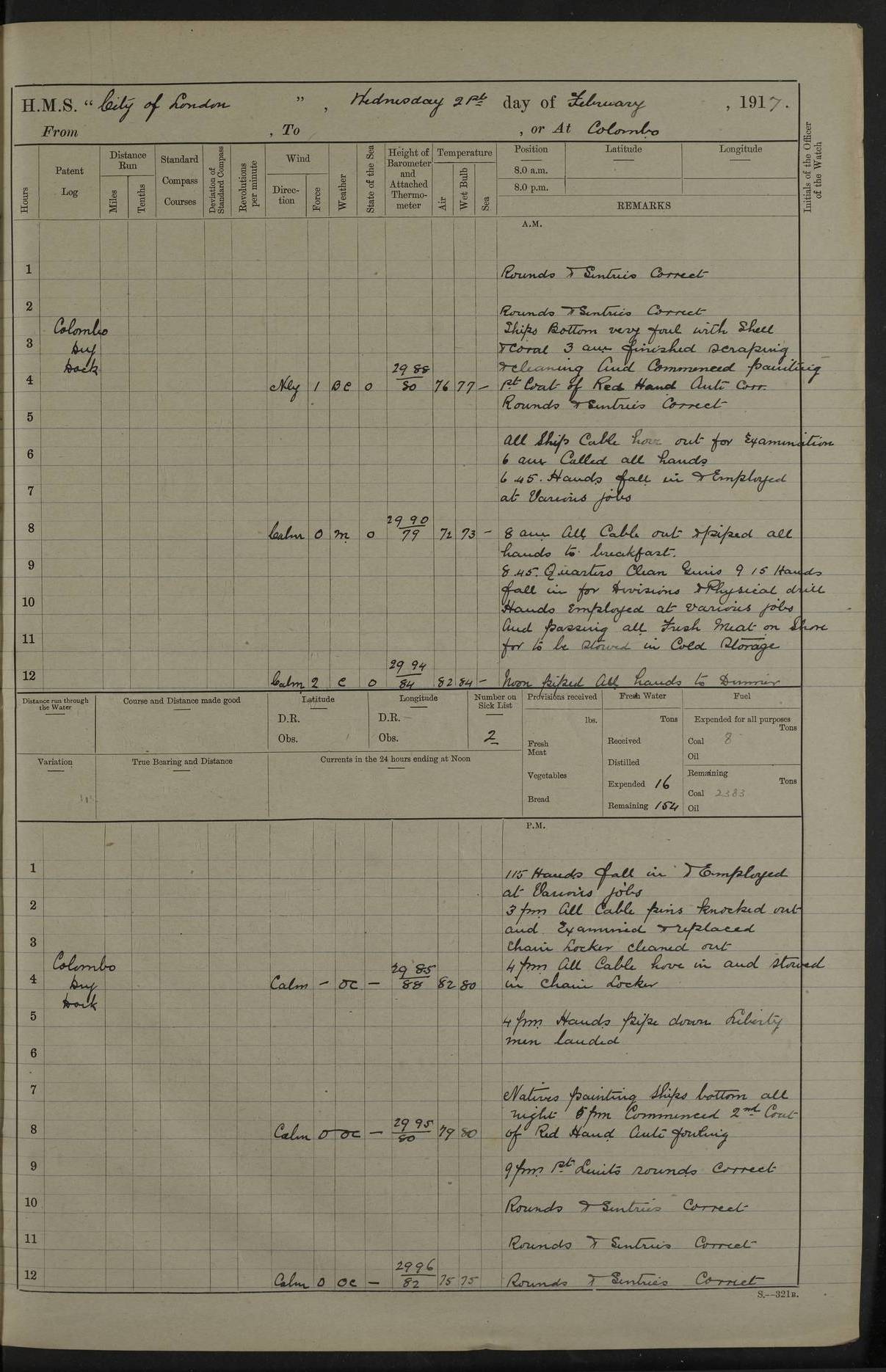
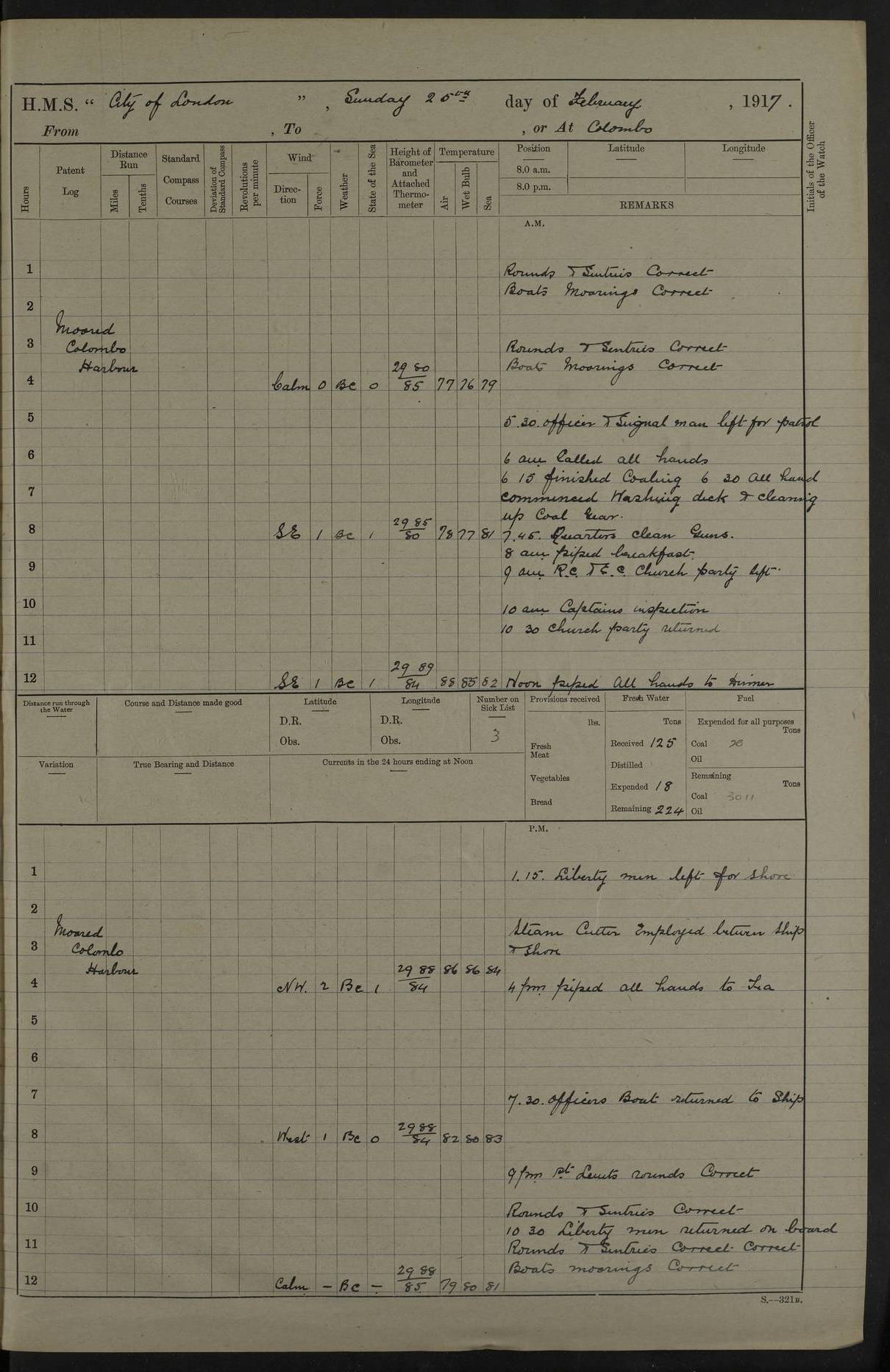
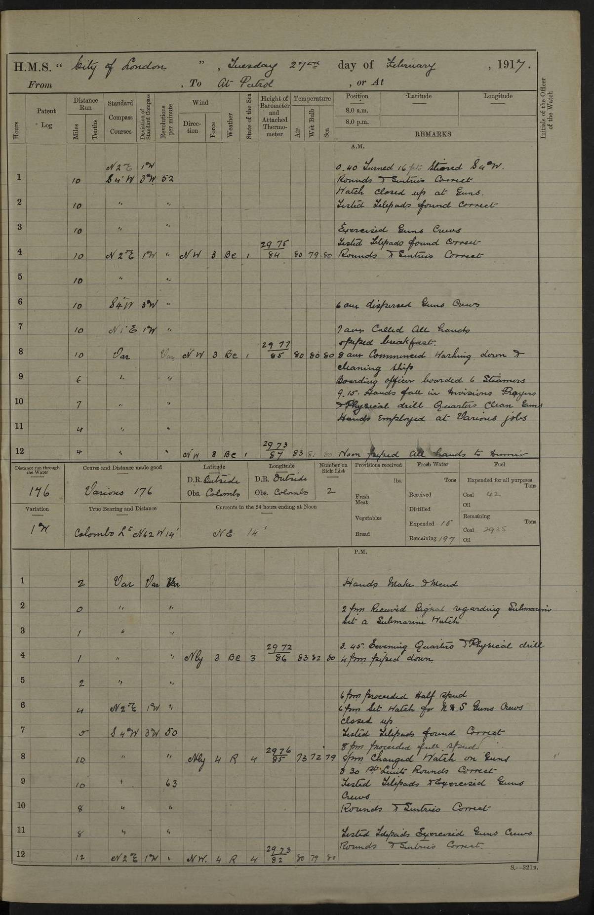
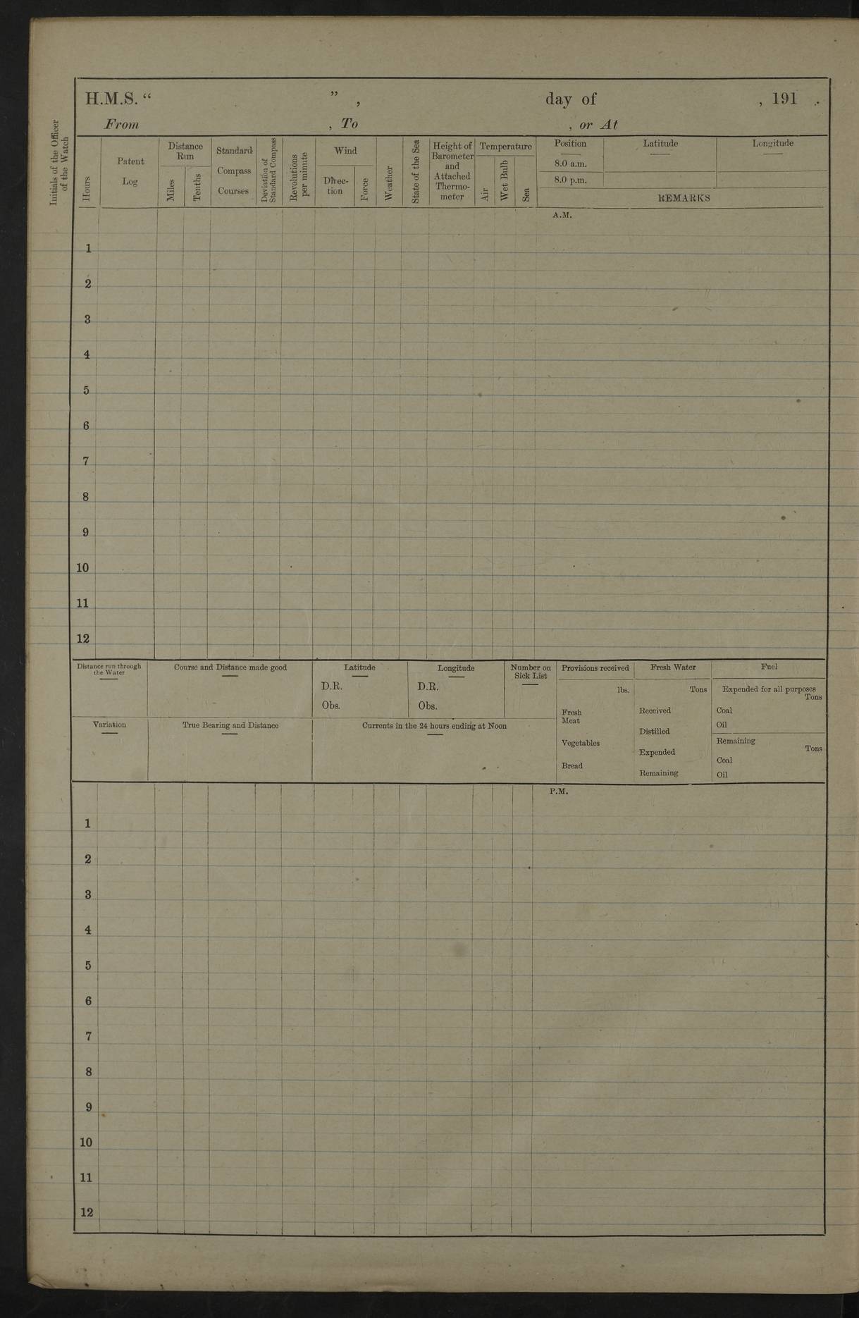
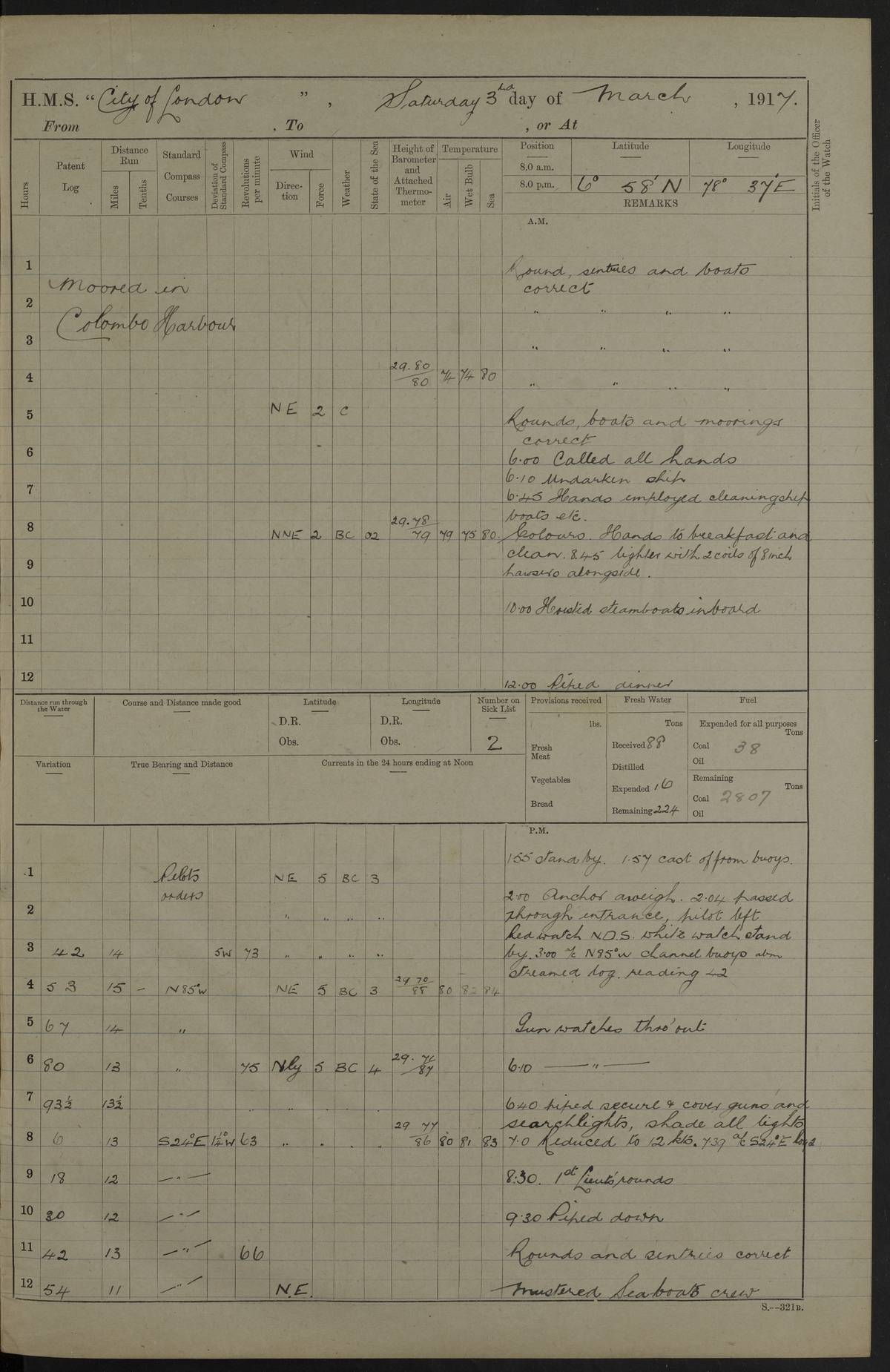
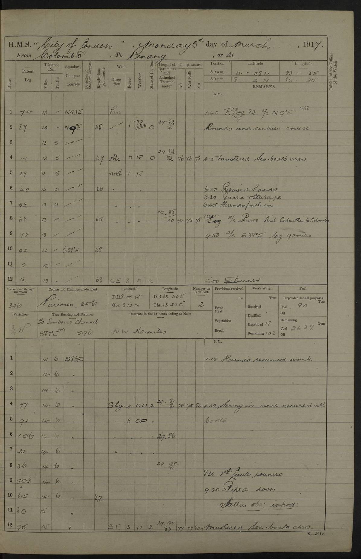
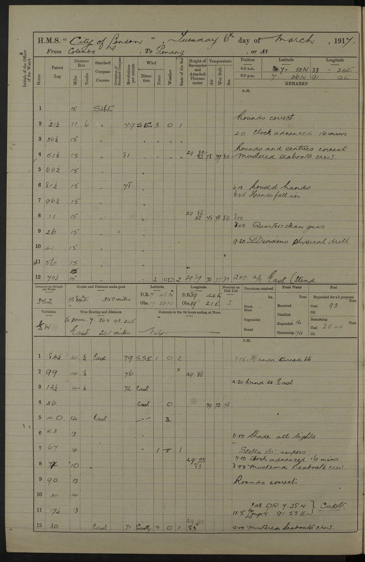
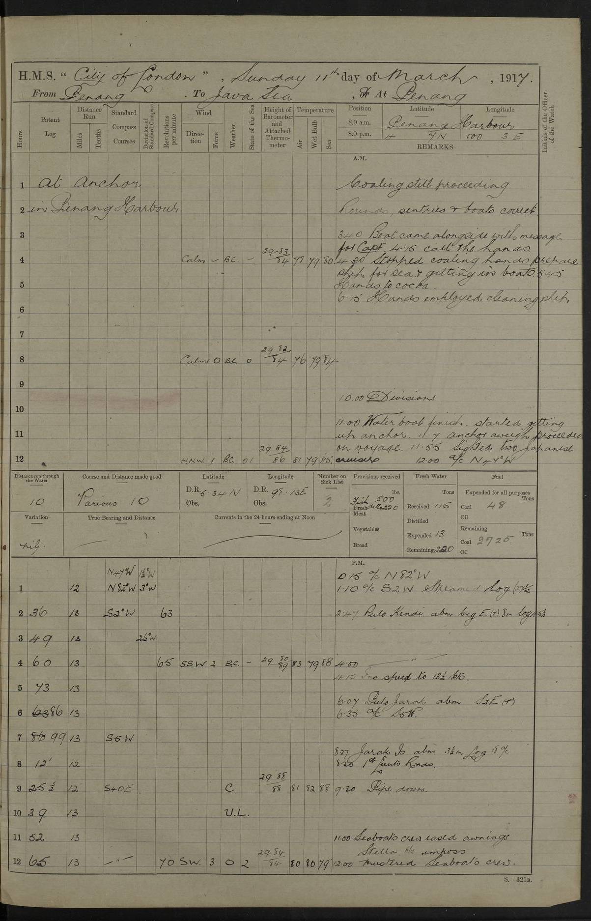
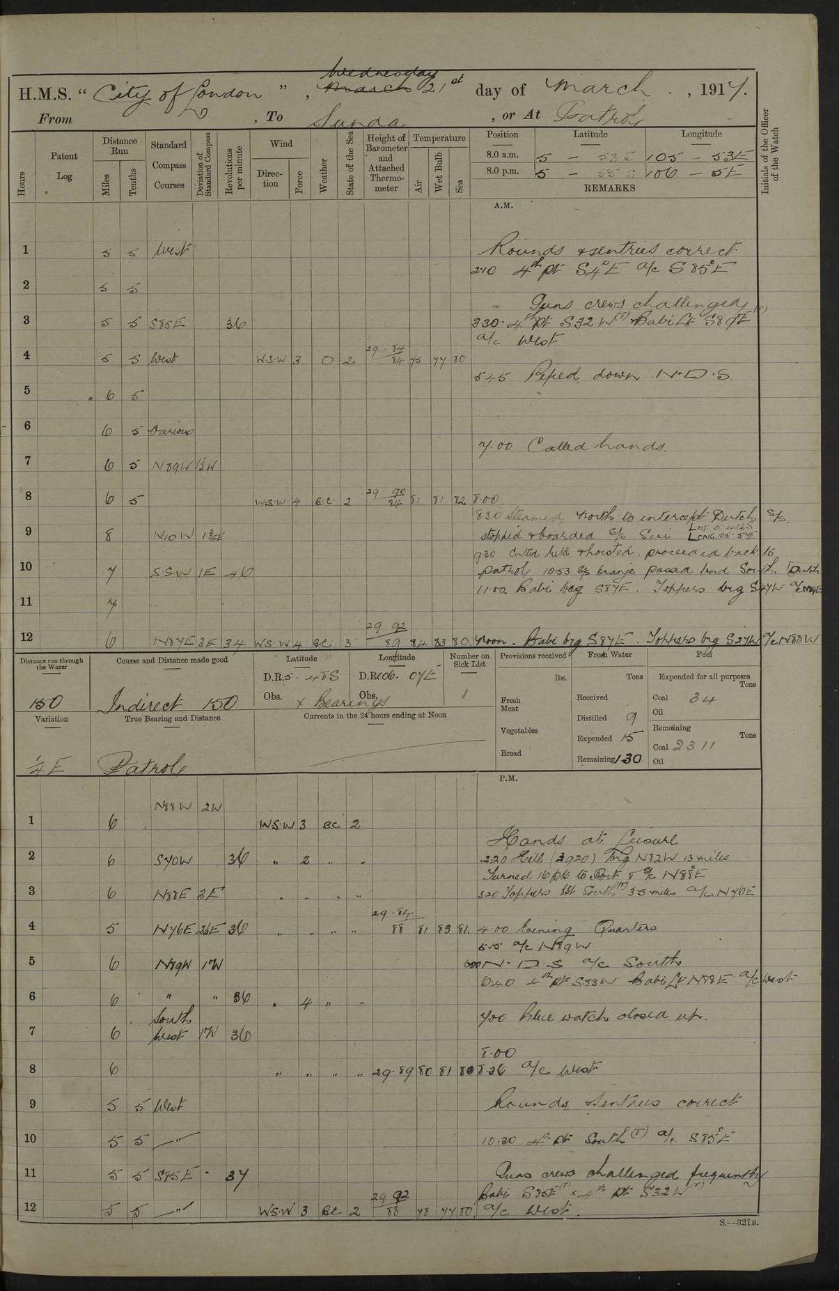
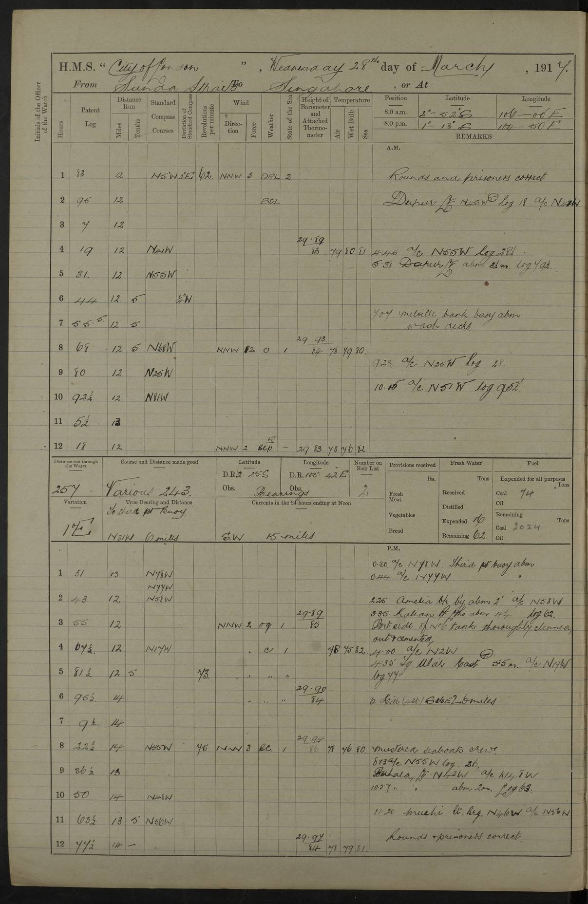
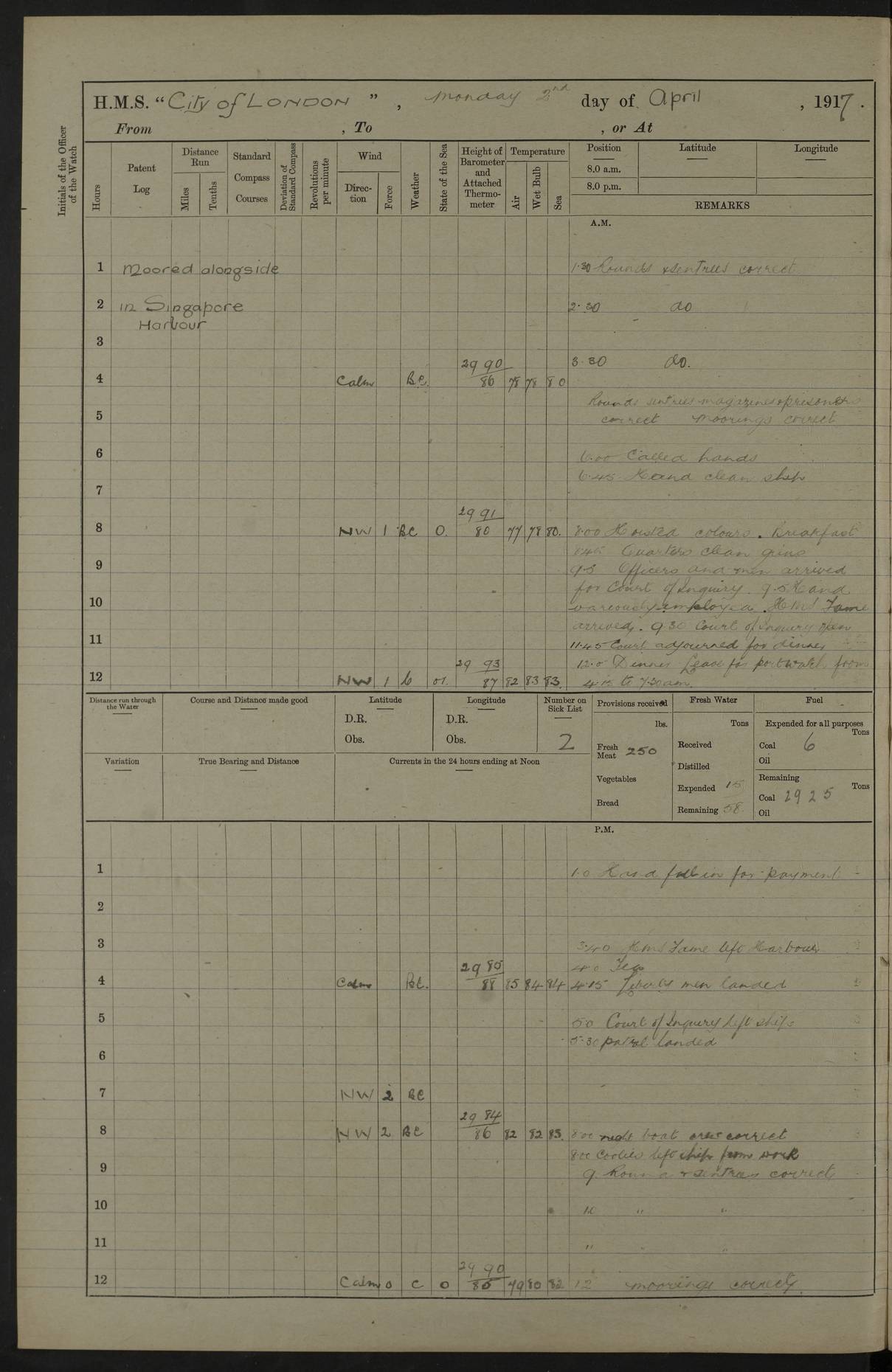
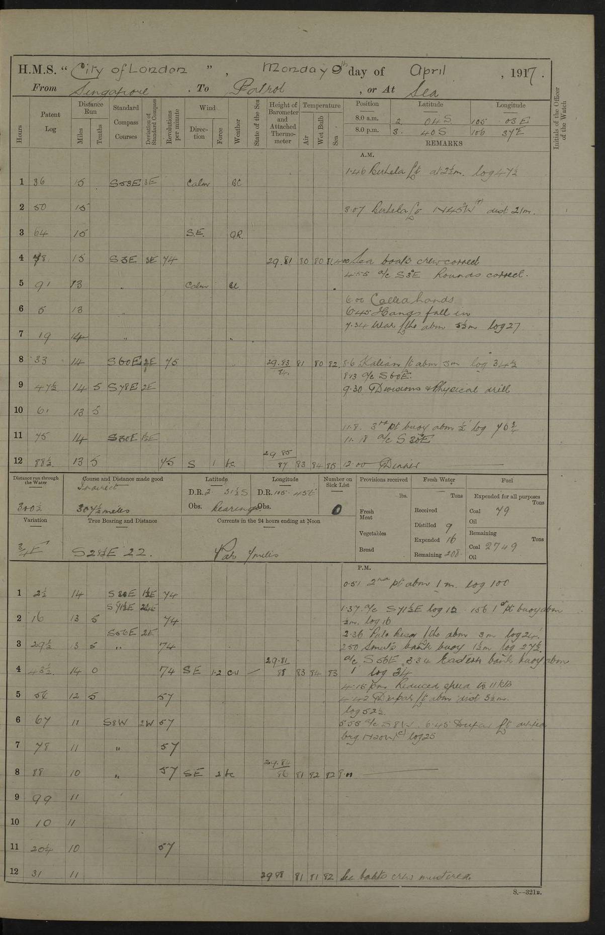
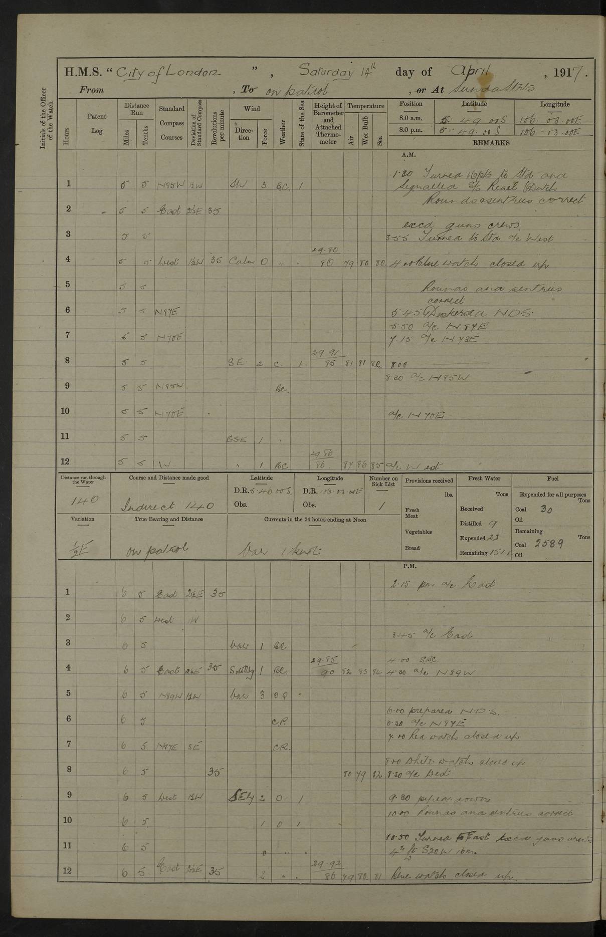
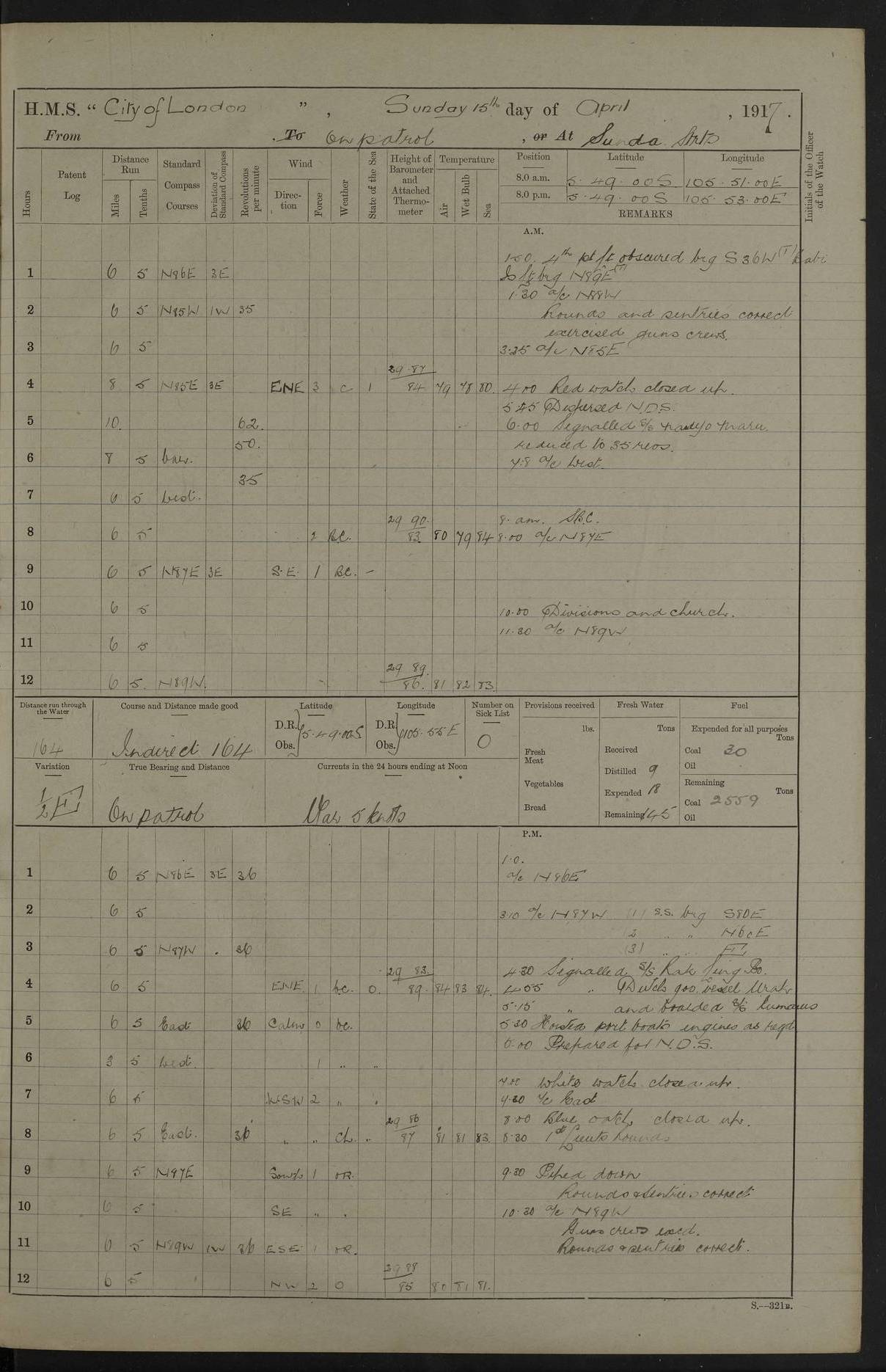
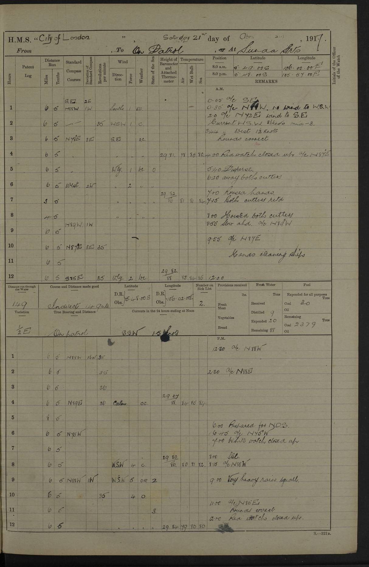
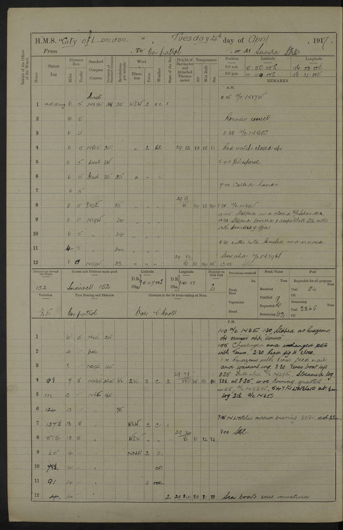
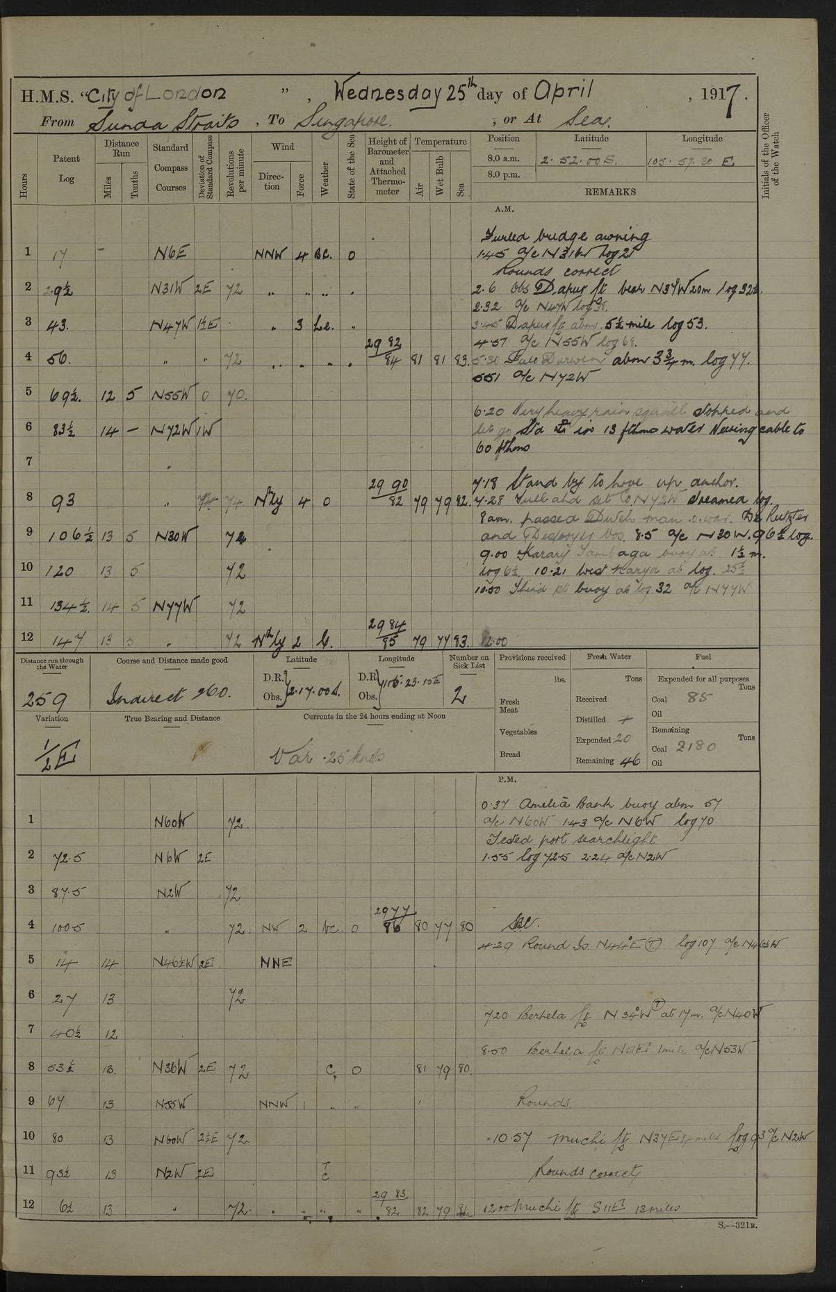
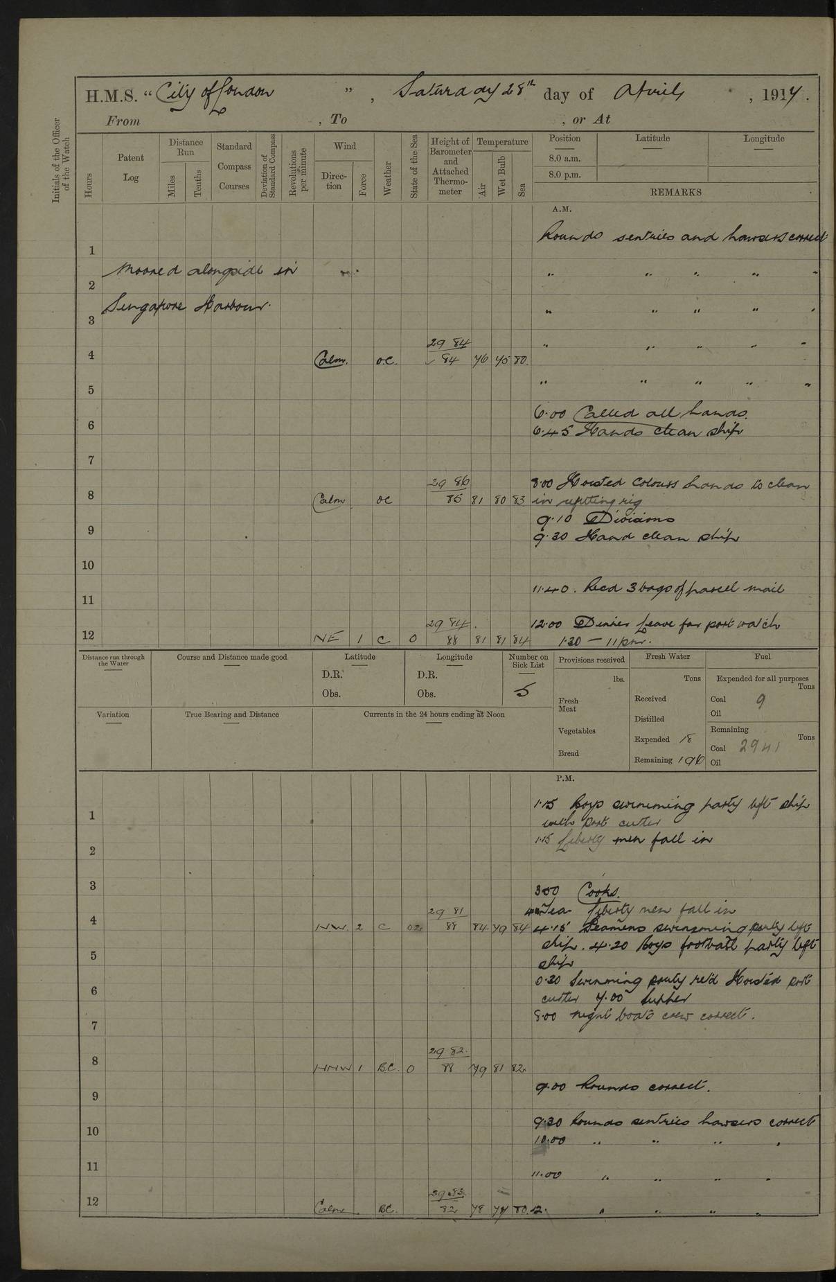
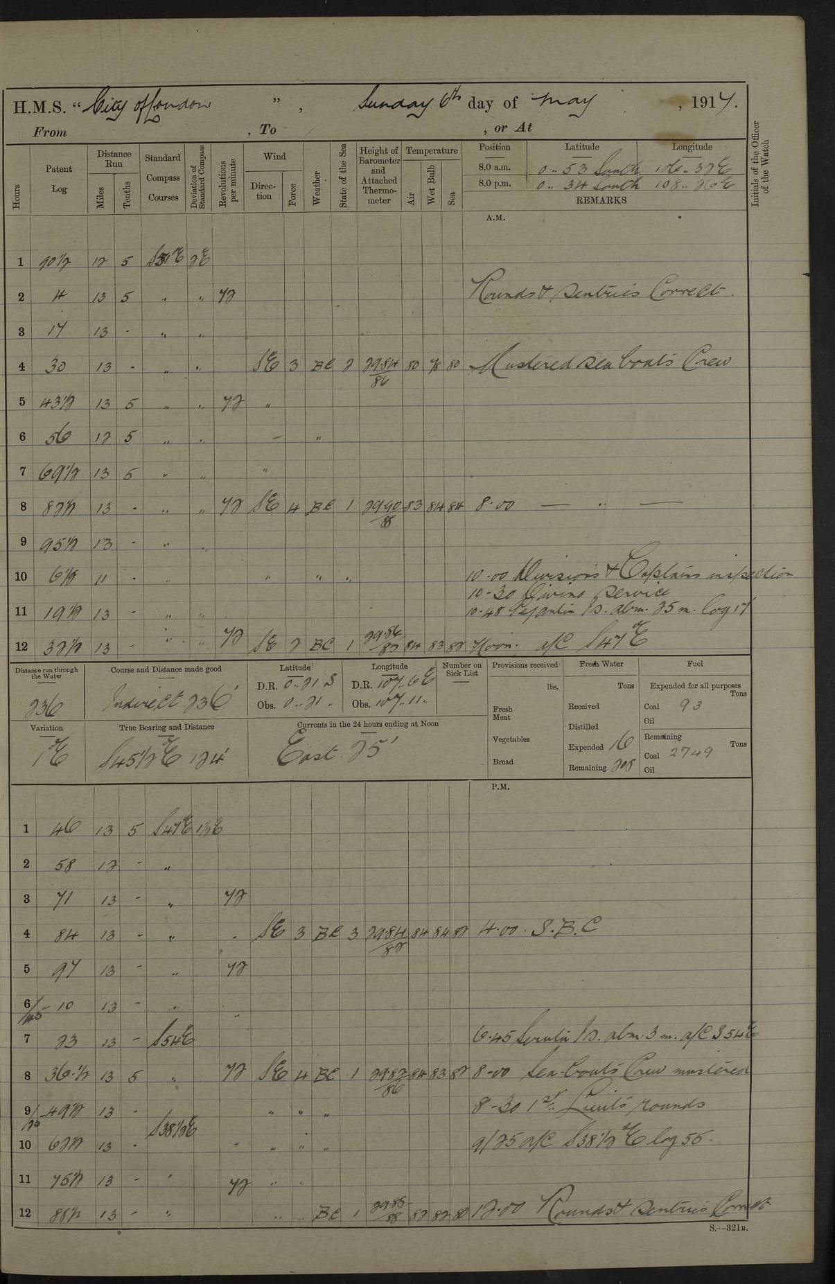
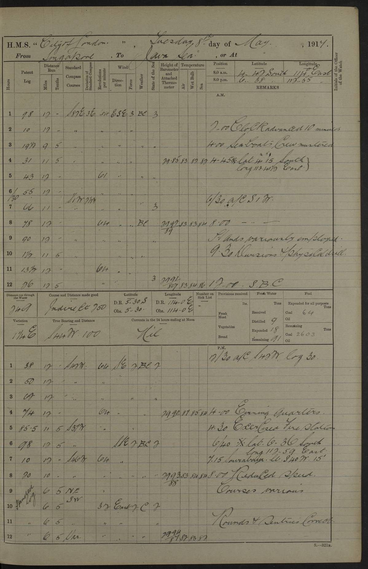
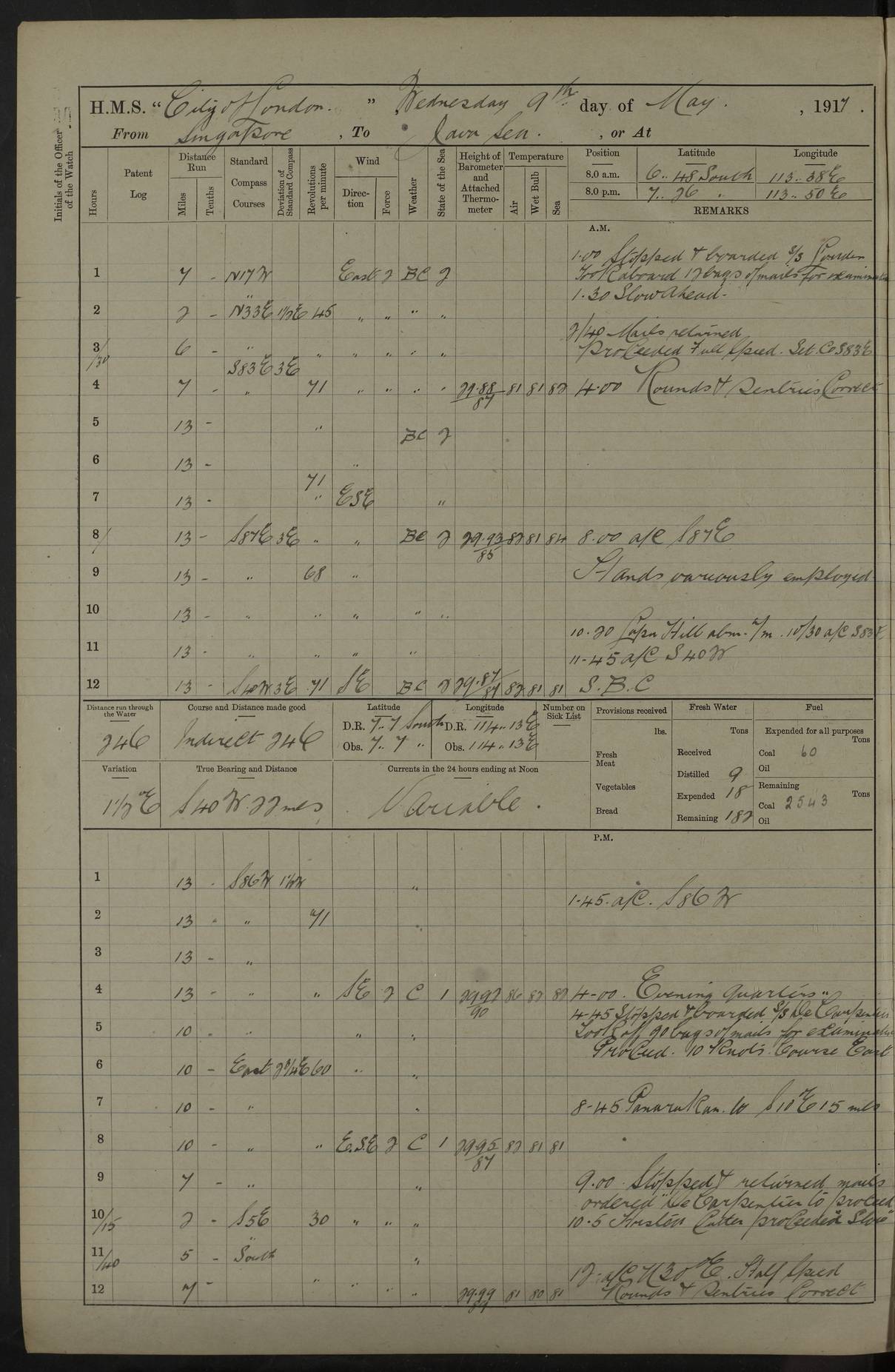
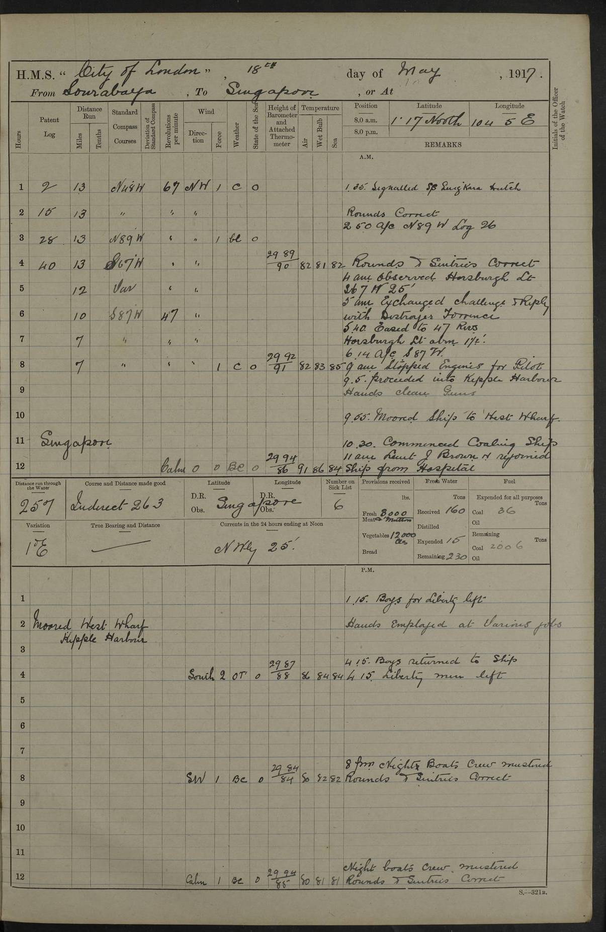
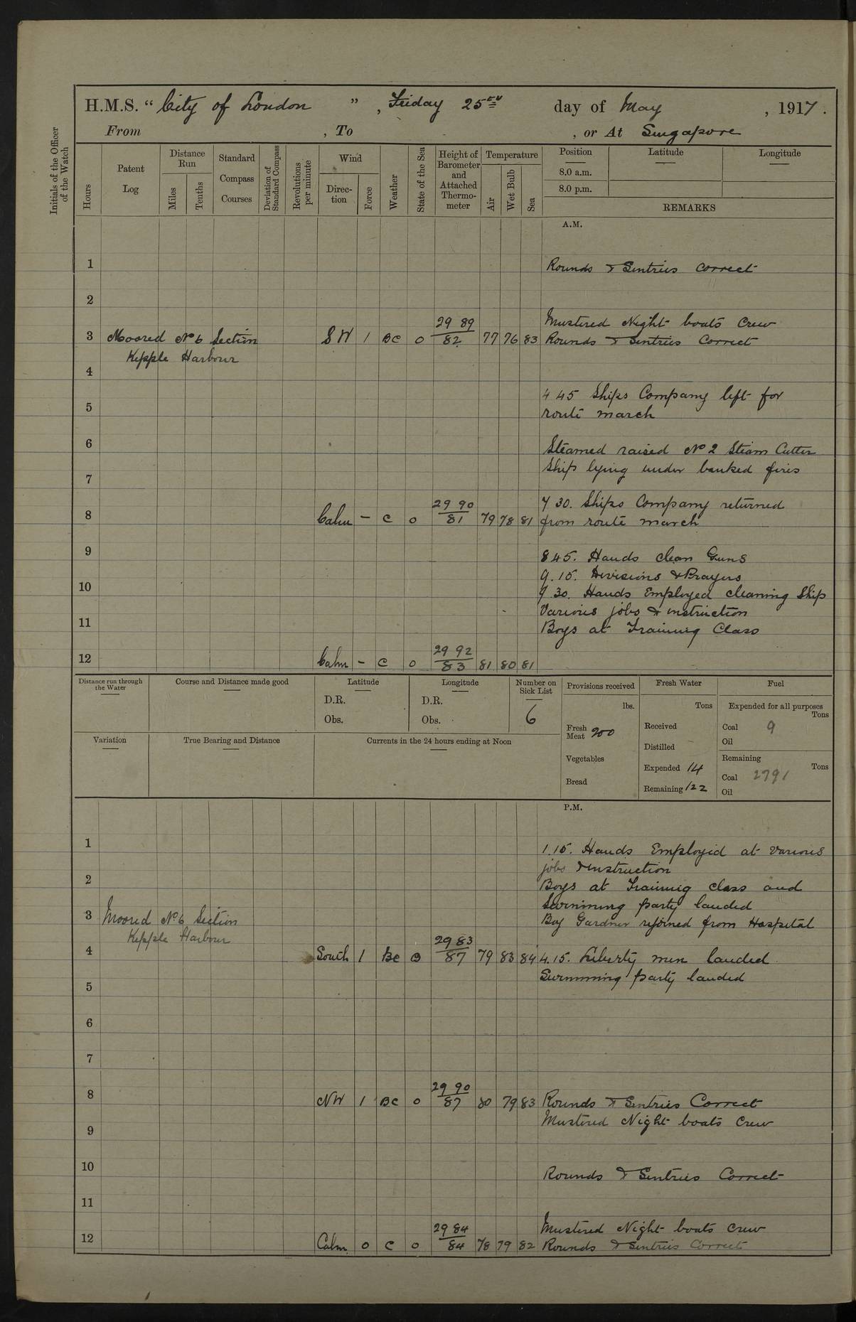
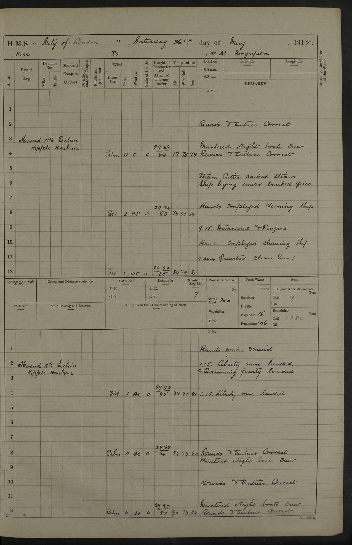
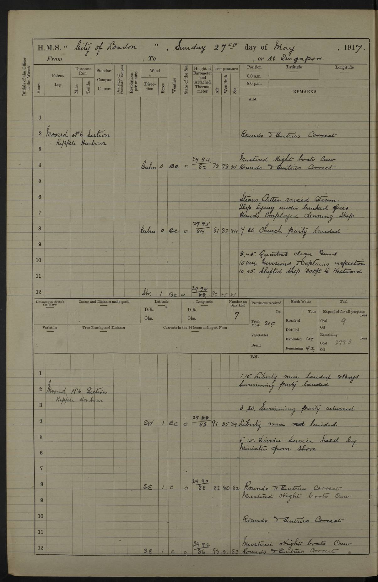
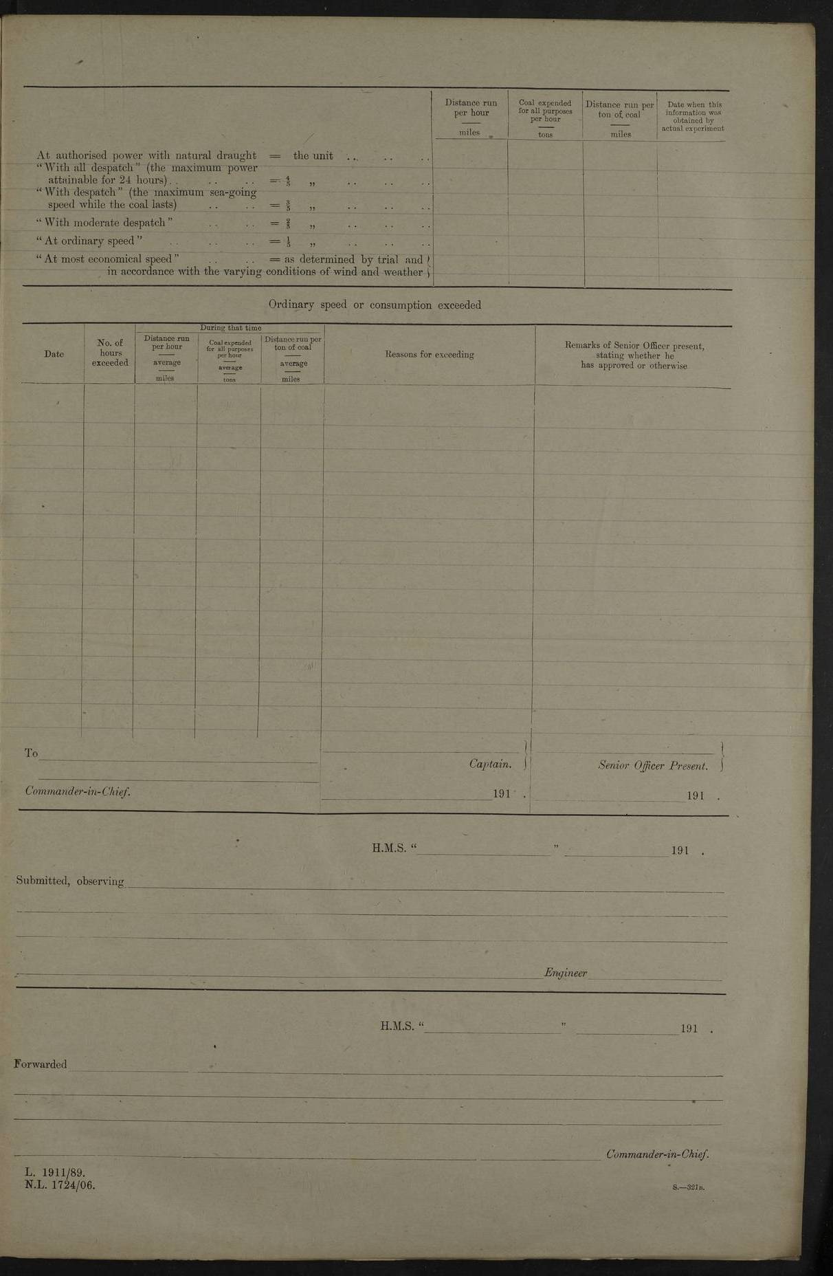
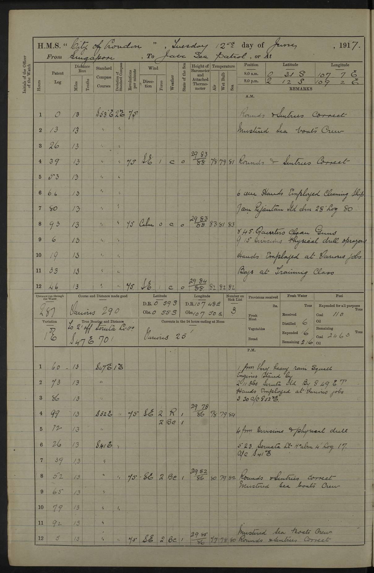
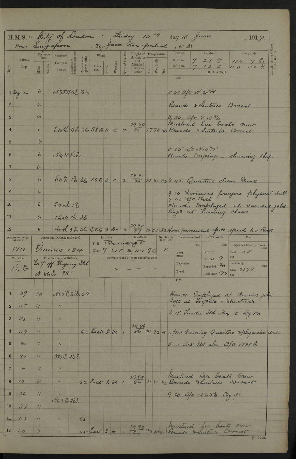
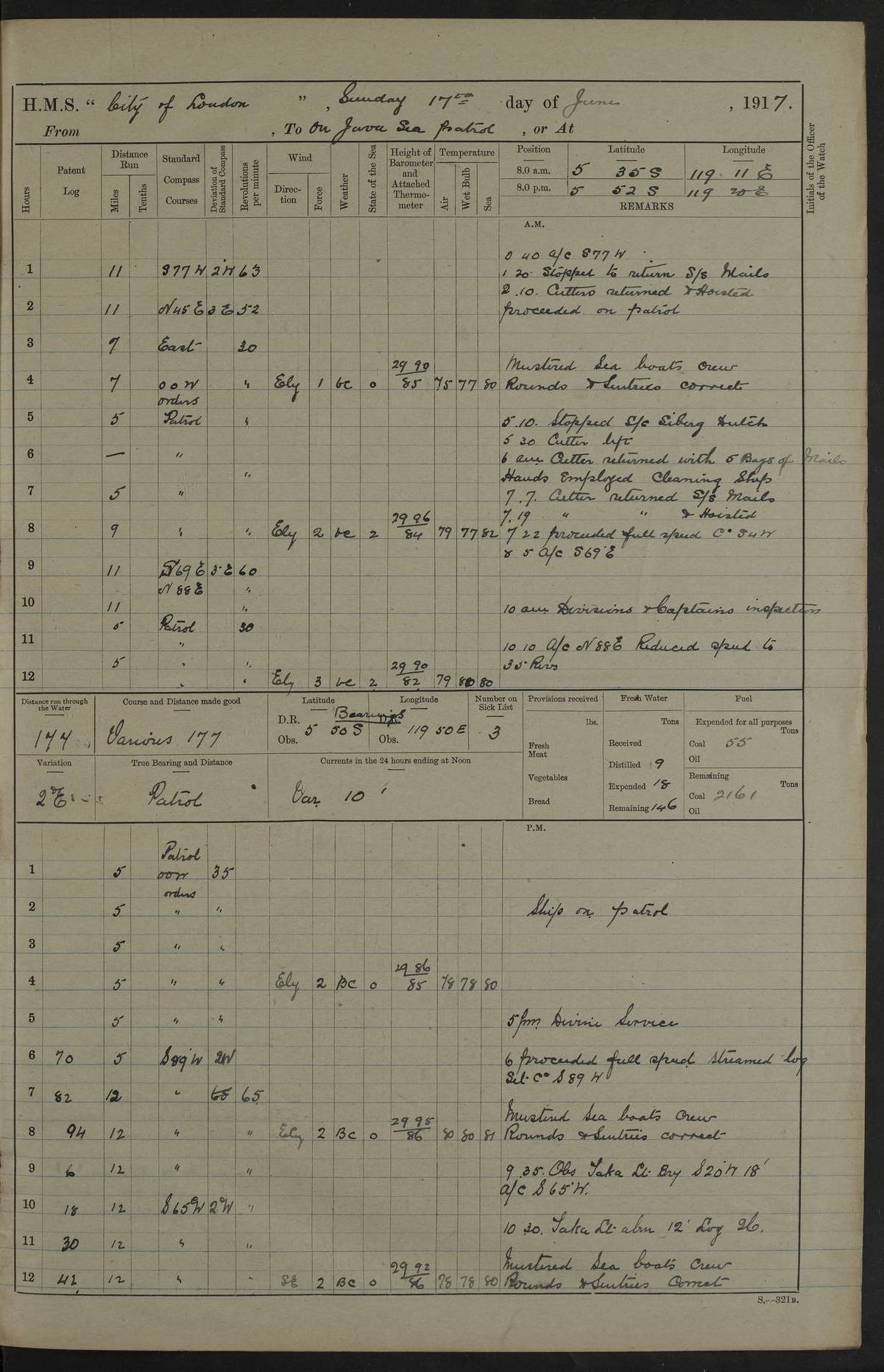
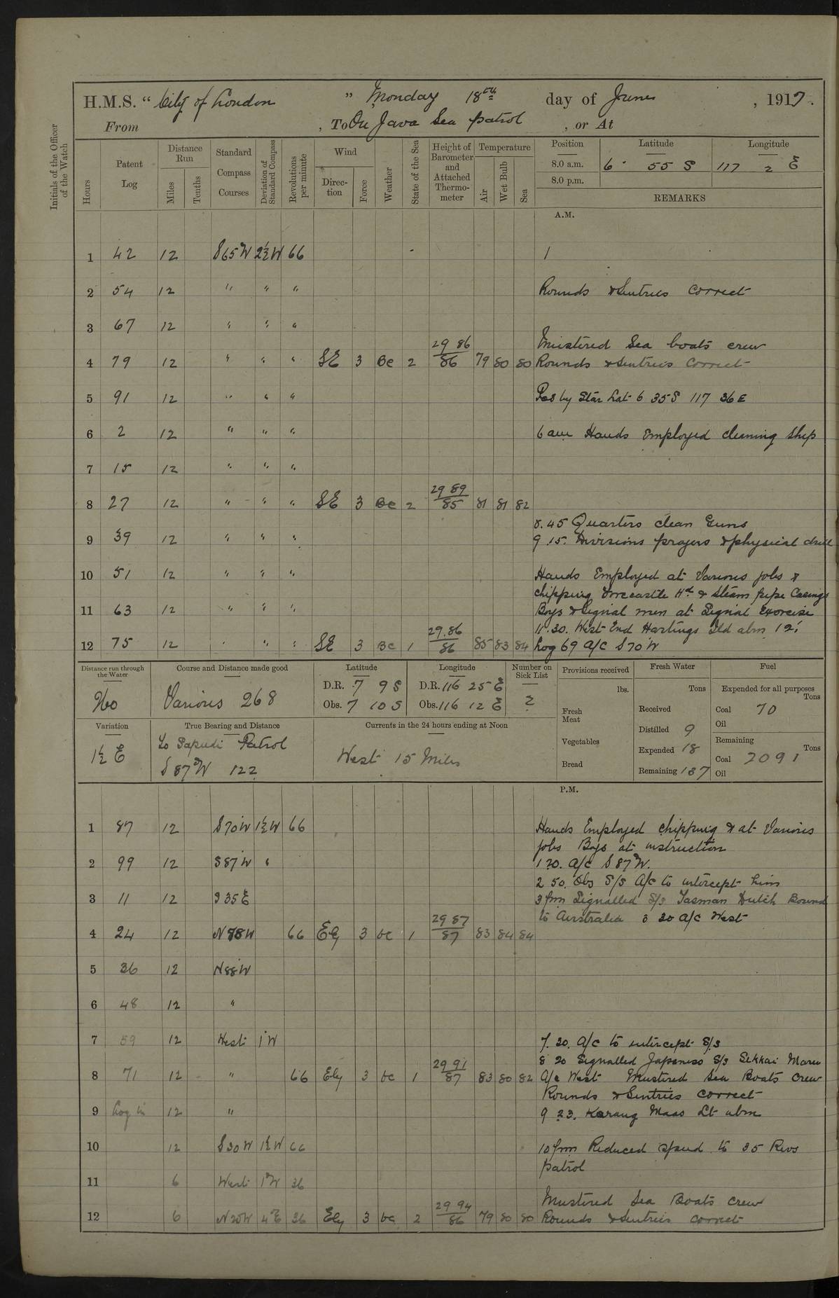
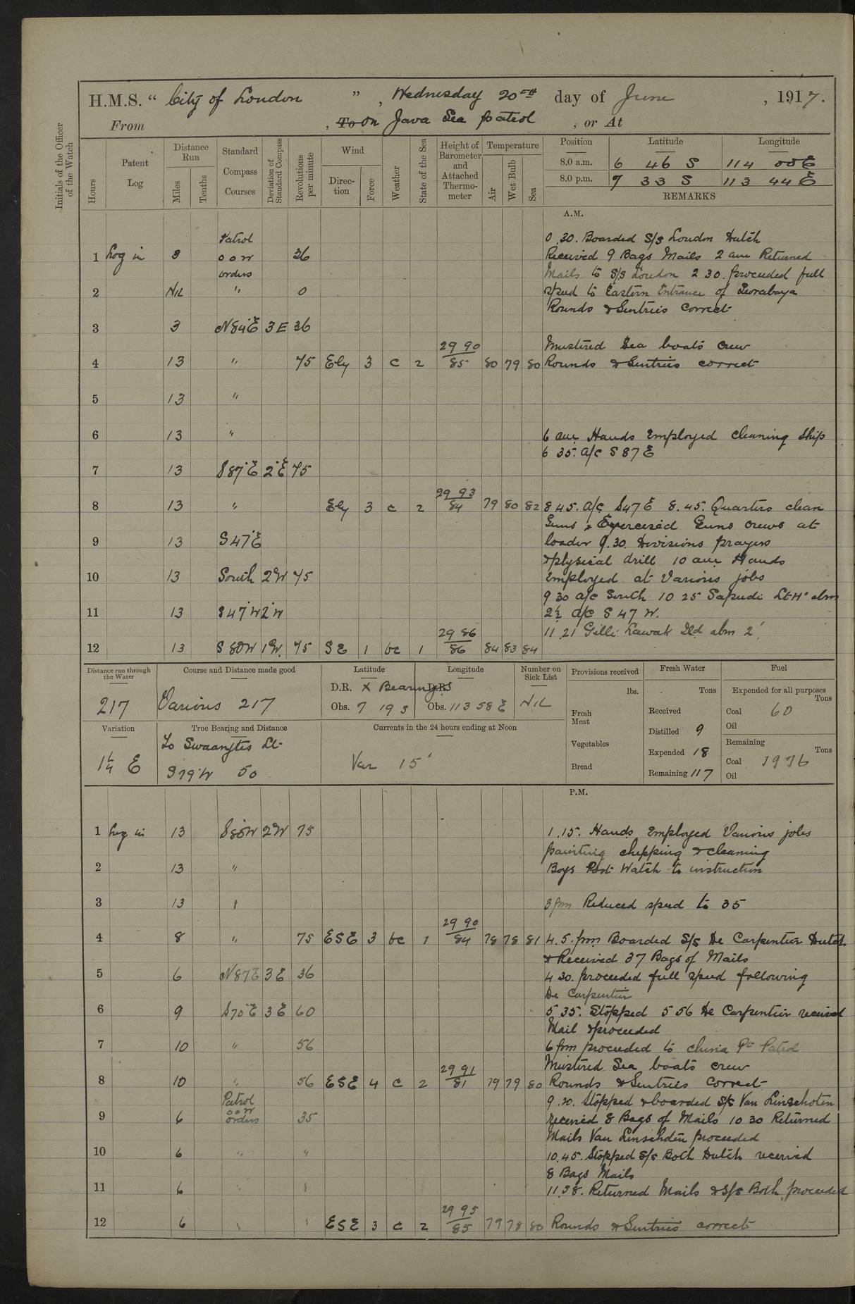
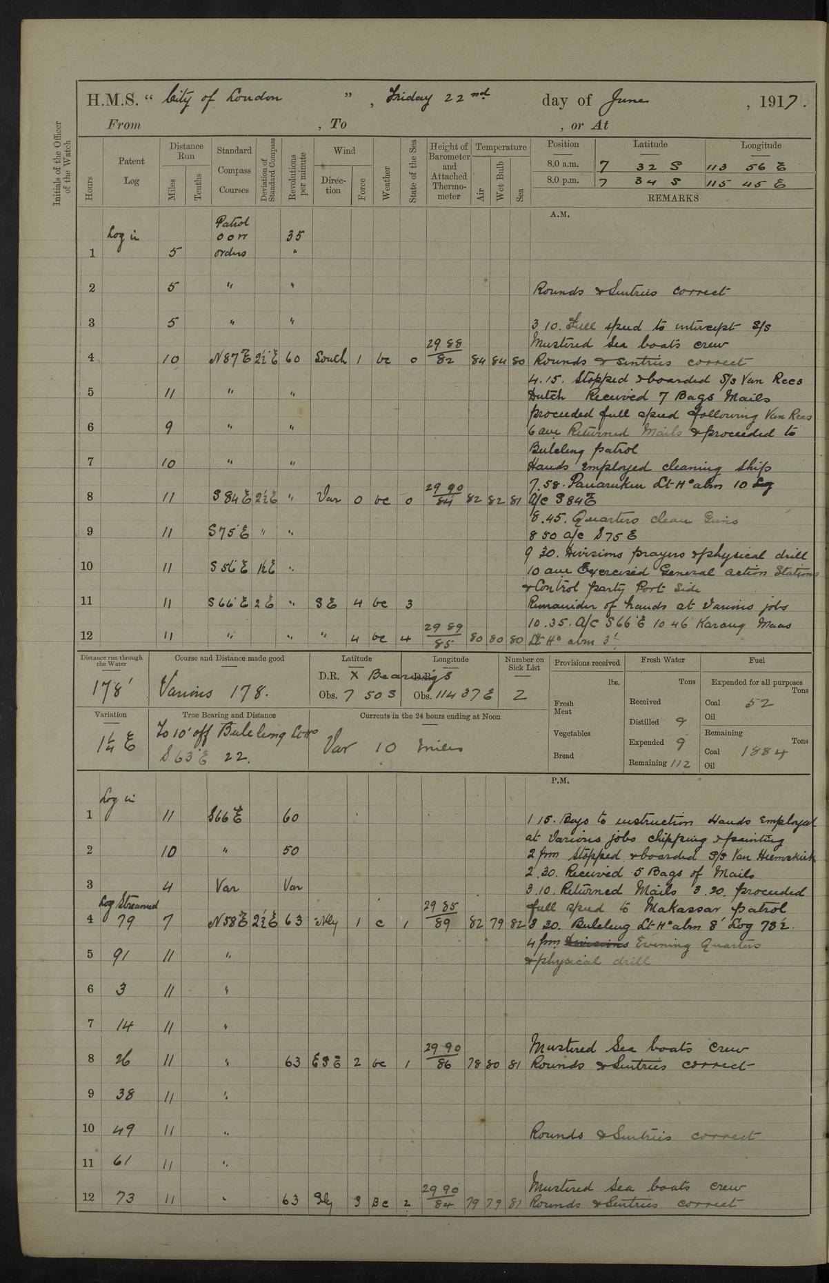
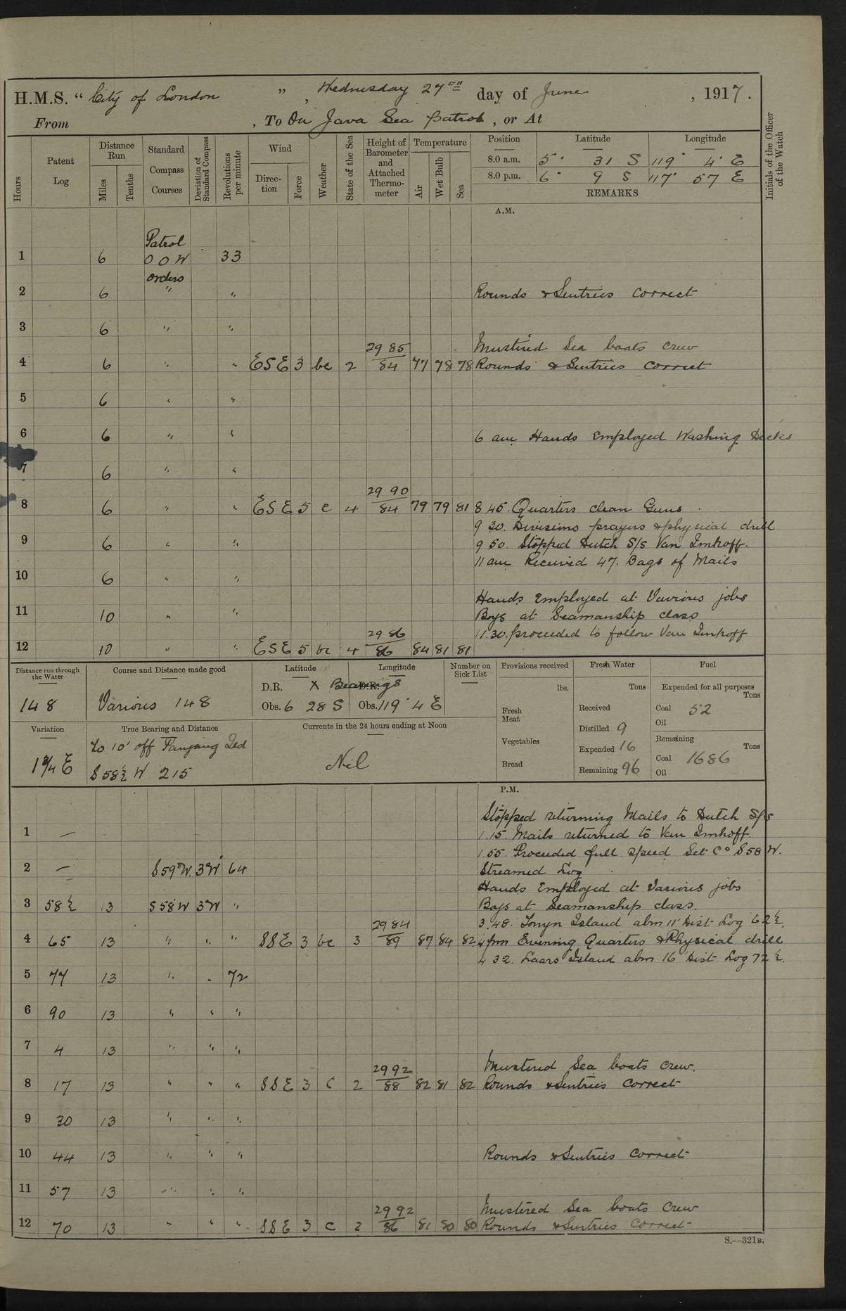
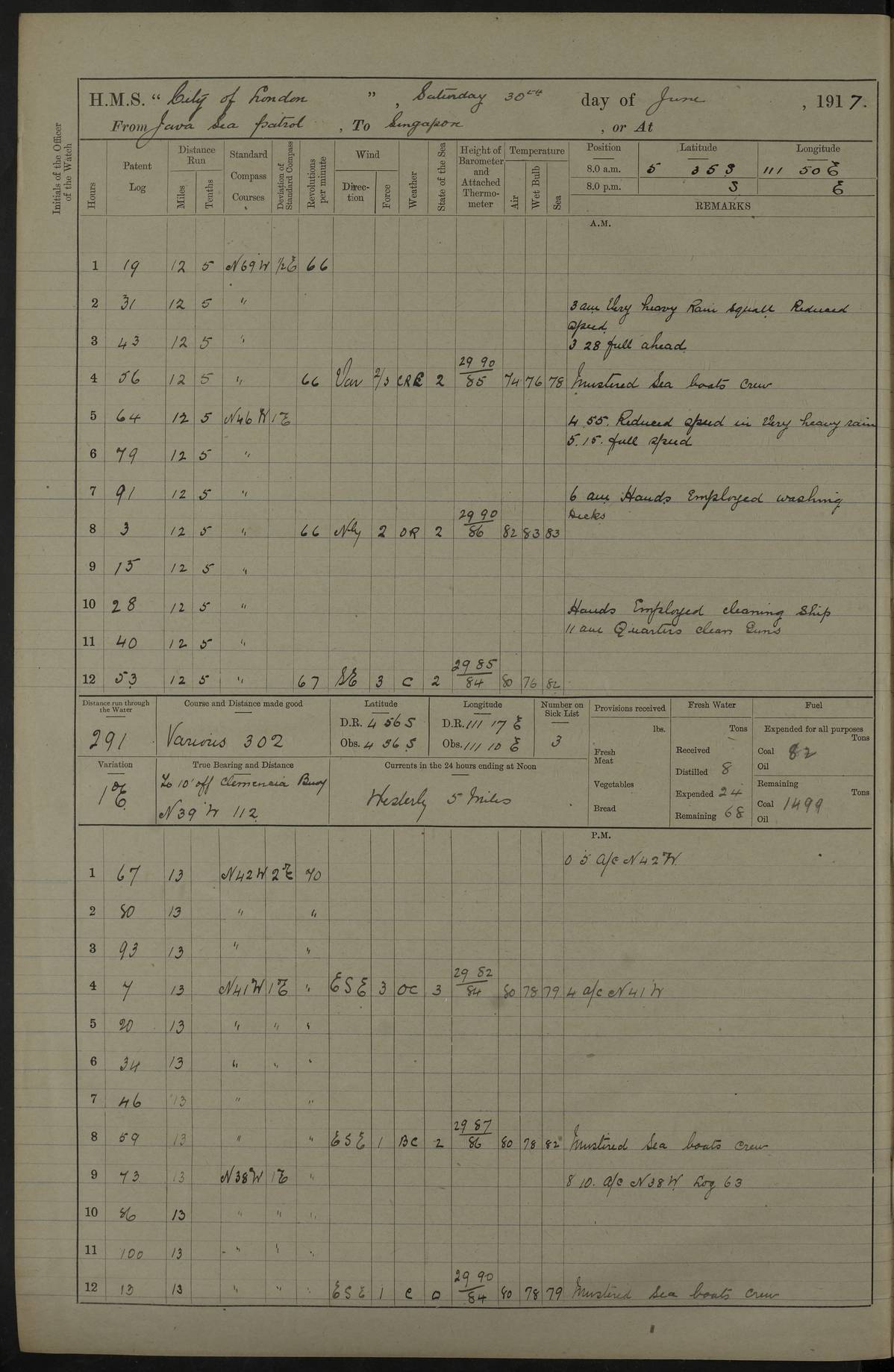
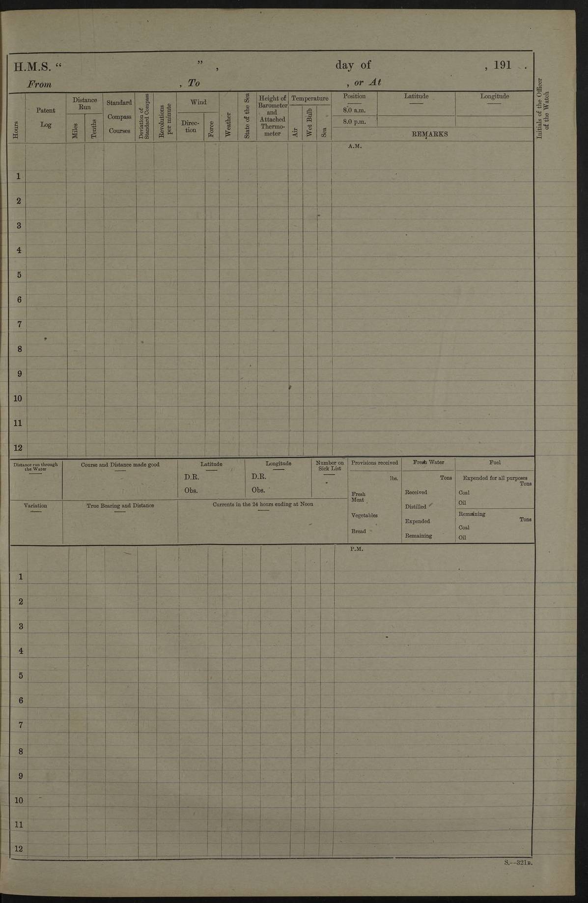
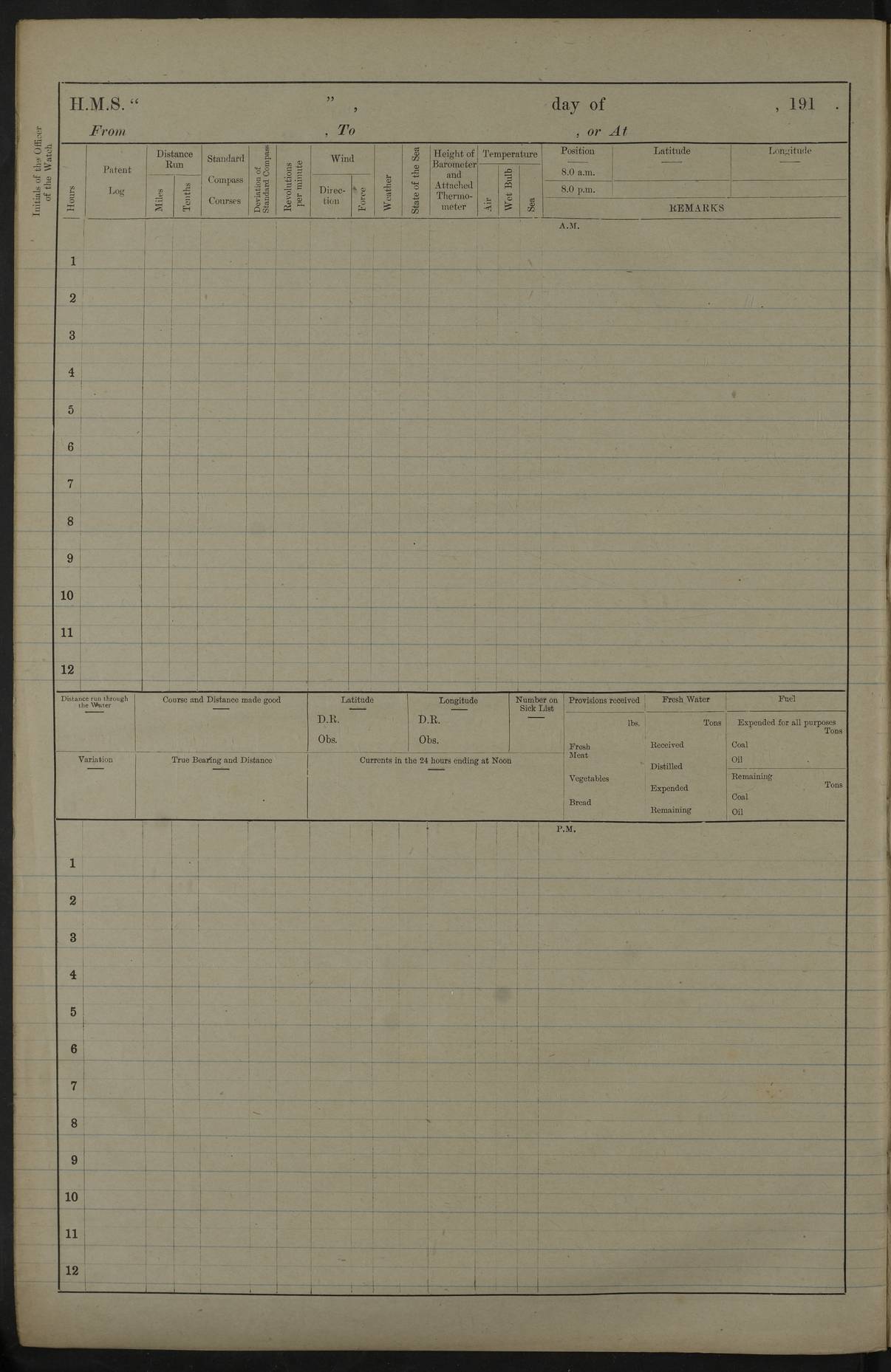
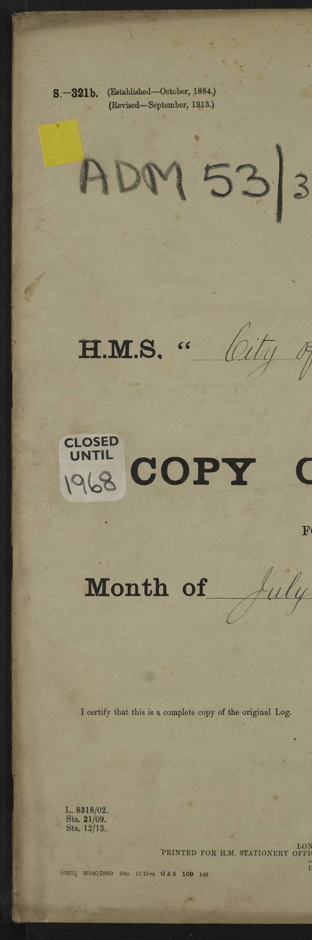
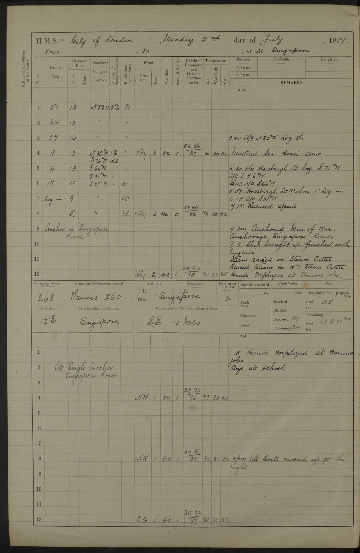
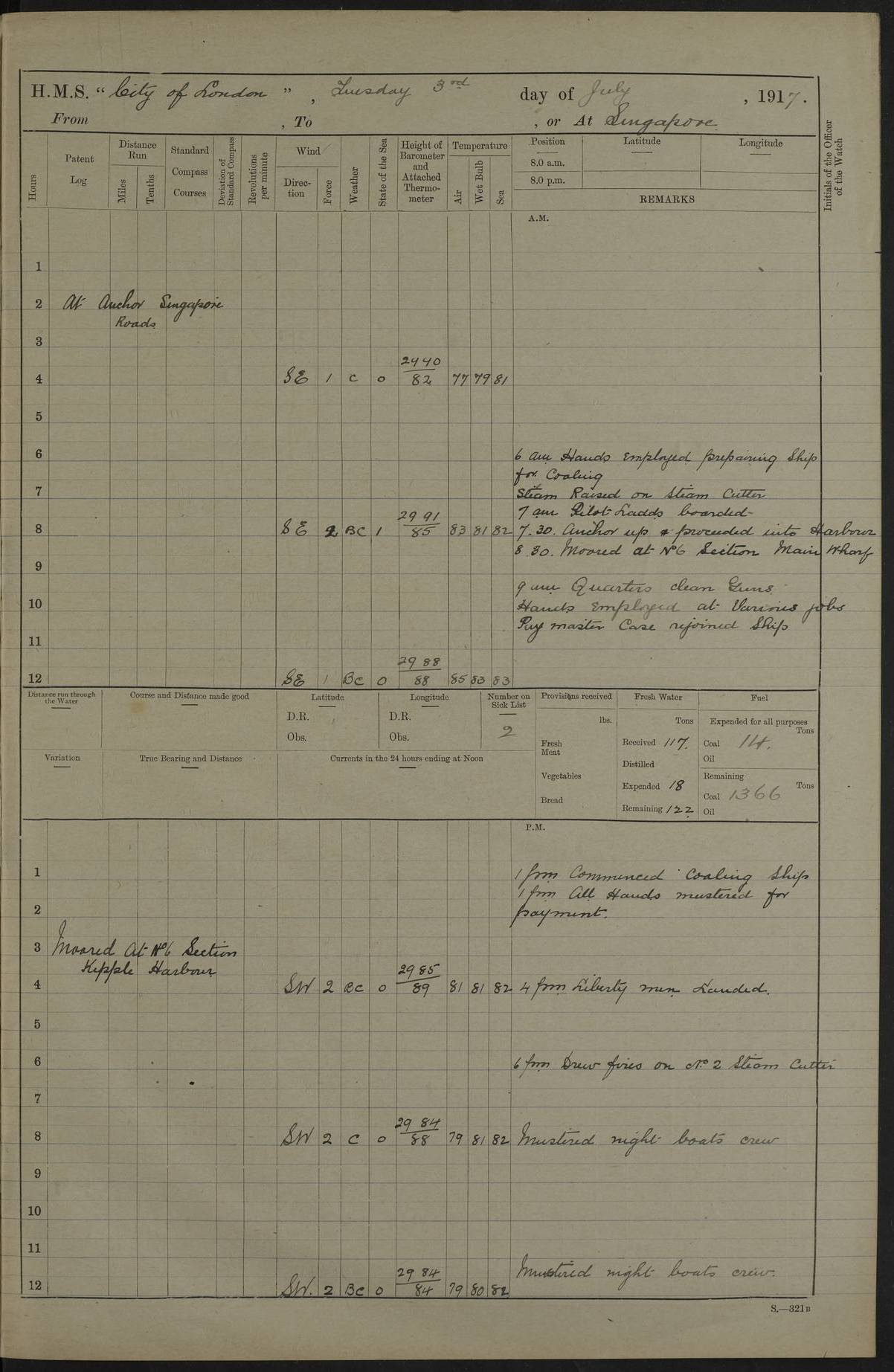
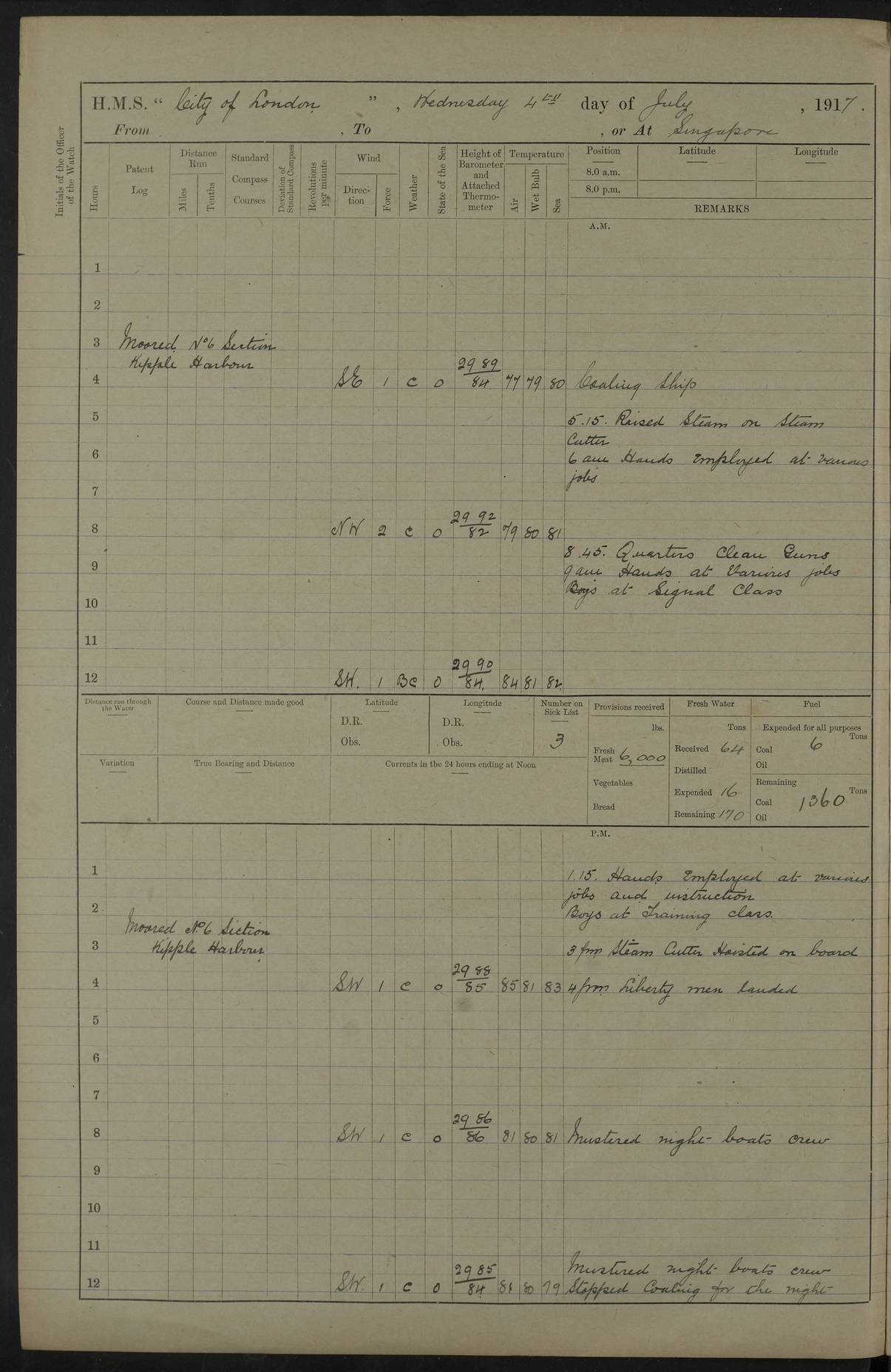
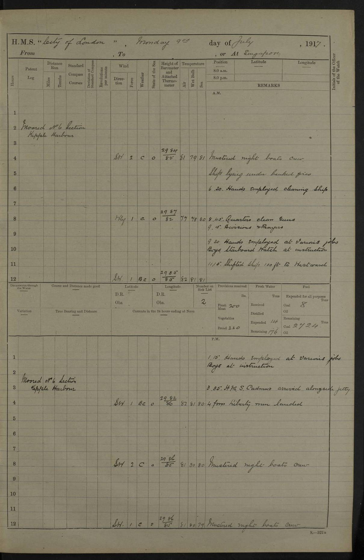
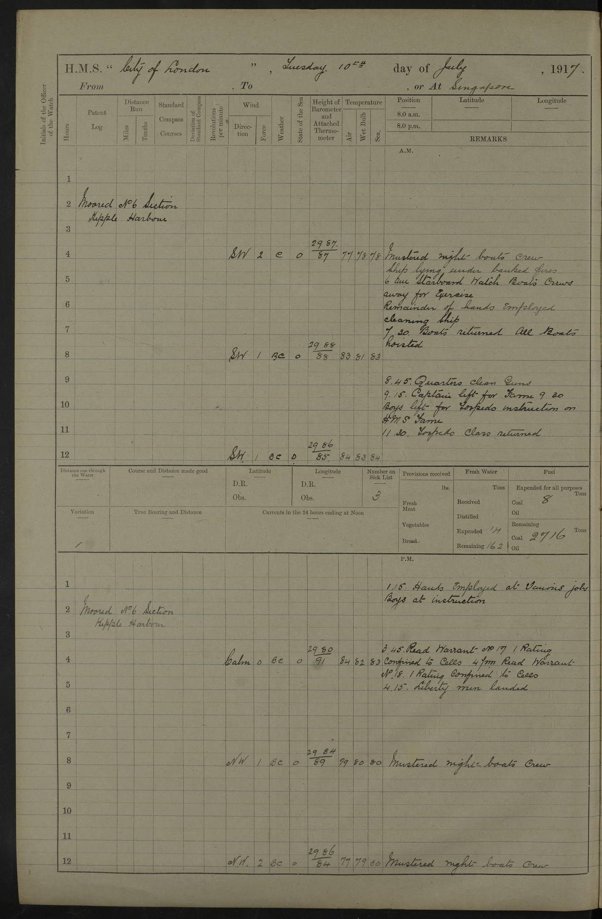
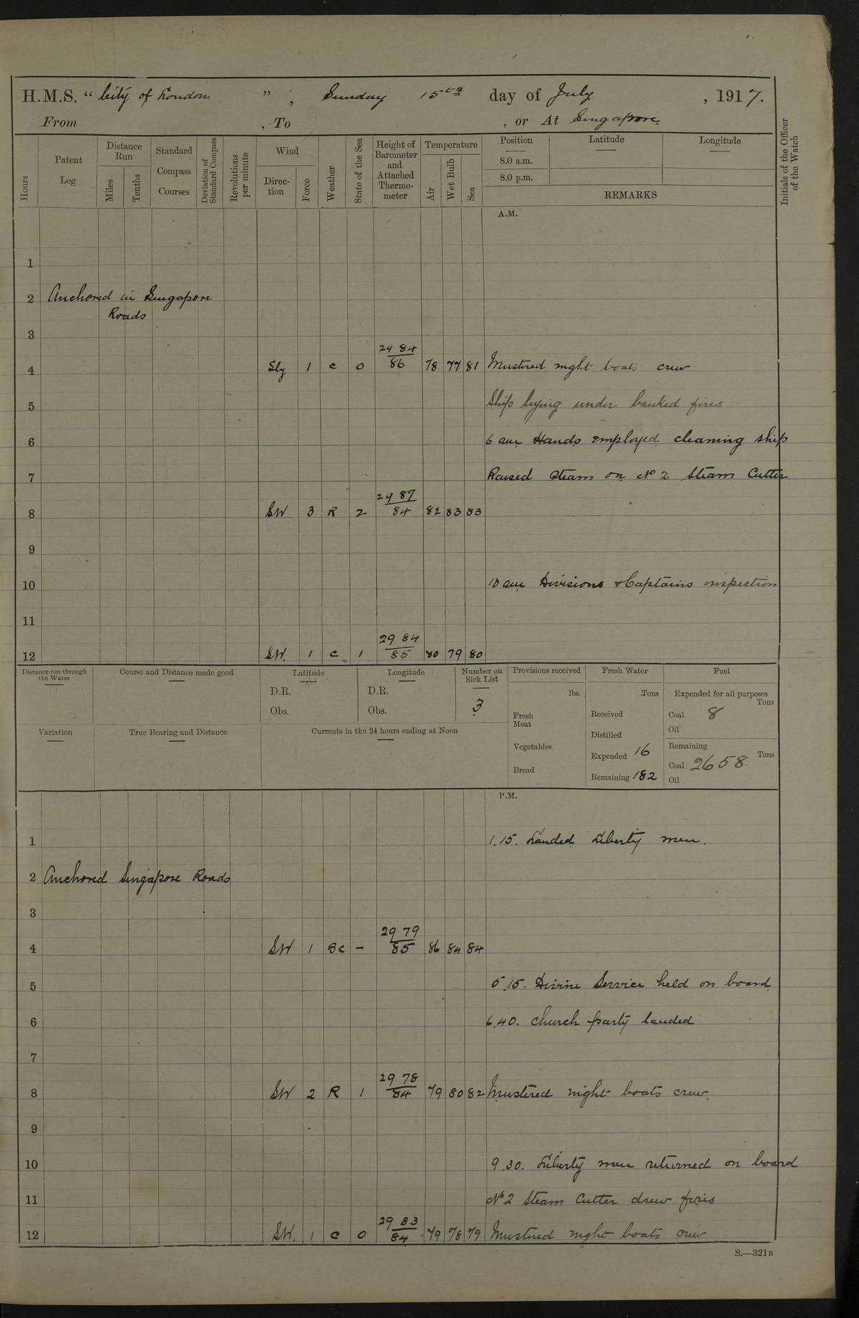
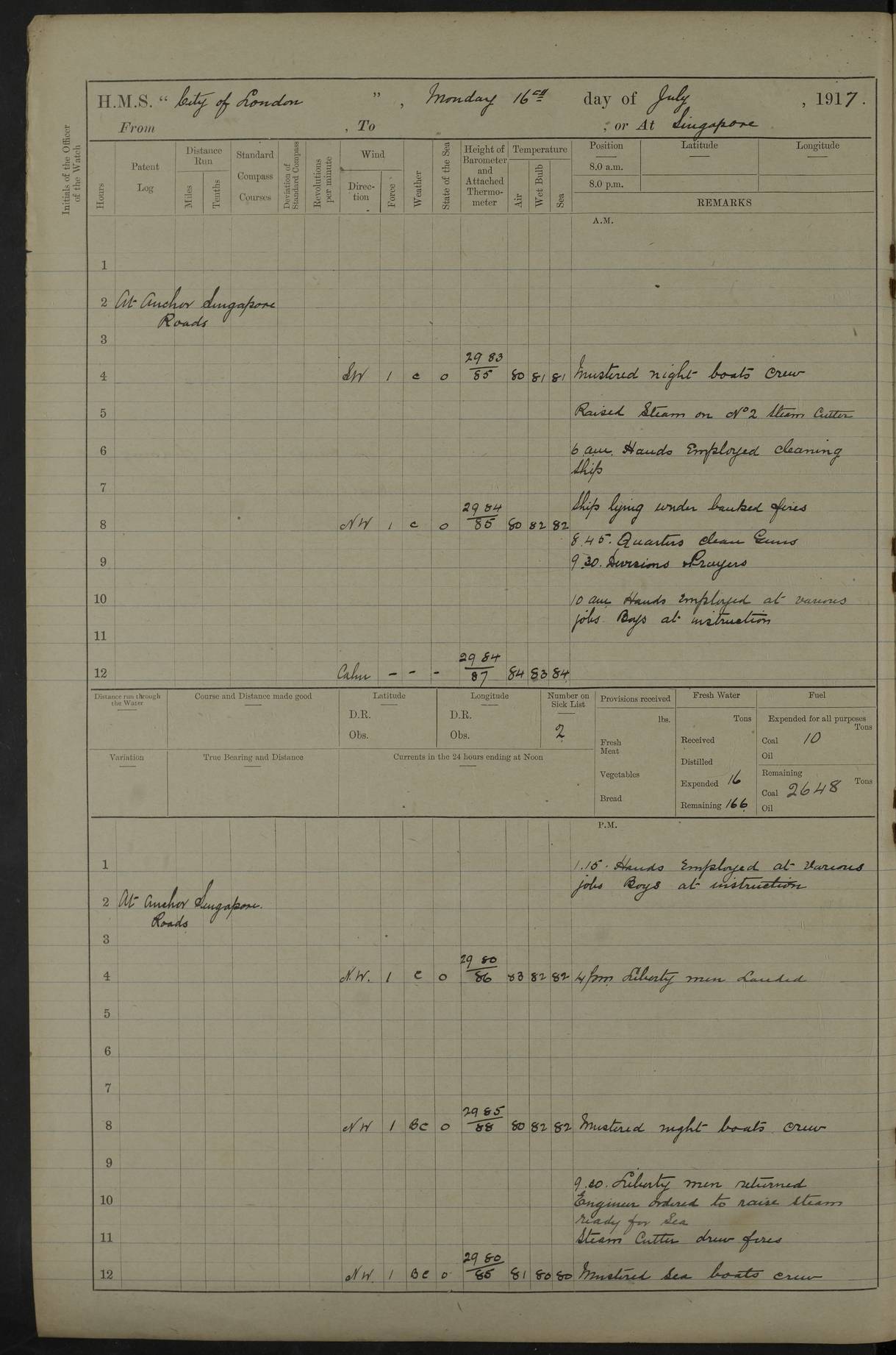
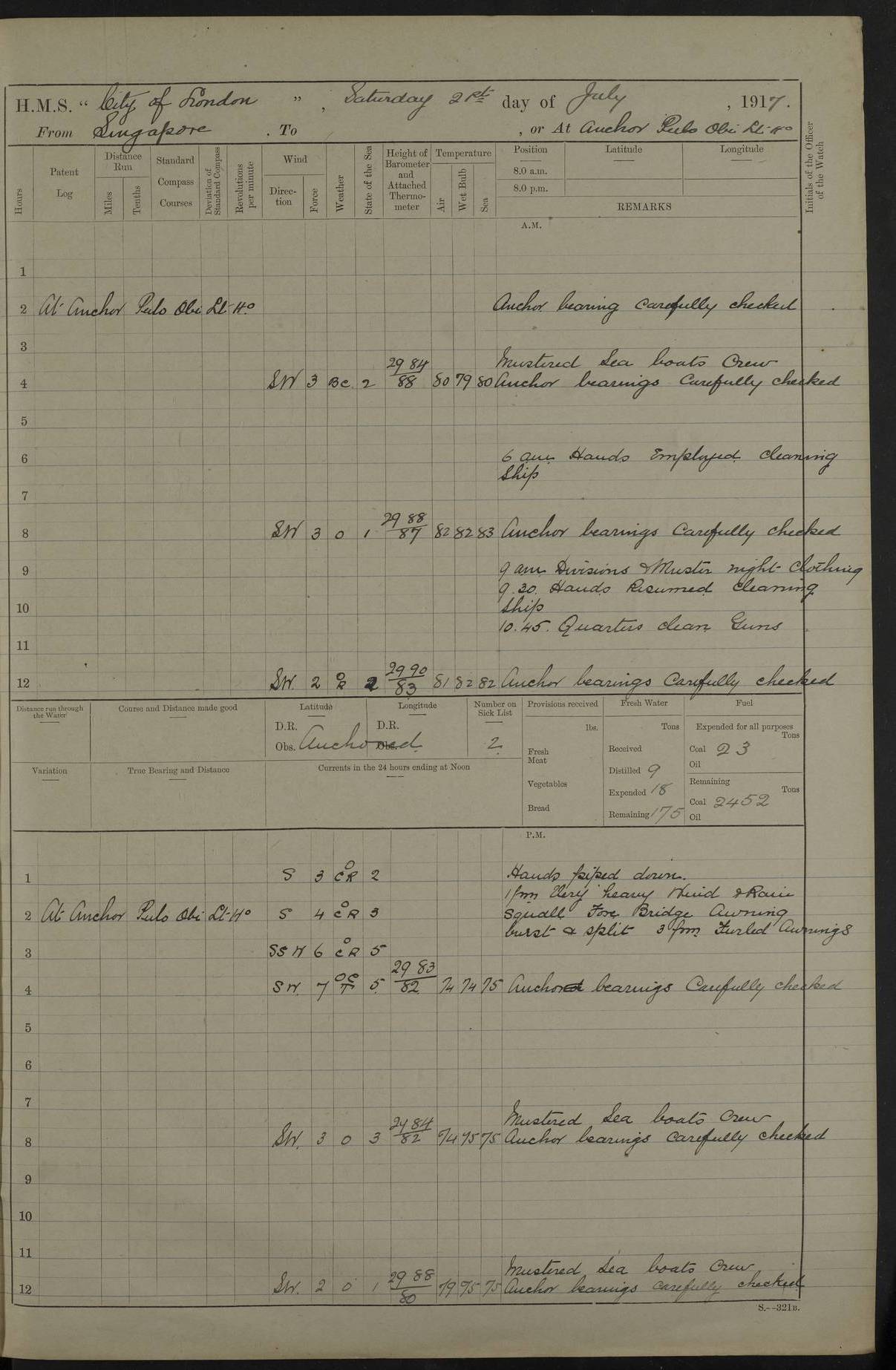
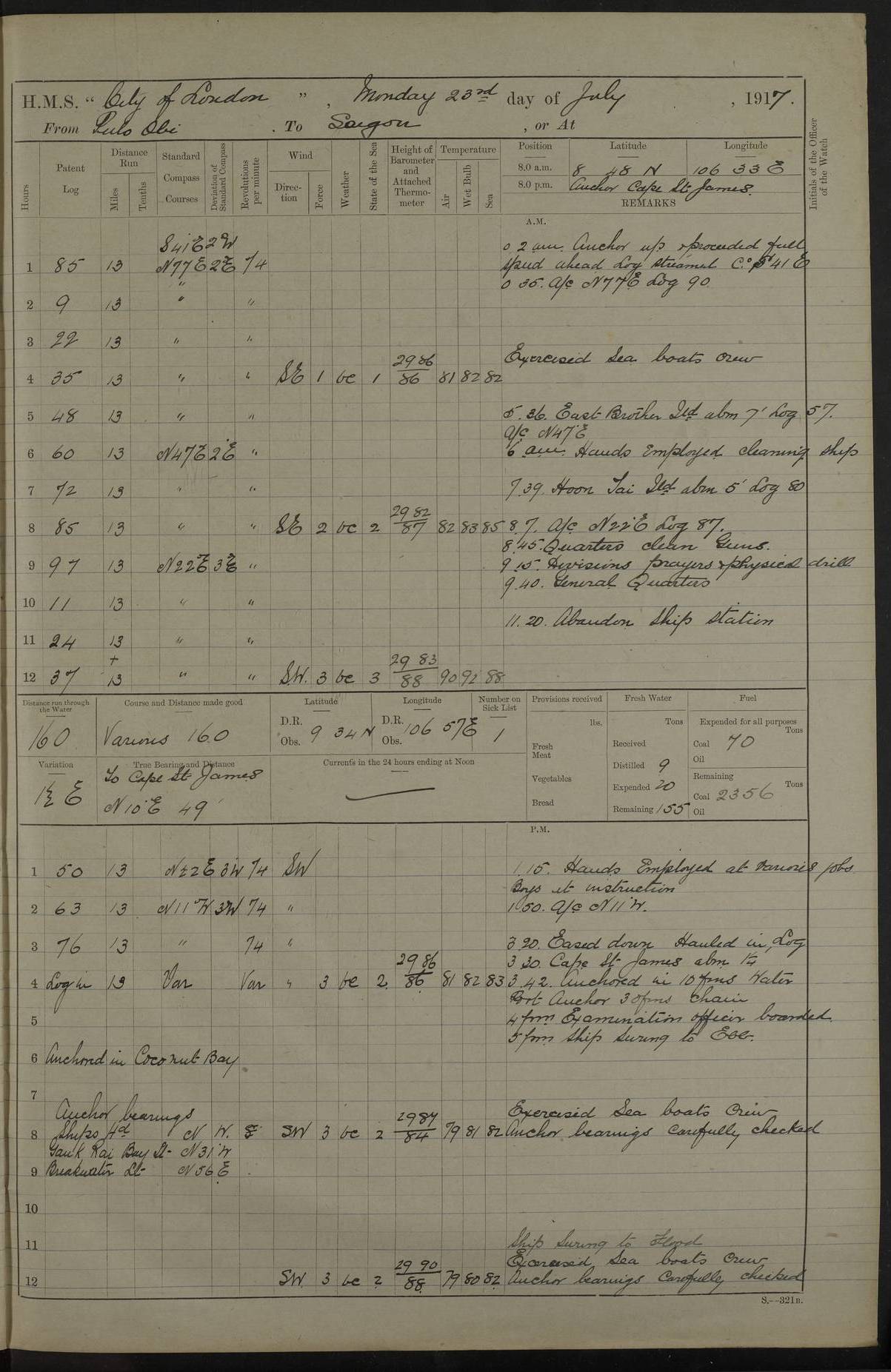
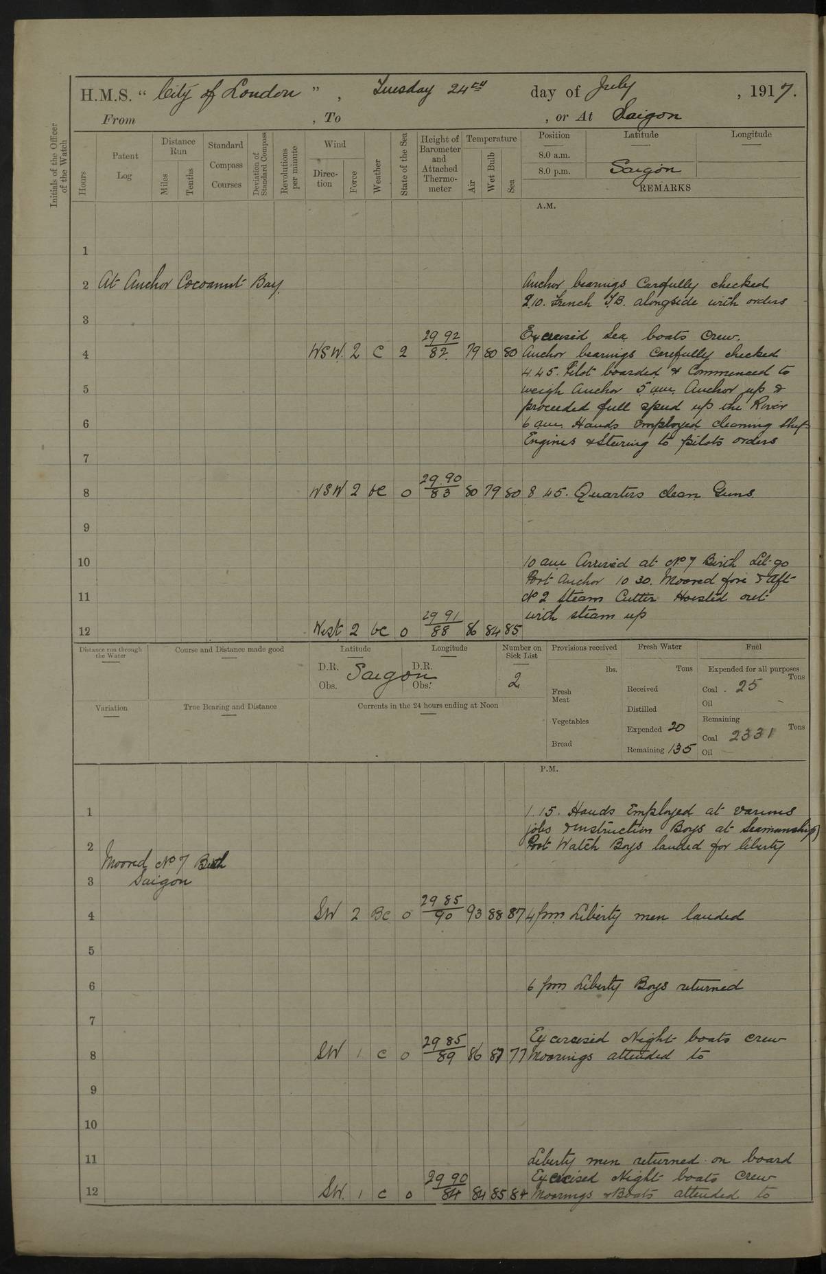
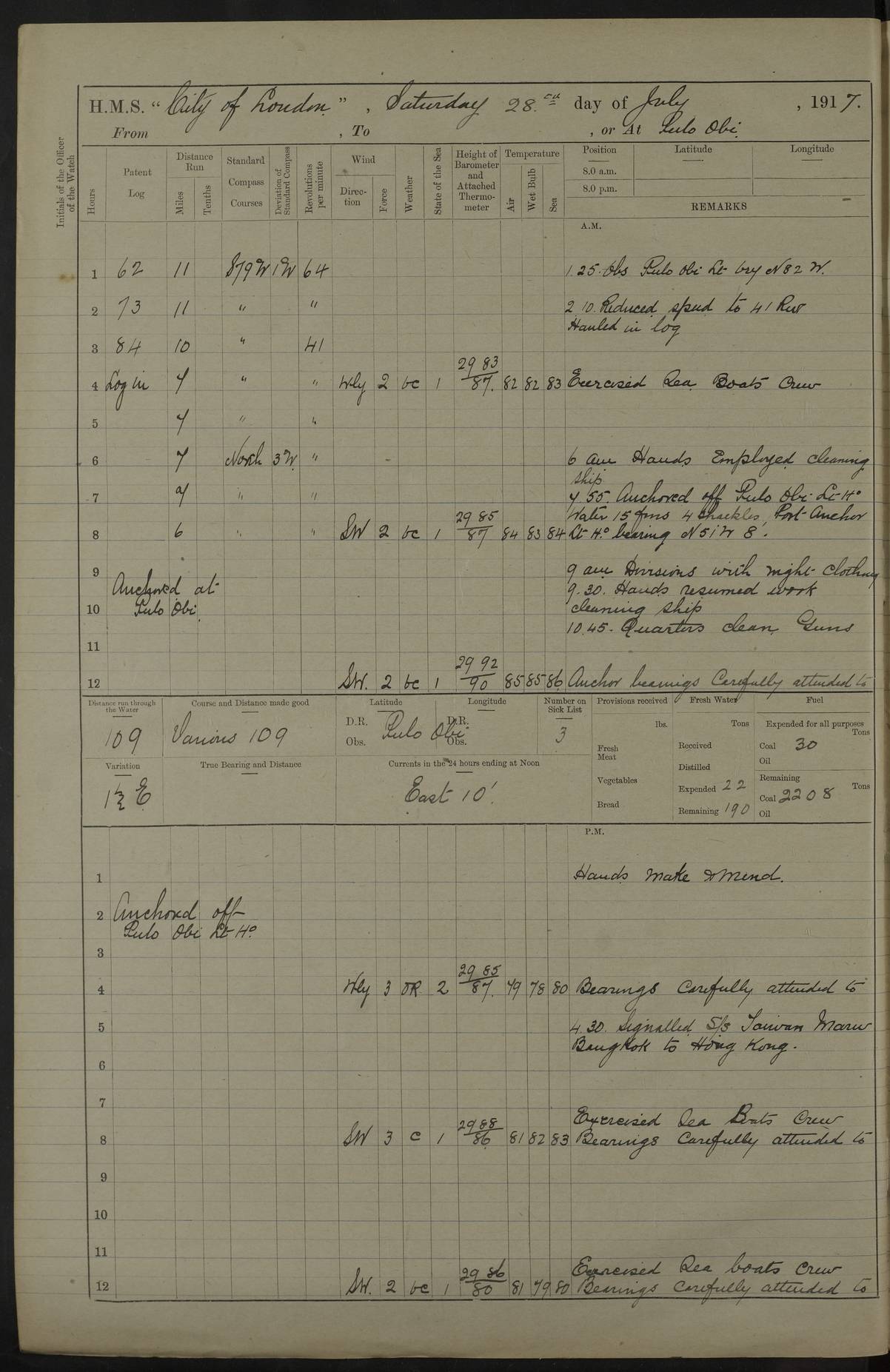
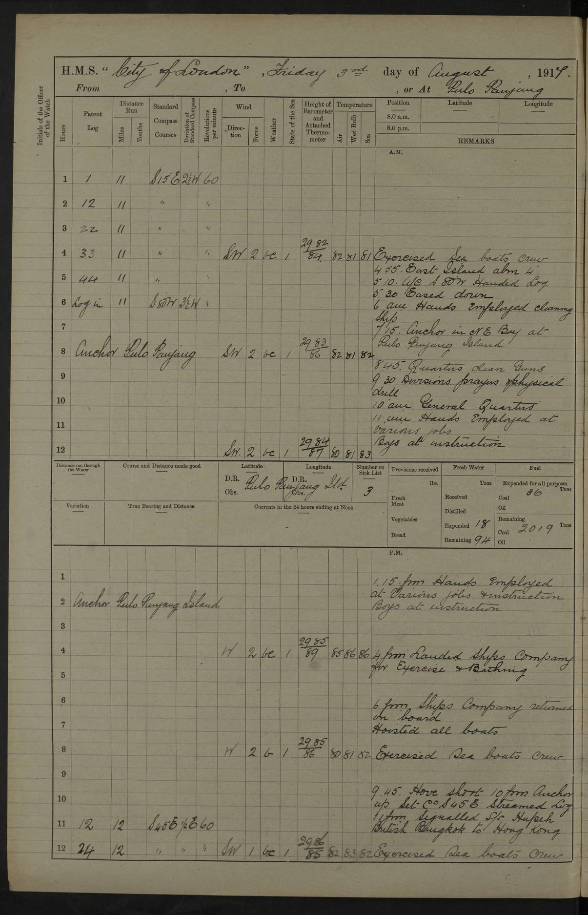
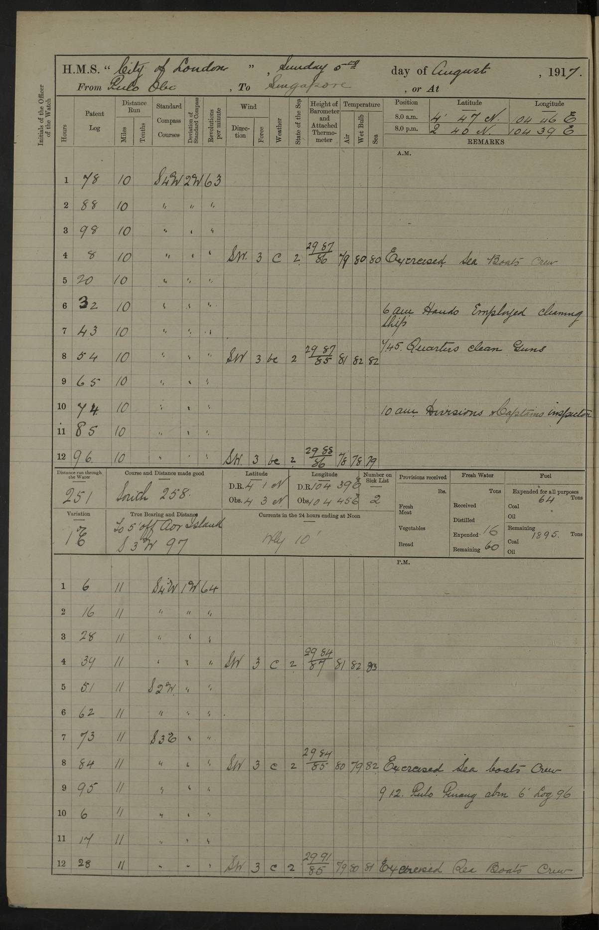
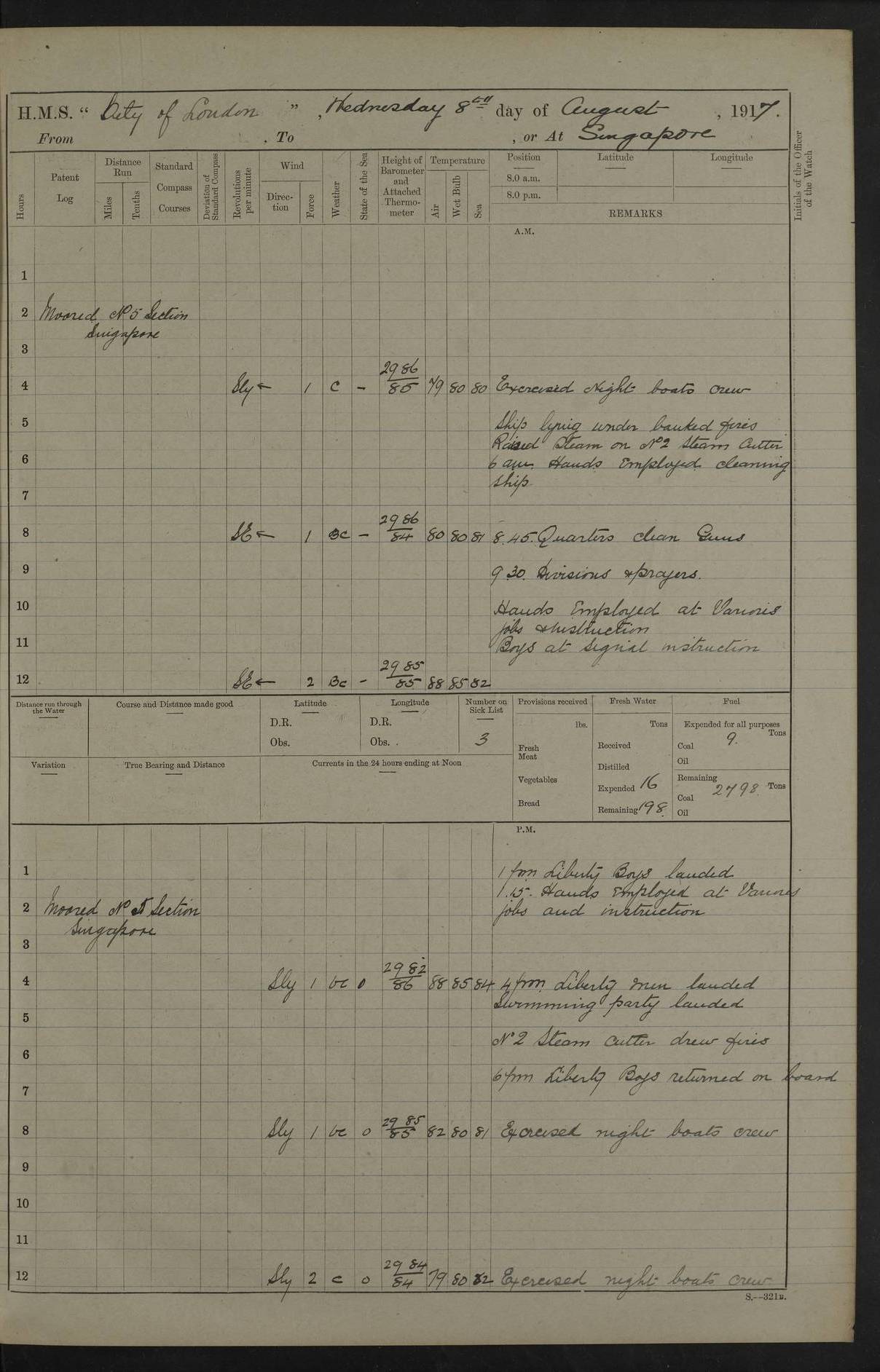
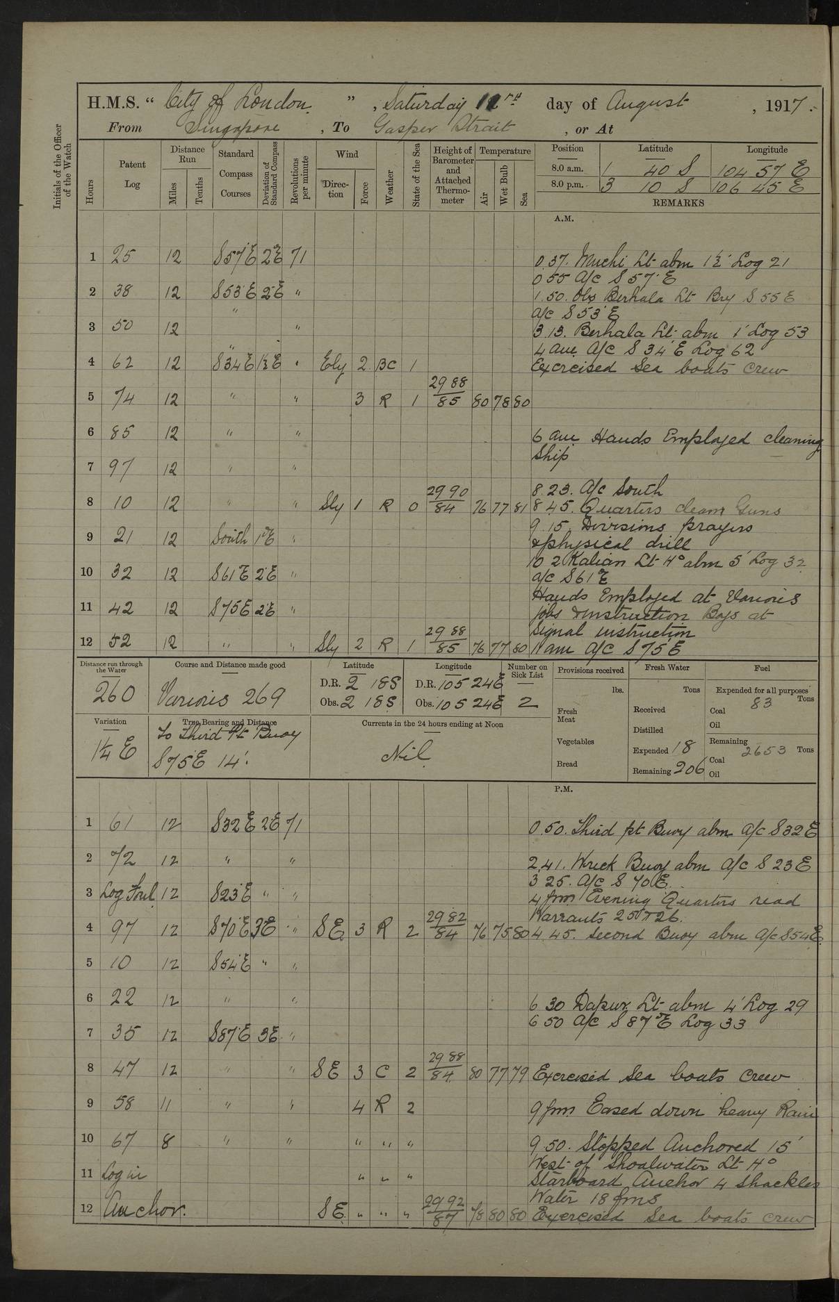
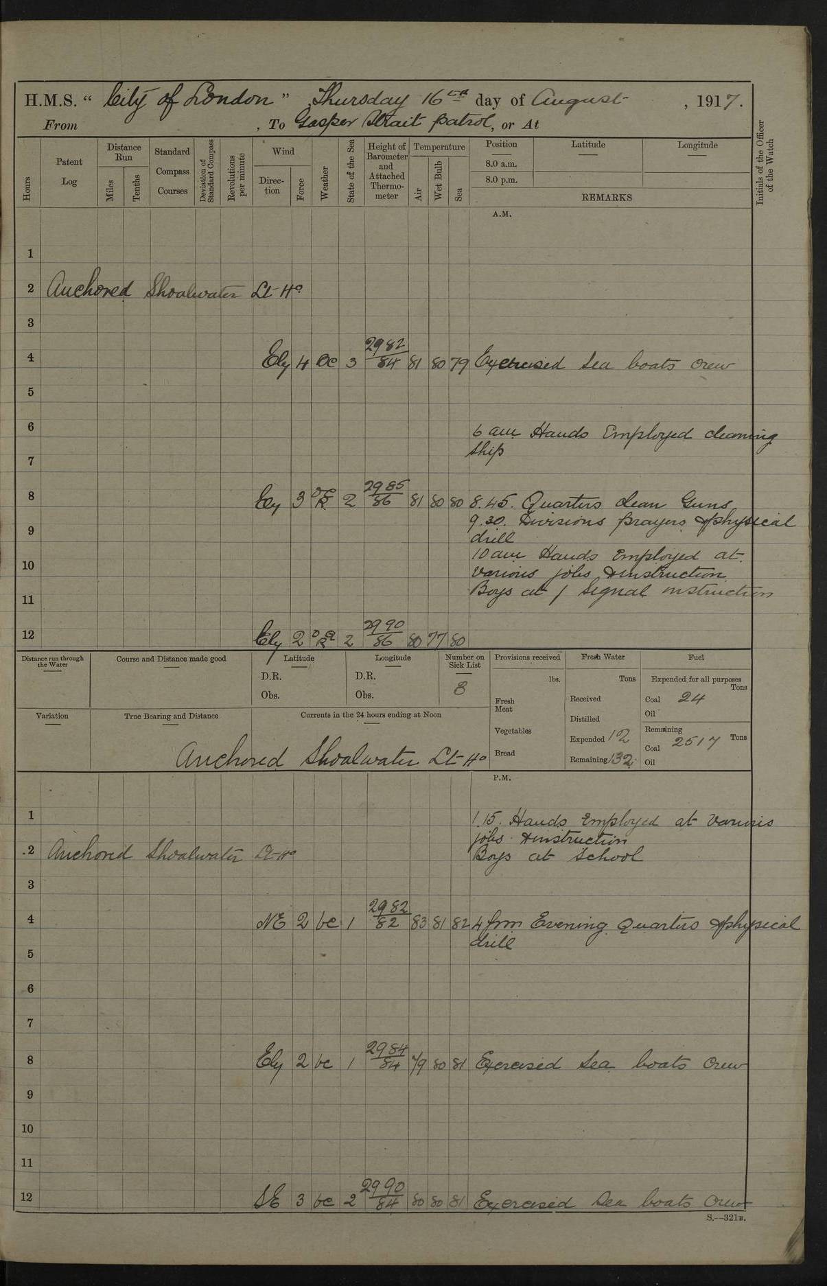
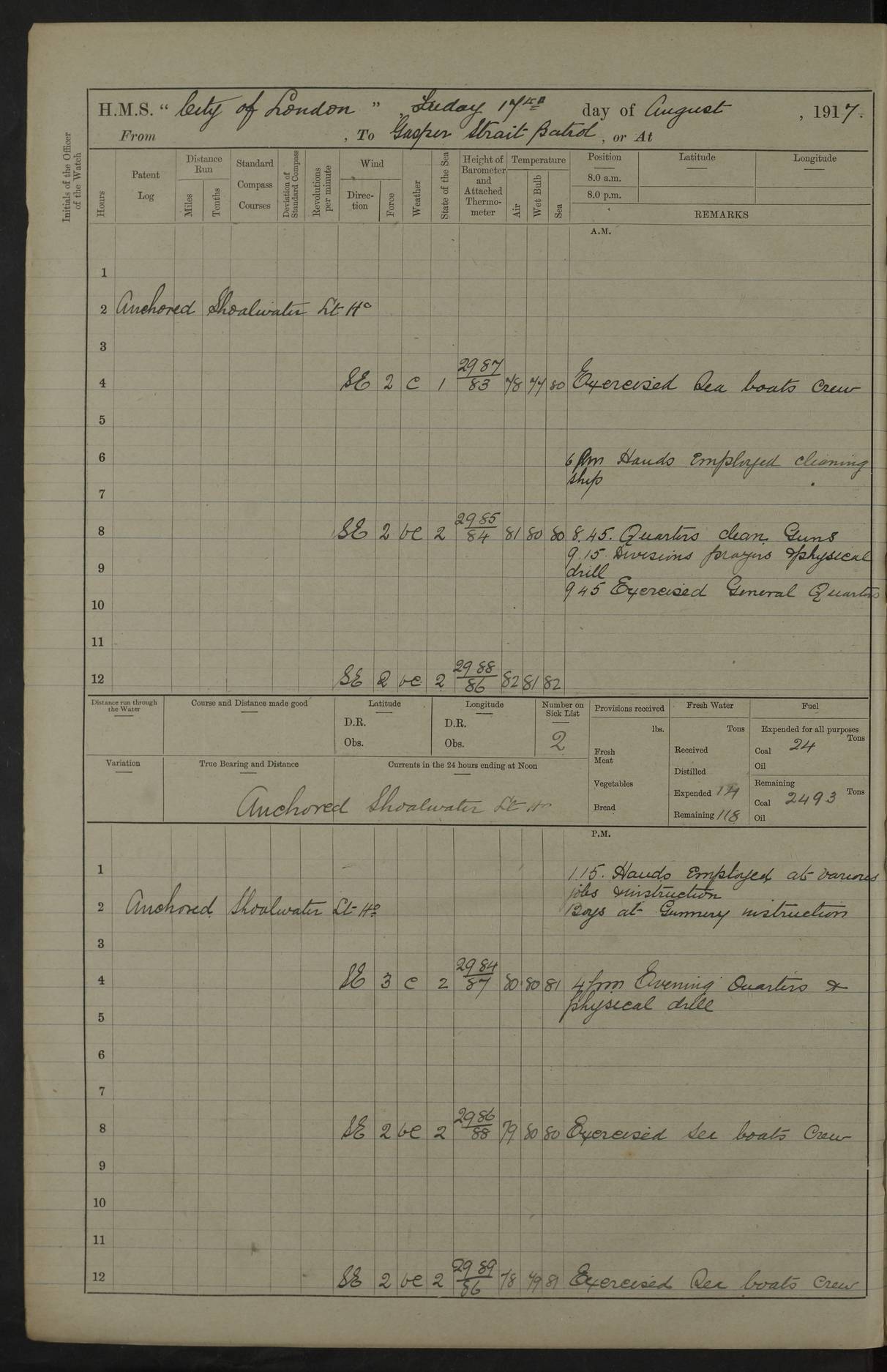
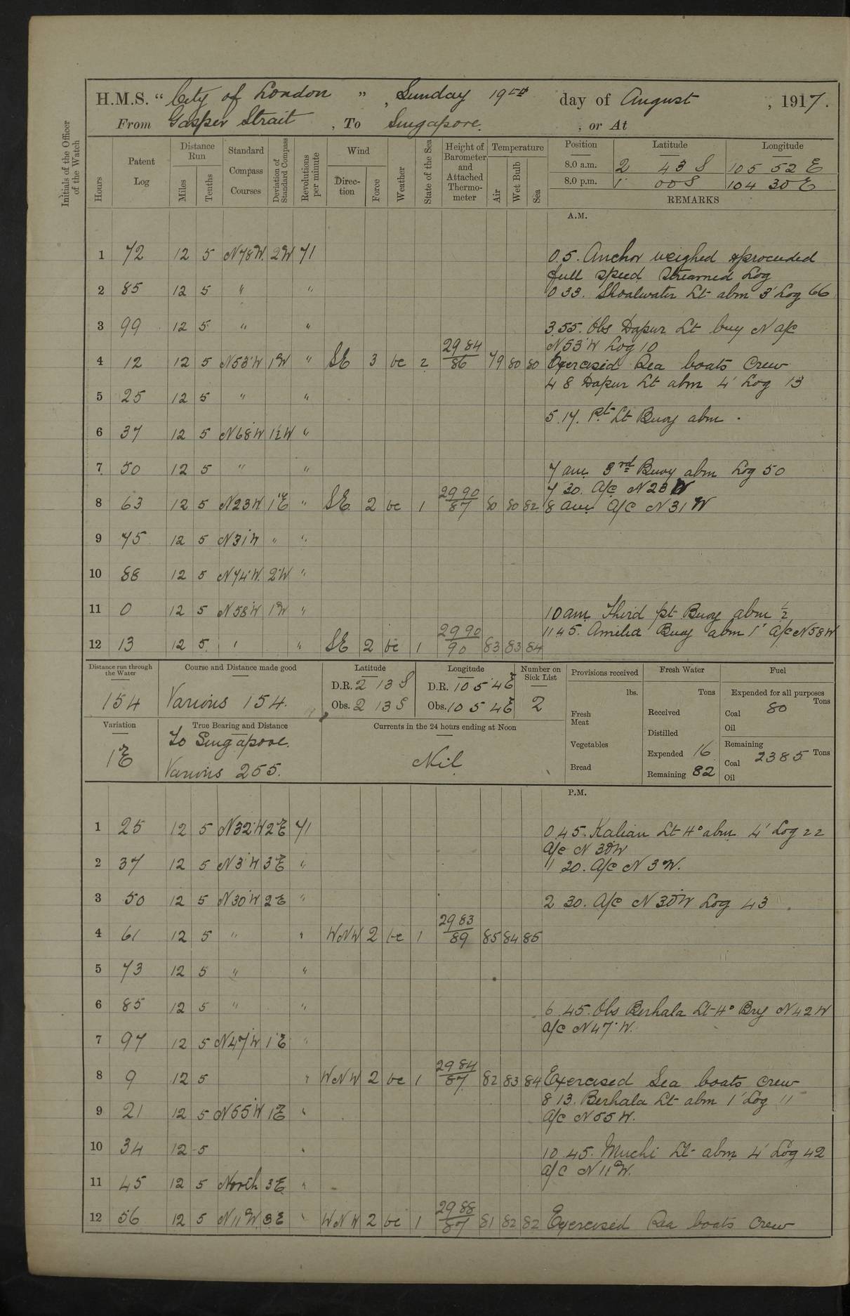
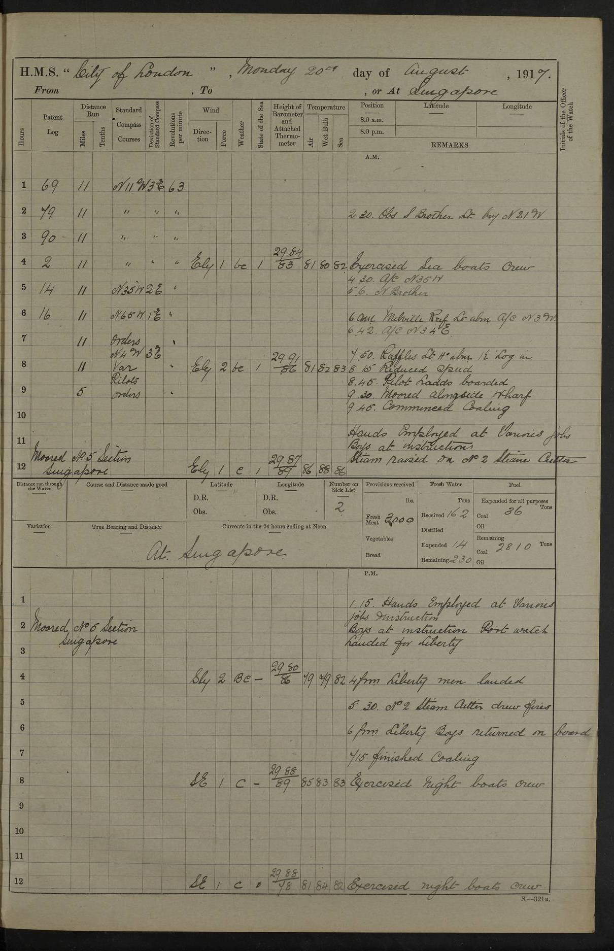
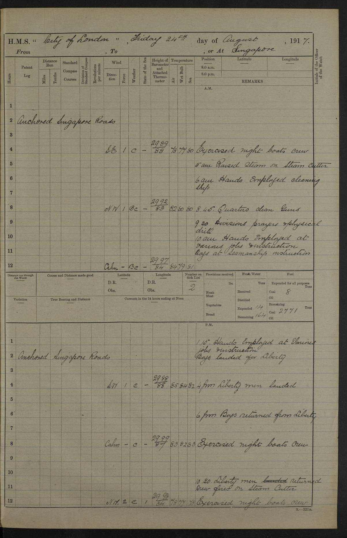
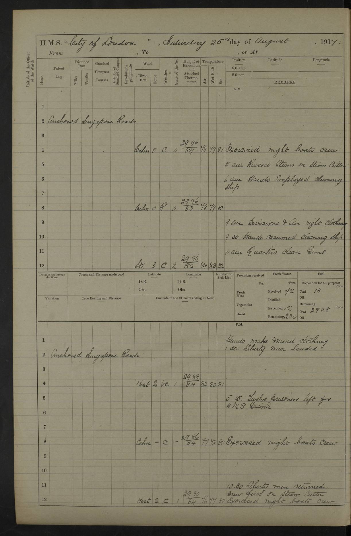
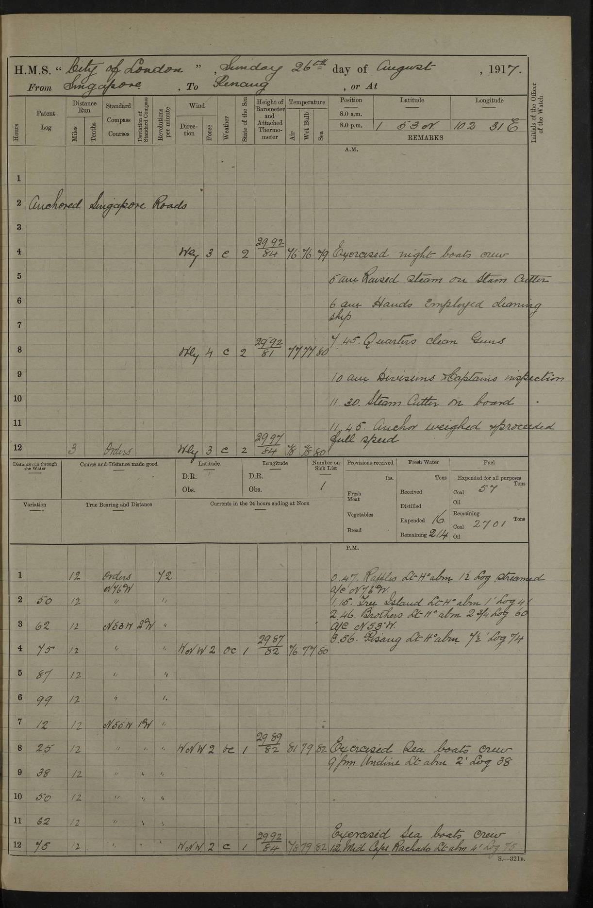
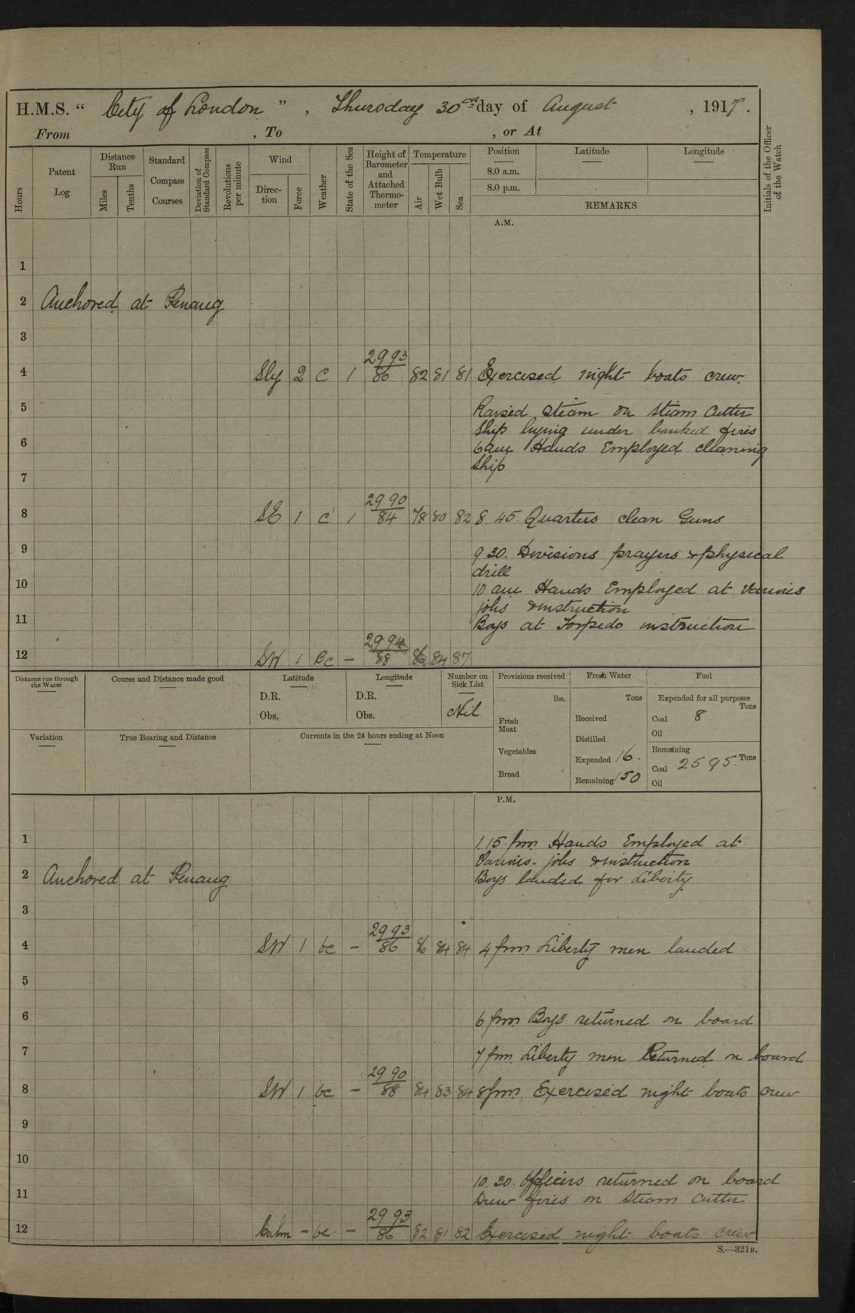
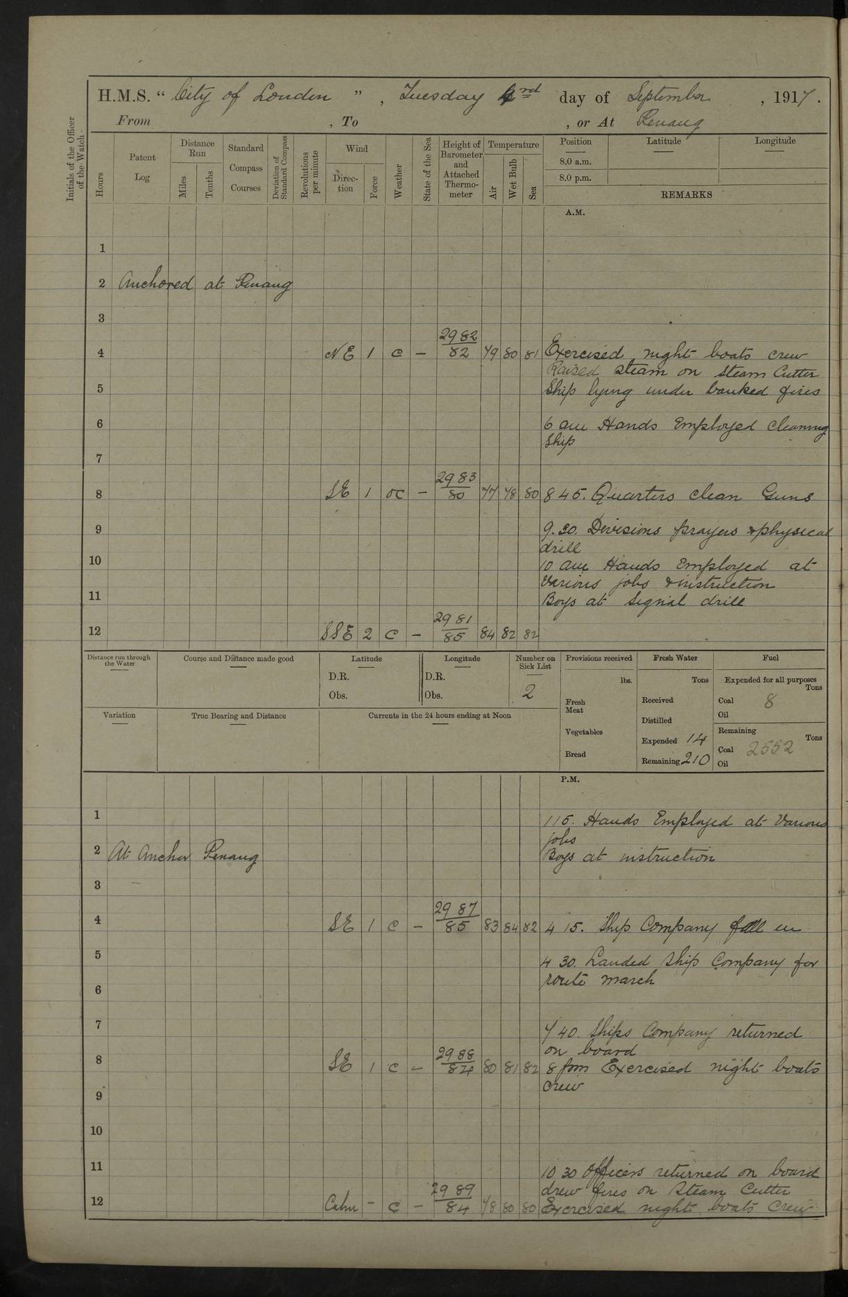
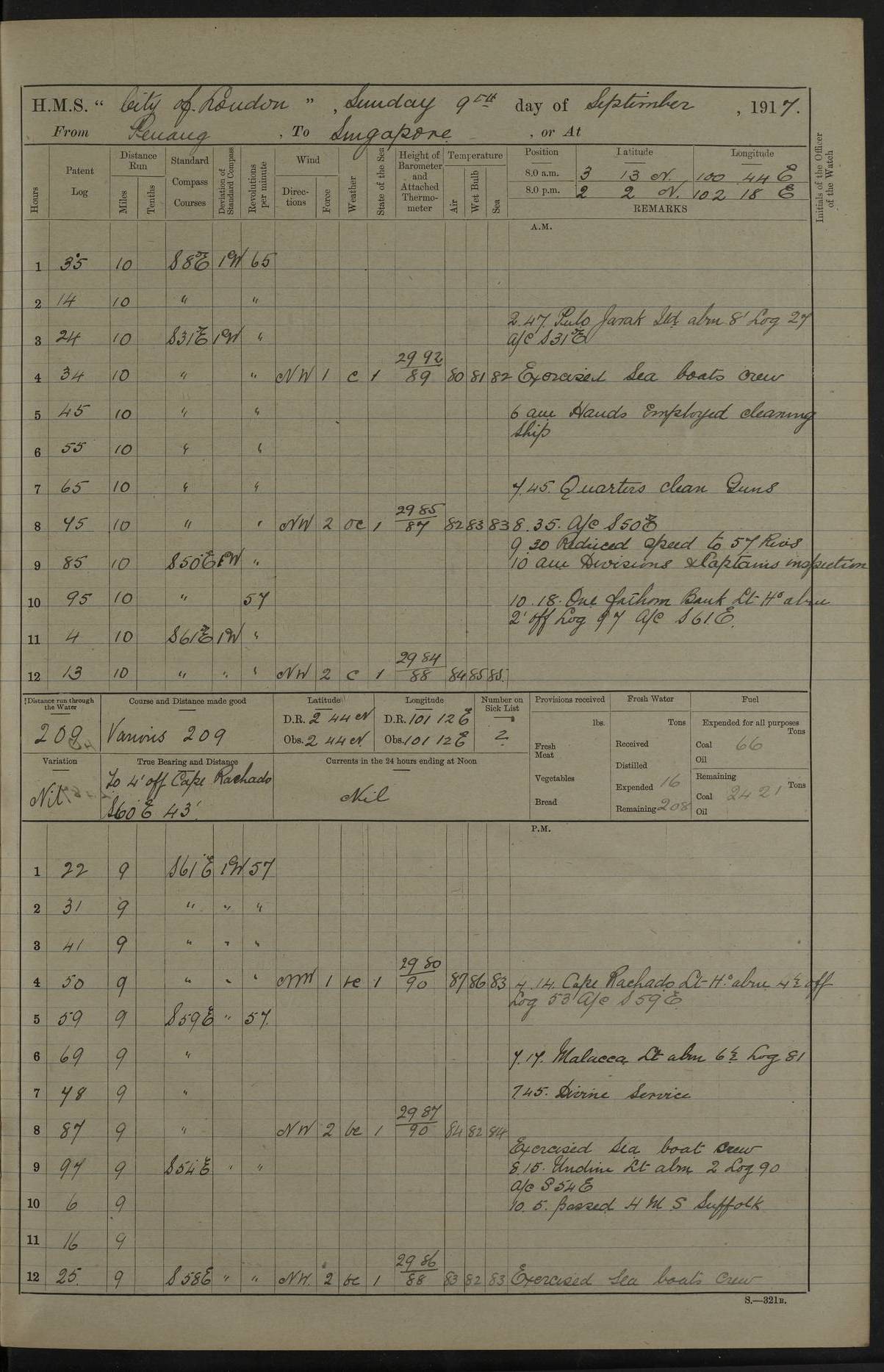
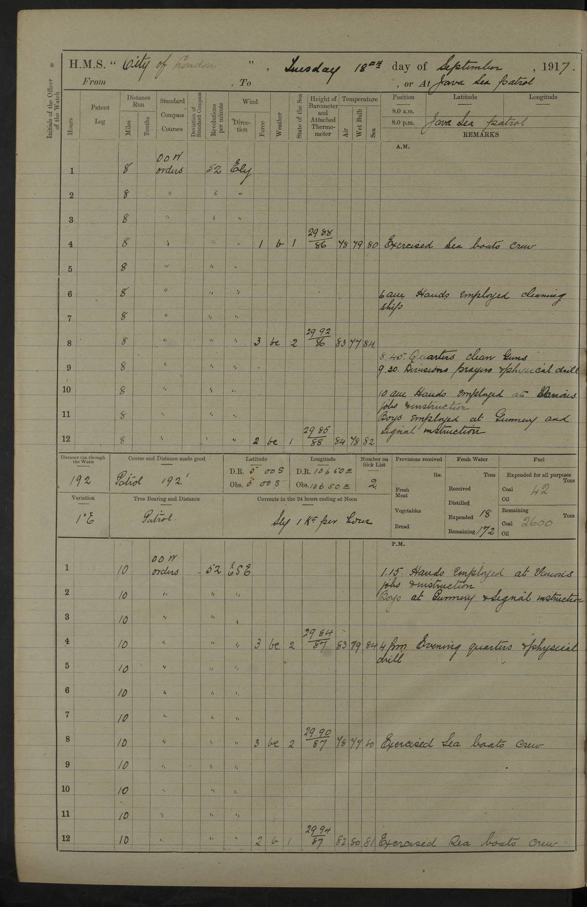
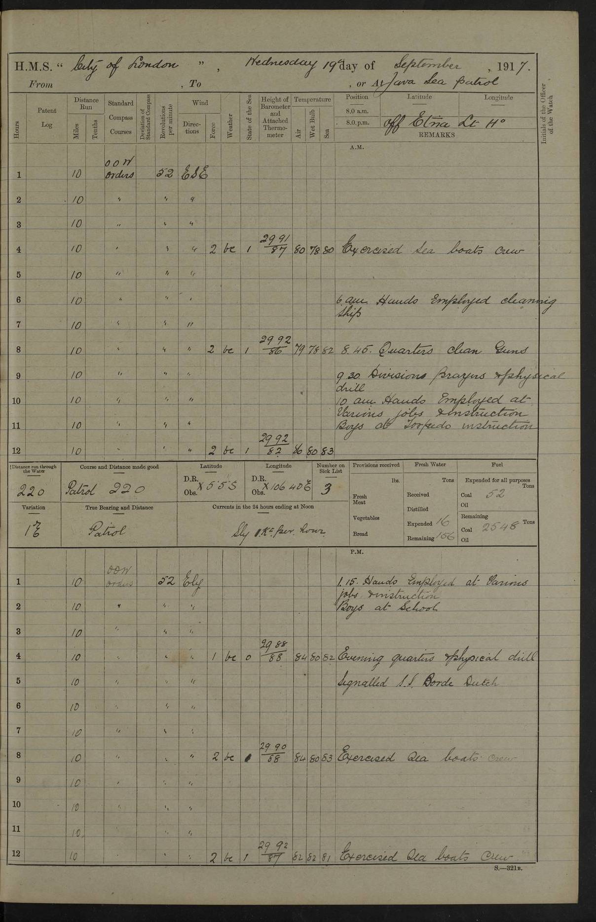
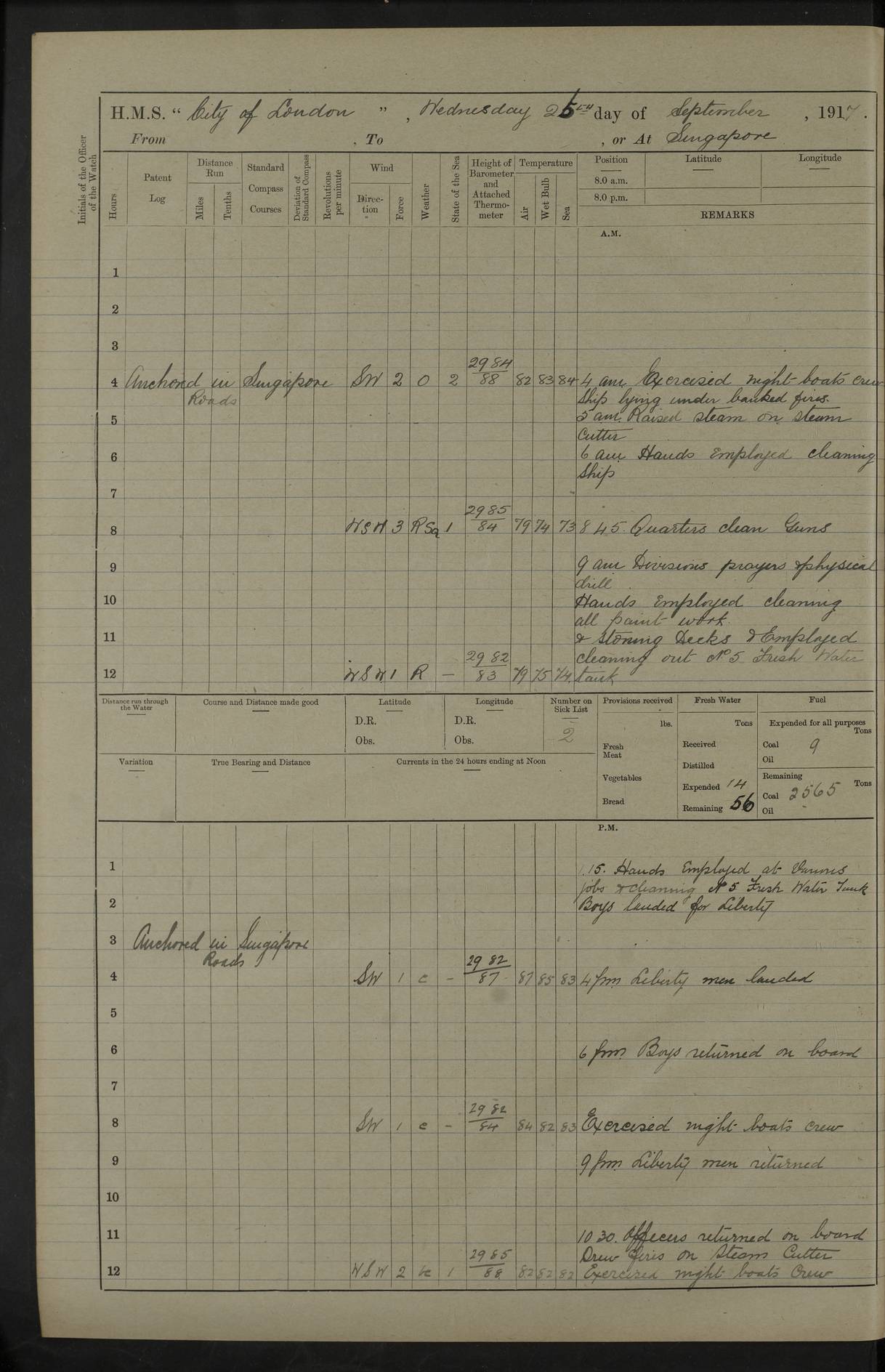
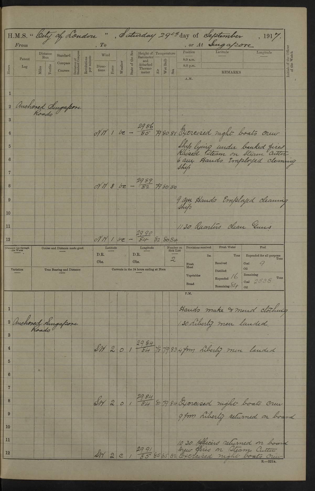
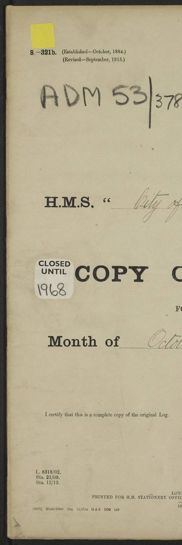
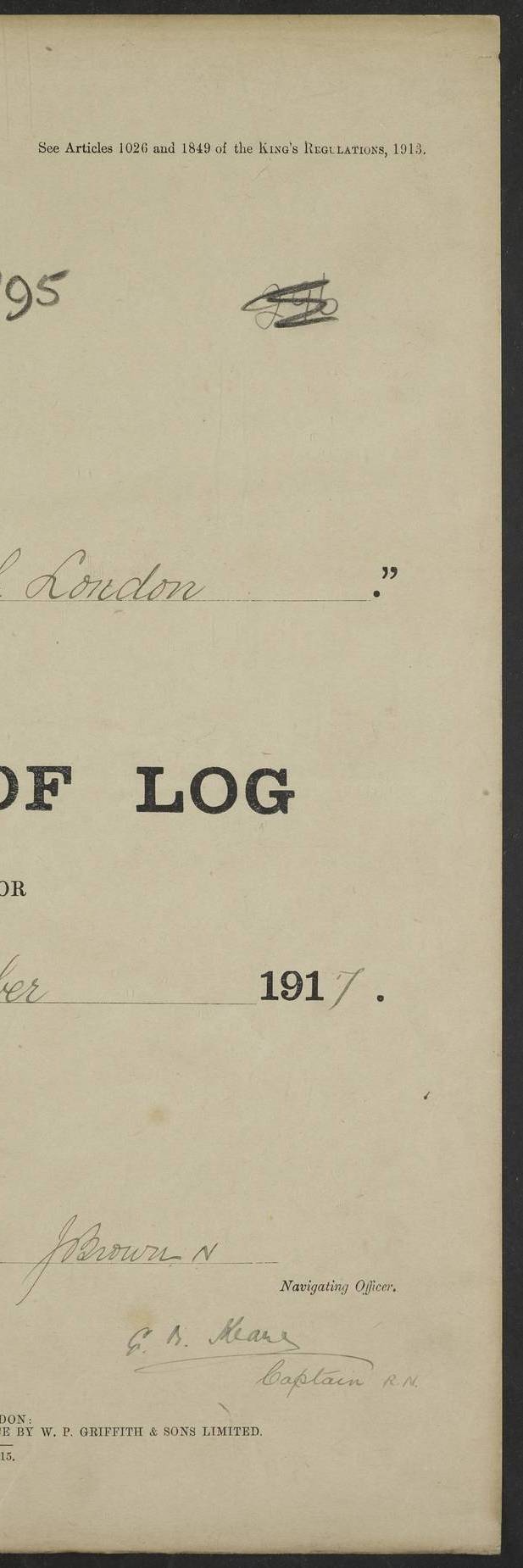
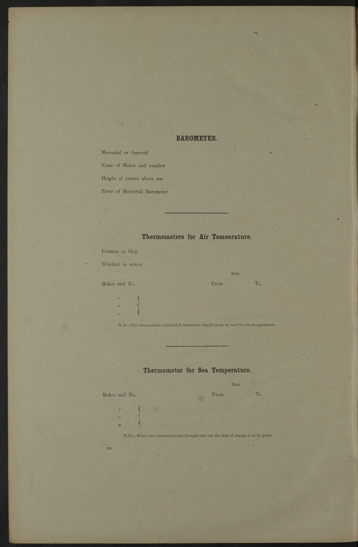
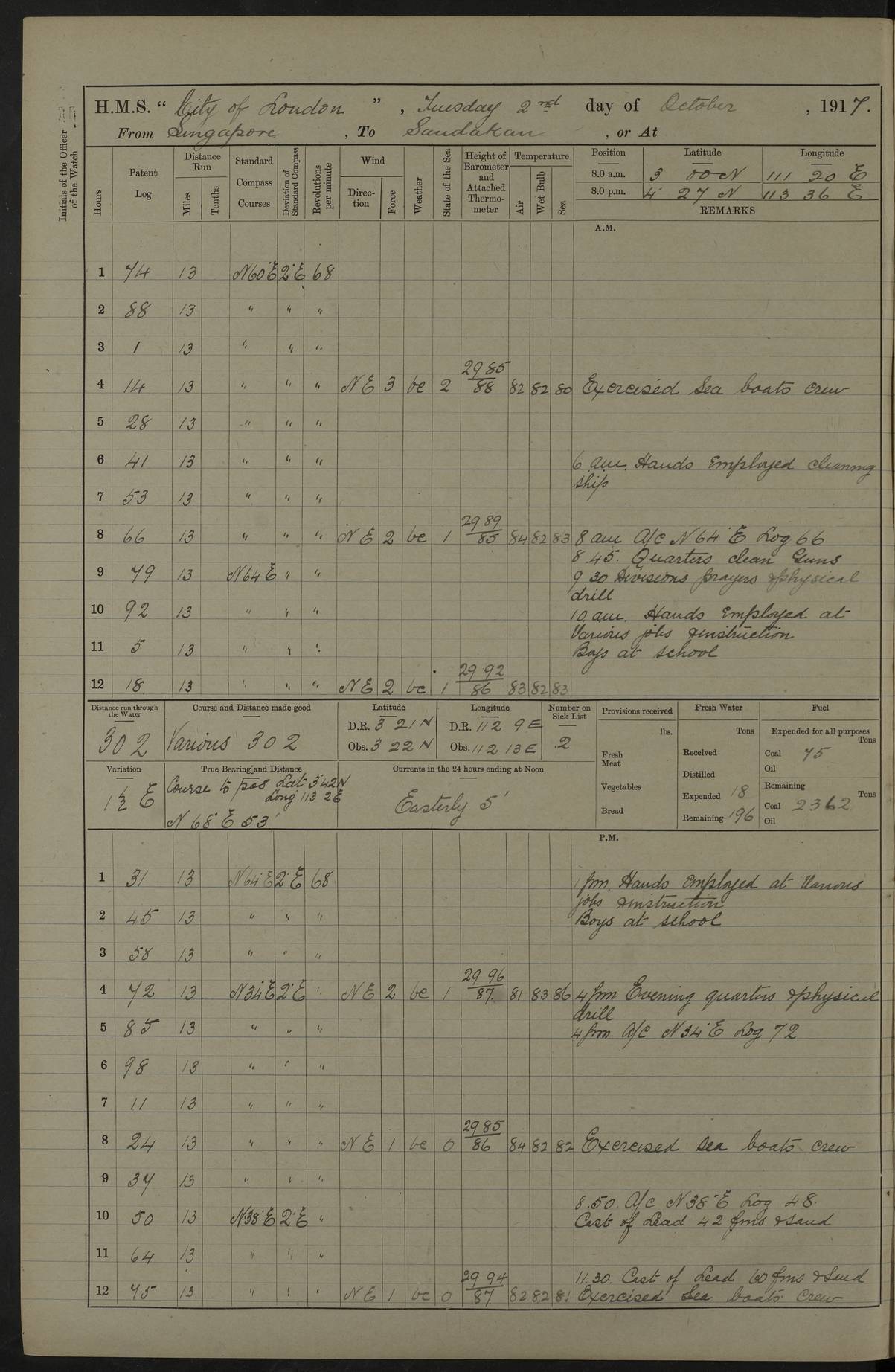
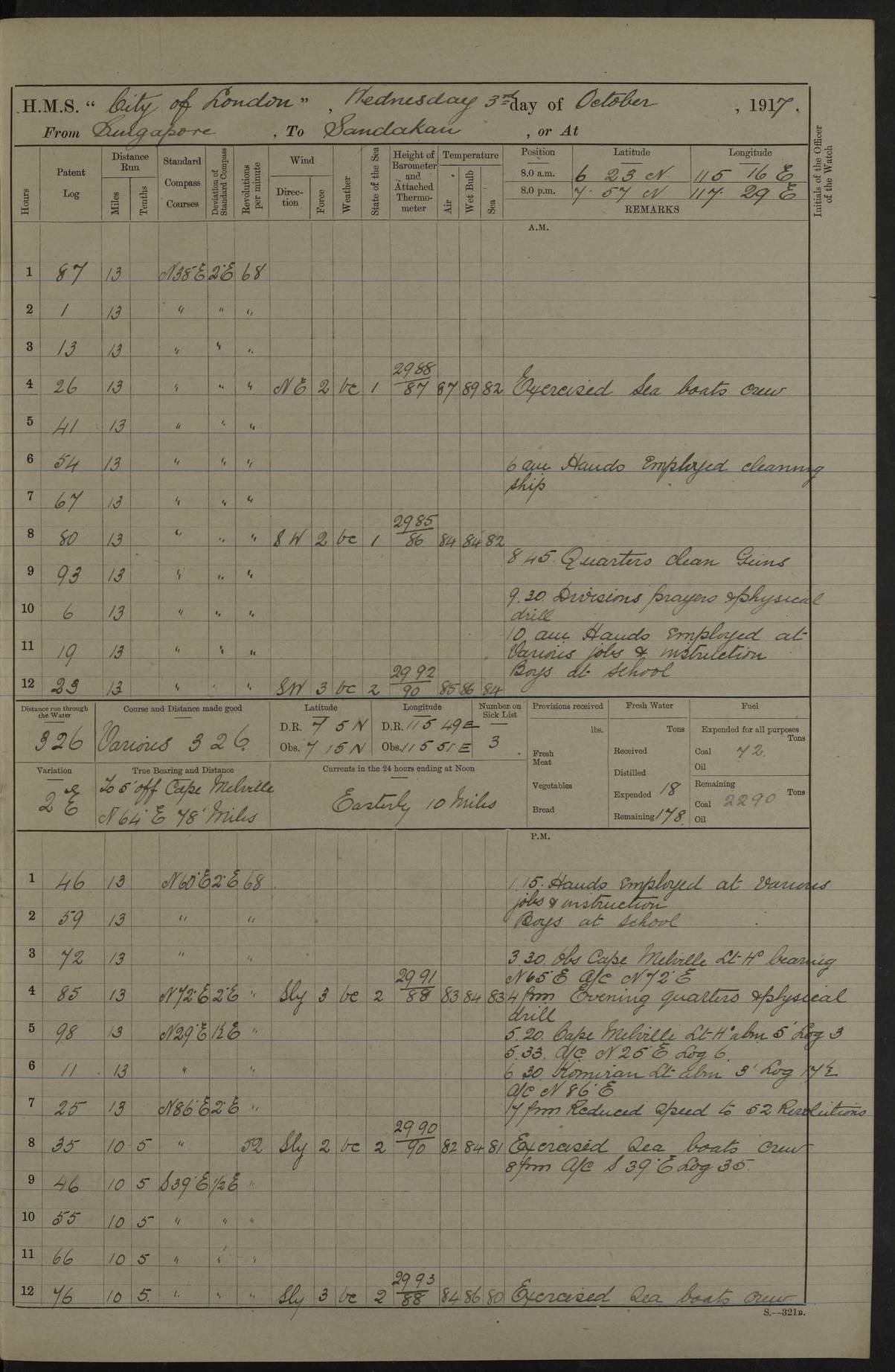
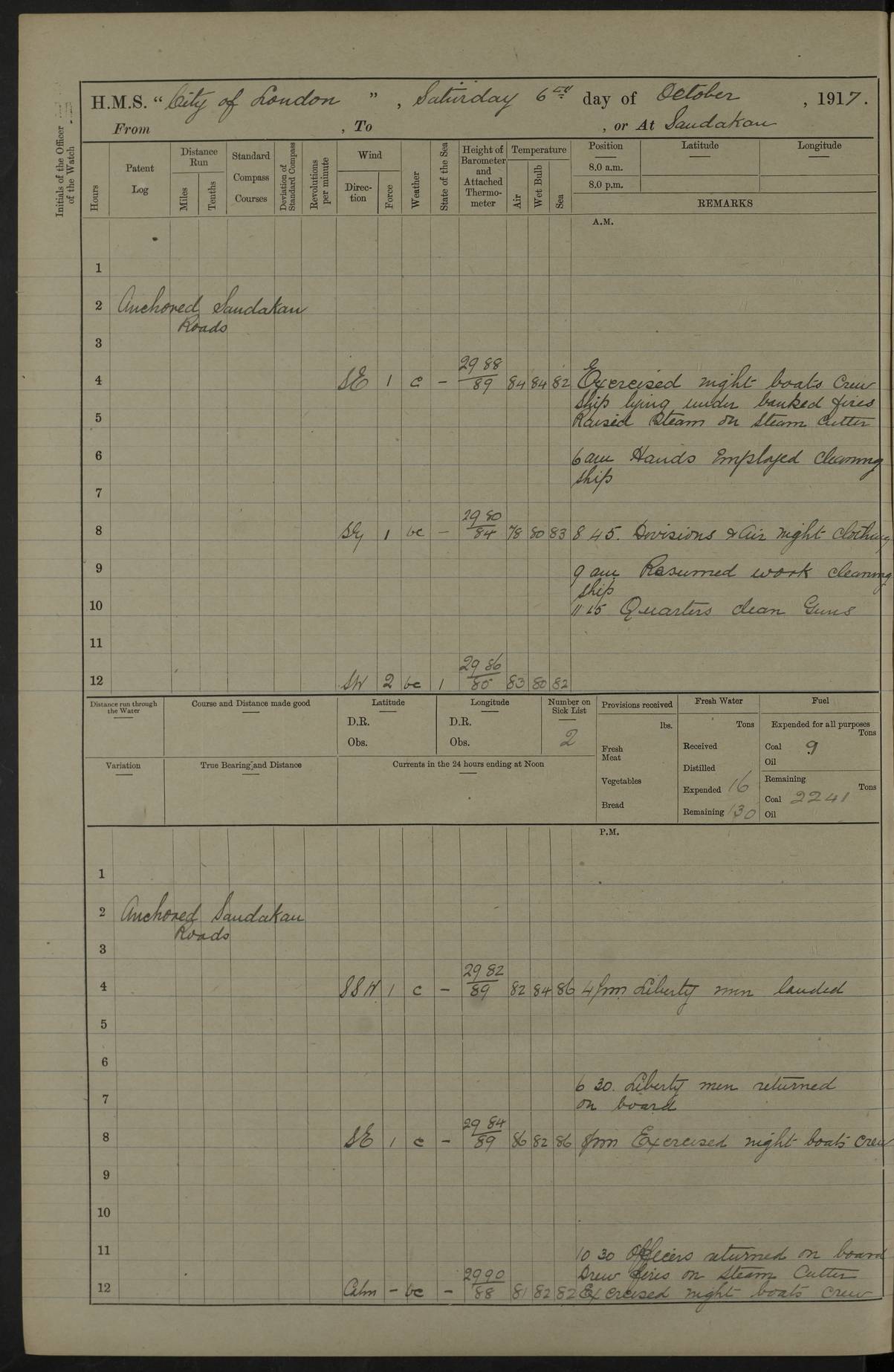
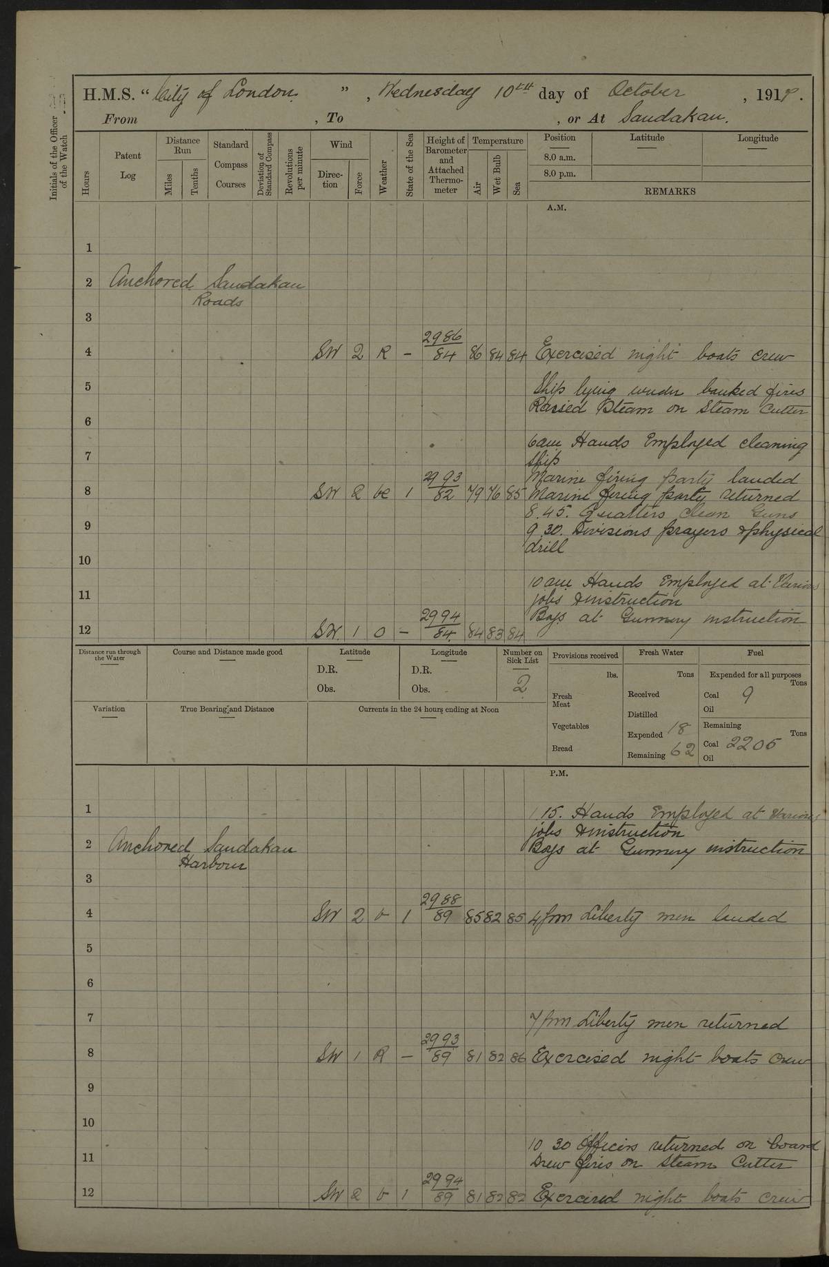
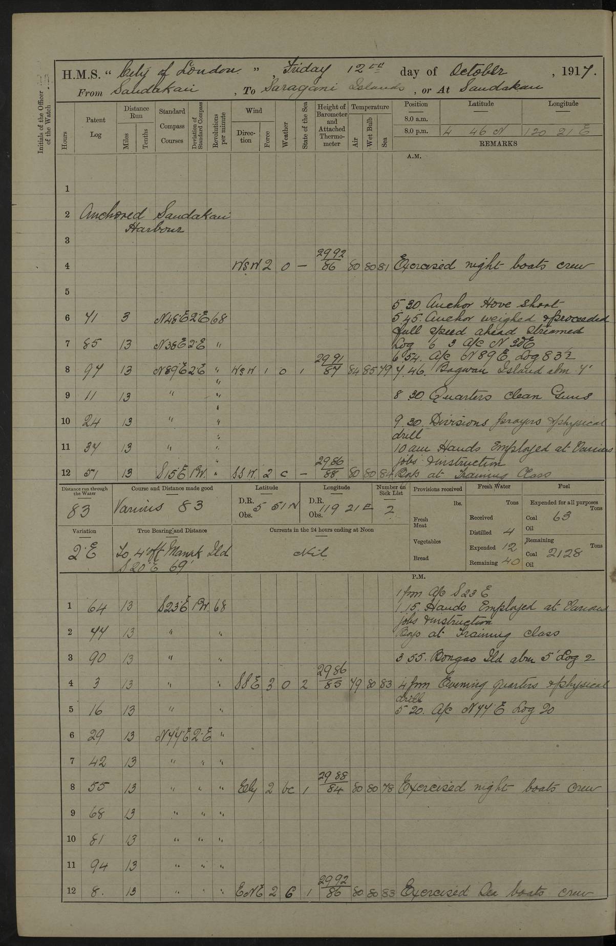
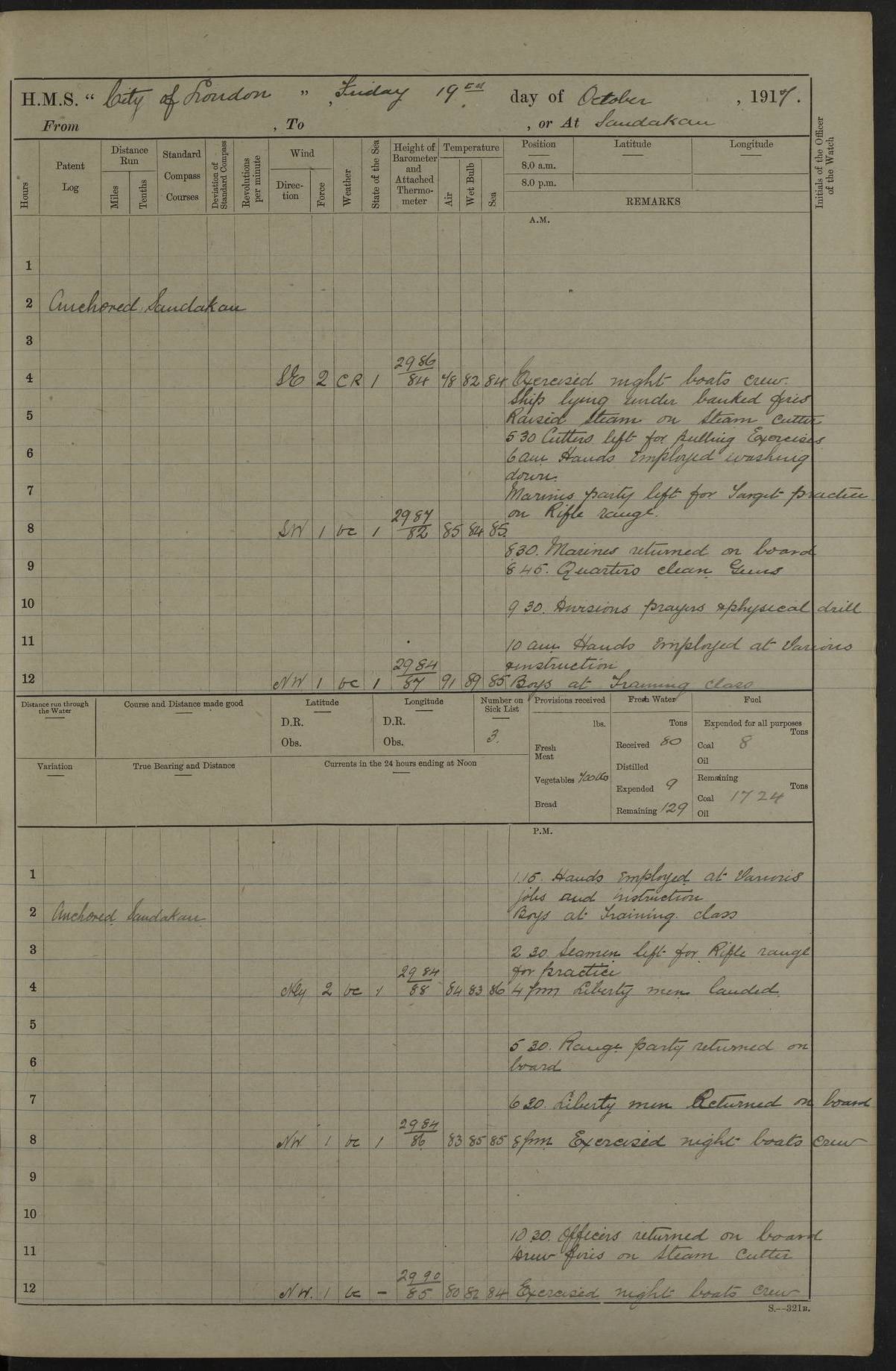
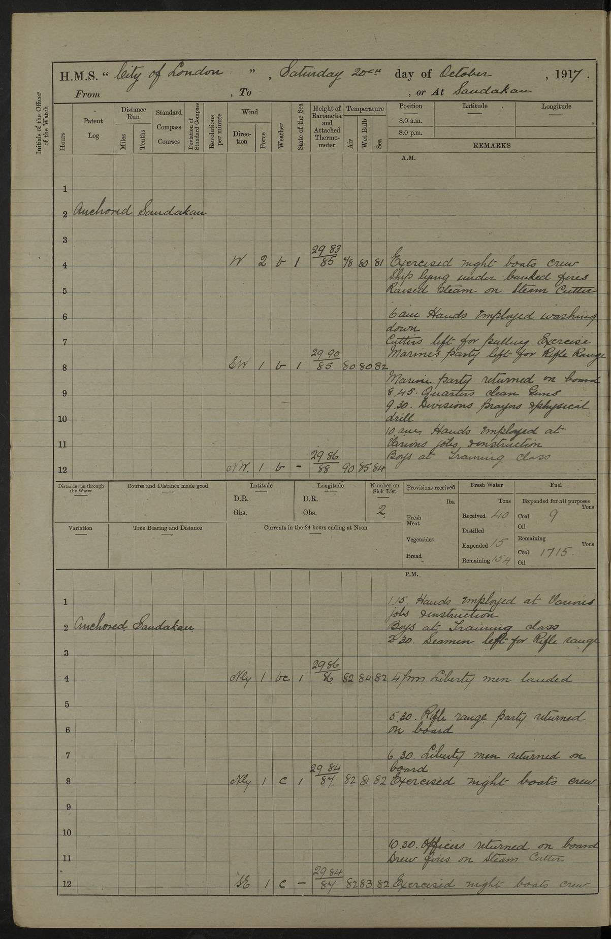
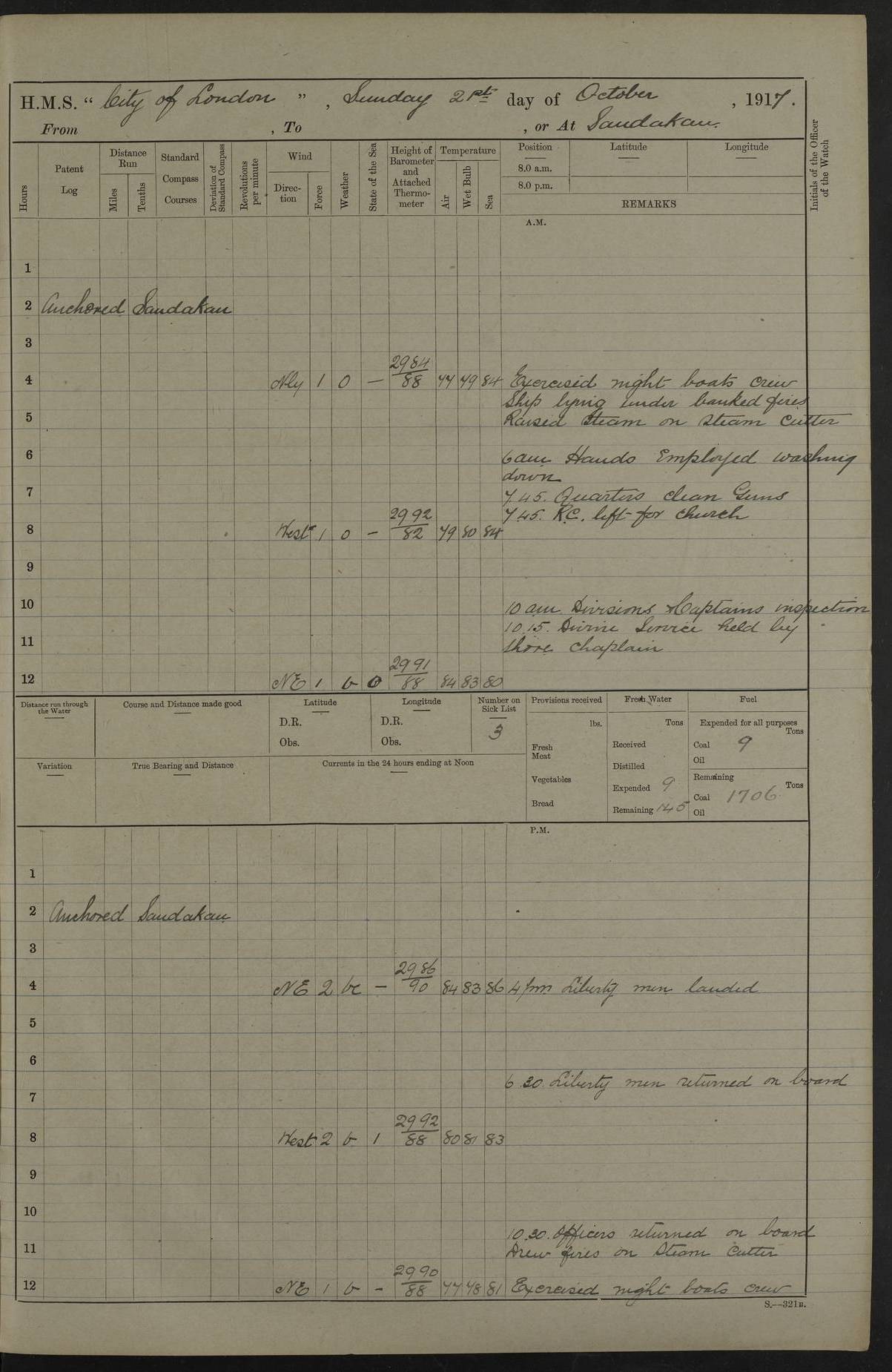
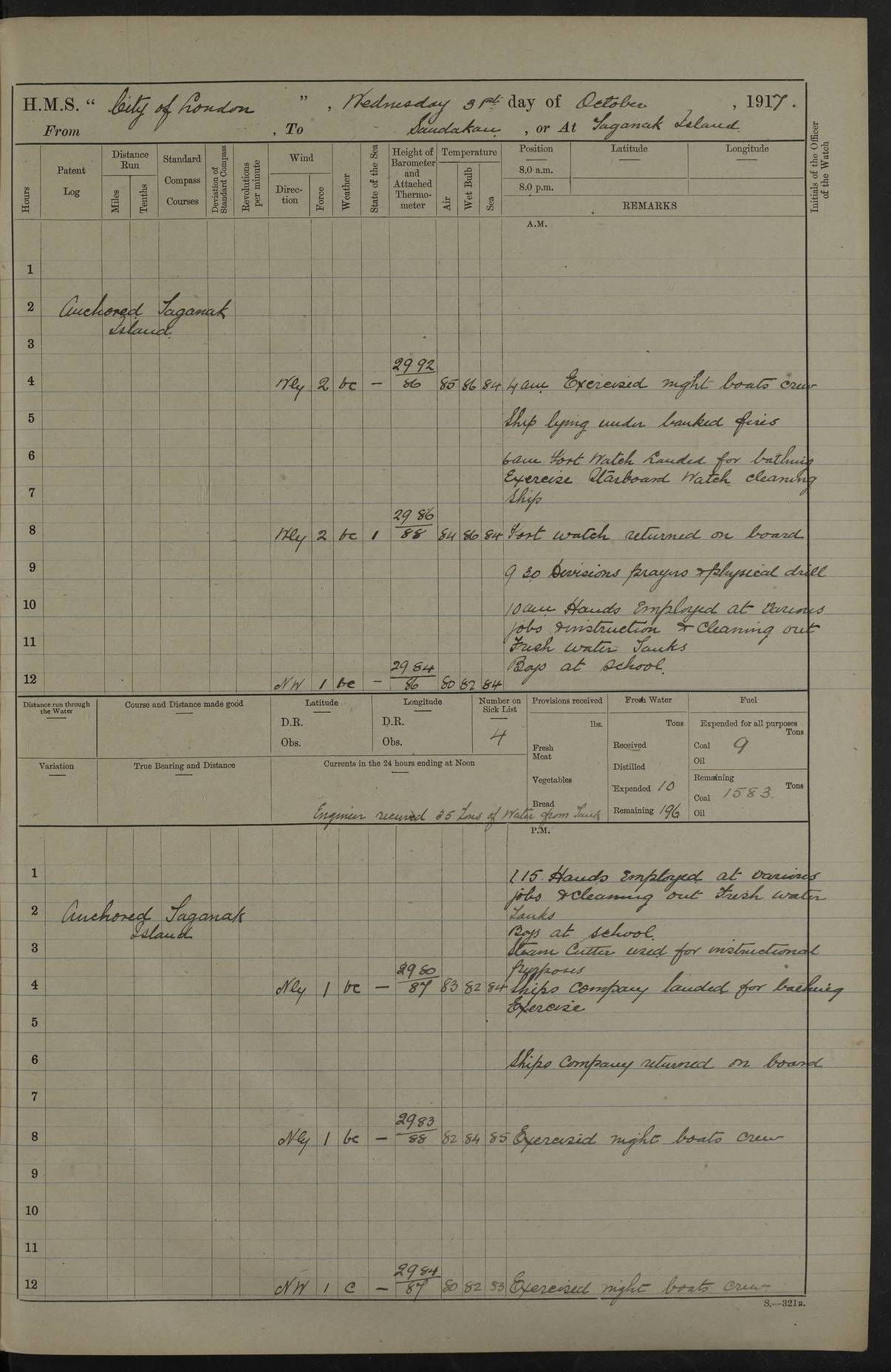
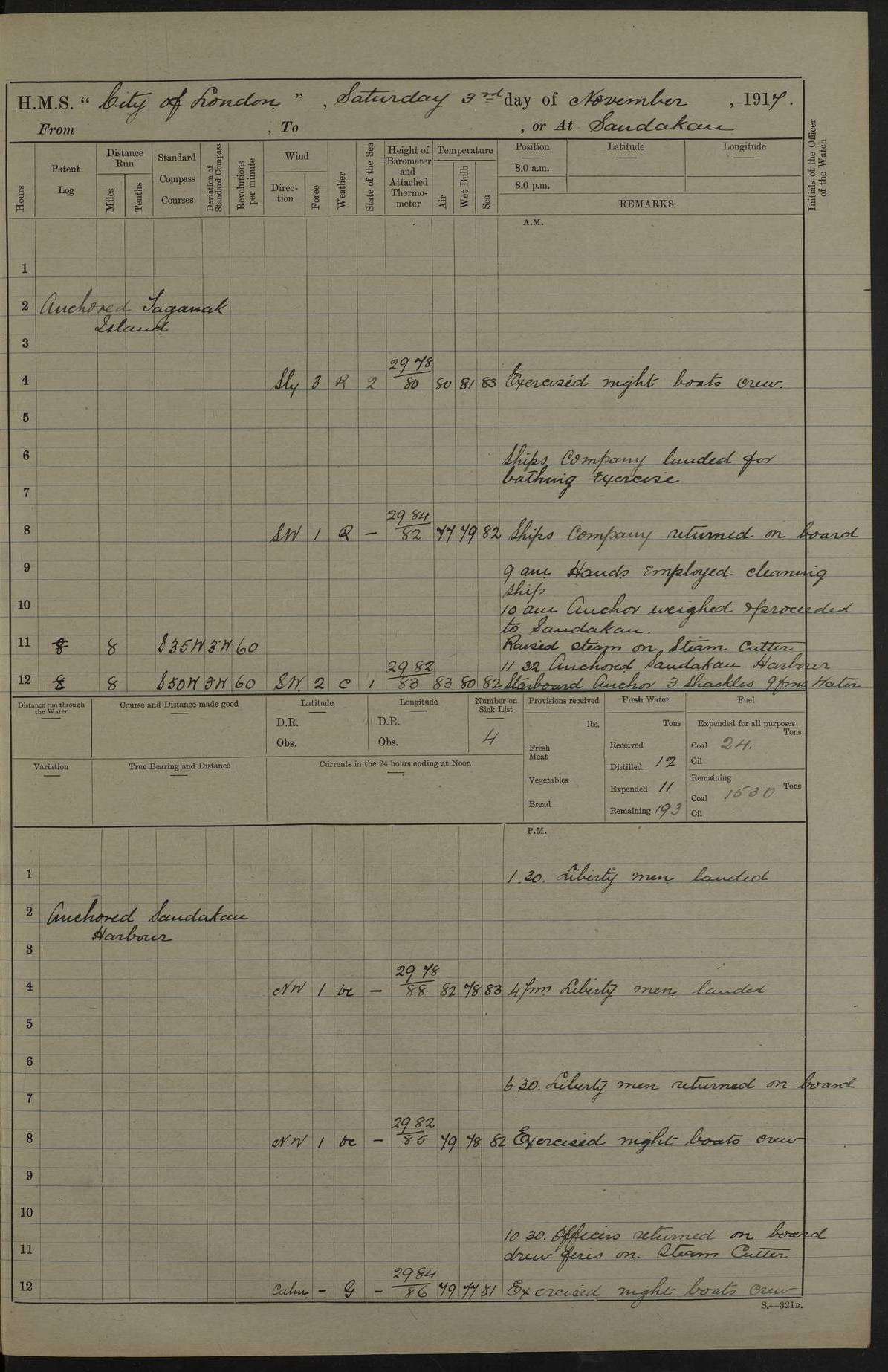
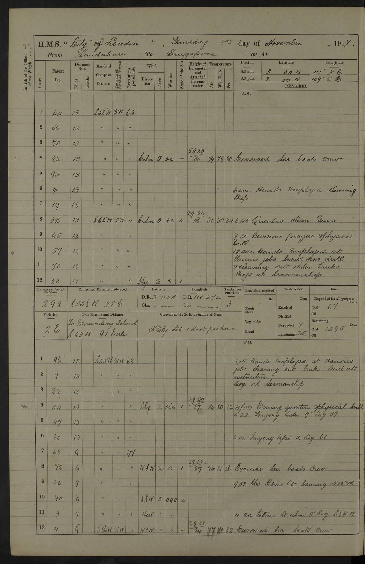
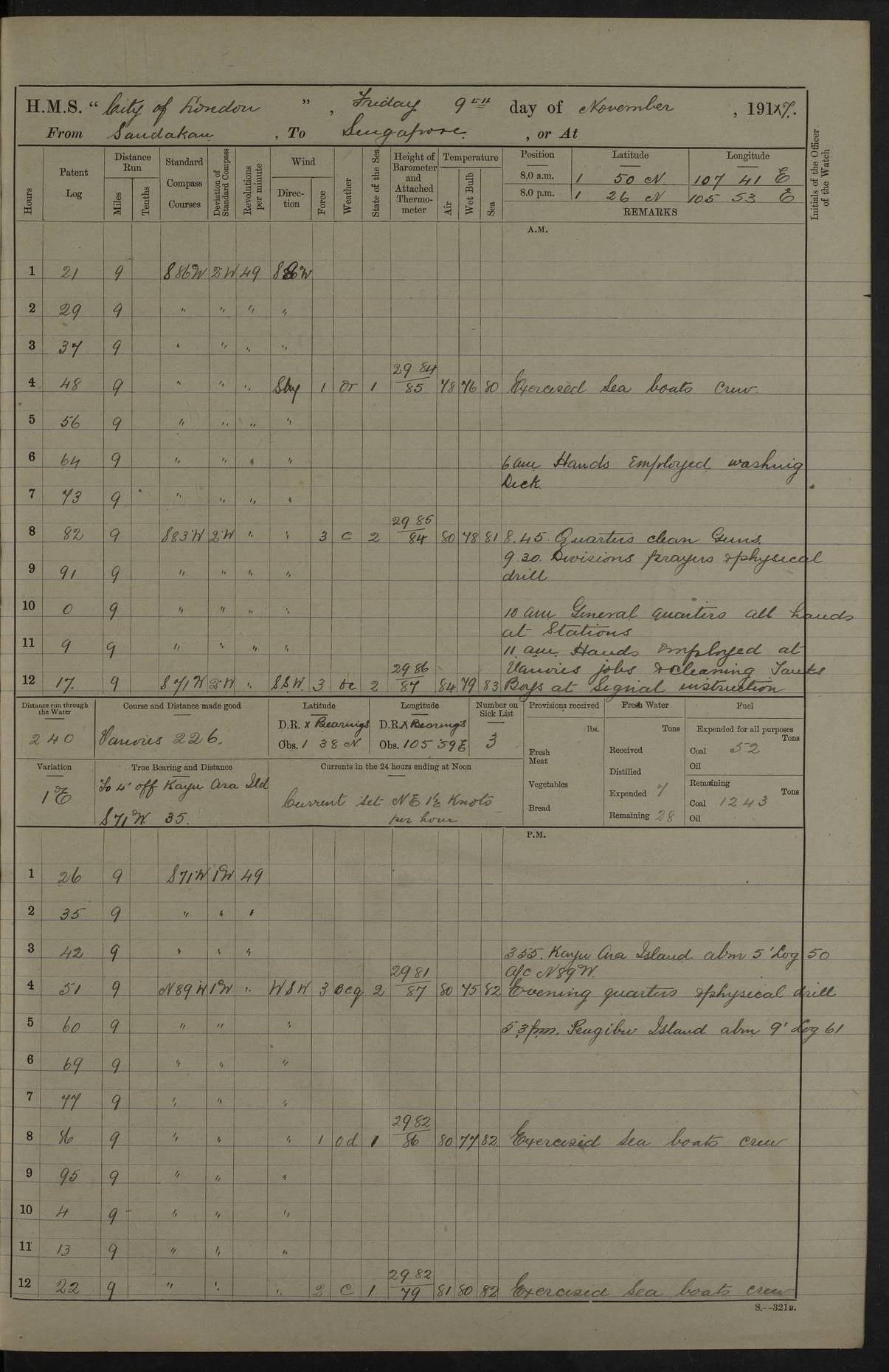
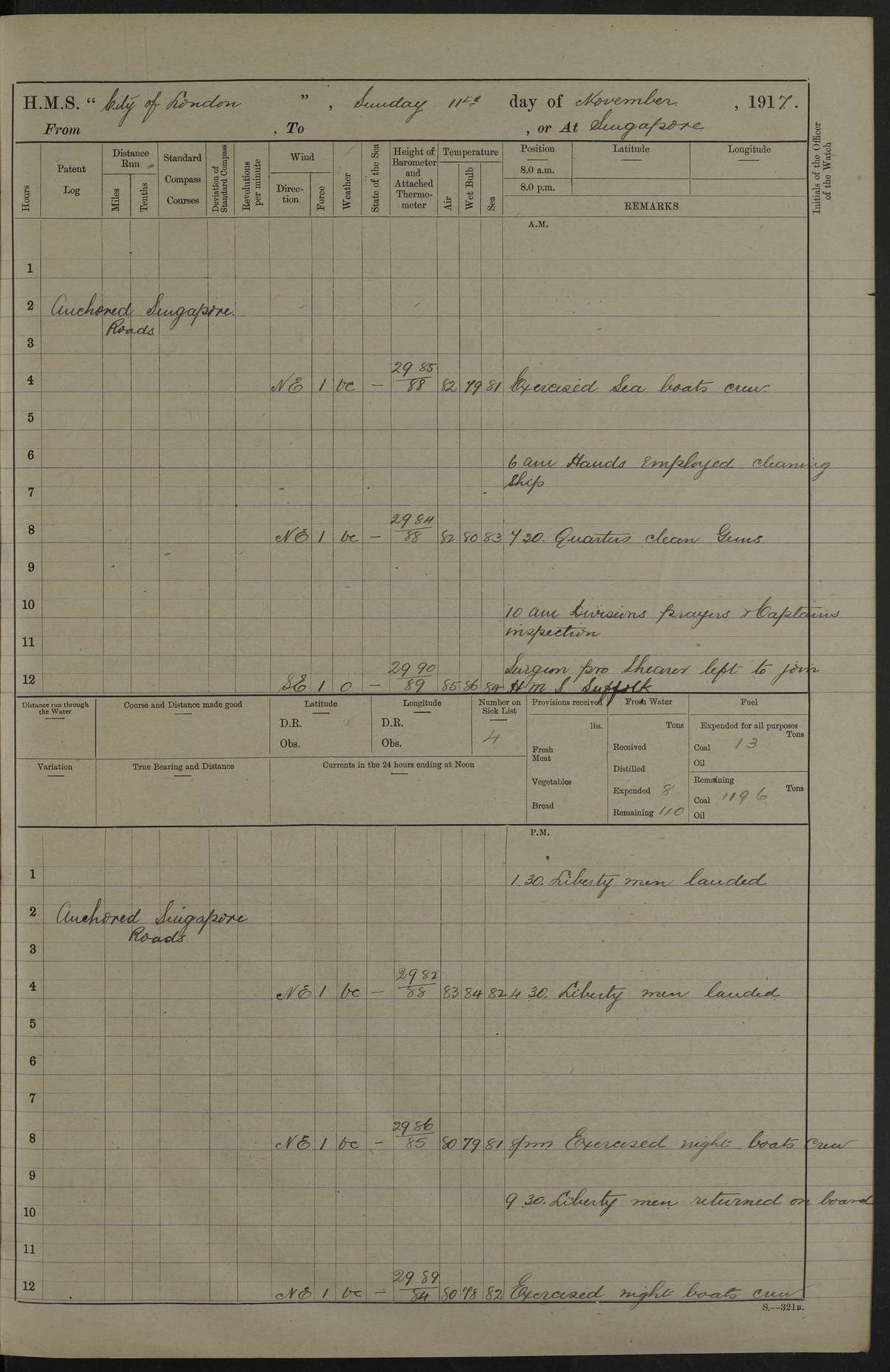
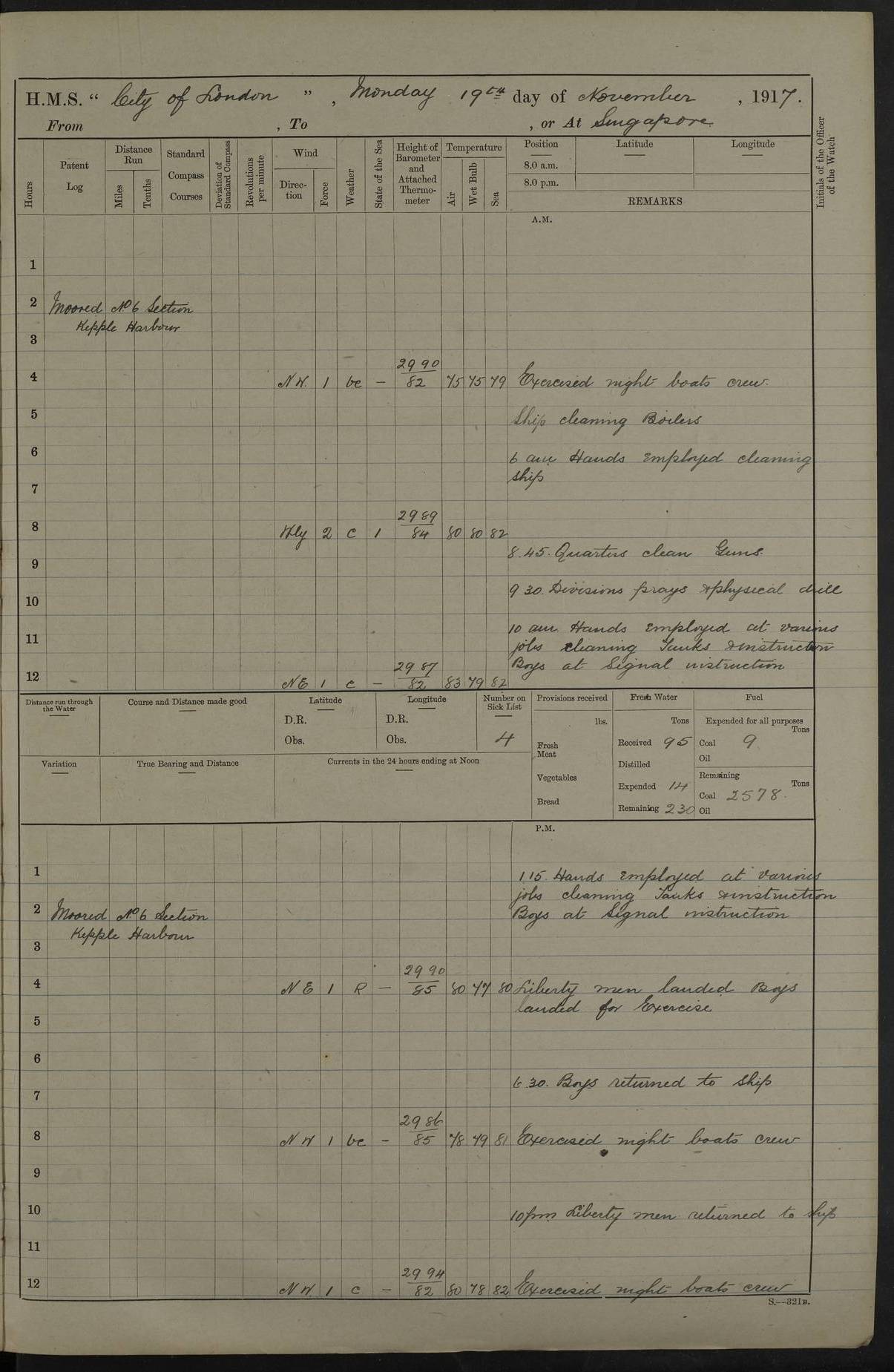
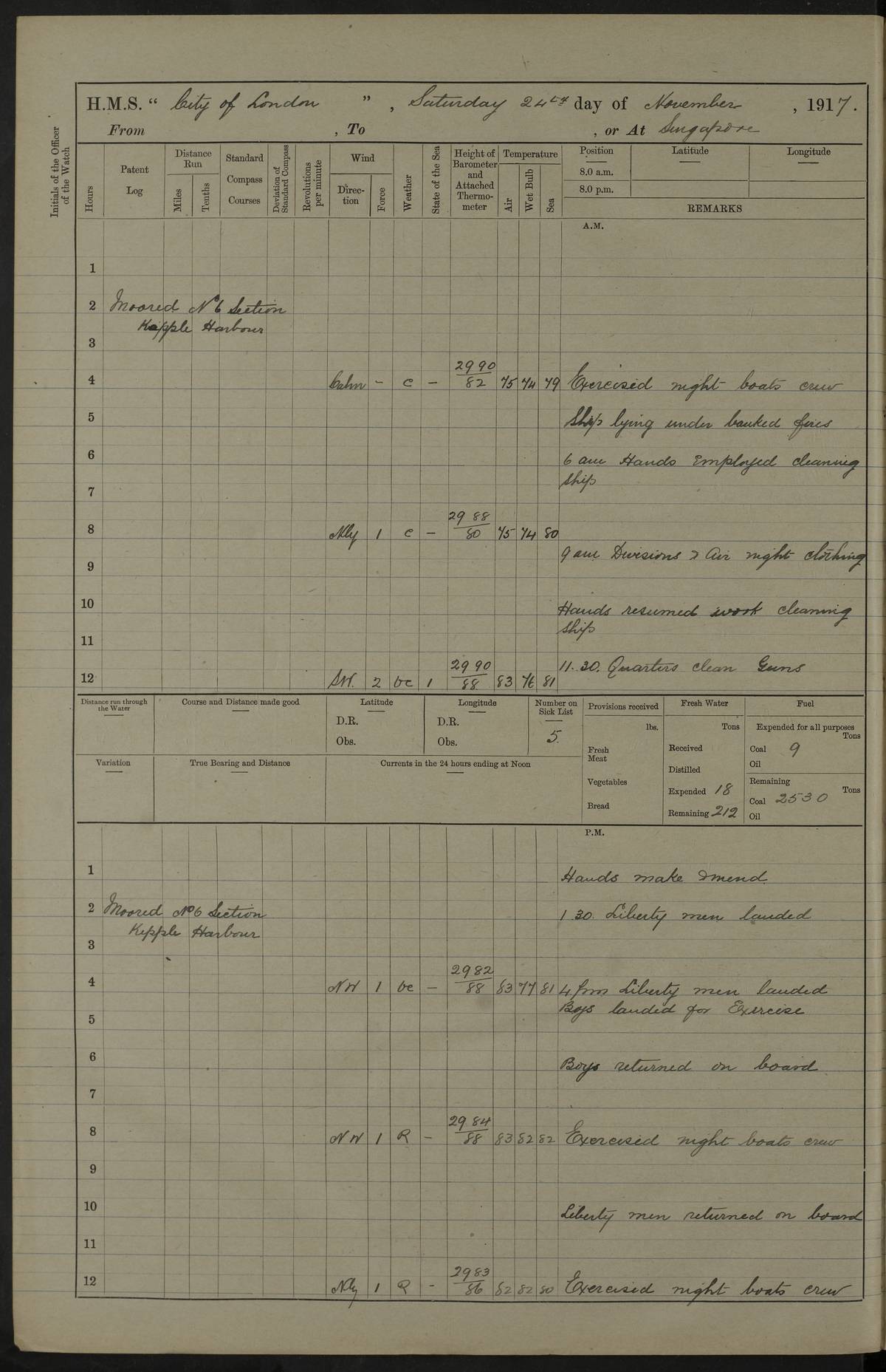
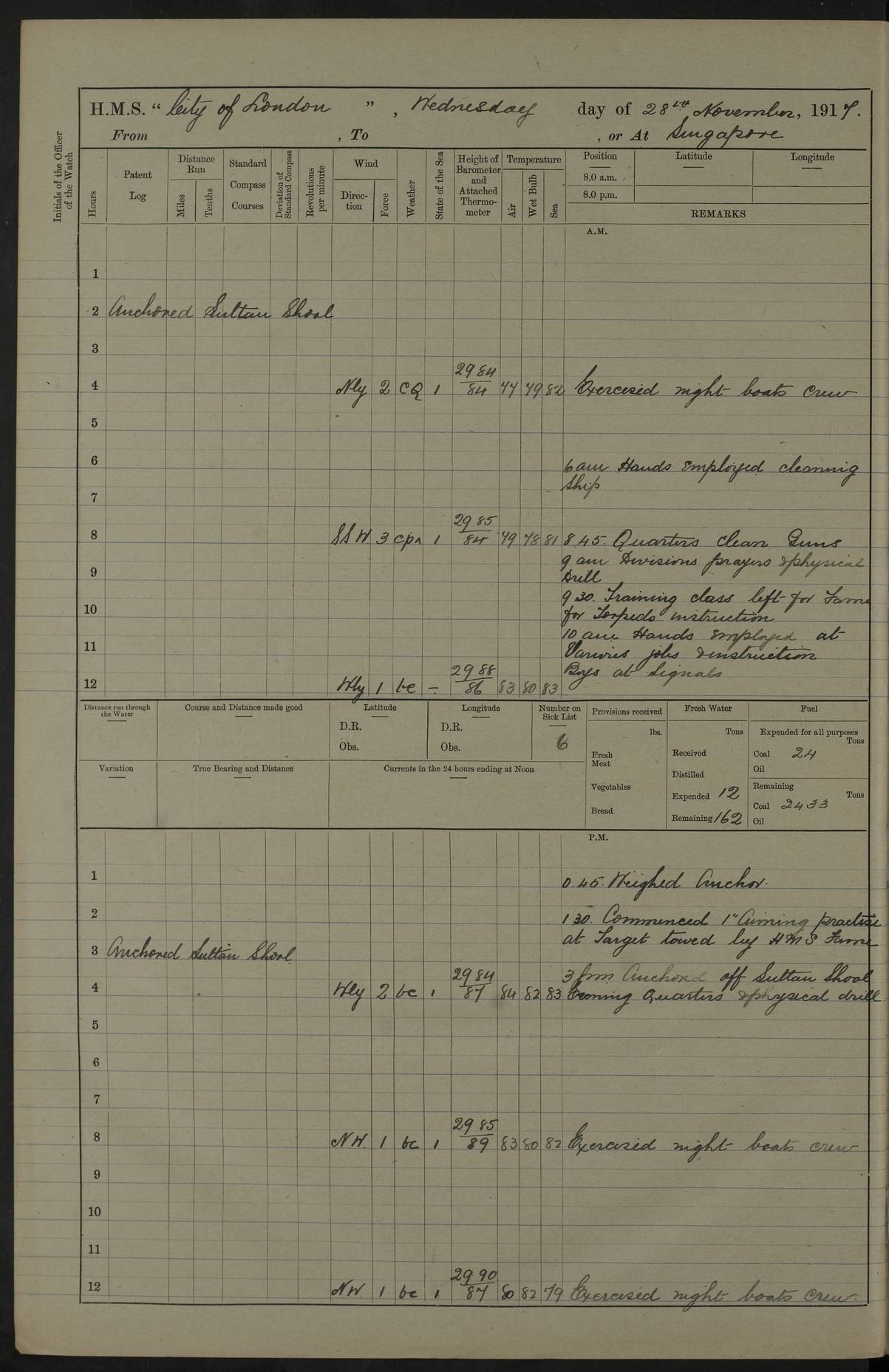
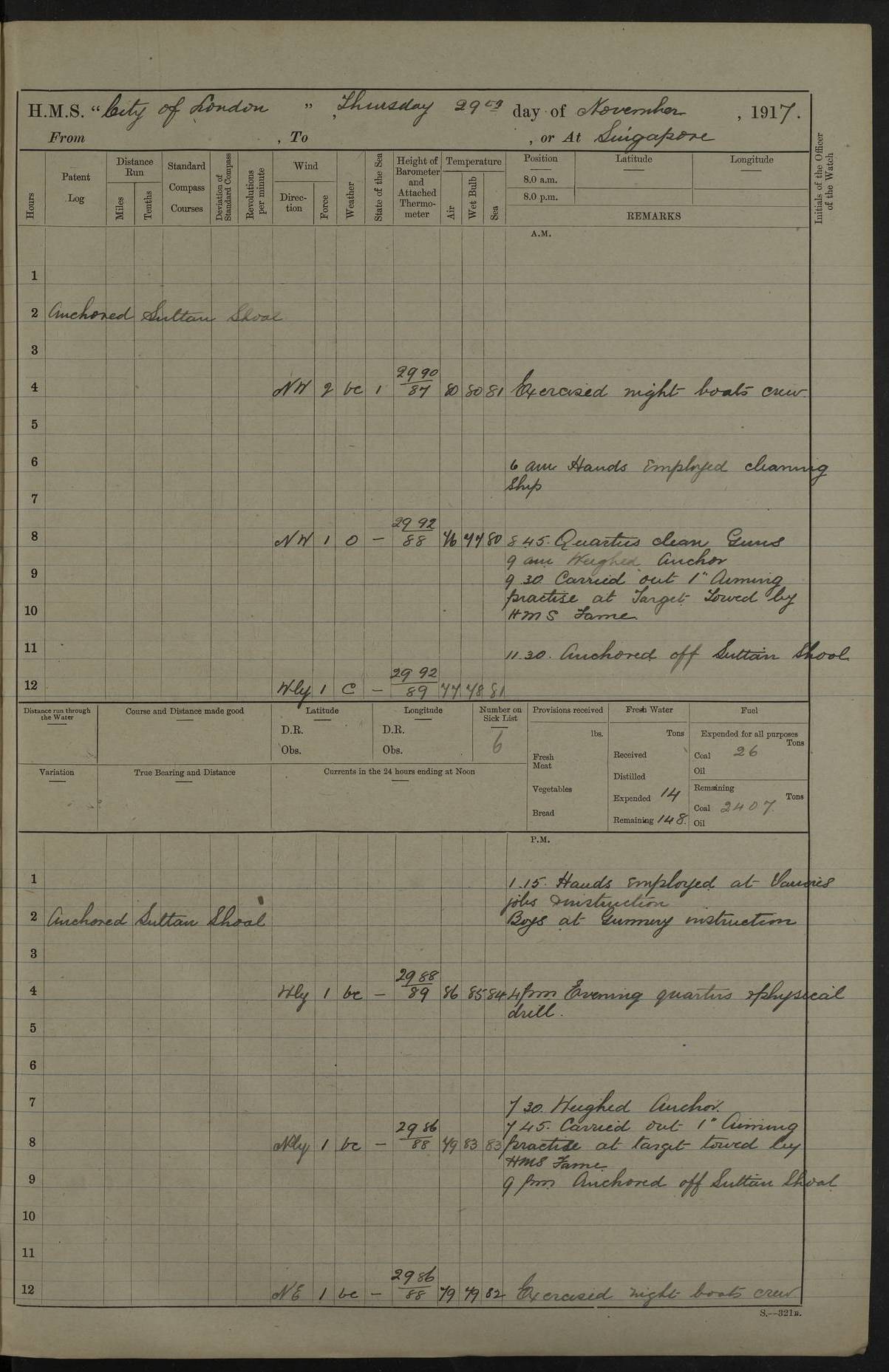
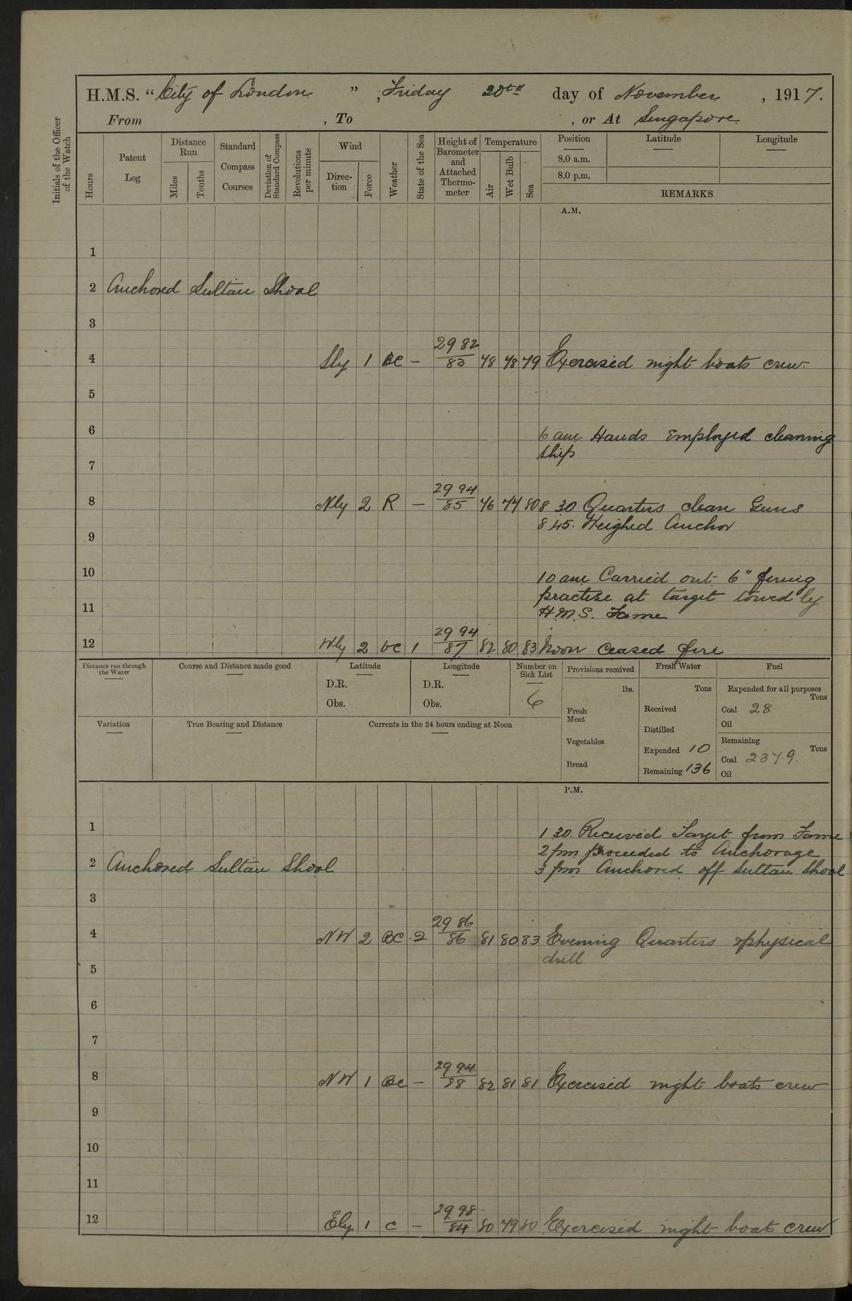
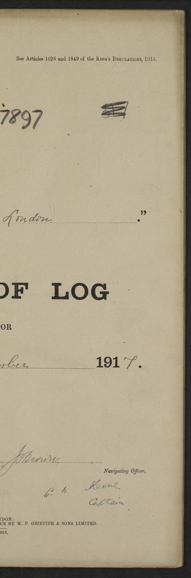
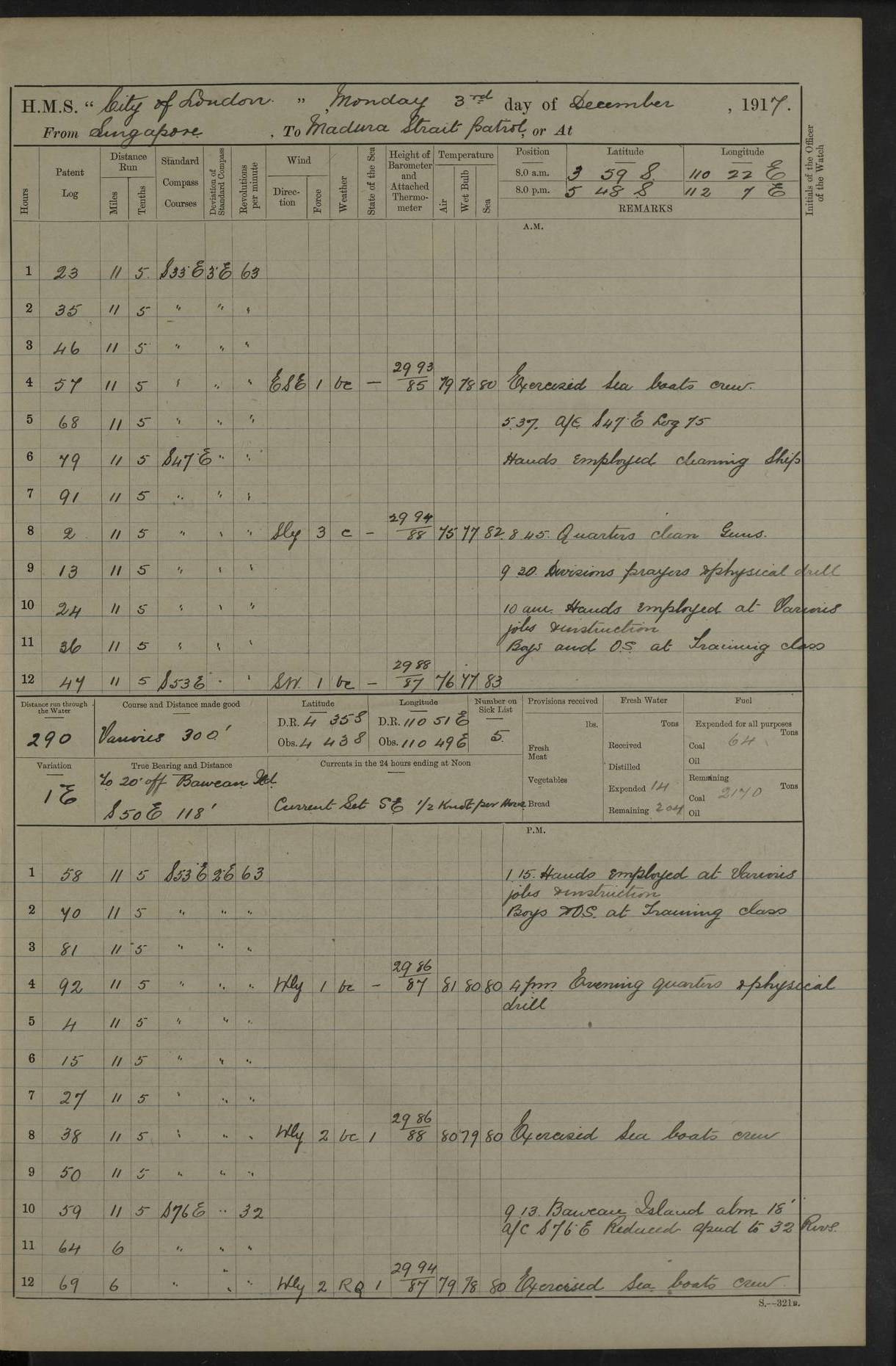
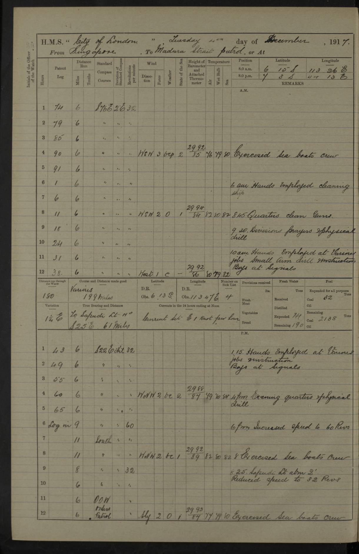
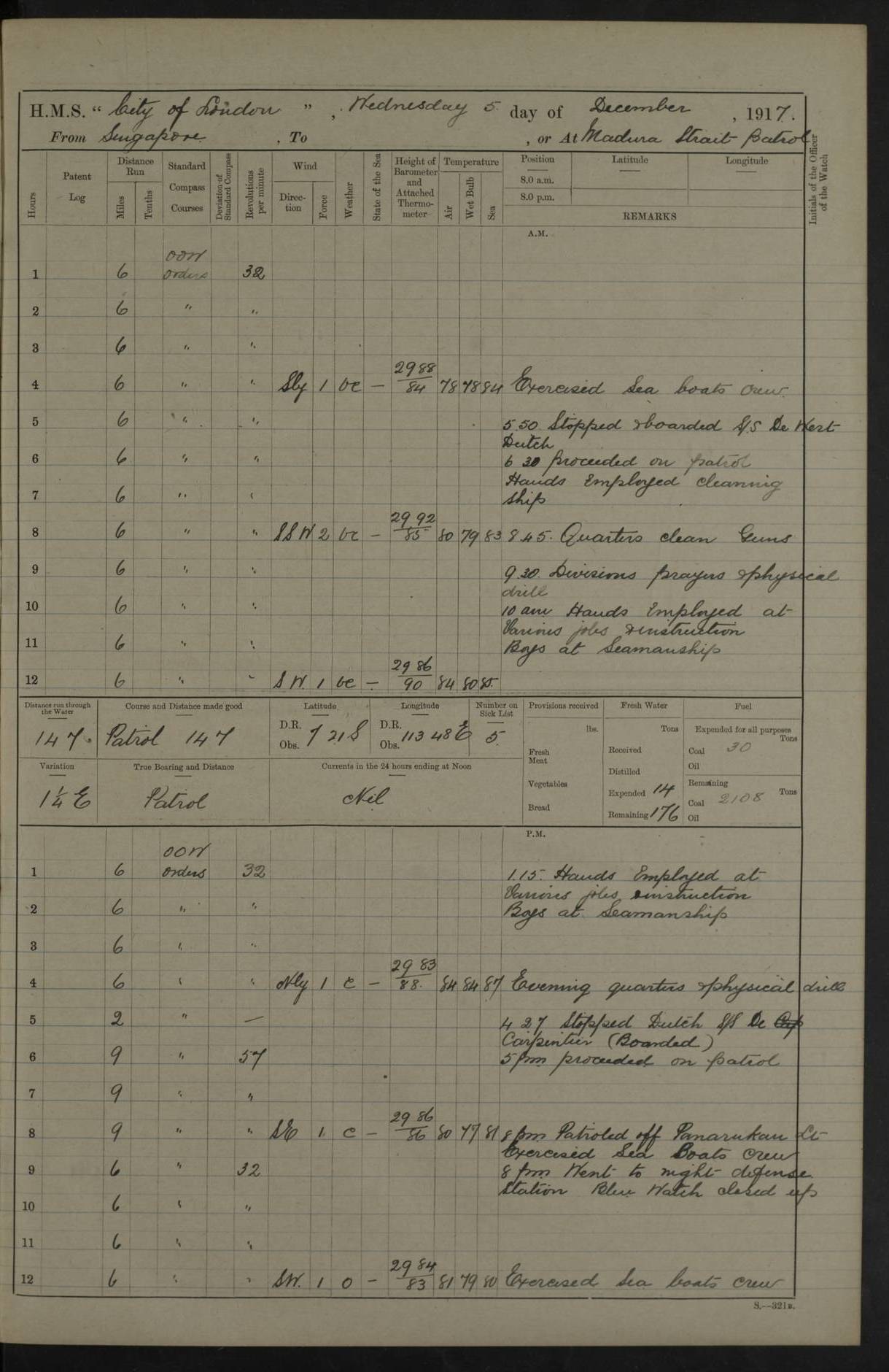
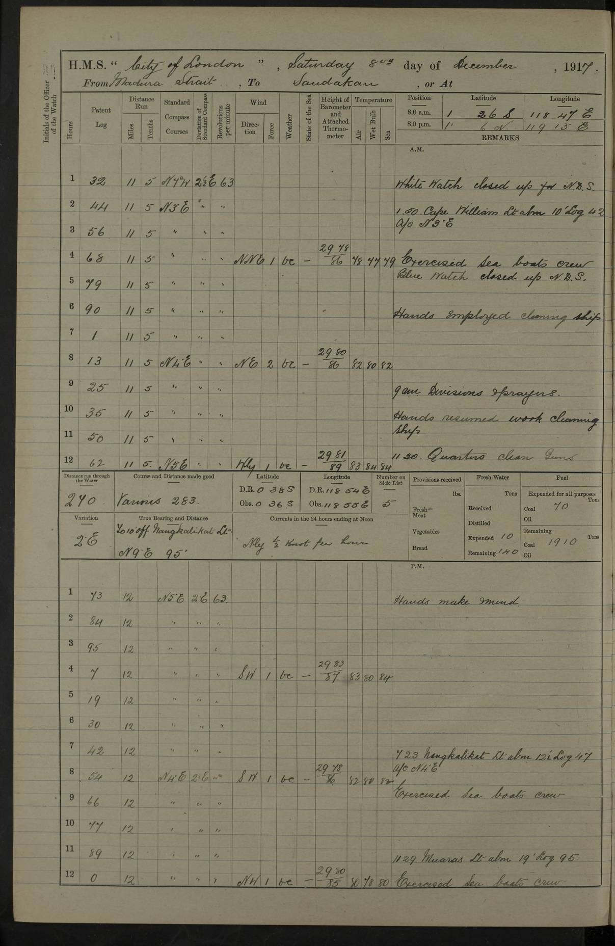
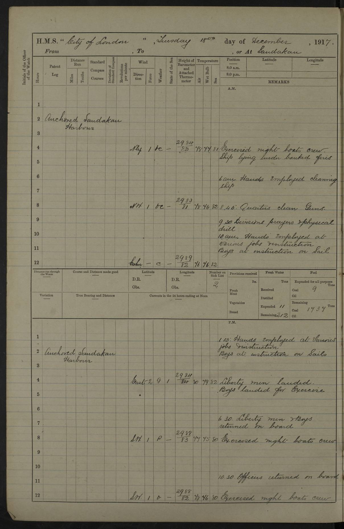
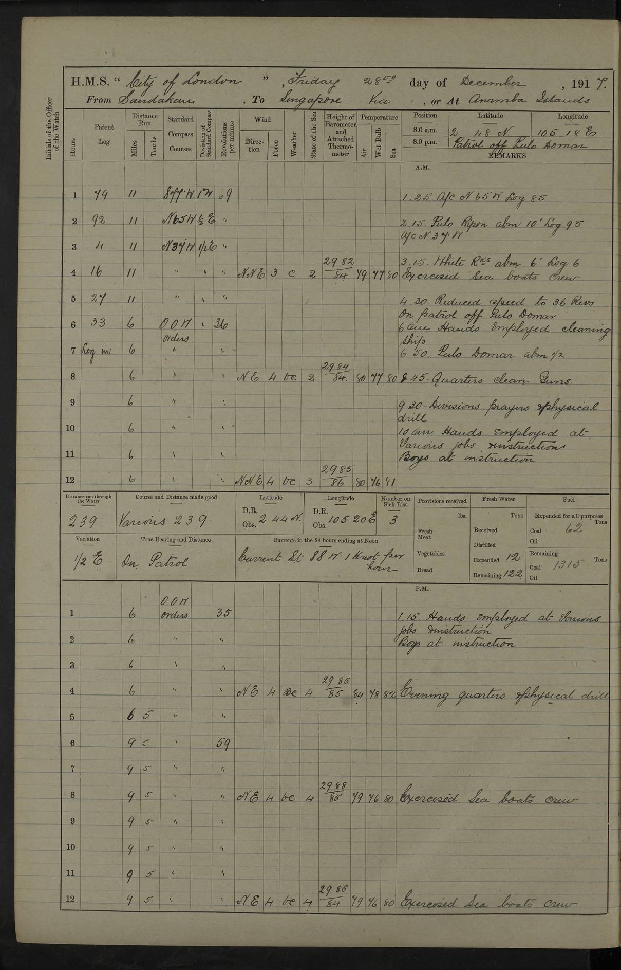
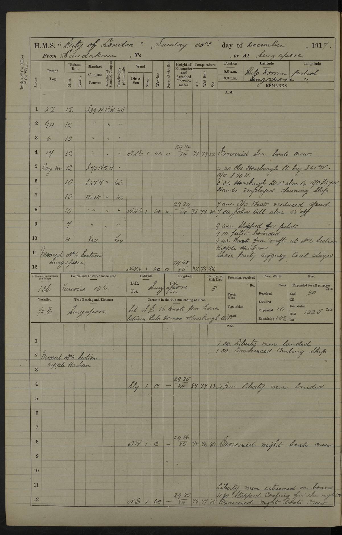
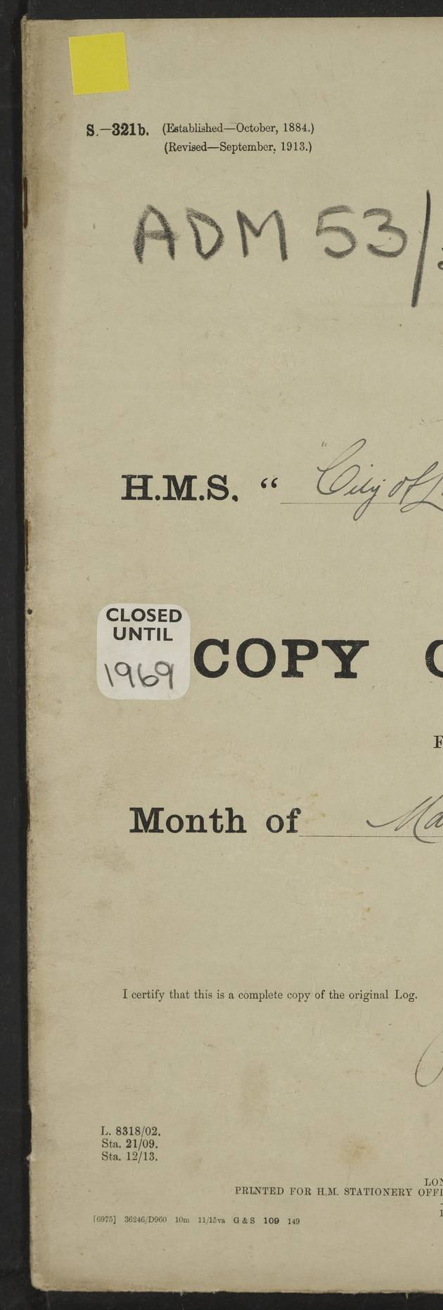
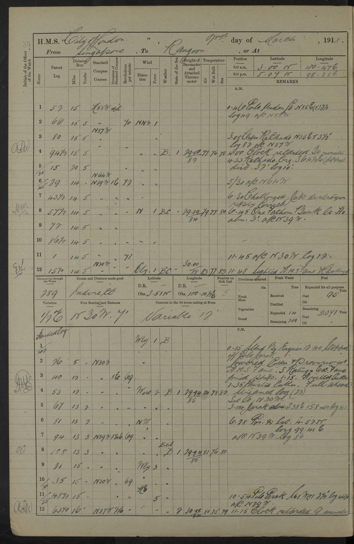
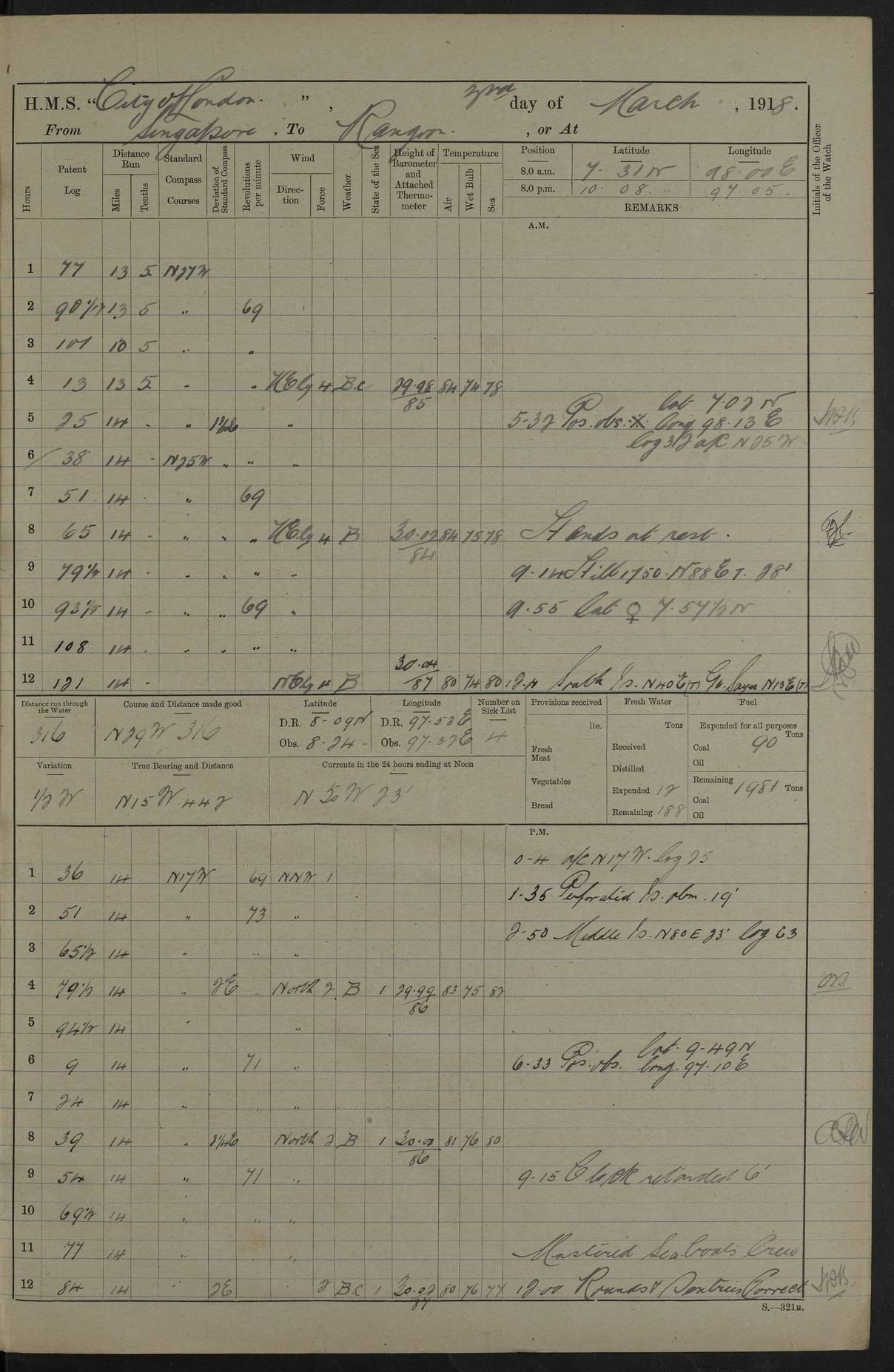
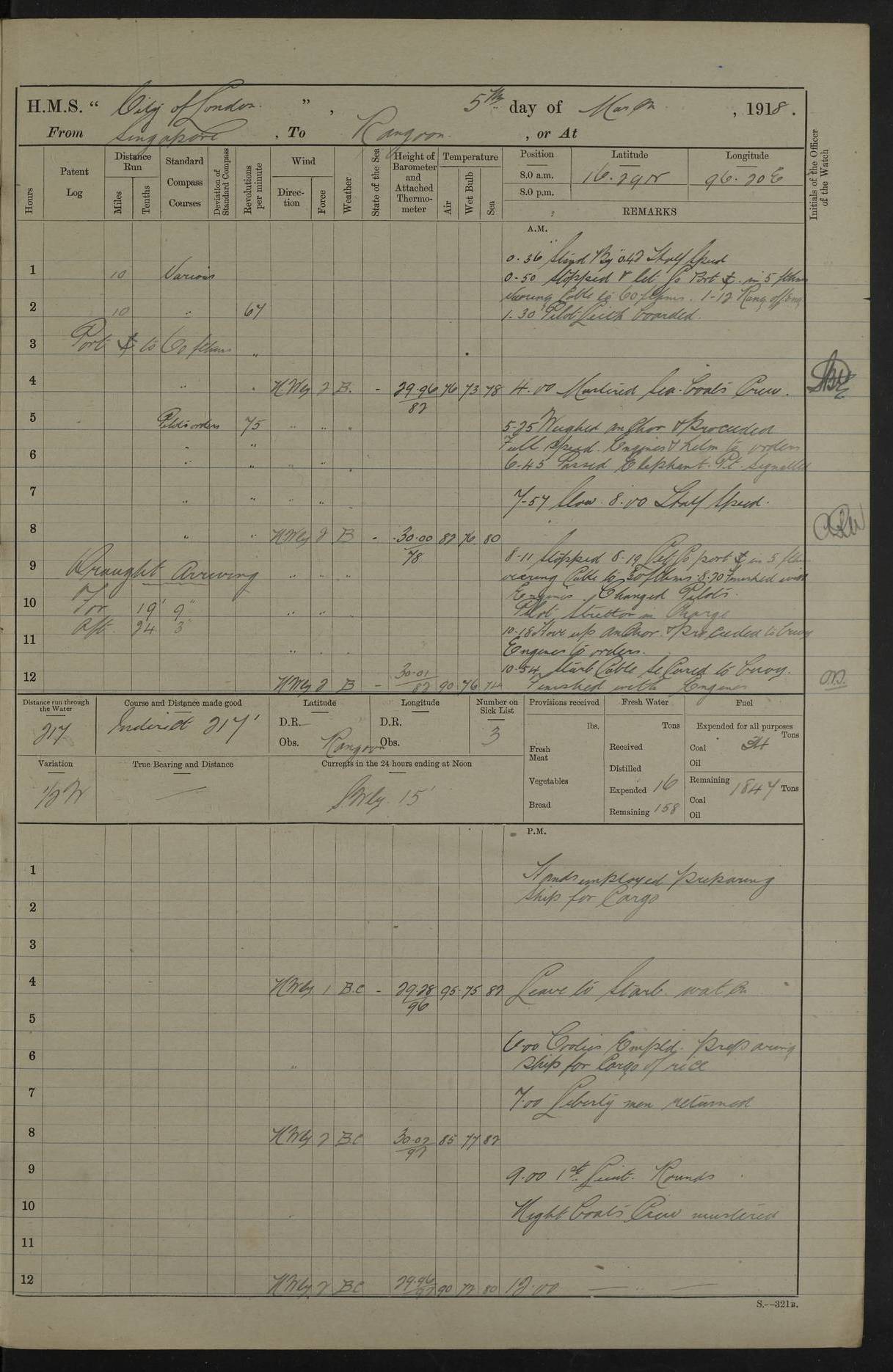
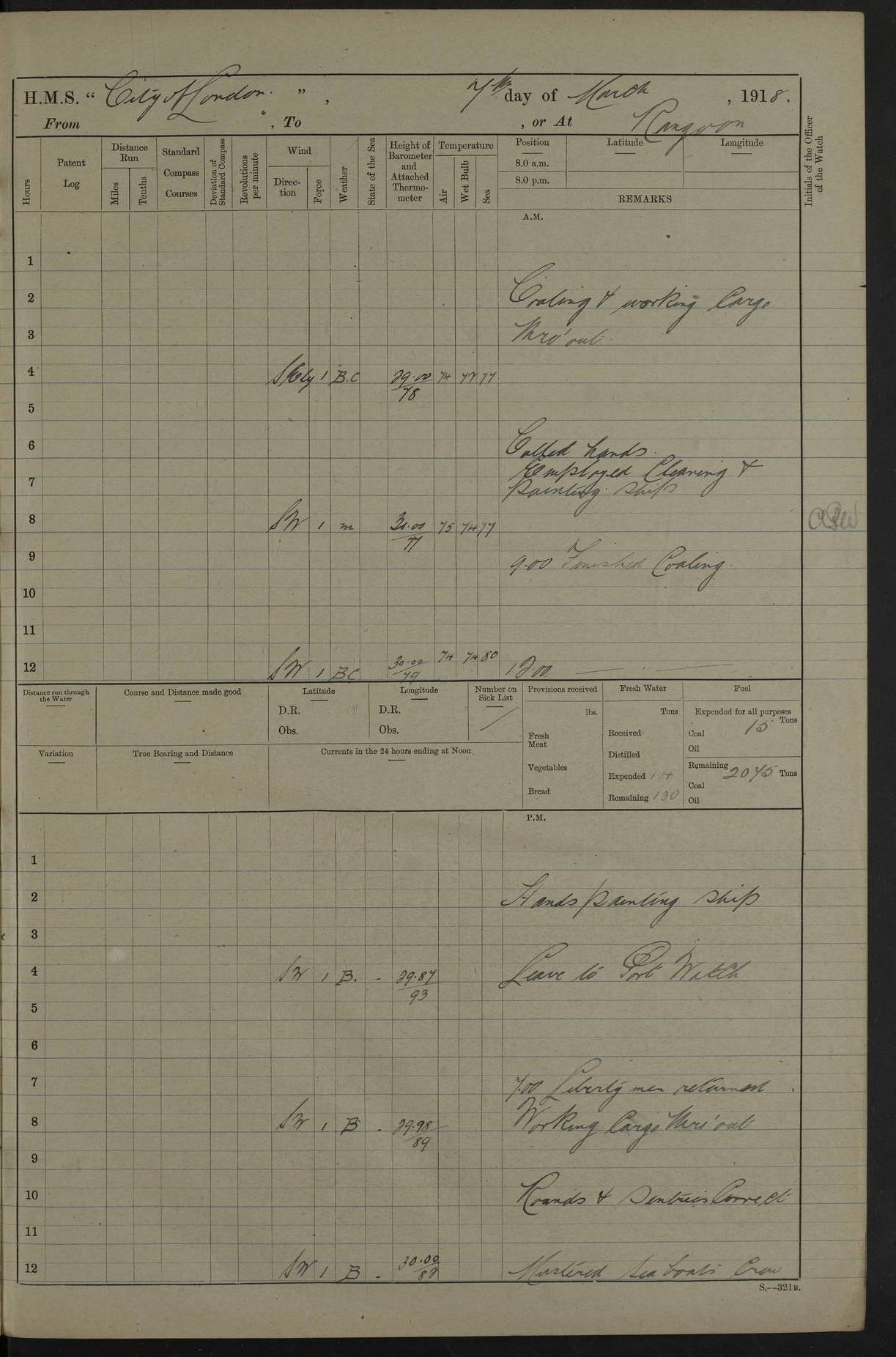
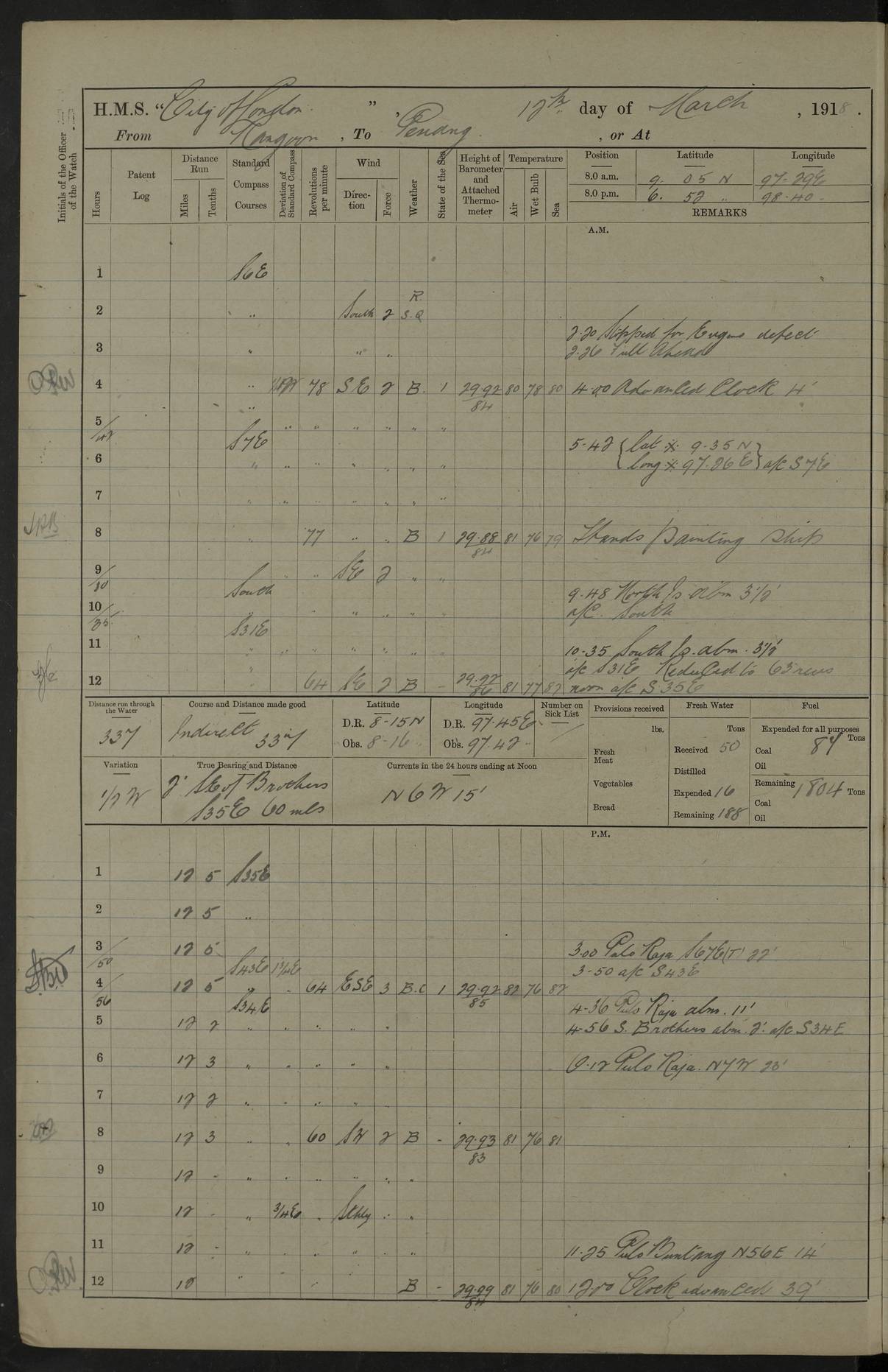
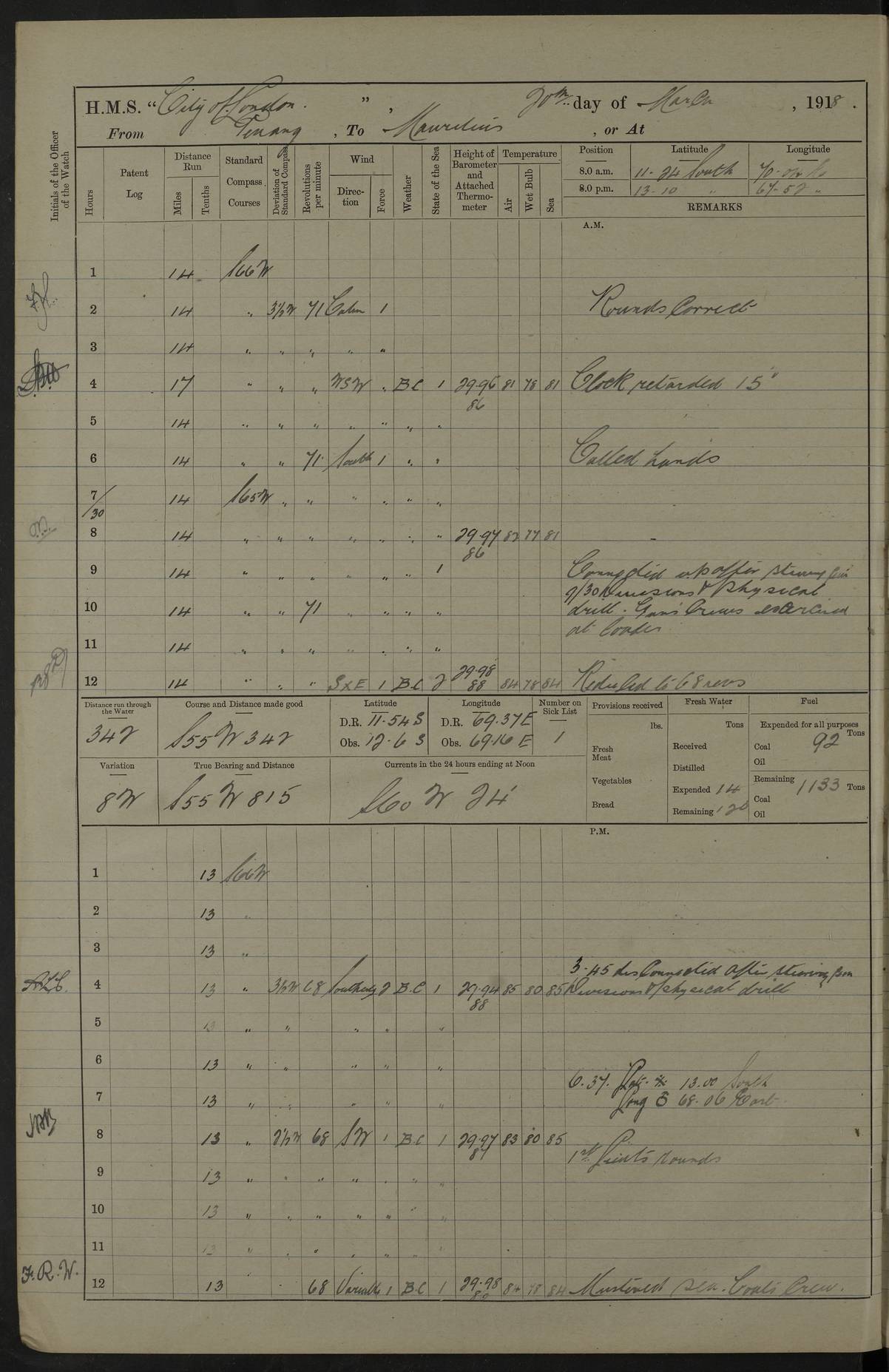
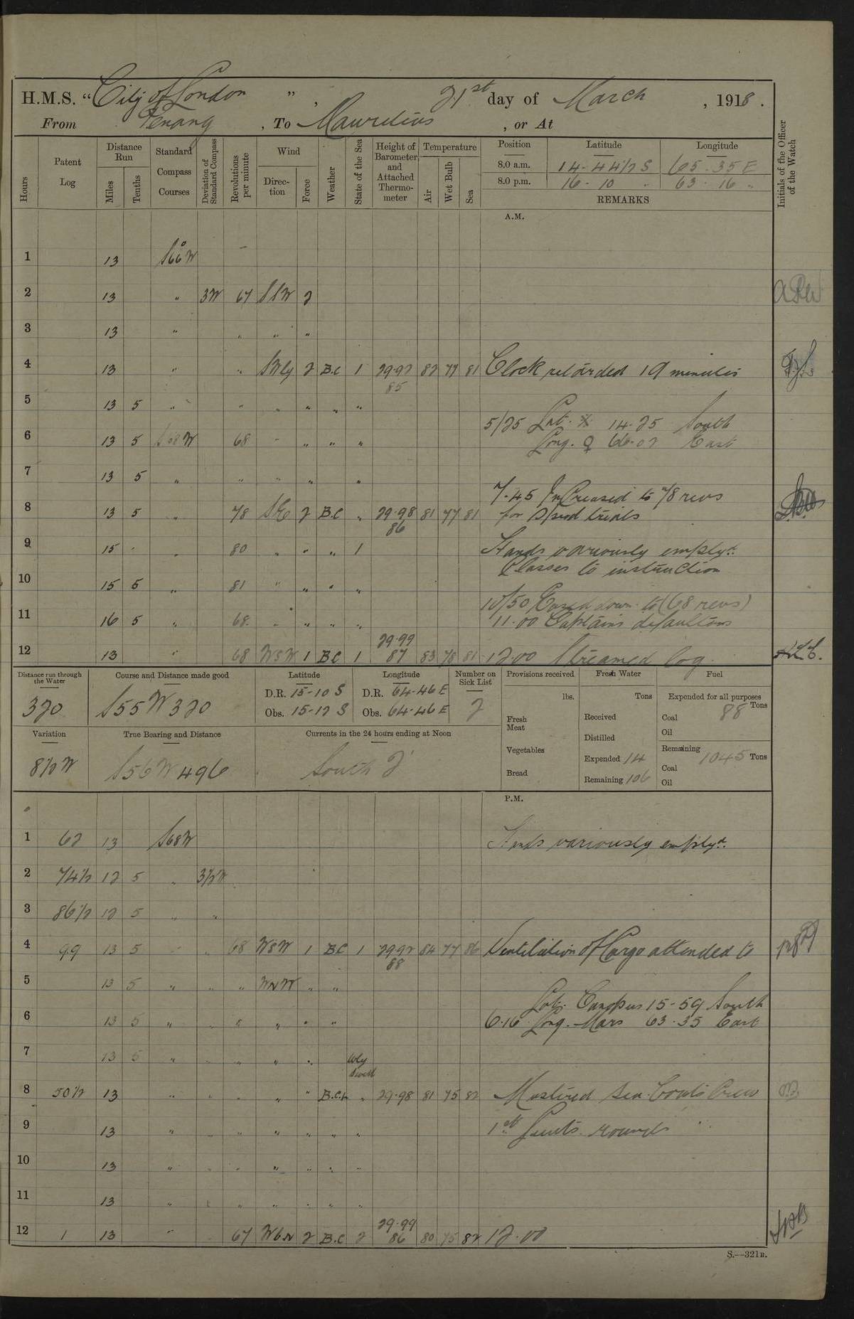
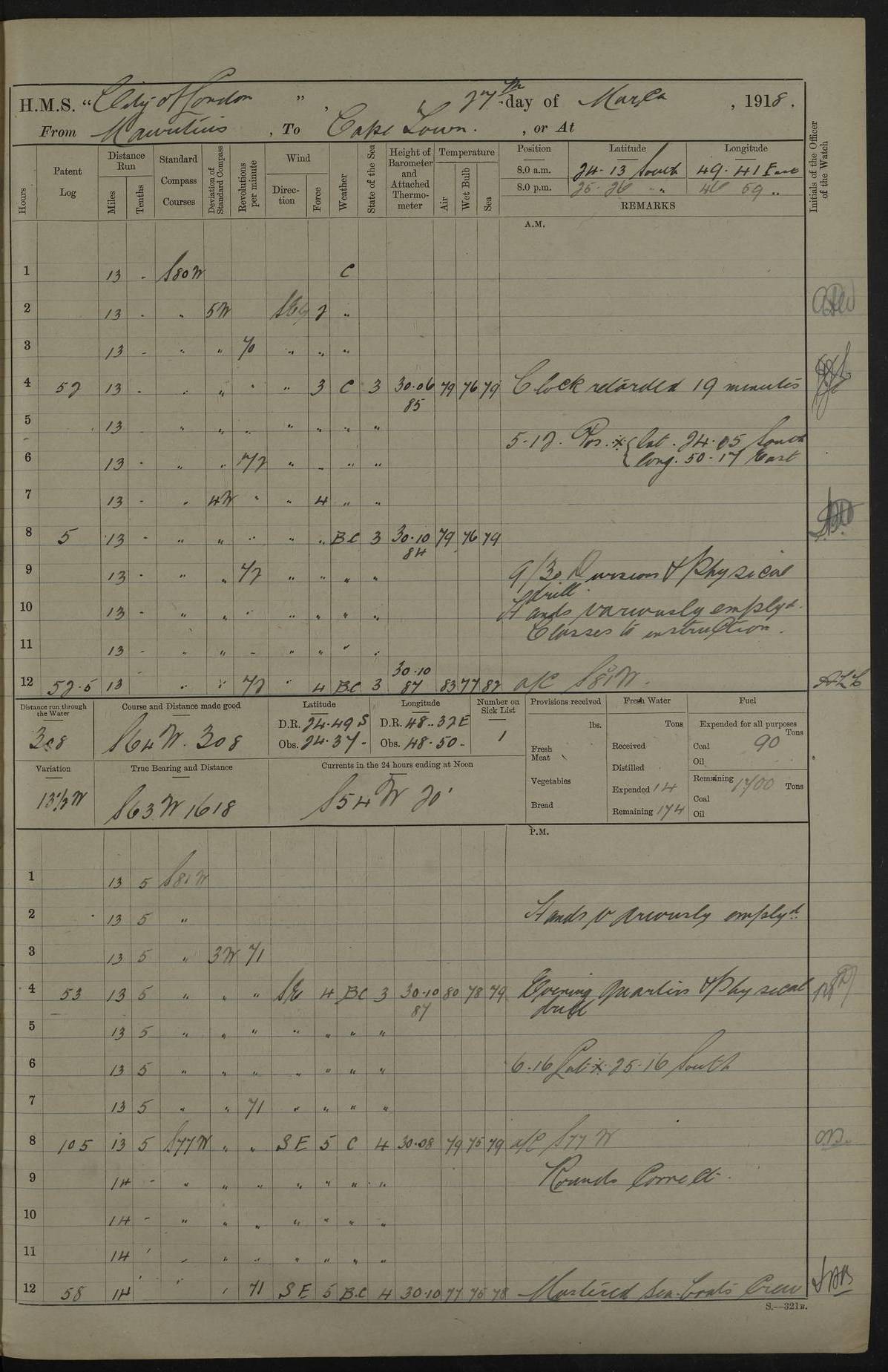
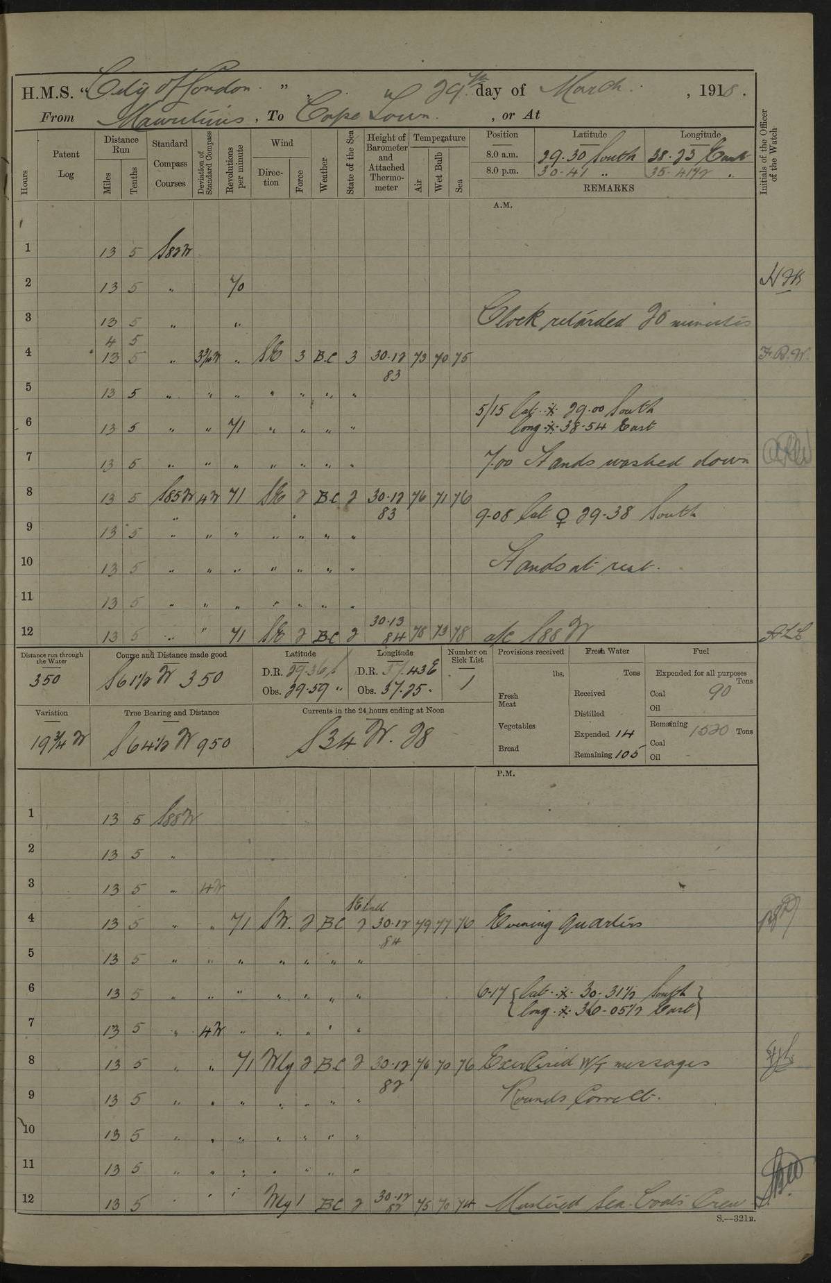
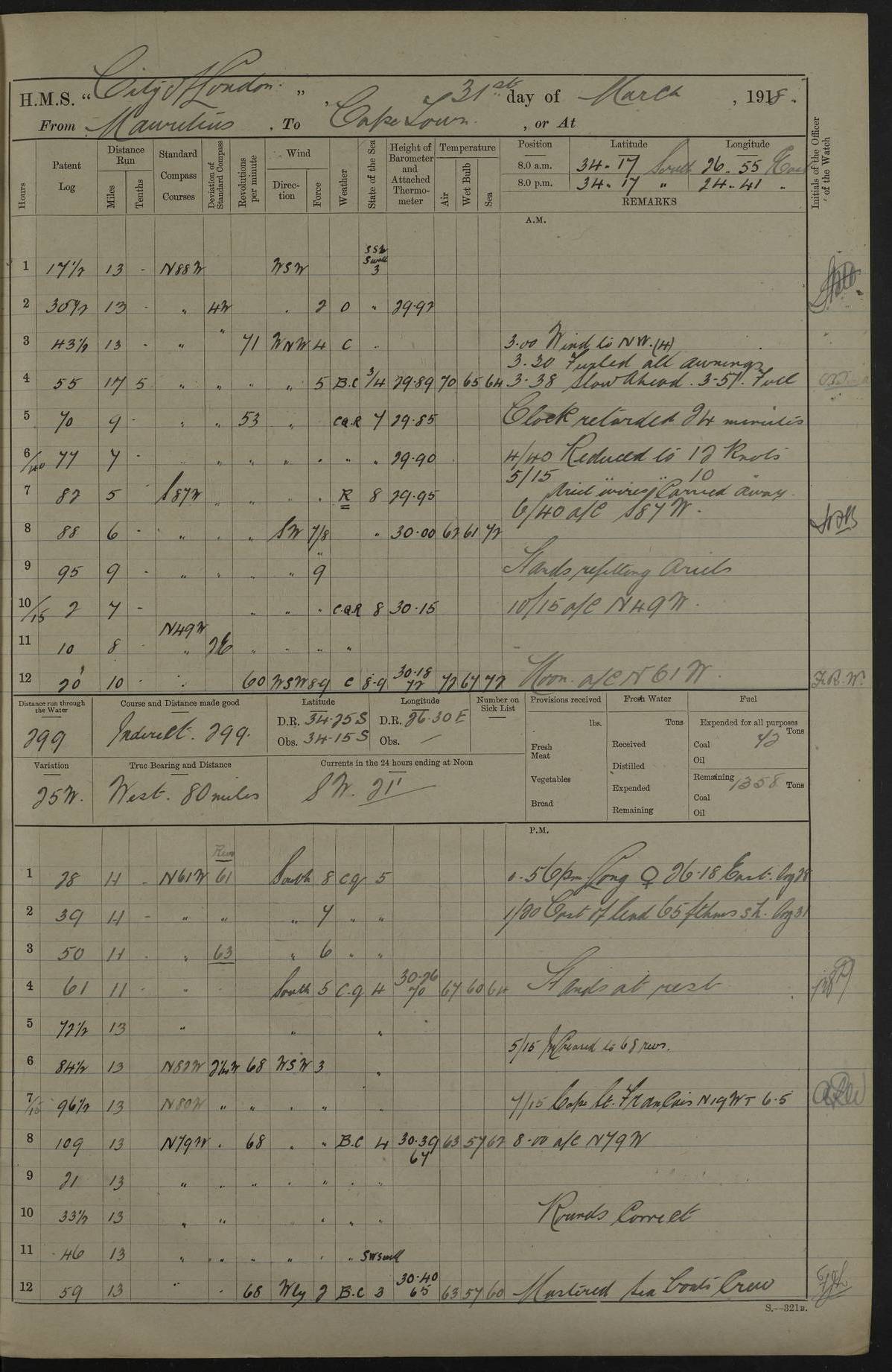
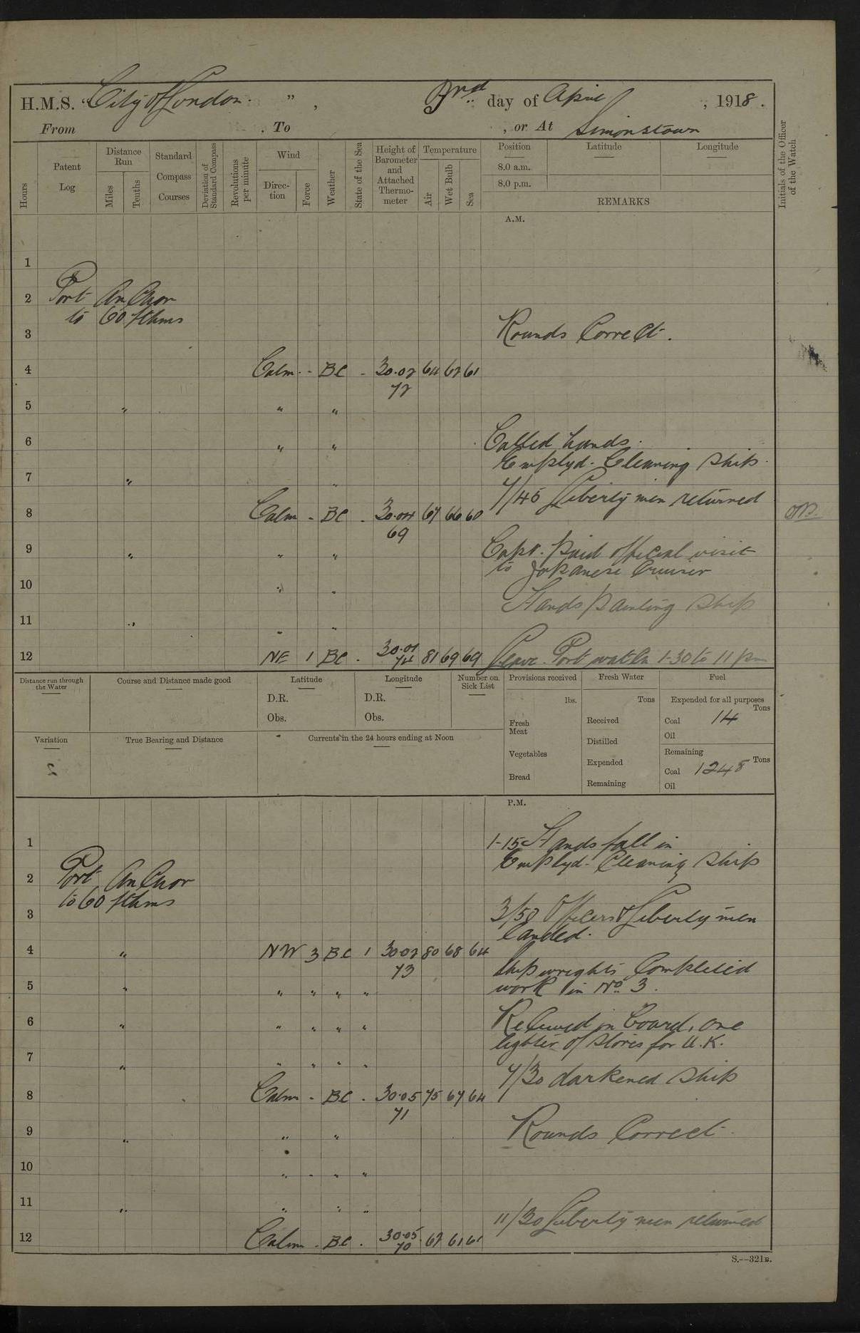
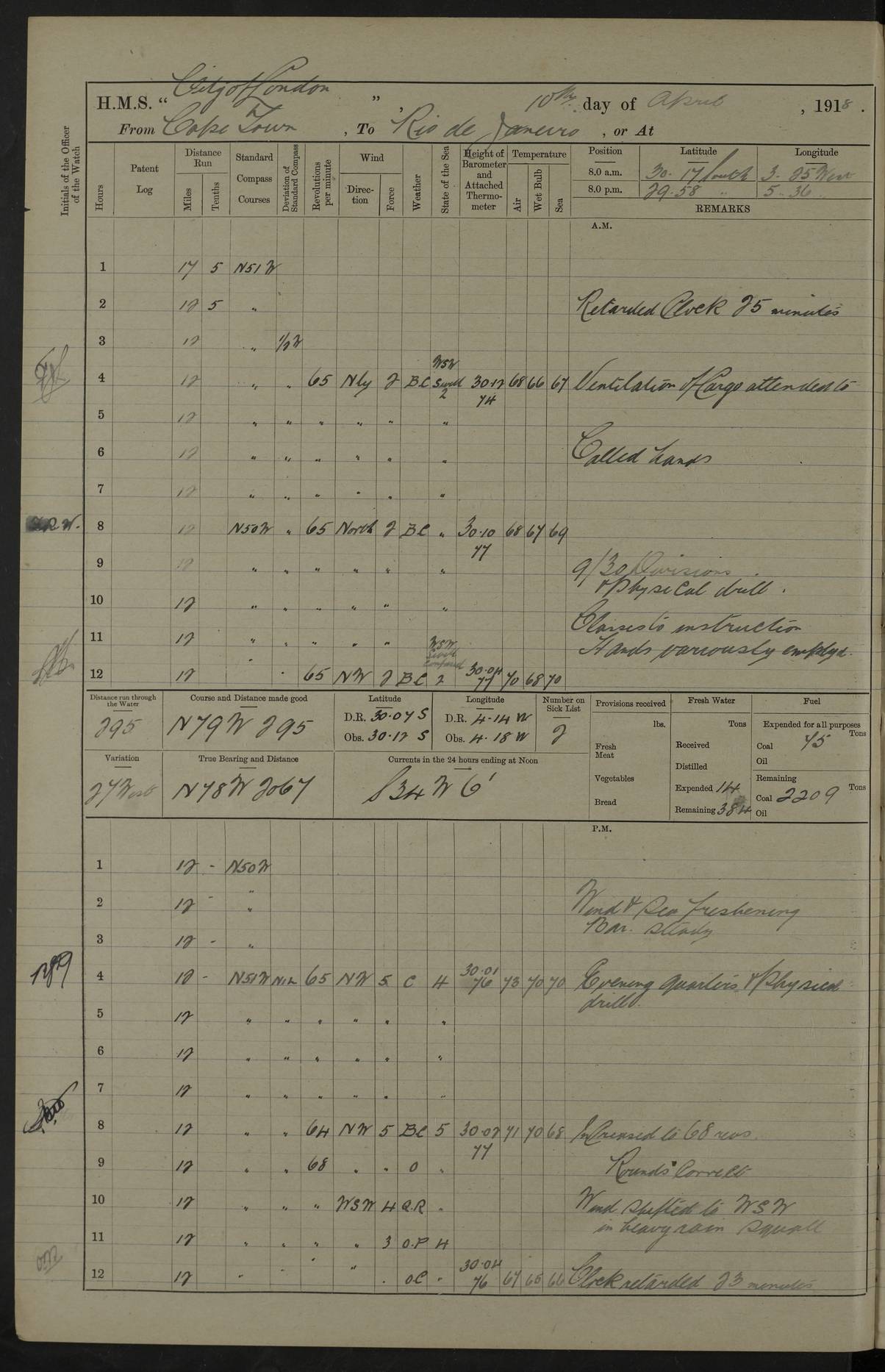
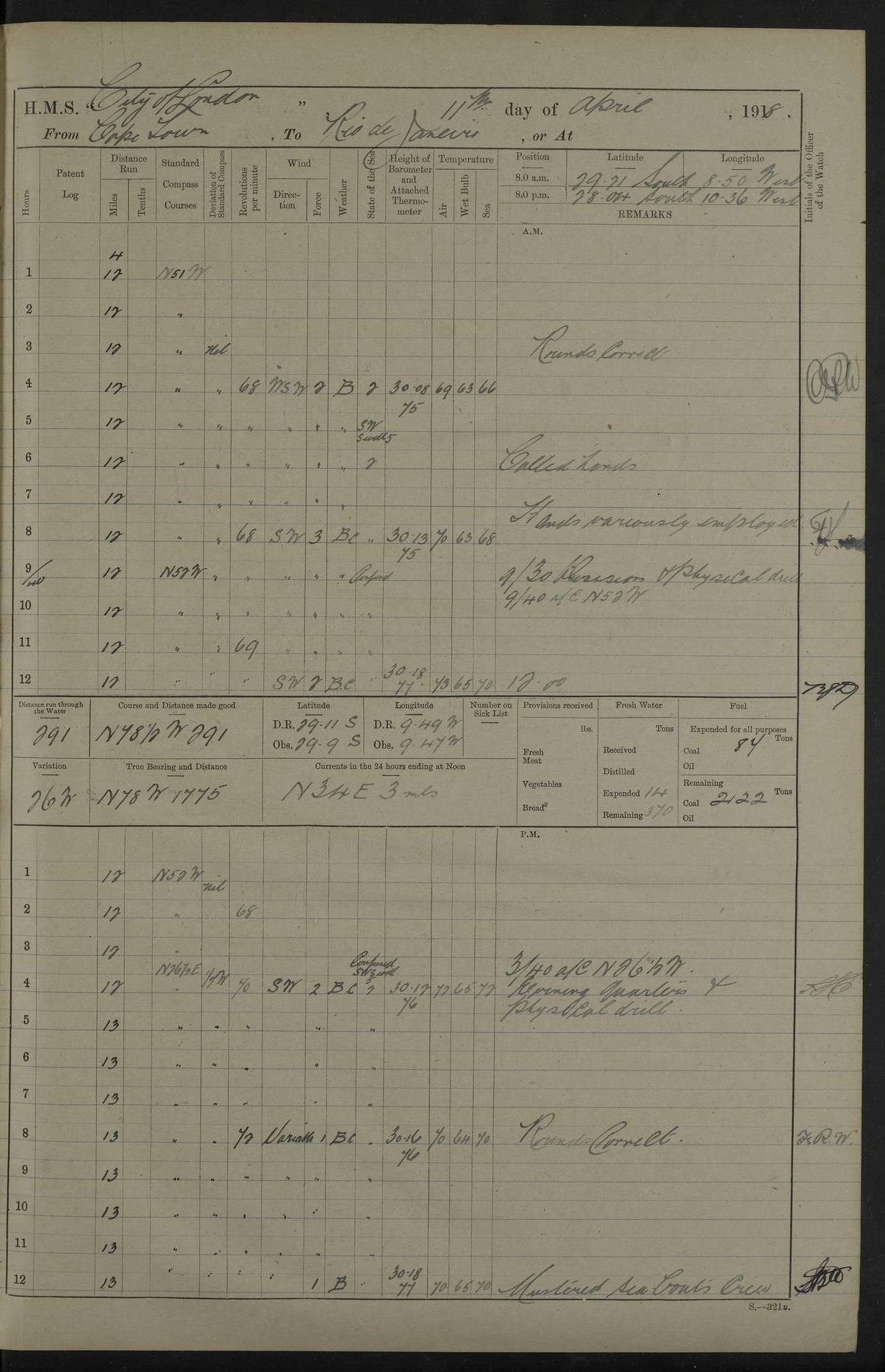
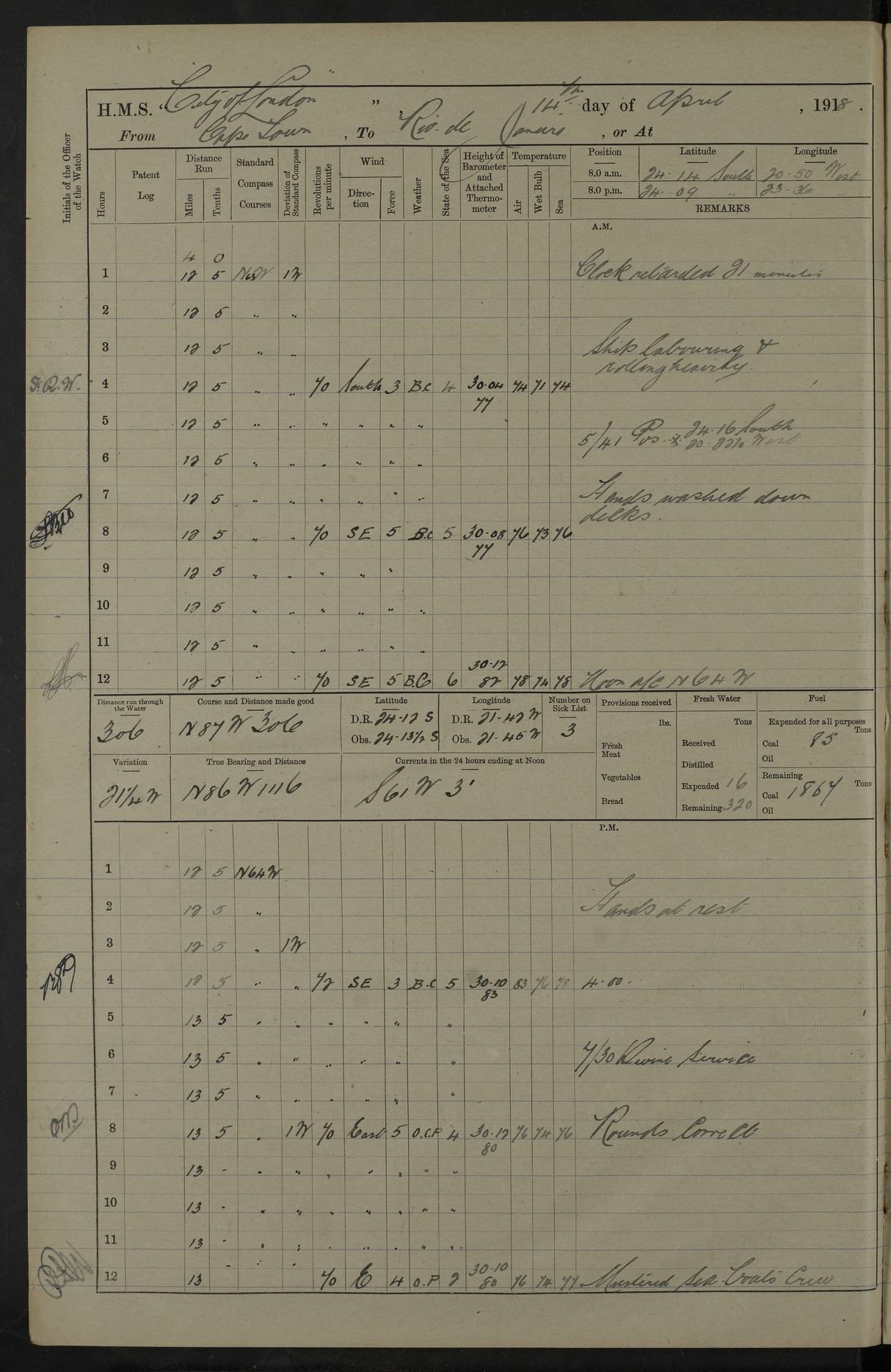
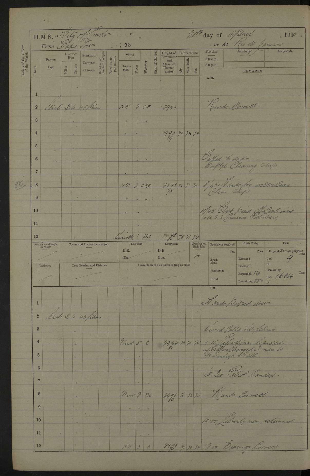
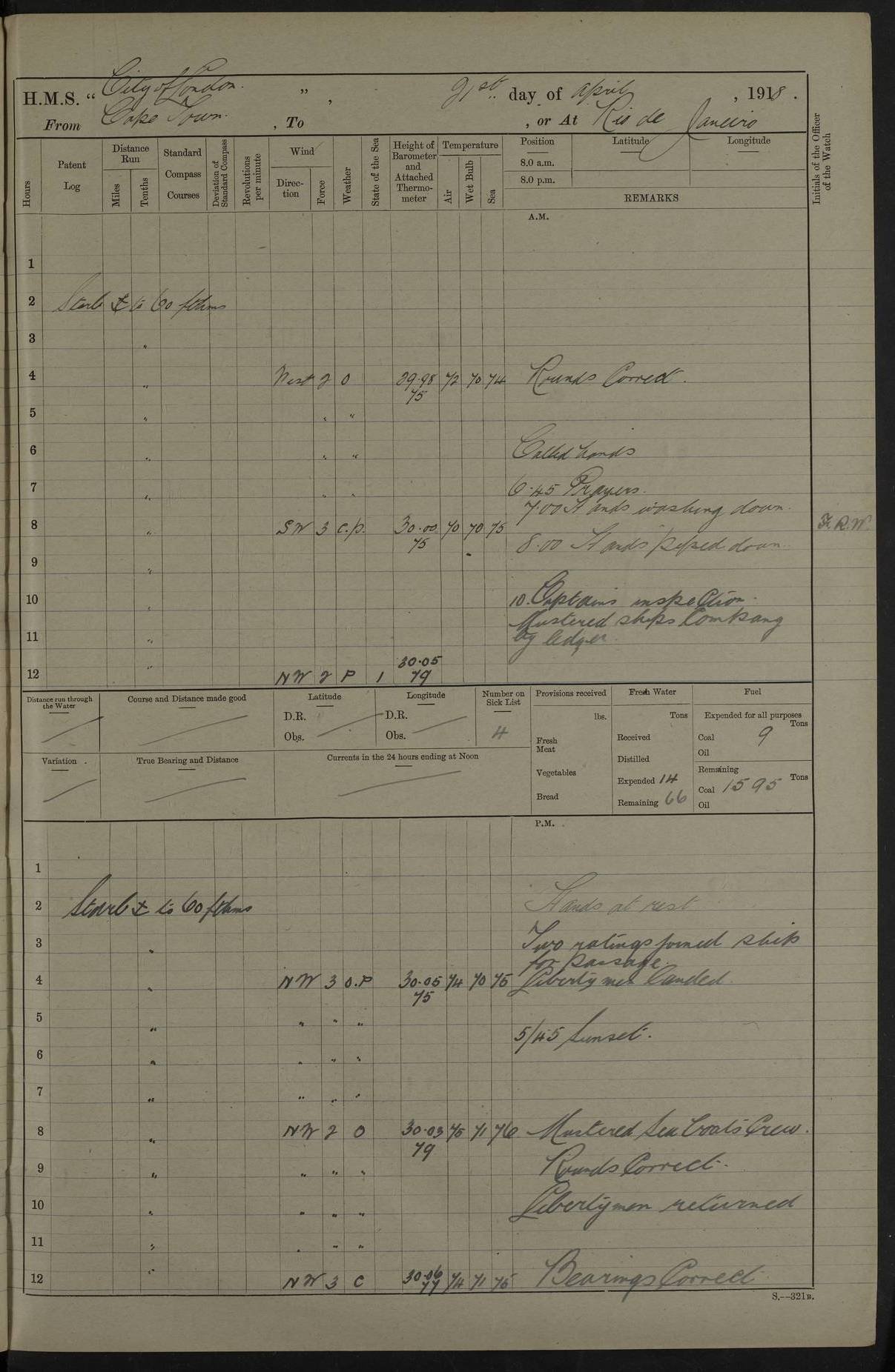
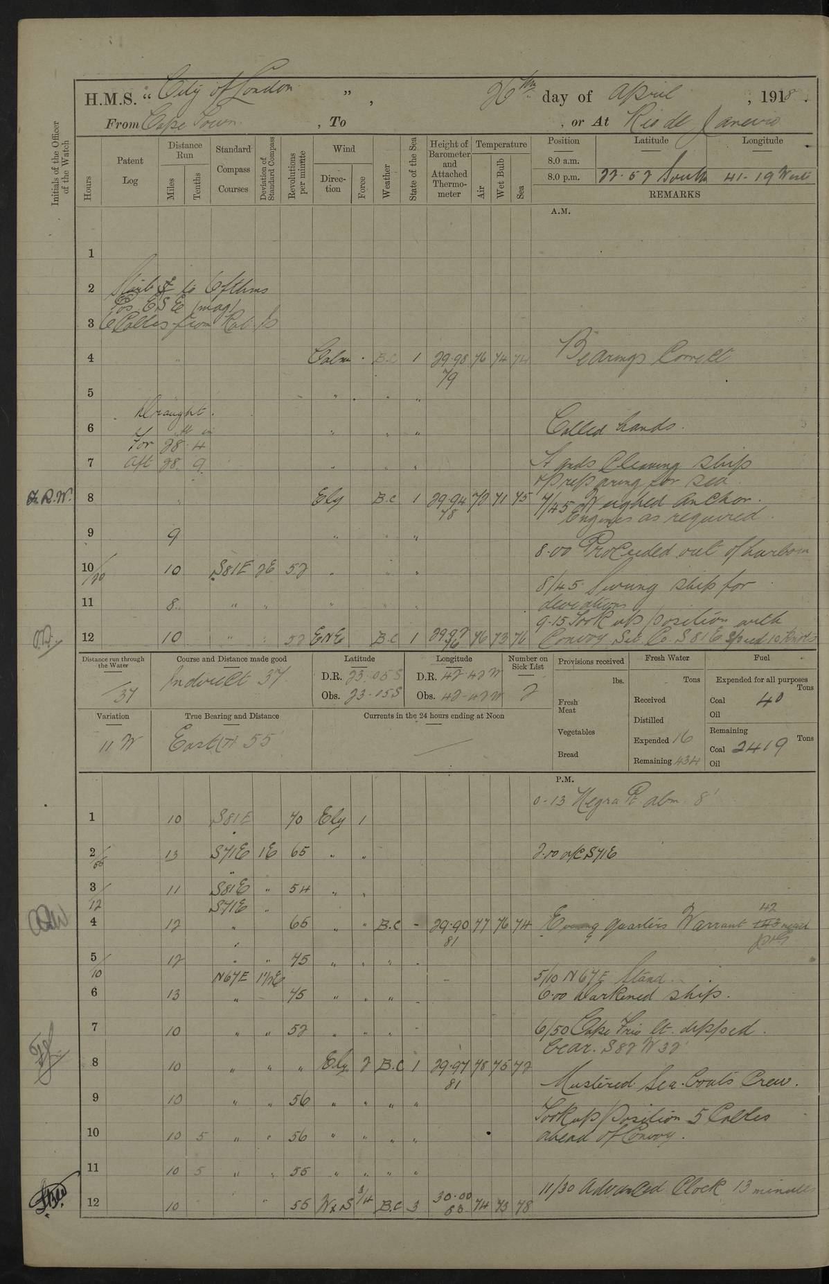
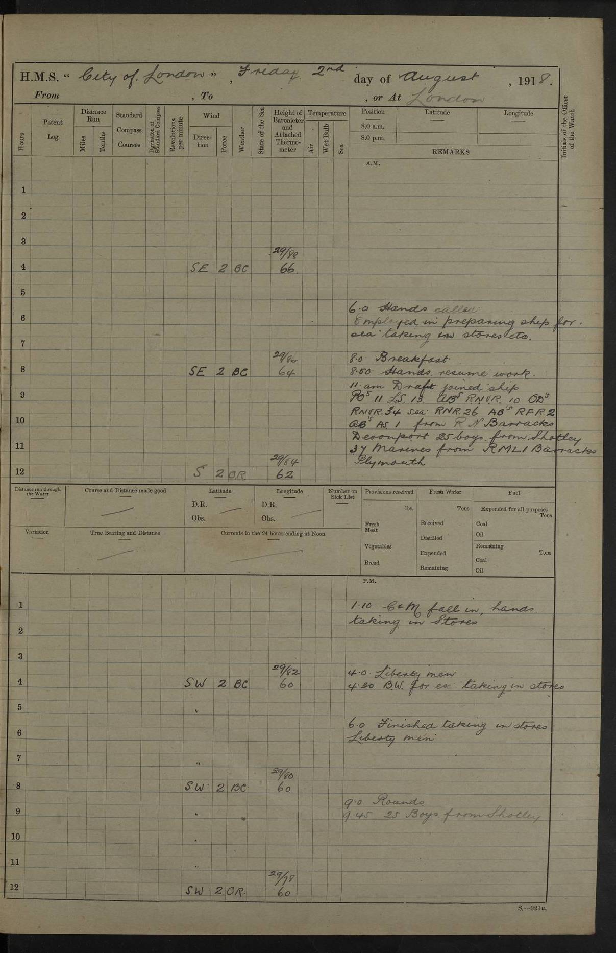
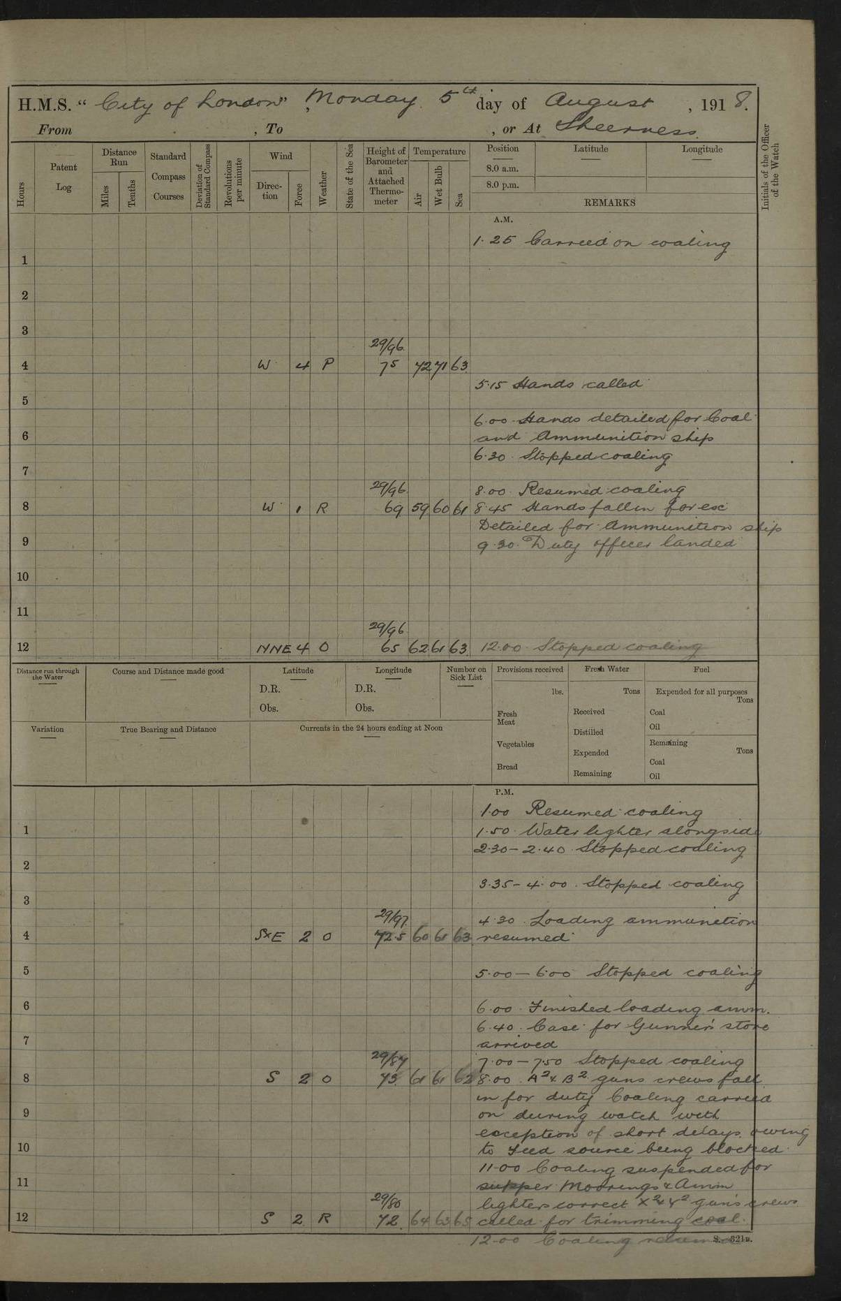
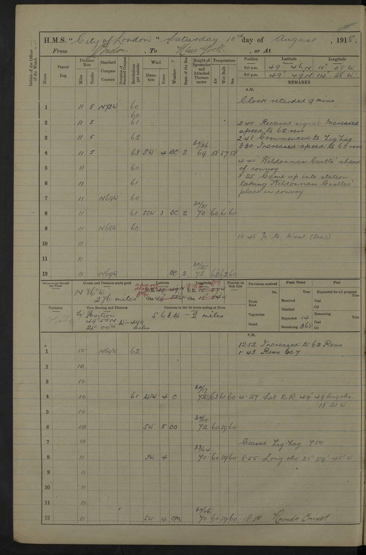
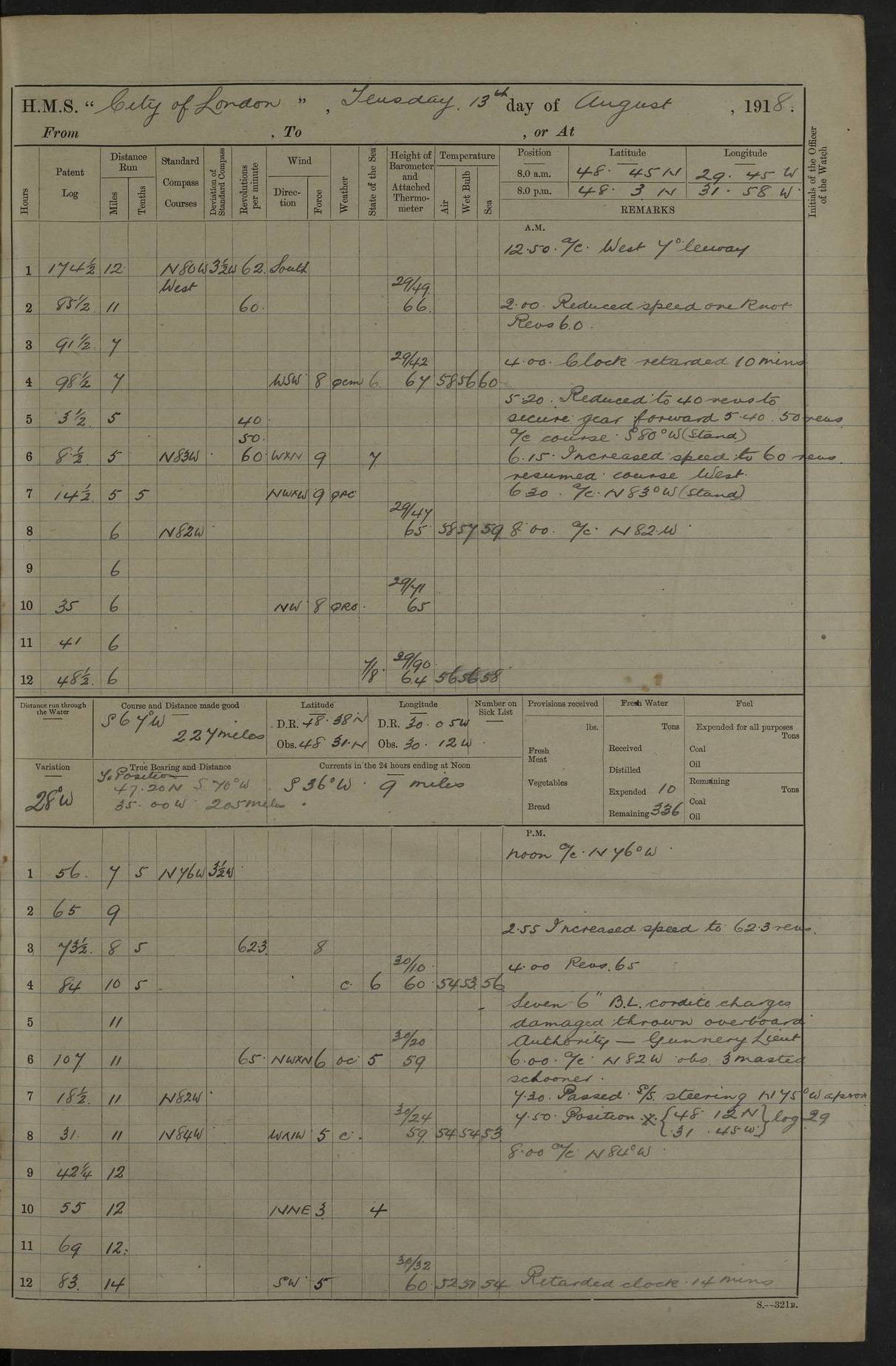
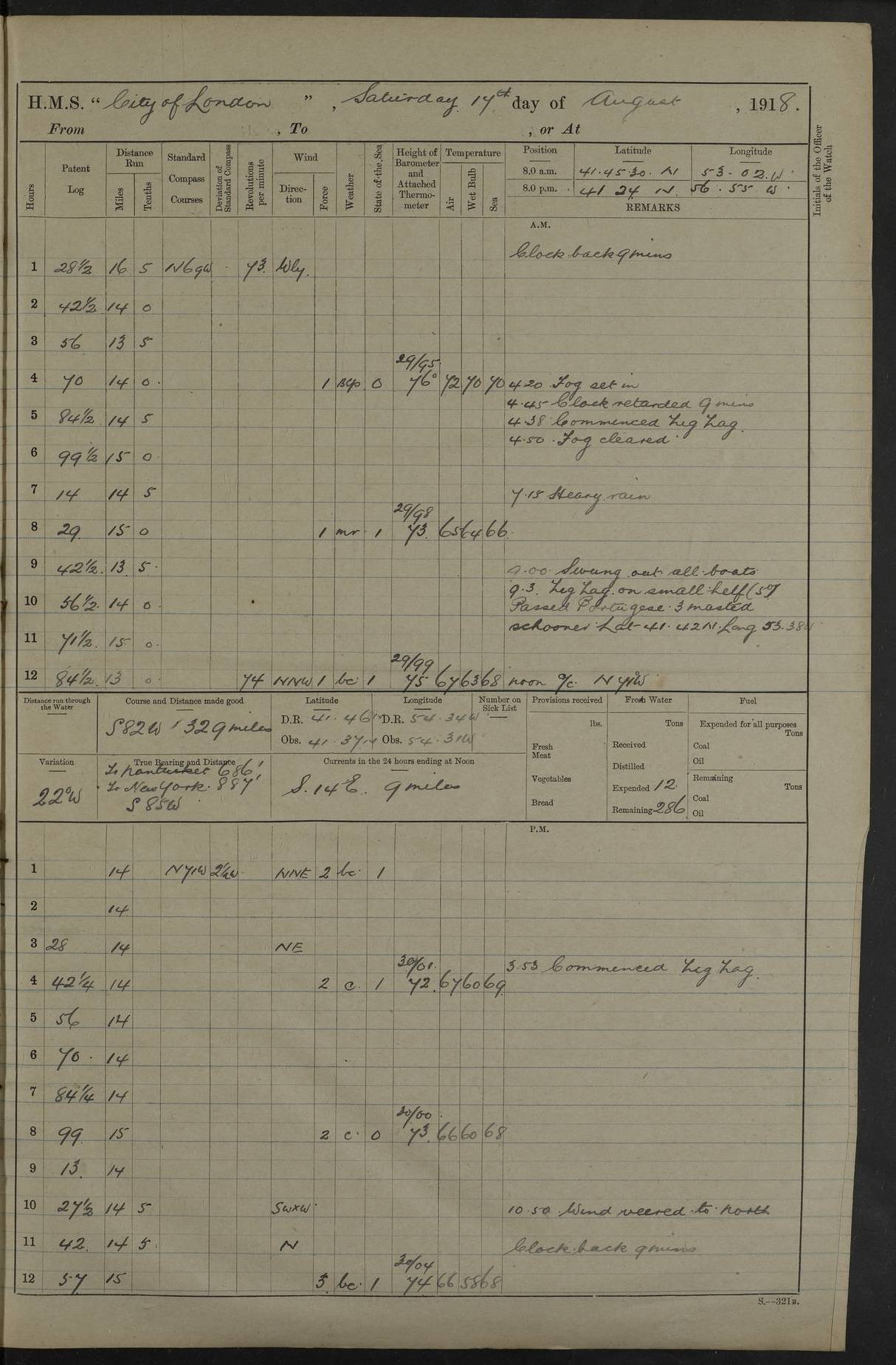
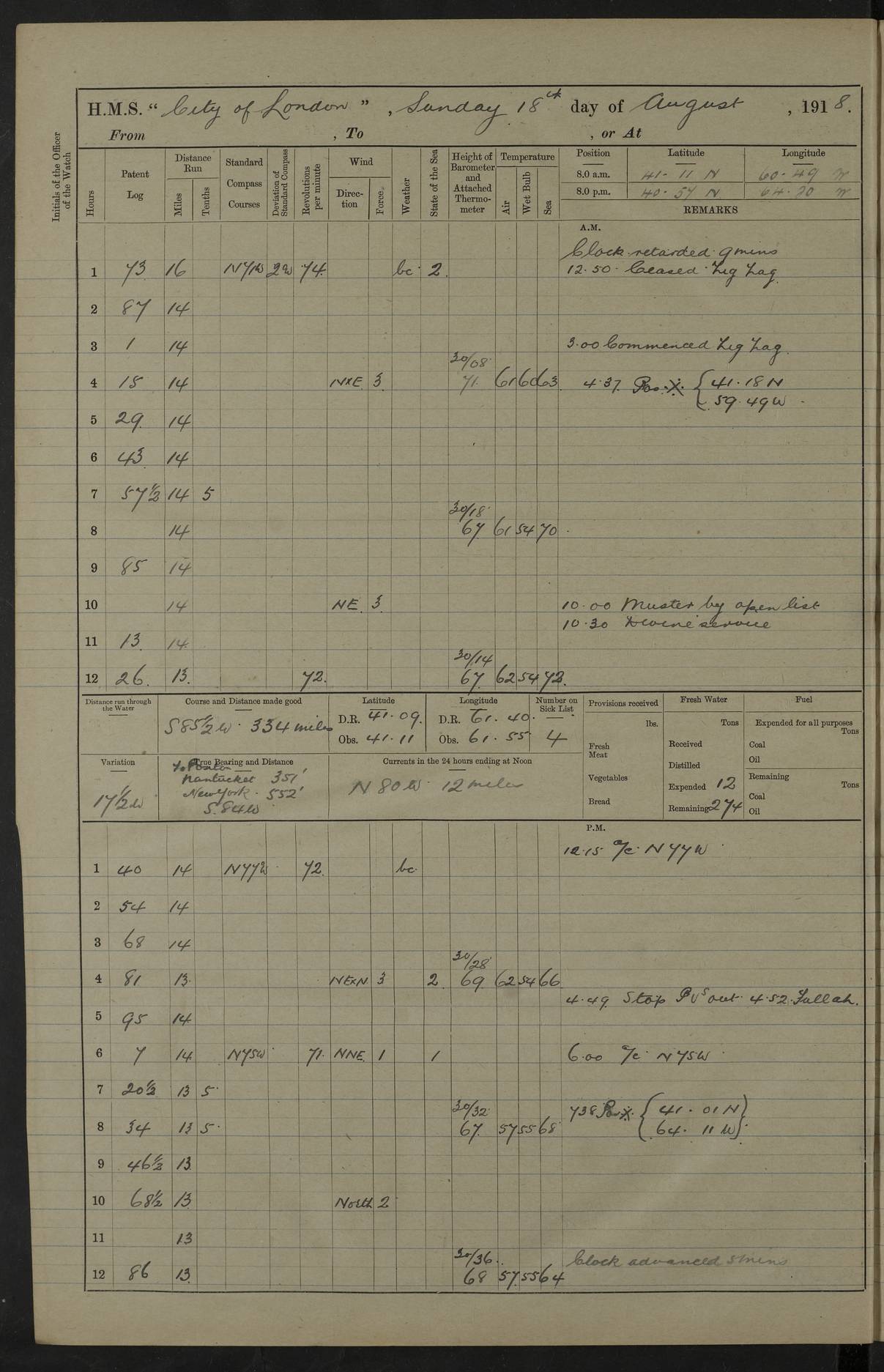
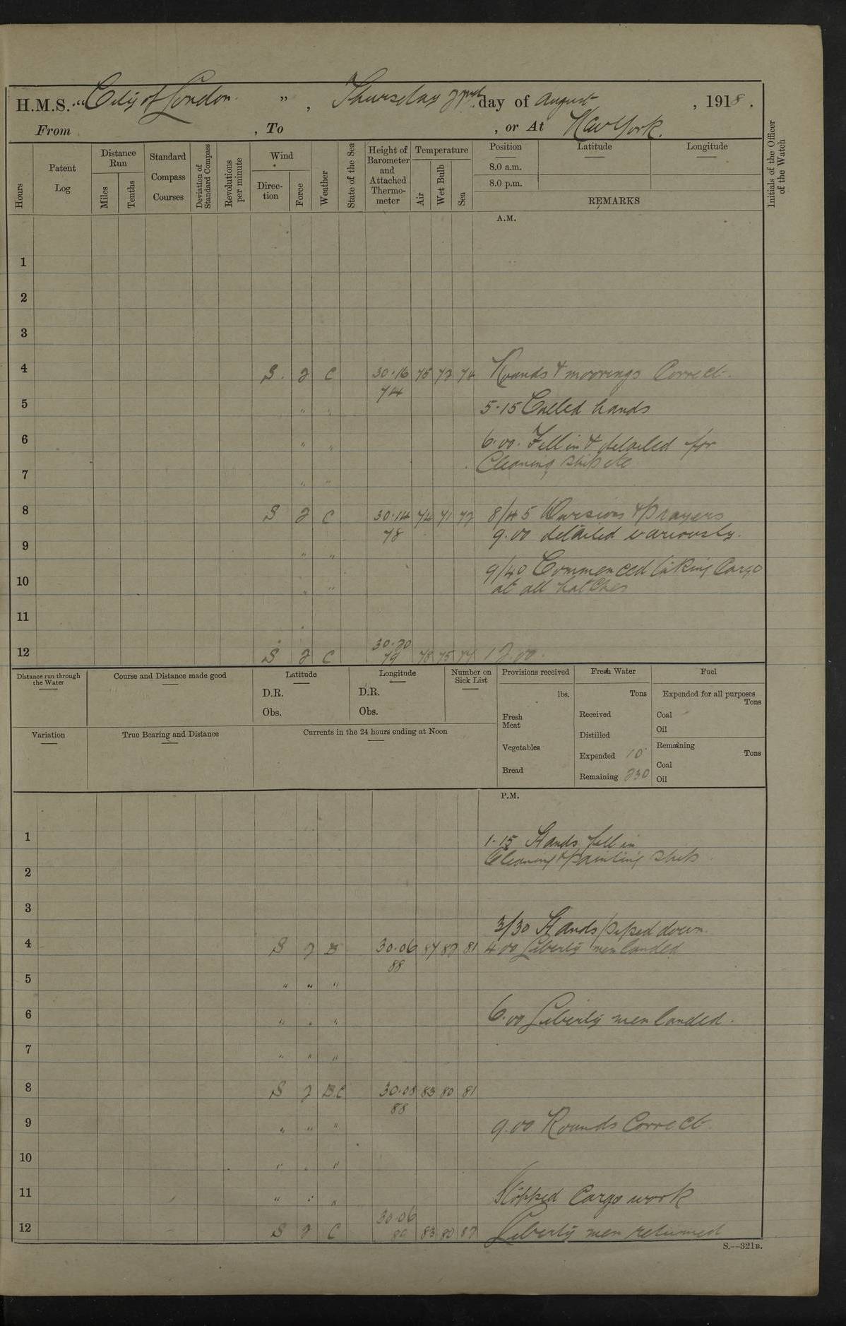
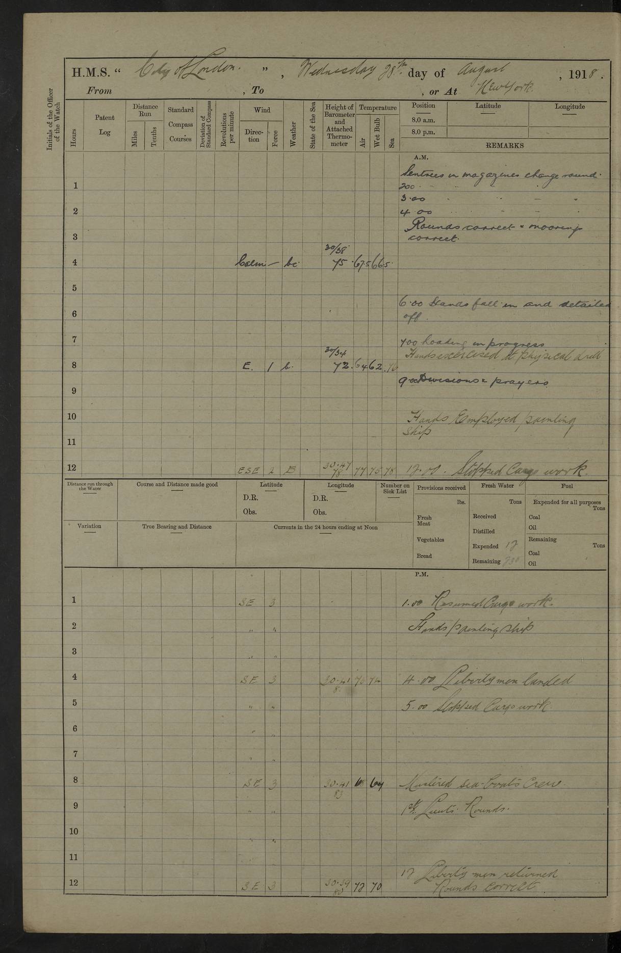
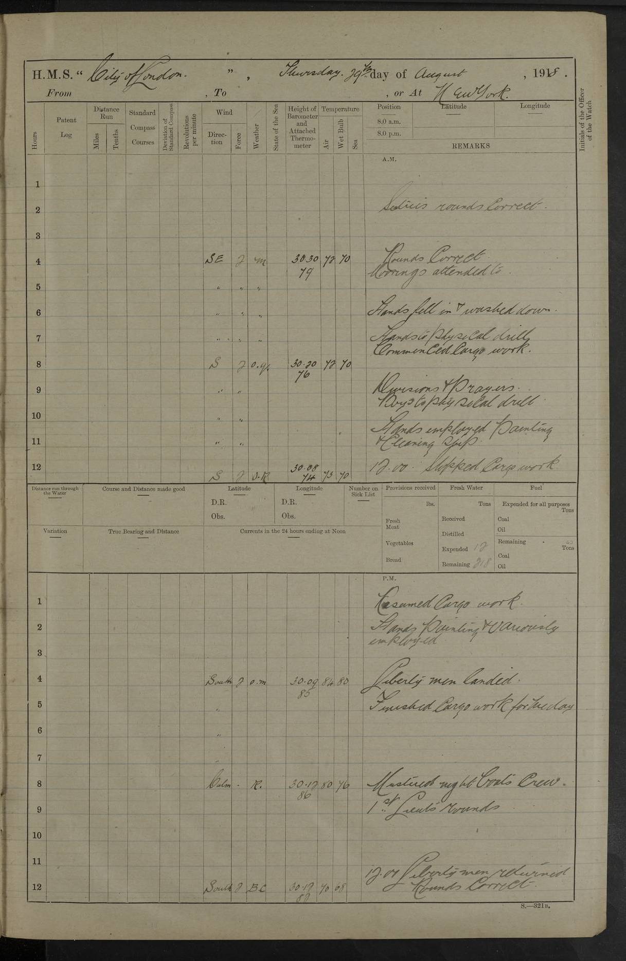
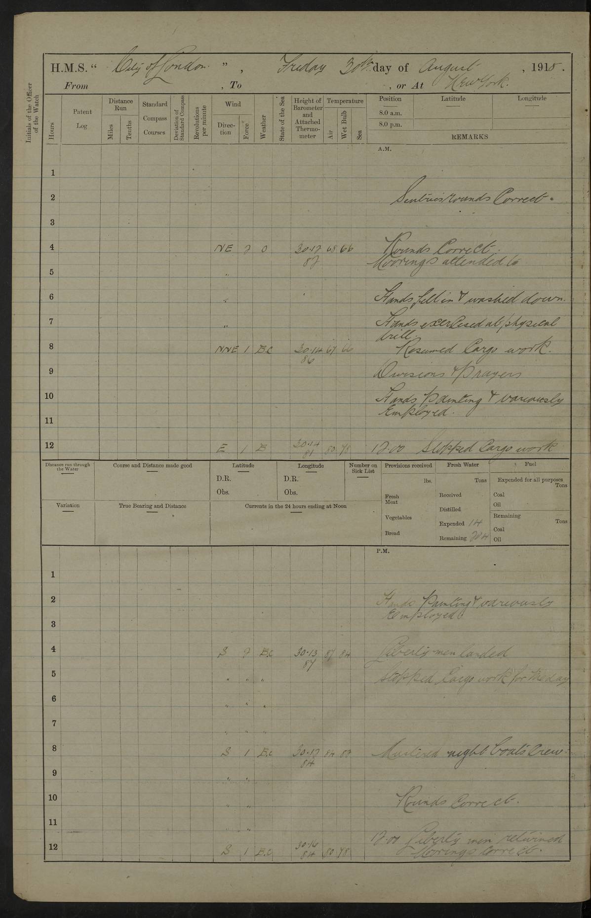
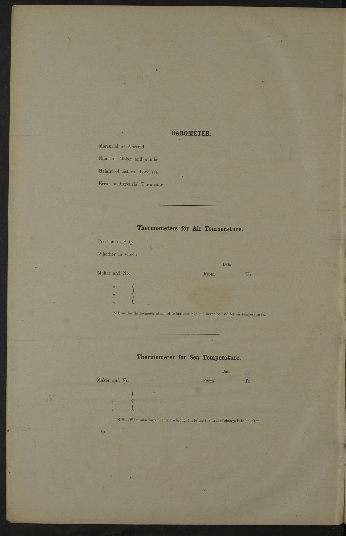
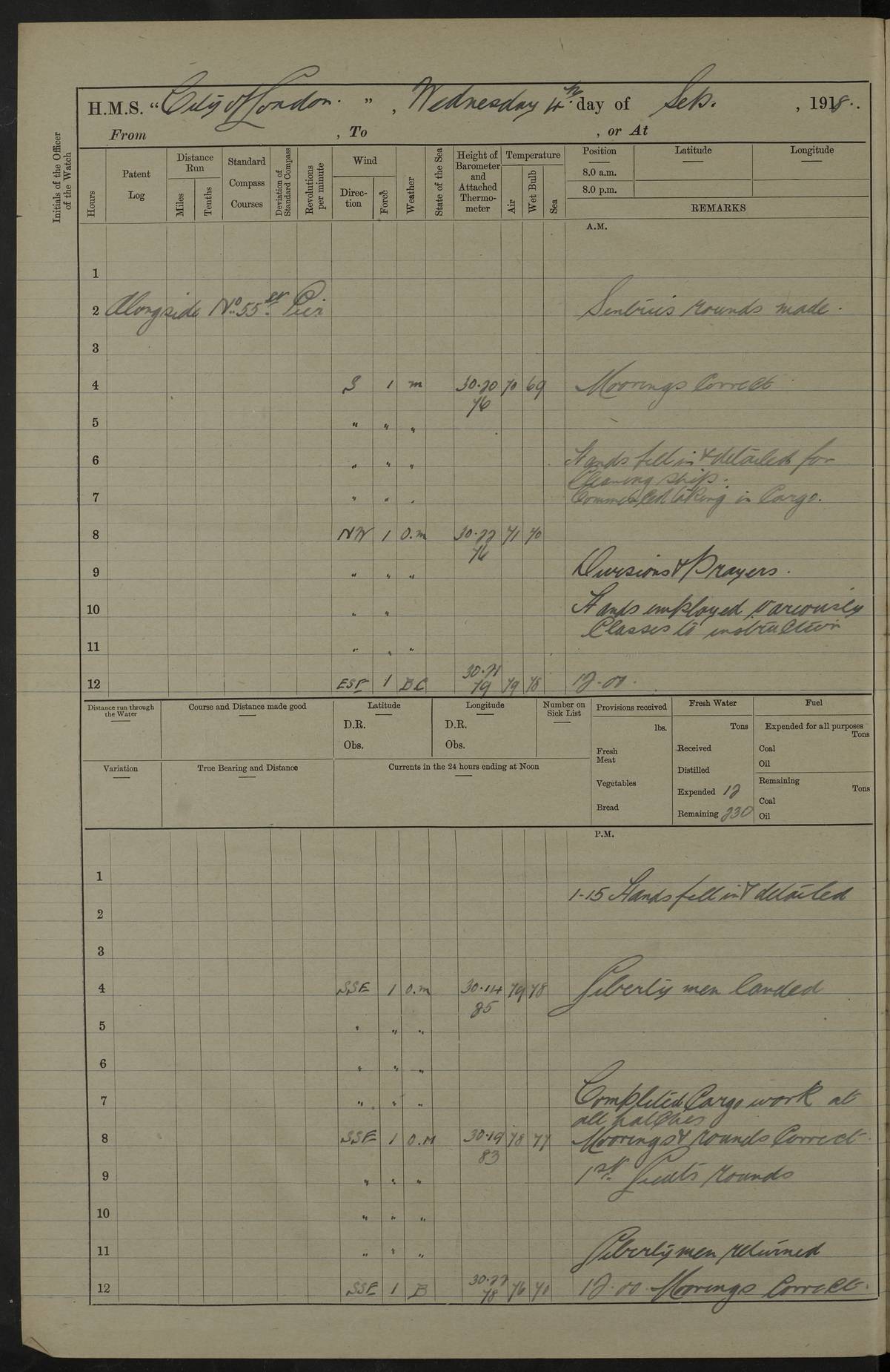
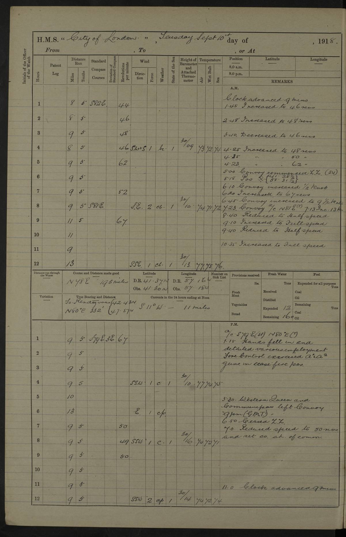
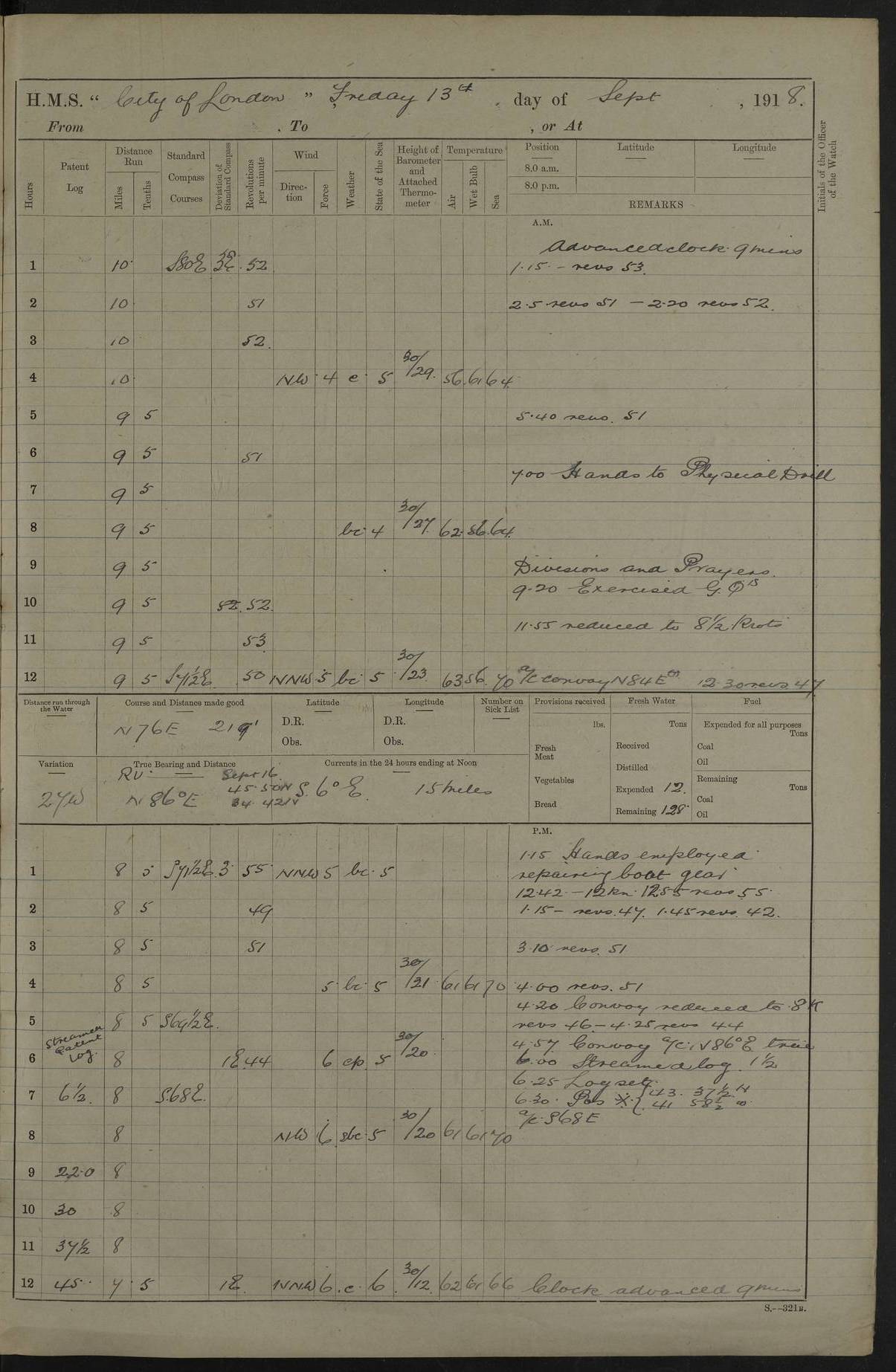
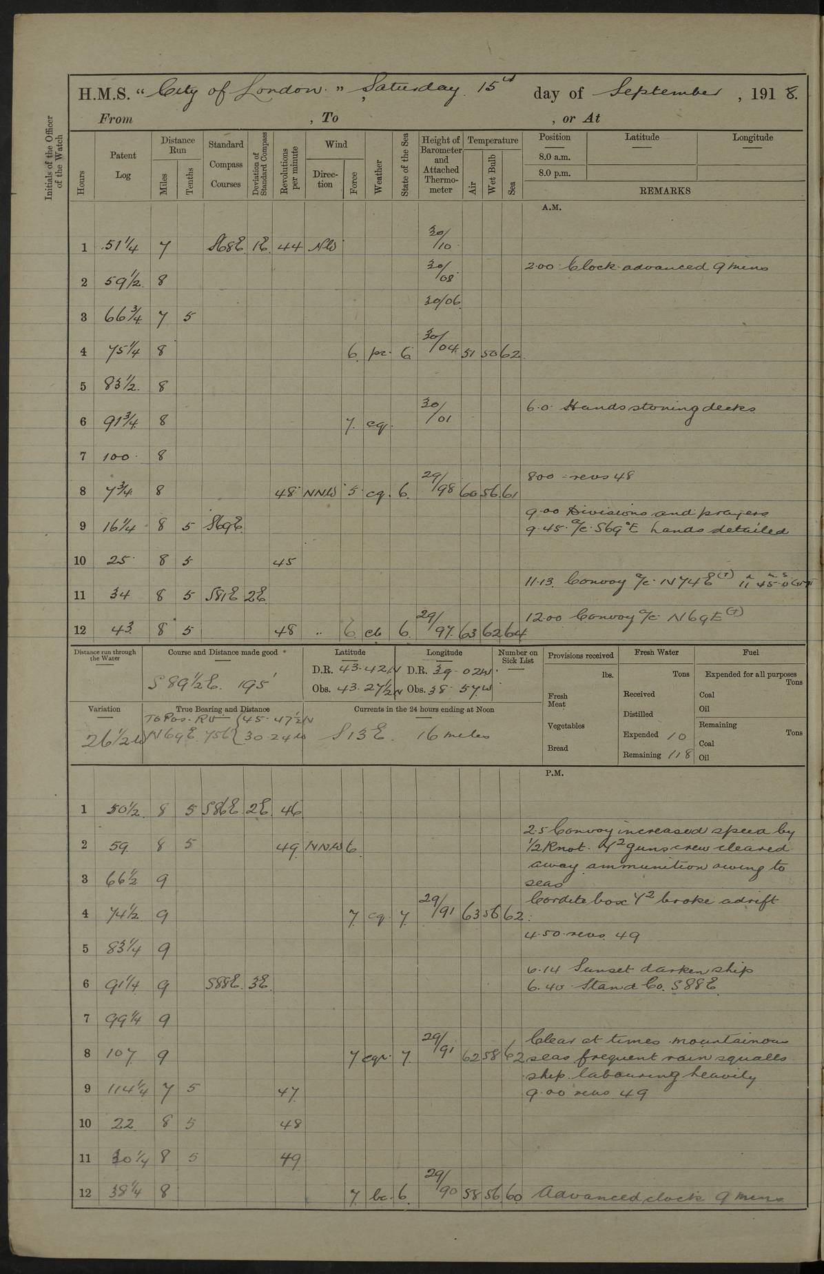
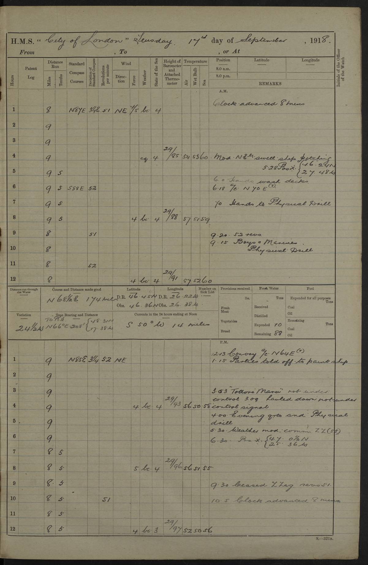
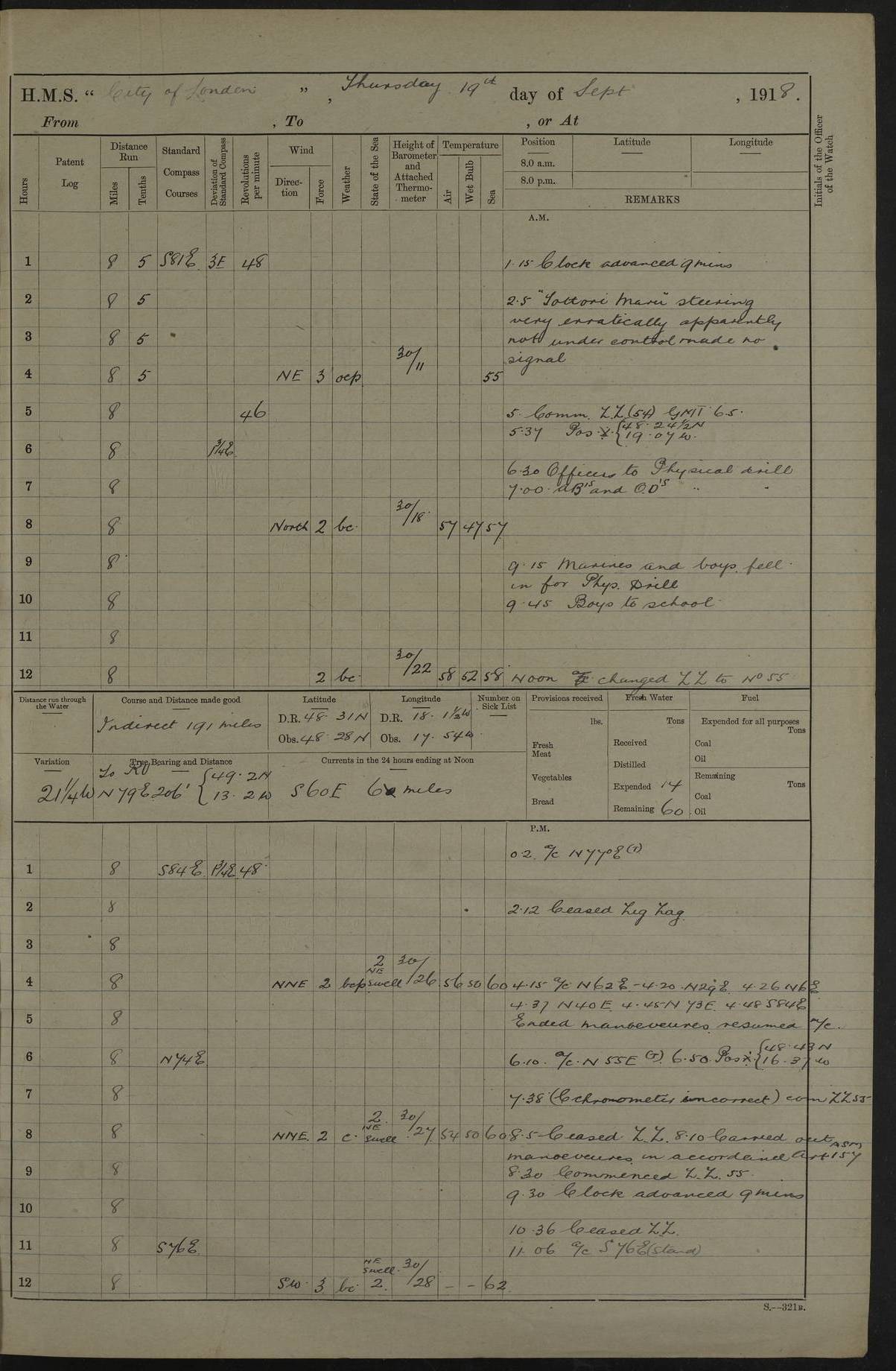
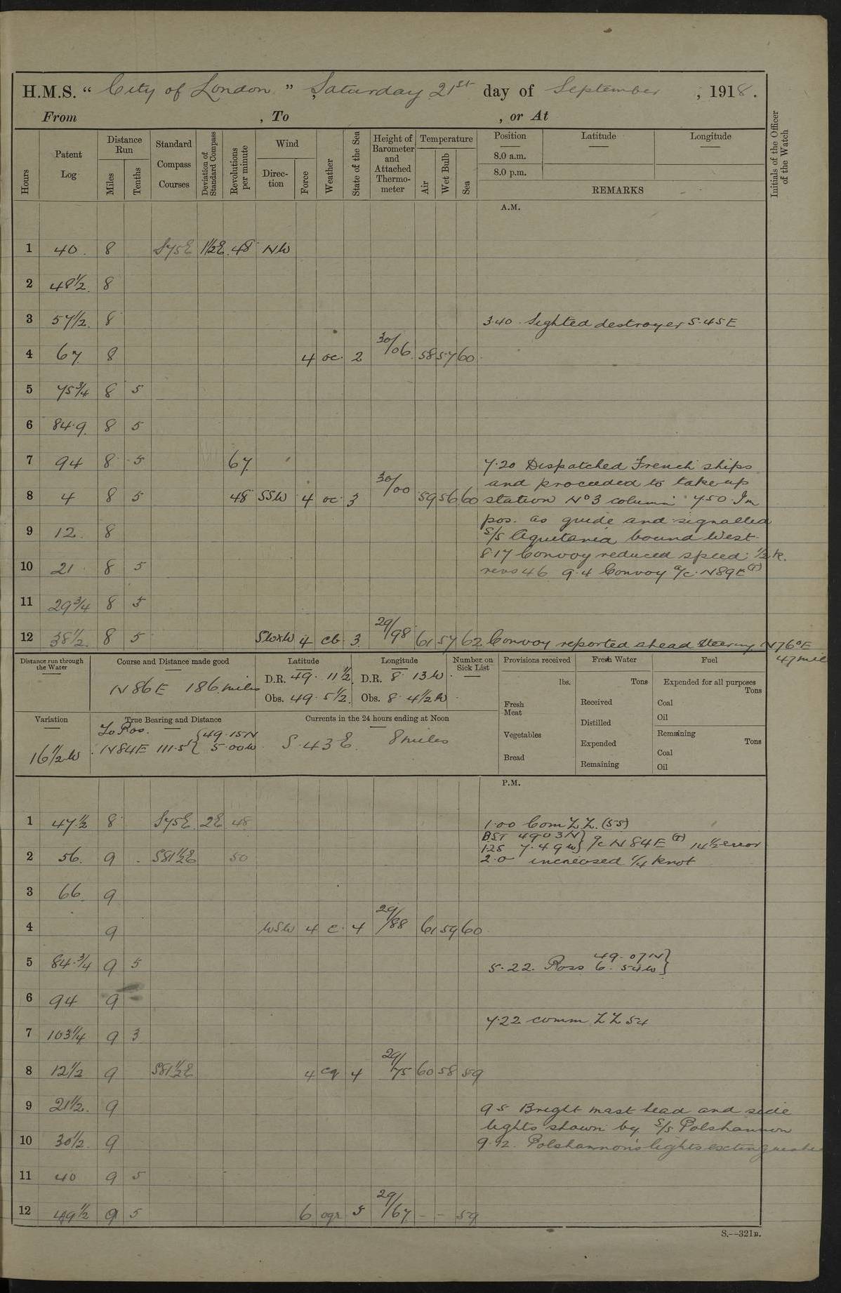
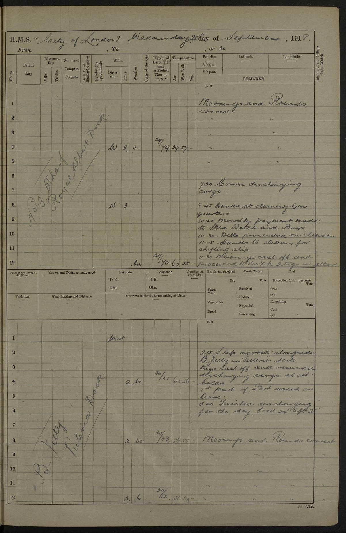
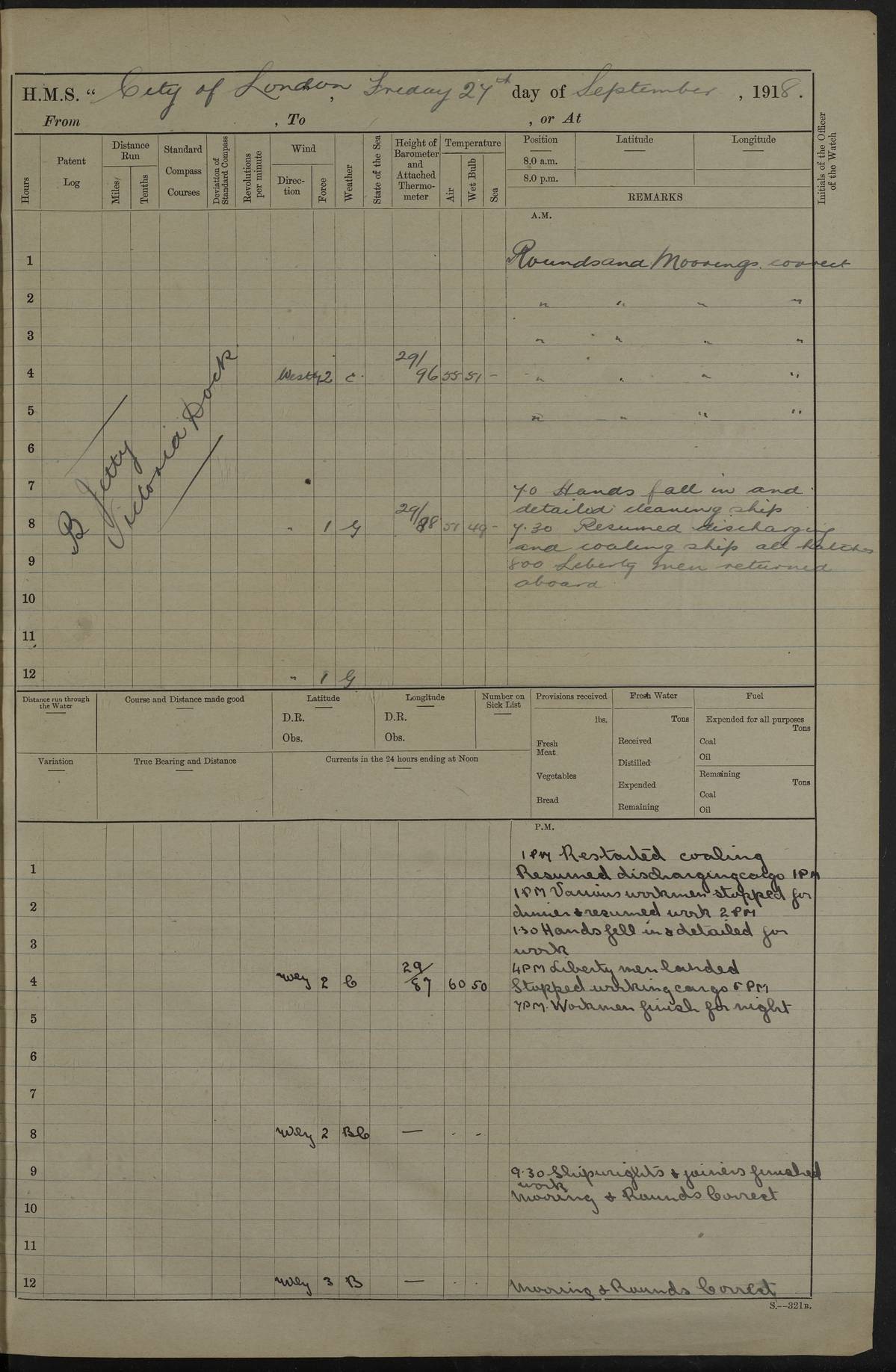
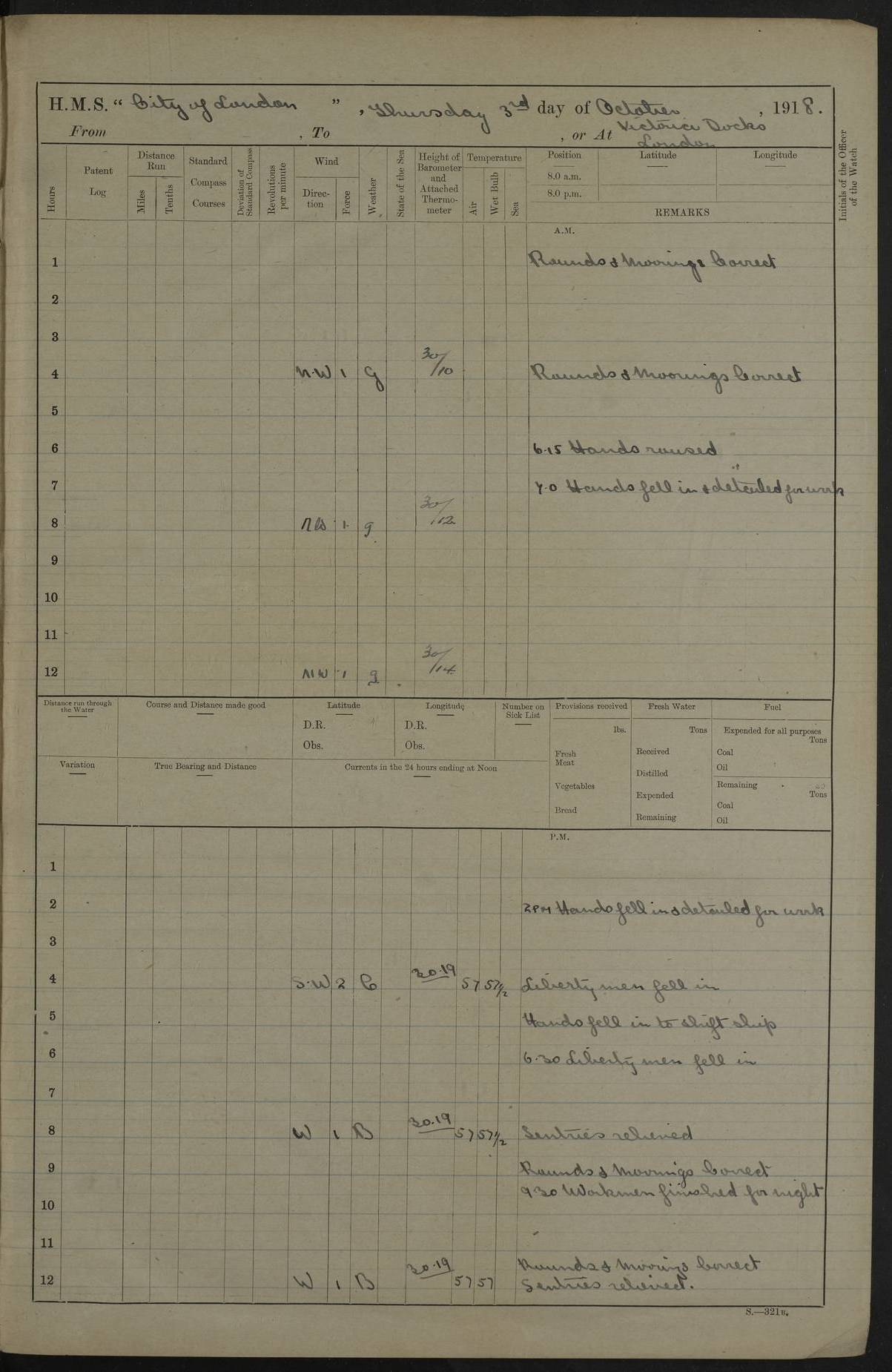
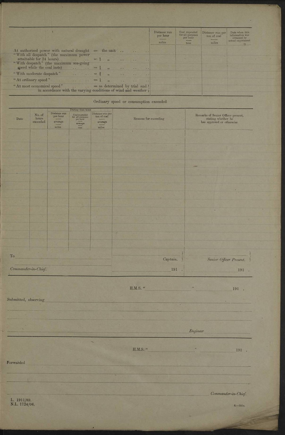
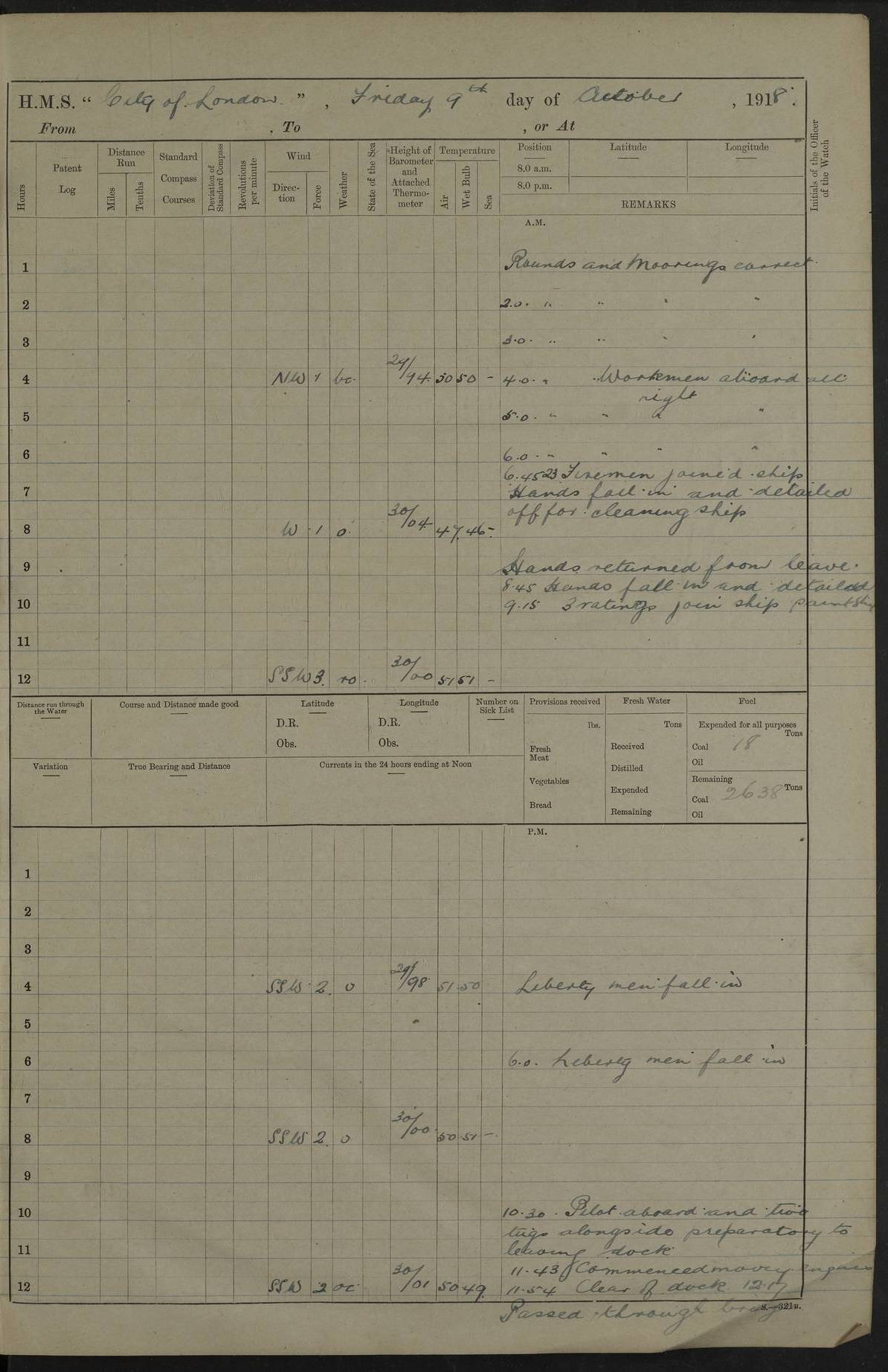
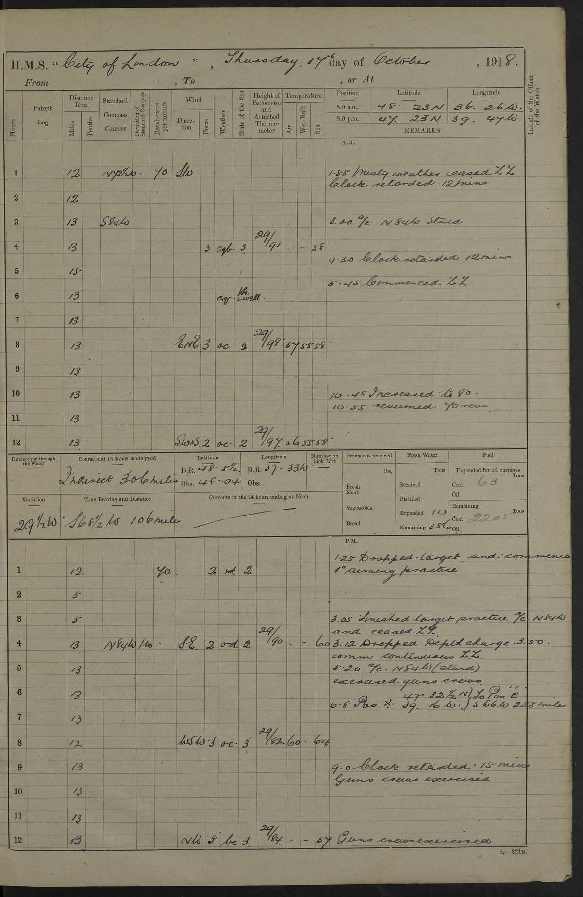
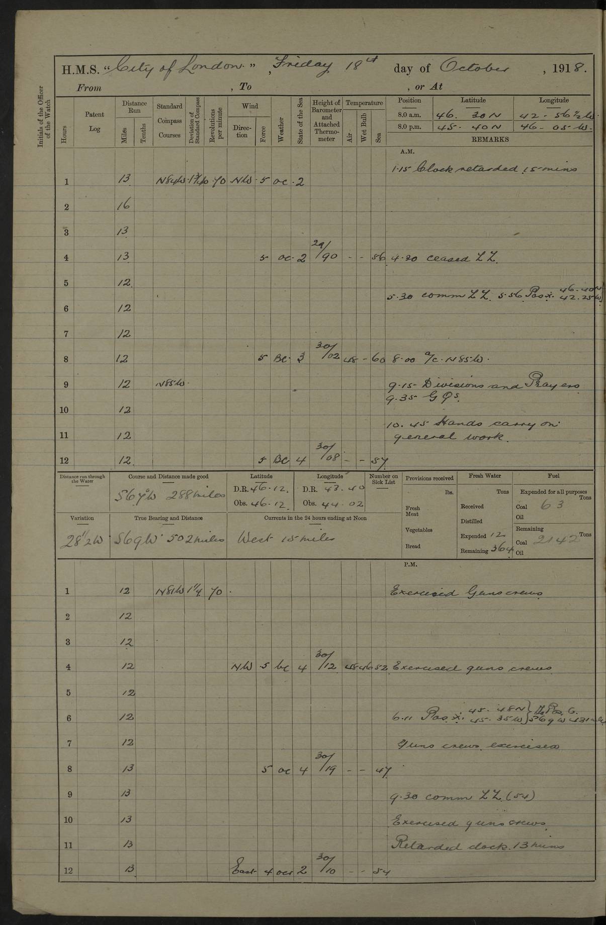
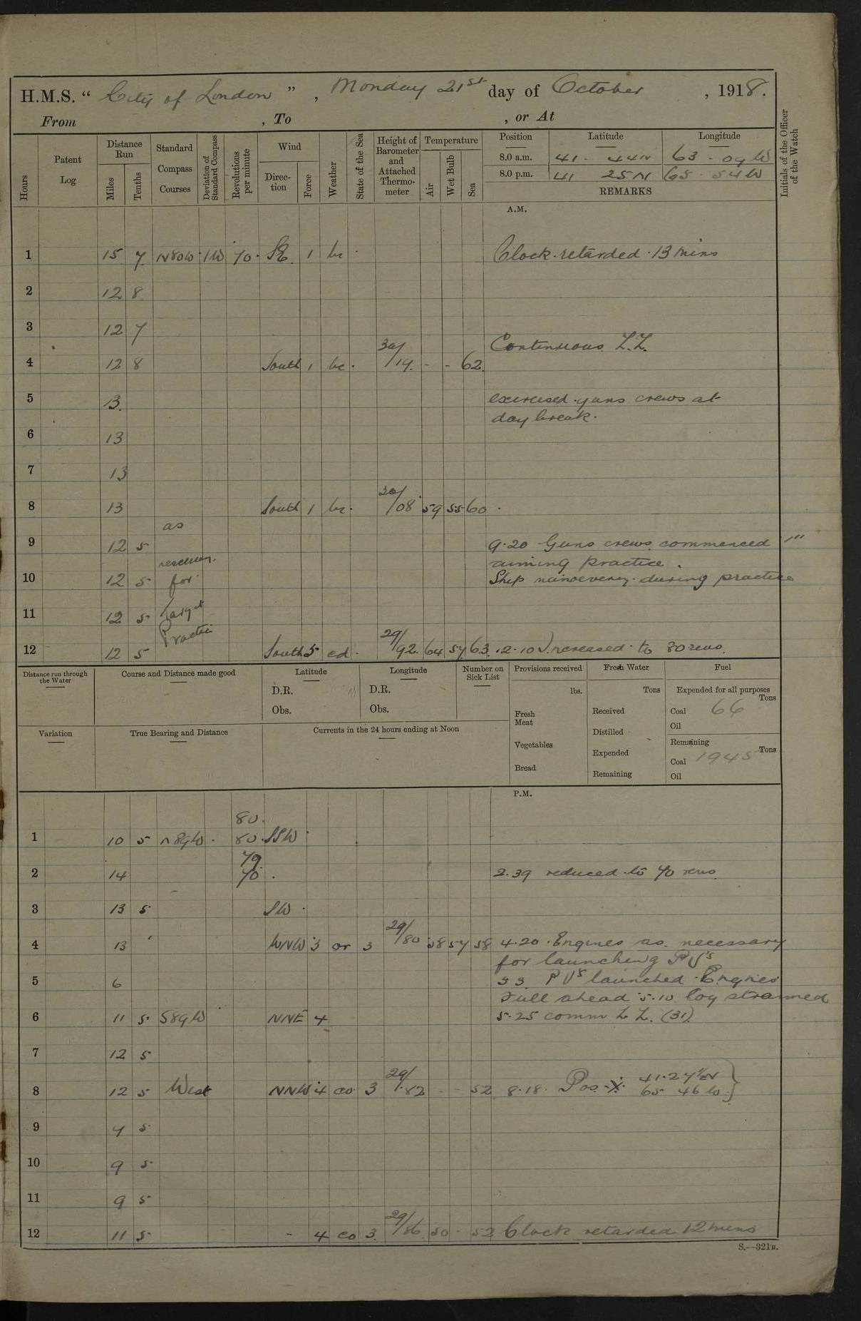
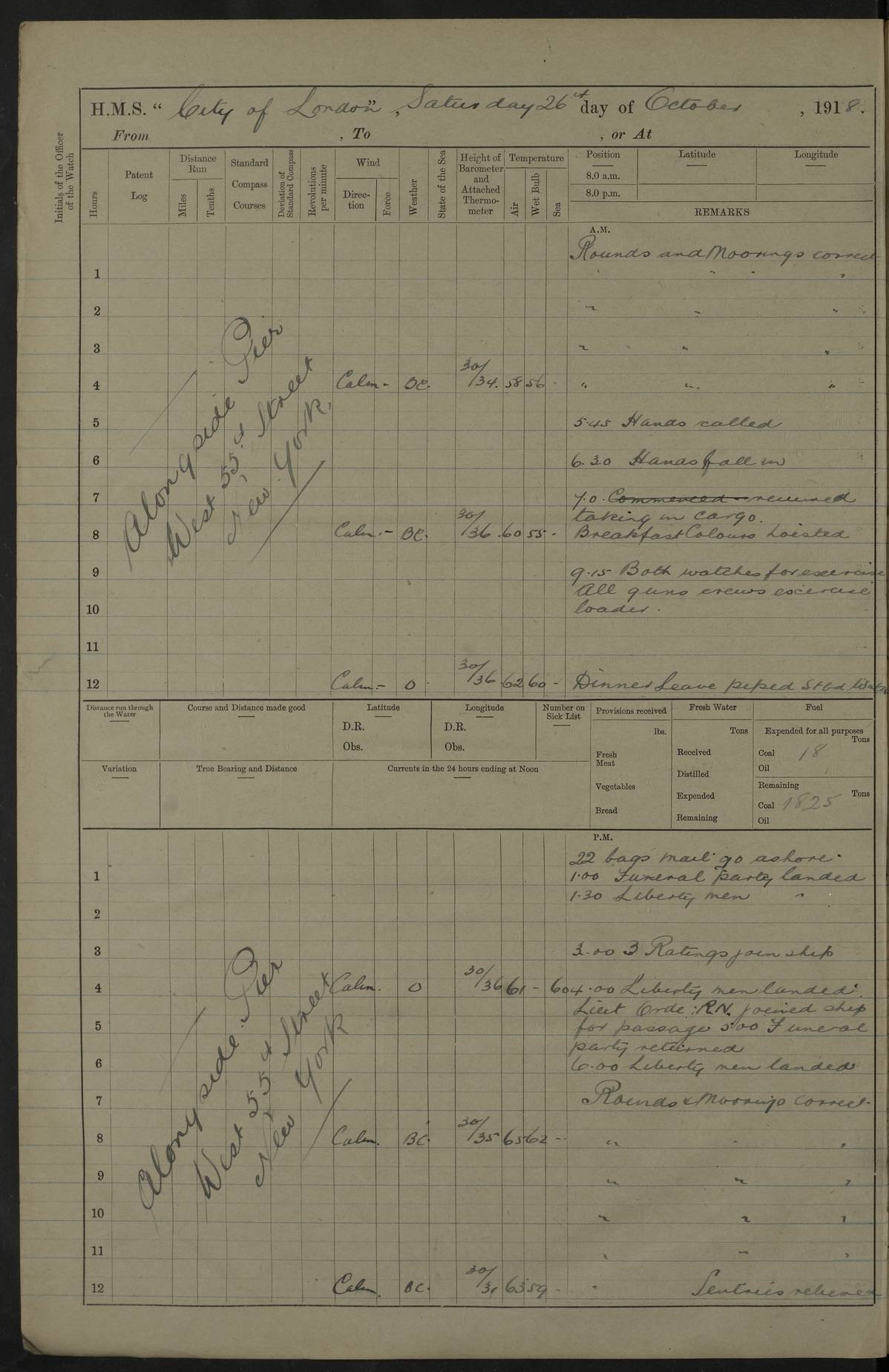
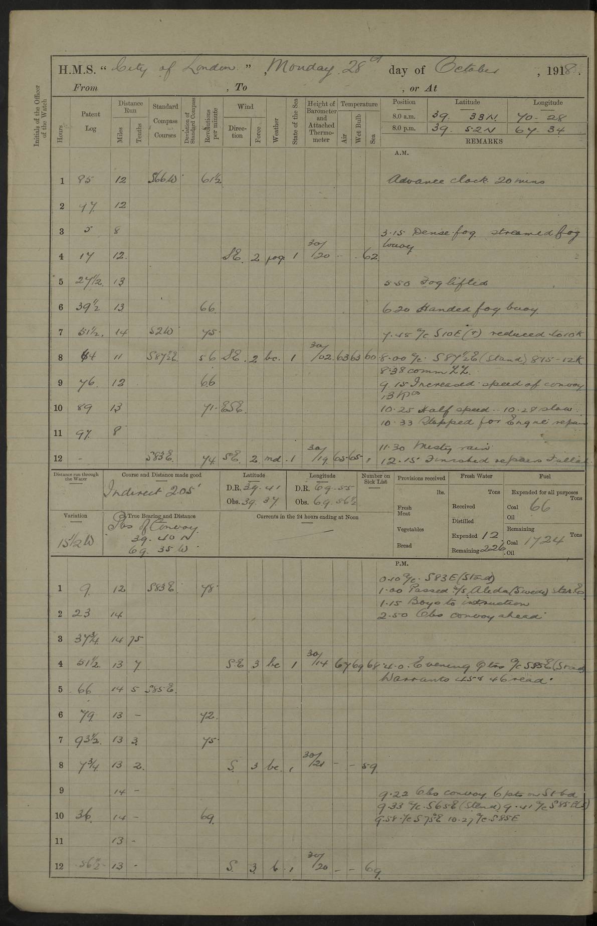
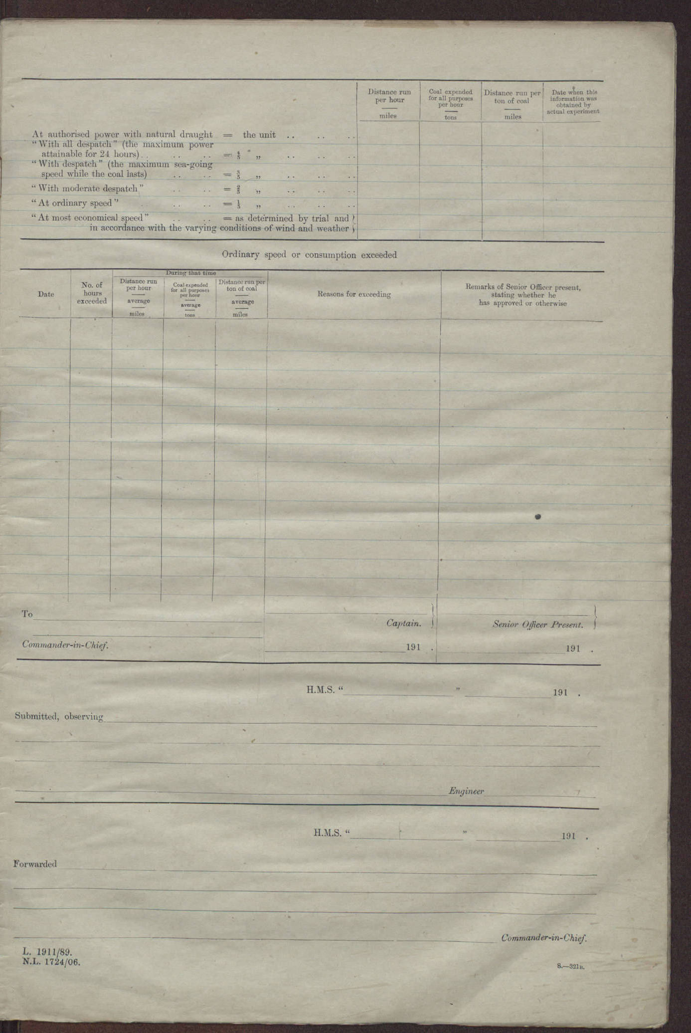
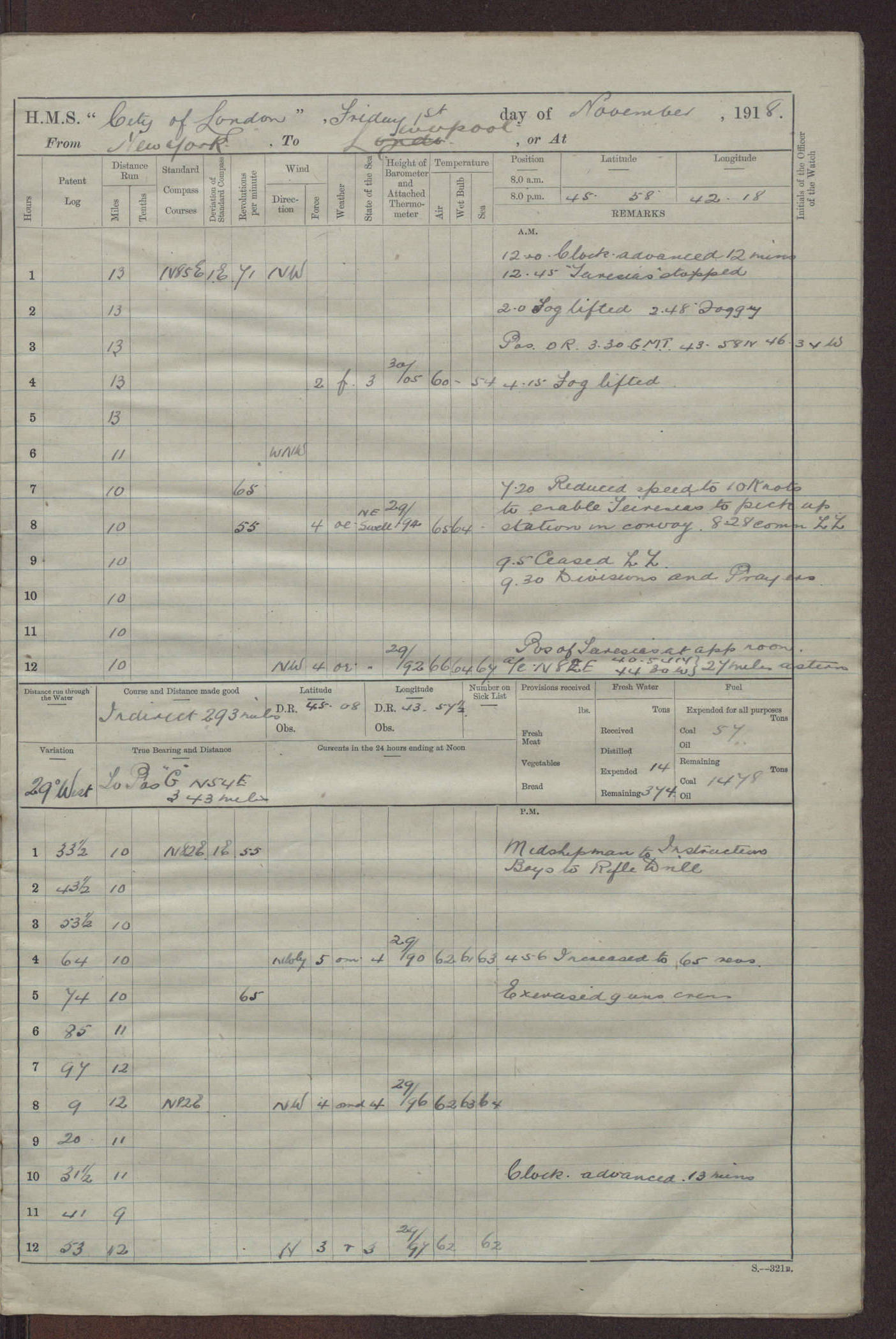
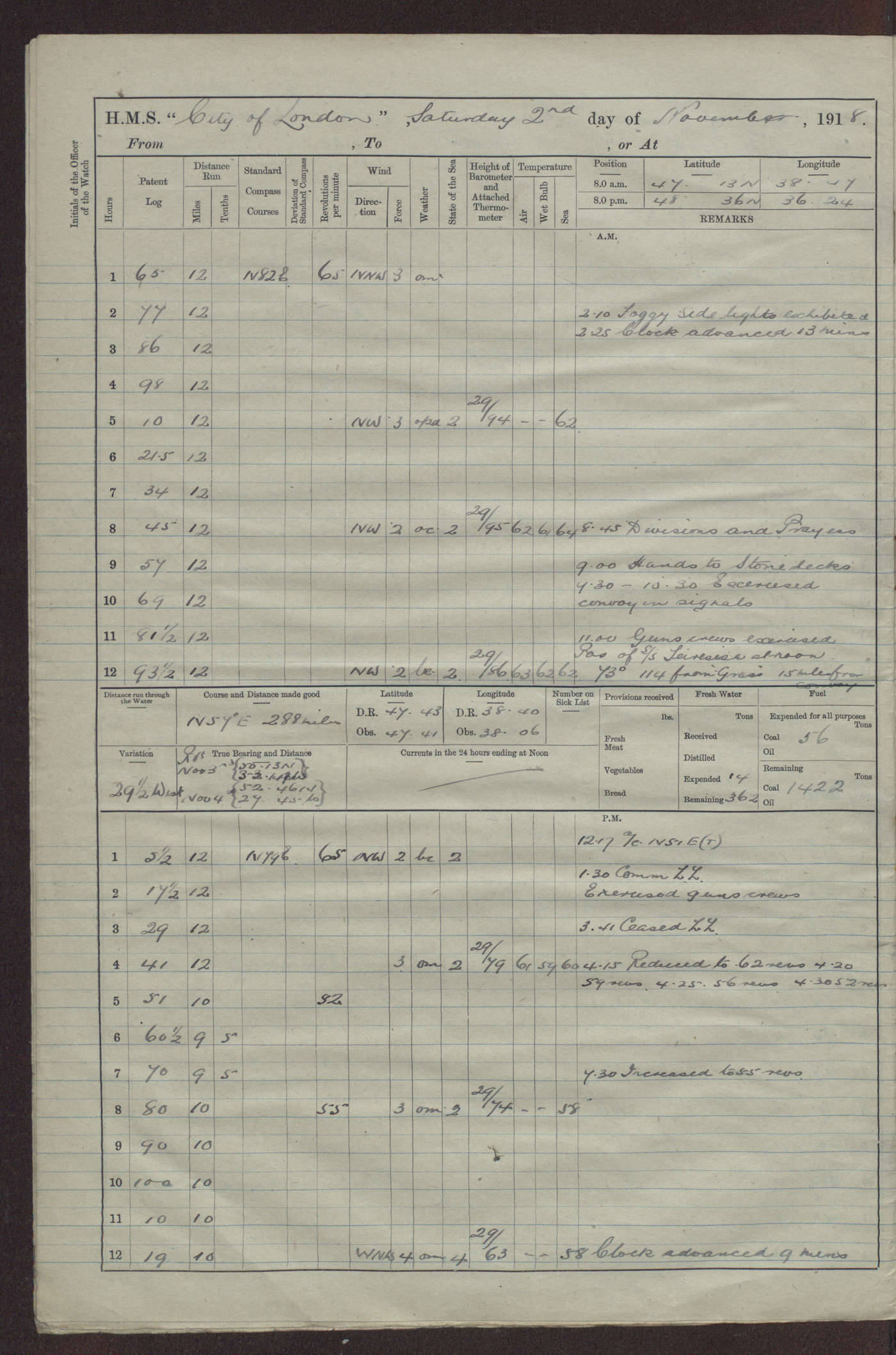
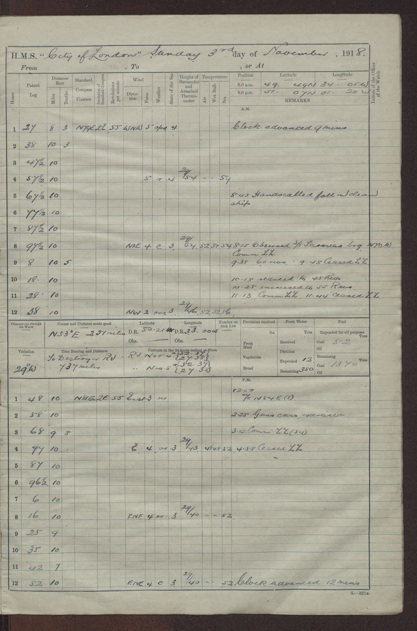
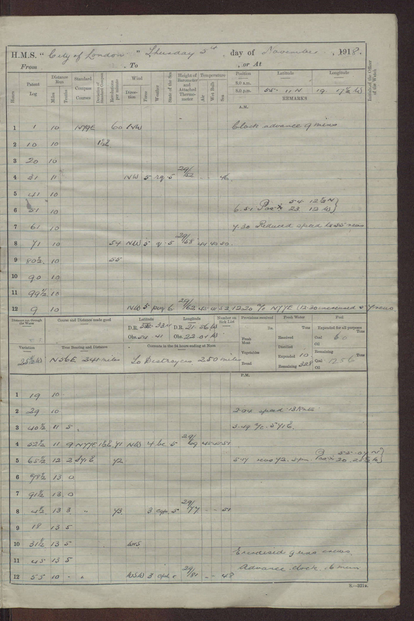
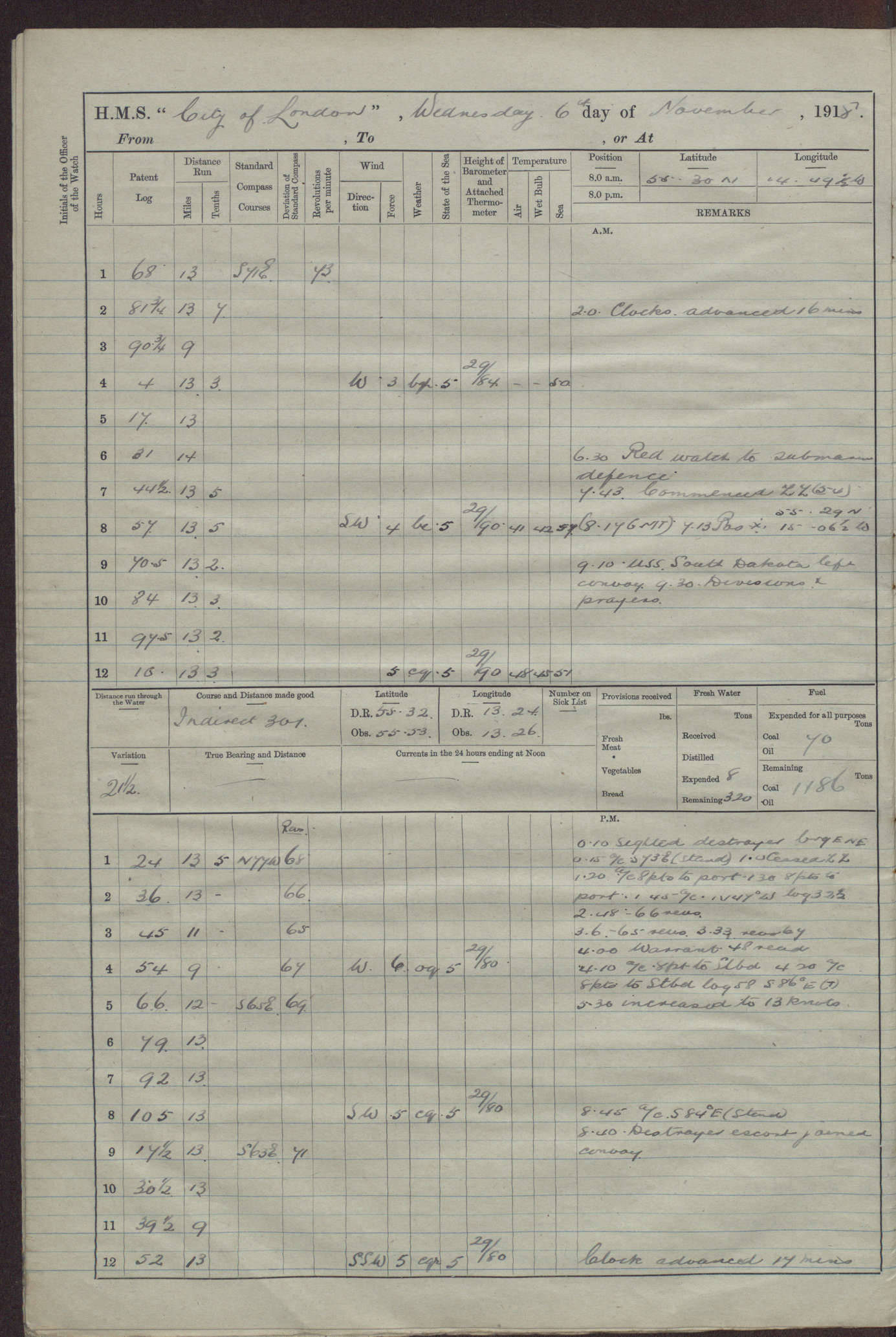
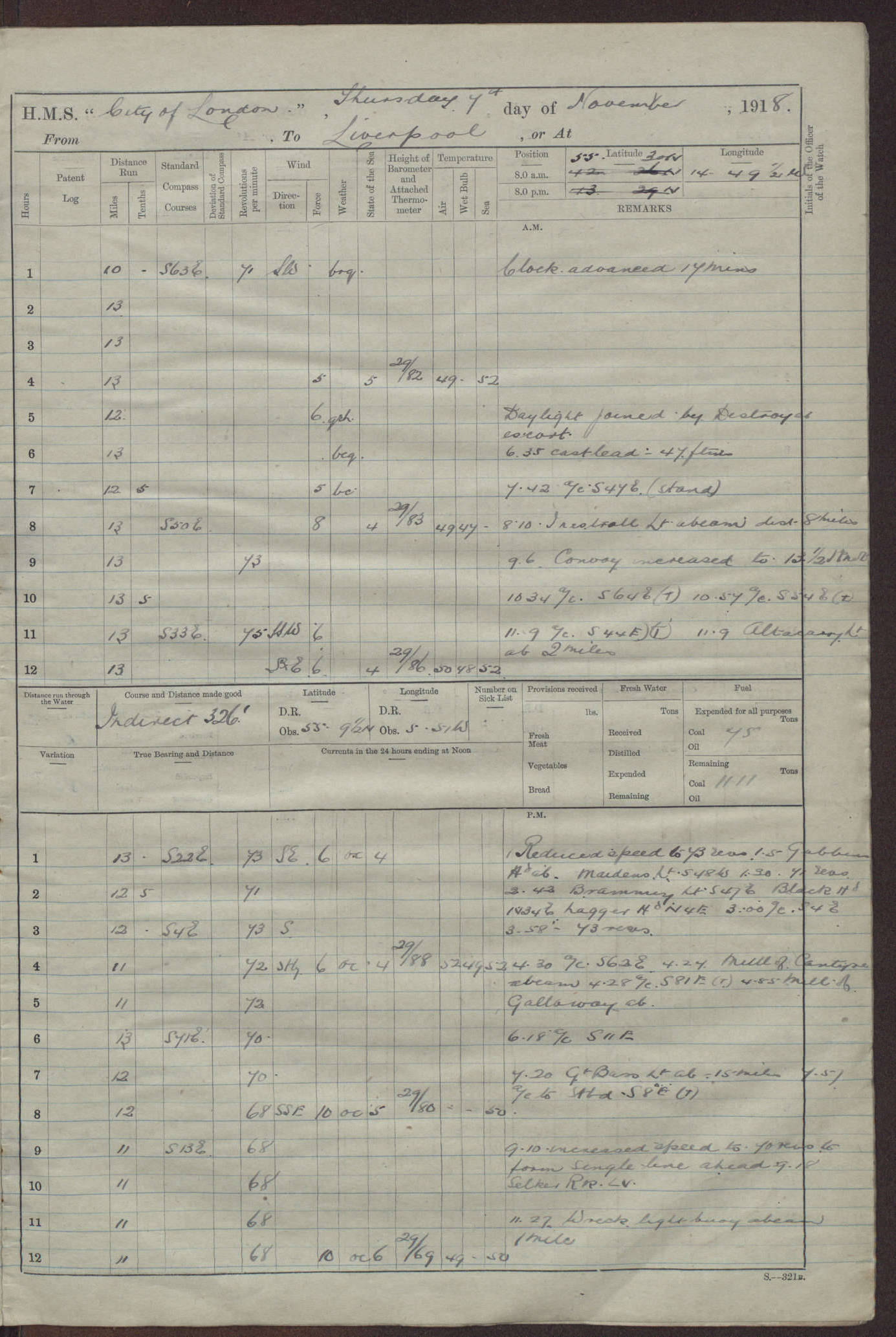
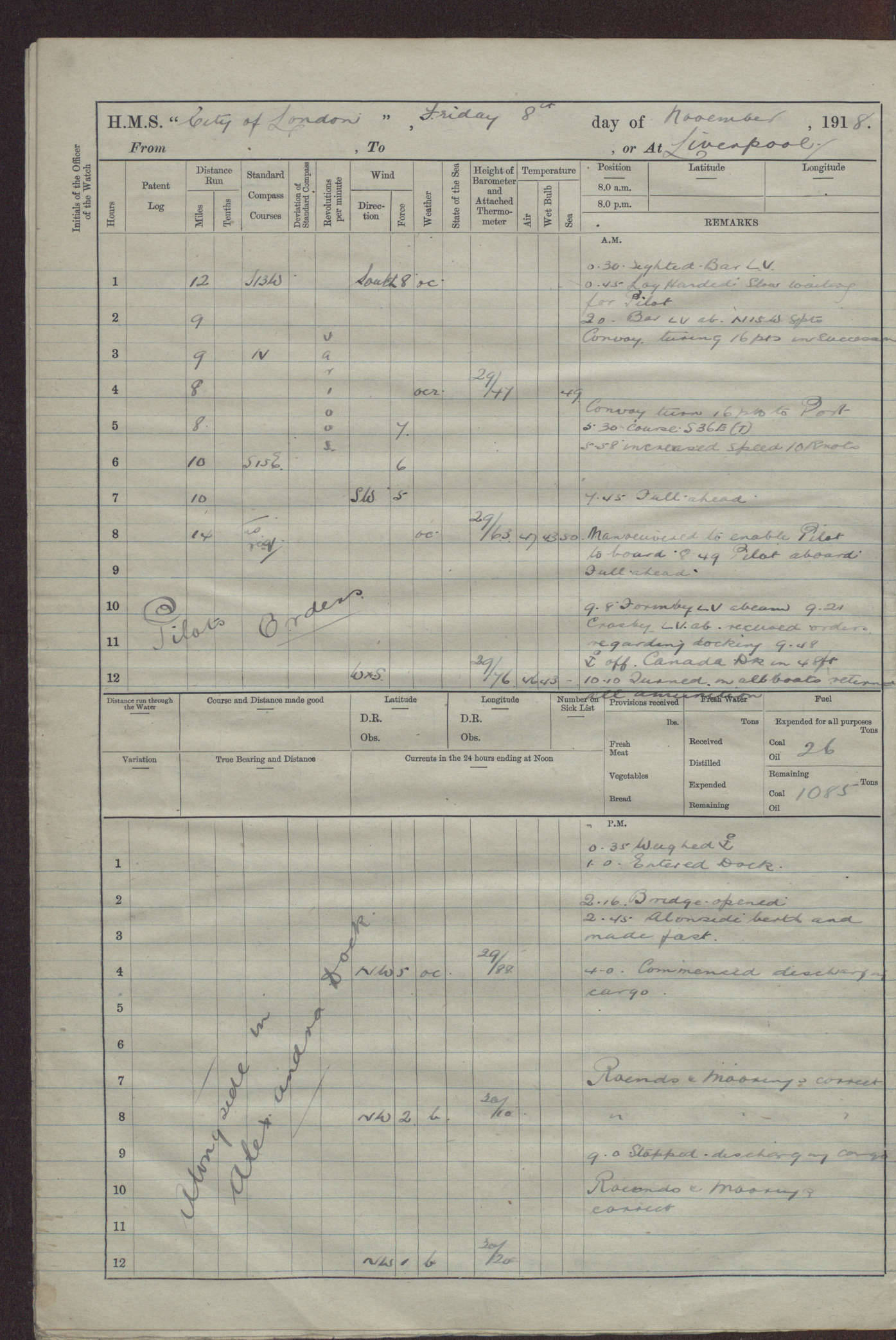
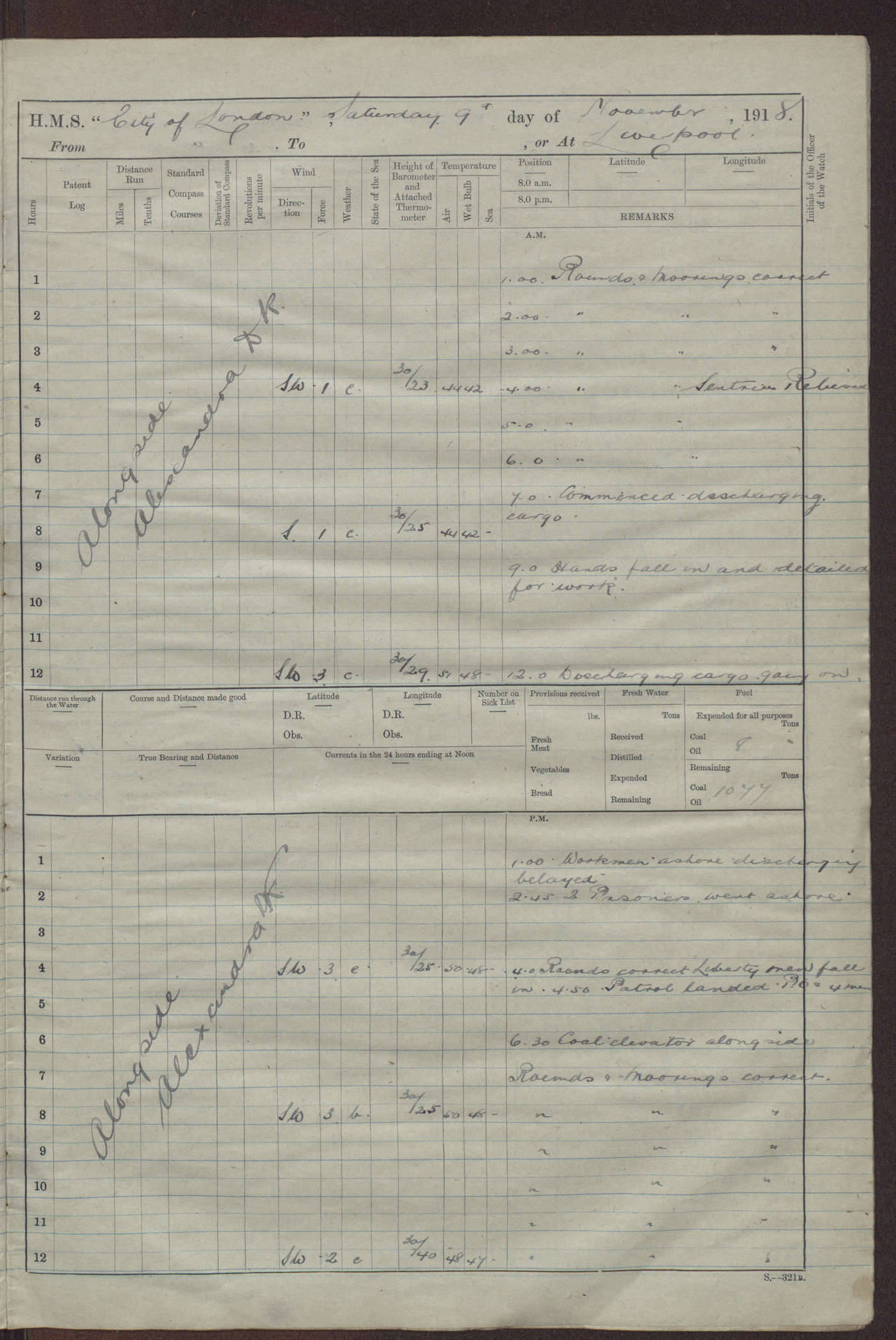
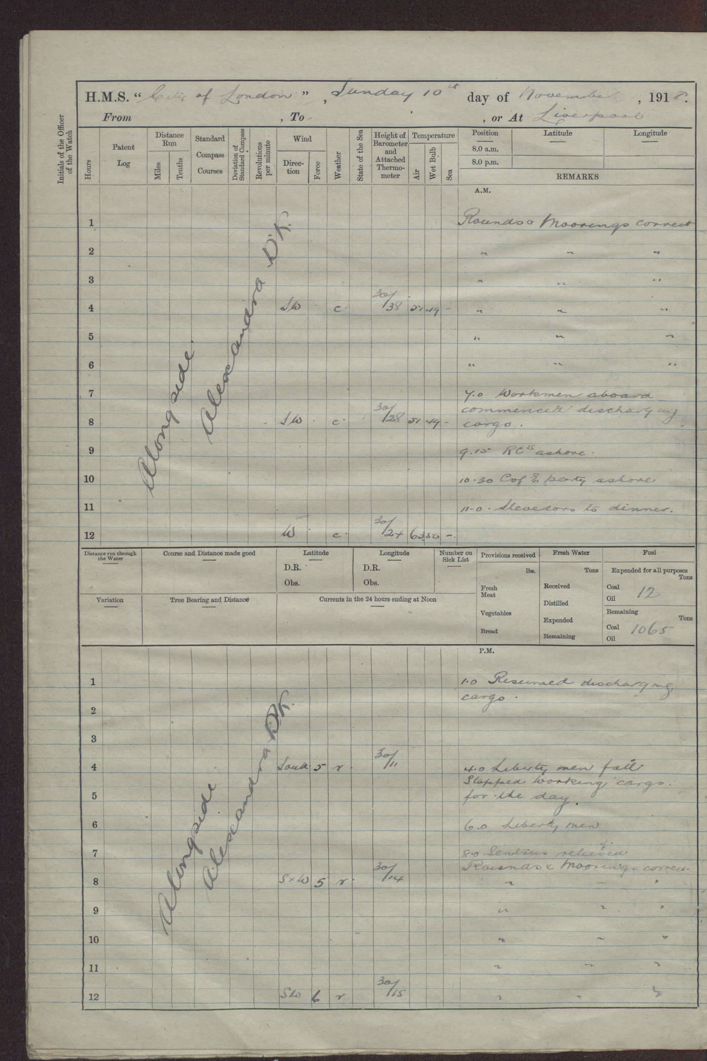
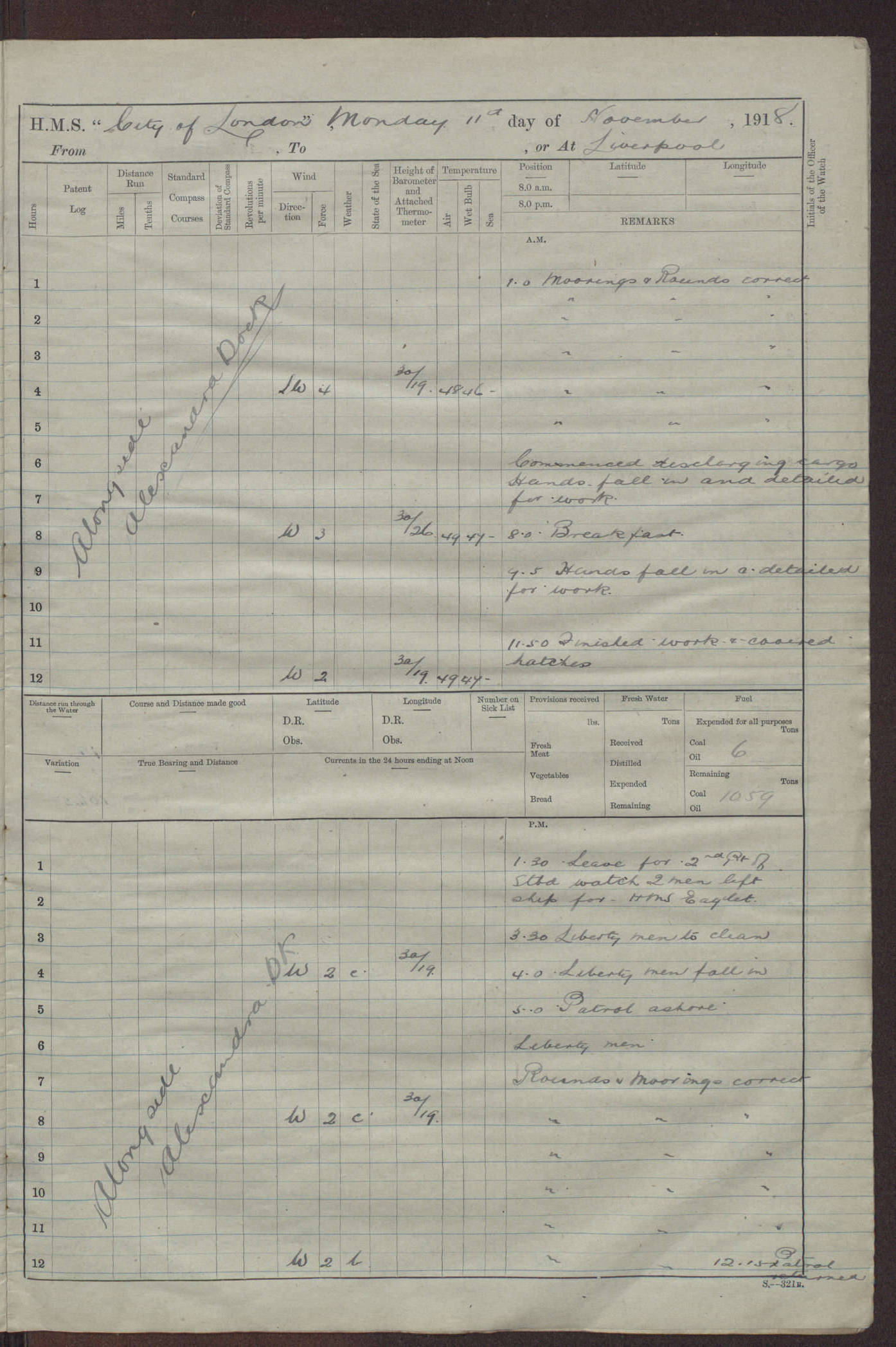
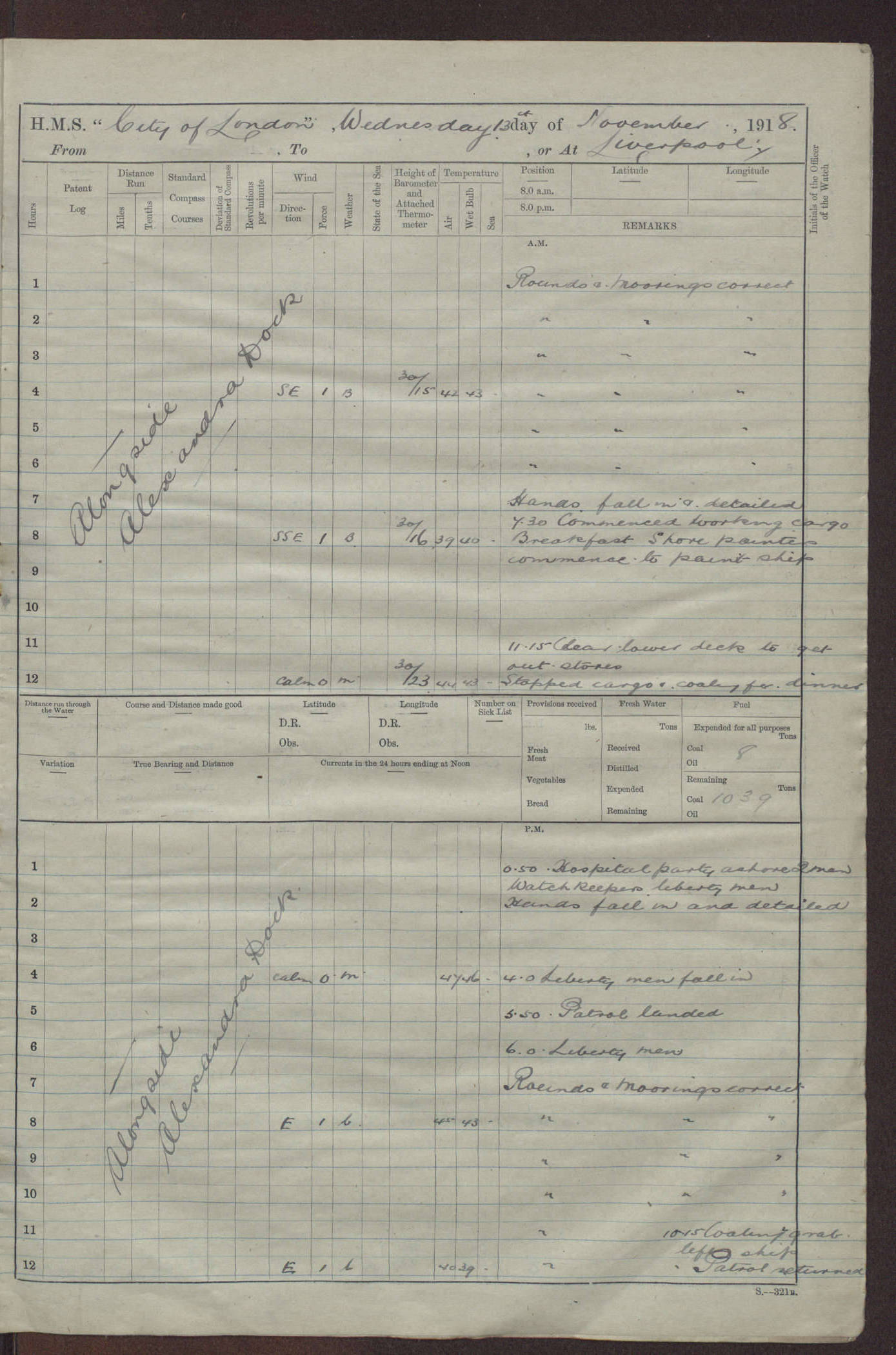
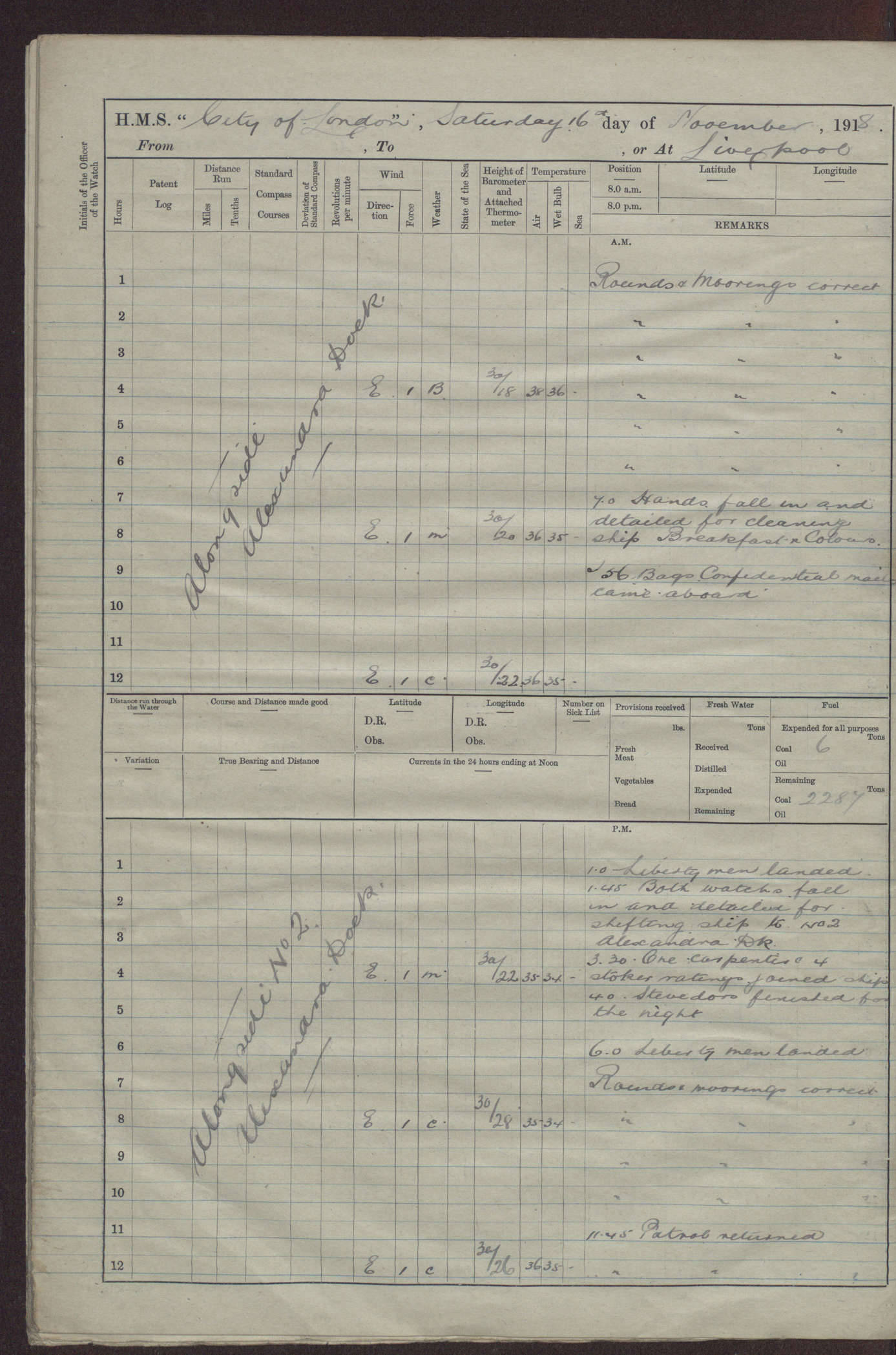
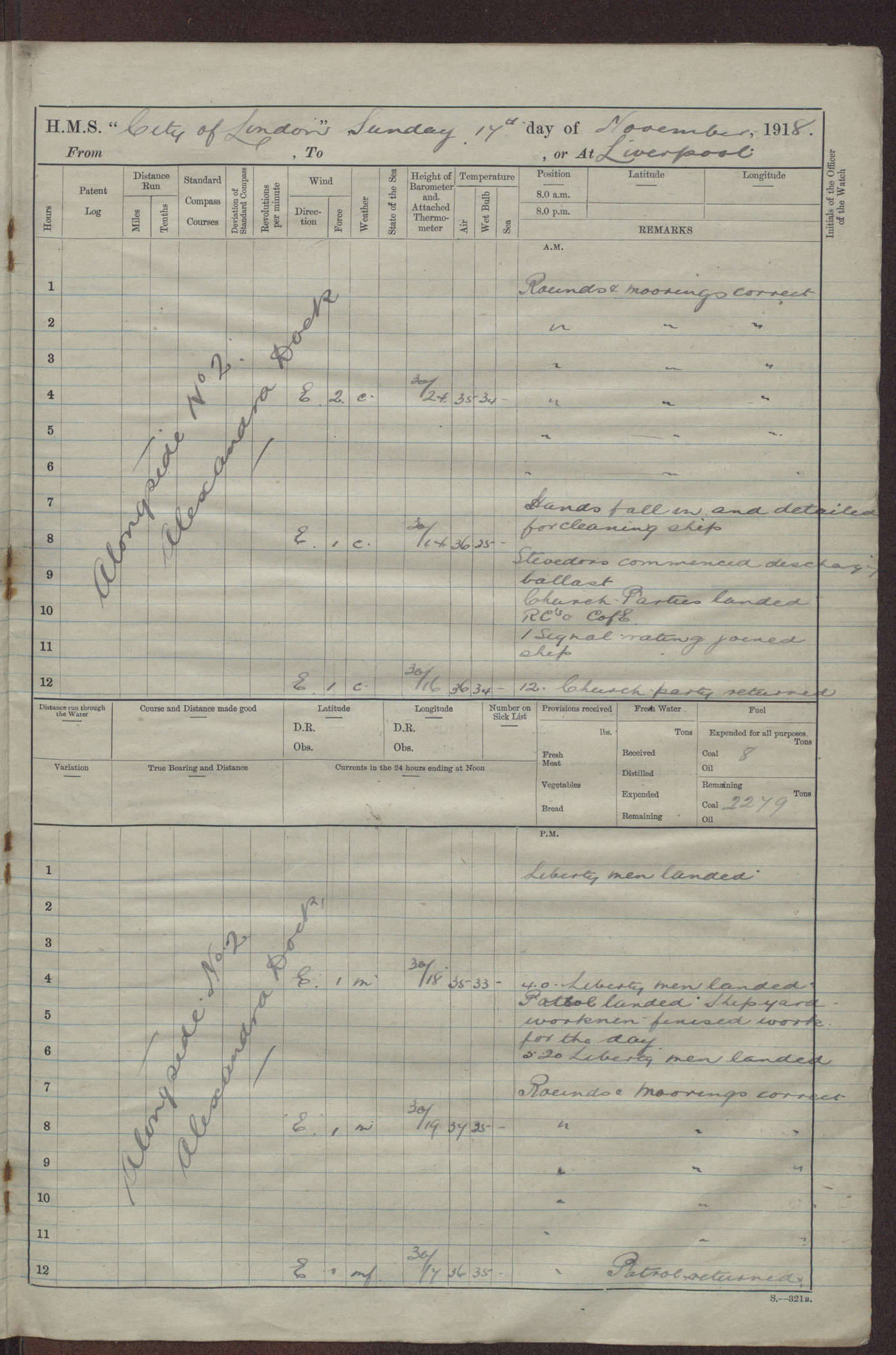
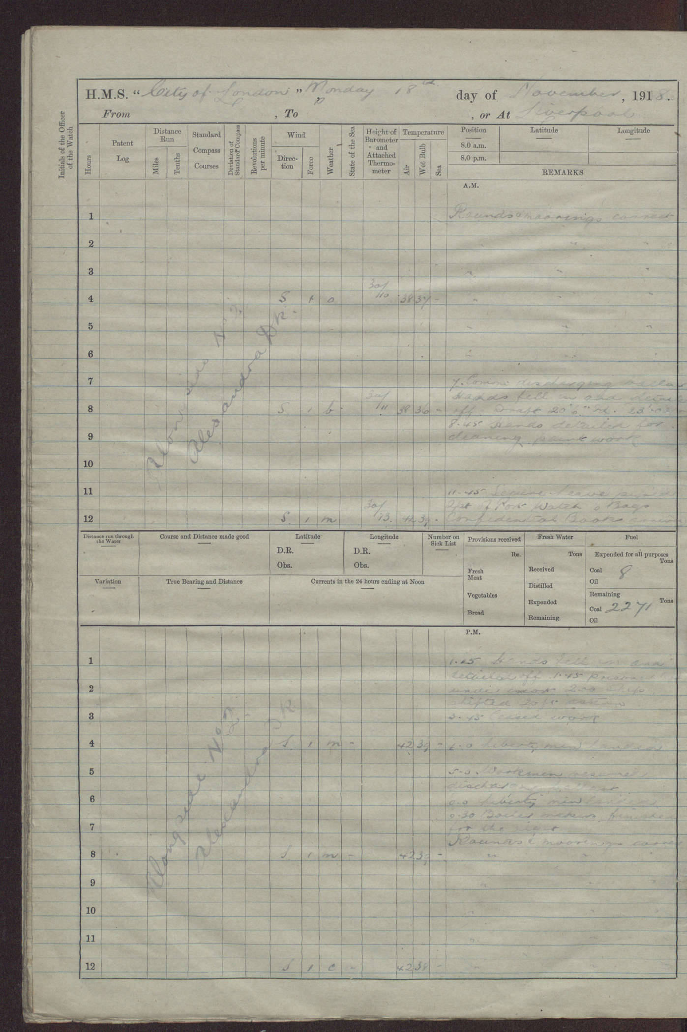
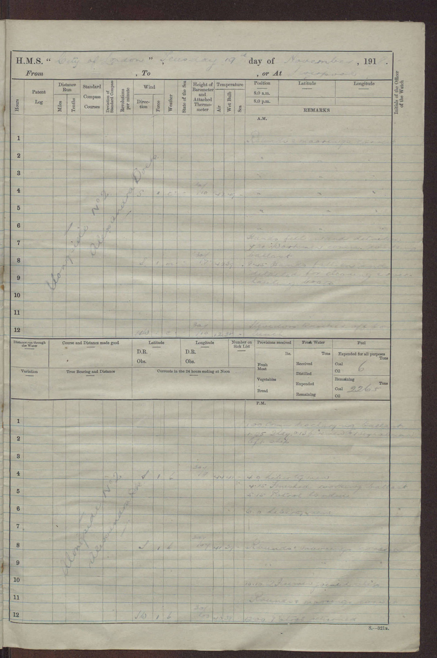
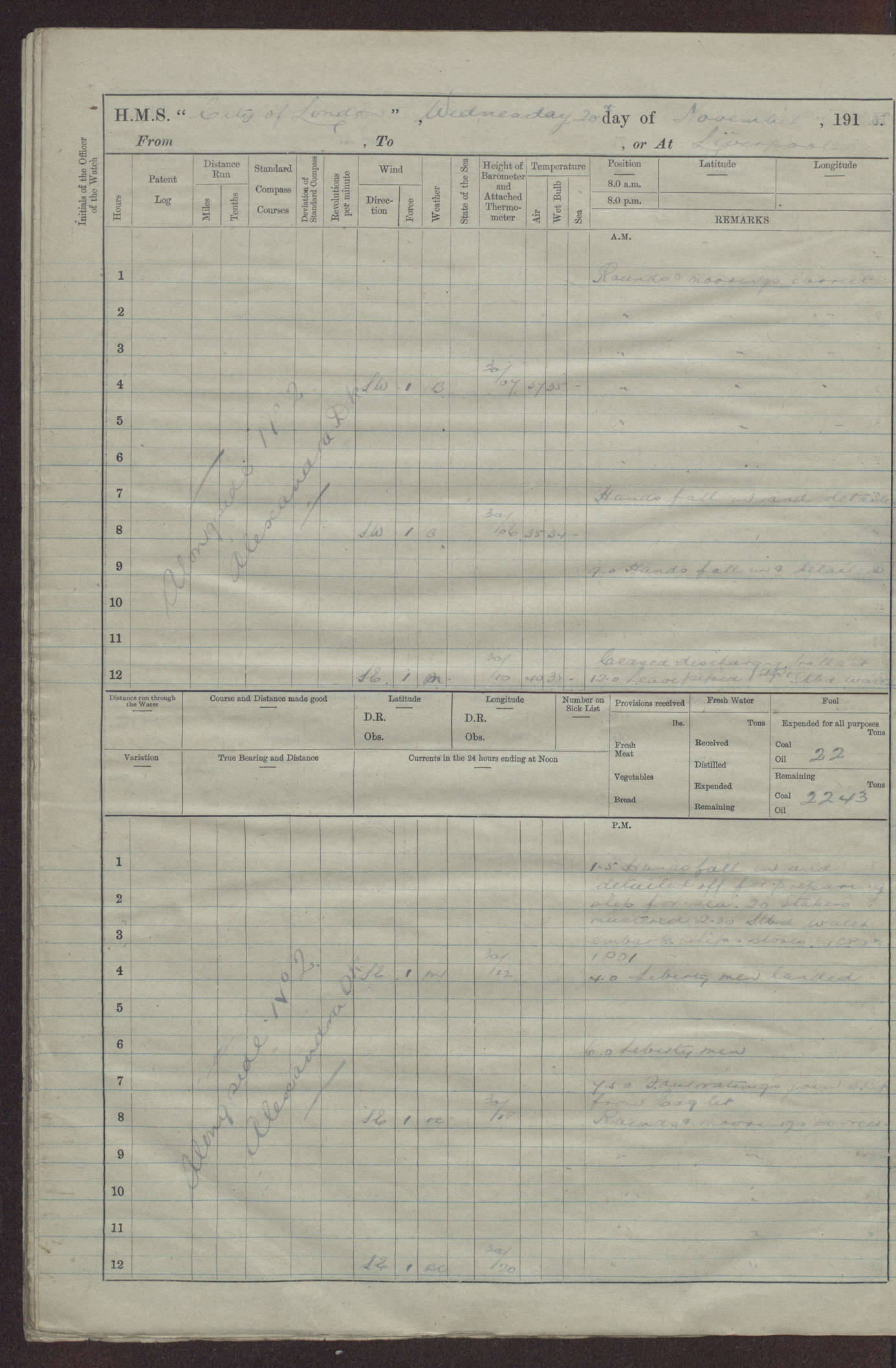
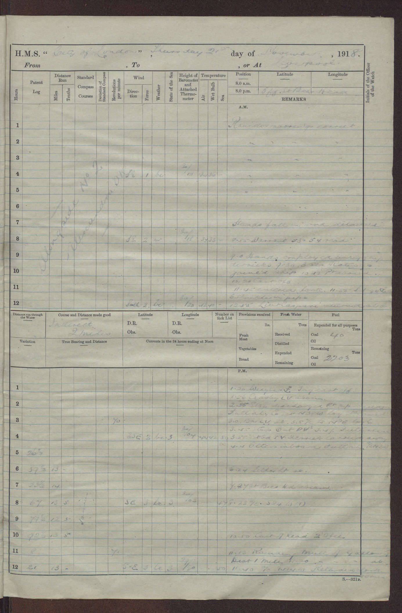
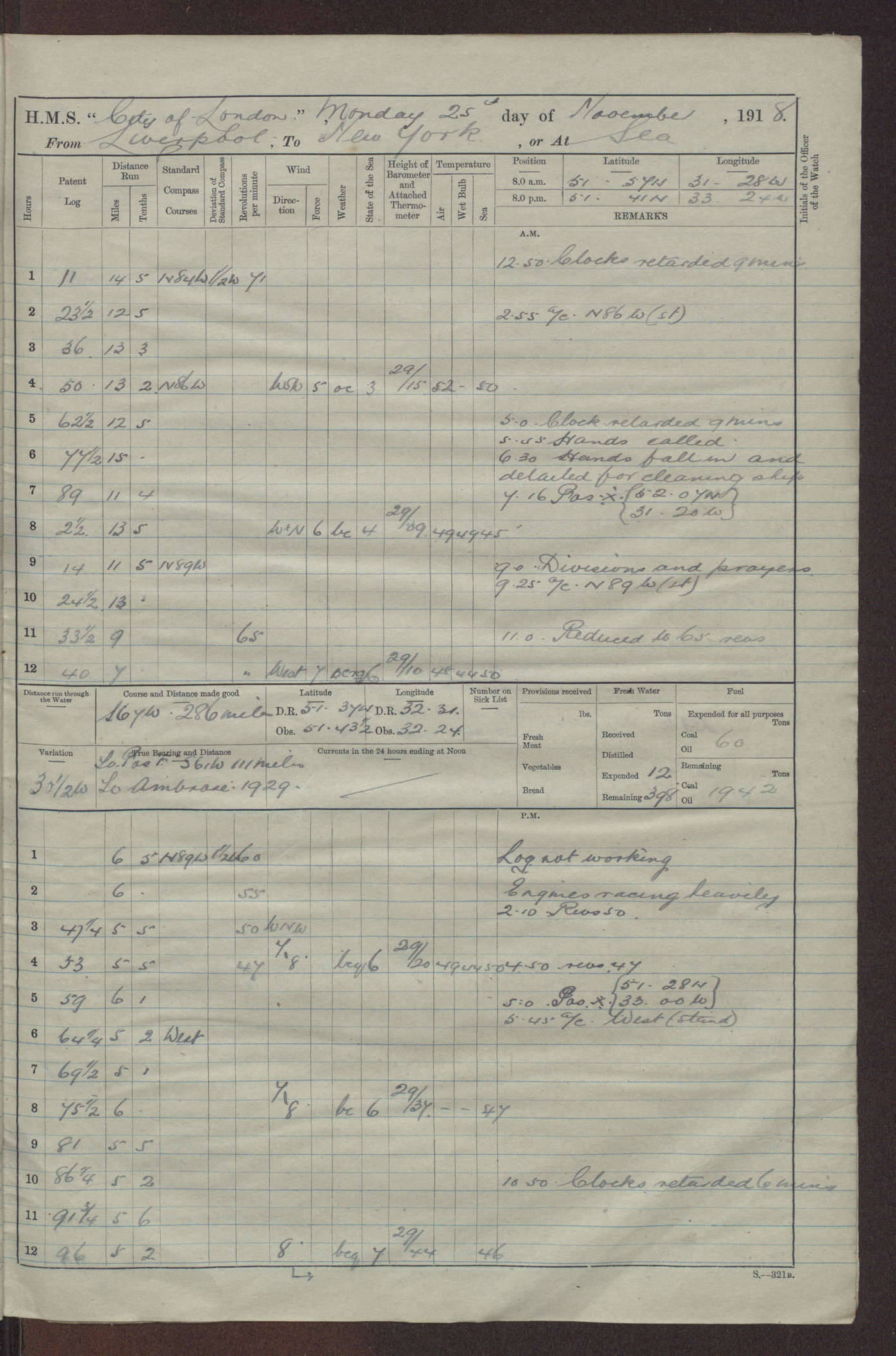
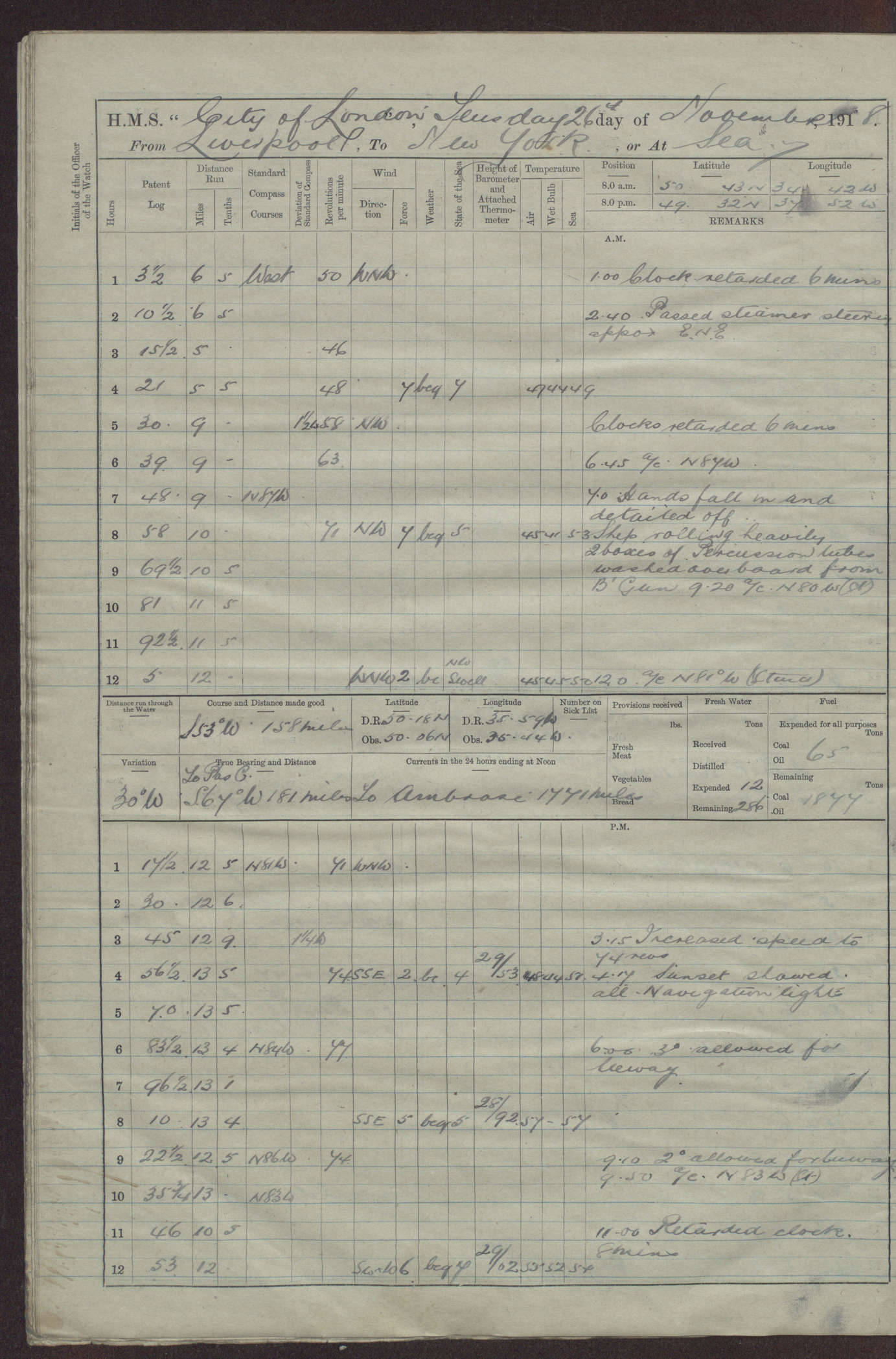
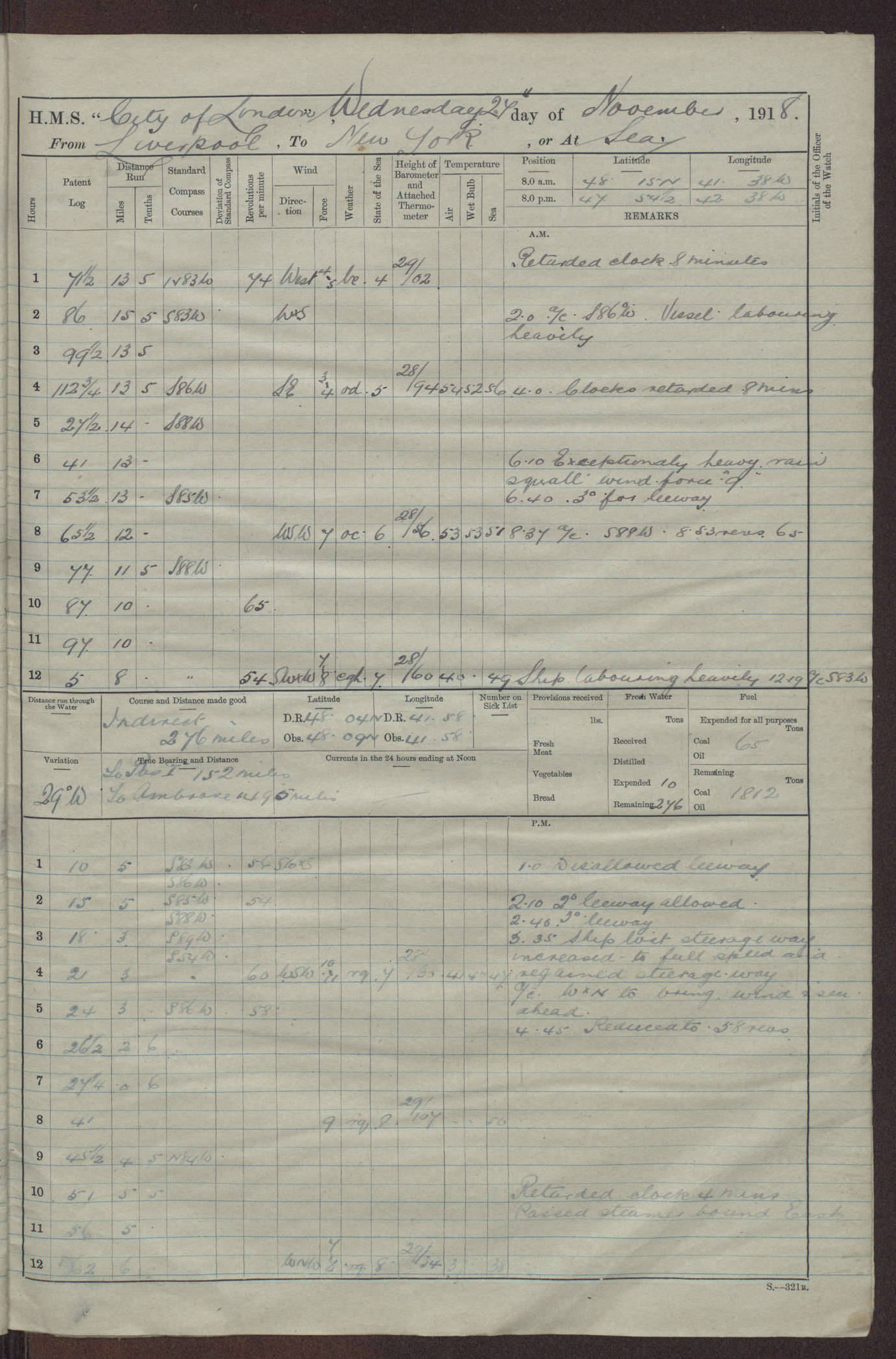
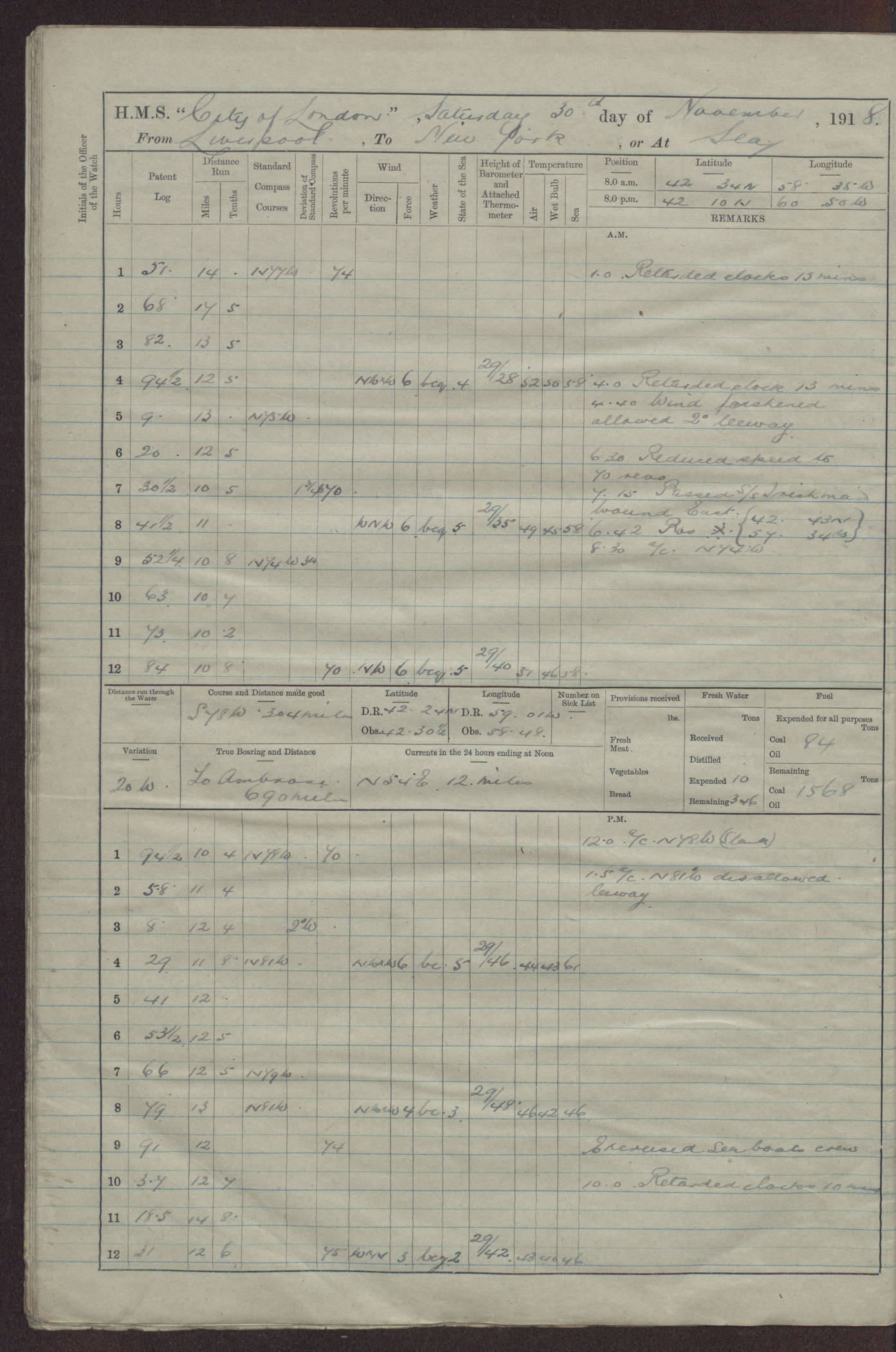