Naval History Homepage and Site Search
Naval History Homepage and Site Search
|
||||||||
|
||||||||
|
Kite Balloon Ship, mercantile conversion Pendant No. Y4.17 (fleet messenger pendant. no). Built 1900, 4120grt, owned by Ellerman & Bucknall Steamship Co. Hired as kite balloon ship 11.3.15-19.8.17, purchased 1915. In Mediterranean 1915, home waters 1915-16. Renamed HUNTBALL 1917, later red ensign collier Y3.313 until 6.18. Battle Honour (and link to despatches, casualties, awards) Dardanelles 1915. (British Warships 1914-1919) |
||||||||
|
||||||||
|
Notes: 1. Latitude/longitude, including for days in port, show representative decimal positions for each day, as calculated by the Old Weather project's analysis program. As such, they differ by varying amounts from the positions recorded, usually at noon, in the log pages. In addition, some latitudes/longitudes have been amended in edited logs for errors in the logs, for errors in identifying locations by the analysis program, or simply for greater accuracy. In all cases, refer to the log-page scans for the positions as originally recorded. Not all log pages contain this information and the ships' positions have therefore often been estimated. 2. Full account of any day is available by clicking on the link above that day. Groups of links refer to log book covers and introductory information; some may be blank. Editor’s notes: In most cases approximate locations are given the first time a geographical name is mentioned, hyperlinks will often lead to maps or locations. Spellings have been standardised in the history, even when there are variations in the log. When it is clear that the name or spelling in the log is not the one found on modern maps, the modern one has been substituted. Those undertaking a serious historical study should consult the original log before quoting place names. See contemporary account of her voyage out and time off German East Africa including Bagamoyo landings - H.M.S. Manica In East Africa |
||||||||
|
THE VOYAGES OF HMS MANICA 1916
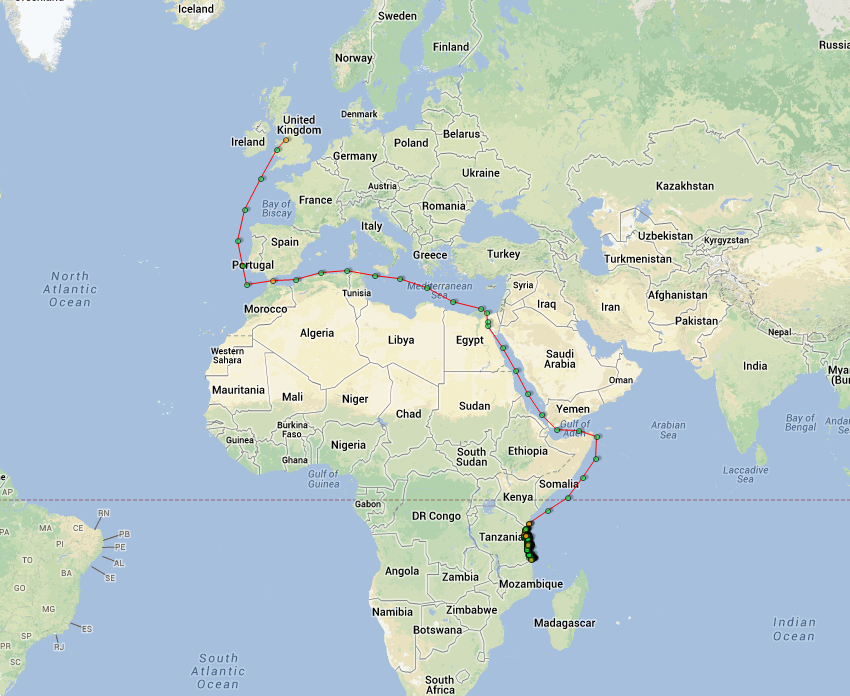
(Maps prepared using Journey Plotter, developed by Maikel. The Plots can only be approximate. They are made by joining-up positions on successive days, and sometimes positions are not given. There will therefore be occasions when the ship appears to have travelled overland) LOGS FOR FEBRUARY 1916 4caf8812cadfd3419701e304: (http://oldweather.s3.amazonaws.com/ADM_53-48163/ADM 53-48163-001_0.jpg) 4caf8812cadfd3419701e305: (http://oldweather.s3.amazonaws.com/ADM_53-48163/ADM 53-48163-001_1.jpg) 4caf8812cadfd3419701e306: (http://oldweather.s3.amazonaws.com/ADM_53-48163/ADM 53-48163-002_0.jpg) 4caf8812cadfd3419701e307: (http://oldweather.s3.amazonaws.com/ADM_53-48163/ADM 53-48163-002_1.jpg) 4caf8812cadfd3419701e308: (http://oldweather.s3.amazonaws.com/ADM_53-48163/ADM 53-48163-003_0.jpg) [These pages are cover pages, blank or unfilled forms.] 4caf8812cadfd3419701e309: (http://oldweather.s3.amazonaws.com/ADM_53-48163/ADM 53-48163-003_1.jpg) 18 February 1916 Birkenhead Lat 53.4, Long -3.0 1.00am: Strong breeze, heavy squalls 4.00am: Repairs etc carrying on 6.00am: Crew employed receiving stores 8.00am: Ship commissioned this day 1.00pm: 8 Naval ratings joined ex-Pembroke 5 Signal ratings 3.00pm: Repairs etc carrying on 5.00pm: Moderate gale with rain squalls 7.00pm: Cammell Laird’s watchmen on duty 4caf8812cadfd3419701e30a: (http://oldweather.s3.amazonaws.com/ADM_53-48163/ADM 53-48163-004_0.jpg) 19 February 1916 Birkenhead Lat 53.4, Long -3.0 2.00am: Moderate breeze & hazy 8.30am: Commenced running water into dock 9.00am: Pilot (Andrews) came on board 10.15am: Ship floated off blocks 10.30am: Left dry dock in tow of 3 tugs & proceeded towards basin 11.10am: Entered basin 11.45am: Alongside “Campania” 2.00pm: Moderate breeze & hazy 3.00pm: Repairs etc carrying on 6.00pm: Watchmen on duty [HMS Campania was a 20,570 ton passenger liner, launched by Fairfield’s Yard at Govan on the Clyde for the Cunard Line. In 1914 Cunard sold her for scrapping but the Navy bought her and converted her into a seaplane and airplane carrier. She never went into combat and sank in bad weather in November 1918 with no loss of life.] 4caf8812cadfd3419701e30b: (http://oldweather.s3.amazonaws.com/ADM_53-48163/ADM 53-48163-004_1.jpg) 20 February 1916 Birkenhead Lat 53.4, Long -3.0 Forenoon: Moderate breeze & hazy Carpenters & shipwrights at work Watchmen on duty Afternoon: Moderate to light breeze & hazy Work as in forenoon 4caf8812cadfd3419701e30c: (http://oldweather.s3.amazonaws.com/ADM_53-48163/ADM 53-48163-005_0.jpg) 21 February 1916 Birkenhead Lat 53.4, Long -3.0 Forenoon: Light breeze & hazy Repairs etc carrying on Crew taking in stores Watchmen on duty 1.00pm: Coal elevator came alongside Repairs etc carrying on 3.00pm: Start bunkering Watchmen on duty Royal Naval Air Service sentry on stores 4caf8812cadfd3419701e30d: (http://oldweather.s3.amazonaws.com/ADM_53-48163/ADM 53-48163-005_1.jpg) 22 February 1916 Birkenhead Lat 53.4, Long -3.0 Forenoon: Light breeze & fine cloudy weather Carrying on bunkering Crew joined ship Repairs carrying on Crew receiving stores etc Firm’s watchmen on duty Afternoon: Light to moderate breeze & cloudy 10.00pm: Finished bunkering, received 994 tons of coal Firm’s watchmen on duty RNAS sentry on stores 4caf8812cadfd3419701e30e: (http://oldweather.s3.amazonaws.com/ADM_53-48163/ADM 53-48163-006_0.jpg) 23 February 1916 Birkenhead Lat 53.4, Long -3.0 Forenoon: Light breeze & cloudy Repairs etc carrying on Crew employed cleaning up & on stores Firm’s watchmen & Quartermasters on duty Afternoon: Light breeze & fine weather Work as forenoon 10 men (Crew) rejected by Surgeon as medically unfit Officers joined ship Inspection of ship by Admiralty Officials RNAS sentry on stores Sub Lieutenant J Loveluck Officer of Watch 4caf8812cadfd3419701e30f: (http://oldweather.s3.amazonaws.com/ADM_53-48163/ADM 53-48163-006_1.jpg) 24 February 1916 Birkenhead Lat 53.4, Long -3.0 Forenoon: Strong breeze & cloudy clear weather Repairs etc carrying on Crew variously employed Afternoon: Strong breeze & overcast squally weather 1 man rejected by Surgeon as medically unfit Kite Balloon Section joined ship from Roehampton Firm’s watchmen, Quartermaster & sentries on duty Sub Lieutenant Bradley OOW 4caf8812cadfd3419701e310: (http://oldweather.s3.amazonaws.com/ADM_53-48163/ADM 53-48163-007_0.jpg) 25 February 1916 Birkenhead Lat 53.4, Long -3.0 Forenoon: Slight breeze, heavy snow Work as usual Afternoon: 1 man rejected by Surgeon as medically unfit Usual sentries, Sub Lieutenant JE Loveluck, OOW 4caf8812cadfd3419701e311: (http://oldweather.s3.amazonaws.com/ADM_53-48163/ADM 53-48163-007_1.jpg) 26 February 1916 Birkenhead Lat 53.4, Long -3.0 Forenoon: Moderate breeze with snow squalls Repairs carrying on Crew cleaning up ship Firm watchmen & sentries on duty Afternoon: Moderate breeze and squally Sub Lieutenant W. Bradley Officer of the Watch 4caf8812cadfd3419701e312: (http://oldweather.s3.amazonaws.com/ADM_53-48163/ADM 53-48163-008_0.jpg) 27 February 1916 Birkenhead Lat 53.4, Long -3.0 Forenoon: Moderate breeze & cloudy Repairs etc carrying on Taking in ballast load Firms watchmen & sentries on duty Afternoon: As forenoon 4caf8812cadfd3419701e313: (http://oldweather.s3.amazonaws.com/ADM_53-48163/ADM 53-48163-008_1.jpg) 28 February 1916 Birkenhead Lat 53.4, Long -3.0 Forenoon: Light breeze & overcast with passing showers Work, including ballasting, carrying on Afternoon: Light breeze & overcast 1.30pm: General Divisions ‘Articles of War’ read by the Captain Sub Lieutenant Loveluck OOW [‘Articles of War’ is the disciplinary code of the Royal Navy.] 4caf8812cadfd3419701e314: (http://oldweather.s3.amazonaws.com/ADM_53-48163/ADM 53-48163-009_0.jpg) 29 February 1916 Birkenhead Lat 53.4, Long -3.0 Forenoon: Moderate breeze, snow and sleet Repairs, ballasting etc carrying on Afternoon: Light breeze & rain Sub Lieutenant Bradley Duty Officer
LOGS FOR MARCH 1916 4caf8812cadfd3419701e315: (http://oldweather.s3.amazonaws.com/ADM_53-48163/ADM 53-48163-009_1.jpg) 1 March 1916 Birkenhead Lat 53.4, Long -3.0 Forenoon: Light breeze & rain Repairs, ballasting etc carrying on Afternoon: Light breeze & rain Ship inspected by Major Mackworth & Lieutenant Cranfield from Admiralty Lieutenant DN Metcalfe Duty Officer Number on sick list 2 4caf8812cadfd3419701e316: (http://oldweather.s3.amazonaws.com/ADM_53-48163/ADM 53-48163-010_0.jpg) 2 March 1916 Birkenhead Lat 53.4, Long -3.0 Forenoon: Light breeze, rain & sleet Repairs etc carrying on Crew employed on stores Afternoon: Moderate breeze, rain & sleep Sub Lieutenant Bradley Duty Officer Midnight: Finished ballasting Number on sick list 2 4caf8812cadfd3419701e317: (http://oldweather.s3.amazonaws.com/ADM_53-48163/ADM 53-48163-010_1.jpg) 3 March 1916 Birkenhead Lat 53.4, Long -3.0 Forenoon: Moderate breeze & snow Repairs etc carrying on Afternoon: Moderate breeze, overcast and rain Ship’s company and Kite Balloon section left ship for route march Sub Lieutenant Loveluck Duty Officer Number on sick list 6 4caf8812cadfd3419701e318: (http://oldweather.s3.amazonaws.com/ADM_53-48163/ADM 53-48163-011_0.jpg) 4 March 1916 Birkenhead Lat 53.4, Long -3.0 Forenoon: Moderate breeze & overcast 9.00am: Ship’s company left ship during inclining test 9.30am: Commenced inclining test, Messrs Cammell Laird Officials in charge 1.30pm: Finished inclination test, ship’s crew returned to ship Ship hauled in berth & moored Afternoon: Moderate breeze & cloudy to moderate breeze & rain Sub Lieutenant Bradley Duty Officer 4caf8812cadfd3419701e319: (http://oldweather.s3.amazonaws.com/ADM_53-48163/ADM 53-48163-011_1.jpg) 5 March 1916 Birkenhead Lat 53.4, Long -3.0 Forenoon: Moderate breeze & snow to moderate breeze & cloudy Repairs etc carrying on 10.00am: Divisions & crew told off to Boat Stations 11.00am: Boat Stations Afternoon: Moderate breeze & rain Sub Lieutenant Loveluck Duty Officer Number on sick list 10 4caf8812cadfd3419701e31a: (http://oldweather.s3.amazonaws.com/ADM_53-48163/ADM 53-48163-012_0.jpg) 6 March 1916 Birkenhead Lat 53.4, Long -3.0 Forenoon: Moderate breeze & squally Repairs etc carrying on 11.00am: Pilot boarded, tugs made fast Afternoon: Fresh breeze & squally 12.53pm: Cast off & proceeded from Basin to River assisted by 3 tugs Gangs of labourers assisting crew 1.15pm: On River started adjusting compasses 2.00pm: Finishing adjusting compasses, anchored off Birkenhead Stage 3.00pm: Ship dragging anchor, weighed & proceeded back to billet 4.20pm: Anchored. Anchor watches kept ship steered head to tide. Number on sick list 11 4caf8812cadfd3419701e31b: (http://oldweather.s3.amazonaws.com/ADM_53-48163/ADM 53-48163-012_1.jpg) 7 March 1916 Birkenhead Lat 53.4, Long -3.0 2.00am: Vessel swung to tide, moderate wind & squally 7.00am: Vessel swung to flood tide, vessel steered to ease veering, strong wind & squally 10.45am Ship inspected by Admiralty Officials, Cammell Laird’s gig acting as tender Noon: Strong wind & heavy squalls, occasional snow squalls 4.00pm: Fresh breeze, occasional rain showers 6.00pm: Vessel riding quietly to her anchor, lights attended to, watch set Strong wind to moderate, clear to cloudy, occasional snow showers Number on sick list 7 4caf8812cadfd3419701e31c: (http://oldweather.s3.amazonaws.com/ADM_53-48163/ADM 53-48163-013_0.jpg) 8 March 1916 Birkenhead Lat 53.4, Long -3.0 2.00am: G Hanlon (Greaser) brought on board by Bootle P.C. Moderate breeze & fine clear weather 8.00am: Moderate breeze, overcast, snow showers Noon: Strong wind, snow squalls 4.00pm: Strong wind, snow squalls 8.00pm: Vessel riding quietly to anchor, lights carefully tended Strong wind, overcast & snow showers Midnight: Moderate breeze, strong squalls & snow Number on sick list 6 [She has started to record pressure but not temperature in her weather records.] 4caf8812cadfd3419701e31d: (http://oldweather.s3.amazonaws.com/ADM_53-48163/ADM 53-48163-013_1.jpg) 9 March 1916 Birkenhead Lat 53.4, Long -3.0 4.00am: Moderate breeze, overcast with sleet 8.00am: Fresh breeze, thick haze Noon: Fresh breeze & haze 4.00pm: Moderate breeze & hazy 5.00pm: All hands boat stations 5.50pm: Weighed & proceeded down river, tug in attendance, helm & engines to Pilot Orders 6.40pm: Anchored off Egremont Pier 8.00pm: Moderate breeze & hazy 11.30pm: Proceeded towards bar to Pilot’s Orders 11.50pm: Rock Light S70W Midnight: Light breeze & hazy Number on sick list 5 [Rock Light is Perch Rock at New Brighton, now in Merseyside, then in Cheshire at Lat 53.4, Long -3.0 Egremont is on the Wirral peninsula at Lat 53.42, Long -3.04, the pier was demolished in 1946 after a coaster crashed into it. NB This location will not show up on most geographic search sites.] 4caf8812cadfd3419701e31e: (http://oldweather.s3.amazonaws.com/ADM_53-48163/ADM 53-48163-014_0.jpg) 10 March 1916 Birkenhead to Gibraltar Lat 52.4, Long -4.5 1.30am: Stopped to discharge pilot. Sighted escort 1.40am: Bar lightship, dropped pilot & proceeded 1.50am: Yacht “Surf” (escort) closed 4.00am: Strong breeze & clear overcast weather. Stopped for engineer’s purposes 4.08am: Proceeded 6.10am: Skerries Light 4’ distant 8.00am: Fresh breeze, clear & overcast, snow showers 8.50am: Caernavon Bay Light Vessel S62E, ¾’ distant 11.20am: Bardsey Light House S11E, 2½’ distant Noon: Fresh breeze, moderate sea, light haze 4.00pm: Strong breeze, overcast, moderate following sea 6.45pm: Smalls Light House 5’ distant 8.00pm: Strong following wind, overcast & cloudy, vessel rolling to sea swell 10.00pm: Escort on station 11.00pm: Lookout & guns crews at station Midnight: Strong following wind, overcast to cloudy, vessel rolling easily Number on sick list 6 [Mersey Bar Light Vessel is moored in the river a few miles downstream of Birkenhead. HMY Surf, a yacht of 496 tons, launched in 1902 was sunk by an aircraft on 6 April 1941 at Piraeus, Greece The Skerries Light or Ynys Môn was the last privately built lighthouse in Britain. It was purchased by Trinity House (who are responsible for lighthouses in England & Wales) in 1841. The Skerries are small, rocky islands about 2 miles NW of Carmel Head, Anglesey at Lat 53.4, Long –4.6 There is no longer a Light Vessel at Caernarvon which is approximately Lat 53.1, Long -4.2 Bardsey Island, Ynys Enlli, has great religious significance in Wales and lies just off the Lleyn Peninsula. The lighthouse is the only square one maintained by Trinity House and is situated at Lat 52.75, Long -4.8 Smalls Light is on a rock to the west of St Davids at Lat 51.7, Long -5.7. It has an interesting history and was the setting for a BBC play.] 4caf8812cadfd3419701e31f: (http://oldweather.s3.amazonaws.com/ADM_53-48163/ADM 53-48163-014_1.jpg) 11 March 1916 Birkenhead to Gibraltar Lat 49.2, Long -7.3 2.00am: All guns manned ready for action 4.00am: Strong breeze & cloudy, moderately rough sea 8.00am: Strong following wind, rough sea, vessel rolling heavily, misty weather 10.45am: Eased speed for “Roche Castle” to effect light repairs Noon: Strong following wind, rough sea, vessel rolling heavily, misty weather 1.25pm: Passed French Ship, name unknown, received signal "Have you fear of Submarines". Answer, “Give Scilly Islands wide berth” 4.00pm: Strong breeze, overcast, ship rolling to rough sea 6.45pm: Escort left 8.00pm: Strong to moderate breeze, rain & hail squalls, vessel rolling 10.00pm: Guns crews & lookouts at stations Midnight: Moderate following wind, overcast & heavy rain Number on sick list 4 [HMT Roche Castle was a trawler, launched in 1910 by Shield Engineering Co for Castle Steam Trawlers Ltd. She was requisitioned as a minesweeper from 1915-19.] 4caf8812cadfd3419701e320: (http://oldweather.s3.amazonaws.com/ADM_53-48163/ADM 53-48163-015_0.jpg) 12 March 1916 Birkenhead to Gibraltar Lat 45.4, Long -10.2 1.00am: Guns crews and lookouts at stations 4.00am: Moderate breeze & sea, overcast & cloudy weather 8.00am: Light following breeze, clear & overcast, moderate sea 10.00am: Guns crews and lookouts at stations Noon: Light to moderate breeze, clear & overcast, slight sea swell 4.00pm: Moderate breeze & fine weather, moderate sea swell 8.00pm: Moderate variable winds, clear & cloudy, slight sea, vessel rolling to confused sea swell Midnight: Strong wind & overcast with heavy rain & hail squalls, confused sea. Number on sick list 3 4caf8812cadfd3419701e321: (http://oldweather.s3.amazonaws.com/ADM_53-48163/ADM 53-48163-015_1.jpg) 13 March 1916 Birkenhead to Gibraltar Lat 41.5, Long -11.4 4.00am: Fresh breeze, hard rain & wind squalls, confused sea 8.00am: Strong Westerly gale, heavy wind & rain squall, rough & confused sea Noon: Strong Westerly gale, heavy rain & wind squall, vessel pitching & rolling 4.00pm: Moderate gale, hard hail & rain squalls, heavy sea, ship rolling 8.00pm: Strong Westerly breeze, hard squalls with rain, overcast & cloudy, rough sea with heavy swell, vessel rolling heavily 10.00pm: Guns crews and lookouts at stations Midnight: Moderately strong Westerly wind, hard squalls, overcast & cloudy, vessel rolling to heavy beam sea & shipping water fore & aft Number on sick list 2 4caf8812cadfd3419701e322: (http://oldweather.s3.amazonaws.com/ADM_53-48163/ADM 53-48163-016_0.jpg) 14 March 1916 Birkenhead to Gibraltar Lat 38.2, Long -10.5 1.00-1.30am: Heavy rain squall 4.00am: Moderate breeze, fine weather, ship rolling to heavy sea 8.00am: Moderate breeze, clear & cloudy, rain squall, rough sea swell, vessel rolling heavily 10.45am: Guns fired and tested, crews at stations & lookouts Noon: Moderate breeze & squally, overcast, rough sea, vessel pitching 1.00pm: Increased speed 4.00pm: Strong gale, continuous rain and heavy rising sea, vessel pitching & rolling 8.00pm: Strong Westerly gale, rough high seas and swell, vessel pitching heavily & flooding fore deck heavy continuous rain 11.00pm: Ship hove to [so as] to stow boats which had broken adrift & secure gear about decks Midnight: Strong gale, violent squalls, high heavy seas, vessel pitching and rolling heavily, shipping water fore & aft Number on sick list 3 4caf8812cadfd3419701e323: (http://oldweather.s3.amazonaws.com/ADM_53-48163/ADM 53-48163-016_1.jpg) 15 March 1916 Birkenhead to Gibraltar Lat 35.4, Long -9.8 4.00am: Fresh gale and overcast, heavy sea. Ship labouring heavily 8.00am: Strong Westerly gale, high rough sea heavy Westerly swell. Vessel rolling and pitching very heavily, engines racing violently Noon: Fresh breeze, rough heavy sea & swell, vessel rolling & pitching heavily 4.00pm: Strong breeze, clear & cloudy, rough following sea, ship labouring heavily 5.00pm: Lifeboat No 1 swung out, all boats ready for use 8.00pm: Reduced speed Moderate wind and sea, clear & cloudy, vessel rolling Midnight: Moderate wind & sea, vessel rolling heavily in heavy Westerly swell, clear 4caf8812cadfd3419701e324: (http://oldweather.s3.amazonaws.com/ADM_53-48163/ADM 53-48163-017_0.jpg) 16 March 1916 Gibraltar Lat 36.1, Long -5.3 4.00am: Strong breeze, fine cloudy weather, heavy rough sea, ship labouring 6.40am: Observed Cape Spartel Light House S63E 7.45am: Cape Trafalgar Light House N35W Cape Tarifa Light House N74E 8.00am: Moderate following wind & sea, clear & overcast with heavy rain squall 8.43am: Tarifa Light House 2¼’ 10.09am: Carero Point N40W 2½’ 10.15am: Reduced speed on approach to pilot anchorage. Awaiting instructions. Noon: Moderate breeze, clear, passing shower 3.00pm: Pilot boarded, hove up anchor and proceeded to berth 4.00pm: Moderate breeze & cloudy 5.15pm: Vessel in berth, securely moored 8.00pm: Moderate breeze & cloudy Sentries & Quarter Master, signalman on duty Midnight: Light breeze, clear & cloudy Number on sick list 1 [Cape Spartel is in Morocco. The longitude of Cape Spartel, 5o 55’ W, is recognised as the Western boundary of the Mediterranean. Lat 35.8, Long 5.9 Cape Trafalgar is in Spain at Lat 36.2, Long -6.0 Tarifa Light House is on a small island just off-shore from the town of Tarifa in Spain. It is the nearest point to Morocco. Lat 36.0, Long 5.6 Punta del Carnero is in Spain near Algeciras at Lat 3.1, Long -5.4 4caf8812cadfd3419701e325: (http://oldweather.s3.amazonaws.com/ADM_53-48163/ADM 53-48163-017_1.jpg) 17 March 1916 Gibraltar Lat 36.1, Long -5.3 5.00pm: No 2 lifeboat lowered in water for libertymen 4caf8812cadfd3419701e326: (http://oldweather.s3.amazonaws.com/ADM_53-48163/ADM 53-48163-018_0.jpg) 18 March 1916 Gibraltar Lat 36.1, Long -5.3 4.45pm: Shifted billet to alongside collier, tugs assisting 6.15pm: Vessel securely moored in berth Number on sick list 1 4caf8812cadfd3419701e327: (http://oldweather.s3.amazonaws.com/ADM_53-48163/ADM 53-48163-018_1.jpg) 19 March 1916 Gibraltar Lat 36.1, Long -5.3 8.00am: Commenced bunkering 9.00am: Breakfast 9.30am: Resumed 2.00pm: Finished bunkering [received 169 tons] 2.30pm: Slacked away stern to allow ship to fall away to hoist in no 2 lifeboat 3.30pm: Hoisted port Motor Boat 4.20pm: Slipped and proceeded two tugs in attendance 4.45pm: Pilot left Snapdragon, Manica, Cameronian & Lady Cory-Wright in company Ship in station 4 cables N of escort 8.00pm: Moderate following breeze & sea, clear weather Guns crews & lookouts at stations Midnight: Moderate breeze, slight sea, clear cloudy weather [HMS Snapdragon was an Arabis class sloop, launched in 1915 and sold in 1934 “Cameronian” was originally “Kamerun” but was claimed as a prize in 1915. She was torpedoed 50 miles from Alexandria in 1917. Lady Cory-Wright was launched as a 2516 ton collier in 1906. She was requisitioned in 1914 and became a mine carrier. In 1918 she was torpedoed with the loss of most of her crew.] 4caf8812cadfd3419701e328: (http://oldweather.s3.amazonaws.com/ADM_53-48163/ADM 53-48163-019_0.jpg) 20 March 1916 Gibraltar to Malta Lat 36.2, Long -1.2 3.15am: Alboran Light S30E 4.40am: Alboran Island Light @ 1½’ 10.00am: Streamed target for HMS Snapdragon 11.22am: “Snapdragon” finished firing, hauled in target. Guns crews and lookouts at Stations [Alboran Island belongs to Spain but is only 50km North of Morocco. It lies at Lat 36.9, Long -3.0 HMS Snapdragon was a sloop launched in 1915 and sold in 1934.] 4caf8812cadfd3419701e329: (http://oldweather.s3.amazonaws.com/ADM_53-48163/ADM 53-48163-019_1.jpg) 21 March 1916 Gibraltar to Malta Lat 37.1, Long 3.2 2.30am: Cape Tenez S5E Vessel in station 4 cables North of escort Guns crews and lookouts at stations Number on sick list 1 [Cape Tenez or Cap Ténès is in Algeria at Lat 33.65, Long 1.35.] 4caf8812cadfd3419701e32a: (http://oldweather.s3.amazonaws.com/ADM_53-48163/ADM 53-48163-020_0.jpg) 22 March 1916 Gibraltar to Malta Lat 37.5, Long 7.7 4.36pm: Galite Island @ 13’ 10.52pm: Cani Rocks S15W, 17 miles distant Number on sick list 3 [Isola Galite is in Tunisia at Lat 37.5, Long 8.9 Cani Rocks, Dog Rocks or Ilés Cani are in Tunisia and are a set of rocky islets at Lat 37.35, Long 10.1] 4caf8812cadfd3419701e32b: (http://oldweather.s3.amazonaws.com/ADM_53-48163/ADM 53-48163-020_1.jpg) 4caf8812cadfd3419701e32c: (http://oldweather.s3.amazonaws.com/ADM_53-48163/ADM 53-48163-021_0.jpg) 4caf8812cadfd3419701e32d: (http://oldweather.s3.amazonaws.com/ADM_53-48163/ADM 53-48163-021_1.jpg) 4caf8812cadfd3419701e32e: (http://oldweather.s3.amazonaws.com/ADM_53-48164/ADM 53-48164-001_0.jpg) 4caf8812cadfd3419701e32f: (http://oldweather.s3.amazonaws.com/ADM_53-48164/ADM 53-48164-001_1.jpg) 4caf8812cadfd3419701e330: (http://oldweather.s3.amazonaws.com/ADM_53-48164/ADM 53-48164-002_0.jpg) 4caf8812cadfd3419701e331: (http://oldweather.s3.amazonaws.com/ADM_53-48164/ADM 53-48164-002_1.jpg) 4caf8812cadfd3419701e332: (http://oldweather.s3.amazonaws.com/ADM_53-48164/ADM 53-48164-003_0.jpg) [These pages are blank or cover pages] 4caf8812cadfd3419701e333: (http://oldweather.s3.amazonaws.com/ADM_53-48164/ADM 53-48164-003_1.jpg) 23 March 1916 Gibraltar to Port Said Lat 36.8, Long 12.6 4.07am: Cape Bon Light South 13’ distant 9.15am: Lloyds signal Tower S45W 8’ 9.30am: Spadito Light S45W 6.3’ 11.40am: HS Dover Castle passed bound West 7.00pm: Gozo Light S36E 9.19pm: Gozo Light S35W 9’ Number on sick list 3 [Cape Bon or Ras At-Tib is in Tunisia Lat 37.1, Long 11.05 Spadito Light is probably Punta Spadillo Light on Pantelleria Island in Italy at Lat 36.8, Long 12.0 HMHS Dover Castle, 8271 tons, was launched on the Clyde for the Union Line in 1904. She was requisitioned as a hospital ship in 1914 and torpedoed in 1917. Gozo Light is probably the one now known as Giordan Light, Lat 36.05, Long 14.2] 4caf8812cadfd3419701e334: (http://oldweather.s3.amazonaws.com/ADM_53-48164/ADM 53-48164-004_0.jpg) 24 March 1916 Gibraltar to Port Said Lat 36.3, Long 17.1 2.25am: Received signal from HMS Snapdragon, "Have you received orders for Port Said?" 2.30am: replied, “Received orders to proceed.” 2.35am: Proceeded full speed 7.00am: Zig- zagging on course, 3 points Port and Starboard 1.00pm: Sighted small French warships & tug heading East 10.00pm: Guns crews and lookouts at stations Number on sick list 3 4caf8812cadfd3419701e335: (http://oldweather.s3.amazonaws.com/ADM_53-48164/ADM 53-48164-004_1.jpg) 25 March 1916 Gibraltar to Port Said Lat 35.1, Long 21.8 1.00am: Guns crews and lookouts at stations 1.00pm: Vessel zig-zagging either side of course 10.00pm: Guns crews and lookouts at stations Number on sick list 3 4caf8812cadfd3419701e336: (http://oldweather.s3.amazonaws.com/ADM_53-48164/ADM 53-48164-005_0.jpg) 26 March 1916 Gibraltar to Port Said Lat 33.0, Long 26.3 After dark: Guns crews and lookouts at stations During daylight: Zig-zagging 3 pts either side of course 10.50am: Passed trawlers patrol (6), pennants hoisted Number on sick list 2 4caf8812cadfd3419701e337: (http://oldweather.s3.amazonaws.com/ADM_53-48164/ADM 53-48164-005_1.jpg) 27 March 1916 Gibraltar to Port Said Lat 31.9, Long 31.3 2.00am: Guns crews & lookouts at stations 6.00am: Vessel zig-zagging 3pts either side of course 11.35am: Cape Brulos Light House S20W, 18’ distance 3.10pm: Damietta Light House S30W, 7’ distance 6.10pm: Pilot boarded 7.50pm: Vessel securely moored in berth 9.00pm: Commenced coaling Sentries posted fore & aft Taking in fresh water Number on sick list 1 [Cape Brulos Light House is probably Burullus Lighthouse in Egypt at Lat 31.6, Long 31.1 Damietta Light House or Dumyat lighthouse is in Egypt at Lat 31.5, Long 31.85] 4caf8812cadfd3419701e338: (http://oldweather.s3.amazonaws.com/ADM_53-48164/ADM 53-48164-006_0.jpg) 28 March 1916 Port Said Lat 31.3, Long 32.3 5.45am: Finished coaling, received 411 tons Crew cleaning ship Received stores from Firfeld 4.30pm: Commenced unmooring ship 4.45pm: Port anchor fouled another ship’s anchor, proceeded to clear same 5.44pm: Anchors up, proceeded under Pilot's orders towards canal 10.10pm: Made fast to West Bank to allow 5 ships to pass 11.30pm: Proceeded under Pilot's orders 4caf8812cadfd3419701e339: (http://oldweather.s3.amazonaws.com/ADM_53-48164/ADM 53-48164-006_1.jpg) 29 March 1916 Port Said to Suez Lat 30.0, Long 32.5 1.45am: Entered Lake Timsah 2.00am: Anchored in 7 fathoms 4.45am: Weighed and proceeded 8.10am: Let go port anchor, swing ship for deviation 9.25am: Weighed & proceeded, proceeding to Pilot's orders 12.10pm: Made fast for 4 ships to pass 12.45pm: Proceeded 2.00pm: Passed clear of canal 2.30pm: Anchored in Suez Bay 4.00pm: Commenced swinging ship for compass adjustment 5.20pm: Sun obscured, stopped adjusting 9.45pm: Hoisted motor boat for repairs 10.15pm: Whaler out 11.45pm: Whaler hoisted. All boats secured for night. Regulation lights carefully tended [The Suez Canal is basically a single lane waterway with passing places connecting the Mediterranean with the Red Sea. The most likely lake is Lake Timsah near to the town of Ismalia at Lat 30.57, Long 32.28.] 4caf8812cadfd3419701e33a: (http://oldweather.s3.amazonaws.com/ADM_53-48164/ADM 53-48164-007_0.jpg) 30 March 1916 Suez Lat 29.4, Long 32.6 7.05am: Anchor aweigh, swung ship for compass adjustment 8.50am: Compass adjustment finished 9.34am: Newport Rock ENE, 4 cables 1.53pm: Zaffarana Light House S74W, 4’ distant 6.38pm: Ras Gharib Light House @ S75W, 1¼’ distant 11.05pm: Ashrafi Light House S46W, 4½’ distant [Newport Rock is at Lat 29.9, Long 32.6 Zaffarana Lighthouse is at Lat 29.1, Long 32.7 Ras Gharib Lighthouse is at Lat 28.35, Long 33.1 Ashrafi Lighthouse or Ashrafy Juzur is at Lat 27.8, Long 33.7] 4caf8812cadfd3419701e33b: (http://oldweather.s3.amazonaws.com/ADM_53-48164/ADM 53-48164-007_1.jpg) 31 March 1916 Suez to Mombasa Lat 25.9, Long 35.2 1.42am: Shadran Light S53W, 5½’ distant 7.45am: Brothers Light House S22E 8.50am: Brothers Light House S63W, 1¼’ 6.25pm: Daedalus Light House S60W 1’ distant [Shadran Island Lighthouse is in Egypt at Lat 27.45, Long 34.0 Daedalus Reef or Abu el-Kizan Lighthouse is in Egypt at Lat 24.9, Long 35.5 The Brothers or Al Ikhwan Lighthouse is in Egypt at Lat 26.3, Long 34.85] 4caf8812cadfd3419701e33c: (http://oldweather.s3.amazonaws.com/ADM_53-48164/ADM 53-48164-008_0.jpg) 4caf8812cadfd3419701e33d: (http://oldweather.s3.amazonaws.com/ADM_53-48164/ADM 53-48164-008_1.jpg) 4caf8812cadfd3419701e33e: (http://oldweather.s3.amazonaws.com/ADM_53-48164/ADM 53-48164-009_0.jpg) 4caf8812cadfd3419701e33f: (http://oldweather.s3.amazonaws.com/ADM_53-48164/ADM 53-48164-009_1.jpg) [These pages are blank.] LOGS FOR APRIL 1916 4caf8812cadfd3419701e340: (http://oldweather.s3.amazonaws.com/ADM_53-48165/ADM 53-48165-001_0.jpg) 4caf8812cadfd3419701e341: (http://oldweather.s3.amazonaws.com/ADM_53-48165/ADM 53-48165-001_1.jpg) 4caf8812cadfd3419701e342: (http://oldweather.s3.amazonaws.com/ADM_53-48165/ADM 53-48165-002_0.jpg) 4caf8812cadfd3419701e343: (http://oldweather.s3.amazonaws.com/ADM_53-48165/ADM 53-48165-002_1.jpg) 4caf8812cadfd3419701e344: (http://oldweather.s3.amazonaws.com/ADM_53-48165/ADM 53-48165-003_0.jpg) [These pages are blank.] 4caf8812cadfd3419701e345: (http://oldweather.s3.amazonaws.com/ADM_53-48165/ADM 53-48165-003_1.jpg) 1 April 1916 Suez to Mombasa Lat 22.2, Long 37.4 Number on sick list 1 4caf8812cadfd3419701e346: (http://oldweather.s3.amazonaws.com/ADM_53-48165/ADM 53-48165-004_0.jpg) 2 April 1916 Suez to Mombasa Lat 18.4, Long 39.5 3.00pm: Passed cable steamer at work on cable: Number on sick list 1 4caf8812cadfd3419701e347: (http://oldweather.s3.amazonaws.com/ADM_53-48165/ADM 53-48165-004_1.jpg) 3 April 1916 Suez to Mombasa Lat 15.0, Long 42.0 8.00am: Jebel Tier Light S45E 9.40am: Zebayir Group S45E Noon: Haycock Island N60E, 2’ 1.50pm: Centre Peak N60E, 2’ 7.17pm: Abu Ail Light N70E, ¾’ Number on sick list 3 [Jebel Tier may be Jebel at Tair lighthouse which is in Yemen at Lat 15.55, Long 41.8 Zebayir or Zubair is a group of volcanic islands in the Red Sea at Lat 15.1, Long 42.8. Haycock Island is part of the Zebayir Group and lies at Lat 13.8, Long 42.8. The volcano has erupted in historic time forming two new small islands. Centre Peak is on the Zubair group, which belongs to Yemen, is at Lat 15.0, Long 42.2 Abu Ail Light is on Quoin Island, Yemen, at Lat 14.1, Long 24.8] 4caf8812cadfd3419701e348: (http://oldweather.s3.amazonaws.com/ADM_53-48165/ADM 53-48165-005_0.jpg) 4 April 1916 Suez to Mombasa Lat 12.4, Long 44.6 2.30am: Observed Perim Light S25E 3.30am: Observed Balfe Point Light S19E 4.52am: Balfe Point Light @ 1’ 5.12am: Perim High Light 2’ http://en.wikipedia.org/wiki/Perim 5.36am: Perim High Light N21W, 5’ Number on sick list 3 [Perim Light is on the island of the same name also called Mayyun at Lat 12.65, Long 43.4 Balfe Point Light is at Lat 12.7, Long 43.4] 4caf8812cadfd3419701e349: (http://oldweather.s3.amazonaws.com/ADM_53-48165/ADM 53-48165-005_1.jpg) 5 April 1916 Suez to Mombasa Lat 12.2, Long 48.6 Number on sick list 3 4caf8812cadfd3419701e34a: (http://oldweather.s3.amazonaws.com/ADM_53-48165/ADM 53-48165-006_0.jpg) 6 April 1916 Place: Suez to Mombasa Lat 11.2, Long 51.6 6.05pm: Ras Hafun Point 5’ Number on sick list 1 [Ras Hafun Point is in Somalia at Lat 10.45, Long 51.4 and is the most easterly point of Africa.] 4caf8812cadfd3419701e34b: (http://oldweather.s3.amazonaws.com/ADM_53-48165/ADM 53-48165-006_1.jpg) 7 April 1916 Suez to Mombasa Lat 7.3, Long 51.5 7.30pm: Sea boats crews stations Number on sick list 21 [The sick list report seems somewhat excessive compared with adjacent entries.] 4caf8812cadfd3419701e34c: (http://oldweather.s3.amazonaws.com/ADM_53-48165/ADM 53-48165-007_0.jpg) 8 April 1916 Suez to Mombasa Lat 4.1, Long 49.2 4.30pm: Abandon ship stations 7.30pm: Sea boat crew stations Number on sick list 2 4caf8812cadfd3419701e34d: (http://oldweather.s3.amazonaws.com/ADM_53-48165/ADM 53-48165-007_1.jpg) 9 April 1916 Suez to Mombasa Lat 0.5, Long 46.6 6.00pm: Sea boats crew to stations Number on sick list 3 4caf8812cadfd3419701e34e: (http://oldweather.s3.amazonaws.com/ADM_53-48165/ADM 53-48165-008_0.jpg) 10 April 1916 Suez to Mombasa Lat -1.8, Long 43.1 6.00pm: Sea boats crews piped to stations Number on sick list 4
THE VOYAGES OF HMS MANICA
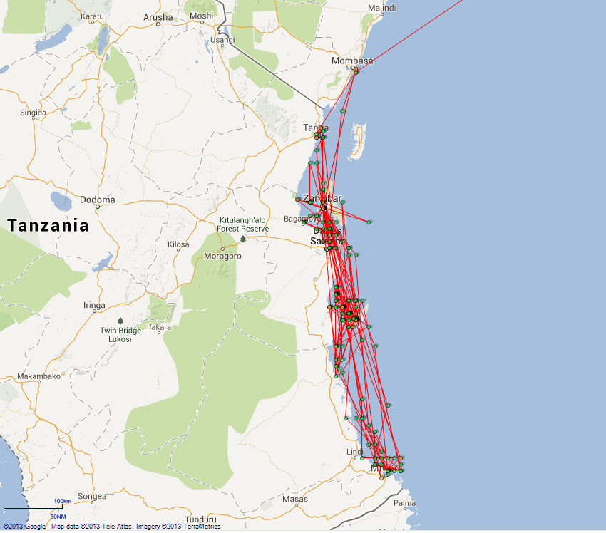
4caf8812cadfd3419701e34f: (http://oldweather.s3.amazonaws.com/ADM_53-48165/ADM 53-48165-008_1.jpg) 11 April 1916 off Mombasa Light House SW 7 miles Lat -4.1, Long 39.7 11.45am: Helm & engines to Commander’s Orders 1.25pm: Anchored for examinations officer 2.00pm: Examinations officer boarded 2.15pm: Weighed & proceeded towards harbour 3.18pm: Anchored in 12 fathoms. Hoisted & lowered motor boat 4.30pm: Swung out Boat Boom & lowered whaler Number on sick list 4 [There are 2 lighthouses near to Mombasa but I think the relevant one is Likoni (KEN-008).] 4caf8812cadfd3419701e350: (http://oldweather.s3.amazonaws.com/ADM_53-48165/ADM 53-48165-009_0.jpg) 12 April 1916 Mombasa Lat -4.05, Long 39.7 4.00am: Light breeze & fine weather 7.00am: Officers bathing party left ship in whaler 8.00am: Officers returned Crew employed painting ship overside Balloon party unshipping beam etc from hold 3.30pm: Libertymen left ship 5.30pm: Bathing party left ship 6.00pm: Libertymen & bathing party returned 8.30pm: Heavy rain squall Midnight: Moderate breeze & frequent rain squalls Number on sick list 5 4caf8812cadfd3419701e351: (http://oldweather.s3.amazonaws.com/ADM_53-48165/ADM 53-48165-009_1.jpg) 13 April 1916 Mombasa Lat -4.05, Long 39.7 6.50am: Bathing Party left ship 7.45am: Bathing Party returned 12.45pm: Weighed & proceeded out of harbour 1.50pm: Mombasa Light House N54W, 3½’ distant 7.30pm: Cumba Island Light 6’ distant Sea boats crew at stations 8.00pm: Moderate wind, heavy rain, moderate sea, cloudy weather Midnight: Moderate wind & sea & rain squalls Number on sick list 6 [There are 3 lighthouses around the island of Mombasa. I think this is Likoni, which is at the entrance to Kilindini Harbour at Lat -4.1, Long 39.67 Lighthouses in Kenya are not well documented. There is one on Chale Island at Lat -4.45, Long 39.5 Sumba Island is in Lake Victoria at Lat -6.3, Long 33.9] 4caf8812cadfd3419701e352: (http://oldweather.s3.amazonaws.com/ADM_53-48165/ADM 53-48165-010_0.jpg) 14 April 1916 Mombasa to Zanzibar Lat -6.2, Long 39.2 1.30am: Sighted Ras Nungwi Light S16W 2.30am: Ras Nungwi Light South, 3½ miles distant 4.00am: Strong breeze, continuous heavy rain & hail squalls, moderate sea 5.13am: Ras Rangir or Raugir Light, 5’, S50W 6.00am: Courses various rounding Zanzibar Head. Noon: At anchor Zanzibar Harbour 5.00pm: Draft arriving F16’..6” A21’..6” 8.00pm: All boats secured to boom for night Guns crews & lookout at stations 9.30pm: Darkened ship [Ras Nungwi or Hog Point is the oldest lighthouse on Zanzibar. It is situated in the village of Nungwi on the northern tip of the main island. Although it is listed as TAN-025 it does not appear in the ARLHS list. The village is at Lat -5.8, Long 39.3 I cannot find Ras Rangir/Raugir The draught or draft is the depth of the ship, in this case measured at both ends, Forward and Aft.] 4caf8812cadfd3419701e353: (http://oldweather.s3.amazonaws.com/ADM_53-48165/ADM 53-48165-010_1.jpg) 15 April 1916 Zanzibar Harbour Lat -6.2, Long 39.2 7.30am: Collier Anglier came alongside 9.00am: Commenced bunkering All hands employed coaling Noon: Men’s Dinner Hour, 64 tons taken in 1.00pm: Resumed coaling 5.00pm: Tea hour 7.00pm: Finished coaling for day 7.30pm: Collier Anglier left from alongside Number on sick list 5 4caf8813cadfd3419701e354: (http://oldweather.s3.amazonaws.com/ADM_53-48165/ADM 53-48165-011_0.jpg) 16 April 1916 Zanzibar Lat -6.2, Long 39.2 8.00am: Crew employed washing & cleaning ship 11.0am: Flagship arrived & anchored 3.30pm: Balloon Party testing & practicing working Balloon 4.00pm: Liberty party left ship 5.00pm: Flagship “Vengeance” weighed & left 5.20pm: Balloon practice finished 6.00pm: Liberty party returned 8.00pm: Moderate breeze & heavy rain squalls 9.30pm: Darkened ship. All boats secured to boom for night Number on sick list 6 [HMS Vengeance was a battleship of 12,950 tons, launched in 1899 by Vickers shipyard in Barrow. She was sold in 1921 and is part of the OW fleet.] 4caf8813cadfd3419701e355: (http://oldweather.s3.amazonaws.com/ADM_53-48165/ADM 53-48165-011_1.jpg) 17 April 1916 Zanzibar Lat -6.2, Long 39.2 8.00am: Crew variously employed painting & scaling 1.00pm: Testing for leak in Balloon 3.00pm: Ran line to stern of “Pioneer” to heave ship stern to wind 3.30pm: Rope parted, wind & tide too strong, re-moored vessel Number on sick list 6 [HMAS Pioneer, a 2200 ton cruiser, was launched in 1899 at Chatham Dockyard for the Royal Navy. She was re-commissioned into the Australian Navy in 1913, sold in 1923 and finally scuttled in 1931.] 4caf8813cadfd3419701e356: (http://oldweather.s3.amazonaws.com/ADM_53-48165/ADM 53-48165-012_0.jpg) 18 April 1916 Zanzibar Lat -6.2, Long 39.2 9.32am: Diver came off to clear injection valves Water boat alongside 11.30am: Diver finished work 1.45pm: Water boat left 2.05pm: Anchor up, full speed ahead 2.44pm: Stopped for Balloon practice 3.25pm: Balloon ascended 4.10pm: Balloon hauled down 4.15pm: Balloon secured, proceeded to anchorage Number on sick list 4 4caf8813cadfd3419701e357: (http://oldweather.s3.amazonaws.com/ADM_53-48165/ADM 53-48165-012_1.jpg) 19 April 1916 Zanzibar Lat -6.2, Long 39.2 8.00am: Crew variously employed Starboard Balloon Section on balloon work 1.15pm: Anchors up & proceeded for balloon practice 2.05pm: Balloon ascended 3.25pm: Hauled down balloon & proceeded back to anchorage 6.00pm: Starboard motor boat lowered, port boat needing repairs Water boat alongside 10.10pm: Water boat left Number on sick list 4 4caf8813cadfd3419701e358: (http://oldweather.s3.amazonaws.com/ADM_53-48165/ADM 53-48165-013_0.jpg) 20 April 1916 Zanzibar Lat -6.2, Long 39.2 8.00am: Shore carpenters at work on board 3.00pm: Hoisted starboard motor boat for overhaul 6.00pm: Lowered whaler to pick up motor boat lifeboat, engine trouble Number on sick list 4 4caf8813cadfd3419701e359: (http://oldweather.s3.amazonaws.com/ADM_53-48165/ADM 53-48165-013_1.jpg) 21 April 1916 Zanzibar Lat -6.2, Long 39.2 11.00am: Hoisted lifeboat & whaler Noon: Commander returned from shore with orders. Hoisted motor boat. 12.17pm: Weighed and proceeded 12.54pm: Passed through fairway channel buoys of South Channel 1.06pm: Chumbe Light House S84E, 9’ distant 2.05pm: "Hyacinth" alongside, exchanged pennants 4.28pm: Ras Kigui Kazi @ distance 6’ Sea boats crews piped to stations Number on sick list 3 [Chumbe Light House, Lat -6.0, Long 39.2, is on a small island near to the capital of Zanzibar. HMS Hyacinth was a cruiser of 5600 tons, launched in 1898 by the London & Glasgow Shipbuilding Co at Glasgow. She was sold in1923 and is part of the OW fleet. Ras Kanzi Lighthouse is at Lat -7.0, Long 39.55] 4caf8813cadfd3419701e35a: (http://oldweather.s3.amazonaws.com/ADM_53-48165/ADM 53-48165-014_0.jpg) 22 April 1916 Zanzibar to Mikandani Lat -9.2, Long 40.2 2.28am: Position, stellar Lat -7.7, Long 40.4 3.00pm: Sighted "Challenger" 3.25pm: Received orders ‘take station 1 cable starboard beam’ 4.17pm: Engines stopped, arrived at position 5.42pm: Proceeded full speed 5.49pm: Half speed, steering to get offing off land Vessel steaming at reduced speed Sea boats crews piped to stations 10.00pm: Vessel steaming at reduced speed awaiting daylight Number on sick list 3 [HMS Challengerwas a cruiser of 5900 tons. She was built at Chatham Naval Dockyard, launched in 1902 and sold in 1920. She is part of the OW fleet.] 4caf8813cadfd3419701e35b: (http://oldweather.s3.amazonaws.com/ADM_53-48165/ADM 53-48165-014_1.jpg) 23 April 1916 East Coast Balloon Work Lat -10.0, Long 40.0 2.20am: Lat * Arcturus -9.95 8.00am: Lat -9.5, Long 40.00 8.45am: Arrived off station, orders from “Challenger”, ‘Put up balloon’ 9.34am: Balloon ascended, engine & helm as required 10.00am: Balloon hauled down, telephone defects 11.00am: Balloon ascended 11.30am: Balloon hauled down Noon: Signal received, ‘await orders’ 12.44pm: Turned ship around, head out 12.49pm: Stopped engines 1.42pm: Received orders from “Challenger” ‘proceed, full speed ahead’ 1.50pm: Slow 10.00pm: Easy steaming awaiting daylight Number on sick list 3 4caf8813cadfd3419701e35c: (http://oldweather.s3.amazonaws.com/ADM_53-48165/ADM 53-48165-015_0.jpg) 24 April 1916 Off Lindi Roads Lat -10.0, Long 40.1 2.15am: Stellar position: Lat -9.95, Long 40.27 6.30am: Arrived at rendezvous 7.43am: Balloon ascended 7.50am: Anchored 4 cables N20E HMS Challenger 8.50am: Hauled balloon down 10.25am: Sent boat with Lieutenant Gill to "Challenger" 11.15am: Boat returned with orders, sea boat hoisted 11.30am: Proceeded 6.00pm: Seaboats’ crews piped to stations Number on sick list 3 [Lindi is a small town in Tanzania at Lat -10.0, Long 39.7] 4caf8813cadfd3419701e35d: (http://oldweather.s3.amazonaws.com/ADM_53-48165/ADM 53-48165-015_1.jpg) 25 April 1916 Working off Mikindani Lat -10.1, Long 40.0 6.30am: Arrived at rendezvous 8.44am: Balloon ascended 9.15am: Balloon hauled down 10.00am: At anchor awaiting squalls to pass Observers report wind speed at 1000ft - 35mph 12.30pm: Proceeded, awaiting finer weather 4.30pm: Boat & fire drill Number on sick list 3 [Mikindani is a small port in Tanzania at Lat -10.3, Long 40.1] 4caf8813cadfd3419701e35e: (http://oldweather.s3.amazonaws.com/ADM_53-48165/ADM 53-48165-016_0.jpg) 26 April 1916 Working balloon off Mikindani Lat -10.1, Long 40.0 6.30am: Closed “Challenger” 8.00am: Heavy rain, cloudy weather 10.00am: Awaiting clear weather 11.52am: Proceeded towards spotting position Noon: Rain squalls, overcast, slight sea 12.15pm: Balloon ascended 1.30pm: Balloon hauled down, proceeded in company with "Challenger" 3.30pm: Balloon ascended 4.00pm: Balloon hauled down 4.43pm: Parted company with “Challenger” & proceeded on patrol 7.00pm: Boat crews piped to stations 11.30pm: Received orders, Msimbati Rendezvous Number on sick list 4 [Msimbati is near to Mikindani and refers to a number of sites including a populated place, a channel and a headland.] 4caf8813cadfd3419701e35f: (http://oldweather.s3.amazonaws.com/ADM_53-48165/ADM 53-48165-016_1.jpg) 27 April 1916 Working off Kilindini, German East Africa Lat -10.2, Long 40.4 9.30am: Sighted "Challenger", ordered to close 10.18am: “Challenger” parted company, received orders await fine weather, report Mzani Bay Noon: Moderate breeze, heavy rain, slight sea 1.00pm: Awaiting fine weather 3.50pm: Received orders, ‘proceed Tirene’ 6.00pm: Sea boats crews piped to stations Number on sick list 4 [Tirene is on Mafia Island to the north of Kilindoni at Lat -7.87, Long 39.67 I could not find Mzani but from entries later in the log it may be Mnazi which is intended] 4caf8813cadfd3419701e360: (http://oldweather.s3.amazonaws.com/ADM_53-48165/ADM 53-48165-017_0.jpg) 28 April 1916 Mikandani to Tirene Lat -7.6, Long 39.8 10.24am: Sighted Ras Mkumbi Light House N78W 2.10pm: Sighted Shungumbile Island N67W 2.25pm: Anchored Tirene Harbour Number on sick list 6 [Ras Mkumbi Lighthouse is on Mafia Island at Lat -7.6, Long 39.9 Shungumbili is an uninhabited island near to Mafia Island at Lat -7.7, Long 39.7] 4caf8813cadfd3419701e361: (http://oldweather.s3.amazonaws.com/ADM_53-48165/ADM 53-48165-017_1.jpg) 29 April 1916 Tirene Lat -8.0, Long 39.65 6.00am: Crew employed coaling ship 7.00am: Collier Anglier arrived alongside 7.40am: Commenced coaling 9.37am: Flagship “Vengeance” arrived 11.00pm: Crew coaling throughout day Number on sick list 6 4caf8813cadfd3419701e362: (http://oldweather.s3.amazonaws.com/ADM_53-48165/ADM 53-48165-018_0.jpg) 30 April 1916 Tirene Lat -8.0, Long 39.65 3.00am: Crew employed coaling 2.30pm: Finished coaling 2.55pm: Collier Anglier left, damage after Port Boat & carried away Ford Davit 4.05pm: Weighed & proceeded Number on sick list 6 4caf8813cadfd3419701e363: (http://oldweather.s3.amazonaws.com/ADM_53-48165/ADM 53-48165-018_1.jpg) [signed W Whittinghame, Commander RN Reserve, in command] 4caf8813cadfd3419701e364: (http://oldweather.s3.amazonaws.com/ADM_53-48165/ADM 53-48165-019_0.jpg) 4caf8813cadfd3419701e365: (http://oldweather.s3.amazonaws.com/ADM_53-48165/ADM 53-48165-019_1.jpg) 4caf8813cadfd3419701e366: (http://oldweather.s3.amazonaws.com/ADM_53-48165/ADM 53-48165-020_0.jpg) 4caf8813cadfd3419701e367: (http://oldweather.s3.amazonaws.com/ADM_53-48165/ADM 53-48165-020_1.jpg) LOGS FOR MAY 1916 4caf8813cadfd3419701e368: (http://oldweather.s3.amazonaws.com/ADM_53-48166/ADM 53-48166-001_0.jpg) 4caf8813cadfd3419701e369: (http://oldweather.s3.amazonaws.com/ADM_53-48166/ADM 53-48166-001_1.jpg) [signed B Loveluck, sub-lieutenant, acting Navigating Officer] 4caf8813cadfd3419701e36a: (http://oldweather.s3.amazonaws.com/ADM_53-48166/ADM 53-48166-002_0.jpg) 4caf8813cadfd3419701e36b: (http://oldweather.s3.amazonaws.com/ADM_53-48166/ADM 53-48166-002_1.jpg) 4caf8813cadfd3419701e36c: (http://oldweather.s3.amazonaws.com/ADM_53-48166/ADM 53-48166-003_0.jpg) [These pages are blank or cover pages] 4caf8813cadfd3419701e36d: (http://oldweather.s3.amazonaws.com/ADM_53-48166/ADM 53-48166-003_1.jpg) 1 May 1916 Zanzibar Lat -6.2, Long 39.2 3.45am: Sighted Chumbe Light N20W 5.00am: Chumbe Light ¼’ distant 7.54am: Anchored in Zanzibar Harbour 10.15am: Weighed & proceeded to shift berth 5.20pm: Native liberty party left ship 6.30pm: Darkened ship Number on sick list 7 4caf8813cadfd3419701e36e: (http://oldweather.s3.amazonaws.com/ADM_53-48166/ADM 53-48166-004_0.jpg) 2 May 1916 Zanzibar Lat -6.2, Long 39.2 5.45am: Native libertymen returned 10.00am: Boat & party left ship to draw stores from “Laconia” 2.00pm: Boat returned with stores 3.50pm: Boat left for more stores 4.00pm: P.O. libertymen ashore 6.00pm: Native libertymen left ship, P.O.s returned 7.00pm: Boat returned from “Laconia” 8.30pm: All stores on board & boats secured for the night Number on sick list 5 [HMS Laconia was an ocean liner of 18,099 tons, launched in 1911 by Swan Hunter for Cunard. She was converted to an Armed Merchant Cruiser in 1914 and torpedoed in 1917 after her return to Cunard. She is part of the OW fleet.] 4caf8813cadfd3419701e36f: (http://oldweather.s3.amazonaws.com/ADM_53-48166/ADM 53-48166-004_1.jpg) 3 May 1916 Zanzibar Lat -6.2, Long 39.2 2.00pm: Boat left for “Laconia” to draw engineer’s stores 3.00pm: Water boat alongside 3.40pm: Lifeboat returned with stores 4.00pm: Liberty party left ship 5.45pm: Native liberty party left ship 6.00pm: Liberty men returned 7.00pm: Water boat left ship Number on sick list 5 4caf8813cadfd3419701e370: (http://oldweather.s3.amazonaws.com/ADM_53-48166/ADM 53-48166-005_0.jpg) 4 May 1916 Zanzibar Lat -6.2, Long 39.2 7.05am: Weighed & proceeded to shift billet 7.45am: Anchored 2.00pm: Crew employed rigging gear for heavy lifts 3.30pm: Liberty men landed 6.00pm: Liberty men returned 7.40pm: Picket sent ashore for 4 absentees. 10.00pm: Picket & absentees returned one man short. Number on sick list 5 4caf8813cadfd3419701e371: (http://oldweather.s3.amazonaws.com/ADM_53-48166/ADM 53-48166-005_1.jpg) 5 May 1916 Zanzibar Lat -6.2, Long 39.2 6.00am: Crew employed in routine work & rigging gear for seaplane 9.15am: Diver came to clear injection pipes. 11.30am: All Clear Diver left 2.37pm: Seaplane alongside 3.27pm: Hoisted in 3.45pm: Hoisted out 4.00pm: Seaplane left 6.00pm: Boarding party left to overhaul Dhows in motor launch 8.30pm: Party returned, sent report to NOC (Naval Officer Commanding) 9.00pm: Water boat alongside 10.20pm: Water boat left Number on sick list 5 4caf8813cadfd3419701e372: (http://oldweather.s3.amazonaws.com/ADM_53-48166/ADM 53-48166-006_0.jpg) 6 May 1916 Zanzibar Lat -6.2, Long 39.2 6.15am: Native liberty men returned Crew employed on routine work & rigging seaplane cover 9.30am: Flagship “Vengeance” arrived 2.00pm: Working party from “Vengeance” working on seaplane tent 3.30pm: P.O. liberty men left ship 5.30pm: Native liberty men left ship 6.00pm: P.O. liberty men returned 7.00pm: Working party left ship Number on sick list 4 4caf8813cadfd3419701e373: (http://oldweather.s3.amazonaws.com/ADM_53-48166/ADM 53-48166-006_1.jpg) 7 May 1916 Zanzibar Lat -6.2, Long 39.2 6.00am: Routine work carried on by crew Working party from “Vengeance” on board to help with seaplane tent 11.55am: Admiral Charlton visited ship Noon: Working party from “Vengeance” left 12.35pm: Admiral Charlton: returned to flagship 2.00pm: Water boat alongside 3.10pm: Seaplane on board & housed. 5.00pm: Stores received for transfer to “Talbot” 7.30pm: Water & store lighters left ship Number on sick list 4 [HMS Talbot was a cruiser of 5600 tons, launched in 1895 at Devonport Dockyard. She was sold in 1921 and is part of the OW fleet. Admiral Edward Francis Benedict Charlton (1865 – 1937) was Commander in Chief of the Cape of Good Hope Station] 4caf8813cadfd3419701e374: (http://oldweather.s3.amazonaws.com/ADM_53-48166/ADM 53-48166-007_0.jpg) 8 May 1916 Lat -6.9, Long 39.7 5.55am: Proceeded to Captain’s orders 6.55am: Chumbe Light @ N67E, ¾’ distance 8.15am: Pungume Island N57E, 2¼’ distance 9.54am: Dar es Salaam Light S57W, 11¼’ distance 11.45am: Sighted Ras Kimbiji Light House S67W 11¼’ distant 4.45pm: Moresby Light House 7’ 5.00pm: Sea boats crews piped to stations Number on sick list 5 [Pungume Island or Punguma is off the south coast of Zanzibar at Lat -6.4, Long 39.3 Dar es Salaam Lighthouse is also known as Outer Makatumbe and is at Lat -6.8, Long 39.3 Ras Kimbiji is at Lat -6.98, Long 39.55 although no active lighthouse is listed there today Moresby Light House is on Mafia Island and is also listed as Ras Mkumbi. It lies at Lat -7.6, Long 39.9] 4caf8813cadfd3419701e375: (http://oldweather.s3.amazonaws.com/ADM_53-48166/ADM 53-48166-007_1.jpg) 9 May 1916 To Rendezvous at 9 30’ S, 30 55’ E Lat -9.5, Long 39.9 7.00am: Stopped engines, “Talbot” closing 7.20am: Captain of “Talbot” boarded. 8.00am: Captain of “Talbot” left. 9.00am: Transferred stores to “Pioneer” & some to “Talbot” 9.45am: Parted company 2.15pm: Turned ship round for Balloon Work 2.35pm: Finished work 4.05pm: Stopped engines by order of “Talbot” 4.30pm: Commenced discharging stores to “Talbot” 6.30pm: All stores for “Talbot” finished 6.40pm: Parted company & proceeded on patrol Number on sick list 6 4caf8813cadfd3419701e376: (http://oldweather.s3.amazonaws.com/ADM_53-48166/ADM 53-48166-008_0.jpg) 10 May 1916 Patrol work off Mikindini Lat -10.0, Long 40.2 1.00am: Rounds reporting every ½ hour 7.00am: Arrived at position, slow Awaiting fine weather 8.00am: Strong breeze & rough sea, clear weather Noon: Strong wind & sea, clear & cloudy 3.00pm: Passed HMS Talbot heading SE 4.00pm: Strong wind, rough sea, clear & cloudy weather 10.00pm: Lookouts & guns crews at stations Number on sick list 7 4caf8813cadfd3419701e377: (http://oldweather.s3.amazonaws.com/ADM_53-48166/ADM 53-48166-008_1.jpg) 11 May 1916 Patrol work off Mikindini G.E.A. Lat -9.6, Long 40.0 1.00am: Rounds made & reported every ½ hour 9.15am: Proceeded to rendezvous 10.00am: Sighted “Talbot”, orders cancelled 11.00am: Stopped engines, received 12 tins petrol from “Talbot” 5.00pm: Stopped by “Hyacinth” for orders 7.00pm: Sea boats crews piped to stations 10.00pm: Guns crew and lookout at stations Number on sick list 8 4caf8813cadfd3419701e378: (http://oldweather.s3.amazonaws.com/ADM_53-48166/ADM 53-48166-009_0.jpg) 12 May 1916 off Kilindini Lat -10.1, Long 40.0 6.00am: Arrived at Rendezvous. 7.00am: Commenced putting seaplane over. 8.00am: Strong breeze, moderate sea swell, fine & clear [wind force 4] 8.15am: Seaplane started trial flight 9.30am: Seaplane alongside, wind too strong aloft. 9.45am: Seaplane housed on board. 2.00pm: Ship stopped, awaiting moderate breeze to work Balloon. 4.00pm: Moderate breeze & sea, fine clear weather [wind force 4]. 6.00pm: Proceeded on patrol Number on sick list 6 4caf8813cadfd3419701e379: (http://oldweather.s3.amazonaws.com/ADM_53-48166/ADM 53-48166-009_1.jpg) 13 May 1916 off Mzani Bay Lat -10.2, Long 40.3 6.00am: Arrived off Rendezvous 6.15am: Proceeded on patrol awaiting fine weather. 11.00am: Sighted steamer on port bow 11.10am: Hoisted demand. No colours shown 11.30am: International M.K. Professor Woermann Noon: All correct you may proceed 2.35pm: Proceeded slow towards Rendezvous. Number on sick list 6 [Mzani Bay is probably Mnazi Bay which is in Tanzania at Lat -10.3, Long 40.35 SS Professor Woermann, a 6061 ton merchant ship, was launched in 1912. She was captured by HMS Carnarvon in Aug 1914 and operated by the Union Castle Line until she was sold in 1921 and renamed Edmund Wagenknecht.] 4caf8813cadfd3419701e37a: (http://oldweather.s3.amazonaws.com/ADM_53-48166/ADM 53-48166-010_0.jpg) 14 May 1916 Off Lindi Lat -9.8, Long 39.9 5.50am: At Rendezvous 7.00am: Sent Motor Boat for letters to "Hyacinth" 7:22am: Proceed slow patrol to Mchinga Bay 11.40am: On Patrol from Mgau Mwana to Mchinga Bay. 5.10pm: Orders to proceed to Zanzibar Number on sick list 7 [Mgau Mwania (tidal creeks) are at Lat -10.1, Long 40.0 and Mchinga Bay is at Lat -9.7, Long 39.75] 4caf8813cadfd3419701e37b: (http://oldweather.s3.amazonaws.com/ADM_53-48166/ADM 53-48166-010_1.jpg) 15 May 1916 Lindi to Zanzibar Lat -6.4, Long 39.3 3.10am: Sighted Moresby Point N21W 4.16am: Moresby Point Light S67E, 7½ miles 8.05am: Sighted Ras Kimbiji Light S57W 10.05am: Sighted Dar es Salaam Light House S57W, 13½ miles 12.56pm: Chumbe Light House N67E, ¾’ distance 2.03pm: Anchored 3.00pm: Lowered port & starboard motor boats 4.00pm: Seaplane hoisted out for trial flight, light breeze, fine & clear 5.30pm: 3 sick men sent to hospital 5.45pm: Seaplane returned, hoisted & housed 8.30pm: All boats secured for night 4caf8813cadfd3419701e37c: (http://oldweather.s3.amazonaws.com/ADM_53-48166/ADM 53-48166-011_0.jpg) 16 May 1916 Zanzibar Lat -6.2, Long 39.2 6.00am: Hoisted out seaplane. 7.00am: Second seaplane arrived, exchanged. 7.30am: Hoisted in & housed, the other returned to base 11.00am: Landed 6 cases for Medical Observation 2.00pm: Water boat alongside Crew employed painting ship 7.00pm: All boats secured for night 8.45pm: Water boat left Number on sick list 4 4caf8813cadfd3419701e37d: (http://oldweather.s3.amazonaws.com/ADM_53-48166/ADM 53-48166-011_1.jpg) 17 May 1916 Zanzibar to Mikindini Lat -6.2, Long 39.2 6.00am: Hoisted starboard motor boat Crew employed painting ship 10.45am: Hoisted port motor boat & secured boat boom ready for sea 11.35am: Anchor up, proceeded to Commander’s orders 12.35pm: Chumbe Light House N76E 3.30pm: Outer Makatumbe @ S56W 5.20pm: Ras Kanzi Light House @ 10’ distance 8.34pm: Moresby Point Light sighted S13W 10.46pm: Moresby Point Light S84W, 7.6’ distance Number on sick list 3 [Outer Makatumbe Lighthouse is in Tanzania at Lat -6.8, Long 39.3] 4caf8813cadfd3419701e37e: (http://oldweather.s3.amazonaws.com/ADM_53-48166/ADM 53-48166-012_0.jpg) 18 May 1916 Zanzibar to Mikindini Lat -9.1, Long 39.8 11.17am: Sighted flagship Noon: Fresh breeze, moderate sea, clear weather 12.50pm: Stopped for orders 1.15pm: Proceeded towards Kilwa Kisiwani harbour entrance 1.55pm: Anchored 2.20pm: Seaplane in water 2.55pm: Hove up & slipped further inshore 3.24pm: Anchored 4.00pm: Moderate breeze & cloudy 4.45pm: Seaplane returned, hoisted & housed 5.30pm: All secure. Hove up anchor and proceeded towards Lindi Number on sick list 3 [Kilwa Kisiwani is an island off the coast of Tanzania at Lat -9.0, Long 39.5] 4caf8813cadfd3419701e37f: (http://oldweather.s3.amazonaws.com/ADM_53-48166/ADM 53-48166-012_1.jpg) 19 May 1916 Working off German East Africa Lat -10.0, Long 39.8 1.00am: “Vengeance” passed North 10.25am: Balloon ascended to observe Lindi, engine & helm as required Noon: Light breeze, fine & clear weather 12.15pm: Balloon descended & housed 12.30pm: Closed “Challenger” for orders and mails 1.30pm: Proceeded on patrol 7.00pm: Sea boats crews piped to stations 10.00pm: Gun crew and lookouts at stations Number on sick list 3 4caf8813cadfd3419701e380: (http://oldweather.s3.amazonaws.com/ADM_53-48166/ADM 53-48166-013_0.jpg) 20 May 1916 Working off German East Africa 2.30am: Stellar position: Lat -10.0, Long 40.3 4.00am: Moderate breeze & sea, clear & fine 5.35am: Vessel aground. Rang ‘full speed astern’, worked engines as required. All hands fallen in on after deck & ordered to double from one side of ship to the other & back [in order] to assist Engines. Proceeded to take soundings all round the ship, also in bilges, wells & tanks. 5.40am: Gave orders to pump out No. 3 Ballast Tank 5.50am: Orders given to get 3½'' wire hawsers up & lay out port bower anchor on starboard quarter. 5.55am: Soundings reported 15 ft Forward, 19.5 ft mid, 23'ft Aft. Tanks, Wells & Bilges as usual. Lowered Port Motor Boat & got Nos. 3 & 4 Lifeboats ready to take Bower anchor 7.19am: Stopped working Engines 7.35am: HMS Challenger arrived & anchored close to, Captain of her taking charge of operations giving orders to lay out port Bower anchor on Starboard Quarter & Kedge on Starboard Bow. & to prepare to take towing wire on board 10.20am: HMS Hyacinth arrived & anchored. Commander Bridges of that ship being sent on board HMS Manica to conduct operations. Noon: Anchor laid out & wire hauled taut, after winch broken in heaving in after hawser 2.30pm: HMS Challenger commenced sending towing line 3.35pm: Felt ship to be afloat, signalled HMS Challenger as per signal log. 4.35pm: Towing line from Challenger tautened & ship came astern without any effort 4.50pm: Clear, slipped towing hawser. Buoy line of after anchor wire fouled propeller. 5.23pm: Clear. Engines worked as required. No sign of damage being apparent after as thorough examination as possible could be made. 6.10pm: Proceeded 10.00pm: Gun crew and lookouts at stations Number on sick list 5 [Oh dear, red faces all round but at least no serious damage done and the Germans didn’t attack them.] 4caf8813cadfd3419701e381: (http://oldweather.s3.amazonaws.com/ADM_53-48166/ADM 53-48166-013_1.jpg) 21 May 1916 Mikindani Bay Lat -10.2, Long 40.2 6.20am: Closing HMS Challenger 7.10am: Stopped, commenced hoisting plane out 7.45am: Plane in water 8.00am: Light airs, fine weather Plane started engines. 9.25am: Plane returned engine trouble 9.55am: Plane on board, stopped in Mikindani Bay 1.10pm: No. 5 Tank full 3.35pm: Plane in water 3.55pm: Plane started engines 4.40pm: Hoisted seaplane Number on sick list 7 4caf8813cadfd3419701e382: (http://oldweather.s3.amazonaws.com/ADM_53-48166/ADM 53-48166-014_0.jpg) 22 May 1916 Mikindani Bay Lat -10.0, Long 40.4 7.00am: Arrived at position 8.00am: Light breeze fine weather. Plane started 10.05am: Plane returned 10.20am: Plane hoisted on board. In Mikindani Bay 3.04pm: Seaplane hoisted out 3.50pm: Seaplane hoisted on board. Petrol pipe burst. 5.56pm: Proceeded on slow patrol Number on sick list 6 4caf8813cadfd3419701e383: (http://oldweather.s3.amazonaws.com/ADM_53-48166/ADM 53-48166-014_1.jpg) 23 May 1916 between Lindi & Mikindani Lat -10.0, Long 40.4 7.28am: Arrived Rendezvous. In Mikindani Bay 8.00am: Strong wind, slight sea, clear weather. 12.45pm: Proceeded into Mikindani Bay 2.05pm: Anchored 2.45pm: HMS Thistle came alongside 3.35pm: “Thistle” left 4.35pm: Weighed & proceeded 5.00pm: Proceeded full speed towards Tirene Number on sick list 6 [HMS Thistle was a gunboat, launched in 1899 and sold in 1926. She is part of the OW fleet.] 4caf8813cadfd3419701e384: (http://oldweather.s3.amazonaws.com/ADM_53-48166/ADM 53-48166-015_0.jpg) 24 May 1916 Tirene anchorage Lat -8.0, Long 39.65 3.30am: Exchanged pennants with "Vengeance" 7.30am: Moresby Point Light House 2½ miles 1.00pm: Crew employed getting spare bower anchor for passing forward 8.00pm: Anchor secured & shackled on port cable Number on sick list 7 4caf8813cadfd3419701e385: (http://oldweather.s3.amazonaws.com/ADM_53-48166/ADM 53-48166-015_1.jpg) 25 May 1916 Tirene Lat -8.0, Long 39.65 6.00am: Heavy rain squall 2.00pm: Crew employed painting ship’s side 6.00pm: Hoisted motor boat Number on sick list 7 4caf8813cadfd3419701e386: (http://oldweather.s3.amazonaws.com/ADM_53-48166/ADM 53-48166-016_0.jpg) 26 May 1916 Tirene Lat -8.0, Long 39.65 6.00am: Crew employed chipping & scraping 8.00am: HMS Challenger came alongside for photos & proceeded south 3.00pm: Sent boat to HMS Hyacinth for anchor 4.15pm: Weighed & proceeded, engines & helm on Commanding Officer’s orders 6.41pm: Moresby Point Lighthouse S61W 8.12pm: Moresby Point S84W, 14’ distant Number on sick list 7 4caf8813cadfd3419701e387: (http://oldweather.s3.amazonaws.com/ADM_53-48166/ADM 53-48166-016_1.jpg) 27 May 1916 Kiswere Bay Lat -9.4, Long 39.55 10.12am: Sighted “Vengeance”, altered course South, engines & helm to Commander’s orders Noon: Light breeze fine & clear. 12.27pm: Stood in for land. 1.00pm: Stopped. Balloon ascended 2.25pm: Balloon down. Closed "Vengeance" 3.20pm: Parted company & proceeded on patrol 10.00pm: Gun crew and lookout at stations Number on sick list 7 4caf8813cadfd3419701e388: (http://oldweather.s3.amazonaws.com/ADM_53-48166/ADM 53-48166-017_0.jpg) 28 May 1916 Between Lindi & Mikindani Lat -10.2, Long 40.4 8.35am: Captain and flying officer left for “Challenger” 9.10am: Captain returned 11.30am: Proceeded, engines & helm under CO’s orders 1.20pm: Ras Mkumbe 2.20pm: Proceeded to Mongo Island 3.12pm: Stopped off Mongo Island 5.15pm: Swung ship for deviation 6.00pm: Abandon ship stations carried out Number on sick list 6 [Mongo Island is off Tanzania at Lat -10.25, Long 40.3] 4caf8813cadfd3419701e389: (http://oldweather.s3.amazonaws.com/ADM_53-48166/ADM 53-48166-017_1.jpg) 29 May 1916 Lindi to Mikindani Lat -10.1, Long 40.1 8.00am: Moderate breeze & sea, fine weather 8.47am: Seaplane hoisted into water 10.07am: Seaplane returned Engine & helm to Commander’s orders 1.31pm: Closed “Challenger” 1.38pm: Motor boat left for provisions 2.00pm: Motor boat returned 2.48pm: Seaplane in water 3.15pm: Seaplane started 3.35pm: Seaplane up 3.37pm: Seaplane down 4.00pm: Moderate breeze, slight sea, fine weather 4.25pm: Seaplane returned, engine trouble, hoisted on board 6.00pm: Set course North 9.32pm: Sighted stranger, full speed 9.45pm: Challenged & no reply 11.15pm: Answered AS Adamastor, Portuguese Number on sick list 6 [The ship has been identified from a later entry in the log and cross-reference to “Challenger’s” log as AS Adamstor, a Portuguese cruiser.] 4caf8813cadfd3419701e38a: (http://oldweather.s3.amazonaws.com/ADM_53-48166/ADM 53-48166-018_0.jpg) 30 May 1916 Between Lindi & Mikindani Lat -10.2, Long 40.2 9.25am: Arrived Mikindani Bay Stopped engines, awaiting flying weather 11.15am: “Thistle” closed and sent stores 1.00pm: Laying in Mikindani Bay 5.39pm: Set course N10E Number on sick list 6 4caf8813cadfd3419701e38b: (http://oldweather.s3.amazonaws.com/ADM_53-48166/ADM 53-48166-018_1.jpg) 31 May 1916 Between Lindi & Mikindani Lat -10.2, Long 40.2 5.00am: Proceeded full speed 5.30am: Closing land 7.00am: Observed HMS Thistle aground off Ras Sangamku, ‘Do you require assistance’. Reply, ‘No.’ 7.30am: Arrived Mikindani Bay 2.05pm: Closed “Challenger” 3.04pm: Stopped ready to work seaplane 3.15pm: Motor boat left for “Talbot” 3.55pm: Motor boat returned & hoisted 6.55pm: Proceeded on patrol, full speed 9.15pm: “Talbot” challenged. Answered Number on sick list 7 [Ras Sangamku is in Tanzania at Lat -10.2, Long 40.2] 4caf8813cadfd3419701e38c: (http://oldweather.s3.amazonaws.com/ADM_53-48166/ADM 53-48166-019_0.jpg) 4caf8813cadfd3419701e38d: (http://oldweather.s3.amazonaws.com/ADM_53-48166/ADM 53-48166-019_1.jpg) 4caf8813cadfd3419701e38e: (http://oldweather.s3.amazonaws.com/ADM_53-48166/ADM 53-48166-020_0.jpg) 4caf8813cadfd3419701e38f: (http://oldweather.s3.amazonaws.com/ADM_53-48166/ADM 53-48166-020_1.jpg) [These pages are blank.] LOGS FOR JUNE 1916 4caf8813cadfd3419701e390: (http://oldweather.s3.amazonaws.com/ADM_53-48167/ADM 53-48167-001_0.jpg) 4caf8813cadfd3419701e391: (http://oldweather.s3.amazonaws.com/ADM_53-48167/ADM 53-48167-001_1.jpg) 4caf8813cadfd3419701e392: (http://oldweather.s3.amazonaws.com/ADM_53-48167/ADM 53-48167-002_0.jpg) 4caf8813cadfd3419701e393: (http://oldweather.s3.amazonaws.com/ADM_53-48167/ADM 53-48167-002_1.jpg) 4caf8813cadfd3419701e394: (http://oldweather.s3.amazonaws.com/ADM_53-48167/ADM 53-48167-003_0.jpg) [These pages are blank.] 4caf8813cadfd3419701e395: (http://oldweather.s3.amazonaws.com/ADM_53-48167/ADM 53-48167-003_1.jpg) 1 June 1916 Between Lindi & Mikindani Lat -10.1, Long 40.4 5.00am: Proceeded full speed 6.50am: Ordered to close “Talbot” 7.10am: Proceeded on Patrol 10.30am: Mongo Island S1W, 4.2' distance 11.40pm: Moresby Point Light N17W, 20’ Number on sick list 7 4caf8813cadfd3419701e396: (http://oldweather.s3.amazonaws.com/ADM_53-48167/ADM 53-48167-004_0.jpg) 2 June 1916 Zanzibar Lat -6.5, Long 39.3 12.50am: Moresby Pt Lt N82W, 6' 8.00am: Pungume Island N48E, 1.9’ 9.20am: Chumbe Light House N, 1’ 9.30am: Chumbe Light House S66E, 0.8' 10.37am: Anchored 11.35am: Seaplane hoisted out & lowered into water 5.20pm: 5 men & Lieutenant McLean left for Hospital 4.30pm: Work party left for “Challenger” 5.30pm: Lieutenant Metcalfe left for Hospital 7.30pm: Stores & working party returned Number on sick list 7 4caf8813cadfd3419701e397: (http://oldweather.s3.amazonaws.com/ADM_53-48167/ADM 53-48167-004_1.jpg) 3 June 1916 Zanzibar to Mombasa Lat -4.7, Long 39.5 4.05am: Anchor up, proceeded towards North Channel 6.10am: Ras Oswawembe S83E, 1¼’ 7.00am: Mwana Mwana Light House S73E, ¾’ 11.05am: Ras Kegamacha N18E Murino Hill N15W 11.45am: Ras Kegomacha S63E, 11’ 1.15pm: Chale Island N61W, 5’ 3.10pm: Black Cliff Point N80W, 8' 4.30pm: Rounded Fairway Buoy & proceeded into Kilindini 4.45pm: Received signal, ‘anchor south of flagstaff’ 5.15pm: Proceeded to billet 10.00pm: Regulation lights carried Number on sick list 5 [Ras Oswawembe is on Zanzibar at Lat -5.9, Long 39.2 Mwana Mwana is a small island off the coast of Zanzibar at Lat -5.8, Long 39.2 Ras Kegomacha is on the north coast of Pemba Island at Lat -4.9, Long 39.7 Chale Island is in Kenya at Lat -4.45, Long 39.53 Black Cliff Point is in Kenya at Lat -4.18, Long 39.63] 4caf8813cadfd3419701e398: (http://oldweather.s3.amazonaws.com/ADM_53-48167/ADM 53-48167-005_0.jpg) 4 June 1916 Kilindini Lat -4.1, Long 39.7 7.00am: Officers bathing party left. 8.00am: Officers bathing party returned 9.30am: Divisions, Prayers, Captain’s Inspection 11.00am: Lighter came alongside for Gas Plant & motor winch 3.30pm: Libertymen left ship 4.00pm: Mr Murray, Midshipman, RN joined ship from "Hyacinth" 6.00pm: Libertymen returned Number on sick list 5 [Kilindini is the harbour for Mombasa, Kenyaat Lat -4.1, Long 39.85] 4caf8813cadfd3419701e399: (http://oldweather.s3.amazonaws.com/ADM_53-48167/ADM 53-48167-005_1.jpg) 5 June 1916: Kilindini Lat -4.1, Long 39.7 7.00am: Officers bathing party left ship. 7.45am: Officers bathing party returned 8.30pm: Water Tank alongside 1.00pm: Hands employed scraping & painting ship’s side, working about mainmast & derrick 3.00pm: Libertymen left ship 6.00pm: Libertymen returned Number on sick list 5 4caf8813cadfd3419701e39a: (http://oldweather.s3.amazonaws.com/ADM_53-48167/ADM 53-48167-006_0.jpg) 6 June 1916 Kilindini Lat -4.1, Long 39.7 6.30am: Officers bathing party left. 7.40am: Officers bathing party returned 9.30am: Captain Sykes, Commander Davis & L.C. Brooke arrived from “Challenger” on Court of Inquiry 11.00am: Inquiry finished, returned to “Challenger”. 1.00pm: Crew employed routine work & painting ship 3.30pm: Libertymen left ship 6.00pm: Libertymen returned Number on sick list 6 [Court of Inquiry probably dealt with grounding of ship on 20th May] 4caf8813cadfd3419701e39b: (http://oldweather.s3.amazonaws.com/ADM_53-48167/ADM 53-48167-006_1.jpg) 7 June 1916 Kilindini Lat -4.1, Long 39.7 Number on sick list 5 [Officers bathing and limited local leave continue. The men do not seem to bathe and everyone is back on board by 6pm.] 4caf8813cadfd3419701e39c: (http://oldweather.s3.amazonaws.com/ADM_53-48167/ADM 53-48167-007_0.jpg) 8 June 1916 Kilindini Lat -4.1, Long 39.7 4.30pm: Water boat came alongside Number on sick list 5 4caf8813cadfd3419701e39d: (http://oldweather.s3.amazonaws.com/ADM_53-48167/ADM 53-48167-007_1.jpg) 9 June 1916 Kilindini Lat -4.1, Long 39.7 6.30am: Officers bathing party left ship. 7.30am: Officers bathing party returned Noon: Lighter secured alongside with Balloon stores 1.00pm: James Urquhuart Mackintosh, Engineering Sub Lieutenant RNR: has been logged for insubordinate conduct towards his superior officer Engineering Lieutenant RA Mackenzie RNR 2.30pm: Water tank & lighter left ship Number on sick list 7 4caf8813cadfd3419701e39e: (http://oldweather.s3.amazonaws.com/ADM_53-48167/ADM 53-48167-008_0.jpg) 10 June 1916 Kilindini Lat -4.1, Long 39.7 6.30am: Officers bathing party left ship. 7.40am: Officers bathing party returned 4.30pm: Water tank alongside Number on sick list 7 4caf8813cadfd3419701e39f: (http://oldweather.s3.amazonaws.com/ADM_53-48167/ADM 53-48167-008_1.jpg) 11 June 1916 Kilindini Lat -4.1, Long 39.7 6.00am: Seaplane in water 6.30am: Officers bathing party 7.40am: Officers bathing party returned 8.45am: Seaplane hoisted inboard 9.30am: Divisions, Prayers, Captain’s Inspection 4.30pm: Water tank left ship Number on sick list 7 4caf8813cadfd3419701e3a0: (http://oldweather.s3.amazonaws.com/ADM_53-48167/ADM 53-48167-009_0.jpg) 12 June 1916 Kilindini Lat -4.1, Long 39.7 6.30am: Officers bathing party left ship. 7.25am: Officers bathing party returned 5.04pm: Anchor up. Proceeded out of Kilindini 5.14pm: Mombassa Light House in line astern 10.52pm: Ras Kegomacha Light S5½E Number on sick list 7 [There are a number of lighthouses around Mombasa, it is difficult to say which was referred to in the log. Ras Kegomacha is on Pemba Island at Lat -4.9, Long 39.7 but there is no current lighthouse listed] 4caf8813cadfd3419701e3a1: (http://oldweather.s3.amazonaws.com/ADM_53-48167/ADM 53-48167-009_1.jpg) 13 June 1916 Mombasa to Tanga Lat -5.05, Long 39.1 12.15am: Kegomacha Light N21E 3.45am: Kegomacha Light: N73E 6.20am: Took station 2 cables astern of “Challenger” 8.00am: Sighted Zanzibar seaplane, Zanzibar seaplane alongside 9.20am: Hoisted out seaplane 9.58am: Seaplane up 10.26am: Seaplane returned and hoisted inboard 11.00am: Zanzibar seaplane left 1.20pm: “Challenger”, “Pioneer”, “Vengeance” & whalers proceeded into bay 2.00pm: Ships in company opened fire 2.50pm: Ceased fire 5.45pm: Anchor up, speed and course to Commanding Officer’s orders 6.08pm: Ulenge Light House N39W, 6½’ 11.50pm: Sighted Nungwi Light S12½E Number on sick list 7 [There are two lighthouses called Ulenge currently listed but I think this is the one at Lat -5.0, Long 39.2] 4caf8813cadfd3419701e3a2: (http://oldweather.s3.amazonaws.com/ADM_53-48167/ADM 53-48167-010_0.jpg) 14 June 1916 Tanga to Zanzibar Lat -5.0, Long 39.2 1.50am: Nungwi Light S42E, 7.3’ 3.00am: Sighted Mwana Light S6W, 12.2' 4.00am: Mwana Light S4W, 8.5’ 4.45am: Ras Nungwi N80E, 6’ 5.00am: Mwana Light ¾’ 6.19am: Mungopani Light House S85E, ¾’ 6.55am: Beacons in line 7.53am: Anchored 8.00am: Hoisted out seaplane & left for Chukwakani 10.50am: Water tank alongside 11.20am: RNAS lighter for stores alongside 11.50am: Water tank & lighter left ship 12.15pm: Water tank alongside 3.00pm: Sub Lieutenants Smethurst & FitzHerbert left for shore station 4.15pm: Collier Darnholme secured alongside 6.00pm: Commenced coaling 10.00pm: Coaling continuous Midnight: Changed watch, coal in 124 tons Number on sick list 7 [I cannot find Mungopani Lighthouse but there is a Mungopani in Tanzania at Lat -6.0, Long 39.2] 4caf8813cadfd3419701e3a3: (http://oldweather.s3.amazonaws.com/ADM_53-48167/ADM 53-48167-010_1.jpg) 15 June 1916 Zanzibar Lat -6.2, Long 39.2 Lat -6.1, Long 39.3 11.20am: Water tank alongside 4.20pm: Water tank left Crew spent whole day coaling, changing watches every 4 hours. Midnight: Received 498 tons Number on sick list 7 4caf8813cadfd3419701e3a4: (http://oldweather.s3.amazonaws.com/ADM_53-48167/ADM 53-48167-011_0.jpg) 16 June 1916 Zanzibar Lat -6.2, Long 39.2 Lat -6.1, Long 39.3 4.45am: Finished coaling, received 548 tons 5.35am: Collier left, proceeded alongside “Talbot” 7.30am: Hands cleaning ship 12.35pm: Sighted seaplane 1.30pm: Seaplane inboard & housed, Lieutenant McLean joined ship from shore station 7.40pm: Motor boat broken down, sent whaler to tow in 8.30pm: Motor boat & whaler in tow of HMS Talbot’s launch Number on sick list 6 4caf8813cadfd3419701e3a5: (http://oldweather.s3.amazonaws.com/ADM_53-48167/ADM 53-48167-011_1.jpg) 17 June 1916 Lat -5.5, Long 39.0 1.25am: Weighed & proceeded 4.30am: Mwana Light N32E 2½’ 6.30am: Arrived at Rendezvous off Maziwi 6.50am: Closed “Challenger” and “Talbot” 9.45am: Seaplane up, reconnaissance flight over Pangani 10.33am: Seaplane alongside & housed 1.31pm: Weighed & proceeded 2.30pm: Anchored 3.15pm: Received 1000lbs potatoes from “Rattler” 4.39pm: “Challenger” left 5.45pm: “Talbot” drew 28lb fresh beef 5.50pm: “Talbot” left Number on sick list 7 [Maziwi Island is just off the coast near to Pangani at Lat -5.5, Long 39.0 Pangani is a town at the mouth of the Pangani River in Tanzania to the south of Tanga at Lat -6.1, Long 39.0] 4caf8813cadfd3419701e3a6: (http://oldweather.s3.amazonaws.com/ADM_53-48167/ADM 53-48167-012_0.jpg) 18 June 1916 Pangani Lat -6.1, Long 39.0 4.00am: Heavy rain squalls. 7.40am: Weighed and proceeded 9.36am: Sighted Mwana Light House S54E, 8.2’ 10.55am: Mungopani Light House S68E, 8’ 12.55pm: Pwabuer [?] Reef S88E, 4¼’ 3.55pm: Seaplane in water 4.56pm: Seaplane returned, hoisted and housed 6.10pm: Weighed and proceeded 7.56pm: Sighted Chumbe Light House N29E 8.38pm: Chumbe Light House abeam ¾’ 8.43pm: Stopped engines awaiting buoy 9.13pm: Buoy light, proceeded 10.00pm: Anchored Number on sick list 7 4caf8813cadfd3419701e3a7: (http://oldweather.s3.amazonaws.com/ADM_53-48167/ADM 53-48167-012_1.jpg) 19 June 1916 Zanzibar Lat -6.2, Long 39.2 10.25am: 1 Chief Petty Officer & 2 ratings joined for passage to “Challenger” 1.30pm: Sent whaler & seaplane officers ashore 2.30pm: Sighted “Trent & “Severn” 3.15pm: Whaler & officers returned Number on sick list 8 [HMS Trent, 5541 tons, built 1900, was listed as a Mercantile Fleet Auxiliary. She is part of the OW fleet. HMS Severn, a monitor of 1260 tons, was launched by Vickers in 1913. She had been ordered by Brazil but was purchased at the outbreak of war. She was sold in 1921 and is part of the OW fleet.] 4caf8813cadfd3419701e3a8: (http://oldweather.s3.amazonaws.com/ADM_53-48167/ADM 53-48167-013_0.jpg) 20 June 1916 Zanzibar to Pangani Lat -5.5, Long 39.1 2.28am: Weighed and proceeded 5.05am: Mwana Light N44E, 1.8’ 6.10am: Mazawi Island N25W Ras Nunge S51E 7.25am: Anchored Maziwi Island S43E Sunge Nehouga [?] S10W 8.15am: Seaplane hoisted out 9.35am: Seaplane returned & hoisted inboard 9.42am: Fired on from shore 9.50am: Proceeded & put up Balloon. 10.53am: Balloon down 1.13pm: Turned ship at rendezvous 1.39pm: Seaplane hoisted out, damaged tail with heavy swell & rolling 1.45pm: Seaplane in 2.25pm: Ordered to proceed to Kokotoni Bay & await orders 2.30pm: Proceeded 2.50pm: Maziwi Island S39W, 1’ 4.00pm: Mwana Light House S18E, 7' 4.40pm: Mwana Light House S45E, 1½’, rounded into Bay 5.09pm: Anchored 11.05pm: Sighted dhow, hailed, no reply, fired two rifle shots & sent motor boat to examine papers. All correct ordered her to anchor & proceed in daylight Number on sick list 6 [Ras Nunge is near to Bagamoyo in Tanzania at Lat -6.4, Long 38.9 Maziwi Island is about 8km SE of Pangani, it is very small and is uninhabited. Lat -5.5, Long 39.1. It seems that both Mazawi and Maziwi may be recognised spellings but there are reports that it has eroded to a sand bar. Kokotoni is a bay on the north of Zanzibar on a 1907 map, the nearest map reference I can find is for Tumbatu Island which is just offshore and lies at Lat -5.8, Long 39.2] 4caf8813cadfd3419701e3a9: (http://oldweather.s3.amazonaws.com/ADM_53-48167/ADM 53-48167-013_1.jpg) 21 June 1916 Kokotoni Bay Lat -5.8, Long 39.2 9.15am: Divisions & prayers Hands employed unshipping lower boom & as required 4.10pm: Sighted “Challenger” & “Childers” to North 5.15pm: “Challenger” & “Childers” anchored 6.20pm: “Challenger” supplied with stores Number on sick list 7 [HMS Childers, 182 tons, was a whaler, built in 1912, purchased in 1915 and sold in 1919.] 4caf8813cadfd3419701e3aa: (http://oldweather.s3.amazonaws.com/ADM_53-48167/ADM 53-48167-014_0.jpg) 22 June 1916 Kokotoni Bay Lat -6.2, Long 39.2 4.30am: “Challenger” left 6.45am: Seaplane hoisted out 7.00am: Started on flight 8.25am: Seaplane sighted 8.46am: Seaplane hoisted in and housed 9.45am: “Challenger” sighted to North 10.07am: “Challenger” left 3.00pm: Received orders from “Challenger”, ‘proceed Zanzibar’ 3.25pm: Weighed & proceeded 4.25pm: Light House Mwana S67E, ¾’ 5.55pm: Mungopane Light House N80E, ¼’ 7.20pm: Anchored 7.50pm: Water boats alongside Lowered motor boat & sent Lieutenant Watkins to hospital 11.15pm: Water tank left Number on sick list 6 4caf8813cadfd3419701e3ab: (http://oldweather.s3.amazonaws.com/ADM_53-48167/ADM 53-48167-014_1.jpg) 23 June 1916 Zanzibar Lat -6.2, Long 39.2 6.30am: Motor boat left for shore 7.00am: Motor boat returned 8.35am: Two water boats alongside 9.00am: Divisions & prayers 1.00pm: Awaiting changing of seaplane 3.00pm: Seaplane left for Chugwani 4.45pm: Seaplane arrived from Chugwani, hoisted and housed 5.32pm: Anchor up, proceeded to CO’s orders 6.33pm: Chumbe Light S81E, 1¼’ 7.00pm: Chumbe Light extinguished Number on sick list 4 [Chukwani, which seems to be the modern spelling, is on the outskirts of the town of Zanzibar at Lat -6.2, Long 39.2] 4caf8813cadfd3419701e3ac: (http://oldweather.s3.amazonaws.com/ADM_53-48167/ADM 53-48167-015_0.jpg) 24 June 1916 Zanzibar to Mikindini Lat -8.3, Long 40.0 4.30am: Sighted Moresby Point S10W 7.03am: Moresby Point M87W 1.00pm: Hands make & mend clothes 6.35pm: Stellar position: Lat 8 56’ S, Long 40 3’ E Number on sick list 4 4caf8813cadfd3419701e3ad: (http://oldweather.s3.amazonaws.com/ADM_53-48167/ADM 53-48167-015_1.jpg) 25 June 1916 Mikindini Lat -10.2, Long 40.2 4.35am: Stellar position: Lat 9 52’ S, Long 40 3’ E 5.50am: Observed land on starboard bow & beam, proceeded full speed 6.30am: Mlima Mjoho S31W Ras Sangamku S28E Hand in chains 7.00am: Ras Sangamku S43E Mikindini Custom House S32W 7.51am: Stopped in Mikindini Bay 8.30am: Seaplane hoisted out for flight 9.24am: Seaplane returned, hoisted and housed 9.30am: Divisions, Prayers, Captain’s Inspection 10.20am: “Hyacinth” arrived 10.24am: Mr Murray rejoined “Hyacinth”, sent flying officers over in ~~ 11.45am: Officers returned, Mr Nicol, midshipman RNR joined ship 12.13pm: Proceeded 1.15pm: Stopped off Ras Sangamku 6.10pm: Proceeded Number on sick list 4 [Mlima Mjoho is at Lat -10.28, Long 40.08 Ras Sangamku is at Lat -10.2, Long 40.2] 4caf8813cadfd3419701e3ae: (http://oldweather.s3.amazonaws.com/ADM_53-48167/ADM 53-48167-016_0.jpg) 26 June 1916 Mikindini to Kisiwere Lat -9.4, Long 39.7 5.15am: Closed “Pioneer” 6.20am: Stopped off Kisiwere 7.50am: Seaplane in water 8.07am: Stopped, engine trouble 8.39am: Hoisted on board 12.50pm: Turned ship ready for balloon 12.55pm: Balloon up 2.05pm: Hauled balloon down, proceeded towards Ras Maweli 2.35pm: Ras Bwamkuro @ S64W, 1¼’ 2.55pm: Stopped in Mzungu Bay 4.47pm: Seaplane up 5.15pm: Seaplane returned, hoisted, housed 5.30pm: Proceeded off shore 5.48pm: Grant Point N56W Number on sick list 3 [Kisiwere is in Tanzania at Lat -9.4, Long 39.55 Ras Maweli is at Lat -9.5, Long 39.7 Ras Bwamkuro is at Lat -9.5, Long 39.7 Mzungu Bay is at Lat -9.5, Long 39.65 Grant Point is at Lat -9.4, Long 39.6] 4caf8813cadfd3419701e3af: (http://oldweather.s3.amazonaws.com/ADM_53-48167/ADM 53-48167-016_1.jpg) 27 June 1916 Kisiwere to Mikindini Lat -10.2, Long 40.2 5.45am: Observed Mikindini Bay, full speed 6.30am: Passed “Hyacinth” 7.38am: Stopped in Mikindini Bay Ras Sangamku S89½E 8.00am: Seaplane hoisted out 8.15am: Seaplane in flight 10.23am: Seaplane returned, hoisted inboard 10.50am: Communicated with “Hyacinth”, seaplane officers visited “Hyacinth” 11.50am: Officers returned, mail received 6.00pm: Proceeded Number on sick list 2 4caf8813cadfd3419701e3b0: (http://oldweather.s3.amazonaws.com/ADM_53-48167/ADM 53-48167-017_0.jpg) 28 June 1916 Mikindini to Kilwa Pass Lat -8.6, Long 39.4 5.00am: Reduced to slow owing to rain 5.15am: Turned ship’s head off shore & stopped engines 5.36am: Day breaking & full speed 6.30am: High land sighted, Mjori Island, North 6.50am: Position doubtful – stopped 7.40am: Observed Flagship – full speed to close her – position line ahead, 2 cables astern of Flagship 10.15am: Ordered to close Flagship – stopped to allow Flag Commander to come aboard 10.30am: Flag Commander returned to “Vengeance” 12.30pm: Ceased firing. 12.45pm: Seaplane returned 1.30pm: Seaplane hoisted on board 2.46pm: Weighed & proceeded under lee of Jewe Island 3.28pm: Anchored in 14 fathoms, Fanjove Light N68E 3.49pm: Seaplane in water 3.56pm: Seaplane up 4.50pm: Seaplane returned 5.02pm: Sea plane on board 5.20pm: Weighed & proceeded to close Flagship 6.30pm: Speed & course altered to keep station astern of Flagship 6.45pm: Fanjove Island N7W distance 6 miles 6.50pm: Parted company with “Vengeance” Midnight: Moderate breeze - occasional squalls ship labouring to meet SEly swell Number on sick list 2 [There are several settlements with Kilwa in the name along the Tanzanian coast reflecting the medieval Kilwa Sultanate centred on Kilwa Kisiwani, a coastal island at Lat -9.0, Long 39.5 Fanjove Island is at Lat -8.6, Long 39.6 Jewe Reef is at Lat -.8.5, Long 39.45 There seems to be some events missing from the log – the first seaplane flight, opening fire and the firing target] 4caf8813cadfd3419701e3b1: (http://oldweather.s3.amazonaws.com/ADM_53-48167/ADM 53-48167-017_1.jpg) 29 June 1916 Lat -8.6, Long 39.4 Patrolling between Mchinga & Fanjove Island 7.00am: Arrived at rendezvous, 7 miles South of Fanjove Island 7.13am: Turned ship’s head out & stopped 8.15am: Communicated with “Himalaya” 8.35am: Took station astern of “Challenger” & “Himalaya” 10.05am: “Himalaya” hoisted out seaplane 10.10am: Seaplane officers visited “Challenger” 10.30am: Turned motor boat over to Himalaya 11.10am: Sailing orders received 12.10pm: Weighed & proceeded, full speed 4.00pm: Moderate SEly wind, ship labouring to heavy ESEly swell - fine & clear – frequent cross bearings taken 6.15pm: Observed Mkumbi Light N16W 6.45pm: Ras Mkumbi N31W, 12½ miles Number on sick list 2 [HMS Himalaya, 4690 tons, was built for P & O by CJ Mare, Leamouth, London as a passenger vessel and launched in 1853. She was purchased by the Navy as a troopship for the Crimean War in 1854 and served as such for 4 decades when she became a coal hulk. She was sold in 1920 and sunk in Portland Harbour in 1940. She is part of the OW fleet.] 4caf8813cadfd3419701e3b2: (http://oldweather.s3.amazonaws.com/ADM_53-48167/ADM 53-48167-018_0.jpg) 30 June 1916 Zanzibar Lat -6.2, Long 39.2 2.30am: Chumbe Light N38W 3.30am: Chumbe Light N27W 6.07am: Chumbe Light abeam 7.03am: Anchored 7.39am: Proceeded to shift berth 9.10am: Sent boat to “Hyacinth” for confidential books and Papers etc. 11.00am: Boat returned with Papers etc from “Hyacinth” 3.45pm: Hove short, awaiting sailing orders 4.10pm: Water boat came alongside 4.25pm: Received sailing orders 4.35pm: Water boat left 4.45pm: Weighed & proceeded, leaving by Northern Channel 6.08pm: Mungopani Light abeam 6.25pm: Ras Oswawembe abeam 7.40pm: Ras Nungwe Light S70E 8.01pm: Ras Nungwe Light abeam 11.00pm: Observed lights off Chuaka Point Midnight: Fresh breeze, fine & clear but cloudy, ship labouring to heavy cross swell Number on sick leave 3 [There are two places called Chuaka but I think the one referred to is at Lat -5.4, Long 39.8 towards the south of Pemba Island.] 4caf8813cadfd3419701e3b3: (http://oldweather.s3.amazonaws.com/ADM_53-48167/ADM 53-48167-018_1.jpg) [blank log page signed by W.E. Whittingham] 4caf8813cadfd3419701e3b4: (http://oldweather.s3.amazonaws.com/ADM_53-48167/ADM 53-48167-019_0.jpg) 4caf8813cadfd3419701e3b5: (http://oldweather.s3.amazonaws.com/ADM_53-48167/ADM 53-48167-019_1.jpg) 4caf8813cadfd3419701e3b6: (http://oldweather.s3.amazonaws.com/ADM_53-48167/ADM 53-48167-020_0.jpg) 4caf8813cadfd3419701e3b7: (http://oldweather.s3.amazonaws.com/ADM_53-48167/ADM 53-48167-020_1.jpg) [Blank pages] LOGS FOR JULY 1916 4caf8813cadfd3419701e3b8: (http://oldweather.s3.amazonaws.com/ADM_53-48168/ADM 53-48168-001_0.jpg) 4caf8813cadfd3419701e3b9: (http://oldweather.s3.amazonaws.com/ADM_53-48168/ADM 53-48168-001_1.jpg) [Log cover signed by R. Loveluck, acting Navigating Officer] 4caf8813cadfd3419701e3ba: (http://oldweather.s3.amazonaws.com/ADM_53-48168/ADM 53-48168-002_0.jpg) 4caf8813cadfd3419701e3bb: (http://oldweather.s3.amazonaws.com/ADM_53-48168/ADM 53-48168-002_1.jpg) 4caf8813cadfd3419701e3bc: (http://oldweather.s3.amazonaws.com/ADM_53-48168/ADM 53-48168-003_0.jpg) [These pages are blank.] 4caf8813cadfd3419701e3bd: (http://oldweather.s3.amazonaws.com/ADM_53-48168/ADM 53-48168-003_1.jpg) 1 July 1916 Zanzibar to Ras Kizimkazi Lat -6.5, Long 39.3 5.35am: Observed land on starboard bow 6.20am: Sighted Flagship 6.35am: Received orders, ‘Proceed Makatumbe’, proceeded full speed 8.50am: Slow off Sindi Island 9.00am: Anchored , North end of Sindi N74, South end of Sindi N79W Wind too strong for working Balloon & Seaplane [cq, force 4] 10.00am: Weighed & proceeded, full speed, station astern of Flagship 10.55am: Mbridga Island N76W Makatumbe S20W 1.25pm: Chumbe Light House @ 1 mile, engine & helm as required for anchorage off Ras Buyu 2.40pm: Lieutenant Carson joined from "Hyacinth" Number on sick list 2 [Ras Kizimkazi is on the south of Zanzibar at Lat -6.5, Long 39.5 Sindi Island seems to be a pair of uninhabited islands off the coast at Dar-es-Salaam Mbridga Island is probably Mbudya Island at Lat -6.65, Long 39.25 Ras Buyu is on the west coast of Zanzibar at Lat -6.25, Long 39.2] 4caf8814cadfd3419701e3be: (http://oldweather.s3.amazonaws.com/ADM_53-48168/ADM 53-48168-004_0.jpg) 2 July 1916 Lat -6.4, Long 39.4 6.20am: Received order, ‘Proceed to Dar es Salaam’ 7.05am: Weighed & proceeded full speed 7.30am: Chumbe Light House N67E, 1’ 9.13am: Sighted Makatumbe Light House 10.25am: Orders to proceed to Menai Bay 11.25am: Ras Kizimkazi N62E Pungume Light House N49W 11.45am: Closed Flagship 12.22pm: Anchor Bearings: East End Niarnumbe N7W South End Kwat Island N85W South End Pungume S21W Number on sick list 2 [Menai Bay is on the south west of Zanzibar at Lat -6.4, Long 39.4 Niamembe Island is to the south west of Zanzibar at Lat -6.37, Long 39.35 Pungume is a small island off the South coast of Zanzibar at Lat -6.4, Long 39.3 Kwat Island is probably Kwale Island at Lat -6.4, Long 39.3] 4caf8814cadfd3419701e3bf: (http://oldweather.s3.amazonaws.com/ADM_53-48168/ADM 53-48168-004_1.jpg) 3 July 1916 Zanzibar Lat -6.2, Long 39.2 6.05am: Weighed & proceeded, taking station astern Flagship 8.25am: Turned ship around and returned to Zanzibar 9.45am: Sighted Chumbe Light House 11.30am: Rounded Chumbe, 1’ distance 12.28pm: Anchored 9.15pm: Water boat alongside 10.10pm: Water boat left Number on sick list 2 4caf8814cadfd3419701e3c0: (http://oldweather.s3.amazonaws.com/ADM_53-48168/ADM 53-48168-005_0.jpg) 4 July 1916 Dar es Salaam Lat -6.8, Long 39.3 5.20am: Weighed and proceeded Southern Channel 6.27am: Sighted Chumbe Light House S73E 7.50am: Pungume Light N4E, 7 miles 8.45am: Makatumbe Light S2E 9.25am: Makatumbe Light S25W 9.56am: Stopped and let go 10.52am: Seaplane out and left 11.00am: Turned ship, stern to wind, balloon up 11.15am: Balloon down, proceeded to anchorage Noon: Seaplane returned 12.14pm: Let go off Sinda Island, Seaplane hoisted 12.25pm: Closed Flagship 1.20pm: Station astern Flagship 8.24pm: Mungrove Lighthouse N63W 9.49pm: Mungrove Lighthouse @ 9’ distance Number on sick list 2 [Sinda Island is off the coast at Dar es Salaam in Tanzania at Lat -6.82, Long 39.4. I cannot find a likely location for the lighthouse mentioned in the late evening] 4caf8814cadfd3419701e3c1: (http://oldweather.s3.amazonaws.com/ADM_53-48168/ADM 53-48168-005_1.jpg) 5 July 1916 Dar es Salaam to Mansa Bay Lat -4.95, Long 39.15 2.40am: Kegamachi Light N56E 4.52am: Kegamachi Light S65E, 5’ distant 6.35am: Jambe N16W 9.30am: Entered Mansa Bay 10.08am: Anchored 2 cables NNE of “Talbot” 10.15am: Admiral & staff alongside & left for shore 5.30pm: Lieutenant McLean left for Flagship 6.00pm: Lieutenant McLean returned Number on sick list 2 [Mansa Bay is just north of Tanga on the mainland at Lat -4.95, Long 39.15 Kegamachi may be Kigomasha, a peninsula on Pemba Island where there is an old lighthouse at Lat -5.3, Lat 39.75 Jambe is an island just off Tanga at Lat -5.1, Long 39.15] 4caf8814cadfd3419701e3c2: (http://oldweather.s3.amazonaws.com/ADM_53-48168/ADM 53-48168-006_0.jpg) 6 July 1916 Mansa Bay Lat -4.95, Long 39.15 6.35am: Seaplane hoisted out 7.37am: Seaplane returned, hoisted & housed 10.10am: Line from “Talbot” made fast aft 10.55am: Seaplane in water 11.55am: Seaplane returned Noon: Line from “Talbot” parted 12.20pm: Hoisted and housed seaplane 3.50pm: Commander left for Flagship 4.30pm: Commander returned from Flagship 4.45pm: Signalman Phillipson transferred to flagship 5.10pm: Signalman Ramsden joined ship from “Vengeance” Number on sick list 2 4caf8814cadfd3419701e3c3: (http://oldweather.s3.amazonaws.com/ADM_53-48168/ADM 53-48168-006_1.jpg) 7 July 1916 Mansa Bay & Tanga Lat -5.1, Long 39.1 6.20am: Seaplane hoisted out 7.26am: Seaplane descended in Tanga Bay 8.45am: Weighed for balloon work 9.15am: Balloon up 9.55am: Balloon down and housed 11.00am: Weighed & proceeded to Tanga Bay 11.53am: Entered Tanga Bay 12.13pm: Anchored 1.00pm: Damaged plane alongside from “Thistle” 2.30pm: Discharged stores to “Severn” 3.00pm: Remains of plane hoisted on board 3.30pm: Weighed & proceeded to berth 2 cables ENE of “Talbot” Number on sick list 2 4caf8814cadfd3419701e3c4: (http://oldweather.s3.amazonaws.com/ADM_53-48168/ADM 53-48168-007_0.jpg) 8 July 1916 Tanga to Zanzibar Lat -5.1, Long 39.1 8.00am: Flagship entered Bay & anchored 8.55am: Flag Commander came on board to examineseaplane 10.00am: Wounded Officer (Major Stocks) on board for passage to Zanzibar also officers from Severn 11.15am: Weighed & proceeded out of Bay 2.40pm: Mwana Mwana Light S5W 4.05pm: Mwana Light @ 1’ 5.15pm: Mungopani Light @ ½’ 6.35pm: Anchored 7.10pm: Major Stocks sent to hospital also officers from Severn 7.30pm: Damaged seaplane discharged 8.10pm: New seaplane alongside and hoisted on board 9.35pm: Water boat alongside 9.55pm: Water boat left 10.10pm: Weighed and proceeded through northern channel 11.42pm: Mungopani Light @ 1¼’ Number on sick list 1 4caf8814cadfd3419701e3c5: (http://oldweather.s3.amazonaws.com/ADM_53-48168/ADM 53-48168-007_1.jpg) 9 July 1916 Zanzibar to Tanga Lat -5.1, Long 39.1 12.50am: Mwana Light @ ¾’ 3.10am: Mungwe Light S8E 8.10am: Made fast to stern of “Vengeance” for balloon work 8.12am: Finished with engines, all secure 8.28am: Balloon up 8.48am: Sea plane hoisted out 9.45am: Sea plane hoisted on board 9.50am: Balloon hauled down and housed 10.25am: Sub Lieutenant Fitzhubert left for “Vengeance” to report 10.40am: Sub Lieutenant Fitzhubert returned 11.52am: Let go wire from “Vengeance”, let go starboard anchor 1.30pm: Officers’ Liberty party left ship 2.30pm: Libertymen left ship 5.00pm: “Hyacinth” entered and took up anchorage Libertymen returned 5.45pm: Officers returned 6.30pm: Captain returned Number on sick list 1 4caf8814cadfd3419701e3c6: (http://oldweather.s3.amazonaws.com/ADM_53-48168/ADM 53-48168-008_0.jpg) 10 July 1916 Tanga to Zanzibar Lat -5.1, Long 39.2 7.05am: Seaplane hoisted out 7.55am: Seaplane returned, hoisted & housed 10.45am: Weighed & proceeded out of Bay 2.05pm: Sighted Zanzibar on Port Bow 2.53pm: Ras Nungwe S27E Mwana S6W 3.58pm: Mwana Light House S78E, 1’ 5.18pm: Passed Mungopane ¾’ 6.42pm: Anchored Number on sick list 1 4caf8814cadfd3419701e3c7: (http://oldweather.s3.amazonaws.com/ADM_53-48168/ADM 53-48168-008_1.jpg) 11 July 1916 Zanzibar Lat -6.2, Long 39.2 5.50am: All port boats lowered into water 6.05am: Seaplane hoisted out 6.25am: Weighed & proceeded alongside collier Belmont 8.15am: Commenced coaling Noon: Stopped coaling for dinner 12.45pm: Resumed coaling 1.00pm: Water boat alongside 3.30pm: Water boat left, another alongside 4.00-4.30pm: Tea hour 4.45pm: Water boat left, another alongside 8.00-8.30pm: Water tank left 9.00pm: Finished all coaling Number on sick l 4caf8814cadfd3419701e3c8: (http://oldweather.s3.amazonaws.com/ADM_53-48168/ADM 53-48168-009_0.jpg) 12 July 1916 Zanzibar Lat -6.2, Long 39.2 6.00am: Cast off from collier & proceeded to anchorage 8.30am: Hands employed cleaning ship 1.00pm: Hoisted nos 1 & 3 lifeboats 3.00pm: “Himalaya” left 3.50pm: Seaplane arrived from Chukwani, hoisted and housed 8.00pm: Motor boat hoisted, boom secured for sea Number on sick list 1 4caf8814cadfd3419701e3c9: (http://oldweather.s3.amazonaws.com/ADM_53-48168/ADM 53-48168-009_1.jpg) 13 July 1916 Zanzibar to Pangani Lat -5.3, Long 39.1 12.07am: Anchor away & proceeded to Commander’s orders towards Red fairway Buoy 3.20am: Murano Light N84E, 1¾’ 5.15am: Sighted “Talbot” on port bow 7.43am: “Talbot” anchored; anchored in 9 fathoms 8.20am: Seaplane out 9.30am: Seaplane hoisted and housed 9.53am: Weighed, turned ship, balloon ascended 10.29am: Hauled balloon down and housed 11.40am: Seaplane in water 1.25pm: Seaplane returned, hoisted and housed 3.30pm: “Severn” closed, opened fire on shore objects 4.20pm: “Severn” ceased fire & steamed North 5.20pm: Hove up and proceeded to fresh billet Number on sick list 1 4caf8814cadfd3419701e3ca: (http://oldweather.s3.amazonaws.com/ADM_53-48168/ADM 53-48168-010_0.jpg) 14 July 1916 off Pangani Lat -5.1, Long 39.2 4.35am: Seaplane in water 8.35am: Weighed and proceeded to turn ship stern to wind 9.08am: Balloon up 9.25am: Balloon down and housed 10.00am: Seaplane alongside, hoisted & housed 10.05am: “Severn” weighed and proceeded 10.15am: Weighed & proceeded towards Tanga 11.00am: North end of Karange Island @ 2’ 11.25am: Sighted Vangand [?] leaving Tanga 11.45am: Stopped to transfer signal from flagship to “Severn” 12.05pm: Proceeded through ship channel 1.00pm: Closed “Talbot” 2.45pm: Officers leave party left ship 6.00pm: Officers returned from shore 11.10pm: Pipe (engine room) sent to “Talbot” for repairs Number on sick list 1 [Karange Island is at Lat -5.2, Long 39.1] 4caf8814cadfd3419701e3cb: (http://oldweather.s3.amazonaws.com/ADM_53-48168/ADM 53-48168-010_1.jpg) 15 July 1916 Tanga Lat -5.1, Long 39.1 8.10am: Pipe returned from “Talbot” Motor boat in attendance on “Talbot” 9.40am: Engine officer from “Talbot” on board 10.10am: Engine officer from “Talbot” left ship 3.40pm: Liberty party left ship 6.40pm: Liberty men returned Number on sick list 2 4caf8814cadfd3419701e3cc: (http://oldweather.s3.amazonaws.com/ADM_53-48168/ADM 53-48168-011_0.jpg) 16 July 1916 Tanga Lat -5.1, Long 39.1 10.30am: Divine Service 3.30pm: Liberty men left ship 6.15pm: Liberty men returned to ship Number on sick list 2 4caf8814cadfd3419701e3cd: (http://oldweather.s3.amazonaws.com/ADM_53-48168/ADM 53-48168-011_1.jpg) 17 July 1916 Tanga Lat -5.1, Long 39.1 5.00am: Sent mails to “Talbot” 6.45am: Seaplane in water 7.50am: Seaplane returned, hoisted and housed 3.55pm: Seaplane in water 4.55pm: Seaplane returned to ship, hoisted & housed Number on sick list 2 4caf8814cadfd3419701e3ce: (http://oldweather.s3.amazonaws.com/ADM_53-48168/ADM 53-48168-012_0.jpg) 18 July 1916 Place: Tanga Lat -5.1, Long 39.1 4.45pm: “Trent” entered and anchored Number on sick list 2 [HMS Trent, 1900, is listed as a Fleet Messenger and a Mercantile Fleet Auxiliary. She is part of the OW fleet.] 4caf8814cadfd3419701e3cf: (http://oldweather.s3.amazonaws.com/ADM_53-48168/ADM 53-48168-012_1.jpg) 19 July 1916 Tanga Lat -5.1, Long 39.1 6.00am: Sent 3 boats to “Trent” for stores 9.00am: Received stores from “Trent” 3.00pm: Sent working party & lighter to Collier Queen Alexandra 4.30pm: Seaplane in water 5.45pm: Seaplane returned, hoisted and housed 6.00pm: Lighter alongside with stores Number on sick list 2 4caf8814cadfd3419701e3d0: (http://oldweather.s3.amazonaws.com/ADM_53-48168/ADM 53-48168-013_0.jpg) 20 July 1916 Tanga to Zanzibar Lat -5.0, Long 39.2 11.15am: 15 letters for Commander-in-Chief on board, anchor aweigh & proceeded 11.20am: Stopped awaiting letter from “Severn” 11.30am: Proceeded 3.00pm: Sighted Zanzibar Island, Ras Nungwe S09E, Mwana Light House S33W, 5½’ 4.35pm: Mwana Light House abeam 1’ 4.45pm: Met Flag, stopped engines. Flag sent boat for letters 5.10pm: Full ahead, proceeded 6.10pm: Mungopane abeam 5’ 7.53pm: Anchored 8.35pm: Squadron Commander Cull & flight Sub Lieutenant Gallahead joined ship Number on sick list 2 4caf8814cadfd3419701e3d1: (http://oldweather.s3.amazonaws.com/ADM_53-48168/ADM 53-48168-013_1.jpg) 21 July 1916 Zanzibar to Dar es Salaam Lat -6.8, Long 39.4 5.10am: Seaplane out 5.35am: Anchor up, engines full speed 6.08am: Rounded Red Buoy 7.32am: Chumbe, course S22E 8.20am: Sighted Makatumbe Light & “Vengeance” on Starboard Bow 9.30am: Closed “Mersey” 9.45am: Balloon up, engines & helm as required 10.37am: “Mersey” commenced firing 11.40am: “Mersey” ceased fire Noon: Balloon down & housed 1.05pm: Received stores & AM’s (2) from “Severn” 3.06pm: Sighted Pungui Island N69E, 6' 4.00pm: Chumbe Light N1E, 2.4' 5.00pm: Stopped engines 5.10pm: Let go anchor, ship brought up Number on sick list 2 [HMS Mersey was a monitor of 1260 tons, launched in 1913 by Vickers for Brazil. She was purchased by the Navy on the outbreak of war and sold in 1921. She is part of the OW fleet. Pungui Island may be Bungoyo Island at Lat -6.7, Long 39.3] 4caf8814cadfd3419701e3d2: (http://oldweather.s3.amazonaws.com/ADM_53-48168/ADM 53-48168-014_0.jpg) 22 July 1916 Zanzibar Lat -5.9, Long 39.2 3.50am: Fire reported in Tiller Flat 3.52am: Hands to Fire Stations 3.56am: Water playing on fire – 2 hoses. Parties shifting petrol and ammunition 4.03am: Steam hoses & hand fire engine playing on fire, also bucket party 4.20am: Reported fire to shore 5.10am: “Helmuth” came alongside with working party and fire engine, fire well under control assistance not required 5.35am: Fire extinguished 6.00am: Party on hand pump pumping out water from After Stores 7.55am: Seaplane alongside, hoisted & housed 8.00am: Water boat alongside 10.25am: Anchor aweigh 10.50am: Stopped for engineering purposes. Party working continuously on water in After Peak Stores 10.54am: Full ahead 11.53am: Mungopani Light House @ 1¼’ 1.03pm: Mwana Light @ S80E 2.22pm: Maziwa Island @ N80W, 9’ 3.35pm: Sighted “Talbot” 3.50pm: Closed “Talbot”, ordered to proceed to Pangani 5.55pm: Passed in by Maziwi 6.30pm: Anchored, Ras Kikikwe S53W, 4’ 7.00pm: Stopped working on After Stores for night 10.00pm: Signalmen, QM, Sentries on duty & gun crew Number on sick list 2 [HMS Helmuth was an armed tug. Originally German, she was captured at the start of the war. Ras Kikikwe is probably Ras Kikokwe at Lat -5.45, Long 39.0] 4caf8814cadfd3419701e3d3: (http://oldweather.s3.amazonaws.com/ADM_53-48168/ADM 53-48168-014_1.jpg) 23 July 1916 Pangani Lat -6.1, Long 39.0 2.00am: Vessel rolling to SE swell 5.55am: Weighed to shift berth 7.08am: Seaplane hoisted out 7.58am: Seaplane alongside, hoisted & housed 8.00am: Anchor aweigh, proceeded to anchorage close to “Talbot” 9.10am: Landing party from “Talbot”, “Manica's” motor launch assisting towing 10.00am: Town surrendered Noon: Landing party and launch returned 12.58pm: Anchor up, engines & helm to CO’s orders 2.40pm: Mwana Light House S34E, 9' 3.52pm: Mwana Light House N74E, 1.9’ 4.45pm: Mungopani @ 1' 5.50pm: Rounded Red Buoy 6.07pm: Anchored Number on sick list 2 4caf8814cadfd3419701e3d4: (http://oldweather.s3.amazonaws.com/ADM_53-48168/ADM 53-48168-015_0.jpg) 24 July 1916 Zanzibar Lat -6.2, Long 39.2 5.20am: Motor boat took mails on shore 7.00am: Crew employed on Routine Work and pumping water from After Stores 8.30am: 2 Water boats alongside 9.00am: Divisions & prayers 3.00pm: 2 Water boats left 3.30pm: Liberty men left ship 5.10pm: Liberty men returned Number on sick list 2 4caf8814cadfd3419701e3d5: (http://oldweather.s3.amazonaws.com/ADM_53-48168/ADM 53-48168-015_1.jpg) 25 July 1916 Zanzibar Lat -6.2, Long 39.2 7.30am: Balloon party left ship for route march 10.50am: Balloon party returned from route march 2.10pm: Weighed & proceeded 3.33pm: Mungopani: N23E, 3.3’ 4.56pm: Sighted “Talbot” N30W 5.58pm: Stopped & closed “Talbot” 6.00pm: Ordered, ‘Proceed Saadani, full speed’ 8.00pm: Sighted Mungopani Light N82E 9.10pm: Anchored 9.15pm: Dragging, hove up 9.30pm: Anchored 9.40pm: Mungopani Light N75E Number on sick list 1 4caf8814cadfd3419701e3d6: (http://oldweather.s3.amazonaws.com/ADM_53-48168/ADM 53-48168-016_0.jpg) 26 July 1916 off Saadani Lat -6.05, Long 38.8 5.20am: Sighted “Mersey” 6.30am: Closed “Mersey” 7.00am: Turned ship stern to wind, engine & helm as required 7.30am: Balloon up 7.52am: Anchored 8.15am: Seaplane out 8.33am: Anchor aweigh, proceeded astern of “Mersey” 8.45am: Balloon down. Seaplane reported alongside and resumed flight 9.00am: “Mersey” opened fire 9.45am: Ceased fire in station with “Mersey”, ½ speed 10.43am: Seaplane down 10.47am: Anchored 10.57am: Seaplane hoisted & housed 11.46am: “Mersey” opened fire 1.00pm: Crew employed, routine work Number on sick list 1 [Saadani, sometimes Sadani is a small village on the coast of Tanzania, now the site of a National Park. It used to be an important trading post and port. It lies at Lat -6.05, Long 38.8] 4caf8814cadfd3419701e3d7: (http://oldweather.s3.amazonaws.com/ADM_53-48168/ADM 53-48168-016_1.jpg) 27 July 1916 Saadani Lat -6.05, Long 38.8 7.00am: Seaplane hoisted out & up 7.40am: Seaplane down to report 8.00am: Closed “Mersey” 8.25am: Seaplane hoisted & housed for repairs 11.18am: Shifted berth nearer “Mersey” 2.00pm: Soundings checked every ½ hour Number on sick list 1 4caf8814cadfd3419701e3d8: (http://oldweather.s3.amazonaws.com/ADM_53-48168/ADM 53-48168-017_0.jpg) 28 July 1916 off Saadani Lat -6.05, Long 38.8 QM signalmen on duty, soundings taken every ½ hour 5.45am: Hands fall in, seaplane mechanics getting seaplane ready 7.10am: Seaplane in water 7.55am: Balloon up. 8.10am: Seaplane down and alongside, helm & engines as requisite 8.45am: Balloon down & housed, proceeded to close “Mersey” 11.08am: Seaplane hoisted on board, broken propellor 3.00pm: Seaplane ready for flight, awaiting orders 3.50pm: Anchor up, proceeded full speed 5.20pm: Passed Ras Windi 5.50pm: Anchored Number on sick list 1 [Ras Windi is in Tanzania at Lat -6.2, Long 38.85] 4caf8814cadfd3419701e3d9: (http://oldweather.s3.amazonaws.com/ADM_53-48168/ADM 53-48168-017_1.jpg) 29 July 1916 Lat -6.3, Long 39.1 5.45am: Hands fall in. Uncovered seaplane, hands employed washing decks 6.47am: Seaplane in water 7.47am: Anchor up, closed “Talbot” 8.56am: Anchored 9.58am: Seaplane hoisted & housed 10.07an: Anchor up, turned ship, proceeded full speed to Zanzibar Noon: Chumbe Light @ 1.7’ Hand in chains 12.13pm: Passed Red Buoy 12.47pm: Anchored 6.00pm: Anchor up, proceeded towards South Channel 6.45pm: Red Buoy rounded 7.10pm: Chumbe Light @ S87E, ¾’ 8.17pm: Reduced speed, hand in chains Number in sick list 1 4caf8814cadfd3419701e3da: (http://oldweather.s3.amazonaws.com/ADM_53-48168/ADM 53-48168-018_0.jpg) 30 July 1916 Zanzibar to Dar es Salaam Lat -6.2, Long 39.2 2.45am: Anchor aweigh, slow 4.27am: Sighted light on starboard bow 5.10am: Light presumably Trawler guarding Mbudya Patch 5.40am: Observed Makatumbe Light House SW 6.50am: Anchored 8.28am: Anchor up, swung ship stern to wind for Balloon work 8,47am: Balloon up 10.40am: Balloon down & housed 10.50am: Anchored. North end Sinda Island N60E, South end S60E Noon: Weighed & proceeded to close “Vengeance” 12.45pm: Enemy fired 9 shots at ship from shore 2.38pm: Pungume Island N62E, 5.2’ 3.42pm: Chumbe Light House N62E, 1.1’ 4.06pm: Rounded Red Buoy 4.50pm: Anchored 5.05pm: Seaplane arrived from Chugwani and 3096 left Number on sick list 1 [Mbudya Island is off Tanzania at Lat -6.65, Long 39.25] 4caf8814cadfd3419701e3db: (http://oldweather.s3.amazonaws.com/ADM_53-48168/ADM 53-48168-018_1.jpg) 31 July 1916 Zanzibar to Saadani Lat -6.1, Long 39.2 4.00am: Boat alongside with meat 4.20am: Working party discharging meat 5.15am: Finished meat, motor boat left for rations 8.05am: Motor boat landed postman 10.00am: Sent boat for sand 10.45am: Midshipman Nichol left, Midshipman Lea joined 11.00am: Boat returned, all boats hoisted & boom stowed 11.31am: Anchor weigh, proceeded North Channel, full speed 11.51am: Red Buoy passed 1.07pm: Mungopani Light N75E, 1.9’ 1.30pm: Gambia Shoal: S20E, 1' 3.08pm: Anchored 3.31pm: Seaplane in water 4.15pm: Seaplane hoisted & housed, swell too heavy for seaplane to rise 5.30pm: “Talbot” exchanged 1700 rounds of ammunition & 50 rifles Number on sick list 1 4caf8814cadfd3419701e3dc: (http://oldweather.s3.amazonaws.com/ADM_53-48168/ADM 53-48168-019_0.jpg) 4caf8814cadfd3419701e3dd: (http://oldweather.s3.amazonaws.com/ADM_53-48168/ADM 53-48168-019_1.jpg) 4caf8814cadfd3419701e3de: (http://oldweather.s3.amazonaws.com/ADM_53-48168/ADM 53-48168-020_0.jpg) 4caf8814cadfd3419701e3df: (http://oldweather.s3.amazonaws.com/ADM_53-48168/ADM 53-48168-020_1.jpg) [These pages are blank.] LOGS FOR AUGUST 1916 4caf8814cadfd3419701e3e0: (http://oldweather.s3.amazonaws.com/ADM_53-48169/ADM 53-48169-001_0.jpg) 4caf8814cadfd3419701e3e1: (http://oldweather.s3.amazonaws.com/ADM_53-48169/ADM 53-48169-001_1.jpg) 4caf8814cadfd3419701e3e2: (http://oldweather.s3.amazonaws.com/ADM_53-48169/ADM 53-48169-002_0.jpg) 4caf8814cadfd3419701e3e3: (http://oldweather.s3.amazonaws.com/ADM_53-48169/ADM 53-48169-002_1.jpg) 4caf8814cadfd3419701e3e4: (http://oldweather.s3.amazonaws.com/ADM_53-48169/ADM 53-48169-003_0.jpg) [These pages are blank or cover pages.] 4caf8814cadfd3419701e3e5: (http://oldweather.s3.amazonaws.com/ADM_53-48169/ADM 53-48169-003_1.jpg) 1 August 1916 Lat -6.4, Long 39.9 Red light burning NE 4.10am: Red light taken in 5.00am: Unmoored seaplane 6.00am: Seaplane in water, seaplane rose 6.42am: Seaplane returned, hoisted in and housed 7.53am: Sent motor boat to "Flag" 8.05am: Motor boat returned & hoisted 8.15am: Proceeded full speed 10.52am: “Talbot” anchored 10.55am: Anchored 11.05am: “Talbot” commenced to bombard Bagamoyo 11.13am: Seaplane in water & rose 12.05pm: “Talbot” ceased firing & left Seaplane returned, hoisted & housed 12.45pm: Anchor aweigh, shifted berth to Ngburakurine 3.45pm: Orders closing “Flag” 4.23pm: Anchored Number on sick list 3 4caf8814cadfd3419701e3e6: (http://oldweather.s3.amazonaws.com/ADM_53-48169/ADM 53-48169-004_0.jpg) 2 August 1916 Sadaani Lat -6.05, Long 38.8 5.45am: Hands turned to & uncovered seaplane 6.53am: Seaplane in water 7.04am: Seaplane rose from water 9.00am: Divisions & prayers 9.20am: Seaplane returned 9.30am: Seaplane hoisted in & housed 9.35am: Lowered motor boat, Captain went to Flagship 9.45am: “Thistle” & “Prattler” arrived and anchored 12.15pm: Seaplane in water 1.00pm: Seaplane returned, hoisted 2.30pm: Flag Commander came on board 3.00pm: Flag Commander left Mails sent to “Vengeance” 5.40pm: Motor boat sent over to Flagship 6.00pm: Motor boat returned & hoisted Number on sick list 3 4caf8814cadfd3419701e3e7: (http://oldweather.s3.amazonaws.com/ADM_53-48169/ADM 53-48169-004_1.jpg) 3 August 1916 Sadaani Lat -6.05, Long 38.8 6.30am: Manoeuvred ship into position for balloon 6.43am: Balloon rose, engine and helm as required for keeping position 8.30am: Balloon down and housed 9.20am: Anchored 9.48am: Lowered motor boat, sent to Flagship 10.10am: Motor boat returned & made fast astern 5.15pm: Opened fire on shore 5.30pm: Hove up and approached shore firing continuously 5.45pm: "Ceased fire" 5.50pm: Hoisted motor boat, turned ship & proceeded to anchorage 6.13pm: Anchored Number on sick list 3 4caf8814cadfd3419701e3e8: (http://oldweather.s3.amazonaws.com/ADM_53-48169/ADM 53-48169-005_0.jpg) 4 August 1916 Sadaani to Bagamoyo Lat -6.3, Long 39.1 3.30am: Hands called 4.02am: Anchor up, proceeded to close "Flag" 4.08am: In station astern of Flagship 5.45am: Bagamoyo ahead 6.33am: Proceeded to position 1¾’ Ras Nungwe 7.40am: Flagship opened fire on Bagamoyo 7.45am: Uncovered seaplane & balloon 8.05am: Seaplane in water 8.18am: Seaplane rose from water, manoeuvred ship into position for balloon 8.20am: Balloon rose 9.05am: Seaplane returned 9.19am: Seaplane hoisted in & housed 9.30am: Balloon hauled down & housed 9.50am: Flagship ceased fire, ordered to Zanzibar for coal 10.00am: Observed Chumbe Light 10.35am: Boribu Shoal abeam ¾’ 10.45am: Tambare Shoal abeam ½’ 11.11am: Chumbe abeam 2’ 11.31am: Passed Red Buoy 12.12pm: Anchored 3.40pm: Anchor aweigh, proceeded alongside collier Queen Alexandria 6.00pm: Commenced coaling 7-7.45pm: Supper hour 8.00pm: Changed watches, continuous coaling Midnight: Changed watches Number on sick list 2 [Boribu Shoal is just off Zanzibar at Lat -6.33, Long 39.09 Tambare Shoal is just off Zanzibar at Lat -6.28, Long 39.07] 4caf8814cadfd3419701e3e9: (http://oldweather.s3.amazonaws.com/ADM_53-48169/ADM 53-48169-005_1.jpg) 5 August 1916 Zanzibar Lat -6.2, Long 39.2 3.30am: Finished coaling for’d saddle back 8.00am: Water boat alongside 10.00am: Lighter of stores alongside 11.05am: Water boat alongside 11.30am: Lighter left 12.15pm: Water tank alongside 2.45pm: Water tanks left 3.00pm: Sent motor boat to Naval Operations Centre for mail 8.00pm: HMS Talbot arrived and anchored Number on sick list 1 4caf8814cadfd3419701e3ea: (http://oldweather.s3.amazonaws.com/ADM_53-48169/ADM 53-48169-006_0.jpg) 6 August 1916 Zanzibar Lat -6.2, Long 39.2 6.30am: Natives came on board, 4 absent 8.05am: Seaplane came alongside, hoisted & housed 9.15am: Divisions, Commander’s Rounds 10.30am: Divine Service 4.20pm: Libertymen returned, H Foy (Fireman) fell between boat and ships side and was not seen again. Search was made for an hour by boats and searchlights Number on sick list 1 Note in log: Hugh Patrick Foy. Fireman Mercantile Marine, age 24 years of British Nationality. Last place of abode 96 Park Street, Liverpool 4caf8814cadfd3419701e3eb: (http://oldweather.s3.amazonaws.com/ADM_53-48169/ADM 53-48169-006_1.jpg) 7 August 1916 Zanzibar Lat -6.2, Long 39.2 5.45am: “Trent” left Natives returned on board 10.00am: Lighter containing booby hatch alongside 10.30am: Seaplane in water 11.30am: Diver on board 3.10pm: Flagship anchored 3.30pm: Libertymen left Commander left for Flagship 3.45pm: Prisoner Stoker Shaw sent with escort to “Vengeance” 4.15pm: Escort returned 6.25pm: Libertymen returned 7.25pm: Motor boat left for Flagship with Lieutenant Maclean 9.45pm: Escort sent ashore for absentees 10.40pm: Escort returned with 1 absentee Number on sick list 1 4caf8814cadfd3419701e3ec: (http://oldweather.s3.amazonaws.com/ADM_53-48169/ADM 53-48169-007_0.jpg) 8 August 1916 Lat -6.8, Long 39.6 6.10am: Hove up & proceeded full speed 6.52am: Red Buoy 7.19am: Chumbe Light abeam ¾’ 8.20am: Kwale Island abeam 8.50am: Pungume Light abeam 2¼’ 10.30am: Makatumbe Island Light House abeam, 12’ 12.15pm: “Rinaldo” passed North 12.40pm: Kirnbige Light House S35W, 10’ 4.30pm: Observed Moresby Light House S/W Number on sick list 1 [Kwale Island is at Lat -6.4, Long 39.3 HMS Rinaldo was a sloop of 980 tons, launched in 1900 and sold in 1921. She is part of the OW fleet. Kimbige may be Kimbiji at Lat -7.0, Long 39.5 but there is no current lighthouse listed.] 4caf8814cadfd3419701e3ed: (http://oldweather.s3.amazonaws.com/ADM_53-48169/ADM 53-48169-007_1.jpg) 9 August 1916 Zanzibar to Mikindani Lat -9.8, Long 40.0 9.00am: Divisions, prayers 10.45am: Communicated with HMS Talbot 12.18pm: Stand by closing “Hyacinth” 1.35pm: Proceeded 5.00pm: Cape Paman Sangamkuu 11.15pm: Kiswere Harbour abeam Number on sick list 1 [Cape Paman is at Lat -10.2, Long 40.15 Sangamkuu is at Lat -10.2, Long 40.2 Kiswere is at Lat -9.4, Long 39.55] 4caf8814cadfd3419701e3ee: (http://oldweather.s3.amazonaws.com/ADM_53-48169/ADM 53-48169-008_0.jpg) 10 August 1916 Mikindani Bay Lat -9.9, Long 40.1 8.29am: Seaplane in water 8.39am: Seaplane rose 9.45am: HMS Pickle's boat alongside for 18lb beef 11.45am: Seaplane returned, hoisted and housed 4.09pm: Stopped engines, head east while “Hyacinth” closed to communicate 4.50pm: Full speed Number on sick list 1 4caf8814cadfd3419701e3ef: (http://oldweather.s3.amazonaws.com/ADM_53-48169/ADM 53-48169-008_1.jpg) 11 August 1916 Patrol Mikindani Lat -9.4, Long 39.8 12.45am: Mzunga Bay @ approximately 8 miles 1.40am: Kiswere Bay @ approximately 7 miles 6.50am: Manoeuvred ship into position for balloon 7.30am: Received orders to patrol 10 miles from shore 1.00pm: Engineers repairing gland of H.P. cylinder Haze over land Number on sick list 2 [Mzunga Bay or Mzungu Bay is at Lat -9.5, Long 39.7] 4caf8814cadfd3419701e3f0: (http://oldweather.s3.amazonaws.com/ADM_53-48169/ADM 53-48169-009_0.jpg) 12 August 1916 Kiswere to Mikindani Lat -10.25, Long 40.2 5.35am: Observed land on starboard bow 6.00am: “Talbot” closed, followed “Talbot” into Mikindani Bay 7.30am: Anchored 9.00am: Captain “Talbot” & staff on board for enquiry 1.18pm: “Hyacinth” entered & anchored 1.40pm: Lieutenant Casson left for “Hyacinth”, Captain “Talbot” and staff left ship 2.30pm: “Talbot” resumed patrol Engineers repacking steering gear 3.00pm: Reports sent to “Hyacinth” 3.20pm: Motor boat returned & hoisted 4.35pm: Weighed & proceeded 5.55pm: Mlima Mjoho S30W Ras Sangambuku S37E Number on sick list 2 [Mlima Mjoho is at Lat -10.28, Long 40.08 Ras Sangambuku may be Ras Sangamku which is at Lat -10.2, Long 40.2] 4caf8814cadfd3419701e3f1: (http://oldweather.s3.amazonaws.com/ADM_53-48169/ADM 53-48169-009_1.jpg) 13 August 1916 Mikindani to Kiswere patrol Lat -9.4, Long 39.8 1.35am: Mzungu Bay S72W 2.10am: Grant Point S75W, 9' 2.27am: “Talbot” passed South, challenged & reply given 6.20am: Closed “Talbot” & stopped 6.33am: Proceeded towards Ras Maweli 7.20am: Arrived off Ras Maweli 7.50am: Balloon ascended 9.10am: Balloon down and housed 9.32am: Proceeded 2.02pm: Ras Birkite N72W, Mzungu N88W, haze over land 4.30pm: Ras Kibungwe: S44W 5.35pm: Ship’s crew exercised at fire & abandon ship stations Number on sick list 1 [Grant Point is at Lat -9.4, Long 39.6 Ras Maweli is at Lat -9.48, Long 39.68 (the writing in the log is unclear but this is the most likely location) Ras Berikite is at Lat -9.4, Long 39.6 Ras Kibungwe is at Lat -9.9, Long 39.8] 4caf8814cadfd3419701e3f2: (http://oldweather.s3.amazonaws.com/ADM_53-48169/ADM 53-48169-010_0.jpg) 14 August 1916 Lat -6.6, Long 39.4 3.00am: Moresby Point Light House sighted N12W 4.20am: Moresby Light abeam N73W, 7’ 7.40am: Ras Kimbiji S73W,12’ 9.58am: Makambe Light House S84W Ras Kimbiji Light S10W 11.10am: Makatumbe Light abeam 12.50pm: South end of Punquaru N46E, 3¾’ 1.20pm: Kwale Island North End N64E, 3' 1.50pm: Chumbe Light House N20E 2.20pm: Rounded Red Buoy 3.15pm: Anchored in 45 fathoms, 5 cables Hospital Ship 3.40pm: Captain & Flying Officer left for Flagship 5.16pm: Anchor aweigh, proceeded keeping station astern of “Challenger” 6.05pm: Anchored Chukwane Palace N78E, Chumbe Light House S27E 7.00pm: Darkened ship Number on sick list 1 [I suspect that the island at 12.50pm is Pungume Ras Kimbigu may be Ras Kimbiji at Lat -7.0, Long 39.6 Chukwani is a village at Lat -6.2, Long 39.2] BAGAMOYO - 15 August 1916. Sketch Showing the Landing Operations. 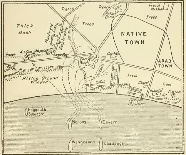
See contemporary account of her voyage out and time off German East Africa including Bagamoyo landings - H.M.S. Manica In East Africa 4caf8814cadfd3419701e3f3: (http://oldweather.s3.amazonaws.com/ADM_53-48169/ADM 53-48169-010_1.jpg) 15 August 1916 Bagamoyo Lat -6.4, Long 38.9 1.40am: Anchor up & proceeded in station with Flag and “Challenger” 3.15am: Entered Bay 4.00am: Anchored NNW of Flagship “Vengeance”, “Mersey”, “Challenger” and “Himalaya” bombarded Bagamoyo 9.00am: Seaplane hoisted & housed 10.00am: Hauled balloon down, exchanged pilots, balloon rose 10.30am: Anchored 10.55am: Stand by below 10.58am: Hauled balloon down 11.00am: Union Jack hoisted ashore 11.20am: Balloon housed 11.30am: Received wounded ratings and two wounded prisoners from HMS Childers 12.15pm: Received ratings from “Challenger” 1.02pm: White & native prisoners sent on board 1.30pm: Received a case from Flagship 1.40pm: Hove up & proceeded 3.38pm: Chumbe S50E 3.53pm: Rounded Red Buoy 4.27pm: Anchored 5.30pm: Wounded & prisoners left ship 6.05pm: Seaplane left ship in tow 6.30pm: 30 K.A.Fs came on board 9.45pm: Water boat left Number on sick list 1 [Bagamoyo was the original capital of German East Africa and lies at Lat -6.4, Long 38.9] 4caf8814cadfd3419701e3f4: (http://oldweather.s3.amazonaws.com/ADM_53-48169/ADM 53-48169-011_0.jpg) 16 August 1916 Lat -6.6, Long 39.3 12.08am: Anchor up, proceeded South Channel 1.20am: Chumbe Light House N42E, 1.4’ 2.40am: Kwale Island N62E, 3’ 3.15am: Pungume Island North end N62E, 4.8’ 5.30am: Closed “Vengeance” 6.40am: Balloon up off Sinto Island 7.40am: Closed Makatumbe Light House 10.00am: Commenced haul down balloon, changed observers 10.50am: Enemy opened fire on "Manica" 11.01am: Enemy ceased fire 11.15am: Balloon up 11.25am: Proceeded 2.15pm: Chumbe Light N32E, 4.5’ 3.00pm: Entered Bagamoyo Bay 3.15pm: Balloon down & housed 6.30pm: Captain & KB Officer left for Flagship 7.55pm: Captain & Officer returned Number on sick list 1 [The KB Officer is the Kite Balloon Officer.] 4caf8814cadfd3419701e3f5: (http://oldweather.s3.amazonaws.com/ADM_53-48169/ADM 53-48169-011_1.jpg) 17 August 1916 Bagamoyo Lat -6.4, Long 38.9 9.00am: Commander-in-Chief on board 9.33am: Anchor aweigh 9.50am: Balloon rose 10.55am: Hauled balloon down & housed 11.10am: Commander-in-Chief left 11.28am: Anchored 4.05pm: Anchor up & proceeded to get ship in position for balloon work 4.30pm: Turned ship stern to wind 4.40pm: Balloon ascended 5.30pm: Balloon descended 6.00pm: Anchored Number on sick list 2 Note at top of log: Total distance run to date 12694 4caf8814cadfd3419701e3f6: (http://oldweather.s3.amazonaws.com/ADM_53-48169/ADM 53-48169-012_0.jpg) 18 August 1916 Bagamoyo Lat -6.4, Long 38.9 5.50am: Motor boat left ship for “Severn” 6.45am: Motor boat returned & hoisted 10.45am: Seaplane returned, hoisted & housed 12.30pm: “Thistle” entered Bay 2.40pm: “Trent” entered Bay 3.30pm: Seaplane uncovered & ready to put out 5.10pm: HMS Thistle left 5.40pm: HMS Severn opened fire on shore 9.00pm: FA “Trent” left 10.00pm: Darkened ship Number on sick list 1 [FA is the designation for Fleet Auxiliary, often RFA, Royal Fleet Auxiliary. These are smaller ships, owned or leased by the Crown which carry messages and supplies around the fleet.] 4caf8814cadfd3419701e3f7: (http://oldweather.s3.amazonaws.com/ADM_53-48169/ADM 53-48169-012_1.jpg) 19 August 1916 Bagamoyo Bay Lat -6.4, Long 38.9 11.25am: HMS Mersey fired at shore 3.40pm: “Barjora” entered & anchored 8.00pm: Large fire ashore to the northward Number on sick list 2 [SS Barjora, 3164 tons, was built for the British India Steam Navigation Company in 1912 and scrapped in 1949.] . 4caf8814cadfd3419701e3f8: (http://oldweather.s3.amazonaws.com/ADM_53-48169/ADM 53-48169-013_0.jpg) 20 August 1916 Bagamoyo Lat -6.3, Long 39.0 9.15am: Divisions, Captain’s Rounds 3.35pm: Received sailing orders 6.00pm: Kite Balloon & Seaplane Officers left for Flagship 7.15pm: Officers returned 7.25pm: Weighed & proceeded 9.42pm: Chumbe Light House abeam Number on sick list 2 4caf8814cadfd3419701e3f9: (http://oldweather.s3.amazonaws.com/ADM_53-48169/ADM 53-48169-013_1.jpg) 21 August 1916 Lat -6.4, Long 39.2 6.00am: Closed "Vengeance" 6.30am: Closed Sinda Island 7.15am: Balloon ascended 7.20am: Seaplane in water 8.35am: Seaplane returned, hoisted & housed 8.58am: Makatumbe S68W 9.00am: “Vengeance” ceased fire 9.12am: Makatumbe Light House S57W, 3’ 10.05am: Stopped, hauled balloon down 10.55am: Chumbe Light N25W 11.55am: North end Kwale Island abeam 12.15pm: Stopped, balloon up & proceeded 12.35pm: Chumbe Light House N17W 1.25pm: Rounded Red Buoy 2.00pm: Balloon down & housed 2.25pm: Anchored 3.30pm: Liberty men ashore 6.00pm: Liberty men returned 8.10pm: Water boat left 8.30pm: HMS Severn entered & anchored Number on sick list 2 [Sinda Island is just off Dar es Salaam at Lat -6.8, Long 39.4.] 4caf8814cadfd3419701e3fa: (http://oldweather.s3.amazonaws.com/ADM_53-48169/ADM 53-48169-014_0.jpg) 22 August 1916 Dar es Salaam Lat -6.8, Long 39.3 5.45am: Received signal to weigh 7.07am: Passed Red Buoy 7.35am: Chumbe Light House S85E, ¾’ 8.30am: Passed HMS Childers 9.05am: Observed HMS Challenger 9.15am: South end Pungume Island abeam 9.40am: Observed Makatumbe Light House 10.30am: In company with “Challenger” & “Echo” 11.40am: Seaplane in water 12.37pm: Seaplane returned, hoisted & housed 1.12pm: Stop (Admiral’s orders transferred from “Pioneer” to “Challenger”) 1.55pm: Proceeded full speed 2.22pm: Mbudja Island S76W 3.29pm: Panjame Island South end N66E, 5.5’ 3.50pm: Kwale Island N64E 4.45pm: Chumbe Light House abeam N66E, distance ¾’ 5.10pm: Passed Red Buoy 5.50pm: Anchored 7.00pm: Seedie boys liberty party left for shore 9.30pm: Darkened ship HMS Childers arrived & anchored Number on sick list 2 4caf8814cadfd3419701e3fb: (http://oldweather.s3.amazonaws.com/ADM_53-48169/ADM 53-48169-014_1.jpg) 23 August 1916 Zanzibar, No IV berth Lat -6.2, Long 39.2 5.15am: Seedie boys came on board 7.00am: Sent motor boat for PMs stores 7.55am: Stores came alongside 8.40am: FAS Trent arrived & anchored 9.00am: Received one seaman rating from “Trent” 10.12am: HMS Vengeance left 11.58am: HMS Princess left 12.15pm: Water boat alongside 1.40pm: Lighter returned to Royal Naval Barracks 3.30pm: Liberty men ashore 5.30pm: Seedie boys left ship for liberty (Tindle & 4 men paid off) 6.15pm: Liberty men returned 7.00pm: Darkened ship Number on sick list 2 4caf8814cadfd3419701e3fc: (http://oldweather.s3.amazonaws.com/ADM_53-48169/ADM 53-48169-015_0.jpg) 24 August 1916 Zanzibar No IV Berth Lat -6.2, Long 39.2 5.15am: Seedie boys returned on board 10.00am: 4 seedie boys joined in place of men discharged 1.00pm: Lieutenant Metcalfe rejoined ship 3.30pm: Liberty men ashore 5.40pm: Seedie boys left for shore 6.20pm: Liberty party returned 7.15pm: Officers returned Number on sick list 2 4caf8814cadfd3419701e3fd: (http://oldweather.s3.amazonaws.com/ADM_53-48169/ADM 53-48169-015_1.jpg) 25 August 1916 Zanzibar Lat -6.2, Long 39.2 5.15am: Seedie boys returned on board 7.30am: Caulkers off from shore 9.00am: Weighed and proceeded for balloon practise 12.15pm: Balloon down & housed. Proceeded to No 4 Berth 5.00pm: Motor boat hoisted in for repairs, lowered whaler Number on sick list 1 4caf8814cadfd3419701e3fe: (http://oldweather.s3.amazonaws.com/ADM_53-48169/ADM 53-48169-016_0.jpg) 26 August 1916 Zanzibar Lat -6.2, Long 39.2 1.15am: “Himalaya” returned & anchored 6.00am: Collier Queen Alexandria alongside 7.30am: Commenced coaling Noon: Knocked off for dinner 12.30pm: Coaling continued 4.00pm: Finished coaling 4.45pm: Collier left, hands cleaning ship Number on sick list 2 4caf8814cadfd3419701e3ff: (http://oldweather.s3.amazonaws.com/ADM_53-48169/ADM 53-48169-016_1.jpg) 27 August 1916 Zanzibar to Bagamoyo Bay Lat -6.4, Long 38.9 7.12am: Seaplane alongside, hoisted & housed 8.00am: Shore fitters working on gun mounting throughout day 8.15am: Lieutenant Commander Bonhill and ratings and 2 Electrical Telegraph officers & baggage on board for passage to Bagamoyo 9.19am: Weighed & proceeded 9:50am: Passed Red Buoy 10.13am: Chumbe Light House abeam 11.00am: Anchored in Bagamoyo Bay 1.45pm: Sent whaler with officers to Flagship 3.00pm: Whaler and officers returned 10.02pm: Anchor aweigh. Full ahead. 11.10pm: Flagship S38W, Chumbe N74W Number on sick list 2 4caf8814cadfd3419701e400: (http://oldweather.s3.amazonaws.com/ADM_53-48169/ADM 53-48169-017_0.jpg) 28 August 1916 Bagamoyo to Dar-es-Salaam At Zanzibar Harbour Lat -6.2, Long 39.2 12.56am: Chumbe Light N34E, 8’ 4.00am: Chumbe Light N29W, 17.5’ 5.55am: Arrived at rendezvous 7.15am: Proceeded to Zanzibar 8.25am; Pungume Bay North 9.42am: Kwale Island South End N54E 10.30am: Chumbe Light House N36E 11.08am: Rounded Red Buoy 11.45am: Anchored Noon: Anchor dragging, hove in 1.11pm: “Hyacinth” & “Trent” weighed & proceeded north 2.30pm: Received motor boat from “Himalaya” 3.10pm: “Challenger” entered and anchored 7.45pm: Whaler & motor boat hoisted 8.00pm: Water boat alongside 10.25pm: Water tank left 11.00pm: Fitters finished on poop for night Number on sick list 1 4caf8814cadfd3419701e401: (http://oldweather.s3.amazonaws.com/ADM_53-48169/ADM 53-48169-017_1.jpg) 29 August 1916 Zanzibar Lat -6.2, Long 39.2 8.45pm: Waterboat left Number on sick list 1 [Local leave, afternoon for RN crew and overnight for Seedie Boys has continued.] 4caf8814cadfd3419701e402: (http://oldweather.s3.amazonaws.com/ADM_53-48169/ADM 53-48169-018_0.jpg) 30 August 1916 Zanzibar Lat -6.2, Long 39.2 4.15am: Flagship weighed and proceeded 9.40am: HMS. Thistle left Number on sick list 0 4caf8814cadfd3419701e403: (http://oldweather.s3.amazonaws.com/ADM_53-48169/ADM 53-48169-018_1.jpg) 31 August 1916 Lat -6.5, Long 39.1 1.40am: “Challenger” proceeded 1.42am: Weighed & proceeded, took station astern of “Challenger” 2.12am: Passed Red Buoy 2.40am: Chumbe Light East, 1.0’ 6.10am: Proceeded towards Sindi Island 7.05am: Ship in position, turned round 7.35am: Balloon up 7.40am: Seaplane in water 8.15am: Seaplane away 8.35am: Balloon down 9.05am: Seaplane hoisted & housed 9.15am: Proceeded full speed for Bagamoyo 1.08pm: Mbwakini Shoal N01W, 1¼' 1.35pm: Anchored 3.15pm: Sent 3 ratings to “Trent” 3.52pm: Weighed & proceeded 5.10pm: Tambru Reef abeam 5.40pm: Beacons in line 6.05pm: Passed Red Buoy 6.32pm: Anchored Number on sick list 0 [Mbwakuni Shoal is at Lat -6.37, Long 39.0, just off Bagamoyo Tambare Reef is at Lat -6.28, Long 39.07 between Bagamoyo and Zanzibar.] 4caf8814cadfd3419701e404: (http://oldweather.s3.amazonaws.com/ADM_53-48169/ADM 53-48169-019_0.jpg) 4caf8814cadfd3419701e405: (http://oldweather.s3.amazonaws.com/ADM_53-48169/ADM 53-48169-019_1.jpg) 4caf8814cadfd3419701e406: (http://oldweather.s3.amazonaws.com/ADM_53-48169/ADM 53-48169-020_0.jpg) 4caf8814cadfd3419701e407: (http://oldweather.s3.amazonaws.com/ADM_53-48169/ADM 53-48169-020_1.jpg) [These pages are blank.] LOGS FOR SEPTEMBER 1916 4caf8814cadfd3419701e408: (http://oldweather.s3.amazonaws.com/ADM_53-48170/ADM 53-48170-001_0.jpg) 4caf8814cadfd3419701e409: (http://oldweather.s3.amazonaws.com/ADM_53-48170/ADM 53-48170-001_1.jpg) [Log covers, signed by Lieutenant AH Metcalfe, RNR] 4caf8814cadfd3419701e40a: (http://oldweather.s3.amazonaws.com/ADM_53-48170/ADM 53-48170-002_0.jpg) 4caf8814cadfd3419701e40b: (http://oldweather.s3.amazonaws.com/ADM_53-48170/ADM 53-48170-002_1.jpg) 4caf8814cadfd3419701e40c: (http://oldweather.s3.amazonaws.com/ADM_53-48170/ADM 53-48170-003_0.jpg) [These pages are blank or uncompleted.] 4caf8814cadfd3419701e40d: (http://oldweather.s3.amazonaws.com/ADM_53-48170/ADM 53-48170-003_1.jpg) 1 September 1916 Zanzibar to Dar-es-Salaam Lat -6.5, Long 39.2 1.24am: Weighed & proceeded 1.56am: Passed S Red Buoy 2.29am: Chumbe Light East, 1¼’ 6.03am: Proceeded to close Sinda Island in company with “Hyacinth” 6.55am: In position off Sinda Island 7.02am: Seaplane out 8.20am: Anchored & hoisted seaplane 8.30am: Hove up & proceeded 10.30am: Parted company with “Hyacinth” & set course for Bagamoyo 1.40pm: North end Mukapuna Island N28W, 2.¼' 2.08pm: Anchored 3.45pm: Tested 4” gun, all correct 4caf8814cadfd3419701e40e: (http://oldweather.s3.amazonaws.com/ADM_53-48170/ADM 53-48170-004_0.jpg) 2 September 1916 Bagamoyo to Dar es Salaam off Konduchi Lat -6.7, Long 39.2 1.32am: Weighed & proceeded 1.51am: Chumbe Light N23E, 1’ 3.40am: Chumbe Light N7W, 13’ 5.20am: Observed Sinda Island S5W 6.20am: Balloon up, proceeded towards Konduchi 8.50am: Anchored, Mbudya N75E, Pangavini Island N30E 11.10am: Hauled balloon down 11.20am: Balloon up 11.45am: Weighed anchor to haul balloon down 12.20pm: Balloon down & anchored [Mbudya is near Dar es Salaam at Lat -6.65, Long 39.25 Pangavini Island is also near Dar es Salaam at Lat -6.68, Long 39.23] 4caf8814cadfd3419701e40f: (http://oldweather.s3.amazonaws.com/ADM_53-48170/ADM 53-48170-004_1.jpg) 3 September 1916 Dar es Salaam & Konduchi Lat -6.7, Long 39.3 5.50am: Weighed and proceeded inside Bongoyo Island, balloon up 7.00am: Anchored with balloon up 7.55am: Hauled balloon down 9.00am: Divisions & Prayers 11.15am: Weighed & shifted berth to Msasani Bay 12.15pm: Weighed & shifted berth 12.25pm: Anchored 6.00pm: Seedy Boys sent to Trent for P.B.M [Bongoyo Island is just north of Dar es Salaam at Lat -6.7, Long 39.27 Msasani Bay is at Lat -6.7, Long 39.3] 4caf8814cadfd3419701e410: (http://oldweather.s3.amazonaws.com/ADM_53-48170/ADM 53-48170-005_0.jpg) 4 September 1916 Dar es Salaam Lat -6.8, Long 39.3 6.02am: Weighed & proceeded towards Makatumbe 6.45am: On station, square C19 6.55am: Balloon up 8.05am: Balloon down 8.10am: Balloon up 9.30am: Balloon down & housed. Seaplane in water 10.25am: Seaplane returned & hoisted 11.00am: Anchored 4.00pm: Transports entered & anchored. Colours hoisted ashore 4.30pm: Seedie boys returned from “Trent” 4caf8814cadfd3419701e411: (http://oldweather.s3.amazonaws.com/ADM_53-48170/ADM 53-48170-005_1.jpg) 5 September 1916 Dar es Salaam Lat -6.8, Long 39.3 2.45pm: Weighed & proceeded 3.13pm: Makatumbe S34E, 1.1’ 3.20pm: Makatumbe S4E, 1.8’ 6.00pm: Ras Kiligi, 6’ 8.50pm: Observed Moresby Point Light S22E 10.50pm: Anchored [Ras Kiligi is possibly Ras Kimbiji at Lat -7.0, Long 39.6] 4caf8814cadfd3419701e412: (http://oldweather.s3.amazonaws.com/ADM_53-48170/ADM 53-48170-006_0.jpg) 6 September 1916 Tirene Bay, Mafia Island Lat -7.9, Long 39.7 5.30am: Weighed & proceeded to Tirene 6.20am: Niororo Reef Buoy 8.10am: Anchored 8.40am: “Vengeance” entered & anchored 4.00pm: Weighed & proceeded with flagship and “Trent” 8.10pm: Moresby Light N80E 4caf8814cadfd3419701e413: (http://oldweather.s3.amazonaws.com/ADM_53-48170/ADM 53-48170-006_1.jpg) 7 September 1916 Tirene to Kilwa Kivinje Lat -8.75, Long 39.4 3.15am: Swung ship to clear “Trent” S40W 4.00am: Reduced speed standing off shore till 5.20am 5.25am: Observed Okuza Island 7.30am: Fanjove Island Light N74W, 2¾’ distance, working round reef at 1’ distance 9.25am: Seaplane in water 9.50am: Balloon up 10.30am: Seaplane hoisted, balloon down 11.12am: Anchored 2.10pm: Weighed & proceeded in station 2½ cables astern of “Rinaldo” 5.25pm: Okinza T @ S64E, 6’ distance 7.30pm: Anchored. Ras Kisimani S22E, 3 miles [Fanjove Island is near Kilwa Kivinje at Lat -7.95, Long 39.6 Kilwa Kivinje was an Arab slave port. The Germans built a fort there at the end of the 19th century. It is now the least developed of the ‘Kilwas’. Okuza Island is at Lat -8.3, Long 39.6 Ras Kisimani is on Mafia Island at Lat -7.95, Long 39.6] 4caf8814cadfd3419701e414: (http://oldweather.s3.amazonaws.com/ADM_53-48170/ADM 53-48170-007_0.jpg) 8 September 1916 Rufiji River Lat -7.6, Long 39.4 5.25am: Turned ship, anchor aweigh 5.35am: Proceeded, course as requisite between reefs 5.55am: Sefo Reef Buoy 1 cable 8.15am: Stopped & lowered seaplane 9.00am: Balloon up 9.53am: Seaplane hoisted & housed 11.05am: “Manica” & “Rinaldo” opened fire on camp. 12.07pm: Cease fire, hauled balloon down, hove anchor, shifted berth 1.10pm: Anchored 4.08pm: Seaplane out 4.50pm: Seaplane hoisted & housed 5.04pm: Weighed and shifted into deeper water [Sefo Reef is at Lat -7.8, Long 39.6 Rufiji River is the longest river in Tanzania at Lat -8.0, Long 39.3] 4caf8814cadfd3419701e415: (http://oldweather.s3.amazonaws.com/ADM_53-48170/ADM 53-48170-007_1.jpg) 9 September 1916 Rufiji River Lat -7.6, Long 39.4 6.00am: Seaplane in water 7.42am: Seaplane returned, hoisted and housed 3.30pm: Katamarang & Natives taken on board awaiting instructions 4.45pm: Seaplane out 4.50pm: Seaplane hoisted & housed, damaged plane [Katamarang is probably ‘Catamaran’, the German for which is Katamaran.] 4caf8814cadfd3419701e416: (http://oldweather.s3.amazonaws.com/ADM_53-48170/ADM 53-48170-008_0.jpg) 10 September 1916 Rufiji River to Dar es Salaam Lat -6.8, Long 39.3 12.05am: Up anchor, proceeded full speed 2.31am: Moresby Point S48E 3.07am: Moresby Point S34E, 15.5’ distance 6.20am: Ras Kimbiji S63W, 6’ distance 8.43am: Makatumbe @ 9.24am: Anchored 3.00pm: Native troops & stores started coming onboard 5.00pm: Finished taking on board 230 Native Troop 7.30pm: Motor boat returned from shore & hoisted 9.05pm: Anchor up 9.50pm: Sinda Island abeam 5’ 4caf8814cadfd3419701e417: (http://oldweather.s3.amazonaws.com/ADM_53-48170/ADM 53-48170-008_1.jpg) 11 September 1916 Dar es Salaam to Kilwa Kivinje Lat -8.2, Long 39.8 2.45am: Moresby Point S18E 6.42am: Moresby Point 78W, 7’ distance 2.07pm: Nyuni Island N65W, 6.1’ 3.20pm: Fanjove Island Light N77W, 2.9’ 5.10pm: Anchored. All boats lowered and loaded with stores & troops, also two launches and picket boats from “Vengeance” 7.00p: All troops, gear etc clear of ship [Nyuni Island at Lat -8.4, Long 29.6 is to the north of a chain of islands off Kilwa Kivinje] 4caf8814cadfd3419701e418: (http://oldweather.s3.amazonaws.com/ADM_53-48170/ADM 53-48170-009_0.jpg) 12 September 1916 From Kilwa Kivinje [Lat -8.7, Long 39.5 – Logbook records longitude 38.5 but this cannot be correct; 39.5 is consistent with adjacent days] 1.45am: Three lifeboats and motor boat returned from shore 5.45am: "Fly" alongside with stores, 2 lifeboats left for "Himalaya" for stores. 6.10am: “Fly” left 6.40am: Hoisted 2 lifeboats 7.00am: Weighed & proceeded to close "Himalaya" 7.22am: Anchored close to “Himalaya” 7.50am: Lifeboats returned with stores 10.57am: Weighed & proceeded 11.52am: Fanjove Light @ 4caf8814cadfd3419701e419: (http://oldweather.s3.amazonaws.com/ADM_53-48170/ADM 53-48170-009_1.jpg) 13 September 1916 Kilwa Kivinji to Mikindani Lat -10.3, Long 40.1 1.00am: Sighted “Thistle” 4.00am: Flag and ships arrived at Rendezvous 6.57am: Seaplane out 7.01am: Motorboats away 7.30am: Balloon up 8.38am: Anchored 9.00am: Sent motor boats & lifeboats to “Bajora” 9.26am: Seaplane hoisted 10.40am: Balloon down 3.45pm: Motorboats & lifeboats returned, motorboat & lifeboat to “Princess” for stores, remainder hoisted 7.40pm: Boats & stores from “Princess” 4caf8814cadfd3419701e41a: (http://oldweather.s3.amazonaws.com/ADM_53-48170/ADM 53-48170-010_0.jpg) 14 September 1916 Mikindani to Rufiji Lat -10.3, Long 40.1 5.55am: Motor boats & 2 lifeboats left for stores 6.10am: “Vengeance” aweigh 1.00pm: Motor boats & stores returned 1.45pm: Stores on board & all boats hoisted 2.15pm: Anchor up & proceeded. Rounded Hull Rocks 3.55pm: Ras Mkiya S45W, 4’ distant 5.22pm: Stopped & put out seaplane 5.40pm: Hoisted & housed seaplane [Hull Rocks are at Lat -10.18, Long 40.15 Ras Mkiya is at Lat -10.1, Long 40.0] 4caf8814cadfd3419701e41b: (http://oldweather.s3.amazonaws.com/ADM_53-48170/ADM 53-48170-010_1.jpg) 15 September 1916 Rufugi Lat -7.7, Long 39.5 5.30am: Sighted Kibondo Island & Mafia Island 7.35am: Moresby Point S84W, 2½’ 9.27am: Nororoco Shoal Buoy @ ½’ 10.00am: Shinguni Shoal Buoy @ ½’ 11.23am: Anchored 4.45pm: Seaplane in water 5.42pm: “Severn” anchored ENE, 3 cables 5.50pm: Seaplane returned, hoisted and housed [Kibondo Island is just south of Mafia Island at Lat -8.05, Long 39.7 Barakuni Island is at Lat -7.7, Long 39.75 Koma Island is at Lat -7.55, Long 39.75 4caf8814cadfd3419701e41c: (http://oldweather.s3.amazonaws.com/ADM_53-48170/ADM 53-48170-011_0.jpg) 16 September 1916 Rufiji Delta to Mohoro Bay Lat -7.7, Long 39.4 5.48am: Seaplane out 8.25am: Seaplane returned, hoisted & housed Noon: Weighed & proceeded 1.00pm: Stopped and put up balloon 2.28pm: Baydu Island S57E, 1.5’ 3.15pm: Ras Dima W, 1.4 cables 4.35pm: Stopped, turned ship to wind & hauled balloon down 4.50pm: Proceeded 6.10pm: Anchored in Mohoro Bay [Baydu Island is probably Boydu Island at Lat -7.9, Long 39.5 Mohoro Bay is at Lat -8.3, Long 39.3 Ras Dima is at Lat -8.0, Long 39.4] 4caf8814cadfd3419701e41d: (http://oldweather.s3.amazonaws.com/ADM_53-48170/ADM 53-48170-011_1.jpg) 17 September 1916 Mohoro Bay [Lat -8.3, Long 39.4 – Logbook records longitude 38.4 but this cannot be correct; 39.4 is consistent with adjacent days] 6.00am: Seaplane out 7.35am: Seaplane returned and hoisted 8.35am: Weighed anchor & turned ship stern to wind 9.00am: Balloon up 9.30am: Weighed anchor 10.10am: Balloon down 11.49am: Weighed & proce eded full speed 12.35pm: West end of Sumay @ 1' 1.17pm: Okzua Island @ S60E, 6.7’ 2.29pm: Mange Reef S73E, 1.3’ 3.30pm: Al Hadjiri Reef N86W, 0.5’ 3.42pm: Sefo Buoy N82W, 0.2’ 4.00pm: Turned ship & followed “Severn” towards Sefo Reef 4.50pm: Anchored. Bearings: West end of Boydu Island S36W, Ras Kisimani S10E [Simay Island is probably Simaya Island at Lat -8.3, Long 39.4 Okuza Island is at Lat -8.3, Long 39.6 Mange Reef is at Lat -8.07, Long 39.6 Al Hadjiri Reef is at Lat -7.9, Long 39.58 Boydu Island is between Mafia Island and the mainland at Lat -7.93, Long 39.51 Ras Kisimani is on Mafia Island at Lat -7.95, Long 39.6] 4caf8814cadfd3419701e41e: (http://oldweather.s3.amazonaws.com/ADM_53-48170/ADM 53-48170-012_0.jpg) 18 September 1916 At anchor off Sefo Island Lat -8.0, Long 39.9 6.06am: “Severn” left 4caf8814cadfd3419701e41f: (http://oldweather.s3.amazonaws.com/ADM_53-48170/ADM 53-48170-012_1.jpg) 19 September 1916 off Sepho Is Lat -7.7, Long 39.5 5.30am: Anchor aweigh, proceeded round East side Sefo Reef @ 1' dist 6.00am: Sefo Reef Buoy S42W, 1.5’ 7.00am: Sighted “Severn”, turned ship round and proceeded SE towards rendezvous 7.50am: Stopped & anchored 9.00am: “Severn” passed SE 3.48pm: Anchor up, proceeded 4.50pm: Anchored. Sefo Reef S, 1.0’ 6.30pm: Port motor boat with Officer and Crew left and joined “Mersey” 4caf8814cadfd3419701e420: (http://oldweather.s3.amazonaws.com/ADM_53-48170/ADM 53-48170-013_0.jpg) 20 September 1916 Rufiji Lat -7.8, Long 39.6 5.42am: Weighed & proceeded 6.40am: Stopped, put up seaplane. 7.22am: Proceeded to close land, up balloon 8.10am: Seaplane returned hoisted and housed 9.50am: Weighed 10.05am: Balloon down 10.28am: Anchored 10.4am: Weighed & proceeded 5.00pm: “Mersey” anchored 5.20pm: “Severn” anchored 5.30pm: Motor boat, officer & crew returned from “Mersey” 9.45pm: Midshipman Gunson on board for passage to “Hyacinth” 4caf8814cadfd3419701e421: (http://oldweather.s3.amazonaws.com/ADM_53-48170/ADM 53-48170-013_1.jpg) 21 September 1916 Lat -7.7, Long 39.5 6.35am: Weighed & turned ship 7.30am: Uncovered balloon 7.45am: Covered up balloon on account of rain 8.37am: Anchored 6.00pm: ‘Abandon ship’ stations 4caf8814cadfd3419701e422: (http://oldweather.s3.amazonaws.com/ADM_53-48170/ADM 53-48170-014_0.jpg) 22 September 1916 Rufiji Delta Lat -7.8, Long 39.6 Anchor Bearings: Koma Island N30W, Ras Twana S12W 4.30am: Uncovered seaplane 5.35am: Seaplane out 5.55am: Weighed & proceeded 7.38am: Salim Bank Buoy @ 8.12am: Anchored. Troops & boats embarked 10.42am: Weighed & proceeded full speed 11.35am: Sefo Shoal @ 1.39pm: Koma Island S5W, 2’ 1.50pm: Pemba Ju Ju W, 1.0’ 2.24pm: Anchored 3.48pm: Weighed & proceeded full speed to shift berth 4.35pm: Anchored N of Koma Island Bearings: North end Pemba Ju Ju S59E, West end Koma Island S14W [Ras Twana is on the mainland at Lat -7.8, Long 39.45 Pemba Ju Ju Island is probably Pemba Juu Island at Lat -7.5, Long 39.4 Salim Bank is at Lat -7.85, Long 39.6] 4caf8814cadfd3419701e423: (http://oldweather.s3.amazonaws.com/ADM_53-48170/ADM 53-48170-014_1.jpg) 23 September 1916 Rufiji Lat -7.4, Long 39.4 5.53am: Weighed & proceeded towards Kwale Island 6.52am: Anchored 9.42am: Proceeded to shift berth 10.39am: Anchored 1.00pm: Proceeded to shift berth 2.40pm: Anchored off Koma Island 3.00pm: Sent motor boat & troops ashore 4.00pm: Motor boat returned to shore with stores 5.00pm: Motor boat returned to ship 5.30pm: Weighed & proceeded 6.04pm: Pemba Ju Ju Island @ S82W, 1.0’ 6.45pm: Anchored 4caf8814cadfd3419701e424: (http://oldweather.s3.amazonaws.com/ADM_53-48170/ADM 53-48170-015_0.jpg) 24 September 1916 Rufiji Lat -7.8, Long 39.6 5.40am: Weighed & proceeded 6.30am: Sighted “Fly” 6.58am: Slowed to communicate 7.00am: Sefo Buoy S14E 7.45am: Slow approaching anchorage 8.00am: Anchorage 9.30am: Divisions & Prayers Commander’s rounds 2.10pm: Weighed & proceeded full speed 4.15pm: Anchored 4.25pm: Seaplane in water 4.55pm: Seaplane hoisted and housed 5.30pm: “Fly” made fast alongside 6.20pm: “Fly” cast off & proceeded to anchorage 4caf8814cadfd3419701e425: (http://oldweather.s3.amazonaws.com/ADM_53-48170/ADM 53-48170-015_1.jpg) 25 September 1916 Rufiji Lat -7.7, Long 39.5 5.50am: Seaplane in water 6.20am: Seaplane hoisted & housed 7.00am: “Fly” closed & anchored 3.00pm: Anchor up, proceeded full speed 4.15pm: Niororo Island @ S47E, 9’ 7.35pm: Moresby Point @ S1W, 11’ 4caf8814cadfd3419701e426: (http://oldweather.s3.amazonaws.com/ADM_53-48170/ADM 53-48170-016_0.jpg) 26 September 1916 Zanzibar Lat -6.2, Long 39.2 7.45am: Chumbe Light House N10W, 2' 8.40am: Passed Red Buoy 9.27am: Anchored 11.00am: Sent starboard motor boat to “Himalaya” 3.30pm: Libertymen ashore 5.53pm: Collier alongside & secured 6.00pm: Libertymen returned 7.30pm: Water boat alongside 9.50pm: Sent escort ashore for absentees 10.45pm: Escort & absentees returned 4caf8815cadfd3419701e427: (http://oldweather.s3.amazonaws.com/ADM_53-48170/ADM 53-48170-016_1.jpg) 27 September 1916 Zanzibar Lat -6.2, Long 39.2 1.40am: Water boat left 3.25am: Water boat alongside 6.00am: Water boat alongside, commenced coaling 8-8.30am: Breakfast hour 9.00am: Water boat alongside, one left 9.30am: Court of Enquiry into death of "Toy" Trimmer 12-12.30pm: Dinner hour 3.00pm: “Vengeance” left, water boat alongside 4-4.30pm: Tea hour 5.00pm: Water boat alongside, one left 8.00pm: Finished coaling for the day 4caf8815cadfd3419701e428: (http://oldweather.s3.amazonaws.com/ADM_53-48170/ADM 53-48170-017_0.jpg) 28 September 1916 Zanzibar Lat -6.2, Long 39.2 5.30am: Resumed coaling 8-8.30am: Breakfast hour 12-12.30pm: Dinner hour 2.10pm: Water boat alongside 4-4.30pm: Tea hour 5.00pm: Water boat left 6.00pm: Finished all coal, 560 tons 8.00pm: Seedie boys ashore liberty 4caf8815cadfd3419701e429: (http://oldweather.s3.amazonaws.com/ADM_53-48170/ADM 53-48170-017_1.jpg) 29 September 1916 Zanzibar Lat -6.2, Long 39.2 5.45am: Hands to clean ship Sent boat for Seedie boys 7.00am: Crew employed cleaning ship & on stores 6.00pm: Hands finished taking in stores, hoisted whaler 8.00pm: Water boat left from alongside 4caf8815cadfd3419701e42a: (http://oldweather.s3.amazonaws.com/ADM_53-48170/ADM 53-48170-018_0.jpg) 30 September 1916 Zanzibar Lat -6.2, Long 39.2 6.00am: Seedie boys returned 4.00pm: Landed liberty party & Patrol 7.00pm: Libertymen & Patrol returned [After the absentee episode they are taking fewer chances and sending the Patrol out with the men.] 4caf8815cadfd3419701e42b: (http://oldweather.s3.amazonaws.com/ADM_53-48170/ADM 53-48170-018_1.jpg) 4caf8815cadfd3419701e42c: (http://oldweather.s3.amazonaws.com/ADM_53-48170/ADM 53-48170-019_0.jpg) 4caf8815cadfd3419701e42d: (http://oldweather.s3.amazonaws.com/ADM_53-48170/ADM 53-48170-019_1.jpg) 4caf8815cadfd3419701e42e: (http://oldweather.s3.amazonaws.com/ADM_53-48170/ADM 53-48170-020_0.jpg) 4caf8815cadfd3419701e42f: (http://oldweather.s3.amazonaws.com/ADM_53-48170/ADM 53-48170-020_1.jpg) [The above pages are blank.] LOGS FOR OCTOBER 1916 4caf8815cadfd3419701e430: (http://oldweather.s3.amazonaws.com/ADM_53-48171/ADM 53-48171-001_0.jpg) 4caf8815cadfd3419701e431: (http://oldweather.s3.amazonaws.com/ADM_53-48171/ADM 53-48171-001_1.jpg) [Cover page signed by D. H. Metcalfe, Lieut RNR, Navigating officer] 4caf8815cadfd3419701e432: (http://oldweather.s3.amazonaws.com/ADM_53-48171/ADM 53-48171-002_0.jpg) 4caf8815cadfd3419701e433: (http://oldweather.s3.amazonaws.com/ADM_53-48171/ADM 53-48171-002_1.jpg) 4caf8815cadfd3419701e434: (http://oldweather.s3.amazonaws.com/ADM_53-48171/ADM 53-48171-003_0.jpg) [These pages are blank or blank forms.] 4caf8815cadfd3419701e435: (http://oldweather.s3.amazonaws.com/ADM_53-48171/ADM 53-48171-003_1.jpg) 1 October 1916 Zanzibar Lat -6.2, Long 39.2 6.00am: Seedie boys on board 7.00am: Roman Catholic party left ship 8.00am: Church of England party left ship 9.00am: Church of England party left ship 9.35am: Roman Catholic party returned 10.15am: Church of England party returned 11.00am: Church of England party returned 1.30pm: Cricket Team left ship 3.30pm: Liberty party left ship 6.00pm: Liberty party returned 8.15pm: SS Tremorrah ran ashore, Captain & Navigator boarded 4caf8815cadfd3419701e436: (http://oldweather.s3.amazonaws.com/ADM_53-48171/ADM 53-48171-004_0.jpg) 2 October 1916 Zanzibar Lat -6.2, Long 39.2 3.30am: “Tremorrah" floating & clear 5.45am: Seedie liberty boys returned Crew employed painting 7.30am: Caulkers off from shore 7.50am: Fitters etc off from shore 4caf8815cadfd3419701e437: (http://oldweather.s3.amazonaws.com/ADM_53-48171/ADM 53-48171-004_1.jpg) 3 October 1916 Zanzibar Lat -6.2, Long 39.2 7.00am: Shore workmen on board 9.00am: Divisions & Prayers Received stores from “Princess” Crew employed painting & as required Number on sick list 1 4caf8815cadfd3419701e438: (http://oldweather.s3.amazonaws.com/ADM_53-48171/ADM 53-48171-005_0.jpg) 4 October 1916 Zanzibar Lat -6.2, Long 39.2 7.00am: Guard pennants hoisted 11.50am: “Trent” arrived & anchored. Flag on board Number on sick list 1 [In harbour, especially in times of war, a ship may have the responsibility of sending a boat round the harbour during the night to act as a sort of sentry. This ship would hoist a special pennant known as a ‘guard pennant’.] 4caf8815cadfd3419701e439: (http://oldweather.s3.amazonaws.com/ADM_53-48171/ADM 53-48171-005_1.jpg) 5 October 1916 Zanzibar Lat -6.2, Long 39.2 Number on sick list 1 4caf8815cadfd3419701e43a: (http://oldweather.s3.amazonaws.com/ADM_53-48171/ADM 53-48171-006_0.jpg) 6 October 1916 Place: Zanzibar Lat -6.2, Long 39.2 7.00am: Hoisted Guard pennants 9.00am: Divisions & Prayers. Boarding Officer on board “Castor” 2.30pm: Liberty party on ashore 3.00pm: Water boat alongside 6.10pm: Liberty party returned 6.30pm: Patrol returned 7.45pm: Water boat left Number on sick list 1 [HMS Castor was a light cruiser of 3750 tons. Launched in 1915 by Cammell Laird, she was sold in 1936. She is part of the OW fleet.] 4caf8815cadfd3419701e43b: (http://oldweather.s3.amazonaws.com/ADM_53-48171/ADM 53-48171-006_1.jpg) 7 October 1916 Zanzibar Lat -6.2, Long 39.2 Number on sick list 1 4caf8815cadfd3419701e43c: (http://oldweather.s3.amazonaws.com/ADM_53-48171/ADM 53-48171-007_0.jpg) 8 October 1916 Zanzibar to Mafia Lat -6.8, Long 39.6 6.10am: Anchor up & proceeded 6.45am: Passed Red Buoy 7.16am: Chumbe Light House N62E, 1.0' 10.48am: Makatumbe Light House S52W, 11’ 11.40am: Portuguese Man of War "Adamastor" passed North 1.21pm: Ras Kimbiji S51W, 8’ 2.30pm: “Trent” passed North 5.10pm: Sighted Mafia 7.00pm: Moresby Point N77E, 6’, let go [Adamastor was a cruiser, launched in 1896 and sold in 1933.] 4caf8815cadfd3419701e43d: (http://oldweather.s3.amazonaws.com/ADM_53-48171/ADM 53-48171-007_1.jpg) 9 October 1916 Tirene Lat -7.87, Long 39.7 5.12am: Anchor up & proceeded 5.30am: Sighted Niroro Buoy 6.05am: Niororo Buoy @ NNE 8.10am: Anchored Sent stores ashore & also to the “Mersey 3.40pm: Anchor up proceeded 4.32pm: Selim Bank Buoy @ S23W, ¾’ 4.52pm: Sefo Reef Buoy @ S13W 6.05pm: Anchored Number excused 2 4caf8815cadfd3419701e43e: (http://oldweather.s3.amazonaws.com/ADM_53-48171/ADM 53-48171-008_0.jpg) 10 October 1916 Kilwa Kivinji Lat -8.0, Long 39.6 5.50am: Seaplane in water 7.15am: Seaplane returned, hoisted & housed 8.45am: Weighed anchor & proceeded full speed 9.00am: Divisions & Prayers 9.45am: Anchored 10.45am: Weighed & proceeded full speed 11.45am: Ras Kisimani, 1.0’ 12.12pm: Kisimani Buoy 12.38pm: Mange Reef @ 1.4’, S75E 2.05pm: Okuza Island @ S68E, 6.3’ 2.35pm: Simaya Island @ N68W, 1.0' distance 3.19pm: Mchaiga Reef S68E, ⅛’ 5.25pm: Anchored of Kilwa Kivinji 5.40pm: “Severn's” boat alongside for stores 7.00pm: “Severn’s” boat left with stores & ratings 9.40pm: HMS Severn left Number on sick list 1, 2 excused [Okuza Island is at Lat -8.28, Long 39.6 Mchaiga Reef may be Machangi Reef at Lat -8.4, Long 39.5 Simaya Island is at Lat -8.3, Long 39.4 4caf8815cadfd3419701e43f: (http://oldweather.s3.amazonaws.com/ADM_53-48171/ADM 53-48171-008_1.jpg) 11 October 1916 Kilwa Kivinji Lat -6.1, Long 39.5 5.50am: Seaplane out 6.00am: Weighed & proceeded 6.20am: Balloon up 7.20am: Balloon down 8.05am: Seaplane returned, hoisted & housed 8.15am: Proceeded full speed 8.50am: Poiasi Shoal N80E 9.00am: Divisions. Prayers 9.40am: Banda Shoal 10.20am: Simaya Island @1.5’ 11.00am: Okuza Island @ 6’ distance 12.44pm: Kisimani Buoy S78E 1.19pm: Al Hadjiri Reef N81E, 0.5’ 1.25pm: Sefo Buoy N6W, 2.5’ 2.47pm: Anchored 5.44pm: Motor boat sent ashore 7.00pm: Motor boat returned Number on sick list 1, excused 3 [Poiasi Shoal is at Lat -8.5, Long 39.4 Banda Shoal is at Lat -8.4, Long 39.5 Al Hadjiri Reef is at Lat -7.9, Long 39.6] 4caf8815cadfd3419701e440: (http://oldweather.s3.amazonaws.com/ADM_53-48171/ADM 53-48171-009_0.jpg) 12 October 1916 Tirene Lat -7.87, Long 39.7 3.50pm: Weighed & proceeded full speed 5.44pm: Stopped & anchored off Rufiji Number on sick list 2, 2 excused 4caf8815cadfd3419701e441: (http://oldweather.s3.amazonaws.com/ADM_53-48171/ADM 53-48171-009_1.jpg) 13 October 1916 Rufiji Lat -7.7, Long 39.5 5.45am: Seaplane out 6.50am: Seaplane returned, hoisted & housed 11.40am: Weighed & proceed full speed 12.55pm: South end Koma Island S84W, 2.1’ 1.10pm: Pemba Juu Island S84W 1.2’ 1.20pm: Balloon up, proceeded 2.00pm: Stopped & anchored off Hatambura 4.26pm: Seaplane out 5.00pm: Balloon down 5.30pm: Seaplane returned, hoisted & housed 5.35pm: Proceeded full speed 7.45pm: Anchored off Rufiji Number on sick list 2, 4 excused [Hatambura Island is at Lat -7.5, Long 39.4] 4caf8815cadfd3419701e442: (http://oldweather.s3.amazonaws.com/ADM_53-48171/ADM 53-48171-010_0.jpg) 14 October 1916 Rufiji Lat -7.7, Long 39.5 1.10pm: Anchor up, turned ship and put up balloon 2.00pm: Balloon down, turned ship and proceeded to anchorage 2.20pm: Anchored off Ras Twana Number on sick list 2, 3 excused 4caf8815cadfd3419701e443: (http://oldweather.s3.amazonaws.com/ADM_53-48171/ADM 53-48171-010_1.jpg) 15 October 1916 Rufiji Lat -8.5, Long 39.5 4.40am: Weighed & proceeded 5.56am: Sefo Buoy @ 3’ 6.42am: Ras Kisimani E, 0.5’ 7.01am: Kisimani Buoy @ 0.5’ 7.25am: Manga Reef @ 1.0’ 8.50am: Okuza Island S58E, 5.0’ 9.00am: Divisions. Prayers. Commander’s inspection 9.34am: Simaya Island @ 2¼’ 10.40am: Turned ship & proceeded to Rufiji 12.02pm: Simaya Island S63E, 2¼’ 12.40pm: Okuza Island S67E, 6.4’ 2.00pm: Manga Reef S56E, 1.6’ 2.20pm: Kismani Buoy S86E, 0.3’ 2.52pm: Al Hadjiri Reef N81E, 0.5’ 3.30pm: Anchored off Sefo 5.00pm: SS Bajora passed north
Number on sick list 1, excused 2 4caf8815cadfd3419701e444: (http://oldweather.s3.amazonaws.com/ADM_53-48171/ADM 53-48171-011_0.jpg) 16 October 1916 Sefo to Tirene Lat -7.9, Long 39.7 5.37am: Seaplane over & away 5.50am: Up anchor & proceeded 6.26am: Seaplane down, altered course to close 6.50am: Seaplane onboard & housed. Anchor up & proceeded 7.31am: Anchored 9.00am: Weighed & proceeded 9.55am: Shungumbili Island 10.10am: Heavy rain squall, reduced to slow 10.20am: Proceeded full speed 11.00pm: Arrived at anchorage Tirene Bay 1.30pm: Officers ashore 2.30pm: Liberty men left ship 4.30pm: Liberty party returned Number on sick list 1, excused 2 [Shungumbili Island is at Lat -7.7, Long 39.7] 4caf8815cadfd3419701e445: (http://oldweather.s3.amazonaws.com/ADM_53-48171/ADM 53-48171-011_1.jpg) 17 October 1916 Tirene Lat -7.9, Long 39.7 Midnight: Mzee Bin Simbe reported dead, cause of death Typho-Malaria 5.48am: Weighed & proceeded 6.35am: Stopped. Body of Seedie Boy “Committed to the Deep” Lat 7o 50’, Long 39o 40’ 6.40am: Proceeded back to Tirene anchorage Number on sick list 3, excused 2 4caf8815cadfd3419701e446: (http://oldweather.s3.amazonaws.com/ADM_53-48171/ADM 53-48171-012_0.jpg) 18 October 1916 Tirene Lat -8.3, Long 39.4 4.45am: Boat left with mails for shore 6.00am: Anchor up & proceeded 7.46am: Ras Kisimani N84E, 0.4’ 8.05am: Kisimani Buoy 8.35am: Manga Reef 10.40am: Simaya Island 11.20am: Anchored 12.30pm: Weighed & proceeded, balloon up, along coast 2.05pm: Simaya Island S72E, 0.5’ 3.25pm: Balloon down 5.45pm: Sefo Buoy N75E, 1.5’ 6.40pm: Anchored off Rufiji Number on sick list 3, excused 2 4caf8815cadfd3419701e447: (http://oldweather.s3.amazonaws.com/ADM_53-48171/ADM 53-48171-012_1.jpg) 19 October 1916 Rufiji Lat -7.7, Long 39.3 6.00am: “Echo” passed south 9.00am: Divisions. Prayers 12.10pm: “Trent” passed north 12.45pm: “Echo” passed north 4.08pm: Seaplane out 4.40pm: Seaplane returned, hoisted & housed Number on sick list 4, excused 2 [Her noon position is given as 7’ NexE off Simba Uranga] 4caf8815cadfd3419701e448: (http://oldweather.s3.amazonaws.com/ADM_53-48171/ADM 53-48171-013_0.jpg) 20 October 1916 Rufiji Lat -7.9, Long 39.5 7.00am: Weighed and proceeded 8.58am: Anchored. 4.15pm: Weighed & proceeded towards Rufiji 6.00pm: Anchored: Koma Island N23W, Shungumbili Island N84E Number on sick list 5, 1 excused [Noon position 2’ NE of West end of Boydu Island which is at Lat -7.9, Long 39.5] 4caf8815cadfd3419701e449: (http://oldweather.s3.amazonaws.com/ADM_53-48171/ADM 53-48171-013_1.jpg) 21 October 1916 Rufiji Lat -7.7, Long 39.3 Number on sick list 5, 2 excused [Her noon position is given as 7½’ NexE off Simba Uranga mouth] 4caf8815cadfd3419701e44a: (http://oldweather.s3.amazonaws.com/ADM_53-48171/ADM 53-48171-014_0.jpg) 22 October 1916 Rufiji Lat -7.7, Long 39.3 6.15am: Seaplane out 7.30am: Seaplane returned, hoisted & housed 4.30pm: “Echo” closed for stores 5.00pm: “Echo” proceeded Number on sick list 5 4caf8815cadfd3419701e44b: (http://oldweather.s3.amazonaws.com/ADM_53-48171/ADM 53-48171-014_1.jpg) 23 October 1916 Rufiji Lat -7.7, Long 39.4 2.45am: Jumbo bin Simba, Seedie Boy, reported dead. Cause of death malaria 6.00am: Seaplane out 6.40am: Weighed & proceeded N78E 7.00am: Stopped. “Committed Body of Seedie Boy to the Deep” 7.06am: Proceeded back to anchorage 7.25am: Stopped 7.35am: Seaplane alongside, hoisted & housed 7.40am: Proceeded 8.00am: Anchored 9.50am: Weighed for balloon work 10.15am: Balloon up 11.15am: Balloon down, proceeded to Tirene 12.14pm: Shungumbili Island @ 8’ 1.15pm: Sefo Buoy S41W, 3.5’ 2.00pm: Anchored Number on sick list 4, excused 1 4caf8815cadfd3419701e44c: (http://oldweather.s3.amazonaws.com/ADM_53-48171/ADM 53-48171-015_0.jpg) 24 October 1916 Tirene Lat -7.9, Long 39.7 l4.00pm: Sent boat to”Challenger” for Petrol, Provisions & Mails Number on sick list 2, excused 3 4caf8815cadfd3419701e44d: (http://oldweather.s3.amazonaws.com/ADM_53-48171/ADM 53-48171-015_1.jpg) 25 October 1916 Rufiji Lat -7.7, Long 39.3 4.45am: Motor boat left with mails 5.50am: Seaplane out 6.00am: Anchor aweigh & proceeded 6.35am: White House S32E, courses to Commanding Officer’s orders working between reefs 7.43am: Anchored 7.46am: Seaplane on board 7.55am: Weighed & proceeded full speed 8.20am: Stopped to communicate with “Echo” 8.30am: Proceeded full speed 9.35am: Anchored Number on sick list 2, excused 3 [In the usual position off Simba Uranga] 4caf8815cadfd3419701e44e: (http://oldweather.s3.amazonaws.com/ADM_53-48171/ADM 53-48171-016_0.jpg) 26 October 1916 Rufiji Lat -7.7, Long 39.3 7.00am: Observed “Mersey” 3.40pm: “Mersey” passed South 5.00pm: Fire stations Number on sick list 3, excused 4 4caf8815cadfd3419701e44f: (http://oldweather.s3.amazonaws.com/ADM_53-48171/ADM 53-48171-016_1.jpg) 27 October 1916 Rufiji Lat -7.7, Long 39.5 7.00am: Collier passed, proceeding towards Tirene 10.40am: Anchor up, proceeded S84E, engines & helm as required 11.10am: Balloon up 11.45am: Balloon down & housed, proceeded back to anchorage 12.02pm: Anchored 5.30pm: Fire stations Number on sick list 3, excused 4 4caf8815cadfd3419701e450: (http://oldweather.s3.amazonaws.com/ADM_53-48171/ADM 53-48171-017_0.jpg) 28 October 1916 Rufiji to Tirene Lat -7.9, Long 39.7 6.50am: Seaplane out 7.12am: Seaplane returned, hoisted & housed 7.42am: Weighed & proceeded 8.25am: Niororo Island abeam 9.03am: Sefo Buoy 10.14am: Abreast Collier, ran lines & hove alongside 10.34am: All secured fore & aft Number on sick list 2, excused 2 [The libertymen are still getting a couple of hours ashore in the afternoon.] 4caf8815cadfd3419701e451: (http://oldweather.s3.amazonaws.com/ADM_53-48171/ADM 53-48171-017_1.jpg) 29 October 1916 Tirene Lat -7.9, Long 39.7 5.40am: Cast off moorings & proceeded to anchorage 6.00am: Anchored 7.53am: “Trent” anchored 9.00am: Divisions & prayers 10.30am: “Trent” left Number on sick list 3 4caf8815cadfd3419701e452: (http://oldweather.s3.amazonaws.com/ADM_53-48171/ADM 53-48171-018_0.jpg) 30 October 1916 Tirene to Rufiji Lat -7.7, Long 39.7 6.05am: Weighed & proceeded 7.08am: Let go port anchor, ¾’ SWxW Shungumbili Island 5.33pm: Weighed & proceeded 7.08pm: Anchored off Simba Uranga entrance Number on sick list 2, excused 2 4caf8815cadfd3419701e453: (http://oldweather.s3.amazonaws.com/ADM_53-48171/ADM 53-48171-018_1.jpg) 31 October 1916 To Rufiji Lat -7.5, Long 39.4 5.53am: Seaplane out 6.11am: Weighed & turned ship 7.33am: Seaplane returned, hoisted & housed 9.20am: Proceeded to Koma Island 9.55am: Anchored, ½' E of Pemba Juu 4.30pm: Seaplane out 5.03pm: Seaplane returned, hoisted & housed 5.41pm: Anchor up, proceeded 7.36pm: Anchored off Simba Uranga Mouth Number on sick list 2, excused 2 4caf8815cadfd3419701e454: (http://oldweather.s3.amazonaws.com/ADM_53-48171/ADM 53-48171-019_0.jpg) 4caf8815cadfd3419701e455: (http://oldweather.s3.amazonaws.com/ADM_53-48171/ADM 53-48171-019_1.jpg) 4caf8815cadfd3419701e456: (http://oldweather.s3.amazonaws.com/ADM_53-48171/ADM 53-48171-020_0.jpg) 4caf8815cadfd3419701e457: (http://oldweather.s3.amazonaws.com/ADM_53-48171/ADM 53-48171-020_1.jpg) [These pages are blank.] LOGS FOR NOVEMBER 1916 4caf8815cadfd3419701e458: (http://oldweather.s3.amazonaws.com/ADM_53-48172/ADM 53-48172-001_0.jpg) 4caf8815cadfd3419701e459: (http://oldweather.s3.amazonaws.com/ADM_53-48172/ADM 53-48172-001_1.jpg) 4caf8815cadfd3419701e45a: (http://oldweather.s3.amazonaws.com/ADM_53-48172/ADM 53-48172-002_0.jpg) 4caf8815cadfd3419701e45b: (http://oldweather.s3.amazonaws.com/ADM_53-48172/ADM 53-48172-002_1.jpg) 4caf8815cadfd3419701e45c: (http://oldweather.s3.amazonaws.com/ADM_53-48172/ADM 53-48172-003_0.jpg) [These pages are blank.] 4caf8815cadfd3419701e45d: (http://oldweather.s3.amazonaws.com/ADM_53-48172/ADM 53-48172-003_1.jpg) 1 November 1916 Rufiji Lat -7.6, Long 39.4 5.45am: Seaplane out 6.49am: Seaplane returned, hoisted & housed 9.45am: Weighed & proceeded 9.54am: Balloon up 11.55am: Balloon down 12.04pm: Anchored off Pemba Juu 5.30pm: Weighed & proceeded 7.24pm: Anchored off Simba Uranga Number on sick list 2, excused 2 4caf8815cadfd3419701e45e: (http://oldweather.s3.amazonaws.com/ADM_53-48172/ADM 53-48172-004_0.jpg) 2 November 1916 Rufiji Lat -7.5, Long 39.4 5.00am: Anchor aweigh, proceeded 6.40am: Closed “Himalaya” off Niororo Island 6.43am: Seaplane out 7.03am: New seaplane on board 10.54am: Balloon up 11.00am: Hatambura Island 11.45am: Balloon down Noon: Anchored 12.15pm: Received 1 rating for transfer to “Hyacinth” 4.50pm: Anchor aweigh, proceeded 6.58pm: Anchored off Simba Uranga Number on sick list 2, excused 4 4caf8815cadfd3419701e464: (http://oldweather.s3.amazonaws.com/ADM_53-48172/ADM 53-48172-007_0.jpg) 3 November 1916 Rufiji Lat -7.4, Long 39.4 5.35am: Seaplane hoisted out 7.08am: Seaplane returned, hoisted & housed 7.35am: Weighed & proceeded 8.28am: Koma Island @ 2½’ 9.00am: Anchored 4.50pm: Weighed & proceeded 7.00pm: Anchored off Simba Uranga Number on sick list 2, excused 4 [This page was copied in to the logbook after the entry for 8 November 1916 and a note appended. It has been moved to give a chronological account of the deployment.] 4caf8815cadfd3419701e45f: (http://oldweather.s3.amazonaws.com/ADM_53-48172/ADM 53-48172-004_1.jpg) 4 November 1916 Rufiji to Tirene Lat -7.8, Long 39.7 6.45am: Weighed & proceeded 8.40am: Selim Bank Buoy @ 2¼’ 9.00am: Reduced speed for “Flagship” to pass 9.35am: Anchored 10.00am: Diver from "Flag" to clear injectors 11.50am: Diver finished and left Noon: Received mails and stores from “Hyacinth” 2.00pm: Engineering Commander from “Hyacinth” came on board 3.00pm: Engineering Commander left 4.45pm: Boat left with empty ammunition cases 5.00pm: Sent prisoner (Keltingham) to flagship under escort 5.30pm: Sent empty CO2 bottles over Number on sick list 1, excused 4 4caf8815cadfd3419701e460: (http://oldweather.s3.amazonaws.com/ADM_53-48172/ADM 53-48172-005_0.jpg) 5 November 1916 Tirene Lat -7.8, Long 39.7 4.15am: “Hyacinth” left 11.20am: “Mersey” proceeded 5.00pm: “Styx” alongside for water Number on sick list 1, excused 2 4caf8815cadfd3419701e461: (http://oldweather.s3.amazonaws.com/ADM_53-48172/ADM 53-48172-005_1.jpg) 6 November 1916 Tirene Lat -7.8, Long 39.7 “Styx” alongside taking water 5.30am: “Styx” left Number on sick list1, excused 2 4caf8815cadfd3419701e462: (http://oldweather.s3.amazonaws.com/ADM_53-48172/ADM 53-48172-006_0.jpg) 7 November 1916 Tirene Lat -7.8, Long 39.7 5.15pm: Weighed & proceeded 7.30pm: Anchored off Simba Uranga Number on sick list 1, excused 2 4caf8815cadfd3419701e463: (http://oldweather.s3.amazonaws.com/ADM_53-48172/ADM 53-48172-006_1.jpg) 8 November 1916 Rufiji Lat -7.8, Long 39.5 6.00am: Anchor aweigh 7.21am: Anchored 8.30am: “Charon” alongside 8.50am: “Charon” left 1.15pm: “Styx” alongside with mail & provisions 1.30pm: “Styx” proceeded 5.30pm: Weighed & proceeded 6.55pm: Anchored off Simba Uranga Number on sick list 1 4caf8815cadfd3419701e465: (http://oldweather.s3.amazonaws.com/ADM_53-48172/ADM 53-48172-007_1.jpg) 9 November 1916 Rufiji Lat -7.5, Long 39.4 5.35am: Weighed & proceeded 7.20am: Hatambura Island N64W, Koma Island S31W 7.57am: Anchored 10.30am: Received provisions from “Mersey” 11.30am: Sent Natives (7) ashore Number on sick list 1, excused 1 4caf8815cadfd3419701e466: (http://oldweather.s3.amazonaws.com/ADM_53-48172/ADM 53-48172-008_0.jpg) 10 November 1916 Rufiji Lat -8.3, Long 39.5 5.07am: Weighed & proceeded 8.18am: Sefo Buoy 8.40am: Al Hadjiri Reef 9.03am: Ras Kisimani @ 0.7’ 9.20am: Kisimani Buoy @ 0.5’ 9.47am: Mange Reef @ 0.5’ 11.07am: Okuza Island @ 5.5’ 11.45am: Simaya Island @ 1.0’ Noon: Nyuni Island 8.0' 12.30pm: Mchinga Reef S 63E, 0.7’ 1.11pm: Poiassi Reef S59E, 0.5' 2.10pm: Jewe Reef N80E, 1.0’ 2.50pm: Anchored. Amana Reef N64E, Ras Msiambe S24E Number on sick list 1, excused 1 [Jewe Reef is off Kilwa Kivinje at Lat -8.65, Long 39.45 Amana Reef is off Kilwa Kivinje at Lat -8.72, Long 39.45 Ras Msiambe may be Ras Miramba near to Amana Reef at Lat -.8.75, Long 39.45] 4caf8815cadfd3419701e467: (http://oldweather.s3.amazonaws.com/ADM_53-48172/ADM 53-48172-008_1.jpg) 11 November 1916 Kilwa Kivinje Lat -8.6, Long 39.4 4.00am: Weighed & proceeded 5.25am: Anchored 5.45am: Seaplane out 6.18am: Seaplane returned, hoisted & housed 4.01pm: Seaplane out 4.30pm: Seaplane returned & hoisted 4.58pm: Anchor up & proceeded 6.25pm: Stopped. Anchored off Kilwa Kivinje 6.30pm: Motor boat & dinghy sent ashore 8.00pm: Boats returned Number on sick list 2, excused 1 4caf8815cadfd3419701e468: (http://oldweather.s3.amazonaws.com/ADM_53-48172/ADM 53-48172-009_0.jpg) 12 November 1916 Kilwa Kivinje Lat -8.5, Long 39.4 5.37am: Seaplane out 6.48am: Seaplane returned, hoisted & housed 10.15am: Anchor up & proceeded 11.05am: Fanjove Light House N85E, 10½’ 11.49am: Paiasi Reef S85W, 0.7' 12.25pm: Chocha Reef @ 0.7' 12.28pm: Baniani Reef 1.15pm: Simaya Island N64W, 2.0’ 1.52pm: Okuza Island S64E, 5.8’ 3.10pm: Mange Reef N72E, 1.5’ 3.33pm: Kisimani Buoy N29E, 0.8’ 4.33pm: Sefo Reef Buoy N75E, 2 cables 5.55pm: Anchored off Simba Uranga Number on sick list 2, excused 2 [Baniani Reef is part of a group just off the coast at Lat -8.45, Long 39.5 Chocha Reef is at Lat -8.4, Long 39.4] 4caf8815cadfd3419701e469: (http://oldweather.s3.amazonaws.com/ADM_53-48172/ADM 53-48172-009_1.jpg) 13 November 1916 Rufiji Lat -7.7, Long 39.5 5.35am: Seaplane out 6.15am: Seaplane returned, propeller damaged through rough water 6.35am: Hoisted & housed seaplane 1.24pm: Anchor up, proceeded full speed 3.45pm: Stopped & anchored 4.00pm: Lowered motor boat 4.15pm: Hoisted motor boat, engine trouble with seaplane 4.40pm: Up anchor & proceeded 5.52pm: Sefo Reef Buoy @ 2.0’ 7.00pm: Stopped & anchored off Simba Uranga Number on sick list 2, excused 1 4caf8815cadfd3419701e46a: (http://oldweather.s3.amazonaws.com/ADM_53-48172/ADM 53-48172-010_0.jpg) 14 November 1916 Rufiji Lat -7.6, Long 39.7 4.00am: Anchor up, proceeded full speed 4.40am: Shungumbili S67E, Niororo N72E 5.30am: Stopped & anchored off Niororo 5.50am: Seaplane out 6.30am: Seaplane hoisted on board & housed 6.40am: Motor boat left for shore 7.40am: Motor boat returned & hoisted 8.25am: SS Glendene passed South 9.15am: SS Cupid moored ~~ Niororo Shoal 12.50pm: Anchor up & proceeded 1.29pm: Shungumbili Buoy S82E, 0.5’ 2.55pm: Lowered motor boat, closed collier 3.30pm: Alongside & ran lines 4.15pm: Received stores from Collier 8.30pm: “Mersey” left collier Number on sick list 2, excused 2 [SS Glendene was built in Hartlepool in 1911. After several changes of owner she was sunk in 1940 under a Greek flag. 4caf8815cadfd3419701e46b: (http://oldweather.s3.amazonaws.com/ADM_53-48172/ADM 53-48172-010_1.jpg) 15 November 1916 Tirene Lat -7.9, Long 39.7 2.00am: No 1 tank filled. Commenced Aft Peak 4.00am: Taking water from Collier 6.15am: After Peak tank finished. 6.45am: Started No 4 tank 10.00am: Embarked 21 native troops, 4 porters & 20 Officers & stores 11.25am: Cast off from Collier 11.55am: Proceeded to Commanding Officer’s orders 12.50pm: Shungumbili N44E, 8.0’ 3.00pm: Koma Island S88W, 2.0’ 3.15pm: Pemba Juu N71W, 1.2’ 3.30pm: Hatambura S64W, 1.0’ 3.40pm: Anchored. “Styx” closed 5.00pm: Askaris, stores & Officers left in “Styx” 5.08pm: Weighed & proceeded 5.15pm: Hatambura @ 1¼’ 5.30pm: Pemba Juu S55W, 1.0’ 5.47pm: S end Koma S66W, Pemba Juu N49W 7.00pm: Anchored off Simba Uranga Number on sick list 3, excused 3 4caf8815cadfd3419701e46c: (http://oldweather.s3.amazonaws.com/ADM_53-48172/ADM 53-48172-011_0.jpg) 16 November 1916 Rufiji Delta Lat -7.4, Long 39.4 7.30am: Sighted “Cupid” 8.55am: Anchor aweigh, turned ship, Balloon up 10.30am: Koma Island 10.45am: Pemba Juu 11.12am: Balloon down, proceeded to anchorage 11.31am: Let go “Styx” alongside taking water 3.00pm: Sent motor boar ashore with Doctor “Styx” supplied with 2 tons water 4.45pm: Doctor returned with Lieutenant Smith (sick) 5.59pm: Weighed & proceeded 6.20pm: Pemba Juu S48W, 1.¼' 6.35pm: South end Koma Island @ 2½’ 7.42pm: Anchored off Simba Uranga Number on sick list 2, excused 4 4caf8815cadfd3419701e46d: (http://oldweather.s3.amazonaws.com/ADM_53-48172/ADM 53-48172-011_1.jpg) 17 November 1916 Rufji Delta Lat -7.5, Long 39.4 7.30am: Anchor aweigh & proceeded 8.40am: Koma Island 1.7’ 8.55am: Pemba Juu West, 1.2' 9.15am: Hatambura: S60W, 0.8' 9.30am: Let go anchor 4.58pm: Weighed & proceeded 5.08pm: Hatambura @ 1.0’ 5.22pm: Pemba Juu @ 1¼’ 7.00pm: Stopped & anchored off Simba Uranga Number on sick list 1, excused 2 4caf8815cadfd3419701e46e: (http://oldweather.s3.amazonaws.com/ADM_53-48172/ADM 53-48172-012_0.jpg) 18 November 1916 Rufiji Delta Lat -7.5, Long 39.4 7.00am: Anchor aweigh & proceeded 8.07am: Koma Island @ 1.3' 8.30am: Pemba Juu S69W 9.00am: Anchored Noon: Weighed & proceeded 12.25pm: Pemba Juu Island S42W, 1.5' 12.30pm: Koma Island @ 3.0’ 2.35pm: Let go 3.30pm: Officers went ashore 5.30pm: Officers returned Number on sick list 1, excused 1 4caf8815cadfd3419701e46f: (http://oldweather.s3.amazonaws.com/ADM_53-48172/ADM 53-48172-012_1.jpg) 19 November 1916 Rufiji Delta Lat -6.7, Long 39.5 12.50am: SS Cupid left north 4.58am: Anchor aweigh & proceeded 7.08am: Fanjove Island 9.05am: Ras Kimbiji Light 7' 10.20am: Makatumbe Light House N71W Noon: Pungume N21W 1.40pm: Pungume Island N62E, 4.0' 2.00pm: South end Kwale N43E, 3.8’ 2.25pm: South end Kwale S88E, 4¼’ 3.05pm: Stopped off Chumbe, discharged seaplane & stores 3.40pm: Proceeded 5.50pm: Anchored in No 1 berth, Zanzibar 8.30pm: Transferred WTO Bewsey to “Echo” 9.00pm: Water boat alongside 11.15pm: Water boat left Number on sick list1, excused 1 4caf8815cadfd3419701e470: (http://oldweather.s3.amazonaws.com/ADM_53-48172/ADM 53-48172-013_0.jpg) 20 November 1916 Zanzibar Lat -6.2, Long 39.2 12.45am: Water boat alongside 2.45am: Water boat left 4.20am: Water boat alongside 6.00am: Water boat left 7.30am: Water boat alongside 7.40am: Water boat alongside 9.00am: Water boats left 3.30pm: Liberty men ashore 4.30pm: Collier Glendene alongside & made fast 6.15pm: Liberty men returned 11.15pm: Water boat shifted to No IV tank Number on sick list 1 [I think she must have been short of water!] 4caf8815cadfd3419701e471: (http://oldweather.s3.amazonaws.com/ADM_53-48172/ADM 53-48172-013_1.jpg) 21 November 1916 Zanzibar Lat -6.2, Long 39.2 12.50am: Water boat left 3.35am: Water boat alongside no IV tank 5.30am: Commenced coaling 6.00am: Water boat left 8 - 8.30am: Breakfast Noon – 1.00pm: Dinner hour 5.00pm: Finished coaling for day 8.30pm: Water boat alongside 10.30pm: Water boat left Number on sick list 2, excused 1 4caf8815cadfd3419701e472: (http://oldweather.s3.amazonaws.com/ADM_53-48172/ADM 53-48172-014_0.jpg) 22 November 1916 Zanzibar Lat -6.2, Long 39.2 1.00am: Water boat alongside 2.30am: Water boat left 3.50am: Water boat alongside 5.00am: Water boat left, hands called 5.30am: Recommenced coaling 8 - 8.30am: Breakfast hour Noon – 1.00pm: Dinner hour 4.30pm: Finished all coaling Number on sck list 2, excused 1 4caf8815cadfd3419701e473: (http://oldweather.s3.amazonaws.com/ADM_53-48172/ADM 53-48172-014_1.jpg) 23 November 1916 Zanzibar Lat -6.2, Long 39.2 4.45am: Hands fallen in, employed cleaning ship & as required 8.00am: Taking in stores Noon: Receiving Engine Room & Seaplane stores 4.00pm: Seaplane & Seaplane Officers on board 4.30pm: Hoisted no. 2 lifeboat & dinghy 6.30pm: No. 4 lifeboat returned from shore from repairs and hoisted Number on sick list 2, excused 1 4caf8815cadfd3419701e474: (http://oldweather.s3.amazonaws.com/ADM_53-48172/ADM 53-48172-015_0.jpg) 24 November 1916 Zanzibar to Rufiji Lat -6.9, Long 39.6 4.50am: Weighed & proceeded 5.30am: Passed Red Buoy 5.43am: Chumbe Light House S10E 6.02am: Chumbe Light House @ ¾’ 7.30am: Pungume Light House N80E, North end Kwale N5W 10.00am: Makatumbe Light House 10.51am: Observed Ras Kimbiji Light House S7W 1.10pm: Ras Kimbiji West 7.2’ 3.05pm: Stopped & put out seaplane 3.40pm: Proceeded 4.25pm: Fanjove Island @ 1¼’ 5.50pm: Anchored 6.25pm: Seaplane returned hoisted and housed 7.00pm: “Mersey” closed & anchored Number on sick list 2, excused 1 4caf8815cadfd3419701e475: (http://oldweather.s3.amazonaws.com/ADM_53-48172/ADM 53-48172-015_1.jpg) 25 November 1916 Rufiji Lat -7.5, Long 39.4 5.25am: Seaplane out 6.00am: Seaplane on board 6.20am: Weighed & proceeded towards Koma Island 6.40pm: Hatambura 7.00am: Anchored 7.55am: Seaplane out 8.25am: Weighed & proceeded to close “Prattler” 9.30am: Anchored. “Prattler” came alongside for water 11.05am: Seaplane returned, hoisted & housed. “Prattler” cast off 11.20am: Proceeded to Koma to close “Mersey” 12.17pm: Pemba Juu S84W, 1.3’ 12.58pm: Anchored 1.35pm: “Salaamander” alongside for water, supplied 2 tons 2.00pm: “Mersey” alongside for coal, supplied 20 tons 4.30pm: “Mersey” left 4.50pm: “Salaamander” left 5.27pm: Weighed & proceeded 6.15pm: Hatambura N43W, South end Koma Island S87W 7.18pm: Anchored off Simba Uranga Number on sick list 2, excused 2 4caf8815cadfd3419701e476: (http://oldweather.s3.amazonaws.com/ADM_53-48172/ADM 53-48172-016_0.jpg) 26 November 1916 Rufiji Lat -7.7, Long 39.5 6.45am: “Prattler” alongside 9.00am: Divisions & Captain’s Inspection. “Salamander” alongside for water 2.00pm: “Prattler” supplied with 12 tons water. Observed Buoy adrift, sent “Prattler” to pick up same 3.30pm: Buoy transferred to “Manica” & secured astern. Observed “Mersey” steering south 4.56pm: “Salamander” left 6.45pm: Niororo South Buoy hoisted & secured, securing chain parted 2½ fathoms from buoy Number on sick list 2, excused 2 4caf8815cadfd3419701e477: (http://oldweather.s3.amazonaws.com/ADM_53-48172/ADM 53-48172-016_1.jpg) 27 November 1916 Rufiji Lat -7.9, Long 39.7 5.05am: Anchor aweigh & proceeded 6.45am: Sefo Buoy 7.05am: Anchored Tirene Bay 3.55pm: Anchor up & proceeded 4.20pm: Passed Tirene Buoy 6.00pm: Koma Island N33W, Shungumbili N73E 6.41pm: Anchored off Simba Uranga Number on sick list 2, excused 2 4caf8815cadfd3419701e478: (http://oldweather.s3.amazonaws.com/ADM_53-48172/ADM 53-48172-017_0.jpg) 28 November 1916 Rufiji Lat -7.5, Long 39.4 6.05am: Seaplane out 8.45am: Seaplane returned, hoisted & housed 9.35am: Anchor aweigh & proceeded 11.20am: Koma Island 11.40am: Pemba Juu Island @ 1.0' 12.15pm: Let go 3.58pm: Seaplane hoisted out 4.15pm: Seaplane hoisted & housed. Hoisted motor boat & dinghy 5.50pm: Weighed & proceeded to close Kwale Island 6.00pm: Anchored Number on sick list 1, excused 3 4caf8815cadfd3419701e479: (http://oldweather.s3.amazonaws.com/ADM_53-48172/ADM 53-48172-017_1.jpg) 29 November 1916 Rufiji Lat -7.5, Long 39.4 6.20am: Seaplane out 7.00am: Seaplane returned unable to rise, hoisted & housed 9.30am: Seaplane out 10.55am: Seaplane returned, hoisted & housed 5.33pm: Weighed & proceeded 5.50pm: Hatambura N69W, South end Koma Island S7W 6.00pm: Hatambura N76W, South end Koma Island S24W 7.41pm: Anchored off Simba Uranga Number on sick list 1, excused 4 4caf8815cadfd3419701e47a: (http://oldweather.s3.amazonaws.com/ADM_53-48172/ADM 53-48172-018_0.jpg) 30 November 1916 Rufiji Lat -7.9, Long 39.7 5.20am: Weighed & proceeded 8.10am: Tirene Buoy 8.30am: Anchored 8.45am: Collier Burnholme alongside with water 12.30pm: Cast off from Collier 12.35pm: Anchor aweigh & proceeded 2.20pm: Al Hadjiri Reef 2.53pm: Ras Kismani Point N80E, 0.5' 3.15pm: Ras Kisimani Buoy N80E, 0.5’ 3.50pm: Stopped to put out seaplane, Manga Reef S72E, 1.0’ 4.17pm: Seaplane out 4.30pm: Proceeded 5.53pm: Seaplane returned, hoisted & housed 6.30pm: Proceeded towards Okuza Island 7.50pm: Anchored off Okuza Island Number on sick list nil 4caf8815cadfd3419701e47b: (http://oldweather.s3.amazonaws.com/ADM_53-48172/ADM 53-48172-018_1.jpg) 4caf8815cadfd3419701e47c: (http://oldweather.s3.amazonaws.com/ADM_53-48172/ADM 53-48172-019_0.jpg) 4caf8815cadfd3419701e47d: (http://oldweather.s3.amazonaws.com/ADM_53-48172/ADM 53-48172-019_1.jpg) 4caf8815cadfd3419701e47e: (http://oldweather.s3.amazonaws.com/ADM_53-48172/ADM 53-48172-020_0.jpg) 4caf8815cadfd3419701e47f: (http://oldweather.s3.amazonaws.com/ADM_53-48172/ADM 53-48172-020_1.jpg) [The above pages are blank.] LOGS FOR DECEMBER 1916 4caf8815cadfd3419701e480: (http://oldweather.s3.amazonaws.com/ADM_53-48173/ADM 53-48173-001_0.jpg) 4caf8815cadfd3419701e481: (http://oldweather.s3.amazonaws.com/ADM_53-48173/ADM 53-48173-001_1.jpg) 4caf8815cadfd3419701e482: (http://oldweather.s3.amazonaws.com/ADM_53-48173/ADM 53-48173-002_0.jpg) [These are cover pages or blank.] 4caf8815cadfd3419701e483: (http://oldweather.s3.amazonaws.com/ADM_53-48173/ADM 53-48173-002_1.jpg) 1 December 1916 Rufiji Delta Lat -7.9, Long 39.7 7.03am: Anchor aweigh & proceeded 9.41am: Kisimani Buoy @ 0.2’ 10.00am: Ras Kisimani @ 0.5’ 10.15am: Maduvi Reef @ 1.0’ 10.25am: Al Hadjiri Reef @ 0.6’ 10.53am: Selim Bank Buoy 12.08pm: Anchored in Tirene Bay Lowered motor boat & nos. 3 & 4 lifeboats 2.30pm: Libertymen ashore 6.00pm: Libertymen returned Number on sick list 0, 1 excused [Maduvi Reef or Shoal is off Mafia Island at Lat -7.9, Long 39.6] 4caf8815cadfd3419701e484: (http://oldweather.s3.amazonaws.com/ADM_53-48173/ADM 53-48173-003_0.jpg) 2 December 1916 Tirene & Rufiji Delta Lat -7.5, Long 39.4 6.06am: Anchor aweigh & proceeded 6.27am: Passed Tirene Buoy 7.10am: Shungumbili, “Prattler” passed in 7.20am: Niororo Tree @ 10½’ 8.05am: Niororo @ 10.5' 9.56am: Koma Island @ 2.2’ 10.45am: Anchored 11.15am: “Salamander” alongside for water 3.25pm: “Salamander” left, received 8 tons water 6.30pm: Anchored off Simba Uranga 7.00pm: “Severn” closed and anchored Number on sick list 0, 2 excused 4caf8815cadfd3419701e485: (http://oldweather.s3.amazonaws.com/ADM_53-48173/ADM 53-48173-003_1.jpg) 3 December 1916 Rufiji Delta Lat -7.6, Long 39.7 5.06am: Anchor up & proceeded 6.40am: Anchored off Niororo 7.10am: SS Burnholme alongside 7.35am: “Burnholme” secured fore & aft 9.15am: Divisions. Prayers. Captain’s inspection Taking water from Collier 5.15pm: Collier left 5.30pm: Anchor aweigh & proceeded 7.00pm: Anchored off Simba Uranga Number on sick list 0, excused 2 4caf8815cadfd3419701e486: (http://oldweather.s3.amazonaws.com/ADM_53-48173/ADM 53-48173-004_0.jpg) 4 December 1916 Rufugi Delta Lat -7.7, Long 39.5 7.20am: “Prattler” passed north 10.50am: Anchor up and turned ship 11.05am: Balloon up 11.30am: “Severn” proceeded NW, “Salamander” proceeded SE 12.10pm: Balloon down 2.35pm: Let go: south end Boydu S5E, Kisimani Pt S37E 4.38pm: Anchor up and proceeded 5.04pm: Sefo Buoy @ 1.5’ 5.45pm: Shungumbili N70E 6.35pm: Anchored off Simba Uranga No on sick list 0, excused 2 4caf8815cadfd3419701e487: (http://oldweather.s3.amazonaws.com/ADM_53-48173/ADM 53-48173-004_1.jpg) 5 December 1916 Rufiji Delta Lat -7.6, Long 39.6 7.20am: Seaplane hoisted out 8.42am: Anchor up and proceeded 9.10am: Seaplane returned, hoisted & housed 12.30pm: Shungumbili S72E, 7.5’ 3.07pm: Shungumbili S28E, 4.8’ 6.50pm: Stopped & anchored off Simba Uranga Number on sick list 0, excused 3 4caf8815cadfd3419701e488: (http://oldweather.s3.amazonaws.com/ADM_53-48173/ADM 53-48173-005_0.jpg) 6 December 1916 Rufiji Delta Lat -7.9, Long 39.7 6.04am: Weighed & proceeded 11.12am: Shungumbili N53E, 7.5’ 12.10pm: Tirene Buoy 0.3' 12.35pm: Let go 1.30pm: “Salamander” alongside for water 2.15pm: “Severn” alongside for water 2.30pm: Libertymen ashore 5.00pm: “Styx” made fast outside “Salamander” 6.15pm: Libertymen returned 7.30pm: Finished watering “Severn” 8.00pm: “Severn” received 15 tons water, “Salamander” 5 tons Number on sick list 1, excused 4 4caf8816cadfd3419701e489: (http://oldweather.s3.amazonaws.com/ADM_53-48173/ADM 53-48173-005_1.jpg) 7 December 1916 Tirene Lat -7.9, Long 39.7 4.50am: “Styx” left 6.00am: “Salamander” left from alongside 7.10am: “Severn” left from alongside 8.00am: Saturday routine carried out. Cleaning no 5 tank Number on sick list 1, excused 4 4caf8816cadfd3419701e48a: (http://oldweather.s3.amazonaws.com/ADM_53-48173/ADM 53-48173-006_0.jpg) 8 December 1916 Tirene and Rufiji Lat -7.9, Long 39.7 2.15am: “Styx” arrived 7.00am: Commander Bowhill RNAS & Lieutenant Dunn left for “Styx” 9.00am: “Styx” left 4.08pm: Anchor up & proceeded 4.20pm: Passed Tirene Buoy 5.08pm: Sefo Buoy @ 2.8’ 6.10pm: Stopped & anchored off Simba Uranga Number on sick list 1, excused 4 4caf8816cadfd3419701e48b: (http://oldweather.s3.amazonaws.com/ADM_53-48173/ADM 53-48173-006_1.jpg) 9 December 1916 Rufiji Delta Lat -7.7, Long 39.5 7.04am: Seaplane out 7.50am: Seaplane hoisted & housed, unable to rise 9.25am: Seaplane out 10.35am: “Salamander” alongside 11.03am: Seaplane returned, hoisted and housed Noon: Lieutenant Spencer RNAS & Canteen Manager left for whaler 12.15pm: “Salamander” left 2.05pm: Anchor up & proceeded 4.20pm: Stopped of Niororo Island 4.25pm: Sent letter to “Salamander” 4.50pm: Proceeded 6.48pm: Anchored off Simba Uranga Number on sick list 2, excused 4 4caf8816cadfd3419701e48c: (http://oldweather.s3.amazonaws.com/ADM_53-48173/ADM 53-48173-007_0.jpg) 10 December 1916 Rufiji Delta Lat -7.7, Long 39.5 7.15am: Sighted “Severn” 9.30am: Divisions. Prayers. Inspection. 10.06am: “Severn” & “Fly” proceeded 10.30am: “Severn” & “Fly” proceeded 3.15pm: Seaplane out 3.50pm: Seaplane hoisted & housed, unable to rise 7.00pm: Challenged ship, reply “Severn” 8.30pm: “Severn” alongside Received 100 projectiles & 4 cases of cordite charges for “Mersey” Number on sick list 2, excused 2 4caf8816cadfd3419701e48d: (http://oldweather.s3.amazonaws.com/ADM_53-48173/ADM 53-48173-007_1.jpg) 11 December 1916 Rufiji Delta Lat -7.7, Long 39.5 7.15am: Received sick rating from "Fly" for “Severn” 7.47am: “Severn” weighed & proceeded 4caf8816cadfd3419701e48e: (http://oldweather.s3.amazonaws.com/ADM_53-48173/ADM 53-48173-008_0.jpg) 12 December 1916 Rufugi Delta Lat -7.7, Long 39.5 11.00am: Anchor up & proceeded 1.30pm: Shungumbili N17W, 5.0’ 1.56pm: Stopped & anchored 4.51pm: Hove up anchor & proceeded 6.58pm: Stopped & let go off Simba Uranga Number on sick list 4, excused 4 4caf8816cadfd3419701e48f: (http://oldweather.s3.amazonaws.com/ADM_53-48173/ADM 53-48173-008_1.jpg) 13 December 1916 Rufugi Delta Lat -7.7, Long 39.5 9.30am: Seaplane out 11.00am: Seaplane returned, hoisted & housed 11.30am: Hove up anchor & proceeded 12.33pm: Niororo N58E, 1.5’ 12.55pm: Shungumbili N58E, 8’ 1.15pm: Sefo Buoy S53W, 2.0’ 1.30pm: Stopped & anchored 5.04pm: Weighed & proceeded to close “Charon” 5.30pm: Sent boats for stores 5.45pm: Boats returned with stores 6.00pm: Hoisted boats 6.15pm: Weighed & proceeded 7.54pm: Stopped & anchored of Simba Uranga Number on sick list 4, excused 4 4caf8816cadfd3419701e490: (http://oldweather.s3.amazonaws.com/ADM_53-48173/ADM 53-48173-009_0.jpg) 14 December 1916 Rufugi Delta Lat -7.8, Long 39.6 5.05am: Weighed and proceeded 7.00am: Stopped & anchored off Kwale 7.15am: “Severn” came alongside with A.S. stores 8.20am: “Severn” left. Weighed & proceeded 8.45am: Hatambura @ 1.3’ 9.00am: Pemba Juu @ 1.3’ 9.15am: Koma 10.40am: Niororo 11.51am: Sefo Buoy @ 0.5’ 12.15pm: Al Hadjiri Reef Buoy @ 0.3’ 12.37pm: Maduvi Reef @ 1.0’ 12.48pm: Ras Kisimani Point @ 0.5’ 1.15pm: Kisimani Buoy @ 0.5’ 3.20pm: Okuza Island @ 5½’ 4.18pm: Simaya @ 2.0’ 5.15pm: Poiasi Reef 6.50pm: Stopped & anchored off Kilwa Kivinje Number on sick list 3, excused 3 4caf8816cadfd3419701e491: (http://oldweather.s3.amazonaws.com/ADM_53-48173/ADM 53-48173-009_1.jpg) 15 December 1916 Kilwa Kivinje Lat -8.3, Long 39.4 4.45am: Commenced loading boats with A.S. stores and Seaplane gear 6.00am: Boats left for shore 8.15am: Boats returned & hoisted 8.35am: Weighed & proceeded 10.10am: Poiasi Reef 10.32am: Stopped, seaplane out 10.47am: Proceeded full speed 11.55am: Stopped to hoist seaplane 12.19pm: Simaya @ 1.5’ 12.31pm: Nuyumi @ 8.5’ 1.15pm: Okuza @ 6.2’ 2.37pm: Mange Reef @ 0.7’ 2.55pm: Kisimani Buoy N45E, 0.2’ 3.14pm: Kisimani Point N80E 3.34pm: Al Hadjiri Reef @ 0.4’ 3.56pm: Salim Bank Island S58E, 1.0’ 4.40pm: Tirene Buoy 4.52pm: Stopped & anchored Number on sick list 5, excused 4 4caf8816cadfd3419701e492: (http://oldweather.s3.amazonaws.com/ADM_53-48173/ADM 53-48173-010_0.jpg) 16 December 1916 Lat -7.87, Long 39.67 7.00am: Cleared side for collier 10.13am: “Cressington Court” alongside 11.47am: “Fly” alongside 1.35pm: “Fly” left Number on sick list 4, excused 3 [SS Cressington Court was a 4396 ton ship built by Richardson, Duck & Co in Stockton on Tees for the Court Line. She was launched in 1908, requisitioned in 1915, sold by the Court Line in 1918 and finally broken up in 1935.] 4caf8816cadfd3419701e493: (http://oldweather.s3.amazonaws.com/ADM_53-48173/ADM 53-48173-010_1.jpg) 17 December 1916 Tirene Lat -7.87, Long 39.67 Taking in fresh water from collier 4.45am: Boat left for fresh beef 7.00am: Boat returned 9.00am: Divisions & Captain’s inspection 1.30pm: Received 206 tons from collier 3.00pm: Collier left 3.12pm: Anchor up & proceeded 3.35pm: Tirene Buoy @ 0.4’ 4.08pm: Ras Kisimani SbW, Boydu S39W 5.25pm: Kisimani Buoy 6.05pm: Stopped & anchored off Manga Reef 4caf8816cadfd3419701e494: (http://oldweather.s3.amazonaws.com/ADM_53-48173/ADM 53-48173-011_0.jpg) 18 December 1916 Rufiji Delta Lat -7.9, Long 39.6 5.08am: Weighed & proceeded 6.40am: Okuza Island 7.05am: Stopped & anchored. Simaya Island S60W, 2.5’ 7.15am: Seaplane out 8.55am: Seaplane returned & hoisted 9.10am: Weighed & proceeded 9.40am: Okuza @ 6.5’ 11.00am: Manga Reef 11.30am: Kisimani Point @ 0.3’ 12.10pm: Al Hadjiri Reef @ 0.4’ 12.18pm: Stopped & anchored 3.52pm: Seaplane out 5.20pm: Seaplane hoisted & housed 5.40pm: Weighed & proceeded 6.00pm: Sefo Reef @ N65E, 0.4’. Shungumbili N62E 8.25pm: Anchored off Simba Uranga Number on sick list 2, excused 2 4caf8816cadfd3419701e495: (http://oldweather.s3.amazonaws.com/ADM_53-48173/ADM 53-48173-011_1.jpg) 19 December 1916 Rufuiji Lat -7.6, Long 39.6 7.15am: Sighted “Severn” 11.10am: Weighed & proceeded 1.00pm: Stopped & anchored 2.30pm: Sent working party in lifeboat for sand 4.45pm: Working party returned Number on sick list 2, excused 2 4caf8816cadfd3419701e496: (http://oldweather.s3.amazonaws.com/ADM_53-48173/ADM 53-48173-012_0.jpg) 20 December 1916 Rufiji & Tirene Lat -7.87, Long 39.67 6.05am: Weighed & proceeded 6.42am: Shungumbili Buoy 7.35am: Sefo Reef Buoy 8.00am: Tirene Buoy 8.15am: Stopped & anchored 9.10am: “Pickle” alongside for water 11.22am: “Pickle” left, 22 tons fresh water 1.00pm: “Fly” alongside for water, received 7 tons fresh water 3.45pm: “Salamander” alongside with stores. “Fly” left 5.30pm: “Salamander” left Number on sick list 2, excused 1 4caf8816cadfd3419701e497: (http://oldweather.s3.amazonaws.com/ADM_53-48173/ADM 53-48173-012_1.jpg) 21 December 1916 Tirene Lat -7.8, Long 39.6 6.05am: Weighed & proceeded 6.10am: Stopped awaiting letter from shore 6.40am: Proceeded 6.53am: Tirene Buoy 7.00am: Niororo N30E, Shungumbili S47E 9.54am: Stopped & anchored off Sefo Reef 2.12pm: Weighed & proceeded 2.25pm: Salim Bank Buoy S47E, 1.8’ 2.33pm: Shungumbili Buoy @ 0.5’ 4.05pm: Anchored off Niororo 5.30pm: “Severn” anchored Number on sick list 2, excused 2 4caf8816cadfd3419701e498: (http://oldweather.s3.amazonaws.com/ADM_53-48173/ADM 53-48173-013_0.jpg) 22 December 1916 Rufiji to Zanzibar Lat -6.2, Long 39.2 6.30am: Sighted south end Zanzibar 7.40am: Pungume Island N36W 9.10am: Chumbe Light N33W 9.15am: Pungume Island @ 5.0’ 9.50am: Kwale Island @ 3.0’ 10.54am: Chumbe @ 0.7’ 11.27am: Passed Red Buoy 11.50am: Anchored in ‘B’ berth 2.30pm: Libertymen ashore 3.45pm: Seaplane out, left for Chukwani 5.15pm: “Challenger” anchored billet ‘A’. Water boat alongside 6.05pm: Libertymen returned 7.30pm: Sent boat ashore for mails 7.55pm: Water boat left 9.00pm: Water boat alongside 11.00pm: Water boat left Number on sick list 1, excused 1 4caf8816cadfd3419701e499: (http://oldweather.s3.amazonaws.com/ADM_53-48173/ADM 53-48173-013_1.jpg) 23 December 1916 Zanzibar Lat -6.2, Long 39.2 5.45am: Motor boat left for Seedies 6.05am: Fresh meat alongside 8.00am: Meat on board, boats left 4.30pm: Water boat alongside 5.20pm: Seaplane alongside, hoisted & housed 8.30pm: Sent patrol for absentees 10.30pm: Patrol boat returned 11.40pm: Water boat left Number on sick list 2, excused 1 4caf8816cadfd3419701e49a: (http://oldweather.s3.amazonaws.com/ADM_53-48173/ADM 53-48173-014_0.jpg) 24 December 1916 Zanzibar to Tirene Lat -7.6, Long 39.7 12.05am: Anchor up and proceeded 12.30am: Let go starboard anchor awaiting leading lights 1.17am: Red Buoy Light 1.35am: Hove up & proceeded 2.00am: Passed Red Buoy 2.35am: Chumbe East, 0.8’ 6.00am: Makatumbe Light House 7.00am: “Mcree” Clan [?] passed north 7.45am: HMHS Guildford Castle passed North 8.34am: Ras Kimbiji @ 7.0’ 9.20am: Observed Niororo Island S10W 12.30pm: Gordon Reef @ 1.0’ 1.34pm: Shungumbili Buoy @ 0.4’ 2.50pm: Tirene Buoy @ 0.1’ 3.05pm: Stopped & anchored. “Fly” closed & anchored 5.10pm: Weighed & proceeded 6.02pm: Salim Bank Number on sick list 2 [Gordon Reef is at Lat -7.57, Long 37.7 Guilford Castle seems to have been a requisitioned ship, registered as no 132611 in 1911 for the Union Castle Line. Her net tonnage was 4990 tons and gross tonnage 7994 tons. The prefix HMHS indicates that she had been converted as a hospital ship. 4caf8816cadfd3419701e49b: (http://oldweather.s3.amazonaws.com/ADM_53-48173/ADM 53-48173-014_1.jpg) 25 December 1916 Rufiji Delta Lat -8.3, Long 39.4 5.07am: Weighed anchor & proceeded 5.24am: Kisimani @ 0.5’ 5.41am: Kisimani Buoy @ 0.3’ 6.00am: Manga Reef @ 1.5’ 7.16am: Okuza Island S49E, Simaya Island S37W 8.20am: Anchored: Simaya Island N15E, Nyuni Island S66E 8.25am: “Pickle” alongside 9.30am: Divisions. Prayers. Captain’s Inspection 10.10am: “Pickle” left 4.00pm: Seaplane out. 4.10pm: Seaplane in. Sea too rough Number on sick list 2 [It might be Christmas Day but inspection after prayers.] 4caf8816cadfd3419701e49c: (http://oldweather.s3.amazonaws.com/ADM_53-48173/ADM 53-48173-015_0.jpg) 26 December 1916 Rufiji Delta Lat -8.3, Long 39.4 7.30am: Weather clearing, uncovered seaplane 8.00am: Hands carrying out Saturday routine [It is Tuesday] 4.00pm: Seaplane out 4.30pm: “Pickle” alongside for water 5.40pm: Sent to “Fly” for letter 5.55pm: Seaplane returned, hoisted & housed 6.56pm: “Pickle” left 4caf8816cadfd3419701e49d: (http://oldweather.s3.amazonaws.com/ADM_53-48173/ADM 53-48173-015_1.jpg) 27 December 1916 Rufiji Delta Lat -8.3, Long 39.4 5.55am: “Pickle” alongside 6.00am: “Fly” alongside for water 7.50am: Seaplane left 9.25am: Seaplane returned, hoisted & housed “Fly” left, received 8 tons water 2.30pm: Weighed & proceeded 2.55pm: Nyuni Island S73E, 8.0’ 3.05pm: Membeuso Reef N80W, 1.0’ 3.30pm: Heavy rain squalls 5.25pm: Stopped and proceeded alongside collier 6.00pm: All fast fore & aft alongside “Cressington Court”, all boats secured alongside Number on sick list 2 [Membeuso Reef is at Lat -8.37, Long 39.43] 4caf8816cadfd3419701e49e: (http://oldweather.s3.amazonaws.com/ADM_53-48173/ADM 53-48173-016_0.jpg) 28 December 1916 Jewe Reef Lat -8.65, Long 39.45 Alongside collier taking in water 4.30am: Shifted ship & put out seaplane 5.30am: Ship in berth for coaling 6.00am: Commenced coaling 1.30pm: Cast off from Collier & proceed to anchorage to hoist boats & seaplane 2.45pm: All boats & seaplane secured, hove up anchor & proceeded 3.45pm: West end Poiasi Reef @ 0.7’ 4.45pm: North end Mchinga Reef 5.30pm: Hauled in for Simaya Island 5.39pm: Stopped & anchored off Simaya Island Number on sick list 2 4caf8816cadfd3419701e49f: (http://oldweather.s3.amazonaws.com/ADM_53-48173/ADM 53-48173-016_1.jpg) 29 December 1916 Rufiji Delta to Tirene Lat -7.9, Long 39.5 6.15am: “Fly” closed, lowered motor boat for stores 7.31am: Weighed & proceeded 9.55am: Manga Reef @ 1.0’ 10.20am: Kisimani Buoy @ 0.5’ 11.35am: Salim Bank 12.35pm: Passed Tirene Buoy 12.45pm: Anchored 2.30pm: Received stores from “Severn”, sent E[lectrical?] pump back 5.30pm: Hoisted “Severn’s” motor boat & sent crew back in whaler Number on sick list 2, excused 1 4caf8816cadfd3419701e4a0: (http://oldweather.s3.amazonaws.com/ADM_53-48173/ADM 53-48173-017_0.jpg) 30 December 1916 Tirene Lat -7.7, Long 39.5 5.20am: Weighed & proceeded 5.35am: Passed Tirene Buoy 6.24am: Reduced speed approaching Sefo Reef 6.47am: Anchored 10.14am: Weighed & proceeded 10.29am: Sefo Buoy @ 0.5’ 11.51am: Shungumbili Island 12.16pm: Anchored off Niororo Island. Starboard boats & port motor boat sent to “Trent” for stores 3.35pm: Seaplane hoisted out 5.25pm: Seaplane returned, hoisted & housed 6.30pm: All stores received from “Trent” 7.00pm: All boats hoisted & secured. Weighed & proceeded 8.49pm: Anchored off Simba Uranga Number on sick list 2, excused 1 4caf8816cadfd3419701e4a1: (http://oldweather.s3.amazonaws.com/ADM_53-48173/ADM 53-48173-017_1.jpg) 31 December 1916 Rufiji Delta Lat -7.7, Long 39.5 6.00am: Sunday routine 9.20am: Captain’s inspection. Divisions. Prayers 9.25am: "Childers" alongside with stores 10.30am: “Childers” proceeded 5.25pm: "Thistle" closed 6.40pm: "Thistle" received meat 4caf8816cadfd3419701e4a2: (http://oldweather.s3.amazonaws.com/ADM_53-48173/ADM 53-48173-018_0.jpg) 4caf8816cadfd3419701e4a3: (http://oldweather.s3.amazonaws.com/ADM_53-48173/ADM 53-48173-018_1.jpg) 4caf8816cadfd3419701e4a4: (http://oldweather.s3.amazonaws.com/ADM_53-48173/ADM 53-48173-019_0.jpg) 4caf8816cadfd3419701e4a5: (http://oldweather.s3.amazonaws.com/ADM_53-48173/ADM 53-48173-019_1.jpg) [These pages are blank.] |
||||||||
|
Revised 06/10/2014 |
||||||||
 Project
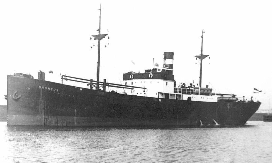
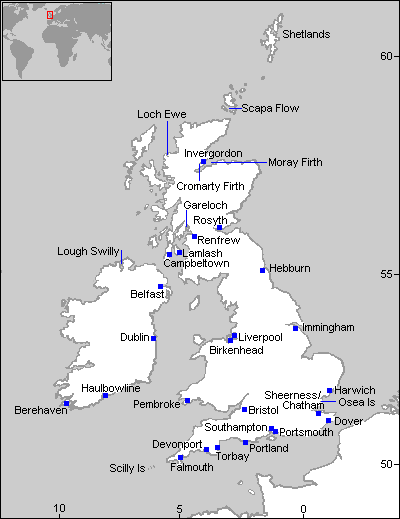
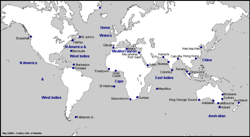
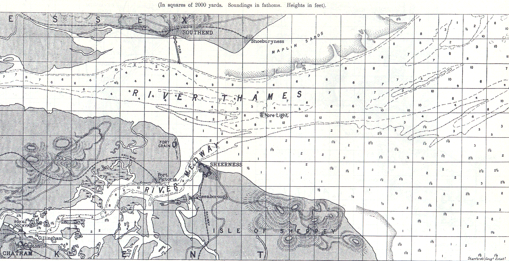
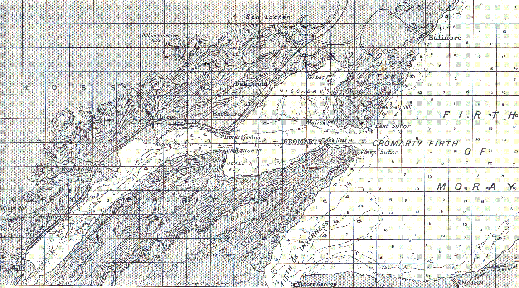
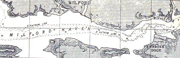
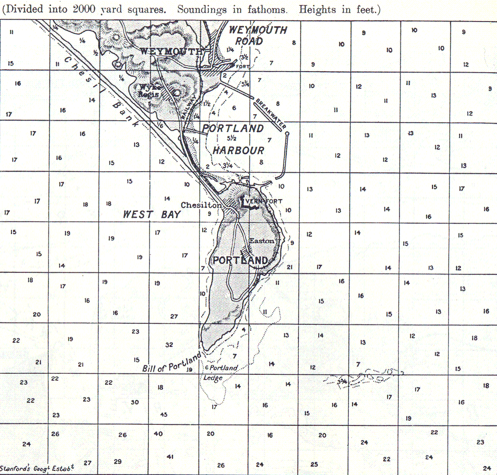
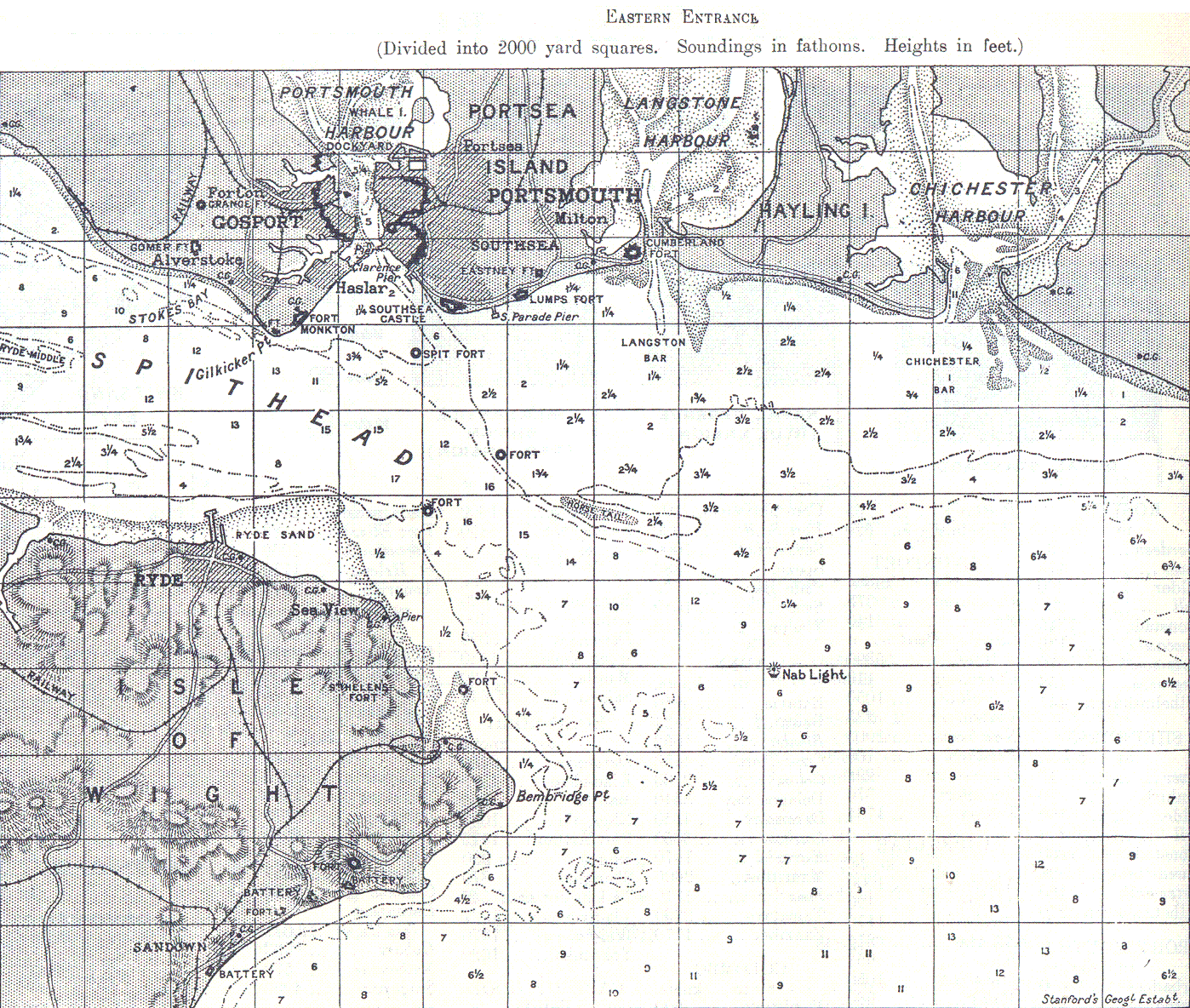
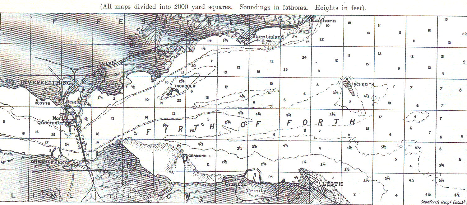
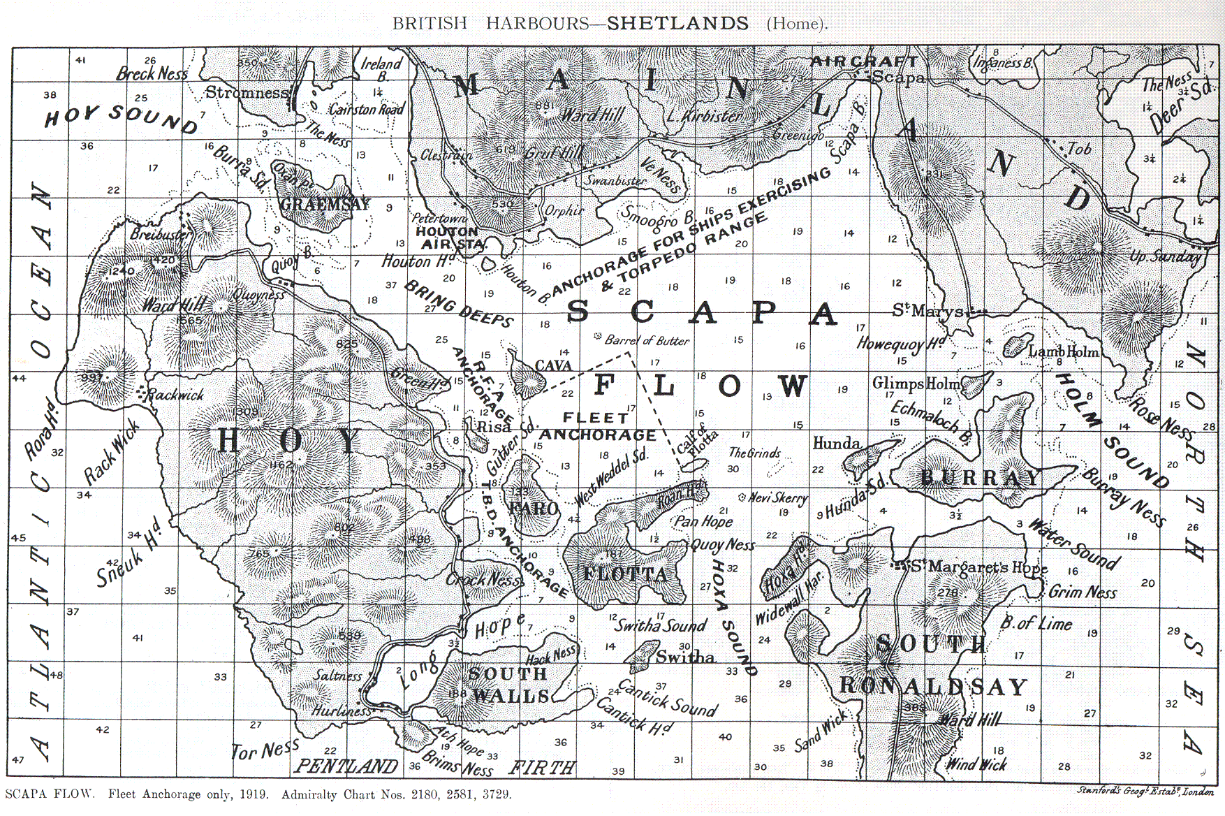
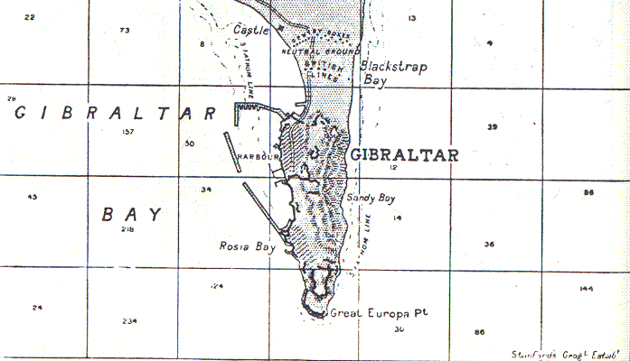
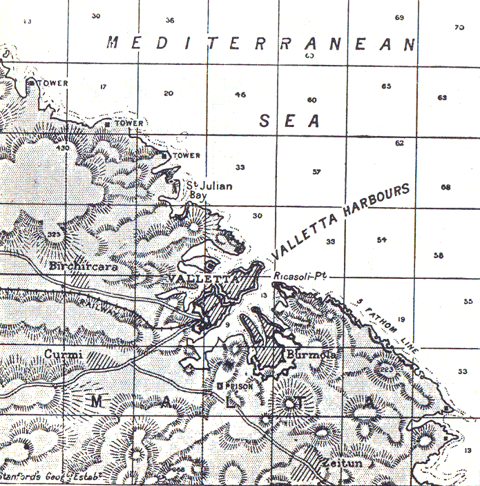
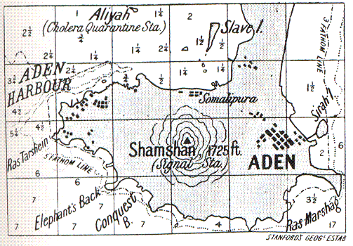
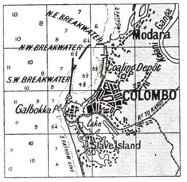
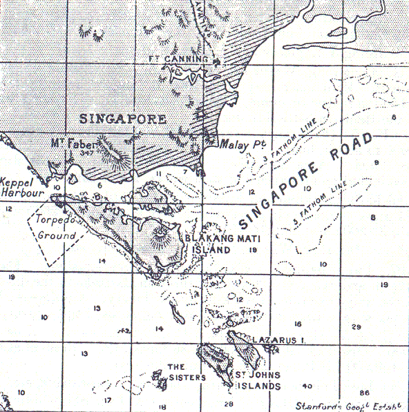
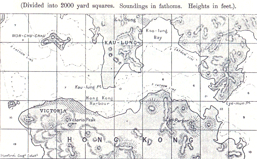
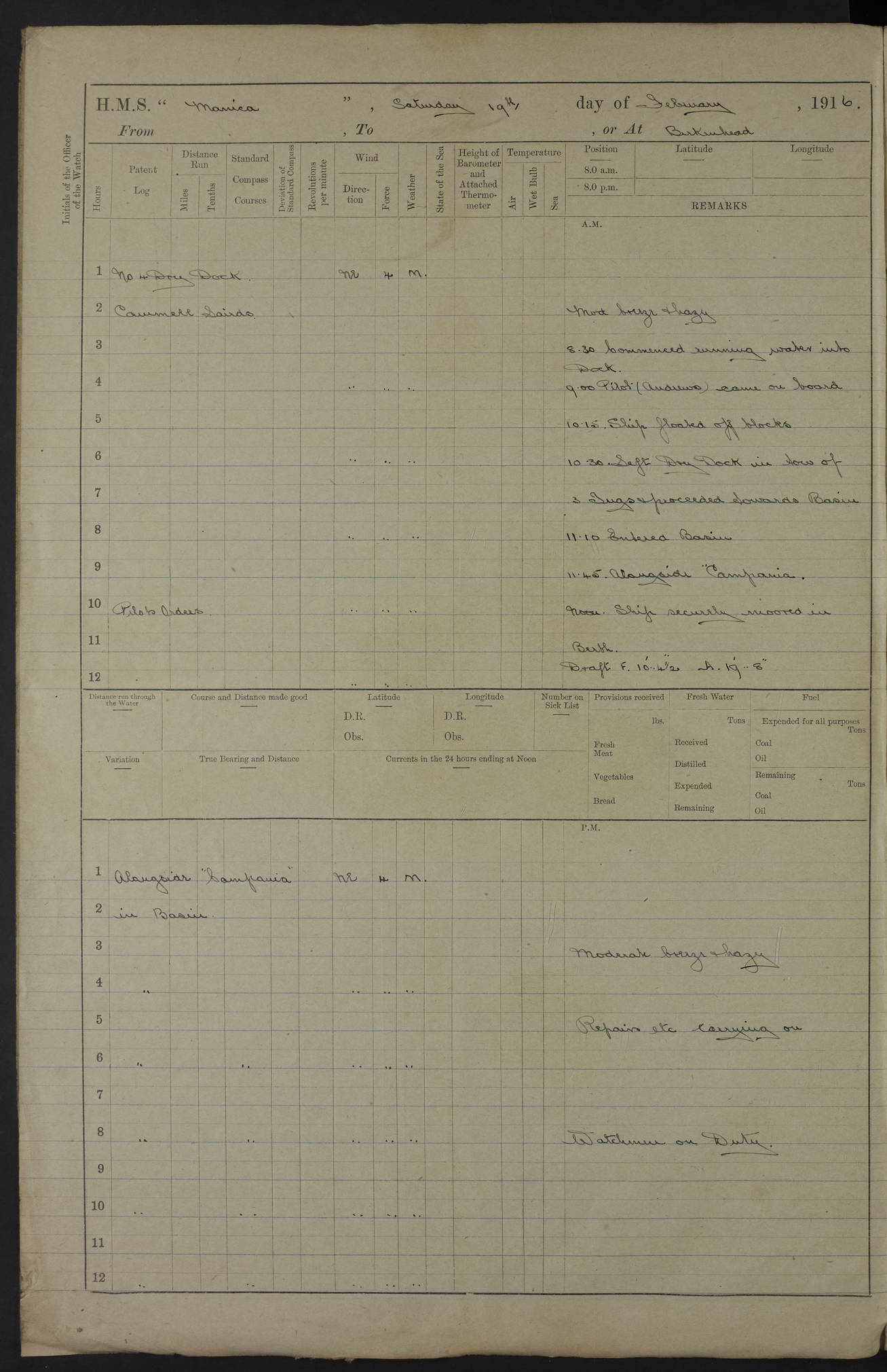
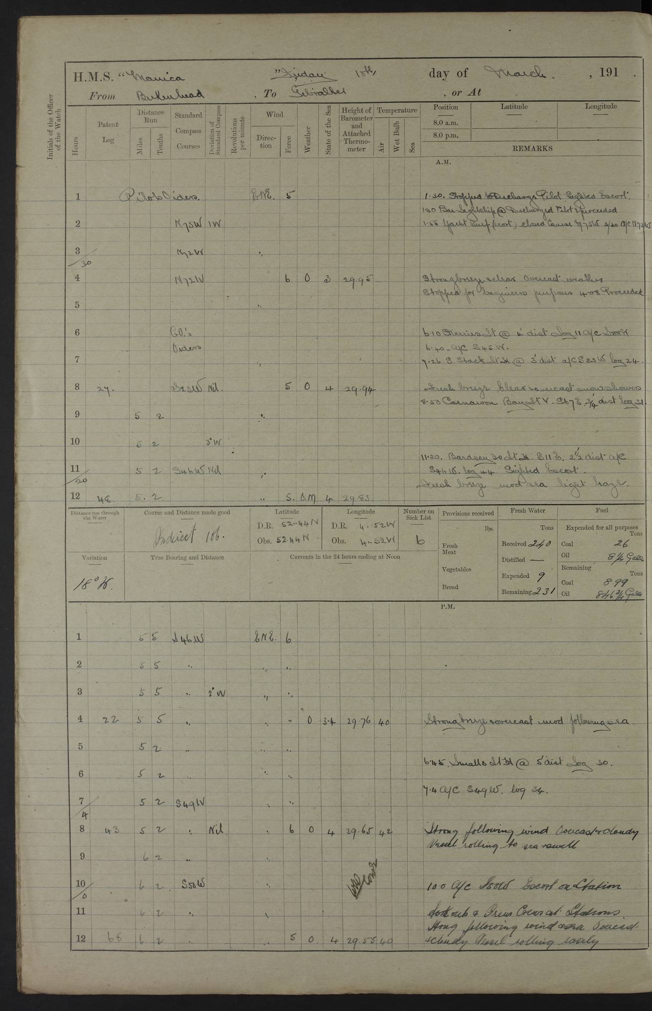
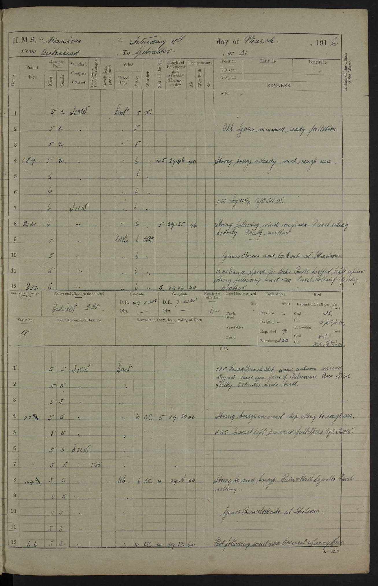
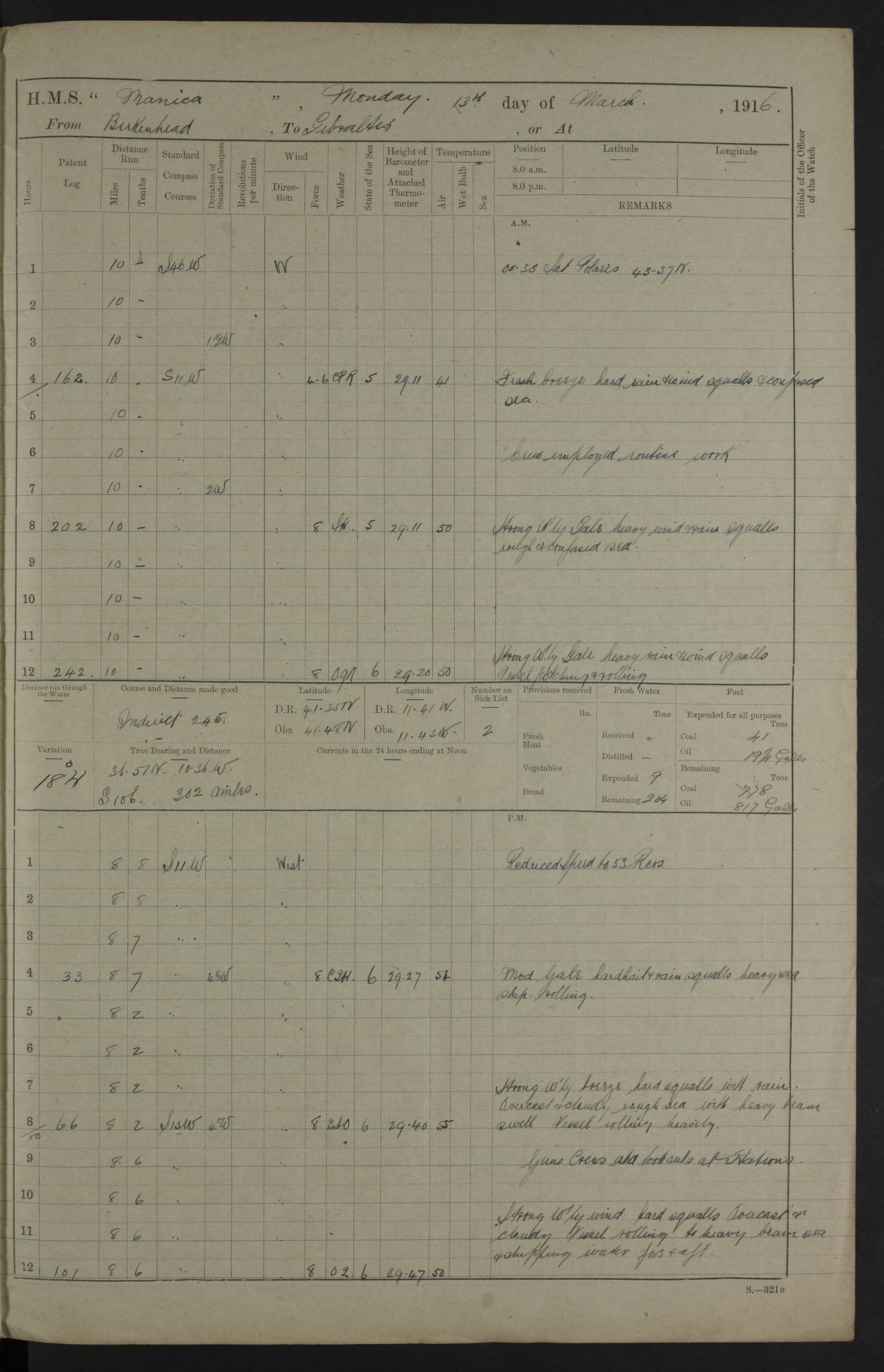
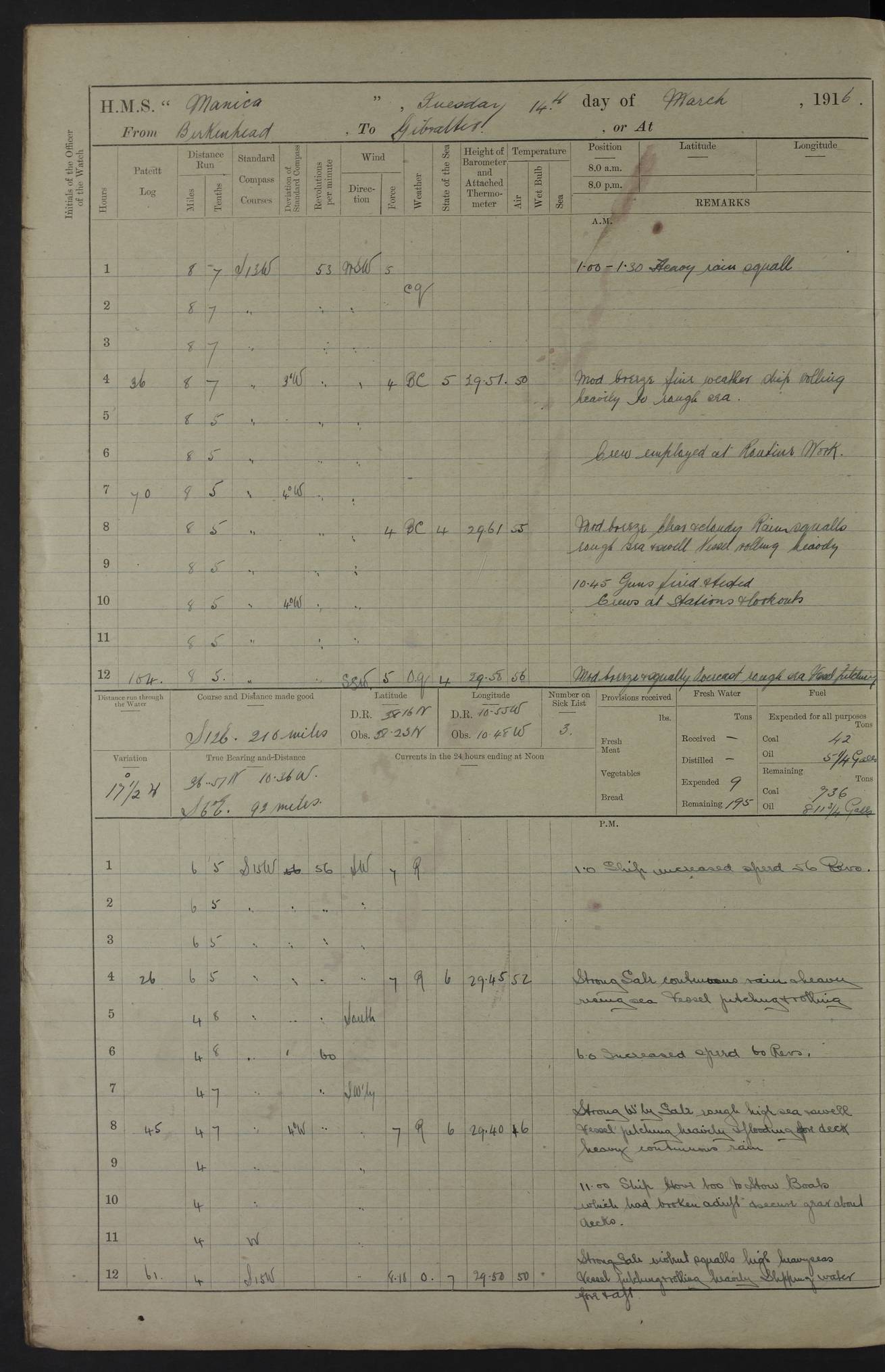
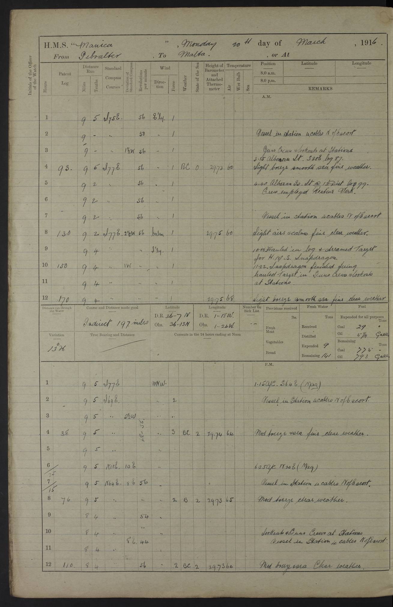
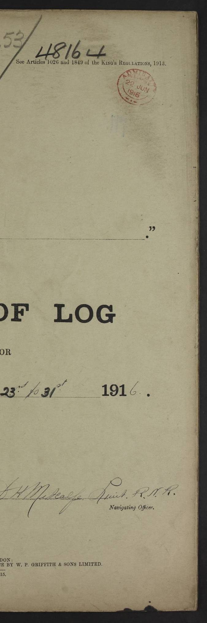
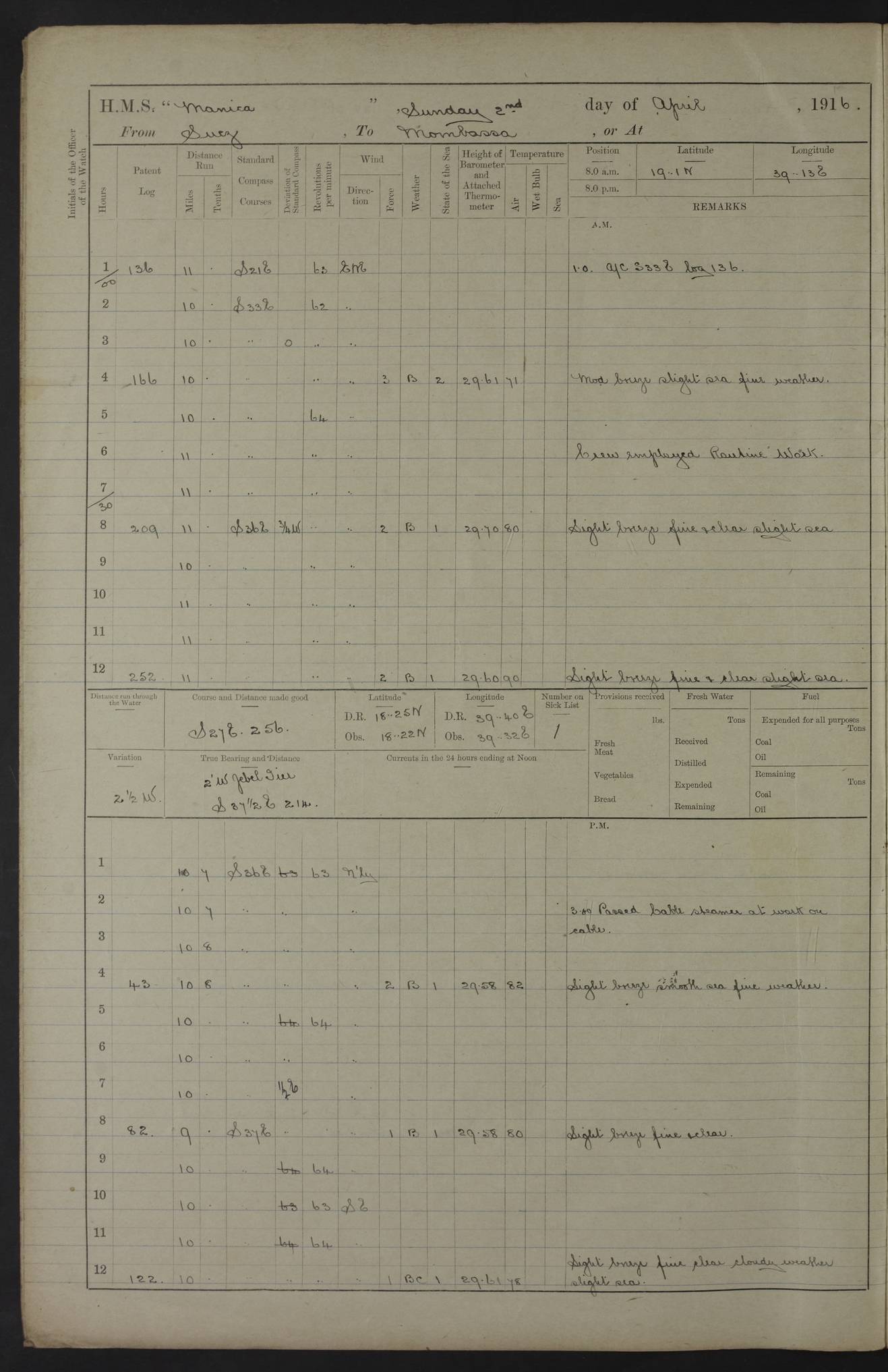
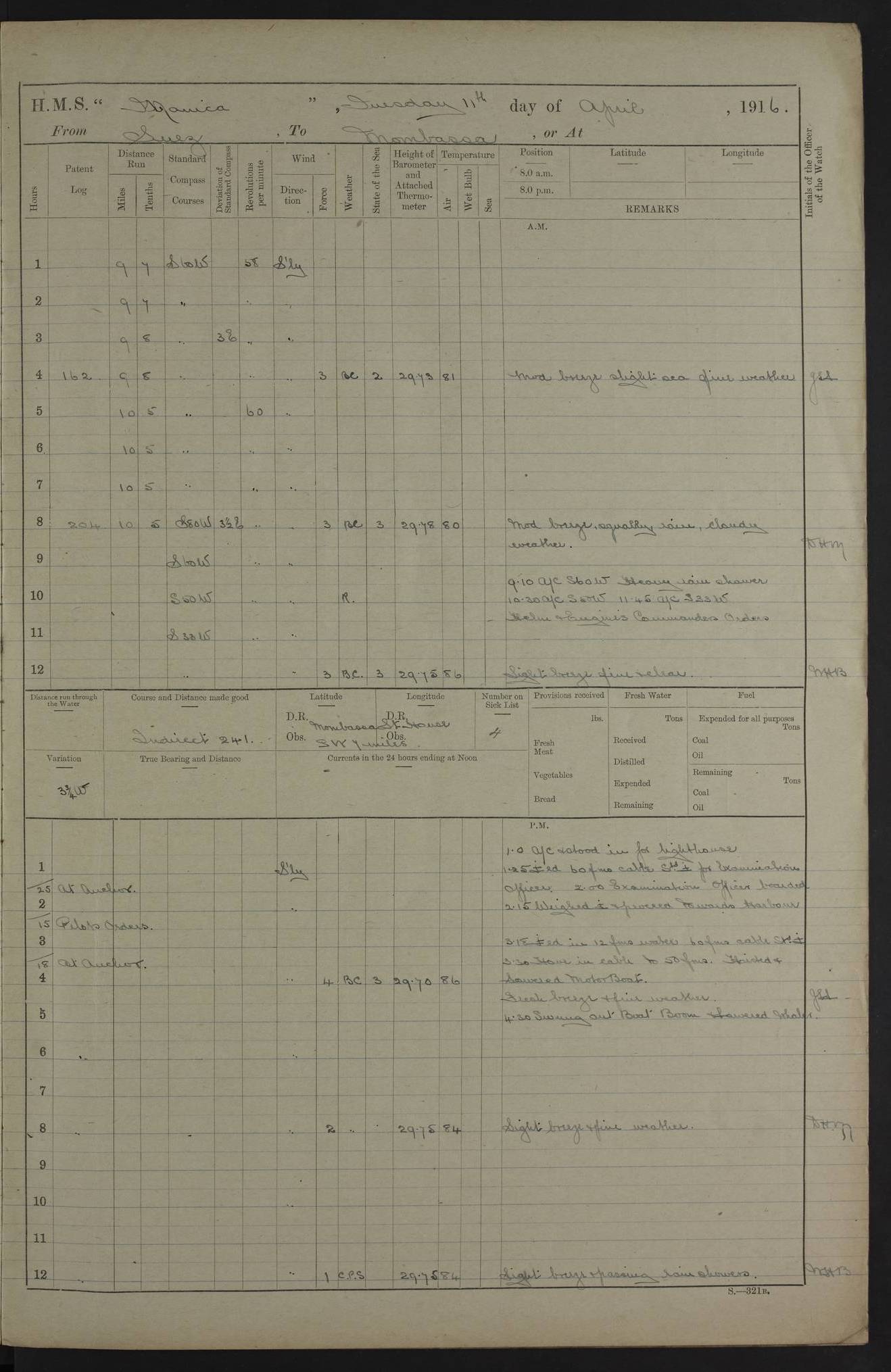
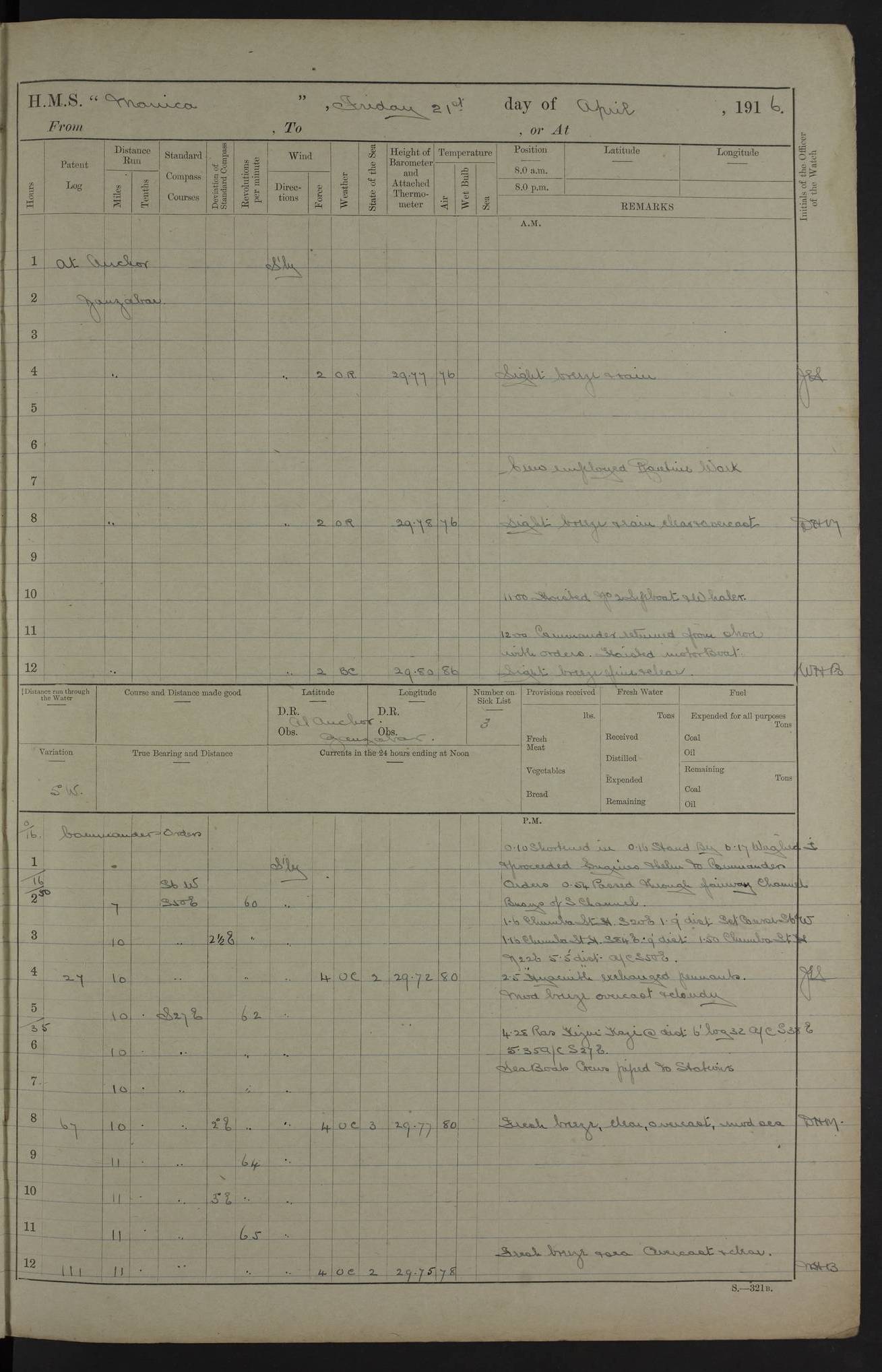
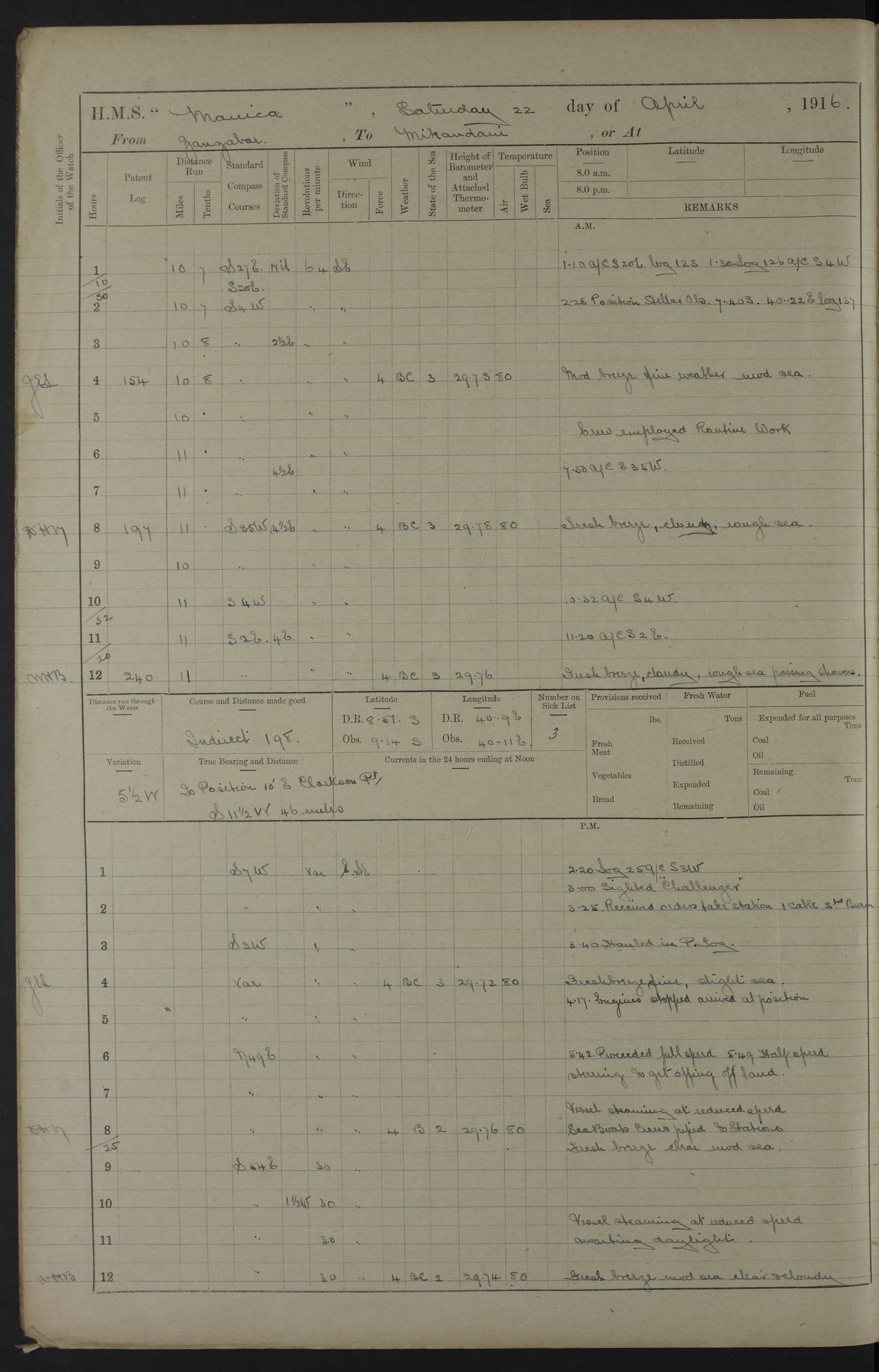
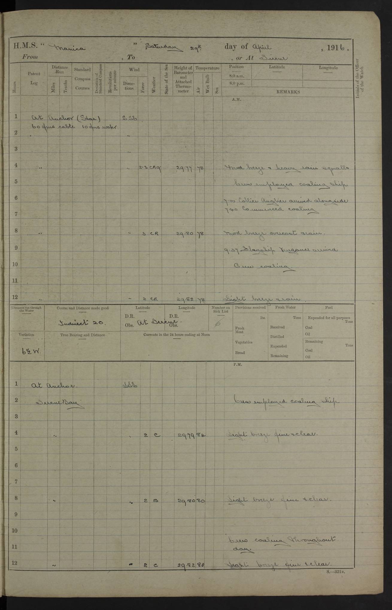
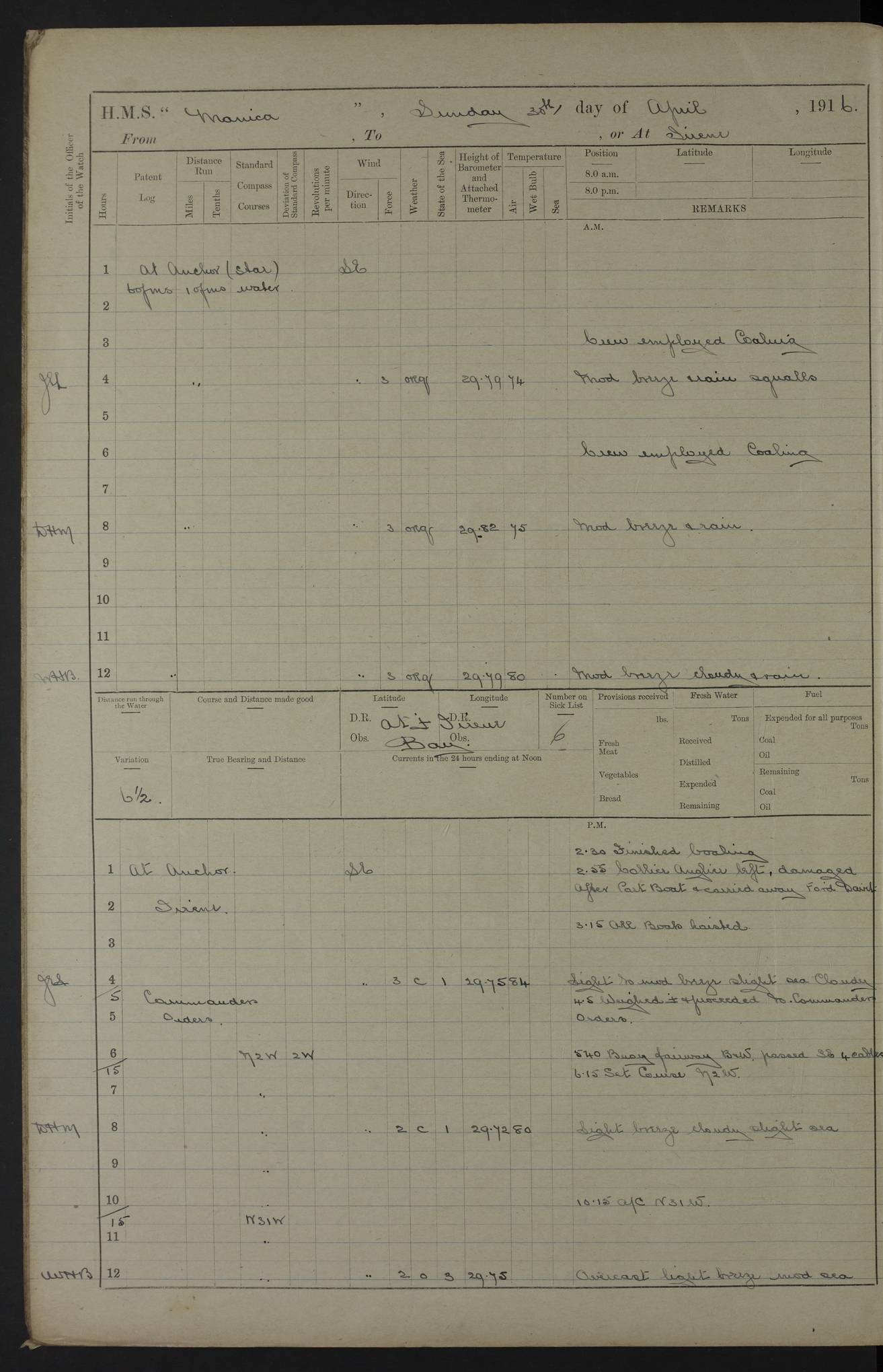
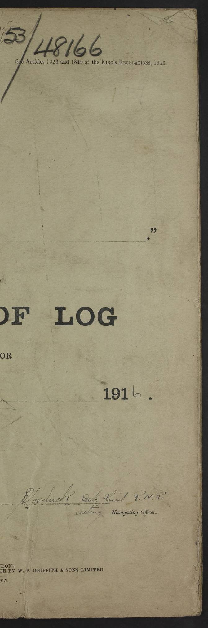
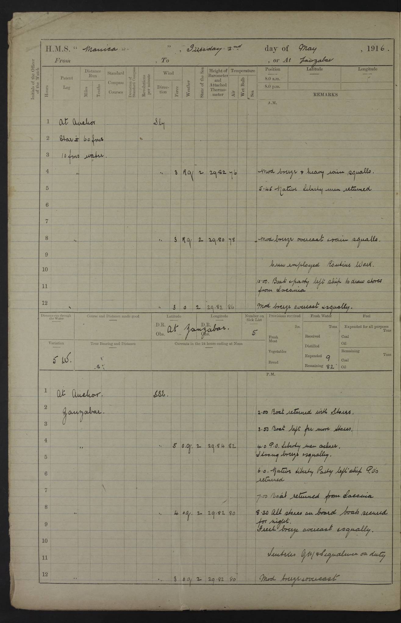
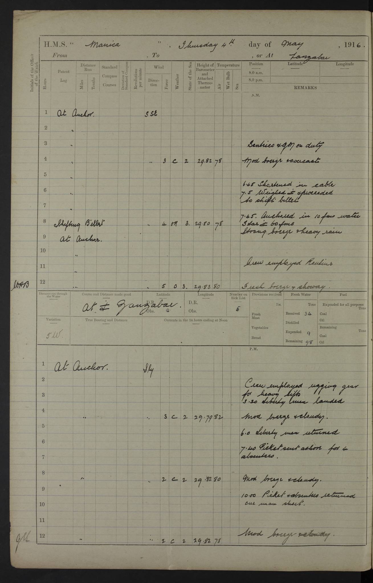
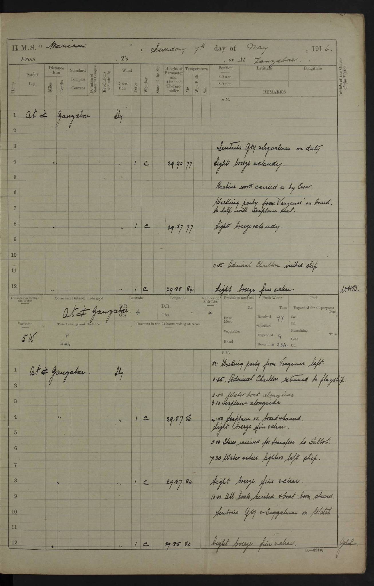
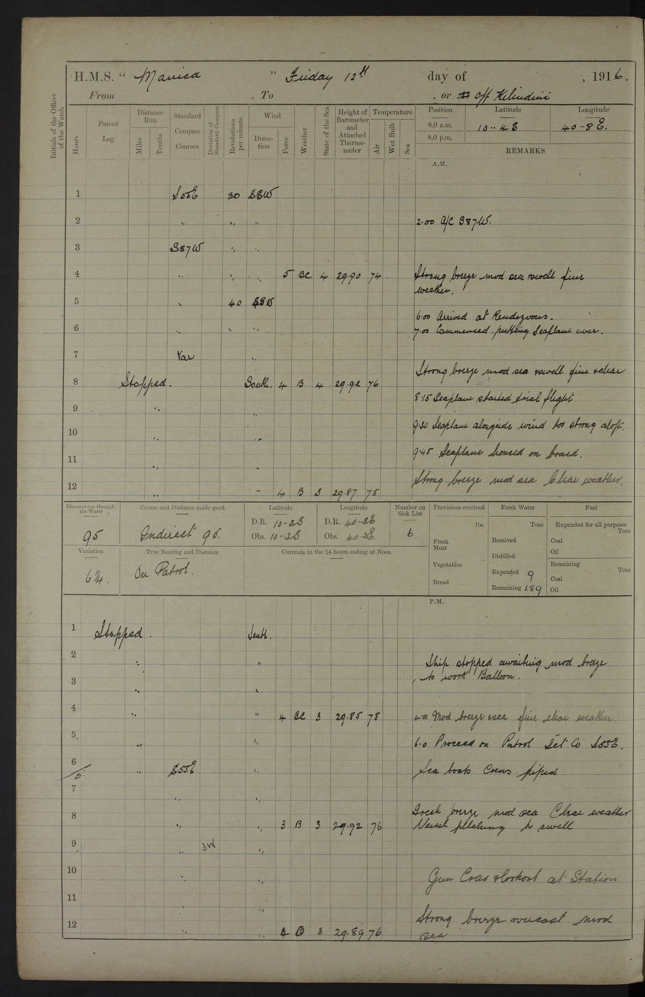
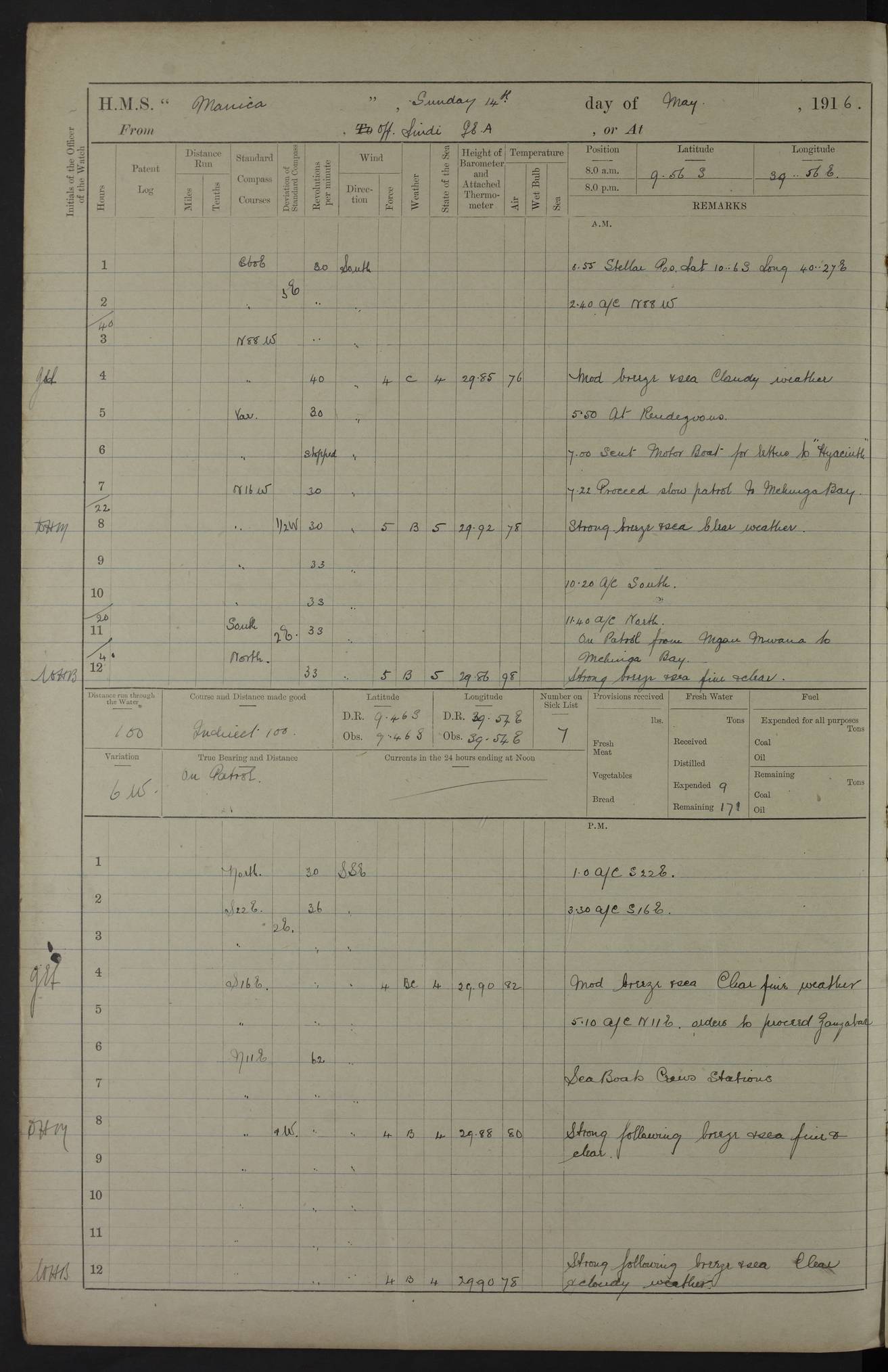
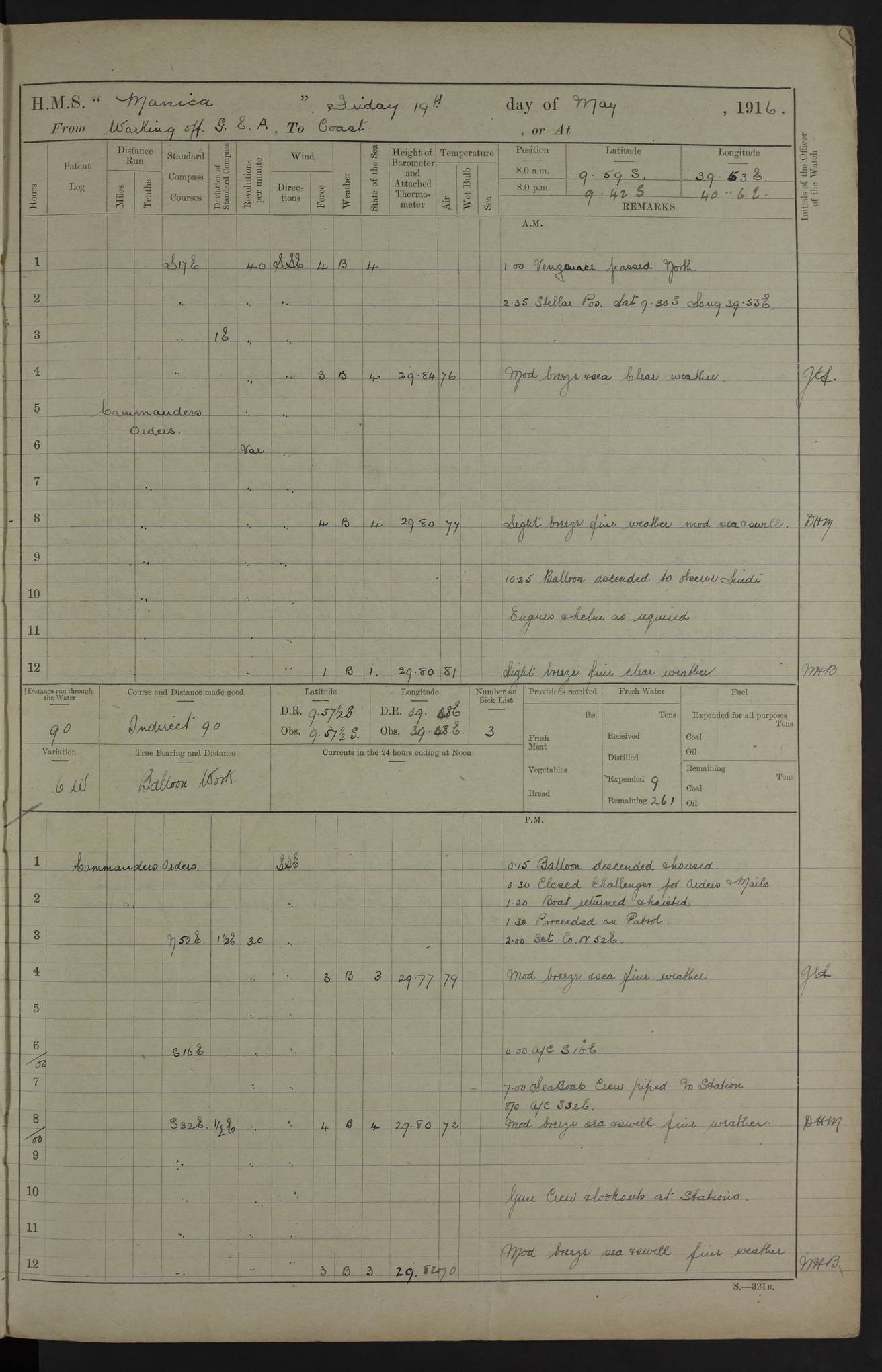
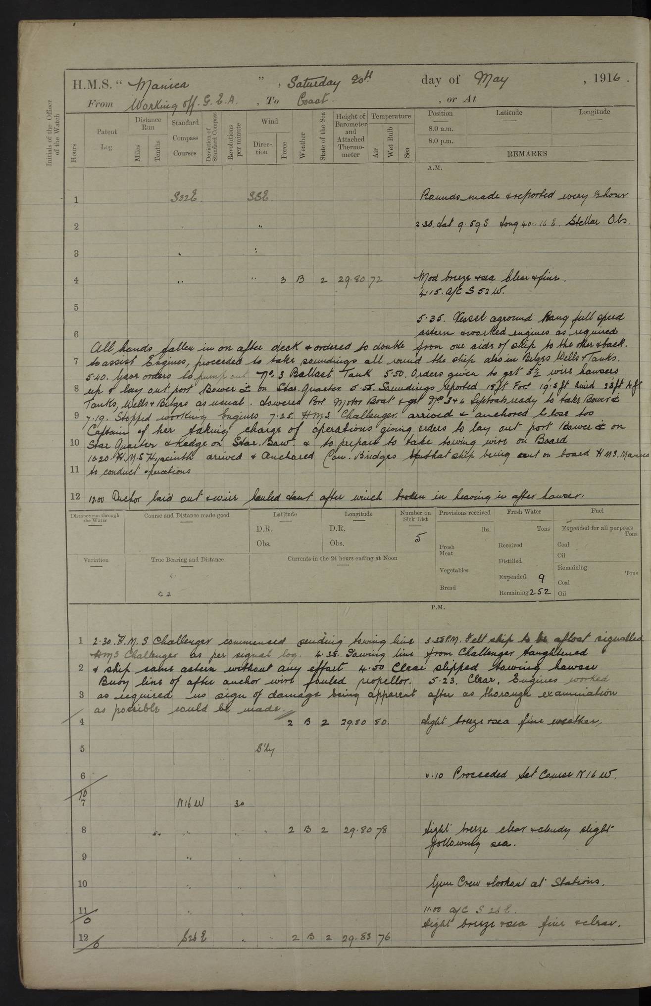
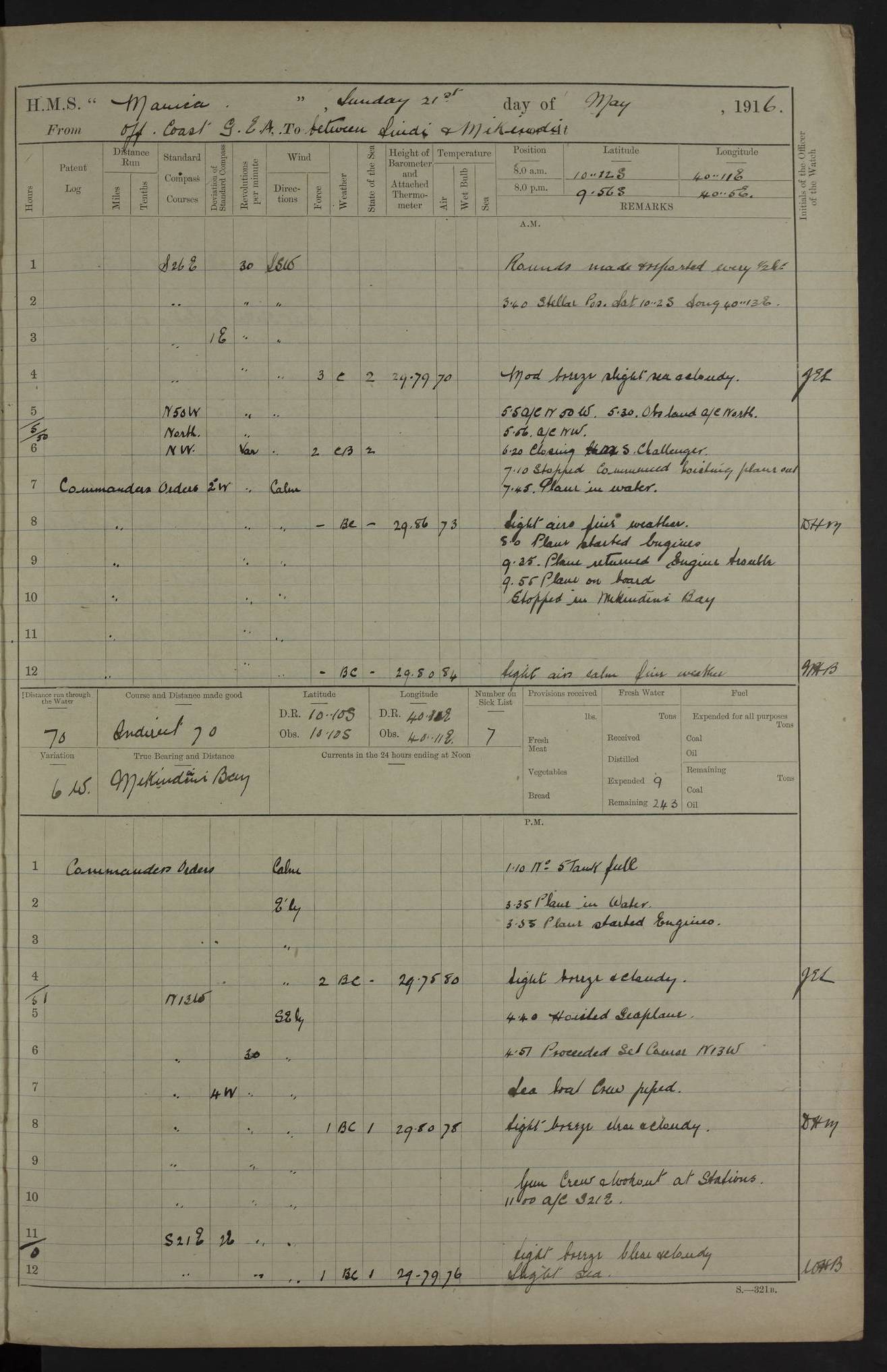
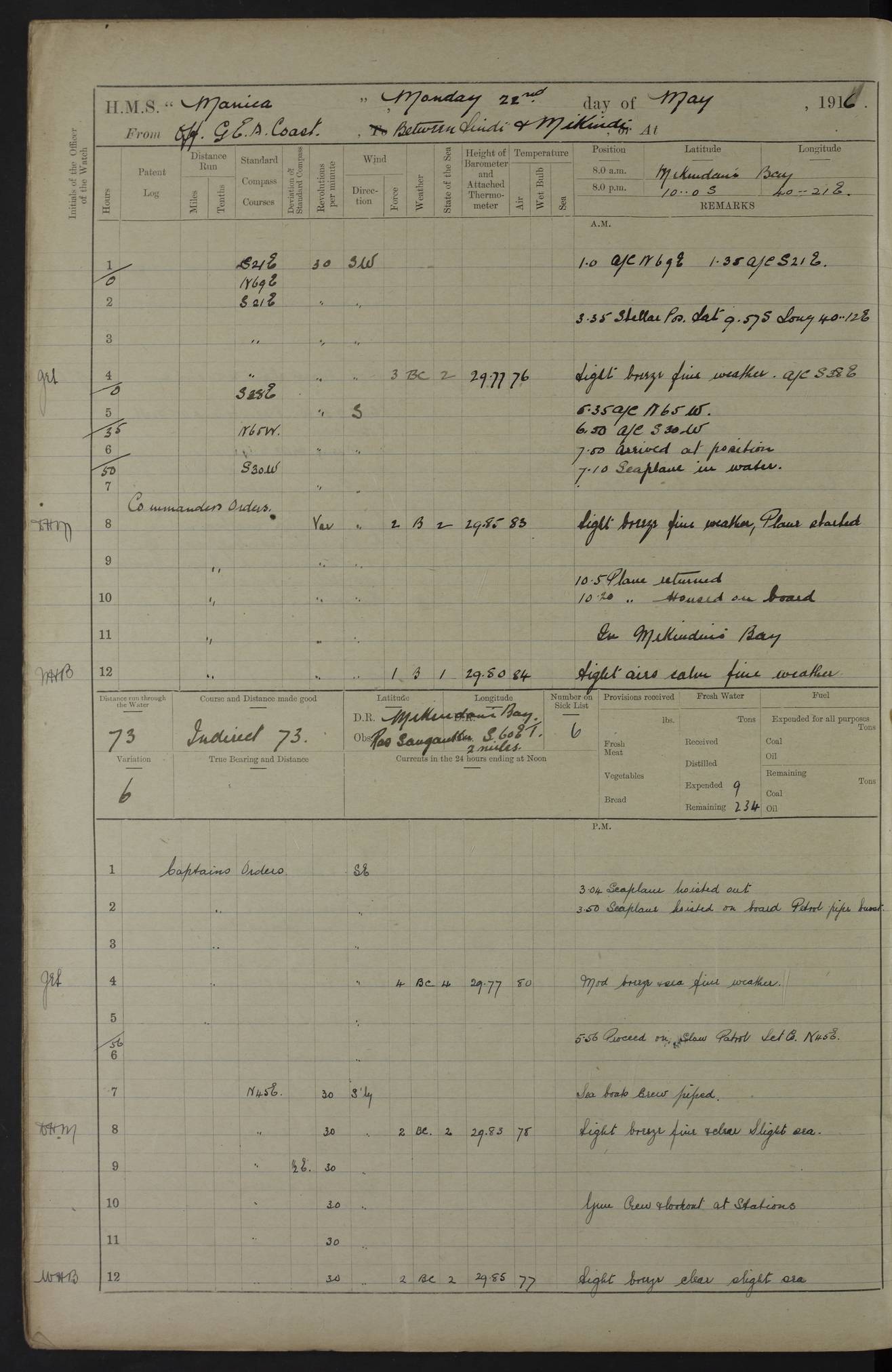
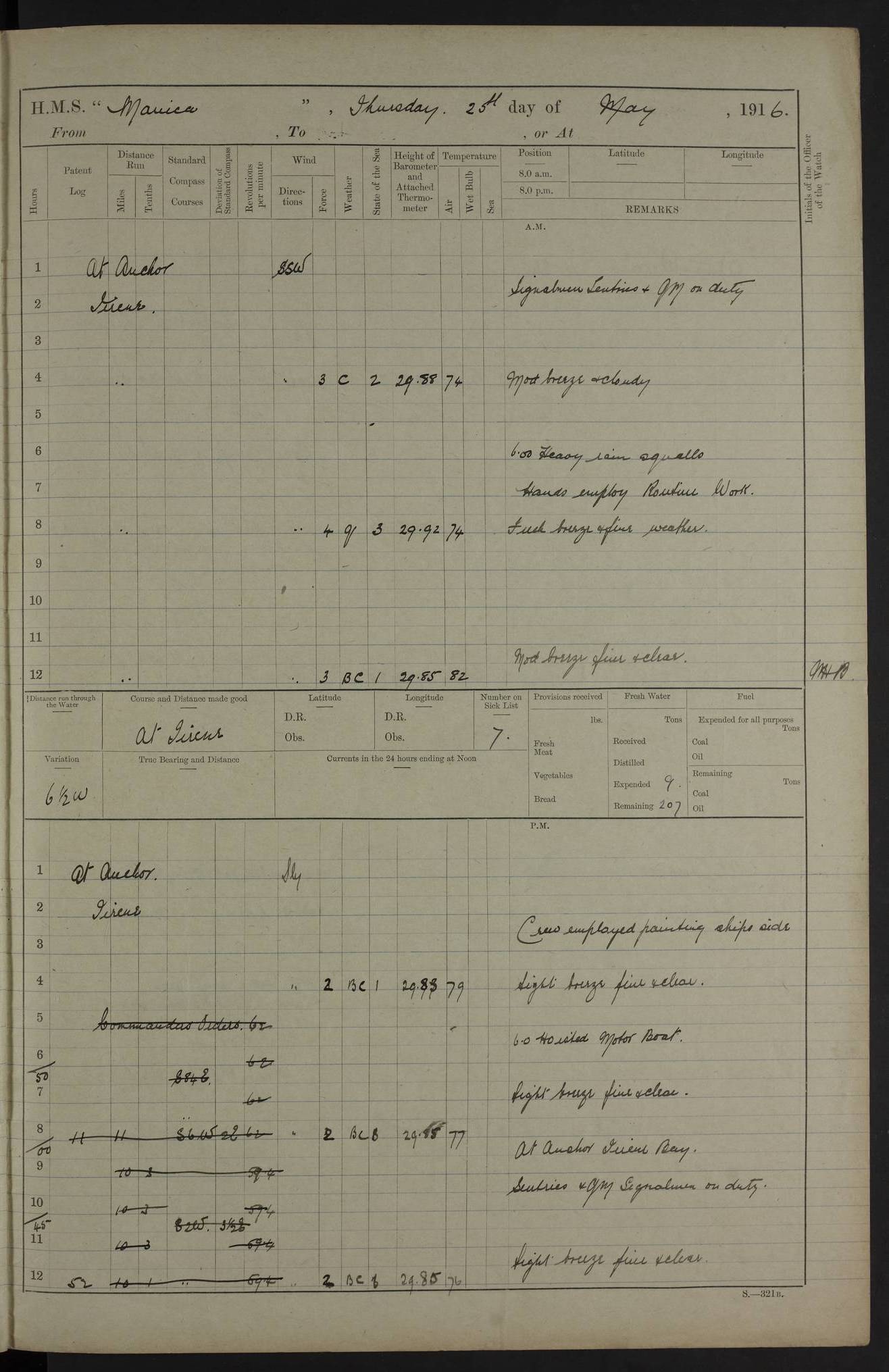
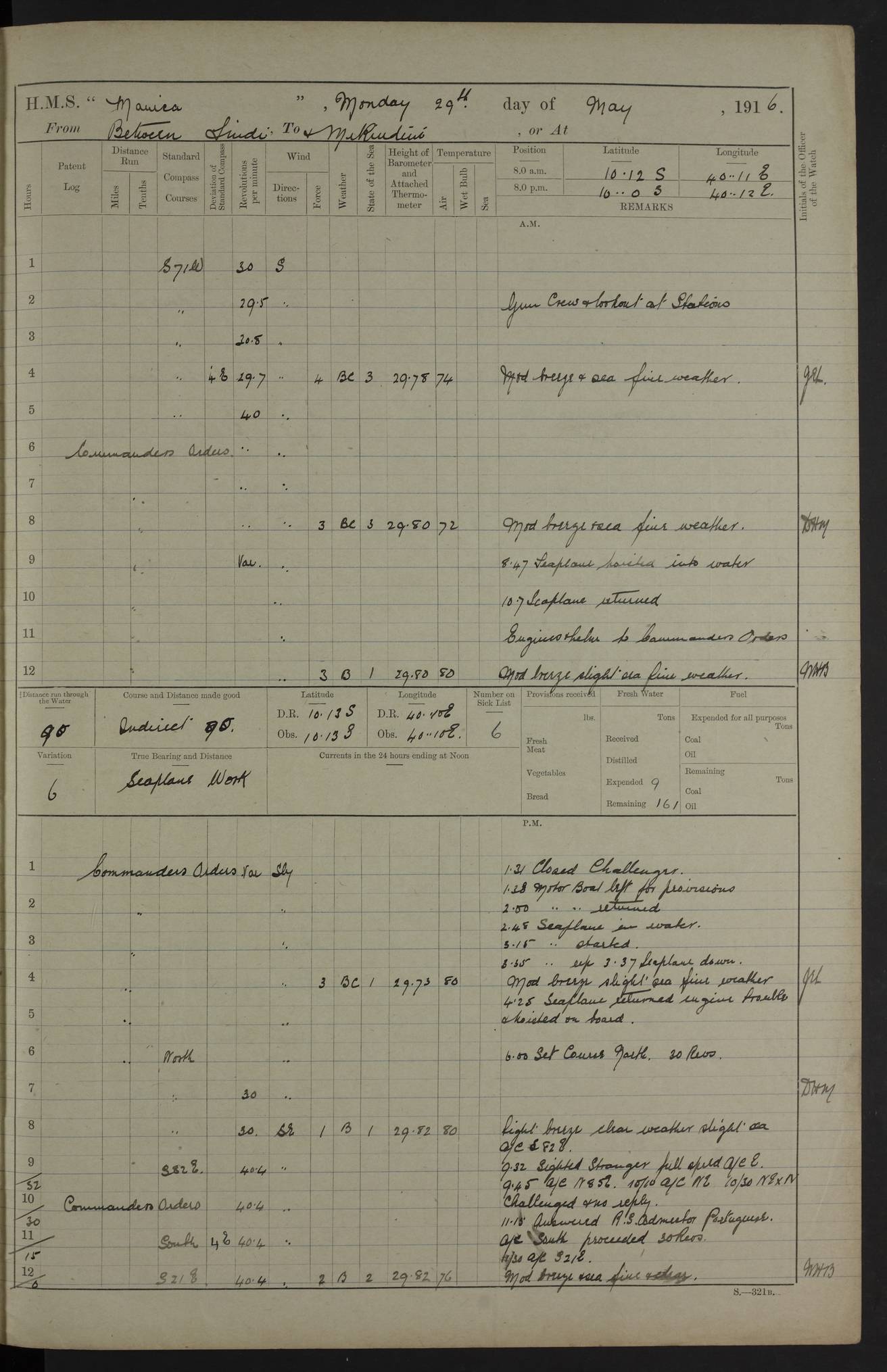
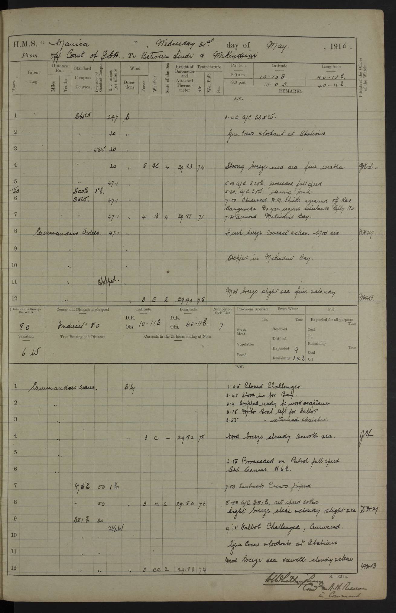
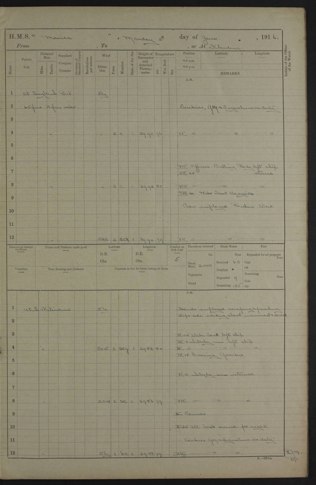
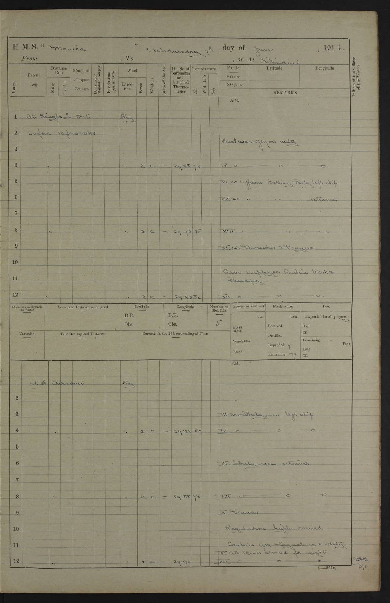
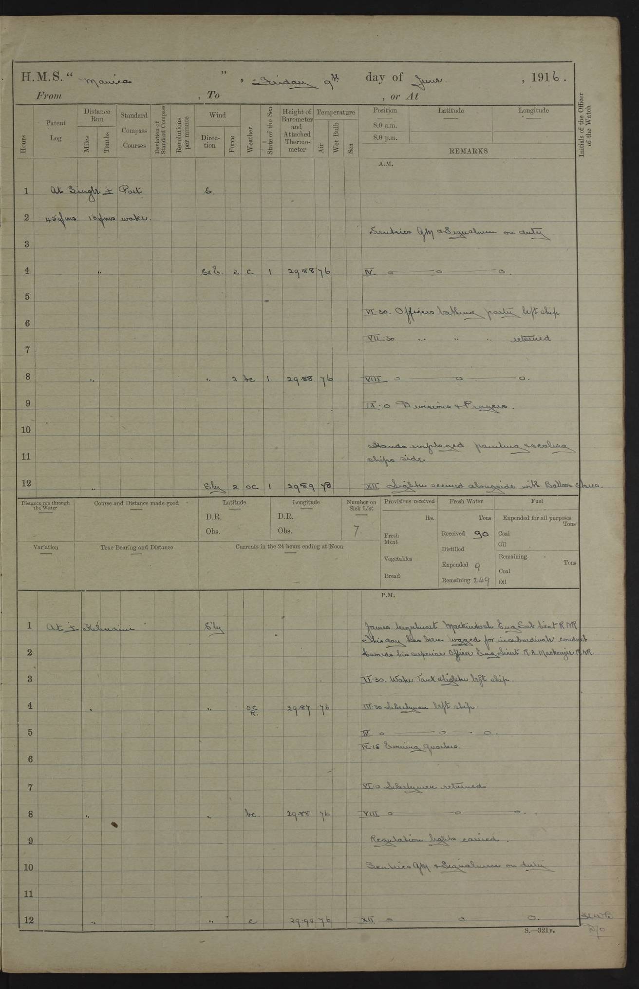
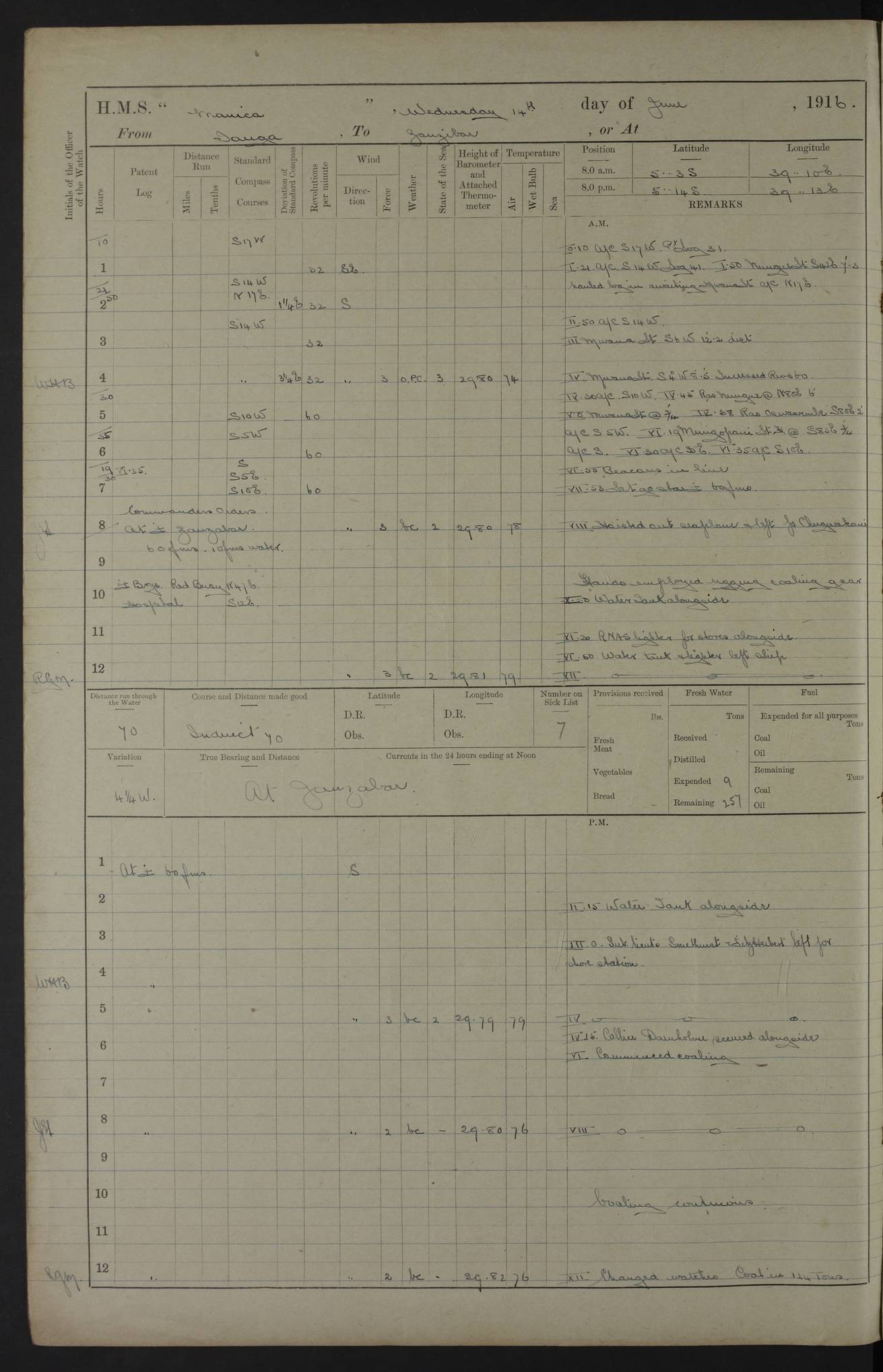
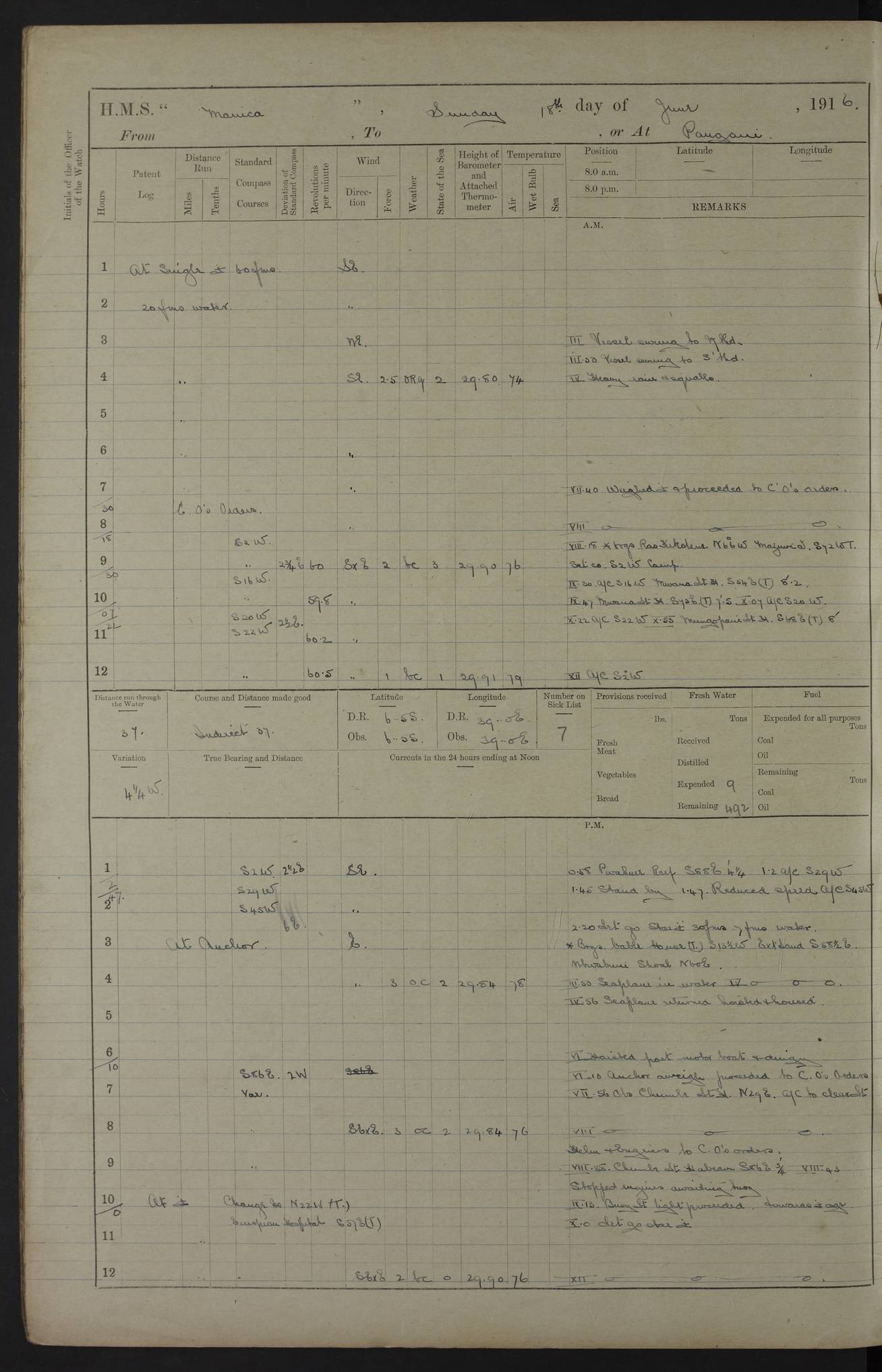
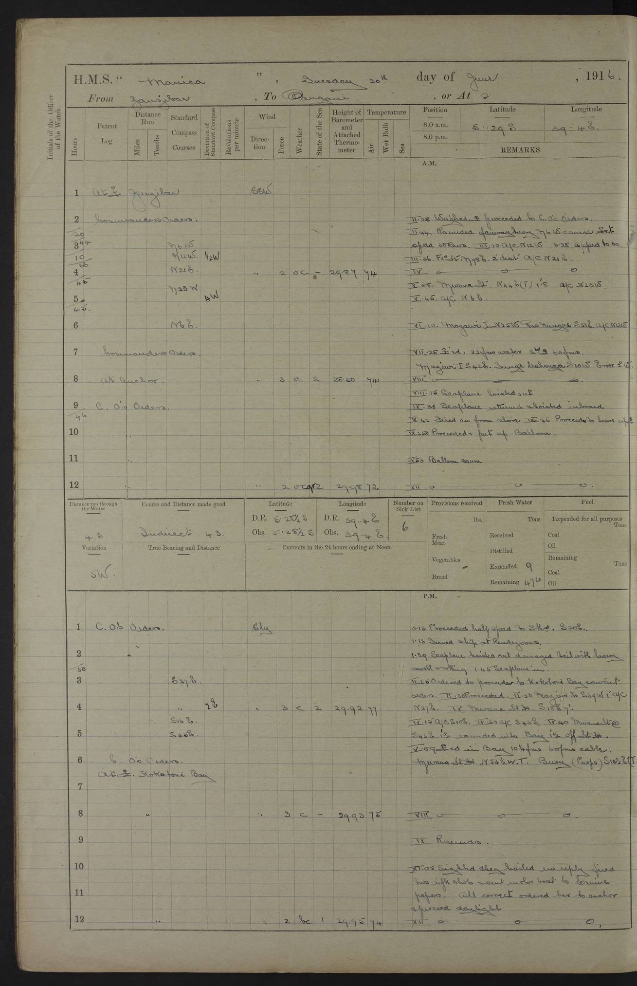
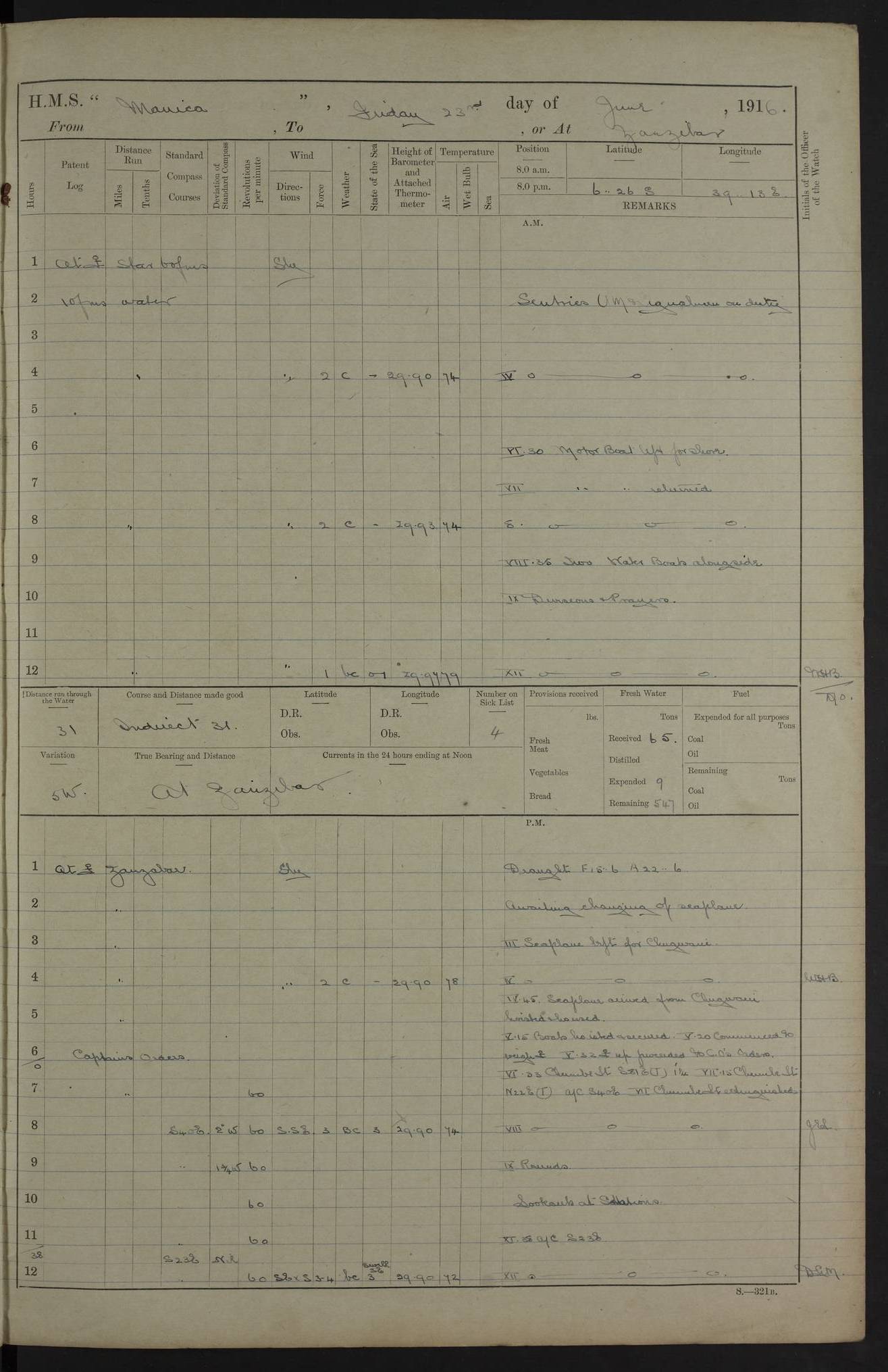
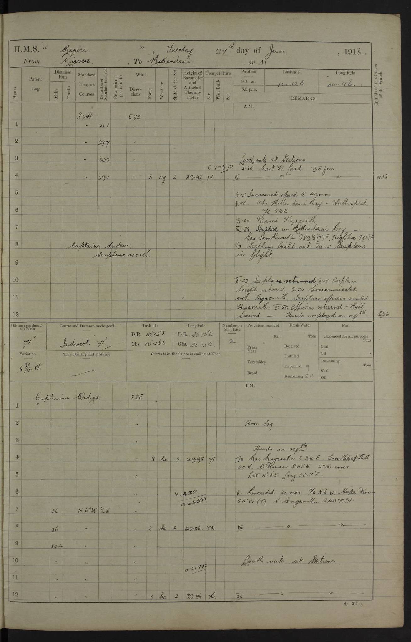
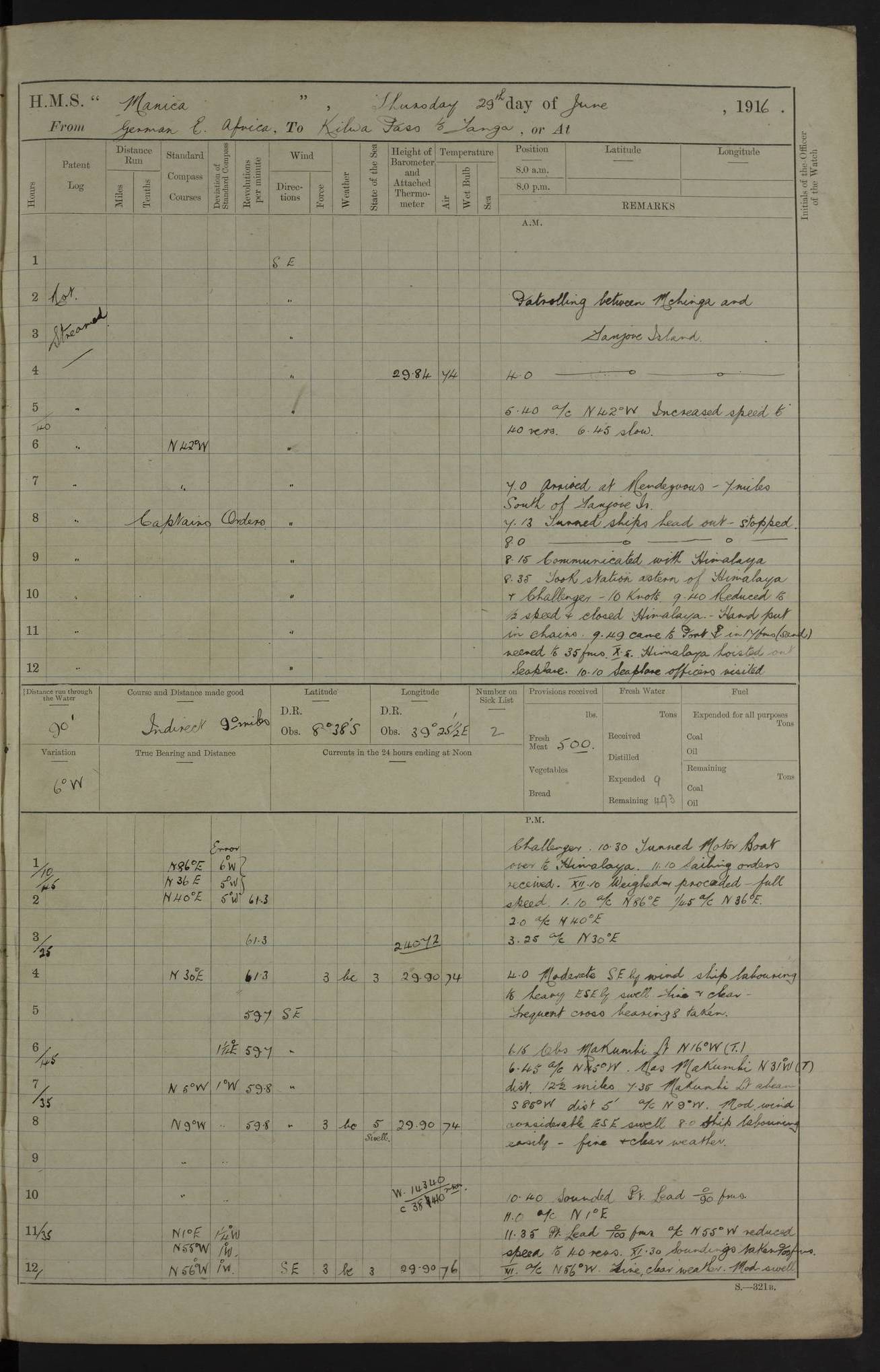
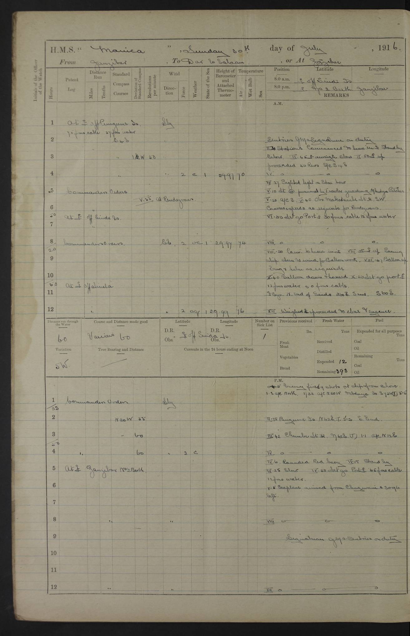
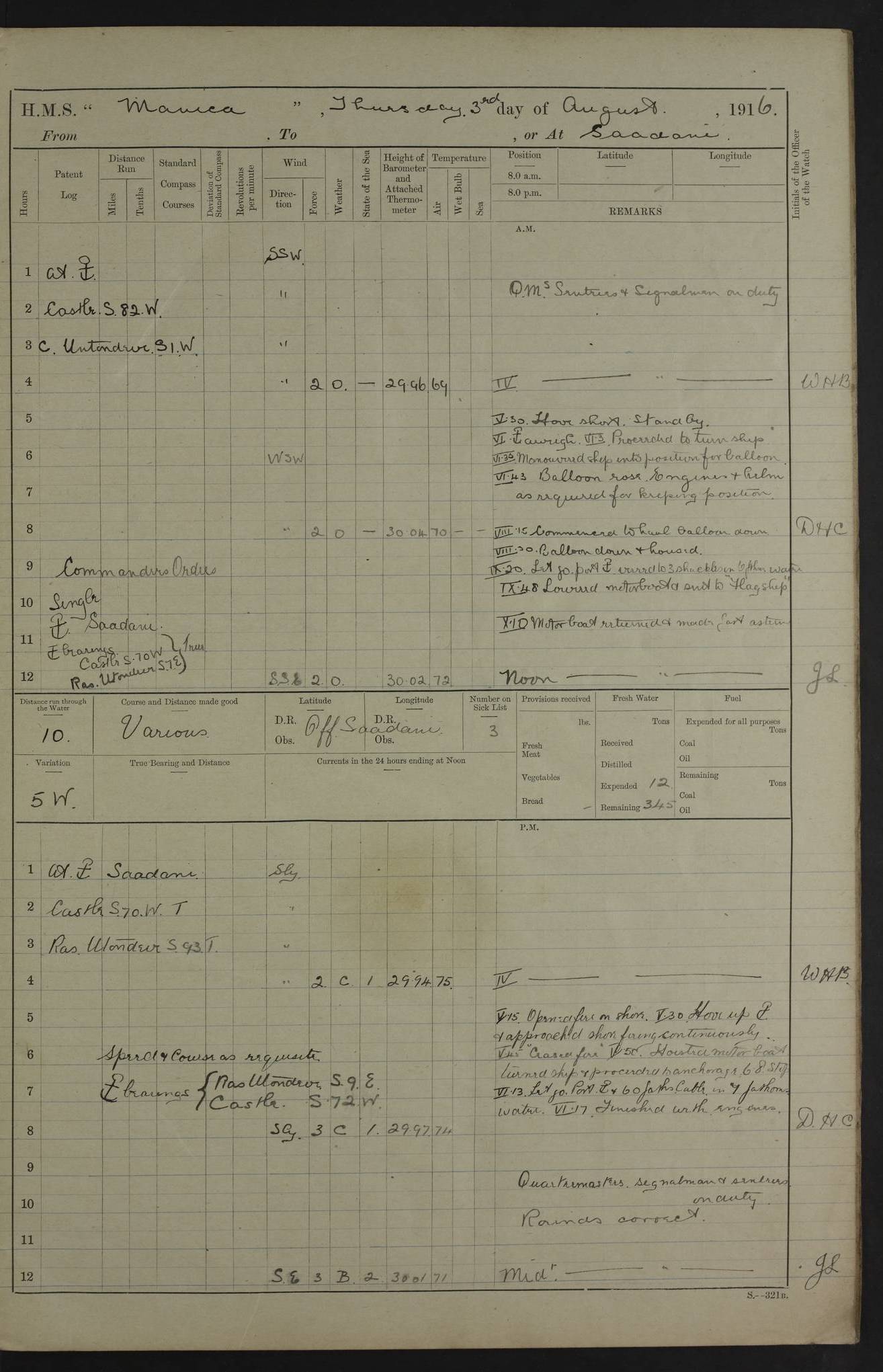
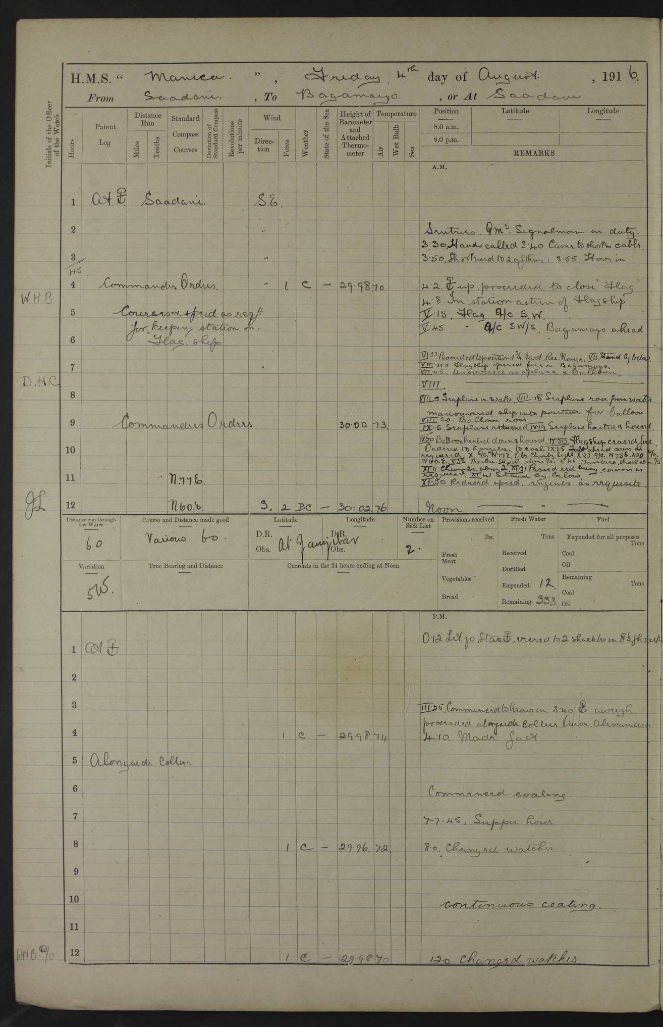
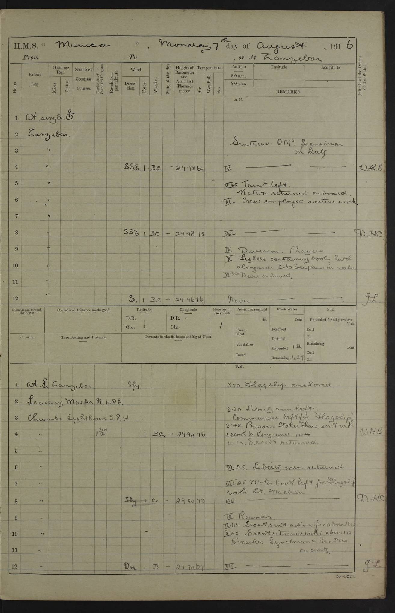
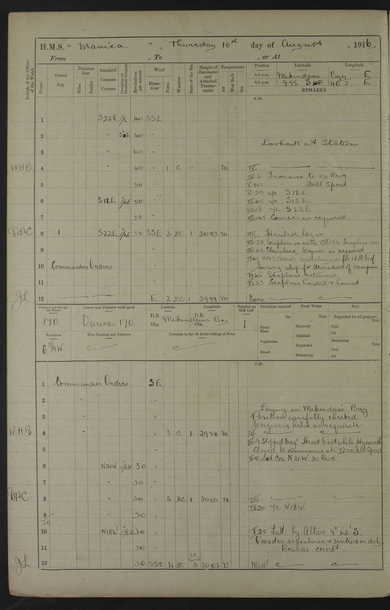
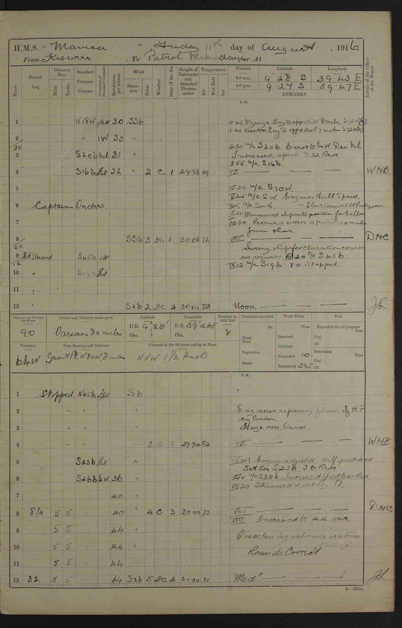
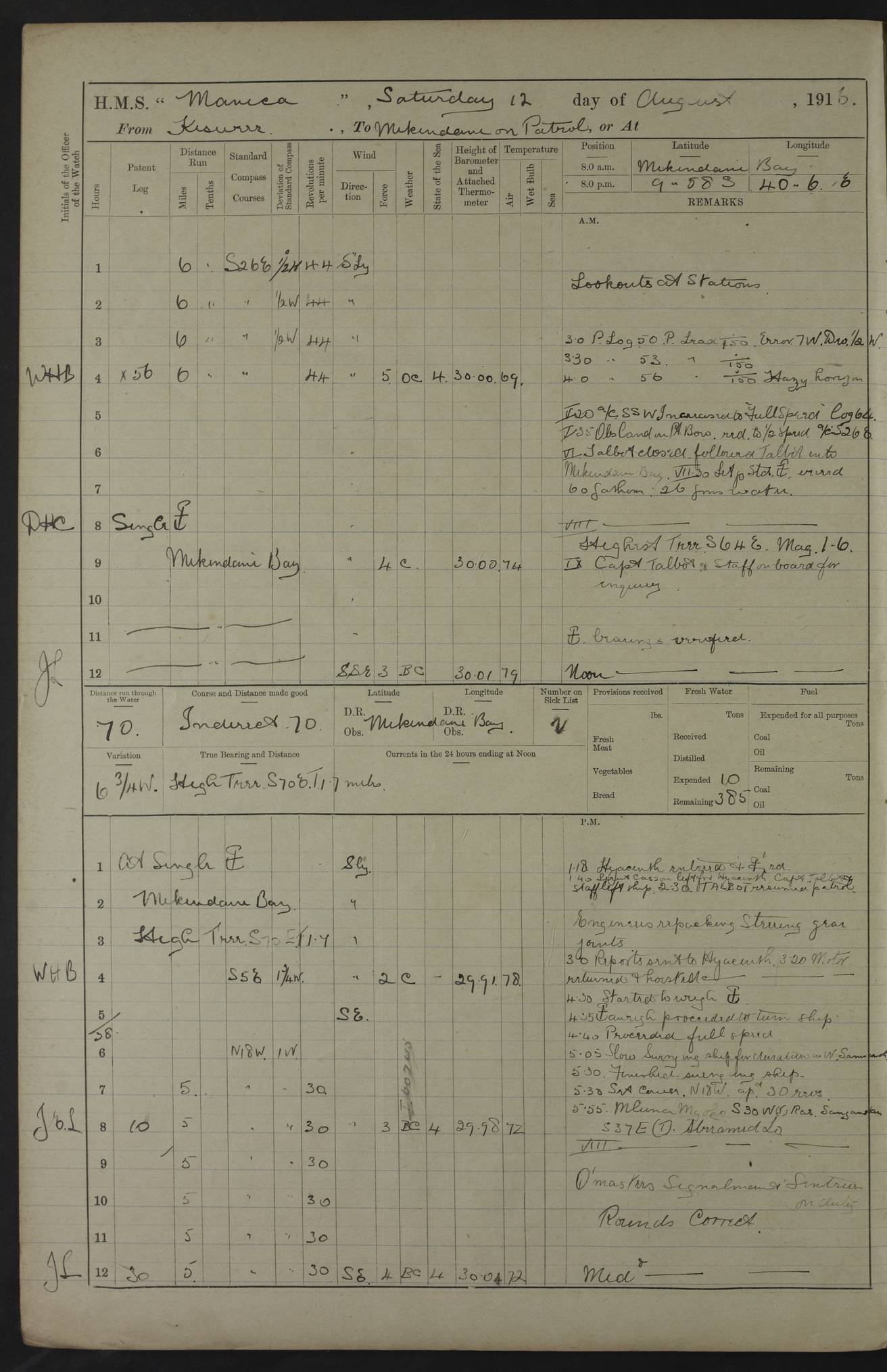
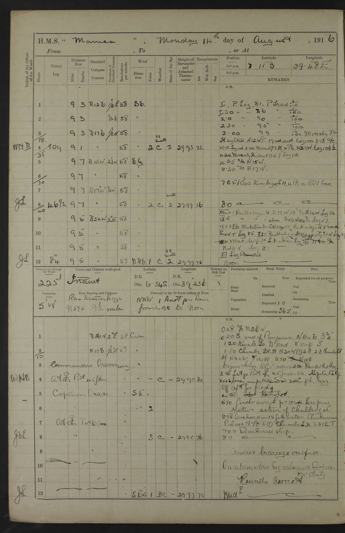
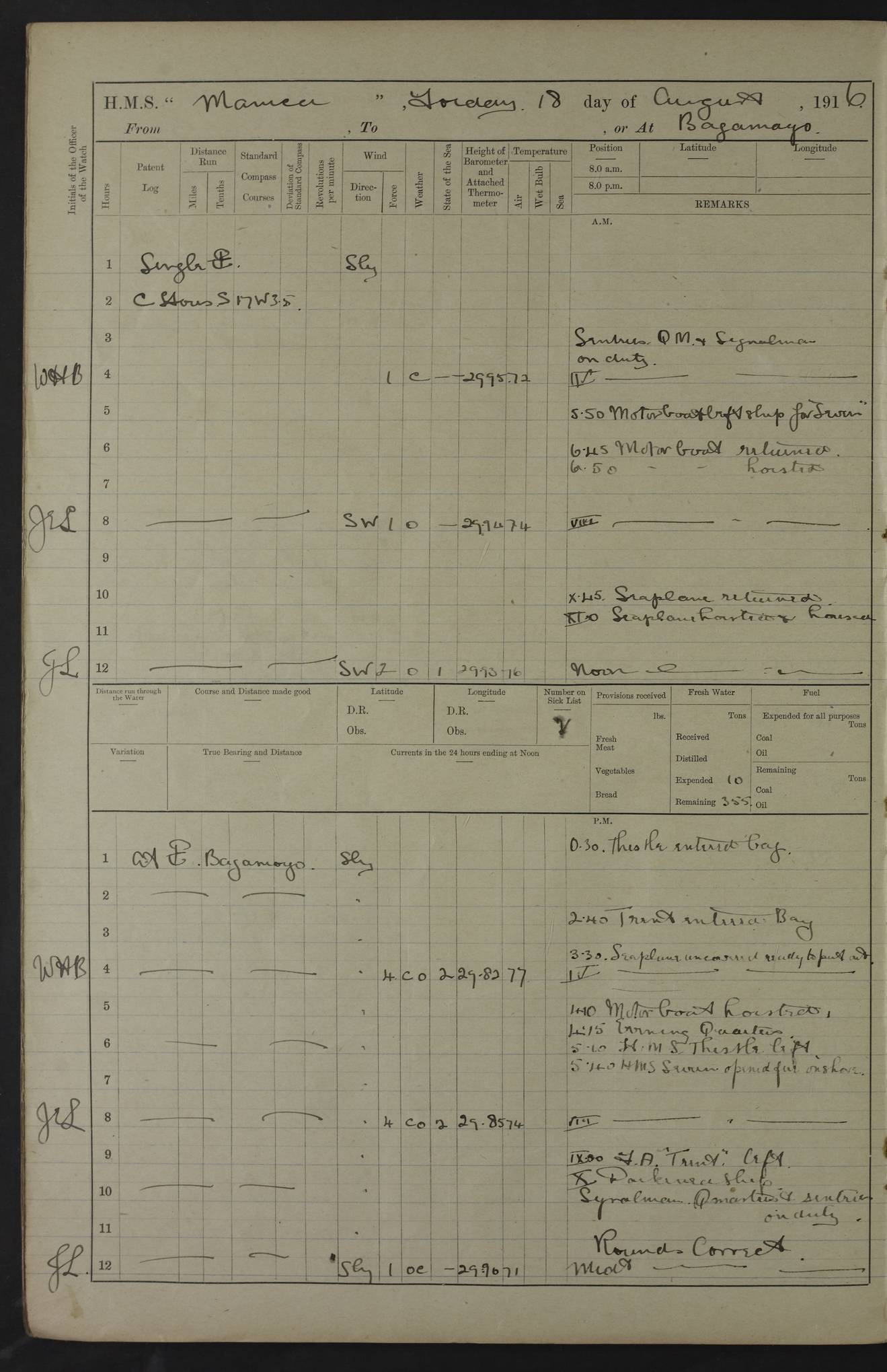
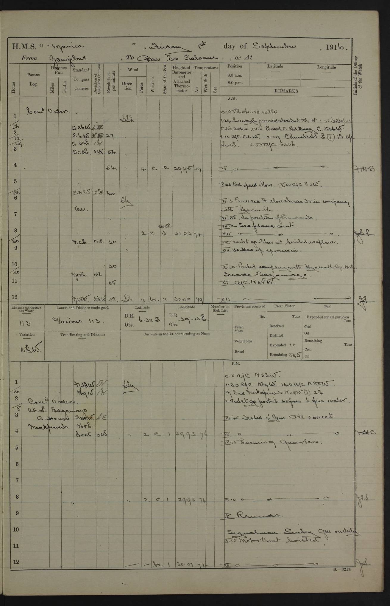
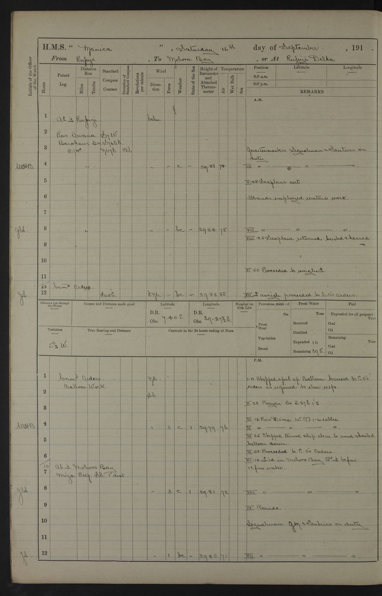
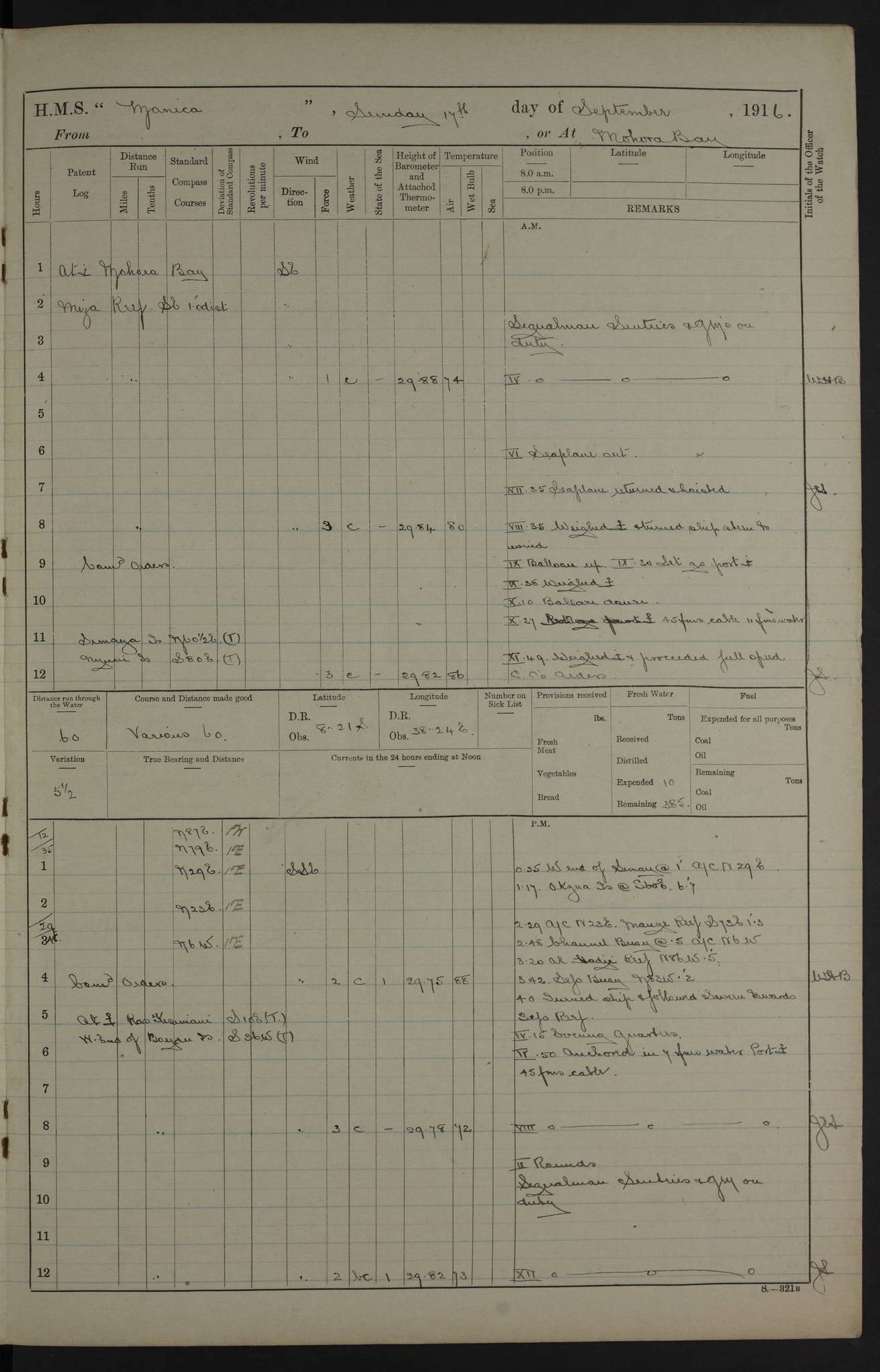
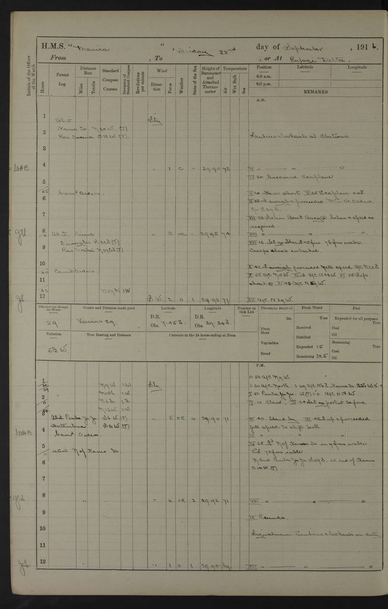
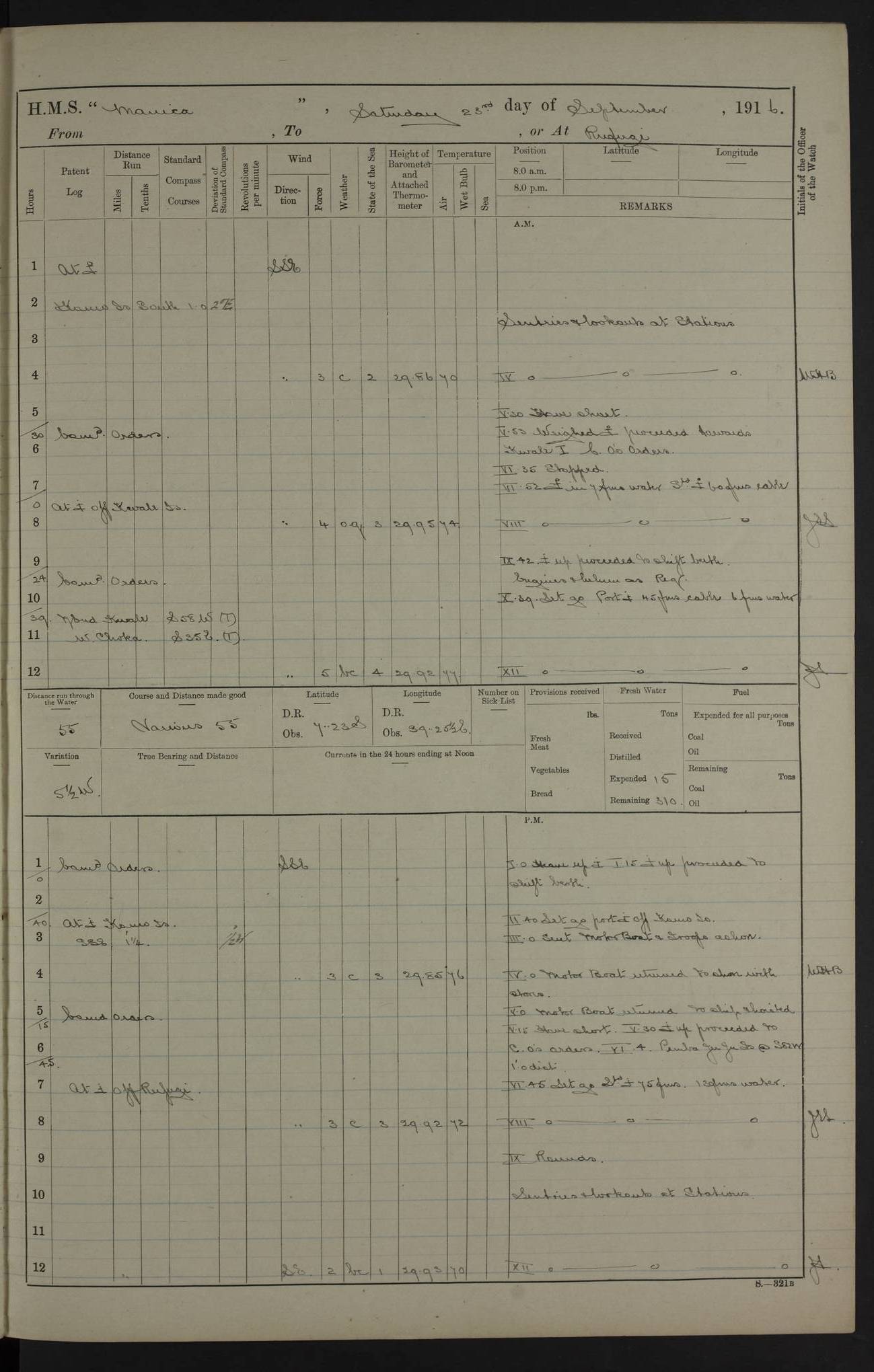
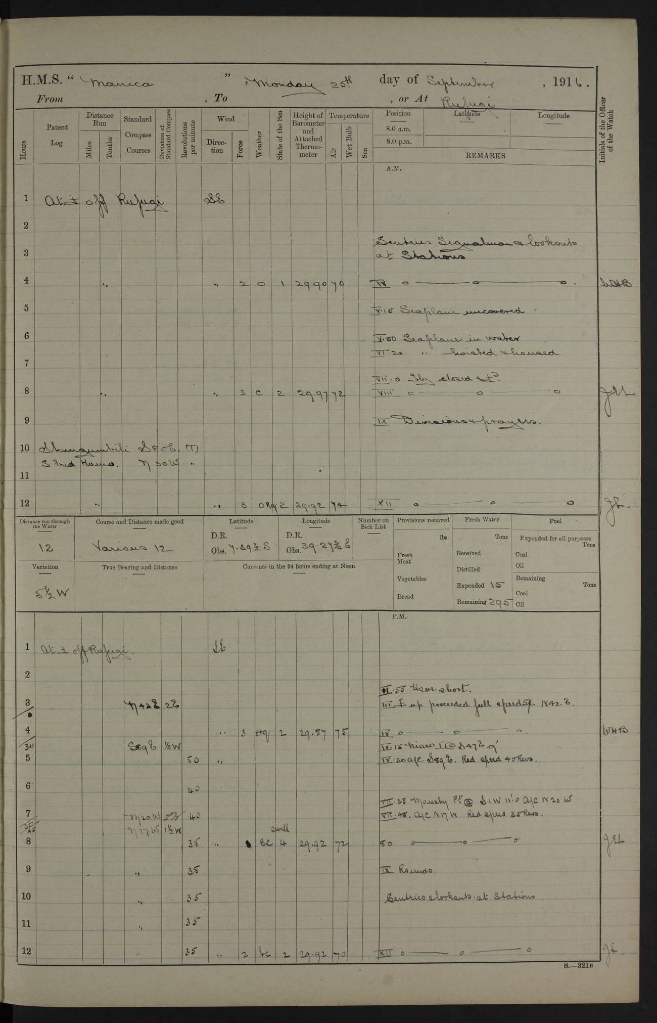
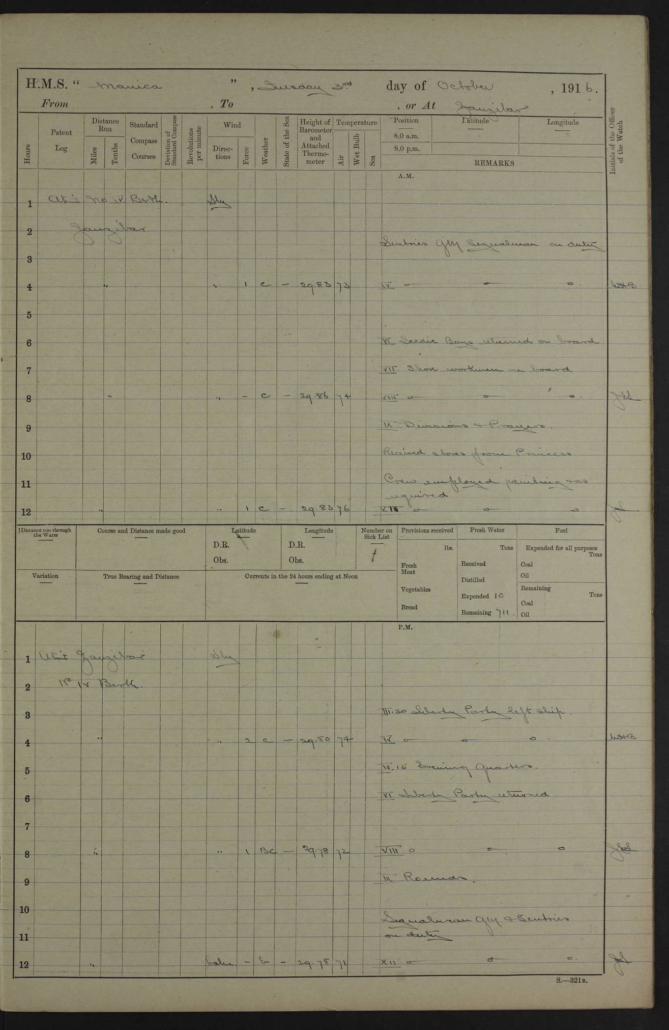
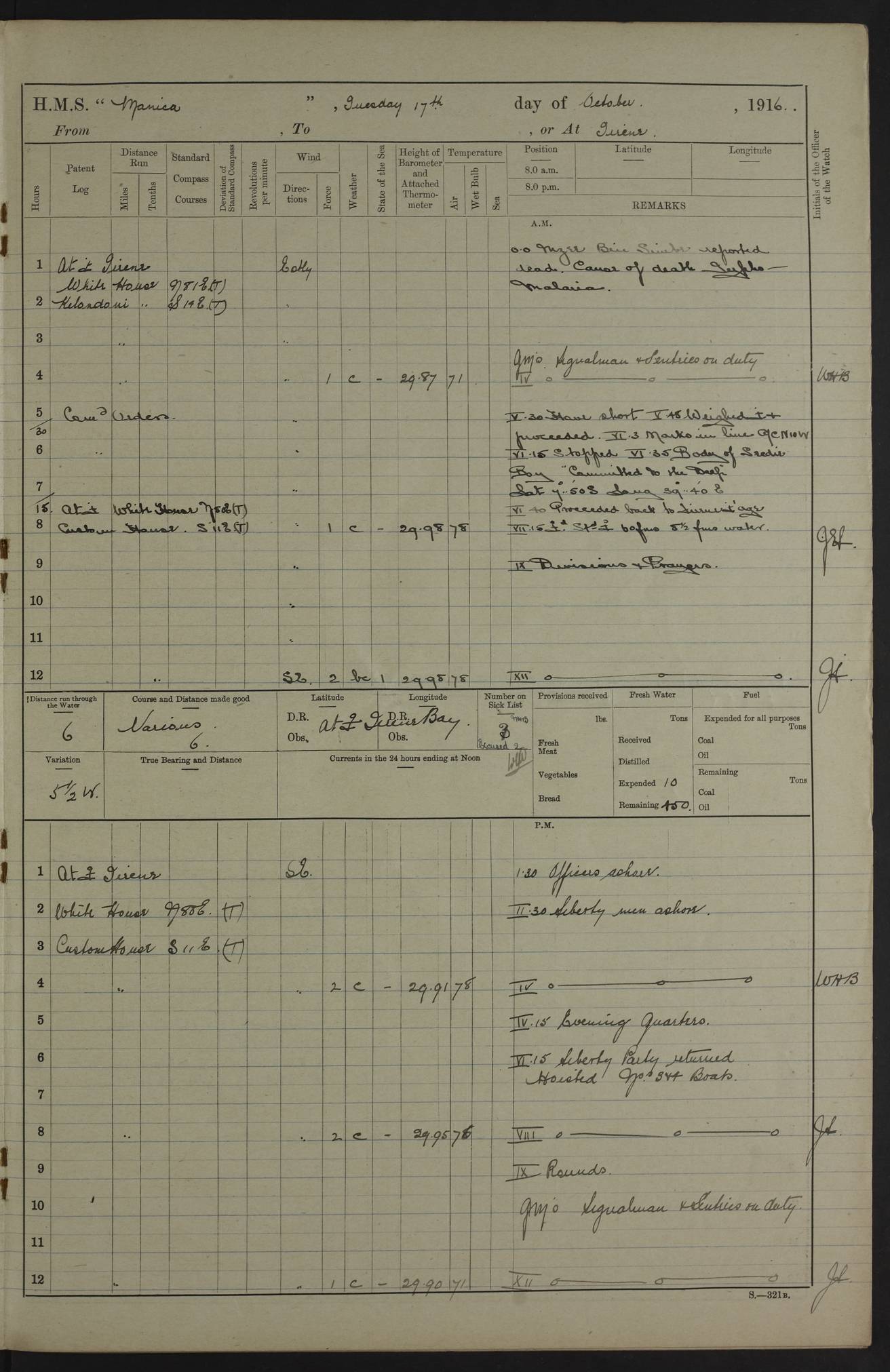
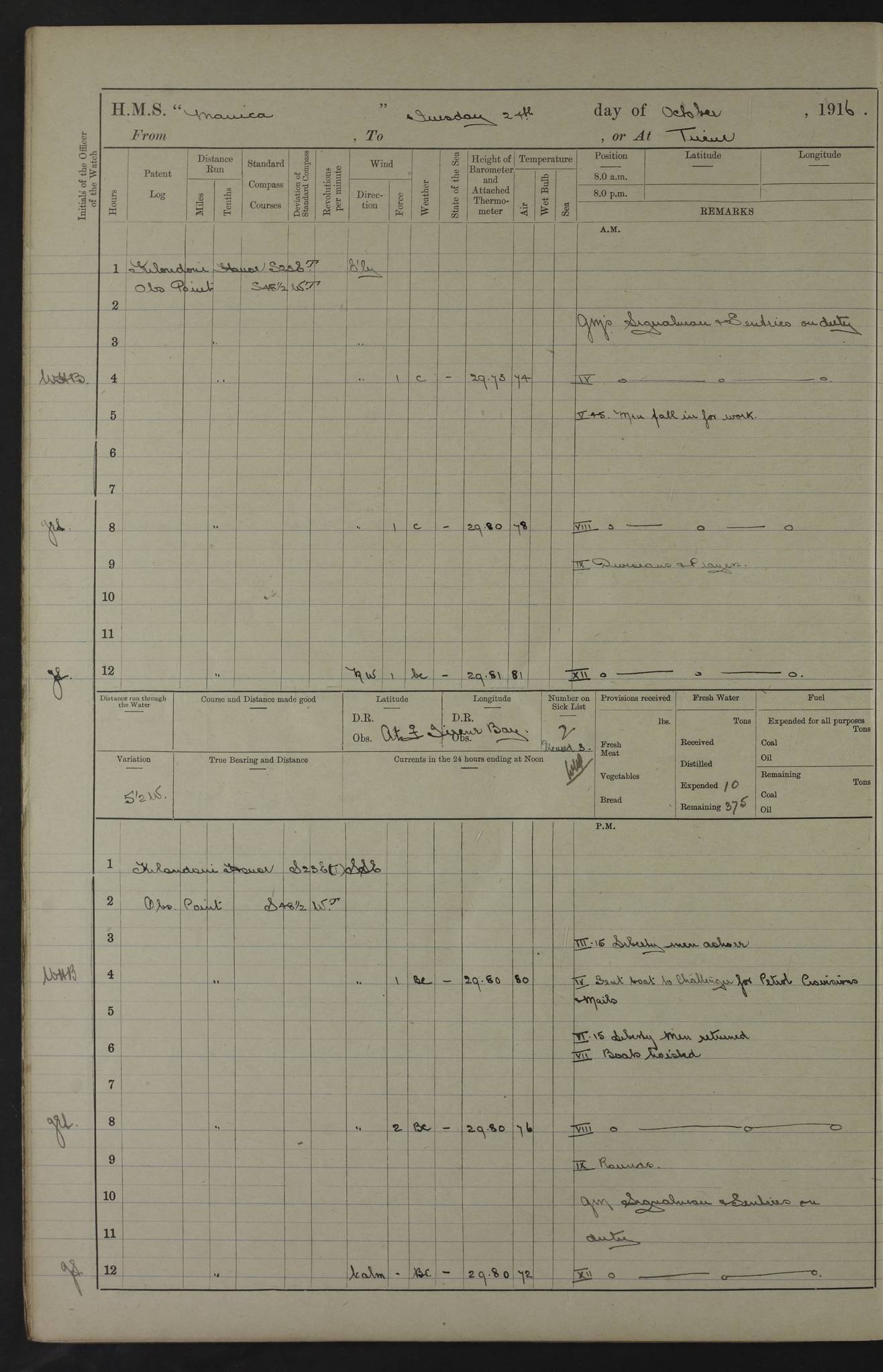
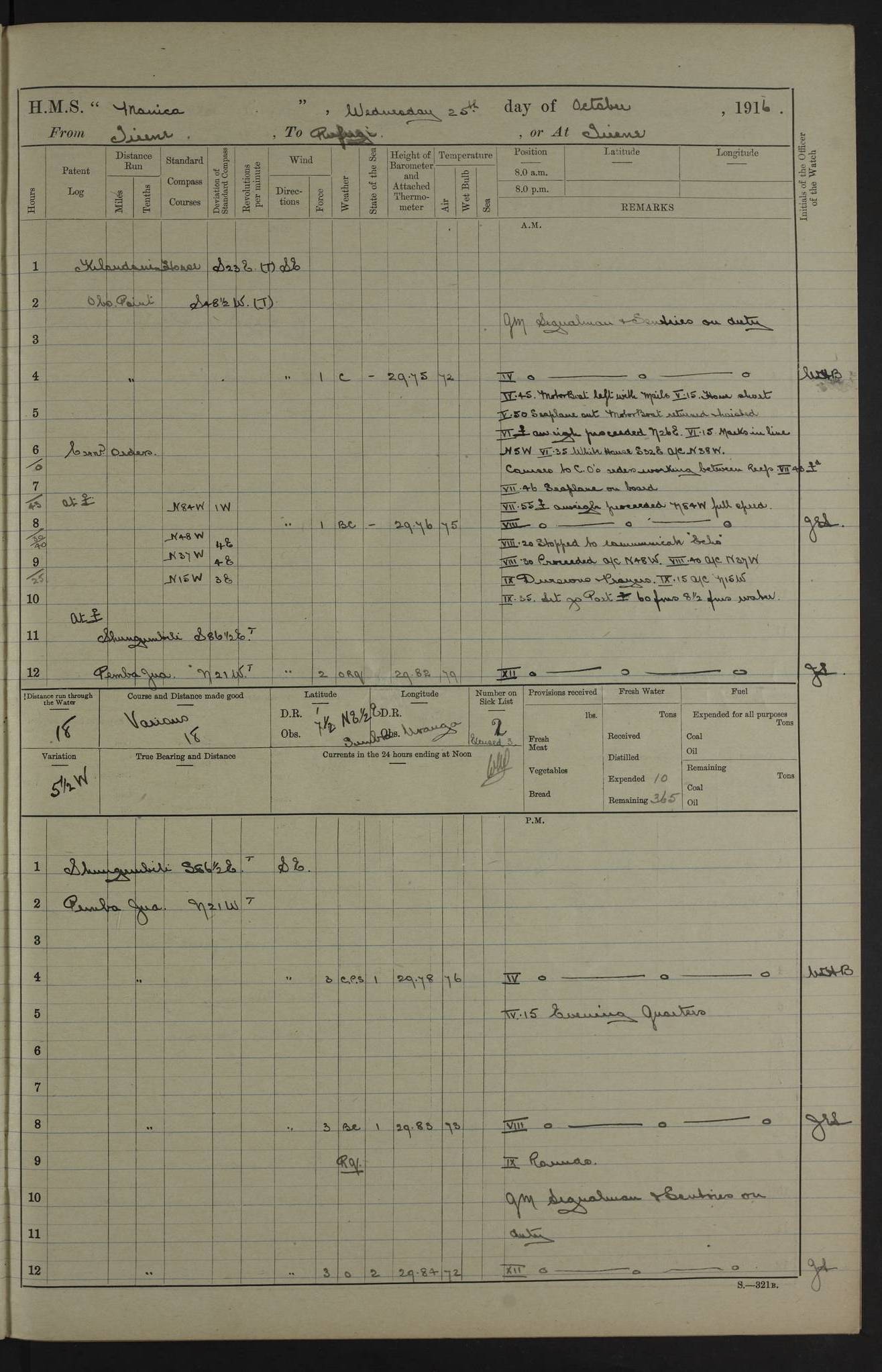
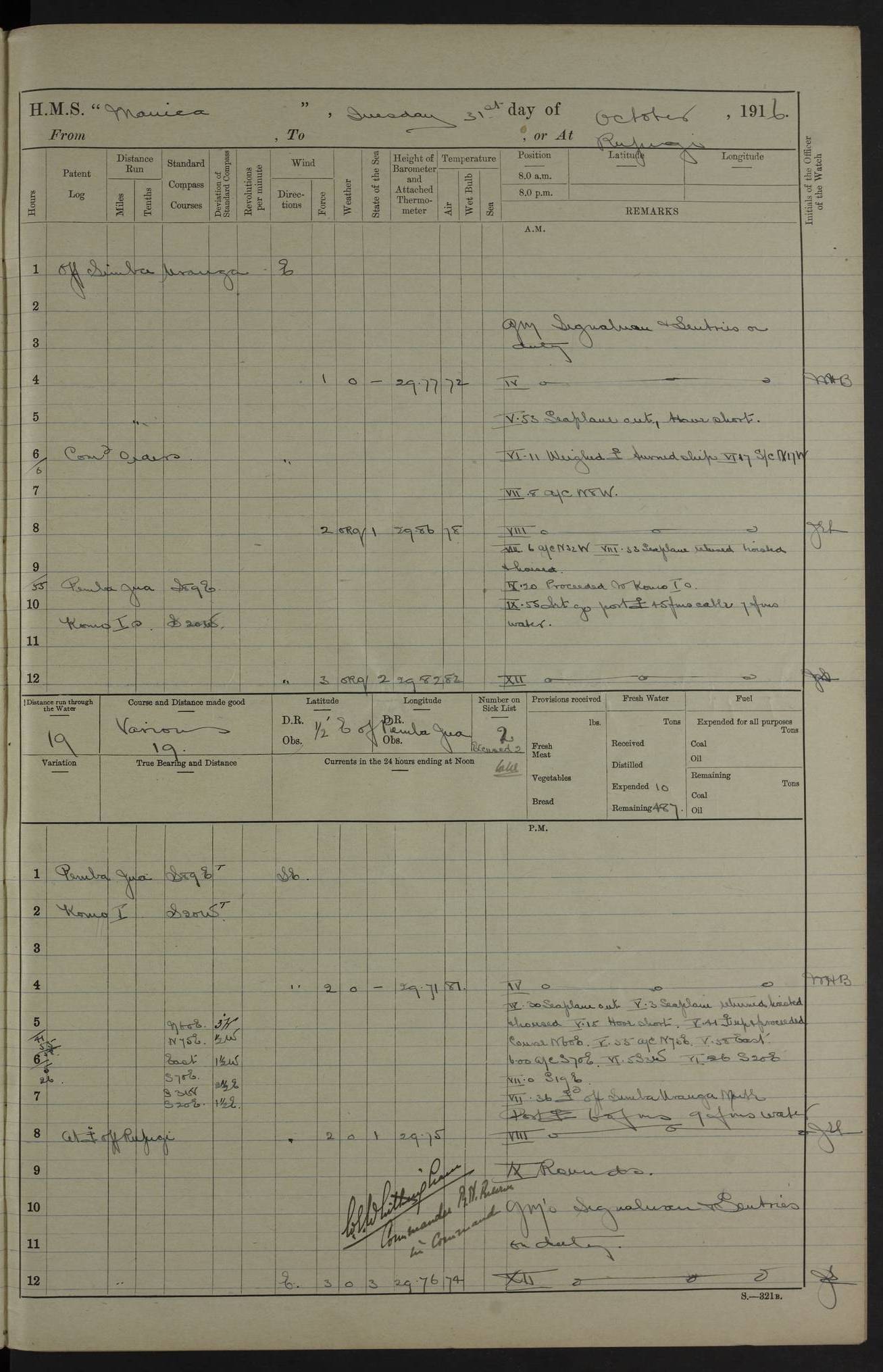
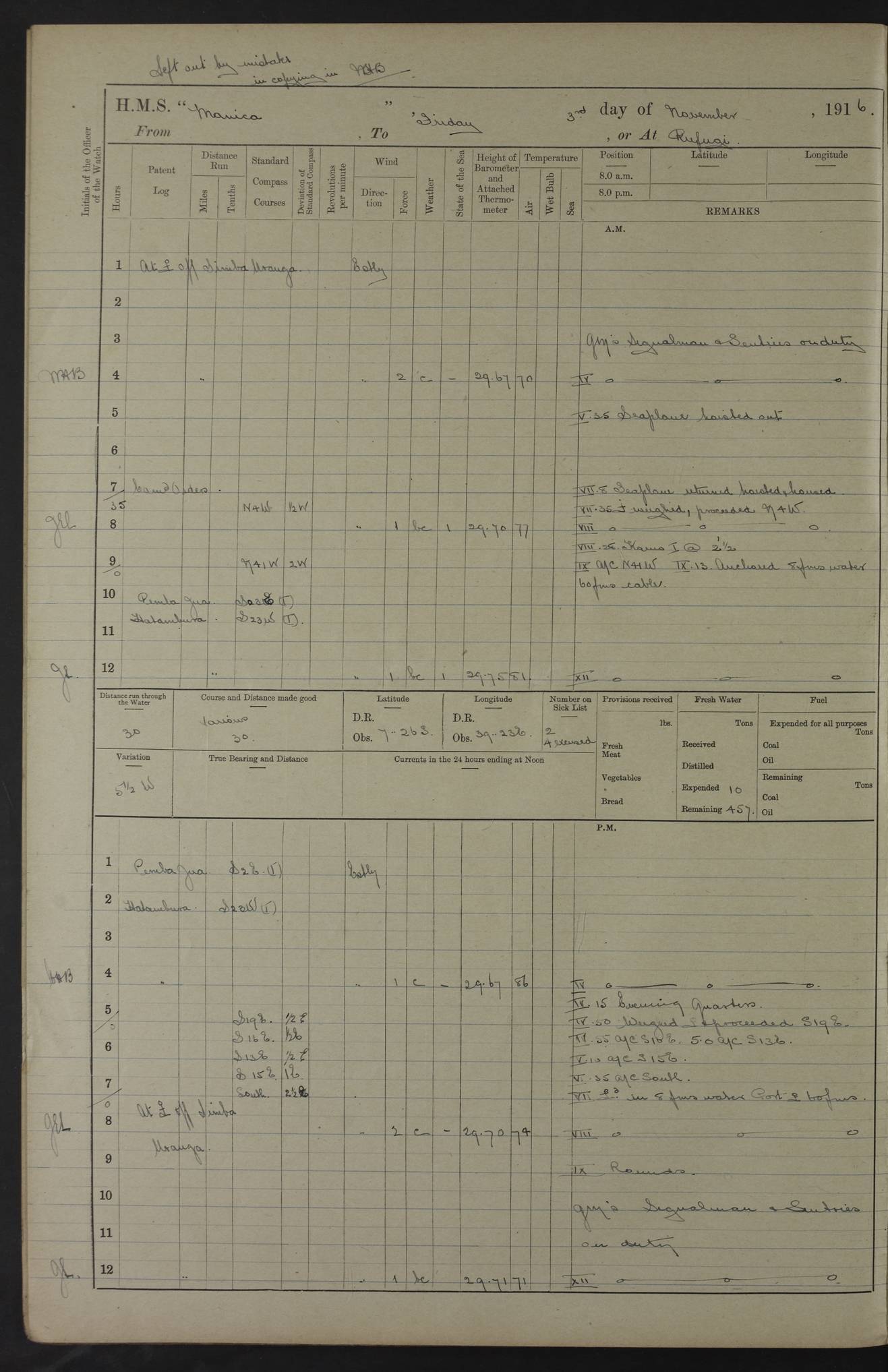
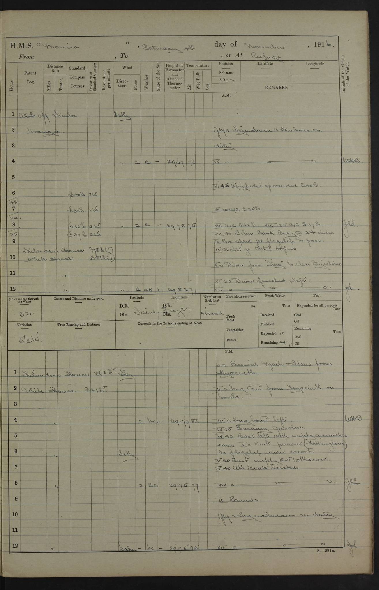
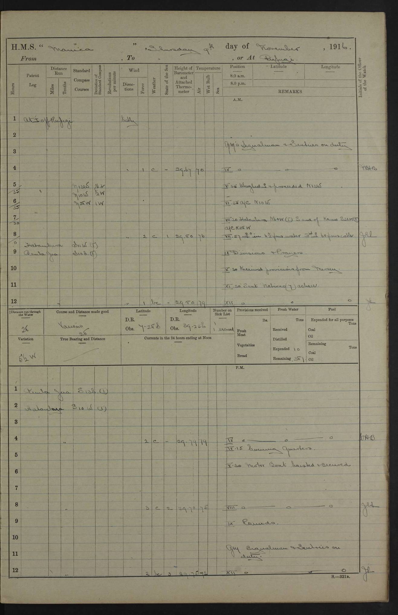
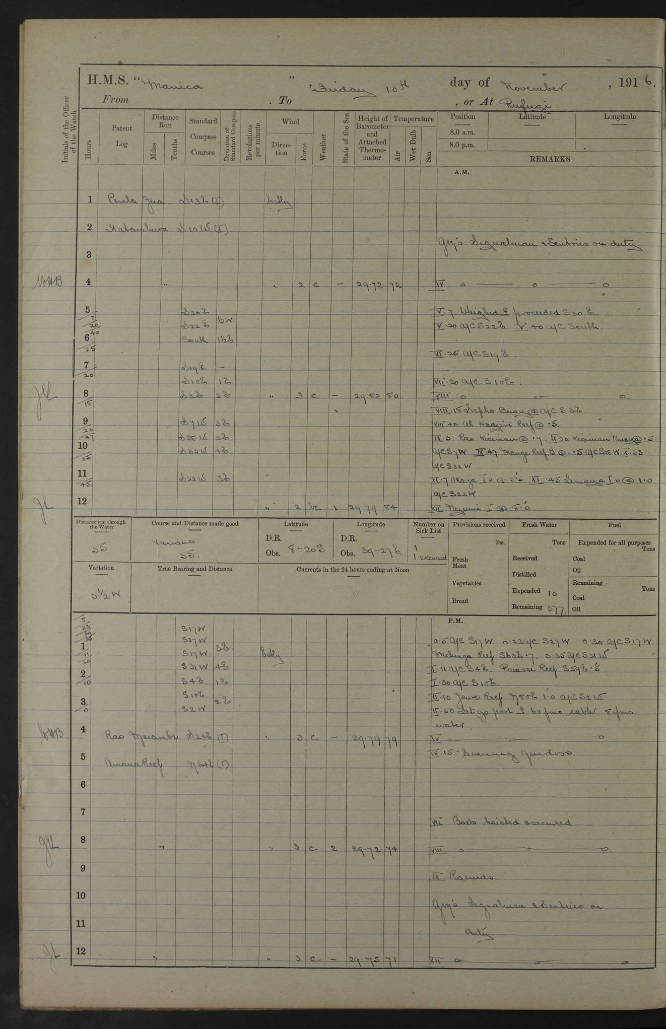
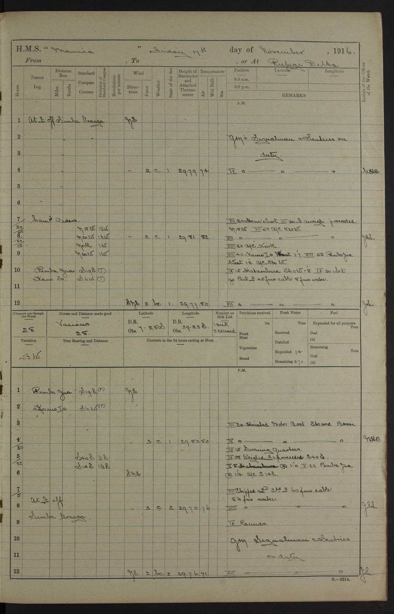
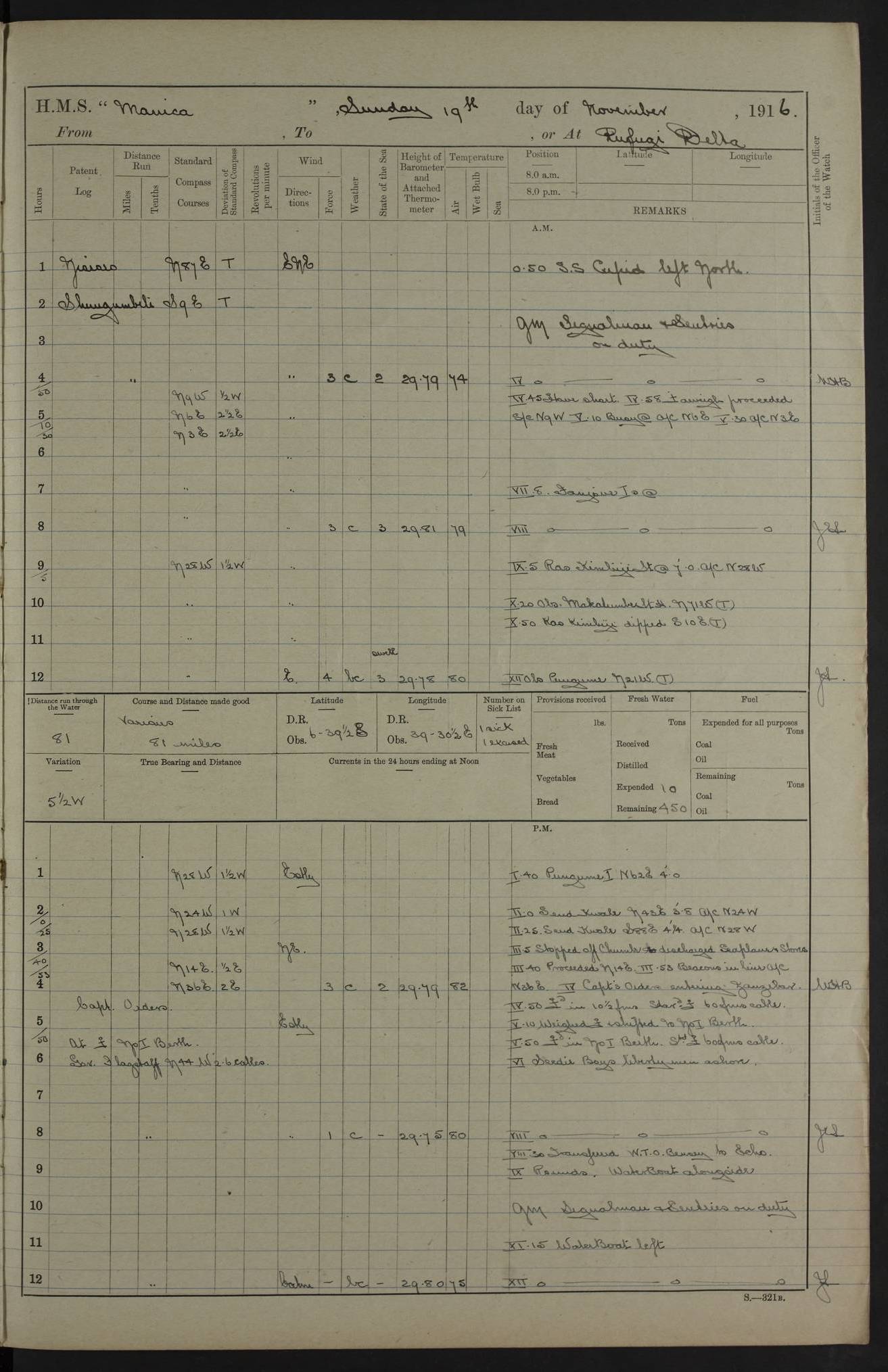
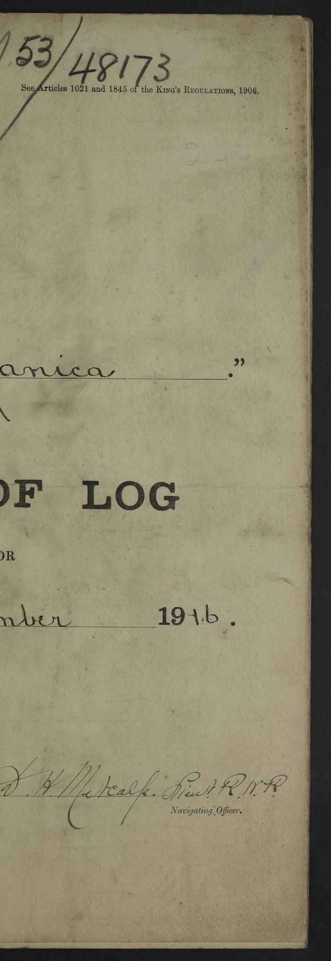