 Project
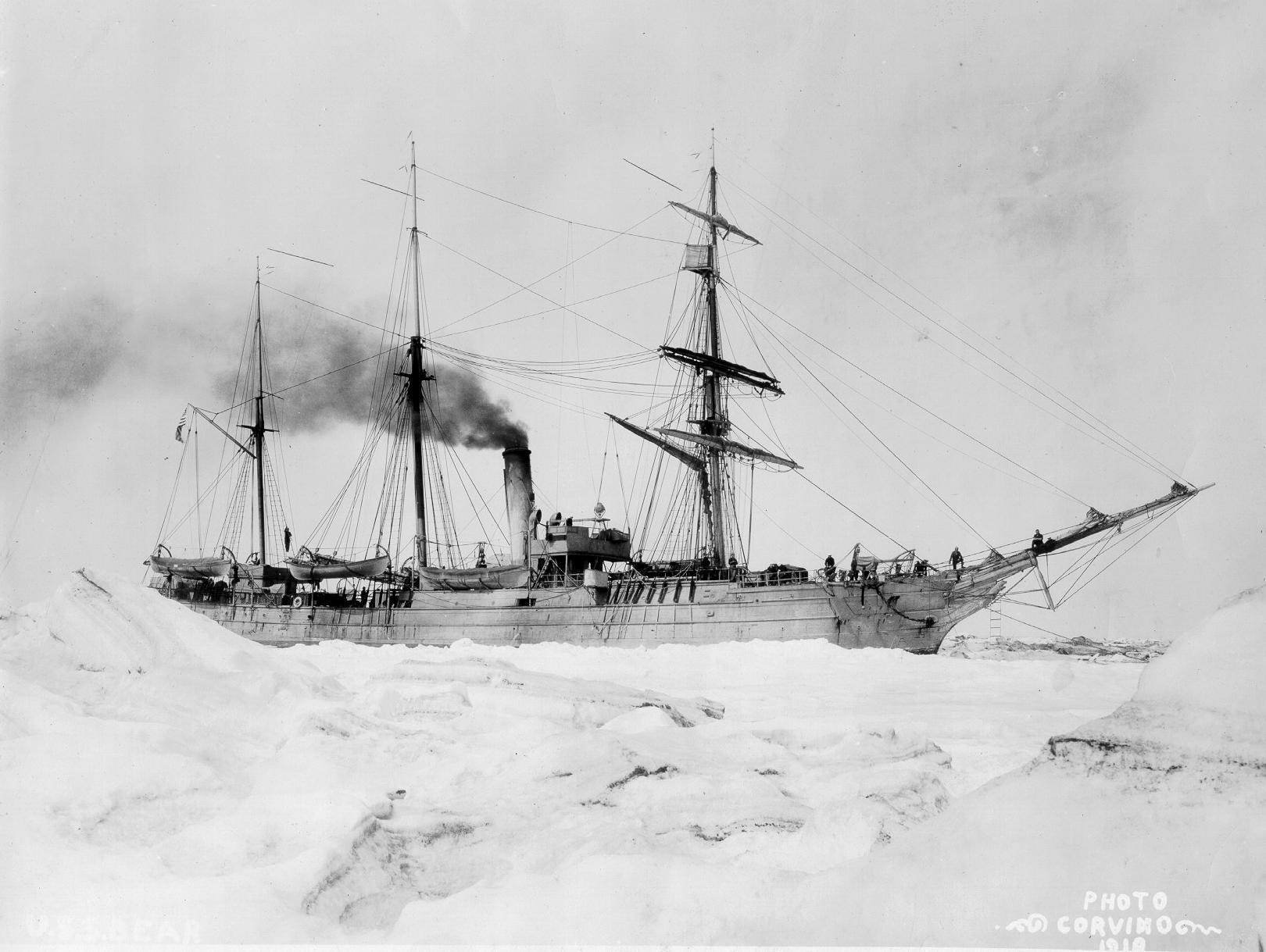
THE VOYAGES OF USRC BEAR 1890-1891
(More detailed plots follow in the text)
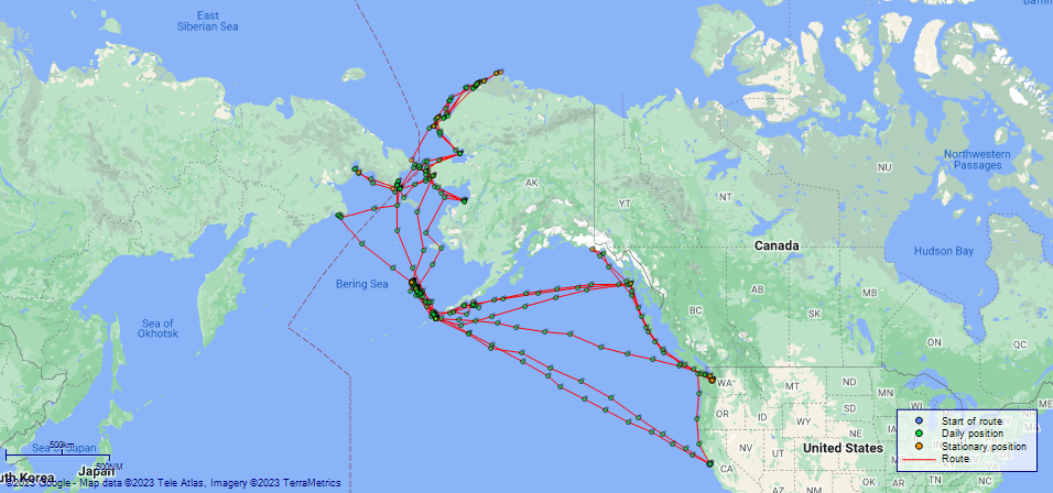
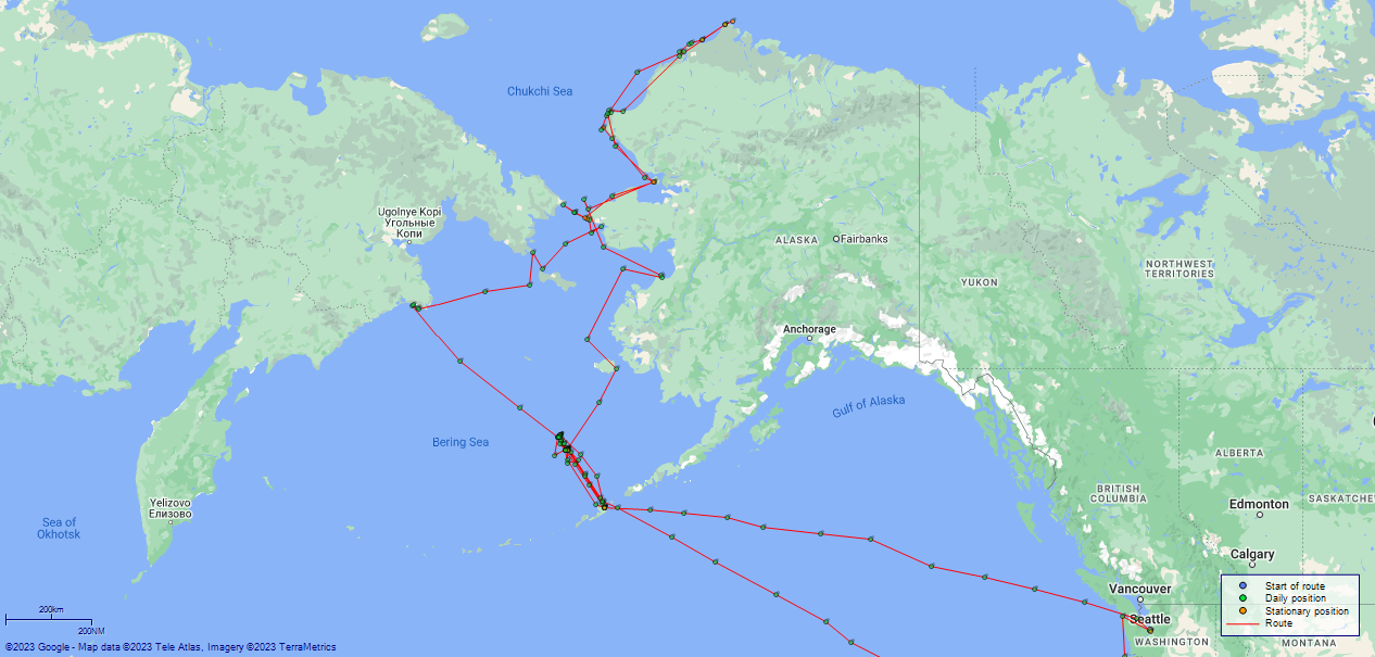
(Maps prepared using Journey Plotter, developed by Maikel. The Plots can only be approximate. They are made by joining-up positions on successive days, and sometimes positions are not given. There will therefore be occasions when the ship appears to have travelled overland)
LOG BOOK – MAY 3rd 1890 TO NOVEMBER 30th 1890
50874d5c09d4090755001357: (http://oldweather.s3.amazonaws.com/ow3/final/USRC Bear/vol068/vol068_001_0.jpg)
50874d5c09d4090755001359: (http://oldweather.s3.amazonaws.com/ow3/final/USRC Bear/vol068/vol068_001_1.jpg)
50874d5c09d409075500135b: (http://oldweather.s3.amazonaws.com/ow3/final/USRC Bear/vol068/vol068_002_0.jpg)
50874d5c09d409075500135d: (http://oldweather.s3.amazonaws.com/ow3/final/USRC Bear/vol068/vol068_002_1.jpg)
Log book of the US Steamer “Bear” First Rate of Four Guns, commanded by Captain MA Healy [Michael A Healy] USRM, commencing May 3rd 1890 at San Francisco, California, and ending November 30th, 1890, at San Francisco, California.
50874d5c09d409075500135f: (http://oldweather.s3.amazonaws.com/ow3/final/USRC Bear/vol068/vol068_003_0.jpg)
List of Officers attached to and on board of the US Revenue Steamer Bear, commanded by Captain MA Healy USRM during the period covered by this log-book from May 3, 1890 to November 30, 1890
MA Healy, Captain
A [Albert] H Buhner, 1st Lieutenant
Johnstone H Quinan, 2nd Lieutenant
F [Frank] H Dimock, 3rd Lieutenant
D [Daniel] J Ainsworth, 2nd Lieutenant
H [Horace] Hassell, Chief Engineer
C [Charles] W Munroe, 1st Assistant Engineer
W [William] C Myers, 2nd Assistant Engineer
ER Holmes, Surgeon
[Forenames of officers from Historical Register of USRCS Officers]
50874d5c09d4090755001361: (http://oldweather.s3.amazonaws.com/ow3/final/USRC Bear/vol068/vol068_003_1.jpg)
[List of officers page, left blank]
50874d5c09d4090755001363: (http://oldweather.s3.amazonaws.com/ow3/final/USRC Bear/vol068/vol068_004_0.jpg)
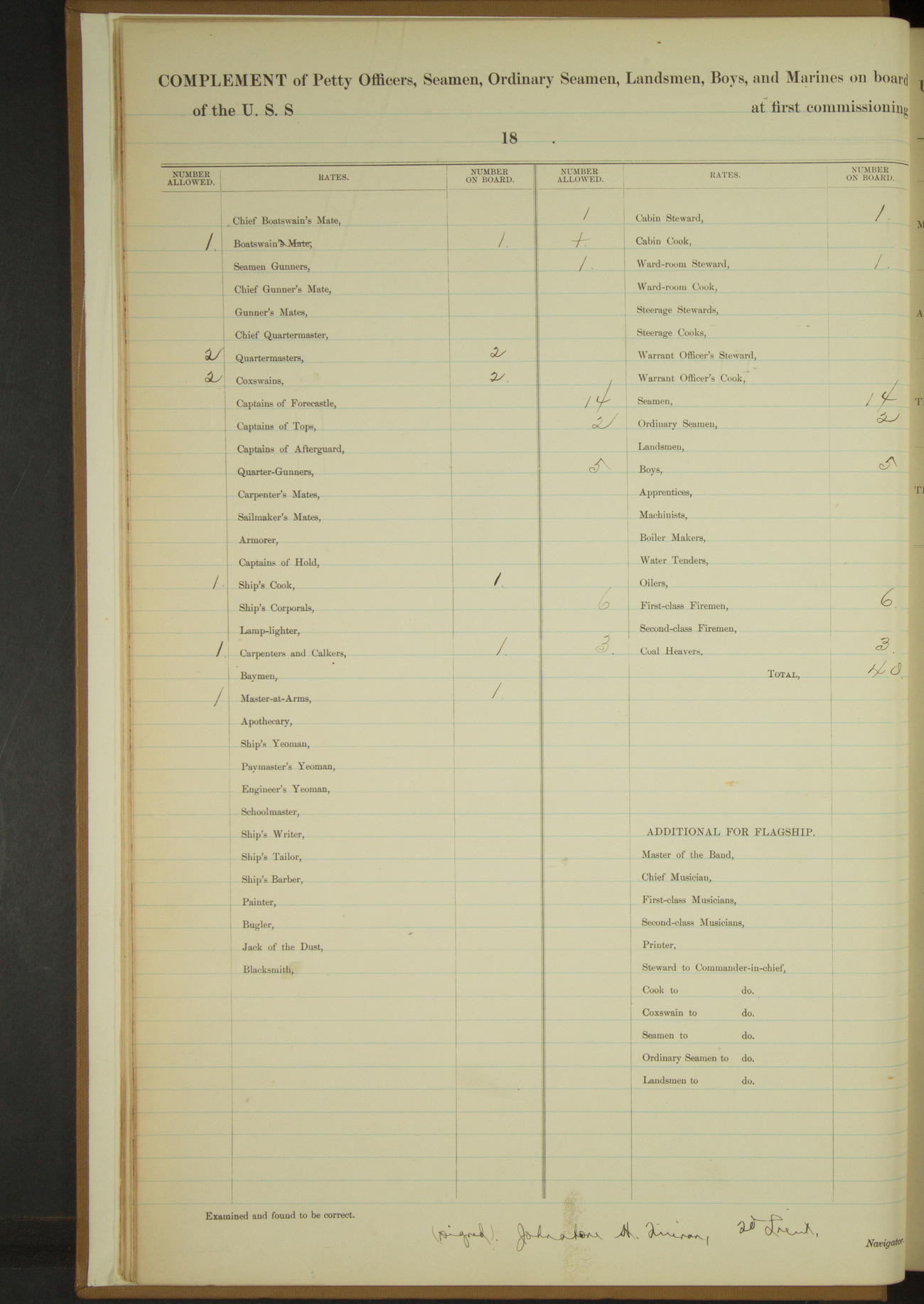
Complement of Petty officers, Seamen, Ordinary Seamen, Landsmen, Boys, and Marines on board
Boatswain 1
Quartermasters 2
Coxswains 2
Ship’s Cook 1
Carpenter and Calker 1
Master-at-arms 1
Cabin Steward 1
Ward-room Steward 1
Seamen 14
Ordinary Seamen 2
Boys 5
First-class Firemen 6
Coal Heavers 3
TOTAL 40
50874d5c09d4090755001365: (http://oldweather.s3.amazonaws.com/ow3/final/USRC Bear/vol068/vol068_004_1.jpg)
[Description of instruments, left blank]
50874d5c09d4090755001367: (http://oldweather.s3.amazonaws.com/ow3/final/USRC Bear/vol068/vol068_005_0.jpg)
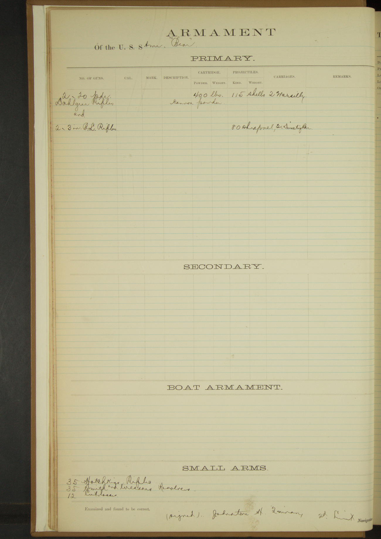
Armament of the US Steamer Bear
PRIMARY
2 x 20 pounder Dahlgren rifles [Dahlgren gun]; Cartridge: 400lbs cannon powder; Projectiles: 115 shells; Carriages: 2 Marsilly
2 x 3 inch BL rifles; Projectiles: 80 shrapnel; Carriages: 2 directing bar
SMALL ARMS
35 Hotchkiss rifles
35 Smith and Wesson revolvers
12 cutlasses
50874d5c09d4090755001369: (http://oldweather.s3.amazonaws.com/ow3/final/USRC Bear/vol068/vol068_005_1.jpg)
[Tables of deviation of the standard compass, left blank]
THE VOYAGES OF USRC BEAR 1890
LOGS FOR MAY 1890
50874d5c09d409075500136b: (http://oldweather.s3.amazonaws.com/ow3/final/USRC Bear/vol068/vol068_006_0.jpg)
50874d5c09d409075500136d: (http://oldweather.s3.amazonaws.com/ow3/final/USRC Bear/vol068/vol068_006_1.jpg)
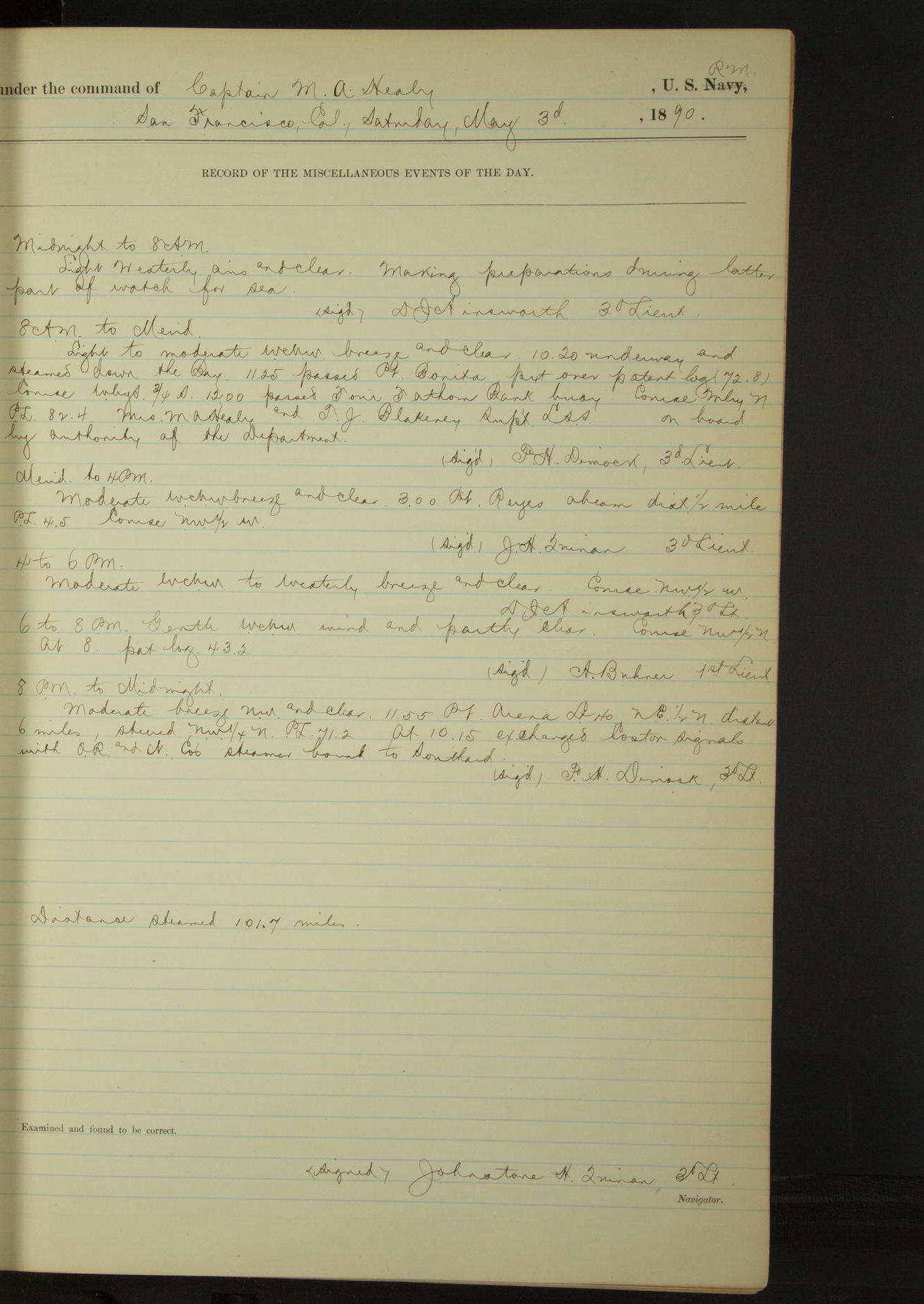
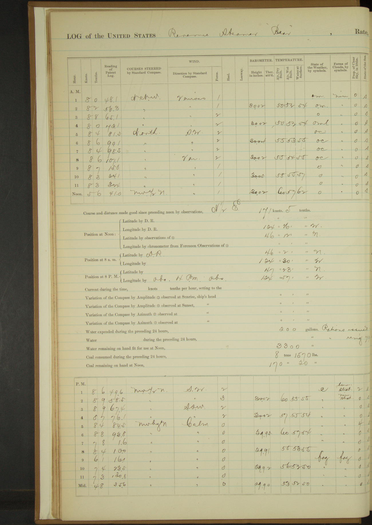
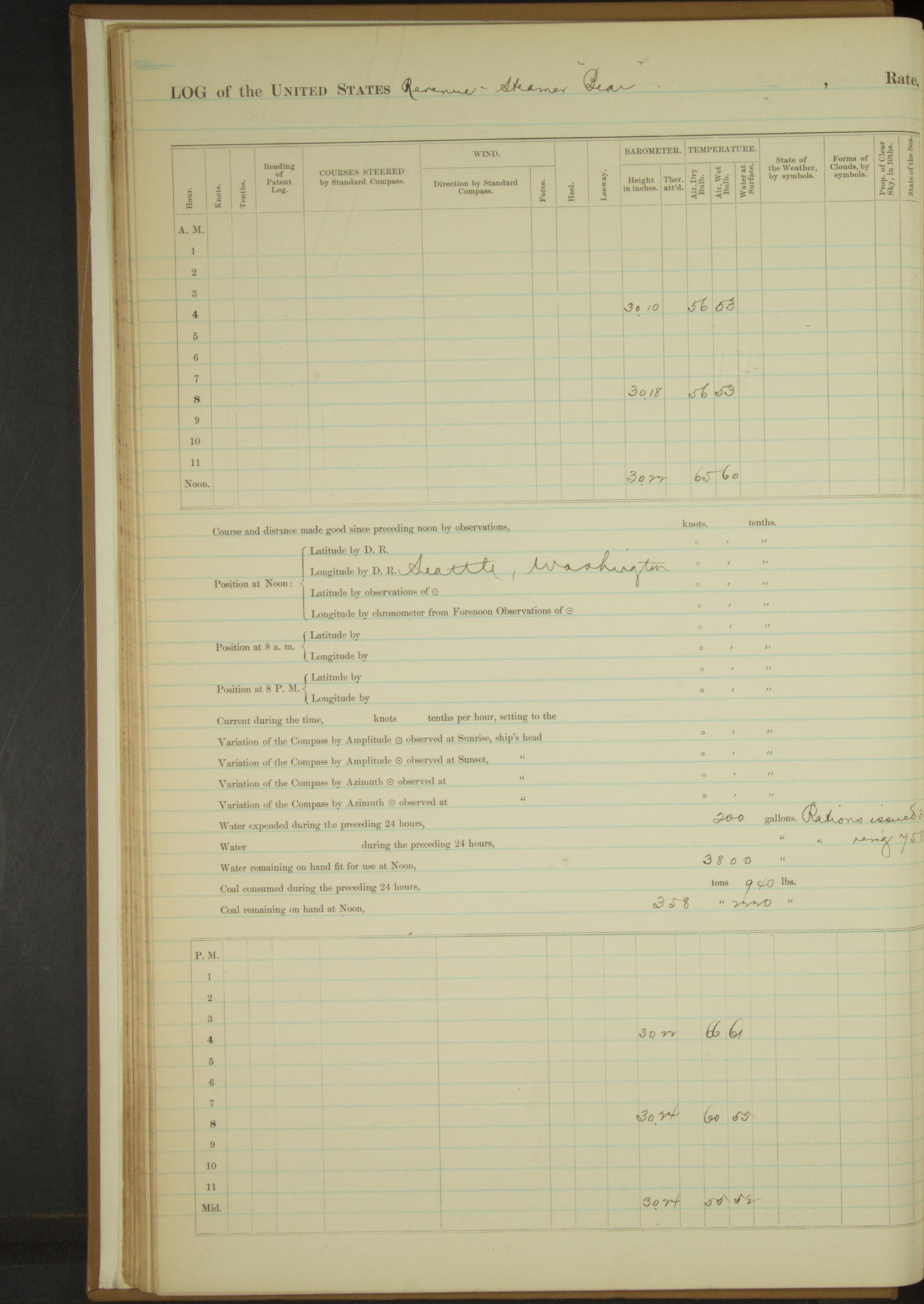
3 May 1890
San Francisco [& at sea]
Lat 37.80, Long -122.62
8am to meridian:
10.20: underway and steamed down the Bay. 11.25 passed Point Bonita. 12.00 passed Four Fathom Bank buoy.
Mrs MA Healy and TJ Blakeney, Superintendent LSS [US Life Saving Service], on board by authority of the Department.
Meridian to 4pm:
3.00: Point Reyes abeam, distant ½ mile.
8pm: Lat 38° 32’N, Long 123° 31’W
8pm to midnight:
11.55: Point Arena Light House NE½N distant 6 miles. At 10.15 exchanged Coston signals with OR&N Co's [Oregon Railroad & Navigation Company] steamer bound to Southward.
Distance steamed 101.7 miles.
50874d5c09d409075500136f: (http://oldweather.s3.amazonaws.com/ow3/final/USRC Bear/vol068/vol068_007_0.jpg)
50874d5c09d4090755001371: (http://oldweather.s3.amazonaws.com/ow3/final/USRC Bear/vol068/vol068_007_1.jpg)
4 May 1890
At sea
Lat 40.33, Long -124.50
Midnight to 4am:
Moderate NW wind and thick fog. Kept fog whistle sounded at regular intervals [& for most of day].
8am: Lat 39° 52’N, Long 124° 22’W
Noon: Lat 40° 20’N, Long 124° 20’W [Locates the ship inland]
Meridian to 4pm:
At 2.00 fog lifted, one vessel in sight.
8pm: Lat 41° 22’N, Long 124° 46’W
Distance under steam exclusively 183.5 miles.
50874d5c09d4090755001373: (http://oldweather.s3.amazonaws.com/ow3/final/USRC Bear/vol068/vol068_008_0.jpg)
50874d5c09d4090755001375: (http://oldweather.s3.amazonaws.com/ow3/final/USRC Bear/vol068/vol068_008_1.jpg)
5 May 1890
At sea
Lat 43.35, Long -124.82
Midnight to 4am:
Light airs NW and foggy. Whistle sounded at intervals during watch.
4am to 8am:
Sounding fog whistle as necessary. Scrubbed and washed clothes.
8am: Lat 42° 51’N, Long 124° 49’W
8am to meridian:
At 10.00 fog lifted.
6pm to 8pm:
At 6.45 drilled at fire quarters.
8pm: Lat 43° 21’N, Long 124° 49’W [Can't be correct, equals noon position]
Distance under steam and sail 44.5 miles.
Distance under steam exclusively 139.6 miles.
Distance total 184.1 miles.
50874d5c09d4090755001377: (http://oldweather.s3.amazonaws.com/ow3/final/USRC Bear/vol068/vol068_009_0.jpg)
50874d5c09d4090755001379: (http://oldweather.s3.amazonaws.com/ow3/final/USRC Bear/vol068/vol068_009_1.jpg)
6 May 1890
At sea
Lat 46.20, Long -124.43
4am to 8am:
8.00: Two vessels in sight.
8am: Lat 46° 2’N, Long 124° 30’W
Meridian to 4pm:
1.55: stopped engine to allow engineer to tighten bolt. 2.00: ahead. 2.10: stopped again. 2.18: ahead again.
8pm: Lat 47° 23’N, Long 124° 57’W
8pm to midnight:
Calm and foggy. Sounded whistle and ran at half speed from 8.25.
Distance under steam exclusively 195.5 miles.
50874d5c09d409075500137b: (http://oldweather.s3.amazonaws.com/ow3/final/USRC Bear/vol068/vol068_010_0.jpg)
50874d5c09d409075500137d: (http://oldweather.s3.amazonaws.com/ow3/final/USRC Bear/vol068/vol068_010_1.jpg)
7 May 1890
At sea [& Neah Bay]
Lat 48.38, Long -124.61
Commences to 4am:
Calm and thick fog. Whistle sounded at regular intervals. Vessel under half speed.
2.00: stopped and sounded, obtained 100 fathoms, no bottom. 2.20: ahead half speed. One vessel in sight at end of watch.
4am to 8am:
At 6.00 stopped and sounded in 72 fathoms, black sand and shell. 6.15: ahead slow.
At 7.00 stopped and sounded in 39 fathoms, black sand and pebble. 7.15: ahead slow.
At 8.00 sounded in 26 fathoms black sand.
8am: Lat 48° 36’N, Long 124° 50’W
8am to meridian:
Calm and foggy to gentle SW breeze and hazy.
8.15: made land ahead. 8.50: stopped and sounded in 29 fathoms, gravelly bottom. 9.02: ahead. 9.15: made Cape Flattery SEbyS. 11.20: passed Koitlah Point.
11.30: anchored in Neah Bay, Washington. Koitlah Point bearing by standard compass W½N and N end Waadah Island NNE.
Meridian to 4pm:
Commanding Officer and Major TJ Blakeney visited Life Saving Station at Neah Bay.
2.55: underway and up Strait of Juan de Fuca. 3.10: took departure from Waadah Island bearing WbyS¾S distant 1¼ miles.
4pm to 6pm:
5.35: Pillar Point abeam, distance 4¼ miles. Shut in thick, sounded fog whistle.
6pm to 8pm:
Wind moderate WNW fog and clearing. 7.20: Race Island Light [Race Rocks Lighthouse] NbyE½E
8pm to midnight:
9.00: Ediz Hook Light House abeam. 11.00: New Dungeness Light House abeam. 11.15: New Dungeness Light House bore S, Smith’s Light House NEbyN.
Distance under steam exclusively 138.5 miles.
50874d5c09d409075500137f: (http://oldweather.s3.amazonaws.com/ow3/final/USRC Bear/vol068/vol068_011_0.jpg)
50874d5c09d4090755001381: (http://oldweather.s3.amazonaws.com/ow3/final/USRC Bear/vol068/vol068_011_1.jpg)
8 May 1890
At sea [& Seattle]
Lat 47.61, Long -122.40 [Estimate in Harbor]
Commences to 4am:
3.00: Admiralty Head Light House right ahead. At 4.00 Point Wilson Light House 3½ points on starboard bow.
4am to 8am:
4.50: passed Admiralty Head and steered various courses up Puget Sound. 7.00: passed Point No Point.
8am to meridian:
9.40: West Point abeam. Steamed into Seattle Harbor, Washington. 10.35: made fast to mooring buoy off coal wharf, Seattle. Allowed five miles to anchorage.
Meridian to 4pm:
Crew hoisting coal bags to deck and clearing starboard coal bunker. Major TJ Blakeney left the vessel.
4pm to midnight: Crew employed until 5.00 as in previous watch.
Distance under steam exclusively 65.3 miles.
50874d5c09d4090755001383: (http://oldweather.s3.amazonaws.com/ow3/final/USRC Bear/vol068/vol068_012_0.jpg)
50874d5c09d4090755001385: (http://oldweather.s3.amazonaws.com/ow3/final/USRC Bear/vol068/vol068_012_1.jpg)
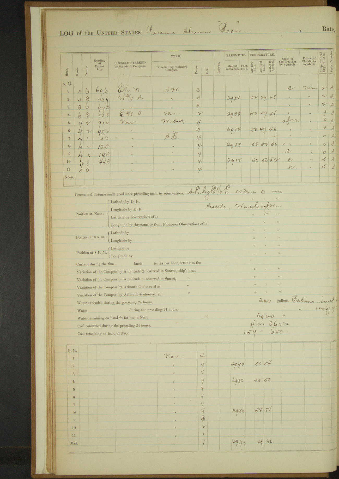
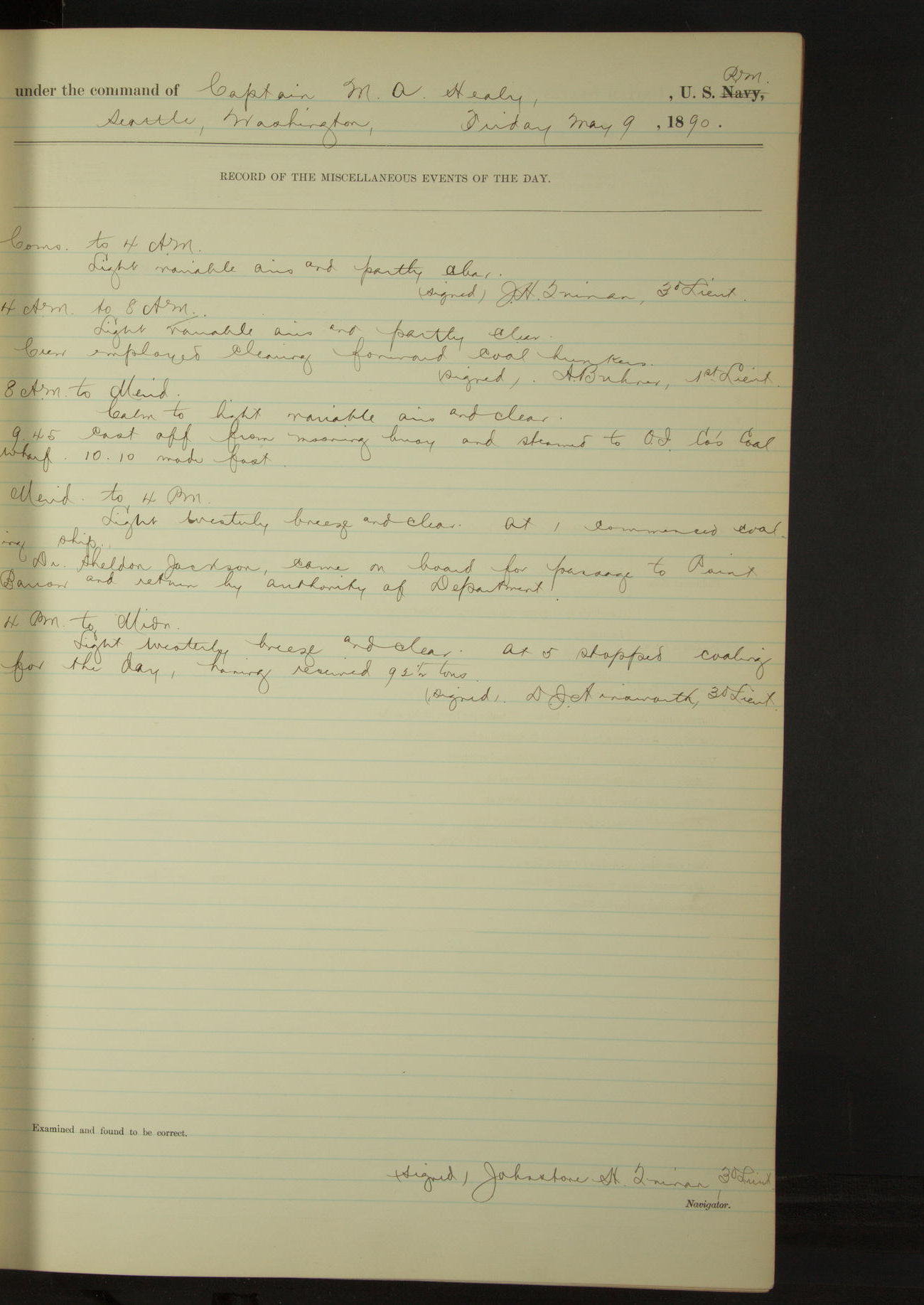
9 May 1890
Seattle, Washington
Lat 47.60, Long -122.34
4am to 8am:
Crew employed cleaning forward coal bunkers.
8am to meridian:
9.45: cast off from coal mooring buoy and steamed to OI Co's Coal Wharf. 10.10: made fast.
[Oregon Improvement Company; article about the company in Seattle]
Meridian to 4pm:
At 1.00 commenced coaling ship. Dr Sheldon Jackson, came on board for passage to Point Barrow and return, by authority of Department.
4pm to midnight:
At 5.00 stopped coaling for the day, having received 92½ tons.
50874d5c09d4090755001387: (http://oldweather.s3.amazonaws.com/ow3/final/USRC Bear/vol068/vol068_013_0.jpg)
50874d5c09d4090755001389: (http://oldweather.s3.amazonaws.com/ow3/final/USRC Bear/vol068/vol068_013_1.jpg)
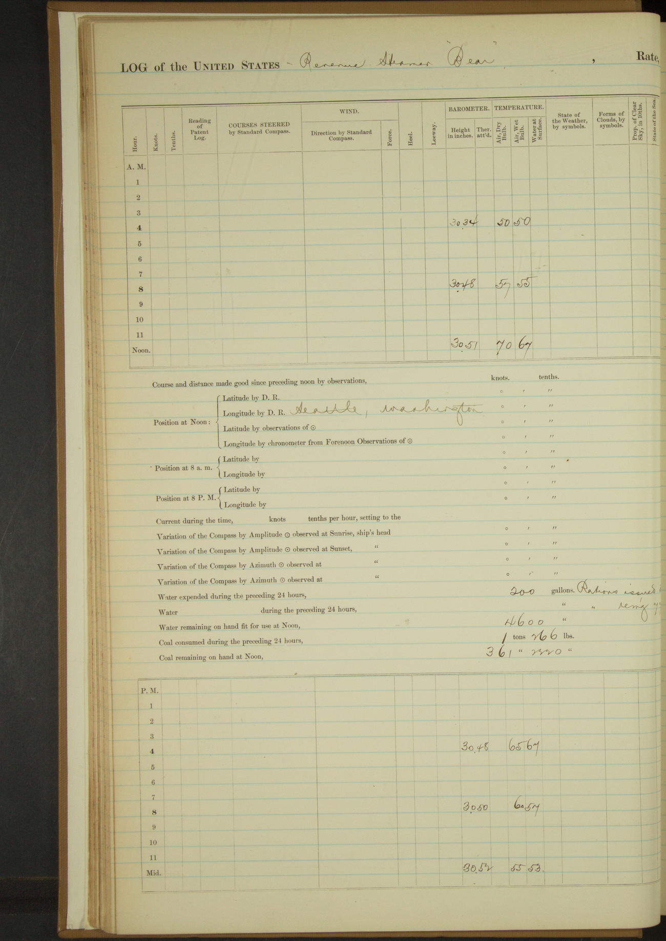
10 May 1890
Seattle, Washington
Lat 47.60, Long -122.34
4am to 8am:
At 7.00 commenced coaling. Henry Davis, Seaman, deserted.
8am to meridian:
Filled tanks with fresh water. Placed C McCarthy, Seaman, in single irons for refusal to carry coal.
Meridian to 4pm:
3.30: stopped coaling for the day having received 66 tons.
4pm to midnight:
Released C McCarthy, Seaman, from irons.
50874d5c09d409075500138b: (http://oldweather.s3.amazonaws.com/ow3/final/USRC Bear/vol068/vol068_014_0.jpg)
50874d5c09d409075500138d: (http://oldweather.s3.amazonaws.com/ow3/final/USRC Bear/vol068/vol068_014_1.jpg)
11 May 1890
Seattle, Washington
Lat 47.60, Long -122.34
Meridian to 4pm:
Henry Davis, Seaman, returned. Discharged him from 10th instant and shipped James Cummings, Seaman, from 10th inst.
4pm to midnight:
H. Waite, 2nd class Boy deserted.
50874d5c09d409075500138f: (http://oldweather.s3.amazonaws.com/ow3/final/USRC Bear/vol068/vol068_015_0.jpg)
50874d5c09d4090755001391: (http://oldweather.s3.amazonaws.com/ow3/final/USRC Bear/vol068/vol068_015_1.jpg)
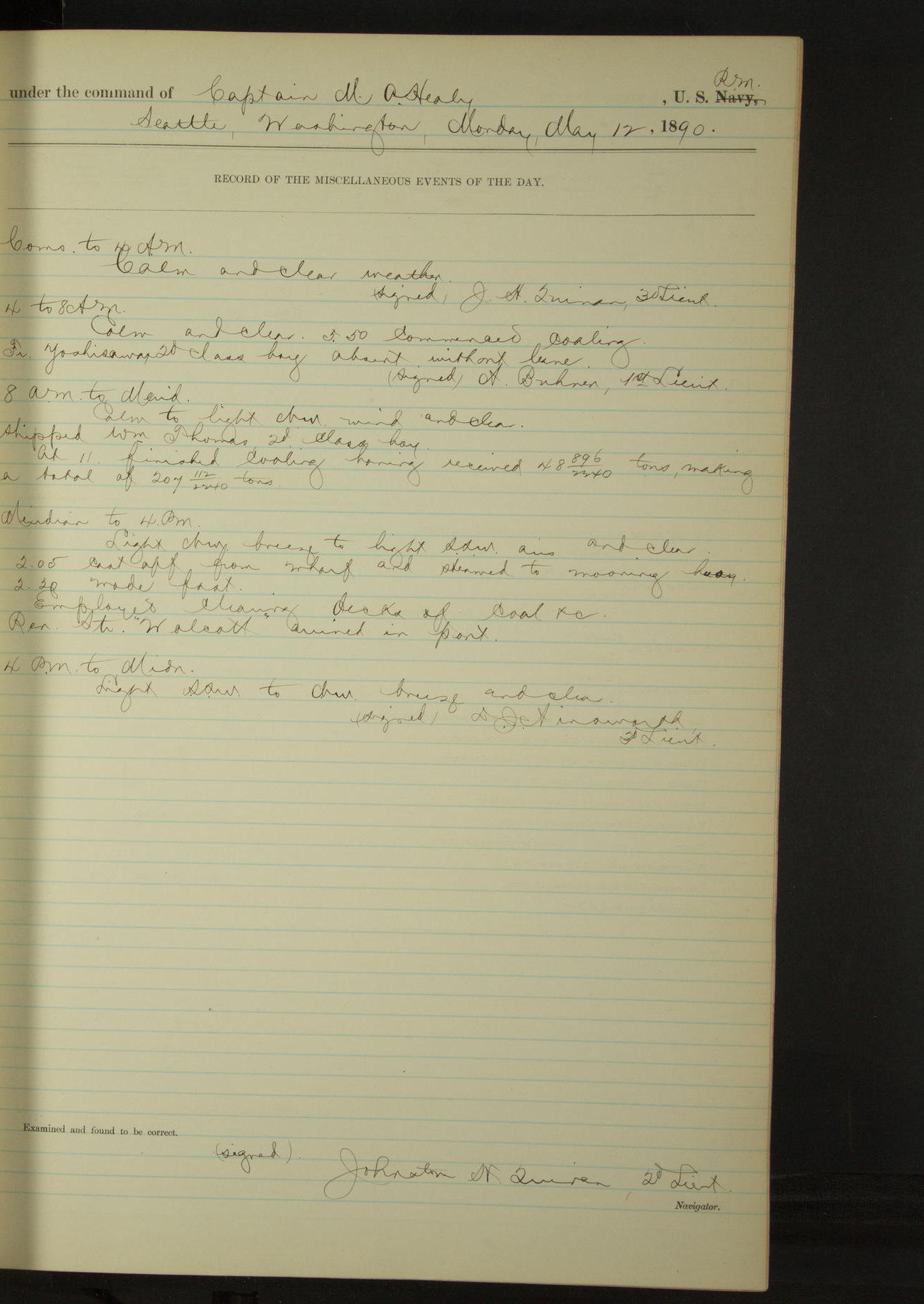
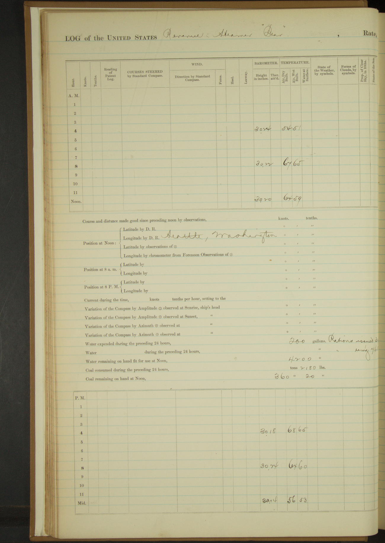
12 May 1890
Seattle, Washington
Lat 47.60, Long -122.34
4am to 8am:
5.50: commenced coaling. Fr Yoshisawa, 2nd class Boy, absent without leave.
8am to meridian:
Shipped William Thomas, 2nd class Boy. At 11.00 finished coaling having received 48 896/2240 tons, making a total of 207 112/2240 tons.
Meridian to 4pm:
2.05: cast off from wharf and steamed to mooring buoy. 2.20: made fast. Employed cleaning decks of coal &c. Revenue Steamer “Wolcott” arrived in port.
50874d5c09d4090755001393: (http://oldweather.s3.amazonaws.com/ow3/final/USRC Bear/vol068/vol068_016_0.jpg)
50874d5c09d4090755001395: (http://oldweather.s3.amazonaws.com/ow3/final/USRC Bear/vol068/vol068_016_1.jpg)
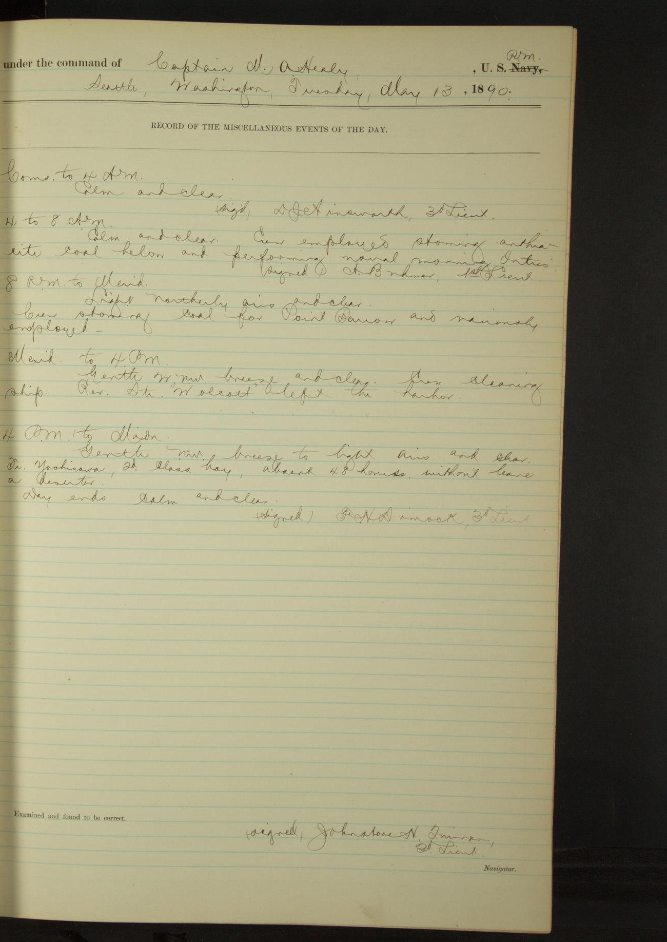
13 May 1890
Seattle, Washington
Lat 47.60, Long -122.34
4am to 8am:
Crew employed stowing anthracite coal below and performing usual morning duties.
8am to meridian:
Crew stowing coal for Point Barrow and variously employed.
Meridian to 4pm:
Revenue Steamer “Wolcott” left the harbor.
4pm to midnight:
Fr Yoshisawa, 2nd class Boy, absent 48 hours without leave, a deserter.
50874d5c09d4090755001397: (http://oldweather.s3.amazonaws.com/ow3/final/USRC Bear/vol068/vol068_017_0.jpg)
50874d5c09d4090755001399: (http://oldweather.s3.amazonaws.com/ow3/final/USRC Bear/vol068/vol068_017_1.jpg)
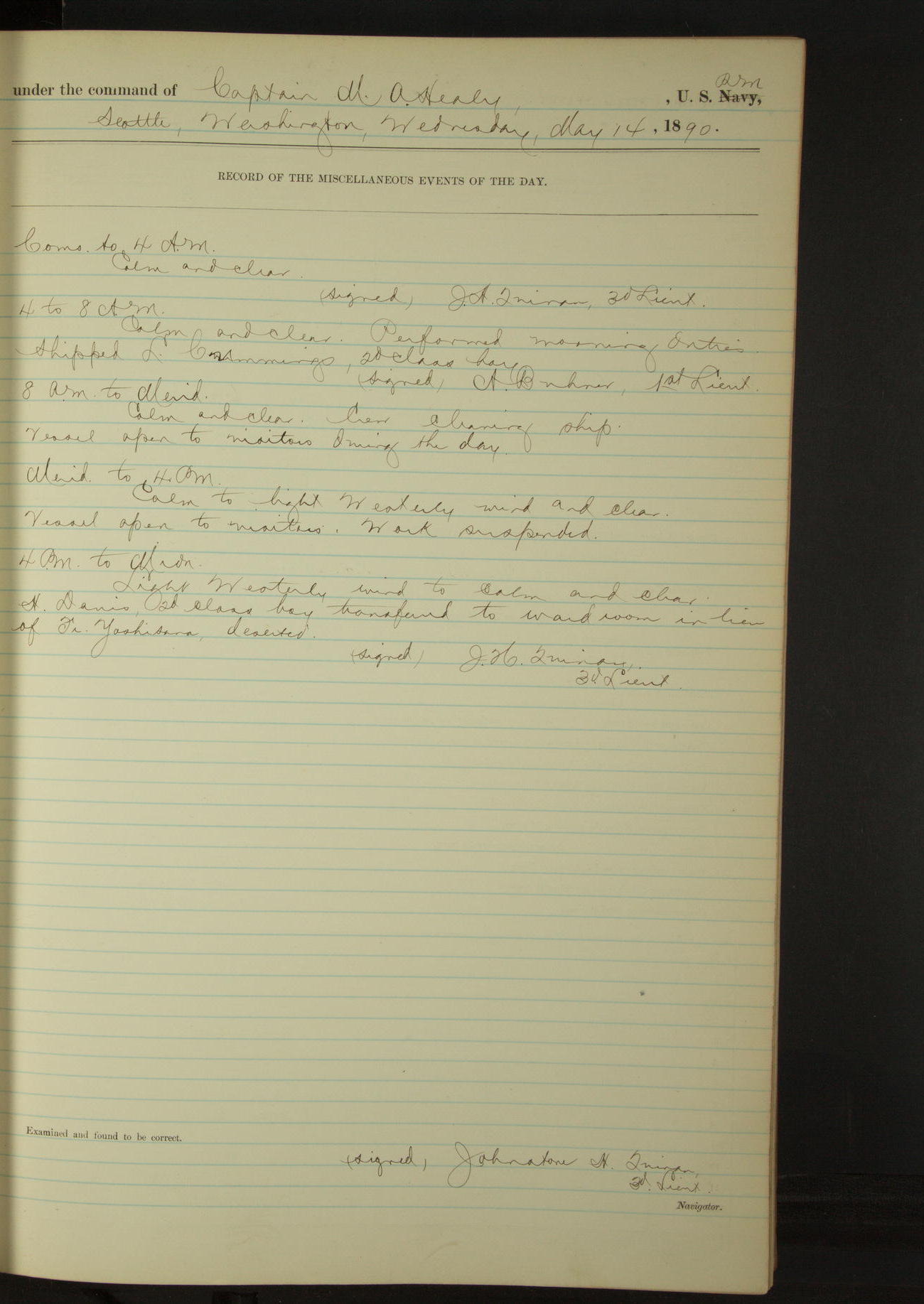
14 May 1890
Seattle, Washington
Lat 47.60, Long -122.34
4am to 8am:
Shipped L Cummings, 2nd class Boy.
8am to meridian:
Vessel open to visitors during the day.
4pm to midnight:
H Davis, 2nd class Boy, transferred to ward room in lieu of Fr Yoshisawa, deserted.
50874d5c09d409075500139b: (http://oldweather.s3.amazonaws.com/ow3/final/USRC Bear/vol068/vol068_018_0.jpg)
50874d5c09d409075500139d: (http://oldweather.s3.amazonaws.com/ow3/final/USRC Bear/vol068/vol068_018_1.jpg)
15 May 1890
Seattle, Washington
Lat 47.60, Long -122.34
4am to 8am:
Scrubbed and washed clothes.
8am to meridian [and Meridian to 4pm]:
Crew employed in squaring ratlines and cleaning boats.
50874d5c09d409075500139f: (http://oldweather.s3.amazonaws.com/ow3/final/USRC Bear/vol068/vol068_019_0.jpg)
50874d5c09d40907550013a1: (http://oldweather.s3.amazonaws.com/ow3/final/USRC Bear/vol068/vol068_019_1.jpg)
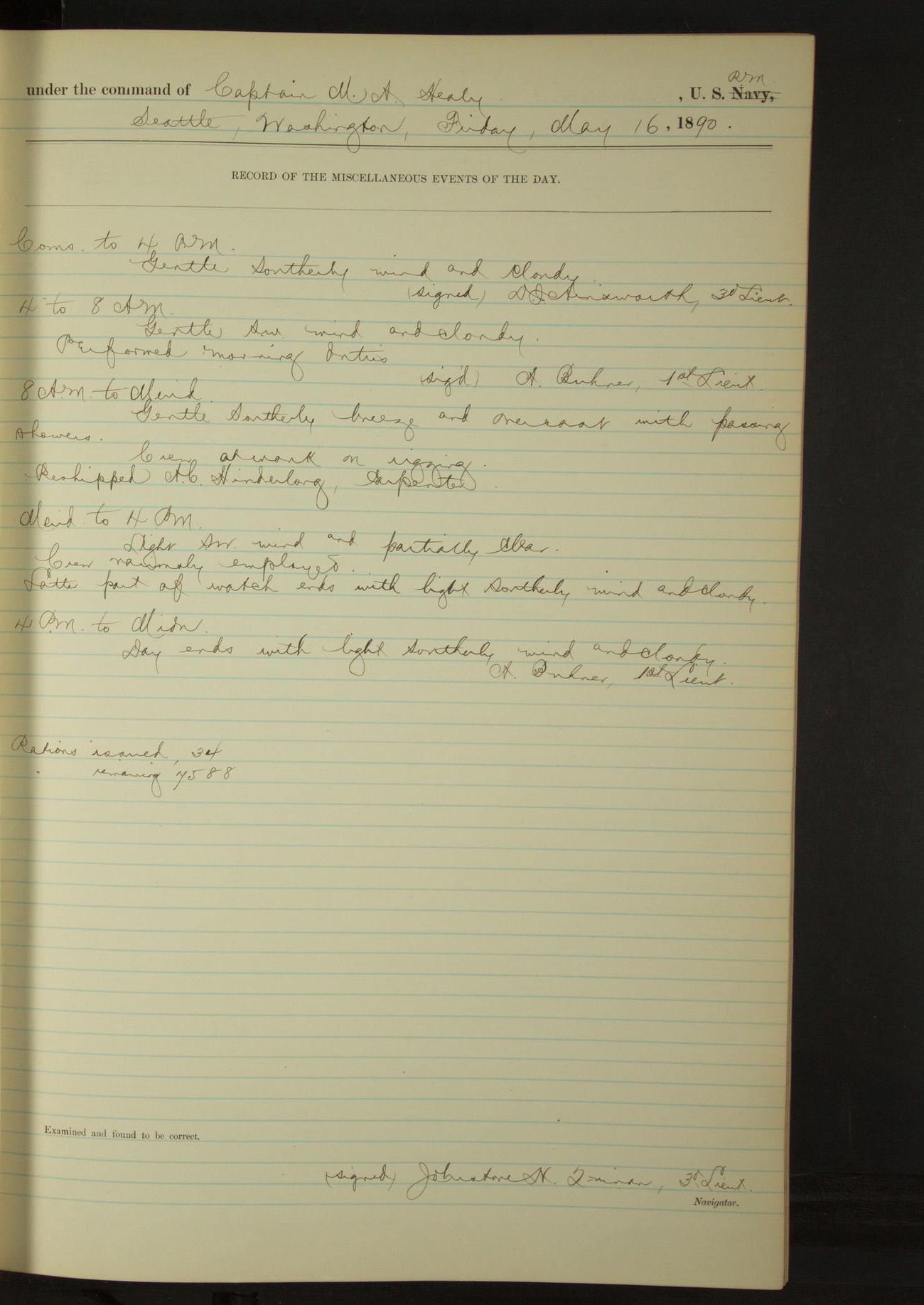
16 May 1890
Seattle, Washington
Lat 47.60, Long -122.34
8am to meridian:
Crew at work on rigging. Reshipped AC Hinderlong, Carpenter.
50874d5d09d40907550013a3: (http://oldweather.s3.amazonaws.com/ow3/final/USRC Bear/vol068/vol068_020_0.jpg)
50874d5d09d40907550013a5: (http://oldweather.s3.amazonaws.com/ow3/final/USRC Bear/vol068/vol068_020_1.jpg)
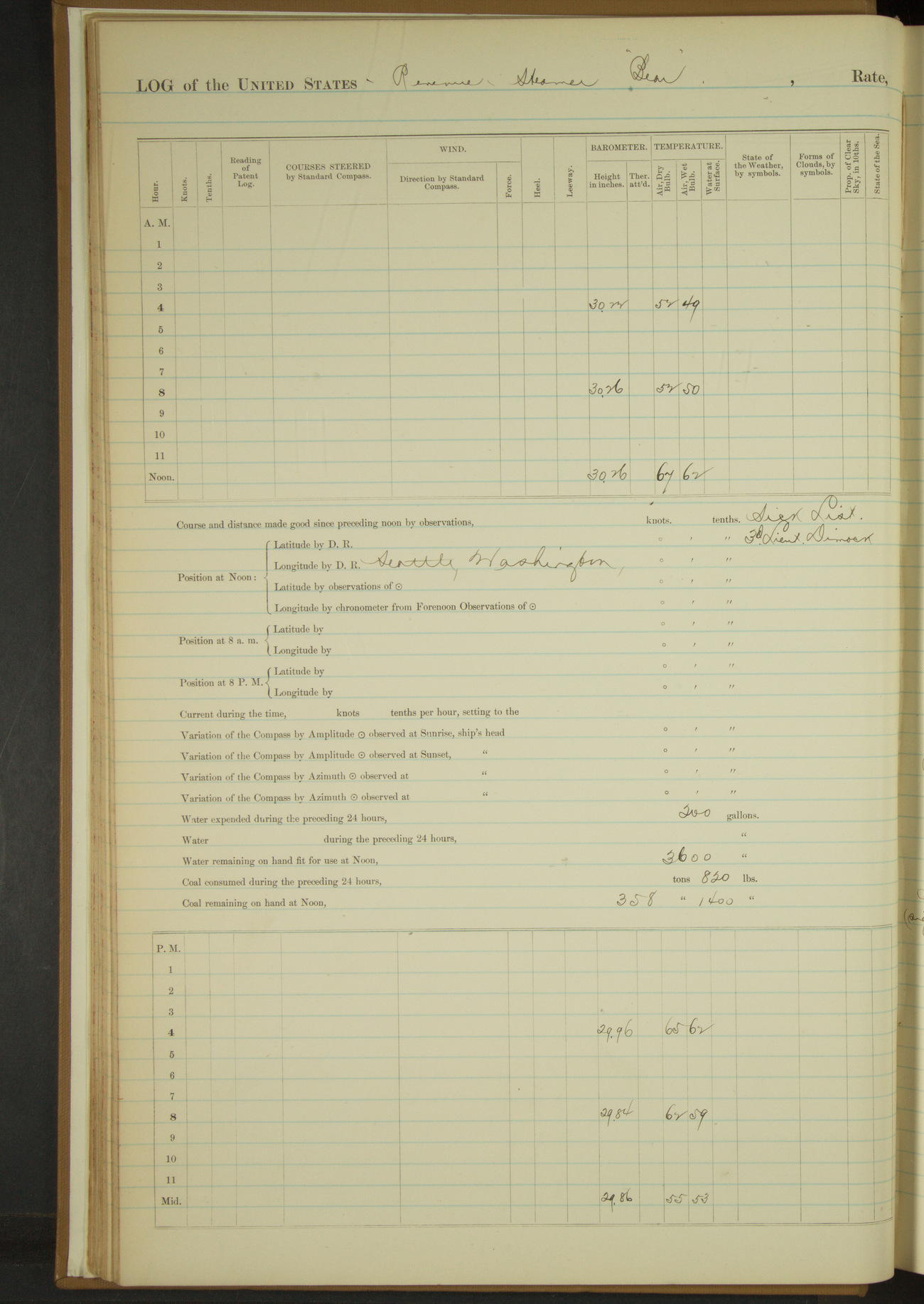
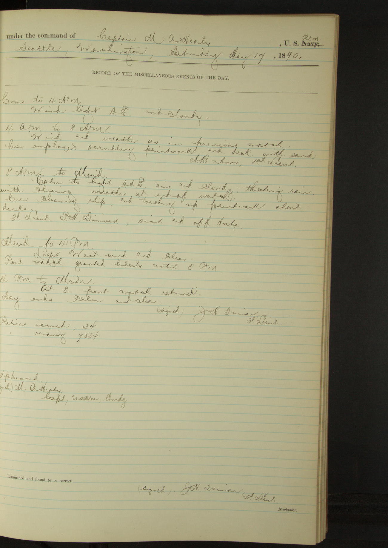
17 May 1890
Seattle, Washington
Lat 47.60, Long -122.34
4am to 8am:
Crew employed scrubbing paintwork and deck with sand.
8am to meridian:
Crew cleaning ship; and touching up paintwork about decks. 3rd Lieutenant FH Dimock off duty sick [to 20 May].
Meridian to 4pm:
Part watch granted liberty until 8pm.
4pm to midnight:
8.00: part watch returned.
50874d5d09d40907550013a7: (http://oldweather.s3.amazonaws.com/ow3/final/USRC Bear/vol068/vol068_021_0.jpg)
50874d5d09d40907550013a9: (http://oldweather.s3.amazonaws.com/ow3/final/USRC Bear/vol068/vol068_021_1.jpg)
[Log for 17 May duplicated]
50874d5d09d40907550013ab: (http://oldweather.s3.amazonaws.com/ow3/final/USRC Bear/vol068/vol068_022_0.jpg)
50874d5d09d40907550013ad: (http://oldweather.s3.amazonaws.com/ow3/final/USRC Bear/vol068/vol068_022_1.jpg)
18 May 1890
Seattle, Washington
Lat 47.60, Long -122.34
8am to meridian:
At 10.00 mustered crew and inspected ship throughout. Gave usual Sunday liberty.
4pm to midnight:
At 8.00 liberty men returned.
50874d5d09d40907550013af: (http://oldweather.s3.amazonaws.com/ow3/final/USRC Bear/vol068/vol068_023_0.jpg)
50874d5d09d40907550013b1: (http://oldweather.s3.amazonaws.com/ow3/final/USRC Bear/vol068/vol068_023_1.jpg)
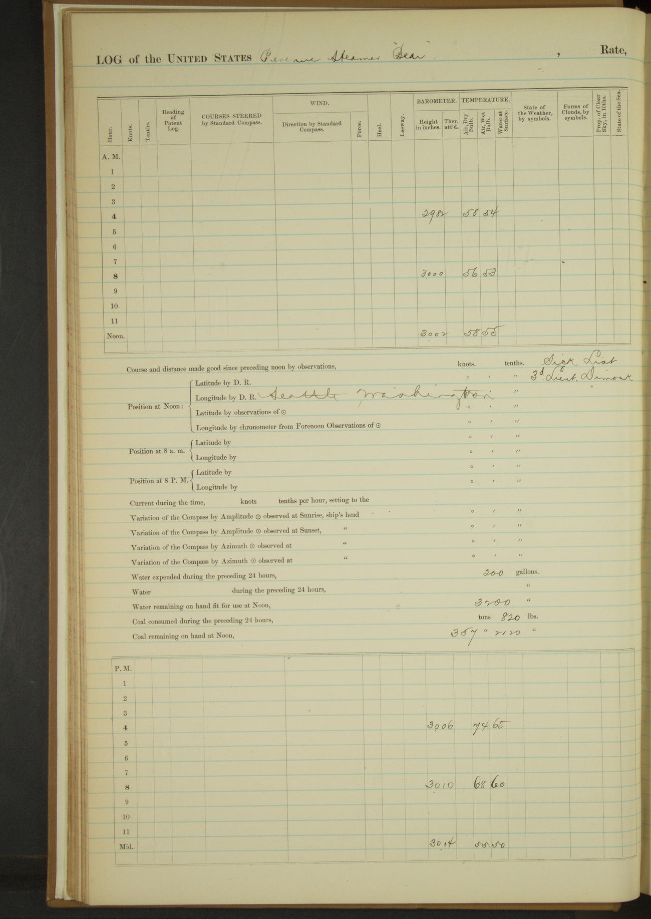
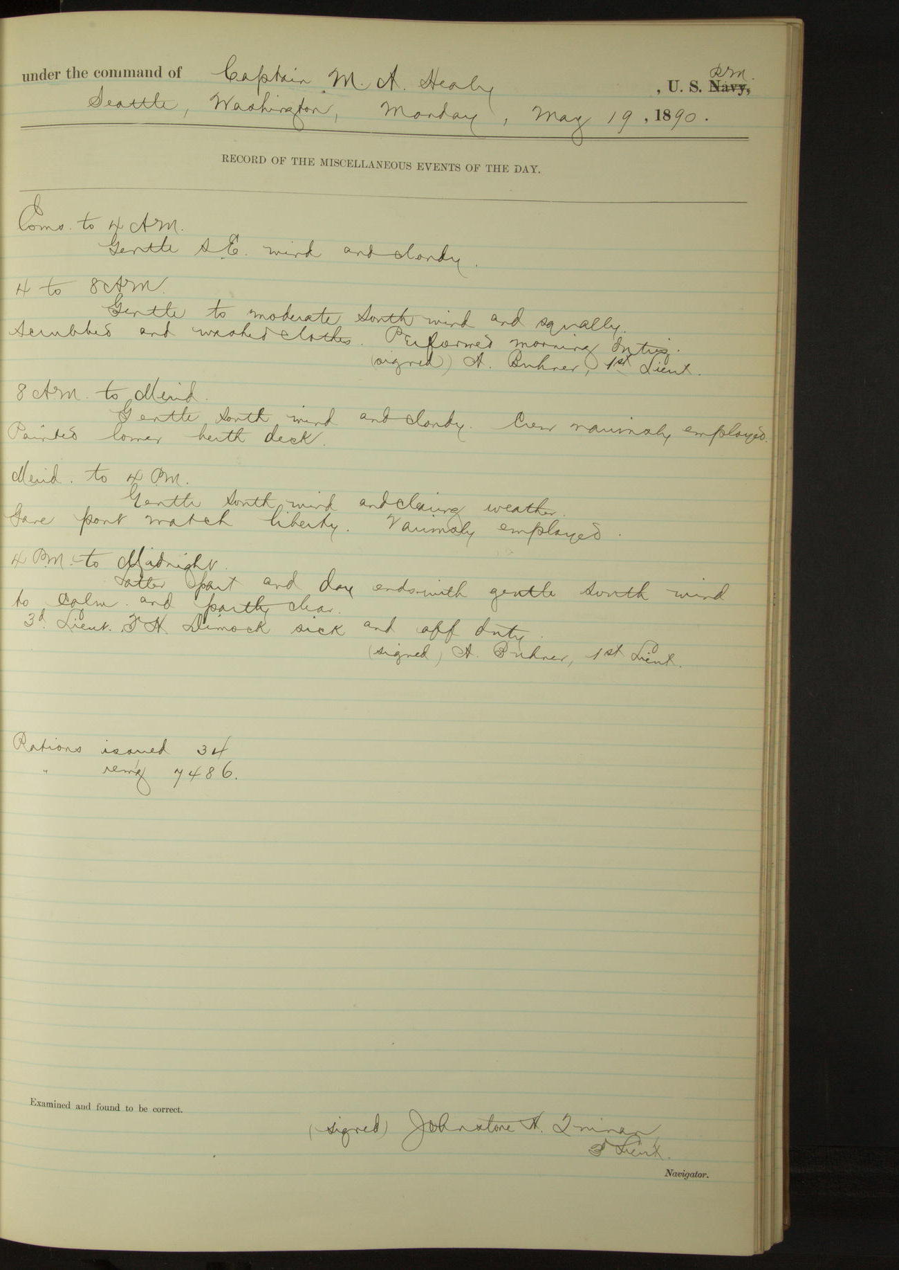
19 May 1890
Seattle, Washington
Lat 47.60, Long -122.34
4am to 8am:
Scrubbed and washed clothes.
8am to meridian:
Painted lower berth deck.
Meridian to 4pm:
Gave part watch liberty.
50874d5d09d40907550013b3: (http://oldweather.s3.amazonaws.com/ow3/final/USRC Bear/vol068/vol068_024_0.jpg)
50874d5d09d40907550013b5: (http://oldweather.s3.amazonaws.com/ow3/final/USRC Bear/vol068/vol068_024_1.jpg)
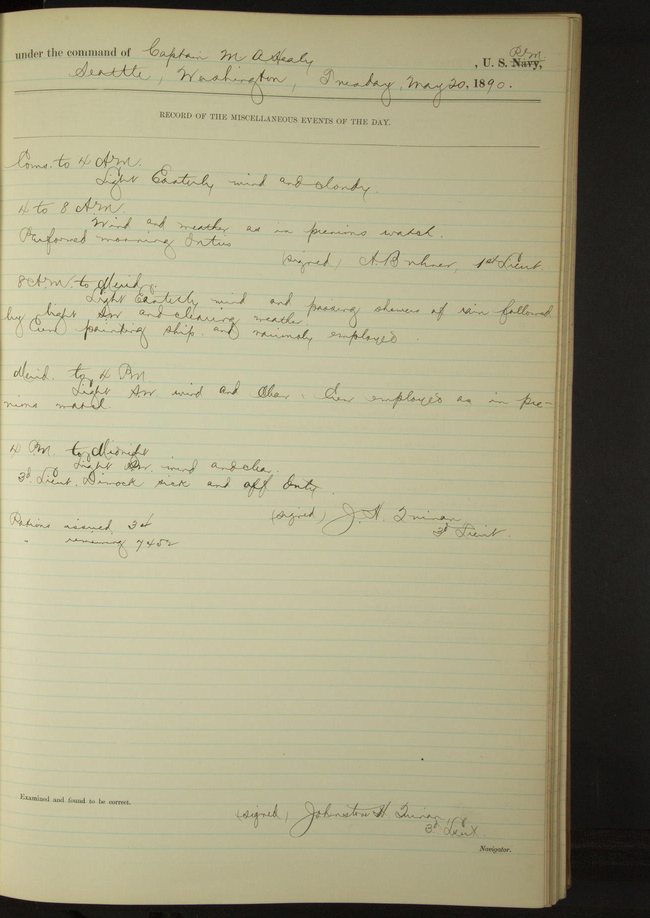
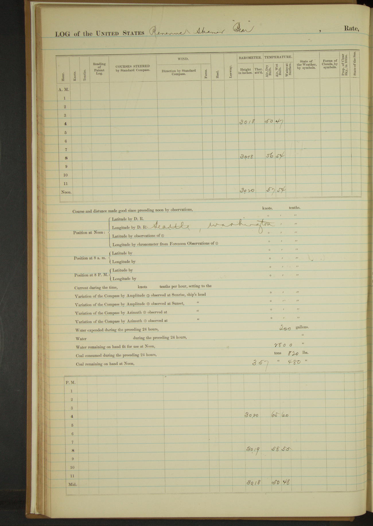
20 May 1890
Seattle, Washington
Lat 47.60, Long -122.34
3rd Lieutenant FH Dimock sick and off duty.
50874d5d09d40907550013b7: (http://oldweather.s3.amazonaws.com/ow3/final/USRC Bear/vol068/vol068_025_0.jpg)
50874d5d09d40907550013b9: (http://oldweather.s3.amazonaws.com/ow3/final/USRC Bear/vol068/vol068_025_1.jpg)
21 May 1890
Seattle, Washington
Lat 47.60, Long -122.34
3rd Lieutenant FH Dimock off sick list and on duty.
50874d5d09d40907550013bb: (http://oldweather.s3.amazonaws.com/ow3/final/USRC Bear/vol068/vol068_026_0.jpg)
50874d5d09d40907550013bd: (http://oldweather.s3.amazonaws.com/ow3/final/USRC Bear/vol068/vol068_026_1.jpg)
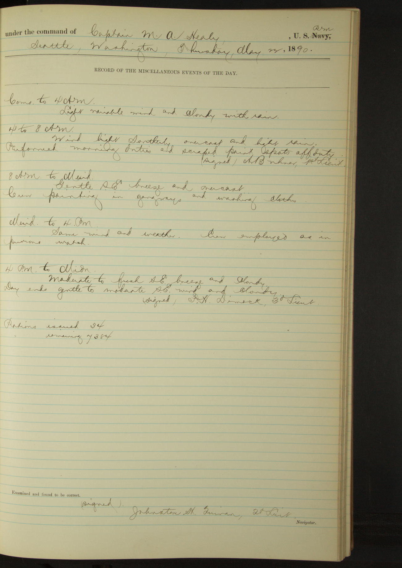
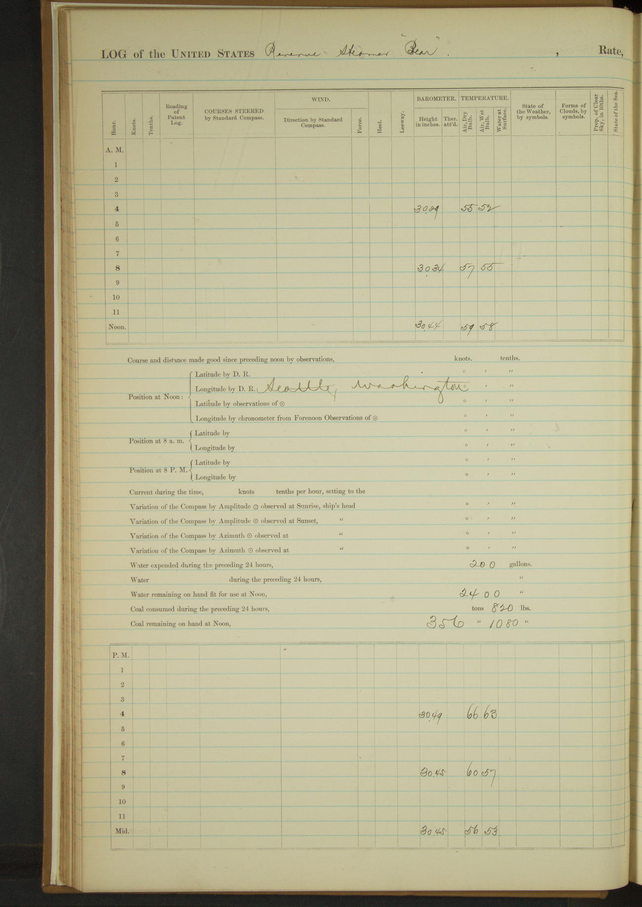
22 May 1890
Seattle, Washington
Lat 47.60, Long -122.34
4am to 8am:
Performed morning duties and scraped paint spots.
8am to meridian [& Meridian to 4pm]:
Crew painting in gangways and washing clothes.
50874d5d09d40907550013bf: (http://oldweather.s3.amazonaws.com/ow3/final/USRC Bear/vol068/vol068_027_0.jpg)
50874d5d09d40907550013c1: (http://oldweather.s3.amazonaws.com/ow3/final/USRC Bear/vol068/vol068_027_1.jpg)
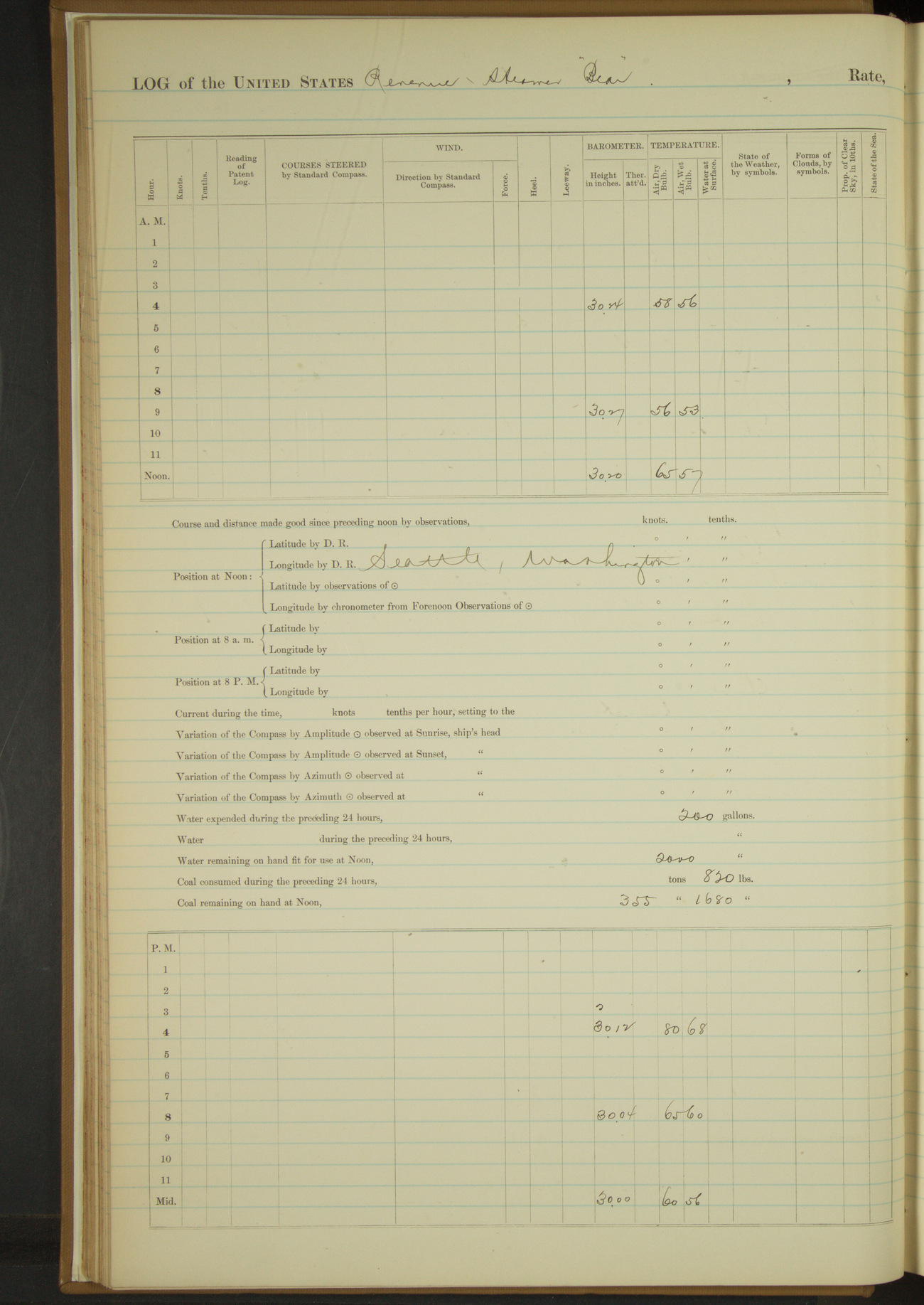
23 May 1890
Seattle, Washington
Lat 47.60, Long -122.34
4am to 8am:
Performed morning duties and prepared to paint ship outside.
8am to meridian:
Crew painting ship outside and about decks. Tarring down mizzen rigging.
Meridian to 4pm:
Granted part watch liberty until 8.00.
4pm to midnight:
At 8.00 liberty men returned.
50874d5d09d40907550013c3: (http://oldweather.s3.amazonaws.com/ow3/final/USRC Bear/vol068/vol068_028_0.jpg)
50874d5d09d40907550013c5: (http://oldweather.s3.amazonaws.com/ow3/final/USRC Bear/vol068/vol068_028_1.jpg)
24 May 1890
Seattle, Washington
Lat 47.60, Long -122.34
8am to meridian:
Crew employed varnishing hard woodwork about quarter deck.
Meridian to 4pm:
2.00: finished varnishing around quarter deck. Gave starboard watch liberty until 8pm and part watch the afternoon to overhaul clothing.
4pm to midnight:
8.00: liberty men returned.
50874d5d09d40907550013c7: (http://oldweather.s3.amazonaws.com/ow3/final/USRC Bear/vol068/vol068_029_0.jpg)
50874d5d09d40907550013c9: (http://oldweather.s3.amazonaws.com/ow3/final/USRC Bear/vol068/vol068_029_1.jpg)
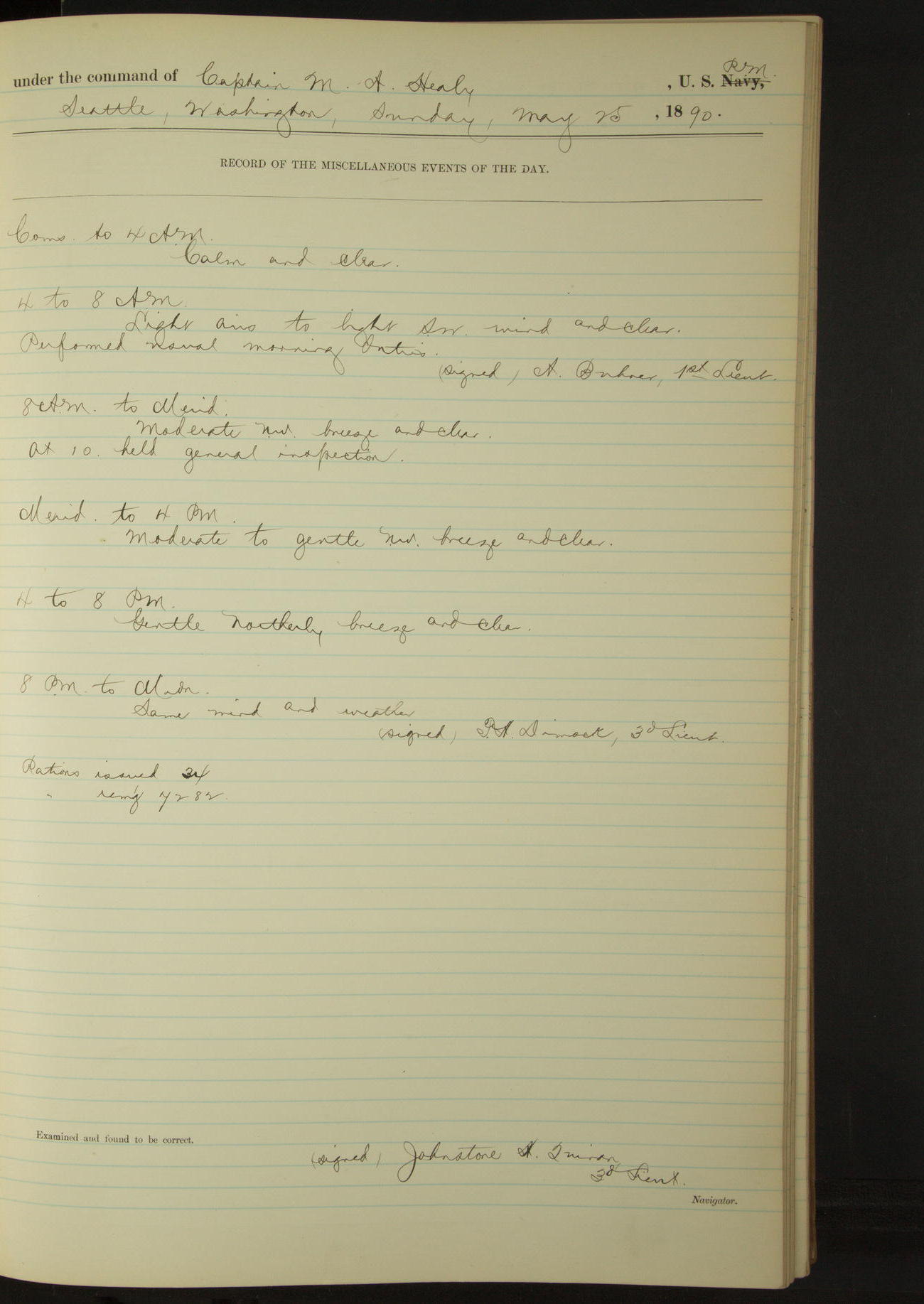
25 May 1890
Seattle, Washington
Lat 47.60, Long -122.34
50874d5d09d40907550013cb: (http://oldweather.s3.amazonaws.com/ow3/final/USRC Bear/vol068/vol068_030_0.jpg)
50874d5d09d40907550013cd: (http://oldweather.s3.amazonaws.com/ow3/final/USRC Bear/vol068/vol068_030_1.jpg)
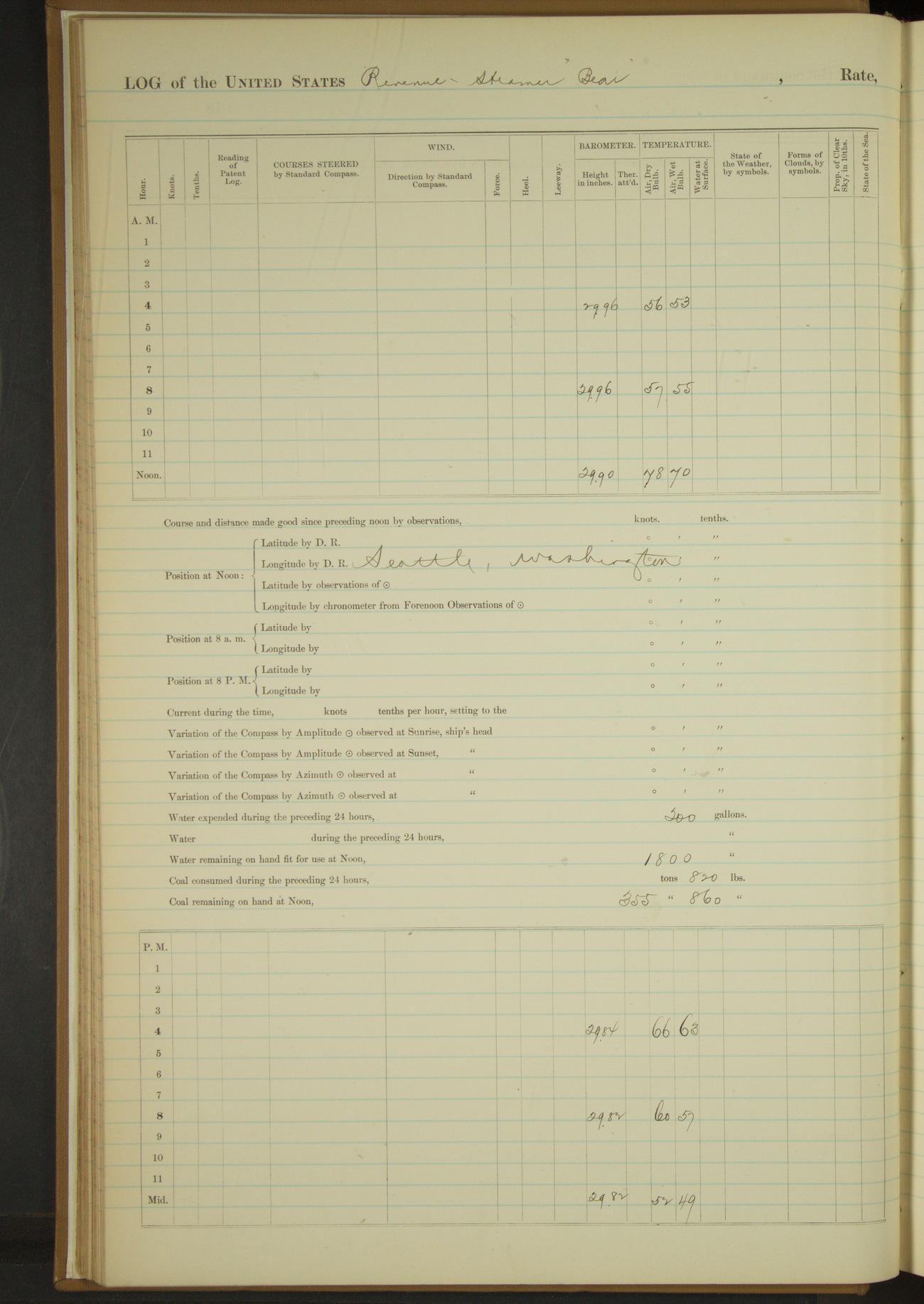
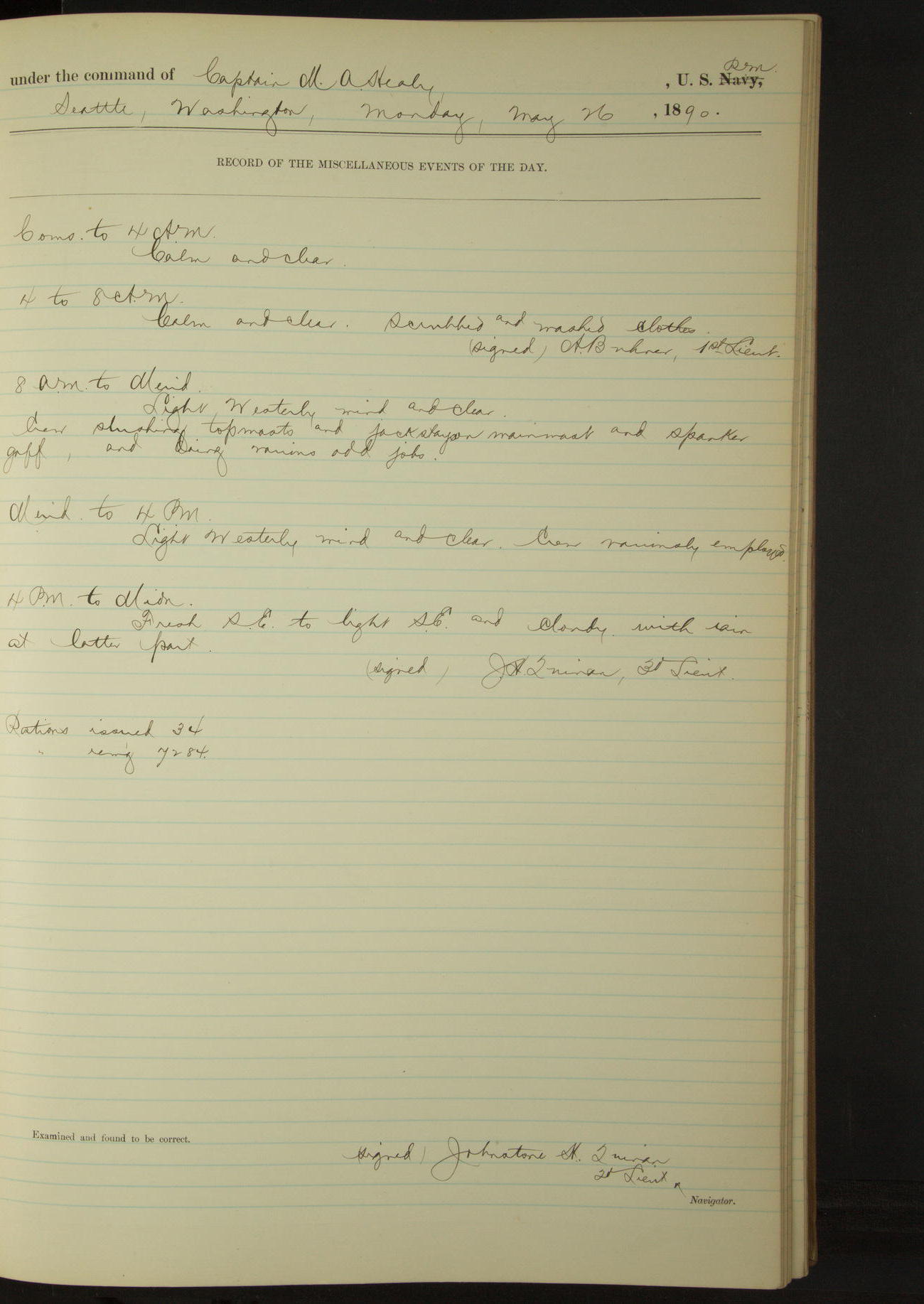
26 May 1890
Seattle, Washington
Lat 47.60, Long -122.34
4am to 8am:
Scrubbed and washed clothes.
8am to meridian:
Crew slushing topmasts and jackstays on main mast and spanker gaff, and doing various odd jobs.
50874d5d09d40907550013cf: (http://oldweather.s3.amazonaws.com/ow3/final/USRC Bear/vol068/vol068_031_0.jpg)
50874d5d09d40907550013d1: (http://oldweather.s3.amazonaws.com/ow3/final/USRC Bear/vol068/vol068_031_1.jpg)
27 May 1890
Seattle, Washington
Lat 47.60, Long -122.34
8am to meridian [& Meridian to 4pm]:
Crew employed shortening main topmast and topgallant stays, scraping and varnishing dead eyes, making sails for dinghy and variously.
50874d5d09d40907550013d3: (http://oldweather.s3.amazonaws.com/ow3/final/USRC Bear/vol068/vol068_032_0.jpg)
50874d5d09d40907550013d5: (http://oldweather.s3.amazonaws.com/ow3/final/USRC Bear/vol068/vol068_032_1.jpg)
28 May 1890
Seattle, Washington
Lat 47.60, Long -122.34
8am to meridian:
Crew at work on rigging and variously employed.
Meridian to 4pm:
At 1.00 hauled into dock and filled tanks with fresh water, receiving 4300 gallons.
50874d5d09d40907550013d7: (http://oldweather.s3.amazonaws.com/ow3/final/USRC Bear/vol068/vol068_033_0.jpg)
50874d5d09d40907550013d9: (http://oldweather.s3.amazonaws.com/ow3/final/USRC Bear/vol068/vol068_033_1.jpg)
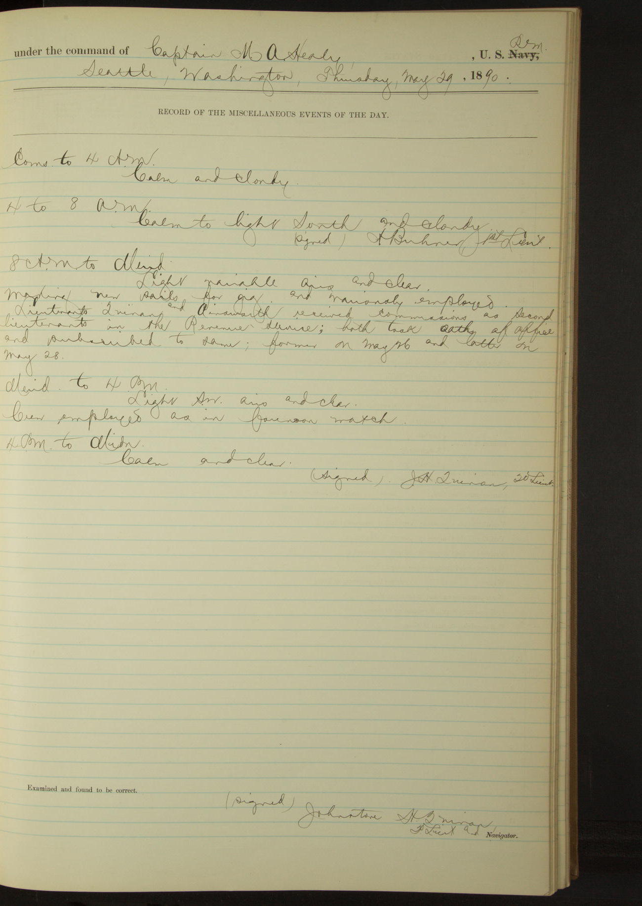
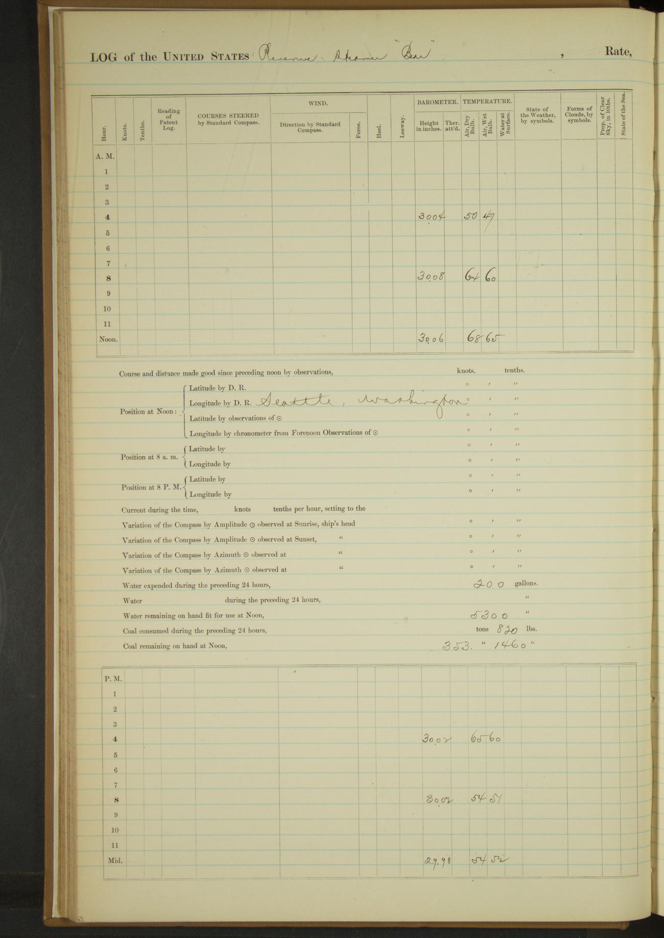
29 May 1890
Seattle, Washington
Lat 47.60, Long -122.34
8am to meridian:
Making new sails for gig and variously employed.
Lieutenants Quinan and Ainsworth received commissions as 2nd Lieutenants in the Revenue Service; both took oaths of office and subscribed to same; former on May 26 and latter on May 28.
Meridian to 4pm:
Crew employed as in forenoon watch.
50874d5d09d40907550013db: (http://oldweather.s3.amazonaws.com/ow3/final/USRC Bear/vol068/vol068_034_0.jpg)
50874d5d09d40907550013dd: (http://oldweather.s3.amazonaws.com/ow3/final/USRC Bear/vol068/vol068_034_1.jpg)
30 May 1890
Seattle, Washington
Lat 47.60, Long -122.34
4am to 8am:
Dressed mastheads in honor of the day.
8am to meridian:
The day being a national holiday, all unnecessary work suspended.
50874d5d09d40907550013df: (http://oldweather.s3.amazonaws.com/ow3/final/USRC Bear/vol068/vol068_035_0.jpg)
50874d5d09d40907550013e1: (http://oldweather.s3.amazonaws.com/ow3/final/USRC Bear/vol068/vol068_035_1.jpg)
31 May 1890
Seattle, Washington
Lat 47.60, Long -122.34
Meridian to 4pm:
Crew mending clothes &c.
Abstract of log for month of May, 1890
At anchor 626 hours 30 minutes; coal received 207 112/2240 tons
Underway 117 hours 30 minutes; coal consumed 60 62/[2240] tons
Under steam & canvas 7 hours; coal consumed 353 640/[2240 tons]
Under steam exclusively 110 hours 30 minutes
Distance steam & canvas 57.6 miles
Distance steam exclusively 813.0 miles
Distance total 870.6 miles
Officers present 279, average 9
Petty Officer and crew 1240, average 40
Rations issued 1054
LOGS FOR JUNE 1890
50874d5d09d40907550013e3: (http://oldweather.s3.amazonaws.com/ow3/final/USRC Bear/vol068/vol068_036_0.jpg)
50874d5d09d40907550013e5: (http://oldweather.s3.amazonaws.com/ow3/final/USRC Bear/vol068/vol068_036_1.jpg)
1 June 1890
Seattle, Washington
Lat 47.60, Long -122.34
50874d5d09d40907550013e7: (http://oldweather.s3.amazonaws.com/ow3/final/USRC Bear/vol068/vol068_037_0.jpg)
50874d5d09d40907550013e9: (http://oldweather.s3.amazonaws.com/ow3/final/USRC Bear/vol068/vol068_037_1.jpg)
2 June 1890
Seattle, Washington
Lat 47.60, Long -122.34
Sick list: Louis Cummings, 2nd class Boy [to 19th June].
4am to 8am:
Scrubbed and washed clothes.
Meridian to 4pm:
Commanding Officer received telegraphic orders from the Department.
4pm to midnight:
Revenue Cutter “Wolcott” arrived in port.
50874d5d09d40907550013eb: (http://oldweather.s3.amazonaws.com/ow3/final/USRC Bear/vol068/vol068_038_0.jpg)
50874d5d09d40907550013ed: (http://oldweather.s3.amazonaws.com/ow3/final/USRC Bear/vol068/vol068_038_1.jpg)
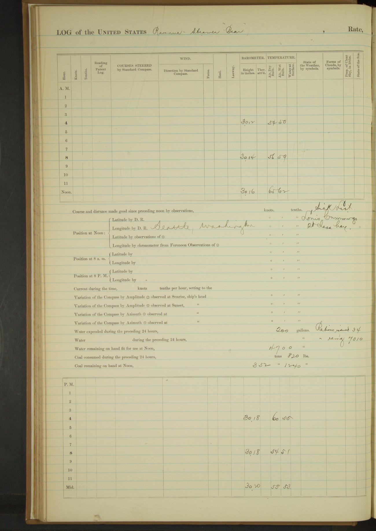
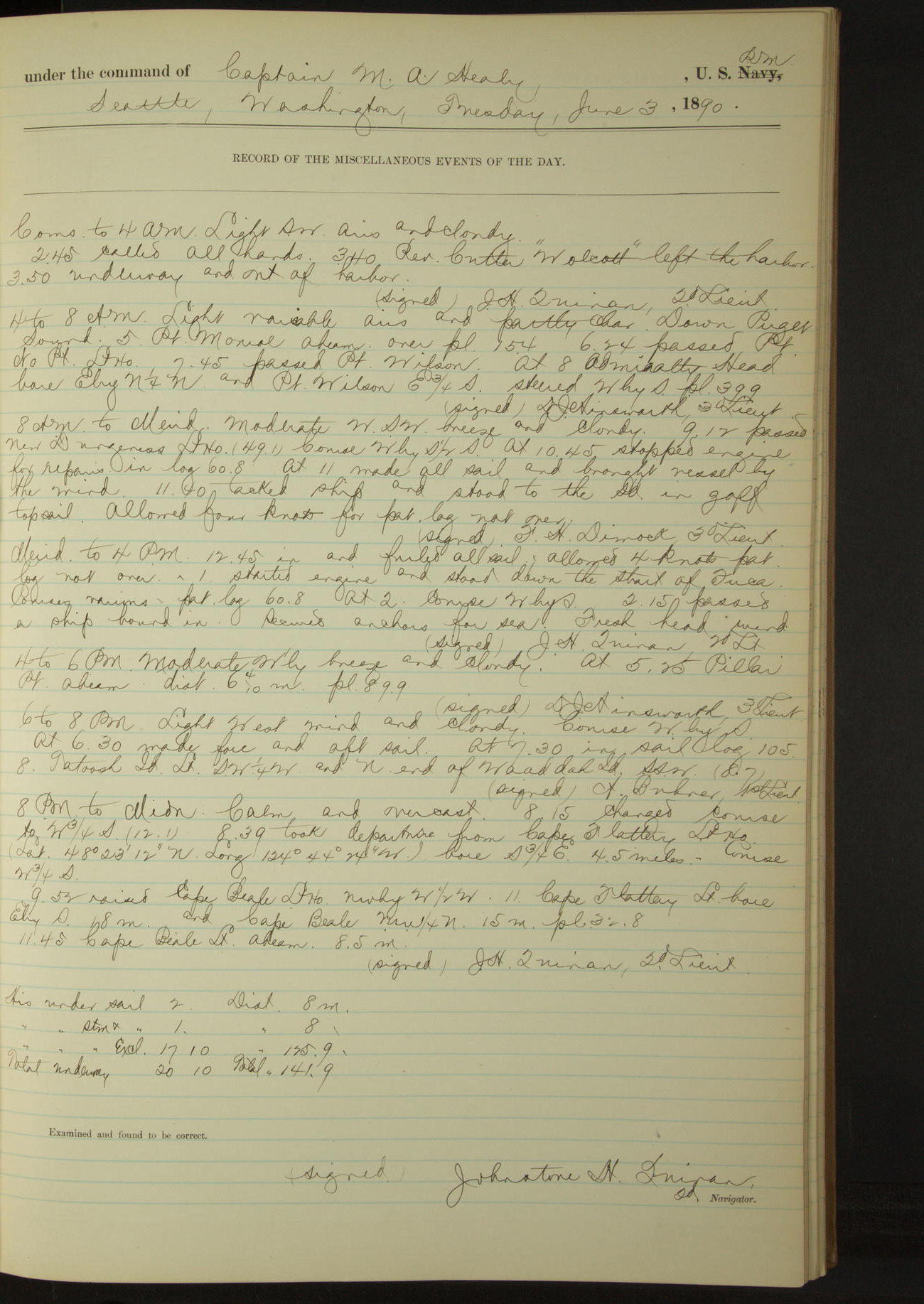
3 June 1890
Seattle, Washington [& at sea]
Lat 48.28, Long -123.47
Commences to 4am:
2.45: called all hands. 3.40: Revenue Cutter “Wolcott” left the harbor. 3.50: underway and out of harbor.
4am to 8am:
Down Puget Sound. 5.00: Point Monroe abeam. 6.24: passed Point No Point Light House.
7.45: passed Point Wilson. At 8.00 Admiralty Head bore EbyN¼N and Point Wilson E¾S.
8am: Lat 48° 9’ 30”N, Long 122° 47’ 30”W
8am to meridian:
9.12: passed New Dungeness Light House. 10.45: stopped engine for repairs. At 11.00 made all sail and brought vessel by the wind.
Meridian to 4pm:
1.00: started engine and stood down the Strait of Fuca. 2.15: passed a ship bound in. Secured anchors for sea.
4pm to 6pm:
At 5.25 Pillar Point abeam.
6pm to 8pm:
8.00: Tatoosh Island Light SW¼W and N end of Waaddah Island SSW.
8pm: Lat 48° 27’N, Long 124° 29’W
8pm to midnight:
8.39: took departure from Cape Flattery Light House (Lat 48° 23’ 12”N, Long 124° 44’ 24”W), bore S¾E, 4.5 miles.
9.52: raised Cape Beale Light House NWbyW½W. 11.00: Cape Flattery Light bore EbyS, 18 miles and Cape Beale NW¼N, 15 miles. 11.45 Cape Beale Light abeam, 8.5 miles.
Under sail 2 hours. Distance 8 miles.
Under steam and sail 1 hour. Distance 8 miles.
Under steam exclusively 17 hours 10 minutes. Distance 175.9 miles.
Total underway 20 hours 10 minutes. Total distance 141.9 miles.
50874d5d09d40907550013ef: (http://oldweather.s3.amazonaws.com/ow3/final/USRC Bear/vol068/vol068_039_0.jpg)
50874d5d09d40907550013f1: (http://oldweather.s3.amazonaws.com/ow3/final/USRC Bear/vol068/vol068_039_1.jpg)
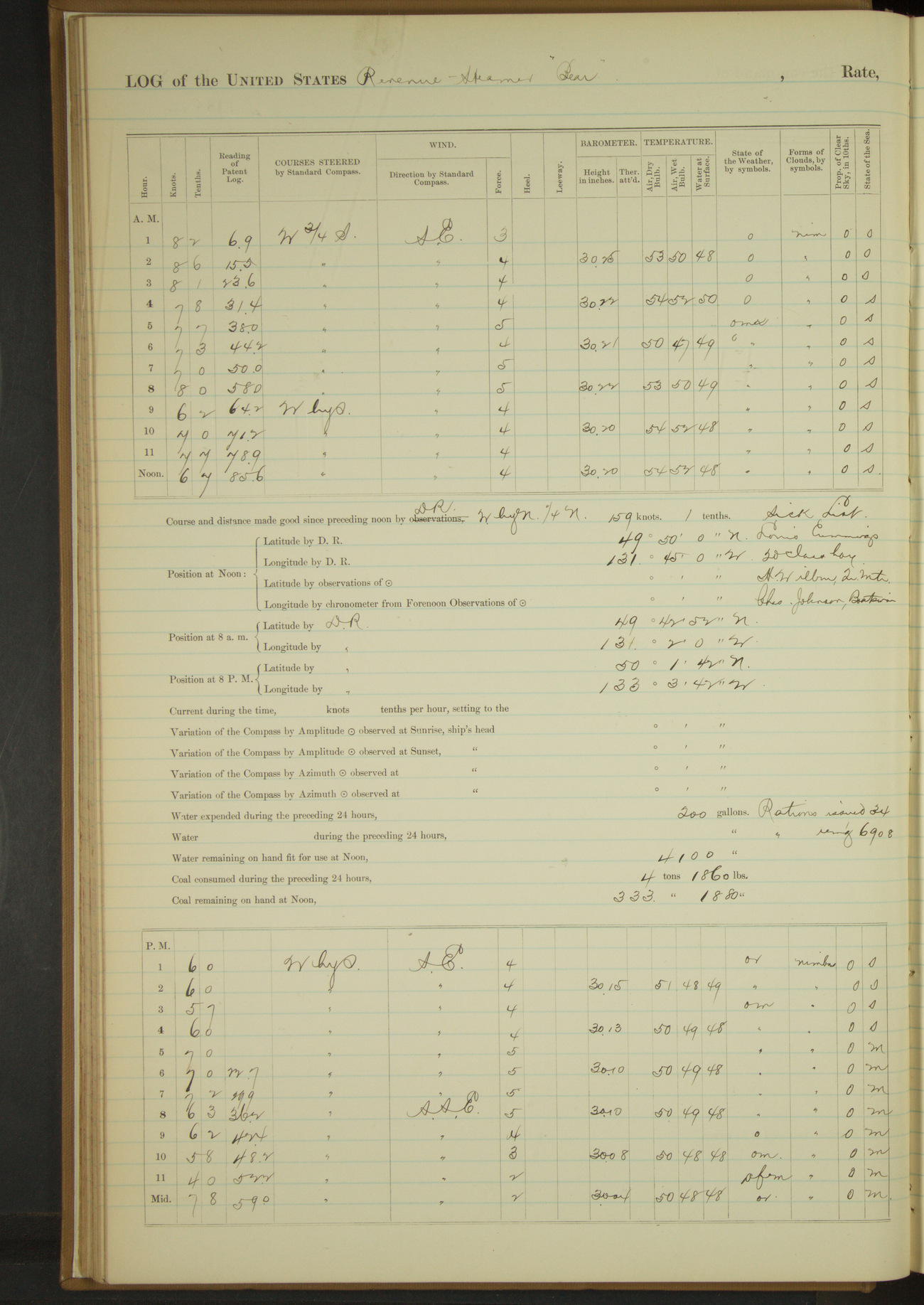
4 June 1890
At sea
Lat 49.15, Long -127.70
Sick list: H Wilbur, Quartermaster [to 8th June]; Charles Johnson, Boatswain [to 18th June]
8am: Lat 48° 47’ 36”N, Long 124° 46’ 23”W
8pm: Lat 49° 22’ 24”N, Long 129° 1’W
Under steam exclusively 12 hours. Distance 67.8 miles.
Under steam and sail 12 hours. Distance 90.6 miles.
Total distance 158.4 miles.
50874d5d09d40907550013f3: (http://oldweather.s3.amazonaws.com/ow3/final/USRC Bear/vol068/vol068_040_0.jpg)
50874d5d09d40907550013f5: (http://oldweather.s3.amazonaws.com/ow3/final/USRC Bear/vol068/vol068_040_1.jpg)
5 June 1890
At sea
Lat 49.83, Long -131.75
8am: Lat 49° 42’ 52”N, Long 131° 2’W
8pm: Lat 50° 1’ 42”N, Long 133° 3’ 42”W
Under sail & steam 13 hours. Distance 98.1 miles.
Under sail exclusively 11 hours. Distance 67.2 miles.
Total 165.3 miles
50874d5d09d40907550013f7: (http://oldweather.s3.amazonaws.com/ow3/final/USRC Bear/vol068/vol068_041_0.jpg)
50874d5d09d40907550013f9: (http://oldweather.s3.amazonaws.com/ow3/final/USRC Bear/vol068/vol068_041_1.jpg)
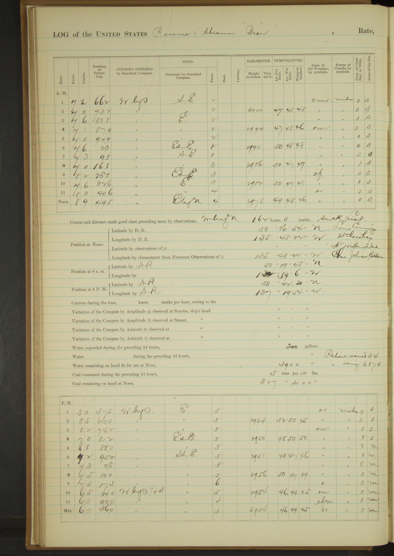
6 June 1890
At sea
Lat 50.45, Long -135.81
8am: Lat 50° 19’ 48”N, Long 134° 59’ 6”W
8pm: Lat 50° 42’ 30”N, Long 137° 19’ 54”W
Under sail and steam 14 hours 45 minutes. Distance 113.5 miles.
Under sail exclusively 9 hours 15 minutes. Distance 63.5 miles.
Total 177 miles.
50874d5d09d40907550013fb: (http://oldweather.s3.amazonaws.com/ow3/final/USRC Bear/vol068/vol068_042_0.jpg)
50874d5d09d40907550013fd: (http://oldweather.s3.amazonaws.com/ow3/final/USRC Bear/vol068/vol068_042_1.jpg)
7 June 1890
At sea
Lat 51.03, Long -140.08 [Using DR, Obs seems incorrect]
8am: Lat 50° 56’ 18”N, Long 139° 17’ 26”W
Noon: DR Lat 51° 1’N, Long 140° 5’W; Observation Lat 51° 58’ 22”N, Long 140° 7’ 40”W
8pm: Lat 52° 3’ 58”N, Long 141° 38’ 28”W
Under sail and steam 19 hours 15 minutes. Distance 139.2 miles.
Under sail exclusively 4 hours 45 minutes. Distance 24.8 miles.
Total 164 miles.
50874d5d09d40907550013ff: (http://oldweather.s3.amazonaws.com/ow3/final/USRC Bear/vol068/vol068_043_0.jpg)
50874d5d09d4090755001401: (http://oldweather.s3.amazonaws.com/ow3/final/USRC Bear/vol068/vol068_043_1.jpg)
8 June 1890
At sea
Lat 52.38, Long -145.02
8am: Lat 52° 22’N, Long 144° 19’W
4pm to 6pm:
H Wilbur, Quartermaster, off sick-list and returned to duty.
8pm: Lat 52° 27’ 20”N, Long 146° 26’W
Under sail and steam 6 hours 30 minutes. Distance 45 miles.
Under sail exclusively 17 hours 30 minutes. Distance 106.7 miles.
Total 151.7 miles.
50874d5d09d4090755001403: (http://oldweather.s3.amazonaws.com/ow3/final/USRC Bear/vol068/vol068_044_0.jpg)
50874d5d09d4090755001405: (http://oldweather.s3.amazonaws.com/ow3/final/USRC Bear/vol068/vol068_044_1.jpg)
9 June 1890
At sea
Lat 52.62, Long -149.05
8am: Lat 52° 34’N, Long 148° 19’W
8pm: Lat 52° 42’N, Long 150° 31’W
Under steam exclusively 14 hours 40 minutes. Distance 90 miles.
Under steam and sail 7 hours 10 minutes. Distance 51.3 miles.
Under sail exclusively 2 hours 5 minutes. Distance 14.5 miles.
Total 155.8 miles.
50874d5d09d4090755001407: (http://oldweather.s3.amazonaws.com/ow3/final/USRC Bear/vol068/vol068_045_0.jpg)
50874d5d09d4090755001409: (http://oldweather.s3.amazonaws.com/ow3/final/USRC Bear/vol068/vol068_045_1.jpg)
10 June 1890
At sea
Lat 52.97, Long -153.72
8am: Lat 52° 54’N, Long 152° 55’W
8pm: Lat 53° 2’ 28”N, Long 154° 40’W
Under sail exclusively 16 hours 15 minutes. Distance 100.2 miles.
Under steam and sail 7 hours 45 minutes. Distance 42.5 miles.
Total 142.7 miles.
50874d5d09d409075500140b: (http://oldweather.s3.amazonaws.com/ow3/final/USRC Bear/vol068/vol068_046_0.jpg)
50874d5d09d409075500140d: (http://oldweather.s3.amazonaws.com/ow3/final/USRC Bear/vol068/vol068_046_1.jpg)
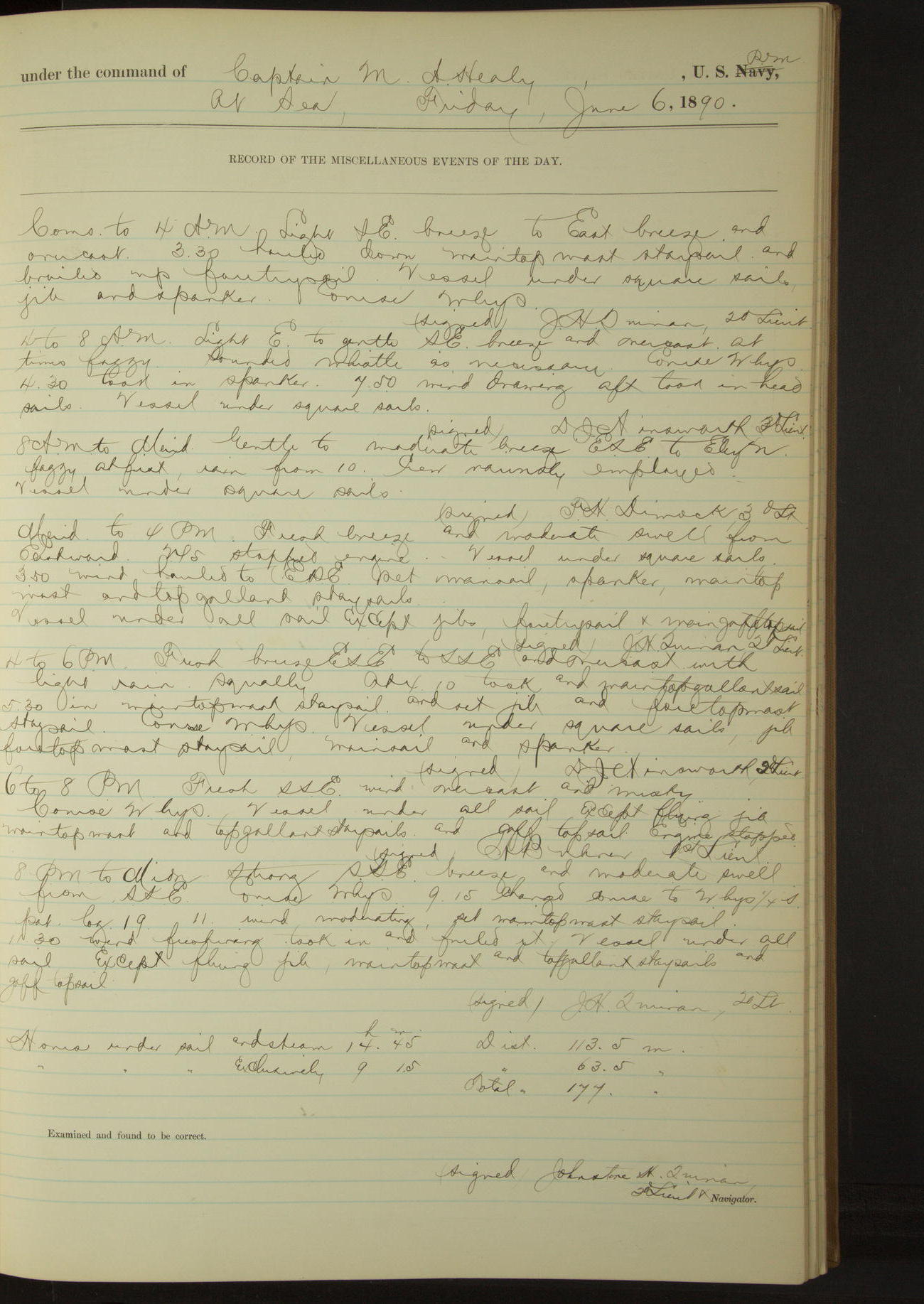
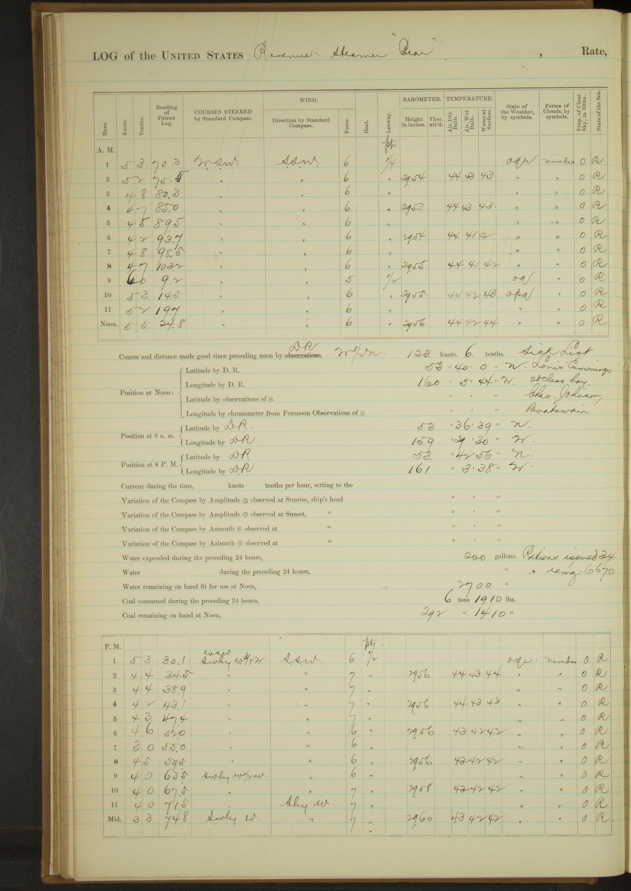
11 June 1890
[11 July 1890 in log]
At sea
Lat 53.43, Long -156.65
Commences to 4am:
12.30: starboard wheel rope parted; got tackles on tiller and attempted to connect forward wheel; found wheel ropes jammed and at 12.55 stopped engines.
In patent log 52.5 and hove vessel to on starboard tack under fore and aft sail, heading SE.
Rove off new wheel rope and at 2.05 started engine at half speed. Brought vessel to course WSW.
2.10: over patent log 52.5; allowed 1.7 miles for patent log not over.
8am: Lat 53° 5’ 55”N, Long 156° 5’W
8pm: Lat 53° 30’ 21”N, Long 157° 49’ 45”W
Under steam and sail 22 hours 50 minutes. Distance 117 miles
Under sail exclusively 1 hour 10 minutes. Distance 1.7 miles
Total 118.7 miles.
50874d5d09d409075500140f: (http://oldweather.s3.amazonaws.com/ow3/final/USRC Bear/vol068/vol068_047_0.jpg)
50874d5d09d4090755001411: (http://oldweather.s3.amazonaws.com/ow3/final/USRC Bear/vol068/vol068_047_1.jpg)
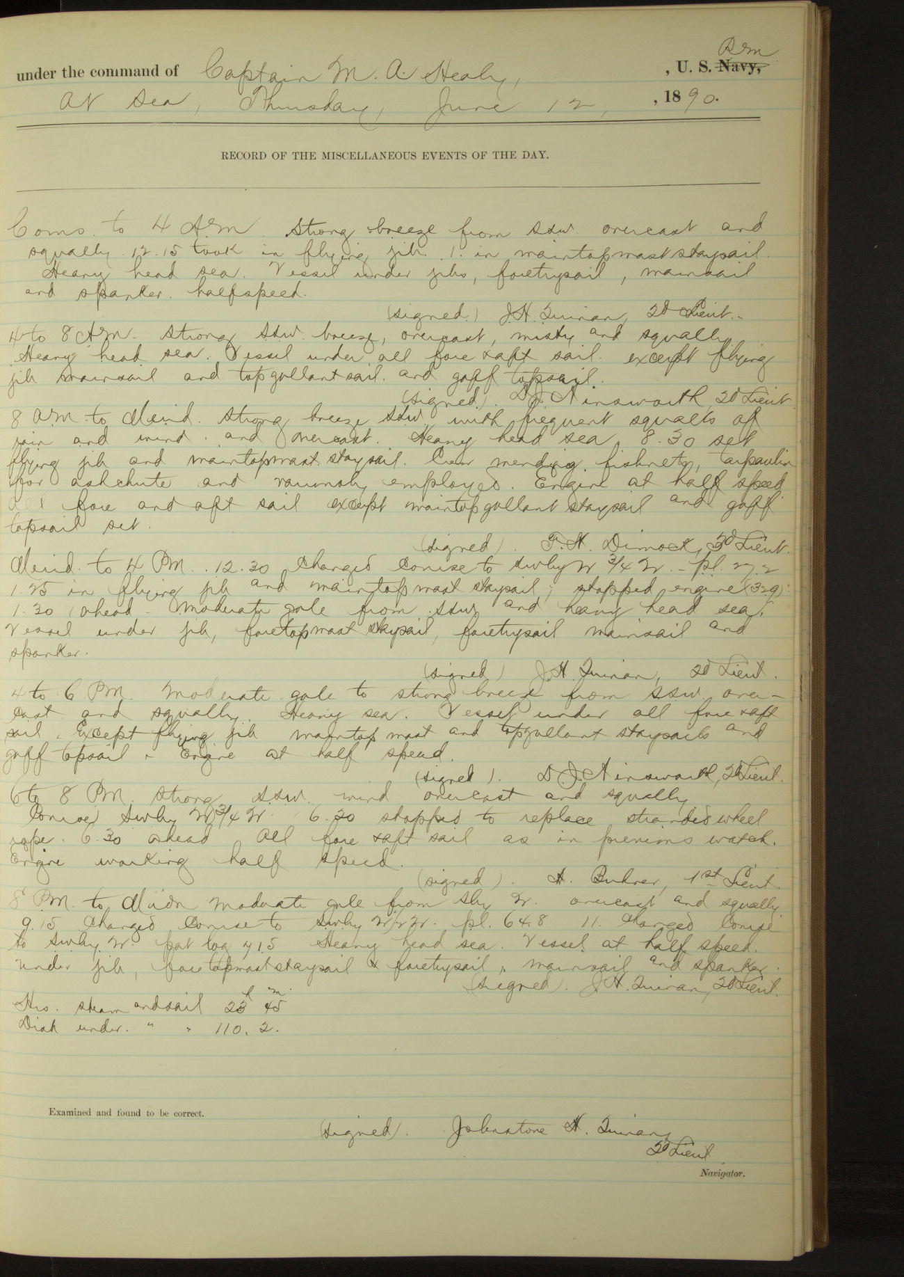
12 June 1890
At sea
Lat 53.67, Long -160.10
8am: Lat 53° 36’ 39”N, Long 159° 29’ 30”W
8am to meridian:
Crew employed mending fishnets, tarpaulin for ash chute and variously employed.
6pm to 8pm:
6.20: stopped to replace stranded wheel rope. 6.30: ahead.
8pm: Lat 53° 42’ 56”N, Long 161° 3’ 38”W
Steam and sail 23 hours 45 minutes. Distance 110.2 miles.
50874d5d09d4090755001413: (http://oldweather.s3.amazonaws.com/ow3/final/USRC Bear/vol068/vol068_048_0.jpg)
50874d5d09d4090755001415: (http://oldweather.s3.amazonaws.com/ow3/final/USRC Bear/vol068/vol068_048_1.jpg)
13 June 1890
At sea
Lat 53.78, Long -162.82
8am: Lat 53° 42’N, Long 162° 18’ 45”W
6pm to 8pm:
7.00: Ugamock bore NWbyN. 8.00: East end Tigalda bore NbyW½W, West end of same NW.
8pm: Lat 53° 42’N, Long 165° 04’W
8pm to midnight:
8.50: East end Tigalda Island abeam. 9.50: E end Avatanak Island abeam.
11.10: off entrance to Akoutan Pass turned and stood off and on to await daylight. At midnight centre of Akoutan Island bore NNW.
Sail and steam 23 hours 10 minutes. Distance 119.4 miles
Steam exclusively 0 hours 50 minutes. Distance 4 miles.
50874d5d09d4090755001417: (http://oldweather.s3.amazonaws.com/ow3/final/USRC Bear/vol068/vol068_049_0.jpg)
50874d5d09d4090755001419: (http://oldweather.s3.amazonaws.com/ow3/final/USRC Bear/vol068/vol068_049_1.jpg)
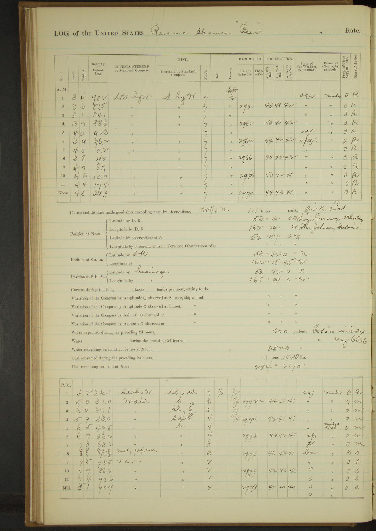
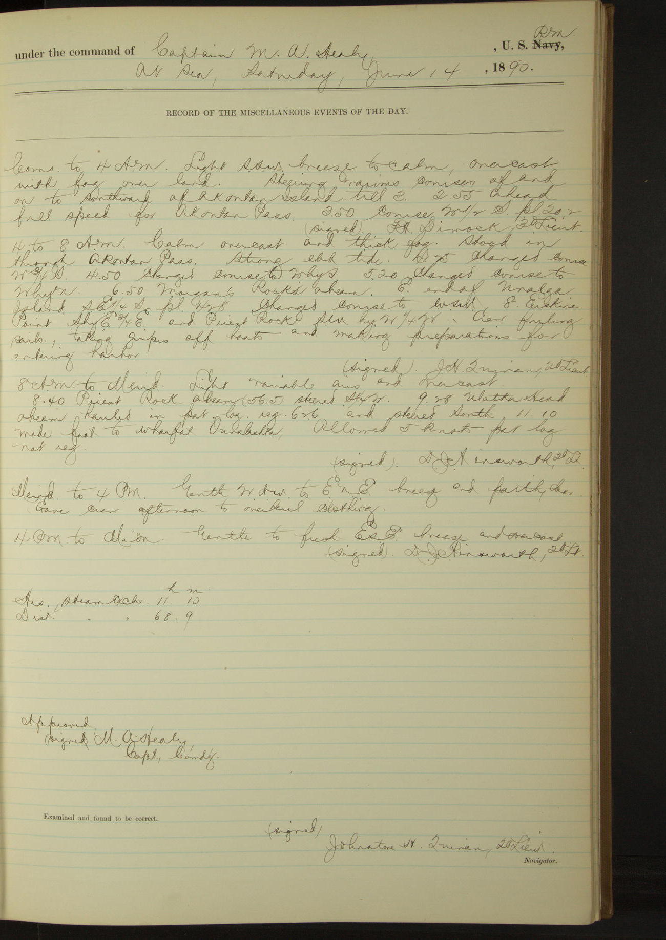
14 June 1890
At sea [& Ounalaska]
Lat 53.88, Long -166.53
Commences to 4am:
2.55: ahead full speed for Akoutan Pass.
4am to 8am:
Calm, overcast and thick fog. Stood in through Akoutan Pass. Strong ebb tide.
6.50: Morgan’s Rocks abeam [Cape Morgan]. E end of Unalga Island SE¼S. 8.00: Erskine Point SbyE¾E and Priest Rock SWbyW¼W.
Crew furling sail, taking gripes off boats and making preparation for entering harbor.
8am to meridian:
8.40: Priest Rock abeam. 9.28: Ulakta Head abeam. 11.10: made fast to wharf at Ounalaska.
Meridian to 4pm:
Gave crew afternoon to overhaul clothing.
Steam exclusively 11 hours 10 minutes. Distance 68.9 miles.
50874d5d09d409075500141b: (http://oldweather.s3.amazonaws.com/ow3/final/USRC Bear/vol068/vol068_050_0.jpg)
50874d5d09d409075500141d: (http://oldweather.s3.amazonaws.com/ow3/final/USRC Bear/vol068/vol068_050_1.jpg)
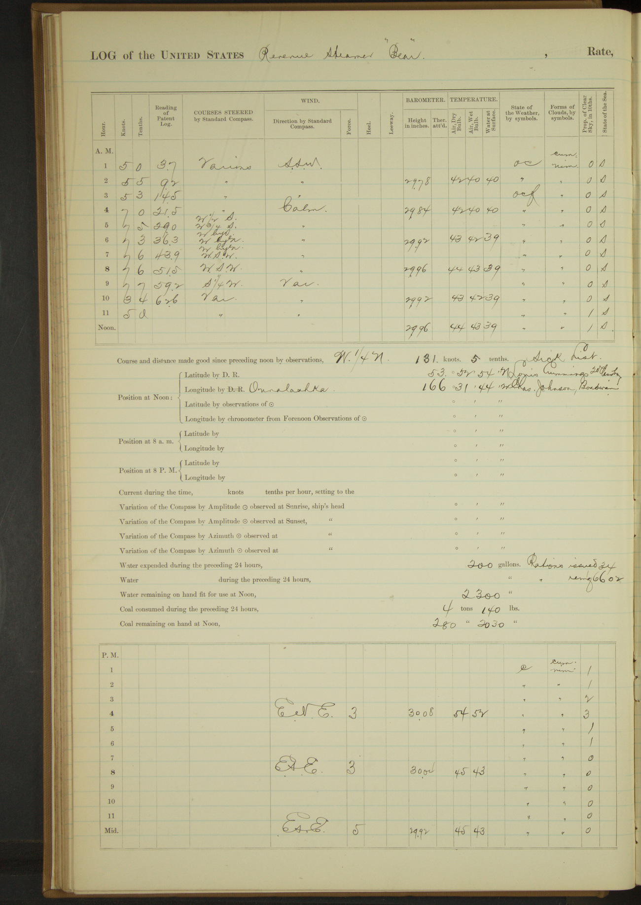
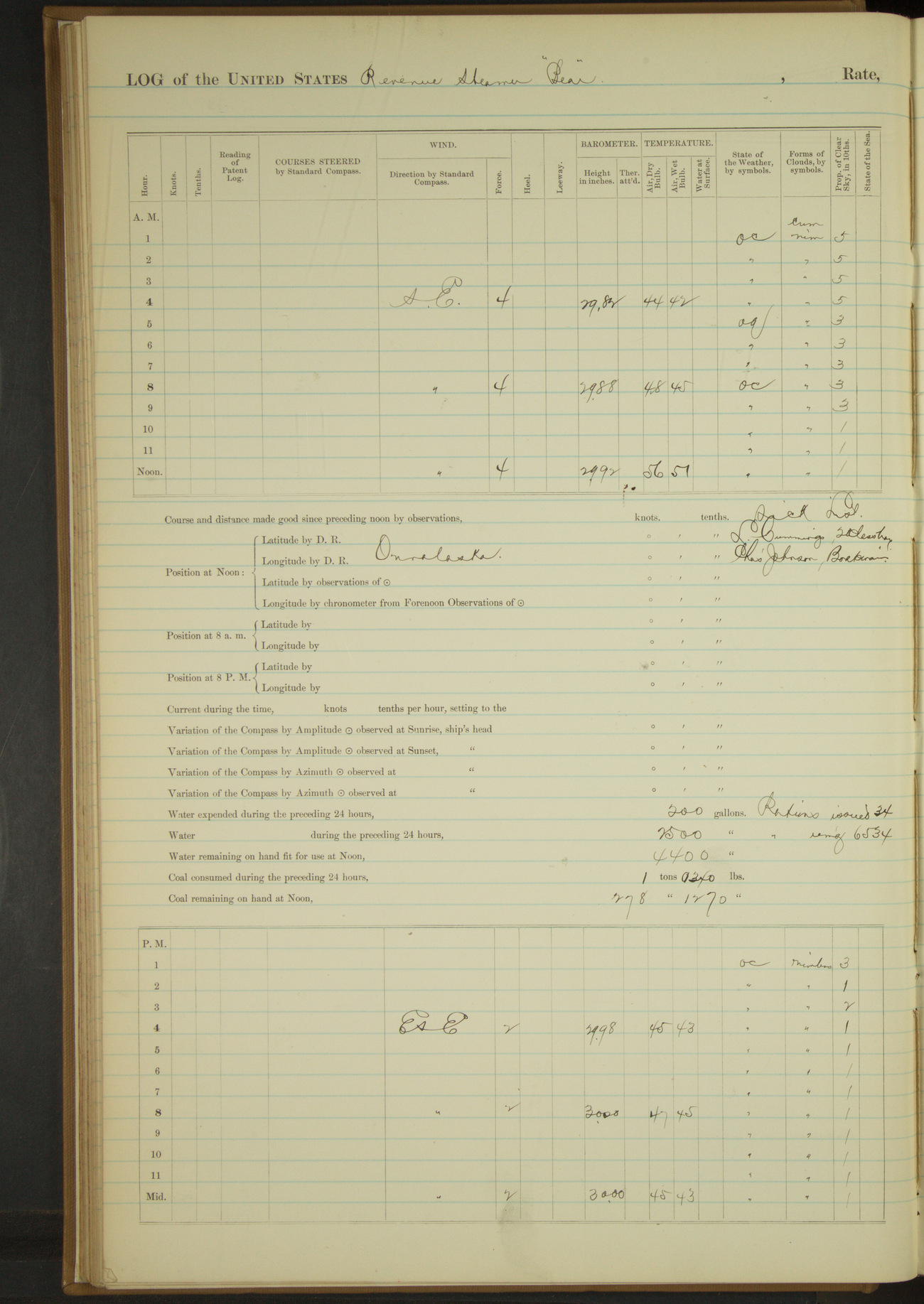
15 June 1890
Ounalaska [Unalaska]
Lat 53.88, Long -166.53
4am to 8am:
Ran lines to secure ship at wharf and performed morning duties.
8am to meridian:
Strong SE wind with very heavy squalls and passing showers. Ran extra lines to dolphin and anchor on shore for security.
Meridian to 4pm:
AC [Alaska Commercial] Co's steamers “Karluk” and “Dora” arrived from Eastward.
8pm to midnight:
USRC steamer “Albatross” arrived in port, made call of courtesy.
50874d5d09d409075500141f: (http://oldweather.s3.amazonaws.com/ow3/final/USRC Bear/vol068/vol068_051_0.jpg)
50874d5d09d4090755001421: (http://oldweather.s3.amazonaws.com/ow3/final/USRC Bear/vol068/vol068_051_1.jpg)
16 June 1890
Ounalaska
Lat 53.88, Long -166.53
4am to 8am:
At 6.00 commenced filling tanks.
8am to meridian:
Crew washing down outside. Filled tanks with fresh water, having received 2500 gallons. Engineer’s force employed blacking smoke stack and ventilator.
Commanding Officer received call from Commanding Officer of USRC steamer “Albatross”.
Boarded steamer “Arago”, San Francisco, Thomas master, NAC Co.; steamer “Karluk”, San Francisco, Thomas Master, AC Co.; steamer “Dora”, San Francisco, Hague master, AC Co.
Meridian to 4pm:
Crew scrubbing boats. Part of crew fishing.
50874d5d09d4090755001423: (http://oldweather.s3.amazonaws.com/ow3/final/USRC Bear/vol068/vol068_052_0.jpg)
50874d5d09d4090755001425: (http://oldweather.s3.amazonaws.com/ow3/final/USRC Bear/vol068/vol068_052_1.jpg)
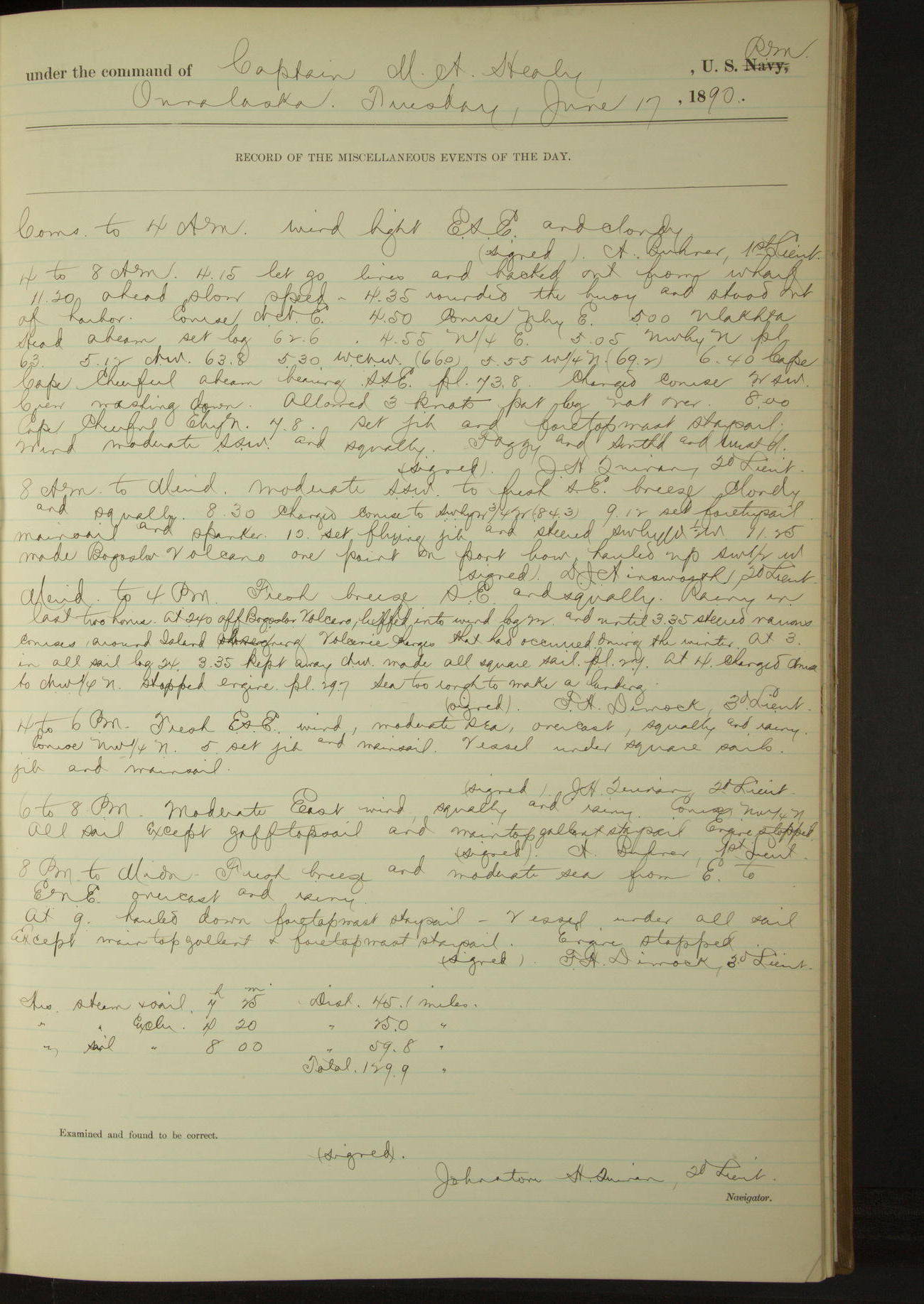
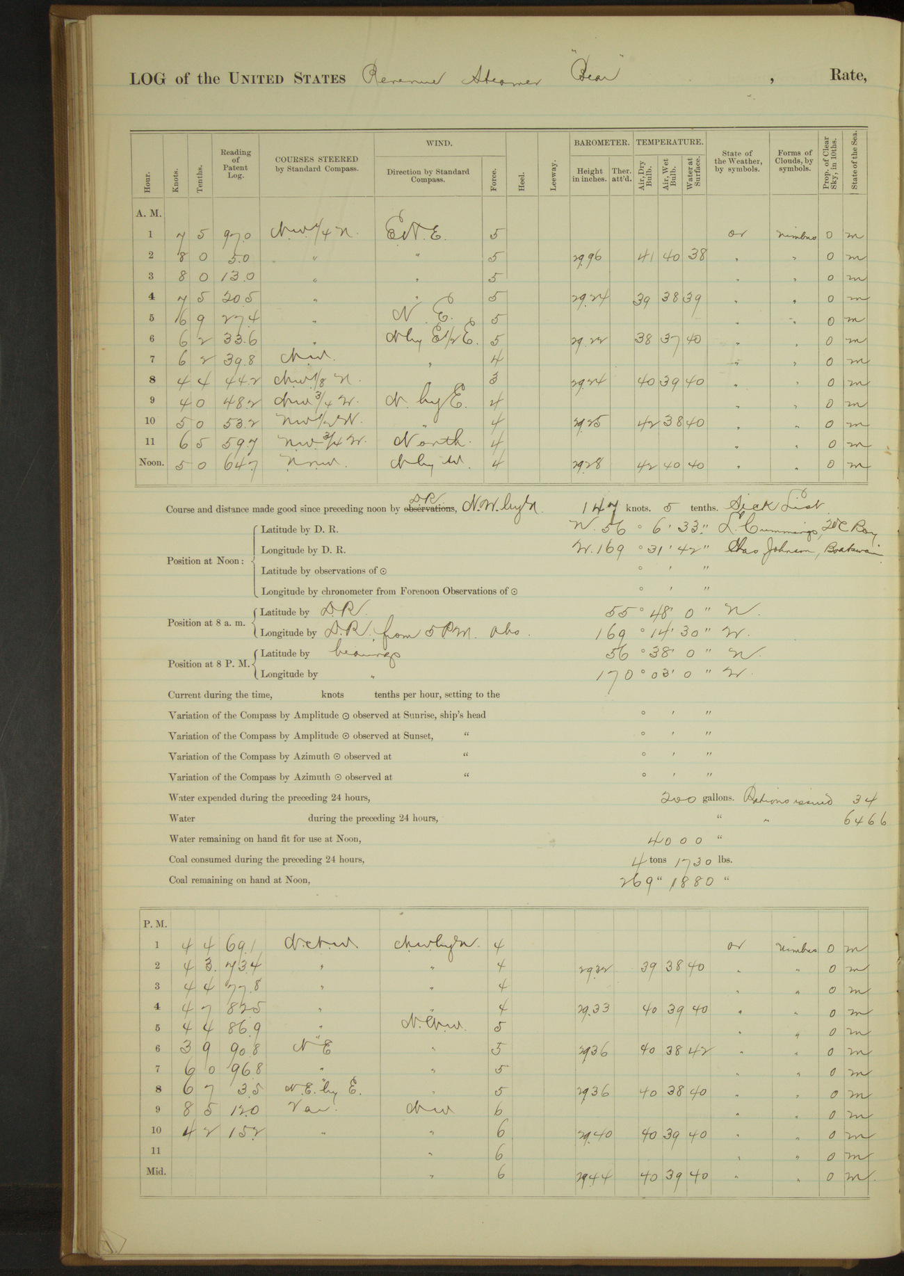
17 June 1890
Ounalaska [& at sea]
Lat 54.04, Long -167.25
4am to 8am:
4.15: let go lines and backed out from wharf. 4.20: ahead slow speed. 4.35: rounded the buoy and stood out of harbor.
5.00: Ulakta Head abeam. 6.40: Cape Cheerful abeam bearing SSE. 8.00: Cape Cheerful EbyN, 7.8 miles.
8am to meridian:
11.25: made Bogoslov Volcano one point on port bow.
Meridian to 4pm:
At 2.40 off Bogoslov Volcano. 3.35: steered various courses around island observing volcanic changes that had occurred during the winter. At 4.00 sea too rough to make a landing.
8pm: Lat 54° 27’N, Long 168° 17’W
Under steam and sail 7 hours 25 minutes. Distance 45.1 miles.
Under steam exclusively 4 hours 20 minutes. Distance 25 miles.
Under sail exclusively 8 hours. Distance 59.8 mile.s
Total 129.9 miles.
50874d5d09d4090755001427: (http://oldweather.s3.amazonaws.com/ow3/final/USRC Bear/vol068/vol068_053_0.jpg)
50874d5d09d4090755001429: (http://oldweather.s3.amazonaws.com/ow3/final/USRC Bear/vol068/vol068_053_1.jpg)
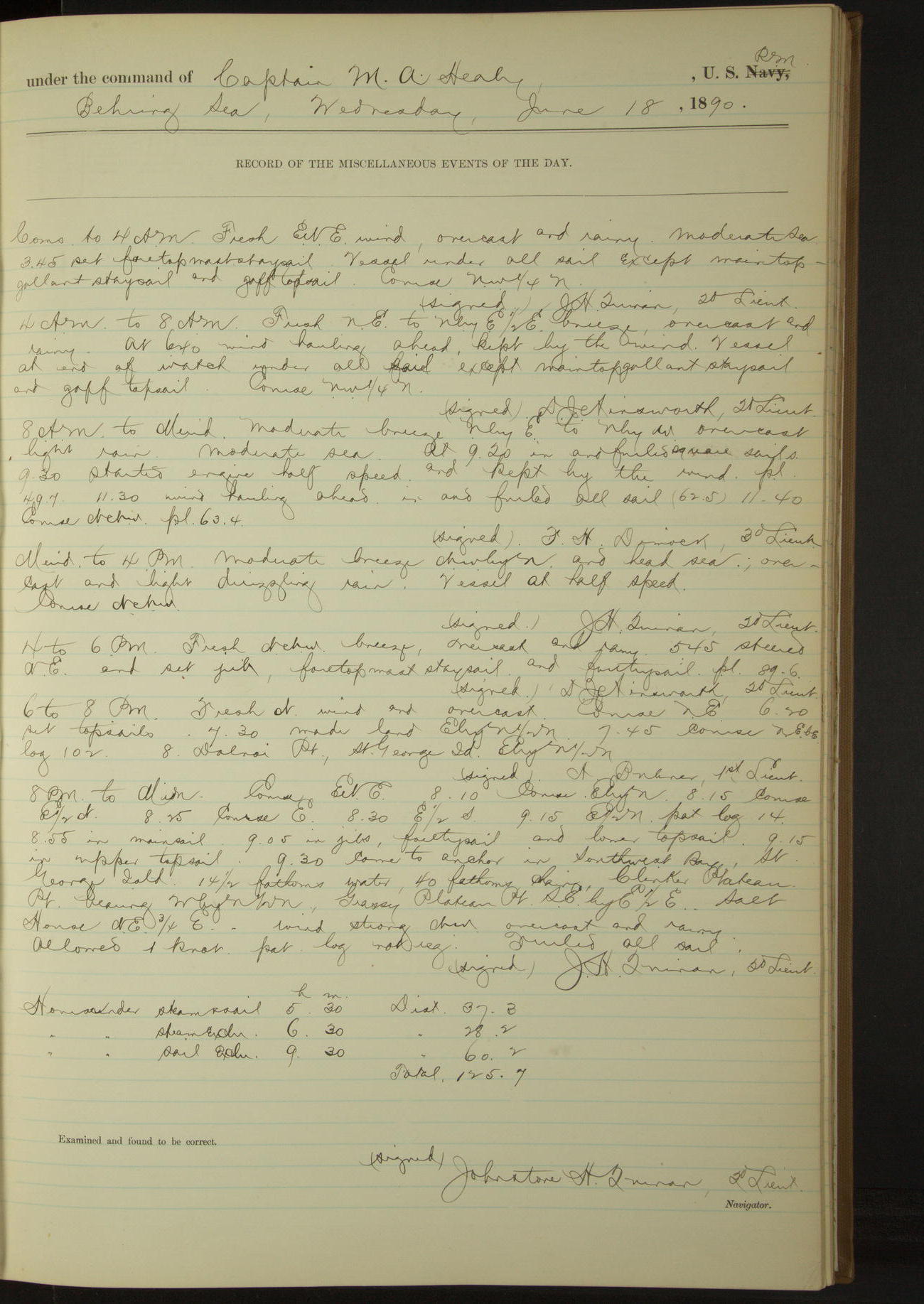
18 June 1890
Behring Sea
Lat 56.11, Long -169.53
8am: Lat 55° 48’N, Long 169° 14’ 30”W
6pm to 8pm:
7.30: made land EbyN½N. 8.00: Dalnoi Point, St. George Island EbyN½N.
8pm: Lat 56° 38’N, Long 170° 03’W
8pm to midnight:
9.30: came to anchor in SouthWest Bay [Zapadni Bay], St. George Island. Clinker Plateau Point bearing WbyN½N, Grassy Plateau Point SEbyE½E, Salt House NE¾E.
Under steam and sail 5 hours 30 minutes. Distance 37.3 miles.
Under steam exclusively 6 hours 30 minutes. Distance 28.2 miles.
Under sail exclusively 9 hours 30 minutes. Distance 60.2 miles.
Total 125.7 miles
50874d5d09d409075500142b: (http://oldweather.s3.amazonaws.com/ow3/final/USRC Bear/vol068/vol068_054_0.jpg)
50874d5d09d409075500142d: (http://oldweather.s3.amazonaws.com/ow3/final/USRC Bear/vol068/vol068_054_1.jpg)
19 June 1890
Behring Sea, SW bay, St. George Island
Lat 56.55, Long -169.52 [Estimate in Garden Cove]
8am to meridian:
10.30: hove up anchor and steamed around island to N’d & E’d.
12.25: came to in Garden Cove, Sea Lion Point bearing NNE and point inside of SE point bearing SWbyS½S.
Meridian to 4pm:
Vessel at anchor in Garden Cove, St. George Island, weather bound. Crew employed setting up jib guys and fore topmast and topgallant backstays. Officers visited village.
8pm to midnight:
9.15: officers returned, having learned that no sealers had been seen this season.
9.30: got underway and stood to N’d and W’d. 10.30 Tolstoi Point abeam.
Under steam exclusively 4 hours 25 minutes. Distance 17.6 miles.
50874d5d09d409075500142f: (http://oldweather.s3.amazonaws.com/ow3/final/USRC Bear/vol068/vol068_055_0.jpg)
50874d5d09d4090755001431: (http://oldweather.s3.amazonaws.com/ow3/final/USRC Bear/vol068/vol068_055_1.jpg)
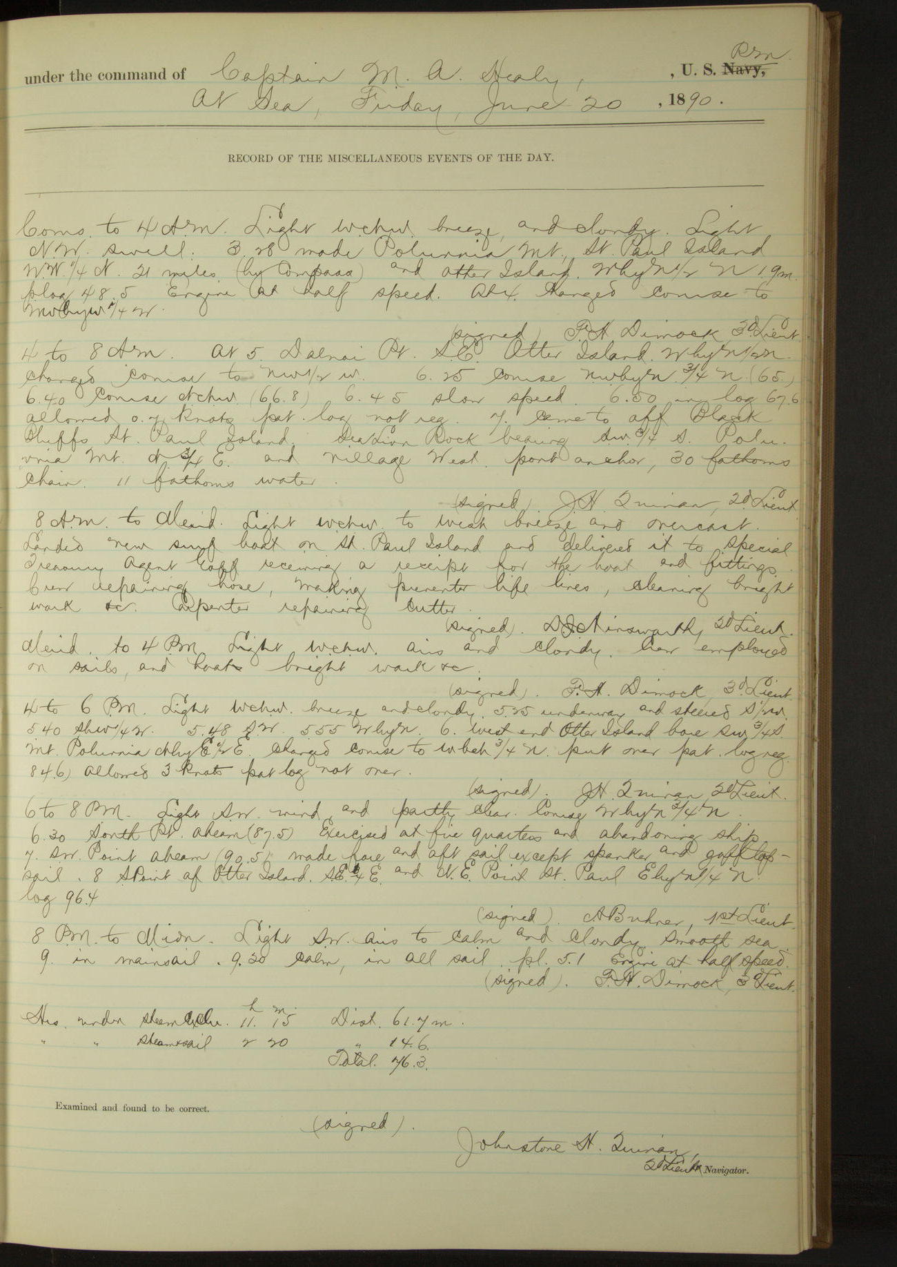
20 June 1890
At sea [& St. Paul]
Lat 57.12, Long -170.30
Commences to 4am:
3.28: made Poluvnia Mount [Polovina Hill], St. Paul Island NW¼N, 21 miles (by compass) and Otter Island WbyN½N 19 miles.
4am to 8am:
At 5.00 Dalnoi Point SE, Otter Island WbyN½N.
7.00: came to off Black Bluffs, St. Paul Island. Sea Lion Rock bearing SW¾S, Poluvnia Mount N¾E and village West.
8am to meridian:
Landed new surf boat on St. Paul Island and delivered it to Special Treasury Agent Goff, receiving a receipt for the boat and fittings.
Crew repairing hose, making preventer life lines, cleaning bright work &c. Carpenter repairing cutter.
Noon: Lat 57° 07’N, Long 170° 17’W [Locates the ship inland]
4pm to 6pm:
5.25: underway. 6.00: West end Otter Island bore SW¾S, Mount Poluvnia NbyE½E.
6pm to 8pm:
6.30: South point abeam. Exercised at fire quarters and abandoning ship.
7.00: SW point abeam. 8.00: South point of Otter Island SE¾E and NE point St. Paul EbyN¼N.
Under steam exclusively 11 hours 15 minutes. Distance 61.7 miles.
Under steam and sail 2 hours 20 minutes. Distance 14.6 miles.
Total 76.3 miles.
50874d5d09d4090755001433: (http://oldweather.s3.amazonaws.com/ow3/final/USRC Bear/vol068/vol068_056_0.jpg)
50874d5d09d4090755001435: (http://oldweather.s3.amazonaws.com/ow3/final/USRC Bear/vol068/vol068_056_1.jpg)
21 June 1890
At sea
Lat 58.40, Long -173.38
8am: Lat 58° 6’ 8”N, Long 172° 39’ 42”W
8pm: Lat 59° 5’ 14”N, Long 174° 53’ 6”W
Under steam exclusively 5 hours 25 minutes. Distance 38.5 miles.
Under steam and sail 18 hours 10 minutes. Distance 140.1 miles.
Under sail exclusively 25 minutes. Distance 1.5 miles.
Total 180.1 miles.
50874d5d09d4090755001437: (http://oldweather.s3.amazonaws.com/ow3/final/USRC Bear/vol068/vol068_057_0.jpg)
50874d5d09d4090755001439: (http://oldweather.s3.amazonaws.com/ow3/final/USRC Bear/vol068/vol068_057_1.jpg)
22 June 1890
At sea
Lat 60.33, Long -178.20
8am: Lat 60° 4’ 32”N, Long 177° 23’W
8pm: Lat 61° 8’ 42”N, Long 179° 43’ 34”W
Under steam and sail 24 hours. Distance 189 miles.
50874d5d09d409075500143b: (http://oldweather.s3.amazonaws.com/ow3/final/USRC Bear/vol068/vol068_058_0.jpg)
50874d5d09d409075500143d: (http://oldweather.s3.amazonaws.com/ow3/final/USRC Bear/vol068/vol068_058_1.jpg)
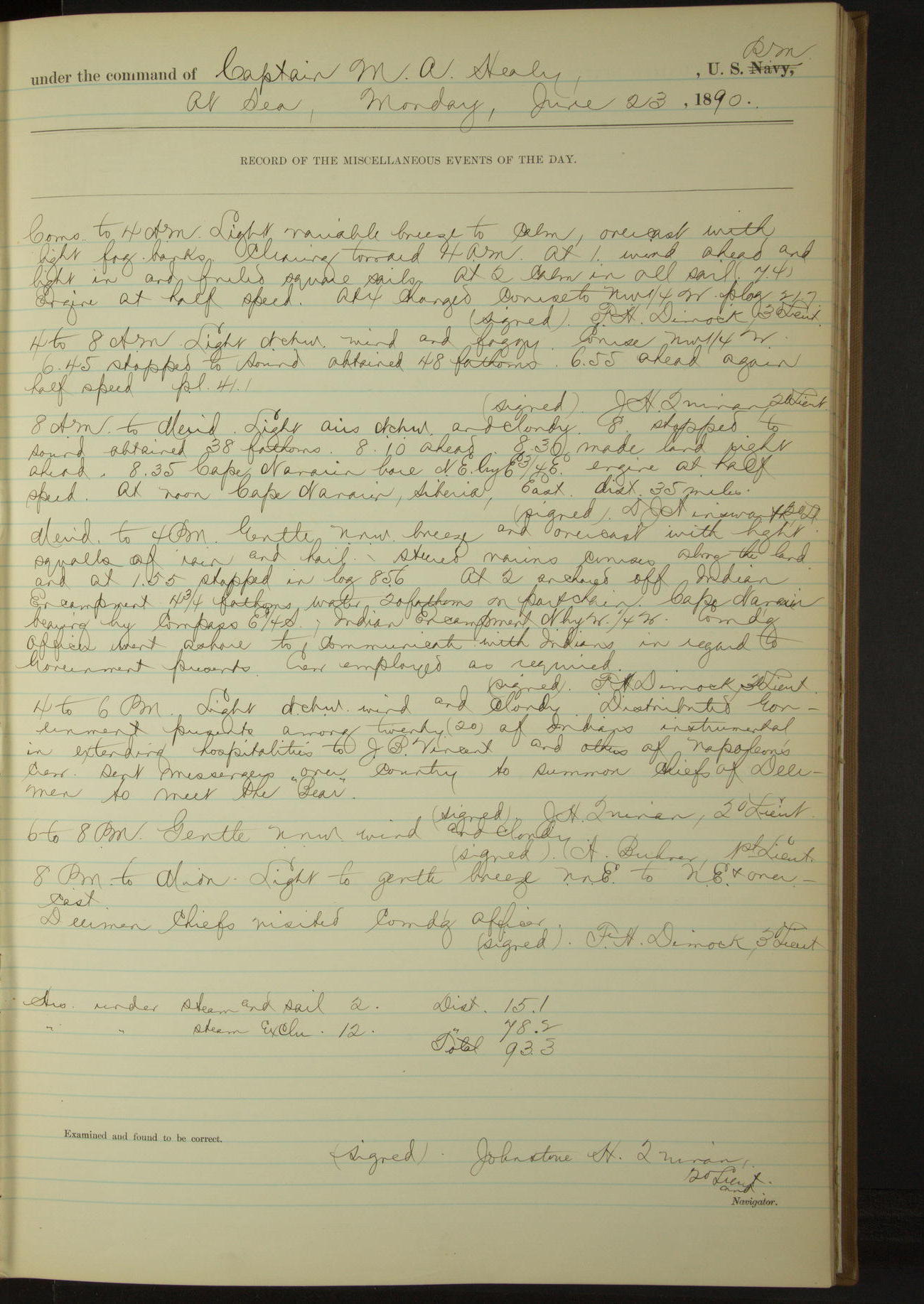
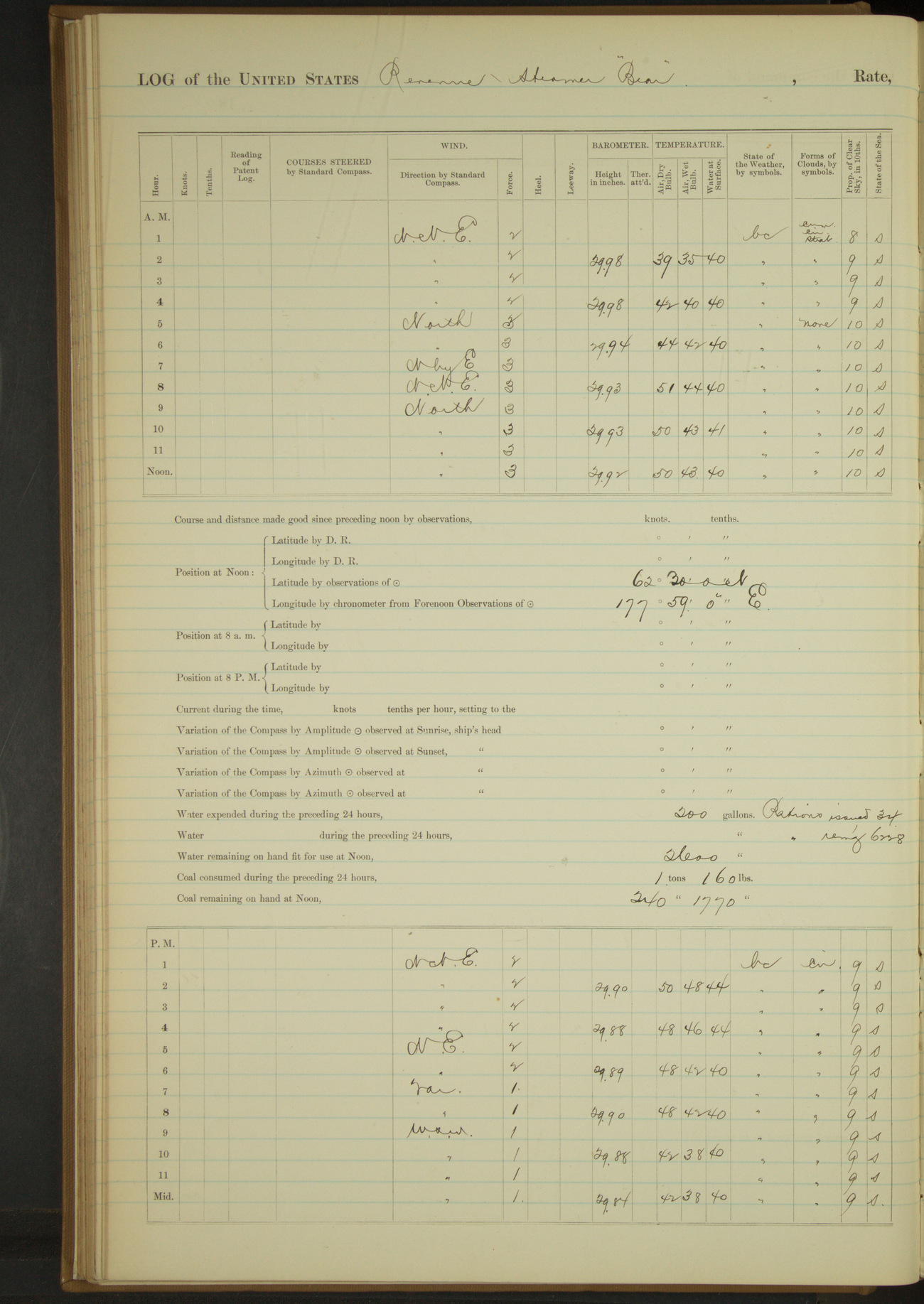
23 June 1890
At sea
Lat 62.48, Long 177.87
4am to 8am:
6.45: stopped to sound; obtained 48 fathoms. 6.55: ahead again half speed.
8am: Lat 62° 7’N, Long 178° 25’E
8am to meridian:
8.00: stopped to sound; obtained 38 fathoms. 8.10: ahead. 8.30: made land right ahead.
8.35: Cape Navarin bore NEbyE¾E. At noon Cape Navarin, Siberia, East, distant 35 miles.
Meridian to 4pm:
Steered various courses along the land and at 1.55 stopped. At 2.00: anchored off Indian encampment. Cape Navarin bearing by compass E¾S, Indian encampment NbyW¼W.
Commanding Officer went ashore to communicate with Indians in regard to Government presents.
4pm to 6pm:
Distributed Government presents among twenty (20) of Indians instrumental in extending hospitalities to JB Vincent and others of “Napoleon's” crew.
Sent messengers over country to summon chiefs of Deermen to meet the “Bear”.
8pm to midnight:
Deermen chiefs visiting Commanding Officer.
Under steam and sail 2 hours. Distance 15.1 miles.
Under steam exclusively 12 hours. Distance 78.2 miles.
Total 93.3 miles.
[See log of the Bear for 17 July 1887 for more details about JB Vincent and the wreck of the “Napoleon”]
50874d5d09d409075500143f: (http://oldweather.s3.amazonaws.com/ow3/final/USRC Bear/vol068/vol068_059_0.jpg)
50874d5d09d4090755001441: (http://oldweather.s3.amazonaws.com/ow3/final/USRC Bear/vol068/vol068_059_1.jpg)
24 June 1890
Cape Navarin Indian Encampment [& at sea]
Lat 62.40, Long 178.30 [Estimate off Cape Navarin]
4am to 8am:
Broke out forehold.
8am to meridian:
Restowed forehold.
Distributed presents to Woncheat Toiack [?] and the father of Outourak [?] and the mother of Yardgidigan [?] (Indians named by JB Vincent as especially instrumental in his preservation) and to twenty five (25) other Deermen and Indians of the vicinity.
Crew handling presents as required.
Meridian to 4pm:
Landed Indians and presents. 3.50: hove up anchor, made sail and stood E½S.
6pm to 8pm:
At 7.00 came to with port anchor. While paying out chain, pin in 15 fathom shackle broke. Let go starboard anchor.
Employed sweeping for port anchor.
8pm to midnight:
8.00 to 9.30 officer and crew in two boats dragging for anchor but without success.
Under sail exclusively 3 hours 10 minutes. Distance 11 miles.
50874d5d09d4090755001443: (http://oldweather.s3.amazonaws.com/ow3/final/USRC Bear/vol068/vol068_060_0.jpg)
50874d5d09d4090755001445: (http://oldweather.s3.amazonaws.com/ow3/final/USRC Bear/vol068/vol068_060_1.jpg)
25 June 1890
Cape Navarin, Indian Encampment
Lat 62.50, Long 177.98
4am to 8am:
Crew sweeping for lost anchor [and to 4pm].
4pm to 6pm:
Gave up searching for anchor.
6pm to 8pm:
Unable to recover anchor lost by shackle pin breaking, got spare anchor out of fore hold and placed on port bow.
Employed distributing presents to Cape Navarin Indians.
8pm to midnight:
Finished distributing presents to Indians.
50874d5d09d4090755001447: (http://oldweather.s3.amazonaws.com/ow3/final/USRC Bear/vol068/vol068_061_0.jpg)
50874d5d09d4090755001449: (http://oldweather.s3.amazonaws.com/ow3/final/USRC Bear/vol068/vol068_061_1.jpg)
26 June 1890
Indian Encampment, Siberia, Cape Navarin [& at sea]
Lat 62.33, Long 178.42
4am to 8am:
At 4.15 hove up anchor and steamed ahead half speed. Put over grapnel astern and dragged for lost anchor, but without success.
7.45: sighted drift ice to Southward and Eastward. 8.00: Cape Navarin E¾S, distant 11 miles.
8am to meridian:
At 9.00 entered drift ice. Working through large field of drift ice to Eastward of Cape Navarin.
Meridian to 4pm:
Working through ice fields to Eastward. At 3.00 cleared ice. Crew rigging crow’s nest, bending mainsail and unbending maintop gallant staysail.
4pm to 6pm:
5.56: Cape Navarin bore W¾S, Cape Thaddeus [Mys Faddeya] bore N¼W.
8pm: Lat 62° 16’N, Long 180° 0’W
Under steam exclusively 13 hours 35 minutes. Distance 72.2 miles.
Under steam and sail 3 hours 10 minutes. Distance 23.4 miles.
Under sail exclusively 3 hours. Distance 16.9 miles.
Total 112.5 miles.
50874d5d09d409075500144b: (http://oldweather.s3.amazonaws.com/ow3/final/USRC Bear/vol068/vol068_062_0.jpg)
50874d5d09d409075500144d: (http://oldweather.s3.amazonaws.com/ow3/final/USRC Bear/vol068/vol068_062_1.jpg)
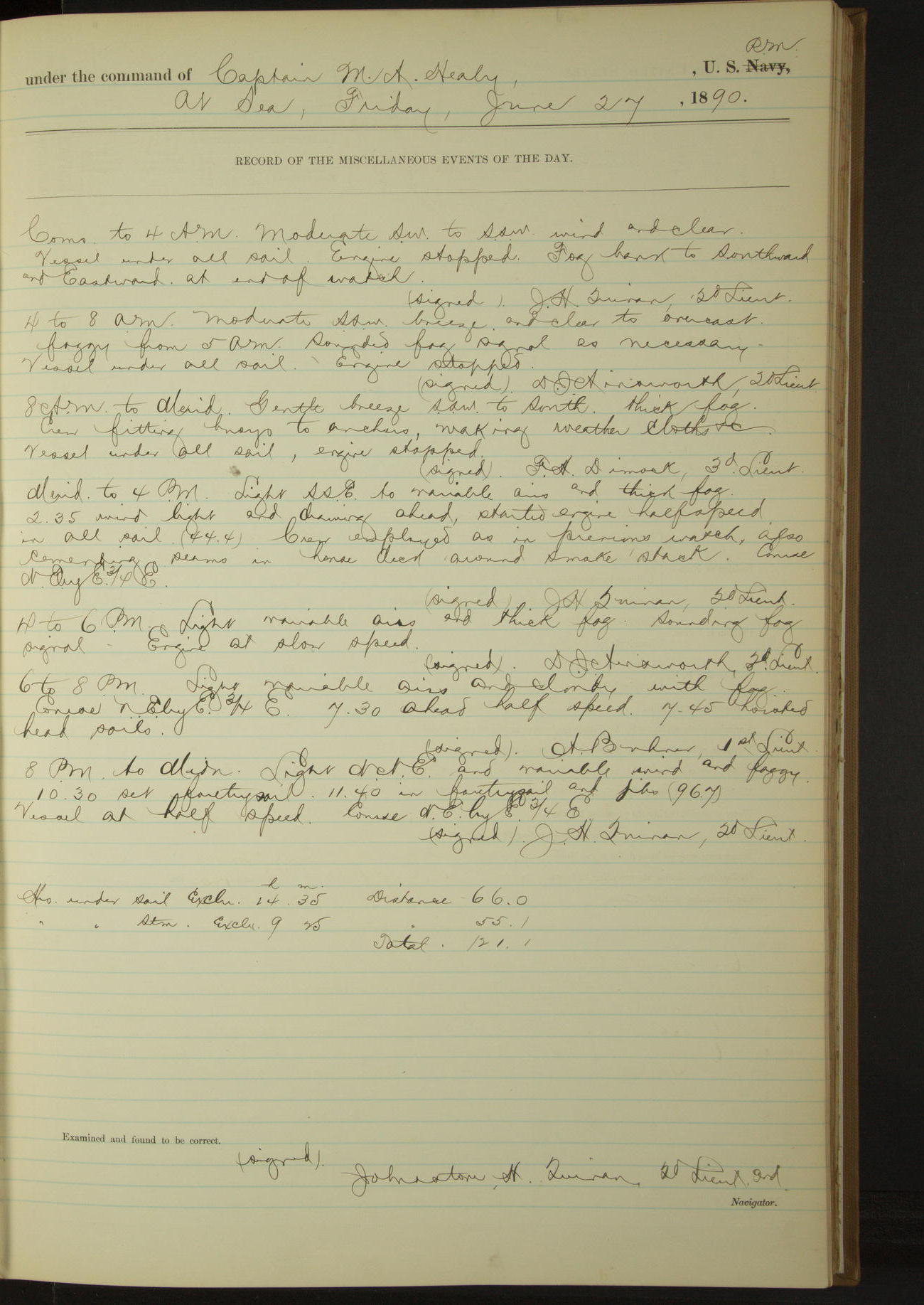
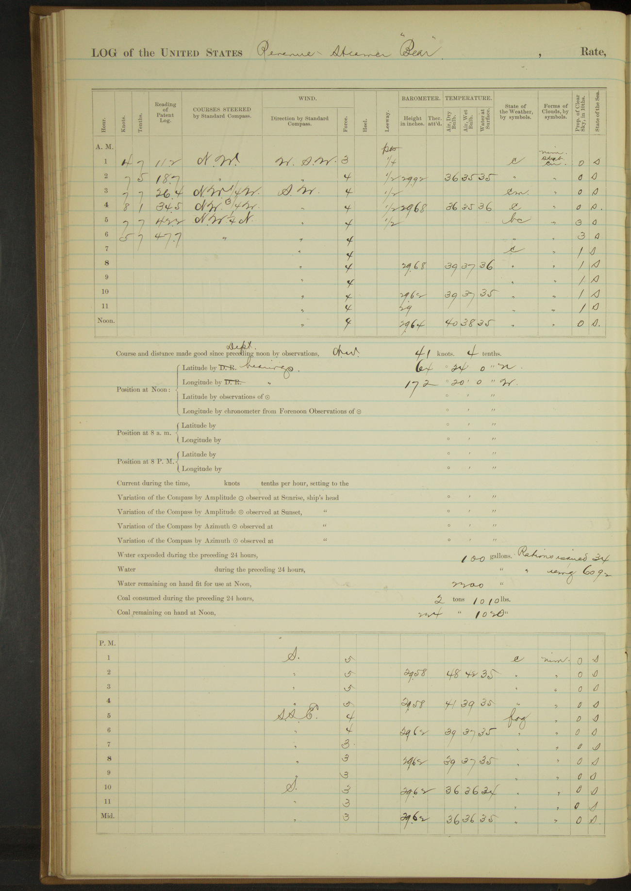
27 June 1890
At sea
Lat 62.98, Long -176.25
Commences to 4am:
Fog bank to Southward and Eastward at end of watch.
4am to 8am:
Foggy from 5am [and for most of rest of the day]. Sounded fog signal as necessary.
8am: Lat 62° 45’N, Long 177° 34’W
8am to meridian:
Crew fitting buoys to anchors, making weather cloths &c.
Meridian to 4pm:
Crew employed as in previous watch, also cementing seams in house deck around smoke stack.
8pm: Lat 63° 14’N, Long 174° 44’ 36”W
Under sail exclusively 14 hours 35 minutes. Distance 66 miles.
Under steam exclusively 9 hours 25 minutes. Distance 55.1 miles.
Total 121.1 miles.
50874d5d09d409075500144f: (http://oldweather.s3.amazonaws.com/ow3/final/USRC Bear/vol068/vol068_063_0.jpg)
50874d5d09d4090755001451: (http://oldweather.s3.amazonaws.com/ow3/final/USRC Bear/vol068/vol068_063_1.jpg)
28 June 1890
At sea
Lat 63.23, Long -172.58
8am: Lat 63° 35’N, Long 172° 8’W
8am to meridian:
9.35: sighted land, bearing by compass NEbyE. 12.00: Bluff St. Lawrence Island EbyN½N.
Meridian to 4pm:
3.30: Cape Sanackno [Tatik Point], St Lawrence Island, abeam, distant 10 miles. Crew employed cementing seams in house deck.
4pm to 6pm:
Steered various courses to village NW point, St. Lawrence Island. 5.35: anchored off village, Cape Chibukak NbyE½E, S point St Lawrence SbyE¼E.
6pm to 8pm:
Large number of natives visited the vessel. Surgeon Holmes administering to the natives.
8pm to midnight:
By 10.00 all of the natives had left the vessel.
Under steam exclusively 10 hours 35 minutes. Distance 66 miles
Under steam and sail 7 hours. Distance 39.5 miles
Total 107.5 miles
50874d5d09d4090755001453: (http://oldweather.s3.amazonaws.com/ow3/final/USRC Bear/vol068/vol068_064_0.jpg)
50874d5d09d4090755001455: (http://oldweather.s3.amazonaws.com/ow3/final/USRC Bear/vol068/vol068_064_1.jpg)
29 June 1890
At anchor off Cape Chibukak, St. Lawrence Island [to Mys Chaplina]
Lat 64.40, Long -172.33
Commences to 4am:
At 12.20 underway. 12.25: course NW for Cape Tchaplin [Mys Chaplina/Indian Point].
4am to 8am:
At 4.40 sighted Indian Point village on starboard bow. 5.42: anchored off Indian Point Village, Siberia. Point bearing by compass S¾E, village SW.
Overhauling steering gear. Indians from village on board.
8am to meridian:
Natives from village on board. Surgeon attending to sick natives.
Meridian to 4pm:
Surgeon, crew and natives as in forenoon watch.
8pm to midnight:
Secured Indian interpreter to assist in obtaining census of natives of St. Lawrence Island.
Under steam exclusively 47 minutes. Distance 3.4 miles.
Under steam and sail 4 hours 35 minutes. Distance 38 miles.
Total 41.4 miles.
50874d5d09d4090755001457: (http://oldweather.s3.amazonaws.com/ow3/final/USRC Bear/vol068/vol068_065_0.jpg)
50874d5d09d4090755001459: (http://oldweather.s3.amazonaws.com/ow3/final/USRC Bear/vol068/vol068_065_1.jpg)
30 June 1890
At anchor off Indian Point, Siberia [& St Lawrence Island & at sea]
Lat 63.82, Long -171.58
Sick list: James Cummings, Seaman [to 23rd July]
Commences to 4am:
2.15: commenced to heave up anchor. 2.25: underway.
4am to 8am:
7.35: made land on starboard bow. 7.45: stopped engine and sounded in 13 fathoms water, no bottom. 7.50: ahead slow.
8am: Lat 63° 52’N, Long 171° 22’W
8am to meridian:
Light WSW breeze, foggy and rainy. 8.40: soundings in 10 fathoms, anchored with 30 fathoms on starboard chain.
At 9.30 fog lifting, made NW point Cape Chibukak WbyS¾S, underway. 10.35: stopped. Village bearing by compass SbyW.
Meridian to 4pm:
3rd Lieutenant Dimock ashore with interpreter, taking census of natives of village, St. Lawrence Island.
Surgeon Holmes assisting in census and also in administering to natives.
4pm to 6pm:
Lieutenant Dimock and Surgeon Holmes as in previous watch.
6pm to 8pm:
6.30: officers returned from shore having finished taking census of natives. 7.30: got underway and steamed to NW.
8pm: Lat 63° 50’ 30”N, Long 171° 41’W
8pm to midnight:
11.00: Bluff St. Lawrence Island bore SE½S. 12.00: thick fog.
Under steam and sail 8 hours 10 minutes. Distance 66.6 miles.
Under steam exclusively 2 hours 20 minutes. Distance 3.4 miles.
Total 11 hours 30 minutes. Total 78.6 miles.
50874d5d09d409075500145b: (http://oldweather.s3.amazonaws.com/ow3/final/USRC Bear/vol068/vol068_066_0.jpg)
[Blank page]
50874d5d09d409075500145d: (http://oldweather.s3.amazonaws.com/ow3/final/USRC Bear/vol068/vol068_066_1.jpg)
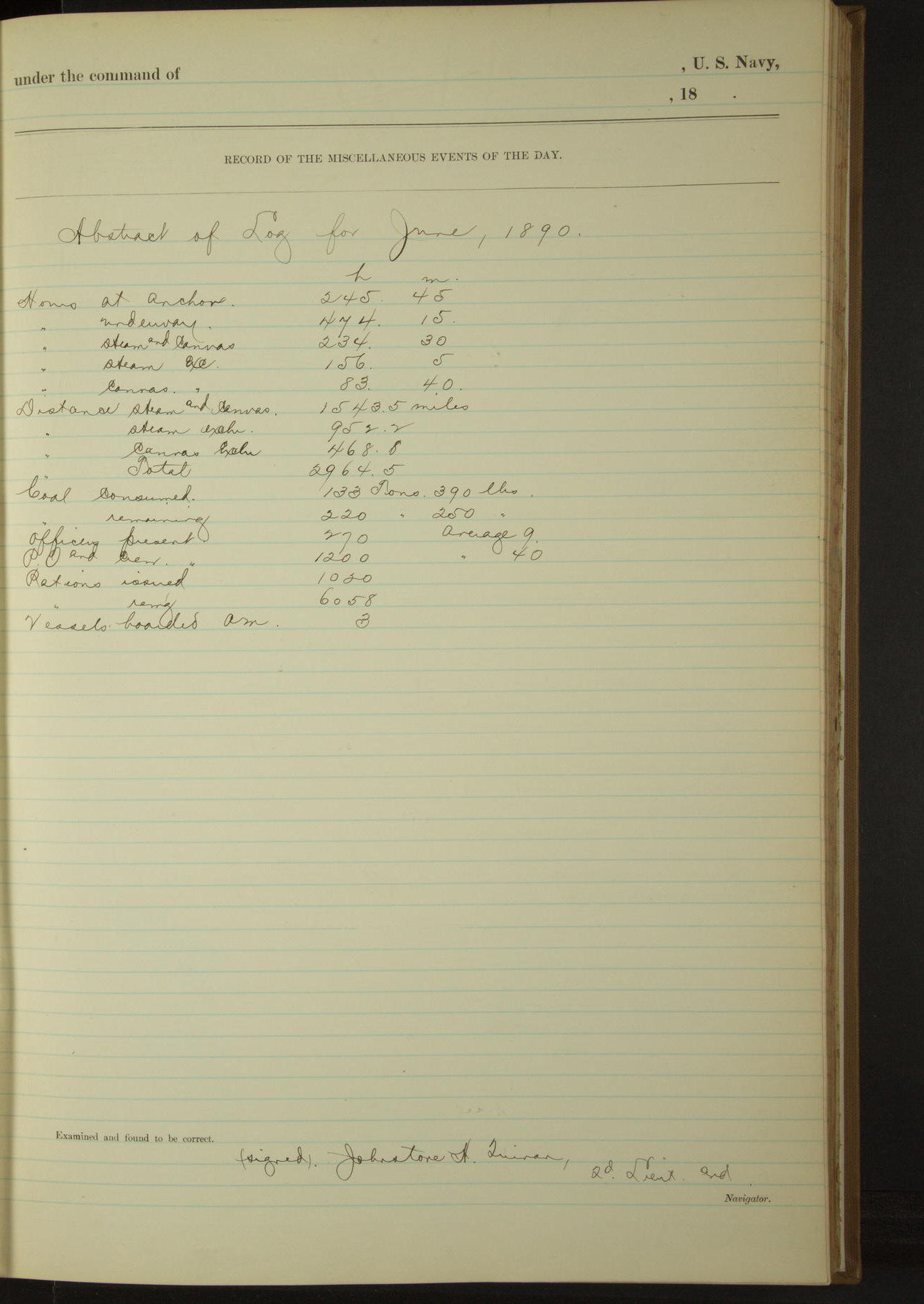
Abstract of log for June, 1890
At anchor 245 hours 45 minutes
Underway 474 hours 15 minutes
Under steam & canvas 234 hours 30 minutes
Under steam exclusively 156 hours 5 minutes
Under canvas exclusively 83 hours 40 minutes
Distance steam & canvas 1543.5 miles
Distance steam exclusively 952.2 miles
Distance canvas exclusively 468.8 miles
Distance total 2964.5 miles
Coal consumed 133 tons 390 lbs
Coal remaining 220 tons 250 lbs
Officers present 270, average 9
Petty Officers and crew 1200, average 40
Rations issued 1050
Rations remaining 6058
Vessels boarded American 3
LOGS FOR JULY 1890
50874d5d09d409075500145f: (http://oldweather.s3.amazonaws.com/ow3/final/USRC Bear/vol068/vol068_067_0.jpg)
50874d5d09d4090755001461: (http://oldweather.s3.amazonaws.com/ow3/final/USRC Bear/vol068/vol068_067_1.jpg)
1 July 1890
At sea [& King’s Island]
Lat 64.69, Long -169.73
Midnight to 4am:
12.25: made Indian Point bearing NW½N. 1.10: stopped and landed interpreter. 2.05: boat returned, stood NEbyE¾E.
Gave interpreter for services rendered one (1) box bread and one (1) bag flour and issued 2 rations to him during his stay on board.
8am: Lat 64° 34’N, Long 170° 48’W
8am to meridian:
Crew employed on rigging.
Meridian to 4pm:
At 2.00 made King’s Island 1½ points on port bow. At 2.15 hauled up for island NE byN.
3.35: kept away NE¼N for village. Crew employed making hammock nettles.
4pm to 6pm:
5.15: anchored off village King's Island.
8pm: Lat 65° 0’N, Long 168° 0’W
8pm to midnight:
9.50: underway. At midnight Cape Prince of Wales bore NW¼W and Cape York N¾W.
Under steam and sail 12 hours 40 minutes. Distance 90.9 miles.
Under steam exclusively 6 hours 20 minutes. Distance 37.9 miles.
Total 19 hours, 128.8 miles.
50874d5d09d4090755001463: (http://oldweather.s3.amazonaws.com/ow3/final/USRC Bear/vol068/vol068_068_0.jpg)
50874d5d09d4090755001465: (http://oldweather.s3.amazonaws.com/ow3/final/USRC Bear/vol068/vol068_068_1.jpg)
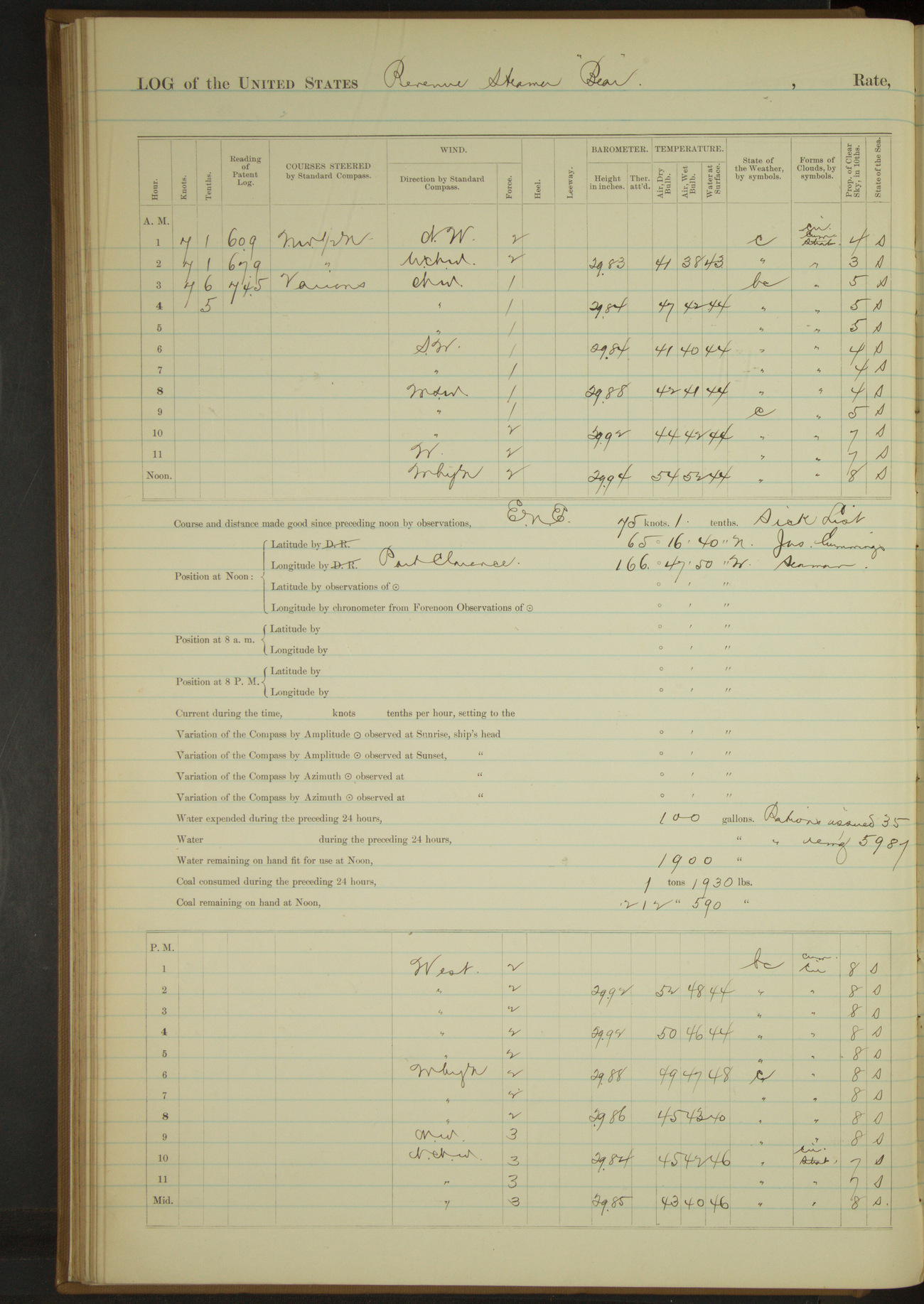
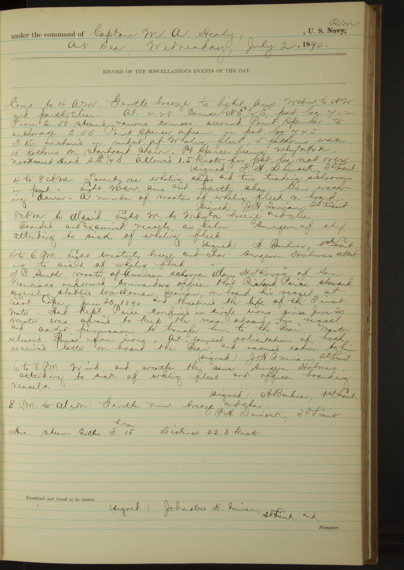
2 July 1890
At sea [& Port Clarence]
Lat 65.28, Long -166.80
Commences to 4am:
2.50: steered various courses around Point Spencer to anchorage. 2.55: Point Spencer abeam.
3.15: anchored in midst of whaling fleet. Point Spencer bearing WbyN¼N, Nookmut Head [Nookmute/Kalulingmiut] SE¼S.
4am to 8am:
Twenty one whaling ships and two trading schooners in port. A number of masters of whaling fleet on board.
8am to meridian:
Boarded and examined vessels as below. Surgeon of ship attending to sick of whaling fleet.
4pm to 6pm:
Surgeon Holmes attending to sick of whaling fleet.
SB Smith, master of American schooner “Mary H Thomas” of San Francisco, informed Commanding Officer that Richard Price, Steward, severely stabbed William Noonan, Seaman, on board his vessel at East Cape, June 20 1890 and threatened the life of the First Mate. Had kept Price confined in single irons since June 20. Master was afraid to keep the man aboard his vessel and asked permission to transfer him to the “Bear”.
Master released Price from irons. At earnest solicitation of both, received latter on board the “Bear” and issued ration to him.
6pm to 8pm:
Surgeon Holmes attending to sick of whaling fleet and officer boarding vessels.
Under steam exclusively 3 hours 15 minutes. Distance 22.3 miles.
50874d5d09d4090755001467: (http://oldweather.s3.amazonaws.com/ow3/final/USRC Bear/vol068/vol068_069_0.jpg)
[Blank page]
50874d5d09d4090755001469: (http://oldweather.s3.amazonaws.com/ow3/final/USRC Bear/vol068/vol068_069_1.jpg)
July 2 (continued) 1890
Following vessels boarded and examined by 3rd Lieutenant Dimock:
American schooner “Oscar and Hattie”, San Francisco, Hariside, lumber for Cape Prince of Wales and Point Hope, stores for Point Barrow
American steamer “Balaena”, San Francisco, Smith, whaling
Steamer “Orca”, San Francisco, Garvin, whaling
Steamer “Jesse H Freeman”, San Francisco, Baker, whaling
Bark “Hunter”, San Francisco, Cogan, whaling
Bark “Helen Mar”, San Francisco, Ellis, whaling
Bark “Mars”, San Francisco, Robinson, whaling
Brig “WH Meyer”, San Francisco, Bolles, whaling
Tug “King Fisher”, San Francisco, McKenna, towing
Bark “James Allen”, San Francisco, Millard, whaling
Bark “Trident” [?], New Bedford, Gifford [?], whaling [there’s a bark Triton of SF with master Gifford]
Brigantine “Hidalgo”, San Francisco, Osterman, whaling
Bark “Reindeer”, New Bedford, Baker, whaling
Brigantine “FA Barstow”, New Bedford, Devoll, whaling
Following vessels boarded and examined by 2nd Lieutenant Ainsworth:
American steamer “Narwhal”, San Francisco, McGregor, whaling
American steamer “Mary D Hume”, San Francisco, Tilton, whaling
Schooner “Mary A Thomas”, San Francisco, Smith, whaling
Schooner “Alton”, San Francisco, Newth, whaling and trading
Schooner “Jane Gray”, San Francisco, Kelly, whaling and walrus hunting
Bark “Wanderer”, San Francisco, Smith, whaling
Bark “Bounding Billow”, San Francisco, Thaxter, whaling
Bark “Sea Breeze”, San Francisco, Green, whaling
Bark “Northern Light”, San Francisco, Simmons, whaling
Bark “Eliza”, San Francisco, Kelly, whaling
Steamer “Grampus”, San Francisco, Norwood, whaling
Steamer “Thrasher” [?], San Francisco, Gilley [?], whaling
Destroyed 6 cases (9 gallons) alcohol and 11 cases (16½ gallons) gin found on board the “Helen Mar” and reported vessel for violation section 1955 Revised Statutes.
Vessel boarded American 26
[In red] Note. Destroyed eleven(11) cases containing 16½ gallons gin and six(6) bbls [barrels] containing 210 gallons alcohol found on board the “Helen Mar” and reported vessel for violation of Section 1955 Revised Statutes.
11 cases gin 16½ gallons, 6 bbls alcohol 210 gallons is correct (signed) FH Dimock, 3rd Lieutenant, Boarding Officer.
[Names of the masters of whaling vessels confirmed using American Offshore Whaling Voyages]
50874d5d09d409075500146b: (http://oldweather.s3.amazonaws.com/ow3/final/USRC Bear/vol068/vol068_070_0.jpg)
50874d5d09d409075500146d: (http://oldweather.s3.amazonaws.com/ow3/final/USRC Bear/vol068/vol068_070_1.jpg)
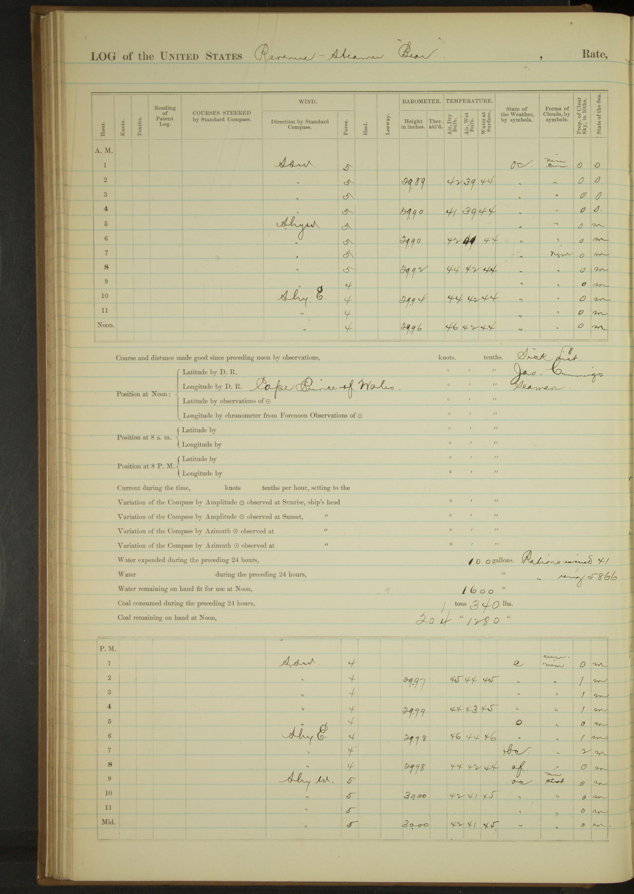
3 July 1890
Port Clarence [to King’s Island & return]
Lat 65.08, Long -167.58
4am to 8am:
Boarded steam whaler “Narwhal” of San Francisco, McGregor master. Surgeon of ship attending to sick of whaling fleet.
Carpenters from “Orca”, “Grampus”, “Narwhal” and “Balaena” came on board to put up house at Cape Prince of Wales. Issued them rations.
Took on board JW Kelly as interpreter in taking census.
8am: Lat 65° 16’ 40”N, Long 166° 47’ 50”W
8am to meridian:
8.10: underway and stood out of harbor. 8.35: passed Point Spencer. Course for King’s Island.
Crew at work on boats, overhauling capstan and variously employed.
Meridian to 4pm:
1.35: came to off King’s Island village. Sent boat ashore with officers and interpreter Kelly.
Obtained census of village with assistance of Mr. Kelly. 4.00: boat with officers and interpreter returned.
4pm to 6pm:
4.35: got underway.
8pm: Lat 65° 11’N, Long 167° 6’W
8pm to midnight:
9.00: came to in Port Clarence harbor. Sent aboard steamer “Jeannie” and received mail for “Bear”.
Under steam exclusively 1 hour 50 minutes. Distance 9.9 miles.
Under steam and sail 8 hours. Distance 65.1 miles
Underway 9 hours 50 minutes.
50874d5d09d409075500146f: (http://oldweather.s3.amazonaws.com/ow3/final/USRC Bear/vol068/vol068_071_0.jpg)
50874d5d09d4090755001471: (http://oldweather.s3.amazonaws.com/ow3/final/USRC Bear/vol068/vol068_071_1.jpg)
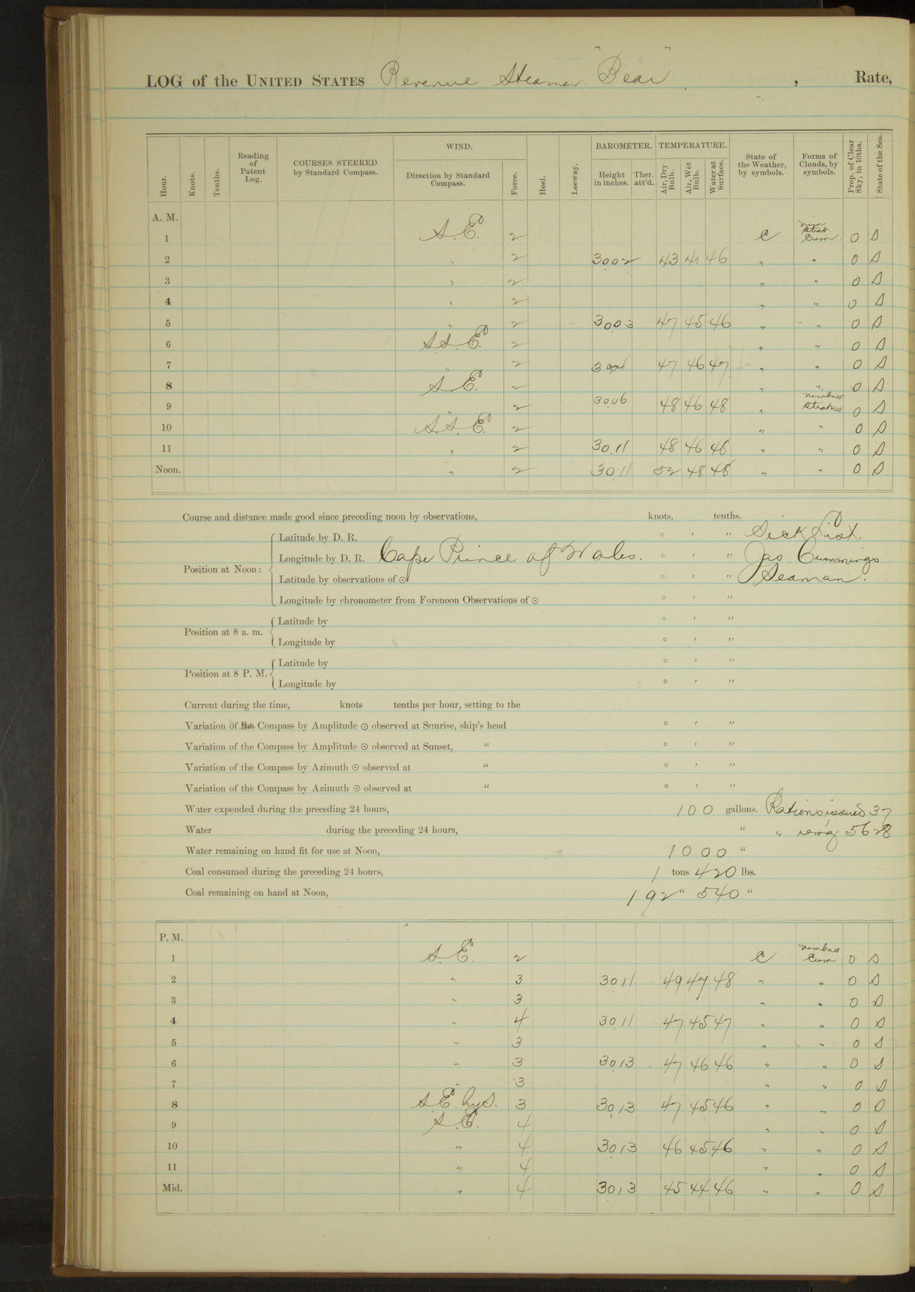
4 July 1890
Port Clarence [to Cape Prince of Wales]
Lat 65.50, Long -167.75
Midnight to 4am:
Sunrise: dressed mast heads in honor of the day.
4am to 8am:
7.50: underway and stood out of harbor. At 8.00 passed Point Spencer.
Took on board Mr. Thornton, teacher, for passage to Cape Prince of Wales and Indian interpreters Charley and his wife Mary to act as interpreters in taking census and establishing schools.
Issued rations to Indians.
8am: Lat 65° 16’ 40”N, Long 166° 47’ 50”W
Meridian to 4pm:
1.25: came to off Cape Prince of Wales, village bearing NE½E, Cape SEbyE, Spit WbyW¾W.
Dr. Sheldon Jackson and Mr. Thornton, school teacher, went ashore to select site for school house.
Boarded schooner “Oscar and Hattie”, Hariside master, from San Francisco. At anchor off village with materials for erection of house at Cape Prince of Wales.
Landed carpenters of “Bear” and whaling fleet to erect house. Surgeon of ship attending to sick natives of village.
4pm to 6pm:
Sent ashore tent and one week’s provisions for ten (10) men while erecting house.
8pm: Lat 65° 33’N, Long 168° 0’W
Under steam exclusively 4 hours 45 minutes. Distance 31.8 miles.
Under steam and sail 50 minutes. Distance 5.9 miles.
Total 5 hours 35 minutes. Distance 37.7 miles.
50874d5d09d4090755001473: (http://oldweather.s3.amazonaws.com/ow3/final/USRC Bear/vol068/vol068_072_0.jpg)
50874d5d09d4090755001475: (http://oldweather.s3.amazonaws.com/ow3/final/USRC Bear/vol068/vol068_072_1.jpg)
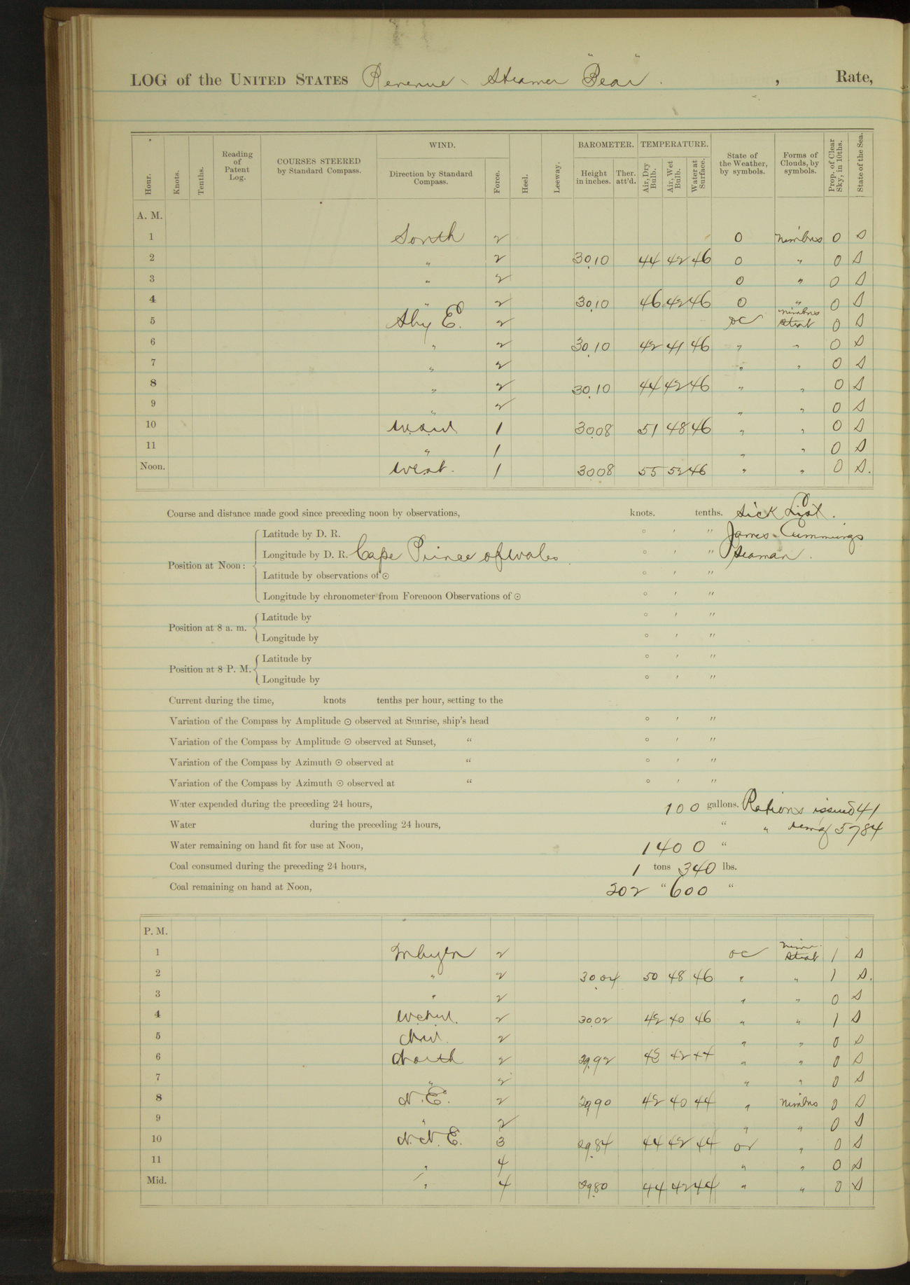
5 July 1890
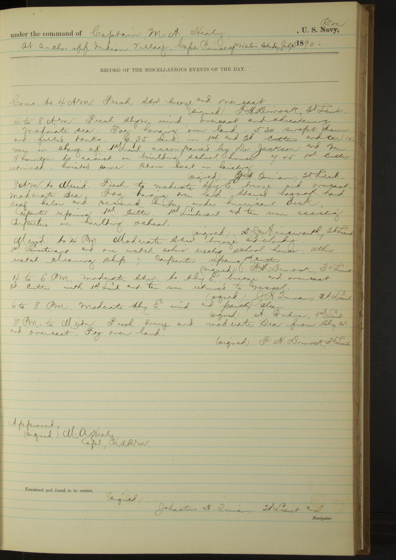
At anchor off Indian Village, Cape Prince of Wales
Lat 65.55, Long -168.00
4am to 8am:
5.30: swept down and filled tanks.
6.35: sent in 1st and 2nd cutters and ten (10) men in charge of 1st Lieutenant accompanied by Dr. Jackson and Mr. Thornton to assist in building school house.
7.45: first cutter returned, hoisted same. Stove boat in hoisting.
8am to meridian:
Stowed bags of hard coal below and secured lumber under hurricane deck. Carpenter repairing first cutter.
1st Lieutenant and ten men assisting carpenters in building school.
Meridian to 4pm:
1st Lieutenant and one watch ashore erecting school house, other watch cleaning ship. Carpenter repairing first cutter.
4pm to 6pm:
second cutter with 1st Lieutenant and ten men returned to vessel.
50874d5d09d4090755001477: (http://oldweather.s3.amazonaws.com/ow3/final/USRC Bear/vol068/vol068_073_0.jpg)
50874d5d09d4090755001479: (http://oldweather.s3.amazonaws.com/ow3/final/USRC Bear/vol068/vol068_073_1.jpg)
6 July 1890
At anchor off Indian Village, Cape Prince of Wales
Lat 65.55, Long -168.00
Commences to 4am:
Midnight: schooner in sight to Northward and Westward bearing to Southward. At 12.55 schooner stood to Westward.
3.40: a schooner in sight from Southward and Eastward standing to Westward.
4am to 8am:
At 5.00 a schooner in sight from Northward and Westward standing to Westward.
Meridian to 4pm:
3.30: boat came alongside with Captain Smith from whaling bark “Balaena”, hove to off shore to communicate with Commanding Officer of “Bear”.
4.00: bark picked up boat and stood to the Westward.
50874d5d09d409075500147b: (http://oldweather.s3.amazonaws.com/ow3/final/USRC Bear/vol068/vol068_074_0.jpg)
50874d5d09d409075500147d: (http://oldweather.s3.amazonaws.com/ow3/final/USRC Bear/vol068/vol068_074_1.jpg)
7 July 1890
At anchor off Indian Village, Cape Prince of Wales
Lat 65.55, Long -168.00
4am to 8am:
Sent carpenter and five men ashore accompanied by Commissioner Jackson and Teacher Thornton to work on house.
8am to meridian:
3rd Lieutenant Dimock and Indian interpreter ashore taking census of village. 1st Lieutenant Buhner, Carpenter and part of crew assisting in erection of house [& in next watch].
Surgeon Holmes attending sick natives. Boatswain and balance of crew employed on boat's sails [& in next watch]. 11.30: 1st Lieutenant Buhner returned.
Meridian to 4pm:
3.30: 3rd Lieutenant Dimock, Surgeon Holmes and Indian interpreter returned on board having finished taking census and attending sick of village.
4pm to 6pm:
Boarded schooner “Bonanza”, San Francisco, Foster master, trading and whaling, bound to Port Clarence.
50874d5d09d409075500147f: (http://oldweather.s3.amazonaws.com/ow3/final/USRC Bear/vol068/vol068_075_0.jpg)
50874d5d09d4090755001481: (http://oldweather.s3.amazonaws.com/ow3/final/USRC Bear/vol068/vol068_075_1.jpg)
8 July 1890
Cape Prince of Wales [to East Cape]
Lat 65.78, Long -168.90
4am to 8am:
6.45: sent ashore second cutter with five men, with provisions and bedding, accompanied by Mr. Thornton, teacher, to assist in building school house.
8am to meridian:
8.25: up anchor, made sail and steered W½S. 11.10: West end Fairway Rock bore S½E.
At 12.00 off Kruzenstern Island [Little Diomede], in all sail, started engine at slow speed, and hauled around island for village.
Noon: Lat 65° 46’N, Long 168° 55’W [Locates the ship inland]
Meridian to 4pm:
12.35: blowing strong between Diomede Islands, kept away. Steered various courses around South end Ratmanoff Island [Big Diomede].
1.30: finding no lee kept NWbyW¼W for East Cape [Cape Dezhnev]. 3.15: course WbyN for South side East Cape.
4pm to 6pm:
Standing inside of East Cape.
6pm to 8pm:
Steering various courses to Westward along the land. At 6.55 came to anchor. South point East Cape bearing E¼S.
8pm: Lat 66° 3’N, Long 169° 52’W [Locates ship inland]
Under sail exclusively 3 hours 35 minutes. Distance 17.3 miles.
Under steam exclusively 6 hours 55 minutes. Distance 34.2 miles.
Hours total 10 hours 40 minutes. Distance 51.5 miles.
50874d5d09d4090755001483: (http://oldweather.s3.amazonaws.com/ow3/final/USRC Bear/vol068/vol068_076_0.jpg)
50874d5d09d4090755001485: (http://oldweather.s3.amazonaws.com/ow3/final/USRC Bear/vol068/vol068_076_1.jpg)
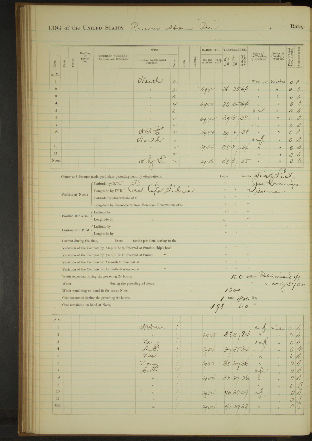
9 July 1890
East Cape, Siberia
Lat 66.02, Long -169.87 [Estimate from above bearings]
8am to meridian:
Crew at work on boat sails and booms.
Meridian to 4pm:
From 2.30 to end of watch snowing hard. Indians from East Cape village on board. 3.00: all natives had left vessel. Crew clearing snow off decks.
8pm to midnight:
8.00 to 9.00 natives from village visiting ship.
50874d5d09d4090755001487: (http://oldweather.s3.amazonaws.com/ow3/final/USRC Bear/vol068/vol068_077_0.jpg)
50874d5d09d4090755001489: (http://oldweather.s3.amazonaws.com/ow3/final/USRC Bear/vol068/vol068_077_1.jpg)
10 July 1890
East Cape, Siberia [to Little Diomede and Cape Prince of Wales]
Lat 65.77, Long -169.02
4am to 8am:
4.15: underway. 4.20: steered various courses around South point East Cape to village.
5.25: anchored off Imakluk Village. Officer visiting shore. 6.50: officer returned, up anchor.
8am to meridian:
9.10: made Big Diomede Island two points on starboard bow. Steering various courses along Island to Southward & Eastward.
11.10: thick fog, stopped engine and lay off island until fog cleared up. 11.30: natives from village came on board. 12.00: East end Big Diomede NEbyE, distant 2 miles.
Meridian to 4pm:
12.05: fog lifting ahead to Eastward and Northward, steering various courses for village Little Diomede Island with Indian canoe in tow.
12.55: came to off Little Diomede Village. 3rd Lieutenant Dimock and Indian interpreter went on shore to take census of village.
1.45: shifted anchorage to Southward & Eastward. Coming to at 2.00. East point island bearing SEbyE, West point NbyE, village (center) NNE.
3.15: Lieutenant Dimock and interpreter returned having taken census. 3.30 Surgeon Holmes went on shore to attend sick natives.
4pm to 6pm:
4.10: Surgeon Holmes returned. 5.10: underway. 5.30: course for Fairway Rock.
6pm to 8pm:
6.45: Fairway Rock abeam.
8pm: Lat 65° 37’N, Long 168° 20’W
8pm to midnight:
9.20: came to off Indian village, Cape Prince of Wales. Cape bearing SEbyE, spit bearing NWbyN½N, village NE¾N.
Under steam and sail 1 hour 30 minutes. Distance 10.8 miles.
Under steam exclusively 9 hours. Distance 59.0 miles.
Total 10 hours 30 minutes. Distance 69.8 miles.
50874d5d09d409075500148b: (http://oldweather.s3.amazonaws.com/ow3/final/USRC Bear/vol068/vol068_078_0.jpg)
50874d5d09d409075500148d: (http://oldweather.s3.amazonaws.com/ow3/final/USRC Bear/vol068/vol068_078_1.jpg)
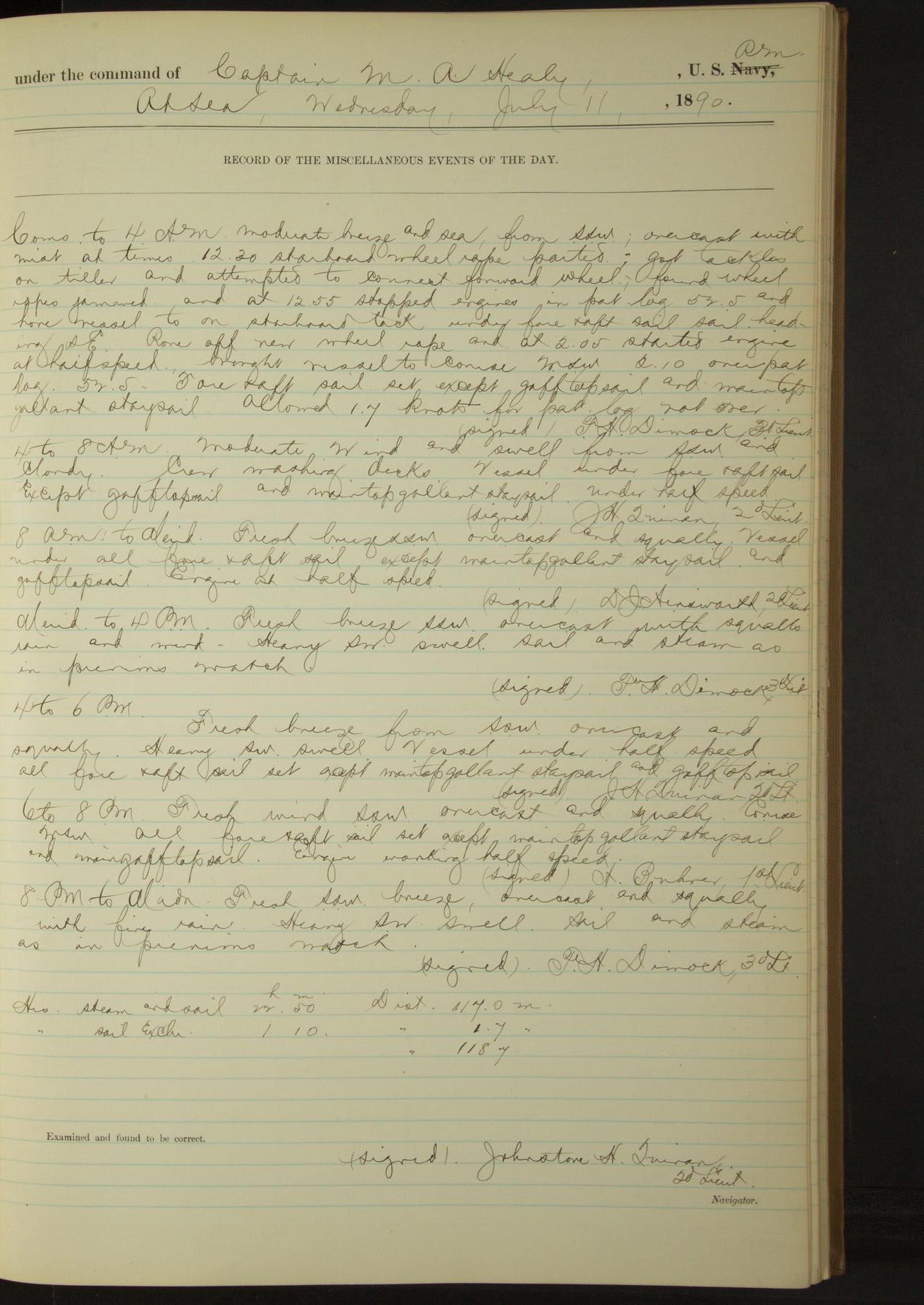
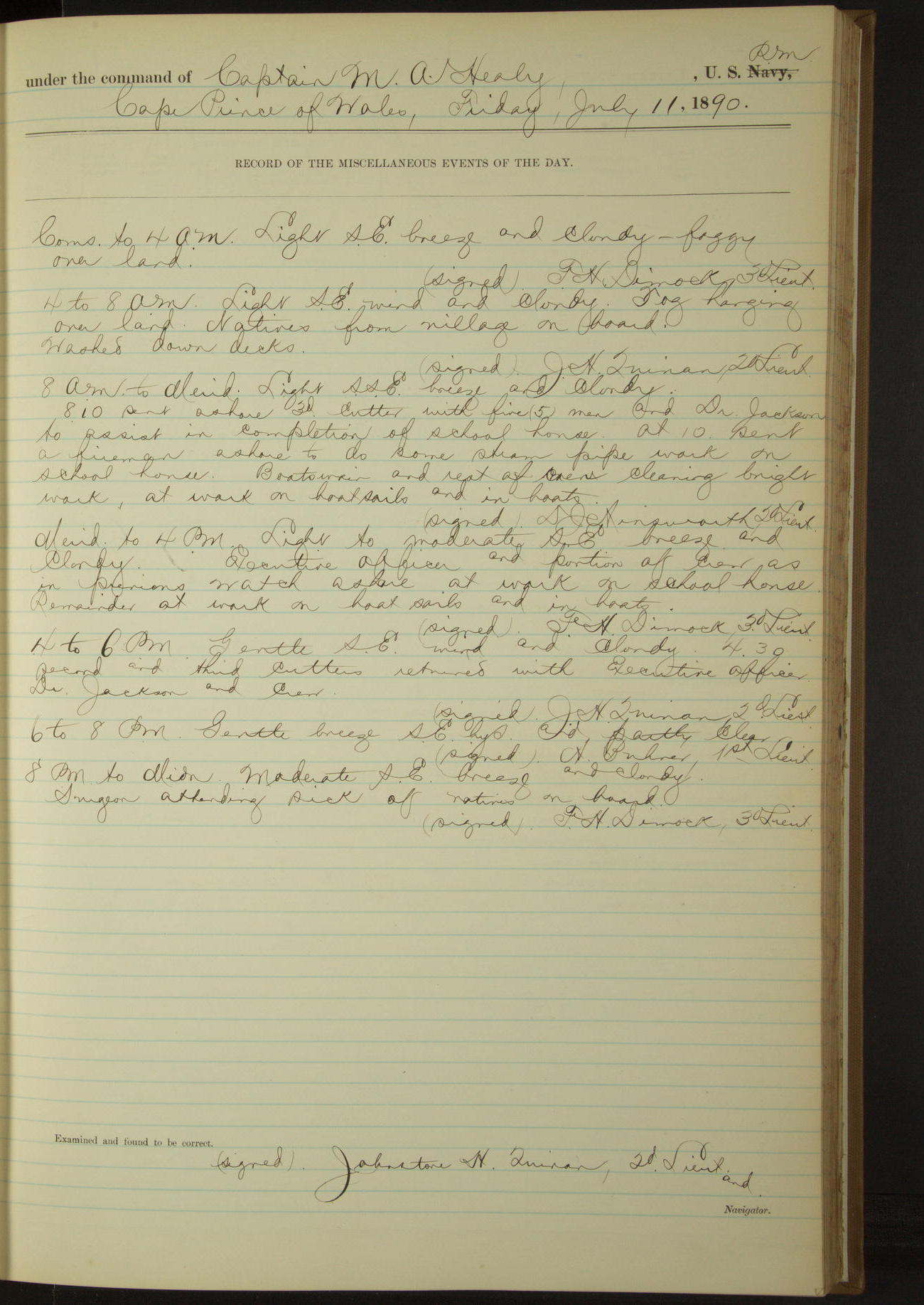
11 July 1890
Cape Prince of Wales
Lat 65.60, Long -168.11 [Estimate from above bearings]
4am to 8am:
Natives from village on board.
8am to meridian:
8.10: sent ashore third cutter with five (5) men and Dr. Jackson to assist in completion of school house.
At 10.00 sent a Fireman ashore to do some steam pipe work on school house. Boatswain and rest of crew cleaning bright work, at work on boat sails and in boats.
Meridian to 4pm:
Executive Officer and portion of crew as in previous watch ashore at work on school house; remainder at work on boat sails and in boats.
4pm to 6pm:
4.30: 2nd and 3rd cutters returned with Executive Officer, Dr. Jackson and crew.
8pm to midnight:
Surgeon attending sick of natives on board.
50874d5d09d409075500148f: (http://oldweather.s3.amazonaws.com/ow3/final/USRC Bear/vol068/vol068_079_0.jpg)
50874d5d09d4090755001491: (http://oldweather.s3.amazonaws.com/ow3/final/USRC Bear/vol068/vol068_079_1.jpg)
12 July 1890
Cape Prince of Wales [& at sea]
Lat 65.60, Long -168.11
4am to 8am:
At 6.45 sent second cutter in to village with carpenter and five men to assist in building school house.
8am to meridian:
Gave portion of crew forenoon for washing and mending clothes &c. Surgeon attending sick natives.
Meridian to 4pm:
1.15: third cutter with Dr. Jackson went ashore to village. 3.45: 2nd and 3rd cutters returned with Dr. Jackson, carpenter and crew. Reported work on school completed. Hoisted both boats.
Surgeon attending sick natives. Boatswain and crew mending clothes.
4pm to 6pm:
4.10: underway.
6pm to 8pm:
At 7.00 Big Diomede bore SW and N and East Cape West.
8pm: Lat 65° 57’N, Long 168° 09’W
8pm to midnight:
10.00: Cape Prince of Wales bore S½W. Kept man in chains heaving lead. 10.50: obtained no bottom.
At 12.00 obtained 8¾ fathoms water; stood in for light observed on shore.
Under steam exclusively 15 minutes. Distance 0.9 miles
Under steam and sail 3 hours 10 minutes. Distance 24.1 miles
Under sail exclusively 4 hours 25 minutes. Distance 28.5 miles
Total 7 hours 50 minutes. Distance 53.5 miles.
50874d5d09d4090755001493: (http://oldweather.s3.amazonaws.com/ow3/final/USRC Bear/vol068/vol068_080_0.jpg)
50874d5d09d4090755001495: (http://oldweather.s3.amazonaws.com/ow3/final/USRC Bear/vol068/vol068_080_1.jpg)
13 July 1890
At sea [& Shishmaref Inlet]
Lat 66.30, Long -165.98 [adjusted 9' West to keep her off the shore]
Midnight to 4am:
Standing along the shore to the Northward and Eastward. Kept lead going during the watch.
4am to 8am:
6.45: hauled in for land by the wind and at 7.10 anchored off Schismareff Inlet [Shishmaref Inlet].
8am: Lat 66° 18’N, Long 165° 50’W
8am to meridian:
8.15: Lieutenant Dimock and Indian interpreters went ashore to take census of Kiktuk village. 10.15: returned. Natives on board. Surgeon attending to the sick.
Meridian to 4pm:
12.20: underway. Kept lead going during the watch.
8pm: Lat 66° 32’N, Long 164° 55’W
8pm to midnight:
Calm and foggy. At 9.00 shut in thick, sounded whistle as necessary. Kept lead going during the watch.
Under steam exclusively 5 hours 30 minutes. Distance 38.9 miles.
Under sail exclusively 13 hours 20 minutes. Distance 33.5 miles.
Total 18 hours 50 minutes. Distance 72.4 miles.
50874d5d09d4090755001497: (http://oldweather.s3.amazonaws.com/ow3/final/USRC Bear/vol068/vol068_081_0.jpg)
50874d5d09d4090755001499: (http://oldweather.s3.amazonaws.com/ow3/final/USRC Bear/vol068/vol068_081_1.jpg)
14 July 1890
At sea [& Kotzebue Sound]
Lat 66.75, Long -162.53
4am to 8am:
Calm and thick fog. At 5.00 stopped engine, came to. 6.45: fog lifting, observed schooner bearing by compass NWbyN¼N. Cape Blossom bearing North. Got underway and steered to Northward and Westward for schooner.
7.45: came to in Kotzebue Sound, Cape Blossom bearing EbyN. Sent officer in third cutter to board schooner.
8am to meridian:
8.25: boat from schooner “Alton” came alongside. At 9.00 third cutter returned, officer having boarded and examined schooner “Alton” of San Francisco, Newth master, trading and whaling.
Surgeon rendering medical assistance to crew of “Alton” and native from shore. 10.00: boat from “Alton” returned to schooner which got underway and stood to the Northward and Westward.
Crew employed slushing down fore, main and mizzen topmasts and topgallant masts and mizzen mast and setting up bowsprit shrouds.
Meridian to 4pm:
Executive Officer, Commissioner Jackson and boat’s crew left vessel for Indian camp. Crew setting up head gear, etc.
4pm to 6pm:
Natives on board.
8pm to midnight:
At 9.00 Executive Officer and Commissioner Jackson returned on board.
Under steam exclusively 6 hours. Distance 39.8 miles.
50874d5d09d409075500149b: (http://oldweather.s3.amazonaws.com/ow3/final/USRC Bear/vol068/vol068_082_0.jpg)
50874d5d09d409075500149d: (http://oldweather.s3.amazonaws.com/ow3/final/USRC Bear/vol068/vol068_082_1.jpg)
15 July 1890
Kotzebue Sound
Lat 66.75, Long -162.53
8am to meridian:
At 10.00 Executive Officer and Boatswain went ashore on official business. Crew repairing sails, hitching off rigging and as required.
Meridian to 4pm:
2.30: Executive Officer and boat’s crew returned bringing Indian trader Isaac and wife in order that Commanding Officer might investigate the circumstances of their intoxication and if any liquor had been landed or traded by schooner “Alton”, the only merchant vessel visiting this locality during present year to date.
No liquor had been traded by any vessel. Isaac had been given a bottle of liquor by some person on schooner “Alton” and he and his wife became intoxicated thereby.
8pm to midnight:
At 8.00 second cutter in charge of an officer left the ship to land Indian trader and his wife.
50874d5d09d409075500149f: (http://oldweather.s3.amazonaws.com/ow3/final/USRC Bear/vol068/vol068_083_0.jpg)
50874d5d09d40907550014a1: (http://oldweather.s3.amazonaws.com/ow3/final/USRC Bear/vol068/vol068_083_1.jpg)
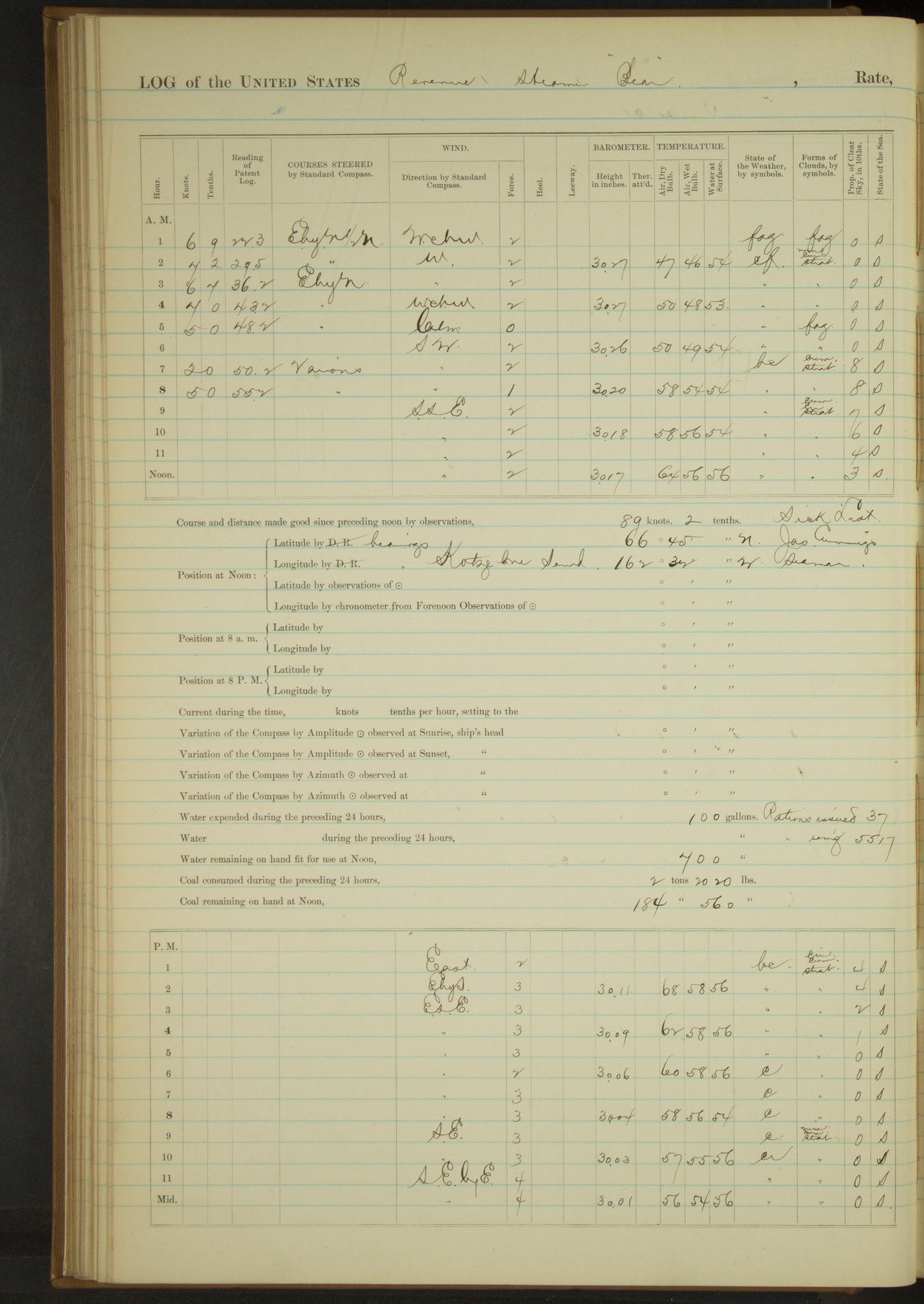
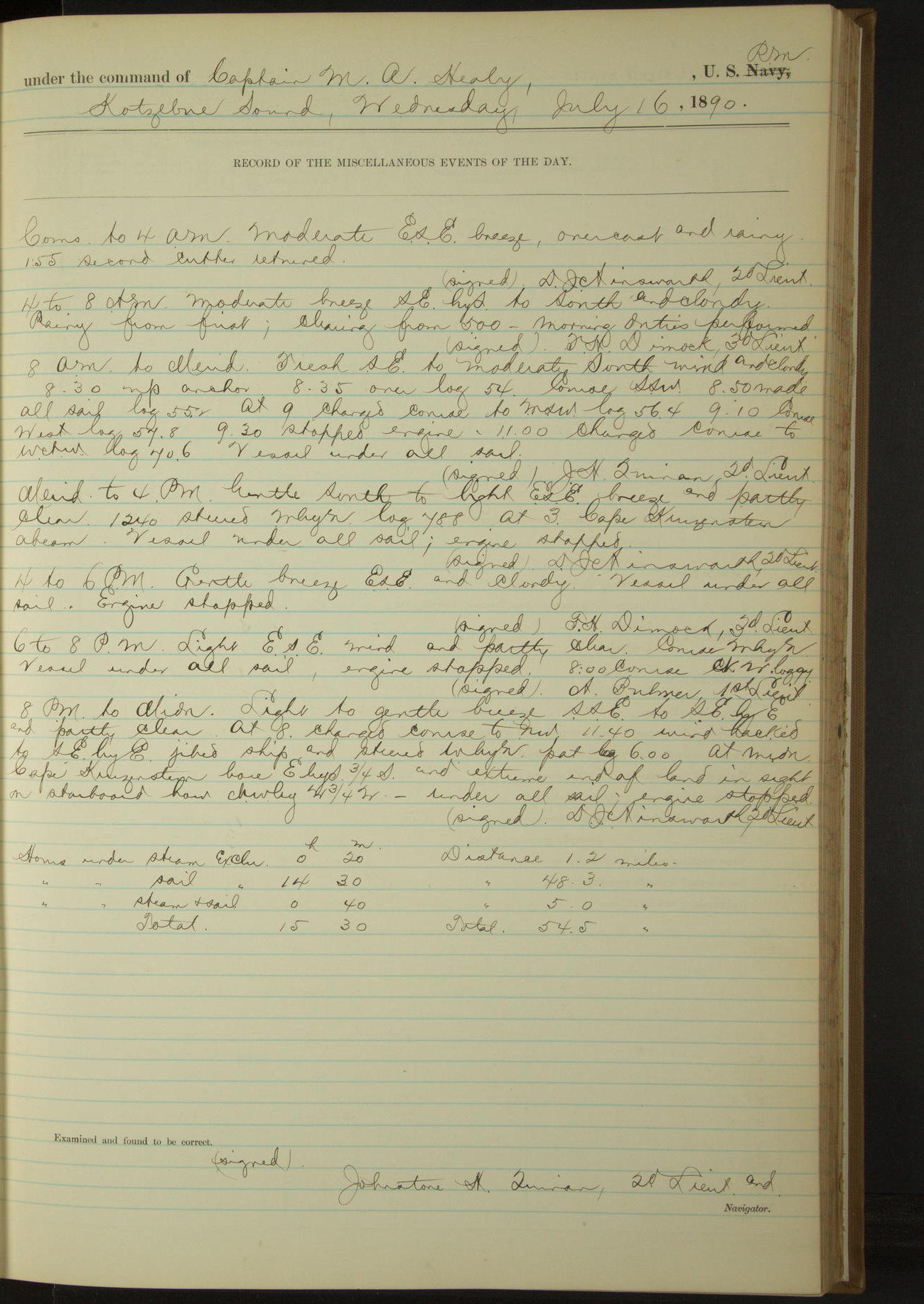
16 July 1890
Kotzebue Sound [& at sea]
Lat 66.90, Long -163.30
Commences to 4am:
1.55: second cutter returned.
8am to meridian:
8.30: up anchor. 8.50: made all sail.
Meridian to 4pm:
At 3.00 Cape Kruzenstern abeam.
8pm: Lat 67° 16’ 33”N, Long 164° 24’W
8pm to midnight:
At midnight Cape Kruzenstern bore EbyS¾S and extreme end of land in sight on starboard bow NWbyW¾W.
Under steam exclusively 20 minutes. Distance 1.2 miles.
Under sail exclusively 14 hours 30 minutes. Distance 48.3 miles.
Under steam and sail 40 minutes. Distance 5.0 miles.
Total 15 hours 30 minutes. Total 54.5 miles.
50874d5d09d40907550014a3: (http://oldweather.s3.amazonaws.com/ow3/final/USRC Bear/vol068/vol068_084_0.jpg)
50874d5d09d40907550014a5: (http://oldweather.s3.amazonaws.com/ow3/final/USRC Bear/vol068/vol068_084_1.jpg)
17 July 1890
At sea [& Cape Thompson & Point Hope]
Lat 68.10, Long -165.93 [Lat from log, Long estimate from bearings at 9.45]
4am to 8am:
8.00: Cape Seppings bore N¾W, Cape Thompson W¾N. Kept man in chains with lead.
8am: Lat 67° 55’N, Long 165° 15’W
8am to meridian:
9.45: Cape Thompson bearing NWbyW, distant two (2) miles. Came to. Lowered 2nd and 3rd cutters, dinghy and gig and made preparations for taking in water in bulk.
10.50: commenced watering ship. Natives came on board.
Meridian to 4pm:
At 1.10 finished watering ship, having taken 5300 gallons. Allowed crew to go ashore and wash clothes.
4pm to 6pm:
At 6.00 third cutter with crew returned. Hoisted boat.
6pm to 8pm:
6.45: got underway.
8pm: Lat 68° 11’N, Long 166° 12’W
8pm to midnight:
10.00: Point Hope abeam. Steered various courses around to North side Point Hope. 11.10: anchored in midst of whaling fleet.
Boarded and examined bark “Thomas Pope”, New Bedford, Fisher, from San Francisco, supplies for whaling fleet.
Under steam and sail 1 hour 38 minutes. Distance 11.5 miles.
Under steam exclusively 6 hours 20 minutes. Distance 45.9 miles.
Under sail exclusively 5 hours 27 minutes. Distance 19.7 miles.
Total 13 hours 25 minutes. Distance 77.1 miles.
50874d5d09d40907550014a7: (http://oldweather.s3.amazonaws.com/ow3/final/USRC Bear/vol068/vol068_085_0.jpg)
50874d5d09d40907550014a9: (http://oldweather.s3.amazonaws.com/ow3/final/USRC Bear/vol068/vol068_085_1.jpg)
18 July 1890
At anchor off Point Hope Alaska
Lat 68.42, Long -166.67
Commences to 4am:
Eleven (11) vessels at anchor North side Point Hope. 2.55: bark “Reindeer” astern got underway and stood to the Northward.
At anchor North side Point Hope. Point Hope bearing SSW and Cape Lisburne N¾W.
4am to 8am:
5.45: a bark on port beam got underway and stood to the Northward.
8am to meridian:
Crew at work on boats sails, fitting and painting forward hatch and as required.
Meridian to 4pm:
Crew at work on boat sails and as required.
50874d5d09d40907550014ab: (http://oldweather.s3.amazonaws.com/ow3/final/USRC Bear/vol068/vol068_086_0.jpg)
50874d5d09d40907550014ad: (http://oldweather.s3.amazonaws.com/ow3/final/USRC Bear/vol068/vol068_086_1.jpg)
19 July 1890
Point Hope
Lat 68.42, Long -166.67
8am to meridian [& Meridian to 4pm]: Crew mending clothes.
50874d5d09d40907550014af: (http://oldweather.s3.amazonaws.com/ow3/final/USRC Bear/vol068/vol068_087_0.jpg)
50874d5d09d40907550014b1: (http://oldweather.s3.amazonaws.com/ow3/final/USRC Bear/vol068/vol068_087_1.jpg)
20 July 1890
Point Hope
Lat 68.42, Long -166.67
4am to 8am:
Boarded and examined:
American brig “WH MeyerW, San Francisco, Bolles, whaling
American schooner “Silver Wave”, San Francisco, Bayne, whaling and trading
Took on board from steam whaler “Belvedere” James Gray, one of the crew of whaling bark “Little Ohio”, wrecked on Point Hope in 1888, picked up by “Belvedere” at the coal mine, destitute and sick. Issued ration to him.
Bark “Andrew Hicks” reported that three of her crew deserted at coal mine. Surgeon of ship attending to sick of whaling fleet.
8am to meridian:
Boarded and examined:
American bark “Andrew Hicks”, New Bedford, Cook, whaling
American bark “Triton”, New Bedford, Gifford, whaling
American schooner “Jane Gray”, San Francisco, Kelley, whaling and hunting
American schooner “Rosario”, San Francisco, Coffin, whaling and trading
American brig “Frances A Barstow”, New Bedford, Devoll, whaling and hunting
Surgeon attending to sick of whaling fleet. Natives from Point Hope on board.
Meridian to 4pm:
1.00: officer returned from boarding. 1.30: Executive Officer and boat’s crew went ashore to visit whaling station officially.
4pm to 6pm:
Natives on board. Surgeon attending to sick.
6pm to 8pm:
7.45: Executive Officer returned aboard. Hoisted third cutter.
[More details of the wreck of Little Ohio, officially named Ohio, from Alaska Shipwreck]
50874d5d09d40907550014b3: (http://oldweather.s3.amazonaws.com/ow3/final/USRC Bear/vol068/vol068_088_0.jpg)
50874d5d09d40907550014b5: (http://oldweather.s3.amazonaws.com/ow3/final/USRC Bear/vol068/vol068_088_1.jpg)
21 July 1890
Point Hope
Lat 68.37, Long -166.79 [Assuming school house located near present village]
Sick list: AC Hinderlong, Carpenter
4am to 8am:
4.35: underway. 5.25 came to off Point Hope school house. Loaned four oars to schooner “Oscar and Hattie”, same to be returned in San Francisco.
7.45: lowered second cutter; 1st Lieutenant and ten (10) men went ashore to assist in building school house.
8am to meridian:
11.45: 1st Lieutenant, Commissioner Jackson and five men returned. Crew employed ashore and as required. Surgeon amputated forefinger of native.
Meridian to 4pm:
3.15: Executive Officer and boat’s crew went ashore in third cutter to assist in building and painting school house.
Crew stowing bags of coal in forward bunker. Natives on board. Surgeon attending to sick.
4pm to 6pm:
4.30: all boats with officers and men returned to vessel. Hoisted boats. 4.40: a steam whaler from Northward came to anchor among whaling fleet off North side of Point Hope.
8pm to midnight:
8.15: boat from steamer “William Lewis” came alongside and procured [?] mail.
Under steam exclusively 50 minutes. Distance 6 miles.
50874d5d09d40907550014b7: (http://oldweather.s3.amazonaws.com/ow3/final/USRC Bear/vol068/vol068_089_0.jpg)
50874d5d09d40907550014b9: (http://oldweather.s3.amazonaws.com/ow3/final/USRC Bear/vol068/vol068_089_1.jpg)
22 July 1890
Point Hope [& at sea]
Lat 68.78, Long -166.42
Sick list: AC Hinderlong, Carpenter; EJ Taylor, Fireman [to 26th July]
4am to 8am:
At 7.00 underway and steered various courses along North side Point Hope to whaling fleet.
8am to meridian:
Boarded and examined steam bark “William Lewis”, New Bedford, Sherman, whaling. 9.15: underway. Crew cleaning boats.
Meridian to 4pm:
1.35: passed Cape Lisburne, distant 1½ miles. 3.00: strong breeze with heavy squalls, single-reefed the mainsail. 3.50: sighted a bark to Southward and Eastward, standing to Southward.
4pm to 6pm:
4.30: Corwin coal mine abeam.
6pm to 8pm:
At 8.00 Cape Beaufort bore SE¾E.
8pm: Lat 69° 16’N, Long 163° 53’W
Under steam exclusively 0.05 minutes. Distance 0.4 miles.
Under sail exclusively 14 hours 40 minutes. Distance 110.8 miles.
Total 14 hours 45 minutes. Distance 111.2 miles.
50874d5d09d40907550014bb: (http://oldweather.s3.amazonaws.com/ow3/final/USRC Bear/vol068/vol068_090_0.jpg)
50874d5d09d40907550014bd: (http://oldweather.s3.amazonaws.com/ow3/final/USRC Bear/vol068/vol068_090_1.jpg)
23 July 1890
At sea
Lat 70.03, Long -163.93
8am: Lat 70° 15’N, Long 163° 56’W
Meridian to 4pm:
Engineers overhauling boiler and machinery.
4pm to 6pm:
Engineer’s force clearing back connections of boiler.
Under sail exclusively 24 hours. Distance 98.2 miles.
50874d5d09d40907550014bf: (http://oldweather.s3.amazonaws.com/ow3/final/USRC Bear/vol068/vol068_091_0.jpg)
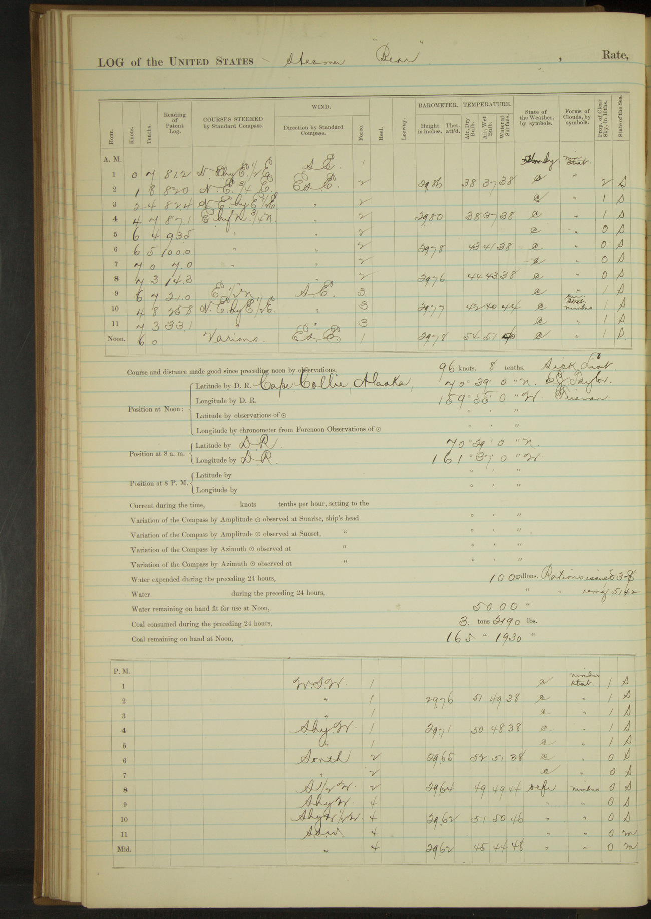
50874d5d09d40907550014c1: (http://oldweather.s3.amazonaws.com/ow3/final/USRC Bear/vol068/vol068_091_1.jpg)
24 July 1890
At sea [& Cape Collie]
Lat 70.59, Long -160.18 [Estimate off Cape Collie]
4am to 8am:
5.30: shook reef out of mainsail.
8am: Lat 70° 29’N, Long 161° 37’W
8am to meridian:
8.25: made land bearing EbyS½S. 8.30: sighted vessel under land. 9.00: steered for vessel to Northward.
11.30: steered various courses around bark “Reindeer” to anchorage. 11.55: anchored off Cape Collie. Indian camp bearing EbyS½S, Northern point of land NbyE.
Noon: Lat 70° 39’N, Long 159° 55’W [Locates ship inland]
Meridian to 4pm:
12.40: shifted anchorage off shore. Village bearing EbyS, North point land NbyE½E. 1.30: second cutter went ashore with Dr. Jackson and 3rd Lieutenant Dimock and Indian interpreters to take census of village. 3.55: returned.
Three of crew ashore in dinghy, gunning. Drift ice floating by to Northward. Four vessels in sight.
4pm to 6pm:
Four vessels in sight standing to Northward. 5.50: dinghy returned and was hoisted. Drift ice floating by to Northward.
Under steam and sail 8 hours 15 minutes. Distance 53.7 miles.
Under steam exclusively 25 minutes. Distance 3.0 miles.
Under sail exclusively 3 hours 15 minutes. Distance 4.9 miles.
Total 11 hours 55 minutes. Distance 61.6 miles.
50874d5d09d40907550014c3: (http://oldweather.s3.amazonaws.com/ow3/final/USRC Bear/vol068/vol068_092_0.jpg)
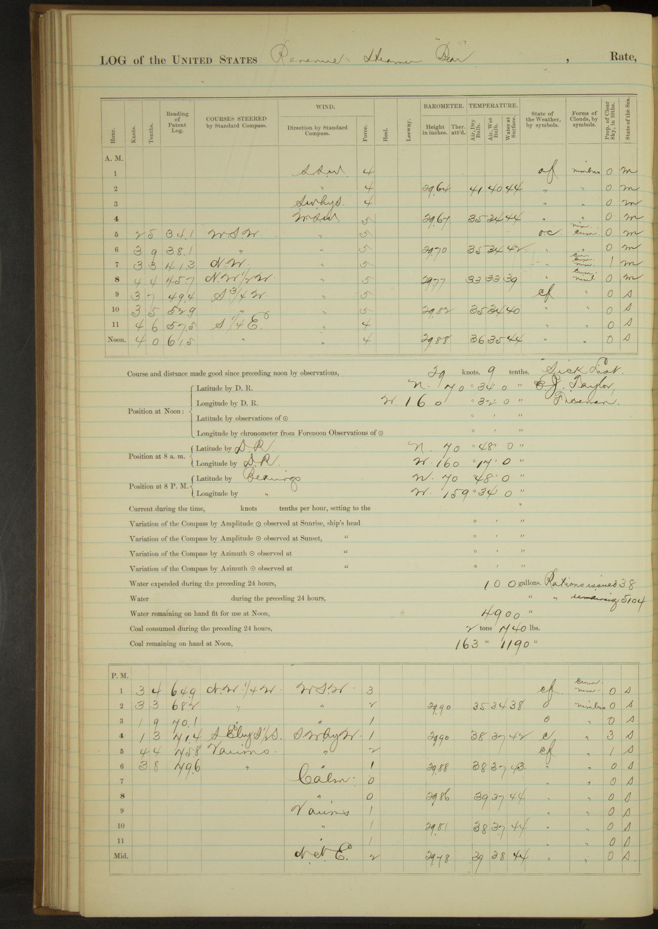
50874d5d09d40907550014c5: (http://oldweather.s3.amazonaws.com/ow3/final/USRC Bear/vol068/vol068_092_1.jpg)
25 July 1890
At anchor off Indian Village, Wainwright Inlet [to Point Belcher]
Lat 70.57, Long -160.53
4am to 8am:
4.25: underway and steered to Westward. At 7.00 made ice field ahead and on weather bow, distant 5 miles. At 8.00 near ice field.
8am: Lat 70° 48’N, Long 160° 17’W
4pm to 6pm:
4.45: made land ESE. From 5.00 steered various courses to land. 5.45: anchored off Point Belcher. Indian village bearing SEbyE½E, North point land NE¼N.
6pm to 8pm:
3rd Lieutenant Dimock and interpreter landed to take census of natives.
8pm: Lat 70° 48’N, Long 159° 34’W [Locates ship inland]
8pm to midnight:
9.05: second cutter with 3rd Lieutenant and interpreter returned, having finished census, and hoisted. 11.30 dinghy returned and hoisted.
Under steam exclusively 3 hours. Distance 14.0 miles.
Under sail exclusively 10 hours 20 minutes. Distance 34.0 miles.
Total 13 hours 20 minutes. Distance 48.0 miles.
50874d5d09d40907550014c7: (http://oldweather.s3.amazonaws.com/ow3/final/USRC Bear/vol068/vol068_093_0.jpg)
50874d5d09d40907550014c9: (http://oldweather.s3.amazonaws.com/ow3/final/USRC Bear/vol068/vol068_093_1.jpg)
26 July 1890
Off Indian Village, Point Belcher [& at sea]
Lat 70.80, Long -159.70 [Estimate off Point Belcher]
4am to 8am:
Two vessels in sight to Northward at end of watch.
8am to meridian:
First hour raining, last three snowing. Crew employed mending clothes. Two vessels in sight to Northward at end of watch.
Noon: Lat 70° 48’N, Long 159° 34’W [Locates ship inland]
Meridian to 4pm:
Overcast with light snow and rain. Officers and crew signed pay rolls for month of July. Gave crew afternoon for making and mending clothes.
4pm to 6pm:
Ice pack from SW to NW distant 10 to 12 miles. Light fog at close of watch from Southward and Westward.
8pm to midnight:
11.00: underway and steered out WSW to examine ice pack.
Under steam exclusively 1 hour. Distance 5.1 miles.
50874d5d09d40907550014cb: (http://oldweather.s3.amazonaws.com/ow3/final/USRC Bear/vol068/vol068_094_0.jpg)
50874d5d09d40907550014cd: (http://oldweather.s3.amazonaws.com/ow3/final/USRC Bear/vol068/vol068_094_1.jpg)
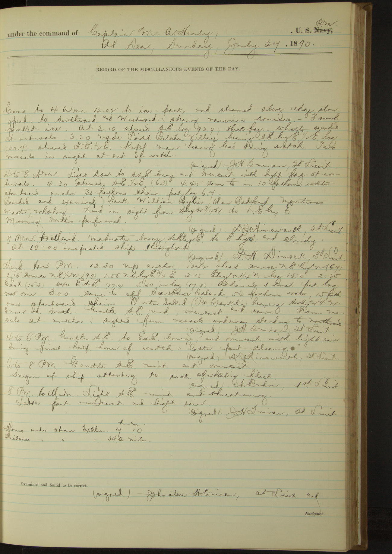
27 July 1890
At sea [& Sea Horse Islands]
Lat 70.83, Long -159.48 [Estimate from distance and course from meridian to 3pm]
Commences to 4am:
12.02: to ice pack and steamed along edge, slow speed, to Southward and Westward. Found packed ice. At 2.10 thick fog, whistle sounded at intervals.
3.30: made Point Belcher village bearing SEbyE½E. Kept man heaving lead during watch. Two vessels in sight at end of watch.
4am to 8am:
4.40: came to. Boarded and examined bark “William Baylies”, New Bedford, Montross master, whaling. Land in sight from SbyW¾W to NEbyE.
Noon: Lat 70° 50’N, Long 159° 19’W [Locates ship inland]
Meridian to 4pm:
12.30: up anchor. 12.42: ahead course NEbyN. 3.00: came to off Sea Horse Islands. Outer Island (Point Franklin) bearing SWbyW¼W, Inner Island S. Four vessels at anchor. Sighted four vessels underway standing to Northward.
6pm to 8pm:
Surgeon of ship attending to sick of whaling fleet.
Under steam exclusively 7 hours 10 minutes. Distance 34.2 miles.
50874d5d09d40907550014cf: (http://oldweather.s3.amazonaws.com/ow3/final/USRC Bear/vol068/vol068_095_0.jpg)
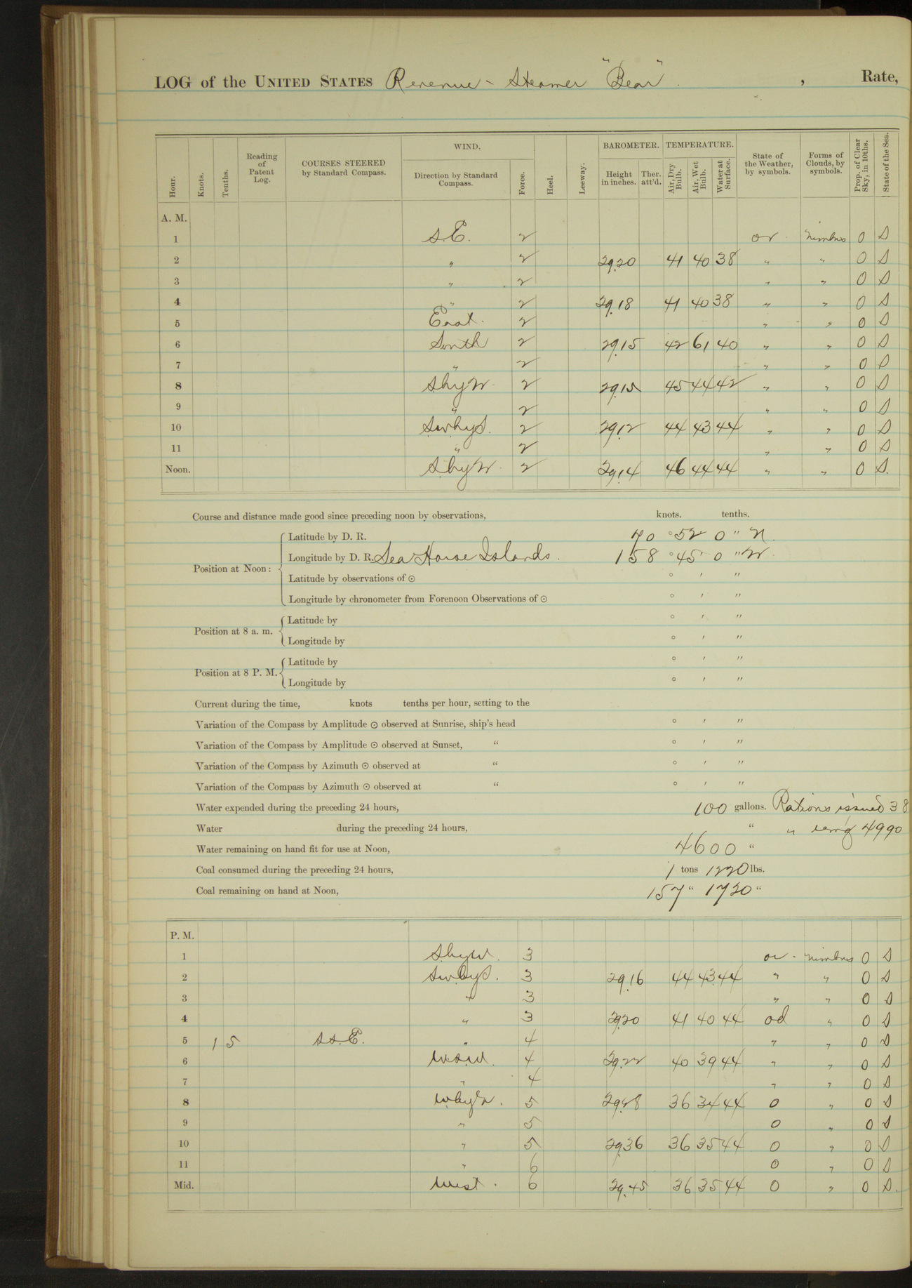
50874d5d09d40907550014d1: (http://oldweather.s3.amazonaws.com/ow3/final/USRC Bear/vol068/vol068_095_1.jpg)
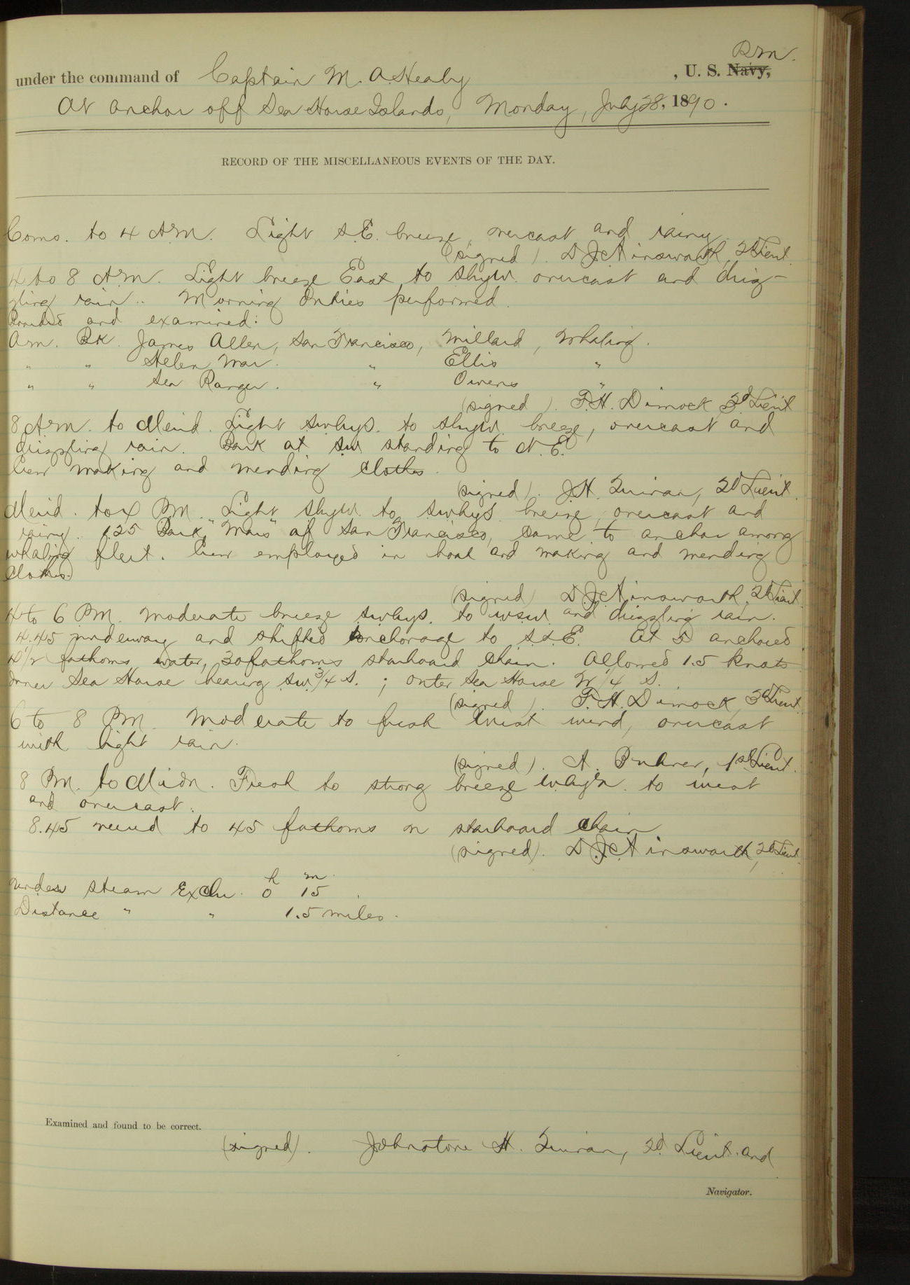
28 July 1890
At anchor off Sea Horse Islands
Lat 70.91, Long -158.66
4am to 8am:
Boarded and examined:
American bark “James Allen”, San Francisco, Millard, whaling.
American bark “Helen Mar”, San Francisco, Ellis, whaling.
American bark “Sea Ranger”, San Francisco, Owen, whaling.
8am to meridian:
Crew making and mending clothes.
Noon: Lat 70° 52’N, Long 158° 45’W [Locates ship at wrong side of islands]
Meridian to 4pm:
1.25: Bark “Mars” of San Francisco came to anchor among whaling fleet. Crew employed in boats and making and mending clothes.
4pm to 6pm:
4.45: underway and shifted anchorage to SSE. At 5.00 anchored. Inner Sea Horse bearing SW¾S, Outer Sea Horse W¼S.
Under steam exclusively 15 minutes. Distance 1.5 miles.
50874d5d09d40907550014d3: (http://oldweather.s3.amazonaws.com/ow3/final/USRC Bear/vol068/vol068_096_0.jpg)
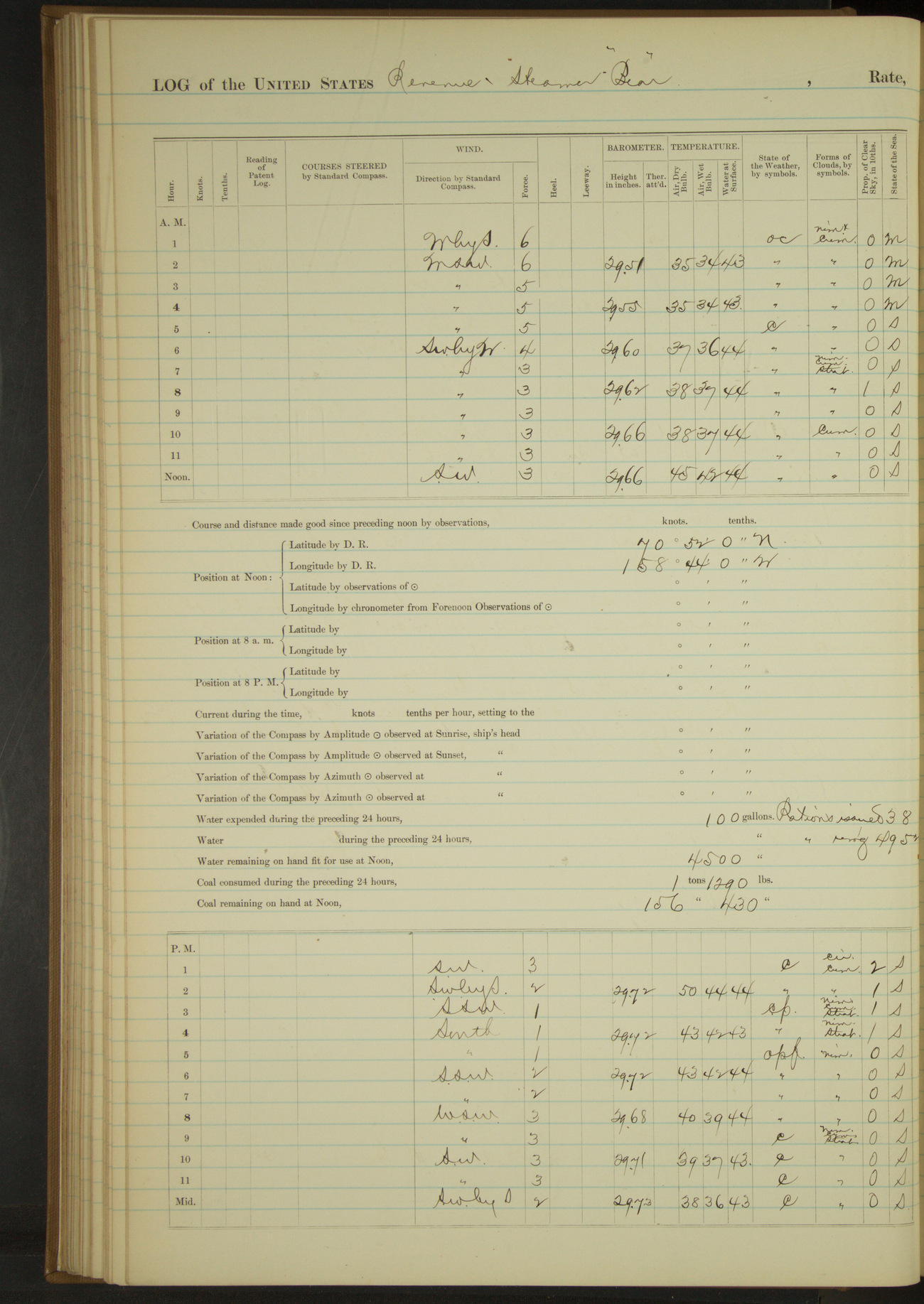
50874d5d09d40907550014d5: (http://oldweather.s3.amazonaws.com/ow3/final/USRC Bear/vol068/vol068_096_1.jpg)
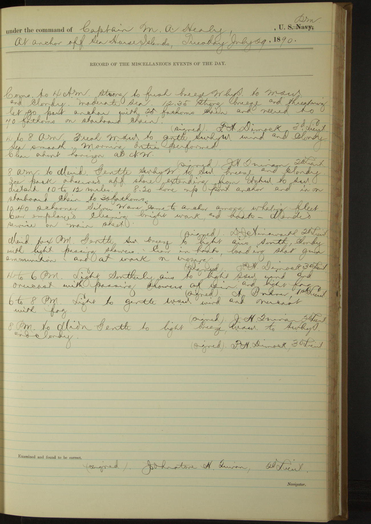
29 July 1890
At anchor off Sea Horse Islands
Lat 70.89, Long -158.67
8am to meridian:
Ice pack observed offshore extending from NNW to SW, distant 10 to 12 miles. 10.40: schooner “Silver Ware” came to anchor among whaling fleet.
Crew employed cleaning bright work and boats. Mended service on main sheet.
Noon: Lat 70° 52’N, Long 158° 44’W [Locates ship at wrong side of islands]
Meridian to 4pm:
Crew in boats, loading shot gun ammunition and at work on rigging.
50874d5d09d40907550014d7: (http://oldweather.s3.amazonaws.com/ow3/final/USRC Bear/vol068/vol068_097_0.jpg)
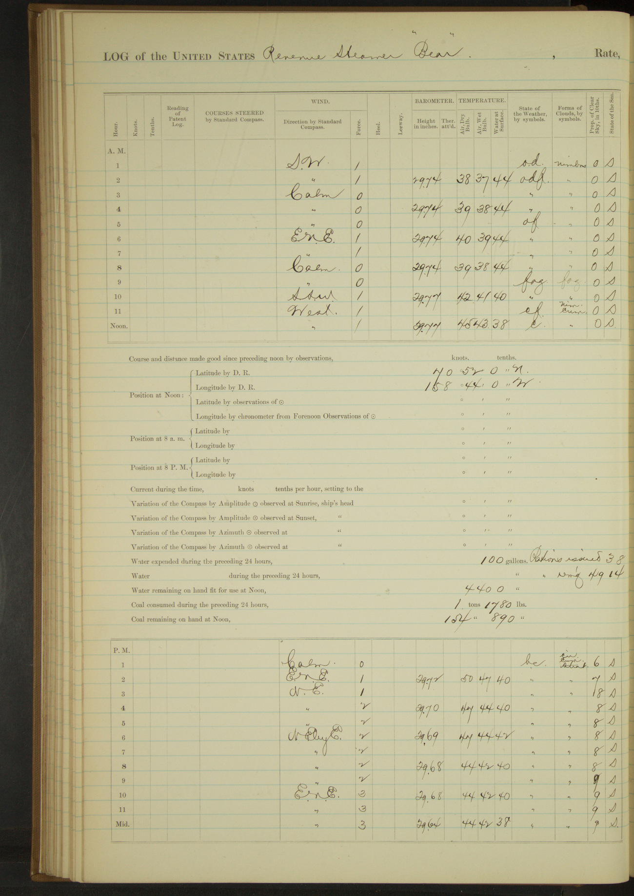
50874d5d09d40907550014d9: (http://oldweather.s3.amazonaws.com/ow3/final/USRC Bear/vol068/vol068_097_1.jpg)
30 July 1890
At anchor off Sea Horse Islands
Lat 70.89, Long -158.67
8am to meridian:
Crew cleaning boats, scrubbing bags, overhauling pumps and rigging.
Noon: Lat 70° 52’N, Long 158° 44’W [Locates ship at wrong side of islands]
Meridian to 4pm:
Crew cleaning boats, painting forward hatches and scraping and varnishing hatch gratings, and at work on rigging.
8pm to midnight:
11.40: a large body of heavy floating ice came down upon the vessel, causing her to drag her anchor. Hove up anchor and steamed through the ice for clear water.
Under steam exclusively 20 minutes. Distance 2 miles,
50874d5d09d40907550014db: (http://oldweather.s3.amazonaws.com/ow3/final/USRC Bear/vol068/vol068_098_0.jpg)
50874d5d09d40907550014dd: (http://oldweather.s3.amazonaws.com/ow3/final/USRC Bear/vol068/vol068_098_1.jpg)
31 July 1890
Off Sea Horse Islands [to Cape Smyth]
Lat 71.30, Long -156.80
Commences to 4am:
Vessel working through the ice. 3.50: hauled up to Eastward to clear drift ice. During watch sighted three vessels to Northward and Eastward.
4am to 8am:
Steered various courses through drift ice till 5.00. At 6.00 clear of ice. 7.50 anchored off Cape Smyth. Flag staff below Indian village bearing SE¾E, US Relief Station E¾N.
8am to meridian:
Employed landing stores at Cape Smyth refuge station. [The station had been built by the crew of the “Bear”. See log for July 1889 and Article from Morning Union about the build.]
Noon: Lat 71° 21’N, Long 156° 37’W [Locates ship too far from Cape Smyth]
Meridian to 4pm:
Crew employed as in previous watch. Surgeon rendered medical assistance to sick of whaling fleet. A number of vessels arrived and departed during watch.
4pm to 6pm:
Quantities of heavy ice drifting by to Northward and Eastward.
6pm to 8pm:
Discharged Indian Interpreters Charley and Mary, their services in taking census being no longer needed [but see 2 August].
A working pressure of steam ordered kept on main boiler to heave short or get underway to avoid heavy drifting ice.
8pm to midnight:
Large quantities of heavy drift ice floating by to Northward.
Under steam exclusively 7 hours 50 minutes. Distance 43.3 miles.
LOGS FOR AUGUST 1890
50874d5d09d40907550014df: (http://oldweather.s3.amazonaws.com/ow3/final/USRC Bear/vol068/vol068_099_0.jpg)
50874d5d09d40907550014e1: (http://oldweather.s3.amazonaws.com/ow3/final/USRC Bear/vol068/vol068_099_1.jpg)
1 August 1890
Cape Smyth, Alaska [to Point Barrow]
Lat 71.38, Long -156.17
Commences to 4am:
Quantities of heavy ice drifting by to Northward [& 4am to 8am].
4am to 8am:
6.15: wind and sea increasing, underway. Steered various courses to Northward and Eastward. 7.30: Point Barrow bore SSE.
8am to meridian:
8.10: came to, Point Barrow bearing SW½W. A number of whaling vessels at anchor near by. Crew employed mending clothes.
Meridian to 4pm:
Crew making mats and variously employed.
4pm to 6pm:
Ice pack observed offshore to NW, distant 10 to 12 miles.
8pm to midnight:
Ice pack closing down to Westward and Northward, distant 5 to 7 miles. Loaned spirit compass to steam bark “Balaena” of San Francisco.
Under steam exclusively 1 hour 55 minutes. Distance 13.8 miles.
50874d5d09d40907550014e3: (http://oldweather.s3.amazonaws.com/ow3/final/USRC Bear/vol068/vol068_100_0.jpg)
50874d5e09d40907550014e5: (http://oldweather.s3.amazonaws.com/ow3/final/USRC Bear/vol068/vol068_100_1.jpg)
2 August 1890
Off Point Barrow, Alaska [& at sea]
Lat 71.38, Long -156.17
Commences to 4am:
Ice pack off shore at NW, distant 5 to 7 miles.
4am to 8am:
Ice pack off shore extending from NNW to SW, distant 6 miles. Discharged BT Tilton, Seaman, at his own request.
Meridian to 4pm:
Indian interpreters Charley and Mary, who were recorded as discharged on the 31st ultimo, retained to assist in taking census at Point Barrow. 3rd Lieutenant Dimock ashore in launch taking census of village at Point Barrow.
3.45: steam bark from Southward came to anchor off Point Barrow. Surgeon rendering medical assistance to sick of whaling fleet. Ice pack extending from WSW to NE observed to be moving offshore.
4pm to 6pm:
Surgeon rendered medical assistance to sick of whaling fleet. 5.05: launch returned.
8pm to midnight:
Received on board with their effects the following persons, ten (10) in number, constituting the crew of the bark “Thomas Pope” dismasted off Point Hope on the 28th ultimo, taken off by steamer “William Lewis” and transferred to “Bear” as shipwrecked mariners, the “Lewis” having no accommodation for them:
John D Silva, Mate; Samual Purdy, 2nd Mate; James Davis, Cabin Boy; George Youle, John Reynolds, John Holmberg, A Alexanderson, James Lawson, E Silva, and E Gomes, Seamen.
10.10: underway. Steered various courses to Southward and Westward around Point Barrow. 11.00: Point Barrow bearing SEbyE. 11.45: Received on board chronometer from steamer “William Lewis” to rate.
Under steam exclusively 1 hour 50 minutes. Distance 12.3 miles.
[Article from The Morning Call on the loss of the “Thomas Pope”. See under ‘Lost in the Arctic’]
50874d5e09d40907550014e7: (http://oldweather.s3.amazonaws.com/ow3/final/USRC Bear/vol068/vol068_101_0.jpg)
50874d5e09d40907550014e9: (http://oldweather.s3.amazonaws.com/ow3/final/USRC Bear/vol068/vol068_101_1.jpg)
3 August 1890
At sea [& Cape Smyth]
Lat 71.29, Long -156.81 [Estimate from bearings below]
Commences to 4am:
12.40: came to off Cape Smyth House of Refuge. 1.20: shifted anchorage off shore and came to. Cape Smyth House of Refuge bearing EbyN½N, flagstaff at village SEbyS½S, North point NbyE¼E.
4am to 8am:
Crew rafting lumber for store house at Cape Smyth.
8am to meridian:
Built raft of lumber for refuge station, landed and hauled same on site for building storehouse; landed also a portion of outfits of the station for 1891.
Executive Officer ashore at station. Shipped S Anderson, Ordinary Seaman, and rated him Seaman in lieu of BT Tilton, discharged.
Meridian to 4pm:
12.50: second cutter returned. At 1.00 launch returned. 1.50: Carpenter and five men went ashore to erect store-house for station.
Indian interpreters Charley and Mary left the vessel, discharged from date.
4pm to 6pm:
At 6.00 officer and boat’s crew returned on board.
6pm to 8pm:
Ice pack observed off shore at Westward, distant 10 to 12 miles.
Under steam exclusively 40 minutes. Distance 4 miles.
50874d5e09d40907550014eb: (http://oldweather.s3.amazonaws.com/ow3/final/USRC Bear/vol068/vol068_102_0.jpg)
50874d5e09d40907550014ed: (http://oldweather.s3.amazonaws.com/ow3/final/USRC Bear/vol068/vol068_102_1.jpg)
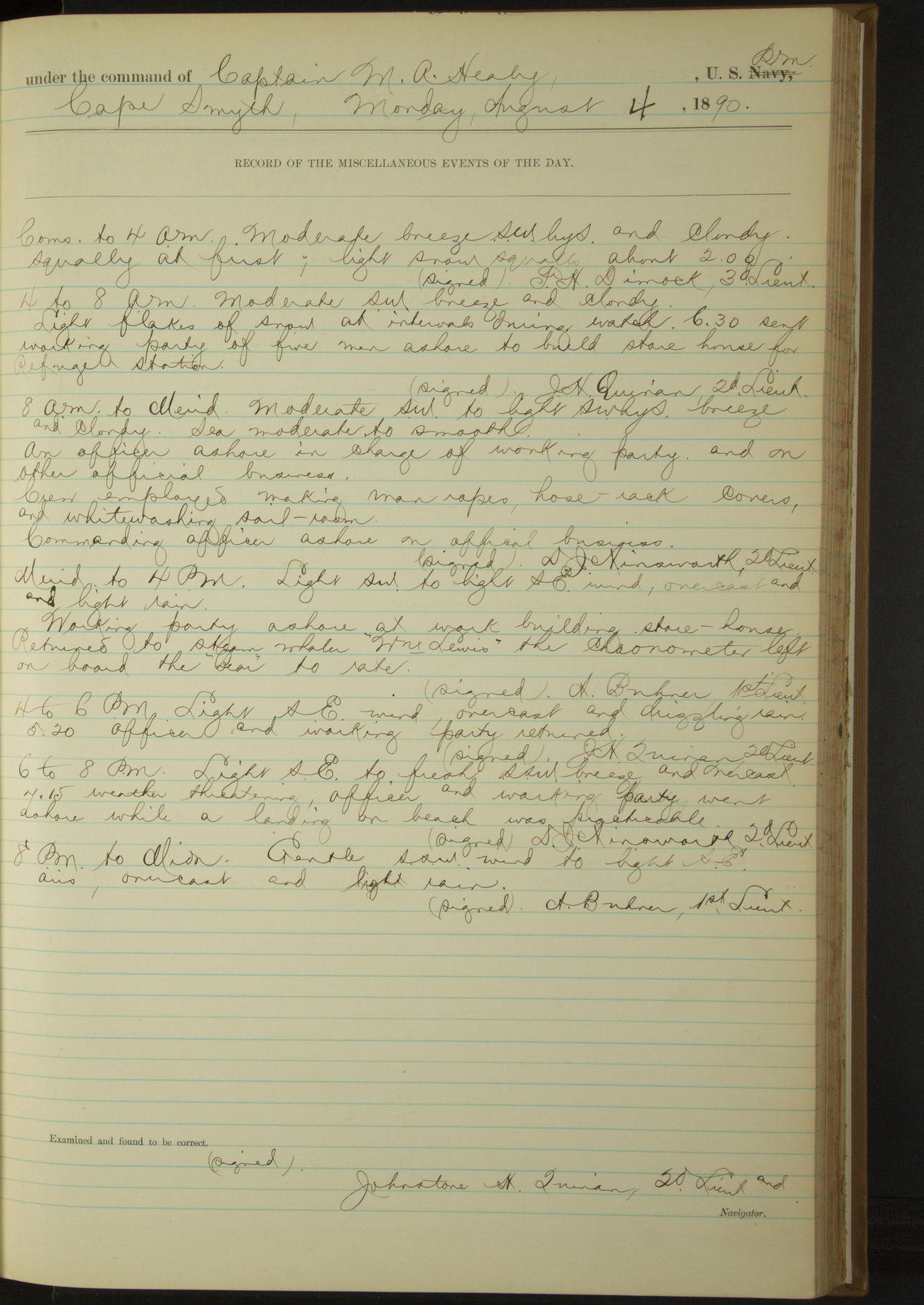
4 August 1890
Cape Smyth
Lat 71.29, Long -156.81
Commences to 4am:
Light snow squalls about 2.00.
4am to 8am:
Light flakes of snow at intervals during watch. 6.30: sent working party of five men ashore to build storehouse for refuge station.
8am to meridian:
An officer ashore in charge of working party and on other official business. Crew employed making man ropes, hose-rack covers and whitewashing sail-room. Commanding Officer ashore on official business.
Meridian to 4pm:
Returned to steam whaler “William Lewis” the chronometer left on board the “Bear” to rate.
4pm to 6pm:
5.20: officer and working party returned.
6pm to 8pm:
7.15: weather threatening, officer and working party went ashore while a landing on beach was practicable.
50874d5e09d40907550014ef: (http://oldweather.s3.amazonaws.com/ow3/final/USRC Bear/vol068/vol068_103_0.jpg)
50874d5e09d40907550014f1: (http://oldweather.s3.amazonaws.com/ow3/final/USRC Bear/vol068/vol068_103_1.jpg)
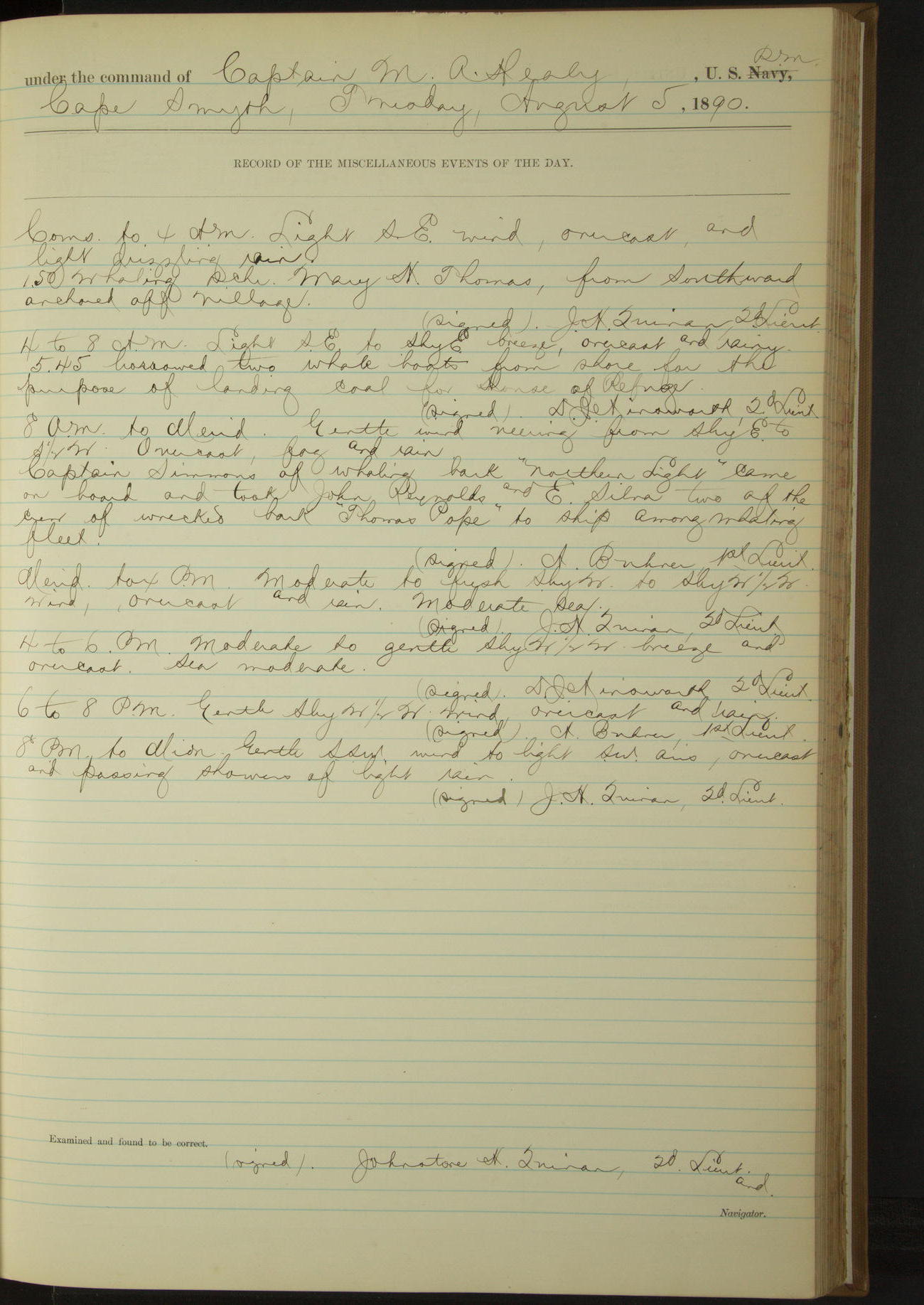
5 August 1890
Cape Smyth
Lat 71.29, Long -156.81
Commences to 4am:
1.50: whaling schooner “Mary H Thomas”, from Southward, anchored off village.
4am to 8am:
5.45: borrowed two whale boats from shore for the purpose of landing coal for House of Refuge.
8am to meridian:
Captain Simmons of whaling bark “Northern Light” came on board and took John Reynolds and E Silva, two of the crew of wrecked bark “Thomas Pope”, to ship among whaling fleet.
50874d5e09d40907550014f3: (http://oldweather.s3.amazonaws.com/ow3/final/USRC Bear/vol068/vol068_104_0.jpg)
50874d5e09d40907550014f5: (http://oldweather.s3.amazonaws.com/ow3/final/USRC Bear/vol068/vol068_104_1.jpg)
6 August 1890
Cape Smyth
Lat 71.29, Long -156.81
4am to 8am:
At 4.00 called all hands and commenced rafting coal ashore.
8am to meridian:
All hands rafting coal ashore to refuge station [& Meridian to 4pm]. Commanding Officer ashore on official business. Officer ashore in charge of working party and on other official business.
4pm to 6pm:
Employed rafting stores and coal ashore to refuge station.
6pm to 8pm:
At 8.00 finished rafting coal and stores to refuge station. Shifted anchorage off shore. Refuge station bearing EbyN¾N, village SbyE.
8pm to midnight:
8.45: boats returned having landed all stores and provisions brought on this vessel for US House of Refuge.
Mr. HD Wolfe and son came on board from whaling station at Cape Smyth; furnished transportation to Ounalaska, the former to act as interpreter and as required without compensation, and providing their own subsistence.
50874d5e09d40907550014f7: (http://oldweather.s3.amazonaws.com/ow3/final/USRC Bear/vol068/vol068_105_0.jpg)
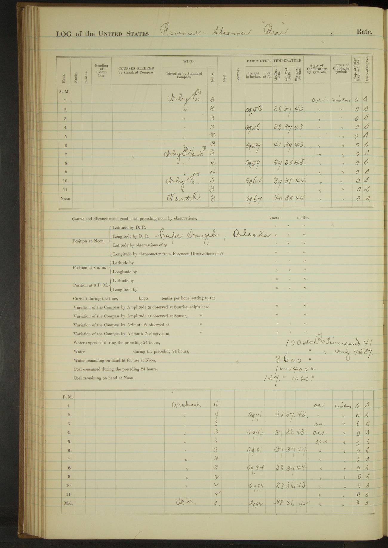
50874d5e09d40907550014f9: (http://oldweather.s3.amazonaws.com/ow3/final/USRC Bear/vol068/vol068_105_1.jpg)
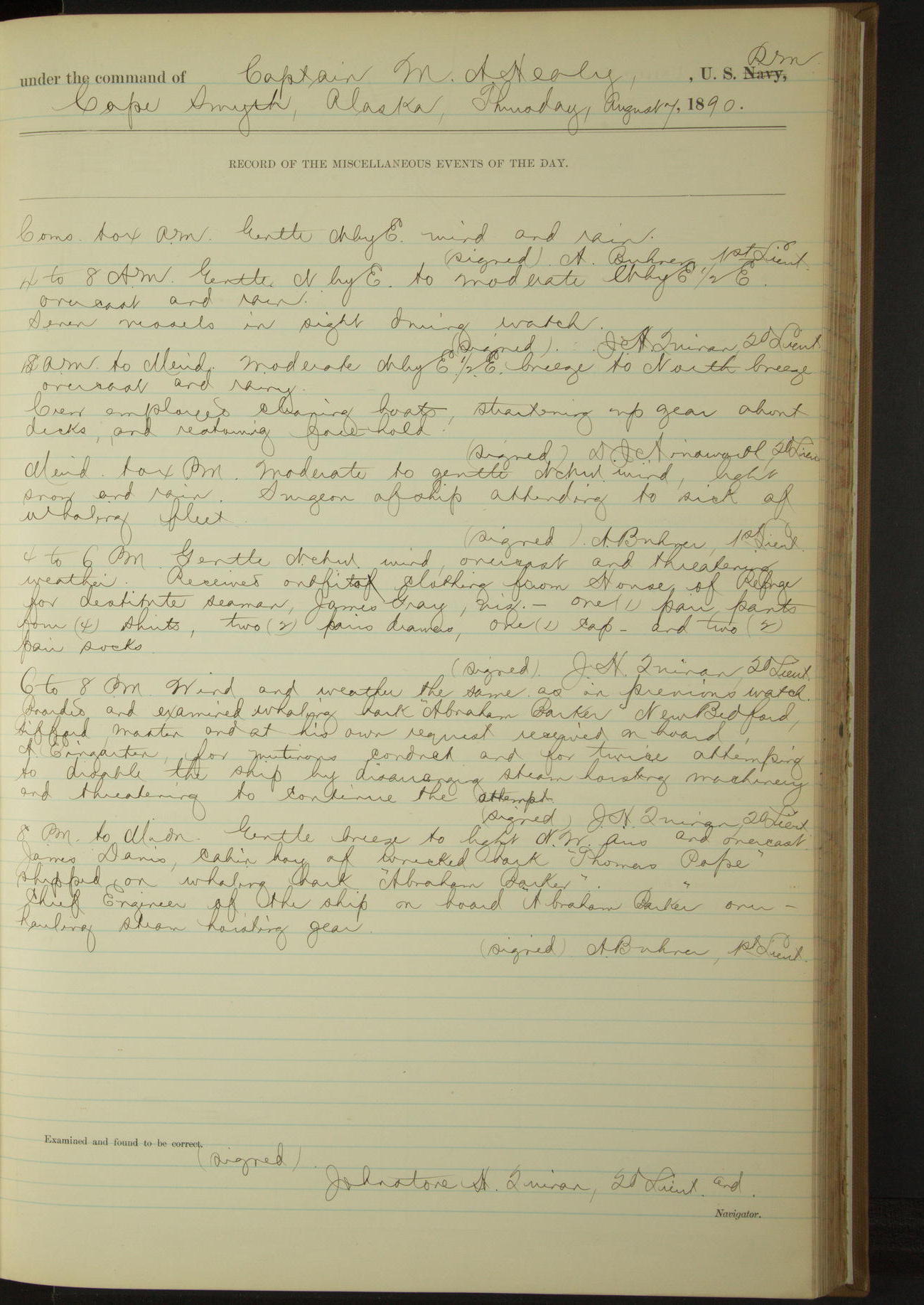
7 August 1890
Cape Smyth
Lat 71.29, Long -156.81
4am to 8am:
Seven vessels in sight during watch.
8am to meridian:
Crew employed cleaning boats, straitening up gear about decks and restowing fore hold.
Meridian to 4pm:
Surgeon of ship attending to sick of whaling fleet.
4pm to 6pm:
Received outfit of clothing from House of Refuge for destitute Seaman, James Gray, viz: one (1) pair pants, four (4) shirts, two (2) pairs drawers, one (1) cap and two (2) pairs socks.
6pm to 8pm:
Boarded and examined whaling bark “Abraham Barker”, New Bedford, Gifford master, and at his request received on board A Eringarten for mutinous conduct and for twice attempting to disable the ship by disarranging steam hoisting machinery and threatening to continue the attempts.
8pm to midnight:
James Davis, Cabin Boy of wrecked bark “Thomas Pope”, shipped on whaling bark “Abraham Barker”. Chief Engineer of the ship on board “Abraham Barker” overhauling steam hoisting gear.
50874d5e09d40907550014fb: (http://oldweather.s3.amazonaws.com/ow3/final/USRC Bear/vol068/vol068_106_0.jpg)
50874d5e09d40907550014fd: (http://oldweather.s3.amazonaws.com/ow3/final/USRC Bear/vol068/vol068_106_1.jpg)
8 August 1890
Cape Smyth
Lat 71.29, Long -156.81
8am to meridian:
Employed scrubbing ship’s side, working party ashore erecting storehouse. Boarded schooner “Mary H Thomas” of San Francisco, Smith master. Landing stores on the cape for whaling station.
Meridian to 4pm:
Employed scrubbing ship’s side. Rest of crew ashore erecting storehouse and stowing supplies in House of Refuge. Commanding Officer ashore on official business.
4pm to 6pm:
At 5.00 Commanding Officer returned. Put a new link in port rudder chain in place of one worn out.
50874d5e09d40907550014ff: (http://oldweather.s3.amazonaws.com/ow3/final/USRC Bear/vol068/vol068_107_0.jpg)
50874d5e09d4090755001501: (http://oldweather.s3.amazonaws.com/ow3/final/USRC Bear/vol068/vol068_107_1.jpg)
9 August 1890
Cape Smyth [& at sea]
Lat 71.29, Long -156.81
8am to meridian:
Commanding Officer ashore on official business. Working party ashore at work on storehouse.
Surgeon performed operation on John Duarto, boat-steerer of bark “Mars” for fracture of elbow. Retained him aboard for further treatment and transportation to San Francisco.
Meridian to 4pm:
12.45: Commanding Officer returned. 3.25: officer with working party returned in second cutter, having finished building storehouse.
4pm to 6pm:
4.10: underway and steamed along shore to Northward. 5.30 anchored in midst of whaling fleet to receive baggage of invalid from bark “Mars” and mail from fleet. Village bearing EbyN¼N, shooting station SE.
8pm to midnight:
9.05: got underway and stood to the Southward. 10.10: House of Refuge abeam. 10.15: Cape Smyth Indian village abeam, distant 1½ miles.
Under steam exclusively 2 hours 30 minutes. Distance 18.9 miles.
Under steam and sail 1 hour 45 minutes. Distance 12.7 miles.
Total 4 hours 15 minutes. Distance 31.6 miles.
House of Refuge furnished with:
½ oz red precipitate [mercuric oxide]
2 oz quinan [possibly quinine]
½ lb zinc ointment
2 sticks lunar caustic [silver nitrate]
100 official envelopes
50874d5e09d4090755001503: (http://oldweather.s3.amazonaws.com/ow3/final/USRC Bear/vol068/vol068_108_0.jpg)
50874d5e09d4090755001505: (http://oldweather.s3.amazonaws.com/ow3/final/USRC Bear/vol068/vol068_108_1.jpg)
10 August 1890
At sea
Lat 70.48, Long -160.50
Commences to 4am:
Between 1.00 and 2.00 passed light field of drift ice. At 4.00 Point Franklin abeam.
4am to 8am:
At 5.00 Outer Sea Horse [island] bearing SEbyS. 7.30: Point Belcher village abeam bearing ESE.
8am: Lat 70° 47’N, Long 159° 47’W
8am to meridian:
10.08: Wainwright Inlet abeam, distant 3 miles.
Meridian to 4pm:
From 2.30 having made Thetis beacon on Icy Cape, steering various courses around Blossom Shoals.
8pm: Lat 70° 8’N, Long 162° 42’W
50874d5e09d4090755001507: (http://oldweather.s3.amazonaws.com/ow3/final/USRC Bear/vol068/vol068_109_0.jpg)
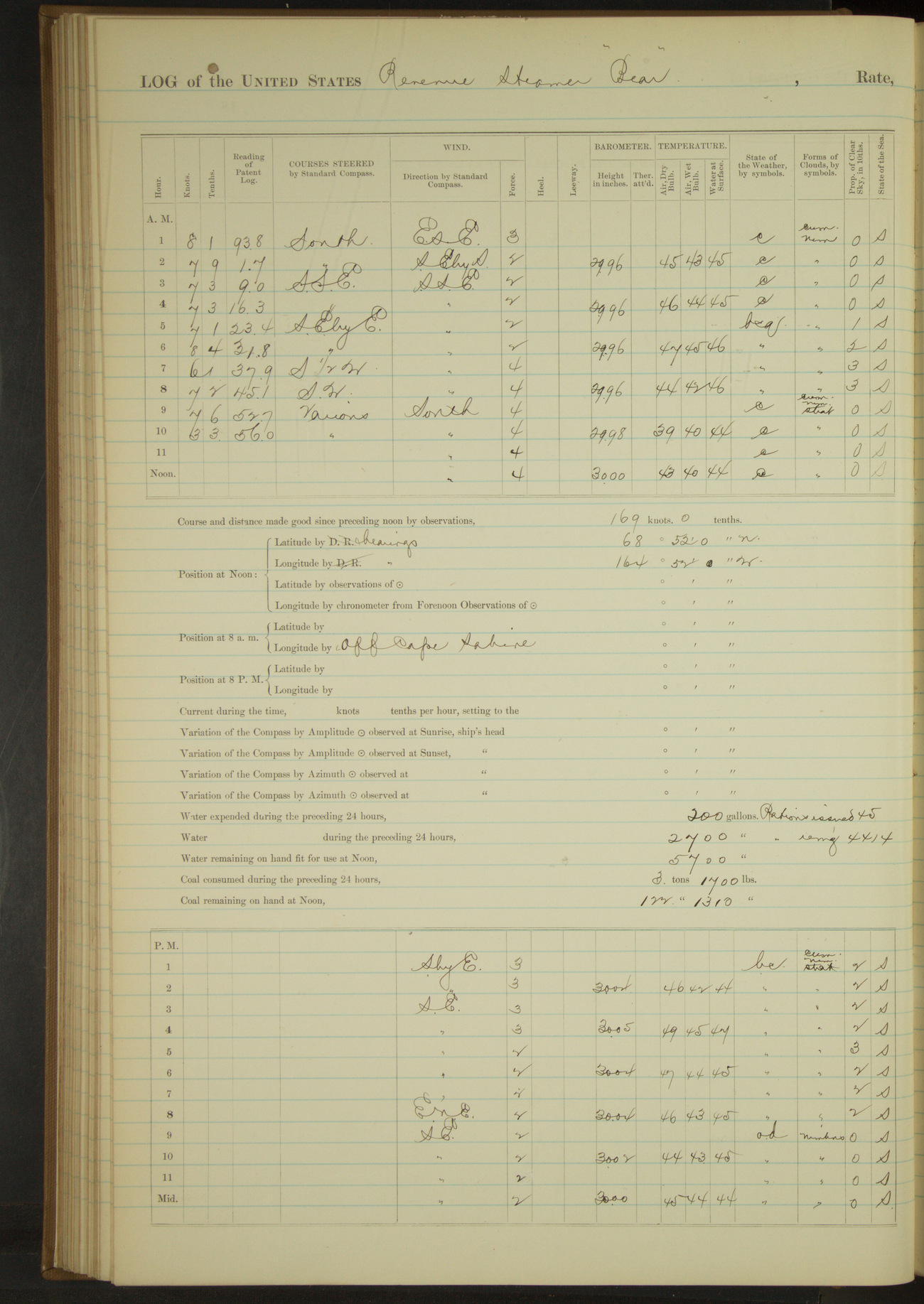
50874d5e09d4090755001509: (http://oldweather.s3.amazonaws.com/ow3/final/USRC Bear/vol068/vol068_109_1.jpg)
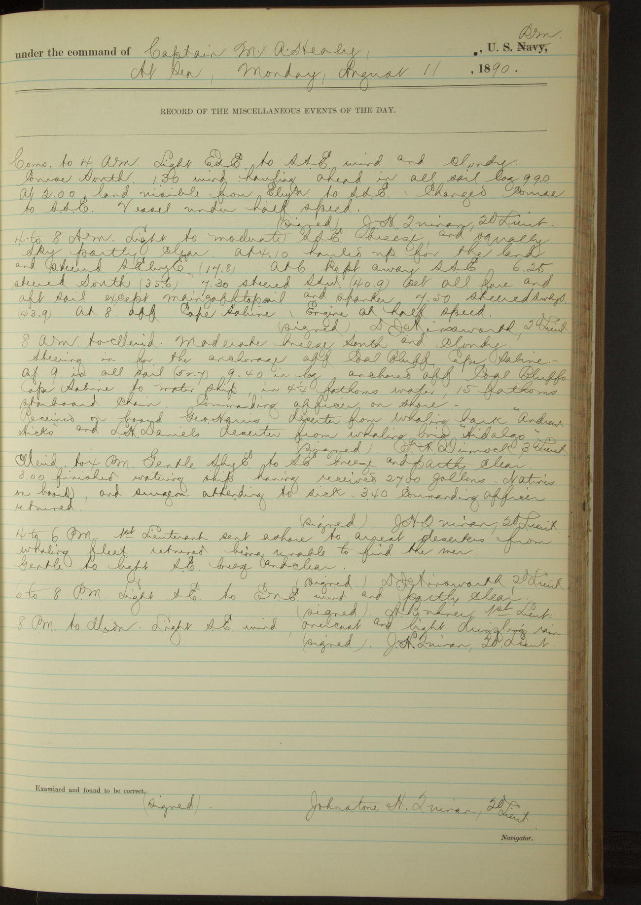
11 August 1890
At sea
Lat 68.90, Long -165.07 [Estimate off Corwin Bluff]
Commences to 4am:
At 2.00 land visible from EbyN to SSE.
4am to 8am:
At 8.00 off Cape Sabine.
8am to meridian:
Steering in for anchorage off Coal Bluffs [possibly Corwin Bluff], Cape Sabine. 9.40: anchored off Coal Bluffs, Cape Sabine to water ship. Commanding Officer on shore.
Received on board George Harris, deserter from whaling bark “Andrew Hicks” and LH Daniels, deserter from whaling brig “Hidalgo”.
Noon: Lat 68° 52’N, Long 164° 22’W [Locates the ship inland]
Meridian to 4pm:
3.00: finished watering ship having received 2700 gallons. Natives on board, and Surgeon attending to sick. 3.40: Commanding Officer returned.
4pm to 6pm:
1st Lieutenant sent ashore to arrest deserters from whaling fleet; returned being unable to find the men.
50874d5e09d409075500150b: (http://oldweather.s3.amazonaws.com/ow3/final/USRC Bear/vol068/vol068_110_0.jpg)
50874d5e09d409075500150d: (http://oldweather.s3.amazonaws.com/ow3/final/USRC Bear/vol068/vol068_110_1.jpg)
12 August 1890
At anchor off Coal Bluffs, Cape Sabine [to Cape Lisburne]
Lat 68.94, Long -166.18 [Estimate from noon bearings]
8am to meridian:
9.15: underway.
Noon: Cape Lisburne S½E, distant 2 miles.
Note:
12.10: off Cape Lisburne strong SE wind, back ropes parted carrying away jib-boom at cap. Stopped engine to clear away wreck and recovered all rigging and sails, Commanding Officer having charge of deck.
Meridian to 4pm:
12.10: carried away jib-boom (see above note). At 2.00 started engine half speed, about ship, in all sail and hauled up under the lee of Cape Lisburne for anchorage. 3.30 came to, Cape Lisburne bearing SWbyW½W and extreme end of land in sight to Northward and Eastward.
50874d5e09d409075500150f: (http://oldweather.s3.amazonaws.com/ow3/final/USRC Bear/vol068/vol068_111_0.jpg)
50874d5e09d4090755001511: (http://oldweather.s3.amazonaws.com/ow3/final/USRC Bear/vol068/vol068_111_1.jpg)
13 August 1890
Cape Lisburne
Lat 68.89, Long -166.04 [Estimate from noon bearings]
4am to 8am:
Boatswain, Carpenter and crew employed getting inboard stump of broken jib-boom, and making and fitting new boom from old one.
8am to meridian:
Rigged out stump jib-boom; setting up head gear.
Noon: Cape Lisburne SWxW¼W, distant 4 miles.
Meridian to 4pm:
Set up head gear, bent and furled jib.
50874d5e09d4090755001513: (http://oldweather.s3.amazonaws.com/ow3/final/USRC Bear/vol068/vol068_112_0.jpg)
50874d5e09d4090755001515: (http://oldweather.s3.amazonaws.com/ow3/final/USRC Bear/vol068/vol068_112_1.jpg)
14 August 1890
Cape Lisburne
Lat 68.86, Long -166.27 [Estimate from noon bearings]
8am to meridian:
Rigged whiskers for jib guys. 11.15: underway, steered various courses around Cape Lisburne.
Noon: Cape Lisburne SE½S, distant 2 miles.
Meridian to 4pm:
12.30: Cape Lisburne bearing ENE.
4pm to 6pm:
4.55: discolored water ahead, stopped as precaution, depth of water not changed. 5.00: started ahead half speed. 5.10: made wreck of bark “Thomas Pope” on starboard bow. Kept away for it SWbyS.
6pm to 8pm:
At 6.30 boarded wrecked bark “Thomas Pope” and at 6.45 came to. Point Hope bearing S½W, distant 3 miles.
8pm to midnight:
Natives on board and Surgeon attending to sick.
Under steam and sail 3 hours 35 minutes. Distance 22.9 miles.
Under steam exclusively 3 hours 55 minutes. Distance 22.3 miles.
Total 7 hours 30 minutes. Distance 45.2 miles.
50874d5e09d4090755001517: (http://oldweather.s3.amazonaws.com/ow3/final/USRC Bear/vol068/vol068_113_0.jpg)
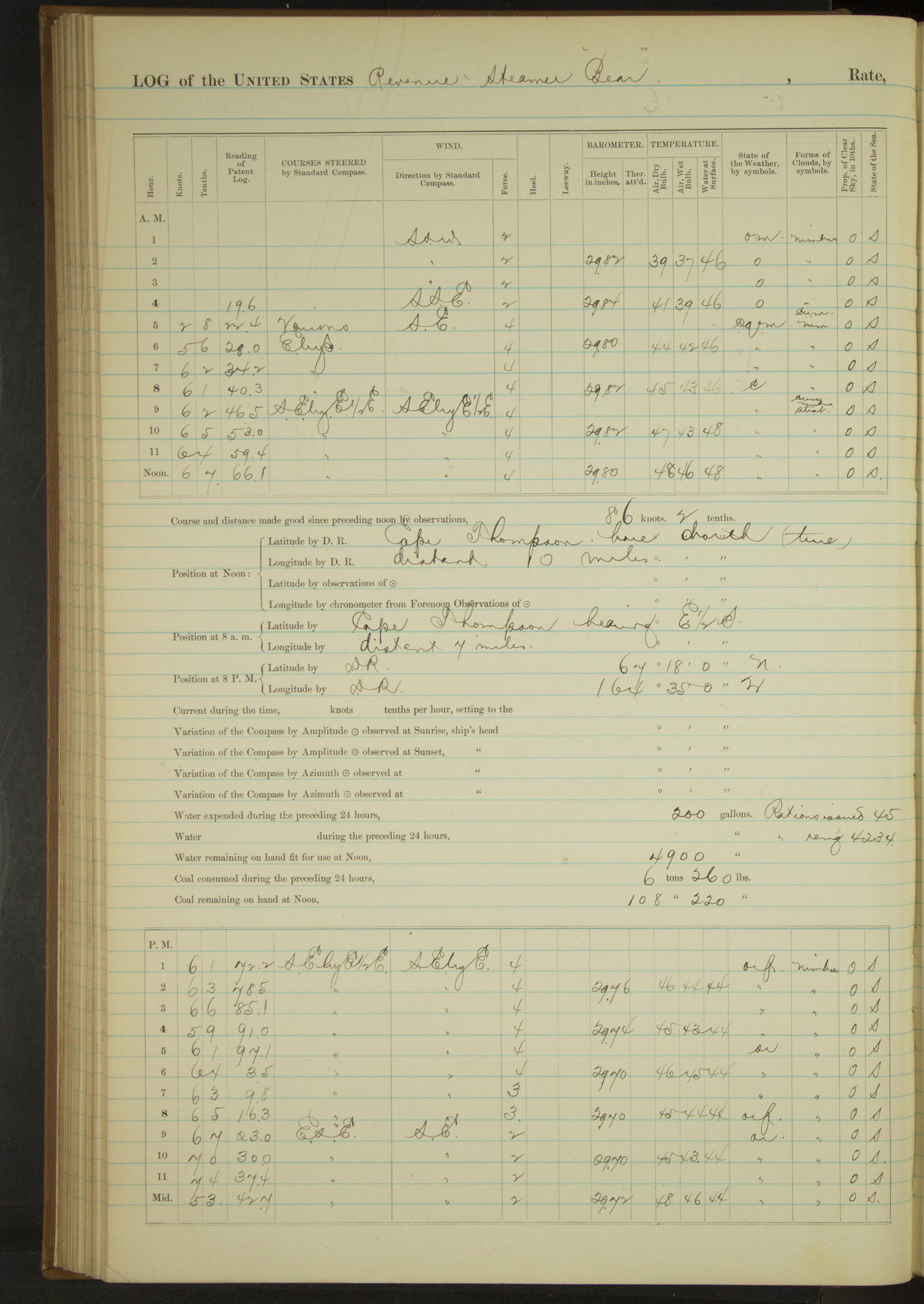
50874d5e09d4090755001519: (http://oldweather.s3.amazonaws.com/ow3/final/USRC Bear/vol068/vol068_113_1.jpg)
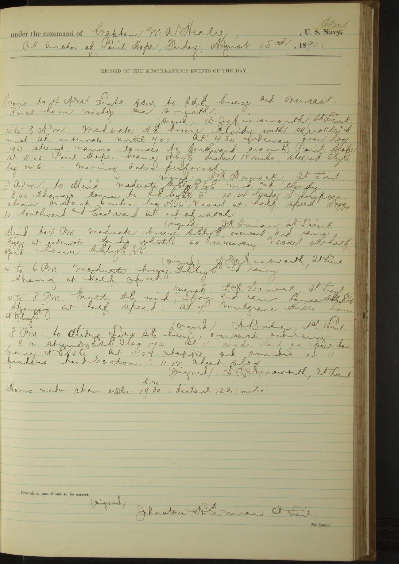
15 August 1890
Point Hope [& at sea]
Lat 67.88, Long -165.70 [Estimate from bearings]
4am to 8am:
At 4.30 underway, steered various courses to Southward around Point Hope. At 5.05 Point Hope bearing NbyE, distant 1¼ miles.
8am: Cape Thompson bearing E½S, distant 7 miles.
8am to meridian:
10.34: Cape Thompson abeam, distant 6 miles.
Noon: Cape Thompson bore North (true), distant 10 miles.
Meridian to 4pm:
Foggy at intervals, sounding whistle as necessary.
6pm to 8pm:
At 7.00 Mulgrave Hills bore NEbyE.
8pm: Lat 67° 18’N, Long 164° 35’W
8pm to midnight:
At 11.00 made land on port bow. At 11.07 stopped and sounded in 11 fathoms, hard bottom. 11.12: ahead slow.
Under steam exclusively 19 hours 30 minutes. Distance 123.1 miles.
50874d5e09d409075500151b: (http://oldweather.s3.amazonaws.com/ow3/final/USRC Bear/vol068/vol068_114_0.jpg)
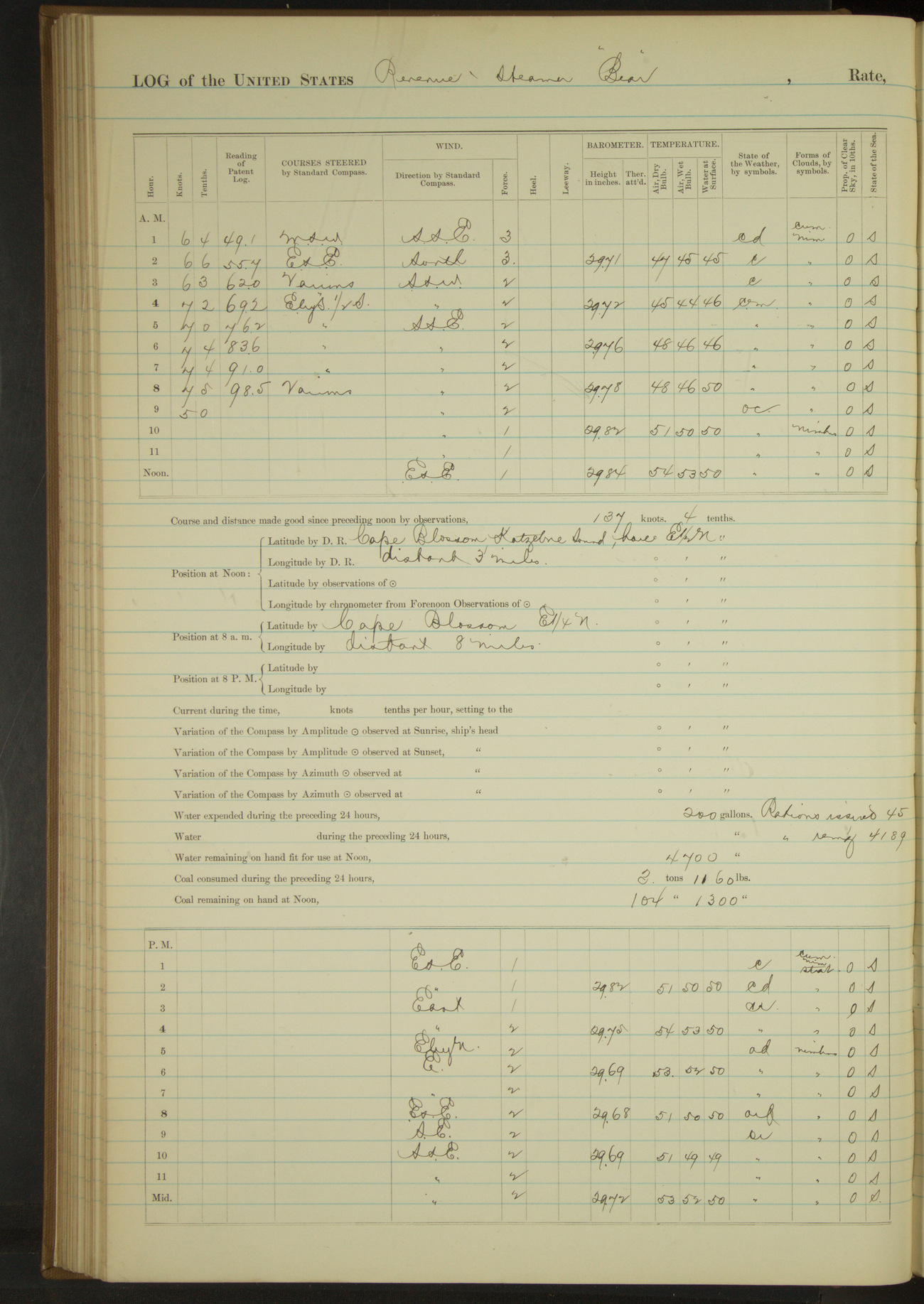
50874d5e09d409075500151d: (http://oldweather.s3.amazonaws.com/ow3/final/USRC Bear/vol068/vol068_114_1.jpg)
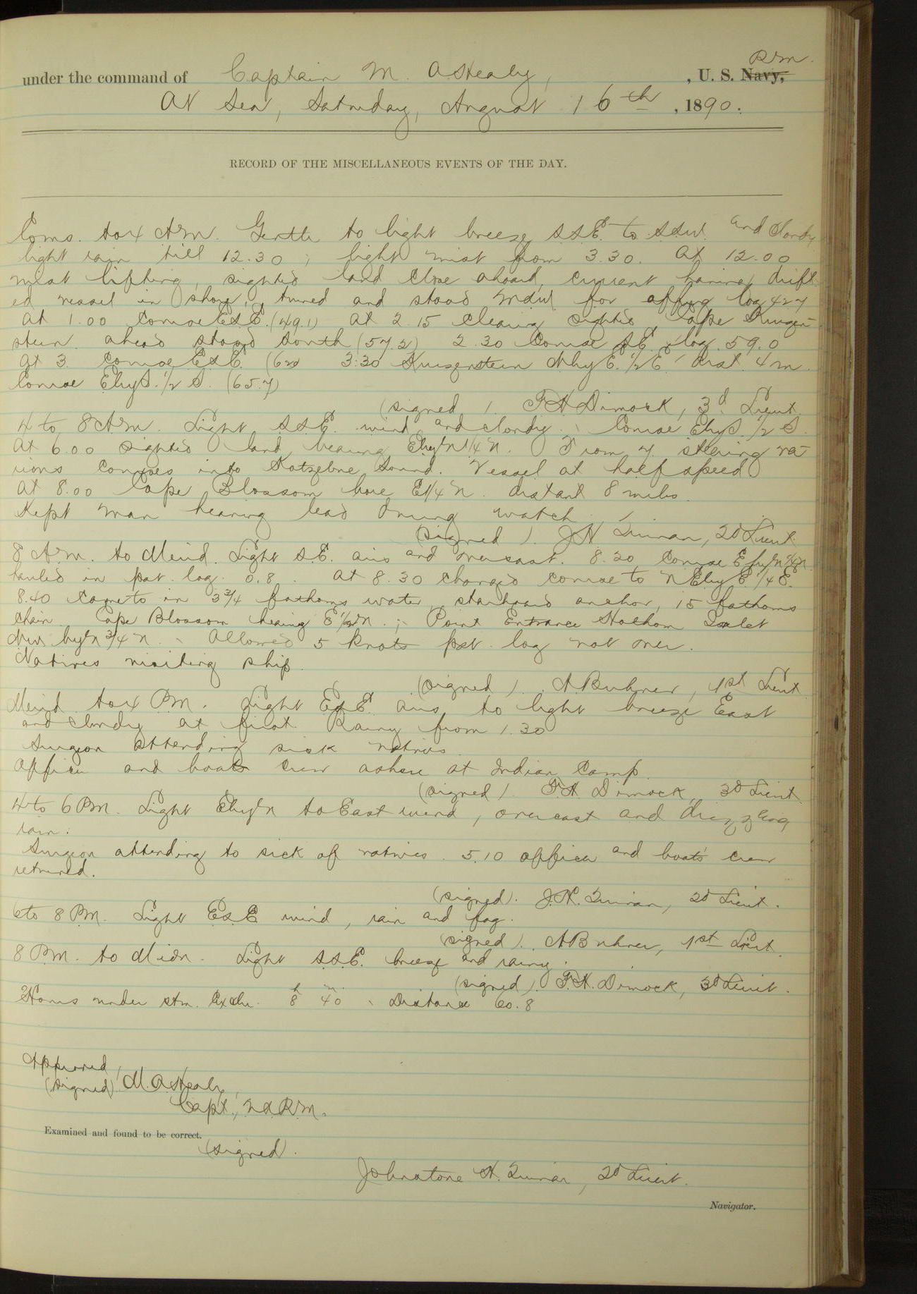
16 August 1890
At sea [& Kotzebue Sound]
Lat 66.75, Long -162.62 [Estimate from noon bearings]
Commences to 4am:
At 12.00 mist lifting, sighted land close ahead; current having drifted vessel in shore, turned and stood WSW for offing. At 2.15 clearing, sighted Cape Kruzenstern ahead, stood South. 3.30: Kruzenstern NbyE½E, distant 4 miles.
4am to 8am:
At 6.00 sighted land bearing EbyN¼N. From 7.00 steering various courses into Kotzebue Sound. At 8.00 Cape Blossom bore E¼N, distant 8 miles.
8am to meridian:
8.40: came to. Cape Blossom bearing E½N; point entrance Hotham Inlet NWbyN¾N. Natives visiting ship.
Noon: Cape Blossom, Kotzebue Sound bore E½N, distant 3 miles
Meridian to 4pm:
Surgeon attending sick natives. Officer and boat’s crew ashore at Indian camp.
4pm to 6pm:
Surgeon attending to sick of natives. 5.10: Officer and boat’s crew returned.
Under steam exclusively 8 hours 40 minutes. Distance 60.8 miles.
50874d5e09d409075500151f: (http://oldweather.s3.amazonaws.com/ow3/final/USRC Bear/vol068/vol068_115_0.jpg)
50874d5e09d4090755001521: (http://oldweather.s3.amazonaws.com/ow3/final/USRC Bear/vol068/vol068_115_1.jpg)
17 August 1890
Cape Blossom, Kotzebue Sound
Lat 66.75, Long -162.62 [Estimate from noon bearings]
8am to meridian:
Surgeon attending sick of natives.
Noon: Cape Blossom, Kotzebue Sound bore E½N, distant 3 miles
Meridian to 4pm:
At 3.00 all natives had left the vessel. At 3.35 underway.
6pm to 8pm:
8.00: Devil’s Mount bore South.
Under steam exclusively 20 minutes. Distance 2 miles.
Under steam and sail 3 hours 50 minutes. Distance 27.5 miles.
Under sail exclusively 4 hours 15 minutes. Distance 24.4 miles.
Total 8 hours 25 minutes. Distance 53.9 miles.
50874d5e09d4090755001523: (http://oldweather.s3.amazonaws.com/ow3/final/USRC Bear/vol068/vol068_116_0.jpg)
50874d5e09d4090755001525: (http://oldweather.s3.amazonaws.com/ow3/final/USRC Bear/vol068/vol068_116_1.jpg)
18 August 1890
At sea [& Cape Prince of Wales]
Lat 65.87, Long -167.85
4am to 8am:
5.35: Saritscheff Inlet [Sarichef Island] bore NWbyW, distant 7 miles.
8am to meridian:
Meridian: Cape Prince of Wales bore SSE.
Meridian to 4pm:
1.10: came to. Point Cape Prince of Wales bearing S½W. Crew employed making hose-rack covers, leathering oars and covering yoke ropes.
Under steam and sail 11 hours 50 minutes. Distance 86.4 miles.
Under steam exclusively 1 hour 20 minutes. Distance 7.6 miles.
Total 13 hours 10 minutes. Distance 94.0 miles.
50874d5e09d4090755001527: (http://oldweather.s3.amazonaws.com/ow3/final/USRC Bear/vol068/vol068_117_0.jpg)
50874d5e09d4090755001529: (http://oldweather.s3.amazonaws.com/ow3/final/USRC Bear/vol068/vol068_117_1.jpg)
19 August 1890
Northward of Cape Prince of Wales [to Cape Prince of Wales village & at sea]
Lat 66.20, Long -168.20
Commences to 4am:
1.50: underway
8am: Lat 65° 58’N, Long 167° 47’W
8am to meridian:
10.50: made land bearing SW¾W, stopped and sounded in 16½ fathoms water. 11.20 made East Cape bearing SbyW¾W and Cape Prince of Wales SEbyS½S. 11.48: Little Diomede bearing SbyW.
4pm to 6pm:
4.15: Fairway Rock bore SW¾S, Cape Prince of Wales SEbyE?E. 5.20: steering various courses for Cape Prince of Wales village. 6.00: came to off village.
6pm to 8pm:
Communicated with missionaries.
8pm to midnight:
At 10.10 having received mail of Government teachers, furnished them small stores and attended to sick of natives, got underway and steered SSE for King’s Island. 10.25: Cape Prince of Wales bore ENE, distant 2 miles.
Under steam exclusively 14 hours. Distance 69.3 miles.
Under steam and sail 4 hours. Distance 32.2 miles.
Total 18 hours. Distance 101.5 miles.
50874d5e09d409075500152b: (http://oldweather.s3.amazonaws.com/ow3/final/USRC Bear/vol068/vol068_118_0.jpg)
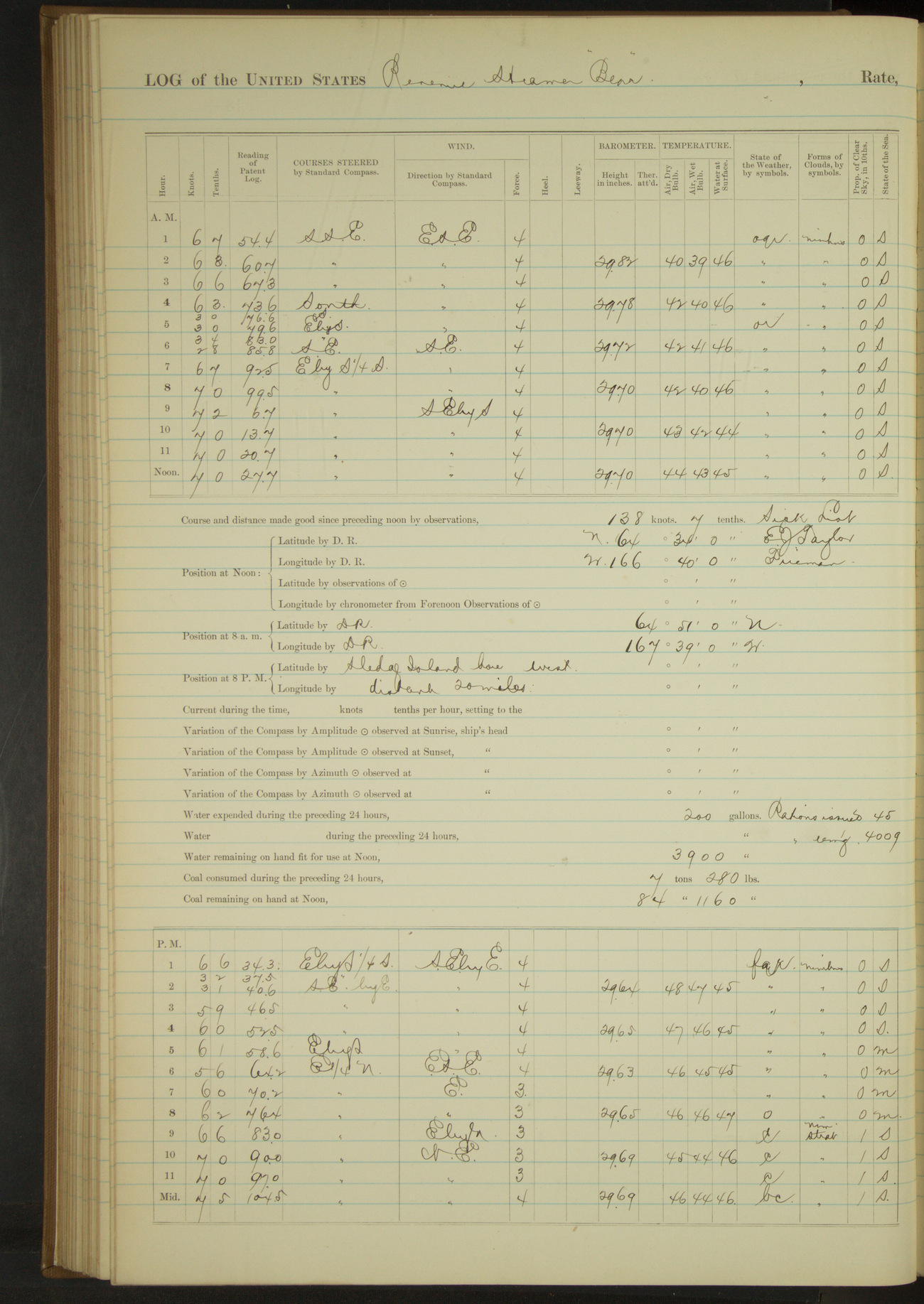
50874d5e09d409075500152d: (http://oldweather.s3.amazonaws.com/ow3/final/USRC Bear/vol068/vol068_118_1.jpg)
20 August 1890
At sea
Lat 64.57, Long -166.67
Sick list: EJ Taylor, Fireman [to 14th October].
4am to 8am:
5.30: made King’s Island bearing EbyS½S, distant 2 miles. 6.20: SE point King’s Island bore NbyE¼E, distant 2½ miles.
8am: Lat 64° 51’N, Long 167° 39’W
Meridian to 4pm:
1.30: made Point Rodney [Cape Rodney] bearing NE. 3.00: made Sledge Island bearing EbyS½S. 4.00: North end Sledge Island bore NEbyN.
4pm to 6pm:
4.41: South end Sledge Island bearing N¼W, distant 2 miles.
6pm to 8pm:
8.00: Cape Nome bore NEbyE.
8pm to midnight:
Steaming up Norton Sound.
Under steam exclusively 14 hours 45 minutes. Distance 98.6 miles.
Under steam and sail 9 hours 15 minutes. Distance 58.2 miles.
Total 24 hours. Distance 156.8 miles.
50874d5e09d409075500152f: (http://oldweather.s3.amazonaws.com/ow3/final/USRC Bear/vol068/vol068_119_0.jpg)
50874d5e09d4090755001531: (http://oldweather.s3.amazonaws.com/ow3/final/USRC Bear/vol068/vol068_119_1.jpg)
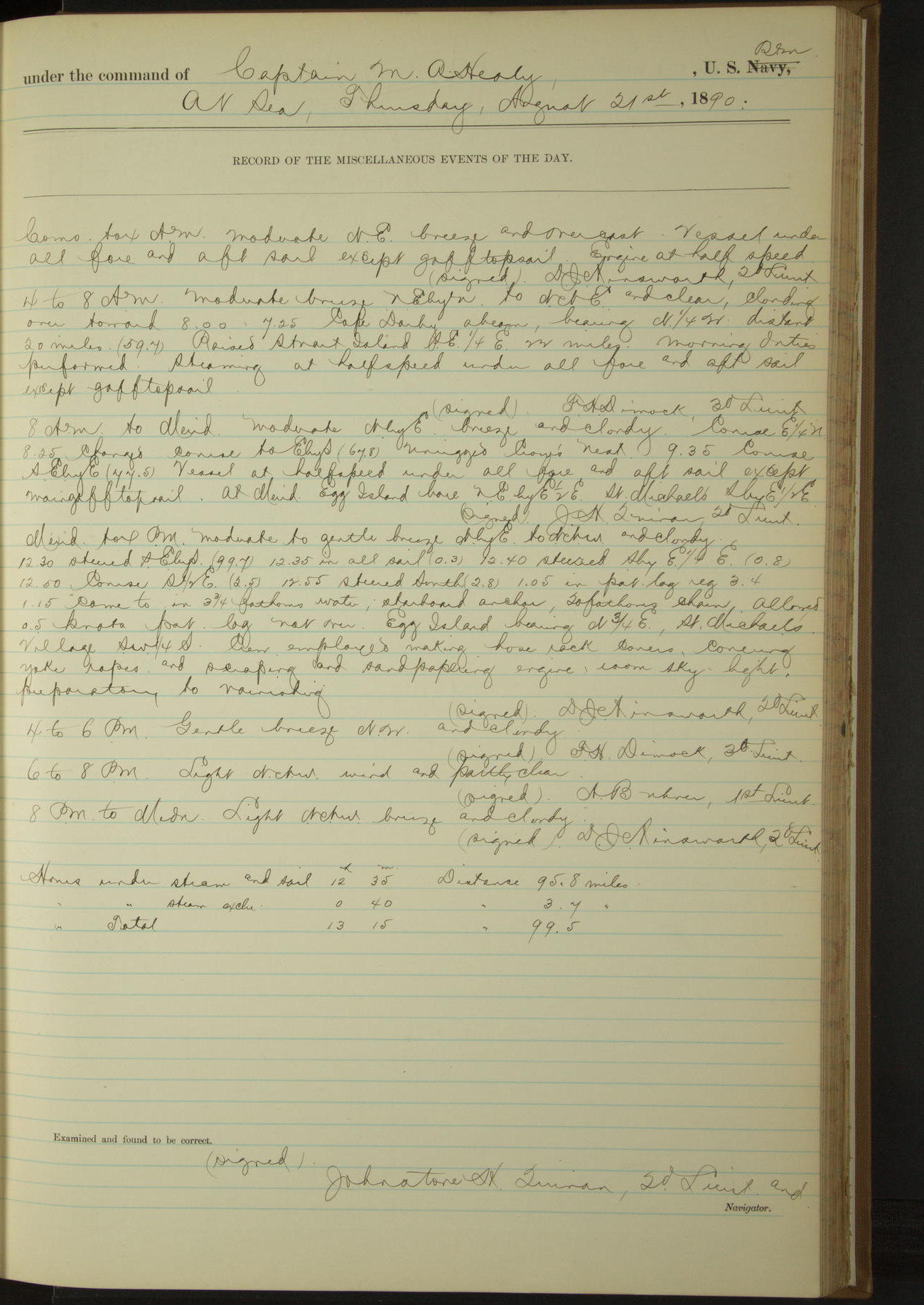
21 August 1890
At sea [& St. Michael’s]
Lat 63.60, Long -162.01 [Estimate from noon bearing]
4am to 8am:
7.25: Cape Darby abeam, bearing N¼W, distant 20 miles. Raised Stuart Island SE¼E, 22 miles.
8am to meridian:
Unrigged crow’s nest.
Noon: St. Michael’s SbyE½E, distant 7 miles
Meridian to 4pm:
1.15: came to. Egg Island bearing N¾E, St. Michael’s village SW¼S. Crew employed making hose rack covers, covering yoke ropes and scraping and sand-papering engine-room skylight, preparatory to varnishing.
Under steam and sail 12 hours 35 minutes. Distance 95.8 miles.
Under steam exclusively 40 minutes. Distance 3.7 miles.
Total 13 hours 15 minutes. Distance 99.5 miles.
50874d5e09d4090755001533: (http://oldweather.s3.amazonaws.com/ow3/final/USRC Bear/vol068/vol068_120_0.jpg)
50874d5e09d4090755001535: (http://oldweather.s3.amazonaws.com/ow3/final/USRC Bear/vol068/vol068_120_1.jpg)
22 August 1890
St Michael’s [& at sea]
Lat 63.51, Long -161.88 [Estimate from above bearings]
4am to 8am:
Crew painting ship outside.
8am to meridian:
At 10.20 finished painting ship outside. Crew employed rest of watch in scraping and sand-papering engine-room skylight, making hose rack covers and covering and painting yoke ropes.
Meridian to 4pm:
Men employed as in previous watch. Received on board George Fredericksen and William Fredericksen [see also 6th September where they are named Fredericks] for passage to Ounalaska.
6pm to 8pm:
7.50: got underway.
8pm to midnight:
At 8.45 Egg island abeam NE by compass, distant 5 miles.
Under steam exclusively 4 hours 10 minutes. Distance 26.3 miles.
50874d5e09d4090755001537: (http://oldweather.s3.amazonaws.com/ow3/final/USRC Bear/vol068/vol068_121_0.jpg)
50874d5e09d4090755001539: (http://oldweather.s3.amazonaws.com/ow3/final/USRC Bear/vol068/vol068_121_1.jpg)
23 August 1890
[At sea] Norton Sound
Lat 63.82, Long -165.03
Commences to 4am:
4.00: Cape Darby bore NbyW and Golofnin Bay Point NWbyN [Golovnin Bay].
8am: Lat 63° 58’N, Long 163° 55’W
8am to meridian:
Crew at work on skylights and bright work. Piped up and aired bedding.
8pm: Lat 63° 1’N, Long 166° 15’W
Under steam and sail 13 hours 25 minutes. Distance 97.8 miles.
Under steam exclusively 10 hours 35 minutes. Distance 75.2 miles.
Total 24 hours. Distance 173.0 miles.
50874d5e09d409075500153b: (http://oldweather.s3.amazonaws.com/ow3/final/USRC Bear/vol068/vol068_122_0.jpg)
50874d5e09d409075500153d: (http://oldweather.s3.amazonaws.com/ow3/final/USRC Bear/vol068/vol068_122_1.jpg)
24 August 1890
At sea
Lat 61.17, Long -168.00
8am: Lat 61° 44’N, Long 167° 44’W
4pm to 6pm:
4.40: raised Nunivak Island SEbyS¾S, distant 30 miles. At 6.00 NW end Nunivak Island bore SbyE.
6pm to 8pm:
At 8.00 NW end Nunivak Island bore EbyS, SW point SEbyE½E.
8pm: Long 167° 46’ 37”W
8pm to midnight:
8.20: NW point Nunivak Island abeam (bearing EbyN). distant 4 miles.
Under steam and sail 15 hours 45 minutes. Distance 124.5 miles.
Under steam exclusively 8 hours 15 minutes. Distance 61.4 miles.
Total 24 hours. Distance 185.9 miles.
50874d5e09d409075500153f: (http://oldweather.s3.amazonaws.com/ow3/final/USRC Bear/vol068/vol068_123_0.jpg)
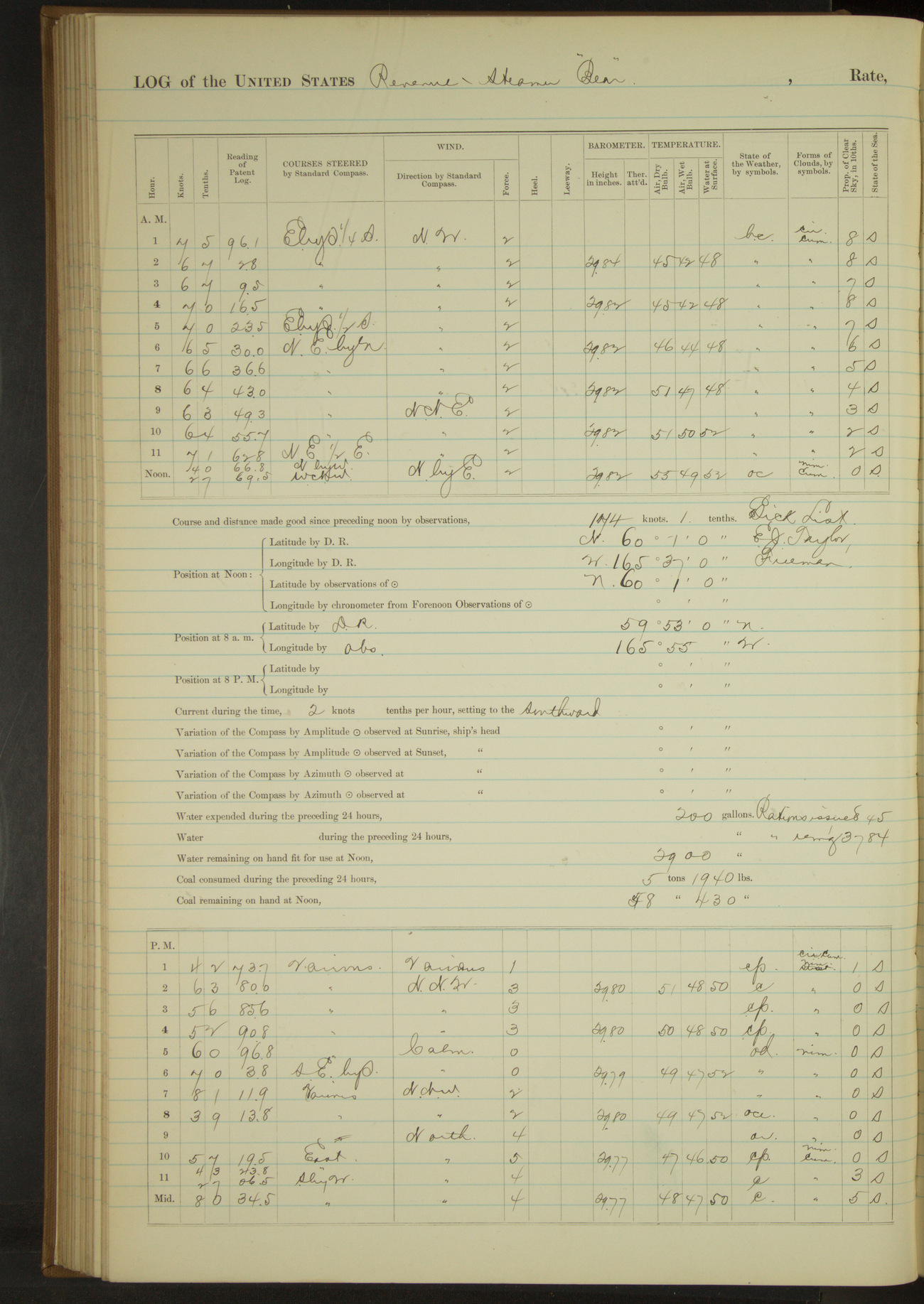
50874d5e09d4090755001541: (http://oldweather.s3.amazonaws.com/ow3/final/USRC Bear/vol068/vol068_123_1.jpg)
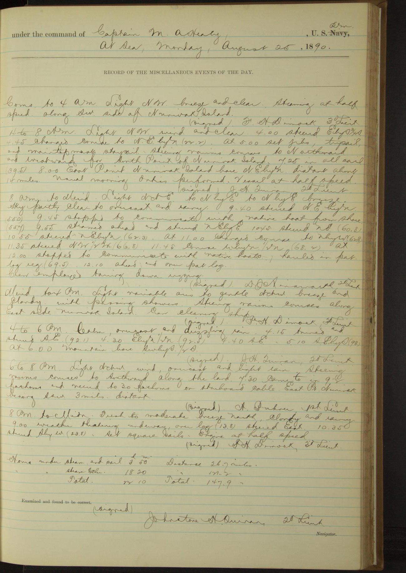
25 August 1890
At sea
Lat 60.02, Long -165.62
Commences to 4am:
Steaming at half speed along SW side of Nunivak Island.
4am to 8am:
At 5.00 steering various courses to Northward and Westward for South point of Nunivak Island. 8.00: East point Nunivak Island bore NEbyN, distant about 14 miles.
8am: Lat 59° 53’N, Long 165° 55’W
8am to meridian:
9.45: stopped to communicate with native boat from shore. 9.55 steamed ahead. At 12.00 stopped to communicate with native boats. Crew employed tarring down rigging.
Meridian to 4pm:
Steering various courses along East side Nunivak Island.
6pm to 8pm:
Steering various courses to Southward along the land. 7.30: came to. East point Nunivak bearing SSW, 3 miles distant.
8pm to midnight:
9.00: weather threatening, underway, steered East.
Under steam and sail 3 hours 50 minutes. Distance 26.7 miles.
Under steam exclusively 18 hours 20 minutes. Distance 121.2 miles.
Total 22 hours 10 minutes. Distance 147.9 miles.
50874d5e09d4090755001543: (http://oldweather.s3.amazonaws.com/ow3/final/USRC Bear/vol068/vol068_124_0.jpg)
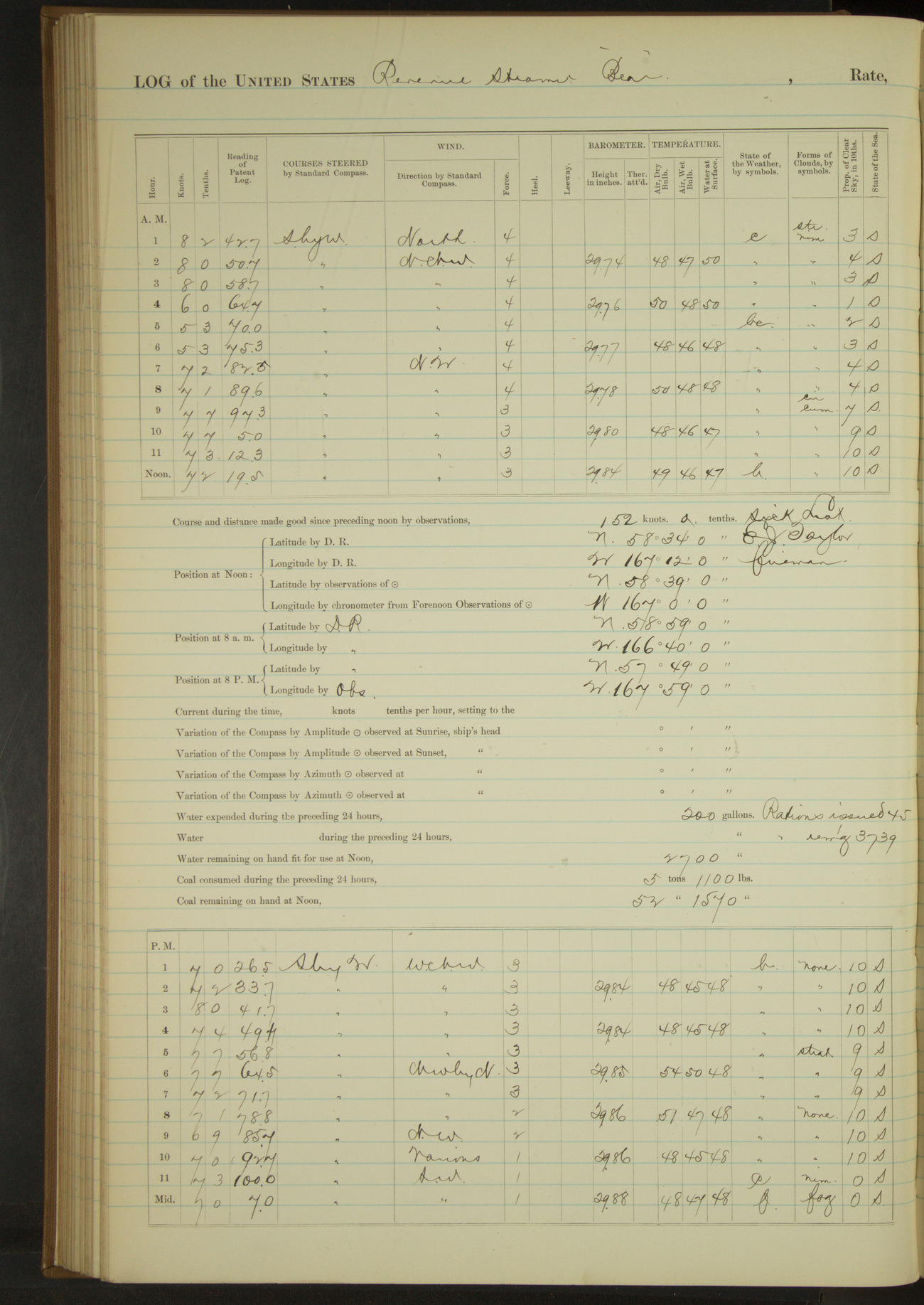
50874d5e09d4090755001545: (http://oldweather.s3.amazonaws.com/ow3/final/USRC Bear/vol068/vol068_124_1.jpg)
26 August 1890
At sea
Lat 58.65, Long -167.00
4am to 8am:
Crew employed from 5.30 to 8.00 in tarring down rigging.
8am: Lat 58° 59’N, Long 166° 40’W
8am to meridian:
Crew tarring rigging and painting white woodwork.
Meridian to 4pm:
Crew painting white woodwork and about decks.
4pm to 6pm:
Crew employed as in previous watch from 4.00 to 5.00.
8pm: Lat 57° 49’N, Long 167° 59’W
Under steam and sail 19 hours 35 minutes. Distance 146.0 miles.
Under steam exclusively 1 hour 45 minutes. Distance 12.4 miles.
Under sail exclusively 2 hours 40 minutes. Distance 14.1 miles.
Total 24 hours. Distance 172.5 miles.
50874d5e09d4090755001547: (http://oldweather.s3.amazonaws.com/ow3/final/USRC Bear/vol068/vol068_125_0.jpg)
50874d5e09d4090755001549: (http://oldweather.s3.amazonaws.com/ow3/final/USRC Bear/vol068/vol068_125_1.jpg)
27 August 1890
At sea [& St. George Island]
Lat 56.62, Long -169.54
4am to 8am:
At 5.00 sighted St. George Island SSW, distant 24 miles. At 7.00 course SWbyS¾S for village. Crew scraping spars.
8am to meridian:
8.40: came to off village North side St. George Island. Flagstaff bearing SE¾S, Dalnoi Point WbyS and East Point E¾S.
10.45: sighted a schooner at Eastward, standing to Northward and Westward. Commanding Officer received visit from Special Treasury Agent Lavender.
Crew cleaning, scraping and oiling spars and painting about decks.
Meridian to 4pm:
At 2.00 Revenue Steamer “Rush” anchored off village. Exchanged calls of courtesy. Communicated with shore. Crew employed painting about decks. Finished work on spars.
Under steam exclusively 8 hours 40 minutes. Distance 58.5 miles.
50874d5e09d409075500154b: (http://oldweather.s3.amazonaws.com/ow3/final/USRC Bear/vol068/vol068_126_0.jpg)
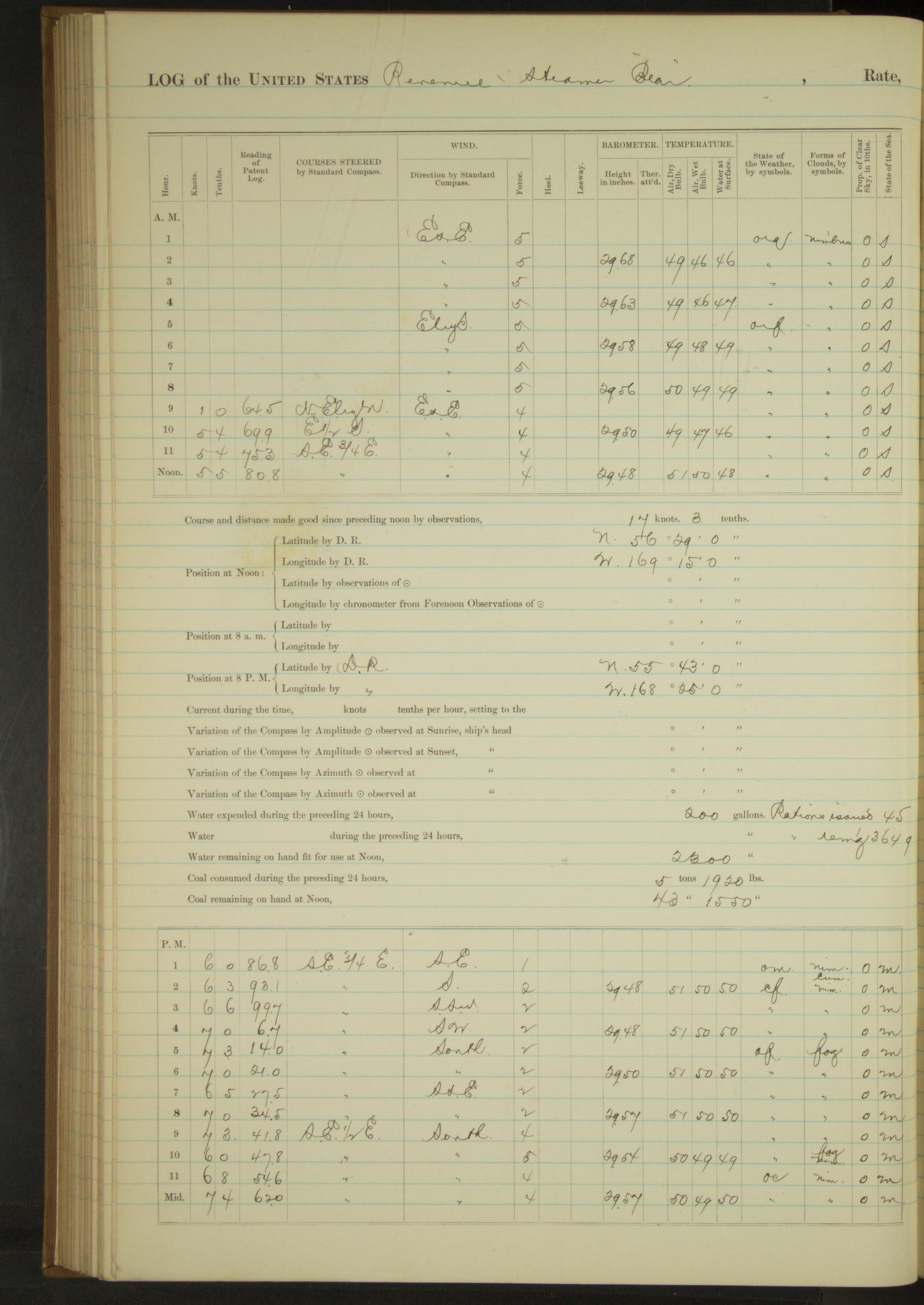
50874d5e09d409075500154d: (http://oldweather.s3.amazonaws.com/ow3/final/USRC Bear/vol068/vol068_126_1.jpg)
28 August 1890
North anchorage, St. George Island [& at sea]
Lat 56.48, Long -169.25
4am to 8am:
Crew scrubbing white woodwork about bow and upper deck.
8am to meridian:
8.45: got underway. 10.12: Tolstoi Point abeam, distant 2 miles.
8pm: Lat 55° 43’N, Long 168° 25’W
Under steam and sail 8 hours 30 minutes. Distance 58.7 miles.
Under steam exclusively 6 hours 45 minutes. Distance 39.8 miles.
Total 15 hours 15 minutes. Distance 98.5 miles.
50874d5e09d409075500154f: (http://oldweather.s3.amazonaws.com/ow3/final/USRC Bear/vol068/vol068_127_0.jpg)
50874d5e09d4090755001551: (http://oldweather.s3.amazonaws.com/ow3/final/USRC Bear/vol068/vol068_127_1.jpg)
29 August 1890
Behring Sea [& at Ounalaska]
Lat 54.17, Long -166.66 [Estimate from noon bearings]
4am to 8am:
At 5.40 made land bearing SEbyE½E.
8am to meridian:
Crew furling sail, cleaning ship and variously employed.
Noon: Cape Cheerful SbyE¼E, distant 9 miles.
Meridian to 4pm:
1.35: Cape Cheerful SW¼W. 2.45: Ulakhta Head [Ulakta Head] abeam. Steering various courses into Ounalaska Harbor. 4.00: made fast to wharf at Ounalaska.
6pm to 8pm:
At 7.20 AC Co’s steamer “Dora” arrived in port.
8pm: Lat 54° 31’N, Long 166° 52’W
Under steam and sail 3 hours 25 minutes. Distance 26.3 miles.
Under steam exclusively 12 hours 35 minutes. Distance 89.7 miles.
Total 16 hours. Distance 116 miles.
50874d5e09d4090755001553: (http://oldweather.s3.amazonaws.com/ow3/final/USRC Bear/vol068/vol068_128_0.jpg)
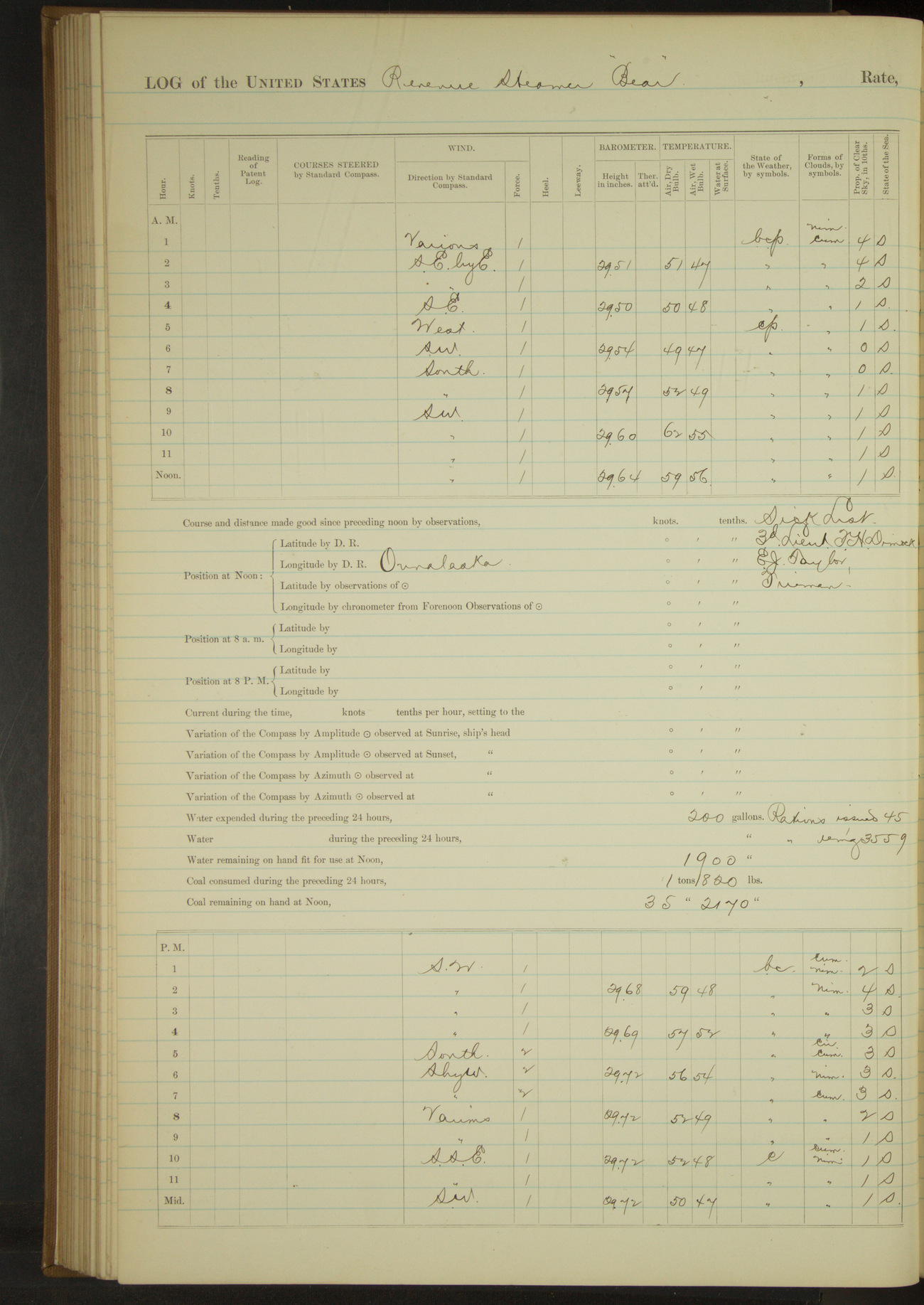
50874d5e09d4090755001555: (http://oldweather.s3.amazonaws.com/ow3/final/USRC Bear/vol068/vol068_128_1.jpg)
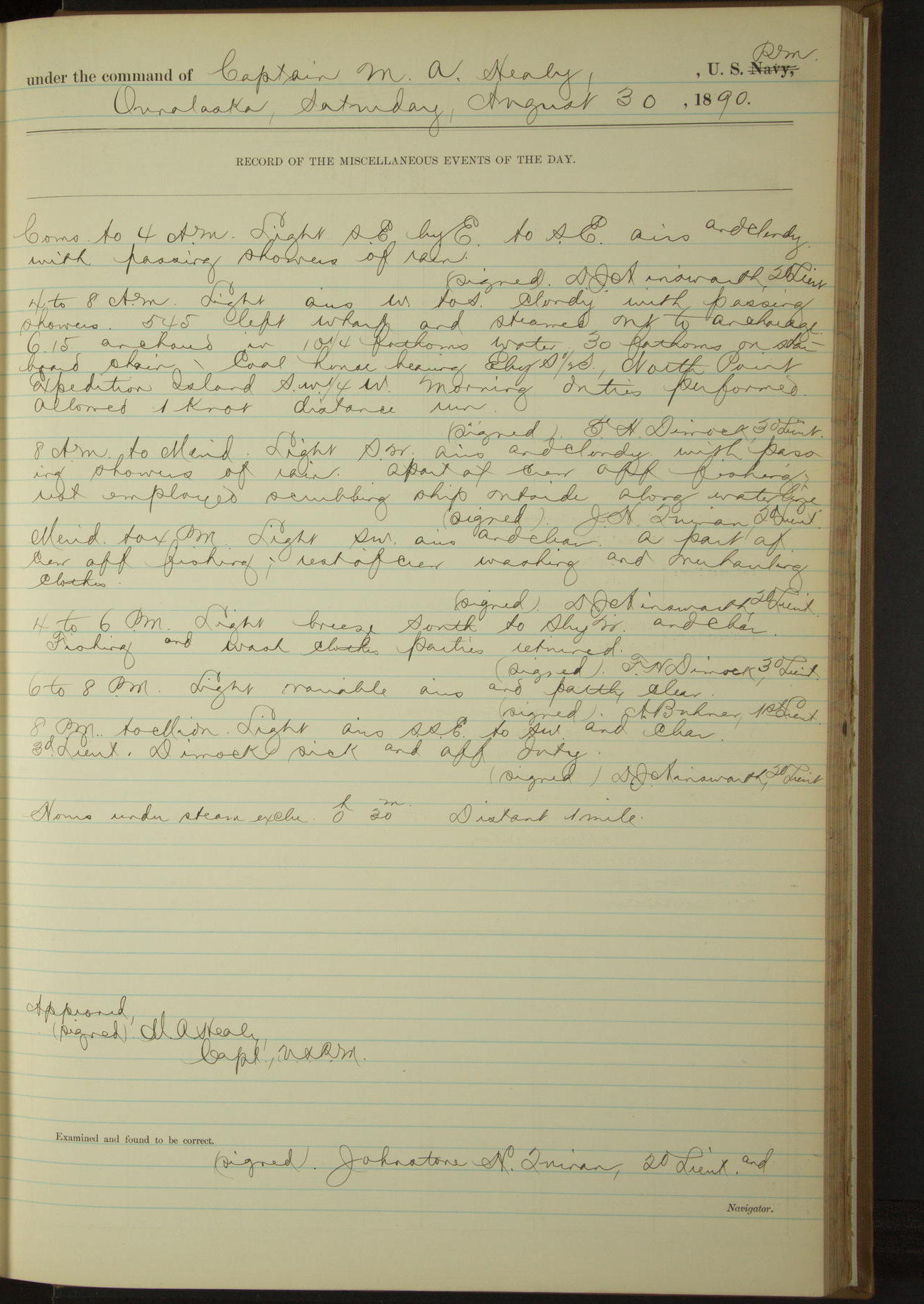
30 August 1890
Ounalaska
Lat 53.88, Long -166.53
Sick list: 3rd Lieutenant FH Dimock.
4am to 8am:
5.45: left wharf and steamed out to anchorage. 6.15: anchored. Coal house bearing EbyS½S; North point Expedition Island SW¼W.
8am to meridian:
A part of crew off fishing, rest employed scrubbing ship outside along waterline.
Meridian to 4pm:
A part of crew off fishing, rest of crew washing and overhauling clothes.
4pm to 6pm:
Fishing and wash-clothes parties returned.
Under steam exclusively 30 minutes. Distance 1 mile.
50874d5e09d4090755001557: (http://oldweather.s3.amazonaws.com/ow3/final/USRC Bear/vol068/vol068_129_0.jpg)
50874d5e09d4090755001559: (http://oldweather.s3.amazonaws.com/ow3/final/USRC Bear/vol068/vol068_129_1.jpg)
31 August 1890
Ounalaska
Lat 53.88, Long -166.53
Sick list: 3rd Lieutenant FH Dimock.
8am to meridian:
10.30: mustered crew and inspected ship throughout. Gave usual Sunday liberty.
Meridian to 4pm:
3.05: Revenue Steamer “Rush” arrived.
Abstract for month of August, 1890
At anchor 444 hours 10 minutes
Underway 299 hours 50 minutes
Under steam and sail 136 hours 25 minutes
Under steam exclusively 154 hours 40 minutes
Under sail exclusively 8 hours 45 minutes
Distance steam and sail 1016.1 miles
Distance steam exclusively 1013.2 miles
Distance sail exclusively 41.6
Distance total 2070.9 miles
Coal on hand 150 1200/[2240] tons
Coal expended 16 390/[2240] tons
Coal remaining 34 810/[2240] tons
Officers present 270, average 9
Petty Officers and crew 1240, average 40
Rations issued 1362
Vessels boarded American 2
LOGS FOR SEPTEMBER 1890
50874d5e09d409075500155b: (http://oldweather.s3.amazonaws.com/ow3/final/USRC Bear/vol068/vol068_130_0.jpg)
50874d5e09d409075500155d: (http://oldweather.s3.amazonaws.com/ow3/final/USRC Bear/vol068/vol068_130_1.jpg)
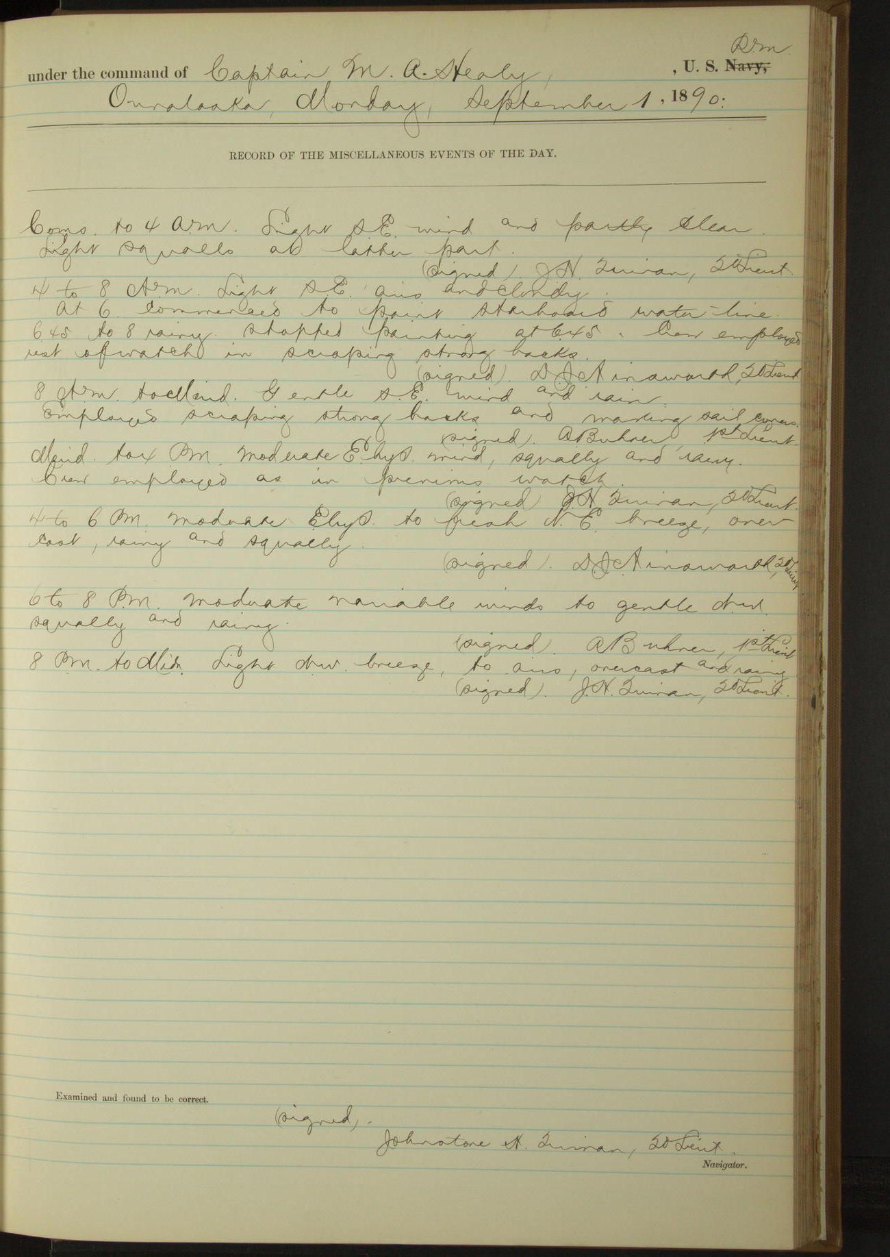
1 September 1890
Ounalaska
Lat 53.88, Long -166.53
Sick list: 3rd Lieutenant FH Dimock
4am to 8am:
At 6.00 commenced to paint starboard water-line. 6.45 to 8.00 rainy. Stopped painting at 6.45. Crew employed rest of watch in scraping strong backs.
8am to meridian [& Meridian to 4pm]:
Employed scraping strong backs and making sail covers.
50874d5e09d409075500155f: (http://oldweather.s3.amazonaws.com/ow3/final/USRC Bear/vol068/vol068_131_0.jpg)
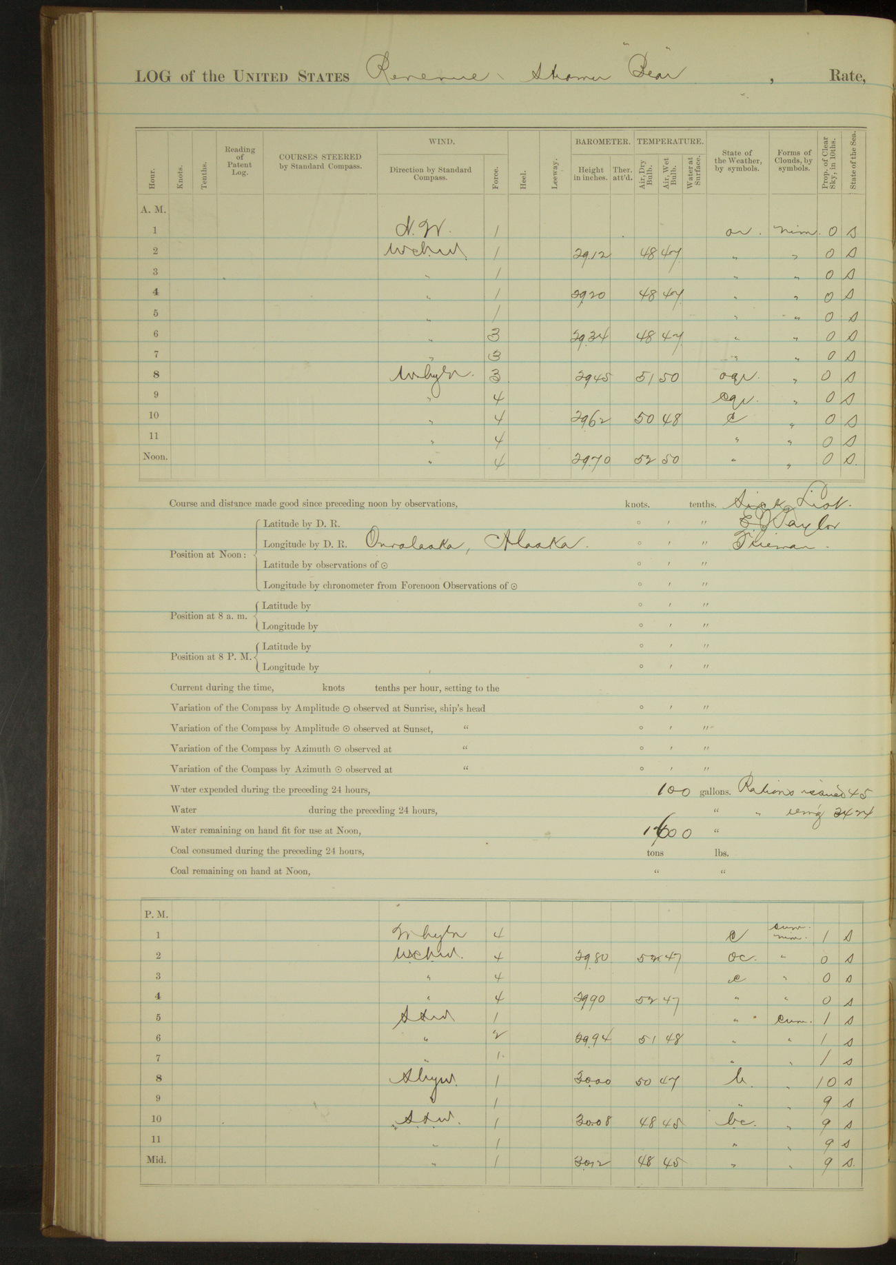
50874d5e09d4090755001561: (http://oldweather.s3.amazonaws.com/ow3/final/USRC Bear/vol068/vol068_131_1.jpg)
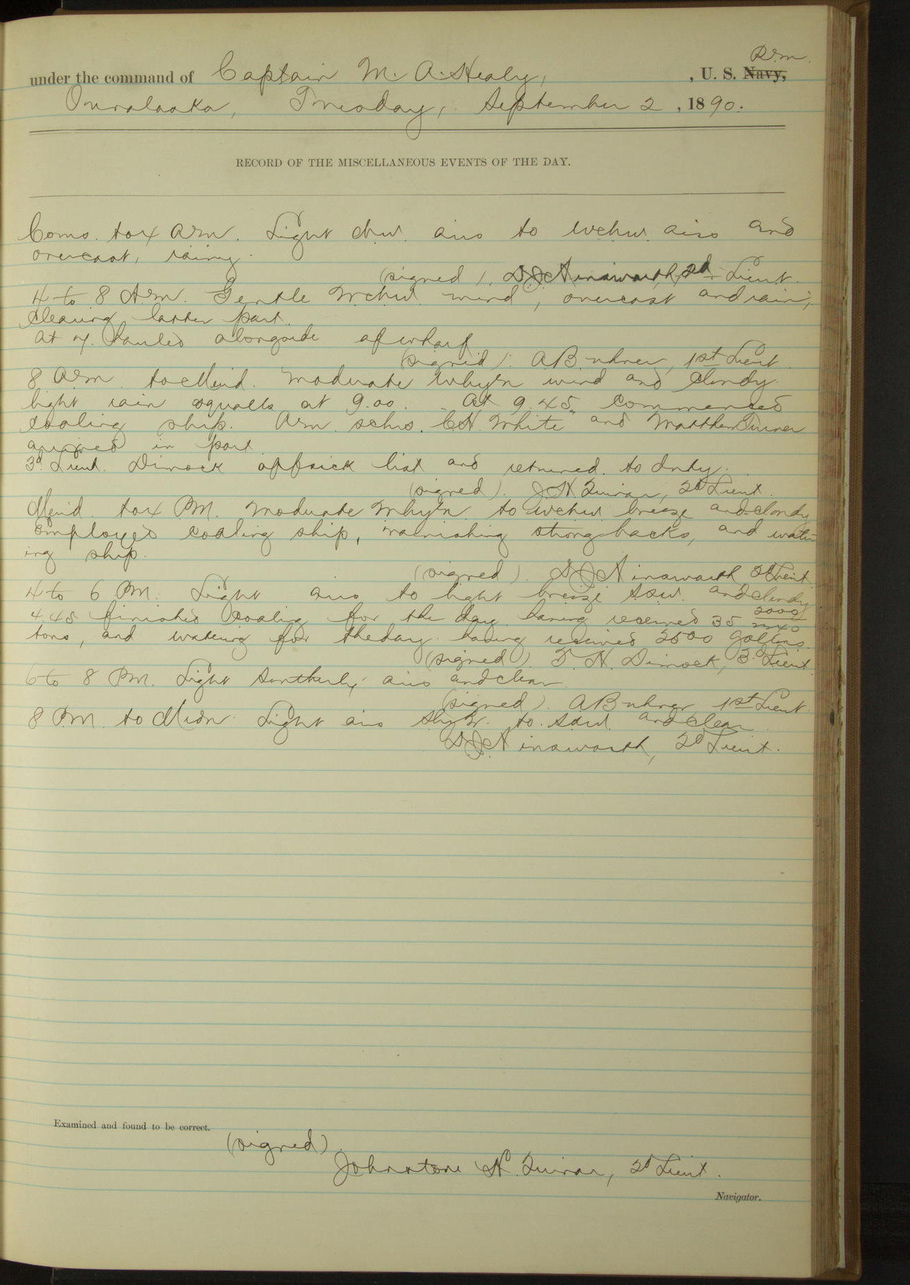
2 September 1890
Ounalaska
Lat 53.88, Long -166.53
4am to 8am:
At 7.00 hauled alongside of wharf.
8am to meridian:
At 9.45 commenced coaling ship. American Schooners “CH White” and “Matthew Turner” arrived in port. 3rd Lieutenant Dimock off sick list and returned to duty.
Meridian to 4pm:
Employed coaling ship, varnishing strong backs and watering ship.
4pm to 6pm:
4.45: finished coaling for the day having received 35 2000/2240 tons, and watering for the day having received 2500 gallons.
50874d5e09d4090755001563: (http://oldweather.s3.amazonaws.com/ow3/final/USRC Bear/vol068/vol068_132_0.jpg)
50874d5e09d4090755001565: (http://oldweather.s3.amazonaws.com/ow3/final/USRC Bear/vol068/vol068_132_1.jpg)
3 September 1890
Ounalaska
Lat 53.88, Long -166.53
4am to 8am:
Crew coaling ship. Finished watering ship having received a total of 4000 gallons.
8am to meridian:
Employed coaling ship and varnishing mizzen-masts.
Meridian to 4pm:
1.30: finished coaling having received a total of 82 180/[2240] tons. Began cleaning ship. Varnished main topmast.
8pm to midnight:
Received from Revenue Cutter “Rush”: 4 oz tincture opii [opium]; 2 oz tincture digitalis; 2 oz tincture belladonna; 4 oz tincture feric cloride [ferric chloride]; 4 oz Liquor potassae arsenitis [Fowler’s Solution]; ½ lb iodoform; 1 dozen bottles; 3 lbs flaxseed.
50874d5e09d4090755001567: (http://oldweather.s3.amazonaws.com/ow3/final/USRC Bear/vol068/vol068_133_0.jpg)
50874d5e09d4090755001569: (http://oldweather.s3.amazonaws.com/ow3/final/USRC Bear/vol068/vol068_133_1.jpg)
4 September 1890
Ounalaska
Lat 53.88, Long -166.53
Sick list: AC Hinderlong, Carpenter.
4am to 8am:
Washed clothes.
8am to meridian:
Allowed party of men to go fishing. Filled boiler. 11.30: started fires under boiler.
Meridian to 4pm:
A part of crew off fishing. Rest employed on sail covers and about decks.
4pm to 6pm:
Surgeon rendered medical assistance to sick natives.
50874d5e09d409075500156b: (http://oldweather.s3.amazonaws.com/ow3/final/USRC Bear/vol068/vol068_134_0.jpg)
50874d5e09d409075500156d: (http://oldweather.s3.amazonaws.com/ow3/final/USRC Bear/vol068/vol068_134_1.jpg)
5 September 1890
Ounalaska
Lat 53.88, Long -166.53
Sick list: AC Hinderlong, Carpenter.
4am to 8am:
At 6.00 left wharf and anchored in harbor.
8am to meridian:
A part of crew off fishing. Rest employed swinging ship to obtain deviation of standard compass. At 11.00 shifted anchorage further out in harbor. AC Co’s Steamer “St. Paul” arrived in port. Received from her mail belonging to “Bear”.
Meridian to 4pm:
A part of crew off fishing, rest of crew employed in boats, covering swinging boom pendants and making mail bag. Transferred John D Silva, Mate, and Samuel Purdy, 2nd Mate, of wrecked bark “Thomas Pope” to Revenue Steamer “Rush” for passage to San Francisco.
50874d5e09d409075500156f: (http://oldweather.s3.amazonaws.com/ow3/final/USRC Bear/vol068/vol068_135_0.jpg)
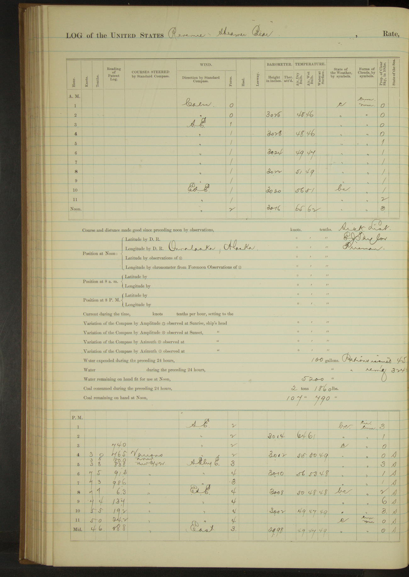
50874d5e09d4090755001571: (http://oldweather.s3.amazonaws.com/ow3/final/USRC Bear/vol068/vol068_135_1.jpg)
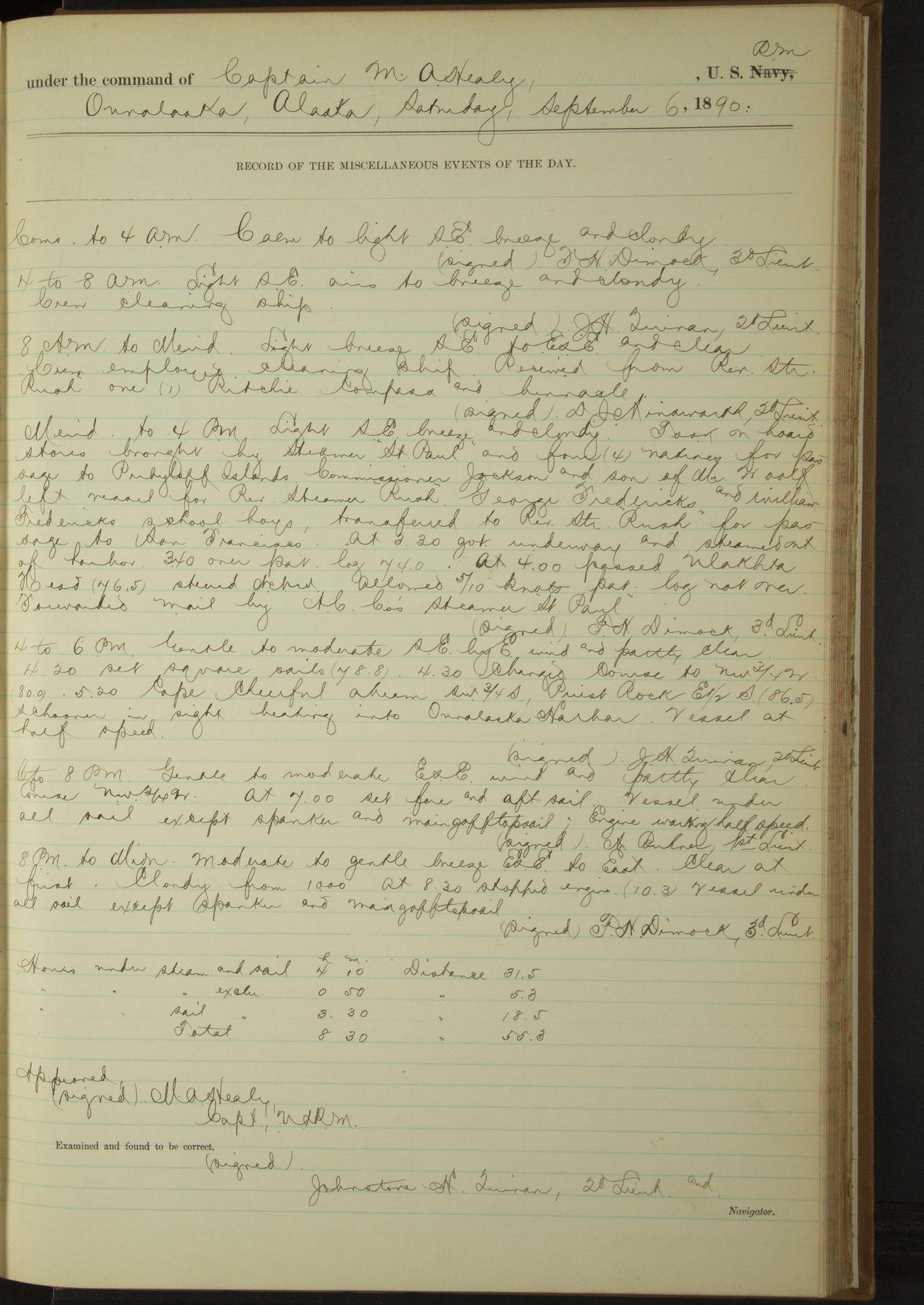
6 September 1890
Ounalaska [& at sea]
Lat 53.88, Long -166.53
8am to meridian:
Received from Revenue Steamer “Rush” one (1) Ritchie compass and binnacle.
Meridian to 4pm:
Took on board stores brought by steamer “St. Paul” and four (4) natives for passage to Pribyloff Islands [Pribilof Islands]. Commissioner Jackson and son of Mr. Woolf left vessel for Revenue Steamer “Rush”. George Fredericks and William Fredericks [see also 22 August where they are named Fredericksen], school boys, transferred to Revenue Steamer “Rush” for passage to San Francisco.
At 3.30 got underway and steamed out of harbor. At 4.00 passed Ulakhta Head. Forwarded mail by AC Co’s steamer “St. Paul”.
4pm to 6pm:
5.20: Cape Cheerful abeam SW¾S, Priest Rock E½S. Schooner in sight heading into Ounalaska Harbor.
Under steam and sail 4 hours 10 minutes. Distance 31.5 miles.
Under steam exclusively 50 minutes. Distance 5.3 miles.
Under sail exclusively 3 hours 30 minutes. Distance 18.5 miles.
Total 8 hours 30 minutes. Distance 55.3 miles.
50874d5e09d4090755001573: (http://oldweather.s3.amazonaws.com/ow3/final/USRC Bear/vol068/vol068_136_0.jpg)
50874d5e09d4090755001575: (http://oldweather.s3.amazonaws.com/ow3/final/USRC Bear/vol068/vol068_136_1.jpg)
7 September 1890
Behring Sea
Lat 55.47, Long -168.17
8am: Lat 55° 15’N, Long 167° 55’W
8am to meridian:
8.20: sighted a schooner bearing West standing to Southward and Eastward.
Under sail exclusively 24 hours. Distance 118.4 miles
50874d5e09d4090755001577: (http://oldweather.s3.amazonaws.com/ow3/final/USRC Bear/vol068/vol068_137_0.jpg)
50874d5e09d4090755001579: (http://oldweather.s3.amazonaws.com/ow3/final/USRC Bear/vol068/vol068_137_1.jpg)
8 September 1890
Behring Sea
Lat 56.67, Long -169.55
Sick list: Lee Pang, Wardroom Steward [to 21st September].
8am to meridian:
Rove off new main sheet.
8pm: Lat 56° 20’N, Long 170° 40’W
8pm to midnight:
Lee Pang, Wardroom Steward, suffering from temporary insanity and placed on sick list.
Under steam and sail 6 hours 15 minutes. Distance 31.3 miles.
Under sail exclusively 17 hours 45 minutes. Distance 53.1 miles.
Total 24 hours. Distance 84.4 miles.
50874d5e09d409075500157b: (http://oldweather.s3.amazonaws.com/ow3/final/USRC Bear/vol068/vol068_138_0.jpg)
50874d5e09d409075500157d: (http://oldweather.s3.amazonaws.com/ow3/final/USRC Bear/vol068/vol068_138_1.jpg)
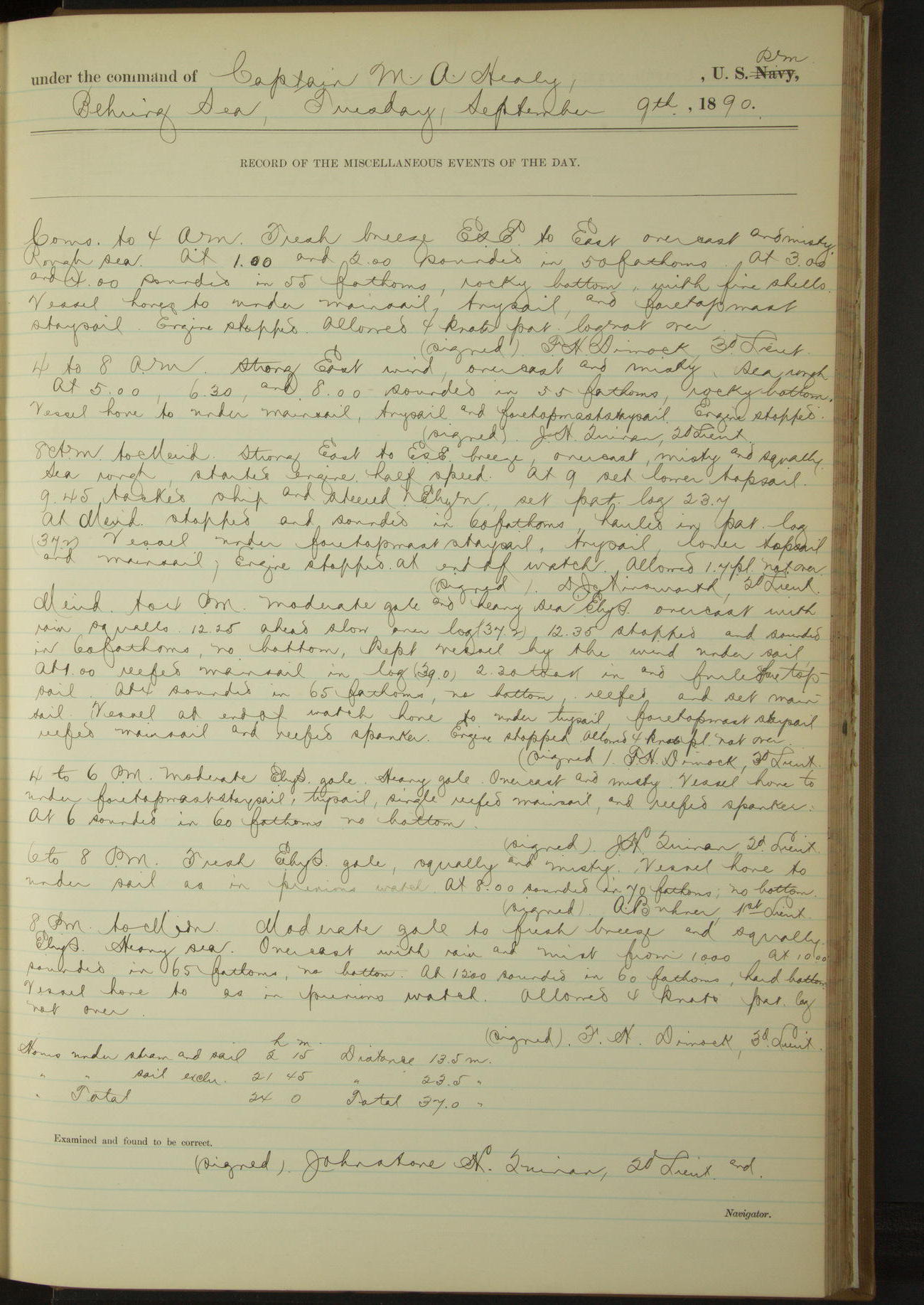
9 September 1890
Behring Sea
Lat 56.33, Long -170.58
Sick list: Joseph Saunders, Quartermaster.
8am: Lat 56° 16’N, Long 170° 46’W
8pm: Lat 56° 33’N, Long 170° 35’W
Under steam and sail 2 hours 15 minutes. Distance 13.5 miles
Under sail exclusively 21 hours 45 minutes. Distance 23.5 miles
Total 24 hours. Distance 37.0 miles
50874d5e09d409075500157f: (http://oldweather.s3.amazonaws.com/ow3/final/USRC Bear/vol068/vol068_139_0.jpg)
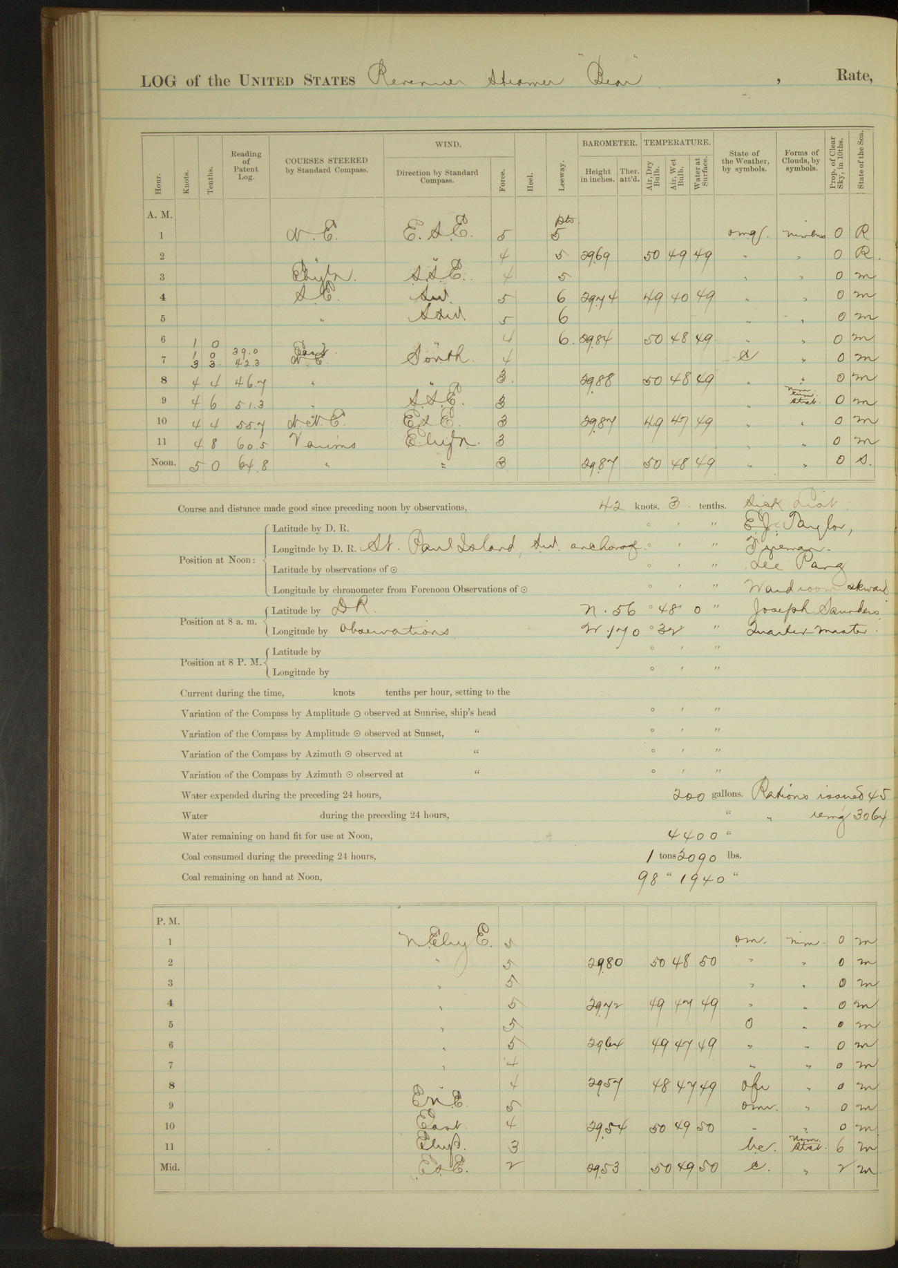
50874d5e09d4090755001581: (http://oldweather.s3.amazonaws.com/ow3/final/USRC Bear/vol068/vol068_139_1.jpg)
10 September 1890
Behring Sea [& St. Paul Island]
Lat 57.12, Long -170.30
Sick list: Joseph Saunders, Quartermaster.
4am to 8am:
6.15: in setting upper topsail, parted port leech rope. At 6.25 sighted Otter Island bearing NNE. At 8.00 Otter Island bore N¾E.
8am: Lat 56° 48’N, Long 170° 32’W
8am to meridian:
10.30: steered various courses for St. Paul Island. 11.50: anchored SW anchorage St. Paul Island. Tolstoi Point bearing N¾W, flagstaff E¾N, Reef Point South.
Meridian to 4pm:
Commanding Officer received visit from Special Treasury Agent Murray. Landed natives on St. Paul Island.
4pm to 6pm:
4.30: schooner “Amethyst” of San Francisco anchored near. Boarded and examined schooner and found that she was from Kodiak with fine wood for Islands St. George and St. Paul; AA Olsen, master.
6pm to 8pm:
By request of master of schooner “Amethyst” took on board for medical treatment and passage to San Francisco, Richard Dupries, Seaman of that vessel. John Holmberg, Seaman of wrecked bark “Thomas Pope”, shipped on schooner “Amethyst” in lieu of Dupries.
Under steam exclusively 1 hour 20 minutes. Distance 8.5 miles.
Under sail exclusively 10 hours 30 minutes. Distance 20.0 miles.
Total 11 hours 50 minutes. Distance 28.5 miles.
50874d5e09d4090755001583: (http://oldweather.s3.amazonaws.com/ow3/final/USRC Bear/vol068/vol068_140_0.jpg)
50874d5e09d4090755001585: (http://oldweather.s3.amazonaws.com/ow3/final/USRC Bear/vol068/vol068_140_1.jpg)
11 September 1890
Southwest Anchorage, St. Paul Island [to NE Point]
Lat 57.12, Long -170.30
8am to meridian:
Employed covering yoke ropes, Jacob’s ladders, leathering oars, etc.
Meridian to 4pm:
Fresh to moderate breeze SE and overcast. Heavy swell from Southward.
1.10: underway. 1.33: South point abeam. 3.55: came to. Sea Lion Hill Point bearing NEbyN. [Sealion Hill/Hutchinson Hill; Sea Lion Point]
Under steam exclusively 2 hours 45 minutes. Distance 18 miles.
50874d5e09d4090755001587: (http://oldweather.s3.amazonaws.com/ow3/final/USRC Bear/vol068/vol068_141_0.jpg)
50874d5e09d4090755001589: (http://oldweather.s3.amazonaws.com/ow3/final/USRC Bear/vol068/vol068_141_1.jpg)
12 September 1890
Northeast Point, St. Paul Island
Lat 57.24, Long -170.14 [Estimate from above bearings]
4am to 8am:
At 6.00 thick fog set in. Washed clothes and performed usual morning duties.
8am to meridian:
Crew employed making sail covers, covering Jacob’s ladders, and leathering oars.
Meridian to 4pm:
Crew at work on sail covers, Jacob’s ladders, stowing coal etc.
50874d5e09d409075500158b: (http://oldweather.s3.amazonaws.com/ow3/final/USRC Bear/vol068/vol068_142_0.jpg)
50874d5e09d409075500158d: (http://oldweather.s3.amazonaws.com/ow3/final/USRC Bear/vol068/vol068_142_1.jpg)
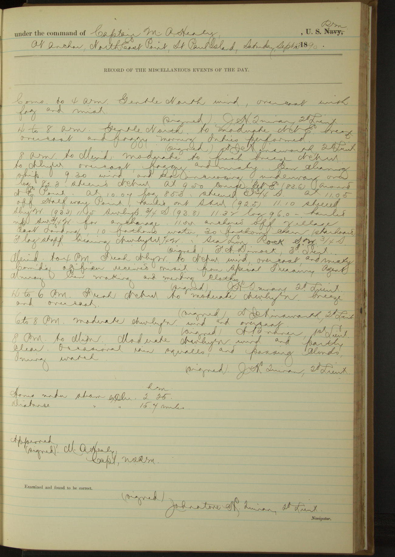
13 September 1890
Northeast Point, St. Paul Island [to SE anchorage]
Lat 57.12, Long -170.26
8am to meridian:
Moderate to fresh breeze NNW to NbyW, overcast, foggy and misty. 9.30: wind and sea increasing, underway. At 9.50 course ENE around NE Point.
At 11.05 off Halfway Point, hauled out SSW. 11.55 anchored off village East Landing. Flagstaff bearing NWbyW¼W, Sea Lion Rock SW¾S.
Meridian to 4pm:
Commanding Officer received visit from Special Treasury Agent Murray. Crew making and mending clothes.
Under steam exclusively 2 hours 25 minutes. Distance 15.7 miles.
50874d5e09d409075500158f: (http://oldweather.s3.amazonaws.com/ow3/final/USRC Bear/vol068/vol068_143_0.jpg)
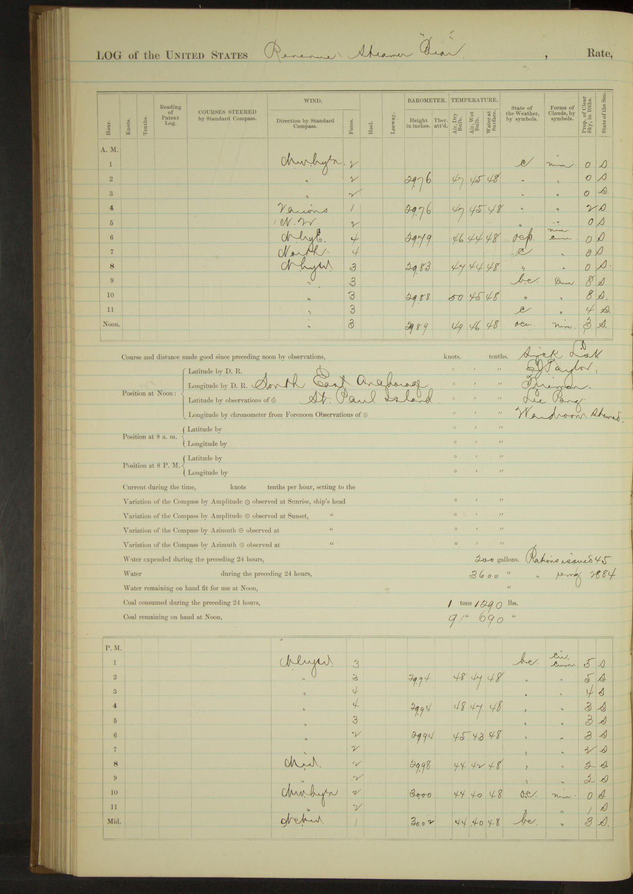
50874d5e09d4090755001591: (http://oldweather.s3.amazonaws.com/ow3/final/USRC Bear/vol068/vol068_143_1.jpg)
14 September 1890
Southeast Anchorage, St. Paul Island
Lat 57.12, Long -170.26
Meridian to 4pm:
Gave liberty until 4pm to part of crew.
50874d5e09d4090755001593: (http://oldweather.s3.amazonaws.com/ow3/final/USRC Bear/vol068/vol068_144_0.jpg)
50874d5e09d4090755001595: (http://oldweather.s3.amazonaws.com/ow3/final/USRC Bear/vol068/vol068_144_1.jpg)
15 September 1890
Southeast Anchorage, St. Paul Island [to St. George Island]
Lat 56.96, Long -170.10
4am to 8am:
Washed clothes and performed usual morning orders. Received on board for passage to St. George and Ounalaska for the purpose of native relations, two native men and two native women at no cost to Government.
8am to meridian:
Crew employed scraping dead-eyes, making sail covers, cleaning boats and covering Jacob’s ladders. Received on board six (6) young girls, natives of St. Paul Island, for passage to Ounalaska for the purpose of attending school at the latter place.
10.30: got underway. At meridian East end Otter Islands bore WbyN¾N and NE point St. Paul Island bore NNW.
4pm to 6pm:
4.20: stopped off village St. George Island. Special Agent Lavender came on board and gave information of presence of schooner on other side of island. 4.45: ahead full. Steered various courses around NE end of island.
Sighted a schooner standing well offshore to Northward. 5.15: another vessel just visible at Northward and Westward.
6pm to 8pm:
7.15: came to in SW bay.
Under steam exclusively 8 hours 20 minutes. Distance 58.2 miles.
50874d5e09d4090755001597: (http://oldweather.s3.amazonaws.com/ow3/final/USRC Bear/vol068/vol068_145_0.jpg)
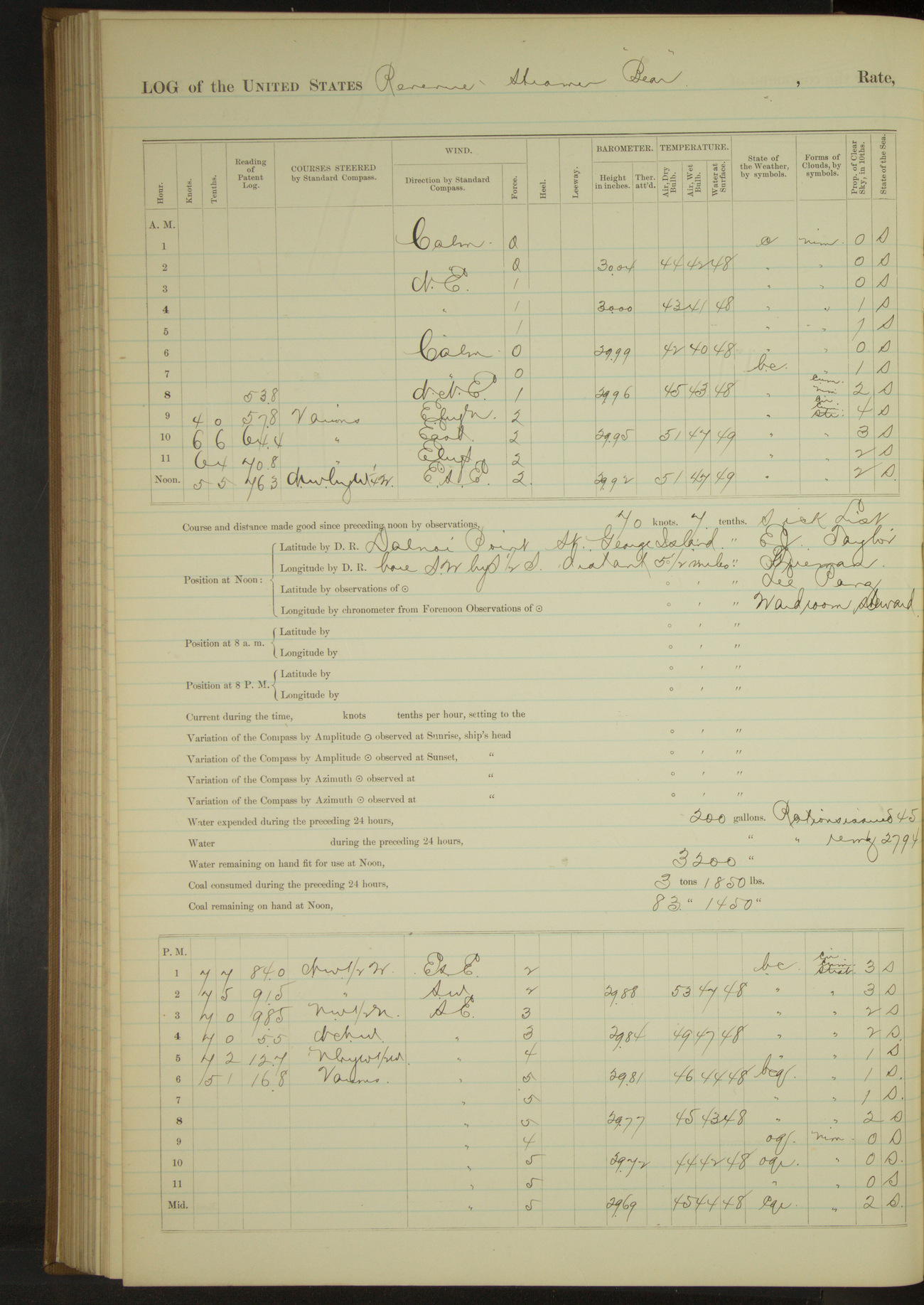
50874d5e09d4090755001599: (http://oldweather.s3.amazonaws.com/ow3/final/USRC Bear/vol068/vol068_145_1.jpg)
16 September 1890
Southwest Bay, St. George Island [to St. Paul Island]
Lat 56.67, Long -169.66 [Estimate from noon bearing]
4am to 8am:
Washed clothes. Communicated with shore.
8am to meridian:
8.25: underway and steered various courses around East side St. George Island. At 10.55 off village. Stopped.
Boarded and examined schooner “Amethyst” of San Francisco, Olsen master, from Kodiak with wood for North American [Commercial] Co. 11.15: boarding officer returned, started engine and steered for St. Paul Island.
Noon: Dalnoi Point, St. George Island, bore SWbyS½S, distant 5½ miles.
Meridian to 4pm:
3.40: Otter Island abeam. Crew scraping and varnishing dead eyes, painting davits, etc.
4pm to 6pm:
4.37: North end Walrus island. 5.05: NE point abeam. 5.45: came to. Sea Lion Hill Point bearing NbyE½E.
Under steam exclusively 9 hours. Distance 64.0 miles.
50874d5e09d409075500159b: (http://oldweather.s3.amazonaws.com/ow3/final/USRC Bear/vol068/vol068_146_0.jpg)
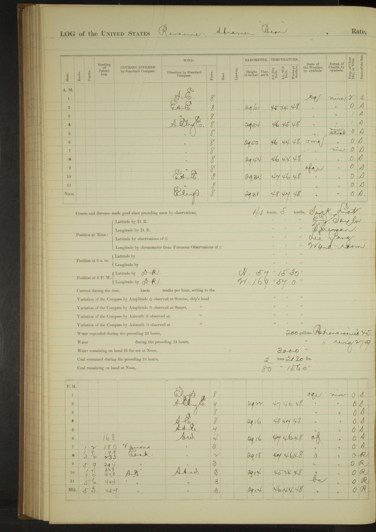
50874d5e09d409075500159d: (http://oldweather.s3.amazonaws.com/ow3/final/USRC Bear/vol068/vol068_146_1.jpg)
17 September 1890
NE Point, St. Paul Island [& at sea]
Lat 57.24, Long -170.14 [Estimate from above bearings]
8am to meridian:
Crew employed scraping swinging boom, leathering oars, making sail covers, etc.
Meridian to 4pm:
Fresh SEbyE to moderate EbyS gale, overcast, rainy and squally. At 1.25 wind increasing. Let go port anchor and veered to 20 fathoms on port chain and to 60 fathoms on starboard chain. From 3.00 to 4.00 wind moderating.
Crew employed scraping and sandpapering swinging booms and making sail covers.
4pm to 6pm:
At 5.30 wind moderate and hauling to SW. Hove up port anchor and hove in to 30 fathoms on starboard chain.
6pm to 8pm:
6.40: got underway and steered various courses around NE Point, St. Paul Island.
8pm: Lat 57° 15’ 30”N, Long 169° 57’W
8pm to midnight:
10.45: vessel pitching heavily, took in and furled jib and reduced number of revolutions of engine.
Under steam and sail 2 hours 45 minutes. Distance 14.9 miles.
Under steam exclusively 2 hours 35 minutes. Distance 14.0 miles.
Total 5 hours 20 minutes. Distance 28.9 miles.
50874d5e09d409075500159f: (http://oldweather.s3.amazonaws.com/ow3/final/USRC Bear/vol068/vol068_147_0.jpg)
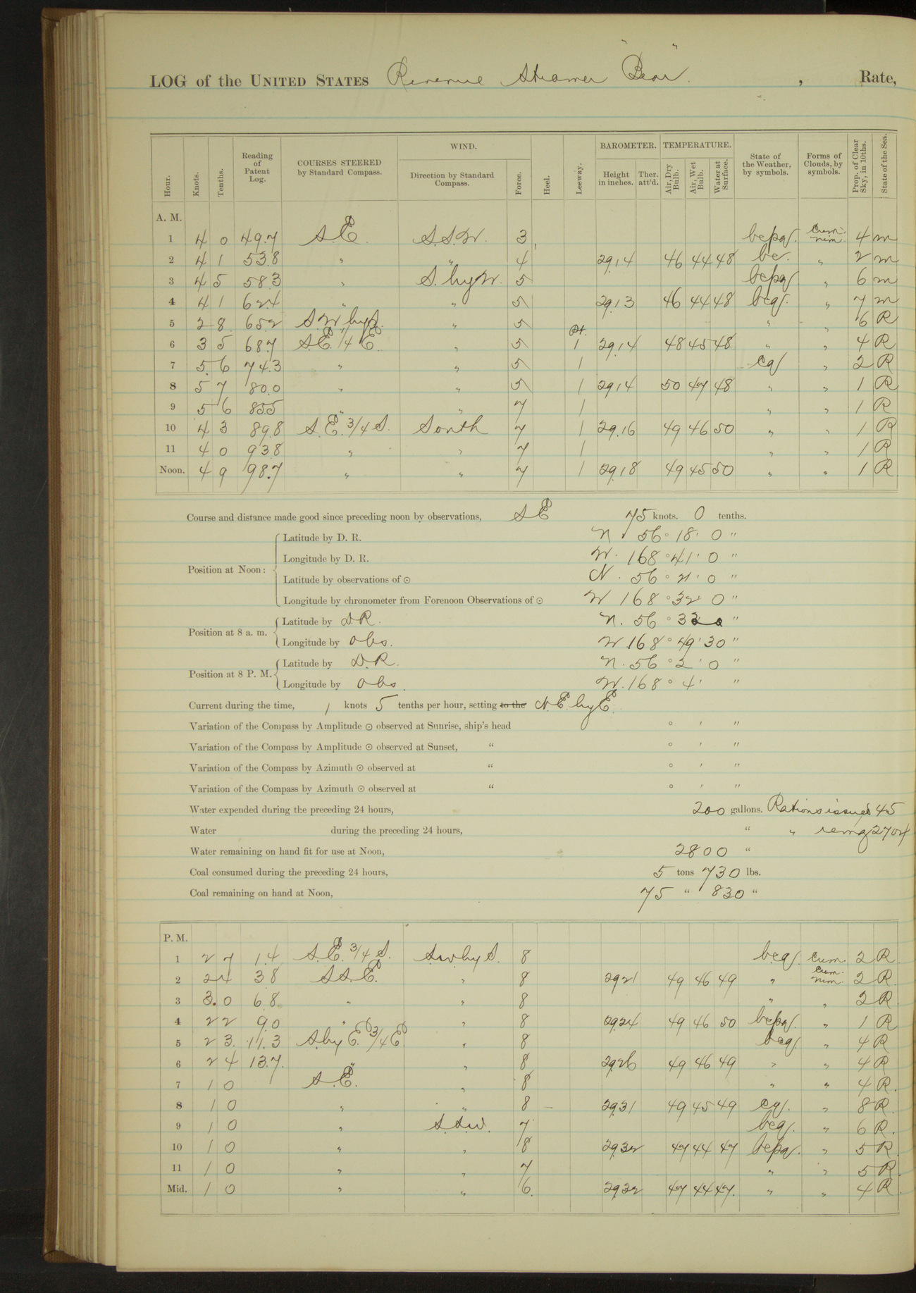
50874d5e09d40907550015a1: (http://oldweather.s3.amazonaws.com/ow3/final/USRC Bear/vol068/vol068_147_1.jpg)
18 September 1890
Behring Sea
Lat 56.35, Long -168.53
4am to 8am:
6.00: St. George’s Island on starboard beam, bearing by compass SW, distant about 10 miles.
8am: Lat 56° 33’N, Long 168° 49’ 30”W
8am to meridian:
Strong breeze to moderate gale SbyW to South. Cloudy and squally. Heavy sea. 8.40: wind increasing, double-reefed mainsail.
Meridian to 4pm:
Strong gale and heavy squalls SWbyS and heavy sea, partly clear with passing showers in last hour. At 12.40 vessel rolling and pitching heavily, slowed engine and kept by the wind heading SSE. At 4.00 passed a schooner hove to on port tack under foresail.
4pm to 6pm:
Heavy gale and squally from SWbyS. Sea running high, partly clear.
8pm: Lat 57° 2’N, Long 168° 4’W
8pm to midnight:
Moderate gale to strong breeze SSW and heavy sea. Moderating towards 12.00.
Under steam and sail 17 hours 5 minutes. Distance 65.9 miles.
Under steam exclusively 55 minutes. Distance 2.1 miles.
Under sail exclusively 6 hours. Distance 6.0 miles.
Total 24 hours. Distance 74.0 miles.
50874d5e09d40907550015a3: (http://oldweather.s3.amazonaws.com/ow3/final/USRC Bear/vol068/vol068_148_0.jpg)
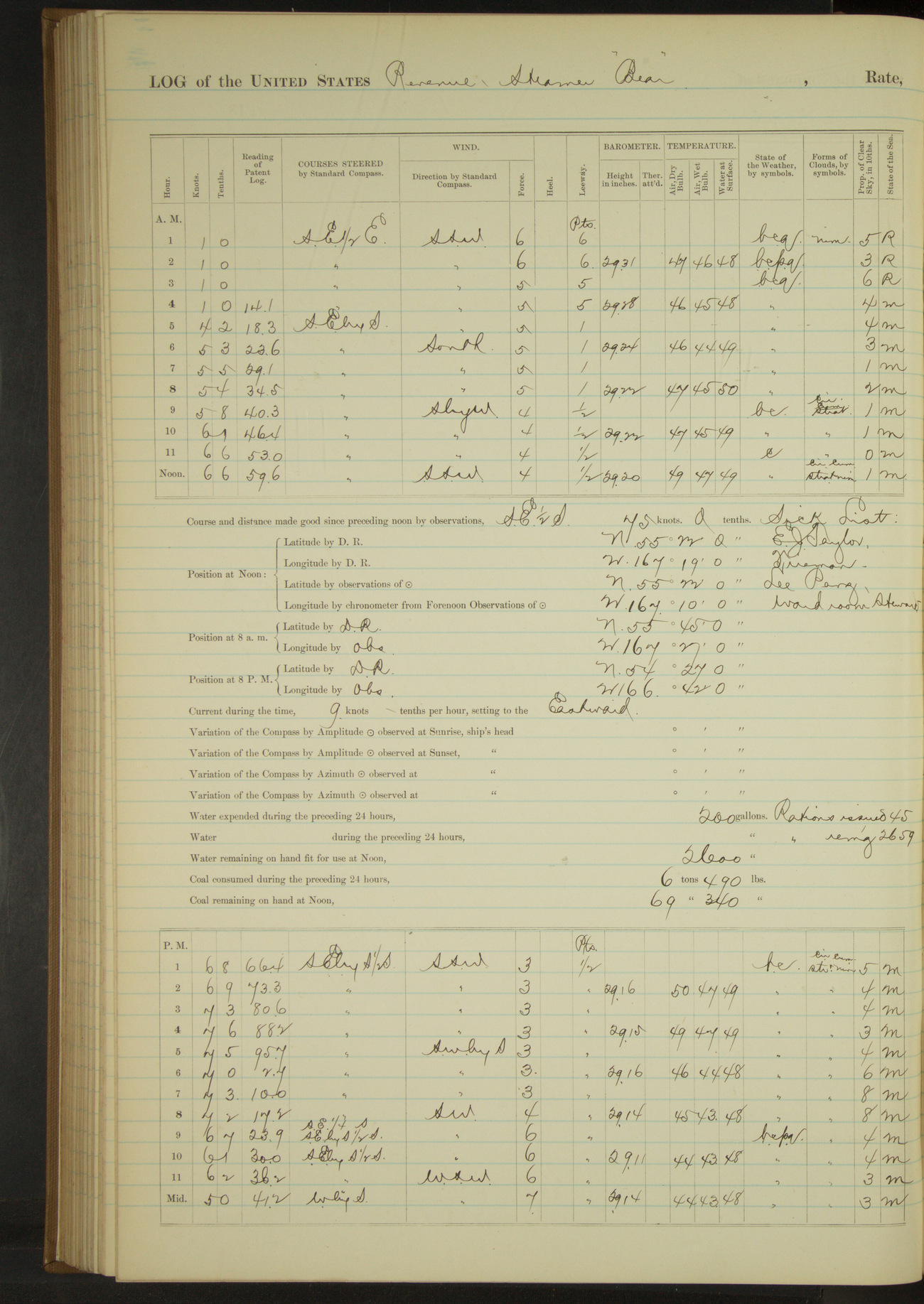
50874d5e09d40907550015a5: (http://oldweather.s3.amazonaws.com/ow3/final/USRC Bear/vol068/vol068_148_1.jpg)
19 September 1890
Behring Sea
Lat 55.37, Long -167.17
8am: Lat 55° 45’N, Long 167° 27’W
8am to meridian:
Moderate breeze SbyW to SSW and cloudy. Moderate SW swell. Crew at work on swinging booms, boat gripes etc.
Meridian to 4pm:
Crew at work on swinging booms, boat gripes and cementing seams of upper deck.
8pm: Lat 54° 27’N, Long 166° 42’W
8pm to midnight:
11.00: made Cape Cheerful, bearing by compass SbyE½E, distant 8 miles. 11.45: Cape Cheerful bore SSW, distant 3 miles.
Under steam and sail 19 hours 30 minutes. Distance 125.4 miles.
Under steam exclusively 30 minutes. Distance 1.7 miles.
Under sail exclusively 4 hours. Distance 4.0 miles.
Total 24 hours. Distance 131.1 miles.
50874d5e09d40907550015a7: (http://oldweather.s3.amazonaws.com/ow3/final/USRC Bear/vol068/vol068_149_0.jpg)
50874d5e09d40907550015a9: (http://oldweather.s3.amazonaws.com/ow3/final/USRC Bear/vol068/vol068_149_1.jpg)
20 September 1890
Behring Sea [& Ounalaska]
Lat 53.88, Long -166.53
4am to 8am:
Strong gale and heavy squalls to gentle breeze SW to SSW. Heavy sea outside of land. At 5.00 made Cape Cheerful on starboard bow. 5.25: steered various courses into Ounalaska Harbor. 6.55 anchored outside Ounalaska Village. Wharf bearing WbyS½S, Cape Kalekhta NbyE¼W.
8am to meridian:
A part of crew off fishing. Landed the six (6) girls and their baggage at Ounalaska Village.
Meridian to 4pm:
Gave crew the afternoon to overhaul clothing. Surgeon rendered medical assistance to sick native.
Under steam exclusively 6 hours 55 minutes. Distance 20.6 miles.
50874d5e09d40907550015ab: (http://oldweather.s3.amazonaws.com/ow3/final/USRC Bear/vol068/vol068_150_0.jpg)
50874d5e09d40907550015ad: (http://oldweather.s3.amazonaws.com/ow3/final/USRC Bear/vol068/vol068_150_1.jpg)
21 September 1890
Ounalaska
Lat 53.88, Long -166.53
4am to 8am:
At 8.00 hove up anchor and steamed to wharf.
8am to meridian:
At 8.35 made fast to wharf. At 9.00 AC Co’s steamer “Dora” arrived from the Eastward.
Under steam exclusively 35 minutes. Distance 1.0 miles.
Note.
By order of the Commanding Officer, 3rd Lieutenant FH Dimock is, for the purpose of acquiring practical experience, made Navigating Officer from date; he exchanging duties with 2nd Lieutenant JH Quinan.
Noted as expended during the current week, provisions to the amount of 56 rations and 272 lbs bread consumed by men ashore during erection of school-house at Cape Prince of Wales and given to the school teacher at that point.
50874d5e09d40907550015af: (http://oldweather.s3.amazonaws.com/ow3/final/USRC Bear/vol068/vol068_151_0.jpg)
50874d5e09d40907550015b1: (http://oldweather.s3.amazonaws.com/ow3/final/USRC Bear/vol068/vol068_151_1.jpg)
22 September 1890
Ounalaska
Lat 53.88, Long -166.53
4am to 8am:
At 6.40 began to coal ship.
8am to meridian:
Crew coaling and watering ship.
Meridian to 4pm:
At 2.30 finished watering ship having received 3000 gallons. Crew coaling ship. Weather threatening, got out extra lines.
4pm to 6pm:
At 4.45 finished coaling having received 67 320/2240 tons.
50874d5e09d40907550015b3: (http://oldweather.s3.amazonaws.com/ow3/final/USRC Bear/vol068/vol068_152_0.jpg)
50874d5e09d40907550015b5: (http://oldweather.s3.amazonaws.com/ow3/final/USRC Bear/vol068/vol068_152_1.jpg)
23 September 1890
Ounalaska
Lat 53.88, Long -166.53
8am to meridian:
Crew procuring sand ballast, cleaning boats and staying fore topgallant mast.
Meridian to 4pm:
Crew scraping bright wood of 1st and 2nd cutters preparatory to varnishing. Stayed fore topgallant mast forward.
4pm to 6pm:
Unbent mainsail and stowed it below.
50874d5e09d40907550015b7: (http://oldweather.s3.amazonaws.com/ow3/final/USRC Bear/vol068/vol068_153_0.jpg)
50874d5e09d40907550015b9: (http://oldweather.s3.amazonaws.com/ow3/final/USRC Bear/vol068/vol068_153_1.jpg)
24 September 1890
Ounalaska
Lat 53.88, Long -166.53
4am to 8am:
Crew taking in sand ballast in forward bunker.
8am to meridian:
Crew as in previous watch. AC Co’s schooners “Pearl” and “Matthew Turner” arrived from Herendeen Bay and Umnak respectively.
Meridian to 4pm:
Allowed portion of crew to go a fishing. Remainder ballasting ship. At 4.00 finished ballasting having taken in 62 tons. Surgeon treating sick natives and residents.
50874d5e09d40907550015bb: (http://oldweather.s3.amazonaws.com/ow3/final/USRC Bear/vol068/vol068_154_0.jpg)
50874d5e09d40907550015bd: (http://oldweather.s3.amazonaws.com/ow3/final/USRC Bear/vol068/vol068_154_1.jpg)
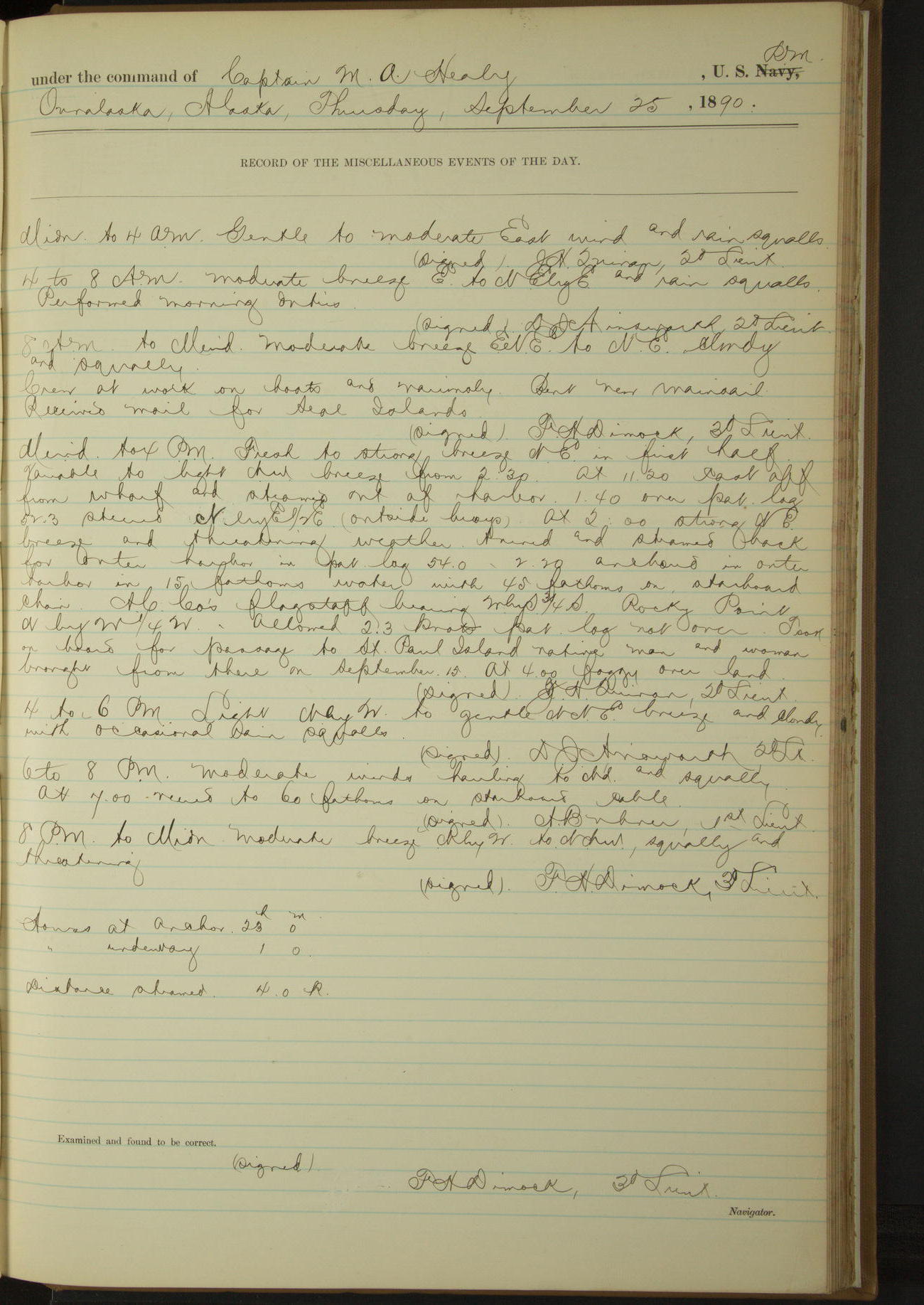
25 September 1890
Ounalaska
Lat 53.88, Long -166.53
8am to meridian:
Crew at work on boats and variously. Bent new mainsail. Received mail for Seal Islands.
Meridian to 4pm:
At 11.20 cast off from wharf and steamed out of harbor. At 2.00 strong NE breeze and threatening weather, turned and steamed back for outer harbor. 2.20: anchored in outer harbor. AC Co’s flagstaff bearing WbyS¾S, Rocky Point NbyW¼W. Took on board for passage to St. Paul Island native man and woman brought from there on September 15.
At anchor 23 hours. Underway 1 hour.
Distance steamed 4.0 miles.
50874d5e09d40907550015bf: (http://oldweather.s3.amazonaws.com/ow3/final/USRC Bear/vol068/vol068_155_0.jpg)
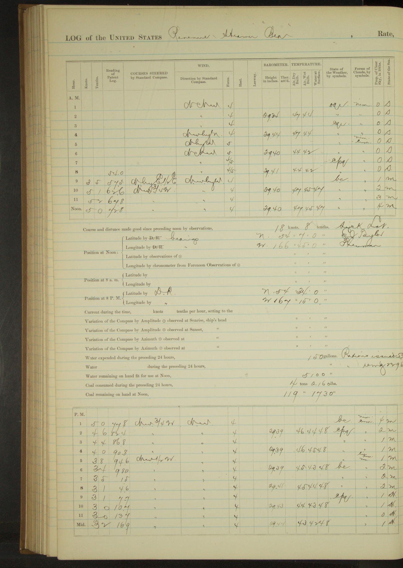
50874d5e09d40907550015c1: (http://oldweather.s3.amazonaws.com/ow3/final/USRC Bear/vol068/vol068_155_1.jpg)
26 September 1890
Ounalaska [& at sea]
Lat 54.12, Long -166.75
4am to 8am:
At 7.30 AC Co’s schooner “Matthew Turner” left for Kodiak.
8am to meridian:
At 8.20 underway and steamed out of harbor. 8.55: Ulakhta Head W½N. 10.30: Cape Cheerful abeam 1? miles.
11.00: sighted AC Co’s steamer “Dora” standing to Southward and Eastward, schooner “Turner” in view standing through passes.
Meridian to 4pm:
Crew at work on chafing gear and boat covers.
4pm to 6pm:
At 4.00 changed course for St. George Island.
8pm: Lat 54° 34’N, Long 167° 15’W
At anchor 8 hours 20 minutes. Underway 15 hours 40 minutes.
Distance steam exclusively 62.9 miles.
50874d5e09d40907550015c3: (http://oldweather.s3.amazonaws.com/ow3/final/USRC Bear/vol068/vol068_156_0.jpg)
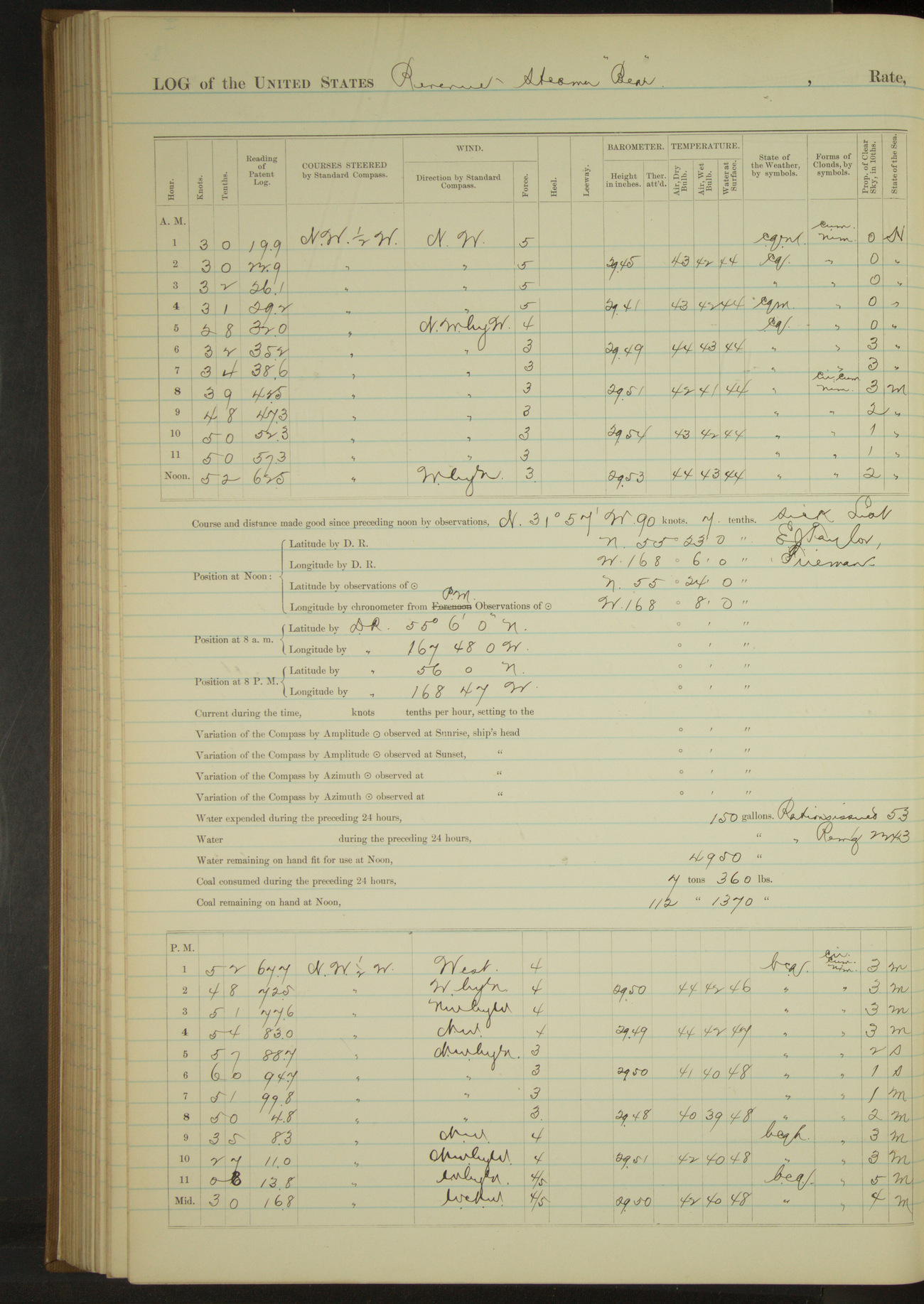
50874d5e09d40907550015c5: (http://oldweather.s3.amazonaws.com/ow3/final/USRC Bear/vol068/vol068_156_1.jpg)
27 September 1890
At sea
Lat 55.40, Long -168.13
8am: Lat 55° 6’N, Long 167° 48’W
8pm: Lat 56° 0’N, Long 168° 47’W
8pm to midnight:
Moderate to fresh breeze NW to WbyN, partly clear and squally with light hail at intervals. Moderate and increasing NW swell. At 8.00 slowed engine to await daylight. At 11.00 wind and sea increasing, gave engines half speed.
Under steam and sail 2 hours. Distance 10.0 miles.
Under steam exclusively 22 hours. Distance 89.9 miles.
Total 24 hours. Distance 99.9 miles.
50874d5e09d40907550015c7: (http://oldweather.s3.amazonaws.com/ow3/final/USRC Bear/vol068/vol068_157_0.jpg)
50874d5e09d40907550015c9: (http://oldweather.s3.amazonaws.com/ow3/final/USRC Bear/vol068/vol068_157_1.jpg)
28 September 1890
At sea
Lat 56.97, Long -170.08
Midnight to 4am:
At 3.40 made land ahead NW½W, distant 10 miles.
4am to 8am:
Moderate breeze NEbyW to WNW, partly clear with snow at intervals. At 5.15 steered for Tolstoi Point. 6.30: Tolstoi Point abeam, steered various courses around Point. At 6.45 observed landing at village to be impracticable, shaped course for St. Paul Island.
8am: Lat 56° 42’N, Long 169° 36’W
8am to meridian:
At meridian steered for anchorage.
Meridian to 4pm:
At 1.45 came to in SE anchorage, St. Paul Island; flagstaff bearing on bluff NW½W; Sea Lion Rock SW½S.
Commanding Officer received visit from Special Treasury Agent Murray. At 3.00 heavy squalls rain and snow.
At anchor 10 hours 5 minutes.
Underway 13 hours 55 minutes.
Hours steamed 13 hours 55 minutes. Distance 74.2 miles.
50874d5e09d40907550015cb: (http://oldweather.s3.amazonaws.com/ow3/final/USRC Bear/vol068/vol068_158_0.jpg)
50874d5e09d40907550015cd: (http://oldweather.s3.amazonaws.com/ow3/final/USRC Bear/vol068/vol068_158_1.jpg)
29 September 1890
Southeast Anchorage, St. Paul Island
Lat 57.12, Long -170.26
8am to meridian:
Crew at work on boat gear, sail covers, etc. Carpenter refastening ventilators to upper deck. Surgeon attending sick at village.
Meridian to 4pm:
Crew making grab ropes and sail covers.
50874d5e09d40907550015cf: (http://oldweather.s3.amazonaws.com/ow3/final/USRC Bear/vol068/vol068_159_0.jpg)
50874d5e09d40907550015d1: (http://oldweather.s3.amazonaws.com/ow3/final/USRC Bear/vol068/vol068_159_1.jpg)
30 September 1890
Southeast Anchorage, St. Paul Island [to St. George Island]
Lat 57.12, Long -170.26
4am to 8am:
Washed clothes.
8am to meridian:
Crew at work on bright work, sail covers and ratlines. Communicated with shore.
Meridian to 4pm:
At 12.45 underway. At 2.00 made St. George Island on starboard bow. At 4.00 steered for Tolstoi Point.
6pm to 8pm:
Steering various courses around Tolstoi Point. 6.55: came to in Garden Cove, Sea Lion Rock bearing NbyE½E, SE point SWbyS.
At anchor 17 hours 50 minutes
Underway 6 hours 10 minutes
Steam and sail 5 hours 40 minutes
Steam 30 minutes
Miles steam and sail 45.8
Miles steam 2.3
Miles total 48.1
50874d5e09d40907550015d3: (http://oldweather.s3.amazonaws.com/ow3/final/USRC Bear/vol068/vol068_160_0.jpg)
[Blank page]
50874d5e09d40907550015d5: (http://oldweather.s3.amazonaws.com/ow3/final/USRC Bear/vol068/vol068_160_1.jpg)
Summary for month of September, 1890
At anchor 491 hours 30 minutes
Underway 228 hours 30 minutes
Steam and sail 59 hours 40 minutes, miles 338.3
Steam exclusively 81 hours 20 minutes, miles 416.8
Sail exclusively 87 hours 30 minutes, miles 243.5
Total miles 999.6
Coal received 149 500/2240 tons
Coal expended 81 460/2240 tons
Coal remaining 102 850/2240 tons
Officers present 270, average 9
Petty Officers and crew 1200, average 40
Rations issued 1406
Vessels boarded American 2
LOGS FOR OCTOBER 1890
50874d5e09d40907550015d7: (http://oldweather.s3.amazonaws.com/ow3/final/USRC Bear/vol068/vol068_161_0.jpg)
50874d5e09d40907550015d9: (http://oldweather.s3.amazonaws.com/ow3/final/USRC Bear/vol068/vol068_161_1.jpg)
1 October 1890
Garden Cove, St. George Island [to village]
Lat 56.61, Long -169.55
4am to 8am:
At 8.00 underway.
8am to meridian:
Steered various courses around Tolstoi Point to village. At 9.55 anchored off village. Flagstaff bearing SSE, Western point WbyS½S.
Landed mail and packages. Special Treasury Agent communicated with Commanding Officer.
Meridian to 4pm:
Crew overhauling steering gear, scraping, varnishing and painting on boats and hatch coverings.
At anchor 22 hours 5 minutes.
Underway 1 hour 55 minutes.
Distance 10.7 miles.
50874d5e09d40907550015db: (http://oldweather.s3.amazonaws.com/ow3/final/USRC Bear/vol068/vol068_162_0.jpg)
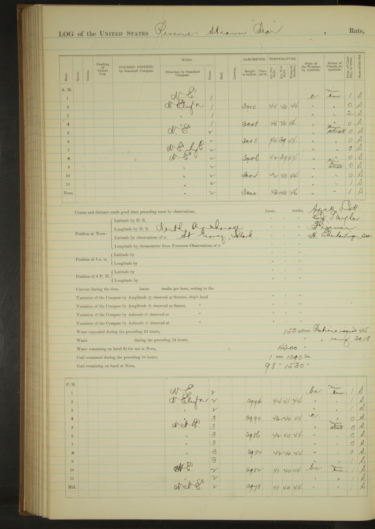
50874d5e09d40907550015dd: (http://oldweather.s3.amazonaws.com/ow3/final/USRC Bear/vol068/vol068_162_1.jpg)
2 October 1890
North anchorage, St. George Island
Lat 56.61, Long -169.55
Sick list: H Eberhartinger, Seaman [to 4th October].
8am to meridian:
At 8.50 sighted anchor and shifted anchorage. Flagstaff bearing SEbyS¼S, Eastern point EbyN¼N. Crew scrubbing paintwork and varnishing bright woodwork of boats.
Meridian to 4pm;
Crew at work on boats and boat spars and scraping foremast.
4pm to 6pm:
Took on board for passage to St. Paul Island the native man and woman brought from there on September 15.
50874d5e09d40907550015df: (http://oldweather.s3.amazonaws.com/ow3/final/USRC Bear/vol068/vol068_163_0.jpg)
50874d5e09d40907550015e1: (http://oldweather.s3.amazonaws.com/ow3/final/USRC Bear/vol068/vol068_163_1.jpg)
3 October 1890
North anchorage, St. George Island [to SE anchorage, St. Paul Island]
Lat 57.12, Long -170.27
Midnight to 4am:
At 2.25 got underway for St. Paul Island. 3.15: Dalnoi Point abeam.
4am to 8am:
6.30: Polovina Mountain NWbyN¾N, Otter Island WbyN¼N. 7.40: steered for SE anchorage, St. Paul.
8am to meridian:
8.25: came to in SE anchorage, St. Paul Island. Sea Lion Rock SW¾S, Black Bluff flagstaff NWbyW.
Landed passengers. Special Treasury Agent communicated with Commanding Officer. Crew employed on boats spars, etc.
At anchor 18 hours
Underway 6 hours
Steam and sail 2 hours 45 minutes, 17.7 miles.
Steam 5 hours 15 minutes, 19.3 miles.
Total 37.0 miles.
50874d5e09d40907550015e3: (http://oldweather.s3.amazonaws.com/ow3/final/USRC Bear/vol068/vol068_164_0.jpg)
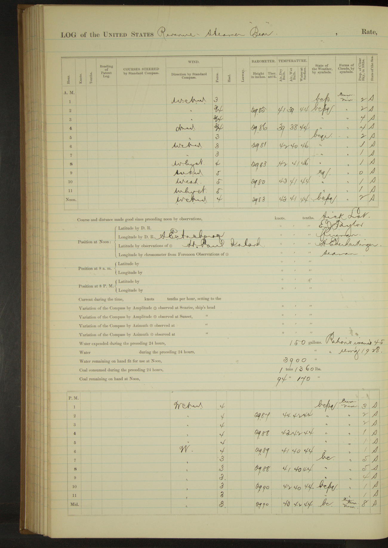
50874d5e09d40907550015e5: (http://oldweather.s3.amazonaws.com/ow3/final/USRC Bear/vol068/vol068_164_1.jpg)
4 October 1890
SE anchorage, St. Paul Island
Lat 57.12, Long -170.27
Meridian to 4pm:
Crew overhauling clothing.
50874d5e09d40907550015e7: (http://oldweather.s3.amazonaws.com/ow3/final/USRC Bear/vol068/vol068_165_0.jpg)
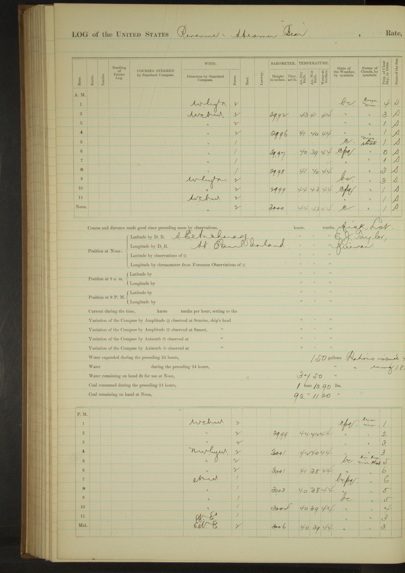
50874d5e09d40907550015e9: (http://oldweather.s3.amazonaws.com/ow3/final/USRC Bear/vol068/vol068_165_1.jpg)
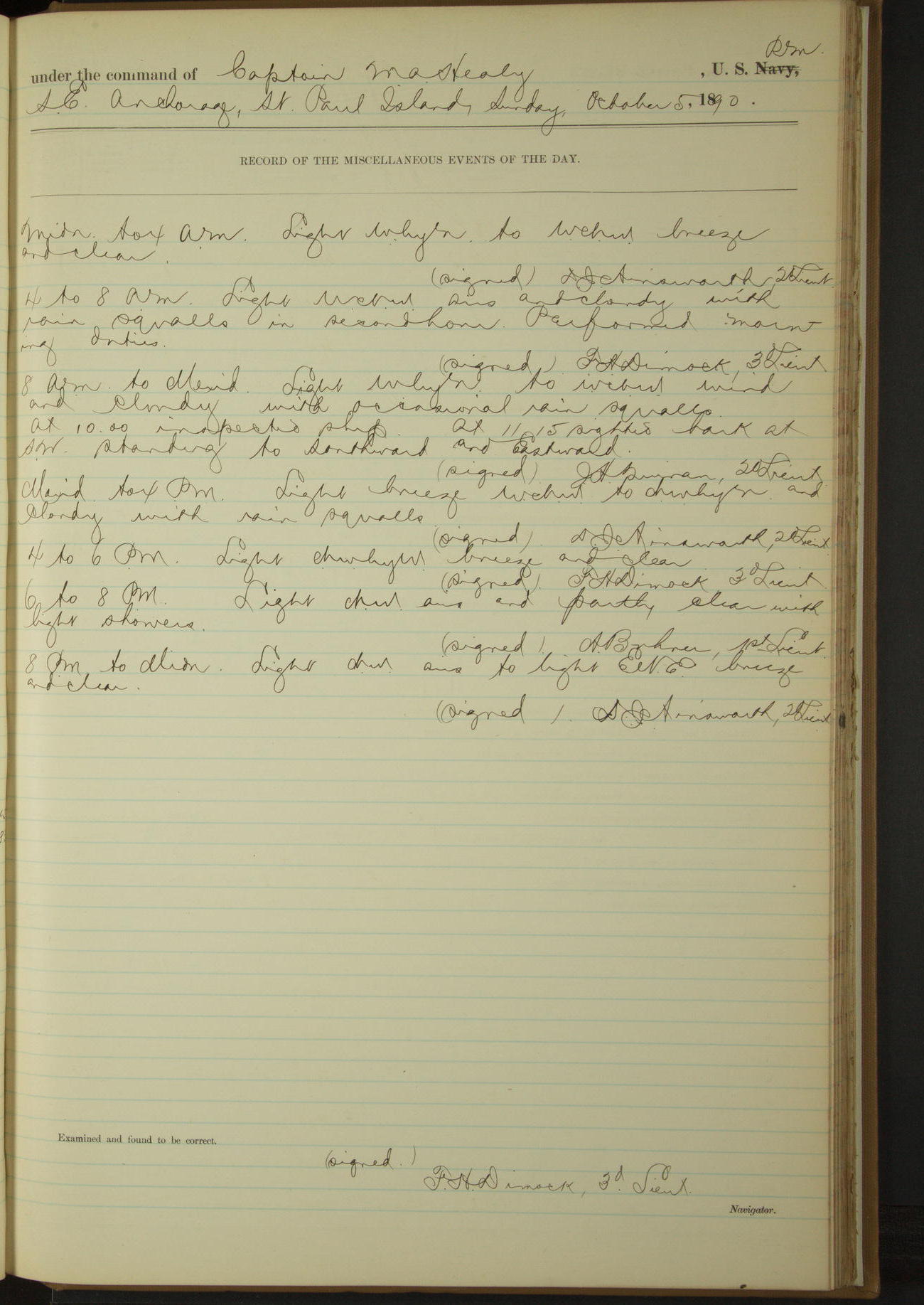
5 October 1890
SE anchorage, St. Paul Island
Lat 57.12, Long -170.27
8am to meridian:
At 11.15 sighted bark at SW standing to Southward and Eastward.
50874d5e09d40907550015eb: (http://oldweather.s3.amazonaws.com/ow3/final/USRC Bear/vol068/vol068_166_0.jpg)
50874d5e09d40907550015ed: (http://oldweather.s3.amazonaws.com/ow3/final/USRC Bear/vol068/vol068_166_1.jpg)
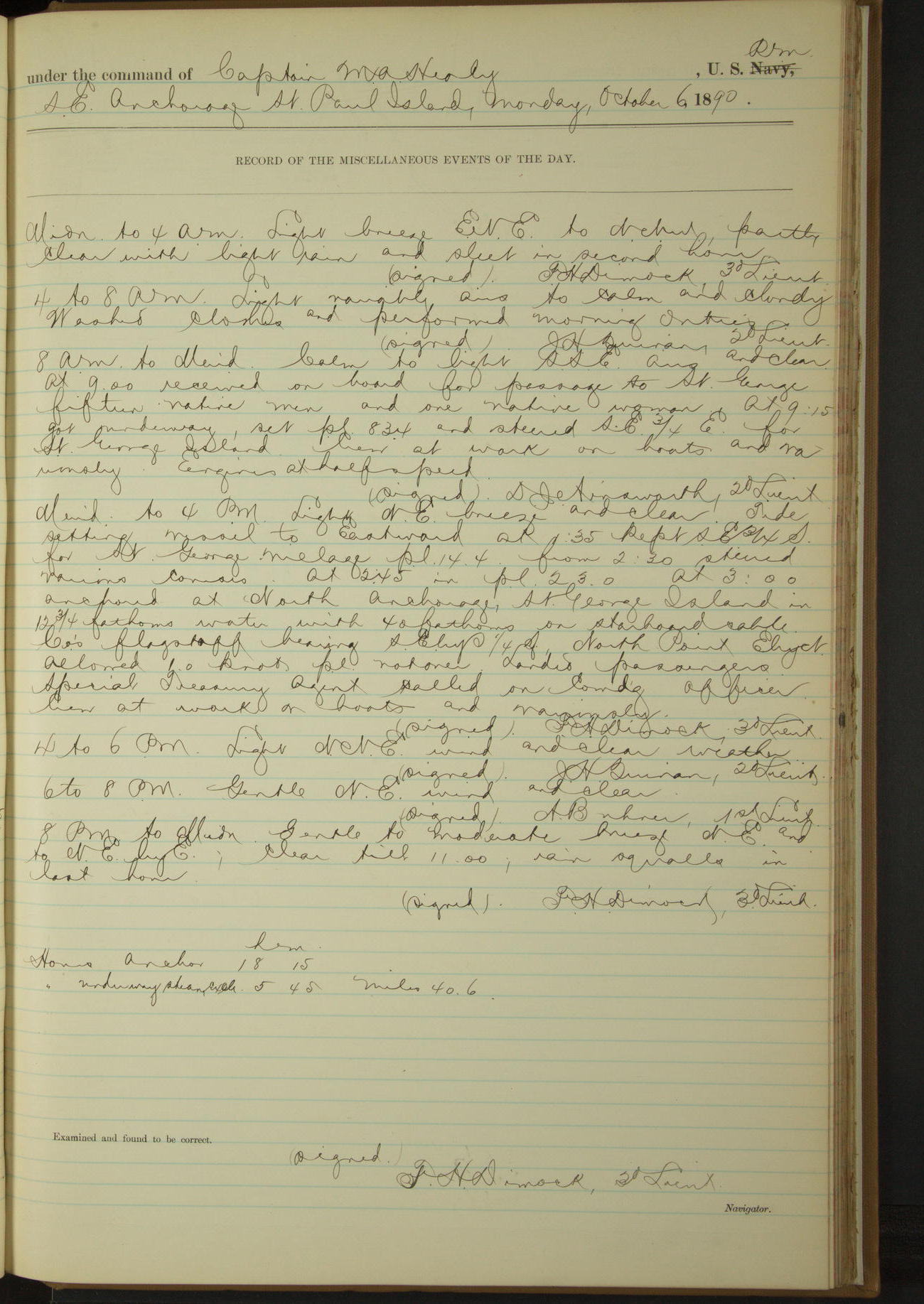
6 October 1890
SE anchorage, St. Paul Island [to St. George Island]
Lat 56.86, Long -169.87 [Estimate from noon bearings]
4am to 8am:
Washed clothes.
8am to meridian:
At 9.00 received on board for passage to St. George, fifteen native men and one native woman. At 9.15 got underway. Crew at work on boats and variously.
Noon: Dalnoi Point, St. George Island SEbyS½S, 15 miles.
Meridian to 4pm:
Tide setting vessel to Eastward. At 1.35 kept SE¾S for St. George village. At 3.00 anchored at North anchorage, St. George Island. Flagstaff bearing SEbyS¼S, North Point EbyN.
Landed passengers. Special Treasury Agent called on Commanding Officer. Crew at work on boats and variously.
At anchor 18 hours 15 minutes.
Underway steam exclusively 5 hours 45 minutes, 40.6 miles.
50874d5e09d40907550015ef: (http://oldweather.s3.amazonaws.com/ow3/final/USRC Bear/vol068/vol068_167_0.jpg)
50874d5e09d40907550015f1: (http://oldweather.s3.amazonaws.com/ow3/final/USRC Bear/vol068/vol068_167_1.jpg)
7 October 1890
North anchorage, St. George Island [to SW Bay]
Lat 56.57, Long -169.68
4am to 8am:
Fresh NEbyE breeze to moderate NE gale, cloudy and squally. 5.25: wind and sea increasing. At 6.15 wind freshening, got underway and steered various courses around island for shelter. 7.20 sighted a schooner to Southward and Westward standing to Southward.
8am to meridian:
Strong to very strong gale and squalls NEbyN with rain and mist in last hour. Steering various courses along land. At 8.55 anchored in SW Bay, St. George Island. Salt House bearing NEbyE¼E, SE Point SE¾E.
Meridian to 4pm:
Very strong to violent gale NEbyN with rain and mist. At 1.35 steamed ahead and let go port anchor, veering to 25 fathoms on port chain and 75 fathoms on starboard.
4pm to 6pm:
Violent gale NEbyN, overcast and rainy. Barometer low and falling rapidly.
8pm to midnight:
Moderate NEbyN to strong EbyN gale, overcast, rainy and squally. At 11.20 hove up port anchor.
At anchor 21 hours 20 minutes.
Underway, steamed 2 hours 40 minutes, 17.5 miles.
50874d5e09d40907550015f3: (http://oldweather.s3.amazonaws.com/ow3/final/USRC Bear/vol068/vol068_168_0.jpg)
50874d5e09d40907550015f5: (http://oldweather.s3.amazonaws.com/ow3/final/USRC Bear/vol068/vol068_168_1.jpg)
8 October 1890
SW Bay, St. George Island [& at sea]
Lat 56.57, Long -169.68
4am to 8am:
Moderate NE breeze, overcast, rainy and squally. Barometer fallen to 28.04. At 8.00 hove in to 50 fathoms on starboard cable.
8am to meridian:
Crew at work on boat gear, sail covers etc.
Meridian to 4pm:
Crew as in forenoon.
4pm to 6pm:
Moderate breeze NE to NWbyW, overcast and rainy. Confused sea from Southward. At 5.45 wind and swell coming from Westward, got underway.
6pm to 8pm:
At 6.05 SE point, St. George bore ENE 1½ miles. At 7.00 stopped engines and hove vessel to on starboard tack heading SW.
At anchor 17 hours 45 minutes.
Underway 6 hours 15 minutes.
Steam exclusively 1 hour 15 minutes, 8.2 miles.
Sail exclusively 5 hours, 5.0 miles.
[Total] 13.2 miles.
50874d5e09d40907550015f7: (http://oldweather.s3.amazonaws.com/ow3/final/USRC Bear/vol068/vol068_169_0.jpg)
50874d5e09d40907550015f9: (http://oldweather.s3.amazonaws.com/ow3/final/USRC Bear/vol068/vol068_169_1.jpg)
9 October 1890
At sea
Lat 55.98, Long -169.55
Sick list: S Benney, Seaman.
Midnight to 4am:
Very strong breeze to strong gale and rough sea WbyN. At 2.30 wind and sea increasing, took in and furled fore topmast staysail. Vessel hove to on starboard tack under trysail, double-reefed mainsail and reefed spanker.
4am to 8am:
Strong to very strong gale and heavy sea WbyN. Wind and sea increasing; hung a canvas bag over weather bow, preventing the sea from breaking. Vessel rolling deeply, but easily. Hove to as in previous watch.
8am: Lat 56° 15’N, Long 169° 36’W
8am to meridian:
Very strong gale [Force 10] WbyN to West, heavy cross sea. At 11.00 reefed trysail.
Meridian to 4pm:
Strong gale and heavy squalls West and cloudy with sleet and rain at times from 2.00. Heavy cross sea. At 2.40 tacked ship (with steam), turned one reef out of mainsail and headed to Northward and Westward. Vessel laboring badly, broke quantities of cabin and wardroom crockery.
4pm to 6pm:
Very strong gale and heavy sea West. Cloudy and ugly with heavy squalls of sleet. Vessel hove to as in previous watch.
8pm: Lat 55° 59’N, Long 169° 16’W
8pm to midnight:
Strong to moderate gale and heavy sleet squalls West and partly clear. Heavy cross sea. Moderating towards midnight.
Under sail exclusively 24 hours. Distance 30 miles.
50874d5e09d40907550015fb: (http://oldweather.s3.amazonaws.com/ow3/final/USRC Bear/vol068/vol068_170_0.jpg)
50874d5e09d40907550015fd: (http://oldweather.s3.amazonaws.com/ow3/final/USRC Bear/vol068/vol068_170_1.jpg)
10 October 1890
Behring Sea
Lat 56.12, Long -168.67
Sick list: S Benney, Seaman.
Midnight to 4am:
Strong to very strong gale and heavy sea WbyN, cloudy and ugly with heavy squalls of sleet and rain. Vessel hove to on port tack.
4am to 8am:
Strong gale WbyN to WbyS and heavy cross sea, cloudy and squally. At 6.30 shook reef out of trysail, and set fore topmast staysail. At 7.00 in setting lower topsail, carried away foot rope of sail. Unbent upper and lower topsails and stowed them below.
8am: Lat 56° 9’N, Long 168° 37’W
Meridian to 4pm:
Strong to fresh breeze WSW to WbyS, partly clear and squally. Rain squalls from 12.00 to 2.00. Rough sea. At 4.00 made St. George Island bearing by compass WNW distant 30 miles.
8pm: Lat 56° 16’N, Long 168° 45’W
Underway 24 hours.
Steam exclusively 4 hours. Distance 11.4 miles.
Sail exclusively 20 hours. Distance 29.3 miles.
[Total] Distance 40.7 miles.
50874d5e09d40907550015ff: (http://oldweather.s3.amazonaws.com/ow3/final/USRC Bear/vol068/vol068_171_0.jpg)
50874d5e09d4090755001601: (http://oldweather.s3.amazonaws.com/ow3/final/USRC Bear/vol068/vol068_171_1.jpg)
11 October 1890
Behring Sea [& St. George Island & St. Paul Island]
Lat 56.58, Long -169.46 [Estimate from noon bearings]
Sick list: H Eberhartinger, Seaman.
Midnight to 4am:
At 2.15 made Tolstoi Point, St. George Island WbyN, 6 miles.
4am to 8am:
At 4.30 steered toward Garden Cove. From 5.30 steered various courses around Tolstoi Point. At 6.50 in Garden Cove, landing appearing practicable, turned and stood to Northward for village. Steering various courses around Tolstoi Point.
8am to meridian:
Fresh to strong breeze WbyN. Moderate to rough NW sea. Landing impracticable at village at 9.45, in patent log and anchored in Garden Cove. Sent officer and boats ashore and brought ten natives brought from St. Paul on October 6. At 11.40 underway and steered various courses around Tolstoi Point. Wind and sea increasing.
Noon: Tolstoi Point, St. George Island NW¾N, 1 mile.
Meridian to 4pm:
Fresh breeze WbyN, partly clear and squally. Rough head sea. At 1.50 while clearing cutter’s fall, H Eberhartinger, Seaman, fell overboard; threw over life buoy, lowered boat and rescued him. Not seriously injured, placed him in Surgeon’s care [water temperature 44°F]. Failed to recover life buoy. At 2.00 ahead full speed.
4pm to 6pm:
Fresh breeze and heavy squalls with snow and sleet from WbyN, rough head sea. At 5.00 made St. Paul’s Island NWbyW 25 miles.
8pm: Lat 57° 2’N, Long 170° 9’W
8pm to midnight:
Strong breeze WbyN to WNW with heavy squalls of snow and sleet. From 8.50 steered various courses for anchorage. 9.55 anchored in SE anchorage St. Paul Island. SE Point SW½W, Whale Point [Kitovi Point] N½W.
At anchor 24 hours [presumably should be 4 hours].
Underway 20 hours.
Steam and sail 30 minutes. Distance 3.2 miles.
Steam 18 hours. Distance 80.8 miles.
Sail 1 hour 30 minutes. Distance 5.3 miles.
[Total] Distance 89.3 miles.
50874d5e09d4090755001603: (http://oldweather.s3.amazonaws.com/ow3/final/USRC Bear/vol068/vol068_172_0.jpg)
50874d5e09d4090755001605: (http://oldweather.s3.amazonaws.com/ow3/final/USRC Bear/vol068/vol068_172_1.jpg)
12 October 1890
SE anchorage, St. Paul Island
Lat 57.12, Long -170.26
Sick list: H Eberhartinger, Seaman.
8am to meridian:
Special Treasury Agent visited Commanding Officer. Landed native passengers.
Meridian to 4pm:
Received on board mail and packages for Southern points of residents of St. Paul island.
50874d5e09d4090755001607: (http://oldweather.s3.amazonaws.com/ow3/final/USRC Bear/vol068/vol068_173_0.jpg)
50874d5e09d4090755001609: (http://oldweather.s3.amazonaws.com/ow3/final/USRC Bear/vol068/vol068_173_1.jpg)
13 October 1890
SE anchorage, St. Paul Island [to St. George Island & at sea]
Lat 56.57, Long -169.68
Midnight to 4am:
Moderate NNE to strong N wind, overcast with frequent snow squalls and threatening weather. At 2.20 got underway.
4am to 8am:
At 5.40 made Dalnoi Point, St. George Island, SbyE¾E, 17 miles. At 6.00 hauled up SEbyE for village.
8am to meridian:
Strong to fresh NW wind and overcast with heavy snow squalls. At 8.30 abreast of village, steered various courses around East side of St. George Island.
At 11.00 anchored in SW Bay. Salt House bearing NbyE½E, East Point SE¾E, West Point WbyN. Sent officer ashore to communicate with residents and receive mail.
Meridian to 4pm:
Strong WNW wind and cloudy with frequent snow squalls. Moderately rough and increasing sea.
At 3.35 officer returned bringing mail and Robert Bennett, cook for NAC Co, who is received on board for transportation to San Francisco at the request of Special Treasury Agent Lavender and Agent Fowler of the NAC Co, being discharged and sent from the island for dishonesty and dissolute conduct; issued a ration to Bennett.
At 3.45 got underway.
4pm to 6pm:
4.20: SE point St. George Island NE¼N, 1¼ miles.
8pm: Lat 56° 12’N, Long 169° 17’W
At anchor 7 hours 5 minutes. Under steam 2 hours 50 minutes.
Underway 16 hours 55 minutes. Under sail 7 hours 50 minutes.
Steam and sail 6 hours 15 minutes. Distance steam and sail 39.5 miles.
Distance steam 17.9 miles.
Distance sail 40.9 miles.
Distance total 98.3 miles.
50874d5e09d409075500160b: (http://oldweather.s3.amazonaws.com/ow3/final/USRC Bear/vol068/vol068_174_0.jpg)
50874d5e09d409075500160d: (http://oldweather.s3.amazonaws.com/ow3/final/USRC Bear/vol068/vol068_174_1.jpg)
14 October 1890
Behring Sea
Lat 54.97, Long -167.82
4am to 8am:
Fresh breeze NWbyW to West and partly clear. Snow squalls at 6.00 and 7.30; rough sea on quarter. Vessel rolling deeply. A bark, presumably a whaler, in sight to Northward and Eastward at 7.00.
8am: Lat 55° 21’N, Long 168° 10’W
4pm to 6pm:
Moderate breeze WNW, backing to SWbyW in snow squalls at end of watch, rough sea on quarter.
8pm: Lat 54° 21’N, Long 166° 52’W
Under sail exclusively 24 hours. 117.7 miles.
50874d5f09d409075500160f: (http://oldweather.s3.amazonaws.com/ow3/final/USRC Bear/vol068/vol068_175_0.jpg)
50874d5f09d4090755001611: (http://oldweather.s3.amazonaws.com/ow3/final/USRC Bear/vol068/vol068_175_1.jpg)
15 October 1890
Behring Sea [& Ounalaska]
Lat 53.88, Long -166.53
Sick list: H Eberhartinger, Seaman [to 18th October].
Midnight to 4am:
At 2.15 made land Cape Cheerful SE½E, distant 16 miles. At 4.00 within 5 miles of land hauled by the wind to await daylight.
4am to 8am:
5.20: in and furled all sail. Started engines full speed. At 6.00 Cape Cheerful SWbyS½S, 1 mile. At 7.00 rounded Ulakhta Head and steered various courses into Ounalaska Harbor. 7.45: made fast to wharf at Ounalaska.
8am to meridian:
Crew painting ship outside and watering ship. At 11.00 hauled fires and blew down boiler. Surgeon gave medical assistance to residents and natives.
Meridian to 4pm:
Finished watering ship having received 4700 gallons. Painted outside of ship, boats and smoke stack. The mineral sperm oil furnished the vessel for use in binnacle and other lamps having been poor from the first, and becoming practically worthless with the approach of colder weather, purchased from the Alaska Commercial Co 20 gallons kerosene oil.
At anchor 16 hours 15 minutes.
Underway 7 hours 45 minutes.
Steam and sail 1 hour 15 minutes. Distance 7.5 miles.
Steam exclusively 2 hours 25 minutes. Distance 17.0 miles.
Sail exclusively 4 hours 5 minutes. Distance 5.5 miles.
Total 30.0 miles.
50874d5f09d4090755001613: (http://oldweather.s3.amazonaws.com/ow3/final/USRC Bear/vol068/vol068_176_0.jpg)
50874d5f09d4090755001615: (http://oldweather.s3.amazonaws.com/ow3/final/USRC Bear/vol068/vol068_176_1.jpg)
16 October 1890
Ounalaska
Lat 53.88, Long -166.53
4am to 8am:
At 6.50 began coaling ship.
Meridian to 4pm:
Moderate to fresh NW wind with heavy snow squalls at intervals. At 2.50 finished coaling having received 45 tons. Surgeon attending sick natives and residents.
50874d5f09d4090755001617: (http://oldweather.s3.amazonaws.com/ow3/final/USRC Bear/vol068/vol068_177_0.jpg)
50874d5f09d4090755001619: (http://oldweather.s3.amazonaws.com/ow3/final/USRC Bear/vol068/vol068_177_1.jpg)
17 October 1890
Ounalaska
Lat 53.88, Long -166.53
8am to meridian:
Crew cleaning ship, fishing and washing clothes. Surgeon gave medical assistance to sick on shore.
Meridian to 4pm:
Crew employed as in forenoon. Engineer’s force employed during the day filling boiler with fresh water.
50874d5f09d409075500161b: (http://oldweather.s3.amazonaws.com/ow3/final/USRC Bear/vol068/vol068_178_0.jpg)
50874d5f09d409075500161d: (http://oldweather.s3.amazonaws.com/ow3/final/USRC Bear/vol068/vol068_178_1.jpg)
18 October 1890
Ounalaska
Lat 53.88, Long -166.53
8am to meridian:
Allowed portion of crew to go fishing, remainder employed upon bright work, sails and rigging.
Meridian to 4pm:
At 1.30 Revenue steamer “Bertha” (chartered from Karluk Packing Co) under command of Captain Glover USRM arrived in port, 13 days from Strait of Fuca. At 3.00 steamer “Bertha” made fast alongside “Bear”. Captain Glover communicated Department orders to Commanding Officer. Fishing party returned.
50874d5f09d409075500161f: (http://oldweather.s3.amazonaws.com/ow3/final/USRC Bear/vol068/vol068_179_0.jpg)
50874d5f09d4090755001621: (http://oldweather.s3.amazonaws.com/ow3/final/USRC Bear/vol068/vol068_179_1.jpg)
19 October 1890
Ounalaska
Lat 53.88, Long -166.53
6pm to 8pm:
Discharged EJ Taylor, Fireman, for physical disability and James Saunders, Quartermaster, for incompetency and at his own request.
50874d5f09d4090755001623: (http://oldweather.s3.amazonaws.com/ow3/final/USRC Bear/vol068/vol068_180_0.jpg)
50874d5f09d4090755001625: (http://oldweather.s3.amazonaws.com/ow3/final/USRC Bear/vol068/vol068_180_1.jpg)
20 October 1890
Ounalaska
Lat 53.88, Long -166.53
Provisions received from steamer “Bertha”: beef salt 400 lbs, currants 50 lbs, beef canned 240 lbs, apples 50 lbs, pork 600 lbs, onions 300 lbs, flour 850 lbs, mustard 8 lbs, bread 382 lbs, beans 90 quarts, sugar 303 lbs, molasses 20 quarts, coffee 65 lbs, butter 240 lbs, tomatoes 240 lbs, potatoes 1800 lbs.
4am to 8am:
At 7.00 began coaling ship from steamer “Bertha”. Shipped J Lawson, Ordinary Seaman, and rated Seaman in lieu of J Saunders. Shipped A Reingarter as Coal Passer in lieu of EJ Taylor, discharged. Rated S Benney as Quartermaster and Coal Passer J Gallagher as Fireman.
Took on board from steamer “Bertha” to form additional crew of the “Bear” the following men enlisted as belonging to Revenue Steamer “Wolcott”: Thomas Thorsen, Coxswain; A Smith, J Pattersen, R Jensen and G Budge, Seamen.
Commanding Officer informed Captain Glover, commanding steamer “Bertha”, that the “Bear” would execute the orders of the Department relative to the protection of the Seal Islands, enabling Captain Glover to return the “Bertha” to San Francisco and terminate the charter.
Transferred to steamer “Bertha” for passage down, the survivors of wreck of bark “Thomas Pope”, invalids, deserters and others of the “Bear” for passage as follows: James Saunders, James Greg, John Duarto, EJ Taylor, George Harris, E Glover, A Alexandersen, LH Daniels, R Dupries, George Youle, J Price, Robert Bennett.
8am to meridian:
At 11.45 stopped coaling, having received 46 tons.
Meridian to 4pm:
Received from steamer “Bertha” stores to the amount of the list on opposite page to enable “Bear” to prolong her stay. [See above]
50874d5f09d4090755001627: (http://oldweather.s3.amazonaws.com/ow3/final/USRC Bear/vol068/vol068_181_0.jpg)
50874d5f09d4090755001629: (http://oldweather.s3.amazonaws.com/ow3/final/USRC Bear/vol068/vol068_181_1.jpg)
21 October 1890
Ounalaska [& at sea]
Lat 54.38, Long -166.87
4am to 8am:
Put ship’s mail aboard the steamer “Bertha”, received packages and mail for Seal Island. At 7.15 cast off from dock and steamed out of harbor. 7.45: stopped and spoke steam whaler “Narwhal”, McGregor, calling at Ounalaska on way to San Francisco. 7.50: ahead.
8am: Ulakhta Head WbyN½N, ½ mile.
8am to meridian:
At 9.12 Cape Cheerful SW¾S, 2 miles.
8pm: Lat 55° 20’N, Long 167° 58’W
8pm to midnight:
From 10.00 long swell from SW. Vessel rolling deeply.
At anchor 7 hours 15 minutes.
Underway 16 hours 45 minutes.
Steam and sail 13 hours. Distance 107.5 miles.
Steam exclusively 3 hours 45 minutes. Distance 24.9 miles.
Total distance 132.4 miles.
50874d5f09d409075500162b: (http://oldweather.s3.amazonaws.com/ow3/final/USRC Bear/vol068/vol068_182_0.jpg)
50874d5f09d409075500162d: (http://oldweather.s3.amazonaws.com/ow3/final/USRC Bear/vol068/vol068_182_1.jpg)
22 October 1890
Behring Sea
Lat 56.83, Long -169.82
Midnight to 4am:
Long swell from Westward. Vessel rolling deeply.
4am to 8am:
At 6.20 made land (St. George Island) NW½W, 8 miles. At 7.00 Tolstoi Point bearing NW½N.
8am to meridian:
At 8.30 Tolstoi Point SWbyW, ¾ mile. Steered various courses around N side St. George Island. 9.05 anchored off village St. George Island.
Special Treasury Agent Lavender visited Commanding Officer and reported no sealing schooners seen since the last visit of “Bear” or since September 15-17. Reported also that continuous boisterous weather had been experienced since “Bear’s” visit (October 13) making landing on the island mainly impracticable and that the seals were leaving in large numbers, those remaining being mainly pups.
The majority of the natives being ill suffering from La Grippe [influenza], Commanding Officer offered to lend part of crew to guard island, which offer was refused by Agent Lavender, he having sufficient force for protection.
At 10.05 underway and steamed at full speed for St. Paul Island. Moderately heavy swell from Southward and Westward.
Meridian to 4pm:
At 2.00 kept off to Westward of Sea Lion Rock. At 3.00 hauled up for anchorage. At 3.30 anchored in SW anchorage, St. Paul Island. South Point bearing NWbyW, Sea Lion Rock SEbyS.
At anchor 9 hours 30 minutes
Underway 14 hours 30 minutes
Steam and sail 4 hours 55 minutes. Distance 41.3 miles.
Steam exclusively 9 hours 35 minutes. Distance 67.0 miles.
Total 108.3 miles.
50874d5f09d409075500162f: (http://oldweather.s3.amazonaws.com/ow3/final/USRC Bear/vol068/vol068_183_0.jpg)
50874d5f09d4090755001631: (http://oldweather.s3.amazonaws.com/ow3/final/USRC Bear/vol068/vol068_183_1.jpg)
23 October 1890
SW anchorage, St. Paul Island [to SE anchorage]
Lat 57.12, Long -170.26
4am to 8am:
Moderately heavy SW swell. At 7.20 got underway and steered out around Sea Lion Rock for better shelter at SE anchorage.
8am to meridian:
At 8.35 anchored in SE anchorage, Sea Lion Rock SW½S, Black Bluff flagstaff NW.
At 9.30 received signals from shore that nearly everyone on the island was sick and requesting that a boat be sent. Dispatched boat with Lieutenant and Surgeon.
At 11.30 officers returned and reported majority of natives suffering from “La Grippe”, four deaths having occurred within the week. Learned from Special Treasury Agent Murray and residents that no sealing schooners or marauders had been seen; that an efficient watch was kept over the rookeries exposed to raids; that boisterous weather, mainly Westerly, had been experienced during the “Bear’s” absence and that the bull seals and many others were leaving the island.
Meridian to 4pm:
Crew setting up rigging, etc. Brought Special Treasury Agent Murray on board to communicate with Commanding Officer.
Commanding Officer offered portion of crew to assist in guarding island, which assistance was refused as unneeded by Agent Murray. He stating that with his available force he was well able to protect rookeries from being raided at this season.
4pm to 6pm:
Landed Special Treasury Agent.
At anchor 22 hours 45 minutes.
Underway steam exclusively 1 hour 15 minutes, distance 6 miles.
50874d5f09d4090755001633: (http://oldweather.s3.amazonaws.com/ow3/final/USRC Bear/vol068/vol068_184_0.jpg)
50874d5f09d4090755001635: (http://oldweather.s3.amazonaws.com/ow3/final/USRC Bear/vol068/vol068_184_1.jpg)
24 October 1890
SE anchorage, St. Paul Island
Lat 57.12, Long -170.26
8am to meridian:
Crew whitewashing lower forecastle and variously. Took on board for passage to St. George Island, four natives.
Meridian to 4pm:
At 12.10 underway. At 2.30 kept away SSE for Dalnoi Point, St. George.
4pm to 6pm:
Steered various courses around Dalnoi Point. 5.05: came to in SW Bay, St. George Island.
At anchor 19 hours 5 minutes.
Underway 4 hours 55 minutes.
Steam and sail 4 hours 25 minutes. Distance 38.5 miles.
Steam exclusively 30 minutes. Distance 2.9 miles.
Total 41.4 miles.
50874d5f09d4090755001637: (http://oldweather.s3.amazonaws.com/ow3/final/USRC Bear/vol068/vol068_185_0.jpg)
50874d5f09d4090755001639: (http://oldweather.s3.amazonaws.com/ow3/final/USRC Bear/vol068/vol068_185_1.jpg)
25 October 1890
SW Bay, St. George Island
Lat 56.57, Long -169.68
Sick list: Thomas Morrison, Seaman.
4am to 8am:
Landed native passengers.
8am to meridian:
Fresh to very strong breeze NbyW to NNW. Partly clear and squally. Moderate swell from Westward and moderate surf on beach. Vessel guarding SW Bay (Zapadnie rookery [Zapadni]) as only one about the islands subject to raid in prevalent weather.
8pm to midnight:
Strong wind NNW to NW and cloudy with snow squalls. Moderate Westerly swell. At 9.30 made out a vessel in offing to Southward of Zapadnie. Concealed lights and kept sharp lookout. At 11.00 when weather was moderately clear and object on horizon might be seen at a long distance, nothing was visible.
50874d5f09d409075500163b: (http://oldweather.s3.amazonaws.com/ow3/final/USRC Bear/vol068/vol068_186_0.jpg)
50874d5f09d409075500163d: (http://oldweather.s3.amazonaws.com/ow3/final/USRC Bear/vol068/vol068_186_1.jpg)
26 October 1890
SW Bay, St. George Island [to St. Paul & return]
Lat 56.85, Long -170.20
Sick list: Thomas Morrison, Seaman.
4am to 8am:
Fresh to moderate breeze NNW to NW and cloudy with frequent snow squalls. Long Westerly swell, heavy surf on beach.
At 7.30 got underway and steamed out to Southward and Westward to see if vessel could be seen. No vessel in sight during the watch.
8am to meridian:
At 8.55 Dalnoi Point bore NE¼N, 2 miles. No vessels in sight.
Noon: Lat 56° 51’N, Long 169° 12’W [Longitude is 1° off]
Meridian to 4pm:
At 1.45 hauled up for SE landing, St. Paul Island. At 2.10 stopped off St. Paul village. Sent Lieutenant ashore in boat to communicate intelligence of vessel’s appearance off St. George to Special Treasury Agent Murray and offer men from “Bear’s” crew to assist in guarding rookeries.
At 3.30 officer returned with report from Special Agent Murray that no vessels had been seen from the Island; that assistance in guarding rookeries was not needed; that the natives were improving somewhat in health, although two more deaths had occurred October 25 and 26 and two dangerous cases existed. At 3.30 ahead full speed for St. George Island. No vessel in sight during watch.
8pm to midnight:
Steered various courses around St. George Island to intercept possible marauders. Saw no vessels.
At anchor 7 hours 30 minutes.
Underway 16 hours 30 minutes.
Steam and sail 5 hours 55 minutes. Distance 47.5 miles.
Steam exclusively 10 hours 35 minutes. Distance 58.0 miles.
[Total] distance 105.5 miles.
50874d5f09d409075500163f: (http://oldweather.s3.amazonaws.com/ow3/final/USRC Bear/vol068/vol068_187_0.jpg)
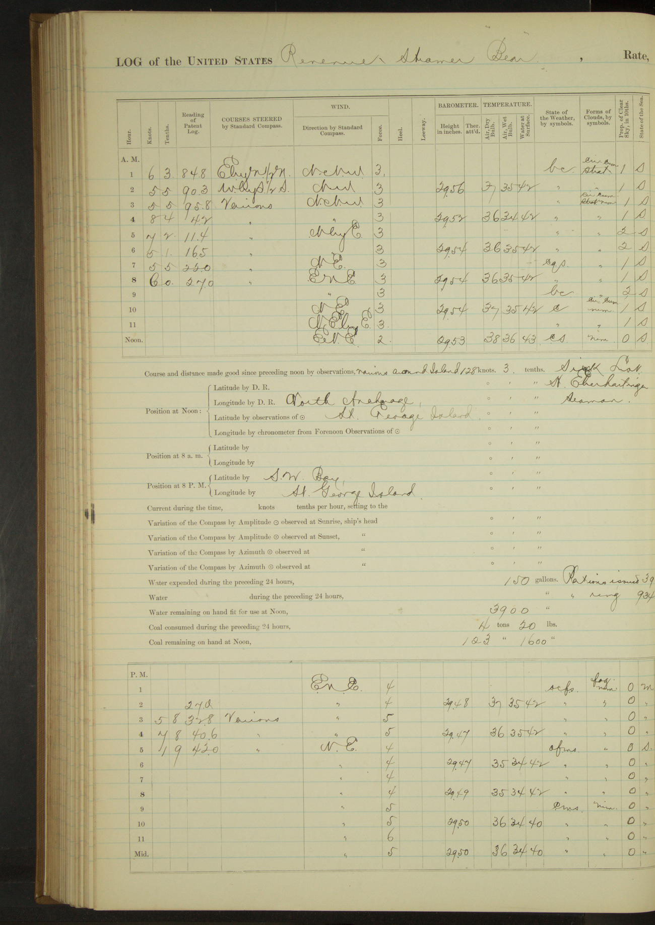
50874d5f09d4090755001641: (http://oldweather.s3.amazonaws.com/ow3/final/USRC Bear/vol068/vol068_187_1.jpg)
27 October 1890
Behring Sea [& St. George Island]
Lat 56.61, Long -169.55
Sick list: H Eberhartinger, Seaman.
Midnight to 4am:
Steering various courses around St. George Island to intercept possible marauders. Saw no vessels.
4am to 8am:
At 7.50 having made circuit of island twice during the night and seen no vessels, anchored off village.
8am to meridian:
Snowing from 11.30.
Special Treasury Agent Lavender called on Commanding Officer and reported no vessels had been seen from the island; also that two deaths had occurred from “La Grippe” but that natives were now recovering and that nearly all the seals had left.
Meridian to 4pm:
Moderate to fresh breeze ENE, overcast. Heavy snow and sleet and light fog throughout. At 2.15 got underway, steered various courses around West end of island for SW Bay.
4pm to 6pm:
Moderate NE wind and overcast with fog, mist and sleet. At 4.20 anchored in SW Bay.
At anchor 14 hours 5 minutes.
Underway, steam, 9 hours 55 minutes, 65.0 miles.
50874d5f09d4090755001643: (http://oldweather.s3.amazonaws.com/ow3/final/USRC Bear/vol068/vol068_188_0.jpg)
50874d5f09d4090755001645: (http://oldweather.s3.amazonaws.com/ow3/final/USRC Bear/vol068/vol068_188_1.jpg)
28 October 1890
SW Bay, St. George Island
Lat 56.57, Long -169.68
8am to meridian [& Meridian to 4pm]:
Crew whitewashing between decks, etc.
50874d5f09d4090755001647: (http://oldweather.s3.amazonaws.com/ow3/final/USRC Bear/vol068/vol068_189_0.jpg)
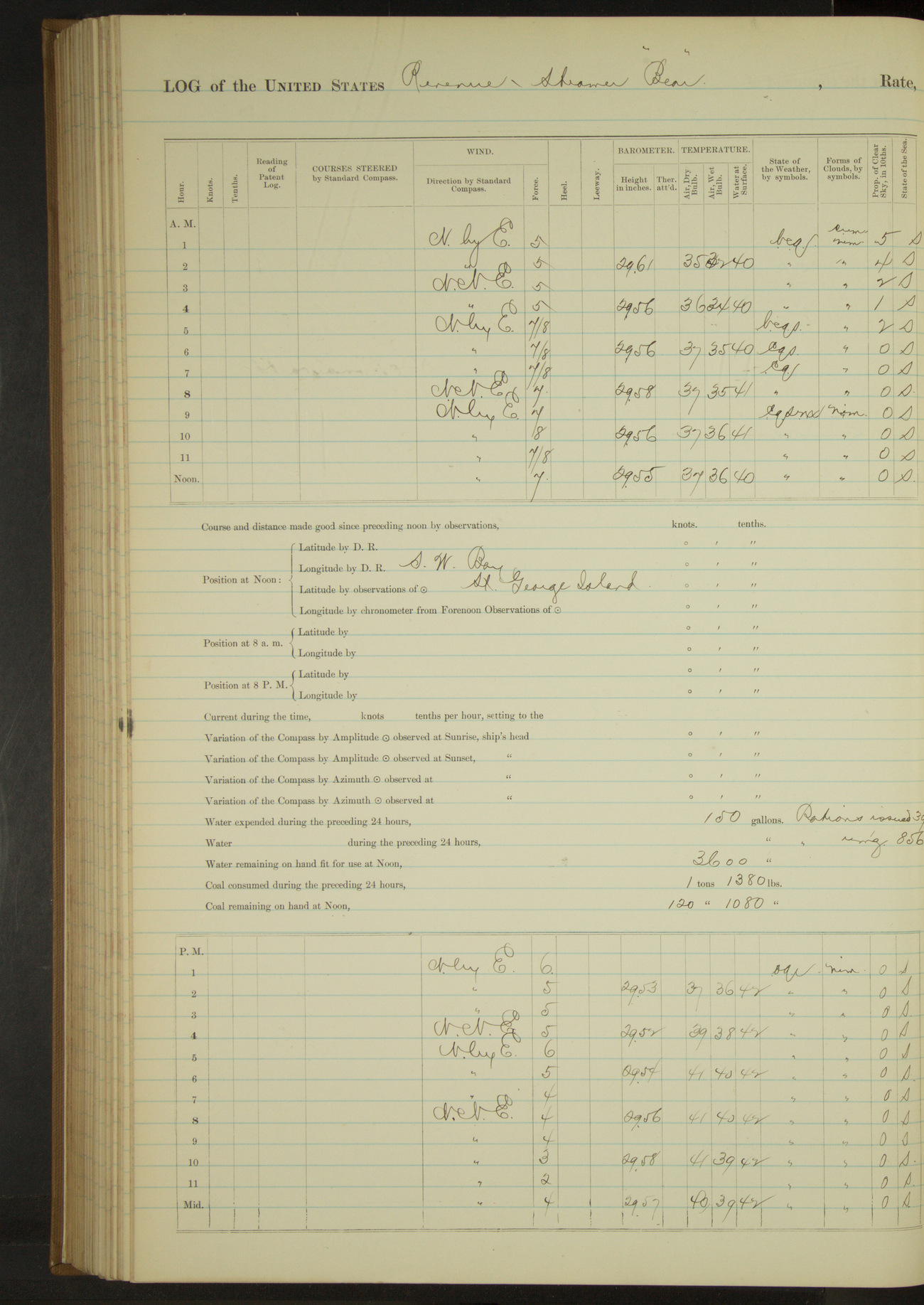
50874d5f09d4090755001649: (http://oldweather.s3.amazonaws.com/ow3/final/USRC Bear/vol068/vol068_189_1.jpg)
29 October 1890
SW Bay, St. George Island
Lat 56.57, Long -169.68
4am to 8am:
Moderate gale to very strong breeze NbyE to NNE and squally; partly clear till 5.00, sleet squalls between 5.00 and 6.00. At 5.00 heavy squalls, veered to 60 fathoms on starboard chain.
8am to meridian:
Very fresh breeze to moderate gale NbyE. Overcast and misty with snow squalls. Crew whitewashing and cleaning between decks, etc.
50874d5f09d409075500164b: (http://oldweather.s3.amazonaws.com/ow3/final/USRC Bear/vol068/vol068_190_0.jpg)
50874d5f09d409075500164d: (http://oldweather.s3.amazonaws.com/ow3/final/USRC Bear/vol068/vol068_190_1.jpg)
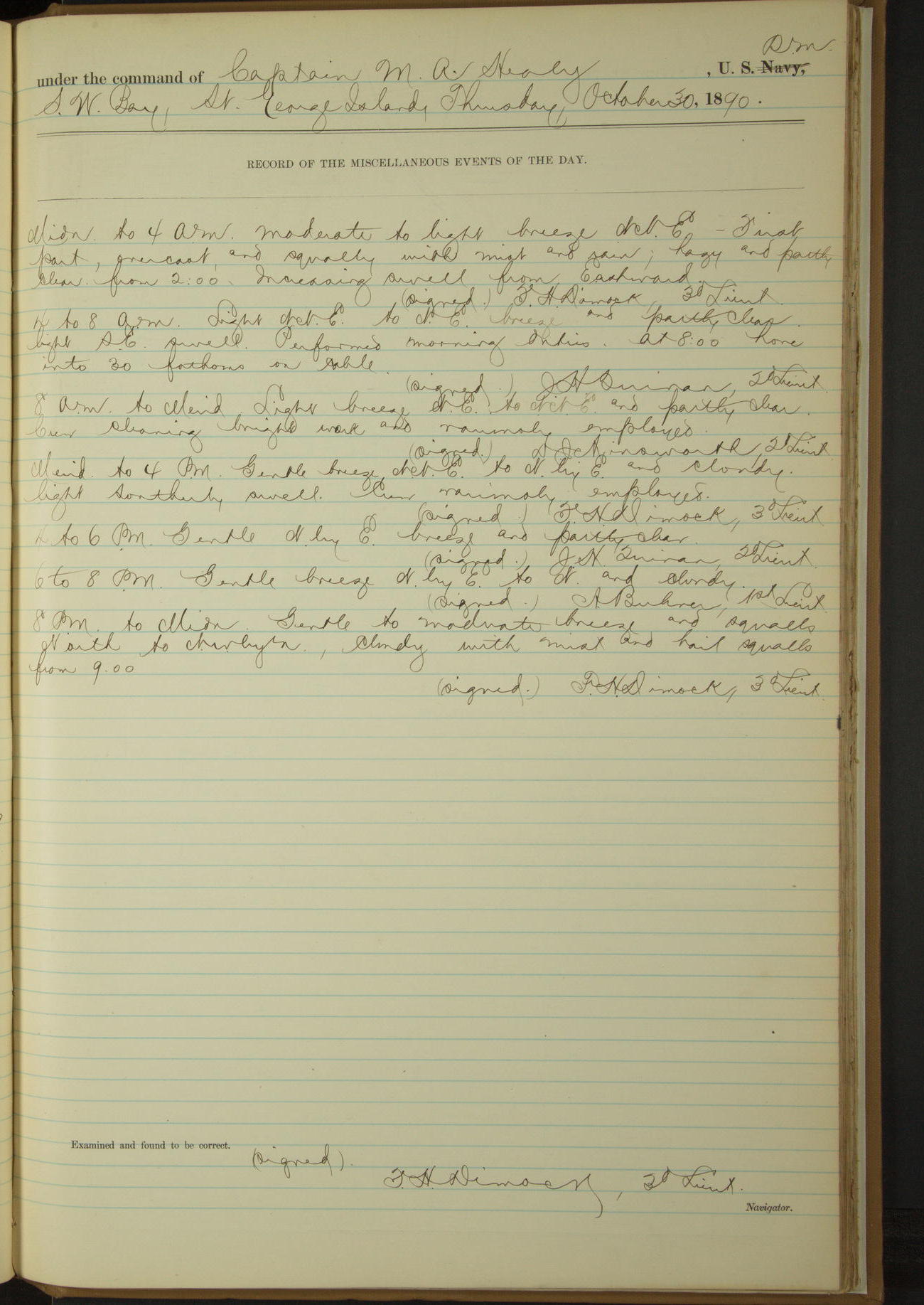
30 October 1890
SW Bay, St. George Island
Lat 56.57, Long -169.68
8am to meridian:
Crew cleaning bright work and variously employed.
50874d5f09d409075500164f: (http://oldweather.s3.amazonaws.com/ow3/final/USRC Bear/vol068/vol068_191_0.jpg)
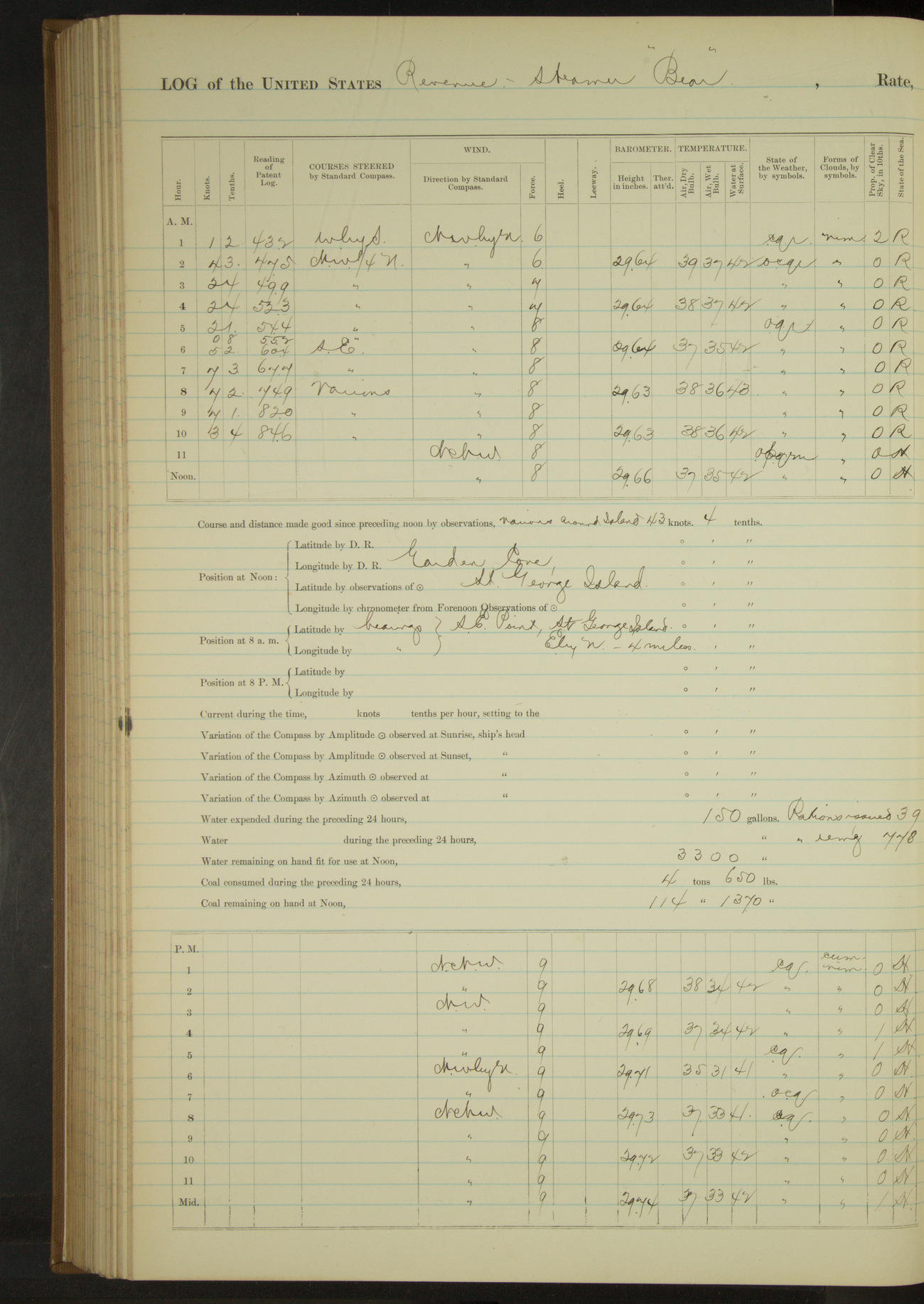
50874d5f09d4090755001651: (http://oldweather.s3.amazonaws.com/ow3/final/USRC Bear/vol068/vol068_191_1.jpg)
31 October 1890
SW Bay, St. George Island [to Garden Cove]
Lat 56.56, Long -169.53
Midnight to 4am:
At 12.30 got underway and stood out of bay. At 1.15 hauled up for St. Paul Island. Heavy head sea and increasing wind toward 4.00.
4am to 8am:
Very fresh breeze to moderate gale NWbyN. Overcast, rainy and squally; heavy NW sea. At 5.20 wind and sea increasing about ship, steered SE for St. George Island. From 6.50 steered various courses around South side St. George Island.
8am to meridian:
Moderate gale and heavy squalls NWbyN to NNW. Overcast and misty with rain in squalls. Rough NW sea to heavy NE swell in Garden Cove. Steered various courses around SE end St. George. 9.50: anchored in Garden Cove.
[Strong gale and heavy NE swell for rest of day]
At anchor 14 hours 40 minutes.
Underway, steam exclusively, 9 hours 20 minutes, 43.4 miles.
50874d5f09d4090755001653: (http://oldweather.s3.amazonaws.com/ow3/final/USRC Bear/vol068/vol068_192_0.jpg)
[Blank page]
50874d5f09d4090755001655: (http://oldweather.s3.amazonaws.com/ow3/final/USRC Bear/vol068/vol068_192_1.jpg)
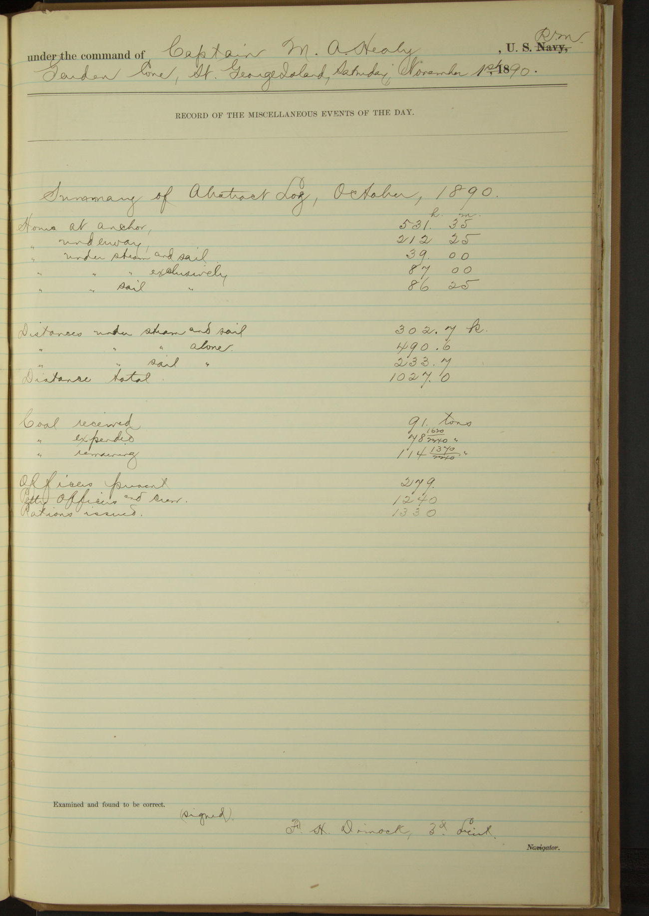
Summary of abstract, log October, 1890
At anchor 531 hours 35 minutes.
Underway 212 hours 25 minutes.
Steam and sail 39 hours.
Steam exclusively 87 hours.
Sail exclusively 86 hours 25 minutes.
Distance under steam and sail 302.7 miles.
Distance under steam alone 490.6 miles.
Distance sail alone 233.7 miles.
Distance total 1027.0 miles.
Coal received 91 tons.
Coal expended 78 1620/2240 tons.
Coal remaining 114 1370/2240 tons.
Officers present 279.
Petty Officers and crew 1240.
Rations issued 1330.
LOGS FOR NOVEMBER 1890
50874d5f09d4090755001657: (http://oldweather.s3.amazonaws.com/ow3/final/USRC Bear/vol068/vol068_193_0.jpg)
50874d5f09d4090755001659: (http://oldweather.s3.amazonaws.com/ow3/final/USRC Bear/vol068/vol068_193_1.jpg)
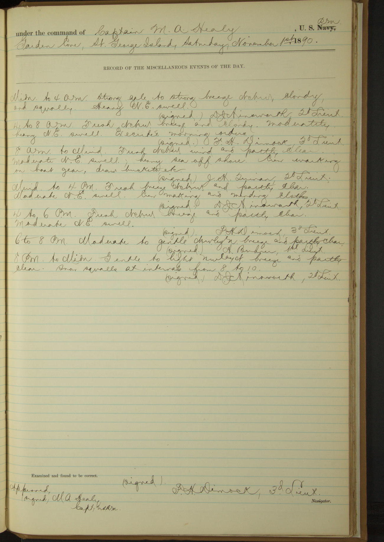
1 November 1890
Garden Cove, St. George Island
Lat 56.56, Long -169.53
8am to meridian:
Moderate NE swell; heavy sea offshore. Crew working on boat gear, draw buckets, etc.
Meridian to 4pm:
Moderate NE swell. Crew making and mending clothes.
50874d5f09d409075500165b: (http://oldweather.s3.amazonaws.com/ow3/final/USRC Bear/vol068/vol068_194_0.jpg)
50874d5f09d409075500165d: (http://oldweather.s3.amazonaws.com/ow3/final/USRC Bear/vol068/vol068_194_1.jpg)
2 November 1890
Garden Cove, St. George Island [to St. Paul Island]
Lat 57.12, Long -170.26
Sick list: M Bowen, Seaman.
Midnight to 4am:
Moderate to gentle breeze NWbyN to NWbyW and partly clear with heavy snow squalls at intervals. Moderate head sea. At 12.45 underway, steamed out from anchorage. Steamed various courses around Tolstoi Point. 1.45: Tolstoi Point SWbyS, 1 mile. Steered for St. Paul Island.
4am to 8am:
At 5.40 made land ahead NW¾W, distant about 15 miles. From 7.00 steered various courses for anchorage, St. Paul Island. At 8.00 shoulder ring on stock of starboard anchor being carried away, stopped. Bent starboard cable to port anchor.
8am to meridian:
At 8.20 ahead. 8.30: came to in SE anchorage, St. Paul. Shifted starboard bower to port side, secured shoulder hand in place on stock with Turk’s head. Bent port chain and got anchor on bow.
Special Treasury Agent Murray visited vessel. Reported no vessels sighted from the island since the last visit of the “Bear”; also that natives were recovering from epidemic, seven deaths having occurred in all. Also that many seals were leaving the island.
Meridian to 4pm:
At 2.55 underway. Steamed along shore to Northward and Eastward.
4pm to 6pm:
At 4.15 hauled in for anchorage. 4.40: came to East side NE Point. Poluvina Mount SWbyS½S; NE Point N¾E; Walrus Island E¼S.
8pm to midnight:
At 9.00 wind and sea from Southward, underway. Steered various courses around NE point to Westward.
At 11.15 1 mile NNW of NW and NE Point a light jar was felt on deck, a heavier shock below. Vessel rolling somewhat in moderate sea at time. Soundings of 8 and 10 fathoms water had immediately before and after. See log of November 3rd and 4th.
At 11.55 anchored on West side NE Point. North point of land bearing NE½N; cross on hill EbyS.
At anchor 11 hours 35 minutes.
Under steam exclusively 12 hours 25 minutes, distance 70.5 miles.
50874d5f09d409075500165f: (http://oldweather.s3.amazonaws.com/ow3/final/USRC Bear/vol068/vol068_195_0.jpg)
50874d5f09d4090755001661: (http://oldweather.s3.amazonaws.com/ow3/final/USRC Bear/vol068/vol068_195_1.jpg)
3 November 1890
NE Point, St. Paul Island [to off North Hill, to East side NE Point]
Lat 57.21, Long -170.04 [Estimate from noon bearings]
Sick list: M Bowen, Seaman.
8am to meridian:
Very strong breeze to moderate gale and heavy squalls SSW to SWbyS. Overcast, misty and rainy. Rough sea out from under lee of land.
Observed a heavy breaker surrounded by clear water about one mile NNW from NW point of Sea Lion Hill [Hutchison Hill], indicating that shock felt previous evening might have been occasioned by grazing bottom about this spot.
At 8.50 got underway and shifted anchorage to Westward for better lee. At 9.30 anchored to Eastward and Northward of North Hill.
At 10.40 heavy swell making in from SW and vessel dragging, got underway. Steamed various courses around NE point to Eastward.
Noon: Sea Lion Hill, St. Paul Island NWbyW¼W, 3.5 miles.
Meridian to 4pm:
12.40: came to on East side of NE Point.
At anchor 21 hours 20 minutes.
Under steam exclusively 2 hours 40 minutes, distance 13.4 miles.
50874d5f09d4090755001663: (http://oldweather.s3.amazonaws.com/ow3/final/USRC Bear/vol068/vol068_196_0.jpg)
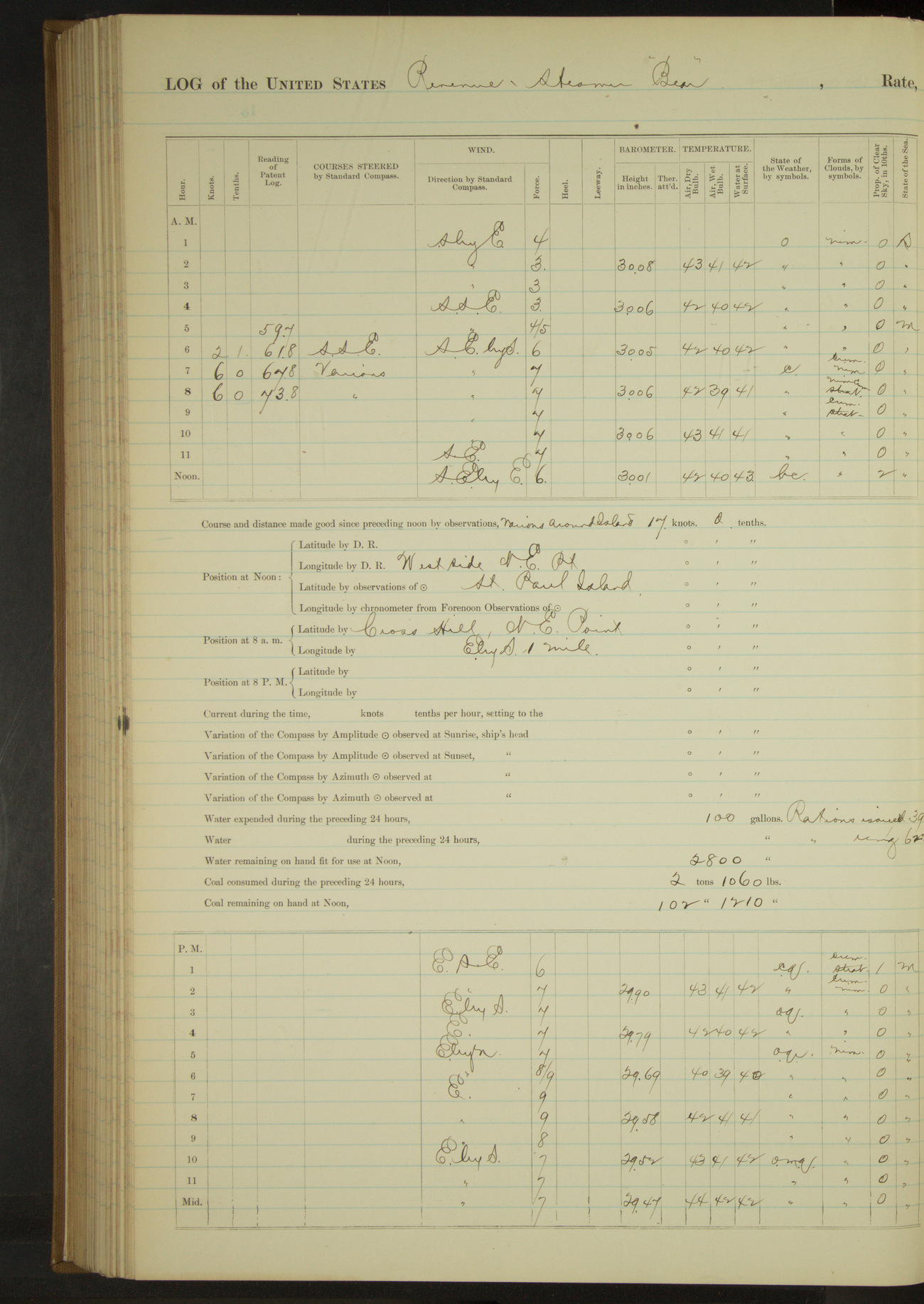
50874d5f09d4090755001665: (http://oldweather.s3.amazonaws.com/ow3/final/USRC Bear/vol068/vol068_196_1.jpg)
4 November 1890
NE Point, St. Paul Island
Lat 57.24, Long -170.15 [Estimate from anchor bearings]
4am to 8am:
Fresh to very fresh breeze SSE to SEbyS. Cloudy and squally. Moderate Southerly sea. At 5.20 wind and sea increasing from Southward and Eastward, got underway. Steered various courses around NE Point to Westward. At 8.00 anchored on West side NE Point. Cross Hill bearing EbyS, North Point NE½E.
8am to meridian:
Crew overhauling cat and fish gear and variously.
At anchor 21 hours 20 minutes.
Under steam exclusively 2 hours 40 minutes, distance 14.1 miles.
50874d5f09d4090755001667: (http://oldweather.s3.amazonaws.com/ow3/final/USRC Bear/vol068/vol068_197_0.jpg)
[Blank page]
50874d5f09d4090755001669: (http://oldweather.s3.amazonaws.com/ow3/final/USRC Bear/vol068/vol068_197_1.jpg)
For continuation see Continuation Log enclosed
50874d5f09d409075500166b: (http://oldweather.s3.amazonaws.com/ow3/final/USRC Bear/vol068/vol068_198_0.jpg)
[Blank page]
50874d5f09d409075500166d: (http://oldweather.s3.amazonaws.com/ow3/final/USRC Bear/vol068/vol068_198_1.jpg)
Continuation of the transcript Log of the U.S. Revenue Cutter “Bear” November 5th to 30th, 1890
50874d5f09d409075500166f: (http://oldweather.s3.amazonaws.com/ow3/final/USRC Bear/vol068/vol068_199_0.jpg)
50874d5f09d4090755001671: (http://oldweather.s3.amazonaws.com/ow3/final/USRC Bear/vol068/vol068_199_1.jpg)
[Blank pages]
50874d5f09d4090755001673: (http://oldweather.s3.amazonaws.com/ow3/final/USRC Bear/vol068/vol068_200_0.jpg)
50874d5f09d4090755001675: (http://oldweather.s3.amazonaws.com/ow3/final/USRC Bear/vol068/vol068_200_1.jpg)
5 November 1890
West side, NE Point, St. Paul Island [& at sea]
Lat 57.24, Long -170.15
8am to meridian [& Meridian to 4pm]:
Crew making sail covers etc.
8pm to midnight:
Moderate to fresh breeze SSW to WSW. Cloudy, misty and squally with rain at times. Clearing in last hour. Moderate NW swell. At 9.00 wind veering to Westward, hove up anchor, windlass broke, letting anchor go, lost chain pendant and beak. Hove up and secured anchor and at 9.30 got underway. Steered NWbyN for offing.
At anchor 21 hours 30 minutes
Under steam exclusively 2 hours 30 minutes, distance 13.0 miles
50874d5f09d4090755001677: (http://oldweather.s3.amazonaws.com/ow3/final/USRC Bear/vol068/vol068_201_0.jpg)
50874d5f09d4090755001679: (http://oldweather.s3.amazonaws.com/ow3/final/USRC Bear/vol068/vol068_201_1.jpg)
6 November 1890
Behring Sea [& St. Paul Island]
Lat 57.13, Long -170.15 [Estimate from noon bearings]
4am to 8am:
At 6.30 made NE point St. Paul Island SWbyS½S, 8 miles. From 7.45 steered various courses to Southward along shore St. Paul.
8am to meridian:
Cruising about St. Paul Island at half speed. Steering various courses along East side. Crew fitting stopper for anchor and variously.
Noon: Halfway Point, St. Paul Island NW½N, 1.7 miles [Polovina Point].
Meridian to 4pm:
At 12.30 off Black Bluff, turned and stood to Northward around island. At 3.30 came to off West side NE point. Cross Hill bearing EbyS, N point NE¾E.
At anchor 8 hours 30 minutes.
Under steam 15 hours 30 minutes, distance 78.0 miles.
50874d5f09d409075500167b: (http://oldweather.s3.amazonaws.com/ow3/final/USRC Bear/vol068/vol068_202_0.jpg)
50874d5f09d409075500167d: (http://oldweather.s3.amazonaws.com/ow3/final/USRC Bear/vol068/vol068_202_1.jpg)
7 November 1890
St. Paul Island [NE Point to SW anchorage]
Lat 57.24, Long -170.17 [Estimate from above bearings]
8am to meridian:
Crew making sail covers and variously employed.
Meridian to 4pm:
At 1.25 got underway and steamed various courses cruising about St. Paul Island to Westward and Southward. In sounding lost 9 lb lead and one fathom of line. Crew employed as in forenoon.
4pm to 6pm:
Steamed along South side of island. At 4.30 came to in SW anchorage.
At anchor 20 hours 55 minutes
Under steam exclusively 3 hours 5 minutes, distance 21.5 miles
50874d5f09d409075500167f: (http://oldweather.s3.amazonaws.com/ow3/final/USRC Bear/vol068/vol068_203_0.jpg)
50874d5f09d4090755001681: (http://oldweather.s3.amazonaws.com/ow3/final/USRC Bear/vol068/vol068_203_1.jpg)
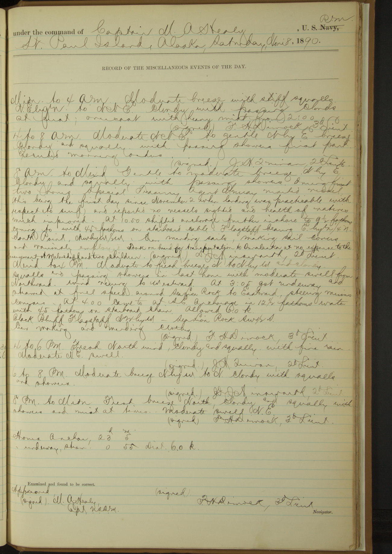
8 November 1890
St. Paul Island [SW anchorage to SE anchorage]
Lat 57.12, Long -170.31
8am to meridian:
During first two hours, Special Treasury Agent Murray visited vessel (this being the first day since November 2 when landing was practicable with respect to surf) and reported no vessels sighted and health of natives much improved.
At 10.50 shifted anchorage further inshore. Crew mending sails, making sail covers and variously employed. Took on board for transportation to Ounalaska at no expense to the Government A Melovedoff [see also 17 November & 25 April 1891] and two children.
Meridian to 4pm:
Moderate to fresh breeze N to NbyW and cloudy. Squalls and passing showers in last hour with moderate swell from Northward. Wind veering to Westward.
At 3.05 got underway, steamed at full speed around Sea Lion Rock to Eastward. At 4.00 came to at SE anchorage. Crew making and mending clothes.
At anchor 23h 5m
Under steam 55 minutes, distance 6.0 miles.
50874d5f09d4090755001683: (http://oldweather.s3.amazonaws.com/ow3/final/USRC Bear/vol068/vol068_204_0.jpg)
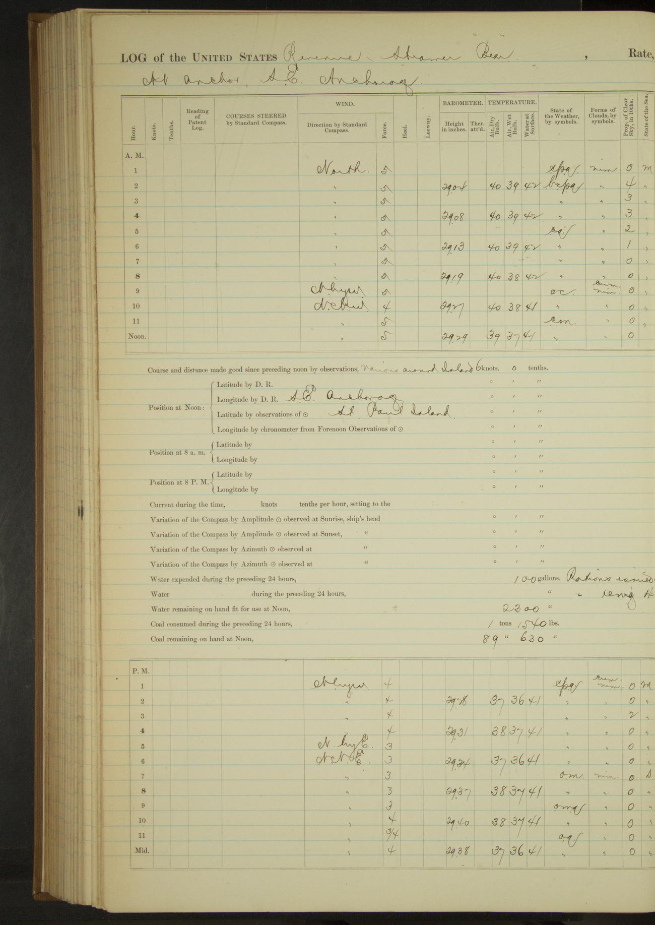
50874d5f09d4090755001685: (http://oldweather.s3.amazonaws.com/ow3/final/USRC Bear/vol068/vol068_204_1.jpg)
9 November 1890
SE anchorage, St. Paul Island
Lat 57.12, Long -170.27
50874d5f09d4090755001687: (http://oldweather.s3.amazonaws.com/ow3/final/USRC Bear/vol068/vol068_205_0.jpg)
50874d5f09d4090755001689: (http://oldweather.s3.amazonaws.com/ow3/final/USRC Bear/vol068/vol068_205_1.jpg)
10 November 1890
St. Paul Island [to St. George Island]
Lat 56.57, Long -169.70
Midnight to 4am:
At 1.00 got underway, steered for St. George Island.
4am to 8am:
At 6.00 made Dalnoi Point SbyE (mag), distant 9 miles. From 7.35 hauled up to Eastward along shore off village. Made signals for SW Bay. 7.50 turned and stood W½S.
8am to meridian:
Steered various courses around West end of St. George Island. 9.15: Dalnoi Point abeam NE¾N. 10.05: came to in SW Bay.
Meridian to 4pm:
Officer went ashore, communicated with natives from boat being unable to land safely on account of surf, and received mail and communication from Special Treasury Agent Lavender stating that no marauders or vessels had been seen from the island during the “Bear’s” absence and that the seals were rapidly disappearing from the island, also that the natives had recovered from the epidemic.
Crew employed in boat and making sail covers.
At anchor 14 hours 55 minutes.
Under steam exclusively 9 hours 5 minutes, distance 52.5 miles.
50874d5f09d409075500168b: (http://oldweather.s3.amazonaws.com/ow3/final/USRC Bear/vol068/vol068_206_0.jpg)
50874d5f09d409075500168d: (http://oldweather.s3.amazonaws.com/ow3/final/USRC Bear/vol068/vol068_206_1.jpg)
11 November 1890
St. George Island [& at sea]
Lat 55.92, Long -168.90
Sick list: H Eberhartinger, Seaman [to 28th November].
4am to 8am:
At 6.50 got underway. 7.25: SE point, St. George bore NE¼N, 2 miles.
8am to meridian:
Fresh breeze NWbyN to NW. Cloudy and squally, thick snow from 9.00 to 10.00. Increasing NW sea. Crew making mainsail cover and variously.
Meridian to 4pm:
Strong to fresh NWbyW breeze, cloudy with occasional light snow squalls. Heavy following sea. Crew employed as in forenoon.
8pm: Lat 55° 13’N, Long 168° 2’W
At anchor 6 hours 50 minutes.
Underway 17 hours 10 minutes.
Steam and sail 4 hours 50 minutes. Distance 46.0 miles.
Steam exclusively 20 minutes. Distance miles.
Sail exclusively 12 hours. Distance 72.5 miles.
[Total] distance 121.0 miles.
50874d5f09d409075500168f: (http://oldweather.s3.amazonaws.com/ow3/final/USRC Bear/vol068/vol068_207_0.jpg)
50874d5f09d4090755001691: (http://oldweather.s3.amazonaws.com/ow3/final/USRC Bear/vol068/vol068_207_1.jpg)
12 November 1890
Behring Sea [& at Ounalaska]
Lat 53.88, Long -166.52 [Estimate from noon bearings]
4am to 8am:
6.20: made land SE¾S. At 7.00 made Cape Cheerful bearing SEbyE¾E.
8am to meridian:
At 10.45 Cape Cheerful SSW, 1½ miles. At 11.40 rounded Ulakhta Head. Steered various courses into Ounalaska Harbor.
Noon: Rocky Point, Amaknak Island WNW, ½ mile.
Meridian to 4pm:
At 12.20 made fast to wharf, Ounalaska. Crew employed on sail covers, chafing gear and as required.
At anchor 11 hours 40 minutes.
Underway 12 hours 20 minutes.
Steam and sail 2 hours 35 minutes. Distance 22.0 miles.
Steam exclusively 5 hours 20 minutes. Distance 41.3 miles.
Sail exclusively 4 hours 25 minutes. Distance 22.2 miles.
[Total] distance 85.5 miles.
50874d5f09d4090755001693: (http://oldweather.s3.amazonaws.com/ow3/final/USRC Bear/vol068/vol068_208_0.jpg)
50874d5f09d4090755001695: (http://oldweather.s3.amazonaws.com/ow3/final/USRC Bear/vol068/vol068_208_1.jpg)
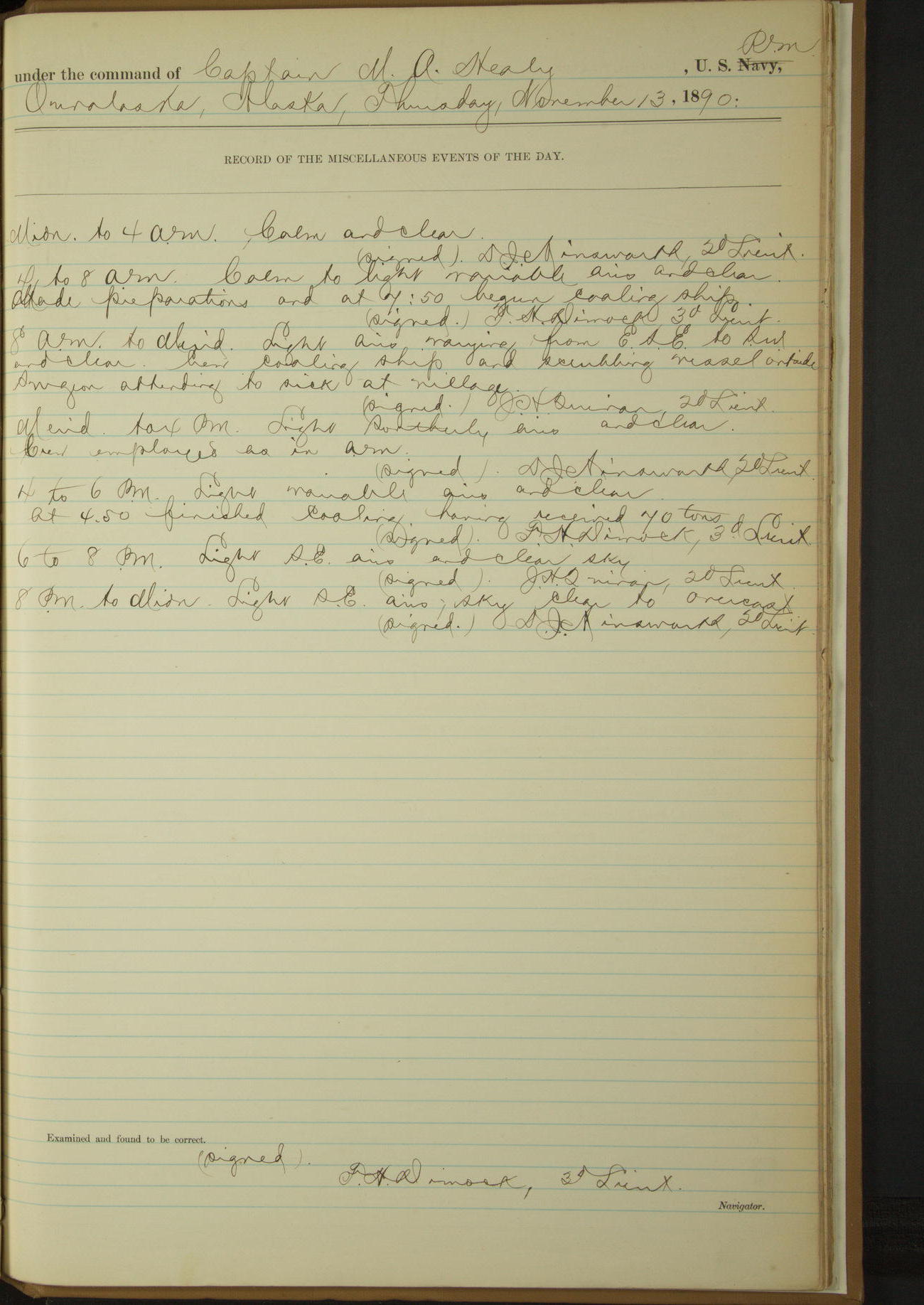
13 November 1890
Ounalaska
Lat 53.88, Long -166.53
4am to 8am:
Made preparations and at 7.50 began coaling ship.
8am to meridian:
Crew coaling ship and scrubbing vessel outside. Surgeon attending to sick at village.
Meridian to 4pm:
Crew employed as in forenoon.
4pm to 6pm:
At 4.50 finished coaling having received 70 tons.
50874d5f09d4090755001697: (http://oldweather.s3.amazonaws.com/ow3/final/USRC Bear/vol068/vol068_209_0.jpg)
50874d5f09d4090755001699: (http://oldweather.s3.amazonaws.com/ow3/final/USRC Bear/vol068/vol068_209_1.jpg)
14 November 1890
Ounalaska
Lat 53.88, Long -166.53
Midnight to 4am:
Light snow at time from 2.00. Barometer falling rapidly.
4am to 8am:
Light to moderate wind and fresh squalls SE. Overcast, misty, rainy and threatening. 6.30 got out extra lines.
8am to meridian:
Crew watering and cleaning ship. Purchased and received fifty (50) gallons kerosene (Starlight) oil.
Meridian to 4pm:
Crew watering ship, scrubbing hammocks and fishing. At 2.00 finished watering having received 4000 gallons.
8pm to midnight:
Heavy SW squalls, cloudy and threatening, with snow, rain and lightning at times.
50874d5f09d409075500169b: (http://oldweather.s3.amazonaws.com/ow3/final/USRC Bear/vol068/vol068_210_0.jpg)
50874d5f09d409075500169d: (http://oldweather.s3.amazonaws.com/ow3/final/USRC Bear/vol068/vol068_210_1.jpg)
15 November 1890
Ounalaska
Lat 53.88, Long -166.53
Midnight to 4am:
Heavy SW squalls, overcast and stormy with rain at times.
8am to meridian:
Heavy squalls veering from SW to West. Cloudy, stormy and threatening rain and sleet at times. Vessel detained in port by stormy and unsettled weather. Allowed crew to go fishing.
Meridian to 4pm:
Heavy squalls WSW to West, with snow and rain. Sky cloudy to overcast. Crew returned from fishing.
6pm to 8pm:
Heavy squalls with snow and rain veering from West to SSE. Weather stormy and unsettled.
50874d5f09d409075500169f: (http://oldweather.s3.amazonaws.com/ow3/final/USRC Bear/vol068/vol068_211_0.jpg)
50874d5f09d40907550016a1: (http://oldweather.s3.amazonaws.com/ow3/final/USRC Bear/vol068/vol068_211_1.jpg)
16 November 1890
Ounalaska
Lat 53.88, Long -166.53
4am to 8am:
Violent to heavy squalls and thick snow squalls.
8am to meridian:
Heavy squalls from WSW and snowing. Vessel detained in port by stormy and unsettled weather.
50874d5f09d40907550016a3: (http://oldweather.s3.amazonaws.com/ow3/final/USRC Bear/vol068/vol068_212_0.jpg)
50874d5f09d40907550016a5: (http://oldweather.s3.amazonaws.com/ow3/final/USRC Bear/vol068/vol068_212_1.jpg)
17 November 1890
Ounalaska [& at sea]
Lat 54.22, Long -166.75
4am to 8am:
Heavy squalls WSW to WNW. Cloudy and snowing. At 8 cast off from wharf and steamed out of harbor.
8am to meridian:
Wind varying in direction from NW to SW and in force from light to moderate with snow and sleet in squalls. 8.40: Ulakhta Head bearing WbyN½N. 10.08: Cape Cheerful abeam 2.2 miles. Crew clearing decks of snow.
Before leaving Ounalaska took on board for transportation to St. Paul Island, at no expense to the Government, Anton Melovedoff [see also 25 April 1891] brought from there on November 8.
Meridian to 4pm:
Strong breeze and heavy squalls NWbyN to NWbyW and cloudy. Snowing fast from noon to 2.00 and in squalls from 2.00 to 4.00. Rough to heavy NW sea. Vessel pitching and rolling heavily. Crew clearing decks of snow and variously.
4pm to 6pm:
Strong breeze and violent snow squalls NW. Heavy head sea. Vessel pitching badly.
6pm to 8pm:
Strong breeze to moderate gale with frequent violent squalls of snow and hail. Heavy head sea. Vessel laboring badly and shipping considerably.
At anchor 8 hours.
Underway 16 hours.
Steam and sail 35 minutes, 4.1 miles.
Steam exclusively 15 hours 25 minutes, 54.7 miles.
[Total] 58.8 miles.
50874d5f09d40907550016a7: (http://oldweather.s3.amazonaws.com/ow3/final/USRC Bear/vol068/vol068_213_0.jpg)
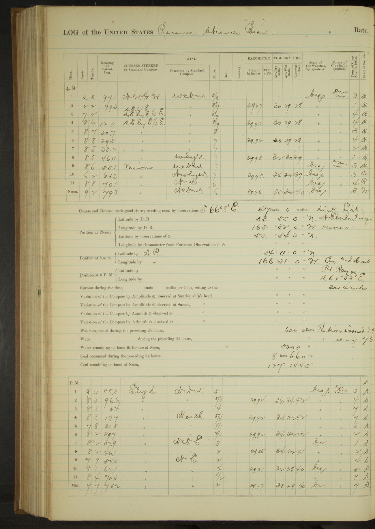
50874d5f09d40907550016a9: (http://oldweather.s3.amazonaws.com/ow3/final/USRC Bear/vol068/vol068_213_1.jpg)
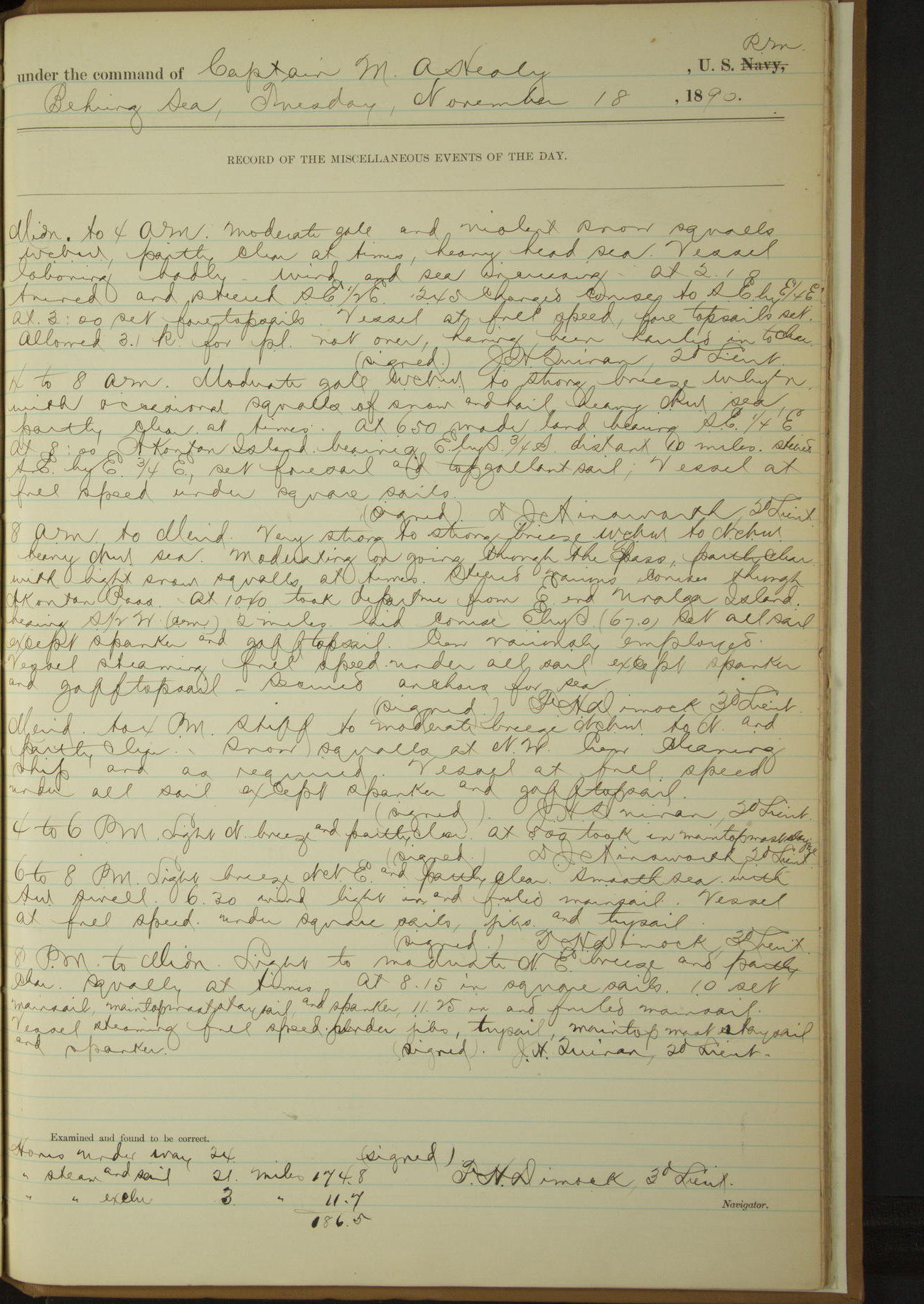
18 November 1890
Behring Sea
Lat 53.90, Long -165.53
Midnight to 4am:
Moderate gale and violent snow squalls WNW, heavy head sea. Vessel laboring badly. Wind and sea increasing. At 2.10 turned and steered SE½E. [Bear had been steering NW½W since leaving Ounalaska; never reached St. Paul] 2.45: changed course to SEbyE¾E.
4am to 8am:
Moderate gale WNW to strong breeze WbyN with occasional squalls of snow and hail, heavy NW sea. At 6.50 made land bearing SE¼E.
8am: Lat 54° 11’N, Long 166° 31’W
8am to meridian:
Very strong to strong breeze WNW to NNW. Heavy NW sea. Moderating on going through the Pass, partly clear with light snow squalls at times. Steered various courses through Akoutan Pass. At 10.40 took departure from E end Unalga Island bearing S½W, 2 miles. Secured anchors for sea.
Underway 24 hours.
Steam and sail 21 hours. Distance 174.8 miles.
Steam exclusively 3 hours. Distance 11.7 miles.
[Total] 186.5 miles.
50874d5f09d40907550016ab: (http://oldweather.s3.amazonaws.com/ow3/final/USRC Bear/vol068/vol068_214_0.jpg)
50874d5f09d40907550016ad: (http://oldweather.s3.amazonaws.com/ow3/final/USRC Bear/vol068/vol068_214_1.jpg)
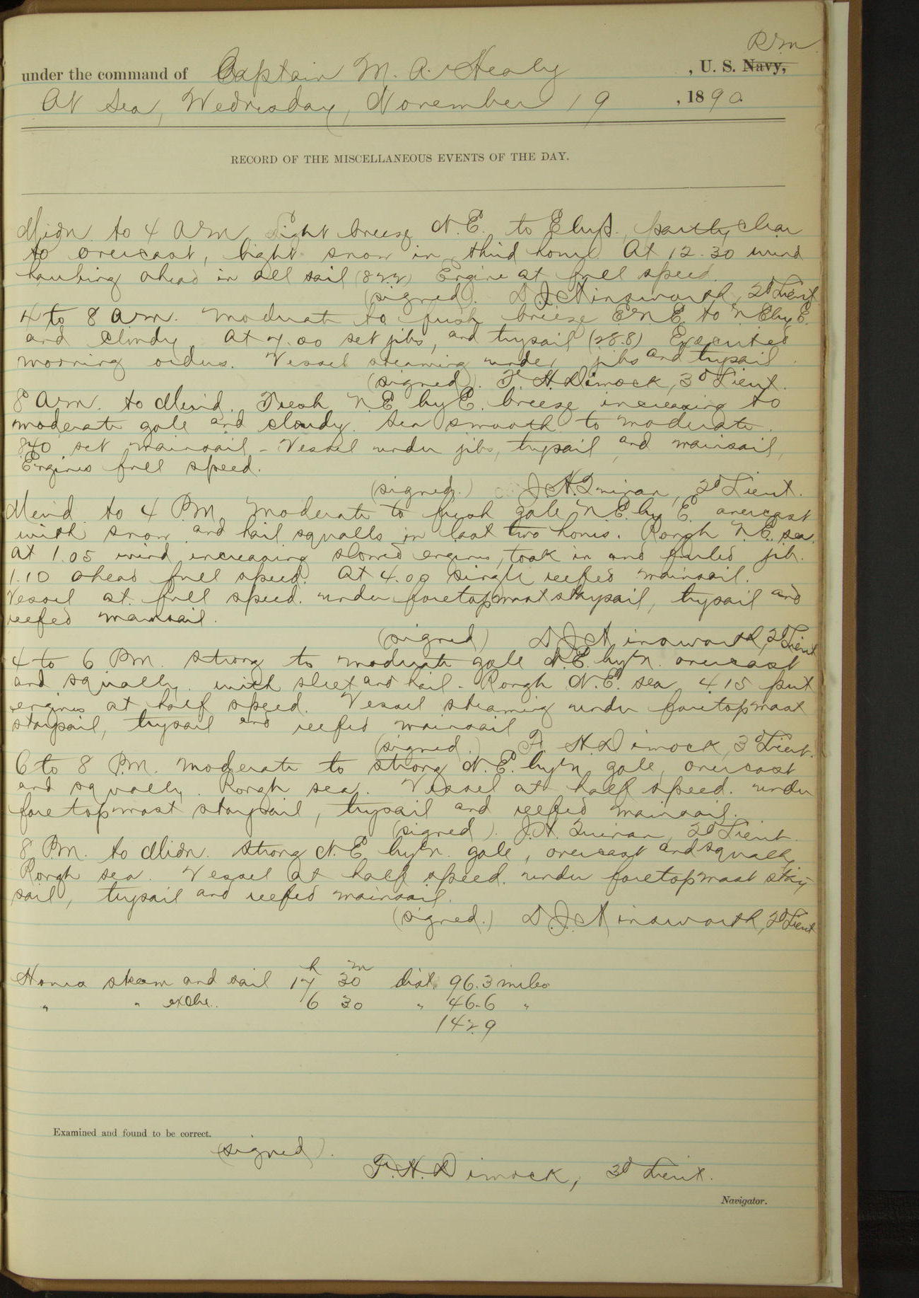
19 November 1890
At sea
Lat 52.50, Long -161.13
Steam and sail 17 hours 30 minutes. Distance 96.3 miles.
Steam exclusively 6 hours 30 minutes. Distance 46.6 miles.
[Total distance] 142.9 miles.
50874d5f09d40907550016af: (http://oldweather.s3.amazonaws.com/ow3/final/USRC Bear/vol068/vol068_215_0.jpg)
50874d5f09d40907550016b1: (http://oldweather.s3.amazonaws.com/ow3/final/USRC Bear/vol068/vol068_215_1.jpg)
20 November 1890
At sea
Lat 51.25, Long -157.55
Sick list: A McEwan, Fireman.
Commences to 4am:
Moderate gale NbyE to N. Overcast to cloudy and squally. Rough sea running to Northward and Westward. Vessel rolling and pitching heavily and breaking quantities of cabin and ward room furniture and crockery.
4am to 8am:
Moderate and decreasing gale N to NbyW with rough sea. The ship’s regular rations being exhausted, issued stores received in Ounalaska from steamer “Bertha”.
Meridian to 4pm:
Moderate gale NNW to NWbyN and cloudy with sleet squalls. Heavy Westerly sea. Vessel rolling heavily.
4pm to 6pm:
Moderate NWbyN gale, cloudy and squally. Rough sea. Vessel rolling deeply. Stopped engine twice during watch to adjust machinery.
8pm to midnight:
Very strong to fresh breeze NWbyN to NNW and rough sea. Vessel rolling heavily. Cloudy with sleet squalls. 11.00: wind and sea decreasing. In rolling lost brass binnacle guard overboard.
Steam and sail 24 hours. Distance 201.1 miles.
50874d5f09d40907550016b3: (http://oldweather.s3.amazonaws.com/ow3/final/USRC Bear/vol068/vol068_216_0.jpg)
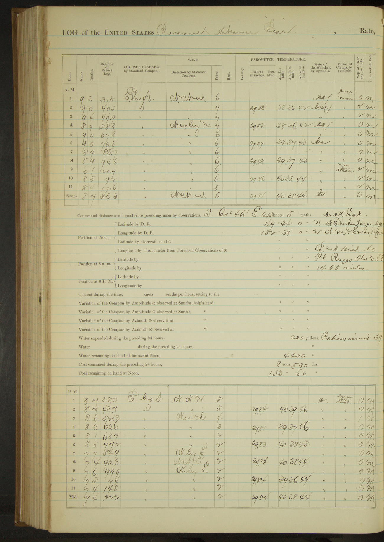
50874d5f09d40907550016b5: (http://oldweather.s3.amazonaws.com/ow3/final/USRC Bear/vol068/vol068_216_1.jpg)
21 November 1890
At sea
Lat 49.57, Long -152.65
Sick list: A McEwan, Fireman.
8am to meridian:
Crew at work on boats and variously.
Meridian to 4pm:
Crew scraping off old paint, making sail covers, overhauling gear, etc.
Steam and sail 24 hours. Distance 200.0 miles.
50874d5f09d40907550016b7: (http://oldweather.s3.amazonaws.com/ow3/final/USRC Bear/vol068/vol068_217_0.jpg)
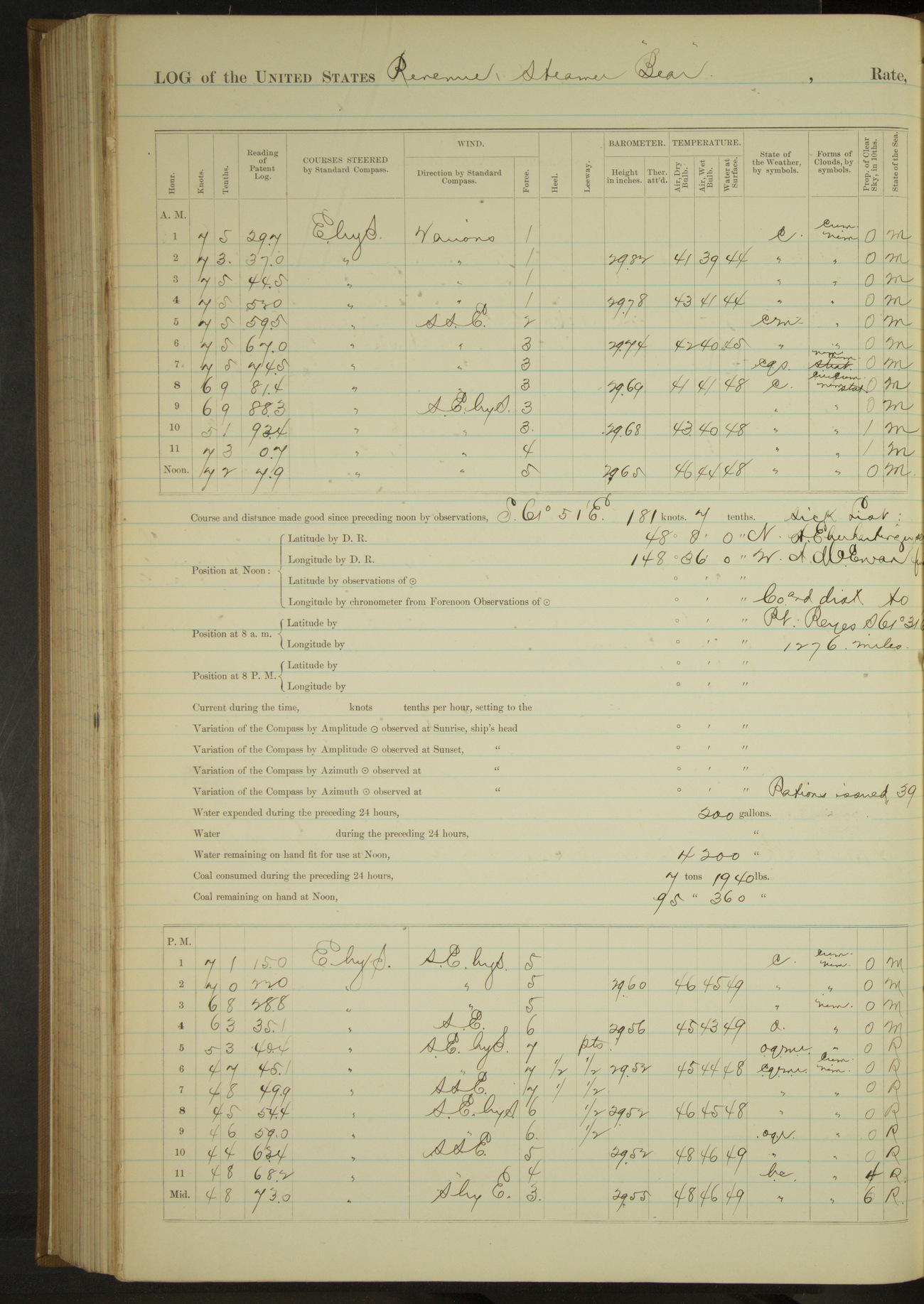
50874d5f09d40907550016b9: (http://oldweather.s3.amazonaws.com/ow3/final/USRC Bear/vol068/vol068_217_1.jpg)
22 November 1890
At sea
Lat 48.13, Long -148.60
Sick list: A McEwan, Fireman.
Steam and sail 17 hours. Distance 101.0 miles.
Steam exclusively 7 hours. Distance 49.8 miles.
[Total] 150.8 miles.
50874d5f09d40907550016bb: (http://oldweather.s3.amazonaws.com/ow3/final/USRC Bear/vol068/vol068_218_0.jpg)
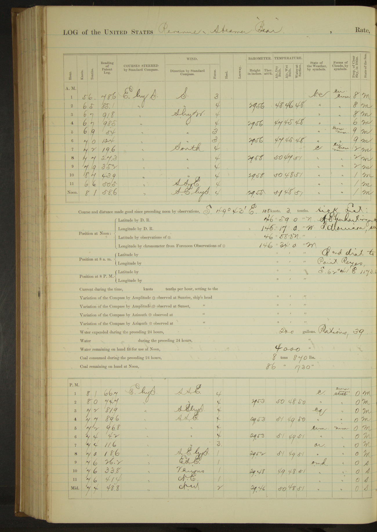
50874d5f09d40907550016bd: (http://oldweather.s3.amazonaws.com/ow3/final/USRC Bear/vol068/vol068_218_1.jpg)
23 November 1890
At sea
Lat 46.97, Long -146.57
Sick list: T Morrison, Fireman [to end of log book].
Under steam and sail 19 hours 30 minutes. Distance 142.2 miles.
Under steam 4 hours 30 minutes. Distance 33.6 miles.
[Total] 175.8 miles.
50874d5f09d40907550016bf: (http://oldweather.s3.amazonaws.com/ow3/final/USRC Bear/vol068/vol068_219_0.jpg)
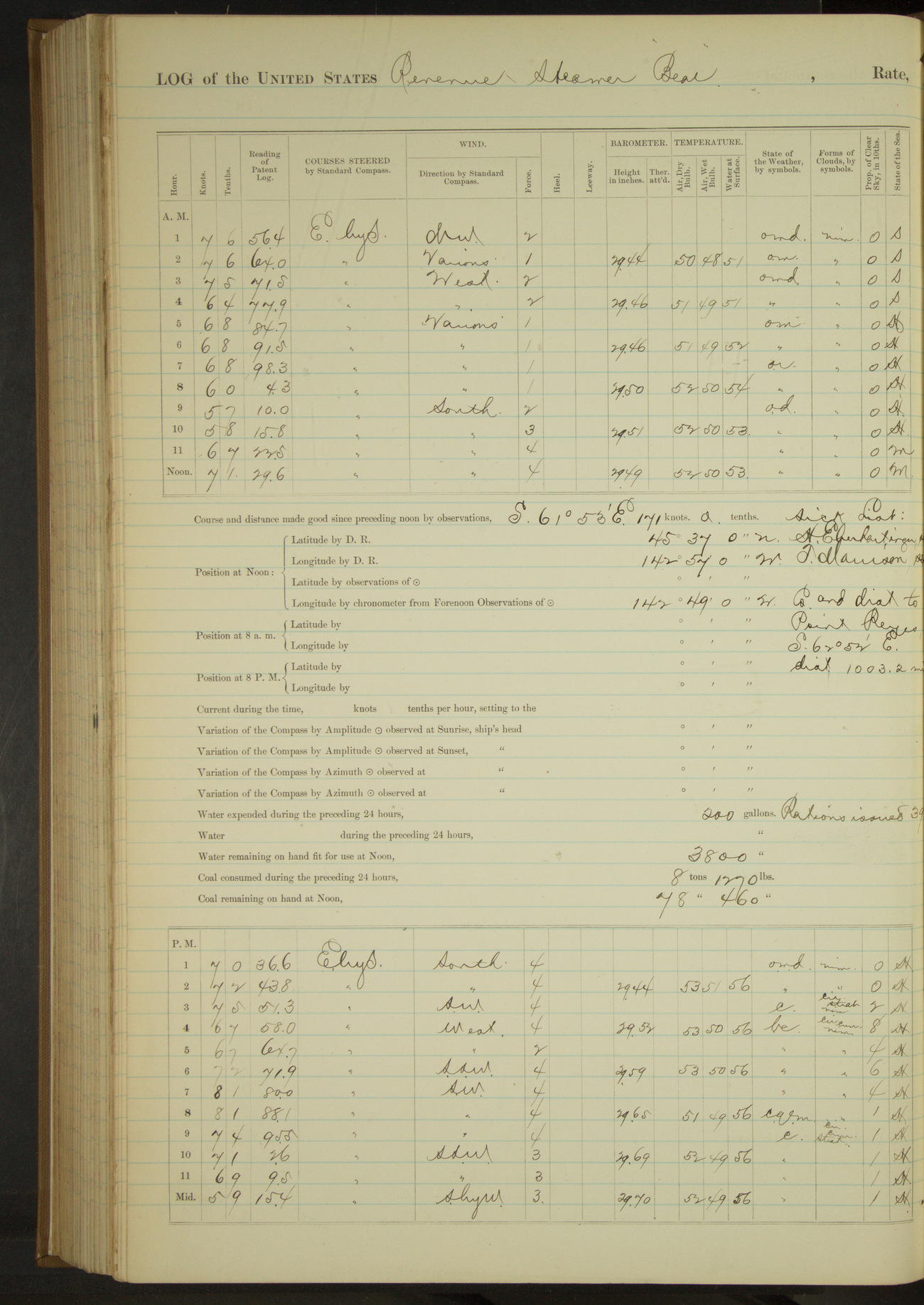
50874d5f09d40907550016c1: (http://oldweather.s3.amazonaws.com/ow3/final/USRC Bear/vol068/vol068_219_1.jpg)
24 November 1890
At sea
Lat 45.62, Long -142.82
Meridian to 4pm:
Secured keys to propeller gear. Crew overhauling running gear, etc. Heavy cross swell.
6pm to 8pm [& 8pm to midnight]:
Heavy cross swell. Vessel rolling deeply.
Steam and sail 15 hours. Distance 105.4 miles.
Steam 9 hours. Distance 61.2 miles.
[Total] 166.6 miles.
50874d5f09d40907550016c3: (http://oldweather.s3.amazonaws.com/ow3/final/USRC Bear/vol068/vol068_220_0.jpg)
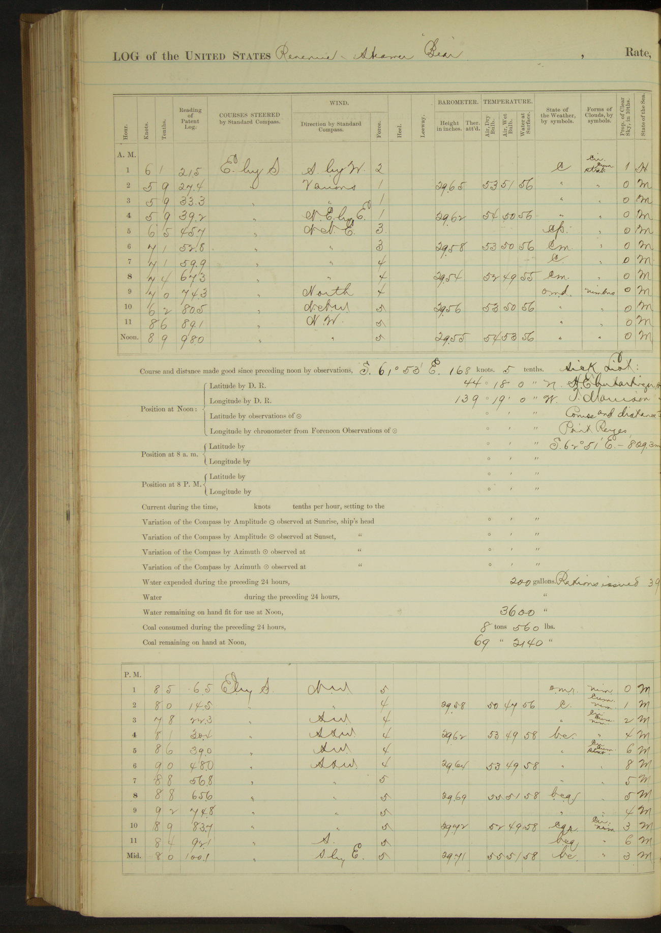
50874d5f09d40907550016c5: (http://oldweather.s3.amazonaws.com/ow3/final/USRC Bear/vol068/vol068_220_1.jpg)
25 November 1890
At sea
Lat 44.30, Long -139.32
8am to meridian:
Crew cleaning boats and boat davits.
Meridian to 4pm:
Crew cleaning boats and mainmast.
Steam and sail 21 hours 30 minutes. Distance 169.9 miles.
Steam 2 hours 30 minutes. Distance 14.8 miles.
Total 24 hours, 184.7 miles.
50874d5f09d40907550016c7: (http://oldweather.s3.amazonaws.com/ow3/final/USRC Bear/vol068/vol068_221_0.jpg)
50874d5f09d40907550016c9: (http://oldweather.s3.amazonaws.com/ow3/final/USRC Bear/vol068/vol068_221_1.jpg)
26 November 1890
At sea
Lat 43.00, Long -135.65
4am to 8am:
Crew scraping spanker boom.
8am to meridian:
Crew scraping and varnishing spanker boom and painting fore and main masts.
Meridian to 4pm:
Crew painting and varnishing on spare blocks, boats, etc.
Under steam and sail 24 hours. Distance 192.1 miles.
50874d5f09d40907550016cb: (http://oldweather.s3.amazonaws.com/ow3/final/USRC Bear/vol068/vol068_222_0.jpg)
50874d5f09d40907550016cd: (http://oldweather.s3.amazonaws.com/ow3/final/USRC Bear/vol068/vol068_222_1.jpg)
27 November 1890
At sea
Lat 41.80, Long -132.08
50874d5f09d40907550016cf: (http://oldweather.s3.amazonaws.com/ow3/final/USRC Bear/vol068/vol068_223_0.jpg)
50874d5f09d40907550016d1: (http://oldweather.s3.amazonaws.com/ow3/final/USRC Bear/vol068/vol068_223_1.jpg)
28 November 1890
At sea
Lat 40.35, Long -128.72
8am to meridian:
Crew cleaning boat gear, paintwork.
Meridian to 4pm:
Crew cleaning paintwork.
6pm to 8pm:
Light NE wind and fog. Clear overhead at times. Whistle sounded at intervals.
8pm to midnight:
Light breeze NEbyE and foggy. Sky partly clear overhead. Sounded fog signal at regular intervals during watch.
Steam and sail 17 hours 15 minutes. Distance 134.4 miles.
Steam 6 hours 45 minutes. Distance 50.3 miles.
Total 24 hours. Distance 184.7 miles.
50874d5f09d40907550016d3: (http://oldweather.s3.amazonaws.com/ow3/final/USRC Bear/vol068/vol068_224_0.jpg)
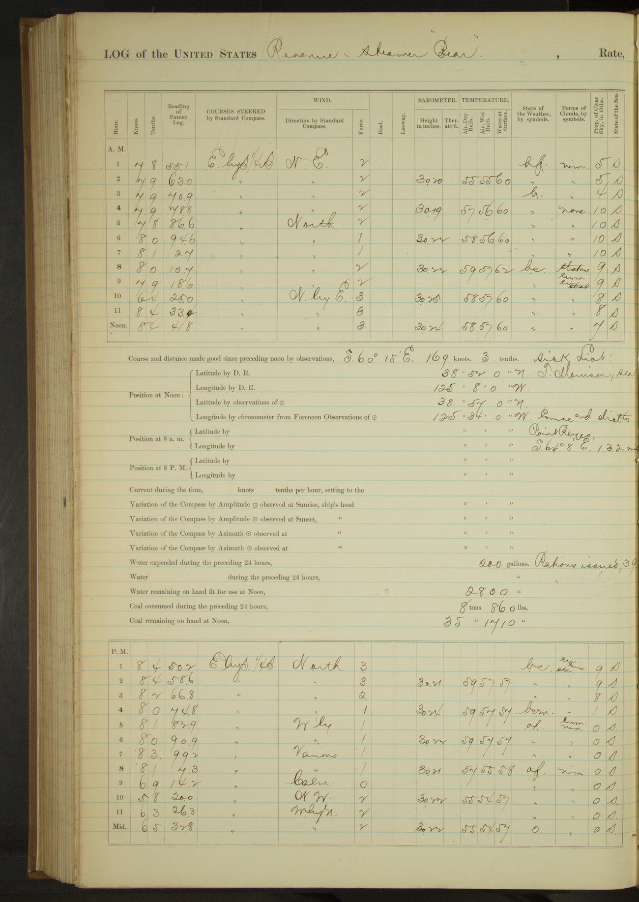
50874d5f09d40907550016d5: (http://oldweather.s3.amazonaws.com/ow3/final/USRC Bear/vol068/vol068_224_1.jpg)
29 November 1890
At sea
Lat 38.95, Long -125.57
Meridian to 4pm:
At 2.20 took in square sails, unbent topgallant sail & sent down topgallant yard and gear. 3.00: took in, unbent and sent down main topmast staysail and gear. A three-masted schooner in sight to Eastward at end of watch.
8pm to midnight:
Calm to light Westerly winds, overcast with fog, clearing latter part of watch. Sounding whistle at intervals.
Steam and sail 16 hours 30 minutes. Distance 131.5 miles.
Steam exclusively 7 hours 30 minutes. Distance 55.0 miles.
Total 24 hours. Distance 185.5 miles.
50874d5f09d40907550016d7: (http://oldweather.s3.amazonaws.com/ow3/final/USRC Bear/vol068/vol068_225_0.jpg)
50874d5f09d40907550016d9: (http://oldweather.s3.amazonaws.com/ow3/final/USRC Bear/vol068/vol068_225_1.jpg)
30 November 1890
At sea
Lat 37.79, Long -122.61 [Estimate from noon bearings]
4am to 8am:
5.25: foggy, stopped and sounded in 55 fathoms water, sandy bottom. At 5.35 steamed at slow speed with helm hard a-starboard to wait for fog to lift.
6.20 fog light hauled up on course. 6.45: steamed half speed. 7.30: heard fog signal at Point Reyes Light House, hauled up NNE for it. At 7.42 sighted a schooner to Northward and Westward bound out.
Crew making preparations for entering port. Sounded fog signal as necessary.
8am to meridian:
Light to gentle breeze NW, foggy at first to partly clear and hazy at close. At 10.15 spoke tug. 11.17: made whistling buoy ESE. 11.22: course for fairway buoy. 11.36: ahead full speed. Crew making preparations for port.
Noon: Point Bonita NE¼E, 4 miles.
Meridian to 4pm:
12.30: Point Bonita abeam. 12.45: Fort Point abeam. 12.50: steering various courses into San Francisco Harbor. 1.35: came to off Vallejo St. Wharf, San Francisco.
Gave starboard watch 24 hours liberty. Received calls of courtesy from USCSS “Patterson” [USC&GSS Carlile P. Patterson] and US Revenue Steamer “Rush”.
Steam exclusively 13 hours 35 minutes. Distance 87.7 miles.
50874d5f09d40907550016db: (http://oldweather.s3.amazonaws.com/ow3/final/USRC Bear/vol068/vol068_226_0.jpg)
50874d5f09d40907550016dd: (http://oldweather.s3.amazonaws.com/ow3/final/USRC Bear/vol068/vol068_226_1.jpg)
[Blank pages]
[Logs for December 1st 1890 to April 4th 1891 not included]
THE VOYAGES OF USRC BEAR 1891
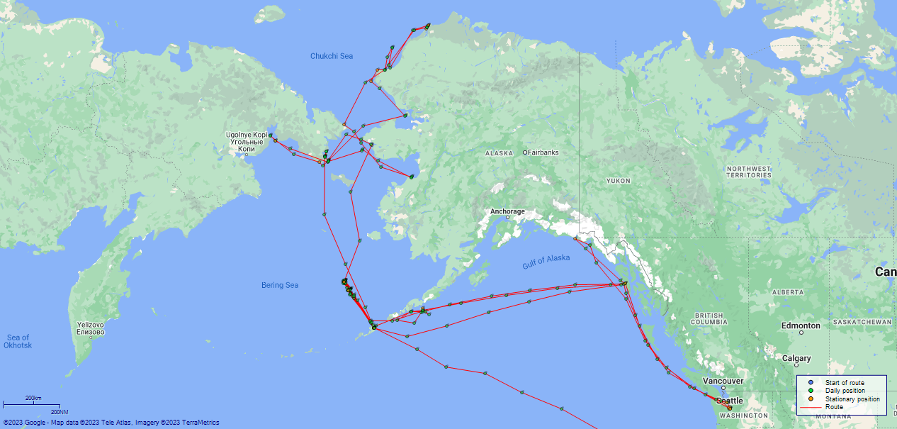
LOG BOOK – APRIL 5th 1891 TO SEPTEMBER 30th 1891
50874d5f09d40907550016df: (http://oldweather.s3.amazonaws.com/ow3/final/USRC Bear/vol069/vol069_001_0.jpg)
50874d5f09d40907550016e1: (http://oldweather.s3.amazonaws.com/ow3/final/USRC Bear/vol069/vol069_001_1.jpg)
50874d5f09d40907550016e3: (http://oldweather.s3.amazonaws.com/ow3/final/USRC Bear/vol069/vol069_002_0.jpg)
50874d5f09d40907550016e5: (http://oldweather.s3.amazonaws.com/ow3/final/USRC Bear/vol069/vol069_002_1.jpg)
Log book of the USS “Bear” of Four Guns, commanded by MA Healy, Captain USRM. Commencing April 5th 1891 at Seattle, Washington, and ending September 30th, 1891, at sea, Bering Sea.
50874d5f09d40907550016e7: (http://oldweather.s3.amazonaws.com/ow3/final/USRC Bear/vol069/vol069_003_0.jpg)
List of Officers attached to and on board of the USS “Bear”, commanded by MA Healy, Captain USRM, during the period covered by this log-book from April 5th, 1891, to September 30th, 1891.
MA Healy, Captain
John Dennett, 1st Lieutenant
H [Howard] M Broadbent, 2nd Lieutenant
D [David] H Jarvis, 2nd Lieutenant
A [Andrew] J Henderson, 3rd Lieutenant
H [Horace] Hassell, Chief Engineer
A [Alfred] L Broadbent, 1st Assistant Engineer
F [Fred] R Falkenstein, 2nd Assistant Engineer
SJ Call, Surgeon
George E McConnell, 1st Lieutenant
L [Leonidas] L Robinson, 3rd Lieutenant
50874d5f09d40907550016e9: (http://oldweather.s3.amazonaws.com/ow3/final/USRC Bear/vol069/vol069_003_1.jpg)
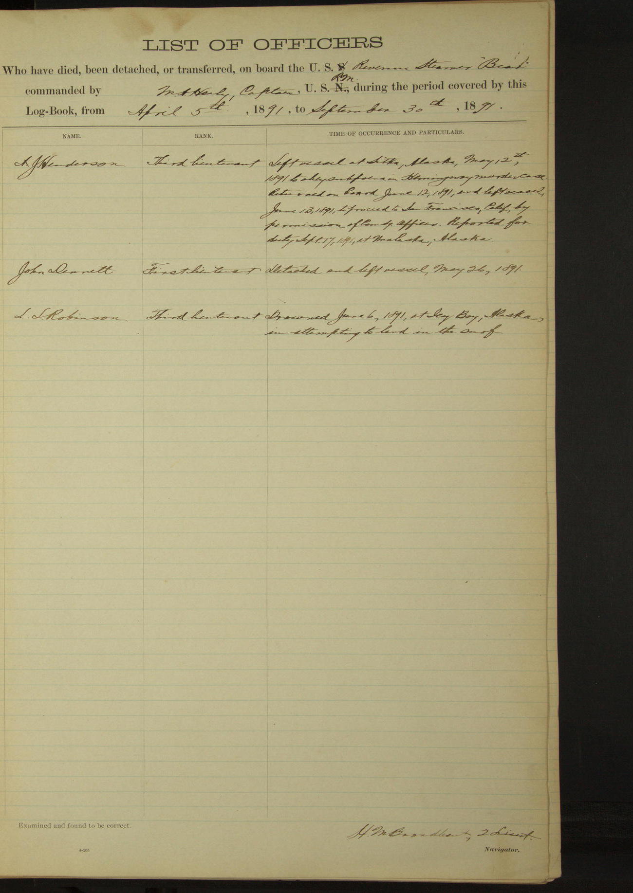
List of officers who have died, been detached or transferred on board of US Revenue Steamer “Bear” commanded by MA Healy, Captain USRM, during the period covered by this book from April 5th, 1891 to September 30th, 1891
AJ Henderson, 3rd Lieutenant, left vessel at Sitka, Alaska, May 12th,1891 to obey subpoena in Hemmingway murder case. Returned on board June 12, 1891, and left vessel June 13, 1891, to proceed to San Francisco, California, by permission of Commanding Officer. Reported for duty September 17, 1891, at Unalaska, Alaska.
John Dennett, 1st Lieutenant, detached and left vessel, May 26, 1891.
LL Robinson, 3rd Lieutenant, drowned June 6, 1891, at Icy Bay, Alaska, in attempting to land in the surf.
50874d5f09d40907550016eb: (http://oldweather.s3.amazonaws.com/ow3/final/USRC Bear/vol069/vol069_004_0.jpg)
Complement of Petty officers, Seamen, Ordinary Seamen, Landsmen, Boys, and Marines on board, March 1891
Boatswain 1
Quartermasters 2
Coxswains 2
Ship’s Cook 1
Master-at-arms 1
Cabin Steward 1
Ward-room Steward 1
Seamen 14
Ordinary Seamen 2
First-class Firemen 6
Coal Heavers 3
TOTAL 40
50874d5f09d40907550016ed: (http://oldweather.s3.amazonaws.com/ow3/final/USRC Bear/vol069/vol069_004_1.jpg)
[Description of instruments, left blank]
50874d5f09d40907550016ef: (http://oldweather.s3.amazonaws.com/ow3/final/USRC Bear/vol069/vol069_005_0.jpg)
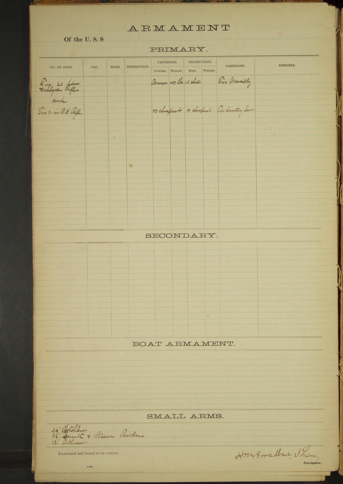
Armament [same as previous log book]
50874d5f09d40907550016f1: (http://oldweather.s3.amazonaws.com/ow3/final/USRC Bear/vol069/vol069_005_1.jpg)
[Tables of deviation of the standard compass, left blank]
50874d5f09d40907550016f3: (http://oldweather.s3.amazonaws.com/ow3/final/USRC Bear/vol069/vol069_006_0.jpg)
50874d5f09d40907550016f5: (http://oldweather.s3.amazonaws.com/ow3/final/USRC Bear/vol069/vol069_006_1.jpg)
5 April 1891
Strait of Juan de Fuca [& Seattle]
Lat 47.61, Long -122.40
Midnight to 4am:
Steaming up the Strait of Fuca. 12.18: Ediz Hook light abeam. At 2.00 Dungeness Light abeam. Course East, made Admiralty Head Light abeam. 4.00: Smith’s Island Light abeam.
4am to 8am:
Steaming to the Eastward up Puget Sound. 5.15: passed Point Wilson. 5.54: passed Admiralty Head. 6.30: passed Marrowstone Point.
8am to meridian:
8.25: Point No Point Light House abeam. 9.45: Point Jefferson abeam. 10.20: West Point Light House abeam. 10.30: hauled up for Seattle. 11.15: made fast to mooring buoy off Seattle.
50874d5f09d40907550016f7: (http://oldweather.s3.amazonaws.com/ow3/final/USRC Bear/vol069/vol069_007_0.jpg)
50874d5f09d40907550016f9: (http://oldweather.s3.amazonaws.com/ow3/final/USRC Bear/vol069/vol069_007_1.jpg)
6 April 1891
Seattle, Washington
Lat 47.61, Long -122.40
4am to 8am:
Frank Friedburg, Seaman, and Samual Rainsford, Seaman, returned from liberty 12 hours late. Restowing forehold and getting ready to take anthracite coal out of forward bunker. Dennis Carney, Fireman, absent without leave.
8am to meridian:
Carpenter repairing water closets. Crew employed shifting coal from forward bunker to forehold to be delivered to Point Barrow Refuge Station.
Meridian to 4pm:
Crew employed shifting coal and mending furl of sails. Dennis Carney, Fireman, returned on board.
50874d5f09d40907550016fb: (http://oldweather.s3.amazonaws.com/ow3/final/USRC Bear/vol069/vol069_008_0.jpg)
50874d5f09d40907550016fd: (http://oldweather.s3.amazonaws.com/ow3/final/USRC Bear/vol069/vol069_008_1.jpg)
7 April 1891
Seattle, Washington
Lat 47.60, Long -122.34
4am to 8am:
6.15: cast off from mooring buoy, and steamed to coal bunkers. 6.30: made fast. 8.00: commenced taking in coal. Eight coal shovelers from shore stowing bunkers.
8am to meridian:
9.00: commenced coaling ship.
Meridian to 4pm:
2.15: US Revenue Steamer “Wolcott” came into port.
4pm to 8pm:
5.00pm: ceased coaling for the day.
50874d5f09d40907550016ff: (http://oldweather.s3.amazonaws.com/ow3/final/USRC Bear/vol069/vol069_009_0.jpg)
50874d5f09d4090755001701: (http://oldweather.s3.amazonaws.com/ow3/final/USRC Bear/vol069/vol069_009_1.jpg)
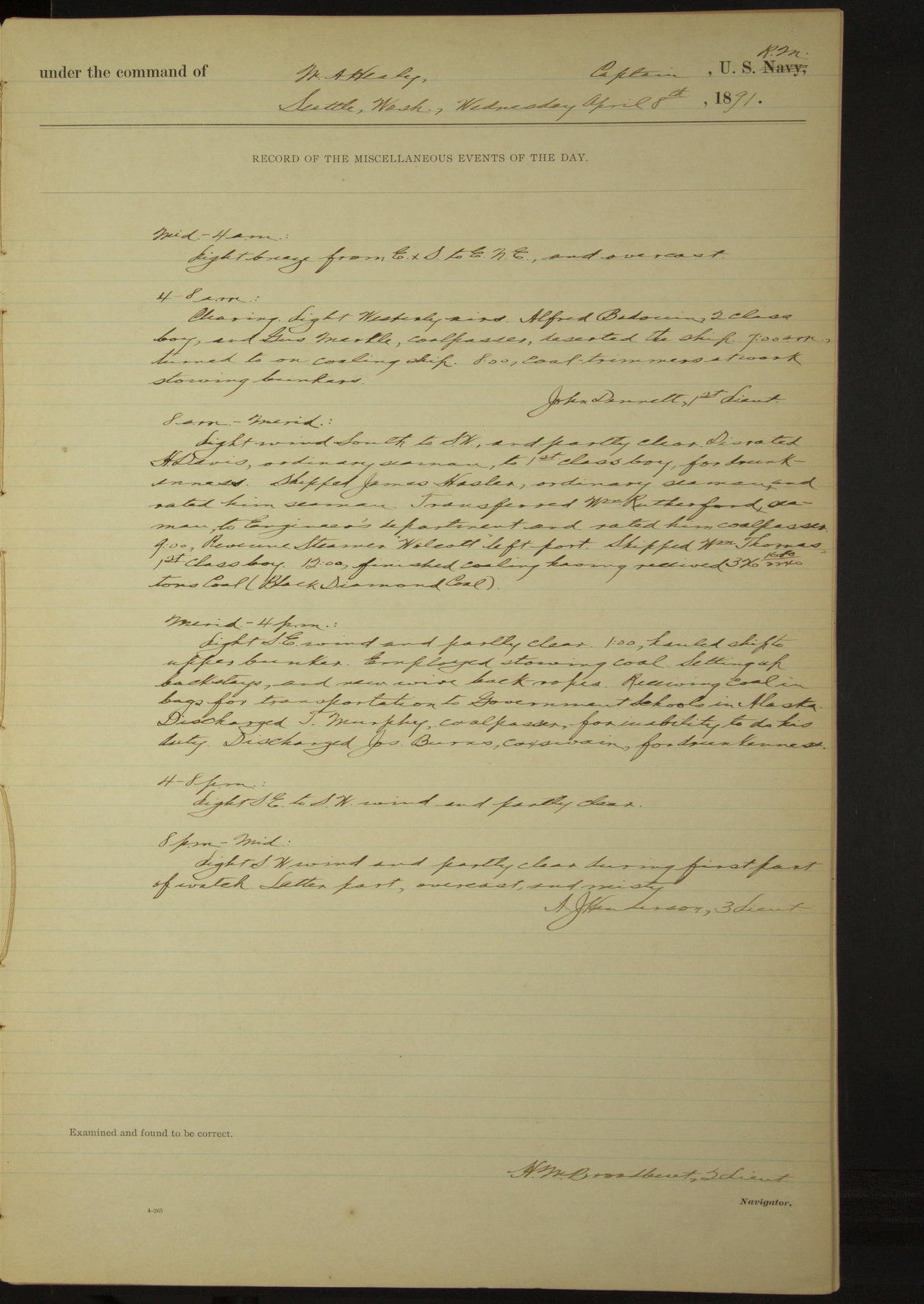
8 April 1891
Seattle, Washington
Lat 47.60, Long -122.34
4am to 8am:
Alfred Badowin, 2nd class Boy, and George Mertle, Coal Passer, deserted the ship. 7.00am: turned to on coaling ship. 8.00: coal trimmers at work stowing bunkers.
8am to meridian:
Disrated H Davis, Ordinary Seaman, to 1st class Boy, for drunkenness. Shipped James Hasler, Ordinary Seaman, and rated him Seaman. Transferred William Rutherford, Seaman, to Engineer’s department and rated him Coal Passer.
9.00: Revenue Steamer “Wolcott” left port. Shipped William Thomas, 1st class Boy.
12.00: finished coaling having received 326 1680/2240 tons coal (Black Diamond coal).
Meridian to 4pm:
1.00: hauled ship to upper bunker. Employed stowing coal. Setting up backstays and new wire back ropes. Receiving coal in bags for transportation to Government schools in Alaska.
Discharged T Murphy, Coal Passer, for inability to do his duty. Discharged James Burns, Coxswain, for drunkenness.
50874d5f09d4090755001703: (http://oldweather.s3.amazonaws.com/ow3/final/USRC Bear/vol069/vol069_010_0.jpg)
50874d5f09d4090755001705: (http://oldweather.s3.amazonaws.com/ow3/final/USRC Bear/vol069/vol069_010_1.jpg)
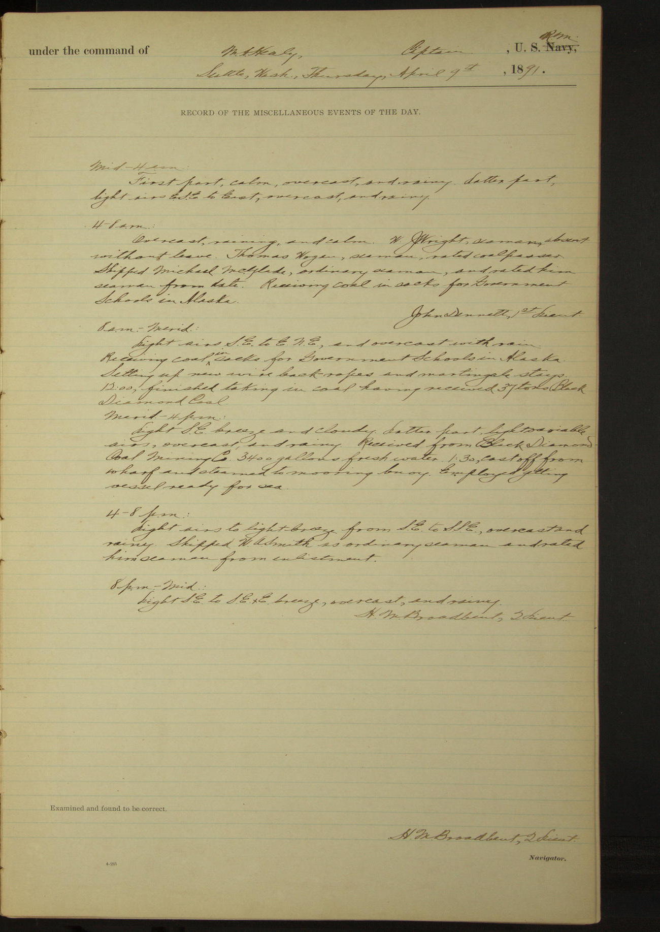
9 April 1891
Seattle, Washington
Lat 47.60, Long -122.34
4am to 8am:
WJ Wright, Seaman, absent without leave. Thomas Wogan, Seaman, rated Coal Passer. Shipped Michael McGlade, Ordinary Seaman, and rated him Seaman from date. Receiving coal in sacks for Government schools in Alaska.
8am to meridian:
Receiving coal in sacks for Government schools in Alaska. Setting up new wire back-ropes and martingale stays.
12.00: finished taking in coal having received 37 tons (Black Diamond coal).
Meridian to 4pm:
Received from Black Diamond Coal Mining Co 3400 gallons fresh water. 1.30: cast off from wharf and steamed to mooring buoy. Employed getting vessel ready for sea.
4pm to 8pm:
Shipped WA Smith as Ordinary Seaman and rated him Seaman from enlistment.
50874d5f09d4090755001707: (http://oldweather.s3.amazonaws.com/ow3/final/USRC Bear/vol069/vol069_011_0.jpg)
50874d5f09d4090755001709: (http://oldweather.s3.amazonaws.com/ow3/final/USRC Bear/vol069/vol069_011_1.jpg)
10 April 1891
Seattle, Washington [& at sea]
Lat 48.23, Long -123.53 [Estimate from meridian bearings]
Midnight to 4am:
WJ Wright, Seaman, returned on board.
4am to 8am:
4.15: cast off from buoy, and steamed to the Westward. 5.06: passed West Point Light.
8am: Admiralty Head Light House NWxW, 4 miles.
8am to meridian:
8.18: passed Marrowstone Point. 8.39: Point Wilson abeam, 1 mile distant. 10.07: New Dungeness Light House abeam. 11.25: Ediz Hook Light House abeam. Meridian: Race Rock Light House NNW, 4 miles.
Meridian to 4pm:
4.00: Waadah Island bore WxS¾S.
6pm to 8pm:
Steaming along the Vancouver shore to the Westward. 7.30: Tatoosh Island Light bore South, distant 8 miles.
8pm: Cape Flattery Light SxE½E, 8 miles.
8pm to midnight:
10.55: Cape Beale Light abeam, 1.5 miles distant.
Underway: steam 19 hours 45 minutes. Distance: steam 146.1 miles.
50874d5f09d409075500170b: (http://oldweather.s3.amazonaws.com/ow3/final/USRC Bear/vol069/vol069_012_0.jpg)
50874d5f09d409075500170d: (http://oldweather.s3.amazonaws.com/ow3/final/USRC Bear/vol069/vol069_012_1.jpg)
11 April 1891
At sea
Lat 49.40, Long -127.37
Midnight to 4am:
11.30 [?]: passed sailing vessel bound East. Burnt Coston signal.
8am: Lat 49° 09’N, Long 126° 36’W
Meridian to 4pm:
12.29: set clock back 29 minutes for local apparent time.
8pm: Lat 50° 08’N, Long 126° 56’W
Underway: steam and sail 22 hours; steam exclusively 2 hours; total 24 hours.
Distance: steam and sail 185.4 miles; steam exclusively 12.3 miles; total 197.7 miles.
50874d5f09d409075500170f: (http://oldweather.s3.amazonaws.com/ow3/final/USRC Bear/vol069/vol069_013_0.jpg)
50874d5f09d4090755001711: (http://oldweather.s3.amazonaws.com/ow3/final/USRC Bear/vol069/vol069_013_1.jpg)
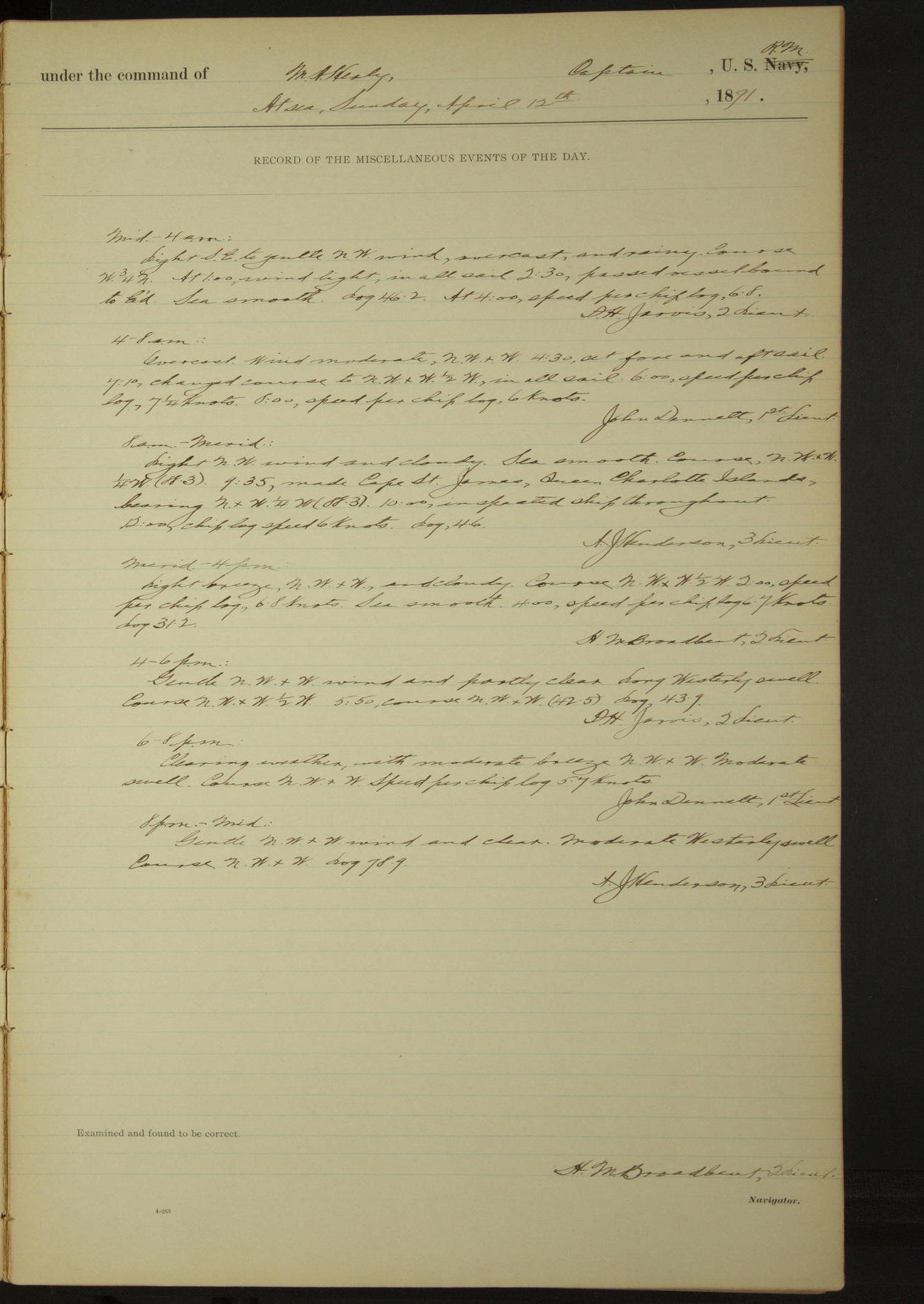
12 April 1891
At sea
Lat 51.57, Long -131.43
8am: Lat 51° 00’N, Long 130° 59’ 44”W
8am to meridian:
9.35: made Cape St. James, Queen Charlotte Islands, bearing NxW¼W.
8pm: Lat 52° 16’N, Long 132° 14’W
Underway: steam and sail 3 hours 40 minutes; steam exclusively 20 hours 20 minutes.
Distance: steam and sail 33.7 miles; steam exclusively 126.5 miles; total 160.2 miles.
50874d5f09d4090755001713: (http://oldweather.s3.amazonaws.com/ow3/final/USRC Bear/vol069/vol069_014_0.jpg)
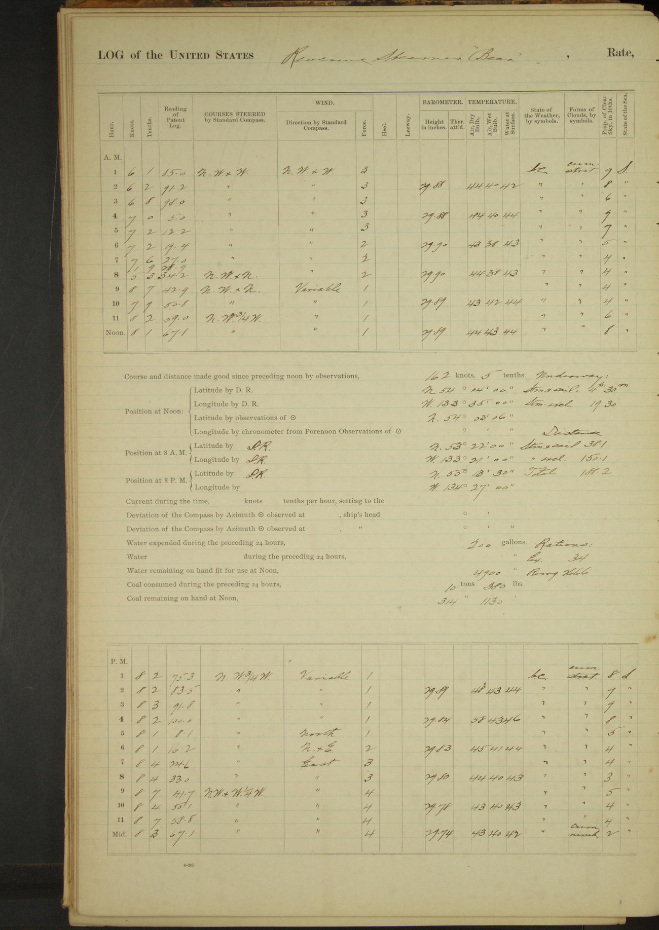
50874d5f09d4090755001715: (http://oldweather.s3.amazonaws.com/ow3/final/USRC Bear/vol069/vol069_014_1.jpg)
13 April 1891
At sea
Lat 54.05, Long -133.58
4am to 8am:
Steaming along the land by Graham’s Island, distant 20 miles.
8am: Lat 53° 22’N, Long 133° 21’W
8am to meridian:
At 10.00 Frederick Island NNE.
Meridian to 4pm:
2.25: Forrester Island bore N¾W.
4pm to 6pm:
4.57: Forrester Island abeam, bearing NE¾N, distant 20 miles.
8pm: Lat 55° 13’ 30”N, Long 134° 27’W
Underway: steam and sail 4 hours 30 minutes; steam exclusively 19 hours 30 minutes.
Distance: steam and sail 38.1 miles; steam exclusively 150.1 miles; total 188.2 miles.
50874d5f09d4090755001717: (http://oldweather.s3.amazonaws.com/ow3/final/USRC Bear/vol069/vol069_015_0.jpg)
50874d5f09d4090755001719: (http://oldweather.s3.amazonaws.com/ow3/final/USRC Bear/vol069/vol069_015_1.jpg)
14 April 1891
At sea [& Sitka]
Lat 57.05, Long -135.33
4am to 8am:
5.30: made Mount Edgecumbe bearing NWxN. Steaming in for Sitka Sound.
8am: Lat 56° 44’ 30”N, Long 135° 33’ 50”W
8am to meridian:
9.15: Biorca Island [Biorka] bearing E¾N and St. Lazaria Island SExS¾S. 9.30: St. Lazaria Island abeam. 10.05: Vilstsen [?] Island [possibly Vitskari] abeam.
10.55: East Biorca abeam. 11.20: came to anchor in Sitka Harbor (Turning Island, bearing SWxS¾S and The Twins ESE).
Officer from “Pinta” made official call on Commanding Officer of this vessel.
Meridian to 4pm:
US Deputy Commissioner Tarpley left the vessel. Lieutenant Commander Farenholt [Oscar Farenholt] USN, and Captain Harrington [Francis Harrington] USMC, visited the vessel.
Underway: steam and sail 8 hours 45 minutes; steam exclusively 2 hours 35 minutes; total 11 hours 20 minutes.
Distance: steam and sail 44.5 miles; steam exclusively 55.4 miles; total 99.9 miles.
50874d5f09d409075500171b: (http://oldweather.s3.amazonaws.com/ow3/final/USRC Bear/vol069/vol069_016_0.jpg)
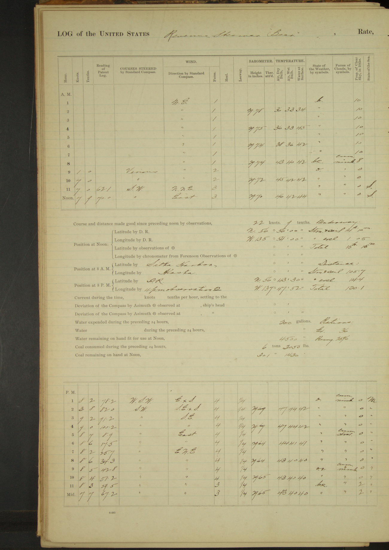
50874d5f09d409075500171d: (http://oldweather.s3.amazonaws.com/ow3/final/USRC Bear/vol069/vol069_016_1.jpg)
15 April 1891
Sitka Harbor [& at sea]
Lat 56.93, Long -135.90
8am to meridian:
8.45: underway with Governor Knapp of Alaska, District Attorney Johnson of Alaska and US Deputy Marshal George Castromutinhoff [later Kostrometinoff, see 28 April etc.] on board; also two natives to be returned to homes in Aleutian Islands.
10.58: St. Lazaria Island bore NW, 1½ miles. 12.00: Mount Edgecumbe bore N¼E, 6 miles. Issued two (2) extra rations to natives on board.
[From US Attorney’s Office: District of Alaska: a session of the District Court was administered on board Bear while she was underway]
Meridian to 4pm:
Steering various courses to speak a sailing bark. 1.17: stopped and hove to. Spoke American whaling bark “Tamerlane” of New Bedford, Tobey master; all well on board. 1.30: filled away and started engine.
4pm to 6pm:
5.40: head earing on mainsail parted, lowered sail.
8pm: Lat 56° 43’ 30”N, Long 137° 47’ 52”W
Underway: steam and sail 14 hours 10 minutes; steam exclusively 1 hour 5 minutes; total 15 hours 15 minutes.
Distance: steam and sail 105.7 miles; steam exclusively 14.4 miles; total 120.1 miles.
50874d5f09d409075500171f: (http://oldweather.s3.amazonaws.com/ow3/final/USRC Bear/vol069/vol069_017_0.jpg)
50874d5f09d4090755001721: (http://oldweather.s3.amazonaws.com/ow3/final/USRC Bear/vol069/vol069_017_1.jpg)
16 April 1891
At sea
Lat 56.46, Long -142.30
8am: Lat 56° 22’N, Long 144° 07’W
Meridian to 4pm:
1.30: shackle on martingale for back-ropes parted; took in jib and spanker; stopped engine and set up back-ropes to new shackle.
8pm: Lat 56° 13’N, Long 144° 11’ 30”W
Underway: steam and sail 24 hours.
Distance: steam and sail 197.3 miles.
50874d5f09d4090755001723: (http://oldweather.s3.amazonaws.com/ow3/final/USRC Bear/vol069/vol069_018_0.jpg)
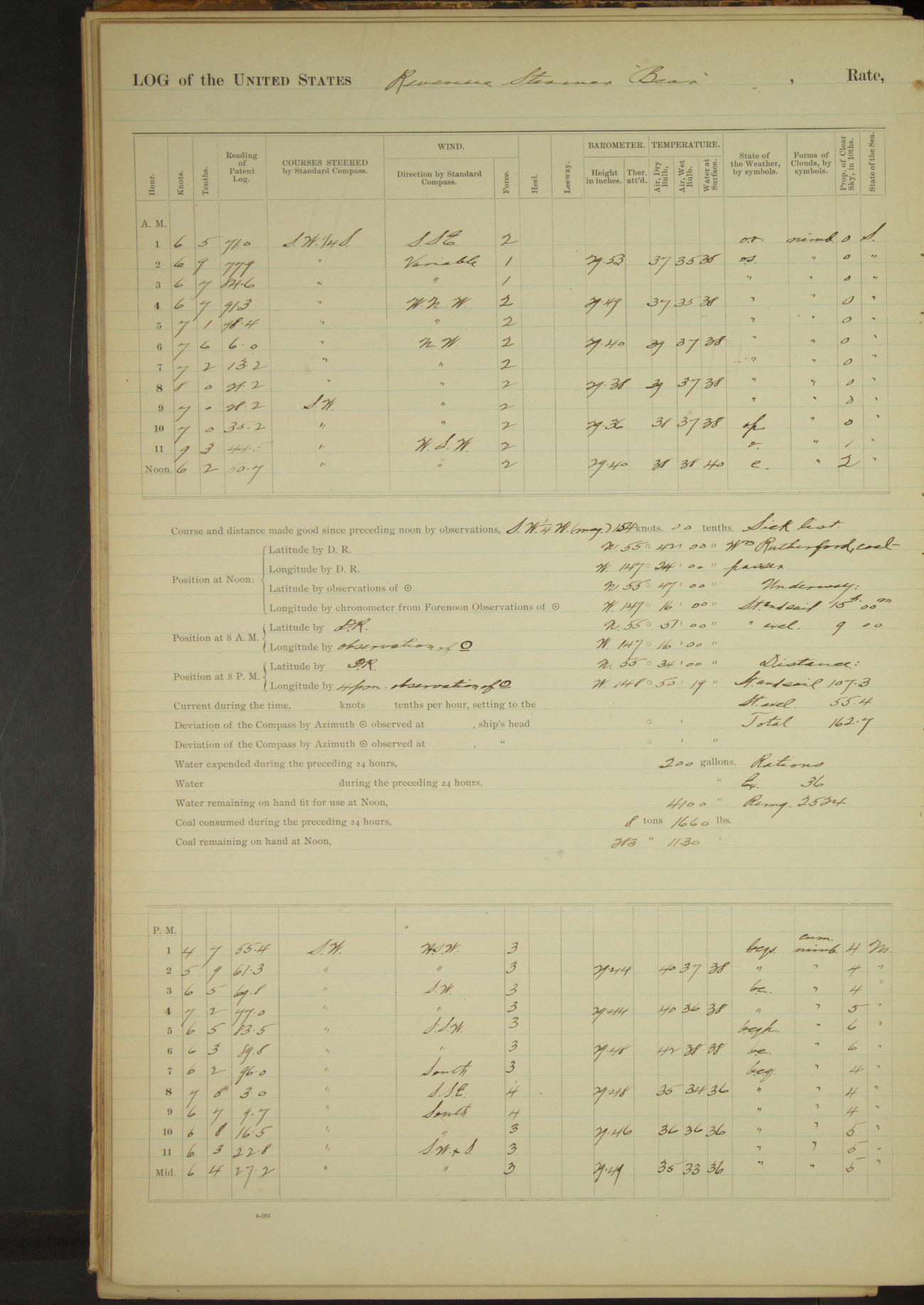
50874d5f09d4090755001725: (http://oldweather.s3.amazonaws.com/ow3/final/USRC Bear/vol069/vol069_018_1.jpg)
17 April 1891
At sea
Lat 55.78, Long -147.27
Sick list: William Rutherford, Coal Passer.
8am: Lat 55° 51’N, Long 147° 16’W
8pm: Lat 55° 34’N, Long 148° 50’ 19”W
Underway: steam and sail 15 hours; steam exclusively 9 hours.
Distance: steam and sail 107.3 miles; steam exclusively 55.4 miles; total 162.7 miles.
50874d5f09d4090755001727: (http://oldweather.s3.amazonaws.com/ow3/final/USRC Bear/vol069/vol069_019_0.jpg)
50874d5f09d4090755001729: (http://oldweather.s3.amazonaws.com/ow3/final/USRC Bear/vol069/vol069_019_1.jpg)
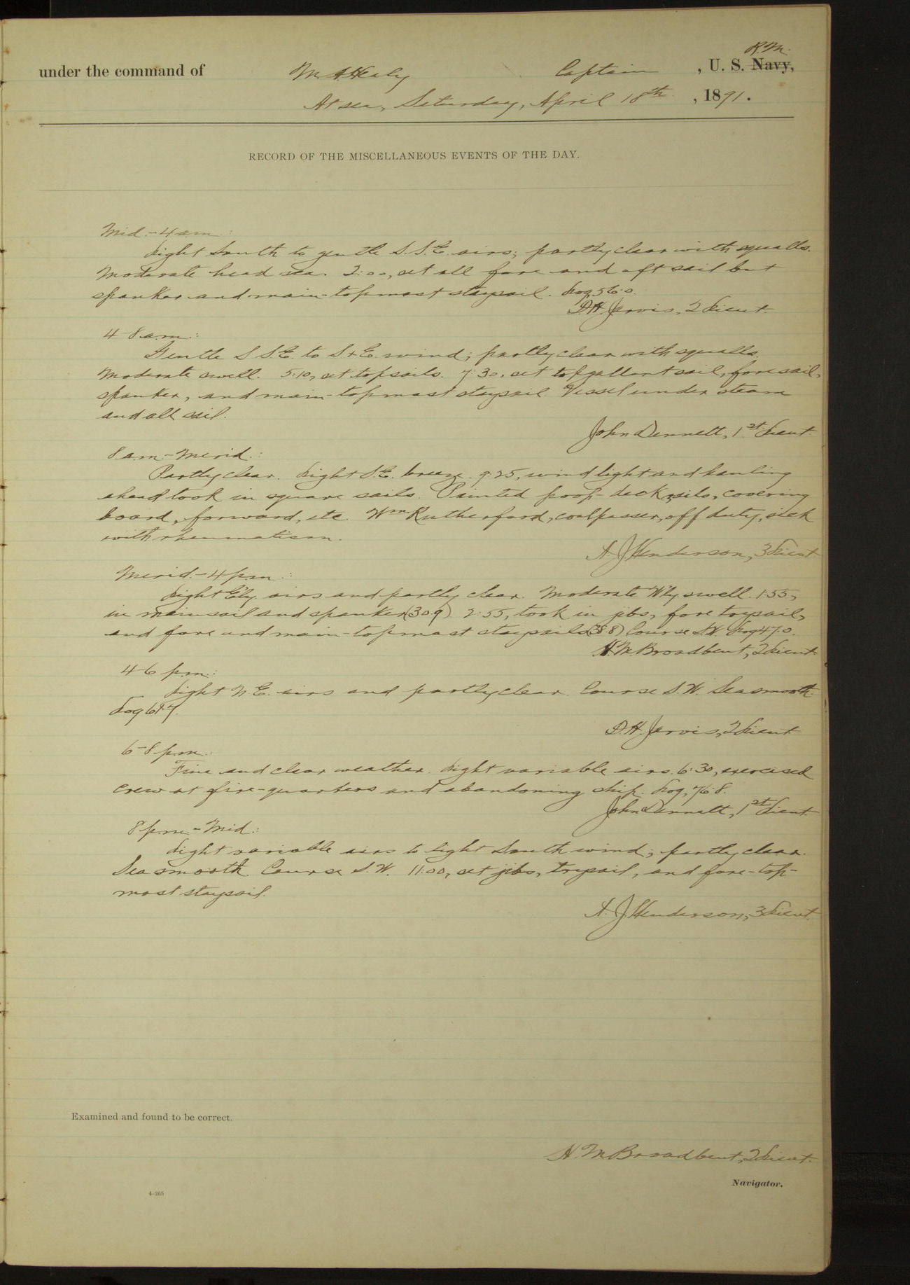
18 April 1891
At sea
Lat 55.01, Long -152.31
Sick list: William Rutherford, Coal Passer.
8am: Lat 55° 12’ 12”N, Long 151° 25’ 11”W
8am to meridian:
Painted poop-deck rails, covering board, forward, etc. William Rutherford, Coal Passer, off duty, sick with rheumatism.
6pm to 8pm:
6.30: exercised crew at fire quarters and abandoning ship.
8pm: Lat 55° 44’ 18”N, Long 153° 59’ 17”W
Underway: steam and sail 13 hours 55 minutes; steam exclusively 11 hours 5 minutes.
Distance: steam and sail 105.6 miles; steam exclusively 75.2 miles; total 180.8 miles.
50874d5f09d409075500172b: (http://oldweather.s3.amazonaws.com/ow3/final/USRC Bear/vol069/vol069_020_0.jpg)
50874d5f09d409075500172d: (http://oldweather.s3.amazonaws.com/ow3/final/USRC Bear/vol069/vol069_020_1.jpg)
19 April 1891
At sea
Lat 54.07, Long -157.53
Sick list: William Rutherford, [Coal Passer], rheumatism
8am: Lat 54° 15’ 42”N, Long 156° 28’ 41”W
8pm: Lat 53° 35’ 06”N, Long 159° 02’ 30”W
Underway: steam and sail 22 hours 50 minutes; steam exclusively 1 hour 10 minutes.
Distance: steam and sail 181.2 miles; steam exclusively 8.9 miles; total 190.1 miles.
50874d6009d409075500172f: (http://oldweather.s3.amazonaws.com/ow3/final/USRC Bear/vol069/vol069_021_0.jpg)
50874d6009d4090755001731: (http://oldweather.s3.amazonaws.com/ow3/final/USRC Bear/vol069/vol069_021_1.jpg)
20 April 1891
At sea
Lat 53.26, Long -162.46
Midnight to 4am:
Gentle to light SSE wind, partly clear, squally with snow.
4am to 8am:
Washed decks. Cleared snow off the vessel. Daylight, warm and clearing. Low barometer.
8am: Lat 53° 32’ 49”N, Long 161° 34’ 51”W
8pm: Lat 53° 38’ 31”N, Long 163° 49’ 37”W
Underway: steam and sail 24 hours.
Distance: steam and sail 196.1 miles.
50874d6009d4090755001733: (http://oldweather.s3.amazonaws.com/ow3/final/USRC Bear/vol069/vol069_022_0.jpg)
50874d6009d4090755001735: (http://oldweather.s3.amazonaws.com/ow3/final/USRC Bear/vol069/vol069_022_1.jpg)
21 April 1891
At sea [& Unalaska]
Lat 53.88, Long -166.53
[Snow squalls or snowing most of the day]
Midnight to 4am:
At 1.00 made land bearing NW½N. 2.45: made land bearing WxS.
4am to 8am:
5.25: passed North end Egg Island. 7.00: through Unalga Pass.
8am to meridian:
Steering various courses, hauling in for Unalaska Bay. 8.40: Priest Rock abeam. 9.08: stopped engine. Sent boat ashore to NA Commercial Co’s station at Dutch Harbor.
9.10 ahead, steamed into Unalaska Harbor. 10.00: made fast to Alaska Commercial Co’s wharf. Employed putting ashore coal in bags for Government stations, and stowing same in Government coal house.
Boarded American whaling brig “Alexander” of San Francisco, Shorey master, from San Francisco via Honolulu, on a whaling voyage for the Arctic Ocean. Surgeon Call went on board to treat master who had broken leg; also one of the seamen for a disabled hand.
Meridian to 4pm:
Employed discharging coal as in forenoon. Filled tanks with fresh water, having received 2200 gallons.
Underway: steam and sail 3 hours 30 minutes; steam exclusively 6 hours 30 minutes; total 10 hours.
Distance: steam and sail 14.8 miles; steam exclusively 37.7 miles; total 52.5 miles.
50874d6009d4090755001737: (http://oldweather.s3.amazonaws.com/ow3/final/USRC Bear/vol069/vol069_023_0.jpg)
50874d6009d4090755001739: (http://oldweather.s3.amazonaws.com/ow3/final/USRC Bear/vol069/vol069_023_1.jpg)
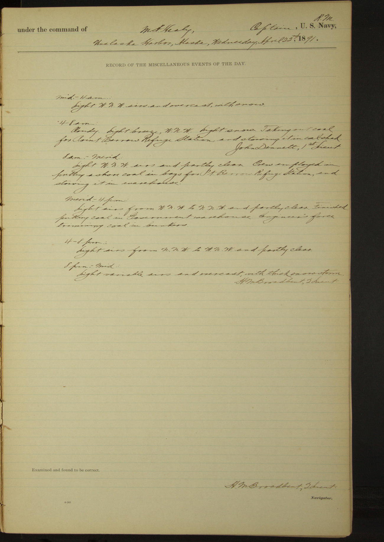
22 April 1891
Unalaska Harbor
Lat 53.88, Long -166.53
4am to 8am:
Cloudy, light breeze WNW, light snow. Taking out coal for Point Barrow Refuge Station, and stowing it in coal-shed.
8am to meridian:
Crew employed in putting ashore coal in bags for Point Barrow Refuge Station, and stowing it in warehouse.
Meridian to 4pm:
Finished putting coal in Government warehouse. Engineer’s force trimming coal in bunkers.
8pm to midnight:
Light variable airs and overcast with thick snow storm.
50874d6009d409075500173b: (http://oldweather.s3.amazonaws.com/ow3/final/USRC Bear/vol069/vol069_024_0.jpg)
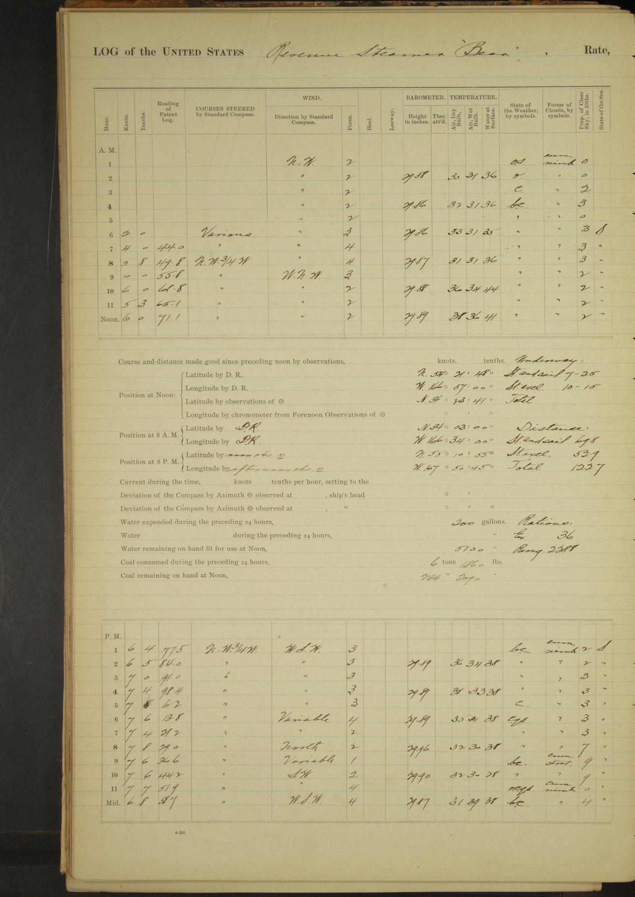
50874d6009d409075500173d: (http://oldweather.s3.amazonaws.com/ow3/final/USRC Bear/vol069/vol069_024_1.jpg)
23 April 1891
Unalaska Harbor [& at sea]
Lat 54.39, Long -166.95
Midnight to 4am:
Light NW breeze and overcast with snow during first part of watch.
4am to 8am:
Commences with snow and overcast weather. 5.00am: clearing. 5.20: cast off from wharf and steamed out of Unalaska Harbor. 5.45: took brig “Alexander” of San Francisco in tow to help her out clear of the land.
7.20: cast off brig’s towline when she made sail and stood to the Northward and Eastward. 7.25: Cascade, Cape Cheerful SWxS, 3 miles.
8am: Lat 54° 03’N, Long 166° 34’W
8pm: Lat 55° 10’ 55”N, Long 167° 50’ 45”W
Underway: steam and sail 7 hours 25 minutes; steam exclusively 10 hours 15 minutes.
Distance: steam and sail 69.8 miles; steam exclusively 52.9 miles; total 122.7 miles.
50874d6009d409075500173f: (http://oldweather.s3.amazonaws.com/ow3/final/USRC Bear/vol069/vol069_025_0.jpg)
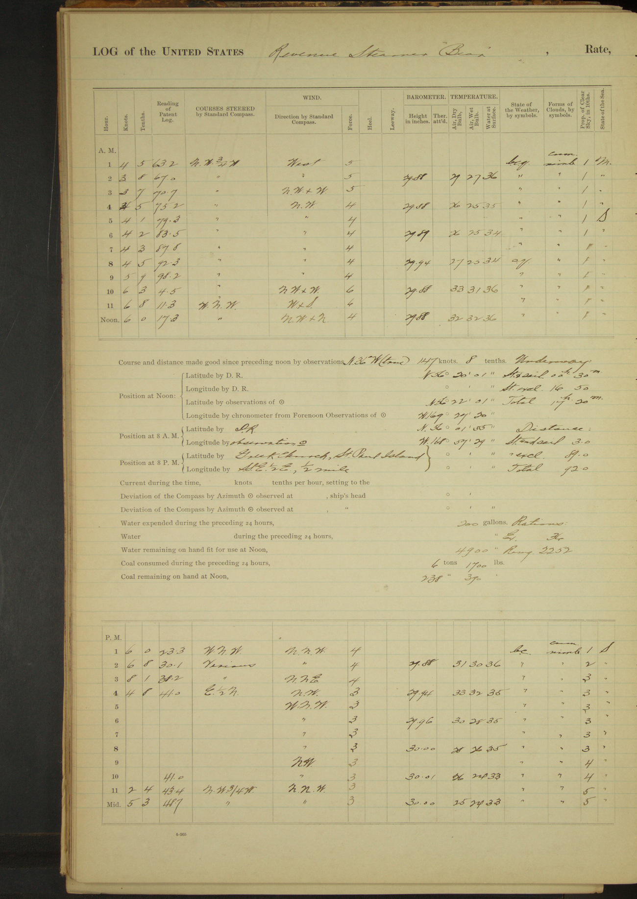
50874d6009d4090755001741: (http://oldweather.s3.amazonaws.com/ow3/final/USRC Bear/vol069/vol069_025_1.jpg)
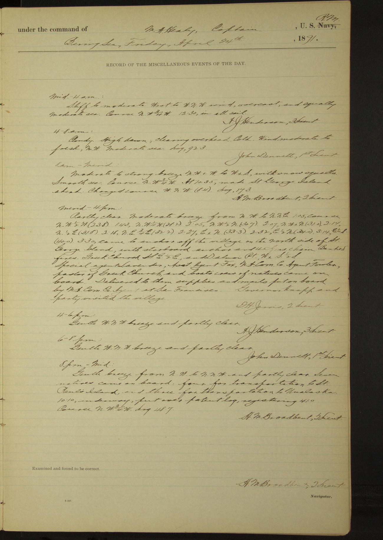
24 April 1891
Behring Sea [& St. George Island]
Lat 56.37, Long -169.46
4am to 8am:
Cloudy. High dawn, clearing overhead. Cold [temperature at 4am & 6am 26°F]. Wind moderate to fresh NW.
8am: Lat 56° 01’ 55”N, Long 168° 57’ 29”W
8am to meridian:
At 10.35 made St. George Island ahead.
Meridian to 4pm:
3.30: came to anchor off the village on the North side of St. George Island. Greek church SSE½E and Dalnoi Point WxS½S.
Special Agent Lavender, Assistant Agent Fox, NA Commercial Co Agent Fowler, pastor of Greek Church and boat’s crew of natives came on board. Delivered to them supplies and mails put on board by NA Commercial Co Agent at San Francisco. Governor Knapp and party visited the village.
8pm to midnight:
Seven natives came on board: four for transportation to St. Paul’s Island and three for transportation to Unalaska. 10.10: underway.
Underway: steam and sail 30 minutes; steam exclusively 16 hours 50 minutes; total 17 hours 20 minutes.
Distance: steam and sail 3.0 miles; steam exclusively 89.0 miles; total 92.0 miles.
50874d6009d4090755001743: (http://oldweather.s3.amazonaws.com/ow3/final/USRC Bear/vol069/vol069_026_0.jpg)
50874d6009d4090755001745: (http://oldweather.s3.amazonaws.com/ow3/final/USRC Bear/vol069/vol069_026_1.jpg)
25 April 1891
Behring Sea [& St. Paul Island & St. George Island]
Lat 57.10, Long -170.28 [Estimate from bearings]
Midnight to 4am:
At 2.00 made St. Paul’s Island ahead.
4am to 8am:
4.30: stood in for Lukannon [Lukanin] Bay. 4.50: hauled to Westward to pass around Reef Point. 5.35: came to off the village, South side of St. Paul Island. Delivered to official mails and supplies for station. Landed four natives taken on board at St. George Island. Anton Melovedoff [see also 8 &17 November 1890] left the vessel.
8am to meridian:
Governor Knapp and District Attorney Johnson visited the village. 11.45: underway and out of the harbor.
Meridian to 4pm:
12.07: put over patent log, Reef Point abeam, bearing NE¾N, distant one mile.
4pm to 6pm:
5.25: stopped engine off St. George Island village. Special Treasury Agent Lavender and NA Commercial Co’s agent Fowler came on board to receive and deliver mail. 5.33: ahead. 5.36: Tolstoi Point SW½S, 1 mile.
8pm: Lat 56° 25’N, Long 169° 06’W
Underway: steam 17 hours 50 minutes.
Distance: steam 120.3 miles.
50874d6009d4090755001747: (http://oldweather.s3.amazonaws.com/ow3/final/USRC Bear/vol069/vol069_027_0.jpg)
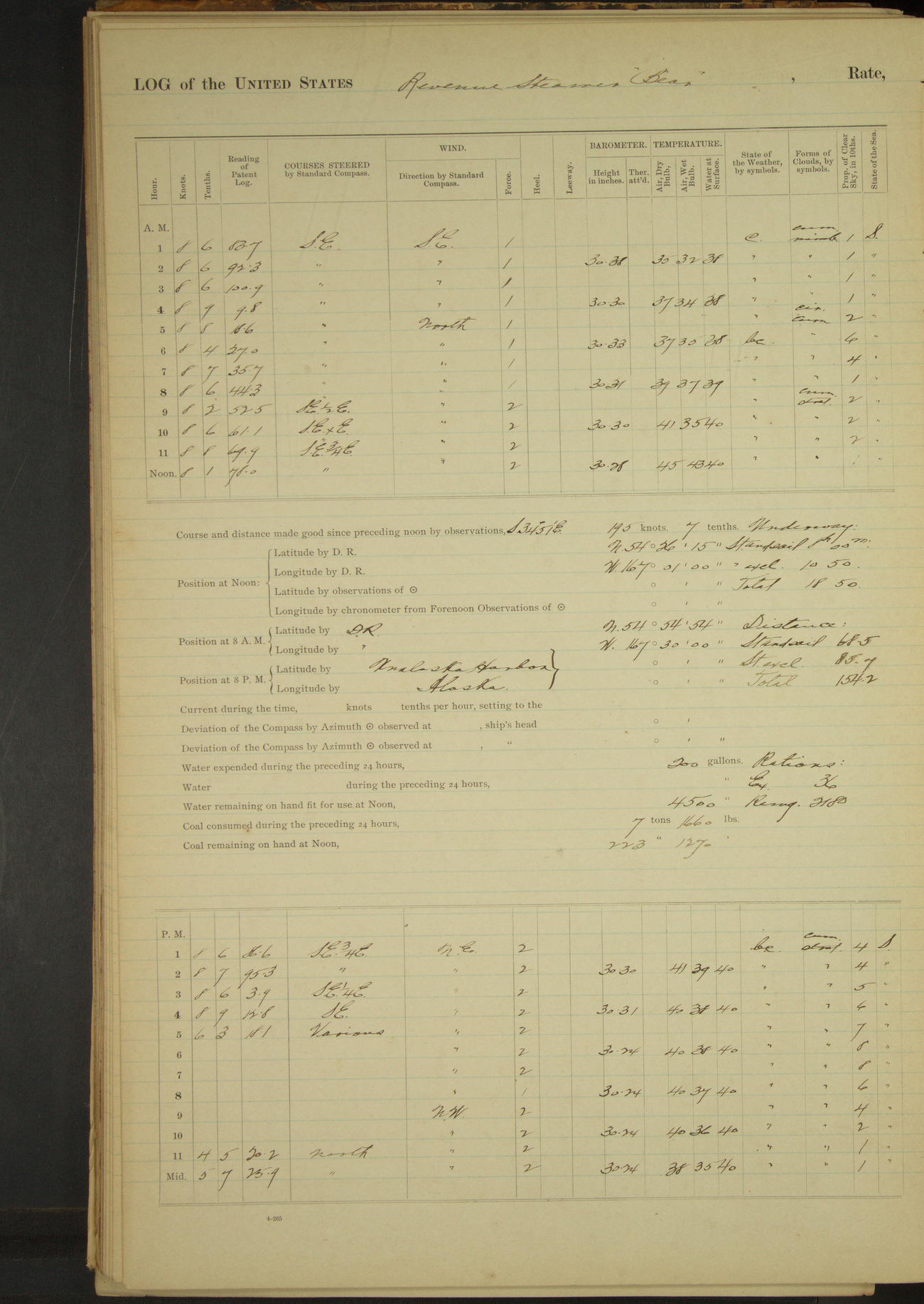
50874d6009d4090755001749: (http://oldweather.s3.amazonaws.com/ow3/final/USRC Bear/vol069/vol069_027_1.jpg)
26 April 1891
Behring Sea [& Unalaska]
Lat 54.44, Long -167.02
4am to 8am:
4.30: Cape Cheerful and high land of Unalaska Island in sight, bearing SE¼S.
8am: Lat 54° 54’ 54”N, Long 167° 30’W
Meridian to 4pm:
3.46: waterfall, Cape Cheerful, abeam.
4pm to 6pm:
4.50: came to anchor in Unalaska outer harbor. Rocky Point bearing North and Astronomical Station bearing West. Gov. Knapp and District Attorney Johnson visited the village. Two natives left the vessel.
8pm to midnight:
10.00: boat returned. District Attorney Johnson having completed business. Underway and out of the harbor. 10.35: Ulakhta Head West. 11.25: Kalekhta Head abeam, 4 miles.
Underway: steam and sail 8 hours; steam exclusively 10 hours 50 minutes; total 18 hours 50 minutes.
Distance: steam and sail 68.5 miles; steam exclusively 85.7 miles; total 154.2 miles.
50874d6009d409075500174b: (http://oldweather.s3.amazonaws.com/ow3/final/USRC Bear/vol069/vol069_028_0.jpg)
50874d6009d409075500174d: (http://oldweather.s3.amazonaws.com/ow3/final/USRC Bear/vol069/vol069_028_1.jpg)
27 April 1891
Behring Sea
Lat 54.40, Long -164.23
4am to 8am:
6.35: through Unimak Pass.
8am: Lat 54° 54’ 54”N, Long 167° 30’W
8am to meridian:
9.17: Scotch Cap abeam.
Meridian to 4pm:
4.00: Cape Pankoff [Cape Pankof] bore NxE.
4pm to 6pm:
4.30: Cape Pankoff abeam.
6pm to 8pm:
Steaming to Northward and Eastward toward Lizzie Island [Fox Island]. 6.25: passed 2 miles inside of Unga Island.
8pm to midnight:
9.25: came to anchor in King’s Cove.
Underway: steam and canvas 15 hours 12 minutes; steam exclusively 6 hours 13 minutes; total 21 hours 25 minutes.
Distance: steam and sail 125.7 miles; steam exclusively 36.5 miles; total 162.2 miles.
50874d6009d409075500174f: (http://oldweather.s3.amazonaws.com/ow3/final/USRC Bear/vol069/vol069_029_0.jpg)
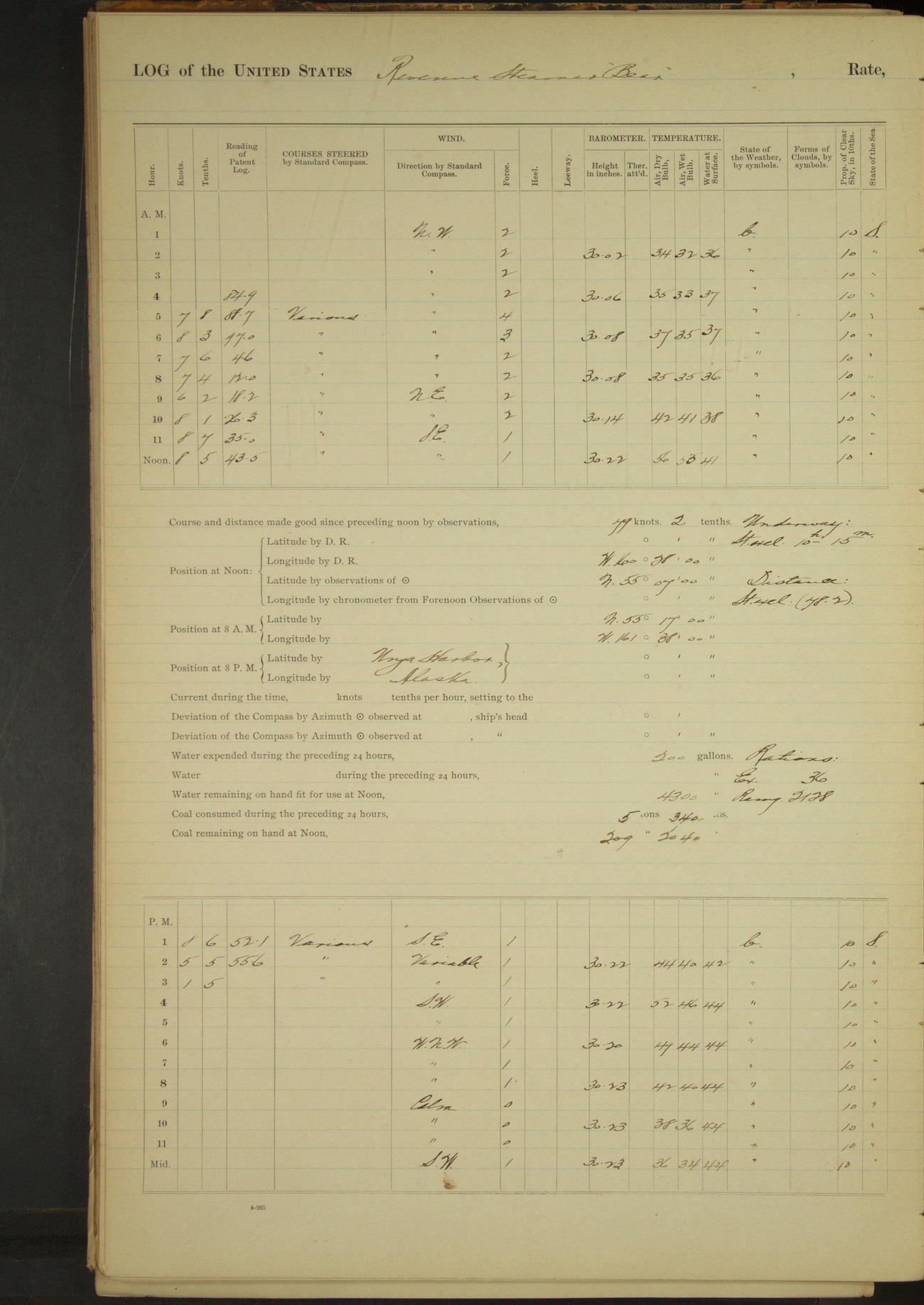
50874d6009d4090755001751: (http://oldweather.s3.amazonaws.com/ow3/final/USRC Bear/vol069/vol069_029_1.jpg)
[Duplicate log pages for 28 April partially obscured by scrap paper]
50874d6009d4090755001753: (http://oldweather.s3.amazonaws.com/ow3/final/USRC Bear/vol069/vol069_030_0.jpg)
50874d6009d4090755001755: (http://oldweather.s3.amazonaws.com/ow3/final/USRC Bear/vol069/vol069_030_1.jpg)
28 April 1891
King’s Cove [to Unga Harbor]
Lat 55.12, Long -160.47
Midnight to 4am:
4.00: underway and out of the cove.
4am to 8am:
4.22: through Isialik Passage [probably Iliasik Passage but Deer Passage seems more likely]. 5.25: course up inside of Golvoy Island [Goloi Island].
5.32: Passed Belkofsky [Belkofski; it seems more likely that Bear passed Belkofski before following a course inside Goloi Island]. 7.45: passed Pavloff Volcano [Pavlof Volcano]; smoke issuing from the crater.
8am: Lat 55° 17’N, Long 161° 38’W
8am to meridian:
9.00: NE end of Ukolonoy Island [Ukolnoi Island] abeam. 10.43: Judie Island [Jude Island] abeam.
Meridian to 4pm:
1.30: passed Point Unga [Cape Unga]. 1.45: stopped and spoke schooner “FF Feeney” of Kodiak, fishing. 2.15: came to anchor in Unga Harbor [Delarof Harbor]. US District Attorney Johnson and Deputy Marshal Kostrometinoff accompanied by Governor Knapp went ashore to obtain witnesses in the Hemingway murder* case.
6pm to 8pm:
Sent Lieutenant Jarvis with boat’s crew to assist Deputy Marshal Kostrometinoff in serving subpoenas on witnesses in Hemingway murder case.
8pm to midnight:
Governor Knapp, District Attorney Johnson, Deputy Marshal Kostrometinoff and Lieutenant Jarvis returned on board.
Underway: steam exclusively 10 hours 15 minutes.
Distance: steam exclusively 78.2 miles.
[*San Francisco Call, August 29, 1890, “Murdered at Unga”]
50874d6009d4090755001757: (http://oldweather.s3.amazonaws.com/ow3/final/USRC Bear/vol069/vol069_031_0.jpg)
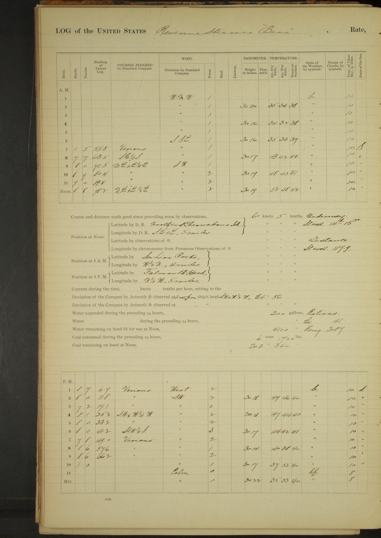
50874d6009d4090755001759: (http://oldweather.s3.amazonaws.com/ow3/final/USRC Bear/vol069/vol069_031_1.jpg)
29 April 1891
Unga Harbor [to Falmouth Harbor]
Lat 54.89, Long -159.67 [Estimate from noon bearings]
4am to 8am:
6.40: witnesses in Hemingway case were brought on board by Deputy Marshal Kostrometinoff. Names as follows: John Gardner, Robert Gould, Christian Baker, Peter Lawson, M~~~ Guttridge, Mrs. A Hemingway and child. 6.45: underway and out of Unga Harbor. Issued extra rations.
8am to meridian:
9.30: Mountain Cape [Mountain Point] North, 2 miles.
Noon: North end Chernabour Island [Chernabura] SExE 5 miles
Meridian to 4pm:
12.35: through 12 Fathom Strait. 1.55: anchored in NE Harbor, Simeonoff Island. Man from shore informed Commanding Officer that John Smith, witness in Hemingway murder case, had gone to Pirate Cove. 2.05: underway. 2.35: through 12 Fathom Strait. 3.20: South end Little Koninshi Island [Little Koniuji] abeam.
6pm to 8pm:
6.45: hauled around Mountain Cape and stood to the Northward and Westward.
8pm to midnight:
Steering various courses in Falmouth Harbor. 9.10: came to anchor in Falmouth Harbor.
Underway: steam exclusively 14 hours 15 minutes.
Distance: steam exclusively 117.9 miles.
50874d6009d409075500175b: (http://oldweather.s3.amazonaws.com/ow3/final/USRC Bear/vol069/vol069_032_0.jpg)
50874d6009d409075500175d: (http://oldweather.s3.amazonaws.com/ow3/final/USRC Bear/vol069/vol069_032_1.jpg)
30 April 1891
Falmouth Harbor, Nagai Island [to Humboldt Harbor]
Lat 55.09, Long -160.17 [Estimate from noon bearings]
8am to meridian:
11.40: underway. 11.50 passed Cape Horn.
Noon: North Falmouth Head NW½W, 1 mile.
Meridian to 4pm:
Steaming around North Head of Falmouth Harbour. At 2.00 hauled around High Island.
2.25: stopped off Pirate Cove and sent boat with officer and Deputy Marshall. 3.20: boat returned bringing JC Smith for transportation to Sitka as witness in Hemingway murder case.
Sent boat for wrecked crew of schooner “Premier”, wrecked on Ozernoi [?] Island, April 6th. 3.30: boat returned with landing party and bringing for passage to Seattle the following persons, who signed articles of enlistment without other consideration than passage to such point as they can reach their homes from: Charles Nilson, Albert Anderson, John Hansson, John Holtz, Charles Wurburg, HE Davis, Niels Hangeland, William Nelson, John Hintelmann, John Nilsson, Adolph Petterson, Hermann Hanson, G Seaberg, AJ Carlson, CA Banknot.
[More details of the shipwreck from Alaska Shipwrecks]
4pm to 6pm:
Steering various courses around Popoff Island [Popof Island] to Southward and Eastward. Issued 17 extra rations for shipwrecked crew aboard by order of Commanding Officer.
6pm to 8pm:
6.38: stopped off Little Squaw Harbor [Squaw Harbor] and sent boat ashore with District Attorney Johnson, Deputy Marshal Kostrometinoff and Lieutenant Broadbent to arrest Russian Pete and secure witnesses in Miller murder case.
7.10, boat returned with officers and Russian Pete. Steamed ahead.
7.40 came to in Humboldt Harbor. Sent Lieutenants Jarvis and Henderson with civil officers to subpoena witnesses in Miller murder case and to search for smuggled liquors.
8pm to midnight:
11.00: Lieutenant Jarvis returned having found indications of a cache for smuggled liquors. Left Lieutenant Henderson with two men to watch and search for smuggled liquors.
Underway: 8 hours; steam exclusively 6 hours 20 minutes; steam and sail 1 hour 40 minutes.
Distance: steam exclusively 40.9 miles; steam and sail 11.8 miles; total 52.7 miles.
LOGS FOR MAY 1891
50874d6009d409075500175f: (http://oldweather.s3.amazonaws.com/ow3/final/USRC Bear/vol069/vol069_033_0.jpg)
50874d6009d4090755001761: (http://oldweather.s3.amazonaws.com/ow3/final/USRC Bear/vol069/vol069_033_1.jpg)
1 May 1891
Humboldt Harbor, Popoff Island
Lat 55.33, Long -160.51
Midnight to 4am:
Midnight: Lieutenant Dennett went ashore to relieve Lieutenant Henderson in searching for smuggled liquors. Lieutenant Henderson returned on board. Emil Sivertson, Seaman, from wrecked schooner “Premier” came on board for passage to Seattle; issued one extra ration by order of Commanding Officer.
4am to 8am:
4.00: sent Boatswain on shore to relieve 1st Lieutenant in guarding inspected building, that no contraband articles should be removed therefrom.
8am to meridian:
10.00: inspecting party returned onboard, having found a secret place of concealment, but no liquor. Found 5 gallon keg whiskey in storehouse and let it run out. Cautioned proprietors that their reputation for dealing in liquor was well established at the Department, and that if found in selling the same, they would [be] arrested and taken to Sitka for trial.
Boarded American schooner “John Hancock” of San Francisco, Chipman, master, 40000 fish on board. License for vessel expired March 4th, 1891; informed master that it would have to be renewed at earliest possible date.
50874d6009d4090755001763: (http://oldweather.s3.amazonaws.com/ow3/final/USRC Bear/vol069/vol069_034_0.jpg)
50874d6009d4090755001765: (http://oldweather.s3.amazonaws.com/ow3/final/USRC Bear/vol069/vol069_034_1.jpg)
2 May 1891
Humboldt Harbor, Popoff Island
Lat 55.33, Long -160.51
4am to 8am:
Issued 17 extra rations (for one day only) by order of Commanding Officer.
50874d6009d4090755001767: (http://oldweather.s3.amazonaws.com/ow3/final/USRC Bear/vol069/vol069_035_0.jpg)
50874d6009d4090755001769: (http://oldweather.s3.amazonaws.com/ow3/final/USRC Bear/vol069/vol069_035_1.jpg)
3 May 1891
Humboldt Harbor, Popoff Island [& at sea]
Lat 55.03, Long -160.65
Midnight to 4am:
3.35: underway. Steered various courses out of the harbor. 3.48: passed Sand Point.
4am to 8am:
4.10: passed Egg Island. 4.40: fog shutting in. 4.55: passed Unga Head. 5.35: slowed engine. Keeping careful lookout for Sea Lion Rocks. 7.21: Fog dense and without breaks.
8am: Lat 55° 0’N, Long 160° 24’W
8am to meridian:
9.53: stopped engine and allowed vessel to drift on account of fog.
Meridian to 4pm:
Vessel drifting.
6pm to 8pm:
Dense fog on the water and around the entire horizon. 7.50: steamed ahead under slow bell. Course SSW to make an offing from the land for the night.
8pm: Lat 55° 03’ 30”N, Long 160° 41’W
8pm to midnight:
Foggy around the horizon, but clearing.
Underway: steam exclusively 20 hours 25 minutes.
Distance: steam exclusively 60.9 miles.
50874d6009d409075500176b: (http://oldweather.s3.amazonaws.com/ow3/final/USRC Bear/vol069/vol069_036_0.jpg)
50874d6009d409075500176d: (http://oldweather.s3.amazonaws.com/ow3/final/USRC Bear/vol069/vol069_036_1.jpg)
4 May 1891
At sea
Lat 54.28, Long -161.53
8am: Lat 54° 43’N, Long 161° 06’W
8pm: Lat 53° 48’ 46”N, Long 162° 52’ 33”W
Underway: steam and sail 58m; steam exclusively 23 hours 2 minutes.
Distance: steam and sail 7.6 miles; steam exclusively 161.7 miles; total 169.3 miles.
50874d6009d409075500176f: (http://oldweather.s3.amazonaws.com/ow3/final/USRC Bear/vol069/vol069_037_0.jpg)
50874d6009d4090755001771: (http://oldweather.s3.amazonaws.com/ow3/final/USRC Bear/vol069/vol069_037_1.jpg)
5 May 1891
At sea
Lat 54.48, Long -163.64
4am to 8am:
7.00: made the land 6 miles West of Cape Lazaroff [Cape Lazaref]. 8.00: passed Cape Lazaroff, distant 2 miles, shaped course for Cape Pankoff.
8am: Lat 54° 35’N, Long 163° 48’ W
8am to meridian:
Light ENE to South wind and overcast, rainy and foggy. Feeling way with various courses along the land. 10.00: course ExN, an island abeam, 1 mile. 10.30: slowed engine, rocks close aboard.
Meridian to 4pm:
Light SE wind and thick fog. Steaming in for land. 12.25: made land ahead. Steaming various courses along the land. 2.42: Bird Island abeam. Stopped engine. Spoke fishing schooner “Unga” of Pirate Cove, fishing. 3.30: ahead. 3.56: West head of Cape Pankoff abeam.
4pm to 6pm:
4.25: passed Cape Pankoff (East head). 5.10: stopped and boarded schooner “Francis Alice” of San Francisco, Hergaard master, fishing. License expired March 7, 1891. Informed master that license must be renewed as soon as possible. 5.25: ahead. 5.50: came to in East Anchor Cove Ikatok Peninsula [Ikatan].
6pm to 8pm:
Sent an officer with Deputy Marshal ashore and brought on board Lawrence Reid, a witness in Hemingway murder case. Emil Sivertson from the wrecked schooner “Premier” left the ship to join the schooner “Francis Alice”, Hergaard master, fishing, in port.
8pm to midnight:
9.00: boat with US Deputy Marshal went on shore with witness Lawrence Reid. 11.30: boat returned with US Marshal, Lawrence Reid, wife and small child.
Underway: steam exclusively 17 hours 50 minutes.
Distance: steam exclusively 121.0 miles.
50874d6009d4090755001773: (http://oldweather.s3.amazonaws.com/ow3/final/USRC Bear/vol069/vol069_038_0.jpg)
50874d6009d4090755001775: (http://oldweather.s3.amazonaws.com/ow3/final/USRC Bear/vol069/vol069_038_1.jpg)
6 May 1891
East Anchor Cove, Ikatok Peninsula [to Belkofsky Village to Bear Bay]
Lat 55.08, Long -161.99 [Estimate from anchor bearings]
4am to 8am:
5.45: received on board for passage to Unga or some point where they could reach their homes, one man and one woman, natives who were destitute and depending upon witness Lawrence Reid for support; also John Nord, superintendent of fishing station at East Anchor Cove, for passage to some point where he could procure supplies for his fishing crew, his provisions having been lost by wreck of the schooner “Dashing Wave”.
6.15: underway and out of East Anchor Cove.
[More information about the wreck of the Dashing Wave from Alaska Shipwrecks]
8am to meridian:
8.05: Unga Island SE¼S, 1 mile. 9.42: Lizzie Island abeam. 10.42: Bold Cape abeam. 11.20: passed Belkofsky Point. 11.50: came to anchor off Belkofsky Village. Belkofsky Point bearing SWxW, 2 miles. Sent ashore two natives taken on board at Sitka for transportation to their homes.
Meridian to 4pm:
1.30: boat returned, underway, hauled in through the Iliasik [Islands]. 3.00: off Cape Moss. 3.05: course into Bear Bay. 3.50: came to anchor in the head of Bear Bay, off sand spit.
Underway: steam and sail 3 hours 5 minutes; steam exclusively 4 hours 50 minutes.
Distance: steam and sail 24.4 miles; steam exclusively 37.4 miles; total 61.8 miles.
50874d6009d4090755001777: (http://oldweather.s3.amazonaws.com/ow3/final/USRC Bear/vol069/vol069_039_0.jpg)
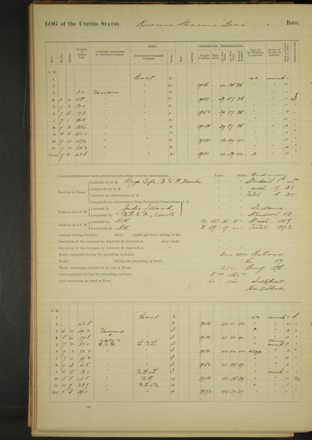
50874d6009d4090755001779: (http://oldweather.s3.amazonaws.com/ow3/final/USRC Bear/vol069/vol069_039_1.jpg)
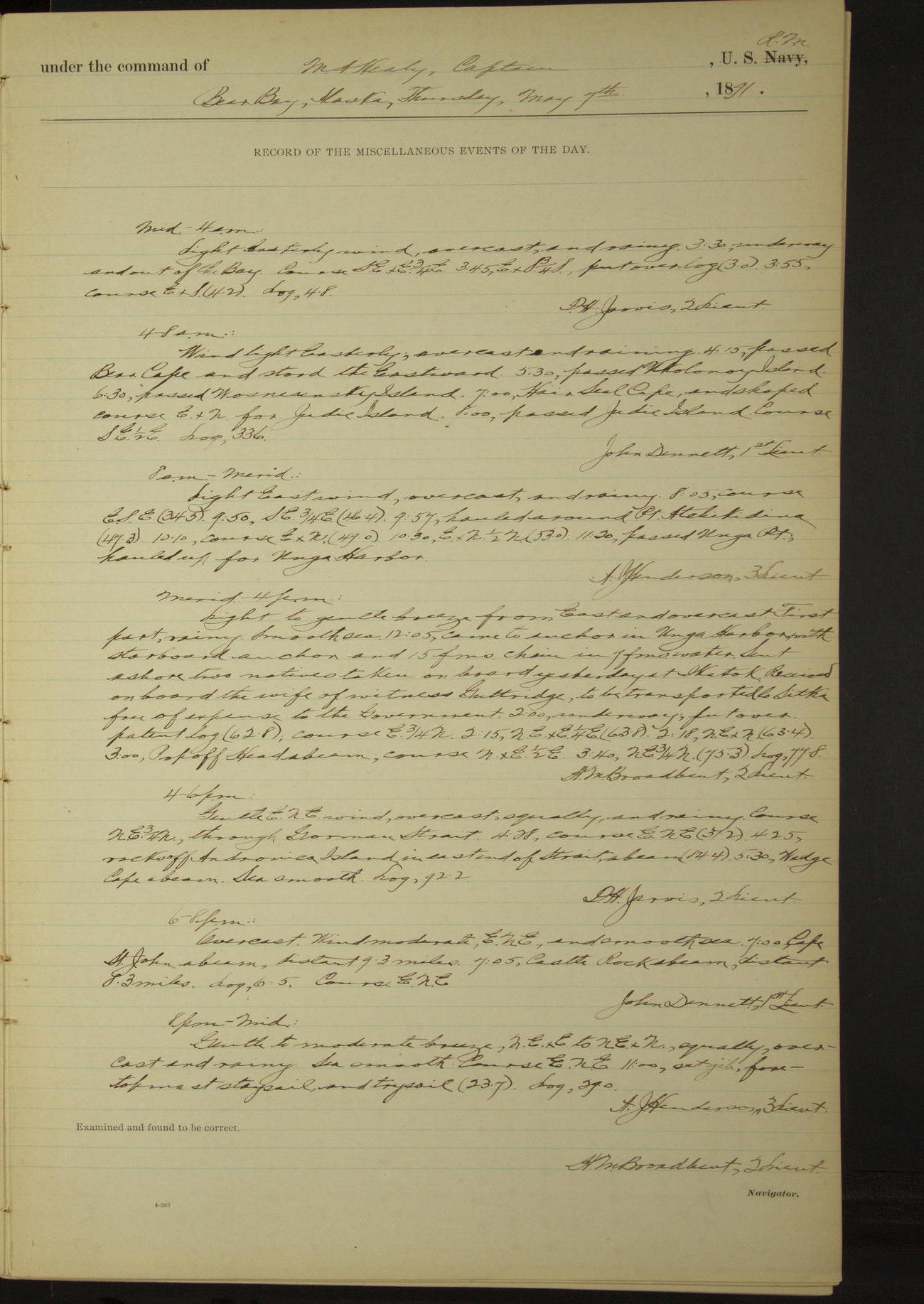
7 May 1891
Bear Bay [to Unga Harbor & at sea]
Lat 55.10, Long -160.53 [Estimate from noon bearings]
Sick list: Charles O Shade [to 10th May].
Midnight to 4am:
3.30: underway and out of the Bay.
4am to 8am:
4.15: passed Bear Cape and stood [to] the Eastward. 5.30: passed Ukolonoy Island. 6.30: passed Wosnesensky Island [Wosnesenski Island]. 7.00: Hair Seal Cape [Seal Cape]. 8.00: passed Judie Island.
8am to meridian:
9.57: hauled around Point Atchikidina [possibly Acheredin Point]. 11.20: passed Unga Point, hauled up for Unga Harbor.
Noon: Unga Cape N½W, 2 miles.
Meridian to 4pm:
12.05: came to anchor in Unga Harbor. Sent ashore two natives taken on board yesterday at Ikatok. Received on board the wife of witness Guttridge, to be transported to Sitka free of expense to the Government.
2.00: underway. 3.00: Popoff Head abeam.
4pm to 6pm:
Course through Gorman Strait. 4.25: rocks off Andronica Island in East end of Strait abeam. 5.30: Wedge Cape abeam.
6pm to 8pm:
7.00: Cape St. John [Kupreanof Point] abeam, distant 9.3 miles. 7.05: Castle Rock abeam, distant 8.3 miles.
8pm: Lat 53° 26’ 18”N, Long 159° 17’ W
Underway: steam and sail 1 hour; steam exclusively 17 hours 35 minutes.
Distance: steam and sail 5.3 miles; steam exclusively 121.9 miles; total 127.2 miles.
50874d6009d409075500177b: (http://oldweather.s3.amazonaws.com/ow3/final/USRC Bear/vol069/vol069_040_0.jpg)
50874d6009d409075500177d: (http://oldweather.s3.amazonaws.com/ow3/final/USRC Bear/vol069/vol069_040_1.jpg)
8 May 1891
At sea
Lat 55.60, Long -157.18
8am: Lat 55° 34’ 18”N, Long 157° 35’ 48” W
4pm to 6pm:
4.45: made Ukamok Island [Chirikof] bearing NExE, distant 25 miles.
8pm: Lat 55° 43’ 24”N, Long 155° 40’ 24” W [Long from 3.30pm observation]
8pm to midnight:
8.32: South end of Ukamok Island abeam, distant 5 miles..
Underway: steam and sail 24 hours.
Distance: steam and sail 131.4 miles.
50874d6009d409075500177f: (http://oldweather.s3.amazonaws.com/ow3/final/USRC Bear/vol069/vol069_041_0.jpg)
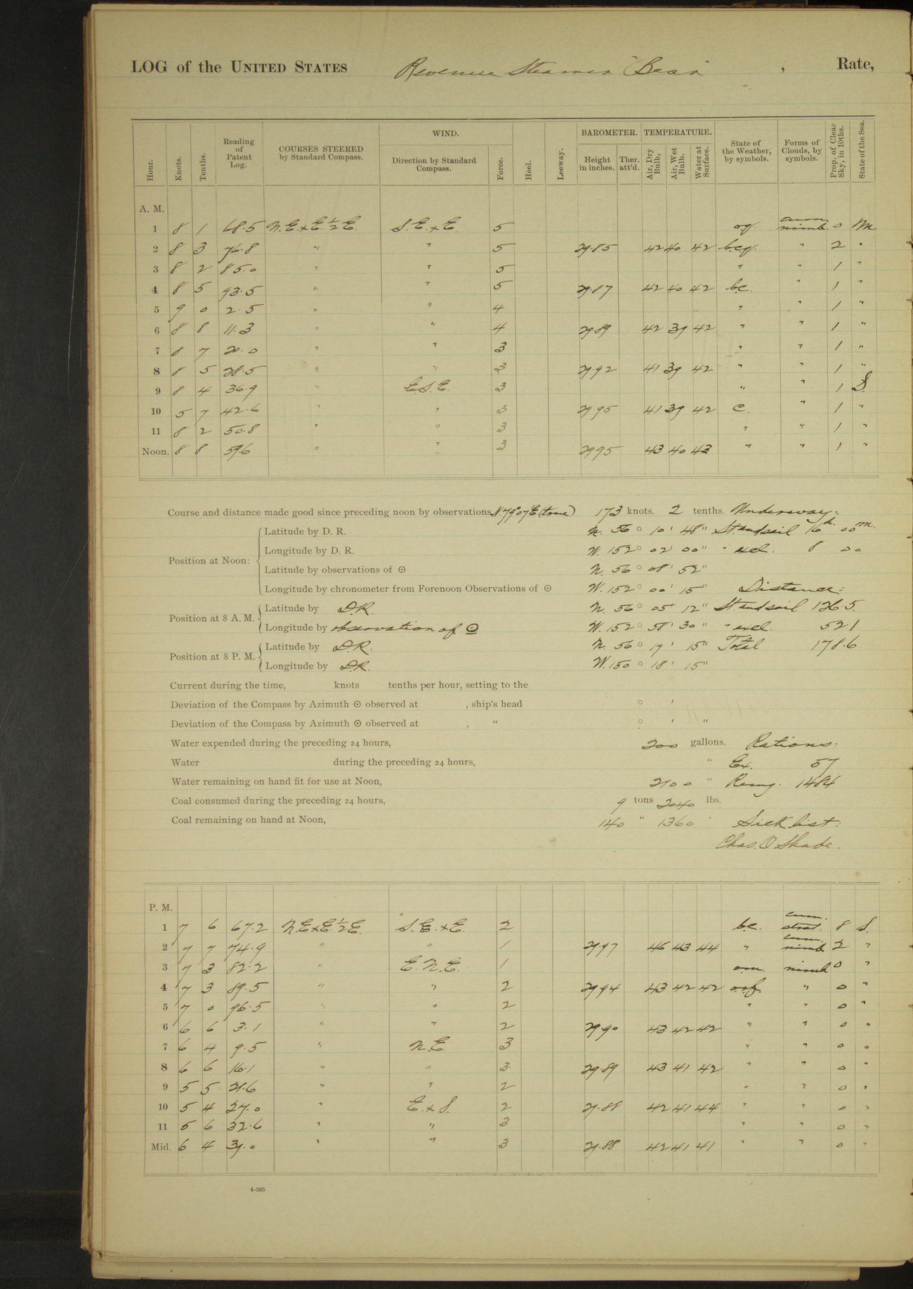
50874d6009d4090755001781: (http://oldweather.s3.amazonaws.com/ow3/final/USRC Bear/vol069/vol069_041_1.jpg)
9 May 1891
At sea
Lat 56.15, Long -152.00
8am: Lat 56° 05’ 12”N, Long 152° 58’ 30”W
8am to meridian:
10.20: stopped engine to clear an oil-pipe. 10.28: started engine.
8pm: Lat 56° 19’ 15”N, Long 150° 18’ 15”W
Underway: steam and sail 16 hours; steam exclusively 8 hours.
Distance: steam and sail 126.5 miles; steam exclusively 52.1 miles; total 178.6 miles.
50874d6009d4090755001783: (http://oldweather.s3.amazonaws.com/ow3/final/USRC Bear/vol069/vol069_042_0.jpg)
50874d6009d4090755001785: (http://oldweather.s3.amazonaws.com/ow3/final/USRC Bear/vol069/vol069_042_1.jpg)
10 May 1891
At sea
Lat 56.55, Long -147.19
8am: Lat 56° 30’ 18”N, Long 147° 50’ 30”W
8pm: Lat 56° 40’ 15”N, Long 145° 27’ 14”W
Underway: steam and sail 24 hours.
Distance: steam and sail 169.9 miles.
50874d6009d4090755001787: (http://oldweather.s3.amazonaws.com/ow3/final/USRC Bear/vol069/vol069_043_0.jpg)
50874d6009d4090755001789: (http://oldweather.s3.amazonaws.com/ow3/final/USRC Bear/vol069/vol069_043_1.jpg)
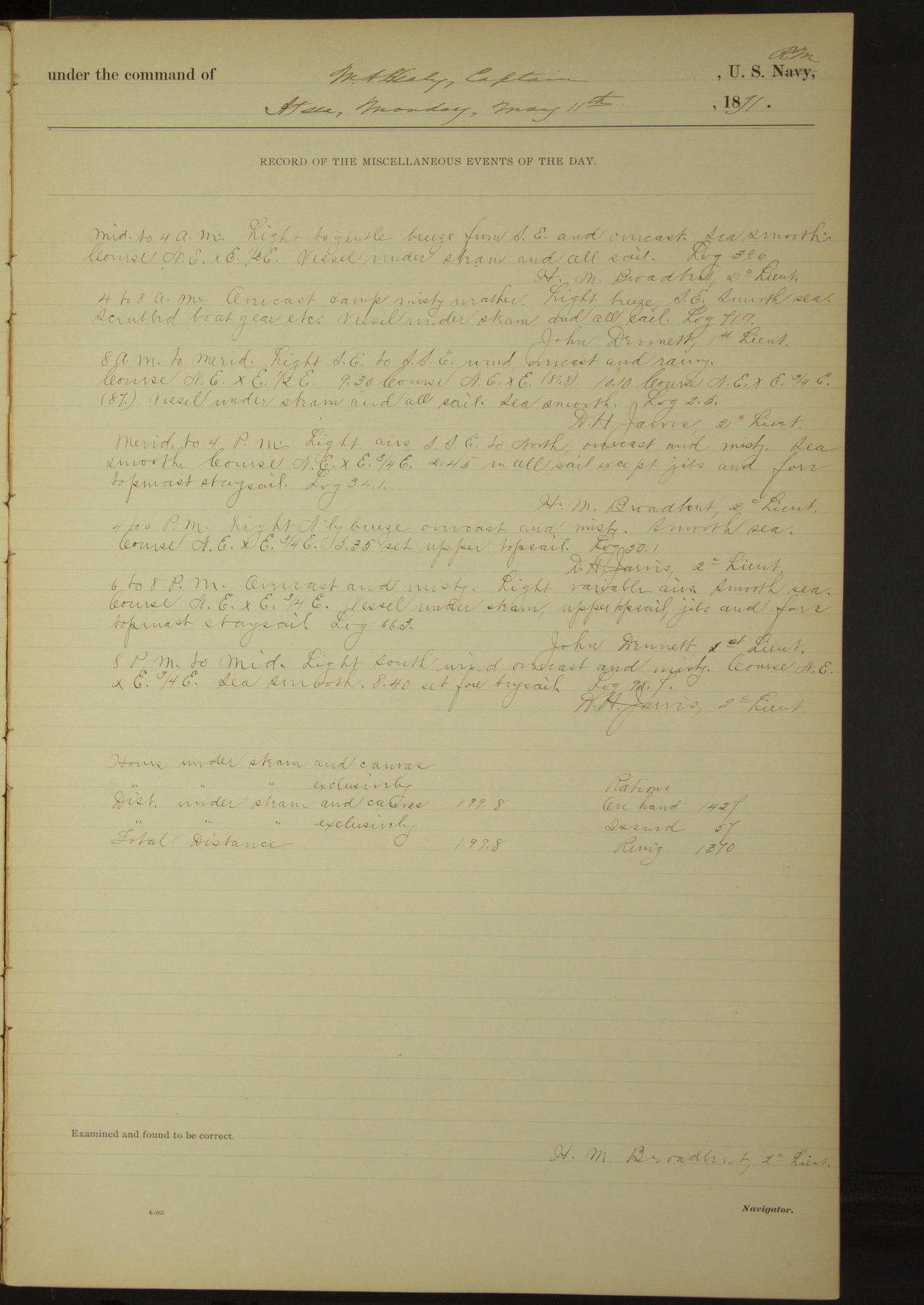
11 May 1891
At sea
Lat 56.96, Long -141.61
8am: Lat 56° 48’ 14”N, Long 142° 32’W
8pm: Lat 56° 53’ 48”N, Long 139° 37’ 30”W
Distance under steam and canvas 199.8 miles.
50874d6009d409075500178b: (http://oldweather.s3.amazonaws.com/ow3/final/USRC Bear/vol069/vol069_044_0.jpg)
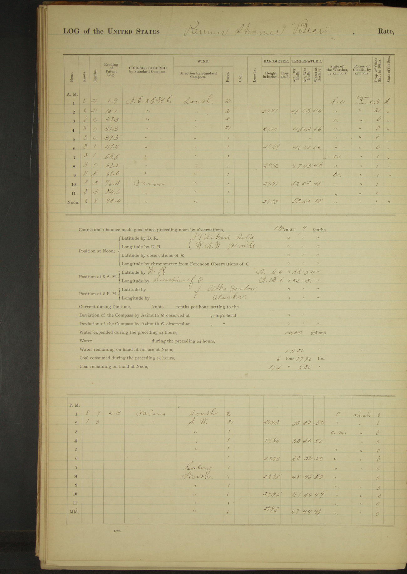
50874d6009d409075500178d: (http://oldweather.s3.amazonaws.com/ow3/final/USRC Bear/vol069/vol069_044_1.jpg)
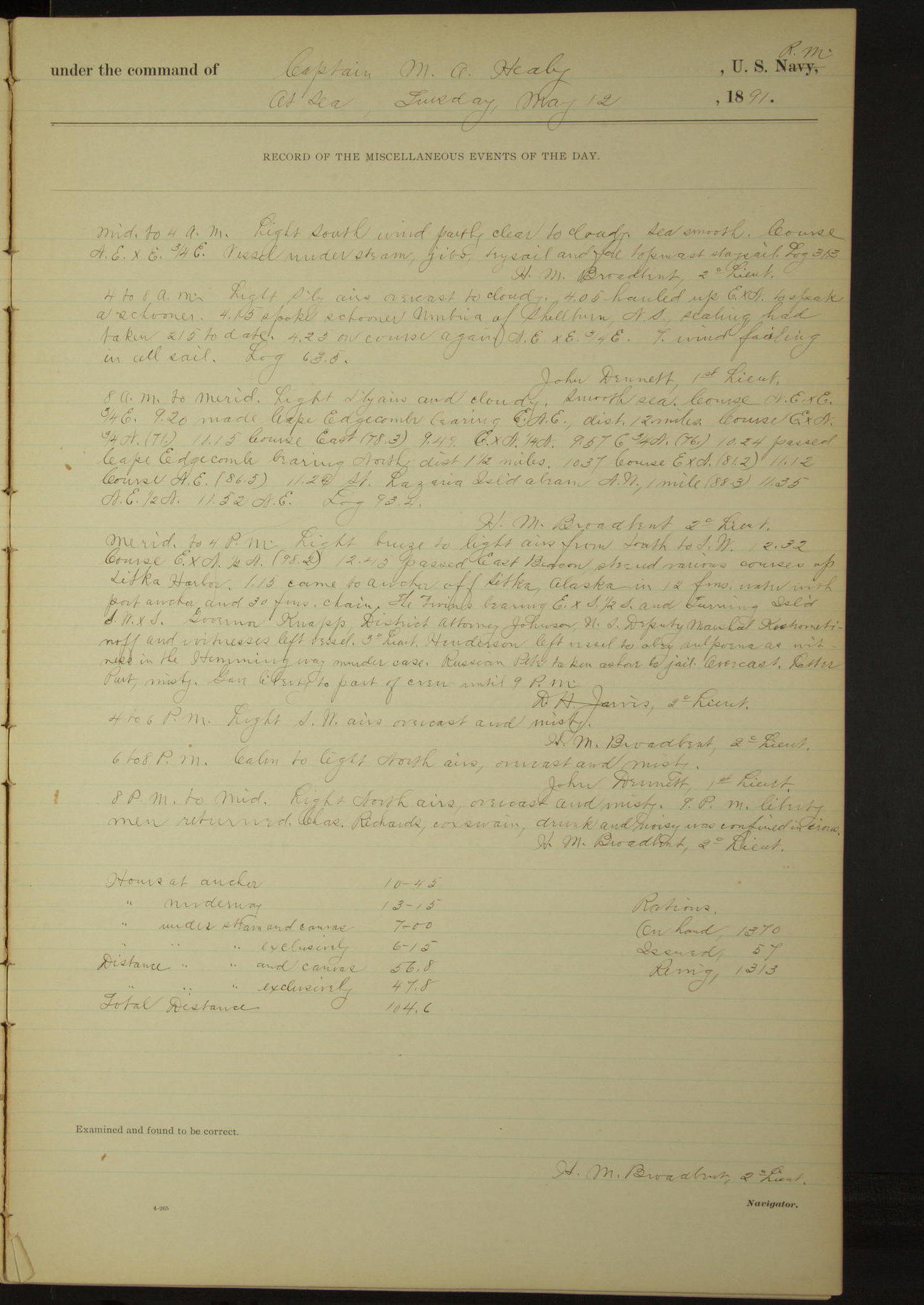
12 May 1891
At sea [& at Sitka]
Lat 56.99, Long -135.54 [Estimate from noon bearings]
4am to 8am:
4.05: hauled up ExN to speak a schooner. 4.15: spoke schooner “Umbria” of Shellburn [Shelburne], Nova Scotia, sealing, had taken 215 to date.
8am: Lat 56° 58’ 54”N, Long 136° 32’ 30”W
8am to meridian:
9.20: made Cape Edgecumbe bearing ESE, distant 12 miles. 10.24: passed Cape Edgecumbe bearing North, distant 1½ miles. 11.24: St. Lazaria Island abeam NW, 1 mile.
Noon: Vitskari Island WNW ½ mile
Meridian to 4pm:
12.43: passed East Beacon, steered various courses up Sitka Harbor. 1.15: came to anchor off Sitka. The Twins bearing ExS½S and Turning Island SWxS.
Governor Knapp, District Attorney Johnson, US Deputy Marshal Kostrometinoff and witnesses left vessel. 3rd Lieutenant Henderson left vessel to obey subpoena as witness in the Hemingway murder case. Russian Pete taken ashore to jail. Gave liberty to part of crew until 9pm.
8pm to midnight:
9.00: liberty men returned. Charles Richards, Coxswain, drunk and noisy, was confined in irons.
At anchor 10 hours 45 minutes.
Underway 13 hours 15 minutes.
Steam and canvas 7 hours.
Under steam exclusively 6 hours 15 minutes.
Distance under steam and canvas 56.8 miles.
Distance under steam exclusively 47.8 miles.
Total distance 104.6 miles.
50874d6009d409075500178f: (http://oldweather.s3.amazonaws.com/ow3/final/USRC Bear/vol069/vol069_045_0.jpg)
50874d6009d4090755001791: (http://oldweather.s3.amazonaws.com/ow3/final/USRC Bear/vol069/vol069_045_1.jpg)
13 May 1891
Sitka [& at sea]
Lat 56.38, Long -135.24
4am to 8am:
4.10: underway out of Sitka Harbor through the Eastern Passage. 5.35: passed Vitskari Island. 6.05: passed St. Lazaria Island. 7.00: Sitka Point NWxW½W. Biorca Island NExE½E and St. Lazaria Island NWxN.
8am: Lat 56° 47’N, Long 135° 33’W
8am to meridian:
Charles Richards, Coxswain, released and returned to duty.
Meridian to 4pm:
3.45: Cape Ommaney abeam 20 miles.
8pm: Lat 55° 47’N, Long 134° 47’W
At anchor 4 hours 10 minutes.
Underway 19 hours 50 minutes.
Steam and sail 15 hours 30 minutes.
Steam exclusively 4 hours 20 minutes.
Distance under steam and canvas 89.0 miles.
Distance under steam exclusively 29.7 miles.
Total distance 118.7 miles.
50874d6009d4090755001793: (http://oldweather.s3.amazonaws.com/ow3/final/USRC Bear/vol069/vol069_046_0.jpg)
50874d6009d4090755001795: (http://oldweather.s3.amazonaws.com/ow3/final/USRC Bear/vol069/vol069_046_1.jpg)
14 May 1891
At sea
Lat 54.84, Long -134.12
8am: Lat 54° 58’N, Long 134° 16’W
4pm to 6pm:
5.25: spoke British schooner “E.B. Marvin” [photo from Wikimedia] of Victoria, sealing. Left Victoria February 10 and caught 310 seals.
8pm: Lat 54° 06’N, Long 133° 46’W
Under steam and canvas 20 hours.
Under steam exclusively 4 hours.
Distance under steam and canvas 96.1 miles.
Distance under steam exclusively 26.0 miles.
Total distance 122.1 miles.
50874d6009d4090755001797: (http://oldweather.s3.amazonaws.com/ow3/final/USRC Bear/vol069/vol069_047_0.jpg)
50874d6009d4090755001799: (http://oldweather.s3.amazonaws.com/ow3/final/USRC Bear/vol069/vol069_047_1.jpg)
15 May 1891
At sea
Lat 52.62, Long -132.52
8am: Lat 52° 58’N, Long 132° 58’W
8pm: Lat 52° 02’ 30”N, Long 131° 48’W
Under steam and canvas 5 hours.
Under steam exclusively 18 hours 55 minutes.
Distance under steam and canvas 32.6 miles.
Distance under steam exclusively 107.5 miles.
Total distance 142.1 miles.
50874d6009d409075500179b: (http://oldweather.s3.amazonaws.com/ow3/final/USRC Bear/vol069/vol069_048_0.jpg)
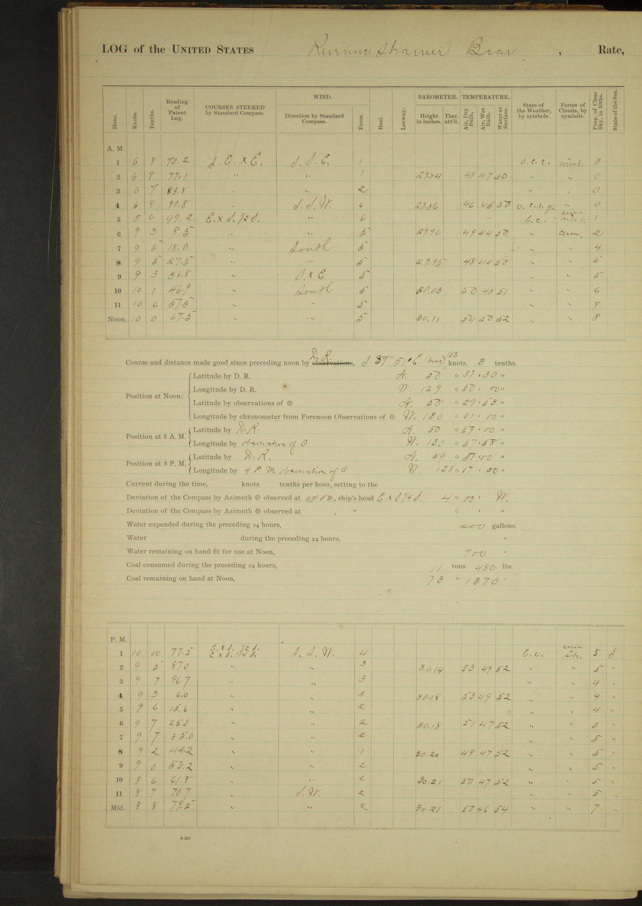
50874d6009d409075500179d: (http://oldweather.s3.amazonaws.com/ow3/final/USRC Bear/vol069/vol069_048_1.jpg)
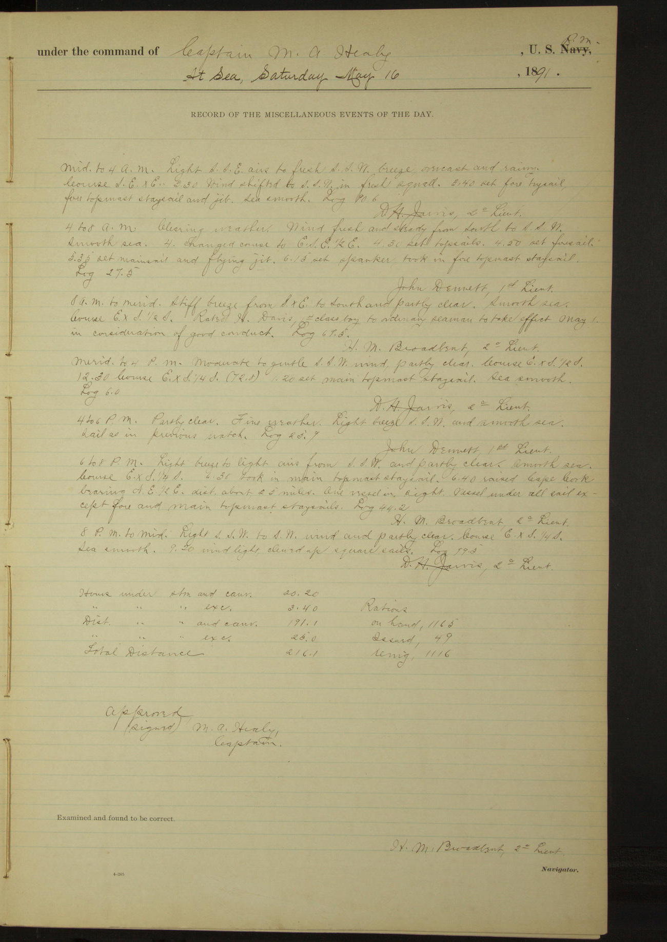
16 May 1891
At sea
Lat 50.50, Long -130.02
8am: Lat 50° 59’N, Long 130° 57’ 58”W
8am to meridian:
Rated H. Davis, 1st class Boy, to Ordinary Seaman to take effect May 1 in consideration of good conduct.
6pm to 8pm:
6.40: raised Cape Cook bearing NE½E, distant about 25 miles. One vessel in sight.
8pm: Lat 49° 57’N, Long 128° 17’W
Under steam and canvas 20 hours 20 minutes.
Under steam exclusively 3 hours 40 minutes.
Distance under steam and canvas 191.1 miles.
Distance under steam exclusively 25.0 miles.
Total distance 216.1 miles.
50874d6009d409075500179f: (http://oldweather.s3.amazonaws.com/ow3/final/USRC Bear/vol069/vol069_049_0.jpg)
50874d6009d40907550017a1: (http://oldweather.s3.amazonaws.com/ow3/final/USRC Bear/vol069/vol069_049_1.jpg)
17 May 1891
At sea
Lat 48.77, Long -125.38
Midnight to 4am:
At daylight 2.38am land in sight port beam, Vancouver Island near Nootka Sound.
8am: Lat 48° 28’N, Long 126° 05’W
8am to meridian:
11.30: Amphitrite Point abeam, 13.2 miles.
Noon: Lat 48° 46’ N, Long 126° 23’W [seems incorrect, doesn't fit with previous bearing]
Meridian to 4pm:
1.10: passed Cape Beale Light, distant 8 miles on fore point bearing. 4.00: Tatoosh Light House South, Bonilla Point NW. Unlashed anchor etc.
4pm to 6pm:
Standing up Strait of Juan de Fuca.
6pm to 8pm:
7.20: Pillar Point abeam.
8pm to midnight:
9.30: Race Island Light North, 5.5 miles. 10.25: Ediz Hook Light SxE, 3.1 miles. 11.40: Dungeness Light SExS, 2 miles.
Under steam and canvas 19 hours 45 minutes.
Under steam exclusively 4 hours 15 minutes.
Distance under steam and canvas 177.5 miles.
Distance under steam exclusively 34.1 miles.
Total distance 211.6 miles.
50874d6009d40907550017a3: (http://oldweather.s3.amazonaws.com/ow3/final/USRC Bear/vol069/vol069_050_0.jpg)
50874d6009d40907550017a5: (http://oldweather.s3.amazonaws.com/ow3/final/USRC Bear/vol069/vol069_050_1.jpg)
18 May 1891
Strait of Juan de Fuca [& Seattle]
Lat 47.60, Long -122.34
Midnight to 4am:
1.55 [?]: Smiths Island Light bore NxW and Point Wilson Light ExS. 1.40: Point Wilson Light abeam. 2.20: Marrowstone Point abeam. 3.10: Passed Nodule Point.
4am to 8am:
Steaming up Puget Sound. 4.15: Passed Point No Point. At 7.00 stopped and made fast to buoy off coal wharf at Seattle, Washington. The fifteen shipwrecked seamen taken on board at Pirate Cove, being destitute, were allowed to remain on board. US Commissioner Tarpley left the vessel.
8am to meridian:
10.00: hauled fires and blew water out of boiler to clean it.
At anchor 17 hours.
Underway 7 hours.
Distance 59.4 miles.
Total distance from Sitka to Seattle 870 miles.
Total distance run since leaving San Francisco 5879.4 miles.
Total distance run since leaving Seattle 4986.7 miles.
Time from Sitka to Seattle 5 days 2 hours 50 minutes.
50874d6009d40907550017a7: (http://oldweather.s3.amazonaws.com/ow3/final/USRC Bear/vol069/vol069_051_0.jpg)
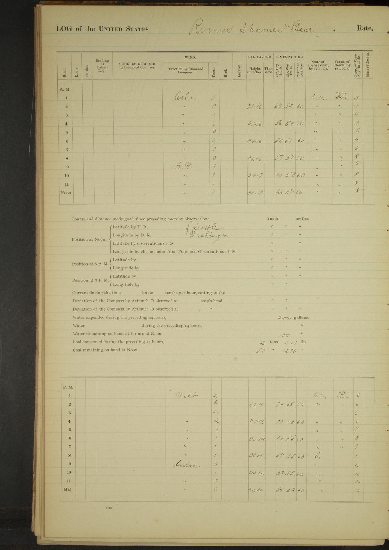
50874d6009d40907550017a9: (http://oldweather.s3.amazonaws.com/ow3/final/USRC Bear/vol069/vol069_051_1.jpg)
19 May 1891
Seattle
Lat 47.60, Long -122.34
4am to 8am:
6.30: hauled in to South bunker to be ready for coaling ship. On account of a strike in mines, were unable to obtain coal when ready to receive it. Waited for report from mines. Hauled boats out on float for cleaning and painting. FF Anderson, James Baines, William Mackey, Michael McGlade, Seamen, and Alexander McEwan, Fireman, absent without leave from 7.00.
8am to meridian:
Getting ready for coaling. Engineer’s force cleaning boiler and repairing check valve [& to 4pm].
Meridian to 4pm:
Painting boats. Michael McGlade, Seaman, returned on board.
50874d6009d40907550017ab: (http://oldweather.s3.amazonaws.com/ow3/final/USRC Bear/vol069/vol069_052_0.jpg)
50874d6009d40907550017ad: (http://oldweather.s3.amazonaws.com/ow3/final/USRC Bear/vol069/vol069_052_1.jpg)
20 May 1891
Seattle
Lat 47.60, Long -122.34
4am to 8am:
Liberty men and absentees returned. 7.00: commenced coaling ship. Painting launch outside.
8am to meridian:
Michael McGlade, Seaman, left vessel without permission. Eleven (11) coal trimmers from shore employed stowing coal.
Two shipwrecked seamen from schooner “Premier”, Herman Hansen and John Holtz, left vessel.
Engineer’s force cleaning boiler and repairing check valve [& to 4pm].
Meridian to 4pm:
Nine (9) coal trimmers from shore employed stowing coal.
4pm to 8pm:
5.00: ceased coaling for the night. Discharged T Takasaka, 2nd class Boy, for general worthlessness and filthiness.
8pm to midnight:
Michael McGlade, Seaman, returned on board.
50874d6009d40907550017af: (http://oldweather.s3.amazonaws.com/ow3/final/USRC Bear/vol069/vol069_053_0.jpg)
50874d6009d40907550017b1: (http://oldweather.s3.amazonaws.com/ow3/final/USRC Bear/vol069/vol069_053_1.jpg)
21 May 1891
Seattle
Lat 47.60, Long -122.34
4am to 8am:
7.00: resumed coaling. Three (3) coal trimmers from shore employed stowing coal. Filled water tanks and boiler with fresh water.
8am to meridian:
Finished coaling having received 340 560/2240 tons Black Diamond coal. Cleaning ship. Engineer’s force finished cleaning boiler and repairing check valve.
Meridian to 4pm:
Bent old mainsail.
4pm to 8pm:
Received from Department list of merchant vessels for 1890. Hauled over to coal wharf and took on board some stores for rations.
50874d6009d40907550017b3: (http://oldweather.s3.amazonaws.com/ow3/final/USRC Bear/vol069/vol069_054_0.jpg)
50874d6009d40907550017b5: (http://oldweather.s3.amazonaws.com/ow3/final/USRC Bear/vol069/vol069_054_1.jpg)
22 May 1891
Seattle [to Port Townsend]
Lat 48.11, Long -122.69 [Estimate from noon bearings]
4am to 8am:
6.30: cast off from the wharf and steamed out into the stream. Hoisted boats, etc. Archibald Nelson, Seaman, left on shore, absent without leave. 6.50: ahead down the Sound. 7.40: passed West Point Light House.
8am to meridian:
8.53: Apple Cove Point abeam. 9.45: Point No Point abeam. 11.00: Bush Point abeam. 11.58: passed Marrowstone Point. Stood in to Port Townsend Bay.
Noon: Marrowstone Point South, ½ mile.
Meridian to 4pm:
12.40: came to anchor off Port Townsend, Washington. Marrowstone Point bearing ExN, Point Hudson NWxN and Fort Townsend S¾W.
Revenue Steamer “Wolcott” in port. 1st Lieutenant George E McConnell and 3rd Lieutenant LL Robinson reported for duty. A Nelson, Seaman, returned on board.
Discharged Paul O’Connor, Master-at-Arms, for inefficiency; William Rutherford, Coal Passer, and CO Shade for physical disability. Crew employed stowing provisions in fore hold, etc. Discharged T Mogi and K Yasuda, 1st class Boys.
At anchor 17 hours 50 minutes.
Underway 6 hours 10 minutes.
Distance 37.3 miles.
50874d6009d40907550017b7: (http://oldweather.s3.amazonaws.com/ow3/final/USRC Bear/vol069/vol069_055_0.jpg)
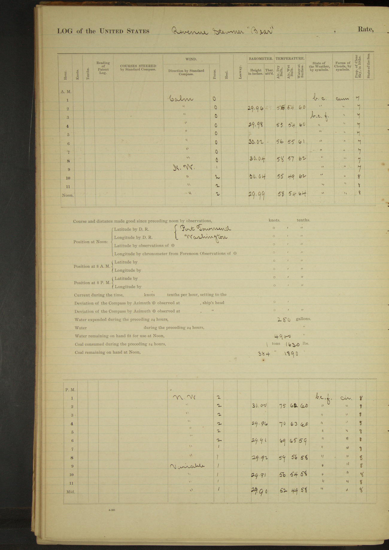
50874d6009d40907550017b9: (http://oldweather.s3.amazonaws.com/ow3/final/USRC Bear/vol069/vol069_055_1.jpg)
23 May 1891
Port Townsend
Lat 48.11, Long -122.74
4am to 8am:
Scrubbed decks, paint work, etc. with sand.
David Charles, Quartermaster, rated Master-at-Arms from date. Thomas Ogan, Seaman, rated Quartermaster from date. William Thomas, 1st class Boy, rated Coal Passer from date. J Spencer, 2nd class Boy, rated 1st class Boy from date. WA Smith, Seaman, rated Coxswain from May 1st.
Shipped Frank Wormell, 2nd class Boy; H Honda, 1st class Boy; TS Frank, 1st class Boy; and U Onki, 2nd class Boy.
8am to meridian:
Officers and crew received pay for April. Shipped CA Book, Seaman. Discharged Harry Davis, Ordinary Seaman.
Meridian to 4pm:
Remainder of wrecked seamen from schooner “Premier” left the vessel. Cooper from shore working on provision barrels. Mechanics from shore working on air pumps.
50874d6009d40907550017bb: (http://oldweather.s3.amazonaws.com/ow3/final/USRC Bear/vol069/vol069_056_0.jpg)
50874d6009d40907550017bd: (http://oldweather.s3.amazonaws.com/ow3/final/USRC Bear/vol069/vol069_056_1.jpg)
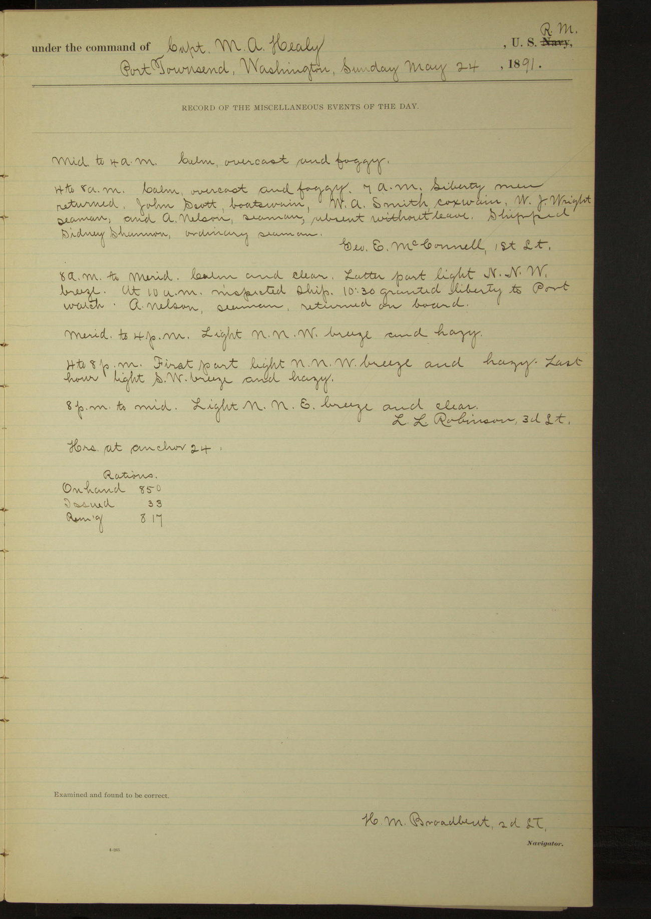
24 May 1891
Port Townsend
Lat 48.11, Long -122.74
4am to 8am:
7.00: Liberty men returned. John Scott, Boatswain; WA Smith, Coxswain; WJ Wright, Seaman; and A Nelson, Seaman, absent without leave. Shipped Sidney Shannon, Ordinary Seaman.
8am to meridian:
10.30: granted liberty to Port watch. A Nelson, Seaman, returned on board.
50874d6009d40907550017bf: (http://oldweather.s3.amazonaws.com/ow3/final/USRC Bear/vol069/vol069_057_0.jpg)
50874d6009d40907550017c1: (http://oldweather.s3.amazonaws.com/ow3/final/USRC Bear/vol069/vol069_057_1.jpg)
25 May 1891
Port Townsend
Lat 48.11, Long -122.74
4am to 8am:
7.00: Liberty men returned. William Mackey, Seaman, drunk. John Scott, Boatswain; WA Smith, Coxswain; John Clifford, Fireman; Frank Friedburg and Charles Henry, Seamen, absent without leave.
7.30: lighter “Baltic” came alongside with provisions furnished by Waterman & Katz. WJ Wright, Seaman, returned on board.
8am to meridian:
1st Lieutenant John Dennett received Departmental order detaching him from this vessel. Crew employed receiving and stowing rations. Received from Waterman & Katz 6056 rations.
Meridian to 4pm:
Reverend Sheldon Jackson came on board for cruise to the Arctic by authority of Department. Received 12 cases of hardware for missionary schools at Cape Prince of Wales. John Scott, Boatswain, returned on board.
8pm to midnight:
Charles Henry, Seaman; John Clifford, Fireman; and D Fender, Coal Passer, returned on board.
50874d6009d40907550017c3: (http://oldweather.s3.amazonaws.com/ow3/final/USRC Bear/vol069/vol069_058_0.jpg)
50874d6009d40907550017c5: (http://oldweather.s3.amazonaws.com/ow3/final/USRC Bear/vol069/vol069_058_1.jpg)
26 May 1891
Port Townsend
Lat 48.11, Long -122.74
4am to 8am:
7.00: Liberty men returned. WA Smith, Coxswain (absent without leave), returned on board. Frank Friedburg, Seaman, a deserter.
8am to meridian:
Shipped Charles Nelson, Seaman, and William Lohman as Ordinary Seaman, and rated him Seaman from date.
8pm to midnight:
1st Lieutenant John Dennett left the vessel.
50874d6009d40907550017c7: (http://oldweather.s3.amazonaws.com/ow3/final/USRC Bear/vol069/vol069_059_0.jpg)
50874d6009d40907550017c9: (http://oldweather.s3.amazonaws.com/ow3/final/USRC Bear/vol069/vol069_059_1.jpg)
27 May 1891
Port Townsend
Lat 48.11, Long -122.74
4am to 8am:
7.00: Liberty men returned.
8am to meridian:
Scraping spars and variously employed preparing for sea.
Meridian to 4pm:
Variously employed, scraping spars, stowing supplies, etc.
4pm to 8pm:
At 6.00 granted liberty to starboard watch.
50874d6009d40907550017cb: (http://oldweather.s3.amazonaws.com/ow3/final/USRC Bear/vol069/vol069_060_0.jpg)
50874d6009d40907550017cd: (http://oldweather.s3.amazonaws.com/ow3/final/USRC Bear/vol069/vol069_060_1.jpg)
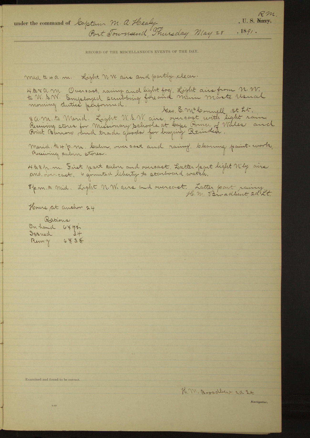
28 May 1891
Port Townsend
Lat 48.11, Long -122.74
4am to 8am:
Employed scrubbing fore and main masts.
8am to meridian:
Receiving stores for missionary schools at Cape Prince of Wales and Point Barrow, and trade goods for buying reindeer.
Meridian to 4pm:
Cleaning paint-work. Receiving cabin stores.
4pm to 8pm:
6.00: granted liberty to starboard watch.
50874d6009d40907550017cf: (http://oldweather.s3.amazonaws.com/ow3/final/USRC Bear/vol069/vol069_061_0.jpg)
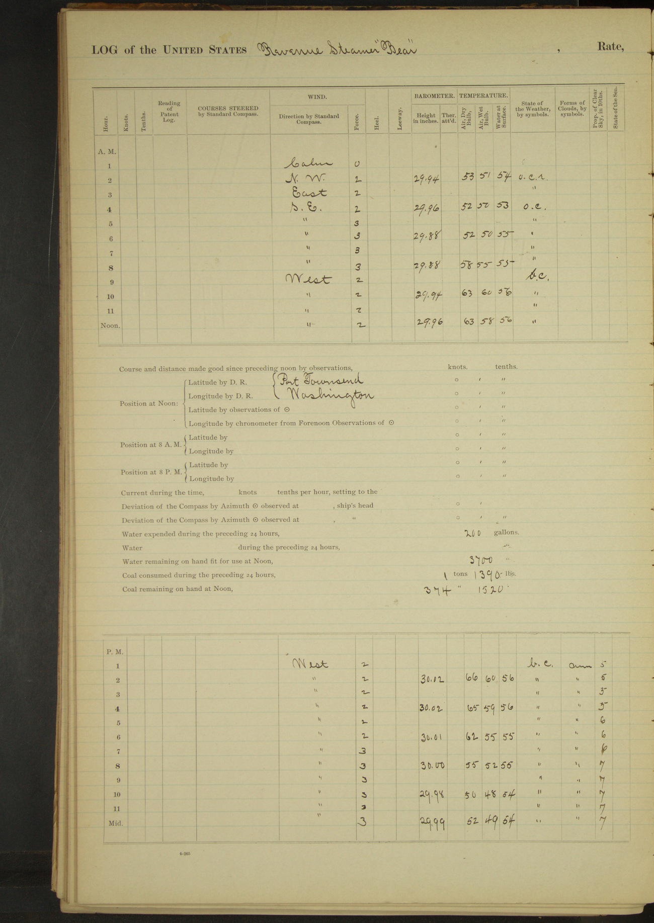
50874d6009d40907550017d1: (http://oldweather.s3.amazonaws.com/ow3/final/USRC Bear/vol069/vol069_061_1.jpg)
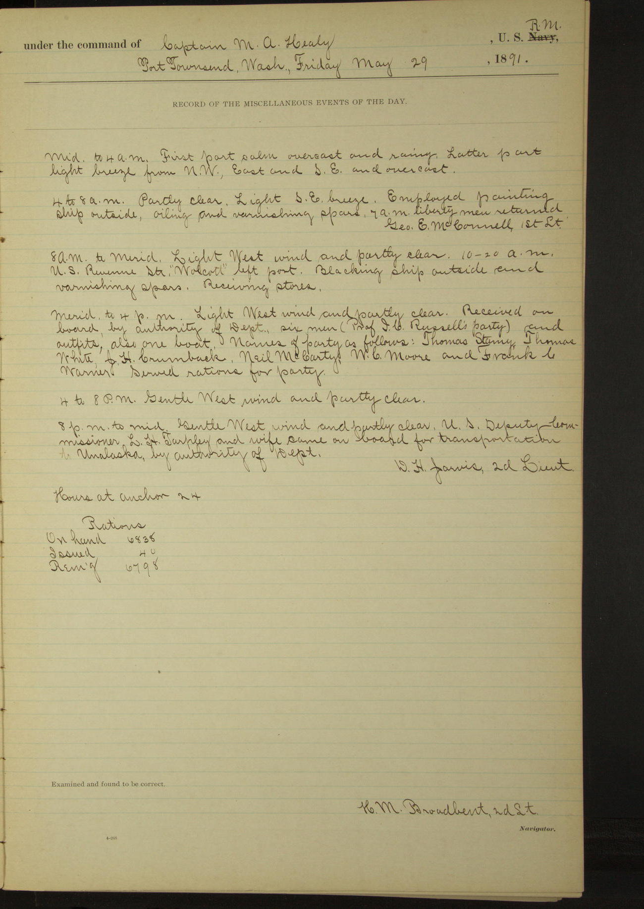
29 May 1891
Port Townsend
Lat 48.11, Long -122.74
4am to 8am:
Employed painting ship outside, oiling and varnishing spars. 7.00: Liberty men returned.
8am to meridian:
10.20: US Revenue Steamer “Wolcott” left port. Blacking ship outside and varnishing spars. Receiving stores.
Meridian to 4pm:
Received on board, by authority of Department, six men (Professor IC Russell's [Israel Russell] party and outfits, also one boat. Names of party as follows: Thomas Storey, Thomas White, CH Crumback, Neil McCarty, WC Moore and Frank C Warner. Served rations for party. [From geosociety.org: the party was on an expedition to Mount St. Elias]
8pm to midnight:
US Deputy Commissioner LH Tarpley and wife came on board for transportation to Unalaska, by authority of Department
50874d6009d40907550017d3: (http://oldweather.s3.amazonaws.com/ow3/final/USRC Bear/vol069/vol069_062_0.jpg)
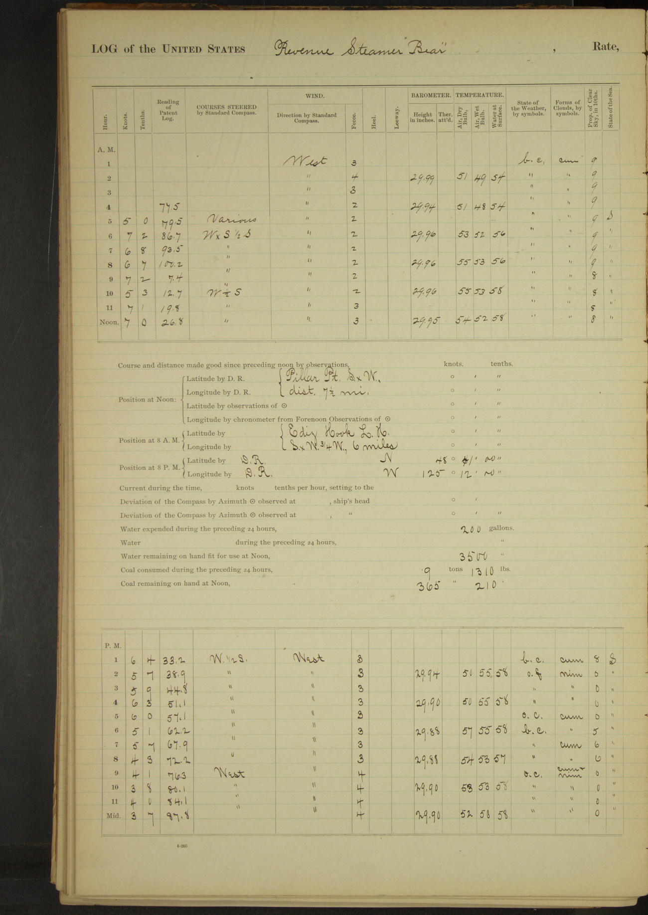
50874d6009d40907550017d5: (http://oldweather.s3.amazonaws.com/ow3/final/USRC Bear/vol069/vol069_062_1.jpg)
30 May 1891
Port Townsend [& at sea]
Lat 48.36, Long -124.07 [Estimate from noon bearings]
Midnight to 4am:
At 2.30 Professor IC Russell of the Geological Survey came on board by authority of Department. At 3.30 got steam. 4.00: underway. Stood out of the harbor.
4am to 8am:
4.40: Point Wilson Light House abeam. 6.50: New Dungeness Light House abeam. Employed securing boats, reeving tacks and sheets, etc.
8am to meridian:
9.16: Race Island Light House abeam. US Revenue Steamer “Wolcott” in sight; kept away SW toward her. 9.25: stopped and sent mail aboard “Wolcott”. Exchanged salutes with her. 9.40: ahead.
Noon: Pillar Point SxW distant 7½ miles
Meridian to 4pm:
Steaming down the Strait of Juan de Fuca. 2.45: Port San Juan abeam. 4.53: Cape Flattery Light House abeam.
4pm to 6pm:
At 5.00 Cape Flattery Light House SW½S, distant by four-point bearing 7.0 miles
8pm: Lat 48° 41’N, Long 125° 12’W
50874d6009d40907550017d7: (http://oldweather.s3.amazonaws.com/ow3/final/USRC Bear/vol069/vol069_063_0.jpg)
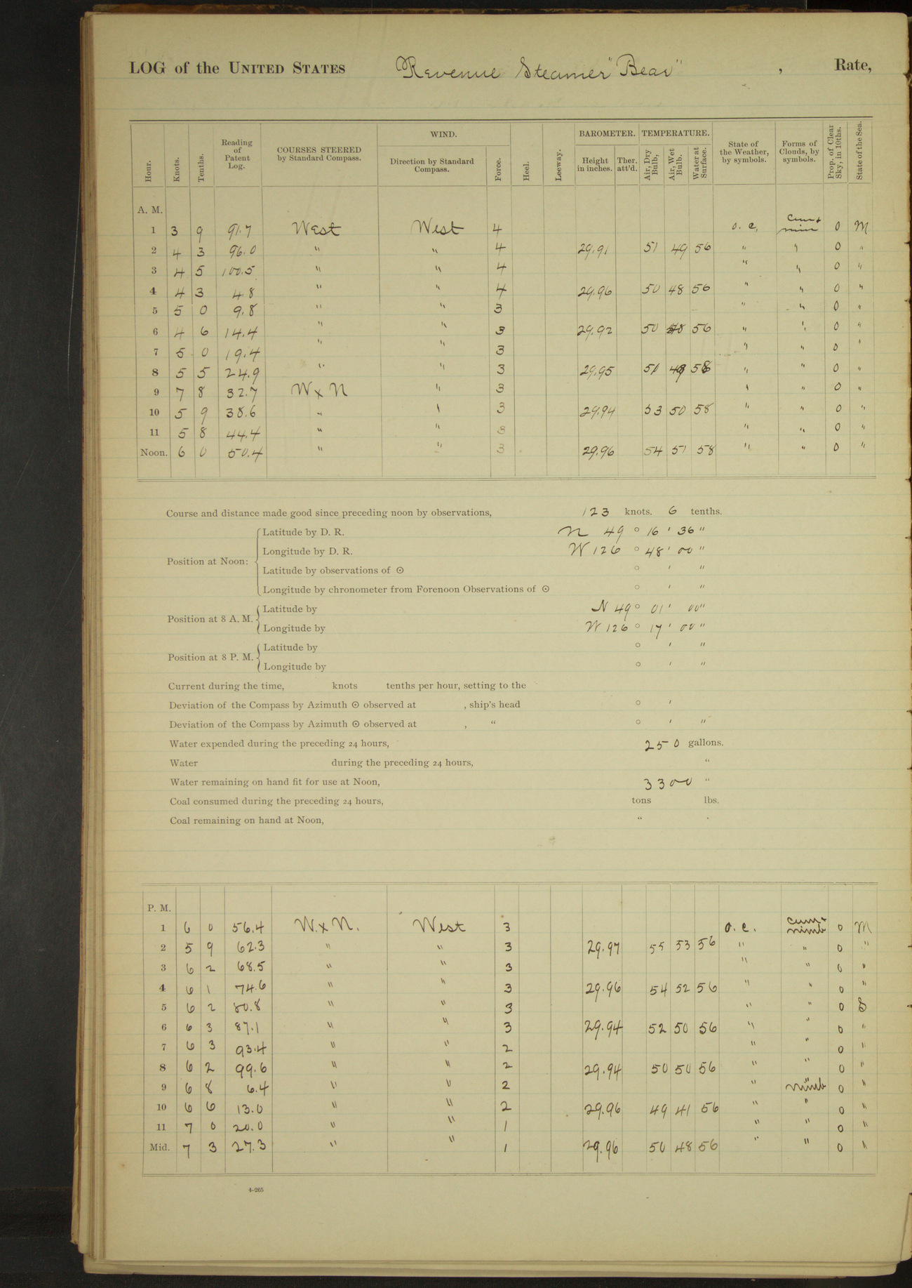
50874d6009d40907550017d9: (http://oldweather.s3.amazonaws.com/ow3/final/USRC Bear/vol069/vol069_063_1.jpg)
31 May 1891
At sea
Lat 49.28, Long -126.80
8am: Lat 49° 01’N, Long 126° 17’W
Distance 139.5 miles
50874d6009d40907550017db: (http://oldweather.s3.amazonaws.com/ow3/final/USRC Bear/vol069/vol069_064_0.jpg)
[Blank page]
50874d6009d40907550017dd: (http://oldweather.s3.amazonaws.com/ow3/final/USRC Bear/vol069/vol069_064_1.jpg)
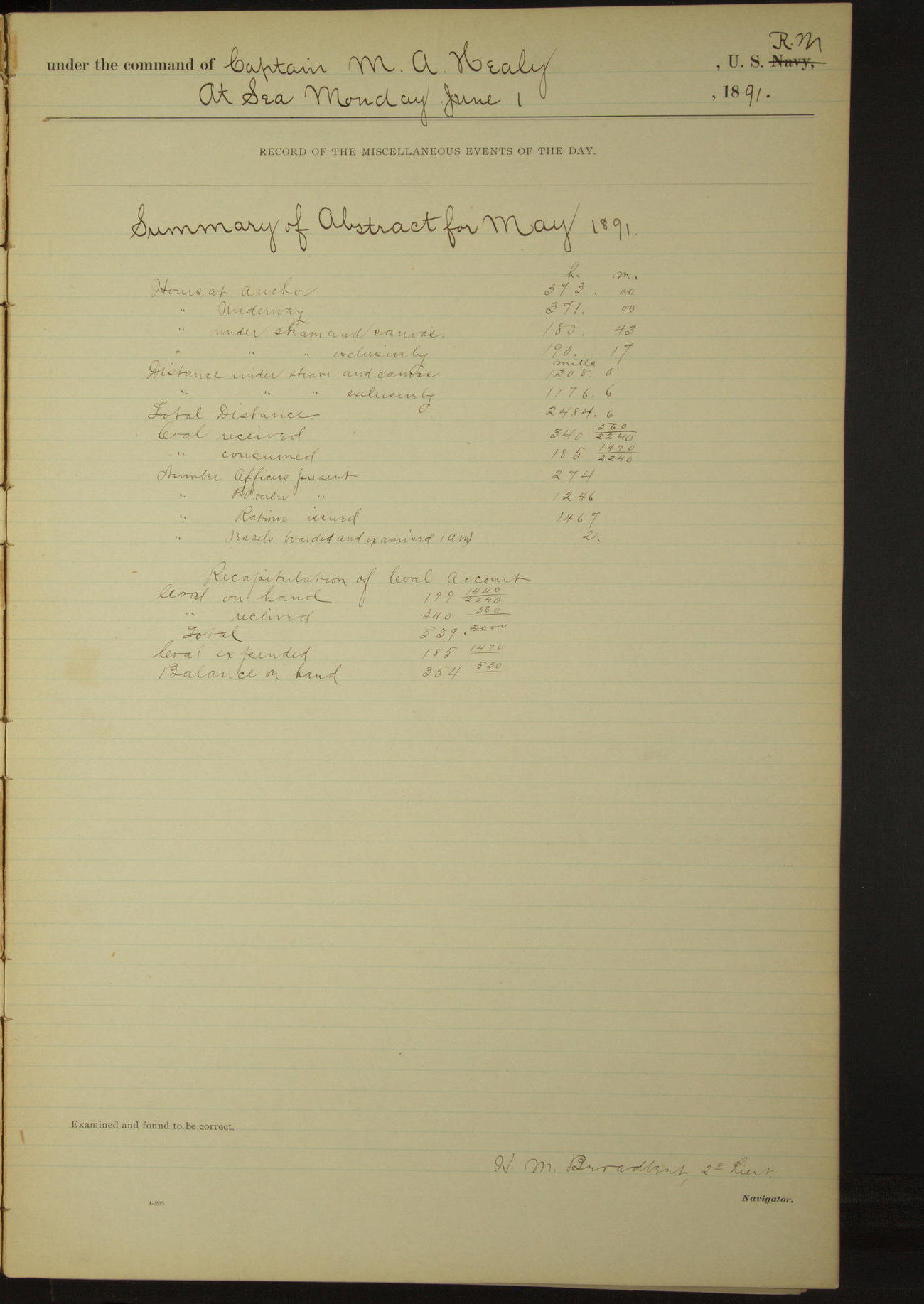
Summary of abstract for May 1891
At anchor 373 hours.
Underway 371 hours.
Under steam and canvas 180 hours 43 minutes.
Under steam exclusively 190 hours 17 minutes.
Distance under steam and canvas 1308.0 miles.
Distance under steam exclusively 1176.6 miles.
Total Distance 2484.6 miles.
Coal received 340 560/2240 tons.
Coal consumed 185 1970/2240 tons.
Number Officers present 274.
Number Petty Officers & crew 1246.
Number Rations issued 1467.
Number vessels boarded and examined (American) 2.
LOGS FOR JUNE 1891
50874d6009d40907550017df: (http://oldweather.s3.amazonaws.com/ow3/final/USRC Bear/vol069/vol069_065_0.jpg)
50874d6009d40907550017e1: (http://oldweather.s3.amazonaws.com/ow3/final/USRC Bear/vol069/vol069_065_1.jpg)
1 June 1891
At sea
Lat 50.88, Long -130.22
8am: Lat 50° 38’ 06”N, Long 129° 44’W
Meridian to 4pm:
Employed cementing seams in hurricane deck.
4pm to 6pm:
5.45: made Cape St. James bearing NNW½W.
6pm to 8pm:
7.00: Cape St. James bore NNW.
8pm: Lat 51° 27’ 27”N, Long 131° 15’ 33”W
Under steam & canvas 3.15 hours.
Under steam exclusively 20.45 hours.
Distance under steam & canvas 23.7 miles.
Distance under steam exclusively 130.5 miles.
Total distance 154.2 miles.
50874d6009d40907550017e3: (http://oldweather.s3.amazonaws.com/ow3/final/USRC Bear/vol069/vol069_066_0.jpg)
50874d6009d40907550017e5: (http://oldweather.s3.amazonaws.com/ow3/final/USRC Bear/vol069/vol069_066_1.jpg)
2 June 1891
At sea
Lat 52.97, Long -132.92
Midnight to 4am:
At 1.00 passed a schooner beating to windward.
8am: Lat 52° 30’N, Long 132° 33’W
8am to meridian:
Crew employed cleaning guns, touching up paintwork and various other jobs.
Meridian to 4pm:
2.25: Buck Point abeam.
4pm to 6pm:
At 4.25: Hippa Island abeam, distant by four-point bearing 4.9 miles.
6pm to 8pm:
7.45: Frederick Island abeam, NE½N.
8pm: Lat 53° 56’N, Long 133° 27’W
Distance 174.7 miles.
50874d6009d40907550017e7: (http://oldweather.s3.amazonaws.com/ow3/final/USRC Bear/vol069/vol069_067_0.jpg)
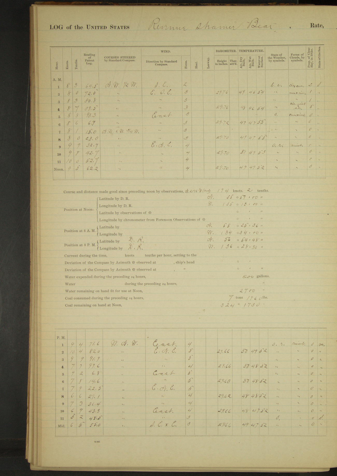
50874d6009d40907550017e9: (http://oldweather.s3.amazonaws.com/ow3/final/USRC Bear/vol069/vol069_067_1.jpg)
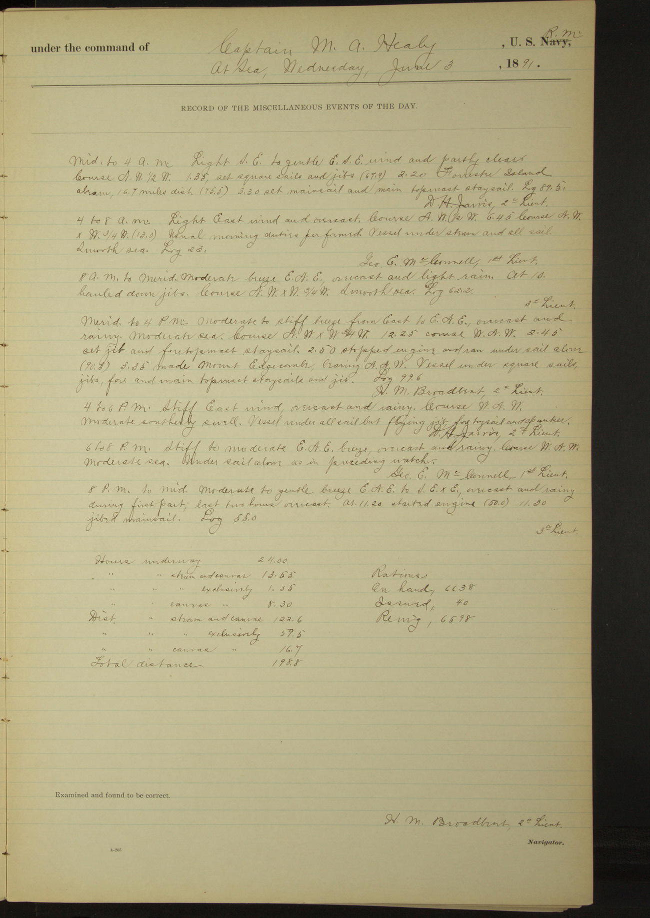
3 June 1891
At sea
Lat 55.98, Long -135.22
Midnight to 4pm:
2.20: Forrester Island abeam, 16.7 miles distant.
8am: Lat 55° 25’ 36”N, Long 134° 34’W
Meridian to 4pm:
3.25: made Mount Edgecumbe bearing NNW.
8pm: Lat 56° 54’ 48”N, Long 136° 28’ 30”W
Under steam and canvas 13.55 hours.
Under steam exclusively 1.35 hours.
Hours under canvas exclusively 8.30 hours.
Distance under steam and canvas 122.6 miles.
Distance under steam exclusively 59.5 miles.
Distance under canvas exclusively 16.7 miles.
Total distance 198.8 miles.
50874d6009d40907550017eb: (http://oldweather.s3.amazonaws.com/ow3/final/USRC Bear/vol069/vol069_068_0.jpg)
50874d6009d40907550017ed: (http://oldweather.s3.amazonaws.com/ow3/final/USRC Bear/vol069/vol069_068_1.jpg)
4 June 1891
At sea [& Port Mulgrave]
Lat 58.41, Long -138.94
Midnight to 4am:
Two schooners in sight.
8am: Lat 58° 04’ 30”N, Long 138° 15’W
8am to meridian:
10.10: made Mount St. Elias NWxW¾W, distant 140 miles.
Meridian to 4pm:
1.47: Mount Fairweather abeam.
6pm to 8pm:
Standing in for land.
8pm: Lat 59° 16’ 02”N, Long 139° 52’ 30”W
8pm to midnight:
8.30: made Ocean Cape ahead. 10.15: off Ocean Cape. 10.43: stood into Port Mulgrave, Cape Phipps [Point Carrew] abeam. Steering various courses about East, up the bay. 11.05: stopped, hunting anchorage. 11.45: anchored on South side, at head of Port Mulgrave. Cape Phipps bearing WxS, distant 3 miles, and Point Turner WxN. Mr. Hendrickson of mission came on board.
At anchor 15 minutes.
Underway 23.45 hours.
Under steam & canvas 12.40 hours.
Under steam exclusively 11.05 hours.
Distance under steam & canvas 104.4 miles.
Distance under steam exclusively 77.3 miles.
Total distance 181.7 miles.
50874d6009d40907550017ef: (http://oldweather.s3.amazonaws.com/ow3/final/USRC Bear/vol069/vol069_069_0.jpg)
50874d6009d40907550017f1: (http://oldweather.s3.amazonaws.com/ow3/final/USRC Bear/vol069/vol069_069_1.jpg)
5 June 1891
Port Mulgrave
Lat 59.55, Long -139.75 [Estimate from above anchor bearings]
4am to 8am:
Employed landing boat and articles belonging to survey party.
Meridian to 4pm:
Indians on board.
50874d6009d40907550017f3: (http://oldweather.s3.amazonaws.com/ow3/final/USRC Bear/vol069/vol069_070_0.jpg)
50874d6009d40907550017f5: (http://oldweather.s3.amazonaws.com/ow3/final/USRC Bear/vol069/vol069_070_1.jpg)
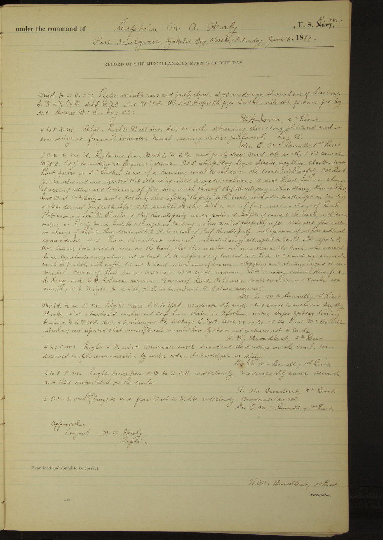
6 June 1891
Port Mulgrave [to Icy Bay]
Lat 59.92, Long -141.59 [Estimate in Icy Bay]
Midnight to 4am:
2.40: underway, steamed out of harbor. At 3.15 Cape Phipps South, 1 mile distant.
4am to 8am:
Steaming close along the land and sounding at frequent intervals.
8am to meridian:
9.25: Stopped off Guyot Glacier, Icy Bay. Sent Lieutenant Jarvis in second cutter to see if a landing could be made on the beach with safety. 9.50: Lieutenant Jarvis returned and reported that a landing could be made with ease.
10.00: sent Lieutenant Jarvis in charge of second cutter and boat’s crew of five men, with three of Professor Russell’s party: Thomas Storey, Thomas White, and Neil McCarty, and a portion of the outfits of the party, to the beach, with orders to attempt no landing unless deemed perfectly safe.
10.15: Sent third cutter, with a crew of five men in charge of Lieutenant Robinson, with WC Moore of Professor Russell’s party, and a portion of outfits of same, to the beach, with same orders as Lieutenant Jarvis had, to attempt no landing unless deemed perfectly safe.
10.30: sent first cutter, in charge of Lieutenant Broadbent, with JH Crumback of Professor Russell’s party, with portion of outfits and with same orders.
11.15: Lieutenant Broadbent returned without having attempted to land, and reported that but one boat could be seen on the beach, that there were but ten men seen on the beach, who warned him by shouts and gestures not to land. Took outfits out of boat and sent Lieutenant McConnell to go as near the beach as possible with safety, but not to land unless sure of success.
Names of Lieutenant Jarvis’s boat’s crew: William Smith, Coxswain; William Mackay, Samuel Rainsford, C Henry and William Robinson, Seamen. Names of Lieutenant Robinson’s boat’s crew: James Hassler [Haasler], Coxswain; NJ Wright, H Smith, JJ Anderson and A Nelson, Seamen.
Meridian to 4pm:
12.10: came to anchor in Icy Bay. Cape Yaktag [Cape Yakataga] bearing WSW½W, distant 25 miles, Point Sitkagi E¾N, distant 22 miles. 12.20: Lieutenant McConnell returned and reported that men on the beach warned him by shouts and gestures not to land.
4pm to 6pm:
Second and third cutters on the beach. Endeavored to open communication by service code, but could get no reply.
At anchor 14.30 hours.
Underway 9.30 hours.
Distance 51.7 miles.
50874d6009d40907550017f7: (http://oldweather.s3.amazonaws.com/ow3/final/USRC Bear/vol069/vol069_071_0.jpg)
50874d6009d40907550017f9: (http://oldweather.s3.amazonaws.com/ow3/final/USRC Bear/vol069/vol069_071_1.jpg)
7 June 1891
Icy Bay
Lat 59.92, Long -141.59
Midnight to 4am:
Second and third cutters still on the beach.
4am to 8am:
7.15: sent first cutter in charge of an officer to examine condition of beach. Boat arrived near line of breakers and the party on shore warned the officer not to land, making gestures with hands and coats to keep away. First cutter returned.
8am to meridian:
At 8.00 sent first cutter with Lieutenants McConnell and Broadbent to try to open communications with party on shore.
10.15: boat returned and reported the following information from Lieutenant Jarvis: that Lieutenant Robinson, Coxswain Hassler, Seamen JJ Anderson, H Smith and A Nelson; and WC Moore of Professor Russell’s party, were lost in attempting to land; that the bodies of Lieutenant Robinson and Seaman Anderson had been found; that the boats were all right.
Instructed Lieutenant Jarvis by signal to bury dead except Lieutenant Robinson and to bring that body with him; to bring his men on board, the explorers to remain on shore and follow the beach East. Second and third cutters on board at end of watch.
[The Alaskan: "Melancholy disaster at Icy Bay: six lives lost"]
Meridian to 4pm:
1.30: Lieutenant Jarvis returned with second and third cutters and the body of Lieutenant Robinson. It was slack water, high tide and Lieutenant Jarvis reported that the surf at that time was not bad, and that it was safe to land.
2.00: sent Lieutenant Broadbent in charge of second cutter to land outfits and supplies for survey party.
2.10: sent Lieutenant McConnell in charge of third cutter to land supplies etc. Second and third cutters returned having landed safely and discharged. Put supplies etc. in boats and sent them to beach to land if safe, if not, to return. Frank C Warner of survey party, in third cutter. Third cutter capsized in surf and remained on beach, having broken rowlock of steering oar.
Second cutter returned having safely landed cargo. Sent her to beach with supplies etc. and Professor Russell. When near the beach, the boat was warned by the party on the beach not to land, as the tide having ebbed, the surf was increasing. Second cutter returned without attempting to land.
Dr. SJ Call prepared the body of Lieutenant Robinson for preservation. Expended one can (45 lbs) pemmican for Professor Russell’s party.
6pm to 8pm:
7.00: opened communication by signal with Lieutenant McConnell and instructed him to signal when safe to land.
50874d6009d40907550017fb: (http://oldweather.s3.amazonaws.com/ow3/final/USRC Bear/vol069/vol069_072_0.jpg)
50874d6009d40907550017fd: (http://oldweather.s3.amazonaws.com/ow3/final/USRC Bear/vol069/vol069_072_1.jpg)
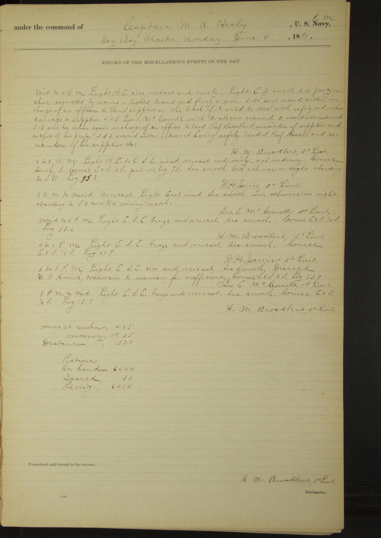
8 June 1891
Icy Bay [& at sea]
Lat 59.33, Long -140.25
Midnight to 4am:
2.15: party on shore signaled by waving a lighted brand and firing a gun. 2.30: sent second cutter in charge of an officer to land supplies on the beach if it could be done with safety and without damage to supplies.
2.45: Lieutenant McConnell with boat’s crew returned. 3.00: second cutter returned. 3.15: sent her ashore again in charge of an officer to land Professor Russell and remainder of supplies and outfits of his party.
3.55: second cutter returned having safely landed Professor Russell and remainder of his supplies. etc.
4am to 8am:
4.05: underway. 5.00 one schooner in sight standing to SW.
8am: Lat 59° 31’ 30”N, Long 140° 59’W
8am to meridian:
Two schooners in sight standing to Southward and Westward during watch.
6pm to 8pm:
Disrated WA Smith, Coxswain, to Seaman for inefficiency.
8pm: Lat 58° 40’N, Long 138° 51’W
At anchor 4.05 hours.
Underway 19.55 hours.
Distance 153.8 miles.
50874d6009d40907550017ff: (http://oldweather.s3.amazonaws.com/ow3/final/USRC Bear/vol069/vol069_073_0.jpg)
50874d6009d4090755001801: (http://oldweather.s3.amazonaws.com/ow3/final/USRC Bear/vol069/vol069_073_1.jpg)
9 June 1891
At sea [& Sitka]
Lat 57.23, Long -135.97
Midnight to 4am:
At 4.00 Cape Spencer bore NExN¼N.
4am to 8am:
Rated WJ Wright and Thomas Richards, Seamen, to Coxswains.
8am: Lat 57° 38’N, Long 138° 45’W
8am to meridian:
Carpenter making coffin for Lieutenant Robinson’s body [& to 4pm].
Meridian to 4pm:
1.20: Cape Edgecumbe abeam. 3.05: St. Lazaria Island abeam. 3.48: Vitskari Island abeam.
4pm to 6pm:
Steaming in for harbor. 5.12: came to anchor in Sitka Harbor. The Twins bearing ESE and Turning Island SWxS, ? mile.
6pm to 8pm:
Preparing Lieutenant Robinson’s body for burial.
At anchor 6.48 hours.
Underway 17.12 hours.
Distance 131.5 miles.
50874d6009d4090755001803: (http://oldweather.s3.amazonaws.com/ow3/final/USRC Bear/vol069/vol069_074_0.jpg)
50874d6009d4090755001805: (http://oldweather.s3.amazonaws.com/ow3/final/USRC Bear/vol069/vol069_074_1.jpg)
10 June 1891
Sitka Harbor
Lat 57.05, Long -135.33
8am to meridian:
Made preparations for the burial of 3rd Lieutenant Robinson. 10.30: Lieutenant Broadbent with escort of 12 men took body on shore in launch. Captain and ward room officers proceeded in gig to attend burial services. Half masted flag on vessel and in boats until return of burial party.
Meridian to 4pm:
1.00: burial party of officers and men returned on board. Hoisted flag to peak. Suspended work for the day. Granted liberty to starboard watch.
[Sitka National Cemetery grave record for Lieutenant Robinson]
50874d6009d4090755001807: (http://oldweather.s3.amazonaws.com/ow3/final/USRC Bear/vol069/vol069_075_0.jpg)
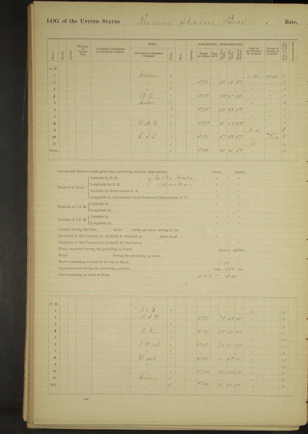
50874d6009d4090755001809: (http://oldweather.s3.amazonaws.com/ow3/final/USRC Bear/vol069/vol069_075_1.jpg)
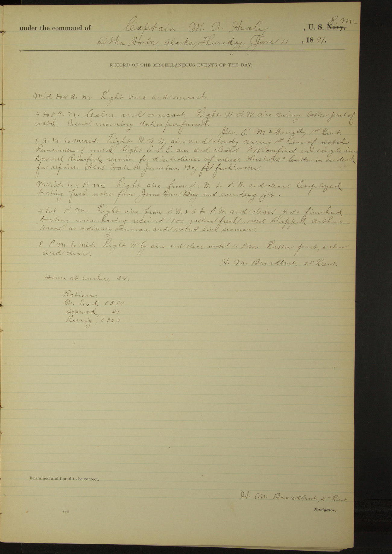
11 June 1891
Sitka Harbor
Lat 57.05, Long -135.33
8am to meridian:
9.15: confined in single irons Samuel Rainsford, Seaman, for disobedience of order. Hoisted second cutter in on deck for repairs. Sent boats to Jamestown Bay for fresh water.
Meridian to 4pm:
Employed boating fresh water from Jamestown Bay and mending jib.
4pm to 8pm:
4.30: finished boating water having received 1900 gallons fresh water. Shipped Arthur Moore as Ordinary Seaman and rated him Seaman.
50874d6009d409075500180b: (http://oldweather.s3.amazonaws.com/ow3/final/USRC Bear/vol069/vol069_076_0.jpg)
50874d6009d409075500180d: (http://oldweather.s3.amazonaws.com/ow3/final/USRC Bear/vol069/vol069_076_1.jpg)
12 June 1891
Sitka Harbor
Lat 57.05, Long -135.33
4am to 8am:
Released Samuel Rainsford, Seaman, from confinement. Employed overhauling boats falls and blocks.
8am to meridian:
Employed setting up rigging, mending jib and overhauling boats falls. Rated D Fender and Thomas Wogan, Coal Passers, to Seamen.
4pm to 8pm:
John Clifford, Fireman, absent without leave. 6.30: steamer “City of Topeka” arrived. Received on board effects of witnesses to be conveyed to Unga. 3rd Lieutenant AJ Henderson returned on board.
50874d6009d409075500180f: (http://oldweather.s3.amazonaws.com/ow3/final/USRC Bear/vol069/vol069_077_0.jpg)
50874d6009d4090755001811: (http://oldweather.s3.amazonaws.com/ow3/final/USRC Bear/vol069/vol069_077_1.jpg)
13 June 1891
Sitka Harbor
Lat 57.05, Long -135.33
4am to 8am:
John Clifford, Fireman, absent without leave.
8am to meridian:
Disrated WJ Wright, Coxswain, to Seaman at his own request. Crew employed setting up rigging, overhauling boat falls, blocks etc.
Meridian to 4pm:
Indian mission school visited the vessel. Shipped John Matthews and William Harris as Coal Passers; and William Wells as Ordinary Seaman and rated him Seaman.
4pm to 8pm:
3rd Lieutenant AJ Henderson left the vessel to proceed to San Francisco by permission of Commanding Officer.
8pm to midnight:
The following named witnesses came on board to be conveyed to Unga: John Gardner, Lawrence Reid (wife and child), John Smith, Peter Malone, Robert Gould, N Gutthridge (wife), G Becker, Thomas Devine, P Lawsen, T Swanningson and C Weise [see also 18th June; some names have alternative spellings].
Issued one extra ration daily to each of the men, the women to be transported free of expense to the Government. J Clifford, Fireman, returned on board. Discharged him for drunkenness, breaking liberty and general worthlessness.
50874d6009d4090755001813: (http://oldweather.s3.amazonaws.com/ow3/final/USRC Bear/vol069/vol069_078_0.jpg)
50874d6009d4090755001815: (http://oldweather.s3.amazonaws.com/ow3/final/USRC Bear/vol069/vol069_078_1.jpg)
14 June 1891
Sitka Harbor [& at sea]
Lat 56.93, Long -137.24
Midnight to 4am:
3.00: Underway, steamed out of harbor. 3.45: Kulitch Rock [Kulichkof Rock] abeam, distant 1½ miles.
4am to 8am:
5.00: Cape Edgecumbe WxN¼N, distant 5 miles.
8am: Lat 56° 56’ 06”N, Long 136° 17’ 20”W
8am to meridian:
Rated Charles Nilson, Seaman, to Coxswain.
8pm: Lat 56° 51’ 45”N, Long 139° 04’ 20”W
At anchor 3.00 hours.
Underway 21.00 hours.
Under steam & canvas 18.00 hours.
Under steam exclusively 3.00 hours.
Distance under steam & canvas 136.3 miles.
Distance under steam exclusively 19.6 miles.
Total distance 155.9 miles.
50874d6009d4090755001817: (http://oldweather.s3.amazonaws.com/ow3/final/USRC Bear/vol069/vol069_079_0.jpg)
50874d6009d4090755001819: (http://oldweather.s3.amazonaws.com/ow3/final/USRC Bear/vol069/vol069_079_1.jpg)
15 June 1891
At sea
Lat 56.70, Long -143.77
4am to 8am:
Rated D Fender, Seaman, to Fireman.
8am: Lat 56° 41’N, Long 142° 31’W
8pm: Lat 56° 33’ 27”N, Long 145° 57’W
Under steam and canvas 24 hours.
Distance under steam and canvas 217.1 miles.
50874d6009d409075500181b: (http://oldweather.s3.amazonaws.com/ow3/final/USRC Bear/vol069/vol069_080_0.jpg)
50874d6009d409075500181d: (http://oldweather.s3.amazonaws.com/ow3/final/USRC Bear/vol069/vol069_080_1.jpg)
16 June 1891
At sea
Lat 56.21, Long -150.13
8am: Lat 56° 18’ 51”N, Long 149° 03’W
8am to meridian:
10.45: observed a barque standing to Northward. Carpenter repairing boats’ rudders etc.
8pm: Lat 56° 01’ 33”N, Long 151° 50’ 15”W
Under steam & canvas 24 hours.
Distance 204.8 miles.
50874d6009d409075500181f: (http://oldweather.s3.amazonaws.com/ow3/final/USRC Bear/vol069/vol069_081_0.jpg)
50874d6009d4090755001821: (http://oldweather.s3.amazonaws.com/ow3/final/USRC Bear/vol069/vol069_081_1.jpg)
17 June 1891
At sea
Lat 55.66, Long -155.78
4am to 8am:
At 5.15 passed a small schooner flying British colors, standing to Northward.
8am: Lat 55° 44’ 27”N, Long 154° 54’ 22”W
8am to meridian:
11.17 Ukamok Island [Ugamak] abeam bearing NW½N, distant 6 miles.
Meridian to 4pm:
3.40: Semidi Islands abeam.
4pm to 6pm:
4.28: Chowee-Et Island [Chowiet] bore NNW.
6pm to 8pm:
7.14: Lighthouse Rock abeam bearing NWxN, distant 12 miles.
8pm: Lat 55° 32’ 30”N, Long 158° 34’W
Under steam & canvas 9.15 hours.
Under steam exclusively 14.45 hours.
Distance under steam & canvas 71.2 miles.
Distance under steam exclusively 121.1 miles.
Total distance 192.3 miles.
50874d6009d4090755001823: (http://oldweather.s3.amazonaws.com/ow3/final/USRC Bear/vol069/vol069_082_0.jpg)
50874d6009d4090755001825: (http://oldweather.s3.amazonaws.com/ow3/final/USRC Bear/vol069/vol069_082_1.jpg)
18 June 1891
At sea [& Unga & Humboldt]
Lat 55.18, Long -160.52
Midnight to 4am:
At 3.00 made land on port bow. 3.10 land on starboard bow. 3.50 Cape St. John bore W¼N.
4am to 8am:
5.10: passed Castle Rock, 10 miles distant. 7.38: passed Andronica Rocks, distant ¾ mile on port beam. 8.00: West end of Andronica Island bore SSE, distant 3 miles.
8am: Lat 55° 22’N, Long 160° 06’W
8am to meridian:
8.50: off High island. 9.00: stopped off Pirate Cove and landed John Smith, witness. Posted laws regarding salmon fisheries. 9.50: boat returned, ahead and around High Island. 10.50: off Popoff Head. 11.55: came to anchor in Unga Harbor.
Meridian to 4pm:
12.10: commenced landing witnesses and their effects. Landed John Gardner, Lawrence Reid (wife & child), Peter Malone, Robert Gould, N Guttridge & wife, G Becke, P Larsen, T Swanningsen and C Weise [see also 13th June; some names have alternative spellings].
1.30: finished landing passengers and their effects. 1.55 underway and stood to Eastward. 3.50: came to anchor in Humboldt Harbor, Popoff Island.
4pm to 6pm:
Sent an officer ashore to examine whiskey cache (found here by officers of this vessel, April 30) and to post President’s proclamation regarding salmon fisheries. Boarded British schooner “CD Rand” of Vancouver, Alcock master, hunting and fishing. Landed T Devine, witness, and his effects.
At anchor 10.10 hours.
Underway 13.50 hours.
Distance 97.0 miles.
50874d6009d4090755001827: (http://oldweather.s3.amazonaws.com/ow3/final/USRC Bear/vol069/vol069_083_0.jpg)
50874d6009d4090755001829: (http://oldweather.s3.amazonaws.com/ow3/final/USRC Bear/vol069/vol069_083_1.jpg)
19 June 1891
Humboldt Harbor [& at sea]
Lat 55.08, Long -161.90 [Estimate from meridian bearings]
Midnight to 4am:
2.25: underway. 2.37: Sand Point abeam.
4am to 8am:
5.45: passed Unga Cape. 7.45: Judie Island abeam.
8am: Lat 55° 16’ 30”N, Long 161° 04’ 30”W
8am to meridian:
11.21: passed Cape Baum. Meridian: West end of Inner Iliasik bore WSW, distant 2½ miles.
Noon: Lat 56° 57’ 30”N, Long 161° 50’W [locates the ship too far North]
Meridian to 4pm:
1.55: passed Bold Cape. 2.50: West end of Lizzie Island abeam. 3.00: passed a steam schooner (American) bound East. Exchanged salutes with her. 3.20: Thin Point abeam.
4pm to 6pm:
4.30: Umga Island abeam, distant 1.6 miles.
6pm to 8pm:
6.22: Cape Pankoff NwxN, distant 1.5 miles. At 8.00: Cape Lazaroff W¾N, 6 miles.
8pm: Lat 54° 32’N, Long 163° 27’W
At anchor 2.25 hours.
Underway 21.35 hours.
Under steam & canvas 2.15 hours.
Under steam exclusively 19.20 hours.
Distance under steam & canvas 17.7 miles
Distance under steam exclusively 143.6 miles.
Total distance 161.3 miles.
50874d6009d409075500182b: (http://oldweather.s3.amazonaws.com/ow3/final/USRC Bear/vol069/vol069_084_0.jpg)
50874d6009d409075500182d: (http://oldweather.s3.amazonaws.com/ow3/final/USRC Bear/vol069/vol069_084_1.jpg)
20 June 1891
At sea [& Unalaska]
Lat 54.07, Long -166.30
Midnight to 4am:
1.00: Promontory Point [Cape Lutke] NNW. 3.00: Ugomok Island [Ugamak] abeam, distant 5 miles, through Unimak Pass. 4.00: North Head Akun bore SWxW½W and NW Cape NWxN¼N.
4am to 8am:
At 8.00 N head Akun bore S½W, distant 2.5 miles and N head Akoutan SWxS, distant 2 miles.
8am: Lat 54° 20’N, Long 165° 38’W
8am to meridian:
9.30: N head Akoutan abeam. 9.50: saw a steamer broad on starboard bow bound to Northward & Eastward. Meridian: Priest Rock bore S¼W, distant 5 miles.
Meridian to 4pm:
12.43: Priest Rock abeam. 1.40: Ulakta Head abeam. 2.06: rounded buoy. 2.55: made fast to wharf at Unalaska. Revenue Steamer “Rush” and AC Co’s schooner “Matthew Turner” in port. 3.30: steamer “South Coast” arrived.
4pm to 8pm:
US Deputy Commissioner LH Tarpley & wife left vessel.
At anchor 9.05 hours.
Underway 14.55 hours.
Distance 102.0 miles.
50874d6009d409075500182f: (http://oldweather.s3.amazonaws.com/ow3/final/USRC Bear/vol069/vol069_085_0.jpg)
50874d6009d4090755001831: (http://oldweather.s3.amazonaws.com/ow3/final/USRC Bear/vol069/vol069_085_1.jpg)
21 June 1891
Unalaska
Lat 53.88, Long -166.53
8am to meridian:
Vessel waiting for coal.
50874d6009d4090755001833: (http://oldweather.s3.amazonaws.com/ow3/final/USRC Bear/vol069/vol069_086_0.jpg)
50874d6009d4090755001835: (http://oldweather.s3.amazonaws.com/ow3/final/USRC Bear/vol069/vol069_086_1.jpg)
22 June 1891
Unalaska
Lat 53.88, Long -166.53
4am to 8am:
At 6.00 commenced hauling from wharf to allow Revenue Steamer “Rush” to coal. At 6.45 secured to buoy in stream.
8am to meridian:
10.20: hauled fires and blew down boiler for the purposes of cleaning it. Sent Boatswain with second cutter, 9 men and seine, fishing. Sent gig and third cutter ashore to haul out on beach and clean. 12.00 gig returned.
Meridian to 4pm:
Employed cleaning third cutter on beach. Left third cutter on beach to be ready for painting in favorable weather. Engineer’s force overhauling machinery etc. Vessel waiting for coal.
4pm to 8pm:
7.00: second cutter returned with large haul of fish.
50874d6009d4090755001837: (http://oldweather.s3.amazonaws.com/ow3/final/USRC Bear/vol069/vol069_087_0.jpg)
50874d6009d4090755001839: (http://oldweather.s3.amazonaws.com/ow3/final/USRC Bear/vol069/vol069_087_1.jpg)
23 June 1891
Unalaska
Lat 53.88, Long -166.53
8am to meridian:
Boatswain and party went fishing in second cutter. Remainder of crew cleaning guns and otherwise variously employed.
Meridian to 4pm:
Employed overhauling potatoes of rations.
4pm to 8pm:
Steamer “South Coast” left port at 5.00.
50874d6009d409075500183b: (http://oldweather.s3.amazonaws.com/ow3/final/USRC Bear/vol069/vol069_088_0.jpg)
50874d6009d409075500183d: (http://oldweather.s3.amazonaws.com/ow3/final/USRC Bear/vol069/vol069_088_1.jpg)
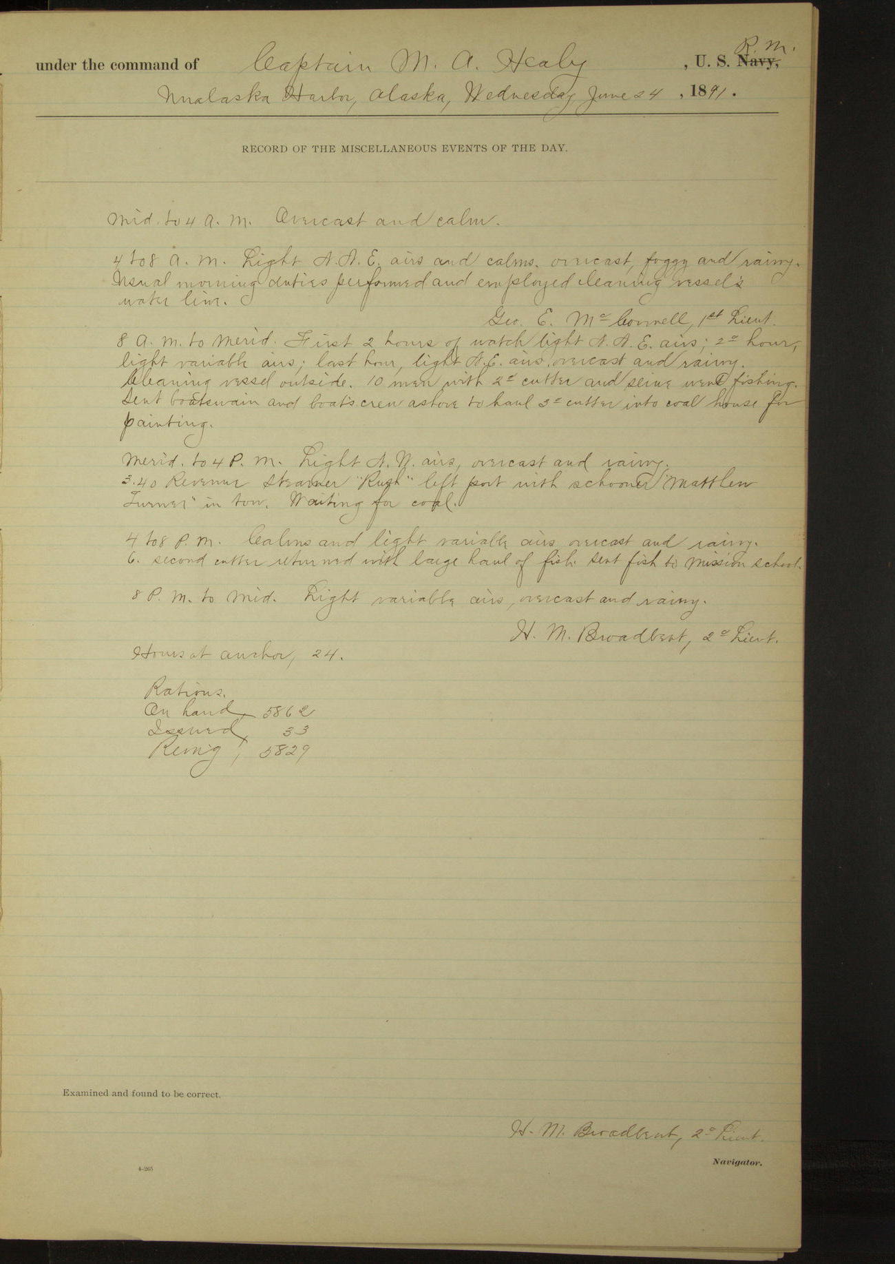
24 June 1891
Unalaska
Lat 53.88, Long -166.53
4am to 8am:
Employed cleaning vessel’s water line.
8am to meridian:
Cleaning vessel outside. Ten men with second cutter and seine went fishing. Sent Boatswain and boat’s crew ashore to haul third cutter into coal house for painting.
Meridian to 4pm:
3.40: Revenue Steamer “Rush” left port with schooner “Matthew Turner” in tow. Waiting for coal.
4pm to 8pm:
6.00: second cutter returned with large haul of fish. Sent fish to mission school.
50874d6009d409075500183f: (http://oldweather.s3.amazonaws.com/ow3/final/USRC Bear/vol069/vol069_089_0.jpg)
50874d6009d4090755001841: (http://oldweather.s3.amazonaws.com/ow3/final/USRC Bear/vol069/vol069_089_1.jpg)
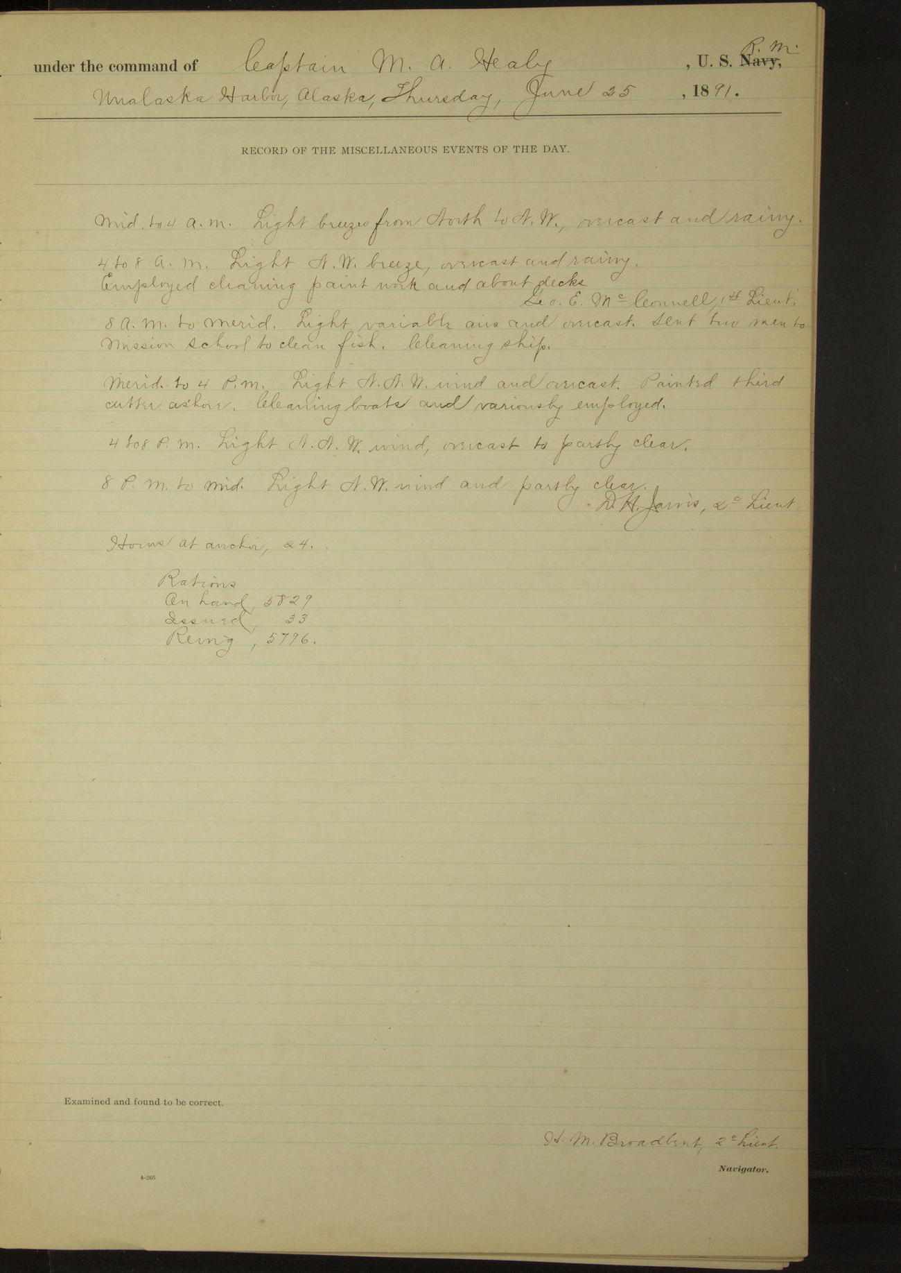
25 June 1891
Unalaska
Lat 53.88, Long -166.53
4am to 8am:
Employed cleaning paintwork and about decks.
8am to meridian:
Sent two men to mission school to clean fish.
Meridian to 4pm:
Painted third cutter ashore. Cleaning boats and variously employed.
50874d6009d4090755001843: (http://oldweather.s3.amazonaws.com/ow3/final/USRC Bear/vol069/vol069_090_0.jpg)
50874d6009d4090755001845: (http://oldweather.s3.amazonaws.com/ow3/final/USRC Bear/vol069/vol069_090_1.jpg)
26 June 1891
Unalaska
Lat 53.88, Long -166.53
8am to meridian:
9.00: Steam whaling bark “Beluga” arrived in port. Boarded American steam whaling bark “Beluga” of San Francisco, Wicks master, from San Francisco via Kodiak whaling grounds for cruise in Bering Sea, light.
Crew employed shifting stores to make room for coal between decks.
Meridian to 4pm:
Crew employed shifting stores and overhauling potatoes of stores for Point Barrow and Cape Prince of Wales schools.
4pm to 8pm:
Waiting for coal.
50874d6009d4090755001847: (http://oldweather.s3.amazonaws.com/ow3/final/USRC Bear/vol069/vol069_091_0.jpg)
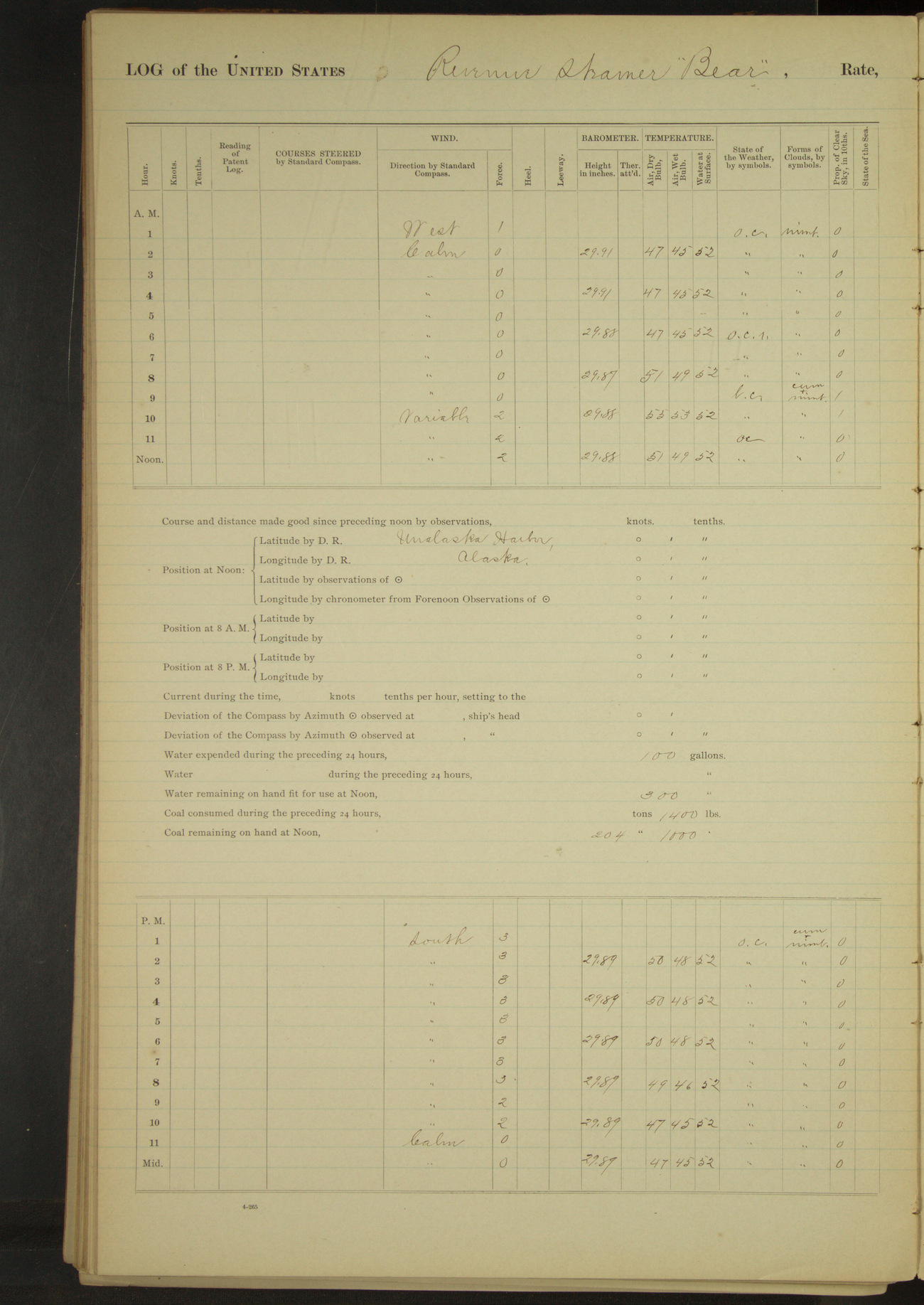
50874d6009d4090755001849: (http://oldweather.s3.amazonaws.com/ow3/final/USRC Bear/vol069/vol069_091_1.jpg)
27 June 1891
Unalaska
Lat 53.88, Long -166.53
8am to meridian:
Cleaning about decks. Boating water from dock.
Meridian to 4pm:
Boating water. Received 2000 gallons.
50874d6009d409075500184b: (http://oldweather.s3.amazonaws.com/ow3/final/USRC Bear/vol069/vol069_092_0.jpg)
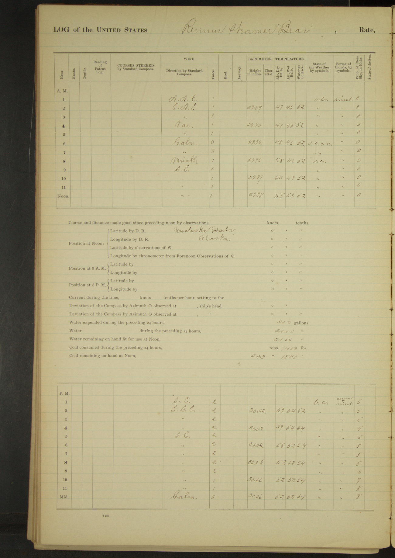
50874d6009d409075500184d: (http://oldweather.s3.amazonaws.com/ow3/final/USRC Bear/vol069/vol069_092_1.jpg)
28 June 1891
Unalaska
Lat 53.88, Long -166.53
50874d6009d409075500184f: (http://oldweather.s3.amazonaws.com/ow3/final/USRC Bear/vol069/vol069_093_0.jpg)
50874d6009d4090755001851: (http://oldweather.s3.amazonaws.com/ow3/final/USRC Bear/vol069/vol069_093_1.jpg)
29 June 1891
Unalaska
Lat 53.88, Long -166.53
4am to 8am:
At 5.30 cast off from buoy and hauled alongside the AC Co’s wharf for the purpose of taking the Point Barrow bags of hard coal on board. Made fast at 6.45.
8am to meridian:
Getting on board coal for Point Barrow station. Donkey boiler gave out. Started pumping up main boiler.
Meridian to 4pm:
Employed as in forenoon. 3.30: Revenue Steamer “Corwin” arrived in port.
50874d6009d4090755001853: (http://oldweather.s3.amazonaws.com/ow3/final/USRC Bear/vol069/vol069_094_0.jpg)
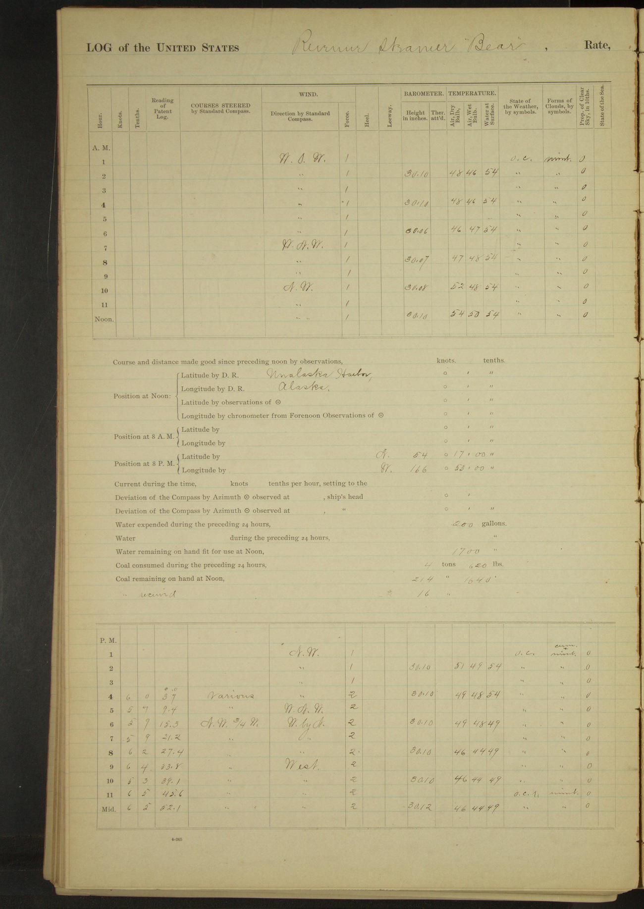
50874d6009d4090755001855: (http://oldweather.s3.amazonaws.com/ow3/final/USRC Bear/vol069/vol069_094_1.jpg)
30 June 1891
Unalaska
Lat 53.88, Long -166.53
4am to 8am:
At 6.00 delivered two tons of Point Barrow coal to Revenue Steamer “Corwin”. Employed getting bituminous coal from storehouse on board vessel. Engineer’s department filling boiler with fresh water.
8am to meridian.
Crew employed getting coal on board from storehouse on wharf. Received on board 16 tons bituminous coal. Engineer’s department pumping up main boiler with fresh water. 10.30: blew down donkey boiler.
11.00: finished pumping up main boiler, commenced filling water tanks. 11.20: started fires under main boiler. 11.00: Steam whaling bark “Beluga” left port.
Meridian to 4pm:
1.50: Revenue Steamer “Rush” arrived in port. 2.00: finished filling water tanks having received 2500 gallons fresh water. 2.05: cast off from wharf and hauled out in stream. 3.10: half speed ahead. 3.48: rounded Ulakhta Head.
4pm to 6pm:
5.00: Cape Cheerful bore SW, 1.5 miles.
8pm: Lat 54° 17’N, Long 166° 53’W
8pm to midnight:
9.20: stopped engine to find occasion of thump. 9.37: ahead.
At anchor 14.55 hours.
Underway 9.05 hours.
Under steam & canvas 3.00 hours.
Under steam exclusively 6.05 hours.
Distance steam & canvas 18.3 miles
Distance steam exclusively 36.1 miles.
Total distance 54.4 miles.
LOGS FOR JULY 1891
50874d6009d4090755001857: (http://oldweather.s3.amazonaws.com/ow3/final/USRC Bear/vol069/vol069_095_0.jpg)
50874d6009d4090755001859: (http://oldweather.s3.amazonaws.com/ow3/final/USRC Bear/vol069/vol069_095_1.jpg)
1 July 1891
Bering Sea
Lat 55.88, Long -168.58
Midnight to 4am:
At 12.40 stopped engine to key up. At. 3.00 ahead.
8am: Lat 55° 18’N, Long 168° 06’W
8pm: Tolstoi Point, St. George Island, NNW¾W, 8 miles.
8pm to midnight:
At 9.45 came to anchor off St. George Island (North anchorage), village bearing SE and Tolstoi Point E¾N. Heavy swell from NW. No landing.
At anchor 2.15 hours.
Underway 21.45 hours.
Under steam & canvas 6.00 hours.
Under steam exclusively 15.45 hours.
Distance under steam & canvas 43.7 miles
Distance under steam exclusively 101.9 miles.
Total distance 145.6 miles.
Summary of abstract for June
At anchor 425.13 hours.
Underway 294.47 hours.
Under steam & canvas 110.20 hours.
Under steam exclusively 175.57 hours.
Hours under canvas exclusively 8.30 hours.
Distance under steam & canvas 916.1 miles
Distance under steam exclusively 1255.6 miles.
Distance under canvas exclusively 59.5 miles.
Total distance 2331.2 miles.
Coal received 16 tons
Coal consumed 155 1130/2240 tons.
Number Officers present 248.
Number Petty Officers & crew present 1161.
Number rations issued 1087.
Number vessels boarded and examined American 1, foreign 1.
50874d6009d409075500185b: (http://oldweather.s3.amazonaws.com/ow3/final/USRC Bear/vol069/vol069_096_0.jpg)
50874d6009d409075500185d: (http://oldweather.s3.amazonaws.com/ow3/final/USRC Bear/vol069/vol069_096_1.jpg)
2 July 1891
North anchorage, St. George Island [to St. Paul & at sea]
Lat 57.12, Long -170.26 [Estimate from bearings at 9am]
Sick list: H Wilber, Quartermaster.
Midnight to 4am:
Heavy NW swell. Surf too heavy to land. 3.15: underway.
4am to 8am:
7.40: Sea Lion Point abeam.
8am to meridian:
9.00: came to off Whale Point, St. Paul Island. Whale Point bearing North and Sea Lion Rock SWxS. Commanding Officer visited the island. Delivered to the Special Treasury Agent official and other mail.
Meridian to 4pm:
2.40: Commanding Officer returned. 2.45: underway. 3.40: Halfway Point abeam, distant ¼ mile.
4pm to 6pm:
4.30: Northeast Point abeam, distant 2.7 miles.
8pm: Lat 57° 40’N, Long 169° 50’W
At anchor 9.00 hours.
Underway 15.00 hours.
Under steam & canvas 3.30 hours.
Under steam exclusively 6.45 hours.
Hours under canvas exclusively 4.45 hours.
Distance under steam & canvas 29.5 miles
Distance under steam exclusively 44.1 miles.
Distance under canvas exclusively 33.3 miles.
Total distance 106.9 miles.
50874d6009d409075500185f: (http://oldweather.s3.amazonaws.com/ow3/final/USRC Bear/vol069/vol069_097_0.jpg)
50874d6009d4090755001861: (http://oldweather.s3.amazonaws.com/ow3/final/USRC Bear/vol069/vol069_097_1.jpg)
3 July 1891
Bering Sea
Lat 59.78, Long -168.33
Sick list: H Wilber, Quartermaster.
8am: Lat 59° 23’N, Long 168° 40’W
8pm: Lat 61° 04’ 48”N, Long 169° [?] 59’ 48”W
Under canvas exclusively 24 hours.
Distance under canvas exclusively 210 miles.
50874d6009d4090755001863: (http://oldweather.s3.amazonaws.com/ow3/final/USRC Bear/vol069/vol069_098_0.jpg)
50874d6009d4090755001865: (http://oldweather.s3.amazonaws.com/ow3/final/USRC Bear/vol069/vol069_098_1.jpg)
4 July 1891
Bering Sea
Lat 62.72, Long -169.42
Sick list: H Wilber, Quartermaster.
8am: Lat 62° 37’ 36”N, Long 167° 40’ 48”W
8am to meridian:
9.20: made land close aboard, wore ship. 9.30: land bore NWxN and NE½N.
Meridian to 4pm:
4.00: Punuk Islands bore North, distant 4 miles.
4pm to 6pm:
5.28: NE Cape bearing NNE and Punuk Islands SWxW½W.
6pm to 8pm:
NE Cape abeam, 5 miles.
8pm to midnight:
8.50: stopped and sent boat to board American brigantine “Alexander” of San Francisco, WT Shorey master, from Port Clarence whaling. 9.22: boat returned, ahead.
Note: The land made at 9.20am was found to be SE Cape, St. Lawrence Island, the vessel having drifted to the Westward 45 miles in 41 hours, showing a current setting in that direction at a rate of about 1.1 miles per hour, with gentle to stiff Easterly wind.
Underway 24.00 hours.
Under steam & canvas 13 hours 55 minutes.
Hours under canvas exclusively 10 hours 5 minutes.
Distance under steam & canvas 98.0 miles.
Distance under canvas exclusively 69.4 miles.
Total distance 167.4 miles.
50874d6009d4090755001867: (http://oldweather.s3.amazonaws.com/ow3/final/USRC Bear/vol069/vol069_099_0.jpg)
50874d6009d4090755001869: (http://oldweather.s3.amazonaws.com/ow3/final/USRC Bear/vol069/vol069_099_1.jpg)
5 July 1891
Bering Sea [& Port Clarence]
Lat 65.26, Long -166.78
Midnight to 4am:
3.15: made King’s Island bearing NNW, distant about 25 miles.
4am to 8am:
6.30: King’s Island abeam, 5 miles.
8am: Lat 65° 05’N, Long 167° 35’W
8am to meridian:
11.20 came to anchor in Port Clarence. Point Spencer bearing WxN¼N, 1.5 miles.
Meridian to 4pm:
Natives from shore came on board. Officers boarding vessels of whaling fleet [to 8pm]. Surgeon attending sick of whaling fleet [to 6pm].
6pm to 8pm:
Preparing to receive coal on board.
At anchor 12.40 hours.
Underway 11.20 hours.
Under steam & canvas 8.00 hours.
Hours under canvas exclusively 3.20 hours.
Distance under steam & canvas 63.5 miles
Distance under canvas exclusively 22.2 miles.
Total distance 85.7 miles.
Vessels boarded American 20
50874d6009d409075500186b: (http://oldweather.s3.amazonaws.com/ow3/final/USRC Bear/vol069/vol069_100_0.jpg)
[Blank page]
50874d6009d409075500186d: (http://oldweather.s3.amazonaws.com/ow3/final/USRC Bear/vol069/vol069_100_1.jpg)
The following vessels boarded and examined by 2nd Lieutenant HM Broadbent:
American steam bark “Orca” of San Francisco, AH McGregor master, whaling
American schooner “Alton” of San Francisco, EW Newth master, whaling
American steam bark “Narwhal” of San Francisco, CC Weeks master, whaling, coal for Refuge Station Point Barrow
American steam bark “Helen Mar” of San Francisco, WB Ellis master, whaling
American steam bark “Reindeer” of New Bedford, JG Baker master, whaling
American steam bark “Triton” of New Bedford, ES Gifford master, whaling
American steam bark “Hunter” of San Francisco, Cogan master, whaling
American steam bark “Alice Knowles” of New Bedford, Lapham master, whaling
American steam bark “Sea Ranger” of San Francisco, AJ Marvin master, whaling
American steam bark “Sea Breeze” of San Francisco, FM Greene master, whaling
American Brigantine “Frances A Barstow” of New Bedford, DF Devoll master, whaling
The following vessels boarded and examined by 2nd Lieutenant DH Jarvis:
American bark “Wanderer” of San Francisco, Macomber master, whaling
American bark “Andrew Hicks” of New Bedford, Cook master, whaling
American bark “John & Winthrop” of San Francisco, Tucker master, whaling
American bark “Bounding Billow” of San Francisco, Thaxter master, whaling
American steam bark “Balaena” of San Francisco, Smith master, whaling
American steam bark “Jeanie” of San Francisco, Porter master, San Francisco for Port Clarence, whaling supplies
American bark “Horatio” of New Bedford, Winslow master, whaling
American bark “Abraham Barker” of New Bedford, Gifford master, whaling
American schooner “Bonanza” of San Francisco, Huntley master, whaling
50874d6009d409075500186f: (http://oldweather.s3.amazonaws.com/ow3/final/USRC Bear/vol069/vol069_101_0.jpg)
50874d6009d4090755001871: (http://oldweather.s3.amazonaws.com/ow3/final/USRC Bear/vol069/vol069_101_1.jpg)
6 July 1891
Port Clarence
Lat 65.26, Long -166.78
4am to 8am:
At 4.15 hove up anchor and made fast alongside of steamer “Jeanie” and commenced coaling ship.
8am to meridian:
Employed receiving and stowing coal from steamer “Jeanie”. Surgeon of ship attending sick of whaling fleet.
11.50 ceased coaling having received 140 tons bituminous coal: 102½ tons for ship’s use, 65 of which being due from owners of steamers “Grampus” and “Lucretia”, the remaining 37½ tons for mission schools.
Vessel of whaling fleet leaving port.
Meridian to 4pm:
Employed receiving and stowing coal. Surgeon of ship attending sick of whaling fleet. Received from steamer “Jeanie” 28 bags of anthracite coal for Point Barrow Refuge Station.
2.15: cast off from steamer “Jeanie” and came to anchor. Steamer “Jeanie” left port. Vessels of whaling fleet leaving port.
4pm to 6pm:
Ceased working crew on coal to allow them to rest. HM [?] Thornton and WT Lopp, missionary teachers at Cape Prince of Wales, came on board for passage to Cape Prince of Wales.
50874d6009d4090755001873: (http://oldweather.s3.amazonaws.com/ow3/final/USRC Bear/vol069/vol069_102_0.jpg)
50874d6009d4090755001875: (http://oldweather.s3.amazonaws.com/ow3/final/USRC Bear/vol069/vol069_102_1.jpg)
7 July 1891
Port Clarence [to Cape Prince of Wales]
Lat 65.29, Long -166.92 [Estimate from bearings at noon]
4am to 8am:
Crew employed sacking coal for Cape Prince of Wales mission school.
8am to meridian:
Surgeon attending sick of whaling fleet. Received on board JS Layton, 1st officer of bark “Alice Knowles” for medical treatment and attention. Eight canoes with natives made fast astern to be towed to Cape Prince of Wales.
1125: underway and steamed out of harbor. 11.30: off Point Spencer. 12.00: Cape York W½N, 16 miles.
Meridian to 4pm:
12.10: stopped on account of hot journal. 12.16: ahead. At 4.00 Cape Prince of Wales NW¾N, 2 miles.
4pm to 6pm:
4.45: came to anchor off Cape Prince of Wales. End of sand spit bearing NNW, 3 miles. Commenced sending coal in sacks ashore for mission school in natives’ canoes. Messrs Thornton and Lopp left vessel.
6pm to 8pm:
Landing coal and stores for Cape Prince of Wales mission school in natives’ canoes.
8pm to midnight:
9.10: finished delivering stores for Cape Prince of Wales school.
At anchor 18.25 hours.
Underway 5.35 hours.
Distance 38 miles.
50874d6009d4090755001877: (http://oldweather.s3.amazonaws.com/ow3/final/USRC Bear/vol069/vol069_103_0.jpg)
50874d6009d4090755001879: (http://oldweather.s3.amazonaws.com/ow3/final/USRC Bear/vol069/vol069_103_1.jpg)
8 July 1891
Off Cape Prince of Wales [& at sea]
Lat 65.55, Long -168.10 [Estimate off Cape Prince of Wales]
Meridian to 4pm:
Natives on board. Messrs Lopp and Thornton gave an exhibition on board showing the proficiency of native children from mission school in speaking English etc.
3.15: sent an officer ashore with Mr. Lopp to bring the chief with his son on board. 3.50: Mr. Lopp & officer returned bringing the chief and his son.
The missionary teacher having complained of the behavior of the natives, the Commanding Officer warned them that their conduct must improve in the future etc.
Fired three rounds of ammunition with blank Hotchkiss shells from Dahlgren howitzers.
6pm to 8pm:
At 6.25 underway. 8.00: Kruzenstern Island West, 3 miles.
8pm to midnight:
8.10: stopped and took in tow a canoe with natives. 8.16: ahead. 8.30: stopped and took in tow another canoe with natives. 8.35: ahead.
9.20: stopped and let go first canoe. 9.25: ahead. 9.30: stopped and let go second canoe. 9.35: ahead. 10.28: Ratmanoff Island abeam.
At anchor 18.25 hours.
Underway 5.35 hours.
Under steam & canvas 5.35 hours.
Distance 39.4 miles.
50874d6009d409075500187b: (http://oldweather.s3.amazonaws.com/ow3/final/USRC Bear/vol069/vol069_104_0.jpg)
50874d6009d409075500187d: (http://oldweather.s3.amazonaws.com/ow3/final/USRC Bear/vol069/vol069_104_1.jpg)
9 July 1891
Behring Strait
Lat 65.81, Long -169.97 [Estimate from noon bearings]
Midnight to 4am:
1.20: anchored off village of East Cape. East Cape NNW, ½ mile.
4am to 8am:
Usual morning duties except wetting decks performed. Considerable moving ice about Cape.
8am to meridian:
9.20: underway. 10.40: Fairway Rock abeam. Employed reeving off new lanyard for starboard topgallant backstay and at various other jobs.
Noon: Cape Nuniagmo [Mys Nunyamo] SWxS, 20 miles.
Meridian to 4pm:
2.30: Cape Nuniagmo abeam, 5 miles. At 4.00 Cape Krieougoune [Mys Kriguygun] bore West.
8pm: Lat 65° 00’N, Long 171° 5’W
8pm to midnight:
10.40: Round Mountain WSW, High Island SSW¼W. 11.45: Cape Kigulunuy [Mys Kygynin?] abeam, 3.8 miles.
At anchor 8.00 hours.
Underway 16.00 hours.
Under steam & canvas 9.00 hours.
Under steam exclusively 9.00 hours.
Distance under steam & canvas 53.6 miles.
Distance under canvas exclusively 59.9 miles.
Total distance 113.5 miles.
50874d6009d409075500187f: (http://oldweather.s3.amazonaws.com/ow3/final/USRC Bear/vol069/vol069_105_0.jpg)
50874d6009d4090755001881: (http://oldweather.s3.amazonaws.com/ow3/final/USRC Bear/vol069/vol069_105_1.jpg)
10 July 1891
Bering Sea [& Indian Point]
Lat 64.47, Long -172.19 [Estimate from below bearings]
Midnight to 4am:
3.05: came to anchor off Indian Point, Siberia. Indian Point bearing S½W and High Island [Ostrov Arakamchechen or Ostrov Yttygran] NNW½W. Vessel visited by many natives.
4am to 8am:
Natives on board. Surgeon taking measurements of natives.
8am to meridian:
Surgeon attending sick of natives.
Meridian to 4pm:
Surgeon on shore obtaining measurements of natives. Crew variously employed and restowing and cleaning after store-rooms.
At anchor 20.55 hours.
Underway 3.05 hours.
Distance 20.8 miles.
50874d6009d4090755001883: (http://oldweather.s3.amazonaws.com/ow3/final/USRC Bear/vol069/vol069_106_0.jpg)
50874d6009d4090755001885: (http://oldweather.s3.amazonaws.com/ow3/final/USRC Bear/vol069/vol069_106_1.jpg)
11 July 1891
Off Indian Point [& at sea]
Lat 64.37, Long -172.24 [Estimate from noon bearings]
8am to meridian:
11.30: underway. Five native interpreters on board.
Noon: Indian Point NxW, 2 miles.
8pm: Lat 64° 11’N, Long 174° 05’W
At anchor 11.30 hours.
Underway 12.30 hours.
Under steam & canvas 12.05 hours.
Under steam exclusively 0.25 hours.
Distance under steam & canvas 91.2 miles
Distance under canvas exclusively 2.7 miles.
Total distance 93.9 miles.
50874d6009d4090755001887: (http://oldweather.s3.amazonaws.com/ow3/final/USRC Bear/vol069/vol069_107_0.jpg)
50874d6009d4090755001889: (http://oldweather.s3.amazonaws.com/ow3/final/USRC Bear/vol069/vol069_107_1.jpg)
12 July 1891
At sea, Gulf of Anadir [Anadyrskiy Zaliv] [& Cape Metchkin]
Lat 65.08, Long -176.88
Midnight to 4am:
3.45: Cape Aggen [Mys Achchen] N¼E and Cape Bering [Mys Beringa] NW¼N.
8am: Lat 64° 51’ 06”N, Long 176° 34’ 12”W
8am to meridian:
8.27: saw ice ahead. Hauled in log and stopped engine. 8.30: ahead slow. Steaming through fields of broken ice. 9.25: open water ahead, put over log, ahead half speed. 9.25 [?]: ice ahead.11.40: made land to Northward and Eastward.
Meridian to 4pm:
Steaming through ice. 1.00: clear of ice. 3.30: big sand spit on starboard beam.
4pm to 6pm:
4.45: passed through ice field. 5.35: came to anchor off sand spit (Cape Metchkin, Siberia [Mys Meechkyn]). Fog very thick.
6pm to 8pm:
Fields of ice drifting to Eastward.
At anchor 6.25 hours.
Underway 17.35 hours.
Under steam & canvas 8.55 hours.
Under steam exclusively 8.40 hours.
Distance under steam & canvas 65.0 miles.
Distance under canvas exclusively 46.1 miles.
Total distance 111.1 miles.
50874d6109d409075500188b: (http://oldweather.s3.amazonaws.com/ow3/final/USRC Bear/vol069/vol069_108_0.jpg)
50874d6109d409075500188d: (http://oldweather.s3.amazonaws.com/ow3/final/USRC Bear/vol069/vol069_108_1.jpg)
13 July 1891
Off Cape Metchkin [& at sea]
Lat 65.47, Long -178.74 [Estimate off Cape Metchkin]
Midnight to 4am:
2.30: large fields of broken ice drifting to Eastward.
8pm to midnight:
8.20: underway. At 11.00 encountered light ice and shoal water; backed into deep water. At 12.00 point of sand spit bore ESE.
At anchor 20.20 hours.
Underway 3.40 hours.
Distance 21.3 miles.
50874d6109d409075500188f: (http://oldweather.s3.amazonaws.com/ow3/final/USRC Bear/vol069/vol069_109_0.jpg)
50874d6109d4090755001891: (http://oldweather.s3.amazonaws.com/ow3/final/USRC Bear/vol069/vol069_109_1.jpg)
14 July 1891
Gulf of Anadir
Lat 65.49, Long -178.73 [Estimate in Holy Cross Bay]
Midnight to 4am:
12.20: passed point of sand spit, Cape Metchkin. 12.30 came to anchor in Holy Cross Bay [Zaliv Kresta]. Cape Metchkin bearing SxW½W, 1 mile.
8am to meridian:
Vessel visited by several natives from sand spit village.
Meridian to 4pm:
Sent two boats to beach for water. Natives on board.
6pm to 8pm:
7.00: water boats returned. Received 200 gallons fresh water.
At anchor 23 hours 30 minutes.
Underway 30 minutes.
Distance 2.5 miles.
50874d6109d4090755001893: (http://oldweather.s3.amazonaws.com/ow3/final/USRC Bear/vol069/vol069_110_0.jpg)
50874d6109d4090755001895: (http://oldweather.s3.amazonaws.com/ow3/final/USRC Bear/vol069/vol069_110_1.jpg)
15 July 1891
Holy Cross Bay
Lat 65.49, Long -178.73
8am to meridian;
9.00: Commanding Officer and Surgeon went in dinghy to shoot walrus. 9.30: Lieutenant Jarvis in charge of third cutter went to assist in bringing walrus on board. 10.30: boats returned with two walrus. Hoisted them on board and skinned them.
Meridian to 4pm:
Employed preparing walrus skins for specimens.
4pm to 6pm:
Finished cleaning walrus skins.
50874d6109d4090755001897: (http://oldweather.s3.amazonaws.com/ow3/final/USRC Bear/vol069/vol069_111_0.jpg)
50874d6109d4090755001899: (http://oldweather.s3.amazonaws.com/ow3/final/USRC Bear/vol069/vol069_111_1.jpg)
16 July 1891
Holy Cross Bay
Lat 65.49, Long -178.73
8am to meridian;
Preparing walrus skin and variously employed. Natives left vessel.
50874d6109d409075500189b: (http://oldweather.s3.amazonaws.com/ow3/final/USRC Bear/vol069/vol069_112_0.jpg)
50874d6109d409075500189d: (http://oldweather.s3.amazonaws.com/ow3/final/USRC Bear/vol069/vol069_112_1.jpg)
17 July 1891
Holy Cross Bay
Lat 65.75, Long -179.40 [Estimate off W side of bay]
4am to 8am:
4.10: up anchor, course NWxN. 6.15: entered drift ice. 7.05: came to off village on West side of Holy Cross Bay. Ice packing up and vessel drifting. At 7.30 up anchor and steamed ahead to clear water.
8am to meridian:
9.30: passed through last of ice and came to anchor off West side of bay. 10.30 sent second cutter to make landing. Wind freshening from Northward, recalled boat and hoisted her. 11.15: considerable broken ice moving to the Southward.
4pm to 6pm:
5.15: ice coming down, underway and stood out clear. 5.50 came to. Point bore NW¾N.
At anchor 18 hours 30 minutes.
Underway 5 hours 30 minutes.
Distance 22.2 miles.
50874d6109d409075500189f: (http://oldweather.s3.amazonaws.com/ow3/final/USRC Bear/vol069/vol069_113_0.jpg)
50874d6109d40907550018a1: (http://oldweather.s3.amazonaws.com/ow3/final/USRC Bear/vol069/vol069_113_1.jpg)
18 July 1891
Holy Cross Bay [& at sea]
Lat 65.73, Long -179.38 [Estimate off point]
8am to meridian:
9.00: Lieutenant Jarvis accompanied by Dr. Sheldon Jackson went ashore in second cutter to get information from natives in regard to purchase of reindeer.
10.30: native canoe visited vessel. 11.30: vessel swung to flood tide. Fields of broken ice drifting up bay.
Meridian to 4pm:
2.15: second cutter returned. Natives on board.
6pm to 8pm:
6.30: vessel swung to ebb tide. Fields of broken ice drifting by vessel.
8pm to midnight:
8.00: underway and steamed out through drift ice. 11.15: entered scattering ice. 11.45: slowed down to speak native canoe. 12.00: ahead slow.
At anchor 20 hours.
Underway 4 hours.
Distance 22 miles.
50874d6109d40907550018a3: (http://oldweather.s3.amazonaws.com/ow3/final/USRC Bear/vol069/vol069_114_0.jpg)
50874d6109d40907550018a5: (http://oldweather.s3.amazonaws.com/ow3/final/USRC Bear/vol069/vol069_114_1.jpg)
19 July 1891
At sea, Gulf of Anadir
Lat 64.77, Long -176.49
Midnight to 4am:
At 3.12 passed through ice fields into clear water.
8am: Lat 64° 57’N, Long 177° 25’W
8am to meridian:
10.30: Cape Bering NE.
Meridian to 4pm:
At 4.00 Cape Aggen bore NxW½W.
8pm: Lat 64° 23’N, Long 175° 00’W
8pm to midnight:
At 10.30 Table Cape bearing NNW. 10.55 thick fog shut in land, altered course to South.
Underway 24 hours.
Distance 143.6 miles.
50874d6109d40907550018a7: (http://oldweather.s3.amazonaws.com/ow3/final/USRC Bear/vol069/vol069_115_0.jpg)
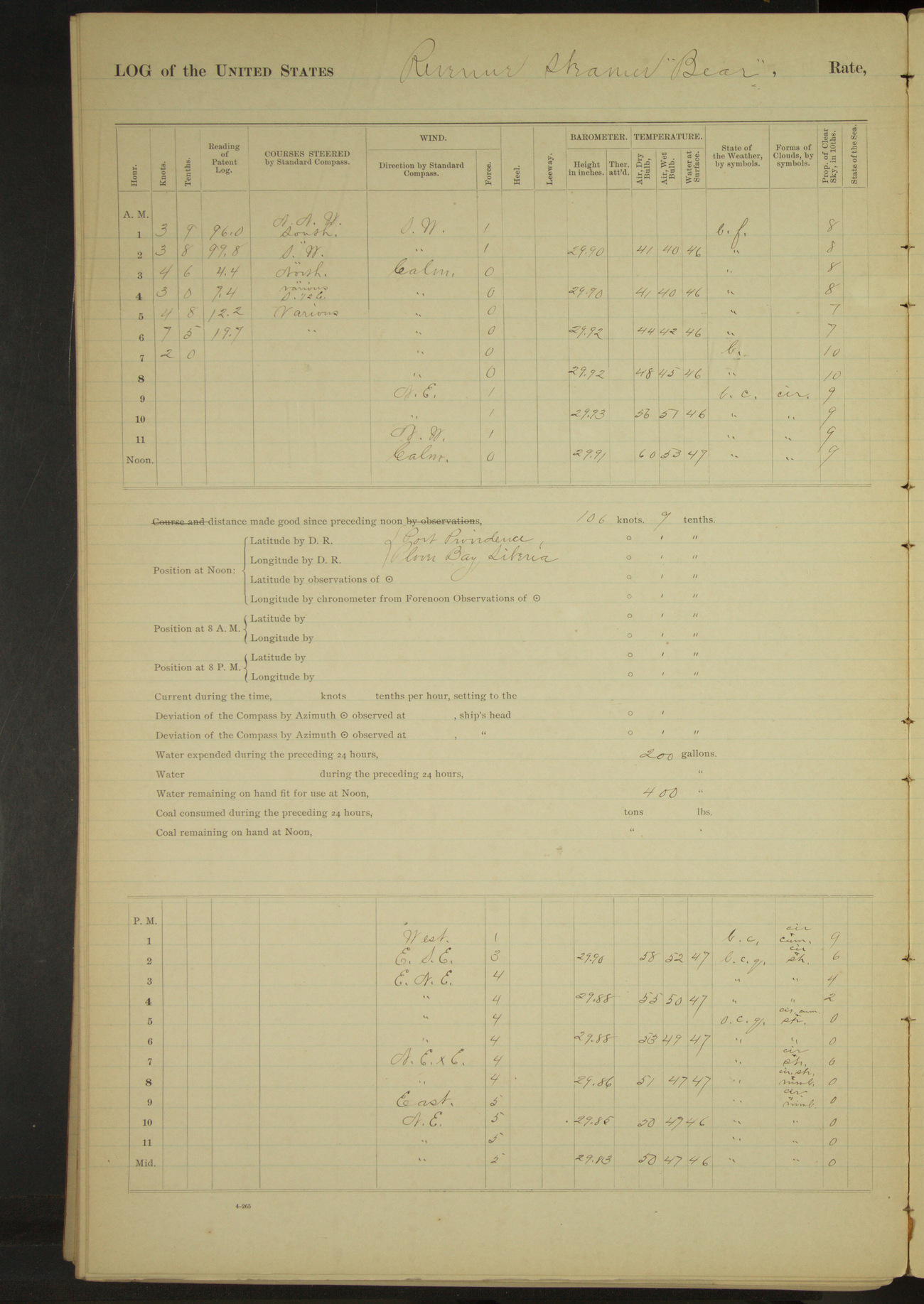
50874d6109d40907550018a9: (http://oldweather.s3.amazonaws.com/ow3/final/USRC Bear/vol069/vol069_115_1.jpg)
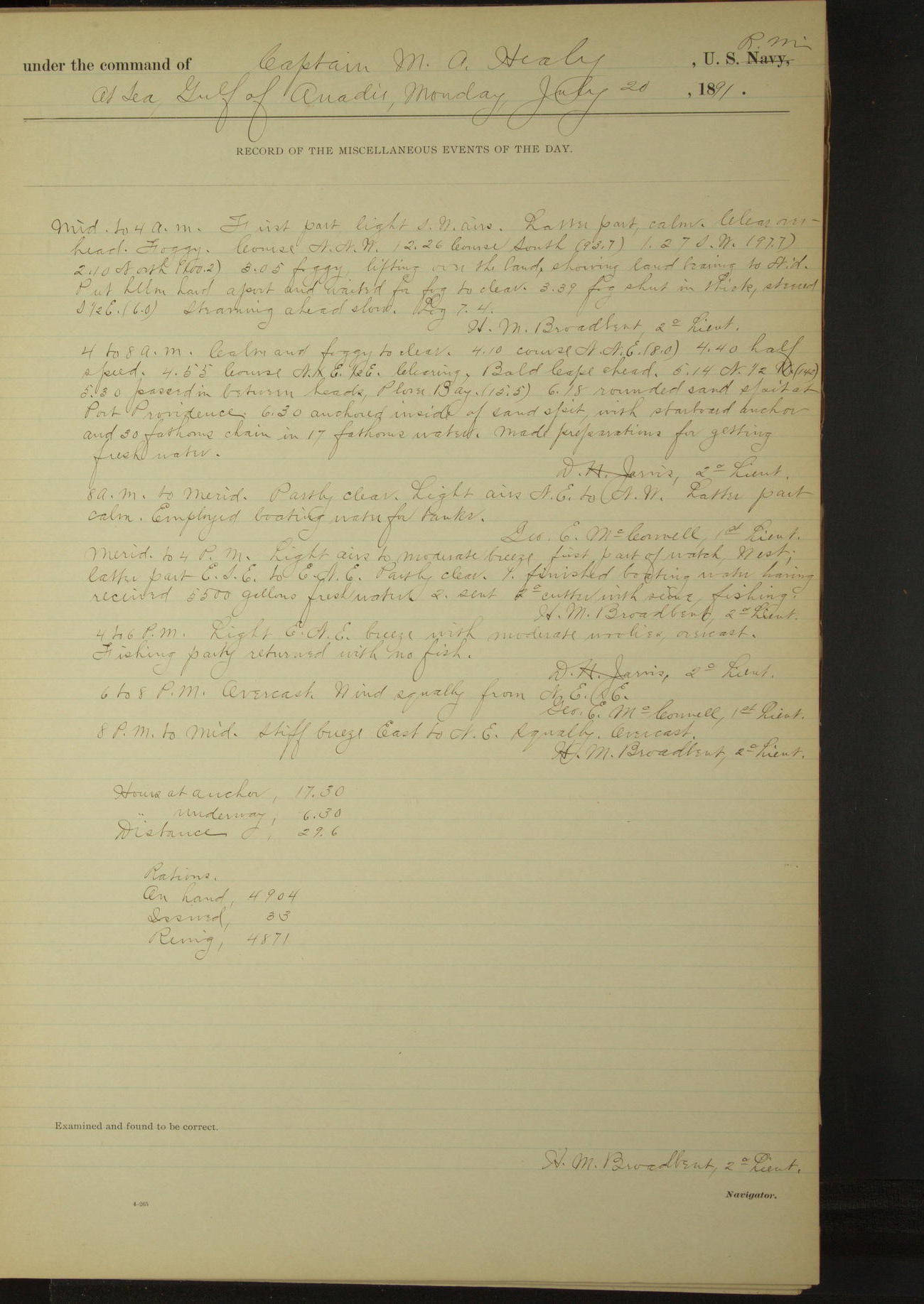
20 July 1891
At sea, Gulf of Anadir [& Port Providence]
Lat 64.37, Long -173.34
Midnight to 4am:
Foggy. 3.05: lifting over the land, showing land bearing to Northward. Put helm hard a-port and waited for fog to clear. 3.39 fog shut in thick, steered S½E.
4am to 8am:
4.55: clearing, Bald Cape [Mys Lysaya Golova] ahead. 5.30: passed between heads Plover Bay [Bukhta Provideniya]. 6.18: rounded sand spit at Port Providence [Reyd Plover]. 6.30 anchored inside of sand spit. Made preparations for getting fresh water.
8am to meridian:
Employed boating water for tanks.
Meridian to 4pm:
1.00: finished boating water having received 5500 gallons fresh water. 2.00: sent second cutter with seine, fishing.
4pm to 6pm:
Fishing party returned with no fish.
At anchor 17 hours 30 minutes.
Underway 6 hours 30 minutes.
Distance 29.6 miles.
50874d6109d40907550018ab: (http://oldweather.s3.amazonaws.com/ow3/final/USRC Bear/vol069/vol069_116_0.jpg)
50874d6109d40907550018ad: (http://oldweather.s3.amazonaws.com/ow3/final/USRC Bear/vol069/vol069_116_1.jpg)
21 July 1891
Port Providence
Lat 64.37, Long -173.34
Midnight to 4am:
Moderate ENE breeze with woolies-force moderate gale. 12.15: vessel dragging, hove up starboard anchor, foul; steamed ahead and at 12.30 let go port anchor. Point Haidaimark [Mys Gaydamak] bearing WxN½N.
4am to 8am:
Heavy squalls of wind from ENE to NE. At 8.00 sand spit (Point Haidaimark) bore NW¾W.
8am to meridian:
Heavy squalls of wind from all points of the compass.
Meridian to 4pm:
Stiff, squally ESE wind. Natives on board [& to 6pm].
50874d6109d40907550018af: (http://oldweather.s3.amazonaws.com/ow3/final/USRC Bear/vol069/vol069_117_0.jpg)
50874d6109d40907550018b1: (http://oldweather.s3.amazonaws.com/ow3/final/USRC Bear/vol069/vol069_117_1.jpg)
22 July 1891
Port Providence
Lat 64.37, Long -173.34
Sick list: Thomas Wogan, Seaman; JS Layton, 1st Officer bark “Alice Knowles” [to 16th August].
50874d6109d40907550018b3: (http://oldweather.s3.amazonaws.com/ow3/final/USRC Bear/vol069/vol069_118_0.jpg)
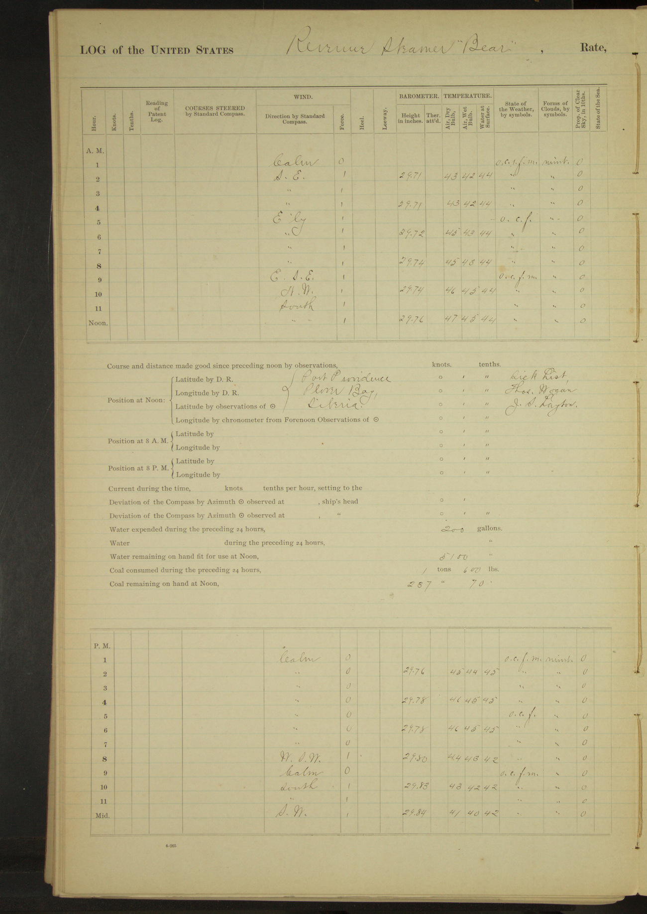
50874d6109d40907550018b5: (http://oldweather.s3.amazonaws.com/ow3/final/USRC Bear/vol069/vol069_118_1.jpg)
23 July 1891
Port Providence
Lat 64.37, Long -173.34
Sick list: Thomas Wogan.
Meridian to 4pm:
Sent second cutter ashore for water. 4.00: cutter returned. Received 400 gallons fresh water.
50874d6109d40907550018b7: (http://oldweather.s3.amazonaws.com/ow3/final/USRC Bear/vol069/vol069_119_0.jpg)
50874d6109d40907550018b9: (http://oldweather.s3.amazonaws.com/ow3/final/USRC Bear/vol069/vol069_119_1.jpg)
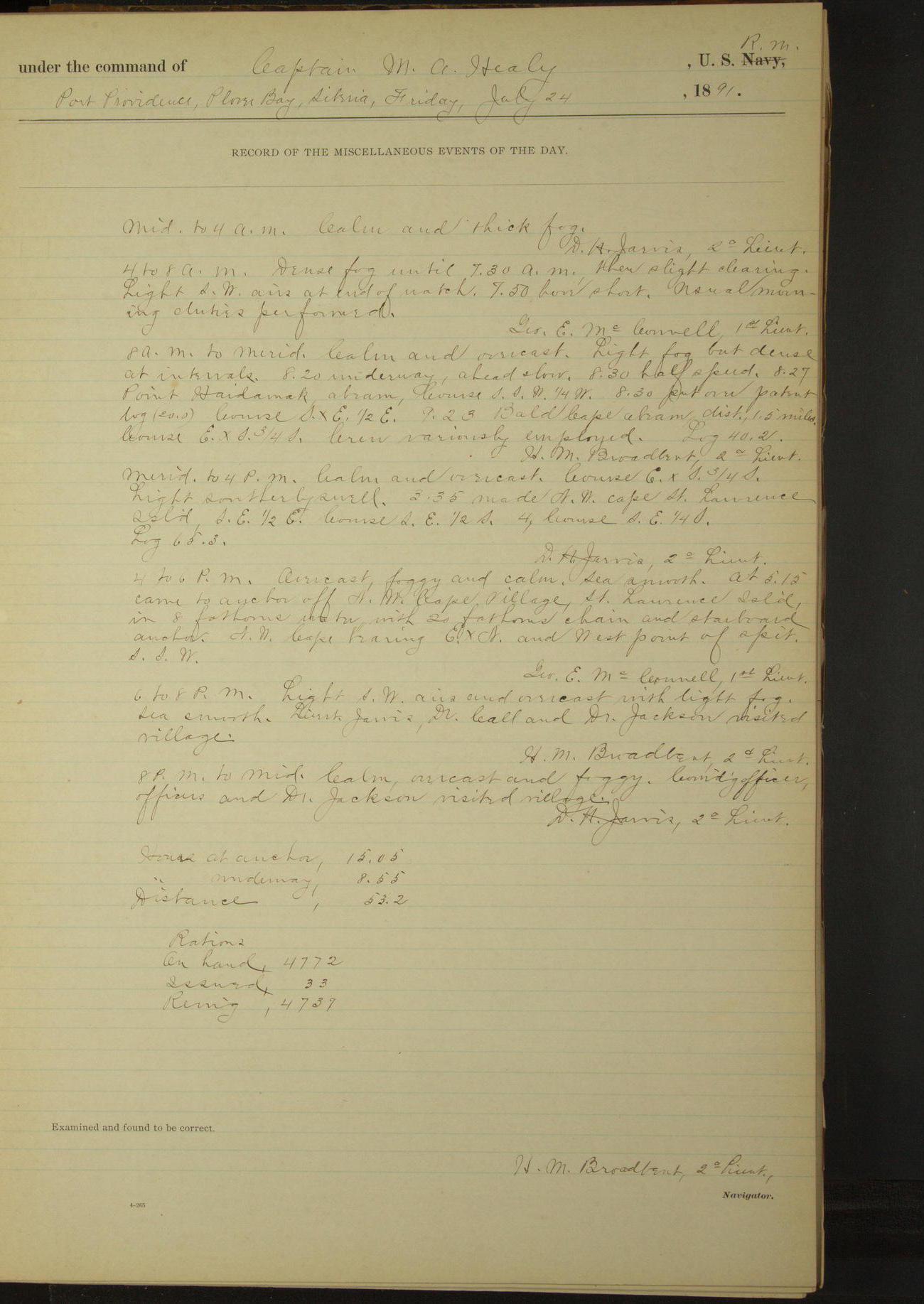
24 July 1891
Port Providence [to St. Lawrence Island]
Lat 64.17, Long -172.92
4am to 8am:
Dense fog until 7.30, then slight clearing.
8am to meridian:
Light fog but dense at intervals. 8.20: underway, ahead slow. 9.23: Bald Cape abeam, distant 1.5 miles.
Meridian to 4pm:
3.35: made NW cape St. Lawrence Island SE½E.
4pm to 6pm:
At 5.15 came to anchor off NW Cape village, St. Lawrence Island. NW Cape bearing ExN and West point of spit SSW.
6pm to 8pm:
Lieutenant Jarvis, Dr. Call and Dr. Jackson visited village.
8pm: Cape Chibukak ExN 1 mile.
8pm to midnight:
Commanding Officer, officers and Dr. Jackson visited village.
At anchor 15 hours 5 minutes.
Underway 8 hours 55 minutes.
Distance 53.2 miles.
50874d6109d40907550018bb: (http://oldweather.s3.amazonaws.com/ow3/final/USRC Bear/vol069/vol069_120_0.jpg)
50874d6109d40907550018bd: (http://oldweather.s3.amazonaws.com/ow3/final/USRC Bear/vol069/vol069_120_1.jpg)
25 July 1891
St. Lawrence Island [to Indian Point & at sea]
Lat 64.42, Long -172.21 [Estimate off Indian Point]
Midnight to 4am:
At 2.15 underway.
4am to 8am:
6.30: raised land one point on starboard bow. 6.45: made Cape Nismenni [probably Mys Nizmennyy] bearing WxS.
8am to meridian:
8.45: hauled around Indian Point to North side. 9.10: came to anchor. Point bearing S½W. Landed interpreters. Surgeon attending sick of natives.
Meridian to 4pm:
At 12.50 underway.
8pm: Lat 65° 01’ 24”N, Long 175° 51’ 12”W
At anchor 5 hours 55 minutes.
Underway 18 hours 5 minutes.
Under sail & steam 7 hours 20 minutes.
Under steam exclusively 10 hours 45 minutes.
Distance under sail & steam 51.6 miles.
Distance under steam exclusively 67.9 miles.
Total distance 119.5 miles.
50874d6109d40907550018bf: (http://oldweather.s3.amazonaws.com/ow3/final/USRC Bear/vol069/vol069_121_0.jpg)
50874d6109d40907550018c1: (http://oldweather.s3.amazonaws.com/ow3/final/USRC Bear/vol069/vol069_121_1.jpg)
26 July 1891
At sea, Bering Sea
Lat 66.24, Long -167.83
Midnight to 4am:
Dense fog; clearing partially at intervals. 2.00: sounded in 23 fathoms; white sand with black specks. Raised high land above fog bearing NE¾E, and land bearing North.
3.20: fog shut in thick. 3.33: sounded in 23 fathoms; pebbles and broken shells.
4am to 8am:
4.25: fog clearing. East Cape bore N½W, Fairway Rock ExS and North end of Big Diomede E½N.
8.00: Cape Prince of Wales bore SE?E, West end of Big Diomede S¾W.
8am: Lat 66° 06’N, Long 168° 56’W
8am to meridian:
Meridian: Cape Prince of Wales bore S½E, East Cape SW½W.
4pm to 6pm:
4.30: “The Ears” [Ear Mountain] abeam.
8pm: Lat 66° 28’ 30”N, Long 165° 40’W
8pm to midnight:
9.28: stopped and took native canoe in tow. 9.38: ahead slow. 9.55: canoe cast off. 10.35: stopped; natives came on board. 11.40: ahead
Underway 24 hours.
Under steam & canvas 4 hours 55 minutes.
Under steam exclusively 19 hours 5 minutes.
Distance under steam & canvas 32.2 miles.
Distance under steam exclusively 112.1 miles.
Total distance 144.3 miles.
50874d6109d40907550018c3: (http://oldweather.s3.amazonaws.com/ow3/final/USRC Bear/vol069/vol069_122_0.jpg)
50874d6109d40907550018c5: (http://oldweather.s3.amazonaws.com/ow3/final/USRC Bear/vol069/vol069_122_1.jpg)
27 July 1891
At sea, Arctic Ocean [& Cape Blossom]
Lat 66.74, Long -162.57 [Estimate from below bearings]
8am: Lat 66° 42’N, Long 162° 34’W
8am to meridian:
9.15: came to anchor off Cape Blossom, Kotzebue Sound. Cape Blossom bearing E½N, distant 2 miles. At 10.00 30 natives came on board. Surgeon measuring natives.
Meridian to 4pm:
15 native canoes alongside.
At anchor 14 hours 45 minutes.
Underway 9 hours 15 minutes.
Under steam & canvas 5 hours 30 minutes.
Under steam exclusively 3 hours 45 minutes.
Distance under steam & canvas 37.7 miles
Distance under steam exclusively 24.3 miles.
Total distance 62 miles.
50874d6109d40907550018c7: (http://oldweather.s3.amazonaws.com/ow3/final/USRC Bear/vol069/vol069_123_0.jpg)
50874d6109d40907550018c9: (http://oldweather.s3.amazonaws.com/ow3/final/USRC Bear/vol069/vol069_123_1.jpg)
28 July 1891
Off Cape Blossom [& at sea]
Lat 66.72, Long -162.67
8am to meridian:
11.00: Natives left vessel. 11.15 up anchor and ahead. Meridian Cape Blossom NExE, Hotham Inlet NxW.
Meridian to 4pm:
At 12.30 Cape Blossom bearing NExE½E. At 4.00 Cape Kruzenstern NW½N.
4pm to 6pm:
5.25: Cape Kruzenstern abeam.
8pm: Lat 67° 17’ 18”N, Long 164° 06’ 10”W
At anchor 11 hours 15 minutes.
Underway 12 hours 45 minutes.
Under steam & canvas 35 minutes.
Under steam exclusively 12 hours 10 minutes.
Distance under steam & canvas 4.3 miles
Distance under steam exclusively 71 miles.
Total distance 75.3 miles.
50874d6109d40907550018cb: (http://oldweather.s3.amazonaws.com/ow3/final/USRC Bear/vol069/vol069_124_0.jpg)
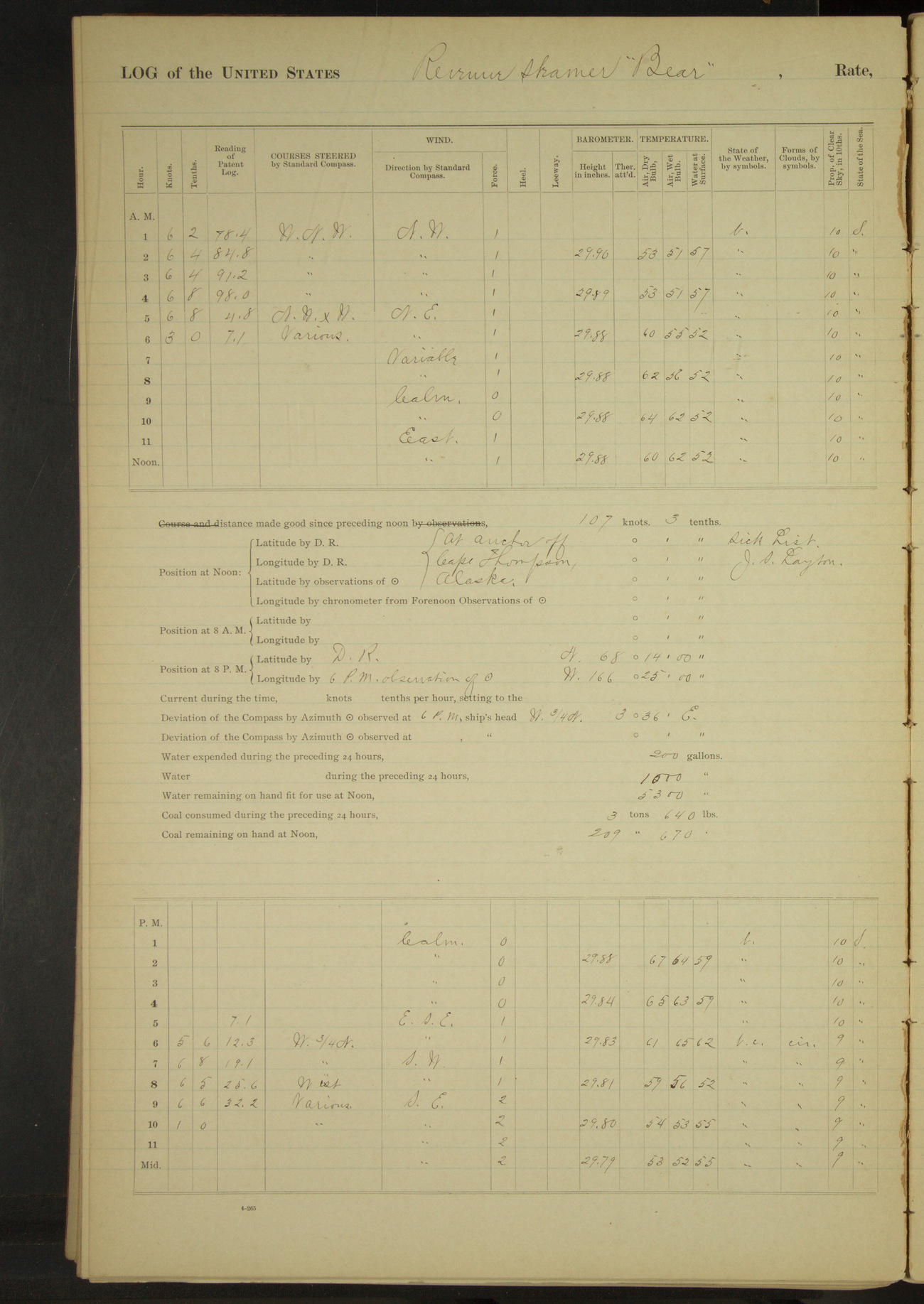
50874d6109d40907550018cd: (http://oldweather.s3.amazonaws.com/ow3/final/USRC Bear/vol069/vol069_124_1.jpg)
29 July 1891
At sea, Arctic Ocean [& Cape Thompson & Point Hope]
Lat 68.04, Long -165.83 [Estimate off Cape Thompson watering place]
4am to 8am:
5.00: Hauled in for watering place at Cape Thompson. 5.35: came to anchor, Cape Thompson NW¾W, East Bluff ExS. Sent two boats ashore and boated off water. Received 1000 gallons.
8am to meridian:
Crew employed scrubbing clothing. Aired bedding [& Meridian to 4pm].
4pm to 6pm:
Crew completed washing. 5.05: up anchor and steamed ahead.
8pm: Lat 68° 14’N, Long 166° 25’W
8pm to midnight:
8.15: Steering various courses rounding Point Hope. 9.15: came to anchor off Point Hope, end of spit bearing SxE½E, distant 2 miles. Four men from whaling station came on board.
10.45: Surgeon left vessel to go to whaling station to examine a man for medical treatment. A number of natives came on board.
At anchor 14 hours 15 minutes.
Underway 9 hours 45 minutes.
Distance 62.1 miles.
50874d6109d40907550018cf: (http://oldweather.s3.amazonaws.com/ow3/final/USRC Bear/vol069/vol069_125_0.jpg)
50874d6109d40907550018d1: (http://oldweather.s3.amazonaws.com/ow3/final/USRC Bear/vol069/vol069_125_1.jpg)
30 July 1891
North side Point Hope
Lat 68.37, Long -166.87 [Estimate from above bearings]
Sick list: William Brown [to end of log]; Stephen Custer (miner) [to 25th September].
Midnight to 4am:
Natives left vessel.
4am to 8am:
6.30: Surgeon returned; received on board for medical treatment from shore William Brown, suffering with frost bitten feet. American schooner “Rosario” arrived and anchored.
Received on board for treatment and transportation from this region, Stephen Custer (miner), sick with rheumatism and destitute. Issued two extra rations by order of Commanding Officer.
8am to meridian:
8.15: boarded American schooner “Rosario” of San Francisco; Coffin, master; whaling. Dr. Sheldon Jackson visited mission school and returned accompanied by Dr. Driggs of mission school.
Master of whaling schooner “Rosario” visited vessel. Employed restowing goods in store-room under cabin etc.
Meridian to 4pm:
Received from schooner “Rosario” a 120-gallon cask and stowed in it walrus skin for preservation in pickle. Dr. Driggs left vessel having received some missionary supplies.
4pm to 6pm:
Received from American schooner “Rosario” for transportation 24 bundles of whalebone, the Commanding Officer and Department assuming no responsibility for the same. Loaned to schooner “Rosario” one 500 lb anchor for which master of schooner receipted.
50874d6109d40907550018d3: (http://oldweather.s3.amazonaws.com/ow3/final/USRC Bear/vol069/vol069_126_0.jpg)
50874d6109d40907550018d5: (http://oldweather.s3.amazonaws.com/ow3/final/USRC Bear/vol069/vol069_126_1.jpg)
31 July 1891
North side Point Hope
Lat 68.37, Long -166.87
8am to meridian:
Natives on board.
After making an examination on shore of William Brown, I find that he is suffering form the effects of frost bite, necessitating the amputation of his left leg and three fingers of his left hand.
I also find that Stephen Custer has been reduced to a state of destitution by an attack of rheumatism.
As their lives are more or less jeopardized by remaining on shore without any care, I recommend that they be taken on board this vessel where they may receive proper medical treatment. [Signed] SJ Call, MD, Surgeon
Summary of abstract for July
At anchor 460 hours 40 minutes.
Underway 283 hours 20 minutes.
Under steam & canvas 83 hours 20 minutes.
Under steam exclusively 161 hours 10 minutes.
Hours under canvas exclusively 38 hours 50 minutes.
Distance under steam & canvas 609.7 miles.
Distance under steam exclusively 967.5 miles.
Distance under canvas exclusively 312.7 miles.
Total distance 1889.9 miles.
Coal received 102 1120/2240 tons.
Coal consumed 110 1770/2240 tons.
Number Officers present 248.
Number Petty Officers & crew present 1209.
Number rations issued 1023.
Number vessels boarded and examined, American 21.
LOGS FOR AUGUST 1891
50874d6109d40907550018d7: (http://oldweather.s3.amazonaws.com/ow3/final/USRC Bear/vol069/vol069_127_0.jpg)
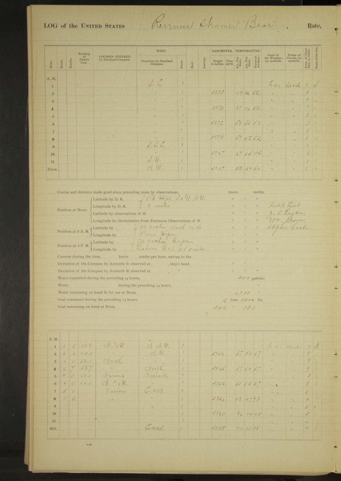
50874d6109d40907550018d9: (http://oldweather.s3.amazonaws.com/ow3/final/USRC Bear/vol069/vol069_127_1.jpg)
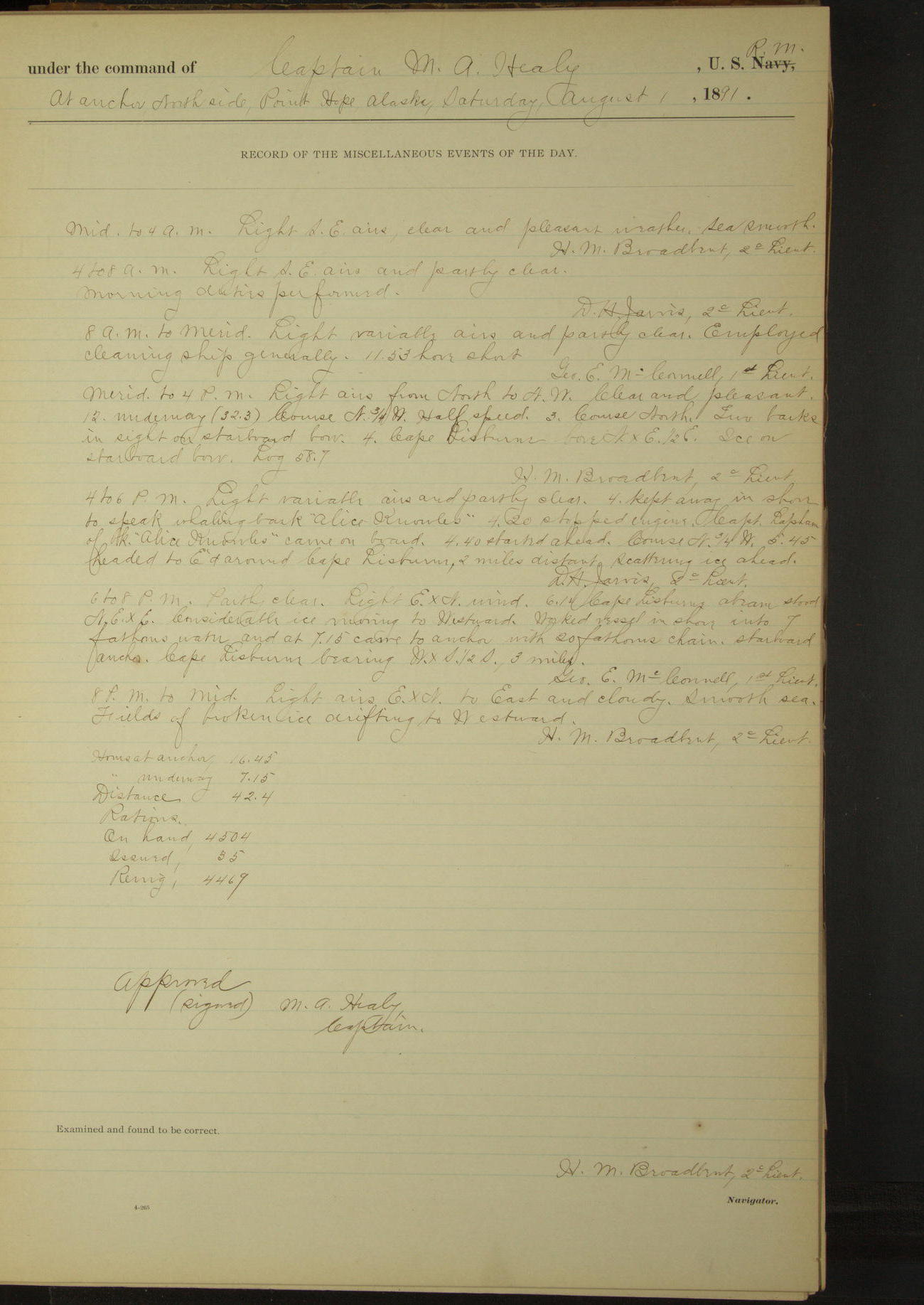
1 August 1891
North side Point Hope [to Cape Lisburne]
Lat 68.37, Long -166.87
Meridian to 4pm:
12.00: underway. 3.00: Two barks in sight on starboard bow. 4.00: Cape Lisburne. Ice on starboard bow.
4pm to 6pm:
4.00: kept away in shore to speak whaling bark “Alice Knowles”. 4.20: Stopped engine. Captain Lapham of bark “Alice Knowles” came on board.
4.40: started ahead. 5.45: headed to Eastward around Cape Lisburne, 2 miles distant, scattering ice ahead.
6pm to 8pm:
6.14: Cape Lisburne abeam. Considerable ice moving to Westward. Worked vessel in shore into 7 fathoms water and at 7.15 came to anchor. Cape Lisburne bearing WxS½S, 3 miles.
8pm to midnight:
Fields of broken ice drifting to Westward.
At anchor 16 hours 45 minutes.
Underway 7 hours 15 minutes.
Distance 42.4 miles.
50874d6109d40907550018db: (http://oldweather.s3.amazonaws.com/ow3/final/USRC Bear/vol069/vol069_128_0.jpg)
50874d6109d40907550018dd: (http://oldweather.s3.amazonaws.com/ow3/final/USRC Bear/vol069/vol069_128_1.jpg)
2 August 1891
Cape Lisburne
Lat 68.88, Long -166.08 [Estimate from above bearings]
Midnight to 4am:
Broken ice running to Westward [& to 4pm].
8am to meridian:
10.00: large cake of ice fouled chain, veered to 30 fathoms; ice floated clear. 10.10: Surgeon visited bark “Sea Ranger” to attend two men with ulcerated legs. 11.15: Surgeon returned.
4pm to 6pm:
Dense fog. 5.45: weighed to clear hawse of a field of drifting ice. Large quantities of broken ice moving to Westward.
6pm to 8pm:
Dense fog. 6.05: came to. Ice drifting to Westward.
8pm to midnight:
Thick fog. Broken ice running to Westward
At anchor 23 hours 40 minutes.
Underway 20 minutes.
Distance 1.2 miles.
50874d6109d40907550018df: (http://oldweather.s3.amazonaws.com/ow3/final/USRC Bear/vol069/vol069_129_0.jpg)
50874d6109d40907550018e1: (http://oldweather.s3.amazonaws.com/ow3/final/USRC Bear/vol069/vol069_129_1.jpg)
3 August 1891
Cape Lisburne [to Cape Sabine]
Lat 68.88, Long -166.08
Midnight to 4am:
Broken ice running slowly to Westward.
4am to 8am:
Dense fog. Broken ice moving slowly to Westward.
8am to meridian:
Surgeon, assisted by 2nd Assistant Engineer FR Falkenstein, amputated left foot of William Brown. Four vessels in sight to Westward at end of watch.
Meridian to 4pm:
At 3.00 underway. Broken ice drifting to Westward. Expended for use of Surgeon two pairs of blankets of ward room outfits.
4pm to 6pm:
Broken ice drifting to Westward. 5.30: slowed engine, steaming various courses to clear ice.
6pm to 8pm:
Steaming through broken ice. 7.05: came to anchor off house at coal mine Cape Sabine [Corwin Mine or Thetis Mine?]. House bearing ExS¾S.
8pm to midnight:
Large quantities of broken ice moving slowly to Westward.
At anchor 19 hours 55 minutes.
Underway 4 hours 5 minutes.
Distance 20.5 miles.
50874d6109d40907550018e3: (http://oldweather.s3.amazonaws.com/ow3/final/USRC Bear/vol069/vol069_130_0.jpg)
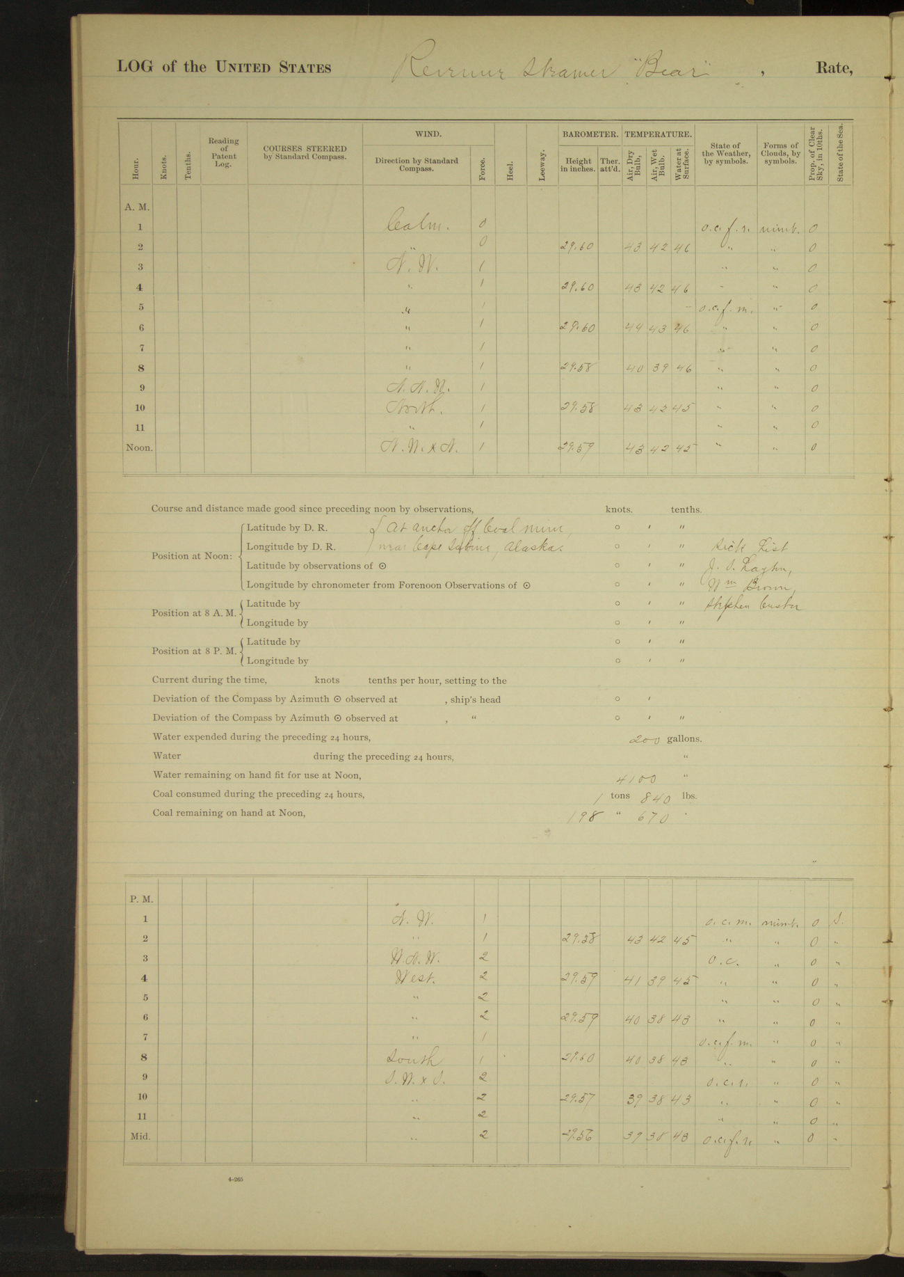
50874d6109d40907550018e5: (http://oldweather.s3.amazonaws.com/ow3/final/USRC Bear/vol069/vol069_130_1.jpg)
4 August 1891
Off coal mine near Cape Sabine
Lat 68.88, Long -165.14 [Estimate off Cape Sabine]
Midnight to 4am:
Broken ice moving to Westward [& to 4pm].
4am to 8am:
One bark standing Westward.
Meridian to 4pm:
Employed rigging crow’s nest. Two vessels (one schooner and one bark) in sight to Northward & Westward during watch.
4pm to 6pm:
Broken ice about; current stopped.
6pm to 8pm:
Broken ice moving slowly to Eastward.
8pm to midnight:
Broken ice moving to Northward and Eastward.
50874d6109d40907550018e7: (http://oldweather.s3.amazonaws.com/ow3/final/USRC Bear/vol069/vol069_131_0.jpg)
50874d6109d40907550018e9: (http://oldweather.s3.amazonaws.com/ow3/final/USRC Bear/vol069/vol069_131_1.jpg)
5 August 1891
Off coal mine near Cape Sabine [& at sea]
Lat 69.43, Long -164.87 [Estimated]
[Only top part of weather page completed]
[Snow squalls most of the day]
Midnight to 4am:
Ice moving to Eastward; working engine to keep clear hawse.
4am to 8am:
4.40: ice running heavy to Eastward, got underway. Working through ice to best advantage.
8am to meridian:
Steering various courses to avoid ice, but making good per compass about NxE. Open water around vessel last two hours, but ice to Northward & Eastward.
Meridian to 4pm:
Broken ice along shore on starboard hand. Last hour made ice on port beam and ahead. At end of watch, one vessel on port beam.
4pm to 6pm:
Steaming slowly along ice on starboard beam.
6pm to 8pm:
Broken ice drifting about vessel. 6.00: stopped engine, lowered dinghy and third cutter. Commanding Officer and Surgeon went to shoot walrus on ice. 8.00: boats returned with four walrus. Stopping and starting at intervals.
8pm to midnight:
8.20: hoisted walrus aboard, ahead slow out of ice. 9.00: clear. Four vessels in sight at end of watch.
At anchor 4 hours 40 minutes.
Underway 19 hours 20 minutes.
Distance 82.5 miles.
50874d6109d40907550018eb: (http://oldweather.s3.amazonaws.com/ow3/final/USRC Bear/vol069/vol069_132_0.jpg)
50874d6109d40907550018ed: (http://oldweather.s3.amazonaws.com/ow3/final/USRC Bear/vol069/vol069_132_1.jpg)
6 August 1891
At sea, Arctic Ocean
Lat 69.86, Long -164.28
4am to 8am:
8.00: ice from ½ point on starboard bow to starboard beam. One vessel in sight bearing West and standing to Northward at end of watch.
8am: Lat 69° 40’ 30”N, Long 165° 04’W
8am to meridian:
Five vessels in sight at end of watch: one SWxW on port tack, two on port bow on port tack and two ahead on starboard tack.
Meridian to 4pm:
Six sails in sight during watch all on port tack, one NWxW½W, two N¾W, one NNW, one NWxN¾N, one NW.
4pm to 6pm:
4.17: large quantities of ice ahead, backed ship and stood SW full and by. One vessel in sight to Northward & Westward at end of watch.
6pm to 8pm:
One vessel in sight bearing NxW, standing SW.
8pm: Lat 70° 01’ 30”N, Long 164° 32’W
8pm to midnight:
Four vessels in sight at end of watch. One a schooner W½N, one NNW½W, one NW½W and one SWxW.
Underway 24 hours.
Hours under canvas exclusively 24 hours.
Distance 62.8 miles.
50874d6109d40907550018ef: (http://oldweather.s3.amazonaws.com/ow3/final/USRC Bear/vol069/vol069_133_0.jpg)
50874d6109d40907550018f1: (http://oldweather.s3.amazonaws.com/ow3/final/USRC Bear/vol069/vol069_133_1.jpg)
7 August 1891
At sea, Arctic Ocean
Lat 69.85, Long -164.26
Midnight to 4am:
Two vessels in sight at end of watch standing to Southward. Ice on port beam.
4am to 8am:
4.15: started engine at half speed to speak whaling bark, SxE. 5.45: stopped engine, hove to and sent boat to board schooner “Balaena”. 7.00: boat returned with Captain Smith of “Balaena”. Filled away SWxS¼S. Cruising along edge of ice as far as Lat 70° 04’N, Long 164° 40’W. Heavy ice on shore extending seaward 40 miles, debarring all progress to Northward.
8am: Lat 69° 50’ 06”N, Long 164° 12’ 18”W
8am to meridian:
9.20: wore ship; sent boat with Captain Smith of schooner “Balaena” to his vessel. 9.45: tacked and hove aback to pick up boat. 10.08: filled away.
10.25: hove aback to speak American schooner “William Lewis”. 10.30: Captain Sherman of the “William Lewis” came aboard. The two schooners mentioned were the only vessels in sight at the end of watch.
Meridian to 4pm:
1.50: saw a number of whaling vessels in the vicinity, all of which were unable to get to Point Barrow, all progress having been stopped on account of heavy ice. Two vessel (schooners “Balaena” and “William Lewis”) in sight.
4pm to 6pm:
Raised sailing vessel bearing NExE.
6pm to 8pm:
Sail [sailed in log] to Northward & Eastward proved to be “Helen Mar” (American bark). Two vessels (“Balaena” and “William Lewis”) in sight at end of watch.
8pm: Lat 70° 01’N, Long 164° 46’W
Underway 24 hours.
Under steam & canvas 1 hour 30 minutes.
Hours under canvas exclusively 22 hours 30 minutes.
Distance steam & canvas 5.5 miles.
Distance canvas exclusively 68.6 miles.
Total distance 74.1 miles.
50874d6109d40907550018f3: (http://oldweather.s3.amazonaws.com/ow3/final/USRC Bear/vol069/vol069_134_0.jpg)
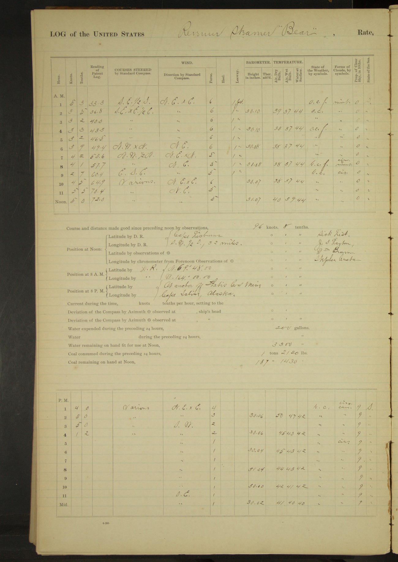
50874d6109d40907550018f5: (http://oldweather.s3.amazonaws.com/ow3/final/USRC Bear/vol069/vol069_134_1.jpg)
8 August 1891
At sea, Arctic Ocean
Lat 69.11, Long -164.67 [Estimate from noon bearings, although there is confusion over the distance and it does not fit with 8am location]
Midnight to 4am:
Foggy at times. At 1.00 clearing, made land from East to South about 30 miles distant. 2.00: Cape Lisburne bore SxW¾W.
4am to 8am:
Fog clearing at times. 5.00: ice on port bow. No vessels or land in sight at end of watch.
8am: Lat 69° 48’N, Long 164° 00’W
8am to meridian:
8.40: made land bearing East. 10.15: saw ice ahead. 11.00: entered field of broken ice. 11.18: steering various courses to avoid ice. Noon: Cape Lisburne bore SW½S, distant 22 miles [on weather page 32 miles].
Meridian to 4pm:
Steering in for land through broken ice. 3.25: came to anchor off Thetis Coal mine, Cape Sabine. Cape Lisburne SWxW¾W. Sent boat to prospect for coal.
4pm to 6pm:
5.40: boat returned from shore bringing specimens of coal. Broken ice moving slowly to Eastward [& for rest of day].
At anchor 8 hours 35 minutes.
Underway 15 hours 25 minutes.
Distance 66.6 miles.
Under canvas exclusively 13 hours 35 minutes. Distance 50.4 miles.
Under steam exclusively 1 hour 50 minutes. Distance 16.2 miles.
50874d6109d40907550018f7: (http://oldweather.s3.amazonaws.com/ow3/final/USRC Bear/vol069/vol069_135_0.jpg)
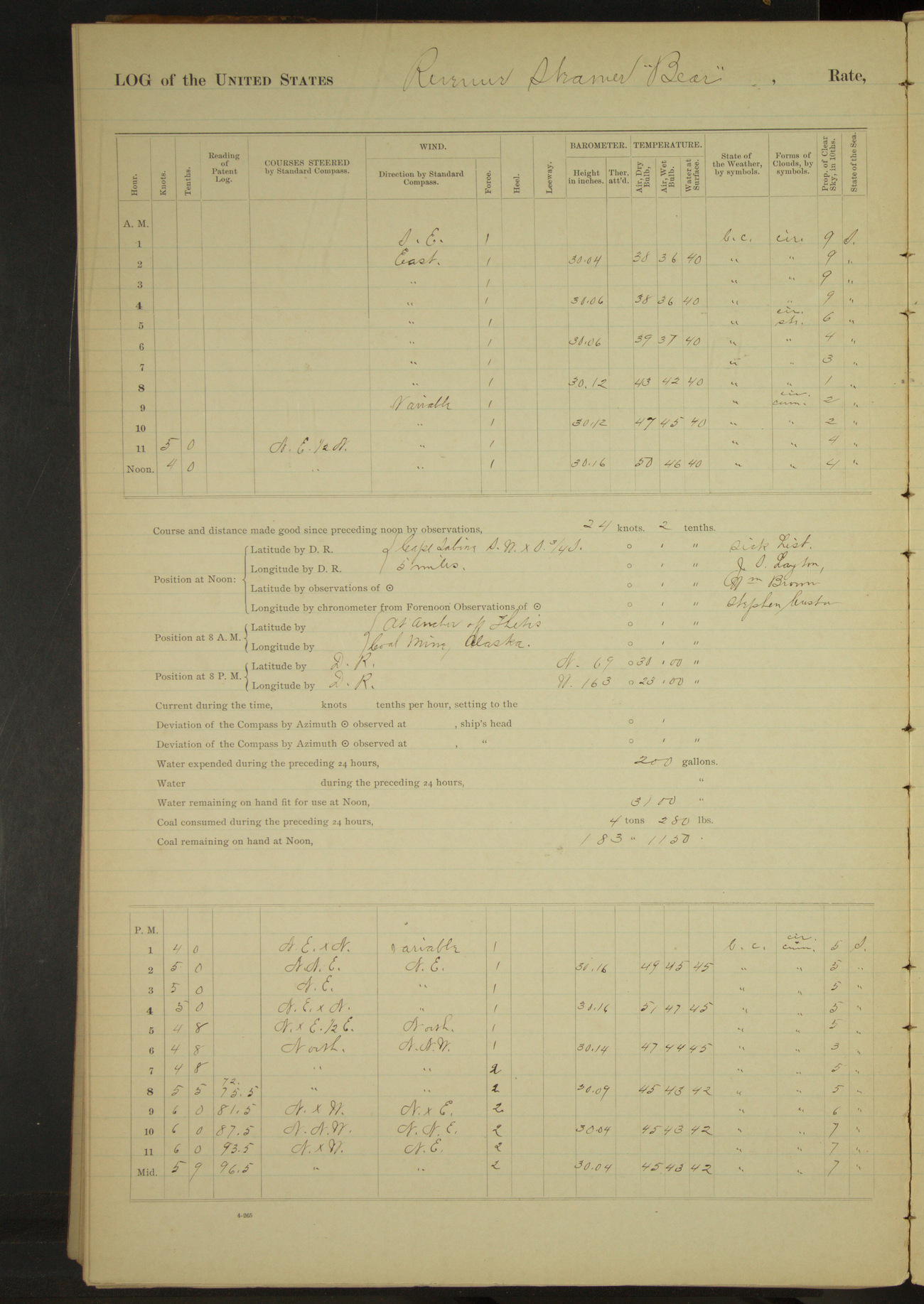
50874d6109d40907550018f9: (http://oldweather.s3.amazonaws.com/ow3/final/USRC Bear/vol069/vol069_135_1.jpg)
9 August 1891
Off Thetis Coal Mine, Cape Sabine [& at sea]
Lat 68.98, Long -164.54 [Estimate from noon bearings]
Midnight to 4am:
Ice moving to Eastward.
4am to 8am:
Ice moving slowly to Eastward.
8am to meridian:
9.00: sent boat to bring off men who were shouting and signalling to vessel. 10.00: boat returned with three deserters from American schooner “Rosario”, Robert Ogle, Charles Wattay and Joseph Smith. Confined them in single irons and issued them half rations until returned to their vessel.
10.15: up anchor and ahead along the shore through broken ice, in from 5 to 6 fathoms water, about 3 miles distant.
Noon: Cape Sabine SWxS¾S 5 miles
Meridian to 4pm:
Steaming through broken ice along the shore in from 6 to 8 fathoms water, about 5 miles distant.
4pm to 6pm:
Steaming about 5 miles from beach. Broken ice ahead and on port beam, scattering ice around vessel. Steering various courses to clear ice.
6pm to 8pm:
6.40: through ice, clear water ahead and off shore, shore 6 miles distant.
8pm: Lat 69° 30’N, Long 163° 23’W
8pm to midnight:
At 11.00 made a bark to SW working through broken ice. At 11.40 stopped to communicate with natives in a canoe. 10.15: opening in beach abeam. At 11.50 made sail to Eastward.
At anchor 10 hours 15 minutes.
Underway 13 hours 45 minutes.
Under steam & canvas 1 hour.
Under steam exclusively 12 hours 45 minutes.
Distance steam & canvas 5.9 miles.
Distance steam exclusively 65.9 miles.
Total distance 71.8 miles.
50874d6109d40907550018fb: (http://oldweather.s3.amazonaws.com/ow3/final/USRC Bear/vol069/vol069_136_0.jpg)
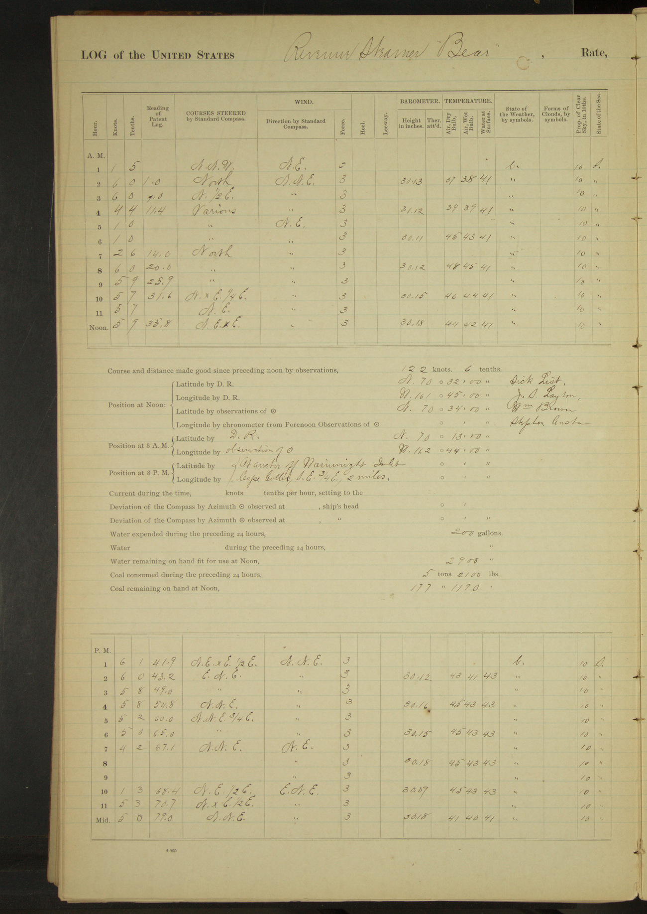
50874d6109d40907550018fd: (http://oldweather.s3.amazonaws.com/ow3/final/USRC Bear/vol069/vol069_136_1.jpg)
10 August 1891
At sea, Arctic Ocean [& off Wainwright Inlet]
Lat 70.57, Long -161.75
Midnight to 4am:
12.39: natives left vessel, slow ahead. 12.43: half speed, steering various courses along the beach. 1.15: spoke American whaling bark “Hunter” of San Francisco, all well on board.
3.45: stopped. Two canoes with natives came on board. Two schooners and one bark in sight at end of watch.
4am to 8am:
4.20: ahead slow. 5.15: stopped. 6.30: natives left vessel, ahead half speed. 6.40: inlet above Point Lay abeam. Two schooners ahead and two barks astern at end of watch.
8am: Lat 70° 13’N, Long 162° 44’W
8am to meridian:
Working around Blossom Shoal. Passing through broken ice. Two schooners to Eastward and one bark to NE at end of watch.
Meridian to 4pm:
Steaming through scattering ice. 2.00: through ice. Two vessels in sight (American bark “Sea Breeze” on starboard bow and American schooner “Bonanza” on port quarter) at end of watch.
4pm to 6pm:
4.45: kept away to speak bark “Sea Breeze”. 5.10: resumed course. 5.25: stopped to pick up canoes. 5.30: ahead. 6.00 off Wainwright Inlet.
6pm to 8pm:
6.20: stood in for land. 6.40: came to off entrance to Wainwright Inlet. From masthead discerned three square-rigged vessels at anchor off Point Belcher. Cape Collie SE¾E, 2 miles.
8pm to midnight:
9.35: underway and steamed along the beach, about 3 miles distant to Northward & Eastward.
At anchor 2 hours 55 minutes.
Underway 21 hours 5 minutes.
Under steam & canvas 4 hours 30 minutes.
Under canvas exclusively 1 hour 15 minutes.
Under steam exclusively 15 hours 20 minutes.
Distance under canvas exclusively 1 mile.
Distance under steam & canvas 12.5 miles.
Distance under steam exclusively 88.2 miles.
Total distance 101.7 miles.
50874d6109d40907550018ff: (http://oldweather.s3.amazonaws.com/ow3/final/USRC Bear/vol069/vol069_137_0.jpg)
50874d6109d4090755001901: (http://oldweather.s3.amazonaws.com/ow3/final/USRC Bear/vol069/vol069_137_1.jpg)
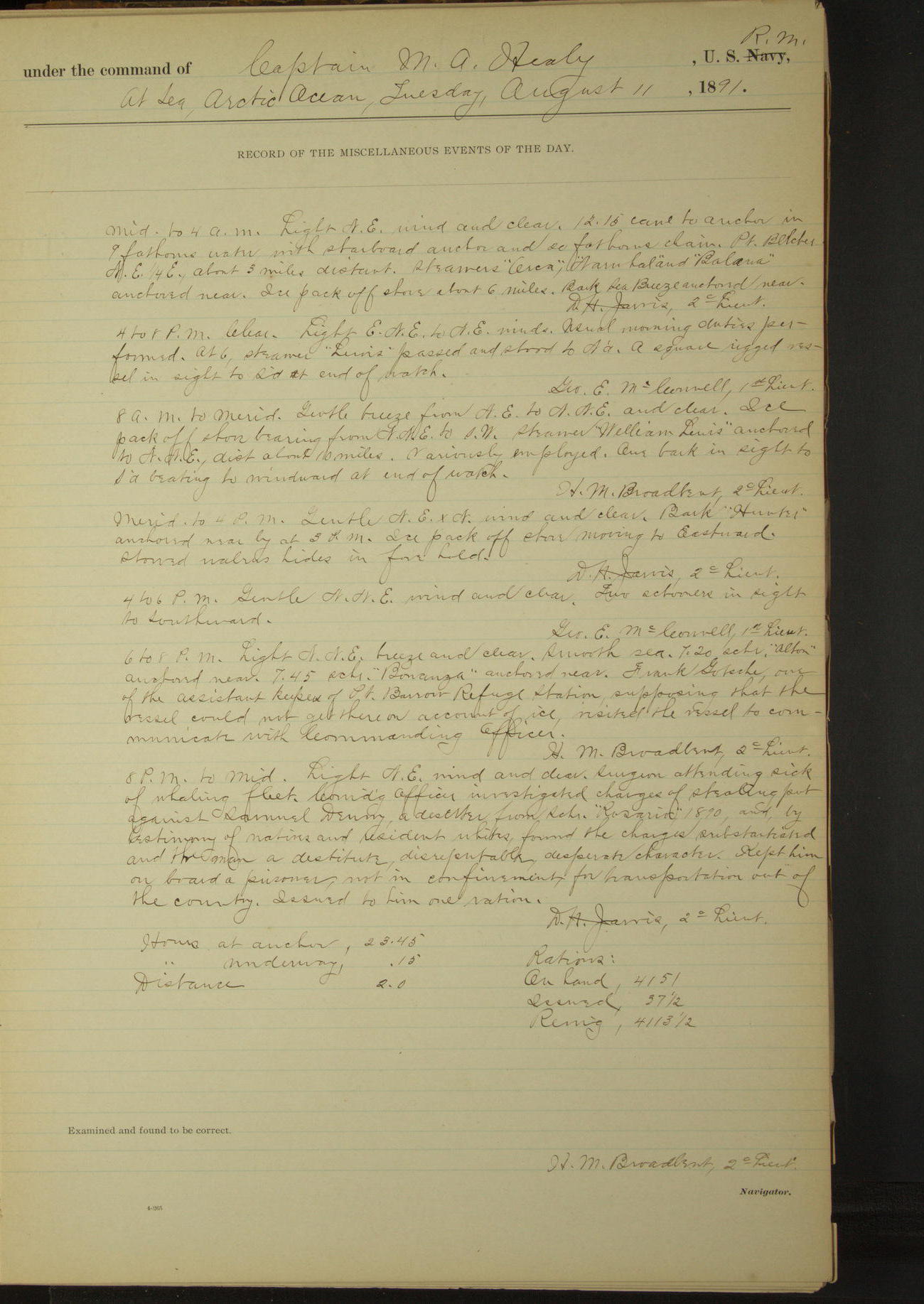
11 August 1891
At sea, Arctic Ocean [& off Point Belcher]
Lat 70.78, Long -159.80 [Estimate from below bearings]
Midnight to 4am:
12.15: came to anchor, Point Belcher NE¼E, about 3 miles distant. Steamers “Orca”, “Narwhal” and “Balaena” anchored near. Ice pack off shore about 6 miles. Bark “Sea Breeze” anchored near.
4am to 8am:
At 6.00 steamer “Lewis” passed and stood to Northward. A square-rigged vessel in sight to Southward at end of watch.
8am to meridian:
Ice pack off shore bearing from NNE to SW. Steamer “William Lewis” anchored to NNE, distant about 10 miles. American bark in sight to Southward beating to windward at end of watch.
Meridian to 4pm:
Bark “Hunter” anchored near by at 3.00. Ice pack off shore moving to Eastward. Stowed walrus hides in fore hold.
4pm to 6pm:
Two schooners in sight to Southward.
6pm to 8pm:
7.20: schooner “Alton” anchored near. 7.45: schooner “Bonanza” anchored near. Frank Gotsche, one of the assistant keepers of Point Barrow Refuge Station, supposing that the vessel could not get there on account of ice, visited the vessel to communicate with Commanding Officer.
8pm to midnight:
Surgeon attending sick of whaling fleet. Commanding Officer investigated charges of stealing put against Samuel Denny, a deserter from schooner “Rosario” 1890, and by testimony of natives and resident whites, found the charges substantiated and the man a destitute, disreputable, desperate character. Kept him on board a prisoner, not in confinement, for transportation out of the country. Issued him one ration.
At anchor 23 hours 45 minutes.
Underway 15 minutes.
Distance 2 miles.
50874d6109d4090755001903: (http://oldweather.s3.amazonaws.com/ow3/final/USRC Bear/vol069/vol069_138_0.jpg)
50874d6109d4090755001905: (http://oldweather.s3.amazonaws.com/ow3/final/USRC Bear/vol069/vol069_138_1.jpg)
12 August 1891
Off Point Belcher
Lat 70.78, Long -159.80
4am to 8am:
7.05: steam bark “William Lewis” anchored near by.
8am to meridian:
Schooner “Bonanza” stood to NE and anchored 10 miles distant.
Meridian to 4pm:
2.22: American bark “James Allen” arrived and anchored near shore. At 4.00 schooner “Bonanza” in sight standing to Southward.
4pm to 6pm:
5.10: schooner “Bonanza” anchored near shore.
50874d6109d4090755001907: (http://oldweather.s3.amazonaws.com/ow3/final/USRC Bear/vol069/vol069_139_0.jpg)
50874d6109d4090755001909: (http://oldweather.s3.amazonaws.com/ow3/final/USRC Bear/vol069/vol069_139_1.jpg)
13 August 1891
Off Point Belcher
Lat 70.78, Long -159.80
Midnight to 4am:
Dense fog. Sounding fog bell.
4am to 8am:
Thick fog.
8am to meridian:
First part, passing fog. Latter part, thick fog. Sent Lieutenant Jarvis to the bark “Hunter” to be present at auction sale of the schooner “Silver Wave” (owned by McKenna of San Francisco), wrecked last fall.
Meridian to 4pm:
Broken ice moving slowly to Northward & Eastward.
4pm to 6pm:
Ice off shore running to Southward.
6pm to 8pm:
Broken ice moving slowly to Southward.
8pm to midnight:
Ice moving to Southward. 11.00: JW Kelly, agent of Pacific whaling station, came on board, received two sacks of mail for station and left vessel. He reported ice very bad between here and Point Barrow, and very improbable that any vessel could reach that point.
50874d6109d409075500190b: (http://oldweather.s3.amazonaws.com/ow3/final/USRC Bear/vol069/vol069_140_0.jpg)
50874d6109d409075500190d: (http://oldweather.s3.amazonaws.com/ow3/final/USRC Bear/vol069/vol069_140_1.jpg)
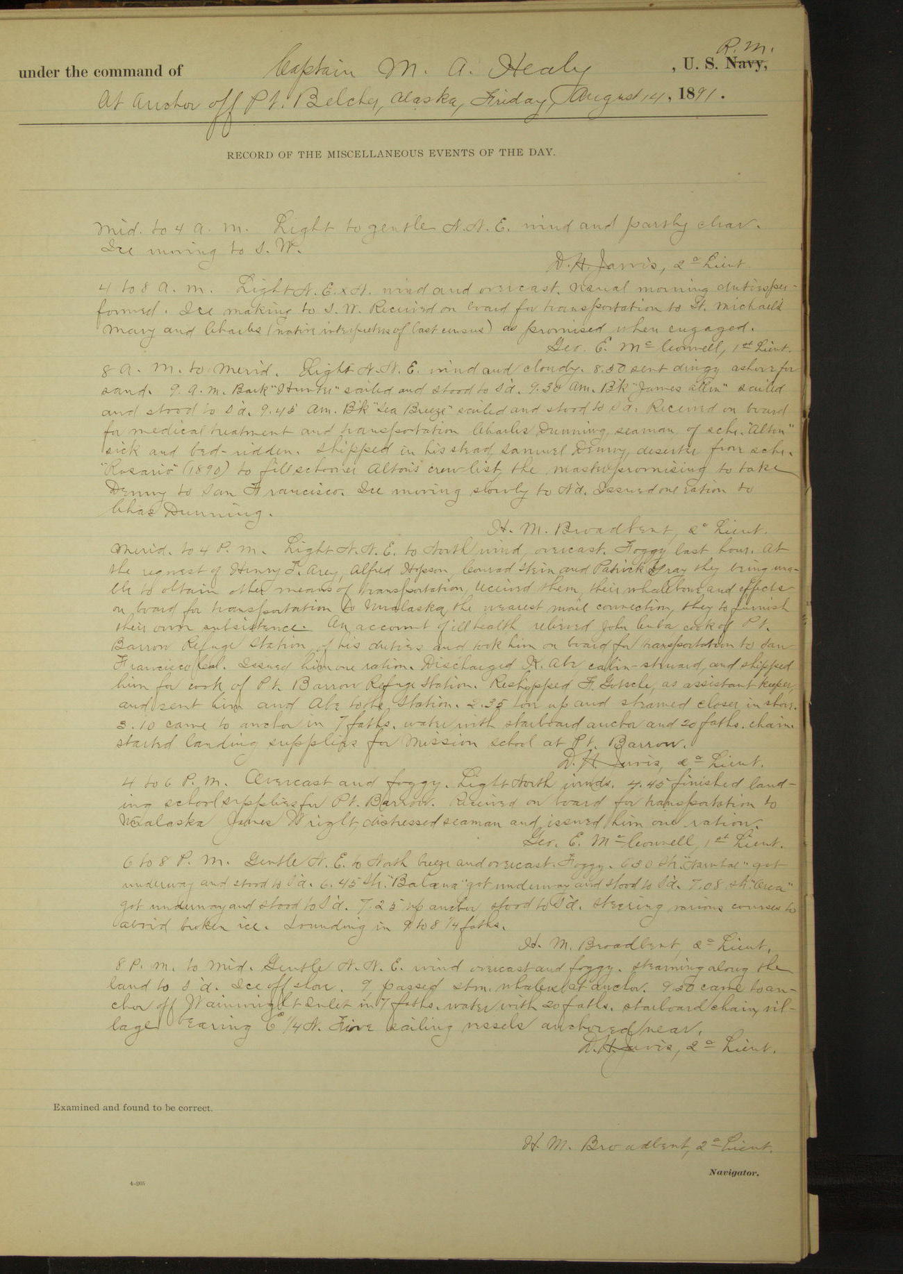
14 August 1891
Off Point Belcher [to Wainwright Inlet]
Lat 70.78, Long -159.80
Sick list: Charles Dunning [to 25th September].
Midnight to 4am:
Ice running to SW.
4am to 8am:
Ice making to SW. Received on board for transportation to St. Michael’s, Mary and Charles (native interpreters of last census) as promised when engaged.
8am to meridian:
8.50: sent dinghy ashore for sand. 9.00: bark “Hunter” sailed and stood to Southward. 9.30: bark “James Allen” sailed and stood to Southward. 9.45: American bark “Sea Breeze” sailed and stood to Southward.
Received on board for medical treatment and transportation Charles Dunning, Seaman of schooner “Alton”, sick and bed-ridden. Shipped in his stead, Samuel Denny, deserter from schooner “Rosario” (1890), to fill schooner “Alton’s” crew list, the master promising to take Denny to San Francisco.
Ice moving slowly to Northward. Issued one ration to Charles Dunning.
Meridian to 4pm:
At the request of Henry T Arey, Alfred Hopson, Conrad Stein and Patrick Gray, they being unable to obtain other means of transportation, received them, their whalebone and effects on board for transportation to Unalaska, the nearest mail connection, they to furnish their own subsistence.
On account of ill health, relieved John Cuba, cook of Point Barrow Refuge Station, of his duties and took him on board for transportation to San Francisco. Issued him one ration.
Discharged K Abe, Cabin Steward, and shipped him for cook of Point Barrow Refuge Station. Reshipped F Gotsche as assistant keeper and sent him and Abe to the station.
2.35: hove up and steamed closer in shore. 3.10: came to anchor, started landing supplies for mission school at Point Barrow.
4pm to 6pm:
4.40: finished landing school supplies for Point Barrow. Received on board for transportation to Unalaska James Wright, distressed Seaman, and issued him one ration.
6pm to 8pm:
6.30: schooner “Narwhal” got underway and stood to Southward. 6.45: schooner “Balaena” got underway and stood to Southward. 7.08: schooner “Orca” got underway and stood to Southward.
7.25: up anchor; stood to Southward. Steering various courses to avoid broken ice.
8pm to midnight:
Steaming along the land to Southward. Ice off shore. 9.00: passed steam whalers at anchor. 9.50: came to anchor off Wainwright Inlet, village bearing E¼N. Five sailing vessels anchored near.
At anchor 21 hours.
Underway 3 hours.
Distance 14 miles.
50874d6109d409075500190f: (http://oldweather.s3.amazonaws.com/ow3/final/USRC Bear/vol069/vol069_141_0.jpg)
50874d6109d4090755001911: (http://oldweather.s3.amazonaws.com/ow3/final/USRC Bear/vol069/vol069_141_1.jpg)
15 August 1891
Off Wainwright Inlet
Lat 70.65, Long -160.08 [Estimate off Wainwright Inlet]
Midnight to 4am:
American bark “Abraham Barker” arrived from Southward and anchored off inlet. Ice moving to Southward.
Meridian to 4pm:
Enlisted K Yasuda as 1st class Boy and rated him Cabin Steward.
4pm to 6pm:
5.35: schooner “Alton” got underway and beat to windward.
50874d6109d4090755001913: (http://oldweather.s3.amazonaws.com/ow3/final/USRC Bear/vol069/vol069_142_0.jpg)
50874d6109d4090755001915: (http://oldweather.s3.amazonaws.com/ow3/final/USRC Bear/vol069/vol069_142_1.jpg)
16 August 1891
Off Wainwright Inlet
Lat 70.65, Long -160.08
Midnight to 4am:
3.30: schooner “Bonanza” sailed and stood to Northward. During watch two barks in sight to Southward, beating to windward.
4am to 8am:
5.25: two barks came to anchor, bearing ExN and SSW. 6.00: bark “Sea Ranger” sailed.
6.45: Lieutenant Jarvis accompanied by Assistant Engineer Falkenstein and Surgeon Call left vessel in the launch on a prospecting expedition.
8am to meridian:
James Wright, distressed Seaman, shipped on board American bark “Abraham Barker” for season.
Meridian to 4pm:
It being improbable that the “Bear” would fall in with the schooner “Rosario”, transferred Robert Ogle, Charles Wattay and Joseph Smith, deserters from that vessel to the bark “Hunter”, Cogan master, to be delivered to the master of the “Rosario” on meeting that vessel [although Rosario is met by Bear on 23rd].
3.40: bark “Hunter” sailed and stood to Northward. 3.45: bark “James Allen” sailed and stood to Northward. 3.50: bark “Abraham Barker” sailed and stood to Northward.
4pm to 6pm:
At 4.40 bark “William Bayliss” sailed and stood to Northward.
6pm to 8pm:
6.20: bark “Sea Ranger” sailed and stood to Northward.
8pm to midnight:
8.45: up anchor and stood SSW. 10.25: launch returned with prospecting party. 10.35: came to anchor.
At anchor 22.10
Under canvas exclusively 1 hour 50 minutes.
Distance 4 miles.
50874d6109d4090755001917: (http://oldweather.s3.amazonaws.com/ow3/final/USRC Bear/vol069/vol069_143_0.jpg)
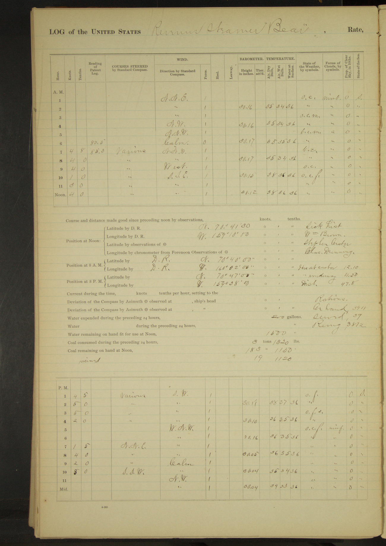
50874d6109d4090755001919: (http://oldweather.s3.amazonaws.com/ow3/final/USRC Bear/vol069/vol069_143_1.jpg)
17 August 1891
Near Wainwright Inlet [& at sea & Point Belcher]
Lat 70.69, Long -160.00 [Estimate NE along shore from 8am bearing]
4am to 8am:
6.00: underway. 7.00: stopped and put Mr. JS Layton, 1st officer of bark “Alice Knowles” on board bark “Abraham Barker” for passage to his vessel.
An unknown steamer was reported to have passed to Northward & Eastward. Her actions being suspicious, at 7.20 ahead & worked North to overtake her. 7.35 entered broken ice.
8am: Lat 70° 40’N, Long 160° 02’W
8am to meridian:
Steering various courses along the land to Northward & Eastward. 10.15: stopped and spoke American steam bark “Balaena” of San Francisco, Smith master. Lieutenant Jarvis went ashore in dinghy on official business. 10.45: Lieutenant Jarvis returned; ahead to Northward & Eastward. Working through heavy drifting ice.
11.00: fog shut in thick. Received 19½ tons coal taken on board from schooner “Jeanie” at Port Clarence for Point Barrow mission school, it not being wanted. Credited same to vessel.
Noon: Lat 70° 41’ 30”N, Long 159° 10’W [locates ship inland]
Meridian to 4pm:
Light SW airs and thick fog with snow. Steaming slowly to NNE through heavy drift ice. 12.30: ice heavy and dense fog stood to SSW. 2.00: spoke steamer “Balaena”. 2.50: spoke bark “Sea Breeze”. 3.30 stopped (clear of ice) and came to anchor. Steamer “Orca” nearby.
4pm to 6pm:
Light WNW airs, overcast and foggy. Broken ice moving to SE. 4.50: bark “Sea Ranger” and schooner “Bonanza” passed to SSW.
Unknown steamer in sight to Northward and working South, made preparations to weigh anchor and speak her.
6pm to 8pm:
7.00: steamer “Balaena” stopped and spoke us. 7.35: up anchor and steamed to Northward along the land towards and unknown brigantine-rigged steamer. Steaming through broken ice.
8pm: Lat 70° 47’N, Long 159° 38’W [locates ship inland]
8pm to midnight:
8.30: stopped and boarded Japanese steamer “Tsuru Maru” of Tokio, Coston master, with yachting party, Mr. Carroll of Carrollton, Maryland, and wife. Stood to SSW to clear water.
9.55: came to anchor. Steamer “Tsuru Maru” anchored nearby. Mr. Carroll and party came on board.
At anchor 12 hours 10 minutes.
Underway 11 hours 50 minutes.
Distance 47.8 miles.
50874d6109d409075500191b: (http://oldweather.s3.amazonaws.com/ow3/final/USRC Bear/vol069/vol069_144_0.jpg)
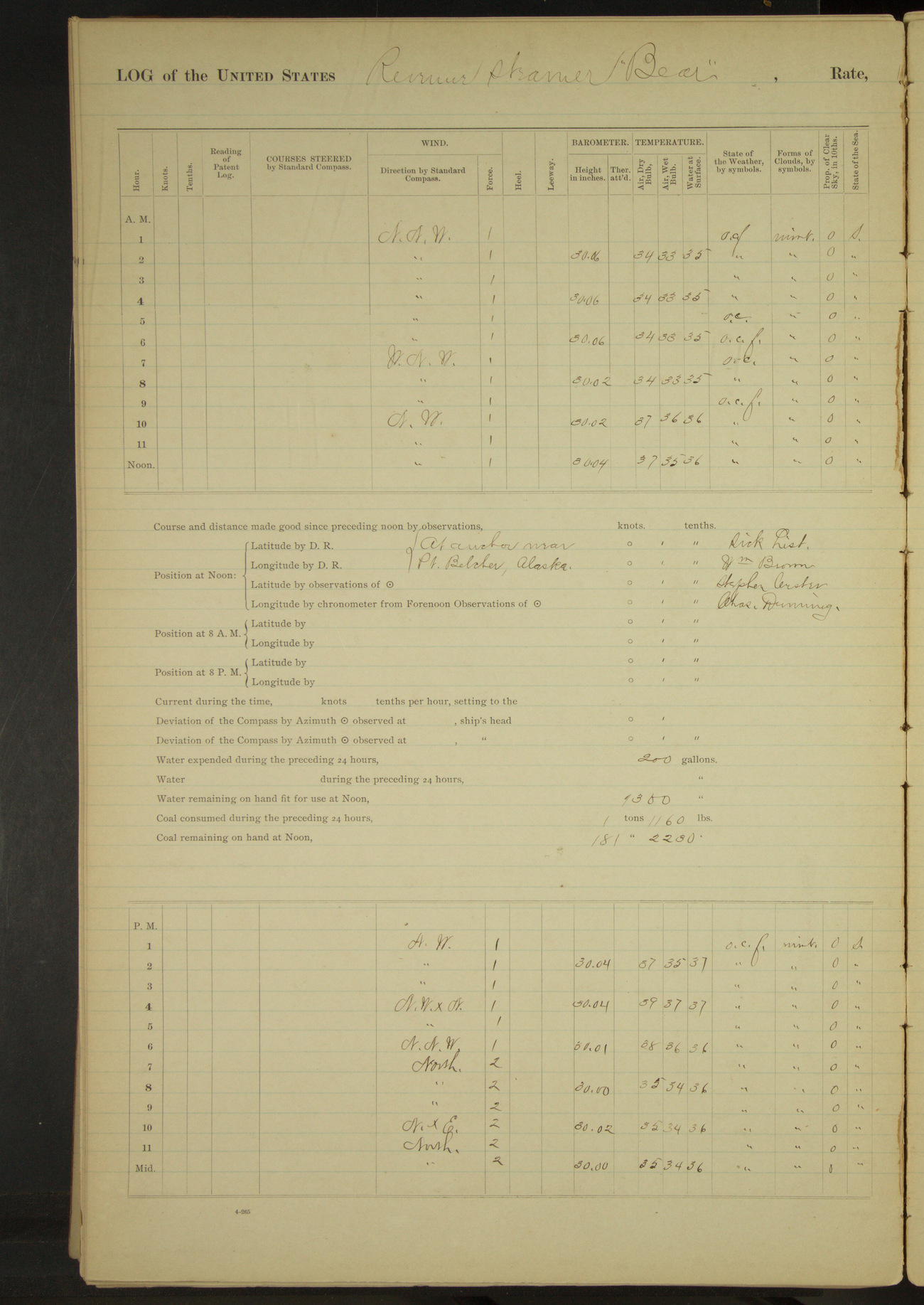
50874d6109d409075500191d: (http://oldweather.s3.amazonaws.com/ow3/final/USRC Bear/vol069/vol069_144_1.jpg)
18 August 1891
Near Point Belcher
Lat 70.77, Long -159.84 [Estimate near Point Belcher]
Midnight to 4am:
Foggy. Broken ice running to Northward.
4am to 8am:
5.00 to 6.00 foggy. Ice moving slowly to Northward.
Meridian to 4pm:
Fog lifting at intervals. Employed making boats’ chafing mats. Schooner “Alton” in sight standing to Southward & Westward. Two barks under sail to Southward.
50874d6109d409075500191f: (http://oldweather.s3.amazonaws.com/ow3/final/USRC Bear/vol069/vol069_145_0.jpg)
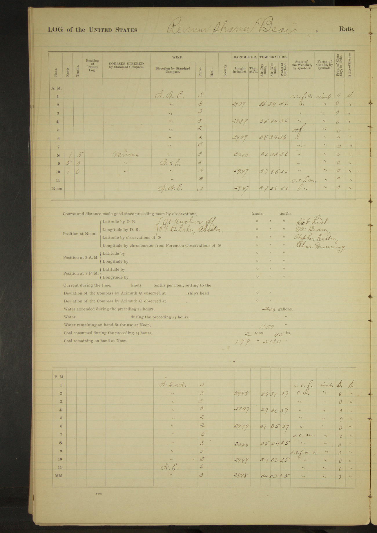
50874d6109d4090755001921: (http://oldweather.s3.amazonaws.com/ow3/final/USRC Bear/vol069/vol069_145_1.jpg)
19 August 1891
Near Point Belcher
Lat 70.79, Long -159.81 [Estimate off Point Belcher]
4am to 8am:
5.30: Japanese steamer “Tsuru Maru” stood to Southward. 7.00: steam whaler stood to Northward. Two barks beating to Northward.
8am to meridian:
8.30: underway and stood NxE½E. 10.20: came to off Point Belcher. Steamers “Orca”, “Narwhal” and “Balaena” anchored near.
11.25: bark “Abraham Barker” arrived from Southward and anchored. Bark “William Bayliss” in sight to Southward until 11.00 when fog shut in close. Point Belcher bearing NE½E, village ExS½S.
Employed renewing [?] seizings of rigging forward where chafed, reseizing ratlines etc.
Meridian to 4pm:
Dense fog first hour. Crew employed as in preceding watch. Surgeon taking measurements of natives.
American bark to Southward beating to windward. Bark “William Bayliss” at anchor nearby when fog lifted. Bark “William Lewis” at anchor to Northward about 10 miles distant.
At anchor 22 hours 10 minutes.
Underway 1 hours 50 minutes.
Distance 7.5 miles.
50874d6109d4090755001923: (http://oldweather.s3.amazonaws.com/ow3/final/USRC Bear/vol069/vol069_146_0.jpg)
50874d6109d4090755001925: (http://oldweather.s3.amazonaws.com/ow3/final/USRC Bear/vol069/vol069_146_1.jpg)
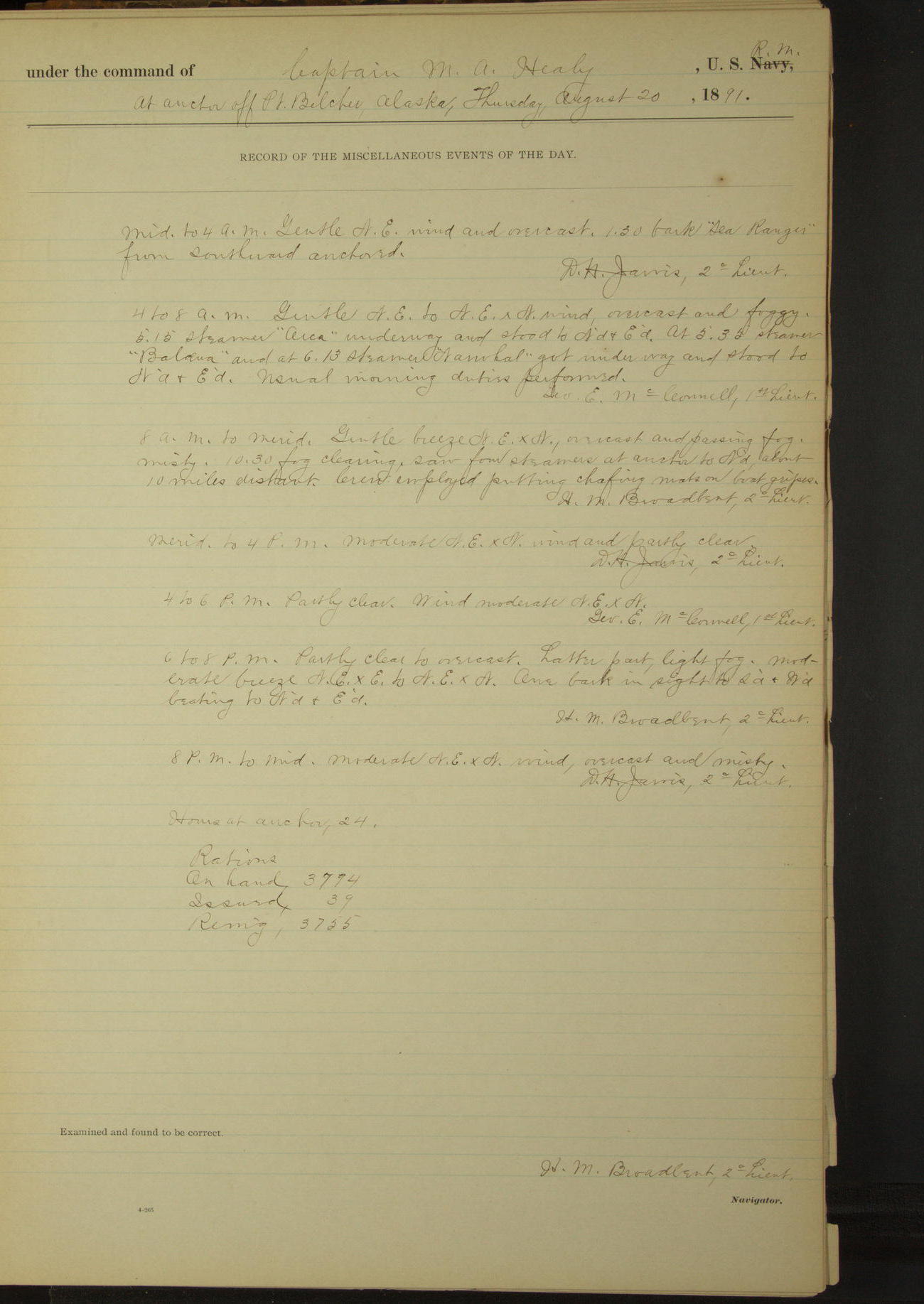
20 August 1891
Off Point Belcher
Lat 70.79, Long -159.81
Midnight to 4am:
1.30: bark “Sea Ranger” from Southward anchored.
4am to 8am:
5.15: steamer “Orca” underway and stood to Northward & Eastward. At 5.35 steamer “Balaena” and at 6.13 steamer “Narwhal” got underway and stood to Northward & Eastward.
8am to meridian:
Overcast and passing fog, misty. 10.30: fog clearing, saw four steamers at anchor to Northward, about 10 miles distant. Crew employed putting chafing mats on boat gripes.
6pm to 8pm:
One bark in sight to Southward & Westward beating to Northward & Eastward.
50874d6109d4090755001927: (http://oldweather.s3.amazonaws.com/ow3/final/USRC Bear/vol069/vol069_147_0.jpg)
50874d6109d4090755001929: (http://oldweather.s3.amazonaws.com/ow3/final/USRC Bear/vol069/vol069_147_1.jpg)
21 August 1891
Off Point Belcher
Lat 70.79, Long -159.81
Midnight to 4am:
Overcast and misty. Light snow squalls. Moderate NExN winds. Ice making in rigging [air temperature 31°F and not rising above 34°F during the day].
4am to 8am:
Moderate NExN wind, overcast, foggy and misty with light snow. One bark in sight during watch to Southward & Westward, standing to Westward on starboard tack. Freezing weather.
8am to meridian:
At 12.00 bark “John and Winthrop” from Southward worked by.
Meridian to 4pm:
12.55: schooner “Alton” weighed and stood to Northward & Eastward. 2.40: bark “Sea Ranger” came to anchor nearby. 3.48: bark “John and Winthrop” came to anchor about a mile distant to Northward.
4pm to 6pm:
5.30: bark “Abraham Barker” and at 6.00 bark “William Bayliss” weighed and stood to Southward & Westward.
50874d6109d409075500192b: (http://oldweather.s3.amazonaws.com/ow3/final/USRC Bear/vol069/vol069_148_0.jpg)
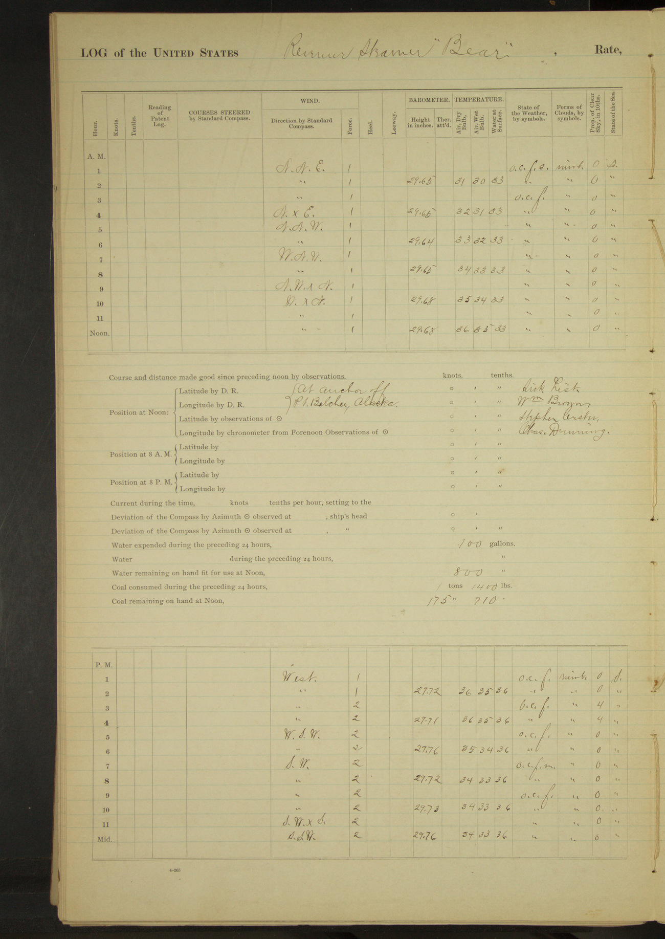
50874d6109d409075500192d: (http://oldweather.s3.amazonaws.com/ow3/final/USRC Bear/vol069/vol069_148_1.jpg)
22 August 1891
Off Point Belcher
Lat 70.79, Long -159.81
Midnight to 4am:
Snow first two hours. Latter part dense fog. Freezing weather.
4am to 8am:
Thick fog. Ice making in rigging.
8am to meridian:
9.00: bark “John and Winthrop” anchored nearer inshore.
Meridian to 4pm:
Dense fog. 10.30: bark “Wanderer” came to anchor near by. 3.00: schooner “Alton” anchored near by. 3.30: bark “Sea Ranger” weighed and stood to Southward. Broken ice drifting slowly to Eastward.
6pm to 8pm:
Foggy and misty. Broken ice moving to Eastward.
50874d6109d409075500192f: (http://oldweather.s3.amazonaws.com/ow3/final/USRC Bear/vol069/vol069_149_0.jpg)
50874d6109d4090755001931: (http://oldweather.s3.amazonaws.com/ow3/final/USRC Bear/vol069/vol069_149_1.jpg)
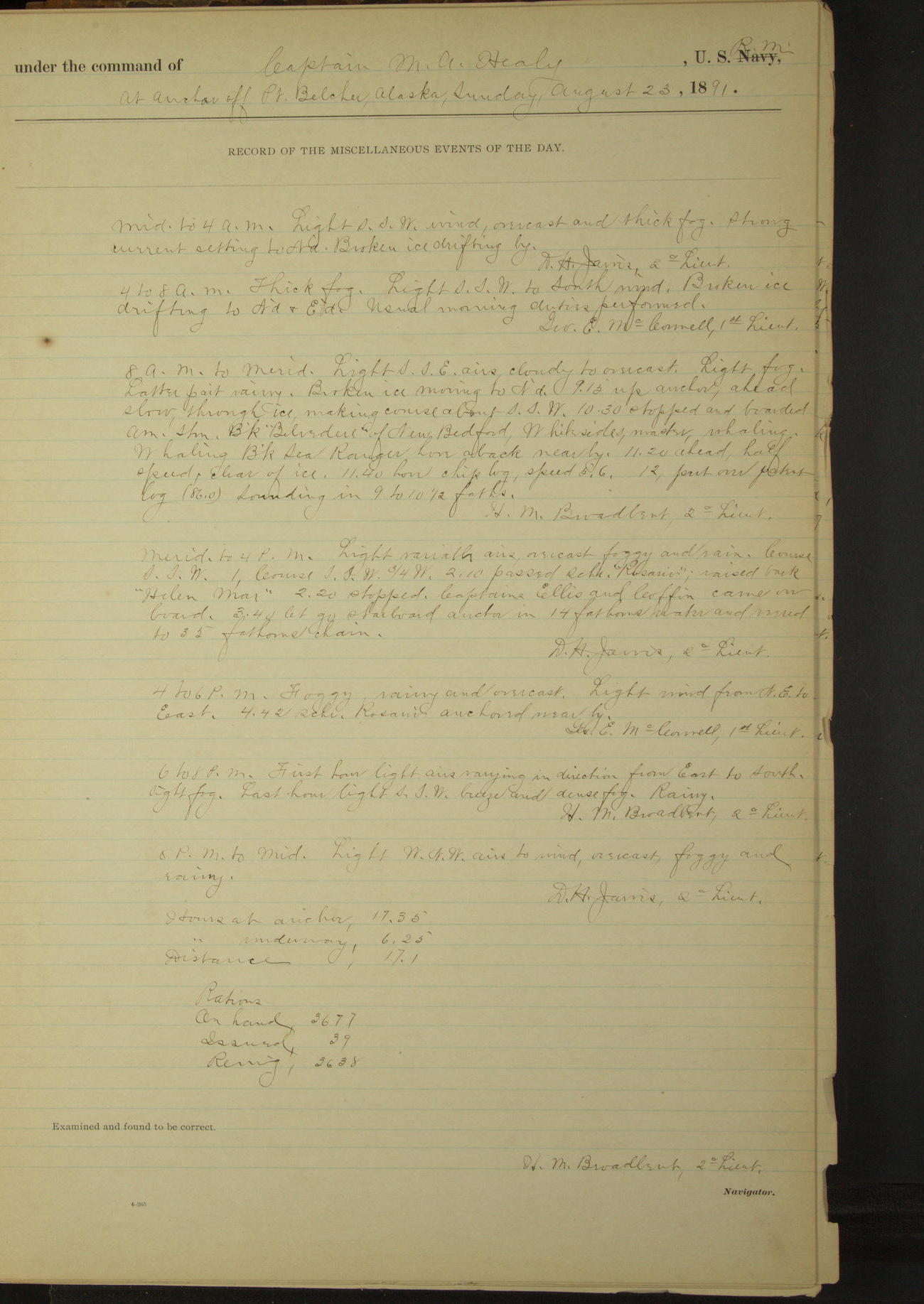
23 August 1891
Off Point Belcher [to Off Wainwright Inlet]
Lat 70.70, Long -159.97
Midnight to 4am:
Thick fog. Strong current setting to Northward. Broken ice drifting by.
4am to 8am:
Thick fog. Broken ice drifting to Northward & Eastward.
8am to meridian:
Light fog. Broken ice moving to Northward. 9.15: up anchor, ahead slow through ice. 10.30: stopped and boarded American steam bark “Belvedere” of New Bedford, Whiteside master, whaling.
Whaling bark “Sea Ranger” hove aback near by. 11.20 ahead half speed, clear of ice.
Meridian to 4pm:
Foggy and rain. 2.10: passed schooner “Rosario”, raised bark “Helen Mar”. 2.20: stopped. Captains Ellis [Helen Mar] and Coffin [Rosario] came on board. 3.40 let go starboard anchor.
4pm to 6pm:
Foggy [& for rest of day]. 4.42: schooner “Rosario” anchored near by.
At anchor 17 hours 35 minutes.
Underway 6 hours 25 minutes.
Distance 17.1 miles.
50874d6109d4090755001933: (http://oldweather.s3.amazonaws.com/ow3/final/USRC Bear/vol069/vol069_150_0.jpg)
50874d6109d4090755001935: (http://oldweather.s3.amazonaws.com/ow3/final/USRC Bear/vol069/vol069_150_1.jpg)
24 August 1891
Off Wainwright Inlet [& at sea]
Lat 70.58, Long -161.55
Midnight to 4am:
Commences and until 1.30am, foggy and rainy, then thick snow squalls. 1.30: sighted a bark standing to Southward & Westward.
4am to 8am:
Light NW breeze, overcast and thick fog. Snow first two hours. 5.45 fog clearing, saw a bark bore aback about 2 miles to Southward.
6.40: bark “Helen Mar” weighed and stood to Southward. 7.00: schooner “Rosario” weighed and stood to Southward.
7.00: underway. 7.20: entered broken ice. Steering various courses to avoid broken ice. 7.45: fog shut in thick. Freezing weather, ice making in rigging.
8am: Lat 70° 36’N, Long 160° 35’W
8am to meridian:
Light NW breeze, overcast, foggy to partly clear. Course SW through scattered ice. 11.00: clear of ice, raised vessel ahead in fog.
Meridian to 4am:
First part foggy, latter part overcast and partly clear. 1.27: hauled up WSW to examine character of sails in sight.
6pm to 8pm:
Partly clear and foggy. 7.00: raised land ahead.
8pm: Lat 70° 52’ 30”N, Long 162° 50’ 50”W
8pm to midnight:
8.07: Point Lay bore ExS. 10.35: sighted a schooner in shore and stood in for her. 11.00: hove to and boarded American schooner “John McCulloch”, Wagner master, building material for Point Barrow mission school.
11.45: boat returned, stood SSW¼W. Schooner “McCulloch” standing on same course.
At anchor 7 hours 10 minutes.
Underway 16 hours 50 minutes.
Under steam & canvas 16 hours 40 minutes.
Under steam exclusively 10 minutes.
Distance under steam & canvas 99 miles
Distance under steam exclusively 1 mile.
Total distance 100 miles.
50874d6109d4090755001937: (http://oldweather.s3.amazonaws.com/ow3/final/USRC Bear/vol069/vol069_151_0.jpg)
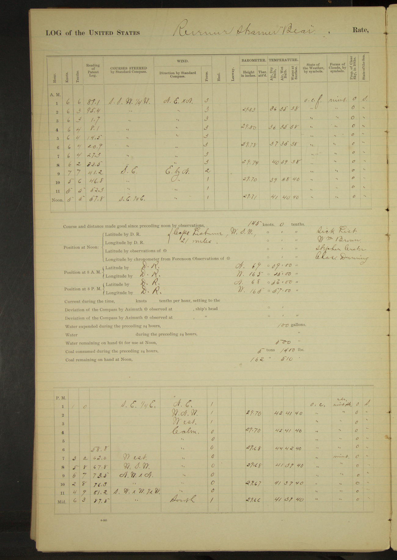
50874d6109d4090755001939: (http://oldweather.s3.amazonaws.com/ow3/final/USRC Bear/vol069/vol069_151_1.jpg)
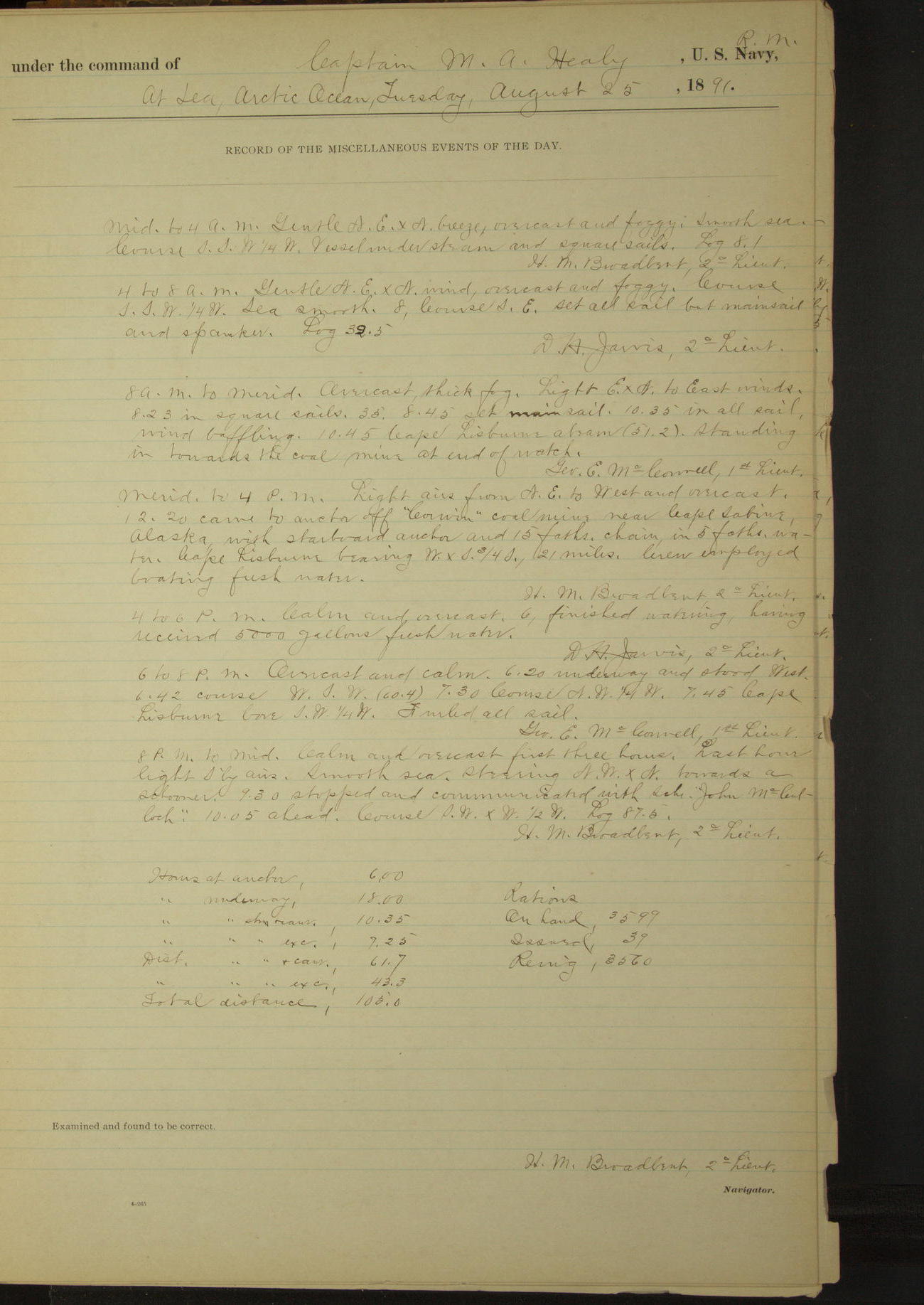
25 August 1891
At sea, Arctic Ocean [& off Corwin Mine]
Lat 68.87, Long -165.25 [Estimate from noon bearings]
8am: Lat 69° 09’N, Long 165° 25’W
8am to meridian:
10.45: Cape Lisburne abeam. Standing in towards the coal mines at end of watch.
Noon: Cape Lisburne bearing WSW, 21 miles.
Meridian to 4pm:
12.20: came to anchor off “Corwin” coal mine near Cape Sabine. Cape Lisburne bearing WxS¾S, 21 miles. Crew employed boating fresh water.
4pm to 6pm:
6.00: finished watering, having received 5000 gallons fresh water.
6pm to 8pm:
6.20: underway. 7.45: Cape Lisburne bore SW¼W.
8pm: Lat 68° 56’N, Long 165° 57’W
8pm to midnight:
Steering towards a schooner. 9.30: stopped and communicated with schooner “John McCulloch”. 10.05: ahead.
At anchor 6 hours.
Underway 18 hours.
Under steam & canvas 10 hours 35 minutes.
Under steam exclusively 7 hours 25 minutes.
Distance under steam & canvas 61.7 miles
Distance under steam exclusively 43.3 miles.
Total distance 105 miles.
50874d6109d409075500193b: (http://oldweather.s3.amazonaws.com/ow3/final/USRC Bear/vol069/vol069_152_0.jpg)
50874d6109d409075500193d: (http://oldweather.s3.amazonaws.com/ow3/final/USRC Bear/vol069/vol069_152_1.jpg)
26 August 1891
At sea, Arctic Ocean
Lat 68.30, Long -167.58
Midnight to 4am:
3.40: Cape Lisburne abeam (12 miles).
4am to 8am:
6.25: Cape Lisburne NExN.
8am: Lat 68° 32’N, Long 167° 07’W
8pm: Lat 67° 23’N, Long 168° 27’W
Under steam & canvas 8 hours 50 minutes.
Under steam exclusively 15 hours 10 minutes.
Distance under steam & canvas 54.7 miles.
Distance under steam exclusively 91.6 miles.
Total distance 146.3 miles.
50874d6109d409075500193f: (http://oldweather.s3.amazonaws.com/ow3/final/USRC Bear/vol069/vol069_153_0.jpg)
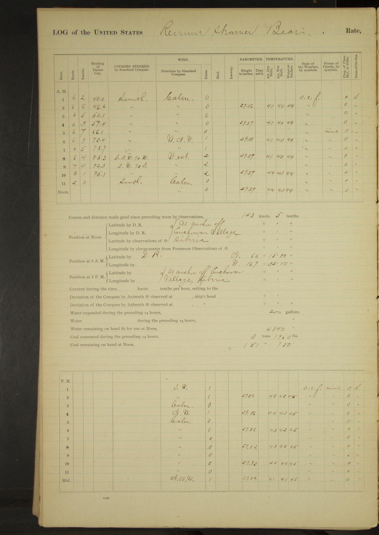
50874d6109d4090755001941: (http://oldweather.s3.amazonaws.com/ow3/final/USRC Bear/vol069/vol069_153_1.jpg)
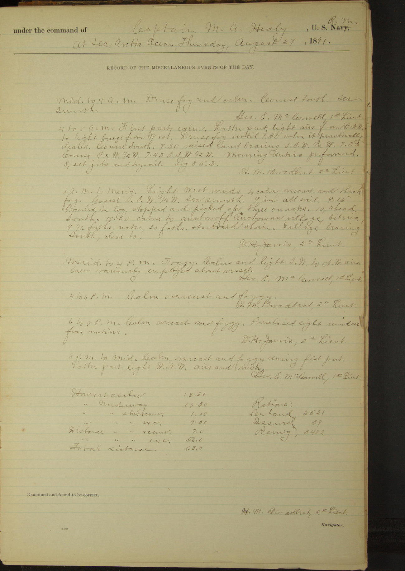
27 August 1891
At sea, Arctic Ocean
Lat 66.30, Long -170.28 [Estimate off Enchowaw]
4am to 8am:
Dense fog until 7.30 when it practically cleared. 7.30: raised land bearing SSW½W.
8am: Lat 66° 15’N, Long 169° 32’W
8am to meridian:
Overcast and thick fog [foggy rest of the day]. 9.15: stopped and picked up three oumiaks. 10.00: ahead. 10.30: came to anchor off Enchowaw [Inchoun] village, Siberia. Village bearing South, close to.
6pm to 8pm:
Purchased eight reindeer from natives.
At anchor 13 hours 30 minutes.
Underway 10 hours 30 minutes.
Under steam & canvas 1 hour.
Under steam exclusively 9 hours 30 minutes.
Distance under steam & canvas 7 miles.
Distance under steam exclusively 56 miles.
Total distance 63 miles.
[NOAA article about the transfer of reindeer from Siberia to Alaska]
50874d6109d4090755001943: (http://oldweather.s3.amazonaws.com/ow3/final/USRC Bear/vol069/vol069_154_0.jpg)
50874d6109d4090755001945: (http://oldweather.s3.amazonaws.com/ow3/final/USRC Bear/vol069/vol069_154_1.jpg)
28 August 1891
Off Enchowaw village
Lat 66.30, Long -170.28
4am to 8am:
6.30: Lieutenant Jarvis left vessel in launch to bring on board reindeer purchased yesterday.
8am to meridian:
Employed preparing vessel to receive reindeer on board and obtaining food grasses for reindeer.
Meridian to 4pm:
1.30: Lieutenant Jarvis returned in launch with four of the reindeer purchased yesterday. Hoisted them on board, secured boats, cleared up decks etc. Carpenter employed building stalls for reindeer on main deck. The four reindeer were taken on board as an experiment, more could have been purchased if desired.
50874d6109d4090755001947: (http://oldweather.s3.amazonaws.com/ow3/final/USRC Bear/vol069/vol069_155_0.jpg)
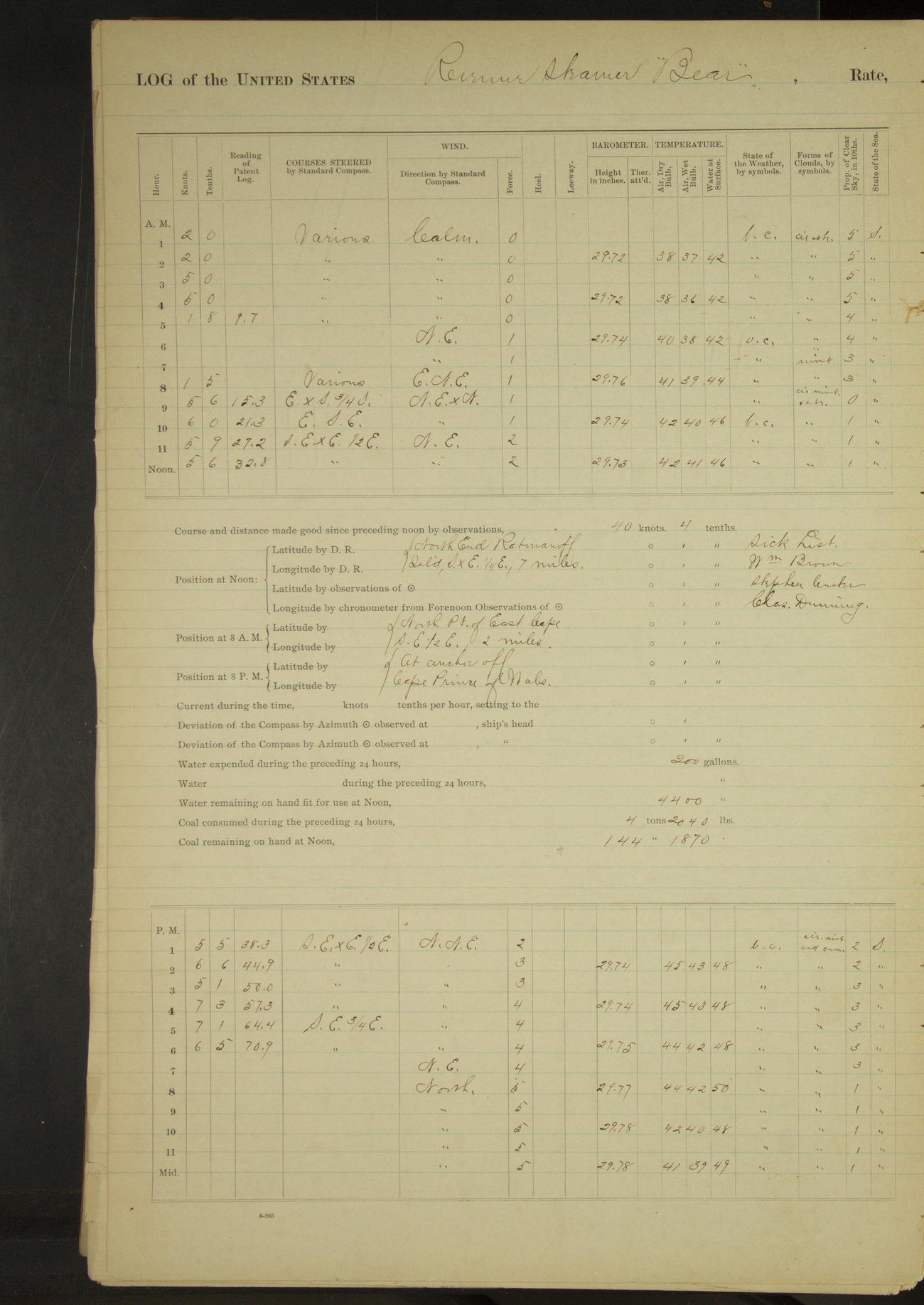
50874d6109d4090755001949: (http://oldweather.s3.amazonaws.com/ow3/final/USRC Bear/vol069/vol069_155_1.jpg)
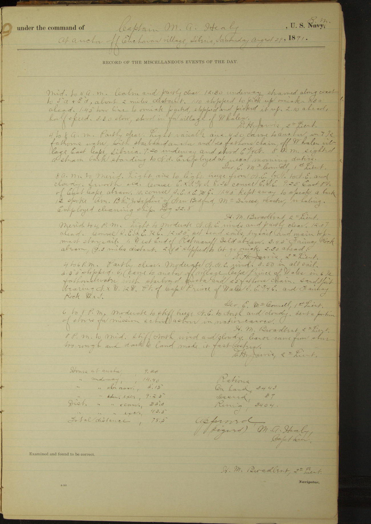
29 August 1891
Off Enchowaw village [to Whalen to Cape Prince of Wales]
Lat 65.94, Long -169.05 [Estimate from noon bearing]
Midnight to 4am:
12.30: underway, steamed along coast to Southward & Eastward about 2 miles distant. 1.10: stopped to pick up umiak. 1.30: ahead.
1.45: tow line to umiak parted, stopped and picked it up. 2.10: ahead. 3.30: stood in for village of Whalen [Uelen].
4am to 8am:
4.30: came to anchor off Whalen village, East Cape, Siberia. 7.20: underway. 8.00: sighted a steam bark standing to Northward.
8am: North point of East Cape SE½E, 2 miles.
8am to meridian:
9.25: East Point of East Cape abeam. 11.45: kept away to speak a bark. 12.00: spoke American bark “Josephine” of New Bedford, McInnes master, whaling.
Noon: North end Ratmanoff Island SxE¼E, 7 miles.
Meridian to 4pm:
12.07: ahead. 1.00: West end of Ratmanoff Island abeam. 3.45: Fairway Rock abeam, 9.3 miles distant. 2.15: stopped to let go umiak. 2.30: ahead.
4pm to 6pm:
5.55: stopped. 6.00: came to anchor off village Cape Prince of Wales. Sand spit bearing NxW½W, point of Cape Prince of Wales SE¾E and Fairway Rock WxS.
6pm to 8pm:
Sent a portion of stores for mission school ashore in native canoes.
8pm to midnight:
Canoe came from shore, too rough and dark to land, made it fast astern.
At anchor 9 hours 20 minutes.
Underway 14 hours 40 minutes.
Under steam & canvas 5 hours 15 minutes.
Under steam exclusively 9 hours 25 minutes.
Distance under steam & canvas 35 miles.
Distance under steam exclusively 43.5 miles.
Total distance 78.5 miles.
50874d6109d409075500194b: (http://oldweather.s3.amazonaws.com/ow3/final/USRC Bear/vol069/vol069_156_0.jpg)
50874d6109d409075500194d: (http://oldweather.s3.amazonaws.com/ow3/final/USRC Bear/vol069/vol069_156_1.jpg)
30 August 1891
Off Cape Prince of Wales
Lat 65.37, Long -168.10 [Estimate from noon bearing]
Midnight to 4am:
Canoe and crew still on board.
4am to 8am:
Crew assisted by natives landing stores for mission school. Mary and Charles (interpreters) left vessel.
8am to meridian:
9.20: underway.
Noon: King’s Island SSE, 25 miles.
Meridian to 4pm:
At 4.00 East point King’s Island abeam, distant 2 miles.
4pm to 6pm:
4.20: East point of King’s Island W½N, hauled up for anchorage under lee of King’s Island and at 4.25 came to.
6pm to 8pm:
7.20: underway.
8pm to midnight:
At 10.00 King’s Island (East point) bore NW.
At anchor 12 hours 15 minutes.
Underway 11 hours 45 minutes.
Under canvas exclusively 11 hours 45 minutes.
Distance under canvas exclusively 70.2 miles.
50874d6109d409075500194f: (http://oldweather.s3.amazonaws.com/ow3/final/USRC Bear/vol069/vol069_157_0.jpg)
50874d6109d4090755001951: (http://oldweather.s3.amazonaws.com/ow3/final/USRC Bear/vol069/vol069_157_1.jpg)
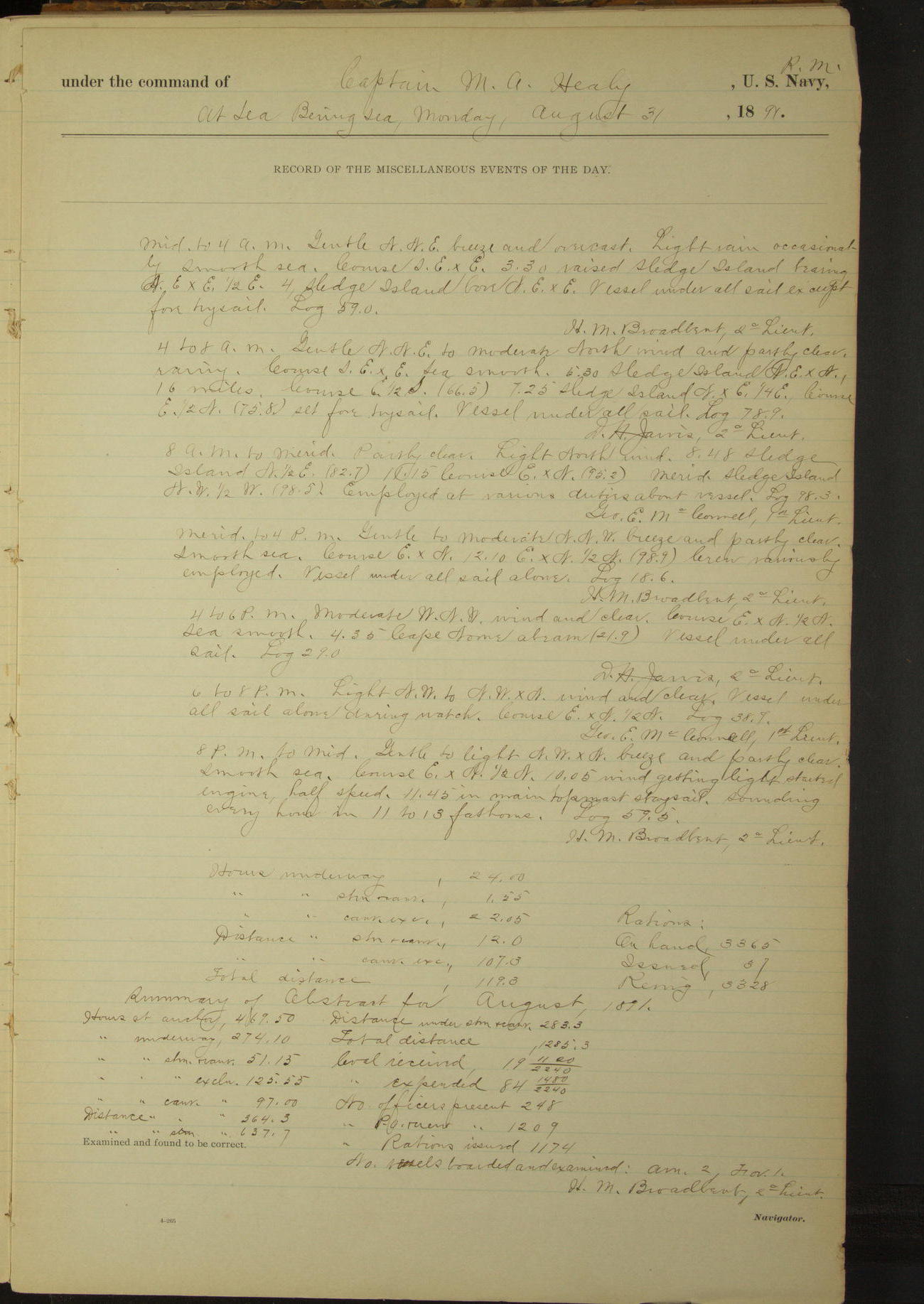
31 August 1891
At sea, Bering Sea
Lat 64.10, Long -165.67
Midnight to 4am:
3.30: raised Sledge Island bearing NExE½E.
4am to 8am:
5.30: Sledge Island NexN, 16 miles.
8am: Sledge Island N½E, 15 miles.
4pm to 6pm:
4.35: Cape Nome abeam.
8pm: Lat 64° 00’N, Long 164° 36’W
Under steam & canvas 1 hour 55 minutes.
Hours under canvas exclusively 22 hours 5 minutes.
Distance under steam & canvas 12 miles.
Distance under canvas exclusively 107.3 miles.
Total distance 119.3 miles.
Summary of abstract for August
At anchor 469 hours 50 minutes.
Underway 274 hours 10 minutes.
Under steam & canvas 51 hours 15 minutes.
Under steam exclusively 125 hours 55
Under canvas exclusively 97 hours.
Distance under canvas exclusively 364.3 miles.
Distance under steam exclusively 637.7 miles.
Distance under steam & canvas 283.3 miles .
Total distance 1285.3 miles.
Coal received 19 1120/2240 tons.
Coal expended 84 1480/2240 tons.
Number Officers present 248.
Number Petty Officers & crew present 1209.
Number rations issued 1174.
Number vessels boarded and examined American 2, foreign 1.
LOGS FOR SEPTEMBER 1891
50874d6109d4090755001953: (http://oldweather.s3.amazonaws.com/ow3/final/USRC Bear/vol069/vol069_158_0.jpg)
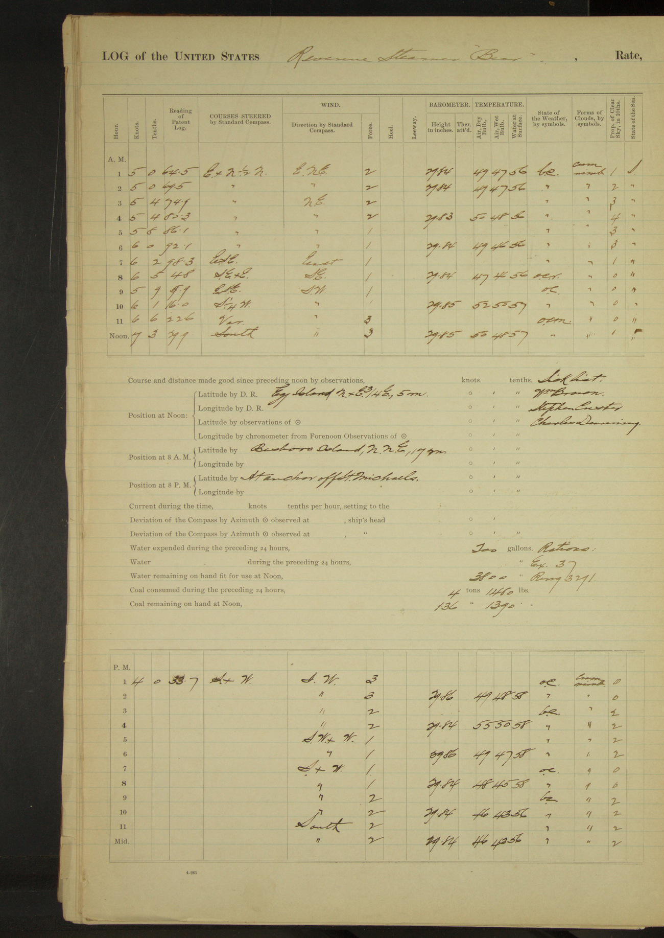
50874d6109d4090755001955: (http://oldweather.s3.amazonaws.com/ow3/final/USRC Bear/vol069/vol069_158_1.jpg)
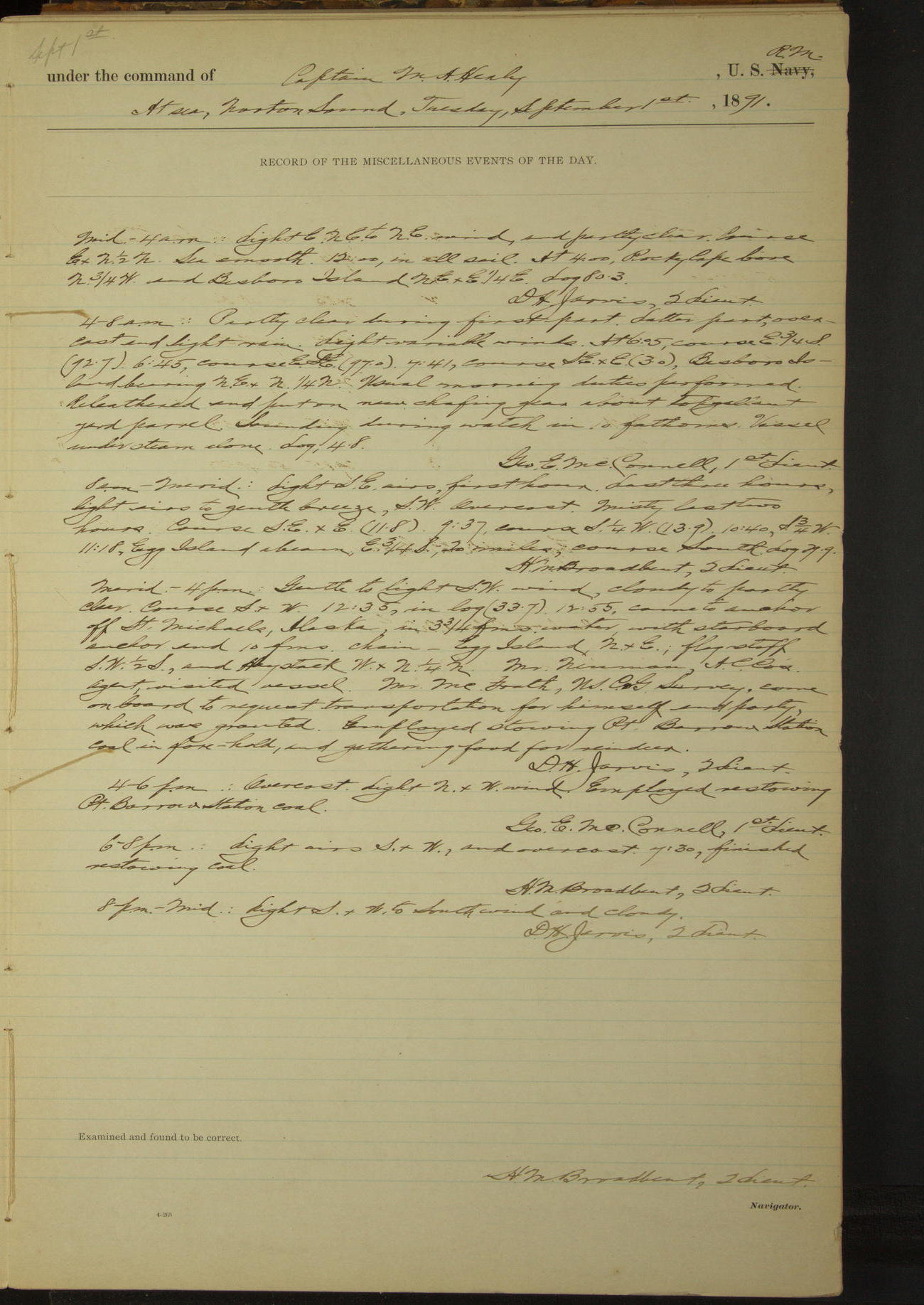
1 September 1891
At sea, Norton Sound [& at St. Michaels]
Lat 63.55, Long -161.87 [Estimate from noon bearings]
Midnight to 4am:
At 4.00 Rocky Cape [Rocky Point] bore N¾W and Besboro Island NExE¼E.
4am to 8am:
Re-leathered and put on new chafing gear about topgallant yard parrel.
8am: Besboro Island NNE, 17 miles.
Noon: Egg Island NxE¾E, 5 miles.
Meridian to 4pm:
12.55: came to anchor off St. Michaels. Egg Island NxE, flagstaff SW½S. Mr. Newman, AC Co’s agent, visited vessel.
Mr. McGrath, USCG Survey, came on board to request transportation for himself and party, which was granted.
Employed stowing Point Barrow station coal in fore-hold, and gathering food for reindeer.
4pm to 6pm:
Employed restowing Point Barrow station coal.
6pm to 8pm:
7.30: finished restowing coal.
50874d6109d4090755001957: (http://oldweather.s3.amazonaws.com/ow3/final/USRC Bear/vol069/vol069_159_0.jpg)
50874d6109d4090755001959: (http://oldweather.s3.amazonaws.com/ow3/final/USRC Bear/vol069/vol069_159_1.jpg)
2 September 1891
Off St. Michaels [to Egg Island]
Lat 63.57, Long -161.81 [Estimate from noon bearings]
4am to 8am:
6.25: sent second and third cutters ashore to bring on board the effects of JE McGrath, USCG Survey, and party.
[There are two entries for 8am to meridian; the first one has ‘error’ written next to it and is a copy of the previous day’s entry]
8am to meridian:
9.00: second and third cutters returned with lighter, proceeded to discharge her. Shore boat came off with part of McGrath’s party’s outfits.
Received on board for transportation: NE Taggart and James Chaplyn, two destitute miners; also the following persons belonging to McGrath’s party: William Dirkes, CF Hagland, RE Carson, TH Beaumont, John Lines and James McLarty [see also 21st September].
WA De Hass, of Frank Leslie Exploring Expedition, came on board for transportation to Unalaska. [From Taylor & Francis Online: Frank Leslie’s Illustrated Newspaper had sent a team to explore Alaska and produce articles]
At 10.00 wind shifted to North in a moderate squall and at 10.15 got underway and steamed for a lee under Egg Island. Issued eight rations to party on board.
Noon: Egg Island NxE½E, 3 miles.
Meridian to 4pm:
Overcast, rainy and squally. Stiff North wind and large sea. At 12.45 came to anchor under Egg Island. East end of island bearing North and West end NNW.
50874d6109d409075500195b: (http://oldweather.s3.amazonaws.com/ow3/final/USRC Bear/vol069/vol069_160_0.jpg)
50874d6109d409075500195d: (http://oldweather.s3.amazonaws.com/ow3/final/USRC Bear/vol069/vol069_160_1.jpg)
3 September 1891
Under Egg Island [to St. Michaels & at sea]
Lat 63.50, Long -161.93
4am to 8am:
At 4.00 hauled lighter alongside and discharged remainder of McGrath’s party’s stores. Dropped lighter and boat astern again.
8am to meridian:
8.00: underway. 9.50: came to anchor, St. Michaels church bearing SW, 3 miles. Employed unbending mainsail and bending a heavier one.
Meridian to 4pm:
1.30: sent second and third cutters, in charge of Lieutenants Broadbent and Jarvis, to tow lighter to wharf at St. Michaels. JE McGrath and his assistant, WW Davis, USCG Survey, came on board. Hoisted and secured their boats on deck.
4pm to 6pm:
4.30: second and third cutters returned, having towed lighter ashore and brought off flour and tea purchased by Captain Healy and officers of vessel to distribute to natives of King’s Island, who are reported to be in danger of starving. Brought on board a supply of moss for food for reindeer.
6pm to 8pm:
7.15: underway.
8pm to midnight:
8.40: Egg Island abeam ENE, distant 4.5 miles. 10.54: Stuart Island bore South, distant 6.8 miles.
50874d6109d409075500195f: (http://oldweather.s3.amazonaws.com/ow3/final/USRC Bear/vol069/vol069_161_0.jpg)
50874d6109d4090755001961: (http://oldweather.s3.amazonaws.com/ow3/final/USRC Bear/vol069/vol069_161_1.jpg)
4 September 1891
At sea, Norton Sound
Lat 64.45, Long -166.03 [Estimate from noon bearings]
8am to meridian:
9.15: Cape Nome abeam. 9.50: raised Sledge Island bearing WxS.
Noon: Sledge Island W¼N, 5 miles.
8pm: Lat 64° 37’N, Long 167° 05’W
50874d6109d4090755001963: (http://oldweather.s3.amazonaws.com/ow3/final/USRC Bear/vol069/vol069_162_0.jpg)
50874d6109d4090755001965: (http://oldweather.s3.amazonaws.com/ow3/final/USRC Bear/vol069/vol069_162_1.jpg)
5 September 1891
At sea, Bering Sea [& Port Clarence]
Lat 65.05, Long -168.00
Midnight to 4am:
3.20: sighted land bearing SWxW.
4am to 8am:
Moderate to stiff South breeze. 6.00: King’s Island bore South, distant about 5 miles; fog shut in. Vessel hove to.
8am: Lat 65° 08’N, Long 168° 05’W
8am to meridian:
8.30: started engine half speed. Course SSE. 10.00: made King’s Island bearing SSE.
Meridian to 4pm:
1.20: NW point of King’s Island SW¼S.
4pm to 6pm:
5.15: rounded spit at Port Clarence. 5.30: came to anchor, end of spit bearing WxN¼N, distant about ½ mile.
50874d6109d4090755001967: (http://oldweather.s3.amazonaws.com/ow3/final/USRC Bear/vol069/vol069_163_0.jpg)
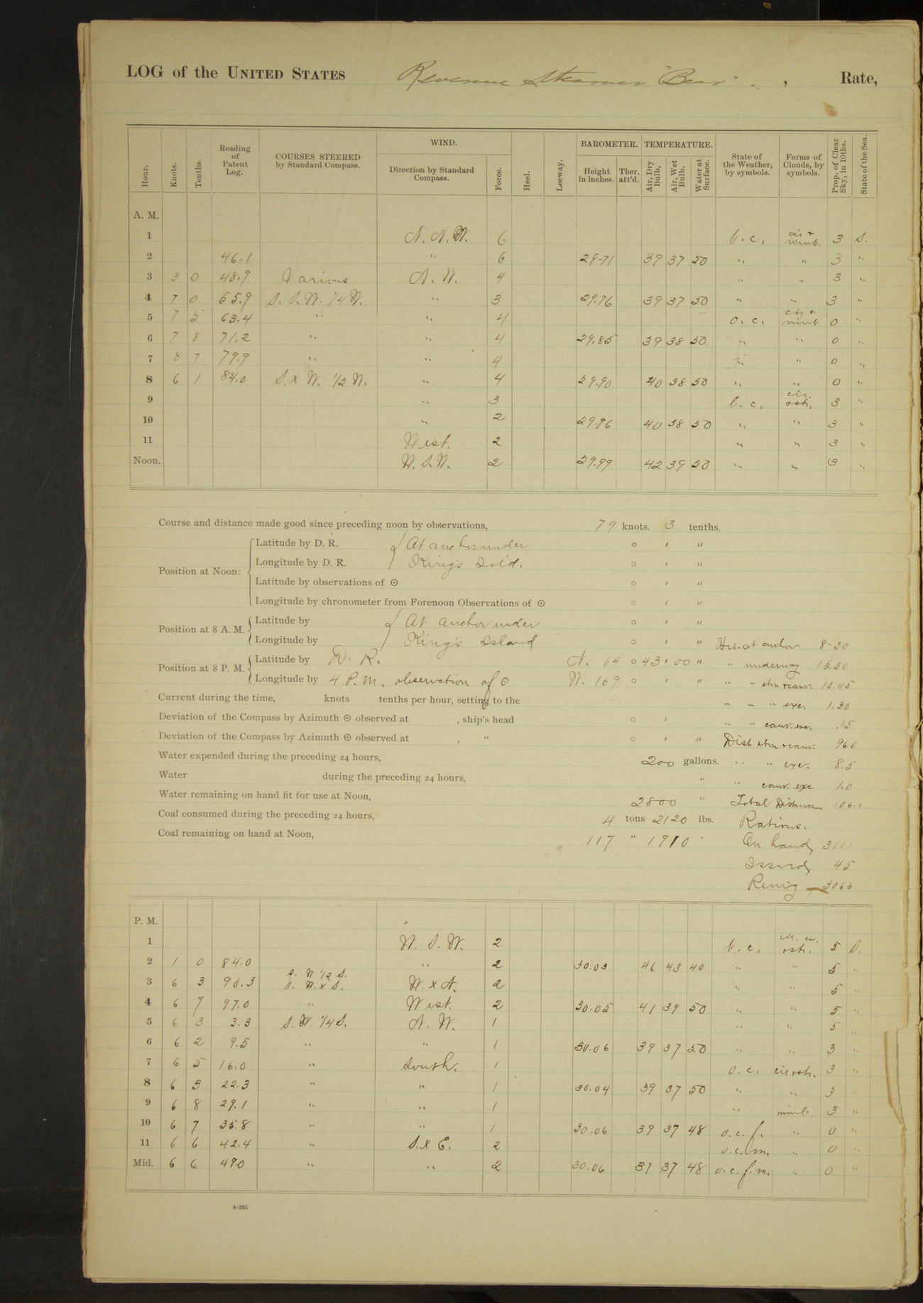
50874d6109d4090755001969: (http://oldweather.s3.amazonaws.com/ow3/final/USRC Bear/vol069/vol069_163_1.jpg)
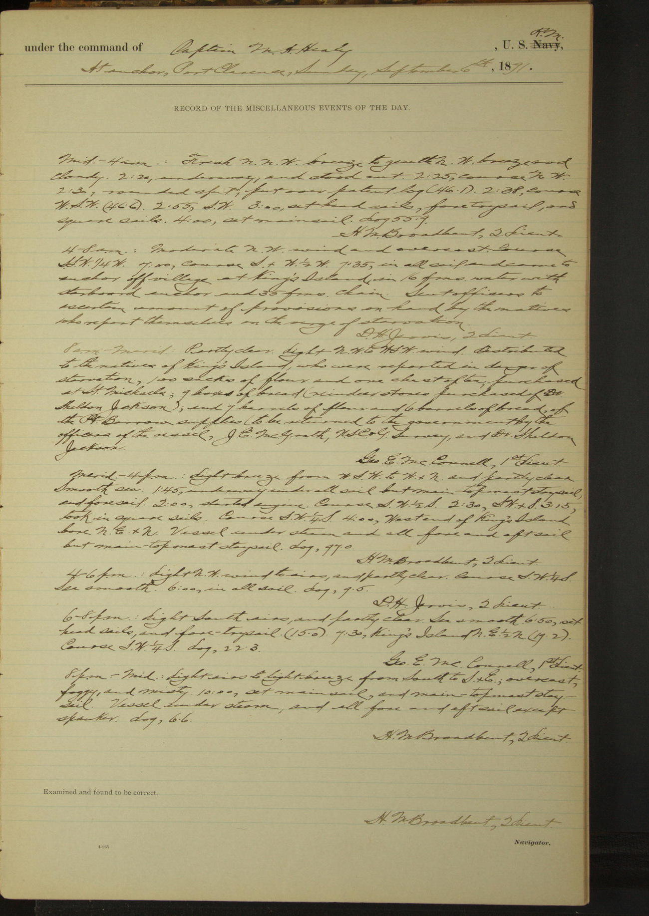
6 September 1891
Port Clarence [to King’s Island & at sea]
Lat 64.95, Long -168.06 [Estimate off Ukivok]
Midnight to 4am:
2.20: underway. 2.30: rounded spit.
4am to 8am:
7.35: came to anchor off village [Ukivok] at King’s Island. Sent officers to ascertain amount of provisions on hand by the natives who report themselves on the verge of starvation.
8am to meridian:
Distributed to the natives of King’s Island, who were reported in danger of starvation, 100 sacks of flour and one chest of tea, purchased at St. Michaels; 9 boxes of bread (reindeer stores purchased of Dr. Sheldon Jackson); and 7 barrels of flour and 6 barrels of bread, of the Point Barrow supplies (to be returned to the Government by the officers of the vessel, JE McGrath, USCG Survey, and Dr. Sheldon Jackson).
Meridian to 4pm:
1.45: underway. 4.00: West end of King’s Island bore NExN.
6pm to 8pm:
7.30: King’s Island NE½N.
At anchor 8 hours 30 minutes.
Underway 15 hours 30 minutes.
Under steam & canvas 13 hours 45 minutes.
Under steam exclusively 1 hour 30 minutes.
Hours under canvas exclusively 15 minutes.
Distance under steam & canvas 96.6 miles.
Distance under steam exclusively 8.5 miles.
Distance under canvas exclusively 1 mile.
Total distance 106.1miles.
50874d6109d409075500196b: (http://oldweather.s3.amazonaws.com/ow3/final/USRC Bear/vol069/vol069_164_0.jpg)
50874d6109d409075500196d: (http://oldweather.s3.amazonaws.com/ow3/final/USRC Bear/vol069/vol069_164_1.jpg)
7 September 1891
At sea, Bering Sea [& off Indian Point]
Lat 64.40, Long -172.17 [Estimate off Indian Point]
4am to 8am:
7.45: sighted High Island bearing WNW½W.
8am to meridian:
9.15: came to anchor off Indian Point, Siberia.
Meridian to 4pm:
Struck below cask with walrus skin. Took down crow’s nest.
50874d6109d409075500196f: (http://oldweather.s3.amazonaws.com/ow3/final/USRC Bear/vol069/vol069_165_0.jpg)
50874d6109d4090755001971: (http://oldweather.s3.amazonaws.com/ow3/final/USRC Bear/vol069/vol069_165_1.jpg)
8 September 1891
Off Indian Point [to Glasenapp Harbor]
Lat 64.68, Long -172.60 [Estimate in Glasenapp Harbor]
4am to 8am:
One schooner at anchor bearing ENE distant about 5 miles. 4.25: underway. 5.44: Cape Merton [Mys Mertensa?] abeam, distant 3½ miles. 6.12: High Island abeam, distant ¾ mile; stood up Seniavine Strait [Proliv Senyavina]. 7.13: Cape Yerguin [Mys Yarga] bore NxE. 7.28: Cape Pagueline [Mys Taylek] abeam. 7.35: Kinkay Island [Ostrov Kynkay] bore South, distant 1 mile.
8am to meridian:
8.30: Achinkinkan Island abeam. 9.35: made Kinkay Island abeam. 10.10: stood into Glasenapp Harbor [Gavan Glazenapa]. 10.35: came to anchor, Cape Yerguin SSE½E.
Meridian to 4pm:
Carpenter employed constructing pen for reindeer. Crew employed repairing boat-covers, gripes, etc.
4pm to 6pm:
Stormy throughout the day.
50874d6109d4090755001973: (http://oldweather.s3.amazonaws.com/ow3/final/USRC Bear/vol069/vol069_166_0.jpg)
50874d6109d4090755001975: (http://oldweather.s3.amazonaws.com/ow3/final/USRC Bear/vol069/vol069_166_1.jpg)
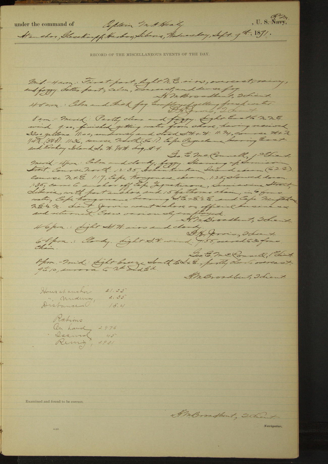
9 September 1891
Glasenapp Harbor [to Cape Yaynakinone]
Lat 64.71, Long -172.64 [Estimate from noon bearings]
8am to meridian:
9.00: finished getting water from shore, having received 3300 gallons. 11.00: underway. 11.36: Cape Pagueline bearing East and Kinkay Island SxW¼W.
Noon: Cape Yerguin SExS½S, 2½ miles
Meridian to 4pm:
Steaming up Seniavine Strait. 12.35: Achikinkan Island abeam. 1.17: Cape Kongonone [Mys Kygynin] abeam. 1.35 came to anchor off Cape Yaynakinone [near village Yanyakinon/Yanrakynnot], Seniavine Strait. Cape Kongonone bearing SExE½E and Cape Neiqtekone [Mys Neegchan] NE½N. Lieutenant Jarvis went ashore on official business and returned.
At anchor 21 hours 25 minutes.
Underway 2 hours 35 minutes.
Distance 15.4 miles.
50874d6109d4090755001977: (http://oldweather.s3.amazonaws.com/ow3/final/USRC Bear/vol069/vol069_167_0.jpg)
50874d6109d4090755001979: (http://oldweather.s3.amazonaws.com/ow3/final/USRC Bear/vol069/vol069_167_1.jpg)
10 September 1891
Seniavine Strait
Lat 64.91, Long -172.42 [Estimate from above bearings]
8am to meridian:
9.15: canoe with 8 natives came alongside. Waiting to receive reindeer.
Meridian to 4pm:
Wind breezing on and sea raising too high to land, hoisted canoe and at 2.15 got underway for Glasenapp Harbor. At 3.30 Achikinkan Island abeam.
4pm to 6pm:
4.45: came to anchor in Glasenapp Harbor. Point of sand spit (Cape Yerguin) bearing SSE½E and bluff (Cape Pagueline) WxN½N.
At anchor 21 hours 30 minutes.
Underway 2 hours 30 minutes.
Distance 17.2 miles.
50874d6109d409075500197b: (http://oldweather.s3.amazonaws.com/ow3/final/USRC Bear/vol069/vol069_168_0.jpg)
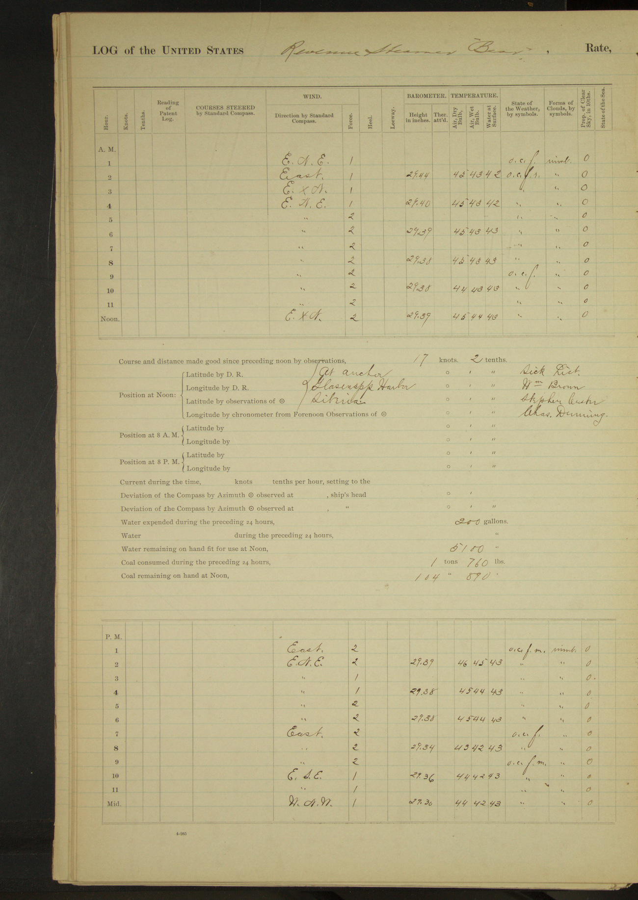
50874d6109d409075500197d: (http://oldweather.s3.amazonaws.com/ow3/final/USRC Bear/vol069/vol069_168_1.jpg)
11 September 1891
Glasenapp Harbor
Lat 64.68, Long -172.60 [Estimate in Glasenapp Harbor]
4am to 8am:
Cleaning boats, boat gear, etc.
50874d6109d409075500197f: (http://oldweather.s3.amazonaws.com/ow3/final/USRC Bear/vol069/vol069_169_0.jpg)
50874d6109d4090755001981: (http://oldweather.s3.amazonaws.com/ow3/final/USRC Bear/vol069/vol069_169_1.jpg)
12 September 1891
Glasenapp Harbor [to Cape Yaynakinone]
Lat 64.91, Long -172.42 [Using same location as 10 September]
Midnight to 4am:
Calm and light fog with rain until 1.30 when wind came out moderate NNW, increasing in force to a fresh breeze with heavy squalls, force 8.
4am to 8am:
Moderate to stiff NNW wind, overcast and rainy. 5.15: underway. 5.40: rounded Cape Pagueline. 6.42: Achinkinkan Island abeam. 7.55: came to anchor off Cape Yaynakinone.
8am to meridian:
8.15: sent launch in charge of Lieutenant Jarvis to shore to obtain reindeer.
Meridian to 4pm:
Very fresh breezes to strong gale NWxN, overcast and rainy with snow. 3.15: Lieutenant Jarvis returned in launch with 12 reindeer, 5 male and 7 females. Hoisted them on board.
4pm to 6pm:
Moderate NWxW gale and overcast with occasional snow.
6pm to 8pm:
A board of survey, composed of Lieutenants McConnell & Jarvis, surveyed and condemned as unfit for use 350 lbs of salt beef and recommended that the same be thrown overboard on account of offensiveness.
At anchor 21 hours 20 minutes.
Underway 2 hours 40 minutes.
Distance 15.9 miles.
50874d6109d4090755001983: (http://oldweather.s3.amazonaws.com/ow3/final/USRC Bear/vol069/vol069_170_0.jpg)
50874d6109d4090755001985: (http://oldweather.s3.amazonaws.com/ow3/final/USRC Bear/vol069/vol069_170_1.jpg)
13 September 1891
Cape Yaynakinone, Seniavine Strait [& at sea]
Lat 64.64, Long -172.60 [Estimate from noon bearings]
4am to 8am:
6.25: Sent launch ashore to convey trade goods of reindeer transaction.
8am to meridian:
8.45: launch returned. 9.10: underway. 10.09: Achinkinkan Island abeam. 10.57: Cape Pagueline abeam. 11.17: Cape Yerguin abeam. 11.30: Island Cape abeam.
Noon: High Island SE½S, 1¾ miles [assuming Ostrov Yttygran]
Meridian to 4pm:
12.35: High Island abeam, 2 miles. 1.02: Indian Point abeam, 2 miles.
4pm to 6pm:
5.52: Cape Chibukak, St. Lawrence Island, bore SExE½E.
6pm to 8pm:
6.50: Cape Chibukak abeam. 8.00: Cape Chibukak NNE and Cape Sanachno [Tatik Point] SE.
8pm to midnight:
11.30: stopped engine to cool crank-pin. 11.45: started engine.
At anchor 9 hours 10 minutes.
Underway 14 hours 50 minutes.
Under steam & canvas 11 hours 30 minutes.
Under steam exclusively 3 hours 20 minutes.
Distance under steam & canvas 95.6 miles.
Distance under steam exclusively 26 miles.
Total distance 121.6 miles.
50874d6109d4090755001987: (http://oldweather.s3.amazonaws.com/ow3/final/USRC Bear/vol069/vol069_171_0.jpg)
50874d6109d4090755001989: (http://oldweather.s3.amazonaws.com/ow3/final/USRC Bear/vol069/vol069_171_1.jpg)
14 September 1891
At sea, Bering Sea
Lat 61.39, Long -172.67
8am: Lat 61° 52’N, Long 172° 40’ 36”W
Meridian to 4pm:
1.47: raised Hall Island bearing S½W. Crew employed scraping boats’ gunwales, etc. 4.00: North Cape, Hall Island SWxW.
4pm to 6pm:
4.56: Glory of Russia Cape abeam.
6pm to 8pm:
7.45: Cape Upright abeam, 1.5 miles.
8pm: Lat 60° 18’N, Long 171° 55’W
Under steam & canvas 24 hours.
Distance under steam & canvas 205.5 miles.
50874d6109d409075500198b: (http://oldweather.s3.amazonaws.com/ow3/final/USRC Bear/vol069/vol069_172_0.jpg)
50874d6109d409075500198d: (http://oldweather.s3.amazonaws.com/ow3/final/USRC Bear/vol069/vol069_172_1.jpg)
15 September 1891
At sea, Bering Sea
Lat 58.33, Long -170.08
8am: Lat 58° 45’N, Long 170° 52’W
8pm: Lat 57° 21’N, Long 169° 14’ 13”W
8pm to midnight:
12.00: St. George Island bore SW½S.
Under steam & canvas 24 hours.
Distance under steam & canvas 197 miles.
50874d6109d409075500198f: (http://oldweather.s3.amazonaws.com/ow3/final/USRC Bear/vol069/vol069_173_0.jpg)
50874d6109d4090755001991: (http://oldweather.s3.amazonaws.com/ow3/final/USRC Bear/vol069/vol069_173_1.jpg
16 September 1891
At sea, Bering Sea
Lat 55.37, Long -167.58
8am: Lat 55° 50’N, Long 167° 58’ 57”W
8am to meridian:
Crew employed scraping and oiling spars, cleaning paintwork etc.
4pm to 6pm:
At 4.20 raised land bearing SxE.
6pm to 8pm:
7.00: Makushin Cape bore South.
8pm: Lat 54° 20’N, Long 166° 58’W
8pm to midnight:
10.40: Cape Cheerful abeam. 11.20: rounded Ulakta Head into Ounalaska outer harbor.
Under steam & canvas 20 hours.
Under steam exclusively 4 hours.
Distance under steam & canvas 170.3 miles.
Distance under steam exclusively 30.5 miles.
Total distance 200.8 miles.
50874d6109d4090755001993: (http://oldweather.s3.amazonaws.com/ow3/final/USRC Bear/vol069/vol069_174_0.jpg)
50874d6109d4090755001995: (http://oldweather.s3.amazonaws.com/ow3/final/USRC Bear/vol069/vol069_174_1.jpg)
17 September 1891
Unalaska Bay
Lat 53.88, Long -166.52 [Estimate in outer harbor]
Midnight to 4am:
12.10: came to anchor in outer harbor Unalaska. Rocky Point bearing NW and astronomical station SWxW. Received mail from shore.
4am to 8am:
US steamer “Mohican” [USS Mohican], HBM steamer “Nymphe” [HMS Nymphe], US Revenue Steamer “Rush”, Nic.[Nicaraguan?] steamer “Costa Rica”, American steamer “Al-ki”, American ship “Ericsson” in port. Officers from US steamer “Mohican” and US Revenue Steamer “Rush” visited vessel.
[Several of these ships formed part of the Bering Sea Anti-poaching Operations]
8am to meridian:
Received visit from HBM steamer “Nymphe”. 9.15: US steamer “Mohican” left port. 3rd Lieutenant AJ Henderson reported for duty.
Meridian to 4pm:
3.00: steamer “Danube” arrived with British Bering Sea Commission [Report of Behring Sea Commission].
At anchor 23 hours 50 minutes.
Underway 10 minutes.
Distance 1 mile.
50874d6209d4090755001997: (http://oldweather.s3.amazonaws.com/ow3/final/USRC Bear/vol069/vol069_175_0.jpg)
50874d6209d4090755001999: (http://oldweather.s3.amazonaws.com/ow3/final/USRC Bear/vol069/vol069_175_1.jpg)
18 September 1891
Unalaska Harbor
Lat 53.88, Long -166.52 [Estimate in outer harbor]
Midnight to 4am:
Fresh SE breeze with heavy squalls (force 8) decreasing in force to a light breeze at end of watch. 1.25: American steamer “Dora” arrived and anchored near by.
8am to meridian:
Commanding Officer made official call on HMS “Nymphe”. Received official call from officers of HMS “Nymphe”. Received fresh stores from San Francisco on steamer “St. Paul”.
Meridian to 4pm:
Sent an officer to make official call upon British Bering Sea Commission on board steamer “Danube”. Allowed boat’s crew to go fishing with seine.
4pm to 8pm:
Officers made official call to HMS “Nymphe”. 7.00: fishing party returned.
50874d6209d409075500199b: (http://oldweather.s3.amazonaws.com/ow3/final/USRC Bear/vol069/vol069_176_0.jpg)
50874d6209d409075500199d: (http://oldweather.s3.amazonaws.com/ow3/final/USRC Bear/vol069/vol069_176_1.jpg)
19 September 1891
Unalaska Harbor
Lat 53.88, Long -166.52 [Estimate in outer harbor]
4am to 8am:
Employed painting ship outside.
8am to meridian:
Employed blacking ship outside. At 9.30 knocked off painting on account of rain.
Meridian to 4pm:
Employed blacking ship outside.
50874d6209d409075500199f: (http://oldweather.s3.amazonaws.com/ow3/final/USRC Bear/vol069/vol069_177_0.jpg)
50874d6209d40907550019a1: (http://oldweather.s3.amazonaws.com/ow3/final/USRC Bear/vol069/vol069_177_1.jpg)
20 September 1891
Unalaska Harbor
Lat 53.88, Long -166.55
4am to 8am:
At 7.30 underway and steamed into inner harbor.
8am to meridian:
HBM steamer “Nymphe” sailed at 8.00. At 8.15 made fast alongside American ship “Ericsson” at AC Co’s wharf. 9.00: steamer “Costa Rica” sailed.
4pm to 8pm:
8.30: steamer “St. Paul” arrived and anchored in outer harbor.
At anchor 23 hours 15 minutes.
Underway 45 minutes.
Distance 1.7 miles.
50874d6209d40907550019a3: (http://oldweather.s3.amazonaws.com/ow3/final/USRC Bear/vol069/vol069_178_0.jpg)
50874d6209d40907550019a5: (http://oldweather.s3.amazonaws.com/ow3/final/USRC Bear/vol069/vol069_178_1.jpg)
21 September 1891
Unalaska Harbor
Lat 53.88, Long -166.55
4am to 8am:
At 6.15 cast off from ship “Ericsson” and steamed to anchorage in inner harbor, and at 6.30 came to. Employed preparing to land reindeer and the effects of US Coast Survey party.
8am to meridian:
Put nine (9) reindeer ashore on Amaknak Island and seven (7) on Unalaska Island, the former in charge of US Deputy Marshal Anthony and the latter in charge of AC Co. Sent effects of McGrath’s Coast & Geodetic Survey party and of Dr. Sheldon Jackson aboard US Revenue Steamer “Rush”.
Received from Commanding Officer of US Revenue Steamer “Rush” list of sealing vessels boarded during the season by the Government fleet. Sent mail aboard US Revenue Steamer “Rush”.
Commanding Officer made official call aboard guard ship “Al-ki”. Officers from steamer “Al-ki” visited the vessel. John Cuba of Point Barrow Refuge Station; UE Taggart, destitute miner; Dr. Sheldon Jackson; and JE McGrath, WW Davis, William Dirkes, CF Haglund, RC Carson, TH Beaumont, John Lines and James McLarty of US Coast & Geodetic party left vessel.
Received on board the following Seamen transferred from Revenue steamer “Rush” and entered them on the muster roll of this vessel: WA Jolliffe, AE Rasmussen, GA Andersen and JW Blumer [?].
4pm to 8pm:
Light to stiff NW to NNW wind, overcast and raining. Squally last two hours. 6.45: let go port anchor and reeved to 40 fathoms on starboard and 30 fathoms on port chain. Heavy squalls (force 7). Sent watch ashore to secure boats on beach.
At anchor 23 hours 45 minutes.
Underway 15 minutes.
Distance 0.2 miles.
[Article from On This Day in History from Alaska Native News includes a photo of reindeer being hoisted off the Bear]
50874d6209d40907550019a7: (http://oldweather.s3.amazonaws.com/ow3/final/USRC Bear/vol069/vol069_179_0.jpg)
50874d6209d40907550019a9: (http://oldweather.s3.amazonaws.com/ow3/final/USRC Bear/vol069/vol069_179_1.jpg)
22 September 1891
Unalaska Harbor
Lat 53.88, Long -166.55
4am to 8am:
Light winds from SSW to SEbyS. 6.00: hove up port anchor and shortened scope on starboard chain to 30 fathoms.
6.45: Revenue Steamer “Rush” left the harbor; also steamer “Dora”. Employed cleaning boats on beach and preparing to land articles belonging to US Mission, Alaska.
8am to meridian:
Sent ashore stores for mission at Sitka; also 39 bundles of whalebone belonging to Henry T Arey, Alfred Hopson, Conrad Sein [Stein when mentioned on 14 August] and Patrick Gray; also 24 bundles of whalebone belonging to schooner “Rosario”. WA De Hass, Patrick Gray, Conrad Sein [?], Alfred Hopson and Henry T Arey left the vessel.
Note: By order of the Commanding Officer, 3rd Lieutenant AJ Henderson is, for the purpose of acquiring experience, made Navigating Officer from date.
50874d6209d40907550019ab: (http://oldweather.s3.amazonaws.com/ow3/final/USRC Bear/vol069/vol069_180_0.jpg)
50874d6209d40907550019ad: (http://oldweather.s3.amazonaws.com/ow3/final/USRC Bear/vol069/vol069_180_1.jpg)
23 September 1891
Unalaska Harbor
Lat 53.88, Long -166.55
8am to meridian:
8.30: steamer “St. Paul” left coal ship and steamed to outer harbor. Got underway and made fast alongside ship “Ericsson” at dock. Made preparations for coaling. Blew water out of boiler.
Meridian to 4pm:
1.30: commenced coaling from ship “Ericsson”. Engineer’s force cleaning boiler.
At anchor 23 hours 30 minutes.
Underway 30 minutes.
Distance 1 mile.
50874d6209d40907550019af: (http://oldweather.s3.amazonaws.com/ow3/final/USRC Bear/vol069/vol069_181_0.jpg)
50874d6209d40907550019b1: (http://oldweather.s3.amazonaws.com/ow3/final/USRC Bear/vol069/vol069_181_1.jpg)
24 September 1891
Unalaska Harbor
Lat 53.88, Long -166.55
4am to 8am:
6.00: Steamer “St. Paul” left harbor.
8am to meridian:
9.00: stopped coaling to haul ship ahead.
Meridian to 4pm:
1.15: commenced coaling. 4.00: stopped coaling for the day; total quantity received 154 tons. Engineer’s force repairing boiler and overhauling machinery.
50874d6209d40907550019b3: (http://oldweather.s3.amazonaws.com/ow3/final/USRC Bear/vol069/vol069_182_0.jpg)
50874d6209d40907550019b5: (http://oldweather.s3.amazonaws.com/ow3/final/USRC Bear/vol069/vol069_182_1.jpg)
25 September 1891
Unalaska Harbor
Lat 53.88, Long -166.55
4am to 8am:
Employed filling tanker from shore.
8am to meridian:
8.00: finished taking water, received 3000 gallons. 9.40: resumed coaling.
10.00: sent James Chaplyn and Stephen Custer, destitute miners, and Charles Dunning, sick Seaman from schooner “Rosario”, to steamer “Al-Ki”, for transportation to San Francisco.
10.35: finished coaling having received [blank] tons. Total quantity [blank] tons. Put coaling boards and barrows ashore. Engineer’s force overhauling boiler and machinery.
Meridian to 4pm:
4.00: USS “Thetis” arrived and made fast to buoy. Engineer’s force employed as in forenoon.
4pm to 8pm:
Commanding Officer and ward room officers visited USS “Thetis”.
50874d6209d40907550019b7: (http://oldweather.s3.amazonaws.com/ow3/final/USRC Bear/vol069/vol069_183_0.jpg)
50874d6209d40907550019b9: (http://oldweather.s3.amazonaws.com/ow3/final/USRC Bear/vol069/vol069_183_1.jpg)
26 September 1891
Unalaska Harbor
Lat 53.88, Long -166.55
4am to 8am:
Employed setting up topgallant backstays. 6.15: schooner “Matthew Turner” left harbor.
8am to meridian:
Rove new main thrust and peak halyard. Setting up rigging.
Meridian to 4pm:
Part of crew went fishing. Engineer’s force filling boiler with fresh water.
50874d6209d40907550019bb: (http://oldweather.s3.amazonaws.com/ow3/final/USRC Bear/vol069/vol069_184_0.jpg)
50874d6209d40907550019bd: (http://oldweather.s3.amazonaws.com/ow3/final/USRC Bear/vol069/vol069_184_1.jpg)
27 September 1891
Unalaska Harbor
Lat 53.88, Long -166.55
4am to 8am:
8.00: started fires in furnaces.
8am to meridian:
Received three packages for St. George Island.
Meridian to 4pm:
3.00: USS “Thetis” left buoy; cast off lines from coal ship and hauled out to buoy and shackled with port chain. Shackled braces to yards and straightened up decks.
50874d6209d40907550019bf: (http://oldweather.s3.amazonaws.com/ow3/final/USRC Bear/vol069/vol069_185_0.jpg)
50874d6209d40907550019c1: (http://oldweather.s3.amazonaws.com/ow3/final/USRC Bear/vol069/vol069_185_1.jpg)
28 September 1891
Unalaska Harbor
Lat 53.88, Long -166.53
8am to meridian:
Last two hours very fresh breeze with heavy squalls (force 9); overcast and rainy. 10.45: cast off from buoy and steamed to outer harbor. At 11.00 came to anchor. North Rock bearing SWbyW½W and Rocky Point NbyW. Stormy weather, barometer falling rapidly.
Meridian to 4pm [& 4pm to 8pm]:
Very fresh ESE wind with long squalls (force 9); overcast rainy and foggy. Barometer falling rapidly, stormy weather.
8pm to meridian:
First part fresh SE breeze and rainy; heavy squalls (force 8). Wind moderating. Latter part light Southerly breeze and partly clear.
At anchor 23 hours 40 minutes.
Underway 20 minutes.
Distance 2 miles.
50874d6209d40907550019c3: (http://oldweather.s3.amazonaws.com/ow3/final/USRC Bear/vol069/vol069_186_0.jpg)
50874d6209d40907550019c5: (http://oldweather.s3.amazonaws.com/ow3/final/USRC Bear/vol069/vol069_186_1.jpg)
29 September 1891
Outer Harbor Unalaska
Lat 53.88, Long -166.53
4am to 8am:
Employed rebending mainsail.
8am to meridian:
Unbent old topmasts and bent new ones.
Meridian to 4pm:
Overhauling steering gear and unbending sails. Sent part of crew fishing.
4pm to 8pm:
Took on board Dimitri Lisnikoff for passage to St. George Island. Issued him one ration.
50874d6209d40907550019c7: (http://oldweather.s3.amazonaws.com/ow3/final/USRC Bear/vol069/vol069_187_0.jpg)
50874d6209d40907550019c9: (http://oldweather.s3.amazonaws.com/ow3/final/USRC Bear/vol069/vol069_187_1.jpg)
30 September 1891
Outer Harbor Unalaska [& at sea]
Lat 54.25, Long -166.87
8am to meridian:
Moderate to very fresh SW wind with heavy squalls (force 9); partly clear. Sea moderate to rough. 8.35: got underway and steamed out of harbor. 9.54: waterfall, Cape Cheerful, abeam 1.8 miles.
Meridian to 4pm:
Very fresh SW byW breezes with heavy squalls (force 9); partly clear to overcast. Rain showers. Rough sea.
8pm: Lat 54° 43’N, Long 167° 24’W
At anchor 8 hours 35 minutes.
Underway 15 hours 25 minutes.
Under steam exclusively 2 hours 45 minutes.
Under steam & canvas [12 hours 40 minutes].
Distance under steam exclusively 17 miles.
Distance under steam & canvas 59.1 miles.
Total distance 76.1 miles.
50874d6209d40907550019cb: (http://oldweather.s3.amazonaws.com/ow3/final/USRC Bear/vol069/vol069_188_0.jpg)
[Blank page]
50874d6209d40907550019cd: (http://oldweather.s3.amazonaws.com/ow3/final/USRC Bear/vol069/vol069_188_1.jpg)
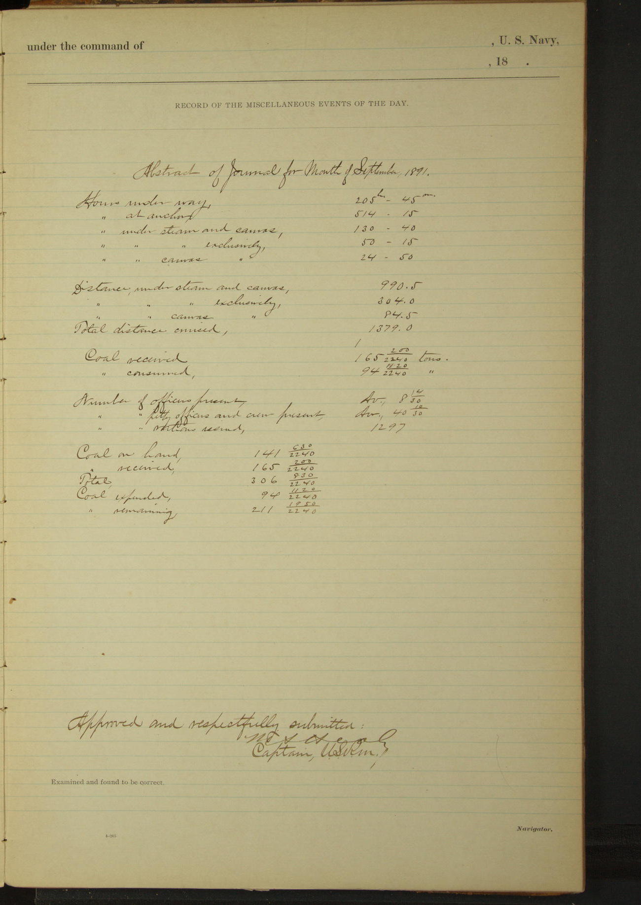
Abstract of Journal for Month of September 1891
Underway 205.45
At anchor 514 hours 15 minutes.
Under steam & canvas 130 hours 40 minutes.
Under steam exclusively 50 hours 15 minutes.
Hours under canvas exclusively 24 hours 50 minutes.
Distance under steam & canvas 990.5 miles.
Distance under steam exclusively 304 miles.
Distance under canvas exclusively 84.5 miles.
Total distance 1379 miles.
Number of officers present average 8 14/30
Number of petty officers & crew present average 40 10/30
Number rations issued 1297
Coal on hand 141 630/2240 tons.
Coal received 165 200/2240 tons.
Total 306 830/2240 tons.
Coal expended 94 1120/2240 tons.
Coal remaining 211 1950/2240 tons.
50874d6209d40907550019cf: (http://oldweather.s3.amazonaws.com/ow3/final/USRC Bear/vol069/vol069_189_0.jpg)
50874d6209d40907550019d1: (http://oldweather.s3.amazonaws.com/ow3/final/USRC Bear/vol069/vol069_189_1.jpg)
[Blank pages]
LOG BOOK – OCTOBER 1st 1891 TO DECEMBER 12th 1891
50874d6209d40907550019d3: (http://oldweather.s3.amazonaws.com/ow3/final/USRC Bear/vol070/vol070A_001_0.jpg)
50874d6209d40907550019d5: (http://oldweather.s3.amazonaws.com/ow3/final/USRC Bear/vol070/vol070A_001_1.jpg)
50874d6209d40907550019d7: (http://oldweather.s3.amazonaws.com/ow3/final/USRC Bear/vol070/vol070_001_0.jpg)
50874d6209d40907550019d9: (http://oldweather.s3.amazonaws.com/ow3/final/USRC Bear/vol070/vol070_001_1.jpg)
50874d6209d40907550019db: (http://oldweather.s3.amazonaws.com/ow3/final/USRC Bear/vol070/vol070_002_0.jpg)
50874d6209d40907550019dd: (http://oldweather.s3.amazonaws.com/ow3/final/USRC Bear/vol070/vol070_002_1.jpg)
Log book of the USS “Bear” of Four Guns, commanded by MA Healy, Captain USRM. Commencing October 1st 1891 at sea, Bering Sea, and ending December 12th 1891, at San Francisco, California.
50874d6209d40907550019df: (http://oldweather.s3.amazonaws.com/ow3/final/USRC Bear/vol070/vol070_003_0.jpg)
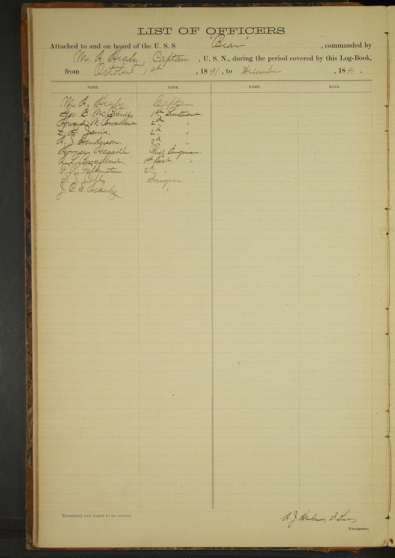
List of Officers attached to and on board of the USS “Bear”, commanded by MA Healy, Captain USRM, during the period covered by this log-book from October 1st 1891, to December 12th, 1891.
MA Healy, Captain
George E McConnell, 1st Lieutenant
H [Howard] M Broadbent, 2nd Lieutenant
D [David] H Jarvis, 2nd Lieutenant
A [Andrew] J Henderson, 3rd Lieutenant
Horace Hassell, Chief Engineer
A [Alfred] L Broadbent, 1st Assistant Engineer
F [Fred] R Falkenstein, 2nd Assistant Engineer
SJ Call, Surgeon
JCS Ackerly, Surgeon
50874d6209d40907550019e1: (http://oldweather.s3.amazonaws.com/ow3/final/USRC Bear/vol070/vol070_003_1.jpg)
List of officers who have died, been detached or transferred on board of US Revenue Steamer “Bear” commanded by MA Healy, Captain, USRM, during the period covered by this book from October 1st 1891, to December 12th, 1891
SJ Call, Surgeon, November 28th 1891, exchanged with Surgeon JCS Ackerly of St. Paul Island, Dr. Ackerly being in ill health and fearing the results of exposure during the cold winter.
50874d6209d40907550019e3: (http://oldweather.s3.amazonaws.com/ow3/final/USRC Bear/vol070/vol070_004_0.jpg)
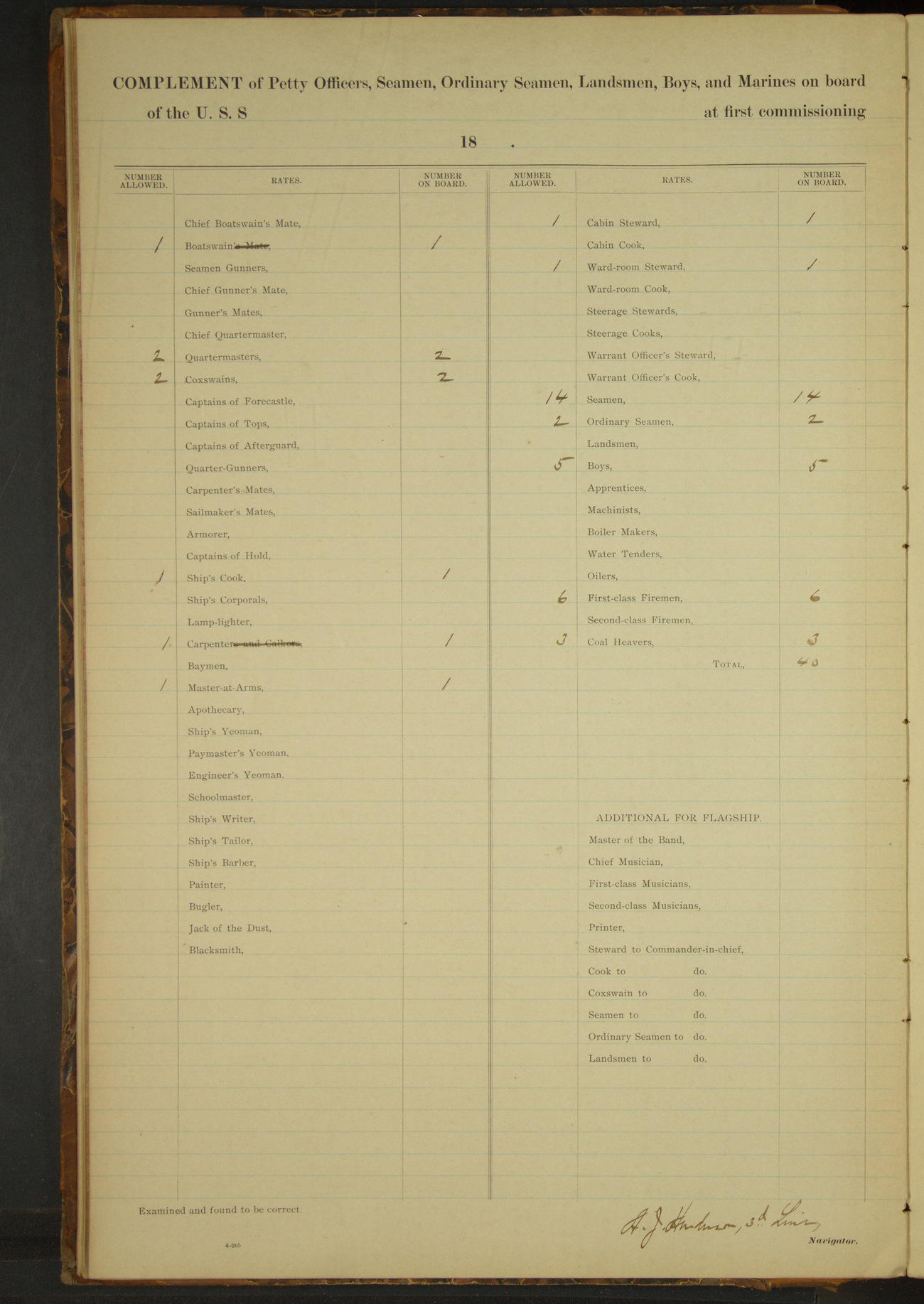
Complement of Petty officers, Seamen, Ordinary Seamen, Landsmen, Boys, and Marines on board
Boatswain 1
Quartermasters 2
Coxswains 2
Ship’s Cook 1
Carpenter 1
Master-at-arms 1
Cabin Steward 1
Ward-room Steward 1
Seamen 14
Ordinary Seamen 2
Boys 5
First-class Firemen 6
Coal Heavers 3
TOTAL 40
50874d6209d40907550019e5: (http://oldweather.s3.amazonaws.com/ow3/final/USRC Bear/vol070/vol070_004_1.jpg)
[Description of instruments, left blank]
50874d6209d40907550019e7: (http://oldweather.s3.amazonaws.com/ow3/final/USRC Bear/vol070/vol070_005_0.jpg)
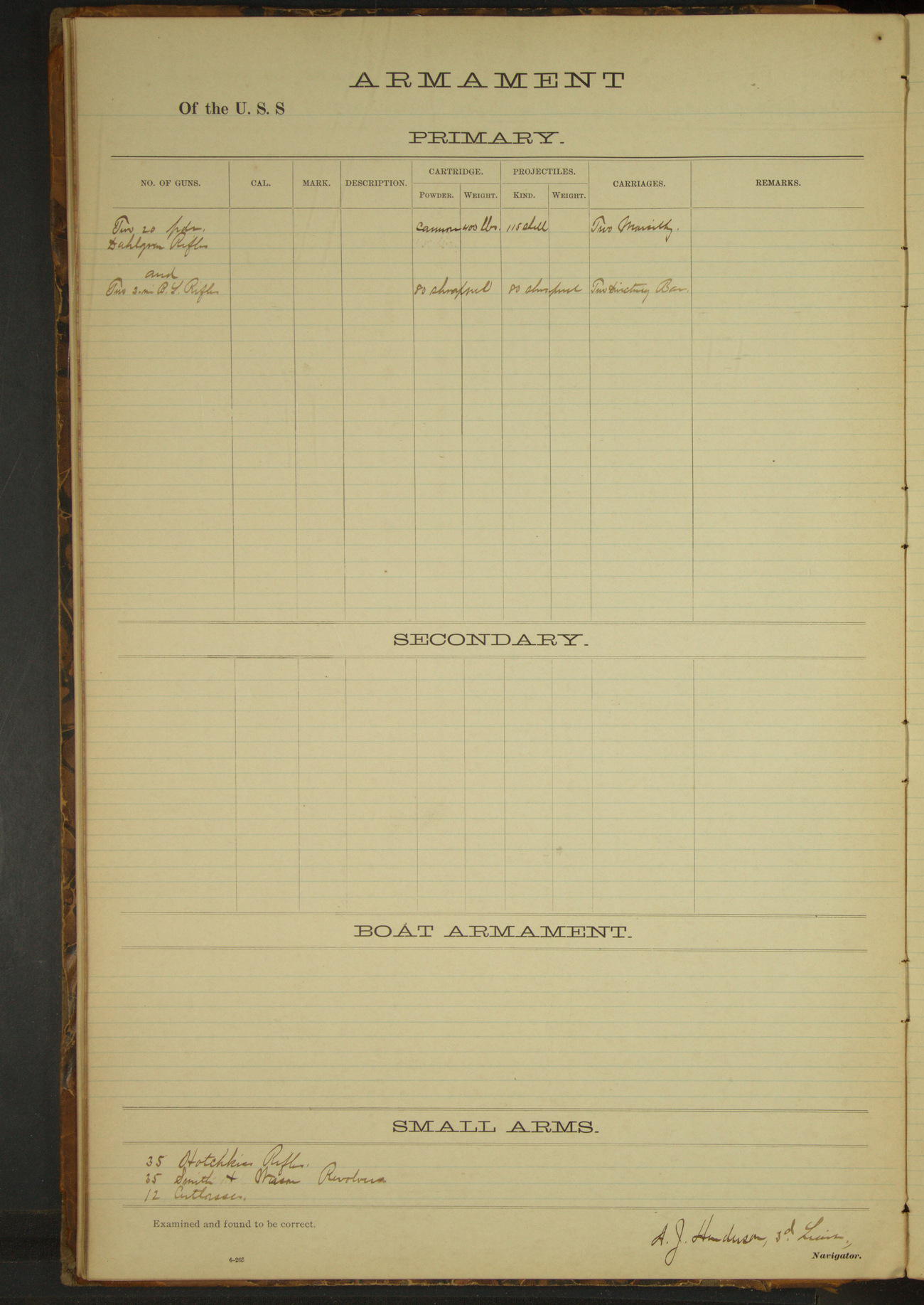
Armament [same as previous log books]
50874d6209d40907550019e9: (http://oldweather.s3.amazonaws.com/ow3/final/USRC Bear/vol070/vol070_005_1.jpg)
[Tables of deviation of the standard compass, left blank]
LOGS FOR OCTOBER 1891
50874d6209d40907550019eb: (http://oldweather.s3.amazonaws.com/ow3/final/USRC Bear/vol070/vol070_006_0.jpg)
50874d6209d40907550019ed: (http://oldweather.s3.amazonaws.com/ow3/final/USRC Bear/vol070/vol070_006_1.jpg)
1 October 1891
At sea, Bering Sea
Lat 56.17, Long -169.17
8am: Lat 55° 44’ 38”N, Long 168° 37’ 22”W
Meridian to 4pm:
3.25: Tolstoi Point abeam. 3.40: steered for anchorage.
4pm to 6pm:
4.05: came to anchor off village St. George Island. Great Eastern Rookery bearing EbyN and village SEbyS. Special Treasury Agent Nettleton visited the vessel. Dimitri Lisnikoff left vessel.
At anchor 7 hours 55 minutes.
Underway 16 hours 5 minutes. Distance 120 miles.
Under steam & canvas 15 hours 20 minutes. Distance 115 miles.
Under steam exclusively 45 minutes. Distance 5 miles.
50874d6209d40907550019ef: (http://oldweather.s3.amazonaws.com/ow3/final/USRC Bear/vol070/vol070_007_0.jpg)
50874d6209d40907550019f1: (http://oldweather.s3.amazonaws.com/ow3/final/USRC Bear/vol070/vol070_007_1.jpg)
2 October 1891
Off village St. George Island [to St. Paul Island]
Lat 57.12, Long -170.30 [Estimate from noon bearings]
Midnight to 4am:
2.10: underway.
4am to 8am:
6.30: raised land on starboard bow and ahead. Steaming along Eastern side of St. Paul island at end of watch.
8am to meridian:
8.10: came to anchor at South anchorage, St. Paul Island.
Noon: Sea Lion Rock, St. Paul Island SSE½E 1 mile
Meridian to 4pm:
3.00: hove up anchor, steamed ahead and came to, SW point bearing WbyN, Otter Island SSW.
4pm to 6pm:
Moderate North gale, squally (force 9); overcast and rainy. Stormy weather.
At anchor 18 hours.
Underway 6 hours. Distance 42.8 miles.
Under steam & canvas 3 hours 40 minutes. Distance 34.6 miles.
Under steam exclusively 2 hours 20 minutes. Distance 8.2 miles.
50874d6209d40907550019f3: (http://oldweather.s3.amazonaws.com/ow3/final/USRC Bear/vol070/vol070_008_0.jpg)
50874d6209d40907550019f5: (http://oldweather.s3.amazonaws.com/ow3/final/USRC Bear/vol070/vol070_008_1.jpg)
3 October 1891
SW Bay, St. Paul Island [to SE anchorage]
Lat 57.12, Long -170.26 [Estimate from noon bearings]
Midnight to 4am:
Moderate NNW to NW gale, overcast and squally. At 2.45 wind backing to Westward, making lee shore, got underway.
4am to 8am:
Fresh gale from West. Heavy Easterly swell. 4.45: stood in toward the land. At 5.00 off village of St. Paul. 5.20: came to off Whale Point, Whale Point bearing NxW¼W, Otter Island SSW½W, Black Bluffs WNW. Heavy surf on shore.
8am to meridian:
Fresh gale WbyN to West. Heavy Easterly swell, moderating during watch.
Noon: Whale Point bearing NxW¼W 1½ miles
8pm to midnight:
Strong gale West and WbyS to very fresh NW wind, squally, overcast and rainy to partly clear. 9.30: wind veered to NW; weather moderating and clearing. Vessel swinging to tide.
At anchor 21 hours 25 minutes.
Under steam exclusively 2 hours 35 minutes. Distance 12.7 miles.
50874d6209d40907550019f7: (http://oldweather.s3.amazonaws.com/ow3/final/USRC Bear/vol070/vol070_009_0.jpg)
50874d6209d40907550019f9: (http://oldweather.s3.amazonaws.com/ow3/final/USRC Bear/vol070/vol070_009_1.jpg)
4 October 1891
SE anchorage, St. Paul Island
Lat 57.12, Long -170.26
4pm to 6pm:
Strong NW gale with heavy squalls (force 10), showers of rain and hail.
50874d6209d40907550019fb: (http://oldweather.s3.amazonaws.com/ow3/final/USRC Bear/vol070/vol070_010_0.jpg)
50874d6209d40907550019fd: (http://oldweather.s3.amazonaws.com/ow3/final/USRC Bear/vol070/vol070_010_1.jpg)
5 October 1891
SE anchorage, St. Paul Island
Lat 57.12, Long -170.26
8am to meridian:
Moderate to strong NW gale with rain and snow squalls. Watch employed scraping engine-room skylight.
8pm to midnight:
Moderate to strong gale WNW to NWbyN, partly clear, frequent heavy snow squalls. Irregular swell.
50874d6209d40907550019ff: (http://oldweather.s3.amazonaws.com/ow3/final/USRC Bear/vol070/vol070_011_0.jpg)
50874d6209d4090755001a01: (http://oldweather.s3.amazonaws.com/ow3/final/USRC Bear/vol070/vol070_011_1.jpg)
6 October 1891
SE anchorage, St. Paul Island
Lat 57.12, Long -170.26
4am to 8am:
Moderate NW gale with heavy squalls and snow. Irregular swell.
8am to meridian.
Mr. JC Redpath, North American Commercial Co’s agent, visited Commanding Officer and reported having seen a schooner on the 30th ultimo to Westward of island and standing to SW. The vessel was apparently a whaler.
Sent ashore mail and stores brought from Unalaska. Dr. Call visited the island. Watch employed scraping engine-room skylight and cleaning out and whitewashing cabin hold.
50874d6209d4090755001a03: (http://oldweather.s3.amazonaws.com/ow3/final/USRC Bear/vol070/vol070_012_0.jpg)
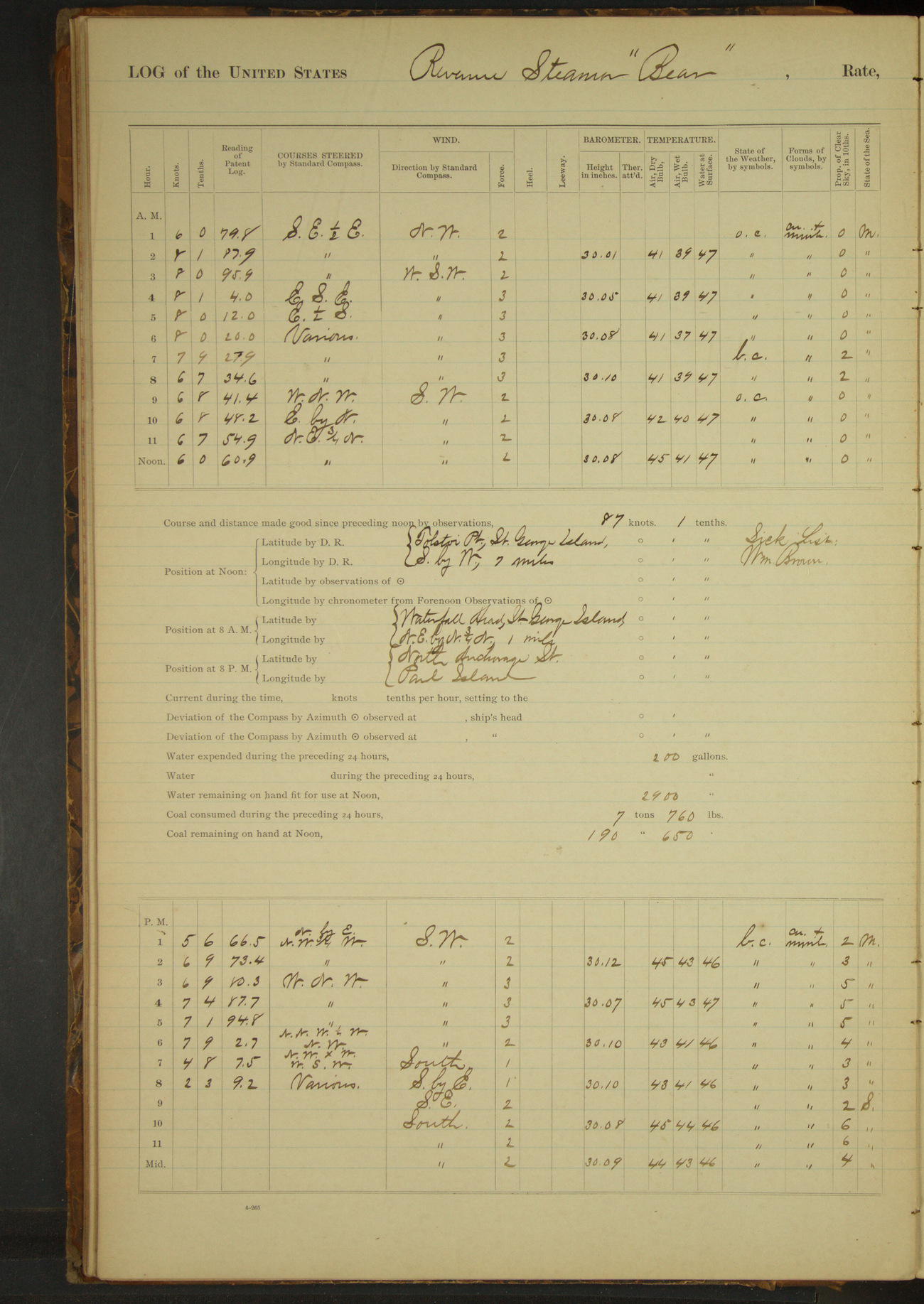
50874d6209d4090755001a05: (http://oldweather.s3.amazonaws.com/ow3/final/USRC Bear/vol070/vol070_012_1.jpg)
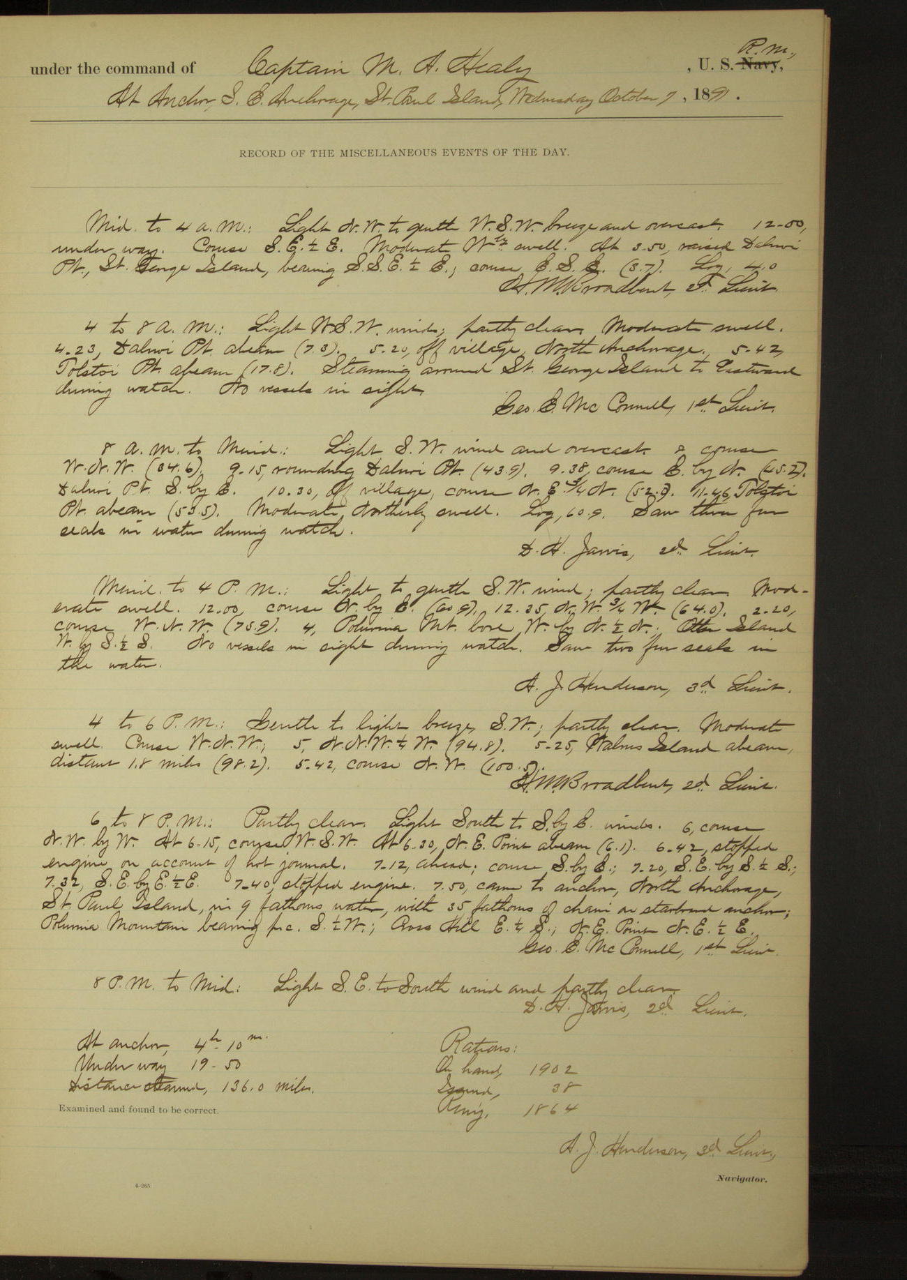
7 October 1891
SE anchorage, St. Paul Island [to St. George Island & back]
Lat 56.70, Long -169.37 [Estimate from noon bearings]
Midnight to 4am:
12.00: underway. 3.50: raised Dalnoi Point, St. George Island, bearing SSE½E.
4am to 8am:
4.23: Dalnoi Point abeam. 5.20: off village North anchorage. 5.42: Tolstoi Point abeam. Steaming around St. George Island to Eastward during watch. No vessels in sight.
8am to meridian:
9.15: rounding Dalnoi Point. 10.30: off village. 11.46: Tolstoi Point abeam. Saw three fur seals in water during watch.
Noon: Tolstoi Point SbyW 7 miles
Meridian to 4pm:
4.00: Polovina Mountain bore WbyN½N, Otter Island WbyS½S. No vessels in sight during watch. Saw two fur seals in the water.
4pm to 6pm:
5.25: Walrus Island abeam, distance 1.8 miles.
6pm to 8pm:
At 6.30 NE point abeam. 6.42: stopped engine on account of hot journal. 7.12: ahead. 7.50: came to anchor North anchorage St. Paul Island. Polovina Mountain bearing S½W, Cross Hill E¼S, NE point NE½E.
At anchor 4 hours 10 minutes.
Underway 19 hours 50 minutes.
Distance steamed 136.0 miles
50874d6209d4090755001a07: (http://oldweather.s3.amazonaws.com/ow3/final/USRC Bear/vol070/vol070_013_0.jpg)
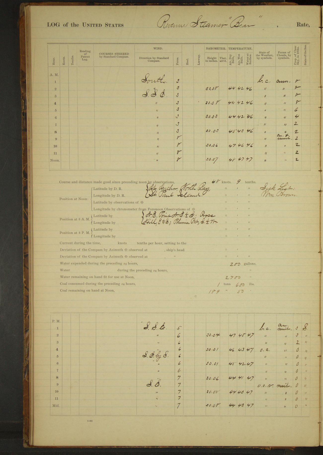
50874d6209d4090755001a09: (http://oldweather.s3.amazonaws.com/ow3/final/USRC Bear/vol070/vol070_013_1.jpg)
8 October 1891
North anchorage, St. Paul Island
Lat 57.24, Long -170.13
4am to 8am:
No vessels in sight during watch.
8am to meridian:
Unbent foresail and flying jib. Bent new foresail. Broke out and overhauled new mainsail.
Meridian to 4pm:
Watch employed mending sails; mended reef in mainsail.
50874d6209d4090755001a0b: (http://oldweather.s3.amazonaws.com/ow3/final/USRC Bear/vol070/vol070_014_0.jpg)
50874d6209d4090755001a0d: (http://oldweather.s3.amazonaws.com/ow3/final/USRC Bear/vol070/vol070_014_1.jpg)
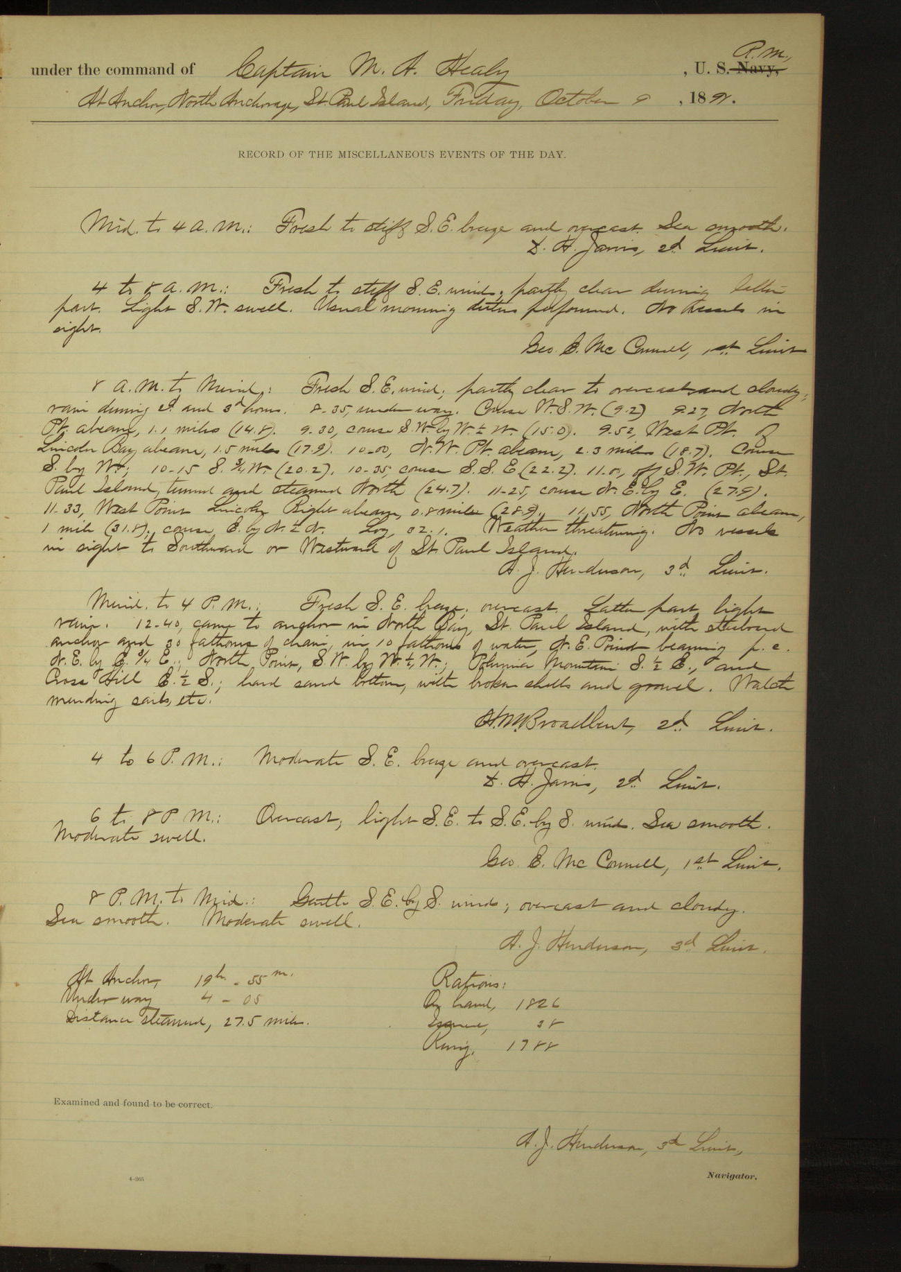
9 October 1891
North anchorage, St. Paul Island [& at sea]
Lat 57.23, Long -170.31
4am to 8am:
No vessels in sight.
8am to meridian:
8.35: underway. 9.27: North point abeam, 1.1 miles. 9.52: West point of Lincoln Bay abeam, 1.5 miles. 10.00: NW point abeam, 2.3 miles. 11.00 off SW point, St. Paul Island, turned and steamed North.
11.33: West point Lincoln Bight abeam, 1.8 miles. 11.55: North point abeam, 1 mile. Weather threatening. No vessels in sight to Southward or Westward of St. Paul Island.
Noon: North Point SExS, 1 mile
Meridian to 4pm:
12.40: came to anchor in North Bay, St. Paul Island. NE point NEbyE¾E, Polovina Mountain S½E, Cross Hill E½S. Watch mending sails etc.
At anchor 19 hours 55 minutes.
Underway 4 hours 5 minutes.
Distance steamed 27.5 miles.
50874d6209d4090755001a0f: (http://oldweather.s3.amazonaws.com/ow3/final/USRC Bear/vol070/vol070_015_0.jpg)
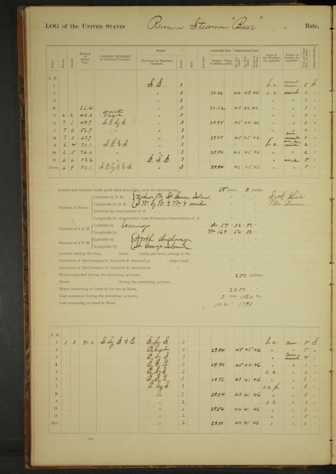
50874d6209d4090755001a11: (http://oldweather.s3.amazonaws.com/ow3/final/USRC Bear/vol070/vol070_015_1.jpg)
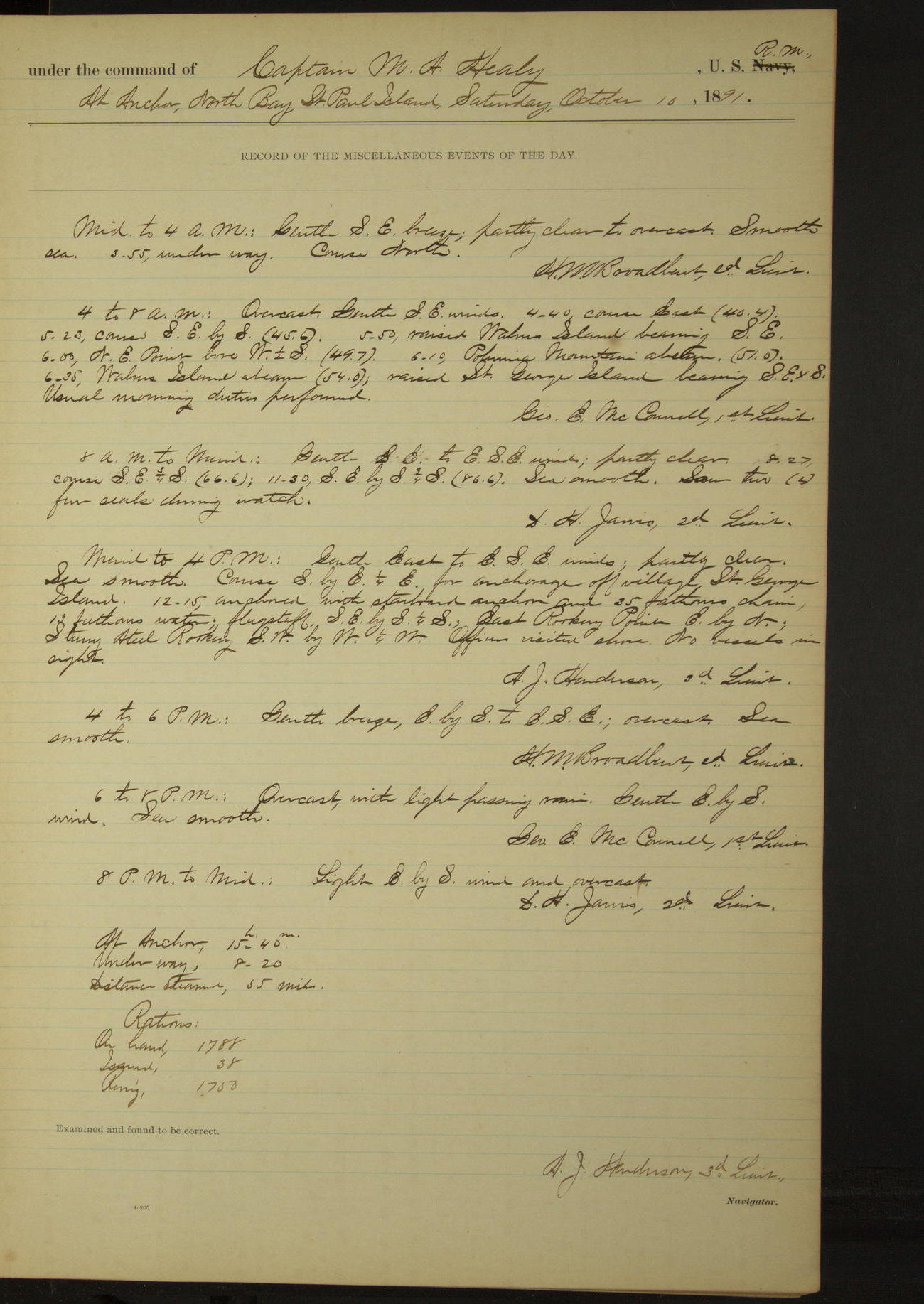
10 October 1891
North Bay, St. Paul Island [to St. George Island]
Lat 56.64, Long -169.58 [Estimate from noon bearings]
Midnight to 4am:
3.55: underway.
4am to 8am:
5.50: raised Walrus Island bearing SE. 6.00: NE point bore W½S. 6.10: Polovina Mountain abeam. 6.35: Walrus Island abeam; raised St. George Island bearing SExS.
8am: Lat 57° 02’N, Long 169° 54’W
8am to meridian:
Saw two (2) fur seals during watch.
Noon: Dalnoi Point, St. George Island, SWbyW½W, 7 miles
Meridian to 4pm:
Course for anchorage off village St. George Island. 12.15: anchored. East Rookery Point EbyN, Starry Arteel [Staraya Artil] Rookery SWbyW¼W. Officers visited shore. No vessels in sight.
At anchor 15 hours 40 minutes.
Underway 8 hours 20 minutes.
Distance steamed 55 miles.
50874d6209d4090755001a13: (http://oldweather.s3.amazonaws.com/ow3/final/USRC Bear/vol070/vol070_016_0.jpg)
50874d6209d4090755001a15: (http://oldweather.s3.amazonaws.com/ow3/final/USRC Bear/vol070/vol070_016_1.jpg)
11 October 1891
North anchorage, St. George Island [to SW Bay]
Lat 56.61, Long -169.55
4 to 8am [& 8am to meridian]:
No vessels in sight during watch.
Meridian to 4pm:
Fresh to stiff ENE breeze and partly clear. 12.20: underway. 1.33: Dalnoi Point SE, hauled around to Southward and Eastward.
2.45: came to anchor in South West Bay. West Point bearing WbyN¼N, East Point SEbyE. Long SW swell.
4pm to 6pm:
Stiff NE to ENE wind; partly clear to overcast. Long SW swell. Heavy surf on beach.
6pm to 8pm:
Stiff ENE to NEbyE wind; partly clear. Frequent long and heavy SW swell.
8pm to midnight:
Moderate to stiff breeze from NEbyE to NEbyN; partly clear to overcast. Moderate SW swell decreasing. Heavy surf on beach.
At anchor 21 hours 35 minutes.
Underway 2 hours 25 minutes.
Distance steamed 17.5 miles.
50874d6209d4090755001a17: (http://oldweather.s3.amazonaws.com/ow3/final/USRC Bear/vol070/vol070_017_0.jpg)
50874d6209d4090755001a19: (http://oldweather.s3.amazonaws.com/ow3/final/USRC Bear/vol070/vol070_017_1.jpg)
12 October 1891
SW Bay, St. George Island [& at sea]
Lat 56.04, Long -169.02
4am to 8am:
Stiff to fresh NNE to NE winds. Long SW swell. 6.25 underway. 6.55: East Point EbyN. 7.25: SE Point abeam. No vessels in sight during watch.
Meridian to 4pm:
1.25: raised a bark on port bow, steered for her. 3.20: spoke American bark “Lydia” of San Francisco, Knowles master, whaling. 3.27: ahead.
8pm: Lat 55° 14’ 32”N, Long 167° 48’ 34”W
At anchor 17 hours 35 minutes.
Underway 6 hours 25 minutes.
Under steam & canvas 17 hours 5 minutes. Distance 129.6 miles.
Under steam exclusively 30 minutes. Distance 1.9 miles.
Total distance 131.5 miles.
50874d6209d4090755001a1b: (http://oldweather.s3.amazonaws.com/ow3/final/USRC Bear/vol070/vol070_018_0.jpg)
50874d6209d4090755001a1d: (http://oldweather.s3.amazonaws.com/ow3/final/USRC Bear/vol070/vol070_018_1.jpg)
13 October 1891
At sea, Bering Sea [& Unalaska]
Lat 53.88, Long -166.52 [Estimate in outer harbor]
4am to 8am:
At 5.20 raised land bearing SEbyS. At 6.00 raised Cape Cheerful bearing SE¾S.
8am to meridian:
Hauling around Ulakhta Head. 9.10: came to anchor in Unalaska outer harbor. Prepared to go to wharf. Ship “Ericsson” towed out by the “Dora”.
Meridian to 4pm:
12.55: hove up and steamed into inner harbor. 1.30: made fast outside of ship “Louis Walsh” alongside of wharf. Made preparations for coaling ship; hauled port boats up on beach.
At anchor 14 hours 15 minutes.
Underway 9 hours 45 minutes. Distance 72.0 miles.
Under steam & canvas 8 hours 30 minutes. Distance 66.7 miles.
Under steam exclusively 1 hour 15 minutes. Distance 5.3 miles.
50874d6209d4090755001a1f: (http://oldweather.s3.amazonaws.com/ow3/final/USRC Bear/vol070/vol070_019_0.jpg)
50874d6209d4090755001a21: (http://oldweather.s3.amazonaws.com/ow3/final/USRC Bear/vol070/vol070_019_1.jpg)
14 October 1891
Unalaska Harbor
Lat 53.88, Long -166.55
4am to 8am:
At 7.00, commenced receiving coal from ship “Louis Walsh” using baskets. Carpenter employed taking off starboard wildcats of steam windlass.
8am to meridian:
Got up and fitted new wildcats to steam windlass. Received 3000 gallons fresh water.
Meridian to 4pm:
At 3.00 finished coaling having received 42 1060/2240 tons of Wellington coal.
8pm to midnight:
At 10.15 mail steamer “Elsie” arrived in port from Sitka, Alaska, via way ports. Received mail.
50874d6209d4090755001a23: (http://oldweather.s3.amazonaws.com/ow3/final/USRC Bear/vol070/vol070_020_0.jpg)
50874d6209d4090755001a25: (http://oldweather.s3.amazonaws.com/ow3/final/USRC Bear/vol070/vol070_020_1.jpg)
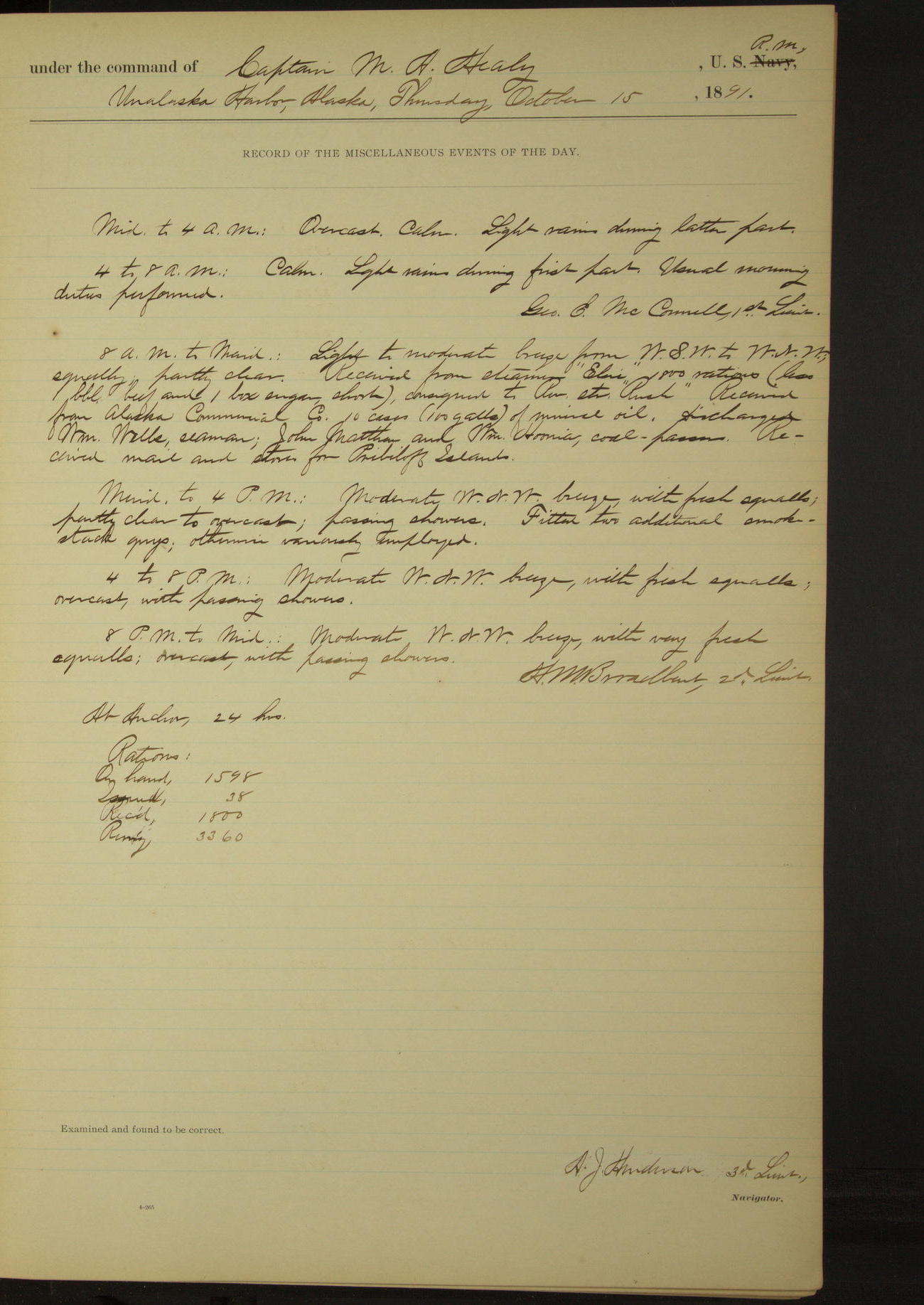
15 October 1891
Unalaska Harbor
Lat 53.88, Long -166.55
8am to meridian:
Received from steamer “Elsie”: 800 rations (less 1 barrel beef and 1 box sugar, short) consigned to Revenue Steamer “Rush”. Received from Alaska Commercial Co: 10 cases (100 gallons) of mineral oil.
Discharged William Wells, Seaman; John Matthew and William Hoonia [?], Coal Passers. Received mail and stores for Pribiloff Islands.
Meridian to 4pm:
Fitted two additional smokestack guys.
50874d6209d4090755001a27: (http://oldweather.s3.amazonaws.com/ow3/final/USRC Bear/vol070/vol070_021_0.jpg)
50874d6209d4090755001a29: (http://oldweather.s3.amazonaws.com/ow3/final/USRC Bear/vol070/vol070_021_1.jpg)
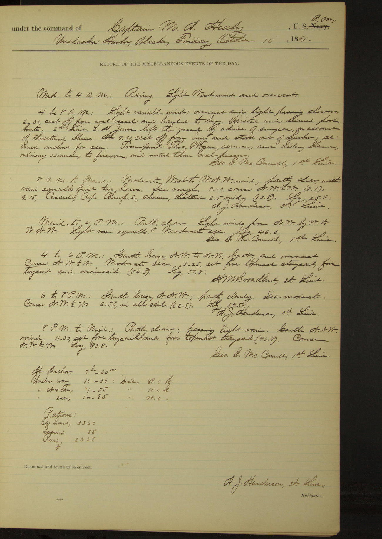
16 October 1891
Unalaska Harbor [& at sea]
Lat 54.13, Long -166.68
4am to 8am:
6.30: cast off from coal vessel and hauled to buoy. Hoisted and secured port boats. 2nd Lieutenant DH Jarvis left the vessel by advice of Surgeon, on account of threatened illness.
At 7.30 cast off from buoy and stood out of harbor; secured anchors for sea. Transferred Thomas Wogan, Seaman, and Sidney Shannon, Ordinary Seaman, to fire room and rated them Coal Passers.
8am to meridian:
9.15: Cascade, Cape Cheerful, abeam, distant 2.5 miles.
8pm [8am in log]: Lat 54° 45’N, Long 167° 20’W
At anchor 7 hours 30 minutes.
Underway 16 hours 30 minutes. Distance 89.0 miles
Under steam & canvas 1 hour 55 minutes. Distance 11.0 miles.
Under steam exclusively 14 hours 35 minutes. Distance 78.0 miles.
50874d6209d4090755001a2b: (http://oldweather.s3.amazonaws.com/ow3/final/USRC Bear/vol070/vol070_022_0.jpg)
50874d6209d4090755001a2d: (http://oldweather.s3.amazonaws.com/ow3/final/USRC Bear/vol070/vol070_022_1.jpg)
17 October 1891
At sea, Bering Sea [& St. Paul Island]
Lat 56.25, Long -169.02
8am: Lat 55° 51’N, Long 168° 34’W
8am to meridian:
9.50: raised land bearing NW. No vessels in sight during watch.
Meridian to 4pm:
2.11: Tolstoi Point, St. George Island, abeam, distant ½ mile. 2.30: off village, St. George Island.
4pm to 6pm:
Observed a very strong current setting to Northward. No vessels in sight. Saw one fur seal.
6pm to 8pm:
7.20: came to anchor in SW Bay, St. Paul Island. Reef Point SE¾S, Otter Island SxW¾W.
At anchor 4 hours 40 minutes.
Underway 19 hours 20 minutes. Distance 154.0 miles.
Under steam & canvas 18 hours 50 minutes. Distance 150.2 miles.
Under steam exclusively 30 minutes. Distance 3.8 miles.
50874d6209d4090755001a2f: (http://oldweather.s3.amazonaws.com/ow3/final/USRC Bear/vol070/vol070_023_0.jpg)
50874d6209d4090755001a31: (http://oldweather.s3.amazonaws.com/ow3/final/USRC Bear/vol070/vol070_023_1.jpg)
18 October 1891
SW Bay, St. Paul Island [to North Bay]
Lat 57.13, Long -170.31
4am to 8am:
Fresh East gale, squally and
overcast. Latter part misty. 7.15: weighed anchor and changed
anchorage farther inshore and to Westward. Outer end of reef bearing
S¾E,
Otter Island SxW¾W,
Tolstoi Point N¼W.
Meridian to 4pm:
Fresh breeze ESE. 12.45: underway. 1.26: SW point abeam, distant 1 mile. 3.35: anchored in North Bay, St. Paul Island. NE Point NExE¼E, Cross Hill E¼S, Polovina Mountain S¼E. Very heavy surf on beach. Observed a heavy break on tide rip, about 1½ miles North of NE Point.
4pm to 6pm:
Moderate gale from ESE. Strong current action to North.
6pm to 8pm:
Moderate gale to very fresh breeze from ESE to ExS. Moderate Easterly swell.
8pm to midnight;
Moderate gale to stiff breeze from East. Moderate Easterly swell. No landing possible at any place on St. Paul Island during the day.
At anchor 21 hours 10 minutes.
Underway 2 hours 50 minutes.
Distance 17 miles.
50874d6209d4090755001a33: (http://oldweather.s3.amazonaws.com/ow3/final/USRC Bear/vol070/vol070_024_0.jpg)
50874d6209d4090755001a35: (http://oldweather.s3.amazonaws.com/ow3/final/USRC Bear/vol070/vol070_024_1.jpg)
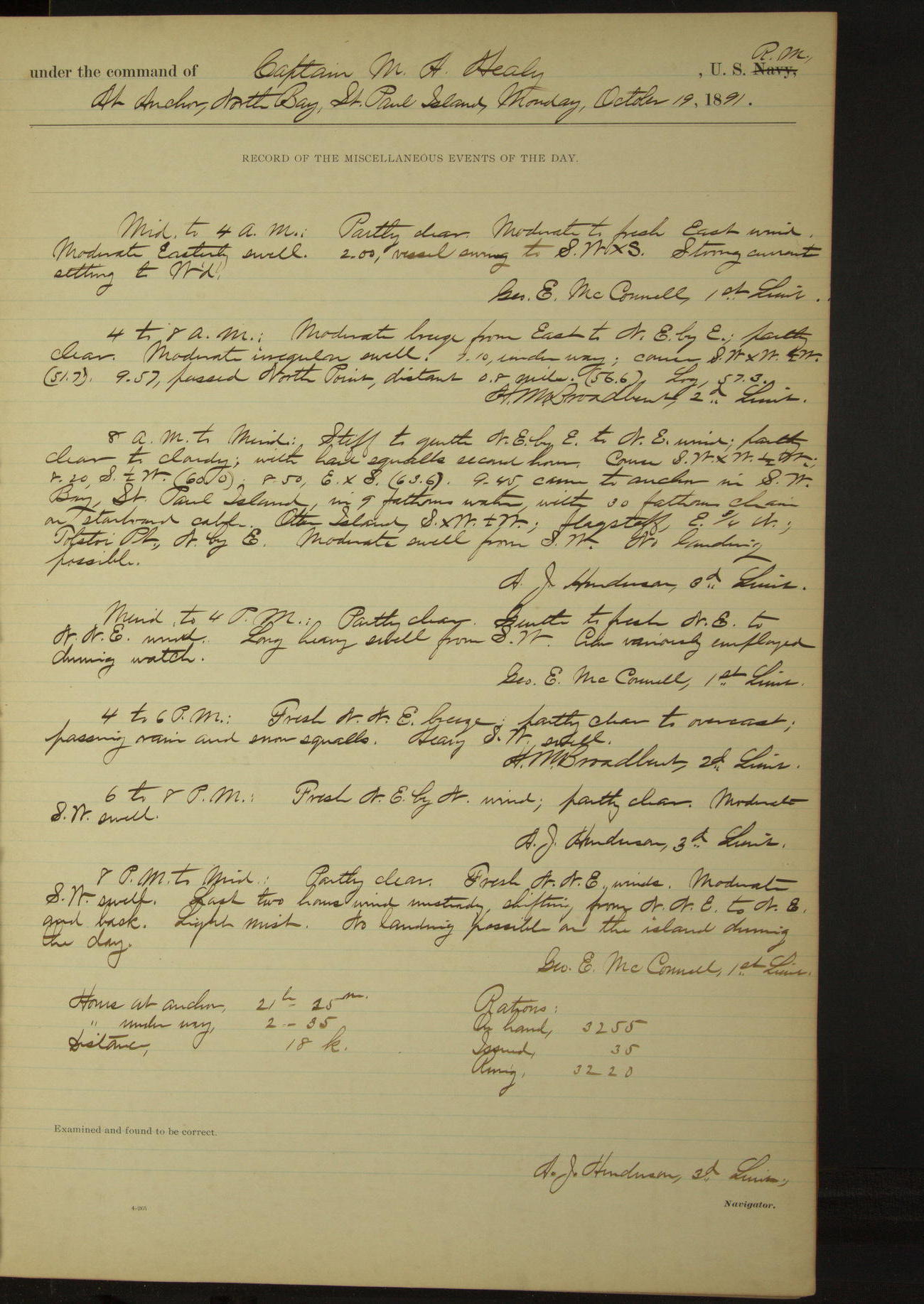
19 October 1891
North Bay, St. Paul Island [to SW Bay]
Lat 57.13, Long -170.31
Midnight to 4am:
Moderate to fresh East wind. Moderate Easterly swell. 2.00: vessel swung to SWxS. Strong current setting to Westward.
4am to 8am:
Moderate breeze from East to NEbyE. Moderate irregular swell. 7.10: underway. 9.57 [?]: passed North Point, distant 0.8 miles.
8am to meridian:
9.45: came to anchor in SW Bay, St. Paul Island. Otter Island SxW¼W, Tolstoi Point NbyE. Moderate swell from SW. No landing possible.
Meridian to 4pm:
Gentle to fresh NE to NNE wind. Long heavy swell from SW.
8pm to midnight:
Fresh NNE wind. Moderate SW swell. Last two hours wind unsteady, shifting from NNE to NE and back. No landing possible on the island during the day.
At anchor 21 hours 25 minutes.
Underway 2 hours 35 minutes.
Distance 18 miles.
50874d6209d4090755001a37: (http://oldweather.s3.amazonaws.com/ow3/final/USRC Bear/vol070/vol070_025_0.jpg)
50874d6209d4090755001a39: (http://oldweather.s3.amazonaws.com/ow3/final/USRC Bear/vol070/vol070_025_1.jpg)
20 October 1891
SW Bay, St. Paul Island [to SE anchorage]
Lat 57.13, Long -170.31
8am to meridian:
Fresh ENE winds; overcast; light snow flurries. Moderate SW swell. No landing on island possible on account of surf. [Similar entries for next 2 watches]
8pm to midnight:
8.15: underway. 9.20: came to anchor off Black Bluffs, St. Paul Island (village bearing NWxW½W, Polovina Mountain NbyE, Otter Island SW½S). Heavy surf on beach.
At anchor 22 hours 55 minutes.
Underway 1 hour 5 minutes.
Distance 6 miles.
50874d6209d4090755001a3b: (http://oldweather.s3.amazonaws.com/ow3/final/USRC Bear/vol070/vol070_026_0.jpg)
50874d6209d4090755001a3d: (http://oldweather.s3.amazonaws.com/ow3/final/USRC Bear/vol070/vol070_026_1.jpg)
21 October 1891
SE anchorage, St. Paul Island
Lat 57.12, Long -170.26
4am to 8am:
Strong NNW gale. Light snow squalls latter part. Moderate swell from NE. 6.25: weighed anchor and stood to Northward. 6.50: came to off Whale Point. Otter Island SSW½W, Polovina Mountain N½E.
Heavy surf on beach, no landing [same for rest of day].
50874d6209d4090755001a3f: (http://oldweather.s3.amazonaws.com/ow3/final/USRC Bear/vol070/vol070_027_0.jpg)
50874d6209d4090755001a41: (http://oldweather.s3.amazonaws.com/ow3/final/USRC Bear/vol070/vol070_027_1.jpg)
22 October 1891
SE anchorage, St. Paul Island [to NE anchorage and back]
Lat 57.21, Long -170.10
8am to meridian:
Natives from St. Paul Island came aboard with a request from Special Treasury Agent Barnes that they be taken to NE Point and landed there for the purpose of killing young sea lions for food. 8.55: underway. 9.35: Halfway Point abaft the beam. Ran line of soundings to anchorage off Salt House, NE Point. 10.40: anchored. Walrus Island E½S, Cross Hill NNW, Polovina Mountain SWxS. Landing impossible on account of heavy surf.
Noon: NE anchorage, St. Paul Island
Meridian to 4pm:
2.10: underway. 3.25: came to anchor at SE anchorage, St. Paul Island. Natives left the vessel with mail and stores for the island. Otter Island SWbyS, Polovina Mountain NbyE.
At anchor 21 hours.
Underway 3 hours.
Distance 18 miles.
50874d6209d4090755001a43: (http://oldweather.s3.amazonaws.com/ow3/final/USRC Bear/vol070/vol070_028_0.jpg)
50874d6209d4090755001a45: (http://oldweather.s3.amazonaws.com/ow3/final/USRC Bear/vol070/vol070_028_1.jpg)
23 October 1891
SE anchorage, St. Paul Island [to St. George Island]
Lat 56.61, Long -169.55
Midnight to 4am:
1.05: underway.
4am to 8am:
6.25: Dalnoi Point abeam 3 miles. 7.15: anchored off village, St. George Island. East Point EbyN, West Point WbyS¼S.
Special Treasury Agent Nettleton and Dr. Noyes of NA Commercial Co visited the Commanding Officer and reported that no vessels had been sighted from the island. Delivered mail and stores from Dutch Harbor [Unalaska].
8am to meridian:
Employed running new lanyard, starboard after shroud of main rigging. Slushing masts. No vessel in sight during watch.
Meridian to 4pm:
1.05: underway. 1.42: Tolstoi Point bore South. 2.03: Sea Lion Point bore West. 2.45: came to anchor in Garden Cove, St George Island. Sea Lion Point NbyE½E, SE Point SW¾S. Watch employed fitting new lanyards and dinghy’s falls.
6pm to 8pm:
At 6.25 sighted a steamer to Eastward. Made distinguishing Coston signal, which was answered by steamer with Coston signal, showing red light followed by blue star. At 7.20 boat from steamer came alongside.
The vessel proved to be the steam whaling bark “Orca”, McGregor, master, from the Arctic to San Francisco. Reported the loss of steam whaling bark “William Lewis” at Point Barrow, Alaska, about the 1st instant. Expended four (4) Coston signals.
[See Alaska Shipwrecks for more details of the loss of the William Lewis]
At anchor 15 hours.
Underway 9 hours.
Distance 50 miles.
50874d6209d4090755001a47: (http://oldweather.s3.amazonaws.com/ow3/final/USRC Bear/vol070/vol070_029_0.jpg)
50874d6209d4090755001a49: (http://oldweather.s3.amazonaws.com/ow3/final/USRC Bear/vol070/vol070_029_1.jpg)
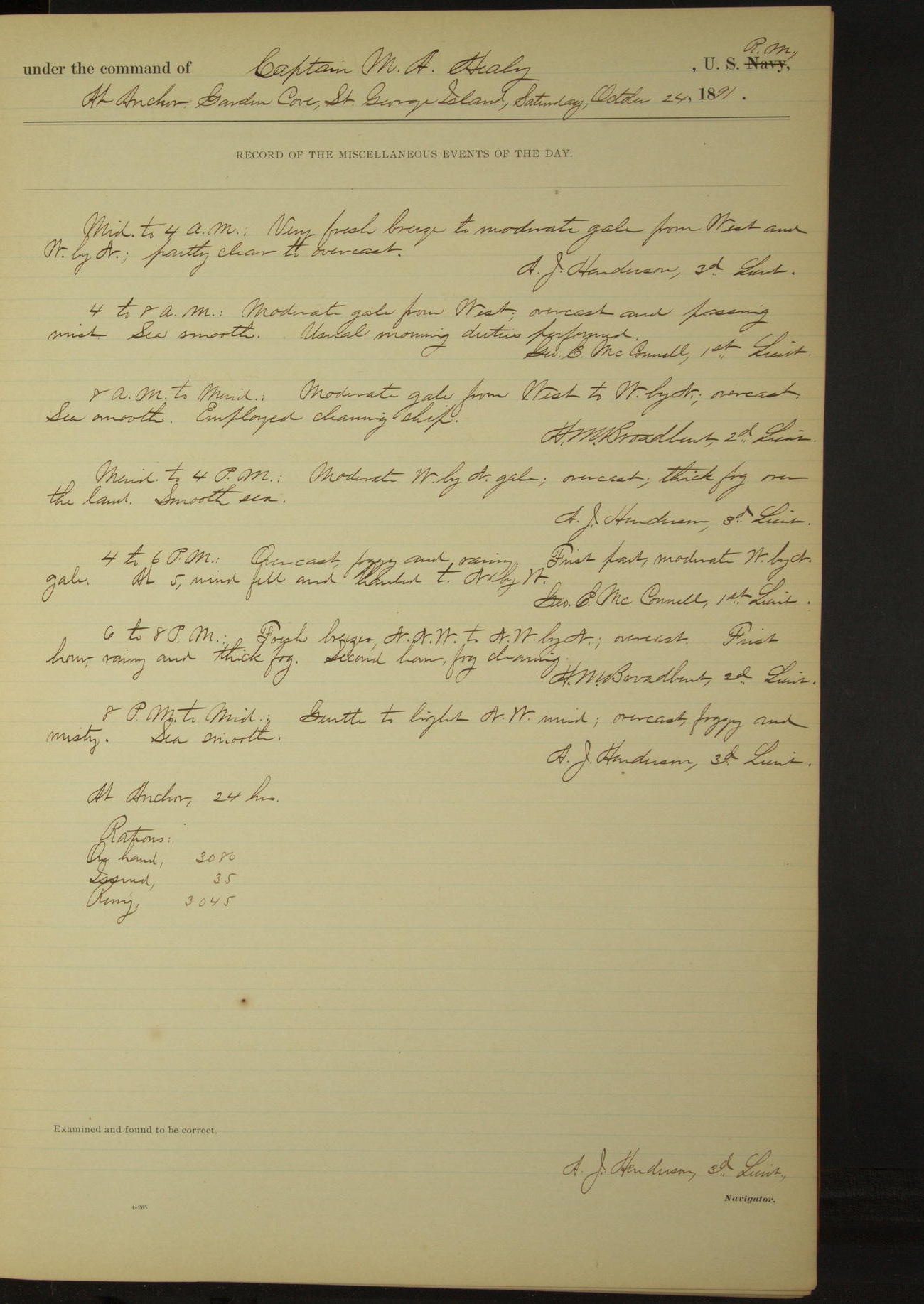
24 October 1891
Garden Cove, St. George Island
Lat 56.56, Long -169.51
50874d6209d4090755001a4b: (http://oldweather.s3.amazonaws.com/ow3/final/USRC Bear/vol070/vol070_030_0.jpg)
50874d6209d4090755001a4d: (http://oldweather.s3.amazonaws.com/ow3/final/USRC Bear/vol070/vol070_030_1.jpg)
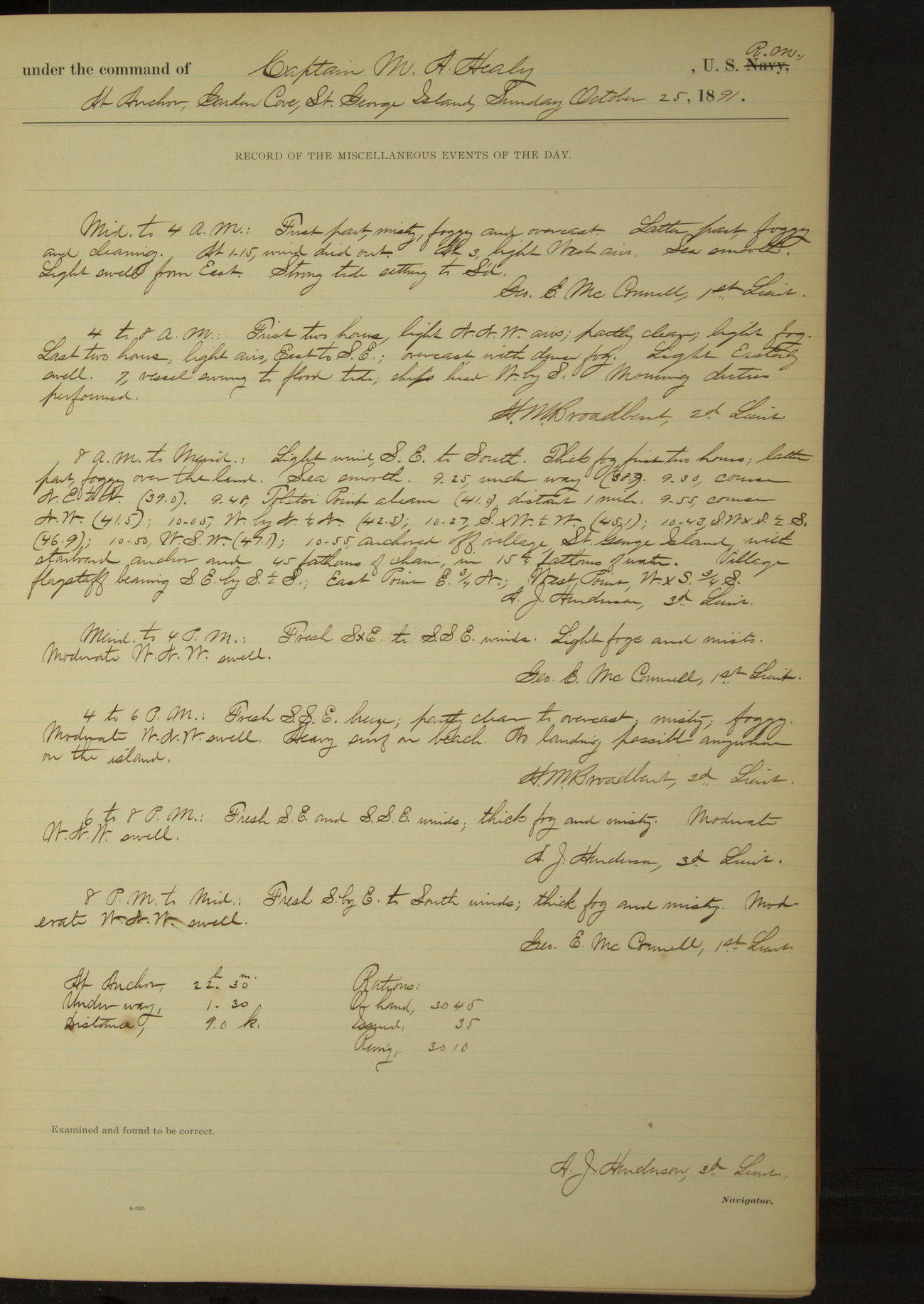
25 October 1891
Garden Cove, St. George Island [to North anchorage]
Lat 56.61, Long -169.55
8am to meridian:
9.25: underway. 9.48: Tolstoi Point abeam, distant 1 mile. 10.55 anchored off village, St. George Island.
4pm to 6pm:
Heavy surf on beach. No landing possible anywhere on the island.
At anchor 22 hours 30 minutes.
Underway 1 hour 30 minutes.
Distance 9 miles.
50874d6209d4090755001a4f: (http://oldweather.s3.amazonaws.com/ow3/final/USRC Bear/vol070/vol070_031_0.jpg)
50874d6209d4090755001a51: (http://oldweather.s3.amazonaws.com/ow3/final/USRC Bear/vol070/vol070_031_1.jpg)
26 October 1891
North anchorage, St. George Island
Lat 56.61, Long -169.55
Midnight to 4am;
Fresh South breeze with heavy squalls (force 8). Heavy NW swell. Heavy surf on beach. No landing possible.
4am to 8am:
Heavy surf on beach, impossible to land.
8am to meridian:
Heavy surf on beach. Employed fitting and running new fore braces.
Meridian to 4pm:
Heavy surf on beach, no landing. Sent down topgallant yard.
50874d6209d4090755001a53: (http://oldweather.s3.amazonaws.com/ow3/final/USRC Bear/vol070/vol070_032_0.jpg)
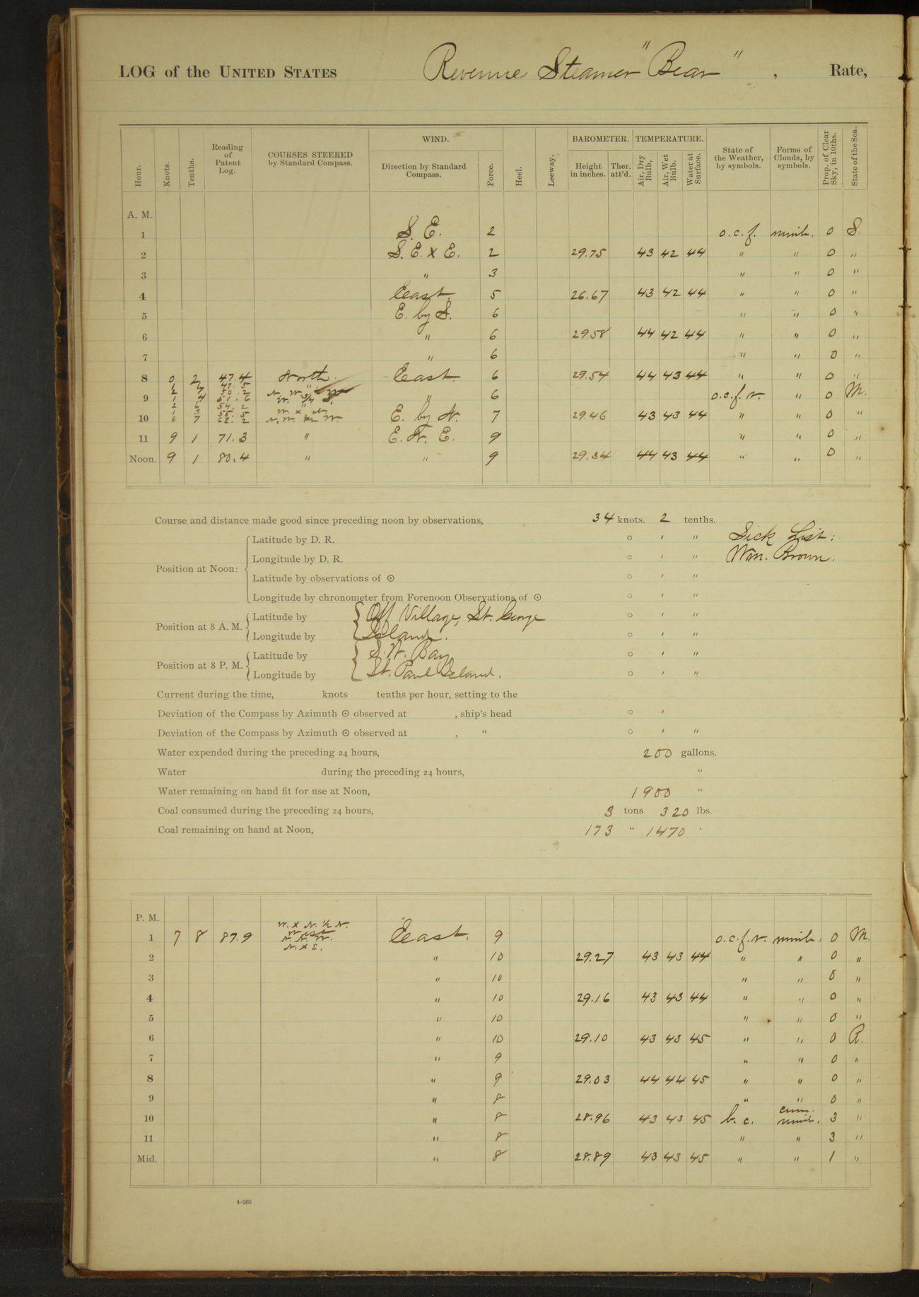
50874d6209d4090755001a55: (http://oldweather.s3.amazonaws.com/ow3/final/USRC Bear/vol070/vol070_032_1.jpg)
27 October 1891
North anchorage, St. George Island [to SW Bay St. Paul Island]
Lat 57.03, Long -170.16 [Estimate]
4am to 8am:
7.55: underway.
8am to meridian:
8.25: saw a bark bearing NNW and standing to Southward and Eastward. 8.35: saw American steam whaling bark “Jesse H Freeman” bearing WNW, standing to Southward and Eastward.
9.05: stopped and spoke American whaling bark “Sea Ranger” of New Bedford, Marvin master, from Arctic Ocean for San Francisco. 9.10: ahead full speed, Dalnoi Point bearing S½E.
Meridian to 4pm:
1.00: anchored in SW Bay, St. Paul Island. Sea Lion Point SEbyS¾S, flagstaff E¼N, salt house ENE½E.
6pm to 8pm:
Gale to strong gale from East. Heavy SSE swell. Heavy surf on beach. No landing possible.
At anchor 18 hours 55 minutes.
Underway 5 hours 5 minutes. Distance 42 miles.
Under steam & canvas 4 hours 20 minutes. Distance 38 miles.
Under steam exclusively 45 minutes. Distance 4 miles.
50874d6209d4090755001a57: (http://oldweather.s3.amazonaws.com/ow3/final/USRC Bear/vol070/vol070_033_0.jpg)
50874d6209d4090755001a59: (http://oldweather.s3.amazonaws.com/ow3/final/USRC Bear/vol070/vol070_033_1.jpg)
28 October 1891
SW Bay, St. Paul Island [to North Bay & at sea]
Lat 57.23, Long -170.28 [Estimate from noon bearings]
Midnight to 4am:
3.15: underway.
4am to 8am:
7.40: NW Point bore South, distant 3 miles.
8am: Lat 57° 15’N, Long 170° 20’W
8am to meridian:
9.00: anchored in North Bay, St. Paul Island. Polovina Mountain SxE, Cross Hill E¼S. 10.30: wind veering to SW and increasing, got underway and stood along North side of island.
Noon: North Point, St. Paul Island SSW¼W 1 mile
Meridian to 4pm:
1.47: Cross Hill abeam. 4.00: NW Point SSW, NE Point East.
6pm to 8pm:
Very fresh breeze SSW, squally with hail. Sea rough and heavy. 6.30: NW Cape abeam.
50874d6209d4090755001a5b: (http://oldweather.s3.amazonaws.com/ow3/final/USRC Bear/vol070/vol070_034_0.jpg)
50874d6209d4090755001a5d: (http://oldweather.s3.amazonaws.com/ow3/final/USRC Bear/vol070/vol070_034_1.jpg)
29 October 1891
At sea, Bering Sea [& St. George Island]
Lat 57.02, Long -170.32
8am: Lat 57° 07’ 30”N, Long 170° 52’W
8am to meridian:
11.00: Otter Island S½W, Sea Lion Rock NEbyE. 11.50: raised St. George Island bearing SE½E.
Meridian to 4pm:
2.45: Dalnoi Point SEbyS and Tolstoi Point ESE.
4pm to 6pm:
4.30: Dalnoi Point abeam. 5.25: anchored off village, St. George Island. East Point EbyN, West Point WxS½S. Heavy surf on beach.
8pm to midnight:
Heavy surf on beach. No landing possible.
At anchor 6 hours 35 minutes.
Underway 17 hours 25 minutes.
Under steam & canvas 17 hours.
Under steam exclusively 25 minutes.
Distance steam & canvas 78 miles.
Distance steam exclusively 3 miles.
Total distance 81 miles.
50874d6209d4090755001a5f: (http://oldweather.s3.amazonaws.com/ow3/final/USRC Bear/vol070/vol070_035_0.jpg)
50874d6209d4090755001a61: (http://oldweather.s3.amazonaws.com/ow3/final/USRC Bear/vol070/vol070_035_1.jpg)
30 October 1891
North anchorage, St. George Island
Lat 56.61, Long -169.55
4am to 8am:
Heavy surf on beach. No landing possible [& to 8pm].
8pm to midnight:
Barometer falling rapidly.
50874d6209d4090755001a63: (http://oldweather.s3.amazonaws.com/ow3/final/USRC Bear/vol070/vol070_036_0.jpg)
50874d6209d4090755001a65: (http://oldweather.s3.amazonaws.com/ow3/final/USRC Bear/vol070/vol070_036_1.jpg)
31 October 1891
North anchorage, St. George Island
Lat 56.61, Long -169.55
4am to 8am:
Barometer falling rapidly [lowest value 28.73 inches at 8pm].
Meridian to 4pm:
Barometer steady.
8pm to midnight:
12.00: underway.
50874d6209d4090755001a67: (http://oldweather.s3.amazonaws.com/ow3/final/USRC Bear/vol070/vol070_037_0.jpg)
[Blank page]
50874d6209d4090755001a69: (http://oldweather.s3.amazonaws.com/ow3/final/USRC Bear/vol070/vol070_037_1.jpg)
Summary of abstract for October 1891
At anchor 559 hours 20 minutes.
Underway 184 hours 40 minutes.
Under steam and canvas 96 hours 50 minutes.
Under steam exclusively 87 hours 50 minutes.
Distance under steam and canvas 656.1 miles.
Distance under steam exclusively 500.9 miles.
Total distance cruised 1157 miles.
Number of officers present 264; average 8 16/31.
Number of Petty Officers & crew present 1285; average 41 14/31.
Number rations issued 1131.
Time underway 7 days, 16 hours, 40 minutes.
Coal on hand 211 1950/2240 tons.
Coal received 42 1060/2240 tons.
Total 254 770/2240 tons.
Coal expended 93 420/2240 tons.
Balance on hand 161 350/2240 tons.
Coal drawn from AC Co’s coal ship at Unalaska 42 1060/2240 tons.
Days not cruising: total number 11; Sundays 1.
LOGS FOR NOVEMBER 1891
50874d6209d4090755001a6b: (http://oldweather.s3.amazonaws.com/ow3/final/USRC Bear/vol070/vol070_038_0.jpg)
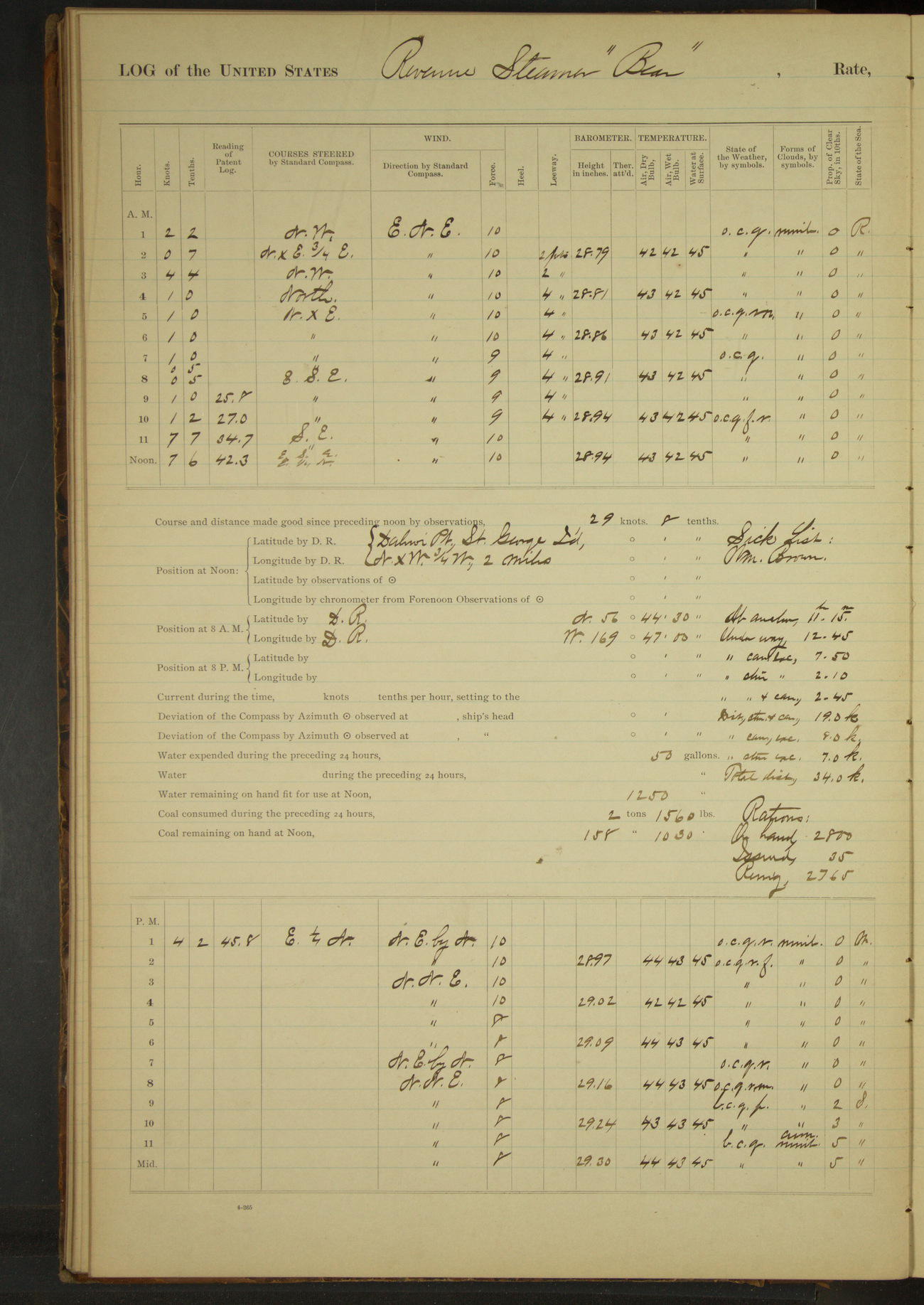
50874d6209d4090755001a6d: (http://oldweather.s3.amazonaws.com/ow3/final/USRC Bear/vol070/vol070_038_1.jpg)
1 November 1891
At sea, Bering Sea, off St. George Island
Lat 56.58, Long -169.78 [Estimate from noon bearings]
4am to 8am:
By order of Commanding Officer served new ration received from Revenue Steamer “Rush”, in lieu of old ration on hand.
8am: Lat 56° 44’ 30”N, Long 169° 47’W
8am to meridian:
11.20: Spanker vangs parted; rove new vangs. 11.30: Dalnoi Point, St. George Island bore ExN¾N.
Noon: Dalnoi Point, St. George Island NxW¾W 2, miles
Meridian to 4pm:
12.45: came to anchor in SW Bay, St. George Island. West Point bearing WbyN¼N, East Point SExE½E.
Moderate SE swell. Heavy surf on beach, no landing.
At anchor 11 hours 15 minutes.
Underway 12 hours 45 minutes.
Under canvas exclusively 7 hours 50 minutes.
Under steam exclusively 2 hours 10 minutes.
Under steam & canvas 2 hours 45 minutes.
Distance steam & canvas 19 miles.
Distance canvas exclusively 9 miles.
Distance steam exclusively 7 miles.
Total distance 34 miles.
50874d6209d4090755001a6f: (http://oldweather.s3.amazonaws.com/ow3/final/USRC Bear/vol070/vol070_039_0.jpg)
50874d6209d4090755001a71: (http://oldweather.s3.amazonaws.com/ow3/final/USRC Bear/vol070/vol070_039_1.jpg)
2 November 1891
SW Bay, St. George Island
Lat 56.57, Long -169.69
8am to meridian:
Watch employed fitting new spanker vangs and fore topmast staysail sheets, mending swivels etc. Heavy surf on beach; no landing.
Meridian to 4pm:
Heavy surf on beach. Crew refitting trysail vangs and spanker sheets.
4pm to 6pm:
Heavy gale from NbyW, squally [force 11 from 4pm to 8pm].
5.00: shortened scope of starboard chain to 30 fathoms, steamed ahead, let go port anchor and veered to 45 fathoms on starboard and 25 fathoms on port chain.
8pm to midnight:
Strong gale to stiff breeze from North, squally. 9.00: wind moderating. 9.30: hove up port anchor.
50874d6209d4090755001a73: (http://oldweather.s3.amazonaws.com/ow3/final/USRC Bear/vol070/vol070_040_0.jpg)
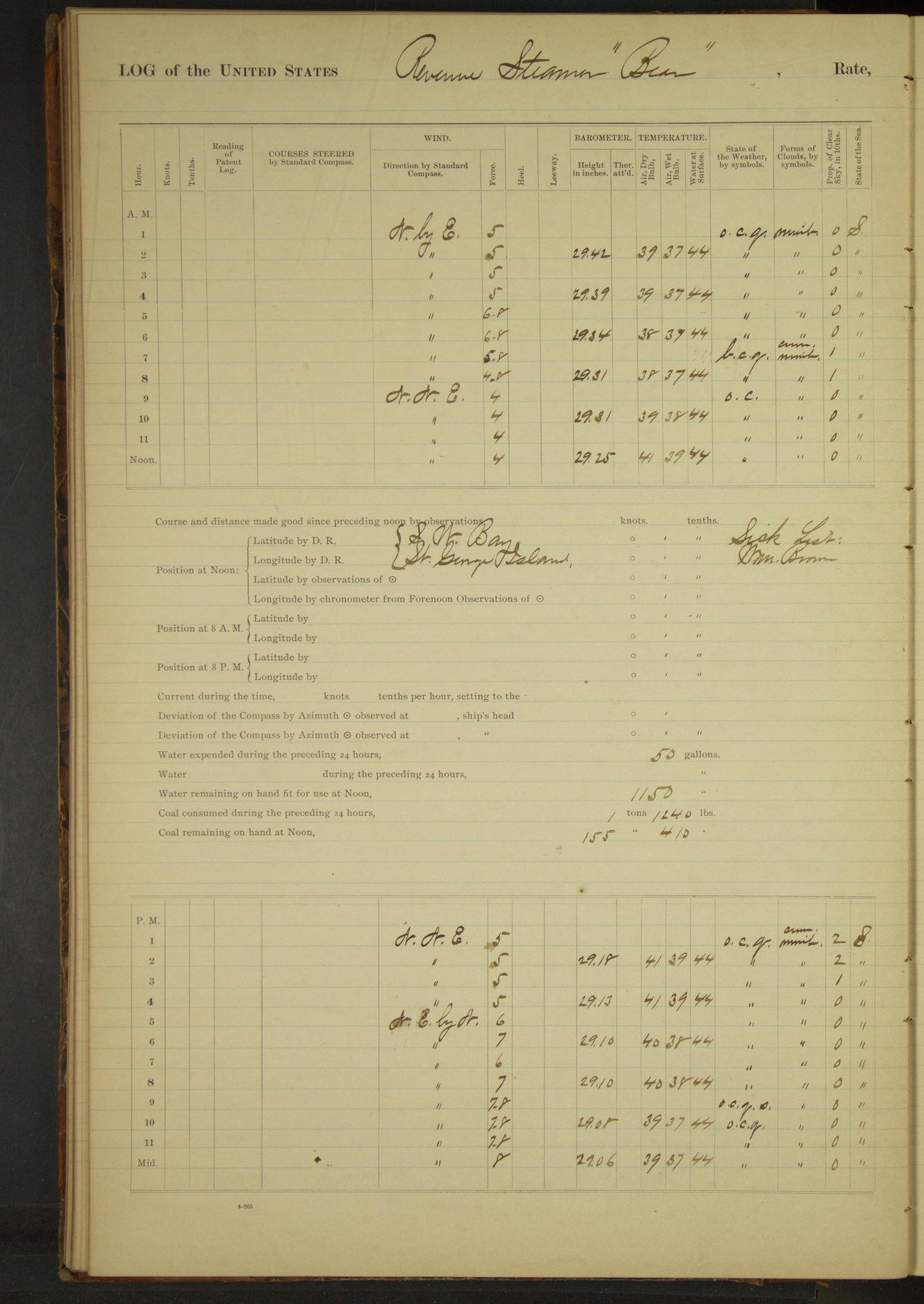
50874d6209d4090755001a75: (http://oldweather.s3.amazonaws.com/ow3/final/USRC Bear/vol070/vol070_040_1.jpg)
3 November 1891
SW Bay, St. George Island
Lat 56.57, Long -169.69
4am to 8am:
Fresh to moderate breeze with heavy squalls (force moderate gale). Moderate irregular swell. Heavy surf on beach; no landing.
Meridian to 4pm:
12.30: sent an officer ashore to communicate with guard at rookery. 2.20: officer returned, having ascertained that the seals were leaving the rookery rapidly.
50874d6209d4090755001a77: (http://oldweather.s3.amazonaws.com/ow3/final/USRC Bear/vol070/vol070_041_0.jpg)
50874d6209d4090755001a79: (http://oldweather.s3.amazonaws.com/ow3/final/USRC Bear/vol070/vol070_041_1.jpg)
4 November 1891
SW Bay, St. George Island
Lat 56.57, Long -169.69
Meridian to 4pm:
North gale. Light Westerly swell at intervals. Heavy surf on beach; no landing possible.
[Wind force 8 at start of day; gradually increasing to force 11 by 7pm]
50874d6209d4090755001a7b: (http://oldweather.s3.amazonaws.com/ow3/final/USRC Bear/vol070/vol070_042_0.jpg)
50874d6209d4090755001a7d: (http://oldweather.s3.amazonaws.com/ow3/final/USRC Bear/vol070/vol070_042_1.jpg)
5 November 1891
SW Bay, St. George Island [to Garden Cove]
Lat 56.57, Long -169.69
8am to meridian:
Heavy to strong gale NWbyN. Occasional snow squalls. Sea moderate. Heavy surf on beach. Swung in launch and secured it on deck.
[Wind force 11 from start of day to 9am]
Meridian to 4pm:
2.15: underway. 2.47: South Point abeam. 3.00: SE Point abeam. 3.55: anchored in Garden Cove. Sea Lion Point NxE½E, SE Point SWxS.
At anchor 22 hours 20 minutes.
Underway 1 hour 40 minutes.
Distance 10 miles.
50874d6209d4090755001a7f: (http://oldweather.s3.amazonaws.com/ow3/final/USRC Bear/vol070/vol070_043_0.jpg)
50874d6209d4090755001a81: (http://oldweather.s3.amazonaws.com/ow3/final/USRC Bear/vol070/vol070_043_1.jpg)
6 November 1891
Garden Cove, St. George Island [to St. Paul island]
Lat 57.06, Long -170.04 [Estimate from noon bearings]
4am to 8am:
6.05: underway. 6.50: Tolstoi Point bearing West, distant 1.2 miles.
8am: Lat 56° 41’ 30”N, Long 169° 35’W
8am to meridian:
Gentle to moderate WSW to WxS wind; squally with thick snow. Sea moderate.
Noon: Whale Point, St. Paul Island, WxN 8 miles.
Meridian to 4pm:
Moderate to stiff West to WxN wind; squally with snow. Sea moderate, 2.00: anchored, NE Point bearing NxW¾W, Walrus Island E½S, Cross Hill NW.
At anchor 16 hours 5 minutes.
Underway 7 hours 55 minutes. Distance 50 miles.
Under steam & canvas 3 hours 35 minutes. Distance 24 miles.
Under steam exclusively 4 hours 20 minutes. Distance 26 miles.
50874d6209d4090755001a83: (http://oldweather.s3.amazonaws.com/ow3/final/USRC Bear/vol070/vol070_044_0.jpg)
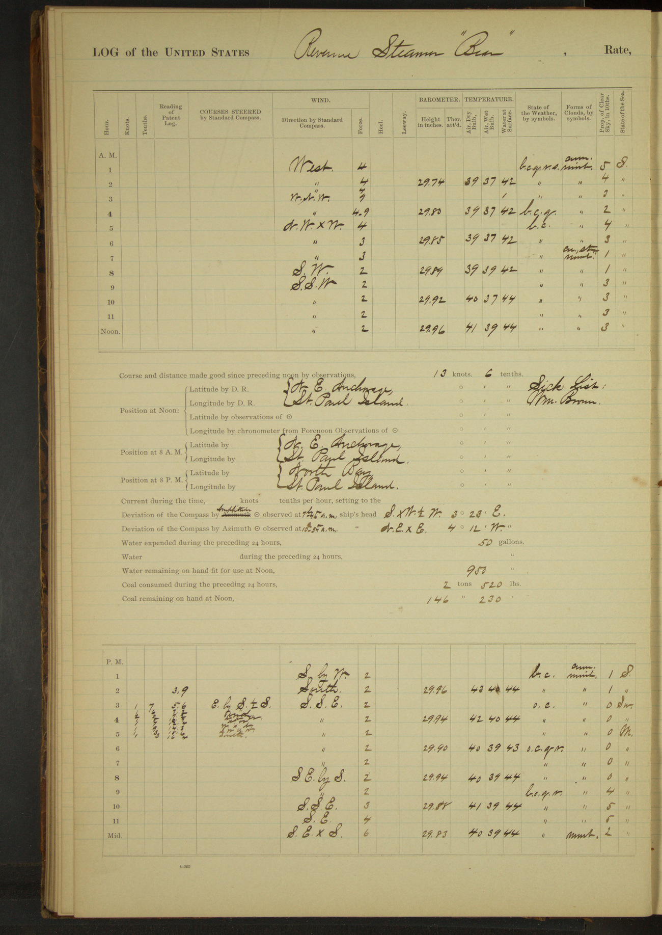
50874d6209d4090755001a85: (http://oldweather.s3.amazonaws.com/ow3/final/USRC Bear/vol070/vol070_044_1.jpg)
7 November 1891
NE Anchorage, St. Paul Island [to North Bay]
Lat 57.21, Long -170.10
Midnight to 4am:
First two hours moderate West wind. Last two hours moderate WNW wind with heavy squalls (force 9). Rain and snow squalls. Smooth sea.
Meridian to 4pm:
2.40: underway. 4.00: NE Point bore SW and Polovina Mountain SSW.
4pm to 6pm:
4.45 anchored in North Bay, St. Paul Island. Polovina Mountain bearing South, Cross Hill E½S, NE Point NExE½E.
6pm to 8pm:
Light SSE wind. Heavy NW swell. 6.00: set spanker to keep vessel head to wind.
8pm to midnight:
Light to fresh breeze SSE to SE. Heavy NW swell moderating. Occasional rain squalls. 11.00: took in spanker.
At anchor 21 hours 55 minutes.
Underway 2 hours 5 minutes.
Distance 13 miles.
50874d6209d4090755001a87: (http://oldweather.s3.amazonaws.com/ow3/final/USRC Bear/vol070/vol070_045_0.jpg)
50874d6209d4090755001a89: (http://oldweather.s3.amazonaws.com/ow3/final/USRC Bear/vol070/vol070_045_1.jpg)
8 November 1891
North Bay, St. Paul Island
Lat 57.24, Long -170.16
4am to 8am:
Strong gale from SE; overcast and squally. Moderate sea. 7.50 wind increasing [force 9 then force 11 from 9am to 4pm], veered to 65 fathoms on starboard chain. Heavy surf on beach.
50874d6209d4090755001a8b: (http://oldweather.s3.amazonaws.com/ow3/final/USRC Bear/vol070/vol070_046_0.jpg)
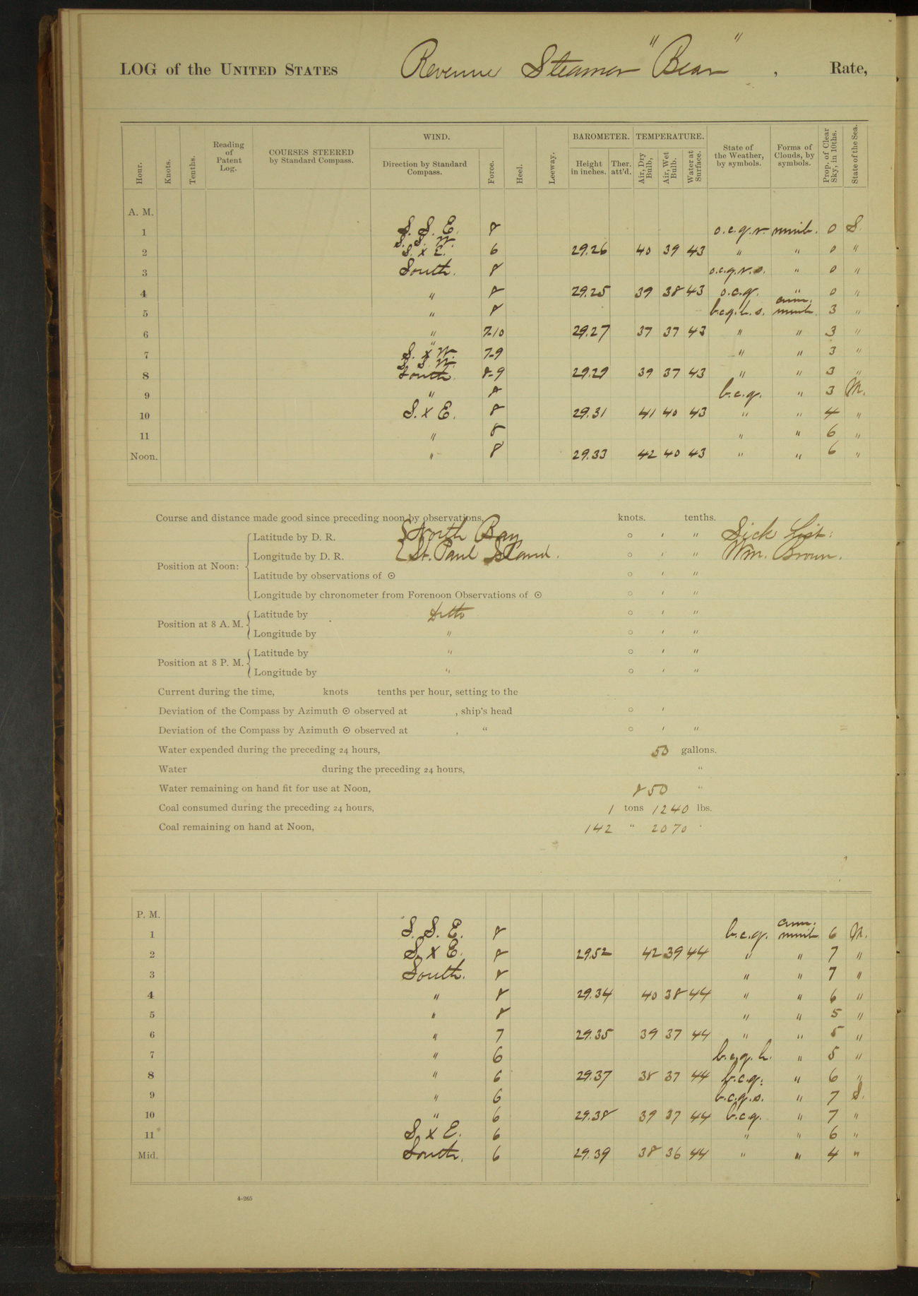
50874d6209d4090755001a8d: (http://oldweather.s3.amazonaws.com/ow3/final/USRC Bear/vol070/vol070_046_1.jpg)
9 November 1891
North Bay, St. Paul Island
Lat 57.24, Long -170.16
4am to 8am:
Moderate gale to fresh breeze from South to SSW with heavy squalls, accompanied by hail and snow. Light SW swell. Heavy surf on beach; no landing possible.
8am to meridian:
Very heavy break observed about two miles NNW of NE Point.
Meridian to 4pm:
Moderate gale from SSE to South, squally, light snow flurries. Heavy SW swell.
At 2.35 sighted US Revenue Steamer “Rush” passing on East side of island. At 3.40 the “Rush” came to anchor in North Bay. Unable to communicate with her on account of heavy sea. Heavy surf on beach.
4pm to 6pm:
Moderate gale to fresh breeze South, squally. Heavy SW swell. No landing possible on beach. Sea too rough to board steamer “Rush”.
6pm to 8pm:
Fresh South wind. Hail squall at end of first hour. Heavy WSW swell.
8pm to midnight:
Fresh South to SxE winds and squalls. Light snow flurries during first hour. Sea smooth. Heavy WSW swell.
50874d6209d4090755001a8f: (http://oldweather.s3.amazonaws.com/ow3/final/USRC Bear/vol070/vol070_047_0.jpg)
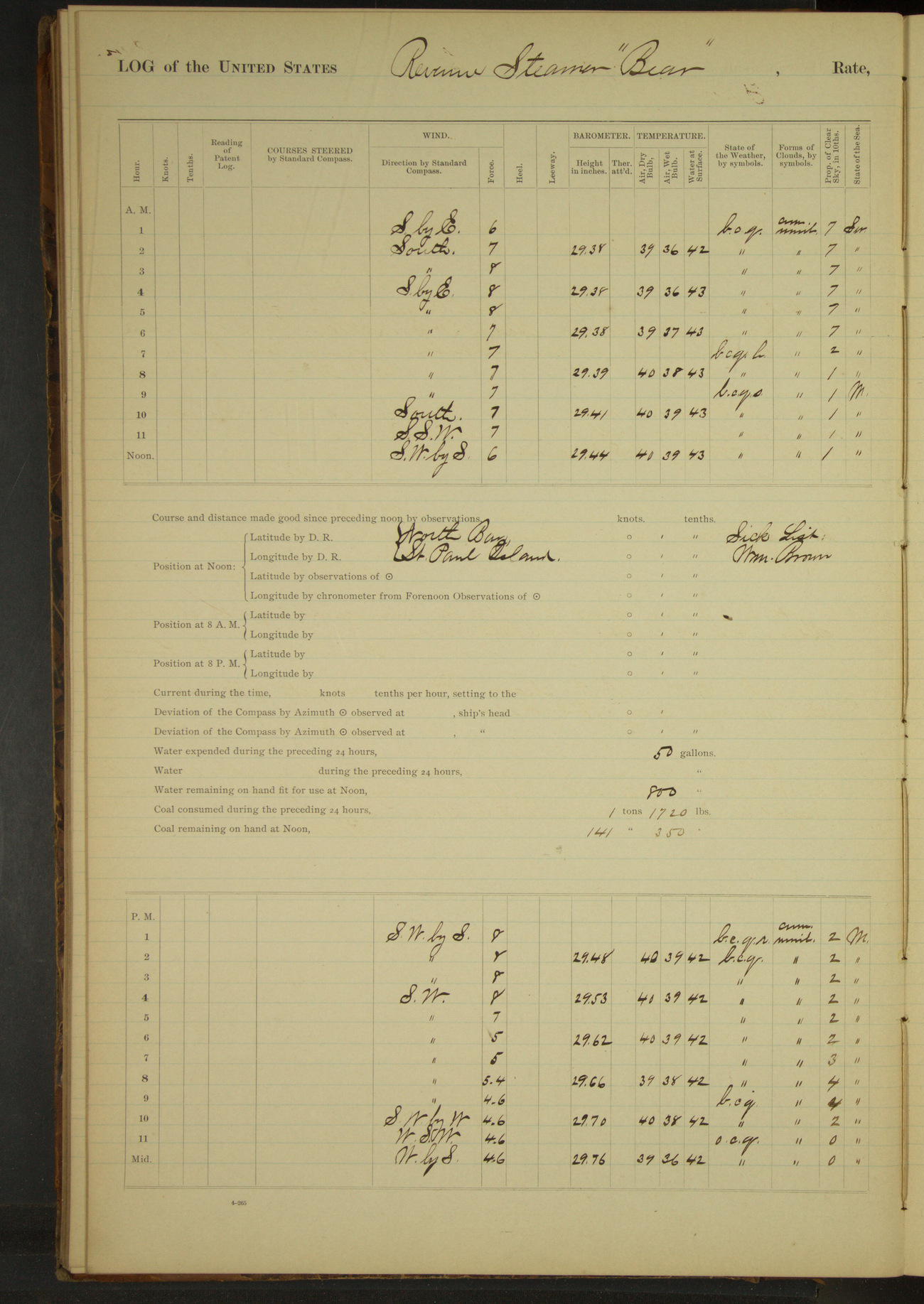
50874d6209d4090755001a91: (http://oldweather.s3.amazonaws.com/ow3/final/USRC Bear/vol070/vol070_047_1.jpg)
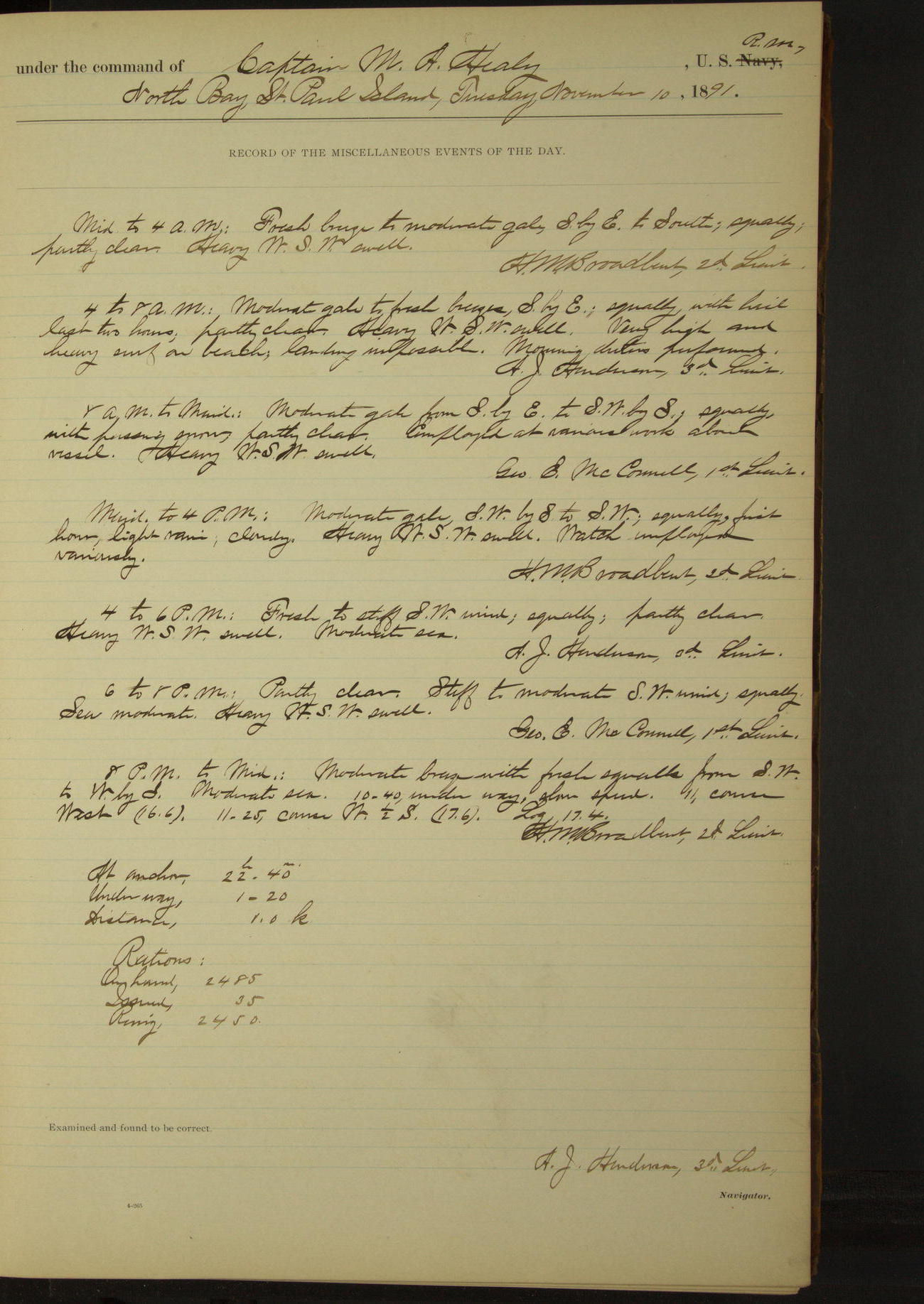
10 November 1891
North Bay, St. Paul Island [& at sea]
Lat 57.24, Long -170.16
4am to 8am:
Moderate to fresh breeze SbyE; squally with hail last two hours. Heavy WSW swell. Very high and heavy surf on beach, landing impossible.
8pm to midnight:
10.40: underway.
At anchor 22 hours 40 minutes.
Underway 1 hour 20 minutes.
Distance 1 mile.
50874d6209d4090755001a93: (http://oldweather.s3.amazonaws.com/ow3/final/USRC Bear/vol070/vol070_048_0.jpg)
50874d6209d4090755001a95: (http://oldweather.s3.amazonaws.com/ow3/final/USRC Bear/vol070/vol070_048_1.jpg)
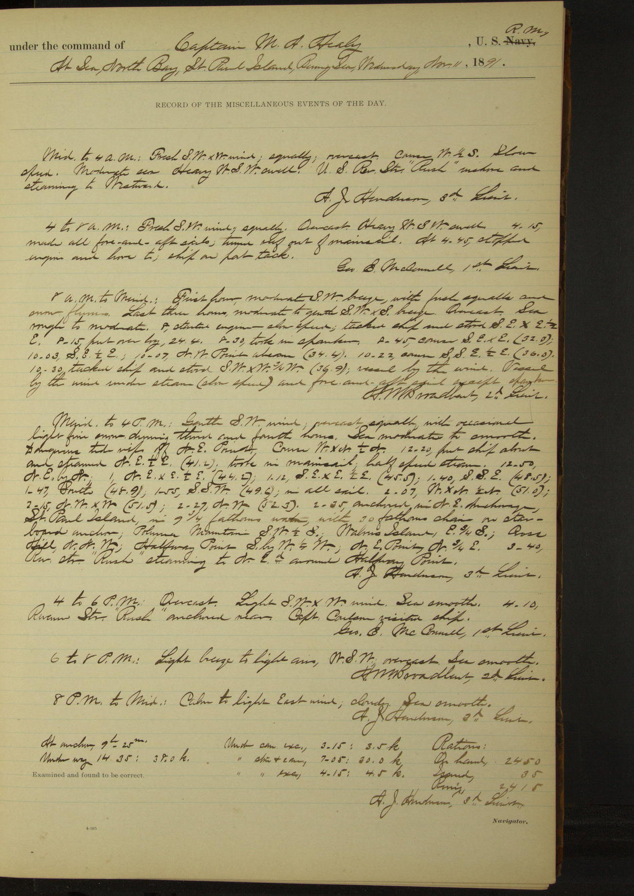
11 November 1891
At sea, North Bay [probably NE anchorage], St. Paul Island
Lat 57.23, Long -170.18 [Estimate from noon bearings]
Midnight to 4am:
US Revenue Steamer “Rush” inshore and steaming to Westward.
8am: Lat 57° 22’N, Long 170° 25’W
8am to meridian:
10.07: NW Point abeam.
Noon: NE Point St. Paul Island NE, 3 miles
Meridian to 4pm:
Gentle SW wind. Sea moderate to smooth. Dangerous tide rips off NE Point. 2.35: anchored in NE anchorage, St. Paul Island. Polovina Mountain SW½S, Walrus Island E¾S.
3.40: Revenue Steamer “Rush” steaming to North-eastward around Halfway Point.
4pm to 6pm:
4.10: Revenue Steamer “Rush” anchored near. Captain Coulson visited ship.
At anchor 9 hours 25 minutes.
Underway 14 hours 35 minutes. Distance 38 miles.
Under canvas exclusively 3 hours 15 minutes. Distance 3.5 miles.
Under steam & canvas 7 hours 5 minutes. Distance 30 miles.
Under steam exclusively 4 hours 15 minutes. Distance 4.5 miles.
50874d6209d4090755001a97: (http://oldweather.s3.amazonaws.com/ow3/final/USRC Bear/vol070/vol070_049_0.jpg)
50874d6209d4090755001a99: (http://oldweather.s3.amazonaws.com/ow3/final/USRC Bear/vol070/vol070_049_1.jpg)
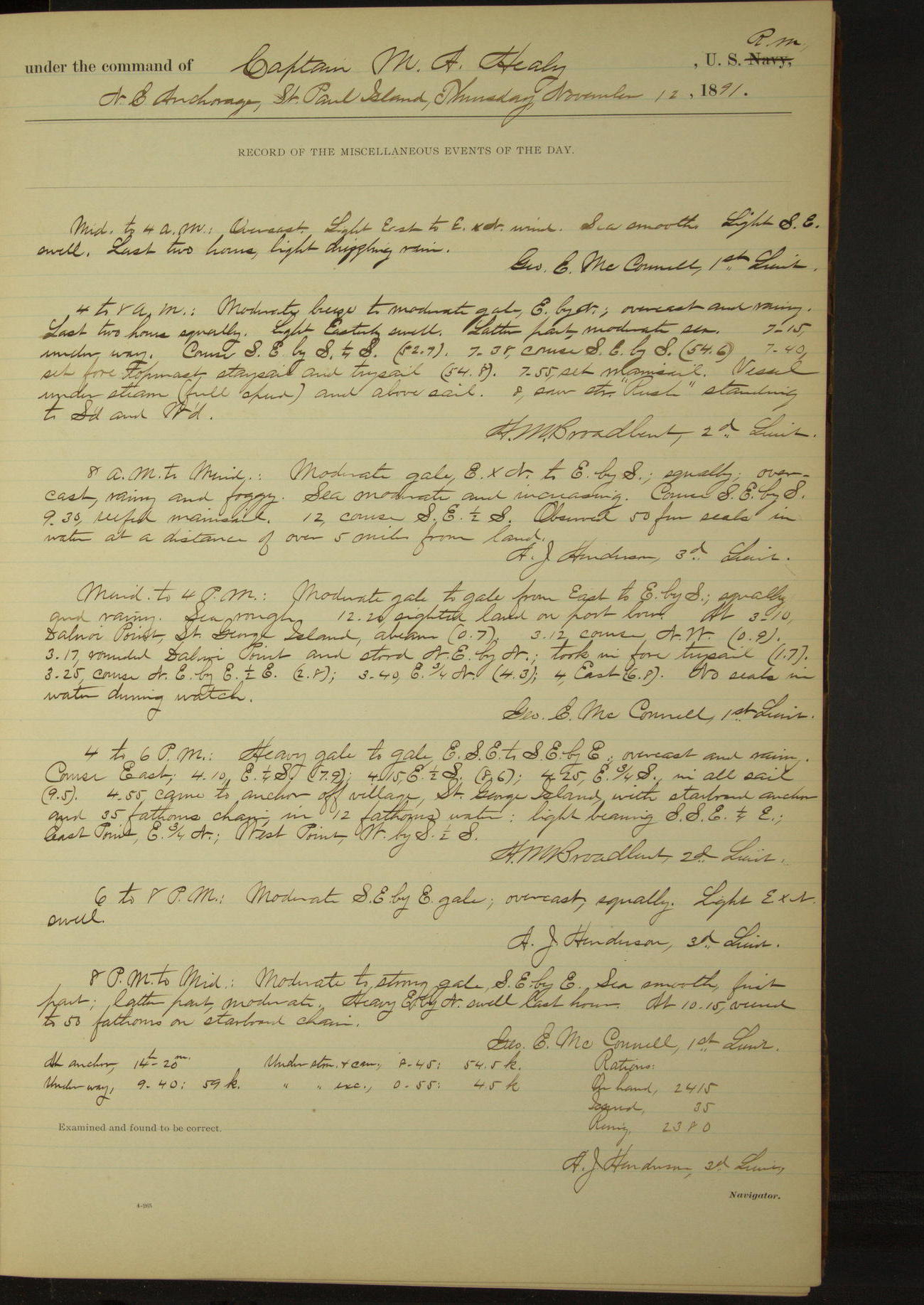
12 November 1891
NE anchorage, St. Paul Island [to St. George Island]
Lat 56.73, Long -169.87
4am to 8am:
7.15: underway. 8.00: saw steamer “Rush” standing to Southward and Westward.
8am: Lat 57° 08’N, Long 170° 04’ 30”W
8am to meridian:
Observed 50 fur seals in water at a distance of over 5 miles from land.
Meridian to 4pm:
12.20: sighted land on port bow. At 3.10 Dalnoi Point, St. George Island, abeam. 3.17: rounded Dalnoi Point and stood NEbyN. No seals in water during watch.
4pm to 6pm:
4.55: came to anchor off village, St. George Island. East Point E¾N, West Point WbyS½S.
At anchor 14 hours 20 minutes.
Underway 9 hours 40 minutes. Distance 59 miles.
Under steam & canvas 8 hours 45 minutes. Distance 54.5 miles.
Under steam exclusively 55 minutes. Distance 4.5 miles.
50874d6209d4090755001a9b: (http://oldweather.s3.amazonaws.com/ow3/final/USRC Bear/vol070/vol070_050_0.jpg)
50874d6209d4090755001a9d: (http://oldweather.s3.amazonaws.com/ow3/final/USRC Bear/vol070/vol070_050_1.jpg)
13 November 1891
North anchorage, St. George Island [to SW Bay]
Lat 56.61, Long -169.55
Meridian to 4pm:
2.05: underway.
4pm to 6pm:
4.35 anchored. East Point SEbyE, West Point WbyN¾N.
6pm to 8pm:
Unbent spanker to repair it.
8pm to midnight:
Heavy gale ENE to EbyN, violent squalls. Very stormy weather [wind force 11 from 9pm to midnight]. 8.00: veered to 60 fathoms chain. 10.30: veered to 70 fathoms chain. Heavy SE swell.
At anchor 21 hours 30 minutes.
Underway 2 hours 30 minutes.
Distance 17 miles.
50874d6209d4090755001a9f: (http://oldweather.s3.amazonaws.com/ow3/final/USRC Bear/vol070/vol070_051_0.jpg)
50874d6209d4090755001aa1: (http://oldweather.s3.amazonaws.com/ow3/final/USRC Bear/vol070/vol070_051_1.jpg)
14 November 1891
SW Bay, St. George Island [to North anchorage]
Lat 56.57, Long -169.68
Midnight to 4am:
Heavy gale to gale EbyN to East; squally. Sea rough and heavy. Flying sand. Very heavy surf on beach.
8am to meridian:
Strong gale from East to EbyS; squally. Light SE swell. Bent storm mizzen; set it to keep vessel head to wind.
Meridian to 4pm:
Moderate gale to gale EbyS to SE; squally. 1.55: underway. 2.53: Dalnoi Point abeam. Sea smooth to rough. Heavy ENE swell.
4pm to 6pm:
Strong SE gale. Heavy ENE swell. Heavy surf on beach. 4.30: came to anchor off village, St. George Island.
6pm to 8pm:
Strong SE gale, squally; flying sand. Heavy ENE swell. Heavy surf on beach, no landing possible.
8pm to meridian:
Strong gale to fresh breeze SE; squally. Flying sand from SE. Heavy ENE swell. Heavy surf on beach.
At anchor 21 hours 25 minutes.
Underway 2 hours 35 minutes.
Distance 15 miles.
50874d6209d4090755001aa3: (http://oldweather.s3.amazonaws.com/ow3/final/USRC Bear/vol070/vol070_052_0.jpg)
50874d6209d4090755001aa5: (http://oldweather.s3.amazonaws.com/ow3/final/USRC Bear/vol070/vol070_052_1.jpg)
15 November 1891
North anchorage, St. George Island
Lat 56.61, Long -169.55
Midnight to 4am:
Moderate gale SE to SSE; squally. Heavy ENE swell. Heavy surf on beach. Flying sand from SE.
4am to 8am:
First hour moderate ESE gale; last three hours fresh breeze with squalls (force 8). Moderate ENE swell. Heavy surf on beach; no landing possible.
[Heavy or moderate surf on beach to 8pm]
50874d6209d4090755001aa7: (http://oldweather.s3.amazonaws.com/ow3/final/USRC Bear/vol070/vol070_053_0.jpg)
50874d6209d4090755001aa9: (http://oldweather.s3.amazonaws.com/ow3/final/USRC Bear/vol070/vol070_053_1.jpg)
16 November 1891
North anchorage, St. George Island [& at sea]
Lat 56.18, Long -168.98
4am to 8am:
7.45: underway.
8am to meridian:
Heavy West swell. 10.00: Tolstoi Point, St. George Island bore NW¾W.
8pm: Lat 55° 35’ 35”N, Long 167° 55’ 22”W
8pm to midnight:
Moderate breeze from South to SbyE; halo around the moon. Heavy SW swell, decreasing at end of watch.
At anchor 7 hours 45 minutes.
Underway 16 hours 15 minutes. Distance 122 miles.
Under steam and canvas 15 hours 30 minutes. Distance 118 miles.
Under steam exclusively 45 minutes. Distance 4 miles.
50874d6209d4090755001aab: (http://oldweather.s3.amazonaws.com/ow3/final/USRC Bear/vol070/vol070_054_0.jpg)
50874d6209d4090755001aad: (http://oldweather.s3.amazonaws.com/ow3/final/USRC Bear/vol070/vol070_054_1.jpg)
17 November 1891
At sea, Bering Sea [& Unalaska]
Lat 53.88, Long -166.55
4am to 8am:
6.00: Sighted land bearing SbyE½E.
8am: Lat 54° 18’N, Long 166° 27’W
8am to meridian:
10.30: Cascade, Cape Cheerful, abeam. 11.45: made fast to Alaska Commercial Co’s wharf, Unalaska.
Meridian to 4pm:
Crew employed receiving stores, cleaning vessel’s water line, making preparations for taking out coal. 2nd Lieutenant DH Jarvis returned on board.
At anchor 12 hours 15 minutes.
Underway 11 hours 45 minutes. Distance 83 miles.
Under steam & canvas 4 hours 5 minutes. Distance 27.5 miles.
Under steam exclusively 7 hours 40 minutes. Distance 55.5 miles.
50874d6209d4090755001aaf: (http://oldweather.s3.amazonaws.com/ow3/final/USRC Bear/vol070/vol070_055_0.jpg)
50874d6209d4090755001ab1: (http://oldweather.s3.amazonaws.com/ow3/final/USRC Bear/vol070/vol070_055_1.jpg)
18 November 1891
Unalaska Harbor
Lat 53.88, Long -166.55
Sick list: Charles Henry, Seaman [to 24th November]; H Honda, 1st class Boy.
4am to 8am:
Employed getting Point Barrow Refuge Station coal from bunkers and stowing same in storehouse on shore.
8am to meridian:
Discharging anthracite coal for Point Barrow Refuge Station into US Coal House. Blacking ship outside. Filling tanks with fresh water.
Meridian to 4pm:
Discharging coal as in forenoon. Finished blacking ship outside. Finished taking water, having received 4400 gallons.
50874d6209d4090755001ab3: (http://oldweather.s3.amazonaws.com/ow3/final/USRC Bear/vol070/vol070_056_0.jpg)
50874d6209d4090755001ab5: (http://oldweather.s3.amazonaws.com/ow3/final/USRC Bear/vol070/vol070_056_1.jpg)
19 November 1891
Unalaska Harbor
Lat 53.88, Long -166.55
Sick list: H Honda, 1st class Boy.
4am to 8am:
Employed putting coal on board vessel from AC Co’s wharf.
Midnight to 4pm:
3.00: stopped coaling for the day on account of stormy weather.
50874d6209d4090755001ab7: (http://oldweather.s3.amazonaws.com/ow3/final/USRC Bear/vol070/vol070_057_0.jpg)
50874d6209d4090755001ab9: (http://oldweather.s3.amazonaws.com/ow3/final/USRC Bear/vol070/vol070_057_1.jpg)
20 November 1891
Unalaska Harbor
Lat 53.88, Long -166.55
Sick list: H Honda, 1st class Boy.
4am to 8am:
At 7.00 commenced putting coal on board vessel from AC Co’s wharf.
4pm to 8pm:
4.30: finished coaling, having received 100 tons Nanaimo coal from Alaska Commercial Co.
50874d6309d4090755001abb: (http://oldweather.s3.amazonaws.com/ow3/final/USRC Bear/vol070/vol070_058_0.jpg)
50874d6309d4090755001abd: (http://oldweather.s3.amazonaws.com/ow3/final/USRC Bear/vol070/vol070_058_1.jpg)
21 November 1891
Unalaska Harbor
Lat 53.88, Long -166.55
8am to meridian:
Took on board and secured whaleboat belonging to McGrath survey party.
Meridian to 4pm:
Received on board Charles Poole, master of schooner “Margharette”, for transportation to San Francisco. Issued him a ration.
50874d6309d4090755001abf: (http://oldweather.s3.amazonaws.com/ow3/final/USRC Bear/vol070/vol070_059_0.jpg)
50874d6309d4090755001ac1: (http://oldweather.s3.amazonaws.com/ow3/final/USRC Bear/vol070/vol070_059_1.jpg)
22 November 1891
Unalaska Harbor
Lat 53.88, Long -166.55
4am to 8am:
Light to moderate SSE to ESE wind, squally, overcast and threatening. Barometer falling rapidly.
Meridian to 4pm:
Fresh to moderate ESE to NEbyE wind, overcast, rain and fog. Barometer falling rapidly [28.90 inches by end of day]. Weather threatening.
50874d6309d4090755001ac3: (http://oldweather.s3.amazonaws.com/ow3/final/USRC Bear/vol070/vol070_060_0.jpg)
50874d6309d4090755001ac5: (http://oldweather.s3.amazonaws.com/ow3/final/USRC Bear/vol070/vol070_060_1.jpg)
23 November 1891
Unalaska Harbor [& at sea]
Lat 54.31, Long -166.81
Midnight to 4am:
Received on board for transportation to San Francisco, S Applegate and baggage.
4am to 8am:
At 7.20 underway and stood out of harbor.
8am to meridian:
8.52: Cascade, Cape Cheerful, bore SW½S. Saw one fur seal in water during watch.
8pm: Lat 55° 03’ 48”N, Long 167° 35’ 03”W
At anchor 7 hours 20 minutes.
Underway 16 hours 40 minutes. Distance 109 miles.
Under steam & canvas 14 hours 20 minutes. Distance 93.5 miles.
Under steam exclusively 2 hours 20 minutes. Distance 15.5 miles.
50874d6309d4090755001ac7: (http://oldweather.s3.amazonaws.com/ow3/final/USRC Bear/vol070/vol070_061_0.jpg)
50874d6309d4090755001ac9: (http://oldweather.s3.amazonaws.com/ow3/final/USRC Bear/vol070/vol070_061_1.jpg)
24 November 1891
At sea, Bering Sea
Lat 56.28, Long -169.50
Sick list: T Richards, Coxswain.
Midnight to 4am:
3.45: leech-rope of mainsail parted, took in sail.
8am: Lat 56° 04’ 06”N, Long 168° 39’ 14”W
8am to meridian:
Unbent mainsail and bent new one. 10.15: set mainsail. 11.35: made land bearing NWbyN.
Meridian to 4pm:
2.30: came to anchor in SW Bay, St. George Island. East Point SEbyE, West Point WbyN¼N.
Sent 2nd Lieutenant Jarvis ashore on official business. 3.55: Lieutenant Jarvis returned.
At anchor 9 hours 30 minutes.
Underway 14 hours 30 minutes. Distance 83 miles.
Under steam and canvas 14 hours 5 minutes. Distance 79 miles.
Under steam exclusively 25 minutes. Distance 4 miles.
50874d6309d4090755001acb: (http://oldweather.s3.amazonaws.com/ow3/final/USRC Bear/vol070/vol070_062_0.jpg)
50874d6309d4090755001acd: (http://oldweather.s3.amazonaws.com/ow3/final/USRC Bear/vol070/vol070_062_1.jpg)
25 November 1891
SW Bay, St. George Island
Lat 56.57, Long -169.68
Sick list: T Richards, Coxswain; N Onoki [?], Ward Room Boy.
8am to meridian:
Sent boat ashore for mail and communication with village. Received mail and learned through natives that a raid had been made on Great Eastern Rookery on the night of November 18.
50874d6309d4090755001acf: (http://oldweather.s3.amazonaws.com/ow3/final/USRC Bear/vol070/vol070_063_0.jpg)
50874d6309d4090755001ad1: (http://oldweather.s3.amazonaws.com/ow3/final/USRC Bear/vol070/vol070_063_1.jpg)
26 November 1891
SW Bay, St. George Island
Lat 56.57, Long -169.68
8am to meridian:
Sent boat ashore to inquire about seals, and learned that there were about 300 on the entire island.
50874d6309d4090755001ad3: (http://oldweather.s3.amazonaws.com/ow3/final/USRC Bear/vol070/vol070_064_0.jpg)
50874d6309d4090755001ad5: (http://oldweather.s3.amazonaws.com/ow3/final/USRC Bear/vol070/vol070_064_1.jpg)
27 November 1891
SW Bay, St. George Island [to St. Paul Island]
Lat 57.12, Long -170.26
Midnight to 4am:
12.35: underway. 1.30: Dalnoi Point NE 1.5 miles.
4am to 8am:
7.30: raised land on port bow.
8am to meridian:
8.35: anchored in SE anchorage, St. Paul Island. Black Bluffs bearing NWbyW½W, Whale Point N½W, Otter Island SSW½W.
Communicated with the shore and learned that no vessels had been seen from the island during the last month.
10.00: US Revenue Steamer “Rush” anchored near. Commanding Officer visited “Rush”.
Meridian to 4pm:
First three hours, stiff breeze to moderate gale West, overcast, thick snow storm. 3.00: wind moderated to a light breeze and shifted to NW, gradually hauling to NbyW. Ceased snowing. Light NE swell.
NA Commercial Co’s agent Redpath visited vessel.
6pm to 8pm:
Dr. SJ Call, by permission of Commanding Officer, exchanged with Dr. JCS Ackerly, formerly of US Revenue Steamer “Corwin”, whose health precluded his remaining on St. Paul Island during the winter.
At anchor 16 hours.
Underway 8 hours.
Distance 44 miles.
50874d6309d4090755001ad7: (http://oldweather.s3.amazonaws.com/ow3/final/USRC Bear/vol070/vol070_065_0.jpg)
50874d6309d4090755001ad9: (http://oldweather.s3.amazonaws.com/ow3/final/USRC Bear/vol070/vol070_065_1.jpg)
28 November 1891
SE anchorage, St. Paul Island [to SW Bay]
Lat 57.12, Long -170.26
4am to 8am:
At 4.20 US Revenue Steamer “Rush” got underway and stood to the SE.
8am to meridian:
Mr. Redpath, NA Commercial Co’s Agent, visited vessel.
Meridian to 4pm:
2.00: underway. 3.00: anchored in SW Bay, St. Paul Island. Sea Lion Rock [Point in log] SSE½E, Tolstoi Point North.
At anchor 23 hours.
Underway 1 hour.
Distance 5.5 miles.
50874d6309d4090755001adb: (http://oldweather.s3.amazonaws.com/ow3/final/USRC Bear/vol070/vol070_066_0.jpg)
50874d6309d4090755001add: (http://oldweather.s3.amazonaws.com/ow3/final/USRC Bear/vol070/vol070_066_1.jpg)
29 November 1891
SW Bay, St. Paul Island [to SE anchorage]
Lat 57.12, Long -170.25
Midnight to 4am:
Light to gentle NbyE to NE byN wind, snowing. Last hour, thick snow storm.
4am to 8am:
Gentle NW to NWbyW winds, thick snow storm [snowing all day; air temperature 28 to 32°F].
8am to meridian:
8.00: underway. 9.35: anchored in SE anchorage, St. Paul Island. Whale Point NW, Sea Lion Rock SW½S. Saw 20 fur seals in water during watch.
50874d6309d4090755001adf: (http://oldweather.s3.amazonaws.com/ow3/final/USRC Bear/vol070/vol070_067_0.jpg)
50874d6309d4090755001ae1: (http://oldweather.s3.amazonaws.com/ow3/final/USRC Bear/vol070/vol070_067_1.jpg)
30 November 1891
SE anchorage, St. Paul Island
Lat 57.12, Long -170.25
Midnight to 4am:
Fresh NNW winds to moderate NW gale, snowing [snowing all day, air temperature 25 to 28°F, wind force 6 to 8].
8am to meridian:
10.00: sent boat to communicate with shore in answer to signals on beach. Ascertained that the seals had all left the rookeries. A few remained in the water near the shore, but were leaving the vicinity of the island rapidly.
50874d6309d4090755001ae3: (http://oldweather.s3.amazonaws.com/ow3/final/USRC Bear/vol070/vol070_068_0.jpg)
[Blank page]
50874d6309d4090755001ae5: (http://oldweather.s3.amazonaws.com/ow3/final/USRC Bear/vol070/vol070_068_1.jpg)
Summary of abstract for November 1891
At anchor 595 hours 10 minutes.
Underway 124 hours 50 minutes.
Under steam and canvas 70 hours 10 minutes.
Under steam exclusively 43 hours 35 minutes.
Hours under canvas exclusively 11 hours 5 minutes.
Distance under steam and canvas 445.5 miles.
Distance under steam exclusively 234.5 miles.
Distance under canvas exclusively 11.5 miles.
Total distance cruised 691.5 miles.
Number of Officers present average 8 14/30
Number of Petty Officers & crew present average 40
Rations issued 1060.
Time underway 5 days, 4 hours, 50 minutes.
Days not cruising: 14.
Sundays: 3.
Coal on hand 161 350/2240 tons.
Coal received 100 tons.
Total 261 350/2240 tons.
Coal expended 81 680/2240 tons.
Coal remaining 179 1910/2240 tons.
Coal drawn from Alaska Commercial Co at Unalaska 100 tons.
LOGS FOR DECEMBER 1891
50874d6309d4090755001ae7: (http://oldweather.s3.amazonaws.com/ow3/final/USRC Bear/vol070/vol070_069_0.jpg)
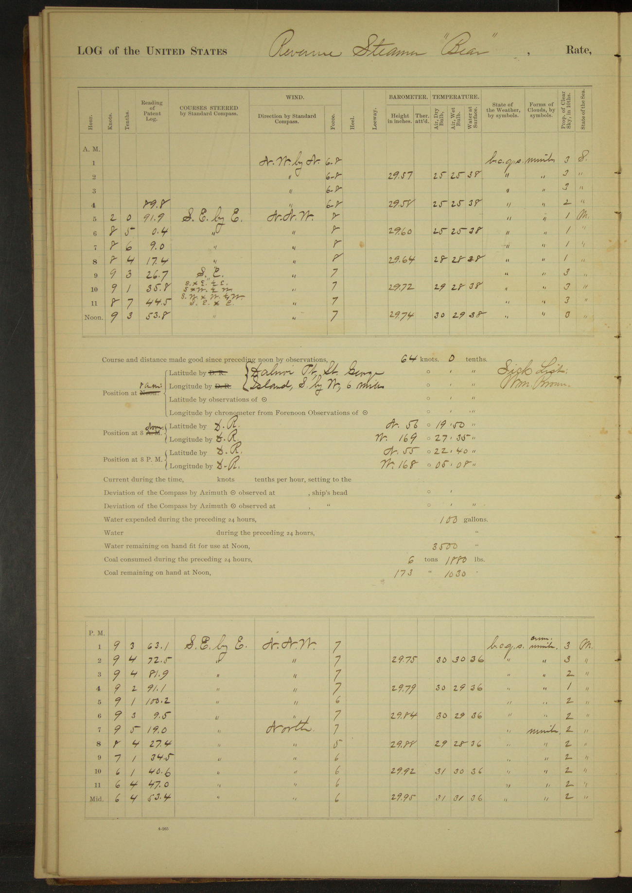
50874d6309d4090755001ae9: (http://oldweather.s3.amazonaws.com/ow3/final/USRC Bear/vol070/vol070_069_1.jpg)
1 December 1891
SE anchorage, St. Paul Island [& at sea]
Lat 56.33, Long -169.46
[Snowing all day, air temperature 25 to 31°F, wind force 5 to 8]
4am to 8am:
4.30: underway. 6.55: raised land bearing SSE.
8am: Dalnoi Point, St. George Island, SxW, 6 miles
8am to meridian:
9.15: Tolstoi Point abeam 1 mile. 10.00: by South Point of St. George. 10.30: looked into SW Bay. No vessels in sight. 10.35: SE Point abeam 4 miles.
8pm: Lat 55° 22’ 40”N, Long 168° 05’ 08”W
At anchor 4 hours 30 minutes.
Underway 19 hours 30 minutes. Distance 163.6 miles.
Under steam & canvas 14 hours 30 minutes. Distance 130.7 miles.
Under steam exclusively 1 hour 30 minutes. Distance 10.6 miles.
Under canvas exclusively 3 hours 30 minutes. Distance 22.3 miles.
50874d6309d4090755001aeb: (http://oldweather.s3.amazonaws.com/ow3/final/USRC Bear/vol070/vol070_070_0.jpg)
50874d6309d4090755001aed: (http://oldweather.s3.amazonaws.com/ow3/final/USRC Bear/vol070/vol070_070_1.jpg)
2 December 1891
At sea, Bering Sea [to San Francisco]
Lat 53.90, Long -166.44
4am to 8am:
6.25: raised land bearing SxE. At 7.30 Cape Cheerful S¾E.
8am: Lat 54° 12’N, Long 166° 26’ 30”W
8am to meridian:
9.50: Priest Rock bore SW. 11.36: Egg Island bore SbyW, distant 1.3 miles, from which departure is taken.
8pm: Lat 53° 21’ 42”N, Long 164° 15’ 48”W
Underway 24 hours. Distance 205 miles.
Under steam and canvas 19 hours. Distance 164.7 miles.
Under steam exclusively 5 hours. Distance 40.6 miles.
50874d6309d4090755001aef: (http://oldweather.s3.amazonaws.com/ow3/final/USRC Bear/vol070/vol070_071_0.jpg)
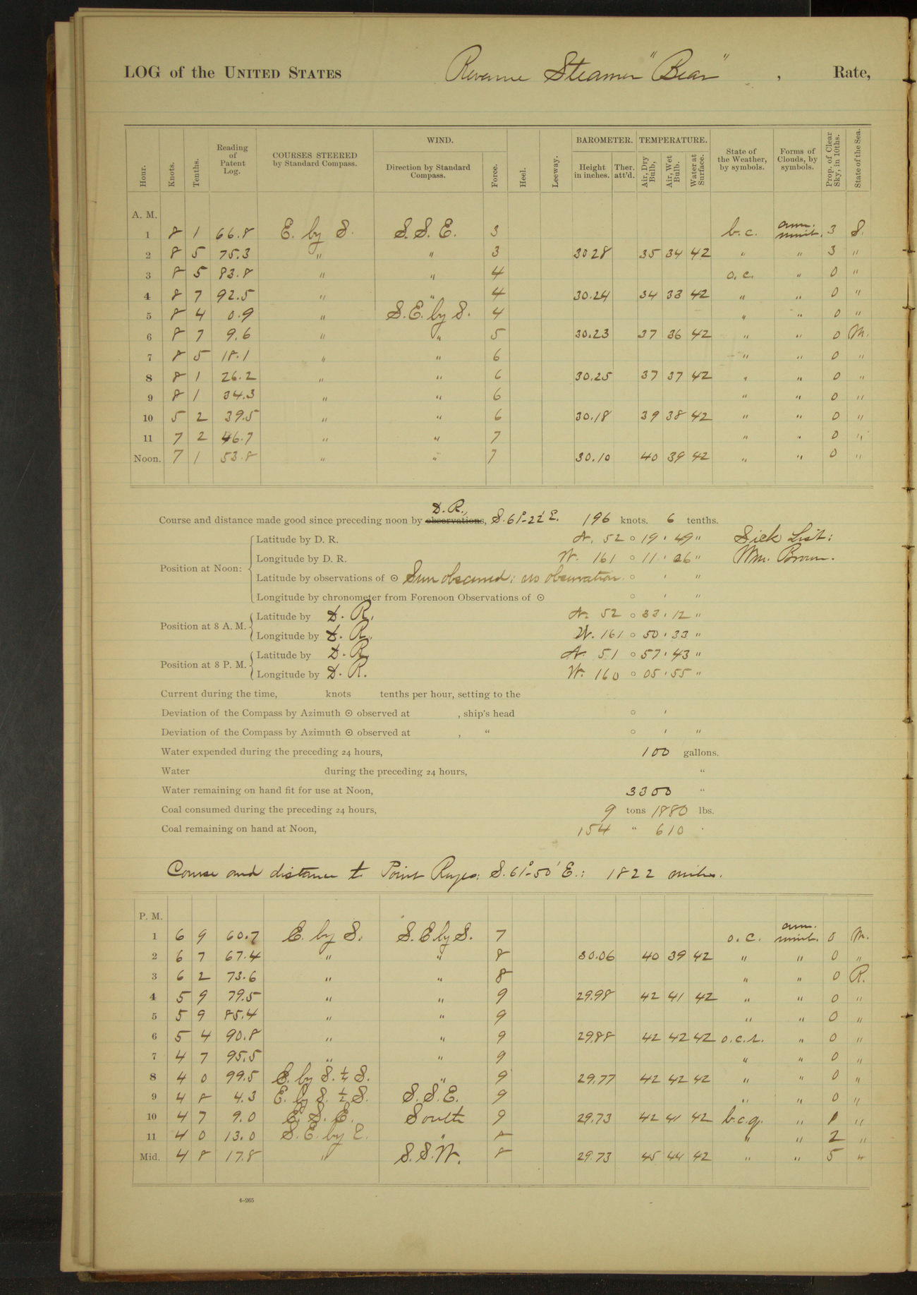
50874d6309d4090755001af1: (http://oldweather.s3.amazonaws.com/ow3/final/USRC Bear/vol070/vol070_071_1.jpg)
3 December 1891
At sea
Lat 52.33, Long -161.19
8am: Lat 52° 33’ 12”N, Long 161° 50’ 33”W
8pm: Lat 51° 57’ 43”N, Long 160° 05’ 55”W
Under steam and canvas 24 hours. Distance 159.1 miles.
50874d6309d4090755001af3: (http://oldweather.s3.amazonaws.com/ow3/final/USRC Bear/vol070/vol070_072_0.jpg)
50874d6309d4090755001af5: (http://oldweather.s3.amazonaws.com/ow3/final/USRC Bear/vol070/vol070_072_1.jpg)
4 December 1891
At sea
Lat 50.97, Long -157.63
8am: Lat 51° 13’ 37”N, Long 158° 21’ 31”W
8pm: Lat 50° 32’ 49”N, Long 156° 24’ 44”W
Under sail & steam 24 hours. Distance 172 miles.
50874d6309d4090755001af7: (http://oldweather.s3.amazonaws.com/ow3/final/USRC Bear/vol070/vol070_073_0.jpg)
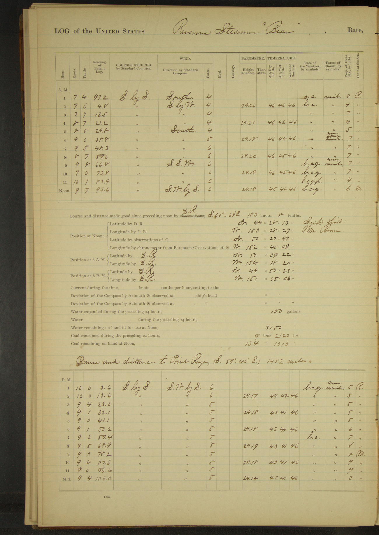
50874d6309d4090755001af9: (http://oldweather.s3.amazonaws.com/ow3/final/USRC Bear/vol070/vol070_073_1.jpg)
5 December 1891
At sea
Lat 50.46, Long -152.77
8am: Lat 50° 09’ 22”N, Long 154° 18’ 20”W
8pm: Lat 49° 50’ 23”N, Long 151° 05’ 03”W
Under steam & canvas 24 hours. Distance 216.2 miles.
50874d6309d4090755001afb: (http://oldweather.s3.amazonaws.com/ow3/final/USRC Bear/vol070/vol070_074_0.jpg)
50874d6309d4090755001afd: (http://oldweather.s3.amazonaws.com/ow3/final/USRC Bear/vol070/vol070_074_1.jpg)
6 December 1891
At sea
Lat 48.95, Long -148.15
Midnight to 4am:
Fresh South wind to moderate SbyE gale, squally and rainy. 3.30: wind increasing and barometer falling rapidly, took in jib, upper topsail and foresail.
4am to 8am:
Moderate to strong gale from SSE to SW, squally with hail and rain. Sea rough and increasing. 4.10: took in lower topsail. 7.30: put second reef in mainsail and slowed engine to half speed.
8am: Lat 49° 00’ 17”N, Long 148° 51’ 36”W
Meridian to 4pm:
Strong gale SWbyS, squally. Second and fourth hours violent squalls with rain. Very heavy sea. 1.55: kept off NE on account of heavy squall. 3.30: wind shifted to SW in heavy squall.
6pm to 8pm:
Strong SWbyS gale, heavy squalls with rain and hail. Heavy SW sea. Frequent lightning in SE.
8pm: Lat 48° 30’ 27”N, Long 146° 24’ 40”W
8pm to midnight:
SW gale, heavy squalls, rain and hail squalls. Heavy SW sea. Frequent lightning in SE.
Under steam & canvas 24 hours. Distance 204.2 miles.
50874d6309d4090755001aff: (http://oldweather.s3.amazonaws.com/ow3/final/USRC Bear/vol070/vol070_075_0.jpg)
50874d6309d4090755001b01: (http://oldweather.s3.amazonaws.com/ow3/final/USRC Bear/vol070/vol070_075_1.jpg)
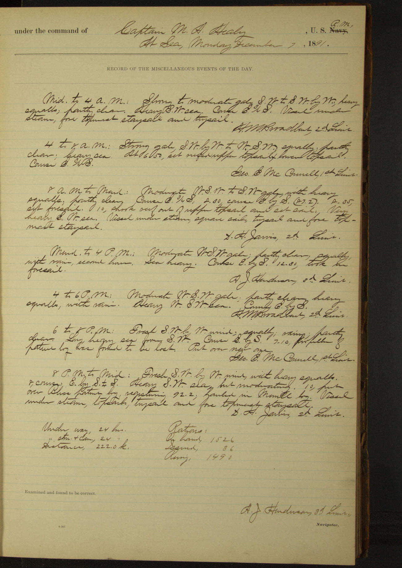
7 December 1891
At sea
Lat 47.57, Long -143.23
Midnight to 4am:
Strong to moderate gale SW to SWbyW, heavy squalls. Heavy SW sea.
8am: Lat 47° 46’ 51”N, Long 143° 58’ 28”W
6pm to 8pm:
Fresh SWbyW wind, squally, rainy. Long heavy sea from SW. 7.10: propellor of patent log was found to be lost. Put over new one.
8pm: Lat 46° 55’ 30”N, Long 141° 35’ 27”W
8pm to midnight:
Fresh SWbyW wind with heavy squalls. heavy SW sea, but moderating. 10.00: put over Bliss patent log, hauled in Merrill log.
Under steam & canvas 24 hours. Distance 222 miles.
50874d6309d4090755001b03: (http://oldweather.s3.amazonaws.com/ow3/final/USRC Bear/vol070/vol070_076_0.jpg)
50874d6309d4090755001b05: (http://oldweather.s3.amazonaws.com/ow3/final/USRC Bear/vol070/vol070_076_1.jpg)
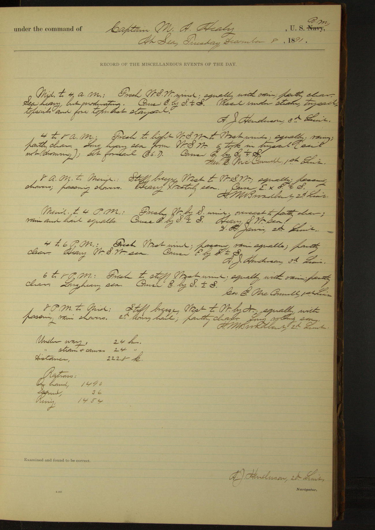
8 December 1891
At sea
Lat 45.68, Long -138.44
8am: Lat 45° 58’ 18”N, Long 139° 17’ 51”W
8pm: Lat 44° 56’ 30”N, Long 136° 54’ 32”W
Under steam & canvas 24 hours. Distance 222.8 miles.
50874d6309d4090755001b07: (http://oldweather.s3.amazonaws.com/ow3/final/USRC Bear/vol070/vol070_077_0.jpg)
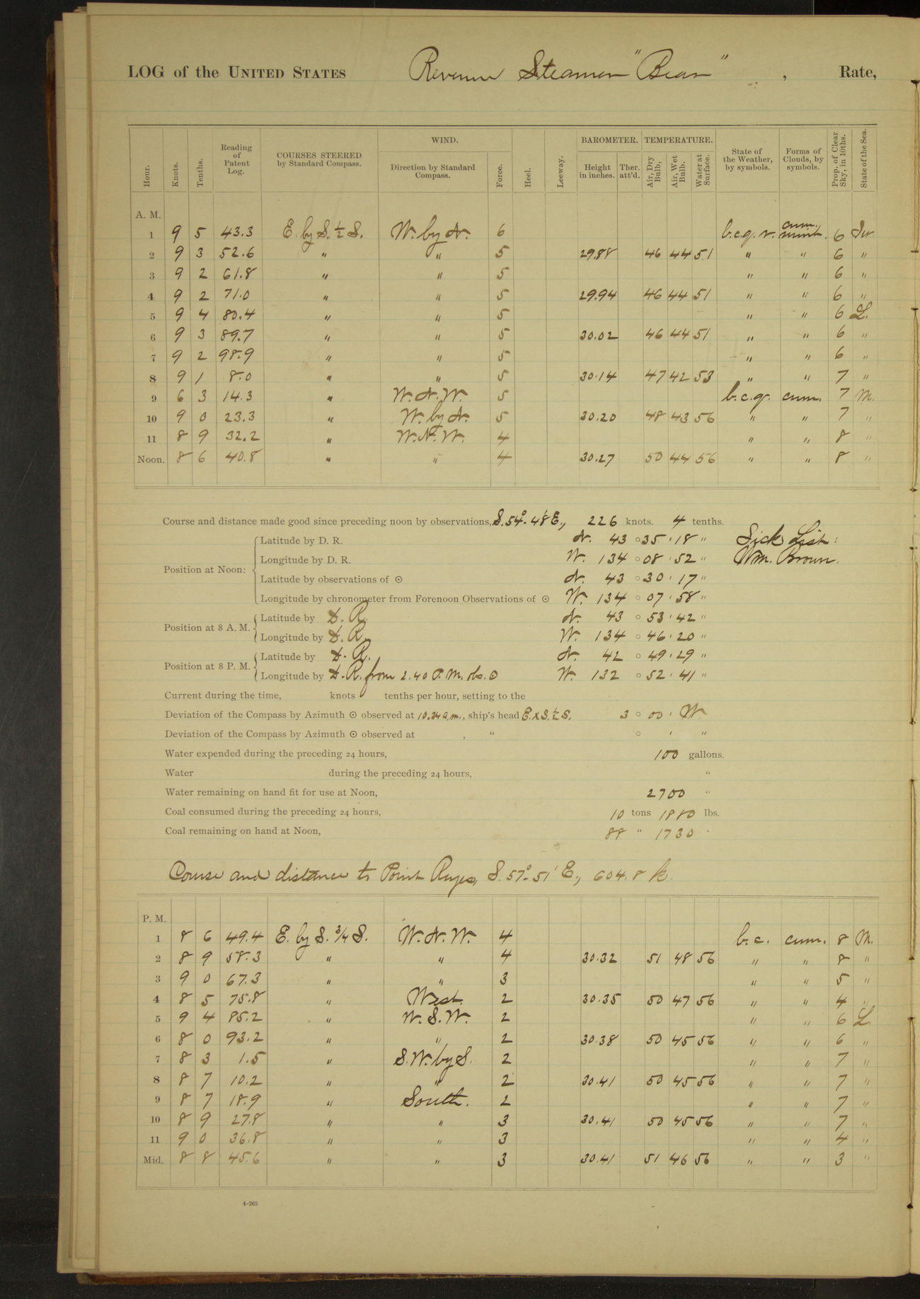
50874d6309d4090755001b09: (http://oldweather.s3.amazonaws.com/ow3/final/USRC Bear/vol070/vol070_077_1.jpg)
9 December 1891
At sea
Lat 43.50, Long -134.13
8am: Lat 43° 53’ 42”N, Long 134° 46’ 20”W
8am to meridian:
Employed slushing masts, cleaning boats and boat gear.
8pm: Lat 42° 49’ 29”N, Long 132° 52’ 41”W
Under steam & canvas 24 hours. Distance 211.8 miles.
50874d6309d4090755001b0b: (http://oldweather.s3.amazonaws.com/ow3/final/USRC Bear/vol070/vol070_078_0.jpg)
50874d6309d4090755001b0d: (http://oldweather.s3.amazonaws.com/ow3/final/USRC Bear/vol070/vol070_078_1.jpg)
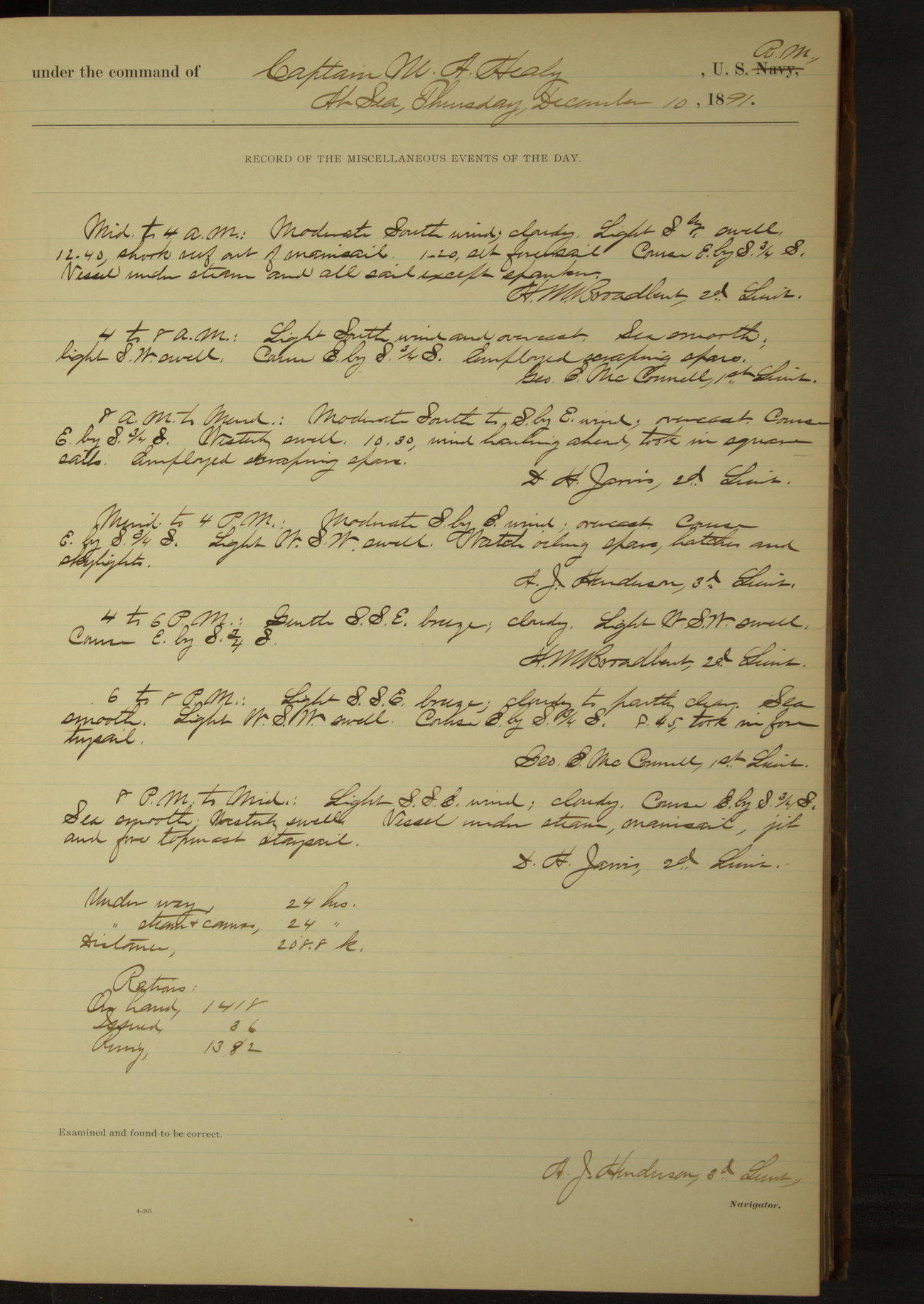
10 December 1891
At sea
Lat 41.45, Long -130.25
4 to 8am [& 8am to meridian]:
Employed scraping spars.
8am: Lat 41° 46’ 37”N, Long 130° 50’ 47”W
Meridian to 4pm:
Watch oiling spars, hatches and skylights.
8pm: Lat 40° 47’ 51”N, Long 129° 00’ 30”W
Under steam & canvas 24 hours. Distance 208.8 miles.
50874d6309d4090755001b0f: (http://oldweather.s3.amazonaws.com/ow3/final/USRC Bear/vol070/vol070_079_0.jpg)
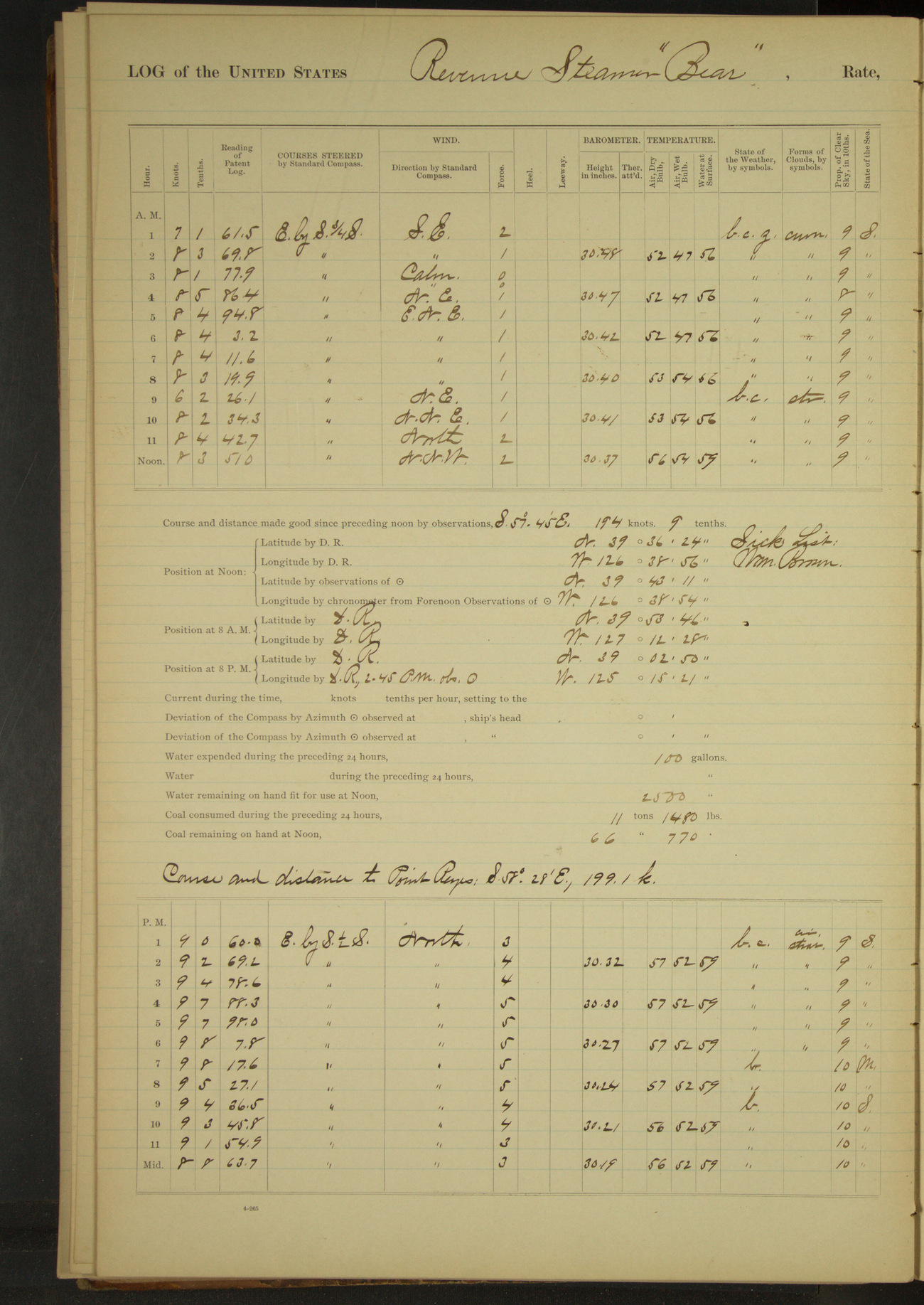
50874d6309d4090755001b11: (http://oldweather.s3.amazonaws.com/ow3/final/USRC Bear/vol070/vol070_079_1.jpg)
11 December 1891
At sea
Lat 39.72, Long -126.65
8am: Lat 39° 53’ 46”N, Long 127° 12’ 28”W
8am to meridian [& Meridian to 4pm]:
Watch tarring rigging.
8pm: Lat 39° 02’ 50”N, Long 125° 15’ 21”W
Underway 24 hours. Distance 208.3 miles.
Under steam & canvas 19 hours 15 minutes. Distance 166.6 miles.
Under steam exclusively 4 hours 45 minutes. Distance 41.7 miles.
50874d6309d4090755001b13: (http://oldweather.s3.amazonaws.com/ow3/final/USRC Bear/vol070/vol070_080_0.jpg)
50874d6309d4090755001b15: (http://oldweather.s3.amazonaws.com/ow3/final/USRC Bear/vol070/vol070_080_1.jpg)
12 December 1891
At sea
Lat 37.83, Long -122.75 [Estimate from noon bearings]
8am: Lat 38° 05’ 26”N, Long 123° 17’ 51”W
8am to meridian:
Light airs and winds SE to East, thick fog first hour. Sea smooth. 8.00: made Point Reyes bearing EbyN.
10.30: Point Reyes Light House abeam NbyE, distant 4 miles. Employed making preparations for entering port.
Noon: Duxbury Point NbyE¼E 4½ miles
Meridian to 4pm: 1.00: passed Whistling buoy. 2.00: Point Bonita abeam. 2.30: Fort Point abeam. 2.55: Alcatraz Light House abeam. 3.00: Revenue steamer “Hartley” came alongside.
3.20: came to anchor off Clay Street wharf, San Francisco. Yerba Buena Light House bearing NEbyE½E, Alcatraz Light House WNW and Clay Street wharf South.
Mrs. MA Healy and J Applegate left vessel.
4pm to 8pm:
Gave one watch liberty.
At anchor 8 hours 40 minutes.
Underway 15 hours 20 minutes. Distance 127 miles.
Under steam and canvas 6 hours 15 minutes. Distance 58.8 miles.
Under steam exclusively 9 hours 5m. Distance 68.2 miles.
50874d6309d4090755001b17: (http://oldweather.s3.amazonaws.com/ow3/final/USRC Bear/vol070/vol070_081_0.jpg)
[Blank page]
50874d6309d4090755001b19: (http://oldweather.s3.amazonaws.com/ow3/final/USRC Bear/vol070/vol070_081_1.jpg)
Summary for the cruise
At anchor 3655 hours 33 minutes.
Underway 2512 hours 27minutes.
Under steam and canvas 1212 hours 45 minutes.
Under steam exclusively 1115 hours 57 minutes.
Hours under canvas exclusively 183 hours 45 minutes.
Distance under steam and canvas 9239 miles.
Distance under steam exclusively 7033 miles.
Distance under canvas exclusively 854.8 miles.
Total distance cruised 17126.8 miles.
Time underway 104 days, 16 hours, 27 minutes.
50874d6309d4090755001b1b: (http://oldweather.s3.amazonaws.com/ow3/final/USRC Bear/vol070/vol070_082_0.jpg)
[Blank page]
50874d6309d4090755001b1d: (http://oldweather.s3.amazonaws.com/ow3/final/USRC Bear/vol070/vol070_082_1.jpg)
[Blank page]
[Logs for December 13th 1891 to February 29th 1892 not included]