Naval History Homepage and Site Search
Naval History Homepage and Site Search
|
|||||||||||||||||||||||||||||||||||||||||||||||||||||||||||||||||||||||||||||||||||||||||||||||||||||||||||||||||||||||||||||||||||||||||||||||||||||||||||||||||||||||||||||||||||||||||||||||||||||||||||||||||||||||||
|
|||||||||||||||||||||||||||||||||||||||||||||||||||||||||||||||||||||||||||||||||||||||||||||||||||||||||||||||||||||||||||||||||||||||||||||||||||||||||||||||||||||||||||||||||||||||||||||||||||||||||||||||||||||||||
|
Armed Merchant Cruiser, mercantile conversion Ex-EMIL L. BOAS, Pendant Nos. M.84 (on coming into service), MI.81 (1.18), MI.44 (4.18). Built 1912, 5977grt, 15kts, liner, owned by Elders & Fyffes Steamship Co. Armament: 6-6in, 2-3pdr AA. In service 21.11.14-18.12.19. Of over 60 commissioned AMC's employed on patrol and later convoy protection, 33 served with 10th CS on Northern Patrol. (British Warships 1914-1919) |
|||||||||||||||||||||||||||||||||||||||||||||||||||||||||||||||||||||||||||||||||||||||||||||||||||||||||||||||||||||||||||||||||||||||||||||||||||||||||||||||||||||||||||||||||||||||||||||||||||||||||||||||||||||||||
|
|||||||||||||||||||||||||||||||||||||||||||||||||||||||||||||||||||||||||||||||||||||||||||||||||||||||||||||||||||||||||||||||||||||||||||||||||||||||||||||||||||||||||||||||||||||||||||||||||||||||||||||||||||||||||
|
Notes: 1. Latitude/longitude, including for days in port, show representative decimal positions for each day, as calculated by the Old Weather project's analysis program. As such, they differ by varying amounts from the positions recorded, usually at noon, in the log pages. In addition, some latitudes/longitudes have been amended in edited logs for errors in the logs, for errors in identifying locations by the analysis program, or simply for greater accuracy. In all cases, refer to the log-page scans for the positions as originally recorded. Not all log pages contain this information and the ships' positions have therefore often been estimated. 2. Full account of any day is available by clicking on the link above that day. Groups of links refer to log book covers and introductory information; some may be blank. Editor’s notes: Positions (Latitude and Longitude) are given for noon each day, correcting or estimating the position given in the logs as appropriate. If exact times are not indicated in the log they have been estimated from the position of the entries (which show times on the left hand side of the log page). Information about sea state is based on the Sea Disturbance Scale where “rough to very rough” indicates waves 5 to 10 feet from peak to trough, “high” indicates waves of 11 to 15 feet, “very high” indicates wave height of 16 to 35 feet and “phenomenal” indicates waves of 36 feet and above. A note is made of numbers on sick list where this is 5 or more. This and other information from the log is included in square brackets [not in italics] if it is not to be found under “Remarks” on the right hand side of the page. Additional information about geographical locations, terminology and about merchant and foreign naval ships encountered has been provided where identification is reasonably certain, by means of embedded links within the text. Note also that when looking at the maps of the voyages of this ship there may be little apparent movement when Motagua is on patrol, as she often arrives back at a similar position at noon, information about the distance travelled each day has therefore been provided in the text below. There is more information about the ship here and she is mentioned a number of times in the account here. |
|||||||||||||||||||||||||||||||||||||||||||||||||||||||||||||||||||||||||||||||||||||||||||||||||||||||||||||||||||||||||||||||||||||||||||||||||||||||||||||||||||||||||||||||||||||||||||||||||||||||||||||||||||||||||
|
THE VOYAGES OF HMS MOTAGUA 1914-1918
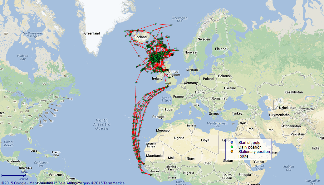
(Maps prepared using Journey Plotter, developed by Maikel. The Plots can only be approximate. They are made by joining-up positions on successive days, and sometimes positions are not given. There will therefore be occasions when the ship appears to have travelled overland) LOG BOOK – DECEMBER 31st 1914 TO MARCH 31st 1915 4caf8896cadfd34197021683: (http://oldweather.s3.amazonaws.com/ADM_53-50069/ADM 53-50069-001_0.jpg) [Left hand side of hard front cover of Ship’s Log Commencing 31st December 1914, Ending 31st March 1915] 4caf8896cadfd34197021684: (http://oldweather.s3.amazonaws.com/ADM_53-50069/ADM 53-50069-001_1.jpg) [Right hand side of front cover] 4caf8896cadfd34197021685: (http://oldweather.s3.amazonaws.com/ADM_53-50069/ADM 53-50069-002_0.jpg) [Blank page - blue inside of front cover] 4caf8896cadfd34197021686: (http://oldweather.s3.amazonaws.com/ADM_53-50069/ADM 53-50069-002_1.jpg) [Blue page, blank apart from ADM.53/] 4caf8896cadfd34197021687: (http://oldweather.s3.amazonaws.com/ADM_53-50069/ADM 53-50069-003_0.jpg) [Blank page] 4caf8896cadfd34197021688: (http://oldweather.s3.amazonaws.com/ADM_53-50069/ADM 53-50069-003_1.jpg) [Blank page] 4caf8896cadfd34197021689: (http://oldweather.s3.amazonaws.com/ADM_53-50069/ADM 53-50069-004_0.jpg) [Blank page] 4caf8896cadfd3419702168a: (http://oldweather.s3.amazonaws.com/ADM_53-50069/ADM 53-50069-004_1.jpg) The Name and Address of the Officer to whom the acknowledgement of receipt should be sent by the Deputy Cashier in charge, Royal Victoria Yard, Deptford, is to be inserted by the ship here: Name John A Webster, Address HMS Motagua. Log of HMS Motagua Commanded by Captain V Phillimore RN DSO, 31st 12 14 to 12 2 15 Commanded by Captain J Webster RN MVO For the Period Commencing Thursday 31st of December 1914, Ending Wednesday 31st of March 1915.
[signed] JA Webster, Captain 4caf8896cadfd3419702168b: (http://oldweather.s3.amazonaws.com/ADM_53-50069/ADM 53-50069-005_0.jpg) [Page of Directions, indicating how the Log is to be used, showing Figures to indicate the Force of the Wind, Letters to denote the State of the Weather, Scale of Fog Intensity and Sea Disturbance Scale] 4caf8896cadfd3419702168c: (http://oldweather.s3.amazonaws.com/ADM_53-50069/ADM 53-50069-005_1.jpg) [Page with information about instruments, armaments, boats, etc]
THE VOYAGES OF HMS MOTAGUA
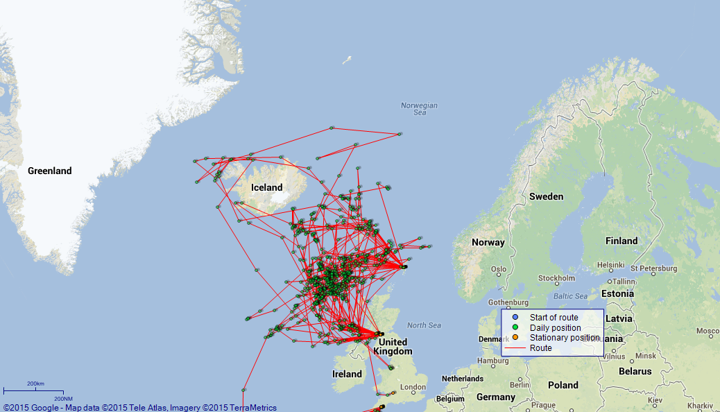
4caf8896cadfd3419702168d: (http://oldweather.s3.amazonaws.com/ADM_53-50069/ADM 53-50069-006_0.jpg) 31 December 1914 At Avonmouth [details of docks here] Lat 51.50, Long -2.71 [estimated] 9.0am: Captain V Phillimore RN DSO commissioned ship. am: Hands employed taking in Stores. pm: Hands employed as requisite. 4.10pm: Sunset. 10.0pm: Rounds Correct. [Fuel Remaining: Coal 1603 tons] [Weather fine, noon temperature 44F] LOGS FOR JANUARY 1915 4caf8897cadfd3419702168e: (http://oldweather.s3.amazonaws.com/ADM_53-50069/ADM 53-50069-006_1.jpg) 1 January 1915 At Avonmouth Lat 51.50, Long -2.71 2.0am: Rounds correct. am: Hands employed taking in stores and as requisite. pm: Hands employed as requisite. 4.10pm: Sunset. 10.0pm: Rounds Correct. 4caf8897cadfd3419702168f: (http://oldweather.s3.amazonaws.com/ADM_53-50069/ADM 53-50069-007_0.jpg) 2 January 1915 At Avonmouth Lat 51.50, Long -2.71 am: Hands employed taking in stores and as requisite. 0.30pm: Shifted ship into Dry Dock and made fast. pm: Hands employed as requisite. 4.12pm: Sunset. 4caf8897cadfd34197021690: (http://oldweather.s3.amazonaws.com/ADM_53-50069/ADM 53-50069-007_1.jpg) 3 January 1915 [shown as 1914, in error] At Avonmouth Lat 51.51, Long -2.71 2.0am: Rounds Correct. 4.13pm: Sunset. 10.0pm: Rounds Correct. [Westerly wind force 5, with rain for most of day] 4caf8897cadfd34197021691: (http://oldweather.s3.amazonaws.com/ADM_53-50069/ADM 53-50069-008_0.jpg) 4 January 1915 At Avonmouth Lat 51.51, Long -2.71 am: Hands employed taking in stores and as requisite. pm: Hands employed as requisite. 4.14pm: Sunset. 4caf8897cadfd34197021692: (http://oldweather.s3.amazonaws.com/ADM_53-50069/ADM 53-50069-008_1.jpg) 5 January 1915 At Avonmouth Lat 51.51, Long -2.71 am: Hands employed taking in stores and as requisite. pm: Hands employed as requisite. 4.14pm: Sunset. 4caf8897cadfd34197021693: (http://oldweather.s3.amazonaws.com/ADM_53-50069/ADM 53-50069-009_0.jpg) 6 January 1915 At Avonmouth Lat 51.51, Long -2.71 am: Hands employed taking in stores and as requisite. pm: Hands employed as requisite. 4.14pm: Sunset. pm: Sub Lieutenants RNR Radcliff, Rhodes, Wood and Dodds, Midshipmen RNR Loran, Clarke, Maclare and Myers, Surgeon probationary FP Law Joined ship. 4caf8897cadfd34197021694: (http://oldweather.s3.amazonaws.com/ADM_53-50069/ADM 53-50069-009_1.jpg) 7 January 1915 At Avonmouth Lat 51.51, Long -2.71 am: Hands employed taking in stores. pm: Hands employed as requisite. 4.18pm: Sunset. pm: 95 POs and Seamen Ratings Joined. 4caf8897cadfd34197021695: (http://oldweather.s3.amazonaws.com/ADM_53-50069/ADM 53-50069-010_0.jpg) 8 January 1915 At Avonmouth Lat 51.51, Long -2.71 9.0am: Crew mustered and told off into Watches. am: Hands employed taking in stores and clearing up decks. pm: Hands employed as requisite. 4.20pm: Sunset. 4caf8897cadfd34197021696: (http://oldweather.s3.amazonaws.com/ADM_53-50069/ADM 53-50069-010_1.jpg) 9 January 1915 At Avonmouth Lat 51.51, Long -2.71 am: Hands employed taking in stores and cleaning ship. Shore gangs placing gun mounting. 1.0pm: Special Leave to Red and Blue Watches till 8am Sunday [on this Saturday]. pm: Received 2 x 6 inch QF [Quick Firing] Guns. 2 Sick berth Ratings returned to RN Barracks, Portsmouth. 4.20pm: Sunset. 4caf8897cadfd34197021697: (http://oldweather.s3.amazonaws.com/ADM_53-50069/ADM 53-50069-011_0.jpg) 10 January 1915 At Avonmouth Lat 51.51, Long -2.71 7.0am: Hands told off for duty. 8.15am: RC [Roman Catholic] Church party left. 10.0am: Divisions. 1.30pm: Special leave to Red and White watches till 8am. 4.20pm: Sunset. 4caf8897cadfd34197021698: (http://oldweather.s3.amazonaws.com/ADM_53-50069/ADM 53-50069-011_1.jpg) 11 January 1915 At Avonmouth Lat 51.51, Long -2.71 7.0am: Hands Employed cleaning ship. am: Hands employed taking in Stores and as requisite. pm: Hands employed taking in stores. Received 3 x 6 inch QF guns. 4.20pm: Sunset. 6.0pm: 22 RMLI [Royal Marines Light Infantry] Joined ship. Special leave to Blue and White Watches till 8am. 4caf8897cadfd34197021699: (http://oldweather.s3.amazonaws.com/ADM_53-50069/ADM 53-50069-012_0.jpg) 12 January 1915 At Avonmouth Lat 51.51, Long -2.71 am: Received 1 x 6 inch QF gun - making total of 6 x 6 inch QF guns. 7.0am: Hands cleaning ship. am: Hands employed taking in stores. Taking in Ammunition forward Magazine. pm: Taking in Stores and Ammunition in forward Magazines. pm: Private RMLI T Burrows discharged to hospital. 4.20pm: Sunset. 5.30pm: Leave to Red and Blue Watches till 9am. pm: Duty Watch taking in Ammunition to 7.30pm. 4caf8897cadfd3419702169a: (http://oldweather.s3.amazonaws.com/ADM_53-50069/ADM 53-50069-012_1.jpg) 13 January 1915 At Avonmouth Lat 51.51, Long -2.71 2.0am: Rounds Correct. 7.0am: Hands cleaning ship. am: Taking in ballast in No 1 Lower hold. Hands employed taking in stores. pm: Taking in Ammunition at after Magazine and storing ship. 4.21pm: Sunset. 5.30pm: WL Davis RNVR (deserter) recovered and placed under arrest. Leave to Red and White Watches till 8am. 10.0pm: Rounds Correct. 4caf8897cadfd3419702169b: (http://oldweather.s3.amazonaws.com/ADM_53-50069/ADM 53-50069-013_0.jpg) 14 January 1915 At Avonmouth Lat 51.51, Long -2.71 7.0am: Hands cleaning ship. am: Hands employed taking in stores and as requisite. 11.30am: Completed ballast in No 1 Lower hold (200 tons pig iron). pm: Hands Employed storing ship and preparing for sea. 5.0pm: Cast off moorings and proceeded from berth. Pilot Mr GW Hunt and 2 tugs assisting. 6.20pm: In lock. 6.45pm: Proceeded out of lock. 7.10pm: Blacknore Point abeam. 7.25pm: Anchored in 13 fathoms and brought up on Port cable with 60 fathoms chain. [Anchor Bearings: Blacknore Point N80E, Occulting Buoy N60W, Signal Station S5W, Ship’s Head N35E] 9.0pm: Rounds correct. 10.0pm: Regulation lights exhibited. [Draught leaving Avonmouth: 18’ 00” forward, 22’ 4” aft] 4caf8897cadfd3419702169c: (http://oldweather.s3.amazonaws.com/ADM_53-50069/ADM 53-50069-013_1.jpg) 15 January 1915 At Walton Bay Lat 51.32, Long -3.44 [very rough estimate] 1.30am: Swung to flood tide. 3.0am: Rounds correct. 8.0am: Swung to ebb tide. Hove up anchor. 8.17am: Anchor aweigh. Proceeded. Courses and speeds as requisite. 9.5am: Bridge Light Vessel abeam. 9.23am: Flatholm Light House abeam. 10.4am: Breaksea Light Vessel abeam. 10.30am to Noon: Carried out gun trials successful. 0.30pm - 2.0pm: Swung ship and adjusted Standard Compass (off Breaksea Light Vessel). pm: Tested Steering gear with auxiliary connections and wheels. Proceeded to anchorage; Courses and speeds as requisite. 4.15pm: Anchored in 12 fathoms and brought up on Starboard cable with 60 fathoms chain. [Anchor Bearings: Blacknore Point N82E, Signal Station S2E, Occulting Buoy N60W, Ship’s Head S72W] 6.0pm: Regulation lights exhibited. 7.0pm: Tender left with shore staff. 8.30pm: Swung to Ebb tide. 10.0pm: Rounds Correct. [South westerly wind force 6 for most of day, noon temperature 48F] 4caf8897cadfd3419702169d: (http://oldweather.s3.amazonaws.com/ADM_53-50069/ADM 53-50069-014_0.jpg) 16 January 1915 From Walton Bay to Patrol Lat 51.42, Long -4.62 0.30am: Wind increasing. Let go Port anchor. 2.0am: Swung to flood tide. 4.0am: Commenced to heave up. 5.22am: Proceeded under weigh; Courses and speeds as requisite. 6.4am: Bridge Light Vessel abeam. 6.48am: Flatholm Light Vessel abeam. 7.10am: Stopped. 7.30am: Discharged Pilot off Barry. 7.50am: Breaksea Light Vessel S, distant 0.5 miles, set course N67W. 8.0am: Streamed log. 8.37am: Nash Point N22E, 3 miles, log 7. 9.10am: Divisions. 10.20am: Scarweather Light Vessel N30E, 5.5 miles. 11.30am: Helwick Light Vessel N40E, 7 miles. 1.52pm: St Goban’s Light Vessel N50E, 3 miles, log 18.5. pm: Hands employed securing gear and clearing decks. 4.0pm: Exercised General Quarters. 4.50pm - 5.15pm: Courses various rounding Smalls Light House. 5.15pm: Smalls Light House S65E, 3 miles, log 57. Set course N25E. 7.0pm: Watch at night defence stations. 10.7pm: Bardsey Island Light S65E, approximately 26 miles, log 115. 11.0pm: Exercised seaboats crew. [Course and Distance made good: Various 68 miles] [True Bearing and Distance: Lundy Island North Point S9W, 13 miles] [North westerly or northerly wind force 7 to 8 all day, sea state very rough to high from 8am, noon temperature 48F] 4caf8897cadfd3419702169e: (http://oldweather.s3.amazonaws.com/ADM_53-50069/ADM 53-50069-014_1.jpg) 17 January 1915 From Walton Bay to Patrol Lat 55.33, Long -5.95 0.40am: South Stack Light S65E, 21 miles, log 158. 1.30am: Watch at night defence stations. 3.0am: Exercised seaboats crew. 4.20am: Chickens Light S65E, 10 miles, log 191, course altered N11E. 6.0am: South Rock Light Vessel N79W, 5 miles, log 213. 8.0am: Mew Island S88W, 3 miles, log 237. 9.30am: Divisions and Inspection. 9.36am: Maidens Light S88W, 6 miles, course altered N22W. 11.40am: Mull of Cantyre N68E, 2.5 miles, log 283 miles. 2.10pm: Oversay Light House N60E, 2 miles, log 27, course altered N14W. 4.0pm: Exercised General Quarters. 5.30pm: Skerryvore Light N76E, distant 7 miles, log 67, course altered N5W. Darkened ship. 6.30pm: Watch at night defence stations. 9.5pm: Barra Head Light N72E, 4 miles, log 104. 10.0pm: Rounds Correct. 11.0pm: Exercised Seaboat’s crew. [Course and Distance made good: Various 272 miles] [True Bearing and Distance: Mull of Cantyre S72E, 5 miles] [Northerly or north easterly wind force 6 or 7 all day, with sea state very rough, weather fine, noon temperature 41F] 4caf8897cadfd3419702169f: (http://oldweather.s3.amazonaws.com/ADM_53-50069/ADM 53-50069-015_0.jpg) 18 January 1915 From Walton Bay to Patrol Lat 58.58, Long -8.72 1.0am: Watch at night defence stations. 3.0am: Exercised seaboats crew. 7.50am: Soa [Soay] Island (St Kilda) S16E 19 miles. 9.10am: Divisions. Exchanged signals with HMS “Calyx”. am: Hands employed as requisite. 11.45am: Sighed SS N40W steering WSW. Courses and speeds as requisite. 0.20pm: Stopped Norwegian SS “Capella” in Lat 58 36 N, Long 8 52 W. 0.45pm: Proceeded on Course. 4.0pm: Evening Quarters. 5.0pm: Darkened Ship. 6.0pm: Watch at night defence stations. 9.0pm: Rounds Correct. 10.30pm: Exercised Seaboats’ Crew. [Course and Distance made good: Various 241 miles] [North westerly wind force 5 in am with sea state rough, westerly or south westerly force 6 with sea state very rough in pm, rain at times, noon temperature 46F] 4caf8897cadfd341970216a0: (http://oldweather.s3.amazonaws.com/ADM_53-50069/ADM 53-50069-015_1.jpg) 19 January 1915 From Walton Bay to Patrol Lat 61.17, Long -7.90 5.0am: Sounding every half hour. 7.0am: Sighted Sumbo Light N67E approximately 15 miles. 7.40am: Sumbo Head abeam N23E, 10 miles, log 180. 8.0am: Laid in lead. 9.10am: Divisions. am: Hands variously employed. 1.0pm: Sounding every half hour. pm: Hands cleaning ship. 4.0pm: Evening Quarters. 5.0pm: Darkened ship. Laid in lead. 6.0pm: Watch at night defence stations. 10.0pm: Sounding every hour. [Course and Distance made good: Various 219 miles] [South westerly wind force 6 or 7 in am with sea state very rough, westerly wind in pm, wind and sea starting to reduce. Barometric pressure falling all day] 4caf8897cadfd341970216a1: (http://oldweather.s3.amazonaws.com/ADM_53-50069/ADM 53-50069-016_0.jpg) 20 January 1915 Cruising on Northern Patrol Lat 61.00, Long -8.25 2.0am: Soundings taken hourly. 6.0am: Laid in lead. 8.30am: Sounding every half hour. 9.10am: Divisions. am: Courses various to avoid submarine attack. Hands cleaning ship. pm: Courses Various to avoid Submarine attack. Guns crews, control parties and ship’s Company exercised at divisional drills. 4.0pm: Exercised General Quarters. Darkened ship. 5.30pm: Watch at night defence stations. 7.35pm: Sighted Navigation lights of SS. 8.5pm: Hands to “Action” Stations and closed with SS sighted. 8.30pm: Challenged HMS “Alsatian”. 8.40pm: Secured guns and dismissed watch below. 11.0pm: Soundings every half hour. [Course and Distance made good: Various 178 miles] [Squally westerly and north westerly wind force 6 or 7 for most of day, sea state mostly high, barometric pressure still falling, noon temperature 42F, sea temperature 39F] 4caf8897cadfd341970216a2: (http://oldweather.s3.amazonaws.com/ADM_53-50069/ADM 53-50069-016_1.jpg) 21 January 1915 Cruising on Northern Patrol Lat 60.98, Long -9.55 5.0am: Sounding every half hour. 7.30am: Courses various to avoid submarines. 8.0am: Star observation Lat 61 00 N, Long 8 47 W. 9.10am: Divisions. am: Hands employed cleaning ship and as requisite. 11.0am: In company with HMS “Alsatian”. 1.30pm: In communication with HMS “Alsatian”. 2.30pm: Soundings taken half hourly. 3.30pm: Proceeded in execution of orders. 4.0pm: Evening Quarters. 4.30pm: Laid in lead. 5.0pm: Darkened ship. 6.0pm: Watch at night defence stations. [Course and Distance made good: Various 206 miles] [Number on sick list: 7] [Northerly and north westerly wind force 8 or 9 from noon to 8pm, sea state high or very high in pm, rain, hail or snow at times. Barometric pressure starting to rise slowly, noon temperature 36F, sea temperature 44F] 4caf8897cadfd341970216a3: (http://oldweather.s3.amazonaws.com/ADM_53-50069/ADM 53-50069-017_0.jpg) 22 January 1915 Cruising on Northern Patrol Lat 61.85, Long -3.00 7.30am: Courses various to avoid Submarines. am: Guns’ crews, Control parties and Ship’s Company exercised at divisional drills. Hands employed as requisite. 4.0pm: Evening Quarters. [Course and Distance made good: Various 225 miles] [Number on sick list: 9] [Wind and sea more moderate today] 4caf8897cadfd341970216a4: (http://oldweather.s3.amazonaws.com/ADM_53-50069/ADM 53-50069-017_1.jpg) 23 January 1915 Cruising on Northern Patrol Lat 60.95, Long -8.83 6.0am: Sumbo Head Light N5E, 20 miles, log 162. 9.10am: Divisions. Sounding every half hour. pm: Courses various to avoid submarines. Laid in lead. Hands employed as necessary. [Course and Distance made good: Various 231 miles] [Number on sick list: 9] 4caf8897cadfd341970216a5: (http://oldweather.s3.amazonaws.com/ADM_53-50069/ADM 53-50069-018_0.jpg) 24 January 1915 Cruising on Northern Patrol Lat 61.00, Long -9.07 [A fairly typical day on patrol, in quite challenging weather - all log entries shown here as example] 0.30am: Sounding taken half hourly. 1.0am: Watch at night defence stations. 3.0am: Exercised seaboats crew. 6.15am: Sumbo Head Light S78E approximately 25 miles, log 217.5. 8.30am: Courses various to avoid submarines. 9.30am: Divisions. 10.30am: Divine Service. 0.30pm: Courses Various to avoid submarines. 1.30pm: Laid in lead. 4.0pm: Evening quarters. 5.0pm: Darkened ship. 6.0pm: Watch at night defence stations. 9.0pm: Rounds correct. 10.0pm: Exercised seaboats crew. [Course and Distance made good: Various 276 miles] [Number on sick list: 9] 4caf8897cadfd341970216a6: (http://oldweather.s3.amazonaws.com/ADM_53-50069/ADM 53-50069-018_1.jpg) 25 January 1915 Cruising on Northern Patrol Lat 60.95, Long -8.93 7.0am - 8.0am: Steered with auxiliary wheel on poop. 9.30am: Exercised General Quarters and fire stations. am: Gun’s crews, control parties and Ship’s Company exercised at divisional drills. 0.20pm: Sighted steam trawler WNW. Courses and speeds as requisite. 1.23pm: Stopped and 1.30 Boarded “Regal” GY158 in Lat 61 1 N, Long 9 20 W. 2.12pm: Boat returned. 2.15pm: Proceeded on course. 3.0pm: Laid in lead. 7.0pm: Courses various to avoid submarines. [Course and Distance made good: Various 210 miles] [Number on sick list: 5] 4caf8897cadfd341970216a7: (http://oldweather.s3.amazonaws.com/ADM_53-50069/ADM 53-50069-019_0.jpg) 26 January 1915 Cruising on Northern Patrol Lat 60.87, Long -8.83 1.0am: Sounding every half hour. 7.45am: In communication (visual) with HMS “Otway”. 1.30pm: Laid in lead. 3.0pm: Mounted “Hezzanith” Mark II Standard Compass (Liquid), partial adjustment made. 11.30pm: Sounding every half hour. [Course and Distance made good: Various 273 miles] [Number on sick list: 5] 4caf8897cadfd341970216a8: (http://oldweather.s3.amazonaws.com/ADM_53-50069/ADM 53-50069-019_1.jpg) 27 January 1915 Cruising on Northern Patrol Lat 60.70, Long -8.83 0.30pm: Sighted steam trawler NWxW. Courses and speeds as requisite. 1.5pm: Boarded steam Trawler “Raetia” GY707 in Lat 60 35 N, Long 9 00 W. 1.40pm: Proceeded on course. [Course and Distance made good: Various 290 miles] [Number on sick list: 6] 4caf8897cadfd341970216a9: (http://oldweather.s3.amazonaws.com/ADM_53-50069/ADM 53-50069-020_0.jpg) 28 January 1915 Lat 60.58, Long -9.05 [Course and Distance made good: Various 282 miles] [Number on sick list: 6] [Weather relatively quiet. Log just records routine matters, while patrolling to and fro, changing course about every 6 hours] 4caf8897cadfd341970216aa: (http://oldweather.s3.amazonaws.com/ADM_53-50069/ADM 53-50069-020_1.jpg) 29 January 1915 Cruising on Northern Patrol Lat 60.3, Long -8.2 1.0pm: Exchanged signals with HMS “Changuinola”. 6.0pm: Sighted SS bearing WNW steering ExS. 6.30pm: Boarded Norwegian SS “St Alheim” [Stalheim] in Lat 60 24 N, Long 10 43 W. 6.55pm: Proceeded on course. [Course and Distance made good: Various 284 miles] [Number on sick list: 6] 4caf8897cadfd341970216ab: (http://oldweather.s3.amazonaws.com/ADM_53-50069/ADM 53-50069-021_0.jpg) 30 January 1915 Cruising on Northern Patrol Lat 60.00, Long -8.67 9.0am: Sighted SS bearing N60W to Eastward. Courses and speeds as requisite. 9.40am: Boarded Norwegian SS “Noruega” [listed here] in Lat 60 05 N, Long 8 10 W. 10.39am: Proceeded on course. [Course and Distance made good: Various 268 miles] [Number on sick list: 6] 4caf8897cadfd341970216ac: (http://oldweather.s3.amazonaws.com/ADM_53-50069/ADM 53-50069-021_1.jpg) 31 January 1915 Cruising on Northern Patrol [though not stated in log] Lat 59.93, Long -8.90 1.30am: Courses various to avoid submarine. 9.30am: Divisions. Crew mustered and “Articles of War” read. 11.0am: Divine Service. 1.0pm: Exchanged signals with HMS “Ambrose”. 2.0pm: Courses various to avoid submarines. 4.0pm: Evening Quarters. 7.45pm: Exchanged signals with HMS “Hildebrand”. [Course and Distance made good: Various 290 miles] [Number on sick list: 5] LOGS FOR FEBRUARY 1915 4caf8897cadfd341970216ad: (http://oldweather.s3.amazonaws.com/ADM_53-50069/ADM 53-50069-022_0.jpg) 1 February 1915 Cruising on Northern Patrol Lat 59.90, Long -8.93 0.30am: Sighted SS bearing E, steering to Westward. Courses and speeds as requisite. 3.30am: Stopped SS “Tesas” [or more probably Texas - there are several possible ships of this name] in Lat 60 00 N, Long 9 50 W. 8.33am: Sighted vessel bearing SWxW steering to NE. 9.30am: Exercised General Quarters and Fire Stations. 9.40am: Boarded topsail schooner “Rasmussen” in Lat 59 58, Long 8 30 W. 10.30am: Proceeded on Course. 0.45pm: Sighted [SS] bearing W steering to Eastward. Courses and speeds as requisite. 1.30pm: Boarded Danish SS “Randlesborg” [probably Randelsborg] in Lat 59 48 N, Long 9 26 W. 2.35pm: Continued course. 3.0pm: Courses various to avoid submarines. 4.0pm: Evening Quarters. [Course and Distance made good: Various 273 miles] [Number on sick list: 6] 4caf8897cadfd341970216ae: (http://oldweather.s3.amazonaws.com/ADM_53-50069/ADM 53-50069-022_1.jpg) 2 February 1915 Cruising of Northern Patrol Lat 59.77, Long -8.75 6.30am: Sounding every half hour. 7.30am: Laid in lead. am: Guns crews, control parties and Ship’s Company exercised at divisional drills. 1.0pm: Hands employed securing gear and preparing for heavy weather. 3.30pm: Wind and sea rapidly increasing. 4.0pm: Hove ship to. Engines used as requisite. [SxW Hove to] 5.30pm: Burned Navigation Lights. 10.30pm: Engines tended as necessary. [Course and Distance made good: Various 246 miles] [Number on sick list: 6] [South westerly wind force 7 to 8/9 from 8am to 4pm, force 10/11 thereafter. Sea state rough to very rough in am, very high to phenomenal (waves 36ft or above) in pm. Barometric pressure recorded hourly in pm, low and falling until 7pm (when 28.20), rising slowly from 10pm. Weather fine in am, hail in pm, noon temperature 46F, sea temperature 48F] 4caf8897cadfd341970216af: (http://oldweather.s3.amazonaws.com/ADM_53-50069/ADM 53-50069-023_0.jpg) 3 February 1915 Cruising on Northern Patrol Lat 59.87, Long -9.25 [Hove to SxW] 1.0am: Ship Hove to. Engines tended as necessary. 6.0am: Proceeded on Course. 9.30am: Divisions not inspected owing to severity of Weather. am: Hands employed as necessary. 4.0pm: Evening Quarters not held owning to severity of weather. Ordered to patrol South of Sydero [Suderoy, Faeroe Islands]. 4.30pm: Proceeded in execution of orders. 6.0pm: Burned Navigation Lights. 7.0pm: Sounding every half hour. 11.20pm: Hove ship to. [Hove to SW] [Course and Distance made good: Various 86 miles] [Number on sick list: 5] [Squally south westerly wind force 8 or 9 all day, with sea state very high. Barometric pressure recorded hourly - rising then falling again in pm] 4caf8897cadfd341970216b0: (http://oldweather.s3.amazonaws.com/ADM_53-50069/ADM 53-50069-023_1.jpg) 4 February 1915 Lat 60.47, Long -8.83 [Hove to SW] 2.0am: Laid in lead. 9.0am: Divisions not mustered owing to severity of weather. am: Hands employed as necessary. [Hove to WSW] 4.0pm: Evening Quarters not held owing to severity of weather. 7.0pm: Burned Navigation lights. 8.0pm: Proceeded on course for patrol. 9.30pm: Rounds Correct. 10.30pm: Watch at night defence stations. [Course and Distance made good: Various 108 miles] [Number on sick list: 5] [Squally south westerly wind force 9 to 11 in am, with sea state phenomenal, force 9 to 7 in pm, with sea state reducing to very high. Barometric pressure falling slowly in am, rising again from late am, noon temperature 48F, sea temperature 46F] 4caf8897cadfd341970216b1: (http://oldweather.s3.amazonaws.com/ADM_53-50069/ADM 53-50069-024_0.jpg) 5 February 1915 Cruising on Northern Patrol Lat 60.77, Long -6.25 0.30am: Watch at night defence stations. 2.30am: Exercised Seaboats crew. 5.0am: Sounding every half hour. 6.30am: Exercised seaboats crew. 8.0am: Sumbo Head N30E, 18 miles. 8.55am: Exchanged signals with HMS “Cedric”. 9.15am: Divisions. am: Guns crews, Control parties and Ship’s Company exercised at divisional drills. 11.30am: Laid in Lead. 0.30pm: Exchanged signals with HMS “Cedric” and “Mantua”. pm: Hands employed as requisite. 4.0pm: Evening Quarters. Read Warrant No I. 5.0pm: Darkened ship. 6.0pm: Watch at night defence stations. 9.0pm: Exchanged signals with HMS “Hillary” [Hilary]. 11.0pm: Exercised seaboats crew. [Course and Distance made good: Various 145 miles] [Wind still south westerly for most of day, force 6 with sea state very rough. Barometric pressure rising slowly for most of day] 4caf8897cadfd341970216b2: (http://oldweather.s3.amazonaws.com/ADM_53-50069/ADM 53-50069-024_1.jpg) 6 February 1915 Cruising on Northern Patrol Lat 60.88, Long -6.17 0.30am: Watch at night defence stations. 1.0am: Sounding every half hour. 2.0am: Laid in lead. 9.0am: Divisions not mustered owing to heavy weather. 10.0am: Sounding every half hour. Noon: Laid in lead. 1.30pm: Hove ship to. [Hove to S0.5W] 4.0pm: Evening Quarters not held owing to heavy weather. 5.30pm: Darkened ship. [Course and Distance made good: Various 236 miles] [South easterly wind force 7 to 9 all day, with sea state very rough to very high, rain for much of day] 4caf8897cadfd341970216b3: (http://oldweather.s3.amazonaws.com/ADM_53-50069/ADM 53-50069-025_0.jpg) 7 February 1915 Cruising on Northern Patrol Lat 60.67, Long -6.13 9.0am: Divisions. 10.0am: Divine Service. 11.40am: Hove ship to. [Hove to SxE] 4.0pm: Evening Quarters not held on account of weather conditions. 5.30pm: Darkened Ship. 11.0pm: Exercised Seaboats crew. [Course and Distance made good: Various 236 miles] [South easterly wind force 8 to 9/10 all day, with sea state very high to phenomenal, barometric pressure tending to fall] 4caf8897cadfd341970216b4: (http://oldweather.s3.amazonaws.com/ADM_53-50069/ADM 53-50069-025_1.jpg) 8 February 1915 Cruising on Northern Patrol Lat 59.80, Long -5.25 5.0am: Sounding every hour. 7.0am: Sounding every half hour. 9.0am: Divisions. 10.30am: Sighted SS Ringhorn in Lat 59 48 N, Long 5 15 W. Stopped and communicated with her. Ex British Port and allowed to proceed. Noon: Laid in lead. 1.15pm: Exchanged Signals with HMS “Oropessa” [Oropesa]. 2.0pm: Orders to proceed to Clyde for coal. Proceeded in execution of orders. 4.0pm: Evening Quarters. 5.0pm: Sounding every half hour. 6.0pm: Burned Navigation Lights. 7.0pm: Watch at night defence stations. 9.20pm: Flannan Island Light S32W, 29 miles, course altered S64W. 11.30pm: Flannan Island Light abeam distant 18 miles, log 128. [Course and Distance made good: Various 94 miles] [Wind and sea more moderate today, rain until 4pm] 4caf8897cadfd341970216b5: (http://oldweather.s3.amazonaws.com/ADM_53-50069/ADM 53-50069-026_0.jpg) 9 February 1915 From Patrol to Clyde Lat 56.32, Long -7.33 1.30am: Sounding every half hour. 7.35am: Barra Head Light S14E, approximately 33 miles. 8.0am: Laid in lead. 9.0am: Guns crews closed up and extra lookouts posted. 9.56am: Barra Head abeam N84E, 3 miles, log 265. Increased to “full speed”. 0.15pm: Skerryvore Light House N75E, 7 miles. 2.0pm: Exchanged signals with HMS Nymph. 3.5pm: Oversay Light N75E, 2 miles. 4.0pm: Evening Quarters. 4.55pm: Exchanged signals with HMS “Lara”. 5.23pm: Mull of Cantyre N33E 3.7 miles. 5.50pm: Sanda Light N22E 2 miles. 7.10pm: Pladda Light N67W 3 miles. 7.45pm: Holy Island Light N65W 2 miles. 8.35pm: Little Cumbrae Light abeam 9.15pm: Toward Point Light abeam. Received permission to enter Port. Courses and speeds as requisite. 9.47pm: Cloch Point abeam. 10.25pm: Anchored off Greenock and brought up on Starboard cable with 75 fathoms chain in 16 fathoms Water. [Anchor Bearings: Greenock Red Lights N22W, Rosneath Patch N50W, Whitefarland Green Lights S80W] 10.30pm: Clyde Pilot Mr Laing on board. [Course and Distance made good: Various 303 miles] [True Bearing and Distance: Skerryvore Light House N83E, 7.5 miles] 4caf8897cadfd341970216b6: (http://oldweather.s3.amazonaws.com/ADM_53-50069/ADM 53-50069-026_1.jpg) 10 February 1915 From Patrol to Glasgow Lat 55.86, Long -4.29 [estimated] 0.30am: Watch at night control stations. 1.30am: Anchor bearings carefully checked. 4.45am: Weighed Anchor. 5.0am: Proceeded up Clyde, Pilot Mr Laing and two tugs assisting. Courses and speeds as requisite. 8.0am: Swung ship off Princes Dock and Backed into Queens Dock. 9.30am: Made fast in Berth No 32. am: Hands employed painting ship and as necessary. 1.0pm: Long leave granted to Port Watch. Hands employed as requisite. 4.0pm: Evening Quarters. 5.0pm: Special leave to second part Starboard Watch. 6.0pm: J Walters Plumber and Dowden Seaman RNR discharged to Hospital. 9.0pm: Rounds Correct. [Course and Distance made good: Various 168 miles] [Noon position][In Port] [Draught on arrival, Forward 15’ 3”, Aft 20’ 00”] [Fuel Remaining: Coal 308 tons] 4caf8897cadfd341970216b7: (http://oldweather.s3.amazonaws.com/ADM_53-50069/ADM 53-50069-027_0.jpg) 11 February 1915 At Glasgow Lat 55.86, Long -4.29 2.0am: Shifted ship to coaling berth. 2.40am: Commenced coaling. am: Hands employed as requisite. Coaling ship throughout. pm: Hands employed as necessary. 4.0pm: Evening Quarters. 4.30pm: Special leave to first part Starboard Watch. 9.0pm: Rounds Correct. 4caf8897cadfd341970216b8: (http://oldweather.s3.amazonaws.com/ADM_53-50069/ADM 53-50069-027_1.jpg) 12 February 1915 At Glasgow Lat 55.86, Long -4.29 0.15am: Finished Coaling. 1.0am: Shifted ship to Berth No 32. 7.0am: Hands employed cleaning ship. am: Hands employed storing and cleaning ship. Noon: Captain Webster RN relieved Captain V Phillimore RN DSO. 0.30pm: Long leave to Starboard Watch. pm: Dock Yard party employed calking [caulking] decks. 4.0pm: Evening Quarters. 5.0pm: Leave to first part Port Watch. 8.0pm: Shifted ship. 9.10pm: Made fast in berth. 10.0pm: Rounds Correct. [Mist or rain for most of day, noon temperature 36F] 4caf8897cadfd341970216b9: (http://oldweather.s3.amazonaws.com/ADM_53-50069/ADM 53-50069-028_0.jpg) 13 February 1915 At Glasgow Lat 55.86, Long -4.29 1.30am: Rounds Correct. 7.0am: Hands cleaning ship. 9.30am: Ship’s Cook placed under arrest. am: Hands employed storing and cleaning ship and variously. 0.30pm: Commenced taking in ballast at No 2 hold. pm: Hands employed as necessary. W Towns second Writer joined ship. 4.0pm: Evening Quarters. 5.0pm: Leave to second part Port Watch. 6.0pm: Petty Officer Ryan discharged to Falmouth. 9.0pm: Rounds Correct. 4caf8897cadfd341970216ba: (http://oldweather.s3.amazonaws.com/ADM_53-50069/ADM 53-50069-028_1.jpg) 14 February 1915 At Glasgow Lat 55.86, Long -4.29 am: Approximate Coal Received at Glasgow: 1220 tons; Remains previous cruise 293 tons = 1513 tons. 7.30am: Hands cleaning ship. 9.30am: Divisions. 10.0am: Church Parties landed. am: J Hawkins Leading Seaman RNR transferred to HMS Hillary [sic]. 0.35pm: Church party returned. 1.30pm: Special leave to Port Watch till 7.30am. 4.0pm: Evening Quarters. 5.0pm: Returned [or Received] Admiralty Pattern Standard Compass. 7.30pm: Completed taking in ballast. 9.0pm: Rounds Correct. 11.15pm: Shifted ship to berth No 32. [Fuel Remaining: Coal 1501 tons] 4caf8897cadfd341970216bb: (http://oldweather.s3.amazonaws.com/ADM_53-50069/ADM 53-50069-029_0.jpg) 15 February 1915 At Glasgow Lat 55.86, Long -4.30 [estimated] [Position 8.0pm: Anchored off Greenock] 2.0am: Rounds Correct. 7.0am: Hands cleaning ship. 9.15am: Divisions. am: Hands employed cleaning ship and preparing for sea. Wilkins Writer discharged to shore. T Ducker [or Duiker] RNR discharged to Hospital. 11.0am: Cast off mooring. 11.30am: Left Queens Dock and proceeded down Clyde. Local pilot and 2 tugs assisting. 2.0pm: Discharged Pilot off Greenock. 2.0pm - 3.0pm: Swung ship for Compass adjustment. 3.5pm: Anchored and brought up on Starboard cable 75 fathoms in 15 fathoms water. [Anchor Bearings: Rosneath Beacon N27W, Whitefarland Pier S88W, Tail of Bank Buoy S30E] 4.0pm: Evening Quarters. 5.30pm: Darkened ship. 6.30pm: Duty boat left. 8.0pm: Swung to flood. 9.20pm: Duty boat returned. 10.0pm: Rounds Correct. [Draft leaving Glasgow: 19’ 11” forward, 20’ 10” aft] 4caf8897cadfd341970216bc: (http://oldweather.s3.amazonaws.com/ADM_53-50069/ADM 53-50069-029_1.jpg) 16 February 1915 From Glasgow to Patrol Lat 56.10, Long -7.23 0.15am: Hove up anchor. 0.35am: Proceeded under weigh. Courses and speeds as requisite. 1.5am: Cloch Point. 1.30am: Toward Point. 2.8am: Little Cumbrae Light abeam 0.5 miles. 3.28am: Pladda Light N60W 4 miles, log 31, course altered S76W. 4.58am: Sanda Island Light N10W 4 miles, log 52, course altered N71W. 5.33am: Mull of Cantyre Light N19E 6 miles, log 60, course altered N29W. 7.0am: Courses Various to avoid submarine attack. 8.0am: Special lookouts posted. 8.30am: Oversay Light House N61E, 6 miles. 9.15am: Divisions. am: Hands employed cleaning ship. 11.0am: Exchanged signals with HM TBD [Torpedo Boat Destroyer]. 1.0pm: Skerryvore Light N80E, 12 miles, course altered N8W. 2.0pm: Courses Various to avoid submarines. 3.18pm: Barra Head N82E, 11 miles, log 99. 4.0pm: Evening Quarters. 4.30pm: Crew mustered at boats stations. 5.30pm: Darkened ship. 7.0pm: Watch at night defence stations. 9.0pm: Rounds Correct. 10.0pm: Soundings taken half hourly. 10.30pm: Exercised Seaboats crew. Midnight: Laid in lead. [Course and Distance made good: Various 165 miles] [True Bearing and Distance: Skerryvore Light House N15E, 14 miles] [South easterly wind increasing in pm, force 7 or 8 from 8pm, with sea state very rough to high] 4caf8897cadfd341970216bd: (http://oldweather.s3.amazonaws.com/ADM_53-50069/ADM 53-50069-030_0.jpg) 17 February 1915 From Glasgow to Patrol Lat 59.35, Long -6.70 1.0am: Watch at night defence stations. 3.0am: Exercised seaboats crew. 8.0am: Sounding every half hour. 9.0am: Divisions. am: Hands employed as requisite. 1.10pm: Exchanged Signals with HMS “Oropessa” [sic]. pm: Hands employed as necessary. 4.0pm: Evening Quarters. 5.0pm: Darkened ship. 6.30pm: Watch at night defence stations. 9.0pm: Rounds Correct. 10.30pm: Exercised seaboats crew. [Course and Distance made good: Various 252 miles] [South easterly wind force 7 or 8 until 8pm, then reducing, sea state mostly very rough, rain for most of day. Barometric pressure relatively low and falling until 8pm (when 28.70), noon temperature 41F, sea temperature 45F] 4caf8897cadfd341970216be: (http://oldweather.s3.amazonaws.com/ADM_53-50069/ADM 53-50069-030_1.jpg) 18 February 1915 From Glasgow to Patrol Lat 61.33, Long -2.42 5.45am: Signalled SS “Bergensfjord” [Bergensfjord (1) listed here]. 7.0am: Lat 61 28 N, Long 1 00 W: star observation. 8.0am: Courses various to avoid submarines. 9.15am: Divisions. 9.30am: Exercised General Quarters. am: Guns crews, Control parties and ships Company exercised at divisional drills. 4.30pm: Sighted SS SxE. Courses and speeds as requisite. 5.46pm: Stopped. 6.0pm: Boarded steam trawler “Sir Mark Sykes” in Lat 60 50 N, Long 3 36 W. 6.22pm: Proceeded. 6.45pm: Sighted SS to NW. Courses and speeds as requisite. 7.16pm: Stopped steam trawler “Benalir” [? - just possibly Benalder listed here] in Lat 60 55 N, [Long] 3 47 W. 7.54pm: Proceeded. 9.15pm: Lat star observation 60 58 N. 11.0pm: Sighted SS to NE. Courses and speeds as requisite. 11.52pm: Stopped steam trawler “St Denis” “H228” in Lat 61 8 N, Long 3 11 W. [Course and Distance made good: Various 266 miles] [Southerly and south easterly wind force 4 all day] 4caf8897cadfd341970216bf: (http://oldweather.s3.amazonaws.com/ADM_53-50069/ADM 53-50069-031_0.jpg) 19 February 1915 Cruising on Northern Patrol Lat 61.38, Long -2.33 11.30am: Orders to turn 16 points to intercept mine-layers. Proceeded in execution. [Course and Distance made good: Various 252 miles] [North easterly wind force 7 from noon onwards, with sea state high. Rain from noon, when temperature 39F, sea temperature 45F] 4caf8897cadfd341970216c0: (http://oldweather.s3.amazonaws.com/ADM_53-50069/ADM 53-50069-031_1.jpg) 20 February 1915 Cruising on Northern Patrol Lat 62.15, Long 0.60 8.30am: Divisions not mustered owing to heavy weather. 4.0pm: Evening Quarters. [Course and Distance made good: Various 221 miles] [Similar weather and sea conditions to previous day] 4caf8897cadfd341970216c1: (http://oldweather.s3.amazonaws.com/ADM_53-50069/ADM 53-50069-032_0.jpg) 21 February 1915 Cruising on Northern Patrol Lat 61.75, Long -1.83 10.0am: Divisions. 11.0am: Divine service. 4.0pm: Evening Quarters. [Course and Distance made good: Various 183 miles] [North easterly wind force 7 in am, with sea state very rough to high. Wind and sea moderating in evening] 4caf8897cadfd341970216c2: (http://oldweather.s3.amazonaws.com/ADM_53-50069/ADM 53-50069-032_1.jpg) 22 February 1915 Cruising on Northern Patrol Lat 61.65, Long 1.03 [Course and Distance made good: Various 253 miles] [Log only records routine matters while patrolling to and fro in unremarkable weather. Main changes of course at 2.30am, 5.0am, noon and 6.0pm] 4caf8897cadfd341970216c3: (http://oldweather.s3.amazonaws.com/ADM_53-50069/ADM 53-50069-033_0.jpg) 23 February 1915 Cruising on Northern Patrol Lat 61.63, Long 1.87 Midnight: Sighted SS lights to SW. Courses and speeds as requisite. 1.10am: Alongside steam trawler “A133”, “Drunglide” (?) [Drumblade, listed here has the correct registration number]. 1.15am: Proceeded on course. 6.20am: Lat 61 31.5 N, Long 3 8.0 E: star observation. 9.0am: Divisions not mustered owing to heavy weather. 10.30am: Ordered to “heave to”. Hands employed as requisite. 4.0pm: Evening Quarters. 4.30pm: Exchanged Signals with HMS “Patia”. 5.50pm: Lat 61 41 N, Long 1 02.5 E: star observation. [Course and Distance made good: Various 295 miles] [North westerly wind force 6 or 7 from 9am to noon, northerly then north easterly force 5 or 6 in pm with sea state rough. Rain in am, snow or hail in pm, noon temperature 33F, sea temperature 36F] 4caf8897cadfd341970216c4: (http://oldweather.s3.amazonaws.com/ADM_53-50069/ADM 53-50069-033_1.jpg) 24 February 1915 Cruising on Northern Patrol Lat 61.57, Long 0.83 7.0am: Courses various to avoid submarines. 8.30am: Exchanged signals with HMS Patia. 9.15am: Divisions. Exercised General Quarters. am: Guns’ crews, control parties and Ship’s Company exercised at Divisional drills. 3.0pm: Met steam Trawlers “Tally ho” (H522) and Strathugie (A61) in Lat 61 18 N, [Long] 00 20 W. 4.0pm: Evening Quarters. [Course and Distance made good: Various 244 miles] 4caf8897cadfd341970216c5: (http://oldweather.s3.amazonaws.com/ADM_53-50069/ADM 53-50069-034_0.jpg) 25 February 1915 Cruising on Northern Patrol Lat 61.58, Long -1.67 4.40am: Sighted SS N62E steering to Westward. Courses and speeds as requisite. 5.20am: Exchanged signals with HMS “Teutonic” taking over vessel sighted. Resumed course. 2.0pm: Fired at and sank a floating mine in Lat 61 32 N, Long 00 58 E (3 pounder gun). 4.25pm: Exchanged signals with HMS “Patia”. 6.0pm: Lat 61 13 N, Long 00 13.5 W, star observation. [Course and Distance made good: Various 312 miles] 4caf8897cadfd341970216c6: (http://oldweather.s3.amazonaws.com/ADM_53-50069/ADM 53-50069-034_1.jpg) 26 February 1915 Cruising on Northern Patrol Lat 61.50, Long -3.10 9.30am: Divisions. am: Hands variously employed. 1.0pm: Hove to in heavy sea. 2.25pm: Sighted steam trawler “GY504” [probably Seriema, listed here] Lat 61 30 N, Long 3 22 W. 7.0pm: Weather moderating; proceeded on course. [Course and Distance made good: Various 294 miles] [South westerly wind force 6 or 7 between 8am and 4pm, with sea state very rough or high, noon temperature 43F, sea temperature 41F] 4caf8897cadfd341970216c7: (http://oldweather.s3.amazonaws.com/ADM_53-50069/ADM 53-50069-035_0.jpg) 27 February 1915 Cruising on Northern Patrol Lat 61.07, Long -4.83 0.20am: Sighted SS bearing SE, steering SSE. 1.15am: Closed with Norwegian SS “Susannah” [possibly Susanna] in Lat 60 50 N, Long 4 50 W. 1.30am: Proceeded on Course. 5.0am: Exchanged Signals with HMS “Patuca”. 6.30am: Ordered to join “B” Patrol, proceeded in execution of orders. 7.15am: Exchanged signals with HMS “Bayano”. 9.30am: Divisions. Sighted SS NNE steering E. Courses and speeds as requisite. 11.4am: Boarded Sweedish [Swedish] SS “Abisko” in Lat 61 4 N, Long 4 50 W. 0.3pm: Boarding boat returned. 0.7pm: Proceeded on Course. 2.30pm: Orders to send in SS “Abisko” with prize crew. 2.55pm: Sent Prize Crew to SS “Abisko” in Lat 61 8 N, Long 3 53 W. 3.20pm: SS Abisko Left for Kirkwall. 3.25pm: Boat returned. 3.30pm: Proceeded on course. 4.0pm: Evening Quarters and Exercised Action. 5.30pm: Darkened ship. 6.30pm: Watch at night defence stations. [Course and Distance made good: Various 197 miles] 4caf8897cadfd341970216c8: (http://oldweather.s3.amazonaws.com/ADM_53-50069/ADM 53-50069-035_1.jpg) 28 February 1915 From Cruising to Northern Patrol Lat 61.28, Long -3.60 5.20am: Closed with steam trawler “A290” [probably Cortes]. 7.0am: Day Routine. 8.30am: Exchanged Signals with HMS “Teutonic”. 9.0am: Closed with steam trawler “A393”. 9.30am: Divisions. 10.30am: Divine Service. 10.40am: Closed with steam trawler Ostrich of Hull. 7.0pm: Sighted SS bearing NW steering E. Courses and speeds as requisite. 7.40pm: Signalled ship “Platuria” Lat 60 34 N, Long 5 40 W. Lost overboard by accident 2 Rifle Sight Protectors [?]. 10.30pm: Received Orders to Send SS “Platuria” to Kirkwall. 11.15pm: Put prize crew on SS “Platuria” in Lat 60 44 N, Long 4 40 W. Midnight: Sea boat returned. [Course and Distance made good: Various 284 miles] LOGS FOR MARCH 1915 4caf8897cadfd341970216c9: (http://oldweather.s3.amazonaws.com/ADM_53-50069/ADM 53-50069-036_0.jpg) 1 March 1915 Cruising on Northern Patrol Lat 61.23, Long -3.67 6.25am: Passed steam trawler GY960 [Simerson, listed here] 7.0am: Exchanged signals with HMS “Teutonic”. 7.30am: Sighted schooner bearing West steering to Eastward. Courses and speeds as requisite. 8.30am: Boarded Danish Schooner “LT Bager” in Lat 61 20 N, Long 3 12 W. 1 German seaman taken as a prisoner of war. 11.15am: Boat returned. 11.23am: Proceeded on course. 0.30pm: Ordered to send Schooner “LT Bager” to Kirkwall. Courses and speeds as requisite. 1.20pm: Sent prize crew and prisoner of war to schooner “LJ Bager” in Lat 61 18 N, Long 3 00 W. 1.34pm: Boat returned. 1.35pm: Continued course. 2.30pm: Sighted trawler WNW steering SE. 3.5pm: Boarded GY [Grimsby] trawler “Husley” [possibly Huxley, listed here] Lat 61 15 N, Long 3 30 W. 4.0pm: Evening Quarters. pm: Lost overboard by accident one Bush [or Buch] Cartridge Pistol whilst returning from boarding steam trawler “Husley”. 5.30pm: Darkened ship. 6.20pm: Closed with steam trawler “GY494” [probably Nellie Bruce, mentioned here]. 7.0pm: Watch at night defence stations. 10.25pm: Sighted SS NExN steering E. Courses and speeds as requisite. 11.30pm: Boarded SS “Jomsberg” Lat 61 4 N, Long 4 38 W. [Course and Distance made good: Various 238 miles] 4caf8897cadfd341970216ca: (http://oldweather.s3.amazonaws.com/ADM_53-50069/ADM 53-50069-036_1.jpg) 2 March 1915 Cruising on Northern Patrol Lat 61.10, Long -3.95 0.25am: Boat returned. Proceeded on course. 6.0am: Orders to send SS “Jomsberg” to Kirkwall. 7.30am: Sent Prize Crew on board in Lat 61 19 N, Long 2 50 W. 8.15am: Boat returned; proceeded on Course. 9.15am: Divisions and Exercised Action. am: Gun’s crews, Control parties and ship’s Company exercised at divisional drills. 4.0pm: Evening Quarters. 5.0pm: Crew mustered and paid monthly wages. Darkened ship. 7.55pm: Stopped for Engine room requirements. 8.45pm: Proceeded under weigh. Lat 60 41 N, Long 5 21 W: star observation. 11.0pm: Exercised seaboats crew. [Course and Distance made good: Various 255 miles] 4caf8897cadfd341970216cb: (http://oldweather.s3.amazonaws.com/ADM_53-50069/ADM 53-50069-037_0.jpg) 3 March 1915 Cruising on Northern Patrol Lat 61.10, Long -4.08 9.30am: Divisions. 9.35am: Closed steam trawler “Shackelton” H1003 [Shackleton, listed here] in Lat 61 16 N, Long 3 25 W. am: Hands employed as necessary. 3.0pm: Signalled SS “Oscar II” Westbound in Lat 60 58 N, Long 4 40 W. [Course and Distance made good: Various 296 miles] [South easterly wind force 7 or 6 from noon onwards, with sea state rough or very rough. Barometric pressure falling for most of day, rain at times in pm, noon temperature 40F, sea temperature 43F] 4caf8897cadfd341970216cc: (http://oldweather.s3.amazonaws.com/ADM_53-50069/ADM 53-50069-037_1.jpg) 4 March 1915 Cruising on Northern Patrol Lat 61.97, Long -3.25 7.10am: Exchanged signals with HMS “Oratava” [Orotava]. 9.15am: Closed Aberdeen steam trawler “Mary Wetherly” [listed here] steering to Southwards in Lat 61 31 N, Long 2 43 W. 9.20am: Divisions. 4.0pm: Evening Quarters. Exercised Fire stations. [Course and Distance made good: Various 262 miles] [Wind force 6 with sea state very rough in am, wind and sea moderating in pm] 4caf8897cadfd341970216cd: (http://oldweather.s3.amazonaws.com/ADM_53-50069/ADM 53-50069-038_0.jpg) 5 March 1915 Cruising on Northern Patrol Lat 60.85, Long -4.48 4.0am: Orders to rendyvous [rendezvous] with “Duke of Albay” [HMS Duke of Albany]. Proceeded in execution of Orders. 10.30am: Spoke Norwegian Barque “Bonavento” in Lat 61 2 N, Long 4 22 W. 3.45pm: Rendezvoused [sic] with HMS “Duke of Albay” [sic] in Lat 60 05 N, Long 4 56 W. 4.30pm: Transhipped 3 Officers, 3 POs and 12 men - prize crews of this vessel returned, also 1 PO and 6 men for HMS “Hillary” [Hilary]. 4.50pm: Proceeded on course. 5.0pm: Evening Quarters. Orders to rejoin “B” Patrol. [Course and Distance made good: Various 285 miles] 4caf8897cadfd341970216ce: (http://oldweather.s3.amazonaws.com/ADM_53-50069/ADM 53-50069-038_1.jpg) 6 March 1915 Cruising on Northern Patrol Lat 61.67, Long -2.87 2.0am: Exchanged signals with HMS “Teutonic”. 8.0am: Closed with steam trawler Admiral Craddock “H103” in Lat 61 38 N, Long 3 00 W. 8.20am: Closed with steam trawler “Sutton” H363. am: Hands employed Cleaning ship. 5.50pm: Closed with steam trawler “Thurineria” of Grimsby [probably Thuringia] in Lat 61 30 N, Long 3 00 W. 11.0pm: Orders to rendezvous with HMS “Hillary” [sic] in Lat 60 00 N, Long 9 00 W. Midnight: Proceeded in execution of orders. [Course and Distance made good: Various 286 miles] [North westerly wind force 5 or 6 with sea state rough for most of day, showers at times, noon temperature 40F, sea temperature 44F] 4caf8897cadfd341970216cf: (http://oldweather.s3.amazonaws.com/ADM_53-50069/ADM 53-50069-039_0.jpg) 7 March 1915 Cruising on Northern Patrol Lat 60.45, Long -7.55 7.0am: Sounding every half hour. 9.0am: Laid in lead. 10.0am: Divisions. Divine service. 3.50pm: Sighted HMS “Hillary” [sic]. 4.30pm: Transferred 1 PO and 6 men (prize crew) to HMS Hillary in Lat 59 55 N, Long 9 00 W. 4.40pm: Proceeded on course. 9.0pm: Rounds Correct. 10.0pm: Burned Navigation Lights. [Course and Distance made good: Various 285 miles] 4caf8897cadfd341970216d0: (http://oldweather.s3.amazonaws.com/ADM_53-50069/ADM 53-50069-039_1.jpg) 8 March 1915 From Patrol to Clyde Lat 55.85, Long -7.00 1.45am: St Kilda bore N70E, distant 11 miles, log 183. 2.5am: Course altered S11E, log 188. 6.40am: Proceeded full speed. Special and submarine lookouts posted. Guns crews closed up. 7.30am: Barra Head N79E, 6.5 miles, log 263. 9.0am: Exchanged signals with HMS “Alsatian”. 10.7am: Skerryvore Light House N79E, 9 miles, log 99. am: Hands preparing ship for port and coaling etc. 1.0pm: Oversay Light House abeam N85E, 4 miles, log 46. 2.30pm: Courses as requisite through Rathlin Sound. 2.40pm: Bull Point N48E, 1.5 miles. 3.0pm: Altacarry Light N10E, 3 miles. 3.30pm: Exchanged signals with HMS “Yarra”. 4.0pm: Evening Quarters. Courses various rounding trawlers. 4.50pm: Sanda Light House North distant 5.5 miles. 6.20pm: Pladda Light N20W 2.25 miles. 6.43pm: Pladda Light N82W, Holy Island Light N20W: course altered N16E. 7.55pm: Little Cumbrae abeam 5 cables. 8.0pm: Courses and speeds as requisite. 8.40pm: Toward Point abeam. 9.0pm: Cloch Point abeam. 9.15pm: Clyde Pilot boarded. 9.45pm: Let go anchor and brought up on Starboard cable 45 fathoms in 13 fathoms water. [Anchor Bearings: Tail of Bank Buoy S8W, Greenock Red Lights S72W, Whitefarland Point N72W, Rosneath Patch N47W] [Course and Distance made good: Various 315 miles] [True Bearing and Distance: Oversay Light S55E, 20 miles] 4caf8897cadfd341970216d1: (http://oldweather.s3.amazonaws.com/ADM_53-50069/ADM 53-50069-040_0.jpg) 9 March 1915 At Glasgow Lat 55.86, Long -4.29 [estimated] 0.40am: Hove up anchor. 1.0am: Proceeded under weigh. Pilot and two tugs assisting. Courses and speeds as requisite. 3.15am: Swung ship off Princes Dock. 4.0am: Made fast in Queens Dock Berth No 32. 8.30am: Leave granted to Starboard Watch (48 hours). 9.0am: Midshipman Clark and Prize Crew from Schooner “LJ Bager” returned on board. am: Hands employed painting ship and as requisite. 2.40pm: 13 Stoker Ratings discharged to shore. 5.0pm: Special leave to second part Port Watch till 7.30am. 5.50pm: Sunset. 9.0pm: Rounds Correct. [Noon position] [Queens Dock Glasgow] [Draft arriving Glasgow: 16’ 3” forward, 18’ 9” aft] [Fuel Remaining: 247 tons] 4caf8897cadfd341970216d2: (http://oldweather.s3.amazonaws.com/ADM_53-50069/ADM 53-50069-040_1.jpg) 10 March 1915 At Glasgow Lat 55.86, Long -4.29 2.0am: Rounds Correct. am: Hands employed painting ship and as necessary. 10.30am: McLeod, seaman, discharged to Hospital. pm: Hands employed as requisite. 5.0pm: Exercised fire stations. 6.0pm: Special leave to first Part Port Watch. 9.0pm: Rounds Correct. [Weather overcast and/or misty, noon temperature 43F] 4caf8897cadfd341970216d3: (http://oldweather.s3.amazonaws.com/ADM_53-50069/ADM 53-50069-041_0.jpg) 11 March 1915 At Glasgow Lat 55.86, Long -4.29 8.0am: Shifted ship to coaling berth. 9.0am: Made fast in berth. 10.20am: Commenced Coaling. Noon: Starboard Watch returned from leave. Leave Granted to Port Watch till 10.0pm Saturday 13th. pm: Hands employed as requisite. 5.0pm: Special leave to second part Starboard Watch till 7.30pm. 9.0pm: Rounds Correct. 4caf8897cadfd341970216d4: (http://oldweather.s3.amazonaws.com/ADM_53-50069/ADM 53-50069-041_1.jpg) 12 March 1915 At Glasgow Lat 55.86, Long -4.29 6.30am: E Coward Ship’s Corporal, M Macaulay Seaman: Joined ship. 8.30pm: Finished Coaling. pm: Hands employed cleaning ship and painting. 11.0am: Shifted ship to Berth No 32. pm: Hands employed cleaning and storing ship. 5.0pm: Special leave to first part Starboard Watch. 4caf8897cadfd341970216d5: (http://oldweather.s3.amazonaws.com/ADM_53-50069/ADM 53-50069-042_0.jpg) 13 March 1915 At Glasgow Lat 55.86, Long -4.29 am: EW Shipley Writer Third Class joined. Borrow Master at Arms discharged, S Summers stoker discharged to Hospital. 4 Stewards (Mercantile Ratings) left on completion of 3 months service. am: Hands employed cleaning and storing ship. 1.0pm: Special leave to second part Starboard Watch till 7am. pm: Hands employed taking in stores. 4caf8897cadfd341970216d6: (http://oldweather.s3.amazonaws.com/ADM_53-50069/ADM 53-50069-042_1.jpg) 14 March 1915 At Glasgow Lat 55.86, Long -4.29 9.30am: Divisions. 10.30am: Church Parties landed. 0.30pm: Church Parties Returned. 2.0pm: Special leave to Starboard Watch and first Part Port Watch till 7am. 4.0pm: Evening Quarters. 4caf8897cadfd341970216d7: (http://oldweather.s3.amazonaws.com/ADM_53-50069/ADM 53-50069-043_0.jpg) 15 March 1915 At Glasgow Lat 55.86, Long -4.29 am: Coal received 1364 tons; Coal remaining 222 tons: Total 1586 tons. am: Hands employed cleaning and storing ship. pm: Hands employed as necessary. 5.0pm: Special leave to Port Watch and first part Starboard Watch. [Fuel Remaining: Coal 1581 tons] 4caf8897cadfd341970216d8: (http://oldweather.s3.amazonaws.com/ADM_53-50069/ADM 53-50069-043_1.jpg) 16 March 1915 At Glasgow Lat 55.86, Long -4.29 am: Hands employed cleaning, storing ship. [Blank] ERA [Engine Room Artificer] joined ship. T Smith ERA discharged to Hospital. pm: Hands employed as requisite. 5.0pm: Leave to Chief and First Class POs. 4caf8897cadfd341970216d9: (http://oldweather.s3.amazonaws.com/ADM_53-50069/ADM 53-50069-044_0.jpg) 17 March 1915 At Glasgow Lat 55.86, Long -4.29 5.0am: All repairs on deck and engine room finished. 7.0am: Hands employed cleaning ship. am: Hands preparing ship for sea. 9.0am: Discovered Chronometer well to have been forced open during night and Deck watch stolen. 0.45pm: Cast off from Wharf. Pilot Mr McMillan and 2 tugs assisting. 1.7pm: Left Queens Dock and proceeded; courses and speeds as requisite. 2.20pm: Made fast to Quay Wall outside Rothsay Dock. 4.0pm: Evening Quarters. Exercised “Abandon Ship” Stations and served out life saving gear. 9.0pm: Proceeded under weigh. 10.0pm: Courses and speeds as requisite. Compasses adjusted as opportunity offered. 11.50pm: Discharged Pilot off Princes Pier Greenock and proceeded. [Draft leaving Glasgow: Forward 19’ 9”, Aft 22’ 1”] 4caf8897cadfd341970216da: (http://oldweather.s3.amazonaws.com/ADM_53-50069/ADM 53-50069-044_1.jpg) 18 March 1915 From Glasgow to Patrol Lat 55.88, Long -7.07 Midnight: Courses and speeds as requisite. 0.5am: Kempock Point abeam. 0.20am: Cloch Point. 0.40am: Skelmorlie Buoy. 1.15am: Little Cumbrae abeam 5 cables. Guns crews closed up and special lookouts posted, started zigzaging [zigzagging]. 2.15am: Holy Island Light N45W, 5 miles, course altered S62W. 4.0am: Ailsa Craig S14E, 5 miles. 4.45am: Maidens Light S25W, 9 miles, course altered N33W. 6.0am: Altacarry Head N42W, 6 miles. 6.10am: Exchanged signals with HMS “Tara”. Courses as requisite through Rathlin Sound. 9.15am: Oversay Light House N47E, 9 miles. am: Hands employed variously. Guns crews kept closed up and special lookouts posted. 2.22pm: Skerryvore Light House N80E 9 miles. 3.0pm: Exercised seaboats crew. 4.0pm: Evening Quarters. 6.0pm: Darkened ship. 7.0pm: Watch at night defence stations. 9.0pm: Rounds Correct. 10.55pm: St Kilda N80E 11 miles. Midnight: Course altered N64E. [Course and Distance made good: Various 159 miles] [True Bearing and Distance: to 5 miles off Barra Head N25W, 59 miles] [North easterly wind force 6 in late am, with sea state rough; wind and sea somewhat reducing in pm] 4caf8897cadfd341970216db: (http://oldweather.s3.amazonaws.com/ADM_53-50069/ADM 53-50069-045_0.jpg) 19 March 1915 From Clyde to Patrol Lat 59.60, Long -6.43 0.30am: Watch at night defence stations. 2.0am: Exercised seaboats crew. 3.55am: Flannan Island Light S26E, 19 miles. 6.30am: Hands cleaning ship. 9.0am: Divisions. 9.30am: Order to join with “B” Patrol. am: Guns crews, Control parties and ships Company exercised at divisional drills. Hands employed as requisite. 2.30pm: Exercised seaboats crew. 4.0pm: Evening Quarters. 6.0pm: Darkened ship. 7.0pm: Watch at night defence stations. 7.20pm: Sighted SS N60E steering E. 8.0pm: Courses and speeds as requisite. 8.28pm: Boarded Danish SS “Adolf Andersan” in Lat 60 42 N, Long 4 35 W. 8.35pm: Proceeded on course. 11.0pm: Exercised seaboat’s crew. [Course and Distance made good: Various 220 miles] 4caf8897cadfd341970216dc: (http://oldweather.s3.amazonaws.com/ADM_53-50069/ADM 53-50069-045_1.jpg) 20 March 1915 Cruising on Northern Patrol Lat 60.15, Long -6.63 1.0am: Ordered to join “D” Patrol. 1.20am: Proceeded in execution of orders. 7.40am: Sighted SS bearing S67W steering W. 9.15am: Signalled SS “London” (Danish). am: Hands employed cleaning ship. 4.0pm: Evening Quarters. 10.20pm: Flannan Island Light S35E approximately 28 miles. Midnight: Course altered N12W. [Course and Distance made good: Various 283 miles] 4caf8897cadfd341970216dd: (http://oldweather.s3.amazonaws.com/ADM_53-50069/ADM 53-50069-046_0.jpg) 21 March 1915 Cruising on Northern Patrol Lat 58.62, Long -9.17 6.0am: Day defence stations. 8.0am: Boreray Island (St Kilda) S21E 15 miles. 9.30am: Divisions. 10.30am: Divine Service. 2.52pm: Sighted SS bearing E steering S. Courses and speeds as requisite. 3.40pm: Boarded Norwegian SS “Asturius” [probably Asturias] in Lat 58 4 N, Long 8 42 W. 4.0pm: Evening Quarters. 6.0pm: Orders to send SS “Asturius” to Stornoway. Put Prize Crew on board. Darkened ship. Watch at night defence stations. 6.54pm: Proceeded. 7.30pm: Exchanged signals with SS “Erota” (British) Lat 58 00 N, Long 8 43 W. [Course and Distance made good: Various 293 miles] 4caf8897cadfd341970216de: (http://oldweather.s3.amazonaws.com/ADM_53-50069/ADM 53-50069-046_1.jpg) 22 March 1915 Cruising on Northern Patrol Lat 58.15, Long -8.57 5.0am: Orders to rendezvous with HMS “Hildebrand”, proceeded in execution of orders. 7.5: Sighted HMS Hildebrand, courses and speeds as requisite. 7.50am: Sent Prize crew on board Sweedish [Swedish] SS “Nike” in Lat 58 40 N, Long 8 4 W. Hildebrand proceed to Patrol. 8.15am: SS “Nike” left for Kirkwall. 8.30am: Proceed to resume patrol. 9.30am: Divisions and General Quarters. am: Guns crews, Control parties and ships Company exercised at divisional drills. Noon: Sighted SS South, steering NE. Courses and speeds as requisite. 0.35pm: Boarded Sweedish [sic] SS “Scaraborg” in Lat 58 0.5 N, Long 8 34 W. 1.20pm: Proceeded on course. 4.0pm: Evening Quarters. Exercised fire stations. 10.0pm: Sighted SS N25E steering SW. Courses and speeds as requisite. 10.30pm: Boarded SS “Nordstgerjan” [probably Nordstjernen (2) listed here] in Lat 58 36 N, Long 9 6 W. 11.20pm: Proceeded. [Course and Distance made good: Various 242 miles] [True Bearing and Distance: Boreray Island St Kilda S23E, 18 miles] 4caf8897cadfd341970216df: (http://oldweather.s3.amazonaws.com/ADM_53-50069/ADM 53-50069-047_0.jpg) 23 March 1915 Cruising on Northern Patrol Lat 58.32, Long -9.03 9.0am: Divisions. Exercised General Quarters. am: Hands employed painting ship and as requisite. 4.0pm: Evening Quarters. 5.0pm: Boarded SS “Kiana” (Danish) for Ayr in Lat 58 28 N, Long 9 12 W. 5.35pm: Proceeded on Course. [Course and Distance made good: 279 miles] [Soa [Soay] Island St Kilda S24E, 34 miles] [Weather fine with fairly light southerly winds, noon temperature 49F, sea temperature 48F] 4caf8897cadfd341970216e0: (http://oldweather.s3.amazonaws.com/ADM_53-50069/ADM 53-50069-047_1.jpg) 24 March 1915 Cruising on Northern Patrol Lat 58.35, Long -9.12 5.0am: Orders to rendezvous with HMS “Hildebrand”, proceeded in execution of orders. 6.30am: Sighted HMS “Hildebrand”, courses and speeds as requisite. 7.15am: Sent Prize Crew to Sweedish [sic] SS “Drott” in Lat 58 54 N, Long 8 52 W. HMS “Hildebrand” left. 7.30am: SS “Drott” left for Kirkwall. 7.40am: Returned to Patrol. am: Hands employed painting ship and as requisite. 6.30pm: Signalled SS “Valborg” [possibly this ship] for Liverpool. Darkened ship. 10.20pm: Turned searchlight on Danish Barque “Martha” steering WSW. [Course and Distance made good: Various 297 miles] [North easterly wind force 5 to 6 from 8am to 8pm, with sea state rough, rain in middle of day] 4caf8897cadfd341970216e1: (http://oldweather.s3.amazonaws.com/ADM_53-50069/ADM 53-50069-048_0.jpg) 25 March 1915 Cruising on Northern Patrol Lat 58.52, Long -9.42 3.0am: Signalled Norwegian SS “Asturias” (previously sent in with prize crew). 8.30am: Sighted SS N15W steering S. 9.30am: Boarded steam trawler “Phoebe” FD121 [Phoebe III listed here] in Lat 58 15 N, Long 8 54 W. 11.50am: Signalled Norwegian Barque “Ragna” previously boarded by HMS Hildebrand. 5.0pm: Exchanged signals with HMS “Hildebrand”. 8.30pm: Turned Searchlight on SS “Nordsson” [possibly Nordsoen] ex Ardrossan. 9.30pm: Searchlight on Schooner “Frem” Lat 58 6 N, Long 8 25 W. 10.20pm: Examined SS “Jacobsen” [possibly JC Jacobsen] Lat 58 4 N, Long 8 34 W. 11.0pm: Boarded SS “Hafma”. 11.30pm: Boat returned. 11.45pm: Boarded SS “Silkborg” [possibly Silkeborg] in Lat 58 6 N, Long 8 25 W. [Course and Distance made good: Various 296 miles] 4caf8897cadfd341970216e2: (http://oldweather.s3.amazonaws.com/ADM_53-50069/ADM 53-50069-048_1.jpg) 26 March 1915 Cruising on Northern Patrol Lat 58.42, Long -9.07 [Distance run through the Water: 289 miles] [Course and Distance made good: N73E, 12 miles] [Log just records routine matters while zigzagging to and fro, changing course about every 3 hours. North easterly wind force 5 all day, with snow or hail at times, noon temperature 36F, sea temperature 46F] 4caf8897cadfd341970216e3: (http://oldweather.s3.amazonaws.com/ADM_53-50069/ADM 53-50069-049_0.jpg) 27 March 1915 Cruising on Northern Patrol Lat 58.38, Long -9.10 8.20am: Sighted HMS Hildebrand. 8.45am: Stopped in Lat 58 23 N, Long 9 8 W. Midshipman Loram [Loran in places elsewhere in log] RNR and Prize Crew ex “Nike” returned on board. 9.20am: Proceed. 0.10pm: Sighted SS S40E. Courses and speeds as requisite. 1.10pm: Boarded Sweedish [sic] ship “Neptunus” in Lat 58 15 N, Long 8 58 W. 1.40pm: Send Prize Crew on board. 2.0pm: Neptunus left for Kirkwall. Boarded Norwegian SS Stat. Lat 58 15 N, Long 8 58 W. 2.35pm: Proceeded on course. 7.10pm: Orders to join “B” Patrol. 7.20pm: Proceeded in execution of orders. 10.15pm: Flannan Island Light S28E, 22 miles. [Distance run through the Water: 290 miles] [Course and Distance made good: S26W, 3 miles] [Wind decreasing during day, snow for most of the time] 4caf8897cadfd341970216e4: (http://oldweather.s3.amazonaws.com/ADM_53-50069/ADM 53-50069-049_1.jpg) 28 March 1915 Cruising on Northern Patrol Lat 60.60, Long -4.33 0.30am: Watch at night defence stations. 6.0am: Day defence stations. 10.0am: Ship’s Company Mustered by open list. 11.0am: Divine Service. Noon: Course altered N67E. 3.20pm: Sighted SS N40E steering ESE. 3.50pm: Boarded steam trawler “Benhope” A128 [this name and number are not consistent - maybe “Ben Hope” A285 listed here], Lat 61 4 N, Long 3 44 W. 4.23pm: Proceeded. 6.30pm: Sighted SS N20E. Courses and speeds as requisite. 6.50pm: Boarded steam trawler GY292 [Hortensia, which changed name and registration the previous month] Lat 61 23 N, Long 3 30 W. 7.25pm: Proceeded. Darkened ship. 8.0pm: Sighted SS S20E. 8.30pm: Boarded steam trawler “Imperial Queen” H193 and stopped trawler “Vera” H960 [both listed here] in Lat 61 11 N, Long 3 28 W. [Distance run through the Water: 287 miles] [Course and Distance made good: N48E, 195 miles] 4caf8897cadfd341970216e5: (http://oldweather.s3.amazonaws.com/ADM_53-50069/ADM 53-50069-050_0.jpg) 29 March 1915 Cruising on Northern Patrol Lat 61.50, Long -3.58 9.0am: Divisions and prayers. am: Hands employed as requisite. 11.45am: Signalled steam trawler “Cambodia” GY597 [listed here]. Noon: Course altered S20W. 4.0pm: Evening Quarters. [Distance run through the Water: 284 miles] [Course and Distance made good: N28E, 58 miles] 4caf8897cadfd341970216e6: (http://oldweather.s3.amazonaws.com/ADM_53-50069/ADM 53-50069-050_1.jpg) 30 March 1915 Cruising on Northern Patrol Lat 61.42, Long -3.58 6.45am: Signalled SS “Kien” (Danish) Iceland to Leith Lat 61 25 N, Long 3 25 W. 9.0am: Divisions and prayers. 10.0am: Exercised General Quarters. 7.50pm: Stopped steam trawler [no name or number] in Lat 61 22 N, Long 3 36 W. 8.0pm: Exchanged signals with HMS “Teutonic”. 9.15pm: Stopped port Engine. 9.53pm: Proceeded. [Distance run through the Water: 277 miles] [Course and Distance made good: S 5 miles] [Snowing for most of day, noon temperature 31F, sea temperature 41F] 4caf8897cadfd341970216e7: (http://oldweather.s3.amazonaws.com/ADM_53-50069/ADM 53-50069-051_0.jpg) 31 March 1915 Cruising on Northern Patrol Lat 61.33, Long -3.37 9.40am: Sighted SS S80E, courses and speeds as requisite. 10.30am: Boarded Danish SS “Algarve” in Lat 61 9 N, Long 3 13 W. [Distance run through the Water: 294 miles] [Course and Distance made good: S50E, 8 miles] 4caf8897cadfd341970216e8: (http://oldweather.s3.amazonaws.com/ADM_53-50069/ADM 53-50069-051_1.jpg) [Basic information for 1 April (such as position and distances run) but no weather information or Remarks] 4caf8897cadfd341970216e9: (http://oldweather.s3.amazonaws.com/ADM_53-50069/ADM 53-50069-052_0.jpg) [Basic information for 2 April, no weather or Remarks] 4caf8897cadfd341970216ea: (http://oldweather.s3.amazonaws.com/ADM_53-50069/ADM 53-50069-052_1.jpg) [Log page not filled in] 4caf8897cadfd341970216eb: (http://oldweather.s3.amazonaws.com/ADM_53-50069/ADM 53-50069-053_0.jpg) [Blank page] 4caf8897cadfd341970216ec: (http://oldweather.s3.amazonaws.com/ADM_53-50069/ADM 53-50069-053_1.jpg) [Blank page] 4caf8897cadfd341970216ed: (http://oldweather.s3.amazonaws.com/ADM_53-50069/ADM 53-50069-054_0.jpg) [Blank page, blue inside of back cover] 4caf8897cadfd341970216ee: (http://oldweather.s3.amazonaws.com/ADM_53-50069/ADM 53-50069-054_1.jpg) [Blank page, blue inside of back cover] 4caf8897cadfd341970216ef: (http://oldweather.s3.amazonaws.com/ADM_53-50069/ADM 53-50069-055_0.jpg) [Blank page, blue back cover] 4caf8897cadfd341970216f0: (http://oldweather.s3.amazonaws.com/ADM_53-50069/ADM 53-50069-055_1.jpg) [Blank page, blue back cover and book spine] LOGS FOR APRIL 1915 4caf8897cadfd341970216f1: (http://oldweather.s3.amazonaws.com/ADM_53-50070/ADM 53-50070-0001_0.jpg) [Left hand side of cover of Copy of Log for April 1915] 4caf8897cadfd341970216f2: (http://oldweather.s3.amazonaws.com/ADM_53-50070/ADM 53-50070-0001_1.jpg) [Right hand side of cover, signed by E Aikman Lieutenant RNR, Navigating Officer] 4caf8897cadfd341970216f3: (http://oldweather.s3.amazonaws.com/ADM_53-50070/ADM 53-50070-0002_0.jpg) [Blank page] 4caf8897cadfd341970216f4: (http://oldweather.s3.amazonaws.com/ADM_53-50070/ADM 53-50070-0002_1.jpg) [Page not filled in] 4caf8897cadfd341970216f5: (http://oldweather.s3.amazonaws.com/ADM_53-50070/ADM 53-50070-0003_0.jpg) [Page for details of Barometer and Thermometers, not filled in] 4caf8897cadfd341970216f6: (http://oldweather.s3.amazonaws.com/ADM_53-50070/ADM 53-50070-0003_1.jpg) 1 April 1915 Cruising on Northern Patrol Lat 60.83, Long -3.68 0.30am: Fire broke out amidships. Hands piped to fire stations. Courses and speeds as requisite. Sighted HMS “Orotava” and signalled to Stand by (Lat 60 05 N, Long 3 28 W). Located fire in Ward room. 2.0am: Fire extinguished. Ward room burned out and all officers cabins flooded. Orotava left. 6.30am: Hands employed bailing out cabins, clearing up etc. 9.0am: Sighted HMS “Teutonic” S22E, Sighted HMS “Patia” W. Courses and speeds as requisite. 1.40pm: Closed HMS “Patia”. 2.0pm: Sent sea boat away. 2.40pm: Midshipmen Clark, Meyers and McLure RNR returned with 3 prize crews. 3.0pm: Proceeded on course. 6.30pm: Darkened ship. 7.0pm: Watch at night defence stations. [Distance run through the Water: 255 miles] [Course and Distance made good: S18W, 32 miles] [North westerly wind force 6 through middle of day, with sea state rough or very rough, weather mostly fine, noon temperature 32F] 4caf8897cadfd341970216f7: (http://oldweather.s3.amazonaws.com/ADM_53-50070/ADM 53-50070-0004_0.jpg) 2 April 1915 Cruising on Northern Patrol Lat 59.70, Long -5.45 5.30am: Day defence stations. 7.30am: Sounding every hour. am: Hands employed as requisite. Sounding every 20 minutes. 4.20pm: Rendezvoused with [HMS] “Duke of Cornwall” and proceeded under lee of North Rona. 6.50pm: Transferred 2 officers and prize crew for HMS “Patia”. 7.0pm: Proceeded under weigh. 8.40pm: Signalled HMS “Hildebrand”. [Distance run through the Water: 267 miles] [Course and Distance made good: S37W, 87 miles] [True Bearing and Distance: North Rona Island S20W, 36 miles] 4caf8898cadfd341970216f8: (http://oldweather.s3.amazonaws.com/ADM_53-50070/ADM 53-50070-0004_1.jpg) 3 April 1915 Cruising on Northern Patrol Lat 61.23, Long -3.58 3.0am: Exercised seaboats crew. 8.15am: Met HMS Patia. 9.0am: Transferred prize crews to Patia and proceeded on Patrol. am: Hands employed cleaning ship. 3.30pm: Courses and speeds as requisite to signal Danish Schooner “Lorenz”. 5.0pm: Sighted HMS “Patia” WSW. 5.30pm: Signalled Norwegian Barque “Vikar”. 11.0pm: Exercised seaboats crew. [Distance run through the Water: 280 miles] [Course and Distance made good: N30E, 106 miles] 4caf8898cadfd341970216f9: (http://oldweather.s3.amazonaws.com/ADM_53-50070/ADM 53-50070-0005_0.jpg) 4 April 1915 Cruising on Northern Patrol Lat 60.67, Long -3.90 1.0am: Courses and speeds to intercept steam trawler GY245 [probably Gaelic, listed here]. 4.35am: Lat 61 32 N, Long 3 24 W: star observation. 9.0am: Courses and speeds as requisite to signal Barquentine “Baron Stolling” [or Baron Holling?]. 10.0am: Divisions. Divine service. 6.30pm: Sighted: HMS “Alsatian” SW. USA SS Llama bound E. 8.0pm: Watch at night defence stations. 9.0pm: Keeping station on SS Llama. Courses and speeds as requisite. [Distance run through the Water: 268 miles] [Course and Distance made good: S15W, 36 miles] [South westerly wind force 7 at noon and 4pm and sea state high from noon to 8pm, rain at times. Noon air and sea temperature 45F] 4caf8898cadfd341970216fa: (http://oldweather.s3.amazonaws.com/ADM_53-50070/ADM 53-50070-0005_1.jpg) 5 April 1915 Cruising on Northern Patrol Lat 60.90, Long -0.73 6.0am: Courses and speeds as requisite. 9.0am: Divisions and prayers. am: Hands employed as requisite. Guns crews, Control parties and ships Company exercised at divisional drills. 0.30pm: Monthly payment to crew. 0.40pm: Stopped. 0.45pm: Put prize crew on board SS Llama in Lat 60 46 N, Long 00 37 W. 1.15pm: SS Llama left for Kirkwall. 1.30pm: Proceeded, courses as requisite. 3.0pm: Muckle Flugga S20W, 6 miles. 4.0pm: Evening Quarters. Exercised fire quarters [stations]. 6.0pm: Sighted SS [HMS] “Orotava” NW. [Distance run through the Water: 202 miles] [Course and Distance made good: N82E, 94 miles] [True Bearing and Distance: Muckle Flugga S69W, 6 miles] [Westerly wind force 5 or 6 all day, with sea state mostly rough] 4caf8898cadfd341970216fb: (http://oldweather.s3.amazonaws.com/ADM_53-50070/ADM 53-50070-0006_0.jpg) 6 April 1915 From Patrol to Clyde Lat 58.82, Long -7.08 6.15am: North Rona bore S24W. 8.0am: North Rona S30E, 15 miles. 2.40pm: Flannan Islands Light House S45W, 10.5 miles. 3.0pm: HMS Hildebrand sighted NW. 8.7pm: Boreray Island (St Kilda) S 8.7 miles. 10.40pm: Course altered S5E. [Distance run through the Water: 289 miles] [Course and Distance made good: S57W, 230 miles] [True Bearing and Distance: S37W, 35 miles] [Number on sick list: 5] [Wind mostly southerly or westerly, force 6 or 7 from 8am onwards, with sea state rough to very high. Noon temperature 42F, sea temperature 41F] 4caf8898cadfd341970216fc: (http://oldweather.s3.amazonaws.com/ADM_53-50070/ADM 53-50070-0006_1.jpg) 7 April 1915 From Patrol to Clyde Lat 56.52, Long -7.90 0.30am: Watch at night defence stations. 5.0am: Day defence stations. 6.35am: Barra Head S60E 13 miles. 9.30am: Divisions and prayers. 4.30pm: Evening Quarters. 5.25pm: Inistrahull Light House S74E, 7 miles. 6.30pm: Darkened ship. 7.25pm: Bull Point (Rathlin Island) N45E, 1.5 miles. 7.45pm: Fair Head S45E, 1.2 miles. 8.0pm: Special lookouts posted and ships Company at action stations. 9.40pm: Maidens Light S47W, 7 miles. 11.30pm: Pladda Light N20E, 5 miles. [Distance run through the Water: 240 miles] [Course and Distance made good: Various 180 miles] [True Bearing and Distance: Barra Head N27E, 18 miles] [Number on sick list: 5] [Westerly or south westerly wind force 6 or 7 all day, sea state high in am, reducing in pm, hail in early am, rain in pm] 4caf8898cadfd341970216fd: (http://oldweather.s3.amazonaws.com/ADM_53-50070/ADM 53-50070-0007_0.jpg) 8 April 1915 From Patrol to Clyde Lat 55.86, Long -4.29 [estimated] 0.10am: Holy Island Light N33W, 5 miles. 1.13am: Cumbrae Light abeam. 1.48am: Toward Point. 2.10am: Cloch Point. 2.40am: Local Pilot on board, proceeded up Clyde. 3.53am: Dumbarton. 4.40am: Rothsay Dock. 5.25am: Entered Queens Dock. 6.35am: Made fast and ROE [Rang off Engines]. [Draft on arrival: Forward 18’ 00”, Aft 19’ 9”] 9.0am: Leave to Port Watch till 9am 12th inst. Hands employed as requisite. pm: Hands employed as requisite. 4.0pm: Evening Quarters. 5.0pm: Leave to part Watch till 7am. 9.0pm: Rounds Correct. [Course and Distance made good: Various 230] [Number on sick list: 5] [Fuel Remaining: Coal 170 tons] [Squally south westerly wind force 6 in am, force 5 in pm, rain until noon, when temperature 40F] 4caf8898cadfd341970216fe: (http://oldweather.s3.amazonaws.com/ADM_53-50070/ADM 53-50070-0007_1.jpg) 9 April 1915 At Glasgow Lat 55.86, Long -4.29 2.0am: Rounds Correct. 7.0am: Liberty men returned. am: Hands employed as requisite. 1.30pm: Shifted ship to coaling berth. 2.0pm: Made fast in coaling berth. 3.15pm: Commenced coaling. 5.0pm: Leave to second part Starboard Watch. 6.0pm: Lieutenant Commander Wallace RNR and prize crews rejoined. 9.0pm: Rounds Correct. 4caf8898cadfd341970216ff: (http://oldweather.s3.amazonaws.com/ADM_53-50070/ADM 53-50070-0008_0.jpg) 10 April 1915 At Glasgow Lat 55.86, Long -4.29 7.0am: Hands cleaning ship. 9.0am: Sub Lieutenant Hitchcock RNR and Engineer Noble RNR joined ship. am: Hands employed as necessary. 4.30pm: Special leave to first part Starboard Watch. 5.15pm: Completed coaling and shifted ship. 4caf8898cadfd34197021700: (http://oldweather.s3.amazonaws.com/ADM_53-50070/ADM 53-50070-0008_1.jpg) 11 April 1915 At Glasgow Lat 55.86, Long -4.29 7.0am: Hands cleaning ship. 10.0am: Divisions. 11.0am: Landed Church parties. Noon: Sub Lieutenants Mash and Dawson RNR joined ship. 1.0pm: Special leave to second part Starboard Watch till 7am. 4.0pm: Evening Quarters. 4caf8898cadfd34197021701: (http://oldweather.s3.amazonaws.com/ADM_53-50070/ADM 53-50070-0009_0.jpg) 12 April 1915 At Glasgow Lat 55.86, Long -4.29 9.0am: Port Watch returned from leave. Leave to Starboard Watch till 9am 16th Inst. am: Hands employed as requisite. 2.0pm: Read Warrant No 2. 4.0pm: Evening Quarters. 5.0pm: Special leave to first part Port Watch till 7am. 4caf8898cadfd34197021702: (http://oldweather.s3.amazonaws.com/ADM_53-50070/ADM 53-50070-0009_1.jpg) 13 April 1915 At Glasgow Lat 55.86, Long -4.29 am: Hands painting ship and as requisite. 4.0pm: Evening Quarters. Exercised fire stations. 5.0pm: Special leave to second part Port Watch. 4caf8898cadfd34197021703: (http://oldweather.s3.amazonaws.com/ADM_53-50070/ADM 53-50070-0010_0.jpg) 14 April 1915 At Glasgow Lat 55.86, Long -4.29 am: Hands employed painting and storing ship. pm: Hands employed storing ship and as requisite. 5.0pm: Special leave to first part port watch till 7am. 4caf8898cadfd34197021704: (http://oldweather.s3.amazonaws.com/ADM_53-50070/ADM 53-50070-0010_1.jpg) 15 April 1915 At Glasgow Lat 55.86, Long -4.29 7.0am: Hands cleaning ship. am and pm: Hands employed storing ship etc. 5.0pm: Leave to second part Port Watch till 7am. 4caf8898cadfd34197021705: (http://oldweather.s3.amazonaws.com/ADM_53-50070/ADM 53-50070-0011_0.jpg) 16 April 1915 At Glasgow Lat 55.86, Long -4.29 am: Coal received 1325 tons (approximate). am: Hands employed painting and Storing ship. pm: Hands employed storing ship and preparing for sea. 5.0pm: Leave to CPOs and POs first class till 7am. [Fuel Remaining: Coal 1460 tons] 4caf8898cadfd34197021706: (http://oldweather.s3.amazonaws.com/ADM_53-50070/ADM 53-50070-0011_1.jpg) 17 April 1915 At Glasgow Lat 55.86, Long -4.29 am: Hands employed preparing ship for sea. Noon: Cast off Moorings and proceeded from Queen’s Dock. Local Pilot and two tugs assisting. 0.15pm: Exited dock gates. Courses and speeds as requisite. 1.40pm: Made fast alongside Rothsay Dock. 5.30pm: Evening Quarters and Boat stations. 8.0pm: Darkened ship. 9.0pm: Rounds Correct. 10.10pm: Cast off from Rothsay Dock and proceeded seawards. 10.44pm: Off Bowling. 11.22pm: Off Dumbarton. [Draught leaving Glasgow: Forward 18’ 8”, Aft 22’ 4”] 4caf8898cadfd34197021707: (http://oldweather.s3.amazonaws.com/ADM_53-50070/ADM 53-50070-0012_0.jpg) 18 April 1915 From Clyde to Patrol Lat 56.37, Long -7.60 0.18am: Discharged Clyde Pilot off Greenock. 0.35am: Proceeded 87 revs. Courses as requisite. 0.57am: Cloch Point abeam, 100 Revs. 1.20am: Skelmorlie Buoy. Special lookouts posted and guns crews closed up. 1.56am: Little Cumbrae. 2.45am: Holy Island N70W, 2.5 miles. 3.15am: Pladda Island N22W, 2 miles. 4.30am: Sanda Light N28W, 1.5 miles. 5.0am: Mull of Cantyre Light N53E, 1 mile. 6.0am: Day Routine. 8.0am: Oversay Light House S63E, 10 miles. 10.0am: Divisions and Prayers. Noon: Course altered N17W. 1.30pm: Sounding every half hour. 3.30pm: Laid in lead. Barra Head sighted S71E. 4.0pm: Evening Quarters. 7.0pm: Darkened ship. 7.45pm: Soa Island (St Kilda) N45E. 8.0pm: Watch at night defence stations. 9.0pm: Rounds Correct. 10.30pm: Exercised seaboats crew. [Course and Distance made good: Various 175 miles] [True Bearing and Distance: Skerryvore Light House S82E, 11 miles] 4caf8898cadfd34197021708: (http://oldweather.s3.amazonaws.com/ADM_53-50070/ADM 53-50070-0012_1.jpg) 19 April 1915 Cruising on Northern Patrol Lat 59.47, Long -9.0 0.30am: Watch at night defence stations. 2.30am: Exercised seaboats crew. 4.30am: Day defence stations. 10.0am: Gun’s crews closed up. Dropped target. 10.45am: Fired one round from Forecastle gun, target capsized. Target practice discontinued on account weather. 2.35pm - 3.36pm: In company with HMS “Cedric”. 4.0pm: Evening Quarters. 7.0pm: Darkened ship. Watch at night defence stations. [Distance run through the Water: 285 miles] [Course and Distance made good: N14W, 193 miles] [Westerly and north westerly wind force 4 or 5 for most of day, sea state mostly rough, rain at times, noon temperature 48F, sea temperature 47F] 4caf8898cadfd34197021709: (http://oldweather.s3.amazonaws.com/ADM_53-50070/ADM 53-50070-0013_0.jpg) 20 April 1915 Cruising on Northern Patrol Lat 59.93, Long -8.83 9.0am: Divisions and prayers. am: Hands employed as necessary. 7.0pm: Signalled steam Trawler “Princess Victoria”. Darkened ship. 11.30pm: Signalled Danish SS “Bertha”. [Distance run through the Water: 284 miles] [Course and Distance made good: N10E, 29 miles] [North westerly wind force 5 to 8 for most of day, sea state rough or very rough, weather fine] 4caf8898cadfd3419702170a: (http://oldweather.s3.amazonaws.com/ADM_53-50070/ADM 53-50070-0013_1.jpg) 21 April 1915 Cruising on Northern Patrol Lat 59.73, Long -8.87 6.0am: Signalled Norwegian Barque “Socotra”. am: Exercised General Quarters. Guns Crews, Control parties and Ships Company exercised at divisional drills. 0.15pm: Sighted ship N30W steering West. Courses and speeds as requisite. 2.2pm: Boarded Norwegian ship “Brabloch” in Lat 59 50 N, Long 9 32 W. 2.53pm: Proceeded. 4.0pm: Evening Quarters. Exercised fire stations. [Distance run through the Water: 276 miles] [Course and Distance made good: S7W, 12 miles] 4caf8898cadfd3419702170b: (http://oldweather.s3.amazonaws.com/ADM_53-50070/ADM 53-50070-0014_0.jpg) 22 April 1915 Cruising on Northern Patrol Lat 59.95, Long -8.43 10.10am: Sighted SS S45W, steering E. 10.40am: Boarded Norwegian SS “Randulf Hansen” in Lat 59 57 N, Long 8 15 W. 11.10am: Sent Prize Crew on board. 11.30am: SS left for Kirkwall. 11.33am: Proceeded. 2.40pm: Signalled British Barque “Lord Templeton”. 3.20pm: Sighted Barque S45W, steering NW. 4.0pm: Evening Quarters. Signalled HMS “Changuinola”. 5.15pm: Boarded Swedish Barque “Wanloch” in Lat 59 26 N, Long 9 50 W. Discharged 3 Stoker Ratings on passage to HMS Changuinola. 5.35pm: Proceeded. [Distance run through the Water: 293 miles] [Course and Distance made good: N65E, 14 miles] 4caf8898cadfd3419702170c: (http://oldweather.s3.amazonaws.com/ADM_53-50070/ADM 53-50070-0014_1.jpg) 23 April 1915 Cruising on Northern Patrol Lat 59.77, Long -8.68 4.30am: Sighted Barque ESE steering NW. Day defence stations. 5.10am: Boarded Norwegian Barque “Rolls” in Lat 60 03 N, Long 7 15 W. 9.0am: Divisions and prayers. 2.40pm: Rendezvoused with HMS “Carribean” [Caribbean] and received 3 ratings - recovered deserters. 3.21pm: Proceeded on course. [Distance run through the Water: 288 miles] [Course and Distance made good: S36W, 14 miles] [Misty all day] 4caf8898cadfd3419702170d: (http://oldweather.s3.amazonaws.com/ADM_53-50070/ADM 53-50070-0015_0.jpg) 24 April 1915 Cruising on Northern Patrol Lat 59.58, Long -8.77 1.0am: Sighted [SS] S80E steering West. 1.4am: Boarded British SS “Balakani” Lat 59 36 N, Long 8 36 W. 1.50am: Proceeded on course. am: Hands employed cleaning ship. [Distance run through the Water: 295 miles] [Course and Distance made good: S13W, 11 miles] [Weather misty early and late in day, otherwise fine or overcast and quiet, noon temperature 56F, sea temperature 48F] 4caf8898cadfd3419702170e: (http://oldweather.s3.amazonaws.com/ADM_53-50070/ADM 53-50070-0015_1.jpg) 25 April 1915 Cruising on Northern Patrol Lat 59.52, Long -8.55 [A fairly typical Sunday on patrol with not much happening, zig zagging to and fro; all entries shown here as example] 1.0am: Watch at night defence stations. 3.0am: Exercised seaboats crew. 5.0am: Day defence stations. 7.0am: Hands cleaning ship. 10.0am: Divisions. 11.0am: Divine Service. 4.0pm: Evening Quarters. 5.0pm: Exercised Seaboats crew. 8.0pm: Darkened Ship. Watch at night defence stations. 9.0pm: Rounds Correct. 10.30pm: Exercised Seaboats crew. 11.0pm: Sighted SS N55E, steering E. Courses and speeds as requisite. [Distance run through the Water: 309 miles] [Course and Distance made good: S59E, 8 miles] 4caf8898cadfd3419702170f: (http://oldweather.s3.amazonaws.com/ADM_53-50070/ADM 53-50070-0016_0.jpg) 26 April 1915 Cruising on Northern Patrol Lat 59.43, Long -8.47 0.5am: Boarded Danish SS Kronprinz Fredrick in Lat 59 28 N, Long 8 37 W. 0.20am: Proceeded on Course. 3.50am: Sighted schooner SE close hauled. 4.0am: Boarded Danish schooner “Skirner” in Lat 59 28 N, Long 7 38 W. 8.30am: Special lookouts posted. 9.30am: Divisions and prayers. Exercised General Quarters. am: Guns crews, control parties and ships Company exercised at divisional drills. 2.0pm: Proceeded to rendezvous with HMS “Changuinola”. 4.0pm: Evening Quarters. 4.35pm: Sighted HMS “Changuinola” SExS. Courses and speeds as requisite. 5.20pm: Received 1 midshipman RNR and prize crew ex HMS “Changuinola”. 5.30pm: Sighed HMS “Orotava” SSE. [Distance run through the Water: 289 miles] [Course and Distance made good: S27E, 5 miles] [Mist or fog almost all day] 4caf8898cadfd34197021710: (http://oldweather.s3.amazonaws.com/ADM_53-50070/ADM 53-50070-0016_1.jpg) 27 April 1915 Cruising on Northern Patrol Lat 59.17, Long -8.58 4.30pm - 6.0pm: Swung ship and adjusted Standard Compass. [Distance run through the Water: 285 miles] [Course and Distance made good: S14W, 16 miles] 4caf8898cadfd34197021711: (http://oldweather.s3.amazonaws.com/ADM_53-50070/ADM 53-50070-0017_0.jpg) 28 April 1915 Cruising on Northern Patrol Lat 59.22, Long -7.73 2.0am: Exercised Guns’ Crews. Exercised Seaboats crew. 6.45am: Sighted SS S25E steering E. Courses and speeds as requisite. 7.20am: Boarded Russian SS “Leccapasia” in Lat 59 20 N, Long 7 8 W. 10.0am to 11.15am: Carried out target practice in Lat 59 12 N, Long 7 40 W. 11.0am: Sighted SS N45W steering E. 11.34am: Boarded Sweedish [Swedish] SS “Sumatra” in Lat 59 14 N, Long 7 44 W. 10.30pm: Exercised Seaboats crew. Exercised Guns’ crews. [Distance run through the Water: 222 miles] [Course and Distance made good: N75E, 28 miles] 4caf8898cadfd34197021712: (http://oldweather.s3.amazonaws.com/ADM_53-50070/ADM 53-50070-0017_1.jpg) 29 April 1915 Cruising on Northern Patrol Lat 59.18, Long -7.92 9.30am: Divisions and prayers. 10.20am: Sighted HMS “Virginian” S40E. 11.30am: Transhipped 1 domestic Rating ex “Virginian”. 11.50am: Proceeded on Course. 7.30pm: Sighted Barque E, steering SW. 9.15pm: Boarded Sweedish [sic] Barque “Saturnus” in Lat 59 5 N, Long 9 20 W. [Distance run through the Water: 301 miles] [Course and Distance made good: S67W, 6 miles] 4caf8898cadfd34197021713: (http://oldweather.s3.amazonaws.com/ADM_53-50070/ADM 53-50070-0018_0.jpg) 30 April 1915 Cruising on Northern Patrol Lat 59.08, Long -8.88 4.0pm: Evening Quarters. Exercised General Quarters. 4.30pm: Sighted Barque bearing NW steering SW. Courses and speeds as requisite. 5.30pm: Boarded Norwegian Barque “Hatholmen” in Lat 59 48 N, Long 9 25 W. 6.20pm: Put Prize Crew on Board and sent to Kirkwall. [Distance run through the Water: 298 miles] [Course and Distance made good: S78W, 28 miles] 4caf8898cadfd34197021714: (http://oldweather.s3.amazonaws.com/ADM_53-50070/ADM 53-50070-0018_1.jpg) [Log page not filled in] 4caf8898cadfd34197021715: (http://oldweather.s3.amazonaws.com/ADM_53-50070/ADM 53-50070-0019_0.jpg) [Log page not filled in] 4caf8898cadfd34197021716: (http://oldweather.s3.amazonaws.com/ADM_53-50070/ADM 53-50070-0019_1.jpg) [Blank page] 4caf8898cadfd34197021717: (http://oldweather.s3.amazonaws.com/ADM_53-50070/ADM 53-50070-0020_0.jpg) [Blank page, back cover] 4caf8898cadfd34197021718: (http://oldweather.s3.amazonaws.com/ADM_53-50070/ADM 53-50070-0020_1.jpg) [Blank page, back cover] LOGS FOR MAY 1915 4caf8898cadfd34197021719: (http://oldweather.s3.amazonaws.com/ADM_53-50071/ADM 53-50071-0001_0.jpg) [Left hand side of cover of Copy of Log for May 1915] 4caf8898cadfd3419702171a: (http://oldweather.s3.amazonaws.com/ADM_53-50071/ADM 53-50071-0001_1.jpg) [Right hand side of cover, signed by Navigating Officer, as before] 4caf8898cadfd3419702171b: (http://oldweather.s3.amazonaws.com/ADM_53-50071/ADM 53-50071-0002_0.jpg) [Blank page] 4caf8898cadfd3419702171c: (http://oldweather.s3.amazonaws.com/ADM_53-50071/ADM 53-50071-0002_1.jpg) [Page not filled in but signed: JA Webster, Captain, 2nd June 1915] 4caf8898cadfd3419702171d: (http://oldweather.s3.amazonaws.com/ADM_53-50071/ADM 53-50071-0003_0.jpg) [Page for details of Barometer and Thermometers, not filled in] 4caf8898cadfd3419702171e: (http://oldweather.s3.amazonaws.com/ADM_53-50071/ADM 53-50071-0003_1.jpg) 1 May 1915 Cruising on Northern Patrol Lat 59.50, Long -8.55 [Distance run through the Water: 295 miles] [Course and Distance made good: N23E, 27 miles] [Log only notes routine matters as Motagua zig zags to and fro on patrol. Wind and sea starting to increase late in day] 4caf8898cadfd3419702171f: (http://oldweather.s3.amazonaws.com/ADM_53-50071/ADM 53-50071-0004_0.jpg) [Top of additional page relating to compass data, not filled in] 4caf8898cadfd34197021720: (http://oldweather.s3.amazonaws.com/ADM_53-50071/ADM 53-50071-0004_1.jpg) [Bottom of additional page:] Steering Compass
4caf8898cadfd34197021721: (http://oldweather.s3.amazonaws.com/ADM_53-50071/ADM 53-50071-0005_0.jpg) [Top of page of Record of Observations for Deviation. Information at top of page as follows:]
[Then data on observations shown] 4caf8898cadfd34197021722: (http://oldweather.s3.amazonaws.com/ADM_53-50071/ADM 53-50071-0005_1.jpg) [Bottom of page, with data. [At bottom of page] Variation allowed 23 degrees 30 minutes. Signature of Officer Superintending Observations: E Aikman, Lieut RNR] 4caf8898cadfd34197021723: (http://oldweather.s3.amazonaws.com/ADM_53-50071/ADM 53-50071-0006_0.jpg) 2 May 1915 Cruising on Northern Patrol Lat 59.18, Long -10.37 10.0am: Divisions. Divine Service. 2.0pm: Guns’ crews closed up and special lookouts posted. 4.0pm: Evening Quarters. [Distance run through the Water: 302 miles] [Course and Distance made good: S71W, 59 miles] 4caf8898cadfd34197021724: (http://oldweather.s3.amazonaws.com/ADM_53-50071/ADM 53-50071-0006_1.jpg) 3 May 1915 Cruising on Northern Patrol Lat 59.22, Long -10.22 4.30am: Signalled British SS “Hastfield”. 5.30am: Day defence stations. 0.30pm: Sighted Barque N52W steering to Eastward. Courses and speeds as requisite. 2.56pm: Boarded Norwegian Barque “Thekla” in Lat 59 28 N, Long 10 13 W. 3.30pm: Put Prize Crew on board. 3.45pm: Barque proceeded for Kirkwall. 3.53pm: Proceeded on course. 8.0pm: Watch at night defence stations. 9.0pm: Darkened ship. [Distance run through the Water: 333 miles] [Course and Distance made good: N79E, 5 miles] 4caf8898cadfd34197021725: (http://oldweather.s3.amazonaws.com/ADM_53-50071/ADM 53-50071-0007_0.jpg) 4 May 1915 Cruising on Northern Patrol Lat 59.18, Long -10.57 9.0am: Divisions and prayers. 10.0am: Exercised action. am: Guns crews, control parties and ships Company exercised at divisional drills. [Distance run through the Water: 323 miles] [Course and Distance made good: S80W, 11 miles] [Weather fine, though some mist in pm, noon temperature 53F, sea temperature 48F] 4caf8898cadfd34197021726: (http://oldweather.s3.amazonaws.com/ADM_53-50071/ADM 53-50071-0007_1.jpg) 5 May 1915 From Patrol to Clyde Lat 56.65, Long -7.87 5.0am: Special look outs posted. 8.0am: Sounding every 20 minutes. 9.0am: Divisions and prayers. 10.0am: Hands preparing ship for port. 10.48am: Barra Head S10E distant 4 miles. Noon: Full speed. 1.0pm: Soundings taken every half hour. 4.0pm: Evening Quarters. 7.48pm: Oversay Light House N57E, 5 miles. 8.0pm: Laid in lead. 8.30pm: Darkened ship. Gun’s crews closed up. 9.0pm: Otter Bank Light Vessel E 4 miles. 10.43pm: Mull of Cantyre Light N62E 1.3 miles. 11.30pm: Sanda Light N11W, 3.7 miles. [Distance run through the Water: 315 miles] [Course and Distance made good: S30E, 172 miles] [True Bearing and Distance: Barra Head N41E, 10.5 miles] [Misty all day] 4caf8898cadfd34197021727: (http://oldweather.s3.amazonaws.com/ADM_53-50071/ADM 53-50071-0008_0.jpg) 6 May 1915 At [arriving at] Glasgow Lat 55.86, Long -4.30 [estimated] 0.50am: Pladda Light N15W, 4 miles. 1.17am: Holy Island Light N28E, 3 miles. 2.10am: Little Cumbrae. 2.40am: Toward Point. 3.13am: Cloch Point. 3.30am: Local Pilot on board. 4.0am: Made fast tugs fore and aft. 5.0am: Proceeding up Clyde. 6.21am: Entered Princes Dock. 6.50am: Made fast in berth. 7.55am: Commenced coaling. 9.0am: Leave to Starboard Watch till 9am Sunday [on this Thursday]. 10.30am: Sub Lieutenant [Dawson crossed through] RNR and prize crew returned on board. pm: Hands employed as requisite. 5.0pm: Leave to first part port Watch till 7am. 9.0pm: Round Correct. 11.0pm: Coaling throughout. [Distance run through the Water: 264 miles] [Fuel Remaining: Coal 290 tons] 4caf8898cadfd34197021728: (http://oldweather.s3.amazonaws.com/ADM_53-50071/ADM 53-50071-0008_1.jpg) 7 May 1915 At Glasgow Lat 55.86, Long -4.30 3.0am: Rounds Correct. am: Hands employed as necessary. 5.0pm: Leave to second part Port Watch till 7am. 7.0pm: Finished Coaling. 8.0pm: Shifted Ship from Coaling berth to Anchor Line [?] Berth. 9.30pm: Rounds Correct. 4caf8898cadfd34197021729: (http://oldweather.s3.amazonaws.com/ADM_53-50071/ADM 53-50071-0009_0.jpg) 8 May 1915 At Glasgow Lat 55.86, Long -4.30 7.0am: Hands employed cleaning Ship. 1.30pm: Read Warrant No 3. pm: Hands employed as requisite. 5.0pm: Special leave to first part Port Watch till 7am. 4caf8898cadfd3419702172a: (http://oldweather.s3.amazonaws.com/ADM_53-50071/ADM 53-50071-0009_1.jpg) 9 May 1915 At Glasgow Lat 55.86, Long -4.30 am: Coal received at Glasgow 1198 tons (approximately). 9.0am: Leave to Port Watch till noon Wednesday [on this Sunday]. 9.20am: Roman Catholic Party Landed. Church Party Landed. 1.0pm: Special leave to second part Starboard Watch till 7am. 7.0pm: Sub Lieutenant Dawson RNR and prize crew returned on board. [Fuel Remaining: Coal 1473 tons] 4caf8898cadfd3419702172b: (http://oldweather.s3.amazonaws.com/ADM_53-50071/ADM 53-50071-0010_0.jpg) 10 May 1915 At Glasgow Lat 55.86, Long -4.30 6.30am: Hands cleaning ship. am: Hands employed as requisite. 5.0pm: Leave to first part Starboard Watch. [Weather fine after early mist, noon temperature 53F] 4caf8898cadfd3419702172c: (http://oldweather.s3.amazonaws.com/ADM_53-50071/ADM 53-50071-0010_1.jpg) 11 May 1915 At Glasgow Lat 55.86, Long -4.30 am: Hands employed as requisite. 5.0pm: Special leave to second part Starboard Watch. 4caf8898cadfd3419702172d: (http://oldweather.s3.amazonaws.com/ADM_53-50071/ADM 53-50071-0011_0.jpg) 12 May 1915 At Glasgow Lat 55.86, Long -4.30 2.0am: Rounds Correct. am: Hands employed as necessary. 5.0pm: Special leave to first part Port Watch and Starboard Watch. 9.0pm: Rounds Correct. 4caf8898cadfd3419702172e: (http://oldweather.s3.amazonaws.com/ADM_53-50071/ADM 53-50071-0011_1.jpg) 13 May 1915 At Glasgow Lat 55.86, Long -4.30 am: Hands variously employed. 5.0pm: Special leave to Port Watch and second part Starboard Watch. 4caf8898cadfd3419702172f: (http://oldweather.s3.amazonaws.com/ADM_53-50071/ADM 53-50071-0012_0.jpg) 14 May 1915 At Glasgow Lat 55.86, Long -4.30 am: Hands employed preparing ship for sea. pm: Hands preparing ship for sea. 8.40pm: Cast off moorings and proceeded down river. Pilot Mr Roberson and 2 tugs assisting. 11.15pm: Arrived off Tail of Bank, landed Pilot and proceeded. Courses and speeds as requisite. 11.37pm: Cloch Point. 11.59pm: Skelmorlie Buoy. Midnight: Guns Crews closed up. 4caf8898cadfd34197021730: (http://oldweather.s3.amazonaws.com/ADM_53-50071/ADM 53-50071-0012_1.jpg) 15 May 1915 From Glasgow to Patrol Lat 56.50, Long -7.80 0.34am: Little Cumbrae Light abeam 0.5 miles. 1.27am: Holy Island Light N70W, 4 miles. 2.0am: Pladda Point N35W, 4.7 miles. 3.35am: Sanda Island Light N36E, 3.5 miles. 4.8am: Mull of Cantyre N80E, 1.2 miles. 6.20am: Oversay Light N49E, 10 miles, set course N10W. 7.0am: Guns’ crews closed up throughout and periscope lookout kept. 10.33am: Skerryvore Light House N85E, 16 miles. 1.10pm: Barra Head N83E, 17 miles. 4.0pm: Evening Quarters. Exercised General Quarters. 6.42pm: Soa Island (St Kilda) N66E, 20.5 miles. 9.0pm: Rounds Correct. Darkened ship. Watch at night defence stations. 11.0pm: Exercised Seaboats crew. [Course and Distance made good: Various 187 miles] [True Bearing and Distance: Barra Head N16E, 19 miles] 4caf8898cadfd34197021731: (http://oldweather.s3.amazonaws.com/ADM_53-50071/ADM 53-50071-0013_0.jpg) 16 May 1915 Cruising on Northern Patrol Lat 60.22, Long -12.00 1.0am: Watch at night defence stations. 3.0am: Exercised Guns’ Crews. Exercised seaboats crew. 5.0am: Day defence stations. 10.0am: Divisions. 11.0am: Divine Service. 4.0pm: Evening Quarters. 9.0pm: Rounds Correct. 10.0pm: Darkened Ship. Watch at night defence stations. 11.30pm: Exercised seaboats crew. [Distance run through the Water: 318 miles] [Course and Distance made good: N30W, 255 miles] [Weather fine and quiet, noon temperature 54F, sea temperature 49F] 4caf8898cadfd34197021732: (http://oldweather.s3.amazonaws.com/ADM_53-50071/ADM 53-50071-0013_1.jpg) 17 May 1915 Cruising on Northern Patrol Lat 59.83, Long -10.00 [Distance run through the Water: 306 miles] [Course and Distance made good: S69E, 65 miles] [Log only records routine matters while zig zagging to and fro, changing course every 2 to 3 hours, on patrol, in unremarkable weather] 4caf8898cadfd34197021733: (http://oldweather.s3.amazonaws.com/ADM_53-50071/ADM 53-50071-0014_0.jpg) 18 May 1915 Cruising on Northern Patrol Lat 59.62, Long -11.90 2.0am: Sighted SS E0.5S, steering W. Courses and speeds as requisite. 2.30am: Signalled SS “Konig Kaikon” previously boarded. [Distance run through the Water: 305 miles] [Course and Distance made good: S82W, 90 miles] 4caf8898cadfd34197021734: (http://oldweather.s3.amazonaws.com/ADM_53-50071/ADM 53-50071-0014_1.jpg) 19 May 1915 Cruising on Northern Patrol Lat 59.58, Long -12.18 [Distance run through the Water: 292 miles] [Course and Distance made good: S82W, 9 miles] [Log only records routine matters. South easterly wind force 5 or 6 all day, with sea state rough, weather overcast in am, misty in pm] 4caf8898cadfd34197021735: (http://oldweather.s3.amazonaws.com/ADM_53-50071/ADM 53-50071-0015_0.jpg) 20 May 1915 Cruising on Northern Patrol Lat 59.57, Long -12.10 [Distance run through the Water: 243 miles] [Course and Distance made good: S72E, 3 miles] [Log only records routine matters while zigzagging to and fro. Wind and sea reducing in am, foggy all day, noon air and sea temperature 50F] 4caf8898cadfd34197021736: (http://oldweather.s3.amazonaws.com/ADM_53-50071/ADM 53-50071-0015_1.jpg) 21 May 1915 Cruising on Northern Patrol Lat 59.88, Long -10.75 [Distance run through the Water: 248 miles] [Course and Distance made good: N65E, 46 miles] [Another very foggy day when nothing much happened] 4caf8898cadfd34197021737: (http://oldweather.s3.amazonaws.com/ADM_53-50071/ADM 53-50071-0016_0.jpg) 22 May 1915 Cruising on Northern Patrol Lat 59.97, Long -10.70 6.20pm: Sighted SS ESE steering NNE. Courses and speeds as requisite. 7.0am: Boarded steam Trawler “H766” Princess Victoria in Lat 59 50 N, Long 10 20 W. [Distance run through the Water: 256 miles] [Course and Distance made good: N13E, 5 miles] [Nothing else of note in log. Mist or fog for most of day] 4caf8898cadfd34197021738: (http://oldweather.s3.amazonaws.com/ADM_53-50071/ADM 53-50071-0016_1.jpg) 23 May 1915 Cruising on Northern Patrol Lat 59.90, Long -10.40 10.0am: Divisions and Inspection. 10.20am: Ships Company mustered by open list. 11.0am: Divine service. [Distance run through the Water: 276 miles] [Course and Distance made good: S65E, 11 miles] [Still foggy for most of day] 4caf8898cadfd34197021739: (http://oldweather.s3.amazonaws.com/ADM_53-50071/ADM 53-50071-0017_0.jpg) 24 May 1915 Cruising on Northern Patrol Lat 59.85, Long -10.48 5.0am: Day defence stations. am: Hands employed as requisite. Guns’ crews exercised at deflection teacher. 4.0pm: Evening Quarters. Exercised General Quarters. 4.45pm: Sighted Ship S50E Steering East. Courses and speeds as requisite. 6.50pm: Boarded Norwegian S [ship?] Sophia [or Sophie] Lat 60 00 N, Long 9 58 W. Sub Lieutenant Dawson RNR with armed Guard placed on board and ship left for Kirkwall. 8.45pm: Sighted Barquentine bearing South steering E. 10.0pm: Boarded Danish Barquentine “HC Christensen” in Lat 59 35 N, Long 9 38 W. Midshipman Burgess and armed Guard placed on board and vessel left for Kirkwall. [Distance run through the Water: 284 miles] [Course and Distance made good:S30W, 4 miles] [Fog finally clearing at 5pm] 4caf8898cadfd3419702173a: (http://oldweather.s3.amazonaws.com/ADM_53-50071/ADM 53-50071-0017_1.jpg) 25 May 1915 Cruising on Northern Patrol Lat 59.83, Long -10.57 9.0am: Divisions and prayers. am: Guns’ crews exercised at loader and deflection teacher. Hands employed as requisite. 4.0pm: Evening Quarters. Hands to Physical Drill. [Distance run through the Water: 287 miles] [Course and Distance made good: S59W, 3 miles] 4caf8898cadfd3419702173b: (http://oldweather.s3.amazonaws.com/ADM_53-50071/ADM 53-50071-0018_0.jpg) 26 May 1915 Cruising on Northern Patrol Lat 60.20, Long -10.75 9.0am: Divisions and prayers. Hands to physical drill. 10.30am: Sighted SS N12W steering E. Courses and speeds as requisite. 11.57am: Boarded Swedish [Swedish] SS “Aldebaran” in Lat 60 12 N, Long 10 45 W. 0.20pm: SS “Aldebaran” left for Kirkwall with Midshipman MacLure RNR and Armed Guard on board. 4.0pm: Evening Quarters. Exercised fire stations. 10.0pm: Darkened Ship. Watch at night defence stations. [Distance run through the Water: 310 miles] [Course and Distance made good: N14W, 22 miles] 4caf8898cadfd3419702173c: (http://oldweather.s3.amazonaws.com/ADM_53-50071/ADM 53-50071-0018_1.jpg) 27 May 1915 Cruising on Northern Patrol Lat 60.08, Long -10.50 1.50am: Sighted SS S70W steering E. Courses and speeds as requisite. 3.0am: Boarded Sweedish SS “Kiruna” in Lat 59 24 N, Long 10 30 W. 3.30am: SS “Kiruna” left for Kirkwall with Midshipman Clark RNR and armed Guard. 10.40am: Sighted Barquentine N48E Steering W. Courses and speeds as requisite. 11.45am: Boarded Danish Barquentine “Danmark” in Lat 60 05 N, Long 10 30 W. 1.0pm: Courses as requisite awaiting orders re “Danmark”. 3.0pm: Put armed Guard under Sub Lieutenant Loram RNR on board “Danmark”. 5.0pm: Signalled Away Barquentine “Danmark” proceeded to Stornoway. [Distance run through the Water: 276 miles] [Course and Distance made good: S55E, 10 miles] 4caf8898cadfd3419702173d: (http://oldweather.s3.amazonaws.com/ADM_53-50071/ADM 53-50071-0019_0.jpg) 28 May 1915 Cruising on Northern Patrol Lat 59.98, Long -10.50 5.0am: Day defence stations. 9.0am: Divisions and prayers. Hands to Physical drill. am: Guns crews, control parties and Ships Company exercised at divisional drills. 4.0pm: Evening Quarters. Exercise Action. 10.0pm: Darkened Ship. Watch at night defence stations. [Distance run through the Water: 298 miles] [Course and Distance made good: South 6 miles] 4caf8898cadfd3419702173e: (http://oldweather.s3.amazonaws.com/ADM_53-50071/ADM 53-50071-0019_1.jpg) 29 May 1915 Cruising on Northern Patrol Lat 59.62, Long -10.18 am: Hands employed cleaning ship. Noon: Sighted SS N70E Steering S. Courses and speeds as requisite. 2.30pm: Boarded Danish SS “Neson” [or Nexon, just possibly Nexos] in Lat 59 26 N, Long 9 40 W. [Distance run through the Water: 290 miles] [Course and Distance made good: S22E, 24 miles] [North easterly wind force 6 or 7, with sea state very rough or rough, until 4pm, then wind and sea reducing. Noon temperature 44F, sea temperature 48F] 4caf8898cadfd3419702173f: (http://oldweather.s3.amazonaws.com/ADM_53-50071/ADM 53-50071-0020_0.jpg) 30 May 1915 Cruising on Northern Patrol Lat 59.98, Long -10.57 9.30am: Divisions and Inspection. 10.30am: Divine Service. [Distance run through the water: 289 miles] [Course and Distance made good: N27W, 26 miles] [Westerly wind force 6, with sea state rough or very rough from noon onwards] 4caf8898cadfd34197021740: (http://oldweather.s3.amazonaws.com/ADM_53-50071/ADM 53-50071-0020_1.jpg) 31 May 1915 Cruising on Northern Patrol Lat 59.80, Long -10.78 am: Hands employed as requisite. Guns’ crews exercised at loader. 1.30pm: Sighted SS S22W, steering E. Courses and speeds as requisite. 3.0pm: Signalled Swedish SS “Svdis” [probably Svedic - see below, though shown as “Sydric in log of HMS Cedric] in Lat 59 25 N, Long 10 10 W. 5.0pm: Escorted SS “Svedic”. 11.30pm: Turned over SS “Svedic” to HMS “Cedric”. [Distance run through the Water: 273 miles] [Course and Distance made good: S30W, 13 miles] [South westerly wind force 6 in am, westerly and north westerly force 4 or 5 in pm, sea state very rough or rough throughout] 4caf8898cadfd34197021741: (http://oldweather.s3.amazonaws.com/ADM_53-50071/ADM 53-50071-0021_0.jpg) [Log page not filled in] 4caf8898cadfd34197021742: (http://oldweather.s3.amazonaws.com/ADM_53-50071/ADM 53-50071-0021_1.jpg) [Blank page] 4caf8898cadfd34197021743: (http://oldweather.s3.amazonaws.com/ADM_53-50071/ADM 53-50071-0022_0.jpg) [Blank page, back cover] 4caf8898cadfd34197021744: (http://oldweather.s3.amazonaws.com/ADM_53-50071/ADM 53-50071-0022_1.jpg) [Blank page, back cover] LOGS FOR JUNE 1915 4caf8898cadfd34197021745: (http://oldweather.s3.amazonaws.com/ADM_53-50072/ADM 53-50072-0001_0.jpg) [Left hand side of cover of Copy of Log for June 1915] 4caf8898cadfd34197021746: (http://oldweather.s3.amazonaws.com/ADM_53-50072/ADM 53-50072-0001_1.jpg) [Right hand side of cover, signed by Edmund Aikman, Lieutenant RNR, Navigating Officer and Forwarded by JA Webster, Captain] 4caf8898cadfd34197021747: (http://oldweather.s3.amazonaws.com/ADM_53-50072/ADM 53-50072-0002_0.jpg) [Blank page] 4caf8898cadfd34197021748: (http://oldweather.s3.amazonaws.com/ADM_53-50072/ADM 53-50072-0002_1.jpg) [Page not filled in] 4caf8898cadfd34197021749: (http://oldweather.s3.amazonaws.com/ADM_53-50072/ADM 53-50072-0003_0.jpg) [Page for details of Barometer and Thermometers, not filled in] 4caf8898cadfd3419702174a: (http://oldweather.s3.amazonaws.com/ADM_53-50072/ADM 53-50072-0003_1.jpg) 1 June 1915 Cruising on Northern Patrol Lat 59.65, Long -7.02 9.0am: Divisions and prayers. 4.0pm: Evening Quarters. Exercise Action. 5.30pm: In Company with HMS Cedric. 6.0pm: Parted Company with HMS Cedric. 7.0pm: Sighted SS S24W steering E. Courses and speeds as requisite. 9.0pm: Boarded SS “Kynto” (British) in Lat 59 10 N, Long 6 48 W. 10.30pm: Darkened Ship. Watch at night defence stations. [Distance run through the Water: 288 miles] [Course and Distance made good: S86E, 117 miles] 4caf8898cadfd3419702174b: (http://oldweather.s3.amazonaws.com/ADM_53-50072/ADM 53-50072-0004_0.jpg) 2 June 1915 Cruising on Northern Patrol Lat 60.10, Long -9.95 7.30am: Met HMS “Duke of Cornwall” Lat 60 05 N, Long 9 04 W, transferred 16 officers and 77 men Armed Guards for distribution. 8.30am: Sub Lieutenant Dawson RNR, Midshipmen McLure [variable spelling in log for this name] and Meyers and Clark RNR with 4 Armed Guards Returned on board. 9.30am: Proceeded under weigh. am: Hands employed as requisite. 3.0pm: Met HMS “Oropesa” in Lat 60 08 N, Long 10 51 W. Transferred Armed Guards for distribution in Patrol. 4.30pm: Left Patrol for Clyde. 11.30pm: Exercised Guns’ Crews. [Distance run through the Water: 267 miles] [Course and Distance made good: N73W, 93 miles] 4caf8898cadfd3419702174c: (http://oldweather.s3.amazonaws.com/ADM_53-50072/ADM 53-50072-0004_1.jpg) 3 June 1915 From Patrol to Clyde Lat 59.73, Long -7.80 5.0am: Day defence stations. 6.0am: Cast lead every 20 minutes. 9.0am: Divisions and prayers. 9.30am: Guns Crews closed up. Special lookouts posted. Full Speed. am: Hands preparing Ship for Port. Noon: Laid in lead. 8.30pm: Oversay Light House S83E, 8.5 miles. 10.0pm: Darkened Ship. 10.23pm: Mull of Cantyre Light S43E. Rathlin Island Light S29W. 11.13pm: Mull of Cantyre ENE 1 mile. Courses as requisite. 11.33pm: Sanda Island Light N11W, 3 miles, course altered N67W. [Distance run through the Water: 312 miles] [Course and Distance made good: S18E, 213 miles] [True Bearing and Distance: Barra Head N52E, 6 miles] [Weather quiet and fine, noon temperature 54F, sea temperature 50F] 4caf8898cadfd3419702174d: (http://oldweather.s3.amazonaws.com/ADM_53-50072/ADM 53-50072-0005_0.jpg) 4 June 1915 From Patrol to Glasgow Lat 55.86, Long -4.30 [estimated] 1.24am: Pladda Point N10W, Holy Island Light N21E. 1.35am: Holy Island Light N55W, 2.8 miles. 2.25am: Little Cumbrae abeam 5 cables. 3.0am: Skelmorlie Buoy. 3.30am: Local Pilot on board. 4.0am: Off Greenock. 4.41am: Dumbarton. 6.20am: Entered Princes Dock. 6.50am: Made fast in Coaling Berth and ROE [Rang off Engines]. 7.30am: Commenced Coaling. 9.0am: Leave to Port Watch till 9am Monday [on this Friday]. 10.30am: Sub Lieutenant Loran [Loram elsewhere in log] RNR and armed Guard Returned to Ship. pm: Hands employed as requisite. 4.0pm: Evening Quarters. 5.0pm: Special leave to part Starboard Watch. 9.0pm: Rounds Correct. [Distance run through the Water: 266 miles] [Course and Distance made good: Various 200 miles] [Fuel Remaining: Coal 275 tons] 4caf8898cadfd3419702174e: (http://oldweather.s3.amazonaws.com/ADM_53-50072/ADM 53-50072-0005_1.jpg) 5 June 1915 At Glasgow Lat 55.86, Long -4.30 2.0am: Rounds Correct. am: Coal Received at Glasgow 1323 tons (approximately). 8.15am: Completed Coaling. am: Hands cleaning ship. 3.0pm: Shifted ship to YorkHill Quay. 5.0pm: Leave to part Starboard Watch. 9.0pm: Rounds Correct. [Fuel Remaining: Coal 1593 tons] 4caf8898cadfd3419702174f: (http://oldweather.s3.amazonaws.com/ADM_53-50072/ADM 53-50072-0006_0.jpg) 6 June 1915 At Glasgow Lat 55.86, Long -4.31 [estimated] 9.30am: Divisions and inspection. 9.45am: RC Party landed. 10.30am: Church Party Landed. 1.30pm: Leave to first part Starboard Watch. 4caf8898cadfd34197021750: (http://oldweather.s3.amazonaws.com/ADM_53-50072/ADM 53-50072-0006_1.jpg) 7 June 1915 At Glasgow Lat 55.86, Long -4.31 6.0am: Hands cleaning Ship. 8.30am: Port Watch Returned from Leave. 9.0am: Leave to Starboard Watch till 9am Wednesday [on this Monday]. am and pm: Hands employed as requisite. 5.0pm: Leave to second part Port Watch. 4caf8898cadfd34197021751: (http://oldweather.s3.amazonaws.com/ADM_53-50072/ADM 53-50072-0007_0.jpg) 8 June 1915 At Glasgow Lat 55.86, Long -4.31 6.0am: Hands cleaning ship. am: Hands employed provisioning ship. 4.0pm: Evening Quarters. 5.0pm: Leave to first Part Port Watch. [Misty in early am, then fine, noon temperature 65F] 4caf8898cadfd34197021752: (http://oldweather.s3.amazonaws.com/ADM_53-50072/ADM 53-50072-0007_1.jpg) 9 June 1915 At Glasgow Lat 55.86, Long -4.31 am: Hands preparing ship for sea. 5.0pm: Evening Quarters. 7.30pm: Unmoored and proceeded under weigh. Local Pilot and 2 tugs assisting. 8.30pm: Rothsay Dock. 9.21pm: Dumbarton. 10.6pm: Princes Pier (Greenock). 10.45pm: Discharged Pilot. 11.4pm: Skelmorlie Buoy. 11.37pm: Little Cumbrae. Guns crews closed up and guns at half cock. [Draft leaving Glasgow: Forward 20’ 00”, Aft 21’ 7”] 4caf8898cadfd34197021753: (http://oldweather.s3.amazonaws.com/ADM_53-50072/ADM 53-50072-0008_0.jpg) 10 June 1915 From Glasgow to Patrol Lat 56.53, Long -8.23 0.36am: Holy Island N72W, 3 miles. 0.41am: Holy Island N19W, Pladda Point West. 1.8am: Pladda Point N10E 3 miles. 2.20am: Sanda Light N 3 miles. 2.55am: Mull of Cantyre N50E, 1 mile. 5.40am: Oversay Light House N73E, 8 miles. 9.40am: Skerryvore Light House N83E. 10.40am: Sighted Periscope of Submarine. Courses as requisite; full speed. Lat 56 27 N, Long 7 48 W. 5.0pm: Evening Quarters. Abandon Ship stations. 6.27pm: Soa Island (St Kilda) N78E, 23 miles. 9.0pm: Rounds Correct. 10.0pm: Darkened Ship. Watch at night defence stations. [Distance run through the Water: 226 miles] [Course and Distance made good: Various 200 miles] [True Bearing and Distance: Barra Head N50E, 25 miles] 4caf8898cadfd34197021754: (http://oldweather.s3.amazonaws.com/ADM_53-50072/ADM 53-50072-0008_1.jpg) 11 June 1915 From Glasgow to Patrol Lat 59.62, Long -8.25 0.30am: Watch at night defence stations. 2.0am: Special lookouts posted. 5.0am: Day defence stations. 7.0am: Hands cleaning ship. am: Hands employed cleaning ship. 4.0pm: Evening Quarters. 9.0pm: Rounds Correct. 10.0pm: Darkened Ship. Watch at night defence stations. [Distance run through the Water: 314 miles] [Course and Distance made good: North 185 miles] 4caf8898cadfd34197021755: (http://oldweather.s3.amazonaws.com/ADM_53-50072/ADM 53-50072-0009_0.jpg) 12 June 1915 Cruising on Northern Patrol Lat 59.70, Long -8.27 2.30am: Exercised Seaboats crew. am: Hands employed cleaning ship. 4.0pm: Evening Quarters. Read Warrants Nos 10, 11, 12 and 13. Midnight: Star observation: Lat 59 27 N, Long 8 40 W. [Distance run through the Water: 300 miles] [Course and Distance made good: N6W, 5 miles] [Rain until 8am, then mist or fog for rest of day, noon temperature 50F, sea temperature 51F] 4caf8898cadfd34197021756: (http://oldweather.s3.amazonaws.com/ADM_53-50072/ADM 53-50072-0009_1.jpg) 13 June 1915 Cruising on Northern Patrol Lat 58.72, Long -9.67 0.20am: Sighted SS bearing S steering E. Courses and speeds as requisite. 0.40am: Boarded Sweedish [Swedish] SS “Oscar Tapp” in Lat 59 20 N, Long 8 30 W. 3.20am: Sighted SS SW steering E. 3.50am: Boarded Sweedish [sic] SS “New Sweden” in Lat 59 04 N, Long 8 45 W. 4.30am: SS “New Sweden” left for Kirkwall with Sub Lieutenant Meyers RNR and armed Guard. 10.0am: Divisions and Inspection. 10.30am: Divine Service. 4.0pm: Evening Quarters. Midnight: Flannan Island Light S43E, 26 miles. [Distance run through the Water: 291 miles] [Course and Distance made good: S36W, 72 miles] 4caf8898cadfd34197021757: (http://oldweather.s3.amazonaws.com/ADM_53-50072/ADM 53-50072-0010_0.jpg) 14 June 1915 Cruising on Northern Patrol Lat 58.95, Long -8.65 8.8am: Sighted 2 ships bearing S and SSW. Courses as requisite. 8.50am: Boarded SS Goathland (British). 9.0am: Observed SS sinking rapidly in Lat 58 18 N, Long 8 10 W and sighted conning tower of Submarine awash in vicinity (Range 4 to 5 miles). Fired 2 Rounds from aft 6 inch Gun. Submarine dived. Proceeded full speed. Courses as requisite keeping in touch with SS “Goathland”. 0.30pm: Guns at half cock and crews closed up. 2.20pm: Stopped to tranship Boarding officer and boats crew from SS “Goathland”. 2.30pm: Proceeded. 5.0pm: Evening Quarters. Exercised Abandon Ship Stations. 6.0pm: Guns at cease firing position. [Distance run through the Water: 318 miles] [Course and Distance made good: N65E, 34 miles] 4caf8898cadfd34197021758: (http://oldweather.s3.amazonaws.com/ADM_53-50072/ADM 53-50072-0010_1.jpg) 15 June 1915 Cruising on Northern Patrol Lat 62.72, Long -10.47 10.0am: Steaming in Company with HMS “Alsatian”. am: Guns crews, control parties and ships Company exercised at divisional drills. 4.0pm: Evening Quarters. Exercised General Quarters. [Distance run through the Water: 319 miles] [Course and Distance made good: N13W, 232 miles] 4caf8898cadfd34197021759: (http://oldweather.s3.amazonaws.com/ADM_53-50072/ADM 53-50072-0011_0.jpg) 16 June 1915 Cruising on Northern Patrol Lat 62.77, Long -11.00 4.0am: SS sighted S26E, steering N. Courses and speeds as requisite. 5.13am: Boarded steam trawler “Mollyhawk” [probably Mollymawk, listed here] in Lat 62 58 N, Long 11 03 W. 6.45am: Sighted 2 SS S30W, Steering SE. 7.18am: Boarded steam trawlers “Schipperke” and Stalwart [both listed here] in Lat 63 3 N, Long 11 39 W. 9.30am: Divisions and prayers. am: Guns Crews, Control parties and Ships Company exercised at divisional drills. 4.0pm: Evening Quarters. Hands to Physical Drill. Exercised Control Parties. 9.30pm: Sighted SS NE steering S. Courses as requisite. 10.40pm: Boarded steam trawler “Robinia” [one of the ships listed here] in Lat 63 11 N, Long 11 20 W. [Distance run through the Water: 295 miles] [Course and Distance made good: N80W, 14 miles] 4caf8898cadfd3419702175a: (http://oldweather.s3.amazonaws.com/ADM_53-50072/ADM 53-50072-0011_1.jpg) 17 June 1915 Cruising on Northern Patrol Lat 62.47, Long -13.70 9.50am: Sighted vessel SW steering WNW. Courses as requisite. 11.0am: Boarded Norwegian topsail Schooner “Bien” in Lat 62 28 N, Long 13 43 W. 4.0pm: Evening Quarters. 5.0pm: Exercise fire drill. [Distance run through the Water: 303 miles] [Course and Distance made good: S76W, 78 miles] [Fine, quiet weather, barometric pressure relatively high, noon temperature 56F, sea temperature 50F] 4caf8898cadfd3419702175b: (http://oldweather.s3.amazonaws.com/ADM_53-50072/ADM 53-50072-0012_0.jpg) 18 June 1915 Cruising on Northern Patrol Lat 62.38, Long -12.93 2.0am: Exercised Guns’ Crews. 3.30am: Signalled Norwegian SS “Dramensfjord” [Drammensfjord (1) listed here] in Lat 62 12 N, Long 12 30 W. 5.20am: Sighted SS N steering SSE. 6.0am: Boarded Danish SS “Sterling” in Lat 62 34 N, Long 12 46 W. 1.0pm: HMS “Arlanza” bearing NNW. 4.0pm: Evening Quarters. Exercised General Quarters. 6.30pm: Met HMS “Victorian” in Lat 62 27 N, Long 12 55 W. Sub Lieutenant Meyers RNR and Armed Guard returned to ship. 1 Officer and Armed Guard in transit for HMS “Hilary”. 9.5pm: Met HMS “Hilary” in Lat 62 50 N, Long 13 28 W, transferred 1 Officer and Armed Guard. [Distance run through the Water: 315 miles] [Course and Distance made good: S82E, 24 miles] 4caf8898cadfd3419702175c: (http://oldweather.s3.amazonaws.com/ADM_53-50072/ADM 53-50072-0012_1.jpg) 19 June 1915 Cruising on Northern Patrol Lat 62.30, Long -12.90 [Distance run through the Water: 309 miles] [Course and Distance made good: S4E, 7 miles] [Log just records routine matters while patrolling to and fro in calm, fine weather. Noon temperature 65F, sea temperature 52F] 4caf8898cadfd3419702175d: (http://oldweather.s3.amazonaws.com/ADM_53-50072/ADM 53-50072-0013_0.jpg) 20 June 1915 Cruising on Northern Patrol Lat 61.98, Long -12.50 3.30am: Sighted SS N86W steering SSE. Courses and speeds as requisite. 4.30am: Boarded British Trawler “Lord Landsdowne” [Lord Lansdowne listed here] in Lat 61 43 N, Long 12 38 W. Sighted SS N85W, steering S85E. 5.0am: Stopped Norwegian SS “Bergensfjord”. 5.52am: Boarded SS “Bergensfiord” [sic] in Lat 61 40 N, Long 12 50 W. 7.15am: “Berginsfiord” [sic] left for Kirkwall with Lieutenant Commander Wallace RNR and prize Crew on board. 9.30am: Divisions and Inspection. 10.30am: Divine Service. [Distance run through the Water: 284 miles] [Course and Distance made good: S31E, 24 miles] 4caf8898cadfd3419702175e: (http://oldweather.s3.amazonaws.com/ADM_53-50072/ADM 53-50072-0013_1.jpg) 21 June 1915 Cruising on Northern Patrol Lat 62.05, Long -12.70 2.30am: Exercised Seaboats crew. Exercised Guns’ crews. 9.10am: Sighted SS SW Steering SE, courses and speeds as requisite. 10.15am: Boarded British Trawler “Magnolia” [presumably one of the ships listed here] in Lat 61 46 N, Long 12 33 W. [Distance run through the Water: 307 miles] [Course and Distance made good: N75W, 11 miles] 4caf8898cadfd3419702175f: (http://oldweather.s3.amazonaws.com/ADM_53-50072/ADM 53-50072-0014_0.jpg) 22 June 1915 Cruising on Northern Patrol Lat 62.38, Long -12.88 9.30am: Divisions and prayers. am: Guns’ Crews exercised at loader. Hands employed as requisite. 4.0pm: Evening Quarters. Exercise General Quarters. [Distance run through the Water: 312 miles] [Course and Distance made good: N13W, 22 miles] 4caf8898cadfd34197021760: (http://oldweather.s3.amazonaws.com/ADM_53-50072/ADM 53-50072-0014_1.jpg) 23 June 1915 Cruising on Northern Patrol Lat 61.92, Long -12.35 9.10am: Sighted SS SSE steering NNW. 10.15am: Boarded steam trawler “Stoic” in Lat 62 10 N, Long 12 30 W. 11.40pm: Sighted 2 schooners NW beating to windward. [Distance run through the Water: 292 miles] [Course and Distance made good: S27E, 34 miles] 4caf8898cadfd34197021761: (http://oldweather.s3.amazonaws.com/ADM_53-50072/ADM 53-50072-0015_0.jpg) 24 June 1915 Cruising on Northern Patrol Lat 62.42, Long -12.78 0.40am: Boarded Danish Schooner “Nana”. 1.45am: Boarded Danish Schooner “Urda” in Lat 62 00 N, Long 12 45 W. am: Guns crews exercised at loader and deflection teacher. [Distance run through the Water: 298 miles] [Course and Distance made good: N22W, 32 miles] [South easterly wind force 5 for much of day, with sea state rough, weather overcast, noon temperature 52F, sea temperature 50F] 4caf8899cadfd34197021762: (http://oldweather.s3.amazonaws.com/ADM_53-50072/ADM 53-50072-0015_1.jpg) 25 June 1915 Cruising on Northern Patrol Lat 62.08, Long -12.55 10.0pm: Met HMS Hildebrand in Lat 62 00 N, Long 12 30 W. Lieutenant Commander Wallace RNR and Prize Crew returned on board. [Distance run through the Water: 312 miles] [Course and Distance made good: S18E, 21 miles] 4caf8899cadfd34197021763: (http://oldweather.s3.amazonaws.com/ADM_53-50072/ADM 53-50072-0016_0.jpg) 26 June 1915 Cruising on Northern Patrol Lat 62.03, Long -12.48 3.40pm: Sighted SS SE steering NNE. 4.0pm: Evening Quarters. 4.15pm: Boarded steam trawler “A Lawrence” [possibly St Lawrence - one of two ships listed here] in Lat 62 27 N, Long 12 40 W. [Distance run through the Water: 306 miles] [Course and Distance made good: S25E, 4 miles] 4caf8899cadfd34197021764: (http://oldweather.s3.amazonaws.com/ADM_53-50072/ADM 53-50072-0016_1.jpg) 27 June 1915 Cruising on Northern Patrol Lat 59.07, Long -10.85 [Long corrected from that shown in log as “50 51 W”] 9.30am: Divisions and Inspection. 10.30am: Divine Service. 10.20pm: Met HMS Virginian in Lat 58 36 N, Long 10 40 W. 11.0pm: Darkened Ship. Watch at night defence stations. [Distance run through the Water: 306 miles] [Course and Distance made good: S15E, 186 miles] 4caf8899cadfd34197021765: (http://oldweather.s3.amazonaws.com/ADM_53-50072/ADM 53-50072-0017_0.jpg) 28 June 1915 Cruising on Northern Patrol Lat 58.75, Long -10.57 [Distance run through the Water: 304 miles] [Course and Distance made good: S26E, 21 miles] [Log just records routine matters, while zigzagging to and fro, changing course about every 3 hours. Misty at times] 4caf8899cadfd34197021766: (http://oldweather.s3.amazonaws.com/ADM_53-50072/ADM 53-50072-0017_1.jpg) 29 June 1915 Cruising on Northern Patrol Lat 58.90, Long -10.67 am: Hands employed as requisite. Guns crews exercised at loader. 0.30pm: Sighted Barque S45W steering W. Courses and Speeds as requisite. 1.30pm: Boarded Norwegian Barque “Royal” in Lat 58 49 N, Long 10 26 W. [Distance run through the Water: 312 miles] [Course and Distance made good: N17W, 10 miles] 4caf8899cadfd34197021767: (http://oldweather.s3.amazonaws.com/ADM_53-50072/ADM 53-50072-0018_0.jpg) 30 June 1915 From Patrol to Clyde Lat 56.25, Long -9.27 9.0am: Special lookouts posted. 10.0am: Guns Crews closed up and Guns at half cock. 11.30am: Cast lead every 20 minutes. 1.0pm: Sounding every 20 minutes. 2.0pm: Guns’ Crews closed up and guns at half cock. 4.0pm: Evening Quarters. 7.15pm: Oversay Light House S70E 12 miles, laid in lead. 8.0pm: Oversay N64E, 5 miles. 10.10pm: Mull of Cantyre N45E 1.5 miles. 10.45pm: Sanda Island Light N 3 miles. 11.40pm: Pladda Point N58E, Ailsa Craig S12E. [Distance run through the Water: 317 miles] [Course and Distance made good: S16E, 166 miles] 4caf8899cadfd34197021768: (http://oldweather.s3.amazonaws.com/ADM_53-50072/ADM 53-50072-0018_1.jpg) [Blank page] 4caf8899cadfd34197021769: (http://oldweather.s3.amazonaws.com/ADM_53-50072/ADM 53-50072-0019_0.jpg) [Blank page, back cover] 4caf8899cadfd3419702176a: (http://oldweather.s3.amazonaws.com/ADM_53-50072/ADM 53-50072-0019_1.jpg) [Blank page, back cover] LOGS FOR JULY 1915 4caf8899cadfd3419702176b: (http://oldweather.s3.amazonaws.com/ADM_53-50073/ADM 53-50073-0001_0.jpg) [Left hand side of cover of Copy of Log for July 1915] 4caf8899cadfd3419702176c: (http://oldweather.s3.amazonaws.com/ADM_53-50073/ADM 53-50073-0001_1.jpg) [Right hand side of cover, signed by Navigating Officer, as before] 4caf8899cadfd3419702176d: (http://oldweather.s3.amazonaws.com/ADM_53-50073/ADM 53-50073-0002_0.jpg) [Blank page] 4caf8899cadfd3419702176e: (http://oldweather.s3.amazonaws.com/ADM_53-50073/ADM 53-50073-0002_1.jpg) [Page not filled in] 4caf8899cadfd3419702176f: (http://oldweather.s3.amazonaws.com/ADM_53-50073/ADM 53-50073-0003_0.jpg) [Page for details of Barometer and Thermometers, not filled in] 4caf8899cadfd34197021770: (http://oldweather.s3.amazonaws.com/ADM_53-50073/ADM 53-50073-0003_1.jpg) 1 July 1915 From Patrol to Clyde Lat 55.86, Long -4.30 [estimated] 1.30am: Little Cumbrae abeam 0.7 miles. 2.2am: Skelmorlie Buoy. 2.22am: Entered Boom Defence. 2.42am: Kempock Point. Clyde Pilot on board. 3.0am: Proceeded up Clyde. 3.45am: Dumbarton Rock. 5.20am: Entered Princes Dock Glasgow. 5.50am: Made fast and ROE. 9.0am: Leave to Starboard Watch till 9am Monday [on this Thursday]. am: Hands employed as requisite. 4.0pm: Proceeded under tow to Dry Dock. 5.50pm: Fast in Dry dock. 6.0pm: Ship took blocks. 7.0pm: Dock Dry. Read Warrants Nos 14, 15 and 16, 17. 9.0pm: Rounds Correct. [Distance run through the Water: 260 miles] [Draught on Arrival: Forward 16’ 1”, Aft 17’ 8”] [Fuel Remaining: Coal 129 tons] 4caf8899cadfd34197021771: (http://oldweather.s3.amazonaws.com/ADM_53-50073/ADM 53-50073-0004_0.jpg) 2 July 1915 At Glasgow Lat 55.86, Long -4.30 2.0am: Rounds Correct. am: Hands employed painting and placing cable in Dock for inspection. pm: Hands employed as requisite. 5.0pm: Leave to first part Port Watch till 7am. 9.0pm: Rounds Correct. 4caf8899cadfd34197021772: (http://oldweather.s3.amazonaws.com/ADM_53-50073/ADM 53-50073-0004_1.jpg) 3 July 1915 At Glasgow Lat 55.86, Long -4.30 am: Hand employed painting ship and cleaning Chain lockers. Sub Lieutenant Davies RNR joined ship. pm: Hands employed as requisite. 5.0pm: Leave to second part Port Watch till 7am. 4caf8899cadfd34197021773: (http://oldweather.s3.amazonaws.com/ADM_53-50073/ADM 53-50073-0005_0.jpg) 4 July 1915 At Glasgow Lat 55.86, Long -4.30 10.0am: Divisions. 10.15am: RC Party landed. 10.30am: Church party landed. 1.30pm: Leave to first part Port Watch. 4caf8899cadfd34197021774: (http://oldweather.s3.amazonaws.com/ADM_53-50073/ADM 53-50073-0005_1.jpg) 5 July 1915 At Glasgow Lat 55.86, Long -4.30 am: 1.7.15 Vessel Docked by Messrs Alex Stephen and Sons in No 3 Graving Dock Govan. Composition Applied “Borallis”. Protection 1 full Coat. Antifouling 1 full Coat. Vessel undocked 5.7.15. 9.0am: Leave to Port Watch till Friday [on this Monday]. am: Hands employed as requisite. pm: Hands employed painting ship and restowing cable. 6.10pm: Left Dry dock. 7.10pm: Made fast in Coaling berth. Commencing Coaling. 8.0pm: Leave to second part Starboard Watch - 7am. [Draught leaving dry dock: Forward 16’ 4.5”, Aft 17’ 11”] [Fuel Remaining: Coal 109 tons] 4caf8899cadfd34197021775: (http://oldweather.s3.amazonaws.com/ADM_53-50073/ADM 53-50073-0006_0.jpg) 6 July 1915 At Glasgow Lat 55.86, Long -4.30 am: Hands employed as requisite. 6.30pm: Leave to first part Port Watch till Midnight. [Weather quiet and fine or overcast, noon temperature 69F] 4caf8899cadfd34197021776: (http://oldweather.s3.amazonaws.com/ADM_53-50073/ADM 53-50073-0006_1.jpg) 7 July 1915 At Glasgow Lat 55.86, Long -4.29 [estimated] 3.0am: Finished Coaling. am: Coal Received at Glasgow 1338.9 tons. 6.0am: Shifted ship to Queens Dock. 7.30am: Made fast in Berth No 5. am: Hands employed as requisite Cleaning Ship. pm: Hands employed as requisite. 4.0pm: Evening Quarters. 5.0pm: Leave to second part port Watch till 7am. [Fuel Remaining: Coal 1436 tons] [Mist or rain all day, noon temperature 54F] 4caf8899cadfd34197021777: (http://oldweather.s3.amazonaws.com/ADM_53-50073/ADM 53-50073-0007_0.jpg) 8 July 1915 At Glasgow Lat 55.86, Long -4.29 am and pm: Hands employed storing ship etc. 5.0pm: Leave to first part port watch - 7am. 4caf8899cadfd34197021778: (http://oldweather.s3.amazonaws.com/ADM_53-50073/ADM 53-50073-0007_1.jpg) 9 July 1915 At Glasgow Lat 55.86, Long -4.29 am: Hands employed taking in stores and as requisite. Port watch returned from leave. pm: Hands employed as requisite. 5.0pm: Special leave to Starboard Watch. 4caf8899cadfd34197021779: (http://oldweather.s3.amazonaws.com/ADM_53-50073/ADM 53-50073-0008_0.jpg) 10 July 1915 At Glasgow Lat 55.86, Long -4.29 am: Hands employed preparing ship for sea. 4.0pm: Evening Quarters. 6.40pm: Cast off moorings. 7.0pm: Left Berth. Local Pilot and 2 tugs assisting. 7.15pm: Ex Dock Gates. 8.46pm: Dumbarton. 9.35pm: Tail of Bank. Discharged Clyde Pilot. 9.47pm: Kempock Point. 10.0pm: Passed Boom Defence. 10.37pm: Skelmorlie Buoy abeam. 11.0pm: Little Cumbrae Light abeam 0.7 miles. 11.47pm: Pladda Point S56W, Holy Island N70W, Turnberry S5E. 4caf8899cadfd3419702177a: (http://oldweather.s3.amazonaws.com/ADM_53-50073/ADM 53-50073-0008_1.jpg) 11 July 1915 From Clyde to Patrol Lat 56.50, Long -8.25 0.30am: Guns Crews closed up. Guns at half cock. 1.35am: Sanda Island Light abeam N12W, 3.5 miles. 3.23am: Mull of Cantyre Light N60E 1.5 miles. 10.0am: Divisions and Inspection. Divine Service. 4.0pm: Evening Quarters. 9.0pm: Rounds Correct. 10.0pm: Darkened Ship. Watch at night defence stations. [Distance run through the Water: 220 miles] [Course and Distance made good: Various 195 miles] [North westerly wind force 4 or 5 all day, with sea state mostly rough, showers at times in pm, noon temperature 57F, sea temperature 56F] 4caf8899cadfd3419702177b: (http://oldweather.s3.amazonaws.com/ADM_53-50073/ADM 53-50073-0009_0.jpg) 12 July 1915 From Clyde to Patrol Lat 60.00, Long -11.25 0.30am: Watch at night defence stations. 2.0am: Exercised Guns’ Crews. 5.0am: Day defence stations. 9.0am: Divisions and prayers. Exercised General Quarters. am: Guns crews, Control parties and Ships Company exercised at divisional drills. 4.0pm: Evening Quarters. 4.30pm: Transferred one Rating to HMS “Changuinola”. 9.0pm: Rounds Correct. 10.0pm: Darkened Ship. Watch at night defence stations. 11.30pm: Exercised Guns’ Crews. [Distance run through the Water: 321 miles] [Course and Distance made good: N24W, 235 miles] 4caf8899cadfd3419702177c: (http://oldweather.s3.amazonaws.com/ADM_53-50073/ADM 53-50073-0009_1.jpg) 13 July 1915 Cruising on Northern Patrol Lat 61.35, Long -5.35 3.40pm: Sighted SS to SW steering SE. 4.40pm: Boarded steam trawler “Heather” [probably one of the two ships of this name listed here] Lat 60 45 N, Long 6 15 W. [Distance run through the Water: 314 miles] [Course and Distance made good: N67E, 186 miles] [Number on sick list: 5] 4caf8899cadfd3419702177d: (http://oldweather.s3.amazonaws.com/ADM_53-50073/ADM 53-50073-0010_0.jpg) 14 July 1915 Cruising on Northern Patrol Lat 59.63, Long -10.93 11.0am: In company with HMS “Patia”. 11.40am: Parted company with HMS Patia. 1.0pm: Sighted SS. Courses and speeds as requisite. 2.0pm: Signalled SS Fridland (previously boarded). 3.0pm: Sighted SS NW steering E. 3.45pm: Boarded SS “Grontoft” (Norwegian) in Lat 59 15 N, Long 11 00 W. 4.0pm: “Grontoft” left for Kirkwall with Armed Guard Sub Lieutenant McLure RNR. [Distance run through the Water: 308 miles] [Course and Distance made good: S58W, 195 miles] [Number on sick list: 5] 4caf8899cadfd3419702177e: (http://oldweather.s3.amazonaws.com/ADM_53-50073/ADM 53-50073-0010_1.jpg) 15 July 1915 Cruising on Northern Patrol Lat 59.52, Long -10.77 9.0am: Divisions and prayers. 10.0am: Exercised Action. 4.0pm: Evening Quarters. Exercised fire drill. 9.30pm: Sighted SS N22W, steering E. Darkened Ship. 10.30pm: Boarded Danish SS “Louisana” [presumably Louisiana] in Lat 59 30 N. Long 10 40 W. 10.50pm: SS Left for Kirkwall with Armed Guard Sub Lieutenant Meyers RNR. [Distance run through the Water: 310 miles] [Course and Distance made good: S17E, 18 miles] [Number on sick list: 5] 4caf8899cadfd3419702177f: (http://oldweather.s3.amazonaws.com/ADM_53-50073/ADM 53-50073-0011_0.jpg) 16 July 1915 Cruising on Northern Patrol Lat 59.43, Long -10.97 4.0pm: General Quarters. 4.30pm: Sighted SS NW steering E. 5.30pm: Boarded Norwegian SS “Peter Jebsen” in Lat 59 26 N, Long 11 00 W. 7.30pm: Sighted SS SW steering E. 8.30pm: Boarded Danish SS “Virginia” [Virginia (1) listed here] in Lat 59 4 N, Long 10 48 W. 8.50pm: SS Left for Kirkwall with Armed Guard Sub Lieutenant Dawson RNR. 11.0pm: Exercised Guns’ Crews. [Distance run through the Water: 313 miles] [Course and Distance made good: N48W, 8 miles] [Number on sick list: 5] 4caf8899cadfd34197021780: (http://oldweather.s3.amazonaws.com/ADM_53-50073/ADM 53-50073-0011_1.jpg) 17 July 1915 Cruising on Northern Patrol Lat 59.32, Long -10.68 [Distance run through the Water: 302 miles] [Course and Distance made good: S50E, 11.5 miles] [Number on sick list: 5] [Log only records routine matters, while zigzagging to and fro on patrol, changing course about every 3 hours] 4caf8899cadfd34197021781: (http://oldweather.s3.amazonaws.com/ADM_53-50073/ADM 53-50073-0012_0.jpg) 18 July 1915 Cruising on Northern Patrol Lat 59.42, Long -10.78 3.30am: Sighted SS NE steering W. 4.53am: Boarded USA SS “Platuria” in Lat 59 27 N, Long 10 45 W. 10.0am: Crew Mustered by “Open List”. 11.0am: Divine Service. 4.0pm: Evening Quarters. [Distance run through the Water: 311 miles] [Course and Distance made good: N31W, 6 miles] [Number on sick list: 5] 4caf8899cadfd34197021782: (http://oldweather.s3.amazonaws.com/ADM_53-50073/ADM 53-50073-0012_1.jpg) 19 July 1915 Cruising on Northern Patrol Lat 59.45, Long -10.83 0.30pm: Met HMS “Columbella” in Lat 59 25 N, Long 10 52 W and transhipped one rating. [Distance run through the Water: 312 miles] [Course and Distance made good: N33W, 3 miles] [South westerly then south easterly wind force 4 for much of day, with rain and/or mist] 4caf8899cadfd34197021783: (http://oldweather.s3.amazonaws.com/ADM_53-50073/ADM 53-50073-0013_0.jpg) 20 July 1915 Cruising on Northern Patrol Lat 59.28, Long -10.67 [Distance run through the Water: 314 miles] [Course and Distance made good: S28E, 11 miles] [Log just records routine matters, while zigzagging to and fro on patrol, changing course about every 3 hours] 4caf8899cadfd34197021784: (http://oldweather.s3.amazonaws.com/ADM_53-50073/ADM 53-50073-0013_1.jpg) 21 July 1915 Cruising on Northern Patrol Lat 59.28, Long -10.35 [A fairly typical day on patrol, all log entries shown here as example:] 2.30am: Exercised Guns’ Crews. 5.0am: Day defence stations. 9.0am: Divisions and prayers. am: Marines to Rifle drill. Hands employed as requisite. 2.30pm: Exercised Guns’ Crews. 4.0pm: Evening Quarters. Exercised Fire Drill. 9.0pm: Round Correct. 10.0pm: Darkened Ship. Watch at night defence stations. [Distance run through the Water: 312 miles] [Course and Distance made good: West 0.5 miles] 4caf8899cadfd34197021785: (http://oldweather.s3.amazonaws.com/ADM_53-50073/ADM 53-50073-0014_0.jpg) 22 July 1915 Cruising on Northern Patrol Lat 59.0, Long -10.43 3.0pm: Sighted SS NW steering E. 4.15pm: Boarded Norwegian SS “Fimreite” [which apparently sank the next day - details here] in Lat 59 04 N, Long 10 20 W. 7.30pm: “Fimreite” sent to Kirkwall with Armed Guard Midshipman Clark RNR, Lat 59 10 N, Long 9 45 W. 10.20pm: Boarded Admiralty Transport No 17 Lat 58 57 N, Long 10 10 W. [Distance run through the Water: 321 miles] [Course and Distance made good: S22E, 19 miles] 4caf8899cadfd34197021786: (http://oldweather.s3.amazonaws.com/ADM_53-50073/ADM 53-50073-0014_1.jpg) 23 July 1915 Cruising on Northern Patrol Lat 58.60, Long -9.77 am: Guns’ Crews exercised at loader. Hands employed as requisite. 1.0pm: Courses and speeds as requisite to meet HMS “Royal Scot” with Danish SS “General Consul Palliser”. 3.0pm: Armed Guard left for SS “GC Palliser” and SS proceeded to Kirkwall Sub Lieutenant Hitchcock RNR, Lat 58 47 N, Long 8 40 W. 5.0pm: Guns’ Crews Closed Up. 5.30pm: Read Warrant No 18. [No information on Distance run through the Water or Course and Distance made good] 4caf8899cadfd34197021787: (http://oldweather.s3.amazonaws.com/ADM_53-50073/ADM 53-50073-0015_0.jpg) 24 July 1915 Cruising on Northern Patrol Lat 58.65, Long -10.27 6.0am: Met HMS “Victorian” and received 3 Armed Guards returned ex Kirkwall, Lat 59 23 N, Long 10 40 W. am: Hands employed cleaning ship. [Distance run through the Water: 315 miles] [Course and Distance made good: N39W, 29 miles] [Weather fine, noon temperature 56F, sea temperature 57F] 4caf8899cadfd34197021788: (http://oldweather.s3.amazonaws.com/ADM_53-50073/ADM 53-50073-0015_1.jpg) 25 July 1915 Cruising on Northern Patrol Lat 58.97, Long -10.28 3.0am: Sighted SS NE steering W. 3.28am: Boarded Sweedish [Swedish] SS “Norbotten” [Norrbotten] in Lat 58 42 N, Long 9 50 W. 10.0am: Divisions and Inspection. 11.0am: Divine service. [Distance run through the Water: 312 miles] [Course and Distance made good: S24W, 1 mile] 4caf8899cadfd34197021789: (http://oldweather.s3.amazonaws.com/ADM_53-50073/ADM 53-50073-0016_0.jpg) 26 July 1915 Cruising on Northern Patrol Lat 59.73, Long -10.43 2.15am: Sighted SS bearing ENE steering W. Courses and speeds as requisite. 3.10am: Boarded Danish SS “Fredrick VIII” [Frederik VIII listed here] in Lat 59 35 N, Long 9 58 W. 9.5am: Boarded Norwegian Barque “Springbank” in Lat 59 21 N, Long 10 28 W. am: Exercised General Quarters. Guns Crews, Control parties and Ship’s Company exercised at divisional drills. 0.38pm: Boarded Danish Schooner “Slar” in Lat 59 50 N, Long 10 32 W. 3.0pm: Sighted SS SSW steering E. 3.30pm: Boarded Danish SS “Kentucky in Lat 59 24 N, Long 9 53 W. 4.15pm: SS “Kentucky” left for Kirkwall with Armed Guard Sub Lieutenant Meyers RNR. [Distance run through the Water: 307 miles] [Course and Distance made good: N6W, 46 miles] 4caf8899cadfd3419702178a: (http://oldweather.s3.amazonaws.com/ADM_53-50073/ADM 53-50073-0016_1.jpg) 27 July 1915 Cruising on Northern Patrol Lat 59.62, Long -11.27 am: Guns Crews exercised at loader and Deflection teacher. 5.50pm: Sighted SS NNE Steering E. 7.20pm: Boarded Norwegian SS “Urd” in Lat 59 30 N, Long 10 30 W. 7.40pm: SS “Urd” Left for Kirkwall with Armed Guard Sub Lieutenant Dawson RNR. [Distance run through the Water: 307 miles] [Course and Distance made good: S74W, 26 miles] 4caf8899cadfd3419702178b: (http://oldweather.s3.amazonaws.com/ADM_53-50073/ADM 53-50073-0017_0.jpg) 28 July 1915 Cruising on Northern Patrol Lat 59.43, Long -11.08 9.30am: Divisions and prayers. Exercised Action. Sighted SS NE steering W. 10.15am: Boarded Sweedish [sic] SS “Annie Johnson” [Annie Johnson (1) listed here] Lat 59 19 N, Long 10 53 W. 11.10am: SS left for Stornoway with Armed Guard Sub Lieutenant MacLure [note variable spelling of this name in log] RNR. [Distance run through the Water: 314 miles] [Course and Distance made good: S29E, 12 miles] 4caf8899cadfd3419702178c: (http://oldweather.s3.amazonaws.com/ADM_53-50073/ADM 53-50073-0017_1.jpg) 29 July 1915 Cruising on Northern Patrol Lat 59.38, Long -10.50 9.30am: Discharged one Rating to HMS Digby Lat 59 16 N, Long 10 50 W. [Distance run through the Water: 316 miles] [Course and Distance made good: S59E, 27 miles] 4caf8899cadfd3419702178d: (http://oldweather.s3.amazonaws.com/ADM_53-50073/ADM 53-50073-0018_0.jpg) 30 July 1915 From Patrol to Clyde Lat 59.25, Long -8.92 4.0am: Guns Crews Closed up. 9.0am: Full Speed and Guns at “Half Cock”. 4.0pm: Evening Quarters. Ship’s Company Paid Monthly Wages. 6.15pm: Sighted Oversay Light House S56E, 15 miles. 7.48pm: Oversay Light abeam 5 miles. 8.40pm: Mull Cantyre S44E, Altacarry Head S7E, Oversay Light N11W. 9.50pm: Stopped for 25 minutes off Mull of Cantyre by patrol boat. 10.15pm: Proceeded. 10.22pm: Mull abeam 1.5 miles. 10.35pm: Pladda Light N84E. Entering Sanda Sound. 10.50pm: Sheep Island abeam 0.5 miles. 11.25pm: Davaar Island abeam WNW 3 miles. [Distance run through the Water: 331 miles] [Course and Distance made good: S16E, 196 miles] [Weather fine with light winds, noon temperature 60F, sea temperature 58F] 4caf8899cadfd3419702178e: (http://oldweather.s3.amazonaws.com/ADM_53-50073/ADM 53-50073-0018_1.jpg) 31 July 1915 From Patrol to Clyde Lat 55.86, Long -4.30 [estimated] 1.24am: Little Cumbrae abeam. 1.55am: Skelmorlie Buoy abeam. 2.25am: Passed Boom defence. Guns unloaded and Guns’ Crews fallen out. 2.47am: Local Pilot on board. Proceeded up Clyde. 5.15am: Entered Princes Dock. 5.40am: Made fast at Coaling Wharf. 6.30am: Commenced Coaling. 9.0am: Leave to Port Watch till 9am Monday [on this Saturday]. am: Sub Lieutenants Dawson, Meyers, and MacLure RNR and Midshipman Clark RNR Returned with Armed Guards. Hands employed as requisite. pm: Draft on Arrival: Forward 17’ 00”, Aft 18’ 00”. 4.0pm: Evening Quarters. 5.0pm: Leave to second part Starboard Watch till 7am. 9.0pm: Rounds Correct. [Distance run through the Water: 248 miles] [Course and Distance made good: Various 208 miles] [Fuel Remaining: Coal 171 tons] 4caf8899cadfd3419702178f: (http://oldweather.s3.amazonaws.com/ADM_53-50073/ADM 53-50073-0019_0.jpg) [Log page not filled in] 4caf8899cadfd34197021790: (http://oldweather.s3.amazonaws.com/ADM_53-50073/ADM 53-50073-0019_1.jpg) [Blank page] 4caf8899cadfd34197021791: (http://oldweather.s3.amazonaws.com/ADM_53-50073/ADM 53-50073-0020_0.jpg) [Blank page, back cover] 4caf8899cadfd34197021792: (http://oldweather.s3.amazonaws.com/ADM_53-50073/ADM 53-50073-0020_1.jpg) [Blank page, back cover] LOGS FOR AUGUST 1915 4caf8899cadfd34197021793: (http://oldweather.s3.amazonaws.com/ADM_53-50074/ADM 53-50074-001_0.jpg) [Left hand side of cover of Copy of Log for August 1915] 4caf8899cadfd34197021794: (http://oldweather.s3.amazonaws.com/ADM_53-50074/ADM 53-50074-001_1.jpg) [Right hand side of cover, signed by Navigating Officer, as before] 4caf8899cadfd34197021795: (http://oldweather.s3.amazonaws.com/ADM_53-50074/ADM 53-50074-002_0.jpg) [Blank page] 4caf8899cadfd34197021796: (http://oldweather.s3.amazonaws.com/ADM_53-50074/ADM 53-50074-002_1.jpg) [Page not filled in but signed by JA Webster, Captain, September 1st 1915] 4caf8899cadfd34197021797: (http://oldweather.s3.amazonaws.com/ADM_53-50074/ADM 53-50074-003_0.jpg) [Page for details of Barometer and Thermometers, not filled in] 4caf8899cadfd34197021798: (http://oldweather.s3.amazonaws.com/ADM_53-50074/ADM 53-50074-003_1.jpg) 1 August 1915 At Glasgow Lat 55.86, Long -4.30 0.30am: Suspended Coaling. 2.0am: Rounds Correct. am: Lost by accident on 23rd July 1915: 2 rifles, £10-0-0 in notes, 1 Bayonet and Belt, 2 Frogs, 5 Ammunition pouches, 2 Revolver cases, 2 Sight Covers, 1 Revolver, 1 Cutlass, 4 Belts, 5 Duffel Suits. 9.30am: RC Party Landed. 10.0am: Divisions and Inspection. Church Party Landed. 1.30pm: Leave to first Part Port Watch. 4.0pm: Evening Quarters. 10.0pm: Sub Lieutenant Hitchcock RNR and Armed Guard returned on board. Midnight: Continued Coaling Ship. 4caf8899cadfd34197021799: (http://oldweather.s3.amazonaws.com/ADM_53-50074/ADM 53-50074-004_0.jpg) 2 August 1915 At Glasgow Lat 55.86, Long -4.30 0.30am: Resumed Coaling. 7.30am: Starboard Watch returned from Leave. 9.0am: Leave to Port Watch till 9am Wednesday [on this Monday]. am: Hands employed as requisite. 5.0pm: Leave to part of Starboard Watch till 7am. 8.0pm: Completed Coaling. [Fuel Remaining: Coal 1473, 1312 Received Approximately] 4caf8899cadfd3419702179a: (http://oldweather.s3.amazonaws.com/ADM_53-50074/ADM 53-50074-004_1.jpg) 3 August 1915 At Glasgow Lat 55.86, Long -4.30 7.0am: Shifted ship to No 4 Berth Princes Dock (Dock Pilot and 2 tugs assisting). 8.30am: Made fast in berth. am: Hands cleaning ship. 5.0pm: Special leave to second part Port Watch. [Weather fine and quiet, noon temperature 69F] 4caf8899cadfd3419702179b: (http://oldweather.s3.amazonaws.com/ADM_53-50074/ADM 53-50074-005_0.jpg) 4 August 1915 At Glasgow Lat 55.86, Long -4.30 am: Hands employed storing ship. 5.0pm: Leave to Port Watch and first Part Starboard Watch. 4caf8899cadfd3419702179c: (http://oldweather.s3.amazonaws.com/ADM_53-50074/ADM 53-50074-005_1.jpg) 5 August 1915 At Glasgow Lat 55.86, Long -4.30 am and pm: Hands employed storing ship and as requisite. 5.0pm: Leave to Starboard Watch and first part port watch. 4caf8899cadfd3419702179d: (http://oldweather.s3.amazonaws.com/ADM_53-50074/ADM 53-50074-006_0.jpg) 6 August 1915 At Glasgow Lat 55.86, Long -4.30 6.30am: Hands employed cleaning ship, taking in and stowing 2 Lifeboats. 9.0am: Read Warrant No 19. am: Hands preparing ship for sea. 4.0pm: Evening Quarters and Boat stations. 5.45pm: Left Berth (Princes Dock). Local Pilot and two tugs assisting. 6.5pm: Ex Princes Dock. 8.20pm: Discharged Local Pilot off Greenock and proceeded. 8.25pm: Whitefarland Point. 8.32pm: Kempock Point. 8.50pm: Ex Boom Defence. 9.11pm: Skelmorlie Buoy. Guns crews closed up and special lookouts posted. Guns half cock. 9.45pm: Little Cumbrae Abeam. 10.46pm: Holy Island Light N29W 2.6 miles. 11.15pm: Pladda Point N26E 4 miles. [Draft leaving Glasgow: Forward 19’ 11”, Aft 21’ 7”] 4caf8899cadfd3419702179e: (http://oldweather.s3.amazonaws.com/ADM_53-50074/ADM 53-50074-006_1.jpg) 7 August 1915 From Glasgow to Patrol Lat 56.33, Long -9.23 0.40am: Sanda Island Light N13E, 3.8 miles. 1.17am: Mull of Cantyre Light N60E, 1.5 miles. 3.40am: Oversay Light N68E, 6 miles. Altacarry Head S22W. am: Hands employed cleaning ship. 4.0pm: Evening Quarters. Exercised General Quarters. 9.0pm: Rounds Correct. 9.30pm: Darkened Ship. Watch at night defence stations. 11.0pm: Exercised Guns’ Crews. [Distance run through the Water: 242 miles] [Course and Distance made good: Various 218 miles] 4caf8899cadfd3419702179f: (http://oldweather.s3.amazonaws.com/ADM_53-50074/ADM 53-50074-007_0.jpg) 8 August 1915 From Glasgow to Patrol Lat 58.57, Long -11.47 5.0am: Transhipped 2 Ratings to HMS “Orotava” in Lat 57 17 N, Long 11 40 W. 10.0am: Divisions and inspection. Read Articles of War. 11.0am: Divine Service. 5.0pm: Met HMS Ebro in Lat 59 11 N, Long 10 18 W and transferred 2 ratings. [Distance run through the Water: 316 miles] [Course and Distance made good: N29W, 151 miles] 4caf8899cadfd341970217a0: (http://oldweather.s3.amazonaws.com/ADM_53-50074/ADM 53-50074-007_1.jpg) 9 August 1915 Cruising on Northern Patrol Lat 60.22, Long -11.77 2.0am: Exercised Guns’ crews. 5.0am: Day defence stations. 11.30am: Met HMS Ambrose in Lat 60 11 N, Long 11 40 W and transhipped 3 Ratings. 3.40pm: Sighted SS S80W Steering NNW. 4.0pm: Evening Quarters. Exercised General Quarters. 4.50pm: Boarded Danish SS “Ejsberg” [probably Esbjerg (1) listed here] in Lat 60 30 N, Long 12 10 W. [Distance run through the Water: 311 miles] [Course and Distance made good: N5W, 100 miles] 4caf8899cadfd341970217a1: (http://oldweather.s3.amazonaws.com/ADM_53-50074/ADM 53-50074-008_0.jpg) 10 August 1915 Cruising on Northern Patrol Lat 60.63, Long -12.18 am: Guns’ crews exercised at loader and deflection teacher. 4.0pm: Evening Quarters. Exercised Fire drill. [Distance run through the Water: 320 miles] [Course and Distance made good: N25W, 28 miles] [Misty until 8am, foggy from 9pm, noon temperature 52F, sea temperature 54F] 4caf8899cadfd341970217a2: (http://oldweather.s3.amazonaws.com/ADM_53-50074/ADM 53-50074-008_1.jpg) 11 August 1915 Cruising on Northern Patrol Lat 60.58, Long -12.07 [Distance run through the Water: 307 miles] [Course and Distance made good: S48E, 4 miles] [Log just records routine matters, while zigzagging to and fro on patrol, changing course about every 4 hours] 4caf8899cadfd341970217a3: (http://oldweather.s3.amazonaws.com/ADM_53-50074/ADM 53-50074-009_0.jpg) 12 August 1915 Cruising on Northern Patrol Lat 60.55, Long -12.1 [Distance run through the Water: 322 miles] [Course and Distance made good: S 2 miles] [Log just records routine matters] 4caf8899cadfd341970217a4: (http://oldweather.s3.amazonaws.com/ADM_53-50074/ADM 53-50074-009_1.jpg) 13 August 1915 Cruising on Northern Patrol Lat 60.41, Long -11.93 [Distance run through the Water: 322 miles] [Course and Distance made good: S26E, 10 miles] [Another day of zigzagging to and fro with nothing much happening] 4caf8899cadfd341970217a5: (http://oldweather.s3.amazonaws.com/ADM_53-50074/ADM 53-50074-010_0.jpg) 14 August 1915 Cruising on Northern Patrol Lat 60.42, Long -11.92 0.30am: Met HMS “Fiona” in Lat 59 40 N, Long 11 22 W and transhipped [blank] ratings en route for HMS “Changuinola”. 10.0pm: Sighted SS S10E steering W. 11.0pm: Boarded Danish SS “Hans Brogue” [presumably Hans Broge] in Lat 60 05 N, Long 11 40 W. [Distance run through the Water: 307 miles] [Course and Distance made good: N45E, 0.7 miles] 4caf8899cadfd341970217a6: (http://oldweather.s3.amazonaws.com/ADM_53-50074/ADM 53-50074-010_1.jpg) 15 August 1915 Cruising on Northern Patrol Lat 60.50, Long -11.97 [Distance run through the Water: 305 miles] [Course and Distance made good: N17W 5 miles] [Log only records routine matters] 4caf8899cadfd341970217a7: (http://oldweather.s3.amazonaws.com/ADM_53-50074/ADM 53-50074-011_0.jpg) 16 August 1915 Cruising on Northern Patrol Lat 60.45, Long -11.93 [Distance run through the Water: 316 miles] [Course and Distance made good: S14E, 3 miles] [Another day of zigzagging to and fro in unremarkable weather] 4caf8899cadfd341970217a8: (http://oldweather.s3.amazonaws.com/ADM_53-50074/ADM 53-50074-011_1.jpg) 17 August 1915 Cruising on Northern Patrol Lat 60.19, Long -12.17 10.25am: Sighted SS W steering N. 11.25am: Boarded Russian SS “Burevestnik” in Lat 60 10 N, Long 12 13 W. 11.45pm: Sighted SS SxE steering W. Midnight: Boarded SS “Mexicano” (Norwegian) [listed here] in Lat 59 47 N, Long 11 42 W. [Distance run through the Water: 314 miles] [Course and Distance made good: S24W, 17 miles] 4caf8899cadfd341970217a9: (http://oldweather.s3.amazonaws.com/ADM_53-50074/ADM 53-50074-012_0.jpg) 18 August 1915 Cruising on Northern Patrol Lat 60.42, Long -11.90 [Another day when nothing really happened; all log entries shown here as example] 2.30am: Exercised Guns Crews. 5.0am: Day defence stations. 9.30am: Divisions and prayers. am: Guns’ Crews, Control parties and Ships Company exercised at divisional drills. 4.0pm: Evening Quarters. Exercised General Quarters. 9.0pm: Darkened Ship. Watch at night defence stations. 11.0pm: Exercised Guns’ Crews. [Distance run through the Water: 314 miles] [Course and Distance made good: N30E, 16 miles] 4caf8899cadfd341970217aa: (http://oldweather.s3.amazonaws.com/ADM_53-50074/ADM 53-50074-012_1.jpg) 19 August 1915 Cruising on Northern Patrol Lat 60.28, Long -11.68 0.30pm: Sighted SS SSW steering E. 2.0pm: Boarded Sweedish [sic] SS Kronprincessen Victoria [Kronprinsessan Victoria listed here] in Lat 60 05 N Long 11 25 W. 2.55pm: SS left for Kirkwall with armed Guard Sub Lieutenant Jenkins RNR in charge. [Distance run through the Water: 321 miles] [Course and Distance made good: S39E, 10 miles] [North westerly wind force 4 until 4pm, then force 5 or 6, weather mostly fine, noon temperature 60F, sea temperature 55F] 4caf8899cadfd341970217ab: (http://oldweather.s3.amazonaws.com/ADM_53-50074/ADM 53-50074-013_0.jpg) 20 August 1915 Cruising on Northern Patrol Lat 61.00, Long -11.00 [Distance run through the Water: 303 miles] [Course and Distance made good: N26E, 48 miles] [Log only records routine matters while zigzagging to and fro. North westerly wind force 5 or 6 in am, with sea state very rough; wind and sea decreasing in pm] 4caf8899cadfd341970217ac: (http://oldweather.s3.amazonaws.com/ADM_53-50074/ADM 53-50074-013_1.jpg) 21 August 1915 Cruising on Northern Patrol Lat 61.00, Long -11.08 5.15am: Met HMS “Patuca” Lat 60 50 N, Long 11 10 W, transhipped 1 Rating. am: Hands employed cleaning ship. [Distance run through the Water: 317 miles] [Course and Distance made good: W 2.5 miles] 4caf8899cadfd341970217ad: (http://oldweather.s3.amazonaws.com/ADM_53-50074/ADM 53-50074-014_0.jpg) 22 August 1915 Cruising on Northern Patrol Lat 59.30, Long -11.13 10.0am: Divisions and Inspection. Divine service. 9.30pm: Sighted SS SxE steering E. 10.0pm: Boarded Danish SS “London” Lat 60 00 N, Long 11 00 W. 10.20pm: “London” left for Kirkwall with Armed Guard Lieutenant Dawson RNR. 11.30pm: Sighted SS S steering E. [Distance run through the Water: 305 miles] [Course and Distance made good: S1W, 102 miles] [Westerly wind force 5 or 6 from noon, with sea state rough or very rough] 4caf8899cadfd341970217ae: (http://oldweather.s3.amazonaws.com/ADM_53-50074/ADM 53-50074-014_1.jpg) 23 August 1915 Cruising on Northern Patrol Lat 60.32, Long -11.10 0.12am: Boarded Norwegian SS “Clonicia” [?] in Lat 59 43 N, Long 11 00 W. 0.40am: SS left for Kirkwall with armed Guard Lieutenant Mash RNR. 9.30am: Divisions and prayers. am: Exercised Guns’ crews at loader and deflection teacher. Hand employed as requisite. [Distance run through the Water: 294 miles] [Course and Distance made good: N 61 miles] 4caf8899cadfd341970217af: (http://oldweather.s3.amazonaws.com/ADM_53-50074/ADM 53-50074-015_0.jpg) 24 August 1915 Cruising on Northern Patrol Lat 60.29, Long -11.00 [Distance run through the Water: 307 miles] [Course and Distance made good: S65E, 3.5 miles] [Log just records routine matters while zigzagging to and fro, changing course about every 4 hours. Westerly wind force 6 in am, force 7 in pm, sea state very rough until midnight when high] 4caf8899cadfd341970217b0: (http://oldweather.s3.amazonaws.com/ADM_53-50074/ADM 53-50074-015_1.jpg) 25 August 1915 Cruising on Northern Patrol Lat 60.09, Long -11.00 4.0pm: Evening Quarters. Exercised Abandon Ship stations. 6.26pm: Received Mail from HMS “Arlanza” in Lat 59 52 N, Long 10 45 W. 7.30pm: Received Rating from HMS “Oropessa” [Oropesa] in Lat 58 45 N, Long 10 51 W. [Distance run through the Water: 304 miles] [Course and Distance made good: S 12.5 miles] [Wind still westerly force 6 or 7 in am, force 5 in pm, sea state initially high, then rough in pm. Weather mostly overcast, noon temperature 57F, sea temperature 54F] 4caf8899cadfd341970217b1: (http://oldweather.s3.amazonaws.com/ADM_53-50074/ADM 53-50074-016_0.jpg) 26 August 1915 From Patrol to Clyde Lat 56.23, Long -8.34 4.0am: Guns crews close up. Guns at half cock. 9.0am; Proceeded full speed. 9.30am: Divisions and prayers. am: Hands preparing ship for port and coaling. 4.0pm: Evening Quarters. 4.30pm: Sighted Oversay Light House S45E. 5.0pm: Oversay Light House S55E, 13 miles. 6.0pm: Oversay Light House N75E, 4 miles. 7.45pm: Mull Cantyre S34E, Rathlin Island Light S32W. 8.36pm: Mull of Cantyre N50E, 1.5 miles. 9.5pm: Sanda Island Light N, 4 miles. 10.14pm: Pladda Point N2E, Ailsa Craig S36W, Turnberry Point S69E. 11.0pm: Holy Island N70W, 3 miles. 11.50pm: Little Cumbrae abeam 0.5 miles. [Distance run through the Water: 330 miles] [Course and Distance made good: S20E, 242 miles] 4caf8899cadfd341970217b2: (http://oldweather.s3.amazonaws.com/ADM_53-50074/ADM 53-50074-016_1.jpg) 27 August 1915 From Patrol to Clyde Lat 55.86, Long -4.29 [estimated] 0.10am: Received permission to Enter Port. 0.22am: Skelmorlie Buoy. 0.50am: Passed in boom defence. 1.10am: Local Pilot on board, proceeded to Clyde. Courses and speeds as requisite. 3.50am: Entered Queens’ Dock. 4.25am: Made fast at Quay. 7.55am: Leave to Starboard Watch till 9am Sunday [on this Friday]. 9.0am: Shifted ship to coaling berth. 10.15am: Commenced Coaling. am: Hands employed as requisite. pm: Draft on Arrival: Forward 16’ 3”, Aft 19’ 00”. 5.0pm: Leave to second part Port Watch till 7am. 9.0pm: Rounds Correct. [Distance run through the Water: 227 miles] [Course and Distance made good: Various 193 miles] [Fuel Remaining: Coal 208 tons] 4caf8899cadfd341970217b3: (http://oldweather.s3.amazonaws.com/ADM_53-50074/ADM 53-50074-017_0.jpg) 28 August 1915 At Glasgow Lat 55.86, Long -4.29 2.0am: Rounds Correct. 8.22am: Completed coaling. 10.0am: Shifted Ship to No 16 Berth Queens Dock. am and pm: Hands cleaning ship. 5.0pm: Leave to first part Port Watch till 7am. 9.0pm: Rounds correct. 4caf8899cadfd341970217b4: (http://oldweather.s3.amazonaws.com/ADM_53-50074/ADM 53-50074-017_1.jpg) 29 August 1915 At Glasgow Lat 55.86, Long -4.29 9.0am: Starboard Watch returned from Leave. Leave to Port Watch till 9am Tuesday [on this Sunday]. 10.0am: Landed Church party. 1.0pm: Leave to [blank] part Starboard Watch. [Fuel Remaining: Coal 1484 tons 18 cwt, 1286 tons 18 cwt Received] 4caf8899cadfd341970217b5: (http://oldweather.s3.amazonaws.com/ADM_53-50074/ADM 53-50074-018_0.jpg) 30 August 1915 At Glasgow Lat 55.86, Long -4.29 6.0am: Commenced taking in ballast at Nos 2 and 3 hatches. 8.40am: Read Warrant No 20. am: Hands employed painting and storing ship. 5.0pm: Leave to part Starboard Watch. 4caf8899cadfd341970217b6: (http://oldweather.s3.amazonaws.com/ADM_53-50074/ADM 53-50074-018_1.jpg) 31 August 1915 At Glasgow Lat 55.86, Long -4.29 9.0am: Port Watch returned from Leave. am: Hands employed storing ship and as requisite. 1.10pm: Finished taking in Ballast. 4.0pm: Evening Quarters. 5.0pm: Leave to Starboard Watch and part of Port Watch. 4caf8899cadfd341970217b7: (http://oldweather.s3.amazonaws.com/ADM_53-50074/ADM 53-50074-019_0.jpg) [Log page not filled in] 4caf8899cadfd341970217b8: (http://oldweather.s3.amazonaws.com/ADM_53-50074/ADM 53-50074-019_1.jpg) [Blank page] 4caf8899cadfd341970217b9: (http://oldweather.s3.amazonaws.com/ADM_53-50074/ADM 53-50074-020_0.jpg) [Blank page, back cover] 4caf8899cadfd341970217ba: (http://oldweather.s3.amazonaws.com/ADM_53-50074/ADM 53-50074-020_1.jpg) [Blank page, back cover] LOGS FOR SEPTEMBER 4caf8899cadfd341970217bb: (http://oldweather.s3.amazonaws.com/ADM_53-50075/ADM 53-50075-001_0.jpg) [Left hand side of cover of Copy of Log for September 1915] 4caf8899cadfd341970217bc: (http://oldweather.s3.amazonaws.com/ADM_53-50075/ADM 53-50075-001_1.jpg) [Right hand side of cover, signed by Navigating Officer, as before] 4caf8899cadfd341970217bd: (http://oldweather.s3.amazonaws.com/ADM_53-50075/ADM 53-50075-002_0.jpg) [Blank page] 4caf8899cadfd341970217be: (http://oldweather.s3.amazonaws.com/ADM_53-50075/ADM 53-50075-002_1.jpg) [Page not filled in] 4caf8899cadfd341970217bf: (http://oldweather.s3.amazonaws.com/ADM_53-50075/ADM 53-50075-003_0.jpg) [Details of Barometer and Thermometers]
4caf8899cadfd341970217c0: (http://oldweather.s3.amazonaws.com/ADM_53-50075/ADM 53-50075-003_1.jpg) 1 September 1915 At Glasgow Lat 55.86, Long -4.29 am: Hands preparing ship for sea. 2.0pm: Repairs completed. 3.15pm: Left Berth. Local Pilot and 2 tugs assisting. 3.30pm: Ex Dock Gate. 4.0pm: Ship’s Company paid Monthly wages. 4.50pm: Passed Bowling. 5.0pm: Anchored off Tail of Bank. 7.0pm: Shifted Berth and brought up on Starboard anchor 60 fathoms in 12 fathoms water. [Anchor Bearings: Rosneath Farm North, Rosneath Beacon N46W, Whitefarland Point N89W] 9.0pm: Rounds Correct. 10.30pm: Swung to flood. 4caf8899cadfd341970217c1: (http://oldweather.s3.amazonaws.com/ADM_53-50075/ADM 53-50075-004_0.jpg) 2 September 1915 At Greenock Lat 55.97, Long -4.78 [rough estimate] [At Anchor off Greenock] 2.0am: Rounds Correct. 5.30am: Swung to Ebb. 9.0am: Divisions and prayers. am: Tested Range finder and Gun sights. Hands employed as requisite. 8 Stoker Ratings joined up. 1.30pm: Turned out and secured boats. 4.0pm: Evening Quarters. 7.25pm: Up Anchor. 7.35pm: Anchor up. 7.45pm: Whitefarland Point abeam. 7.52pm: Kempock Point abeam. 8.16pm: Ex Boom Defence. Guns crews closed up and guns at half cock. 8.37pm: Skelmorlie Buoy. 9.12pm: Little Cumbrae abeam 0.5 miles. 10.2pm: Holy Island Light N72W, 2 miles. 11.3pm: Sanda Light S89W, Ailsa Craig S18E, Davaar Light N46W. [Course and Distance made good: Various 19 miles] 4caf8899cadfd341970217c2: (http://oldweather.s3.amazonaws.com/ADM_53-50075/ADM 53-50075-004_1.jpg) 3 September 1915 From Clyde to Patrol Lat 56.40, Long -9.33 0.3am: Sanda Light N10E, 4 miles. 0.46am: Mull of Cantyre N60E, 1.5 miles. 2.0am: Guns crews closed up and guns at half cock. 3.18am: Oversay Light N45E, 7 miles. 9.0am: Divisions and prayers. am: Hands employed as requisite. 4.0pm: General Quarters. 5.0pm: Guns’ crews “fallen out”. 9.0pm: Darkened Ship. Watch at night defence stations. 11.0pm: Exercised Guns crews. [Distance run through the Water: 232 miles] [Course and Distance made good: Various 203 miles] [Weather fine with light winds, noon temperature 57F, sea temperature 53F] 4caf8899cadfd341970217c3: (http://oldweather.s3.amazonaws.com/ADM_53-50075/ADM 53-50075-005_0.jpg) 4 September 1915 Cruising on Northern Patrol Lat 59.38, Long -13.17 2.30am: Exercised Guns’ crews. 5.0am: Day defence stations. 6.25am: Met HMS “Changuinola” in Lat 58 54 N, Long 13 10 W and transhipped one rating. 7.45am: Met HMS “Oropesa” Lat 58 27 N, Long 13 8 W and received back Signals. Relieved HMS Oropesa on Patrol. am: Hands employed cleaning ship. 2.15pm: Met HMS “Mantua” in Lat 59 43 N, Long 13 3 W and transhipped 4 ratings. 4.0pm: Evening Quarters. 8.0pm: Darkened ship. Watch at night defence stations. 9.0pm: Rounds Correct. 11.0pm: Exercised Guns’ Crews. [Distance run through the Water: 309 miles] [Course and Distance made good: N34W, 217 miles] 4caf8899cadfd341970217c4: (http://oldweather.s3.amazonaws.com/ADM_53-50075/ADM 53-50075-005_1.jpg) 5 September 1915 Cruising on Northern Patrol Lat 59.20, Long -11.68 10.0am: Divisions and inspection. Divine service. 3.25pm: Sighted SS N60E steering W. 3.58pm: Boarded Norwegian SS “Clitra” at Lat 59 35 N, Long 11 00 W. 4.0pm: Evening Quarters. 5.35pm: Sighted SS S30E steering W. 6.45pm: Boarded Norwegian SS “Stanige” [or Stanjge] in Lat 59 56 N, Long 11 12 W. 8.0pm: Darkened Ship. Watch at night defence stations. Sighted SS S60E Steering W. 8.35pm: Boarded Norwegian SS “Peter Jebsen” Lat 59 40 N, Long 11 00 W. [Distance run through the Water: 314 miles] [Course and Distance made good: S78E, 46 miles] 4caf8899cadfd341970217c5: (http://oldweather.s3.amazonaws.com/ADM_53-50075/ADM 53-50075-006_0.jpg) 6 September 1915 Cruising on Northern Patrol Lat 59.70, Long -11.00 [Distance run through the Water: 285 miles] [Course and Distance made good: N34E, 37 miles] [Log just records routine matters while patrolling to and fro, changing course about every 3 hours. Misty for most of the day, noon temperature 56F, sea temperature 54F] 4caf8899cadfd341970217c6: (http://oldweather.s3.amazonaws.com/ADM_53-50075/ADM 53-50075-006_1.jpg) 7 September 1915 Cruising on Northern Patrol Lat 59.72, Long -11.00 am: Guns’ Crews, Control parties and Ships Company exercised at divisional drills. 11.0am: Sighted SS S52W steering SSW. 1.20pm: Boarded British SS “Luga” in Lat 59 18 N, Long 11 14 W. 2.0pm: Sighted SS N steering E. 2.20pm: Boarded Norwegian SS “Aero” in Lat 59 23 N, Long 11 10 W. 2.40pm: SS “Aero” left for Kirkwall with Armed Guard Lieutenant Dawson RNR. [Distance run through the Water: 304 miles] [Course and Distance made good: N 1 mile] [Mist or fog all day] 4caf8899cadfd341970217c7: (http://oldweather.s3.amazonaws.com/ADM_53-50075/ADM 53-50075-007_0.jpg) 8 September 1915 Cruising on Northern Patrol Lat 59.43, Long -10.92 9.30am: Sighted SS NW steering NE. 10.5am: Boarded British SS “Nero” in Lat 59 23 N, Long 11 10 W. 11.50am: Met HMS “Ambrose” in Lat 59 26 N, Long 10 55 W, transhipped one Rating. [Distance run through the Water: 274 miles] [Course and Distance made good: S9E, 17 miles] [Misty for much of day, southerly wind force 6 or 7 in pm, with sea state very rough] 4caf8899cadfd341970217c8: (http://oldweather.s3.amazonaws.com/ADM_53-50075/ADM 53-50075-007_1.jpg) 9 September 1915 Cruising on Northern Patrol Lat 59.93, Long -11.08 [Distance run through the Water: 307 miles] [Course and Distance made good: N10W, 31 miles] [Log just records routine matters, while zigzagging to and fro on another misty day. Southerly wind force 5 or 6 all day, with sea state rough to very rough] 4caf8899cadfd341970217c9: (http://oldweather.s3.amazonaws.com/ADM_53-50075/ADM 53-50075-008_0.jpg) 10 September 1915 Cruising on Northern Patrol Lat 60.02, Long -11.08 [A fairly typical day with nothing much happening while zigzagging to and fro on patrol. All Remarks in log shown here as example:] 2.30am: Exercised Guns’ Crews. 5.30am: Day defence stations. 9.30am: Divisions and prayers. 10.0am: Exercise Action. Tested secondary steering Gear. 4.0pm: Evening Quarters. 8.0pm: Darkened ship. Watch at night defence stations. 9.0pm: Rounds Correct. 11.50pm: Exercise Action. [Distance run through the Water: 299 miles] [Course and Distance made good: North 6 miles] 4caf8899cadfd341970217ca: (http://oldweather.s3.amazonaws.com/ADM_53-50075/ADM 53-50075-008_1.jpg) 11 September 1915 Cruising on Northern Patrol Lat 60.00, Long -11.00 6.35pm: Sighted ship NxW steering NNW. 7.15pm: Boarded Danish topsail schooner “Ekisisten” [?] in Lat 59 53 N, Long 11 08 W. [Distance run through the Water: 314 miles] [Course and Distance made good: S56E, 3 miles] [Another misty day, with southerly winds force 4 or 5 and sea state rough] 4caf8899cadfd341970217cb: (http://oldweather.s3.amazonaws.com/ADM_53-50075/ADM 53-50075-009_0.jpg) 12 September 1915 Cruising on Northern Patrol Lat 60.00, Long -11.00 10.0am: Ship’s Company Mustered by open list. 11.0am: Divine service. [Distance run through the Water: 306 miles] [Course and Distance made good: [blank]] 4caf889acadfd341970217cc: (http://oldweather.s3.amazonaws.com/ADM_53-50075/ADM 53-50075-009_1.jpg) 13 September 1915 Cruising on Northern Patrol Lat 60.02, Long -11.00 5.55am: Sighted SS S80E steering E. Increased to full speed. 7.30am: Boarded Danish SS “California” [probably the ship listed here] in Lat 59 48 N, Long 10 23 W. 8.0am: California left for Kirkwall with armed guard (Sub Lieutenant Hitchcock RNR), am: Guns’ crews exercised at loader and deflection teacher. Hands employed painting ship and as requisite. 4.0pm: Exercise Action. 5.50pm: Sighted 3 masted Barque NNE steering W. 6.20pm: Boarded Russian Barque “Montrosa” in Lat 59 43 N, Long 11 8 W. [Distance run through the Water: 288 miles] [Course and Distance made good: N, 1 mile] [Snow in am, gloomy in pm] 4caf889acadfd341970217cd: (http://oldweather.s3.amazonaws.com/ADM_53-50075/ADM 53-50075-010_0.jpg) 14 September 1915 Cruising on Northern Patrol Lat 60.00, Long -11.08 am: Guns’ crews, control parties and ships Company exercised at divisional drills. 5.45pm: Sighted SS S60W steering NNE. 6.15pm: Boarded Russian SS “Souchan” in Lat 59 08 N, Long 11 32 W. [Distance run through the Water: 314 miles] [Course and Distance made good: S68W, 2.7 miles] 4caf889acadfd341970217ce: (http://oldweather.s3.amazonaws.com/ADM_53-50075/ADM 53-50075-010_1.jpg) 15 September 1915 Cruising on Northern Patrol Lat 58.80, Long -11.38 8.0am: Sighted Russian Barquentine closehauled. 9.0am: Divisions and prayers. am: Guns’ crews, control parties and ships Company exercised at divisional drills. Hands employed overhauling boats. [Distance run through the Water: 304 miles] [Course and Distance made good: S8W, 72 miles] [South westerly wind force 5 to 7 all day, sea state very rough in am, high to very high in pm, noon temperature 59F, sea temperature 55F] 4caf889acadfd341970217cf: (http://oldweather.s3.amazonaws.com/ADM_53-50075/ADM 53-50075-011_0.jpg) 16 September 1915 Cruising on Northern Patrol Lat 58.98, Long -11.52 2.0am: Mercurial Barometer broken accidentally due to weather. [Distance run through the Water: 286 miles] [Course and Distance made good: N20W, 12 miles] [Squally south westerly then westerly wind force 7 or 8 in am with sea state high, wind and sea moderating slowly in pm] 4caf889acadfd341970217d0: (http://oldweather.s3.amazonaws.com/ADM_53-50075/ADM 53-50075-011_1.jpg) 17 September 1915 Cruising on Northern Patrol Lat 58.98, Long -11.43 7.0am: Sighted SS SW Steering E. 7.50am: Boarded British SS “Brentford” in Lat 58 22 N, Long 11 16 W. am: Guns’ crews, control parties and ships Company exercised at divisional drills. Hands employed overhauling boats. 4.0pm: Exercise Action. [Distance run through the Water: 302 miles] [Course and Distance made good: E, 2.5 miles] [Wind and sea increasing in late pm] 4caf889acadfd341970217d1: (http://oldweather.s3.amazonaws.com/ADM_53-50075/ADM 53-50075-012_0.jpg) 18 September 1915 Cruising on Northern Patrol Lat 58.98, Long -11.43 6.0am: Day defence stations. am: Hands cleaning ship. 4.0pm: Evening Quarters. 7.0pm: Darkened Ship. Watch at night defence stations. 9.0pm: Rounds Correct. [Distance run through the Water: 306 miles] [Course and Distance made good: Nil] [Easterly then south easterly wind force 8 all day, with sea state mostly very high] 4caf889acadfd341970217d2: (http://oldweather.s3.amazonaws.com/ADM_53-50075/ADM 53-50075-012_1.jpg) 19 September 1915 Cruising on Northern Patrol Lat 58.97, Long -11.48 10.0am: Divisions and Inspection. 11.0am: Divine Service. [Distance run through the Water: 231 miles] [Course and Distance made good: S56W, 1.7 miles] [South easterly wind force 6 or 7 all day, with sea state high and mist or rain] 4caf889acadfd341970217d3: (http://oldweather.s3.amazonaws.com/ADM_53-50075/ADM 53-50075-013_0.jpg) 20 September 1915 Cruising on Northern Patrol Lat 58.97, Long -11.43 [Distance run through the Water: 300 miles] [Course and Distance made good: E, 1.5 miles] [Log just records routine matters while zigzagging to and fro on another misty, windy day with very rough sea] 4caf889acadfd341970217d4: (http://oldweather.s3.amazonaws.com/ADM_53-50075/ADM 53-50075-013_1.jpg) 21 September 1915 Cruising on Northern Patrol Lat 59.08, Long -11.52 5.0pm: Lat 58 31 N, Long 10 56 W: observed. [Distance run through the Water: 294 miles] [Course and Distance made good: N20W, 7.5 miles] [Log just records routine matters. Wind and sea moderating in pm] 4caf889acadfd341970217d5: (http://oldweather.s3.amazonaws.com/ADM_53-50075/ADM 53-50075-014_0.jpg) 22 September 1915 Cruising on Northern Patrol Lat 59.02, Long -11.47 [Distance run through the Water: 307 miles] [Course and Distance made good: S20E, 4 miles] [Log just records routine matters while zigzagging to and fro in am, starting to head south in pm] 4caf889acadfd341970217d6: (http://oldweather.s3.amazonaws.com/ADM_53-50075/ADM 53-50075-014_1.jpg) 23 September 1915 From Patrol to Clyde Lat 56.12, Long -8.07 8.0am: Commenced Sounding. am: Hands employed preparing ship for coaling etc. 1.0pm: Guns’ Crews Closed up. 1.30pm: Laid in lead. 3.58pm: Oversay Light House S55E, 12 miles. 4.0pm: Evening Quarters. 4.54pm: Oversay Light House N70E, 4 miles. 6.0pm: Darkened ship. 7.24pm: Mull of Cantyre N60E, 1.5 miles. 8.5pm: Sanda Light N13W, 4 miles. 9.13pm: Pladda Point N15W, 3.5 miles. 9.50pm: Holy Island N71W, 3.5 miles. 10.42pm: Little Cumbrae abeam 0.5 miles. 11.12pm: Skelmorlie Buoy. 11.40pm: Passed through Boom Defence. 11.50pm: Local Pilot Boarded. [Distance run through the Water: 314 miles] [Course and Distance made good: S33E, 205 miles] [True Bearing and Distance: Oversay S62E, 59 miles] [Southerly wind force 6 or 7 in am, with sea state rough; wind and sea reducing in evening. Noon temperature 60F, sea temperature 58F] 4caf889acadfd341970217d7: (http://oldweather.s3.amazonaws.com/ADM_53-50075/ADM 53-50075-015_0.jpg) 24 September 1915 At Clyde Lat 55.89, Long -4.40 [estimated] 0.15am: Let go and brought up on Starboard anchor with 45 fathoms chain in 9 fathoms water and ROE [Rang off Engines]. [Anchor Bearings: Rosneath Beacon N40W, Greenock Red Light N83W, Custom House S61W] 2.30am: Rounds Correct. 5.30am: Hands restowing boats and ammunition. 9.45am: Weighed anchor and proceeded up Clyde. Courses and speeds as requisite. 10.30am: Dumbarton Rock. 11.45am: Entered Rothsay Dock. Noon: Made fast in Coaling Berth. pm: Hands employed as requisite. 2.0pm: Commenced Coaling. 5.0pm: Leave to Port Watch till 9am Monday [on this Friday]. 6.0pm: Leave to first Part Starboard Watch till 7am. 9.0pm: Rounds Correct. [Distance run through the Water: 193 miles] [Draft on arrival: Forward 17’ 04”, Aft 19’ 03”] [Fuel Remaining: Coal 226 tons] 4caf889acadfd341970217d8: (http://oldweather.s3.amazonaws.com/ADM_53-50075/ADM 53-50075-015_1.jpg) 25 September 1915 At Clyde Lat 55.89, Long -4.40 5.0am: Coaling Continued throughout. am: Coal received 1265 tons approximately. am: Hands employed clearing up holds and as necessary. Read Warrant No 21. Noon: Finished Coaling. 2.0pm: Unmoored and left Coaling berth, proceeded to Princes Dock. 3.50pm: Entered Princes Dock and made fast in Berth No I. 5.0pm: Leave to second part Starboard Watch till 7am. [Fuel Remaining: Coal 1474 tons] 4caf889acadfd341970217d9: (http://oldweather.s3.amazonaws.com/ADM_53-50075/ADM 53-50075-016_0.jpg) 26 September 1915 At Glasgow Lat 55.86, Long -4.30 [estimated] 6.30am: Hands employed Cleaning ship. 10.15am: Landed RC party. 10.30am: Landed Church Party. 1.30pm: Leave to first Part Starboard Watch till 7am. 4.0pm: Evening Quarters. 4caf889acadfd341970217da: (http://oldweather.s3.amazonaws.com/ADM_53-50075/ADM 53-50075-016_1.jpg) 27 September 1915 At Glasgow Lat 55.86, Long -4.30 8.0am: Port Watch returned from Leave. 9.0am: Leave to Starboard Watch till 9am Thursday [on this Monday]. am: Hands Employed cleaning ship. 1.0pm: Lieutenant Dawson and Sub Lieutenant Hitchcock RNR returned with Armed Guards. 5.0pm: Leave to part Starboard [should presumably be Port] Watch till 7am. 4caf889acadfd341970217db: (http://oldweather.s3.amazonaws.com/ADM_53-50075/ADM 53-50075-017_0.jpg) 28 September 1915 At Glasgow Lat 55.86, Long -4.30 am: Hands employed painting ship. pm: Hands employed painting ship and overhauling gun mountings and taking in ammunition. 5.0pm: Leave to first part Port Watch till 7am. 4caf889acadfd341970217dc: (http://oldweather.s3.amazonaws.com/ADM_53-50075/ADM 53-50075-017_1.jpg) 29 September 1915 At Glasgow Lat 55.86, Long -4.30 am: Hands employed painting ship, taking in stores and overhauling gun mountings. pm: Hands employed as before. 5.0pm: Leave to second part port watch till 7.0am. [Weather fine, noon temperature 50F] 4caf889acadfd341970217dd: (http://oldweather.s3.amazonaws.com/ADM_53-50075/ADM 53-50075-018_0.jpg) 30 September 1915 At Glasgow Lat 55.86, Long -4.30 8.30am: Starboard watch returned from leave. am: Hands employed taking in stores and painting ship. pm: Hands employed as above. 4.0pm: Evening Quarters. 5.0pm: Leave to Port Watch. 4caf889acadfd341970217de: (http://oldweather.s3.amazonaws.com/ADM_53-50075/ADM 53-50075-018_1.jpg) [Log page not filled in] 4caf889acadfd341970217df: (http://oldweather.s3.amazonaws.com/ADM_53-50075/ADM 53-50075-019_0.jpg) [Log page not filled in] 4caf889acadfd341970217e0: (http://oldweather.s3.amazonaws.com/ADM_53-50075/ADM 53-50075-019_1.jpg) [Blank page] 4caf889acadfd341970217e1: (http://oldweather.s3.amazonaws.com/ADM_53-50075/ADM 53-50075-020_0.jpg) [Blank page, back cover] 4caf889acadfd341970217e2: (http://oldweather.s3.amazonaws.com/ADM_53-50075/ADM 53-50075-020_1.jpg) [Blank page, back cover] LOGS FOR OCTOBER 1915 4caf889acadfd341970217e3: (http://oldweather.s3.amazonaws.com/ADM_53-50076/ADM 53-50076-001_0.jpg) [Left hand side of cover of Copy of Log for October 1915] 4caf889acadfd341970217e4: (http://oldweather.s3.amazonaws.com/ADM_53-50076/ADM 53-50076-001_1.jpg) [Right hand side of cover, signed by Navigating Officer, as before] 4caf889acadfd341970217e5: (http://oldweather.s3.amazonaws.com/ADM_53-50076/ADM 53-50076-002_0.jpg) [Blank page] 4caf889acadfd341970217e6: (http://oldweather.s3.amazonaws.com/ADM_53-50076/ADM 53-50076-002_1.jpg) [Page not filled in] 4caf889acadfd341970217e7: (http://oldweather.s3.amazonaws.com/ADM_53-50076/ADM 53-50076-003_0.jpg) [Details of Barometer and Thermometers, as before] 4caf889acadfd341970217e8: (http://oldweather.s3.amazonaws.com/ADM_53-50076/ADM 53-50076-003_1.jpg) 1 October 1915 At Glasgow Lat 55.86, Long -4.30 am: Hands employed preparing ship for sea. 2.15pm: Cast off moorings. 2.3pm: Ex Princes Dock Local Pilot assisting. 3.58pm: Passed Bowling. 4.5pm: Let go anchor and brought up on 45 fathoms starboard cable in 12 fathoms water. Discharged Pilot. Swung out boats and secured same. [Anchor Bearings: Rosneath Point N14E, Rosneath Beacon N32W, Whitefarland Point N65W] 7.55pm: Weighed anchor. Courses and speeds as requisite. 8.20pm: Kempock Point. 8.39pm: Ex Boom defence. Guns crews closed up. 9.0pm: Skelmorlie Buoy abeam. 9.37pm: Little Cumbrae abeam 0.5 miles. 10.25pm: Turnberry Point S6E, Pladda Point S55W, Holy Island N70W. 10.53pm: Ailsa Craig Light S27W, 2.2 miles. [Draft leaving Glasgow: forward 21’ 00”, aft 23’ 8”] 4caf889acadfd341970217e9: (http://oldweather.s3.amazonaws.com/ADM_53-50076/ADM 53-50076-004_0.jpg) 2 October 1915 From Glasgow to Patrol Lat 56.45, Long -9.50 0.20am: Sanda Light N15E 2.5 miles. 1.3am: Mull of Cantyre N60E, 1.5 miles. 3.22am: Oversay Light N48E, 7.5 miles. am: Hands employed cleaning ship. 4.0pm: Exercise Action. 5.30pm: Ship’s Company paid Monthly Wages. 6.30pm: Darkened Ship. Watch at night defence stations. 9.0pm: Met HMS “Hilary” and received back signals. 11.0pm: Exercised Guns’ Crews. [Distance run through the Water: 253 miles] [Course and Distance made good: Various 229 miles] 4caf889acadfd341970217ea: (http://oldweather.s3.amazonaws.com/ADM_53-50076/ADM 53-50076-004_1.jpg) 3 October 1915 Cruising on Patrol Lat 57.25, Long -12.38 2.0am: Exercised Guns Crew. 6.0am: Lat 56 09.4N, Long 12 3.5 W, star observation. 7.0am: Sighted SS S20W Steering ESE. 8.0am: Boarded British SS “Den of Ogil” [Den of Ogil (2) listed here] in Lat 56 45 N, Long 11 40 W. 10.0am: Divisions and Inspection. 10.30am: Divine Service. 4.0pm: Evening Quarters. [Distance run through the Water: 305 miles] [Course and Distance made good: N63W, 106 miles] 4caf889acadfd341970217eb: (http://oldweather.s3.amazonaws.com/ADM_53-50076/ADM 53-50076-005_0.jpg) 4 October 1915 Cruising on Patrol Lat 57.23, Long -12.35 7.10am: Sighted SS S30E steering W. 8.5am: Boarded British SS “Cornishman” [details here] in Lat 56 40 N, Long 12 00 W. 9.30am: Divisions and prayers. am: Guns crews, control parties and ships Company exercised at divisional drills. 4.0pm: Exercise Action. 6.50pm: Sighted SS NW steering NE. 7.20pm: Boarded Danish SS “Elizabeth Mark” in Lat 57 00 N, Long 12 20 W. 8.0pm: SS left for Kirkwall with armed Guard Lieutenant Dawson RNR. [Distance run through the Water: 295 miles] [Course and Distance made good: S52E, 1.6 miles] [South westerly wind force 3 or 4 all day, misty early and late in day, noon temperature 58F, sea temperature 54F] 4caf889acadfd341970217ec: (http://oldweather.s3.amazonaws.com/ADM_53-50076/ADM 53-50076-005_1.jpg) 5 October 1915 Cruising on Patrol Lat 57.12, Long -12.08 am: Guns crews and control parties exercised. Hands employed overhauling boats. 11.45am: Sighted SS N Steering SW. 0.20pm: Boarded Russian SS Export in Lat 57 09 N, Long 12 6 W. [Distance run through the Water: 290 miles] [Course and Distance made good: S51E, 11 miles] [South westerly, then southerly wind force 5 or 6 from 8am, with sea state rough or very rough, misty in pm] 4caf889acadfd341970217ed: (http://oldweather.s3.amazonaws.com/ADM_53-50076/ADM 53-50076-006_0.jpg) 6 October 1915 Cruising on Patrol Lat 58.88, Long -11.93 am: Guns crews, control parties and Ships Company exercised at divisional drills. Hands painting out boats etc. 4.0pm: Evening Quarters. Read Warrants Nos 22 and 23. 5.35pm: Sighted S Bearing SExW steering N. 6.15pm: Boarded British SS “Scalpa” in Lat 58 27 N, Long 11 47 W. [Distance run through the Water: 302 miles] [Course and Distance made good: N2E, 106 miles] 4caf889acadfd341970217ee: (http://oldweather.s3.amazonaws.com/ADM_53-50076/ADM 53-50076-006_1.jpg) 7 October 1915 Cruising on Patrol Lat 59.00, Long -12.03 am: Guns crews exercised at loader and 6 inch Gun drill. Hands employed on boats and coaling stays. [Distance run through the Water: 293 miles] [Course and Distance made good: N34W, 2.6 miles] [Wind increasing in am, south easterly force 8 from noon onwards and sea state very high in pm. Misty in am, rain in pm, noon air and sea temperature 54F] 4caf889acadfd341970217ef: (http://oldweather.s3.amazonaws.com/ADM_53-50076/ADM 53-50076-007_0.jpg) 8 October 1915 Cruising on Patrol Lat 58.88, Long -11.97 am: Guns crews, control parties and ships Company exercised at divisional drills. Hands employed Holystoning decks. 1.0pm: Intercepted British SS Cairndhu in Lat 58 58 N, Long 11 53 W. 4.0pm: Exercise Action. 5.0pm: Lat 58 28 N, Long 11 35 W, observed. [Distance run through the Water: 154 miles] [Course and Distance made good: S10E, 7 miles] [Winds variable in direction and force during day, though tending to reduce. Barometric pressure falling until noon, then rising slowly, sea state very rough for most of day] 4caf889acadfd341970217f0: (http://oldweather.s3.amazonaws.com/ADM_53-50076/ADM 53-50076-007_1.jpg) 9 October 1915 Cruising on Patrol Lat 58.98, Long -11.93 am: Hands employed cleaning ship. 0.55pm: Sighted SS N15W steering E. 1.40pm: Boarded Danish SS “Virginia” in Lat 08 49 N, Long 12 5 W. 2.0pm: SS “Virginia” Left for Kirkwall with Armed Guard Sub Lieutenant Hitchcock. 6.50pm: Lat 58 47 N, Long 11 45 W, star observation. [Distance run through the Water: 311 miles] [Course and Distance made good: N9E, 6 miles] 4caf889acadfd341970217f1: (http://oldweather.s3.amazonaws.com/ADM_53-50076/ADM 53-50076-008_0.jpg) 10 October 1915 Cruising on Patrol Lat 59.02, Long -11.98 10.0am: Divisions and Inspection. 10.30am; Divine service. 11.0am: Sighted SS N30E steering N. 11.45am: Boarded Norwegian SS “Susanna” in Lat 59 01 N, Long 11 59 W. [Distance run through the Water: 307 miles] [Course and Distance made good: N41W, 2.6 miles] [Misty for much of day] 4caf889acadfd341970217f2: (http://oldweather.s3.amazonaws.com/ADM_53-50076/ADM 53-50076-008_1.jpg) 11 October 1915 Cruising on Patrol Lat 59.37, Long -12.30 [Distance run through the Water: 312 miles] [Course and Distance made good: N26W, 23 miles] [Log just records routine matters. Zigzagging in am only. Southerly wind force 7 or 8 from noon onwards with sea state becoming high or very high. Barometric pressure low and falling until late evening (recorded hourly in pm). Mist then rain in pm] 4caf889acadfd341970217f3: (http://oldweather.s3.amazonaws.com/ADM_53-50076/ADM 53-50076-009_0.jpg) 12 October 1915 Cruising on Patrol Lat 59.00, Long -11.32 2.0am: Rolling very heavily throughout watch. 6.50am: Sighted SS bound E. 7.30am: Closed Norwegian SS “Brode”. 9.0am: Divisions and prayers. 9.30am: Hove to in Company with SS “Brode” awaiting opportunity to board. am: Hands employed as requisite. 2.0pm: Courses and speeds as requisite keeping station on SS “Brode”. 4.0pm: Evening Quarters. 6.0pm: Darkened Ship. 6.30pm: Lat 58 49 N, Long 11 40 W, star observation. 9.0pm: Round Correct. 11.0pm: Wind shifted to SSW. [Distance run through the Water: 181 miles] [Course and Distance made good: S54E, 37 miles] [South westerly wind force 8 or 9 in am, with sea state to phenomenal (waves 36 feet and above) in am, force 6 or 7 and squally in pm, with sea state high or very high. Barometric pressure low but rising very slowly from 8am. Noon temperature 53F, sea temperature 54F] 4caf889acadfd341970217f4: (http://oldweather.s3.amazonaws.com/ADM_53-50076/ADM 53-50076-009_1.jpg) 13 October 1915 Cruising on Patrol Lat 59.05, Long -11.42 2.0am: Courses and speeds as requisite standing by SS “Brode”. 6.30am: Day defence stations. 9.0am: Divisions and prayers. am: Hand employed as requisite and securing gear. [Hove to heading SSW] 4.0pm: Evening Quarters. 6.0pm: Squalls of hurricane force. 6.30pm: Darkened ship. 9.0pm: Rounds Correct. [Distance run through the Water: 87 miles] [Course and Distance made good: N43W, 4 miles] [South westerly wind force 7 or 8 in am with sea state high and rain, heavy at times. Very squally wind force 9 to 11 in pm with sea state phenomenal (rated at 10 - the highest available). Barometric pressure relatively low and falling until 8pm] 4caf889acadfd341970217f5: (http://oldweather.s3.amazonaws.com/ADM_53-50076/ADM 53-50076-010_0.jpg) 14 October 1915 Cruising on Patrol Lat 58.86, Long -10.33 [Hove to Heading S60W] 6.0am: Set course to pick up SS “Brode”. 6.18am: Lat 58 41 N, Long 11 30 W, star observation. 6.35am: Sighted SS Brode. 8.0am: Steering in Company with SS “Brode” for Butt of Lewis. 9.30am: Divisions and prayers. am: Hands employed as necessary. 4.0pm: Evening Quarters. 6.0pm: Lat 58 45 N, Long 8 50 W. Hove to and put Armed Guard on Board SS “Brode” Sub Lieutenant Meyers RNR. 6.20pm: SS left for Lerwick. 6.25pm: Darkened Ship. [Distance run through the Water: 65 miles] [Course and Distance made good: S71E, 35 miles] [South westerly wind force 8 in am, force 7 from noon onwards, sea state very high in am, high in pm. Barometric pressure rising slowly all day] 4caf889acadfd341970217f6: (http://oldweather.s3.amazonaws.com/ADM_53-50076/ADM 53-50076-010_1.jpg) 15 October 1915 Cruising on Patrol Lat 59.65, Long -12.50 6.20am: Lat 59 20 N, Long 11 21 W, star observation. am: Exercised Guns crews and control parties. Hands employed on coaling stays and boats falls. 3.40pm: Intercepted British SS “Axminster” in Lat 59 37 N, Long 12 27 W. 4.30pm: Met HMS “Otway” Lat 59 38 N, Long 12 30 W and transhipped Lieutenant Dawson RNR and armed Guard. 11.15pm: Met HMS “Hildebrand” Lat 59 18 N, Long 12 16 W, taking off Crew from Norwegian SS “Corona” (sinking). Stood by to render assistance. Midnight: Resumed patrol. [Distance run through the Water: 190 miles] [Course and Distance made good: N54W, 81 miles] [South westerly wind force 6 to 8 all day, sea state high to very high in am, high or very rough in pm, noon air and sea temperature 52F] 4caf889acadfd341970217f7: (http://oldweather.s3.amazonaws.com/ADM_53-50076/ADM 53-50076-011_0.jpg) 16 October 1915 Cruising on Patrol Lat 59.82, Long -12.55 6.30am: Lat 59 30 N, Long 12 11 W, star observation. 7.50am: Passed HMS “Hildebrand” standing by SS “Corona”. am: Hands employed on coaling stays and as requisite. 11.0pm: Intercepted Norwegian SS “Remus” Westbound. [Distance run through the Water: 278 miles] [Course and Distance made good: N9W, 10 miles] [South westerly wind force 6 all day, with sea state very rough] 4caf889acadfd341970217f8: (http://oldweather.s3.amazonaws.com/ADM_53-50076/ADM 53-50076-011_1.jpg) 17 October 1915 Cruising on Patrol Lat 59.32, Long -12.38 0.45am: Allowed SS to proceed. Resumed patrol. 10.0am: Divisions and Inspection.10.30am: Divine Service. 11.40am: Sighted SS N20W steering E. 0.30pm: Boarded Norwegian SS “Kaupanger” in Lat 59 23 N, Long 12 22 W. 0.50pm: SS Left for Lerwick with armed Guard Sub Lieutenant MacLure RNR. 6.0pm: Lat 60 05.5 N, Long 11 30.2 W, star observation. [Distance run through the Water: 225 miles] [Course and Distance made good: S10E, 30 miles] 4caf889acadfd341970217f9: (http://oldweather.s3.amazonaws.com/ADM_53-50076/ADM 53-50076-012_0.jpg) 18 October 1915 From Patrol to Swarbacks Minn Lat 62.71, Long -7.39 2.30am: Exercised Guns’ Crews. 6.30am: Day defence stations. 9.0am: Divisions and prayers. am: Hands employed rigging coaling gear. 4.0pm: Read Warrant No 24. Evening Quarters. Increased to full speed. 5.40pm: Lat 62 33 N, Long 5 01.5 W, star observation. 6.0pm: Darkened ship. Guns at half cock and Guns’ Crews closed up. 9.0pm: Rounds Correct. Distance run through the Water: 313 miles] [Course and Distance made good: N36E, 252 miles] [Weather fine and quiet, noon temperature 56F, sea temperature 49F] 4caf889acadfd341970217fa: (http://oldweather.s3.amazonaws.com/ADM_53-50076/ADM 53-50076-012_1.jpg) 19 October 1915 At Busta Voe Lat 60.38, Long -1.36 [estimated] 5.42am: Sighted Muckle Ossa E, approximately 8 miles. 6.5am: Eshaness Skerry N77E, 3.3 miles. 6.20am: Hillswickness N82E, 4.5 miles. 6.50am: Muckle Roe Light House N45E, 3 cables. 7.5am: Passed in Boom defence. 7.22am: Hevden ness abeam. 7.30am: Let go and brought up on Starboard cable 60 fathoms in 15 fathoms water. [Anchor Bearings: Busta Flagstaff N51W, 3.25 cables, Free Church spire N51E] 9.0am: Colliers made fast Port and Starboard. Coaling gear tested and passed. 10.0am: Commenced Coaling ship. 0.15pm - 1.15pm: Suspended Coaling. 4.0pm - 4.30pm: Suspended Coaling. 5.0pm: Sub Lieutenants Hitchcock and Meyers RNR returned with armed Guards. 6.0pm: Suspended coaling. 9.0pm: Rounds Correct. [Distance run through the Water: 292 miles] [Course and Distance made good: Various 245 miles] [Draft on arrival: forward 16’ 11”, aft 20’ 10”] [Fuel Remaining: 527 tons] 4caf889acadfd341970217fb: (http://oldweather.s3.amazonaws.com/ADM_53-50076/ADM 53-50076-013_0.jpg) 20 October 1915 At Busta Voe Lat 60.38, Long -1.36 2.0am: Rounds Correct. 7.0am: Resumed Coaling. 9.30am - 10.0am: Suspended Coaling. 0.40pm: Completed Coaling. 3.20pm: Colliers cast off. 4.0pm: Hands cleaning ship. 5.0pm: Darkened Ship. 7.30pm: HMS Oropesa Left for Sea. 9.0pm: Rounds Correct. [Draft after Coaling: forward 20’ 00”, aft 22’ 6”] [Fuel Remaining: Coal 1518 tons] 4caf889acadfd341970217fc: (http://oldweather.s3.amazonaws.com/ADM_53-50076/ADM 53-50076-013_1.jpg) 21 October 1915 At Busta Voe Lat 60.38, Long -1.36 am: Coal received at Busta Voe 1001 tons. 6.30am: Unrigged Coaling gear. 7.30am: HMS “Otway” came to anchor. am: Hands employed cleaning ship. 1.15pm: Leave to Starboard Watch and second part port watch till 5.30pm. 3.0pm: Sub Lieutenant MacLure RNR returned with Armed Guard. 4.0pm: Evening Quarters. 5.0pm: Darkened Ship. HMS “Iphigenia” put to sea. 9.0pm: Rounds Correct. 4caf889acadfd341970217fd: (http://oldweather.s3.amazonaws.com/ADM_53-50076/ADM 53-50076-014_0.jpg) 22 October 1915 At Busta Voe Lat 60.38, Long -1.36 9.0am: Divisions and prayers. am: Hands employed cleaning ship and as requisite. 4.0pm: Evening Quarters. 4.55pm: Hove up anchor. 5.10pm: Anchor up. Proceeded in execution of orders. Courses and speeds as requisite. 5.30pm: Ex Boom defence. 5.40pm: Muckle Roe Light abeam 3 cables. 6.0pm: Full speed. 10.30pm: Exercised Guns’ Crews. [Draft leaving Busta Voe: forward 20’ 1”, aft 22’ 8”] [South easterly wind force 5 for most of day, showers at times] 4caf889acadfd341970217fe: (http://oldweather.s3.amazonaws.com/ADM_53-50076/ADM 53-50076-014_1.jpg) 23 October 1915 From Busta Voe to Patrol Lat 62.85, Long -5.92 3.0am: Exercised Guns’ Crews. 6.30am: Day defence stations. 6.45am: Lat 62 35 N, Long 3 56 W, star observation. am: Hands employed cleaning ship. am: Lost overboard by accident: 1 Bandolier (tubes Electric No I) 1; 10 Electric tubes VS. 4.0pm: Evening Quarters. 5.0pm: Darkened Ship. Watch at night defence stations. [Distance run through the Water: 256 miles] [Course and Distance made good: N40W, 196 miles] [South easterly wind force 5 or 6 all day with sea state rough or very rough. Noon temperature 46F, sea temperature 51F] 4caf889acadfd341970217ff: (http://oldweather.s3.amazonaws.com/ADM_53-50076/ADM 53-50076-015_0.jpg) 24 October 1915 Cruising on Patrol Lat 62.53, Long -14.60 10.0am: Ship’s Company mustered by Open List. 11.0am: Divine Service. [Distance run through the Water: 313 miles] [Course and Distance made good: S86W, 252 miles] [South easterly wind force 6 all day, with very rough sea, rain for much of day] 4caf889acadfd34197021800: (http://oldweather.s3.amazonaws.com/ADM_53-50076/ADM 53-50076-015_1.jpg) 25 October 1915 Cruising on Patrol Lat 62.43, Long -14.75 8.0am: Day defence stations. 9.30am: Divisions and prayers. am: Guns’ crews, control parties and ship’s Company exercised at divisional drills. 1.50pm: Sighted SS ENE Steering NW. 2.30pm: Boarded Norwegian SS “Hiram” in Lat 62 20 N, Long 14 42 W. 4.0pm: Exercise Action. 6.0pm: Lat 62 19 N, Long 14 34 W, star observation. 8.48pm: Sighted SS South steering East. 9.40pm: Boarded Norwegian SS “Atna” [listed here] in Lat 62 20, Long 14 28 W. 10.10pm: SS Left for Lerwick with armed Guard (Lieutenant Dawson RNR). [Distance run through the Water: 307 miles] [Course and Distance made good: S38E, 7.6 miles] [Wind and sea more moderate today] 4caf889acadfd34197021801: (http://oldweather.s3.amazonaws.com/ADM_53-50076/ADM 53-50076-016_0.jpg) 26 October 1915 Cruising on Patrol Lat 62.55, Long -14.82 6.15pm: Lat 62 35 N, Long 14 8 W: star observation. [Distance run through the Water: 306 miles] [Course and Distance made good: N13W, 7 miles] [Log just records routine matters while zigzagging to and fro on patrol in variable weather conditions] 4caf889acadfd34197021802: (http://oldweather.s3.amazonaws.com/ADM_53-50076/ADM 53-50076-016_1.jpg) 27 October 1915 [Cruising on Patrol, though not stated in log] Lat 63.20, Long -14.33 4.30pm: Secured Guns. [Distance run through the Water: 312 miles] [Course and Distance made good: N19E, 41 miles] [Log just records routine matters. South easterly wind force 8 or 9 in pm, with sea state becoming high, rain in pm, barometric pressure falling all day] 4caf889acadfd34197021803: (http://oldweather.s3.amazonaws.com/ADM_53-50076/ADM 53-50076-017_0.jpg) 28 October 1915 Cruising on Patrol Lat 62.40, Long -13.82 am: Hands employed securing boats and as requisite. 4.0pm: Evening Quarters. 5.0pm: Darkened Ship. [Distance run through the Water: 125 miles] [Course and Distance made good: S16E, 51 miles] [South easterly wind force 8 all day, with sea state very high. Barometric pressure recorded hourly; falling slowly until 8am, then rising slowly. Noon temperature 47F, sea temperature 49F] 4caf889acadfd34197021804: (http://oldweather.s3.amazonaws.com/ADM_53-50076/ADM 53-50076-017_1.jpg) 29 October 1915 Cruising on Patrol Lat 63.02, Long -14.35 9.0am: Divisions and prayers. am: Guns Crews, Control parties and ships Company exercised at divisional drills. 0.15pm: Sighted SS S22W steering E. 1.30pm: Signalled Norwegian SS “Ellan”. Courses and speeds as requisite. 10.30pm: Steaming in company with SS “Ellan”. [Distance run through the Water: 143 miles] [Course and Distance made good: N21W, 39 miles] [Squally south easterly wind force 7 for most of day, sea state very high in am, high in pm] 4caf889acadfd34197021805: (http://oldweather.s3.amazonaws.com/ADM_53-50076/ADM 53-50076-018_0.jpg) 30 October 1915 Cruising on Patrol Lat 63.23, Long -12.70 2.0am: Steaming in company with SS “Ellan”. 8.0am: Boarded SS “Ellan” in Lat 63 16 N, Long 11 03 W. 9.0am: Proceeded to rejoin patrol. am: Hands employed cleaning ship. 3.40am: Met HMS Ebro in Lat 62 35 N, Long 13 57 W and received one rating. 4.0pm: Evening Quarters. 6.0pm: Lat 62 53 N, Long 14 7 W, star observation. [Distance run through the Water: 149 miles] [Course and Distance made good: N73E, 47 miles] [Wind and sea moderating during day] 4caf889acadfd34197021806: (http://oldweather.s3.amazonaws.com/ADM_53-50076/ADM 53-50076-018_1.jpg) 31 October 1915 Cruising on Patrol Lat 64.68, Long -11.32 10.0am: Divisions and Inspection. 11.0am: Divine Service. [Distance run through the Water: 312 miles] [Course and Distance made good: N19E, 93 miles] 4caf889acadfd34197021807: (http://oldweather.s3.amazonaws.com/ADM_53-50076/ADM 53-50076-019_0.jpg) [Log page not filled in] 4caf889acadfd34197021808: (http://oldweather.s3.amazonaws.com/ADM_53-50076/ADM 53-50076-019_1.jpg) [Blank page] 4caf889acadfd34197021809: (http://oldweather.s3.amazonaws.com/ADM_53-50076/ADM 53-50076-020_0.jpg) [Blank page, back cover] 4caf889acadfd3419702180a: (http://oldweather.s3.amazonaws.com/ADM_53-50076/ADM 53-50076-020_1.jpg) [Blank page, back cover] LOGS FOR NOVEMBER 1915 4caf889acadfd3419702180b: (http://oldweather.s3.amazonaws.com/ADM_53-50077/ADM 53-50077-001_0.jpg) [Left hand side of cover of Copy of Log for November 1915] 4caf889acadfd3419702180c: (http://oldweather.s3.amazonaws.com/ADM_53-50077/ADM 53-50077-001_1.jpg) [Right hand side of cover, signed by Navigating Officer, as before] 4caf889acadfd3419702180d: (http://oldweather.s3.amazonaws.com/ADM_53-50077/ADM 53-50077-002_0.jpg) [Blank page] 4caf889acadfd3419702180e: (http://oldweather.s3.amazonaws.com/ADM_53-50077/ADM 53-50077-002_1.jpg) [Page not filled in] 4caf889acadfd3419702180f: (http://oldweather.s3.amazonaws.com/ADM_53-50077/ADM 53-50077-003_0.jpg) [Page for details of Barometer and Thermometers, as before] 4caf889acadfd34197021810: (http://oldweather.s3.amazonaws.com/ADM_53-50077/ADM 53-50077-003_1.jpg) 1 November 1915 Cruising on Patrol Lat 64.43, Long -8.87 9.0am: Divisions and prayers. Exercise Action. am: Guns’ Crews, Control parties and Ship’s Company exercised at divisional drills. 1.0pm: Ship’s Company paid Monthly Advance. 8.0pm: Stopped for Engine Room requirements. 7.15pm: Proceeded. [Distance run through the Water: 305 miles] [Course and Distance made good: S76E, 65 miles] [Number on sick list: 5] 4caf889acadfd34197021811: (http://oldweather.s3.amazonaws.com/ADM_53-50077/ADM 53-50077-004_0.jpg) 2 November 1915 Cruising on Patrol Lat 64.37, Long -8.35 7.0am: Lat 64 02 N, Long 7 08 W: star observation. 10.15am - 11.30am: Carried out target practice. 37 rounds 6 inch Ammunition, 32 rounds 3 pounder Ammunition fired. Noon: Proceeded on patrol. 5.40pm: Sighted SS WSW steering E. 6.15pm: Boarded SS “Sea Comet” [?] (USA) in Lat 64 28 N, Long 10 40 W. [Distance run through the Water: 302 miles] [Course and Distance made good: S74E, 14 miles] [Number on sick list: 6] 4caf889acadfd34197021812: (http://oldweather.s3.amazonaws.com/ADM_53-50077/ADM 53-50077-004_1.jpg) 3 November 1915 Cruising on Patrol Lat 64.39, Long -9.03 7.0am: Lat 64 09 N, Long 6 58 W: star observation. Day defence stations. 9.0am: Divisions and prayers. Mustered and inspected bedding. [Distance run through the Water: 292 miles] [Course and Distance made good: N85W, 18 miles] [Number on sick list: 5] [Weather damp at times with light winds, noon temperature 38F, sea temperature 42F] 4caf889acadfd34197021813: (http://oldweather.s3.amazonaws.com/ADM_53-50077/ADM 53-50077-005_0.jpg) 4 November 1915 Cruising on Patrol Lat 64.45, Long -8.43 7.5am: Sighted and Intercepted SS “Rosilee” bound for Archangel (Lat 64 15 N, Long 7 15 W). 9.25am: Sighted SS N54W steering NE. 10.15am: Boarded SS “Lesreaulx” [Lesreaulx (3) listed here] (British) in Lat 64 28 N, Long 8 00 W. 6.0pm: Swung Ship for Compass Deviation. 7.25pm: Sighted SS NExE steering S. 8.15pm: Boarded Norwegian SS “Skjoldulf” in Lat 64 39 N, Long 10 45 W. 8.45pm: SS Left for Lerwick with armed Guard Sub Lieutenant Loram RNR. [Distance run through the Water: 280 miles] [Course and Distance made good: N76E, 16 miles] [Number on sick list: 5] 4caf889acadfd34197021814: (http://oldweather.s3.amazonaws.com/ADM_53-50077/ADM 53-50077-005_1.jpg) 5 November 1915 Cruising on Patrol Lat 64.38, Long -9.12 am: Hands employed shifting stores and holystoning bridge [?]. 4.0pm: Evening Quarters. Exercised fire drill. 5.15pm: Lat 64 32 N, Long 10 53 W: star observation. [Distance run through the Water: 295 miles] [Course and Distance made good: S77W, 18.5 miles] [Number on sick list: 5] 4caf889acadfd34197021815: (http://oldweather.s3.amazonaws.com/ADM_53-50077/ADM 53-50077-006_0.jpg) 6 November 1915 Cruising on Patrol Lat 63.95, Long -7.80 [A fairly typical day on patrol in difficult weather, zigzagging in am only, main changes of course at 1am, 8am, 1.30pm and 9pm; all log entries shown here as example] 2.0am: Exercised Guns Crews. 7.0am: Day defence stations. am: Hands employed Cleaning Ship. 4.0pm: Evening Quarters. 5.20pm: Lat 64 00 N, Long 8 50 W: star observation. 5.30pm: Darkened Ship. Watch at night defence stations. 9.0pm: Rounds Correct. [Distance run through the Water: 300 miles] [Course and Distance made good: S54E, 43 miles] [Number on sick list: 5] [Westerly wind increasing in force in am, force 7 throughout pm, with sea state high to very high] 4caf889acadfd34197021816: (http://oldweather.s3.amazonaws.com/ADM_53-50077/ADM 53-50077-006_1.jpg) 7 November 1915 Cruising on Patrol Lat 63.80, Long -7.35 5.0am: Intercepted British SS “Visis”. 10.0am: Divisions and Inspection. 11.0am: Divine service. 5.30pm: Lat 63 58 N, Long 9 30 W: star observation. [Distance run through the Water: 198 miles] [Course and Distance made good: S54E, 15 miles] [Number on sick list: 6] [North westerly wind force 7 in am, force 6 or 7 in pm, with sea state high throughout, weather mostly overcast, noon temperature 38F, sea temperature 42F] 4caf889acadfd34197021817: (http://oldweather.s3.amazonaws.com/ADM_53-50077/ADM 53-50077-007_0.jpg) 8 November 1915 Cruising on Patrol Lat 63.97, Long -8.20 2.0am: Ship rolling very heavily. am: Guns’ crews, control parties and Ship’s Company exercised at divisional drills. Hands employed clearing up holds. 6.0pm: Intercepted SS Gullfoss [Gullfoss (1) listed here] Leith to Iceland. [Distance run through the Water: 265 miles] [Course and Distance made good: N66W, 25 miles] [Number on sick list: 6] [Squally northerly wind force 6 in am with sea state very rough, force 7 or 8 in pm with sea state high to very high] 4caf889acadfd34197021818: (http://oldweather.s3.amazonaws.com/ADM_53-50077/ADM 53-50077-007_1.jpg) 9 November 1915 Cruising on Patrol Lat 64.80, Long -8.08 2.0am: Rolling very heavily. 7.20am: Lat 63 38 N, Long 6 34.5 W: star observation. [Distance run through the Water: 241 miles] [Course and Distance made good: S18E, 11 miles] [Number on sick list: 6] [Patrolling to and fro (no zigzag). Wind still squally, north easterly force 7 with sea state high in am, force 8 with sea state very high in pm] 4caf889acadfd34197021819: (http://oldweather.s3.amazonaws.com/ADM_53-50077/ADM 53-50077-008_0.jpg) 10 November 1915 From Patrol to Clyde Lat 59.97, Long -9.05 7.40am: Lat 60 52 N, Long 9 44 W: star observation. 5.0pm: Lat 58 58 N, Long 8 53 W: star observation. [Distance run through the Water: 304 miles] [Course and Distance made good: S7W, 232 miles] [Number on sick list: 6] [North easterly wind force 8 in am, with sea very high, then force 7 until 8pm, with sea state high] 4caf889acadfd3419702181a: (http://oldweather.s3.amazonaws.com/ADM_53-50077/ADM 53-50077-008_1.jpg) 11 November 1915 From Patrol to Clyde Lat 55.88, Long -7.78 6.0am: Increased to full speed. 7.0am: Lat 56 28 N, Long 9 19 W: star observation. 8.30am: Guns crews closed up and Guns at half cock. am: Guns’ Crews, control parties and Ships Company exercised at divisional drills. Hands employed preparing ship for Port. 1.30pm: Paps [of] Jura S86E, Inistrahull South (16 miles). 3.23pm: Oversay Light House N74E, 9 miles. 6.27pm: Mull of Cantyre N70E, 1.8 miles. 7.15pm: Sanda Light North 2.5 miles. 8.33pm: Pladda Point N22W 2.5 miles. 9.5pm: Holy Island N72W, 2.5 miles. 9.52pm: Little Cumbrae abeam 0.5 miles. 10.0pm: Received permission to Enter Port. 10.25pm: Skelmorlie Buoy. 10.50pm: Entered Boom Defence. 10.55pm: Local Pilot on board. Proceeded up Clyde. [Distance run through the Water: 341 miles] [Course and Distance made good: S9E, 248 miles] [Number on sick list: 6] [Wind and sea more moderate today] 4caf889acadfd3419702181b: (http://oldweather.s3.amazonaws.com/ADM_53-50077/ADM 53-50077-009_0.jpg) 12 November 1915 At Glasgow Lat 55.86, Long -4.29 [estimated] 0.15am: Passed Dumbarton. 2.0am: Swung ship off Princes Dock. 3.20am: Made fast at Coaling berth Queens Dock and ROE [Rang off Engines]. [Draft on arrival: Forward 17’ 10”, Aft 19’ 3”] 6.0am: Commenced Coaling. 9.0am: Leave to Starboard Watch till 7am Monday morning [on this Friday]. am: Hands employed securing boats and restowing ammunition. Armed Guard returned on board (Lieutenant Dawson RNR). pm: 29 tons Fresh Water Pumped overside to empty tank for cleaning purposes. Hands employed shifting forward derrick. 5.0pm: Leave to part of Watch till 7am. 7.0pm: Sub Lieutenants [blank] joined ship. 9.0pm: Rounds Correct. [Distance run through the Water: 194 miles] [Course and Distance made good: Various 168 miles] [Number on sick list: 5] [Fuel Remaining: Coal 292 tons] 4caf889acadfd3419702181c: (http://oldweather.s3.amazonaws.com/ADM_53-50077/ADM 53-50077-009_1.jpg) 13 November 1915 At Glasgow Lat 55.89, Long -4.29 3.0am: Completed Coaling. 5.0am: Shifted ship to No 23 berth Queens Dock. 7.0am: Made fast in berth. am: Hands employed cleaning ship. Received 1258 tons 19 cwt Coal. pm: Hands employed cleaning ship. 4.0pm: Fire Quarters. 5.0pm: Leave to part of Watch till 7am. 9.0pm: Rounds Correct. 10.0pm: Lieutenant Commander Towell RNR joined Ship. [Draft after coaling: forward 21’ 00”, aft 21’ 7”] [Fuel Remaining: Coal 1545 tons 19 cwt] 4caf889acadfd3419702181d: (http://oldweather.s3.amazonaws.com/ADM_53-50077/ADM 53-50077-010_0.jpg) 14 November 1915 At Glasgow Lat 55.89, Long -4.29 9.40am: Landed RC Party. 10.30am: Landed Church Party. 1.30pm: Leave to part of Port Watch till 7am. 4.0pm: Fire Quarters. 4caf889acadfd3419702181e: (http://oldweather.s3.amazonaws.com/ADM_53-50077/ADM 53-50077-010_1.jpg) 15 November 1915 At Glasgow Lat 55.89, Long -4.29 9.0am: Leave to Port Watch till 9am Thursday [on this Monday]. am: Hands employed cleaning Ship and shifting forward derricks. pm: Hands employed cleaning ship. 4.0pm: Evening Quarters. 5.0pm: Leave to part Starboard Watch till 7am. [Number on sick list: 5] [Snow through middle of day, noon temperature 31F] 4caf889acadfd3419702181f: (http://oldweather.s3.amazonaws.com/ADM_53-50077/ADM 53-50077-011_0.jpg) 16 November 1915 At Glasgow Lat 55.89, Long -4.29 am: Hands employed cleaning ship and as requisite. 11.0am: Assistant Engineers Purn [?], Hunt, O’Mara [?] and Campbell RNR joined ship. 4.0pm: Evening Quarters. 5.0pm: Leave to first part starboard watch till 7am. 7.0pm: Probationary Surgeon TJ Lane RNR [blank space] RNB Joined Ship. [Mist or fog almost all day, noon temperature 28F] 4caf889acadfd34197021820: (http://oldweather.s3.amazonaws.com/ADM_53-50077/ADM 53-50077-011_1.jpg) 17 November 1915 At Glasgow Lat 55.89, Long -4.29 am: Hands employed storing ship and reaving [reeving] boat falls. 4.0pm: Evening Quarters. [Thick fog all day, noon temperature 21F] 4caf889acadfd34197021821: (http://oldweather.s3.amazonaws.com/ADM_53-50077/ADM 53-50077-012_0.jpg) 18 November 1915 At Glasgow Lat 55.89, Long -4.29 9.0am: Port Watch Returned from leave. am: Hands employed storing ship and as requisite. 3.0pm: Sub Lieutenant Samuels RNR discharged to Hospital. 5.0pm: Leave to Starboard Watch and part of Port Watch till 7am. [Number on sick list: 7] [Weather unchanged] 4caf889acadfd34197021822: (http://oldweather.s3.amazonaws.com/ADM_53-50077/ADM 53-50077-012_1.jpg) 19 November 1915 At Glasgow Lat 55.89, Long -4.29 am: Hands employed storing ship and as requisite. 5.0pm: Leave to Port Watch till 11pm. [Number on sick list: 8] [Thick fog continues] 4caf889acadfd34197021823: (http://oldweather.s3.amazonaws.com/ADM_53-50077/ADM 53-50077-013_0.jpg) 20 November 1915 At Glasgow Lat 55.89, Long -4.29 am: Hands employed preparing ship for sea. 11.0am: Repairs Completed. Sailing delayed on account of fog. pm: 100 tons [water] used for filling Main Boiler, 150 tons used for cleaning tanks. 4.0pm: Evening Quarters. [Thick fog all day again] 4caf889acadfd34197021824: (http://oldweather.s3.amazonaws.com/ADM_53-50077/ADM 53-50077-013_1.jpg) 21 November 1915 At Glasgow Lat 55.89, Long -4.29 10.0am: Divisions and Inspection. 11.0am: Divine Service. 1.30pm: Leave to POs till 7.0pm. [Still thick fog all day, noon temperature 30F] 4caf889acadfd34197021825: (http://oldweather.s3.amazonaws.com/ADM_53-50077/ADM 53-50077-014_0.jpg) 22 November 1915 At Glasgow Lat 55.89, Long -4.29 am: Hands employed cleaning ship. 1.23pm: Cast off Moorings and left berth. Local Pilot and 2 tugs assisting. 1.40pm: Ex Queens Dock. 2.50pm: Bowling. 4.8pm: Let go anchor. 4.12pm: Brought up on Starboard anchor 45 fathoms cable in 15 fathoms water. Landed Pilot. [Anchor Bearings: Whitefarland Point N80W, Rosneath Point N34E, Greenock Red Light South] 5.55pm: Hove up anchor. 6.15pm: Anchor up. Proceeded under weigh. 6.35pm: Kempock Point. 6.55pm: Ex Boom Defence. Guns crews closed up and Guns at half cock. 7.18pm: Skelmorlie Buoy. 7.54pm: Little Cumbrae Light abeam 0.7 miles. 8.47pm: Holy Island Light N36W, 2 miles. 9.5pm: Pladda Point Light N78W, 3.2 miles. 10.40pm: Sanda Island Light N, 3 miles. 11.30pm: Mull of Cantyre N67E, 1.9 miles. [Draft leaving Glasgow: forward 23’ 6”, aft 21’ 2”] [Foggy until 4pm, then misty] 4caf889acadfd34197021826: (http://oldweather.s3.amazonaws.com/ADM_53-50077/ADM 53-50077-014_1.jpg) 23 November 1915 From Clyde to Patrol Lat 56.66, Long -10.25 7.50am: Lat 59 10 N, Long 8 56 W: star observation. 9.0am: Divisions and prayers. am: Guns crews, Control parties and ship’s Company exercised at divisional drills. Hands employed cleaning out boats. 3.30pm: Sighted SS NE steering SW. 4.0pm: Boarded Sweedish [sic] SS “Nippon” [Nippon (1) listed here] in Lat 57 12 N, Long 10 22 W. Evening Quarters. Read Warrants No 25, 26, and 27. 5.0pm: Darkened Ship. 9.0pm: Rounds Correct. 11.0pm: Exercised Guns’ Crews. [Distance run through the Water: 271 miles] [Course and Distance made good: Various 256 miles] [North easterly wind force 4 or 5 from 8am, sea state rough in pm, weather generally cloudy after early fog, noon temperature 45F, sea temperature 49F] 4caf889bcadfd34197021827: (http://oldweather.s3.amazonaws.com/ADM_53-50077/ADM 53-50077-015_0.jpg) 24 November 1915 Cruising on Patrol Lat 59.02, Long -9.97 3.0am: Intercepted British SS “Cairndhu” in Lat 58 54 N, Long 9 5 W. 9.0am: Divisions and prayers. am: Guns crews, Control parties and ships Company exercised at divisional drills. Hands employed cleaning paintwork. Noon: Met HMS “Patia” and transferred 1 Rating. 1.0pm: Met HMS “Mantua” and discharged 1 Rating. 4.0pm: Evening Quarters. Exercise Action. Read Warrant No 28. 5.0pm: Darkened Ship. Watch at night defence stations. 8.45pm: Lat 58 23 N, Long 10 46 W: star observation. 11.0pm: Exercised Guns Crews. [Distance run through the Water: 304 miles] [Course and Distance made good: N3E, 142 miles] 4caf889bcadfd34197021828: (http://oldweather.s3.amazonaws.com/ADM_53-50077/ADM 53-50077-015_1.jpg) 25 November 1915 Cruising on Patrol Lat 58.63, Long -9.95 6.0am: Intercepted SS “Kirsos” [?] (previously boarded). 7.40am: Lat 58 53 N, Long 8 34 W: star observation. 4.0pm: Exercised General Quarters. 5.0pm: Lat 58 23 N, Long 11 30 W: star observation. [Distance run through the Water: 309 miles] [Course and distance made good: S1E, 23 miles] [Number on sick list: 5] 4caf889bcadfd34197021829: (http://oldweather.s3.amazonaws.com/ADM_53-50077/ADM 53-50077-016_0.jpg) 26 November 1915 Cruising on Patrol Lat 59.23, Long -9.60 8.0am: HMS Mantua bearing NE. 9.0am: Divisions and prayers. 10.0am: Exercise Action. 11.0am: HMS “Patuca” N23E. 1.20pm: Transferred Midshipman Purkont [?] RNR to Patuca Lat 59 15 N, Long 10 9 W. [Distance run through the Water: 322 miles] [Course and Distance made good: N17E, 37 miles] 4caf889bcadfd3419702182a: (http://oldweather.s3.amazonaws.com/ADM_53-50077/ADM 53-50077-016_1.jpg) 27 November 1915 Cruising on Patrol Lat 59.32, Long -9.68 am: Hands employed cleaning ship. 7.30pm: Sighted SS N75W steering E. 8.45pm: Boarded Sweedish [sic] SS “Vendeggen” [?] in Lat 59 15 N, Long 10 30 W. 9.40pm: SS Left for Kirkwall with Armed Guard Sub Lieutenant Hitchcock. 10.15pm: Lat 59 12 N, Long 10 20 W: star observation. [Distance run through the Water: 317 miles] [Course and Distance made good: N25E, 5 miles] [Number on sick list: 5] [South westerly wind force 5 or 6 for most of day, with sea state rough or very rough from noon, rain at times in pm, noon temperature 46F, sea temperature 48F] 4caf889bcadfd3419702182b: (http://oldweather.s3.amazonaws.com/ADM_53-50077/ADM 53-50077-017_0.jpg) 28 November 1915 Cruising on Patrol Lat 59.32, Long -9.65 7.35am: Lat 59 33.5 N, Long 8 21.0 W: star observation. 10.0am: Ship’s Company mustered by Open List. 11.0am: Divine Service. [Distance run through the Water: 291 miles] [Course and Distance made good: E, 1 mile] [Number on sick list: 5] [Squally south westerly wind force 6 to 7 in pm, with sea state very rough to high] 4caf889bcadfd3419702182c: (http://oldweather.s3.amazonaws.com/ADM_53-50077/ADM 53-50077-017_1.jpg) 29 November 1915 Cruising on Patrol Lat 59.20, Long -9.77 10.15am: Observed wreckage of ships life boat Lat 59 18 N, Long 9 20 W. [Distance run through the Water: 226 miles] [Course and Distance made good: S27W, 8 miles] [Number on sick list: 6] [Squally southerly or south easterly wind force 7 for most of day, with sea state high throughout, noon temperature 44F, sea temperature 48F] 4caf889bcadfd3419702182d: (http://oldweather.s3.amazonaws.com/ADM_53-50077/ADM 53-50077-018_0.jpg) 30 November 1915 Cruising on Patrol Lat 59.15, Long -9.78 7.30am: Day defence stations. am: Hand employed securing deck fittings, scaling iron rust and as requisite. 4.30pm: Darkened Ship. Burned Navigation Lights. [Distance run through the Water: 178 miles] [Course and Distance made good: S6W, 3 miles] [Number on sick list: 5] [Squally easterly then north easterly wind force 8 all day, with sea state very high, rain in am. Barometric pressure recorded hourly all day (relatively low and steady)] 4caf889bcadfd3419702182e: (http://oldweather.s3.amazonaws.com/ADM_53-50077/ADM 53-50077-018_1.jpg) [Log page not filled in] 4caf889bcadfd3419702182f: (http://oldweather.s3.amazonaws.com/ADM_53-50077/ADM 53-50077-019_0.jpg) [Log page not filled in] 4caf889bcadfd34197021830: (http://oldweather.s3.amazonaws.com/ADM_53-50077/ADM 53-50077-019_1.jpg) [Blank page] 4caf889bcadfd34197021831: (http://oldweather.s3.amazonaws.com/ADM_53-50077/ADM 53-50077-020_0.jpg) [Blank page, back cover] 4caf889bcadfd34197021832: (http://oldweather.s3.amazonaws.com/ADM_53-50077/ADM 53-50077-020_1.jpg) [Blank page, back cover] LOG BOOK –DECEMBER 1915 4caf889bcadfd34197021833: (http://oldweather.s3.amazonaws.com/ADM_53-50078/ADM 53-50078-001_0.jpg) [Left hand side of cover of Copy of Log for December 1915] 4caf889bcadfd34197021834: (http://oldweather.s3.amazonaws.com/ADM_53-50078/ADM 53-50078-001_1.jpg) [Right hand side of cover, signed by Navigating Officer, as before] 4caf889bcadfd34197021835: (http://oldweather.s3.amazonaws.com/ADM_53-50078/ADM 53-50078-002_0.jpg) [Blank page] 4caf889bcadfd34197021836: (http://oldweather.s3.amazonaws.com/ADM_53-50078/ADM 53-50078-002_1.jpg) [Page not filled in] 4caf889bcadfd34197021837: (http://oldweather.s3.amazonaws.com/ADM_53-50078/ADM 53-50078-003_0.jpg) [Details of Barometer and Thermometers, as before] 4caf889bcadfd34197021838: (http://oldweather.s3.amazonaws.com/ADM_53-50078/ADM 53-50078-003_1.jpg) 1 December 1915 Cruising on Patrol Lat 59.12, Long -9.58 8.15am: Lat 59 37 N, Long 9 12 W: star observation. am: Marines to rifle drill. Hands employed clearing up Holds and Magazines. 0.30pm: Ship’s Company paid Monthly advance. 3.0pm: Intercepted Russian SS “Burevestnik” in Lat 59 13 N, Long 11 17 W. 10.0pm: Intercepted British SS “Chama” [listed here] in Lat 60 07 N, Long 10 55 W. [Distance run through the Water: 92 miles] [Course and Distance made good: S67W, 4.5 miles] [Number on sick list: 5] [Squally north easterly wind force 7 or 8 for most of day, sea state very high in am, high in pm. Weather fine, barometric pressure recorded hourly all day - rising slowly] 4caf889bcadfd34197021839: (http://oldweather.s3.amazonaws.com/ADM_53-50078/ADM 53-50078-004_0.jpg) 2 December 1915 Cruising on Patrol Lat 60.43, Long -10.10 8.0am: HMS Virginian N45W. 10.0am: Sounding every 10 minutes. 3.15pm: Laid in lead. 4.30pm: Lat 61 01 N, Long 9 55 W: star observation. [Distance run through the Water: 207 miles] [Course and Distance made good: N4W, 79 miles] [North easterly wind force 6 or 7 in am, with sea state high, force 5 or 6 in pm with very rough sea. Weather fine in am, snow throughout pm, noon temperature 34F, sea temperature 45F] 4caf889bcadfd3419702183a: (http://oldweather.s3.amazonaws.com/ADM_53-50078/ADM 53-50078-004_1.jpg) 3 December 1915 Cruising on Patrol Lat 60.45, Long -10.08 8.0am: Day defence stations. 8.35am: Lat 60 57 N, Long 9 58 W: star observation. 9.30am: Divisions and prayers. Exercise Action. 3.0pm: Intercepted French SS “St Anne” [possibly Sainte Anne, for which there are several possibilities] in Lat 60 55 N, Long 10 7 W. 4.0pm: Evening Quarters. 4.2pm: Lat 61 01 N, Long 9 59 W: star observation. 6.50pm: Intercepted Danish trawler GK433 [registration for Grindavik, Iceland] Lat 60 55 N, Long 10 6 W. [Distance run through the Water: 231 miles] [Course and Distance made good: N30E, 1 mile] [Squally north wind force 5 all day, with rough sea; snow or hail for most of day, noon temperature 30F, sea temperature 44F] 4caf889bcadfd3419702183b: (http://oldweather.s3.amazonaws.com/ADM_53-50078/ADM 53-50078-005_0.jpg) 4 December 1915 Cruising on Patrol Lat 59.37, Long -9.07 8.0am: Lat 59 30 N, Long 9 58 W: star observation. am: Hands employed cleaning ship. 5.0pm: Lat 59 9.5 N, Long 8 19.0 W: star observation. 5.30pm: Darkened Ship. Watch at night defence stations. [Distance run through the Water: 278 miles] [Course and Distance made good: S25E, 72 miles] 4caf889bcadfd3419702183c: (http://oldweather.s3.amazonaws.com/ADM_53-50078/ADM 53-50078-005_1.jpg) 5 December 1915 Cruising on Patrol Lat 59.83, Long -8.72 4.30am: HMS “Mantua” S30W. 8.0am: Lat 59 04 N, Long 8 16 W: star observation. 10.0am: Divisions and Inspection. 10.30am: Divine Service. 11.30am: Intercepted Norwegian SS “Tanafjord” [listed here] (previously boarded) Lat 59 44 N, Long 8 40 W. 1.30pm: Intercepted Norwegian SS “Glitura” [probably Glitra] in Lat 59 50 N, Long 9 27 W (previously boarded). 3.30pm: Intercepted Norwegian Barque “Ferm” in Lat 60 15 N, 9 02 W (Armed Guard on board). 4.40pm: Lat 60 05 N, Long 9 25 W: star observation. 5.30pm: Darkened Ship. Burned Navigation Lights. 9.0pm: Rounds Correct. Extinguished Lights. [Distance run through the Water: 316 miles] [Course and Distance made good: N21E, 30 miles] 4caf889bcadfd3419702183d: (http://oldweather.s3.amazonaws.com/ADM_53-50078/ADM 53-50078-006_0.jpg) 6 December 1915 Cruising on Patrol Lat 60.07, Long -9.27 7.30am: Day defence stations. am: Hands employed securing gear on deck and as requisite. 4.30pm: Darkened Ship. Watch at night defence station. 5.30pm: Burned Navigation Lights. [Distance run through the Water: 171 miles] [Course and Distance made good: N51W, 22 miles] [Squally easterly wind force 8 or 9 all day, with sea mostly very high (phenomenal at 4pm). Barometric pressure recorded hourly - falling slowly until 4pm (when 28.75). Rain from noon onwards, noon temperature 38F, sea temperature 42F] 4caf889bcadfd3419702183e: (http://oldweather.s3.amazonaws.com/ADM_53-50078/ADM 53-50078-006_1.jpg) 7 December 1915 From Patrol to Swarbacks Minn Lat 60.63, Long -7.18 8.0am: Day defence stations. am: Hands employed rigging coaling gear. 4.0pm: Darkened ship. Watch at night defence stations. 9.0pm: Rounds Correct. 10.30pm: Ship Rolling very heavily. [Distance run through the Water: 72 miles] [Course and Distance made good: N61E, 72 miles] [Squally easterly and north easterly wind force 8 all day, with sea state very high and rain in am. Barometric pressure recorded hourly - relatively low and steady] 4caf889bcadfd3419702183f: (http://oldweather.s3.amazonaws.com/ADM_53-50078/ADM 53-50078-007_0.jpg) 8 December 1915 At Busta Voe Lat 60.38, Long -1.37 [estimated] 2.0am: Commenced Sounding. 2.30am: Laid in lead. 3.40am: Sighted Eshaness Light S70E, distant approximately 23 miles. 6.22am: Eshaness Light abeam N45E, 4 miles. 6.36am: Helswick Light N43E, 4 miles. 7.0am: Muckle Roe Light N43E, 3 cables. 7.20am: Passed in Boom Defence. 7.45am: Anchored in Busta Voe (No 3 Berth). 7.55am: Brought up on Port cable 75 fathoms in 15 fathoms water. [Anchor Bearings: Heveness [Hevdeness] Light S15W, Busta Flagstaff N27W, Free Church N52E] 8.45am: Collier “Sir Frances” made fast Port side. 9.0am: Collier “Rondo” made fast starboard side. 10.0am: Commenced coaling port side. 10.40am: Commenced coaling starboard side. Noon: Suspended coaling. 1.0pm: Resumed Coaling. 2.0pm: Sub Lieutenant Hitchcock and Armed Guard returned on board. Sub Lieutenant [blank space] RNR joined ship. 6.0pm: Suspended Coaling. 9.0pm: Rounds Correct. 10.0pm: Let go Starboard anchor and set Anchor Watch. [Course and Distance made good: Various 175 miles] [Draft on Arrival: forward 17’ 9”, aft 20’ 7”] [Fuel Remaining: Coal 590 tons] [Squally northerly then north westerly wind force 6 or 7 in am, force 4 to 6 in pm. Hail at noon (when temperature 34F), snow from 8pm] 4caf889bcadfd34197021840: (http://oldweather.s3.amazonaws.com/ADM_53-50078/ADM 53-50078-007_1.jpg) 9 December 1915 At Busta Voe Lat 60.38, Long -1.37 2.0am: Rounds Correct. 3.0am: Anchor Bearings unaltered. 8.0am: Resumed Coaling. Noon: Suspended Coaling. 2.0pm: Cleared hawse. 3.15pm: HMS “Mantua” left for Sea. 3.45pm: Completed Coaling. 6.0pm: Colliers cast off and proceeded to anchorage. 6.30pm: Hove up starboard anchor. 9.0pm: Rounds Correct. 11.0pm: Anchor Bearings unaltered. [Draft after Coaling: forward 19’ 3”, aft 21’ 00”] [Snow or hail on and off all day, noon temperature 30F] 4caf889bcadfd34197021841: (http://oldweather.s3.amazonaws.com/ADM_53-50078/ADM 53-50078-008_0.jpg) 10 December 1915 At Busta Voe Lat 60.38, Long -1.37 6.0am: Anchor bearings unaltered. am: Coal Received at Busta Voe 848 tons. am: Hands employed unrigging coaling gear and cleaning ship. 1.0pm: Leave to Starboard Watch and first part Port Watch till 4pm. 4.0pm: Darkened Ship. 11.0pm: Anchor Bearings unaltered. [Fuel Remaining: Coal 1418 tons] 4caf889bcadfd34197021842: (http://oldweather.s3.amazonaws.com/ADM_53-50078/ADM 53-50078-008_1.jpg) 11 December 1915 At Busta Voe Lat 60.38, Long -1.37 6.30am: Anchor Bearings unaltered. 8.40am: HMS Virginia arrived. am: Hands employed preparing ship for Sea. 3.0pm: Hove up anchor. 3.15pm: Anchor up. 3.27pm: Proceeded. 3.30pm: Heviness [Hevdeness] abeam. 3.45: Ex Boom Defence. 3.52pm: Muckle Roe Light abeam 3 cables. 4.0pm: Exercised General Quarters. Darkened ship. 4.11pm: Hillswick List N48E, 5 miles. 4.30pm: Eshaness Light N48E, 5 miles. Guns manned at half cock. [Draft leaving Busta Voe: forward 19’ 3”, aft 21’ 3”] 4caf889bcadfd34197021843: (http://oldweather.s3.amazonaws.com/ADM_53-50078/ADM 53-50078-009_0.jpg) 12 December 1915 From Busta Voe to Patrol Lat 61.48, Long -7.35 1.0am: Secured Guns and fell out Guns Crews. 6.54am: Sumbo Light N21E, 14 miles. 7.30am: Day defence stations. am: Hands employed securing gear on deck. 4.0pm: Darkened ship. Watch at night defence stations. 4.10pm: Myggenaes Light N71E, 20 miles. 5.30pm: Intercepted British steam trawler “Alaria”. [Course and Distance made good: Various 206 miles] [Squally northerly wind force 8 or 9 in am, with sea state very high; wind and sea moderating in pm, snow from noon onwards. Noon temperature 31F, sea temperature 42F] 4caf889bcadfd34197021844: (http://oldweather.s3.amazonaws.com/ADM_53-50078/ADM 53-50078-009_1.jpg) 13 December 1915 Cruising on Patrol Lat 63.03, Long -9.08 2.0am: Exercised Guns’ Crews. 8.0am: Day defence stations. 8.10am: Lat 62 23 N, Long 9 42 W. 9.30am: Divisions and prayers. Exercise Action. am: Guns Crews, control parties and Ships Company exercised at divisional drills. 4.0pm: Darkened Ship. Evening Quarters. Watch at night defence stations. 5.0pm: Read Warrant No 29. 10.30pm: Exercised Guns Crews. [Distance run through the Water: 233 miles] [Course and Distance made good: N28W, 106 miles] 4caf889bcadfd34197021845: (http://oldweather.s3.amazonaws.com/ADM_53-50078/ADM 53-50078-010_0.jpg) 14 December 1915 Cruising on Patrol Lat 62.50, Long -5.00 3.55am: Myggenaes Light S15W approximately 32 miles. am: Guns’ crews, control parties and ship’s Company exercised at divisional drills. Hands employed clearing up holds. [Distance run through the Water: 294 miles] [Course and Distance made good: S74E, 117 miles] 4caf889bcadfd34197021846: (http://oldweather.s3.amazonaws.com/ADM_53-50078/ADM 53-50078-010_1.jpg) 15 December 1915 Cruising on Patrol Lat 62.48, Long -4.93 8.0am: Lat 61 22 N, Long 3 25 W: star observation. Day defence stations. 9.0am: Divisions and prayers. Exercised Towing evolution. 4.50pm: Sighted SS SW Steering NW. 5.10pm: Boarded SS “Agnes” (Norwegian) in Lat 62 41 N, Long 6 52 W. [Distance run through the Water: 309 miles] [Course and Distance made good: S62E, 2 miles] 4caf889bcadfd34197021847: (http://oldweather.s3.amazonaws.com/ADM_53-50078/ADM 53-50078-011_0.jpg) 16 December 1915 Cruising on Patrol Lat 60.50, Long -4.77 4.24am: Sighted SS N50E steering to Eastward showing no lights. 4.55am: Fired 1 Round blank. 5.15am: Boarded Sweedish [sic] SS “Jentland” [probably Jemptland] in Lat 62 28 N, Long 3 20 W. 6.30am: SS Left for Lerwick with Armed Guard Sub Lieutenant Meyers RNR. 10.30am: Sighted SS N60W steering NNW. 11.30am: Boarded Danish SS “Nyrhius” [?] in Lat 62 30 N, Long 4 46 W. 6.0pm: Intercepted British Trawler A397 [Deeside] in Lat 62 37 N, Long 6 50 W. [Distance run through the Water: 293 miles] [Course and Distance made good: N78E, 5 miles] 4caf889bcadfd34197021848: (http://oldweather.s3.amazonaws.com/ADM_53-50078/ADM 53-50078-011_1.jpg) 17 December 1915 Cruising on Patrol Lat 62.48, Long -4.95 8.40am: Lat 62 15 N, Long 3 51 W: star observation. [Distance run through the Water: 294 miles] [Course and Distance made good: S79W, 5 miles] [Zig zagging to and fro on patrol, changing course about every 6 hours. North easterly wind force 6, with sea state very rough in am, wind and sea reducing in pm. Noon temperature 35F, sea temperature 42F] 4caf889bcadfd34197021849: (http://oldweather.s3.amazonaws.com/ADM_53-50078/ADM 53-50078-012_0.jpg) 18 December 1915 Cruising on Patrol Lat 60.50, Long -5.13 am: Hands Employed Cleaning Ship. 2.0pm: Sighted SS S25W. 3.0pm: Boarded steam trawlers “GY298” [Reperio, listed here] and “A397” in Lat 62 22 N, Long 5 52 W. 3.45pm: Nordberg (Fuglö Island) N78W, 15 miles. 4.0pm: Evening Quarters. 8.35pm: Myggenaes Light S30W approximately 29 miles. 11.30pm: Sighted SS SSW steering S. 11.30pm: Boarded Norwegian SS “Jash” [?] in Lat 62 18 N, Long 8 22 W. [Distance run through the Water: 310 miles] [Course and Distance made good: N79W, 5.3 miles] 4caf889bcadfd3419702184a: (http://oldweather.s3.amazonaws.com/ADM_53-50078/ADM 53-50078-012_1.jpg) 19 December 1915 Cruising on Patrol Lat 60.98, Long -10.70 8.25am: Lat 61 9 N, Long 9 29 W: star observation. 10.0am: Divisions and Inspection. Read Articles of War. 11.0am: Divine Service. [Distance run through the Water: 298 miles] [Course and Distance made good: S60W, 83 miles] 4caf889bcadfd3419702184b: (http://oldweather.s3.amazonaws.com/ADM_53-50078/ADM 53-50078-013_0.jpg) 20 December 1915 Cruising on Patrol Lat 60.27, Long -10.03 8.40pm: Lat 60 09 N, Long 11 16 W: star observation. [Distance run through the Water: 305 miles] [Course and Distance made good: S25E, 47 miles] [Rain until 4pm, then fine, noon temperature 45F, sea temperature 44F] 4caf889bcadfd3419702184c: (http://oldweather.s3.amazonaws.com/ADM_53-50078/ADM 53-50078-013_1.jpg) 21 December 1915 Cruising on Patrol Lat 63.16, Long -9.88 8.0am: Day defence stations. 8.45am: Lat 60 21 N, Long 8 55 W: star observation. am: Guns’ crews, control parties and ships Company exercised at divisional drills. Hands employed clearing No 2 Hold. 3.0pm: HMS “Teutonic” N19W. 4.0pm: General Quarters. 5.0pm: Darkened Ship. Watch at night defence stations. 11.0pm: Exercised Guns’ Crews. [Distance run through the Water: 308 miles] [Course and Distance made good: S17E, 7 miles] 4caf889bcadfd3419702184d: (http://oldweather.s3.amazonaws.com/ADM_53-50078/ADM 53-50078-014_0.jpg) 22 December 1915 Cruising on Patrol Lat 60.15, Long -10.37 am: Hands employed clearing up No 4 hold. 3.40am: Met HMS “Otway” in Lat 60 10 N, Long 11 10 W and received Sub Lieutenant Meyers RNR and prize crew. 4.55pm: Lat 60 06 N, Long 11 24 W: star observation. [Distance run through the Water: 302 miles] [Course and Distance made good: W, 12 miles] [Southerly wind force 5 or 6 in am, with sea state rough, wind and sea decreasing in pm. Rain until 4pm, then fine. Barometric pressure recorded hourly from 8am - falling slowly, then steady in pm. Noon temperature 46F, sea temperature 43F] 4caf889bcadfd3419702184e: (http://oldweather.s3.amazonaws.com/ADM_53-50078/ADM 53-50078-014_1.jpg) 23 December 1915 Cruising on Patrol Lat 60.15, Long -10.15 [Distance run through the Water: 289 miles] [Course and Distance made good: E, 6.5 miles] [Log just records routine matters, while zigzagging to and fro on patrol, in rather variable weather. Barometric pressure relatively low and rising slowly in pm when wind and sea increasing] 4caf889bcadfd3419702184f: (http://oldweather.s3.amazonaws.com/ADM_53-50078/ADM 53-50078-015_0.jpg) 24 December 1915 Cruising on Patrol Lat 60.60, Long -9.18 4.0am: Intercepted Norwegian ship “Skomvaer” [possibly this barque] with Armed Guard in Lat 60 13 N, Long 9 40 W. am: Hands employed clearing up holds. 11.0am: Cast lead every half hour. 0.30pm: Laid in lead. 1.0pm: Intercepted Sweedish [Swedish] SS “Carolina” with armed Guard Lat 60 41 N, Long 9 28 W. 2.30pm: Cast lead every 20 minutes. 4.32pm: Lat 60 34.5 N, Long 10 27.0 W: star observation. Current during previous 48 hours N50W, 24 miles. 6.0pm: Burned Navigation Lights. 7.0pm: Laid in lead. [Distance run through the Water: 203 miles] [Course and Distance made good: N47E, 39 miles] [South easterly wind force 7 or 8 all day, with sea state high or very high. Barometric pressure still relatively low and steady, noon temperature 39F, sea temperature 46F] 4caf889bcadfd34197021850: (http://oldweather.s3.amazonaws.com/ADM_53-50078/ADM 53-50078-015_1.jpg) 25 December 1915 From Patrol to Busta Voe Lat 61.13, Long -4.70 5.25am: Sumbo Head N22E 16 miles. 8.0am: Day defence stations. am: Xmas Day. 5.0pm: Darkened Ship. 6.0pm: Commenced Sounding. 9.5pm: Sighted Eshaness Light S35E. 9.50pm: Eshaness Light N70E, 2 miles. 10.5pm: Hillswick Light N70E, 4 miles. 10.37pm: Muckle Roe Light abeam 3 cables. 10.50pm: Passed in Boom Defence. 11.15pm: Let go starboard anchor. 11.25pm: Brought up on 75 fathoms cable in 10 fathoms water. [Anchor Bearings: Heveness [sic] Light S11W, Flagstaff Busta House N20W, Burgastoo Island West] [Distance run through the Water: 225 miles] [Course and Distance made good: N77E, 134 miles] [Squally south easterly wind force 7 all day, with sea state high, snow at times in am, rain in pm] 4caf889bcadfd34197021851: (http://oldweather.s3.amazonaws.com/ADM_53-50078/ADM 53-50078-016_0.jpg) 26 December 1915 At Busta Voe Lat 60.37, Long -1.37 [estimated] 2.0am: Rounds Correct. 3.0am: Anchor Bearings unaltered. 7.0am: Hands rigging coaling gear. 10.5am: Collier “Pensacola” [possibly the ship listed here] attempted to make fast alongside but failed owing to weather and collided with Port Quarter. 11.20am: Let go Starboard anchor. Noon: Collier “Cairnnevis” [listed here] made fast on Starboard side. 1.0pm: Collier “Sir Frances” made fast on port side. 2.15pm: Commenced Coaling. 6.0pm: Suspended Coaling. 9.15pm: HMS “Teutonic” left for Sea. 11.30pm: Anchor Bearings unaltered. [Course and Distance made good: Various 121 miles] [Draft on arrival: forward 17’ 8”, aft 18’ 9”] [Fuel Remaining: Coal 451 tons] [Squally southerly wind force 6 in am, force 4 or 5 in pm] 4caf889bcadfd34197021852: (http://oldweather.s3.amazonaws.com/ADM_53-50078/ADM 53-50078-016_1.jpg) 27 December 1915 At Busta Voe Lat 60.37, Long -1.37 8.30am: Resumed Coaling. 8.20am: HMS “Andes” arrived. 10.0am: Cleared hawse and hove up Port anchor. Noon: Suspended Coaling. 1.0pm: Resumed Coaling. 6.0pm: Suspended Coaling. 11.0pm: Anchor Bearings unaltered. 4caf889bcadfd34197021853: (http://oldweather.s3.amazonaws.com/ADM_53-50078/ADM 53-50078-017_0.jpg) 28 December 1915 At Busta Voe Lat 60.37, Long -1.37 3.0am: Anchor Bearings unaltered. am: Coal Received at Busta Voe 1035 tons. 8.0am: Collier “Sir Frances” cast off. Resumed coaling starboard side. 9.5am: Collier “Barmoor” made fast port side. 9.50am: Resumed Coaling Port side. 10.0am: HMS Vienna came to anchor. Noon: Suspended Coaling. 3.15pm: Completed Coaling. 3.40pm: Colliers left and came to anchor. 4.30pm: Hands employed unrigging coaling gear and hoisting boats. 11.55pm: HMS “Vienna” left Port. [Fuel Remaining: Coal 1441 tons] 4caf889bcadfd34197021854: (http://oldweather.s3.amazonaws.com/ADM_53-50078/ADM 53-50078-017_1.jpg) 29 December 1915 At Busta Voe Lat 60.37, Long -1.37 2.0am: Anchor Bearings unaltered. 8.20am: HMS Victorian arrived and anchored. am: Hands employed cleaning ship. 11.0am: Steering gear, whistle and engine telegraph tested and passed. 0.30pm: Lieutenant Clifton Mogg and Sub Lieutenant Normon [Norman] RNR on passage to HMS “Orotaba” [Orotava]. 3.15pm: Weighed anchor. 3.30pm: Anchor up. 3.35pm: Proceeded under weigh. 3.40pm: Heveness [Hevden Ness] Light abeam. 3.55pm: Ex Boom Defence. 4.0pm: General Quarters. 4.5pm: Muckle Roe Light. Guns crews closed up. Proceeded full speed. 4.25pm: Hillswick Light N53E, 4 miles. 4.43pm: Eshaness Light N52E, 5 miles. 5.18pm: Eshaness N67E, 10 miles. 10.15pm: Watch at night defence stations. Guns at Ceasefire position. [Draught leaving Busta Voe: forward 20’ 1”, aft 20’ 10”] 4caf889bcadfd34197021855: (http://oldweather.s3.amazonaws.com/ADM_53-50078/ADM 53-50078-018_0.jpg) 30 December 1915 From Busta Voe to Patrol Lat 62.58, Long -4.92 2.30am: Exercised Guns’ Crews. 8.0am: Day defence stations. am: Hands employed cleaning ship. 9.45am: Met HMS “Alsatian” in Lat 62 30 N, Long 4 30 W. 10.0am: Captain boarded “Alsatian”. 11.8am: Captain returned on board. 11.15am: Proceeded in execution of orders. 2.0pm: Commenced Sounding. 4.0pm: Darkened Ship. Evening Quarters. 5.0pm: Watch at night defence stations. Burned Navigation Lights. 6.0pm: Laid in lead. 9.0pm: Rounds Correct. [Distance run through the Water: 262 miles] [Course and Distance made good: Various 171 miles] [South easterly wind force 5 to 7 for most of day, with sea state rough to high from noon. Mist or rain in pm, noon temperature 42F, sea temperature 44F] 4caf889bcadfd34197021856: (http://oldweather.s3.amazonaws.com/ADM_53-50078/ADM 53-50078-018_1.jpg) 31 December 1915 From Patrol to Iceland Lat 62.98, Long -15.73 7.20am: Lat 62 57 N, Long 13 28 W: star observation. am: Hands employed cleaning ship. Guns’ crews, control parties and ships Company exercised at divisional drills. pm: Spring, Platform, Magazine 1; Platform, Magazine Japanese Rifle 1: lost by accident whilst boarding at sea. 8.0pm: Commenced Sounding. [Course and Distance made good: N86W, 301 miles] [Squally easterly wind force 6 to 8 from noon to 6pm, with sea state high at times. Barometric pressure consistently low (28.50 at 6pm and 8pm), misty at times, noon air and sea temperature 46F] 4caf889bcadfd34197021857: (http://oldweather.s3.amazonaws.com/ADM_53-50078/ADM 53-50078-019_0.jpg) [Log page not filled in] 4caf889bcadfd34197021858: (http://oldweather.s3.amazonaws.com/ADM_53-50078/ADM 53-50078-019_1.jpg) [Blank page] 4caf889bcadfd34197021859: (http://oldweather.s3.amazonaws.com/ADM_53-50078/ADM 53-50078-020_0.jpg) [Blank page, back cover] 4caf889bcadfd3419702185a: (http://oldweather.s3.amazonaws.com/ADM_53-50078/ADM 53-50078-020_1.jpg) [Blank page, back cover] LOGS FOR JANUARY 1916 4caf889bcadfd3419702185b: (http://oldweather.s3.amazonaws.com/ADM_53-50079/ADM 53-50079-001_0.jpg) [Left hand side of cover of Copy of Log for January 1916] 4caf889bcadfd3419702185c: (http://oldweather.s3.amazonaws.com/ADM_53-50079/ADM 53-50079-001_1.jpg) [Right hand side of cover, signed by Navigating Officer, as before] 4caf889bcadfd3419702185d: (http://oldweather.s3.amazonaws.com/ADM_53-50079/ADM 53-50079-002_0.jpg) [Blank page] 4caf889bcadfd3419702185e: (http://oldweather.s3.amazonaws.com/ADM_53-50079/ADM 53-50079-002_1.jpg) [Page not filled in] 4caf889bcadfd3419702185f: (http://oldweather.s3.amazonaws.com/ADM_53-50079/ADM 53-50079-003_0.jpg) [Details of Barometer and Thermometers, as before] 4caf889bcadfd34197021860: (http://oldweather.s3.amazonaws.com/ADM_53-50079/ADM 53-50079-003_1.jpg) 1 January 1916 From Patrol to Iceland Lat 64.16, Long -21.92 [estimated] 0.30am: Sounding every quarter hour. 3.15am: Sighted Reykjane [Reykjanes] Light N20W. 5.25am: Laid in lead. 6.20am: Reykjane N60E, 4 miles, log 63.5. 6.45am: Reykjane N60E E, 5 miles. 9.5am: Skagi Rock [Skagi Point] Light S47E, 11 miles, course altered S70E. 9.55am: Skagi Rock Light S20W, 5 miles. 11.10am: Grotta Island Light S, course altered S24E. 11.19am: Entered Territorial Waters. 11.30am: Rounded Akrey [Akurey] reef Buoy. 11.46am: Let go Port anchor. 11.55am: Brought up with 45 fathoms cable in 9 fathoms water. pm: Anchor Bearings: Reykjavik Light House S32W, Laugarness S52E, Engey N Beacon N28E, Orfirsey [Orfirisey] N End N30W. 0.20pm: British Consul and Vice Consul arrived on board. 4.0pm: Evening Quarters. 9.0pm: Rounds Correct. 11.0pm: Anchor Bearings unaltered. [Distance run through the Water: 255 miles] [Course and Distance made good: Various 240 miles] [Noon Position] [Reykjavik] [Draft on arrival: forward 19’ 3”, Aft 20’ 4”] [Weather fine with fairly light winds, barometric pressure consistently low, noon temperature 40F, sea temperature 45F] 4caf889bcadfd34197021861: (http://oldweather.s3.amazonaws.com/ADM_53-50079/ADM 53-50079-004_0.jpg) 2 January 1916 From Iceland to Patrol Lat 64.18, Long -22.65 am: Severely Admonished Temporary Lieutenant JS Mash for being drunk on board at 9pm on 21st Dec 1915. [Signed] JS Mash Lieut RNR, JA Webster Captain. 10.0am: Weighed anchor. 10.10am: Anchor up. 10.15am: Proceeded. 10.27am: Rounded Akley [Akurey?] buoy. 10.43am: Ex Territorial waters. 10.55am: Grotta Island Light S, 5 miles, log 2.8. 0.14pm: Skagi Rocks Light House S15W, 5 miles. 0.35pm: Skagi Rocks Light House S34E, 7.5 miles. 2.5pm: Karl Rock S45E, 6 miles. 2.36pm: Reykjanes Light House N82E, 4.5 miles. 4.0pm: Evening Quarters. 5.0pm: Darkened Ship. Watch at night defence stations. 11.0pm: Exercised Guns’ Crews. [Course and Distance made good: Various 22 miles] [True Bearing and Distance: Skagi Rocks Light House S3W, 5.5 miles] [Draft leaving: 19’ 3” forward, 20’ 3” aft] [Rain on and off during day] 4caf889bcadfd34197021862: (http://oldweather.s3.amazonaws.com/ADM_53-50079/ADM 53-50079-004_1.jpg) 3 January 1916 From Iceland to Patrol Lat 61.63, Long -14.72 9.0am: Lat 61 49 N, Long 15 35 W: star observation. 9.30am: Divisions and prayers. Exercised General Quarters. 10.45am: Boarded British Trawler “Seriema” in Lat 61 47 N, Long 14 55 W. 2.0pm: Ship’s Company paid Monthly Advance. 11.0pm: Wind veered to SW. [Course and Distance made good: Various 292 miles] 4caf889bcadfd34197021863: (http://oldweather.s3.amazonaws.com/ADM_53-50079/ADM 53-50079-005_0.jpg) 4 January 1916 From Iceland to Patrol Lat 58.38, Long -11.83 2.0am: Secured all boats and moveable gear. 8.0am: Day defence stations. am: Hands securing gear and as requisite. pm: Starboard boat on fore well deck damaged by seas including air tanks, compass, lamp and covers. Starboard boarding boat stove in by seas. 4.0pm: Darkened Ship. Watch at night defence stations. 5.0pm: Burned Navigation Lights. [Course and Distance made good: S24E, 216 miles] [Squally south westerly wind force 9 until 4pm, with sea state phenomenal and rain, then north westerly force 8 or 7, with sea state very high. Barometric pressure recorded hourly, low and falling slowly in am, rising slowly in pm, noon temperature 46F, sea temperature 47F] 4caf889bcadfd34197021864: (http://oldweather.s3.amazonaws.com/ADM_53-50079/ADM 53-50079-005_1.jpg) 5 January 1916 Cruising on Patrol Lat 58.03, Long -12.73 7.0am: In company with HMS “Orotava”. 8.30am: Lat 57 59 N, Long 12 50 W: star observation. am: Guns’ crews, control parties and ship’s Company exercised at divisional drills. Hands employed cleaning No 4 Hold. 2.50pm: Transferred Armed Guard and 4 Officers (on passage) to HMS “Orotava” in Lat 58 10 N, Long 12 14 W. 3.55pm: Sighted SS N28W steering E. 4.30pm: Boarded Danish SS “Tula” [Tula (2) listed here] in Lat 58 23 N, Long 12 15 W. 5.0pm: SS Left for Kirkwall with Armed Guard Sub Lieutenant Loram RNR. [Distance run through the Water: 88 miles] [Course and Distance made good: S54W, 36 miles] [Squally north westerly wind force 7 or 6 in am, with sea state high, wind and sea moderating in pm, heavy rain at midnight] 4caf889bcadfd34197021865: (http://oldweather.s3.amazonaws.com/ADM_53-50079/ADM 53-50079-006_0.jpg) 6 January 1916 Cruising on Patrol Lat 62.07, Long -9.63 5.30am: Exercised Guns Crews. 4.0pm: Exercise Action. 4.28pm: Lat 62 47 N, Long 8 11 W. [Distance run through the Water: 275 miles] [Course and Distance made good: N21E, 259 miles] 4caf889bcadfd34197021866: (http://oldweather.s3.amazonaws.com/ADM_53-50079/ADM 53-50079-006_1.jpg) 7 January 1916 Cruising on Patrol Lat 62.92, Long -4.93 11.0am: Intercepted Norwegian ship “Brablock” [Brabloch] in charge of armed Guard Lat 62 55 N, Long 4 50 W. [Distance run through the Water: 270 miles] [Course and Distance made good: N69E, 141 miles] 4caf889bcadfd34197021867: (http://oldweather.s3.amazonaws.com/ADM_53-50079/ADM 53-50079-007_0.jpg) 8 January 1916 Cruising on Patrol Lat 62.97, Long -6.22 8.45am: Lat 62 46 N, Long 5 7 W: star observation. 9.30am: Sighted Füglo Island S64W. am: Hands employed cleaning ship. Noon: Füglo Island S24W, approximately 37 miles. 4.0pm: Evening Quarters. Exercised fire drill. [Distance run through the Water: 265 miles] [Course and Distance made good: N85W, 35 miles] 4caf889bcadfd34197021868: (http://oldweather.s3.amazonaws.com/ADM_53-50079/ADM 53-50079-007_1.jpg) 9 January 1916 Cruising on Patrol Lat 62.98, Long -5.83 4.26pm: Lat 63 19 N, Long 6 33 W: star observation. Set during previous 28 hours N60E 20 miles. [Distance run through the Water: 250 miles] [Course and Distance made good: N84E, 10.5 miles] [Log mostly records routine matters while patrolling to and fro (not zigzagging for most of time). Squally westerly wind force 6 or 7 all day, with sea state mostly high. Barometric pressure recorded hourly (falling slowly), rain for part of am, snow at 8pm. Noon temperature 47F, sea temperature 46F] 4caf889bcadfd34197021869: (http://oldweather.s3.amazonaws.com/ADM_53-50079/ADM 53-50079-008_0.jpg) 10 January 1916 Cruising on Patrol Lat 63.17, Long -5.62 9.0am: Divisions and prayers. am: First Division Seamen, RFR [Royal Fleet Reserve] Stokers, and Marines Kit inspection. [Distance run through the water: 202 miles] [Course and Distance made good: N27E, 13 miles] [Squally north westerly wind force 6 to 8 for most of day, with sea state very rough to very high, snow for most of day, noon temperature 34F, sea temperature 44F] 4caf889bcadfd3419702186a: (http://oldweather.s3.amazonaws.com/ADM_53-50079/ADM 53-50079-008_1.jpg) 11 January 1916 Cruising on Patrol Lat 63.24, Long -6.53 8.5am: HMS” Alsatian” S61W. 8.46am: Lat 62 56.5 N, Long 5 32.5 W: star observation. [Distance run through the Water: 152 miles] [Course and Distance made good: N81W, 24.5 miles] 4caf889bcadfd3419702186b: (http://oldweather.s3.amazonaws.com/ADM_53-50079/ADM 53-50079-009_0.jpg) 12 January 1916 Cruising on Patrol Lat 62.63, Long -5.53 am: Hands employed as necessary. 0.20pm: Sighted Fuglo Island (Faeroes) bearing West, approximately 25 miles. 1.0pm: Fuglo Island North End N85W, 20 miles. 2.0pm: Met HMS “Alsatian”. Received Mail - proceeded to Clyde for Coal. 5.27pm: Nolsö [Nolsoy] Light N54W, 19 miles. 7.45pm: Sumbo Head Light N54W, 12 miles. 9.0pm: Compelled to lie to on account of weather. 11.0pm: Rolling and pitching very [underlined] heavily. [Distance run through the Water: 248 miles] [Course and Distance made good: S38E, 45 miles] [Wind and sea increasing considerably in late am - southerly force 8 at 10am, with sea state high, westerly then northerly wind in pm, up to force 10/11 at midnight with sea state phenomenal (rated 10 - the highest possible)] 4caf889bcadfd3419702186c: (http://oldweather.s3.amazonaws.com/ADM_53-50079/ADM 53-50079-009_1.jpg) 13 January 1916 From Patrol to Clyde Lat 60.83, Long -6.70 3.0am: Sumbo Head Light N6W, approximately 8 miles. 6.30am: Sumbo Head N68W, 6 miles. 8.50am: Sumbo Head S77W; Little Dimon N78W: log 43. 10.0am: Divisions and prayers. am: Hands employed as requisite. 3.30pm: HMS Hillary [Hilary] bearing W. 5.0pm: Darkened Ship. Burned Navigation Lights. [Distance run through the water: 186 miles] [Course and Distance made good: S16W, 114 miles] [North easterly wind reducing from force 9 to force 7 in am, sea state phenomenal then very high; wind and sea further moderating in pm] 4caf889bcadfd3419702186d: (http://oldweather.s3.amazonaws.com/ADM_53-50079/ADM 53-50079-010_0.jpg) 14 January 1916 From Patrol to Clyde Lat 56.45, Long -7.93 2.30am: Extinguished Navigation Lights. 6.0am: Worked up to full speed. 7.0am: Guns crews Closed up. Commenced Sounding. am: Hands preparing ship for port. 11.11am: Barra Head East approximately 18 miles. 0.30pm: Sounding every quarter hour. 3.17pm: Sighted Oversay Light House. 4.38pm: Oversay Light House S80E, 3.2 miles, log 9.3. Laid in lead. 5.43pm: Otter Rock Light N76E, Rathlin Light S7W. 6.56pm: Mull of Cantyre Light N60E, 1.5 miles, log 44.5. 7.35pm: Sanda Island Light North 2.5 miles. 8.55pm: Pladda Light N33W, 3 miles. 9.17pm: Holy Island Light N22W, Pladda Light S68W. 10.17pm: Little Cumbrae Light S67E, 0.7 miles. 10.53pm: Skelmorlie Buoy abeam. 11.12pm: Entered Boom Defence. Fell out Guns Crews. 11.27pm: Local Pilot onboard. 11.52pm: Anchor let go in 10 fathoms water, 60 fathoms chain. [Distance run through the Water: 351 miles] [Course and Distance made good: S8W, 270 miles] [True Bearing and Distance: Oversay Light S46E, 66 miles] [South westerly wind force 5 in am, westerly then north westerly in pm, increasing to force 8 at midnight] 4caf889bcadfd3419702186e: (http://oldweather.s3.amazonaws.com/ADM_53-50079/ADM 53-50079-010_1.jpg) 15 January 1916 At Glasgow Lat 55.86, Long -4.28 [estimated] [Anchor Bearings: Rosneath Patch N40W, Whitefarland Point N85W, Greenock Red Lights S50W] 2.0am: Watch turning in Boats and striking ammunition. 3.0am: Anchor Bearings unaltered. 8.50am: Hove up anchor and proceeded up Clyde. 9.45am: Dumbarton Rock. 10.40am: Rothsay Dock. 11.45am: Made fast at Stobcross Wharf No 62. 1.0pm: Leave to Port Watch till 9am Wednesday [on this Saturday]. 4.0pm: Evening Quarters. 5.0pm: Leave to second Part Starboard Watch till 7.0am. 6.30pm: Sub Lieutenant Loram RNR and Armed Guard returned on board. 9.0pm: Rounds Correct. [Distance run through the Water: 197 miles] [Draft on Arrival: forward 17’ 8”, aft 20’ 00”] [Fuel Remaining: Coal 385 tons] [Westerly wind force 8/9 then force 8 until 8am, then reducing, quiet and misty in pm, noon temperature 47F] 4caf889bcadfd3419702186f: (http://oldweather.s3.amazonaws.com/ADM_53-50079/ADM 53-50079-011_0.jpg) 16 January 1916 At Glasgow Lat 55.86, Long -4.28 8.0am: Hands Cleaning Ship. 10.0am: Divisions. 10.30am: RC and Church Parties Landed. 1.30pm: Leave to first Part Starboard Watch till 7am. 4.0pm: Evening Quarters and fire stations. 9.0pm: Rounds Correct. 4caf889bcadfd34197021870: (http://oldweather.s3.amazonaws.com/ADM_53-50079/ADM 53-50079-011_1.jpg) 17 January 1916 At Glasgow Lat 55.86, Long -4.28 am: Hands employed clearing out holds, scaling ship’s side and taking in stores. pm: Hands employed as above. 4.0pm: Evening Quarters and fire stations. 5.0pm: Leave to second Part Starboard Watch till 7am. 4caf889bcadfd34197021871: (http://oldweather.s3.amazonaws.com/ADM_53-50079/ADM 53-50079-012_0.jpg) 18 January 1916 At Glasgow Lat 55.86, Long -4.28 am: Hands employed overhauling boats’ falls and scaling ship’s side. pm: Hands employed as above. 5.0pm: Leave to first part Starboard Watch till 7am. [Weather fine, noon temperature 50F] 4caf889bcadfd34197021872: (http://oldweather.s3.amazonaws.com/ADM_53-50079/ADM 53-50079-012_1.jpg) 19 January 1916 At Glasgow Lat 55.86, Long -4.28 8.30am: Port Watch returned from Leave. 9.0am: Starboard Watch proceeded on leave till Midnight Sunday [on this Tuesday]. am: Hands employed storing ship. 1.30pm: Unmoored and left Stobcross Quay under tow. Local Pilot assisting. 3.15pm: Entered Govan Dry Dock. 4.0pm: Read Warrant no 30. 5.30pm: Ship took blocks. 7.15pm: Dock dry. 7.30pm: Leave to first part Port Watch till 7am. 4caf889bcadfd34197021873: (http://oldweather.s3.amazonaws.com/ADM_53-50079/ADM 53-50079-013_0.jpg) 20 January 1916 At Glasgow Lat 55.86, Long -4.30 am: Cable, Gunner’s and Boatswain’s party as requisite. Hands taking in Stores. pm: Hands employed as above. 6.0pm: Leave to second part Port Watch till 7am. 4caf889bcadfd34197021874: (http://oldweather.s3.amazonaws.com/ADM_53-50079/ADM 53-50079-013_1.jpg) 21 January 1916 At Glasgow Lat 55.86, Long -4.30 am: Cable, Gunners and Boatswain’s Party as requisite. Hands employed taking in Stores. 5.0pm: Leave to first part Port Watch till 7am. 4caf889bcadfd34197021875: (http://oldweather.s3.amazonaws.com/ADM_53-50079/ADM 53-50079-014_0.jpg) 22 January 1916 At Glasgow Lat 55.86, Long -4.30 am: Cable, Gunners and Bosun’s Party as requisite. Hands employed taking in Stores. 1.0pm: 1 Officer RNR and Armed Guard ex HMS “Ebro” joined Ship. 5.0pm: Leave to second part port watch till 7am. 4caf889bcadfd34197021876: (http://oldweather.s3.amazonaws.com/ADM_53-50079/ADM 53-50079-014_1.jpg) 23 January 1916 At Glasgow Lat 55.86, Long -4.30 10.0am: RC and Church Parties Landed. 1.30pm: Leave to first Part Port Watch till 7am. Midnight: Starboard Watch returned from Leave. 4caf889bcadfd34197021877: (http://oldweather.s3.amazonaws.com/ADM_53-50079/ADM 53-50079-015_0.jpg) 24 January 1916 At Glasgow Lat 55.86, Long -4.30 am: Hands employed painting and storing ship. 5.0pm: Leave to Port Watch till 7am. 4caf889bcadfd34197021878: (http://oldweather.s3.amazonaws.com/ADM_53-50079/ADM 53-50079-015_1.jpg) 25 January 1916 At Glasgow Lat 55.86, Long -4.30 1.15am: Commenced flooding Dock. 3.45am: Dock flooded. 4.0am: Shifted ship 200ft ahead. 5.0am: Commenced pumping out dock. 6.30am: Ship took blocks. 8.0am: Dock dry. am: Hands employed painting ship and as requisite. 4.0pm: Evening Quarters and fire stations. 5.0pm: Leave to Starboard Watch and second part Port Watch till 7am. 4caf889bcadfd34197021879: (http://oldweather.s3.amazonaws.com/ADM_53-50079/ADM 53-50079-016_0.jpg) 26 January 1916 At Glasgow Lat 55.86, Long -4.30 am: Gunner’s, Bos’n’s and Side parties as requisite. Hands storing ship. pm: Hands employed as above. 5.0pm: Leave to Port Watch and second part Starboard Watch till 7am. 4caf889bcadfd3419702187a: (http://oldweather.s3.amazonaws.com/ADM_53-50079/ADM 53-50079-016_1.jpg) 27 January 1916 At Glasgow Lat 55.86, Long -4.30 am: Gunners, Bosun’s and Side parties as requisite. Hands Storing Ship. 5.0pm: Leave to Port Watch. 4caf889bcadfd3419702187b: (http://oldweather.s3.amazonaws.com/ADM_53-50079/ADM 53-50079-017_0.jpg) 28 January 1916 At Glasgow Lat 55.86, Long -4.30 3.30am: Commenced to flood Dry dock. 4.55am: Dock flooded. Left Dry dock Local Pilot and 2 tugs assisting. 7.15am: Made fast in Princes Dock. am: Bosun’s, Gunners and side parties as requisite. Hands Storing Ship. pm: Draft: forward 15’ 8”, aft 21’ 9”. 2.15pm - 3.30pm: Shifted ship to coaling Berth. 3.40pm: Commenced Coaling. Hands taking in stores. 5.0pm: Leave to Port Watch and first part Starboard watch till 7am. 11.0pm: Continued Coaling throughout the night. [Provisions received: Fresh Meat 7516 lbs, Vegetables 22060 lbs, Bread 800 lbs] [Fuel Remaining: Coal 320 tons] 4caf889bcadfd3419702187c: (http://oldweather.s3.amazonaws.com/ADM_53-50079/ADM 53-50079-017_1.jpg) 29 January 1916 At Glasgow Lat 55.86, Long -4.30 2.0am: Coaling continued throughout. am: Bos’n’s and Gunner’s Parties as requisite. Hands storing ship. 11.0am: Sub Lieutenant (E) [Engineering] Strawson Joined ship. 0.30pm: Completed coaling. Draft forward 20’ 6”, aft 24’ 01”. Received 1322 tons coal (approximately). pm: Hands employed cleaning ship. 4.0pm: Evening Quarters. Read Warrant No 31. 5.0pm: Leave to Starboard watch and first part Port Watch till 7am. [Fuel Remaining: Coal 1623 tons] 4caf889bcadfd3419702187d: (http://oldweather.s3.amazonaws.com/ADM_53-50079/ADM 53-50079-018_0.jpg) 30 January 1916 At Glasgow Lat 55.86, Long -4.30 8.0am: Hands cleaning ship. 9.0am: Steering gear, Engine telegraphs and Whistle passed. 10.0am: Divisions and Inspection. 11.0am: Divine Service. 3.0pm: Overhaul complete. 4.0pm: Evening Quarters. 4.50pm: Cast off moorings. 5.0pm: Left Berth. 5.20pm: Ex Princes Dock. 6.7pm: Passed Rothsay Dock. 7.30pm: Passed Dumbarton. 8.0pm: Discharged Local Pilot off Greenock. 8.14pm: Whitefarland Point abeam. 8.30pm: Passed out Boom defence. Guns crews closed up, guns at half cock. 9.0pm: Skelmorlie Buoy abeam. 9.33pm: Little Cumbrae Light abeam. 10.21pm: Holy Island Light N75W, 2.5 miles. 10.45pm: Pladda Point N70W, 4.5 miles. [Draft leaving Glasgow: forward 20’ 5”, aft 24’ 6”] 4caf889bcadfd3419702187e: (http://oldweather.s3.amazonaws.com/ADM_53-50079/ADM 53-50079-018_1.jpg) 31 January 1916 From Clyde to Patrol Lat 56.52, Long -9.58 0.49am: Mull of Cantyre Light N60E, 1.5 miles, log 53.6. 1.35am: Otter Rock N9E, Oversay N26W, Altacarry Head S37W. 2.57am: Oversay Light N49E, 5.5 miles, log 85. 4.0pm: Inistrahull Light S52W, Oversay S63E. 7.0am: Hands securing boats. am: Hands employed cleaning ship. 4.0pm: Exercised General Quarters. 5.0pm: Guns at “Cease firing” position. 5.30pm: Darkened Ship. Watch at night defence stations. Midnight: Burned Navigation Lights. [Course and Distance made good: Various 233 miles] 4caf889bcadfd3419702187f: (http://oldweather.s3.amazonaws.com/ADM_53-50079/ADM 53-50079-019_0.jpg) [Log page not filled in] 4caf889bcadfd34197021880: (http://oldweather.s3.amazonaws.com/ADM_53-50079/ADM 53-50079-019_1.jpg) [Blank page] 4caf889bcadfd34197021881: (http://oldweather.s3.amazonaws.com/ADM_53-50079/ADM 53-50079-020_0.jpg) [Blank page, back cover] 4caf889ccadfd34197021882: (http://oldweather.s3.amazonaws.com/ADM_53-50079/ADM 53-50079-020_1.jpg) [Blank page, back cover] LOGS FOR FEBRUARY 1916 4caf889ccadfd34197021883: (http://oldweather.s3.amazonaws.com/ADM_53-50080/ADM 53-50080-001_0.jpg) [Left hand side of cover of Copy of Log for February 1916] 4caf889ccadfd34197021884: (http://oldweather.s3.amazonaws.com/ADM_53-50080/ADM 53-50080-001_1.jpg) [Right hand side of cover, signed by Navigating Officer, as before] 4caf889ccadfd34197021885: (http://oldweather.s3.amazonaws.com/ADM_53-50080/ADM 53-50080-002_0.jpg) [Blank page] 4caf889ccadfd34197021886: (http://oldweather.s3.amazonaws.com/ADM_53-50080/ADM 53-50080-002_1.jpg) [Page not filled in] 4caf889ccadfd34197021887: (http://oldweather.s3.amazonaws.com/ADM_53-50080/ADM 53-50080-003_0.jpg) [Details of Barometer and Thermometers, as before] 4caf889ccadfd34197021888: (http://oldweather.s3.amazonaws.com/ADM_53-50080/ADM 53-50080-003_1.jpg) 1 February 1916 Cruising on Patrol Lat 60.87, Long -8.17 2.0am: Exercised Guns Crews. 7.30am: Day defence stations. 9.0am: Divisions and prayers. 10.0am: Met HMS “Hildebrand” in Lat 60 24 N, Long 8 24 W and received Back Signals. am: Control parties exercised. Hands employed cleaning ship. 1.30pm: Intercepted GY [Grimsby] Trawler “Ereima” [possibly Seriema] in Lat 60 43 N, Long 8 10 W previously boarded. 4.30pm: Sounding every 10 minutes. 6.0pm: Laid in lead. 11.0pm: Exercised Guns’ Crews. [Distance run through the Water: 315 miles] [Course and Distance made good: N10E, 263 miles] 4caf889ccadfd34197021889: (http://oldweather.s3.amazonaws.com/ADM_53-50080/ADM 53-50080-004_0.jpg) 2 February 1916 Cruising on Patrol Lat 60.83, Long -8.93 7.40am: Lat 60 48 N, Long 8 13 W: star observation. am: Guns Crews, Control parties and ships Company exercised at divisional drills. Hands employed cleaning ship. 4.0pm: Evening Quarters. Read Warrant No 32. 5.0pm: Intercepted Norwegian ship “Nor” [there are several possibilities for this ship] in Lat 60 41 N, Long 10 21 W. [Distance run through the Water: 267 miles] [Course and Distance made good: S85W, 23 miles] [South westerly wind force 4 to 6 during day, with sea state rough or very rough from noon, rain and showers in pm, noon temperature 45F, sea temperature 46F] 4caf889ccadfd3419702188a: (http://oldweather.s3.amazonaws.com/ADM_53-50080/ADM 53-50080-004_1.jpg) 3 February 1916 Cruising on Patrol Lat 60.83, Long -8.08 5.50am: Sumbo Head Light N70E approximately 23 miles. am: Hands employed securing gear and as requisite. 5.20pm: Lat 60 23 N, Long 8 49 W: star observation. 7.0pm: Boarded GY Trawler “Hawke” 622 [the name and number for this trawler do not match] in Lat 60 16 N, Long 8 43 W. [Distance run through the Water: 202 miles] [Course and Distance made good: East, 25 miles] [Squally southerly wind force 6 to 8 in am, with sea state very rough or high, wind moderating in pm, with sea state very rough or rough. Barometric pressure recorded hourly from 8am onwards - low and falling slowly - down to 28.37 at midnight] 4caf889ccadfd3419702188b: (http://oldweather.s3.amazonaws.com/ADM_53-50080/ADM 53-50080-005_0.jpg) 4 February 1916 Cruising on Patrol Lat 60.43, Long -9.13 6.0pm: Lat 60 08 N, Long 10 53 W: star observation. [Distance run through the Water: 198 miles] [Course and Distance made good: S52W, 39 miles] [Log records routine matters, while patrolling to and fro, zigzagging through middle of day only. South westerly wind force 4 or 5 for most of day, with sea state rough; barometric pressure falling slowly until 6am (when 28.23), then rising slowly] 4caf889ccadfd3419702188c: (http://oldweather.s3.amazonaws.com/ADM_53-50080/ADM 53-50080-005_1.jpg) 5 February 1916 Cruising on Patrol Lat 60.57, Long -8.30 1.30am: Intercepted Danish Schooner “Norolir” [?] in Lat 60 29 N, Long 8 26 W; previously boarded. 6.0am: Intercepted British Trawler St “Denin” [probably St Denis] in Lat 60 52 N, Long 7 10 W. 7.40am: Lat 60 45 N, Long 7 20 W: star observation. am: Hands employed cleaning ship. 4.0pm: McLeod AB AB [sic] released from cells. [Distance run through the Water: 242 miles] [Course and Distance made good: N72E, 26 miles] [Squally south westerly wind force 7 to 9 for most of day, with sea state very rough or high. Barometric pressure still recorded hourly - low but rising slowly until noon, then falling slowly again] 4caf889ccadfd3419702188d: (http://oldweather.s3.amazonaws.com/ADM_53-50080/ADM 53-50080-006_0.jpg) 6 February 1916 Cruising on Patrol Lat 60.40, Long -9.23 9.30am: Divisions and Inspection. 10.30am: Divine Service. 4.0pm: Evening Quarters. [Distance run through the Water: 138 miles] [Course and Distance made good: S70W, 30 miles] [Squally south westerly wind force 7 to 9 in am, south westerly or north westerly force 7 or 8 in pm, sea state very high all day, barometric pressure low and tending to fall in am, rising slowly in pm] 4caf889ccadfd3419702188e: (http://oldweather.s3.amazonaws.com/ADM_53-50080/ADM 53-50080-006_1.jpg) 7 February 1916 Cruising on Patrol Lat 59.85, Long -9.83 2.0am: Burned Navigation Lights. 7.50am: Lat 59 43 N, Long 11 26 W: star observation. 9.0am: Divisions and prayers. Exercised General Quarters. 10.30am: Intercepted Norwegian SS “Otta” [listed here] in Lat 59 50 N, Long 10 35 W (previously boarded). am: Hands employed painting and as requisite. 6.0pm: Lat 59 55 N, Long 10 08 W: star observation. 7.0pm: Intercepted USA SS “Polarine”. [Distance run through the Water: 132 miles] [Course and Distance made good: S28W, 37 miles] [Squally wind continues, westerly then north westerly, force 7 or 8 all day, with rain or hail in am, noon temperature 40F, sea temperature 45F] 4caf889ccadfd3419702188f: (http://oldweather.s3.amazonaws.com/ADM_53-50080/ADM 53-50080-007_0.jpg) 8 February 1916 Cruising on Patrol Lat 60.02, Long -8.17 [A fairly typical day patrolling to and fro (no zigzag today). All Remarks in log shown here as example:] 2.0am: Rounds Correct. 7.30am: Day defence stations. 9.30am: Divisions and prayers. am: Guns’ Crews, Control parties exercised. Hands employed painting and as requisite. 4.0pm: Evening Quarters. 5.30pm: Darkened Ship. Watch at night defence stations. 6.38pm: Lat 59 48 N, Long 10 10 W: star observation. 9.0pm: Rounds Correct. 10.30pm: Exercised Guns’ Crews. [Distance run through the Water: 164 miles] [Course and Distance made good: N79E, 51 miles] [Winds mostly north westerly force 6, with sea state high, hail at times, barometric pressure still consistently low] 4caf889ccadfd34197021890: (http://oldweather.s3.amazonaws.com/ADM_53-50080/ADM 53-50080-007_1.jpg) 9 February 1916 Cruising on Patrol Lat 60.03, Long -8.76 7.53am: Lat 60 11 N, Long 7 42 W: star observation. 6.0pm: Lat 59 47 N, Long 10 25 W: star observation. [Distance run through the Water: 206 miles] [Course and Distance made good: N87W, 18 miles] [Squally northerly wind force 6 or 7 for most of day, with sea state very rough or high. Barometric pressure rising all day] 4caf889ccadfd34197021891: (http://oldweather.s3.amazonaws.com/ADM_53-50080/ADM 53-50080-008_0.jpg) 10 February 1916 Cruising on Patrol Lat 60.00, Long -8.15 7.55am: Sighted SS S26W Steering NW. 8.40: Boarded British Trawler “Great Admiral” [listed here] in Lat 60 07 N, Long 8 04 W. 5.30pm: Wind veered to NW. 9.50pm: Sighted SS N20E Steering W. 10.50pm: Boarded Norwegian SS “Olaf Kyrre” in Lat 59 57 N, Long 9 48 W. [Distance run through the Water: 215 miles] [Course and Distance made good: S70W, 6.5 miles] 4caf889ccadfd34197021892: (http://oldweather.s3.amazonaws.com/ADM_53-50080/ADM 53-50080-008_1.jpg) 11 February 1916 Cruising on Patrol Lat 60.00, Long -8.93 7.42am: Lat 60 15 N, Long 7 31 W: star observation. am: Guns crews, control parties and ships Company exercised at divisional drills. Hands employed painting Ship. 5.46pm: Lat 59 42 N, Long 10 46 W: star observation. [Distance run through the Water: 256 miles] [Course and Distance made good: E, 1.5 miles] 4caf889ccadfd34197021893: (http://oldweather.s3.amazonaws.com/ADM_53-50080/ADM 53-50080-009_0.jpg) 12 February 1916 Cruising on Patrol Lat 60.05, Long -8.50 7.18am: Lat 60 18 N, Long 7 23 W: star observation. am: Hands employed cleaning ship. 11.45am: HMS “Changuinola” N56W. 0.45pm: Received 1 Rating ex “Changuinola”. 0.50pm: Proceeded. 5.5pm: Sighted SS S25W Steering E. 7.0pm: Boarded Sweedish [sic] SS “Osman” in Lat 60 09 N, Long 9 40 W. 7.30pm: SS Left for Kirkwall with armed Guard Sub Lieutenant Boyle RNR. [Distance run through the Water: 295 miles] [Course and Distance made good: N46E, 4.5 miles] [Squally south westerly wind force 6 with sea state very rough for most of day, rain at times, noon air and sea temperature 46F] 4caf889ccadfd34197021894: (http://oldweather.s3.amazonaws.com/ADM_53-50080/ADM 53-50080-009_1.jpg) 13 February 1916 Cruising on Patrol Lat 60.62, Long -7.75 10.0am: Divine Service. 6.0pm: Lat 60 32 N, Long 8 09 W, star observation. [Distance run through the Water: 212 miles] [Course and Distance made good: N43E, 47 miles] [Squally westerly wind force 7 to 9 all day, sea state mostly very high, though phenomenal at times, barometric pressure recorded hourly - rising slowly until late evening] 4caf889ccadfd34197021895: (http://oldweather.s3.amazonaws.com/ADM_53-50080/ADM 53-50080-010_0.jpg) 14 February 1916 Cruising on Patrol Lat 60.23, Long -8.85 7.30am: Day defence stations. am: Guns’ crews, control parties and ships Company exercised at divisional drills. Hands employed overhauling Coaling gear. 6.0pm: Darkened Ship. Watch at night defence stations. 8.22pm: Lat 59 41 N, Long10 45 W: star observation. [Distance run through the Water: 141 miles] [Course and Distance made good: S55W, 40 miles] [Wind and sea more moderate through middle of day. Snow at noon and 4pm] 4caf889ccadfd34197021896: (http://oldweather.s3.amazonaws.com/ADM_53-50080/ADM 53-50080-010_1.jpg) 15 February 1916 From Patrol to Busta Voe Lat 60.75, Long -7.43 am: Hands employed Rigging Coaling Gear. Noon: Sighted Sumbo Island N48E. 3.30pm: Sumbo Head N3W, 24 miles. 4.0pm: Evening Quarters. Gun’s Crews closed up and guns at half cock. Worked up to full Speed. 5.30pm: Darkened ship. 6.0pm: Lat 61 09 N, Long 5 26 W: star observation. [Distance run through the Water: 234 miles] [Course and Distance made good: N54E, 52 miles] [Fuel Remaining: Coal 777 tons] [Snow throughout pm, noon temperature 39F, sea temperature 44F] 4caf889ccadfd34197021897: (http://oldweather.s3.amazonaws.com/ADM_53-50080/ADM 53-50080-011_0.jpg) 16 February 1916 At Busta Voe Lat 60.38, Long -1.37 [estimated] 2.27am: Sighted Eshaness Light S40E. 4.53am: Muckle Ossa N77E, Eshaness S73E, Hillswick S59E. 5.3am: Eshaness N80E, 4.5 miles. 5.27am: Hillswick Light N65E, Muckle Roe S48E. 5.52am: Muckle Roe abeam. 6.0am: Passed Boom defence. 6.22am: Anchored. 6.30am: Brought up on Port cable 60 fathoms in 15 fathoms water. [Anchor Bearings: Busta House Flagstaff N31W, Burgastoo S82W, Heveness [Hevdeness] Light S18W] [Draught on arrival: forward 18’ 11”, aft 20’ 10”] 8.25am: Collier “Barmore” [Barmoor] made fast Port Side. 8.35am: Collier “Townlenely” [Towneley] made fast Starboard Side. 9.30am: Commenced Coaling. 2.0pm: HMS “Virginian” anchored in Busta Voe. 6.0pm: Anchor Bearings unaltered. 9.30pm: Completed coaling. Coal Received 752 tons. [Draught after coaling: forward 18’ 9”, aft 21’ 5”] [Distance run through the Water: 278 miles] [Course and Distance made good: Various 218 miles] [Fuel Remaining: Coal 1500 tons] [Weather rather variable; wind increasing in late evening, snow at times in am and at midnight] 4caf889ccadfd34197021898: (http://oldweather.s3.amazonaws.com/ADM_53-50080/ADM 53-50080-011_1.jpg) 17 February 1916 At Busta Voe Lat 60.38, Long -1.37 1.0am: Let go Starboard anchor. 3.0am: Anchor Bearings unaltered. 7.20am: Collier Barmoor left. 8.0am: Collier “Toweneley” [sic] left. 8.20am: Hove up Starboard anchor. am: Hands employed cleaning ship. 0.30pm: Leave to Port Watch till 5.30pm. 4.0pm: Evening Quarters. 6.0pm: Anchor Bearings unaltered. 9.0pm: Rounds Correct. 4caf889ccadfd34197021899: (http://oldweather.s3.amazonaws.com/ADM_53-50080/ADM 53-50080-012_0.jpg) 18 February 1916 At Busta Voe Lat 60.38, Long -1.37 2.0am: Anchor Bearings unaltered. 9.0am: Divisions and prayers. 10.0am: Exercised abandon ship. am: Hands employed painting and cleaning ship. 0.30pm: Leave to Starboard Watch till 5.30pm. 4.0pm: Evening Quarters. 7.0pm: HMS “Duke of Cornwall” anchored. 8.0pm: Sub Lieutenant Boyle RNR and armed guard returned on board. 9.0pm: Rounds Correct. 11.0pm: Anchor Bearings unaltered. [Provisions received: Fresh Meat 300 lbs, Vegetables 437 lbs] 4caf889ccadfd3419702189a: (http://oldweather.s3.amazonaws.com/ADM_53-50080/ADM 53-50080-012_1.jpg) 19 February 1916 At Busta Voe Lat 60.38, Long -1.37 6.30am: HMS “Andes” came to anchor. 7.0am: HMS “Duke of Cornwall” left. am: Hands employed preparing ship for sea and as requisite. 0.30pm: Steering gear, Engine telegraphs and Whistle tested and passed. 3.0pm: Reverend A Calderbank transferred to HMS “Gibralter” [Gibraltar]. 5.20pm: Hove up anchor. 5.35pm: Anchor up. Permission granted to proceed. 5.50pm: Ex Boom defence. 6.0pm: Muckle Roe Light abeam. Darkened Ship. Guns’ crews closed up and guns at half cock. 6.34pm: Muckle Roe S39E, Hillswick Light S88E, Eshaness N44E. 7.15pm: Eshaness S65E, 11 miles. Midnight: Guns at cease firing position. [Draught leaving Busta Voe: forward 19’ 3”, aft 22’ 00”] 4caf889ccadfd3419702189b: (http://oldweather.s3.amazonaws.com/ADM_53-50080/ADM 53-50080-013_0.jpg) 20 February 1916 From Busta Voe to Patrol Lat 62.88, Long -5.60 2.0am: Exercised Guns’ Crews. 7.0am: Day defence stations. 9.30am: Divisions and Inspection. 10.30am: Divine Service. 3.45pm: Met HMS “Teutonic” in Lat 62 58 N, Long 5 44 W and transferred dispatches. 4.0pm: Evening Quarters. 5.45pm: Met HMS “Victorian” in Lat 63 15 N, Long 5 17 W and transferred dispatches. 6.30pm: Darkened Ship. Watch at night defence stations. [Distance run through the Water: 253 miles] [Course and Distance made good: N38W, 192 miles] 4caf889ccadfd3419702189c: (http://oldweather.s3.amazonaws.com/ADM_53-50080/ADM 53-50080-013_1.jpg) 21 February 1916 Cruising on Patrol Lat 63.78, Long -7.80 am: Guns Crews, Control parties and Ship’s Company exercised at divisional drills. 5.50pm: Lat 63 56 N, Long 5 35 W: star observation. 10.45pm: Intercepted Norwegian Barque “Snespurven” in Lat 62 51 N, Long 7 18 W. [Distance run through the Water: 276 miles] [Course and Distance made good: N47W, 80 miles] 4caf889ccadfd3419702189d: (http://oldweather.s3.amazonaws.com/ADM_53-50080/ADM 53-50080-014_0.jpg) 22 February 1916 Cruising on Patrol Lat 63.83, Long -8.00 7.0am: Lat 63 41 N, Long 9 42 W: star observation. 9.0am: Divisions and prayers. Inspected and aired Beddings. 4.0pm: Exercised General Quarters. [Distance run through the Water: 286 miles] [Course and Distance made good: N61W, 6 miles] 4caf889ccadfd3419702189e: (http://oldweather.s3.amazonaws.com/ADM_53-50080/ADM 53-50080-014_1.jpg) 23 February 1916 Cruising on Patrol Lat 63.37, Long -8.00 2.0am: Spirit Room found broken open secured same. 6.55am: Lat 63 13 N, Long 9 46 W: star observation. 9.0pm: Divisions and prayers. Exercise Action. 4.0pm: Evening Quarters. Exercise fire drill. 6.30pm: Lat 63 9 N, Long 9 53 W: star observation. [Distance run through the Water: 276 miles] [Course and Distance made good: South 28 miles] 4caf889ccadfd3419702189f: (http://oldweather.s3.amazonaws.com/ADM_53-50080/ADM 53-50080-015_0.jpg) 24 February 1916 Cruising on Patrol Lat 63.37, Long -7.63 10.0am - 11.0am: Carried out 1 inch aiming rifle target practice. am: Hands employed painting ship. 4.0pm: Evening Quarters. Exercised Abandon Ship Stations. 4.20pm: Sighted SS S80W steering SE. 5.20pm: Boarded Danish SS “Seddisfjord” [?] Lat 63 22 N, Long 9 50 W. 6.20pm: Lat 63 30 N, Long 9 30 W: star observation. [Distance run through the Water: 294 miles] [Course and Distance made good: E, 10 miles] [Weather cloudy or fine, noon temperature 43F, sea temperature 42F] 4caf889ccadfd341970218a0: (http://oldweather.s3.amazonaws.com/ADM_53-50080/ADM 53-50080-015_1.jpg) 25 February 1916 Cruising on Patrol Lat 63.77, Long -9.50 am: Exercise Action. Guns’ Crews, control parties and Ship’s Company exercised at divisional drills. Hands painting and cleaning ship. [Distance run through the Water: 323 miles] [Course and Distance made good: N64W, 55 miles] 4caf889ccadfd341970218a1: (http://oldweather.s3.amazonaws.com/ADM_53-50080/ADM 53-50080-016_0.jpg) 26 February 1916 Cruising on Patrol Lat 63.88, Long -11.62 6.52am: Lat 63 32 N, Long 10 50 W: star observation. 5.0pm: Read Warrant No 33. [Distance run through the Water: 291 miles] [Course and Distance made good: N80W, 58 miles] 4caf889ccadfd341970218a2: (http://oldweather.s3.amazonaws.com/ADM_53-50080/ADM 53-50080-016_1.jpg) 27 February 1916 Cruising on Patrol Lat 63.99, Long -11.73 7.7am: Lat 63 32 N, Long 10 58 W: star observation. 10.0am: Divisions. Ship’s Company mustered by open list. 11.0am: Divine Service. [Distance run through the Water: 296 miles] [Course and Distance made good: N36W, 5 miles] 4caf889ccadfd341970218a3: (http://oldweather.s3.amazonaws.com/ADM_53-50080/ADM 53-50080-017_0.jpg) 28 February 1916 Cruising on Patrol Lat 63.98, Long -11.68 7.0am: Day defence stations. am: Carried out 1 inch aiming rifle practice. Exercised Guns crews and control parties. pm: Lost overboard: Staves End No 18 II, one; Staves Intermediate BL 6” and 7.5”, two. Cleaners piasaba expanding 6” heads one, 1/5 babu [?] charged. [Distance run through the Water: 314 miles] [Course and Distance made good: S57E, 1.5 miles] [Light winds, rain and showers at times, noon temperature 40F, sea temperature 43F] 4caf889ccadfd341970218a4: (http://oldweather.s3.amazonaws.com/ADM_53-50080/ADM 53-50080-017_1.jpg) 29 February 1916 Cruising on Patrol Lat 63.38, Long -9.35 9.0am: Divisions and prayers. Worked up to full speed. 10.0am: Exercised General Quarters. 2.0pm: Reduced to 100 revs. [Distance run through the Water: 294 miles] [Course and Distance made good: S60E, 72 miles] 4caf889ccadfd341970218a5: (http://oldweather.s3.amazonaws.com/ADM_53-50080/ADM 53-50080-018_0.jpg) [Log page not filled in] 4caf889ccadfd341970218a6: (http://oldweather.s3.amazonaws.com/ADM_53-50080/ADM 53-50080-018_1.jpg) [Blank page] 4caf889ccadfd341970218a7: (http://oldweather.s3.amazonaws.com/ADM_53-50080/ADM 53-50080-019_0.jpg) [Blank page, back cover] 4caf889ccadfd341970218a8: (http://oldweather.s3.amazonaws.com/ADM_53-50080/ADM 53-50080-019_1.jpg) [Blank page, back cover] LOGS FOR MARCH 1916 4caf889ccadfd341970218a9: (http://oldweather.s3.amazonaws.com/ADM_53-50081/ADM 53-50081-001_0.jpg) [Left hand side of cover of Copy of Log for March 1916] 4caf889ccadfd341970218aa: (http://oldweather.s3.amazonaws.com/ADM_53-50081/ADM 53-50081-001_1.jpg) [Right hand side of cover, signed by Navigating Officer, as before] 4caf889ccadfd341970218ab: (http://oldweather.s3.amazonaws.com/ADM_53-50081/ADM 53-50081-002_0.jpg) [Blank page] 4caf889ccadfd341970218ac: (http://oldweather.s3.amazonaws.com/ADM_53-50081/ADM 53-50081-002_1.jpg) [Page not filled in] 4caf889ccadfd341970218ad: (http://oldweather.s3.amazonaws.com/ADM_53-50081/ADM 53-50081-003_0.jpg) [Page for details of Barometer and Thermometers - not filled in] 4caf889ccadfd341970218ae: (http://oldweather.s3.amazonaws.com/ADM_53-50081/ADM 53-50081-003_1.jpg) 1 March 1916 Cruising on Patrol Lat 63.10, Long -5.75 3.0pm: Sighted Füglo Island S55W. 7.0pm: Lat 63 2 N, Long 7 15 W: star observation. [Distance run through the Water: 327 miles] [Course and Distance made good: S80E, 99 miles] [North easterly wind force 5 in am, with sea state rough; squally northerly wind force 6 or 7 in pm, with sea state very rough to high. Snow from noon onwards, noon temperature 29F, sea temperature 40F] 4caf889ccadfd341970218af: (http://oldweather.s3.amazonaws.com/ADM_53-50081/ADM 53-50081-004_0.jpg) 2 March 1916 Cruising on Patrol Lat 62.72, Long -14.45 7.12am: Lat 62 36 N, Long 13 41 W: star observation. 8.30am: In company with HMS “Teutonic”. 10.0am: Received mail ex “Teutonic”. 10.30am: Parted company with HMS “Teutonic”. 11.30am: Intercepted Steam Trawler “Elf King” [listed here] Lat 62 43 N, Long 14 27 W. 6.40pm: Lat 63 2 N, Long 12 3 W: star observation. [Distance run through the Water: 345 miles] [Course and Distance made good: S83W, 238 miles] [Squally north easterly force 6 or 7 for most of day, with sea state very rough or high. Snowing all day, noon temperature 29F, sea temperature 35F] 4caf889ccadfd341970218b0: (http://oldweather.s3.amazonaws.com/ADM_53-50081/ADM 53-50081-004_1.jpg) 3 March 1916 Cruising on Patrol Lat 63.00, Long -5.67 6.53am: Lat 63 1 N, Long 7 43 W: star observation. am: Hands employed Rigging coaling gear. 2.0pm: Proceeded full speed. 4.0pm: Exercised General Quarters. 6.0pm: Darkened Ship. 7.0pm: Guns crews closed up and Guns at half cock. [Distance run through the Water: 281 miles] [Course and Distance made good: N86E, 240 miles] 4caf889ccadfd341970218b1: (http://oldweather.s3.amazonaws.com/ADM_53-50081/ADM 53-50081-005_0.jpg) 4 March 1916 At [and arriving at] Busta Voe Lat 60.38, Long -1.37 [estimated] 3.20am: Sighted Eshaness Light S28E, distant 23 miles. 4.30am: Eshaness Light S74E, Hillswick Light S62E, Muckle Roe S38E. 4.50am: Eshaness Light N55E, 5 miles. 5.30am: Muckle Roe Light abeam. 5.38am: Passed in Boom defence. Unloaded Guns. 6.0am: Let go port anchor. 6.10am: Brought up with 60 fathoms cable in 21 fathoms water. [Anchor Bearings: Free Church N51E, Busta Flagstaff N8E, Hevdeness Light S26E] 8.0am: [HMS] Duke of Cornwall left. 8.30am: Collier “Charlestown” [probably Charleston] made fast Port side. 9.20am: Collier “Ben Nevis” [probably Bennevis (1) listed here] made fast Starboard Side. 9.30am: Commenced Coaling. am: Warrant Telegraphist [blank space] joined ship. 6.0pm: Suspended coaling. 6.30pm: HMS “Victorian” left port. HMS “Columbella” left port. 11.0pm: Anchor Bearings unaltered. [Course and Distance made good: Various 214 miles] [Draught on arrival: forward 16’ 5”, aft 19’ 11”] [Fuel Remaining: Coal 607 tons] 4caf889ccadfd341970218b2: (http://oldweather.s3.amazonaws.com/ADM_53-50081/ADM 53-50081-005_1.jpg) 5 March 1916 At Busta Voe Lat 60.38, Long -1.37 2.0am: Anchor Bearings unaltered. 5.30am: HMS “Patuca” arrived. 8.0am: Resumed Coaling. 11.20am: Completed Coaling. 11.55am: Hove up and steamed to No 3 berth. 0.15pm: Let go Starboard anchor. 0.25pm: Brought up with 60 fathoms cable in 15 fathoms waters. [Anchor Bearings: Post Office N41E, Busta Flag Staff N24W, Burgastoo S86W] 2.0pm: Leave to Starboard Watch till 6pm. 4.0pm: Evening Quarters. pm: Coal received 805 tons. 11.0pm: Anchor Bearings unaltered. [Draught after coaling: forward 18’ 9”, aft 21’ 3”] [Fuel Remaining: Coal 1393 tons] [Snow at times during day, noon temperature 41F] 4caf889ccadfd341970218b3: (http://oldweather.s3.amazonaws.com/ADM_53-50081/ADM 53-50081-006_0.jpg) 6 March 1916 At Busta Voe Lat 60.38, Long -1.37 am: Hands employed cleaning ship. 1.0pm: Leave to Port watch till 6pm. 4caf889ccadfd341970218b4: (http://oldweather.s3.amazonaws.com/ADM_53-50081/ADM 53-50081-006_1.jpg) 7 March 1916 At Busta Voe Lat 60.38, Long -1.37 6.15am: HMS Ebro anchored in Olna Firth. am: Hands employed cleaning ship and preparing for sea. 6.0pm: Commenced to heave up anchor. 6.15pm: Anchor up. Received permission to proceed. 6.30pm: Hevdenness Light abeam. 6.42pm: Ex Gate. 6.48pm: Muckle Roe Light abeam. 7.25pm: Eshaness Light N56E, 5 miles. 9.0pm: Eshaness Light S37E, 23.5 miles, log 33. 10.0pm: Intercepted SS “Capto” in charge of Armed Guard Lat 60 56 N, Long 2 57 W. [Draught leaving Busta Voe: Aft 21’ 6”, forward 18’ 6”] 4caf889ccadfd341970218b5: (http://oldweather.s3.amazonaws.com/ADM_53-50081/ADM 53-50081-007_0.jpg) 8 March 1916 From Busta Voe to Patrol Lat 62.80, Long -6.55 5.0am: Guns crews fallen out and guns unloaded. 6.30am: Day defence stations. 9.0am: Divisions and prayers. Exercise Action. am: Guns crews, control parties and ships Company exercised at divisional drills. 2.0pm: Boarded Steam Trawler “King Henry” [listed here] (British) in Lat 62 45 N, Long 7 16 W. 4.0pm: Evening Quarters. 5.0pm: Boarded Dutch Trawler “Hercules” in Lat 62 38 N, Long 8 20 W. 6.30pm: Darkened Ship. Watch at night defence stations. 9.0pm: Rounds Correct. [Distance run through the Water: 264 miles] [Course and Distance made good: Various 225 miles] 4caf889ccadfd341970218b6: (http://oldweather.s3.amazonaws.com/ADM_53-50081/ADM 53-50081-007_1.jpg) 9 March 1916 Cruising on Patrol Lat 62.93, Long -11.07 6.50am: Lat 62 57 N, Long 10 57 W: star observation. 10.0am: Boarded Dutch Trawler “Anna” in Lat 63 8 N, Long 10 49 W. 11.45am: Boarded Danish Ketch “Nagiz” [?]. 3.10pm: HMS “Patia” bearing N70W. 4.0pm: Evening Quarters. 5.0pm: In company with HMS “Alsatian”. 6.0pm: Parted Company with HMS “Alsatian”. [Distance run through the Water: 298 miles] [Course and Distance made good: N86W, 125 miles] 4caf889ccadfd341970218b7: (http://oldweather.s3.amazonaws.com/ADM_53-50081/ADM 53-50081-008_0.jpg) 10 March 1916 Cruising on Patrol Lat 64.00, Long -12.12 7.0am: RV [Rendezvous] with HMS “Changuinola” Lat 64 2 N, Long 9 48 W and transferred despatches. 3.30pm: RV with HMS “Columbella” Lat 63 57 N, Long 13 50 W and transferred despatches. 6.30pm: Intercepted British Trawler “Titiania” [probably Titania]. 7.10pm:Lat 63 41.5 N, Long 15 5.0 W: star observation. [Distance run through the Water: 295 miles] [Course and Distance made good: N24W, 70 miles] 4caf889ccadfd341970218b8: (http://oldweather.s3.amazonaws.com/ADM_53-50081/ADM 53-50081-008_1.jpg) 11 March 1916 Cruising on Patrol Lat 63.17, Long -22.23 0.15am: Intercepted British Trawler “Stalwart”. am: Hands employed cleaning ship. 4.0pm: Exercise Action and fire drill. [Distance run through the Water: 323 miles] [Course and Distance made good: S80W, 278 miles] [Weather mostly fine, with light winds, noon air and sea temperature 43F] 4caf889ccadfd341970218b9: (http://oldweather.s3.amazonaws.com/ADM_53-50081/ADM 53-50081-009_0.jpg) 12 March 1916 Cruising on Patrol Lat 65.60, Long -24.75 6.43am: Sighted Ice ahead. 6.49am: Entered loose field ice. Engines used as requisite to clear ice. 9.0am: Sounding every 15 minutes. 9.30am: Divisions and Inspection. 10.0am: Divine Service. 11.30am: Laid in lead. pm: Cruising between Staalbierg Huk and ice barrier in Denmark Strait. 4.0pm: Evening Quarters. 7.0pm: Darkened Ship. 11.3pm: Staalbierg Huk Light S3E. [Distance run through the Water: 284 miles] [Course and Distance made good: N24W, 159 miles] [True Bearing and Distance: Staalbierg Huk S45E, 8 miles] [Weather overcast and quiet, noon temperature 39F, sea temperature recorded hourly - varying from 34F to 42F] 4caf889ccadfd341970218ba: (http://oldweather.s3.amazonaws.com/ADM_53-50081/ADM 53-50081-009_1.jpg) 13 March 1916 Cruising on Patrol Lat 65.68, Long -25.07 7.0am: Day defence stations. 8.0am: Exercise Action. 8.30am: Boarded British Trawler “Aisne” [discussed here] in Lat 65 30 N, Long 25 00 W. 10.30am: Carried out 1 inch Aiming Rifle practice. 4.0pm: Evening Quarters. 8.0pm: Darkened Ship. Watch at night defence stations. [Distance run through the Water: 197 miles] [Course and Distance made good: N56W, 9 miles] [True Bearing and Distance: Staalbierg Huk S51E, 18 miles] [Weather still quiet and water temperature recorded hourly - 35F - 41F] 4caf889ccadfd341970218bb: (http://oldweather.s3.amazonaws.com/ADM_53-50081/ADM 53-50081-010_0.jpg) 14 March 1916 Cruising off Iceland Lat 65.83, Long -24.75 am: Carried out 1 inch Aiming Rifle practice. 3.50pm: Straumnes S77E, Skaaling [?] S23E, Kopparnaes S50W. 9.0pm: Met HMS “Ebro”. 10.20m: Parted company with HMS “Ebro”. [Distance run through the Water: 201 miles] [Course and Distance made good: N41E, 12 miles] [Staalbierg Huk S16E, 21 miles] 4caf889ccadfd341970218bc: (http://oldweather.s3.amazonaws.com/ADM_53-50081/ADM 53-50081-010_1.jpg) 15 March 1916 Cruising off Iceland Lat 65.78, Long -24.70 am: Carried out 1 inch Aiming Rifle practice. Hands employed painting and cleaning ship. 4.0pm: Evening Quarters. Read Warrant No 34. 5.30pm: Examined Edge of Ice floe. [Distance run through the Water: 190 miles] [Course and Distance made good: S25E, 3 miles] [True Bearing and Distance: Staalbierg Huk S15E, 17.5 miles] [Weather fine and quiet, noon temperature 36F, sea temperature 37F] 4caf889ccadfd341970218bd: (http://oldweather.s3.amazonaws.com/ADM_53-50081/ADM 53-50081-011_0.jpg) 16 March 1916 Cruising off Iceland Lat 66.43, Long -23.35 6.30am: Day defence stations. 9.0am: Divisions and prayers. am: Hands employed painting ship and blacking down aloft. 4.0pm: Evening Quarters. 8.0pm: Darkened Ship. watch at night defence stations. [Distance run through the Water: 200 miles] [Course and Distance made good: N41E, 51 miles] [True Bearing and Distance: Straumnaes N85E, 5.5 miles] 4caf889ccadfd341970218be: (http://oldweather.s3.amazonaws.com/ADM_53-50081/ADM 53-50081-011_1.jpg) 17 March 1916 Cruising off Iceland Lat 66.43, Long -20.48 10.0am: Courses as required to clear field ice. am: Hands employed as requisite. 2.0pm: HMS “Ebro” N74W. 7.12pm: North Cape abeam 4 miles. 11.0pm: RV HMS Ebro and received Mail. [Distance run through the Water: 151 miles] [Course and Distance made good: East, 69 miles] [Weather mostly overcast, snow at 4pm, noon temperature 28F, sea temperature 29F] 4caf889ccadfd341970218bf: (http://oldweather.s3.amazonaws.com/ADM_53-50081/ADM 53-50081-012_0.jpg) 18 March 1916 From Iceland to Clyde Lat 63.95, Long -24.95 2.51am: Staalbierg Huk Light S10E, 15 miles. am: Hands employed cleaning ship. [Distance run through the Water: 267 miles] [Course and Distance made good: Various 236 miles] 4caf889ccadfd341970218c0: (http://oldweather.s3.amazonaws.com/ADM_53-50081/ADM 53-50081-012_1.jpg) 19 March 1916 From Iceland to Clyde Lat 60.18, Long -20.00 6.30am: Lat 61 02 N, Long 21 31 W: star observation. 10.0am: Divisions and Inspection. Read Articles of War. 11.0am: Divine Service. 4.3pm: Lat Venus 59 41.5 N, Long sun 19 16.0 W. [Course and Distance made good: S32E, 266 miles] [Easterly wind force 5 or 6 in pm, with sea state rough or very rough, noon temperature 44F, sea temperature 45F] 4caf889ccadfd341970218c1: (http://oldweather.s3.amazonaws.com/ADM_53-50081/ADM 53-50081-013_0.jpg) 20 March 1916 From Iceland to Clyde Lat 57.17, Long -15.00 am: Guns’ crews, control parties and ship’s Company exercised at divisional drills. Hands employed cleaning ship. [Course and Distance made good: S41E, 240 miles] [Squally easterly wind force 7 in am, with sea state very rough to high, force 5 or 6 in pm, with sea state very rough] 4caf889ccadfd341970218c2: (http://oldweather.s3.amazonaws.com/ADM_53-50081/ADM 53-50081-013_1.jpg) 21 March 1916 From Iceland to Clyde Lat 55.25, Long -9.70 8.30am: Guns crews closed up and guns at half cock. 9.25am: Sighted submarine N85E steering SW. 9.30am: Submarine submerged, courses as requisite. 10.0am: Sounding every 15 minutes. 0.15pm: Laid in lead. 2.40pm: Sighted Bloody Foreland S40E. 5.5pm: Tory Island abeam 7 miles. 7.43pm: Inistrahull N19E, 1 mile. 10.0pm: Mull of Cantyre S54E, Altacarry Head S11E, Oversay Light N9W. 11.10pm: Mull of Cantyre Light N19E, 1.2 miles. Midnight: Sanda Light N10W, 2.5 miles. [Course and Distance made good: S57E, 214 miles] [North easterly then easterly wind force 5 all day, with sea state rough, noon temperature 46F, sea temperature 48F] 4caf889ccadfd341970218c3: (http://oldweather.s3.amazonaws.com/ADM_53-50081/ADM 53-50081-014_0.jpg) 22 March 1916 At Clyde Lat 55.86, Long -4.30 [estimated] 1.30am: Pladda Point Light N25W, 2.5 miles. 2.7am: Holy Island N66W, 1.5 miles. 3.8am: Little Cumbrae Abeam. 3.20am: Received permission to enter Port. 3.50am: Skelmorlie Buoy. 4.15am: Passed in Boom Defence. 4.30am: Local Pilot on board. 5.5am: Let go Starboard anchor. 5.15am: Brought up with 60 fathoms cable in 12 fathoms. [Anchor Bearings: Rosneath Patch N45W, Whitefarland Point N83W, Greenock Red Light S60W] 6.25am: Landed Warrant Lily Stoker to Hospital. 9.0am: Hove up anchor. 9.15am: Anchor up. Proceeded up Clyde. 10.0am: Passed Dumbarton. 10.40am: Rothsay Dock. Noon: Made fast in No 1 berth Prince’s Dock and ROE [Rang off Engines]. 1.0pm: Ship’s Company paid Monthly advance. 2.0pm: Leave to Starboard Watch till 9am 27th inst. Unmoored and proceeded to Dry Dock. 2.30pm: Entered Dry dock. 3.40pm: Ship took blocks. 4.0pm: Dock dry. Evening Quarters. 5.0pm: Rigged fire hoses. 6.0pm: Leave to second part Port Watch till 7am. 9.0pm: Rounds Correct. [Course and Distance made good: Various 222 miles] [Provisions received: Fresh Meat 208 lbs] [Fuel Remaining: Coal 440 tons] 4caf889ccadfd341970218c4: (http://oldweather.s3.amazonaws.com/ADM_53-50081/ADM 53-50081-014_1.jpg) 23 March 1916 At Glasgow Lat 55.86, Long -4.30 2.0am: Rounds Correct. am: Hands variously employed. pm: Hands employed on stores, painting and as requisite. 4.0pm: Evening Quarters. 5.0pm: Leave to first part Port Watch till 7am. 6.0pm: Lieutenants Mash and Long RNR discharged to Barracks. Sub Lieutenants Boyle, Myers [Meyers?] and McLure [variable spelling for this name] discharged to Barracks. 9.0pm: Rounds Correct. [Provisions received: Fresh Meat 100 lbs, Vegetables 1012 lbs, Bread 100 lbs] 4caf889ccadfd341970218c5: (http://oldweather.s3.amazonaws.com/ADM_53-50081/ADM 53-50081-015_0.jpg) 24 March 1916 At Glasgow Lat 55.86, Long -4.30 am: Boatswains, Gunners and Painting painting [sic] parties as requisite. Hands employed in holds. pm: Hands employed as above. 5.0pm: Leave to second part Port Watch till 7am. [Provisions received: Fresh Meat 140 lbs, Vegetables 100 lbs, Bread 50 lbs] 4caf889ccadfd341970218c6: (http://oldweather.s3.amazonaws.com/ADM_53-50081/ADM 53-50081-015_1.jpg) 25 March 1916 At Glasgow Lat 55.86, Long -4.30 am: Hands employed cleaning holds. pm: Make and Mend. 5.0pm: Leave to first part Port Watch till 7am. [Provisions received: Fresh Meat 101 lbs, Bread 80 lbs] [Snow at times from noon, when temperature 42F; barometric pressure relatively low and falling all day] 4caf889ccadfd341970218c7: (http://oldweather.s3.amazonaws.com/ADM_53-50081/ADM 53-50081-016_0.jpg) 26 March 1916 At Glasgow Lat 55.86, Long -4.30 9.30am: Divisions and Inspection. 10.30am: Landed Church parties. 1.0pm: Leave to second part Port Watch till 7am. 4.0pm: Evening Quarters. 4caf889ccadfd341970218c8: (http://oldweather.s3.amazonaws.com/ADM_53-50081/ADM 53-50081-016_1.jpg) 27 March 1916 At Glasgow Lat 55.86, Long -4.30 8.0am: Starboard Watch returned from leave. 9.0am: Leave to Port Watch till 9am Saturday [on this Monday]. am: Hands employed painting and in holds. 5.0pm: Leave to part Starboard Watch till 7am. [Provisions received: Fresh Meat 166 lbs, Bread 120 lbs] 4caf889ccadfd341970218c9: (http://oldweather.s3.amazonaws.com/ADM_53-50081/ADM 53-50081-017_0.jpg) 28 March 1916 At Glasgow Lat 55.86, Long -4.30 am: Bos’n’s, Gunners and painting party as requisite. Hands clearing up holds. pm: Hands employed as above. 5.0pm: Leave to first part Starboard Watch till 7am. [Provisions received: Bread 60 lbs] 4caf889ccadfd341970218ca: (http://oldweather.s3.amazonaws.com/ADM_53-50081/ADM 53-50081-017_1.jpg) 29 March 1916 At Glasgow Lat 55.86, Long -4.30 am: Bos’n’s, Gunners and painting parties as requisite. Hands clearing out holds and taking in stores. pm: Hands employed as above. 5.0pm: Leave to second part Starboard Watch till 7am. 6.0pm: Midshipmen McCall and McKellan [McKellar in places elsewhere in log] joined ship. [Provisions received: Fresh Meat 184 lbs, Bread 100 lbs] 4caf889ccadfd341970218cb: (http://oldweather.s3.amazonaws.com/ADM_53-50081/ADM 53-50081-018_0.jpg) 30 March 1916 At Glasgow Lat 55.86, Long -4.30 am: Bosns, Gunners and painting party as requisite. Hands landing loose wood ex holds. 5.0pm: Leave to first part Starboard Watch till 7.0am. [Provisions received: Bread 60 lbs] 4caf889ccadfd341970218cc: (http://oldweather.s3.amazonaws.com/ADM_53-50081/ADM 53-50081-018_1.jpg) 31 March 1916 At Glasgow Lat 55.86, Long -4.30 am: Bosns, Gunner’s and painting party as requisite. Hands clearing loose wood out of holds. 0.30pm: HMS “Changuinola” arrived Queen’s Dock. 5.0pm: Leave to second part Starboard Watch till 7am. [Provisions received: Fresh Meat 107 lbs, Bread 200 lbs] 4caf889ccadfd341970218cd: (http://oldweather.s3.amazonaws.com/ADM_53-50081/ADM 53-50081-019_0.jpg) [Log page not filled in] 4caf889ccadfd341970218ce: (http://oldweather.s3.amazonaws.com/ADM_53-50081/ADM 53-50081-019_1.jpg) [Blank page] 4caf889ccadfd341970218cf: (http://oldweather.s3.amazonaws.com/ADM_53-50081/ADM 53-50081-020_0.jpg) [Blank page, back cover] 4caf889ccadfd341970218d0: (http://oldweather.s3.amazonaws.com/ADM_53-50081/ADM 53-50081-020_1.jpg) [Blank page, back cover] LOGS FOR APRIL 1916 4caf889ccadfd341970218d1: (http://oldweather.s3.amazonaws.com/ADM_53-50082/ADM 53-50082-001_0.jpg) [Left hand side of cover of Copy of Log for April 1916] 4caf889ccadfd341970218d2: (http://oldweather.s3.amazonaws.com/ADM_53-50082/ADM 53-50082-001_1.jpg) [Right hand side of cover, signed by Navigating Officer, as before] 4caf889ccadfd341970218d3: (http://oldweather.s3.amazonaws.com/ADM_53-50082/ADM 53-50082-002_0.jpg) [Blank cover] 4caf889ccadfd341970218d4: (http://oldweather.s3.amazonaws.com/ADM_53-50082/ADM 53-50082-002_1.jpg) [Page not filled in but signed JA Webster, Captain, 30 April 1916] 4caf889ccadfd341970218d5: (http://oldweather.s3.amazonaws.com/ADM_53-50082/ADM 53-50082-003_0.jpg) [Details of Barometer and Thermometers, as previously] 4caf889ccadfd341970218d6: (http://oldweather.s3.amazonaws.com/ADM_53-50082/ADM 53-50082-003_1.jpg) 1 April 1916 At Glasgow Lat 55.86, Long -4.30 8.30am: Port Watch returned from leave. am: Bos’n’s, Gunners and painting parties as requisite. Hands clearing loose wood from Holds. 0.30pm: Ship’s Company paid Monthly advance. pm: Hands employed as above. 4.0pm: Evening Quarters. 5.0pm: Leave to Starboard Watch and first part Port Watch. [Provisions received: Fresh Meat 299 lbs, Vegetables 1000 lbs, Bread 350 lbs] 4caf889ccadfd341970218d7: (http://oldweather.s3.amazonaws.com/ADM_53-50082/ADM 53-50082-004_0.jpg) 2 April 1916 At Glasgow Lat 55.86, Long -4.30 9.30am: Divisions and Inspection. 10.30am: RC and Church Parties landed. 1.30pm: Leave to Port Watch and first part Starboard Watch. [Weather misty in am, fine in pm, noon temperature 65F] 4caf889ccadfd341970218d8: (http://oldweather.s3.amazonaws.com/ADM_53-50082/ADM 53-50082-004_1.jpg) 3 April 1916 At Glasgow Lat 55.86, Long -4.30 am: Bosn’s, Gunners and painting parties as requisite. Hands clearing loose wood from holds. pm: Hands employed as above. 3.0pm: Probationary Surgeon Lane RNVR discharged to Barracks. 4.0pm: Evening Quarters. 5.0pm: Leave to Starboard Watch till 7am. 9.0pm: Rounds Correct. 10.20pm: Commenced to flood dry dock. 11.10pm: Dock flooded Midnight: Proceeded Ex Graving Dock. [Provisions received: Fresh Meat 457 lbs, Vegetables 1100 lbs, Bread 80 lbs] 4caf889ccadfd341970218d9: (http://oldweather.s3.amazonaws.com/ADM_53-50082/ADM 53-50082-005_0.jpg) 4 April 1916 At Glasgow Lat 55.86, Long -4.30 0.10am: Made fast tugs fore and aft. 1.15am: Secured ship in coaling basin, Princes Dock. 5.30am: Unmoored and shifted to coaling berth. 6.30am: Made fast in Coaling berth. 7.0am: Commenced Coaling. am: Gunners, Bosns and painting parties as requisite. Hands restowing No 4 Magazine. pm: Hands employed as above. 5.0pm: Leave to port watch till 7.0am. 9.0pm: Rounds Correct. [Draught before coaling: forward 18’ 00”, aft 19’ 2”] [Provisions received: Vegetables 20236 lbs, Bread 128 lbs] [Fuel Remaining: Coal 382 tons] 4caf889ccadfd341970218da: (http://oldweather.s3.amazonaws.com/ADM_53-50082/ADM 53-50082-005_1.jpg) 5 April 1916 At Glasgow Lat 55.86, Long -4.30 2.0am: Coaling continued throughout night. am: Coal received 1348 tons approximately. 7.50am: Completed coaling. 9.30am: Shifted ship from Coaling berth. 10.30am: Secured alongside Quay. am: Hands cleaning ship. pm: Hands employed taking in stores and cleaning ship. 6.0pm: Leave to Starboard Watch and first part Port Watch till 11pm. [Draught after coaling: forward 21’ 00”, aft 21’ 09”] [Provisions received: Bread 400 lbs] [Fuel Remaining: Coal 1713 tons] [Weather fine, noon temperature 46F] 4caf889dcadfd341970218db: (http://oldweather.s3.amazonaws.com/ADM_53-50082/ADM 53-50082-006_0.jpg) 6 April 1916 At Glasgow Lat 55.86, Long -4.30 am: Hands preparing ship for sea. 1.30pm: Unmoored. 1.40pm: Left Quay. Local Pilot and 2 tugs assisting. 1.50pm: Ex Princes Dock. 2.45pm: Passed Rothsay Dock. 3.15pm: Passed Bowling. 4.15pm: Princes Pier. 4.25pm: Let go starboard anchor. 4.30pm: Brought up with 45 fathoms cable in 12 fathoms water. [Anchor [Bearings]: Rosneath Patch N36W, Whitefarland Point N78W, North Chimney S8W] 8.20pm: Hove up anchor. 8.33pm: Anchor up. 8.56pm: Kempock Point abeam. 9.18pm: Ex Boom defence. 9.40pm: Skelmorlie Buoy abeam. 10.19pm: Little Cumbrae abeam. 11.10pm: Holy Island abeam 1.8 miles, log 26. 11.37pm: Pladda Point Light N63W, 3.5 miles. [Draught leaving Glasgow: forward 20’ 10”, aft 23’ 00”] [Provisions received: Fresh Meat 8982 lbs, Bread 300 lbs] 4caf889dcadfd341970218dc: (http://oldweather.s3.amazonaws.com/ADM_53-50082/ADM 53-50082-006_1.jpg) 7 April 1916 From Clyde to Patrol Lat 55.96, Long -4.77 [estimated] 1.5am: Sanda Island Light N12W, 1.8 miles. 1.30am: Ordered to Return to Greenock. 1.38am: Sanda Light N24E, 3 miles. 3.20am: Pladda Point N28W, 2.7 miles, log 86.5. 3.33am: Holy Island Light N63W, 1.5 miles, log 94.5. 4.45am: Little Cumbrae abeam 0.7 miles. 5.20am: Skelmorlie Buoy abeam. 5.45am: Passed in Boom defence. 6.15am: Let go port anchor. 6.25am: Brought up with 60 fathoms cable in 13 fathoms water. [Anchor Bearings: Rosneath farm N6W, Whitefarland Point N86W, North Chimney S21W] 9.0am: Divisions and prayers. 10.0am: Exercised General Quarters and fire drill. am: Guns crews, control parties and ship’s Company exercised at divisional drills. 2.25pm: HMS “Nigator” [presumably Nicator] came to anchor. 4.0pm: Evening Quarters. 7.30pm: Darkened Ship. 9.0pm: Rounds Correct. 10.30pm: Anchor Bearings unaltered. [Course and Distance made good: Various 148 miles] 4caf889dcadfd341970218dd: (http://oldweather.s3.amazonaws.com/ADM_53-50082/ADM 53-50082-007_0.jpg) 8 April 1916 From Clyde to Patrol Lat 55.96, Long -4.77 1.0am: HMS “Patuca” arrived and proceeded up Clyde. 6.0am: Anchor Bearings unaltered. am: Hands employed cleaning ship. 4.0pm: Evening Quarters. 7.0pm: Darkened Ship. 8.0pm: Hove up anchor. 8.15pm: Anchor up. Proceeded. 8.25pm: Kempock Point. 8.43pm: Ex Boom Defence. 9.3pm: Skelmorlie Buoy. 9.38pm: Little Cumbrae. 10.27pm: Holy Island abeam N68W, 2 miles. 10.35pm: Ordered to Return to Port. 11.43pm: Little Cumbrae Abeam. 4caf889dcadfd341970218de: (http://oldweather.s3.amazonaws.com/ADM_53-50082/ADM 53-50082-007_1.jpg) 9 April 1916 From Clyde to Patrol Lat 55.96, Long -4.76 [estimated] 0.18am: Skelmorlie Buoy abeam. 0.43am: Passed in Boom defence. 1.15am: Let go Starboard anchor. 1.30am: Brought up with 60 fathoms cable in 13 fathoms water, ROE. [Anchor Bearings: Rosneath Beacon N52W, Whitefarland Point N85W, Greenock Red Light S64W] 7.0am: Anchor Bearings unaltered. 10.0am: Divisions and Inspection. 11.0am: Divine Service. 4.0pm: Evening Quarters. 7.0pm: Darkened Ship. 9.0pm: Rounds Correct. 10.30pm: Anchor Bearings unaltered. [Course and Distance made good: Various 72 miles] 4caf889dcadfd341970218df: (http://oldweather.s3.amazonaws.com/ADM_53-50082/ADM 53-50082-008_0.jpg) 10 April 1916 From Clyde to Patrol Lat 55.96, Long -4.76 3.0am: Anchor Bearings unaltered. 9.30am: Divisions and prayers. Exercised “Abandon Ship”. am: Hands cleaning ship. 2.0pm: Hove up anchor. 2.15pm: Anchor up. 2.25pm: Proceeded. 2.52pm: Ex Boom Defence. Guns crews closed up and guns at half cock. 3.15pm: Skelmorlie Buoy. 3.53pm: Little Cumbrae abeam. 4.43pm: Holy Island N70W, distant 2 miles. 6.36pm: Sanda Island Light House N28E, distant 2 miles. 7.30pm: Mull of Cantyre Light N60E, distant 1 mile. Darkened Ship. 8.26pm: Altacarry Head S19W, distant 5 miles. 9.39pm: Inistrahull Light N69W, Oversay Light N38E. 11.9pm: Inistrahull N18E distant 1 mile. 4caf889dcadfd341970218e0: (http://oldweather.s3.amazonaws.com/ADM_53-50082/ADM 53-50082-008_1.jpg) 11 April 1916 From Clyde to Patrol Lat 55.33, Long -11.42 2.12am: Tory Island Light S20W, 5 miles. 3.0am: Ship pitching very heavily. am: Hands employed securing gear and as requisite. 4.0pm: Evening Quarters. 7.0pm: Darkened Ship. Watch at night defence stations. [Course and Distance made good: Various 260 miles] [North westerly wind force 6 or 7 in am, squally and changing to south westerly force 6 or 7 in pm, with rain. Sea state very rough or high all day, noon temperature 49F, sea temperature 44F] 4caf889dcadfd341970218e1: (http://oldweather.s3.amazonaws.com/ADM_53-50082/ADM 53-50082-009_0.jpg) 12 April 1916 Cruising on Patrol Lat 57.88, Long -14.98 6.30am: Day defence stations. am: Guns crews, control parties and ships Company exercised at divisional drills. Hands employed as requisite. [Distance run through the Water: 257 miles] [Course and Distance made good: N38W, 193 miles] [Squally westerly and north westerly wind force 6 or 7 for most of day, with sea state very rough to high] 4caf889dcadfd341970218e2: (http://oldweather.s3.amazonaws.com/ADM_53-50082/ADM 53-50082-009_1.jpg) 13 April 1916 Cruising on Patrol Lat 57.87, Long -15.13 5.0am: Lat 58 04 N, Long 13 41 W: star observation. 1.0pm: HMS “Mantua” Bearing E. 5.0pm: In company with HMS “Hilary”, Lat 58 40 N, Long 15 00 W. [Distance run through the Water: 246 miles] [Course and Distance made good: S83W, 5 miles] [North westerly wind force 5 to 6 initially, then squally force 7 from noon, sea state high throughout pm] 4caf889dcadfd341970218e3: (http://oldweather.s3.amazonaws.com/ADM_53-50082/ADM 53-50082-010_0.jpg) 14 April 1916 Cruising on Patrol Lat 57.72, Long -15.23 0.30am: Intercepted British SS “Andria” of Cardiff in Lat 57 52 N, Long 15 14 W. am: Guns’ crews, control parties and ships Company exercised at divisional drill. Gunners and bosuns parties as requisite. 3.0pm: Intercepted British SS “San Eduardo” [mentioned here] in Lat 57 28 N, Long 16 20 W. [Distance run through the Water: 289 miles] [Course and Distance made good: S22W, 9.5 miles] [Squally north westerly wind force 7 until 4pm, then reducing slightly; sea state very rough to high all day. Weather fine, noon temperature 38F, sea temperature 46F] 4caf889dcadfd341970218e4: (http://oldweather.s3.amazonaws.com/ADM_53-50082/ADM 53-50082-010_1.jpg) 15 April 1916 Cruising on Patrol Lat 57.88, Long -15.05 am: Hands employed cleaning ship. 2.30pm: Sighted SS NE steering E by N. 3.0pm: Boarded Danish SS “Louisiania” [presumably Louisiana] in Lat 57 42 N, Long 15 40 W. 3.15pm: Danish SS Left for Kirkwall with Armed Guard Sub Lieutenant Smylie RNR. 4.0pm: Evening Quarters. Read Warrant No 35. [Distance run through the Water: 306 miles] [Course and Distance made good: N30E, 12 miles] [Wind and sea more moderate today, fog and mist in late pm] 4caf889dcadfd341970218e5: (http://oldweather.s3.amazonaws.com/ADM_53-50082/ADM 53-50082-011_0.jpg) 16 April 1916 From Patrol to Swarbacks Minn Lat 58.67, Long -12.08 6.0am: Day defence stations. 8.30am: Met HMS “Hilary” in Lat 58 12 N, Long 12 48 W and embarked 1 stoker rating. 10.0am: Divisions and Inspection. 11.0am: Divine Service. 1.0pm: Coaling gear examined and found correct. 7.0pm: Sighted SS E steering W. 8.0pm: In Company with Danish SS “Tonkin”. 8.30pm: Darkened Ship. Watch at night defence stations. 10.0pm: Boarded SS Tonkin Lat 59 45 N, Long 11 22 W. SS Left for Stornoway with Armed Guard Lieutenant Hitchcock RNR. [Distance run through the Water: 279 miles] [Course and Distance made good: N63E, 104 miles] [Mist and fog throughout am, westerly wind force 6 or 7 in pm, with sea state very rough to high] 4caf889dcadfd341970218e6: (http://oldweather.s3.amazonaws.com/ADM_53-50082/ADM 53-50082-011_1.jpg) 17 April 1916 From Patrol to Swarbacks Minn Lat 61.17, Long -6.55 5.0am: Sounding throughout watch. am: Hands employed rigging coaling gear. Noon: Laid in lead. 10.0pm: Worked up to full speed. [Distance run through the Water: 298 miles] [Course and Distance made good: N48E, 223 miles] [Fuel Remaining: Coal 1061 tons] 4caf889dcadfd341970218e7: (http://oldweather.s3.amazonaws.com/ADM_53-50082/ADM 53-50082-012_0.jpg) 18 April 1916 At Swarbacks Minn Lat 60.38, Long -1.37 [estimated] 1.26am: Sighted Eshaness Light S60E. 2.47am: Eshaness Light abeam N48E, 5 miles. 3.23am: Muckle Roe Light abeam 0.7 miles. 3.35am: Passed in Boom defence. 3.55am: Let go Starboard anchor. 4.5am: Brought up on 60 fathoms cable in 13 fathoms water and ROE. [Anchor Bearings: Hevdenness S24W, Busta House Flagstaff N48W, Burgastoo S73W] 6.0am: Collier SS “Townley” [Towneley] made fast Starboard. 6.30am: Collier SS “Cundall” [Cundall (2) listed here] made fast Port. 7.45am: Commenced Coaling. 10.0am: Anchor Bearings unaltered. pm: Coal received 571 tons. 5.30pm: Completed coaling. 6.40pm: Colliers Cast off. 7.30pm: Darkened Ship. 9.0pm: Rounds Correct. 11.0pm: Anchor Bearings unaltered. [Distance run through the Water: 219 miles] [Course and Distance made good: Various 174 miles] [Fuel Remaining: Coal 1611 tons] 4caf889dcadfd341970218e8: (http://oldweather.s3.amazonaws.com/ADM_53-50082/ADM 53-50082-012_1.jpg) 19 April 1916 At Swarbacks Minn Lat 60.38, Long -1.37 2.30am: Anchor Bearings unaltered. 7.0am: Hands unrigging coaling gear. am: Hands employed cleaning ship. 1.0pm: Leave to Port Watch till 6pm. 4.0pm: Evening Quarters. 7.0pm: Hoisted all boats. 7.30pm: Darkened Ship. 11.0pm: Anchor Bearings unaltered. 4caf889dcadfd341970218e9: (http://oldweather.s3.amazonaws.com/ADM_53-50082/ADM 53-50082-013_0.jpg) 20 April 1916 At Swarbacks Minn Lat 60.38, Long -1.37 5.30am: HMS “Almanzora” came to anchor. 7.30am: Divine Service. 9.30am: Divisions and prayers. 10.0am: Exercise abandon ship - All boats away. am: Hands employed preparing ship for sea. 1.0pm: Leave to Starboard Watch till 6pm. 4.0pm: Evening Quarters. 8.0pm: Hove up anchor. 8.15pm: Anchor up. 8.20pm: Proceeded in Execution of orders. 8.40pm: Ex Boom defence. 8.46pm: Muckle Roe Light. 9.33pm: Eshaness Light N72E, 5 miles. 10.57pm: Eshaness Light dipped S48E. [Draught leaving Busta Voe: forward 19’ 11”, aft 21’ 11”] 4caf889dcadfd341970218ea: (http://oldweather.s3.amazonaws.com/ADM_53-50082/ADM 53-50082-013_1.jpg) 21 April 1916 From Swarbacks Minn to Patrol Lat 60.47, Long -7.03 2.0am: Guns crews fallen out and guns at cease fire. 9.30am: Divisions and prayers. am: Being “Good Friday” Sunday routine. 2.0pm: Boarded British Trawler “Arabia” in Lat 60 26 N, Long 7 42 W. [Distance run through the Water: 212 miles] [Course and Distance made good: N88W, 170 miles] 4caf889dcadfd341970218eb: (http://oldweather.s3.amazonaws.com/ADM_53-50082/ADM 53-50082-014_0.jpg) 22 April 1916 Cruising on Patrol Lat 59.73, Long -11.47 am: Hands employed cleaning ship. 4.0pm: Exercise General Quarters. 5.0pm: Intercepted Danish Motor ship “Oregon” [possibly Oregon (1) listed here] Lat 59 13 N, Long 12 45 W. 9.0pm: Lat 59 02 N, Long 12 25 W: star observation. 11.30pm: Sighted SS N53E bound W. [Distance run through the Water: 301 miles] [Course and Distance made good: S71W, 141 miles] [Westerly wind force 6 or 7 from 6pm onwards, with sea state very rough, noon temperature 39F, sea temperature 46F] 4caf889dcadfd341970218ec: (http://oldweather.s3.amazonaws.com/ADM_53-50082/ADM 53-50082-014_1.jpg) 23 April 1916 Cruising on Patrol Lat 59.22, Long -12.50 0.30am: Intercepted Norwegian SS “Askelad”. 8.0am: Boarded SS “Askelad” in Lat 59 4 N, Long 11 50 W. 8.30am: SS Left for Stornaway with Armed Guard Midshipman Clark RNR. 9.30am: Boarded Sweedish [Swedish] SS “Augusta” in Lat 59 3 N, Long 11 50 W. 10.0am: SS Left for Lerwick with Armed Guard Sub Lieutenant Loran [elsewhere Loram] RNR. am: Divisions and Inspection. Divine Service. 8.30pm: HMS “Moldavia” N57E. [Distance run through the Water: 228 miles] [Course and Distance made good: S45W, 44 miles] [Westerly then northerly wind, varying from force 3 to force 8 during day; sea state high or very rough until 4pm] 4caf889dcadfd341970218ed: (http://oldweather.s3.amazonaws.com/ADM_53-50082/ADM 53-50082-015_0.jpg) 24 April 1916 Cruising on Patrol Lat 59.27, Long -12.67 9.0am: Intercepted Dutch SS “Osterdyke” [probably Oosterdyk] in Lat 59 19 N, Long 11 31W. 11.0pm: Sighted SS N42W, courses and speed as requisite to intercept. 1.30pm: Boarded Norwegian SS “Nordnaes” in Lat 59 15 N, Long 13 20 W. 3.30pm: Intercepted Danish Schooner “N Hansen” Lat 59 2 N, Long 13 40 W. 4.0pm: Evening Quarters. 10.30pm: Intercepted British SS Regent in Lat 59 10 N, Long 12 35 W. [Distance run through the Water: 292 miles] [Course and Distance made good: N62W, 6 miles] [Weather quiet in am with rain at times, westerly wind force 8 to 6 in pm, with sea state high to very rough, noon air and sea temperature 46F] 4caf889dcadfd341970218ee: (http://oldweather.s3.amazonaws.com/ADM_53-50082/ADM 53-50082-015_1.jpg) 25 April 1916 Cruising on Patrol Lat 59.33, Long -11.93 4.0am: Lat 59 25 N, Long 11 31 W: star observation. 6.0am: Intercepted Norwegian SS Salina Lat 59 28 N, Long 10 55 W. 10.0am: Boarded SS “Belgravian” (British) [Belgravian (1) listed here] in Lat 59 23 N, Long 11 44 W. 3.0pm: Intercepted Danish SS “United States” [listed here]. 4.0pm: Evening Quarters. Exercise fire drill. Lat 59 2 N, Long 13 5 W: Venus and sun. [Distance run through the Water: 239 miles] [Course and Distance made good: N79E, 23 miles] 4caf889dcadfd341970218ef: (http://oldweather.s3.amazonaws.com/ADM_53-50082/ADM 53-50082-016_0.jpg) 26 April 1916 Cruising on Patrol Lat 59.20, Long -12.57 [Distance run through the Water: 303 miles] [Course and Distance made good: S67W, 21 miles] [Log just records routine matters, while zig zagging to and fro on patrol, changing course about every 6 hours] 4caf889dcadfd341970218f0: (http://oldweather.s3.amazonaws.com/ADM_53-50082/ADM 53-50082-016_1.jpg) 27 April 1916 Cruising on Patrol Lat 59.25, Long -12.60 3.45am: Lat 59 25 N, Long 11 24 W: star observation. 5.0am: Met HMS “Mantua” Lat 59 30 N, Long 10 51 W. Lieutenant Hitchcock and Sub Lieutenant Loram RNR returned with Armed Guards. 9.0am: Divisions and prayers. am: Guns’ crews, control parties and ships Company exercised at divisional drills. Hands overhauling boats. 3.0pm: Sighted SS N72W steering E. 3.30pm: Boarded Norwegian SS “Imo” in Lat 59 3 N, Long 13 41 W. 4.0pm: SS Left for Lerwick with Armed Guard Sub Lieutenant Loram RNR. 9.0pm: Darkened Ship. Watch at night defence stations. [Distance run through the Water: 295 miles] [Course and Distance made good: N23W, 3 miles] 4caf889dcadfd341970218f1: (http://oldweather.s3.amazonaws.com/ADM_53-50082/ADM 53-50082-017_0.jpg) 28 April 1916 Cruising on Patrol Lat 59.23, Long -12.47 9.0am: Divisions and prayers. Exercise Action. 4.0pm: Evening Quarters. 5.45pm: Sighted SS S75W steering E. 6.30pm: Boarded Norwegian SS “Drammensfjord” in Lat 58 53 N, Long 14 10 W. 7.0pm: SS left for Lerwick with Armed Guard Sub Lieutenant Hitchcock RNR. 8.0pm: Boarded Norwegian Barque “Skjold” in Lat 58 46 N, Long 14 10 W. 8.15pm: Barque left for Kirkwall with Armed Guard Lieutenant Dawson RNR. [Distance run through the Water: 294 miles] [Course and Distance made good: S77E, 4.5 miles] [Westerly wind force 5 to 7 for most of day, sea state rough or very rough from noon, weather fine] 4caf889dcadfd341970218f2: (http://oldweather.s3.amazonaws.com/ADM_53-50082/ADM 53-50082-017_1.jpg) 29 April 1916 Cruising on Patrol Lat 59.23, Long -12.67 am: Hands employed cleaning ship. 2.15pm: Sighted SS NW steering E. 3.15pm: Boarded Norwegian Fddk [?] SS “Brerfond” in Lat 59 40 N, Long 13 45 W. Turned SS over to HMS “Changuinola” to supply armed Guard [ship is shown as “Briefond” in log for Changuinola for this date and there is a “Breifond” listed here]. 4.30pm: Met HMS “Orcoma” and transferred armed Guard on passage. 9.54pm: Lat 59 59 N, Long 14 05 W: star observation. [Distance run through the Water: 281 miles] [Course and Distance made good: S87W, 6 miles] 4caf889dcadfd341970218f3: (http://oldweather.s3.amazonaws.com/ADM_53-50082/ADM 53-50082-018_0.jpg) 30 April 1916 Cruising on Patrol Lat 60.95, Long -12.93 7.0am: Intercepted Norwegian Barque “Mimosa” ex Cardiff in Lat 60 22 N, Long 11 35 W. 10.0am: Divisions and Inspection. Crew mustered by Open List. 11.30am: Divine Service. 0.30pm: Sighted SS N36W steering NE. Increased to full speed. 2.40pm: Fired 1 Round Blank. 3.20pm: Boarded Norwegian SS “Kristianiafjord” in Lat 60 35 N, Long 12 45 W. 3.40pm: SS Left for Kirkwall with Armed Guard Lieutenant Radcliff RNR. 4.0pm: Evening Quarters. 4.30pm: Sighted SS steering S. 5.30pm: Boarded British Trawler J Bails Minvier [presumably J Baels Mauricx] in Lat 60 21 N, Long 13 10 W. 7.10pm: Sighted SS S65W steering SSE. 8.20pm: Boarded Danish SS “Nordoren” [?] in Lat 60 00 N, Long 13 30 W. [Distance run through the Water: 294 miles] [Course and Distance made good: N9W, 54 miles] 4caf889dcadfd341970218f4: (http://oldweather.s3.amazonaws.com/ADM_53-50082/ADM 53-50082-018_1.jpg) [Log page not filled in] 4caf889dcadfd341970218f5: (http://oldweather.s3.amazonaws.com/ADM_53-50082/ADM 53-50082-019_0.jpg) [Log page not filled in] 4caf889dcadfd341970218f6: (http://oldweather.s3.amazonaws.com/ADM_53-50082/ADM 53-50082-019_1.jpg) [Blank page] 4caf889dcadfd341970218f7: (http://oldweather.s3.amazonaws.com/ADM_53-50082/ADM 53-50082-020_0.jpg) [Blank page, back cover] 4caf889dcadfd341970218f8: (http://oldweather.s3.amazonaws.com/ADM_53-50082/ADM 53-50082-020_1.jpg) [Blank page, back cover] LOGS FOR MAY 1916 4caf889dcadfd341970218f9: (http://oldweather.s3.amazonaws.com/ADM_53-50083/ADM 53-50083-001_0.jpg) [Left hand side of cover of Copy of Log for May 1916] 4caf889dcadfd341970218fa: (http://oldweather.s3.amazonaws.com/ADM_53-50083/ADM 53-50083-001_1.jpg) [Right hand side of cover, signed by Navigating Officer, as before] 4caf889dcadfd341970218fb: (http://oldweather.s3.amazonaws.com/ADM_53-50083/ADM 53-50083-002_0.jpg) [Blank page] 4caf889dcadfd341970218fc: (http://oldweather.s3.amazonaws.com/ADM_53-50083/ADM 53-50083-002_1.jpg) [Page not filled in] 4caf889dcadfd341970218fd: (http://oldweather.s3.amazonaws.com/ADM_53-50083/ADM 53-50083-003_0.jpg) [Details of Barometer and Thermometers, as before] 4caf889dcadfd341970218fe: (http://oldweather.s3.amazonaws.com/ADM_53-50083/ADM 53-50083-003_1.jpg) 1 May 1916 Cruising on Patrol Lat 59.61, Long -13.13 [Distance run through the Water: 288 miles] [Course and Distance made good: S11W, 31 miles] [Log just records routine matters, while zigzagging to and fro on patrol, in unremarkable weather. Main changes of course at 6am, 9am and 7pm] 4caf889dcadfd341970218ff: (http://oldweather.s3.amazonaws.com/ADM_53-50083/ADM 53-50083-004_0.jpg) 2 May 1916 Cruising on Patrol Lat 59.63, Long -12.82 6.0am: Day defence stations. 7.0am: Aired Bedding. 9.0am: Divisions and prayers. Inspected Bedding. 10.0am: Crew Medically inspected. am: Guns crews, control parties and ship’s Company exercised at divisional drills. 1.0pm: Boarded British Trawler “Lucy”, Lat 59 39 N, Long 12 55 W. 4.0pm: Evening Quarters. 4.30pm: Carried out 1 inch Aiming rifle practice. 9.40pm: Lat 59 33 N, Long 13 37 W: star observation. [Distance run through the Water: 318 miles] [Course and Distance made good: N81E, 9.5 miles] 4caf889dcadfd34197021900: (http://oldweather.s3.amazonaws.com/ADM_53-50083/ADM 53-50083-004_1.jpg) 3 May 1916 Cruising on Patrol Lat 59.70, Long -12.75 6.0am: Met HMS Victorian in Lat 60 00 N, Long 10 51 W, received 3 armed Guards returned. am: Guns crews, control parties and ship’s Company exercised at divisional drills. Officers to pistol drill. [Distance run through the Water: 298 miles] [Course and Distance made good: N29E, 4.6 miles] [Weather fine but becoming squally; north easterly wind force 7 from 8pm with sea state very rough, then high. Noon temperature 47F, sea temperature 48F] 4caf889dcadfd34197021901: (http://oldweather.s3.amazonaws.com/ADM_53-50083/ADM 53-50083-005_0.jpg) 4 May 1916 Cruising on Patrol Lat 59.60, Long -13.47 6.0am: Day defence stations. 2.0pm: In company with HMS “Virginian”. 4.0pm: Evening Quarters. Collision stations. 5.0pm: Parted company with HMS “Virginian”. 9.0pm: Darkened Ship. Watch at night defence stations. [Distance run through the Water: 227 miles] [Course and Distance made good: S75W, 22 miles] [Squally north easterly wind force 6 or 7 all day, with sea state mostly high] 4caf889dcadfd34197021902: (http://oldweather.s3.amazonaws.com/ADM_53-50083/ADM 53-50083-005_1.jpg) 5 May 1916 Cruising on Patrol Lat 60.11, Long -13.57 4.20pm: Lat 59 42.5 N, Long 15 14.6 W: Venus and sun. [Distance run through the Water: 246 miles] [Course and Distance made good: N6W, 30 miles] [Still zigzagging to and fro on patrol, main changes of course at 7am and 6pm] 4caf889dcadfd34197021903: (http://oldweather.s3.amazonaws.com/ADM_53-50083/ADM 53-50083-006_0.jpg) 6 May 1916 Cruising on Patrol Lat 60.21, Long -13.19 am: Hands employed cleaning ship. [Distance run through the Water: 293 miles] [Course and Distance made good: N62E, 13 miles] 4caf889dcadfd34197021904: (http://oldweather.s3.amazonaws.com/ADM_53-50083/ADM 53-50083-006_1.jpg) 7 May 1916 Cruising on Patrol Lat 60.12, Long -13.30 10.0am: Divisions and Inspection. Read Articles of War. 11.30am: Divine service. 10.0pm: Lat 60 04 N, Long 13 20 W: star observation. [Distance run through the Water: 307 miles] [Course and Distance made good: S33W, 6 miles] 4caf889dcadfd34197021905: (http://oldweather.s3.amazonaws.com/ADM_53-50083/ADM 53-50083-007_0.jpg) 8 May 1916 Cruising on Patrol Lat 60.12, Long -13.33 4.0am: Met HMS Patuca in Lat 60 14 N, Long 11 25 W. Lieutenants Radcliff, Dawson and Hitchcock RNR returned with armed Guards. am: Guns crews, Control parties and ship’s Company exercised at divisional drills. Bosns’, Gunners’ and Painting parties as requisite. pm: Coaling gear examined and found correct. 4.0pm: Exercise Action. Lat 60 1.3 N, Long 13 59.4 W: Venus and sun. [Distance run through the Water: 306 miles] [Course and Distance made good: W, 1 mile] 4caf889dcadfd34197021906: (http://oldweather.s3.amazonaws.com/ADM_53-50083/ADM 53-50083-007_1.jpg) 9 May 1916 From Patrol to Swarbacks Minn Lat 61.07, Long -7.25 am: Hands employed rigging coaling gear. 11.45am: Worked up to full speed. 1.22pm: Sydero Light House N22E, 20 miles. [Distance run through the Water: 320 miles] [Course and Distance made good: N73E, 190 miles] 4caf889dcadfd34197021907: (http://oldweather.s3.amazonaws.com/ADM_53-50083/ADM 53-50083-008_0.jpg) 10 May 1916 At Swarbacks Minn Lat 60.38, Long -1.37 [estimated] 0.8am: Sighted Eshaness Light S41E, 22 miles. 1.47am: Eshaness Light N50E, 4.5 miles. 2.23am: Muckle Roe Light abeam 0.7 miles. 2.31am: Passed in Boom defence. 2.50am: Let go Port anchor. 3.0am: Brought up with 60 fathoms cable in 13 fathoms water. [Anchor Bearings: Busta Flagstaff N51W, Burgastoo S73W, Hevden Ness Light S24W] 5.55am: Collier “Hitchen” [“Hitchin” in several other log books] made fast port side. 6.10am: Collier “Boscawen” made fast starboard side. 8.0am: Commenced Coaling. am: Admonished Acting Sub Lieutenant DS Loram RNR for not having turned over my orders in a proper manner to the officer who relieved him on morning of 12 March. [Signed] D Loram Acting Sub Lieutenant RNR, JA Webster [Captain]. Admonished Sub Lieutenant FH Smylie RNR for not taking immediate action when ice was first reported and for not calling at once, on morning of 12 March. [Signed] FH Smyly Sub Lieutenant RNR, JA Webster. [Draught arriving Busta Voe: forward 17’ 6”, aft 18’ 2”] Noon - 1.0pm: Suspended Coaling. 4.0pm - 4.30pm: Suspended Coaling. 6.0pm: Stopped Coaling. 9.0pm: Rounds Correct. HMS Ebro left Port. 11.0pm: Anchor Bearings unaltered. [Course and Distance made good: Various 190 miles] [Noon Position] [Busta Voe] [Fuel Remaining: Coal 295 tons] 4caf889dcadfd34197021908: (http://oldweather.s3.amazonaws.com/ADM_53-50083/ADM 53-50083-008_1.jpg) 11 May 1916 At Busta Voe Lat 60.38, Long -1.37 2.0am: Anchor Bearings unaltered. 8.0am: Continued Coaling. am: Coal Received 1300 tons. Noon - 1.0pm: Suspended Coaling. 1.30pm: Completed Coaling. 2.0pm: Colliers cast off. pm: Hands cleaning ship. 8.0pm: Hoisted all boats. 9.0pm: Rounds Correct. 10.30pm: Anchor Bearings unaltered. [Fuel Remaining: Coal 1579 tons] [Weather fine, with light winds, noon temperature 52F] 4caf889dcadfd34197021909: (http://oldweather.s3.amazonaws.com/ADM_53-50083/ADM 53-50083-009_0.jpg) 12 May 1916 At Busta Voe Lat 60.38, Long -1.37 7.40am: HMS “Duke of Cornwall” anchored. am: Hands employed cleaning ship. 1.0pm: Leave to Port Watch till 6pm. 5.0pm: Warrant Telegraphist Mr Payne Left for HMS “Princess”. 7.30pm: HMS “Duke of Cornwall” left Port. 4caf889dcadfd3419702190a: (http://oldweather.s3.amazonaws.com/ADM_53-50083/ADM 53-50083-009_1.jpg) 13 May 1916 At Busta Voe Lat 60.38, Long -1.37 2.30am: HMS “Changuinola” anchored. 7.30am: Divine Service. 9.0am: Divisions and prayers. 10.0am: Exercised Collision stations. Exercised Boats’ crews under sail. am: Hands preparing ship for sea. 1.0pm: Leave to Starboard Watch till 6pm. 4.0pm: Evening Quarters. 7.0pm: 4 Armed Guards joined on passage. 9.0pm: Hove up anchor. 9.20pm: Anchor up, proceeded. 9.37pm: Ex Boom defence. 9.47pm: Muckle Roe Light, 1 mile. 10.20pm: Eshaness N45E, 5 miles. [Draught leaving Port: forward 19’ 6”, aft 22’ 00”] [Provisions received: Fresh Meat 1995 lbs, Vegetables 5040 lbs] 4caf889dcadfd3419702190b: (http://oldweather.s3.amazonaws.com/ADM_53-50083/ADM 53-50083-010_0.jpg) 14 May 1916 From Swarbacks Minn to Patrol Lat 60.60, Long -6.83 11.0am: Intercepted British Trawler “General Gordon” in Lat 60 37 N, Long 6 40 W. 9.30pm: Darkened Ship. Watch at night defence stations. [Distance run through the Water: 201 miles] [Course and Distance made good: N84W, 163 miles] 4caf889dcadfd3419702190c: (http://oldweather.s3.amazonaws.com/ADM_53-50083/ADM 53-50083-010_1.jpg) 15 May 1916 From Swarbacks Minn to Patrol Lat 58.73, Long -11.72 3.30am: Met HMS Andes in Lat 60 08 N, Long 11 46 W, transferred 1 Armed Guard. 6.0am: Day defence stations. 9.40am: Met HMS Orotava in Lat 59 9 N, Long 11 35 W and transferred Armed Guard. am: Guns crews, control parties and ship’s Company exercised at divisional drills. 8.20pm: Met HMS “Patuca” in Lat 57 18 N, Long 12 54 W and transferred 1 Armed Guard. 10.0pm: Lat 57 36 N, Long 12 43 W: star observation. [Distance run through the Water: 314 miles] [Course and Distance made good: S53W, 186 miles] 4caf889dcadfd3419702190d: (http://oldweather.s3.amazonaws.com/ADM_53-50083/ADM 53-50083-011_0.jpg) 16 May 1916 Cruising on Patrol Lat 58.32, Long -11.97 11.30am: Intercepted Danish Schooner “Minerva”, Lat 58 27 N, Long 11 47 W, previously boarded [see log of HMS Patuca for previous day]. 0.25pm: Sighted Ship S60W Steering E. 1.0pm: Boarded Norwegian Barque “Closeburn” in Lat 58 15 N, Long 12 10 W. 1.15pm: Barque left for Lerwick with Armed Guard Lieutenant Hitchcock RNR. 2.0pm: Boarded Sweedish [sic] SS “Anglia” [probably Anglia (1) listed here] in Lat 58 11 N, Long 12 13 W. 2.20pm: SS left for Kirkwall with armed Guard Sub Lieutenant FH Smylie RNR. 4.0pm: Evening Quarters and Fire Drill. [Distance run through the Water: 315 miles] [Course and Distance made good: S18W, 26.5 miles] 4caf889dcadfd3419702190e: (http://oldweather.s3.amazonaws.com/ADM_53-50083/ADM 53-50083-011_1.jpg) 17 May 1916 Cruising on Patrol Lat 58.35, Long -11.98 9.0pm: Intercepted British SS “King Hal” [King Henry?] Lat 58 7 N, Long 12 03 W. [Distance run through the Water: 305 miles] [Course and Distance made good: S6E, 2.5 miles] 4caf889dcadfd3419702190f: (http://oldweather.s3.amazonaws.com/ADM_53-50083/ADM 53-50083-012_0.jpg) 18 May 1916 Cruising on Patrol Lat 58.40, Long -11.80 [Distance run through the Water: 300 miles] [Course and Distance made good: N64E, 6 miles] [Log just records routine matters while zigzagging to and fro, changing course about every 6 hours. Mist or fog all day, noon temperature 52F, sea temperature 50F] 4caf889dcadfd34197021910: (http://oldweather.s3.amazonaws.com/ADM_53-50083/ADM 53-50083-012_1.jpg) 19 May 1916 Cruising on Patrol Lat 58.32, Long -12.03 3.55am: Sighted SS ENE Steering S. 4.15am: Boarded trawler (British) “J Baels Marica” [J Baels Mauricx] in Lat 58 40 N, Long 10 50 W. 7.40pm: Sighted Rockall S24E, 6 miles approximately. [Distance run through the Water: 294 miles] [Course and Distance made good: S56W, 9 miles] 4caf889dcadfd34197021911: (http://oldweather.s3.amazonaws.com/ADM_53-50083/ADM 53-50083-013_0.jpg) 20 May 1916 Cruising on Patrol Lat 56.45, Long -17.40 6.0am: Day defence stations. am: Hands employed cleaning ship. 4.0pm: Evening Quarters. 10.0pm: Watch at night defence stations. [Distance run through the Water: 299 miles] [Course and Distance made good: S57W, 206 miles] 4caf889dcadfd34197021912: (http://oldweather.s3.amazonaws.com/ADM_53-50083/ADM 53-50083-013_1.jpg) 21 May 1916 Cruising on Patrol Lat 56.27, Long -17.58 0.30am: Intercepted USA SS “Corning” in Lat 56 12 N, Long 17 26 W. 10.0am: Divisions and Inspection. 11.0am: Divine Service. [Distance run through the Water: 303 miles] [Course and Distance made good: S32W, 12.5 miles] [Weather misty during middle of day, southerly wind force 6 to 8 from noon onwards, with sea state very rough to very high] 4caf889dcadfd34197021913: (http://oldweather.s3.amazonaws.com/ADM_53-50083/ADM 53-50083-014_0.jpg) 22 May 1916 Cruising on Patrol Lat 56.27, Long -17.62 9.30am: Divisions and prayers. 4.0pm: Evening Quarters. Collision and abandon ship stations. 7.40pm: Sighted SS N32E Steering W. 8.20pm: Boarded Norwegian SS “Ontaneda” in Lat 56 00 N, Long 18 46 W. [Distance run through the Water: 255 miles] [Course and Distance made good: W, 1 mile] [Westerly wind force 7, with sea state high in am, wind and sea reducing during pm] 4caf889dcadfd34197021914: (http://oldweather.s3.amazonaws.com/ADM_53-50083/ADM 53-50083-014_1.jpg) 23 May 1916 Cruising on Patrol Lat 56.32, Long -16.95 10.20am: RV [Rendezvous] HMS Otway Lat 56 20 N, Long 16 36 W. am: Guns’ crews, control parties and ships Company exercised at divisional drills. 10.20pm: Sighted SS N15E Steering W. 11.30pm: Boarded British SS “Vigo” [listed here] in Lat 56 21 N, Long 18 00 W. [Distance run through the Water: 276 miles] [Course and Distance made good: N81E, 22.5 miles] 4caf889dcadfd34197021915: (http://oldweather.s3.amazonaws.com/ADM_53-50083/ADM 53-50083-015_0.jpg) 24 May 1916 Cruising on Patrol Lat 56.53, Long -16.80 8.0am: Sighted SS S50E steering NNE. 9.15am: Boarded British SS “Lady Charlotte” in Lat 56 41 N, Long 16 00 W. [Distance run through the Water: 287 miles] [Course and Distance made good: N23E, 13 miles] 4caf889dcadfd34197021916: (http://oldweather.s3.amazonaws.com/ADM_53-50083/ADM 53-50083-015_1.jpg) 25 May 1916 Cruising on Patrol Lat 56.38, Long -17.50 1.30pm: RV HMS “Patia” Lat 56 20 N, Long 17 50 W. Sub Lieutenant Smylie RNR and Armed Guard returned. 4.0pm: General Quarters. [Distance run through the Water: 303 miles] [Course and Distance made good: S69W, 25 miles] 4caf889dcadfd34197021917: (http://oldweather.s3.amazonaws.com/ADM_53-50083/ADM 53-50083-016_0.jpg) 26 May 1916 Cruising on Patrol Lat 56.27, Long -17.40 5.20am: Sighted SS N88E Steering NNE. 6.10am: Boarded British SS “Rounton” [possibly Rounton Grange] in Lat 56 53 N, Long 15 53 W. 0.50pm: Sighted ship bearing S83W Steering NE. 2.0pm: Boarded Norwegian Barque “Oaklands” in Lat 56 8 N, Long 18 00 W. 2.15pm: Barque left for Lerwick with Armed Guard Sub Lieutenant Squires RNR (Ex “Gloucestershire”). 4.30pm to 5.30pm: Carried out 6 inch target practice, fired 27 Rounds practice ammunition. 7.0pm: Sighted HMS “Teutonic”. [Distance run through the Water: 293 miles] [Course and Distance made good: S28E, 7 miles] 4caf889dcadfd34197021918: (http://oldweather.s3.amazonaws.com/ADM_53-50083/ADM 53-50083-016_1.jpg) 27 May 1916 Cruising on Patrol Lat 55.42, Long -15.33 am: Hands employed cleaning ship. 1.30pm: Sighted ship S6E steering NNW/ 2.30pm: Boarded French lugger “La France” in Lat 55 9 N, Long 15 40 W. 10.10pm: Lat 55 20 N, Long 15 41 W: star observation. [Distance run through the Water: 313 miles] [Course and Distance made good: S54E, 87 miles] [Weather mostly fine, with light winds, noon temperature 54F, sea temperature 50F] 4caf889dcadfd34197021919: (http://oldweather.s3.amazonaws.com/ADM_53-50083/ADM 53-50083-017_0.jpg) 28 May 1916 Cruising on Patrol Lat 55.32, Long -11.25 7.0am: HMS Princess bearing S. 10.0am: Divisions and Inspection. 10.30am: Divine service. 1.30pm: Worked up to full speed. 4.0pm: Exercised General Quarters. 4.5pm: Sighted Bloody Foreland bearing S41E. 6.44pm: Tory Island Light House S36E, 13 miles. 7.45pm: Tory Island Light House S20W, 7.5 miles. 8.55pm: Inistrahull S73E, Malin Head S61E, Fanad Point S10E. 10.10pm: Inistrahull N20E, 1.5 miles. [Distance run through the Water: 311 miles] [Course and Distance made good: S88E, 140 miles] 4caf889dcadfd3419702191a: (http://oldweather.s3.amazonaws.com/ADM_53-50083/ADM 53-50083-017_1.jpg) 29 May 1916 From Patrol to Clyde Lat 55.86, Long -4.30 [estimated] 0.45am: Altacarry Head S9E, Mull of Cantyre S48E, Otter Rock Light Vessel N52E. 2.13am: Mull of Cantyre N60E, 1.3 miles. 2.55am: Sanda Island Light North, 2 miles. 4.6am: Pladda Island Light House N15E, 3.5 miles. 4.47am: Holy Island N72W, 1.5 miles. 5.37am: Little Cumbrae abeam 0.7 miles. 6.12am: Skelmorlie Buoy abeam. 6.35am: Entered Boom defence. 6.45am: Local Pilot on board. 7.0am: Passed Greenock. 8.10am: Bowling. 9.20am: Rothsay Dock. 10.35am: Made fast in Coaling Berth Princes Dock. Clocks advanced 1 hour to Local time. 11.10am: Commenced Coaling. 2.0pm: Leave to Port Watch till 8am 3 June. 5.0pm: Leave to second part Starboard Watch till 7am. 7.0pm: Sub Lieutenant Platt RNVR joined ship. 9.0pm: Rounds Correct. [Distance run through the Water: 314 miles] [Course and Distance made good: Various 270 miles] [Draught on Arrival: forward 18’ 6”, aft 18’ 00”] [Fuel Remaining: Coal 415 tons] 4caf889dcadfd3419702191b: (http://oldweather.s3.amazonaws.com/ADM_53-50083/ADM 53-50083-018_0.jpg) 30 May 1916 At Glasgow Lat 55.86, Long -4.30 2.0am: Coaling continued through night. am: Gunners and Boatswains parties as requisite. Hands scaling and red leading iron work. 1.20pm: Completed Coaling. pm: Hands employed cleaning ship. 3.0pm: Shiftin[g] ship. 4.10pm: Secured alongside heavy crane. 5.0pm: Leave to first part Starboard Watch till 7am. pm: Coal received approximately 1334 tons. 9.0pm: Rounds Correct. [Draught after Coaling: forward 20’ 9”, aft 21’ 5”] [Fuel Remaining: Coal 1744 tons] 4caf889dcadfd3419702191c: (http://oldweather.s3.amazonaws.com/ADM_53-50083/ADM 53-50083-018_1.jpg) 31 May 1916 At Glasgow Lat 55.86, Long -4.30 am: Hands employed cleaning ship. Gunners party lifting 6 inch guns and overhaul mountings. pm: Hands employed as above. 5.0pm: Leave to second part Starboard Watch till 7am. [Rain from noon onwards, noon temperature 57F] 4caf889dcadfd3419702191d: (http://oldweather.s3.amazonaws.com/ADM_53-50083/ADM 53-50083-019_0.jpg) [Log page not filled in] 4caf889dcadfd3419702191e: (http://oldweather.s3.amazonaws.com/ADM_53-50083/ADM 53-50083-019_1.jpg) [Blank page] 4caf889dcadfd3419702191f: (http://oldweather.s3.amazonaws.com/ADM_53-50083/ADM 53-50083-020_0.jpg) [Blank page, back cover] 4caf889dcadfd34197021920: (http://oldweather.s3.amazonaws.com/ADM_53-50083/ADM 53-50083-020_1.jpg) [Blank page, back cover] LOGS FOR JUNE 1916 4caf889dcadfd34197021921: (http://oldweather.s3.amazonaws.com/ADM_53-50084/ADM 53-50084-001_0.jpg) [Left hand side of cover of Copy of Log for June 1916] 4caf889dcadfd34197021922: (http://oldweather.s3.amazonaws.com/ADM_53-50084/ADM 53-50084-001_1.jpg) [Right hand side of cover, signed by Navigating Officer, as before] 4caf889dcadfd34197021923: (http://oldweather.s3.amazonaws.com/ADM_53-50084/ADM 53-50084-002_0.jpg) [Blank page] 4caf889dcadfd34197021924: (http://oldweather.s3.amazonaws.com/ADM_53-50084/ADM 53-50084-002_1.jpg) [Page not filled in] 4caf889dcadfd34197021925: (http://oldweather.s3.amazonaws.com/ADM_53-50084/ADM 53-50084-003_0.jpg) [Details of Barometer and Thermometers:]
4caf889dcadfd34197021926: (http://oldweather.s3.amazonaws.com/ADM_53-50084/ADM 53-50084-003_1.jpg) 1 June 1916 At Glasgow Lat 55.86, Long -4.30 am: Gunners party lifting 6 inch guns and overhauling mountings. Hands employed cleaning out boats and shifting ship as requisite to lift guns. 1.0pm: Ship’s Company paid monthly advance. 5.0pm: Leave to second part starboard watch. 6.0pm: Read Warrant No 36. 4caf889dcadfd34197021927: (http://oldweather.s3.amazonaws.com/ADM_53-50084/ADM 53-50084-004_0.jpg) 2 June 1916 At Glasgow Lat 55.86, Long -4.30 am: Bosn’s, Gunners and painting parties as requisite. Hands cleaning out boats and shifting ship as requisite to facilitate replacing guns. pm: Hands employed as above. 6.0pm: Leave to first part Starboard Watch till 7am. 4caf889dcadfd34197021928: (http://oldweather.s3.amazonaws.com/ADM_53-50084/ADM 53-50084-004_1.jpg) 3 June 1916 At Glasgow Lat 55.86, Long -4.30 8.0am: Port Watch returned from leave. 9.0am: Leave to Starboard Watch till 9am Wednesday [on this Saturday]. am: Hands employed shifting ship as requisite. Gunners, Bosn’s and Painting parties employed as necessary. 5.0pm: Leave to first part Port Watch till 7am. 4caf889dcadfd34197021929: (http://oldweather.s3.amazonaws.com/ADM_53-50084/ADM 53-50084-005_0.jpg) 4 June 1916 At Glasgow Lat 55.86, Long -4.30 10.30am: Church parties landed. 1.30pm: Leave to second part port watch till 7am. 4.0pm: Evening Quarters. 4caf889dcadfd3419702192a: (http://oldweather.s3.amazonaws.com/ADM_53-50084/ADM 53-50084-005_1.jpg) 5 June 1916 At Glasgow Lat 55.86, Long -4.30 am: Hands employed taking in Ammunition and as requisite. 5.30pm: Proceeded under tow to YorkHill Basin. 8.0pm: Made fast in Berth. 9.0pm: Leave to first part Port Watch till 7am. 4caf889dcadfd3419702192b: (http://oldweather.s3.amazonaws.com/ADM_53-50084/ADM 53-50084-006_0.jpg) 6 June 1916 At Glasgow Lat 55.86, Long -4.30 am: Bosun’s, Gunners and painting parties as requisite. Hands taking in stores. 5.0pm: Leave to second part port watch till 7am. 4caf889dcadfd3419702192c: (http://oldweather.s3.amazonaws.com/ADM_53-50084/ADM 53-50084-006_1.jpg) 7 June 1916 At Glasgow Lat 55.86, Long -4.30 9.0am: Starboard Watch returned from leave. am: Gunners, Bosun’s and painting party as requisite. Hands taking in stores. pm: Hands employed as above. 5.0pm: Leave to port Watch and second part Starboard Watch till 7am. 4caf889dcadfd3419702192d: (http://oldweather.s3.amazonaws.com/ADM_53-50084/ADM 53-50084-007_0.jpg) 8 June 1916 At Glasgow Lat 55.86, Long -4.30 am: Gunners, Bosuns and painting party as requisite. Hands restowing ammunition No 5 and cleaning boats. 4.0pm: Evening Quarters. 5.0pm: Leave to POs and CPOs till 10pm. [Provisions received: Fresh Meat 12303 lbs, Vegetables 23170 lbs, Bread 1280 lbs] 4caf889dcadfd3419702192e: (http://oldweather.s3.amazonaws.com/ADM_53-50084/ADM 53-50084-007_1.jpg) 9 June 1916 From Glasgow to Patrol Lat 55.96, Long -4.77 [estimated] [Summer Time] 5.45am: Completed Repairs. 6.0am: Unmoored. 6.20am: Left Berth. 7.11am: Passed Rothsay Dock. 7.45am: Passed Bowling. 8.45am: Let go Starboard anchor. 8.50am: Brought up with 45 fathoms cable in 9 fathoms water. [Anchor Bearings: Rosneath Point N6E, Rosneath Beacon N41W, Whitefarland Point N72W] 9.0am: Clocks put back 1 hour to GMT [Greenwich Mean Time]. am: Hands employed turning out boats and cleaning ship and getting up ammunition. 4.0pm: Evening Quarters. 5.45pm: Hove up anchor. 5.55pm: Proceeded. 6.7pm: Whitefarland Point abeam. 6.30pm: Ex Boom Defence. 6.49pm: Skelmorlie Buoy abeam. 7.22pm: Little Cumbrae abeam. 8.12pm: Holy Island Light House N70W, 2.7 miles. 8.40pm: Pladda Point N35W, 3 miles. 10.25pm: Sanda Light N20E, 3 miles. 11.5pm: Mull of Cantyre Light N60E, 1 mile. [Course and Distance made good: Various 19 miles] [Draught leaving Glasgow: forward 21’ 3”, aft 24’ 2”] 4caf889dcadfd3419702192f: (http://oldweather.s3.amazonaws.com/ADM_53-50084/ADM 53-50084-008_0.jpg) 10 June 1916 From Clyde to Patrol Lat 56.85, Long -9.48 1.29am: Oversay Light N53E, 6.2 miles. 5.56am: Skerryvore Light House N88E, 15 miles. am: Hands employed cleaning ship. 4.0pm: Evening Quarters. Exercise fire drill. 10.0pm: Night defence stations. [Course and Distance made good: Various 223 miles] [Weather fine, with light winds, noon temperature 51F, sea temperature 52F] 4caf889dcadfd34197021930: (http://oldweather.s3.amazonaws.com/ADM_53-50084/ADM 53-50084-008_1.jpg) 11 June 1916 Cruising on Patrol Lat 57.78, Long -11.58 2.0am: Lat 58 54 N, Long 9 33 W: star observation. 6.0am: Day defence stations. 8.40am: Sighted SS N31W steering East. 9.30am: Boarded Sweedish [sic] SS “Oswin” in Lat 58 05 N, Long 11 10 W. 9.50am: SS left for Stornoway with Armed Guard Sub Lieutenant Loram RNR. 11.0am: Divisions and Inspection. Divine service. 4.0pm: Evening Quarters. 4.30pm: Boarded British Trawler “Laureat” [Laureate, listed here] in Lat 57 17 N, 12 33 W. 10.0pm: Watch at night defence stations. [Distance run through the Water: 311 miles] [Course and Distance made good: N50W, 87 miles] 4caf889dcadfd34197021931: (http://oldweather.s3.amazonaws.com/ADM_53-50084/ADM 53-50084-009_0.jpg) 12 June 1916 Cruising on Patrol Lat 58.08, Long -12.43 3.50am: HMS “Victorian” bearing E. 9.0am: Divisions and prayers. am: Gunners, Bosuns parties as requisite. Hands cleaning up No 3 and 4 holds. 11.30am: HMS “Moldavia” bearing N. 4.6pm: Boarded British trawler “Kinscarth” [?] Lat 57 55 N, Long 13 37 W. 5.0pm - 5.30pm: Stopped for Engine room requirements. [Distance run through the Water: 310 miles] [Course and Distance made good: N57W, 32 miles] [Misty for much of day, noon air and sea temperature 52F] 4caf889dcadfd34197021932: (http://oldweather.s3.amazonaws.com/ADM_53-50084/ADM 53-50084-009_1.jpg) 13 June 1916 Cruising on Patrol Lat 57.98, Long -12.65 am: Guns crews, control parties and ship’s Company exercised at divisional drills. Hands clearing up holds. 4.0pm: General Quarters. 8.20pm: RV HMS “Ebro”, received 1 rating. 8.45pm: Proceeded. 10.40pm: Lat 57 57 N, Long 11 57 W: star observation. [Distance run through the Water: 304 miles] [Course and Distance made good: S51W, 9 miles] 4caf889dcadfd34197021933: (http://oldweather.s3.amazonaws.com/ADM_53-50084/ADM 53-50084-010_0.jpg) 14 June 1916 Cruising on Patrol Lat 58.43, Long -12.53 am: Hands employed in holds and magazines. 4.0pm: Evening Quarters. Exercise Out Collision mat. 7.28pm: Rockall S15E approximately 13 miles. [Distance run through the Water: 313 miles] [Course and Distance made good: N26E, 8 miles] 4caf889dcadfd34197021934: (http://oldweather.s3.amazonaws.com/ADM_53-50084/ADM 53-50084-010_1.jpg) 15 June 1916 Cruising on Patrol Lat 58.08, Long -12.58 4.0pm: Evening Quarters. Exercise out collision mat and abandon ship stations. 8.0pm: Boarded British Trawler “Benhope” [Ben Hope] Lat 57 38 N, Long 14 00 W. Midnight: Sighted SS E steering W. [Distance run through the Water: 320 miles] [Course and Distance made good: S56W, 2 miles] 4caf889dcadfd34197021935: (http://oldweather.s3.amazonaws.com/ADM_53-50084/ADM 53-50084-011_0.jpg) 16 June 1916 Cruising on Patrol Lat 58.13, Long -12.48 1.0am: Boarded Norwegian SS “Skard” in Lat 58 3, Long 12 53 W. 9.0am: HMS “Gloucestershire” bearing N. 7.4pm: Rockall bearing S24E. [Distance run through the Water: 306 miles] [Course and Distance made good: N47E, 5 miles] 4caf889dcadfd34197021936: (http://oldweather.s3.amazonaws.com/ADM_53-50084/ADM 53-50084-011_1.jpg) 17 June 1916 Cruising on Patrol Lat 58.05, Long -12.42 2.10am: Sighted SS N2W steering E. 3.40am: Boarded Danish SS “Hellig Olaf” [Hellig Olav listed here] in Lat 58 25 N, Long 11 30 W. 4.0am: SS Left for Kirkwall with Armed Guard Lieutenant Hitchcock RNR. am: Hands employed cleaning ship. 4.6pm: Rockall S21W, 10.5 miles. [Distance run through the Water: 315 miles] [Course and Distance made good: S25E, 5.5 miles] 4caf889dcadfd34197021937: (http://oldweather.s3.amazonaws.com/ADM_53-50084/ADM 53-50084-012_0.jpg) 18 June 1916 Cruising on Patrol Lat 58.00, Long -12.35 7.0am: RV HMS “Columbella” Lat 58 20 N, Long 11 3 W, Sub Lieutenant Loram RNR and armed Guard returned on board. 9.30am: Divisions and Inspection. Muster by Open List. 11.0am: Divine service. 4.0pm: Evening Quarters. 5.40pm: Rockall S46E, 12 miles. [Distance run through the Water: 312 miles] [Course and Distance made good: S32E, 3.5 miles] 4caf889dcadfd34197021938: (http://oldweather.s3.amazonaws.com/ADM_53-50084/ADM 53-50084-012_1.jpg) 19 June 1916 Cruising on Patrol Lat 58.03, Long -12.30 2.0am: Intercepted British SS “Roumanian Prince” [listed here] Lat 58 20 N, Long 11 53 W. 3.21am - 3.45am: Stopped for ER [Engine Room] requirements. 9.0am: Divisions and prayers. Exercised Rig Towing Gear. am: Guns crews, Control parties and ship’s Company exercised at divisional drills. Hands employed in holds etc. 4.0pm: General Quarters. 4.20pm: Rockall S53W, 12 miles (approximately). [Distance run through the Water: 314 miles] [Course and Distance made good: N52E, 2 miles] 4caf889dcadfd34197021939: (http://oldweather.s3.amazonaws.com/ADM_53-50084/ADM 53-50084-013_0.jpg) 20 June 1916 Cruising on Patrol Lat 58.17, Long -12.37 2.30am: Intercepted British SS “Buli Town” in Lat 58 22 N, Long 11 35 W. 6.0am: Day defence stations. 10.40am: Sighted Schooner West steering N. 11.20am: Boarded Danish Schooner “Proven” in Lat 58 11 N, Long 12 18 W. 4.0pm: Evening Quarters. 10.0pm: Night defence stations. [Distance run through the Water: 314 miles] [Course and Distance made good: N15W, 9 miles] 4caf889dcadfd3419702193a: (http://oldweather.s3.amazonaws.com/ADM_53-50084/ADM 53-50084-013_1.jpg) 21 June 1916 Cruising on Patrol Lat 58.05, Long -12.40 11.0am: Passed wreckage (wooden spar). 7.10pm: Rockall bearing S4W. [Distance run through the Water: 323 miles] [Course and Distance made good: S40W, 9.5 miles] [South westerly and southerly winds force 4 or 5 for most of day, sea state rough in late pm, misty in pm, noon air and sea temperature 52F] 4caf889dcadfd3419702193b: (http://oldweather.s3.amazonaws.com/ADM_53-50084/ADM 53-50084-014_0.jpg) 22 June 1916 Cruising on Patrol Lat 58.07, Long -12.59 am: Hands scaling and painting iron work. pm: Admonished Warrant Telegraphist Rodgers for prevaricating when giving evidence. [Signed] Richard Rogers, JA Webster, Captain. 3.50pm: Rockall bore S34W. 4.0pm: Evening Quarters. Exercise Abandon Ship stations. [Distance run through the Water: 318 miles] [Course and Distance made good: N41W, 1 mile] 4caf889dcadfd3419702193c: (http://oldweather.s3.amazonaws.com/ADM_53-50084/ADM 53-50084-014_1.jpg) 23 June 1916 From Patrol to Swarbacks Minn Lat 58.96, Long -10.14 0.30pm: Coaling gear inspected and passed. 2.0pm: Intercepted Swedish SS “Narvik” in Lat 59 20 N, Long 10 14 W. 9.0pm - 10.30pm: Sounding over Bill Bailys Bank [mentioned here]. [Distance run through the Water: 321 miles] [Course and Distance made good: N55E, 94 miles] [Fog, becoming thick, from 9pm] 4caf889dcadfd3419702193d: (http://oldweather.s3.amazonaws.com/ADM_53-50084/ADM 53-50084-015_0.jpg) 24 June 1916 From Patrol to Swarbacks Minn Lat 61.08, Long -6.08 5.30am: Sounding on Faeroe Bank. 9.30am: Commenced Sounding. am: Hands rigging coaling gear. 11.30am: Laid in lead. 4.0pm: Evening Quarters. 10.38pm: Sighted Eshaness Light S40E, approximately 10 miles. 11.22pm: Eshaness Light N60E, 3.2 miles. 11.43pm: Hillswick Light N60E, 4.0 miles. [Distance run through the Water: 308 miles] [Course and Distance made good: N44E, 175 miles] [Fog, thick at times, throughout the day] 4caf889dcadfd3419702193e: (http://oldweather.s3.amazonaws.com/ADM_53-50084/ADM 53-50084-015_1.jpg) 25 June 1916 At Busta Voe Lat 60.38, Long -1.36 [estimated] 0.5am: Muckle Roe Light abeam. 0.15am: Entered Boom Defence. 0.30am: Let go Starboard anchor. 0.36am: Brought up with 60 fathoms cable in 15 fathoms water and ROE. [Anchor Bearings: Busta Flag Staff N51W, Burgastoo S73W, Hevden Ness S24W] 6.30am: Steam Collier “Tweed” [probably this ship] made fast Port Side. Steam Collier Westward [probably Westwood] made fast Starboard Side. 7.55am: Commenced coaling 6.0pm: Suspended Coaling. 10.0pm: Anchor Bearings unaltered. [Course and Distance made good: S72E, 148 miles] [Draft on arrival: forward 19’ 6”, aft 21’ 0”] [Fuel Remaining: Coal 497 tons] [Misty all day, noon temperature 50F] 4caf889dcadfd3419702193f: (http://oldweather.s3.amazonaws.com/ADM_53-50084/ADM 53-50084-016_0.jpg) 26 June 1916 At Busta Voe Lat 60.38, Long -1.36 2.0am: Anchor Bearings unaltered. 8.0am: Continued Coaling. 11.45am: Completed coaling. Coal Received 1087 tons. 0.5pm: Colliers cast off. pm: Hands employed cleaning ship. 3.30pm: Leave to Starboard Watch till 8pm. 9.0pm: Hoisted all boats. 10.30pm: Anchor Bearings unaltered. [Fuel Remaining: Coal 1565 tons] 4caf889ecadfd34197021940: (http://oldweather.s3.amazonaws.com/ADM_53-50084/ADM 53-50084-016_1.jpg) 27 June 1916 At Busta Voe Lat 60.38, Long -1.36 9.0am: Divisions. Divine Service. am: Hands cleaning ship. 1.0pm: Leave to port Watch till 6pm. 10.0pm: Hove up. 10.15pm: Anchor up. General Quarters. 10.30pm: Proceeded. 10.39: Ex boom defence. 10.46pm: Muckle Roe Light abeam. [HMS] “Leopard” in Company. 11.5pm: Hillswick Light N48E, 4 miles. 11.24pm: Eshaness Light N54E, 5 miles. 11.35pm: “Leopard” parted Company. [Draft leaving: forward 21’ 01”, aft 23’ 10”] [Provisions received: Vegetables 1568 lbs] 4caf889ecadfd34197021941: (http://oldweather.s3.amazonaws.com/ADM_53-50084/ADM 53-50084-017_0.jpg) 28 June 1916 From Swarbacks Minn to Patrol Lat 61.07, Long -6.27 6.0am: Day defence stations. 10.0pm: Watch at night defence stations. [Distance run through the Water: 200 miles] [Course and Distance made good: N73W, 150 miles] 4caf889ecadfd34197021942: (http://oldweather.s3.amazonaws.com/ADM_53-50084/ADM 53-50084-017_1.jpg) 29 June 1916 Cruising on Patrol Lat 59.87, Long -13.37 am: Guns crews and control parties exercised. Tested High angle 3 pounder mountings with 3 Rounds from each gun. Hands cleaning out boats. 8.30pm: Spoke HMS “Teutonic” bearing N34W. [Distance run through the Water: 322 miles] [Course and Distance made good: S71W, 224 miles] 4caf889ecadfd34197021943: (http://oldweather.s3.amazonaws.com/ADM_53-50084/ADM 53-50084-018_0.jpg) 30 June 1916 Cruising on Patrol Lat 59.43, Long -13.03 0.30am: Intercepted Danish SS “Nordlys” in Lat 59 38 N, Long 12 43 W ex Kirkwall. 9.0am: Divisions and prayers. am: Guns crews, control parties and ship’s Company exercised at divisional drills. Hands cleaning ship and roping bridge. 4.0pm: General Quarters. [Distance run through the Water: 315 miles] [Course and Distance made good: S21E, 28 miles] [North easterly wind force 5 for most of day, with sea state rough; misty] 4caf889ecadfd34197021944: (http://oldweather.s3.amazonaws.com/ADM_53-50084/ADM 53-50084-018_1.jpg) [Log page not filled in] 4caf889ecadfd34197021945: (http://oldweather.s3.amazonaws.com/ADM_53-50084/ADM 53-50084-019_0.jpg) [Log page not filled in] 4caf889ecadfd34197021946: (http://oldweather.s3.amazonaws.com/ADM_53-50084/ADM 53-50084-019_1.jpg) [Blank page] 4caf889ecadfd34197021947: (http://oldweather.s3.amazonaws.com/ADM_53-50084/ADM 53-50084-020_0.jpg) [Blank page, back cover] 4caf889ecadfd34197021948: (http://oldweather.s3.amazonaws.com/ADM_53-50084/ADM 53-50084-020_1.jpg) [Blank page, back cover] LOGS FOR JULY 1916 4caf889ecadfd34197021949: (http://oldweather.s3.amazonaws.com/ADM_53-50085/ADM 53-50085-001_0.jpg) [Left hand side of cover of Copy of Log for July 1916] 4caf889ecadfd3419702194a: (http://oldweather.s3.amazonaws.com/ADM_53-50085/ADM 53-50085-001_1.jpg) [Right hand side of cover, signed by Navigating Officer, as before] 4caf889ecadfd3419702194b: (http://oldweather.s3.amazonaws.com/ADM_53-50085/ADM 53-50085-002_0.jpg) [Blank page] 4caf889ecadfd3419702194c: (http://oldweather.s3.amazonaws.com/ADM_53-50085/ADM 53-50085-002_1.jpg) [Page not filled in] 4caf889ecadfd3419702194d: (http://oldweather.s3.amazonaws.com/ADM_53-50085/ADM 53-50085-003_0.jpg) [Details of Barometer and Thermometers, as previous month] 4caf889ecadfd3419702194e: (http://oldweather.s3.amazonaws.com/ADM_53-50085/ADM 53-50085-003_1.jpg) 1 July 1916 Cruising on Patrol Lat 59.57, Long -12.90 [Distance run through the Water: 313 miles] [Course and Distance made good: N26E, 8.5 miles] [Log just records routine matters, while zigzagging to and fro on patrol, changing course at 7am and 7pm, on a misty, rainy day] 4caf889ecadfd3419702194f: (http://oldweather.s3.amazonaws.com/ADM_53-50085/ADM 53-50085-004_0.jpg) 2 July 1916 Cruising on Patrol Lat 59.53, Long -12.83 9.30am: Divisions and Inspection. 10.30am: Divine service. 11.30am: Sighted SS N50W steering E. 0.25pm: Boarded Norwegian SS Drammensfjord in Lat 59 33 N, Long 12 55 W. 0.50pm: SS Left for Kirkwall with armed guard Sub Lieutenant Smylie RNR. 2.30pm: Spoke HMS “Almanzora” bearing NNE. 3.0pm: Intercepted Danish Barque “Alexander Lawrence” in Lat 59 14 N, Long 13 00 W in Ballast, allowed to proceed. 5.0pm: Sighted SS S15E steering E. 6.22pm: Boarded USA SS “Moreni” Lat 59 00 N, Long 12 29 W. 6.40pm: SS left for Kirkwall with Armed Guard Lieutenant Hardy RNR. [Distance run through the Water: 319 miles] [Course and Distance made good: S43E, 3 miles] 4caf889ecadfd34197021950: (http://oldweather.s3.amazonaws.com/ADM_53-50085/ADM 53-50085-004_1.jpg) 3 July 1916 Cruising on Patrol Lat 58.65, Long -11.43 7.0am: Aired Bedding. 11.45am: Spoke HMS “Victorian” bearing SSE. 4.0pm: Evening Quarters. Exercise “out Collision Mat”. 5.0pm - 6.0pm: Exercised steering by screws. 11.0pm: Intercepted Danish SS “Hellig Olaf” [Hellig Olav] Lat 58 49 N, Long 13 10 W. [Distance run through the Water: 297 miles] [Course and Distance made good: S39E, 68 miles] 4caf889ecadfd34197021951: (http://oldweather.s3.amazonaws.com/ADM_53-50085/ADM 53-50085-005_0.jpg) 4 July 1916 Cruising on Patrol Lat 58.93, Long -11.88 9.35am: Sighted SS N65W steering E. 10.15am: Boarded British SS “Buffalo” [there are several possibilities for this ship] in Lat 58 52 N, Long 11 18 W. 0.40pm: Intercepted Norwegian SS “Fama” westbound in Lat 58 59 N, Long 12 11 W. 2.50pm: Sighted SS bearing West steering East. 3.30pm: Boarded Norwegian SS “Sorland” in Lat 58 35 N, Long 12 40 W. 3.45pm: SS left for Kirkwall with Armed Guard Sub Lieutenant Laughlan RNR. [Distance run through the Water: 316 miles] [Course and Distance made good: N39W, 21.5 miles] 4caf889ecadfd34197021952: (http://oldweather.s3.amazonaws.com/ADM_53-50085/ADM 53-50085-005_1.jpg) 5 July 1916 Cruising on Patrol Lat 59.25, Long -12.32 1.0am: Intercepted SS “Beljan” [?] in Lat 58 54 N, Long 11 23 W ex Kirkwall. 3.20am: Spoke HMS “Mantua” bearing S10E. am: Officers to revolver target practice. 11.36am: Sighted SS N66W steering E. 0.30pm: Boarded Dutch SS “Westerdjik” [Westerdijk listed here] in Lat 59 17 N, Long 12 28 W. 1.56pm: SS left for Kirkwall with armed Guard Sub Lieutenant Loram RNR. 7.30pm: Intercepted Dutch SS “Sloterdijk” [Sloterdijk (1) listed here] in Lat 58 55 N, Long 14 17 W ex Kirkwall. [Distance run through the Water: 310 miles] [Course and Distance made good: N35W, 24 miles] 4caf889ecadfd34197021953: (http://oldweather.s3.amazonaws.com/ADM_53-50085/ADM 53-50085-006_0.jpg) 6 July 1916 Cruising on Patrol Lat 58.85, Long -13.60 5.0am: Spoke [HMS] “Mantua” bearing S. 8.40am: Sighted SS S70W steering E. 9.40am: Boarded Norwegian SS “John Blumer” in Lat 58 55 N, Long 12 51 W. 9.55am: SS left for Kirkwall with Armed Guard Midshipman Clark RNR. 7.0pm: Intercepted British SS “Wilberforce” in Lat 58 45 N, Long 15 41 W. [Distance run through the Water: 309 miles] [Course and Distance made good: S60W, 46 miles] 4caf889ecadfd34197021954: (http://oldweather.s3.amazonaws.com/ADM_53-50085/ADM 53-50085-006_1.jpg) 7 July 1916 Cruising on Patrol Lat 58.82, Long -14.20 1.45am: Sighted SS S70E steering W. 2.20am: Boarded Russian SS “Krasnoiash” [possibly Krasnoiarsk listed here] in Lat 58 33 N, Long 13 12 W. 3.40am: Sighted SS N60E steering N. 4.34am: Boarded British SS “Ussa” in Lat 59 11 N, Long 12 50 W. 9.0am: Divisions and prayers. 10.0am: Exercise Action. Tested secondary steering gear. 1.30pm: Sighted SS N30E steering N. 2.30pm: Boarded British SS “Woadbridge” [probably Woodbridge] in Lat 58 57 N, Long 14 56 W. 4.35pm: Sighted ship S57W steering E. 5.40pm: Boarded Norwegian ship “Fijong” [?] in Lat 58 29 N, Long 15 21 W. 5.50pm: Ship Left for Kirkwall with Armed Guard Lieutenant Hitchcock RNR. 6.30pm: Intercepted in British SS “Bedeburn” [listed here as Chiswick (2)] in Lat 58 32 N, Long 14 05 W. Sighted SS N12E steering E. 8.30pm: Boarded Norwegian SS “Myrdal” in Lat 59 00 N, Long 14 49 W. 11.0pm: SS Myrdal left for Kirkwall with Armed Guard ex “Changuinola”. [Distance run through the Water: 312 miles] [Course and Distance made good: S84W, 19 miles] [Weather fine, noon temperature 54F, sea temperature 52F] 4caf889ecadfd34197021955: (http://oldweather.s3.amazonaws.com/ADM_53-50085/ADM 53-50085-007_0.jpg) 8 July 1916 Cruising on Patrol Lat 59.03, Long -13.93 9.25am: Sighted SS S70W steering E. 10.13am: Boarded Dutch SS “Ryswyk” in Lat 58 55 N, Long 13 39 W. am: Hands cleaning ship. Midday: “Ryswyk” transferred to HMS “Changuinola” for Armed Guard. [Distance run through the Water: 296 miles] [Course and Distance made good: N34E, 15 miles] 4caf889ecadfd34197021956: (http://oldweather.s3.amazonaws.com/ADM_53-50085/ADM 53-50085-007_1.jpg) 9 July 1916 Cruising on Patrol Lat 59.05, Long -13.23 8.15am: RV [Rendezvous] [HMS] “Andes” Lat 59 04 N, Long 12 40 W, Lieutenant Hardy and Sub Lieutenant Smylie RNR returned with Armed Guards. 9.15am: Sighted SS N10E steering E. 10.5am: Boarded Dutch SS “Samarinda” [Samarinda (1) listed here] in Lat 59 11 N, Long 12 45 W. 10.20am: SS Left for Kirkwall with Armed Guard Sub Lieutenant Smylie RNR. 2.0pm: Intercepted Dutch SS “Noordyujk” [probably Noorderdijk] in Lat 58 54 N, Long 14 00 W. [Distance run through the Water: 295 miles] [Course and Distance made good: N86E, 21 miles] [North westerly wind force 5 or 6 all day, with sea state mostly rough, weather cloudy after rain in am, noon air and sea temperature 52F] 4caf889ecadfd34197021957: (http://oldweather.s3.amazonaws.com/ADM_53-50085/ADM 53-50085-008_0.jpg) 10 July 1916 Cruising on Patrol Lat 59.02, Long -13.55 9.25am: Sighted SS S45W steering E. 10.0am: Boarded Dutch SS “Tesan” [possibly “Texan” or “Texas”] in Lat 58 57 N, Long 13 20 W. 10.15am: SS Left for Kirkwall with Armed Guard Lieutenant Hardy RNR. Sighted SS N70W steering E. 10.45am: Boarded Danish SS “Silkborg” Lat 58 58 N, Long 13 28 W. 1.10pm: Intercepted Norwegian SS “Idaho” in Lat 59 1 N, Long 13 50 W. 1.20pm: “Silkborg” transferred to “Changuinola” for Armed Guard. 7.0pm: Boarded British SS “Kyleakin” [listed here] Lat 59 1 N, Long 15 39 W. [Distance run through the Water: 269 miles] [Course and Distance made good: S78W, 10 miles] 4caf889ecadfd34197021958: (http://oldweather.s3.amazonaws.com/ADM_53-50085/ADM 53-50085-008_1.jpg) 11 July 1916 From Patrol to Swarbacks Minn Lat 59.45, Long -14.38 11.30am: Spoke “Almanzora” bearing NW. 0.30pm: Spoke “Otway” bearing NE. 1.0pm: Position by observation Lat 59 37 N, Long 14 6 W. 5.0pm: “Man and arm ship”. 10.0pm: Night defence stations. [Distance run through the Water: 298 miles] [Course and Distance made good: N45W, 36 miles] 4caf889ecadfd34197021959: (http://oldweather.s3.amazonaws.com/ADM_53-50085/ADM 53-50085-009_0.jpg) 12 July 1916 From Patrol to Swarbacks Minn Lat 60.80, Long -6.27 6.0am: Day defence stations. 9.0am: Divisions and prayers. am: Coaling gear examined and passed. 10.40am: Boarded British Trawler “Belvoir Castle” Lat 60 45 N, Long 6 43 W. 4.0pm: Evening Quarters. 5.0pm: Rigged Coaling Gear. 8.30pm: Commenced Sounding. 10.55pm: Sighted Eshaness Light S60E. 11.0pm: Laid in lead. 11.35pm: Eshaness Light N52E, 4 miles. Destroyer Locust in company. 11.55pm: Hillswick Light N52E, 5 miles. [Distance run though the Water: 316 miles] [Course and Distance made good: N72E, 254 miles] 4caf889ecadfd3419702195a: (http://oldweather.s3.amazonaws.com/ADM_53-50085/ADM 53-50085-009_1.jpg) 13 July 1916 At Busta Voe Lat 60.38, Long -1.37 [estimated] 0.12am: Muckle Roe Light abeam. 0.20am: Passed in Boom Defence. 0.35pm: Let to port anchor. 0.43pm: Brought up with 60 fathoms cable in 13 fathoms water, ROE. [Anchor Bearings: Free Church N67E, Busta House Flagstaff N76W. Hevden Ness S22W] 6.0am: Collier “Sir Frances” made fast port side. 6.45am: Collier “Excellent” made fast starboard side. 8.0am: Commenced Coaling. 6.0pm: Suspended Coaling. 9.0pm: Rounds Correct. 11.0pm: Anchor Bearings unaltered. [Fuel Remaining: Coal 351 tons] 4caf889ecadfd3419702195b: (http://oldweather.s3.amazonaws.com/ADM_53-50085/ADM 53-50085-010_0.jpg) 14 July 1916 At Busta Voe Lat 60.38, Long -1.37 8.0am: Resumed Coaling. am: Coal Received 1150 tons. 0.55pm: Completed Coaling. 1.15pm: Colliers cast off. pm: Hands cleaning ship. 4.0pm: Leave to Starboard Watch and first part Port Watch till 7.30pm. pm: Join ship: 1 officer and AG [Armed Guard] for “Otway”, 1 officer and AG for “Almanzora”, 2 officers for “Moldavia”, 4 officers and AG for “Artois”. 9.0pm: Hoisted all boats. 10.30pm: Anchor Bearings unaltered. [Fuel Remaining: Coal 1484 tons] 4caf889ecadfd3419702195c: (http://oldweather.s3.amazonaws.com/ADM_53-50085/ADM 53-50085-010_1.jpg) 15 July 1916 At Busta Voe Lat 60.38, Long -1.37 7.0am: Hands unrigging coaling gear. 9.0am: Divisions and prayers. am: Hands painting ship. 0.30pm: Leave to Port Watch and first part Starboard Watch till 7.30pm. 4.0pm: Evening Quarters. 8.0pm: Hoisted all boats. 8.20pm: HMS “Locust” left anchorage. 10.0pm: Weighed and proceeded. 10.15pm: Ex Boom Defence. Destroyer Locust in company. 10.42pm: Hillswick Light N48E, 5 miles. 11.5pm: Eshaness Light N52E, 4.5 miles. Locust parted company. Midnight: Eshaness S62E, 14 miles. 4caf889ecadfd3419702195d: (http://oldweather.s3.amazonaws.com/ADM_53-50085/ADM 53-50085-011_0.jpg) 16 July 1916 From Swarbacks Minn Lat 60.33, Long -6.27 6.0am: Day defence stations. 10.0am: Divisions and Inspection. Divine Service. 4.30pm: RV “Moldavia” and transferred 3 officers and 1 AG ([Lat] 59 50 N, [Long] 7 38 W). 10.0pm: Night defence stations. [Distance run through the Water: 194 miles] [Course and Distance made good: S89W, 140 miles] [Mist or fog until 4pm] 4caf889ecadfd3419702195e: (http://oldweather.s3.amazonaws.com/ADM_53-50085/ADM 53-50085-011_1.jpg) 17 July 1916 From Swarbacks Minn to Patrol Lat 61.50, Long -11.80 1.0am: RV “Ebro” and transferred 1 officer and AG ([Lat] 59 55 N, [Long] 10 25 W). 9.20am: Spoke “Alsatian” bearing WNW. am: Hands painting ship. Guns crews, control parties and ships Company exercised at divisional drills. 3.30pm: RV “Otway” [Lat] 62 15 N, [Long] 11 25 W, transferred 1 officer and AG. 4.0pm: Evening Quarters. Exercise fire drill. 5.0pm: “Patia” bore NE. 9.30pm: RV “Orcoma”, transferred 3 officers and AG. 10.0pm: RV “Artois”, transferred 4 officers and AG, Lat 62 50 N, Long 12 15 W. [Distance run through the Water: 311 miles] [Course and Distance made good: N66W, 176 miles] 4caf889ecadfd3419702195f: (http://oldweather.s3.amazonaws.com/ADM_53-50085/ADM 53-50085-012_0.jpg) 18 July 1916 Cruising on Patrol Lat 63.28, Long -13.02 8.30am: Intercepted steam trawler “George Hasler” [possibly George H Hastie listed here] in Lat 62 40 [N], Long 12 14 W. 2.0pm: Intercepted British Trawler “City of Aberdeen” Lat 63 16 N, Long 13 18 W (previously boarded) [listed as previous trawler]. 4.0pm: Evening Quarters. Exercise collision stations. [Distance run through the Water: 300 miles] [Course and Distance made good: N18W, 112 miles] [Weather fine, noon temperature 52F, sea temperature 51F] 4caf889ecadfd34197021960: (http://oldweather.s3.amazonaws.com/ADM_53-50085/ADM 53-50085-012_1.jpg) 19 July 1916 Cruising on Patrol Lat 63.50, Long -13.12 9.15pm: Intercepted British trawler “Virgilia” in Lat 63 3 N, Long 13 25 W. [Distance run through the Water: 312 miles] [Course and Distance made good: N12W, 13 miles] 4caf889ecadfd34197021961: (http://oldweather.s3.amazonaws.com/ADM_53-50085/ADM 53-50085-013_0.jpg) 20 July 1916 Cruising on Patrol Lat 63.63, Long -12.77 9.0am: Boarded Danish Schooner “Confidence” Lat 62 58 N, Long 12 17 W. 11.15am: Spoke “Changuinola” bearing SW. 1.39pm: Sighted SS bearing W steering S. 2.20pm: Boarded British trawler “St Lawrence” in Lat 63 19 N, Long 13 22 W. 4.0pm: Evening Quarters. Exercise Abandon ship stations. 5.0pm: HMS “Patuca” bearing NW. [Distance run through the Water: 282 miles] [Course and Distance made good: N49E, 12 miles] 4caf889ecadfd34197021962: (http://oldweather.s3.amazonaws.com/ADM_53-50085/ADM 53-50085-013_1.jpg) 21 July 1916 Cruising on Patrol Lat 63.54, Long -13.00 am: Guns crews, control parties and ships Company exercised at divisional drills. Hands cleaning up No 2 Hold. [Distance run through the Water: 278 miles] [Course and Distance made good: S48W, 8.5 miles] [Mist or fog all day] 4caf889ecadfd34197021963: (http://oldweather.s3.amazonaws.com/ADM_53-50085/ADM 53-50085-014_0.jpg) 22 July 1916 Cruising on Patrol Lat 60.79, Long -14.03 am: Hands cleaning ship. 3.30pm: RV “Alsatian” Lat 60 10 N, Long 14 00 W. 5.0pm: In Company with “Alsatian” 6.0pm: Parted company with “Alsatian”. 11.0pm: Sighted SS bearing East steering W. 11.40pm: Boarded British SS “Buffalo” Lat 59 32 N, Long 12 37 W. [Distance run through the Water: 281 miles] [Course and Distance made good: S10W, 168 miles] [Mist or fog until 8am, then fine weather, noon temperature 54F, sea temperature 53F] 4caf889ecadfd34197021964: (http://oldweather.s3.amazonaws.com/ADM_53-50085/ADM 53-50085-014_1.jpg) 23 July 1916 Cruising on Patrol Lat 59.40, Long -12.65 9.0am: Intercepted British trawler “Mannonfield” [Mannofield listed here] Lat 59 26 N, Long 11 38 W. 10.0am: Divisions and Inspection. Ship’s Company Mustered by Open List. 11.0am: Divine Service. 11.30am: Sighted SS N42W steering S. 1.0pm: Boarded British trawler “J Baels Mauricx” in Lat 59 24 N, Long 13 2 W. [Distance run through the Water: 303 miles] [Course and Distance made good: S26E, 94 miles] 4caf889ecadfd34197021965: (http://oldweather.s3.amazonaws.com/ADM_53-50085/ADM 53-50085-015_0.jpg) 24 July 1916 Cruising on Patrol Lat 58.93, Long -12.18 9.0am: Divisions and prayers. Hammocks inspected. Exercise Rig towing Gear. 11.30am: Intercepted Norwegian SS “Morjan” [possibly Mirjam] previously boarded. [Distance run through the Water: 306 miles] [Course and Distance made good: S26E, 32 miles] [South easterly wind force 4 in am, south westerly force 4 or 5 in pm, mist or fog from noon onwards, sea state rough in evening. Noon air and sea temperature 55F] 4caf889ecadfd34197021966: (http://oldweather.s3.amazonaws.com/ADM_53-50085/ADM 53-50085-015_1.jpg) 25 July 1916 Cruising on Patrol Lat 59.17, Long -10.48 [Distance run through the Water: 309 miles] [Course and Distance made good: N75E, 55 miles] [Log just records routine matters, while zigzagging to and fro on patrol. Main changes of course at 10am, 7pm, 9.30pm (when zigzag stopped) and 11pm. Mist or fog all day, sea rough until 4pm] 4caf889ecadfd34197021967: (http://oldweather.s3.amazonaws.com/ADM_53-50085/ADM 53-50085-016_0.jpg) 26 July 1916 Cruising on Patrol Lat 59.37, Long -10.57 1.0am: RV French cruiser “Artois” Lat 59 16 N, Long 10 47 W, Lieutenant Hitchcock RNR and Armed Guard returned. 1.30pm: Intercepted Norwegian Barque “Closeburn” Lat 59 24 N, Long 10 30 W. 5.0pm: Sighted 2 British Armed Trawlers. 6.30pm: Boarded British SS “Colorado” in Lat 58 33 N, Long 11 58 W. 8.0pm: Intercepted British SS “Glendhu” [listed here] in Lat 58 45 N, Long 11 38 W. [Distance run through the Water: 294 miles] [Course and Distance made good: N11W, 12.5 miles] [Mist or fog until 10am, then clear weather] 4caf889ecadfd34197021968: (http://oldweather.s3.amazonaws.com/ADM_53-50085/ADM 53-50085-016_1.jpg) 27 July 1916 Cruising on Patrol Lat 58.68, Long -10.48 7.0am: Bedding aired. 8.0am: In company with “Patuca”. 9.0am: Divisions and prayers. Parted company with “Patuca”. 11.25am: Sighted SS bearing SW steering E. Noon: Boarded British SS “Hermione” [probably the ship listed here] in Lat 58 41 N, Long 10 29 W. 1.0pm: HMS “Hildebrand” bearing SW. 4.0pm: Evening Quarters. Exercise Abandon Ship Stations. [Distance run through the Water: 309 miles] [Course and Distance made good: S3E, 41 miles] 4caf889ecadfd34197021969: (http://oldweather.s3.amazonaws.com/ADM_53-50085/ADM 53-50085-017_0.jpg) 28 July 1916 Cruising on Patrol Lat 58.70, Long -10.45 [Distance run through the Water: 312 miles] [Course and Distance made good: N50E, 1.5 miles] [Log just records routine matters, while zigzagging to and fro. Main changes of course at 7am, noon, 4pm and 10pm. Misty in pm, with south westerly wind force 5 or 6 and sea state becoming very rough] 4caf889ecadfd3419702196a: (http://oldweather.s3.amazonaws.com/ADM_53-50085/ADM 53-50085-017_1.jpg) 29 July 1916 From Patrol to Clyde Lat 58.75, Long -10.17 6.0am: Day defence stations. am: Hands cleaning ship. 4.0pm: Evening Quarters. Exercise Man and arm ship. 10.0pm: Night defence stations. [Distance run through the Water: 306 miles] [Course and Distance made good: N72E, 9 miles] [Mist or fog all day, south westerly wind force 5 or 6 with sea state rough to very rough, noon air and sea temperature 56F] 4caf889ecadfd3419702196b: (http://oldweather.s3.amazonaws.com/ADM_53-50085/ADM 53-50085-018_0.jpg) 30 July 1916 From Patrol to Clyde Lat 55.23, Long -11.00 10.0am: Divisions and Inspection. 11.0am: Divine service. 1.0pm: Commenced Sounding. 4.45pm: Sighted Tory Island Light House S30E, 2 miles. 4.58pm: Tory Island Light House S10W, 1.1 miles, log 97.5. 6.53pm: Malin Head S, 1 mile, log 28.2. 7.10pm: Inistrahull Light House N30E, 1.8 miles. 9.8pm: Bull Rock (Rathlin Island) N40E, 1.5 miles. 9.20pm: Rathlin South Light N40E, 7 cables. 11.0pm: Maidens Light S70W, 6 miles. 0.55 [11.55pm?]: Pladda Point N33W, 3 miles. [Distance run through the Water: 314 miles] [Course and Distance made good: S7W, 214 miles] [Misty all day, noon temperature 60F, sea temperature 59F] 4caf889ecadfd3419702196c: (http://oldweather.s3.amazonaws.com/ADM_53-50085/ADM 53-50085-018_1.jpg) 31 July 1916 From Patrol to Clyde Lat 55.86, Long -4.30 [estimated] 1.24am: Holy Island N69W, 1.5 miles. 2.15am: Little Cumbrae Light S60E, 0.7 miles. 2.50am: Skelmorlie Buoy. 3.13am: Entered Boom defence. 3.35am: Kempock Point. 3.50am: Let go Starboard anchor. 4.0am: Brought up with 45 fathoms cable 10 fathoms water, ROE. [Anchor Bearings: Rosneath Point N5E, Rosneath Beacon N45W, Whitefarland Point N75W] 6.0am: Watch turning in boats, striking ammunition and clearing 1 and 2 magazines. 9.30am: Weighed and proceeded up Clyde. Noon: Made fast in Princes Dock. 2.0pm: Ship’s Company paid Monthly Advance. 3.0pm: Leave to Starboard Watch till 9am Saturday [on this Monday]. 5.0pm: Leave to first part Port Watch till 7am. 6.0pm: Rigged fire hoses. 9.0pm: Rounds Correct. [Course and Distance made good: Various 255 miles] [Draught on Arrival: forward 17’ 1”, aft 19’ 6”] [Fuel Remaining: Coal 339 tons] 4caf889ecadfd3419702196d: (http://oldweather.s3.amazonaws.com/ADM_53-50085/ADM 53-50085-019_0.jpg) [Log page not filled in] 4caf889ecadfd3419702196e: (http://oldweather.s3.amazonaws.com/ADM_53-50085/ADM 53-50085-019_1.jpg) [Blank page] 4caf889ecadfd3419702196f: (http://oldweather.s3.amazonaws.com/ADM_53-50085/ADM 53-50085-020_0.jpg) [Blank page, back cover] 4caf889ecadfd34197021970: (http://oldweather.s3.amazonaws.com/ADM_53-50085/ADM 53-50085-020_1.jpg) [Blank page, back cover] LOGS FOR AUGUST 1916 4caf889ecadfd34197021971: (http://oldweather.s3.amazonaws.com/ADM_53-50086/ADM 53-50086-001_0.jpg) [Left hand side of cover of Copy of Log for August 1916] 4caf889ecadfd34197021972: (http://oldweather.s3.amazonaws.com/ADM_53-50086/ADM 53-50086-001_1.jpg) [Right hand side of cover, signed by Navigating Officer, as before] 4caf889ecadfd34197021973: (http://oldweather.s3.amazonaws.com/ADM_53-50086/ADM 53-50086-002_0.jpg) [Blank page] 4caf889ecadfd34197021974: (http://oldweather.s3.amazonaws.com/ADM_53-50086/ADM 53-50086-002_1.jpg) [Page not filled in] 4caf889ecadfd34197021975: (http://oldweather.s3.amazonaws.com/ADM_53-50086/ADM 53-50086-003_0.jpg) [Details of Barometer and Thermometers, as before] 4caf889ecadfd34197021976: (http://oldweather.s3.amazonaws.com/ADM_53-50086/ADM 53-50086-003_1.jpg) 1 August 1916 At Glasgow Lat 55.86, Long -4.30 2.0am: Rounds Correct. am: Gunners, Bosun’s and painting party as requisite. Hands painting and cleaning ship. pm: Hands employed as above. 4.0pm: Shifted ship to No 31 berth. 5.0pm: Dismantled bow gun for overhaul. 6.0pm: Leave to second part Port Watch till 7am. 9.0pm: Rounds Correct. [Provisions received: Fresh Meat 308 lbs, Vegetables 2680 lbs, Bread 100 lbs] 4caf889ecadfd34197021977: (http://oldweather.s3.amazonaws.com/ADM_53-50086/ADM 53-50086-004_0.jpg) 2 August 1916 At Glasgow Lat 55.86, Long -4.30 6.30am: Shifted ship to No 10 Berth. 7.10am: Ship secured in Berth. am: Gunners, Bosn’s and Painting party as requisite. Hands employed painting and cleaning. 5.0pm: Leave to first part Port Watch till 7am. 10.30pm: Captain Webster RN MVO left ship to join Admiralty. 4caf889ecadfd34197021978: (http://oldweather.s3.amazonaws.com/ADM_53-50086/ADM 53-50086-004_1.jpg) 3 August 1916 At Glasgow Lat 55.86, Long -4.30 9.0am: Midshipman Riley RNR joined ship. am: Hands employed painting and cleaning ship. Gunners’, Bosuns and painting party as requisite. 4.0pm: Evening Quarters and fire stations. 5.0pm: Leave to second part Port Watch till 7am. 4caf889ecadfd34197021979: (http://oldweather.s3.amazonaws.com/ADM_53-50086/ADM 53-50086-005_0.jpg) 4 August 1916 At Glasgow Lat 55.86, Long -4.30 am: Gunners, Bosuns and painting party as requisite. Hands Cleaning ship. 0.30pm: HMS Patia arrived in Port. 5.0pm: Leave to first part Port Watch till 7am. [Weather fine, noon temperature 64F] 4caf889ecadfd3419702197a: (http://oldweather.s3.amazonaws.com/ADM_53-50086/ADM 53-50086-005_1.jpg) 5 August 1916 At Glasgow Lat 55.86, Long -4.30 7.0am: Shifted ship. 8.0am: Secured in No 31 Berth. 9.0am: Starboard Watch returned from leave. 10.0am: Leave to Port Watch till 9am Wednesday [on this Saturday]. 11.0am: Mounted Bow Gun. 1.0pm: Received new seaboat (port side). 4.0pm: Evening Quarters and fire stations. 5.0pm: Leave to first part Starboard Watch till 7am. [Provisions received: Fresh Meat 214 lbs, Bread 250 lbs] 4caf889ecadfd3419702197b: (http://oldweather.s3.amazonaws.com/ADM_53-50086/ADM 53-50086-006_0.jpg) 6 August 1916 At Glasgow Lat 55.86, Long -4.30 9.30am: Divisions and Inspection. 10.30am: Landed RC and Church parties. 1.0pm: Leave to second part Starboard Watch. 4.0pm: Evening Quarters. 4caf889ecadfd3419702197c: (http://oldweather.s3.amazonaws.com/ADM_53-50086/ADM 53-50086-006_1.jpg) 7 August 1916 At Glasgow Lat 55.86, Long -4.30 am: Gunners, bos’n’s and painting partys as requisite. Hands taking in stores. pm: Hands employed as above. 5.0pm: Shifted ship to coaling berth. 7.15pm: Secured in berth. Commenced coaling. 11.0pm: Coaling continuing throughout night. [Provisions received: Fresh Meat 129 lbs, Vegetables 660 lbs, Bread 200 lbs] 4caf889ecadfd3419702197d: (http://oldweather.s3.amazonaws.com/ADM_53-50086/ADM 53-50086-007_0.jpg) 8 August 1916 At Glasgow Lat 55.86, Long -4.30 6.0am: Coaling ship. am: Hands provisioning ship. pm: Taking in T and P [Time and Percussion - mentioned here] Common shell. 6.0pm: Completed coaling. 8.0pm: Shifted to No 2 berth Princes Dock. 9.0pm: Secured in berth. [Provisions received: Fresh Meat 164 lbs, Vegetables 1208 lbs, Bread 100 lbs] 4caf889ecadfd3419702197e: (http://oldweather.s3.amazonaws.com/ADM_53-50086/ADM 53-50086-007_1.jpg) 9 August 1916 At Glasgow Lat 55.86, Long -4.30 9.0am: Port Watch returned from leave. am: Hands employed cleaning ship and taking in store[s]. 4.0pm: Evening Quarters and fire stations. 5.0pm: Leave to Starboard Watch and first part Port Watch till 7am. [Provisions received: Fresh Meat 235 lbs, Vegetables 21944 lbs, Bread 150 lbs] 4caf889ecadfd3419702197f: (http://oldweather.s3.amazonaws.com/ADM_53-50086/ADM 53-50086-008_0.jpg) 10 August 1916 At Glasgow Lat 55.86, Long -4.30 am: Hands employed cleaning and storing ship. 11.0am: Captain Dundas RN joined Ship. 5.0pm: Leave to Port Watch and first part Starboard Watch. [Provisions received: Fresh Meat 8102 lbs, Bread 350 lbs] 4caf889ecadfd34197021980: (http://oldweather.s3.amazonaws.com/ADM_53-50086/ADM 53-50086-008_1.jpg) 11 August 1916 At Glasgow Lat 55.86, Long -4.30 am: Hands employed taking in stores and preparing ship for sea. 1.0pm: Sub Lieutenant Brook RNR joined ship. 2.30pm: Sub Lieutenant Lauchlan RNR [elsewhere Laughlan] discharged to Hospital. 7.0pm: Clocks retarded 1 hour to GMT. 7.30pm: Unmoored and proceeded, local pilot and 2 tugs assisting. 7.55pm: Ex Princes Dock. 9.58pm: Bowling. 10.15pm: Princes pier, discharged pilot. 10.26pm: Kempock Point abeam. 10.47pm: Ex Boom defence. Guns crews closed up. 11.10pm: Skelmorlie Buoy abeam. 11.49pm: Little Cumbrae Light abeam, 1 mile. 4caf889ecadfd34197021981: (http://oldweather.s3.amazonaws.com/ADM_53-50086/ADM 53-50086-009_0.jpg) 12 August 1916 From Clyde to Patrol Lat 55.50, Long -8.90 0.40am: Holy Island Light N68W, 2 miles. 1.8am: Pladda Point N38W, 2.2 miles. 2.50am: Sanda Island Light N34E, 2.3 miles. 3.20am: Mull of Cantyre Light N60E, 1.2 miles. 6.50am: Inistrahull Light S73W, 7 miles. am: Hands employed cleaning ship. 10.20am: Tory Island Light House S12W approximately 15 miles. pm: Mr Riley, Midshipman RNR severely admonished by me for excessive Wine Bill on Wed 9th Aug [signed] Roland J Riley Midshipman RNR and L~~~~ Captain. [LWL? Dundas] 4.0pm: Evening Quarters. 9.30pm: Night defence stations. [Course and Distance made good: Various 200 miles] [South easterly, then south westerly wind force 5 from noon onwards, with sea state rough. Weather fine or cloudy after rain in am, noon temperature 63F, sea temperature 62F] 4caf889ecadfd34197021982: (http://oldweather.s3.amazonaws.com/ADM_53-50086/ADM 53-50086-009_1.jpg) 13 August 1916 From Clyde to Patrol Lat 57.75, Long -12.97 10.0am: Ship’s Company Mustered by Open List. 11.0am: Divine Service. [Distance run through the Water: 304 miles] [Course and Distance made good: N45W, 190 miles] 4caf889ecadfd34197021983: (http://oldweather.s3.amazonaws.com/ADM_53-50086/ADM 53-50086-010_0.jpg) 14 August 1916 From Clyde to Patrol Lat 61.58, Long -14.17 5.15am: In company with HMS “Alsatian”. 6.5am: Parted company with “Alsatian” proceeded to take station on Patrol. 9.0am: Divisions and prayers. am: Guns crews, control parties and ship’s Company exercised at divisional drills. Hands employed cleaning ship and as requisite. 4.0pm: Evening Quarters. 4.30pm - 5.30pm: Carried out target practice with 1 inch Aiming Rifle. Read Warrants Nos 37 and 38. [Distance run through the Water: 301 miles] [Course and Distance made good: N10W, 234 miles] 4caf889ecadfd34197021984: (http://oldweather.s3.amazonaws.com/ADM_53-50086/ADM 53-50086-010_1.jpg) 15 August 1916 Cruising on Patrol Lat 63.20, Long -8.95 9.0am: Divisions and prayers. Physical Exercise. 4.0pm: Evening Quarters. Exercise Out Collision Mat Stations. Read Warrant No 39. [Distance run through the Water: 276 miles] [Course and Distance made good: N57E, 181 miles] 4caf889ecadfd34197021985: (http://oldweather.s3.amazonaws.com/ADM_53-50086/ADM 53-50086-011_0.jpg) 16 August 1916 Cruising on Patrol Lat 62.68, Long -6.98 10.15am: HMS Orvieto bearing NNE. Hands employed cleaning decks. 2.10pm: HMS “Orvieto” bearing N. 4.0pm: Exercise Action. 5.30pm: Intercepted Norwegian Schooner “Sor” (previously boarded) [see log for HMS Hildebrand for 15 August 1916]. [Distance run through the Water: 289 miles] [Course and Distance made good: S61E, 63 miles] [True Bearing and Distance: Mylings Point S16W, 24 miles] 4caf889ecadfd34197021986: (http://oldweather.s3.amazonaws.com/ADM_53-50086/ADM 53-50086-011_1.jpg) 17 August 1916 Cruising on Patrol Lat 64.40, Long -7.50 5.20am: Sighted schooner bearing ENE steering WNW. 6.40am: Boarded Danish Schooner “Gertrud” in Lat 63 47 N, Long 6 30 W. 9.0am: Divisions and prayers. Physical Exercise. 10.15am: Sighted schooner N30W steering S. 11.40am: Boarded American schooner “Lizzie Griffin” in Lat 64 24 N, Long 7 30 W. 0.45pm: Schooner left for Lerwick with Armed Guard Sub Lieutenant Loram RNR. 1.30pm: Sighted SS S50W steering ENE. 3.30pm: Boarded Russian SS “Tchichatcher” [?] in Lat 64 30 N, Long 5 09 W. 4.0pm: Evening Quarters and Fire drill. 6.40pm: “Orvieto” bearing N50W. [Distance run through the Water: 274 miles] [Course and Distance made good: N8W, 104 miles] 4caf889ecadfd34197021987: (http://oldweather.s3.amazonaws.com/ADM_53-50086/ADM 53-50086-012_0.jpg) 18 August 1916 Cruising on Patrol Lat 64.67, Long -7.03 5.25am: Sighted SS N31E steering NW. 6.15am: Boarded Danish SS “Mjolnir” in Lat 63 47 N, Long 6 49 W. 4.0pm: Evening Quarters. Exercise Abandon Ship stations. [Distance run through the Water: 275 miles] [Course and Distance made good: N36E, 21 miles] [Weather quiet and misty at times, noon temperature 45F, sea temperature 49F] 4caf889ecadfd34197021988: (http://oldweather.s3.amazonaws.com/ADM_53-50086/ADM 53-50086-012_1.jpg) 19 August 1916 Cruising on Patrol Lat 63.47, Long -7.08 1.15am: Intercepted British Trawler “Sea King” [listed here] Lat 62 35 N, Long 7 34 W. 2.5am: Sighted Myggenaes Light S31W, approximately 15 miles. 2.55am: Sighted American Schooner “Marie [or Marin?]Elliot” in need of fresh water. 3.40am - 4.20am: Supplied fresh water to schooner. 4.0am: Myggenaes Light S31W, 8 miles. am: Hands employed cleaning ship. 2.45pm: Spoke HM Armed Trawler “Arley”. 4.0pm: Evening Quarters. Exercised Man and arm Ship. [Distance run through the Water: 266 miles] [Course and Distance made good: S1W, 72 miles] 4caf889ecadfd34197021989: (http://oldweather.s3.amazonaws.com/ADM_53-50086/ADM 53-50086-013_0.jpg) 20 August 1916 Cruising on Patrol Lat 63.92, Long -7.00 7.0am: Sighted SS S20E steering W. 9.15am: Boarded Roumanian SS “Jiul” [mentioned in account here] in Lat 63 30 N, Long 7 10 W. 10.0am: Divisions and Inspection. 11.0am: Divine service. 2.0pm: HMS Orvieto bearing NE. 2.30pm: Intercepted French transport “Plata” [listed here] previously boarded. 6.30pm: Spoke “Victorian” bearing S70E. [Distance run through the Water: 282 miles] [Course and Distance made good: N4E, 27 miles] 4caf889ecadfd3419702198a: (http://oldweather.s3.amazonaws.com/ADM_53-50086/ADM 53-50086-013_1.jpg) 21 August 1916 Cruising on Patrol Lat 64.38, Long -7.00 2.30am: Spoke HM Armed Trawler “Saxon” in Lat 62 53 N, Long 6 45 W. 6.0am: Day defence stations. 7.0am: Intercepted American Auxiliary Schooner “Speedwell” Lat 63 36 N, Long 6 44 W (previously boarded). 1.52pm: Observed SS S70W steering ENE. 3.0pm: Boarded British SS “Chama” Lat 64 16 N, Long 7 25 W. 3.45pm: Sighted SS S45W steering ENE. 4.30pm: Boarded British SS Herist [?] Lat 64 4 N, Long 7 45 W. 9.30pm: Night defence stations. [Distance run through the Water: 284 miles] [Course and Distance made good: N, 28 miles] 4caf889ecadfd3419702198b: (http://oldweather.s3.amazonaws.com/ADM_53-50086/ADM 53-50086-014_0.jpg) 22 August 1916 Cruising on Patrol Lat 64.63, Long -7.00 am: Guns crews, control parties and ship’s Company exercised at divisional drills. 10.45am: Intercepted Norwegian sailing vessel “Norig” with Armed Guard on board [see also log for HMS Victorian for this date] Lat 64 31 N, Long 6 5 W. 2.0pm: Spoke “Almanzora” bearing N70E. 4.0pm: Evening Quarters. Exercise Collision Stations. [Distance run through the Water: 278 miles] [Course and Distance made good: N, 16 miles] 4caf889ecadfd3419702198c: (http://oldweather.s3.amazonaws.com/ADM_53-50086/ADM 53-50086-014_1.jpg) 23 August 1916 Cruising on Patrol Lat 66.03, Long -7.25 9.0am: Divisions and prayers. Physical Exercise. am: Hands employed painting and as requisite. 4.0pm: General Quarters. 4.50pm: Sighted steam trawler S80W steering to Southward. 5.40pm: Boarded Norwegian trawler “Havdrot I” in Lat 65 06 N, Long 7 26 W. 6.0pm: Trawler left for Lerwick with Armed Guard Sub Lieutenant Smylie RNR. [Distance run through the Water: 281 miles] [Course and Distance made good: N5W, 85 miles] 4caf889ecadfd3419702198d: (http://oldweather.s3.amazonaws.com/ADM_53-50086/ADM 53-50086-015_0.jpg) 24 August 1916 Cruising on Patrol Lat 65.02, Long -7.00 [Lat observed corrected from that shown as 61 01 N] 9.0am: Intercepted Russian Barquentine “St Theodore” previously boarded. pm: Coaling gear examined and passed. [Distance run through the Water: 278 miles] [Course and Distance made good: S6E, 62 miles] 4caf889ecadfd3419702198e: (http://oldweather.s3.amazonaws.com/ADM_53-50086/ADM 53-50086-015_1.jpg) 25 August 1916 From Patrol to Busta Voe Lat 62.68, Long -6.57 9.0am: Intercepted Sweedish [Swedish] SS “Aron” (previously boarded). 10.0am: Intercepted Norwegian Ketch “Sor” (previously boarded). am: Hands employed rigging coaling gear. [Distance run through the Water: 280 miles] [Course and Distance made good: S5E, 141 miles] [True Bearing and Distance: Fuglö Island (Faeroes) S22E, 22 miles] 4caf889ecadfd3419702198f: (http://oldweather.s3.amazonaws.com/ADM_53-50086/ADM 53-50086-016_0.jpg) 26 August 1916 At Busta Voe Lat 60.37, Long -1.37 [estimated] 2.10am: Sighted Eshaness Light S43E, approximately 20 miles. 3.37am: Eshaness Light N55E, 4.0 miles. 3.55am: Hillswick Light N50E, 4.7 miles 4.15am: Muckle Roe Light abeam .5 miles. 4.23am: Passed in Boom defence. 4.40am: Let go starboard anchor. 4.50am: Brought up with 60 fathoms cable in 21 fathoms water. [Anchor Bearings: Burgastoo N39W, Busta Flagstaff N3E, Hevden Ness S12E] 5.15am: Collier “Westgarth” [listed here] made fast Starboard side. 6.15am: [Collier] “Cairnnevis” made fast port side. 7.30am: Commenced coaling. 9.0am: Sub Lieutenant Loram RNR and Armed Guard returned on board. 3.0pm: Sub Lieutenant Smylie RNR and Armed Guard returned on board. 6.0pm: Suspended Coaling. 9.0pm: Rounds Correct. 9.30pm: [HMS] Orvieto Left Port. [Course and Distance made good: S46E, 208 miles] [Draught arriving Busta Voe: forward 17’ 10”, aft 19’ 00”] 4caf889ecadfd34197021990: (http://oldweather.s3.amazonaws.com/ADM_53-50086/ADM 53-50086-016_1.jpg) 27 August 1916 At Busta Voe Lat 60.37, Long -1.37 2.0am: Anchor Bearings unaltered. 3.30am: [HMS] “Mantua” came to anchor. 7.30am: Resumed Coaling. 10.15am: Completed Coaling. 11.0am: Colliers cast off and left. 1.0pm: Hands unrigging coaling gear and cleaning ship. 2.0pm: Leave to Starboard Watch and second part Port watch till 6pm. 4.0pm: Evening Quarters. 4caf889ecadfd34197021991: (http://oldweather.s3.amazonaws.com/ADM_53-50086/ADM 53-50086-017_0.jpg) 28 August 1916 At Busta Voe Lat 60.37, Long -1.37 am: Hands employed cleaning ship and preparing for sea. 11.0am: Divine service for Presbyterians. 1.0pm: Leave to Port Watch and first part Starboard Watch till 6pm. 10.45pm: Weighed and proceeded. 11.0pm: Exercise Action. 11.10pm: Ex Boom Defence. 11.20pm: Muckle Roe Light abeam. 11.40pm: Hillswick N51E, 5 miles. Midnight: Eshaness Light N48E, 5 miles. [Draught leaving Busta Voe: forward 20’ 4”, aft 20’ 10”] 4caf889ecadfd34197021992: (http://oldweather.s3.amazonaws.com/ADM_53-50086/ADM 53-50086-017_1.jpg) 29 August 1916 From Swarbacks Minn to Patrol Lat 61.13, Long -6.00 3.0am: Spoke “Almanzora”. 6.0am: Sighted SS bearing N60W steering NNE. 6.40am: Boarded British SS “Wexford Coast” Lat 61 09 N, Long 4 54 W. 9.0am: Divisions and prayers. Physical drill. General Quarters. 4.0pm: Evening Quarters. Abandon ship stations. 9.30pm: Night defence stations. [Distance run through the Water: 171 miles] [Course and Distance made good: N70W, 140 miles] 4caf889ecadfd34197021993: (http://oldweather.s3.amazonaws.com/ADM_53-50086/ADM 53-50086-018_0.jpg) 30 August 1916 From Swarbacks Minn to Patrol Lat 58.27, Long -11.45 3.0am: Intercepted SS “Inland” ex Kirkwall (westbound). 6.0am: RV [HMS] “Teutonic” Lat 59 05 N, Long 10 55 W, transferred 1 officer and Armed Guard. 10.20am: Sighted SS S15W steering E. 11.20am: Boarded Sweedish [sic] SS “Iris” [possibly this ship] in Lat 58 18 N, Long 11 25 W. 11.30am: SS left for Kirkwall with Armed Guard Sub Lieutenant Brooke RNR. 0.30pm: Spoke “Orcoma” bearing S. 0.50pm: Sighted SS bearing W steering E. 1.30pm: Boarded Norwegian SS “Gisla” Lat 58 10 N, Long 12 00 W. 1.40pm: SS left for Kirkwall with Armed Guard Sub Lieutenant Loram RNR. 4.0pm: Evening Quarters. 6.51pm: Sighted SS N5W steering E. 7.20pm: Boarded Sweedish [sic] SS “Carolina” in Lat 57 49 N, Long 13 39 W. 7.30pm: SS left for Stornoway with Armed Guard Sub Lieutenant Smylie RNR. 9.30pm: Night defence stations. [Distance run through the Water: 283 miles] [Course and Distance made good: S44W, 241 miles] [Weather fine in am, becoming squally and misty in pm, south westerly wind increasing to force 7 at midnight, with sea state very rough. Noon temperature 55F, sea temperature 51F] 4caf889ecadfd34197021994: (http://oldweather.s3.amazonaws.com/ADM_53-50086/ADM 53-50086-018_1.jpg) 31 August 1916 Cruising on Patrol Lat 58.07, Long -11.88 6.0am: Day defence stations. 9.0pm: Divisions and prayers. am: Hands employed clearing up holds and as requisite. 9.30pm: Night defence stations. [Distance run through the Water: 234 miles] [Course and Distance made good: S48W, 18 miles] [Squally south westerly wind force 7 or 8 for most of day, with sea state high or very high from noon onwards] 4caf889ecadfd34197021995: (http://oldweather.s3.amazonaws.com/ADM_53-50086/ADM 53-50086-019_0.jpg) [Log page not filled in] 4caf889ecadfd34197021996: (http://oldweather.s3.amazonaws.com/ADM_53-50086/ADM 53-50086-019_1.jpg) [Blank page] 4caf889ecadfd34197021997: (http://oldweather.s3.amazonaws.com/ADM_53-50086/ADM 53-50086-020_0.jpg) [Blank page, back cover] 4caf889ecadfd34197021998: (http://oldweather.s3.amazonaws.com/ADM_53-50086/ADM 53-50086-020_1.jpg) [Blank page, back cover] LOGS FOR SEPTEMBER 1916 4caf889ecadfd34197021999: (http://oldweather.s3.amazonaws.com/ADM_53-50087/ADM 53-50087-001_0.jpg) [Left hand side of cover of Copy of Log for September 1916] 4caf889ecadfd3419702199a: (http://oldweather.s3.amazonaws.com/ADM_53-50087/ADM 53-50087-001_1.jpg) [Right hand side of cover, signed by Navigating Officer, as before] 4caf889ecadfd3419702199b: (http://oldweather.s3.amazonaws.com/ADM_53-50087/ADM 53-50087-002_0.jpg) [Blank page] 4caf889ecadfd3419702199c: (http://oldweather.s3.amazonaws.com/ADM_53-50087/ADM 53-50087-002_1.jpg) [Page not filled in] 4caf889ecadfd3419702199d: (http://oldweather.s3.amazonaws.com/ADM_53-50087/ADM 53-50087-003_0.jpg) [Details of Barometer and Thermometers, as before] 4caf889ecadfd3419702199e: (http://oldweather.s3.amazonaws.com/ADM_53-50087/ADM 53-50087-003_1.jpg) 1 September 1916 Cruising on Patrol Lat 57.00, Long -15.65 8.30am: Intercepted British SS “Ethel Hilda” [Ethelhilda listed here] Lat 57 10 N, Long 15 20 W. [Distance run through the Water: 194 miles] [Course and Distance made good: S62W, 137 miles] [Westerly then north westerly wind force 7 until 4pm, with sea state very high, then high] 4caf889ecadfd3419702199f: (http://oldweather.s3.amazonaws.com/ADM_53-50087/ADM 53-50087-004_0.jpg) 2 September 1916 Cruising on Patrol Lat 56.15, Long -17.23 5.45am: Sighted SS NE steering SSW. 6.30am: Boarded French SS “Midia” [possibly Medie] in Lat 56 31 N, Long 16 54 W. 9.0am: Sighted SS S steering ENE. 10.30am: Boarded Sweedish [sic] SS “Marie” in Lat 56 10 N, Long 16 57 W. 10.40am: SS left for Stornoway with Armed Guard Lieutenant Hitchcock. 11.30am: Spoke “Patuca” bearing SSW. 4.0pm: General Quarters. 5.0pm: Exercised secondary steering Gear. [Distance run through the Water: 223 miles] [Course and Distance made good: S46W, 73 miles] 4caf889ecadfd341970219a0: (http://oldweather.s3.amazonaws.com/ADM_53-50087/ADM 53-50087-004_1.jpg) 3 September 1916 Cruising on Patrol Lat 55.70, Long -18.87 6.0am: Day defence stations. 10.0am: Divisions and Inspection. 11.0am: Divine Service. 4.0pm: Evening Quarters. 9.0pm: Night defence stations. [Distance run through the Water: 260 miles] [Course and Distance made good: S64W, 61 miles] 4caf889ecadfd341970219a1: (http://oldweather.s3.amazonaws.com/ADM_53-50087/ADM 53-50087-005_0.jpg) 4 September 1916 Cruising on Patrol Lat 55.85, Long -18.26 5.40am: Lat 56 35.5 N, Long 16 57.5 W: star observation. pm: Fitted depth charge (type D) and placed same for slipping by hydraulic release. 4.0pm: Evening Quarters. Exercise Collision Stations. [Distance run through the Water: 286 miles] [Course and Distance made good: N54E, 16 miles] 4caf889ecadfd341970219a2: (http://oldweather.s3.amazonaws.com/ADM_53-50087/ADM 53-50087-005_1.jpg) 5 September 1916 Cruising on Patrol Lat 55.83, Long -18.23 6.30pm: Sighted SS SE steering W. 6.50pm: Boarded British SS “Manchester Exchange” [listed here] in Lat 55 15 N, Long 19 35 W. 7.0pm: Opened fire with 3 pounder and rifles at floating Mine. [Distance run through the Water: 271 miles] [Course and Distance made good: S85E, 9 miles] 4caf889ecadfd341970219a3: (http://oldweather.s3.amazonaws.com/ADM_53-50087/ADM 53-50087-006_0.jpg) 6 September 1916 Cruising on Patrol Lat 55.97, Long -18.07 [Distance run through the Water: 257 miles] [Course and Distance made good: N36E, 9.5 miles] [Log just records routine matters, while zigzagging to and fro in unremarkable weather, changes of course at 7am and 6pm] 4caf889ecadfd341970219a4: (http://oldweather.s3.amazonaws.com/ADM_53-50087/ADM 53-50087-006_1.jpg) 7 September 1916 Cruising on Patrol Lat 55.72, Long -18.58 [Distance run through the Water: 271 miles] [Course and Distance made good: S49W, 23 miles] [Log records routine matters, changing course at 5am, 1pm and 6pm (no zigzag in pm). Squally southerly then south westerly wind force 6 to 8 from 8am, with sea state high in pm, misty at times, rain at midnight. Noon temperature 59F, sea temperature 57F] 4caf889ecadfd341970219a5: (http://oldweather.s3.amazonaws.com/ADM_53-50087/ADM 53-50087-007_0.jpg) 8 September 1916 Cruising on Patrol Lat 57.45, Long -15.52 5.30am: Lat 56 27.5 N, Long 16 53.0 W: star observation. 11.0am: Intercepted Norwegian Barque “Whinlatter” in Lat 57 20 N, Long 15 40 W. 0.30pm: Tested Hydraulic releasing gear for depth charge. 2.15pm: Intercepted British SS “Steelville” in Lat 57 44 N, Long 15 00 W. pm: HE shell fuses examined. 5.0pm: Spoke HMS “Albamarle” [Albemarle] bearing NW. 7.15pm: Intercepted British SS “St Ninian” in Lat 58 30 N, Long 13 42 W. 8.24pm: Lat 58 29.7 N, Long 13 22.0 W: star observation. [Distance run through the Water: 252 miles] [Course and Distance made good: N44E, 146 miles] [Squally westerly wind force 5 to 8 during day, sea state very rough to very high] 4caf889ecadfd341970219a6: (http://oldweather.s3.amazonaws.com/ADM_53-50087/ADM 53-50087-007_1.jpg) 9 September 1916 Cruising on Patrol Lat 58.63, Long -12.27 am: Hands employed cleaning ship. 11.30am: Sighted SS N60W steering E. 0.10pm: Boarded Dutch SS “Alginil” [?] Lat 58 38 N, Long 12 15 W. 0.25pm: SS sent to Kirkwall with Armed Guard Midshipman McCall RNR. 2.15pm: Intercepted Norwegian Barque “Aquila” Lat 58 24 N, Long 12 35 W. 4.0pm: Evening Quarters. Man and arm ship. [Distance run through the Water: 262 miles] [Course and Distance made good: N55E, 125 miles] 4caf889ecadfd341970219a7: (http://oldweather.s3.amazonaws.com/ADM_53-50087/ADM 53-50087-008_0.jpg) 10 September 1916 Cruising on Patrol Lat 58.40, Long -11.77 8.30am: Sighted SS S10W steering W. 9.45am: Boarded British SS “Bedeburn” Lat 58 23 N, Long 11 10 W. 10.0am: Divisions and inspection. 11.0am; Divine service. 1.30pm: Intercepted Norwegian SS “Hamlet” Lat 58 33 N, Long 12 28 W (Westbound). [Distance run through the Water: 256 miles] [Course and Distance made good: S48E, 21 miles] 4caf889ecadfd341970219a8: (http://oldweather.s3.amazonaws.com/ADM_53-50087/ADM 53-50087-008_1.jpg) 11 September 1916 Cruising on Patrol Lat 58.48, Long -11.73 7.45am: Sighted SS NW steering E. 8.30am: Boarded Dutch SS “Yildum” in Lat 58 48 N, Long 10 52 W. 8.45am: SS left for Kirkwall with Armed Guard Lieutenant Hardin RNR 10.0am: Intercepted Danish Barquentine “Kodan” in Lat 58 37 N, Long 11 10 W. [Distance run through the Water: 247 miles] [Course and Distance made good: N12E, 5 miles] [North westerly wind force 5 or 6 all day, with mist in pm] 4caf889ecadfd341970219a9: (http://oldweather.s3.amazonaws.com/ADM_53-50087/ADM 53-50087-009_0.jpg) 12 September 1916 Cruising on Patrol Lat 60.00, Long -11.35 8.30am: Sighted Barque W steering E. 9.0am: Intercepted Norwegian Barque “Fixstjerne” Lat 60 02 N, Long 12 10 W. 1.0pm: Coaling gear inspected and passed. 6.0pm: Barque “Fixstjerne” N80E, 2 miles. [Distance run through the Water: 252 miles] [Course and Distance made good: N7E, 92 miles] [North westerly wind force 7 or 8 from 8am, with sea state high to very high, weather fine, noon temperature 52F, sea temperature 53F] 4caf889fcadfd341970219aa: (http://oldweather.s3.amazonaws.com/ADM_53-50087/ADM 53-50087-009_1.jpg) 13 September 1916 From Patrol to Swarbacks Minn Lat 59.63, Long -4.17 2.0am: Barque Fixstjerne S80E, 3 miles. am: Hands employed rigging coaling gear. 10.20am: Intercepted Dutch SS “Zesta” Westbound. Noon: Directed Barque Fixstjerne to proceed to Lerwick. 8.36pm: Lat 60 22 N, Long 4 8 W: star observation. [Course and Distance made good: S84E, 218 miles] [Fuel Remaining: Coal 414 tons] [Squally north westerly wind force 7 all day, sea state high throughout] 4caf889fcadfd341970219ab: (http://oldweather.s3.amazonaws.com/ADM_53-50087/ADM 53-50087-010_0.jpg) 14 September 1916 At Swarbacks Minn Lat 60.37, Long -1.37 [estimated] 2.40am: Sighted Eshaness Light S55E, approximately 21 miles. 3.56am: Muckle Roe Light S35E, Hillswick Light S72E, Eshaness Light N72E. 4.17am: Hillswick Light N60E, 4.5 miles. 4.45am: Muckle Roe Light abeam. 4.50am: Passed in Boom defence. 5.0am: Let go Port anchor in 15 fathoms water. 5.10am: Brought up with 60 fathoms cable and ROE. [Anchor Bearings: Busta Flagstaff N30W, Burgastoo S85W, Hevdenness S18W] 7.0am: Colliers “Cundall” and “Barmore” [Barmoor] made fast Starboard and Port. 8.0am: Commenced Coaling. 9.0am: Lieutenant Hitchcock, Sub Lieutenants Smylie, Loram and Brooke RNR returned with Armed Guards. Noon: Suspended coaling. 1.0pm: Resumed Coaling. 6.15pm: Completed coaling. 6.30pm: Colliers cast off. Coal Received 652 tons. 9.0pm: Rounds Correct. [Course and Distance made good: Various 102 miles] [Noon Position] [Busta Voe] [Draught on arrival: forward 20’ 8”, aft 19’ 10”] [Fuel Remaining: Coal 1052 tons] [Northerly wind force 6 or 7 in am, reducing in pm. Noon temperature 45F] 4caf889fcadfd341970219ac: (http://oldweather.s3.amazonaws.com/ADM_53-50087/ADM 53-50087-010_1.jpg) 15 September 1916 At Swarbacks Minn Lat 60.37, Long -1.37 2.0am: Anchor Bearings unaltered. 6.30am: Hands employed unrigging coaling gear. 9.0am: Lieutenant Hardy and Midshipman McCall RNR returned with armed Guards. am: Hands employed cleaning ship. 11.0am: 1 Officer and AG [Armed Guard] for “Virginian” arrived. 1.0pm: Leave to port watch and second part Starboard watch till 6pm. 4.0pm: Evening Quarters. 7.30pm: HMS “Teutonic” left Port. 4caf889fcadfd341970219ad: (http://oldweather.s3.amazonaws.com/ADM_53-50087/ADM 53-50087-011_0.jpg) 16 September 1916 From Swarbacks Minn to Patrol Lat 60.37, Long -1.37 7.0am: Marines landed for route March. am: Hands cleaning ship and preparing for sea. 11.30am: Marines returned on board. 0.30pm: Leave to Starboard Watch and second part Port Watch till 6pm. 4.30pm: 1 Officer and AG for Otway, 3 Officers and AG for Virginian arrived. 8.15pm: Weighed and proceeded. 8.20pm: General Quarters. 8.43pm: Ex Boom Defence. 8.50pm: Muckle Roe Light abeam. 9.11pm: Hillswick Light N51E, 5 miles. 9.30pm: Eshaness Light N50E, 4.7 miles. [Draught leaving port: forward 21’ 8”, aft 22’ 6”] 4caf889fcadfd341970219ae: (http://oldweather.s3.amazonaws.com/ADM_53-50087/ADM 53-50087-011_1.jpg) 17 September 1916 From Swarbacks Minn to Patrol Lat 61.08, Long -7.23 6.0am: Day defence stations. 9.30am: Divisions and Inspection. 10.30am: Divine Service. 11.0am: Wind veered to NW. 4.0pm: Evening Quarters. 8.0pm: Night defence stations. [Course and Distance made good: N75W, 173 miles] [North westerly wind force 6 from noon onwards, with sea state very rough in pm] 4caf889fcadfd341970219af: (http://oldweather.s3.amazonaws.com/ADM_53-50087/ADM 53-50087-012_0.jpg) 18 September 1916 From Swarbacks Minn to Patrol Lat 61.25, Long -11.50 2.0am: Wind and sea increasing rapidly. 5.0am: Hove to, sterning sea. 6.0am: Day defence stations. 9.0am: Divisions and prayers. pm: 1 Searchlight Mirror (previously cracked by gunfire) broken by heavy weather. 4.0pm: Evening Quarters. 5.0pm: Spoke HMS “Otway” bearing NE. 8.0pm: Transferred 1 Officer and AG to “Otway”. [Distance run through the Water: 161 miles] [Course and Distance made good: N86W, 125 miles] [Squally north westerly then north easterly wind force 8 to 10 in am, 9 to 6 in pm, sea state mostly high or very high, though phenomenal at 4pm. Weather mostly overcast, noon temperature 44F, sea temperature 51F] 4caf889fcadfd341970219b0: (http://oldweather.s3.amazonaws.com/ADM_53-50087/ADM 53-50087-012_1.jpg) 19 September 1916 Cruising on Patrol Lat 60.95, Long -12.45 5.16am: Lat 61 14 N, Long 12 8 W: star observation. 9.0am: In company with HMS “Alsatian”. 10.0am: Vice Admiral Tupper RN boarded. 11.0am: Admiral’s Inspection. 1.0pm - 2.0pm: Carried out 6 inch target practice, fired 16 rounds 6 inch practice and 8 rounds 3 pounder, 20 rounds 1 inch EA [?]. 2.20pm: Vice Admiral left ship. 2.30pm: Parted Company with Alsatian. 4.0pm: Evening Quarters. [Distance run through the Water: 176 miles] [Course and Distance made good: S56W, 34 miles] 4caf889fcadfd341970219b1: (http://oldweather.s3.amazonaws.com/ADM_53-50087/ADM 53-50087-013_0.jpg) 20 September 1916 Cruising on Patrol Lat 59.98, Long -8.13 7.0am: Aired Bedding. 9.0am: RV HMS “Virginian” and transferred 4 officers and Armed Guards. 10.0am: Read Warrant No 40 10.30am: Intercepted Dutch SS “Blumnerdyjk” [?] westbound Lat 60 03 N, Long 7 48 W. 4.0pm: Divisions; inspected bedding. 7.30pm: Night defence stations. 9.0pm: Intercepted Dutch SS “Hermes” westbound. [Distance run through the Water: 250 miles] [Course and Distance made good: S66E, 139 miles] [Number on sick list: 5] 4caf889fcadfd341970219b2: (http://oldweather.s3.amazonaws.com/ADM_53-50087/ADM 53-50087-013_1.jpg) 21 September 1916 Cruising on Patrol Lat 59.97, Long -8.35 5.30am: Lat 60 28 N, Long 6 55 W: star observation. 9.0am: Divisions and prayers. Physical Exercise. 10.0am: Exercise Rig towing Gear. am: Guns’ crews, control parties and ship’s Company exercised at divisional drills. 11.0pm: Intercepted Dutch SS “Gamma” ex Kirkwall Lat 59 45 N, Long 8 50 W. 11.30pm: Spoke “Moldavia” bearing SSE. [Distance run through the Water: 284 miles] [Course and Distance made good: S82W, 6.5 miles] [Number on sick list: 5] 4caf889fcadfd341970219b3: (http://oldweather.s3.amazonaws.com/ADM_53-50087/ADM 53-50087-014_0.jpg) 22 September 1916 Cruising on Patrol Lat 59.78, Long -8.75 5.23am: Lat 60 16.5 N, Long 7 35.0 W: star observation. 7.0am: Sighted Ketch (West) steering East. 7.30am: Boarded Norwegian Ketch “Klaven” Lat 60 16 N, Long 7 28 W. 7.45am: Ketch left for Kirkwall with AG Sub Lieutenant Loram RNR. am: Exercise General Quarters, out Collision Mat, Abandon ship and fire stations. 11.0am: Intercepted Norwegian Barque “Maletta” [listed here] in Lat 60 08 N, Long 8 15 W (previously boarded). 0.30pm: Tested Hydraulic releasing gear for depth charge. 4.0pm: Evening Quarters. Read Warrant No 41. [Distance run through the Water: 263 miles] [Course and Distance made good: S48W, 16 miles] [Number on sick list: 5] 4caf889fcadfd341970219b4: (http://oldweather.s3.amazonaws.com/ADM_53-50087/ADM 53-50087-014_1.jpg) 23 September 1916 Cruising on Patrol Lat 58.57, Long -12.42 am: Hands employed cleaning ship. 10.40am: Sighted SS N60W steering E. 11.15am: Boarded SS “Leersum” (Dutch) in Lat 58 33 N, Long 12 14 W. 11.30am: SS left for Kirkwall with Armed Guard Sub Lieutenant Smylie RNR. 7.27pm: Lat 58 22 N, Long 13 23 W: star observation. 8.0pm: Stopped for Engine Room repairs. 8.45pm: Proceeded. [Distance run through the Water: 251 miles] [Course and Distance made good: S57W, 134 miles] [Number on sick list: 5] 4caf889fcadfd341970219b5: (http://oldweather.s3.amazonaws.com/ADM_53-50087/ADM 53-50087-015_0.jpg) 24 September 1916 Cruising on Patrol Lat 58.57, Long -12.37 5.30am: Lat 58 51 N, Long 10 33 W: star observation. 7.0am: Log handed and cleared. 9.30am: Divisions and Inspection. 10.30am: Divine service. 11.40am: Sighted SS S30W steering E. 0.30am: Boarded British SS “Zanoni” in Lat 58 30 N, Long 12 20 W. [Distance run through the Water: 278 miles] [Course and Distance made good: E, 1.5 miles] 4caf889fcadfd341970219b6: (http://oldweather.s3.amazonaws.com/ADM_53-50087/ADM 53-50087-015_1.jpg) 25 September 1916 Cruising on Patrol Lat 59.65, Long -12.40 9.0am: Divisions and prayers. Read Articles of War. 4.0pm: Evening Quarters. Abandon ship stations. [Distance run through the Water: 260 miles] [Course and Distance made good: N13W, 5 miles] [Southerly then south easterly wind force 5 all day, with sea state rough, mist and drizzle at times, noon temperature 55F, sea temperature 53F] 4caf889fcadfd341970219b7: (http://oldweather.s3.amazonaws.com/ADM_53-50087/ADM 53-50087-016_0.jpg) 26 September 1916 Cruising on Patrol Lat 58.53, Long -12.45 [Distance run through the Water: 259 miles] [Course and Distance made good: S12W, 7 miles] [Log just records routine matters. Zigzagging in am, changing course at 6am and 6.40pm. South easterly wind force 5 or 6 all day, with sea state rough or very rough, hail in early am, then fine] 4caf889fcadfd341970219b8: (http://oldweather.s3.amazonaws.com/ADM_53-50087/ADM 53-50087-016_1.jpg) 27 September 1916 Cruising on Patrol Lat 58.50, Long -12.23 [Distance run through the Water: 260 miles] [Course and Distance made good: S73E, 7 miles] [Log just records routine matters. Wind and sea slightly more moderate today] 4caf889fcadfd341970219b9: (http://oldweather.s3.amazonaws.com/ADM_53-50087/ADM 53-50087-017_0.jpg) 28 September 1916 Cruising on Patrol Lat 58.52, Long -12.47 11.20am: Boarded Danish Barquentine “Gefion” (ex Fleetwood) Lat 58 40 N, Long 12 17 W. 4.0pm: Evening Quarters. Abandon ship stations. Read Warrant No 42. [Distance run through the Water: 261 miles] [Course and Distance made good: N80W, 7 miles] 4caf889fcadfd341970219ba: (http://oldweather.s3.amazonaws.com/ADM_53-50087/ADM 53-50087-017_1.jpg) 29 September 1916 From Patrol to Clyde Lat 55.50, Long -10.10 11.0am: Boarded Dutch SS “Jacatra” Lat 55 30 N, Long 10 15 W. 6.30pm: Sighted Malin Head bearing S, distant 4. 6.57pm: Inistrahull Light N15E, 1.3 miles. 9.15pm: Rathlin Island Light S18W, 5 miles. 10.5pm: Mull of Cantyre Light N60E, 1.2 miles. 10.30pm: Sanda Island Light N38E, 3.0 miles. [Distance run through the Water: 289 miles] [Course and Distance made good: S23E, 196 miles] [Mist or fog from 8am to 4pm] 4caf889fcadfd341970219bb: (http://oldweather.s3.amazonaws.com/ADM_53-50087/ADM 53-50087-018_0.jpg) 30 September 1916 From Patrol to Glasgow Lat 55.86, Long -4.30 [estimated] 0.23am: Pladda Point Light N42W, 3 miles. 0.52am: Holy Island Light N70W, 2 miles. 1.45am: Little Cumbrae Light abeam, 0.7 miles. 2.0am: Received Permission to enter Port. 2.20am: Skelmorlie Buoy abeam. 2.45am: Entered Boom defence. Guns crews fallen out and Guns unloaded. 3.25am: Let go starboard anchor in 18 fathoms. 3.30am: Brought up with 60 fathoms cable. [Anchor Bearings: Rosneath Beacon N40W, Kempock Point West, Whitefarland Point S67W] 9.0am: Weighed and proceeded up River, Local Pilot and 2 tugs assisting. 11.35am: Secured in Princes Dock No 31 Berth. 0.15pm: Unmoored and proceeded to Govan Dry Dock. 1.0pm: Secured in Dry Dock. 1.30pm: Ship took Blocks. 3.0pm: Dock dry. 4.0pm: Leave to Port Watch till 7am Friday [on this Saturday]. 5.0pm: Leave to second Part Starboard Watch till 7am. 9.0pm: Rounds Correct. 10.0am: Anti Aircraft guns manned throughout night. [Draught on arrival: forward 18’ 6”, aft 19’ 00”] [Fuel Remaining: Coal 278 tons] 4caf889fcadfd341970219bc: (http://oldweather.s3.amazonaws.com/ADM_53-50087/ADM 53-50087-018_1.jpg) [Log page not filled in] 4caf889fcadfd341970219bd: (http://oldweather.s3.amazonaws.com/ADM_53-50087/ADM 53-50087-019_0.jpg) [Log page not filled in] 4caf889fcadfd341970219be: (http://oldweather.s3.amazonaws.com/ADM_53-50087/ADM 53-50087-019_1.jpg) [Blank page] 4caf889fcadfd341970219bf: (http://oldweather.s3.amazonaws.com/ADM_53-50087/ADM 53-50087-020_0.jpg) [Blank page, back cover] 4caf889fcadfd341970219c0: (http://oldweather.s3.amazonaws.com/ADM_53-50087/ADM 53-50087-020_1.jpg) [Blank page, back cover] LOGS FOR OCTOBER 1916 4caf889fcadfd341970219c1: (http://oldweather.s3.amazonaws.com/ADM_53-50088/ADM 53-50088-001_0.jpg) [Left hand side of cover of Copy of Log for October 1916] 4caf889fcadfd341970219c2: (http://oldweather.s3.amazonaws.com/ADM_53-50088/ADM 53-50088-001_1.jpg) [Right hand side of cover, signed by Navigating Officer, as before] 4caf889fcadfd341970219c3: (http://oldweather.s3.amazonaws.com/ADM_53-50088/ADM 53-50088-002_0.jpg) [Blank page] 4caf889fcadfd341970219c4: (http://oldweather.s3.amazonaws.com/ADM_53-50088/ADM 53-50088-002_1.jpg) [Page not filled in] 4caf889fcadfd341970219c5: (http://oldweather.s3.amazonaws.com/ADM_53-50088/ADM 53-50088-003_0.jpg) [Details of Barometer and Thermometers, as before except: Thermometers for Air Temperature: Dry 2585 from 1st Oct to 20th Oct, Dry 2582 from 20th Oct to 31 Oct] 4caf889fcadfd341970219c6: (http://oldweather.s3.amazonaws.com/ADM_53-50088/ADM 53-50088-003_1.jpg) 1 October 1916 At Glasgow Lat 55.86, Long -4.30 [estimated] 9.30am: Divisions and Inspection. 10.30am: Church parties and RCs Landed. 1.30pm: Leave to first part Starboard Watch till 7am. 4.0pm: Evening Quarters. 8.0am: Antiaircraft guns manned. 9.0am: Rounds Correct. 4caf889fcadfd341970219c7: (http://oldweather.s3.amazonaws.com/ADM_53-50088/ADM 53-50088-004_0.jpg) 2 October 1916 At Glasgow Lat 55.86, Long -4.30 am: Hands employed laying out cable in Dock for survey. Gunners and Bos’n’s Parties as requisite. pm: Hands employed as above. 5.0pm: Leave to second Part Starboard Watch till 7am. 4caf889fcadfd341970219c8: (http://oldweather.s3.amazonaws.com/ADM_53-50088/ADM 53-50088-004_1.jpg) 3 October 1916 At Glasgow Lat 55.86, Long -4.30 am: Hands employed cleaning out cable lockers. Bos’n’s and Gunners’ parties as requisite. Cables surveyed and passed. pm: Hands employed taking in stores. 5.0pm: Leave first part Starboard Watch till 7am. 4caf889fcadfd341970219c9: (http://oldweather.s3.amazonaws.com/ADM_53-50088/ADM 53-50088-005_0.jpg) 4 October 1916 At Glasgow Lat 55.86, Long -4.30 am: Hands employed cleaning out cable lockers and taking in stores. 3.0pm: HMS Patia arrived in Port. 3.30pm: HMS Ebro arrived in Port. 5.0pm: Leave to second part starboard watch till 7am. 4caf889fcadfd341970219ca: (http://oldweather.s3.amazonaws.com/ADM_53-50088/ADM 53-50088-005_1.jpg) 5 October 1916 At Glasgow Lat 55.86, Long -4.30 am: Gunners, Bosun’s and side party as requisite. Hands cleaning out cable lockers. pm: Restowed port cable. 5.0pm: Leave to first part Starboard Watch till 7am. [Rain early and late in day, noon temperature 56F] 4caf889fcadfd341970219cb: (http://oldweather.s3.amazonaws.com/ADM_53-50088/ADM 53-50088-006_0.jpg) 6 October 1916 At Glasgow Lat 55.86, Long -4.30 9.0am: Port Watch returned from leave. Leave to Starboard Watch till 9am Wednesday [on this Friday]. am: Hands employed taking in stores. pm: Hands employed restowing cable. 5.0pm: Leave to first part Port Watch. 4caf889fcadfd341970219cc: (http://oldweather.s3.amazonaws.com/ADM_53-50088/ADM 53-50088-006_1.jpg) 7 October 1916 At Glasgow Lat 55.86, Long -4.30 am: Gunners, Bosns and painting parties as requisite. Hands clearing up and taking in stores. 5.0pm: Leave to second part port watch till 7am. 4caf889fcadfd341970219cd: (http://oldweather.s3.amazonaws.com/ADM_53-50088/ADM 53-50088-007_0.jpg) 8 October 1916 At Glasgow Lat 55.86, Long -4.30 10.0am: Divisions and Inspection. 10.30am: Landed RC and Church Parties. 1.30pm: Leave to first part Port Watch till 7am. 4caf889fcadfd341970219ce: (http://oldweather.s3.amazonaws.com/ADM_53-50088/ADM 53-50088-007_1.jpg) 9 October 1916 At Glasgow Lat 55.86, Long -4.30 9.0am: Commenced to flood Dry Dock. 10.50am: Left dry dock. 11.30am: Moored in coaling Berth. 0.30pm: Commenced Coaling. pm: Hands taking in stores. 5.0pm: Leave to second part Port Watch till 7am. 6.0pm: Suspended Coaling. 4caf889fcadfd341970219cf: (http://oldweather.s3.amazonaws.com/ADM_53-50088/ADM 53-50088-008_0.jpg) 10 October 1916 At Glasgow Lat 55.86, Long -4.30 6.0am: Resumed Coaling. am: Hands employed taking in stores and ammunition. 5.0pm: Leave to first part port Watch till 7am. 6.0pm: Suspended Coaling. 4caf889fcadfd341970219d0: (http://oldweather.s3.amazonaws.com/ADM_53-50088/ADM 53-50088-008_1.jpg) 11 October 1916 At Glasgow Lat 55.86, Long -4.30 6.0am: Resumed Coaling. 8.0am: Starboard Watch Returned from Leave. 8.15am: Completed Coaling. Coal Received [blank] tons. 10.0am: Shifted ship and secured in No 19 Berth. am: Hands employed cleaning ship. pm: Received 1107 tons coal (approximately). pm: Hands Cleaning ship and taking in provisions. 5.0pm: Leave to Port Watch and second part Starboard Watch. [Fuel Remaining: Coal 1348 tons] [Rain or showers for most of day, noon temperature 57F] 4caf889fcadfd341970219d1: (http://oldweather.s3.amazonaws.com/ADM_53-50088/ADM 53-50088-009_0.jpg) 12 October 1916 At Glasgow Lat 55.86, Long -4.30 am: Hands employed cleaning ship. Gunners, bosns and painting parties as requisite. 5.0pm: Special leave to Starboard Watch and second part port watch. 4caf889fcadfd341970219d2: (http://oldweather.s3.amazonaws.com/ADM_53-50088/ADM 53-50088-009_1.jpg) 13 October 1916 At Glasgow Lat 55.86, Long -4.30 am: Gunners’, Bos’n’s and painting party as requisite. Hands employed preparing ship for sea. 0.30pm: Repairs completed. pm: Hands employed as above. 10.15pm: Unmoored and proceeded. Two tugs and local pilot assisting. 10.30pm: Ex dock. [Draught leaving Glasgow: forward 22’ 6”, aft 24’ 4”] 4caf889fcadfd341970219d3: (http://oldweather.s3.amazonaws.com/ADM_53-50088/ADM 53-50088-010_0.jpg) 14 October 1916 From Clyde to Patrol Lat 55.42, Long -7.50 1.40am: Discharged pilot off Greenock. 2.10am: Passed out Boom Defence. 2.30am: Skelmorlie Buoy. 3.3am: Little Cumbrae abeam. 3.55am: Holy Island N72W, 2.5 miles. 4.20am: Pladda Point Light House N67W, 2.7 miles. 6.8am: Sanda Island Light N33E, 2 miles. 6.42am: Mull of Cantyre N60E, 1.2 miles. 9.30am: Hands employed securing gear - preparing for heavy weather. 11.10am: Inistrahull N20E, 1.5 miles. 11.37am: Malin Head S20W, 1.7 miles. 4.30pm: Read Warrants Nos 43, 44, 45. 5.30pm: Wind veering and glass rising. 9.0pm: Rounds Correct. [Course and Distance made good: Various 150 miles] [True Bearing and Distance: Malin Head S63E, 5 miles] [Wind south westerly until 4pm, then north westerly, force 9 to 11 from 11am to 6pm, force 8 or 9 thereafter, with sea state very high throughout pm. Barometric pressure falling until 4pm] 4caf889fcadfd341970219d4: (http://oldweather.s3.amazonaws.com/ADM_53-50088/ADM 53-50088-010_1.jpg) 15 October 1916 From Clyde to Patrol Lat 55.83, Long -11.38 10.30am: Divine Service. 4.0pm: RV HMS “Alsatian”, transferred officers, ratings and mails. 4.45pm: Proceeded in execution of orders. 6.20pm: Lat 56 27 N, Long 12 02 W: star observation. [Distance run through the Water: 134 miles] [Course and Distance made good: N79W, 134 miles] [Wind still squally, north westerly then northerly, force 9 to 7 in am with sea state very high, force 6 to 5 in pm, with sea state high to very rough. Noon temperature 51F, sea temperature 56F] 4caf889fcadfd341970219d5: (http://oldweather.s3.amazonaws.com/ADM_53-50088/ADM 53-50088-011_0.jpg) 16 October 1916 At Cruising Lat 59.33, Long -13.62 2.0am: 1 HE shell washed overboard. 6.40am: Lat 58 24 N, Long 13 30 W: star observation. 10.0am: RV HMS Orcoma and exchanged rating on passage. 11.0am: General Quarters. 4.0pm: Evening Quarters. Exercise out collision Mat. 5.10pm: Boarded Norwegian SS “Haflide” in Lat 60 25 N, Long 13 25 W. 6.40pm: RV HMS “Orvieto” and transferred Armed Guards on passage. [Distance run through the Water: 243 miles] [Course and Distance made good: N19W, 221 miles] 4caf889fcadfd341970219d6: (http://oldweather.s3.amazonaws.com/ADM_53-50088/ADM 53-50088-011_1.jpg) 17 October 1916 At Cruising Lat 62.20, Long -16.75 9.0am: Divisions and prayers. am: Gunners and bos’n’s parties as requisite. Hands cleaning ship. pm: Hydraulic release gear for depth charge tested and found correct vide CIO [?] 1720. 3.0pm: Lat 61 57 N, Long 15 54 W: observed. 4.0pm: Evening Quarters. Exercised fire drill. 6.50pm: Lat 61 42.5 N, Long 15 17.0 W: star observation. [Distance run through the Water: 245 miles] [Course and Distance made good: N28W, 195 miles] 4caf889fcadfd341970219d7: (http://oldweather.s3.amazonaws.com/ADM_53-50088/ADM 53-50088-012_0.jpg) 18 October 1916 At Cruising Lat 63.05, Long -21.00 am: Guns crews, control parties and ship’s Company exercised at divisional drills. Hands employed clearing up holds. 3.55pm: Sighted Eldey Island N30W, 15 miles. 4.0pm: Evening Quarters. Abandon Ship Stations. 5.10pm: Reykjanes Light House N70E, 5 miles. [Distance run through the Water: 247 miles] [Course and Distance made good: N66W, 129 miles] 4caf889fcadfd341970219d8: (http://oldweather.s3.amazonaws.com/ADM_53-50088/ADM 53-50088-012_1.jpg) 19 October 1916 At Cruising Lat 65.35, Long -25.33 am: Hands employed clearing up holds. pm: 1 lifebuoy washed overboard. 4.0pm: Evening Quarters. [Distance run through the Water: 232 miles] [Course and Distance made good: N40W, 179 miles] [Squally south westerly wind for most of day, force 7 to 9 with sea state very rough to very high throughout. Barometric pressure low and falling until 9am (when 28.56), then rising slightly. Hail in late pm, noon temperature 43F, sea temperature 45F] 4caf889fcadfd341970219d9: (http://oldweather.s3.amazonaws.com/ADM_53-50088/ADM 53-50088-013_0.jpg) 20 October 1916 At Cruising Lat 66.48, Long -23.23 9.30am: Spoke “Almanzora” bearing NxE. 10.10am: Saudanaes [Saudanes] South 4.5 miles. am: Hands employed holystoning decks. 0.30pm: RV [Rendezvous] Almanzora, transferred 1 Officer and Ratings. pm: Cautioned and reprimanded Temporary Engineer Lieutenant WH Noble, RNR and Temporary Engineer Sub Lieutenant AB Howie RNR for excessive consumption of spirits between dates of 7th and 13th October 1916 and limited their wine bills. [Signed] WH Noble Temp Eng Lieut RNR, AB Howie Temp Eng Sub Lieut RNR. 3.52pm: Saudanaes S6W, 4.5 miles. 4.0pm: Evening Quarters. 6.30pm: RV “Hilary” off Kopparnaes, transferred 3 Officers and Ratings. 1 thermometer No 2585 accidentally broken. [Distance run through the Water: 183 miles] [Course and Distance made good: N37E, 87 miles] [True Bearing and Distance: Straumnaes S10E, 4 miles] [Squally south westerly wind force 6 to 8 all day, sea state mostly high, hail on and off all day. Barometric pressure rising in am, steady in pm] 4caf889fcadfd341970219da: (http://oldweather.s3.amazonaws.com/ADM_53-50088/ADM 53-50088-013_1.jpg) 21 October 1916 Cruising on Patrol Lat 65.28, Long -27.62 am: Hands employed cleaning ship. 4.0pm: Evening Quarters. 9.0pm: Rounds Correct. [Distance run through the Water: 181 miles] [Course and Distance made good: S56W, 131 miles] [Squally westerly or south westerly wind force 6 or 7 all day, sea state mostly very rough, snow at times, noon temperature 36F, sea temperature 42F] 4caf889fcadfd341970219db: (http://oldweather.s3.amazonaws.com/ADM_53-50088/ADM 53-50088-014_0.jpg) 22 October 1916 Cruising on Patrol Lat 66.55, Long -24.23 10.0am: Ritur Huk S69E, 17 miles. Boarded British Steam Trawler “Caliban”. 10.30am: Divisions and Inspection. 11.30am: Divine Service. [Distance run through the Water: 204 miles] [Course and Distance made good: N47E, 113 miles] [True Bearing and Distance: Straumnaes Point S79E, 28 miles] 4caf889fcadfd341970219dc: (http://oldweather.s3.amazonaws.com/ADM_53-50088/ADM 53-50088-014_1.jpg) 23 October 1916 Cruising on Patrol Lat 65.50, Long -25.23 8.0am: Staalbierg Huk Light S25E, 15 miles. 9.0am: RV HMS “Andes”, transferred back signals and papers. 10.30am: Carried out 1 inch Aiming Rifle and 3 pounder practice. [Distance run through the Water: 229 miles] [Course and Distance made good: S21W, 68 miles] [True Bearing and Distance: Staalbierg Huk N89E, 18 miles] 4caf889fcadfd341970219dd: (http://oldweather.s3.amazonaws.com/ADM_53-50088/ADM 53-50088-015_0.jpg) 24 October 1916 Cruising on Patrol Lat 66.37, Long -27.88 2.30am: Heavy continuous rain. [Distance run through the Water: 234 miles] [Course and Distance made good: N51W, 84 miles] [Squally easterly wind force 8 or 9 in pm, with sea state high or very high, misty. Noon temperature 37F, sea temperature 36F] 4caf889fcadfd341970219de: (http://oldweather.s3.amazonaws.com/ADM_53-50088/ADM 53-50088-015_1.jpg) 25 October 1916 Cruising on Patrol Lat 66.52, Long -26.47 2.30am: Rolling very heavily. am: Hands employed securing gear. 6.54pm: Lat 66 32 N, Long 24 25 W: star observation. [Distance run through the Water: 127 miles] [Course and Distance made good: N75E, 35 miles] [Squally easterly wind force 9 throughout am, with sea state very high, wind and sea slightly lower and more variable in pm] 4caf889fcadfd341970219df: (http://oldweather.s3.amazonaws.com/ADM_53-50088/ADM 53-50088-016_0.jpg) 26 October 1916 Cruising on Patrol Lat 66.60, Long -16.97 9.48am: Grimsey Island S30W, 3 miles. 2.2pm: Revsnaes Light House S35W, 2 miles 6.0pm: In company with HMS “Avenger”. 7.0pm: Parted company with HMS “Avenger”. 9.50pm: Langanaes Light S73W, 3.2 miles. [Distance run through the Water: 244 miles] [Course and Distance made good: N89E, 230 miles] [South easterly wind force 5 or 6 all day, with sea state rough, noon air and sea temperature 43F] 4caf889fcadfd341970219e0: (http://oldweather.s3.amazonaws.com/ADM_53-50088/ADM 53-50088-016_1.jpg) 27 October 1916 Cruising on Patrol Lat 65.30, Long -11.82 7.10am: Lat 65 39 N, Long 12 37 W: star observation. 9.0am: Divisions and prayers. General Quarters. am: Carried out 1 inch aiming Rifle firing. 4.0pm: Evening Quarters. Exercise out collision mat. 11.0pm: Intercepted British Trawler H150 [?]. [Distance run through the Water: 197 miles] [Course and Distance made good: S59E, 159 miles] 4caf889fcadfd341970219e1: (http://oldweather.s3.amazonaws.com/ADM_53-50088/ADM 53-50088-017_0.jpg) 28 October 1916 From Patrol to Swarbacks Minn Lat 62.40, Long -6.00 [positions corrected from those shown in log, entered in wrong places] 9.0am: Spoke HMS “Orvieto” bearing S20W. am: Hands employed rigging coaling gear. 1.30pm: Fuglö Island (N) N43W, 7 miles. pm: Hydraulic Release gear tested and found correct. [Course and Distance made good: S43E, 238 miles] [Fuel Remaining: Coal 645 tons] 4caf889fcadfd341970219e2: (http://oldweather.s3.amazonaws.com/ADM_53-50088/ADM 53-50088-017_1.jpg) 29 October 1916 At Busta Voe Lat 60.38, Long -1.36 [estimated] 4.45am: Sighted Eshaness Light S50E. 6.0am: Eshaness Light N50E, 4 miles. 6.16am: Hillswick Light N60E, 4.5 miles. 6.33am: Muckle Roe Light abeam 0.7 miles. 6.43am: Entered Boom Defence. 7.0am: Let go Starboard anchor in 15 fathoms water. 7.9am: Brought up with 60 fathoms cable and ROE [Rang off Engines]. [Anchor Bearings: Busta House Flagstaff N50W, Burgastoo S73W, Hevden Ness S24W] 7.40am: Colliers “Sir Arthur” and “Largo” made fast Port and Starboard. 9.30am: Commenced Coaling. 9.10am: HMS “Duke of Edinburgh” arrived and anchored. Noon: Suspended Coaling. pm: Received 692 tons coal. 6.30pm: Completed Coaling. 7.0pm: Collier “Sir Arthur” cast off. 11.0pm: Anchor Bearings unaltered. [Course and Distance made good: Various 177 miles] [Draught on arrival: forward 19’ 4”, aft 21’ 8”] [Fuel Remaining: Coal 1323 tons] 4caf889fcadfd341970219e3: (http://oldweather.s3.amazonaws.com/ADM_53-50088/ADM 53-50088-018_0.jpg) 30 October 1916 At Busta Voe Lat 60.38, Long -1.36 3.0am: Anchor Bearings unaltered. 7.0am: Collier “Largo” cast off. am: Hands employed unrigging coaling gear and cleaning ship. 1.0pm: Leave to Port Watch till 4pm. [Number on sick list: 5] [Squally south easterly wind force 6 to 8/9 for most of day with rain in am] 4caf889fcadfd341970219e4: (http://oldweather.s3.amazonaws.com/ADM_53-50088/ADM 53-50088-018_1.jpg) 31 October 1916 At Busta Voe Lat 60.38, Long -1.36 9.0am: Divisions and prayers. am: Hands employed preparings [sic] ship for sea. 1.0pm: Leave to Starboard Watch till 4pm. 5.0pm: Hove short. 6.20pm: Weighed and proceeded in company with HM Destroyer “Albacore” [? - handwriting very unclear]. 6.30pm: General Quarters. 6.45pm: Ex Boom Defence. 6.48pm: Muckle Roe Light abeam. 7.25pm: Eshaness Light N48E, 5 miles, parted company with “Albacore”. 4caf889fcadfd341970219e5: (http://oldweather.s3.amazonaws.com/ADM_53-50088/ADM 53-50088-019_0.jpg) [Log page not filled in] 4caf889fcadfd341970219e6: (http://oldweather.s3.amazonaws.com/ADM_53-50088/ADM 53-50088-019_1.jpg) [Blank page] 4caf889fcadfd341970219e7: (http://oldweather.s3.amazonaws.com/ADM_53-50088/ADM 53-50088-020_0.jpg) [Blank page, back cover] 4caf889fcadfd341970219e8: (http://oldweather.s3.amazonaws.com/ADM_53-50088/ADM 53-50088-020_1.jpg) [Blank page, back cover] LOGS FOR NOVEMBER 1916 4caf889fcadfd341970219e9: (http://oldweather.s3.amazonaws.com/ADM_53-50089/ADM 53-50089-001_0.jpg) [Left hand side of cover of Copy of Log for November 1916] 4caf889fcadfd341970219ea: (http://oldweather.s3.amazonaws.com/ADM_53-50089/ADM 53-50089-001_1.jpg) [Right hand side of cover, signed by Navigating Officer, as before] 4caf889fcadfd341970219eb: (http://oldweather.s3.amazonaws.com/ADM_53-50089/ADM 53-50089-002_0.jpg) [Blank page] 4caf889fcadfd341970219ec: (http://oldweather.s3.amazonaws.com/ADM_53-50089/ADM 53-50089-002_1.jpg) [Page not filled in] 4caf889fcadfd341970219ed: (http://oldweather.s3.amazonaws.com/ADM_53-50089/ADM 53-50089-003_0.jpg) [Details of Barometer and Thermometers, consistent with previous month] 4caf889fcadfd341970219ee: (http://oldweather.s3.amazonaws.com/ADM_53-50089/ADM 53-50089-003_1.jpg) 1 November 1916 From Swarbacks Minn to Patrol Lat 60.12, Long -8.43 8.20am: Boarded Danish Schooner “Tvoroyri” [see also log for HMS Avenger, 1 December 1916] in Lat 60 10 N, Long 7 14 W. 8.40am: Schooner proceeded for Liverpool with Armed Guard Sub Lieutenant Brooke RNR. 2.40pm: Sighted ship N70W close hauled. 4.20pm: Boarded Norwegian ship “Najade” in Lat 60 02 N, Long 9 50 W. 6.0pm: Read Warrant No 46. 8.20pm: Intercepted Norwegian SS “Voss” (previously boarded). [Course and Distance made good: S86W, 209 miles] 4caf889fcadfd341970219ef: (http://oldweather.s3.amazonaws.com/ADM_53-50089/ADM 53-50089-004_0.jpg) 2 November 1916 From Swarbacks Minn to Patrol Lat 58.57, Long -14.05 8.0am: RV HMS “Ebro” and transferred 5 Armed Guards and 33 bags mails. 9.0am: Divisions and prayers. Read Court Martial returns. 4.0pm: Evening Quarters. Exercised Abandon Ship stations. 5.20pm: Rockall N67W, 5.5 miles. [Distance run through the Water: 246 miles] [Course and Distance made good: S62W, 195 miles] 4caf889fcadfd341970219f0: (http://oldweather.s3.amazonaws.com/ADM_53-50089/ADM 53-50089-004_1.jpg) 3 November 1916 Cruising on Patrol Lat 55.02, Long -12.95 [Distance run through the Water: 274 miles] [Course and Distance made good: S10E, 216 miles] [Log just records routine matters. Squally easterly then north easterly wind force 6 to 9 from 8am to 8pm, sea state high to very high through middle of day. Barometric pressure low and falling for most of day, down to 28.29 at 9pm] 4caf889fcadfd341970219f1: (http://oldweather.s3.amazonaws.com/ADM_53-50089/ADM 53-50089-005_0.jpg) 4 November 1916 Cruising on Patrol Lat 55.90, Long -10.90 0.30am: Spoke HMS “Antrim”. 9.30am: Sighted SS SW steering North. 10.0am: Boarded Dutch SS “Rynland” [probably Rijnland, listed here] Lat 55 46 N, Long 10 46 W. 11.0am: Sighted SS W steering E. 11.0am: Boarded Dutch SS “Juno” [probably Juno (2) listed here] Lat 55 54 N, Long 10 54 W. 11.15am: Sighted SS SW steering N. Noon: Boarded Sweedish [sic] SS “Drottinging Sophia” [Drottning Sophia, listed here]. 0.30pm: SS Left for Kirkwall with Armed Guard Sub Lieutenant Smylie RNR. 5.0pm: In company with HMS “Alsatian”. 5.30pm: Parted company with “Alsatian”. [Distance run through the Water: 160 miles] [Course and Distance made good: N53E, 87 miles] [Weather more moderate as barometric pressure rises. Noon temperature 51F, sea temperature 53F] 4caf889fcadfd341970219f2: (http://oldweather.s3.amazonaws.com/ADM_53-50089/ADM 53-50089-005_1.jpg) 5 November 1916 Cruising on Patrol Lat 55.75, Long -12.08 9.30am: Divisions and Inspection. Ship’s Company Mustered by Open List. 11.0am: Divine Service. 11.30am: Intercepted Danish Schooner “Edski Smil” [?] in Lat 55 45 N, Long 12 0 W. [Distance run through the Water: 253 miles] [Course and Distance made good: S77W, 41 miles] [Squally north easterly or northerly wind force 7 from noon onwards, with sea state high] 4caf889fcadfd341970219f3: (http://oldweather.s3.amazonaws.com/ADM_53-50089/ADM 53-50089-006_0.jpg) 6 November 1916 Cruising on Patrol Lat 55.98, Long -11.95 [Distance run through the Water: 172 miles] [Course and Distance made good: N16E, 14.5 miles] [Log just records routine matters, while patrolling to and fro. Squally north westerly wind force 7 or 8 in am, with sea state very high or high, wind and sea moderating in pm] 4caf889fcadfd341970219f4: (http://oldweather.s3.amazonaws.com/ADM_53-50089/ADM 53-50089-006_1.jpg) 7 November 1916 Cruising on Patrol Lat 56.28, Long -16.10 7.20am: Lat 57 10 N, Long 14 44 W: star observation. 9.0am: Divisions and prayers. am: Guns’ crews, control parties and ships Company exercised at divisional drills. 4.0pm: Evening Quarters. [Distance run through the Water: 200 miles] [Course and Distance made good: N83W, 141 miles] [Wind and sea increasing again, squally north easterly then northerly force 7 in pm, with sea state high] 4caf889fcadfd341970219f5: (http://oldweather.s3.amazonaws.com/ADM_53-50089/ADM 53-50089-007_0.jpg) 8 November 1916 Cruising on Patrol Lat 56.88, Long -13.98 2.52pm: Lat 57 04 N, Long 14 04 W: observed. [Distance run through the Water: 186 miles] [Course and Distance made good: N63E, 79 miles] [Squally north westerly wind force 7 to 8/9 with sea state very high all day] 4caf889fcadfd341970219f6: (http://oldweather.s3.amazonaws.com/ADM_53-50089/ADM 53-50089-007_1.jpg) 9 November 1916 Cruising on Patrol Lat 56.72, Long -14.77 2.44pm: Lat 56 41 N, Long 15 40 W: observed. 4.0pm: Evening Quarters. Exercise “Out Collision Mat”. [Distance run through the Water: 170 miles] [Course and Distance made good: S69W, 28 miles] 4caf889fcadfd341970219f7: (http://oldweather.s3.amazonaws.com/ADM_53-50089/ADM 53-50089-008_0.jpg) 10 November 1916 Cruising on Patrol Lat 58.62, Long -11.03 [Distance run through the Water: 252 miles] [Course and Distance made good: N46E, 164 miles] [Log just records routine matters, while patrolling to and fro in damp but relatively quiet weather] 4caf889fcadfd341970219f8: (http://oldweather.s3.amazonaws.com/ADM_53-50089/ADM 53-50089-008_1.jpg) 11 November 1916 Cruising on Patrol Lat 58.82, Long -10.65 am: Hands cleaning ship. 4.0pm: Evening Quarters. 5.47pm: Lat 58 24.5 N, Long 11 57.0 W: star observation. [Distance run through the Water: 243 miles] [Course and Distance made good: N46E, 17 miles] 4caf889fcadfd341970219f9: (http://oldweather.s3.amazonaws.com/ADM_53-50089/ADM 53-50089-009_0.jpg) 12 November 1916 Cruising on Patrol Lat 58.62, Long -10.67 9.30am: Divisions and Inspection. 10.30am: Divine Service. 4.0pm: Evening Quarters. [Distance run through the Water: 225 miles] [Course and Distance made good: S2W, 12 miles] 4caf889fcadfd341970219fa: (http://oldweather.s3.amazonaws.com/ADM_53-50089/ADM 53-50089-009_1.jpg) 13 November 1916 Cruising on Patrol Lat 58.48, Long -11.68 9.0am: Divisions and prayers. am: Guns’ crew, control parties and ship’s Company exercised at divisional drills. Hands painting and as requisite. 4.0pm: Evening Quarters. Abandon Ship stations. [Distance run through the Water: 239 miles] [Course and Distance made good: S76W, 33 miles] [Mist or fog for most of day] 4caf889fcadfd341970219fb: (http://oldweather.s3.amazonaws.com/ADM_53-50089/ADM 53-50089-010_0.jpg) 14 November 1916 From Patrol to Swarbacks Minn Lat 59.70, Long -7.45 1.0am: Observed excessive vibration probably due to ship striking submerged wreckage. 10.0am: Boarded Norwegian Barque “Musslecrag” [?] in Lat 59 40 N, Long 7 47 W. 11.0am - 12.0am: Carried out 6 inch target practice, fired 39 Rounds practice ammunition. 4.0pm: Evening Quarters. 5.0pm: Rigged Coaling Gear. [Distance run through the Water: 271 miles] [Course and Distance made good: N61E, 150 miles] [Fuel Remaining: Coal 760 tons] 4caf889fcadfd341970219fc: (http://oldweather.s3.amazonaws.com/ADM_53-50089/ADM 53-50089-010_1.jpg) 15 November 1916 At Busta Voe Lat 60.37, Long -1.37 [estimated] 3.28am: Sighted Eshaness Light S25E. 5.40am: Eshaness N62E, 5.7 miles. 6.10am: Hillswick Light N40E, 5 miles. 6.25am: Muckle Roe Light abeam. 6.35am: Passed in Boom Defence. 6.45am: Let go starboard anchor in 17 fathoms water. 6.55am: Brought up with 60 fathoms cable. [Anchor Bearings: Busta House Flagstaff N9W, Burgastoo N73W, Hevden Ness S7W] [Draught on Arrival: forward 18’ 6”, aft 19’ 5”] 8.20am: Collier “Pinewood” made fast Port. 9.0am: Collier “Kilsyth” made fast Starboard. 9.30am: Commenced Coaling. am: Sub Lieutenant Smylie RNR and Armed Guard returned on board. Noon: Suspended Coaling. 1.0pm: Resumed Coaling. pm: Received 505 tons Coal. 4.40pm: Completed Coaling. 6.0pm: Unrigged Coaling gear. 10.30pm: Anchor Bearings unaltered. [Course and Distance made good: Various 190 miles] [Fuel Remaining: Coal 1245 tons] 4caf889fcadfd341970219fd: (http://oldweather.s3.amazonaws.com/ADM_53-50089/ADM 53-50089-011_0.jpg) 16 November 1916 At Busta Voe Lat 60.37, Long -1.37 9.0am: Sub Lieutenant Smylie RNR transferred to HMS “Brilliant”. am: Hands employed cleaning ship. 1.0pm: Leave to Port Watch and first part Starboard Watch till 4pm. 4.0pm: Evening Quarters. [Southerly and south westerly wind force 6 or 7 from 8am onwards, noon temperature 46F] 4caf889fcadfd341970219fe: (http://oldweather.s3.amazonaws.com/ADM_53-50089/ADM 53-50089-011_1.jpg) 17 November 1916 At Busta Voe Lat 60.37, Long -1.37 am: Hands employed painting and preparing ship for sea. 1.0pm: Leave to Starboard Watch and first part Port Watch till 3pm. 2.30pm: Sub Lieutenant Irving RNR joined ship [in] lieu Smylie. 4.40pm: Hove short. 4.50pm: Weighed and proceeded in company with HMS “Locust”. 5.12pm: Ex Boom Defence. General Quarters. 5.20pm: Muckle Roe Light abeam. 5.38pm: Hillswick Light N48E, 5 miles. 6.5pm: Eshaness Light N76E, 3.3 mile. Parted company with “Locust”. [Draught leaving Port: forward 20’ 6”, aft 22’ 8”] [Provisions received: Fresh Meat 182 lbs, Vegetables 1234 lbs] 4caf889fcadfd341970219ff: (http://oldweather.s3.amazonaws.com/ADM_53-50089/ADM 53-50089-012_0.jpg) 18 November 1916 From Swarbacks Minn to Patrol Lat 60.45, Long -8.22 9.0am: Sighted ship lying E. 10.0am: Boarded Danish ship “Rjukan” in Lat 60 28 N, Long 7 35 W. 4.0pm: Evening Quarters. 5.0pm: Lat 60 08 N, Long 9 52 W: star observation. 6.0pm: Intercepted British SS “Edington”. [Course and Distance made good: N88W, 200 miles] [Squally south easterly wind force 6 or 7 all day, with sea very rough or high, noon temperature 45F, sea temperature 48F] 4caf889fcadfd34197021a00: (http://oldweather.s3.amazonaws.com/ADM_53-50089/ADM 53-50089-012_1.jpg) 19 November 1916 Cruising on Patrol Lat 59.72, Long -12.43 9.30am: Divisions and Inspection. 10.30am: Divine service. 11.30am: Sighted SS WNW steering E. Noon: Boarded Norwegian SS “Grosholm”. 0.30pm: SS left for Kirkwall with Armed Guard Sub Lieutenant Loram RNR. 2.0pm: Met Russian SS “Slavonic” (disabled) with Escort in Lat 59 43 N, Long 12 44 W. 3.30pm: Intercepted Norwegian SS “Kongsli” [maybe] Lat 59 42 N, Long 13 15 W (previously boarded). 5.38pm: Lat 59 46.5 N, Long 14 01.0 W: star observation. [Distance run through the Water: 236 miles] [Course and Distance made good: S71W, 134 miles] [Wind still squally south easterly force 6 or 7 for most of day, with very rough sea] 4caf889fcadfd34197021a01: (http://oldweather.s3.amazonaws.com/ADM_53-50089/ADM 53-50089-013_0.jpg) 20 November 1916 Cruising on Patrol Lat 60.92, Long -11.98 7.20am: Lat 60 24.5 N, Long 10 59.0 W: star observation. am: Guns crews, control parties and ships Company exercised at divisional drills. 0.35pm: Sighted SS bearing S steering E. 1.30pm: Boarded Danish SS “Arnold Maersk” in Lat 59 42 N, Long 11 48 W. 1.40pm: SS left for Kirkwall with Armed Guard Sub Lieutenant Johnson RNR. 3.30pm: Intercepted Danish Barquentine “Dannebrog” [probably this ship which was to be abandoned the following day] Lat 59 49 N, Long 12 00 W. 5.30pm: Lat 59 43.5 N, Long 13 01.0 W: star observation. [Distance run through the Water: 203 miles] [Course and Distance made good: N51E, 18 miles] [Weather unchanged for most of day] 4caf889fcadfd34197021a02: (http://oldweather.s3.amazonaws.com/ADM_53-50089/ADM 53-50089-013_1.jpg) 21 November 1916 Cruising on Patrol Lat 60.13, Long -11.15 7.44am: Lat 60 9.5 N, Long 10 36.0 W: star observation. 8.55am: Boarded Sweedish [sic] Barque “Grifin” Lat 60 00 N, Long 10 36 W. 11.10am: Boarded American SS “Wico” Lat 60 10 N, Long 11 03 W. 5.20pm: Lat 59 43 N, Long 12 52 W: star observation. [Distance run through the Water: 223 miles] [Course and Distance made good: N63E, 28 miles] 4caf889fcadfd34197021a03: (http://oldweather.s3.amazonaws.com/ADM_53-50089/ADM 53-50089-014_0.jpg) 22 November 1916 Cruising on Patrol Lat 59.70, Long -11.32 7.20am: Lat 60 9.5 N, Long 10 6.5 W: star observation. 9.30am: Boarded British SS “Mendip Range” [listed here] in Lat 59 58 N, Long 10 36 W. am: Reprimanded Executive Officer Lieutenant Commander WC Towell RNR for negligently performing his duty pm Nov 17th. [signed ] Wm C Towell [and signature of Captain]. 3.30pm: Sighted Barquentine S20W steering E. 4.30pm: Boarded Danish topsail schooner “Alliance” in Lat 59 26 N, Long 12 30 W, Sub Lieutenant Irving RNR. [Distance run through the Water: 246 miles] [Course and Distance made good: S11W, 26 miles] 4caf889fcadfd34197021a04: (http://oldweather.s3.amazonaws.com/ADM_53-50089/ADM 53-50089-014_1.jpg) 23 November 1916 Cruising on Patrol Lat 59.65, Long -12.50 9.0am: RV “Changuinola” Lat 59 24 N, Long 12 00 W. Sub Lieutenant Brook RNR and Armed Guard returned on board. 4.0pm: Evening Quarters. [Distance run through the Water: 221 miles] [Course and Distance made good: S85W, 36 miles] 4caf889fcadfd34197021a05: (http://oldweather.s3.amazonaws.com/ADM_53-50089/ADM 53-50089-015_0.jpg) 24 November 1916 Cruising on Patrol Lat 59.95, Long -9.87 8.0am: Lat 60 03 N, Long 8 41 W: star observation. 9.0am: Divisions and prayers. General Quarters. am: Hands painting ship. 5.30pm: Lat 59 24 N, Long 11 25 W: star observation. [Distance run through the Water: 230 miles] [Course and Distance made good: N82E, 81 miles] 4caf889fcadfd34197021a06: (http://oldweather.s3.amazonaws.com/ADM_53-50089/ADM 53-50089-015_1.jpg) 25 November 1916 Cruising on Patrol Lat 59.97, Long -10.02 0.30am: Intercepted Sweedish [sic] SS "George" (westbound) in Lat 59 58 N, Long 10 00 W. 7.50am: Lat 60 15.5 N, Long 8 54.0 W: star observation. 9.30am: Intercepted Danish topsail schooner [no name given] steering E with AG [Armed Guard] on board. am: Hands employed cleaning ship. 2.20am: Intercepted British SS “Silverlip” in Lat 59 43 N, Long 10 45 W. 4.40pm: Lat 59 31 N, Long 11 21 W: star observation. [Distance run through the Water: 235 miles] [Course and Distance made good: N75W, 4.5 miles] 4caf889fcadfd34197021a07: (http://oldweather.s3.amazonaws.com/ADM_53-50089/ADM 53-50089-016_0.jpg) 26 November 1916 Cruising on Patrol Lat 59.82, Long -9.75 8.0am: Lat 59 12 [N], Long 8 59 [W]: star observation. 9.30am: Divisions and Inspection. 10.0am: Divine Service. 10.55am: Sighted SS WSW steering E. 11.20am: Boarded Norwegian SS “Kristianiafjord” in Lat 59 49 N, Long 9 45 W. 11.40am: SS Left for Kirkwall with Armed Guard Lieutenant Hitchcock RNR. 2.0pm: Intercepted British SS “Cairndhu” in Lat 59 51 N, Long 10 12 W. 4.0pm: Evening Quarters. 4.55pm: Lat 59 31.5 N, Long 11 10.0 W: star observation. [Distance run through the Water: 234 miles] [Course and Distance made good: S41E, 12.5 miles] 4caf889fcadfd34197021a08: (http://oldweather.s3.amazonaws.com/ADM_53-50089/ADM 53-50089-016_1.jpg) 27 November 1916 Cruising on Patrol Lat 59.57, Long -11.15 [Distance run through the Water: 222 miles] [Course and Distance made good: S71W, 45 miles] [Log just records routine matters while patrolling to and fro, changing course at 4.30am and 6.0pm] 4caf889fcadfd34197021a09: (http://oldweather.s3.amazonaws.com/ADM_53-50089/ADM 53-50089-017_0.jpg) 28 November 1916 Cruising on Patrol Lat 59.82, Long -10.50 9.0am: Divisions and prayers. am: Guns crews and control parties exercised. Gunners and bos’n’s parties as requisite. 4.0pm: Evening Quarters. 4.40pm: Lat 59 39 N, Long 10 32 W: star observation. [Distance run through the Water: 212 miles] [Course and Distance made good: N53E, 24.5 miles] [Weather fine after early rain and mist, south westerly then north westerly wind force 7 or 8 from 8am to 4pm with sea state very rough to high. Noon temperature 47F, sea temperature 48F] 4caf889fcadfd34197021a0a: (http://oldweather.s3.amazonaws.com/ADM_53-50089/ADM 53-50089-017_1.jpg) 29 November 1916 Cruising on Patrol Lat 59.58, Long -10.95 8.12am: Lat 59 43.7 N, Long 10 34.0 W: star observation. 10.15am: Sighted Derelict floating keel up. Fired 29 Rounds 6 inch Ammunition and 11 Rounds 3 pounder at derelict. 3.0pm: Fired 31 Rounds 6 inch ammunition at wooden derelict. 4.45pm: Lat 59 37.5 N, Long 10 51.0 W: star observation. 9.30pm: Spoke HMS “Arlanza” bearing SW. [Distance run through the Water: 162 miles] [Course and Distance made good: S44W, 19.5 miles] 4caf889fcadfd34197021a0b: (http://oldweather.s3.amazonaws.com/ADM_53-50089/ADM 53-50089-018_0.jpg) 30 November 1916 Cruising on Patrol Lat 59.15, Long -10.73 8.10am: Lat 59 26 N, Long 9 53 W: star observation. 5.0pm: Lat 58 43 N, Long 11 30.5 W: star observation. [Distance run through the Water: 199 miles] [Course and Distance made good: S15E, 27 W [presumably miles]] 4caf889fcadfd34197021a0c: (http://oldweather.s3.amazonaws.com/ADM_53-50089/ADM 53-50089-018_1.jpg) [Log page not filled in] 4caf889fcadfd34197021a0d: (http://oldweather.s3.amazonaws.com/ADM_53-50089/ADM 53-50089-019_0.jpg) [Log page not filled in] 4caf889fcadfd34197021a0e: (http://oldweather.s3.amazonaws.com/ADM_53-50089/ADM 53-50089-019_1.jpg) [Blank page] 4caf889fcadfd34197021a0f: (http://oldweather.s3.amazonaws.com/ADM_53-50089/ADM 53-50089-020_0.jpg) [Blank page, back cover] 4caf889fcadfd34197021a10: (http://oldweather.s3.amazonaws.com/ADM_53-50089/ADM 53-50089-020_1.jpg) [Blank page, back cover] LOGS FOR DECEMBER 1916 4caf889fcadfd34197021a11: (http://oldweather.s3.amazonaws.com/ADM_53-50090/ADM 53-50090-001_0.jpg) [Left hand side of cover of Copy of Log for December 1916] 4caf889fcadfd34197021a12: (http://oldweather.s3.amazonaws.com/ADM_53-50090/ADM 53-50090-001_1.jpg) [Right hand side of cover, signed by Navigating Officer, as before] 4caf889fcadfd34197021a13: (http://oldweather.s3.amazonaws.com/ADM_53-50090/ADM 53-50090-002_0.jpg) [Blank page] 4caf88a0cadfd34197021a14: (http://oldweather.s3.amazonaws.com/ADM_53-50090/ADM 53-50090-002_1.jpg) [Page not filled in] 4caf88a0cadfd34197021a15: (http://oldweather.s3.amazonaws.com/ADM_53-50090/ADM 53-50090-003_0.jpg) [Details of Barometer and Thermometers, as before] 4caf88a0cadfd34197021a16: (http://oldweather.s3.amazonaws.com/ADM_53-50090/ADM 53-50090-003_1.jpg) 1 December 1916 Cruising on Patrol Lat 56.92, Long -12.08 [Distance run through the Water: 200 miles] [Course and Distance made good: S18W, 140 miles] [Log just records routine matters, while zigzagging to and fro, changing course at 4am, 7am, 9am and 5.30pm] 4caf88a0cadfd34197021a17: (http://oldweather.s3.amazonaws.com/ADM_53-50090/ADM 53-50090-004_0.jpg) 2 December 1916 Cruising on Patrol Lat 57.07, Long -12.05 8.15am: Lat 57 39.5 N, Long 11 40 0 W: star observation. am: Hands Cleaning ship. 4.0pm: Evening Quarters. 5.10pm: Lat 56 10 N, Long 12 40 W: star observation. [Distance run through the Water: 240 miles] [Course and Distance made good: N6E, 9 miles] 4caf88a0cadfd34197021a18: (http://oldweather.s3.amazonaws.com/ADM_53-50090/ADM 53-50090-004_1.jpg) 3 December 1916 From Patrol to Clyde Lat 55.40, Long -7.20 1.30am: Intercepted Dutch SS “Terschelling” [listed here] previously boarded. 6.56am: Sighted Aran Island Light S39E, 25 miles. 9.17am: Tory Island Light House S, distant 7 miles. 9.30am: Divisions and Inspection.10.0am: Divine service. 11.38am: Malin Head Light S25W, 2 miles. 11.55am: Inistrahull Light N32E, 1.2 miles. 2.10pm: Bull Point (Rathlin Island) N44E, 1.5 miles. 2.25pm: Rathlin SE Light N45E, 0.7 miles. 3.40pm: Maidens Light House S5W, 6 miles. 4.0pm: Evening Quarters. 5.45pm: Ailsa Craig Light House N65W, 2 miles. 6.27pm: Pladda Point Light N73W, 3 miles. 6.50pm: Holy Island Light N65W, 2 miles. 7.42pm: Little Cumbrae Light abeam 7 cables. 8.0pm: Permission to enter Port Granted. 8.45am: Entered Boom Defence. 9.12pm: Let go Port anchor. 9.18pm: Brought up with 45 fathoms cable in 15 fathoms water. Anchor Bearings: Rosneath Point N40E, Rosneath Beacon N49W, Chimney S8E. [Distance run through the Water: 291 miles] [Course and Distance made good: S59E, 188 miles] [True Bearing and Distance: Inistrahull N33W, 1.7 miles] [Fuel Remaining: Coal 534 tons] 4caf88a0cadfd34197021a19: (http://oldweather.s3.amazonaws.com/ADM_53-50090/ADM 53-50090-005_0.jpg) 4 December 1916 From Greenock to Glasgow Lat 55.97, Long -4.78 [estimated] 2.0am: Anchor Bearings unaltered. 6.30am: Hands employed striking ammunition and preparing ship for dock. am: Hands employed painting ship. 3.20pm: Weighed and proceeded up Clyde. 4.30pm: Passed Bowling. 5.25pm: Entered Queens Dock. 6.15pm: Made fast in No 32 Berth and ROE [Rang off Engines]. Draught on arrival: forward 18’ 3”, aft 19’ 6”. 9.0pm: Leave to Starboard Watch till 9am 9th inst. [Course and Distance made good: Various 134 miles] 4caf88a0cadfd34197021a1a: (http://oldweather.s3.amazonaws.com/ADM_53-50090/ADM 53-50090-005_1.jpg) 5 December 1916 At Glasgow Lat 55.86, Long -4.29 [estimated] 6.30am: Shifted ship to Coaling Berth. 7.0am: Commenced Coaling. am: Hands employed painting. 2.30pm: Coaling continued throughout. 5.0pm: Leave to first part Port Watch till 7am. 9.0pm: Rounds Correct. [Provisions received: Fresh Meat 293 lbs, Vegetables 4016 lbs, Bread 250 lbs] [Mist or fog all day, noon temperature 38F] 4caf88a0cadfd34197021a1b: (http://oldweather.s3.amazonaws.com/ADM_53-50090/ADM 53-50090-006_0.jpg) 6 December 1916 At Glasgow Lat 55.86, Long -4.29 6.50am: Completed Coaling. am: Received 1283 tons coal. Hands employed cleaning ship. 0.30pm: Shifted ship to No 22 Berth Queens Dock. 5.0pm: Leave to second part Port Watch till 7am. [Provisions received: Fresh Meat 207 lbs, Bread 150 lbs] [Fuel Remaining: Coal 1803 tons] 4caf88a0cadfd34197021a1c: (http://oldweather.s3.amazonaws.com/ADM_53-50090/ADM 53-50090-006_1.jpg) 7 December 1916 At Glasgow Lat 55.86, Long -4.29 am: Gunners’, Bosun’s and Painting party as requisite. Hands cleaning ship. pm: Hands employed as above. 5.0pm: Leave to first Part Port Watch till 7am. 4caf88a0cadfd34197021a1d: (http://oldweather.s3.amazonaws.com/ADM_53-50090/ADM 53-50090-007_0.jpg) 8 December 1916 At Glasgow Lat 55.86, Long -4.29 am: Gunners, Bosns and Painting parties as requisite. Hands taking in stores. 5.0pm: Leave to second Part Port Watch till 7am. [Provisions received: Fresh Meat 101 lbs, Bread 130 lbs] 4caf88a0cadfd34197021a1e: (http://oldweather.s3.amazonaws.com/ADM_53-50090/ADM 53-50090-007_1.jpg) 9 December 1916 At Glasgow Lat 55.86, Long -4.29 9.0am: Starboard Watch Returned from leave. 10.0am: Port Watch proceeded on Leave. 0.30pm: Landed funeral Party [though there is no indication on the Casualty List for December of any deaths on Motagua]. 1.30pm: Shifted ship to Princes Dock. 2.30pm: Made fast in Berth. 5.0pm: Leave to first part Starboard Watch till 7am. [Provisions received: Fresh Meat 248 lbs, Bread 250 lbs] 4caf88a0cadfd34197021a1f: (http://oldweather.s3.amazonaws.com/ADM_53-50090/ADM 53-50090-008_0.jpg) 10 December 1916 At Glasgow Lat 55.86, Long -4.30 9.30am: Divisions and inspection. 1.30pm: Leave to second Part Starboard Watch till 7am. 7.0pm: Seaman Patrol Landed Sub Lieutenant Hill RNVR in charge. 9.0pm: Rounds Correct. 4caf88a0cadfd34197021a20: (http://oldweather.s3.amazonaws.com/ADM_53-50090/ADM 53-50090-008_1.jpg) 11 December 1916 At Glasgow Lat 55.86, Long -4.30 am: Gunners, Bosn’s and Painting parties as requisite. Hands taking in stores. 5.0pm: Leave to first part Starboard Watch till 7am. [Provisions received: Fresh Meat 153 lbs] 4caf88a0cadfd34197021a21: (http://oldweather.s3.amazonaws.com/ADM_53-50090/ADM 53-50090-009_0.jpg) 12 December 1916 At Glasgow Lat 55.86, Long -4.30 am: Gunners, bosun and painting parties as requisite. Hands taking in ammunition and stores. 5.0pm: Leave to second part Port Watch till 7am. [Provisions received: Fresh Meat 129 lbs, Bread 100 lbs] [Calm and misty all day, noon temperature 40F] 4caf88a0cadfd34197021a22: (http://oldweather.s3.amazonaws.com/ADM_53-50090/ADM 53-50090-009_1.jpg) 13 December 1916 At Glasgow Lat 55.86, Long -4.30 am: Gunners, Bosuns and painting parties as requisite. Hands taking in stores. 2.0pm: Landed funeral party. 5.0pm: Leave to first part Port Watch till 7am, funeral party returned. [Provisions received: Fresh Meat 161 lbs, Bread 200 lbs] 4caf88a0cadfd34197021a23: (http://oldweather.s3.amazonaws.com/ADM_53-50090/ADM 53-50090-010_0.jpg) 14 December 1916 At Glasgow Lat 55.86, Long -4.30 9.0am: Starboard Watch returned from Leave. am: Gunners, Bosn’s and painting parties as requisite. Hands painting, blacking down riggin[g] and taking in stores. 0.30pm: Engineer Sub Lieutenant Alderson RNR discharged to “Kildonan Castle”. pm: Hands employed as above. 4.0pm: Evening Quarters. 5.0pm: Leave to Port Watch and first part Starboard Watch till 7am. [Provisions received: Fresh Meat 239 lbs, Bread 200 lbs] 4caf88a0cadfd34197021a24: (http://oldweather.s3.amazonaws.com/ADM_53-50090/ADM 53-50090-010_1.jpg) 15 December 1916 At Glasgow Lat 55.86, Long -4.30 am: Hands employed taking in stores and painting ship. 4.0pm: Evening Quarters. 5.0pm: Leave to Starboard Watch and first part Port watch till 7am. [Provisions received: Vegetables 16368 lbs, Bread 150 lbs] 4caf88a0cadfd34197021a25: (http://oldweather.s3.amazonaws.com/ADM_53-50090/ADM 53-50090-011_0.jpg) 16 December 1916 At Glasgow Lat 55.86, Long -4.30 am: Hands employed taking in stores and cleaning ship. 4.0pm: Evening Quarters. 5.0pm: Leave to Port Watch and second part Starboard Watch till 7am. 7.0pm: Evening Patrol landed. 11.0pm: Patrol returned. [Provisions received: Fresh Meat 318 lbs, Bread 300 lbs] 4caf88a0cadfd34197021a26: (http://oldweather.s3.amazonaws.com/ADM_53-50090/ADM 53-50090-011_1.jpg) 17 December 1916 At Glasgow Lat 55.86, Long -4.30 9.30am: Divisions and Inspection. 10.30am: RC and Church parties Landed. 2.0pm: Leave to Starboard Watch and first part port watch till 7am. [A misty, foggy day, noon temperature 34F] 4caf88a0cadfd34197021a27: (http://oldweather.s3.amazonaws.com/ADM_53-50090/ADM 53-50090-012_0.jpg) 18 December 1916 At Glasgow Lat 55.86, Long -4.30 am: Gunners, Bos’n’s and Painting parties as requisite. Hands taking in Stores. pm: Hands employed as above and taking in ammunition. 4.0pm: Evening Quarters. 5.0pm: Leave to Port Watch and first part starboard Watch till 7am. 7.55pm: Fire broke out under forecastle due to naptha lamp being upset by repair workmen. 8.10pm: Fire extinguished by ship’s Company. [Provisions received: Fresh Meat 200 lbs, Bread 200 lbs] 4caf88a0cadfd34197021a28: (http://oldweather.s3.amazonaws.com/ADM_53-50090/ADM 53-50090-012_1.jpg) 19 December 1916 At Glasgow Lat 55.86, Long -4.30 am: Gunners and Bosun’s parties as requisite. Hands taking in ammunition and provisions. 5.0pm: Leave to Starboard Watch and second part Port Watch till 7am. [Provisions received: Fresh Meat 198 lbs, Vegetables 14112 lbs, Bread 200 lbs] 4caf88a0cadfd34197021a29: (http://oldweather.s3.amazonaws.com/ADM_53-50090/ADM 53-50090-013_0.jpg) 20 December 1916 At Glasgow Lat 55.86, Long -4.30 am: Gunners and Bosns parties as requisite. Hands employed taking in provisions and restowing ammunition. pm: Hands employed as above. 5.0pm: Leave to port Watch and second part Starboard Watch till 7am. [Provisions received: Fresh Meat 314 lbs, Bread 200 lbs] 4caf88a0cadfd34197021a2a: (http://oldweather.s3.amazonaws.com/ADM_53-50090/ADM 53-50090-013_1.jpg) 21 December 1916 At Glasgow Lat 55.86, Long -4.30 am: Gunners, Bo’s’n’s and painting parties as requisite. Hands taking in provisions and restowing ammunition. 5.0pm: Leave to Starboard Watch and first part port watch till 7am. 7.0pm: Patrol landed. 11.0pm: Patrol returned. [Provisions received: Fresh Meat 1520 lbs, Vegetables 7600 lbs, Bread 200 lbs] 4caf88a0cadfd34197021a2b: (http://oldweather.s3.amazonaws.com/ADM_53-50090/ADM 53-50090-014_0.jpg) 22 December 1916 At Glasgow Lat 55.86, Long -4.30 am: Bosun’s, Gunners and painting parties as requisite. Hands taking in provisions. 5.0pm: Leave to Port Watch and first part starboard Watch till 7am. [Provisions received: Fresh Meat 231 lbs, Bread 200 lbs] 4caf88a0cadfd34197021a2c: (http://oldweather.s3.amazonaws.com/ADM_53-50090/ADM 53-50090-014_1.jpg) 23 December 1916 At Glasgow Lat 55.86, Long -4.30 am: Gunners, Bos’n’s and painting parties as requisite. Hands employed taking in stores. 2.0pm: Received 1 6 inch BL [Breech Loading] Mark XI Gun. 4.0pm: Evening Quarters. 5.0pm: Probationary Surgeon Mackey discharged to Hospital. 6.0pm: Leave to Starboard Watch and second part port Watch till Midnight. [Provisions received: Bread 400 lbs] 4caf88a0cadfd34197021a2d: (http://oldweather.s3.amazonaws.com/ADM_53-50090/ADM 53-50090-015_0.jpg) 24 December 1916 At Glasgow Lat 55.86, Long -4.30 9.30am: Divisions and Inspection. 10.30am: RC and Church parties landed. 10.0pm: Unmoored and cast off. Local pilot and 2 tugs assisting. 10.45pm: Ex Princes Dock. [Draught leaving Clyde: 21’ 6” forward, 23’ 6” aft] 4caf88a0cadfd34197021a2e: (http://oldweather.s3.amazonaws.com/ADM_53-50090/ADM 53-50090-015_1.jpg) 25 December 1916 From Clyde to Patrol Lat 55.62, Long -4.98 0.15am: Passed Bowling. 1.40am: Let go Starboard anchor. 1.47am: Brought up with 45 fathoms cable in 13 fathoms water and ROE. [Anchor Bearings: Rosneath Point N20E, Rosneath Beacon N38W, Whitefarland Point N80W] 10.0am: Weighed and proceeded. 10.34am: Ex Boom defence. 10.56am: Skelmorlie Buoy. 11.33am: Little Cumbrae. 0.25pm: Holy Island N70W, 2.5 miles. 0.52pm: Pladda Light House N62W, 3.3 miles. 2.0pm: Cruising off Ailsa Craig. 3.30pm to 4.0pm: Carried out Gun trials with BL Mk XI 6 inch gun. 4.5pm: Pladda Point Light House N60W, 3 miles. 4.30pm: Holy Island Light House N70W, 2 miles. 5.20pm: Little Cumbrae Light abeam. 6.20pm: Entered Boom Defence. 6.45pm: Let go Starboard Anchor. 6.50pm: Brought up with 45 fathoms cable in 13 fathoms Water. Anchor Bearings: Rosneath Beacon N34W, Whitefarland Point N68W, Chimney S10W. 8.30pm: Weighed and proceeded. 9.10pm: Ex Boom defence. 10.8pm: Little Cumbrae abeam. 10.58pm: Holy Island Light N70W, 2.5 miles. 11.44pm: Turnberry S68E, 5 miles. [Course and Distance made good: Various 44 miles] [True Bearing and Distance: Holy Island Light House S24W, 6.3 miles] [Mist and rain in am, heavy rain and hail at 9pm. South westerly wind force 4 to 6 in pm, noon temperature 42F] 4caf88a0cadfd34197021a2f: (http://oldweather.s3.amazonaws.com/ADM_53-50090/ADM 53-50090-016_0.jpg) 26 December 1916 From Clyde to Patrol Lat 55.38, Long -9.38 1.43am: Corswall [Corsewall] Point S48E, 10 miles. 2.0am: Maiden’s Light S35W, 6 miles. 2.53am: Altacarry Head N28W, Mull of Cantyre N61E. 3.25am: Rathlin Island Light N55E, 1 mile. 3.37am: Bull Point N30E, 1.5 miles. 5.35am: Inistrahull Light N20E, 1 mile. 8.47am: Tory Island Light House S30W, 7.5 miles. am: Saturday Routine [on this Tuesday]. 4.0pm: Evening Quarters. 5.8pm: Lat 55 29.5 N, Long 11 15.0 W: star observation. [Course and Distance made good: Various 305 miles] 4caf88a0cadfd34197021a30: (http://oldweather.s3.amazonaws.com/ADM_53-50090/ADM 53-50090-016_1.jpg) 27 December 1916 From Clyde to Patrol Lat 58.50, Long -14.67 9.0am: Divisions and prayers. am: Guns crews, control parties and ships Company exercised at divisional drills. Hands holystoning decks. 4.0pm: Evening Quarters. Exercise Out Collision Mat. [Distance run through the Water: 308 miles] [Course and Distance made good: N48W, 254 miles] 4caf88a0cadfd34197021a31: (http://oldweather.s3.amazonaws.com/ADM_53-50090/ADM 53-50090-017_0.jpg) 28 December 1916 Cruising on Patrol Lat 59.50, Long -7.50 8.25am: Lat 59 21.5 N, Long 8 7.0 W: star observation. 8.40am: Sighted Barque bearing S steering E. 10.0am: Intercepted Norwegian Barque “Aquila”. am: Guns crews, control parties and ships Company exercised at divisional drills. Hands holy stoning decks. 2.30pm: Standing by “Aquilla” [sic]. 4.23pm: Lat 59 35 N, Long 7 9.0W: star observation. [Distance run through the Water: 257 miles] [Course and Distance made good: N75E, 229 miles] [South westerly wind force 6 to 8 until 4pm, with sea state high through middle of day] 4caf88a0cadfd34197021a32: (http://oldweather.s3.amazonaws.com/ADM_53-50090/ADM 53-50090-017_1.jpg) 29 December 1916 Cruising on Patrol Lat 59.73, Long -7.88 2.30am: Standing by “Aquila”. 9.0am: Boarded and sent to Lerwick with Armed Guard (Sub Lieutenant Johnson RNR) Barque Aquila. 1.30pm: Intercepted Sweedish [sic] SS “Atlantic” (previously boarded). 3.0pm: RV “Orvieto”. Received Back Signals and transferred 2 Armed Guards. Sub Lieutenants Brooks and Irving RNR. 4.45pm: Lat 59 37 N, Long 8 34 W: star observation. [Distance run through the Water: 145 miles] [Course and Distance made good: N40W, 18 miles] [South westerly wind force 5 for most of day, with sea state rough] 4caf88a0cadfd34197021a33: (http://oldweather.s3.amazonaws.com/ADM_53-50090/ADM 53-50090-018_0.jpg) 30 December 1916 Cruising on Patrol Lat 58.85, Long -9.77 8.39am: Lat 59 3.5 N, Long 8 57.0 W: star observation. am: Hands employed Cleaning ship. 4.0pm: Evening Quarters. [Distance run through the Water: 237 miles] [Course and Distance made good: S47W, 79 miles] [Squally westerly then north westerly wind force 5 or 6 for most of day, force 7 at midnight, sea state very rough for most of day. Noon temperature 48F, sea temperature 49F] 4caf88a0cadfd34197021a34: (http://oldweather.s3.amazonaws.com/ADM_53-50090/ADM 53-50090-018_1.jpg) 31 December 1916 Cruising on Patrol Lat 58.78, Long -10.53 8.36am: Lat 59 3 N, Long 9 00 W: star observation. 10.0am: Divisions and Inspection. 11.0am: Divine Service. 4.0pm: Evening Quarters. Distance run through the Water: 229 miles] [Course and Distance made good: S67W, 10 miles] 4caf88a0cadfd34197021a35: (http://oldweather.s3.amazonaws.com/ADM_53-50090/ADM 53-50090-019_0.jpg) [Log page not filled in] 4caf88a0cadfd34197021a36: (http://oldweather.s3.amazonaws.com/ADM_53-50090/ADM 53-50090-019_1.jpg) [Blank page] 4caf88a0cadfd34197021a37: (http://oldweather.s3.amazonaws.com/ADM_53-50090/ADM 53-50090-020_0.jpg) [Blank page, back cover] 4caf88a0cadfd34197021a38: (http://oldweather.s3.amazonaws.com/ADM_53-50090/ADM 53-50090-020_1.jpg) [Blank page, back cover] LOGS FOR JANUARY 1917 4caf88a0cadfd34197021a39: (http://oldweather.s3.amazonaws.com/ADM_53-50091/ADM 53-50091-001_0.jpg) [Left hand side of cover of Copy of Log for January 1917] 4caf88a0cadfd34197021a3a: (http://oldweather.s3.amazonaws.com/ADM_53-50091/ADM 53-50091-001_1.jpg) [Right hand side of cover, signed by Navigating Officer, as before] 4caf88a0cadfd34197021a3b: (http://oldweather.s3.amazonaws.com/ADM_53-50091/ADM 53-50091-002_0.jpg) [Blank page] 4caf88a0cadfd34197021a3c: (http://oldweather.s3.amazonaws.com/ADM_53-50091/ADM 53-50091-002_1.jpg) [Page not filled in] 4caf88a0cadfd34197021a3d: (http://oldweather.s3.amazonaws.com/ADM_53-50091/ADM 53-50091-003_0.jpg) [Details of Barometer and Thermometers, as before] 4caf88a0cadfd34197021a3e: (http://oldweather.s3.amazonaws.com/ADM_53-50091/ADM 53-50091-003_1.jpg) 1 January 1917 Cruising on Patrol Lat 58.78, Long -11.00 9.0am: Divisions and prayers. am: Guns crews, control parties and ships Company exercised at divisional drills. Hands painting and as requisite. 11.10pm: Lat 58 47 N, Long 10 54 W: star observation. [Distance run through the Water: 264 miles] [Course and Distance made good: West, 29.5 miles] 4caf88a0cadfd34197021a3f: (http://oldweather.s3.amazonaws.com/ADM_53-50091/ADM 53-50091-004_0.jpg) 2 January 1917 Cruising on Patrol Lat 59.16, Long -9.17 1.30pm: RV “Columbella”. Received 1 Rating. 4.0pm: Evening Quarters. 10.55pm: Lat 58 50.5 N, Long 9 12.0 W: star observation. Current during previous 24 hours, E 14 miles. [Distance run through the Water: 293 miles] [Course and Distance made good: N69E, 60 miles] 4caf88a0cadfd34197021a40: (http://oldweather.s3.amazonaws.com/ADM_53-50091/ADM 53-50091-004_1.jpg) 3 January 1917 Cruising on Patrol Lat 59.00, Long -9.30 2.30pm: Sighted SS SW steering E. 3.0pm: Boarded Sweedish [sic] SS “Indianic” in Lat 59 42 N, Long 9 45 W. 3.30pm: SS Left for Kirkwall with Armed Guard Sub Lieutenant Loram RNR. 6.0pm: Intercepted Sweedish [sic] SS “Helsenborg” [probably SS Helsingborg, mentioned in account here, for March 1917] ex Stornaway. [Distance run through the Water: 273 miles] [Course and Distance made good: S23W, 10 miles] 4caf88a0cadfd34197021a41: (http://oldweather.s3.amazonaws.com/ADM_53-50091/ADM 53-50091-005_0.jpg) 4 January 1917 Cruising on Patrol Lat 58.92, Long -9.27 8.20am: Lat 59 11.5 N, Long 8 17.0 W: star observation. 4.54pm: Lat 58 29 N, Long 10 40 W: star observation. [Distance run through the Water: 238 miles] [Course and Distance made good: S11E, 5 miles] [Squally north westerly wind force 6 or 7 for most of day, with sea state very rough, noon temperature 43F, sea temperature 48F] 4caf88a0cadfd34197021a42: (http://oldweather.s3.amazonaws.com/ADM_53-50091/ADM 53-50091-005_1.jpg) 5 January 1917 Cruising on Patrol Lat 59.50, Long -9.07 8.13am: Lat 59 24 N, Long 8 21 W: star observation. 9.0am: Sighted SS N60W steering E. 9.30am: Boarded Norwegian SS “Talisman” [Talisman (1) listed here] Lat 59 28 N, Long 8 48 W. 9.45am: SS left for Stornaway with AG [Armed Guard] Midshipman McCall RNR. 11.5am: RV “Columbella”. Received Dispatches. 2.0pm: Spoke [HMS] “Glorious” bearing WNW. 3.0pm: Sighted SS S70W steering E. 3.30pm: Boarded Danish SS “Tesas” [possibly Texas (1) listed here] Lat 58 40 N, Long 9 30 W. 3.50pm: SS Left for Stornaway with AG Lieutenant Hitchcock RNR. 9.45pm: Lat 58 45.5 N, Long 9 54.0 W: star observation. [Distance run through the Water: 242 miles] [Course and Distance made good: N10E, 35 miles] 4caf88a0cadfd34197021a43: (http://oldweather.s3.amazonaws.com/ADM_53-50091/ADM 53-50091-006_0.jpg) 6 January 1917 Cruising on Patrol Lat 59.40, Long -6.47 8.48am: Lat 59 38.5 N, Long 7 24.0 W: star observation. am: Hands employed cleaning ship. 4.57pm: Lat 59 12 N, Long 7 45 W: star observation. [Distance run through the Water: 280 miles] [Course and Distance made good: S86E, 80 miles] [Squally north westerly wind force 5 or 6 from 8am onwards, sea rough or very rough] 4caf88a0cadfd34197021a44: (http://oldweather.s3.amazonaws.com/ADM_53-50091/ADM 53-50091-006_1.jpg) 7 January 1917 Cruising on Patrol Lat 59.45, Long -6.92 8.33am: Lat 59 37.5 N, Long 7 15.0 W: star observation. 9.15am: Sighed SS S20W steering E. 10.0am: Boarded Norwegian SS “Tricolor” [Tricolor (2) listed here] in Lat 59 25 N, Long 7 12 W. 10.20am: SS left for Kirkwall with AG Midshipman McKellar [McKellan in places in log] RNR. 11.0am: Intercepted Norwegian SS “Kim” Lat 59 28 N, Long 7 02 W, ex British Port. 11.15am: Sighted SS S Steering E. 1.0pm: Sulisker S, North Rona S30E. 1.30pm: Boarded Norwegian SS “Jethon” Lat 59 13 N, Long 6 10 W. 1.50pm: SS Left for Kirkwall with AG Midshipman Riley RNR. 2.20pm: North Rona S39E, 12 miles. [Distance run through the Water: 255 miles] [Course and Distance made good: N78W, 14 miles] 4caf88a0cadfd34197021a45: (http://oldweather.s3.amazonaws.com/ADM_53-50091/ADM 53-50091-007_0.jpg) 8 January 1917 From Patrol to Swarbacks Minn Lat 62.87, Long -7.08 4.20am: Sighted Myggenaes Light N51E, 30 miles. 6.20am: Myggenaes Light S75E, 16 miles. am: Hands employed rigging coaling gear. 4.35pm: Stopped for Engine Room Repairs. 6.18pm: Proceeded under weigh. [Distance run through the Water: 278 miles] [Course and Distance made good: N1W, 205 miles] [True Bearing and Distance: Kalsö (Faeroes) S15E, 31 miles] [Fuel Remaining: Coal 581 tons] 4caf88a0cadfd34197021a46: (http://oldweather.s3.amazonaws.com/ADM_53-50091/ADM 53-50091-007_1.jpg) 9 January 1917 At Busta Voe Lat 60.38, Long -1.36 [estimated] 5.49am: Eshaness Light S30E, 22 miles. 7.30am: Eshaness Light N50E, 5 miles. 7.51am: Hillswick Light N50E, 4.7 miles. 8.10am: Muckle Roe Light abeam 0.7 miles. 8.20am: Passed in Boom Defence. 8.45am: Let go Starboard anchor in 18 fathoms Water. 8.50am: Brought up with 60 fathoms cable. [Anchor Bearings: Busta House Flagstaff N46W, Burgastoo S69W, Hevden Ness S17W] 9.30am: Colliers Rouen [listed here] and Gracefield made fast and Port and Starboard. 10.0am: Commenced Coaling. Noon: Suspended Coaling. 0.30pm: Sub Lieutenant Johnson and AG rejoined ship. 1.0pm: Resumed Coaling. 6.0pm: Suspended Coaling. 10.0pm: Sub Lieutenant Loram RNR and AG rejoined. [Course and Distance made good: Various 230 miles] [Fuel Remaining: Coal 818 tons] 4caf88a0cadfd34197021a47: (http://oldweather.s3.amazonaws.com/ADM_53-50091/ADM 53-50091-008_0.jpg) 10 January 1917 At Busta Voe Lat 60.38, Long -1.36 2.0am: Anchor Bearings unaltered. 7.0am: HMS Orvieto came to anchor. 8.0am: Resumed Coaling. 9.0am: HMS Virginian came to anchor. 10.45am: Completed coaling. 11.0am: Colliers cast off. am: Coal Received 858 tons. pm: Hands unrigging coaling gear and cleaning ship. 5.0pm: “Victorian” left Port. 10.0pm: Anchor Bearings unaltered. [Fuel Remaining: Coal 1671 tons] [Mist or rain all day, noon temperature 39F] 4caf88a0cadfd34197021a48: (http://oldweather.s3.amazonaws.com/ADM_53-50091/ADM 53-50091-008_1.jpg) 11 January 1917 At Busta Voe Lat 60.38, Long -1.36 am: Hands employed cleaning ship. 1.0pm: Leave to Port Watch and second part Starboard watch till 4.30pm. 4caf88a0cadfd34197021a49: (http://oldweather.s3.amazonaws.com/ADM_53-50091/ADM 53-50091-009_0.jpg) 12 January 1917 At Busta Voe Lat 60.38, Long -1.36 8.30am: HMS Changuinola came to anchor. 9.0am: Ships Company landed for Route March. am: Lieutenant Hitchcock, Sub Lieutenant Brooke, Irving, Midshipmen McCall, Riley and McKellar RNR with Armed Guards rejoined ship. Noon: Ships Company returned onboard. 2.0pm: Hands preparing ship for sea. 4.30pm: Hove Short. “Virginian” left for sea. 5.20pm: Weighed and proceeded. 5.33pm: Ex Boom Defence. 5.41pm: Muckle Roe Light Abeam. 6.0pm: Hillswick Light N48E, 5 miles. [Draught leaving: forward 20’ 02”, aft 21; 09”] 4caf88a0cadfd34197021a4a: (http://oldweather.s3.amazonaws.com/ADM_53-50091/ADM 53-50091-009_1.jpg) 13 January 1917 From Swarbacks Minn to Patrol Lat 62.58, Long -4.85 am: Hands cleaning ship. 4.0pm: Evening Quarters. [Distance run through the Water: 174 miles] [Course and Distance made good: N35W, 169 miles] [Squally northerly then north easterly wind force 7 to 9 until 4pm, with sea state high or very high and snow through middle of day. Noon temperature 33F, sea temperature 40F] 4caf88a0cadfd34197021a4b: (http://oldweather.s3.amazonaws.com/ADM_53-50091/ADM 53-50091-010_0.jpg) 14 January 1917 From Swarbacks Minn to Patrol Lat 60.90, Long -9.52 8.10am: Lat 61 35 N, Long 9 28 W: star observation. 9.30am: Ship’s Company Mustered by Open List. 11.0am: Divine Service. 1.30pm: Sighted smoke S17W. 5.0pm: Boarded British SS “Oswego” [also mentioned in account here, for this date] Lat 59 57 N, Long 10 33 W. 9.20pm - 9.42pm: Stopped for Engine Room Requirements. [Distance run through the Water: 228 miles] [Course and Distance made good: S53W, 168 miles] 4caf88a0cadfd34197021a4c: (http://oldweather.s3.amazonaws.com/ADM_53-50091/ADM 53-50091-010_1.jpg) 15 January 1917 Cruising on Patrol Lat 59.52, Long -10.28 5.0am: Spoke HMS “Otway” bearing West. 9.0am: RV “Virginian” and transferred Mails for “Patia”. 10.0am: Divisions and prayers. 1.45pm: RV “Ebro” Lat 59 9 N, Long 10 17 W, transferred Mails ex Swarbacks Minn. 4.0pm: Evening Quarters. Exercise Abandon Ship stations. Read Warrant No 47. 9.35pm: Boarded Danish SS “Njordur” [probably this ship] Lat 58 46 N, Long 10 57 W. [Distance run through the Water: 284 miles] [Course and Distance made good: S16W, 86 miles] 4caf88a0cadfd34197021a4d: (http://oldweather.s3.amazonaws.com/ADM_53-50091/ADM 53-50091-011_0.jpg) 16 January 1917 Cruising on Patrol Lat 59.03, Long -9.93 5.0am: Intercepted Danish SS “Hellig Olaf” [Hellig Olav, seen previously] Lat 59 15, Long 9 00 W ex Kirkwall. 11.0am: Intercepted Danish Barque “Sokoto” with Armed Guard Lat 59 03 N, Long 9 55 W. 3.0pm: Spoke “Changuinola”. 4.0pm: Evening Quarters. Exercised Out Collision Mat. 5.16pm: Lat 58 51 N, Long 11 22 W: star observation. 9.0pm: Intercepted Danish Barque “Nelly” Lat 59 13 N, Long 11 24 W, previously boarded. 9.35pm: Stopped for Engine Room requirements. [Distance run through the Water: 266 miles] [Course and Distance made good: S21E, 31 miles] 4caf88a0cadfd34197021a4e: (http://oldweather.s3.amazonaws.com/ADM_53-50091/ADM 53-50091-011_1.jpg) 17 January 1917 Cruising on Patrol Lat 59.33, Long -10.60 1.4am: Proceeded. 3.0am: Intercepted Danish SS Minsk Lat 59 25 N, Long 10 45 W, previously Boarded. 5.0am: Boarded British SS “Mina Brea” [probably this ship, though she was Canadian registered by this date] Lat 59 22 N, Long 10 20 W. 9.0am: Divisions and prayers. Aired Bedding. am: Guns Crew, Control parties and ship’s Company exercised at divisional drills. 4.30pm: Sighted SS SW Steering E. 5.0pm: Boarded Norwegian SS Berit. 5.13pm: Lat 58 51 N, Long 12 05 W: star observation. 5.15pm: SS Left for Kirkwall with AG Sub Lieutenant Johnson RNR. [Distance run through the Water: 233 miles] [Course and Distance made good: N49W, 27 miles] 4caf88a0cadfd34197021a4f: (http://oldweather.s3.amazonaws.com/ADM_53-50091/ADM 53-50091-012_0.jpg) 18 January 1917 Cruising on Patrol Lat 59.28, Long -10.90 8.30am: Intercepted Russian SS “Ekaterovoslavy” [Ekaterinoslav (2) listed here] previously boarded. 1.40pm: Spoke “Columbella” bearing NE. 2.38pm: Sighted SS bearing N steering E. 3.26pm: Boarded Sweedish [Swedish] SS Sagoland Lat 59 19 N, Long 11 33 W. 3.40pm: SS Left for Kirkwall with AG Sub Lieutenant Brooke RNR. [Distance run through the Water: 252 miles] [Course and Distance made good: S78W, 9 miles] 4caf88a0cadfd34197021a50: (http://oldweather.s3.amazonaws.com/ADM_53-50091/ADM 53-50091-012_1.jpg) 19 January 1917 Cruising on Patrol Lat 60.58, Long -10.58 1.0pm: Spoke “Moldavia” bearing N15E. 4.0pm: Evening Quarters. [Distance run through the Water: 224 miles] [Course and Distance made good: N7E, 79 miles] [Southerly then south westerly wind force 6 or 7 all day, with sea state very rough or high, weather overcast, noon temperature 43F, sea temperature 46F] 4caf88a0cadfd34197021a51: (http://oldweather.s3.amazonaws.com/ADM_53-50091/ADM 53-50091-013_0.jpg) 20 January 1917 Cruising on Patrol Lat 59.97, Long -10.48 am: Hands employed cleaning ship. 1.30pm: RV “Moldavia”, transferred one Rating. [Distance run through the Water: 199 miles] [Course and Distance made good: S5E, 37 miles] 4caf88a0cadfd34197021a52: (http://oldweather.s3.amazonaws.com/ADM_53-50091/ADM 53-50091-013_1.jpg) 21 January 1917 Cruising on Patrol Lat 60.72, Long -11.80 5.0am: Boarded British Steam trawlers “Aisne” and “Admiral Cradock” Lat 60 45 N, Long 9 33 W. 9.30am: Divisions and Inspection. 10.0am: Divine service. 11.30am: Sighted vessel WxN steering ENE. 0.15pm: Boarded Sweedish [sic] Barquentine “Ragnhild” in Lat 60 45 N, Long 11 50 W. 0.30pm: Barquentine left for Lerwick with AG [Armed Guard] Sub Lieutenant Irving RNR. [Distance run through the Water: 245 miles] [Course and Distance made good: N41W, 59 miles] 4caf88a0cadfd34197021a53: (http://oldweather.s3.amazonaws.com/ADM_53-50091/ADM 53-50091-014_0.jpg) 22 January 1917 Cruising on Patrol Lat 63.90, Long -11.40 8.48am: Lat [blank] N, Long [blank] W: star observation. 10.30am - 11.30am: Carried out 1 inch aiming rifle practice. am: Reprimanded Surgeon Max MB RN (Temporary) for writing to me a letter, disrespectful and insubordinate in tone; letter withdrawn with my permission [initialled] DM [signed by Captain]. 4.55pm: Lat 64 47 N, Long 11 8.5 W: star observation. [Distance run through the Water: 268 miles] [Course and Distance made good: N3E, 192 miles] 4caf88a0cadfd34197021a54: (http://oldweather.s3.amazonaws.com/ADM_53-50091/ADM 53-50091-014_1.jpg) 23 January 1917 Cruising on Patrol Lat 64.55, Long -9.28 9.0am: Divisions and prayers. 10.0am: General Quarters. 4.0pm: Evening Quarters. Fire Stations. 4.51pm: Lat 65 00.5 N, Long 11 1.2 W: star observation. [Distance run through the Water: 251 miles] [Course and Distance made good: N55W, 68 miles] 4caf88a0cadfd34197021a55: (http://oldweather.s3.amazonaws.com/ADM_53-50091/ADM 53-50091-015_0.jpg) 24 January 1917 Cruising on Patrol Lat 64.55, Long -9.40 [Distance made through the Water: 250 miles] [Course and Distance made good: West, 3 miles] [Log just records routine matters, while zigzagging to and fro in unremarkable weather, changing course at 6am, 0.15pm and 6pm] 4caf88a0cadfd34197021a56: (http://oldweather.s3.amazonaws.com/ADM_53-50091/ADM 53-50091-015_1.jpg) 25 January 1917 Cruising on Patrol Lat 65.03, Long -3.53 [Distance run through the Water: 273 miles] [Course and Distance made good: N78E, 144 miles] [Another day of routine activity] 4caf88a0cadfd34197021a57: (http://oldweather.s3.amazonaws.com/ADM_53-50091/ADM 53-50091-016_0.jpg) 26 January 1917 Cruising on Patrol Lat 64.97, Long -3.47 8.12am: Lat 65 13.5 N, Long 4 55.0 W: star observation. [Distance run through the Water: 259 miles] [Course and Distance made good: S7E, 11 miles] 4caf88a0cadfd34197021a58: (http://oldweather.s3.amazonaws.com/ADM_53-50091/ADM 53-50091-016_1.jpg) 27 January 1917 Cruising on Patrol Lat 64.93, Long -3.30 am: Hands employed cleaning ship. 4.0pm: Evening Quarters. Read Warrant No 48. [Distance run through the Water: 260 miles] [Course and Distance made good: S68E, 5 miles] 4caf88a0cadfd34197021a59: (http://oldweather.s3.amazonaws.com/ADM_53-50091/ADM 53-50091-017_0.jpg) 28 January 1917 Cruising on Patrol Lat 65.23, Long -4.65 9.20am: Spoke “Orvieto” bearing NW. 9.30am: Divisions and Inspection. 10.30am: Divine service. 3.30pm: Hands rigged coaling gear. 8.8pm: Lat 63 20 N, Long 3 29 W: star observation. [Distance run through the Water: 268 miles] [Course and Distance made good: N62W, 38 miles] 4caf88a0cadfd34197021a5a: (http://oldweather.s3.amazonaws.com/ADM_53-50091/ADM 53-50091-017_1.jpg) 29 January 1917 From Patrol to Swarbacks Minn Lat 60.38, Long -1.37 [estimated] 6.44am: Eshaness Light S36E approximately 22 miles. 7.30am: Attacked by Submarine. Courses altered as requisite. Torpedo missed passing 30 to 50 yards to port. Eshaness Light bearing S62E, 11 miles. 8.15am: Eshaness Light N50E, 5.5 miles. Destroyer escort arrived. 8.25am: Hillswick Light N45E, 5.2 miles. 8.51am: Muckle Roe Light abeam. 9.0am: Passed in Boom Defence. 9.15am: Let go Starboard anchor in 15 fathoms water. 9.26am: Brought up with 60 fathoms cable and ROE. [Anchor Bearings: Busta Post office N42E, Busta House Flagstaff N48W, Hevden Ness Light S24W] 9.15am: Colliers made fast alongside. 10.20am: Commenced Coaling. [Draught on arrival: forward 18’ 6”, aft 19’ 8”] pm: AG officers Sub Lieutenants Brook and Johnson RNR with AG rejoined. Noon: Suspended Coaling. 1.0pm: Resumed Coaling. 6.0pm: Suspended Coaling. 10.0pm: Anchor Bearings unaltered. [Fuel Remaining: Coal 553 tons] 4caf88a0cadfd34197021a5b: (http://oldweather.s3.amazonaws.com/ADM_53-50091/ADM 53-50091-018_0.jpg) 30 January 1917 At Busta Voe Lat 60.38, Long -1.37 2.0am: Anchor Bearings unaltered. 8.0am: Resumed Coaling. 11.30am: Completed Coaling. Received 820 tons coal. pm: Hands employed cleaning ship. 1.0pm: Colliers cast off. 3.30pm: Hoisted boats. [Fuel Remaining: Coal 1363 tons] [Weather fine, noon temperature 37F] 4caf88a0cadfd34197021a5c: (http://oldweather.s3.amazonaws.com/ADM_53-50091/ADM 53-50091-018_1.jpg) 31 January 1917 At Busta Voe Lat 60.38, Long -1.37 am: Hands employed cleaning ship. 0.30pm: Leave to Port Watch and first part Starboard Watch till 4pm. [Draught leaving: forward 20’ 4”, aft 21’ 00”] 5.45pm: Hove short. 7.0pm: Weighed anchor. Embarked 2 AGs for “Hilary” and 1 AG for “Patia”, 3 Ratings for “Changuinola”. 7.25pm: Proceeded. 7.35pm: Ex Boom Defence. 7.44pm: Muckle Roe abeam. 8.0pm: Hillswick Light N46E. 8.10pm: Hillswick N71E. 8.27pm: Folga Skerry [Fogla Skerry] S6E, 1 mile. 9.45pm: Foula Island (West) S18E, 11 miles. 4caf88a0cadfd34197021a5d: (http://oldweather.s3.amazonaws.com/ADM_53-50091/ADM 53-50091-019_0.jpg) [Log page not filled in] 4caf88a0cadfd34197021a5e: (http://oldweather.s3.amazonaws.com/ADM_53-50091/ADM 53-50091-019_1.jpg) [Blank page] 4caf88a1cadfd34197021a5f: (http://oldweather.s3.amazonaws.com/ADM_53-50091/ADM 53-50091-020_0.jpg) [Blank page, back cover] 4caf88a1cadfd34197021a60: (http://oldweather.s3.amazonaws.com/ADM_53-50091/ADM 53-50091-020_1.jpg) [Blank page, back cover] LOGS FOR FEBRUARY 1917 4caf88a1cadfd34197021a61: (http://oldweather.s3.amazonaws.com/ADM_53-50092/ADM 53-50092-001_0.jpg) [Left hand side of cover of Copy of Log for February 1917] 4caf88a1cadfd34197021a62: (http://oldweather.s3.amazonaws.com/ADM_53-50092/ADM 53-50092-001_1.jpg) [Right hand side of cover, signed by Navigating Officer, as before] 4caf88a1cadfd34197021a63: (http://oldweather.s3.amazonaws.com/ADM_53-50092/ADM 53-50092-002_0.jpg) [Blank page] 4caf88a1cadfd34197021a64: (http://oldweather.s3.amazonaws.com/ADM_53-50092/ADM 53-50092-002_1.jpg) [Page not filled in] 4caf88a1cadfd34197021a65: (http://oldweather.s3.amazonaws.com/ADM_53-50092/ADM 53-50092-003_0.jpg) [Details of Barometer and Thermometers, as before] 4caf88a1cadfd34197021a66: (http://oldweather.s3.amazonaws.com/ADM_53-50092/ADM 53-50092-003_1.jpg) 1 February 1917 Cruising on Patrol Lat 62.68, Long -5.97 1.30pm: Spoke HMS “Dundee” bearing NW. 4.0pm: Evening Quarters. Crew issued soap and tobacco. 5.45pm: Stopped for Engine Room requirements. 6.44pm: Proceeded. 9.8pm: Sighted Myggenaes Light S34W. Midnight: Myggenaes Light S58E, 19 miles. [Distance run through the Water: 230 miles] [Course and Distance made good: N35W, 173 miles] [Northerly wind force 4 or 5 all day, snow at times in late am] 4caf88a1cadfd34197021a67: (http://oldweather.s3.amazonaws.com/ADM_53-50092/ADM 53-50092-004_0.jpg) 2 February 1917 Cruising on Patrol Lat 60.08, Long -8.27 11.0am: RV “Changuinola”, transferred ratings and mails. 0.5pm: Sighted SS bearing W steering E. 0.25pm: Boarded Danish SS “Bergienin” [?] Lat 59 59 N, Long 8 8 W. 0.40pm: SS Left for Kirkwall with AG Sub Lieutenant Loram RNR. 3.45pm: RV “Patia” and transferred 1 AG and mails. 5.42pm: Lat 59 34 N, Long 9 50 W: star observation. [Distance run through the Water: 276 miles] [Course and Distance made good: S32W, 184 miles] 4caf88a1cadfd34197021a68: (http://oldweather.s3.amazonaws.com/ADM_53-50092/ADM 53-50092-004_1.jpg) 3 February 1917 Cruising on Patrol Lat 59.33, Long -9.52 7.46am: Lat 59 33 N, Long 9 19 W: star observation. 9.0am: RV “Hilary”, transferred 2 AG and mails. 11.46am: Sighted SS bearing SE steering E. 0.15pm: Boarded Danish SS “Europa” Lat 59 20 N, Long 9 31 W 0.25pm: SS Left for Kirkwall with AG Sub Lieutenant Johnson RNR. 5.33pm: Lat 59 02 N, Long 11 15 W, star observation. [Distance run through the Water: 243 miles] [Course and Distance made good: S44W, 63 miles] [Squally northerly wind force 5 in am, with sea state rough, force 6 in pm, with very rough sea, weather mostly fine, noon temperature 36F, sea temperature 47F] 4caf88a1cadfd34197021a69: (http://oldweather.s3.amazonaws.com/ADM_53-50092/ADM 53-50092-005_0.jpg) 4 February 1917 Cruising on Patrol Lat 59.18, Long -10.00 9.30am: Divisions and Inspection.10.30am: Divine Service. 4.0pm: Evening Quarters. 6.0pm: Lat 59 06 N, Long 11 13.5 W: star observation. [Distance run through the Water: 235 miles] [Course and Distance made good: S59W, 18 miles] [Squally northerly wind force 6 or 7 in am, with snow at 8am and noon, sea state very rough or high, wind and sea moderating in pm] 4caf88a1cadfd34197021a6a: (http://oldweather.s3.amazonaws.com/ADM_53-50092/ADM 53-50092-005_1.jpg) 5 February 1917 Cruising on Patrol Lat 59.53, Long -9.92 11.40am: Sighted SS bearing WNW steering E. 0.30pm: Boarded Danish SS “Rosborg” Lat 59 38 N, Long 10 5 W. 0.45pm: Boarded Norwegian SS Songa. 1.0pm: Vessels Left for Kirkwall with AG Midshipman McCall RNR and Sub Lieutenant Brooke RNR. 4.0pm: Evening Quarters. Read Warrant No 49. [Distance run through the Water: 249 miles] [Course and Distance made good: N8E, 27 miles] 4caf88a1cadfd34197021a6b: (http://oldweather.s3.amazonaws.com/ADM_53-50092/ADM 53-50092-006_0.jpg) 6 February 1917 Cruising on Patrol Lat 59.67, Long -11.10 1.0pm: RV “Alsatian”. 2.0pm: In company with “Alsatian”. 3.0pm: Received 2 Officers and AGs for passage to “Hilary”. 4.0pm: Parted Company with Alsatian. Evening Quarters. 6.0pm: Lat 59 28 N, Long 12 7 W: star observation. [Distance run through the Water: 194 miles] [Course and Distance made good: N77W, 37 miles] 4caf88a1cadfd34197021a6c: (http://oldweather.s3.amazonaws.com/ADM_53-50092/ADM 53-50092-006_1.jpg) 7 February 1917 Cruising on Patrol Lat 59.47, Long -10.55 5.0pm: RV French Cruiser “Artois”, transferred dispatches. 8.45pm: Lat 59 10.5 N, Long 12 16.0 W: star observation. [Distance run through the Water: 207 miles] [Course and Distance made good: S54E, 20.5 miles] [South westerly or westerly wind force 6 or 7 from 8am, with sea state very rough from noon, when temperature 48F, sea temperature 49F] 4caf88a1cadfd34197021a6d: (http://oldweather.s3.amazonaws.com/ADM_53-50092/ADM 53-50092-007_0.jpg) 8 February 1917 Cruising on Patrol Lat 57.60, Long -12.85 10.0am: RV “Hilary”. Transferred 2 Officers and armed guards. 1.53pm: Rockall bore N47W, approximately 10 miles. 4.30pm: Carried out target practice fired 20 Rounds 6 inch practice ammunition and 3 Rounds 3 pounder practice ammunition. 5.30pm: Rockall S60E, 4 miles, log 33. [Distance run through the Water: 178 miles] [Course and Distance made good: S33W, 134 miles] [Squally westerly wind force 6 or 7 until 4pm, with very rough sea] 4caf88a1cadfd34197021a6e: (http://oldweather.s3.amazonaws.com/ADM_53-50092/ADM 53-50092-007_1.jpg) 9 February 1917 From Patrol to Clyde Lat 56.33, Long -10.37 9.0am: Intercepted British SS “African Prince”. 8.25pm: Inistrahull Light S16E, 22 miles. 10.12pm: Inistrahull Light N60W, 12 miles. 11.30pm: Bull Point (Rathlin) NE, 1 mile. 11.45pm: Rue Point Light NE, 0.7 miles. Midnight: Altacarry Head N25W, 5 miles. [Distance run through the Water: 250 miles] [Course and Distance made good: S47E, 112 miles] 4caf88a1cadfd34197021a6f: (http://oldweather.s3.amazonaws.com/ADM_53-50092/ADM 53-50092-008_0.jpg) 10 February 1917 From Patrol to Clyde Lat 55.86, Long -4.30 [estimated] 1.20am: Maidens Light S20W, 5 miles. 2.35am: Corsewall Point S17E, 7 miles. 3.20am: Ailsa Craig N60W, 2 miles. 4.5am: Pladda Point Light N67W, 3 miles. 4.37am: Holy Island Light N67W, 1.5 miles. 5.30am: Little Cumbrae Light abeam 0.7 miles. 6.3am: Skelmorlie Buoy abeam. 6.30am: Entered Boom Defence. 6.50am: Local Pilot (Mr Stewart) on board. 7.8am: Let go starboard anchor in 11 fathoms. 8.15am: Brought up with 45 fathoms cable. [Anchor Bearings: Rosneath Point N15E, Rosneath Beacon N36W, Whitefarland Point N70W] 9.30am: Weighed and proceeded. 10.0am: Passed Greenock. Noon: Arrived off Princes Dock. 0.45am: Moored in No 4 Berth Princes Dock and ROE. [Draught on arrival: forward 18’ 10”, aft 19’ 6”] 1.30pm: Sub Lieutenants Loram and Johnson RNR with AG rejoined ship. 3.0pm: Leave to Port Watch till 9am 17th. 4.0pm: Evening Quarters. 5.0pm: Leave to first part Starboard Watch till 7am. 6.0pm: 1 officer and AG for Patuca joined ship. 9.0pm: Rounds Correct. 9.30pm: Temporary Surgeon Clark RN joined. [Course and Distance made good: Various 272 miles] [Fuel Remaining: Coal 584 tons] 4caf88a1cadfd34197021a70: (http://oldweather.s3.amazonaws.com/ADM_53-50092/ADM 53-50092-008_1.jpg) 11 February 1917 At Glasgow Lat 55.86, Long -4.30 9.30am: Divisions and Inspection. 10.30am: RC [Roman Catholic] and Church Parties Landed. 1.30pm: Leave to second part Starboard Watch till 7am. 4.0pm: Evening Quarters. 4caf88a1cadfd34197021a71: (http://oldweather.s3.amazonaws.com/ADM_53-50092/ADM 53-50092-009_0.jpg) 12 February 1917 At Glasgow Lat 55.86, Long -4.30 am: Gunners, Bos’n’s and Painting Party as requisite. Hands taking in stores and ammunition. pm: Hands employed as above. 4.0pm: Evening Quarters. 5.0pm: Leave to first part Starboard Watch. [Provisions received: Vegetables 748 lbs, Bread 100 lbs] 4caf88a1cadfd34197021a72: (http://oldweather.s3.amazonaws.com/ADM_53-50092/ADM 53-50092-009_1.jpg) 13 February 1917 At Glasgow Lat 55.86, Long -4.30 am: Gunners, Bosun and Painting party as requisite. Hands taking in Stores. 5.0pm: Leave to second part Starboard Watch. [Provisions received: Bread 164 lbs] [Mist or fog all day, noon temperature 35F] 4caf88a1cadfd34197021a73: (http://oldweather.s3.amazonaws.com/ADM_53-50092/ADM 53-50092-010_0.jpg) 14 February 1917 At Glasgow Lat 55.86, Long -4.30 7.0am: Shifted ship to No 19 Berth Princes Dock. am: Gunners, bos’n’s and painting parties as requisite. Hands taking in stores. 5.0pm: Leave to first part Starboard Watch till 7am. [Provisions received: Bread 200 lbs] 4caf88a1cadfd34197021a74: (http://oldweather.s3.amazonaws.com/ADM_53-50092/ADM 53-50092-010_1.jpg) 15 February 1917 At Glasgow Lat 55.86, Long -4.30 am: Gunners, Bos’n’s and Painting parties as requisite. Hands employed landing empties and taking in Stores. 3.0pm: HMS “Patia” left for sea. 5.0pm: HMS “Changuinola” arrived. [Provisions received: Bread 200 lbs] 4caf88a1cadfd34197021a75: (http://oldweather.s3.amazonaws.com/ADM_53-50092/ADM 53-50092-011_0.jpg) 16 February 1917 At Glasgow Lat 55.86, Long -4.30 am: Gunners, Bosuns and Painting parties as requisite. Hands scaling iron work and painting. 5.0pm: Leave to first part Starboard Watch till 7am. [Provisions received: Fresh Meat 382 lbs, Vegetables 560 lbs, Bread 200 lbs] 4caf88a1cadfd34197021a76: (http://oldweather.s3.amazonaws.com/ADM_53-50092/ADM 53-50092-011_1.jpg) 17 February 1917 At Glasgow Lat 55.86, Long -4.30 9.0am: Port Watch returned from Leave. am: Hands taking in stores and as requisite. Noon: Starboard Watch proceeded on leave. 5.0pm: Leave to second part Port Watch till 7am. [Provisions received: Bread 200 lbs] 4caf88a1cadfd34197021a77: (http://oldweather.s3.amazonaws.com/ADM_53-50092/ADM 53-50092-012_0.jpg) 18 February 1917 At Glasgow Lat 55.86, Long -4.30 9.30am: Divisions and Inspection. 10.30am: RC and Church Parties Landed. 1.30pm: Leave to first part Port Watch till 7am. 4caf88a1cadfd34197021a78: (http://oldweather.s3.amazonaws.com/ADM_53-50092/ADM 53-50092-012_1.jpg) 19 February 1917 At Glasgow Lat 55.86, Long -4.30 am: Gunners, Bos’n’s and painting parties as requisite. 4.0pm: Evening Quarters. 5.0pm: Leave to second part Port Watch. [Provisions received: Fresh Meat 202 lbs, Bread 100 lbs] 4caf88a1cadfd34197021a79: (http://oldweather.s3.amazonaws.com/ADM_53-50092/ADM 53-50092-013_0.jpg) 20 February 1917 At Glasgow Lat 55.86, Long -4.30 am: Gunners, Bos’n’s and painting parties as requisite. 11.0am: Received 2 x 6 inch gun shields. 5.0pm: Leave to first part Port Watch till 7am. [Provisions received: Bread 100 lbs. 4caf88a1cadfd34197021a7a: (http://oldweather.s3.amazonaws.com/ADM_53-50092/ADM 53-50092-013_1.jpg) 21 February 1917 At Glasgow Lat 55.86, Long -4.30 9.0am: Shifted ship to coaling Berth. 10.0am: Commenced Coaling. 5.30pm: Coaling continued throughout. [Provisions received: Bread 100 lbs] [Fuel Remaining: Coal 530 tons] 4caf88a1cadfd34197021a7b: (http://oldweather.s3.amazonaws.com/ADM_53-50092/ADM 53-50092-014_0.jpg) 22 February 1917 At Glasgow Lat 55.86, Long -4.30 2.30am: Coaling continued throughout. 7.30am: Completed Coaling. Received 1207 tons coal. 9.30am: Shifted ship to No 19 [Berth] Princes Dock. pm: Hands employed cleaning ship. 5.0pm: Leave to first part Port Watch till 7am. [Provisions received: Fresh Meat 513 lbs, Bread 150 lbs] [Fuel Remaining: Coal 1732 tons] 4caf88a1cadfd34197021a7c: (http://oldweather.s3.amazonaws.com/ADM_53-50092/ADM 53-50092-014_1.jpg) 23 February 1917 At Glasgow Lat 55.86, Long -4.30 am: Gunners, Bos’n’s and Painting parties as requisite. Hands provisioning and cleaning ship. 5.0pm: Leave to second Part Port Watch till 7am. [Provisions received: Vegetables 4898 lbs, Bread 150 lbs] 4caf88a1cadfd34197021a7d: (http://oldweather.s3.amazonaws.com/ADM_53-50092/ADM 53-50092-015_0.jpg) 24 February 1917 At Glasgow Lat 55.86, Long -4.30 9.0am: Starboard Watch returning from Leave. am: Gunners, Bosuns and painting parties as requisite. Hands taking in provisions and cleaning ship. 5.0pm: Leave to Port Watch and second part Starboard Watch till 7am. [Provisions received: Fresh Meat 501 lbs, Vegetables 16800 lbs, Bread 500 lbs] 4caf88a1cadfd34197021a7e: (http://oldweather.s3.amazonaws.com/ADM_53-50092/ADM 53-50092-015_1.jpg) 25 February 1917 At Glasgow Lat 55.86, Long -4.30 9.30am: Divisions and Inspection. 10.30am: RC and Church Parties Landed. 1.30pm: Leave to Starboard Watch and first part port watch till 7am. 5.0pm: Leave to Starboard Watch and first part Port Watch [presumably a mistake in view of entry at 1.30pm - the first entry is likely to be correct on this Sunday]. 4caf88a1cadfd34197021a7f: (http://oldweather.s3.amazonaws.com/ADM_53-50092/ADM 53-50092-016_0.jpg) 26 February 1917 At Glasgow Lat 55.86, Long -4.30 am: Gunners, Bosuns and Painting parties as requisite. Hands cleaning out boats. 5.0pm: Leave to Port Watch and first part Starboard Watch. [Provisions received: Fresh Meat 3322 lbs] 4caf88a1cadfd34197021a80: (http://oldweather.s3.amazonaws.com/ADM_53-50092/ADM 53-50092-016_1.jpg) 27 February 1917 At Glasgow Lat 55.86, Long -4.30 am: Gunners, Bosuns and painting parties as requisite. Hands painting and provisioning ship. pm: Hands employed as above. 4.0pm: Evening Quarters. 5.0pm: Leave to Starboard Watch and second part Port Watch. [Provisions received: Bread 400 lbs] 4caf88a1cadfd34197021a81: (http://oldweather.s3.amazonaws.com/ADM_53-50092/ADM 53-50092-017_0.jpg) 28 February 1917 At Glasgow Lat 55.86, Long -4.30 am: Gunners, Bosuns and painting parties as requisite. Hands preparing ship for sea. 3.0pm: Unmoored and proceeded, local pilot and 2 tugs assisting. 3.18pm: Ex Princes Dock. 4.15pm: Passed Rothsay Dock. 5.3pm: Passed Dumbarton. 5.53pm: Let go starboard anchor. 6.0pm: Brought up with 45 fathoms cable in 12 fathoms water. [Anchor Bearings: Rosneath Point N20E, Rosneath Beacon N30W, Whitefarland Point N68W] 6.45pm: Landed Repair Workmen. 7.0pm: Weighed [and] proceeded. 7.38pm: Ex Boom Defence. 8.2pm: Skelmorlie Buoy. 8.35pm: Little Cumbrae Light abeam. 9.21pm: Holy Island Light N75W, 2 miles. 10.0pm: Pladda Point N26W, 6 miles. 10.30pm: Ailsa Craig N35W, 1.3 miles. 11.43pm: Maidens Light S65W, Sanda Light N, Corswall Point S51E. [Draught leaving Port: forward 22’ 00”, aft 22’ 10”] [Provisions received: Bread 200 lbs] 4caf88a1cadfd34197021a82: (http://oldweather.s3.amazonaws.com/ADM_53-50092/ADM 53-50092-017_1.jpg) [Log page not filled in] 4caf88a1cadfd34197021a83: (http://oldweather.s3.amazonaws.com/ADM_53-50092/ADM 53-50092-018_0.jpg) [Log page not filled in] 4caf88a1cadfd34197021a84: (http://oldweather.s3.amazonaws.com/ADM_53-50092/ADM 53-50092-018_1.jpg) [Blank page] 4caf88a1cadfd34197021a85: (http://oldweather.s3.amazonaws.com/ADM_53-50092/ADM 53-50092-019_0.jpg) [Blank page, back cover] 4caf88a1cadfd34197021a86: (http://oldweather.s3.amazonaws.com/ADM_53-50092/ADM 53-50092-019_1.jpg) [Blank page, back cover] LOGS FOR MARCH 1917 4caf88a1cadfd34197021a87: (http://oldweather.s3.amazonaws.com/ADM_53-50093/ADM 53-50093-001_0.jpg) [Left hand side of cover of Copy of Log for March 1917] 4caf88a1cadfd34197021a88: (http://oldweather.s3.amazonaws.com/ADM_53-50093/ADM 53-50093-001_1.jpg) [Right hand side of cover, signed by Navigating Officer, as before] 4caf88a1cadfd34197021a89: (http://oldweather.s3.amazonaws.com/ADM_53-50093/ADM 53-50093-002_0.jpg) [Blank page] 4caf88a1cadfd34197021a8a: (http://oldweather.s3.amazonaws.com/ADM_53-50093/ADM 53-50093-002_1.jpg) [Page not filled in] 4caf88a1cadfd34197021a8b: (http://oldweather.s3.amazonaws.com/ADM_53-50093/ADM 53-50093-003_0.jpg) [Details of Barometer and Thermometers, as before] 4caf88a1cadfd34197021a8c: (http://oldweather.s3.amazonaws.com/ADM_53-50093/ADM 53-50093-003_1.jpg) 1 March 1917 From Clyde to Patrol Lat 56.20, Long -9.53 0.33am: Altacarry Head N25W, Mull of Cantyre N18E, Sanda Island N53E. 1.55am: Rue Point Light (Rathlin) N, 1.5 miles. 2.13am: Bull Point N30E, 2 miles. 3.55am: Inistrahull N58W, 10.5 miles. 9.30am: Saturday morning Routine [which is odd as this is a Thursday]. 4.0pm: Evening Quarters. [Course and Distance made good: Various 245 miles] [South westerly wind force 4 or 5 in am, force 5 or 6 in pm, sea state rough from noon onwards, noon temperature 46F, sea temperature 45F] 4caf88a1cadfd34197021a8d: (http://oldweather.s3.amazonaws.com/ADM_53-50093/ADM 53-50093-004_0.jpg) 2 March 1917 Cruising on Patrol Lat 58.84, Long -9.53 9.0am: Divisions and prayers. General Quarters. 10.0am: RV “Hilary” and transferred ratings. am: Guns crews, control parties and ship’s Company exercised at divisional drills. 4.0pm: Evening Quarters. Exercise “Out Collision Mat”. [Distance run through the Water: 275 miles] [Course and Distance made good: N, 159 miles] 4caf88a1cadfd34197021a8e: (http://oldweather.s3.amazonaws.com/ADM_53-50093/ADM 53-50093-004_1.jpg) 3 March 1917 Cruising on Patrol Lat 58.78, Long -10.83 am: Hands employed cleaning ship. 4.0pm: Evening Quarters. [Distance run through the Water: 269 miles] [Course and Distance made good: S84W, 41 miles] [Rain through middle of day, wind increasing in pm, south easterly force 7 at midnight, with sea state high] 4caf88a1cadfd34197021a8f: (http://oldweather.s3.amazonaws.com/ADM_53-50093/ADM 53-50093-005_0.jpg) 4 March 1917 Cruising on Patrol Lat 58.63, Long -10.00 9.30am: Divisions and Inspection. 10.30am: Divine Service. 4.0pm: Evening Quarters. 9.30pm: Shipped heavy sea forward and broke up lifeboat on starboard side fore well deck. [Distance run through the Water: 216 miles] [Course and Distance made good: S73E, 27 miles] [Squally southerly or south easterly wind force 7 in am, with sea state high, force 8 in pm, with sea state very high. Noon temperature 43F, sea temperature 48F] 4caf88a1cadfd34197021a90: (http://oldweather.s3.amazonaws.com/ADM_53-50093/ADM 53-50093-005_1.jpg) 5 March 1917 Cruising on Patrol Lat 58.27, Long -10.07 4.0pm: Evening Quarters [no other Remarks in log]. [Distance run through the Water: 128 miles] [Course and Distance made good: S5W, 22 miles] [Wind and sea conditions unchanged] 4caf88a1cadfd34197021a91: (http://oldweather.s3.amazonaws.com/ADM_53-50093/ADM 53-50093-006_0.jpg) 6 March 1917 Cruising on Patrol Lat 58.72, Long -10.62 9.0am: Divisions and prayers. am: Guns crews, control parties and ships Company exercised at divisional drills. 4.0pm: Evening Quarters. [Distance run through the Water: 156 miles] [Course and Distance made good: N33W, 32 miles] [Wind still squally south easterly, force 6 in am, force 7 in pm, sea state very rough or high all day] 4caf88a1cadfd34197021a92: (http://oldweather.s3.amazonaws.com/ADM_53-50093/ADM 53-50093-006_1.jpg) 7 March 1917 Cruising on Patrol Lat 58.53, Long -14.88 2.25pm: Lat 58 18 N, Long 15 44 W: observed, set since 1st March NNW, 21 miles. 4.0pm: Evening Quarters. 5.0pm: Exercise Fire Drill. [Distance run through the Water: 186 miles] [Course and Distance made good: S85W, 136 miles] [Wind still squally, force 6 all day with very rough sea] 4caf88a1cadfd34197021a93: (http://oldweather.s3.amazonaws.com/ADM_53-50093/ADM 53-50093-007_0.jpg) 8 March 1917 Cruising on Patrol Lat 57.58, Long -17.77 4.0pm: Evening Quarters. Exercise Abandon Ship Stations. [Distance run through the Water: 196 miles] [Course and Distance made good: S59W, 110 miles] 4caf88a1cadfd34197021a94: (http://oldweather.s3.amazonaws.com/ADM_53-50093/ADM 53-50093-007_1.jpg) 9 March 1917 Cruising on Patrol Lat 56.95, Long -21.27 8.0pm: Lat 57 04 N, Long 20 50 W: star observation. [Distance run through the Water: 200 miles] [Course and Distance made good: S71W, 120 miles] 4caf88a1cadfd34197021a95: (http://oldweather.s3.amazonaws.com/ADM_53-50093/ADM 53-50093-008_0.jpg) 10 March 1917 Cruising on Patrol Lat 57.02, Long -21.13 7.0am: Lat 57 1.5 N, Long 21 04.0 W: star observation. am: Hands employed cleaning ship. 5.0pm: Sighted SV [Sailing Vessel] N80E steering W. 5.55pm: Boarded Danish Barquentine “Davny” in Lat 57 05 N, Long 20 45 W. 8.10pm: Lat 57 06 N, Long 20 36 W: star observation. [Distance run through the Water: 214 miles] [Course and Distance made good: N45E, 5.5 miles] [Wind now easterly or north easterly force 5 all day, with rough sea, weather fine] 4caf88a1cadfd34197021a96: (http://oldweather.s3.amazonaws.com/ADM_53-50093/ADM 53-50093-008_1.jpg) 11 March 1917 Cruising on Patrol Lat 56.97, Long -21.08 7.5am: Lat 56 59 N, Long 20 40 W: star observation. 9.30am: Divisions and Inspection. 10.30am: Divine Service. 8.7pm: Lat 57 6.5 N, Long 20 30.0 W. [Distance run through the Water: 226 miles] [Course and Distance made good: S30E, 3 miles] 4caf88a1cadfd34197021a97: (http://oldweather.s3.amazonaws.com/ADM_53-50093/ADM 53-50093-009_0.jpg) 12 March 1917 Cruising on Patrol Lat 57.52, Long -19.63 3.30pm: Intercepted British SS “Hambleton Range” [listed here] Westbound Lat 58 4 N, Long 18 30 W. 4.0pm: Evening Quarters. Exercised Out Collision Mat. 4.20pm: Read Warrant No 52. 8.0pm: Lat 58 35 N, Long 17 25 W: observation star. [Distance run through the Water: 260 miles] [Course and Distance made good: N58E, 62 miles] 4caf88a1cadfd34197021a98: (http://oldweather.s3.amazonaws.com/ADM_53-50093/ADM 53-50093-009_1.jpg) 13 March 1917 From Patrol to Swarbacks Minn Lat 60.50, Long -13.22 [Course and Distance made good: N48E, 260 miles] [Log just records routine matters] 4caf88a1cadfd34197021a99: (http://oldweather.s3.amazonaws.com/ADM_53-50093/ADM 53-50093-010_0.jpg) 14 March 1917 From Patrol to Swarbacks Minn Lat 62.81, Long -5.73 4.40am: Sighted Myggenaes Light bearing South approximately 30 miles. 9.58am: Intercepted Norwegian SS “Perth” [or possibly Leith]. 10.0am: Spoke HMS “Virginian” bearing NE. 10.27am: Fuglö Island S18W, 24.5 miles. am: Hands rigging coaling gear. 6.30pm: Intercepted Norwegian ship “Sangireid” [?] westbound in ballast. [Course and Distance made good: N58E, 257 miles] 4caf88a1cadfd34197021a9a: (http://oldweather.s3.amazonaws.com/ADM_53-50093/ADM 53-50093-010_1.jpg) 15 March 1917 From Patrol to Swarbacks Minn Lat 62.3, Long -5.2 0.30am: Ordered to proceed to Westward. 11.0am: In company with HMS “Changuinola”. 0.30pm: Intercepted American SS “Healdon” [probably Healdton]. 4.0pm: Evening Quarters. Physical Drill. [Distance run through the Water: 291 miles] [Course and Distance made good: S35E, 25.5 miles] [True Bearing and Distance: Fuglö S80W, 31 miles] 4caf88a1cadfd34197021a9b: (http://oldweather.s3.amazonaws.com/ADM_53-50093/ADM 53-50093-011_0.jpg) 16 March 1917 From Patrol to Swarbacks Minn Lat 60.38, Long -1.37 [estimated] 1.45am: Sighted Eshaness Light S78E, 23 miles, log 74.6. 2.28am: Eshaness Light East, Muckle Roe S54E, log 85.8. 3.0am: Eshaness Light N45E, Muckle Roe S53E, log 92.2. 3.10am: Struck a mine. Eshaness Light bearing N35E, 6.5miles. Ship settling down by the head. Proceeded at Slow speed towards nearest land. 3.50am: Approximately 3 cables off Papa Stour Island. Bulkheads holding out. Altered course for Muckle Roe in company with HM Destroyer “Griffin” and 1 patrol drifter. 4.45am: Muckle Roe Light abeam. 5.30am: Passed in Boom Defence assisted by trawlers. 7.40am: Let go starboard anchor in 17 fathoms water. 7.50am: Brought up with 60 fathoms cable. [Anchor Bearings: Busta House Flagstaff N50W, Burgastoo S65W, Hevdenness S17W] am: Diving and Carpenters party arrived from HMS “Gibraltar” to assist in survey and shore up Decks and Bulkheads. 0.30pm: Carpenter’s party from HMS “Changuinola” arrived to assist with work. pm: Hands employed taking in shores for Bulkheads and assisting generally in making ship watertight. 5.30pm: Lieutenant Embley [or Embly] RNVR joined Ship. 6.0pm: Received steam pump from Trawler “Hibernia” [listed here]. 9.0pm: Commenced pumping from compartment in No 2 hold. 10.0pm: Anchor Bearings unaltered. [Course and Distance made good: S41E, 171 miles] [Noon Position] [Busta Voe] [Draught on Arrival: forward 31’ 00”, aft 14’ 6”] [Fuel Remaining: Coal 755 tons] 4caf88a1cadfd34197021a9c: (http://oldweather.s3.amazonaws.com/ADM_53-50093/ADM 53-50093-011_1.jpg) 17 March 1917 At Busta Voe Lat 60.38, Long -1.37 2.0am: Anchor Bearings unaltered. 3.0am: Pumping and bulkhead shoring continued throughout the night. 6.0am: Hands employed unrigging coaling gear and assisting carpenters party with bulkheads. 7.30am: 4 Carpenter Ratings from Iphigenia arrived. 8.30am: Leaks caulked and holes plugged in No 2 bulkhead. am: Hands employed in No 2 hold. Diving party from “Gibraltar” continued investigating extent of damage. 1.40pm: Hove up anchor and proceeded to shift berth. 3.35pm: Let go port anchor in 8.5 fathoms water. 3.45pm: Brought up with 45 fathoms cable and ROE. [Anchor Bearings: Free Church S49E, Post office N73E, Stone N86W] 5.0pm: Surveying and salvage experts from “Cyclops” arrived. 7.0pm: “Zephyr” with pumping plant arrived. 8.0pm: Working party from “Gibraltar” arrived on board. 10.0pm: Completed pumping in No 2 hold. [Draught at Noon: forward 30’ 2”, aft 15’ 0”] [Mist or rain until mid afternoon, noon temperature 48F] 4caf88a1cadfd34197021a9d: (http://oldweather.s3.amazonaws.com/ADM_53-50093/ADM 53-50093-012_0.jpg) 18 March 1917 At Busta Voe Lat 60.39, Long -1.36 [estimated] 2.0am: Pumping and bulkhead shoring continued throughout the night. 6.0am: Hands employed shifting “pig iron” ballast from No 2 hold to No 4 hold. 8.0am: Relief party from Gibraltar arrived. am: Diving party continued surveying underwater damage to hull. 12 inch Centrifugal pump rigged at upper compartment No I hold. Noon: Commenced pumping on No I hold. pm: Hands employed as above. 8.0pm: Relief party from Gibraltar arrived. 10.0pm: Work of shifting ballast and shoring bulkheads continued throughout. [Draught at Noon: forward 27’ 00”, aft 17’ 00] 4caf88a1cadfd34197021a9e: (http://oldweather.s3.amazonaws.com/ADM_53-50093/ADM 53-50093-012_1.jpg) 19 March 1917 At Busta Voe Lat 60.39, Long -1.36 3.0am: Work on ballast and bulkheads continued throughout. 7.0am: Landed Carpenters’ working party to procure baulks for shoring bulkheads. 8.0am: Relief party from Gibraltar arrived. am: Hands employed shifting iron ballast from No II to No IV hold. pm: Hands employed shifting iron ballast and Carpenter’s party obtaining baulks from shore. 6.0pm: Towed off baulks from shore. 7.0pm: Carpenters working party returned on board. 8.0pm: Relief working party from “Gibraltar” arrived. 8.30pm: Steam Collier “Clandeboy” [Clandeboye] fouled stern of ship stove in starboard side of Captains Galley. 9.15pm: “Clandeboy” anchored in clear berth. Hoisted all boats. 11.0pm: Continued Work on ballast. [Draught at Noon: forward 22’ 10”, aft 22’ 2”] [Wind south westerly then north westerly in am, force 7/8 then 7 at 5am and 8am, then reducing in pm. Snow or hail from 8am to 4pm, noon temperature 39F] 4caf88a1cadfd34197021a9f: (http://oldweather.s3.amazonaws.com/ADM_53-50093/ADM 53-50093-013_0.jpg) 20 March 1917 At Busta Voe Lat 60.39, Long -1.36 2.0am: Work of transferring ballast from No II hold to No IV hold continued throughout the night. 6.30am: Landed Carpenters party for work on baulks ashore. 7.30am: Relief party from “Gibraltar” on board. 8.30am: Working party from Iphigenia arrived. am: Hands employed transferring ballast from No II to No IV holds and in and clearing up wreckage in No I hold. pm: Working parties employed shifting ballast and clearing wreckage from holds. Carpenters party employed on shore preparing baulks. 5.30pm: DSB [Duty Steam Boat] arrived with Timber from shore in tow. 7.0pm: Hands employed hoisting in timber. 8.0pm: Relief party from Gibraltar arrived. 10.0pm: Hands employed hoisting in timber and transferring ballast. [Draught at noon: forward 19’ 10”, aft 21’ 10”] [A squally, snowy day] 4caf88a1cadfd34197021aa0: (http://oldweather.s3.amazonaws.com/ADM_53-50093/ADM 53-50093-013_1.jpg) 21 March 1917 At Busta Voe Lat 60.39, Long -1.36 2.0am: Work of transferring ballast continued throughout night. 4.0am: Anchor Bearings unaltered. 6.30am: Hands employed placing timber baulks as required. 7.30am: Relief working party from Gibraltar arrived. am: Hands employed getting shores below and clearing wreckage from holds. pm: Hands employed transferring ballast from No II to No 4 hold. Carpenters shoring up No 2 bulkhead. 4.0pm: “Changuinola’s” carpenters returned to ship. 7.30pm: “Changuinola” sailed. 8.0pm: Relief Working party from Gibraltar arrived. Hoisted boats. 10.0pm: Work on bulkheads and ballast continued throughout. [Draught at Noon: forward 19’ 10”, aft 22’ 6”] [Snowing for most of day, noon temperature 32F] 4caf88a1cadfd34197021aa1: (http://oldweather.s3.amazonaws.com/ADM_53-50093/ADM 53-50093-014_0.jpg) 22 March 1917 At Busta Voe Lat 60.39, Long -1.36 3.0am: Work on bulkheads and ballast continued throughout. 7.30am: Relief Party from Gibraltar arrived. am: Hands employed transferring ballast from No 2 to No 4 hold and clearing up wreckage from No 1 hold. Carpenters shoring No 2 bulkhead. 2.0pm: Finished shoring lower section of No 2 bulkhead. 3.0pm: Commenced on ‘tweendeck section of bulkhead. 4.0pm: Finished work of transferring ballast. 8.0pm: “Gibraltar” working party left. 10.0pm: Work on No 2 bulkhead continued throughout. [Draught at noon: forward 18’ 3”, aft 23’ 00”] 4caf88a1cadfd34197021aa2: (http://oldweather.s3.amazonaws.com/ADM_53-50093/ADM 53-50093-014_1.jpg) 23 March 1917 At Busta Voe Lat 60.39, Long -1.36 2.30am: “Royal Scot” arrived. 4.0am: Work on bulkhead continued throughout. 7.30am: Working party from Gibraltar arrived. am: “Gibraltar’s” and “Iphigenia’s” pumping plant returned. 10.0am: Completed tweendeck section of bulkhead and commenced on shelterdeck shores. 11.30am: Salvage tugs “Egerton” and “Labour” [both listed here] arrived from Scapa Flow. pm: Hands employed hoisting on board pumping plant and cement from tugs. Diving party at work on hole. Carpenters shoring bulkhead. 5.0pm: Hands employed clearing up Nos I and II holds. 6.0pm: Gibraltars working party returned. 9.0pm: Suspended work. [Draught at noon: forward 18’ 2”, aft 23’ 4”] 4caf88a1cadfd34197021aa3: (http://oldweather.s3.amazonaws.com/ADM_53-50093/ADM 53-50093-015_0.jpg) 24 March 1917 At Busta Voe Lat 60.39, Long -1.36 6.0am: Carried on work in holds and bulkheads. 9.0am: Warrant Carpenter and 8 Ratings returned to “Iphigenia”. am: Hands employed placing baulks for shores, taking in pumping plant and clearing up holds. Diving party at work on hole. 1.0pm: Completed shoring No 2 bulkhead. pm: Diving party plugging rivit [rivet] holes. Hands clearing wreckage from holds. Carpenters caulking in No 3 hold. 5.30pm: Gibraltar Working party returned. 6.0pm: Suspended work. 7.45pm: “Iphigenia” sailed. 8.0pm: Hoisted all boats. [Draught at noon: forward 18’ 3”, aft 23’ 4”] 4caf88a1cadfd34197021aa4: (http://oldweather.s3.amazonaws.com/ADM_53-50093/ADM 53-50093-015_1.jpg) 25 March 1917 At Busta Voe Lat 60.39, Long -1.36 1.0am: HMS “Achilles” arrived. HMS “Amsterdam” arrived. 6.0am: Hands washing down and clearing up decks. 7.30am: Working party from Gibraltar arrived. am: Carpenters at work in No 3 hold. Hands employed clearing up holds and assisting diving party. Mechanics at work in No I shelterdeck plugging holes and cementing. pm: Hands employed as above. 2.0pm: Gibraltar working party returned. 5.30pm: Hoisted boats. 10.50pm: After fall of No 7 boat carried away, rehoisted and secured boat. 11.25pm: Let go second anchor underfoot. [Draught at noon: 18’ 3” forward, 23’ 2” aft] [Wind increasing in evening, north easterly force 7 at midnight, with snow] 4caf88a1cadfd34197021aa5: (http://oldweather.s3.amazonaws.com/ADM_53-50093/ADM 53-50093-016_0.jpg) 26 March 1917 At Busta Voe Lat 60.39, Long -1.36 2.30am: Anchor Bearings unaltered. 7.30am: Working party from Gibraltar arrived. am: Diving party placing baulks for temporary repairs to hole. Hands employed clearing up Nos 1 and 2 holds. Carpenters Constructing wooden protection for hole. pm: Hands employed as above. 6.0pm: Baulks placed over hole. Gibraltar working party returned. 7.0pm: Hove up Starboard anchor. 7.30pm: Hoisted boats. [Draught at noon: 18’ 3” forward, 23’ 0” aft] [Squally north easterly wind force 7 or 7/8 in am, wind moderating in pm, snow until 4pm] 4caf88a1cadfd34197021aa6: (http://oldweather.s3.amazonaws.com/ADM_53-50093/ADM 53-50093-016_1.jpg) 27 March 1917 At Busta Voe Lat 60.39, Long -1.36 6.30am: Hands employed cleaning up number 1 hold. 8.30am: Diving party at work preparing hole for wooden sheathing. am: Severely reprimanded Temporary Surgeon Max RN for contravention of Chapter I Article 10 KR & AI [King’s Rules and Admiralty Instructions] after having this article specially brought to his notice on a previous occasion. [Signed] Captain [and] D Max. pm: Hands employed in holds and assisting diving party. 7.0pm: Assistant Paymaster Webster RNR left ship to join “Moldavia”. 9.0pm: HMS “Shannon” arrived. 11.0pm: HMS “Dundee” arrived. [Draught at noon: forward 18’ 00”, aft 22’ 6”] 4caf88a1cadfd34197021aa7: (http://oldweather.s3.amazonaws.com/ADM_53-50093/ADM 53-50093-017_0.jpg) 28 March 1917 At Busta Voe Lat 60.39, Long -1.36 am: Diving party at work on temporary repairs to hole. Hands employed assisting diving party and in holds. pm: Hands employed as above. 7.0pm: Hoisted boats. [Draught at noon: forward 18’ 00”, aft 22’ 8”] 4caf88a1cadfd34197021aa8: (http://oldweather.s3.amazonaws.com/ADM_53-50093/ADM 53-50093-017_1.jpg) 29 March 1917 At Busta Voe Lat 60.39, Long -1.36 6.30am: Hands employed getting wooden structure for covering hole, overside. 8.30am: Diving party from “Gibraltar” arrived. am: Hands employed with diving party, in holds and cleaning ship. 9 45am: “Amsterdam” left. 11.35am: “Achilles” left. am: Hands employed as above. 4.0pm: Suspended work on temporary repairs owing to weather. 5.0pm: Hoisted boats. 5.30pm: Gibraltar diving party returned. Let go starboard anchor underfoot. 10.0pm: Hove up Starboard anchor. [Draught at noon: forward 18’ 00”, aft 22’ 2”] [Squally north easterly wind force 6-7 at 4pm, with snow. Wind more moderate before and after this, with rain. Noon temperature 40F] 4caf88a1cadfd34197021aa9: (http://oldweather.s3.amazonaws.com/ADM_53-50093/ADM 53-50093-018_0.jpg) 30 March 1917 At Busta Voe Lat 60.39, Long -1.36 2.30am: Anchor Bearings unaltered. 5.30am: Let go Starboard anchor underfoot. am: Diving party at work on temporary structure over hole. Carpenters shoring ‘tweendeck in No I hold. Hands employed assisting diving party and in No I hold. 11.30am: Hove up starboard anchor. pm: Hands employed as above. 2.0pm: Let go starboard anchor with 20 fathoms cable. 3.0pm: Raised steam on 2 boilers. 6.0pm: Hoisted boats. 7.30pm: Suspended diving operations. [Draught at noon: forward 18’ 00”, aft 22’ 9”] [Another squally day with north easterly wind of varying strength; force 7-8 wind at 4pm, rain or snow on and off] 4caf88a1cadfd34197021aaa: (http://oldweather.s3.amazonaws.com/ADM_53-50093/ADM 53-50093-018_1.jpg) 31 March 1917 At Busta Voe Lat 60.39, Long -1.36 5.30am: Port anchor Brought home 80 yards. 6.0am: Steam Tug “Egerton” cast off, to coal. Replaced by steam tug “Labour” (for diving work). am: Diving party at work in No I hold. Carpenters shoring No I between decks. Hands employed assisting diving party and in No I hold. pm: Hands employed as above. 7.15pm: Divers suspended work. 8.0pm: Hoisted boats. 9.20pm: HMS “Minotaur” and Royal Scot arrived. 10.0pm: Anchor Bearing unaltered. [Draught at noon: forward 18’ 00”, aft 22’ 9”] 4caf88a1cadfd34197021aab: (http://oldweather.s3.amazonaws.com/ADM_53-50093/ADM 53-50093-019_0.jpg) [Log page not filled in] 4caf88a1cadfd34197021aac: (http://oldweather.s3.amazonaws.com/ADM_53-50093/ADM 53-50093-019_1.jpg) [Blank page] 4caf88a1cadfd34197021aad: (http://oldweather.s3.amazonaws.com/ADM_53-50093/ADM 53-50093-020_0.jpg) [Blank page, back cover] 4caf88a1cadfd34197021aae: (http://oldweather.s3.amazonaws.com/ADM_53-50093/ADM 53-50093-020_1.jpg) [Blank page, back cover] LOGS FOR APRIL 1917 4caf88a1cadfd34197021aaf: (http://oldweather.s3.amazonaws.com/ADM_53-50094/ADM 53-50094-001_0.jpg) [Left hand side of cover of Copy of Log for April 1917] 4caf88a1cadfd34197021ab0: (http://oldweather.s3.amazonaws.com/ADM_53-50094/ADM 53-50094-001_1.jpg) [Right hand side of cover, signed by Navigating Officer, as before] 4caf88a1cadfd34197021ab1: (http://oldweather.s3.amazonaws.com/ADM_53-50094/ADM 53-50094-002_0.jpg) [Blank page] 4caf88a1cadfd34197021ab2: (http://oldweather.s3.amazonaws.com/ADM_53-50094/ADM 53-50094-002_1.jpg) [Page not filled in] 4caf88a2cadfd34197021ab3: (http://oldweather.s3.amazonaws.com/ADM_53-50094/ADM 53-50094-003_0.jpg) [Details of Barometer and Thermometers, as before] 4caf88a2cadfd34197021ab4: (http://oldweather.s3.amazonaws.com/ADM_53-50094/ADM 53-50094-003_1.jpg) 1 April 1917 At Busta Voe Lat 60.39, Long -1.36 9.0am: Divine service. Divisions and Inspection. am: Diving party at work on temporary repairs to hole. pm: Port Watch assisting diving party. 1.30pm: Leave to Starboard watch till 5.30pm. pm: 56 Rounds Cordite landed for destruction. 6.30pm: Hoisted boats. 8.0pm: Diving party suspended work for night. [Draught at noon: forward 18’ 00”, aft 22’ 9”] 4caf88a2cadfd34197021ab5: (http://oldweather.s3.amazonaws.com/ADM_53-50094/ADM 53-50094-004_0.jpg) 2 April 1917 At Busta Voe Lat 60.39, Long -1.36 8.30am: Diving party from “Gibraltar” arrived. 9.30am: Divisions and prayers. am: Hands employed assisting diving party and painting ship. 11.0am: “Duke of Edinburgh” and “Fiona” left. pm: Hands employed as above. 1.30pm: Leave to Port Watch till 5.30pm. 4.0pm: Evening Quarters. 5.0pm: Issued soap and tobacco. 6.30pm: HM Hospital SS “Berbice” [listed here and more details here] sailed. 7.0pm: Suspended Diving operations. 7.30pm: “Gibraltar’s” diving party left. 9.30pm: HMS “Achilles” arrived. 11.0pm: HMS Amsterdam arrived. [Draught at noon: forward 18’ 00”, aft 23’ 5”] 4caf88a2cadfd34197021ab6: (http://oldweather.s3.amazonaws.com/ADM_53-50094/ADM 53-50094-004_1.jpg) 3 April 1917 At Busta Voe Lat 60.39, Long -1.36 7.30am: Commenced diving operations. 8.30am: “Gibraltar’s” diving party arrived. 9.0am: Divisions and prayers. am: Hands employed painting ship and assisting diving party. 1.30pm: Leave to starboard watch till 5.30pm. pm: Severely reprimanded Lieutenant A Hardie RNR for being absent from his place of duty as Officer of the Watch at 5.10am on 31st March. Steam being on the main Engines and Weather condition bad. [signed] Hardie and Captain. 4.0pm: Evening Quarters. 6.0pm: Hoisted boats. 6.45pm: Suspended diving operations, “Gibraltar’s” diving party left. [Draught at noon: forward 18’ 00”, aft 23’ 5”] 4caf88a2cadfd34197021ab7: (http://oldweather.s3.amazonaws.com/ADM_53-50094/ADM 53-50094-005_0.jpg) 4 April 1917 At Busta Voe Lat 60.39, Long -1.36 2.30am: French Cruiser “Artois” arrived. am: Hands employed assisting diving party and painting ship. 11.0am: Court of Inquiry held on board to investigate “mining” of ship off port. pm: Hands employed as above. 3.0pm: Court of inquiry Completed investigations. 4.0pm: Evening Quarters. 5.20pm: Completed temporary repairs. 5.30pm to 7.30pm: Swung ship and adjusted standard Compass. 7.0pm: Hoisted boats. [Draught at noon: forward 18’ 00”, aft 23’ 5”] 4caf88a2cadfd34197021ab8: (http://oldweather.s3.amazonaws.com/ADM_53-50094/ADM 53-50094-005_1.jpg) 5 April 1917 At Busta Voe Lat 60.38, Long -1.37 [estimated] 9.0am: Weighed and proceeded on trial run. 9.30am: Divisions and prayers. Exercise General Quarters. 10.30am: Let go port anchor in 14.5 fathoms. 10.35am: Brought up with 45 fathoms cable. [Anchor Bearings: Busta Flagstaff N19W, Burgastoo N89W, Hevden Ness Light S12W] 11.30am: Diving party examined temporary repairs and reported satisfactorily. 1.25pm: HMS Destroyers “Marvel” and “Marne” arrived. 4.0pm: Evening Quarters. 11.40pm: French Cruiser “Champagne” arrived. [Draught at noon: forward 17’ 11”, aft 23’ 6”] 4caf88a2cadfd34197021ab9: (http://oldweather.s3.amazonaws.com/ADM_53-50094/ADM 53-50094-006_0.jpg) 6 April 1917 From Swarbacks Minn to Liverpool Lat 60.43, Long -1.77 8.30am: HM Destroyers “Marne” and “Marvel” left. 10.0am: Weighed anchor. 10.20am: Proceeded in company with steam tug Egerton. 10.38am: Boom Defence. 10.48am: Muckle Roe Light House. 11.15am: Temporary pad over hole washed away. In company with “Marne” and “Marvel”. 1.54pm: Foula Island (S) S4E, 10.5 miles. 3.55pm: Foula Island (S) S67E, 19.5 miles. 4.0pm: Evening Quarters. [Course and Distance made good: Various 14 miles] [True Bearing and Distance: Eshaness Light N41E, 6.5 miles] [Draught leaving Busta Voe: forward 17’ 10”, aft 23’ 3”] [Weather fine, winds light, noon temperature 41F, sea temperature 42F] 4caf88a2cadfd34197021aba: (http://oldweather.s3.amazonaws.com/ADM_53-50094/ADM 53-50094-006_1.jpg) 7 April 1917 From Swarbacks Minn to Liverpool Lat 58.18, Long -5.97 2.45am: Sighted North Rona S85W. 5.0am: North Rona N50W, 11.5 miles. 8.55am: Butt of Lewis N87W, 14.0 miles. am: Hands employed cleaning ship. 11.15am: Tiumpan Head N76W, 8 miles. 1.47pm: Milaid Point N25W, 3 miles. 2.28pm: Uishenish Point [Ushenish] N15W, 1 mile. 3.15pm: Glas Island [Eilean Glas] N50W, 1 mile. 4.0pm: Evening Quarters. 6.10pm: Sighted horned mine floating. 6.20pm: Exploded mine by gunfire from HM Destroyer “Marne” Lat 57 31 N, Long 6 49 W. 6.53pm: Neist Point Light S41E, 4 miles. 8.20pm: Uishenish Light N54W, 6 miles. 9.15pm: Loch Boisdale [Lochboisdale] Light N72W, 5.4 miles. [Course and Distance made good: Various 196 miles] [True Bearing and Distance: Tiumpan Head N46W, 7 miles] 4caf88a2cadfd34197021abb: (http://oldweather.s3.amazonaws.com/ADM_53-50094/ADM 53-50094-007_0.jpg) 8 April 1917 From Swarbacks Minn to Liverpool Lat 55.47, Long -6.98 0.6am: Barra Head Light N52W, 10 miles. 9.30am: Divisions and Inspection. 10.0am: Divine Service. 10.40am: Sighted Inistrahull Light House S11W. 11.21am: Inistrahull S41W, 6 miles. 1.45pm: Rathlin (N) N62E, Skerrys [Skerries] S7W, Inishowen Head S68E. 2.36pm: Bull Point (Rathlin) N40E, 1.3 miles. 3.47pm: Rue Point N40E, 0.7 miles. 4.25pm: Tor Point S50W, 1.5 miles. 6.26pm: Maidens Light House S39W, 4.5 miles. 8.2pm: Mew Light House S74W, 5 miles. 9.7pm: Skullmartin [Skulmartin] Light Vessel N72W, 5.5 miles. [Course and Distance made good: Various 200 miles] [True Bearing and Distance: Inistrahull Light House S75W, 8.5 miles] [Squally north westerly wind force 5 or 6 from 8am, snow in evening, noon temperature 43F, sea temperature 44F] 4caf88a2cadfd34197021abc: (http://oldweather.s3.amazonaws.com/ADM_53-50094/ADM 53-50094-007_1.jpg) 9 April 1917 From Swarbacks Minn to Liverpool Lat 53.40, Long -3.02 [estimated] 0.23am: Chickens Light S80E, 8 miles. 2.2am: Chickens Light N1E, Langness Light N44E. 7.50am: Sighted Bar Light Vessel S32E. 8.40am: Entered Queens Channel. 9.0am: Formby Light Vessel. 9.10am: Stopped. Local Pilot Mr Edwards boarded. Received permission to enter port. 9.40am: Rock Light abeam. 10.15am: Rounded to off Alfred Dock. 11.30am: Entered Dock. Noon: Made fast on South Side Alfred Dock. 1.0pm: Clocks advanced 1 hour to British summer time. 1.30pm: Escort HM Destroyers “Marne” and “Marvel” and tug “Egerton” left. 3.0pm: Repair firm diver inspecting damage. 4.0pm: Evening Quarters. 5.0pm: Leave to port Watch till Midnight. [Course and Distance made good: Various 186 miles] [Draught: forward 18’ 00”, aft 22’ 6”] [Squally north westerly wind force 6 to 8 for most of day, hail in am, snow from noon onwards, noon temperature 35F] 4caf88a2cadfd34197021abd: (http://oldweather.s3.amazonaws.com/ADM_53-50094/ADM 53-50094-008_0.jpg) 10 April 1917 At Liverpool Lat 53.40, Long -3.02 am: Hands employed preparing ship for dry docking. 11.30am: Cast off and proceeded from dock. Local Pilot and tugs assisting. 0.20pm: In locks. 0.30pm: Passed out of locks to River. 1.0pm: Off Dry dock. 1.30pm: Entered dry dock. 1.50pm: In position in No 6 Dry Dock Camel Laird [Cammell Laird]. 4.0pm: Took blocks. 6.0pm: Dock dry. [Provisions received: Fresh Meat 131 lbs, Vegetables 120 lbs, Bread 300 lbs] 4caf88a2cadfd34197021abe: (http://oldweather.s3.amazonaws.com/ADM_53-50094/ADM 53-50094-008_1.jpg) 11 April 1917 At Birkenhead Lat 53.39, Long -3.01 [estimated] 7.0am: Hands employed landing ammunition. am: Hands employed getting up and landing ammunition. 11.0am: Conference held on board re repair and refit of ship. pm: Hands employed as above. [Provisions received: Fresh Meat 33 lbs, Vegetables 692 lbs] 4caf88a2cadfd34197021abf: (http://oldweather.s3.amazonaws.com/ADM_53-50094/ADM 53-50094-009_0.jpg) 12 April 1917 At Birkenhead Lat 53.39, Long -3.01 9.0am: Leave to Starboard Watch till 9am 1st May. am: Gunners, bosn’s parties as requisite. Hands employed scaling and painting overside. pm: Hands employed as above. 5.0pm: Leave to first part Port Watch till 7am. [Provisions received: Fresh Meat 75 lbs, Vegetables 672 lbs, Bread 80 lbs] 4caf88a2cadfd34197021ac0: (http://oldweather.s3.amazonaws.com/ADM_53-50094/ADM 53-50094-009_1.jpg) 13 April 1917 At Birkenhead Lat 53.39, Long -3.01 am: Gunners, Bos’n’s parties as requisite. Hands employed scaling and painting overside. 4.0pm: Leave to second part Port Watch till 7am. [Provisions received: Fresh Meat 134 lbs] 4caf88a2cadfd34197021ac1: (http://oldweather.s3.amazonaws.com/ADM_53-50094/ADM 53-50094-010_0.jpg) 14 April 1917 At Birkenhead Lat 53.39, Long -3.01 am: Gunners and Bosun’s parties as requisite. Hands employed scaling overside. 1.0pm: Leave to first part Port Watch. pm: Hands make and mend. [Provisions received: Bread 270 lbs] 4caf88a2cadfd34197021ac2: (http://oldweather.s3.amazonaws.com/ADM_53-50094/ADM 53-50094-010_1.jpg) 15 April 1917 At Birkenhead Lat 53.39, Long -3.01 9.30am: Divisions and inspection. 10.30am: RC and Church parties landed. 1.0pm: Leave to second part Port Watch. 4caf88a2cadfd34197021ac3: (http://oldweather.s3.amazonaws.com/ADM_53-50094/ADM 53-50094-011_0.jpg) 16 April 1917 At Birkenhead Lat 53.39, Long -3.01 am: Gunners and bos’n’s parties as requisite. Hands scaling and painting overside. 5.0pm: Leave to first part Port Watch till 7am. 4caf88a2cadfd34197021ac4: (http://oldweather.s3.amazonaws.com/ADM_53-50094/ADM 53-50094-011_1.jpg) 17 April 1917 At Birkenhead Lat 53.39, Long -3.01 am: Gunners and bos’n’s parties as requisite. Hands employed scaling and painting overside. 5.0pm: Leave to second part Port Watch till 7am. [Provisions received: Fresh Meat 66 lbs, Bread 100 lbs] [Fresh Water: fresh water laid on direct from shore to gravity tank] 4caf88a2cadfd34197021ac5: (http://oldweather.s3.amazonaws.com/ADM_53-50094/ADM 53-50094-012_0.jpg) 18 April 1917 At Birkenhead Lat 53.39, Long -3.01 am: Gunners and Bosn’s parties as requisite. Hands employed cleaning ship. pm: Hands employed scaling and painting overside. 5.0pm: Leave to first part Port Watch till 7am. [Provisions received: Fresh Meat 66 lbs] [Mist or rain for most of day, noon temperature 44F] 4caf88a2cadfd34197021ac6: (http://oldweather.s3.amazonaws.com/ADM_53-50094/ADM 53-50094-012_1.jpg) 19 April 1917 At Birkenhead Lat 53.39, Long -3.01 am: Gunners and bos’n’s parties as requisite. Hands employed scaling overside. 5.0pm: Leave to second part Port Watch till 7am. [Provisions received: Fresh Meat 60 lbs, Bread 100 lbs] 4caf88a2cadfd34197021ac7: (http://oldweather.s3.amazonaws.com/ADM_53-50094/ADM 53-50094-013_0.jpg) 20 April 1917 At Birkenhead Lat 53.39, Long -3.01 am: Gunners and bosun’s parties as requisite. Hands employed scaling and painting overside. 5.0pm: Leave to first part Port Watch till 7am. [Provisions received: Fresh Meat 120 lbs, Bread 100 lbs] 4caf88a2cadfd34197021ac8: (http://oldweather.s3.amazonaws.com/ADM_53-50094/ADM 53-50094-013_1.jpg) 21 April 1917 At Birkenhead Lat 53.39, Long -3.01 am: Hands employed cleaning ship. 1.30pm: Leave to second part Port Watch till 7am. [Provisions received: Fresh Meat 30 lbs, Bread 250 lbs] 4caf88a2cadfd34197021ac9: (http://oldweather.s3.amazonaws.com/ADM_53-50094/ADM 53-50094-014_0.jpg) 22 April 1917 At Birkenhead Lat 53.39, Long -3.01 9.30am: Divisions and Inspection. 10.30am: RC and Church parties landed. 1.30pm: Leave to first part Port Watch till 7am. 4caf88a2cadfd34197021aca: (http://oldweather.s3.amazonaws.com/ADM_53-50094/ADM 53-50094-014_1.jpg) 23 April 1917 At Birkenhead Lat 53.39, Long -3.01 am: Gunners and bosun’s parties as requisite. Hands scaling and painting overside. pm: Hands employed as above. 5.0pm: Leave to second part Port Watch till 7am. [Provisions received: Fresh Meat 98 lbs, Bread 200 lbs] 4caf88a2cadfd34197021acb: (http://oldweather.s3.amazonaws.com/ADM_53-50094/ADM 53-50094-015_0.jpg) 24 April 1917 At Birkenhead Lat 53.39, Long -3.01 am: Gunners and bosun parties as requisite. Hands employed painting and scaling overside. 5.30pm: Leave to first part Port Watch till 7am. [Provisions received: Fresh Meat 68 lbs] 4caf88a2cadfd34197021acc: (http://oldweather.s3.amazonaws.com/ADM_53-50094/ADM 53-50094-015_1.jpg) 25 April 1917 At Birkenhead Lat 53.39, Long -3.01 am: Gunners and bos’n’s parties as requisite. Hands employed scaling and painting overside. 5.30pm: Leave to second part port Watch till 7am. [Provisions received: Fresh Meat 86 lbs, Bread 200 lbs] 4caf88a2cadfd34197021acd: (http://oldweather.s3.amazonaws.com/ADM_53-50094/ADM 53-50094-016_0.jpg) 26 April 1917 At Birkenhead Lat 53.39, Long -3.01 am: Gunners and bos’n’s parties as requisite. Hands scaling and painting overside. 5.30pm: Leave to first part Port Watch till 7am. [Provisions received: Fresh Meat 70 lbs, Bread 150 lbs] 4caf88a2cadfd34197021ace: (http://oldweather.s3.amazonaws.com/ADM_53-50094/ADM 53-50094-016_1.jpg) 27 April 1917 At Birkenhead Lat 53.39, Long -3.01 am: Gunners and bos’n’s parties as requisite. Hands scaling and painting overside. 5.30pm: Leave to second part Port Watch till 7am. [Provisions received: Fresh Meat 160 lbs] 4caf88a2cadfd34197021acf: (http://oldweather.s3.amazonaws.com/ADM_53-50094/ADM 53-50094-017_0.jpg) 28 April 1917 At Birkenhead Lat 53.39, Long -3.01 am: Gunners and bos’n’s parties as requisite. Hands cleaning ship and painting overside. 1.30pm: Leave to first Part Port Watch till 7am. pm: Hands make and mend. [Provisions received: Bread 150 lbs] 4caf88a2cadfd34197021ad0: (http://oldweather.s3.amazonaws.com/ADM_53-50094/ADM 53-50094-017_1.jpg) 29 April 1917 At Birkenhead Lat 53.39, Long -3.01 9.30am: Divisions and Inspection. 10.30am: RC and Church parties landed. 1.30pm: Leave to second part Port Watch till 7am. 4caf88a2cadfd34197021ad1: (http://oldweather.s3.amazonaws.com/ADM_53-50094/ADM 53-50094-018_0.jpg) 30 April 1917 At Birkenhead Lat 53.39, Long -3.01 am: Gunners and Bosun’s parties as requisite. Hands employed scaling and painting over side. 5.30pm: Leave to first part Port Watch till 7am. [Provisions received: Fresh Meat 106 lbs] 4caf88a2cadfd34197021ad2: (http://oldweather.s3.amazonaws.com/ADM_53-50094/ADM 53-50094-018_1.jpg) [Log page not filled in] 4caf88a2cadfd34197021ad3: (http://oldweather.s3.amazonaws.com/ADM_53-50094/ADM 53-50094-019_0.jpg) [Log page not filled in] 4caf88a2cadfd34197021ad4: (http://oldweather.s3.amazonaws.com/ADM_53-50094/ADM 53-50094-019_1.jpg) [Blank page] 4caf88a2cadfd34197021ad5: (http://oldweather.s3.amazonaws.com/ADM_53-50094/ADM 53-50094-020_0.jpg) [Blank page, back cover] 4caf88a2cadfd34197021ad6: (http://oldweather.s3.amazonaws.com/ADM_53-50094/ADM 53-50094-020_1.jpg) [Blank page, back cover] LOGS FOR MAY 1917 4caf88a2cadfd34197021ad7: (http://oldweather.s3.amazonaws.com/ADM_53-50095/ADM 53-50095-001_0.jpg) [Left hand side of cover of Copy of Log for May 1917] 4caf88a2cadfd34197021ad8: (http://oldweather.s3.amazonaws.com/ADM_53-50095/ADM 53-50095-001_1.jpg) [Right hand side of cover, signed by Navigating Officer, as before] 4caf88a2cadfd34197021ad9: (http://oldweather.s3.amazonaws.com/ADM_53-50095/ADM 53-50095-002_0.jpg) [Blank page] 4caf88a2cadfd34197021ada: (http://oldweather.s3.amazonaws.com/ADM_53-50095/ADM 53-50095-002_1.jpg) [Page not filled in] 4caf88a2cadfd34197021adb: (http://oldweather.s3.amazonaws.com/ADM_53-50095/ADM 53-50095-003_0.jpg) [Details of Barometer and Thermometers, as before] 4caf88a2cadfd34197021adc: (http://oldweather.s3.amazonaws.com/ADM_53-50095/ADM 53-50095-003_1.jpg) 1 May 1917 At Birkenhead Lat 53.39, Long -3.01 am: Berthed in Cammell Laird’s Dry Dock No 6 undergoing repairs to hull and refit. 9.0am: Starboard Watch Returned from long leave. 11.0am: Ship’s Company paid Monthly Advance. 0.30pm: Port Watch proceeded on leave till 9am 22 May. pm: Gunners and bosn’s parties as requisite. Hands scaling and painting overside. 5.30pm: Leave to first part Starboard Watch till 7am. [Fresh Water laid on direct from shore mains, none stored in ship’s tanks] 4caf88a2cadfd34197021add: (http://oldweather.s3.amazonaws.com/ADM_53-50095/ADM 53-50095-004_0.jpg) 2 May 1917 At Birkenhead Lat 53.39, Long -3.01 am: Gunners and bos’n’s parties as requisite. Hands employed scaling and painting overside. pm: Hands employed as above. 4.0pm: Evening Quarters. 5.30pm: Leave to second part Starboard Watch till 7am. 4caf88a2cadfd34197021ade: (http://oldweather.s3.amazonaws.com/ADM_53-50095/ADM 53-50095-004_1.jpg) 3 May 1917 At Birkenhead Lat 53.39, Long -3.01 am: Bos’n’s and Gunners parties as requisite. Hands employed scaling and painting overside. 5.30pm: Leave to second part Starboard Watch till 7am. 4caf88a2cadfd34197021adf: (http://oldweather.s3.amazonaws.com/ADM_53-50095/ADM 53-50095-005_0.jpg) 4 May 1917 At Birkenhead Lat 53.39, Long -3.01 am: Hands employed scaling and painting overside. Gunners and bos’n’s parties as requisite. 5.30pm: Leave to first part Starboard Watch till 7am. 4caf88a2cadfd34197021ae0: (http://oldweather.s3.amazonaws.com/ADM_53-50095/ADM 53-50095-005_1.jpg) 5 May 1917 At Birkenhead Lat 53.39, Long -3.01 am: Hands employed cleaning ship. 1.30pm: Leave to second part Starboard Watch till 7am. pm: Hands make and mend. [Misty for most of day, noon temperature 52F] 4caf88a2cadfd34197021ae1: (http://oldweather.s3.amazonaws.com/ADM_53-50095/ADM 53-50095-006_0.jpg) 6 May 1917 At Birkenhead Lat 53.39, Long -3.01 9.30am: Divisions and Inspection. 10.30am: RC and Church parties landed. 1.30pm: Leave to first part Starboard Watch till 7am. 4caf88a2cadfd34197021ae2: (http://oldweather.s3.amazonaws.com/ADM_53-50095/ADM 53-50095-006_1.jpg) 7 May 1917 At Birkenhead Lat 53.39, Long -3.01 am: Gunners and Bos’n’s Parties as requisite. Hands employed scaling and painting overside. pm: Hands employed as above. 2.0pm: Midshipman McPherson discharged to [HMS] “Arlanza”. 4.0pm: Evening Quarters. 5.30pm: Leave to second Part Starboard Watch till 7am. 4caf88a2cadfd34197021ae3: (http://oldweather.s3.amazonaws.com/ADM_53-50095/ADM 53-50095-007_0.jpg) 8 May 1917 At Birkenhead Lat 53.39, Long -3.01 am: Gunners and Bos’n’s parties as requisite. Hands employed scaling iron work in board and painting overside. pm: Hands employed as above. 5.30pm: Leave to first Part Starboard Watch till 7am. 4caf88a2cadfd34197021ae4: (http://oldweather.s3.amazonaws.com/ADM_53-50095/ADM 53-50095-007_1.jpg) 9 May 1917 At Birkenhead Lat 53.39, Long -3.01 am: Gunners and Bos’n’s parties as requisite. Hands employed scaling and painting overside. 5.0pm: Midshipman MV Davies RNR discharged to [HMS] “Alsatian”. 6.30pm: Leave to second part Starboard Watch till 7am. 4caf88a2cadfd34197021ae5: (http://oldweather.s3.amazonaws.com/ADM_53-50095/ADM 53-50095-008_0.jpg) 10 May 1917 At Birkenhead Lat 53.39, Long -3.01 am: Gunner’s and Bos’n’s parties as requisite. Hands employed clearing out No 2 Magazine and landing HE [High Explosive] shell. 5.30pm: Leave to first Part Starboard Watch till 7am. 4caf88a2cadfd34197021ae6: (http://oldweather.s3.amazonaws.com/ADM_53-50095/ADM 53-50095-008_1.jpg) 11 May 1917 At Birkenhead Lat 53.39, Long -3.01 am: Gunners and Bos’n’s parties as requisite. Hands clearing out No 2 Magazine and getting up wood from lowest No 2 hold. 5.30pm: Leave to second part Starboard Watch till 7am. [Mist or fog all day, noon temperature 59F] 4caf88a2cadfd34197021ae7: (http://oldweather.s3.amazonaws.com/ADM_53-50095/ADM 53-50095-009_0.jpg) 12 May 1917 At Birkenhead Lat 53.39, Long -3.01 am: Hands employed clearing out No 2 Magazine and landing HE shell. Completed clearing No 2 magazine. Hands cleaning ship. 1.30pm: Leave to first part Starboard Watch till 7am. pm: Hands make and mend. 4caf88a2cadfd34197021ae8: (http://oldweather.s3.amazonaws.com/ADM_53-50095/ADM 53-50095-009_1.jpg) 13 May 1917 At Birkenhead Lat 53.39, Long -3.01 9.30am: Divisions and Inspection. 10.30am: RC and Church Parties landed. 1.30pm: Leave to second part Starboard Watch till 11pm. 4.0pm: Evening Quarters. 4caf88a2cadfd34197021ae9: (http://oldweather.s3.amazonaws.com/ADM_53-50095/ADM 53-50095-010_0.jpg) 14 May 1917 At Birkenhead Lat 53.39, Long -3.01 am: Gunners and Bos’n’s parties as requisite. Hands employed clearing up No 2 hold. pm: Hands employed as above. 5.30pm: Leave to first Part Starboard Watch till 7am. 4caf88a2cadfd34197021aea: (http://oldweather.s3.amazonaws.com/ADM_53-50095/ADM 53-50095-010_1.jpg) 15 May 1917 At Birkenhead Lat 53.39, Long -3.01 am: Gunner’s and Bosn’s parties as requisite. Hands employed preparing No 2 ‘tween decks for watertighting. 5.30pm: Leave to second Part Starboard Watch till 7am. 4caf88a2cadfd34197021aeb: (http://oldweather.s3.amazonaws.com/ADM_53-50095/ADM 53-50095-011_0.jpg) 16 May 1917 At Birkenhead Lat 53.39, Long -3.01 am: Gunner’s and bos’n’s parties as requisite. Hands employed preparing No 3 tween decks for watertighting. 5.30pm: Leave to first part Starboard Watch till 7am. 4caf88a2cadfd34197021aec: (http://oldweather.s3.amazonaws.com/ADM_53-50095/ADM 53-50095-011_1.jpg) 17 May 1917 At Birkenhead Lat 53.39, Long -3.01 am: Gunners, Bos’n’s and painting parties as requisite. Hands preparing No 3 ‘tween decks for watertighting. 5.30pm: Leave to second part Starboard Watch till 7am. 4caf88a2cadfd34197021aed: (http://oldweather.s3.amazonaws.com/ADM_53-50095/ADM 53-50095-012_0.jpg) 18 May 1917 At Birkenhead Lat 53.39, Long -3.01 am: Gunner’s, Bos’n’s and painting parties as requisite. Hands employed preparing No 4 ‘tween decks for watertighting. 5.30pm: Leave to first part Starboard Watch till 7am. 4caf88a2cadfd34197021aee: (http://oldweather.s3.amazonaws.com/ADM_53-50095/ADM 53-50095-012_1.jpg) 19 May 1917 At Birkenhead Lat 53.39, Long -3.01 am: Gunners, bos’n’s and painting parties as requisite. Hands employed cleaning ship and clearing up holds. 1.30pm: Leave to second part starboard watch till 7am. 4caf88a2cadfd34197021aef: (http://oldweather.s3.amazonaws.com/ADM_53-50095/ADM 53-50095-013_0.jpg) 20 May 1917 At Birkenhead Lat 53.39, Long -3.01 9.30am: Divisions and Inspection. 10.30am: RC and Church parties landed. 1.30pm: Leave to first part Starboard Watch till 7am. 4.0pm: Evening Quarters. 4caf88a2cadfd34197021af0: (http://oldweather.s3.amazonaws.com/ADM_53-50095/ADM 53-50095-013_1.jpg) 21 May 1917 At Birkenhead Lat 53.39, Long -3.01 am: Gunner’s, bos’n’s and painting parties as requisite. Hands clearing up holds. pm: Hands employed as above. 5.30pm: Leave to second part Starboard Watch till 7am. 4caf88a2cadfd34197021af1: (http://oldweather.s3.amazonaws.com/ADM_53-50095/ADM 53-50095-014_0.jpg) 22 May 1917 At Birkenhead Lat 53.39, Long -3.01 am: Gunners, bos’n’s and painting parties as requisite. Hands employed clearing up holds. 5.30pm: Leave to first part Starboard Watch till 7am. 4caf88a2cadfd34197021af2: (http://oldweather.s3.amazonaws.com/ADM_53-50095/ADM 53-50095-014_1.jpg) 23 May 1917 At Birkenhead Lat 53.39, Long -3.01 am: Gunners, bos’n’s and painting parties as requisite. Hands employed scaling and painting and on transferring ballast to No 2 hold. 5.30pm: Leave to second part Starboard Watch till 7am. 4caf88a2cadfd34197021af3: (http://oldweather.s3.amazonaws.com/ADM_53-50095/ADM 53-50095-015_0.jpg) 24 May 1917 At Birkenhead Lat 53.39, Long -3.01 am: Gunners and bosns parties as requisite. Hands employed scaling and painting iron work. 5.30pm: Leave to first Part Starboard Watch till 7am. 4caf88a2cadfd34197021af4: (http://oldweather.s3.amazonaws.com/ADM_53-50095/ADM 53-50095-015_1.jpg) 25 May 1917 At Birkenhead Lat 53.39, Long -3.01 am: Gunners and bosuns parties as requisite. Hands employed scaling and painting iron work and cleaning out boats. 5.30pm: Leave to second part Starboard Watch till 7am. 4caf88a2cadfd34197021af5: (http://oldweather.s3.amazonaws.com/ADM_53-50095/ADM 53-50095-016_0.jpg) 26 May 1917 At Birkenhead Lat 53.39, Long -3.01 am: Hands employed scaling and painting iron work and cleaning ship. 1.30pm: Leave to first part Starboard Watch till 7am. pm: Hands make and mend clothes. 4.0pm: Evening Quarters. [Weather fine, noon temperature 69F] 4caf88a2cadfd34197021af6: (http://oldweather.s3.amazonaws.com/ADM_53-50095/ADM 53-50095-016_1.jpg) 27 May 1917 At Birkenhead Lat 53.39, Long -3.01 9.30am: Divisions and inspection. 10.30am: RC and Church parties landed. 1.30pm: Leave to second Part Starboard Watch till 7am. 4caf88a2cadfd34197021af7: (http://oldweather.s3.amazonaws.com/ADM_53-50095/ADM 53-50095-017_0.jpg) 28 May 1917 At Birkenhead Lat 53.39, Long -3.01 9.30am: Divisions. 1.30pm: Leave to first part Starboard Watch till 7am. 4.0pm: Evening Quarters. 4caf88a2cadfd34197021af8: (http://oldweather.s3.amazonaws.com/ADM_53-50095/ADM 53-50095-017_1.jpg) 29 May 1917 At Birkenhead Lat 53.39, Long -3.01 am: Gunner’s and bos’n’s parties as requisite. Hands employed scaling and painting iron work and cleaning out boats. 5.30pm: Leave to second Part Starboard Watch till 7am. 4caf88a2cadfd34197021af9: (http://oldweather.s3.amazonaws.com/ADM_53-50095/ADM 53-50095-018_0.jpg) 30 May 1917 At Birkenhead Lat 53.39, Long -3.01 am: Gunner’s and bos’n’s parties as requisite. Hands employed scaling and painting iron work and cleaning out boats. 5.30pm: Leave to first part Starboard Watch till 7am. 4caf88a2cadfd34197021afa: (http://oldweather.s3.amazonaws.com/ADM_53-50095/ADM 53-50095-018_1.jpg) 31 May 1917 At Birkenhead Lat 53.39, Long -3.01 am: Gunner’s and bos’n’s parties as requisite. Hands employed scaling and painting iron work and cleaning out boats. 5.30pm: Leave to second part Starboard Watch till 7am. 4caf88a2cadfd34197021afb: (http://oldweather.s3.amazonaws.com/ADM_53-50095/ADM 53-50095-019_0.jpg) [Log page not filled in] 4caf88a2cadfd34197021afc: (http://oldweather.s3.amazonaws.com/ADM_53-50095/ADM 53-50095-019_1.jpg) [Blank page] 4caf88a2cadfd34197021afd: (http://oldweather.s3.amazonaws.com/ADM_53-50095/ADM 53-50095-020_0.jpg) [Blank page, back cover] 4caf88a2cadfd34197021afe: (http://oldweather.s3.amazonaws.com/ADM_53-50095/ADM 53-50095-020_1.jpg) [Blank page, back cover] LOGS FOR JUNE 1917 4caf88a2cadfd34197021aff: (http://oldweather.s3.amazonaws.com/ADM_53-50096/ADM 53-50096-001_0.jpg) [Left hand side of cover of Copy of Log for June 1917] 4caf88a2cadfd34197021b00: (http://oldweather.s3.amazonaws.com/ADM_53-50096/ADM 53-50096-001_1.jpg) [Right hand side of cover, signed by Navigating Officer, as before] 4caf88a2cadfd34197021b01: (http://oldweather.s3.amazonaws.com/ADM_53-50096/ADM 53-50096-002_0.jpg) [Blank page] 4caf88a2cadfd34197021b02: (http://oldweather.s3.amazonaws.com/ADM_53-50096/ADM 53-50096-002_1.jpg) [Page not filled in] 4caf88a2cadfd34197021b03: (http://oldweather.s3.amazonaws.com/ADM_53-50096/ADM 53-50096-003_0.jpg) [Details of Barometer and Thermometers, as before] 4caf88a2cadfd34197021b04: (http://oldweather.s3.amazonaws.com/ADM_53-50096/ADM 53-50096-003_1.jpg) 1 June 1917 At Birkenhead Lat 53.39, Long -3.01 am: Berthed in Messrs Cammell Lairds Dry dock No 6 undergoing repairs to hull and general refit after being mined. am: Gunner’s and bos’n’s parties as requisite. Hands employed scaling iron work, cleaning out boats and clearing up holds. 1.0pm: Ships Company paid monthly advance. pm: Hands employed as above. 4.0pm: Evening Quarters. 5.30pm: Leave to first part starboard watch till 7am. [Provisions received: Fresh Meat 204 lbs, Bread 200 lbs] 4caf88a2cadfd34197021b05: (http://oldweather.s3.amazonaws.com/ADM_53-50096/ADM 53-50096-004_0.jpg) 2 June 1917 At Birkenhead Lat 53.39, Long -3.01 9.0am: Port Watch returned from long leave. am: Hands employed cleaning ship. 1.0pm: Starboard Watch proceeded on leave till 9am 14th Inst. 2.30pm: Leave to second part Port Watch till 7am. [Provisions received: Bread 150 lbs] 4caf88a2cadfd34197021b06: (http://oldweather.s3.amazonaws.com/ADM_53-50096/ADM 53-50096-004_1.jpg) 3 June 1917 At Birkenhead Lat 53.39, Long -3.01 am: Engineer Sub Lieutenant Howie RNR rejoined. 9.30am: Divisions and Inspection. 10.30am: RC and Church parties Landed. 1.30pm: Leave to first part Port Watch till 7am. 4.0pm: Evening Quarters. 4caf88a2cadfd34197021b07: (http://oldweather.s3.amazonaws.com/ADM_53-50096/ADM 53-50096-005_0.jpg) 4 June 1917 At Birkenhead Lat 53.39, Long -3.01 am: Gunners and bos’n’s parties as requisite. Hands scaling and painting iron work. pm: Hands employed as above. 5.30pm: Leave to second part Port Watch till 7am. [Provisions received: Bread 100 lbs] 4caf88a2cadfd34197021b08: (http://oldweather.s3.amazonaws.com/ADM_53-50096/ADM 53-50096-005_1.jpg) 5 June 1917 At Birkenhead Lat 53.39, Long -3.01 am: Gunner’s and bos’n’s parties as requisite. Hands employed scaling and painting iron work and cleaning out boats. 5.30pm: Leave to first part Port Watch till 7am. [Provisions received: Fresh Meat 190 lbs, Vegetables 448 lbs, Bread 100 lbs] 4caf88a2cadfd34197021b09: (http://oldweather.s3.amazonaws.com/ADM_53-50096/ADM 53-50096-006_0.jpg) 6 June 1917 At Birkenhead Lat 53.39, Long -3.01 am: Gunners and bos’n’s parties as requisite. Hands employed scaling and painting iron work. 5.30pm: Leave to second part Port Watch till 7am. [Provisions received: Fresh Meat 100 lbs, Bread 100 lbs] 4caf88a2cadfd34197021b0a: (http://oldweather.s3.amazonaws.com/ADM_53-50096/ADM 53-50096-006_1.jpg) 7 June 1917 At Birkenhead Lat 53.39, Long -3.01 am: Gunner’s and Bos’n’s parties as requisite. Hands employed scaling and painting iron work. 5.30pm: Leave to first part Port Watch till 7am. 4caf88a2cadfd34197021b0b: (http://oldweather.s3.amazonaws.com/ADM_53-50096/ADM 53-50096-007_0.jpg) 8 June 1917 At Birkenhead Lat 53.39, Long -3.01 am: Gunner’s and bos’n’s parties as requisite. Hands employed scaling and painting iron work. pm: Severely reprimanded Engineer Sub Lieutenant AB Howie RNR (temporary) for on the evening and night of 25th May twice breaking out of Fazakerly Western General Hospital contrary to regulations and orders. [signed] E Aikman, AB Howie and LAL Dundas, Captain. 5.30pm: Leave to second part Port Watch till 7am. [Provisions received: Fresh Meat 78 lbs, Bread 100 lbs] 4caf88a2cadfd34197021b0c: (http://oldweather.s3.amazonaws.com/ADM_53-50096/ADM 53-50096-007_1.jpg) 9 June 1917 At Birkenhead Lat 53.39, Long -3.01 am: Gunner’s and bos’n’s parties as requisite. Hands employed cleaning ship and painting. 1.30pm: Leave to first part Port Watch till 7am. pm: Hands make and mend cloths [clothes]. [Provisions received: Fresh Meat 62 lbs, Bread 200 lbs] 4caf88a2cadfd34197021b0d: (http://oldweather.s3.amazonaws.com/ADM_53-50096/ADM 53-50096-008_0.jpg) 10 June 1917 At Birkenhead Lat 53.39, Long -3.01 9.30am: Divisions and Inspection. 10.30am: RC and Church Parties landed. 1.30pm: Leave to second part Port Watch till 7am. 4caf88a2cadfd34197021b0e: (http://oldweather.s3.amazonaws.com/ADM_53-50096/ADM 53-50096-008_1.jpg) 11 June 1917 At Birkenhead Lat 53.39, Long -3.01 am: Gunner’s and Bos’n’s parties as requisite. Hands employed clearing shores from cross bunker and clearing No 4 hold. 5.30pm: Leave to first part port watch till 7am. [Provisions received: Fresh Meat 80 lbs, Bread 50 lbs] 4caf88a2cadfd34197021b0f: (http://oldweather.s3.amazonaws.com/ADM_53-50096/ADM 53-50096-009_0.jpg) 12 June 1917 At Birkenhead Lat 53.39, Long -3.01 am: Gunner’s and Bos’n’s parties as requisite. Hands employed scaling and painting iron work. 5.30pm: Leave to second part Port Watch till 7am. [Provisions received: Fresh Meat 60 lbs, Bread 100 lbs] 4caf88a2cadfd34197021b10: (http://oldweather.s3.amazonaws.com/ADM_53-50096/ADM 53-50096-009_1.jpg) 13 June 1917 At Birkenhead Lat 53.39, Long -3.01 am: Gunner’s and Bos’n’s parties as requisite. Hands employed taking in stores. 5.30pm: Leave to first part Port Watch till 7am. 4caf88a2cadfd34197021b11: (http://oldweather.s3.amazonaws.com/ADM_53-50096/ADM 53-50096-010_0.jpg) 14 June 1917 At Birkenhead Lat 53.39, Long -3.01 9.0am: Starboard Watch returned from leave. am: Gunner’s and bos’n’s parties as requisite. Hands employed scaling and painting iron work and taking in stores. 5.30pm: Leave to second part Port Watch till 7am. [Provisions received: Fresh Meat 140 lbs, Bread 200 lbs] [Weather fine, noon temperature 66F] 4caf88a2cadfd34197021b12: (http://oldweather.s3.amazonaws.com/ADM_53-50096/ADM 53-50096-010_1.jpg) 15 June 1917 At Birkenhead West Float Lat 53.41, Long -3.05 [estimated] 3.40am: Commenced flooding dock. 5.50am: Ship floated. 7.0am: Left dock under tow (2 tugs each end). Local Pilot Mr Andrews assisting. 8.0am: Entered Morpeth Dock. 8.40am: Made fast in basin to level up. 10.40am: Proceeded under tow. 11.40am: Moored alongside quay in West float. 1.30pm to 3.15pm: Taking in ammunition. 4.0pm: Evening Quarters. 5.30pm: Leave to first part Port Watch till 7am. [Draught: forward 18’ 00”, aft 19’ 06”] [Provisions received: Fresh Meat 137 lbs, Bread 200 lbs] 4caf88a2cadfd34197021b13: (http://oldweather.s3.amazonaws.com/ADM_53-50096/ADM 53-50096-011_0.jpg) 16 June 1917 At Birkenhead West Float Lat 53.41, Long -3.05 am: Port Watch taking in Ammunition. Starboard Watch cleaning ship. 0.30pm: 1 Head Schoolmaster joined ship on passage to [HMS] “Alsatian”. pm: Hands employed taking in Ammunition and clearing up. 5.30pm: Leave to second part Port Watch till 7am. [Provisions received: Fresh Meat 150 lbs, Bread 250 lbs] 4caf88a2cadfd34197021b14: (http://oldweather.s3.amazonaws.com/ADM_53-50096/ADM 53-50096-011_1.jpg) 17 June 1917 At Birkenhead West Float Lat 53.41, Long -3.05 7.0am: Hands employed stowing ammunition and clearing up. 1.0pm - 3.30pm: Carried out inclining trials. 7.10pm: Coal elevator made fast on port side. 9.40pm: Commenced coaling. [Fuel Remaining: Coal 245 tons] 4caf88a2cadfd34197021b15: (http://oldweather.s3.amazonaws.com/ADM_53-50096/ADM 53-50096-012_0.jpg) 18 June 1917 At Birkenhead West Float Lat 53.41, Long -3.05 3.0am: Coaling continued throughout. am: Gunners and bos’n’s parties as requisite. Hands employed cleaning up holds and stowing ammunition. pm: Hands employed taking in ammunition and rigging PV [paravane] gear. 4.0pm: Evening Quarters. 6.0pm: Coaling continued throughout. [Provisions received: Fresh Meat 270 lbs, Bread 200 lbs] 4caf88a2cadfd34197021b16: (http://oldweather.s3.amazonaws.com/ADM_53-50096/ADM 53-50096-012_1.jpg) 19 June 1917 At Birkenhead West Float Lat 53.41, Long -3.05 6.0am: Coaling continued. am: Gunners and bos’n’s parties as requisite. Hands employed taking in ammunition and clearing up holds. pm: Received 25 bags mail for “Alsatian”. Received 10 bags mail for “Columbella”. 3.0pm: Completed coaling. 4.0pm: Hands employed cleaning ship. Received 1316 tons Coal. [Provisions received: Fresh Meat 1054 lbs, Vegetables 600 lbs, Bread 500 lbs] [Fuel Remaining: Coal 1541 tons] 4caf88a2cadfd34197021b17: (http://oldweather.s3.amazonaws.com/ADM_53-50096/ADM 53-50096-013_0.jpg) 20 June 1917 At Birkenhead Lat 53.40, Long -3.02 [estimated] 6.30am: Hands preparing ship for sea. 9.0am: Unmoored and left Quay. Local Pilot Mr Dutton and two tugs assisting. 10.12am: Made fast alongside quay in Morpeth Dock to await tide. 11.55am: Unmoored and proceeded from Dock. 0.10pm: Entered River. pm: Swung ship and adjusted compasses. 1.26pm: Let go starboard anchor in 13 fathoms water. 1.40pm: Brought up with 60 fathoms cable. Set anchor watch. [Anchor Bearings: Rock Light Head N34W, New Brighton Tower N50W, Mariners Home S65W, Seacombe Landing Stage S30W] 4.0pm: Received 4 bags mail for “Alsatian”. Received 16 bags mail for “Columbella”. 10.0pm: Anchor Bearings unaltered. [Draught leaving Dock: forward 20’ 9”, aft 23’ 0”] 4caf88a2cadfd34197021b18: (http://oldweather.s3.amazonaws.com/ADM_53-50096/ADM 53-50096-013_1.jpg) 21 June 1917 At Mersey River Lat 53.55, Long -3.19 [very rough estimate] 6.0am: Hands rigging PV gear and preparing ship for sea. 9.0am: Divisions and prayers. General Quarters. 10.30am: Weighed and proceeded. 10.47am: Rock Light abeam. 11.30am: Formby Light Vessel. 11.50am: Bar Light Vessel. Noon - 2.0pm: Carried out PV and gun trials. Fired 3 rounds 6 inch practice ammunition. 2.10pm: Bar ship abeam. 2.28pm: Formby Light Vessel. 3.10pm: Rock Light abeam. 3.40pm: Let go Starboard anchor in 8 fathoms waters. 3.50pm: Brought up with 60 fathoms cable. [Anchor Bearings: Vauxhall Chimney S71E, Liver Buildings (West tower) S28E, Seacombe Stage S35W] 4.0pm: Evening Quarters. 5.0pm: BS [British Summer] Time finishes. Clocks retarded 1 hour to GMT [Greenwich Mean Time]. 5.30pm: Weighed and proceeded. 6.3pm: Rock Light abeam. 6.40pm: Landed Pilot off Formby Ship. 7.0pm: Bar Light Vessel abeam. 7.40pm: Streamed Paravanes. 8.56pm: Great Ormes Head buoy S, 4 cables. 10.12pm: Point Lynas S30W, 3.0 miles. 11.15pm: Skerries Light S25W, 5.0 miles. 4caf88a2cadfd34197021b19: (http://oldweather.s3.amazonaws.com/ADM_53-50096/ADM 53-50096-014_0.jpg) 22 June 1917 From Liverpool to Patrol Lat 55.25, Long -6.18 1.50am: Rockabill Light N47W, 20 miles. 6.40am: South Rock Light Vessel N86W, 2.5 miles. 7.15am: Skull Martin [Skulmartin] Light Vessel N78W, 4 miles. 8.0am: Mew Island Light House N72W, 7 miles. 8.52am: Maidens Light House N37W, Mew Island S29W. 9.47am: Maiden Light House S75W, 3.5 miles. 9.15am: Divisions and Prayers. am: Hands employed cleaning ship and securing for sea. 11.38am: Tor Head SW, 1 mile. 0.4pm: Rue Point (Rathlin Island) NE, 0.5 miles. 0.22pm: Bull Point (Rathlin Island) NE, 1.0 mile. 2.25pm: Oversay Light House S58E, 7 miles. 4.0pm: Evening Quarters. Hoisted in Paravanes. [Course and Distance made good: Various 250 miles] [True Bearing and Distance: Rue Point (Rathlin Island) N24W, 0.5 miles] [North westerly wind force 3 until 4pm, westerly then south westerly force 4 or 5 later on. Weather fine, noon temperature 49F, sea temperature 52F] 4caf88a2cadfd34197021b1a: (http://oldweather.s3.amazonaws.com/ADM_53-50096/ADM 53-50096-014_1.jpg) 23 June 1917 From Liverpool to Patrol Lat 58.70, Long -12.77 am: Hands employed cleaning ship. 9.30am - 10.30am: Exercised secondary steering gear. pm: Both night Life Buoys tested and found correct. 3.30pm: Spoke [HMS] “Patuca” steering SW. 4.0pm: Evening Quarters. 5.0pm: RV [Rendezvous] “Alsatian” and transhipped mails and one Head Schoolmaster and ratings on passage. [Course and Distance made good: N46W, 299 miles] [Squally north westerly then north easterly wind, mostly force 5 with sea state rough] 4caf88a2cadfd34197021b1b: (http://oldweather.s3.amazonaws.com/ADM_53-50096/ADM 53-50096-015_0.jpg) 24 June 1917 Cruising on Patrol Lat 60.85, Long -14.52 9.30am: Divisions and Inspection. 10.30am: Divine Service. 11.40am: Sighted SS N45E steering W. 0.30pm: Boarded Dutch SS “Randwjk” [Randwijk] in Lat 60 53 N, Long 14 35 W. SS allowed to Proceed. 4.0pm: Evening Quarters. 9.0pm: Spoke [HMS] “Orvieto” steering N. [Distance run through the Water: 273 miles] [Course and Distance made good: N22W, 139 miles] [North easterly wind force 6 or 7 for most of day, sea state very rough from noon onwards] 4caf88a2cadfd34197021b1c: (http://oldweather.s3.amazonaws.com/ADM_53-50096/ADM 53-50096-015_1.jpg) 25 June 1917 Cruising on Patrol Lat 61.30, Long -15.40 9.0am: Divisions and prayers. am: Gun’s crews, Control parties and ship’s Company exercised at divisional drills. Gunners, bos’n’s and painting parties as requisite. Torpedo Ratings cleaning Paravanes. 4.0pm: Evening Quarters. Exercise Out Collision Mat. 8.30pm: RV “Columbella” transferred mails and dispatches. 11.0pm: Sighted 3 masted Barque NW, steering E. [Distance run through the Water: 266 miles] [Course and Distance made good: N43W, 37 miles] 4caf88a3cadfd34197021b1d: (http://oldweather.s3.amazonaws.com/ADM_53-50096/ADM 53-50096-016_0.jpg) 26 June 1917 Cruising on Patrol Lat 62.82, Long -15.13 0.30am: Boarded Norwegian Barque “Almora” Lat 62 48 N, Long 16 25 W. 2.0am: Intercepted Danish Barquentine “Jens Nielsen” previously Boarded, [Lat] 62 35 N, [Long] 16 15 W. 9.0am: Divisions and prayers. 4.0pm: Evening Quarters. Exercise Abandon ship stations. Mustered and inspected hammocks. 10.10pm: Sighted SS W steering E. 10.50pm: Boarded Norwegian SS “Songa” for Belgian Relief, Lat 62 50 N, Long 16 10 W. [Distance run through the Water: 279 miles] [Course and Distance made good: N2E, 92 miles] 4caf88a3cadfd34197021b1e: (http://oldweather.s3.amazonaws.com/ADM_53-50096/ADM 53-50096-016_1.jpg) 27 June 1917 Cruising on Patrol Lat 62.63, Long -14.77 5.10am: Sighted SS bearing S steering E. 6.15am: Boarded Russian SS “Tambov” [listed here] in Lat 62 25 N, Long 17 00 W. am: Exercised secondary steering control. 4.0pm: Evening Quarters. Exercised Fire drill. [Distance run through the Water: 267 miles] [Course and Distance made good: S43E, 15 miles] 4caf88a3cadfd34197021b1f: (http://oldweather.s3.amazonaws.com/ADM_53-50096/ADM 53-50096-017_0.jpg) 28 June 1917 Cruising on Patrol Lat 63.07, Long -14.62 5.0am: Intercepted HM Trawler “Ilustra” and tug “Joffre”, Lat 62 36 N Long 15 40 W. 4.0pm: Evening Quarters. Exercise “Out Collision Mat”. 5.0pm: Spoke [HMS] “Columbella” bearing N. 10.30pm: Intercepted Danish “Vesta” [possibly this ship] (previously boarded). [Distance run through the Water: 281 miles] [Course and Distance made good: N8E, 27 miles] [Weather fine and calm, noon temperature 47F, sea temperature 50F] [ 4caf88a3cadfd34197021b20: (http://oldweather.s3.amazonaws.com/ADM_53-50096/ADM 53-50096-017_1.jpg) 29 June 1917 Cruising on Patrol Lat 62.87, Long -15.25 7.0am: Aired Bedding. Sighted schooner bearing NNE steering WNW. 9.0am: Boarded Danish schooner Eva, Lat [blank], Long [blank]. pm: Reprimanded Lieutenant GB [sic] Alabaster RNR for neglect of duty as Officer in charge of Confidential Matter, in that, on several occasions the instructions contained in CAIO‘S’ series were not carried out. [signed] JB Alabaster and LL Dundas Captain. [Distance run through the Water: 282 miles] [Course and Distance made good: S55W, 21 miles] 4caf88a3cadfd34197021b21: (http://oldweather.s3.amazonaws.com/ADM_53-50096/ADM 53-50096-018_0.jpg) 30 June 1917 Cruising on Patrol Lat 62.65, Long -14.17 am: Hands employed cleaning ship. 11.30am: Both Night Life Buoys tested and found correct. 3.0pm: Sighted schooner bearing NE steering NW. 3.45pm: Boarded Danish schooner “Urda”, Lat 62 55 N, Long 12 56 W. 6.0pm: Sighted SS bearing SSW Steering ENE. 6.45pm: Boarded British SS “Erinier” [listed here], Lat 62 57 N, Long 12 15 W. 9.0pm: Intercepted Convoy of 10 British Trawlers, Lat 62 50 N, Long 12 35 W. 11.0pm: Intercepted British Trawler Lat 62 55 N, Long 13 10 W. [Distance run through the Water: 278 miles] [Course and Distance made good: S66E, 32.5 miles] 4caf88a3cadfd34197021b22: (http://oldweather.s3.amazonaws.com/ADM_53-50096/ADM 53-50096-018_1.jpg) [Log page not filled in] 4caf88a3cadfd34197021b23: (http://oldweather.s3.amazonaws.com/ADM_53-50096/ADM 53-50096-019_0.jpg) [Log page not filled in] 4caf88a3cadfd34197021b24: (http://oldweather.s3.amazonaws.com/ADM_53-50096/ADM 53-50096-019_1.jpg) [Blank page] 4caf88a3cadfd34197021b25: (http://oldweather.s3.amazonaws.com/ADM_53-50096/ADM 53-50096-020_0.jpg) [Blank page, back cover] 4caf88a3cadfd34197021b26: (http://oldweather.s3.amazonaws.com/ADM_53-50096/ADM 53-50096-020_1.jpg) [Blank page, back cover] LOGS FOR JULY 1917 4caf88a3cadfd34197021b27: (http://oldweather.s3.amazonaws.com/ADM_53-50097/ADM 53-50097-001_0.jpg) [Left hand side of cover of Copy of Log for July 1917] 4caf88a3cadfd34197021b28: (http://oldweather.s3.amazonaws.com/ADM_53-50097/ADM 53-50097-001_1.jpg) [Right hand side of cover, signed by Navigating Officer, as before] 4caf88a3cadfd34197021b29: (http://oldweather.s3.amazonaws.com/ADM_53-50097/ADM 53-50097-002_0.jpg) [Blank page] 4caf88a3cadfd34197021b2a: (http://oldweather.s3.amazonaws.com/ADM_53-50097/ADM 53-50097-002_1.jpg) [Page not filled in] 4caf88a3cadfd34197021b2b: (http://oldweather.s3.amazonaws.com/ADM_53-50097/ADM 53-50097-003_0.jpg) [Details of Barometer and Thermometer, as before] 4caf88a3cadfd34197021b2c: (http://oldweather.s3.amazonaws.com/ADM_53-50097/ADM 53-50097-003_1.jpg) 1 July 1917 Cruising on Patrol Lat 62.60, Long -14.08 9.30am: Divisions and Inspection. 10.30am: Divine service. 1.30pm: Intercepted Danish Auxiliary Barquentine “Fox”, Lat 62 49 N, Long 14 30 W. 4.0pm: Evening Quarters. 11.30pm: Sighted SS bearing WSW steering E. [Distance run through the Water: 266 miles] [Course and Distance made good: S35E, 4 miles] 4caf88a3cadfd34197021b2d: (http://oldweather.s3.amazonaws.com/ADM_53-50097/ADM 53-50097-004_0.jpg) 2 July 1917 Cruising on Patrol Lat 63.85, Long -15.50 0.20am: Boarded Norwegian SS “Artemis” Lat 62 41 N, Long 15 31 W. 9.0am: Divisions and prayers. am: Gun’s crews, control parties and ships Company exercised at divisional drills. 0.42pm: Lat 62 53 N, Long 15 20 W: observed. [Distance run through the Water: 286 miles] [Course and Distance made good: N68W, 41 miles] [Mist and fog in pm, noon air and sea temperature 50F] 4caf88a3cadfd34197021b2e: (http://oldweather.s3.amazonaws.com/ADM_53-50097/ADM 53-50097-004_1.jpg) 3 July 1917 Cruising on Patrol Lat 62.72, Long -15.43 11.30am: Intercepted Convoy of 10 trawlers proceeding to Iceland. [Distance run through the Water: 257 miles] [Course and Distance made good: S14E, 8 miles] [Foggy for most of day] 4caf88a3cadfd34197021b2f: (http://oldweather.s3.amazonaws.com/ADM_53-50097/ADM 53-50097-005_0.jpg) 4 July 1917 Cruising on Patrol Lat 62.87, Long -15.28 0.30am: Intercepted Dutch Motor Ship “Juno” (previously boarded) Lat 62 36 N, Long 15 42 W. 2.0am: Intercepted Norwegian SS “Tolosa” (previously boarded) Lat 62 32 N, Long 15 28 W. 4.30am: Intercepted Norwegian SS “Kingsfoss” [?] (previously boarded). 6.45am: Boarded Danish SS “Texas” [or Tesas] Lat 62 32 N, Long 16 10 W. 2.0pm: Sighted SS NNE steering E. 3.15pm: Boarded Belgian Relief Norwegian SS “Thomas Krag” Lat 63 16 N, Long 14 30 W. 4.25pm: Boarded Danish schooner “Ternen” Lat 63 25 N, Long 14 18 W. 9.0pm: Intercepted British SS “Rossia” [probably this ship] Lat 63 6 N, Long 14 43 W. 11.0pm: Boarded Danish schooner “Dagney” [probably “Dagny” as there have been a number of ships with that name] Lat 62 48 [N], Long 14 30 W. Midnight: Intercepted Norwegian Barque “Ellen” Lat 62 43 N, Long 14 45 W. [Distance run through the Water: 276 miles] [Course and Distance made good: N23E, 10 miles] 4caf88a3cadfd34197021b30: (http://oldweather.s3.amazonaws.com/ADM_53-50097/ADM 53-50097-005_1.jpg) 5 July 1917 Cruising on Patrol Lat 63.83, Long -15.35 7.20am: Boarded Norwegian SS “Tysla” [Tysla (2) listed here] Lat 62 32 N, Long 16 49 W. 5.0pm: Swung ship for Compass Deviation. [Distance run through the Water: 270 miles] [Course and Distance made good: S35W, 3.5 miles] 4caf88a3cadfd34197021b31: (http://oldweather.s3.amazonaws.com/ADM_53-50097/ADM 53-50097-006_0.jpg) 6 July 1917 Cruising on Patrol Lat 62.78, Long -15.47 [Distance run through the Water: 281 miles] [Course and Distance made good: S49W, 4 miles] [Log just records routine matters, while zigzagging to and fro, changing course at 6am and 6pm] 4caf88a3cadfd34197021b32: (http://oldweather.s3.amazonaws.com/ADM_53-50097/ADM 53-50097-006_1.jpg) 7 July 1917 From Patrol to Clyde Lat 62.32, Long -15.08 am: Hands employed cleaning ship. Noon: Left Patrol. 0.30pm: Both night lifebuoys tested and found correct. 4.0pm: Evening Quarters. [Distance run through the Water: 284 miles] [Course and Distance made good: S21E, 30 miles] 4caf88a3cadfd34197021b33: (http://oldweather.s3.amazonaws.com/ADM_53-50097/ADM 53-50097-007_0.jpg) 8 July 1917 From Patrol to Clyde Lat 57.63, Long -11.97 9.30am: Divisions and Inspection. 10.30am: Divine service. 7.0pm: Passed numerous small pieces of wreckage [Lat] 56 50 N, Long 10 00 W. 11.15pm: Lat 56 02 N, Long 8 17 W: star observation. [Course and Distance made good: S19E, 297 miles] 4caf88a3cadfd34197021b34: (http://oldweather.s3.amazonaws.com/ADM_53-50097/ADM 53-50097-007_1.jpg) 9 July 1917 From Patrol to Clyde Lat 55.58, Long -5.68 1.0am: Streamed Paravanes. 2.33am: Inistrahull Light S26W, Oversay Light S58E. 4.0am: Oversay Light N87E, 8 miles. 6.20am: Bull Point (Rathlin) NE, 1.5 miles. 6.35am: Rue Point (Rathlin) NE, 0.7 miles. 7.0am: Tor Head S65W, 0.7 miles. 8.0am: Garron Head N80W, 6 miles. am: Hands preparing ship for coaling. 10.15am: Ailsa Craig N40W, 4 miles. 10.50am: Turnberry Light House S50E, 1.7 miles. 11.40am: Lady Isle Light House. 0.36pm: Little Cumbrae Light House S65E, 0.7 miles. 0.50pm: Received permission to Enter Port. 1.11pm: Toward Point abeam. 1.30pm: Hoisted in Paravanes. 1.45pm: Entered Boom Defence and received local Pilot. 2.4pm: Kempock Point. 3.5pm: Passed Bowling. 4.45pm: Entered Queens dock. 5.30pm: Ordered to proceed to Yorkhill. 6.0pm: Ex Queens Dock. 6.30pm: Made fast at Yorkhill Basin. 7.0pm: Clocks advanced 1 hour to BST [British Summer Time]. 9.0pm: Special leave to Port Watch till 7am. [Course and Distance made good: Various 307 miles] [True Bearing and Distance: Ardrossan Pier N16E, 3.7 miles] [Fuel Remaining: Coal 364 tons] [Hail from 8am onwards, noon temperature 54F, sea temperature 52F] 4caf88a3cadfd34197021b35: (http://oldweather.s3.amazonaws.com/ADM_53-50097/ADM 53-50097-008_0.jpg) 10 July 1917 At Glasgow Lat 55.87, Long -4.30 [estimated] am: Hands employed scaling and painting iron work and as requisite. 11.0am: Commenced coaling. pm: Hands employed taking in stores. 4.0pm: Evening Quarters. 5.0pm: Leave to Starboard Watch till 7am. 10.0pm: Coaling continued throughout. [Provisions received: Vegetables 2012 lbs] 4caf88a3cadfd34197021b36: (http://oldweather.s3.amazonaws.com/ADM_53-50097/ADM 53-50097-008_1.jpg) 11 July 1917 From Clyde to Patrol Lat 55.87, Long -4.30 2.0am: Coaling continued throughout. am: Hands employed painting and preparing ship for sea. pm: Coal received 1204 tons. 3.0pm: Completed coaling. 4.0pm: Hands cleaning ship. Clocks retarded 1 hour to GMT. Unmoored and proceeded. Two tugs and Local Pilot assisting. 5.0pm: Passed Rothsay Dock. 6.30pm: Discharged Pilot off Princes Pier Greenock. 6.37pm: Kempock Point. 6.54pm: Ex Boom defence. 7.3pm: Launched Paravanes. 8.0pm: Little Cumbrae Light House N50E, 8 cables. 8.51pm: Lady Isle Light S70E, 2.3 miles. 9.40pm: Turnberry Light S50E, 2.2 miles. 10.7pm: Ailsa Craig Light N64W, 4 miles. 11.10pm: Corsewall Point Light S40E, 2 miles. [Fuel Remaining: Coal 1524 tons] 4caf88a3cadfd34197021b37: (http://oldweather.s3.amazonaws.com/ADM_53-50097/ADM 53-50097-009_0.jpg) 12 July 1917 From Clyde to Patrol Lat 56.48, Long -8.98 0.40am: Maidens Light S10W, 5.5 miles. 1.55am: Tor Head S70W, 1.0 mile. 2.22am: Fair Head SW, 0.7 miles. 2.35am: Rue Point NE, 0.7 miles. 2.53am: Bull Point NE, 1.3 miles. 7.10am: Hoisted in Paravanes. 10.30am: Passed life raft and empty life boat Lat 56 15 N, Long 8 43 W. 4.0pm: Evening Quarters. [Course and Distance made good: Various 251 miles] 4caf88a3cadfd34197021b38: (http://oldweather.s3.amazonaws.com/ADM_53-50097/ADM 53-50097-009_1.jpg) 13 July 1917 From Clyde to Patrol Lat 60.18, Long -14.10 6.0am: Spoke HMS “Moldavia”. 9.0am: Divisions and Prayers. 10.0am: General Quarters. am: Guns crews, control parties and ships Company exercised at divisional drills. 1.20pm: Sighted HM Trawler “Lord Landsdown” [Lord Landsdowne] with tow. 4.0pm: Evening Quarters. Physical Drill. 7.0pm: Intercepted British SS “Glodale” (previously boarded). [Course and Distance made good: N36W, 275 miles] [Weather cloudy or fine, with light winds, noon air and sea temperature 56F] 4caf88a3cadfd34197021b39: (http://oldweather.s3.amazonaws.com/ADM_53-50097/ADM 53-50097-010_0.jpg) 14 July 1917 Cruising on Patrol Lat 62.70, Long -6.92 9.0am: Commenced Sounding. am: Hands employed cleaning ship. 0.30pm: Laid in lead. pm: Brass cylinder attached to night lifebuoy lost overboard accidentally. Both night lifebuoys tested and found correct. 4.0pm: Evening Quarters. Read Warrant No 53. 4.5pm: Lat 63 22 N, Long 7 59 W: observed. 6.30pm: Sighted SS bearing E steering SE. 7.30pm: Boarded Sweedish [Swedish] Motor Ship “Kronprincesen Margaret” [there was also a Norwegian ship “Kronprinsessan Margareta”, listed here] Lat 63 48 N, Long 8 04 W. [Distance run through the Water: 325 miles] [Course and Distance made good: N54E, 257 miles] [Mist or fog for most of day, noon air and sea temperature 50F] 4caf88a3cadfd34197021b3a: (http://oldweather.s3.amazonaws.com/ADM_53-50097/ADM 53-50097-010_1.jpg) 15 July 1917 Cruising off Iceland Lat 66.02, Long -13.42 9.30am: Divisions and Inspection. 10.30am: Divine Service. 11.30am: Commenced Sounding. 0.30pm: Both night lifebuoys tested and found correct. 4.0pm: Evening Quarters. Midnight: Laid in lead. [Course and Distance made good: N40W, 264 miles] [Thick fog all day, noon temperature 47F, sea temperature 44F] 4caf88a3cadfd34197021b3b: (http://oldweather.s3.amazonaws.com/ADM_53-50097/ADM 53-50097-011_0.jpg) 16 July 1917 Cruising off Iceland Lat 66.5, Long -21.1 6.15am: Sighted SS steering E. 7.0am: Boarded Norwegian Whaler “Driftig” [possibly the ship listed here] Lat 66 50 N, Long 18 40 W. 3.27pm: Sighted Straumnaes [Straumnes] (Iceland) S51W. 4.22pm: Straumnaes S4E, 9.5 miles. 6.30pm: Boarded British schooner “Rose” Lat 66 13 N, Long 24 00 W. 9.30pm: Boarded Danish schooner “Huginn” Lat 65 56 N, Long 24 00 W. [Distance run through the Water: 228 miles] [Course and Distance made good: N75W, 190 miles] [Mist or fog until 4pm, then hail in evening. Noon temperature 41F, sea temperature 45F] 4caf88a3cadfd34197021b3c: (http://oldweather.s3.amazonaws.com/ADM_53-50097/ADM 53-50097-011_1.jpg) 17 July 1917 Cruising off Iceland Lat 66.23, Long -25.48 6.25am: Sighted field ice. 7.30am: Coasting field ice. am: Hands employed painting. 4.3pm: Staalberg Huk [Staalbierg Huk] S26W, Talkna Huk S3W, Hafnarnaes [Hafnarnes] S34E. 6.50pm: Hafranaes [sic] S26E, 9 miles. 11.0pm: Boarded Danish schooner “Ternen” Lat 66 02 N, Long 24 10 W. [Distance run through the Water: 245 miles] [Course and Distance made good: S67W, 114 miles] 4caf88a3cadfd34197021b3d: (http://oldweather.s3.amazonaws.com/ADM_53-50097/ADM 53-50097-012_0.jpg) 18 July 1917 Cruising off Iceland Lat 66.73, Long -20.70 1.30am: Staalbierg Huk S3E, 21 miles. 6.30am: Ritur Huk S, 8 miles. 6.58am: Straumnaes S, 6 miles. 8.25am: North Cape S25W, 7 miles. pm: Reprimanded Temporary Sub Lieutenant E Other RNR for being ashore without permission on July 9th having previously been detailed for duty on board that evening. [Signed] E Other and LWL Dundas, Captain. 7.20pm: Boarded Norwegian Sealer “Lysningen” Lat 67 06 N, Long 16 55 W. [Course and Distance made good: N75E, 118 miles] 4caf88a3cadfd34197021b3e: (http://oldweather.s3.amazonaws.com/ADM_53-50097/ADM 53-50097-012_1.jpg) 19 July 1917 Cruising on Patrol Lat 68.02, Long -10.52 9.0am: Cruising in company with [HMS] “Achilles”. 4.0pm: Evening Quarters. [Course and Distance made good: N72E, 245 miles] [Foggy from 6pm onwards] 4caf88a3cadfd34197021b3f: (http://oldweather.s3.amazonaws.com/ADM_53-50097/ADM 53-50097-013_0.jpg) 20 July 1917 Cruising on Patrol Lat 67.72, Long -1.97 3.0am: Parted company with “Achilles”. am: Carried out 1 inch Aiming Rifle and 3 pounder target practice. Exercised Controls and secondary steering. Fired 4 Rounds 3 pounder Ammunition. 4.0pm: Evening Quarters. Physical Drill. 9.0pm: Sighted Auxiliary SE steering E. 10.0pm: Boarded Norwegian Sealer “Polarhavit” [or “Polarharet”] Lat 67 04 N, Long 6 50 W. [Distance run through the Water: 257 miles] [Course and Distance made good: S85E, 193 miles] 4caf88a3cadfd34197021b40: (http://oldweather.s3.amazonaws.com/ADM_53-50097/ADM 53-50097-013_1.jpg) 21 July 1917 Cruising on Patrol Lat 66.53, Long -12.32 am: Hands cleaning ship. 0.30pm: Both night lifebuoys tested and found correct. 4.0pm: Evening Quarters. [Course and Distance made good: S74W, 252 miles] [Fog for most of day] 4caf88a3cadfd34197021b41: (http://oldweather.s3.amazonaws.com/ADM_53-50097/ADM 53-50097-014_0.jpg) 22 July 1917 Cruising on Patrol Lat 67.2, Long -7.5 9.30am: Divisions and Inspection. 10.30am: Divine service. 2.3pm: Lat 67 42 N, Long 8 24 W: observed. Current experienced during previous 48 hours N19E (true), 21.5 miles. [Distance run through the Water: 231 miles] [Course and Distance made good: S68E, 115 miles] [Another misty, foggy day] 4caf88a3cadfd34197021b42: (http://oldweather.s3.amazonaws.com/ADM_53-50097/ADM 53-50097-014_1.jpg) 23 July 1917 Cruising on Patrol Lat 65.62, Long -9.57 5.15pm to 6.30pm: Carried out target practice with 3 pounder aiming rifle and 3 pounder practice. [Distance run through the Water: 252 miles] [Course and Distance made good: S24E, 108 miles] 4caf88a3cadfd34197021b43: (http://oldweather.s3.amazonaws.com/ADM_53-50097/ADM 53-50097-015_0.jpg) 24 July 1917 Cruising on Patrol Lat 62.53, Long -13.47 10.35am: Sighted SS S steering W. 11.0am: Boarded Norwegian SS “Hermion” [possibly the ship listed as No 458 here] Lat 62 37 N, Long 13 22 W. 4.0pm: Evening Quarters. Exercise Out Collision Mat. [Distance run through the Water: 260 miles] [Course and Distance made good: S29W, 212 miles] [Mostly foggy until 2pm, then fine weather. Noon air and sea temperature 56F] 4caf88a3cadfd34197021b44: (http://oldweather.s3.amazonaws.com/ADM_53-50097/ADM 53-50097-015_1.jpg) 25 July 1917 Cruising on Patrol Lat 59.55, Long -13.22 7.0am: Aired Bedding. 9.0am: Divisions and prayers. Muster and inspection of hammocks. 7.0pm: Intercepted British SS in Convoy SS “Lumna” [probably Lumina] and “Petroleum” turned over to HM Trawlers “Elf King” and “Lord Landsdown” [Lord Landsdowne]. 9.0pm: Intercepted SS “British Sovereign” [listed here] and escorted her to Westward. [Distance run through the Water: 282 miles] [Course and Distance made good: S16W, 186 miles] 4caf88a3cadfd34197021b45: (http://oldweather.s3.amazonaws.com/ADM_53-50097/ADM 53-50097-016_0.jpg) 26 July 1917 Cruising on Patrol Lat 59.43, Long -16.28 5.0am: In Company with SS “British Sovereign”. 6.30am: Lost sight of SS in fog. 4.0pm: In Company with HMS “Alsatian”. 4.5pm: Captain Boarded Flag ship 6.3pm: Captain Returned from Flagship. 6.40pm: Parted company with flagship. 10.0pm: Intercepted British SS “Colorado” in Lat 59 44 N, Long 14 05 W. [Distance run through the Water: 266 miles] [Course and Distance made good: S87W, 33 miles] [Another misty, foggy day] 4caf88a3cadfd34197021b46: (http://oldweather.s3.amazonaws.com/ADM_53-50097/ADM 53-50097-016_1.jpg) 27 July 1917 From Patrol to Clyde Lat 57.62, Long -11.17 9.0am: Divisions and prayers. General Quarters. am: Guns crews, control parties and ships Company exercised at divisional drills. 3.0pm: In company with HMS “Orestes”. [Distance run through the Water: 271 miles] [Course and Distance made good: S56E, 193 miles] 4caf88a3cadfd34197021b47: (http://oldweather.s3.amazonaws.com/ADM_53-50097/ADM 53-50097-017_0.jpg) 28 July 1917 From Patrol to Clyde Lat 55.94, Long -4.91 [estimated] 0.30am: Streamed Paravanes. 0.50am: Sighted Oversay Light S40E. 2.10am: Oversay Light S60E, Altacarry Head S21E, Inistrahull S62W. 4.0am: Parted Company with “Orestes”. 4.15am: Bull Point, Rathlin, NE 1.5 miles. 4.31am: Rue Point, Rathlin, NE, 0.7 miles. 4.47am: Tor Point SW, 0.7 miles. 7.0pm: Corsewall Point SE, 9.5 miles. 8.0am: Ailsa Craig S43E, 4 miles. 8.47am: Iron Rock Ledges Buoy abeam 1.0 mile. am: Hands employed preparing ship for Port and coaling. 9.35am: Imachar Point E, 0.5 miles. 10.7am: Loch Ranza [Lochranza] Pier S, 1.0 mile. 10.30am: Hoisted in Paravanes. 10.52am: Little Cumbrae Light House S70E, 1.0 mile. Noon: Entered Boom defence. 0.20pm: Local Pilot Mr McGibbon boarded. 0.35pm: Entered Clyde River off Princes Pier. Stern tug made fast. 1.42pm: Passed Bowling; head tug made fast. 2.30pm: Read Warrant No 54. 3.14pm: Entered Princes Dock. 3.45pm: Made fast at Coaling Berth. 4.0pm: Clocks advanced 1 hour to British Summer Time. 7.0pm: Leave to Port Watch till 9am Saturday [on this Saturday]. [Course and Distance made good: Various 320 miles] [Noon Position] [Clyde Boom Defence] [Draught on arrival: forward 18’ 10”, aft 19’ 10”] [Fuel Remaining: Coal 490 tons] 4caf88a3cadfd34197021b48: (http://oldweather.s3.amazonaws.com/ADM_53-50097/ADM 53-50097-017_1.jpg) 29 July 1917 At Glasgow Lat 55.86, Long -4.30 [estimated] 9.30am: Divisions and Inspection. 10.30am: Church and RC Parties Landed. 1.30pm: Leave to second part Port Watch till 7am. 4.0pm: Evening Quarters. Fire Stations. 7.30pm: HMS “Columbella” sailed. [Princes Dock] 4caf88a3cadfd34197021b49: (http://oldweather.s3.amazonaws.com/ADM_53-50097/ADM 53-50097-018_0.jpg) 30 July 1917 At Glasgow Lat 55.86, Long -4.30 8.0am: Working party left for HMS “Spanker”. am: Gunners, Bosuns and painting parties as requisite. Hands scaling and painting ironwork. Coal Bunker Bilges under repair. Bow gun and steering gear under repair. pm: Hands employed as above. 2.30pm: Landed bow gun and repair training rack. 4.0pm: Evening Quarters. 5.0pm: Working party returned from “Spanker”. 6.0pm: Leave to first part Port Watch till 7am. 7.0pm: Patrol landed Sub Lieutenant Johnson in charge. 11.0pm: Patrol returned from duty. [Provisions received: Fresh Meat 190 lbs, Vegetables 636 lbs, Bread 120 lbs] 4caf88a3cadfd34197021b4a: (http://oldweather.s3.amazonaws.com/ADM_53-50097/ADM 53-50097-018_1.jpg) 31 July 1917 At Glasgow Lat 55.86, Long -4.30 8.0am: Working party left for HMS “Spanker”. am: Gunners, bos’n’s and painting parties as requisite. Hands taking in stores and shifting ballast in No 4 hold. 5.0pm: Working party returned from Spanker. 6.0pm: Leave to second part Port Watch till 7am. [Provisions received: Bread 120 lbs] 4caf88a3cadfd34197021b4b: (http://oldweather.s3.amazonaws.com/ADM_53-50097/ADM 53-50097-019_0.jpg) [Log page not filled in] 4caf88a3cadfd34197021b4c: (http://oldweather.s3.amazonaws.com/ADM_53-50097/ADM 53-50097-019_1.jpg) [Blank page] 4caf88a3cadfd34197021b4d: (http://oldweather.s3.amazonaws.com/ADM_53-50097/ADM 53-50097-020_0.jpg) [Blank page, back cover] 4caf88a3cadfd34197021b4e: (http://oldweather.s3.amazonaws.com/ADM_53-50097/ADM 53-50097-020_1.jpg) [Blank page, back cover]
THE VOYAGES OF HMS MOTAGUa
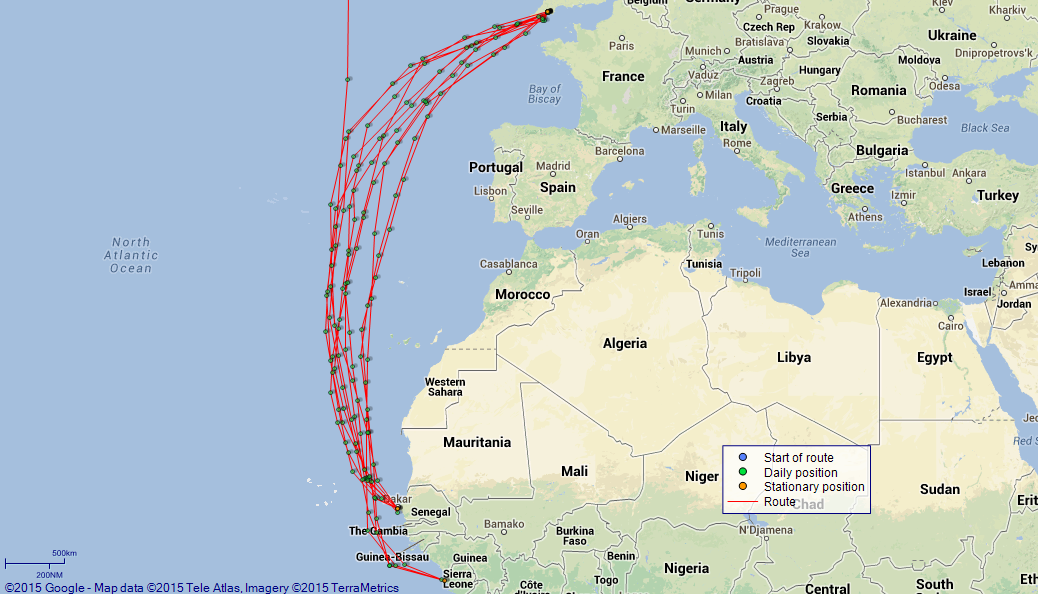
LOGS FOR AUGUST 1917 4caf88a3cadfd34197021b4f: (http://oldweather.s3.amazonaws.com/ADM_53-50098/ADM 53-50098-001_0.jpg) [Left hand side of cover of Copy of Log for August 1917] 4caf88a3cadfd34197021b50: (http://oldweather.s3.amazonaws.com/ADM_53-50098/ADM 53-50098-001_1.jpg) [Right hand side of cover, signed by Navigating Officer, as before] 4caf88a3cadfd34197021b51: (http://oldweather.s3.amazonaws.com/ADM_53-50098/ADM 53-50098-002_0.jpg) [Blank page] 4caf88a3cadfd34197021b52: (http://oldweather.s3.amazonaws.com/ADM_53-50098/ADM 53-50098-002_1.jpg) [Page not filled in] 4caf88a3cadfd34197021b53: (http://oldweather.s3.amazonaws.com/ADM_53-50098/ADM 53-50098-003_0.jpg) [Details of Barometer and Thermometers, as before] 4caf88a3cadfd34197021b54: (http://oldweather.s3.amazonaws.com/ADM_53-50098/ADM 53-50098-003_1.jpg) 1 August 1917 At Glasgow Lat 55.86, Long -4.30 6.30am: Commenced Coaling. am: Gunners, bos’n’s and painting parties as requisite. Hands painting and scaling iron work. 5.0pm: Leave to first part Port Watch till 7am. pm: Coal received 1021 tons, 10.15pm: HMS “Patia” sailed. [Provisions received: Bread 80 lbs] [Fuel Remaining: Coal 1492 tons] [Weather mostly fine, noon temperature 70F] 4caf88a3cadfd34197021b55: (http://oldweather.s3.amazonaws.com/ADM_53-50098/ADM 53-50098-004_0.jpg) 2 August 1917 At Glasgow Lat 55.86, Long -4.30 6.0am: Completed coaling. am: Hands employed cleaning ship. 2.0pm: Shifted ship under tow (2 tugs) from Coaling berth to No 1 berth Princes Dock. Local Pilot assisting. 5.0pm: Leave to second part Port Watch till 7am. [Provisions received: Fresh Meat 125 lbs, Vegetables 4344 lbs, Bread 100 lbs] 4caf88a3cadfd34197021b56: (http://oldweather.s3.amazonaws.com/ADM_53-50098/ADM 53-50098-004_1.jpg) 3 August 1917 At Glasgow Lat 55.86, Long -4.30 am: Gunners, bos’n’s and painting parties as requisite. Hands taking in stores. 4.0pm: Evening Quarters. 5.0pm: Leave to first part Port Watch till 7am. [Provisions received: Bread 100 lbs] 4caf88a3cadfd34197021b57: (http://oldweather.s3.amazonaws.com/ADM_53-50098/ADM 53-50098-005_0.jpg) 4 August 1917 At Glasgow Lat 55.86, Long -4.30 8.30am: Starboard Watch Returned from leave. am: Gunners, Bosun’s and painting party as requisite. Hands Employed provisioning ship. pm: Hands provisioning ship and preparing for sea. [Provisions received: Fresh Meat 1633 lbs, Bread 500 lbs] 4caf88a3cadfd34197021b58: (http://oldweather.s3.amazonaws.com/ADM_53-50098/ADM 53-50098-005_1.jpg) 5 August 1917 At Clyde Lat 55.86, Long -4.30 7.0am: Hands preparing ship for sea. 9.30am: Divisions and Inspection. 10.30am: Divine Service. 1.30pm: Local Pilot and 2 Tugs arrived. 2.10pm: Unmoored and left berth. 2.20pm: Ex Princes Dock. 3.5pm: Off Rothsay Dock. 3.55pm: Off Dumbarton. 4.35pm: Landed Local Pilot off Princes Pier. 4.55pm: Let go Port anchor. 5.0pm: Brought up with 45 fathoms cable in 13 fathoms water. [Anchor Bearings: Kempock Point S82W, Whitefarland Point S62E, Rosneath Beacon N66E] 10.30pm: Hoisted and secured duty boats. [Draught leaving port: forward 20’ 6”, aft 23’ 9”] 4caf88a3cadfd34197021b59: (http://oldweather.s3.amazonaws.com/ADM_53-50098/ADM 53-50098-006_0.jpg) 6 August 1917 At Gourock Lat 55.97, Long -4.82 [estimated] 1.0am: Clocks put back 1 hour to GMT. 2.0am: Anchor Bearings unaltered. 9.0am: Divisions and prayers. General Quarters. am: Guns crews, control parties and ship’s Company exercised at divisional drills. Hands cleaning and painting ship. pm: Hands employed as above. 2.0pm: Midshipman Rea RNR joined ship. 4.0pm: Evening Quarters. 5.30pm: Received new driving wheel for No 1 Winch ex Steam tug “Cruiser”. 11.0pm: Hoisted and secured all duty boats. 4caf88a3cadfd34197021b5a: (http://oldweather.s3.amazonaws.com/ADM_53-50098/ADM 53-50098-006_1.jpg) 7 August 1917 At Gourock Lat 55.97, Long -4.82 am: Training classes and physical drill parties told off. Hands employed painting ship. 11.30am: HMS Artois sailed. 3.0pm: Weighed and proceeded. 3.20pm: Kempock Point. 3.40pm: Ex Boom Defence. 3.50pm: Streamed Paravanes. 4.0pm: Evening Quarters. 4.5pm: Skelmorlie Buoy. 4.43pm: Little Cumbrae ESE, 1 mile. 5.40pm: Lady Isle Light House S80E, 2 miles. 5.50pm: HMS “Marne” bound N. 6.26pm: Turnberry Point Light House SE, 1.7 miles. 7.0pm: Ailsa Craig NW, 4.1 miles. 8.0pm: Corsewall Point Light House S65E, 2.2 miles. 9.0pm: Maidens Light S57W, 6 miles. 10.21pm: Altacarry Head N19W, Mull of Cantyre N59E, Sanda Island N86E. 11.20pm: Rue Point (Rathlin) NE, 0.7 miles. 11.40pm: Bull Point (Rathlin), NE, 1.2 miles. 4caf88a3cadfd34197021b5b: (http://oldweather.s3.amazonaws.com/ADM_53-50098/ADM 53-50098-007_0.jpg) 8 August 1917 From Clyde to Sierra Leone Lat 56.92, Long -8.92 1.17am: Oversay Light N45E, 4.5 miles. 2.0am: In company with HMS “Artois” and HM Sloops “Buttercup” and “Primrose”. 4.20am: Hoisted in paravanes. 7.0am: Spoke HMS “Armadale Castle”. 9.0am: Divisions and prayers. am: Guns crews, Control parties and ships Company exercised at divisional drills. Hands employed in boats and as requisite. 2.0pm: Parted Company with “Artois” and “Buttercup”. 4.0pm: Evening Quarters. 10.0pm: Lat 56 56 [N], Long 13 00 [W]: star observation. 10.30pm: Parted Company with “Primrose”. [Course and Distance made good: Various 246 miles] [Weather fine, light winds, noon air and sea temperature 60F] 4caf88a3cadfd34197021b5c: (http://oldweather.s3.amazonaws.com/ADM_53-50098/ADM 53-50098-007_1.jpg) 9 August 1917 From Clyde to Sierra Leone Lat 56.20, Long -18.28 pm: 1 searchlight mirror found broken in searchlight. 4.0pm: Evening Quarters. Exercised Fire Drill. [Course and Distance made good: S82W, 313 miles] 4caf88a3cadfd34197021b5d: (http://oldweather.s3.amazonaws.com/ADM_53-50098/ADM 53-50098-008_0.jpg) 10 August 1917 From Clyde to Sierra Leone Lat 51.70, Long -21.67 9.0am: Divisions and Prayers. 4.0pm: Evening Quarters. 5.0pm: Exercise Out Collision Mat. [Course and Distance made good: S24W, 296 miles] [Squally north westerly wind force 5 or 6 from noon, sea state rough in pm, weather fine then cloudy, noon temperature 62F, sea temperature 61F] 4caf88a3cadfd34197021b5e: (http://oldweather.s3.amazonaws.com/ADM_53-50098/ADM 53-50098-008_1.jpg) 11 August 1917 From Clyde to Sierra Leone Lat 46.42, Long -21.83 6.15am: USA Cruiser “Washington” [possibly this ship, though she was called USS Seattle at this time] with Convoy steering E. am: Hands employed cleaning Ship. Both night Lifebuoys tested and found correct. 3.0pm: Spoke SS “Panonia” [probably Pannonia] Westbound. [Course and Distance made good: S1W, 317 miles] 4caf88a3cadfd34197021b5f: (http://oldweather.s3.amazonaws.com/ADM_53-50098/ADM 53-50098-009_0.jpg) 12 August 1917 From Clyde to Sierra Leone Lat 41.00, Long -22.40 9.30am: Divisions and Inspection. Ships Company Mustered by open List. 11.0am: Divine Service. 4.0pm: Evening Quarters. [Course and Distance made good: S4W, 326 miles] 4caf88a3cadfd34197021b60: (http://oldweather.s3.amazonaws.com/ADM_53-50098/ADM 53-50098-009_1.jpg) 13 August 1917 From Clyde to Sierra Leone Lat 35.48, Long -22.87 [Course and Distance made good: S3W, 331 miles] [Log just records routine matters as ship zigzags on her course of S22W] 4caf88a3cadfd34197021b61: (http://oldweather.s3.amazonaws.com/ADM_53-50098/ADM 53-50098-010_0.jpg) 14 August 1917 From Clyde to Sierra Leone Lat 30.13, Long -23.42 6.18am: Lat 31 18 N, Long 23 04 W: star observation. 9.0am: Sighted SS SW steering W. 10.10am: Boarded British SS “Glenmorag” Lat 30 31 N, Long 23 24 W. 4.0pm: Evening Quarters. Physical Drill. [Course and Distance made good: S5W, 322 miles] [Weather fine, noon temperature 77F, sea temperature 75F] 4caf88a3cadfd34197021b62: (http://oldweather.s3.amazonaws.com/ADM_53-50098/ADM 53-50098-010_1.jpg) 15 August 1917 From Clyde to Sierra Leone Lat 24.72, Long -22.27 [Course and Distance made good: S11E, 331 miles] [Log records routine matters as Motagua continues south. Winds north easterly force 4 or 5 and sea state rough in pm] 4caf88a3cadfd34197021b63: (http://oldweather.s3.amazonaws.com/ADM_53-50098/ADM 53-50098-011_0.jpg) 16 August 1917 From Clyde to Sierra Leone Lat 19.50, Long -20.98 9.0am: Divisions and prayers. am: Guns crews, Control parties and ships Company exercised at divisional drills. Hands painting iron work. 4.0pm: Evening Quarters. Physical Exercise. [Course and Distance made good: S13E, 322 miles] 4caf88a3cadfd34197021b64: (http://oldweather.s3.amazonaws.com/ADM_53-50098/ADM 53-50098-011_1.jpg) 17 August 1917 From Clyde to Sierra Leone Lat 14.33, Long -19.95 7.55am: Sighted schooner. 8.30am: Boarded American schooner “Ascaswell” Lat 15 00 N, Long 20 04 W. 8.8pm: Lat 12 29.4 N, Long 19 29.0 W: star observation. [Course and Distance made good: S11E, 316 miles] 4caf88a3cadfd34197021b65: (http://oldweather.s3.amazonaws.com/ADM_53-50098/ADM 53-50098-012_0.jpg) 18 August 1917 From Clyde to Sierra Leone Lat 9.83, Long -18.12 5.50pm: Spoke SS “Mascila” [possibly Massilia] steering NNW. 9.0pm: Commenced Sounding. [Course and Distance made good: S22E, 291 miles] [Squally south westerly wind force 5, with rain and rough sea from 8am to 8pm. Noon temperature 78F, sea temperature 79F] 4caf88a3cadfd34197021b66: (http://oldweather.s3.amazonaws.com/ADM_53-50098/ADM 53-50098-012_1.jpg) 19 August 1917 From Clyde to Sierra Leone Lat 8.50, Long -13.24 [estimated] 6.10am: Streamed Paravanes. am: 3 sinkers, 3 swivel pieces, 3 Guards brass and 2 Wires steel Galvanised accidentally lost overboard. 9.35am: Sighted Sierra Leone Light House N55E. 9.50am: Shipped Paravanes. 10.7am: Sierra Leone Light House E, 4.0 miles. Laid in deep sea lead. 10.30am: Sierra Leone Light House S20W, 0.4 miles. 10.35am: Entered Boom Defence. Received permission to proceed. 11.5am: Let go port anchor in 10 fathoms water. 11.12am: Brought up with 45 fathoms cable and ROE [Rang Off Engines]. [Anchor Bearings: Farran Point S56E, Cathedral Tower S5W, King Tom Point (West) S72W] 0.30pm: Rigged coaling gear. 2.0pm: Clocks retarded 1 hour to Local time. 3.0pm: Collier “Priestfield” [listed here] made fast alongside. 4.0pm: Commenced coaling ship. 10.0pm: Suspended Coaling. [Course and Distance made good: Various 306 miles] [Draught on arrival: forward 17’ 08”, aft 20’ 00”] [Noon Position][Sierra Leone] [Fuel Remaining: Coal 584 tons] 4caf88a3cadfd34197021b67: (http://oldweather.s3.amazonaws.com/ADM_53-50098/ADM 53-50098-013_0.jpg) 20 August 1917 At Sierra Leone Lat 8.50, Long -13.24 2.0am: Anchor Bearings unaltered. 6.0am: Continued coaling. pm: Received 503 tons Coal. 8.0pm: Completed Coaling. [Fuel Remaining: Coal 1082 tons] [Weather fine, noon temperature 79F] 4caf88a3cadfd34197021b68: (http://oldweather.s3.amazonaws.com/ADM_53-50098/ADM 53-50098-013_1.jpg) 21 August 1917 At Sierra Leone Lat 8.50, Long -13.24 6.0am: SS “Priestfield” cast off and came to anchor. 7.0am: Unrigged coaling gear. am: Hands employed cleaning ship. pm: 6 RNVR signal Ratings sent to Convoy. 9 RNVR signal Ratings transferred to HMS “Marmora”. Received on board 308 boxes bullion Ex Sierra Leone and 46 boxes bullion Ex SS “Apapa”. 4.0pm: Evening Quarters. 5.0pm: Lieutenant St de Croix ASC [Army Service Corps], 1 RMA [Royal Marine Artillery] Warrant Officer, 3 NCOs and 16 men joined up on passage. 4caf88a3cadfd34197021b69: (http://oldweather.s3.amazonaws.com/ADM_53-50098/ADM 53-50098-014_0.jpg) 22 August 1917 From Sierra Leone to Special Rendezvous Lat 8.57, Long -13.50 6.30am: Hands employed preparing ship for sea. 8.0am: Clocks advanced 1 hour to GMT. 9.30am: Hove short. 10.0am: Convoy weighed and proceeded in single line, “Apapa”, “Kishima Maru” [probably “Kashima Maru”], “La Nigra” [La Negra - which was to be sunk on this voyage - more details here], “Atrius” [possibly Atreus], “Abadesa” [listed here]. 10.25am: Weighed. 10.35am: Proceeded. 10.55am: Ex Boom Defence. 10.57am: Sierra Leone Light House S22W, 0.3 miles. 11.5am: Streamed Paravanes. 11.20am: Convoy formed 2 lines. 4.0pm: Evening Quarters. 6.0pm: Hoisted in Paravanes. [Course and Distance made good: Various 16 miles] [True Bearing and Distance: Sierra Leone Light House S75E, 12.5 miles] [Draught leaving: forward 19’ 06”, aft 22’ 6”] 4caf88a3cadfd34197021b6a: (http://oldweather.s3.amazonaws.com/ADM_53-50098/ADM 53-50098-014_1.jpg) 23 August 1917 From Sierra Leone to Special Rendezvous Lat 9.78, Long -18.07 9.0am: Divisions and prayers. am: Guns crews, Control parties and ships Company exercised at divisional drills. 4.0pm: Evening Quarters. Exercise Out Collision Mat. [Course and Distance made good: N75W, 280 miles] 4caf88a3cadfd34197021b6b: (http://oldweather.s3.amazonaws.com/ADM_53-50098/ADM 53-50098-015_0.jpg) 24 August 1917 From Sierra Leone to Special Rendezvous Lat 13.85, Long -19.22 [Course and Distance made good: N15W, 253 miles] [Number on sick list: 5] [Log just records routine matters. North westerly wind force 4 all day, weather fine, noon temperature 79F, sea temperature 80F] 4caf88a3cadfd34197021b6c: (http://oldweather.s3.amazonaws.com/ADM_53-50098/ADM 53-50098-015_1.jpg) 25 August 1917 From Sierra Leone to Special Rendezvous Lat 18.37, Long -19.52 am: Hands employed cleaning ship. Both night lifebuoys tested and found correct. 4.0pm: Evening Quarters. [Course and Distance made good: N4W, 272 miles] [Number on sick list: 5] 4caf88a3cadfd34197021b6d: (http://oldweather.s3.amazonaws.com/ADM_53-50098/ADM 53-50098-016_0.jpg) 26 August 1917 From Sierra Leone to Special Rendezvous Lat 22.88, Long -20.08 9.0am: Divisions and Inspection. Ship’s Company Mustered by Open List. 11.0am: Divine Service. 4.0pm: Evening Quarters. [Course and Distance made good: N7W, 273 miles] 4caf88a3cadfd34197021b6e: (http://oldweather.s3.amazonaws.com/ADM_53-50098/ADM 53-50098-016_1.jpg) 27 August 1917 From Sierra Leone to Special Rendezvous Lat 27.13, Long -20.62 9.0am: Divisions and prayers. am: Guns crews, control parties and ships Company exercised at divisional drills. Hands employed painting. 4.30pm: Intercepted French Barque “La Argentina” steering SSW. [Course and Distance made good: N7W, 257 miles] 4caf88a3cadfd34197021b6f: (http://oldweather.s3.amazonaws.com/ADM_53-50098/ADM 53-50098-017_0.jpg) 28 August 1917 From Sierra Leone to Special Rendezvous Lat 31.07, Long -20.07 5.0pm: Exercised Abandon ship stations. 8.15pm: Lat 32 18 N, Long 19 42 W: star observation. [Course and Distance made good: N7E, 238 miles] [Log mostly records routine matters while Motagua zigzags northwards. Weather fine, noon temperature 72F, sea temperature 74F] 4caf88a3cadfd34197021b70: (http://oldweather.s3.amazonaws.com/ADM_53-50098/ADM 53-50098-017_1.jpg) 29 August 1917 From Sierra Leone to Special Rendezvous Lat 34.77, Long -19.03 6.0am: Lat 33 52 N, Long 19 15.5 W: star observation. 3.30pm: Intercepted British SS “Darro” [listed here] steering SSW. 8.18pm: Lat 36 04 N, Long 18 33.5 W: star observation. [Course and Distance made good: N13E, 228 miles] [Number on sick list: 5] 4caf88a3cadfd34197021b71: (http://oldweather.s3.amazonaws.com/ADM_53-50098/ADM 53-50098-018_0.jpg) 30 August 1917 From Sierra Leone to Special Rendezvous Lat 38.95, Long -17.62 6.0am: Lat 37 51 N, Long 18 00 W: star observation. 5.0pm: Boarded British SS “Inknoka” [probably Inkonka] in Lat 39 50 N, Long 17 30 W. 8.0pm: Lat 40 23 N, Long 17 05 W: star observation. [Course and Distance made good: N15E, 260 miles] [Number on sick list: 5] 4caf88a3cadfd34197021b72: (http://oldweather.s3.amazonaws.com/ADM_53-50098/ADM 53-50098-018_1.jpg) 31 August 1917 From Sierra Leone to Special Rendezvous Lat 42.73, Long -15.93 11.0am: Boarded Dutch SS Hebe Lat 42 37 N, Long 15 54 W. 2.0pm: Rejoined Convoy. 4.15pm: Lat 42 46.5 N, Long 16 11.0 W: observed. [Course and Distance made good: N19E, 240 miles] 4caf88a3cadfd34197021b73: (http://oldweather.s3.amazonaws.com/ADM_53-50098/ADM 53-50098-019_0.jpg) [Log page not filled in] 4caf88a3cadfd34197021b74: (http://oldweather.s3.amazonaws.com/ADM_53-50098/ADM 53-50098-019_1.jpg) [Blank page] 4caf88a3cadfd34197021b75: (http://oldweather.s3.amazonaws.com/ADM_53-50098/ADM 53-50098-020_0.jpg) [Blank page, back cover] 4caf88a3cadfd34197021b76: (http://oldweather.s3.amazonaws.com/ADM_53-50098/ADM 53-50098-020_1.jpg) [Blank page, back cover] LOGS FOR SEPTEMBER 1917 4caf88a3cadfd34197021b77: (http://oldweather.s3.amazonaws.com/ADM_53-50099/ADM 53-50099-001_0.jpg) [Left hand side of cover of Copy of Log for September 1917] 4caf88a3cadfd34197021b78: (http://oldweather.s3.amazonaws.com/ADM_53-50099/ADM 53-50099-001_1.jpg) [Right hand side of cover, signed by Navigating Officer, as before] 4caf88a3cadfd34197021b79: (http://oldweather.s3.amazonaws.com/ADM_53-50099/ADM 53-50099-002_0.jpg) [Blank page] 4caf88a3cadfd34197021b7a: (http://oldweather.s3.amazonaws.com/ADM_53-50099/ADM 53-50099-002_1.jpg) [Page not filled in] 4caf88a3cadfd34197021b7b: (http://oldweather.s3.amazonaws.com/ADM_53-50099/ADM 53-50099-003_0.jpg) [Details of Barometer and Thermometers, as before] 4caf88a3cadfd34197021b7c: (http://oldweather.s3.amazonaws.com/ADM_53-50099/ADM 53-50099-003_1.jpg) 1 September 1917 From Sierra Leone to Special Rendezvous Lat 45.57, Long -13.63 am: Convoying British SS “Apapa”, “Artieus” [sic], “Abadesa”, “La Nigra” [La Negra] and Japanese SS “Kishima Maru” [sic] to England. 6.30am: “La Nigra” dropping astern owing to trouble with boiler. 1.0pm: In company with HM Destroyer “Unity”. 2.30pm: In company with destroyer escort: “Hardy”, “Beaver”, “Owl”, “Victor”, “Ambuscade”, “Garland”, “Laertes” and “Unity”. 5.0pm: Parted company with SS “La Nigra” and “Abadesa”, “Unity”, “Victor” and “Owl”. 8.0pm: Lat 46 29 N, Long 11 51 W: star observation. [Course and Distance made good: N30E, 197 miles] [Weather fine, noon air and sea temperature 64F] 4caf88a3cadfd34197021b7d: (http://oldweather.s3.amazonaws.com/ADM_53-50099/ADM 53-50099-004_0.jpg) 2 September 1917 From Sierra Leone to Plymouth Lat 48.35, Long -7.97 5.0am: Lat 47 32 N, Long 9 41 W: star observation. 11.45am: Detailed “Beaver” to assist SS “Riton Hall” [Rytonhall] SOS signals. 2.0pm: Parted company with SS “Apapa”, “Artieus” and Kishima Maru with “Ambuscade”, “Garland” and “Hardy”. Proceeded in company with “Laertes”. 6.0pm: Streamed Paravanes. 7.0pm: Starboard PV [Paravane] running badly; streamed spare PV. 8.50pm: Sighted Lizard Light N53E, 25 miles. 10.23pm: Lizard Light N5E, 18 miles. [Course and Distance made good: N54E, 284 miles] 4caf88a3cadfd34197021b7e: (http://oldweather.s3.amazonaws.com/ADM_53-50099/ADM 53-50099-004_1.jpg) 3 September 1917 At Devonport Lat 50.37, Long -4.19 [estimated] 0.20am: Sighted Eddystone Light N53E, 21 miles. 2.0am - 2.6am: Rounded Eddystone Light, distant 1 mile. 2.30am: Signalled Rame Head and received permission to Enter port. Hove up Paravanes. 2.45pm: Penlee Point abeam 6 cables. 2.50am: Rounded Breakwater Light House. 3.30am: Let go Port anchor. 3.37am: Brought up with 30 fathoms cable in 7 fathoms water. [Anchor Bearings: Breakwater Light S45W, Pickle Combe [Picklecombe] Point S85W, Drakes Island semaphore N21W] 6.0am: Clocks advanced 1 hour to BST. Kings Harbour Master and tug Woonda [listed here] assisting. 7.25am: Weighed and proceeded. 7.40am: Milampur [?] Buoy abeam. 7.54am: Passed in Boom Defence. 8.20am: Moored to No 9 Buoy. 8.23am: ROE. am: Hands employed striking Down ammunition and preparing ship for Port. 11.0am: Lieutenant G St Croix ACS and detachment landed. 2.30pm: Unmoored and proceeded under tow. Local Pilot and 3 tugs assisting. 3.8pm: Made fast alongside quay in No 7 Berth. 4.0pm: Evening Quarters. Read warrants Nos 55 and 56. 6.0pm: Cases bullion transferred to train under Marine Guard. 9.0pm: Rounds Correct. [Course and Distance made good: Various 218 miles] [Draught on arrival: forward 17’ 09”, aft 19’ 06”] [Fuel Remaining: Coal 379 tons] 4caf88a3cadfd34197021b7f: (http://oldweather.s3.amazonaws.com/ADM_53-50099/ADM 53-50099-005_0.jpg) 4 September 1917 At Devonport Lat 50.39, Long -4.19 [estimated] 7.30am: Shifted ship to Coaling berth. Local pilot and 3 tugs assisting. 9.0am: Working party from [HMS] Jupiter arrived to assist in Coaling. 10.0am: Commenced Coaling. 1.0pm: Engineer Lieutenant Noble RNR (temporary) discharged to hospital. 4.0pm: Starboard Watch granted leave till 9am Monday 10th inst. 6.0pm: Jupiter’s Working party left ship. 9.30p: Continued Coaling throughout. 10.30pm: Engineer Lieutenant Commander Donnan RNR temporary joined ship. [Provisions received: Fresh Meat 51 lbs, Vegetables 524 lbs, Bread 100 lbs] 4caf88a3cadfd34197021b80: (http://oldweather.s3.amazonaws.com/ADM_53-50099/ADM 53-50099-005_1.jpg) 5 September 1917 At Devonport Lat 50.39, Long -4.19 6.30am: Suspended coaling. 7.30am: Shifted ship to No 7 berth. Local pilot and 3 tugs assisting. am: Hands employed cleaning ship and taking in stores. 11.0am: Lieutenant Commander Towell RNR rejoined from Convoy. 3.0pm: Collier C69 Made fast alongside. 5.0pm: Received 32 bags Mail. [Provisions received: Vegetables 300 lbs] 4caf88a3cadfd34197021b81: (http://oldweather.s3.amazonaws.com/ADM_53-50099/ADM 53-50099-006_0.jpg) 6 September 1917 At Devonport Lat 50.39, Long -4.19 6.0am: Resumed Coaling. 8.0am: Working party from Jupiter arrived to assist in Coaling. pm: Hands employed storing and coaling ship. 7.0pm: Engineer Lieutenant Commander Spencer RNR temporary discharged to “Changuinola”. [Provisions received: Fresh Meat 83 lbs, Bread 20 lbs] 4caf88a3cadfd34197021b82: (http://oldweather.s3.amazonaws.com/ADM_53-50099/ADM 53-50099-006_1.jpg) 7 September 1917 At Devonport Lat 50.39, Long -4.19 am: Hands employed coaling and storing ship. pm: Received 45 x .303 Ross Rifles and bayonets. Returned 45 .236 Japanese Rifles and bayonets. [Provisions received: Fresh Meat 61 lbs, Vegetables 6600 lbs, Bread 150 lbs] 4caf88a3cadfd34197021b83: (http://oldweather.s3.amazonaws.com/ADM_53-50099/ADM 53-50099-007_0.jpg) 8 September 1917 At Devonport Lat 50.39, Long -4.19 3.30am: Suspended Coaling. am: Hands employed cleaning and painting ship. 4.30pm: 1 Prisoner Released from cells. 5.30pm: Received one paravane BIII*. Returned one paravane BIII*. 7.0pm: Sub Lieutenant Johnson RNR (temporary) Discharged to shore. [Provisions received: Fresh Meat 176 lbs, Vegetables 1709 lbs, Bread 130 lbs] 4caf88a3cadfd34197021b84: (http://oldweather.s3.amazonaws.com/ADM_53-50099/ADM 53-50099-007_1.jpg) 9 September 1917 At Devonport Lat 50.39, Long -4.19 am: Hands employed taking in provisions. 1.0pm: Received 15 Cases small arm Ammunition. pm: Received 25 bags outward mail confidential. Received 999 Smoke boxes and 9 cases miscellaneous stores for Sierra Leone. 4caf88a3cadfd34197021b85: (http://oldweather.s3.amazonaws.com/ADM_53-50099/ADM 53-50099-008_0.jpg) 10 September 1917 At Devonport Lat 50.39, Long -4.19 9.0am: Starboard Watch returned from leave. Continued Coaling. am: Hands employed provisioning ship. pm: Hands employed as above. 3.30pm: Completed coaling. Received 1194 tons. 5.0pm: Leave to Port Watch till Midnight. 7.0pm: 1 Stoker and 1 AB returned under escort. 9.0pm: Paymaster Roe RN joined ship on passage. Lieutenant J Smith RNR joined ship on passage. [Provisions received: Fresh Meat 6029 lbs, Vegetables 1350 lbs, Bread 400 lbs] [Fuel Remaining: 1533 tons] 4caf88a3cadfd34197021b86: (http://oldweather.s3.amazonaws.com/ADM_53-50099/ADM 53-50099-008_1.jpg) 11 September 1917 From Devonport to Sierra Leone Lat 50.39, Long -4.19 am: Hands employed preparing ship for sea. 11.0am: 45 Ratings joined ship on passage. 2.0pm: Unmoored and left berth. 2.34pm: Ex Boom Defence. 3.5pm: Let go Starboard anchor in 6 fathoms Water. 3.10pm: Brought up with 45 fathoms cable. Clocks retarded 1 hour to GMT. [Anchor Bearings: Breakwater Beacon S12E, Breakwater Light House S52W, Smeaton Tower N26E] 3.45pm: Weighed and 4.0pm Proceeded with convoy single line “Motagua”, [SS] “Ulysses” [possibly this ship], [SS] “Orontes” [Orontes (1) listed here], “Columbella” [HMS Columbella - see log book here], [SS] “Durham Castle” in company with HM Destroyers “Hardy”, “Forrester”, “Achates”, “Lance”, Beaver”. 4.5pm: Rounded Breakwater Light House 3 cables. 4.33pm: Draystone buoy W 4 cables. Streamed Paravanes. 5.35pm: Eddystone Light House N29E, 2 miles. 6.0pm: Convoy formed in 2 columns. 8.25pm: Lizard Light N27W, 18 miles. 8.30pm: Durham C [Castle] developed Engine defects, detailed HM destroyer Lance to escort. [Draught leaving port: forward 20’ 10”, aft 23’ 00”] 4caf88a4cadfd34197021b87: (http://oldweather.s3.amazonaws.com/ADM_53-50099/ADM 53-50099-009_0.jpg) 12 September 1917 From Devonport to Sierra Leone Lat 47.95, Long -9.00 1.0am: Hoisted in Paravanes. 5.20am: Lat 48 40 N, Long 7 17 W: star observation. 9.0am: Divisions and prayers. am: Guns crews, control parties and ships Company exercised at divisional drills. Hands employed cleaning out boats. 4.0pm: Evening Quarters. Exercise “Out Collision Mat”. 8.0pm: Lat 47 00 N, Long 11 10 W: star observation. [Course and Distance made good: Various 246 miles] [Weather fine, north westerly wind force 3 or 4, barometric pressure relatively high, noon temperature 69F, sea temperature 62F] 4caf88a4cadfd34197021b88: (http://oldweather.s3.amazonaws.com/ADM_53-50099/ADM 53-50099-009_1.jpg) 13 September 1917 From Devonport to Sierra Leone Lat 44.97, Long -14.88 2.0am: Parted Company with Destroyer Escort “Forrester”, “Achates” and “Beaver”. 5.0am: Parted Company with “Columbella” and “Hardy”. 5.47am: Lat 45 31 N, Long 13 52 W: star observation. 11.0am: SS Durham Castle rejoined Convoy. 4.0pm: Evening Quarters. Exercise Fire Drill. 8.0pm: Lat 43 51 N, Long 16 38 W: star observation. [Course and Distance made good: S54W, 302 miles] 4caf88a4cadfd34197021b89: (http://oldweather.s3.amazonaws.com/ADM_53-50099/ADM 53-50099-010_0.jpg) 14 September 1917 From Devonport to Sierra Leone Lat 41.13, Long -18.57 6.0am: Lat 42 16 N, Long 18 19 W: star observation. 4.0pm: Evening Quarters. Physical Drill. [Course and Distance made good: S35W, 281 miles] 4caf88a4cadfd34197021b8a: (http://oldweather.s3.amazonaws.com/ADM_53-50099/ADM 53-50099-010_1.jpg) 15 September 1917 From Devonport to Sierra Leone Lat 36.35, Long -19.38 am: Hands employed cleaning ship. 1.0pm: Both night lifebuoys tested and found correct. 8.0pm: Lat 34 47 N, Long 19 27 W: star observation. [Course and Distance made good: S7.5W, 290 miles] [Weather fine and quiet, noon air and sea temperature 72F] 4caf88a4cadfd34197021b8b: (http://oldweather.s3.amazonaws.com/ADM_53-50099/ADM 53-50099-011_0.jpg) 16 September 1917 From Devonport to Sierra Leone Lat 31.58, Long -19.68 6.22am: Lat 32 44 [N], Long 19 36 [W]: star observation. 9.30am: Divisions and Inspection. 10.30am: Divine service. 4.0pm: Evening Quarters. [Course and Distance made good: S3W, 287 miles] 4caf88a4cadfd34197021b8c: (http://oldweather.s3.amazonaws.com/ADM_53-50099/ADM 53-50099-011_1.jpg) 17 September 1917 From Devonport to Sierra Leone Lat 26.90, Long -20.00 6.29am: Lat 27 49 N, Long 19 58 W: star observation. 7.0am: Parted company with Convoy temporarily. 10.0am to 11.0am: Carried out target practice with 6 inch and 3 pounder, fired 28 rounds 6 inch practice ammunition and 12 rounds 3 pounder. 11.30am: Rejoined Convoy. 1.30pm: Met Northbound Convoy of 11 ships with HMS “King Alfred” Lat 26 34 N, Long 20 00 W. 4.0pm: Evening Quarters. Physical Drill. 8.0pm: Lat 25 17 N, Long 20 00 W: star observation. [Course and Distance made good: S3.5W, 282 miles] 4caf88a4cadfd34197021b8d: (http://oldweather.s3.amazonaws.com/ADM_53-50099/ADM 53-50099-012_0.jpg) 18 September 1917 From Devonport to Sierra Leone Lat 22.07, Long -20.12 6.40am: Lat 23 7 N, Long 20 6.5 W: star observation. 7.30am: Aired bedding. 4.0pm: Evening Quarters. Inspection of Beds and hammocks. [Course and Distance made good: S1W, 290 miles] 4caf88a4cadfd34197021b8e: (http://oldweather.s3.amazonaws.com/ADM_53-50099/ADM 53-50099-012_1.jpg) 19 September 1917 From Devonport to Sierra Leone Lat 17.30, Long -20.10 6.40am: Lat 18 22 N, Long 20 07 W: star observation. [Course and Distance made good: South 286 miles] [Weather cloudy or overcast in am, fine but squally in pm, noon air and sea temperature 78F] 4caf88a4cadfd34197021b8f: (http://oldweather.s3.amazonaws.com/ADM_53-50099/ADM 53-50099-013_0.jpg) 20 September 1917 From Devonport to Sierra Leone Lat 12.83, Long -20.08 6.40am: Lat 13 45 N, Long 20 06 W. 8.12am: SS “Ulysses” reported man overboard and left Convoy. 10.0am: SS Ulysses rejoined Convoy. 8.0pm: Lat 11 12 N, Long 19 58 W: star observation. [Course and Distance made good: S, 268 miles] 4caf88a4cadfd34197021b90: (http://oldweather.s3.amazonaws.com/ADM_53-50099/ADM 53-50099-013_1.jpg) 21 September 1917 From Devonport to Sierra Leone Lat 9.78, Long -17.62 6.40am: Lat 10 12 N, Long 18 31 W: star observation. 9.0am: Divisions and prayers. General Quarters. am: Guns crews, Control parties and ships Company exercised at divisional drills. 4.0pm: Evening Quarters. [Course and Distance made good: S39E, 233 miles] [Weather fine in am, heavy rain in early pm, then fine again, light winds, noon temperature 82F, sea temperature 80F] 4caf88a4cadfd34197021b91: (http://oldweather.s3.amazonaws.com/ADM_53-50099/ADM 53-50099-014_0.jpg) 22 September 1917 From Devonport to Sierra Leone [and at Sierra Leone] Lat 8.50, Long -13.24 [estimated] 4.30am: Commenced Sounding. 6.40am: Streamed PVs [Paravanes]. 8.25am: Sighted land off entrance to Sierra Leone S57E (Magnetic). 8.30am: Laid in lead. 9.45am: Convoy formed single line. 10.50am: Hoisted in PVs. 11.0am: Received permission to Enter Port. 11.9am: Light buoy abeam 4 cables. 11.16am: Light House S30W, 4 cables. 11.20am: Passed in Boom Defence. Noon: Convoy came to anchor. 0.25pm: Let go port anchor in 10.25 fathoms water. 0.32pm: Brought up with 45 fathoms cable and ROE. Clocks put back 1 hour to Local Time. [Anchor Bearings: Cathedral Tower S6W, Farran Point S56E, King Tom Point (target [?]) S73W] 0.45pm: Landed Mail for SNO [Senior Naval Officer]. 7.30pm: All boats hoisted. [Course and Distance made good: Various 276 miles] [Draught on arrival: forward 19’ 00”, aft 21’ 04”] [Fuel Remaining: Coal 886 tons] 4caf88a4cadfd34197021b92: (http://oldweather.s3.amazonaws.com/ADM_53-50099/ADM 53-50099-014_1.jpg) 23 September 1917 At Sierra Leone Lat 8.50, Long -13.24 2.0am: Anchor Bearings unaltered. 9.30am: Divisions and Inspection. 10.30am: Divine service. 2.0pm: Leave to Starboard Watch till 6pm. 3.30pm: Landed patrol. 4.0pm: Evening Quarters. 7.30pm: Hoisted all boats. 4caf88a4cadfd34197021b93: (http://oldweather.s3.amazonaws.com/ADM_53-50099/ADM 53-50099-015_0.jpg) 24 September 1917 At Sierra Leone Lat 8.50, Long -13.24 9.30am: Exercise General Quarters, fire drill and abandon ship. am: Hands employed painting ship. 1.0pm: Commenced discharging smoke boxes and stores from No 1 hold. 6.0pm: Suspended work at No 1 hold. 7.0pm: Hoisted all boats. 4caf88a4cadfd34197021b94: (http://oldweather.s3.amazonaws.com/ADM_53-50099/ADM 53-50099-015_1.jpg) 25 September 1917 At Sierra Leone Lat 8.50, Long -13.24 6.0am: HMS “Bacchante” came to anchor. 6.15am: OOG [Officer of Guard] boarded “Bacchante”. 9.0am: Divisions and prayers. am: Hands employed discharging stores from No 1 hold and painting ship. 2 Pattern 4 paintbrushes lost overboard by accident. pm: Engineer Sub Lieutenant Hetherington RNR (temporary) promoted to Engineer Lieutenant RNR (temporary). 2.0pm: Leave to stokers till 6pm. 3.30pm: NP [Naval Patrol] Landed. 4.0pm: Evening Quarters. 6.30pm: Naval Patrol returned. 8.0pm: All boats hoisted. 4caf88a4cadfd34197021b95: (http://oldweather.s3.amazonaws.com/ADM_53-50099/ADM 53-50099-016_0.jpg) 26 September 1917 At Sierra Leone Lat 8.50, Long -13.24 9.0am: Divisions and prayers. Issued clean hammocks. am: Completed discharging stores. 11.0am: Whalers “Silina” and “Savonia” made fast port and starboard, transferred 26 Ratings on passage to Whalers. 1.0pm: Whalers cast off and came to anchor. Lieutenants Ryan and Sim RNR and Engineer Lieutenant Caws RNR joined ship on passage. 7.0pm: Hoisted all boats. [Rain or showers until mid afternoon, noon temperature 79F] 4caf88a4cadfd34197021b96: (http://oldweather.s3.amazonaws.com/ADM_53-50099/ADM 53-50099-016_1.jpg) 27 September 1917 At Sierra Leone Lat 8.50, Long -13.24 1.0am: Orders received to take anti submarine precaution. Manned Guns, darkened ship and raised steam. 3.0am: Anchor Bearings unaltered. 7.0am: Fell out Guns’ crews. am: Hands employed painting ship. 10.30am: HMS “Africa” arrived and came to anchor. 1.0pm: Staff Paymaster Roe left for “Africa”. Lieutenant Smith RNR discharged to shore for “Astrea” [presumably HMS Astraea]. 2.0pm: Leave to Port Watch till 6pm. 3.0pm: Received 5 bags mail (outwards). 4.0pm: Landed Naval Patrol. 5.0pm: Collier “Helmsdale” [listed here] made fast alongside and transferred cases and drums. 7.0pm: Hoisted boats. 9.35pm: “Helmsdale” Cast off and came to anchor. 11.30pm: Clocks advanced 1 hour to GMT. [Provisions received: Vegetables 500 lbs] 4caf88a4cadfd34197021b97: (http://oldweather.s3.amazonaws.com/ADM_53-50099/ADM 53-50099-017_0.jpg) 28 September 1917 From Sierra Leone to Special Rendezvous Lat 8.50, Long -13.24 6.45am: Sighted anchor (clear) and let go on same anchor Bearings. 9.0am: Hands preparing ship for sea. Engine telegraphs, steam whistle and steering gear tested and found correct. 11.0am: Captains of Convoy ships attended on board for instructions. pm: Fleet Paymaster Mather RN, Chaplin Ager RN, Surgeon Fairbank RN and AP [Assistant Paymaster] Rose RNR joined on passage. Received 616 cases bullion and 1 bag diamonds. 2.0pm: Hove short. Convoy weighed and proceeded to sea single line “Leicestershire” [listed here with subsequent names], “Keemun” [listed here], “Prometheus” [Prometheus (2) listed here], “Kenilworth Castle” [Kenilworth Castle (2) listed here], “Dunvegan Castle”, “Gaika” [listed here]. 2.25pm: Anchor up. Proceeded. 2.50pm: Ex Boom defence. 2.53pm: Light House S20W, 4 cables. 3.0pm: Light Buoy abeam 2 cables. 3.5pm: Streamed PVs. 3.15pm: Convoy formed in 2 columns. 10.0pm: Hoisted in Port PV. Starboard PV found to have carried away at shackle PIIQ with 28 fathoms towing wire. [Draught leaving port: forward 19’ 6”, aft 21’ 6”] 4caf88a4cadfd34197021b98: (http://oldweather.s3.amazonaws.com/ADM_53-50099/ADM 53-50099-017_1.jpg) 29 September 1917 From Sierra Leone to Special Rendezvous Lat 9.85, Long -16.80 6.33am: Lat 9 29 N, Long 15 52 W: star observation. am: Hands employed cleaning ship. 0.30pm: Both night lifebuoys tested and found correct. 4.0pm: Evening Quarters. 5.0pm: Intercepted Australian SS “Austral Range” Lat 10 10 N, Long 17 35 W. 7.40pm: Lat 10 12 N, Long 18 12 W: star observation. [Course and Distance made good: N69W, 230 miles] [Number on sick list: 8] [Weather fine, light winds, noon temperature 80F, sea temperature 79F] 4caf88a4cadfd34197021b99: (http://oldweather.s3.amazonaws.com/ADM_53-50099/ADM 53-50099-018_0.jpg) 30 September 1917 From Sierra Leone to Special Rendezvous Lat 12.60, Long -19.22 6.38am: Lat 11 40 N, Long 19 10 W: star observation. 9.30am: Divisions and Inspection. 10.30am: Divine service. 4.0pm: Evening Quarters. [Course and Distance made good: N41W, 219 miles] [Number on sick list: 7] 4caf88a4cadfd34197021b9a: (http://oldweather.s3.amazonaws.com/ADM_53-50099/ADM 53-50099-018_1.jpg) [Log page not filled in] 4caf88a4cadfd34197021b9b: (http://oldweather.s3.amazonaws.com/ADM_53-50099/ADM 53-50099-019_0.jpg) [Log page not filled in] 4caf88a4cadfd34197021b9c: (http://oldweather.s3.amazonaws.com/ADM_53-50099/ADM 53-50099-019_1.jpg) [Blank page] 4caf88a4cadfd34197021b9d: (http://oldweather.s3.amazonaws.com/ADM_53-50099/ADM 53-50099-020_0.jpg) [Blank page, back cover] 4caf88a4cadfd34197021b9e: (http://oldweather.s3.amazonaws.com/ADM_53-50099/ADM 53-50099-020_1.jpg) [Blank page, back cover] LOGS FOR OCTOBER 1917 4caf88a4cadfd34197021b9f: (http://oldweather.s3.amazonaws.com/ADM_53-50100/ADM 53-50100-001_0.jpg) [Left hand side of cover of Copy of Log for October 1917] 4caf88a4cadfd34197021ba0: (http://oldweather.s3.amazonaws.com/ADM_53-50100/ADM 53-50100-001_1.jpg) [Right hand side of cover, signed by Navigating Officer, as before] 4caf88a4cadfd34197021ba1: (http://oldweather.s3.amazonaws.com/ADM_53-50100/ADM 53-50100-002_0.jpg) [Blank page] 4caf88a4cadfd34197021ba2: (http://oldweather.s3.amazonaws.com/ADM_53-50100/ADM 53-50100-002_1.jpg) [Page not filled in] 4caf88a4cadfd34197021ba3: (http://oldweather.s3.amazonaws.com/ADM_53-50100/ADM 53-50100-003_0.jpg) [Details of Barometer and Thermometers, as before] 4caf88a4cadfd34197021ba4: (http://oldweather.s3.amazonaws.com/ADM_53-50100/ADM 53-50100-003_1.jpg) 1 October 1917 From Sierra Leone to Special Rendezvous Lat 16.97, Long -19.70 am: Proceeding with convoy consisting of: SS “Leicestershire”, SS Keemun, SS Prometheus, SS “Kenilworth Castle”, SS Dunvegan Castle, SS Gaika. 6.46am: Lat 16 00 N, Long 19 34 W: star observation. 5.0pm: Exercised out Collision Mat. Issued soap and tobacco. 7.32pm: Lat 18 16 N, Long 19 46.5 W: star observation. [Course and Distance made good: N6W, 264 miles] [Number on sick list: 8] 4caf88a4cadfd34197021ba5: (http://oldweather.s3.amazonaws.com/ADM_53-50100/ADM 53-50100-004_0.jpg) 2 October 1917 From Sierra Leone to Special Rendezvous Lat 21.07, Long -19.92 6.45am: Lat 20 6.5 N, Long 18 52.0 W: star observation. 9.0am: Divisions and prayers. Aired night clothing. am: Guns crews, Control parties and Ships Company exercised at divisional drills. 4.0pm: Evening Quarters. Physical Exercise. 7.35pm: Lat 22 12 N, Long 20 01 W: star observation. [Course and Distance made good: N3E, 247 miles] [Number on sick list: 8] 4caf88a4cadfd34197021ba6: (http://oldweather.s3.amazonaws.com/ADM_53-50100/ADM 53-50100-004_1.jpg) 3 October 1917 From Sierra Leone to Special Rendezvous Lat 25.10, Long -20.23 6.30am: Lat 24 07 N, Long 20 11 W: star observation. 11.0am: Aired night clothing. 7.35pm: Lat 26 1.7 N, Long 20 19.2 W: star observation. [Course and Distance made good: N4W, 243 miles] [Number on sick list: 8] 4caf88a4cadfd34197021ba7: (http://oldweather.s3.amazonaws.com/ADM_53-50100/ADM 53-50100-005_0.jpg) 4 October 1917 From Sierra Leone to Special Rendezvous Lat 29.22, Long -20.60 6.55am: Lat 28 20 N, Long 20 33 W: star observation. am: Hands employed scaling and painting iron work. 7.35pm: Lat 30 31 N, Long 20 16 W: star observation. [Course and Distance made good: N4W, 248 miles] [Number on sick list: 8] [Weather fine, wind north easterly force 4 for most of day, noon temperature 73F, sea temperature 72F] 4caf88a4cadfd34197021ba8: (http://oldweather.s3.amazonaws.com/ADM_53-50100/ADM 53-50100-005_1.jpg) 5 October 1917 From Sierra Leone to Special Rendezvous Lat 33.120, Long -19.33 6.38am: Lat 32 19 N, Long 19 40 W: star observation. 9.0am: Divisions and prayers. 10.0am: General Quarters. 4.0pm: Evening Quarters. Abandon Ship stations. [Course and Distance made good: N15E, 248 miles] [Number on sick list: 8] 4caf88a4cadfd34197021ba9: (http://oldweather.s3.amazonaws.com/ADM_53-50100/ADM 53-50100-006_0.jpg) 6 October 1917 From Sierra Leone to Special Rendezvous Lat 36.58, Long -18.13 7.0am: Lat 35 57 N, Long 18 21 W: star observation. am: Hands employed cleaning ship. Both night lifebuoys tested and found correct. [Course and Distance made good: N16E, 212 miles] [Number on sick list: 8] [Squally north easterly wind force 5 or 6 all day, with sea state mostly rough, weather overcast or fine, noon temperature 66F, sea temperature 70F] 4caf88a4cadfd34197021baa: (http://oldweather.s3.amazonaws.com/ADM_53-50100/ADM 53-50100-006_1.jpg) 7 October 1917 From Sierra Leone to Special Rendezvous Lat 40.05, Long -16.88 9.30am: Divisions and Inspection. 10.30am: Divine Service. 7.7pm: Lat 41 14 N, Long 16 18 W: star observation. [Course and Distance made good: N16E, 217 miles] [Number on sick list: 8] 4caf88a4cadfd34197021bab: (http://oldweather.s3.amazonaws.com/ADM_53-50100/ADM 53-50100-007_0.jpg) 8 October 1917 From Sierra Leone to Special Rendezvous Lat 44.12, Long -14.75 [9.0am - noon: Intermittent fog] 5.0pm: Motagua leading ship starboard column and guide of Convoy. [Course and Distance made good: N21E, 263 miles] [Number on sick list: 8] [Foggy from 5am to 2pm] 4caf88a4cadfd34197021bac: (http://oldweather.s3.amazonaws.com/ADM_53-50100/ADM 53-50100-007_1.jpg) 9 October 1917 From Sierra Leone to Special Rendezvous Lat 47.25, Long -11.25 9.30am: HM Destroyers “Lysander”, “Lance”, “Attack”, “Midge”, “Gosshawk” [Goshawk], “Beaver” and “Liberty” joined convoy as escort. am: Convoy formed up in 4 columns. 11.30am: Wind shifted to NW. 6.47pm: Lat 47 42 N, Long 9 46 W: star observation. [Course and Distance made good: N38E, 237 degrees W [sic, should be miles]] [Number on sick list: 7] [Fog in early am, then squally with rain at times, north westerly wind force 6 or 7 from noon, sea state very rough. Noon temperature 56F, sea temperature 61F] 4caf88a4cadfd34197021bad: (http://oldweather.s3.amazonaws.com/ADM_53-50100/ADM 53-50100-008_0.jpg) 10 October 1917 From Special Rendezvous to Plymouth Lat 49.17, Long -6.17 6.0am: Lat 48 34 N, Long 7 19 W: star observation. 6.30am: SS “Leicestershire”, “Keemun” and “Prometheus” left with destroyers “Attack”, “Gosshawk” [sic], “Midge” for Milford Haven. 4.0pm: Evening Quarters. Streamed PVs. 5.2pm: Sighted Lizards [sic] Light House N11E. 6.0pm: Lizard Light House N25W, 15 miles. 9.27pm: Eddystone Light House N57W, 1 mile. 10.0pm: Received permission to Enter port. Hoisted in PVs. 10.18pm: Draystone Buoy abeam, 4 cables. 10.25pm: Rounded Plymouth Breakwater Light House, 3 cables. 10.30pm: Let go port anchor in 6.5 fathoms. 10.40pm: Brought up with 45 fathoms cable and ROE. [Course and Distance made good: N61E, 234 miles] [Number on sick list: 7] [Very squally north westerly wind force 7 or 8 in am, with sea state high; wind and sea reducing in pm] 4caf88a4cadfd34197021bae: (http://oldweather.s3.amazonaws.com/ADM_53-50100/ADM 53-50100-008_1.jpg) 11 October 1917 At Plymouth Sound Lat 50.34, Long -4.15 [estimated] [Anchor Bearings: Breakwater Light House S13W, Fort S25E, Picklecombe Point N67W] 4.0am: Anchor Bearings unaltered. 9.0am: Hands employed preparing ship for coaling and refit, striking down ammunition etc. am: Fleet Paymaster Mather RN, Chaplin Ager RN, Surgeon Fairbank RN, Lieutenants Sims and Ryan RNR, Engineer Lieutenant Caws RNR with 53 Ratings on passage landed. Assistant Paymaster Rose RNR and 6 Ratings discharged to hospital. 0.40pm: Weighed and proceeded. Local Pilot and 1 tug assisting. 0.58pm: Tug parted tow rope off. 1.5pm: Passed in Boom defence. pm: Ships company paid monthly advance. 2.0pm: Made fast in No 5 Berth Devonport. 3.0pm: Leave to Port watch till 11 pm Monday 15th October. 5.0pm: Read Warrants Nos 57 and 58. 6.0pm: Discharged 616 cases bullion and 1 bag diamonds to RMLI [Royal Marines Light Infantry] Guard. 7.30pm: Leave to second part Starboard Watch till 7am. [Course and Distance made good: Various 105 miles] [Draught on Arrival: forward 17’ 6”, aft 19’ 9”] [Provisions received: Fresh Meat 157 lbs, Vegetables 1300 lbs] [Fuel Remaining: Coal 302 tons] 4caf88a4cadfd34197021baf: (http://oldweather.s3.amazonaws.com/ADM_53-50100/ADM 53-50100-009_0.jpg) 12 October 1917 At Devonport Lat 50.39, Long -4.19 [estimated] am: Repair to ash shoot [chute] in bunker commenced. Hands employed discharging empty Cases and drums from No 2 hold. Landed 13 bags mail from Sierra Leone in transit. 1.0pm: Assistant Paymaster Penn RNR lent to ship for duty in port. 4.0pm: Evening Quarters. 5.0pm: Leave to first part starboard watch till 7am. 4caf88a4cadfd34197021bb0: (http://oldweather.s3.amazonaws.com/ADM_53-50100/ADM 53-50100-009_1.jpg) 13 October 1917 At Devonport Lat 50.39, Long -4.19 am: Hands employed taking in stores and landing empties. 0.30pm: Assistant Paymaster Penn RNR recalled for distribution and AP Johnson RNR in lieu. pm: Hands employed as above. 5.0pm: Leave to second part Starboard Watch till 7am. [Provisions received: Fresh Meat 64 lbs, Bread 450 lbs] [Rain or showers for most of day, noon temperature 47F] 4caf88a4cadfd34197021bb1: (http://oldweather.s3.amazonaws.com/ADM_53-50100/ADM 53-50100-010_0.jpg) 14 October 1917 At Devonport Lat 50.39, Long -4.19 am: Hands employed rigging screens in bunkers preparatory to part coaling. 1.0pm: Leave to first part Starboard Watch till 7am. 4.0pm: Evening Quarters. Received 2 bags official mail. [Provisions received: Fresh Meat 171 lbs, Vegetables 9000 lbs, Bread 60 lbs] [Fuel Remaining: Coal 287 tons] 4caf88a4cadfd34197021bb2: (http://oldweather.s3.amazonaws.com/ADM_53-50100/ADM 53-50100-010_1.jpg) 15 October 1917 At Devonport Lat 50.39, Long -4.19 am: Hands employed taking in stores. Noon: Unmoored and shifted to No 9 berth assisted by 3 tugs and Local Pilot. 1.10pm: Moored in No 9 berth. 1.30pm: Coaling party from depôt arrived. Temperly transporter [Temperley transporter] and lighter made fast alongside. 3.0pm: Commenced coaling. 5.0pm - 6.0pm: Coaling party to tea and supper. 8.0pm: Relief Coaling party arrived. pm: Received 562 tons coal. 11.0pm: Suspended coaling until bunker repairs completed. [Fuel Remaining: Coal 844 tons] 4caf88a4cadfd34197021bb3: (http://oldweather.s3.amazonaws.com/ADM_53-50100/ADM 53-50100-011_0.jpg) 16 October 1917 At Devonport Lat 50.39, Long -4.19 am: Hands employed taking in stores. Trimming party from depôt working coal in bunkers. pm: Hands employed as above. 5.0pm: Unmoored and left coaling wharf under tow (3 tugs), local Pilot assisting. 6.0pm: Made fast at Nos 2 and 3 jettys South Yard. [Provisions received: Vegetables 108 lbs, Bread 120 lbs] 4caf88a4cadfd34197021bb4: (http://oldweather.s3.amazonaws.com/ADM_53-50100/ADM 53-50100-011_1.jpg) 17 October 1917 At Devonport Lat 50.37, Long -4.19 [estimated] am: Hands employed taking in Stores and cleaning ship. 11.0am: Received 1 Paravane Mk III*. 2.0pm: Lieutenant Embly RNVR discharged to Hospital. 5.0pm: Leave to second part Starboard Watch till 7am. [Provisions received: Fresh Meat 163 lbs, Bread 200 lbs] 4caf88a4cadfd34197021bb5: (http://oldweather.s3.amazonaws.com/ADM_53-50100/ADM 53-50100-012_0.jpg) 18 October 1917 At Devonport Lat 50.37, Long -4.19 9.0am: Port Watch returned from long leave. am: Hands employed taking in stores and clearing up holds. pm: Hands employed scaling and painting iron work. 5.0pm: Unmoored and proceeded under tow (3 tugs) local pilot assisting. 6.30pm: Made fast at No 9 berth. 9.0pm: Coal lighters and temperly [sic] transporter made fast alongside. [Provisions received: Fresh Meat 280 lbs, Vegetables 4955 lbs, Bread 250 lbs] 4caf88a4cadfd34197021bb6: (http://oldweather.s3.amazonaws.com/ADM_53-50100/ADM 53-50100-012_1.jpg) 19 October 1917 At Devonport Lat 50.39, Long -4.19 7.30am: Coaling party from depôt arrived. 7.45am: Commenced Coaling. Noon: Suspended Coaling. 1.0pm: Continued Coaling. 6.0pm: Midshipmen Shelders and Watts RNR joined ship. 7.0pm: Relief coaling party arrived. pm: Received 806 tons coal. Midnight: Completed coaling. [Provisions received: Fresh Meat 6636 lbs, Bread 200 lbs] [Fuel Remaining: Coal 1623 tons] 4caf88a4cadfd34197021bb7: (http://oldweather.s3.amazonaws.com/ADM_53-50100/ADM 53-50100-013_0.jpg) 20 October 1917 At Devonport Lat 50.38, Long -4.19 [estimated] 1.0am: Depôt Working party landed. 6.0am: Coal lighters and temperly [sic] transporter cast off. 7.0am: Unmoored and proceeded under tow 3 tugs, local pilot assisting. 8.0am: Moored at No 6 buoy. am: Hands employed cleaning ship and preparing for sea. 1.52pm: Unmoored from No 6 buoy and proceeded,1 tug and local pilot assisting. 2.15pm: Ex Boom defence. 2.40pm: Rounded to inside Breakwater, discharged local pilot. 3.0pm: Proceeded to Sea with Convoy, single line at 2 cables. [SS] “Mishima Maru” [listed here], “Motagua”, [SS] “Port Littelton” [probably Port Lyttelton (2) listed here], [HMS] “Moldavia”, [SS] “Omrah” [more information about this ship, Port Lyttelton and Ulimaroa here], [SS] “Biltonia” [?], [SS] “Ulimaroa” [listed here] and [SS] “City of Norwich” [listed here] escorted by HM destroyers “Lance”, “Owl”, Hardy and L~~ [just possibly Laurel or Laertes - name on edge of page]. 3.5pm: Rounded Breakwater Light House. 3.20pm: Draystone buoy abeam, 4 cables. Streamed Paravanes. 4.25pm: Eddystone Light House N60W, 1 mile. 4.55pm: Convoy formed up in 4 columns. 5.2pm: Eddystone Light House N15W, 3.8 miles. 9.35pm: Lizard Light House N8E, 13 miles. 11.54pm: Wolf Rock Light abeam N12E, 13.5 miles. [Draught leaving Plymouth: forward 19’ 6”, aft 23’ 6”] 4caf88a4cadfd34197021bb8: (http://oldweather.s3.amazonaws.com/ADM_53-50100/ADM 53-50100-013_1.jpg) 21 October 1917 From Devonport to Dakar Lat 49.57, Long -8.85 1.37am: St Mary’s Light N12E, 12 miles. 2.2am: Bishop’s Light N12E, 11 miles. 6.30am: Hoisted in Paravanes. 9.30am: Divisions and prayers. 4.0pm: Evening Quarters. 6.0pm: Parted Company With convoy. 6.20pm: Lat 49 33 N, Long 10 23 W: star observation. 7.30am: HMS “Moldavia” in charge of Convoy. [Course and Distance made good: Various 202 miles] 4caf88a4cadfd34197021bb9: (http://oldweather.s3.amazonaws.com/ADM_53-50100/ADM 53-50100-014_0.jpg) 22 October 1917 From Devonport to Dakar Lat 47.67, Long -15.22 4.0am: Stopped Port Engine to repair leaking Condenser tubes. 6.37am: Lat 48 24 N, Long 14 03 W: star observation. am: Saturday Routine cleaning ship. 4.0pm: Evening Quarters. Exercise Out collision Mat. [Course and Distance made good: S66W, 277 miles] [Weather fine, noon temperature 57F, sea temperature 56F] 4caf88a4cadfd34197021bba: (http://oldweather.s3.amazonaws.com/ADM_53-50100/ADM 53-50100-014_1.jpg) 23 October 1917 From Devonport to Dakar Lat 42.95, Long -18.67 9.0am: Divisions and prayers. am: Guns crews, Control parties and ships Company exercised at divisional drills. Hands employed clearing up holds. 4.0pm: Evening Quarters. Physical Exercise. [Course and Distance made good: S27W, 319 miles] 4caf88a4cadfd34197021bbb: (http://oldweather.s3.amazonaws.com/ADM_53-50100/ADM 53-50100-015_0.jpg) 24 October 1917 From Devonport to Dakar Lat 37.80, Long -20.40 7.0am: Lat 38 52 N, Long 20 06 W: star observation. am: Officers to pistol firing exercise. Hands employed on paint work. 4.0pm: Evening Quarters. Exercise Fire Drill. [Course and Distance made good: S14W, 320 miles] 4caf88a4cadfd34197021bbc: (http://oldweather.s3.amazonaws.com/ADM_53-50100/ADM 53-50100-015_1.jpg) 25 October 1917 From Devonport to Dakar Lat 32.68, Long -22.00 4.0pm: Evening Quarters. Read Articles of War. 5.40pm: Sighted SS Bearing N82W. SS altering course frequently; closed and increased to 100 Revs. Action Stations. 6.5pm: Fired 1 Round 6 inch Common shell across bows of ss. SS Rounded to and stopped engines. 6.30pm: Boarded British SS “Hollyleaf” Lat 31 29 N, Long 22 16 W. Mercurial Barometer accidentally broken by concussion of gun fire. [Course and Distance made good: S14W, 318 miles] 4caf88a4cadfd34197021bbd: (http://oldweather.s3.amazonaws.com/ADM_53-50100/ADM 53-50100-016_0.jpg) 26 October 1917 From Devonport to Dakar Lat 27.72, Long -22.00 7.7am: Lat 28 44.5 N, Long 22 10.0 W: star observation. 4.0pm: Evening Quarters. Read Court Martial Returns. 7.19pm: Lat 26 1.5 N, Long 21 50.0 W: star observation. [Course and Distance made good: South 298 miles] 4caf88a4cadfd34197021bbe: (http://oldweather.s3.amazonaws.com/ADM_53-50100/ADM 53-50100-016_1.jpg) 27 October 1917 From Devonport to Dakar Lat 22.35, Long -21.15 7.0am: Lat 23 28 N, Long 21 20 W: star observation. Sighted [HMS] “Morea” and convoy of 12 ships S50E steering to northward. am: Hands employed cleaning ship. Both night lifebuoys tested and found correct. 0.30pm: Port engine reduced on account Condenser tubes leaking. 7.25pm: Lat 20 47.8 N, Long 20 53.0 W: star observation. [Course and Distance made good: S8E, 325 miles] [Weather fine, noon temperature 74F, sea temperature 73F] 4caf88a4cadfd34197021bbf: (http://oldweather.s3.amazonaws.com/ADM_53-50100/ADM 53-50100-017_0.jpg) 28 October 1917 From Devonport to Dakar Lat 17.23, Long -20.28 7.0am: Lat 18 18 N, Long 20 26 W: star observation. 9.30am: Divisions and Inspection. 10.30am: Divine Service. 7.18pm: Lat 15 52.5 N, Long 19 19.0 W: star observation. [Course and Distance made good: S9E, 311 miles] 4caf88a4cadfd34197021bc0: (http://oldweather.s3.amazonaws.com/ADM_53-50100/ADM 53-50100-017_1.jpg) 29 October 1917 At Dakar Lat 14.68, Long -17.40 [estimated] 6.0am: Streamed PVs. 6.45am: Sighted Cape Verde S78E. 7.28am: Cape Verde S63E, 7 miles. 7.58am: Maleleine Island [Madeleine Islands] (West) N25E, 0.7 miles. 8.10am: Rounded Cape Manuel Light House at 9 cables. Hoisted in PVs. 8.22am: Passed in Boom defence. 8.33am: Let go starboard anchor in 8 fathoms Water. 8.38am: Brought up with 45 fathoms cable and ROE. [Anchor Bearings: Belair Point N7E, Goree Island (N) S66E, North Breakwater Light House N35W] 9.0am: Divisions and prayers. am: Hands employed painting ship. 2.0pm: Conference with Masters of Homeward Convoy. 4.0pm: Evening Quarters. 6.30pm: Convoy weighed and proceeded to sea, Lieutenant Commander WC Towell RNR (Commodore), “Onitsha” [Onitsha (1) listed here], “Gambia River” [listed here], “Saltmarsh”, “Hatumet” [listed here], “Ulrikka” [possibly this ship, which had several names over the years], “Phrygie” [listed here], “War Council”, “Brodlea” [listed here], “Port Phillips” [Port Phillip], ships proceeding independently and by different routes to RV [rendezvous] at sea. [Course and Distance made good: Various 248 miles] [Draught on arrival: forward 18’ 3”, aft 20’ 9”] [Noon Position] [Dakar Roads] 4caf88a4cadfd34197021bc1: (http://oldweather.s3.amazonaws.com/ADM_53-50100/ADM 53-50100-018_0.jpg) 30 October 1917 From Dakar to Special Rendezvous Lat 14.38, Long -17.42 7.0am: Hands preparing ship for sea. 9.0am: Divisions and prayers. 9.45am: Hove short. 10.30am: Weighed anchor. 10.40am: Proceeded. 10.51am: Ex boom defence. 11.3am: Cape Manuel Light House S8W, 2 miles. Streamed PVs. 1.30pm: Hoisted in PVs. 4.0pm: Evening Quarters. 7.22pm: Lat 14 17 N, Long 18 40 W: star observation. [Course and Distance made good: Various 16 miles] [Draught leaving Dakar: forward 18’ 3”, aft 21’ 00”] [Weather fine, noon temperature 81F, sea temperature 78F] 4caf88a4cadfd34197021bc2: (http://oldweather.s3.amazonaws.com/ADM_53-50100/ADM 53-50100-018_1.jpg) 31 October 1917 From Dakar to Special Rendezvous Lat 17.25, Long -20.08 7.0am: Lat 16 30 N, Long 19 47 W: star observation. 9.16am: Spoke SS “Hatumet”. 10.45am: Spoke SS “Saltmarsh”. am: Hands employed painting. 4.0pm: Evening Quarters. Physical Exercise. 5.0pm: Joined convoy “Onitsha”, “Brodlea”, “Phrygie”, War Council”, “Port Phillips” and “Gambia River”. [Course and Distance made good: N42W, 232 miles] 4caf88a4cadfd34197021bc3: (http://oldweather.s3.amazonaws.com/ADM_53-50100/ADM 53-50100-019_0.jpg) [Log page not filled in] 4caf88a4cadfd34197021bc4: (http://oldweather.s3.amazonaws.com/ADM_53-50100/ADM 53-50100-019_1.jpg) [Blank page] 4caf88a4cadfd34197021bc5: (http://oldweather.s3.amazonaws.com/ADM_53-50100/ADM 53-50100-020_0.jpg) [Blank page, back cover] 4caf88a4cadfd34197021bc6: (http://oldweather.s3.amazonaws.com/ADM_53-50100/ADM 53-50100-020_1.jpg) [Blank page, back cover] LOGS FOR NOVEMBER 1917 4caf88a4cadfd34197021bc7: (http://oldweather.s3.amazonaws.com/ADM_53-50101/ADM 53-50101-001_0.jpg) [Left hand side of cover of Copy of Log for November 1917] 4caf88a4cadfd34197021bc8: (http://oldweather.s3.amazonaws.com/ADM_53-50101/ADM 53-50101-001_1.jpg) [Right hand side of cover, signed by Navigating Officer, as before] 4caf88a4cadfd34197021bc9: (http://oldweather.s3.amazonaws.com/ADM_53-50101/ADM 53-50101-002_0.jpg) [Blank page] 4caf88a4cadfd34197021bca: (http://oldweather.s3.amazonaws.com/ADM_53-50101/ADM 53-50101-002_1.jpg) [Page not filled in] 4caf88a4cadfd34197021bcb: (http://oldweather.s3.amazonaws.com/ADM_53-50101/ADM 53-50101-003_0.jpg) [Details of Barometer and Thermometers. Thermometers as before]
4caf88a4cadfd34197021bcc: (http://oldweather.s3.amazonaws.com/ADM_53-50101/ADM 53-50101-003_1.jpg) 1 November 1917 From Dakar to Special Rendezvous Lat 20.10, Long -21.13 am: On passage from Dakar to England with convoy consisting of: SS “Onitsha”, SS “Brodlea”, SS “Phrygie” (French), SS “War Council”, SS “Port Phillips”, SS “Gambia River”. 7.0am: Lat 19 32.5 N, Long 20 35.0 W: star observation. am: Guns crews, Control parties and ship’s Company exercised at divisional drills. OTC [Officer Training Corps or Class?] and training classes to instruction. Hands employed painting ship. 4.0pm: Evening Quarters. Exercise Out Collision Mat. 4.16pm: Lat 20 41.4 N, Long 21 20.0 W: Venus and sun. [Course and Distance made good: N19W, 181 miles] 4caf88a4cadfd34197021bcd: (http://oldweather.s3.amazonaws.com/ADM_53-50101/ADM 53-50101-004_0.jpg) 2 November 1917 From Dakar to Special Rendezvous Lat 23.02, Long -22.17 7.0am: Lat 22 30 N, Long 21 56 W: star observation. am: Exercised antisubmarine defence. Carried out target practice with 6 inch and 1 inch aiming rifle. pm: Compass bowl of poop Compass broken by Concussion of gunfire. 4.0pm: Evening Quarters. [Course and Distance made good: N18W, 184 miles] 4caf88a4cadfd34197021bce: (http://oldweather.s3.amazonaws.com/ADM_53-50101/ADM 53-50101-004_1.jpg) 3 November 1917 From Dakar to Special Rendezvous Lat 26.22, Long -22.92 am: Hands employed cleaning ship. 1.0pm: Night lifebuoy tested and found Correct. 4.0pm: Evening Quarters. 9.0pm: Very vivid lightening [lightning] to Southward. [Course and Distance made good: 348 degrees, N12W, 196 miles] [Weather mostly fine, noon temperature 76F, sea temperature 72F] 4caf88a4cadfd34197021bcf: (http://oldweather.s3.amazonaws.com/ADM_53-50101/ADM 53-50101-005_0.jpg) 4 November 1917 From Dakar to Special Rendezvous Lat 29.32, Long -22.57 7.16am: Lat 28 36 N, Long 22 40 W: star observation. 9.0am: Divisions and Inspection. 10.0am: Ship’s Company Mustered by Open List. 11.0am: Divine Service. 1.40pm: Boarded SS “Port Phillip” to give medical assistance. 3.30pm: Transferred cot case from “Port Phillip”. 7.10pm: Lat 30 11.5 N, Long 22 27.0 W: star observation. [Course and Distance made good: N6E, 187 miles] 4caf88a4cadfd34197021bd0: (http://oldweather.s3.amazonaws.com/ADM_53-50101/ADM 53-50101-005_1.jpg) 5 November 1917 From Dakar to Special Rendezvous Lat 32.35, Long -22.23 9.0am: Divisions and prayers. Inspected Bedding. 4.24pm: Lat 32 51 N Venus, Long 22 11 W, sun. [Course and Distance made good: N5E, 182 miles] 4caf88a4cadfd34197021bd1: (http://oldweather.s3.amazonaws.com/ADM_53-50101/ADM 53-50101-006_0.jpg) 6 November 1917 From Dakar to Special Rendezvous Lat 35.13, Long -21.75 7.0am: French SS “Phrygie” parted company for Mediterranean. 7.24am: Lat 34 34 N, Long 21 52 W: star observation. am: OTC and training classes to instruction. Hands scaling and painting iron work. 4.0pm: Evening Quarters. Exercise Fire drill. [Course and Distance made good: N8E, 169 miles] 4caf88a4cadfd34197021bd2: (http://oldweather.s3.amazonaws.com/ADM_53-50101/ADM 53-50101-006_1.jpg) 7 November 1917 From Dakar to Special Rendezvous Lat 38.18, Long -21.63 5.30pm: Intercepted British Schooner “Dorothy Baird” [possibly the ship mentioned in article here] Lat 38 53 N, Long 21 28 W. [Course and Distance made good: N2E, 183 miles] 4caf88a4cadfd34197021bd3: (http://oldweather.s3.amazonaws.com/ADM_53-50101/ADM 53-50101-007_0.jpg) 8 November 1917 From Dakar to Special Rendezvous Lat 40.97, Long -20.80 am: Guns crews, Control parties and ships Company exercised at divisional drills. Training classes to instruction. Hands employed painting. [Course and Distance made good: N13E, 172 miles] [Weather mostly cloudy or overcast, noon temperature 57F, sea temperature 62F] 4caf88a4cadfd34197021bd4: (http://oldweather.s3.amazonaws.com/ADM_53-50101/ADM 53-50101-007_1.jpg) 9 November 1917 From Dakar to Special Rendezvous Lat 43.55, Long -20.08 1.0pm: Starboard Watch paid Monthly advance. 4.20pm: Lat 44 02 N Venus, Long 19 55 W sun. [Course and Distance made good: N12E, 159 miles] 4caf88a4cadfd34197021bd5: (http://oldweather.s3.amazonaws.com/ADM_53-50101/ADM 53-50101-008_0.jpg) 10 November 1917 From Dakar to Special Rendezvous Lat 45.40, Long -17.68 5.0pm: Spoke Westbound convoy bearing S50E. [Course and Distance made good: N42E, 149 miles] [North westerly wind force 5 for most of day, with sea state rough] 4caf88a4cadfd34197021bd6: (http://oldweather.s3.amazonaws.com/ADM_53-50101/ADM 53-50101-008_1.jpg) 11 November 1917 From Dakar to Special Rendezvous Lat 47.38, Long -15.00 9.30am: Divisions and Inspection. 10.30am: Divine Service. 11.0am: Boarded SS “Onitsha” Lieutenant Commander Towell RNR returned from Convoy duty. 6.0pm: Lat 47 47.5 N, Long 14 1.0 W. 8.0pm: US Destroyer “Trippe” joined convoy. 9.35pm: US Destroyers “Allen” and “Sterret” [Sterett] joined convoy. [Course and Distance made good: N43E, 163 miles] 4caf88a4cadfd34197021bd7: (http://oldweather.s3.amazonaws.com/ADM_53-50101/ADM 53-50101-009_0.jpg) 12 November 1917 From Dakar to Devonport Lat 48.62, Long -10.50 9.30am: US Destroyers “Poster” [Porter] and “Wainwright” and “Winslow” joined Convoy. 10.40am: SS “Onitsha” and “Gambia River” with Destroyers Porter and Wainwright parted company for Liverpool. 3.0pm: US Destroyer “Sterett” left Convoy. 5.0pm: Parted Company with Convoy and proceeded to Devonport. [Course and Distance made good: N68E, 195 miles] [Intermittent fog for much of day, noon temperature 52F, sea temperature 54F] 4caf88a4cadfd34197021bd8: (http://oldweather.s3.amazonaws.com/ADM_53-50101/ADM 53-50101-009_1.jpg) 13 November 1917 From Dakar to Devonport Lat 50.13, Long -5.04 [rough estimate] 3.0am: Towed Paravanes. 3.20am: Sighted Wolf Rock Light N20E. 3.54am: Wolf Rock Light N5W, 20 miles. 5.7am: Lizard Light N15E [blank] miles. 6.7am: Lizards Light N45W [blank] miles. 6.53am: Manacles Buoy abeam 7 cables. In PVs. 7.10am: Passed in Boom defence. 7.25am: Let go Starboard anchor in 10.5 fathoms. 7.38am: Brought up with 45 fathoms cable and ROE. [Anchor Bearings: St Anthony Light House N65E, Black Rock Beacon N34E, Castle N8E, Pennance Point (N) N55W] am: Hands employed preparing ship for port and coaling. 0.50pm: Weighed anchor. 1.3pm: Anchor up. Permission requested to proceed. 3.5pm: Received permission to proceed out of harbour with Escort. 3.18pm: Out Paravanes. 4.11pm: St Anthony Point N63W, 11.5 miles. 5.25pm: Eddystone Light House S45E, 1 mile. 6.0pm: In PVs. 6.10pm: Draystone Buoy abeam. 6.15pm: Rounded Breakwater Light House. 6.25pm: Let go Port anchor in 6 fathoms water. 6.30pm: Brought up with 45 fathoms cable. 6.35pm: ROE. [Anchor Bearings: Breakwater Light House S22W, Ravenness Point N18W, Drakes Island (E tangent) N33E] [Course and Distance made good: Various 250 miles] [Noon Position] [Falmouth Anchorage] [Draught on arrival: forward 16’ 3”, aft 19’ 10”] [Fuel Remaining: Coal 338 tons] [Mist or fog until 8am, overcast thereafter, noon air and sea temperature 52F] 4caf88a4cadfd34197021bd9: (http://oldweather.s3.amazonaws.com/ADM_53-50101/ADM 53-50101-010_0.jpg) 14 November 1917 At Plymouth Lat 50.37, Long -4.19 [estimated] 10.30am: Weighed anchor. 10.40am: Proceeded, local pilot and 1 tug assisting. 10.50am: Smeaton pass. 11.10am: Boom defence. 11.30am: Moored to No 6 buoy and ROE. 2.30pm: Leave Granted to Starboard Watch. 3.0pm: Port Watch paid monthly advance. 4.0pm: Evening Quarters. [Course and Distance made good: as requisite 47 miles] 4caf88a4cadfd34197021bda: (http://oldweather.s3.amazonaws.com/ADM_53-50101/ADM 53-50101-010_1.jpg) 15 November 1917 At Devonport Lat 50.37, Long -4.19 8.30am: Working party from Dockyard arrived. am: Hands employed in ammunition and in holds. pm: Hands employed as above. 6.30pm: Sub Lieutenant Rowland RNVR joined ship. 4caf88a4cadfd34197021bdb: (http://oldweather.s3.amazonaws.com/ADM_53-50101/ADM 53-50101-011_0.jpg) 16 November 1917 At Devonport Lat 50.37, Long -4.19 7.30am: Shore working parties arrived. am: Gunner’s, bos’n’s and painting parties as requisite. Hands employed painting overside and in holds. 2.0pm: Unmoored and proceeded from No 6 buoy under tow (3 tugs and local pilot assisting). 3.0pm: Moored at No 7 wharf. 5.0pm: Leave to first part port watch till 7am. [Provisions received: Vegetables 900 lbs, Bread 200 lbs] 4caf88a4cadfd34197021bdc: (http://oldweather.s3.amazonaws.com/ADM_53-50101/ADM 53-50101-011_1.jpg) 17 November 1917 At Devonport Lat 50.39, Long -4.19 [estimated] 7.0am: Unmoored and proceeded from No 7 berth under tow - 3 tugs and local pilot assisting. 7.30am: Made fast at Coaling Berth. 9.10am: Commenced Coaling. Noon: Suspended Coaling. 1.20pm: Continued Coaling. 5.0pm: Suspended Coaling. [Provisions received: Bread 100 lbs] [Fuel Remaining: Coal 293 tons] 4caf88a4cadfd34197021bdd: (http://oldweather.s3.amazonaws.com/ADM_53-50101/ADM 53-50101-012_0.jpg) 18 November 1917 At Devonport Lat 50.39, Long -4.19 9.0am: Continued Coaling. 10.0am: RC and Church parties landed. 7.0pm: Suspended Coaling. 8.45pm: Continued Coaling. [Misty all day, noon temperature 50F] 4caf88a4cadfd34197021bde: (http://oldweather.s3.amazonaws.com/ADM_53-50101/ADM 53-50101-012_1.jpg) 19 November 1917 At Devonport Lat 50.39, Long -4.19 2.0am: Coaling Continued throughout night. 6.30am: Completed Coaling. Received 1496 tons coal. 7.20am: Unmoored and proceeded under tow to No 7 Berth. am and pm: Hands employed cleaning ship. 5.0pm: Leave to second part port Watch till 7am. [Provisions received: Bread 52 lbs] [Fuel Remaining: Coal 1769 tons] 4caf88a4cadfd34197021bdf: (http://oldweather.s3.amazonaws.com/ADM_53-50101/ADM 53-50101-013_0.jpg) 20 November 1917 At Devonport Lat 50.39, Long -4.19 am: Gunner’s, bosun’s and painting parties as requisite. Hands employed provisioning ship. 5.0pm: Leave to first part Port Watch till 7am. [Provisions received: Fresh Meat 5286 lbs, Bread 250 lbs] 4caf88a4cadfd34197021be0: (http://oldweather.s3.amazonaws.com/ADM_53-50101/ADM 53-50101-013_1.jpg) 21 November 1917 At Devonport Lat 50.39, Long -4.19 1.0am: Stoker Dyer (MMR) [Mercantile Marine Reserve] brought on board under escort. am: Gunner’s, bosun’s and painting parties as requisite. Hands employed provisioning ship. 5.0pm: Leave to second part port watch till 7am. [Provisions received: Bread 100 lbs] 4caf88a5cadfd34197021be1: (http://oldweather.s3.amazonaws.com/ADM_53-50101/ADM 53-50101-014_0.jpg) 22 November 1917 At Devonport Lat 50.39, Long -4.19 am: Bosn’s party overhauling boats. Gunners party as requisite. Hands scaling and painting overside. 4.0pm: Evening Quarters. 5.0pm: Leave to first part Port Watch till 7am. [Provisions received: Vegetables 12700 lbs, Bread 200 lbs] 4caf88a5cadfd34197021be2: (http://oldweather.s3.amazonaws.com/ADM_53-50101/ADM 53-50101-014_1.jpg) 23 November 1917 At Devonport Lat 50.39, Long -4.19 am: Gunners, bos’n’s and painting parties as requisite. Hands employed painting overside and clearing up holds. Starboard Watch returned from leave. 5.0pm: Leave to port watch and first part Starboard watch till 7am. [Provisions received: Bread 200 lbs] 4caf88a5cadfd34197021be3: (http://oldweather.s3.amazonaws.com/ADM_53-50101/ADM 53-50101-015_0.jpg) 24 November 1917 At Devonport Lat 50.39, Long -4.19 am: Hands employed cleaning ship. 1.35pm: Unmoored and proceeded under tow (3 tugs and local pilot assisting). 2.30pm: Moored at No 6 buoy. 4.0pm: Evening Quarters. 5.0pm: Leave to Port Watch and second part Starboard Watch till 7am. [Provisions received: Bread 250 lbs] [Weather mostly cloudy, north westerly wind force 5 for most of day, noon temperature 52F] 4caf88a5cadfd34197021be4: (http://oldweather.s3.amazonaws.com/ADM_53-50101/ADM 53-50101-015_1.jpg) 25 November 1917 At Devonport Lat 50.37, Long -4.19 [estimated] 9.30am: Divisions and Inspection. 10.30am: Divine Service. 4.0pm: Evening Quarters. 4caf88a5cadfd34197021be5: (http://oldweather.s3.amazonaws.com/ADM_53-50101/ADM 53-50101-016_0.jpg) 26 November 1917 At Devonport [and leaving] Lat 50.37, Long -4.19 am: Hands employed preparing ship for sea. 1.0pm: Engineer Sub Lieutenant Strawson RNR (temporary) discharged on promotion. 3.20pm: Unmoored from No 6 buoy, local pilot and 1 tug assisting. 3.40pm: Passed boom defence. 4.2pm: Let go Starboard anchor in 7 fathoms water. 4.6pm: Brought up with 45 fathoms cable and ROE. [Anchor Bearings: Breakwater Light House S71W, Breakwater Beacon S21E, Smeaton Tower N21E] 7.8pm: Weighed and proceeded in company with HMS “Achate” [Achates] and “Leonoda” [possibly Leonidas]. 7.20pm: Rounded breakwater Light House 3 cables. 7.25pm: Dropped PVs. 7.30pm: Draystone buoy abeam 4 cables. 8.16pm: Eddystone Light S42E, 1 mile. 11.0pm: Spoke HMS “Lance”. 11.30pm: Lizards Light N3W, 16 miles. [Westerly wind increasing in evening, force 7 at midnight, with sea state very rough] 4caf88a5cadfd34197021be6: (http://oldweather.s3.amazonaws.com/ADM_53-50101/ADM 53-50101-016_1.jpg) 27 November 1917 From Devonport to Dakar Lat 48.92, Long -8.83 2.0am: In PVs. Starboard PV wire found to have carried away. PV No 765 BIII* accidentally lost. 3.15am: Met USS “Allen” and E bound convoy Lat 49 29 N, Long 6 10 W. 9.0am: Divisions and prayers. am: Training classes to instruction. 3.32pm: Lat 48 47 N, Long 9 54 W: Venus and sun. 4.0pm: Evening Quarters. [Course and Distance made good: Various 208 miles] [North westerly wind force 5 or 6 for much of day, with rough sea] 4caf88a5cadfd34197021be7: (http://oldweather.s3.amazonaws.com/ADM_53-50101/ADM 53-50101-017_0.jpg) 28 November 1917 From Devonport to Dakar Lat 47.27, Long -16.27 2.0am: Parted company with destroyer escort. am: Guns crews, Control parties and ships Company exercised at divisional drills. Training classes to instruction. 4.0pm: Evening Quarters. Exercise “Out Collision Mat”. [Course and Distance made good: S72W, 314 miles] 4caf88a5cadfd34197021be8: (http://oldweather.s3.amazonaws.com/ADM_53-50101/ADM 53-50101-017_1.jpg) 29 November 1917 From Devonport to Dakar Lat 43.17, Long -21.75 [Course and Distance made good: S43W, 339 miles] [Log just records routine matters. Wind south westerly force 4 or 5, sea rough at times, noon temperature 61F, sea temperature 62F] 4caf88a5cadfd34197021be9: (http://oldweather.s3.amazonaws.com/ADM_53-50101/ADM 53-50101-018_0.jpg) 30 November 1917 From Devonport to Dakar Lat 37.95, Long -22.12 0.15am: Spoke SS “Alphonso XIII” [probably Alfonso XIII listed here] steering E. 7.50am: Lat 38 54.5 N, Long 23 8.0 W: star observation. 4.0pm: Evening Quarters. Physical Exercise. [Course and Distance made good: S11W, 319 miles] 4caf88a5cadfd34197021bea: (http://oldweather.s3.amazonaws.com/ADM_53-50101/ADM 53-50101-018_1.jpg) [Log page not filled in] 4caf88a5cadfd34197021beb: (http://oldweather.s3.amazonaws.com/ADM_53-50101/ADM 53-50101-019_0.jpg) [Log page not filled in] 4caf88a5cadfd34197021bec: (http://oldweather.s3.amazonaws.com/ADM_53-50101/ADM 53-50101-019_1.jpg) [Blank page] 4caf88a5cadfd34197021bed: (http://oldweather.s3.amazonaws.com/ADM_53-50101/ADM 53-50101-020_0.jpg) [Blank page, back cover] 4caf88a5cadfd34197021bee: (http://oldweather.s3.amazonaws.com/ADM_53-50101/ADM 53-50101-020_1.jpg) [Blank page, back cover] LOGS FOR DECEMBER 1917 4caf88a5cadfd34197021bef: (http://oldweather.s3.amazonaws.com/ADM_53-50102/ADM 53-50102-001_0.jpg) [Left hand side of cover of Copy of Log for December 1917] 4caf88a5cadfd34197021bf0: (http://oldweather.s3.amazonaws.com/ADM_53-50102/ADM 53-50102-001_1.jpg) [Right hand side of cover, signed by Navigating Officer, as before] 4caf88a5cadfd34197021bf1: (http://oldweather.s3.amazonaws.com/ADM_53-50102/ADM 53-50102-002_0.jpg) [Blank page] 4caf88a5cadfd34197021bf2: (http://oldweather.s3.amazonaws.com/ADM_53-50102/ADM 53-50102-002_1.jpg) [Page not filled in] 4caf88a5cadfd34197021bf3: (http://oldweather.s3.amazonaws.com/ADM_53-50102/ADM 53-50102-003_0.jpg) [Details of Barometer and Thermometers, as previous month] 4caf88a5cadfd34197021bf4: (http://oldweather.s3.amazonaws.com/ADM_53-50102/ADM 53-50102-003_1.jpg) 1 December 1917 From Devonport to Dakar Lat 32.50, Long -23.27 0.30am: Met [HMS] “Mantua” and N bound convoy Lat 31 10 N, Long 23 12 W. 7.52am: Lat 33 24 N, Long 23 18 W: star observation. am: Hands employed cleaning ship. Both night lifebuoys tested and found correct. 4.0pm: Evening Quarters. [Course and Distance made good: S1W, 327 miles] 4caf88a5cadfd34197021bf5: (http://oldweather.s3.amazonaws.com/ADM_53-50102/ADM 53-50102-004_0.jpg) 2 December 1917 From Devonport to Dakar Lat 27.23, Long -22.60 7.40am: Lat 28 11.0 N, Long 22 47.0 W: star observation. 9.30am: Divisions and Inspection. 10.30am: Divine Service. 4.0pm: Evening Quarters. 4.15pm: Lat 26 20.0 N, Long 22 25.0 W: Venus and sun. [Course and Distance made good: S6E, 316 miles] 4caf88a5cadfd34197021bf6: (http://oldweather.s3.amazonaws.com/ADM_53-50102/ADM 53-50102-004_1.jpg) 3 December 1917 From Devonport to Dakar Lat 22.08, Long -21.42 7.22am: Lat 22 3 N, Long 21 37 W: star observation. am: Guns crews, Control parties and ship’s Company exercised at divisional drills. Training classes to instruction. Hands employed cleaning holds. 2.0pm: Met HMS “Morea” and Convoy North bound Lat 21 40 N, Long 21 20 W. 4.0pm: Evening Quarters. Physical training. 4.26pm: Lat 21 10.5 N Venus, Long 21 10.2 W sun. [Course and Distance made good: S12E, 317 miles] 4caf88a5cadfd34197021bf7: (http://oldweather.s3.amazonaws.com/ADM_53-50102/ADM 53-50102-005_0.jpg) 4 December 1917 From Devonport to Dakar Lat 17.07, Long -20.05 7.15am: Lat 18 02 N, Long 20 28 W: star observation. 4.14pm: Lat 16 24 N Venus, Long 19 38 W sun. [Course and Distance made good: S14E, 310 miles] [Weather fine or cloudy, wind increasing in late pm. Noon temperature 75F, sea temperature 72F] 4caf88a5cadfd34197021bf8: (http://oldweather.s3.amazonaws.com/ADM_53-50102/ADM 53-50102-005_1.jpg) 5 December 1917 At Dakar Lat 14.68, Long -17.41 [estimated] 6.0am: Out Paravanes. 7.10am: Sighted Madeleine Island N60E, approximately 4 miles. 7.40am: Cape Manuel Light House N30E, 5 cables. In Paravanes. 7.47am: Passed in Boom defence. 8.3am: Let go starboard anchor in 5.5 fathoms water. 8.12am: Brought up with 45 fathoms cable and ROE. [Anchor Bearings: Belair Point N9E, Breakwater N Light House N86W, Gore [Goree] Island (N) S35E] 10.0am: Clocks put back 1 hour to local Mean Time. am: Gunners, bos’n’s and painting parties as requisite. Hands painting and cleaning ship. 4.0pm: Evening Quarters. 7.0pm: Hoisted all boats. [Course and Distance made good: Various 227 miles] [Noon Position] [Dakar Roads] [Draught on Arrival: forward 17’ 6”, aft 21’ 00”] 4caf88a5cadfd34197021bf9: (http://oldweather.s3.amazonaws.com/ADM_53-50102/ADM 53-50102-006_0.jpg) 6 December 1917 At Dakar Lat 14.68, Long -17.41 2.0am: Anchor Bearings unaltered. am: Gunners, bosuns and painting parties as requisite. Training classes to instruction. Hands employed painting ship. Both night lifebuoys tested and found correct. 1.0pm: Leave to Port Watch till 6pm. 3.0pm: Landed patrol (Sub Lieutenant Alport RNVR). 4.0pm: Evening Quarters. 6.30pm: Hoisted all boats. [Weather fine, north easterly wind force 4 for most of day, noon temperature 75F, sea temperature 70F] 4caf88a5cadfd34197021bfa: (http://oldweather.s3.amazonaws.com/ADM_53-50102/ADM 53-50102-006_1.jpg) 7 December 1917 At Dakar Lat 14.68, Long -17.41 9.0am: Divisions and prayers. Fire drill and abandon ship stations. am: Hands employed painting ship. 1.0pm: Leave to Starboard Watch till 6pm. 2.0pm: Masters of ships in convoy attended conference on board for instructions. 3.0pm: Landed Patrol (Lieutenant Hitchcock RNR). 4.0pm: Evening Quarters. 7.0pm: Hoisted all boats. 4caf88a5cadfd34197021bfb: (http://oldweather.s3.amazonaws.com/ADM_53-50102/ADM 53-50102-007_0.jpg) 8 December 1917 From Dakar to Special Rendezvous Lat 14.68, Long -17.41 am: Received 4 bags homeward mail. 1 Rating joined on passage. Hands employed cleaning ship. 1.0pm: Clocks advanced 1 hour to GMT. 3.0pm: Convoy weighed and proceeded to sea. Socrates [listed here], Pentwyn, Roker, Agberi, Hasmere [possibly Haslemere listed here], Hortensius [listed here], Horatius [listed with previous ship], Woodfield, Tokushima Maru, Elstree Grange, Gaboon [Gaboon (2) listed here], Dunachton [listed here], Brodmount [listed here], Cooee [listed here]. 4.0pm: Evening Quarters. 4.10pm: Weighed and proceeded. 4.33pm: Ex Boom defence. 4.37pm: Dropped PVs. 4.40pm: Cape Manuel Light House N30W, 0.7 miles. 5.10pm: Madeleine Rocks N50E, 2.7 miles. 6.45pm: Housed PVs. [Draught leaving Dakar: forward 17’ 6”, aft 20’ 10”] 4caf88a5cadfd34197021bfc: (http://oldweather.s3.amazonaws.com/ADM_53-50102/ADM 53-50102-007_1.jpg) 9 December 1917 From Dakar to Special Rendezvous Lat 15.53, Long -19.33 9.30am: Divisions and prayers. 10.30am: Divine service. 4.0pm: Evening Quarters. [Course and Distance made good: Various 127 miles] 4caf88a5cadfd34197021bfd: (http://oldweather.s3.amazonaws.com/ADM_53-50102/ADM 53-50102-008_0.jpg) 10 December 1917 From Dakar to Special Rendezvous Lat 17.95, Long -20.27 7.14am: Lat 17 26 N, Long 20 12 W: star observation. 9.0am: Divisions and prayers. Physical Drill. am: Guns crews, Control parties and Ships Company exercised at divisional drills. Instructional classes to training. Hands employed painting. 4.0pm: Evening Quarters. Physical Drill. 4.15pm: Lat 18 30.5 N Venus, Long 20 20.0 W sun. [Course and Distance made good: N21W, 155 miles] [North easterly wind force 4 or 5 all day, weather fine, noon temperature 69F, sea temperature 72F] 4caf88a5cadfd34197021bfe: (http://oldweather.s3.amazonaws.com/ADM_53-50102/ADM 53-50102-008_1.jpg) 11 December 1917 From Dakar to Special Rendezvous Lat 20.93, Long -20.68 7.20am: Lat 20 19 N, Long 20 36 W: star observation. am: Training classes to instruction. Hands overhauling boats gear. 4.12pm: Lat 21 25 N, Long 20 46 W. [Course and Distance made good: N7W, 179 miles] 4caf88a5cadfd34197021bff: (http://oldweather.s3.amazonaws.com/ADM_53-50102/ADM 53-50102-009_0.jpg) 12 December 1917 From Dakar to Special Rendezvous Lat 23.68, Long -20.95 7.30am: Lat 23 12.5 N, Long 20 53.0 W: star observation. 7.10pm: Lat 24 27 N, Long 21 04 W: star observation. [Course and Distance made good: N6W, 166 miles] 4caf88a5cadfd34197021c00: (http://oldweather.s3.amazonaws.com/ADM_53-50102/ADM 53-50102-009_1.jpg) 13 December 1917 From Dakar to Special Rendezvous Lat 26.38, Long -21.32 7.35am: Lat 25 52 N, Long 21 15 W: star observation. am: Training classes to instruction. Hands employed scaling and painting iron work. 7.4pm: Lat 17 13 N, Long 21 22.5 W: star observation. 10.0pm: Vivid lightening [lightning] to NW. [Course and Distance made good: N7W, 163 miles] [Westerly then south westerly wind force 4 all day, northerly swell, weather fine. Noon temperature 67F, sea temperature 68F] 4caf88a5cadfd34197021c01: (http://oldweather.s3.amazonaws.com/ADM_53-50102/ADM 53-50102-010_0.jpg) 14 December 1917 From Dakar to Special Rendezvous Lat 29.02, Long -21.60 2.0am: Vivid lightening [sic] to NW. 7.50am: Lat 28 41 N, Long 21 33.5 W: star observation. 4.12pm: Lat 29 34 N Venus, Long 21 39 W sun. [Course and Distance made good: N5W, 158 miles] 4caf88a5cadfd34197021c02: (http://oldweather.s3.amazonaws.com/ADM_53-50102/ADM 53-50102-010_1.jpg) 15 December 1917 From Dakar to Special Rendezvous Lat 31.95, Long -21.93 2.0am: Vivid lightening [sic] to E and W throughout watch. 8.0am: Lat 31 34 N, Long 21 59 W: star observation. 4.8pm: Lat 32 32.6 N Venus, Long 21 54.8 W sun. [Course and Distance made good: N6W, 176 miles] 4caf88a5cadfd34197021c03: (http://oldweather.s3.amazonaws.com/ADM_53-50102/ADM 53-50102-011_0.jpg) 16 December 1917 From Dakar to Special Rendezvous Lat 34.83, Long -21.67 8.0am: Lat 34 25 N, Long 21 43 W: star observation. 9.30am: Divisions and Inspection. 10.30am: Divine Service. 11.0am: SS “Roker” unable to maintain speed of Convoy and dropped astern. 4.0pm: Evening Quarters. 4.45pm: Lat 35 23.5 N Venus, Long 21 37.0 W sun. [Course and Distance made good: N4E, 174 miles] 4caf88a5cadfd34197021c04: (http://oldweather.s3.amazonaws.com/ADM_53-50102/ADM 53-50102-011_1.jpg) 17 December 1917 From Dakar to Special Rendezvous Lat 37.3, Long -21.2 [Course and Distance made good: N2E, 157 miles] [Log just records routine matters. North easterly wind force 5 or 6 all day, with sea state rough or very rough. Noon temperature 59F, sea temperature 62F] 4caf88a5cadfd34197021c05: (http://oldweather.s3.amazonaws.com/ADM_53-50102/ADM 53-50102-012_0.jpg) 18 December 1917 From Dakar to Special Rendezvous Lat 39.30, Long -21.27 8.0am: Lat 39 04 N, Long 21 15 W: star observation. am: Guns crews, Control parties and ship’s Company exercised at divisional drills. Training classes to instruction. Hands employed working in boats and on paint work. 4.0pm: Evening Quarters. Physical training. [Course and Distance made good: N5E, 111 miles] [Wind still north easterly force 6 until 4pm, with very rough sea] 4caf88a5cadfd34197021c06: (http://oldweather.s3.amazonaws.com/ADM_53-50102/ADM 53-50102-012_1.jpg) 19 December 1917 From Dakar to Special Rendezvous Lat 41.15, Long -19.73 [Course and Distance made good: N32E, 132 miles] [Log just records routine matters] 4caf88a5cadfd34197021c07: (http://oldweather.s3.amazonaws.com/ADM_53-50102/ADM 53-50102-013_0.jpg) 20 December 1917 From Dakar to Special Rendezvous Lat 43.23, Long -17.45 [Course and Distance made good: N39E, 162 miles] [Rain and showers for most of day, noon temperature 54F, sea temperature 55F] 4caf88a5cadfd34197021c08: (http://oldweather.s3.amazonaws.com/ADM_53-50102/ADM 53-50102-013_1.jpg) 21 December 1917 From Dakar to Special Rendezvous Lat 45.13, Long -15.08 8.0am: Lat 44 55 N, Long 15 22 W: star observation. 9.0am: Divisions and prayers. 10.0am: General Quarters. am: Training classes to instruction. Hands employed painting. 6.0pm: Lat 45 27 N, Long 14 39 W: star observation. [Course and Distance made good: N42E, 153 miles] [Squally north easterly winds force 6 to 8 for most of am, with very rough sea. Wind and sea moderating slightly in pm] 4caf88a5cadfd34197021c09: (http://oldweather.s3.amazonaws.com/ADM_53-50102/ADM 53-50102-014_0.jpg) 22 December 1917 From Dakar to Special Rendezvous Lat 46.70, Long -12.60 8.0am: Lat 46 24 N, Long 13 06 W: star observation. am: Hands cleaning ship. 11.30am: Spoke HM destroyer “Nereus” and 5 destroyers Lat 46 40 N, Long 12 39 W. 1.0pm: Exchanged signals with HMS “Buttercup”. 2.0pm: Buttercup and 5 HM Trawlers took up station as escort to convoy. [Course and Distance made good: N48E, 140 miles] [Winds variable in am, force 6 easterly for most of pm, with very rough sea] 4caf88a5cadfd34197021c0a: (http://oldweather.s3.amazonaws.com/ADM_53-50102/ADM 53-50102-014_1.jpg) 23 December 1917 From Dakar to Devonport Lat 48.20, Long -10.53 8.0am: Spoke outward Convoy bearing ESE. Dispatched trawler to assistance of SS “Romany” (sinking) [Romanby, which sank on this date]. 9.30am: HMS “P56E” and 3 Armed trawlers joined escort. am: Divisions and Inspection. Divine Service. 3.0pm: Trawler rejoined escort from “Romany” (Sunk”). 4.0pm: Evening Quarters. 5.0pm: Commenced Sounding. 8.30pm: Bottom at 100 fathoms. 9.35pm: Lat 48 49 N, Long 9 27 W: star observation. [Course and Distance made good: N45E, 128 miles] [North easterly wind force 4 or 5 all day, gloomy through middle of day, sea mostly rough. Noon temperature 45F, sea temperature 51F] 4caf88a5cadfd34197021c0b: (http://oldweather.s3.amazonaws.com/ADM_53-50102/ADM 53-50102-015_0.jpg) 24 December 1917 From Dakar to Devonport Lat 49.67, Long -6.93 8.30am: HMS “Lance” and 5 Destroyers and observation baloon [balloon] met Convoy. HMS “Buttercup” with trawlers proceeded with Liverpool section of Convoy. HMS Lance and 3 destroyers proceeded with EC [presumably East Coast] section of Convoy. HMS “Motagua” under escort of HMS “Liberty” and “Passley” [possibly Pasley, listed here] proceeded for Devonport. pm: Reprimanded Lieutenant H Hitchcock RNR (temporary) for negligently performing his duty as OoW [Officer of the Watch] on two separate occasions. [signed] Captain and H Hitchcock. 1.0pm: Sighted Bishops Rock Light House N40E. 1.32pm: Bishops Light House N1W, 9 miles. Dropped PVs. 3.10pm: Fired 1 Round 6 inch at supposed periscope of German Submarine position 10 miles SxW from Wolf Rock. 3.20pm: Wolf Rock N10E, 9.5 miles. 5.5pm: Lizards Light N10E, 8 miles. Starboard Paravane running badly. Dropped Spare PV. 8.12pm: Eddystone Light House SE, 1 mile. 8.37pm: Received permission to Enter Port. Hoisted in PVs. 8.50pm: Penlee Point abeam. 8.59pm: Rounded Breakwater. 9.3pm: Let go port anchor in 5.5 fathoms. 9.15pm: Brought up with 45 fathoms cable and rang off engines. [Anchor Bearings Magnetic: Breakwater Light House S22W, Fort S16E, Picklecombe Point N74W] [Course and Distance made good: N57E, 161 miles] 4caf88a5cadfd34197021c0c: (http://oldweather.s3.amazonaws.com/ADM_53-50102/ADM 53-50102-015_1.jpg) 25 December 1917 At Plymouth Lat 50.37, Long -4.19 [estimated] 3.0am: Anchor Bearings unaltered. 8.10am: Hove short. 8.30am: Weighed and proceeded. 8.52am: Passed in Boom defence. 9.8am: Moored to No 6 Buoy, Hamoaz [Hamoaze] and ROE. 1.30pm: Ships’ Company paid Monthly advance. 3.0pm: Leave granted to Officers and Men of Port Watch till 10.30am 3rd prox. 4.0pm: Evening Quarters. [Distance run through the Water: 126 miles] [Draught on arrival: forward 18’ 10”, aft 19’ 6”] [Fuel Remaining: Coal 206 tons] 4caf88a5cadfd34197021c0d: (http://oldweather.s3.amazonaws.com/ADM_53-50102/ADM 53-50102-016_0.jpg) 26 December 1917 At Devonport Lat 50.37, Long -4.19 [No 6 Buoy Hamoaz [sic]] 9.0am: Engine Room repair party of 11 ERAs [Engine Room Artificers], 1 Stoker PO [Petty Officer] and 29 Stokers joined for service in port. am: Hands employed scaling and painting iron work. pm: Hands Make and Mend clothes. 4.0pm: Evening Quarters. 6.0pm: Leave to first part Starboard Watch till 7am. [Weather fine, noon temperature 38F] 4caf88a5cadfd34197021c0e: (http://oldweather.s3.amazonaws.com/ADM_53-50102/ADM 53-50102-016_1.jpg) 27 December 1917 At Devonport [though not stated in log] Lat 50.39, Long -4.19 [estimated] 10.30am: Unmoored and proceeded under tow, 3 tugs and local Pilot assisting. 11.20am: Made fast in No 7 berth. am: Hand[s] scaling and painting iron work. pm: Hands employed as above. 2.0pm: Magazine Keys landed in accordance with ASO [Admiralty Service Order - though possibly “DGO”] 985. 4.0pm: Evening Quarters. 5.0pm: Leave to second part Starboard Watch till 7am. 10.0pm: Vicinity of Magazines and Shell Rooms visited at irregular periods. 4caf88a5cadfd34197021c0f: (http://oldweather.s3.amazonaws.com/ADM_53-50102/ADM 53-50102-017_0.jpg) 28 December 1917 At Devonport Lat 50.39, Long -4.19 2.0am: Holds and Flats in vicinity of Magazines and shell Rooms visited. am: Hands employed in Gunner’s, bos’n’s and painting parties. Landed port No 1 derrick for repairs. 5.0pm: Leave to first part Starboard Watch till 7am. 10.0pm: Holds and flats in vicinity of Magazines and shell rooms visited at irregular intervals. 4caf88a5cadfd34197021c10: (http://oldweather.s3.amazonaws.com/ADM_53-50102/ADM 53-50102-017_1.jpg) 29 December 1917 At Devonport Lat 50.39, Long -4.19 am: Hands employed cleaning ship. Both night lifebuoys tested and found correct. 2.0pm: Shifted Ship to No 6 Berth. 3.0pm: Leave to second part Starboard Watch till 7am. 9.0pm: Holds and flats in vicinity of Magazines and shell Rooms visited at irregular intervals during 24 hours. 4caf88a5cadfd34197021c11: (http://oldweather.s3.amazonaws.com/ADM_53-50102/ADM 53-50102-018_0.jpg) 30 December 1917 At Devonport Lat 50.39, Long -4.19 9.30am: Divisions and Inspection. 1.0pm - 2.0pm: Unmoored and shifted to No 9 (Coaling) berth. 3 tugs and local pilot assisting. 2.0pm: Made fast at Coaling berth. 3.0pm: Leave to first part Starboard watch. 4.0pm: Evening Quarters. 10.0pm: Holds and flats in Vicinity of Magazines and shell rooms examined at irregular intervals throughout 24 hours. [Fuel Remaining: Coal 161 tons] 4caf88a5cadfd34197021c12: (http://oldweather.s3.amazonaws.com/ADM_53-50102/ADM 53-50102-018_1.jpg) 31 December 1917 At Devonport [written as December, in error] Lat 50.39, Long -4.19 9.30am: Commenced Coaling. 11.0am: Lieutenant Coughton RNR joined Ship. Noon: Suspended Coaling. 1.0pm: Resumed Coaling. 2.0pm - 2.24pm: Suspended Coaling to Shift ship. 3.30pm: Main bunker coaling grab out of order. 5.0pm: Leave to second part Starboard Watch till 7am. 7.0pm: Suspended Coaling. 9.45pm to 10.45pm: Continued Coaling. 4caf88a5cadfd34197021c13: (http://oldweather.s3.amazonaws.com/ADM_53-50102/ADM 53-50102-019_0.jpg) [Log page not filled in] 4caf88a5cadfd34197021c14: (http://oldweather.s3.amazonaws.com/ADM_53-50102/ADM 53-50102-019_1.jpg) [Blank page] 4caf88a5cadfd34197021c15: (http://oldweather.s3.amazonaws.com/ADM_53-50102/ADM 53-50102-020_0.jpg) [Blank page, back cover] 4caf88a5cadfd34197021c16: (http://oldweather.s3.amazonaws.com/ADM_53-50102/ADM 53-50102-020_1.jpg) [Blank page, back cover] LOGS FOR JANUARY 1918 4caf88a5cadfd34197021c17: (http://oldweather.s3.amazonaws.com/ADM_53-50103/ADM 53-50103-001_0.jpg) [Left hand side of cover of Copy of Log for January 1918] 4caf88a5cadfd34197021c18: (http://oldweather.s3.amazonaws.com/ADM_53-50103/ADM 53-50103-001_1.jpg) [Right hand side of cover, signed by Navigating Officer, as before] 4caf88a5cadfd34197021c19: (http://oldweather.s3.amazonaws.com/ADM_53-50103/ADM 53-50103-002_0.jpg) [Blank page] 4caf88a5cadfd34197021c1a: (http://oldweather.s3.amazonaws.com/ADM_53-50103/ADM 53-50103-002_1.jpg) [Page not filled in] 4caf88a5cadfd34197021c1b: (http://oldweather.s3.amazonaws.com/ADM_53-50103/ADM 53-50103-003_0.jpg) [Details of Barometer and Thermometers, as before] 4caf88a5cadfd34197021c1c: (http://oldweather.s3.amazonaws.com/ADM_53-50103/ADM 53-50103-003_1.jpg) 1 January 1918 At Devonport Lat 50.39, Long -4.19 8.0am: Continued Coaling. Noon: Suspended Coaling. 1.0pm: Resumed Coaling. 5.0pm: Leave to first part Starboard Watch till 7am. 10.0pm: Holds and flats in vicinity of Magazines and shells rooms visited at irregular intervals. [Provisions received: Fresh Meat 64 lbs, Bread 150 lbs] 4caf88a5cadfd34197021c1d: (http://oldweather.s3.amazonaws.com/ADM_53-50103/ADM 53-50103-004_0.jpg) 2 January 1918 At Devonport Lat 50.39, Long -4.19 6.30am: Completed Coaling. Received 1438 tons coal. 8.0am: Unmoored and proceeded under tow - 3 tugs and local pilot assisting. 8.30am: Made fast in No 8 berth. am: No 8 tank examined after cleaning and passed. Hands employed cleaning ship. pm: Hands employed as above. 5.0pm: Leave to second part Starboard Watch till 7am. 10.0pm: Holds and flats in Vicinity of Magazines and Shell Rooms visited at irregular intervals throughout 24 hours. [Provisions received: Fresh Meat 167 lbs, Bread 150 lbs] [Fuel Remaining: Coal 1578 tons] 4caf88a5cadfd34197021c1e: (http://oldweather.s3.amazonaws.com/ADM_53-50103/ADM 53-50103-004_1.jpg) 3 January 1918 At Devonport Lat 50.39, Long -4.19 8.30am: Working party shifting ballast in No 2 hold. am: Hands employed overhauling boats. 5.0pm: Leave to first part Starboard Watch till 7am. [Provisions received: Bread 150 lbs] 4caf88a5cadfd34197021c1f: (http://oldweather.s3.amazonaws.com/ADM_53-50103/ADM 53-50103-005_0.jpg) 4 January 1918 At Devonport Lat 50.39, Long -4.19 am: Working party shifting ballast in No 2 hold. Hands employed overhauling boats. 11.0am: Completed work on ballast - 50 tons pig iron transferred from starboard to port to correct list. 2.0pm: Nos 7 and 8 Cutters, Galley and Gig returned from dockyard (repair) and hoisted. 5.0pm: Leave to second part Starboard Watch till 7am. [Provisions received: Fresh Meat 95 lbs, Bread 100 lbs] 4caf88a5cadfd34197021c20: (http://oldweather.s3.amazonaws.com/ADM_53-50103/ADM 53-50103-005_1.jpg) 5 January 1918 At Devonport Lat 50.39, Long -4.19 am: Hands employed cleaning ship. 1.0pm: Leave to first part Starboard Watch till 7am. 4.0pm: Evening Quarters. [Provisions received: Fresh Meat 257 lbs, Vegetables 190 lbs, Bread 250 lbs] [Mist or fog all day, noon temperature 36F] 4caf88a5cadfd34197021c21: (http://oldweather.s3.amazonaws.com/ADM_53-50103/ADM 53-50103-006_0.jpg) 6 January 1918 At Devonport Lat 50.39, Long -4.19 am: Divisions and Inspection. Church Parties landed. 0.30pm: Stoker Working party returned to Estes [?]. 1.30pm: Leave to second part Starboard Watch till 7am. 10.0pm: Holds and flats in vicinity of Magazines and shell rooms visited at irregular intervals during 24 hours. 4caf88a5cadfd34197021c22: (http://oldweather.s3.amazonaws.com/ADM_53-50103/ADM 53-50103-006_1.jpg) 7 January 1918 At Devonport Lat 50.39, Long -4.19 am: Hands employed provisioning ship and cleaning out boats. 5.0pm: Leave to first part Starboard Watch till 7am. [Provisions received: Fresh Meat 120 lbs, Bread 100 lbs] 4caf88a5cadfd34197021c23: (http://oldweather.s3.amazonaws.com/ADM_53-50103/ADM 53-50103-007_0.jpg) 8 January 1918 At Devonport Lat 50.39, Long -4.19 am: Hands employed provisioning ship and painting. 1.30pm: Unmoored and shifted to No 7 berth, 3 tugs and local pilot assisting. pm: Hands employed provisioning ship and cleaning out boats. 5.0pm: Leave to second part starboard watch till 7am. [Provisions received: Bread 100 lbs] [Snow at times, noon temperature 35F] 4caf88a5cadfd34197021c24: (http://oldweather.s3.amazonaws.com/ADM_53-50103/ADM 53-50103-007_1.jpg) 9 January 1918 At Devonport Lat 50.39, Long -4.19 am: Hands employed provisioning ship. 3.30pm: Lieutenant RN McNair RNR (temporary) joined ship. 7.0pm: Lieutenant CS Wood RNR lent [or sent] to “Excellent” for Gunnery Course. [Provisions received: Fresh Meat 152 lbs, Vegetables 10800 lbs, Bread 250 lbs] 4caf88a5cadfd34197021c25: (http://oldweather.s3.amazonaws.com/ADM_53-50103/ADM 53-50103-008_0.jpg) 10 January 1918 At Devonport Lat 50.39, Long -4.19 9.30am: Port Watch returned from long leave. am and pm: Hands employed provisioning ship. 0.30pm: Ship’s Company adjusted allottments [allotments] in accordance with [blank]. 5.0pm: Leave to Starboard Watch till 11pm. [Provisions received: Fresh Meat 6285 lbs, Vegetables 2000 lbs, Bread 200 lbs] 4caf88a5cadfd34197021c26: (http://oldweather.s3.amazonaws.com/ADM_53-50103/ADM 53-50103-008_1.jpg) 11 January 1918 At Devonport Lat 50.39, Long -4.19 am: Hands employed cleaning ship and preparing ship for sea. 11.0am: Steam steering gear, whistle and Engine room telegraphs tested and found correct. 0.30pm: Midshipman McCall RNR discharged to RN Barracks Devonport. 3.45pm: Unmoored and proceeded from No 6 Berth; local pilot and 2 tugs assisting. 4.0pm: Let go stern tug. 4.25pm: Ex Boom Defence. 4.30pm: Let go head tug. 4.47pm: Let go Starboard anchor in 7.5 fathoms water. 4.52pm: Brought up with 45 fathoms cable and ROE. [Anchor Bearings: Breakwater Beacon S8W, Breakwater Light House S53W, Drakes Island (North tangent) N33W] [Draught leaving port: forward 21’ 8”, aft 22’ 6”] [Provisions received: Fresh Meat 200 lbs, Vegetables 2000 lbs, Bread 100 lbs] 4caf88a5cadfd34197021c27: (http://oldweather.s3.amazonaws.com/ADM_53-50103/ADM 53-50103-009_0.jpg) 12 January 1918 From Plymouth to Dakar Lat 49.90, Long -4.48 7.50am: Hove Short. 8.5am: Weighed and proceeded in Company with HMS “Marmora” and Convoy escorted by destroyers “Lance”, “Beaver”, “Ambuscade”, “Christopher”, “Laertes”, “Forrester” and “Midge”. 9.58am: Eddystone Light House N45E, 1.5 miles. 8.40am: Paravanes streamed and watch closed up at guns. Noon: “Forrester” and “Midge” parted Company. 1.0pm: Both night lifebuoys tested and found correct. 4.0pm: Evening Quarters. 5.0pm: In PVs. 7.23pm: Bishops Rock Light abeam log 16.9. [Course and Distance made good: Various 34 miles] 4caf88a5cadfd34197021c28: (http://oldweather.s3.amazonaws.com/ADM_53-50103/ADM 53-50103-009_1.jpg) 13 January 1918 From Plymouth to Dakar Lat 48.92, Long -11.50 7.40am: Parted Company with HMS “Marmora” Convoy and escort. 9.30am: Divisions and Inspection. 10.30am: Divine service. 1.10pm: Sighted North bound Convoy N62W. 4.0pm: Evening Quarters. [Course and Distance made good: 258 degrees, 285 miles] 4caf88a5cadfd34197021c29: (http://oldweather.s3.amazonaws.com/ADM_53-50103/ADM 53-50103-010_0.jpg) 14 January 1918 From Plymouth to Dakar Lat 46.17, Long -17.88 am: Guns crews, Control parties and ships Company exercised at divisional drills. Training classes to instruction. 4.0pm: Evening Quarters. Exercise “Out Collision Mat”. [Course and Distance made good: 238 degrees, 306 miles] [South westerly wind force 4 or 5 all day, sea state rough in evening, noon temperature 55F, sea temperature 54F] 4caf88a5cadfd34197021c2a: (http://oldweather.s3.amazonaws.com/ADM_53-50103/ADM 53-50103-010_1.jpg) 15 January 1918 From Plymouth to Dakar Lat 42.73, Long -22.00 8.14am: Lat 43 18 N, Long 21 21 W: star observation. [Course and Distance made good: 221 degrees, 273 miles] [Winds south westerly or westerly, force 7 until 8am, then force 5 with sea state mostly very rough or rough. Barometric pressure recorded hourly in am (falling until 6am, then rising slowly] 4caf88a5cadfd34197021c2b: (http://oldweather.s3.amazonaws.com/ADM_53-50103/ADM 53-50103-011_0.jpg) 16 January 1918 From Plymouth to Dakar Lat 38.37, Long -23.33 [Course and Distance made good: 193 degrees, 269 miles] [Log just records routine matters, sea rough or very rough all day] 4caf88a5cadfd34197021c2c: (http://oldweather.s3.amazonaws.com/ADM_53-50103/ADM 53-50103-011_1.jpg) 17 January 1918 From Plymouth to Dakar Lat 33.98, Long -23.20 8.0am: Lat 34 43 N, Long 23 11 W: star observation. [Course and Distance made good: 179 degrees, 263 miles] 4caf88a5cadfd34197021c2d: (http://oldweather.s3.amazonaws.com/ADM_53-50103/ADM 53-50103-012_0.jpg) 18 January 1918 From Plymouth to Dakar Lat 29.57, Long -22.93 9.0am: Divisions and prayers. 11.0am - Noon: Carried out target practice fired 27 Rounds 6 inch practice ammunition and 9 Rounds 3 pounder. 4.0pm: Evening Quarters. Physical Exercise. 5.30pm: Log foul and cleared. [Course and Distance made good: 177 degrees, 265 miles] [Wind south westerly then westerly force 5 all day, sea rough and weather mostly fine. Noon temperature 66F, sea temperature 64F] 4caf88a5cadfd34197021c2e: (http://oldweather.s3.amazonaws.com/ADM_53-50103/ADM 53-50103-012_1.jpg) 19 January 1918 From Plymouth to Dakar Lat 25.22, Long -21.40 am: Hands employed cleaning ship. Both night lifebuoys tested and found correct. [Course and Distance made good: 163 degrees, 272 miles] 4caf88a5cadfd34197021c2f: (http://oldweather.s3.amazonaws.com/ADM_53-50103/ADM 53-50103-013_0.jpg) 20 January 1918 From Plymouth to Dakar Lat 21.08, Long -20.08 7.30am: Lat 21 45.5 N, Long 20 16.0 W: star observation. am: Ship’s Company mustered by “Open List” and annual assessments Read out. 11.30am: Divine Service. 6.30pm: Met HMS Armadale Castle and Convoy Lat 20 ~~. Long 19 4~ [part of position off edge of page]. 7.37pm: Lat 19 55.0 N, Long 19 47.0 W: star observation. [Course and Distance made good: 164 degrees, 261 miles] 4caf88a5cadfd34197021c30: (http://oldweather.s3.amazonaws.com/ADM_53-50103/ADM 53-50103-013_1.jpg) 21 January 1918 From Plymouth to Dakar Lat 17.08, Long -19.15 7.20am: Lat 17 51.5 N, Long 19 19.0 W: star observation. 7.30am: Aired Bedding. am: Inspected Bedding. 5.30pm: Placed Paymaster E Hayes RNR under arrest. 7.40pm: Lat 15 43 N, Long 18 55 W: star observation. [Course and Distance made good: 168 degrees, 247 miles] 4caf88a5cadfd34197021c31: (http://oldweather.s3.amazonaws.com/ADM_53-50103/ADM 53-50103-014_0.jpg) 22 January 1918 At Dakar Lat 14.67, Long -17.42 [estimated] 5.0am: Sighted Cape Verde Light S60E. 6.30am: Cape Verde Light N50E, 6.5 miles. Out PVs [Paravanes]. 7.20am: Cape Manuel Light House N30W, 7 cables. In PVs. 7.30am: Passed in Boom defence. 7.45am: Let go Starboard anchor in 7 fathoms water. 7.53am: Brought up with 45 fathoms cable and ROE [Rang off Engines]. [Anchor Bearings: Breakwater N tangent N8W, Breakwater N Light House N38W, Breakwater S Light House N63W] am: Lowered duty boats, first Cutter, gig and galley, training classes to boat pulling, hands employed painting. 3.0pm - 5.0pm: Masters and W/T [Wireless Telegraph] operators of Convoy Ships attended on board for instructions. 7.0pm: Hoisted boats. [Course and Distance made good: Various 212 miles] [Draught on arrival: forward 20’ 00”, aft 21’ 6”] [North easterly wind force 5 to 4 in am, force 4 in pm, noon temperature 70F, sea temperature 68F] 4caf88a5cadfd34197021c32: (http://oldweather.s3.amazonaws.com/ADM_53-50103/ADM 53-50103-014_1.jpg) 23 January 1918 From Dakar to Special Rendezvous Lat 14.67, Long -17.42 2.0am: Anchor Bearings unaltered. 7.45am: HMS “Glasgow” arrived. Officer of Guard called on Glasgow. am: Training classes to boat pulling. Midshipmen to boat pulling and Sailing. Hands employed painting. 0.30pm: Steam Steering Gear, Engine Room telegraphs and Whistle tested and found Correct. 3.0pm: Convoy weighed and proceeded to sea single line at 2 cables “Burgandy” [probably Burgundy, possibly the ship listed here], “Benedict” [Benedict (1) listed here], “Falernian” (Commodore), “Dailwen” [Dailwin later in log], “Brodliffe” [listed here], “Fisker”, “Zingara”, “Ville de Verdun” [which was to be sunk on 6 February, off Spain, after leaving the main convoy], “Spilsby” [listed here]. 3.30pm: Weighed and proceeded. 4.5pm: Ex Gate. 4.10pm: Dropped PVs. 4.15pm: Cape Manuel N30W, 6 cables. 4.40pm: Convoy formed up column formation. 5.27pm: Cape Verde N50E, 5.5 miles. 6.0pm: In PVs. 4caf88a5cadfd34197021c33: (http://oldweather.s3.amazonaws.com/ADM_53-50103/ADM 53-50103-015_0.jpg) 24 January 1918 From Dakar to Special Rendezvous Lat 15.62, Long -19.38 7.20am: Lat 15 18 N, Long 18 57 W: star observation. 9.0am: Divisions and prayers. am: Guns crews, Control parties and ship’s Company exercised at divisional drills. Training classes to instruction. Hands employed painting. 4.0pm: Evening Quarters. Issued clean hammocks. 7.37pm: Lat 16 20.7 N, Long 20 1.4 W: star observation. [Course and Distance made good: Various 135 miles] [Misty in early am, then fine, north easterly wind force 5 all day, noon temperature 76F, sea temperature 72F] 4caf88a5cadfd34197021c34: (http://oldweather.s3.amazonaws.com/ADM_53-50103/ADM 53-50103-015_1.jpg) 25 January 1918 From Dakar to Special Rendezvous Lat 17.78, Long -21.32 7.28am: Lat 17 26 N, Long 21 00 W: star observation. 10.0am - 10.30am: Tested secondary steering arrangements. 4.0pm: Evening Quarters. Scrubbed hammocks. 7.40pm: Lat 18 32 N, Long 21 33 W: star observation. [Course and Distance made good: 319 degrees, 172 miles] [Wind still north easterly, force 5 or 6 all day, with sea state rough, weather fine] 4caf88a5cadfd34197021c35: (http://oldweather.s3.amazonaws.com/ADM_53-50103/ADM 53-50103-016_0.jpg) 26 January 1918 From Dakar to Special Rendezvous Lat 20.23, Long -21.95 7.30am: Lat 19 46 N, Long 21 50 W: star observation. 2.0pm: Log foul and cleared. 4.0pm: Evening Quarters. Inspected and returned scrubbed hammocks. 7.45pm: Lat 21 1 N, Long 22 5.5 W: star observation. [Course and Distance made good: 346 degrees, 152 miles] [Weather and sea unchanged] 4caf88a5cadfd34197021c36: (http://oldweather.s3.amazonaws.com/ADM_53-50103/ADM 53-50103-016_1.jpg) 27 January 1918 From Dakar to Special Rendezvous Lat 22.90, Long -22.55 9.0am: Divisions and Inspection. 10.30am: Divine Service. 7.40pm: Lat 23 51 N, Long 22 46 W: star observation. [Course and Distance made good: 348 degrees, 164 miles] 4caf88a5cadfd34197021c37: (http://oldweather.s3.amazonaws.com/ADM_53-50103/ADM 53-50103-017_0.jpg) 28 January 1918 From Dakar to Special Rendezvous Lat 25.87, Long -23.12 7.48am: Lat 25 21 N, Long 23 00 W: star observation. 8.0am: Aired bedding. am: Mustered and inspected Duffle suits, seaboots and oilskins. Guns crews, Control parties and ships Company exercised at divisional drills. Inspected and returned bedding. 4.0pm: Evening Quarters. Abandon Ship stations. 7.34pm: Lat 26 53.4 N, Long 23 19.6 W: star observation. [Course and Distance made good: 350 degrees, 180 miles] 4caf88a5cadfd34197021c38: (http://oldweather.s3.amazonaws.com/ADM_53-50103/ADM 53-50103-017_1.jpg) 29 January 1918 From Dakar to Special Rendezvous Lat 29.08, Long -23.72 8.0am: Lat 28 34 N, Long 23 37 W: star observation. 7.40pm: Lat 30 02 N, Long 23 51 W: star observation. [Course and Distance made good: 351 degrees, 195 miles] 4caf88a5cadfd34197021c39: (http://oldweather.s3.amazonaws.com/ADM_53-50103/ADM 53-50103-018_0.jpg) 30 January 1918 From Dakar to Special Rendezvous Lat 32.13, Long -23.58 am: Hands employed overhauling boats. 4.0pm: Evening Quarters. Out Collision Mat. 4.30pm: SS “Zingara”, “Ville de Verdun” and “Spillsby” [Spilsby] left Convoy for Mediterranean. [Course and Distance made good: 2 degrees, 183 miles] [South westerly wind force 5 for most of day, with sea state rough, showers in am, noon temperature 62F, sea temperature 64F] 4caf88a5cadfd34197021c3a: (http://oldweather.s3.amazonaws.com/ADM_53-50103/ADM 53-50103-018_1.jpg) 31 January 1918 From Dakar to Special Rendezvous Lat 35.17, Long -23.22 7.0am: SS “Fisker” out of sight astern. 5.30pm: Rolling heavily. [Course and Distance made good: 5 degrees, 182 miles] [Wind squally south westerly then westerly, force 5 or 6 all day, sea state very rough, heavy south west swell at times] 4caf88a6cadfd34197021c3b: (http://oldweather.s3.amazonaws.com/ADM_53-50103/ADM 53-50103-019_0.jpg) [Log page not filled in] 4caf88a6cadfd34197021c3c: (http://oldweather.s3.amazonaws.com/ADM_53-50103/ADM 53-50103-019_1.jpg) [Blank page] 4caf88a6cadfd34197021c3d: (http://oldweather.s3.amazonaws.com/ADM_53-50103/ADM 53-50103-020_0.jpg) [Blank page, back cover] 4caf88a6cadfd34197021c3e: (http://oldweather.s3.amazonaws.com/ADM_53-50103/ADM 53-50103-020_1.jpg) [Blank page, back cover] LOGS FOR FEBRUARY 1918 4caf88a6cadfd34197021c3f: (http://oldweather.s3.amazonaws.com/ADM_53-50104/ADM 53-50104-001_0.jpg) [Left hand side of cover of Copy of Log for February 1918] 4caf88a6cadfd34197021c40: (http://oldweather.s3.amazonaws.com/ADM_53-50104/ADM 53-50104-001_1.jpg) [Right hand side of cover, signed by Navigating Officer, as before] 4caf88a6cadfd34197021c41: (http://oldweather.s3.amazonaws.com/ADM_53-50104/ADM 53-50104-002_0.jpg) [Blank page] 4caf88a6cadfd34197021c42: (http://oldweather.s3.amazonaws.com/ADM_53-50104/ADM 53-50104-002_1.jpg) [Page not filled in] 4caf88a6cadfd34197021c43: (http://oldweather.s3.amazonaws.com/ADM_53-50104/ADM 53-50104-003_0.jpg) [Details of Barometer and Thermometers, as before, except for Thermometer for Air Temperature, Dry No 2582 from 1st Feb to 26 Feb, then No 2579] 4caf88a6cadfd34197021c44: (http://oldweather.s3.amazonaws.com/ADM_53-50104/ADM 53-50104-003_1.jpg) 1 February 1918 From Dakar to Special Rendezvous Lat 38.05, Long -22.87 am: Convoying British SS “Falernian”, “Dailwin” [Dailwen earlier in log], “Burgundy”, “Benedict” and “Brodliffe”. 8.0am: Lat 37 37 N, Long 23 04 W: star observation. 0.30pm: Readings taken from log aft. 4.0pm: Evening Quarters. Fire drill. 7.33pm: Lat 38 54 N, Long 23 15 W: star observation. [Course and Distance made good: 6 degrees, 174 miles] [Squally south westerly wind force 6 all day, with sea mostly very rough, though high at times in am. Weather fine, noon temperature 59F, sea temperature 60F] 4caf88a6cadfd34197021c45: (http://oldweather.s3.amazonaws.com/ADM_53-50104/ADM 53-50104-004_0.jpg) 2 February 1918 From Dakar to Special Rendezvous Lat 40.63, Long -21.00 2.30am: Rolling very heavily. 8.0am: Lat 40 15 N, Long 21 15 W: star observation. am: Hands employed cleaning ship. Both night lifebuoys tested and found correct. 10.0pm: Rolling very heavily and steering badly. [Log records different revs on port and starboard engines, hourly, throughout pm] [Course and Distance made good: 30 degrees, 177 miles] [Squally south westerly wind force 7 or 8 all day, with sea state high, weather fine, noon temperature 59F, sea temperature 58F] 4caf88a6cadfd34197021c46: (http://oldweather.s3.amazonaws.com/ADM_53-50104/ADM 53-50104-004_1.jpg) 3 February 1918 From Dakar to Special Rendezvous Lat 42.75, Long -18.97 2.0am: Wind backed to Southward. 9.30am: Divisions and Inspection. 10.30am: Divine Service. 2.0pm: Wind shifted to Westward. 7.0pm: Lat 43 17.5 N, Long 18 00.0 W: star observation. 10.30pm: Rolling very heavily. [Course and Distance made good: 36 degrees, 157 miles] [Squally southerly then south westerly wind force 8 at 8am and noon, with heavy rain. Westerly wind force 6 or 7 in pm, weather cloudy, sea state high throughout day] 4caf88a6cadfd34197021c47: (http://oldweather.s3.amazonaws.com/ADM_53-50104/ADM 53-50104-005_0.jpg) 4 February 1918 From Dakar to Special Rendezvous Lat 44.83, Long -16.15 7.50am: Lat 44 27 N, Long 16 36 W: star observation. 6.48pm: Lat 45 24 N, Long 15 30 W: star observation. 10.0pm: Rolling very heavily. [Course and Distance made good: 45 degrees, 174 miles] [Westerly wind force 5 to 7 with sea state high or very rough throughout day, weather fine, noon temperature 53F, sea temperature 54F] 4caf88a6cadfd34197021c48: (http://oldweather.s3.amazonaws.com/ADM_53-50104/ADM 53-50104-005_1.jpg) 5 February 1918 From Dakar to Special Rendezvous Lat 46.93, Long -13.70 7.45am: Lat 46 33 N, Long 14 07 W: star observation. 8.30am: Spoke British SS “Kyber” [probably “Khyber” - Khyber (1) listed here] steering W. 10.0pm: Log handed and cleared. 11.0pm: Rolling very heavily. [Course and Distance made good: 39 degrees, 163 miles] [Westerly wind force 5 all day, with sea very rough] 4caf88a6cadfd34197021c49: (http://oldweather.s3.amazonaws.com/ADM_53-50104/ADM 53-50104-006_0.jpg) 6 February 1918 From Dakar to Special Rendezvous Lat 48.43, Long -10.88 7.38am: Lat 48 39 N, Long 11 39 W: star observation. 2.5pm: HMS “P67” joined Convoy. 3.5pm: HMS “P55” joined Convoy. 4.0pm: Evening Quarters. Commenced Sounding. 6.0pm: Laid in lead. [Course and Distance made good: 51 degrees, 146 miles] [Wind still westerly force 5 or 6, with sea state rough or very rough, mist, drizzle or rain from noon] 4caf88a6cadfd34197021c4a: (http://oldweather.s3.amazonaws.com/ADM_53-50104/ADM 53-50104-006_1.jpg) 7 February 1918 From Special Rendezvous to Devonport Lat 49.75, Long -6.83 7.0am: Commenced Sounding. 9.0am: Divisions and prayers. am: Gun crews, Control parties and ships Company exercised at divisional drills. 11.30am: Out PVs. 11.40am: “Burgundy”, “Benedict” and Dailwen parted company with “P67 and 55”. 1.31pm: Sighted Bishop’s Light House N10E, approximately 10 miles. 2.0pm: Destroyers Unity and Hardy joined as escort to convoy. 5.0pm: Parted Company with Convoy. 6.28pm: Sighted Lizards Light House N11E. 6.50pm: Lizards Light N18W, 9.2 miles, log 69.3. 9.35pm: Eddystone Light S45E, 1 mile. 10.0pm: Received Permission to enter port, up PVs. 10.20pm: Rounded Breakwater Light. 10.37pm: Let go Starboard anchor in 7 fathoms Water. 10.50pm: Brought up with 60 fathoms cable and ROE. [Anchor Bearings: Breakwater Light S1E, Picklecombe Point N45W, Ravenness N1W] [Course and Distance made good: 68 degrees, 178 miles] [Wind south westerly force 4 or 5 and misty all day, noon temperature 52F, sea temperature 48F] 4caf88a6cadfd34197021c4b: (http://oldweather.s3.amazonaws.com/ADM_53-50104/ADM 53-50104-007_0.jpg) 8 February 1918 At Devonport Lat 50.37, Long -4.19 [estimated] 2.0am: Anchor Bearings unaltered. 8.0am: Hove short. 8.15am: Weighed and proceeded. Local Pilot and 1 tug assisting. 8.42am: Passed in boom defence. 9.0am: Alongside No 8 buoy. 9.10am: Secured to No 8 buoy and ROE. Noon: Hands paid monthly money. 4.0pm: Leave granted to Starboard watch till noon on the 17th. 4.30pm: Warrent [Warrant] No 61 Read. 9.30pm: Magazines frequently visited during the night. [Course and Distance made good: Various 120 miles] [Noon Position][Hamoaz [Hamoaze]] [Draught on arrival: forward 17’ 10”, aft 19’ 8”] [Fuel Remaining: Coal 228 tons] 4caf88a6cadfd34197021c4c: (http://oldweather.s3.amazonaws.com/ADM_53-50104/ADM 53-50104-007_1.jpg) 9 February 1918 At Devonport Lat 50.39, Long -4.19 [estimated] 8.0am: Hands Employed Cleaning Ship. 3.10pm: Pilot Onboard. Commenced shifting Ship. 3.15pm: Tugs assisting. 3.45pm: Entered No 5 basin. 4.15pm: Secured alongside SE corner No 5 basin. Sentries posted on all Magazines. 7.0pm: Acting Commander WC Towel RNR rejoined ship. 10.0pm: All Magazines and holds frequently visited throughout the night. [Provisions received: Bread 100 lbs] 4caf88a6cadfd34197021c4d: (http://oldweather.s3.amazonaws.com/ADM_53-50104/ADM 53-50104-008_0.jpg) 10 February 1918 At Devonport Lat 50.39, Long -4.19 9.30am: Divisions. 10.0am: Landed Church Parties. 4.0pm: Evening Quarters. 10.0pm: All Magazines and holds frequently visited throughout the Day and night. [Provisions received: Bread 150 lbs] 4caf88a6cadfd34197021c4e: (http://oldweather.s3.amazonaws.com/ADM_53-50104/ADM 53-50104-008_1.jpg) 11 February 1918 At Devonport Lat 50.39, Long -4.19 am: Hands Employed in Scraping and painting ships side. PII Gun lifted for examination. 3.45pm: Commenced shifting Ship. 4.30pm: Ship made fast in No 10 lock. 9.0pm: All Magazines and holds frequently visited during the day and night. [Provisions received: Bread 100 lbs] 4caf88a6cadfd34197021c4f: (http://oldweather.s3.amazonaws.com/ADM_53-50104/ADM 53-50104-009_0.jpg) 12 February 1918 At Devonport Lat 50.39, Long -4.19 [estimated] 6.30am: Shifted ship from No 10 lock into Stream. Three Tugs and Pilot assisting. 8.0am: Secured alongside No 9 wharf. 8.35am: Commenced coaling. Ship bumped wharf heavily and on examination found bilge between frames in No 3 compartment, Frames uninjured bilge not sharp [?]. am: Hands employed in scraping and painting ships side. Noon: Stopped coaling for dinner. 1.15pm: Resumed coaling. 1.30pm: No 2 Magazine opened for purpose of refuzing HE [High Explosive] Shell. 4.0pm: No 2 Magazine locked. 7.0pm: All Magazines and holds frequently visited through the day and night. 11.30pm: Coaling continued throughout the night. [Provisions received: Bread 120 lbs] [Fuel Remaining: Coal 192 tons] 4caf88a6cadfd34197021c50: (http://oldweather.s3.amazonaws.com/ADM_53-50104/ADM 53-50104-009_1.jpg) 13 February 1918 At Devonport Lat 50.39, Long -4.19 1.0am: Coaling being continued throughout the night. 8.0am: Hands employed scraping and painting ships side. 10.0am: Rove off new PV [Paravane] chains. Dockyard Diver assisting. Noon: Stopped coaling for dinner. 1.15pm: Recommenced coaling. 5.47pm: Completed Coaling. Received 1500 Tons. 5.50pm: Let go from No 9 wharf. Three Tugs and Pilot assisting. 6.30pm: Entered No 5 basin. 7.15pm: Made fast alongside No 3 berth of No 5 basin. 9.0pm: All magazines and holds frequently visited throughout the day and night. [Provisions received: Bread 100 lbs] [Fuel Remaining: Coal 1683 tons] 4caf88a6cadfd34197021c51: (http://oldweather.s3.amazonaws.com/ADM_53-50104/ADM 53-50104-010_0.jpg) 14 February 1918 At Devonport Lat 50.39, Long -4.19 8.0am: Hands employed in cleaning ship after coaling. am: Starboard Cable surveyed by Dockyard Working Party. pm: Hands employed in getting in Gunners and Bosuns Stores. [Provisions received: Bread 100 lbs] [Weather fine or overcast, noon temperature 54F] 4caf88a6cadfd34197021c52: (http://oldweather.s3.amazonaws.com/ADM_53-50104/ADM 53-50104-010_1.jpg) 15 February 1918 At Devonport Lat 50.39, Long -4.19 8.0am: Hands employed in provisioning Ship. 9.0am: Lieutenant HH Hitchcock RNR left ship for RN Barracks Devonport. pm: Port cable being surveyed and tested by Dockyardmen. 3.0pm: Acting Paymaster E Hayes RNR dismissed HM Service by sentence of Court Martial. [Provisions received: Bread 100 lbs] 4caf88a6cadfd34197021c53: (http://oldweather.s3.amazonaws.com/ADM_53-50104/ADM 53-50104-011_0.jpg) 16 February 1918 At Devonport Lat 50.39, Long -4.19 am: Hands employed taking in Stores and cleaning ship. pm: Hands employed as above. 10.0pm: Holds and flats in Vicinity of Magazines and Shell Rooms visited at irregular intervals throughout 24 hours. [Provisions received: Bread 300 lbs] 4caf88a6cadfd34197021c54: (http://oldweather.s3.amazonaws.com/ADM_53-50104/ADM 53-50104-011_1.jpg) 17 February 1918 At Devonport Lat 50.39, Long -4.19 9.30am: Divisions and Inspection. 10.30am: Church parties and RCs landed. am: Junior Engineer Mr Allison joined ship. Junior Engineer Mr Walton discharged to shore. 4caf88a6cadfd34197021c55: (http://oldweather.s3.amazonaws.com/ADM_53-50104/ADM 53-50104-012_0.jpg) 18 February 1918 At Devonport Lat 50.39, Long -4.19 am: Hands employed preparing Ship for sea. 10.30am: Leading Stoker Raidy brought on board under escort. 11.30am: Steering gear, Engine telegraphs and Whistle tested and found correct. 2.30pm: Unmoored and Warped to North Lock. 2.50pm: Made fast in North Lock. 4.20pm: Unmoored and proceeded. Local pilot and tug assisting. 4.33pm: Cleared lock. 4.50pm: Passed out Boom defence. 5.25pm: Moored to No 1 buoy, Plymouth Sound and ROE. [Draught leaving port: forward 21’ 00”, aft 23’ 02”] 4caf88a6cadfd34197021c56: (http://oldweather.s3.amazonaws.com/ADM_53-50104/ADM 53-50104-012_1.jpg) 19 February 1918 From Plymouth to Dakar Lat 49.90, Long -4.63 9.10am: Unmoored and proceeded to sea in Company with HMS “Andes” and HM destroyers Hardy, Owl and Unity. 9.20am: Rounded Breakwater Light House, 3 cables. 9.32am: Draystone Buoy abeam, 5 cables. Out PVs. 10.15am: Eddystone Light House SE, 7 cables. 1.0pm: Spoke HM Destroyer “Lochinvar”. 4.0pm: Evening Quarters. 5.30pm: In PVs. 6.22pm: Lat 49 21 N, Long 6 19 W: star observation. 8.30pm: HM destroyer “Unity” left Convoy. [Course and Distance made good: Various 33 miles] 4caf88a6cadfd34197021c57: (http://oldweather.s3.amazonaws.com/ADM_53-50104/ADM 53-50104-013_0.jpg) 20 February 1918 From Plymouth to Dakar Lat 48.35, Long -11.33 6.0am: Parted company with “Owl” and “Hardy”. 6.30am: Parted company with HMS “Andes”. 9.0am: Divisions and prayers. am: Gun’s crews, Control parties and ships Company exercised at divisional drills. Training Classes to instruction. 4.0pm: Evening Quarters. [Course and Distance made good: 250 degrees, 280 miles] [Wind south westerly in am, with north westerly swell, north westerly wind in pm with sea state rough, force 5 or 6 throughout the day. Weather fine after early mist and rain, noon temperature 53F, sea temperature 49F] 4caf88a6cadfd34197021c58: (http://oldweather.s3.amazonaws.com/ADM_53-50104/ADM 53-50104-013_1.jpg) 21 February 1918 From Plymouth to Dakar Lat 45.05, Long -16.60 7.0am: Lat 45 50 N, Long 15 37.5 W: star observation. [Course and Distance made good: 228 degrees, 294 miles] 4caf88a6cadfd34197021c59: (http://oldweather.s3.amazonaws.com/ADM_53-50104/ADM 53-50104-014_0.jpg) 22 February 1918 From Plymouth to Dakar Lat 41.57, Long -21.23 2.0pm: Log handed for repairs. 7.38pm: Lat 40 08 N, Log 21 50 W: star observation. [Course and Distance made good: 225 degrees, 291 miles] 4caf88a6cadfd34197021c5a: (http://oldweather.s3.amazonaws.com/ADM_53-50104/ADM 53-50104-014_1.jpg) 23 February 1918 From Plymouth to Dakar Lat 36.83, Long -22.83 7.42am: Lat 37 40 N, Long 22 37 W: star observation. 7.51pm: Lat 35 21.5 N, Long 23 30.0 W: star observation. [Course and Distance made good: 196 degrees, 293 miles] 4caf88a6cadfd34197021c5b: (http://oldweather.s3.amazonaws.com/ADM_53-50104/ADM 53-50104-015_0.jpg) 24 February 1918 From Plymouth to Dakar Lat 31.80, Long -23.60 7.40am: Lat 32 44 N, Long 23 36 W: star observation. 9.30am: Divisions and Inspection. MM [Mercantile Marine] Ratings Mustered by open list. 10.30am: Divine service. 4.0pm: Evening Quarters. [Course and Distance made good: 186 degrees, 303 miles] [North easterly wind force 5 from noon onwards, with sea state rough at times, weather cloudy, noon air and sea temperature 62F] 4caf88a6cadfd34197021c5c: (http://oldweather.s3.amazonaws.com/ADM_53-50104/ADM 53-50104-015_1.jpg) 25 February 1918 From Plymouth to Dakar Lat 26.80, Long -23.25 7.34am: Lat, Long [blank]. am: Guns crews, control parties and ship’s Company exercised at divisional drills. Training Classes to instruction. Hands employed scaling and painting iron work. [Course and Distance made good: 177 degrees, 301 miles] [Easterly wind force 4 to 6 all day, sea state rough from noon onwards] 4caf88a6cadfd34197021c5d: (http://oldweather.s3.amazonaws.com/ADM_53-50104/ADM 53-50104-016_0.jpg) 26 February 1918 From Plymouth to Dakar Lat 21.90, Long -22.25 [Course and Distance made good: 170 degrees, 298 miles] [Log just records routine matters, wind and sea reducing late in day, noon temperature 69F, sea temperature 68F] 4caf88a6cadfd34197021c5e: (http://oldweather.s3.amazonaws.com/ADM_53-50104/ADM 53-50104-016_1.jpg) 27 February 1918 From Plymouth to Dakar Lat 17.40, Long -19.82 7.20am: Lat 18 20.5 N, Long 20 16.0 W: star observation. 7.30am: Aired Bedding. 4.0pm: Evening Quarters. Inspection of Bedding. [Course and Distance made good: 153 degrees, 303 miles] 4caf88a6cadfd34197021c5f: (http://oldweather.s3.amazonaws.com/ADM_53-50104/ADM 53-50104-017_0.jpg) 28 February 1918 At Dakar Lat 14.67, Long -17.41 [estimated] 5.5am: Sighted Cape Verde Light S86E, approximately 16 miles. 6.5am: Dropped PVs. 6.15am: Cape Verde Light House N18E, 8.5 miles. 7.15am: In PVs. Permission to enter Port. 7.18am: Cape Manuel Light House N30E, 5.5 cables. 7.25am: In Gate. 7.37am: Let go Starboard anchor in 7 fathoms Water. 7.45am: Brought up with 45 fathoms Cable and rang off engines. [Anchor Bearings: Tangent North Jetty N8W, South Jetty Light House N49W, Dakar Point S72W] 9.0am: Clocks put back 1 hour to Local Mean Time. 9.30am: Divisions and prayers. am: Hands employed painting overside. 4.0pm: Evening Quarters. 7.0pm: Hoisted boats. [Course and Distance made good: Various 246 miles] [Noon Position] [Dakar Roads] [Draught on arrival: forward 17’ 10”, aft 20’ 6”] 4caf88a6cadfd34197021c60: (http://oldweather.s3.amazonaws.com/ADM_53-50104/ADM 53-50104-017_1.jpg) [Log page not filled in] 4caf88a6cadfd34197021c61: (http://oldweather.s3.amazonaws.com/ADM_53-50104/ADM 53-50104-018_0.jpg) [Log page not filled in] 4caf88a6cadfd34197021c62: (http://oldweather.s3.amazonaws.com/ADM_53-50104/ADM 53-50104-018_1.jpg) [Blank page] 4caf88a6cadfd34197021c63: (http://oldweather.s3.amazonaws.com/ADM_53-50104/ADM 53-50104-019_0.jpg) [Blank page, back cover] 4caf88a6cadfd34197021c64: (http://oldweather.s3.amazonaws.com/ADM_53-50104/ADM 53-50104-019_1.jpg) [Blank page, back cover] LOGS FOR MARCH 1918 4caf88a6cadfd34197021c65: (http://oldweather.s3.amazonaws.com/ADM_53-50105/ADM 53-50105-001_0.jpg) [Left hand side of cover of Copy of Log for March 1918] 4caf88a6cadfd34197021c66: (http://oldweather.s3.amazonaws.com/ADM_53-50105/ADM 53-50105-001_1.jpg) [Left hand side of cover, signed by Navigating Officer, as before] 4caf88a6cadfd34197021c67: (http://oldweather.s3.amazonaws.com/ADM_53-50105/ADM 53-50105-002_0.jpg) [Blank page] 4caf88a6cadfd34197021c68: (http://oldweather.s3.amazonaws.com/ADM_53-50105/ADM 53-50105-002_1.jpg) [Part of log page, not filled in] 4caf88a6cadfd34197021c69: (http://oldweather.s3.amazonaws.com/ADM_53-50105/ADM 53-50105-003_0.jpg) [Part of log page, not filled in] 4caf88a6cadfd34197021c6a: (http://oldweather.s3.amazonaws.com/ADM_53-50105/ADM 53-50105-003_1.jpg) [Page not filled in] 4caf88a6cadfd34197021c6b: (http://oldweather.s3.amazonaws.com/ADM_53-50105/ADM 53-50105-004_0.jpg) [Details of Barometer and Thermometers, as previous month] 4caf88a6cadfd34197021c6c: (http://oldweather.s3.amazonaws.com/ADM_53-50105/ADM 53-50105-004_1.jpg) 1 March 1918 At Dakar Lat 14.67, Long -17.41 [Anchor Bearings: Tangent N Jetty N8W, S Jetty Light House N49W, Dakar Point S72W] 7.0am: Anchor Bearings unaltered. am: Exercise Action, Fire drill, Out Collision Mat. Lowered all boats and abandoned Ship. Exercised boat sailing. 4.0pm: Evening Quarters. 6.0pm: Hoisted all boats. 4caf88a6cadfd34197021c6d: (http://oldweather.s3.amazonaws.com/ADM_53-50105/ADM 53-50105-005_0.jpg) 2 March 1918 At Dakar Lat 14.67, Long -17.41 am: Hands employed cleaning ship. 4.0pm: Evening Quarters. 6.0pm: Hoisted boats. 4caf88a6cadfd34197021c6e: (http://oldweather.s3.amazonaws.com/ADM_53-50105/ADM 53-50105-005_1.jpg) 3 March 1918 At Dakar Lat 14.67, Long -17.41 9.30am: Divisions and Inspection. 10.30am: Divine Service. 2.0pm: Wind increased Suddenly to gale force. 3.20pm: Let go Port anchor underfoot, veered to 60 fathoms on Starboard cable. 4.0pm: Evening Quarters. Read Articles of War. [North easterly wind force 7 or 8 from 3pm to 5pm, then force 5 or 6 for rest of day, weather fine, noon temperature 67F] 4caf88a6cadfd34197021c6f: (http://oldweather.s3.amazonaws.com/ADM_53-50105/ADM 53-50105-006_0.jpg) 4 March 1918 From Dakar to Special Rendezvous Lat 14.67, Long -17.41 1.0am: Clocks advanced 1 hour to GMT. 9.30am: Masters of Convoy Ships attended conference on board. am: Hands preparing ship for sea. 11.30am: Steering gear, Engine telegraphs and Whistles tested and found correct. 0.30pm: Lieutenant Irvine RNR joined SS “Onitsha” (Commodore) to assist Master. 3.0pm: Hove short. 3.30pm: Hoisted all boats. 4.30pm: Convoy weighed and proceeded to Sea. Single line at 2 cables: “Musician” [Musician (1) listed here], “Ormidale” [listed here], “Batanga” [listed here], “Justin” [probably Justin (2) listed here], “Ulrikka”, “Onitsha”, “Abonema”, “Ellaline”, “Waipara” [Waipara (1) listed here], St Nicholas [possibly Saint Nicholas], El Cordobe [probably El Cordobes listed here], “Mottisfont” [listed here], “Brei”, “Begna” [or Bigna], “Ancobra [listed here]. 5.5pm: Weighed and proceeded. 5.35pm: Passed Boom defence. 5.45pm: Cape Manuel N30W, 6 cables. Let go PVs. 6.38pm: Cape Verde Light House N48E, 6.5 miles. 7.0pm: In PVs. [Draught leaving: forward 17’ 10”, aft 20’ 4”] 4caf88a6cadfd34197021c70: (http://oldweather.s3.amazonaws.com/ADM_53-50105/ADM 53-50105-006_1.jpg) 5 March 1918 From Dakar to Special Rendezvous Lat 15.53, Long -18.85 6.0am: Homerus [listed here] joined convoy during night. 9.0am: Divisions and prayers. am: Guns crews, Control parties and ship’s Company exercised at divisional drills. Training Classes to instruction. 11.30am: Intercepted American Schooner Anna Heidietter [possibly Anna R Heidritter]. 4.0pm: Evening Quarters. Abandon Ship stations. 5.0pm: Issued soap and tobacco. 8.0pm: Lat 16 03 [N], Long 19 26 [W]: star observation. [Course and Distance made good: Various 104 miles] 4caf88a6cadfd34197021c71: (http://oldweather.s3.amazonaws.com/ADM_53-50105/ADM 53-50105-007_0.jpg) 6 March 1918 From Dakar to Special Rendezvous Lat 17.17, Long -20.52 7.0am: Lat 16 49 N, Long 20 11 W: star observation. am: Hands employed scaling and painting iron work. 4.0pm: Evening Quarters. Physical Drill. 7.46pm: Lat 17 52 N, Long 21 56 W: star observation. [Course and Distance made good: 316 degrees, 137 miles] [North easterly wind force 5 for most of day, with sea state rough, weather fine, noon temperature 65F, sea temperature 66F] 4caf88a6cadfd34197021c72: (http://oldweather.s3.amazonaws.com/ADM_53-50105/ADM 53-50105-007_1.jpg) 7 March 1918 From Dakar to Special Rendezvous Lat 19.43, Long -21.70 7.12am: Lat 19 00 N, Long 21 30 W: star observation. 8.0am: “Ulrikka” dropped out of Convoy unable to maintain speed. am: Hands employed overhauling boats. 7.49pm: Lat 20 12 N, Long 22 2 W: star observation. [Course and Distance made good: 334 degrees, 151 miles] 4caf88a6cadfd34197021c73: (http://oldweather.s3.amazonaws.com/ADM_53-50105/ADM 53-50105-008_0.jpg) 8 March 1918 From Dakar to Special Rendezvous Lat 21.83, Long -22.65 7.24am: Lat 21 24 N, Long 22 32 W: star observation. 8.0pm: Lat 22 40 N, Long 22 57 W: star observation. 9.0pm: Log handed and cleared. [Course and Distance made good: 340 degrees, 154 miles] [Easterly wind force 5 with sea state rough all day, noon temperature 68F, sea temperature 66F] 4caf88a6cadfd34197021c74: (http://oldweather.s3.amazonaws.com/ADM_53-50105/ADM 53-50105-008_1.jpg) 9 March 1918 From Dakar to Special Rendezvous Lat 24.30, Long -23.33 7.24am: Lat 23 50 N, Long 23 18 W: star observation. am: Hands employed cleaning ship. Both night lifebuoys tested and found correct. 7.54am: Lat 25 12 N, Long 23 20 W: star observation. [Course and Distance made good: 346 degrees, 152 miles] 4caf88a6cadfd34197021c75: (http://oldweather.s3.amazonaws.com/ADM_53-50105/ADM 53-50105-009_0.jpg) 10 March 1918 From Dakar to Special Rendezvous Lat 27.10, Long -23.10 7.30am: Lat 26 33 N, Long 23 12 W: star observation. 9.30am: Divisions and Inspection. 10.30am: Divine Service. 5.30pm: Swung for Deviation. 7.50pm: Lat 28 03 N, Long 22 53 W: star observation. [Course and Distance made good: 4 degrees, 168 miles] 4caf88a6cadfd34197021c76: (http://oldweather.s3.amazonaws.com/ADM_53-50105/ADM 53-50105-009_1.jpg) 11 March 1918 From Dakar to Special Rendezvous Lat 29.98, Long -22.50 am: Carried out 1 inch Aiming Rifle and 6 inch target practice from 9.30 to 11.30 am. Fired 67 Rounds 6 inch practice Ammunition. pm: Port night life buoy lost overboard accidentally during target practice through blast of Stern Gun. 4.0pm: Evening Quarters. Physical Training. [Course and Distance made good: 11 degrees, 176 miles] [North easterly wind force 3 for most of day, weather mostly fine, noon air and sea temperature 64F] 4caf88a6cadfd34197021c77: (http://oldweather.s3.amazonaws.com/ADM_53-50105/ADM 53-50105-010_0.jpg) 12 March 1918 From Dakar to Special Rendezvous Lat 32.75, Long -21.80 4.0pm: Evening Quarters. Read Warrant No 63. [Course and Distance made good: 12 degrees, 170 miles] 4caf88a6cadfd34197021c78: (http://oldweather.s3.amazonaws.com/ADM_53-50105/ADM 53-50105-010_1.jpg) 13 March 1918 From Dakar to Special Rendezvous Lat 35.23, Long -21.00 9.30am: SS “Mottisfont”, “Brei” and “Begna” parted company for Mediterranean. 10.0am: Sighted Convoy steering to Westward. 7.55pm: Lat 35 57 N, Long 20 50 W: star observation. [Course and Distance made good: 15 degrees, 155 miles] [North easterly wind force 5 for most of day, sea state rough, noon temperature 55F, sea temperature 60F] 4caf88a6cadfd34197021c79: (http://oldweather.s3.amazonaws.com/ADM_53-50105/ADM 53-50105-011_0.jpg) 14 March 1918 From Dakar to Special Rendezvous Lat 37.45, Long -20.40 7.6am: Lat 36 58 N, Long 20 32.5 W: star observation. 10.30am: Spoke SS “Faherian” [or possibly Faberian] Southbound. [Course and Distance made good: 12 degrees, 137 miles] 4caf88a6cadfd34197021c7a: (http://oldweather.s3.amazonaws.com/ADM_53-50105/ADM 53-50105-011_1.jpg) 15 March 1918 From Dakar to Special Rendezvous Lat 39.82, Long -19.52 7.0am: Lat 39 16 N, Long 19 47 W: star observation. 9.0am: Divisions and prayers. Exercised General Quarters. 11.0am: Log handed and cleared. 1.0pm: “Ancobra” dropped out of Convoy unable to maintain speed. 4.0pm: Evening Quarters. Exercise “Out Collision Mat”. [Course and Distance made good: 16 degrees, 148 miles] 4caf88a6cadfd34197021c7b: (http://oldweather.s3.amazonaws.com/ADM_53-50105/ADM 53-50105-012_0.jpg) 16 March 1918 From Dakar to Special Rendezvous Lat 42.52, Long -17.37 am: Hands employed cleaning ship. Starboard night lifebuoy tested and found correct. [Course and Distance made good: 30 degrees, 188 miles] 4caf88a6cadfd34197021c7c: (http://oldweather.s3.amazonaws.com/ADM_53-50105/ADM 53-50105-012_1.jpg) 17 March 1918 From Dakar to Special Rendezvous Lat 45.10, Long -14.90 9.0am: “St Nicholas” (French) parted company with Convoy and proceeded in execution of previous orders. 9.30am: Divisions and inspection. 10.30am: Divine Service. [Course and Distance made good: 35 degrees, 188 miles] [South westerly wind force 3 in am, force 4 in pm, westerly swell, mist then fog from noon onwards, noon temperature 53F, sea temperature 52F] 4caf88a6cadfd34197021c7d: (http://oldweather.s3.amazonaws.com/ADM_53-50105/ADM 53-50105-013_0.jpg) 18 March 1918 From Dakar to Special Rendezvous Lat 47.43, Long -11.80 6.0am: Intermittant [sic] fog [Course and Distance made good: 43 degrees, 190 miles] [Log records routine matters. Misty all day] 4caf88a6cadfd34197021c7e: (http://oldweather.s3.amazonaws.com/ADM_53-50105/ADM 53-50105-013_1.jpg) 19 March 1918 From Dakar to Special Rendezvous Lat 49.50, Long -8.47 6.0am: Lat 49 07 N, Long 9 22 W: star observation. 7.45am: Sighted destroyer Escort. 8.5am: US destroyer “Manley” [details here] approached on port bow, and rounded close under “Motagua’s” stern and came alongside starboard side. 8.10am: Manley’s stern collided with Motagua’s counter causing Manley’s depth charges to detonate. Heavy explosion followed Completely Wrecking Motagua’s poop and stern and causing extensive damage to the whole upperworks of Motagua including wireless cabin and aerial. Manley drifted away heavily on fire from Bridge aft. 9.0am: Motagua proceeded under her own steam steering by engines and escorted by Bluebell joined later by “Polyanthus”. Hands employed collecting Wounded, clearing away debris and recovering dead. [Differing revs for port and starboard engines recorded from 9am to 9pm] Noon: Mustered ships company. 1 Officer (Sub Lieutenant Rowland RNVR) and 7 men missing. 2 Officers (Lieutenant CS Wood RNR and Mr Lee RN Gunner) and 17 men identified, killed and 1 unidentified, killed. Approximately 33 Wounded. 4.0pm: Committed to the deep the remains of the late: Lieutenant Wood RNR, Mr Lee RN, Privates Beaney, Brown, Carver, Powell, Wykes [further details here], Oram, Levett and Corporal Wyatt RMLI. Stokers Logan, Turley, Goram [Gorman], McMenamin, Kerr, Rady [Raidy], Nolan, McCasken [McCracken], Assistant Steward Fraser and 1 unidentified body. [Lat 49 32 N, Long 7 43 W] [See also Casualty List for this date - full entry reads: Motagua, armed merchant cruiser, in collision with US destroyer Manley off Irish coast. damaged by her exploding depth charges BEANEY, Ernest E, Private, RMLI, 15681 (Po), BROWN, Francis S, Private, RMLI (RMR B 582), 8971 (Po), CARVER, Edward J, Private, RMLI (RMR B 712), 8331 (Po), FRASER, John, Assistant Steward, MMR, 807704, GORMAN, George, Fireman, MMR, 915140, HANDS, George, Ordinary Seaman, RNVR, Bristol Z 10038, HARRIS, Albert L, Armourer's Crew, M 14742 (Po), JENNINGS, Fred, Ordinary Seaman, RNVR, Bristol Z 10335, KERR, Thomas, Greaser, MMR, 16898, LEE, William J, Gunner, LEVETT, Percy E C, Private, RMLI (RMR B 1153), 10347 (Po), LOGAN, Robert, Fireman, MMR, 639523, MCCRACKEN, John J, Trimmer, MMR, 941969, MCMENAMIN, John, Greaser, MMR, 479562, MCMILLAN, John, Private, RMLI (RMR B 1166), 10066 (Po), NOLAN, Edward, Trimmer, MMR, 924232, ORAM, Bert, Private, RMLI, 17178 (Po), PEARSON, Richard, Petty Officer (Pens), 169482 (Po), POLLOCK, Robert S, Greaser, MMR, 812113, POWELL, Albert, Private, RMLI (RMR B 809), 9440 (Po), RAIDY, James, Greaser, MMR, 677571, ROWLAND, Harold C, Sub Lieutenant, TURLEY, Thomas P, Fireman, MMR, 915138, WELLS, Ernest, Ordinary Seaman, RNVR, Bristol Z 5881, WILKIN, Clive, Ordinary Seaman, J 64183 (Po), WOOD, Charles S, Lieutenant, RNR, WYATT, Albert W, Corporal, RMLI, 15005 (Po), WYKES, Gordon V, Private, RMLI, 17799 (Po)] [There is also a list of those killed on USS Manley for this date here] 6.15pm: Tugs Bramly Moore [Bramley Moore] and Revenger joined with 2 escort trawlers and tugs Victor and Plunger [all tugs listed here]. 7.7pm: Lat 49 33 N, Long 7 13 W: star observation. 10.0pm: Wreckage fouled port propeller. Stopped engines. 10.20pm: Wreckage parted and cleared propeller. 10.40pm: Made fast head tugs towline (Revenger). 11.30pm: Made fast stern tugs line and proceeded. Midnight: Stern tug parted. Bramley Moore [tug]. [Course and Distance made good: 47 degrees, 182 miles] [Number on sick list: 30] [North westerly wind force 4 for most of day, weather fine after early mist, noon temperature 51F, sea temperature 48F. Barometer Aneroid from pm onwards] 4caf88a6cadfd34197021c7f: (http://oldweather.s3.amazonaws.com/ADM_53-50105/ADM 53-50105-014_0.jpg) 20 March 1918 From Dakar to Plymouth Lat 50.02, Long -4.68 [Different revs on port and starboard engines recorded until 4pm] 1.10am: Sighted Bishops Light N20E (Magnetic). 2.0am: Proceeding under own Steam with 1 tug ahead. 6.0am: Lat 49 44 N, Long 5 42 W: star observation. 8.0am: HM Destroyer “Oriole” joined. 8.40am: Bluebell left Convoy. 11.0am: Tugs “Victor” and “Plunger” left for “Falmouth”. 1.27pm: Sighted Eddystone Light House N72E (magnetic). 2.20pm: Eddystone Light House S45E, 4 cables. 3.5pm: Received permission to enter Port. 3.15pm: Secured Bramly Moore [sic] alongside port. 3.50pm: Proceeded. 4.9pm: Rounded Draystone Buoy. 4.15pm: KHM [King’s Harbour Master] took charge. 4.30pm: Rounded Breakwater Light House. Harbour tugs (3) made fast and Sea tugs cast off. Proceeded under tow and steam to Devonport. 5.25pm: Passed in Boom defence. 6.10pm: Made fast in North Lock and ROE. 6.20pm: 18 Wounded transferred to Hospital. 10.0pm: Leave to Starboard Watch and first part Port Watch till 11pm. [Course and Distance made good: Various 153 miles] [Number on sick list: 30] 4caf88a6cadfd34197021c80: (http://oldweather.s3.amazonaws.com/ADM_53-50105/ADM 53-50105-014_1.jpg) 21 March 1918 At Devonport Lat 50.39, Long -4.19 [estimated] 7.10am: Shifted ship to No 10 dry dock. 11.0am: Entered dry dock. Divers examined ships stern. Hands employed clearing away wreckage. 1.0pm: Landed on blocks. 2.0pm: 4 Ratings discharged to hospital. 4.0pm: Evening Quarters. 5.0pm: Leave to port watch and first part of Starboard watch till 7am. 6.0pm: Dock dry. [Distance run through the Water: 32 miles] [Number on sick list: 12] [Provisions received: 200 lbs] [Fuel Remaining: Coal 150 tons] 4caf88a6cadfd34197021c81: (http://oldweather.s3.amazonaws.com/ADM_53-50105/ADM 53-50105-015_0.jpg) 22 March 1918 At Devonport Lat 50.39, Long -4.19 am and pm: Hands employed landing ammunition. 5.0pm: Leave to Starboard Watch and second part port watch. [Provisions received: Bread 200 lbs] [Mist or fog all day, noon temperature 47F] 4caf88a6cadfd34197021c82: (http://oldweather.s3.amazonaws.com/ADM_53-50105/ADM 53-50105-015_1.jpg) 23 March 1918 At Devonport Lat 50.39, Long -4.19 am: Hands employed landing ammunition. Chief Gunner, Mr Hurst RN joined ship. pm: 6 Ratings discharged to hospital. 4.0pm: Evening Quarters. 5.0pm: Leave to port watch and second part Starboard watch till 7am. [Provisions received: Bread 300 lbs] 4caf88a6cadfd34197021c83: (http://oldweather.s3.amazonaws.com/ADM_53-50105/ADM 53-50105-016_0.jpg) 24 March 1918 At Devonport Lat 50.39, Long -4.19 0.30am: Clocks advanced 1 hour to BST [British Summer Time]. 9.30am: Divisions and Inspection. 10.30am: Church and RC Parties Landed. 1.30pm: Leave to Starboard Watch and first part port Watch till 7am. 4caf88a6cadfd34197021c84: (http://oldweather.s3.amazonaws.com/ADM_53-50105/ADM 53-50105-016_1.jpg) 25 March 1918 At Devonport Lat 50.39, Long -4.19 am: Hands employed landing ammunition and Empty cases. pm: Hands employed as above. 5.0pm: Leave to Port Watch and first part Starboard Watch till 7am. 7.30pm: Private F Carter RMLI departed this life in RN Hospital. [Entry on Casualty List reads: Motagua, armed merchant cruiser, damaged on 19th, CARTER, Frank, Private, RMLI, 8798 (Po), DOW [Died of Wounds] in UK. Further information here] [Provisions received: Bread 80 lbs] 4caf88a6cadfd34197021c85: (http://oldweather.s3.amazonaws.com/ADM_53-50105/ADM 53-50105-017_0.jpg) 26 March 1918 At Devonport Lat 50.39, Long -4.19 am: Hands employed discharging ammunition, clearing up wreckage and landing empty cases. 11.30am: Court of Inquiry held at RN Barracks. 4.30pm: All ammunition landed. 5.30pm: Leave to Starboard Watch and second part port Watch till 7am. [Provisions received: Bread 150 lbs] 4caf88a6cadfd34197021c86: (http://oldweather.s3.amazonaws.com/ADM_53-50105/ADM 53-50105-017_1.jpg) 27 March 1918 At Devonport Lat 50.39, Long -4.19 am: Hands employed clearing debris from after holds. 0.30pm: 3 Ratings discharged to Hospital. 5.30pm: Leave to Port Watch and second part of Starboard watch till 7am. [Provisions received: Bread 150 lbs] 4caf88a6cadfd34197021c87: (http://oldweather.s3.amazonaws.com/ADM_53-50105/ADM 53-50105-018_0.jpg) 28 March 1918 At Devonport Lat 50.39, Long -4.19 am: Hands employed discharging debris from No 4 Hold. PVs B Mark III** No 217, 805, 572, 568 discharged to Bull Point. 5.0pm: Leave granted to Starboard Watch and first part of Port watch till seven am. [Provisions received: Bread 400 lbs] 4caf88a6cadfd34197021c88: (http://oldweather.s3.amazonaws.com/ADM_53-50105/ADM 53-50105-018_1.jpg) 29 March 1918 At Devonport Lat 50.39, Long -4.19 9.0am: Divisions. Church parties Landed RC and C of E [this being Good Friday]. 1.0pm: Captain Dundas RN, Lieutenant Commander Aikman RNR, Engineer Commander Williamson RNR and Lieutenant Courtney RNR, two midshipmen and 5 ratings left ship for Queenstown to attend Court of Inquiry. 3.0pm: Leave Granted to Port Watch and First part of Starboard watch till 7.00am. 10.0pm: Rounds Correct. 4caf88a6cadfd34197021c89: (http://oldweather.s3.amazonaws.com/ADM_53-50105/ADM 53-50105-019_0.jpg) 30 March 1918 At Devonport Lat 50.39, Long -4.19 am: Hands employed in cleaning ship. 1.0pm: Leave Granted to Starboard Watch and Second part of Port watch till 7.00am. 4.0pm: Evening Quarters. [Provisions received: Bread 150 lbs] 4caf88a6cadfd34197021c8a: (http://oldweather.s3.amazonaws.com/ADM_53-50105/ADM 53-50105-019_1.jpg) 31 March 1918 At Devonport Lat 50.39, Long -4.19 8.30am: Divisions and Inspection. 9.0am: Church parties landed, RC, C of E and Westleyans [Wesleyans]. 1.0pm: Leave granted to Port watch and Second part of Starboard watch till 7.00am. [South westerly wind force 4 all day, weather mostly fine, noon temperature 51F] 4caf88a6cadfd34197021c8b: (http://oldweather.s3.amazonaws.com/ADM_53-50105/ADM 53-50105-020_0.jpg) [Log page not filled in] 4caf88a6cadfd34197021c8c: (http://oldweather.s3.amazonaws.com/ADM_53-50105/ADM 53-50105-020_1.jpg) [Blank page] 4caf88a6cadfd34197021c8d: (http://oldweather.s3.amazonaws.com/ADM_53-50105/ADM 53-50105-021_0.jpg) [Blank page, back cover] 4caf88a6cadfd34197021c8e: (http://oldweather.s3.amazonaws.com/ADM_53-50105/ADM 53-50105-021_1.jpg) [Blank page, back cover] LOGS FOR APRIL 1918 4caf88a6cadfd34197021c8f: (http://oldweather.s3.amazonaws.com/ADM_53-50106/ADM 53-50106-001_0.jpg) [Left hand side of cover of Copy of Log for April 1918] 4caf88a6cadfd34197021c90: (http://oldweather.s3.amazonaws.com/ADM_53-50106/ADM 53-50106-001_1.jpg) [Right hand side of cover, signed by Navigating Officer, as before] 4caf88a6cadfd34197021c91: (http://oldweather.s3.amazonaws.com/ADM_53-50106/ADM 53-50106-002_0.jpg) [Blank page] 4caf88a6cadfd34197021c92: (http://oldweather.s3.amazonaws.com/ADM_53-50106/ADM 53-50106-002_1.jpg) [Page not filled in] 4caf88a6cadfd34197021c93: (http://oldweather.s3.amazonaws.com/ADM_53-50106/ADM 53-50106-003_0.jpg) [Details of Barometer: Aneroid, Kelvin and James White, Number not stated, Thermometers for Air Temperature as previous, Thermometer for Sea Temperature crossed through] 4caf88a7cadfd34197021c94: (http://oldweather.s3.amazonaws.com/ADM_53-50106/ADM 53-50106-003_1.jpg) 1 April 1918 At Devonport Lat 50.39, Long -4.19 am: Hands employed in Chipping and scraping rails also clearing debris from No 4 hold. 1.30pm: 1 Rating rejoined ship from hospital. 5.0pm: Leave granted to Starboard watch till 7.00am. [Provisions received: Bread 120 lbs] 4caf88a7cadfd34197021c95: (http://oldweather.s3.amazonaws.com/ADM_53-50106/ADM 53-50106-004_0.jpg) 2 April 1918 At Devonport Lat 50.39, Long -4.19 am: Hands employed chipping and scraping ships side and clearing up No 4 hold. 5.0pm: Leave granted to Port watch till 7.00am. [Provisions received: Bread 150 lbs] 4caf88a7cadfd34197021c96: (http://oldweather.s3.amazonaws.com/ADM_53-50106/ADM 53-50106-004_1.jpg) 3 April 1918 At Devonport Lat 50.39, Long -4.19 8.0am: Hands employed scraping and painting ships side. pm: Hands employed as forenoon. 5.0pm: Leave granted to Starboard watch till 7.00am. [Provisions received: Bread 250 lbs] 4caf88a7cadfd34197021c97: (http://oldweather.s3.amazonaws.com/ADM_53-50106/ADM 53-50106-005_0.jpg) 4 April 1918 At Devonport Lat 50.39, Long -4.19 8.0am: Hands employed scraping and painting ships side. 5.0pm: Leave granted to Port watch till 7.00am. [Provisions received: Bread 90 lbs] 4caf88a7cadfd34197021c98: (http://oldweather.s3.amazonaws.com/ADM_53-50106/ADM 53-50106-005_1.jpg) 5 April 1918 At Devonport Lat 50.39, Long -4.19 8.0am: Hands employed scraping and painting ships side. 4.30pm: Leave Starboard watch till 7am. [Provisions received: Bread 180 lbs] 4caf88a7cadfd34197021c99: (http://oldweather.s3.amazonaws.com/ADM_53-50106/ADM 53-50106-006_0.jpg) 6 April 1918 At Devonport Lat 50.39, Long -4.19 am: Hands employed cleaning ship. 1.30pm: Leave to port watch till 7am. 4.0pm: Evening Quarters. 4caf88a7cadfd34197021c9a: (http://oldweather.s3.amazonaws.com/ADM_53-50106/ADM 53-50106-006_1.jpg) 7 April 1918 At Devonport Lat 50.39, Long -4.19 9.30am: Divisions and Inspection. 10.0am: RC and Church parties landed. 1.30pm: Leave to Starboard Watch till 7am. 4caf88a7cadfd34197021c9b: (http://oldweather.s3.amazonaws.com/ADM_53-50106/ADM 53-50106-007_0.jpg) 8 April 1918 At Devonport Lat 50.39, Long -4.19 am: Hands employed chipping, scaling and painting overside and clearing up wreckage on after deck. 4.0pm: Evening Quarters. Read Warrant No 64. 5.0pm: Issued Soap and tobacco. 5.30pm: Leave to Port Watch till 7am. 9.0pm: Rounds Correct. 1 Prisoner in Cells. 4caf88a7cadfd34197021c9c: (http://oldweather.s3.amazonaws.com/ADM_53-50106/ADM 53-50106-007_1.jpg) 9 April 1918 At Devonport Lat 50.39, Long -4.19 am: Hands employed chipping and scaling and painting overside, clearing up wreckage in No 4 [hold]. 5.0pm: Leave to Starboard Watch till 7am. 4caf88a7cadfd34197021c9d: (http://oldweather.s3.amazonaws.com/ADM_53-50106/ADM 53-50106-008_0.jpg) 10 April 1918 At Devonport Lat 50.39, Long -4.19 am: Hands employed chipping, scaling and painting overside and clearing up wreckage in No 4. Gunners, Bos’n’s and painting parties as requisite. pm: Hands employed as above. 4.0pm: Evening Quarters. 4caf88a7cadfd34197021c9e: (http://oldweather.s3.amazonaws.com/ADM_53-50106/ADM 53-50106-008_1.jpg) 11 April 1918 At Devonport Lat 50.39, Long -4.19 9.0am: Divisions and prayers. am: Hands employed chipping and scaling overside and clearing up No 4 hold. Gunners and bos’n’s parties as requisite. 5.0pm: Leave to Starboard watch till 7.00am. [Rain in am, fine in pm, noon temperature 52F] 4caf88a7cadfd34197021c9f: (http://oldweather.s3.amazonaws.com/ADM_53-50106/ADM 53-50106-009_0.jpg) 12 April 1918 At Devonport Lat 50.39, Long -4.19 am: Hands employed scraping and Painting Ships side. Gunner and Bos’uns party as requisite. 9.0pm: Rounds and 1 cell prisoner correct. 4caf88a7cadfd34197021ca0: (http://oldweather.s3.amazonaws.com/ADM_53-50106/ADM 53-50106-009_1.jpg) 13 April 1918 At Devonport Lat 50.39, Long -4.19 8.20am: Commenced Flooding Dock. Hands employed cleaning ship. 10.8am: Ship Floated. Draft Forward 17ft 1in, Aft 18ft 11in. 4.0pm: Commenced shifting ship out of dry dock. 4.50pm: Ship moored alongside West wall of No 5 basin. 6.30pm: Leave Granted to the watch till 7.00am. 4caf88a7cadfd34197021ca1: (http://oldweather.s3.amazonaws.com/ADM_53-50106/ADM 53-50106-010_0.jpg) 14 April 1918 At Devonport Lat 50.39, Long -4.19 9.30am: Divisions and inspection. RC and C of E Church parties landed. 1.0pm: Leave granted to the watch till 7.00am. 4.0pm: Evening Quarters. 4caf88a7cadfd34197021ca2: (http://oldweather.s3.amazonaws.com/ADM_53-50106/ADM 53-50106-010_1.jpg) 15 April 1918 At Devonport Lat 50.39, Long -4.19 8.0am: Hands employed Chipping and painting ships side. Gunners and Bos’uns party as requisite. 5.0pm: Leave granted to Port watch till 7.00am. 4caf88a7cadfd34197021ca3: (http://oldweather.s3.amazonaws.com/ADM_53-50106/ADM 53-50106-011_0.jpg) 16 April 1918 At Devonport Lat 50.39, Long -4.19 8.0am: Hands employed scraping and painting ships side. pm: Hands employed as above. 5.0pm: Leave Granted to Starboard watch till 7.00am. 4caf88a7cadfd34197021ca4: (http://oldweather.s3.amazonaws.com/ADM_53-50106/ADM 53-50106-011_1.jpg) 17 April 1918 At Devonport Lat 50.39, Long -4.19 8.0am: Hands employed scraping and painting ships side. Gunners and Bos’uns party as requisite. 5.0pm: Leave granted to Port watch till 7.00am. 4caf88a7cadfd34197021ca5: (http://oldweather.s3.amazonaws.com/ADM_53-50106/ADM 53-50106-012_0.jpg) 18 April 1918 At Devonport Lat 50.39, Long -4.19 8.0am: Hands employed scraping and painting ships side. Gunners and Bos’uns party as requisite. 5.0pm: Leave granted to Starboard watch till 7.00am. 4caf88a7cadfd34197021ca6: (http://oldweather.s3.amazonaws.com/ADM_53-50106/ADM 53-50106-012_1.jpg) 19 April 1918 At Devonport Lat 50.39, Long -4.19 8.0am: Hands employed scraping and painting Ships side. 1.0pm: Leave granted to Starboard Watch till 11.00am 24th inst. pm: Port watch employed as above. 4.0pm: Evening Quarters. 4caf88a7cadfd34197021ca7: (http://oldweather.s3.amazonaws.com/ADM_53-50106/ADM 53-50106-013_0.jpg) 20 April 1918 At Devonport Lat 50.39, Long -4.19 8.0am: Hands employed cleaning Ship. 1.0pm: Leave granted to First part of port watch. 9.0pm: Rounds Correct. 4caf88a7cadfd34197021ca8: (http://oldweather.s3.amazonaws.com/ADM_53-50106/ADM 53-50106-013_1.jpg) 21 April 1918 At Devonport Lat 50.39, Long -4.19 8.30am: RC Church party landed. 9.0am: Divisions and Inspection. 10.0am: C of E and Westleyans [sic] Church Parties landed. 1.0pm: Leave granted to second part of Port watch till 7.00am. 4caf88a7cadfd34197021ca9: (http://oldweather.s3.amazonaws.com/ADM_53-50106/ADM 53-50106-014_0.jpg) 22 April 1918 At Devonport Lat 50.39, Long -4.19 8.0am: Hands employed in Scraping and painting Ships side. Gunners party as requisite. pm: Hands employed as above. 4.0pm: Evening Quarters. 5.0pm: Leave granted till 7.30am. [Weather fine, noon temperature 48F] 4caf88a7cadfd34197021caa: (http://oldweather.s3.amazonaws.com/ADM_53-50106/ADM 53-50106-014_1.jpg) 23 April 1918 At Devonport Lat 50.39, Long -4.19 9.0am: Divisions. am: Hands employed scaling and painting overside. 5.0pm: Leave to second part Port Watch till 7am. 4caf88a7cadfd34197021cab: (http://oldweather.s3.amazonaws.com/ADM_53-50106/ADM 53-50106-015_0.jpg) 24 April 1918 At Devonport Lat 50.39, Long -4.19 am: Hands employed painting overside. 5.0pm: Leave to first part Port watch till 7am. 4caf88a7cadfd34197021cac: (http://oldweather.s3.amazonaws.com/ADM_53-50106/ADM 53-50106-015_1.jpg) 25 April 1918 At Devonport Lat 50.39, Long -4.19 am: Hands employed scaling and painting overside. pm: Leave to second Part Port Watch till 7am. 4caf88a7cadfd34197021cad: (http://oldweather.s3.amazonaws.com/ADM_53-50106/ADM 53-50106-016_0.jpg) 26 April 1918 At Devonport Lat 50.39, Long -4.19 8.30am: Shifted ship to Dock Ends. 9.5am: Secured in berth. am: Hands employed scaling and painting overside. 5.0pm: Leave to first part Port Watch till 7am. 4caf88a7cadfd34197021cae: (http://oldweather.s3.amazonaws.com/ADM_53-50106/ADM 53-50106-016_1.jpg) 27 April 1918 At Devonport Lat 50.39, Long -4.19 am: Hands employed cleaning Ship. 1.0pm: Returned all Chart Sets to Depot. 1.30pm: Leave to first Part Port Watch till 7am. 4caf88a7cadfd34197021caf: (http://oldweather.s3.amazonaws.com/ADM_53-50106/ADM 53-50106-017_0.jpg) 28 April 1918 At Devonport Lat 50.39, Long -4.19 am: Divisions and Inspection. RC and Church parties landed. 1.30pm: Leave to second part Port Watch till 7am. 4caf88a7cadfd34197021cb0: (http://oldweather.s3.amazonaws.com/ADM_53-50106/ADM 53-50106-017_1.jpg) 29 April 1918 At Devonport Lat 50.39, Long -4.19 am: Hands employed chipping, scaling and painting overside. pm: Hands employed as above. 4caf88a7cadfd34197021cb1: (http://oldweather.s3.amazonaws.com/ADM_53-50106/ADM 53-50106-018_0.jpg) 30 April 1918 At Devonport Lat 50.39, Long -4.19 am: Hands employed painting overside. pm: Hands employed chipping iron rust. 4.0pm: Evening Quarters. 4caf88a7cadfd34197021cb2: (http://oldweather.s3.amazonaws.com/ADM_53-50106/ADM 53-50106-018_1.jpg) [Log page not filled in] 4caf88a7cadfd34197021cb3: (http://oldweather.s3.amazonaws.com/ADM_53-50106/ADM 53-50106-019_0.jpg) [Log page not filled in] 4caf88a7cadfd34197021cb4: (http://oldweather.s3.amazonaws.com/ADM_53-50106/ADM 53-50106-019_1.jpg) [Blank page] 4caf88a7cadfd34197021cb5: (http://oldweather.s3.amazonaws.com/ADM_53-50106/ADM 53-50106-020_0.jpg) [Blank page, back cover] 4caf88a7cadfd34197021cb6: (http://oldweather.s3.amazonaws.com/ADM_53-50106/ADM 53-50106-020_1.jpg) [Blank page, back cover] LOGS FOR MAY 1918 4caf88a7cadfd34197021cb7: (http://oldweather.s3.amazonaws.com/ADM_53-50107/ADM 53-50107-001_0.jpg) [Left hand side of cover of Copy of Log for 1 to 21st May 1918] 4caf88a7cadfd34197021cb8: (http://oldweather.s3.amazonaws.com/ADM_53-50107/ADM 53-50107-001_1.jpg) [Right hand side of cover, signed by Navigating Officer, as before] 4caf88a7cadfd34197021cb9: (http://oldweather.s3.amazonaws.com/ADM_53-50107/ADM 53-50107-002_0.jpg) [Blank page] 4caf88a7cadfd34197021cba: (http://oldweather.s3.amazonaws.com/ADM_53-50107/ADM 53-50107-002_1.jpg) [Page not filled in] 4caf88a7cadfd34197021cbb: (http://oldweather.s3.amazonaws.com/ADM_53-50107/ADM 53-50107-003_0.jpg) [Details of Barometer and Thermometers, as previous month] 4caf88a7cadfd34197021cbc: (http://oldweather.s3.amazonaws.com/ADM_53-50107/ADM 53-50107-003_1.jpg) 1 May 1918 At Devonport Lat 50.39, Long -4.19 9.0am: Divisions and Inspection. am: Hands employed chipping, scaling overside. 5.0pm: Leave to first part Port Watch till 7am. 4caf88a7cadfd34197021cbd: (http://oldweather.s3.amazonaws.com/ADM_53-50107/ADM 53-50107-004_0.jpg) 2 May 1918 At Devonport Lat 50.39, Long -4.19 10.0am: Starboard Watch returned from long leave. am: Hands employed clearing up decks and holds. 1.0pm: Leave to Port Watch till 7am. pm: Hands employed Scaliing and painting overside. 4caf88a7cadfd34197021cbe: (http://oldweather.s3.amazonaws.com/ADM_53-50107/ADM 53-50107-004_1.jpg) 3 May 1918 At Devonport Lat 50.39, Long -4.19 am: Hands employed chipping, scaling and painting. 5.0pm: Leave to Starboard Watch and second part Port Watch till 7am. 4caf88a7cadfd34197021cbf: (http://oldweather.s3.amazonaws.com/ADM_53-50107/ADM 53-50107-005_0.jpg) 4 May 1918 At Devonport Lat 50.39, Long -4.19 am: Hands employed cleaning ship. 1.0pm: Leave to Officers and Men of Port Watch till 11am 20 May subject to recall. 4.0pm: Evening Quarters. 4caf88a7cadfd34197021cc0: (http://oldweather.s3.amazonaws.com/ADM_53-50107/ADM 53-50107-005_1.jpg) 5 May 1918 At Devonport Lat 50.39, Long -4.19 am: Divisions and Inspection. Church Parties landed. 4caf88a7cadfd34197021cc1: (http://oldweather.s3.amazonaws.com/ADM_53-50107/ADM 53-50107-006_0.jpg) 6 May 1918 At Devonport Lat 50.39, Long -4.19 am: Hands employed returning stores. 4.0pm: Evening Quarters. [Weather fine, noon temperature 58F] 4caf88a7cadfd34197021cc2: (http://oldweather.s3.amazonaws.com/ADM_53-50107/ADM 53-50107-006_1.jpg) 7 May 1918 At Devonport Lat 50.39, Long -4.19 am: Hands employed returning stores. 4caf88a7cadfd34197021cc3: (http://oldweather.s3.amazonaws.com/ADM_53-50107/ADM 53-50107-007_0.jpg) 8 May 1918 At Devonport Lat 50.39, Long -4.19 am: Hands employed returning stores. 4caf88a7cadfd34197021cc4: (http://oldweather.s3.amazonaws.com/ADM_53-50107/ADM 53-50107-007_1.jpg) 9 May 1918 At Devonport Lat 50.39, Long -4.19 am: Hands employed returning stores etc. 4caf88a7cadfd34197021cc5: (http://oldweather.s3.amazonaws.com/ADM_53-50107/ADM 53-50107-008_0.jpg) 10 May 1918 At Devonport Lat 50.39, Long -4.19 am: Hands employed returning stores etc. 8.0pm: Discharged to report to Ministry of Shipping London: Engineer Lieutenant AE Evans RNR, Engineer Sub Lieutenant C Other RNR, Engineer Sub Lieutenant GB Howie RNR, Junior Engineer Copeland RNR, Junior Engineer Allison RNR. 4caf88a7cadfd34197021cc6: (http://oldweather.s3.amazonaws.com/ADM_53-50107/ADM 53-50107-008_1.jpg) 11 May 1918 At Devonport Lat 50.39, Long -4.19 am: Hands employed returning stores etc. 10.30am: Sub Lieutenant H Allport RNVR discharged to HMS Edinburgh Castle. 4caf88a7cadfd34197021cc7: (http://oldweather.s3.amazonaws.com/ADM_53-50107/ADM 53-50107-009_0.jpg) 12 May 1918 At Devonport Lat 50.39, Long -4.19 am: Divisions and Inspection. Church parties landed. 4caf88a7cadfd34197021cc8: (http://oldweather.s3.amazonaws.com/ADM_53-50107/ADM 53-50107-009_1.jpg) 13 May 1918 At Devonport Lat 50.39, Long -4.19 am: Hands employed cleaning out holds, bilges and returning stores etc. 7.45pm: Hauled astern about 1000 feet and made well fast fore and aft. 4caf88a7cadfd34197021cc9: (http://oldweather.s3.amazonaws.com/ADM_53-50107/ADM 53-50107-010_0.jpg) 14 May 1918 At Devonport Lat 50.39, Long -4.19 am: Hands employed discharging stores, clearing up holds, bilges etc. 4caf88a7cadfd34197021cca: (http://oldweather.s3.amazonaws.com/ADM_53-50107/ADM 53-50107-010_1.jpg) 15 May 1918 At Devonport Lat 50.39, Long -4.19 am: Hands employed returning stores, clearing up etc. 4caf88a7cadfd34197021ccb: (http://oldweather.s3.amazonaws.com/ADM_53-50107/ADM 53-50107-011_0.jpg) 16 May 1918 At Devonport Lat 50.39, Long -4.19 am: Hands employed returning stores etc. 10.20am: Hauled ship ahead 200 ft and made well fast fore and aft. 4caf88a7cadfd34197021ccc: (http://oldweather.s3.amazonaws.com/ADM_53-50107/ADM 53-50107-011_1.jpg) 17 May 1918 At Devonport Lat 50.39, Long -4.19 8.0am: Shifted ship to Cantilever Jetty and made well fast fore and aft. am: Hands employed returning stores etc. 1.0pm: 9 Firemen MMR discharged to Portsmouth Barracks. 6.0pm: CPO Oliphant discharged to Chatham Barracks. 4caf88a7cadfd34197021ccd: (http://oldweather.s3.amazonaws.com/ADM_53-50107/ADM 53-50107-012_0.jpg) 18 May 1918 At Devonport Lat 50.39, Long -4.19 am: Hands employed returning stores, cleaning ship etc. 10.30am: 1 Fireman MMR discharged to Portsmouth Barracks. 4caf88a7cadfd34197021cce: (http://oldweather.s3.amazonaws.com/ADM_53-50107/ADM 53-50107-012_1.jpg) 19 May 1918 At Devonport Lat 50.39, Long -4.19 9.30am: Divisions and Inspection. Church parties landed. 4caf88a7cadfd34197021ccf: (http://oldweather.s3.amazonaws.com/ADM_53-50107/ADM 53-50107-013_0.jpg) 20 May 1918 At Devonport Lat 50.39, Long -4.19 6.0am: Hands fell in. Clearing up No 3 hold and discharging stores in barge No 9. 8.0am: Four men from Ordnance Department working on guns. 11.0am: Officers returned from leave (Port Watch). 1.15pm: Hands fell in. Employed cleaning ship. 4.0pm: Evening Quarters. 5.0pm: Landed liberty men (Port Watch and Part Starboard Watch). 6.30pm: Landed liberty men. 9.0pm: Rounds correct. 4caf88a7cadfd34197021cd0: (http://oldweather.s3.amazonaws.com/ADM_53-50107/ADM 53-50107-013_1.jpg) 21 May 1918 At Devonport Lat 50.39, Long -4.19 6.0am: Hands fell [in]. Cleaning ship. 7.0am: Four hands from Ordnance Department working on guns. 3.0pm: Divisions. Ship’s Company landed. Inspection of ship by Captain of Dockyard. 3.30pm: Ship turned over to CD in charge of Care and Maintenance party. Commission terminated. 31 Dec 1914 - 21st May 1918. 4caf88a7cadfd34197021cd1: (http://oldweather.s3.amazonaws.com/ADM_53-50107/ADM 53-50107-014_0.jpg) [Log page not filled in but signed by LWL Dundas] 4caf88a7cadfd34197021cd2: (http://oldweather.s3.amazonaws.com/ADM_53-50107/ADM 53-50107-014_1.jpg) [Log page not filled in] 4caf88a7cadfd34197021cd3: (http://oldweather.s3.amazonaws.com/ADM_53-50107/ADM 53-50107-015_0.jpg) [Log page not filled in] 4caf88a7cadfd34197021cd4: (http://oldweather.s3.amazonaws.com/ADM_53-50107/ADM 53-50107-015_1.jpg) [Blank page] 4caf88a7cadfd34197021cd5: (http://oldweather.s3.amazonaws.com/ADM_53-50107/ADM 53-50107-016_0.jpg) [Blank page, back cover, stained] 4caf88a7cadfd34197021cd6: (http://oldweather.s3.amazonaws.com/ADM_53-50107/ADM 53-50107-016_1.jpg) [Blank page, back cover, stained] |
|||||||||||||||||||||||||||||||||||||||||||||||||||||||||||||||||||||||||||||||||||||||||||||||||||||||||||||||||||||||||||||||||||||||||||||||||||||||||||||||||||||||||||||||||||||||||||||||||||||||||||||||||||||||||
|
Revised 08/10/2015 |
|||||||||||||||||||||||||||||||||||||||||||||||||||||||||||||||||||||||||||||||||||||||||||||||||||||||||||||||||||||||||||||||||||||||||||||||||||||||||||||||||||||||||||||||||||||||||||||||||||||||||||||||||||||||||
 Project
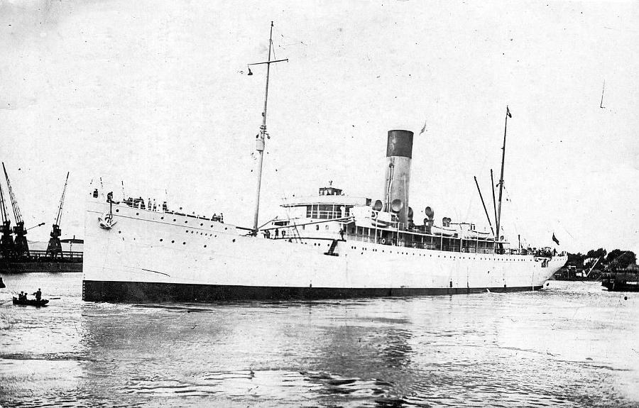
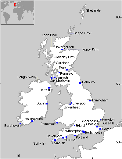
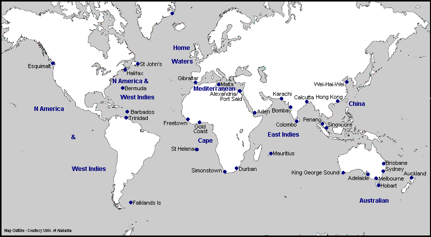
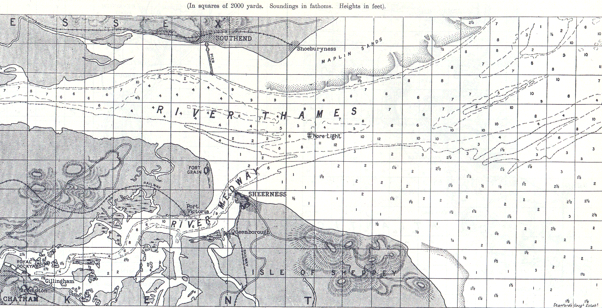
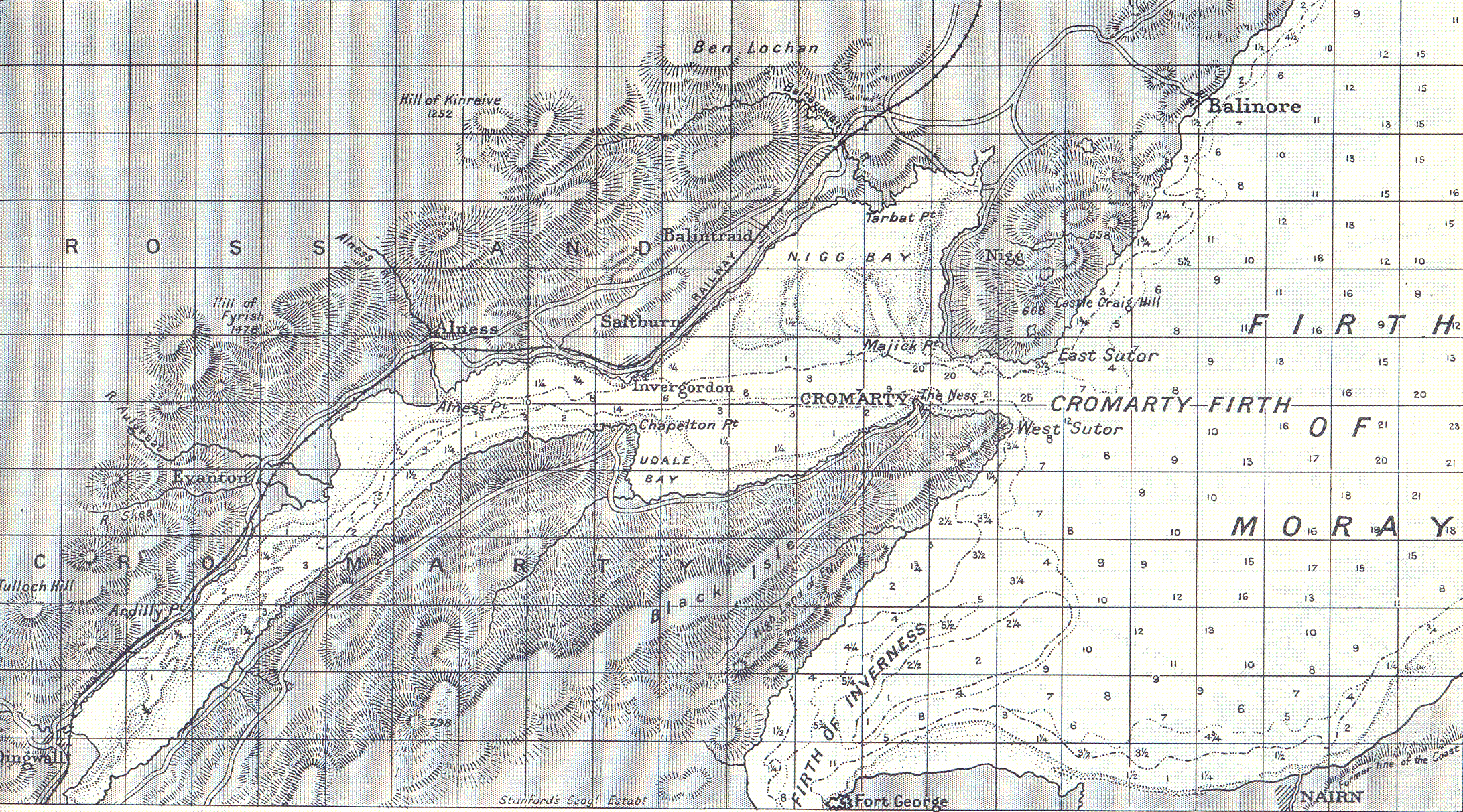
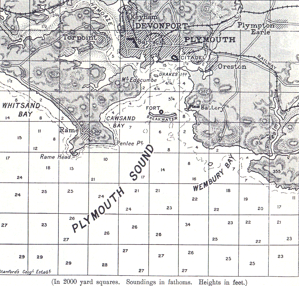
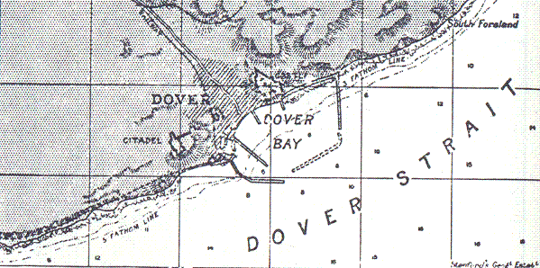
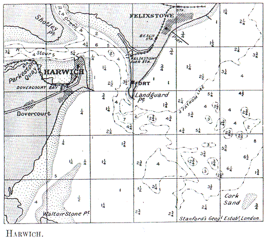
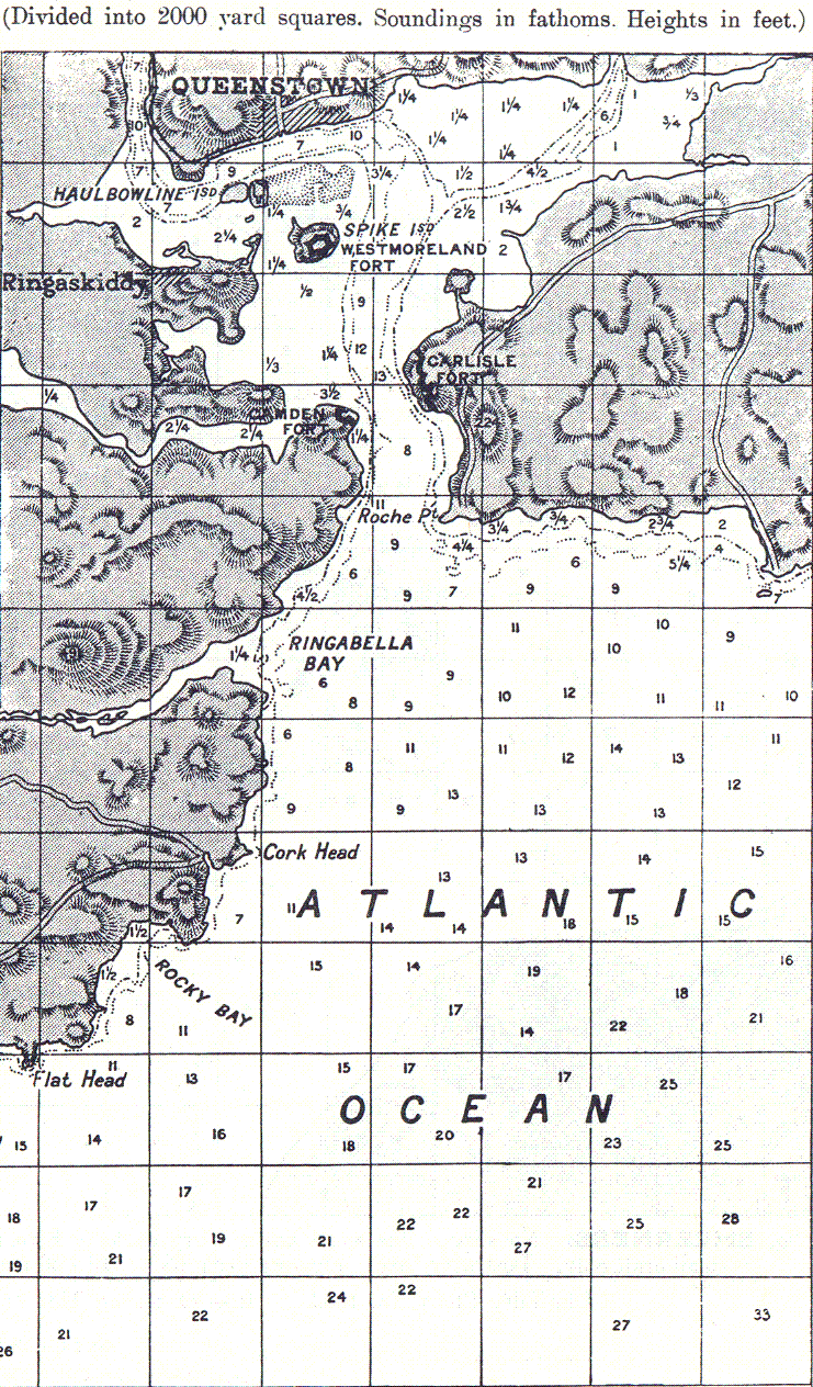
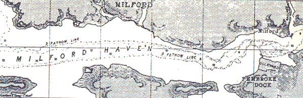
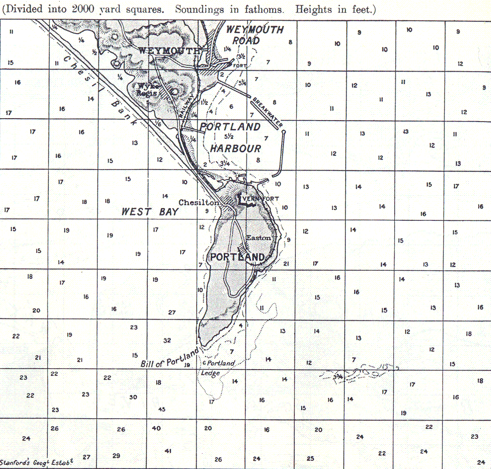
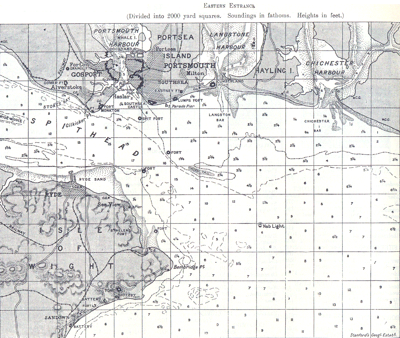
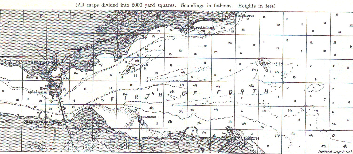
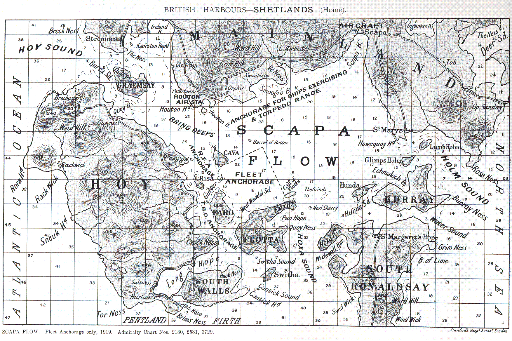
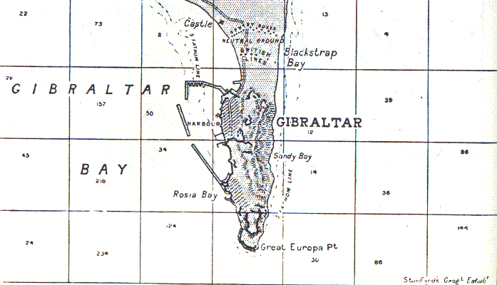
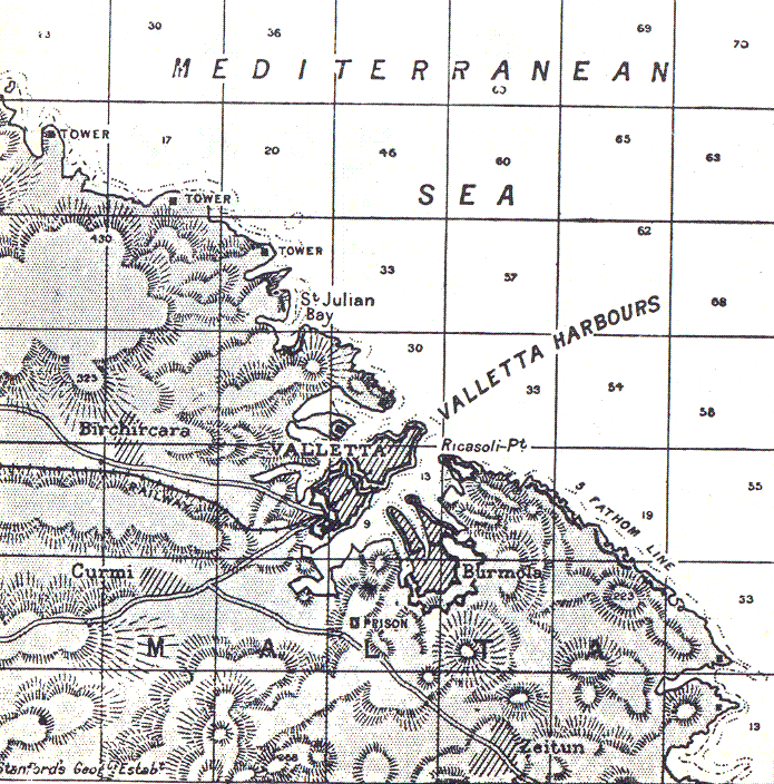
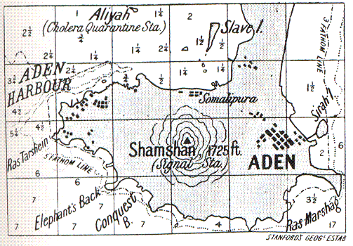
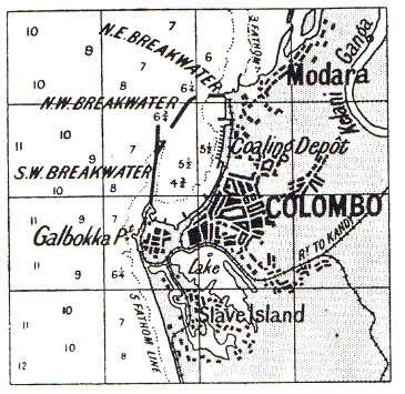
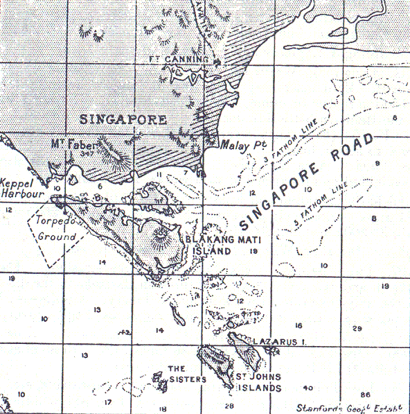
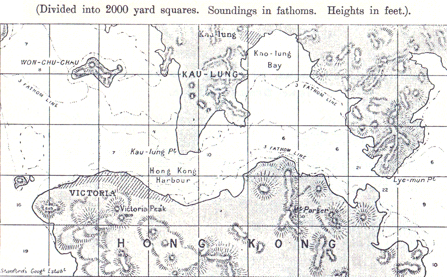
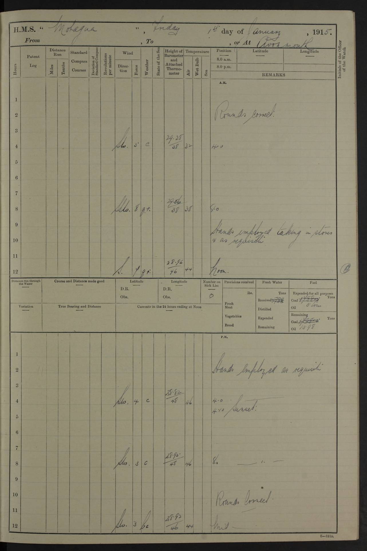
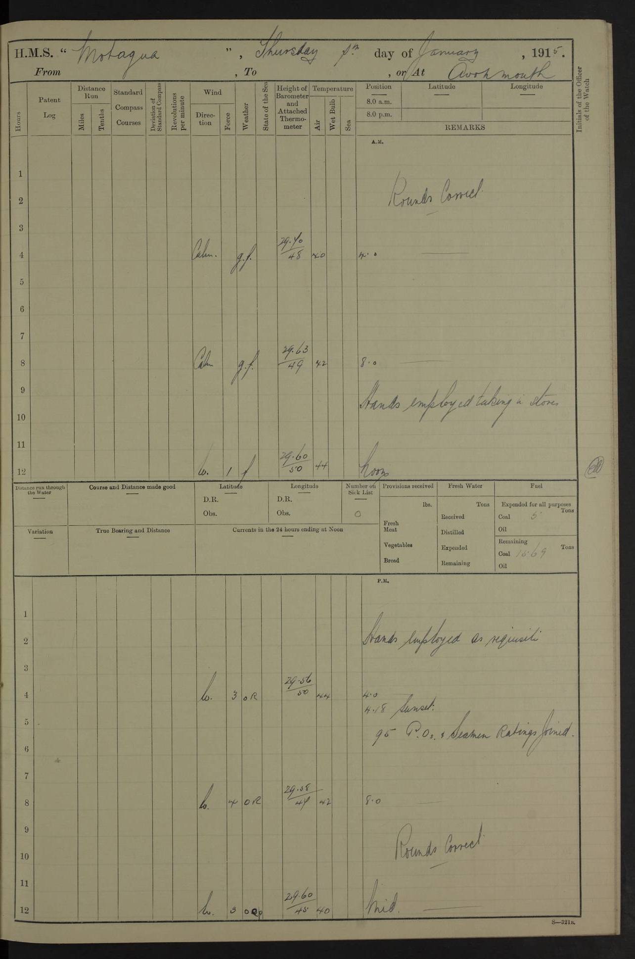
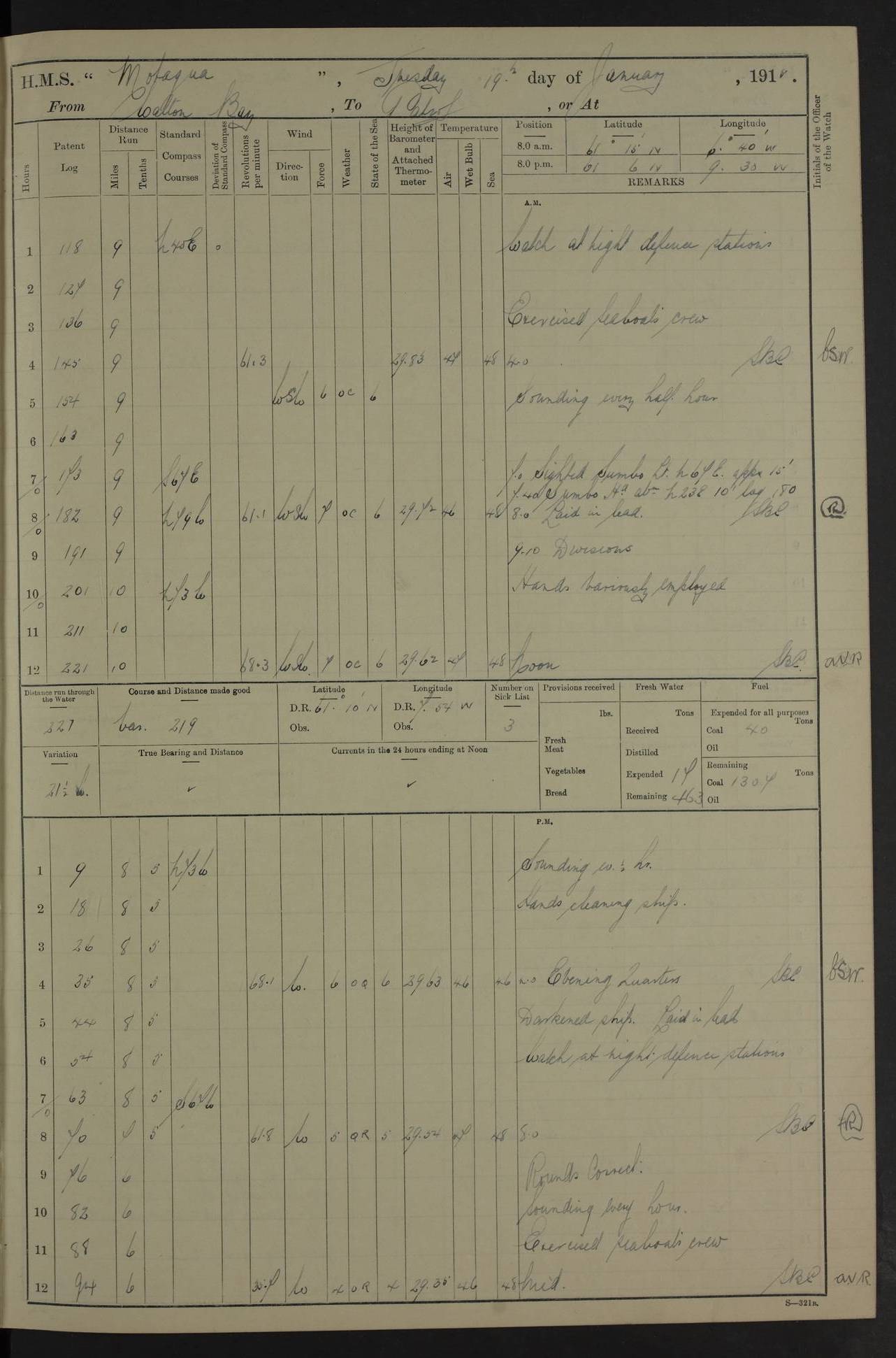
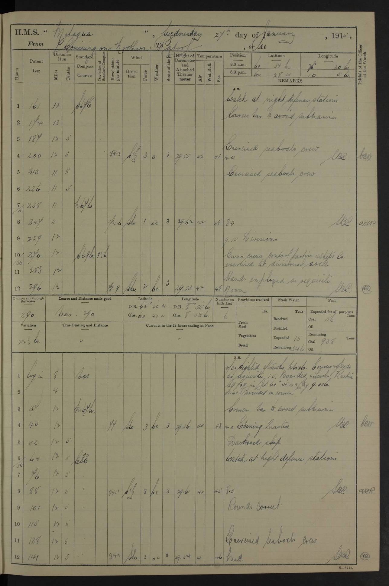
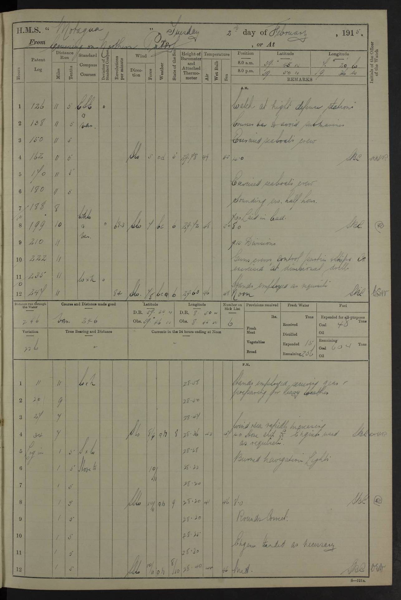
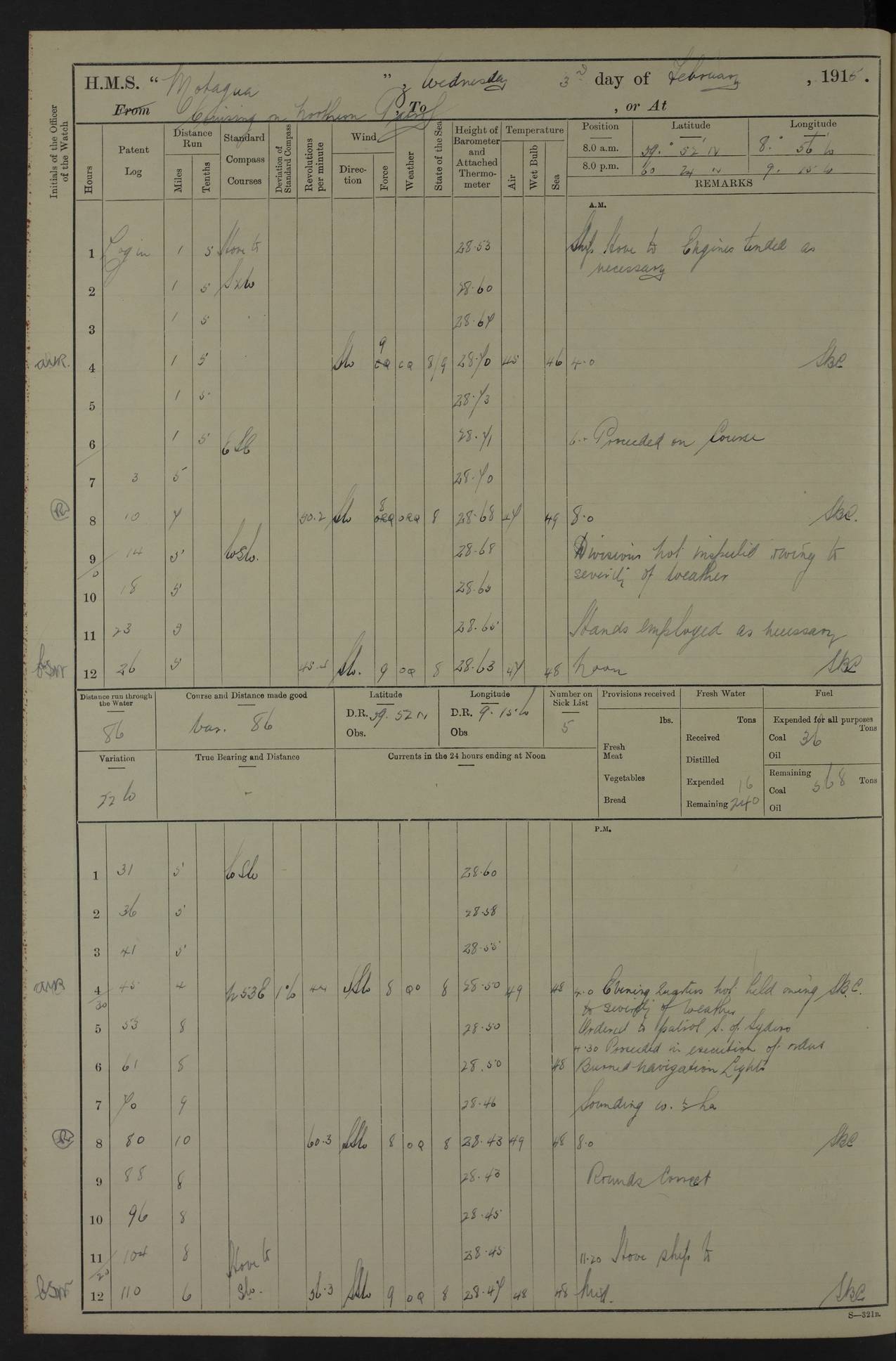
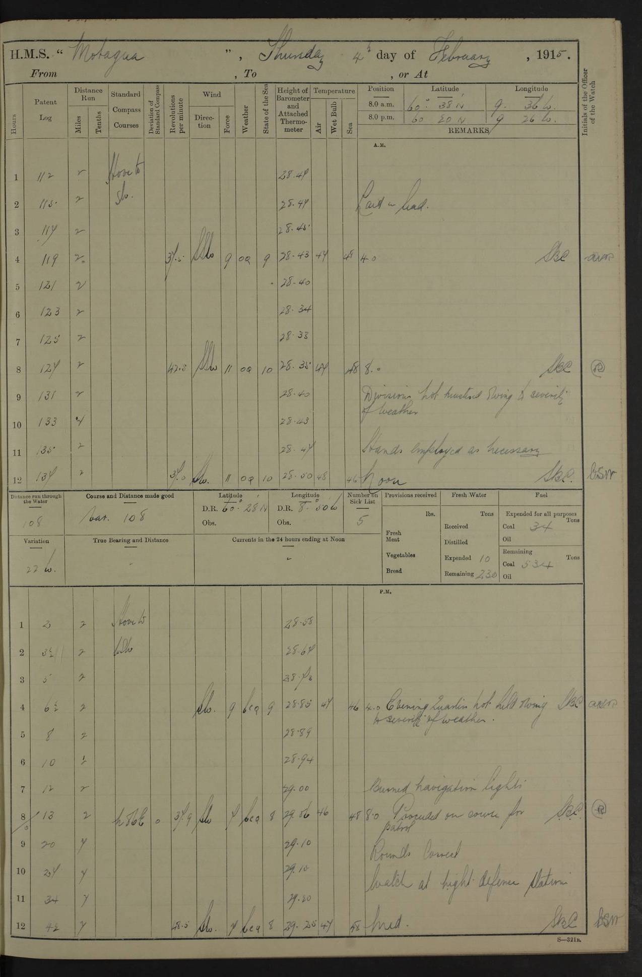
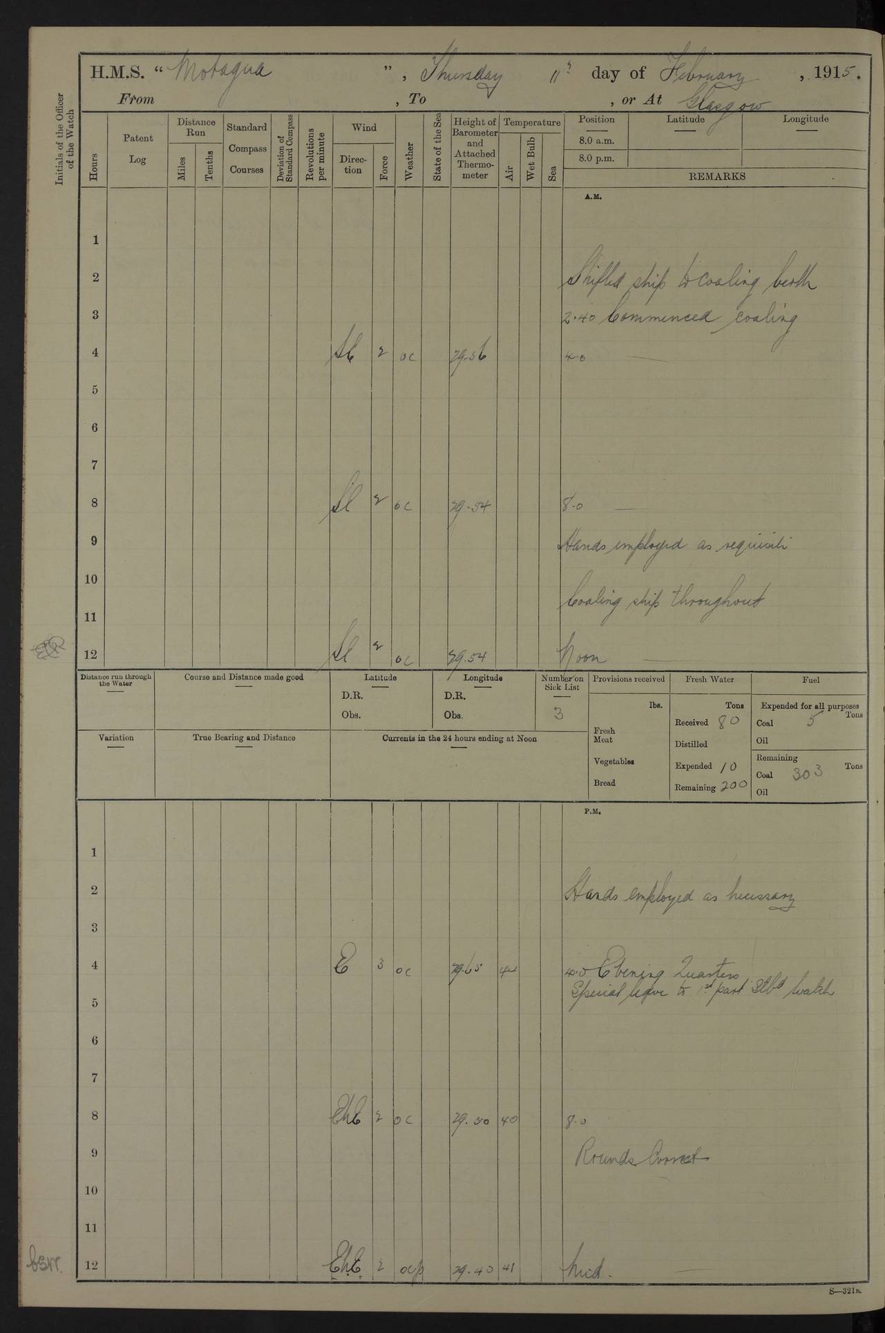
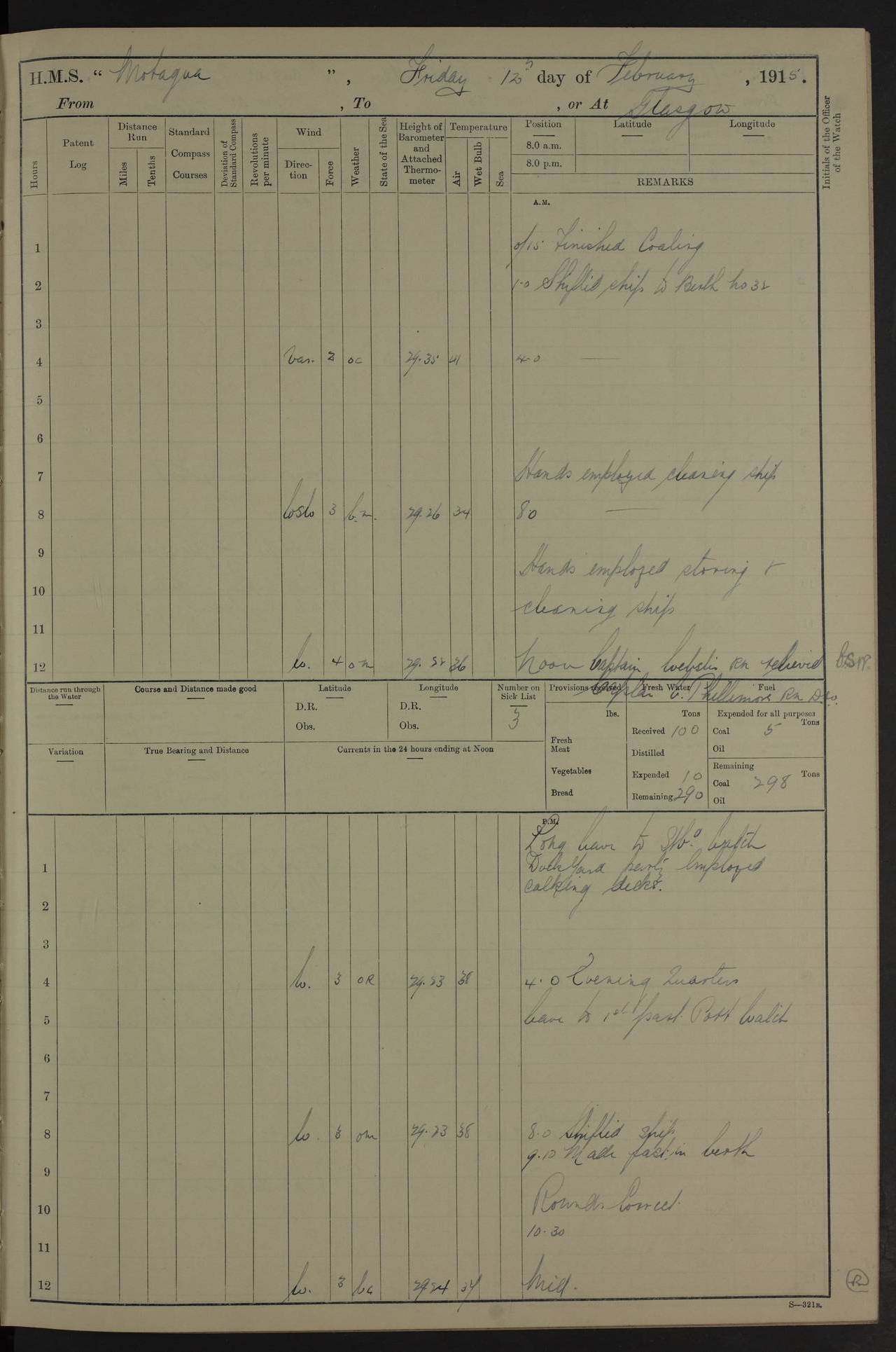
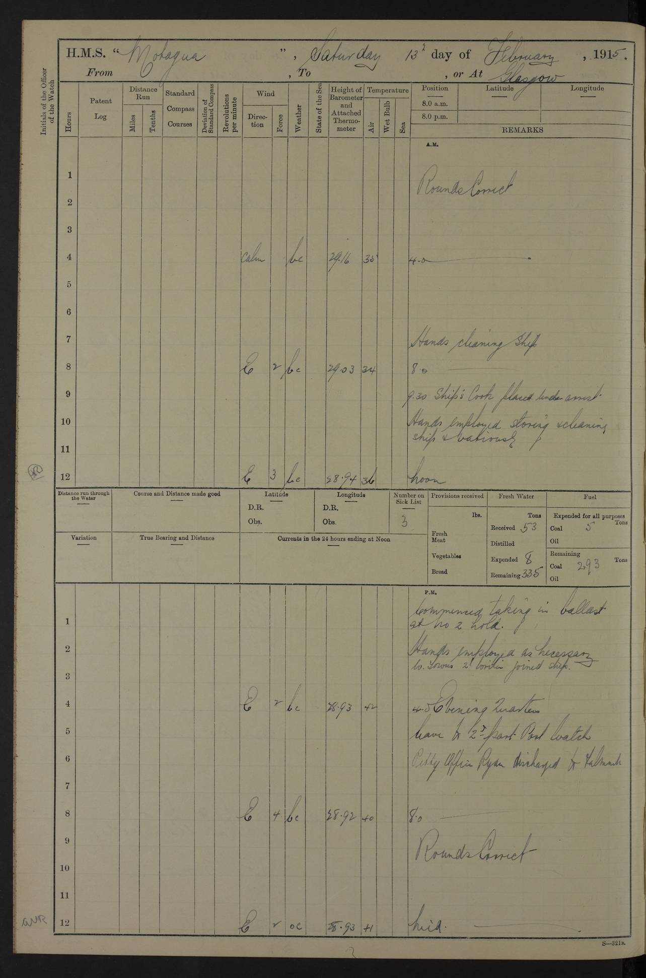
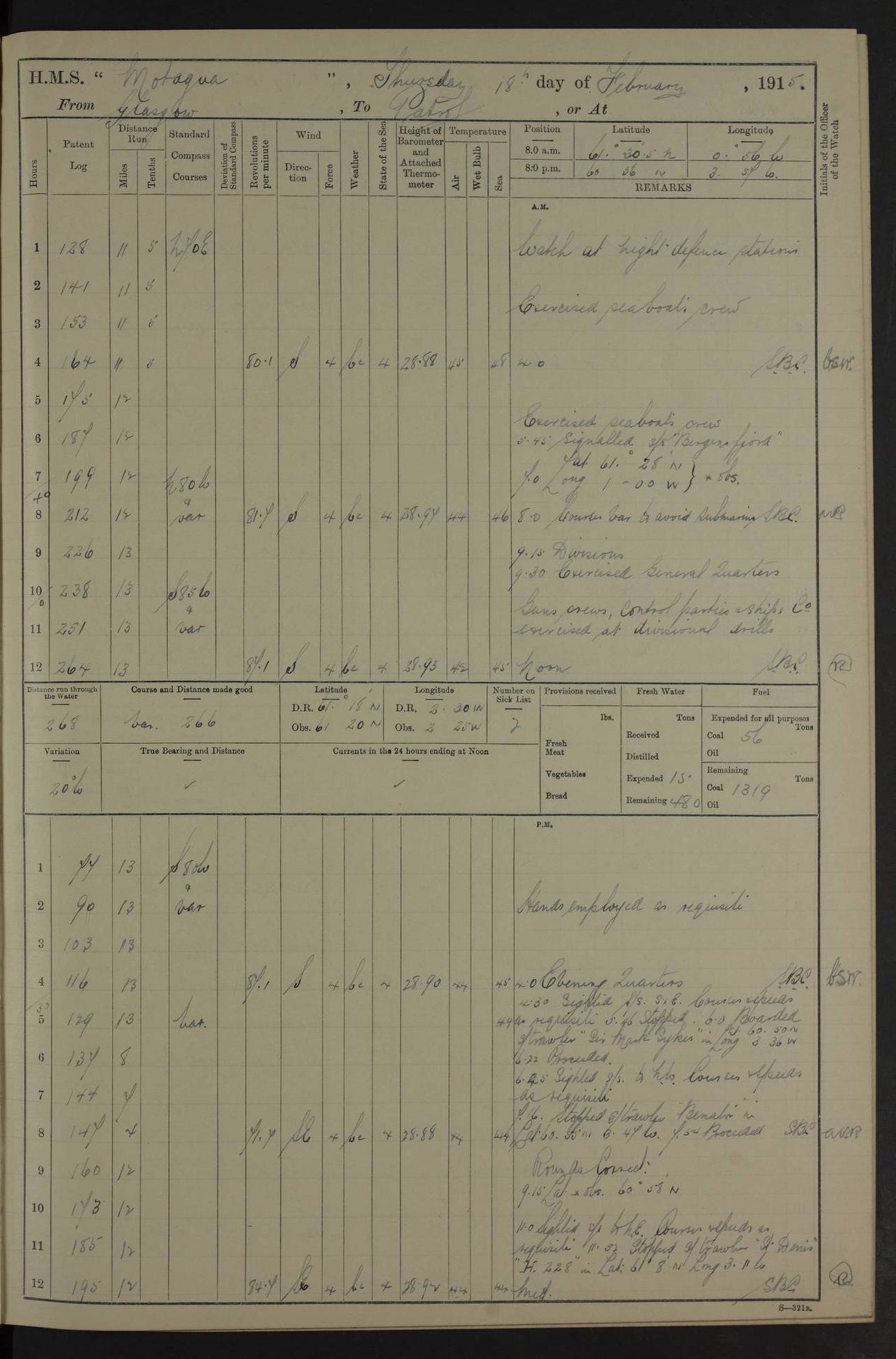
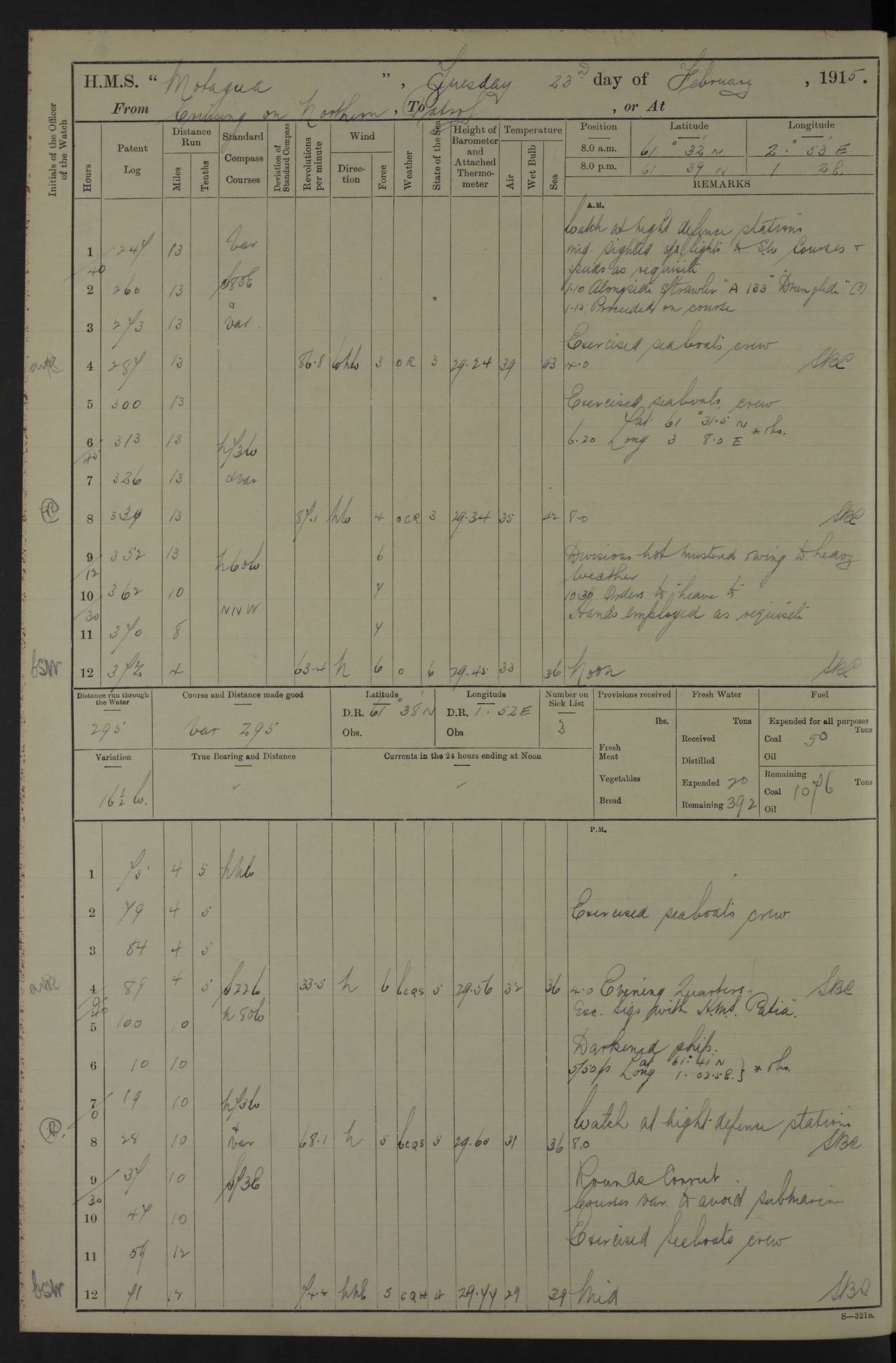
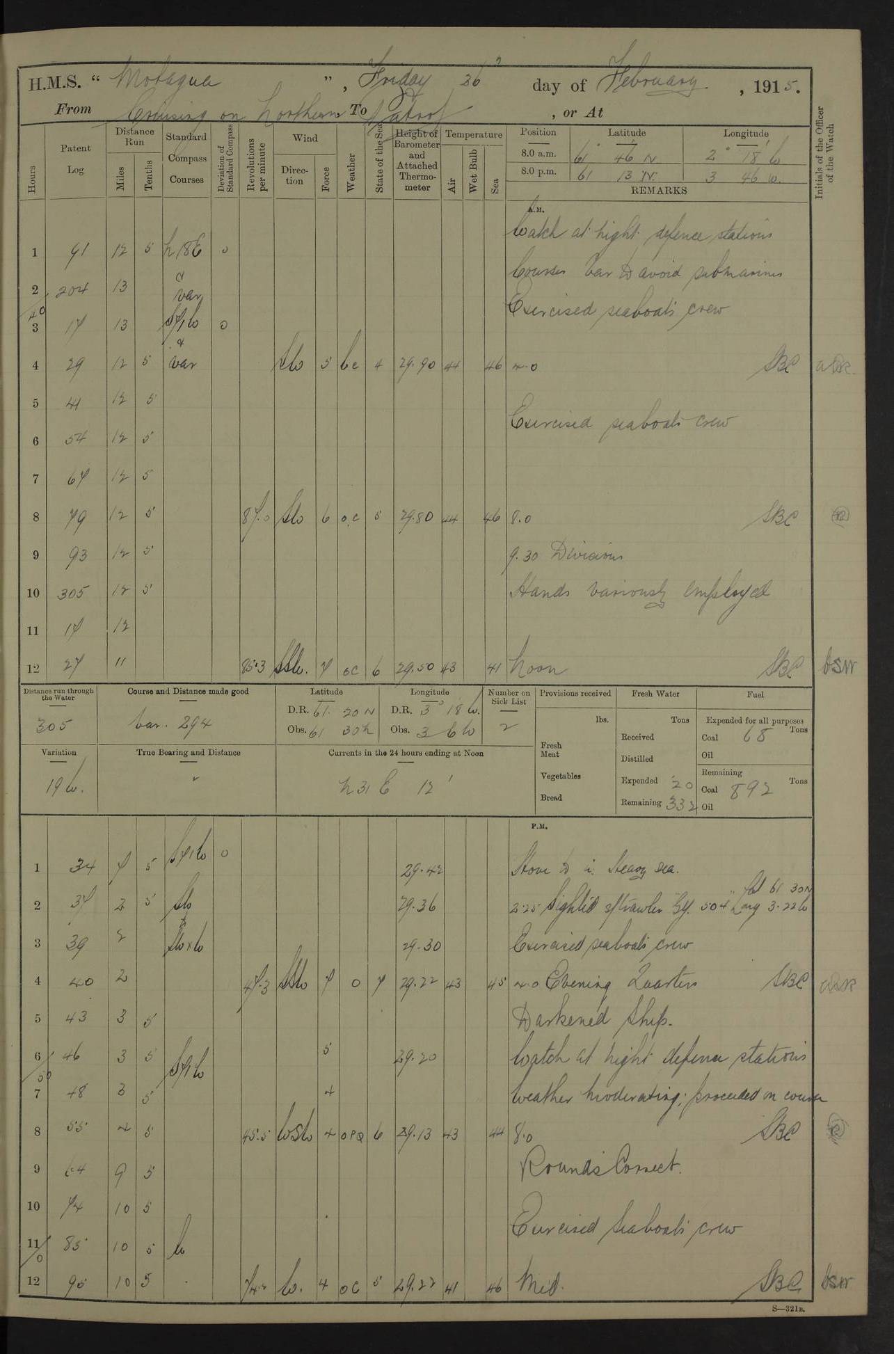
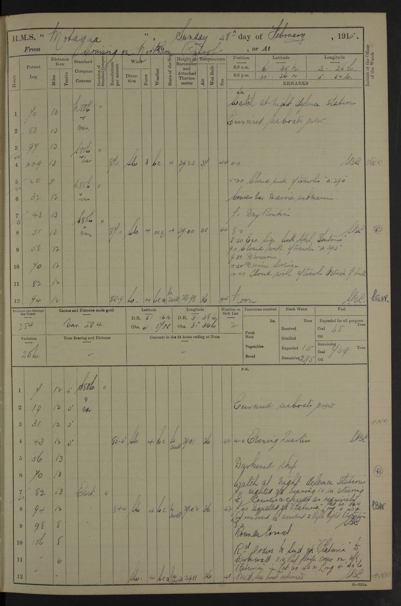
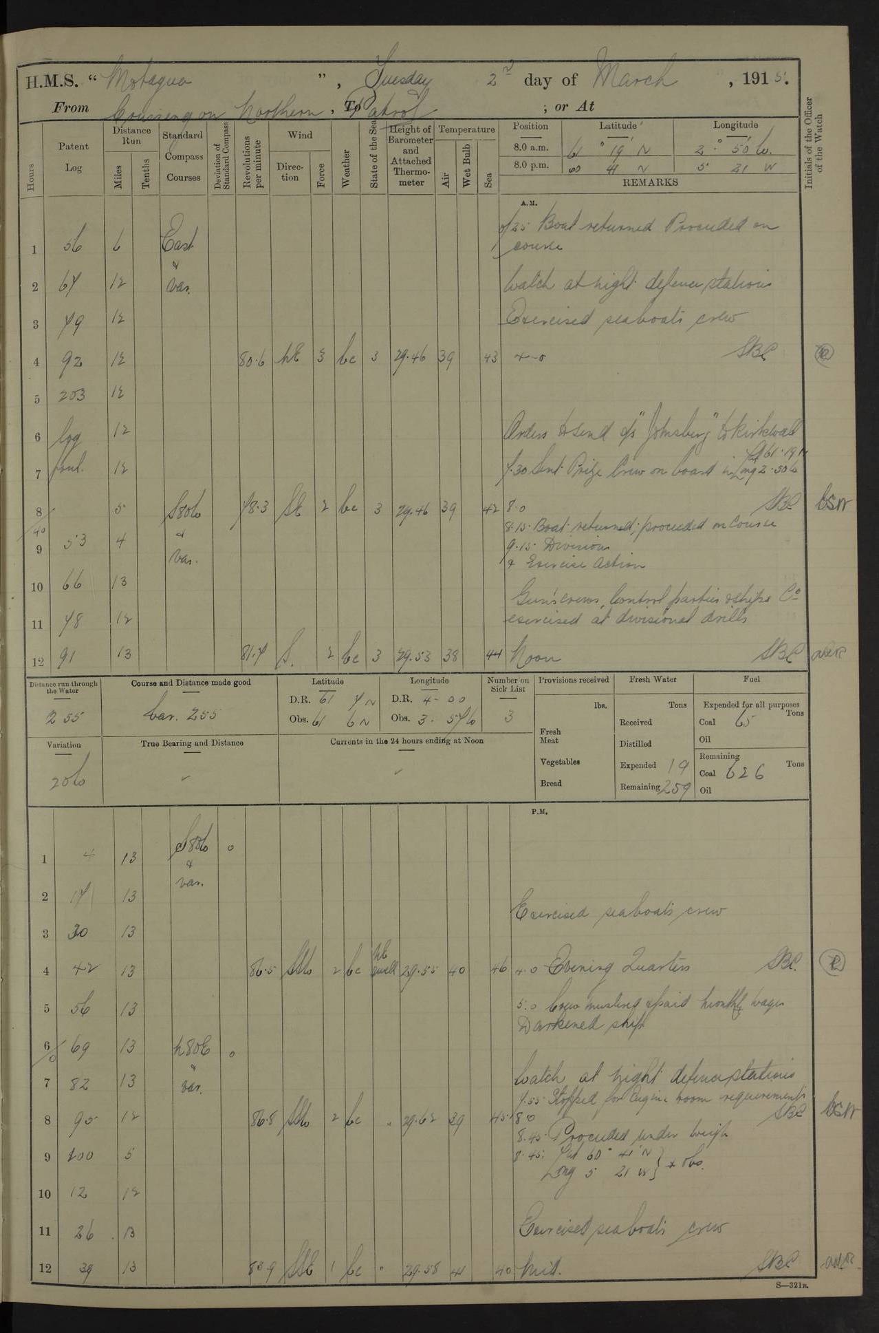
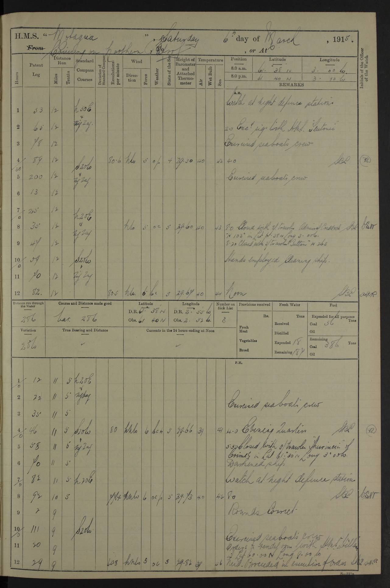
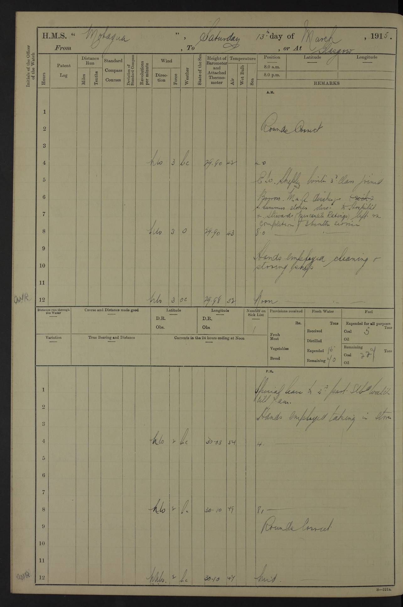
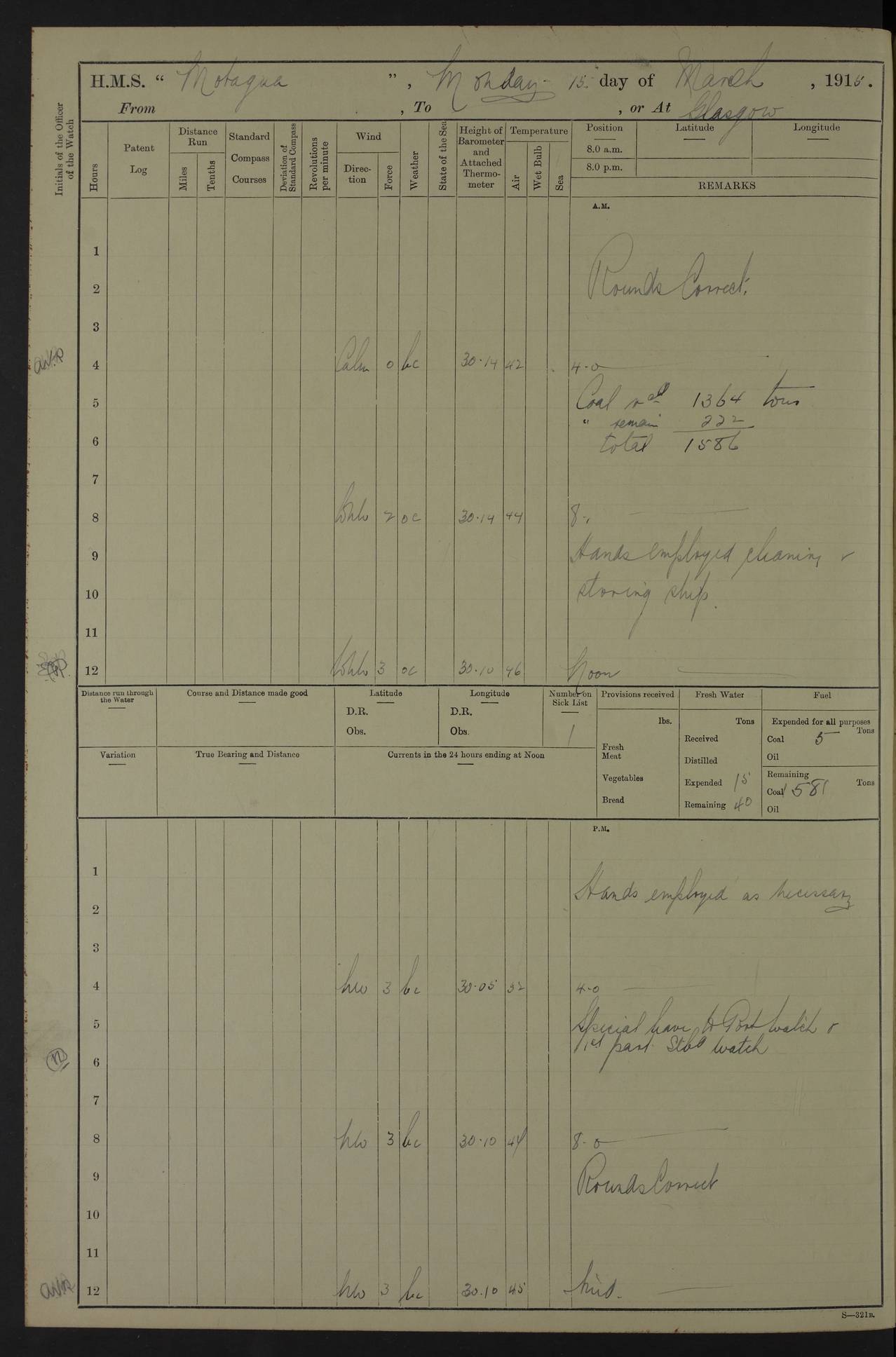
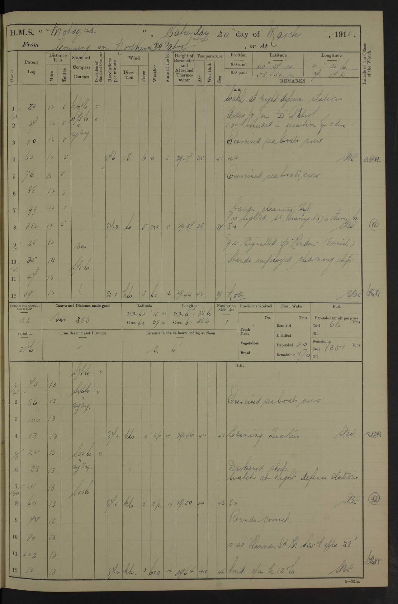
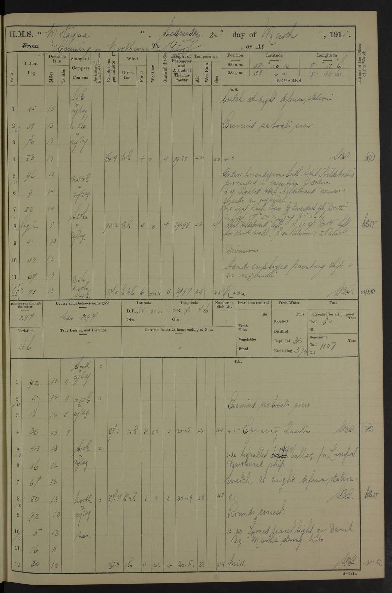
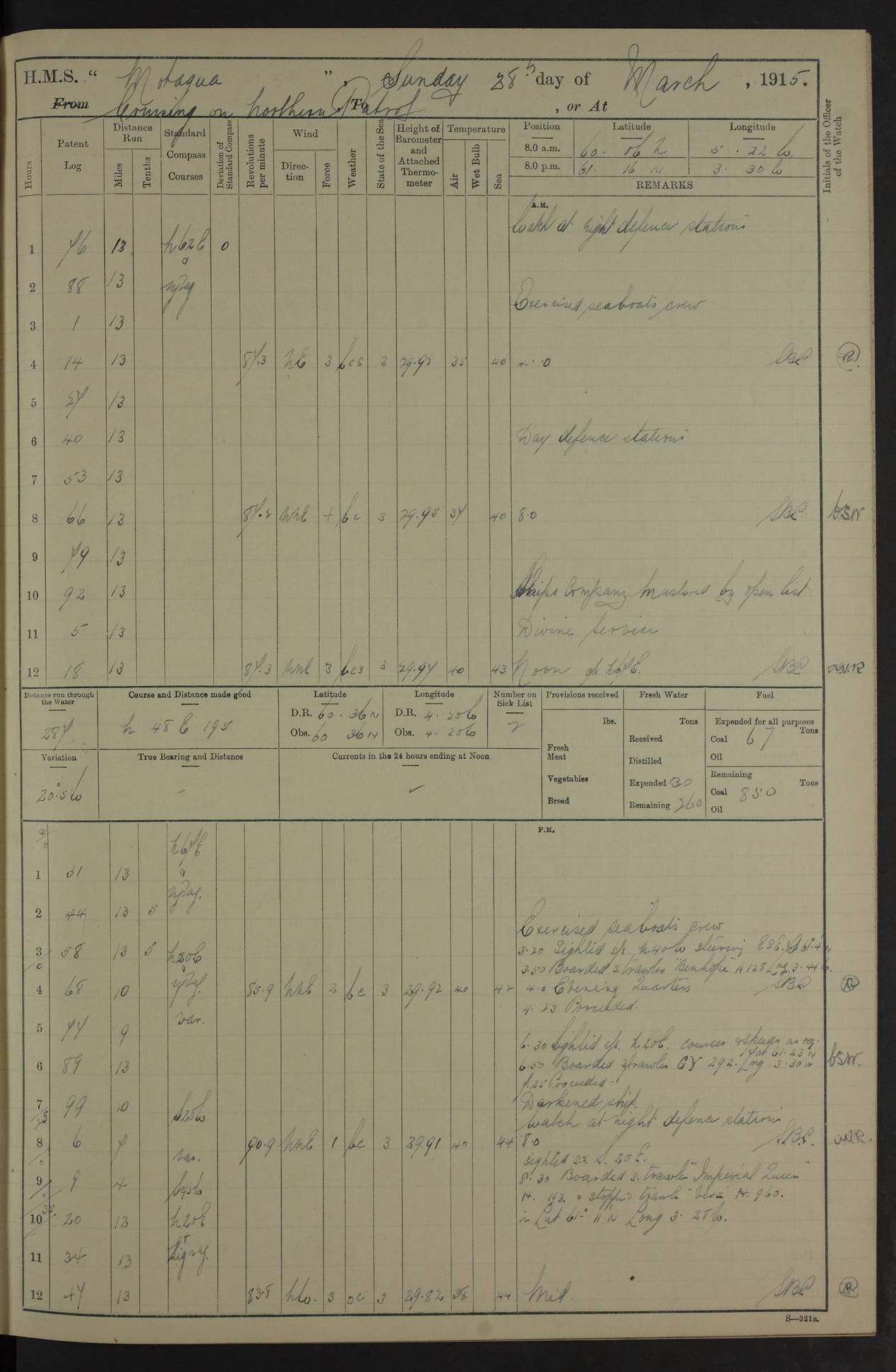
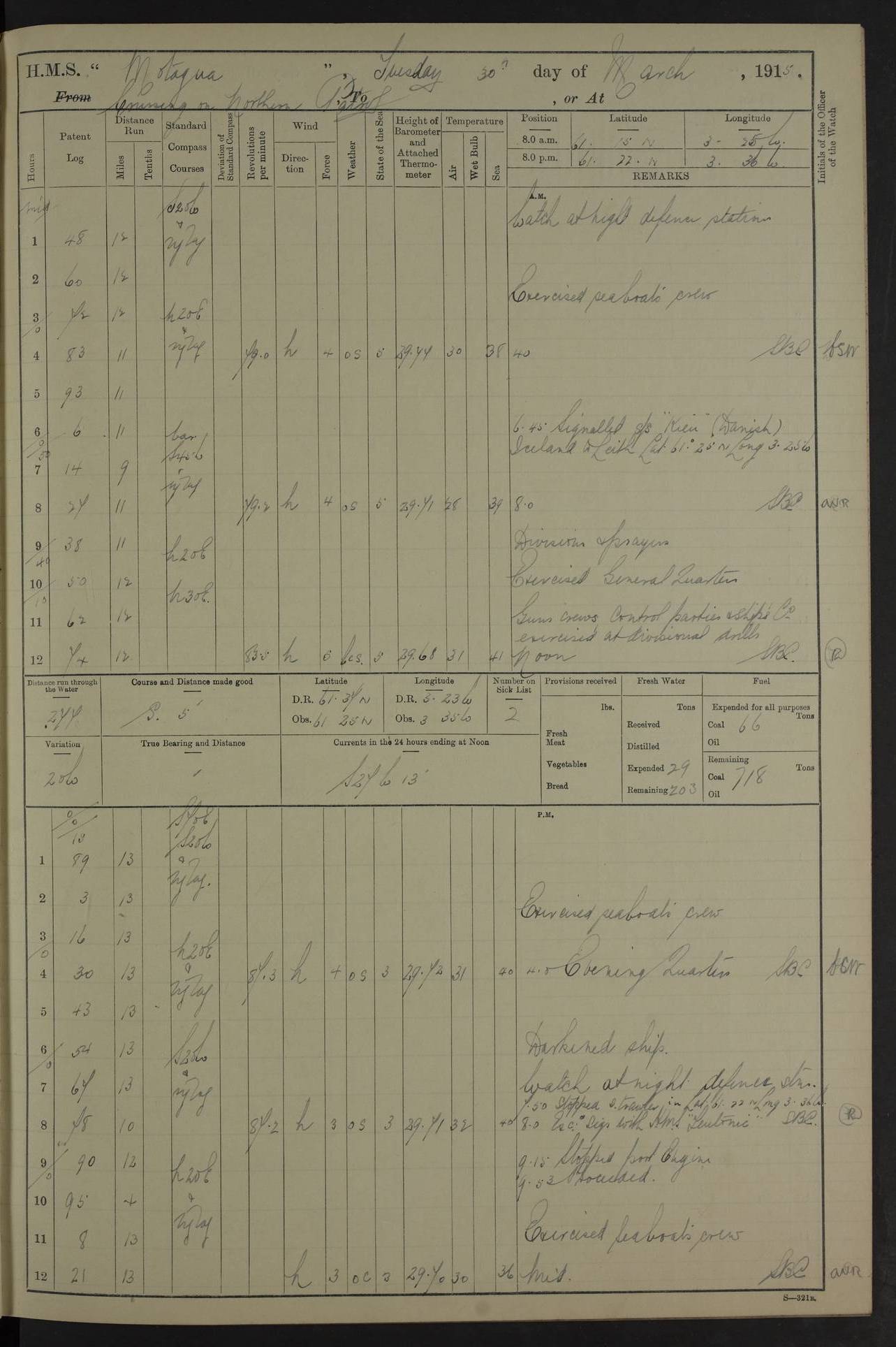
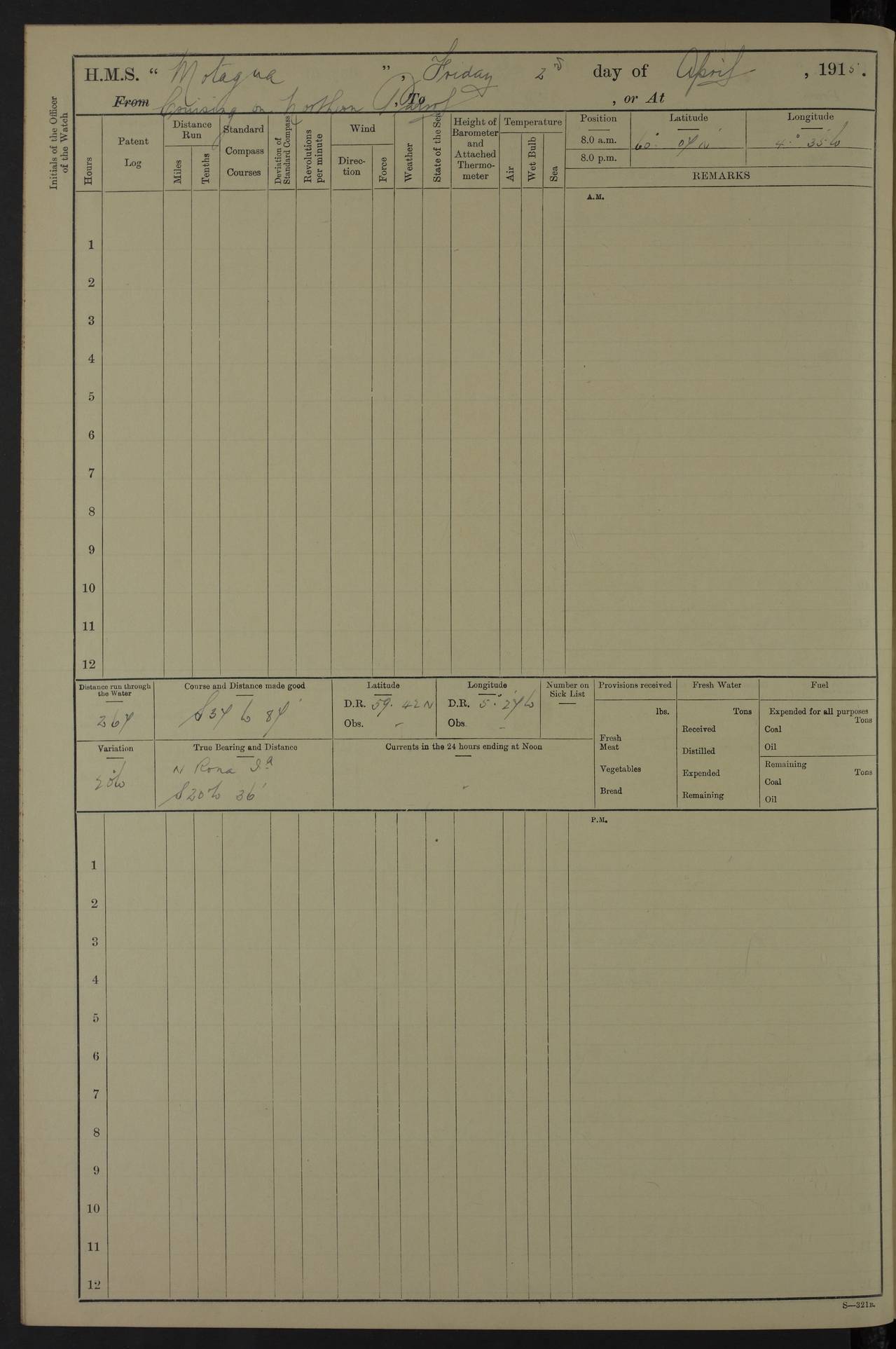
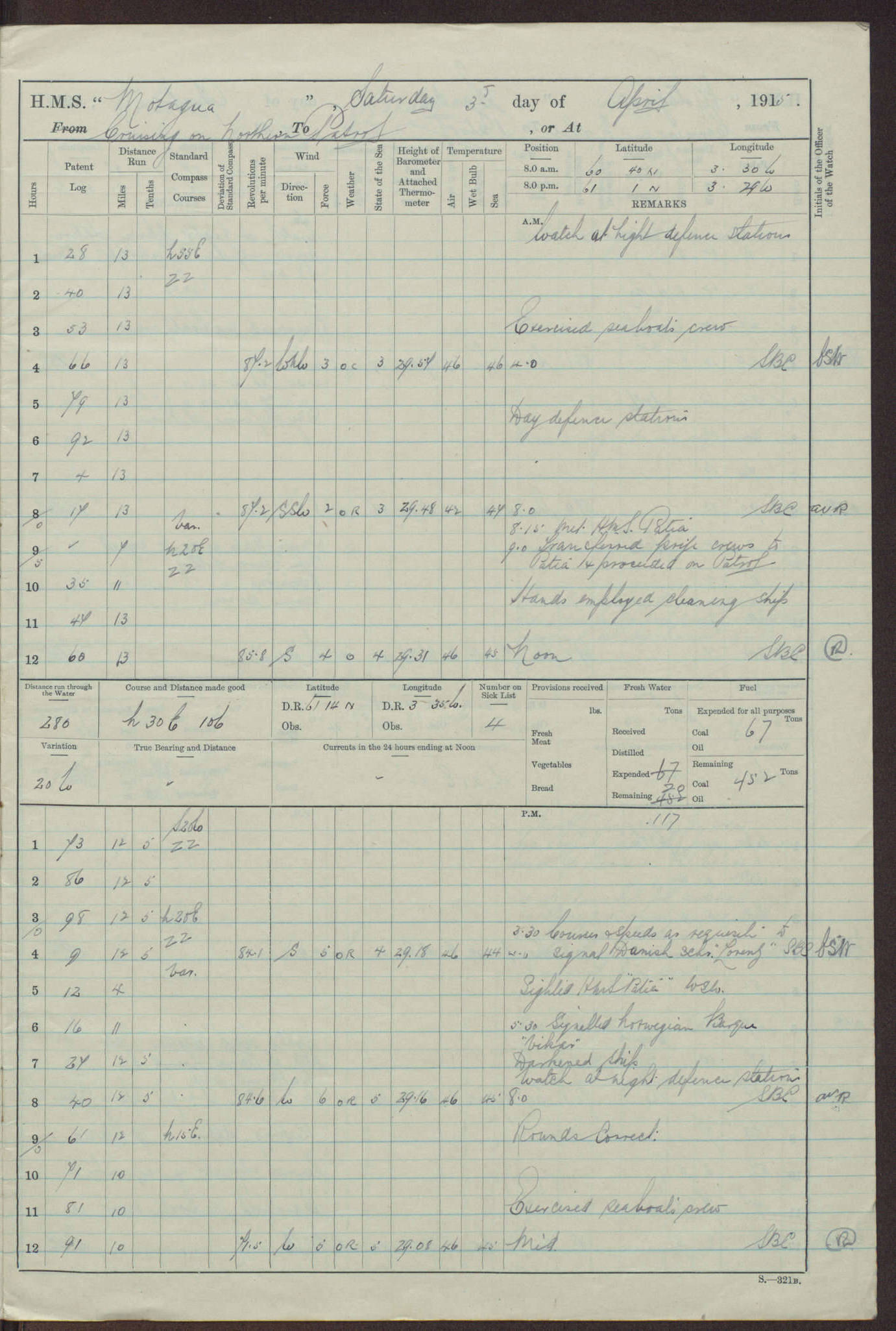
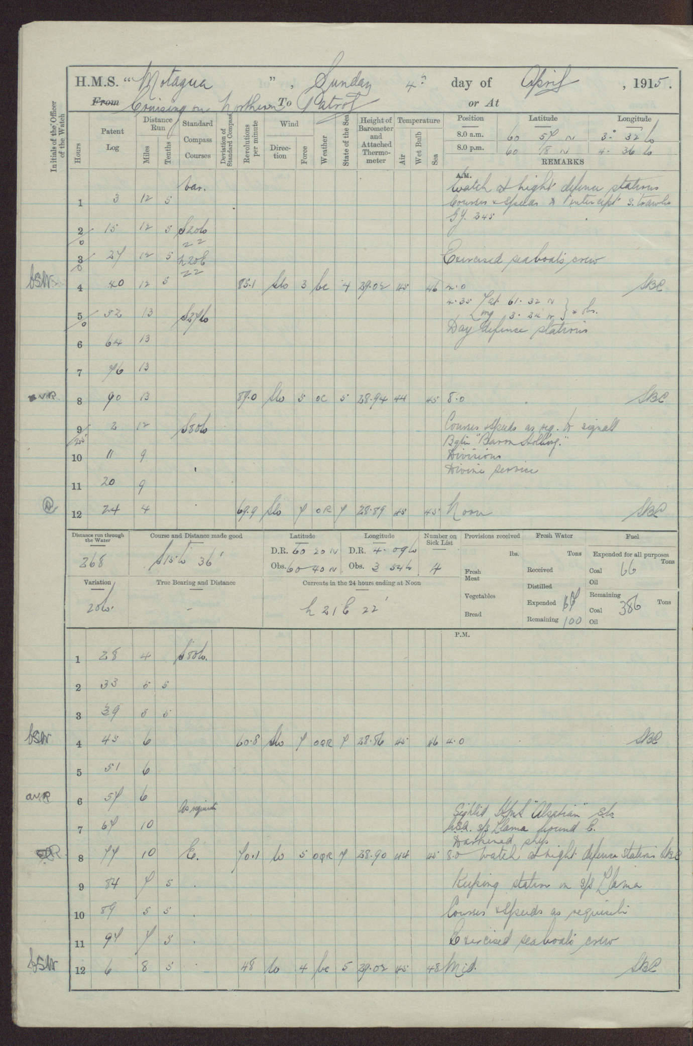
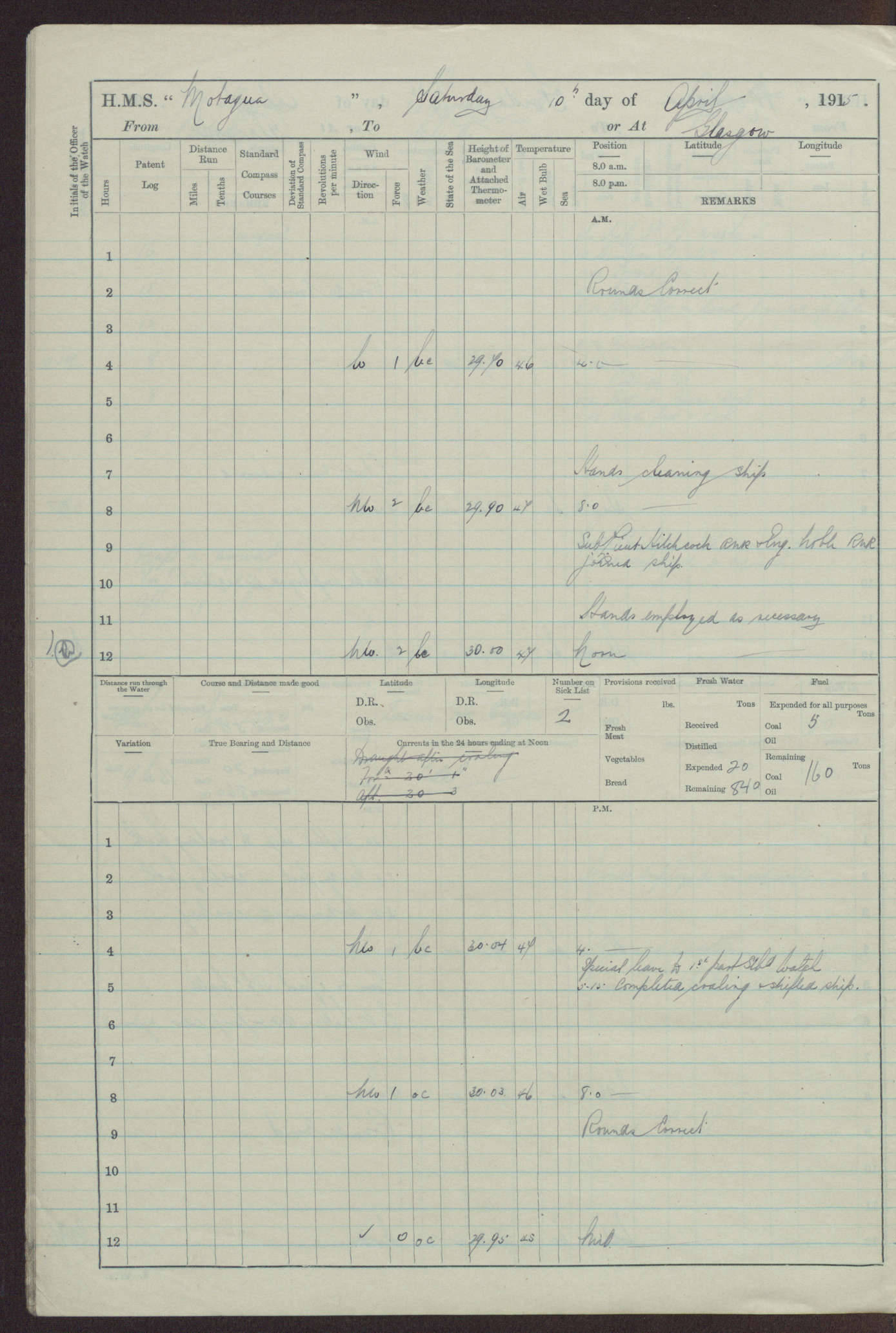
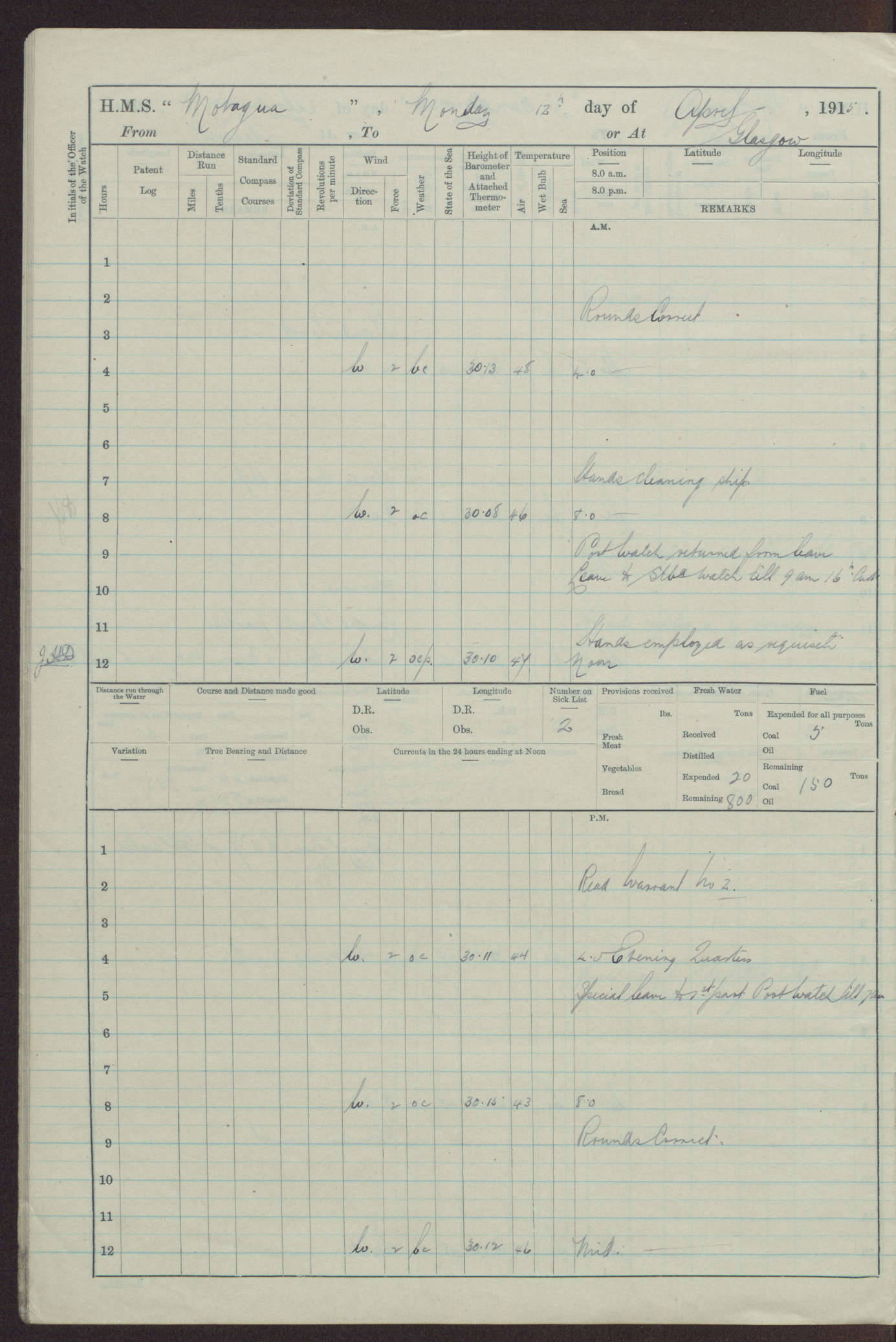
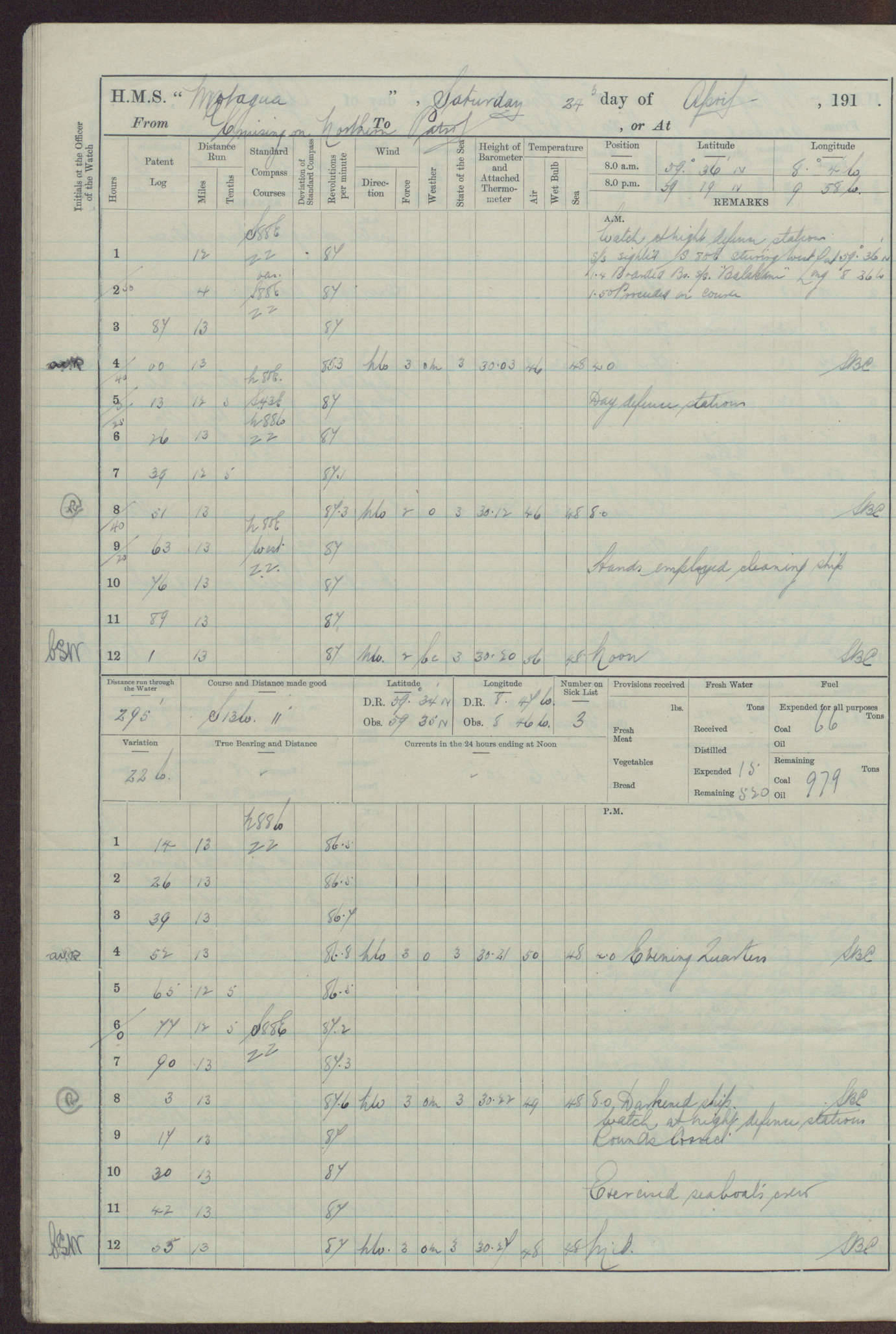
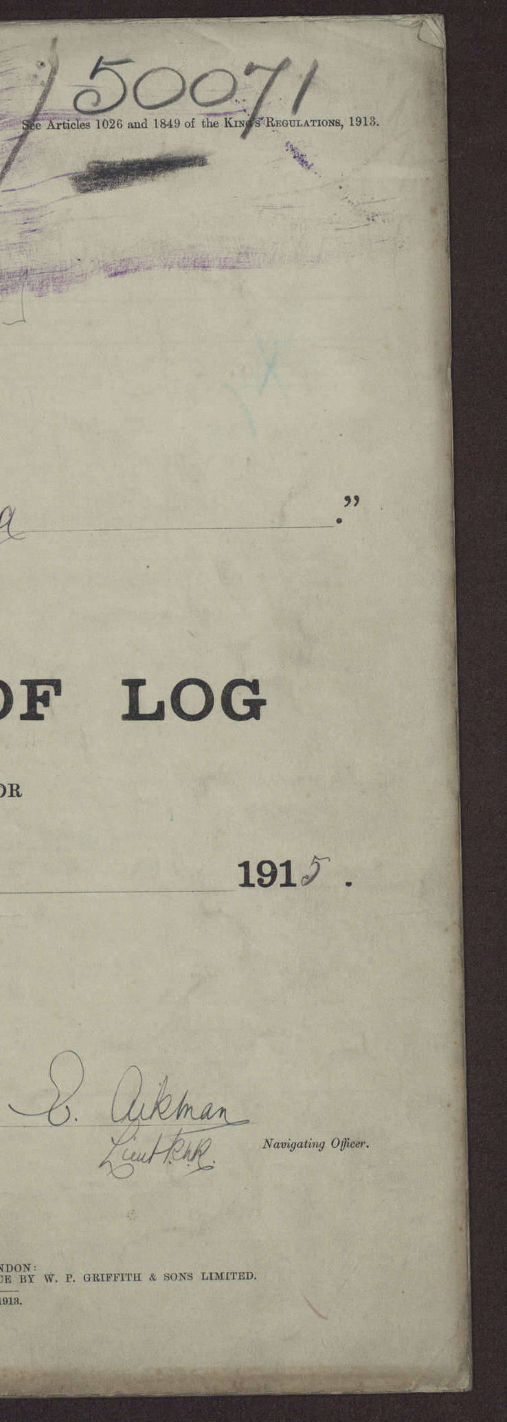
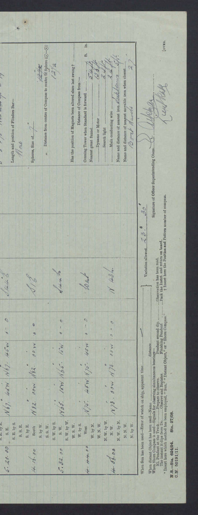
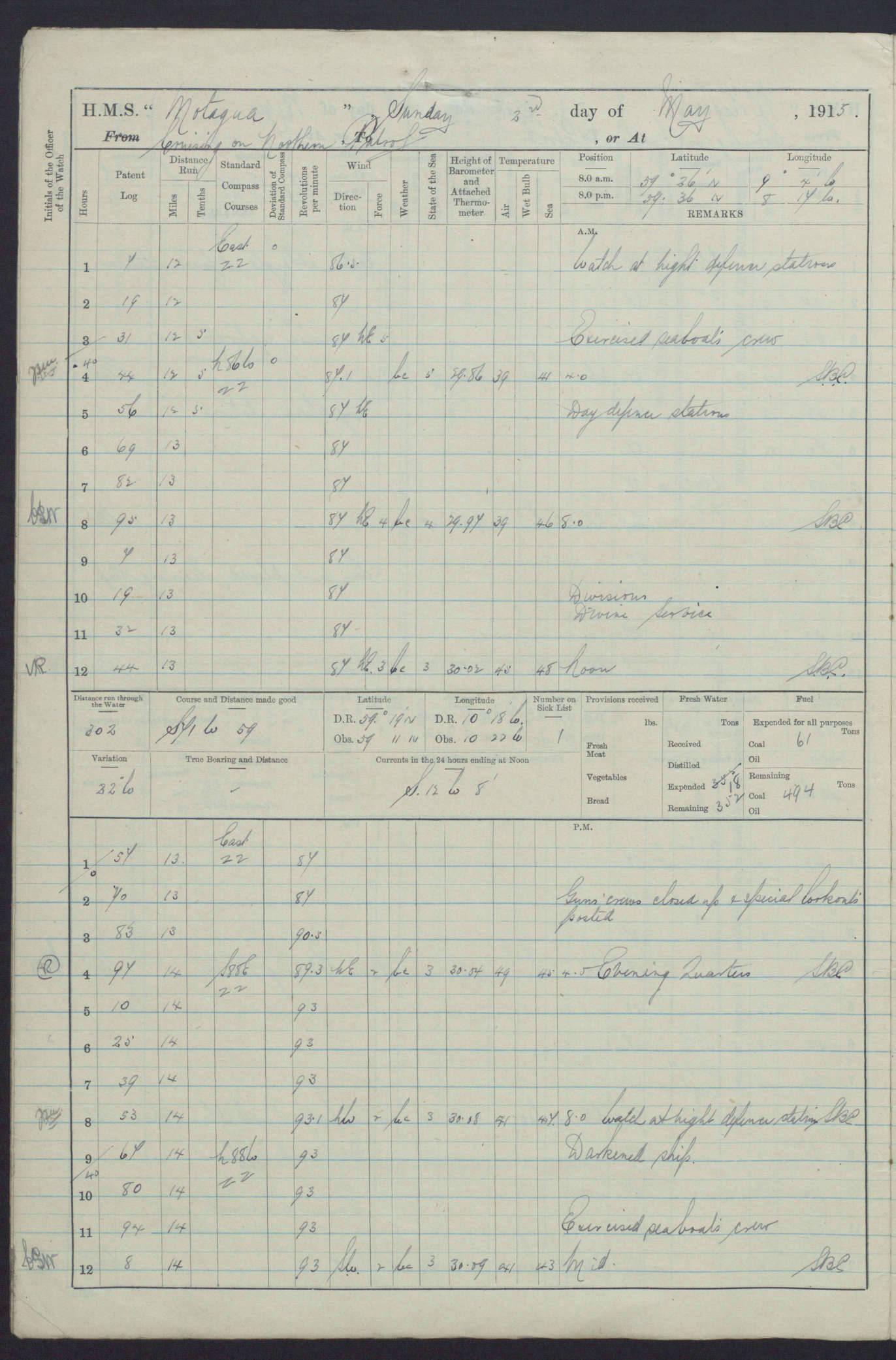
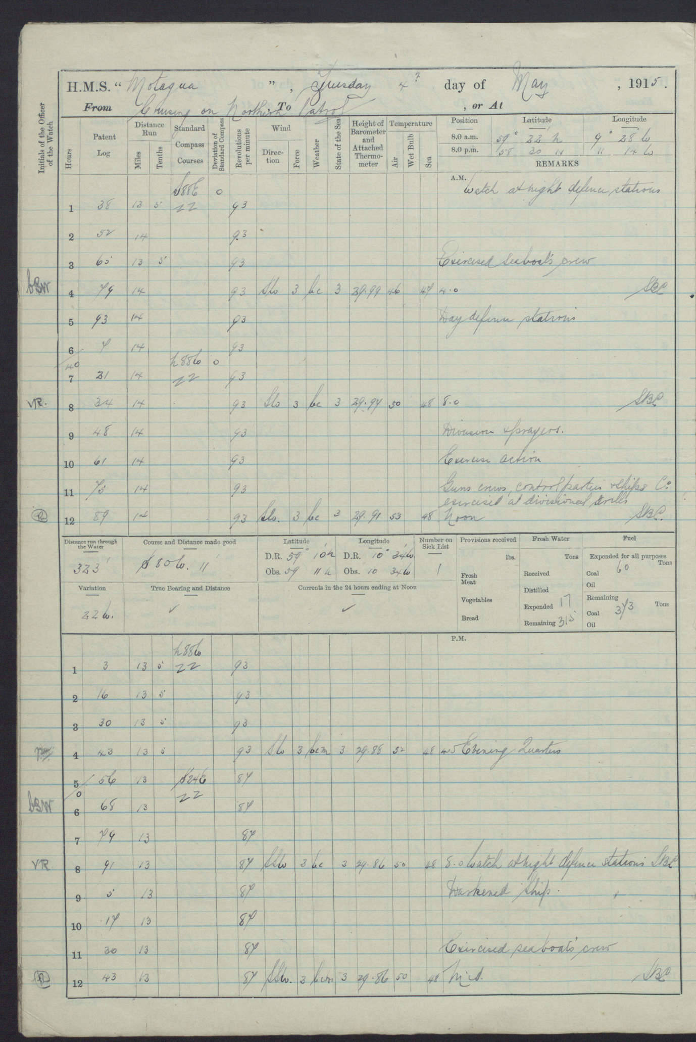
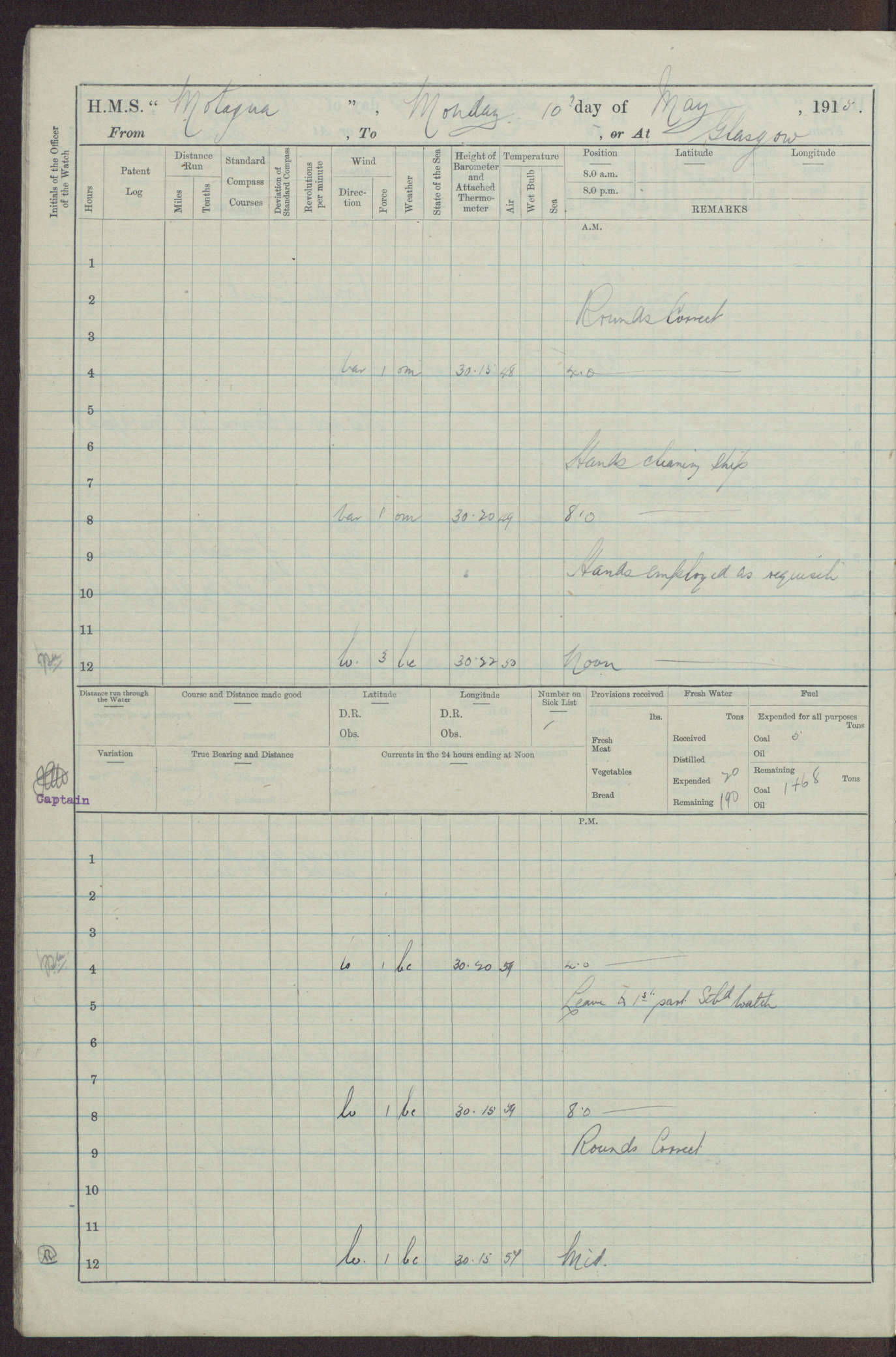
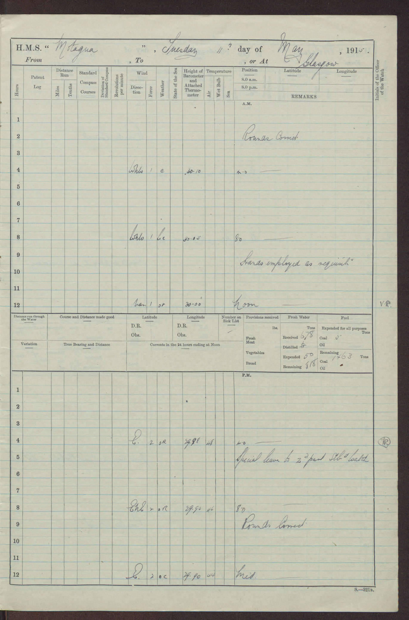
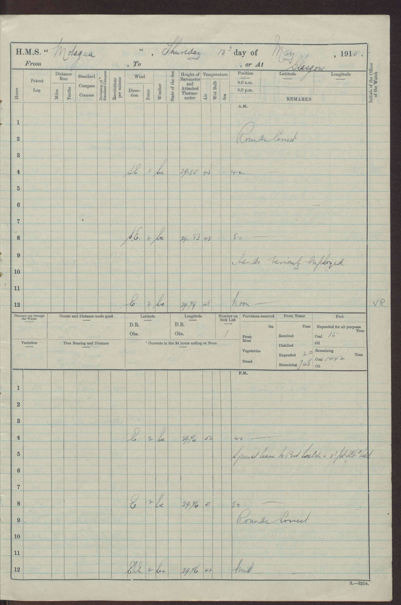
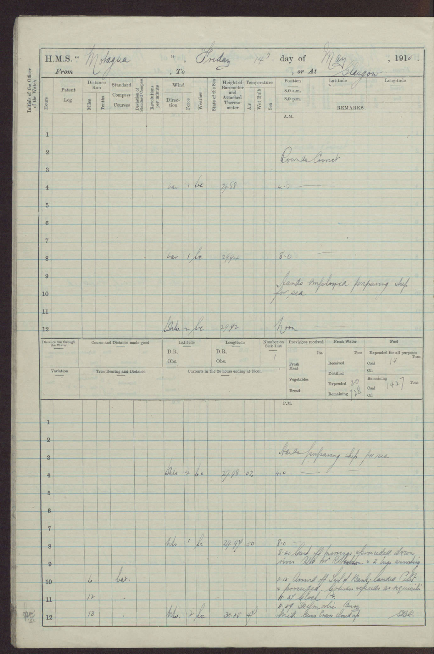
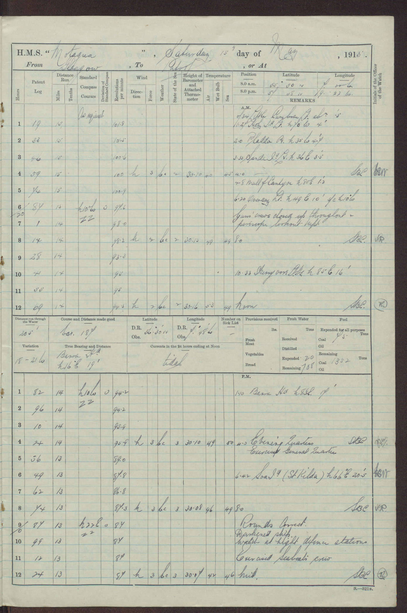
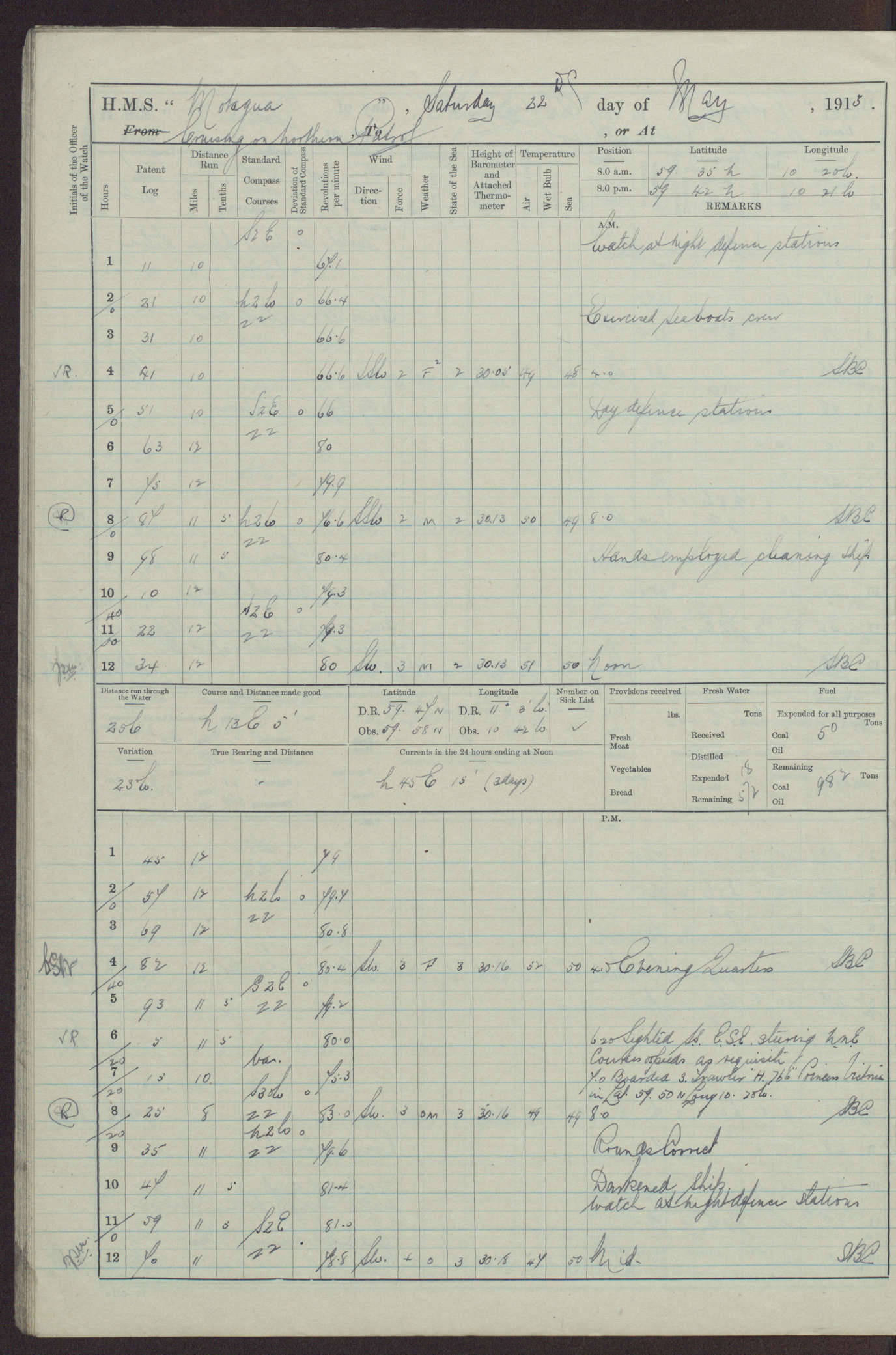
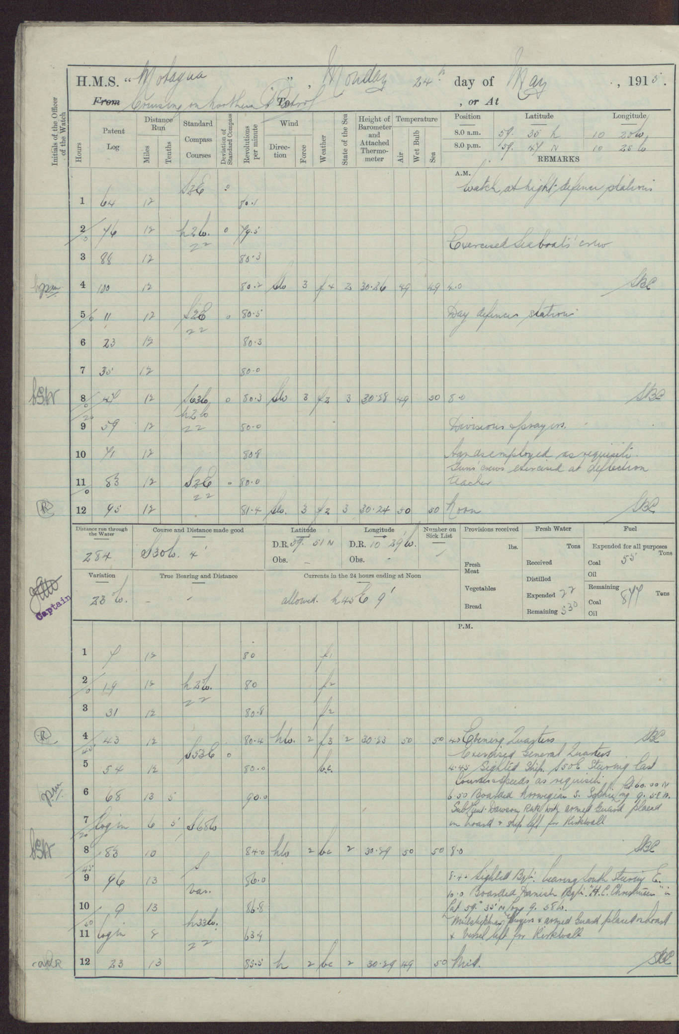
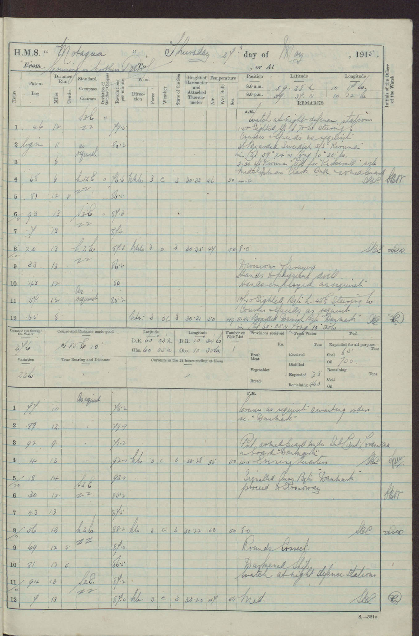
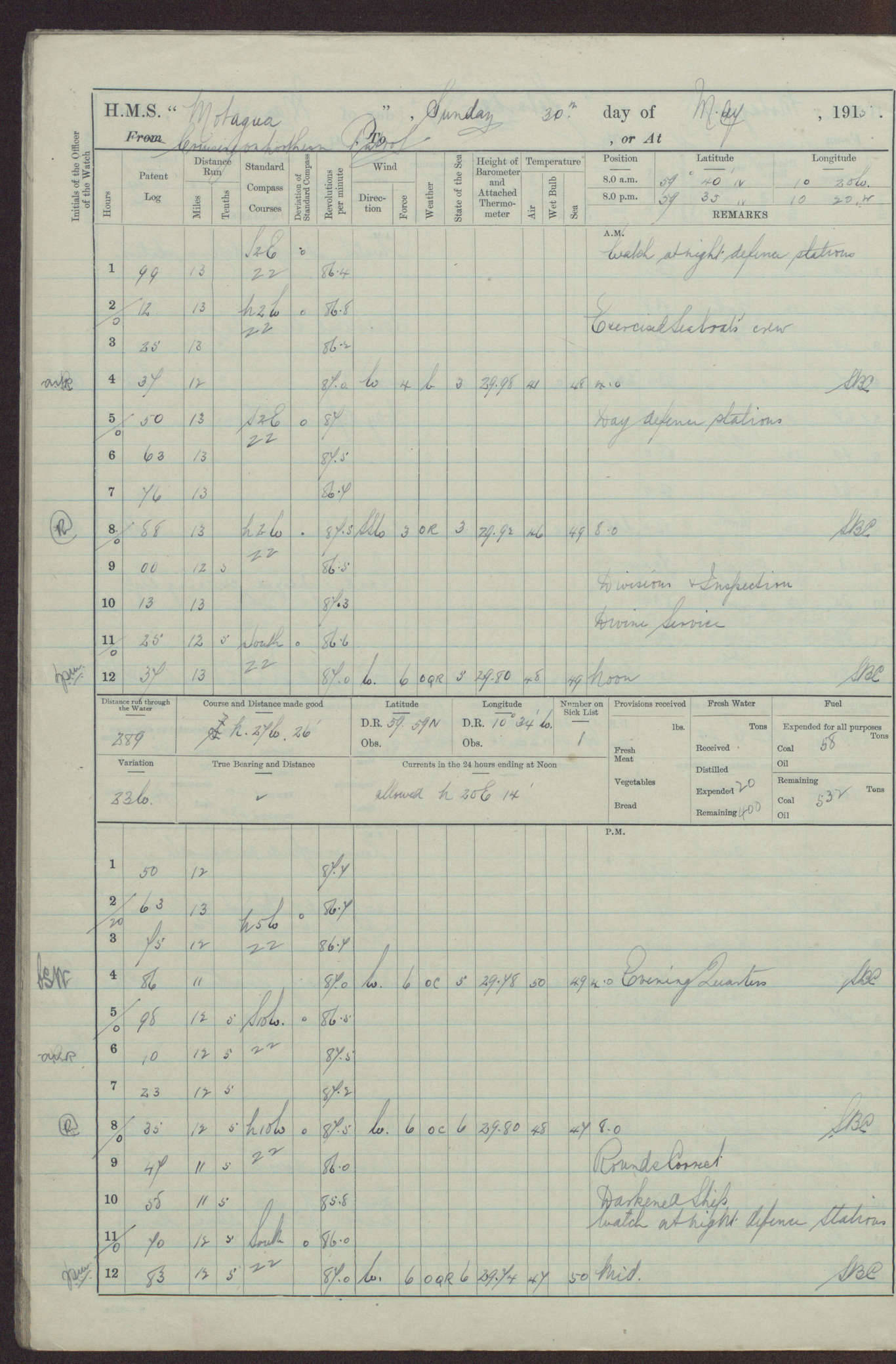
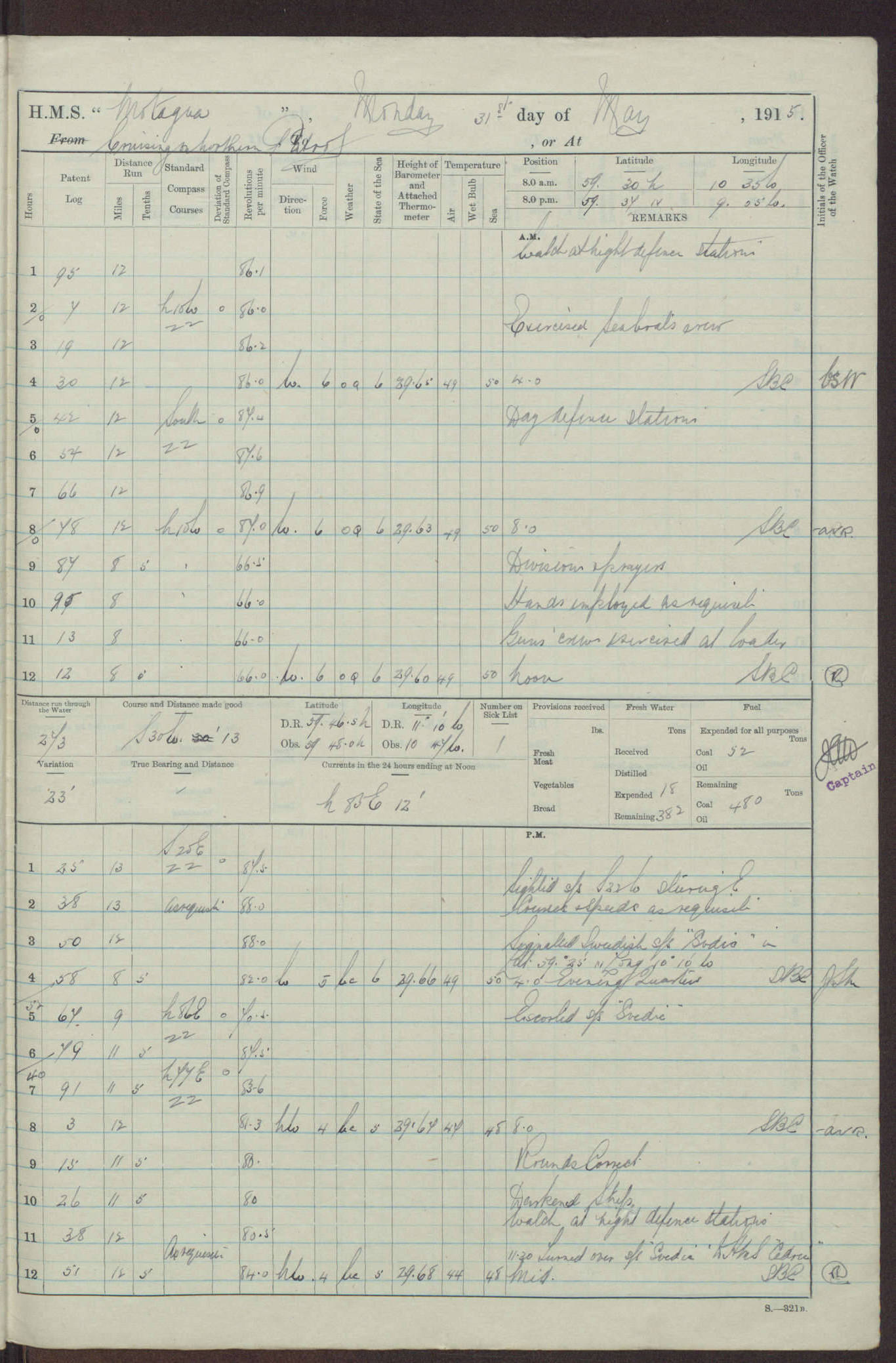
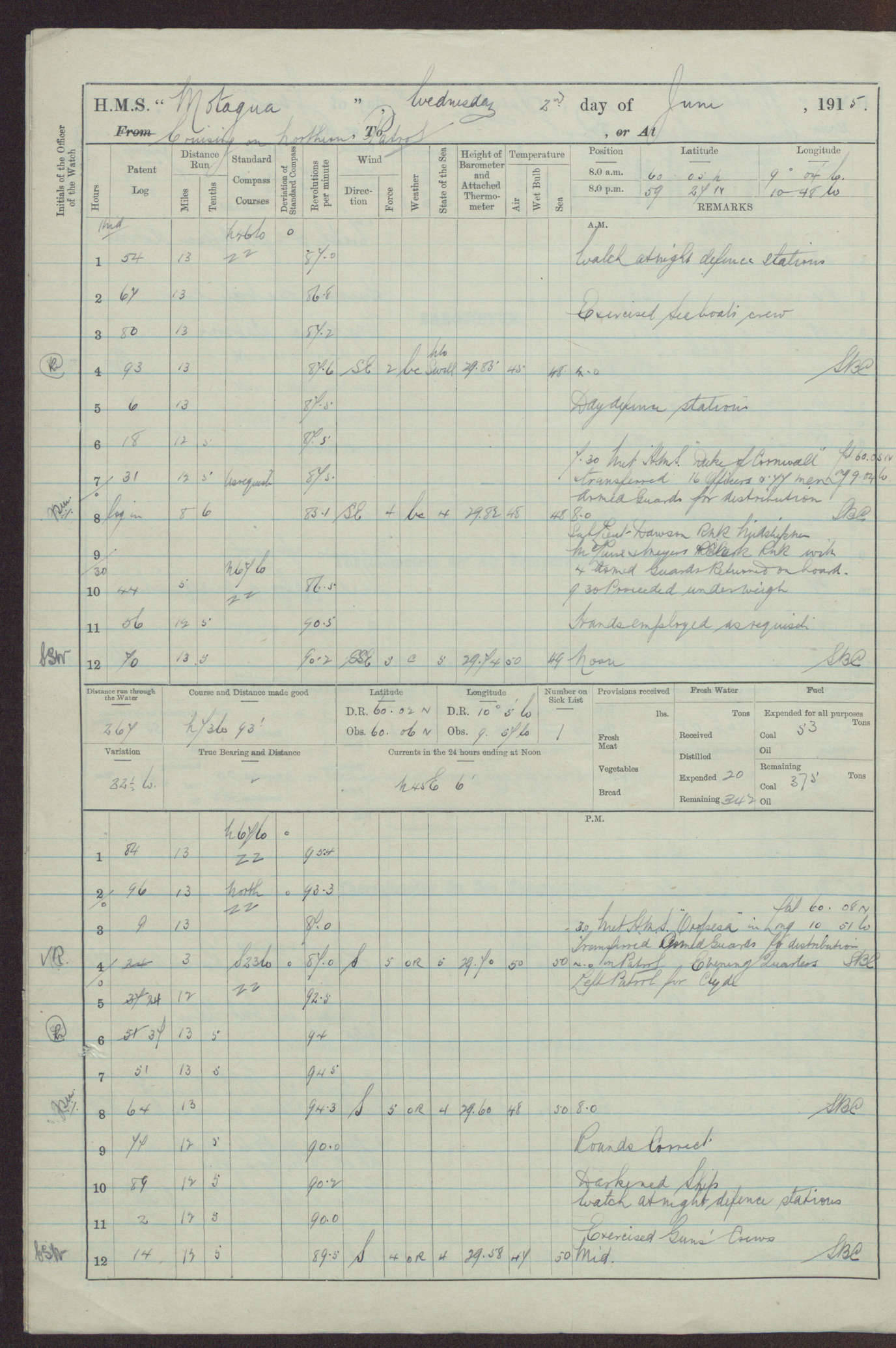
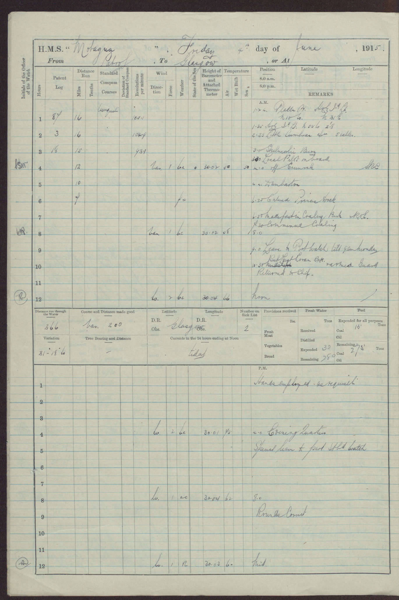
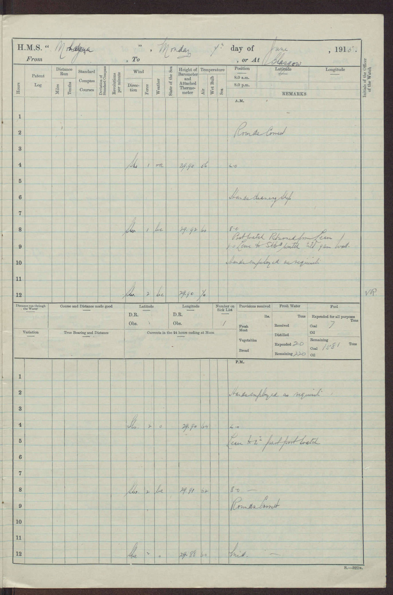
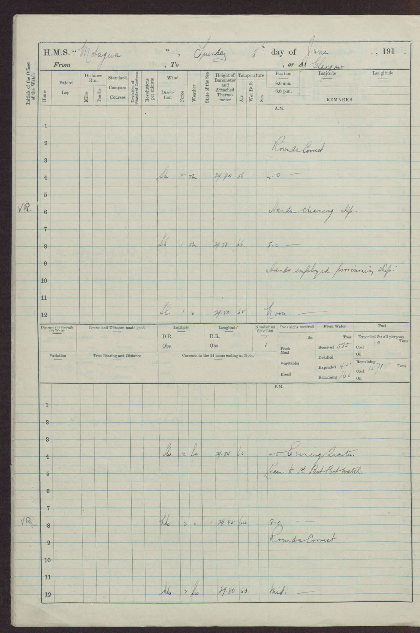
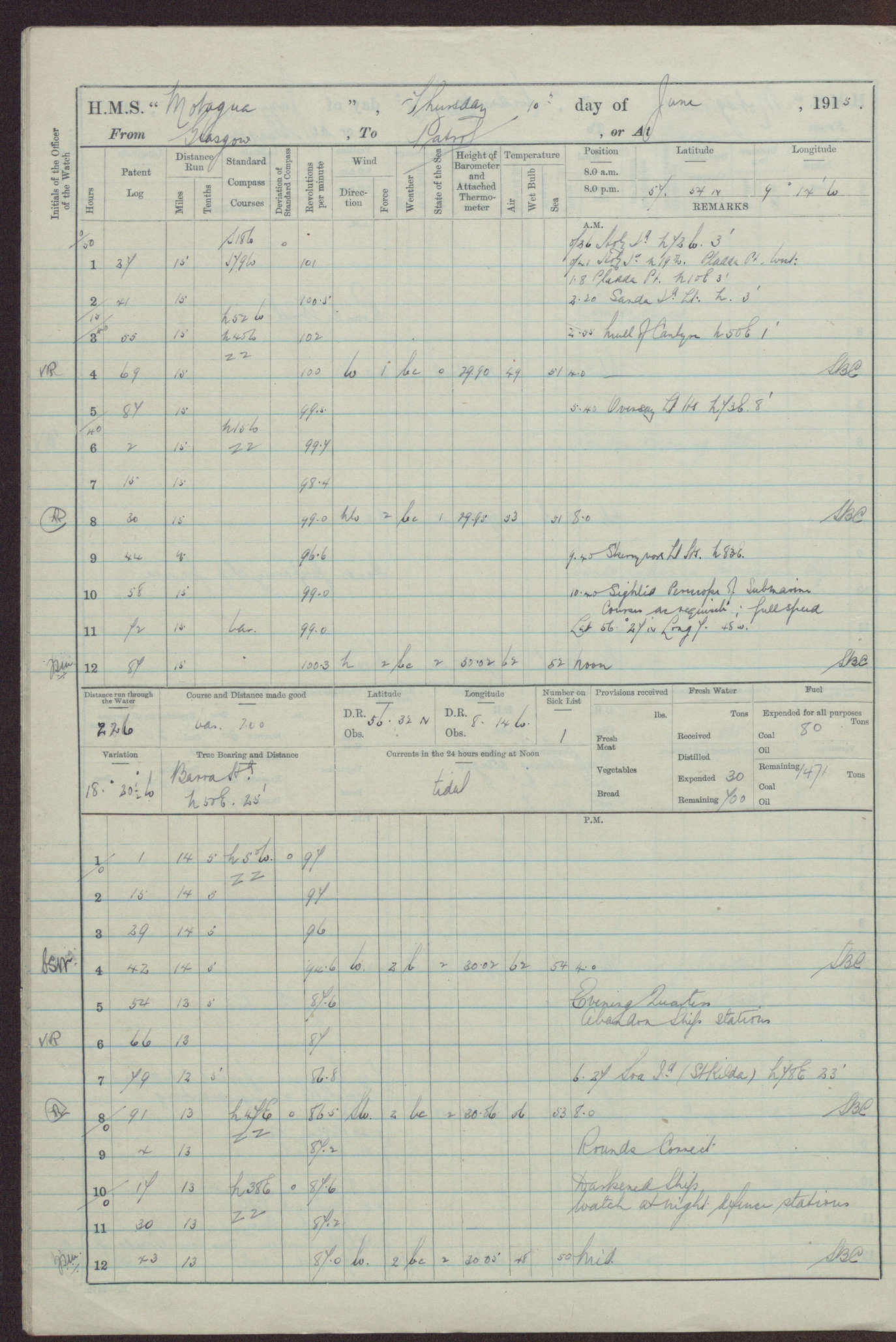
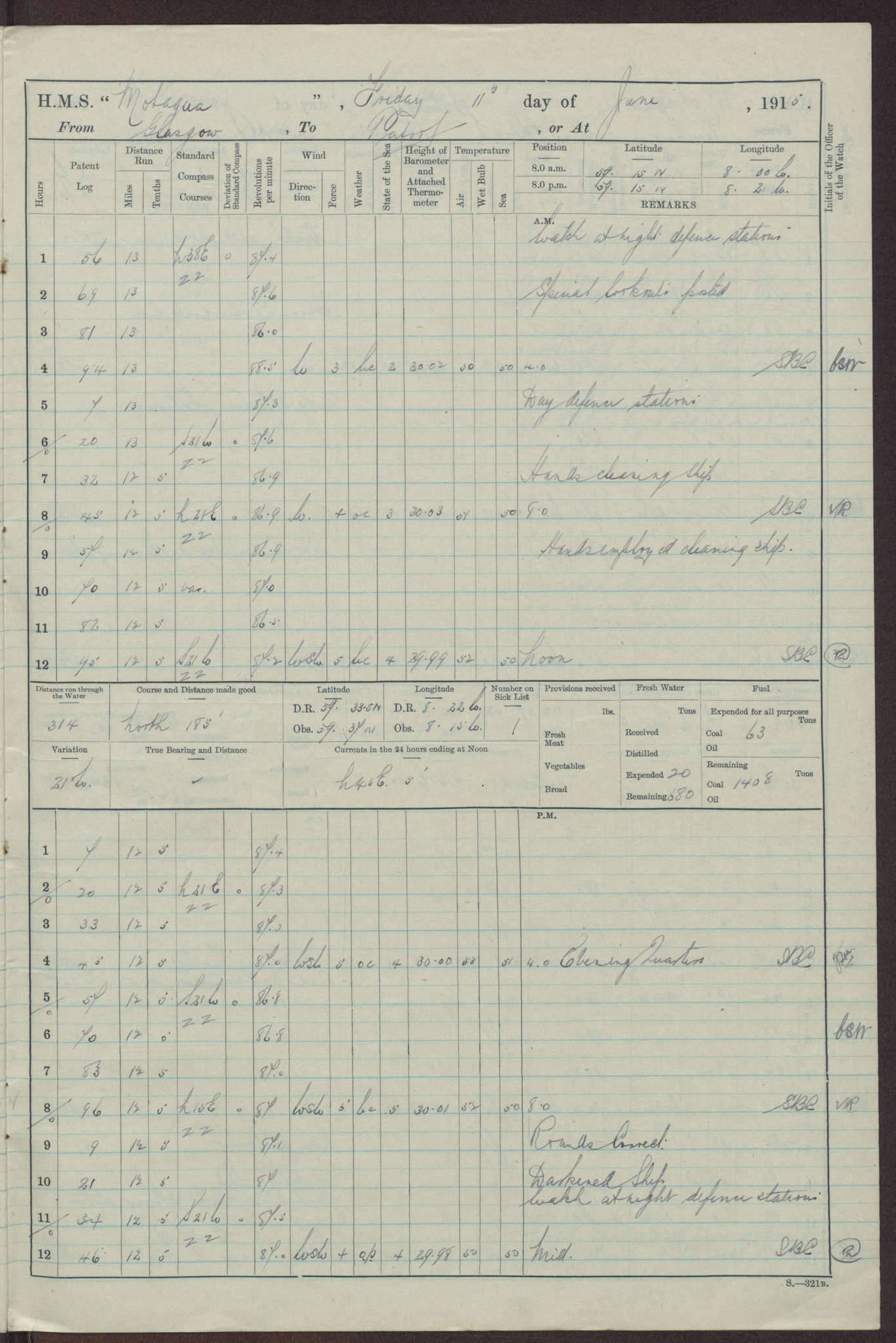
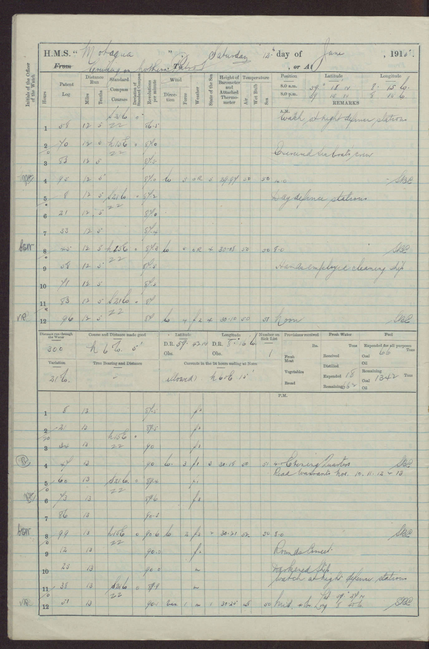
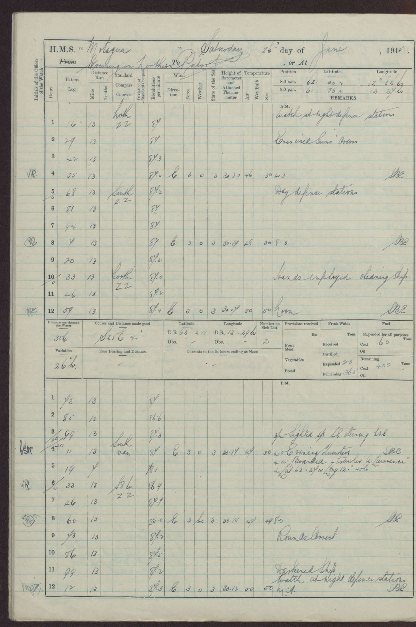
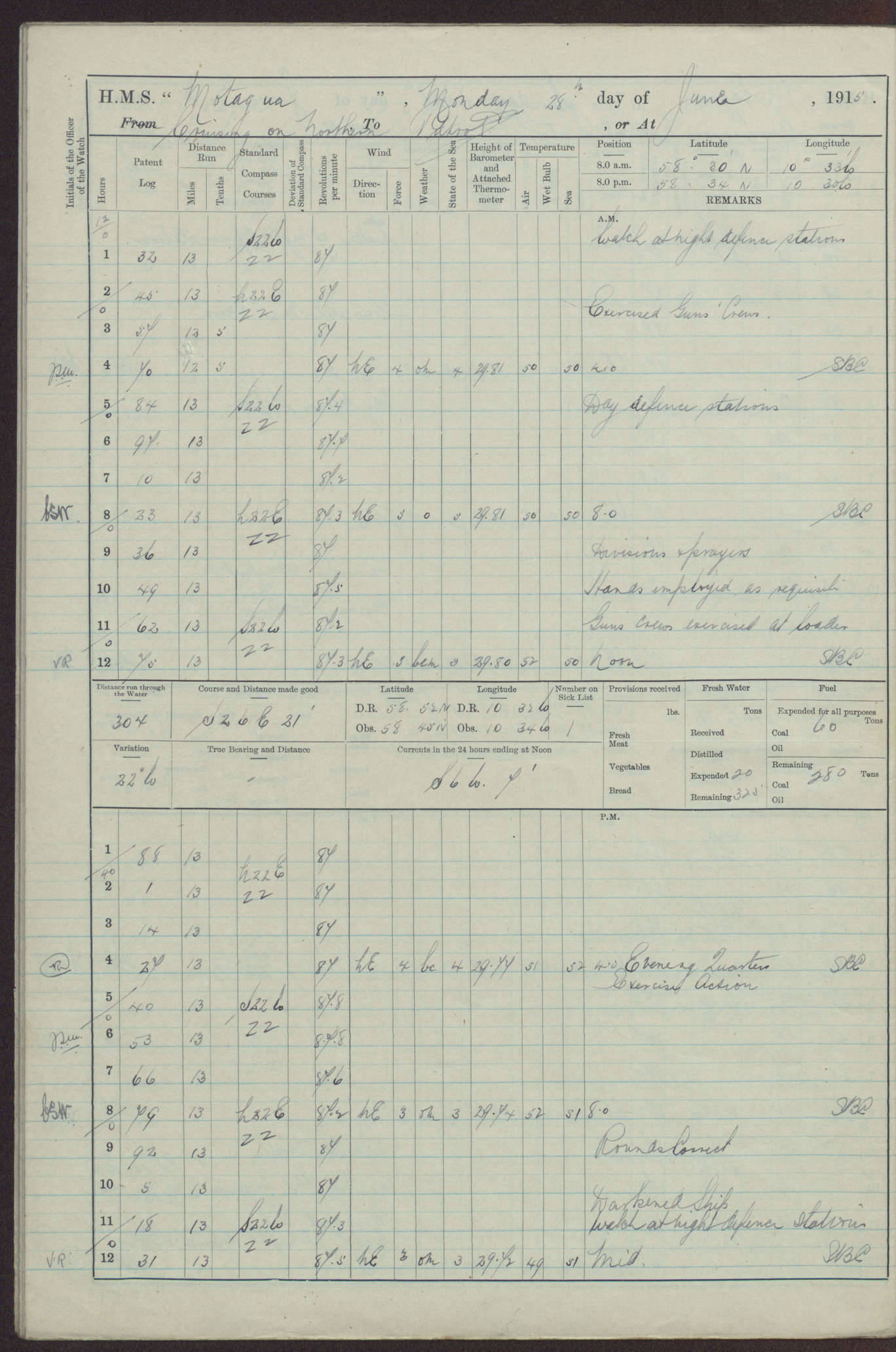
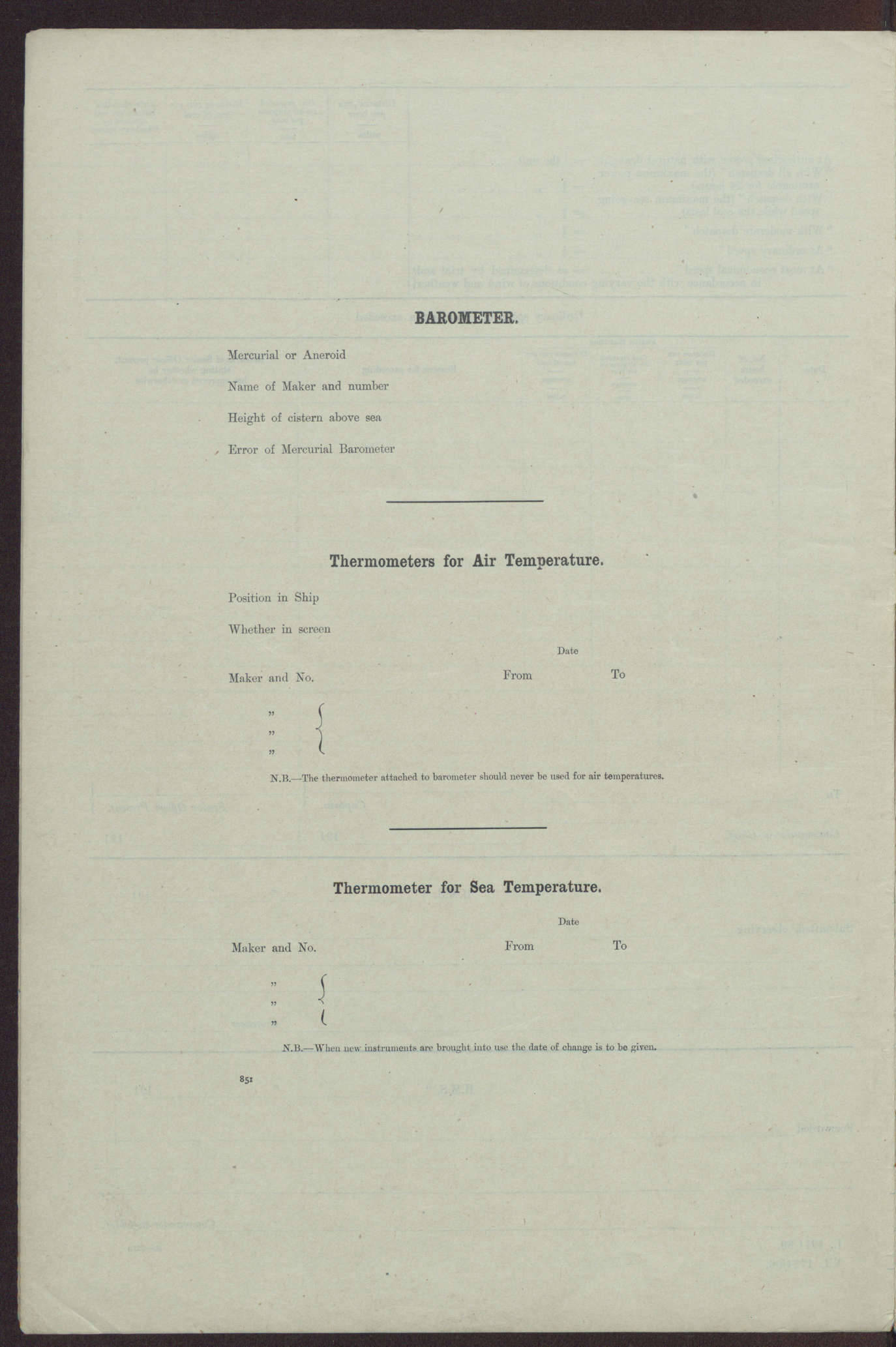
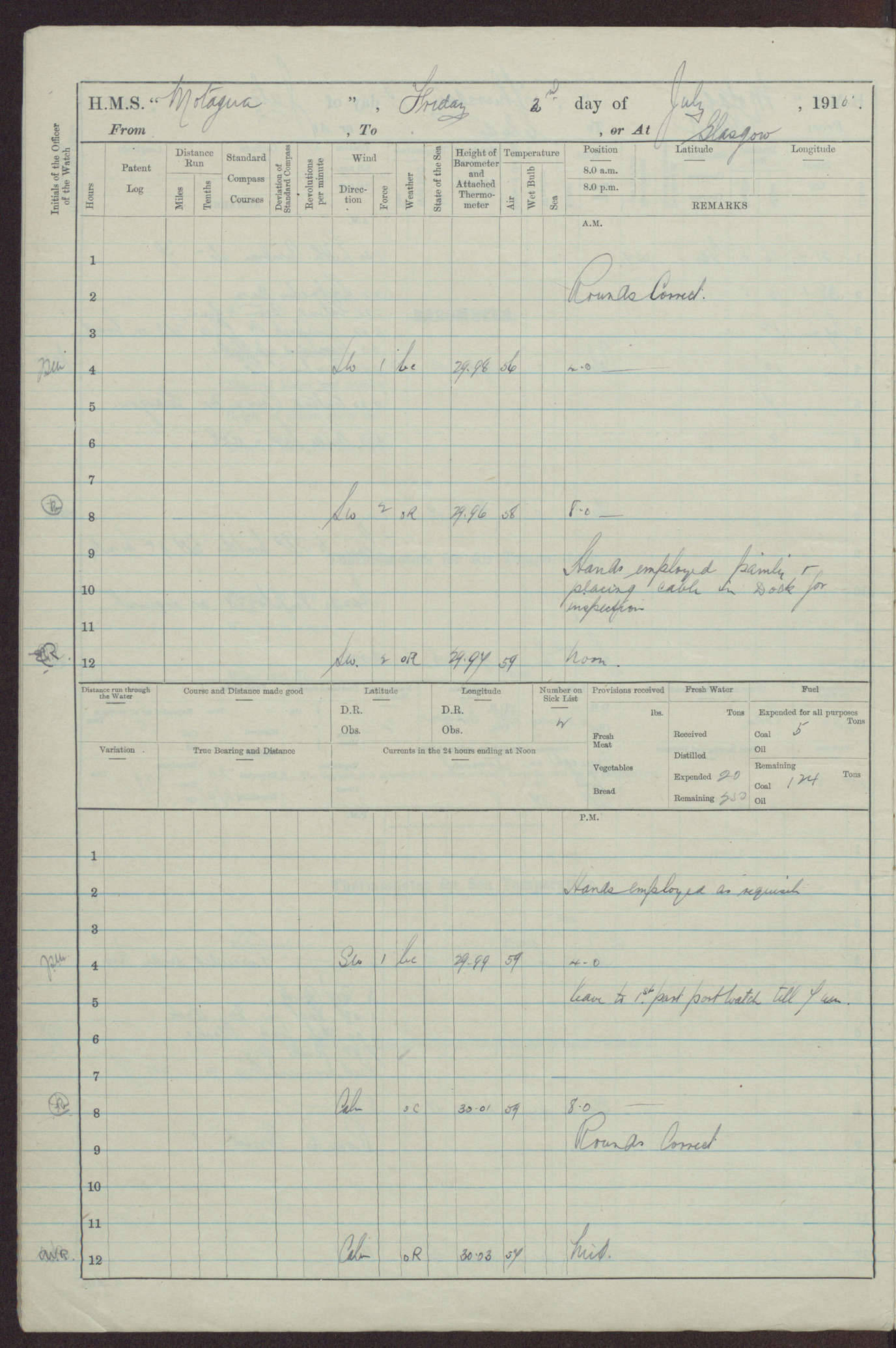
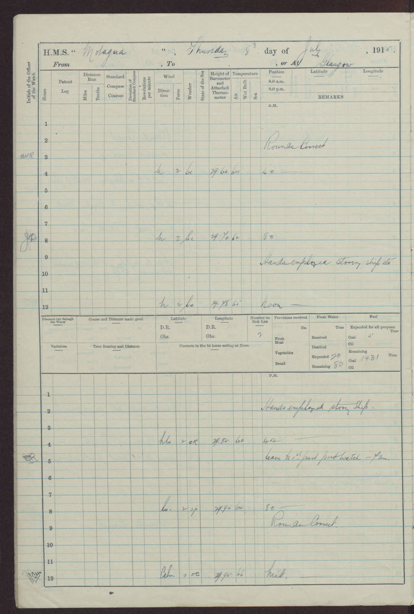
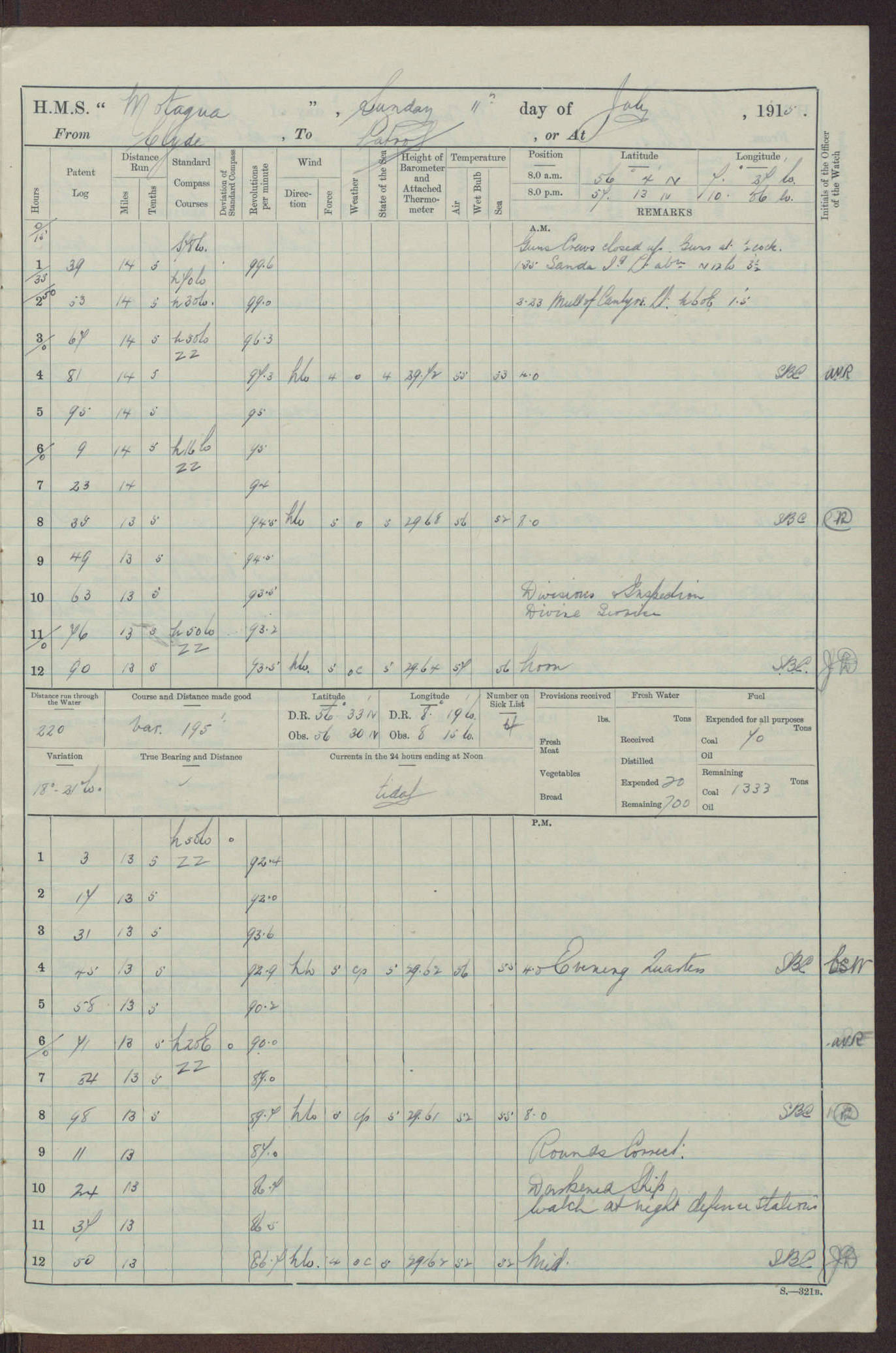
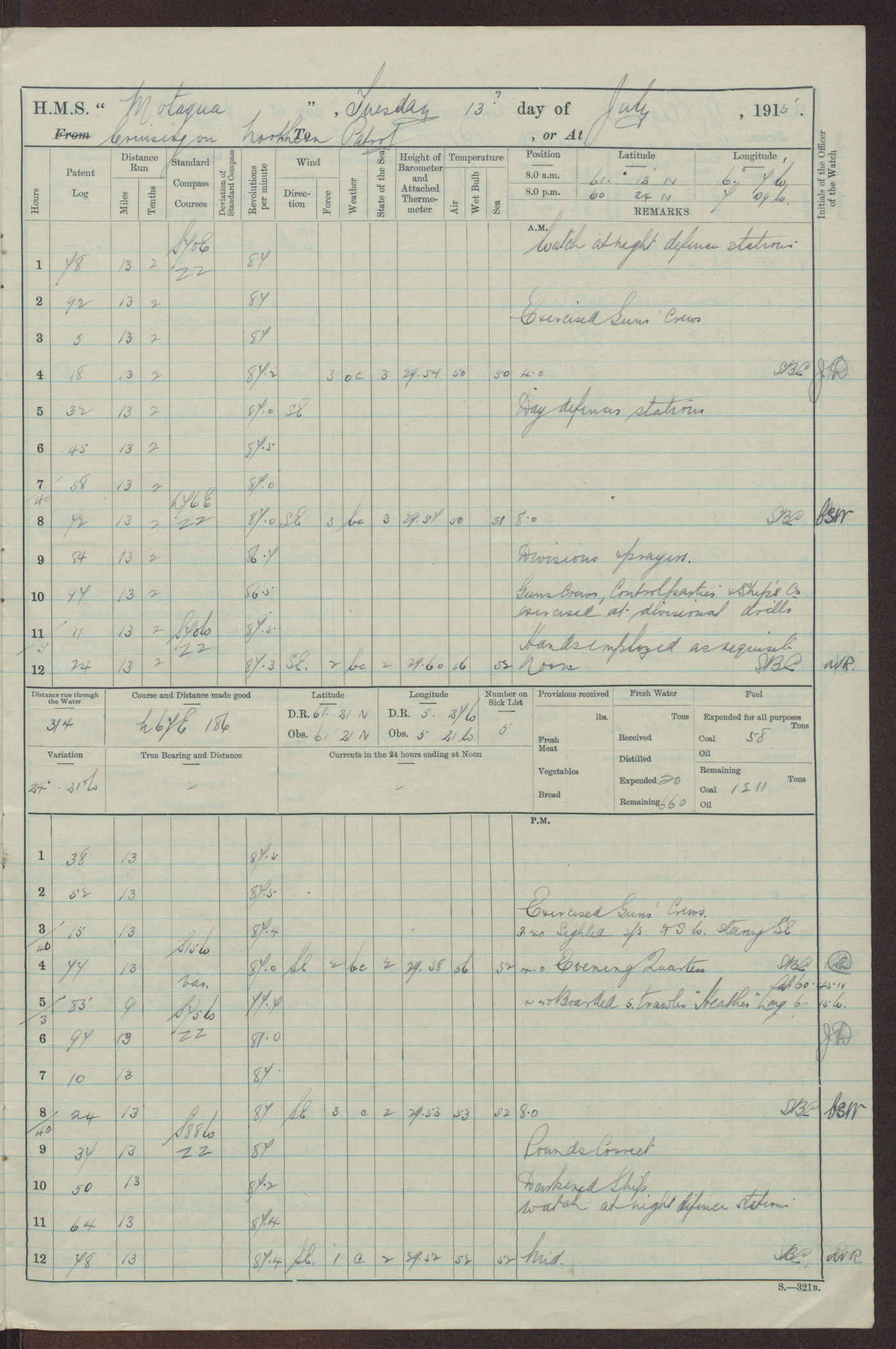
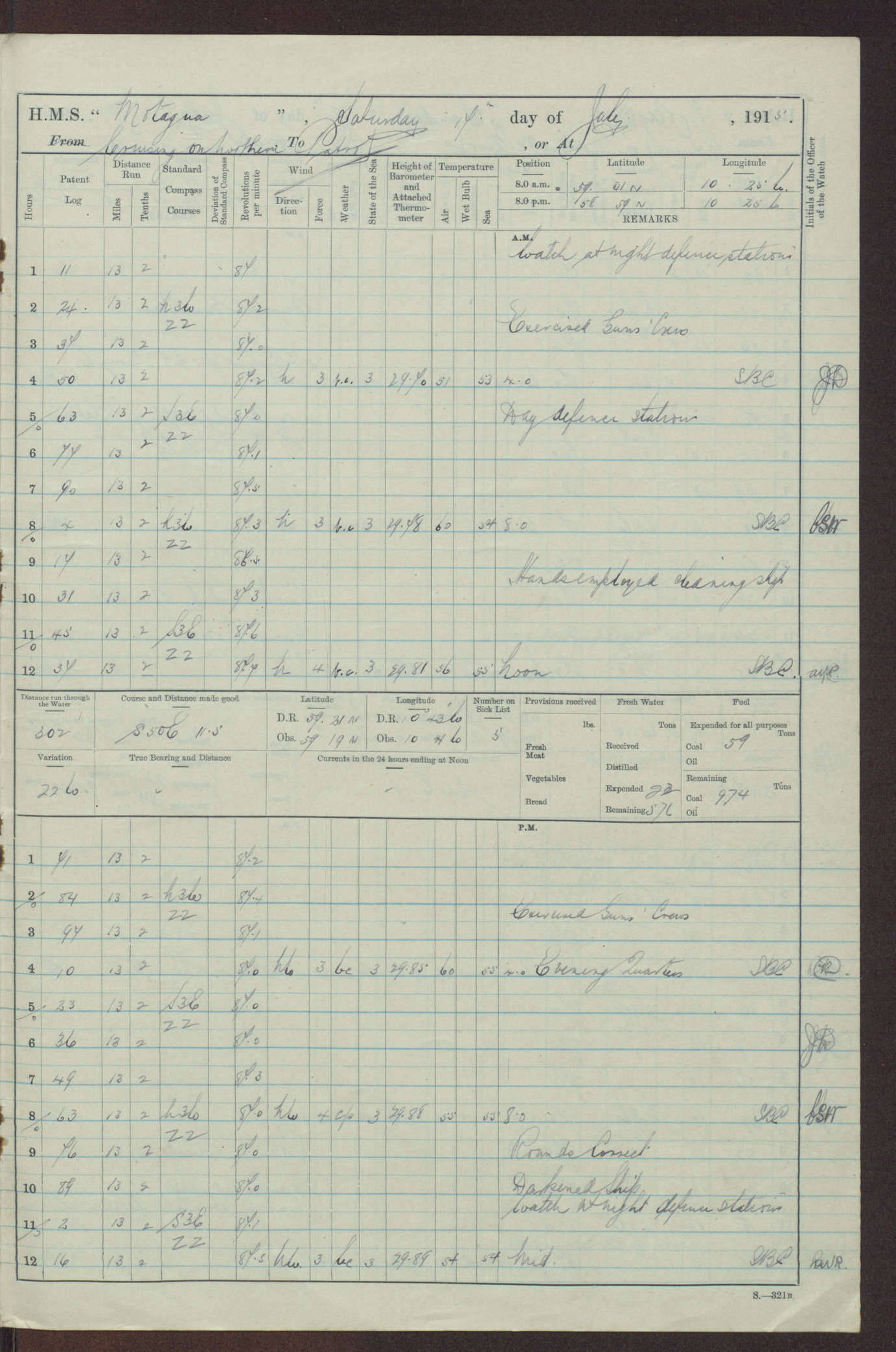
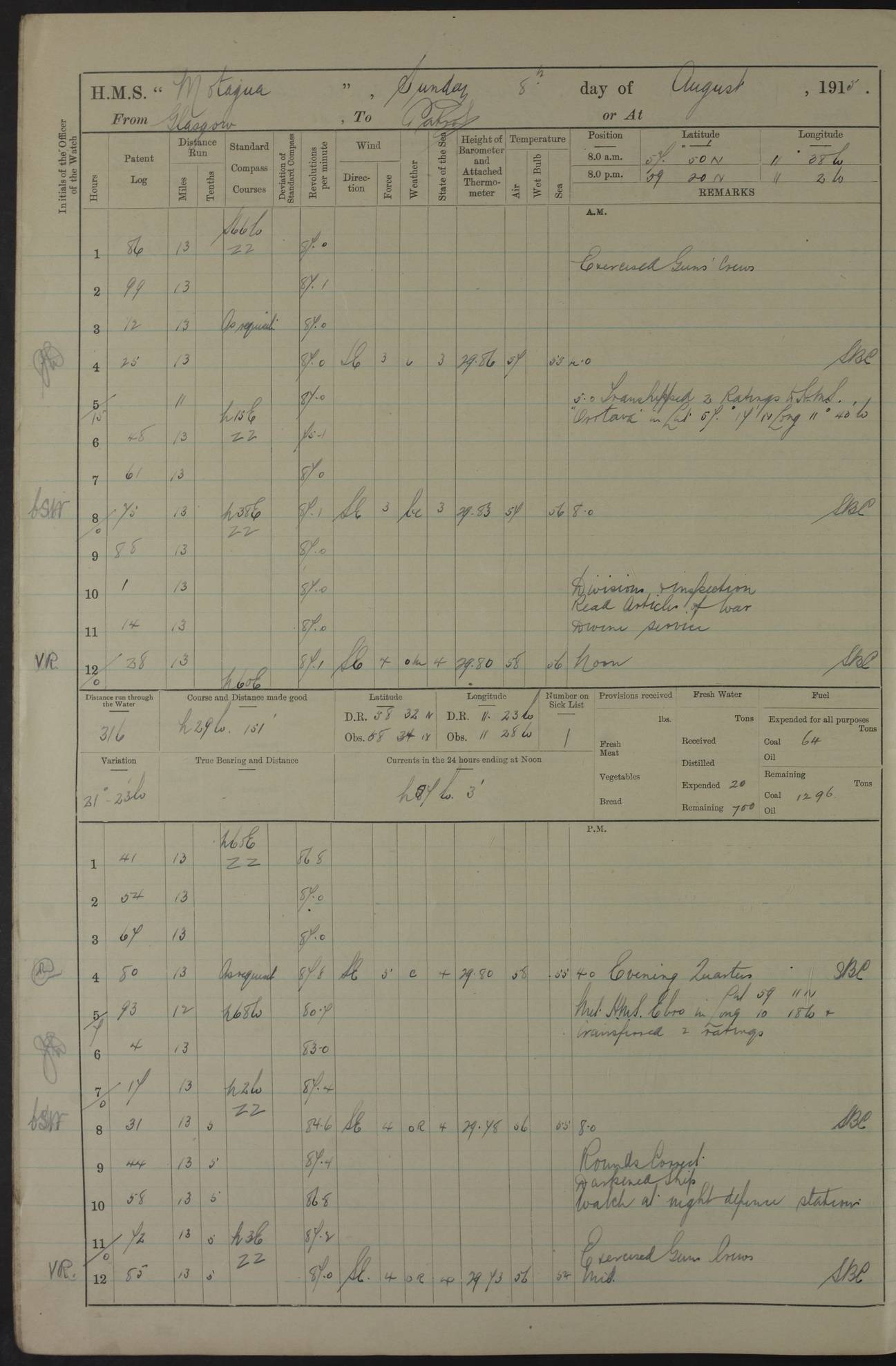
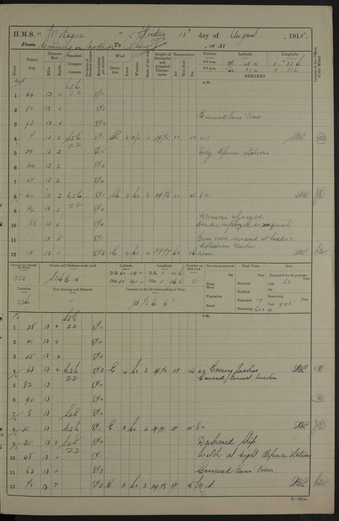
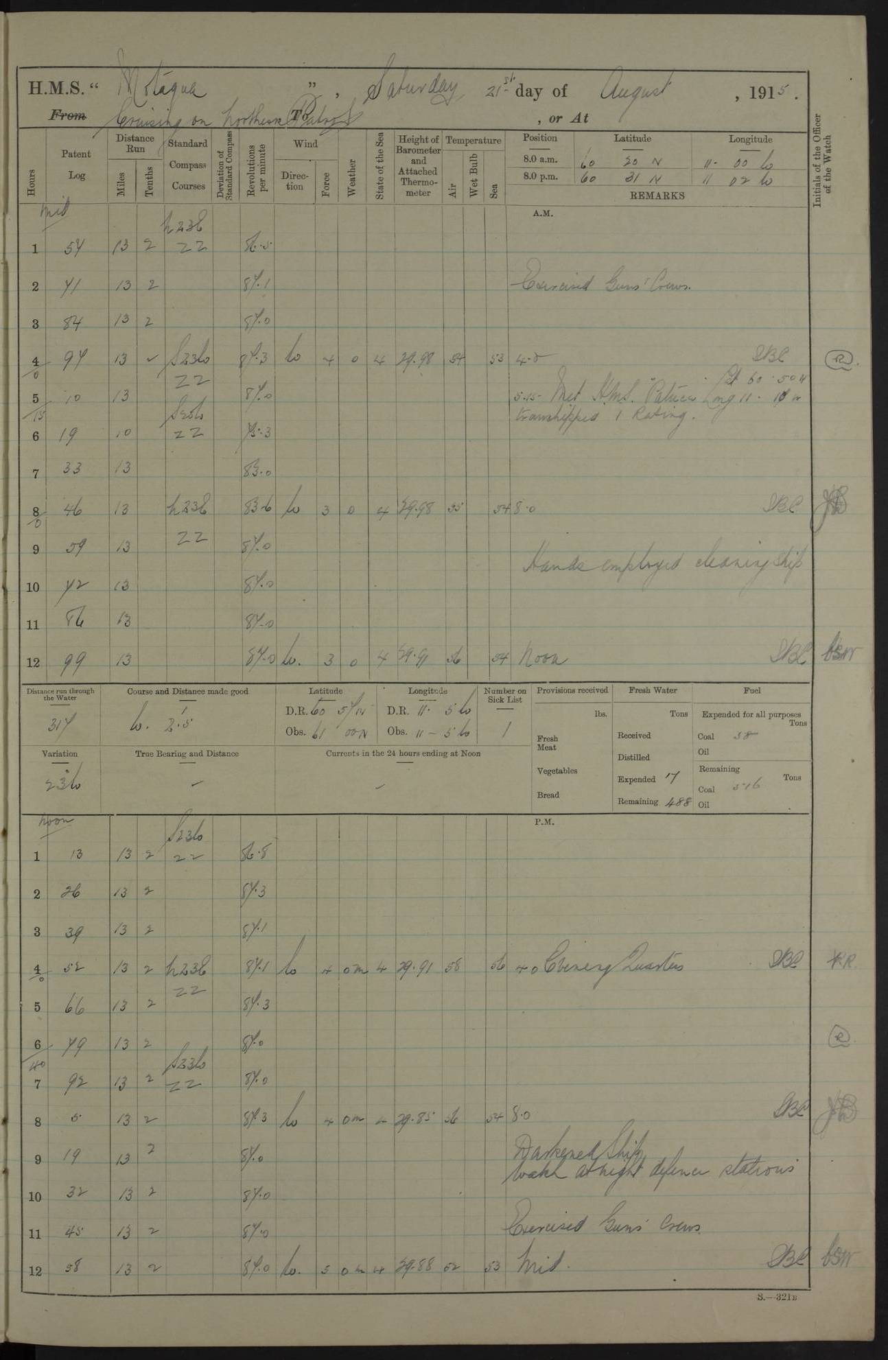
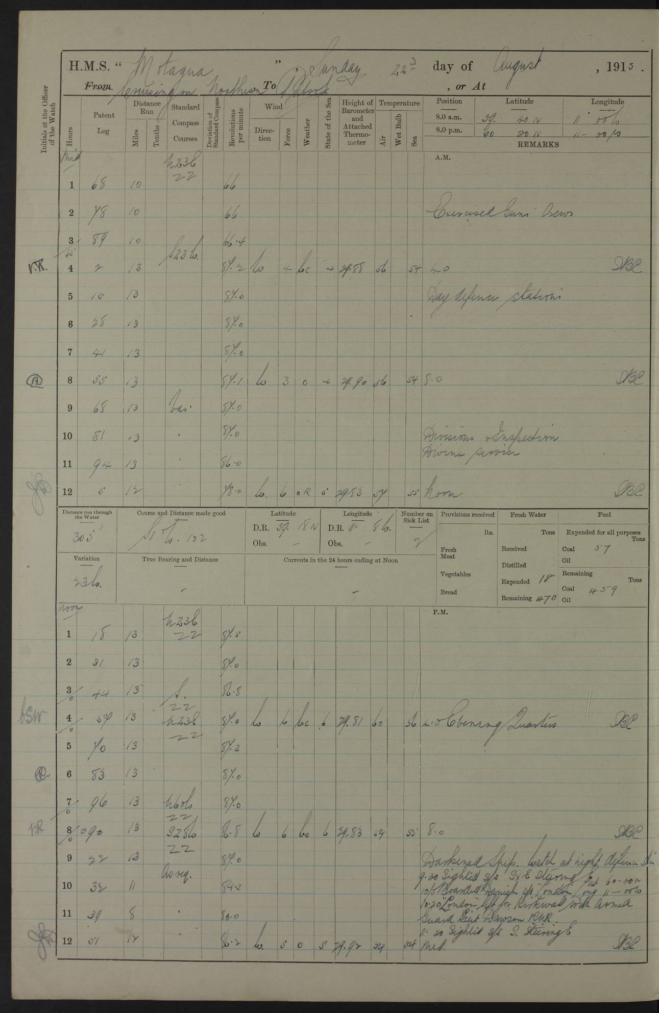
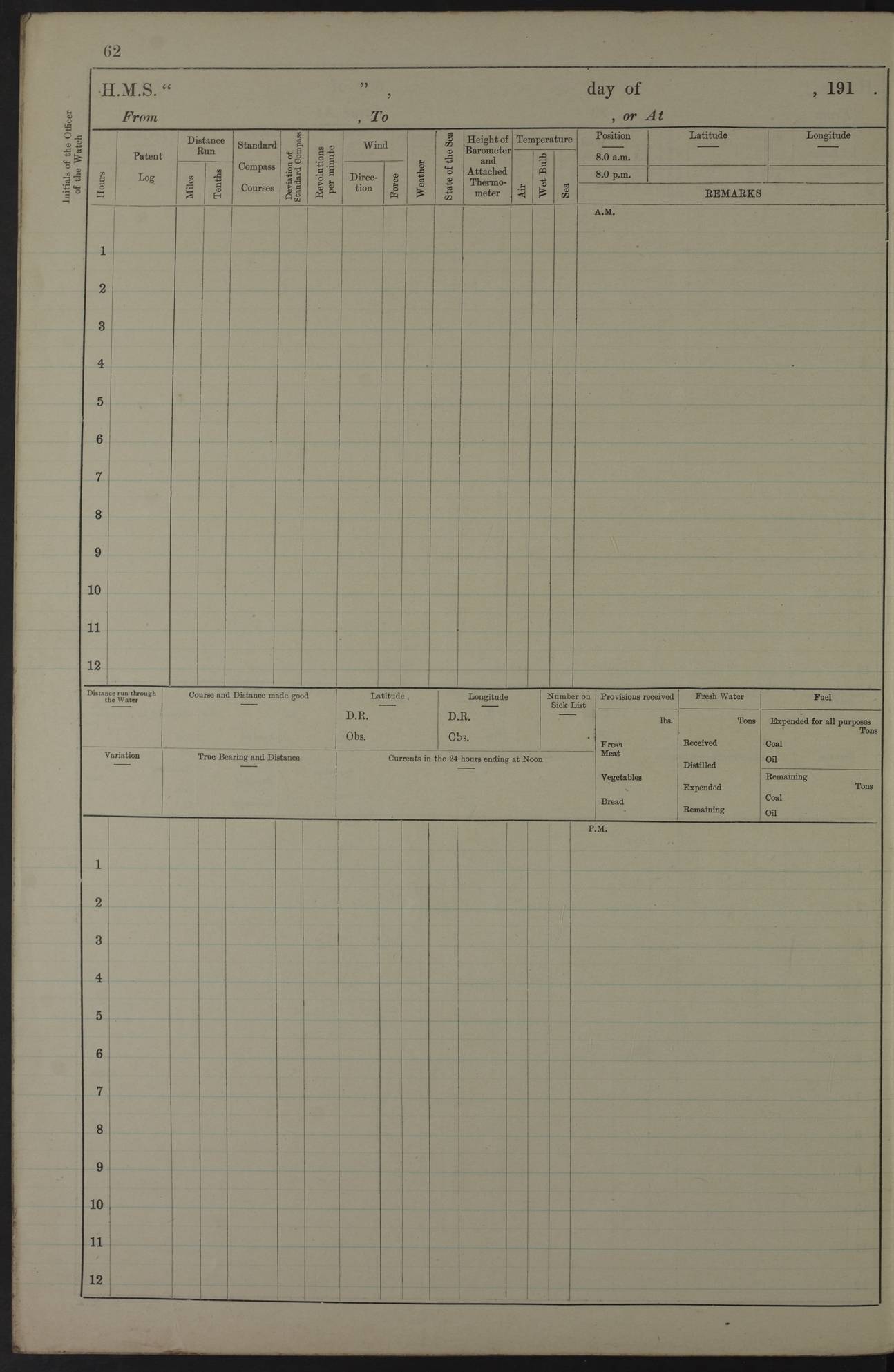
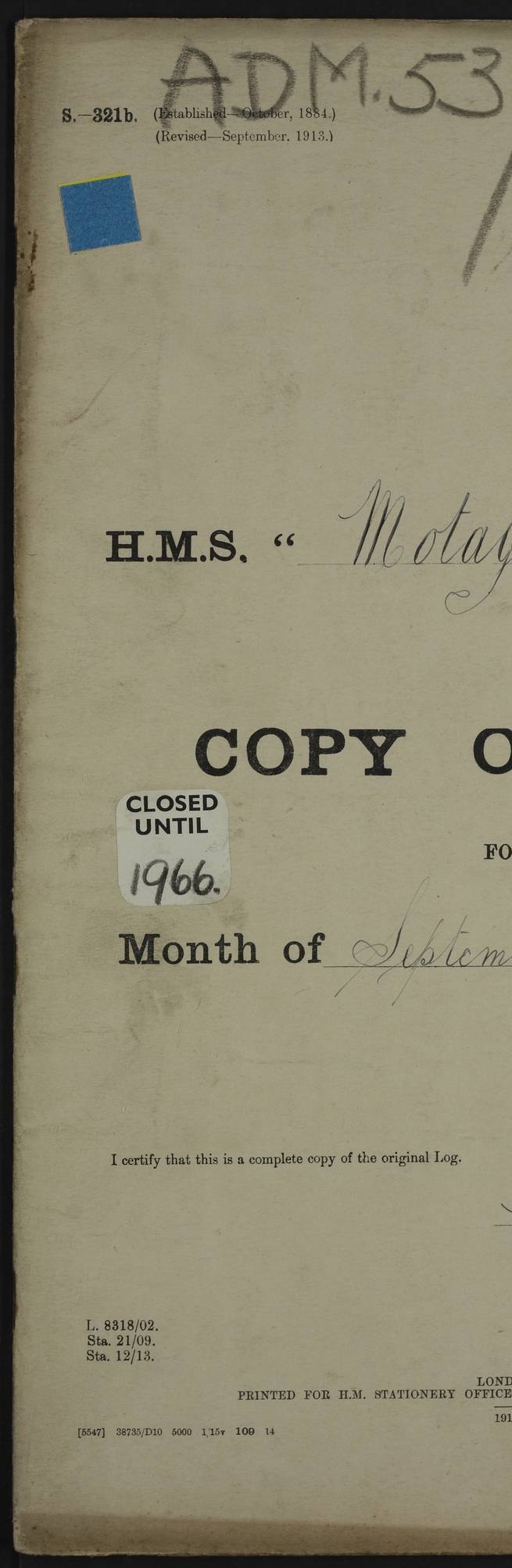
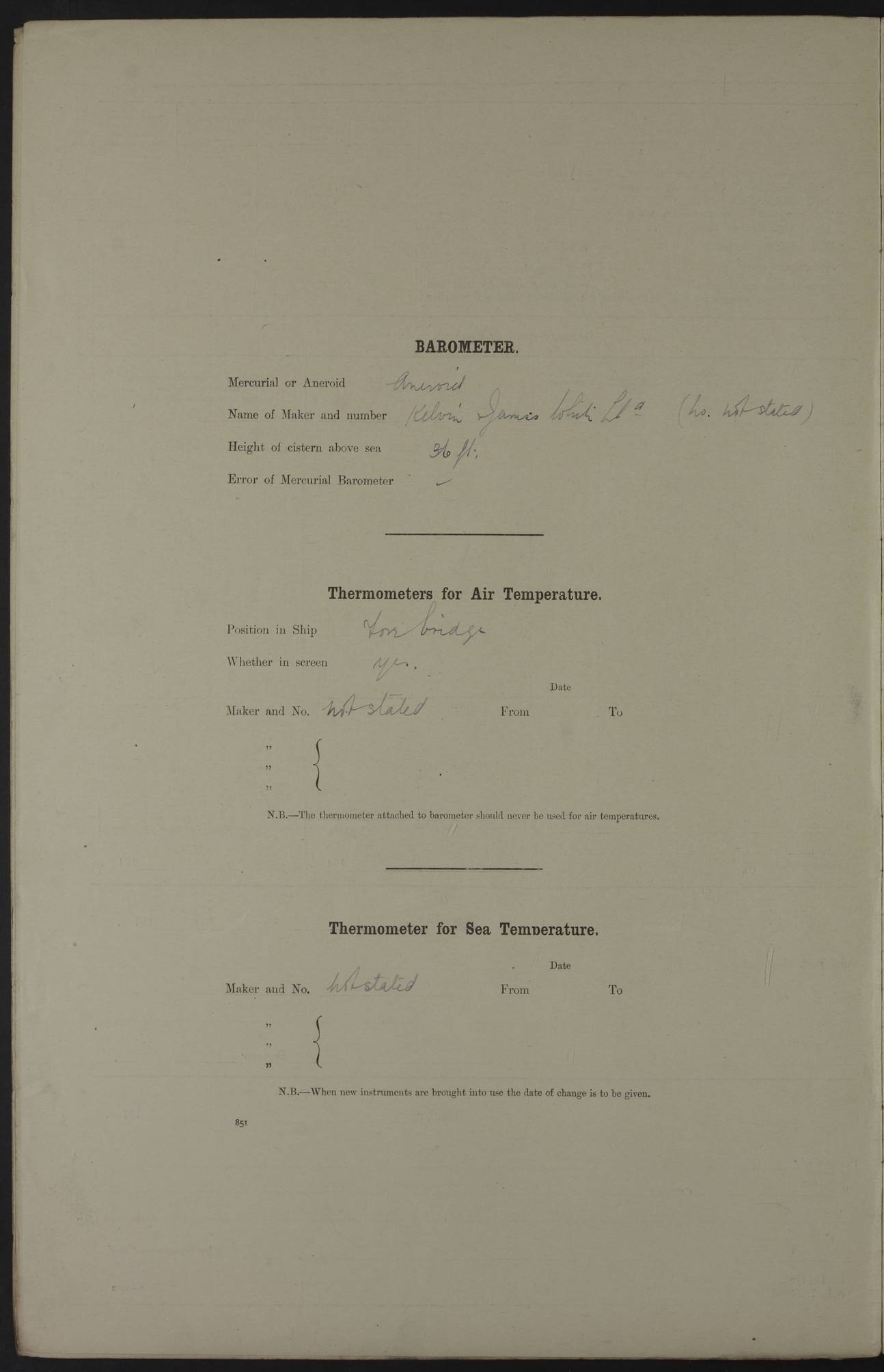
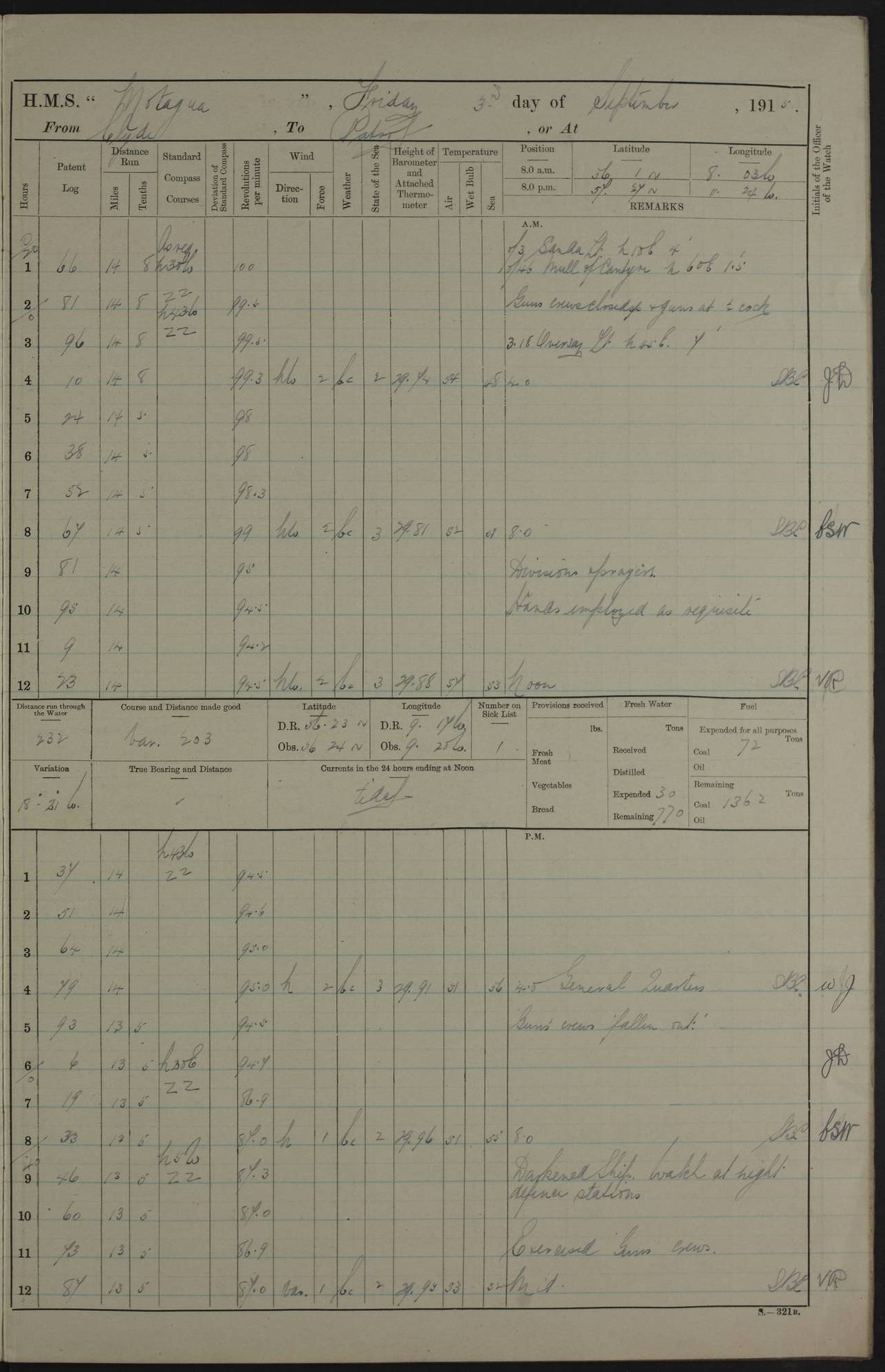
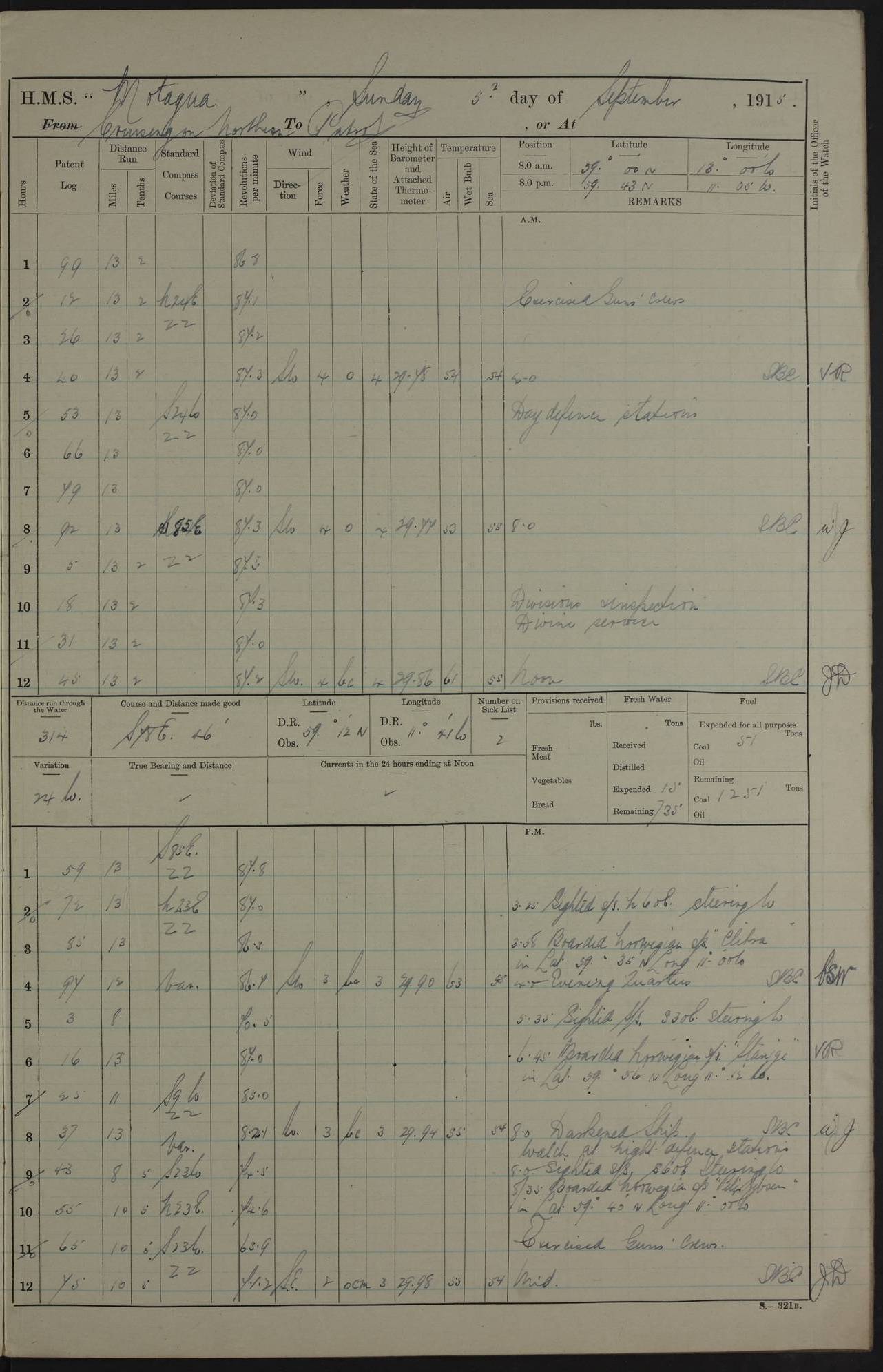
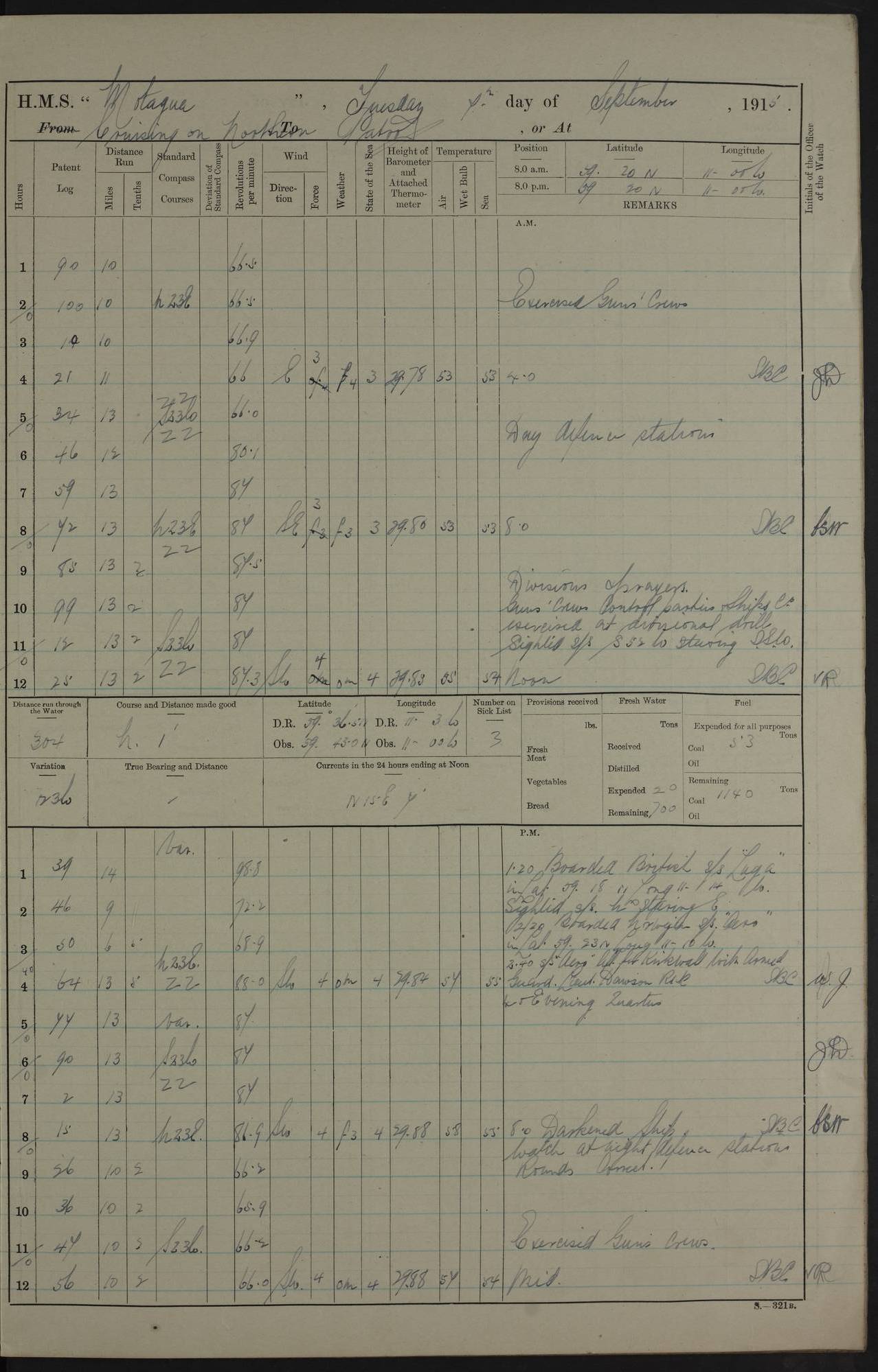
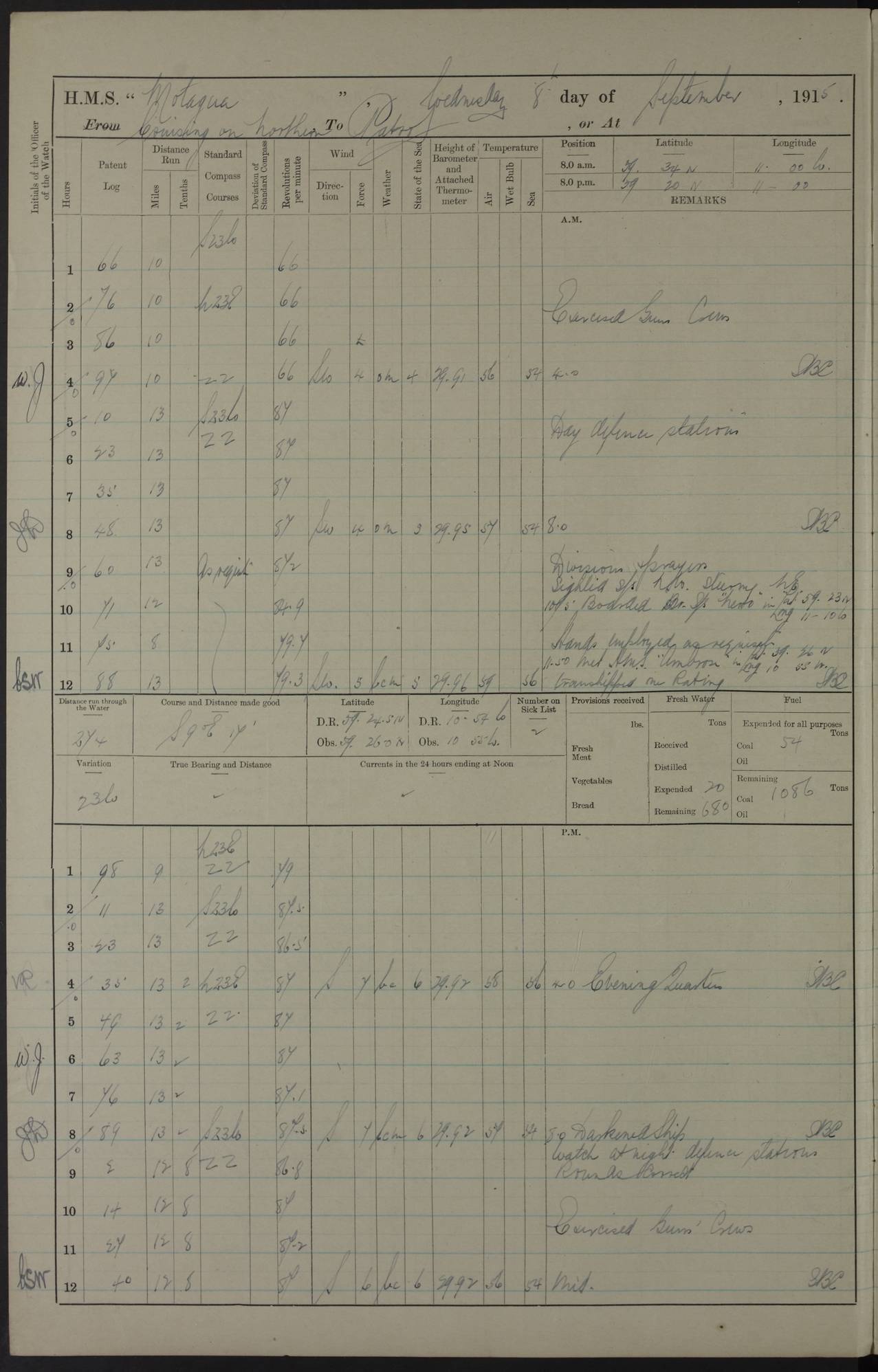
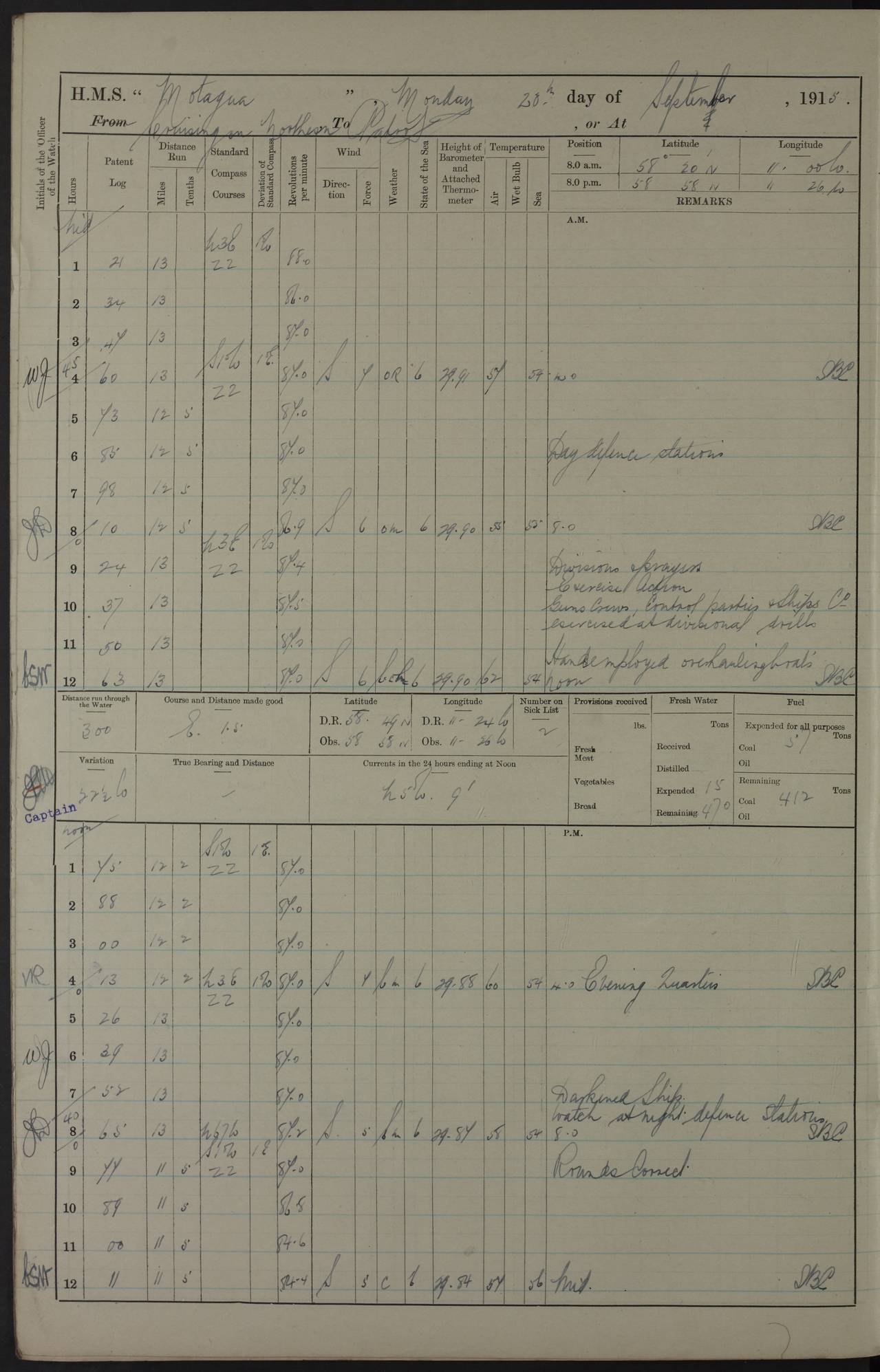
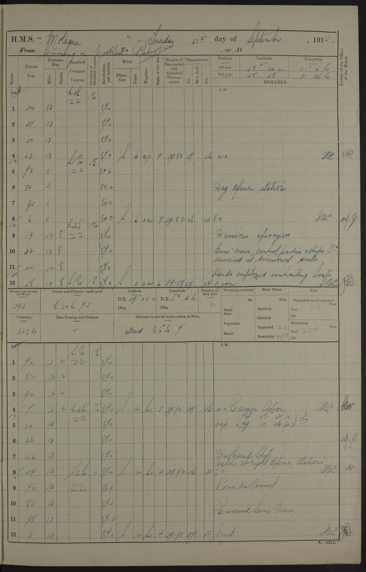
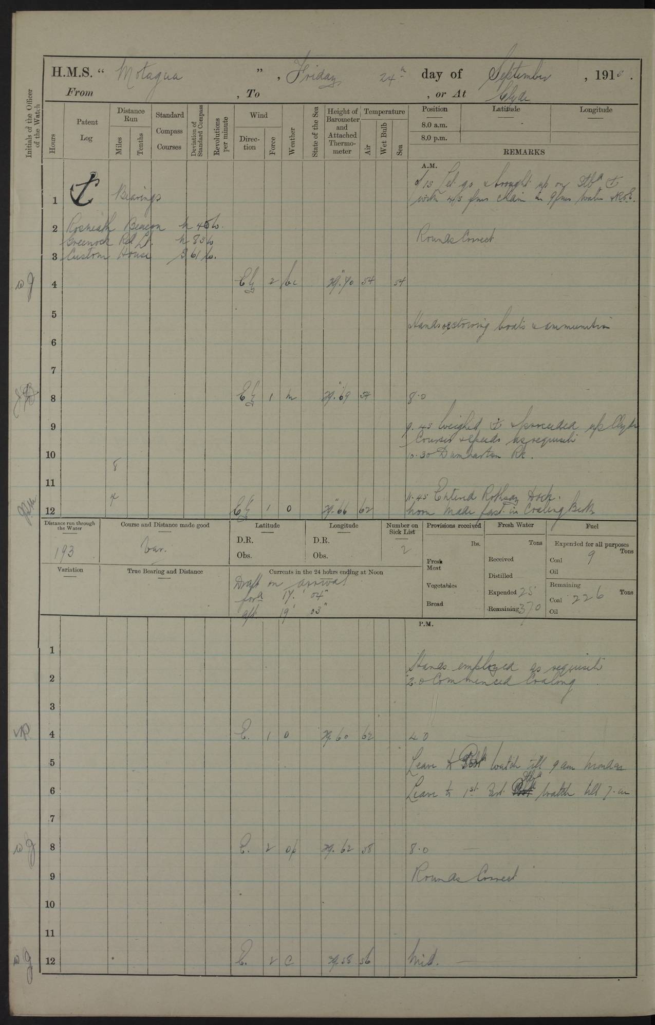
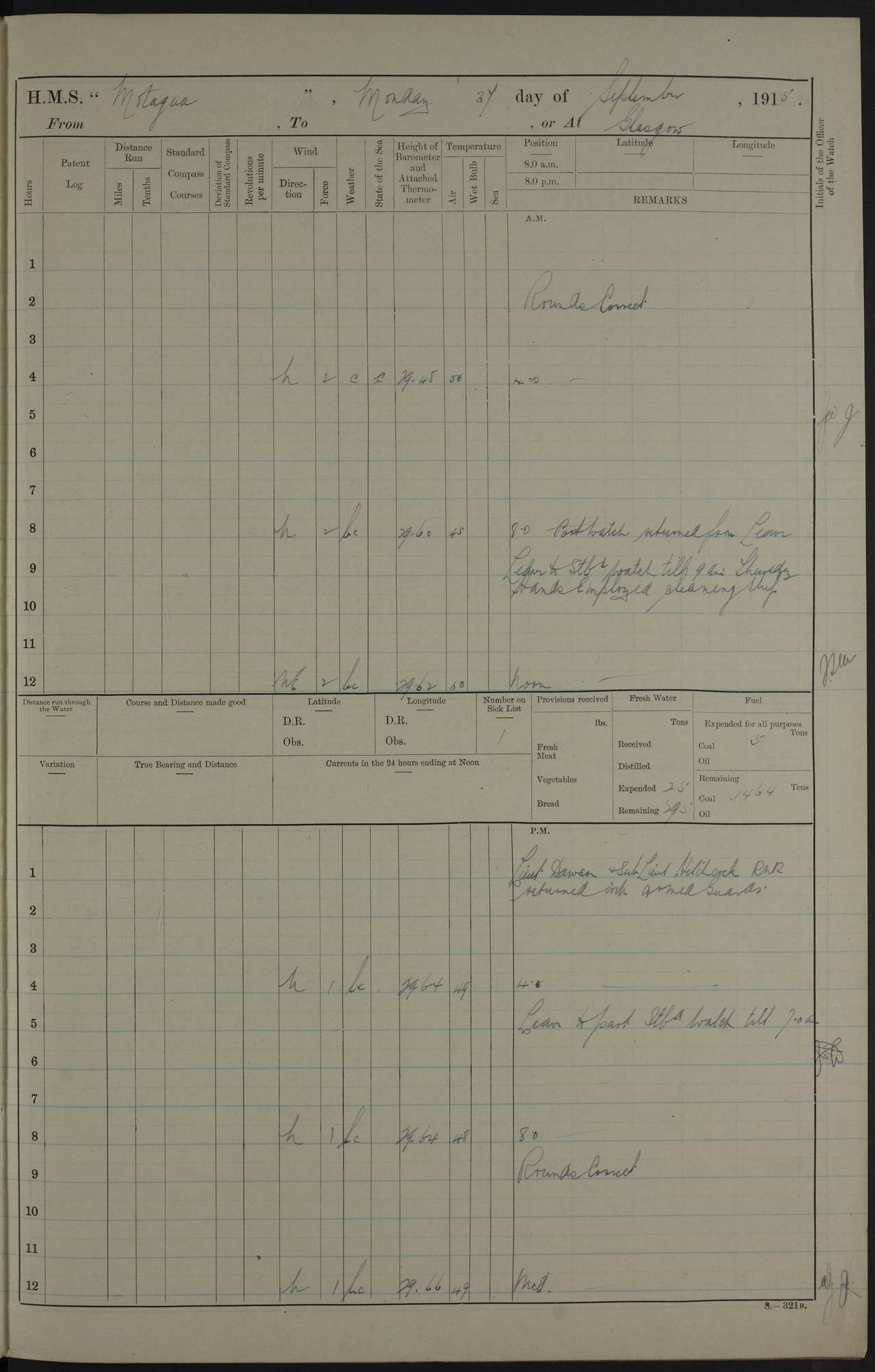
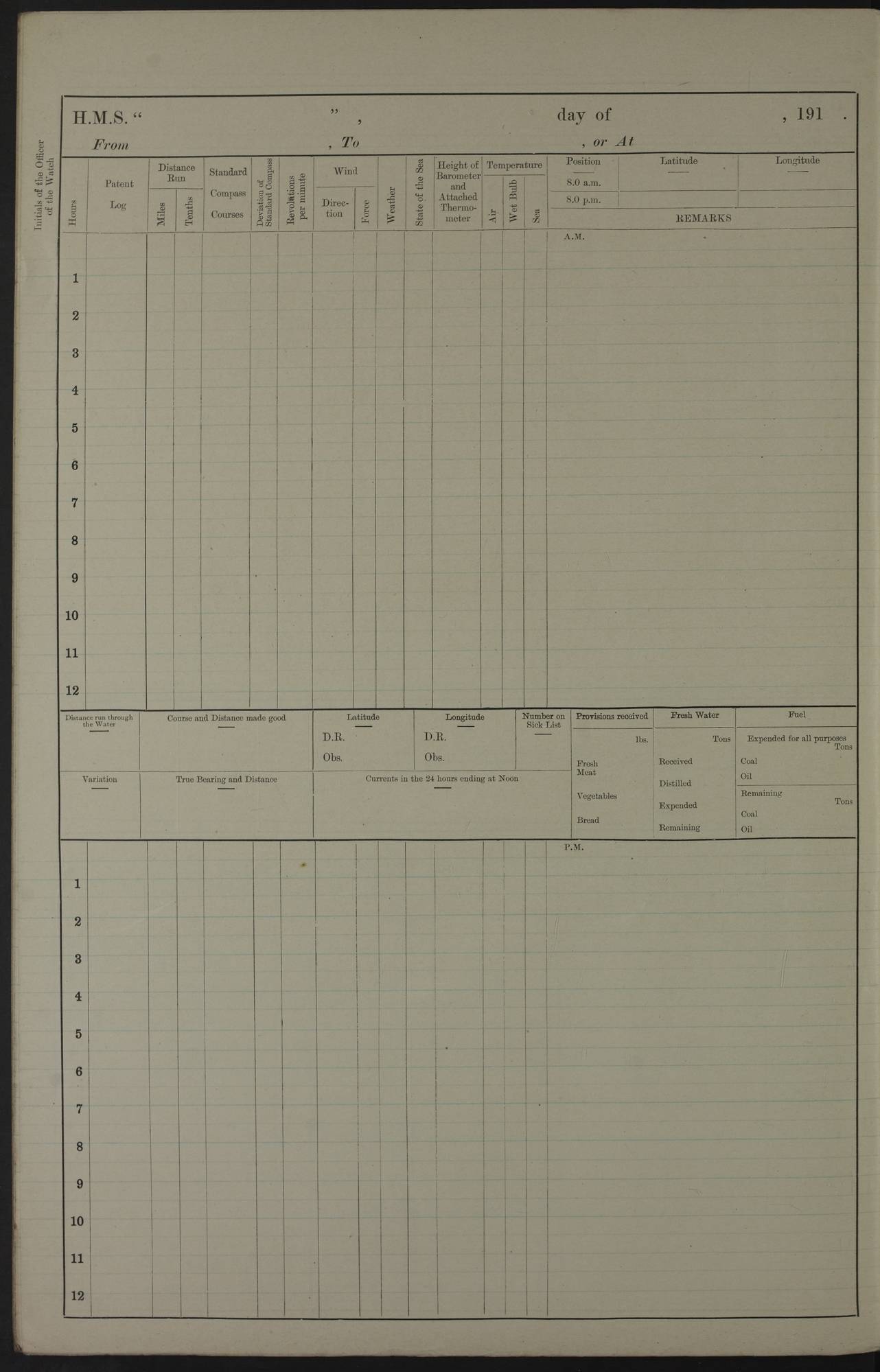
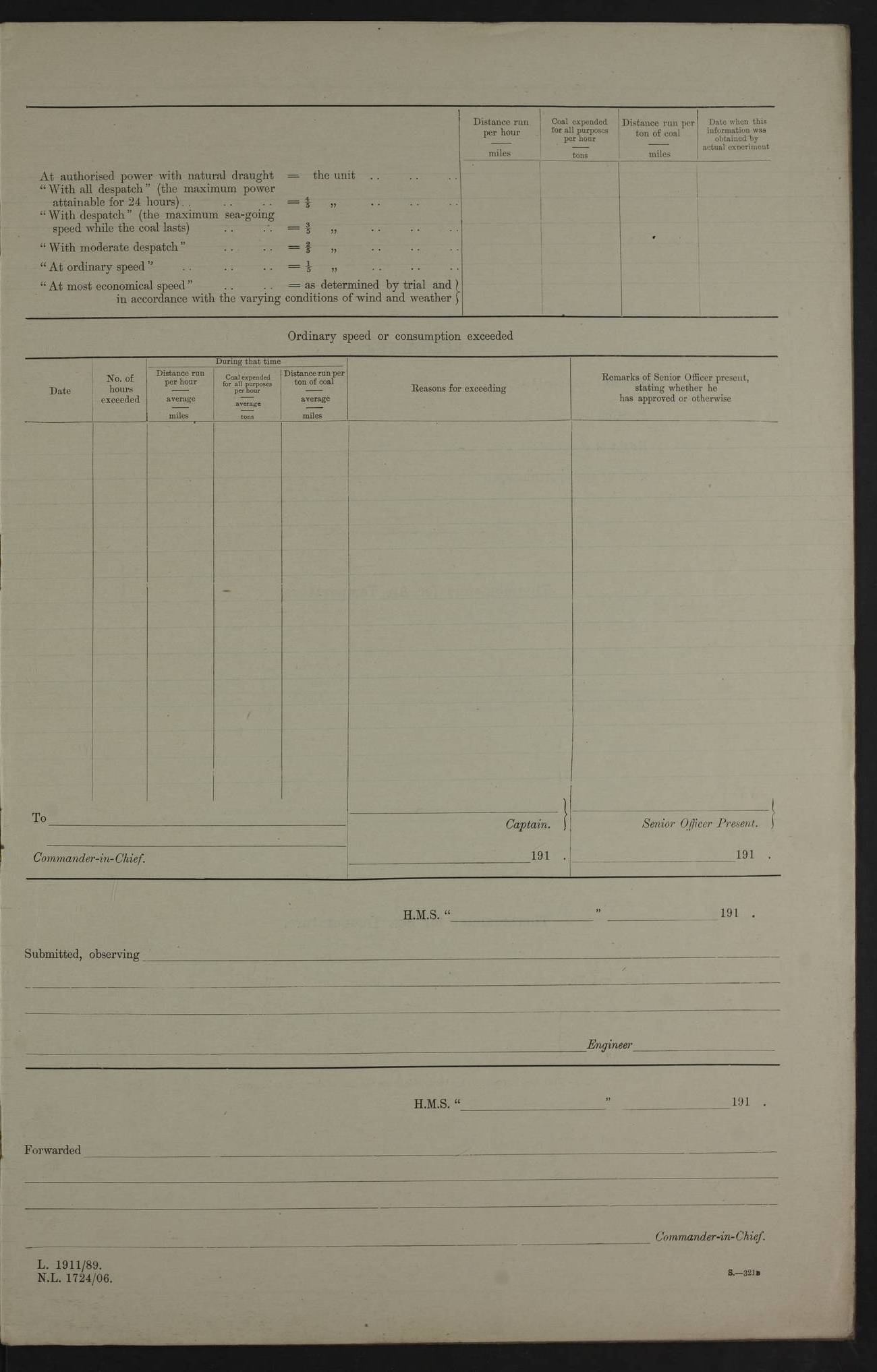
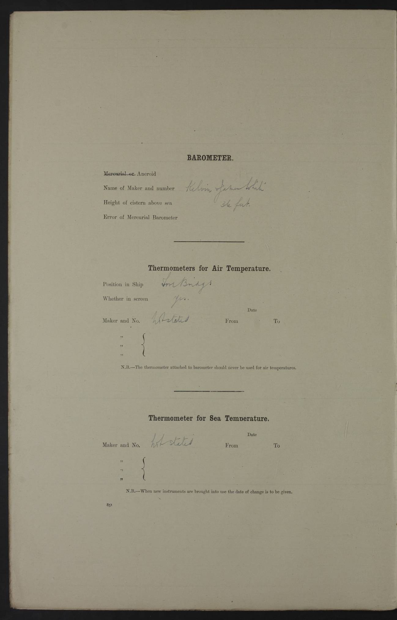
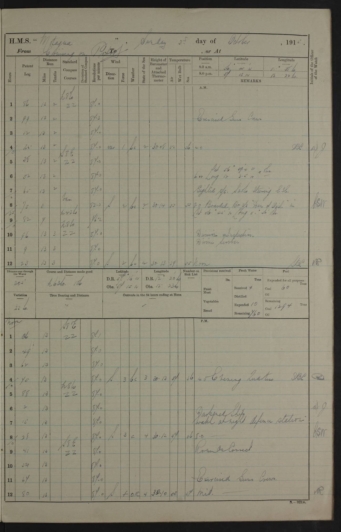
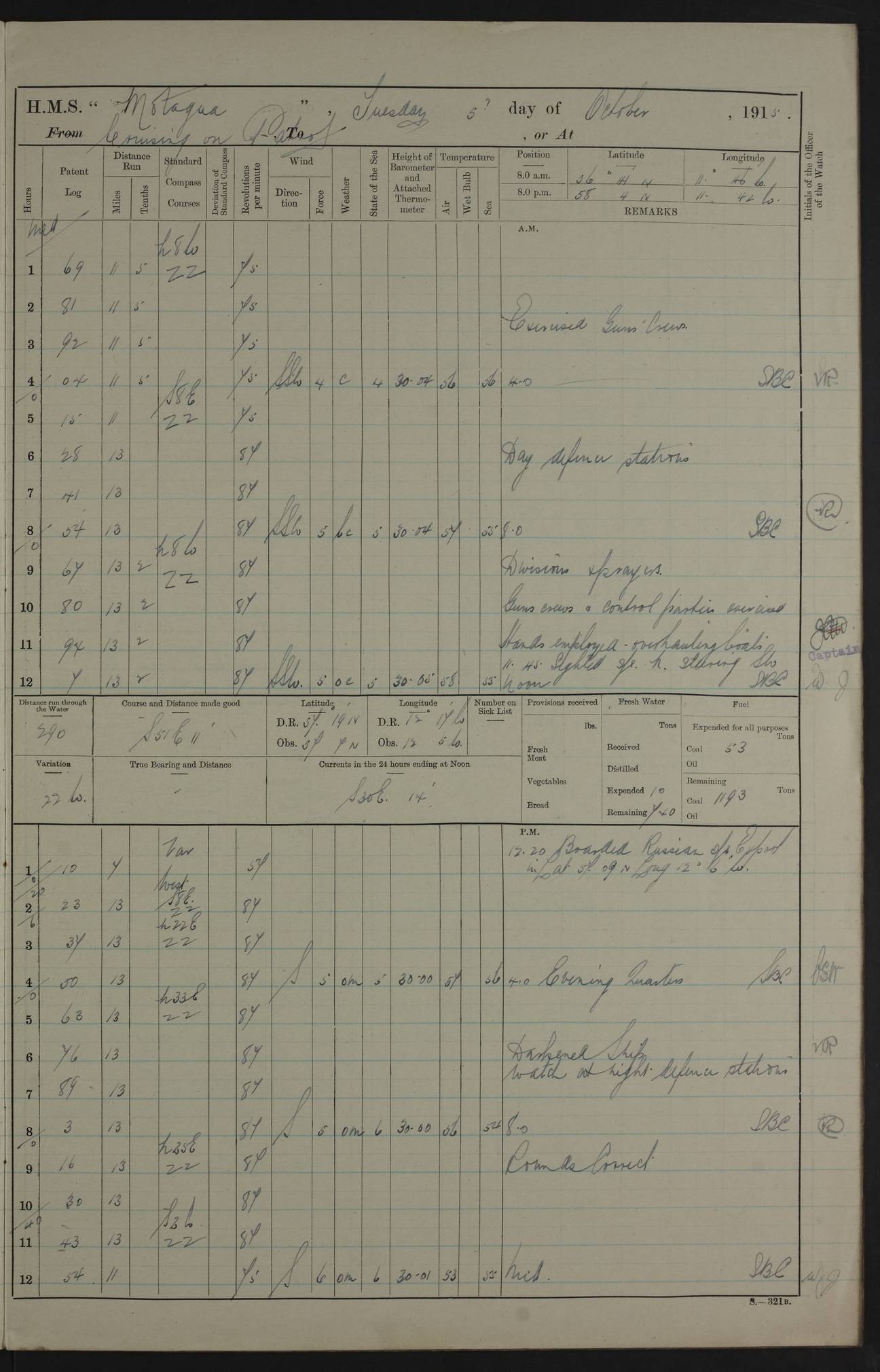
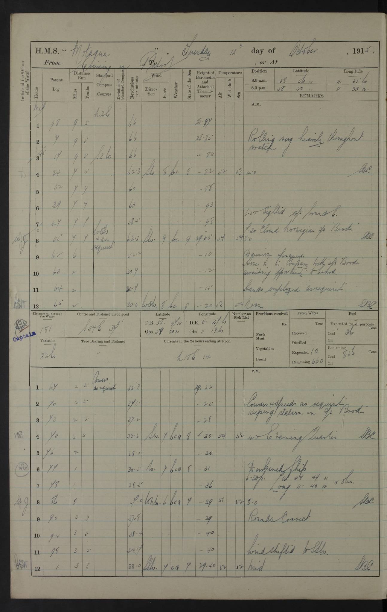
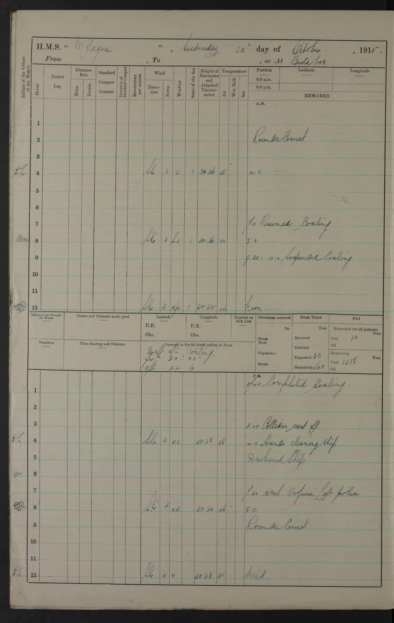
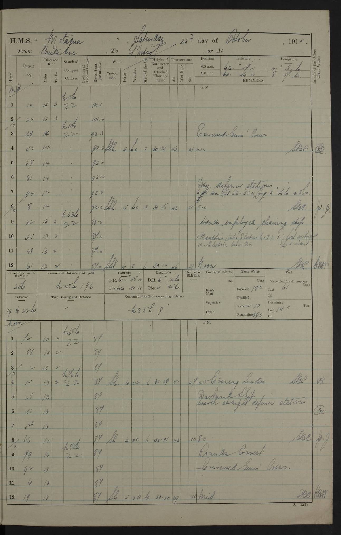
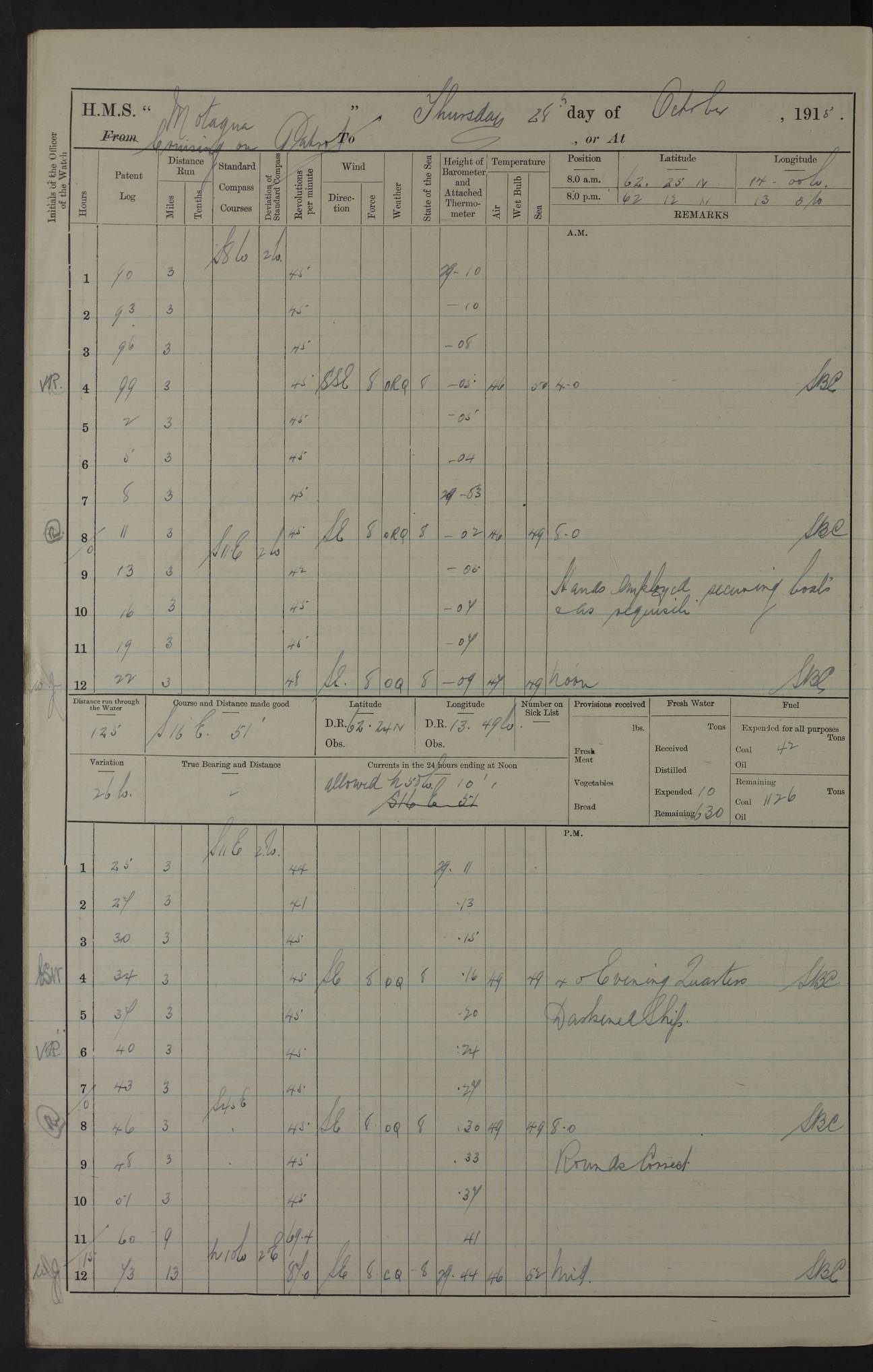
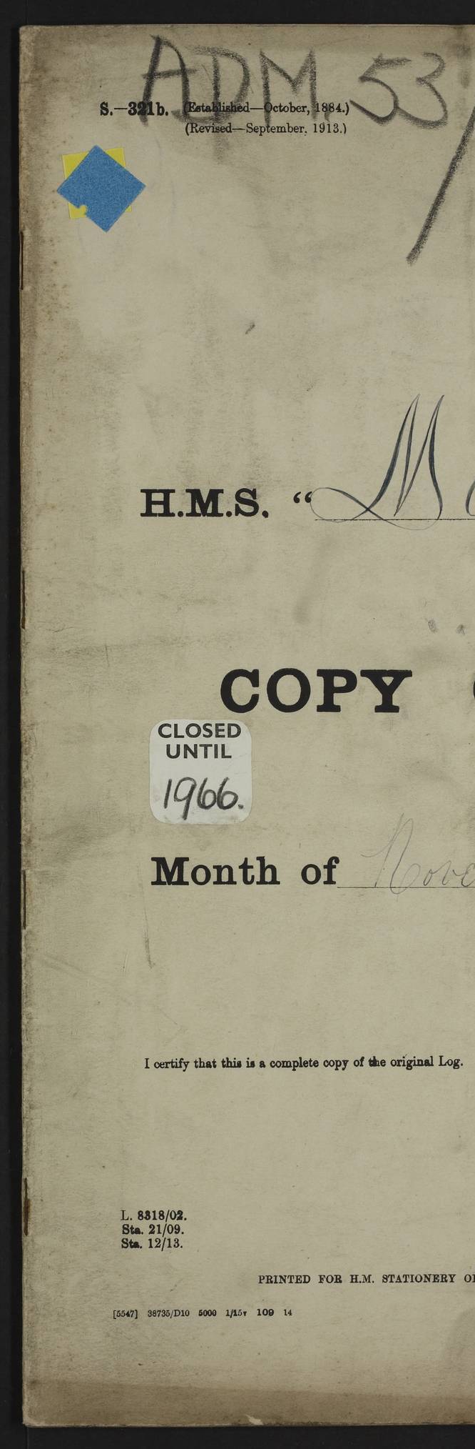
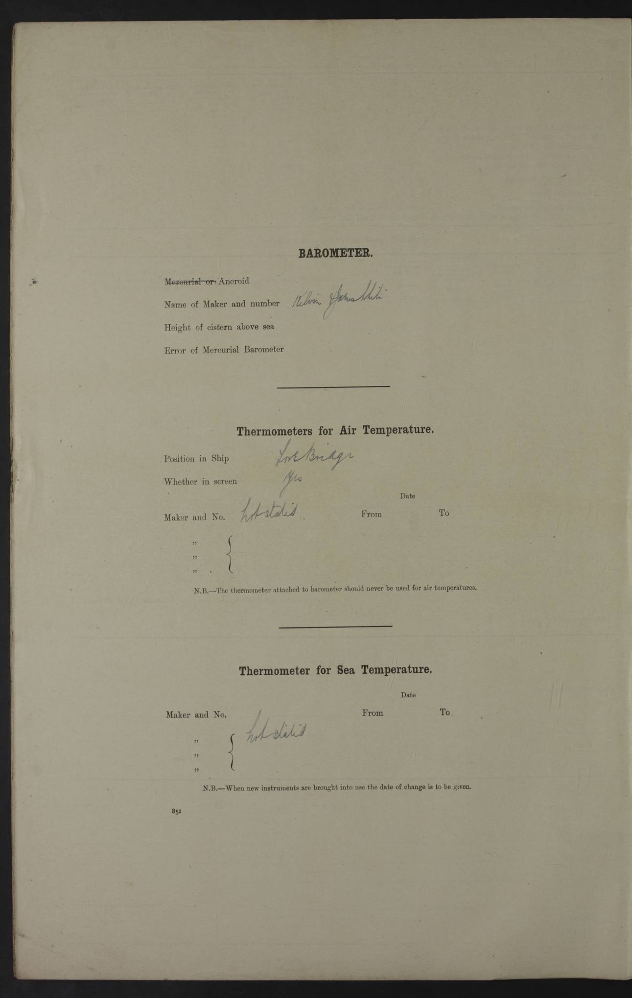
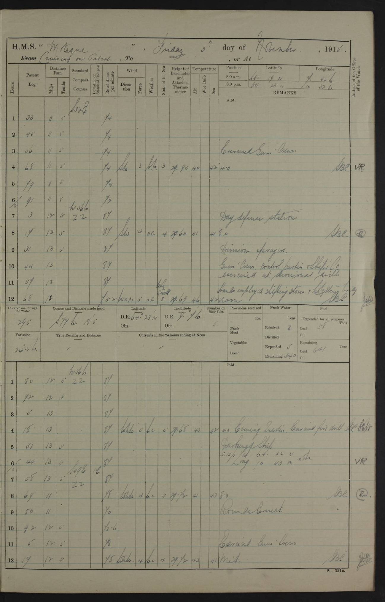
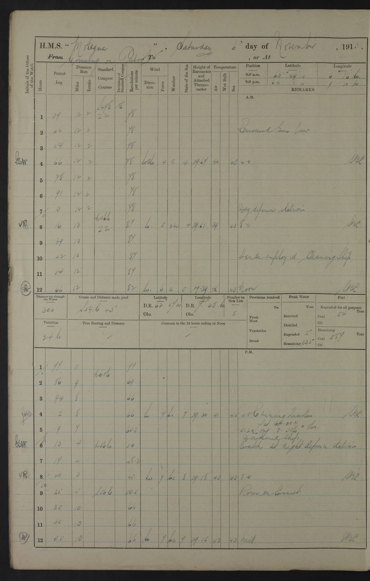
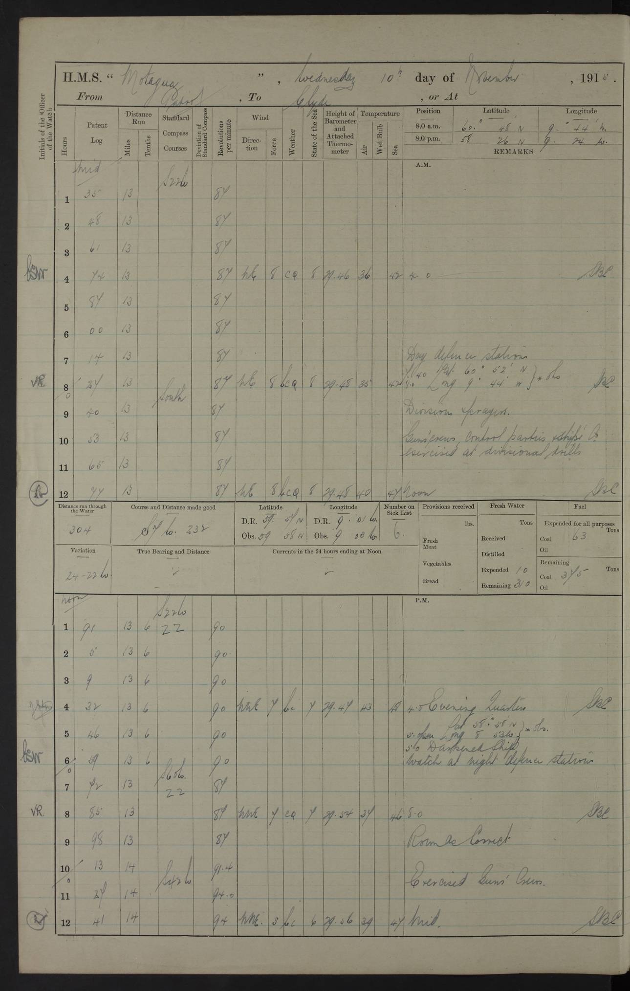
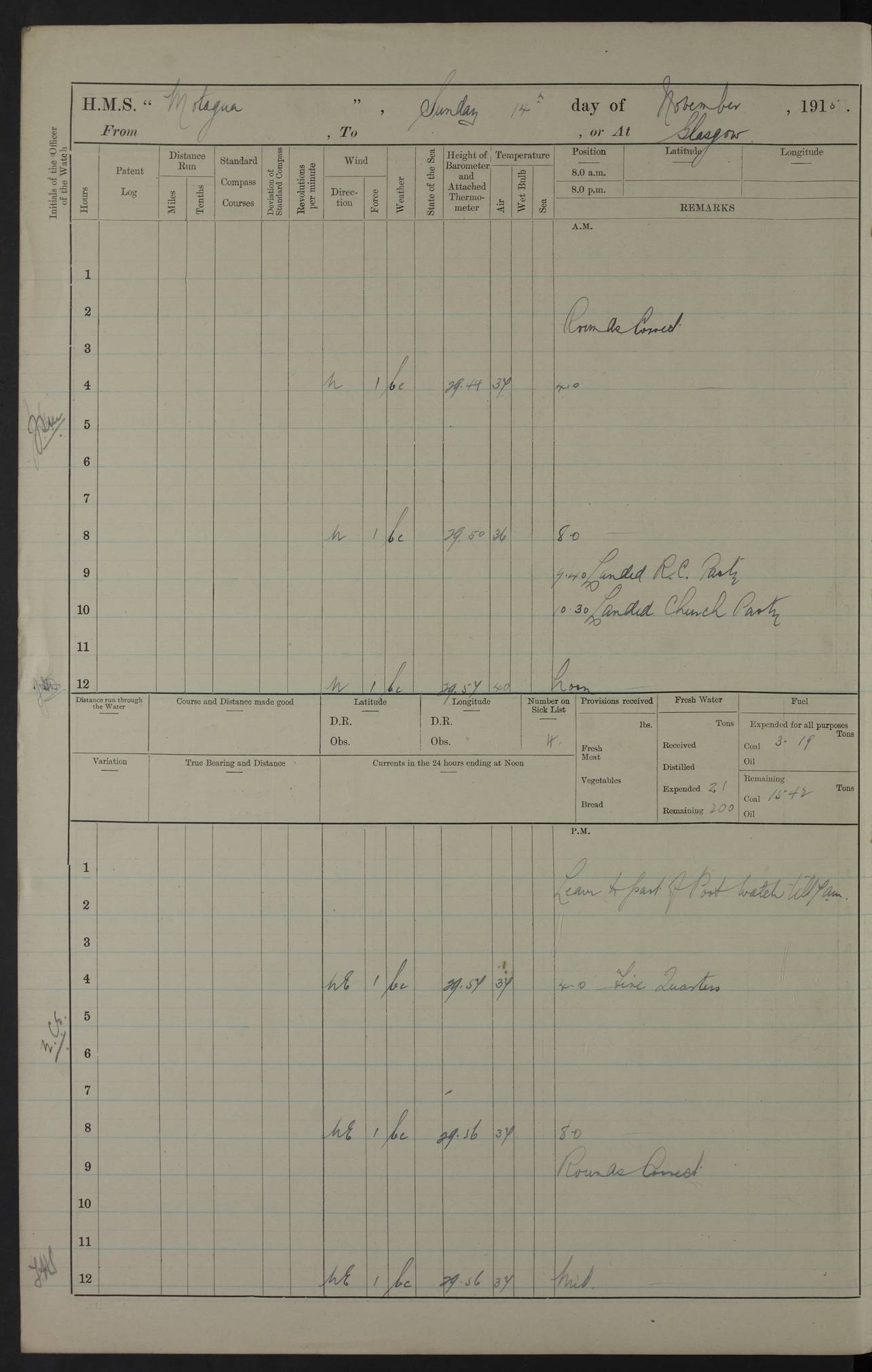
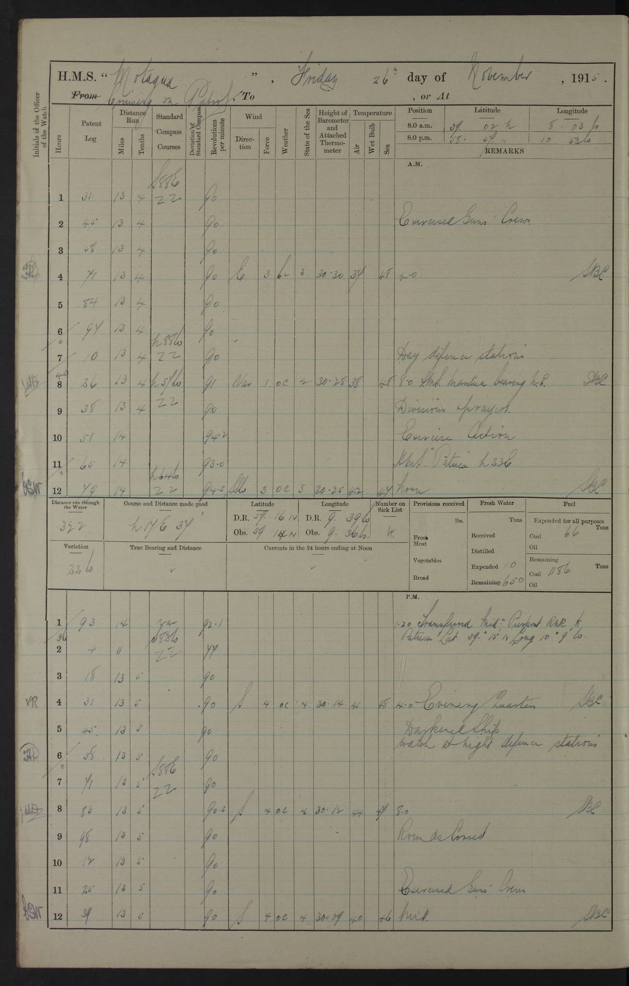
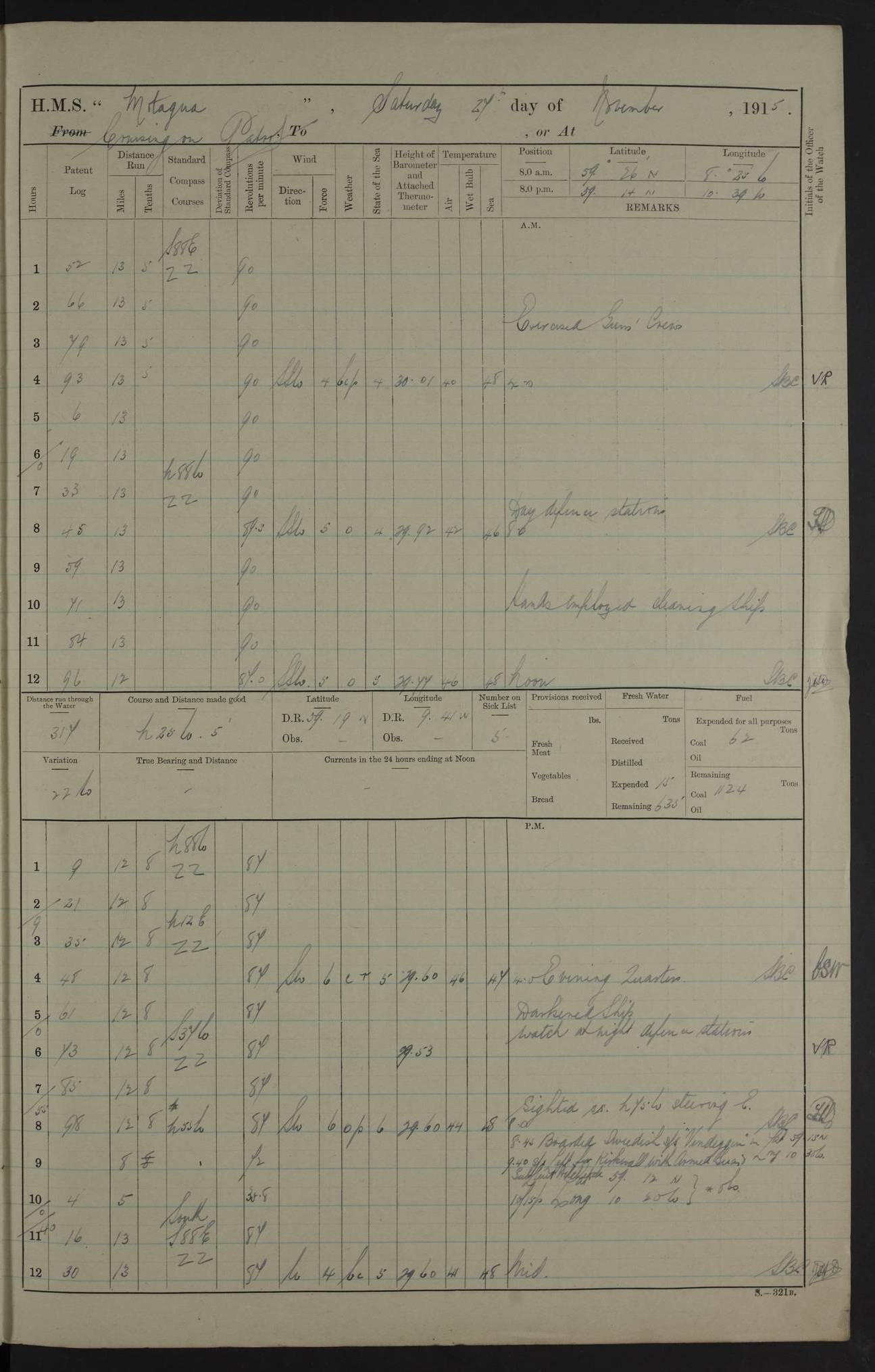
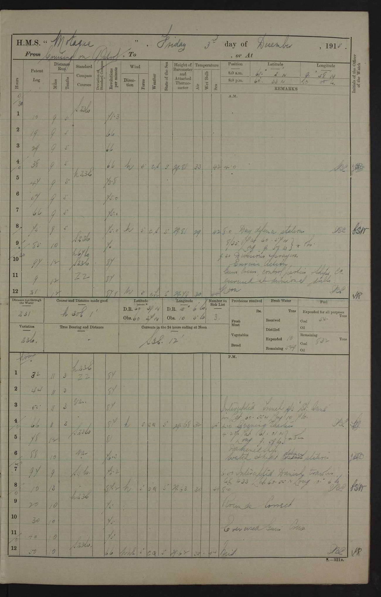
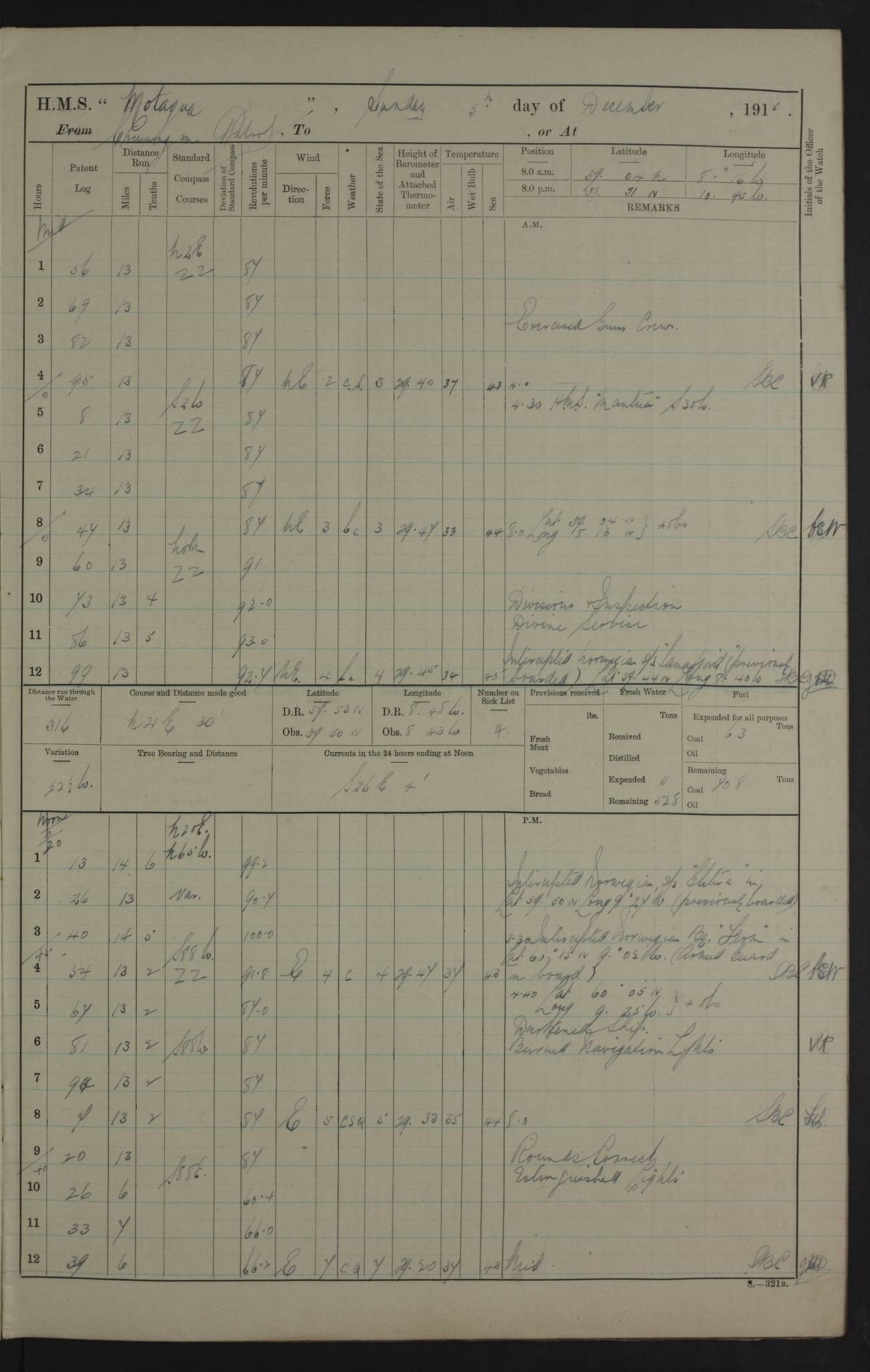
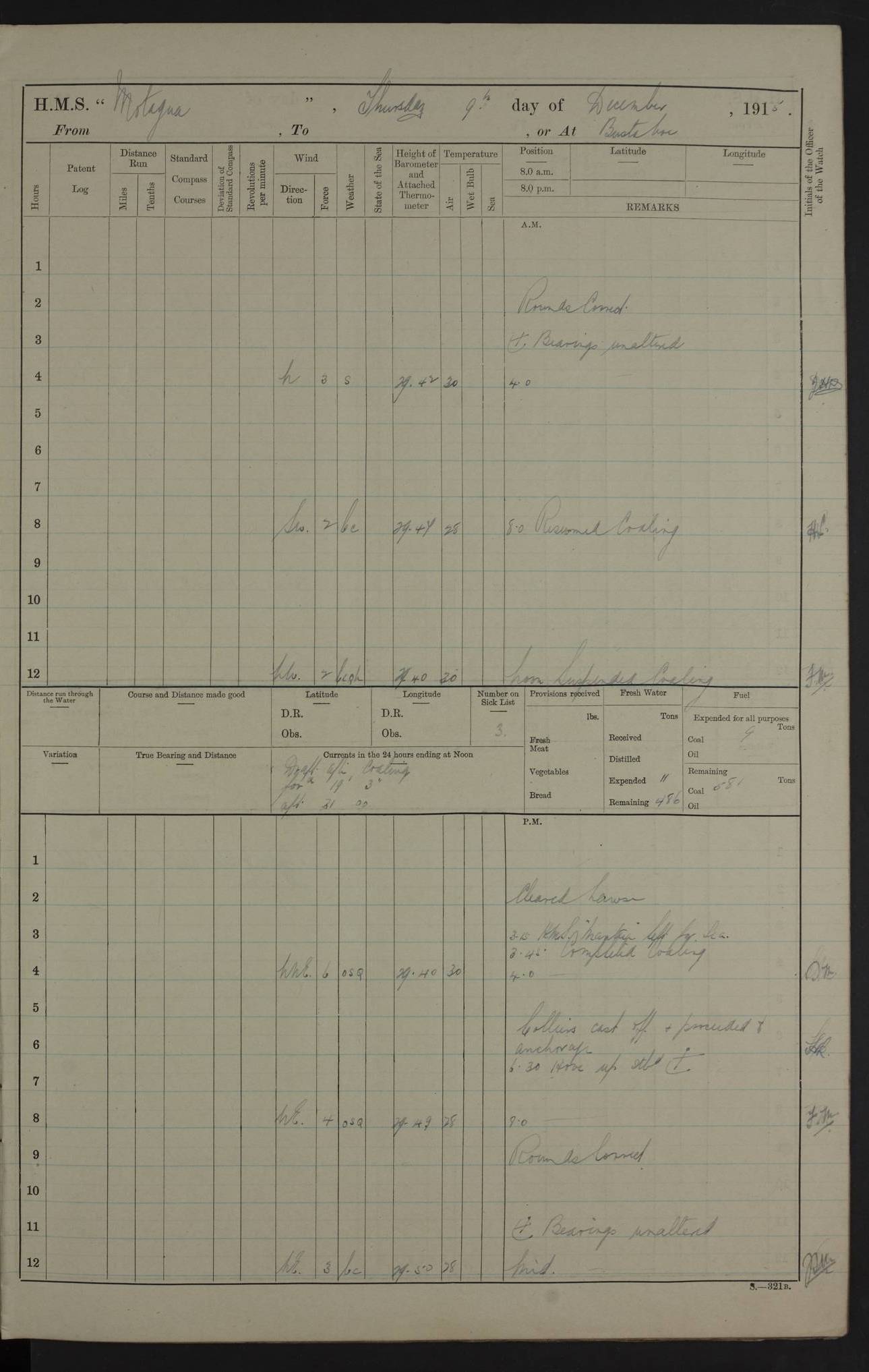
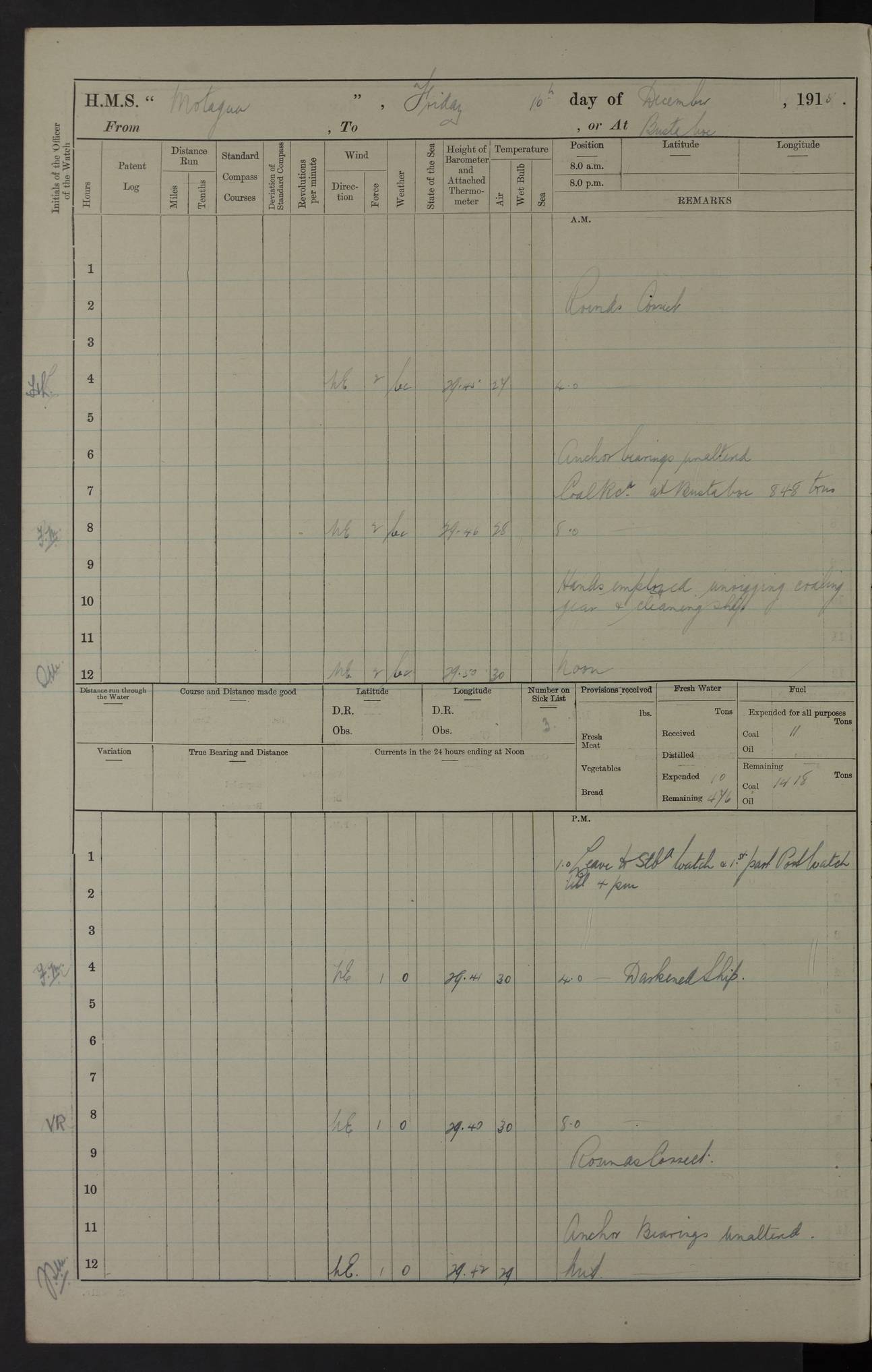
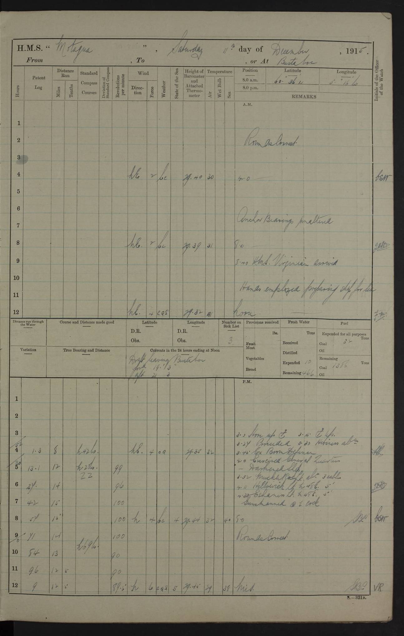
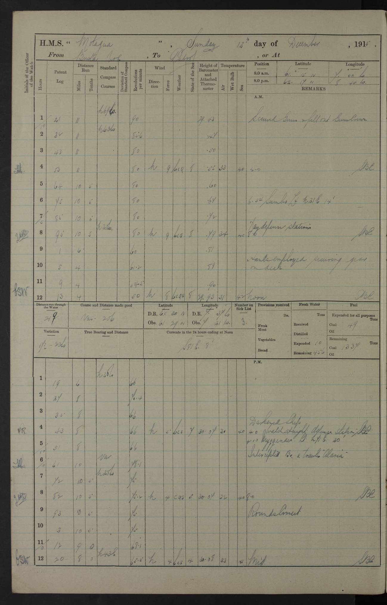
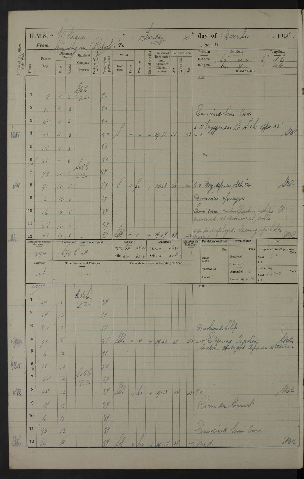
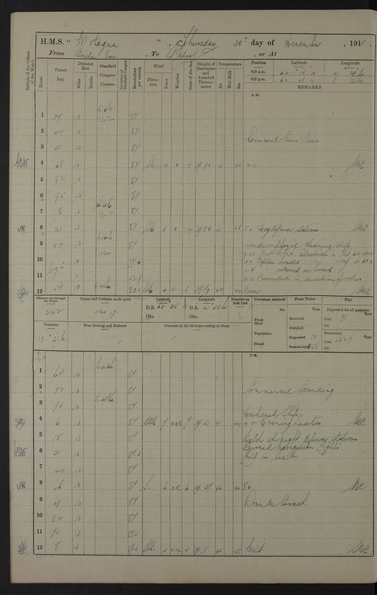
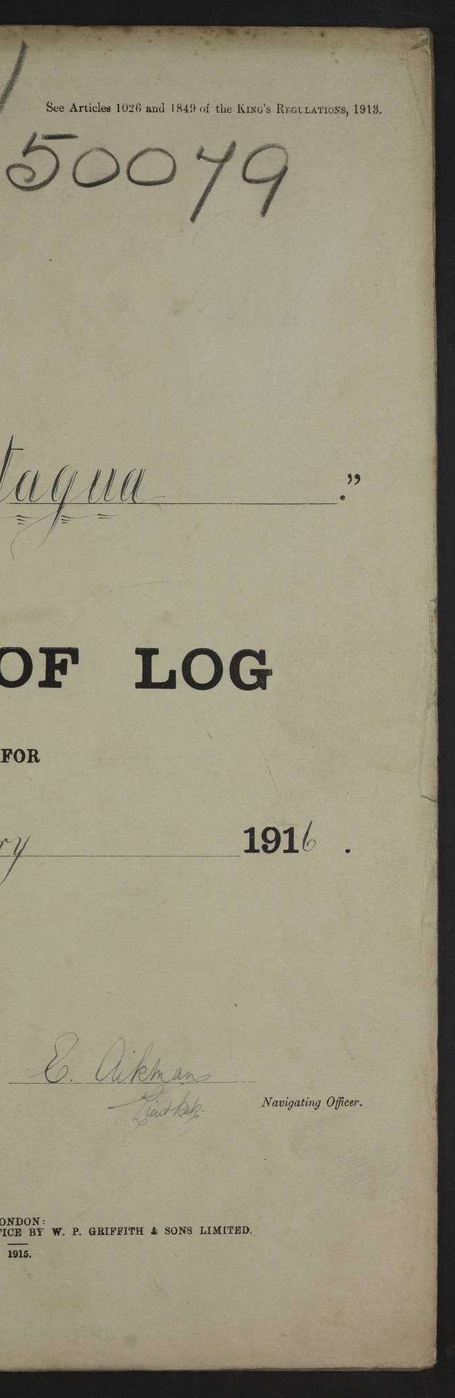
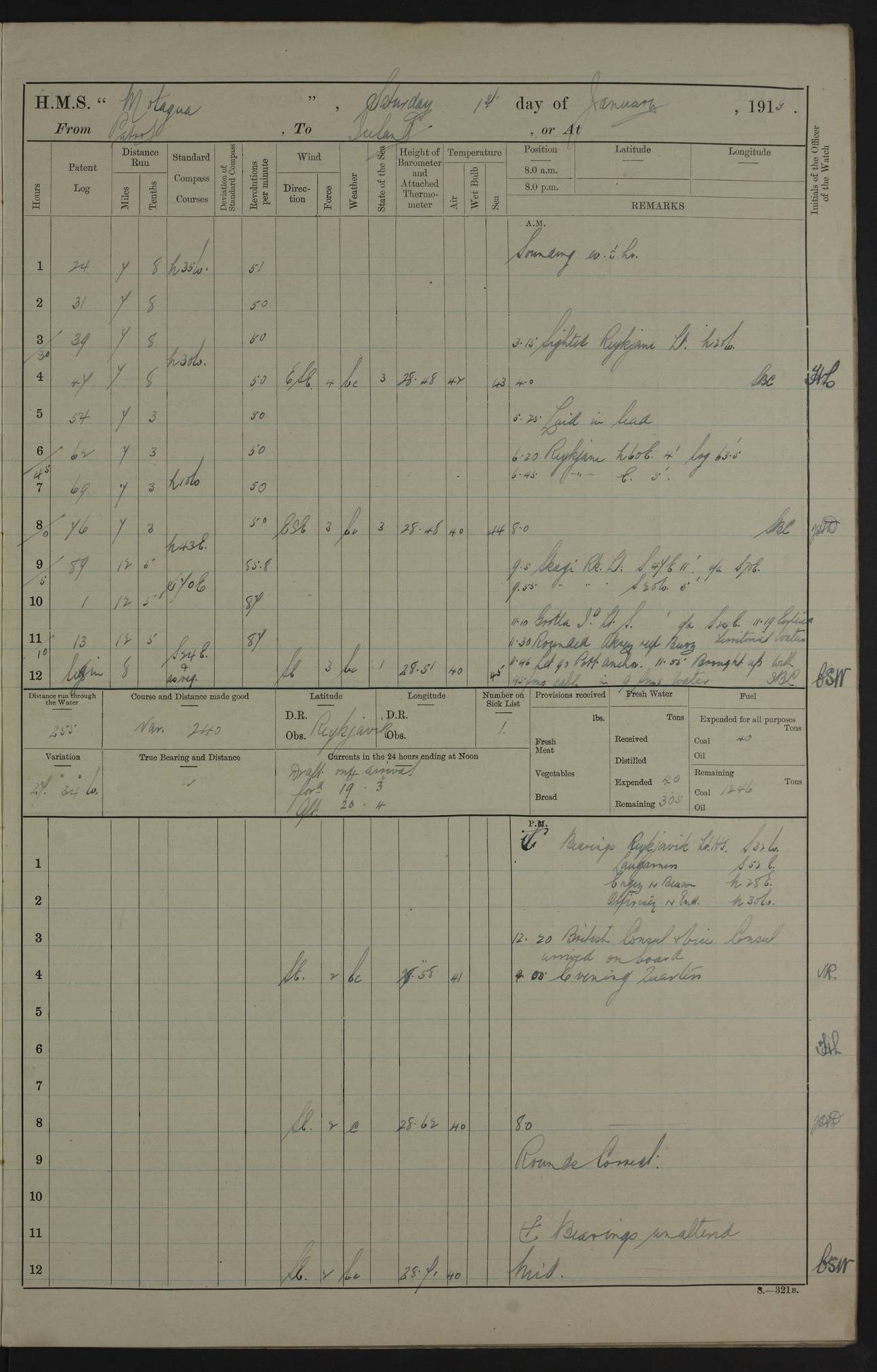
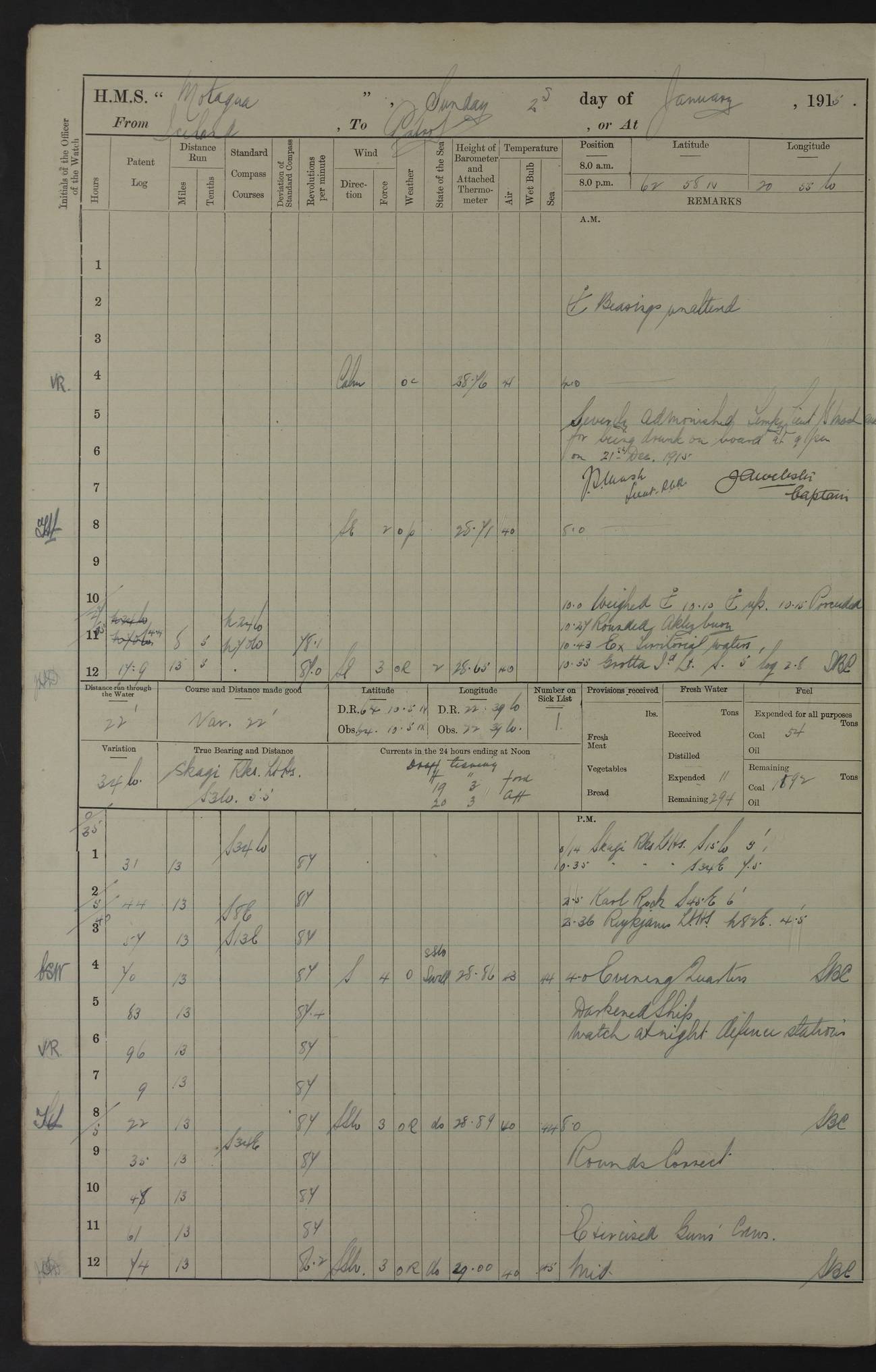
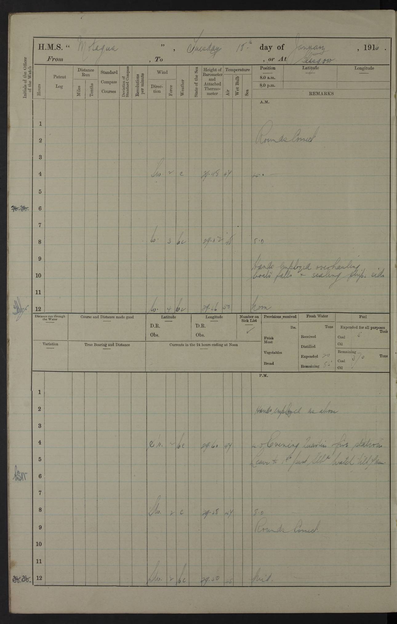
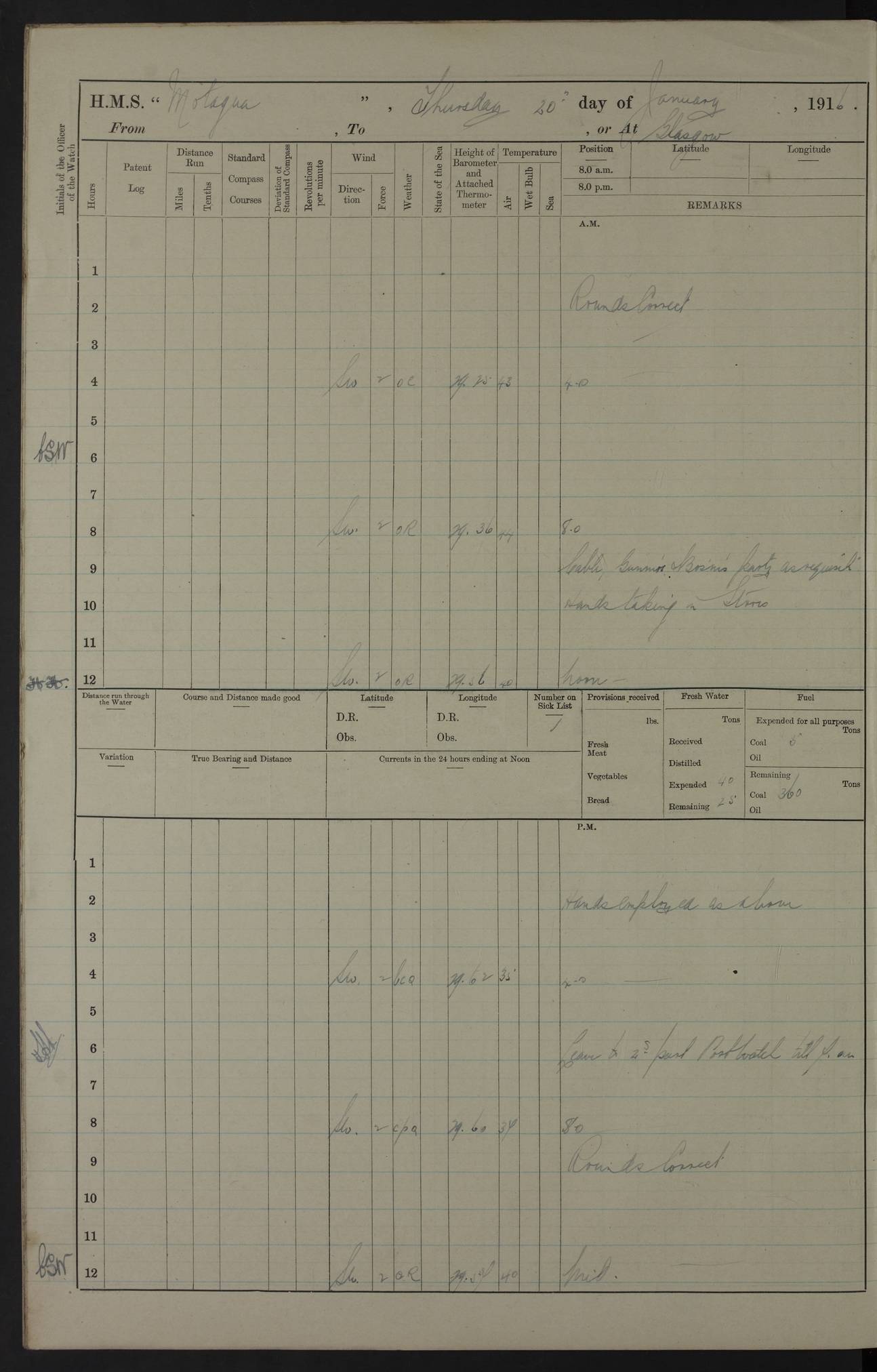
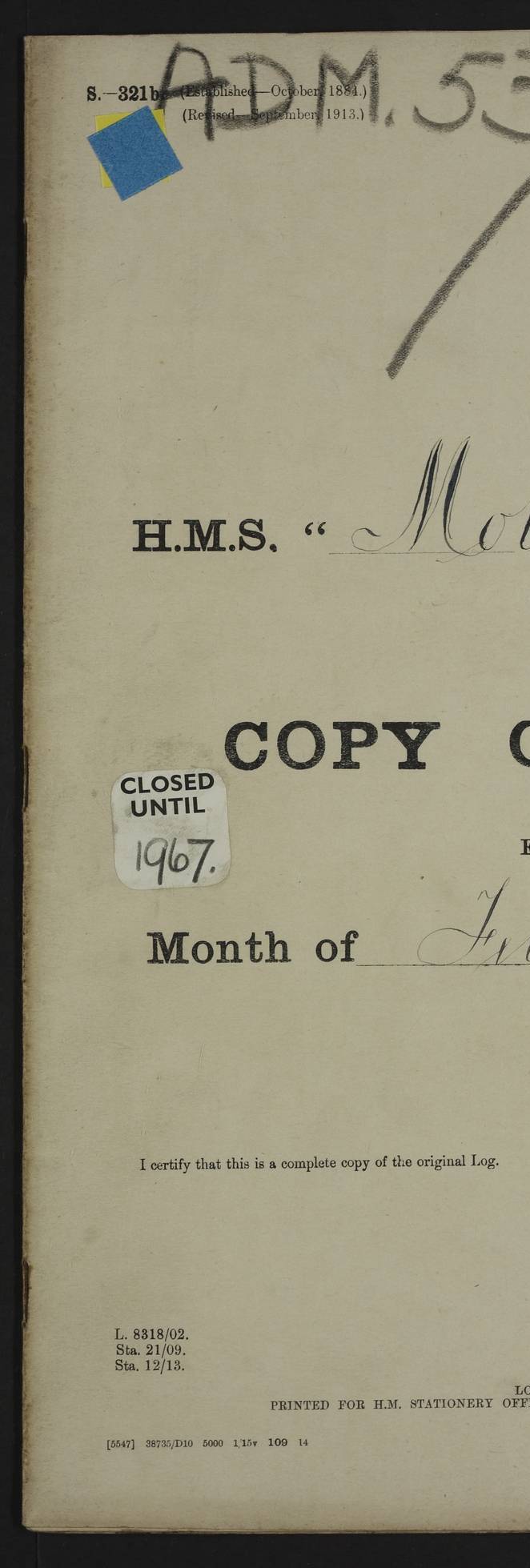
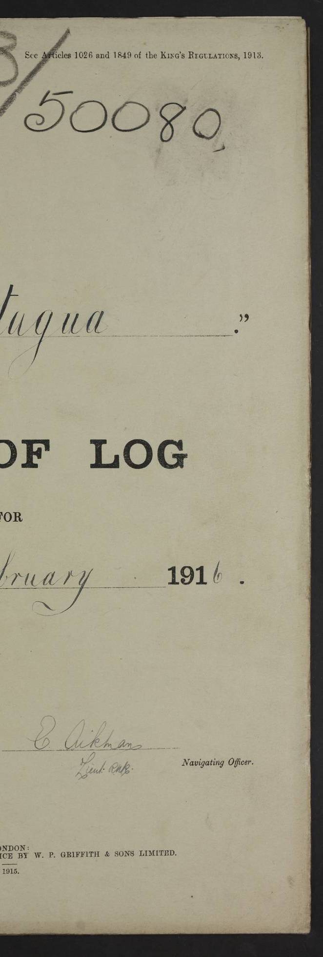
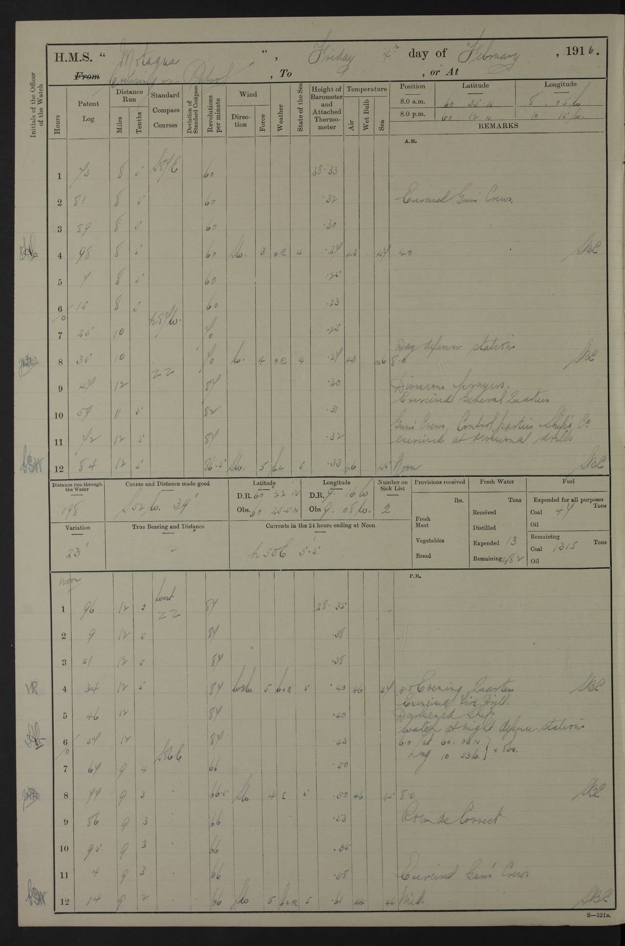
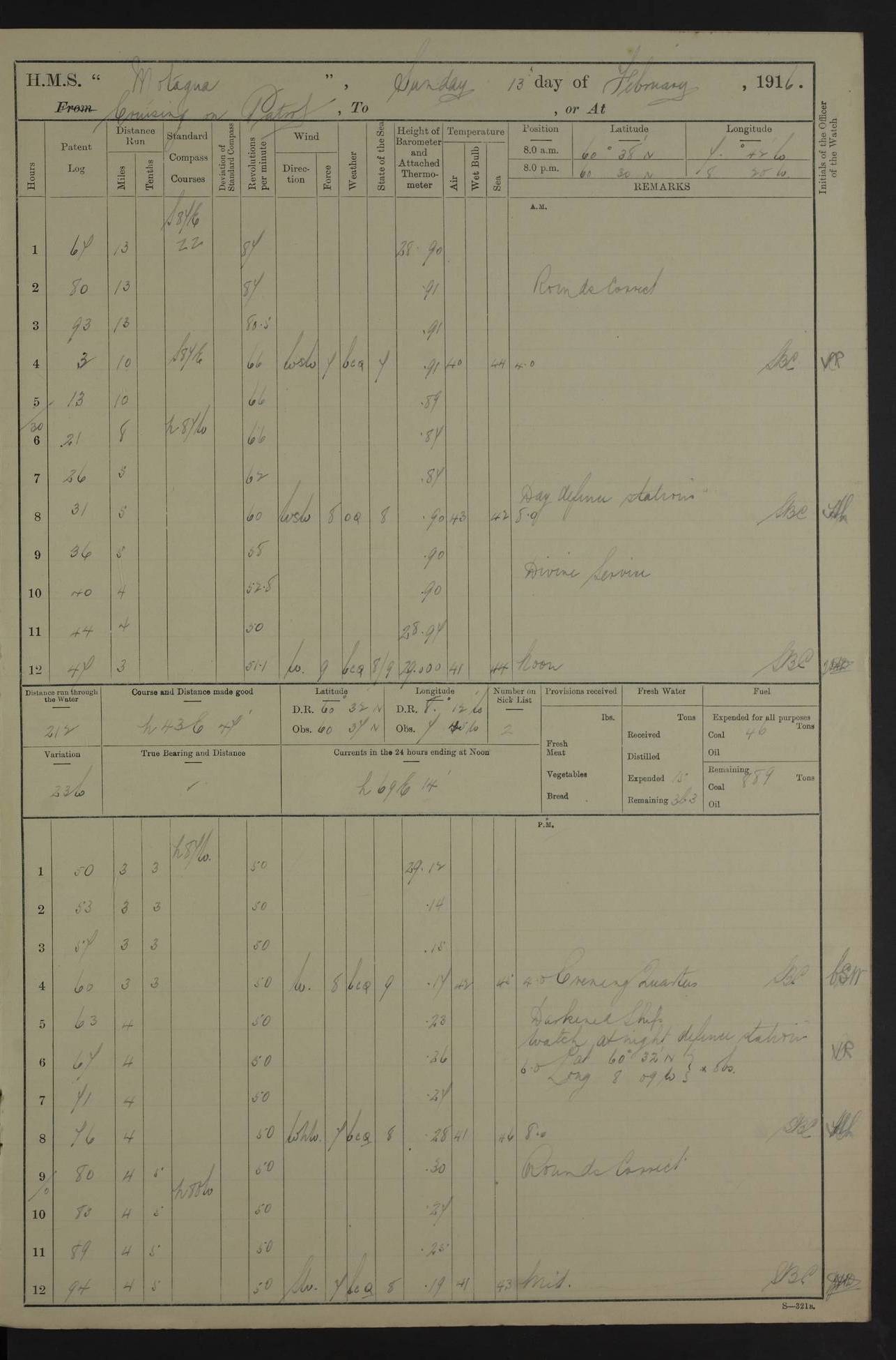
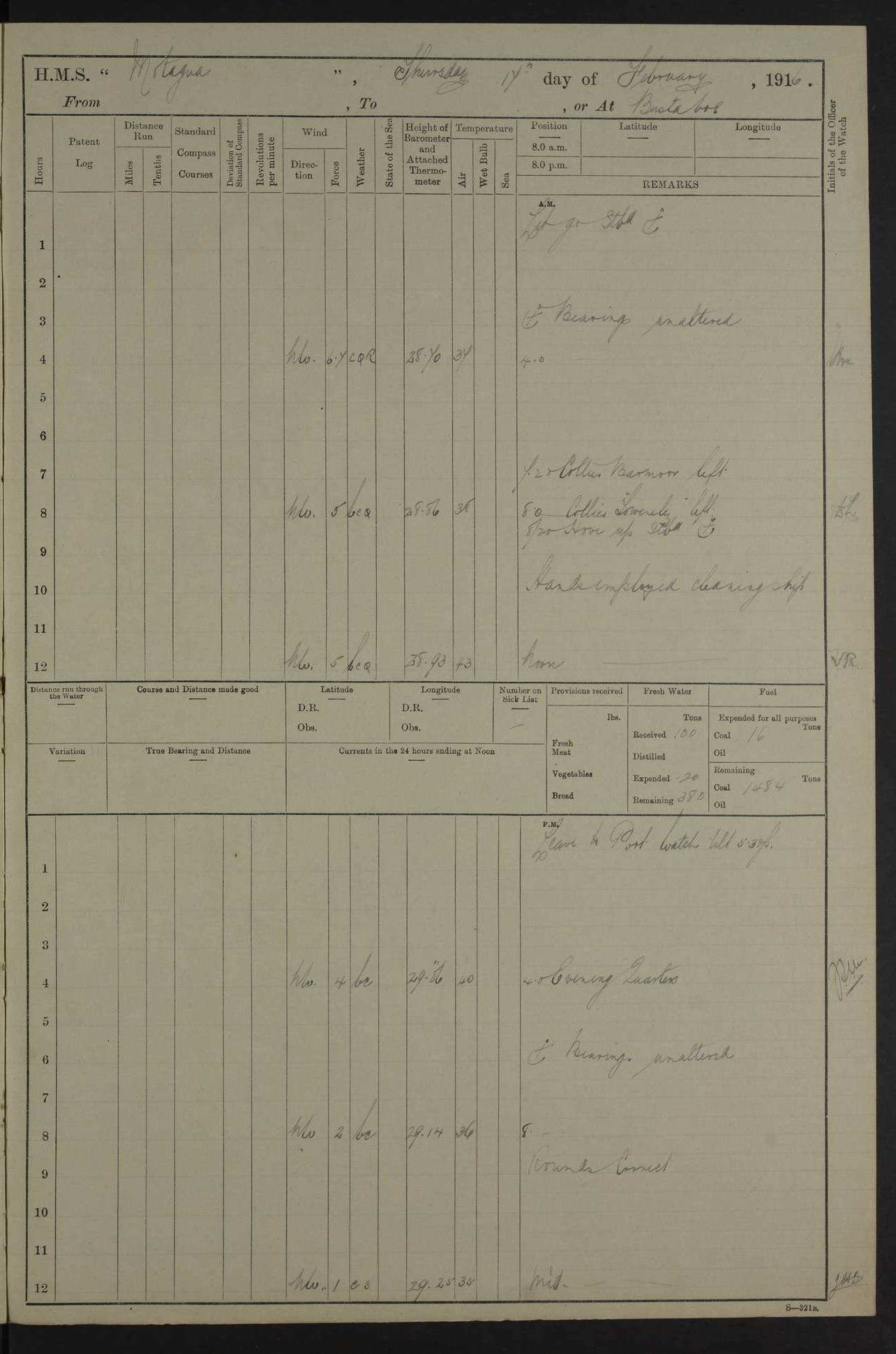
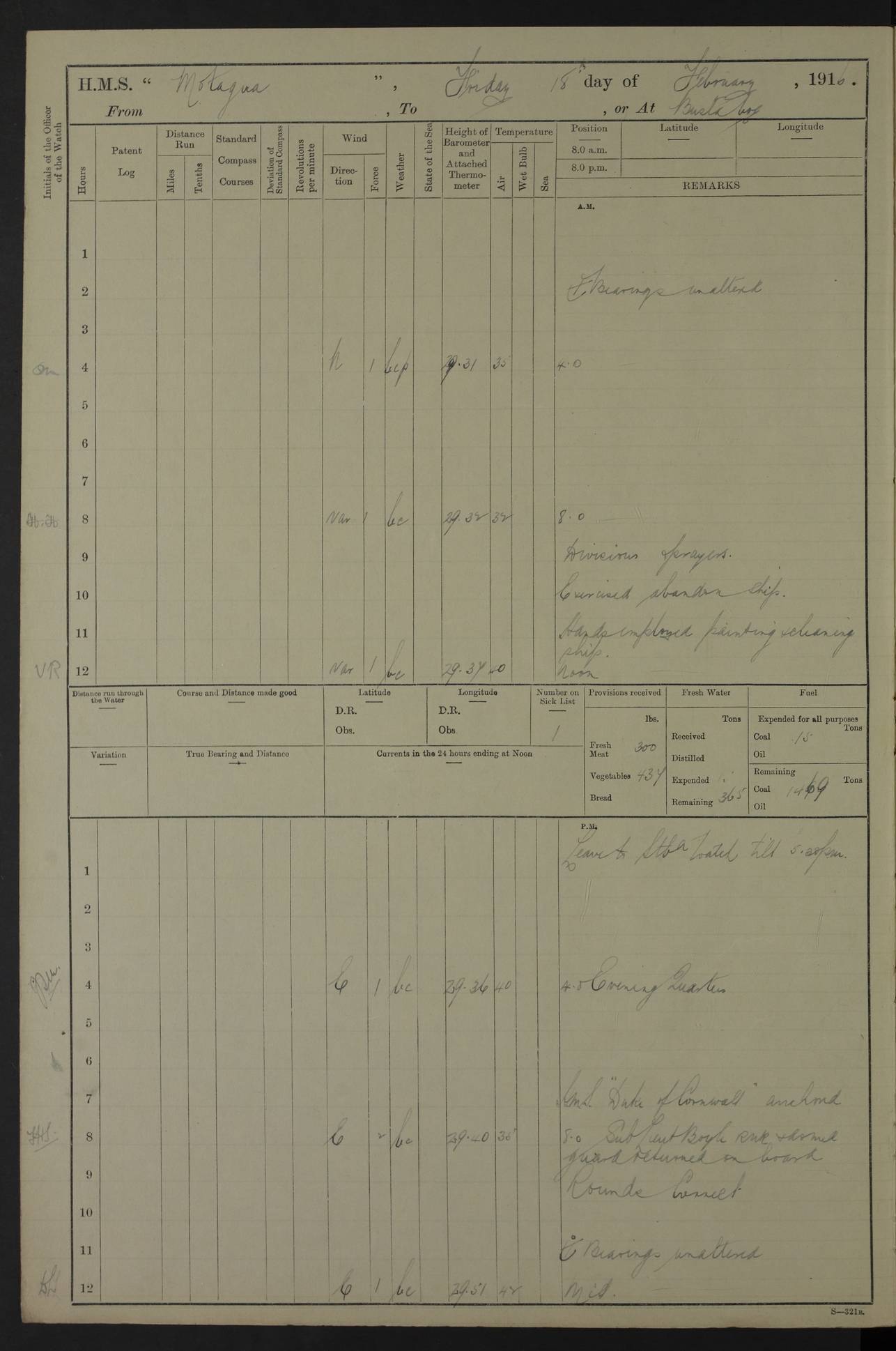
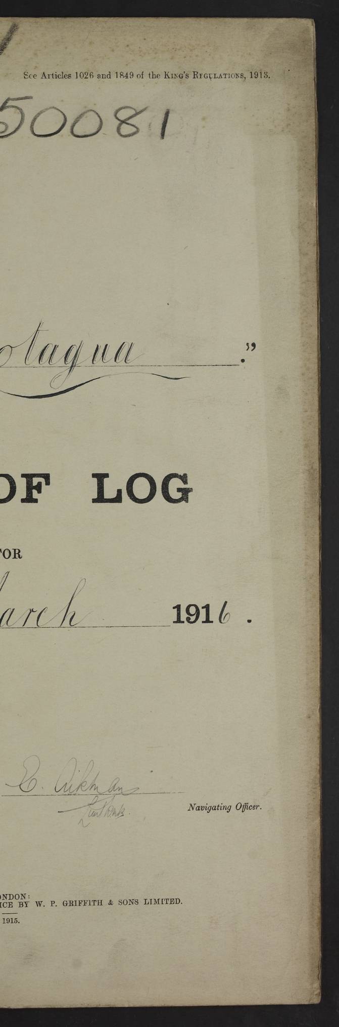
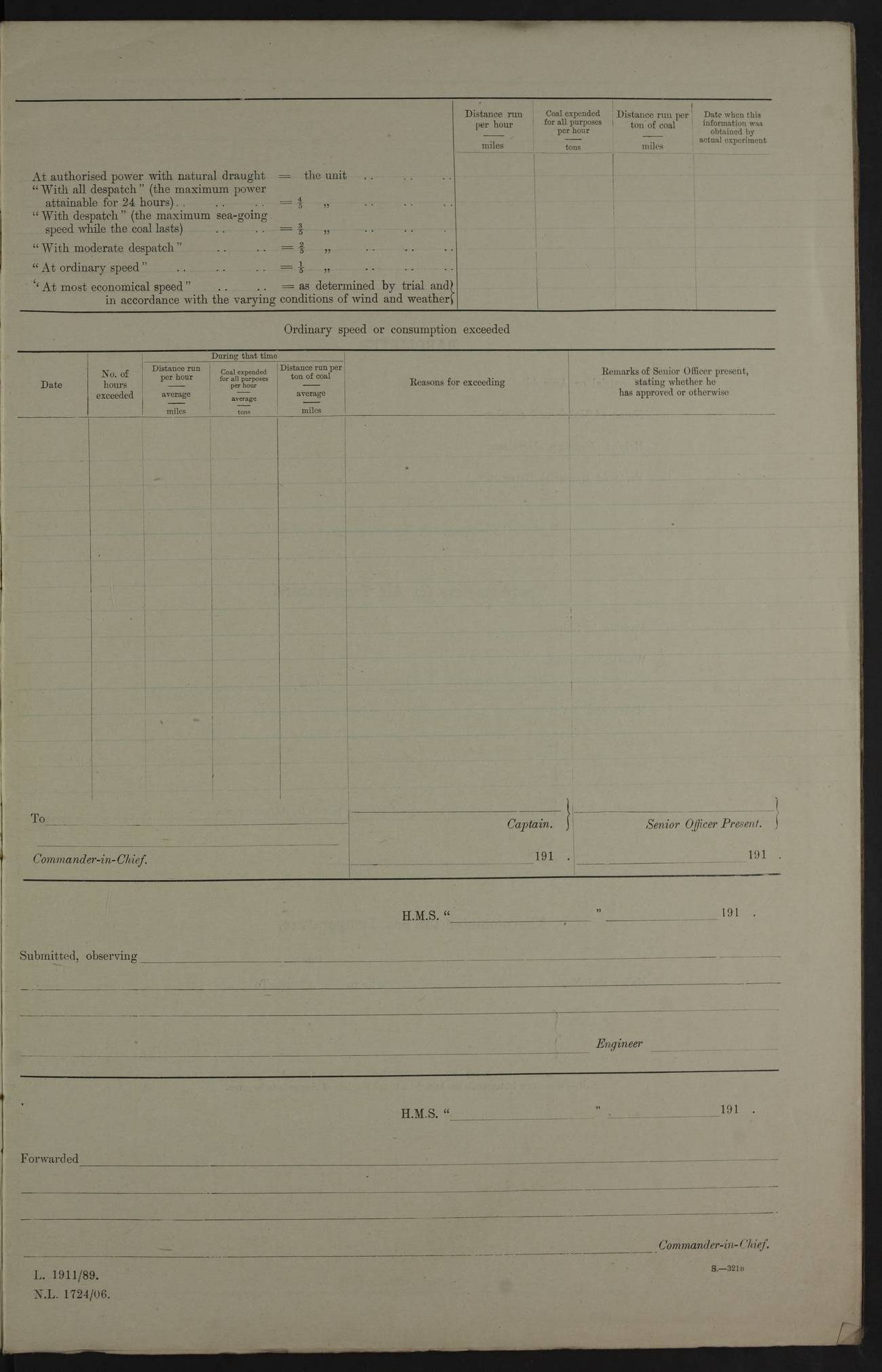
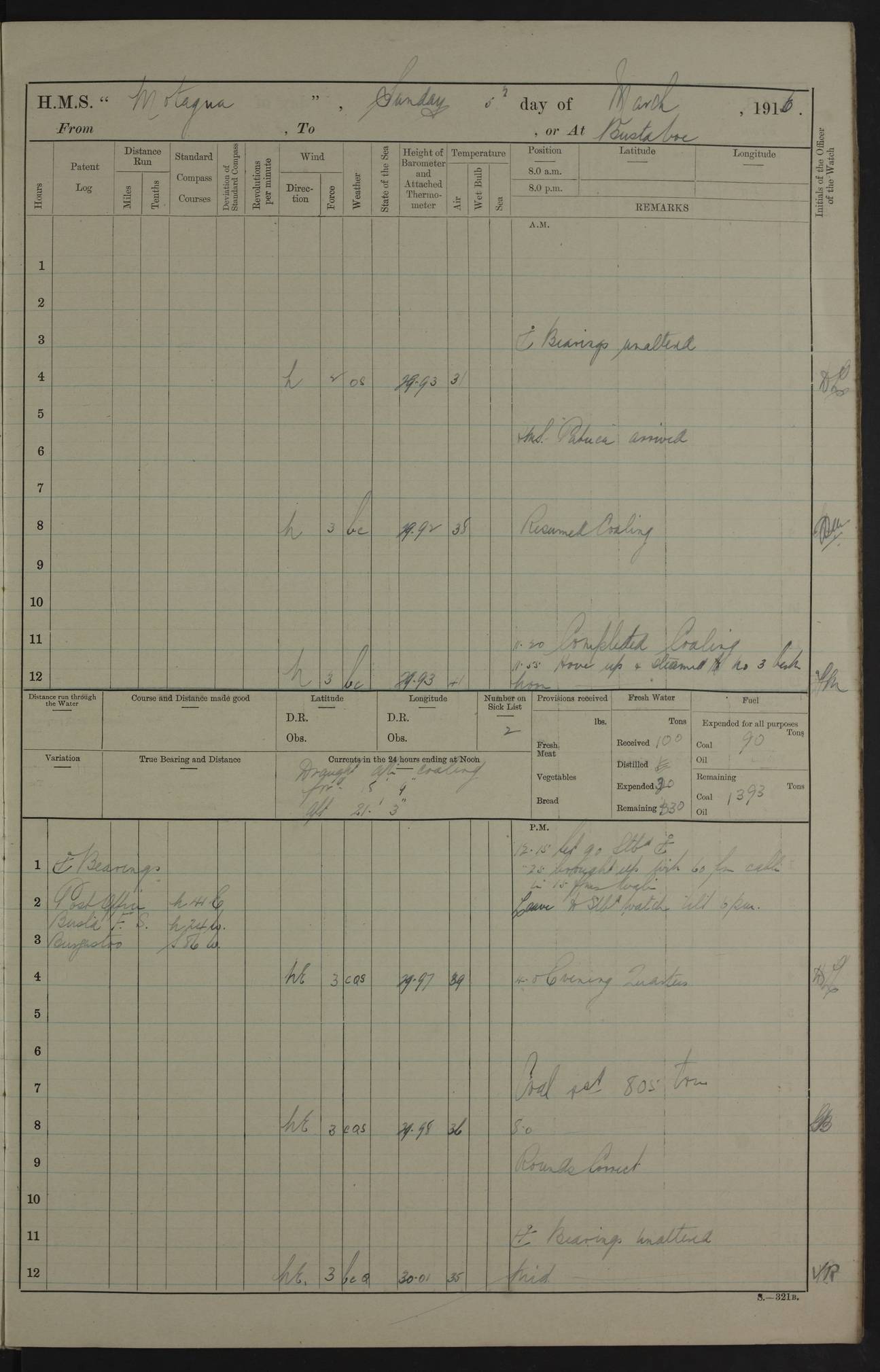
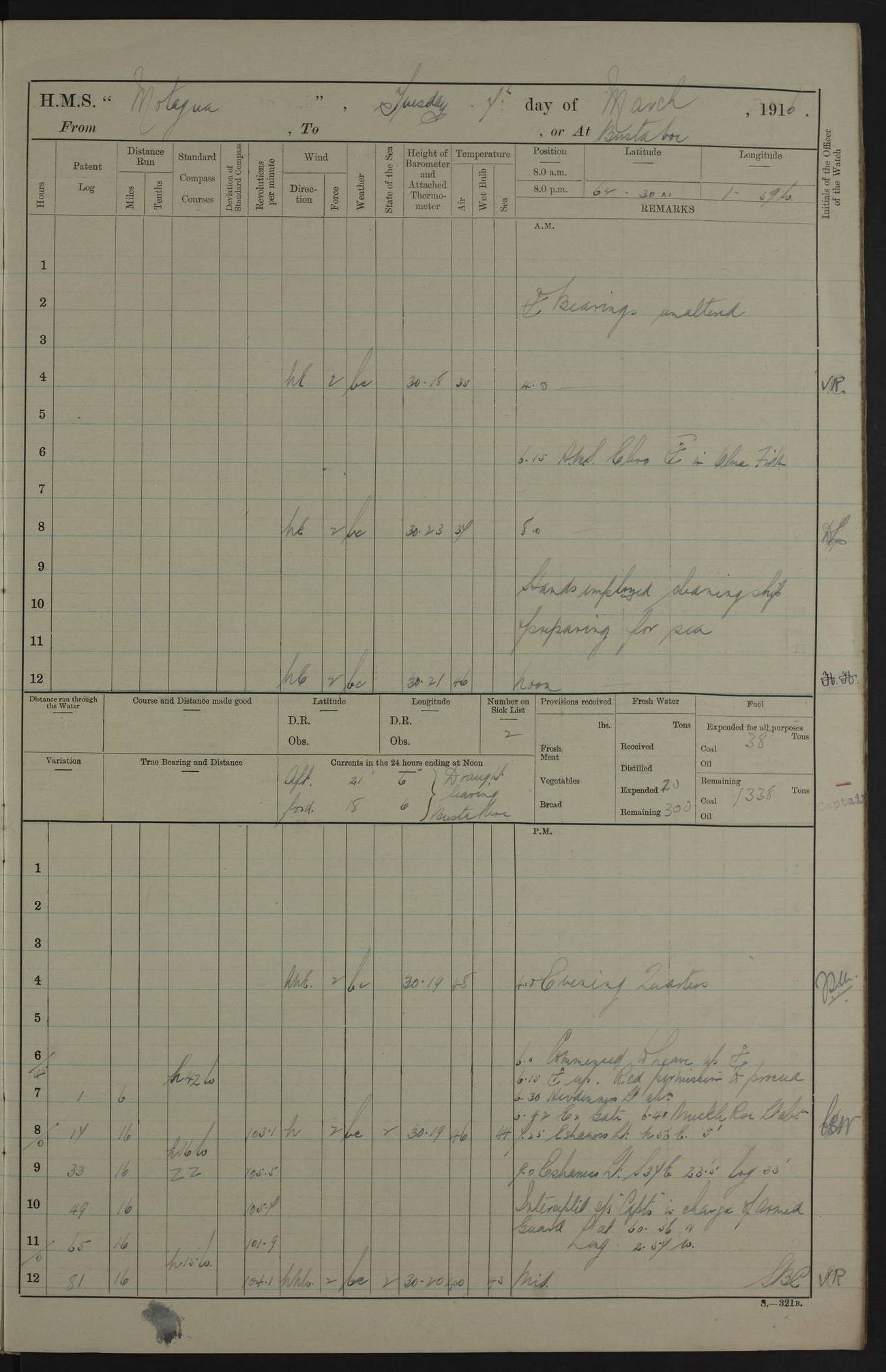
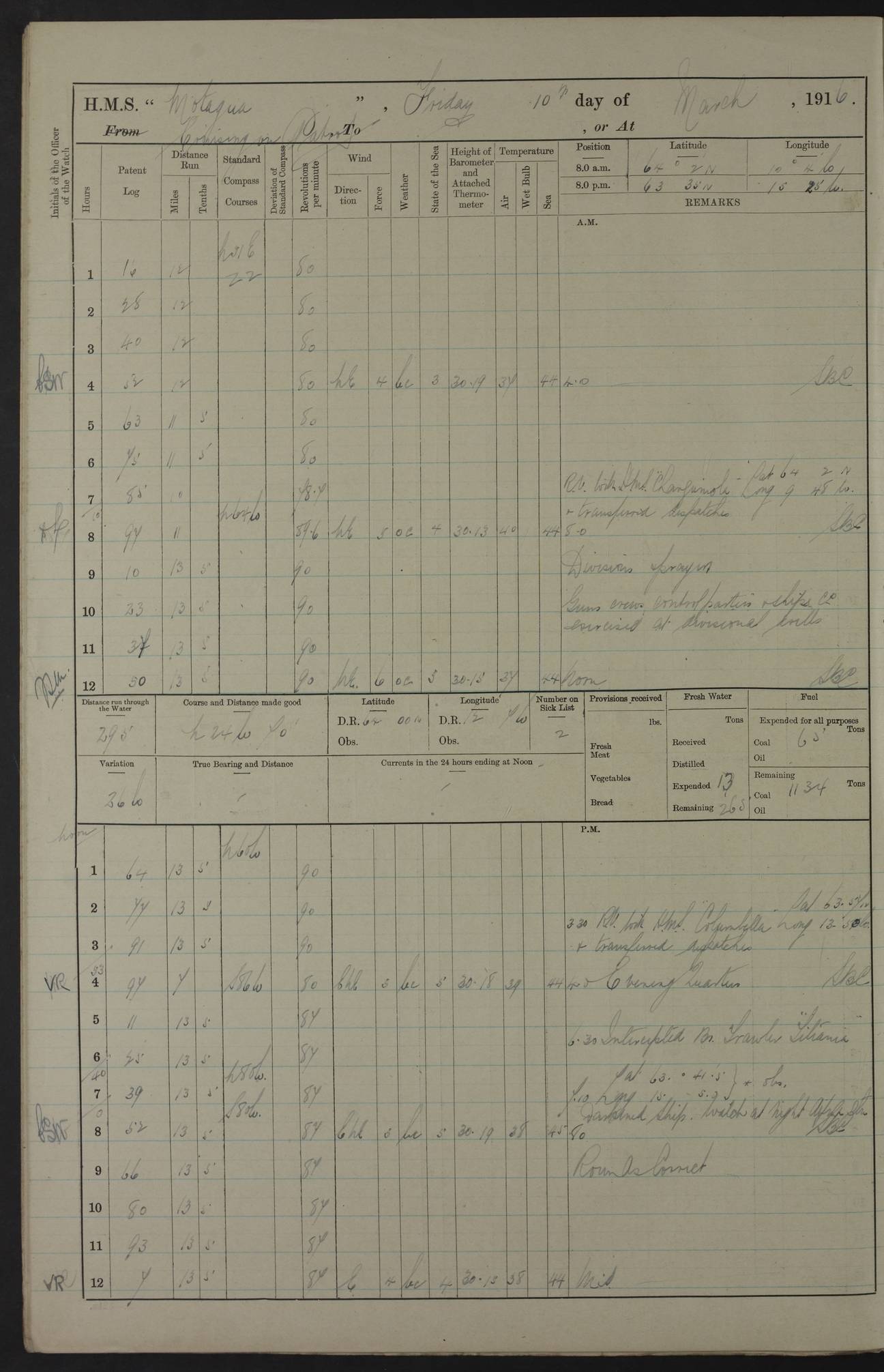
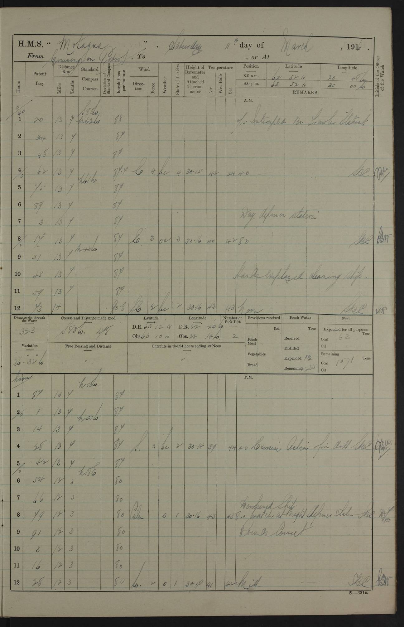
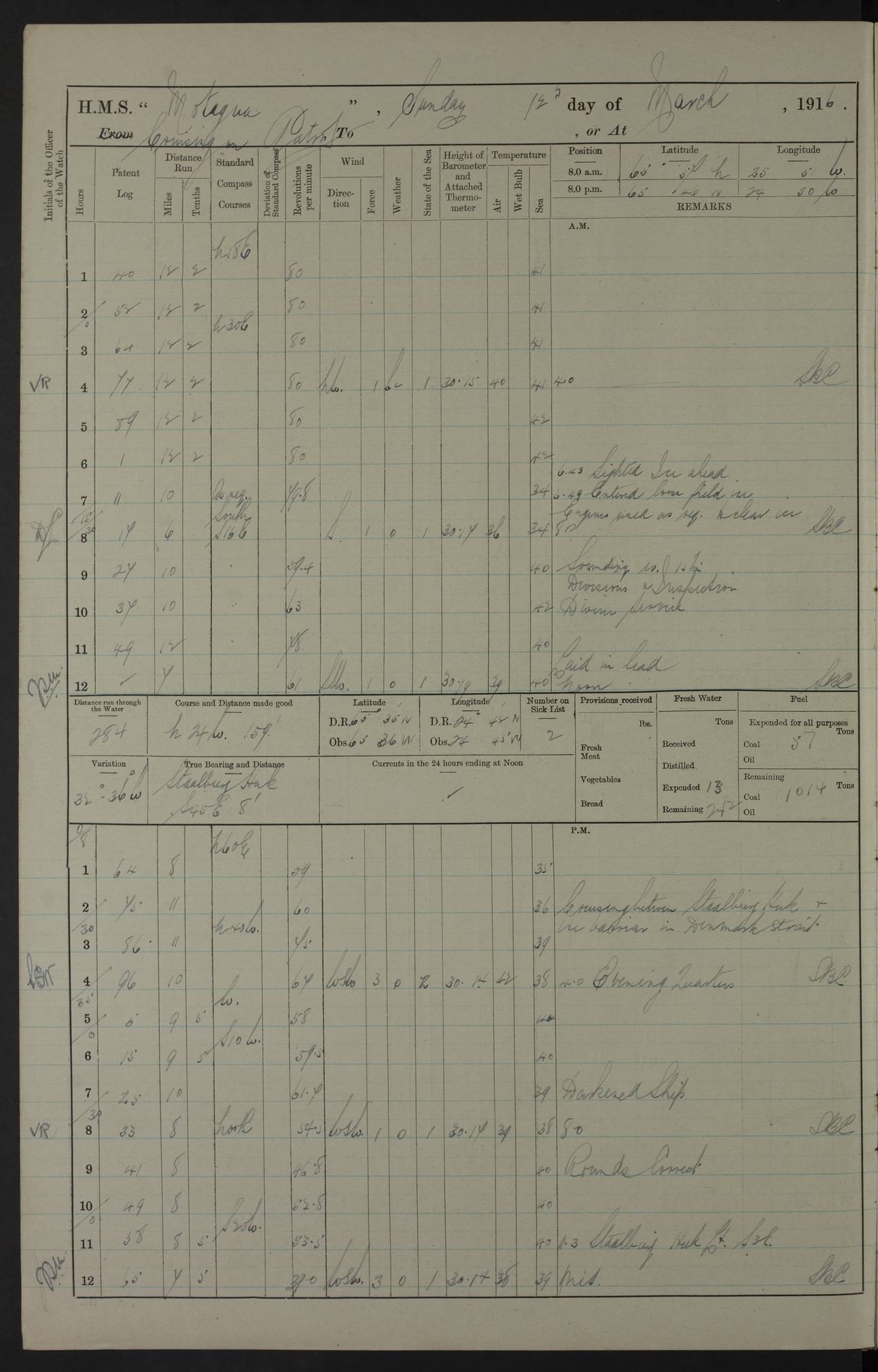
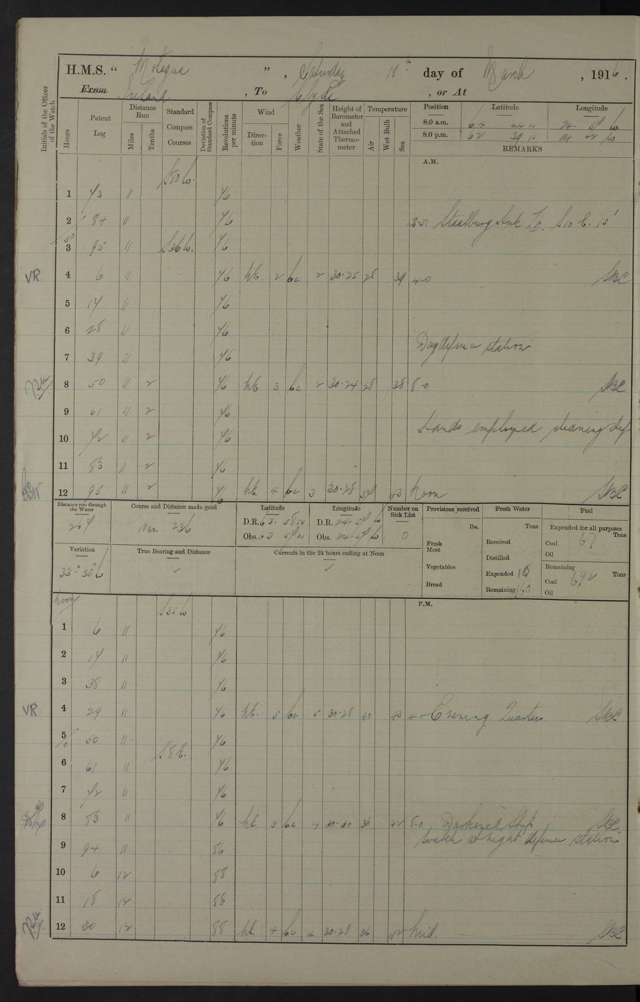
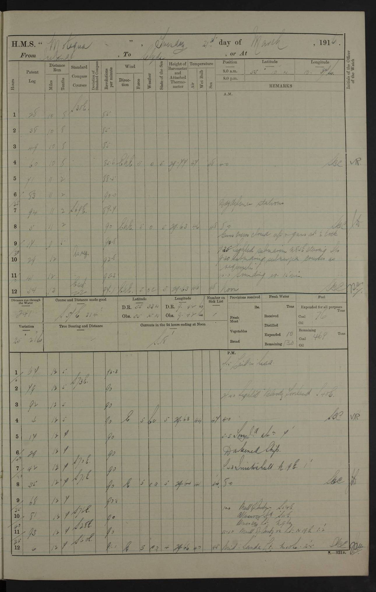
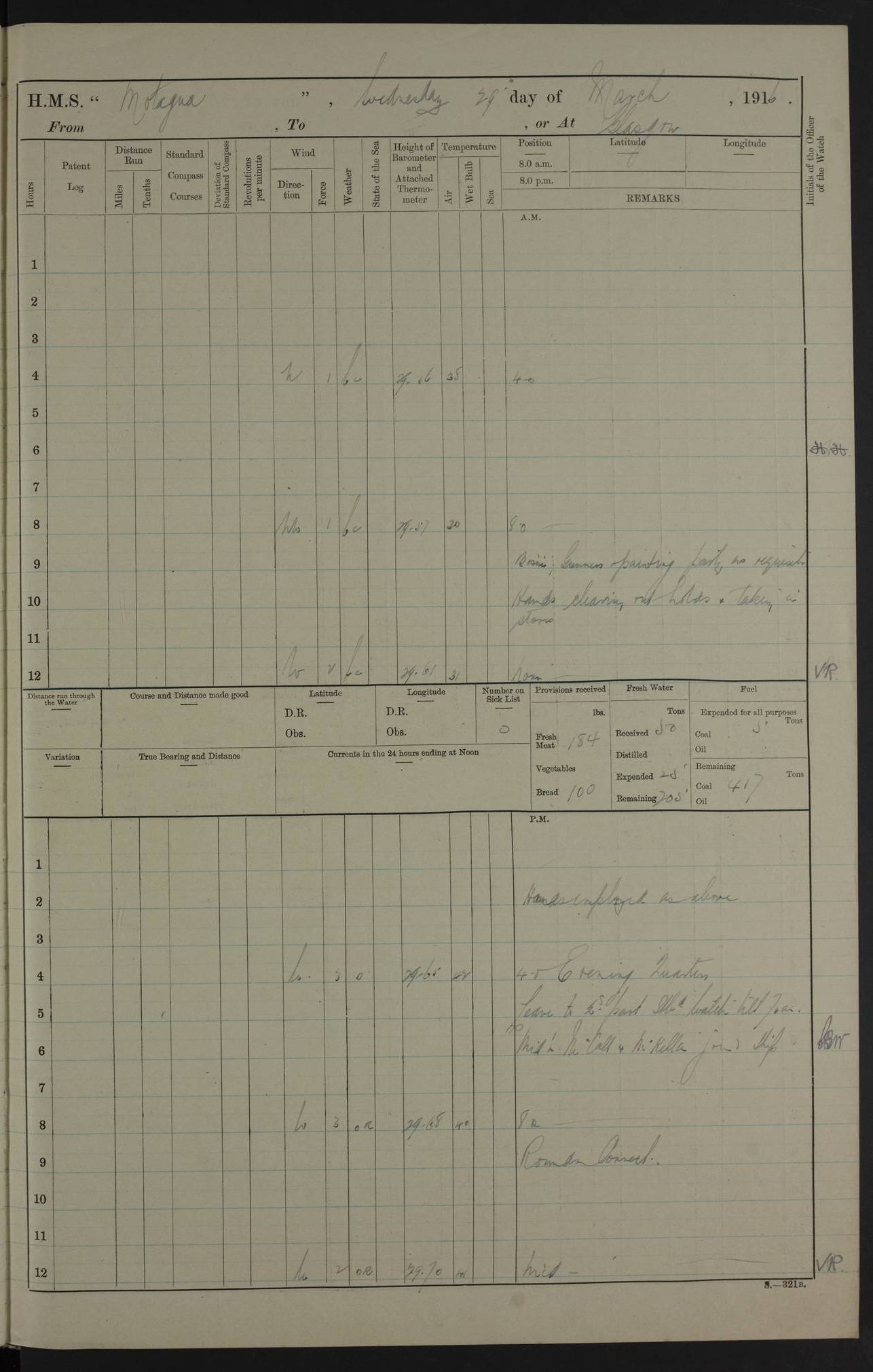
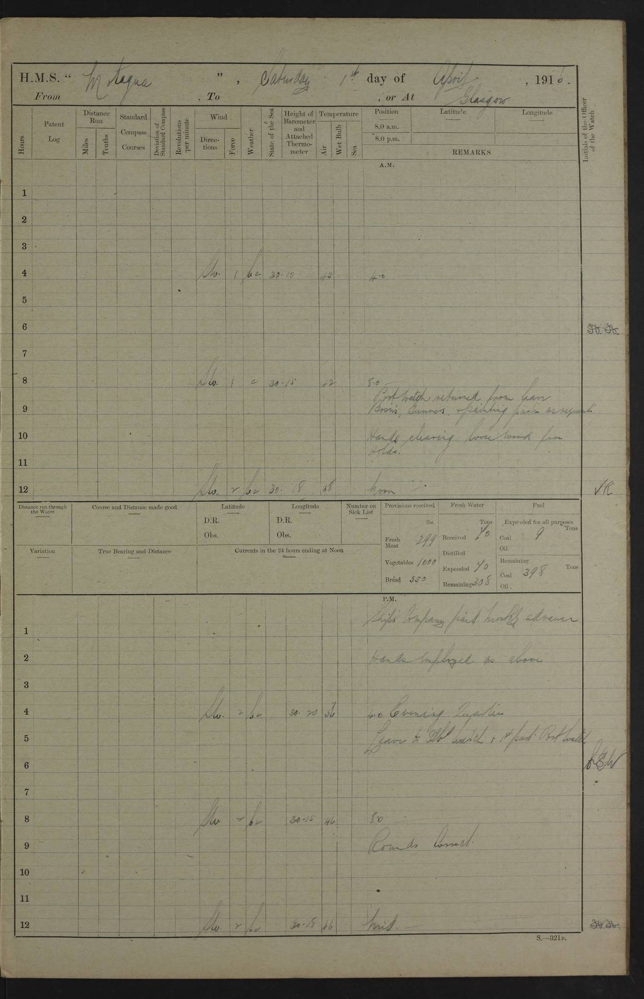
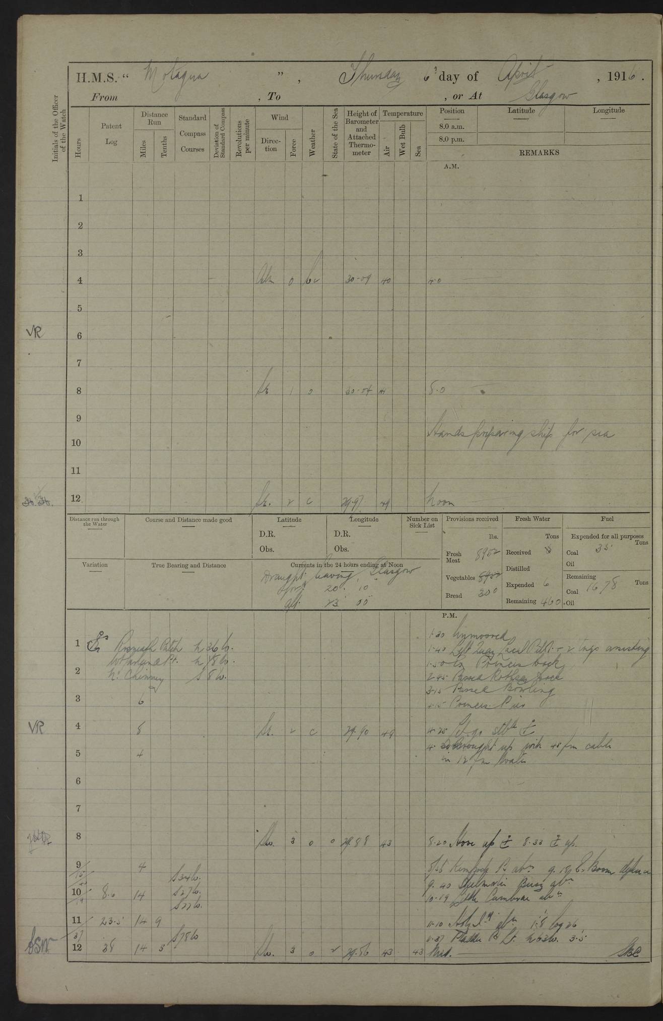
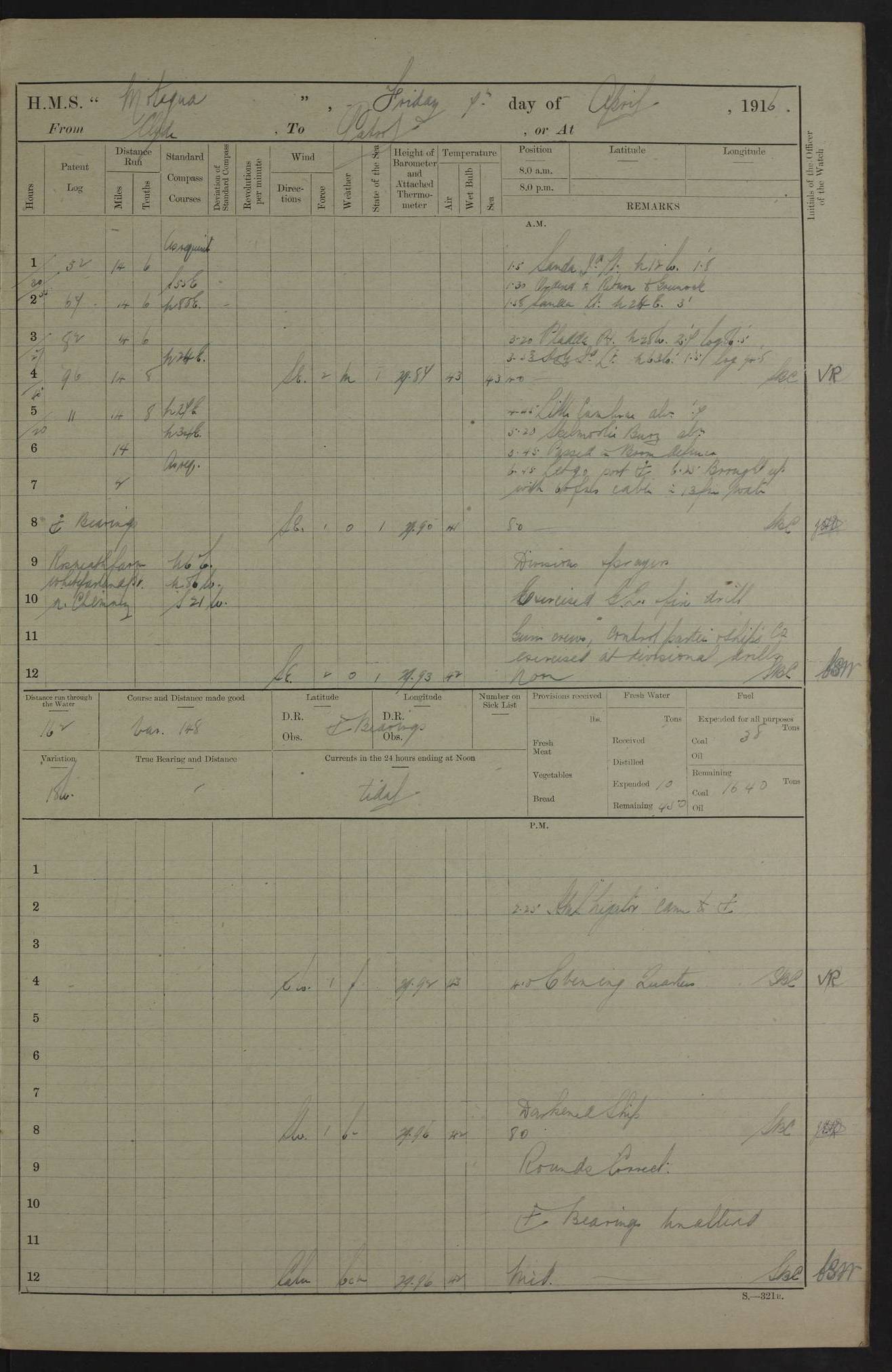
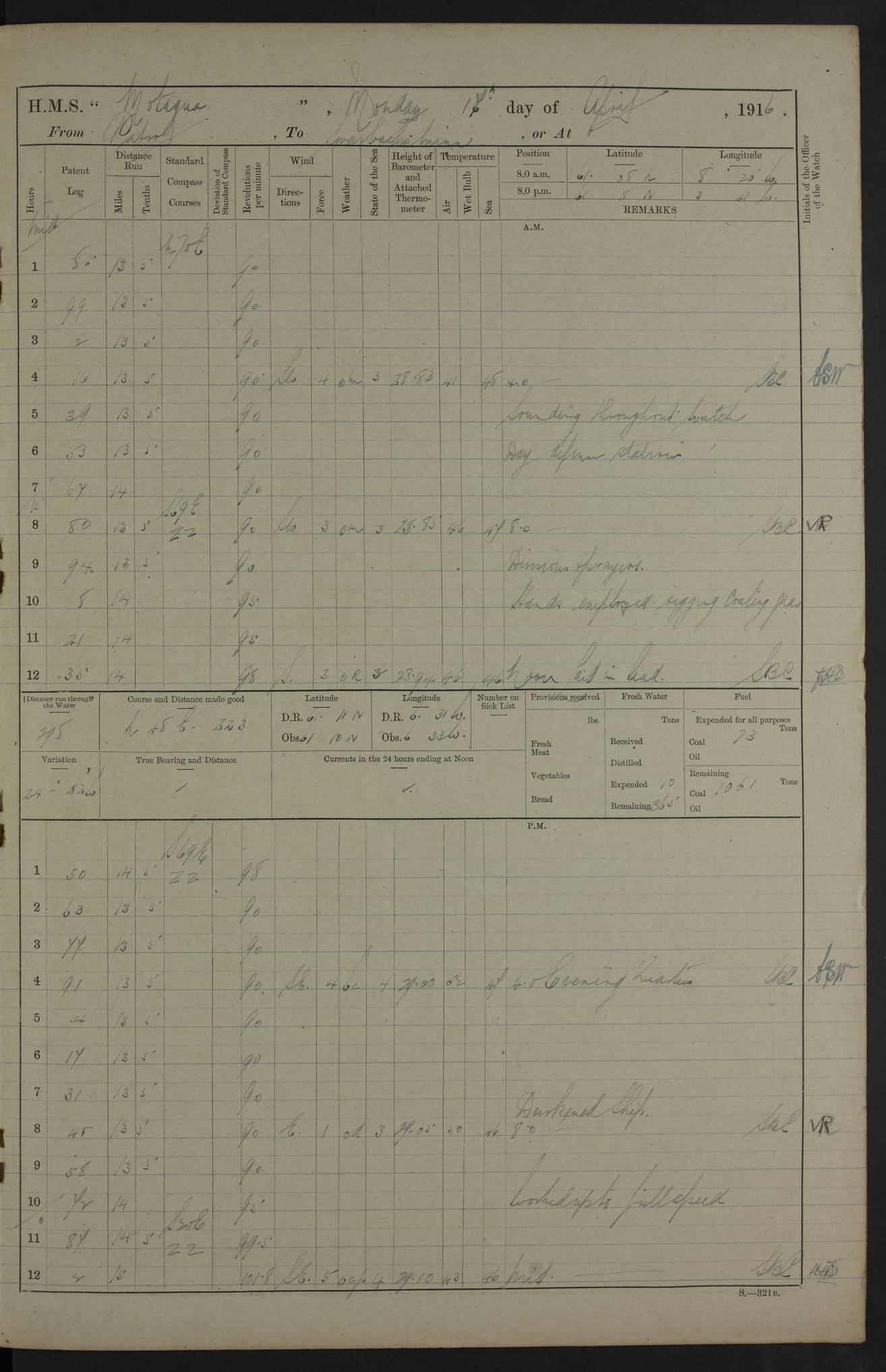
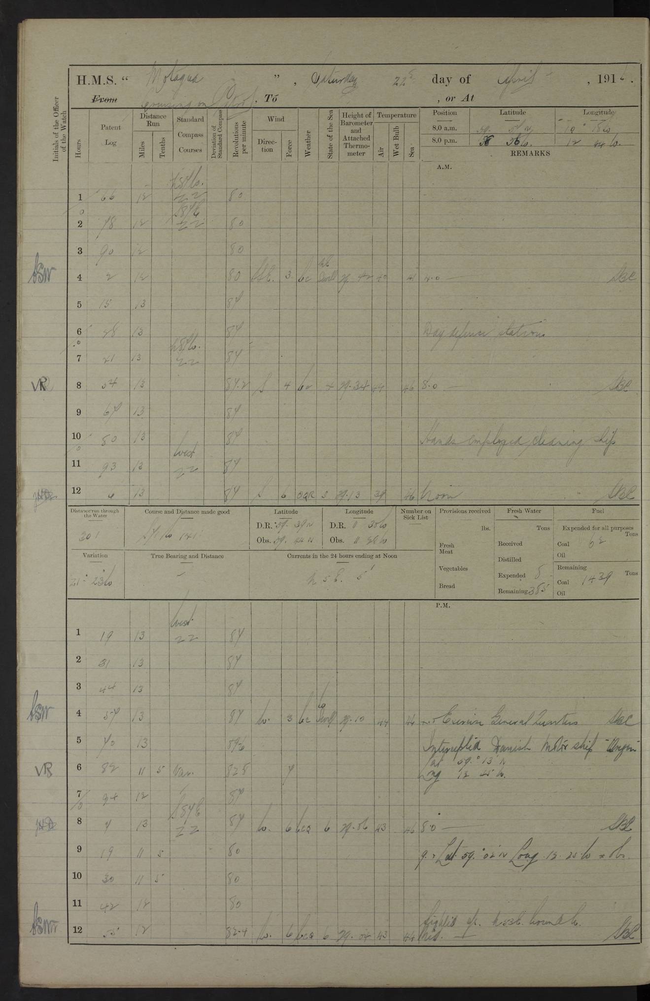
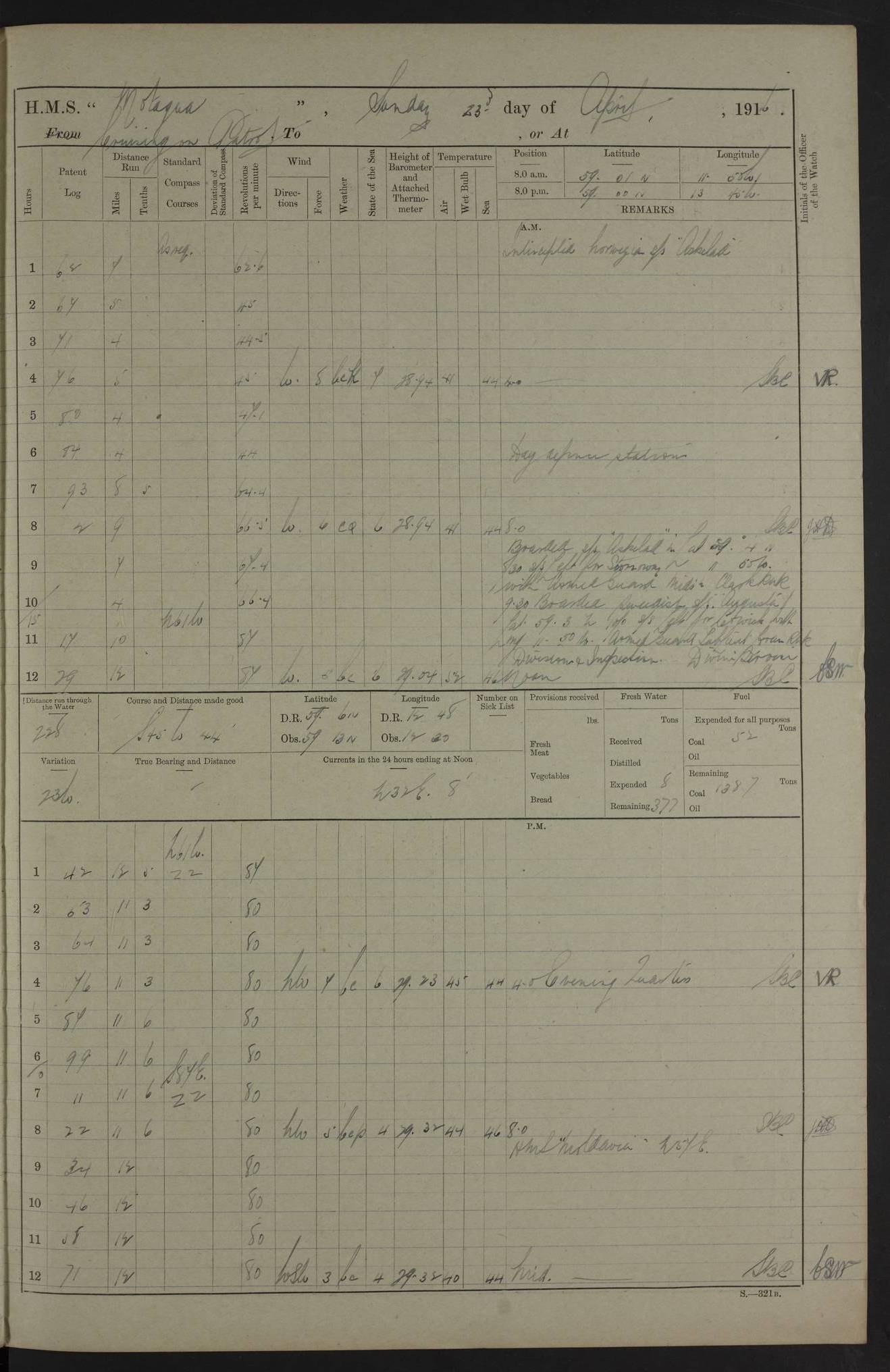
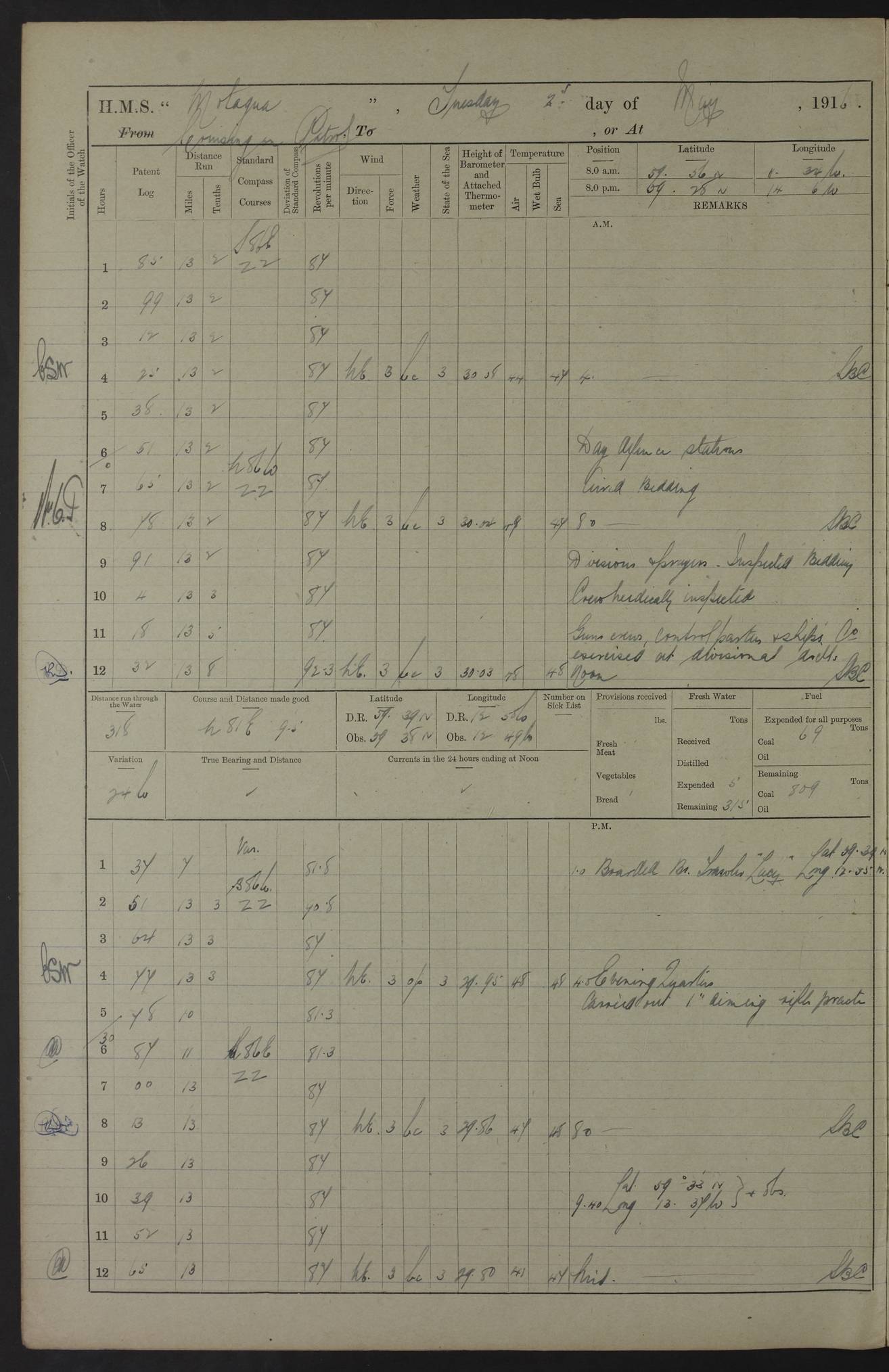
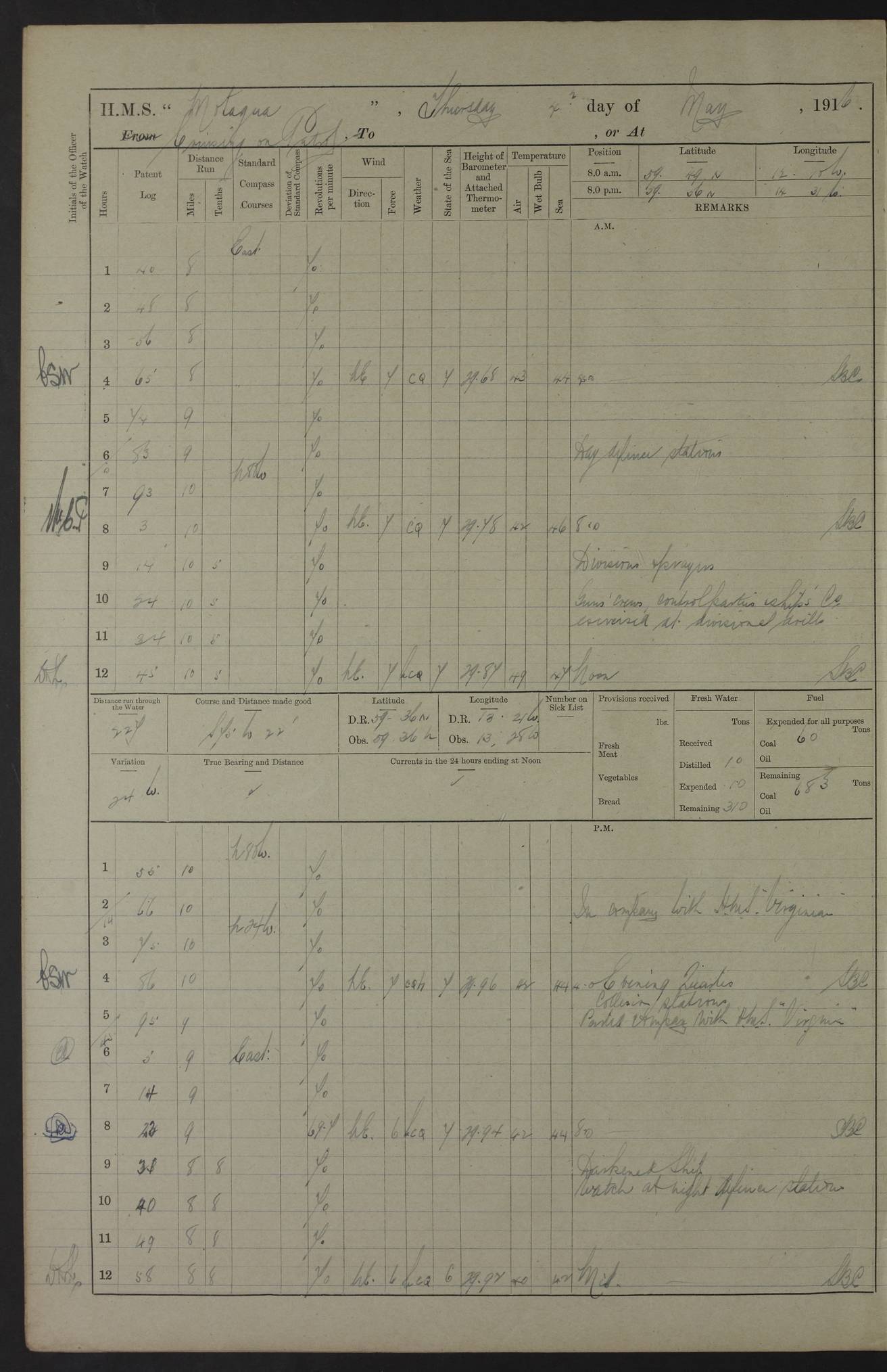
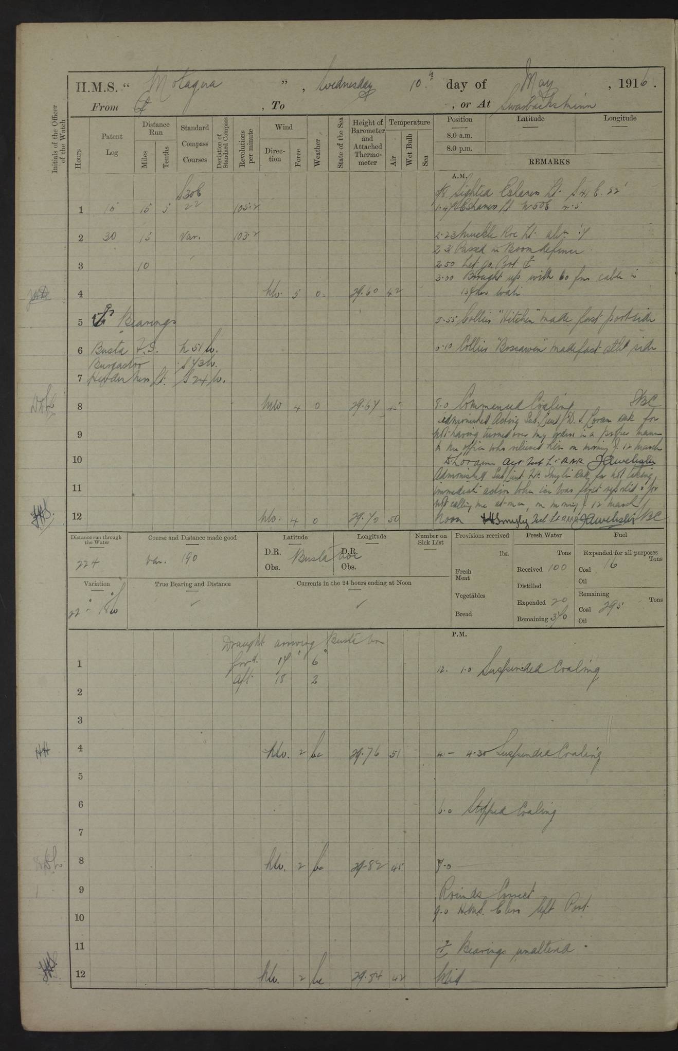
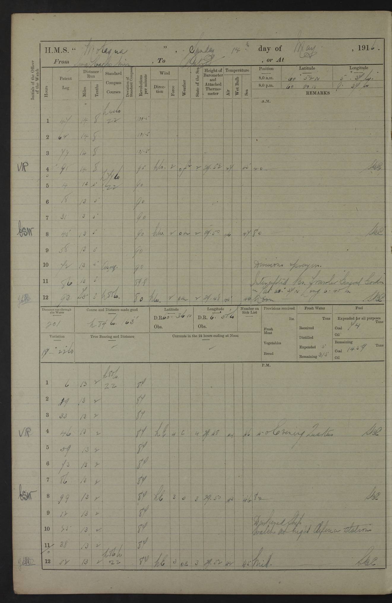
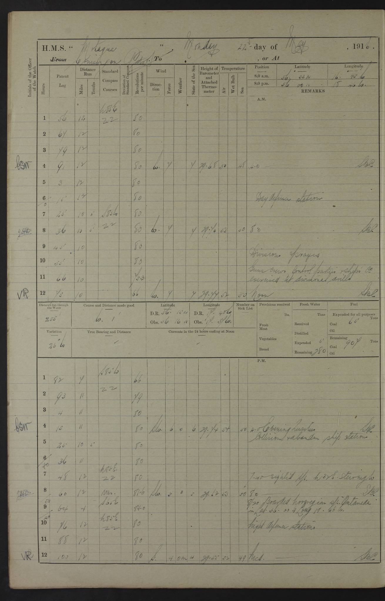
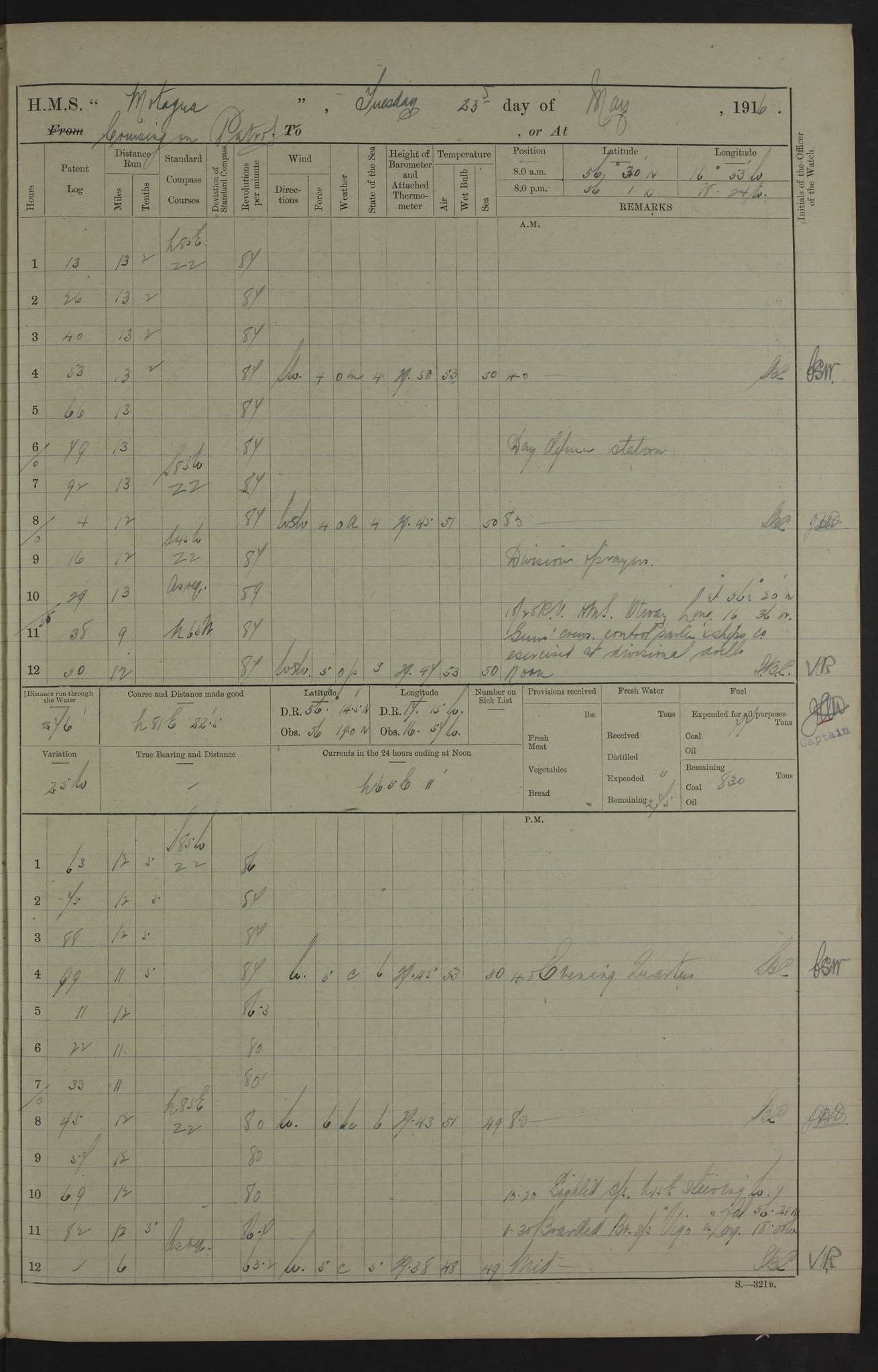
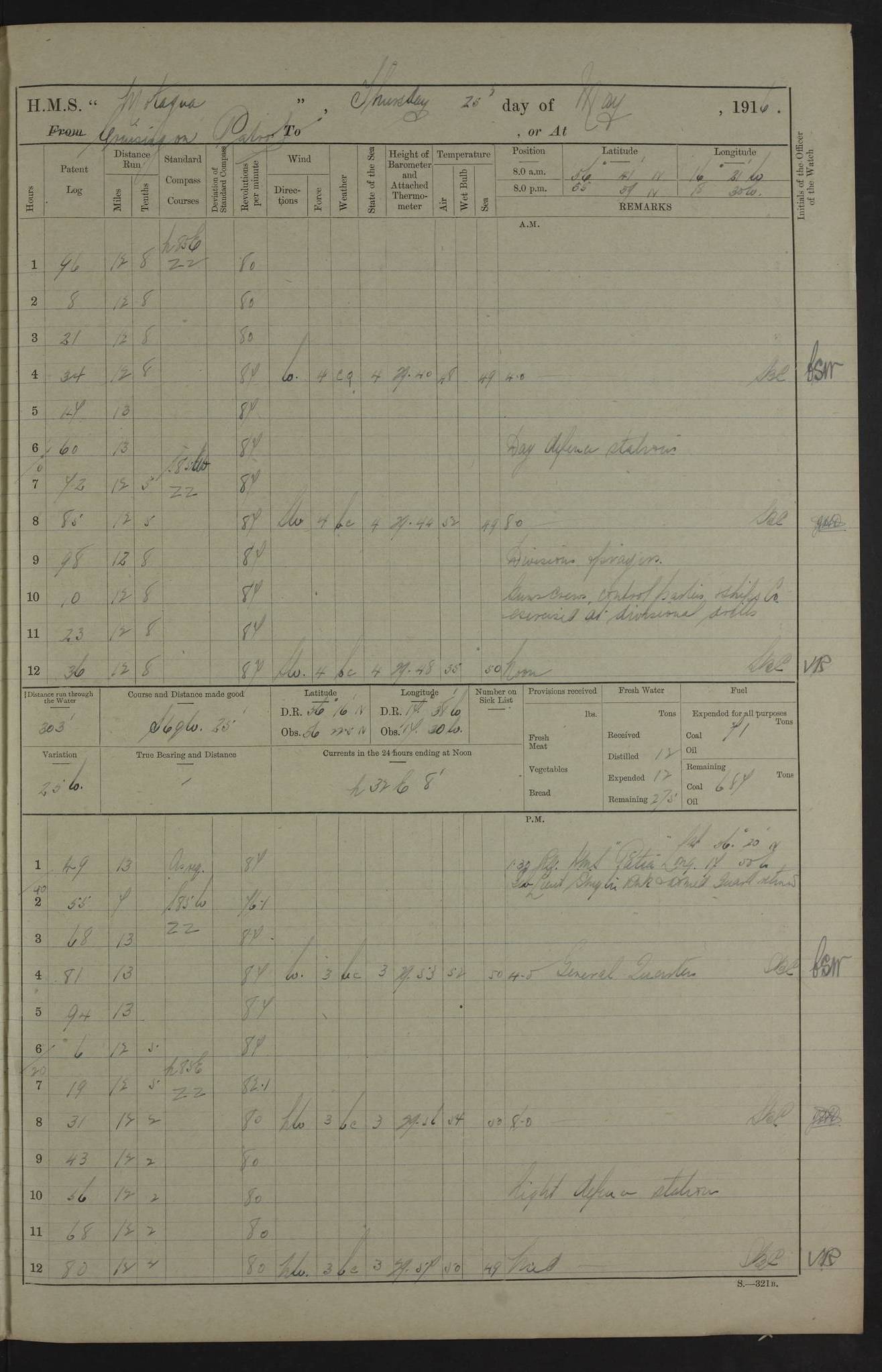
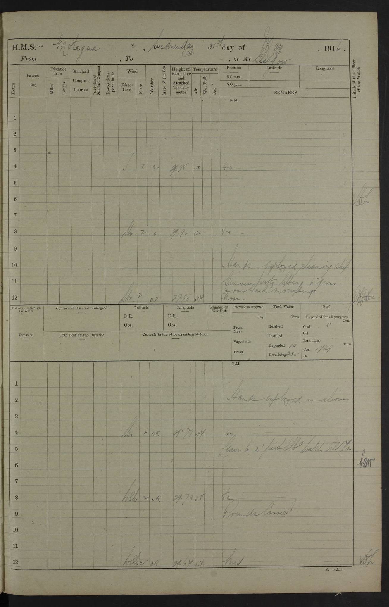
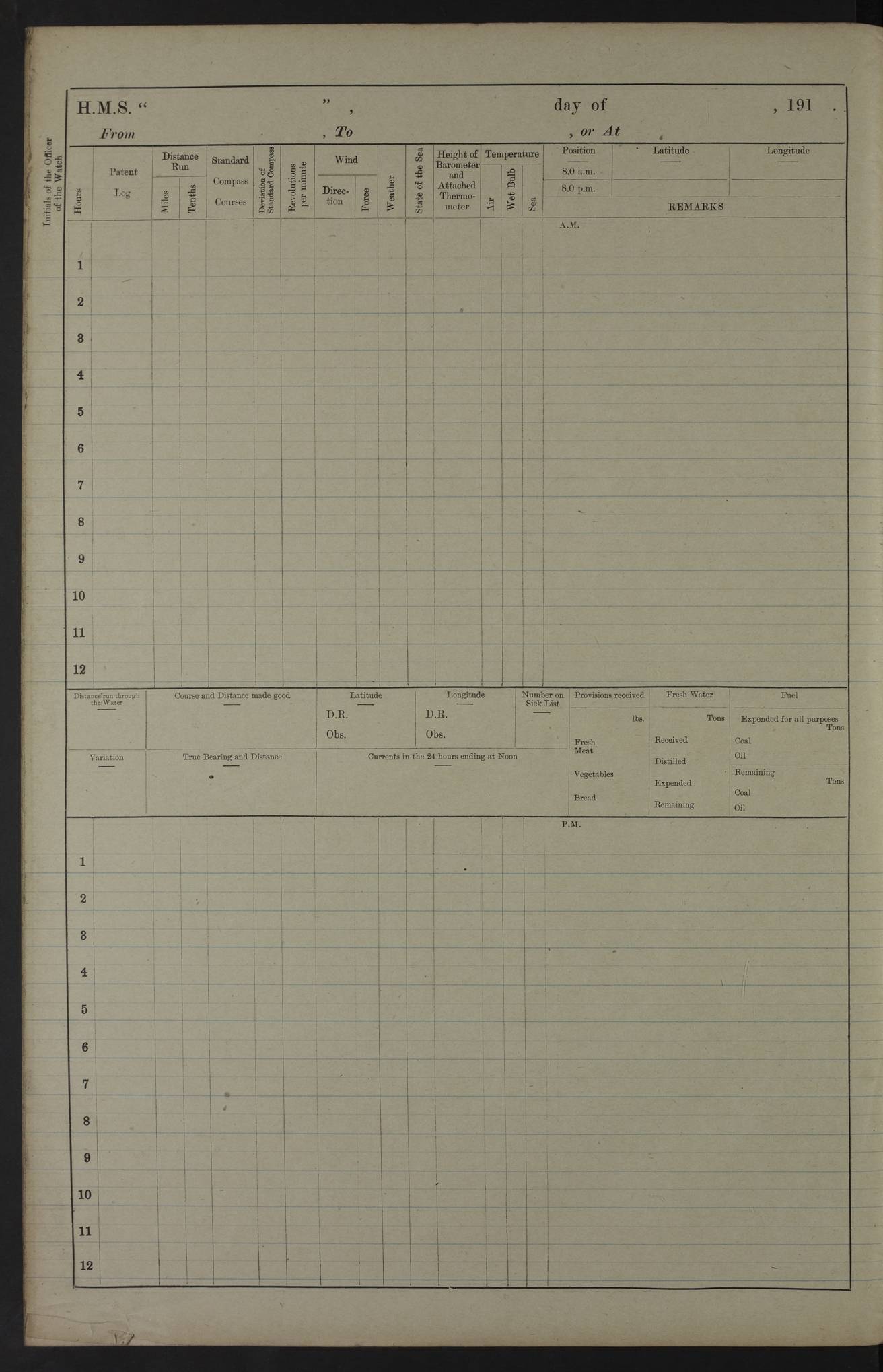
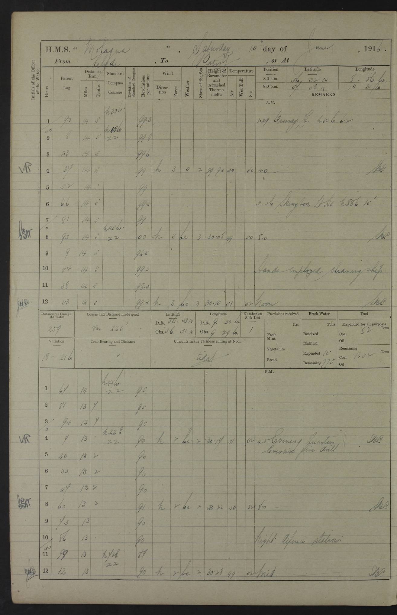
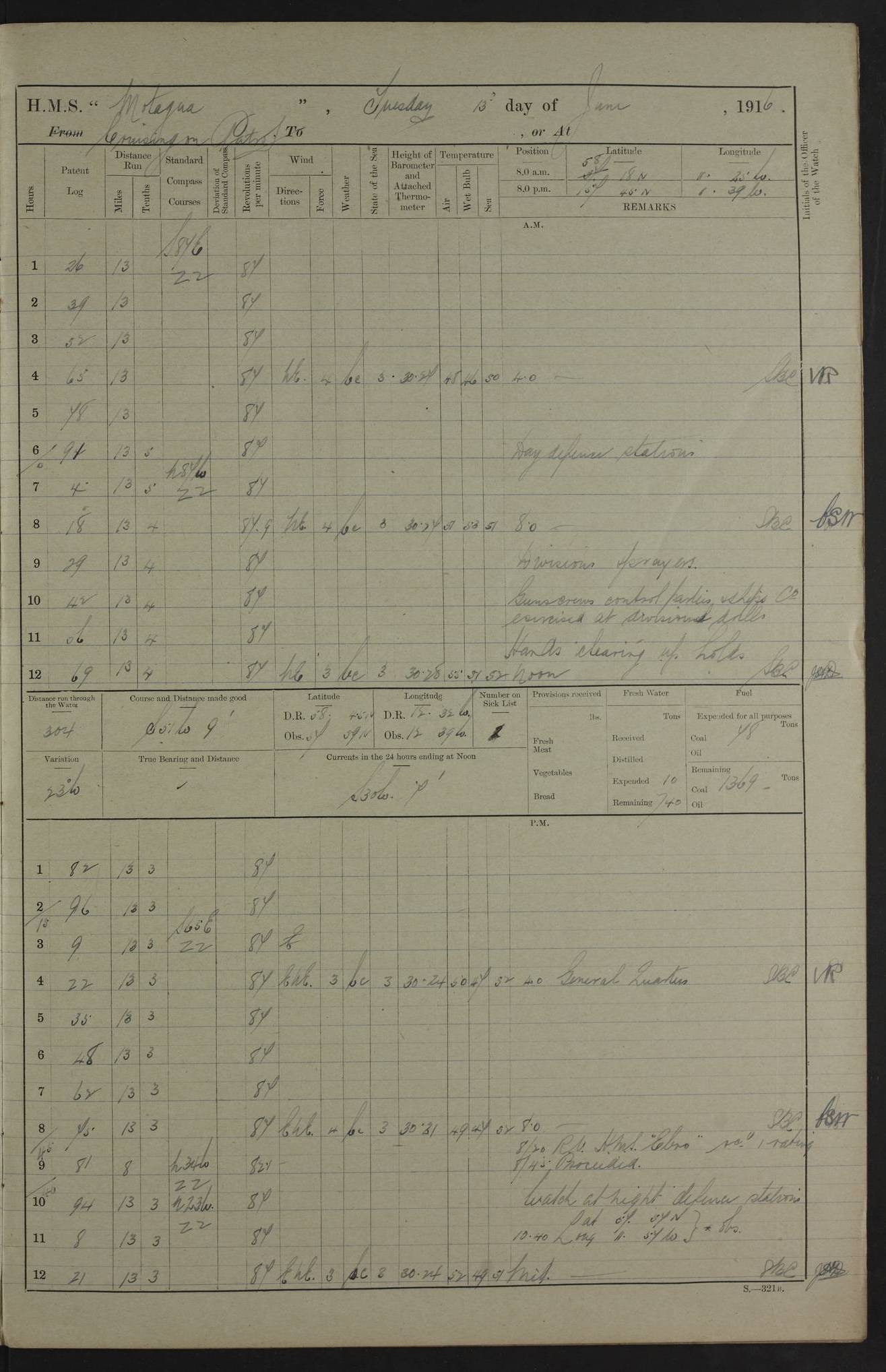
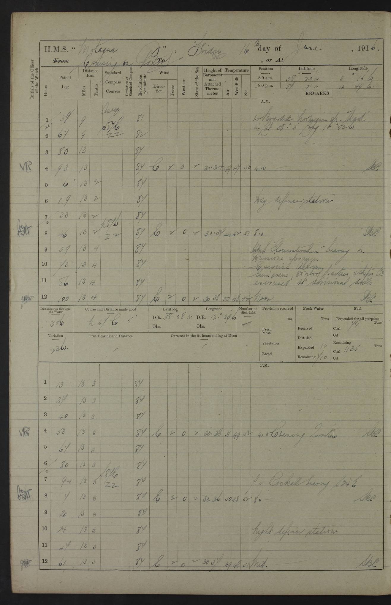
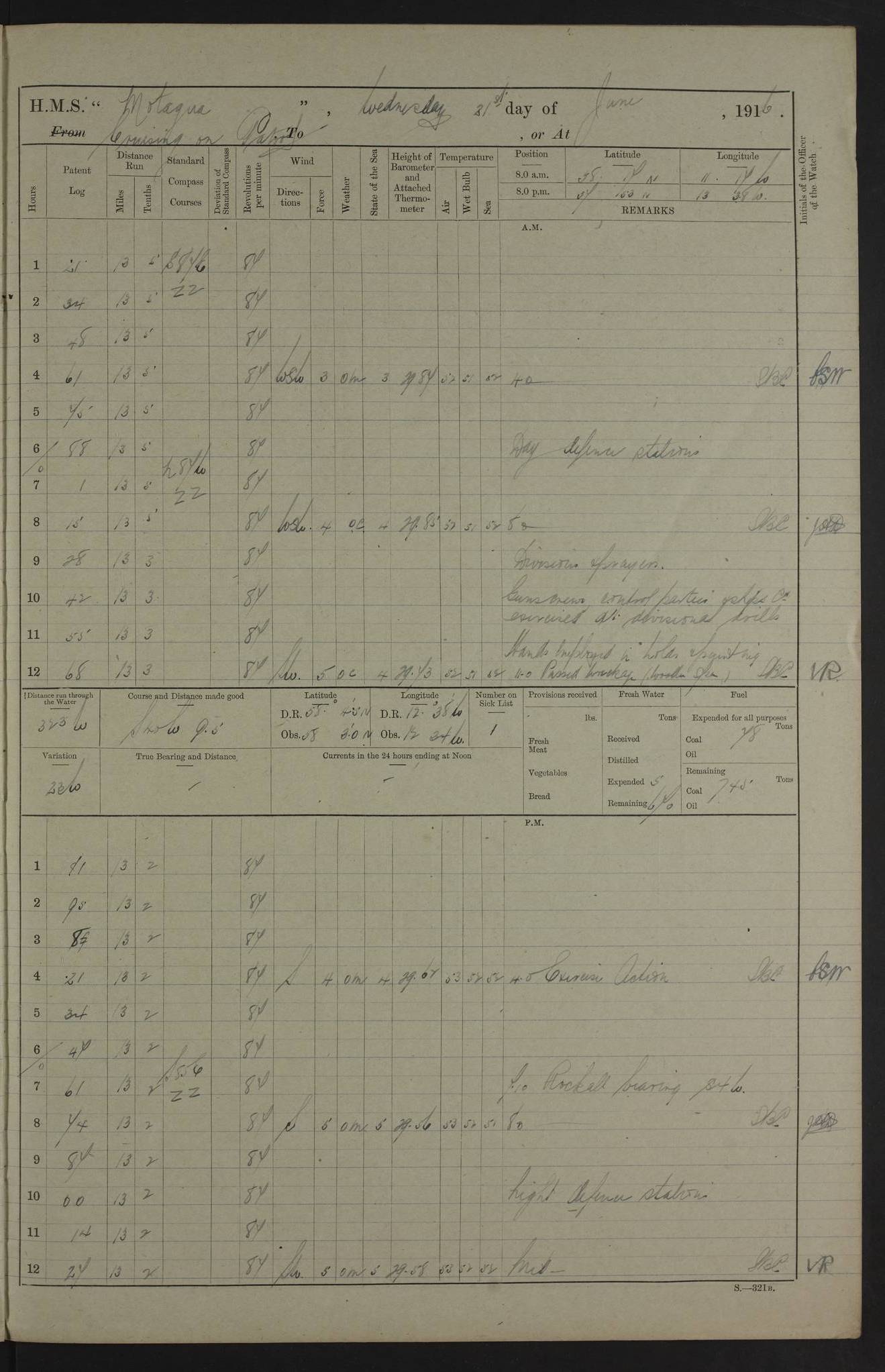
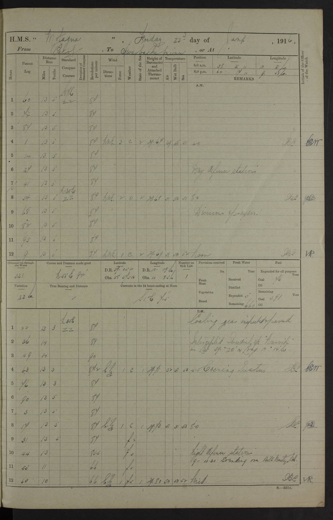
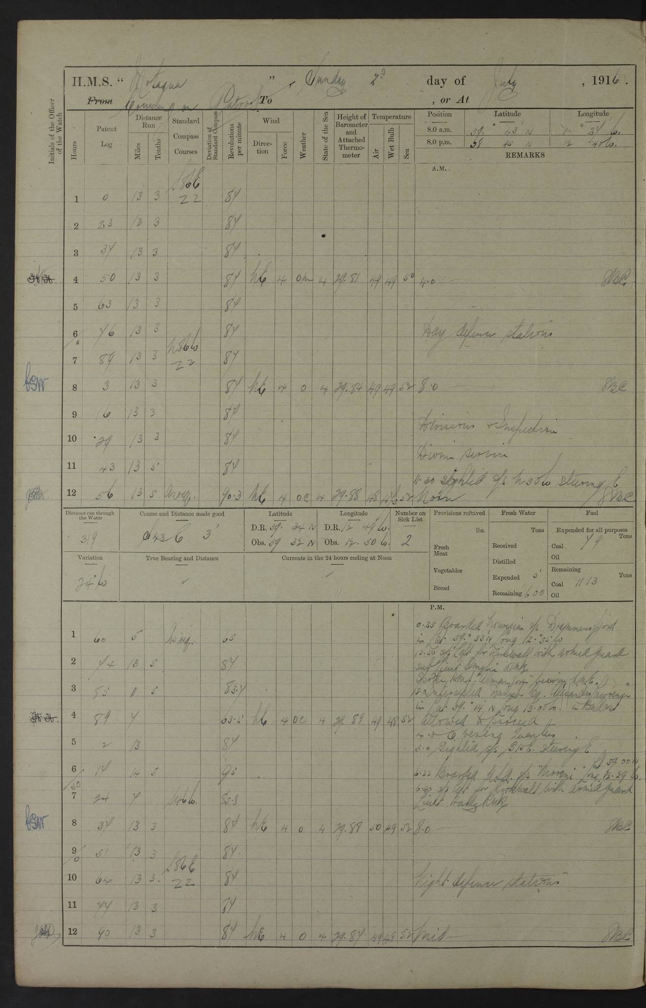
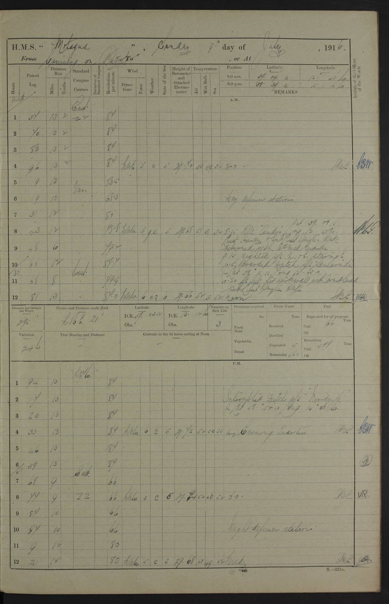
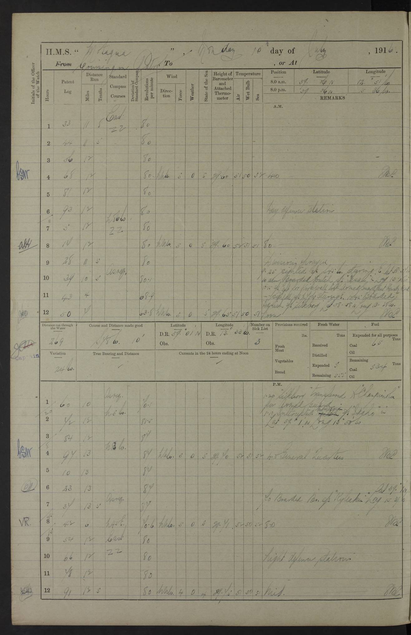
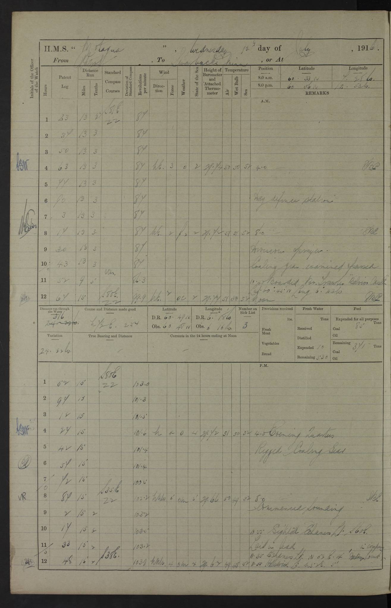
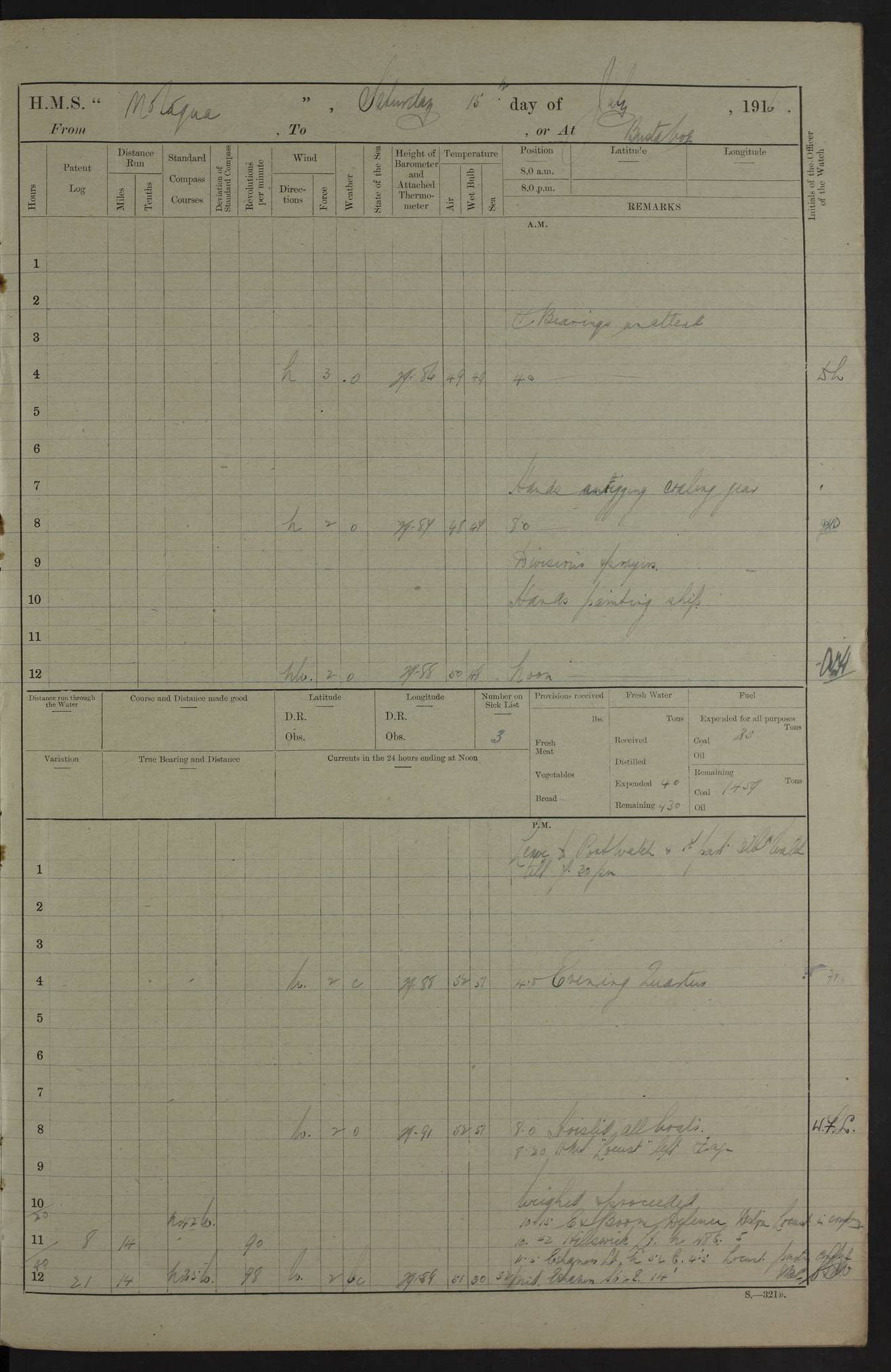
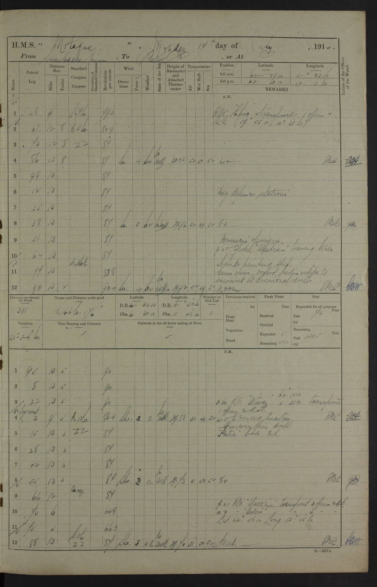
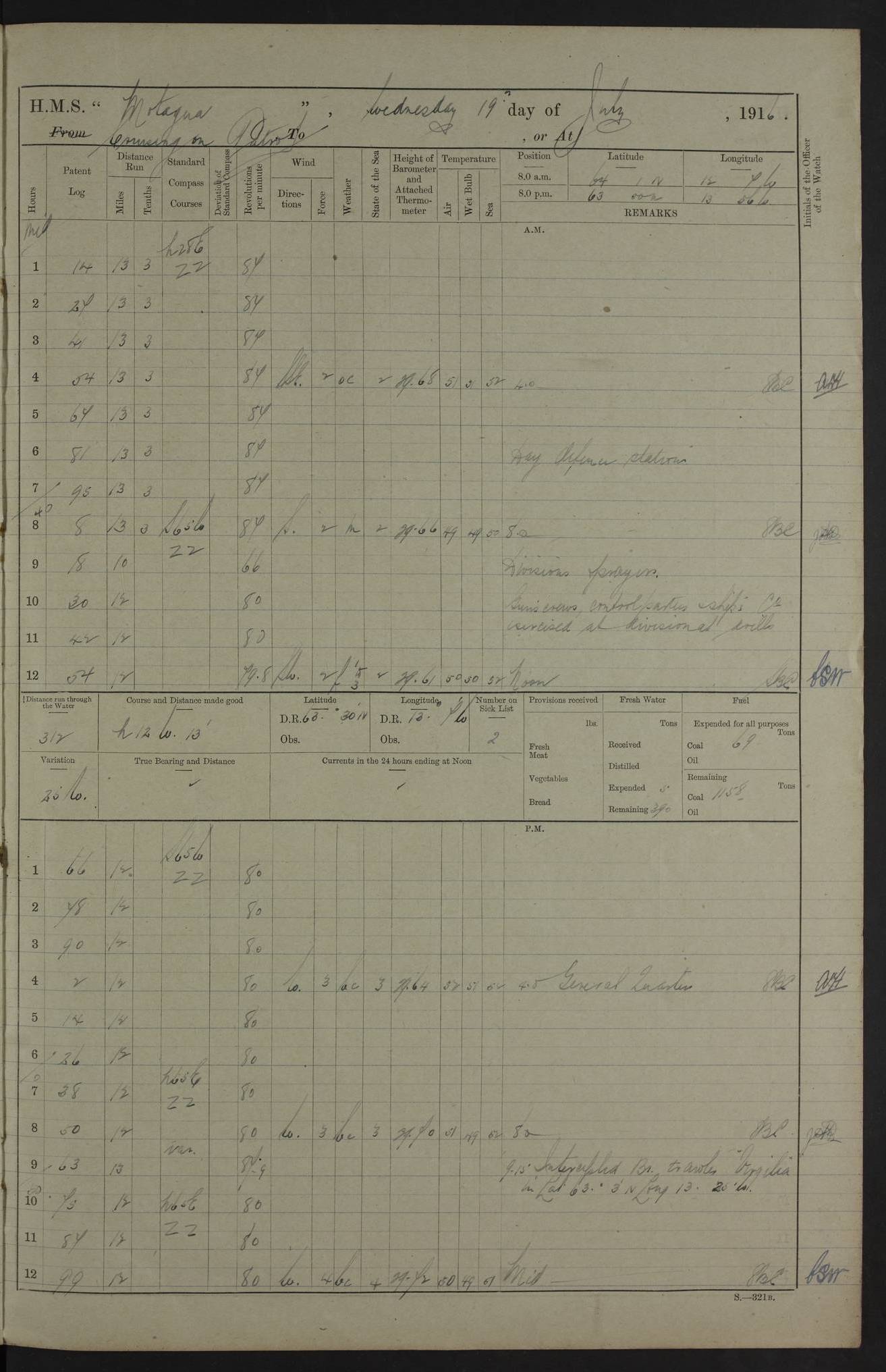
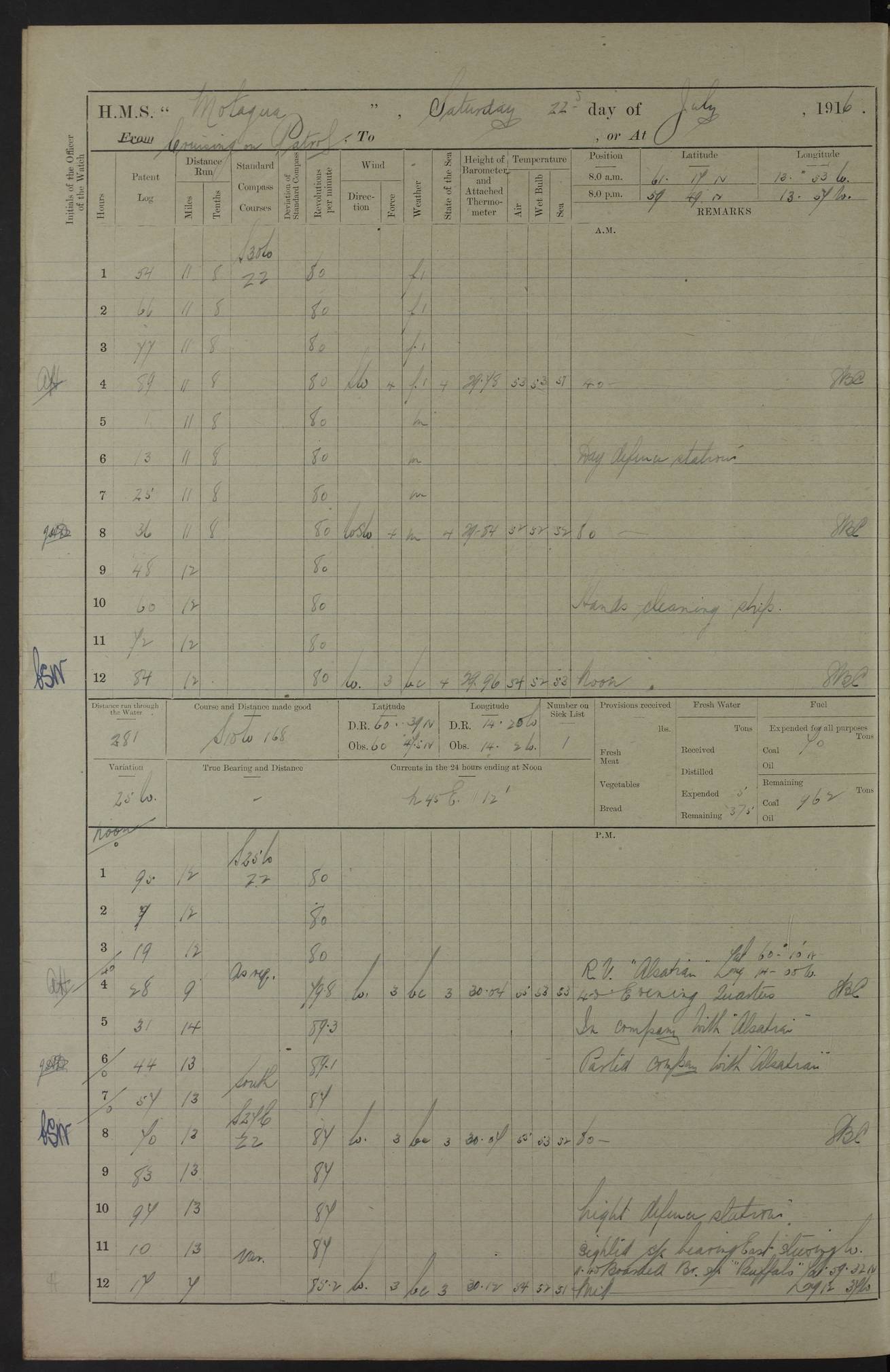
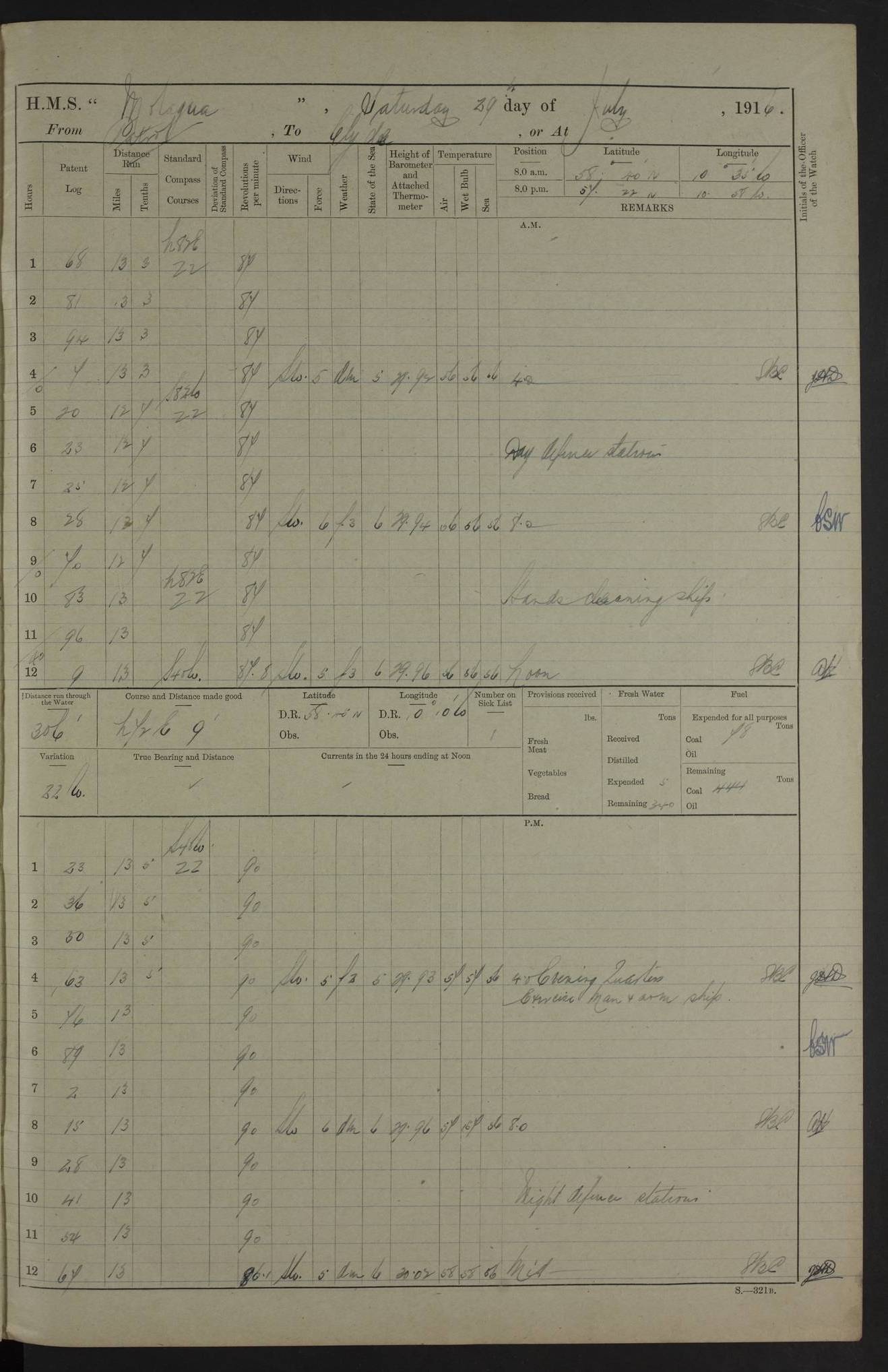
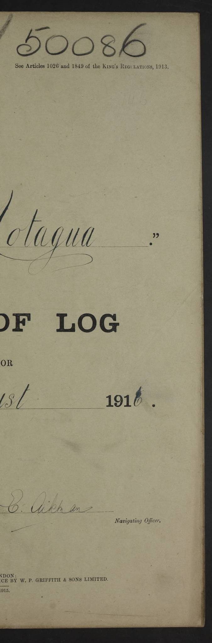
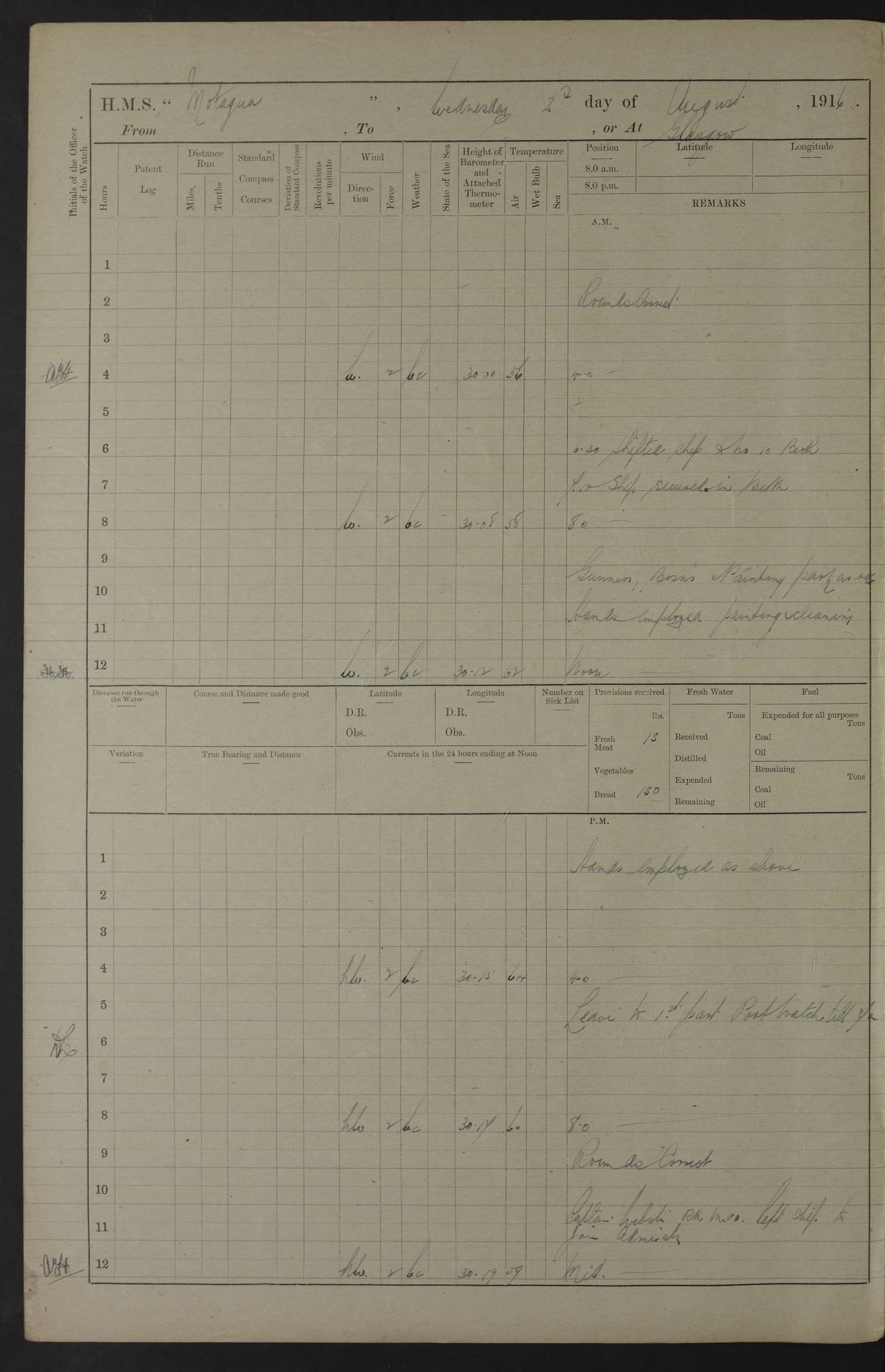
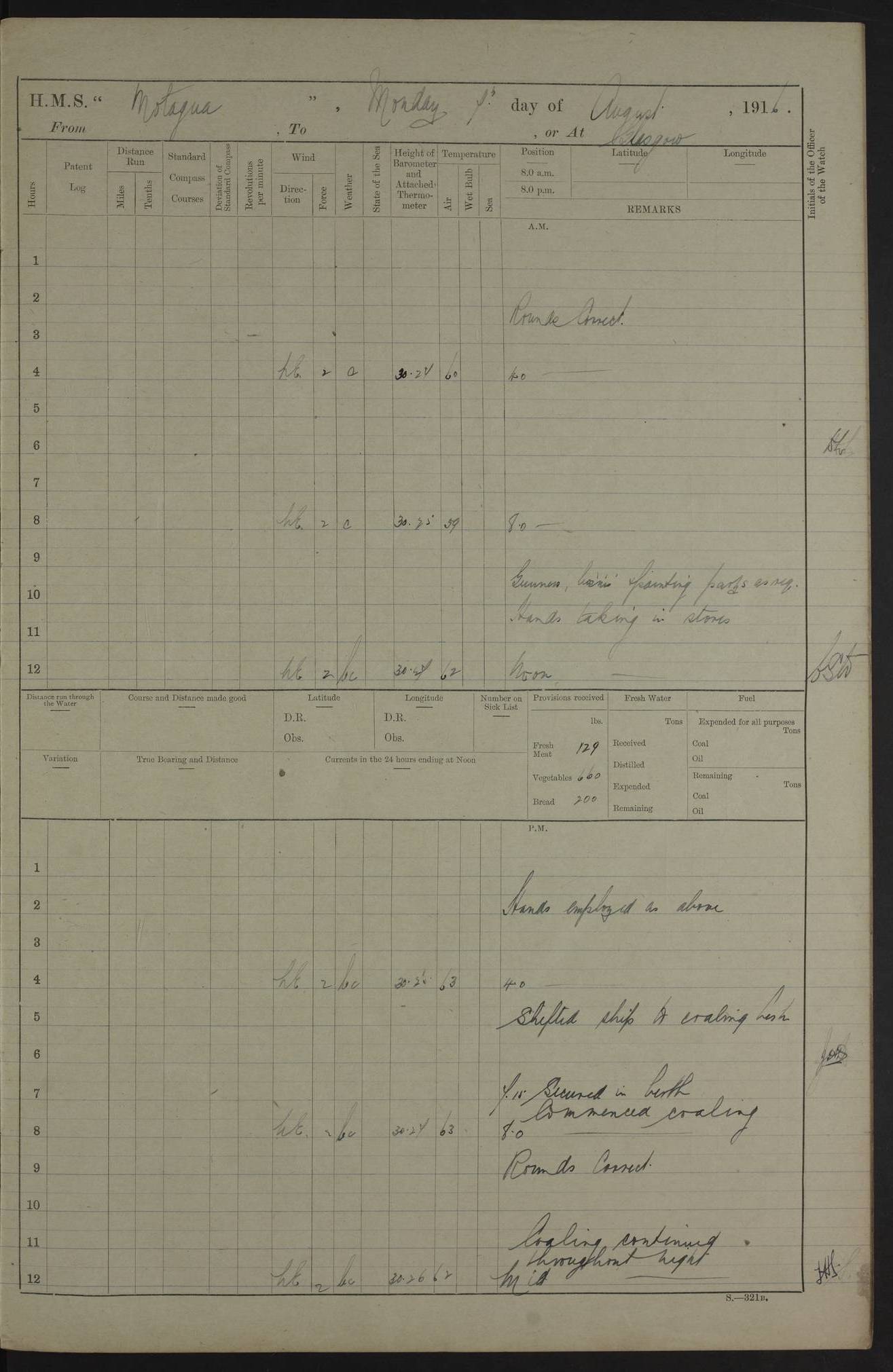
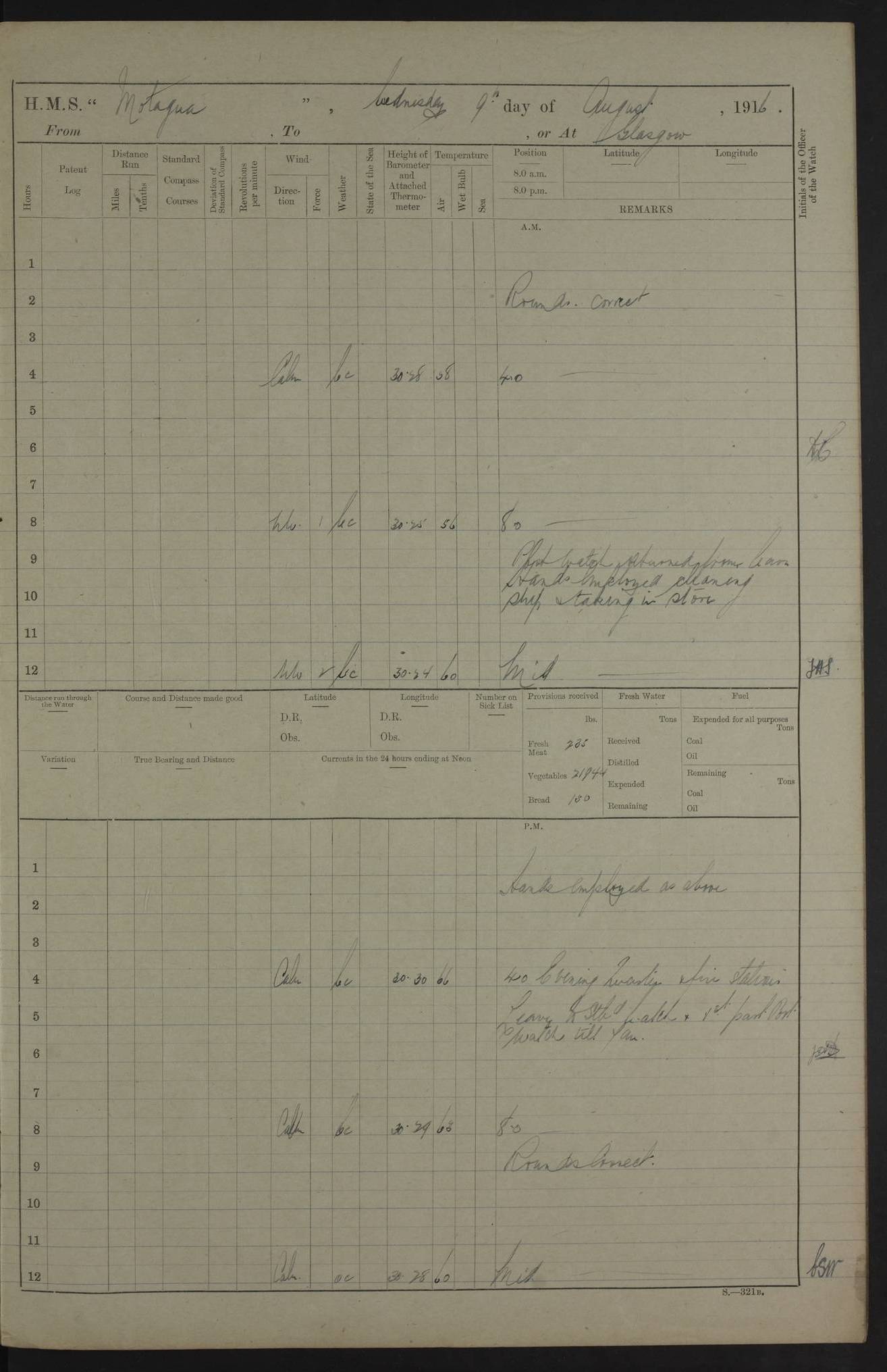
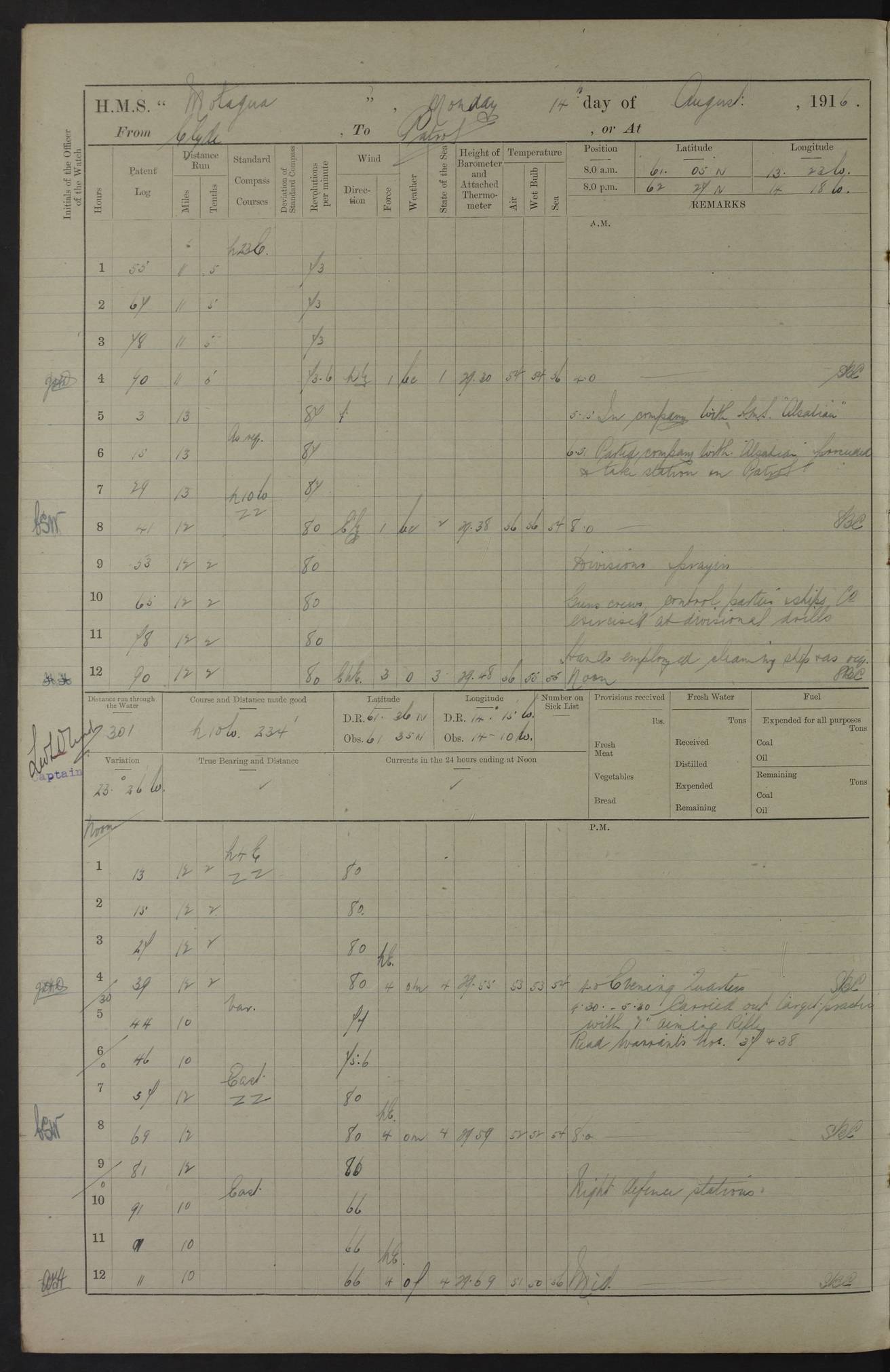
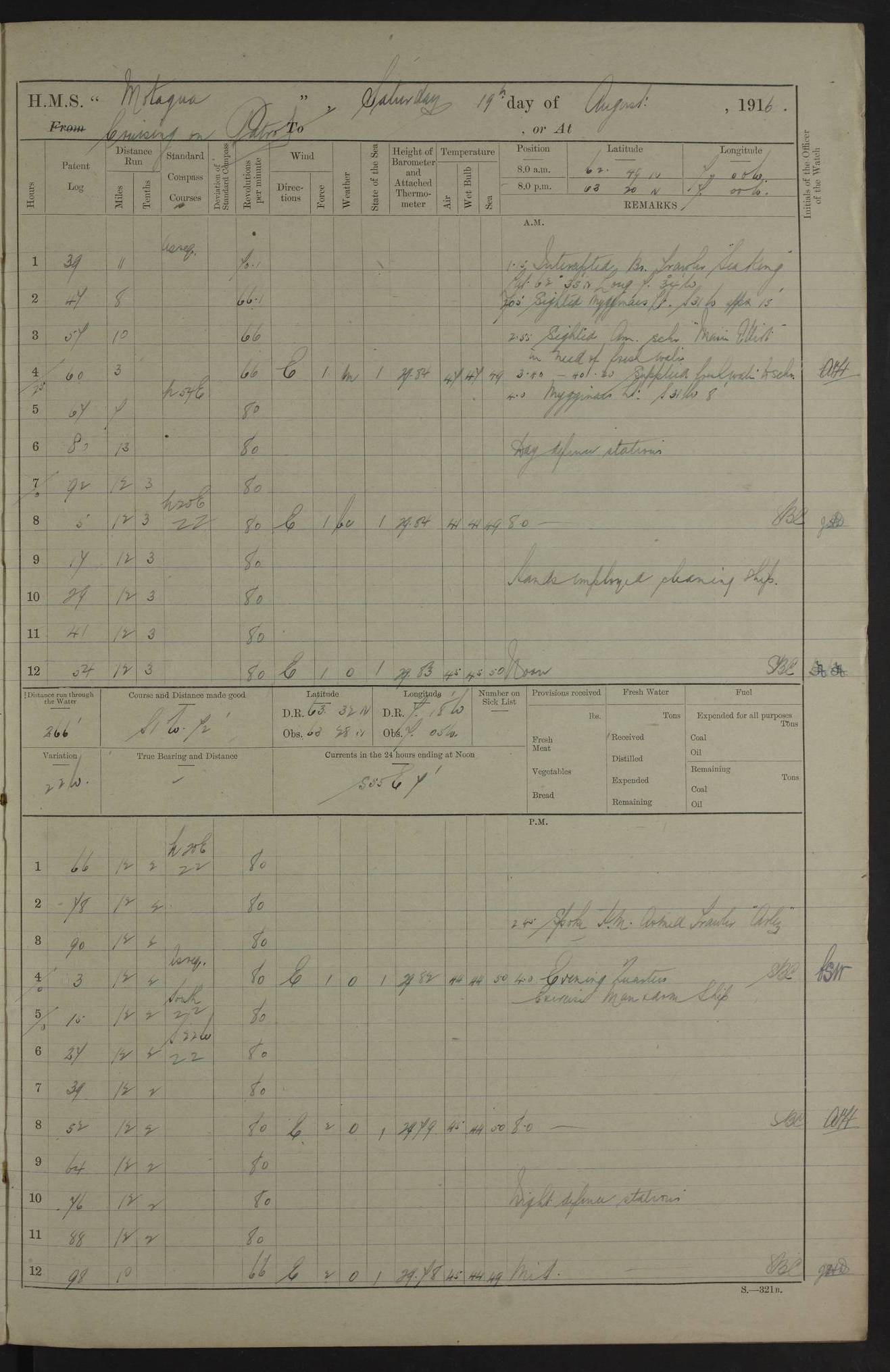
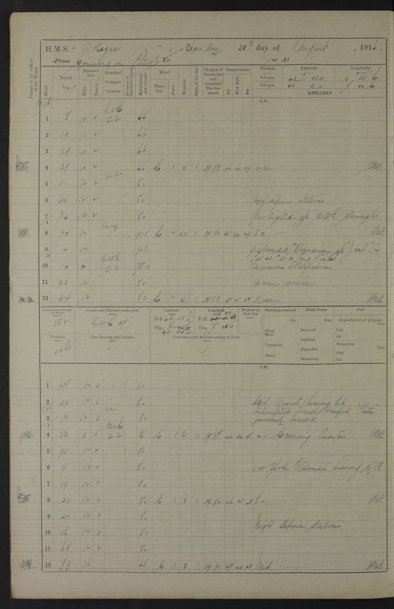
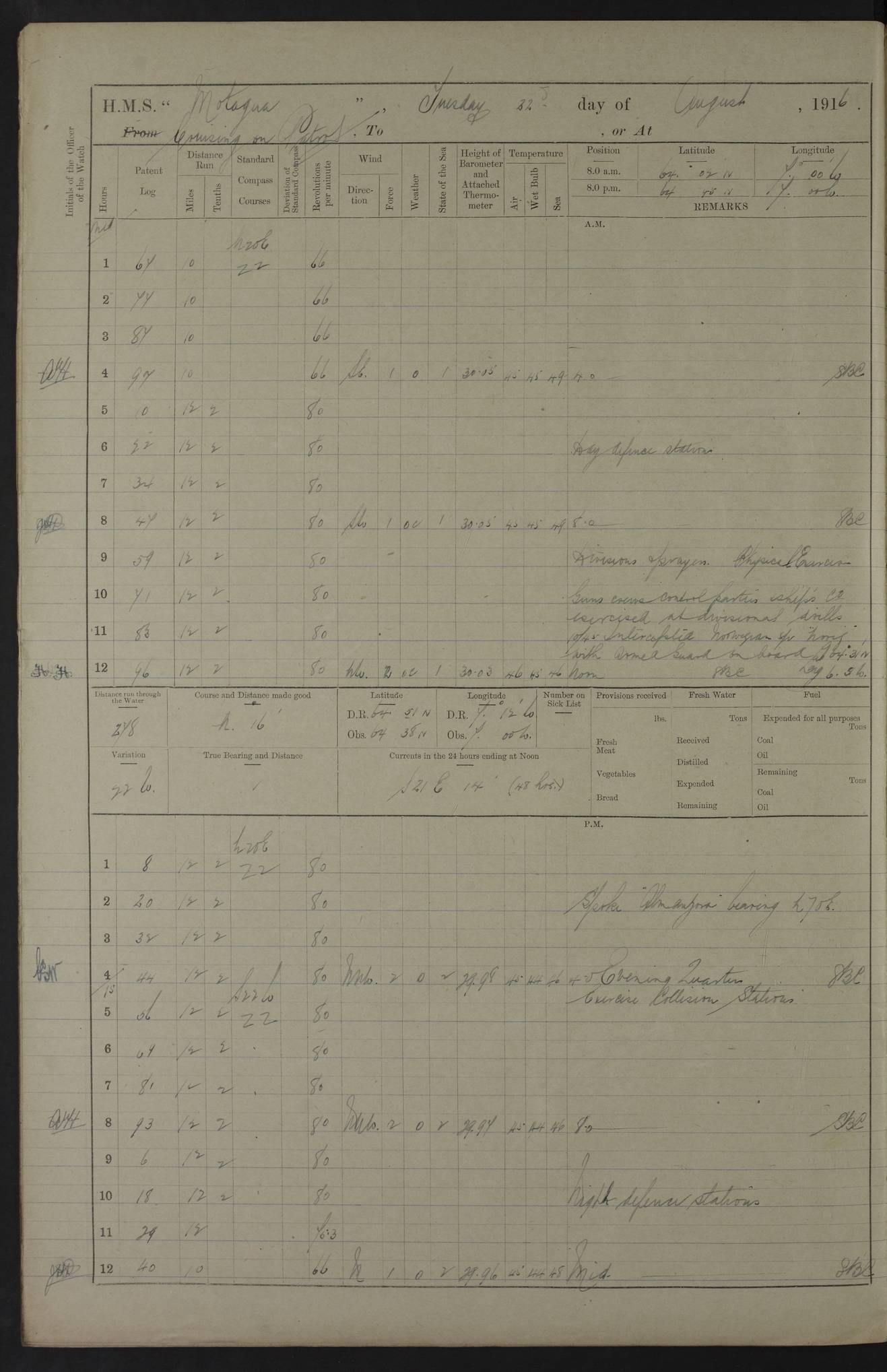
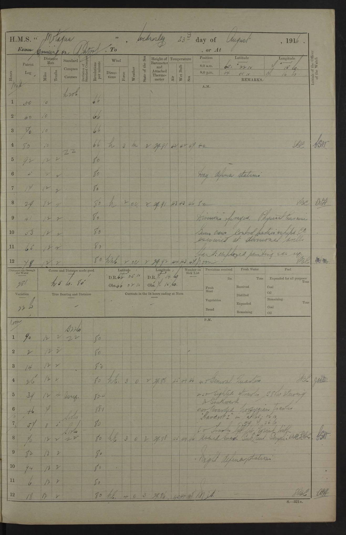
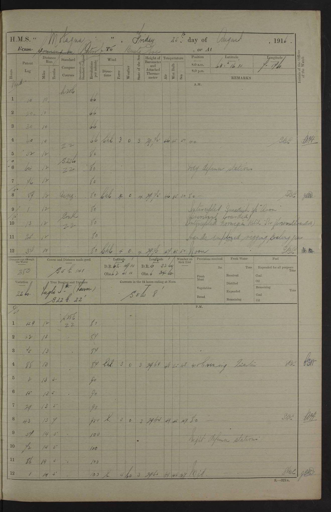
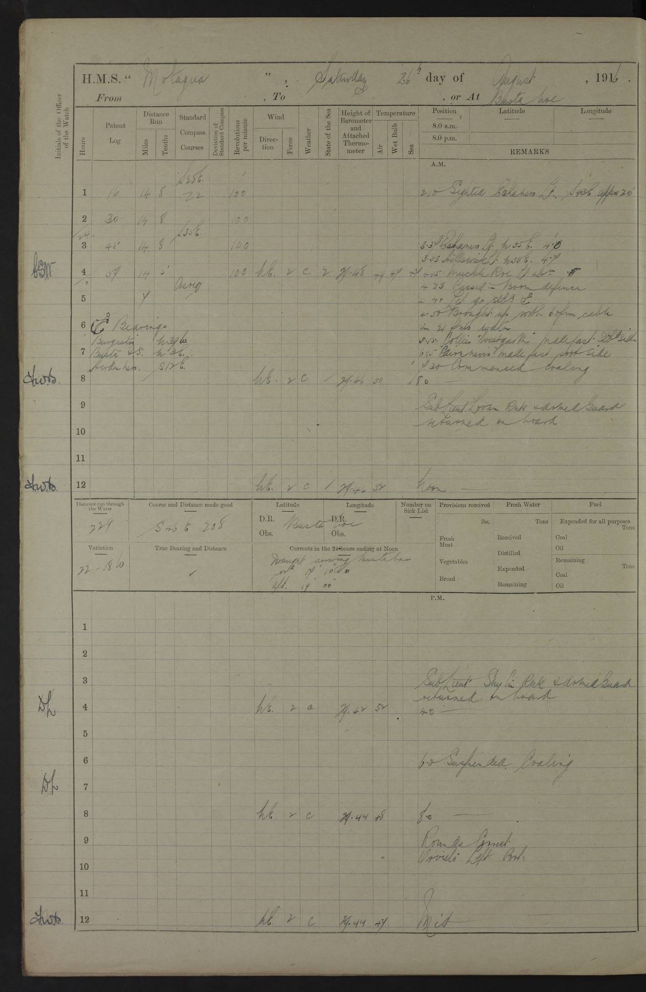
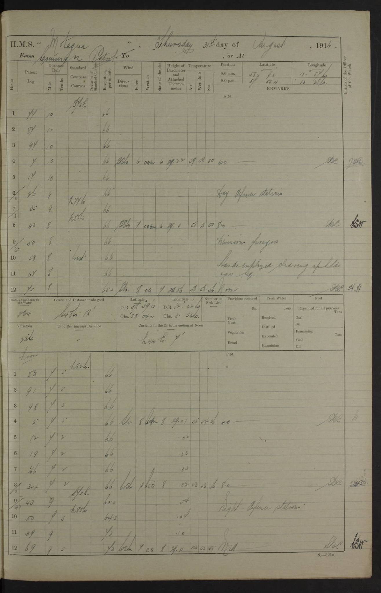
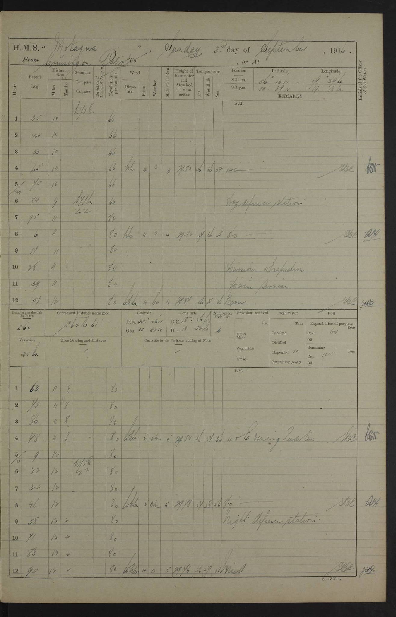
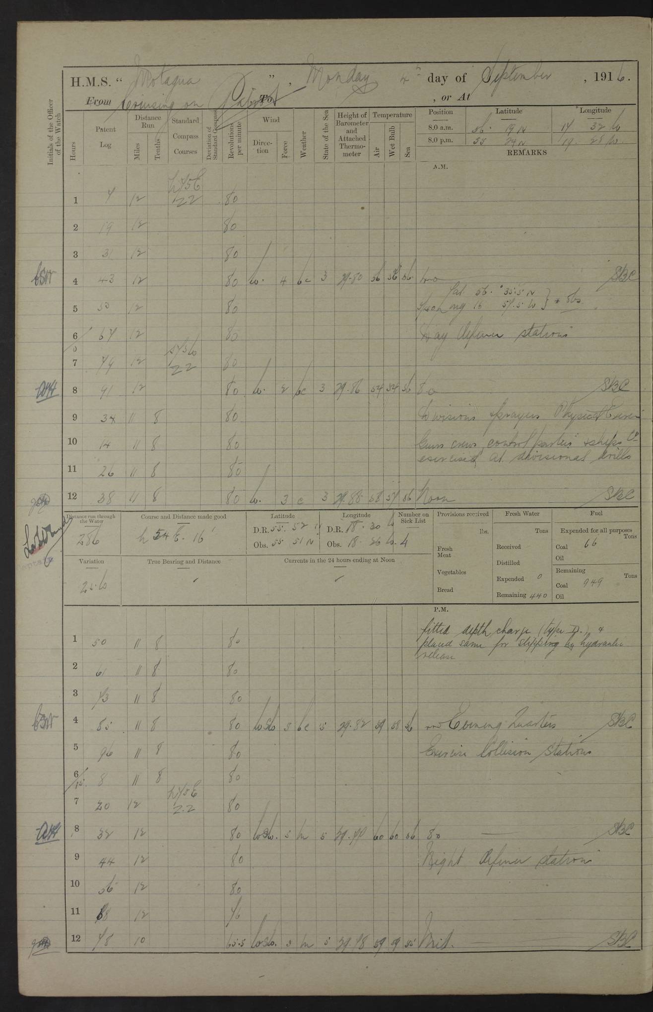
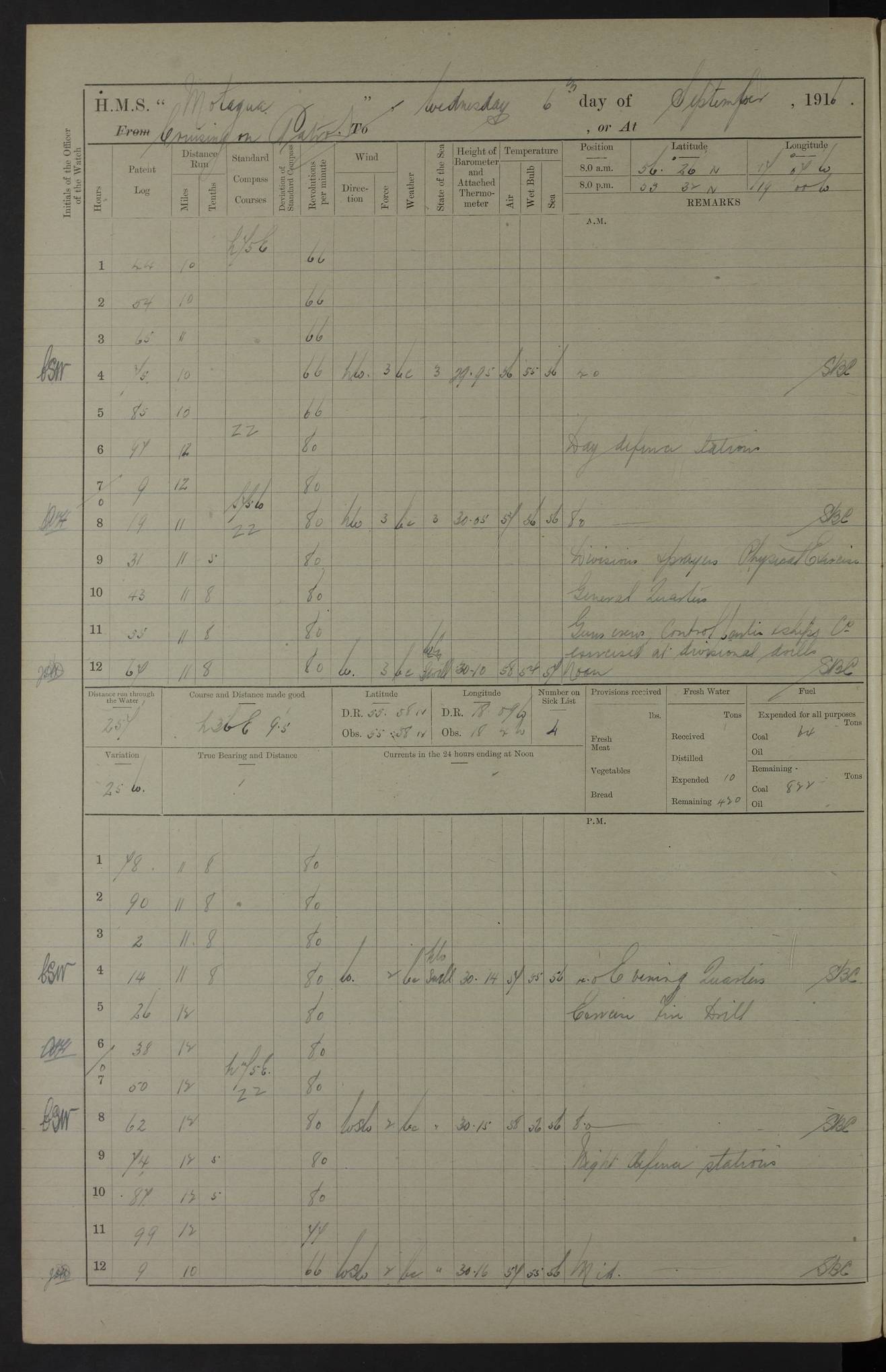
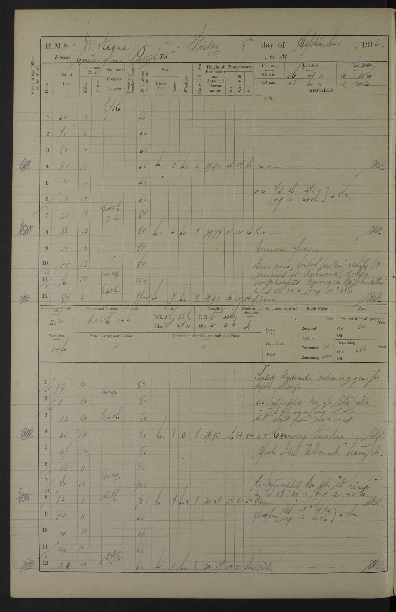
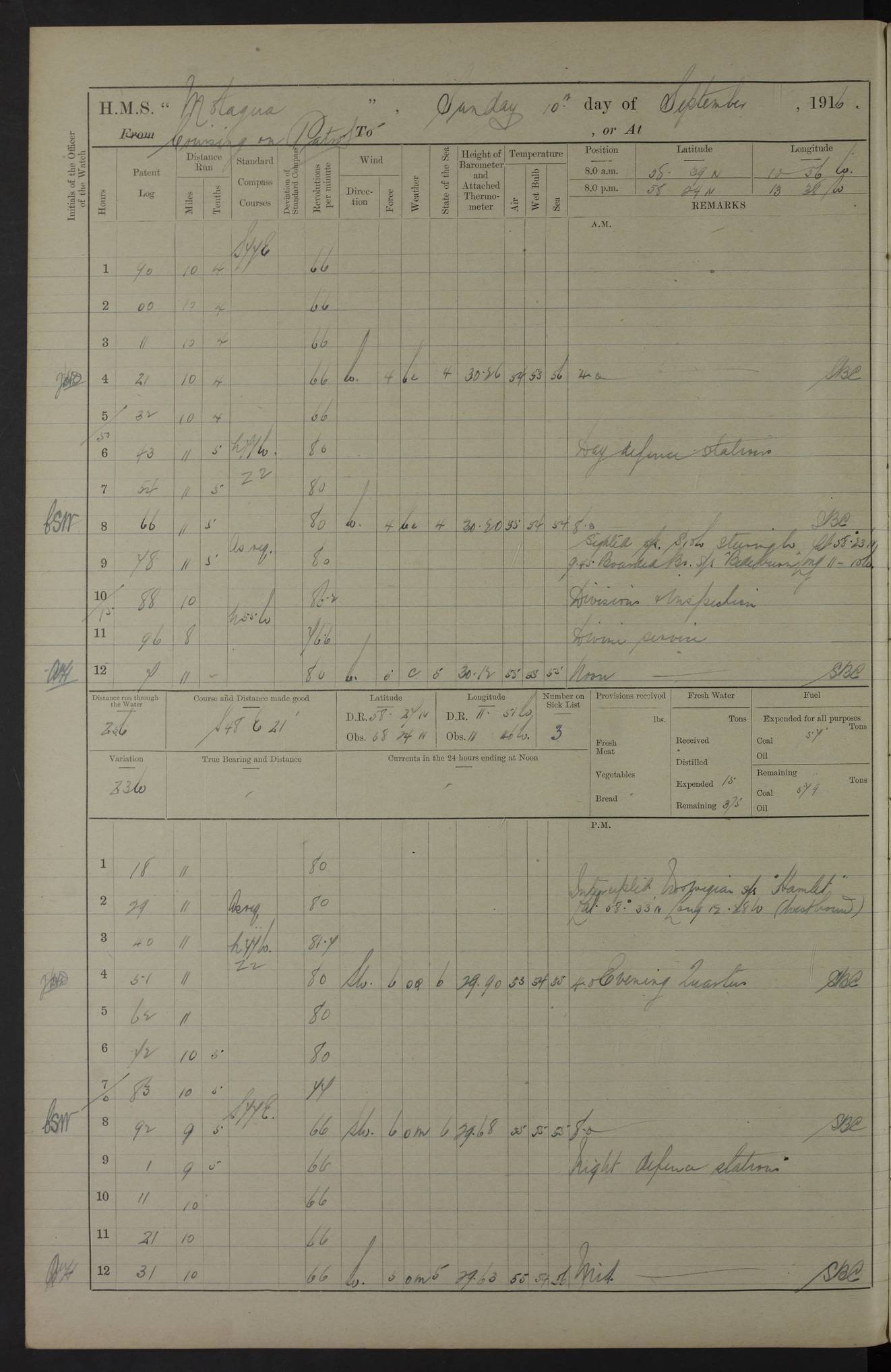
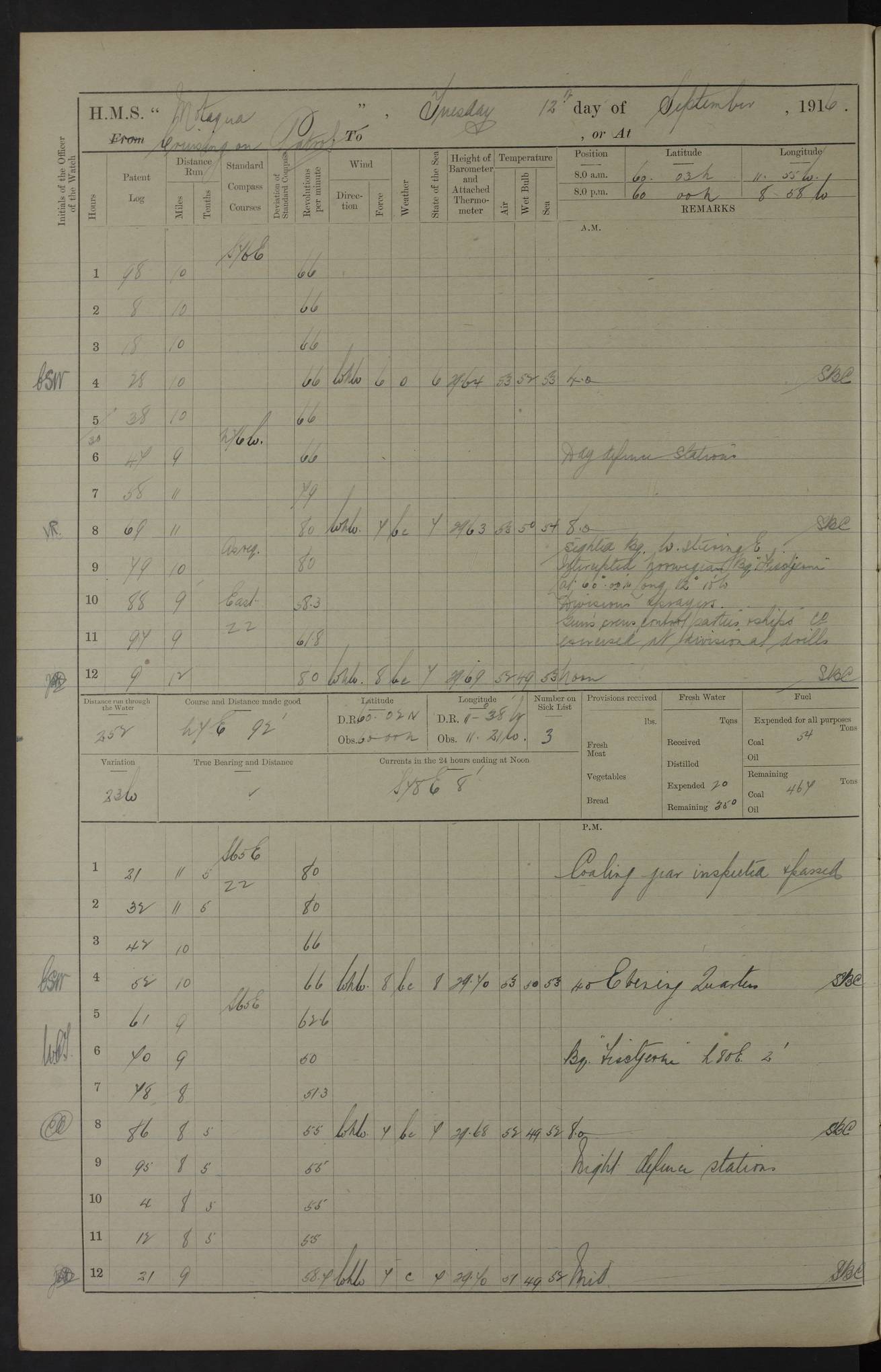
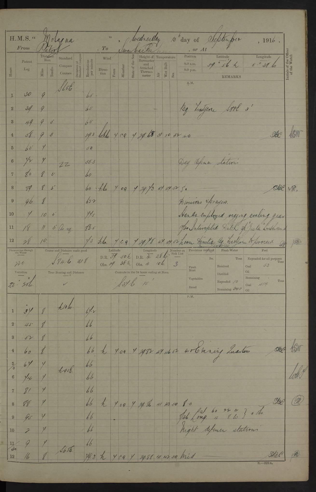
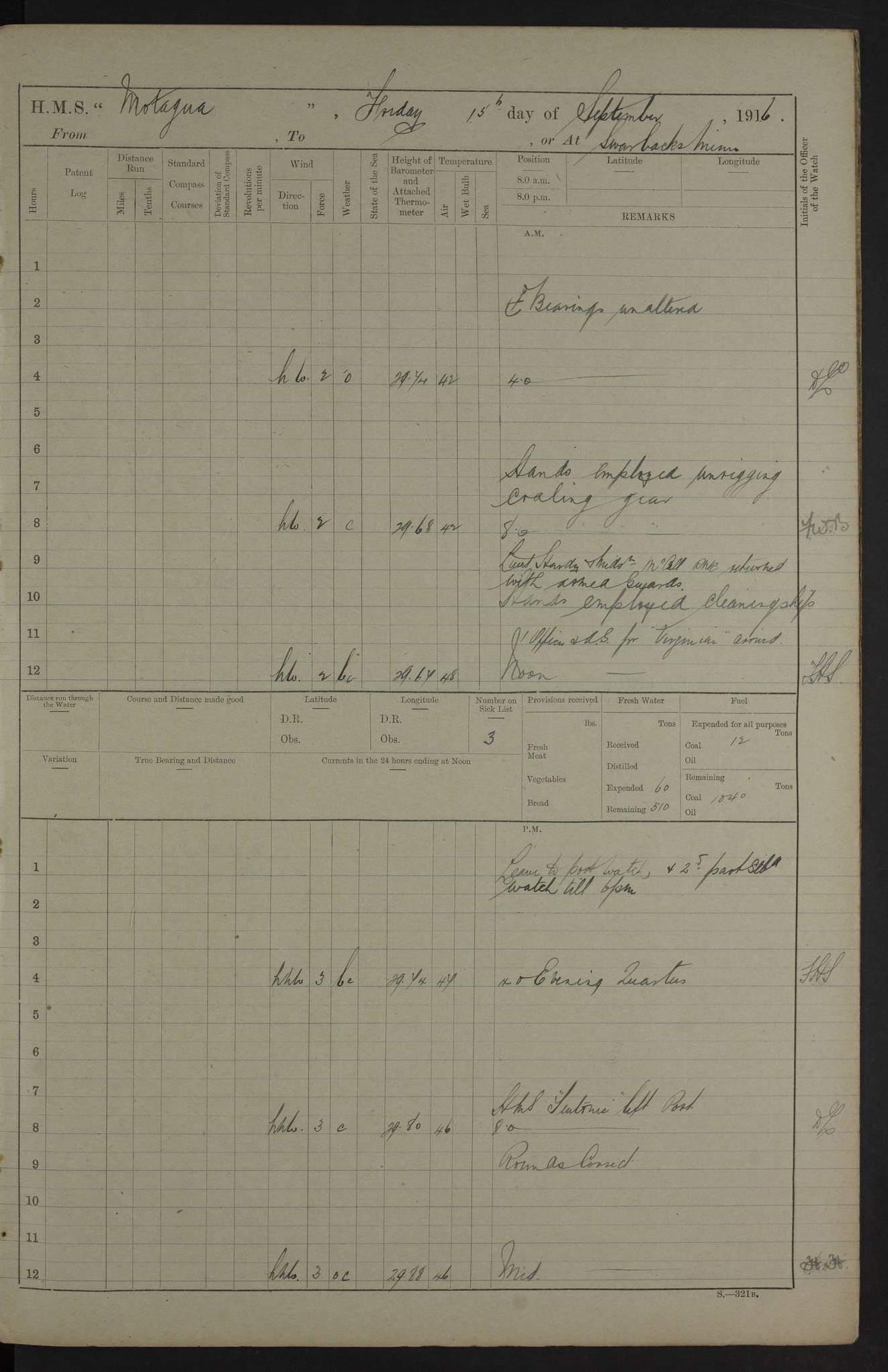
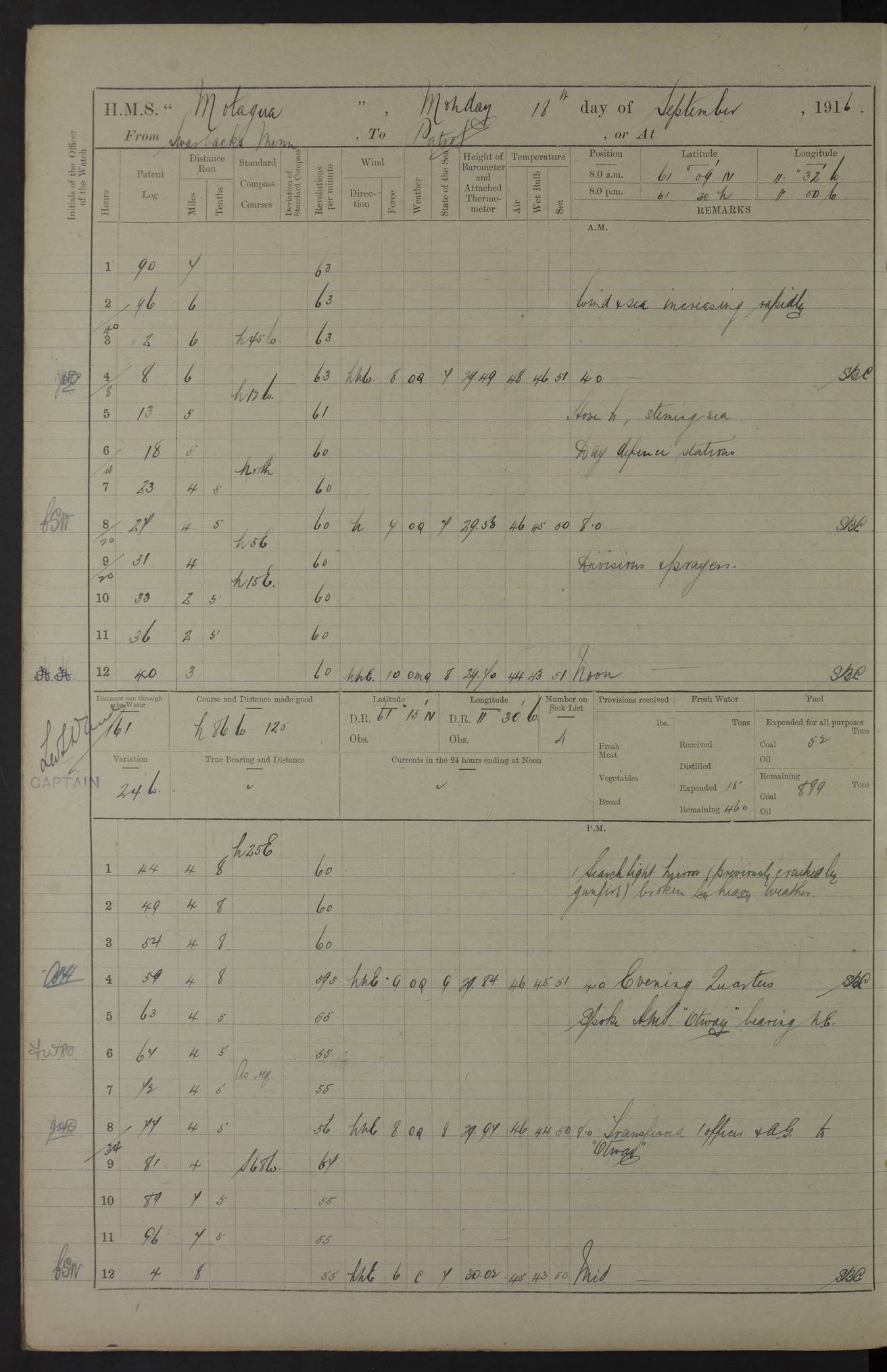
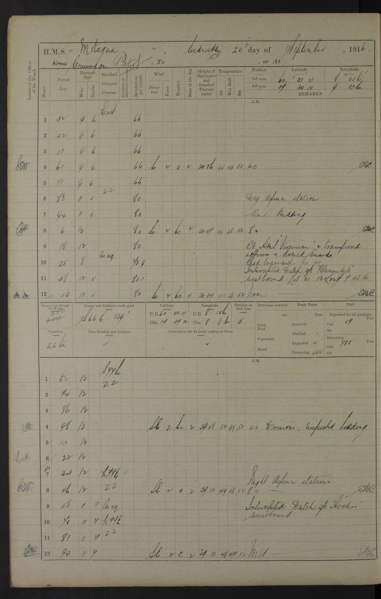
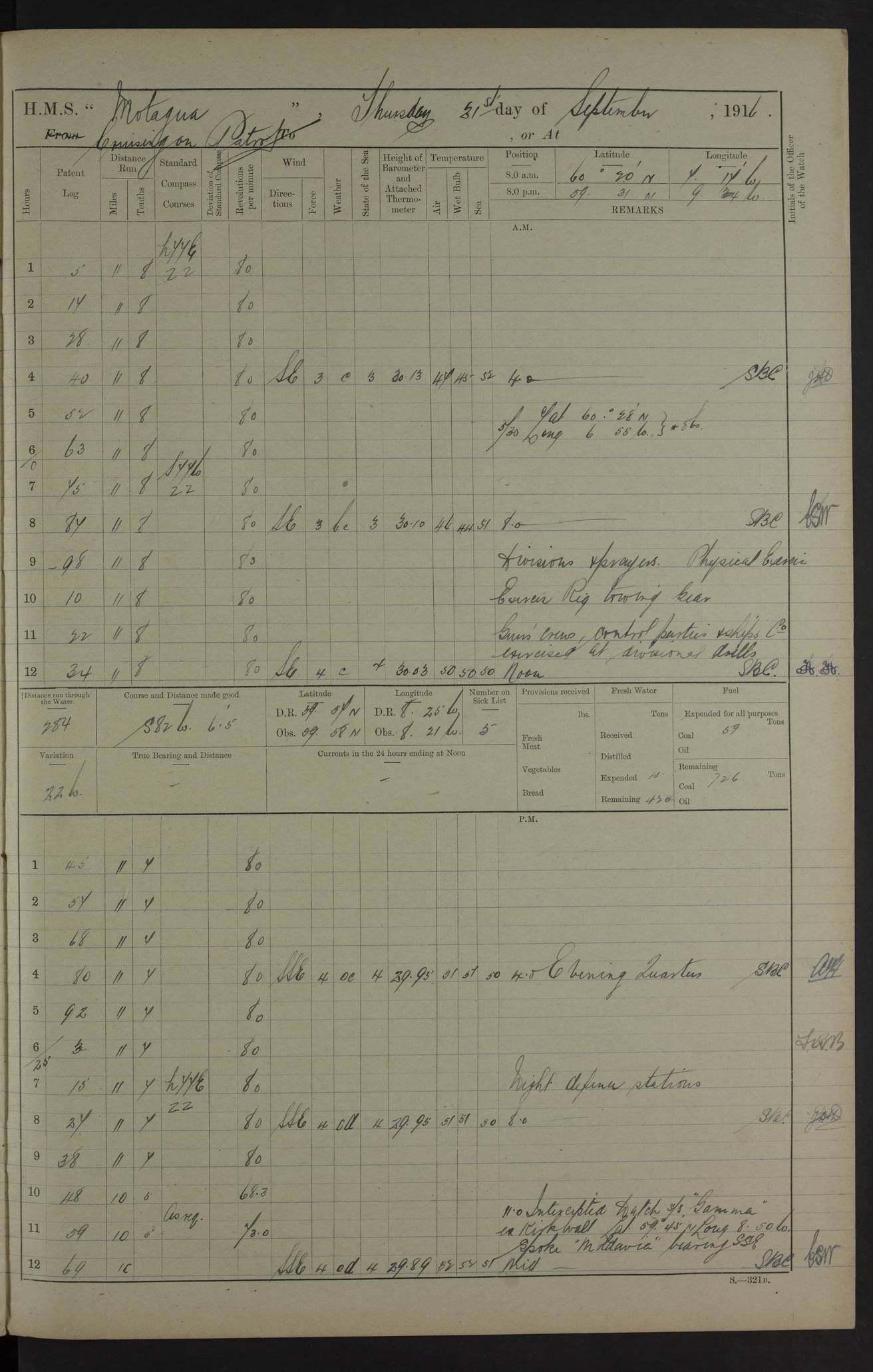
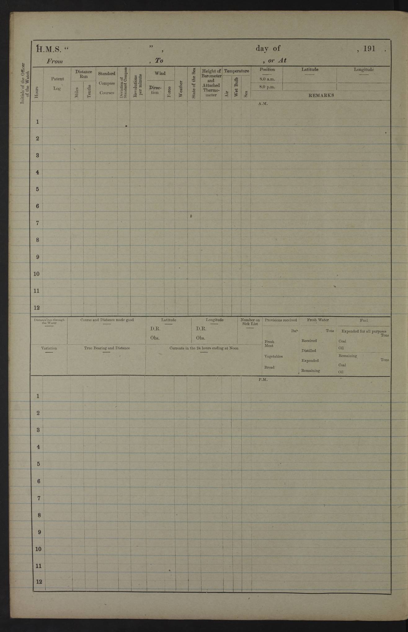
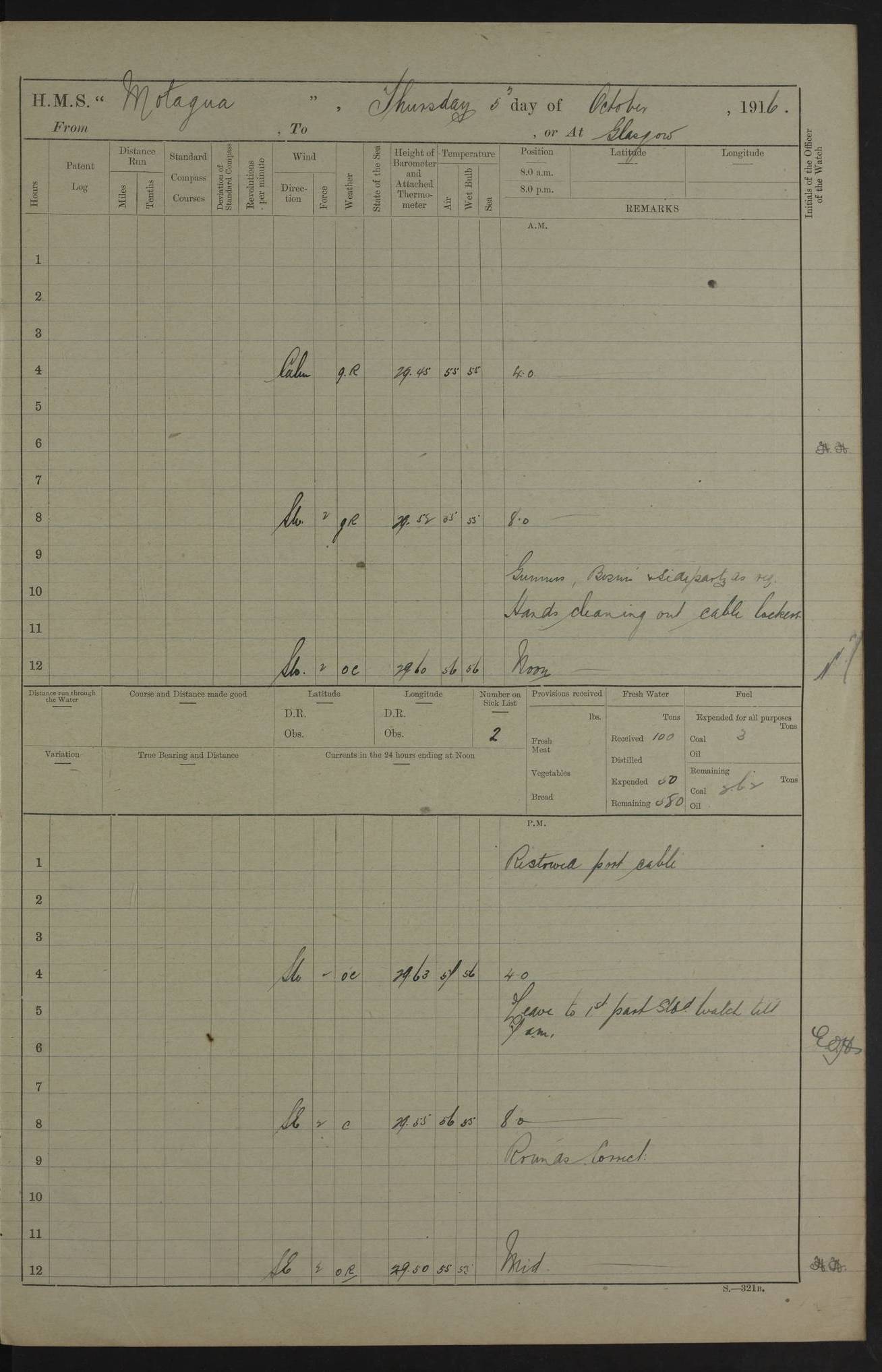
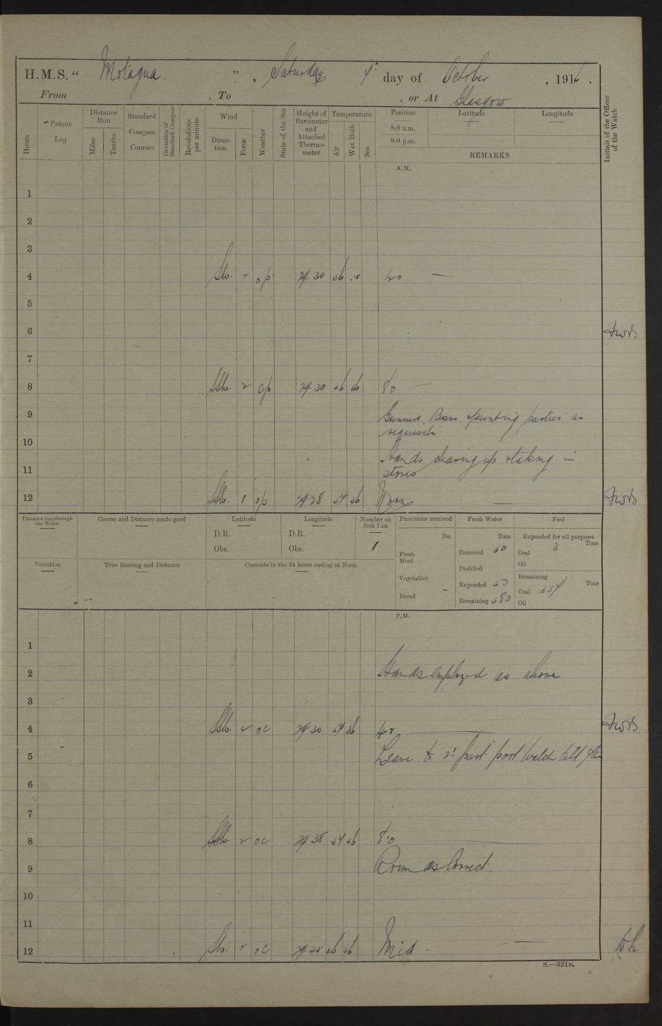
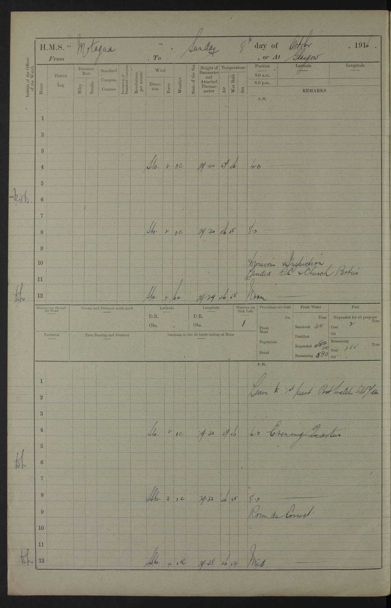
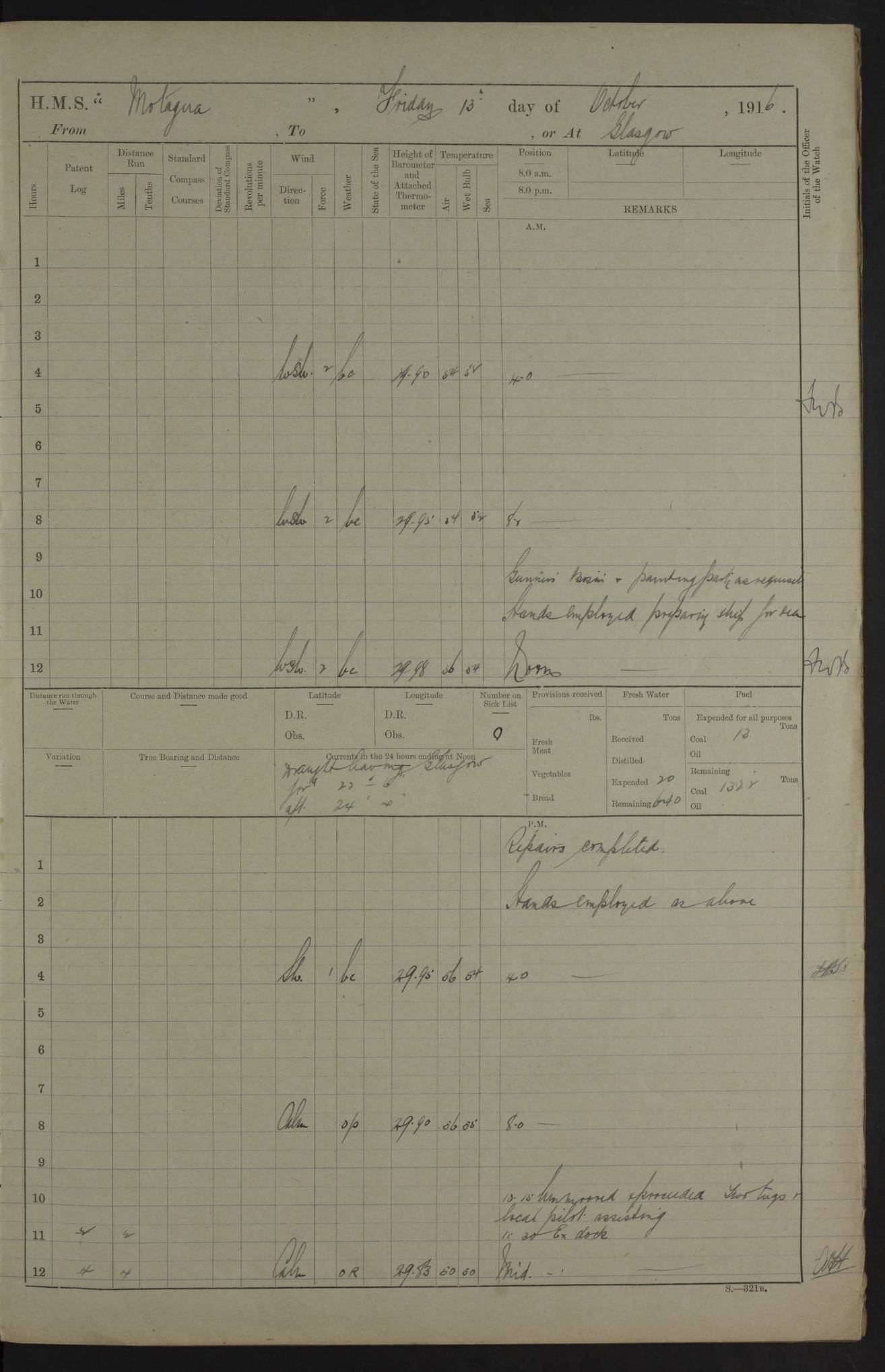
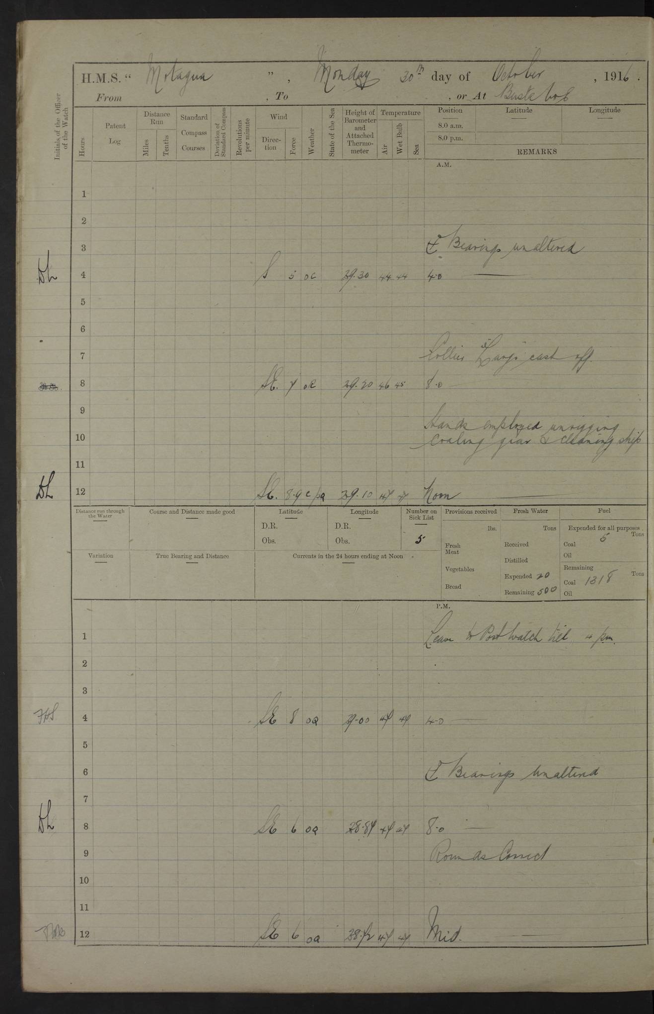
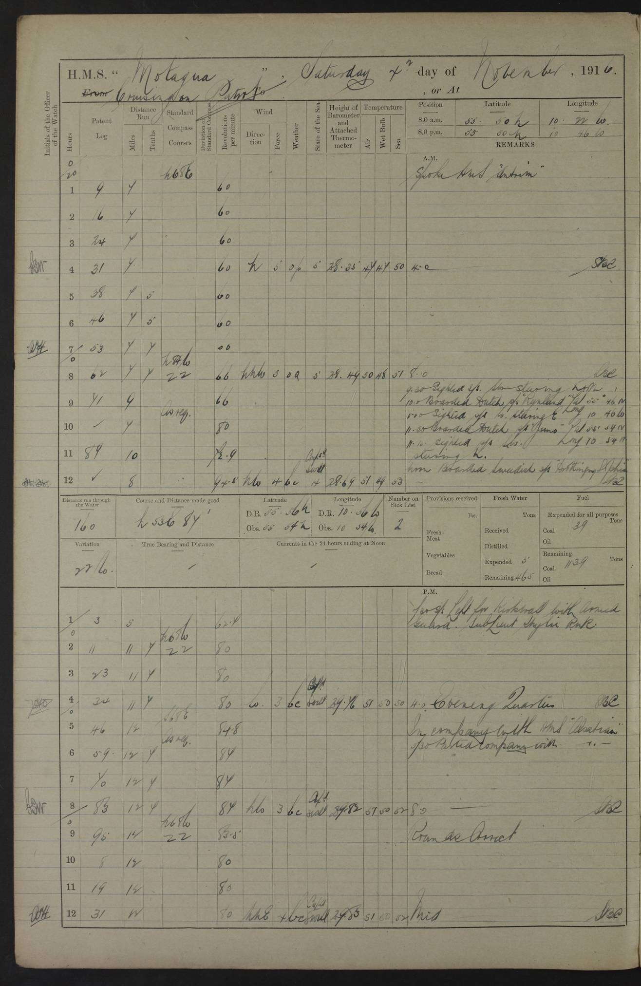
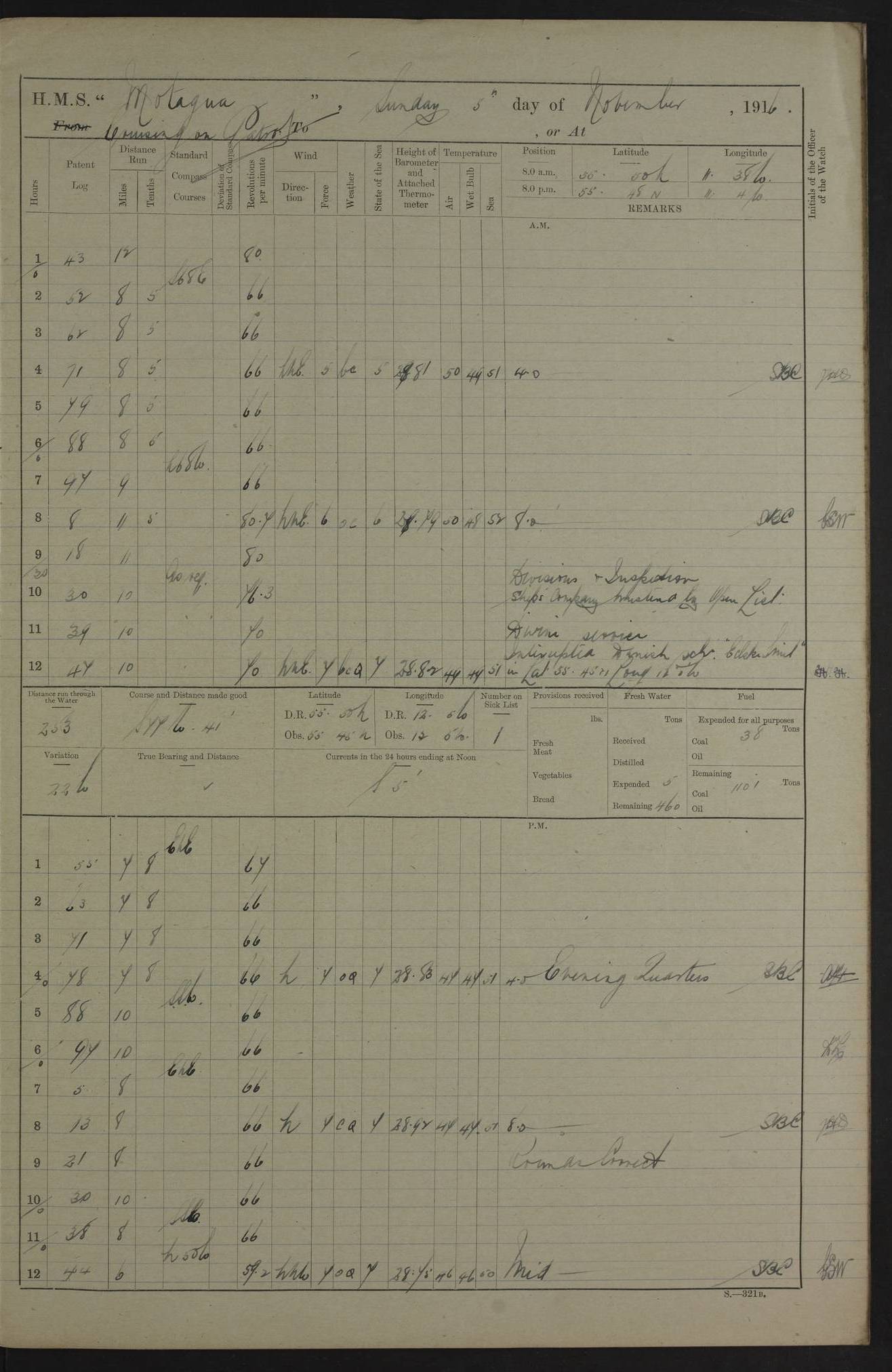
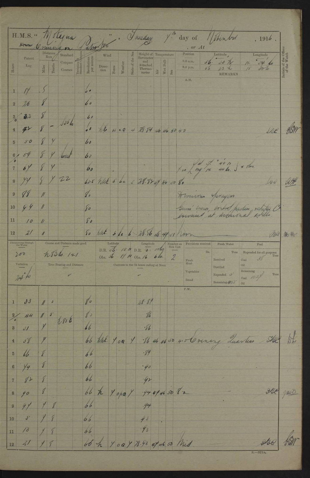
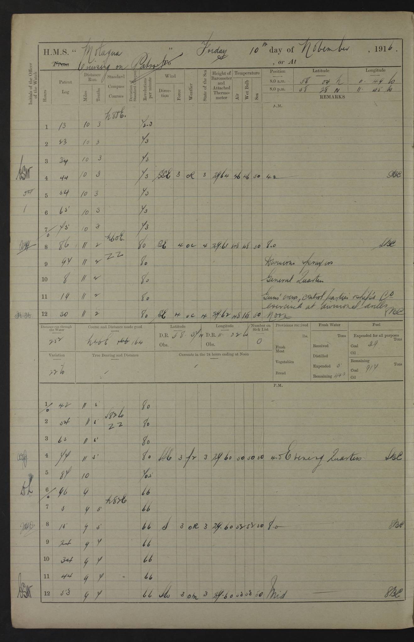
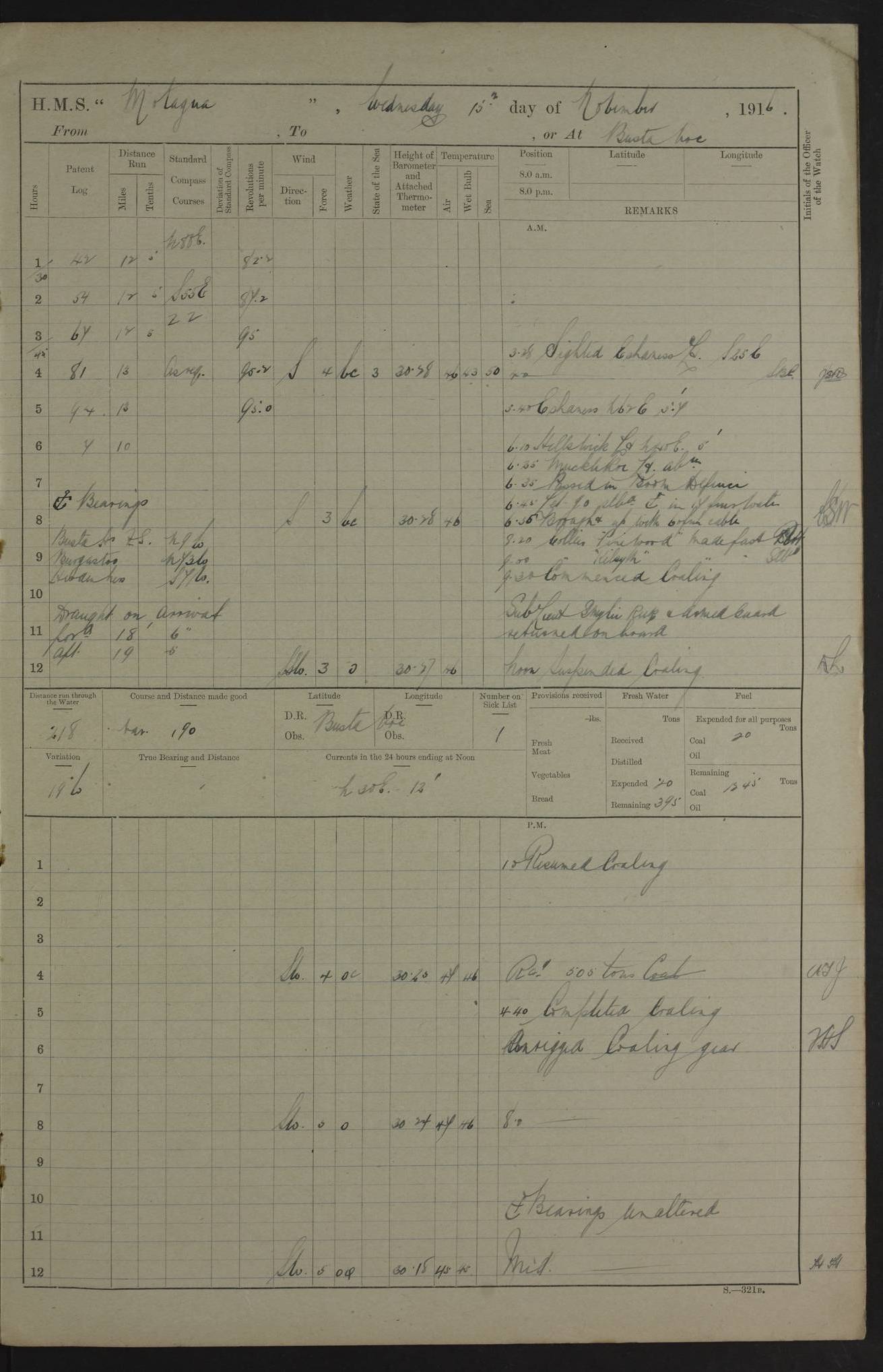
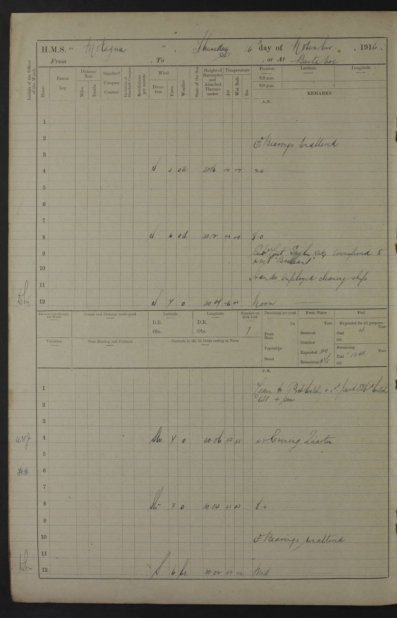
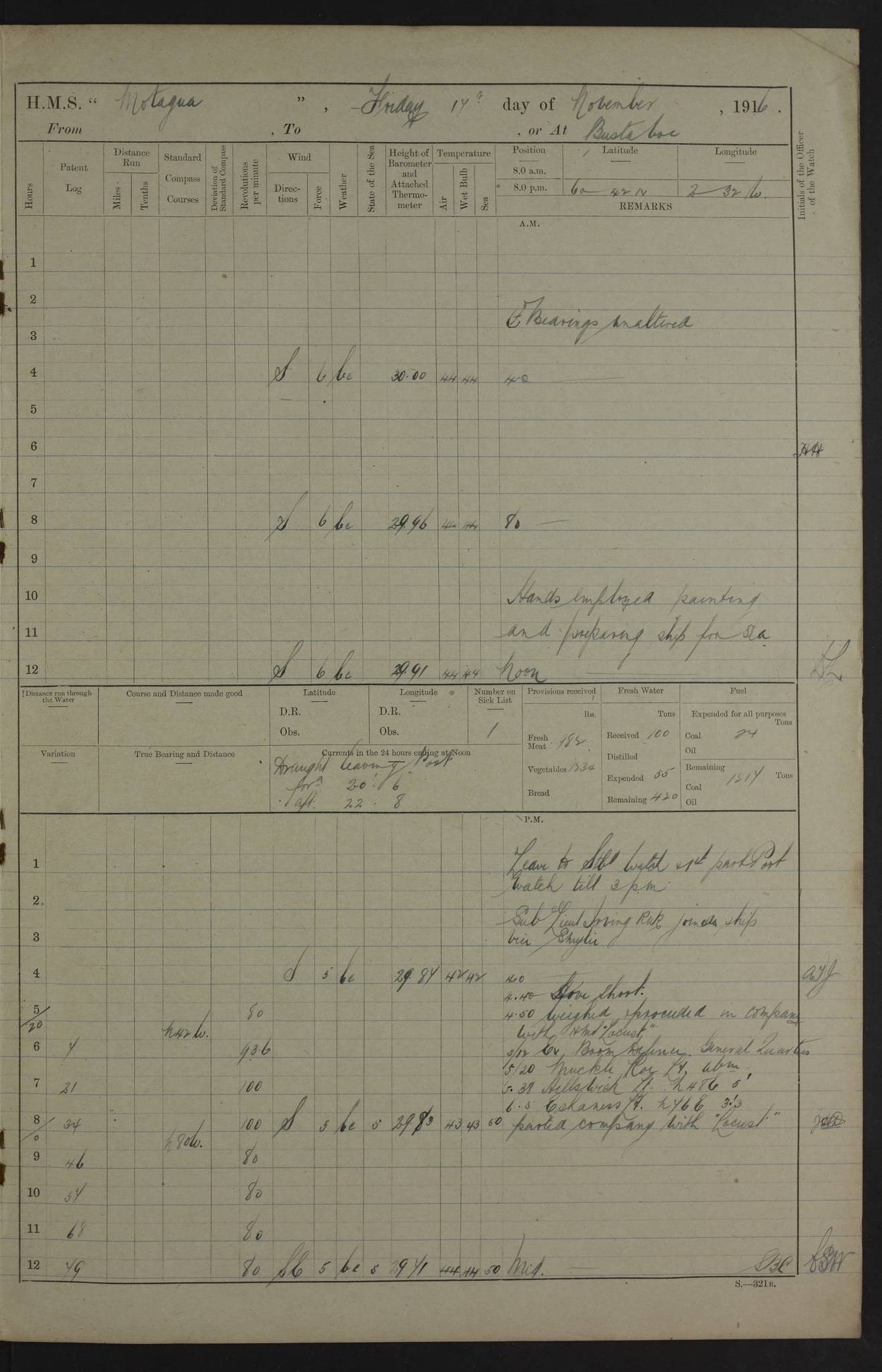
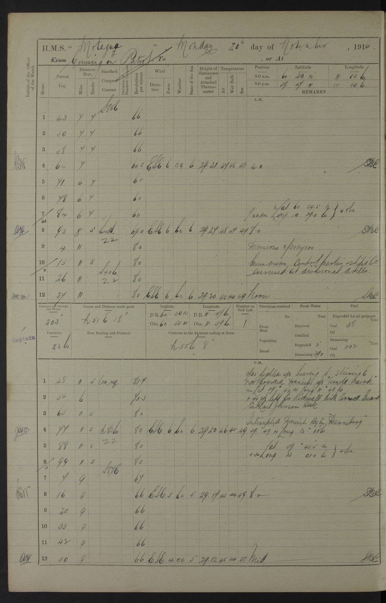
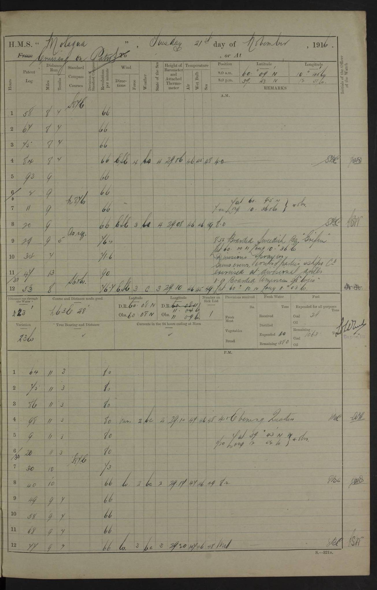
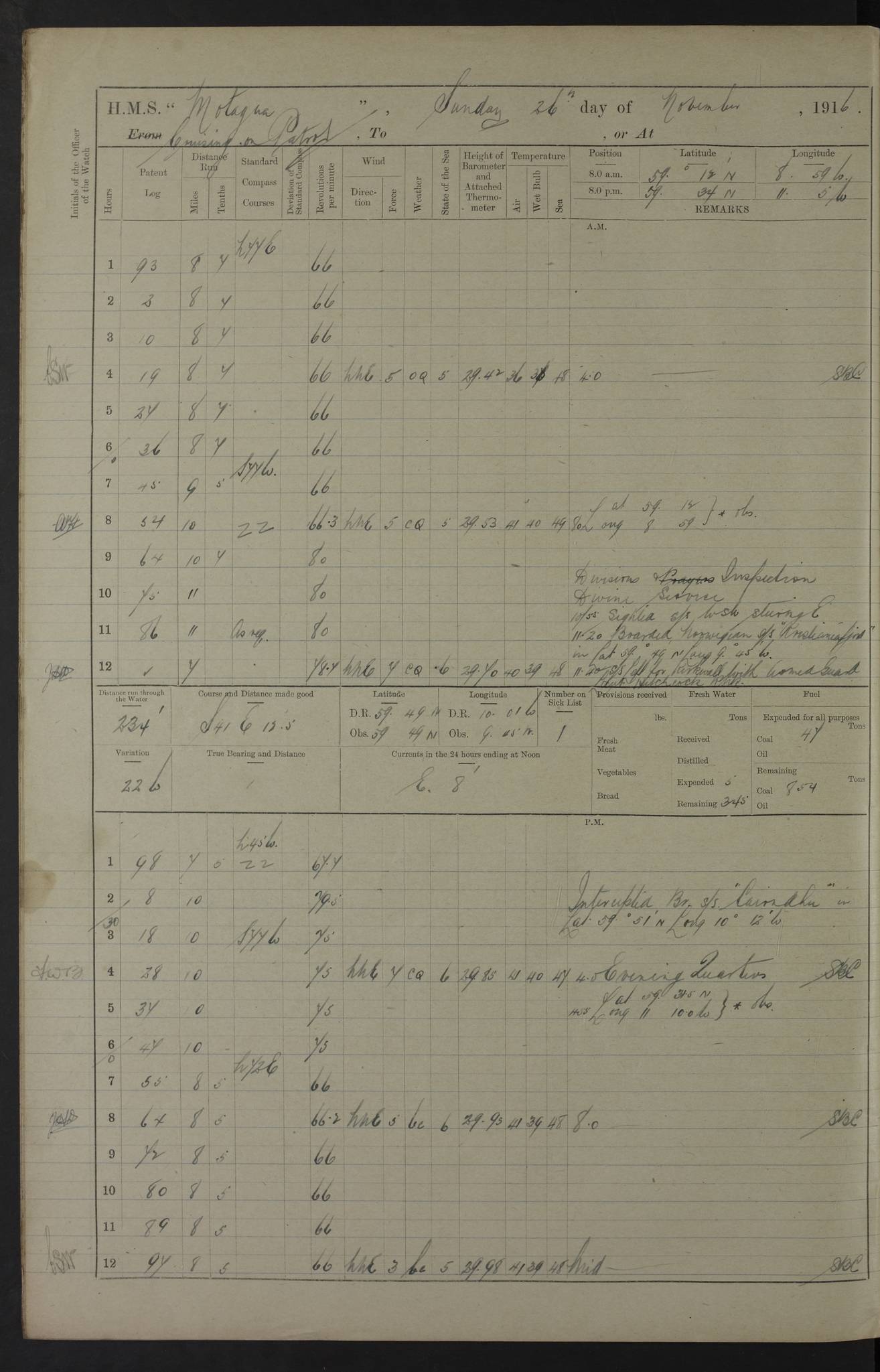
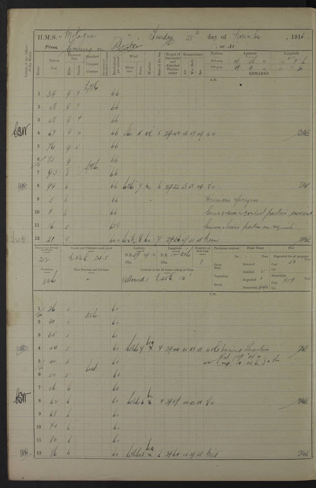
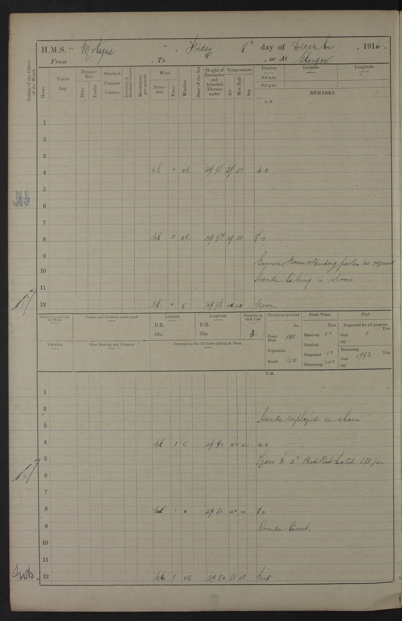
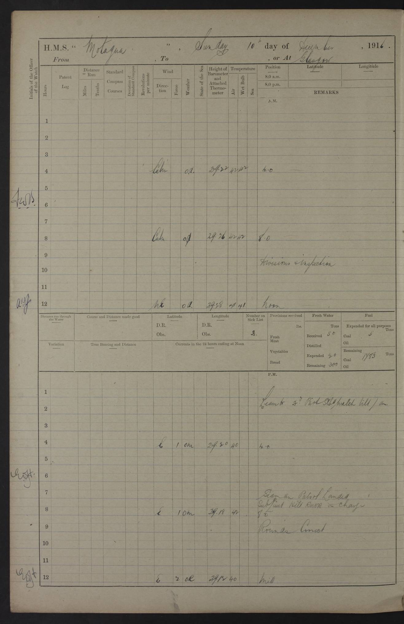
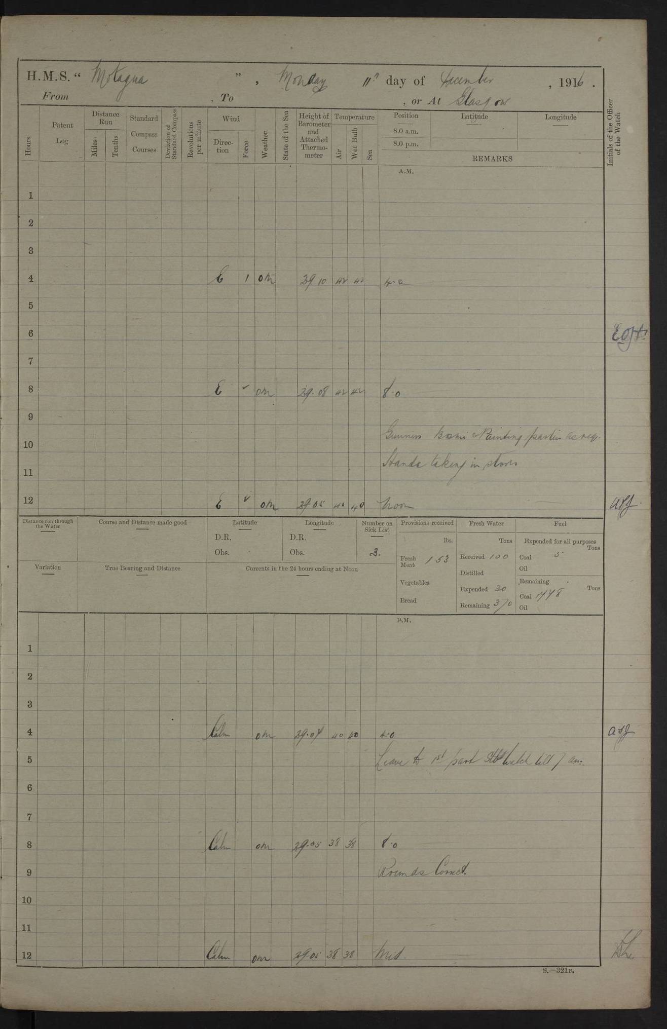
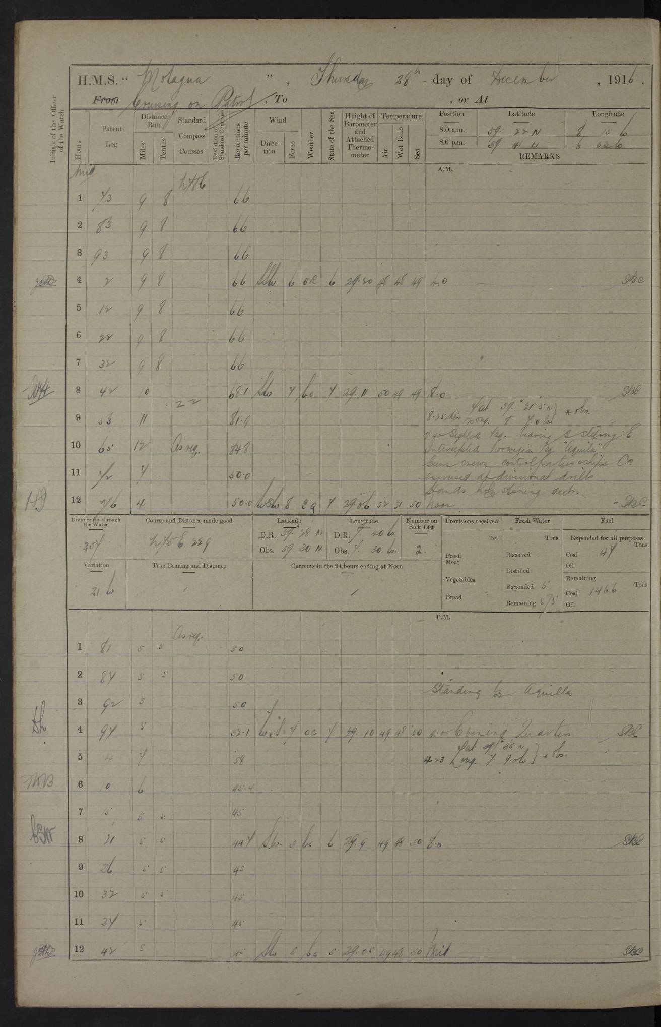
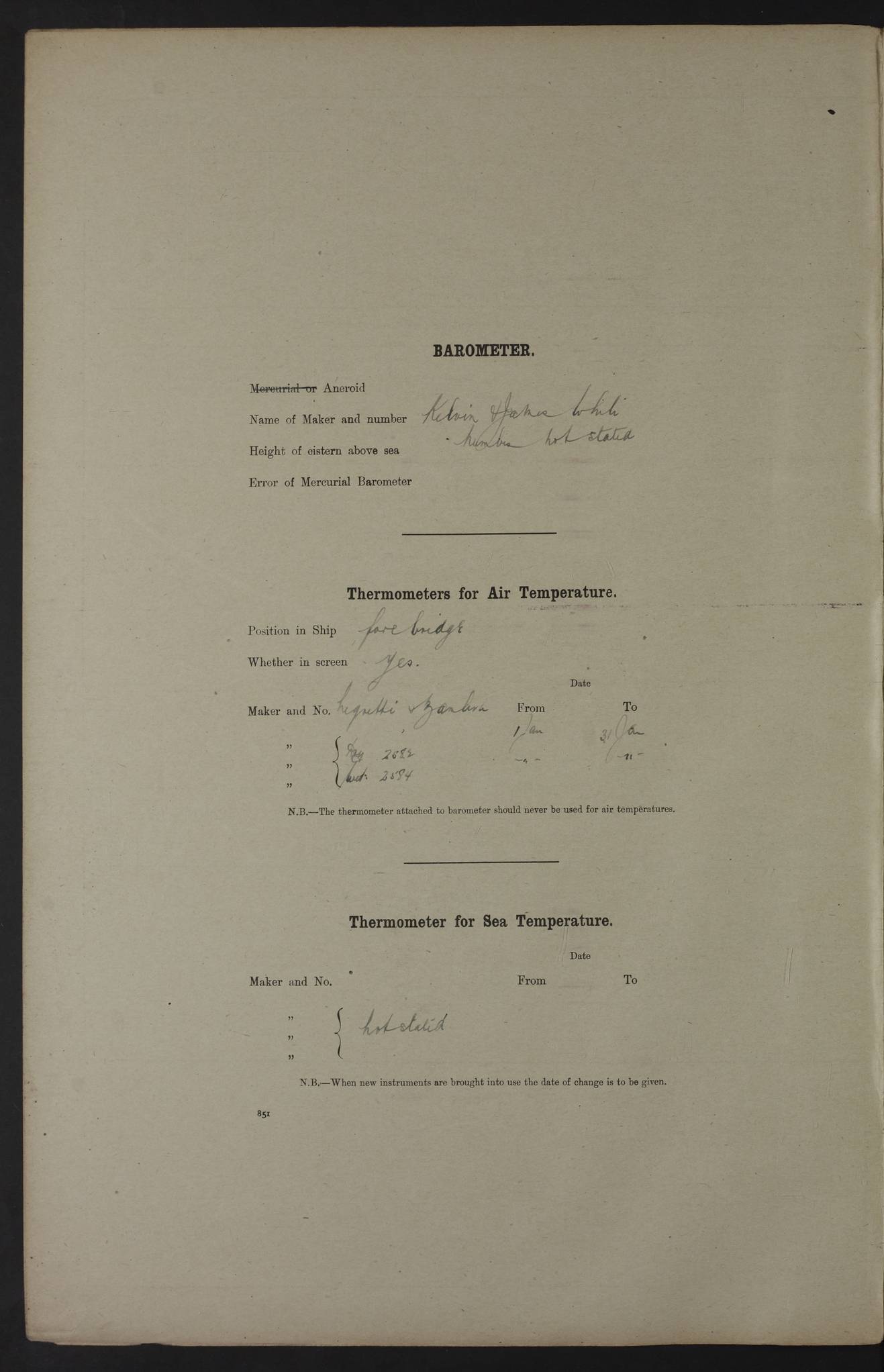
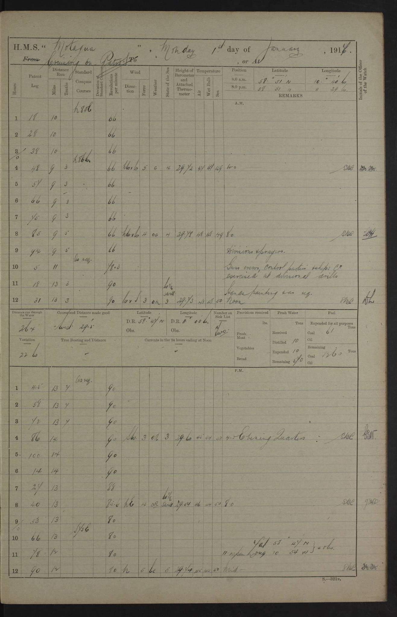
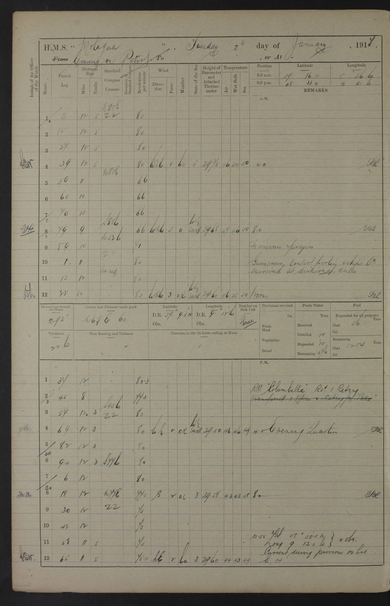
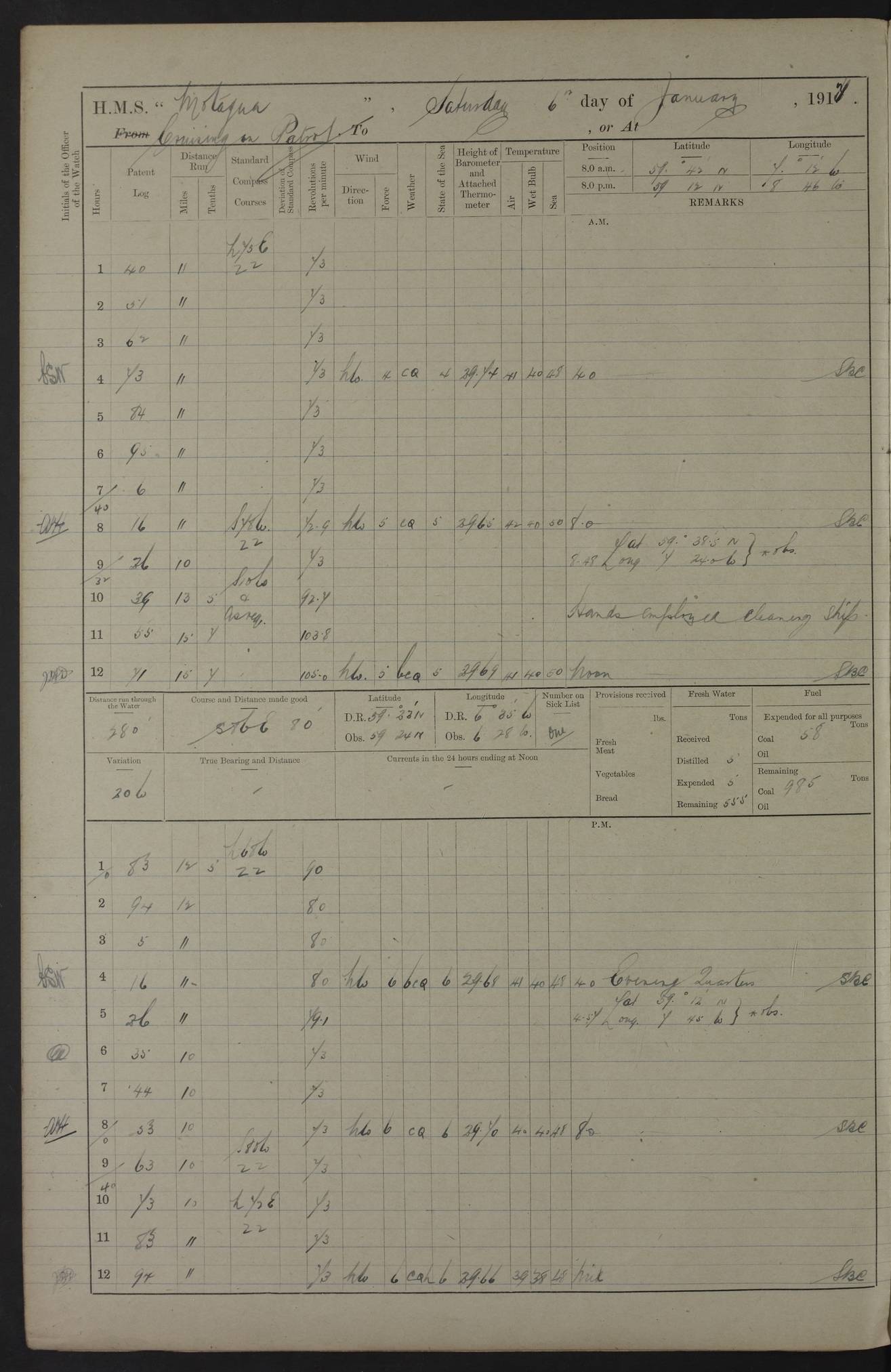
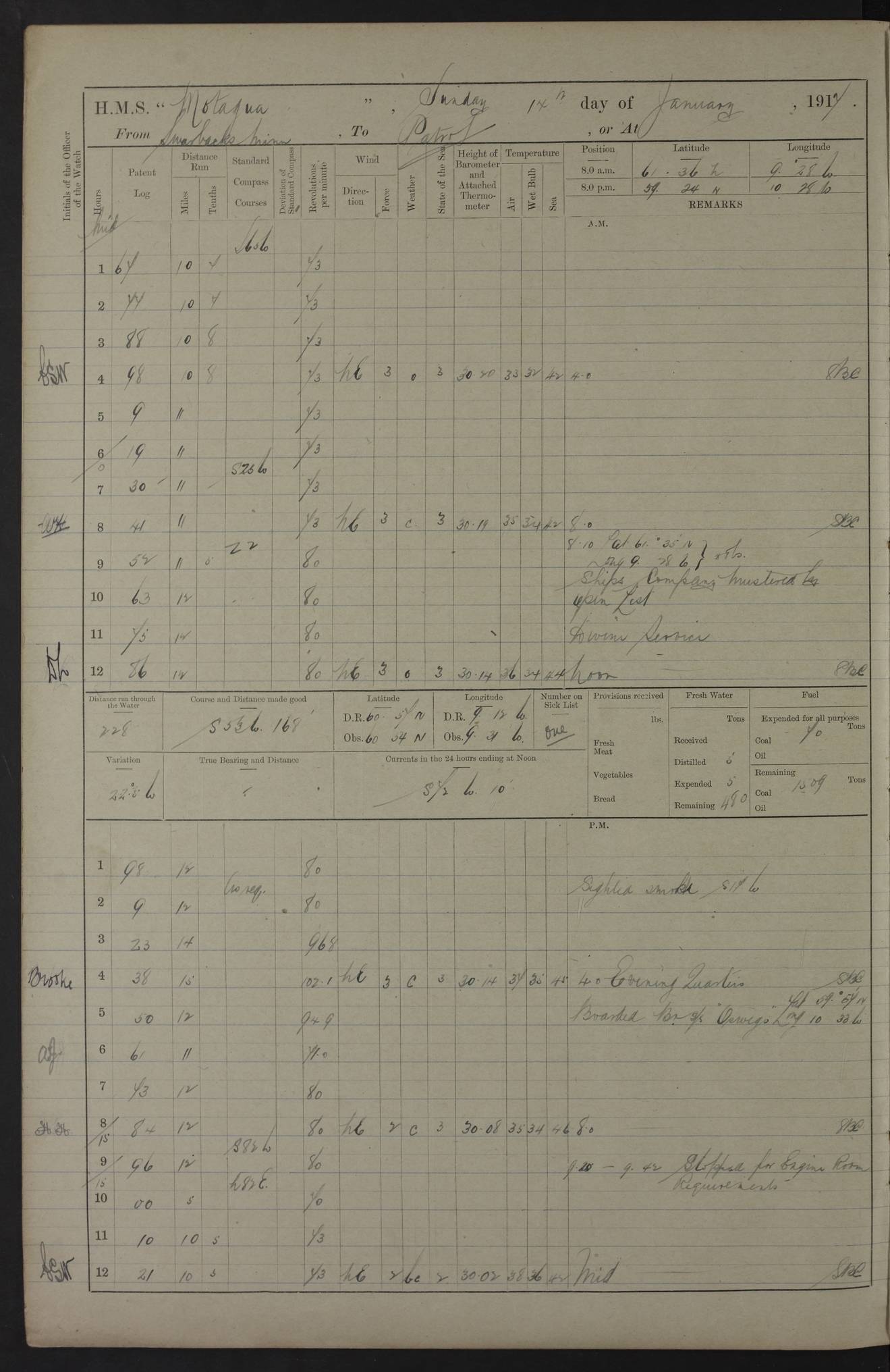
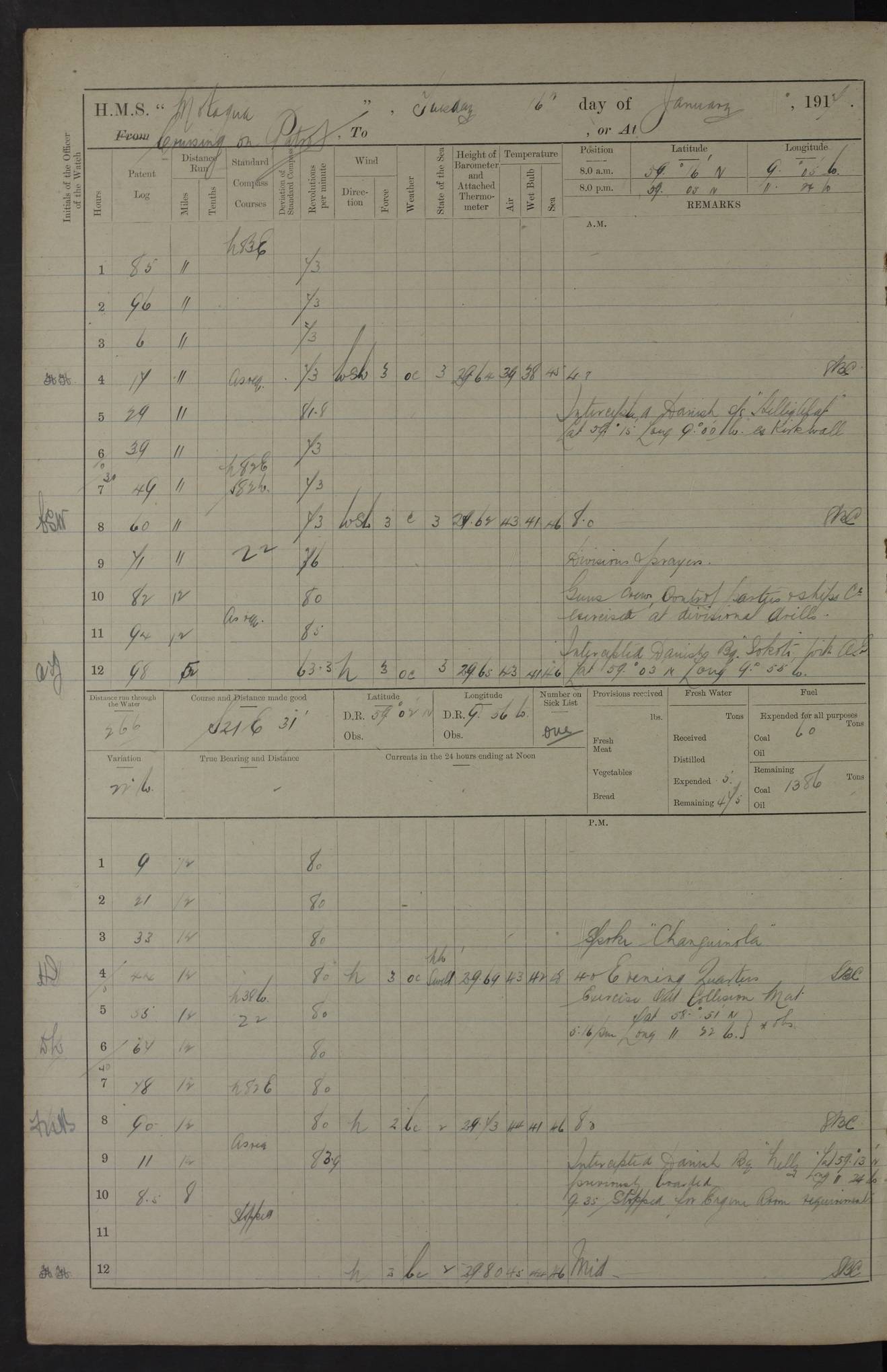
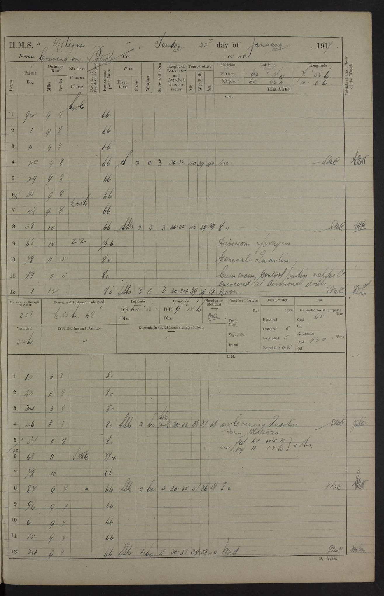
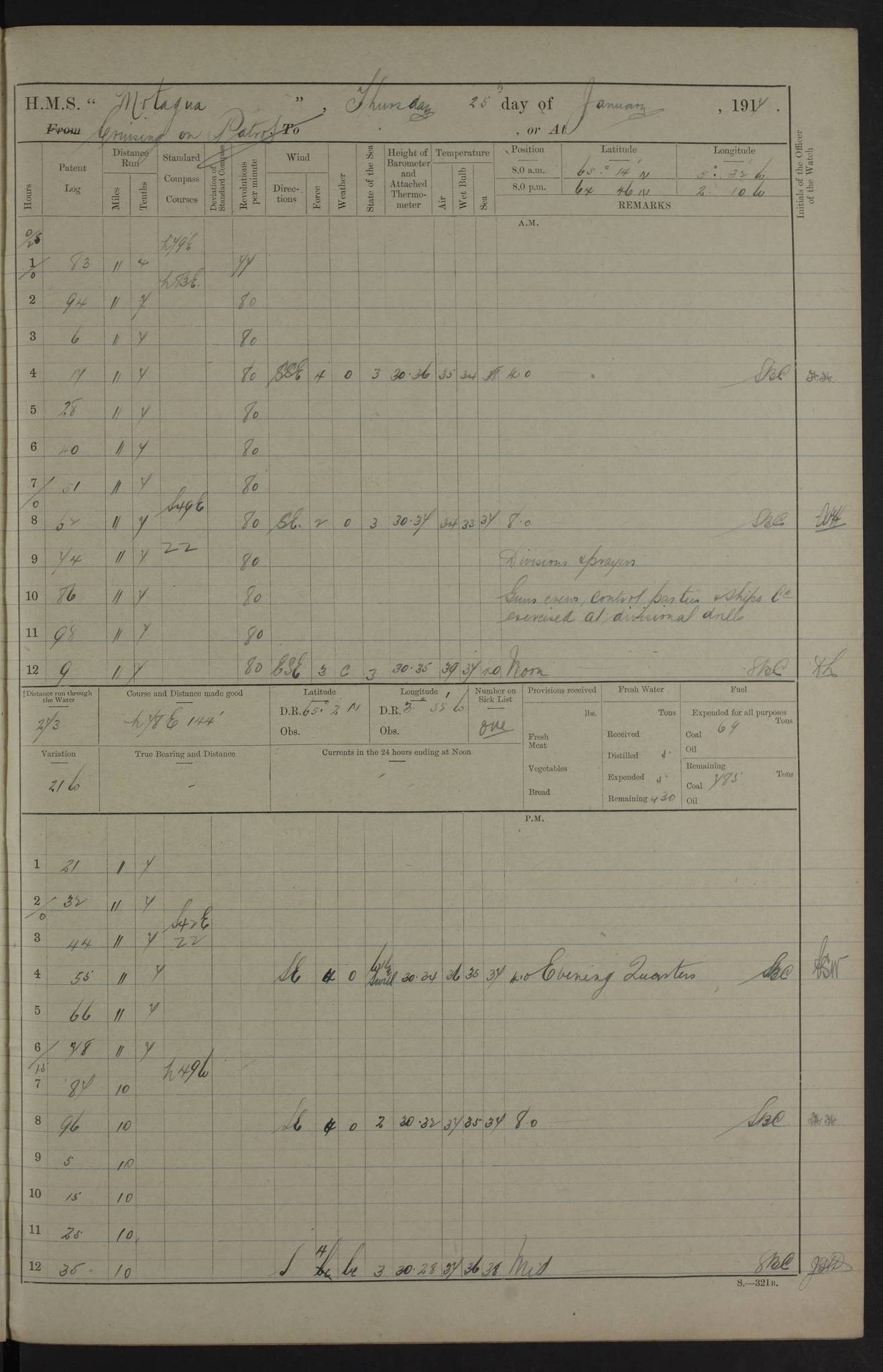
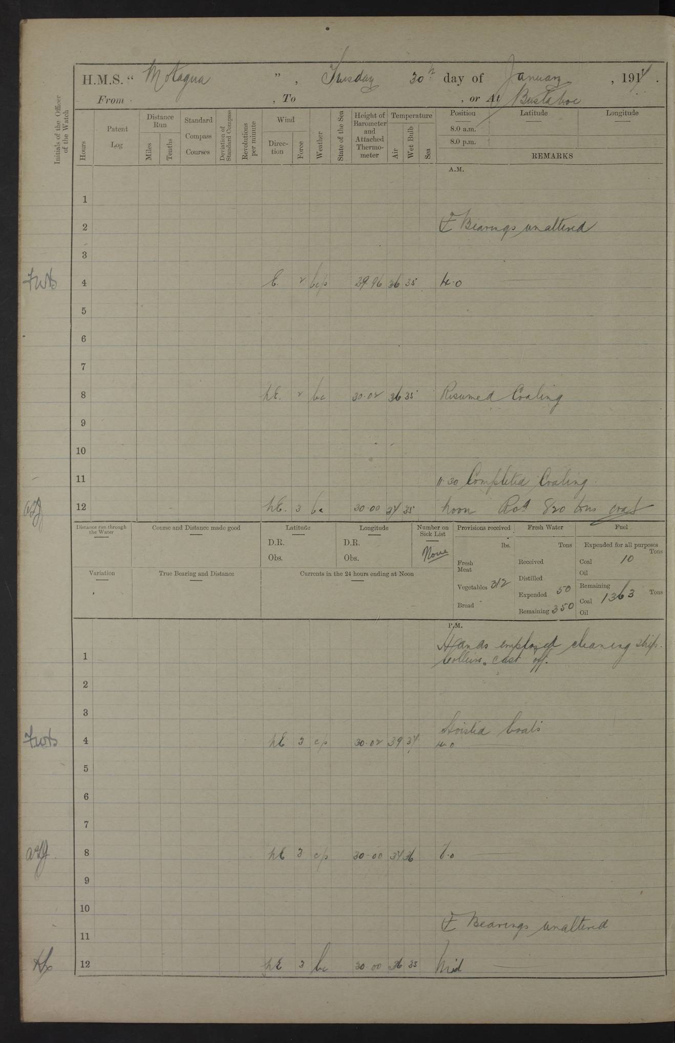
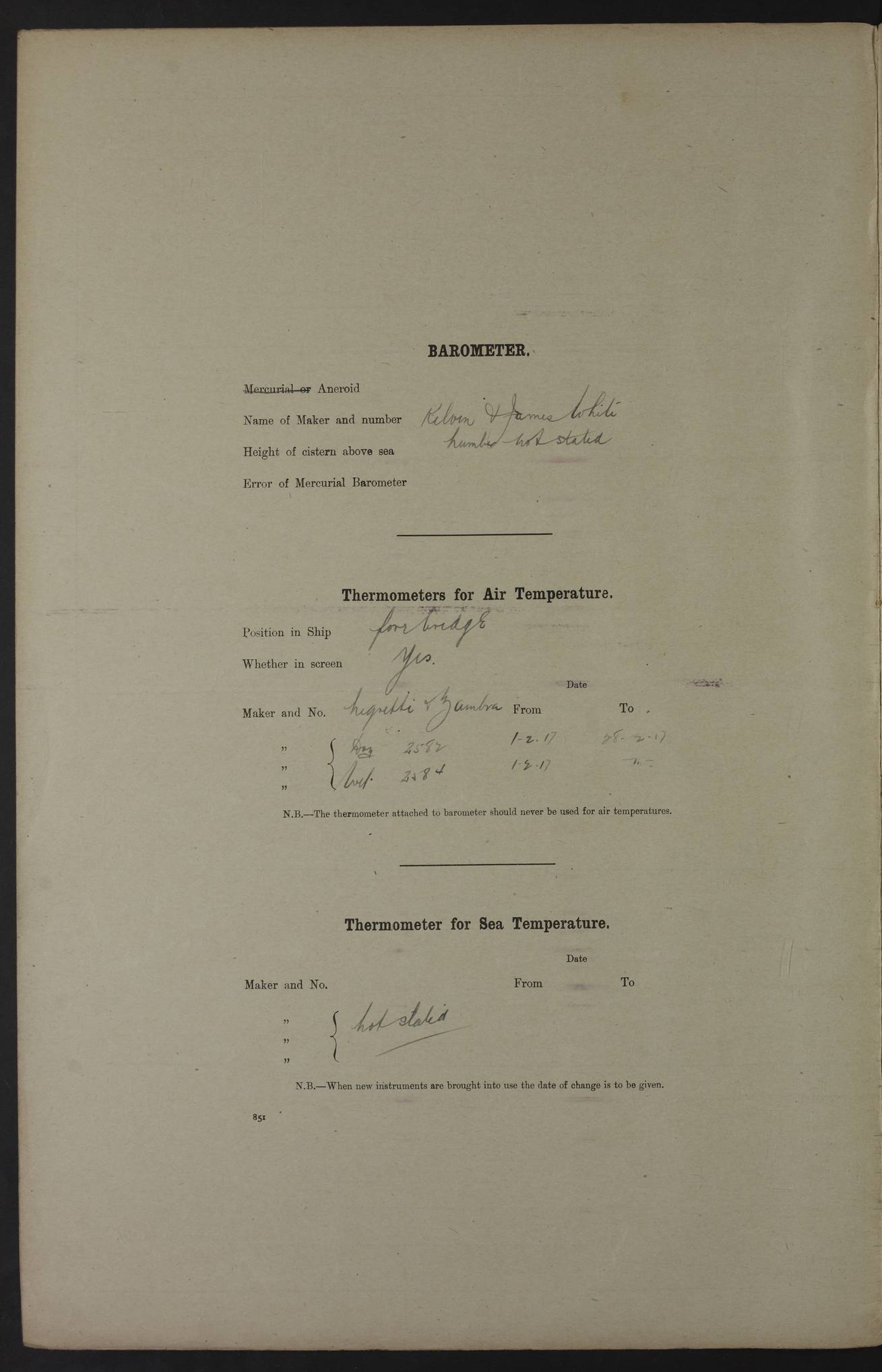
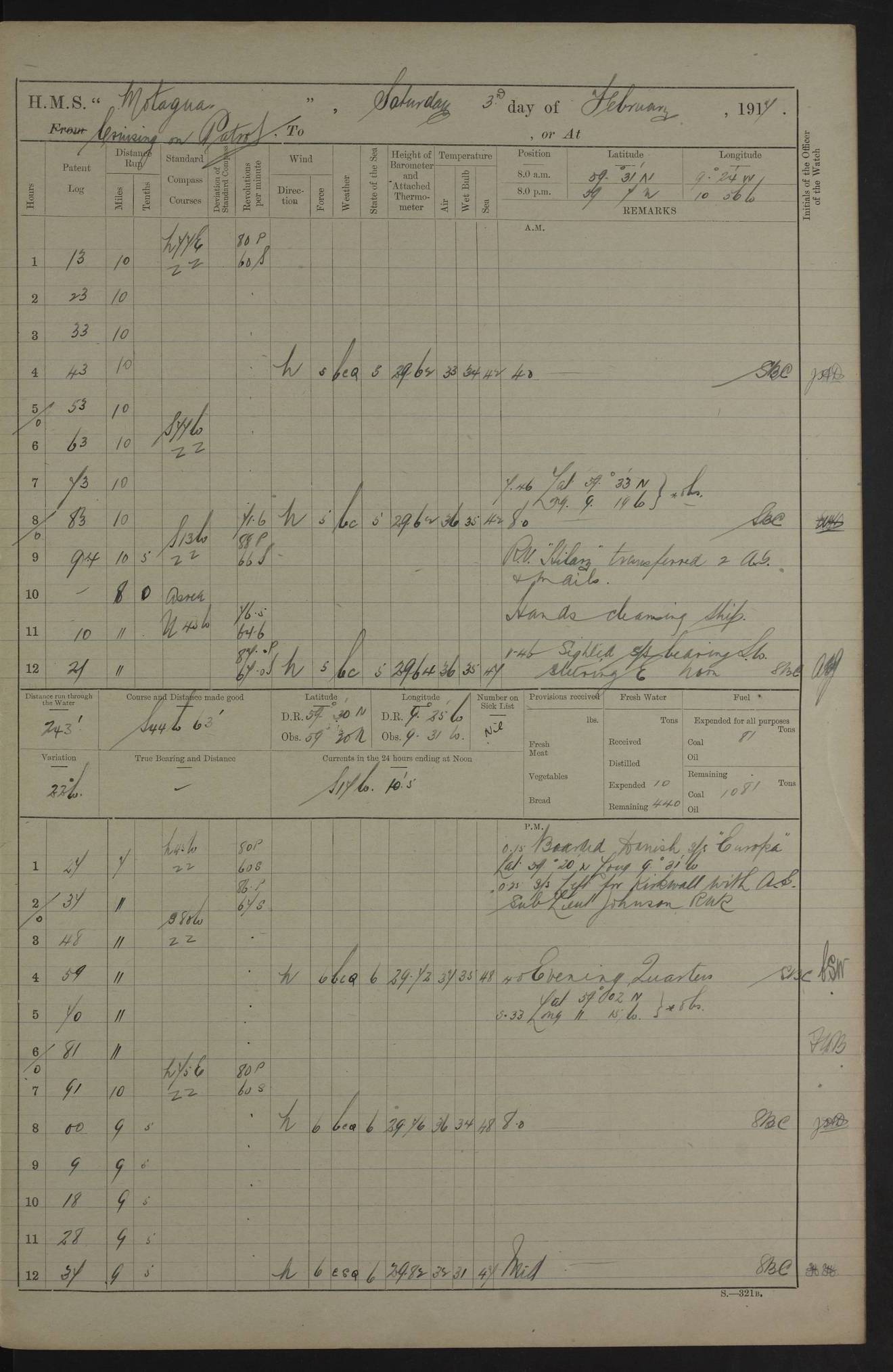
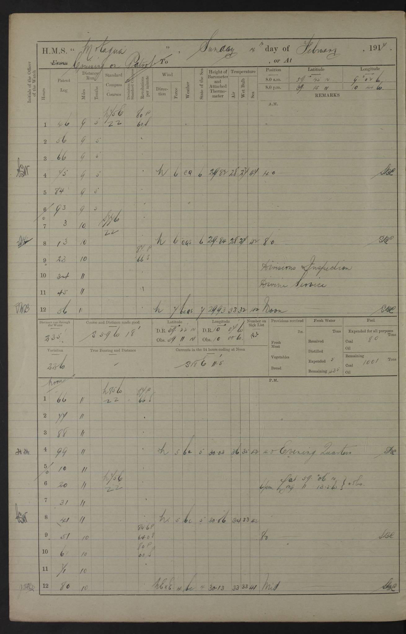
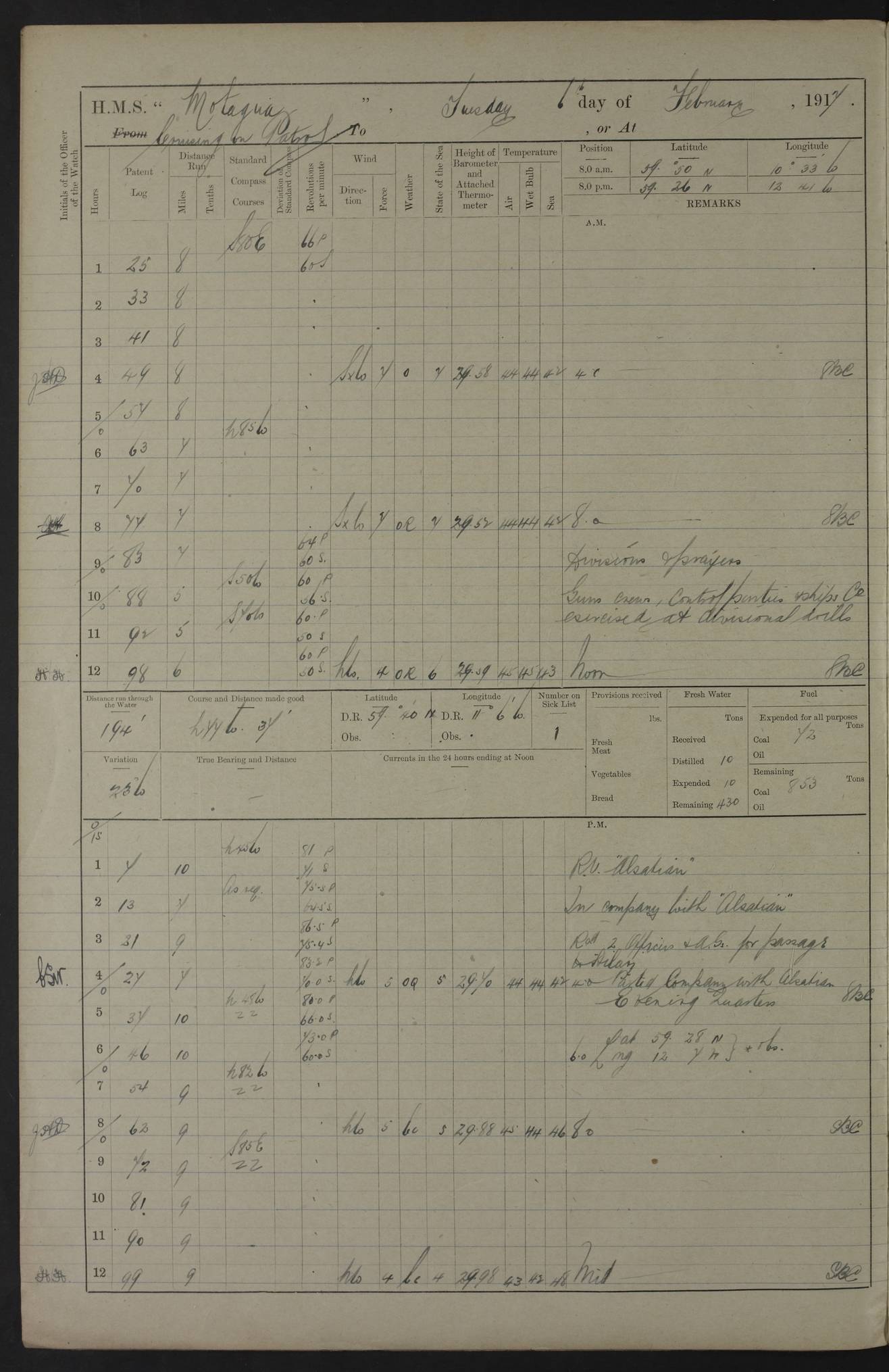
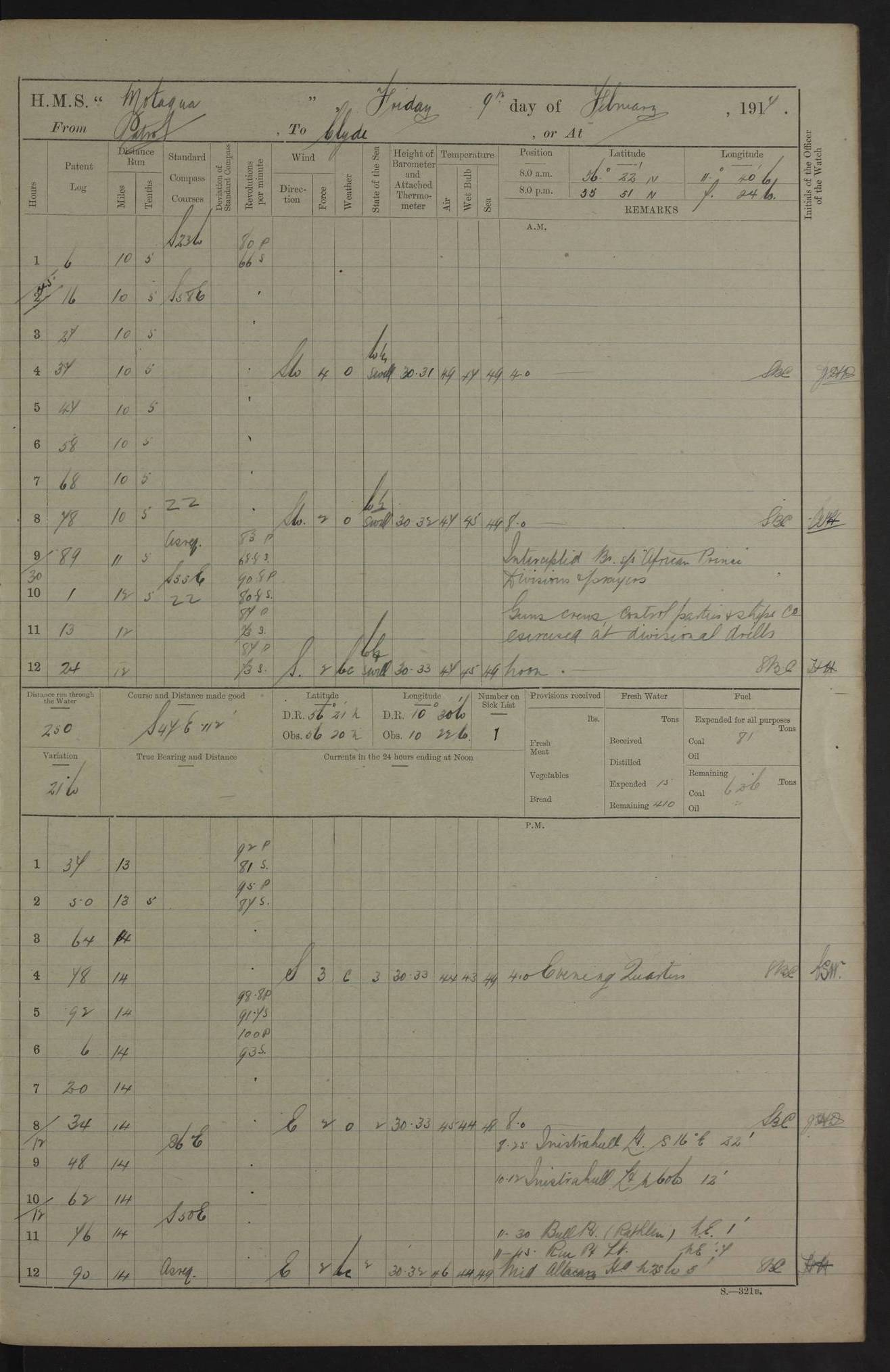
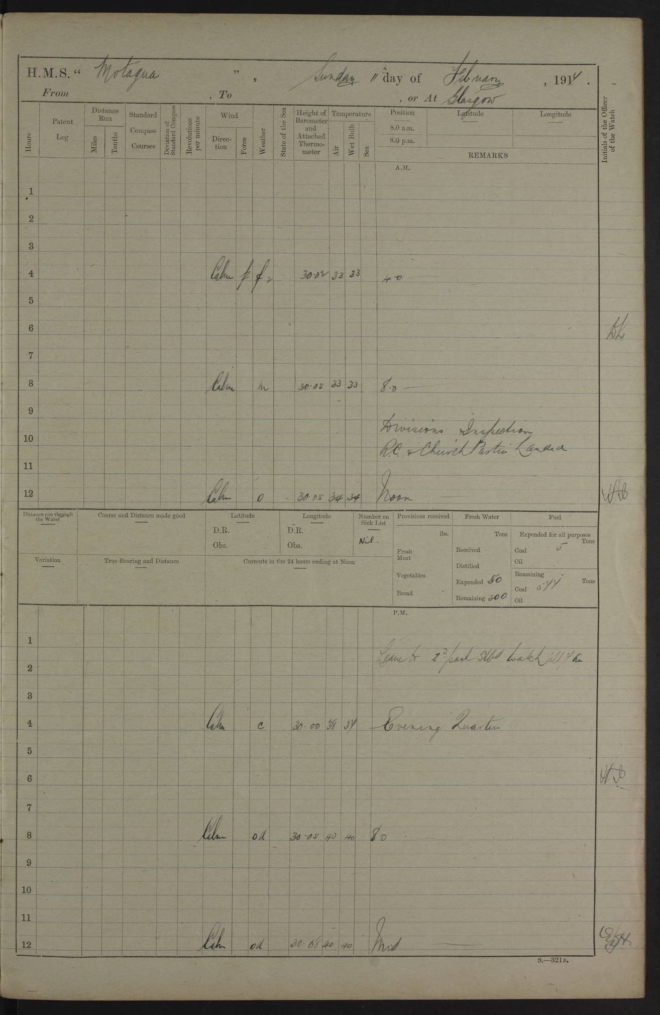
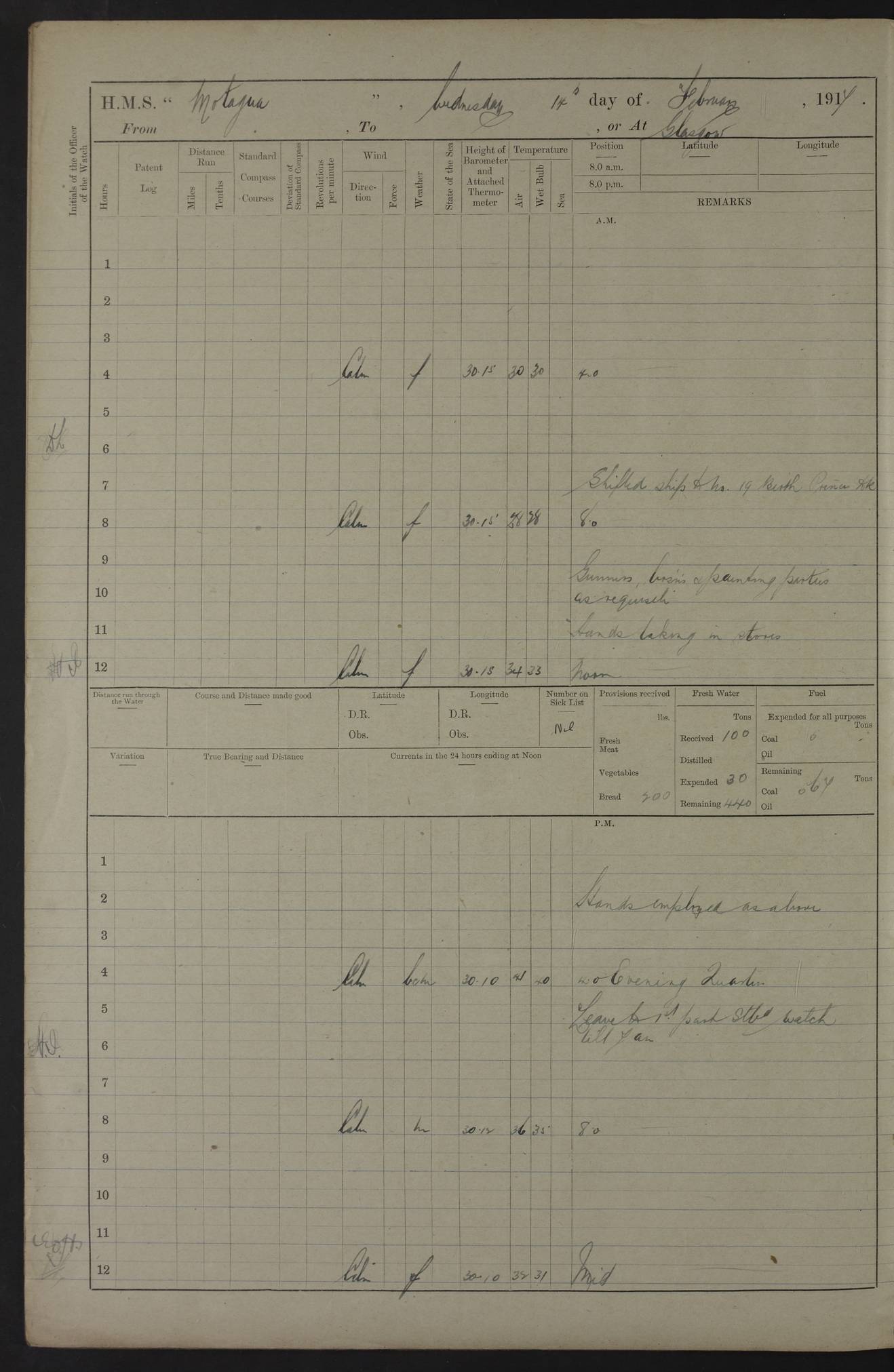
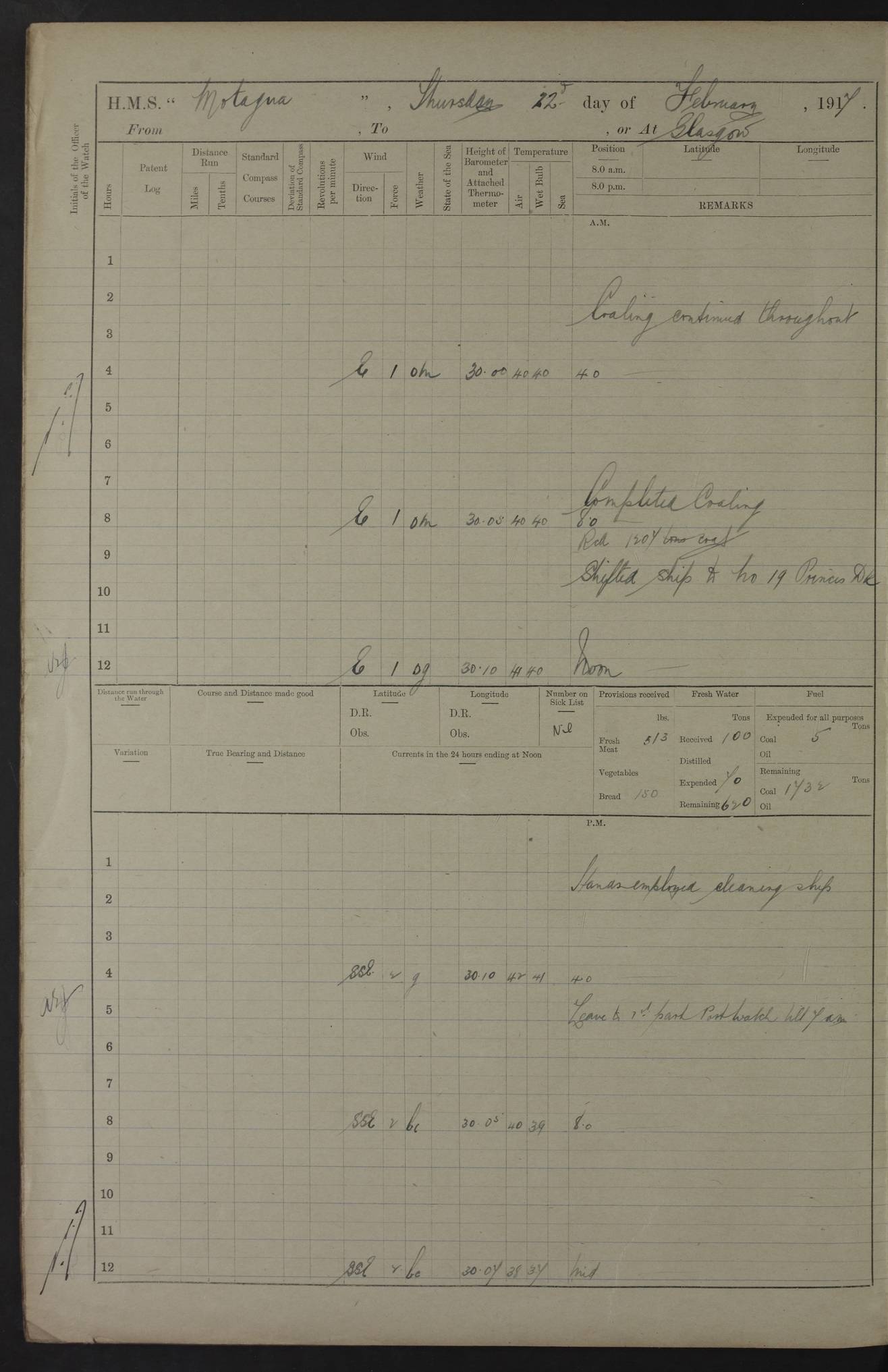
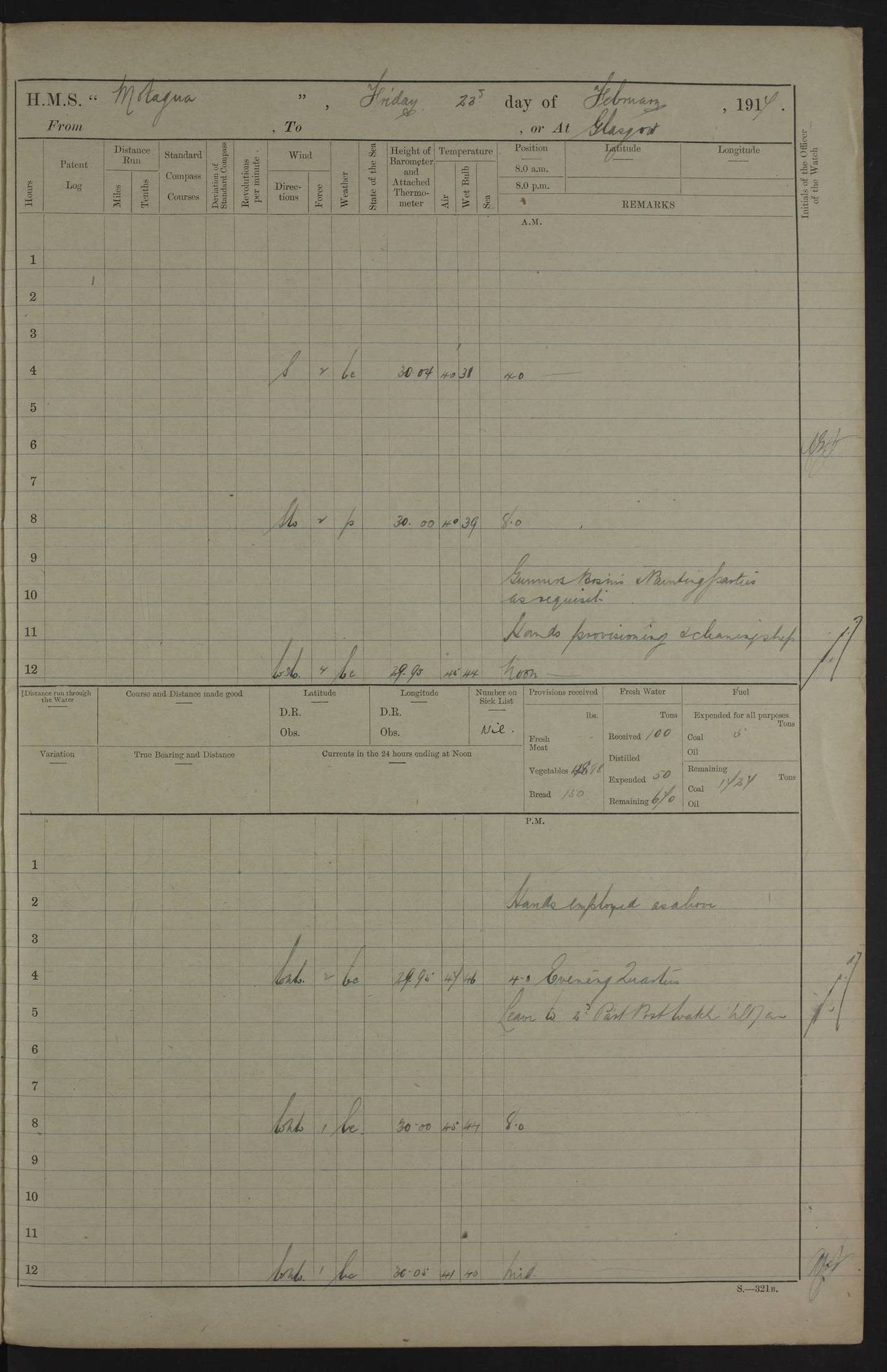
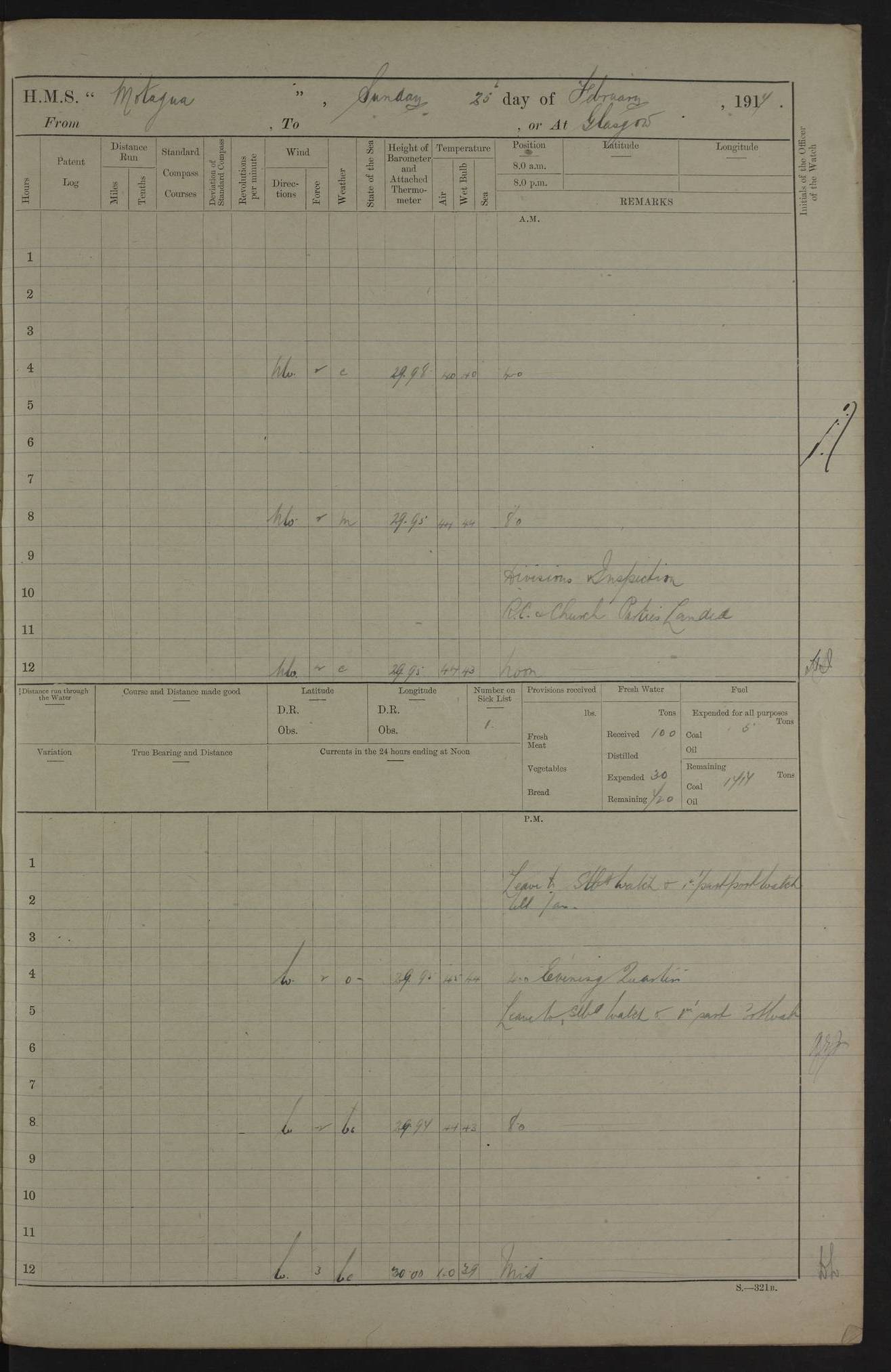
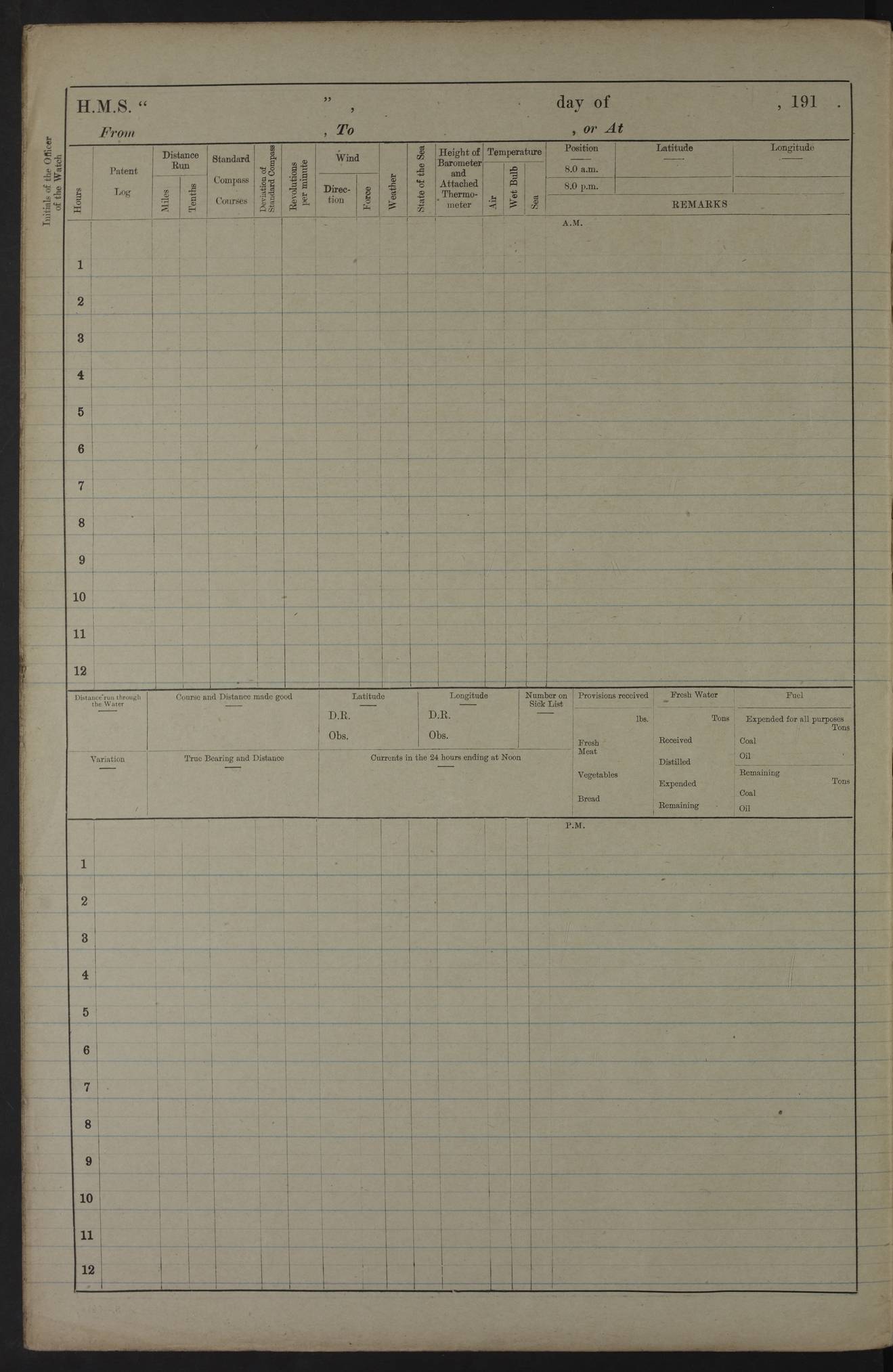
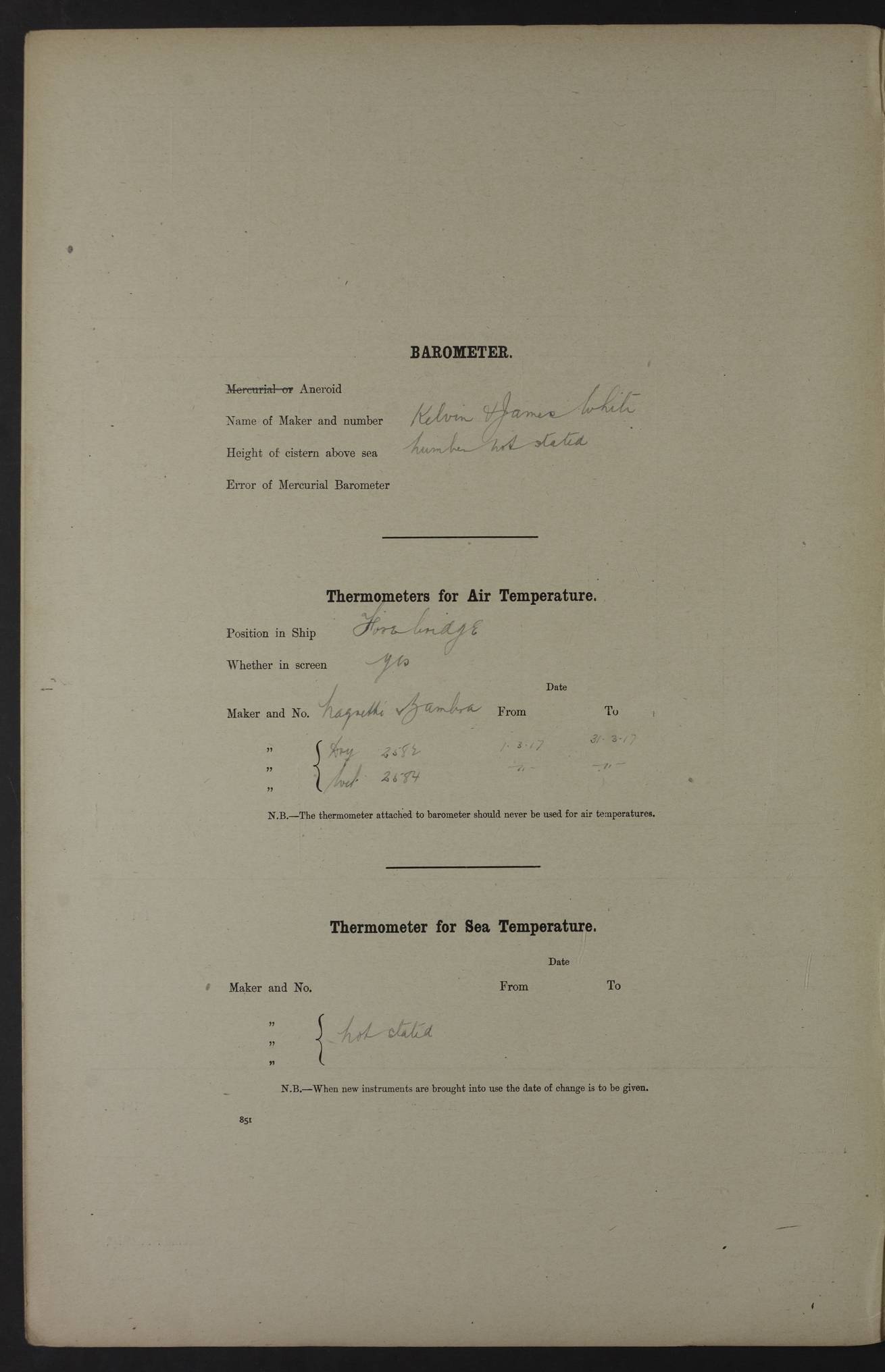
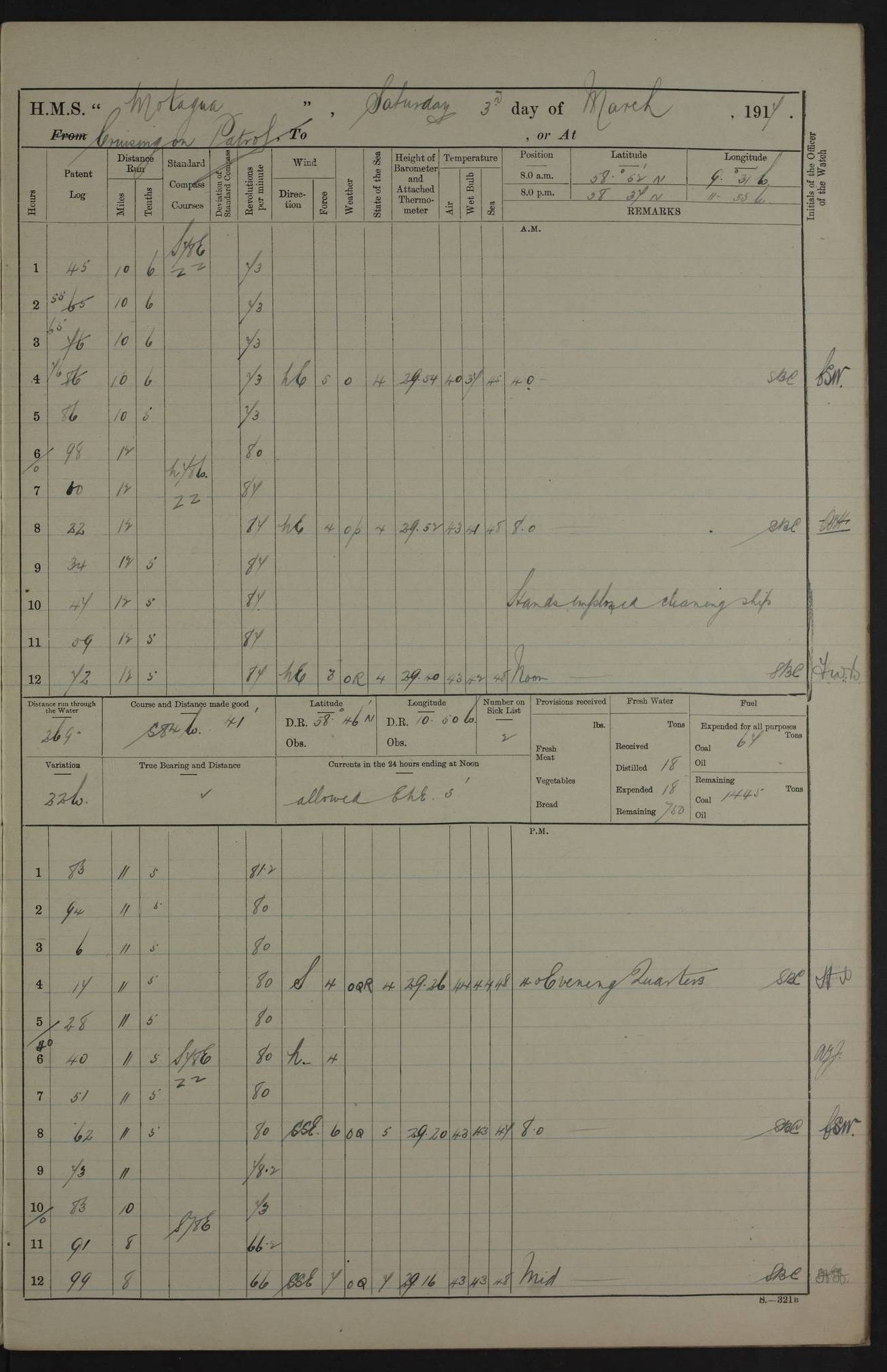
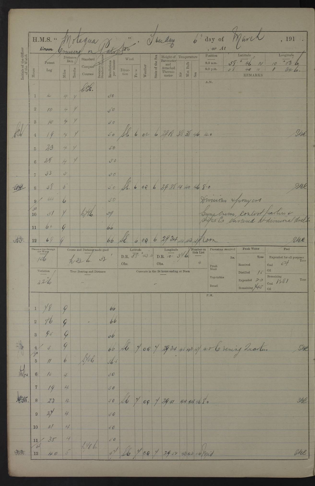
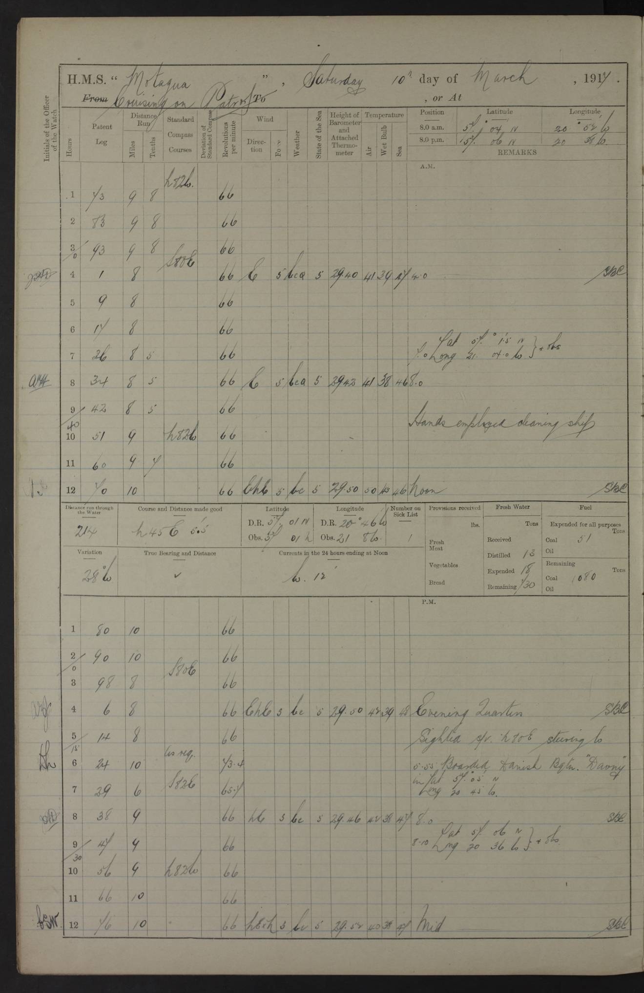
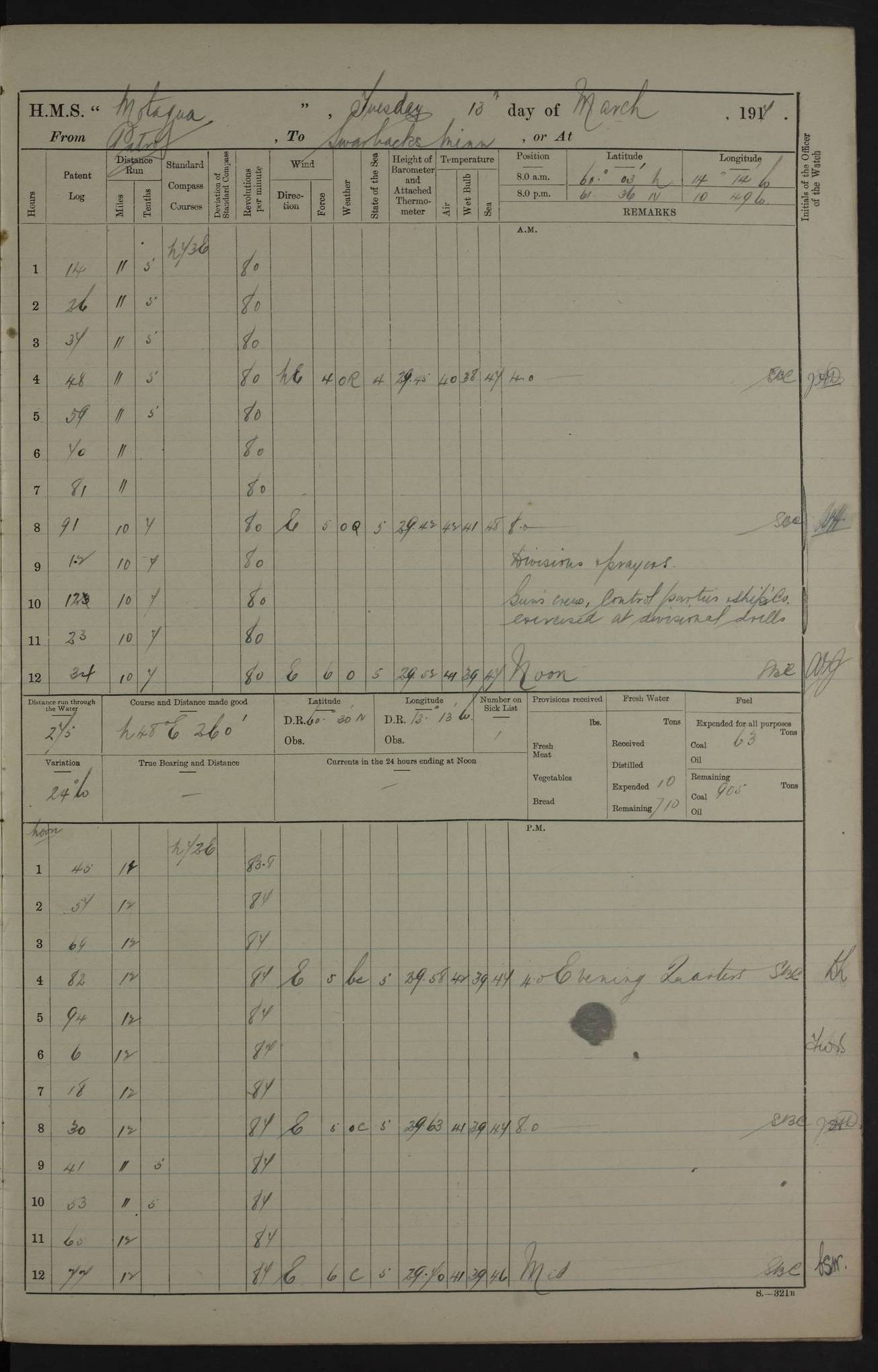
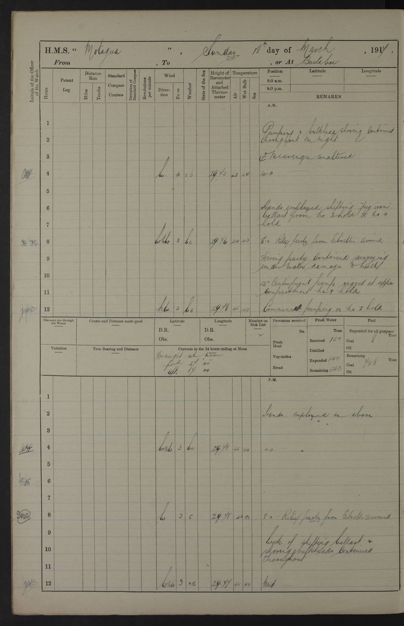
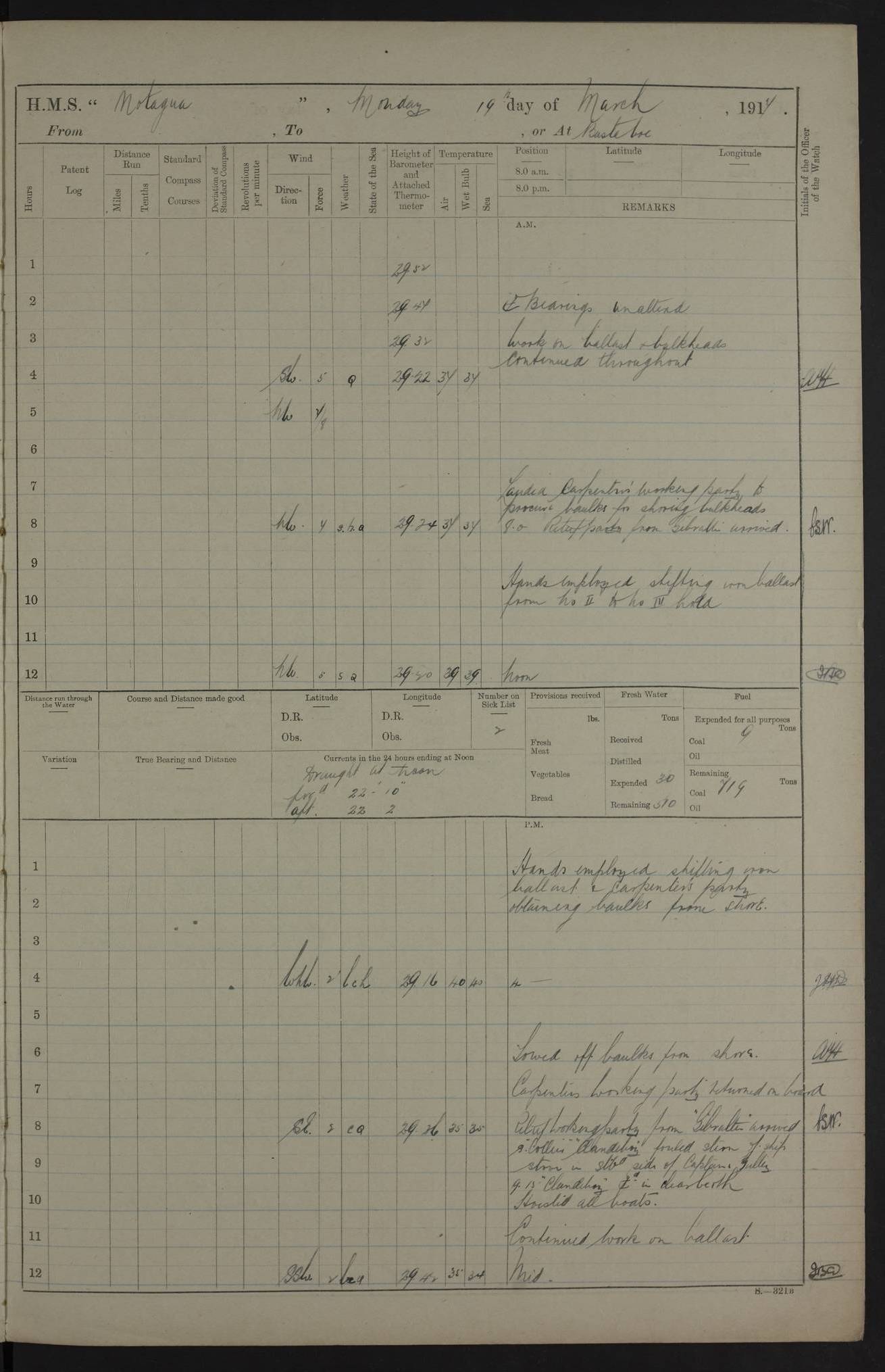
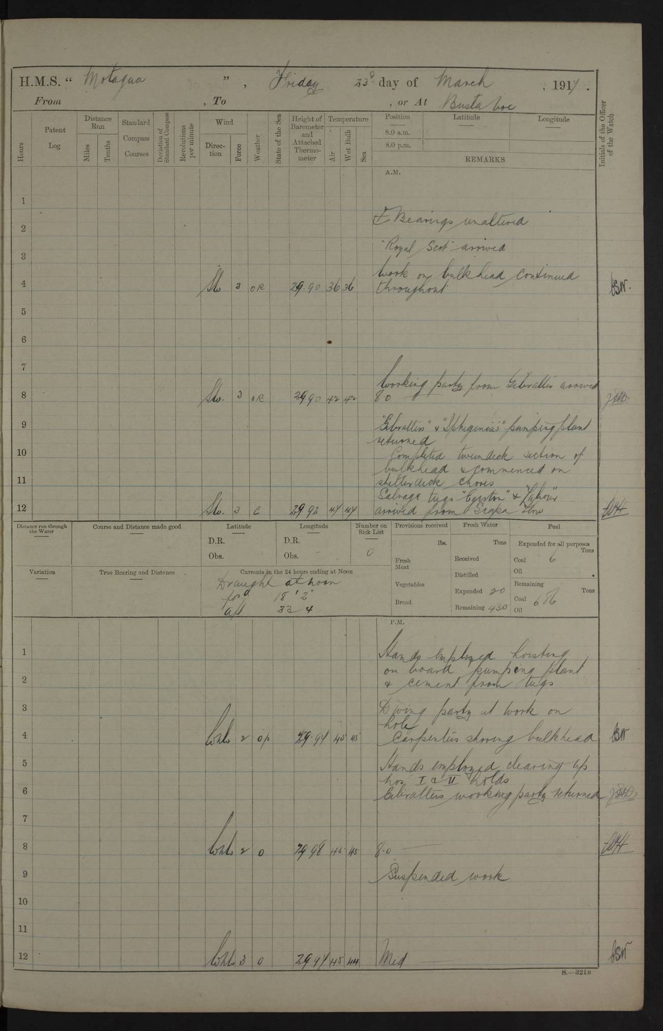
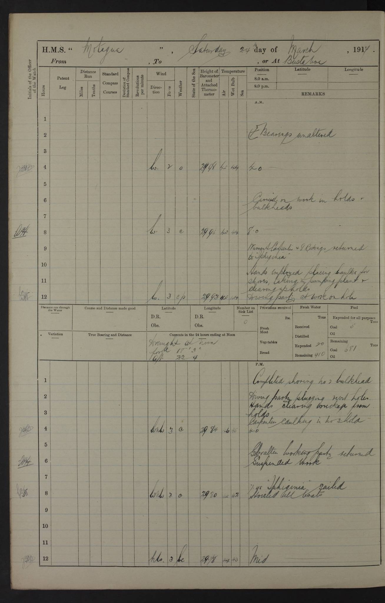
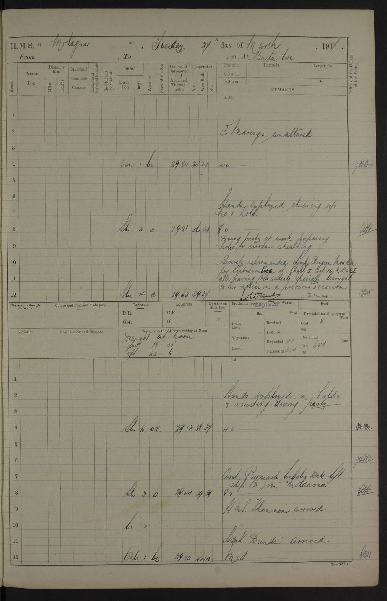
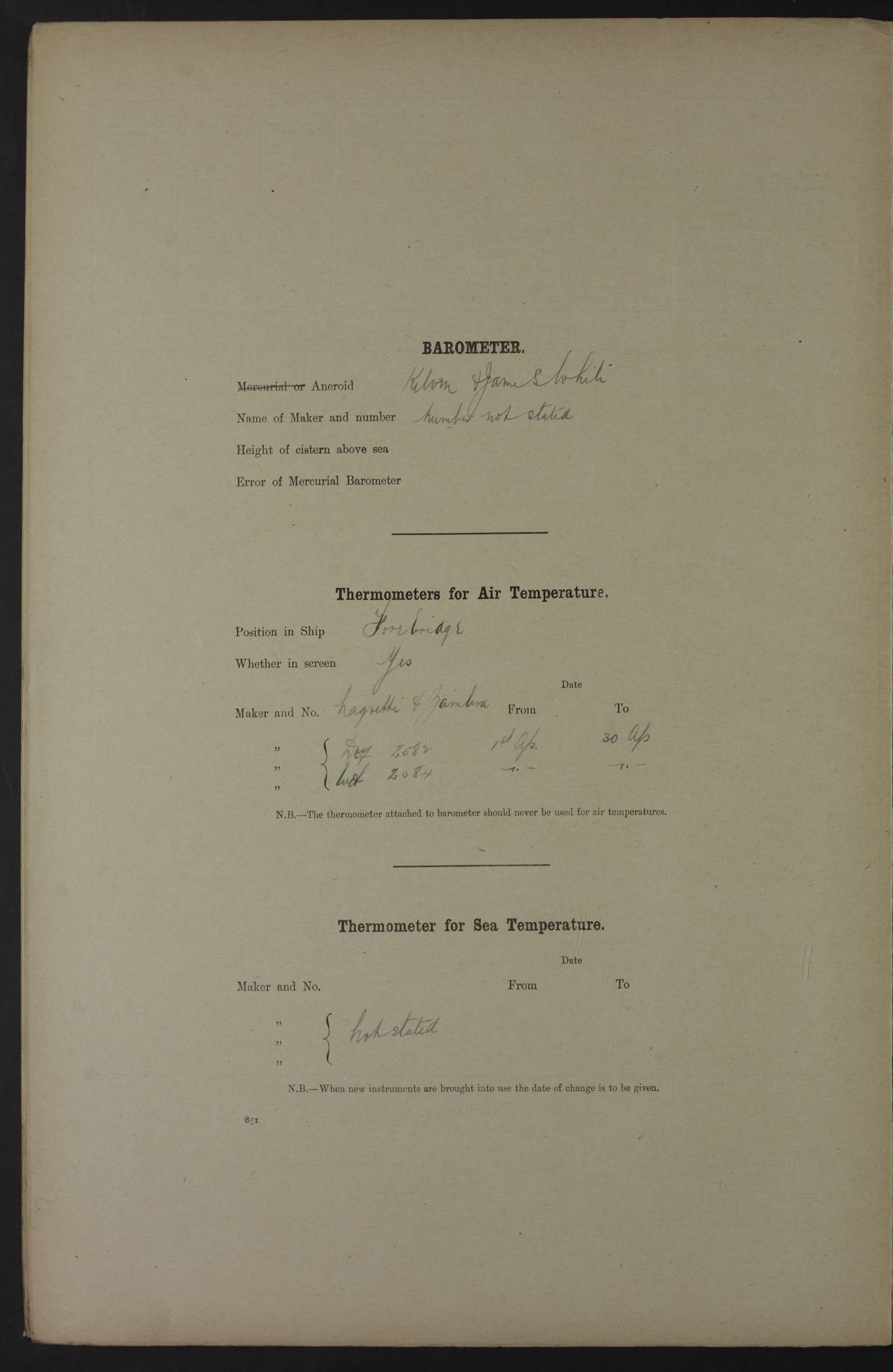
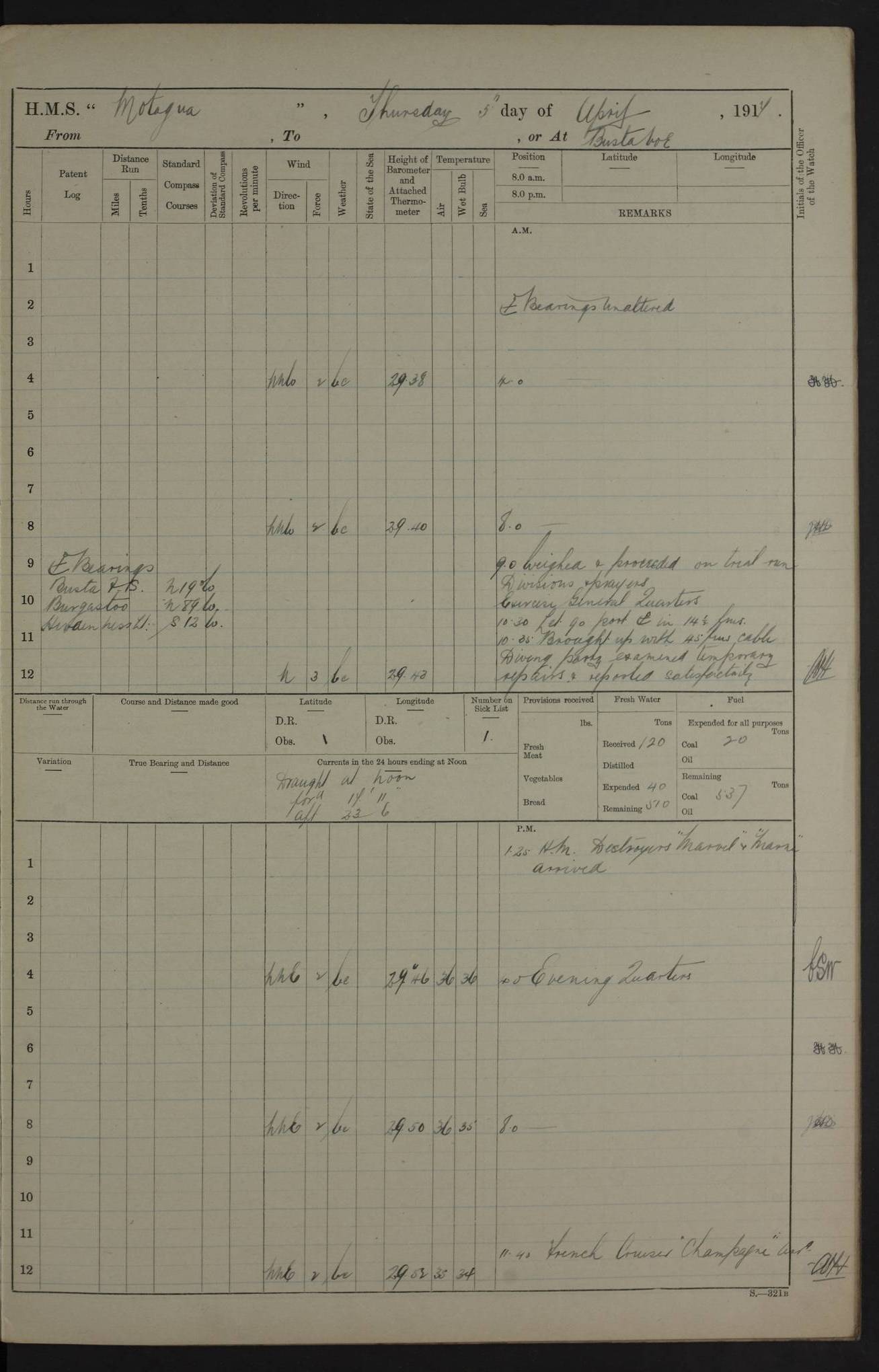
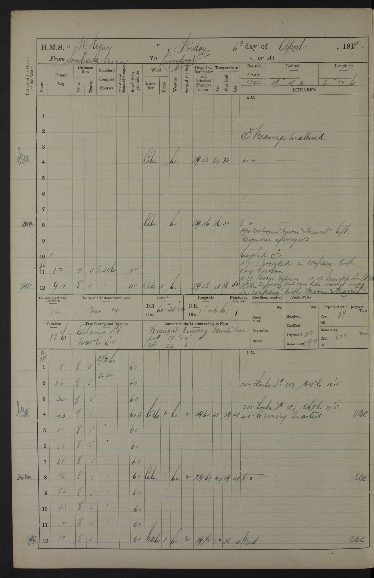
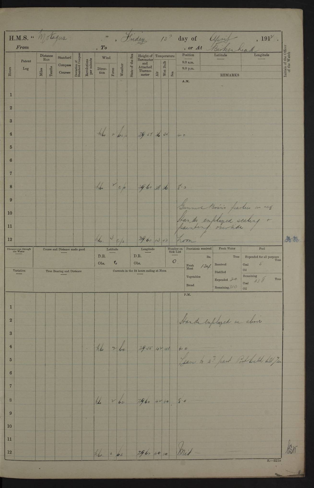
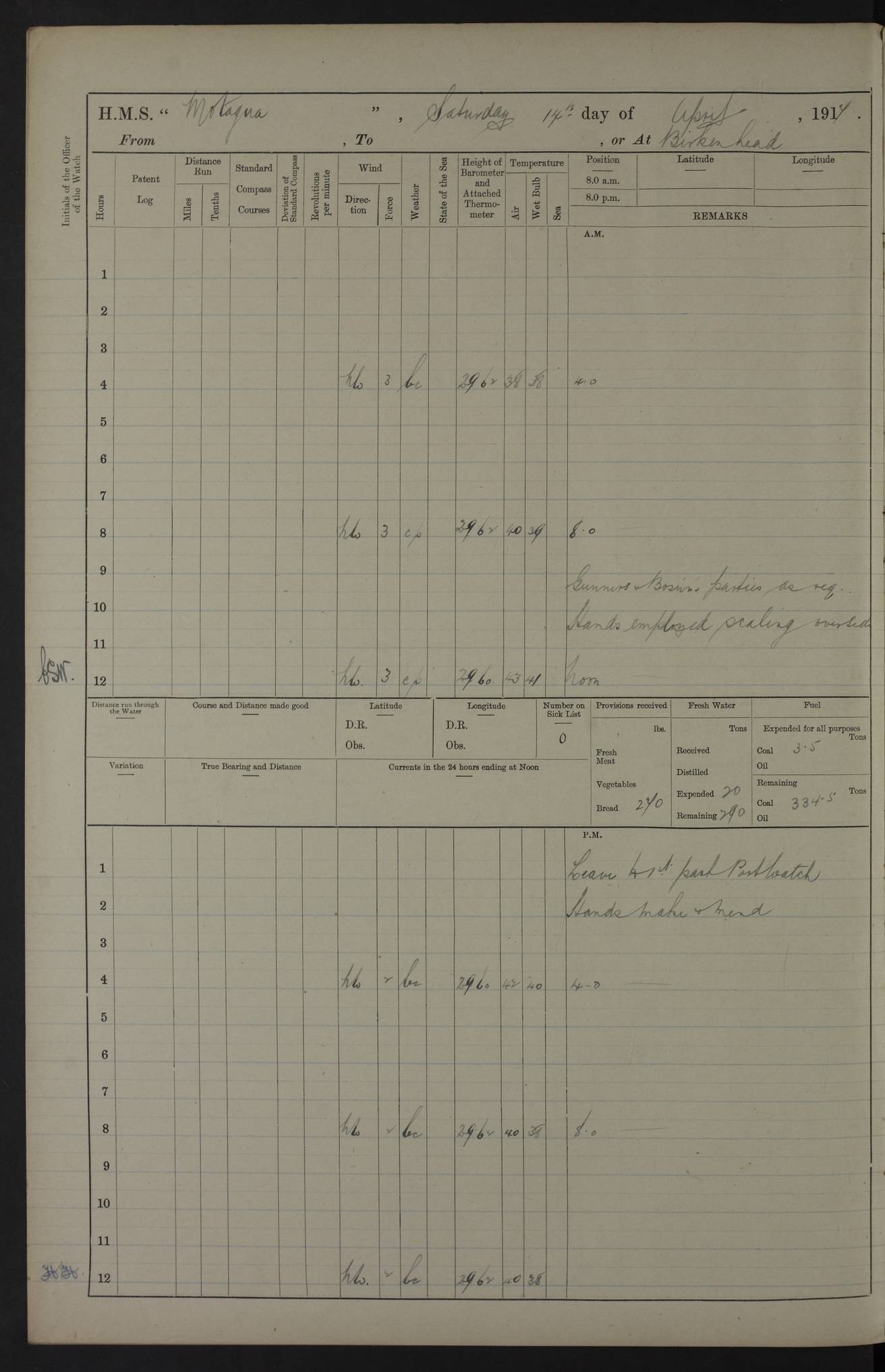
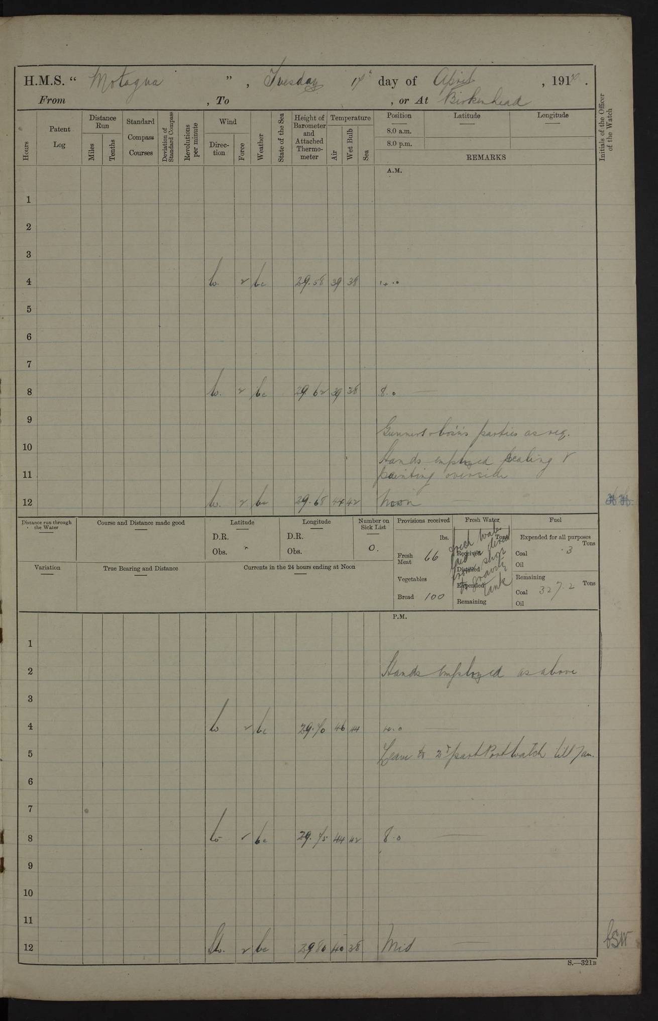
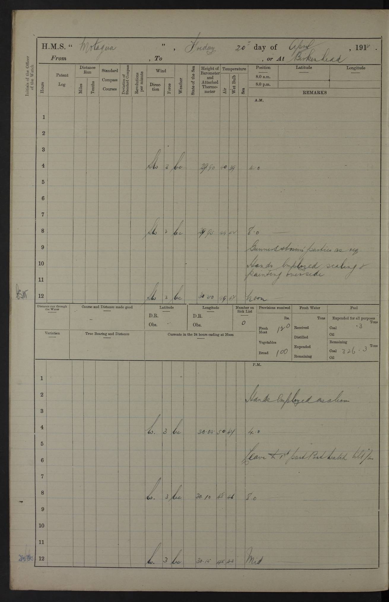
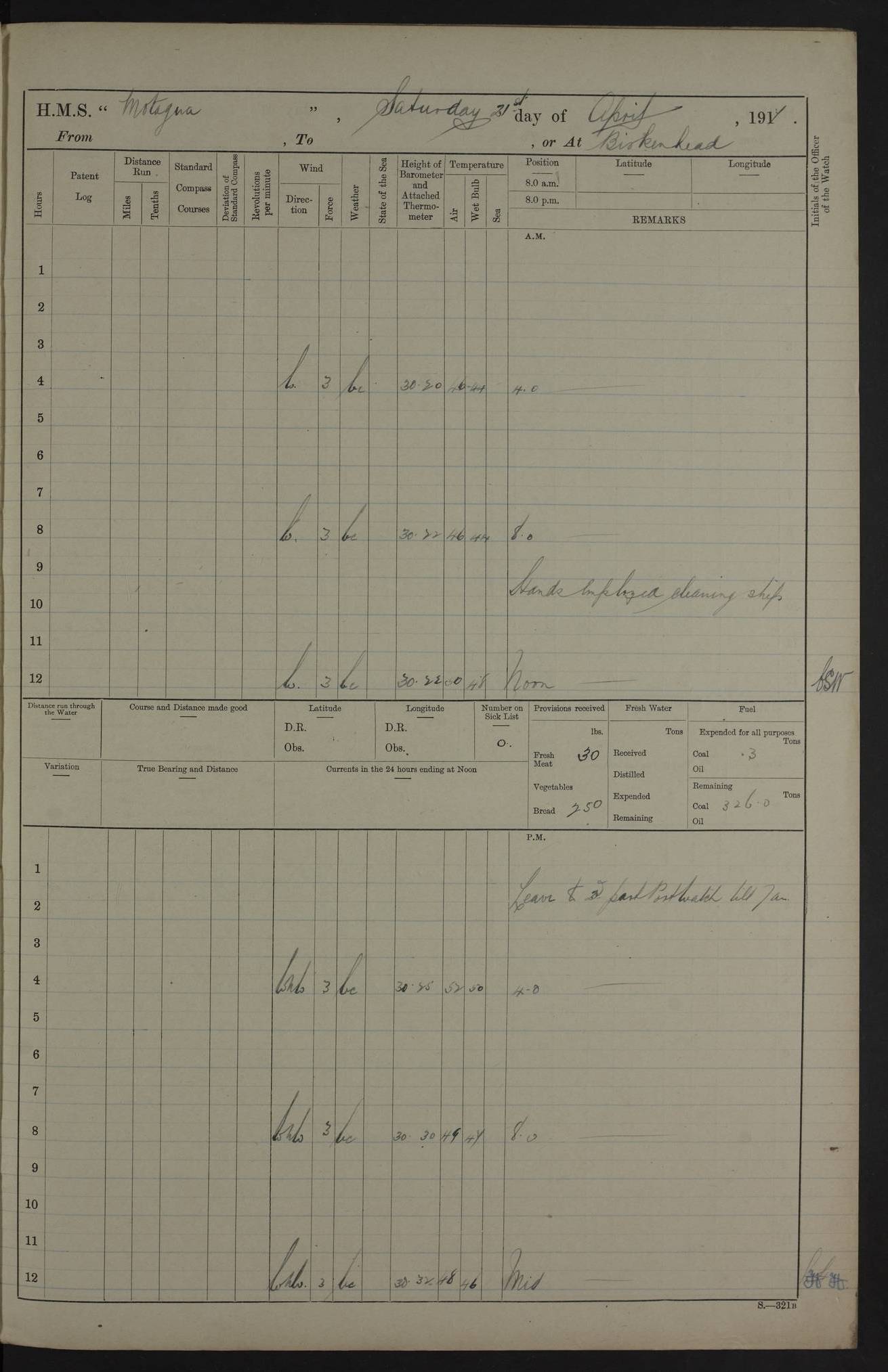
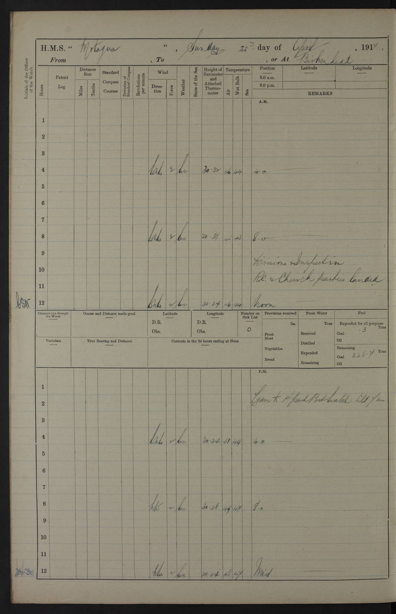
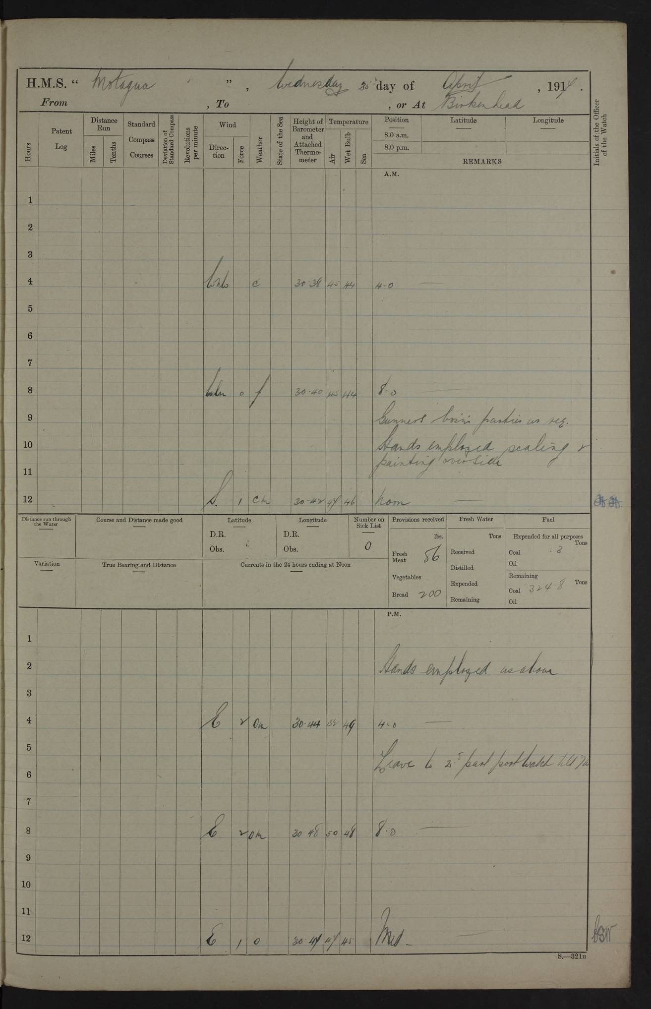
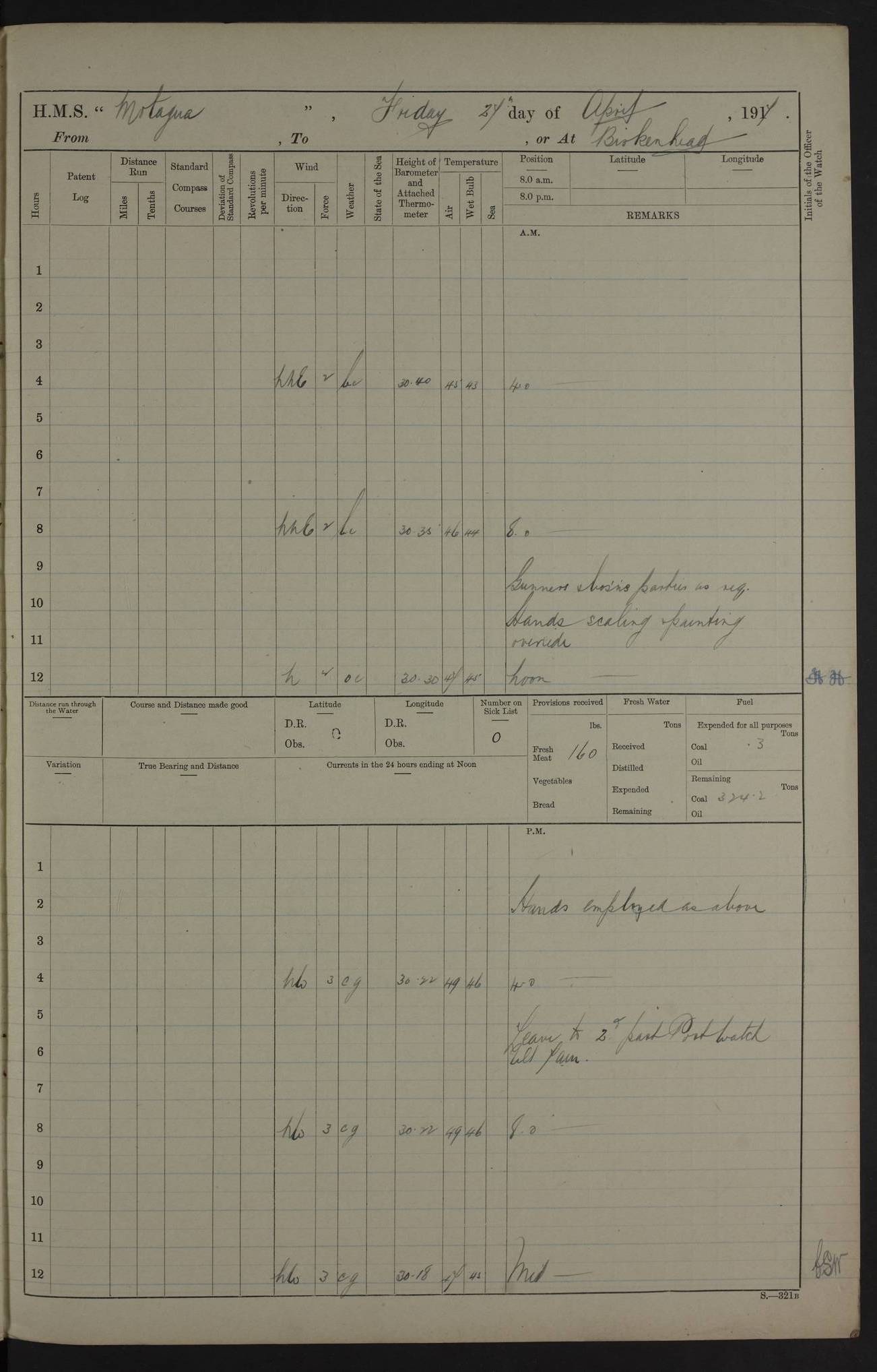
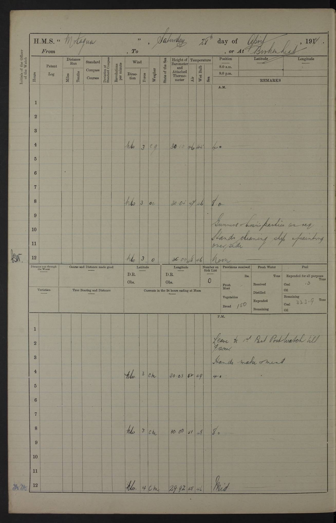
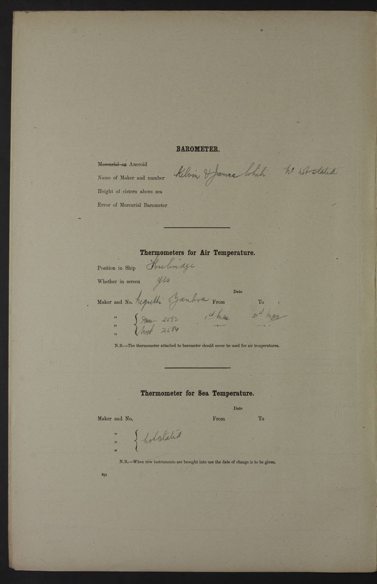
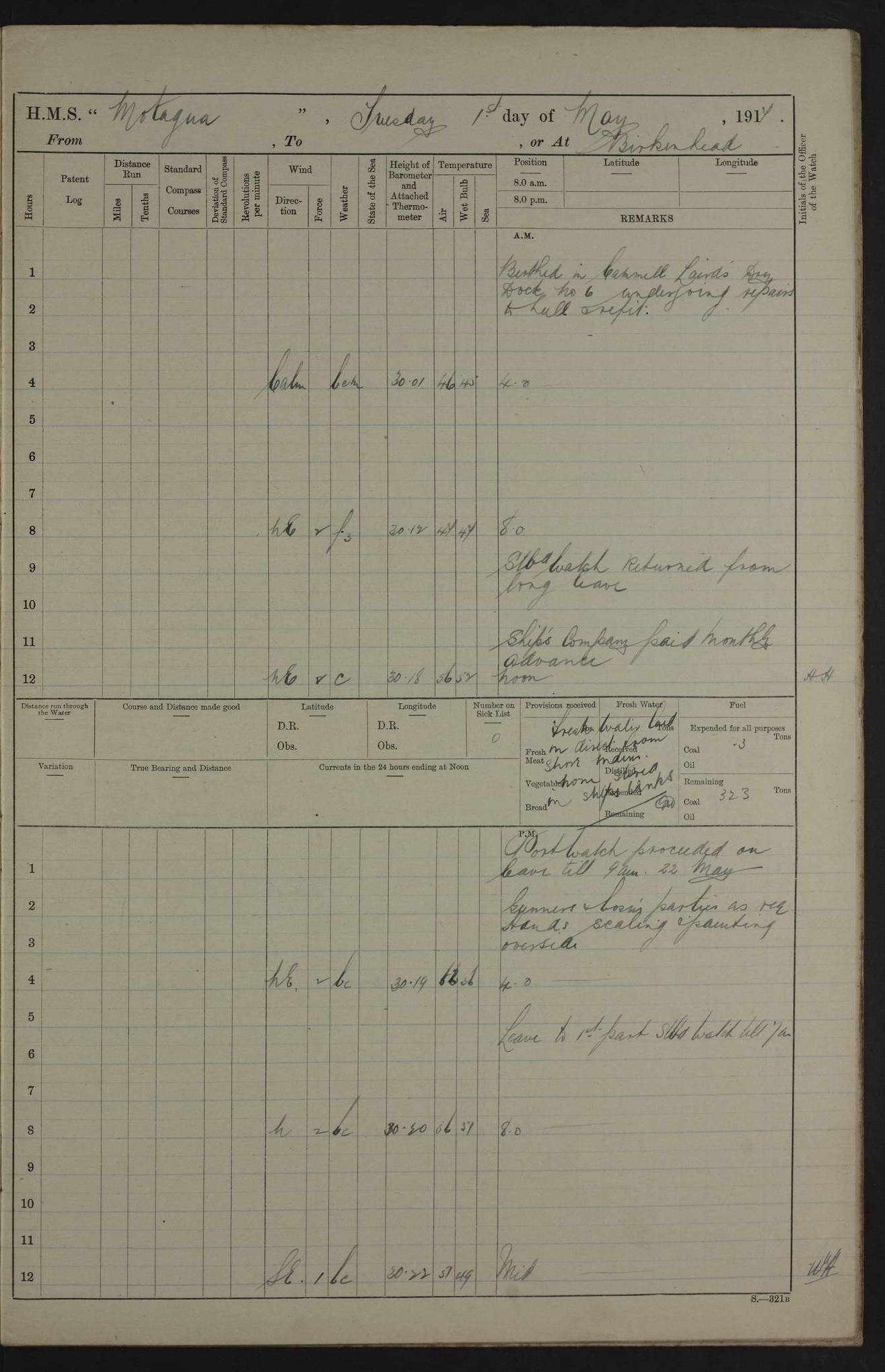
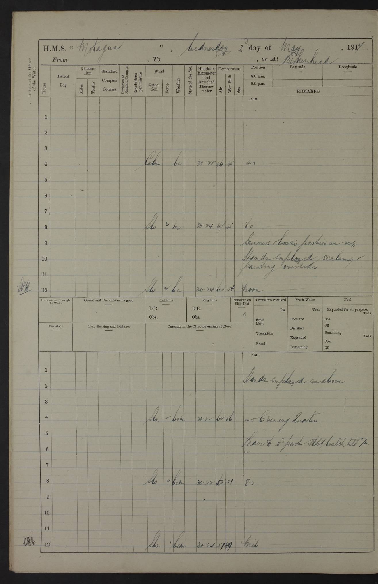
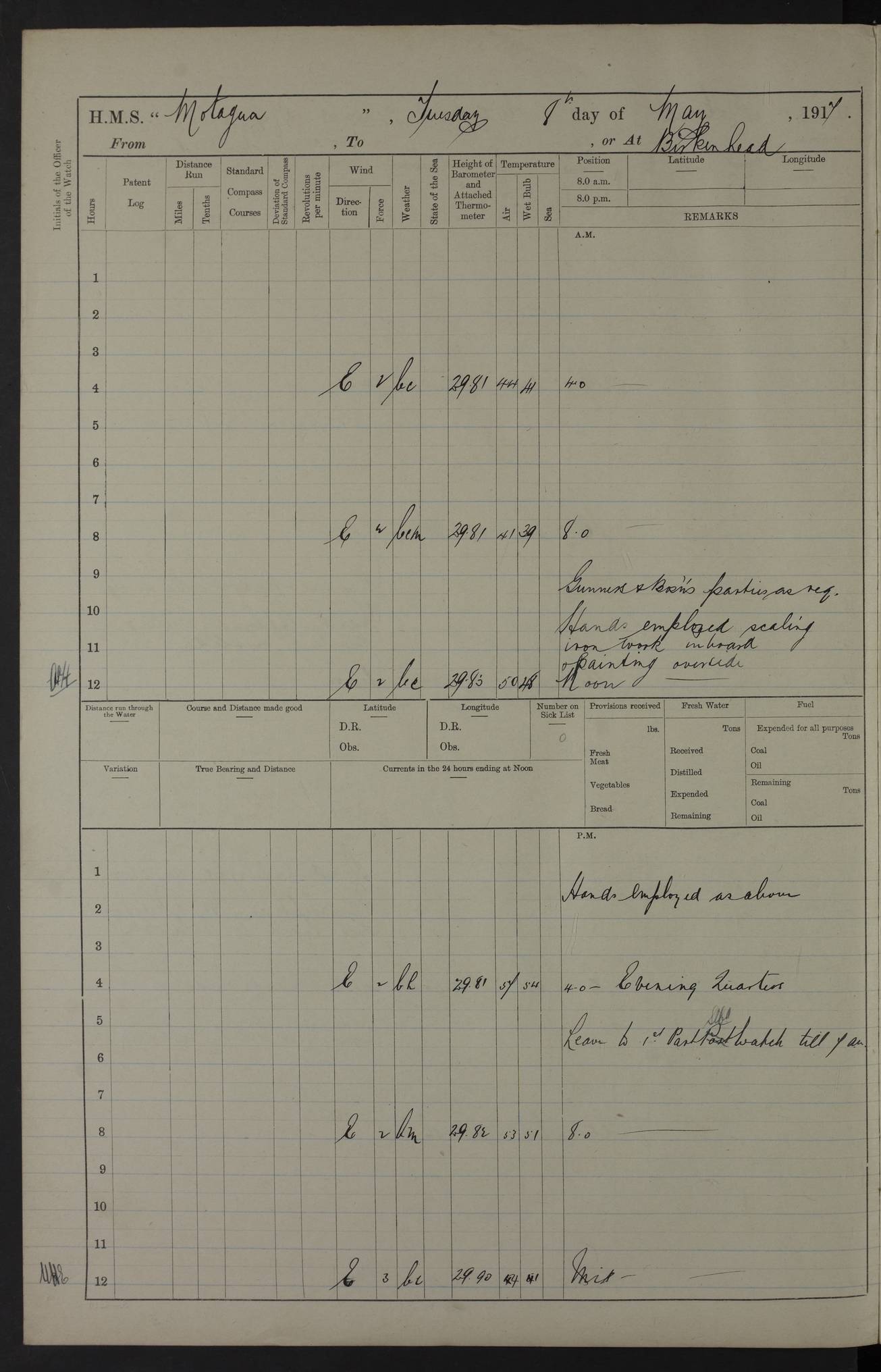
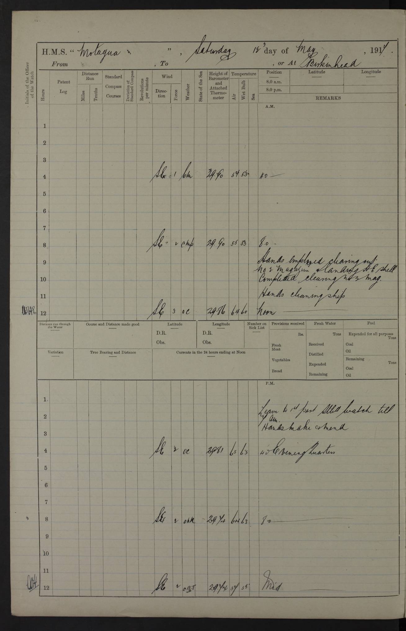
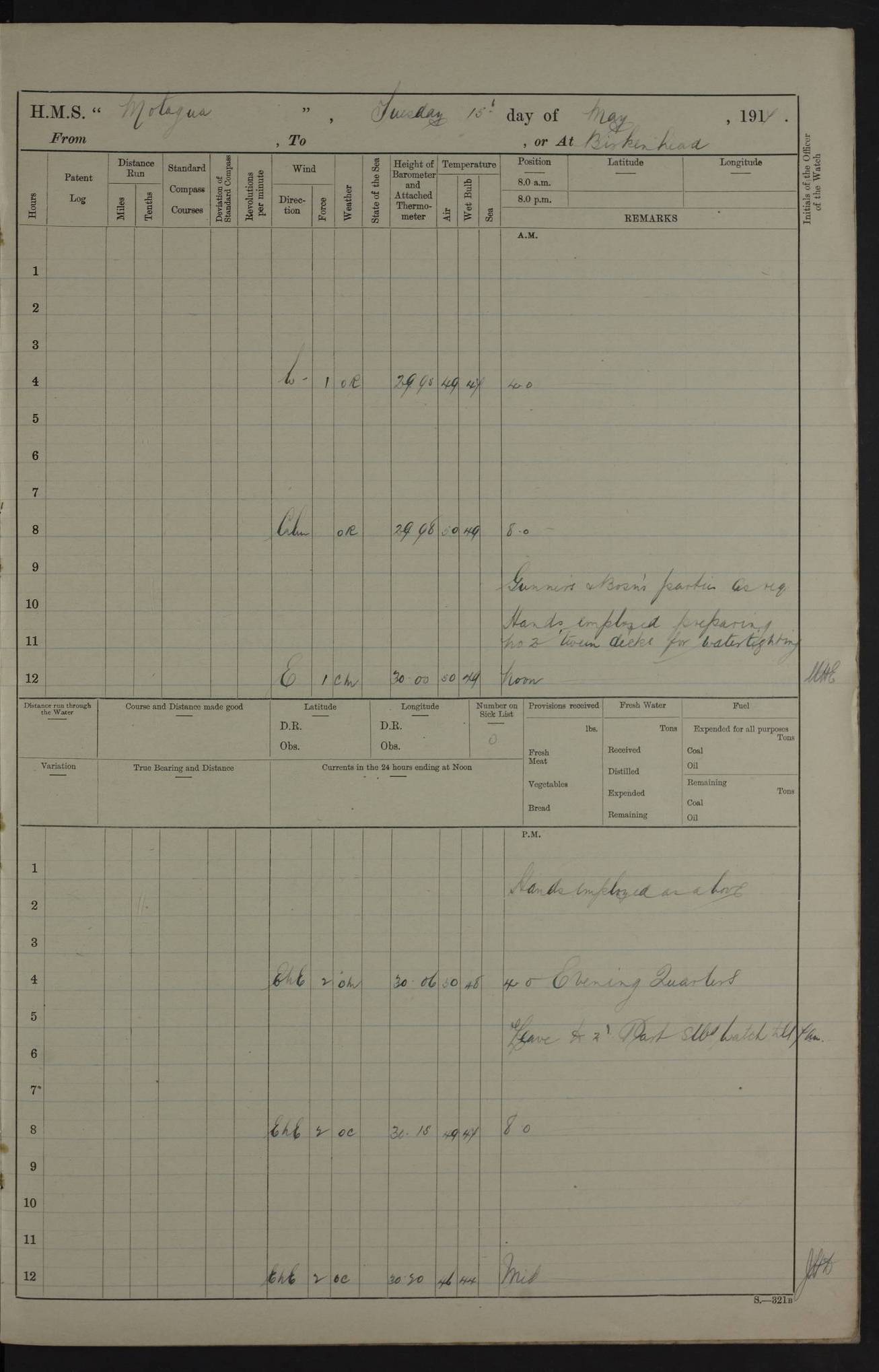
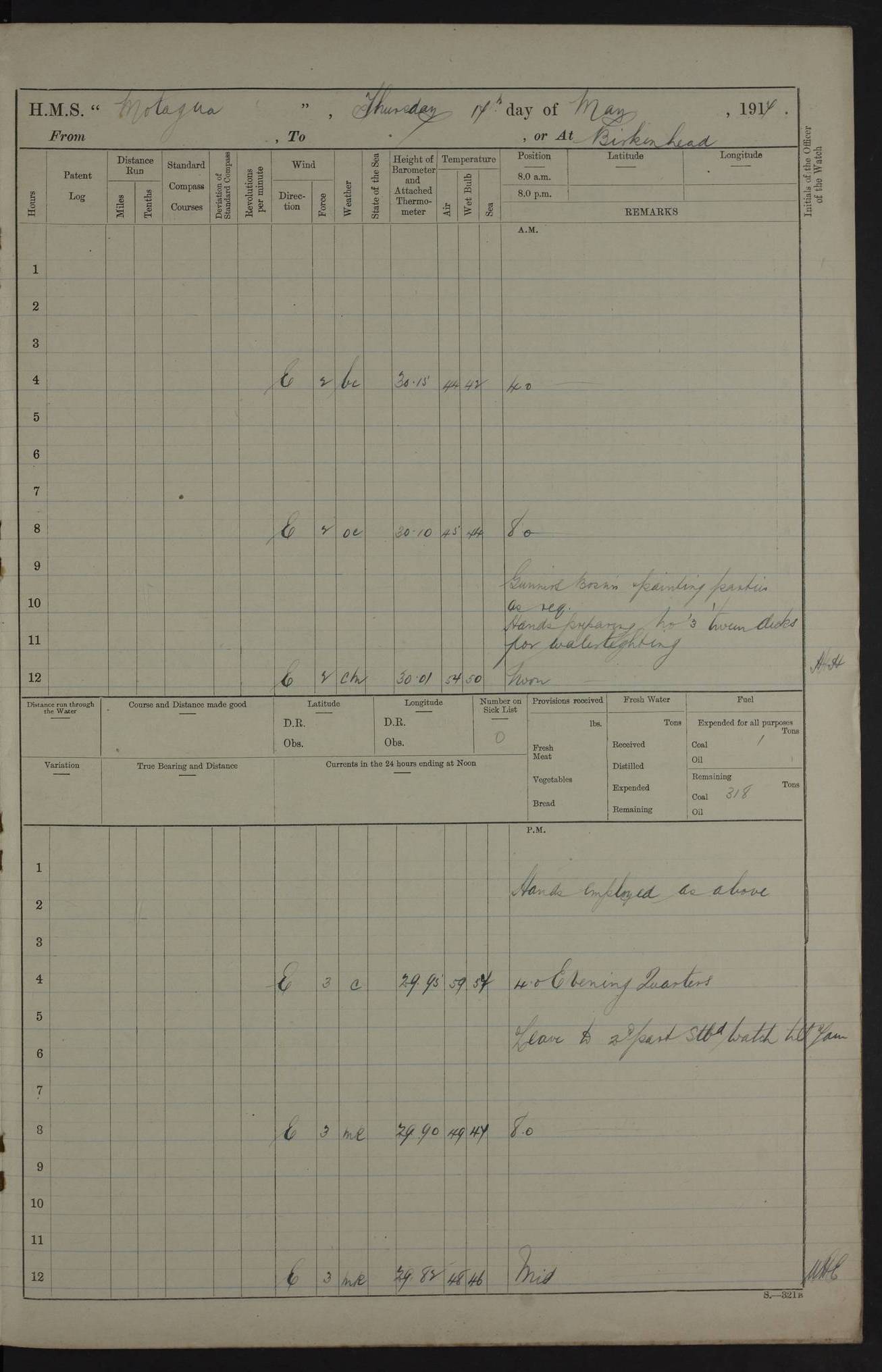
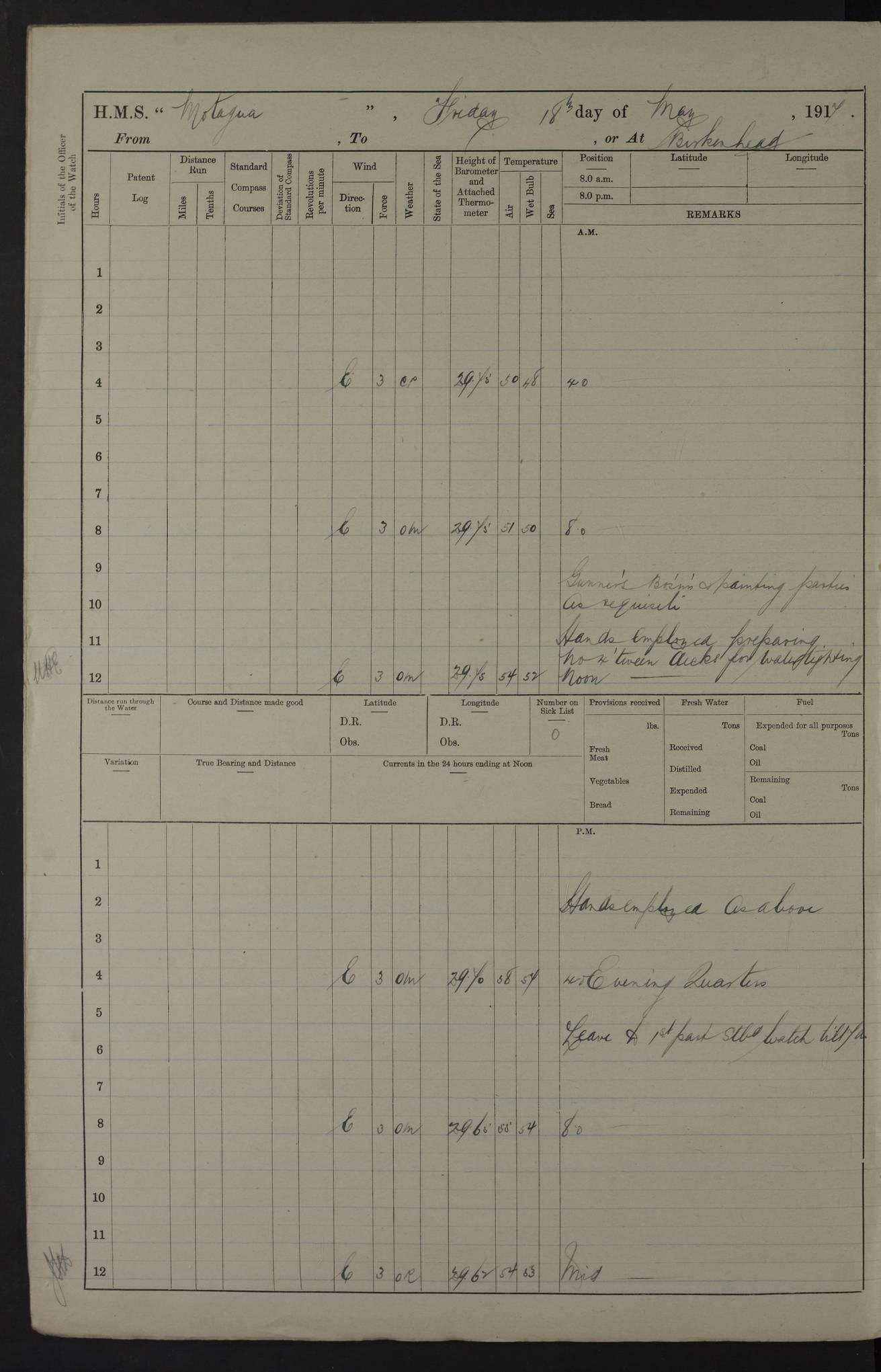
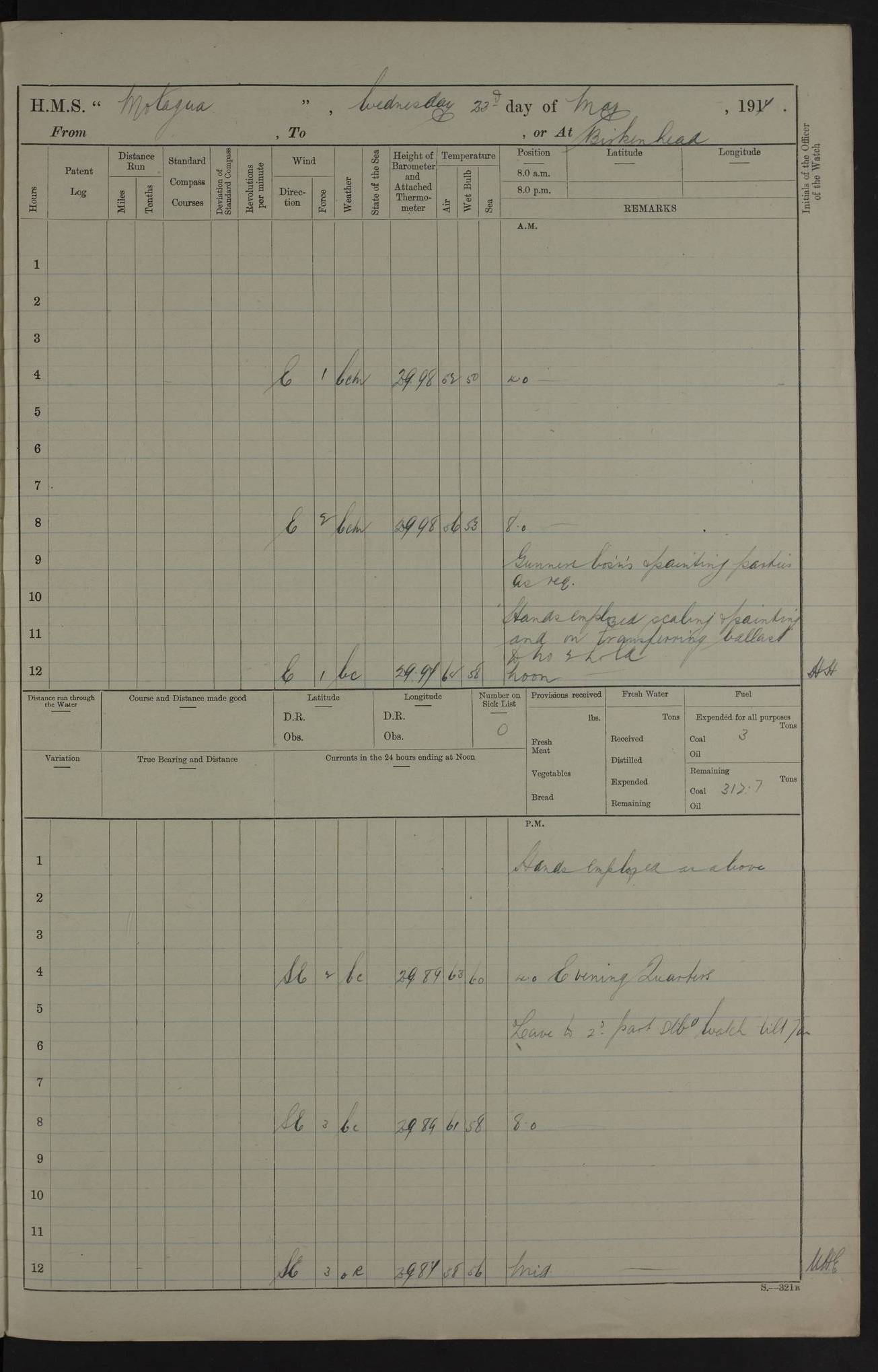
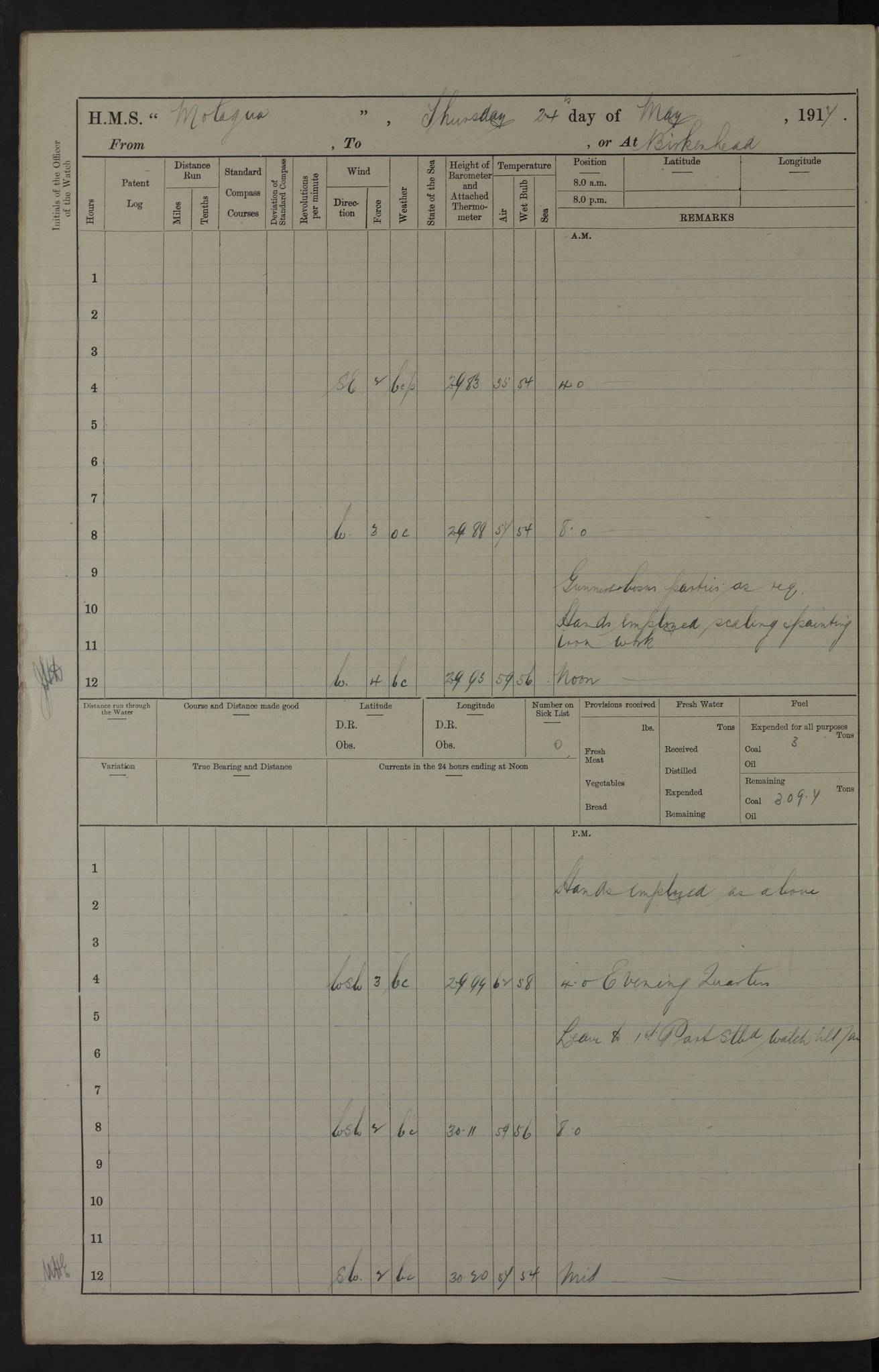
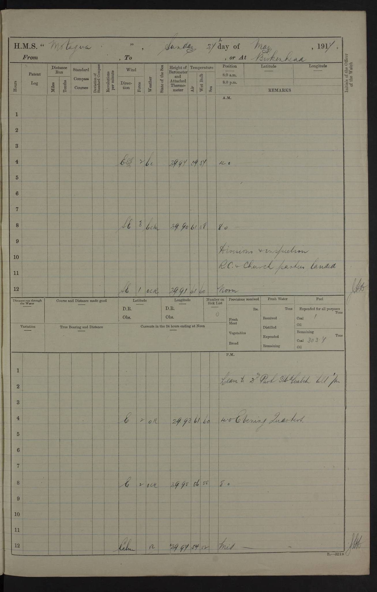
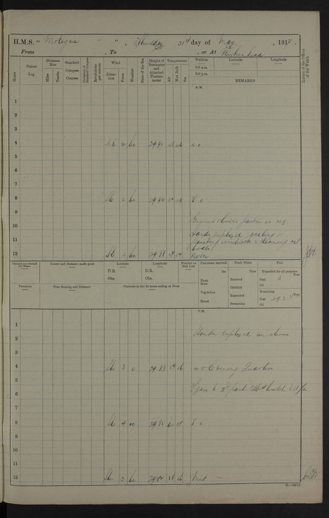
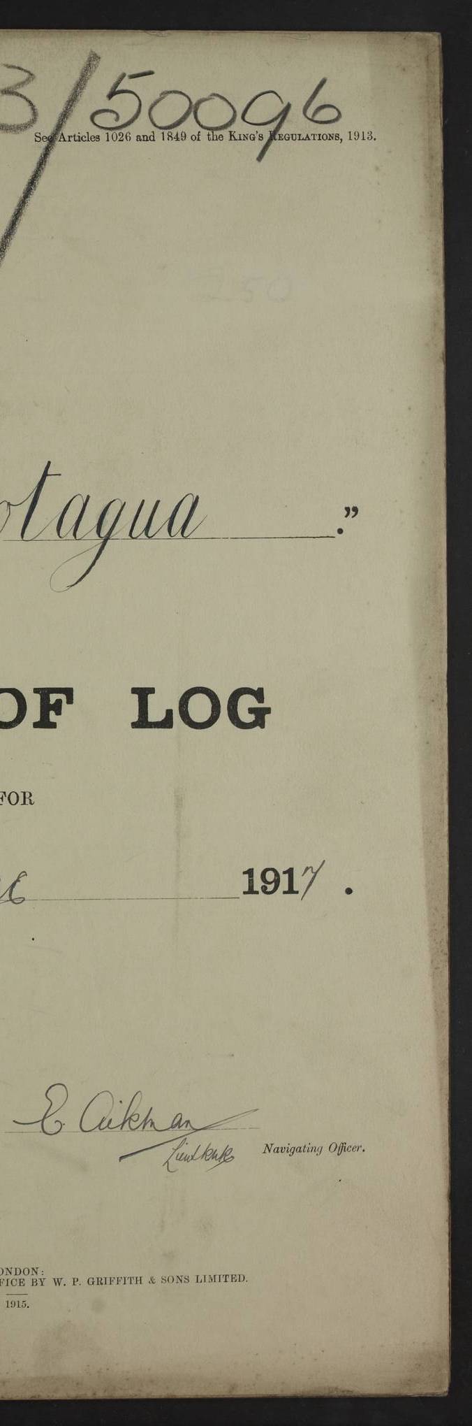
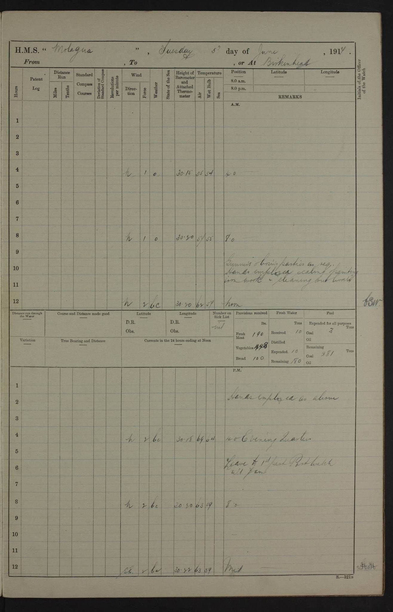
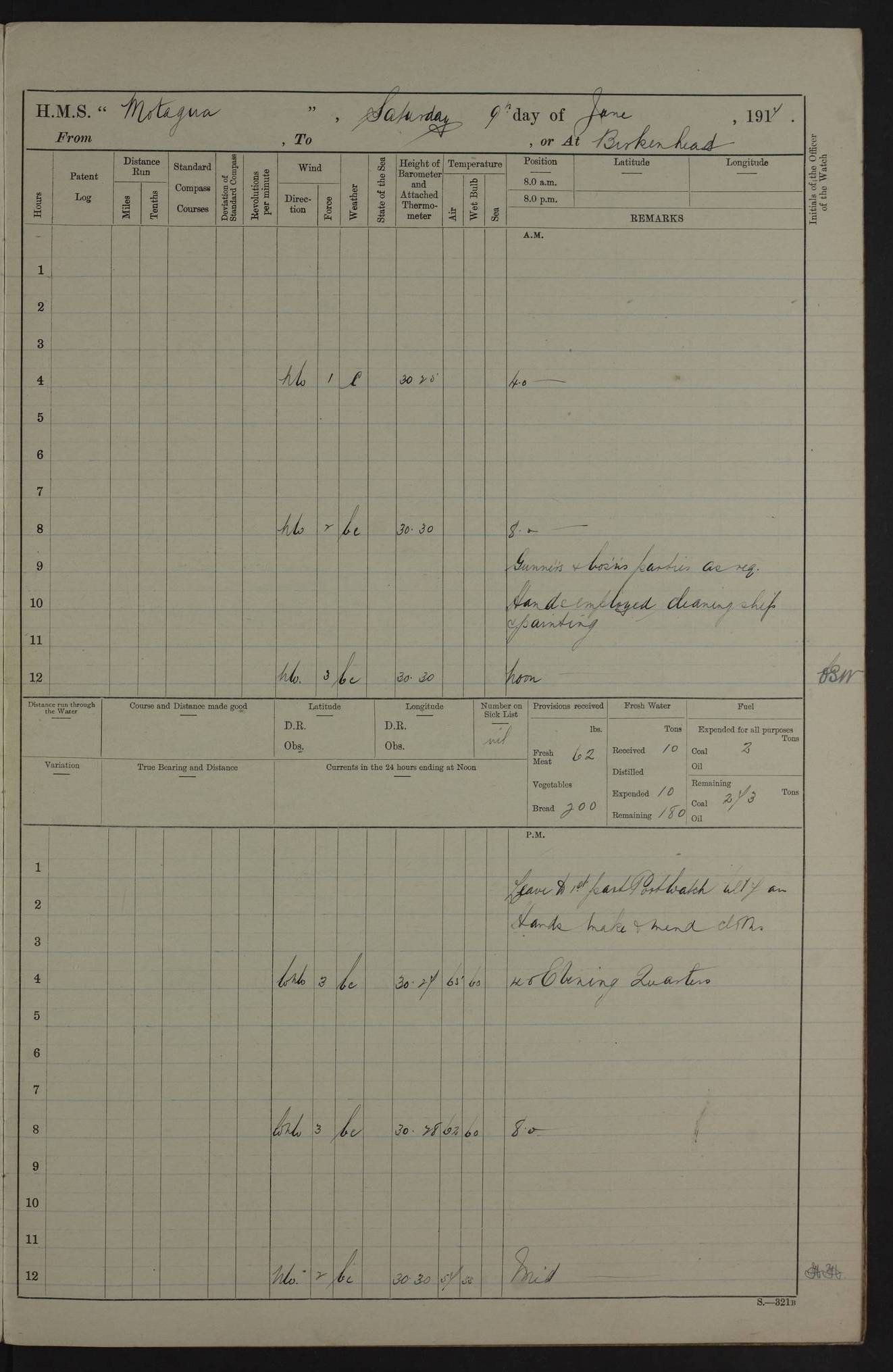
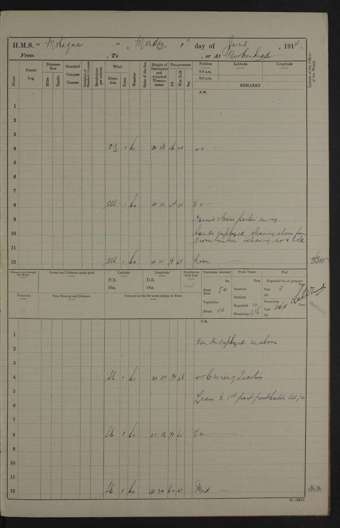
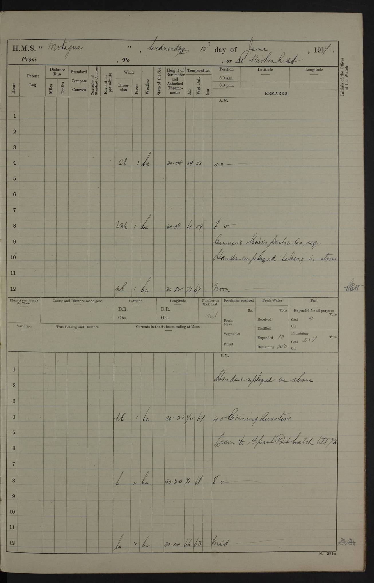
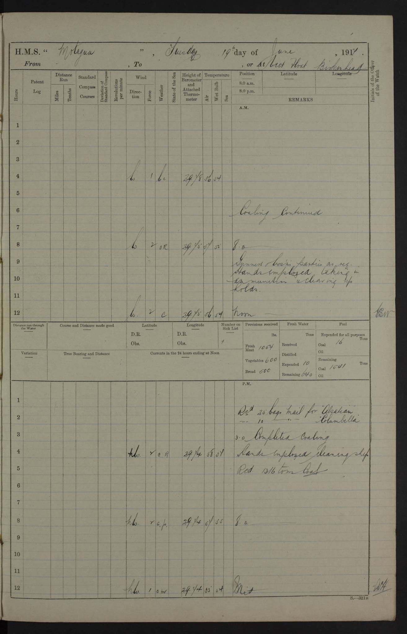
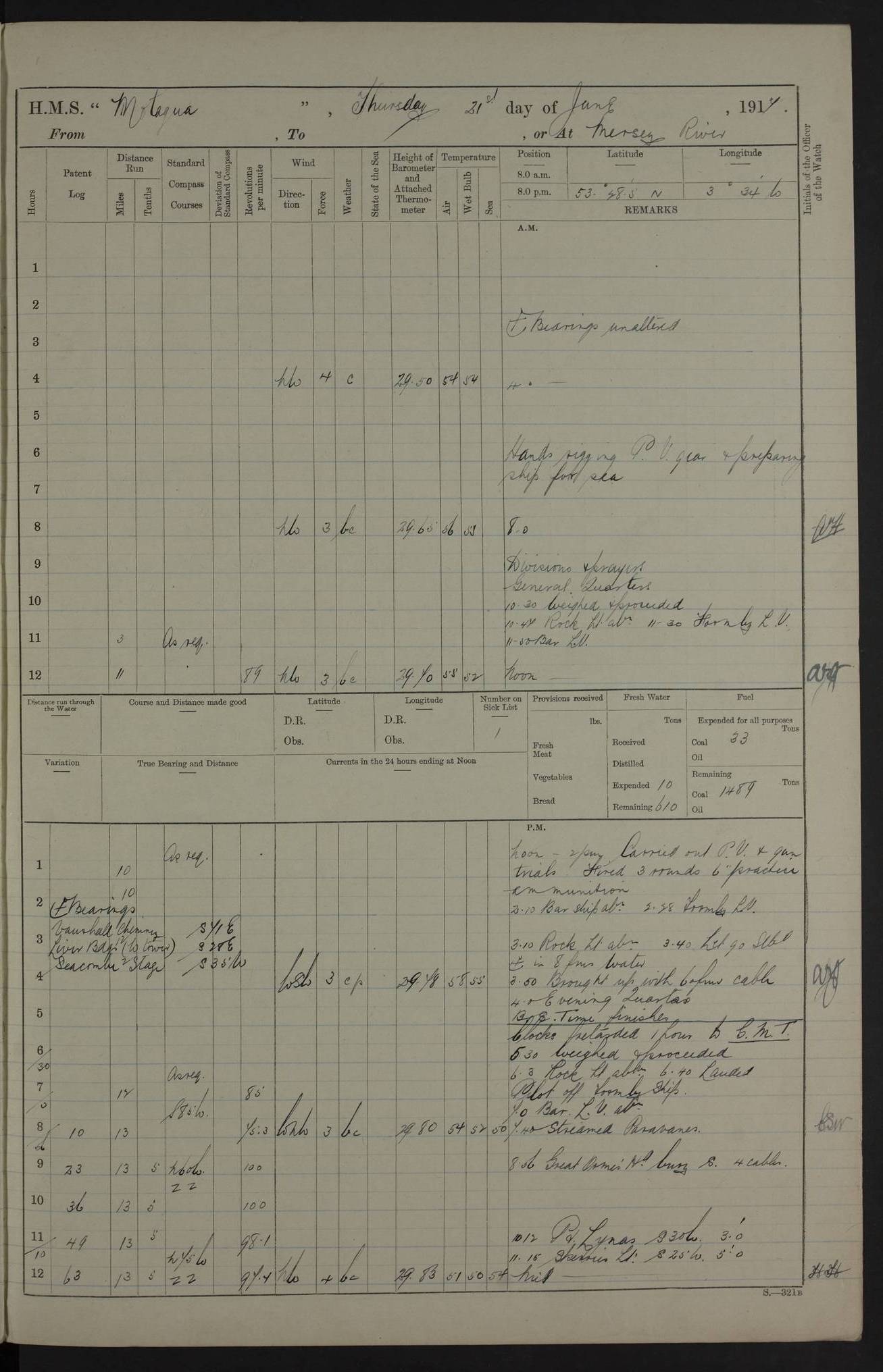
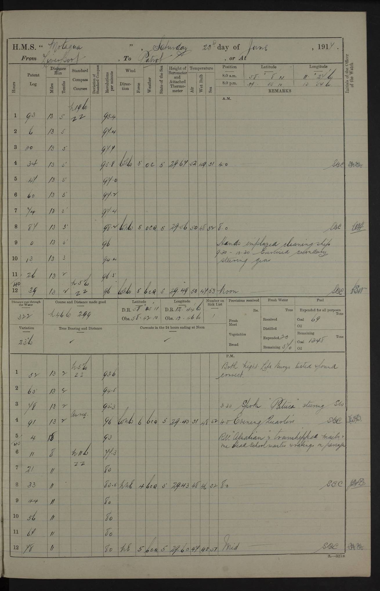
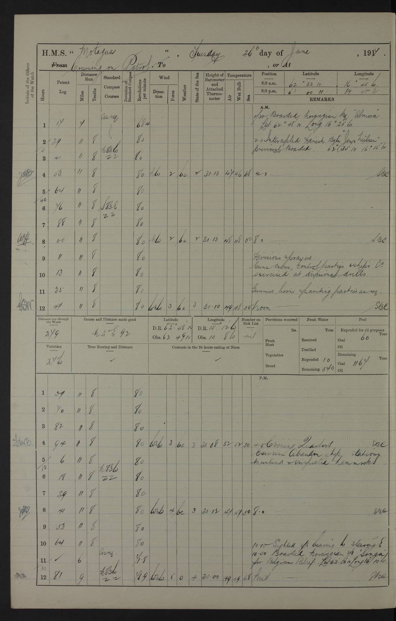
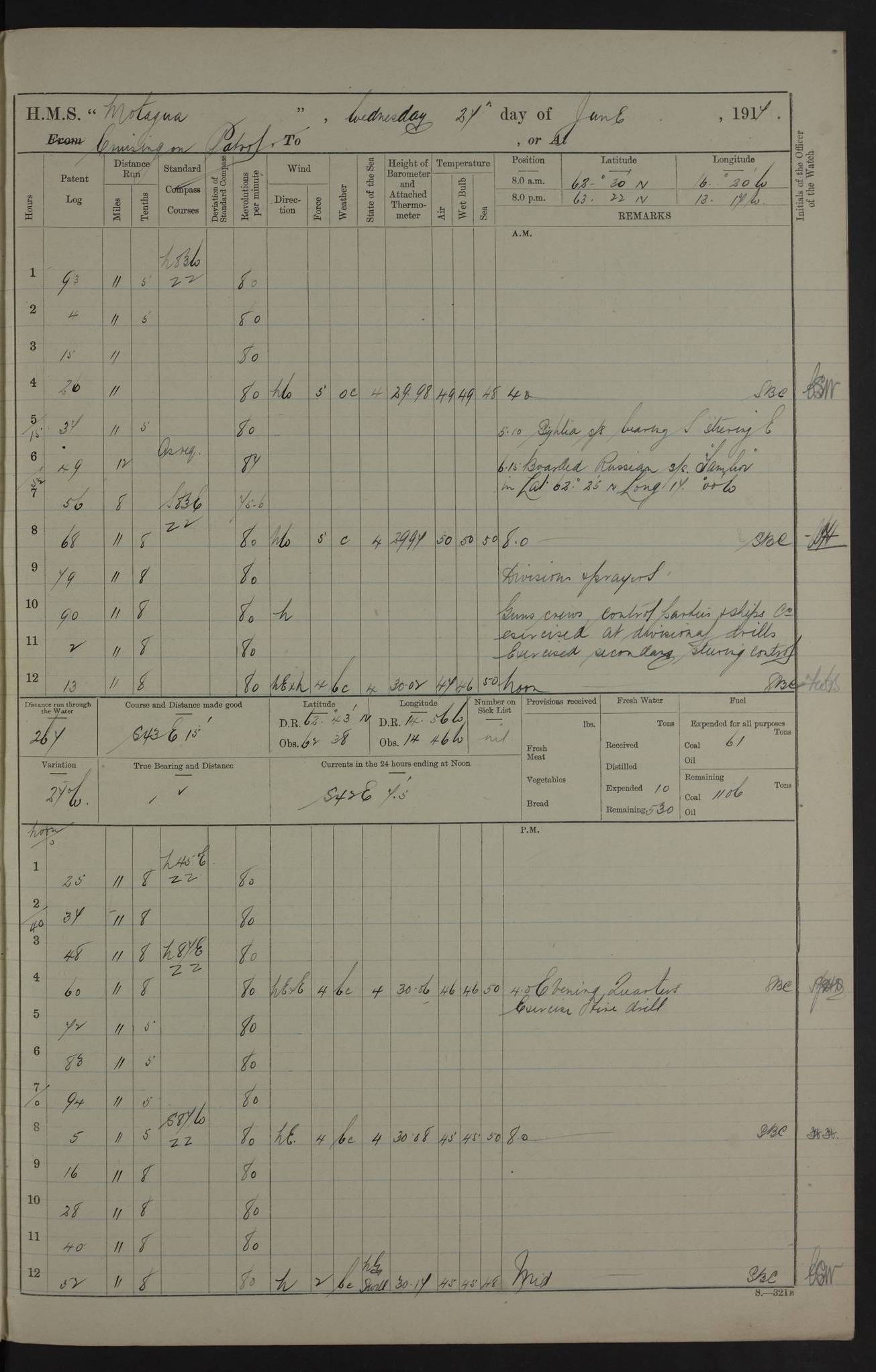
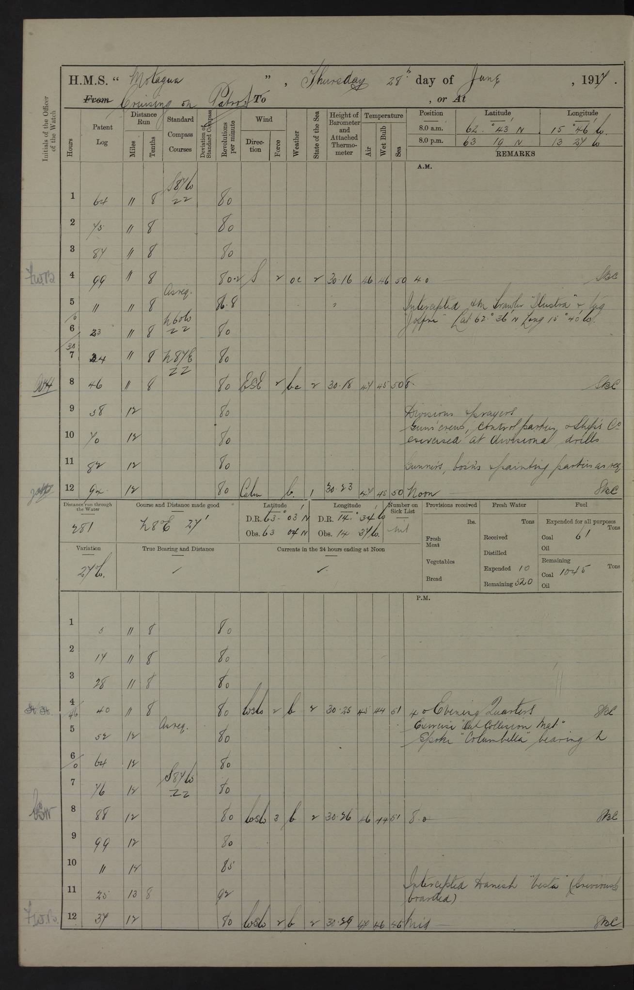
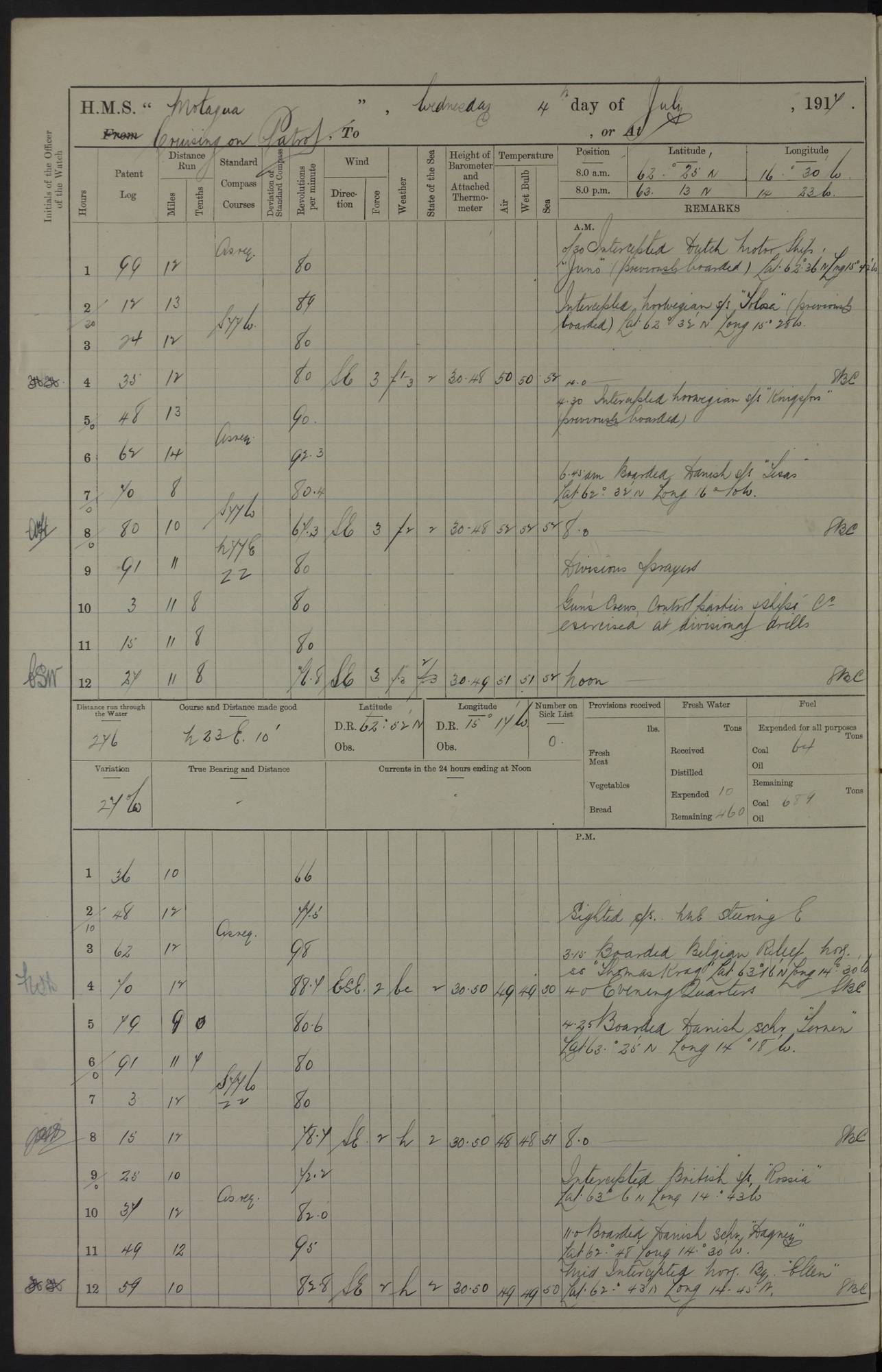
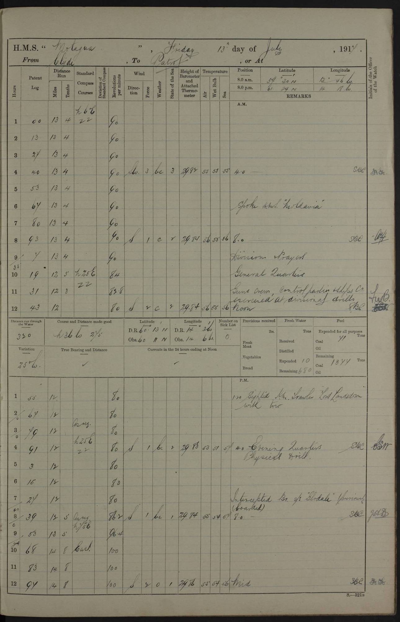
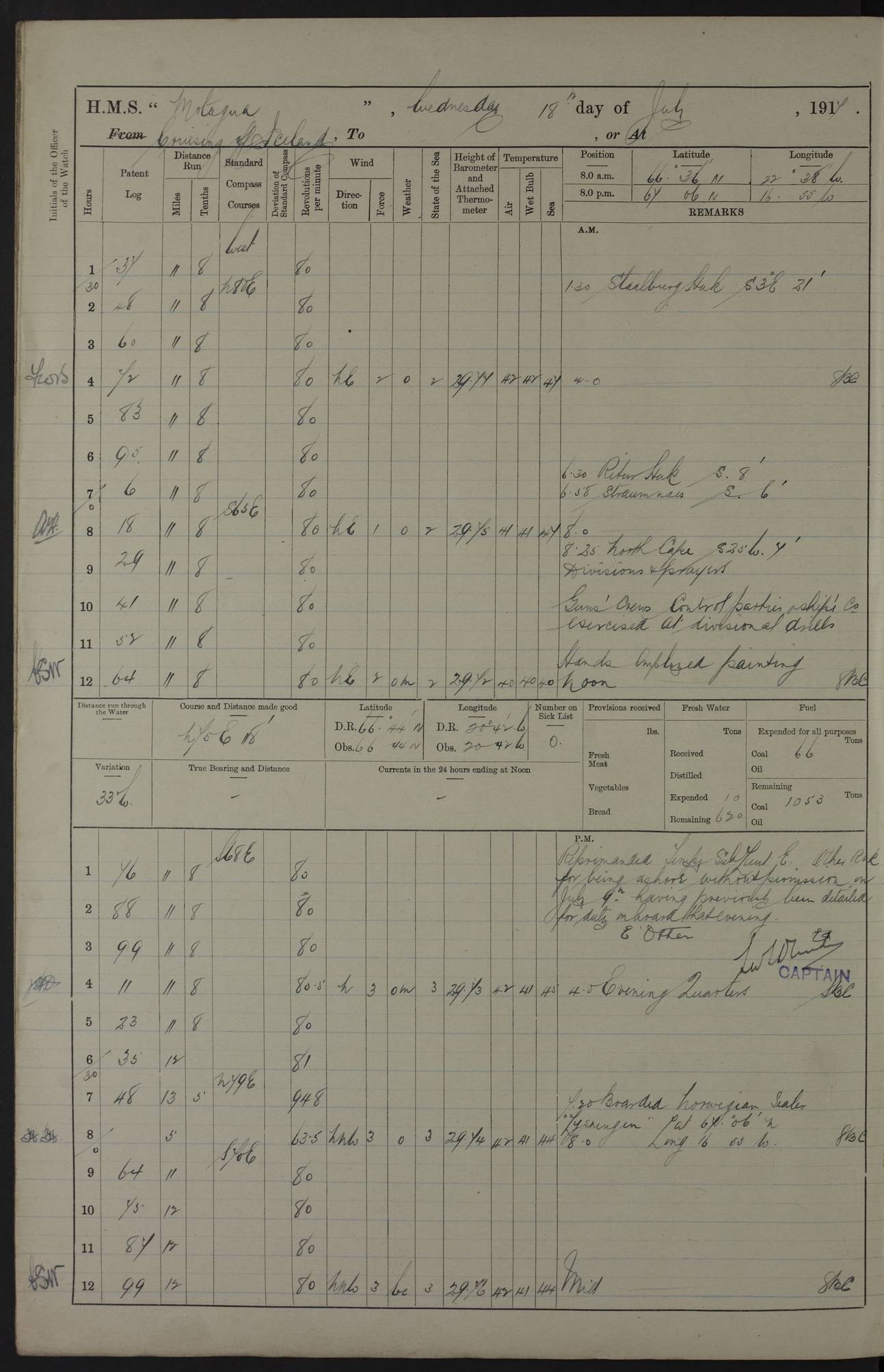
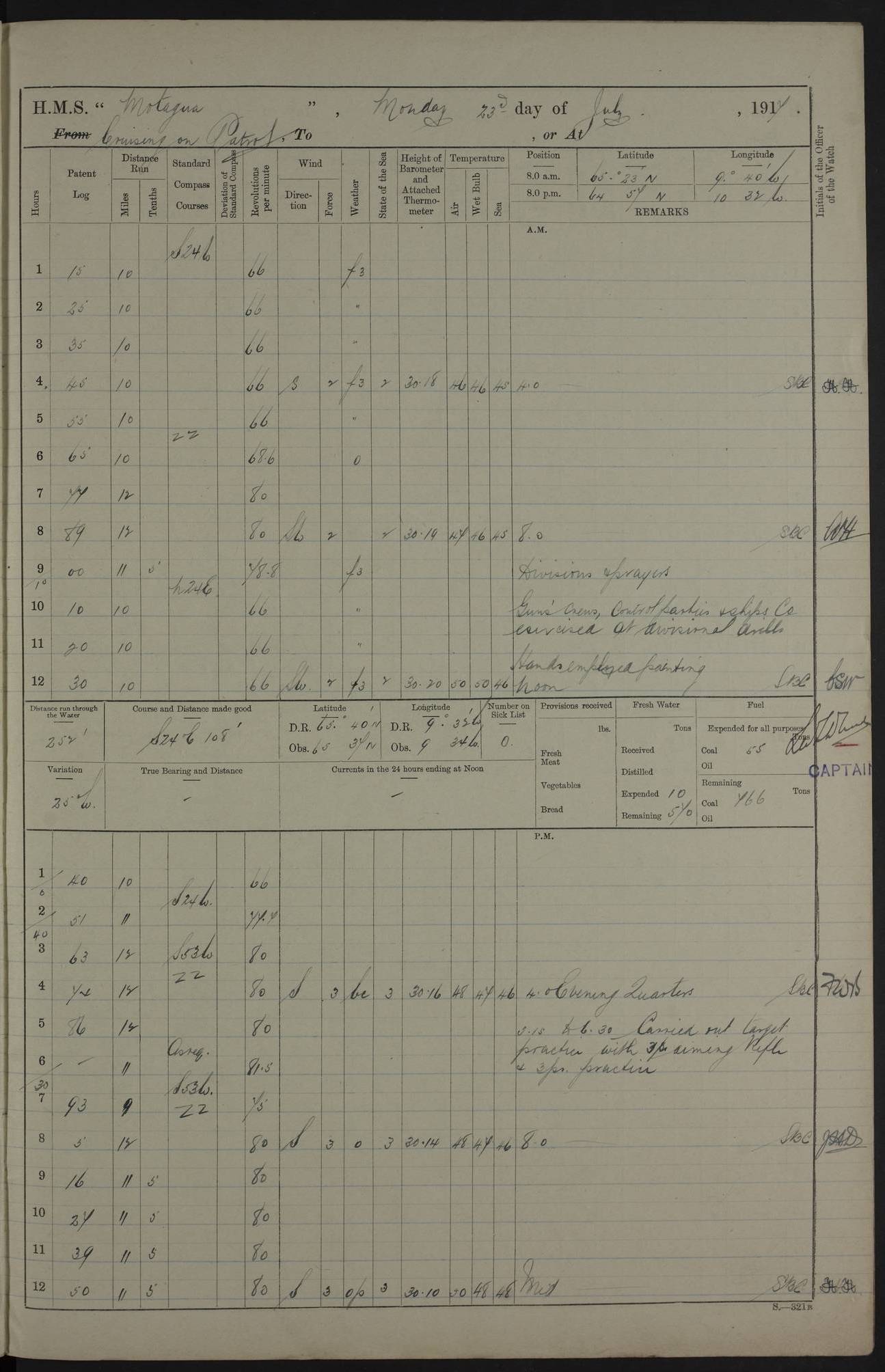
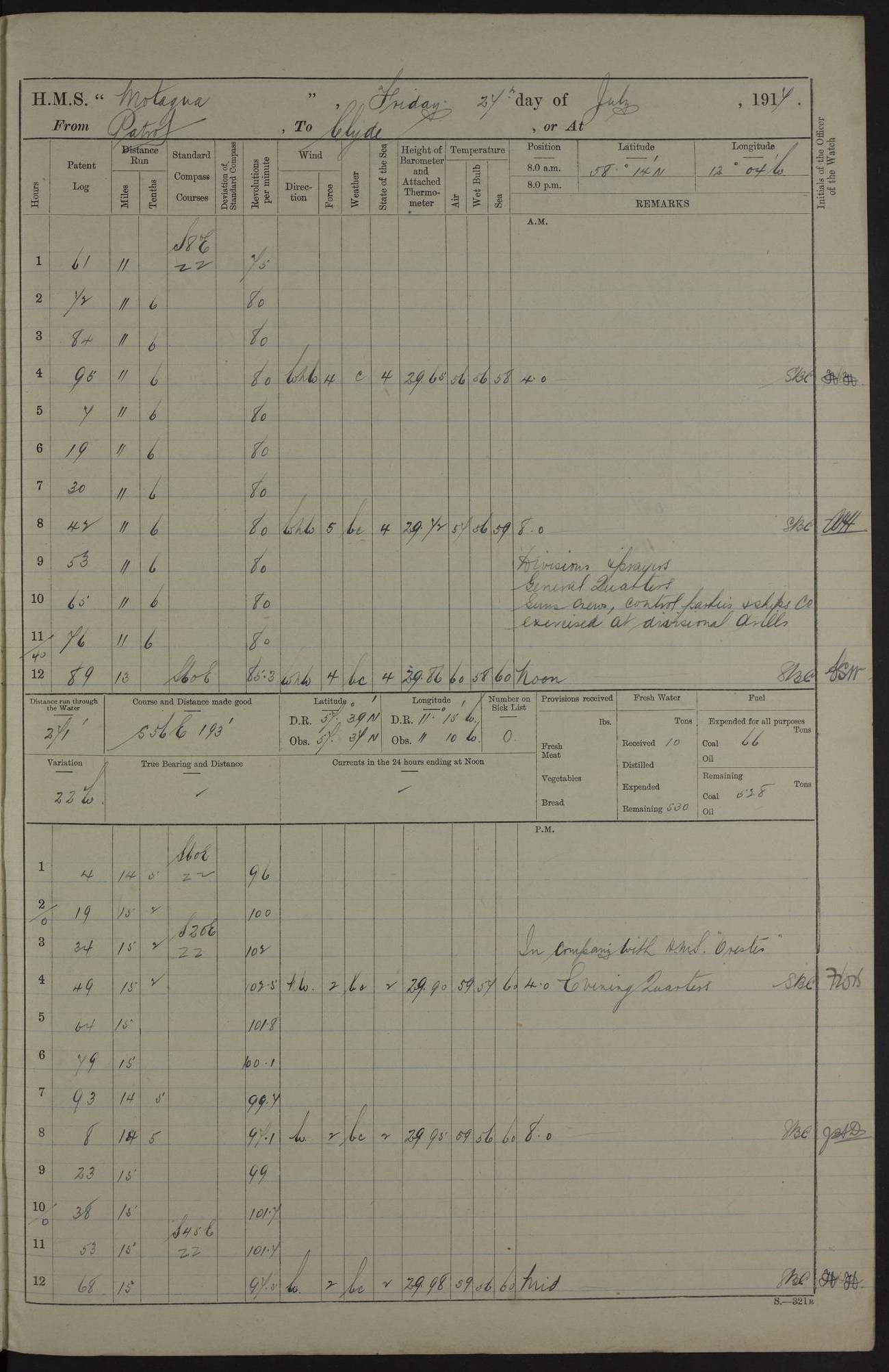
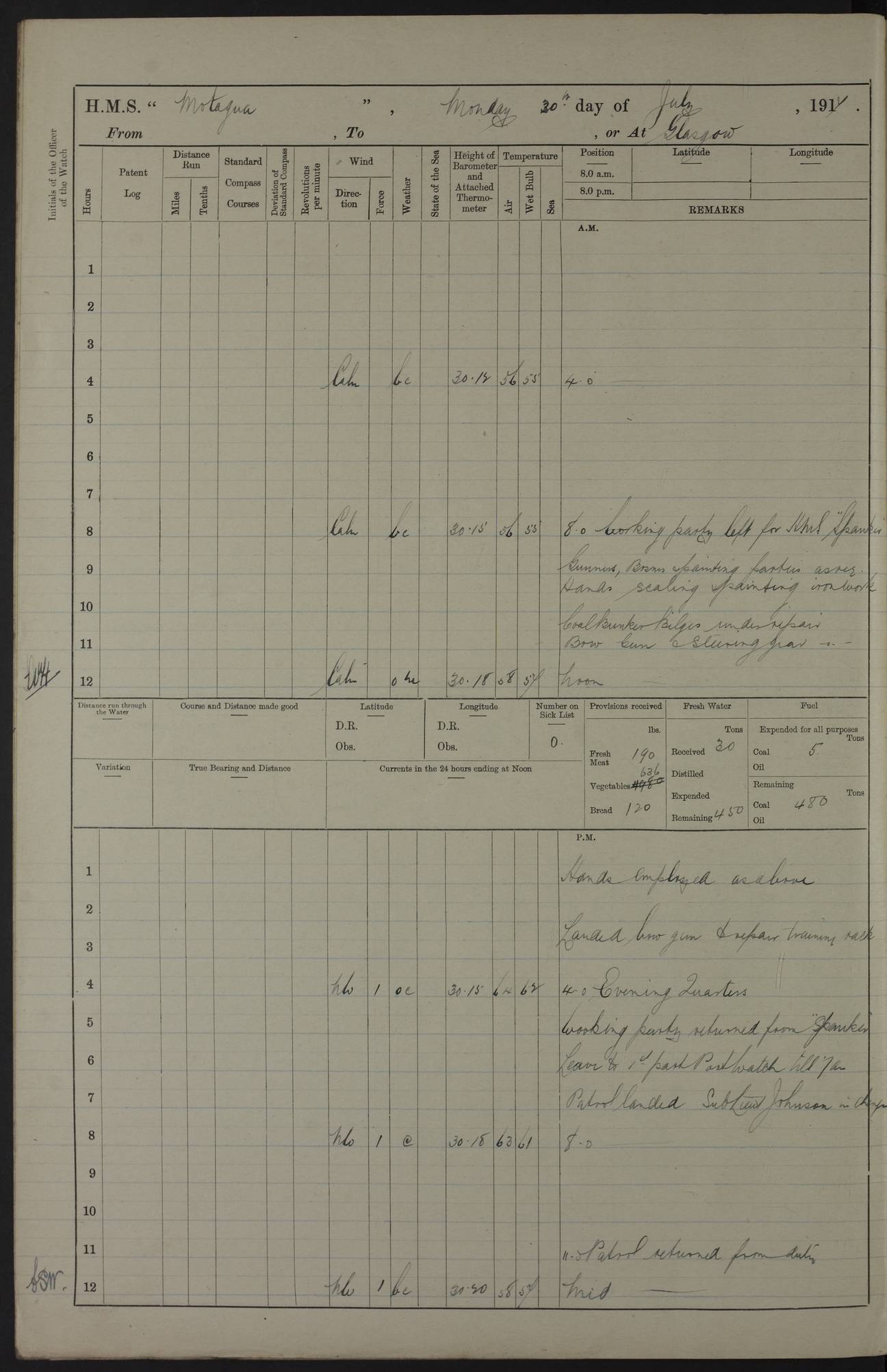
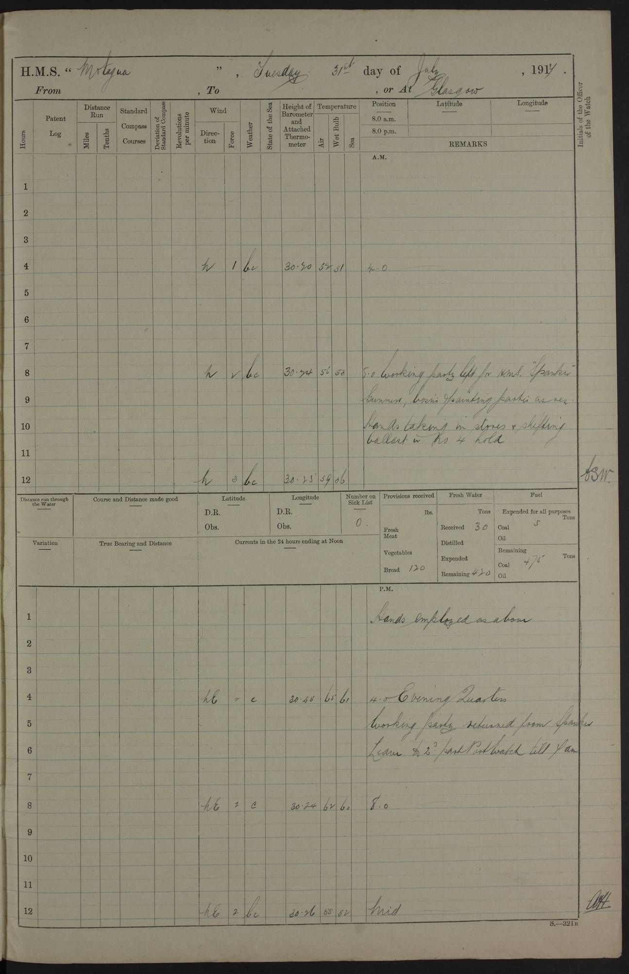
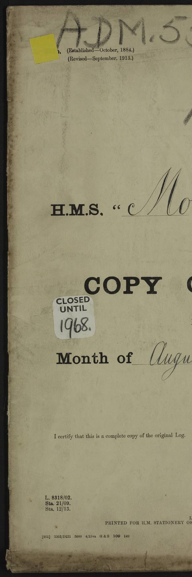
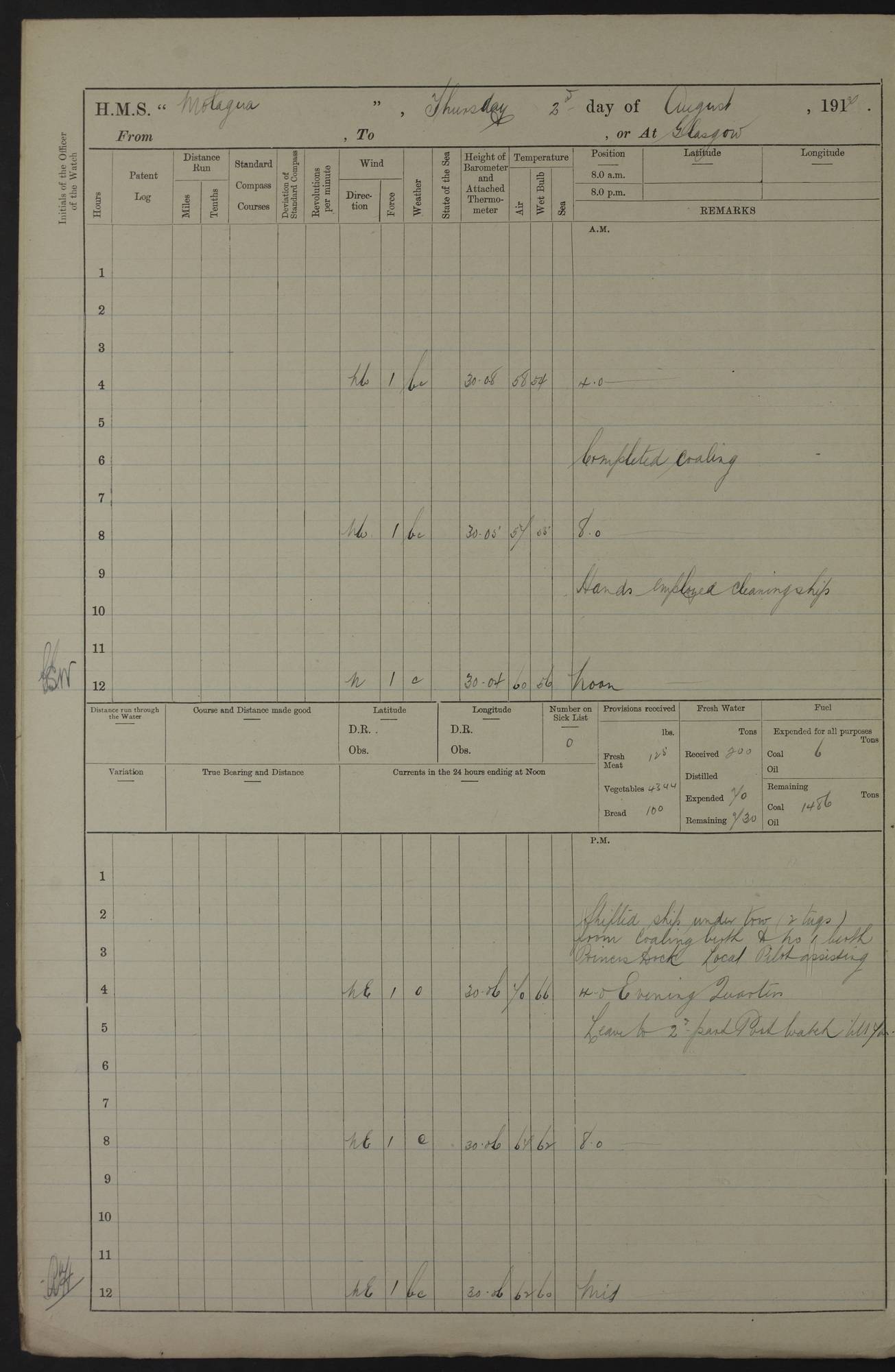
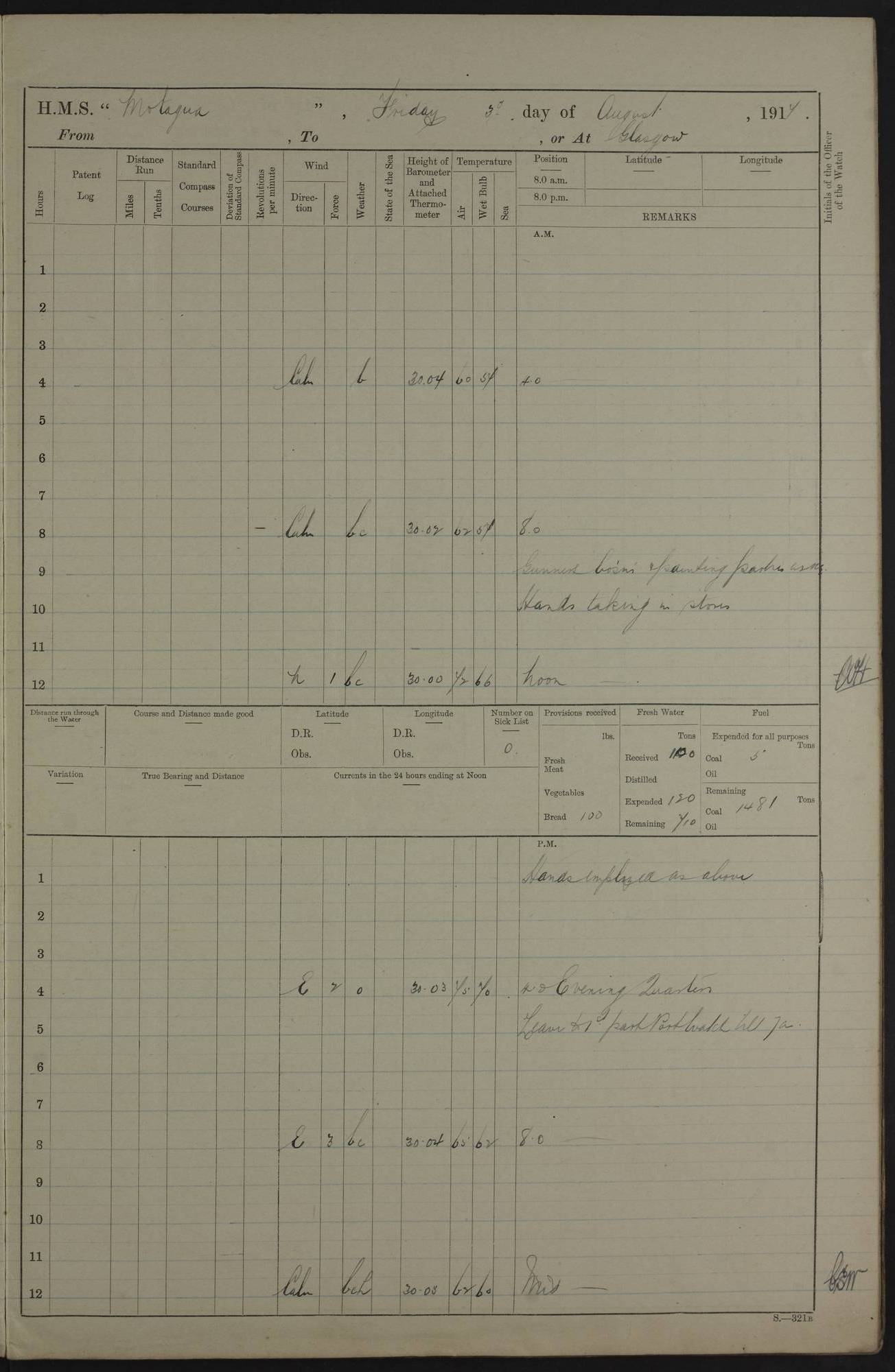
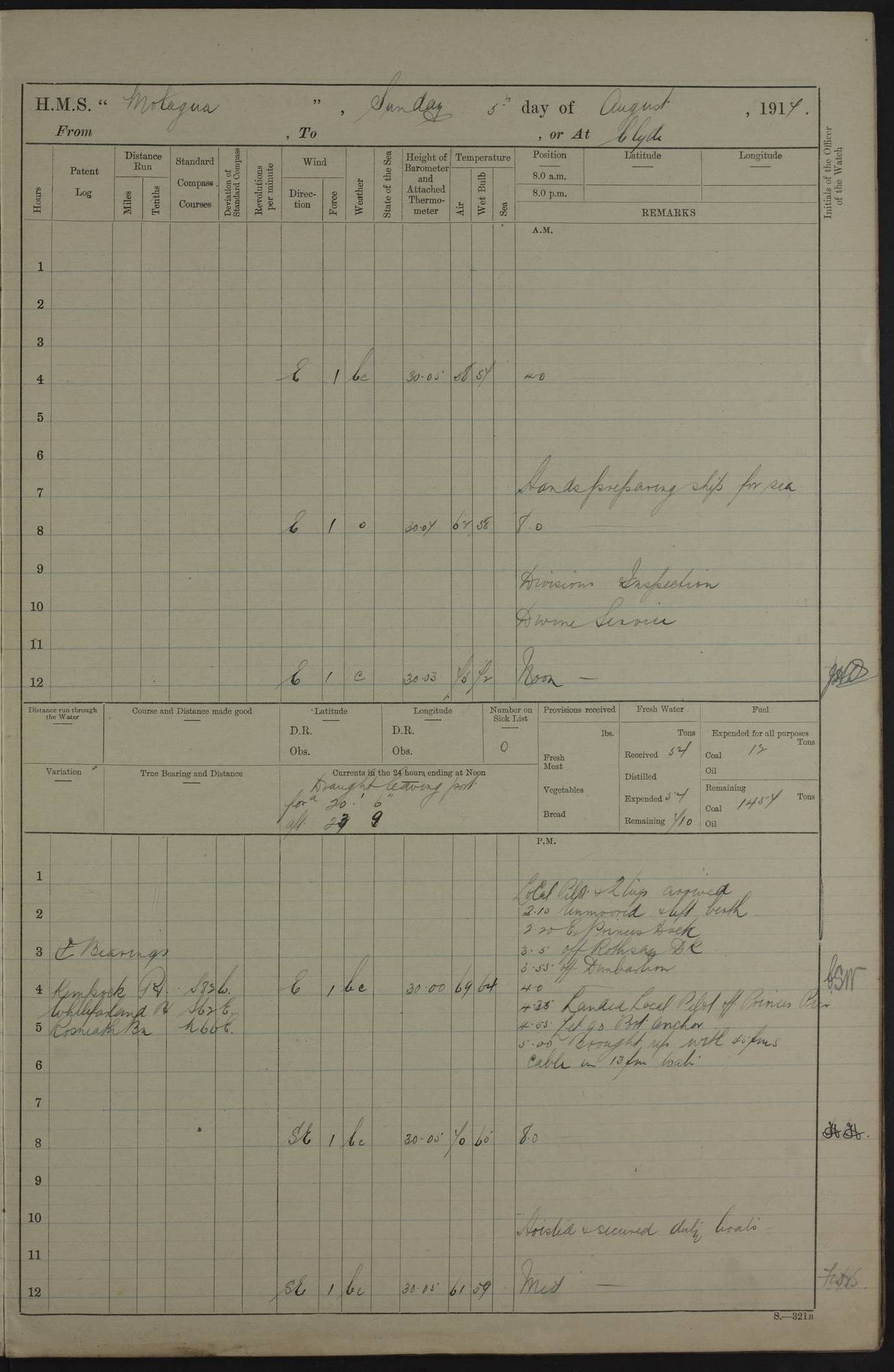
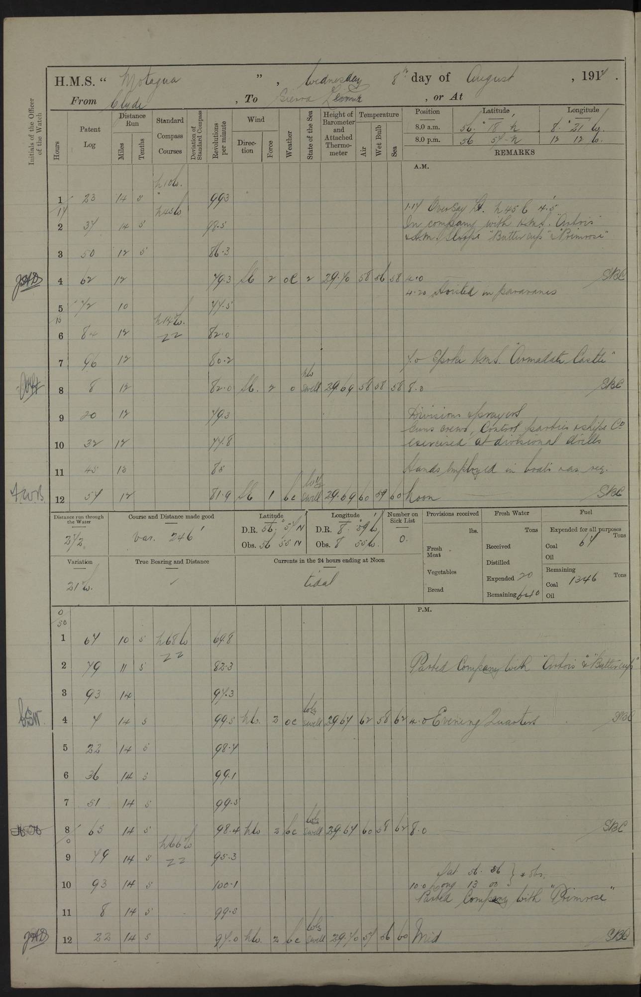
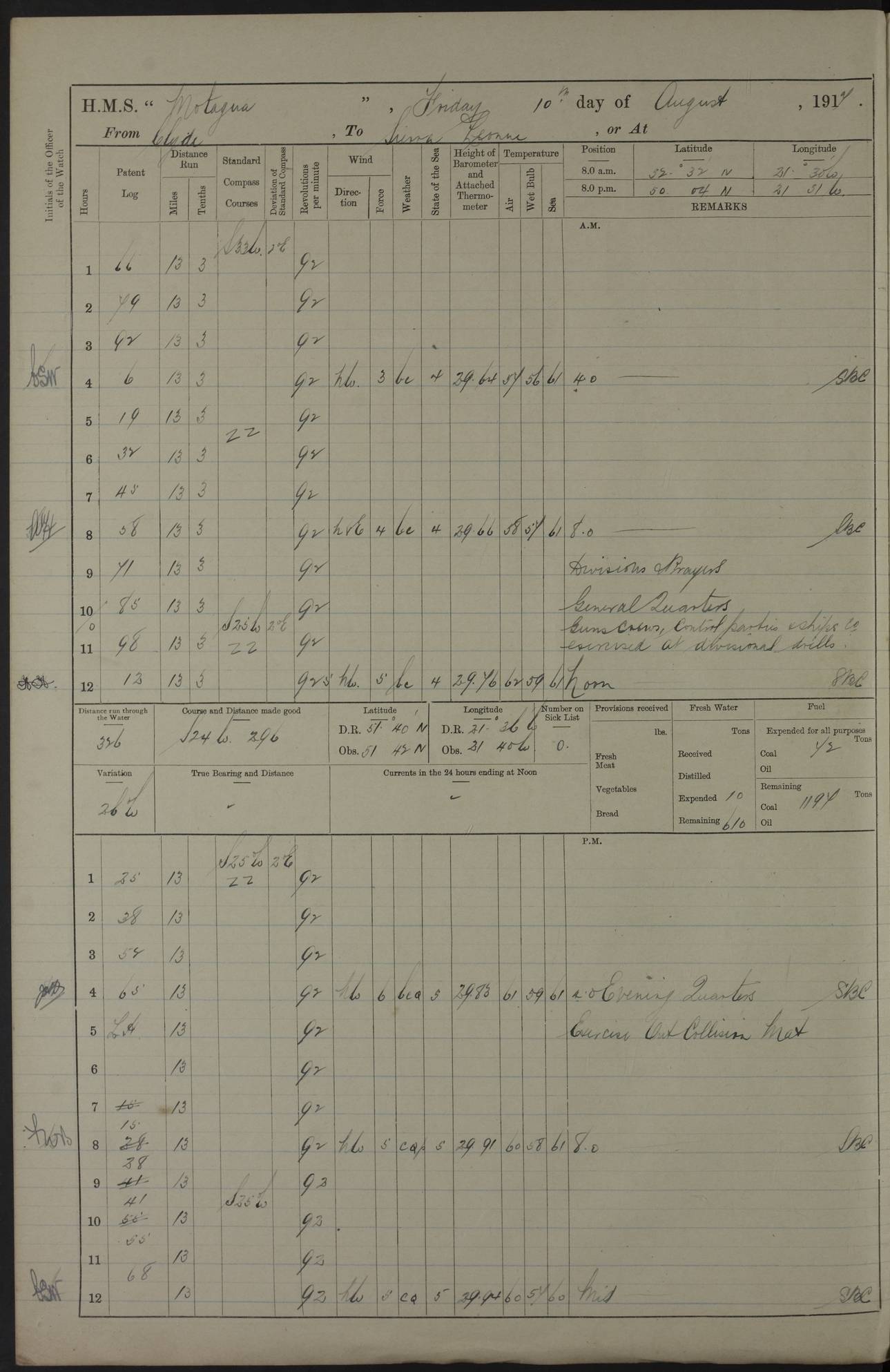
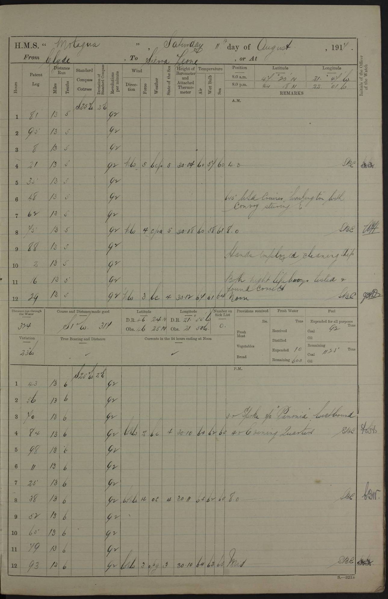
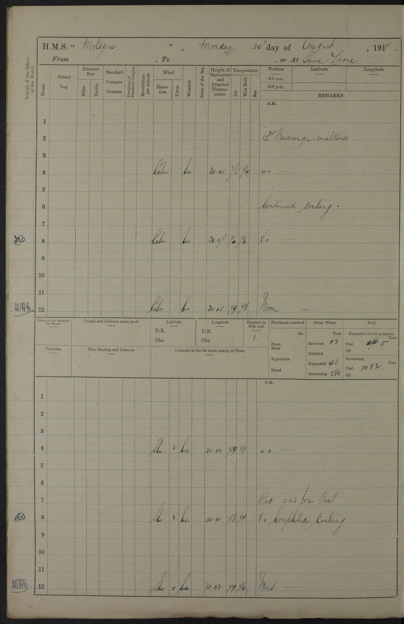
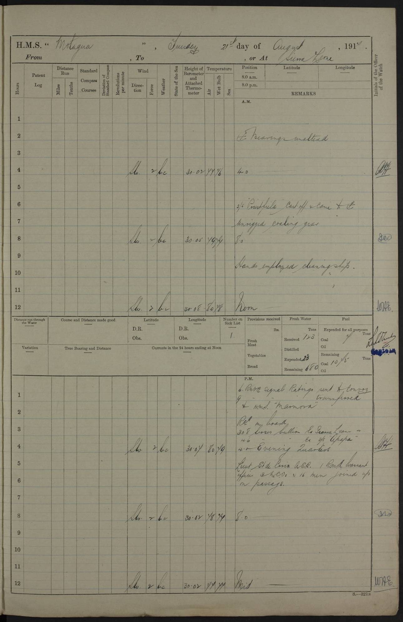
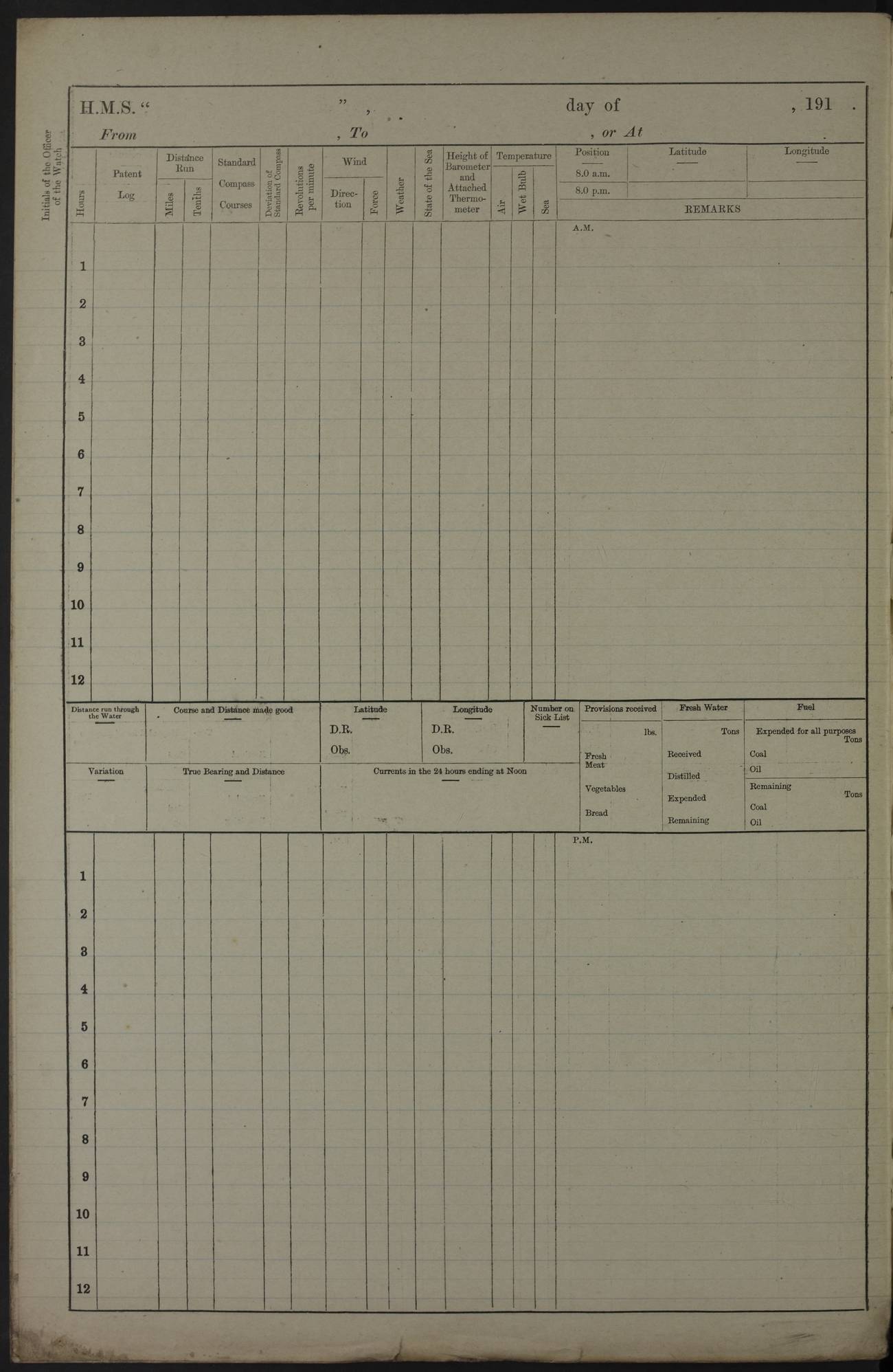
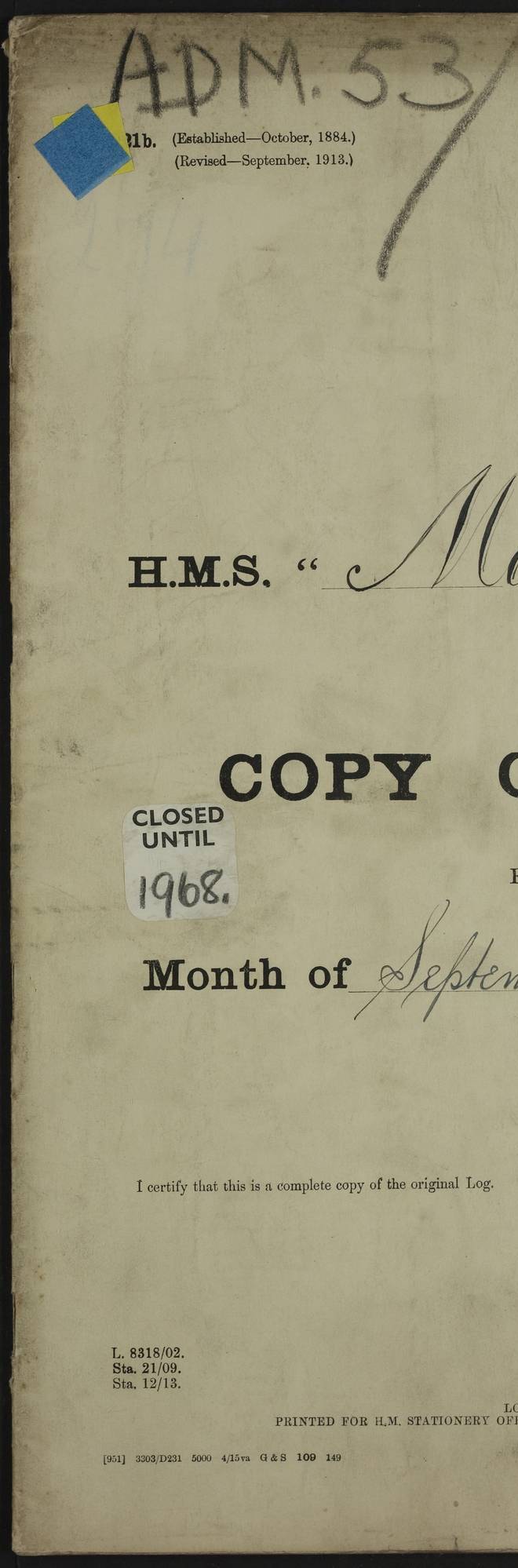
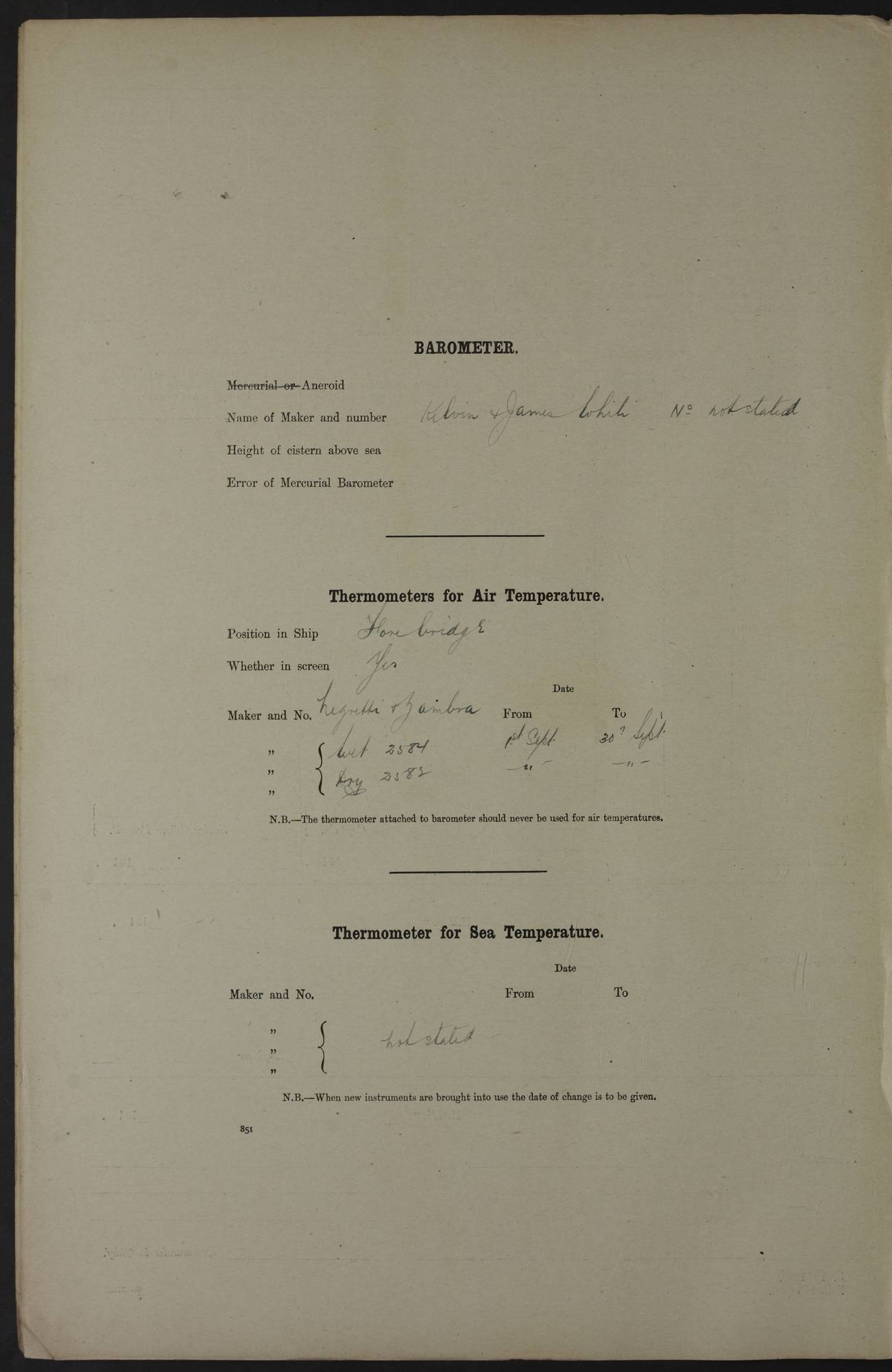
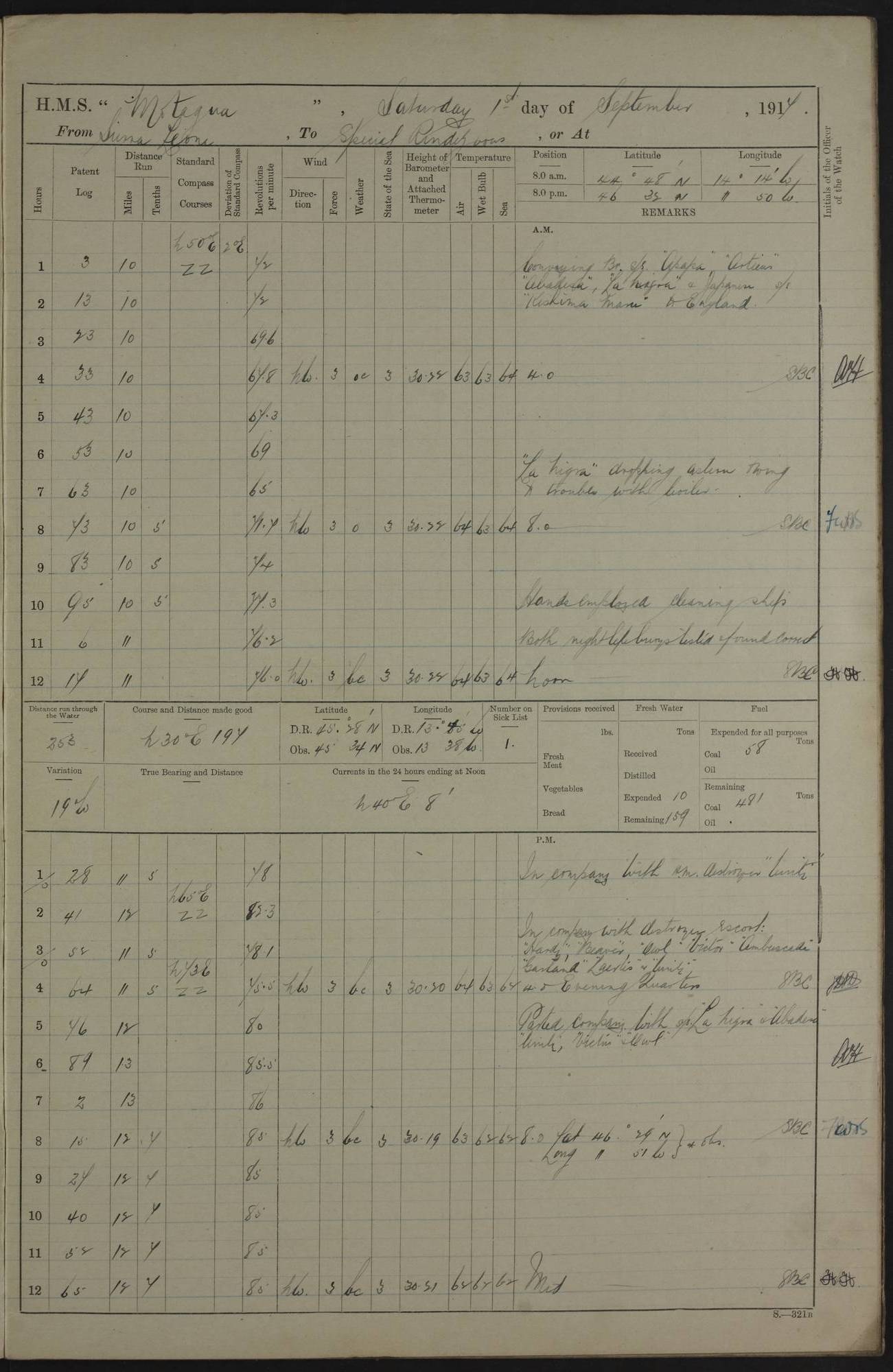
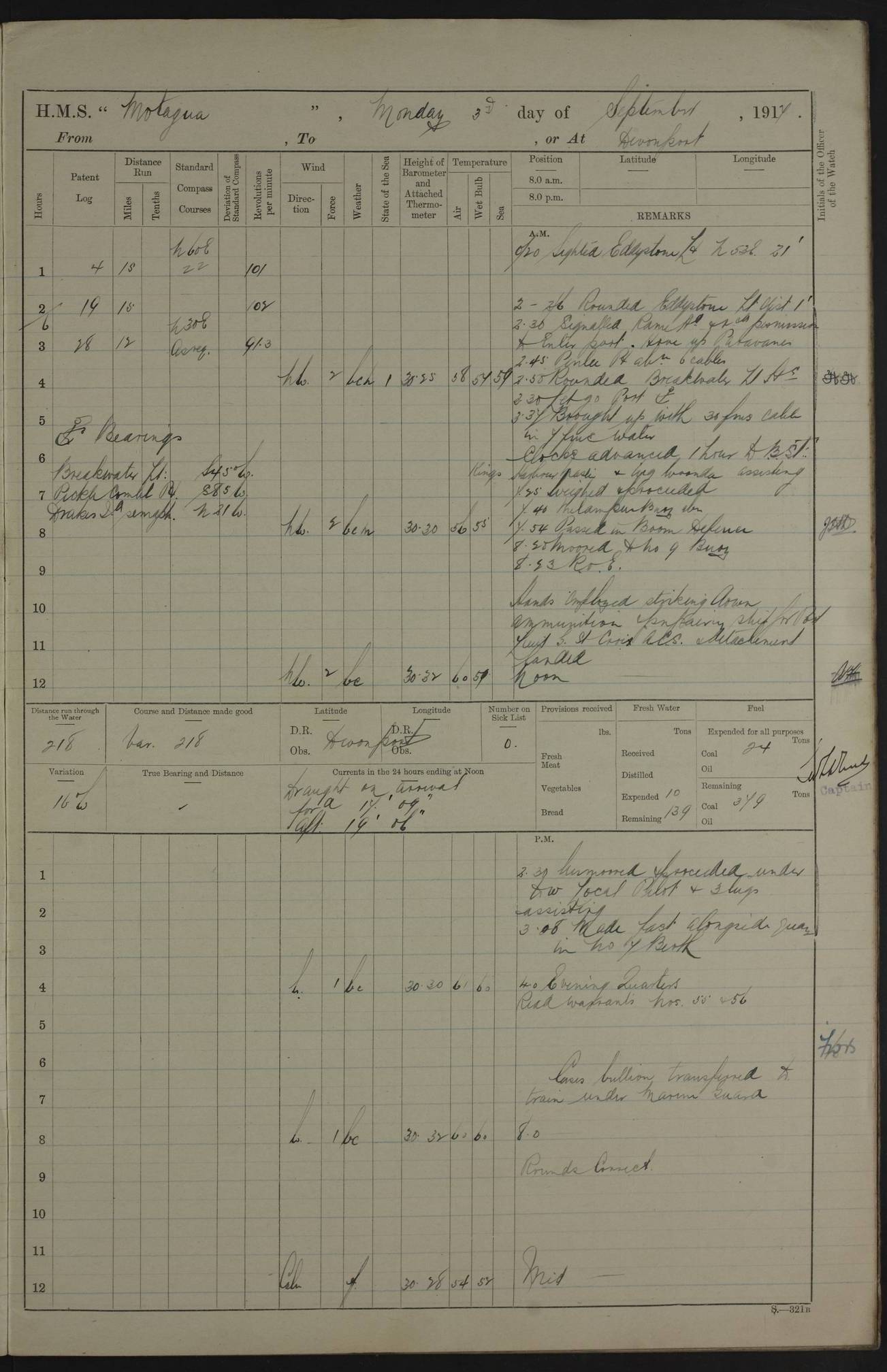
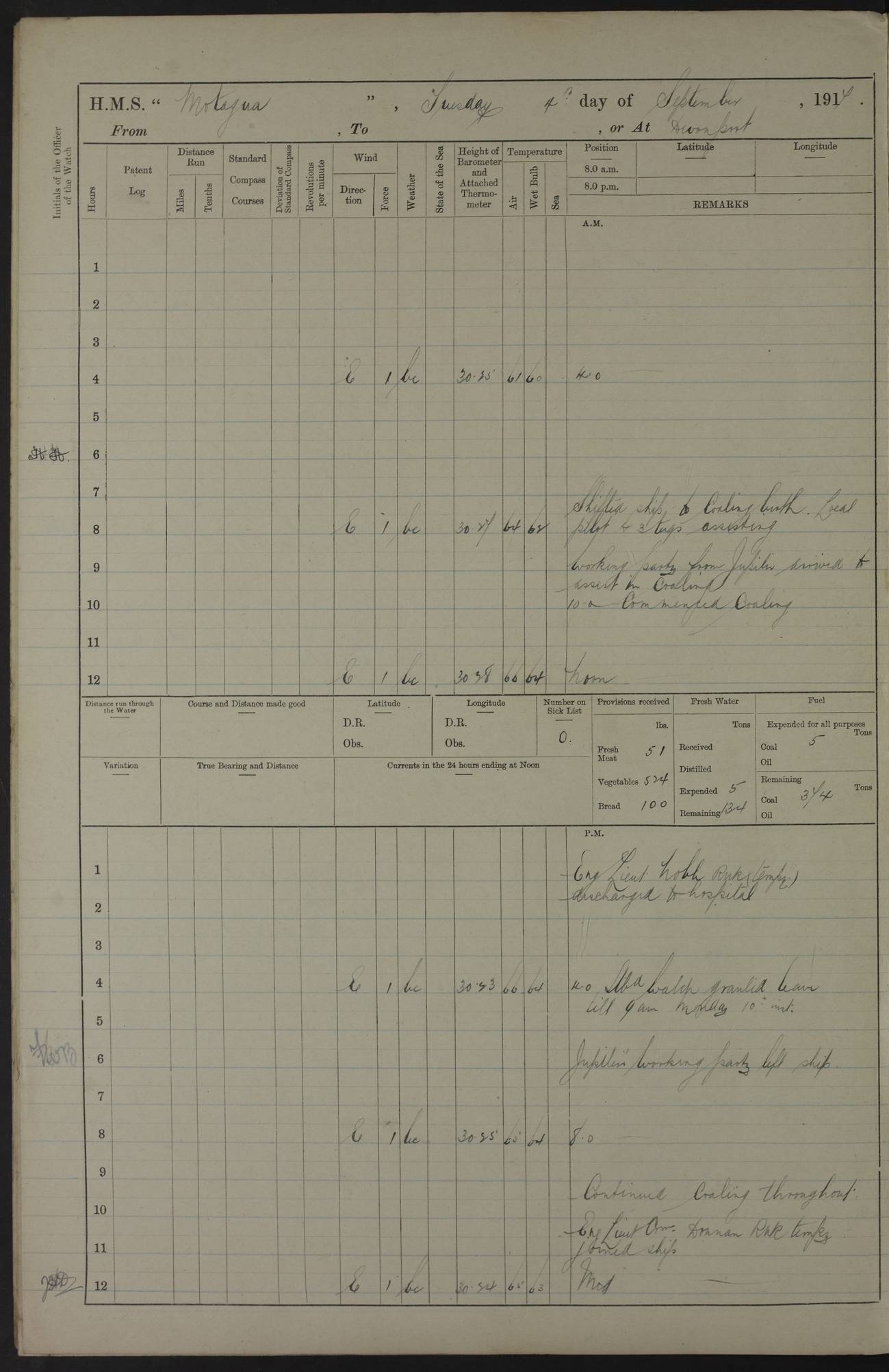
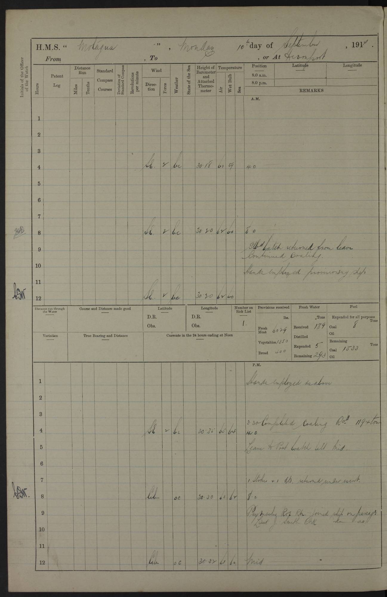
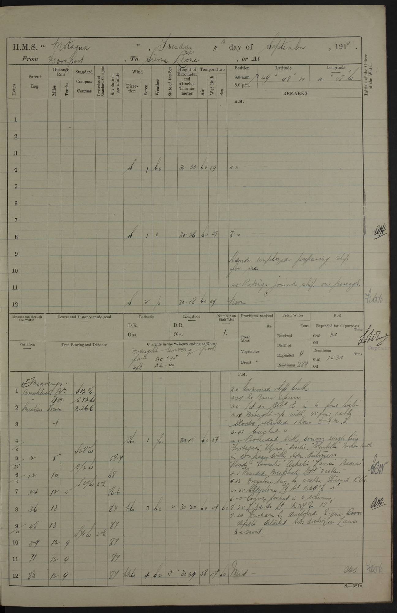
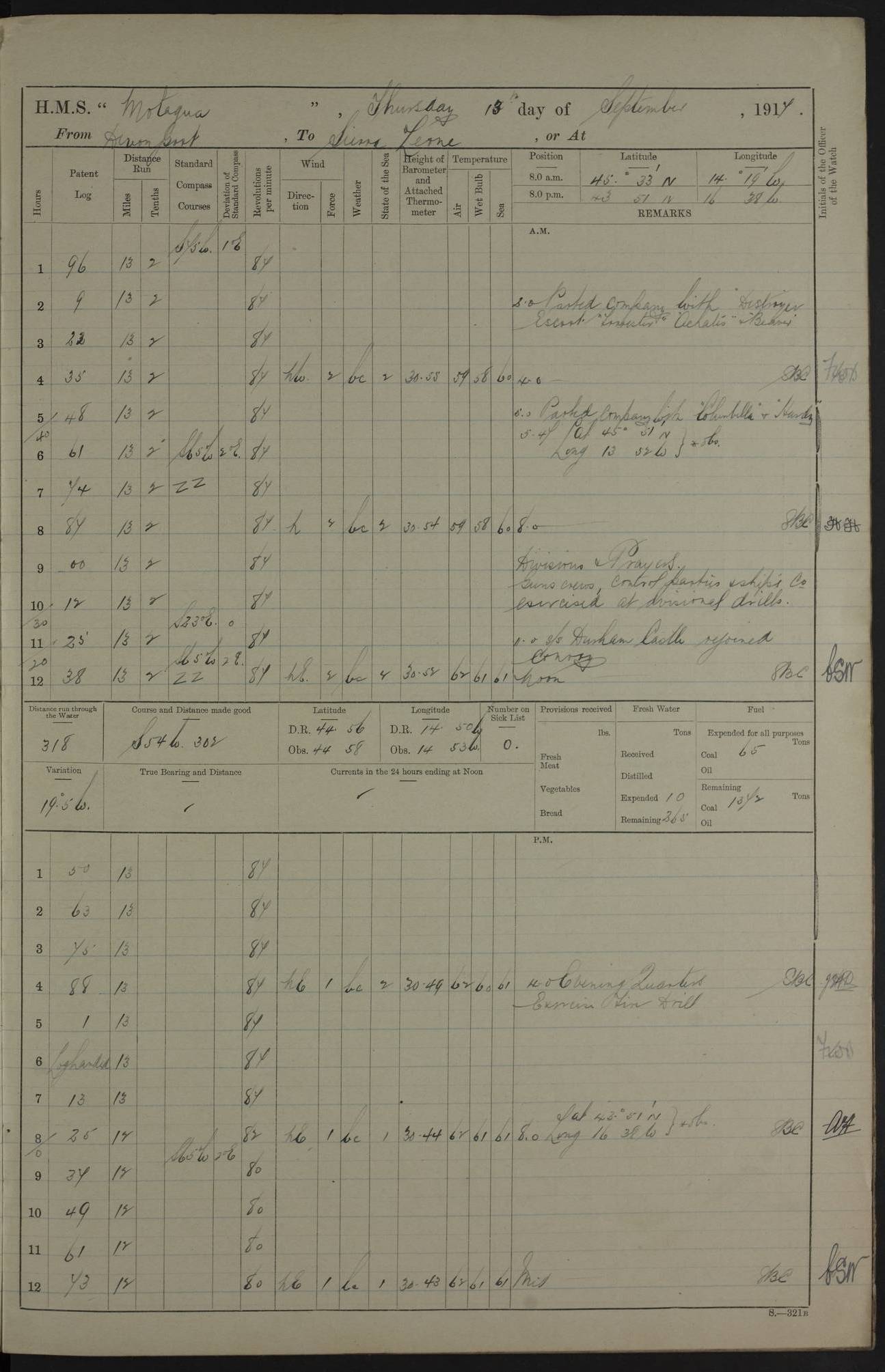
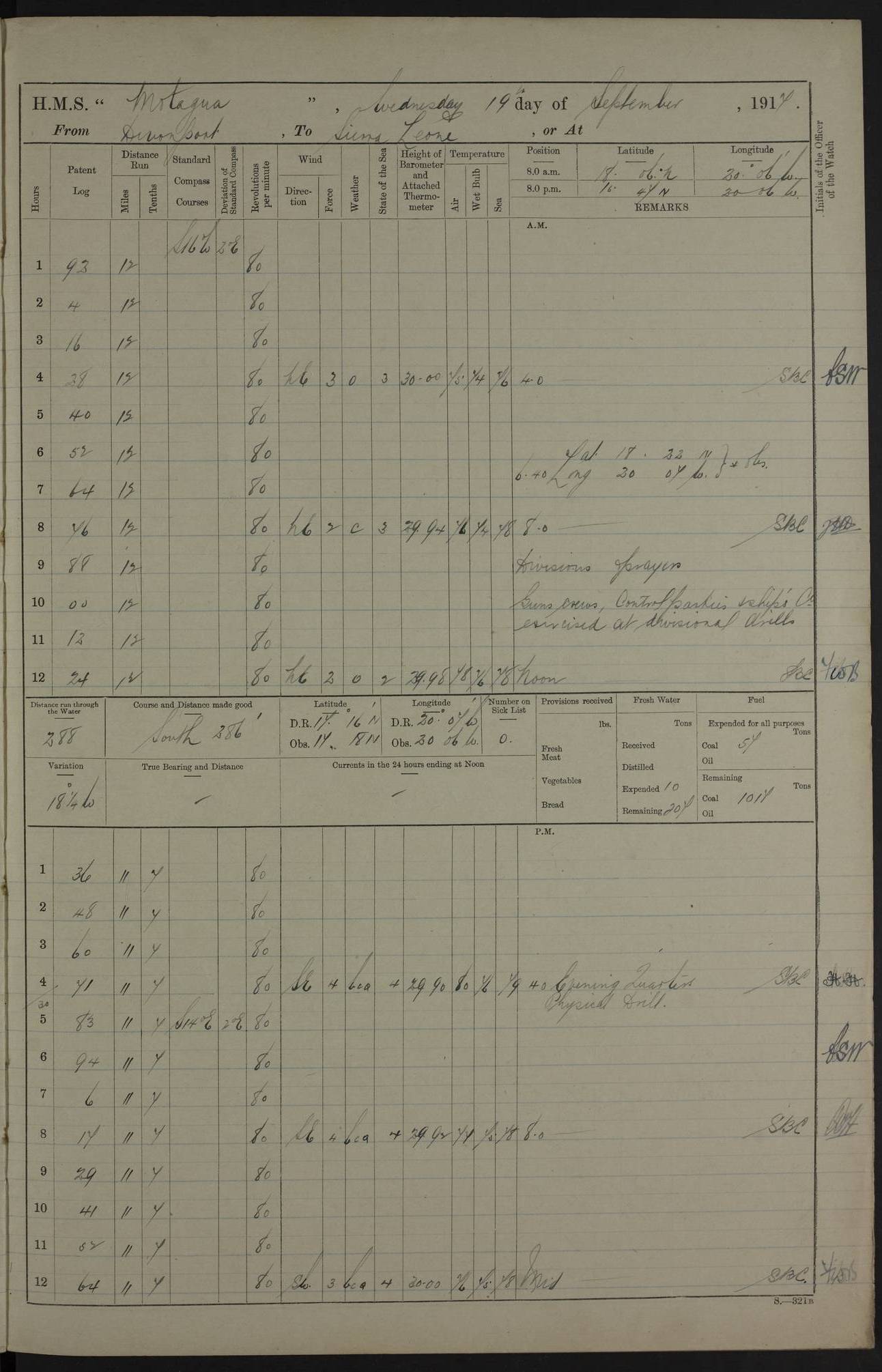
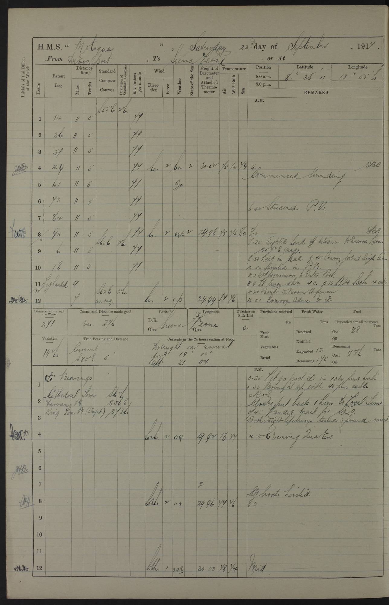
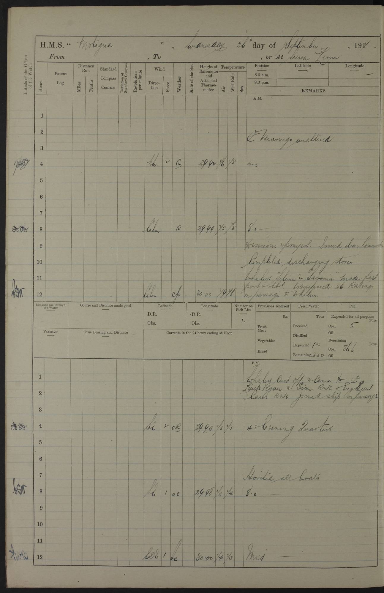
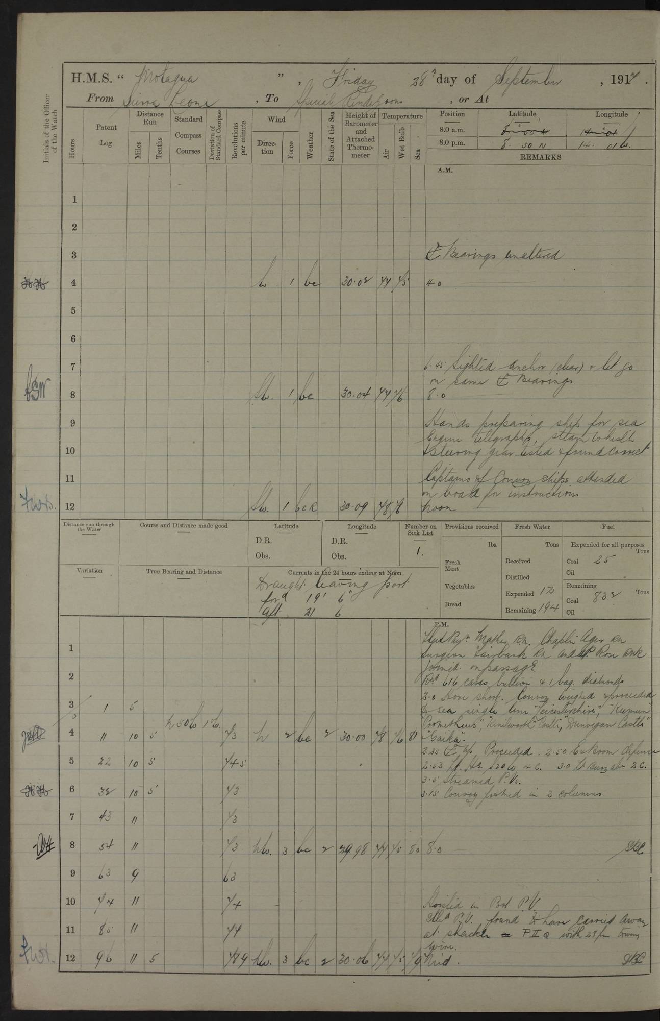
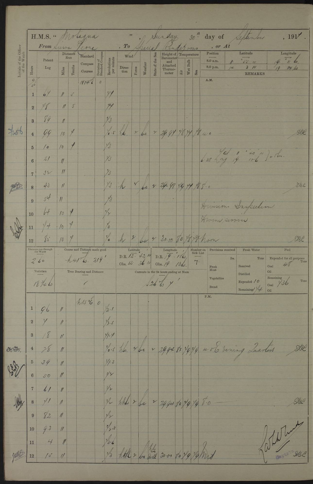
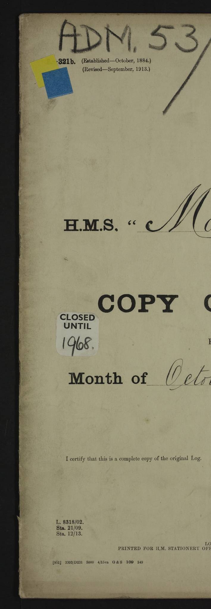
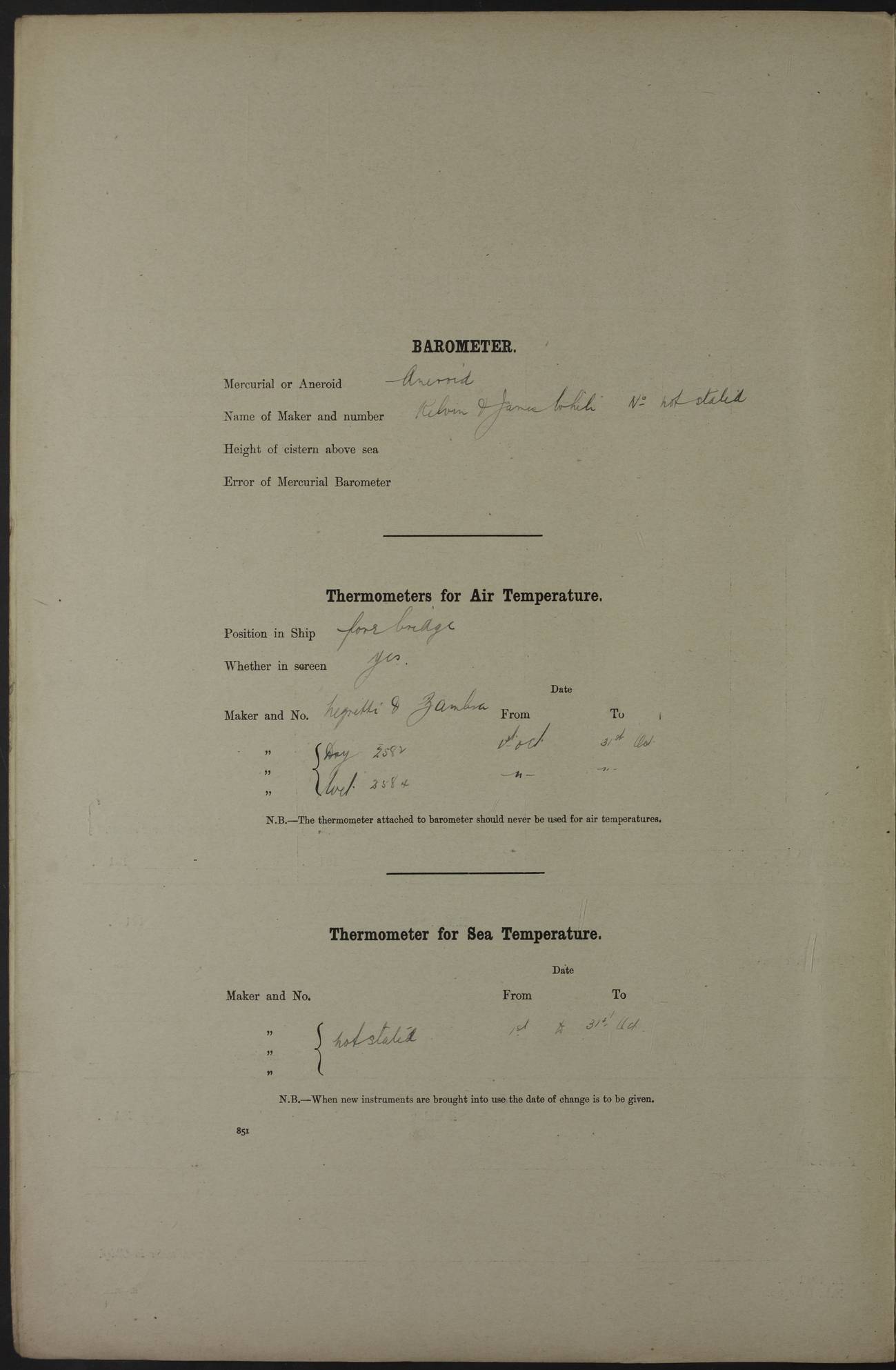
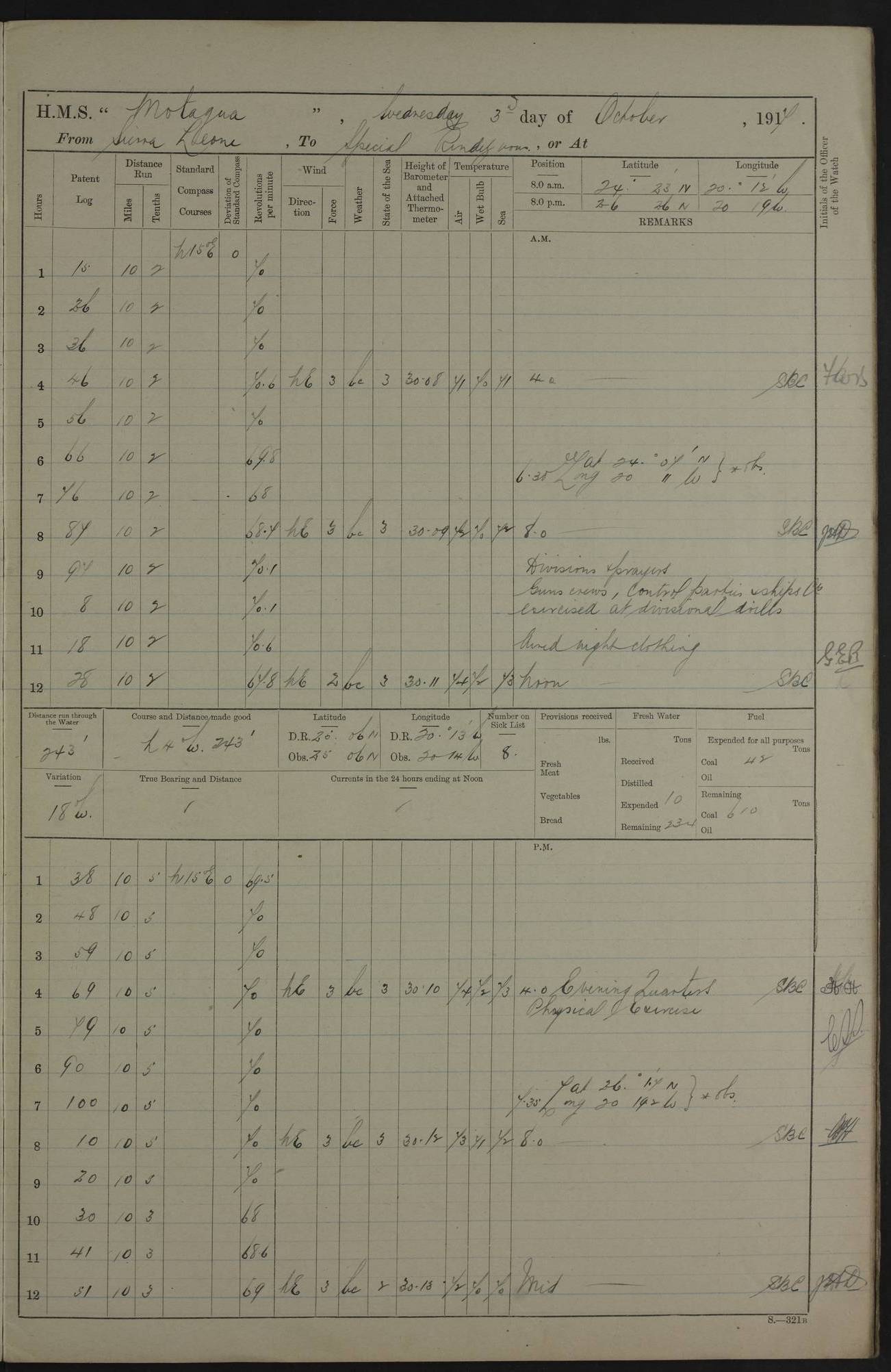
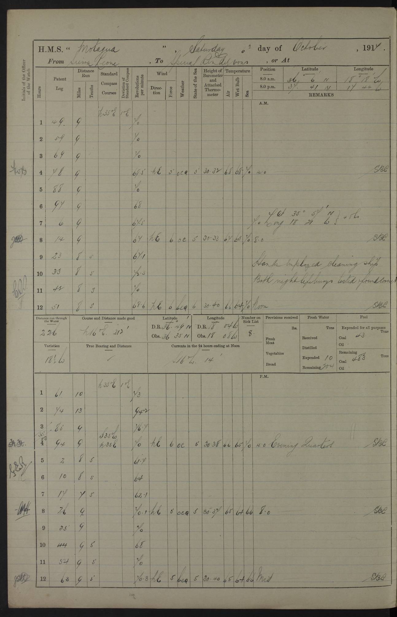
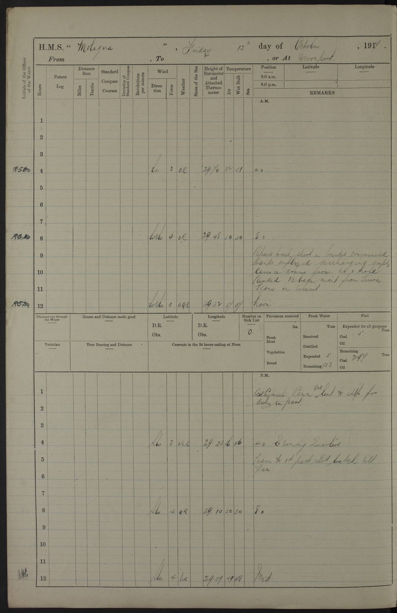
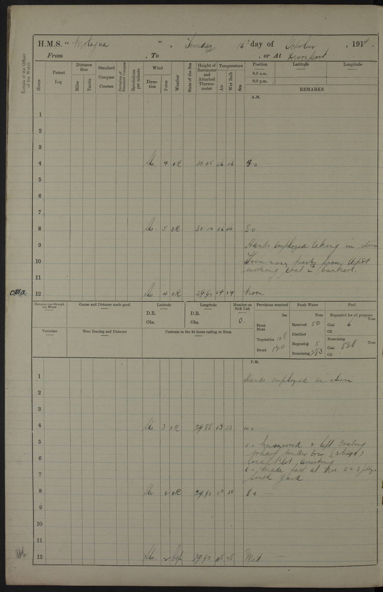
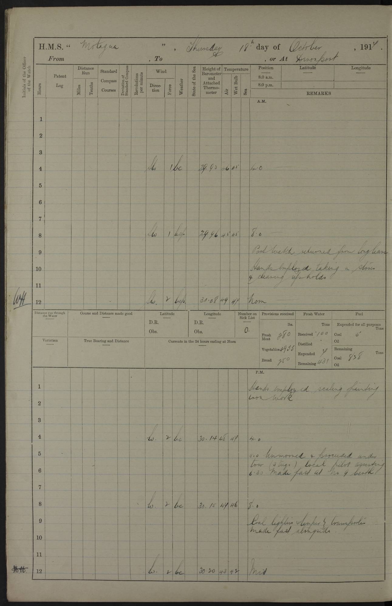
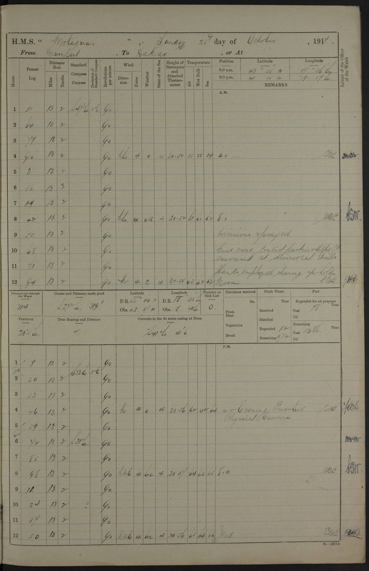
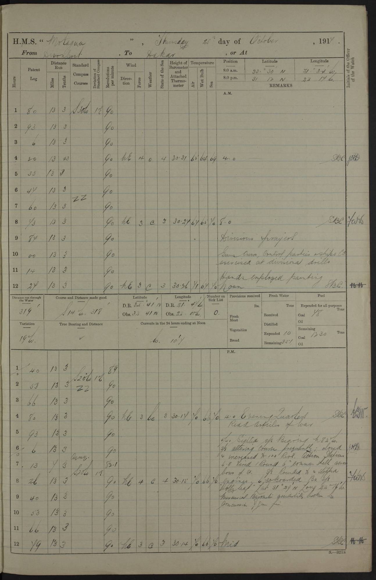
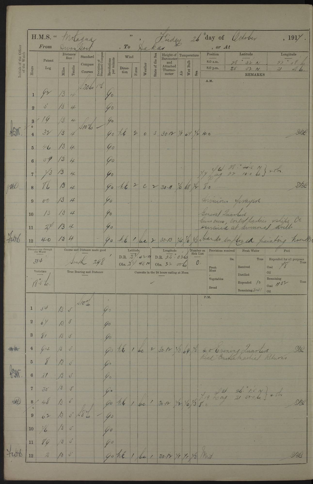
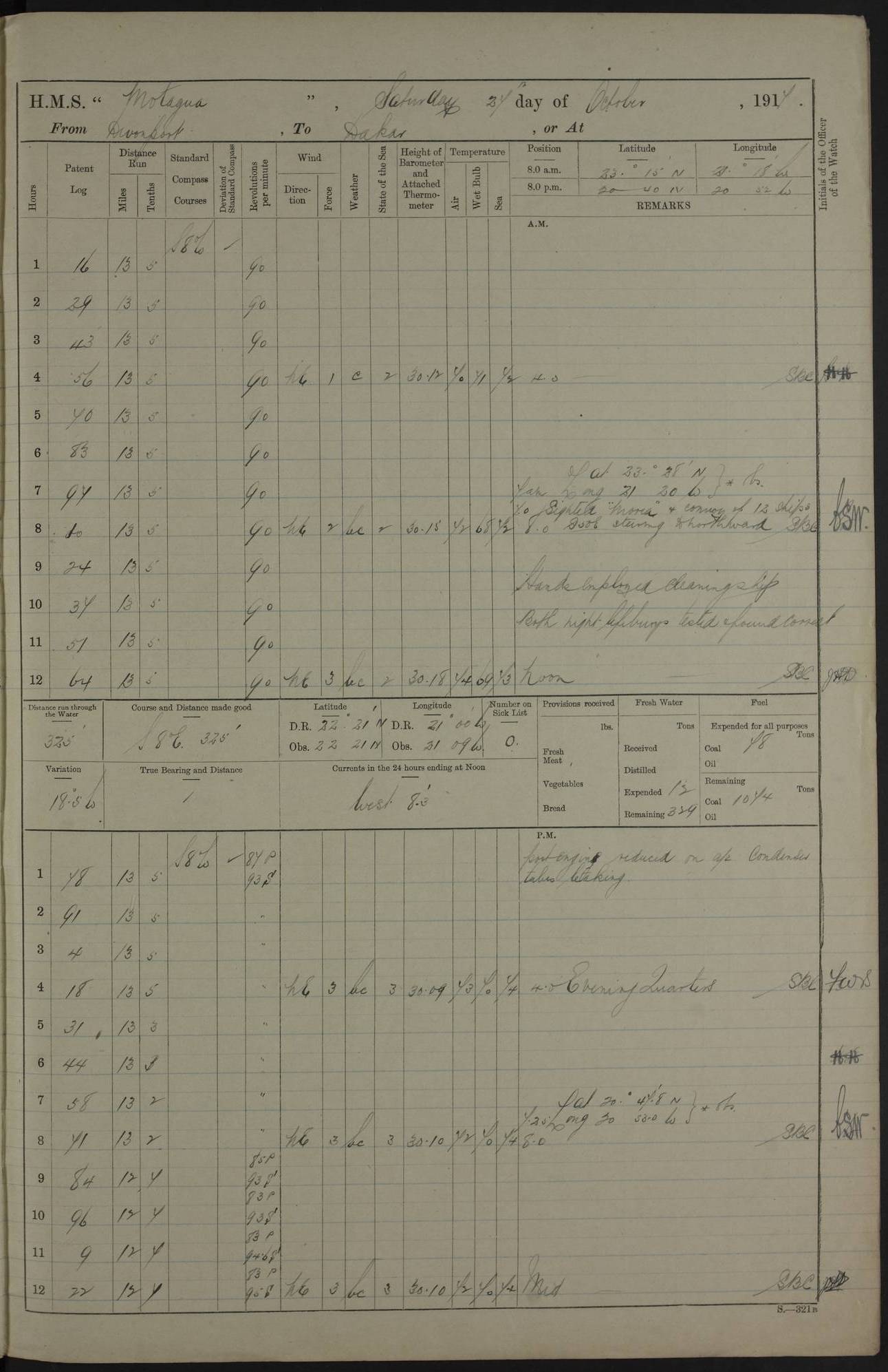
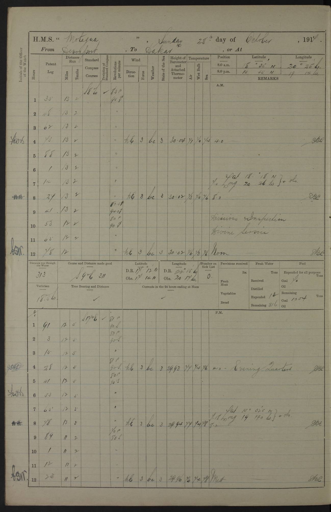
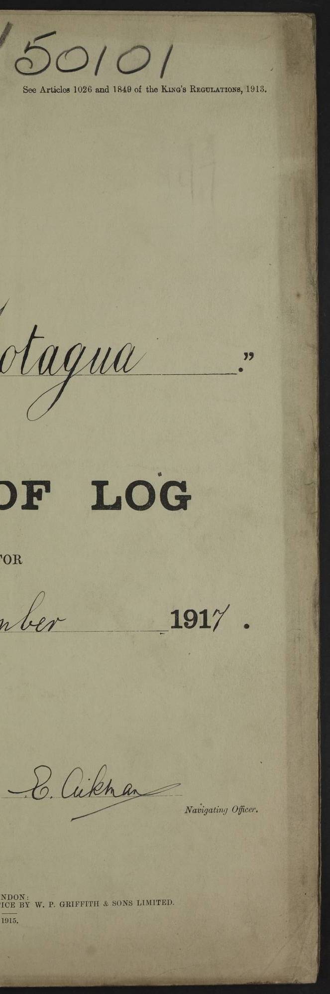
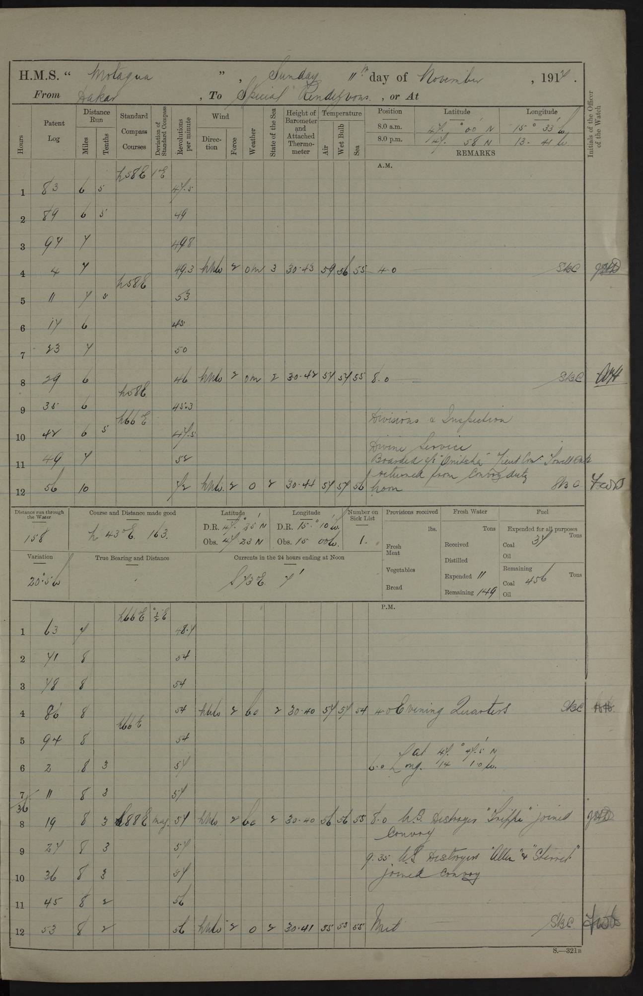
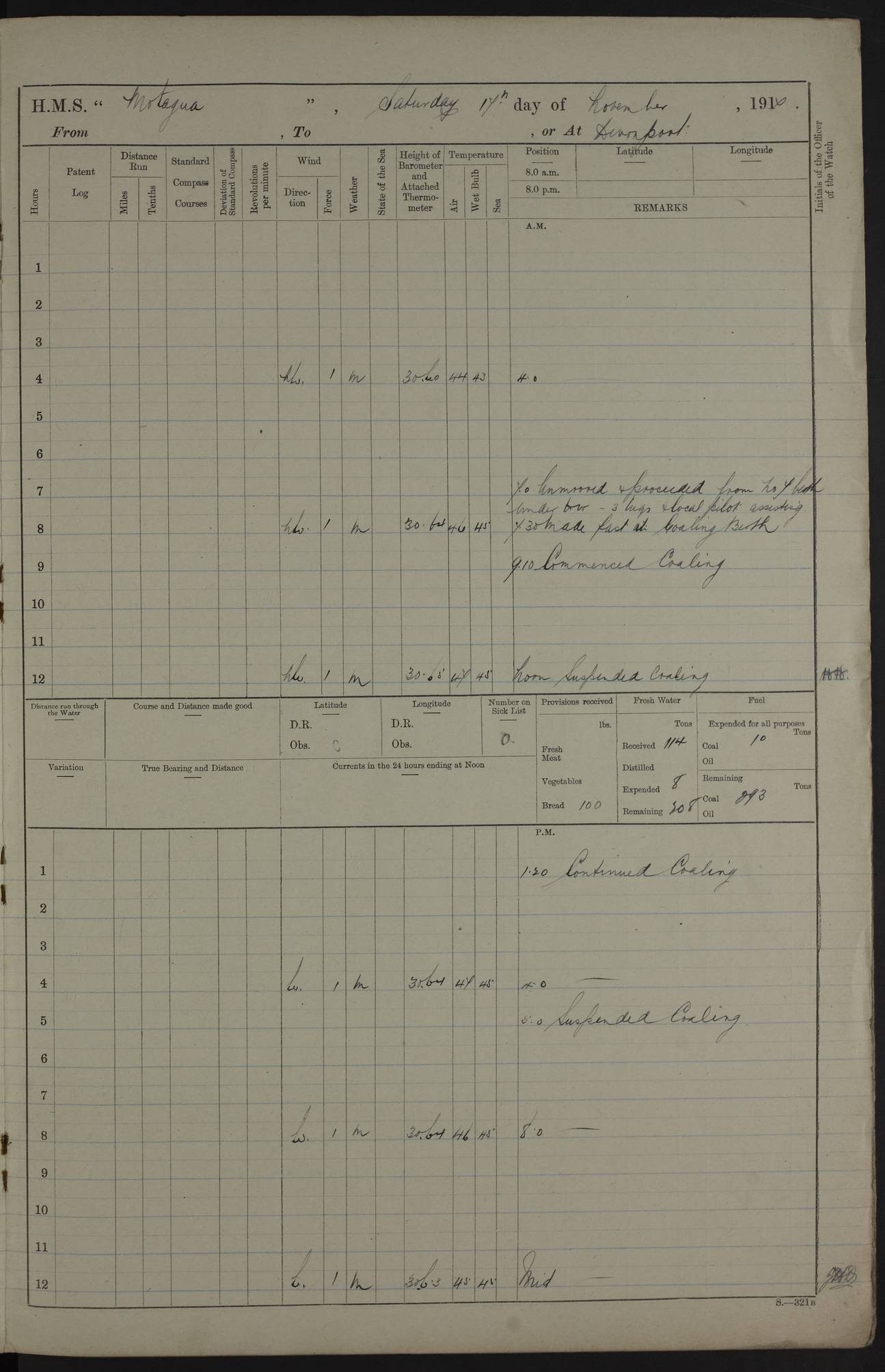
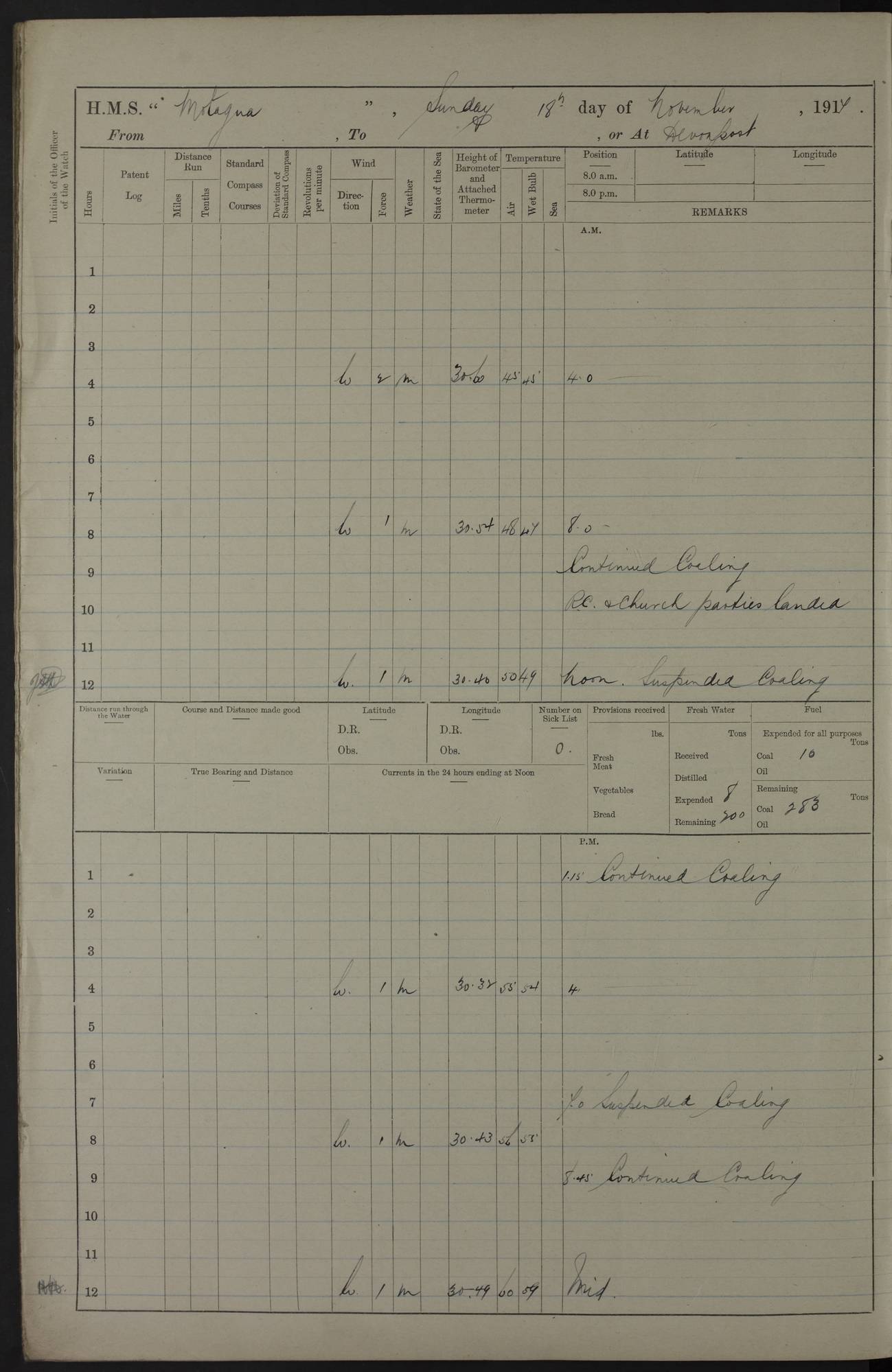
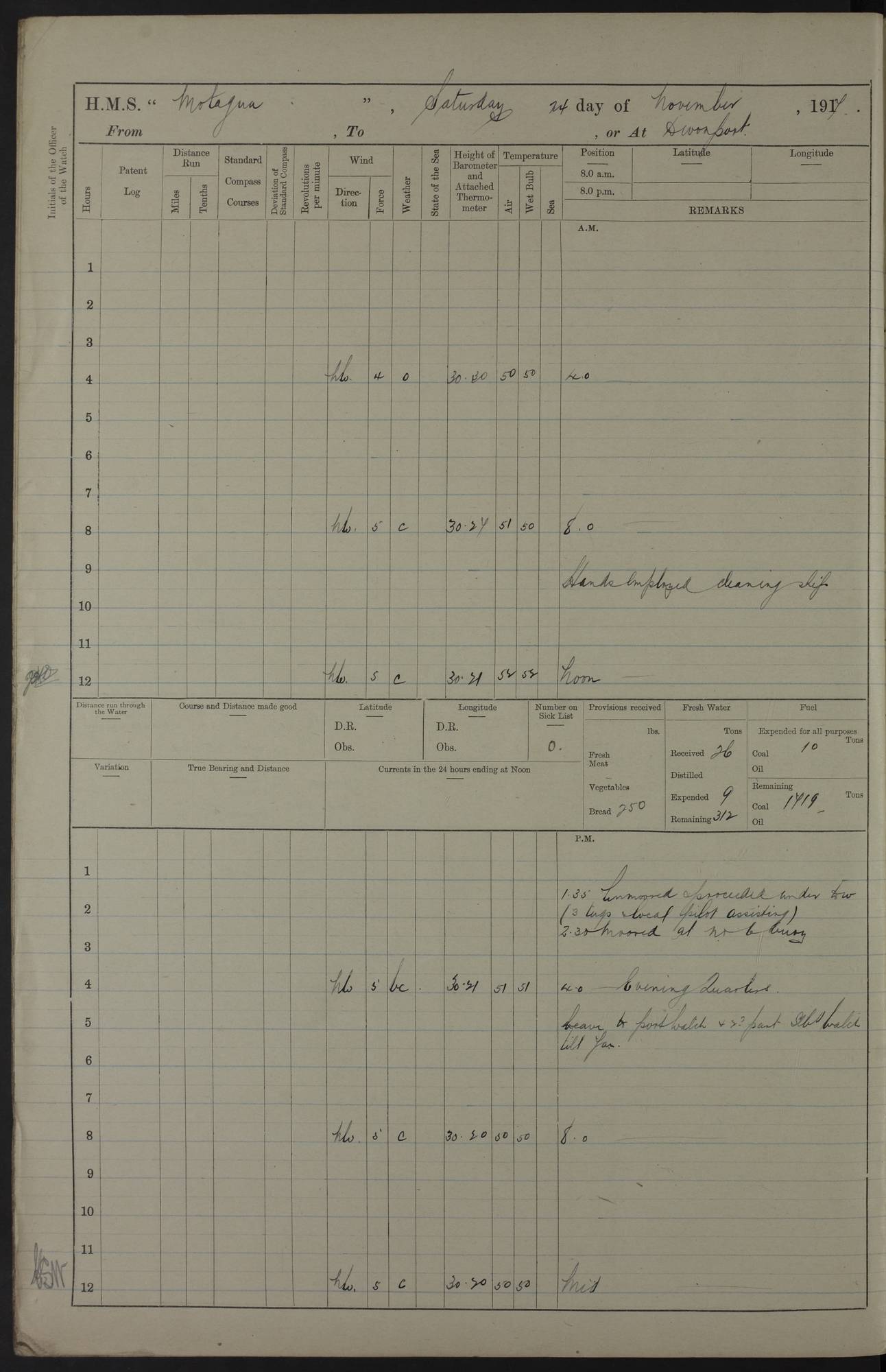
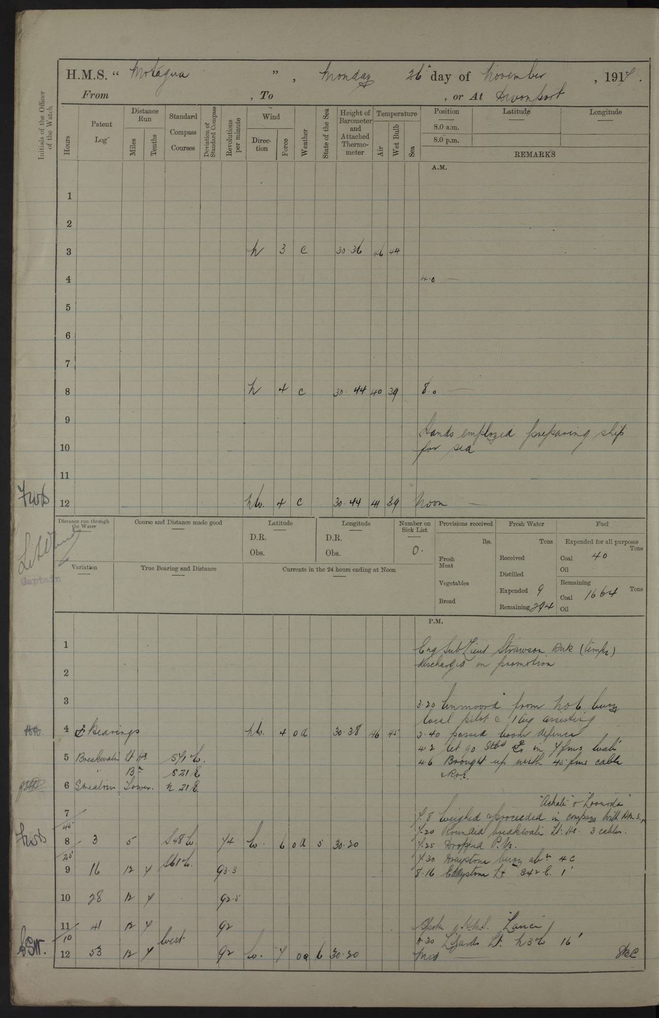
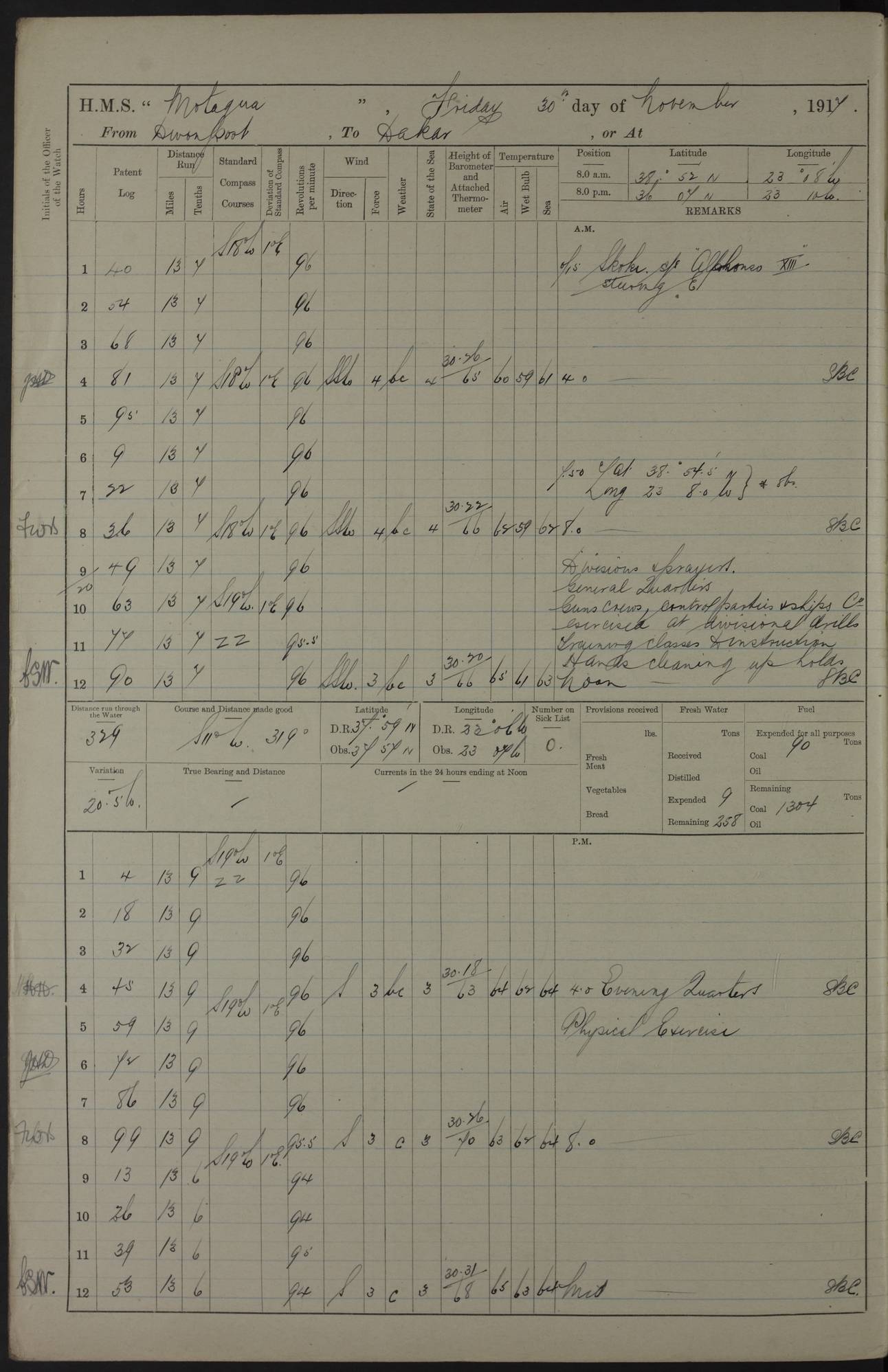
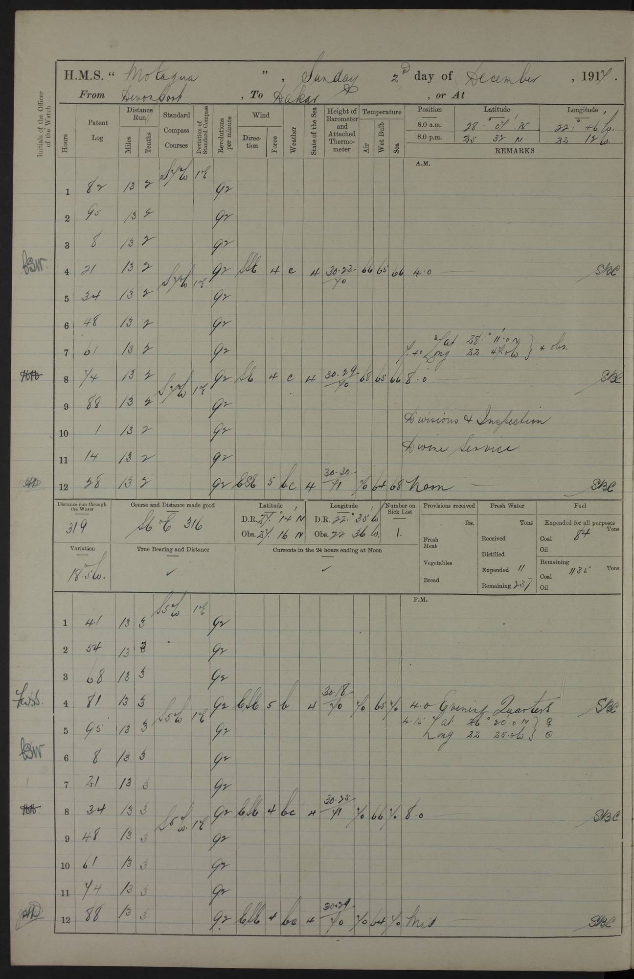
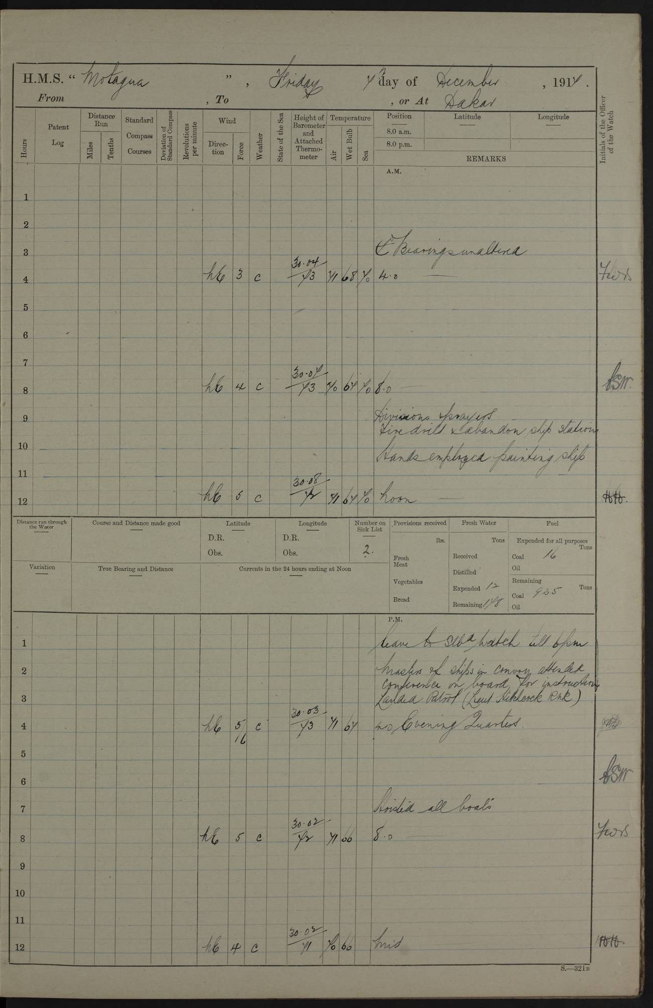
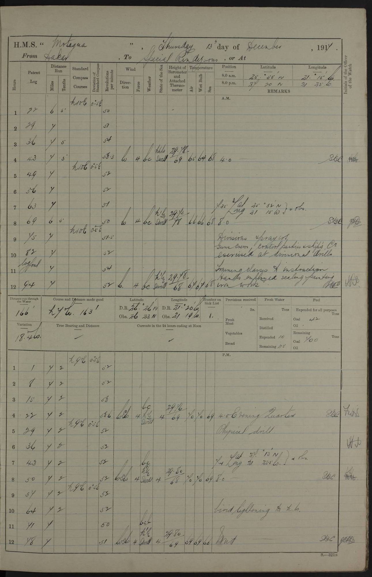
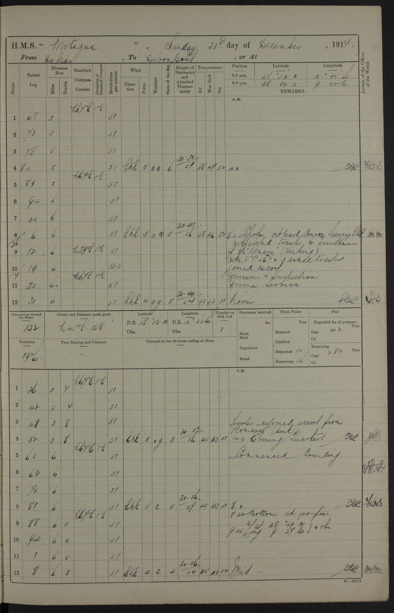
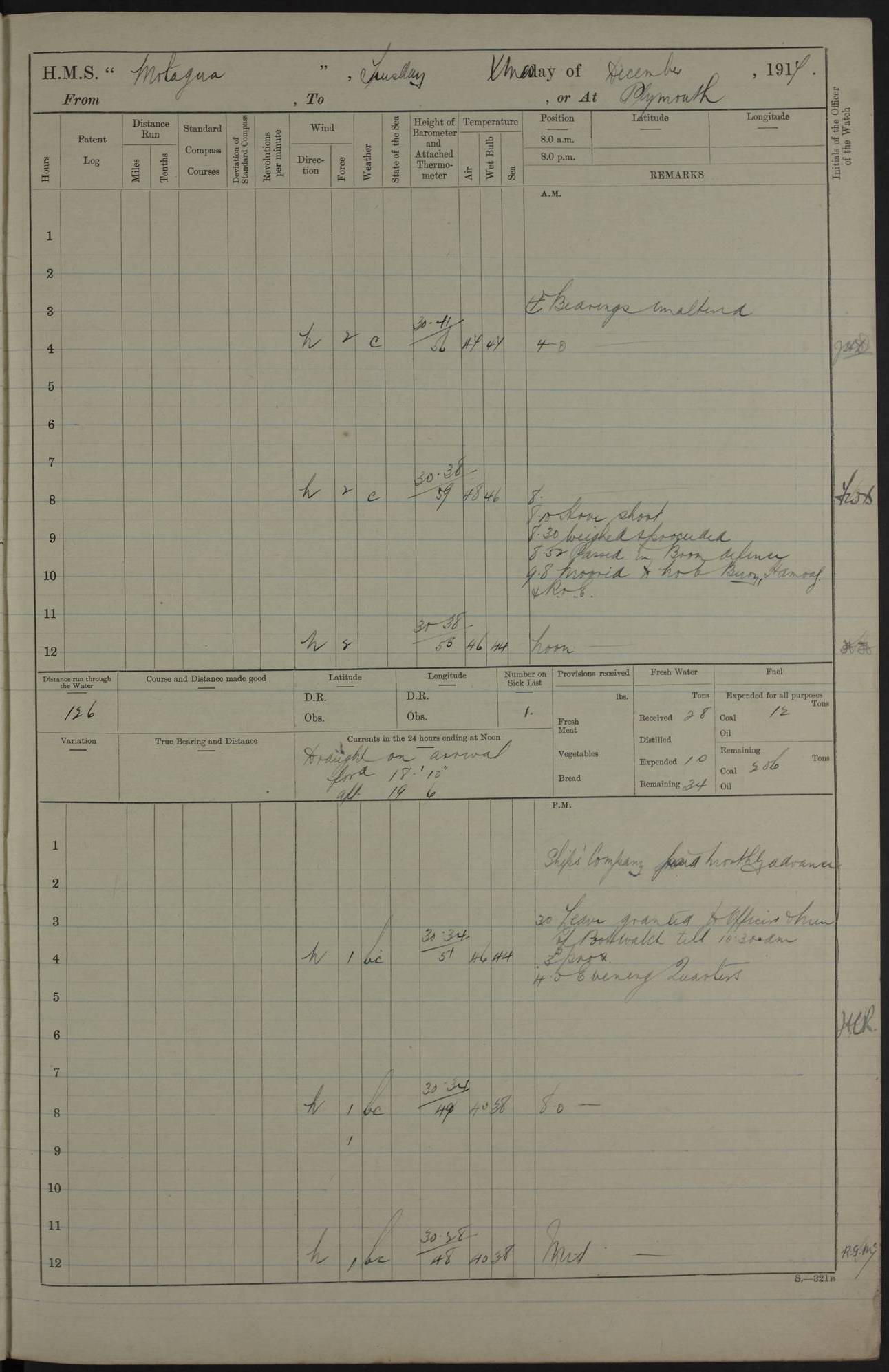
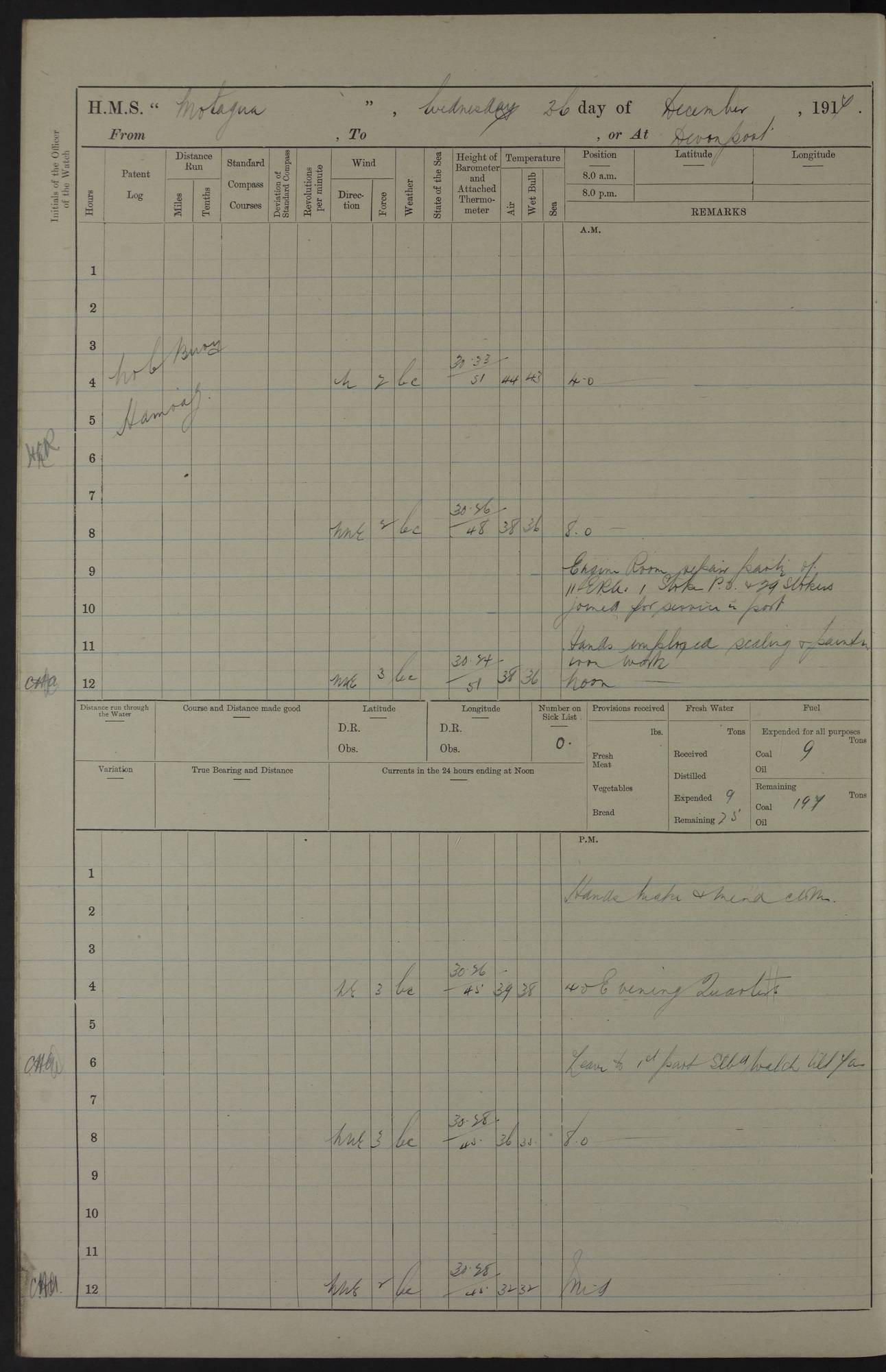
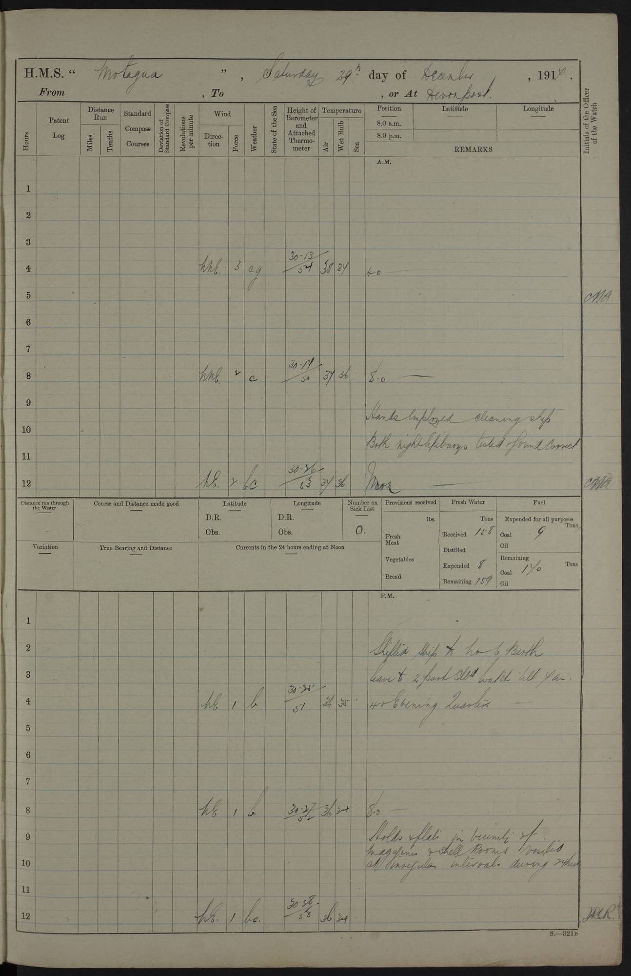
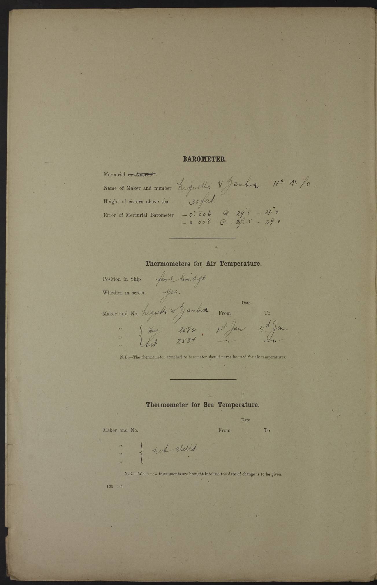
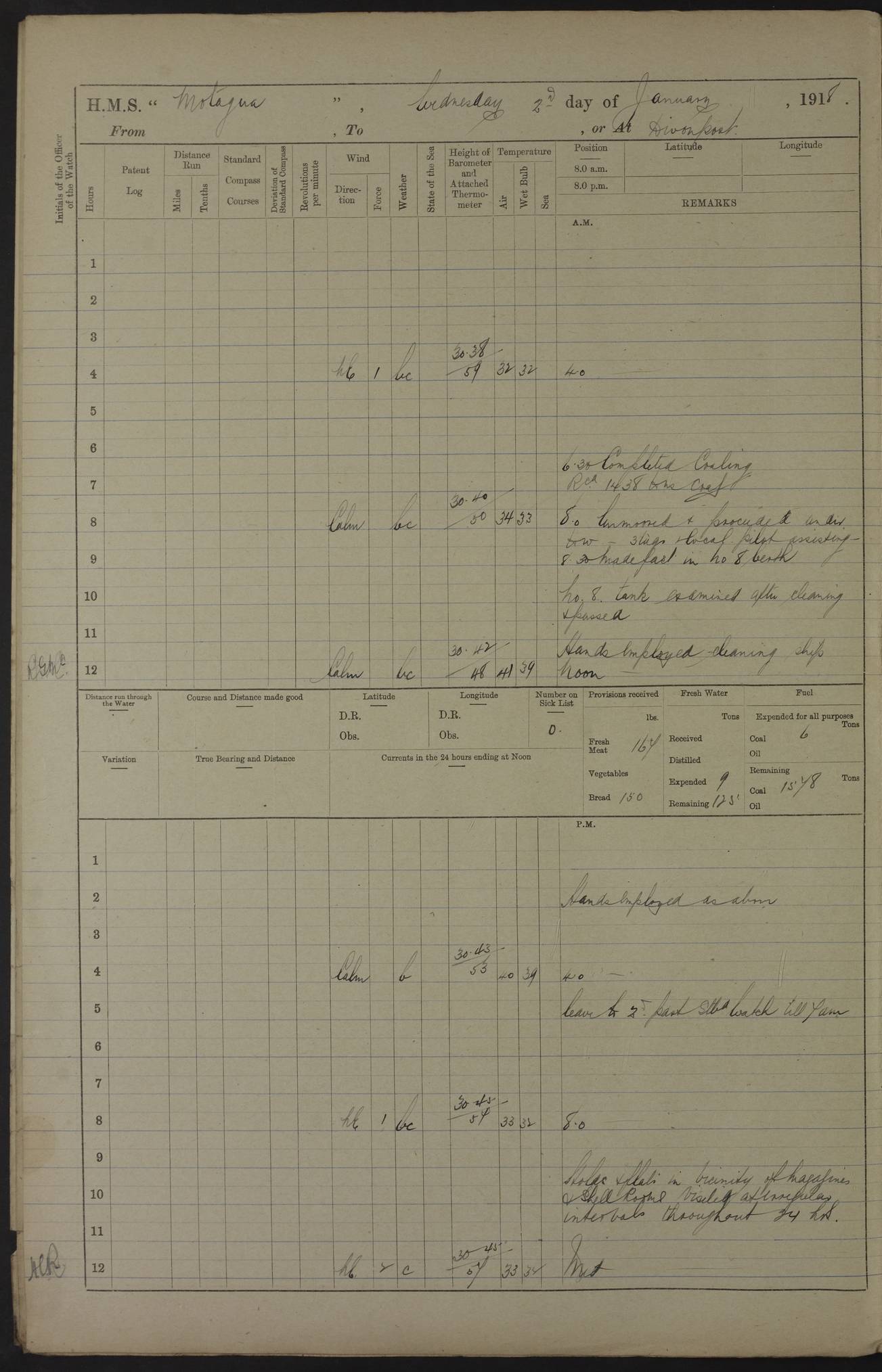
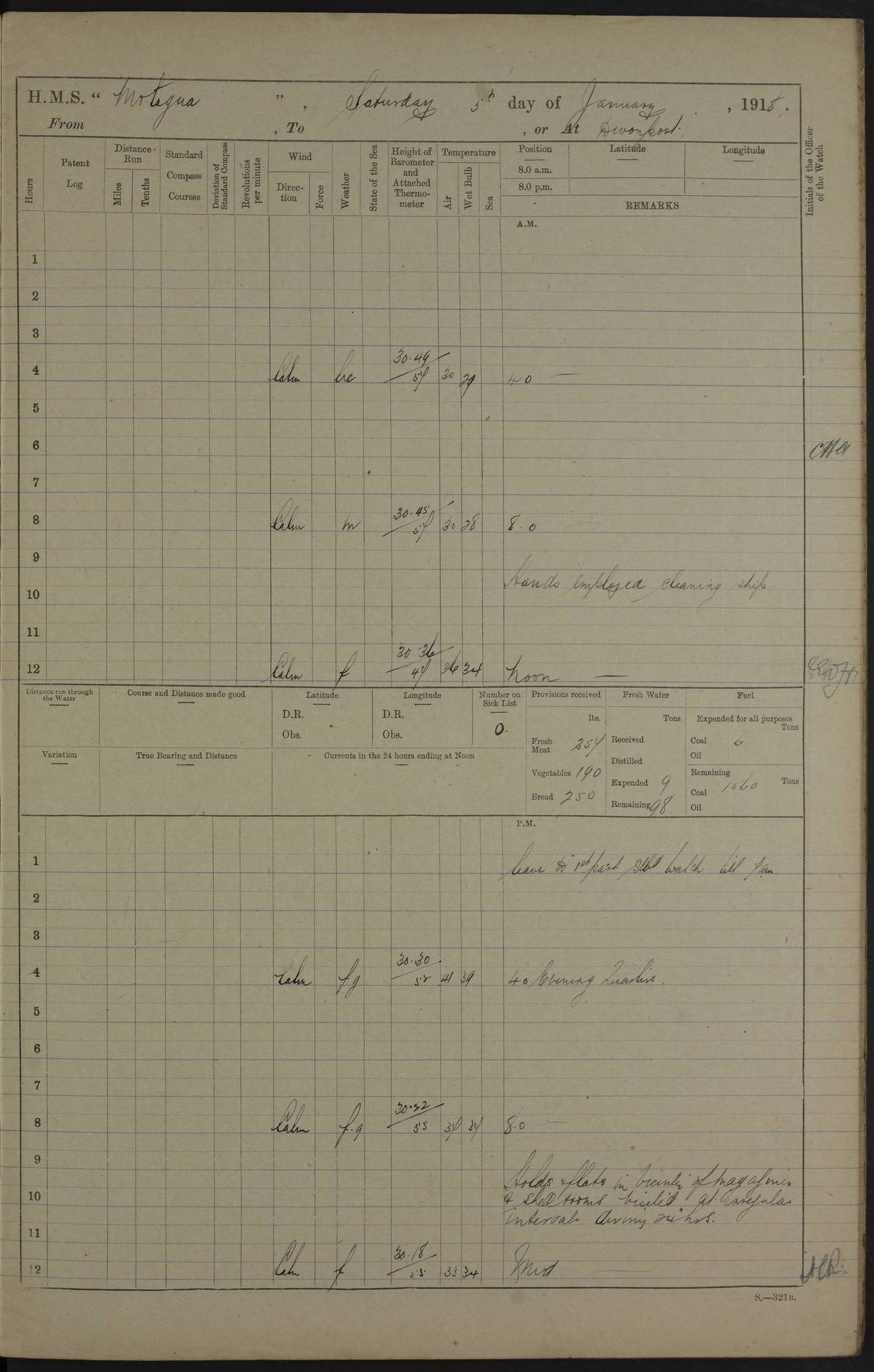
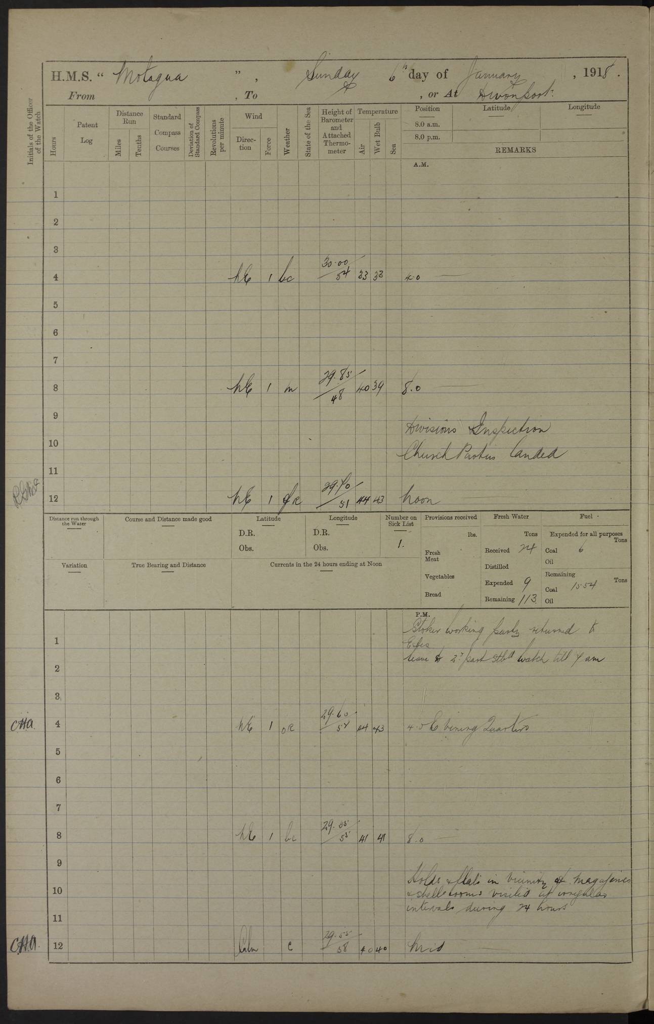
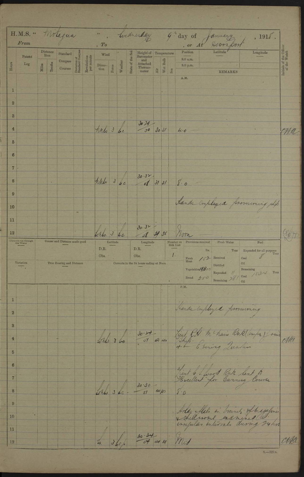
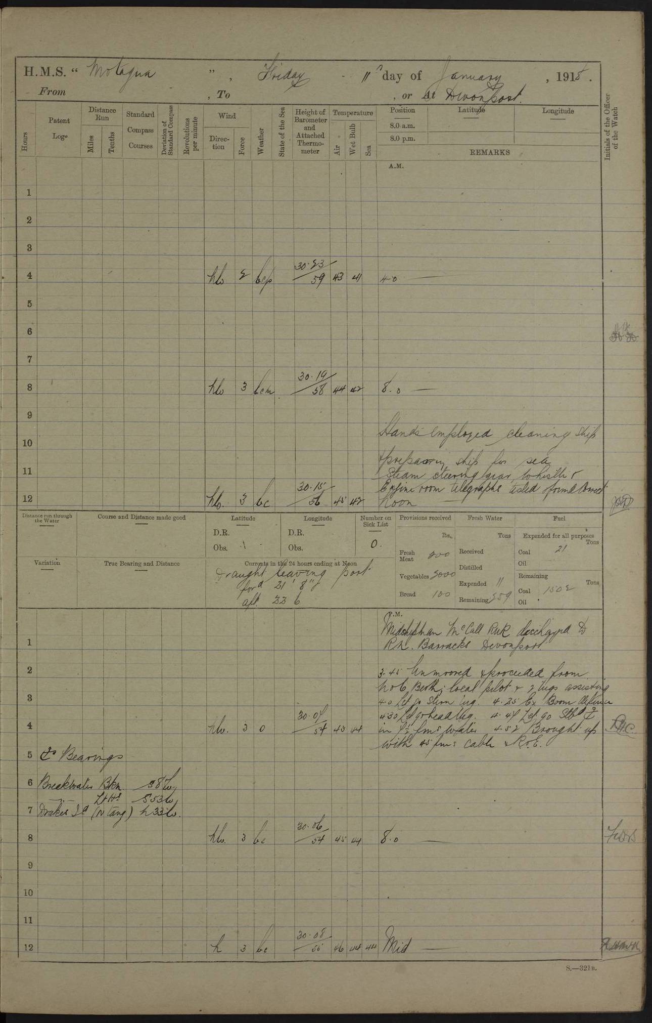
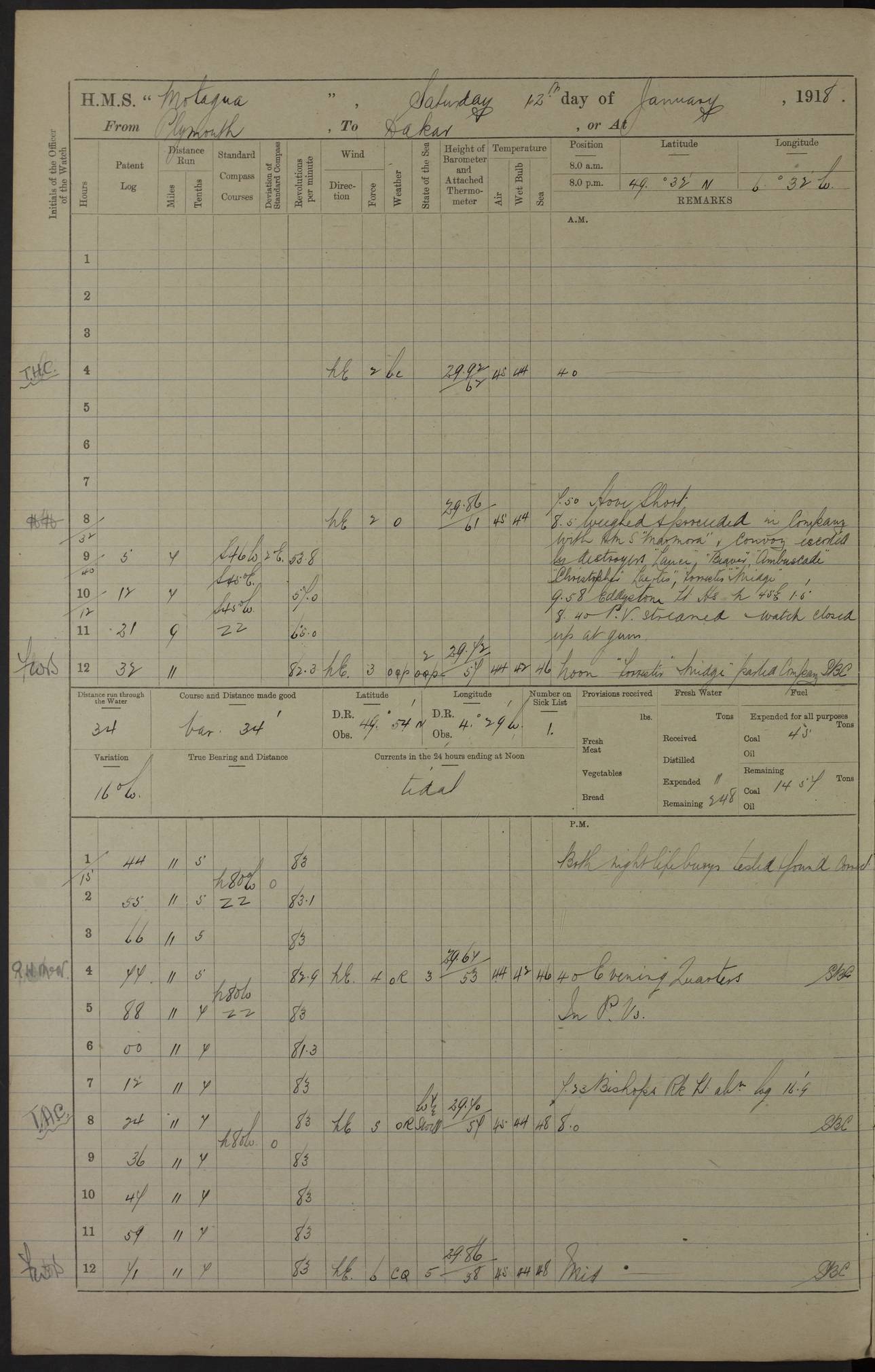
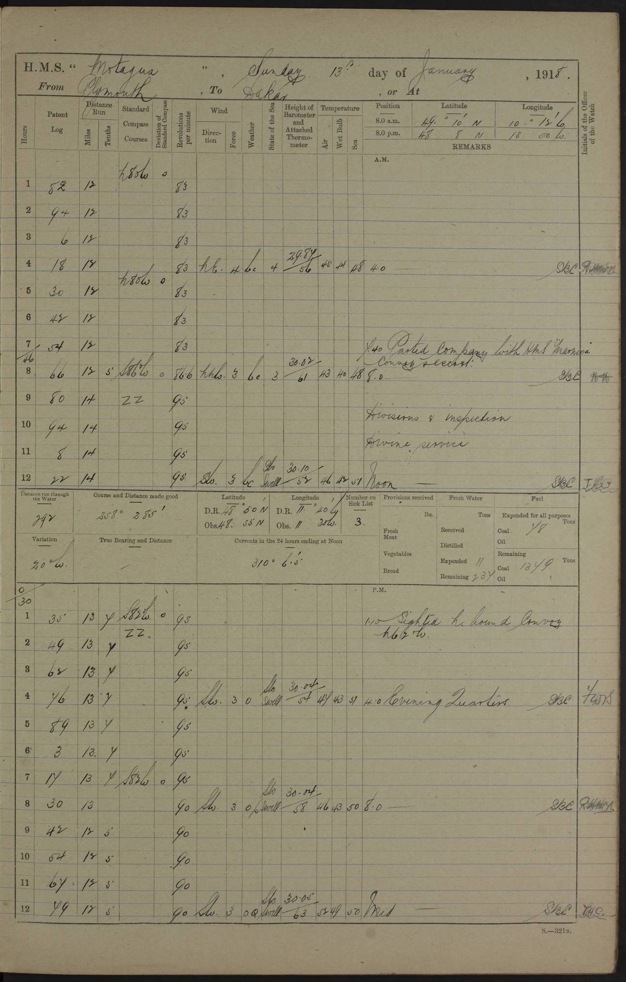
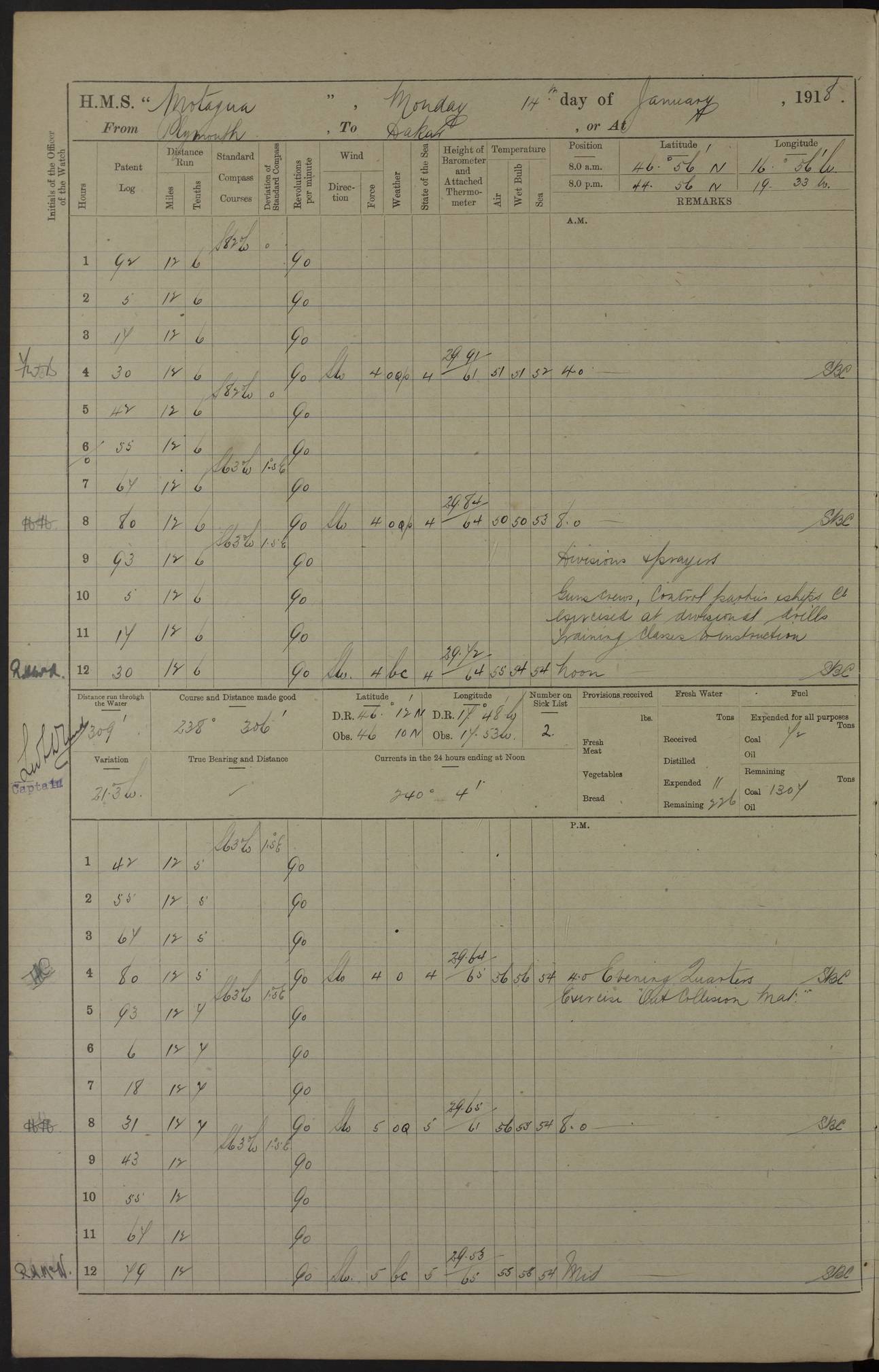
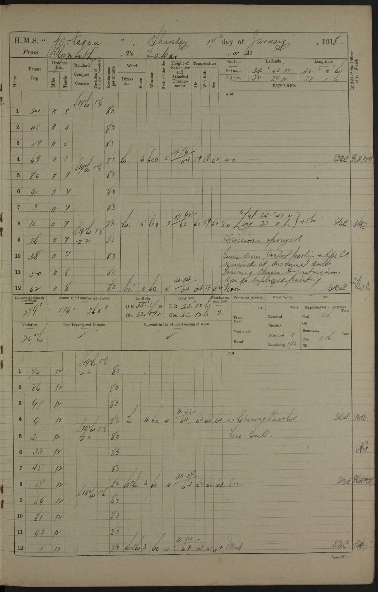
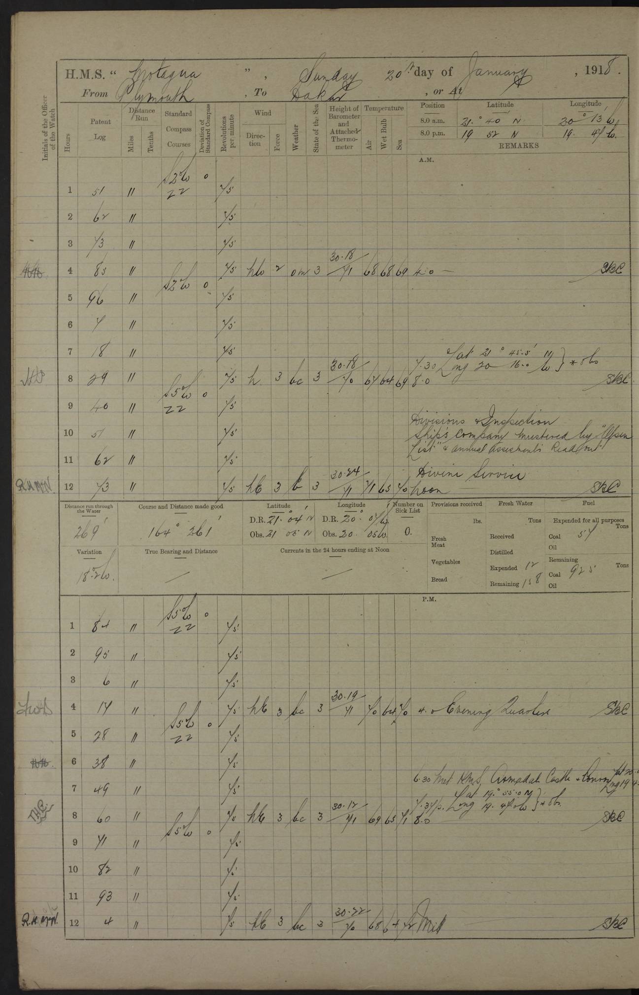
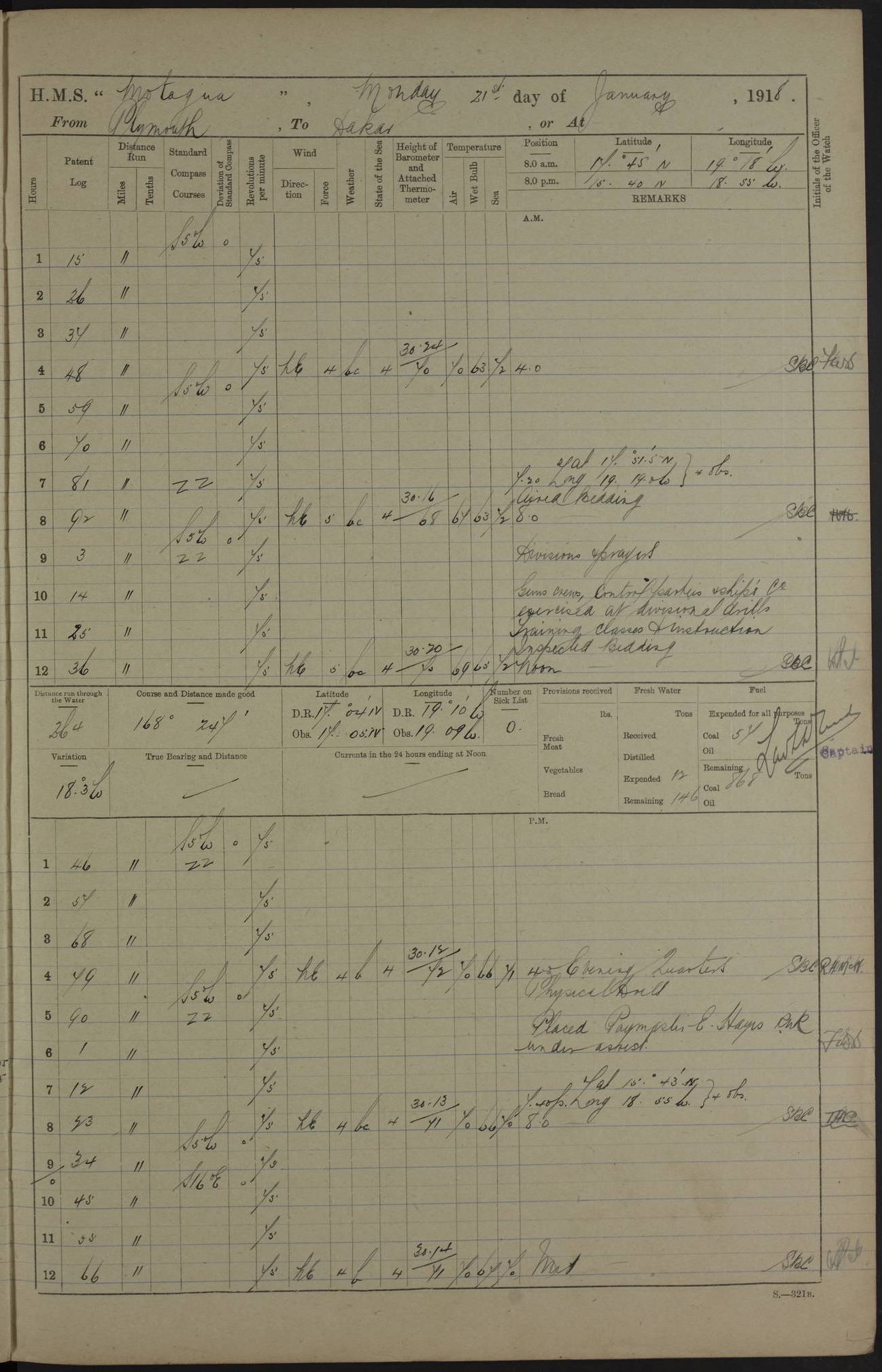
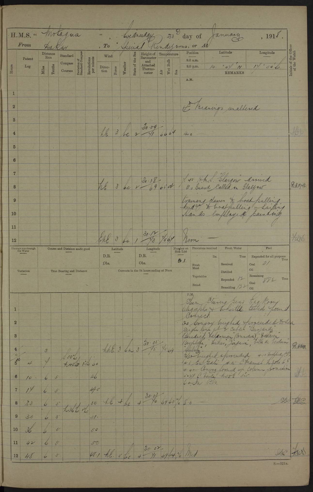
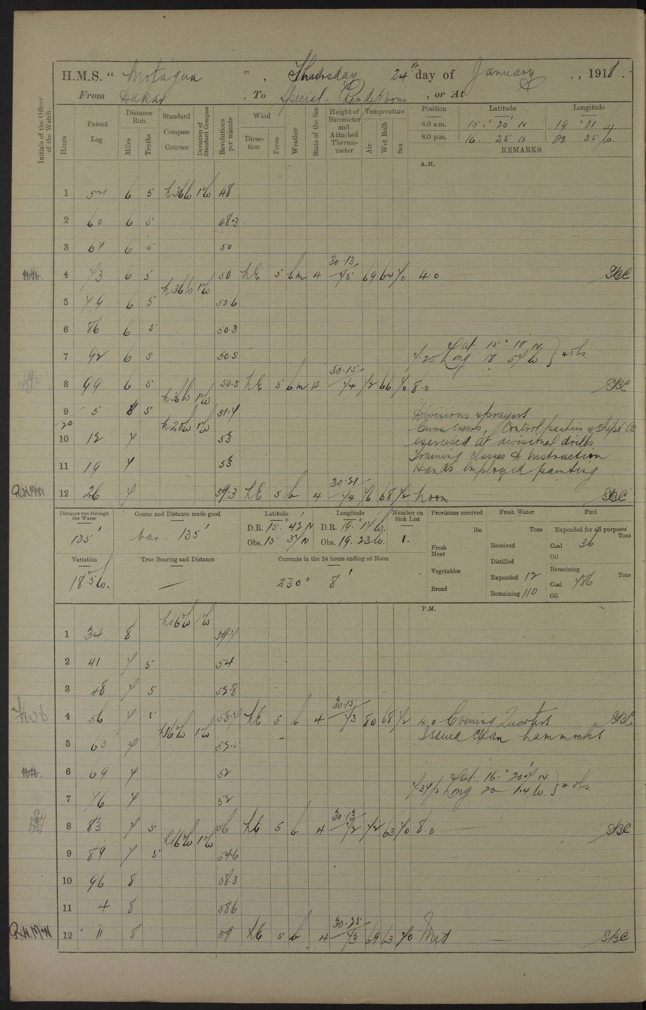
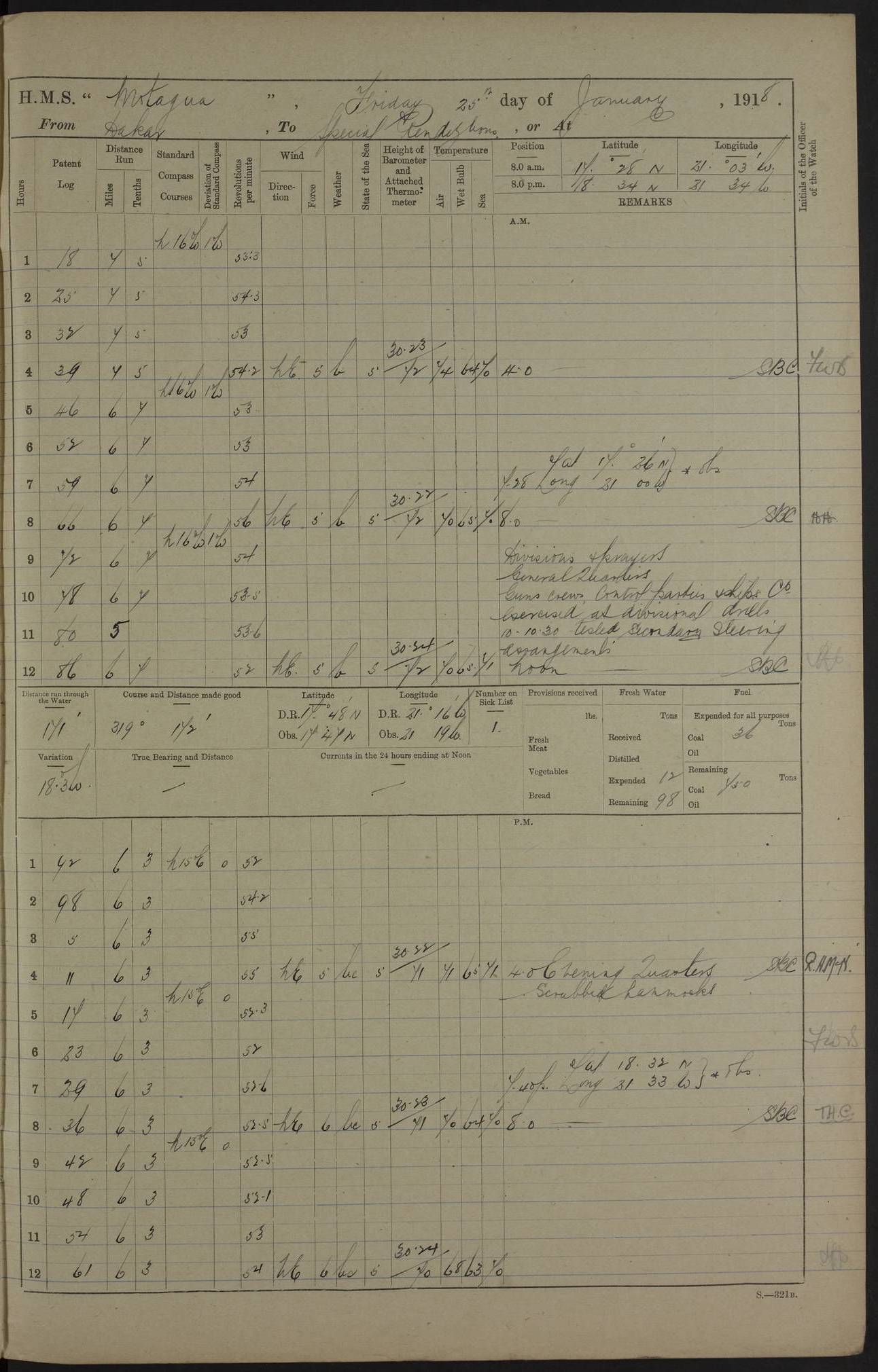
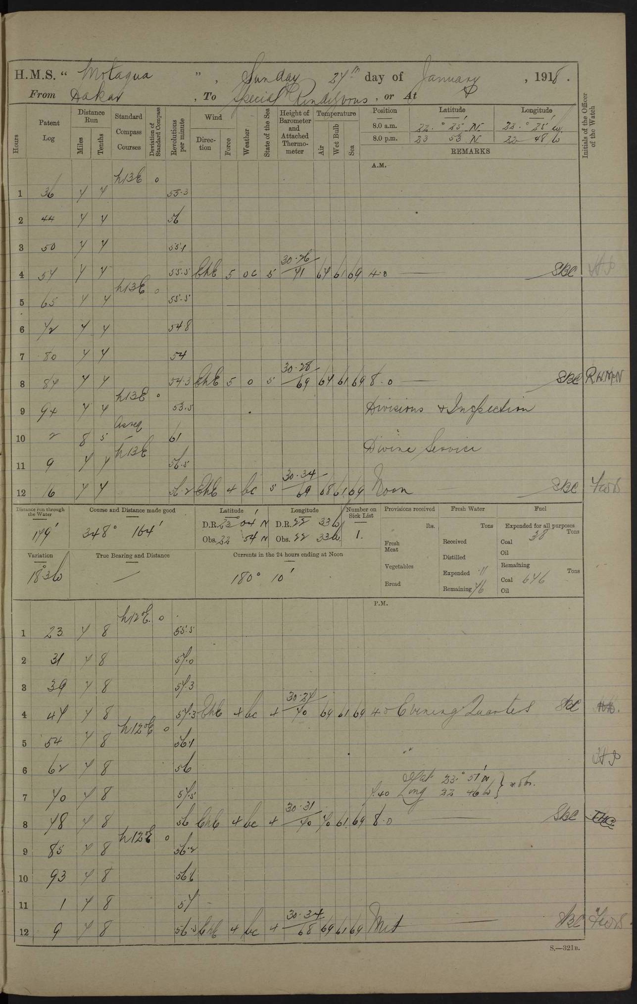
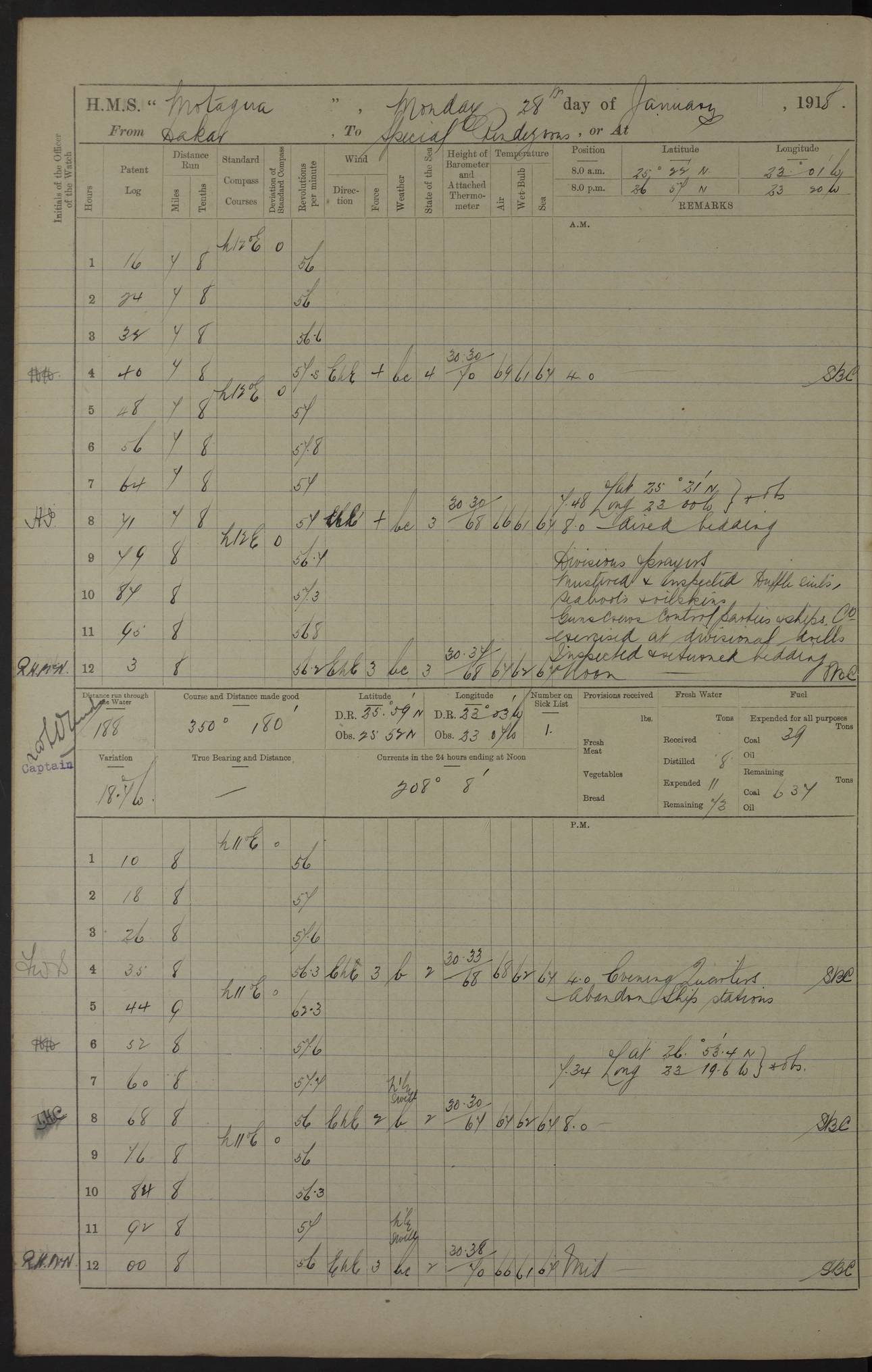
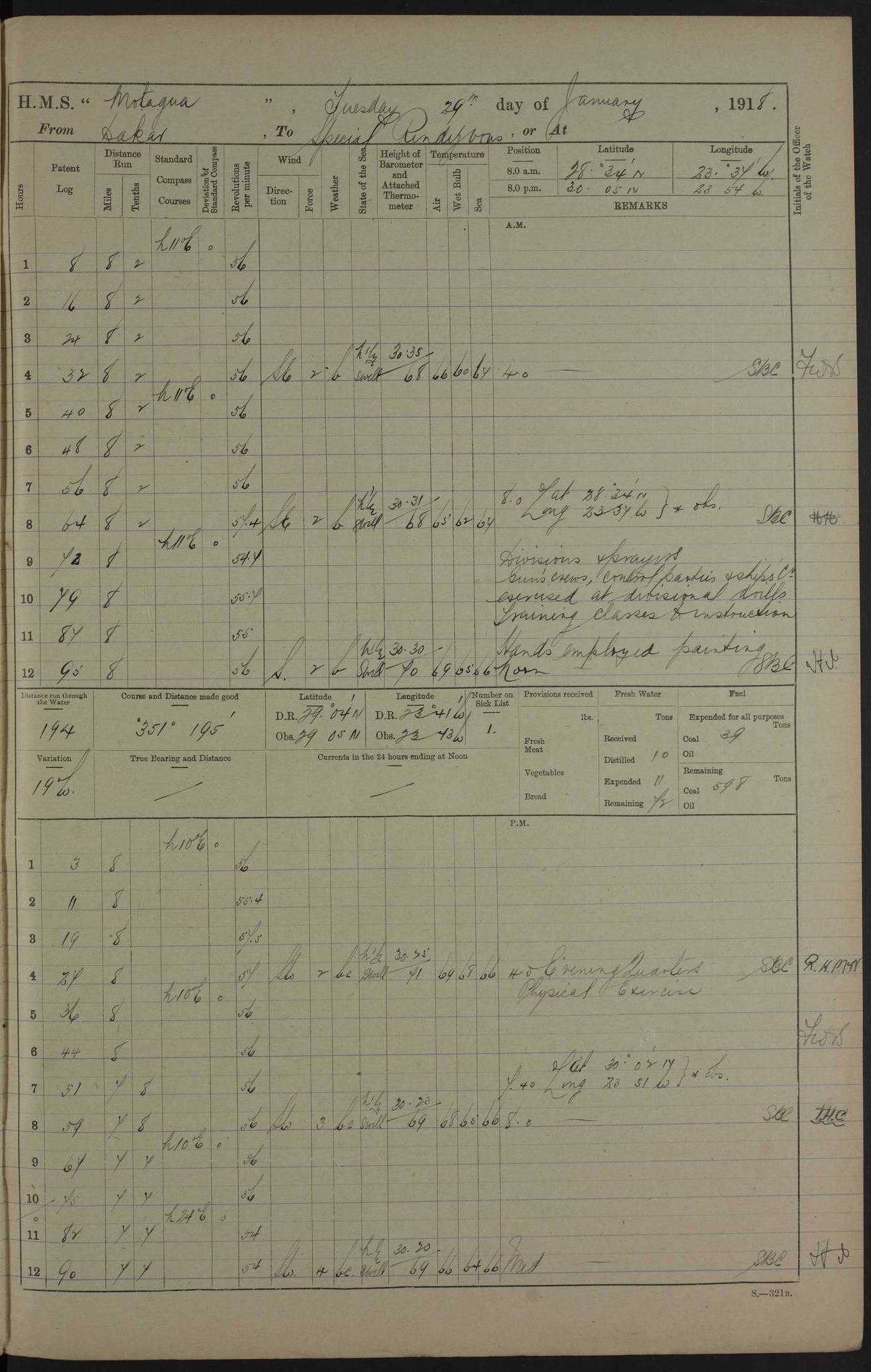
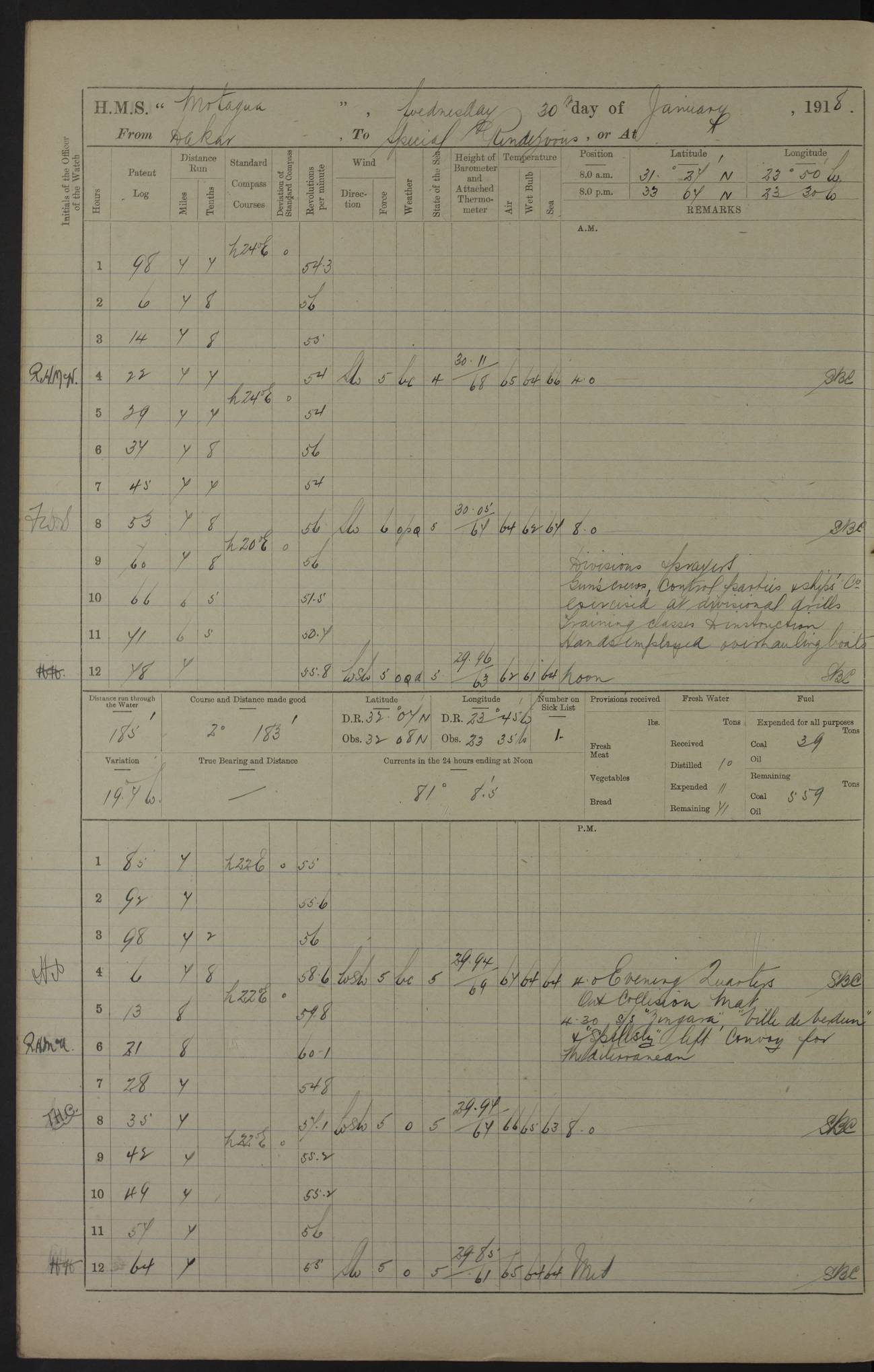
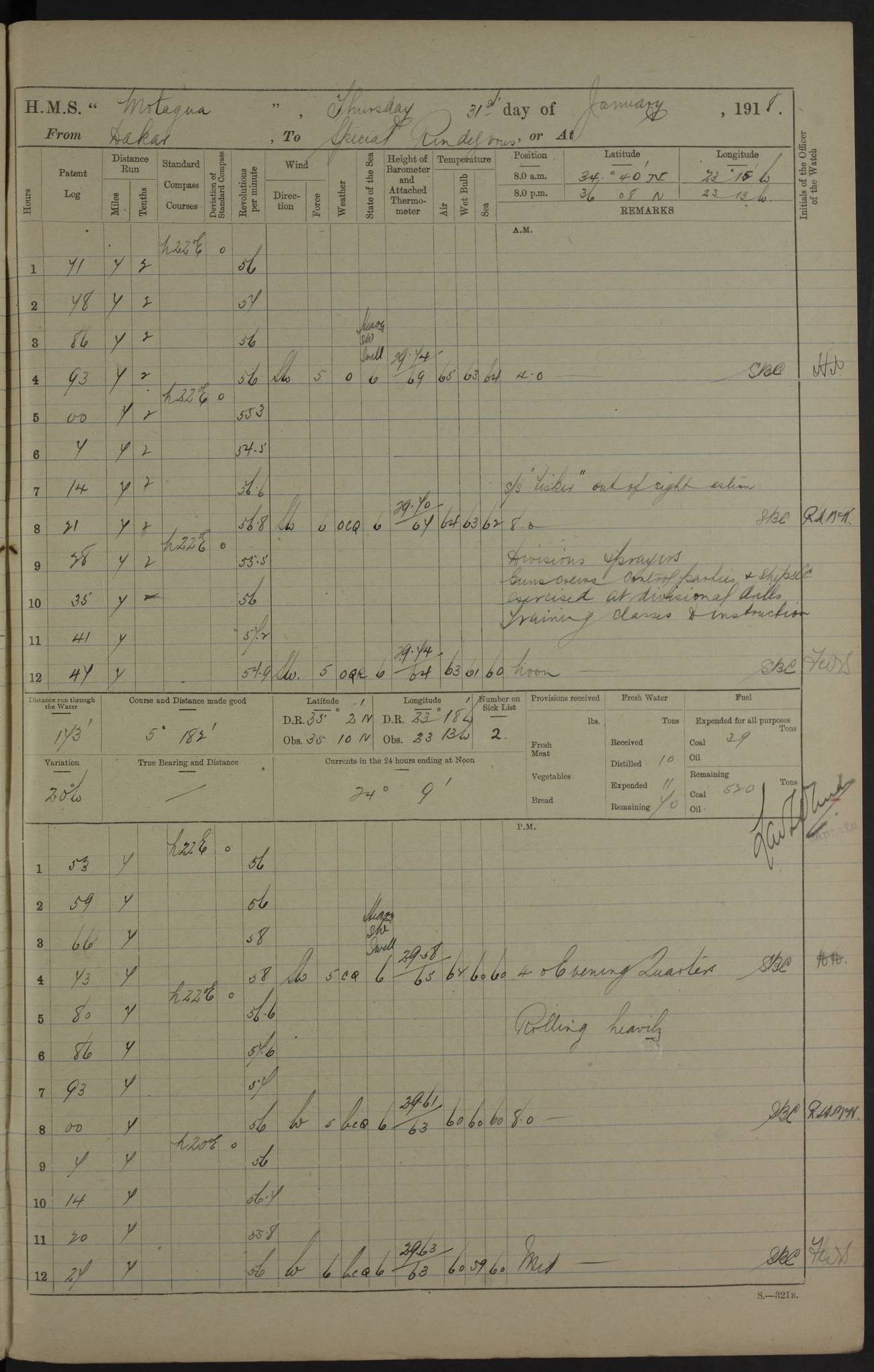
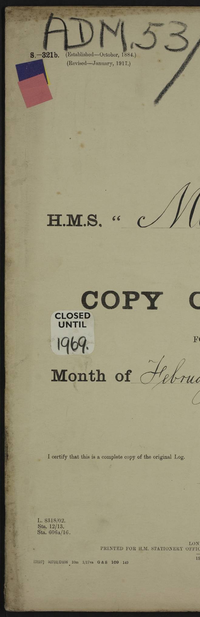
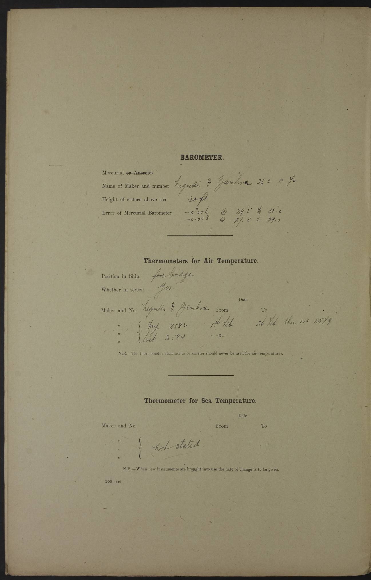
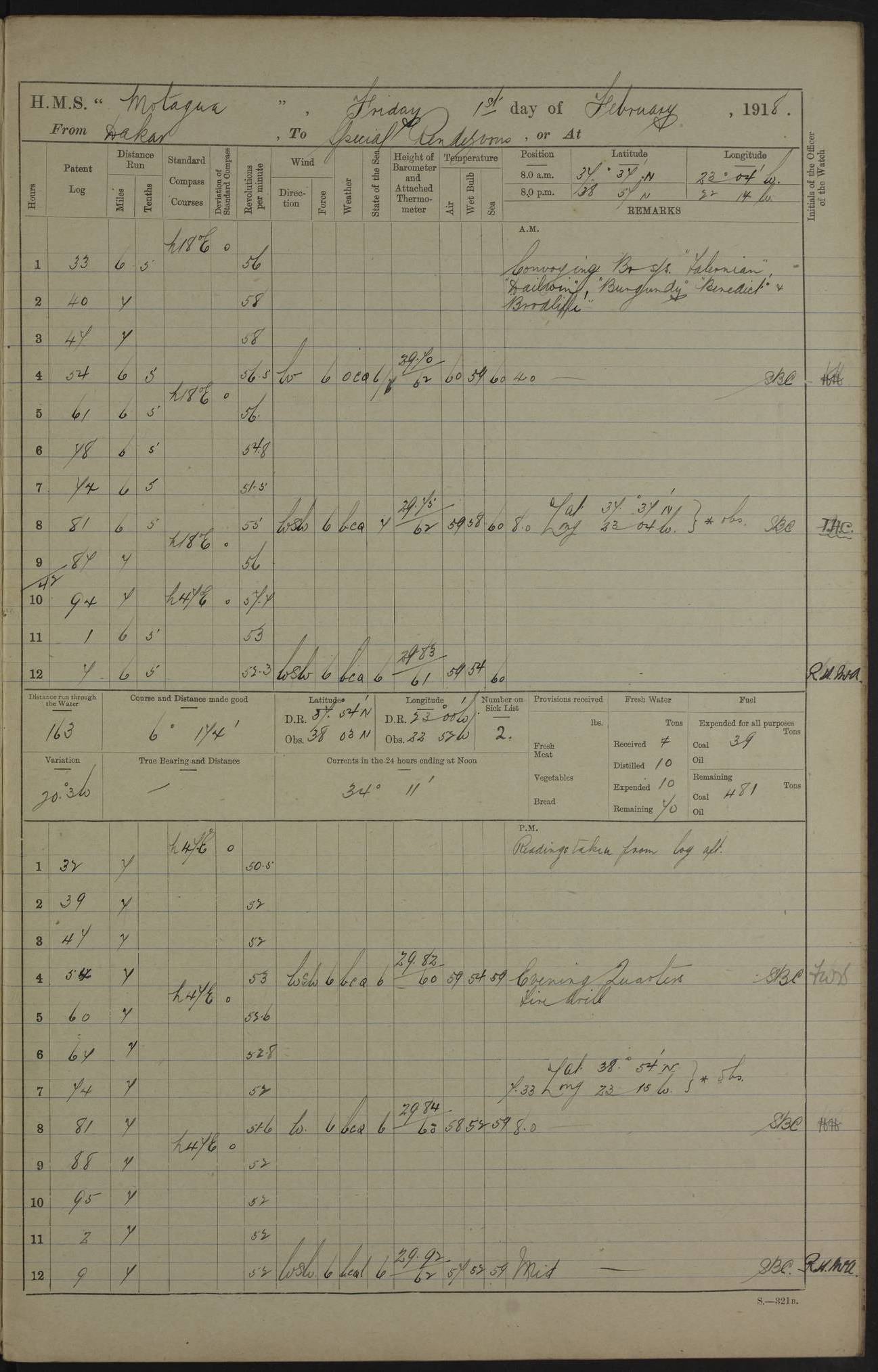
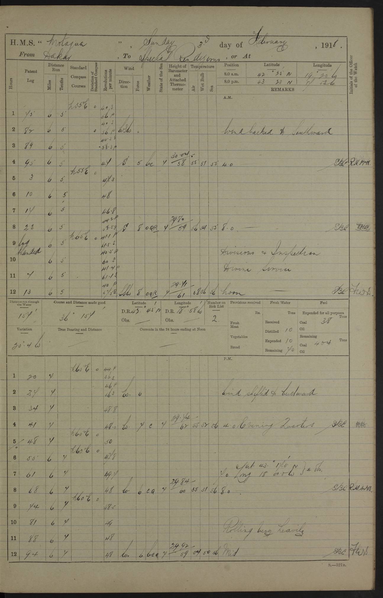
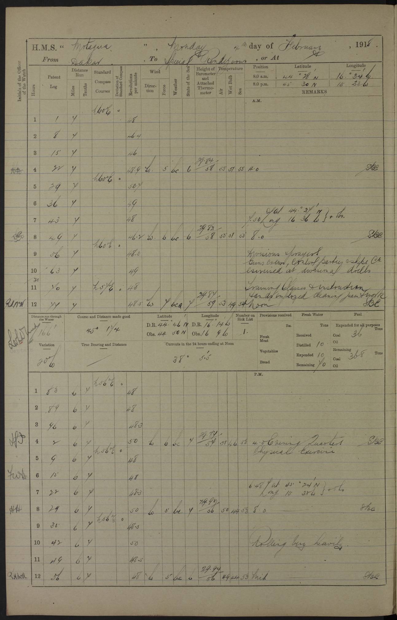
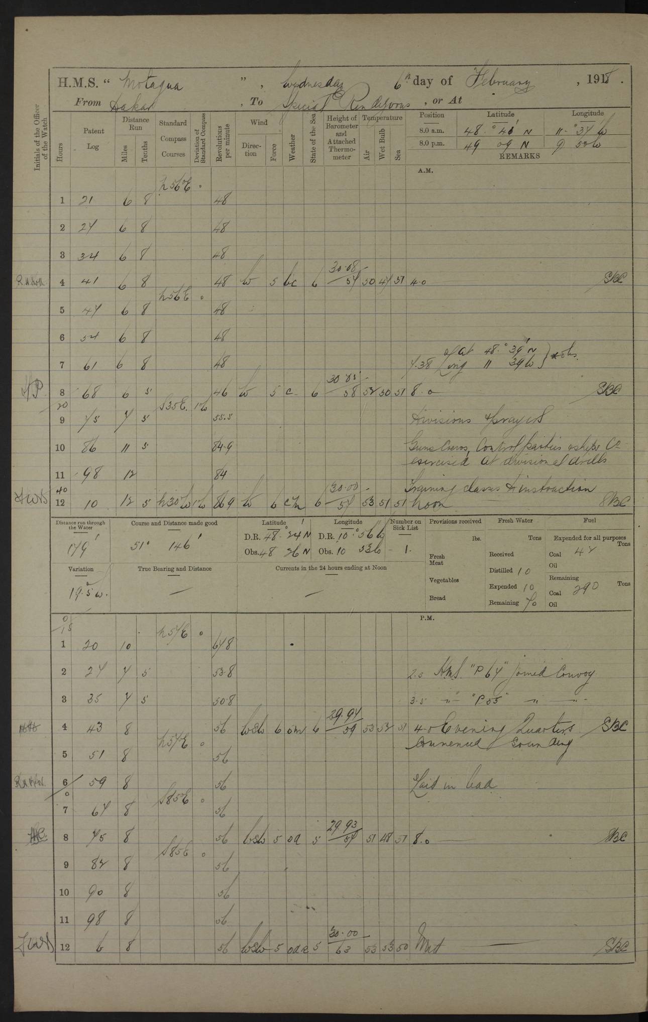
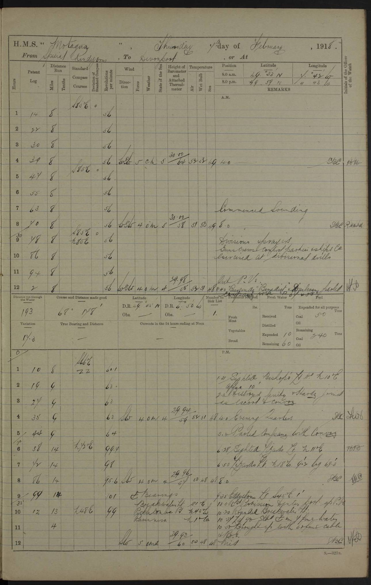
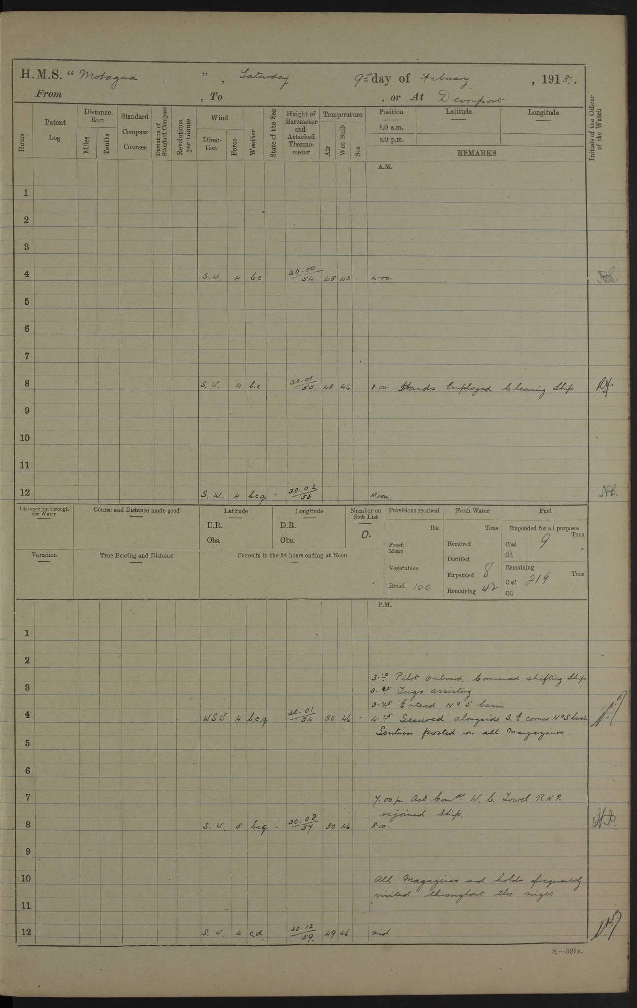
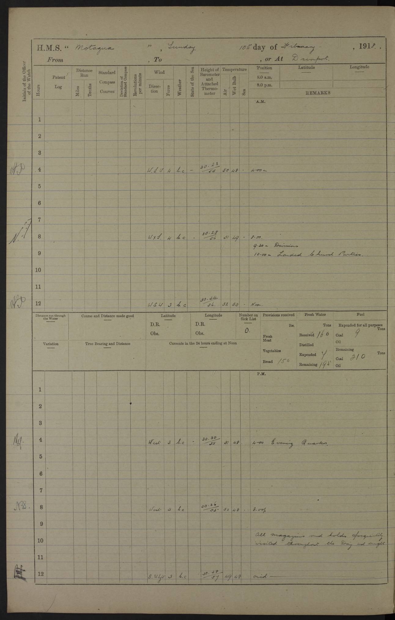
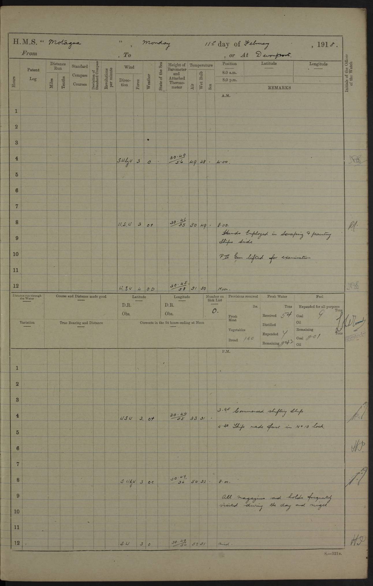
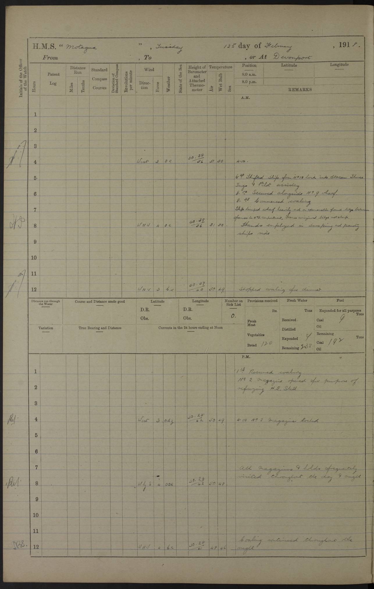
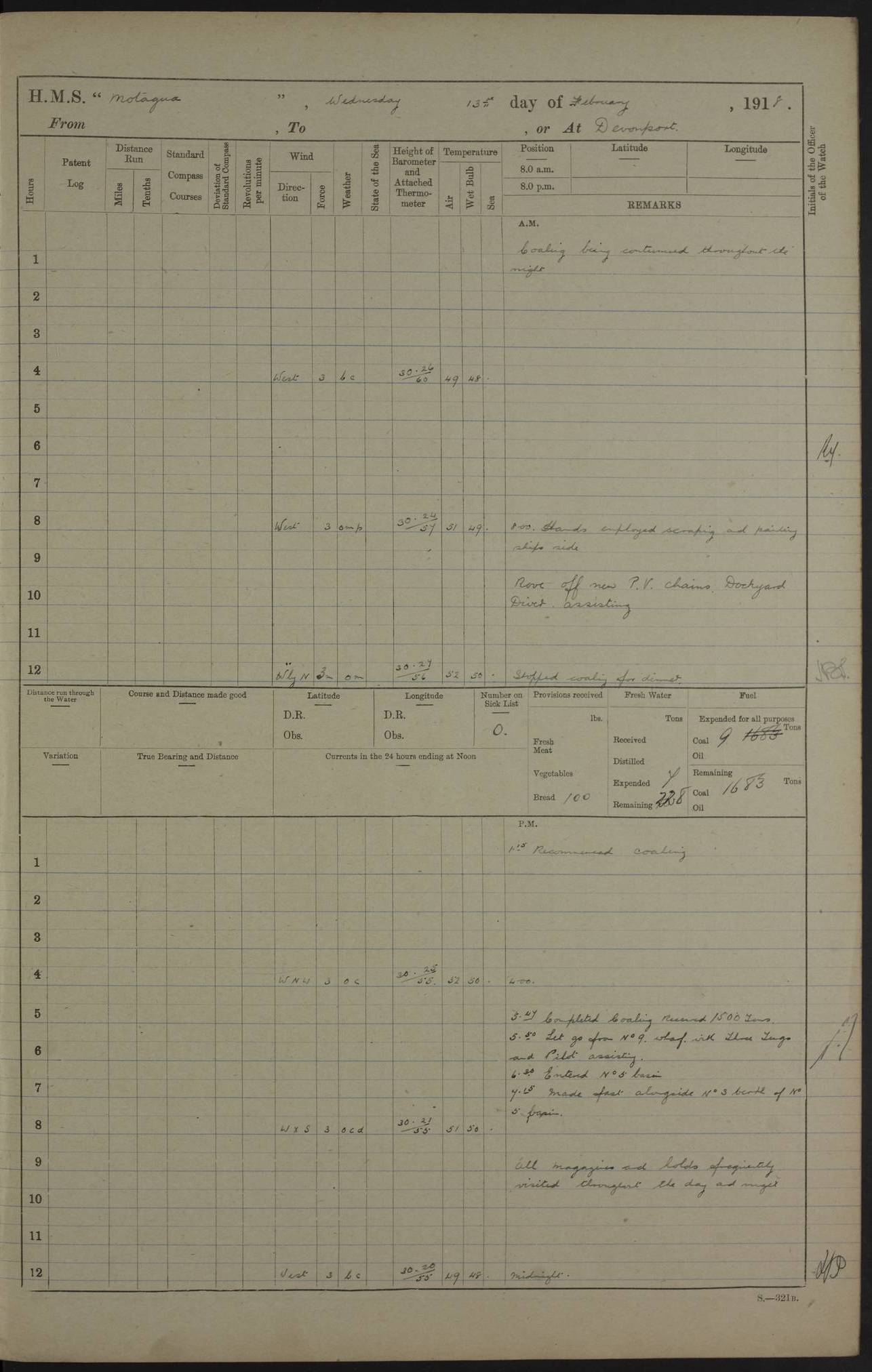
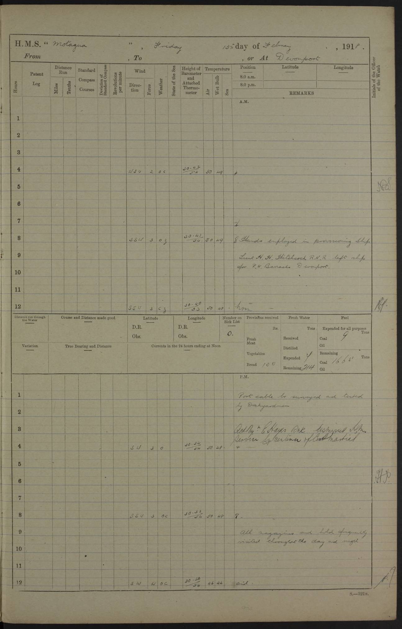
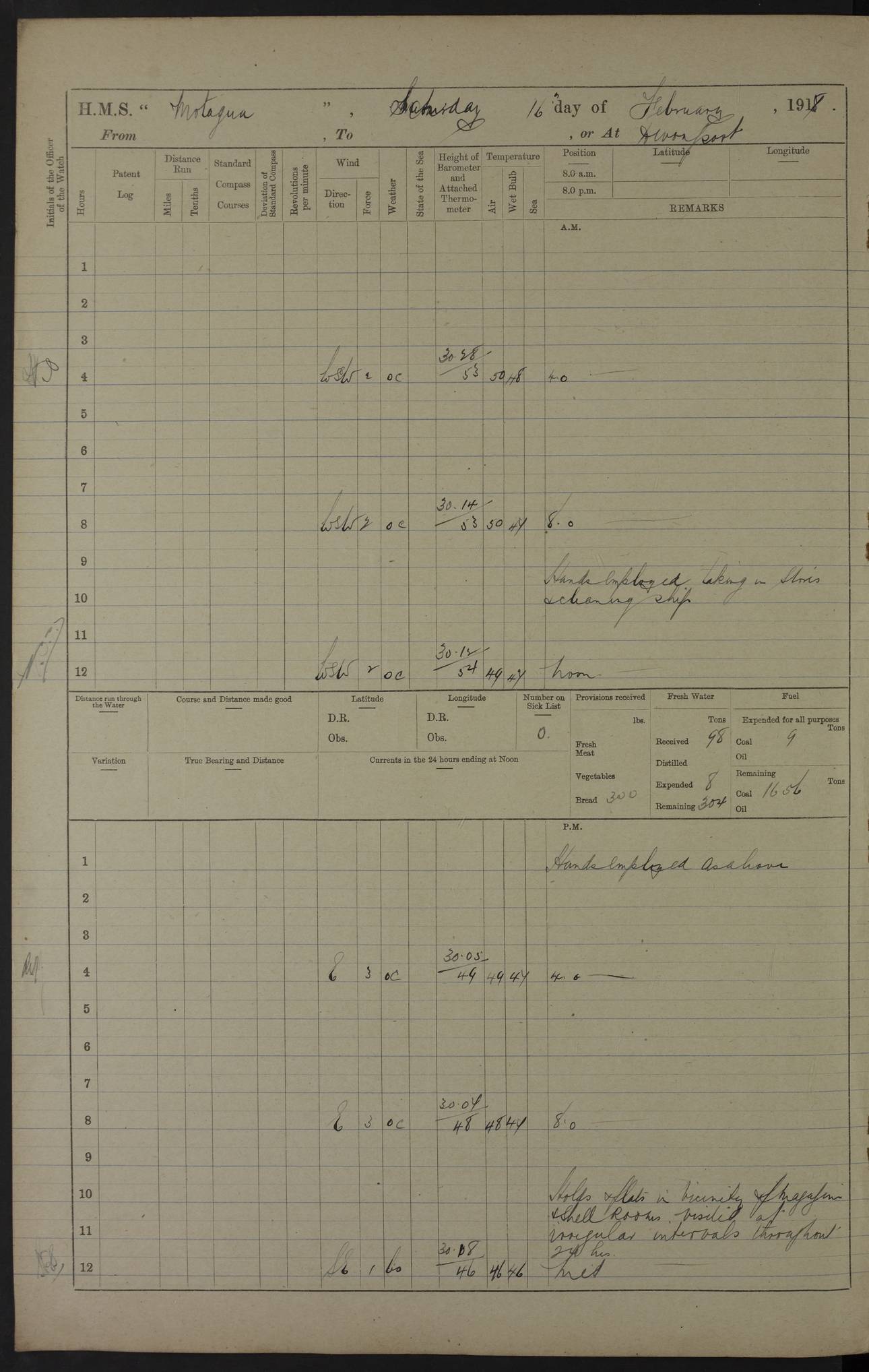
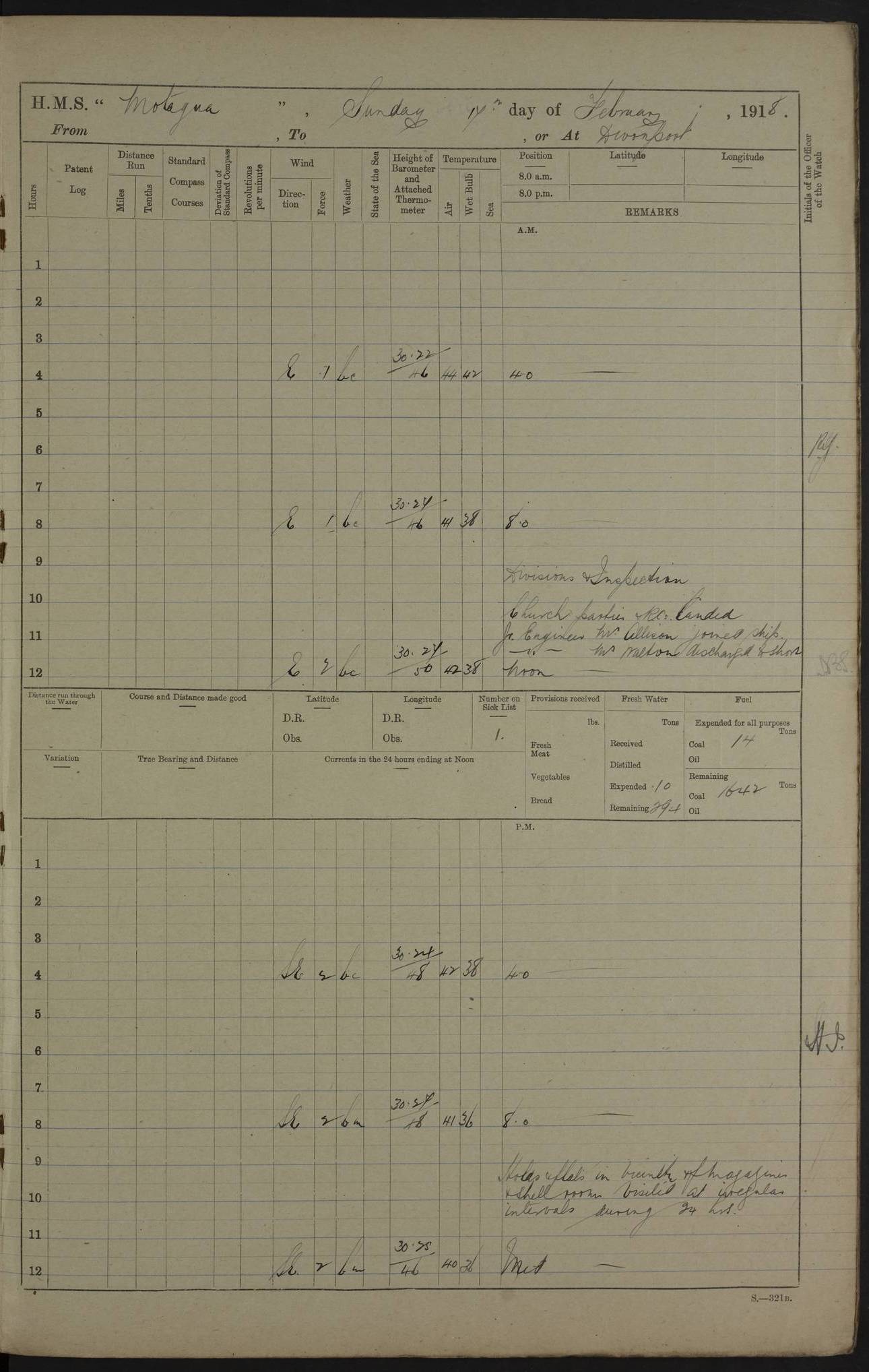
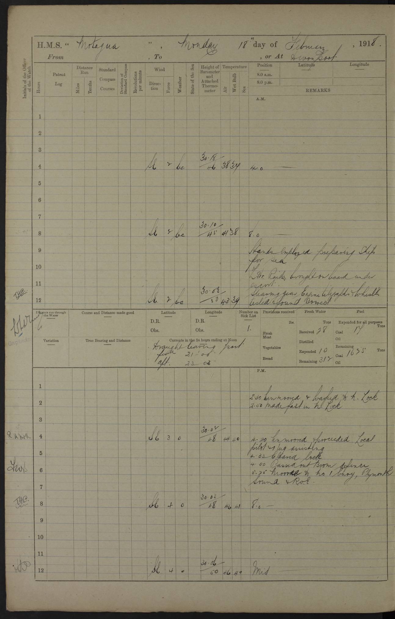
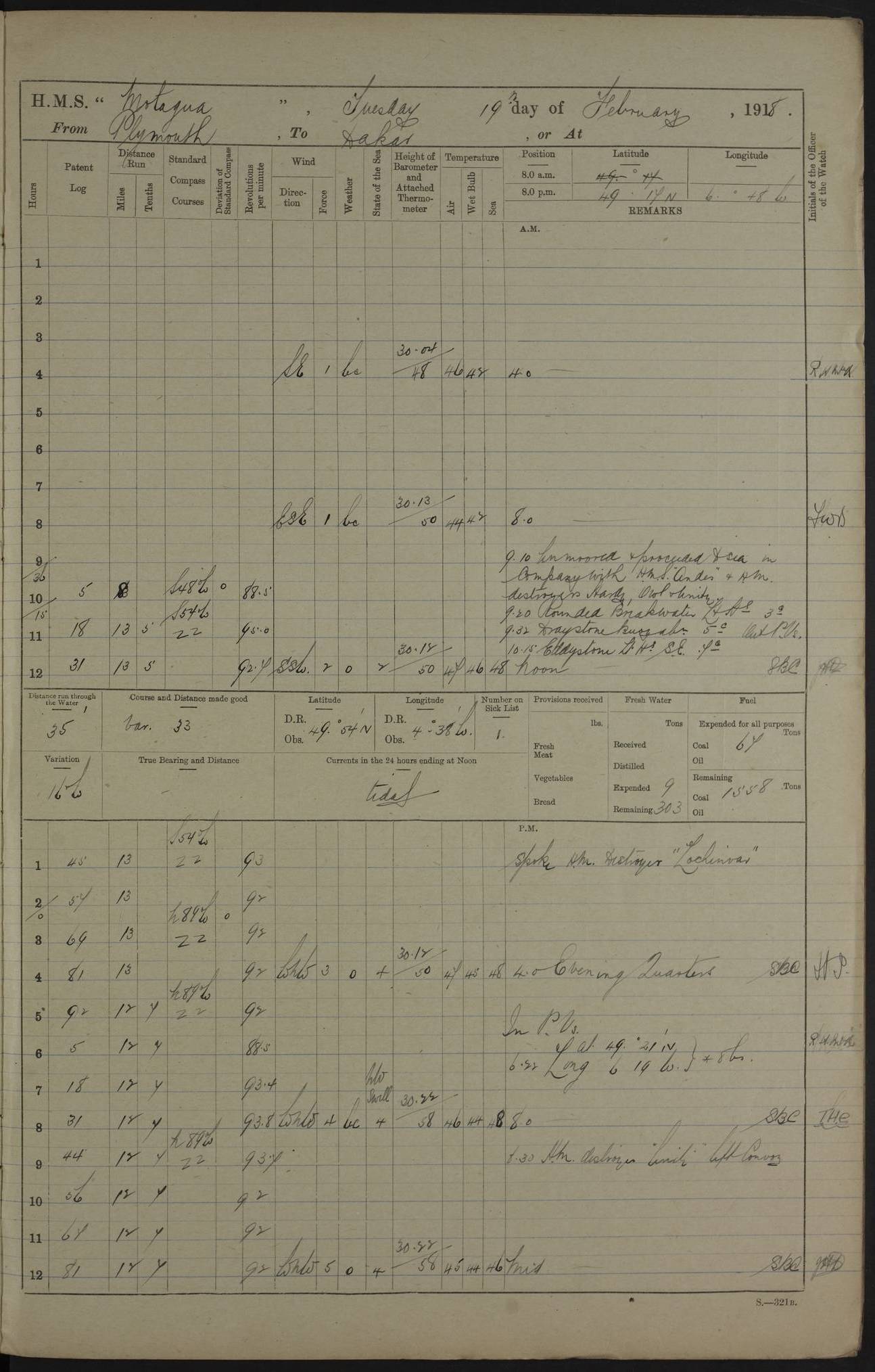
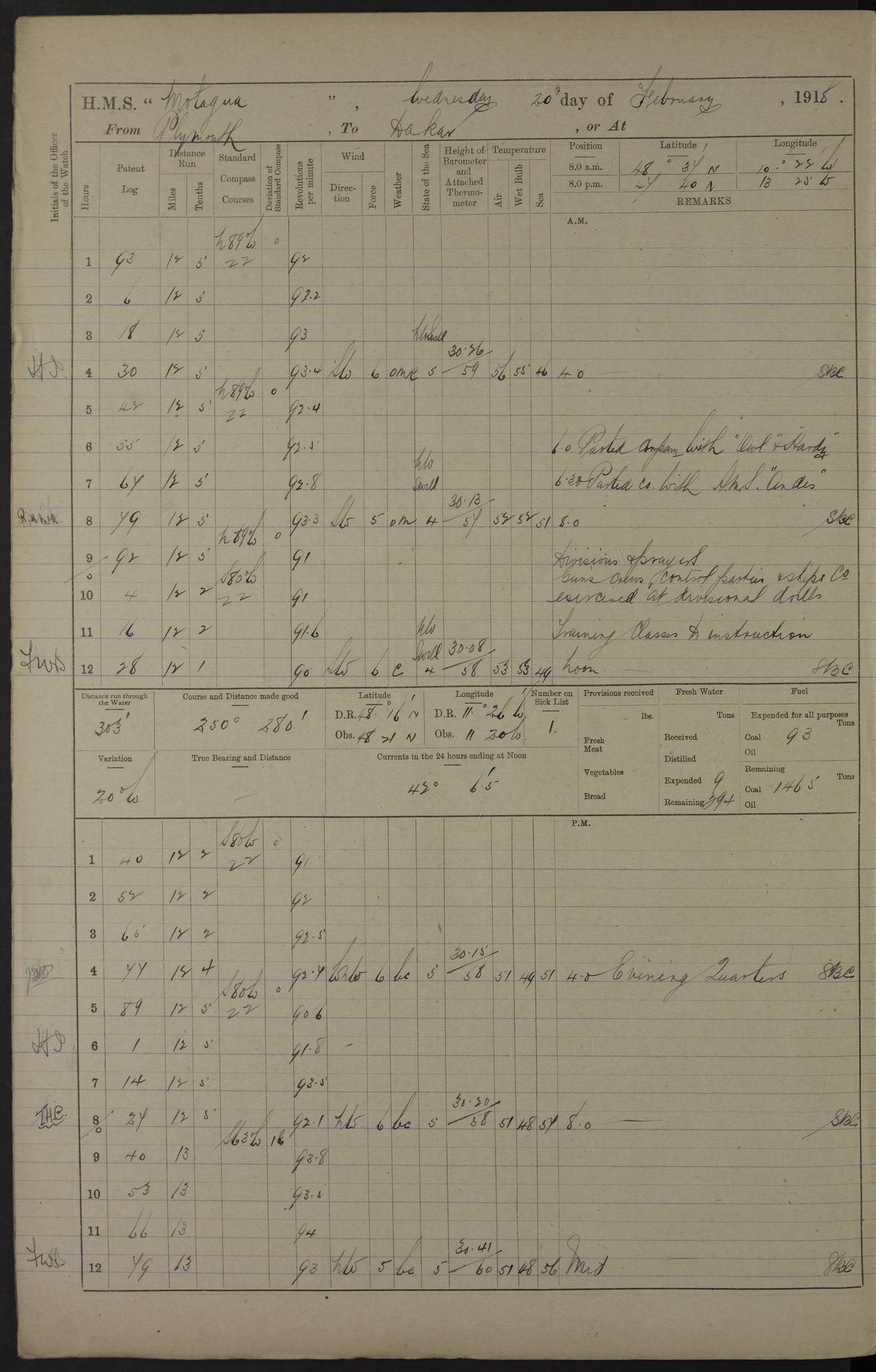
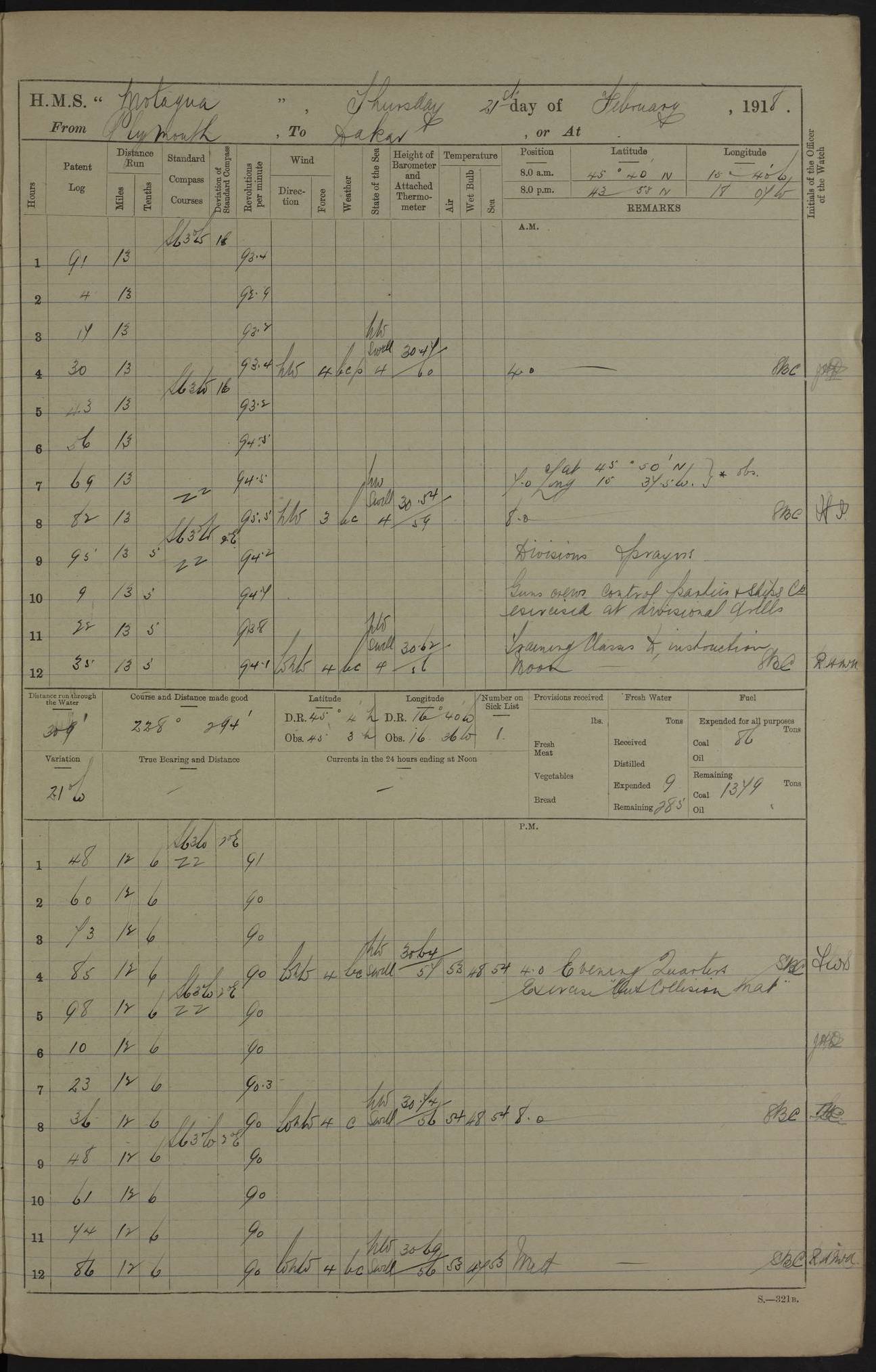
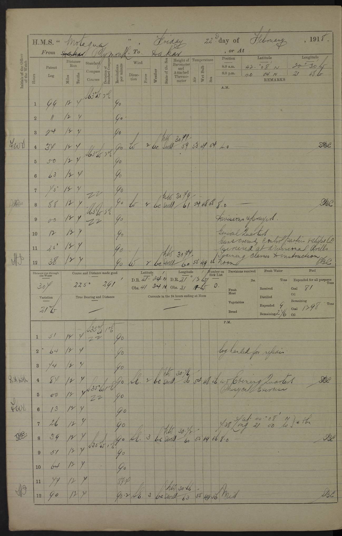
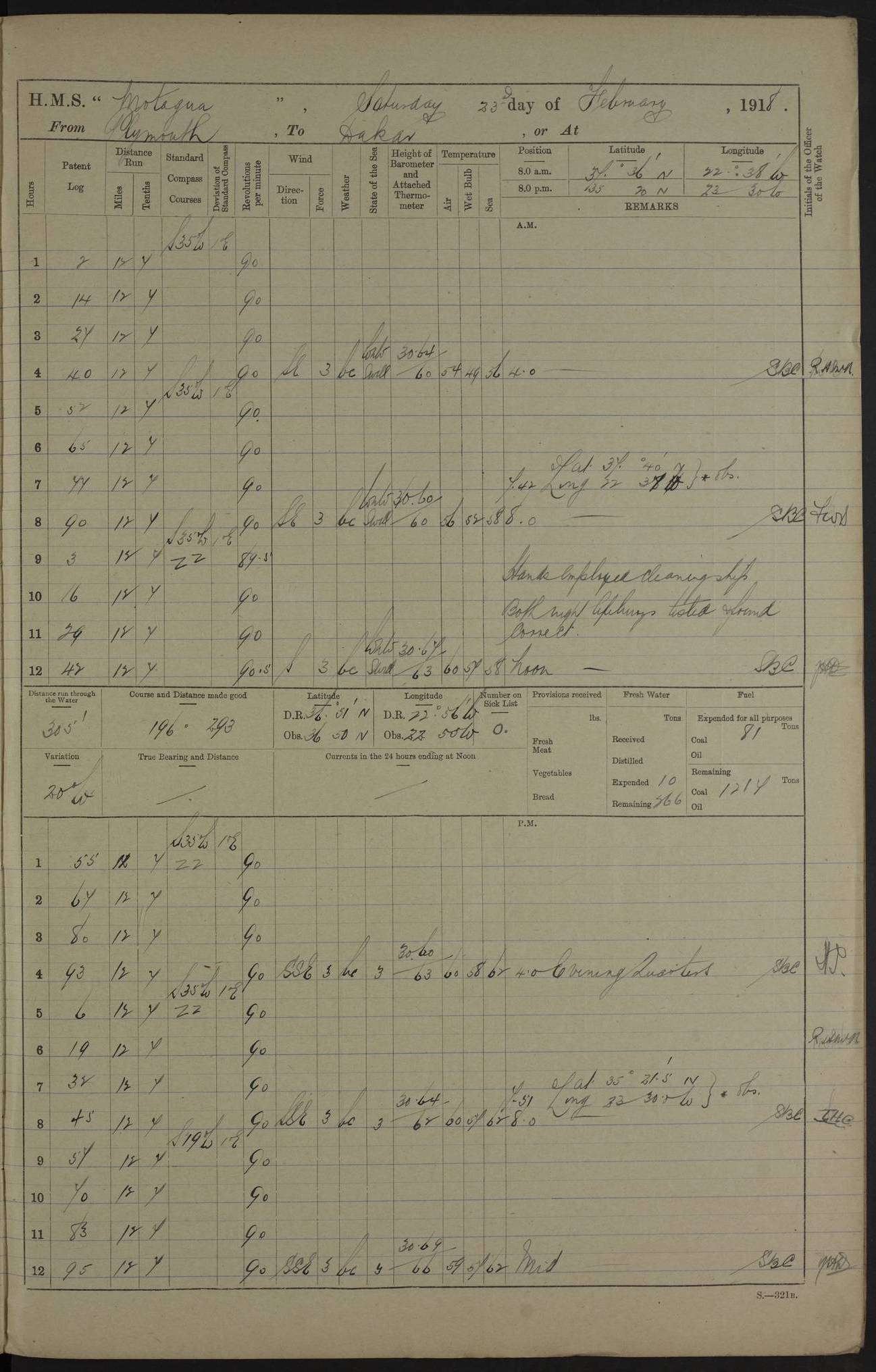
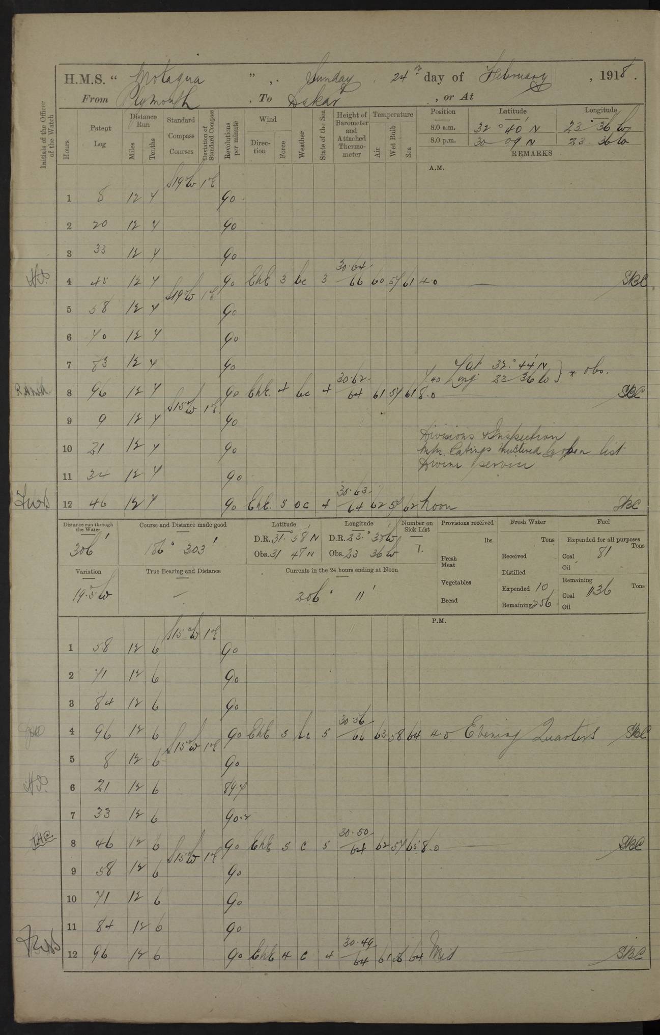
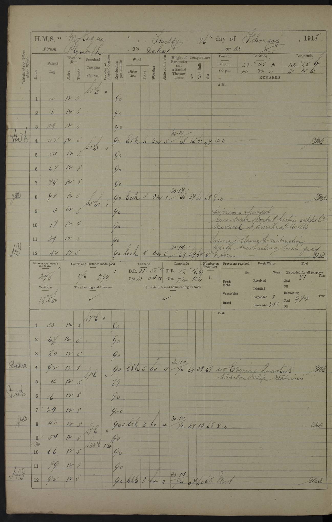
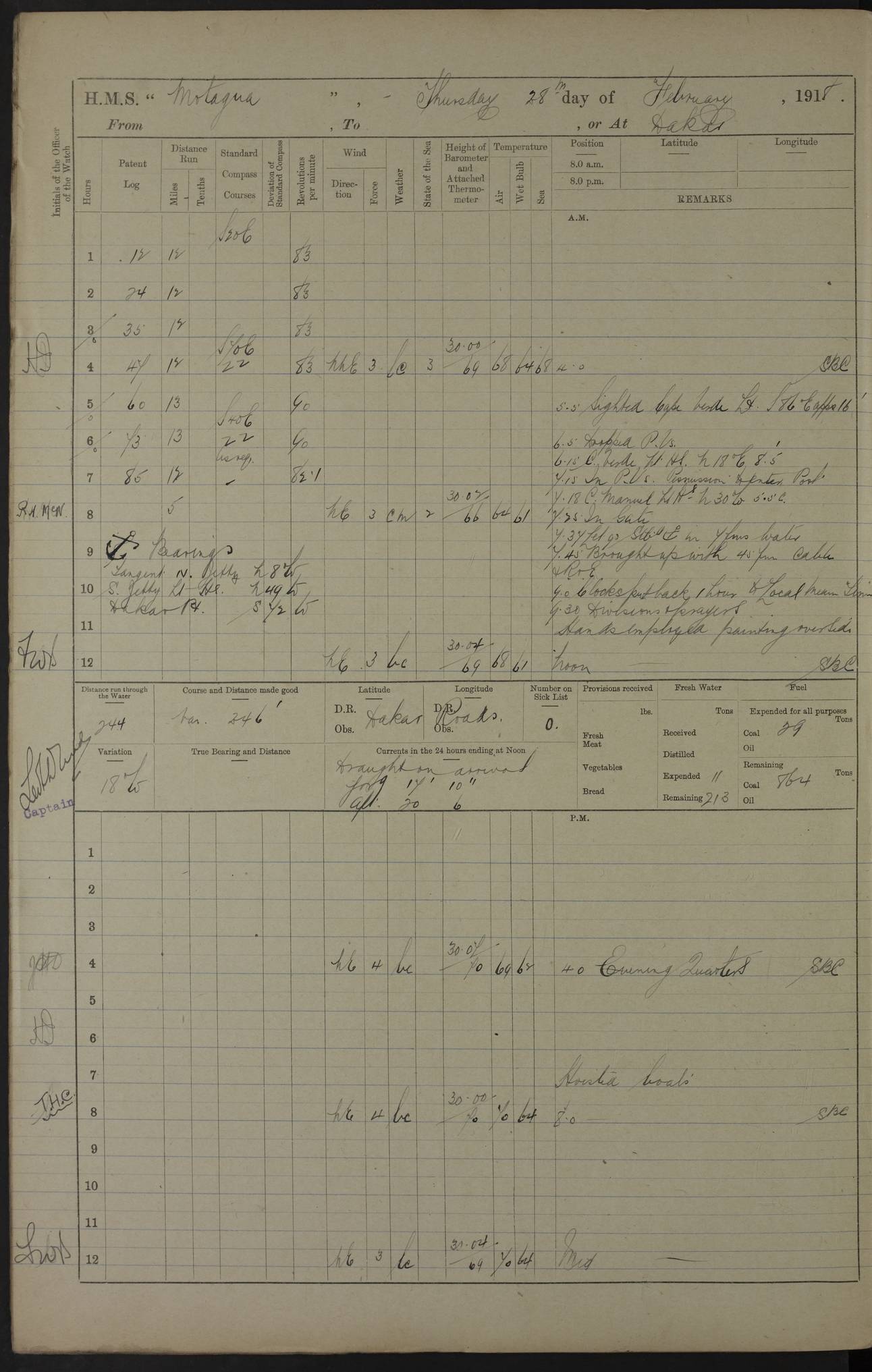
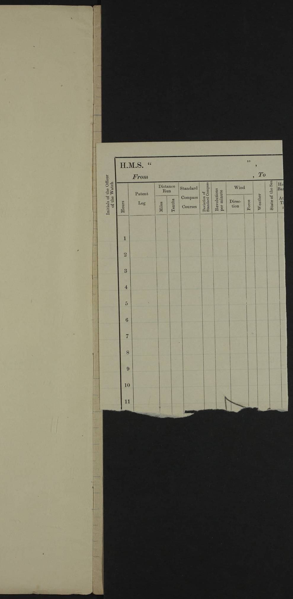
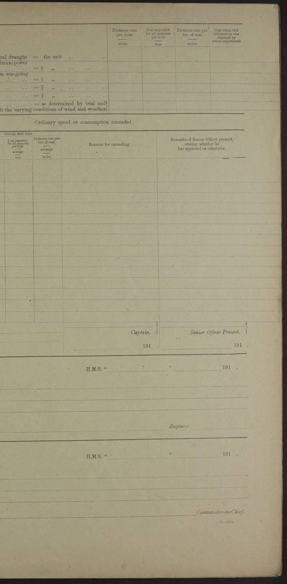
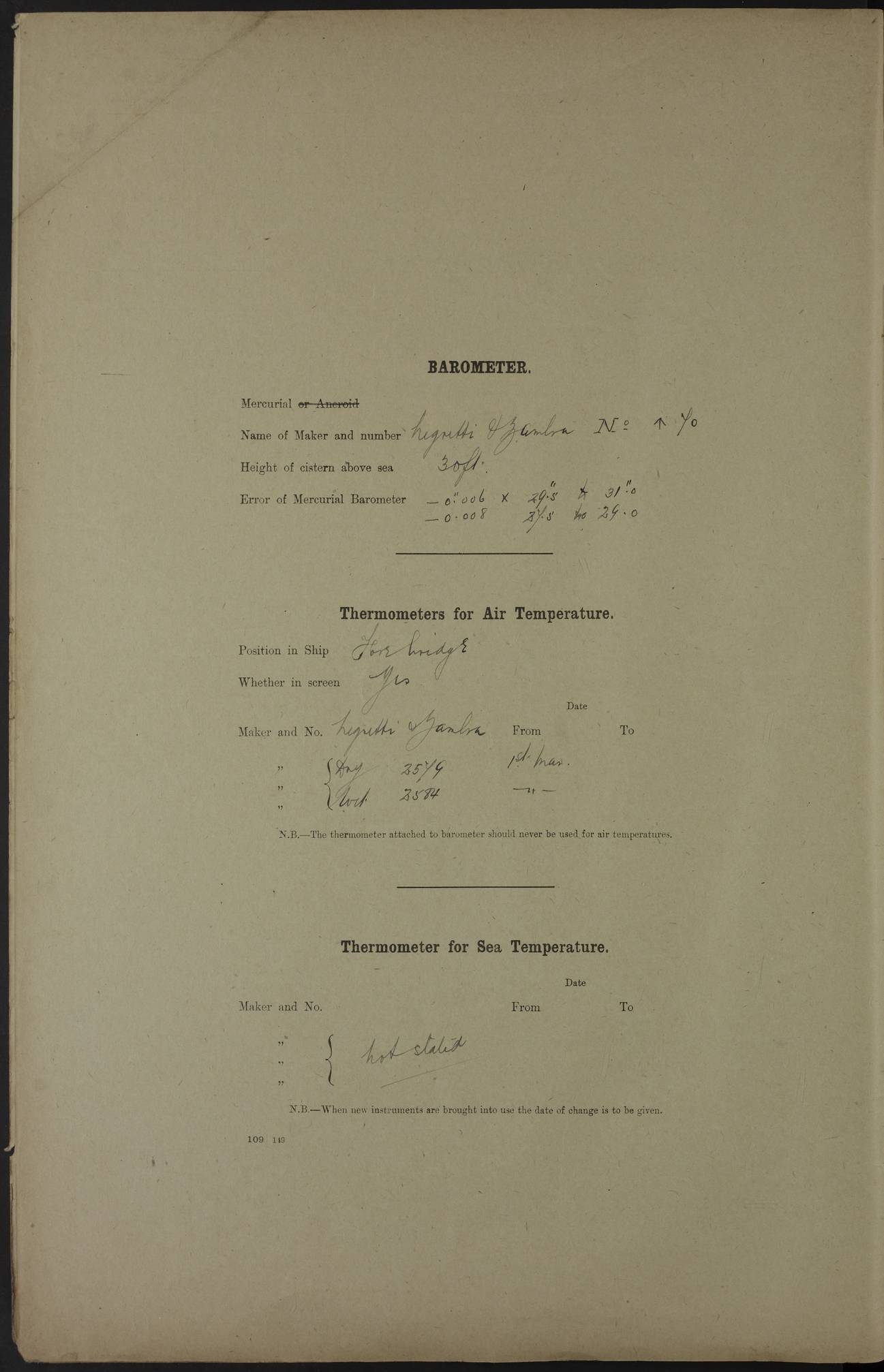
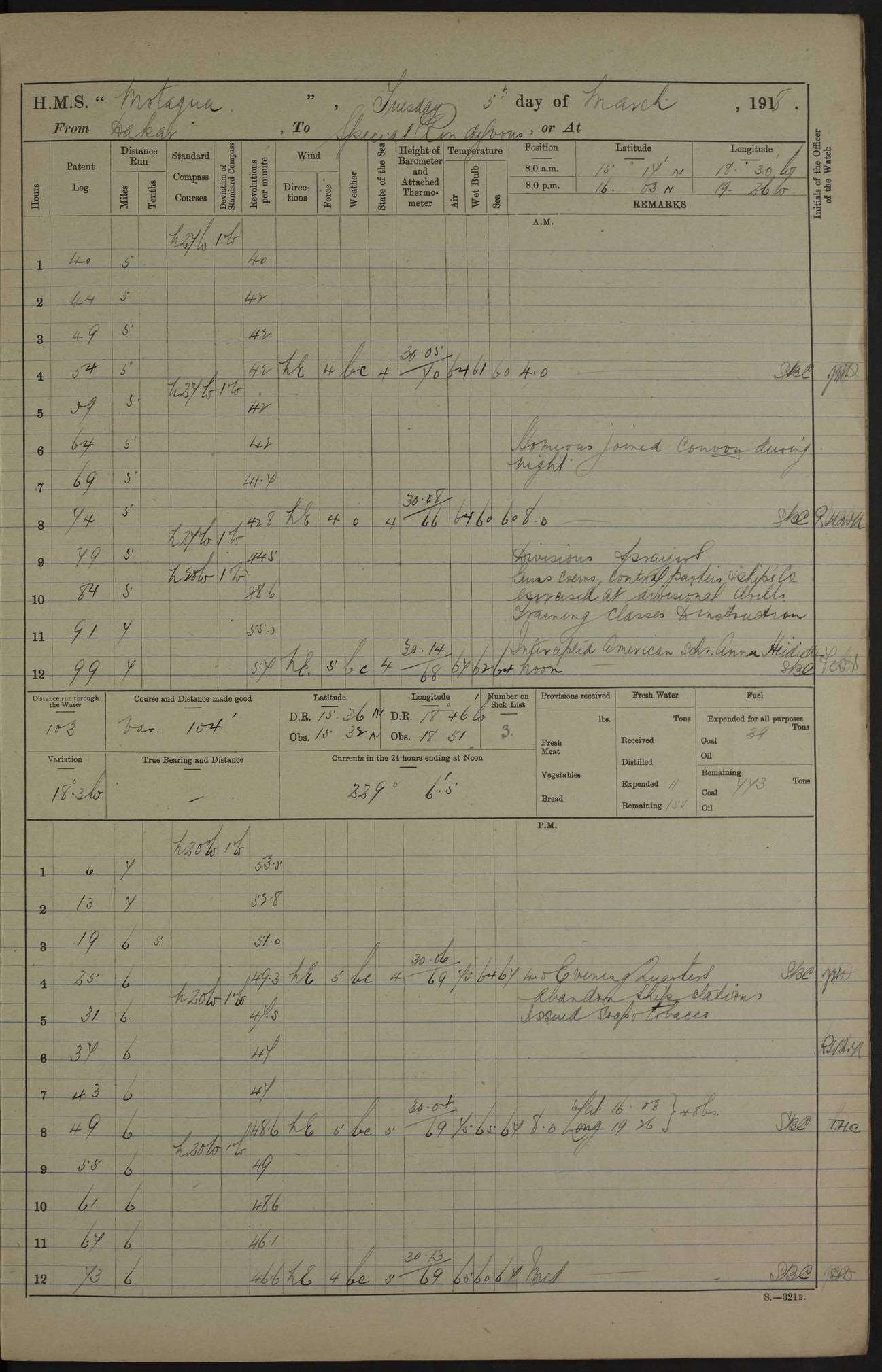
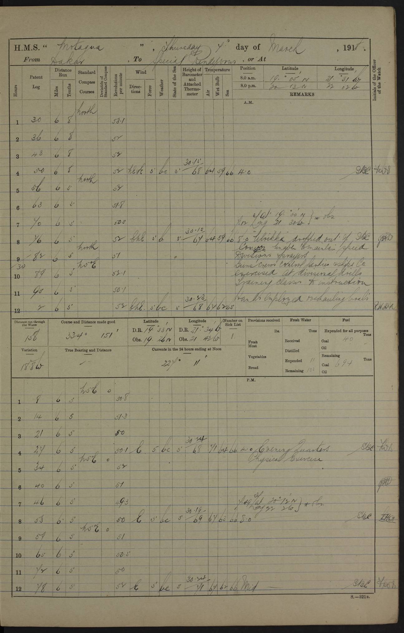
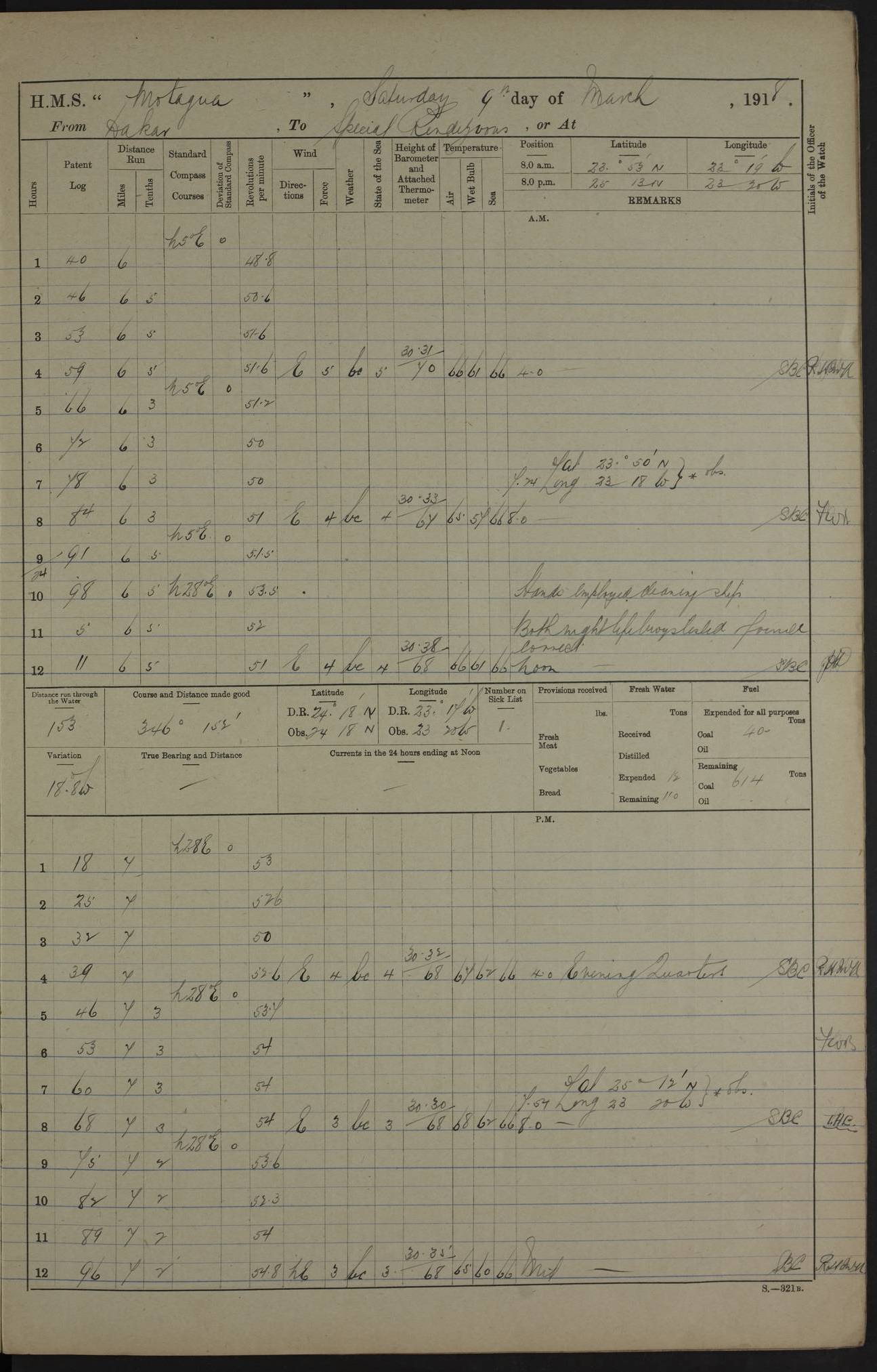
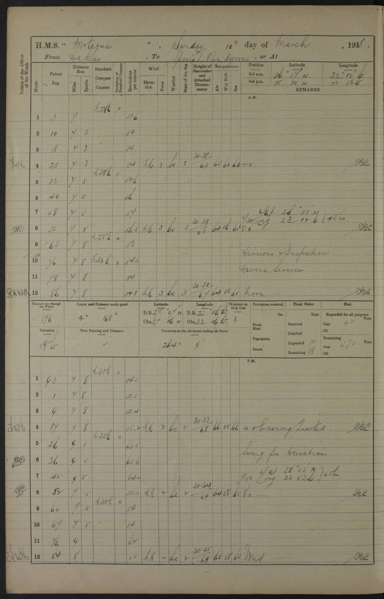
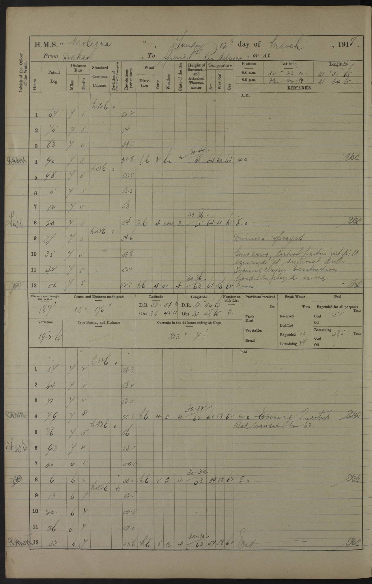
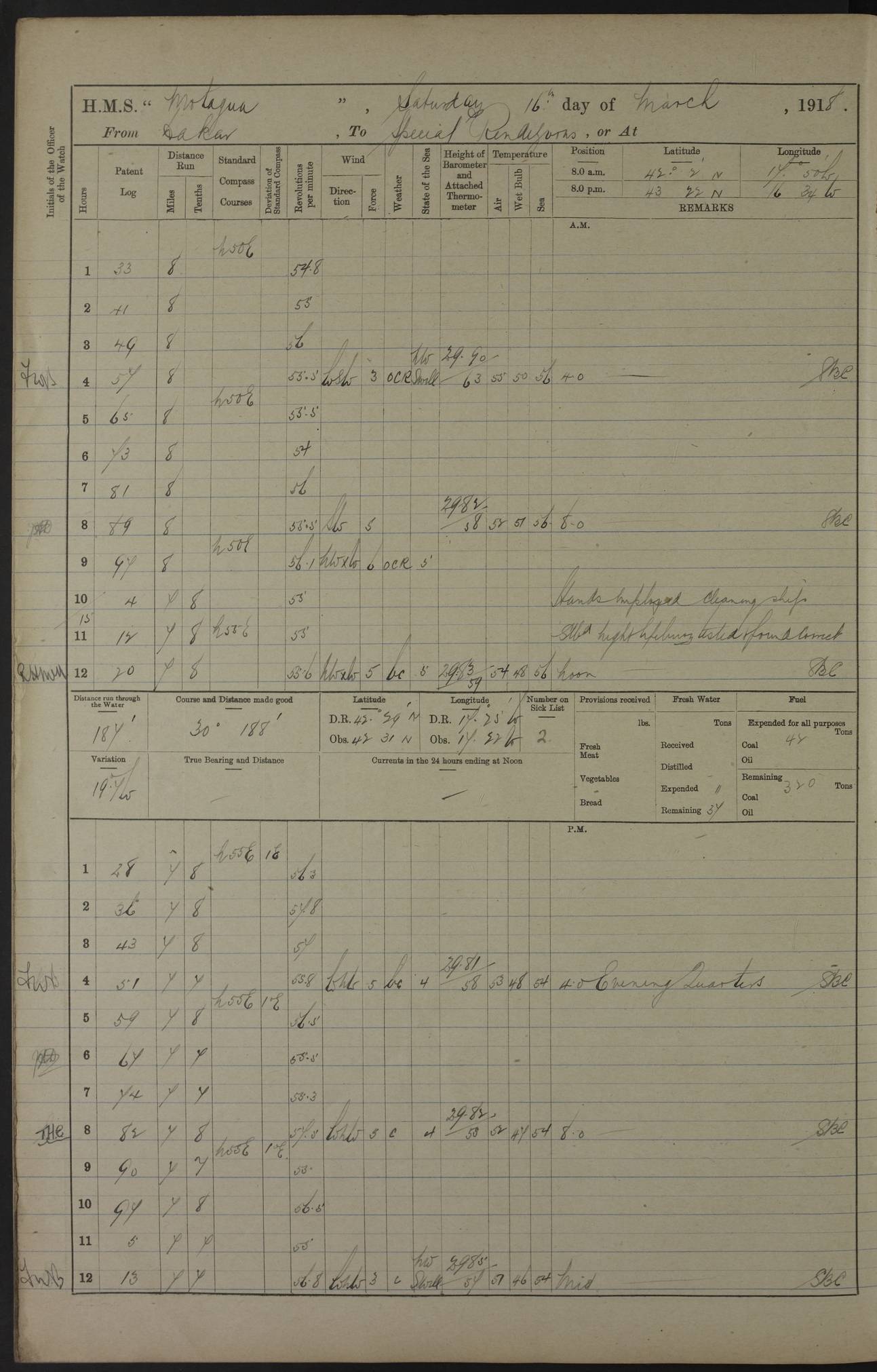
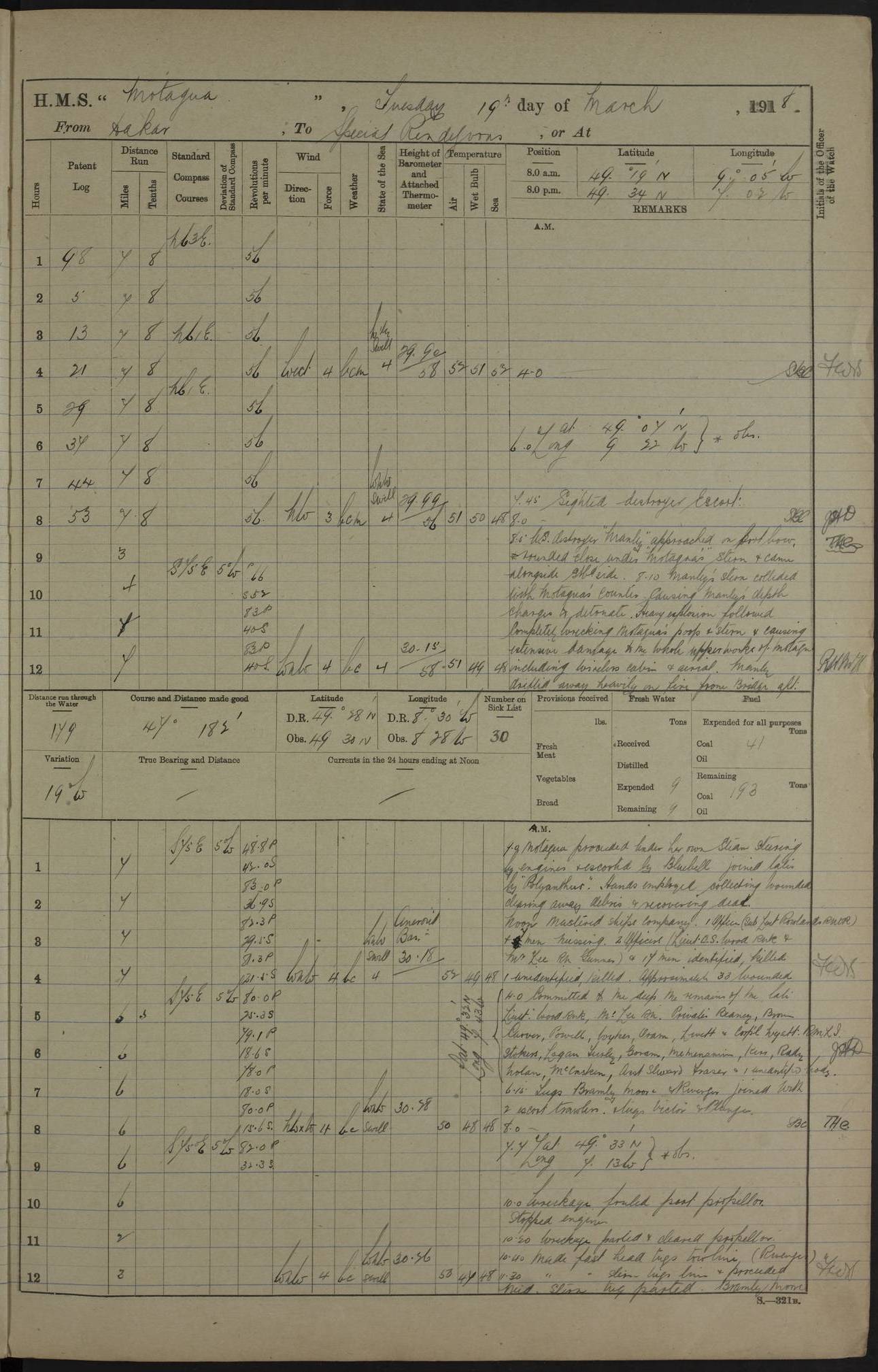
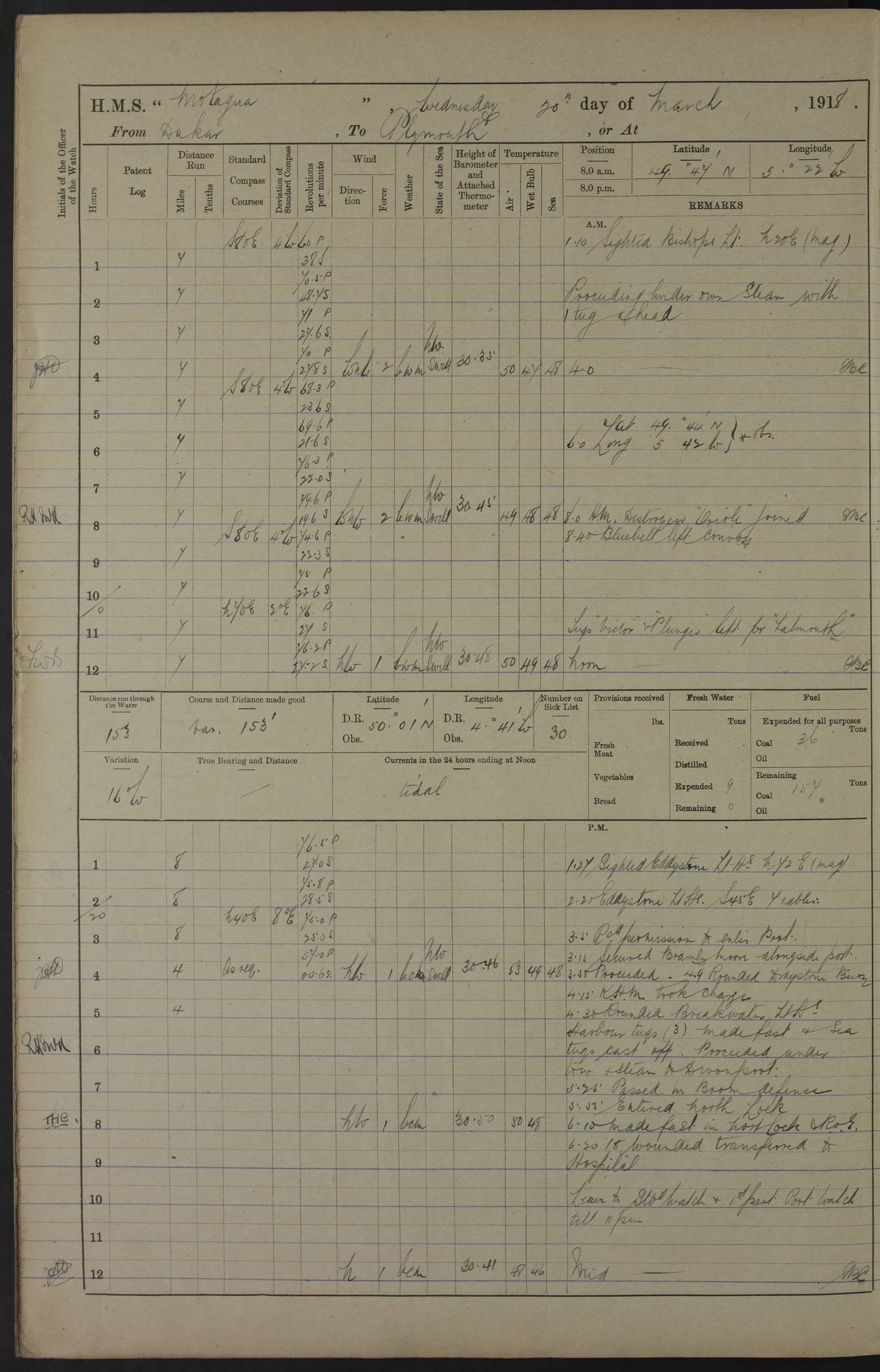
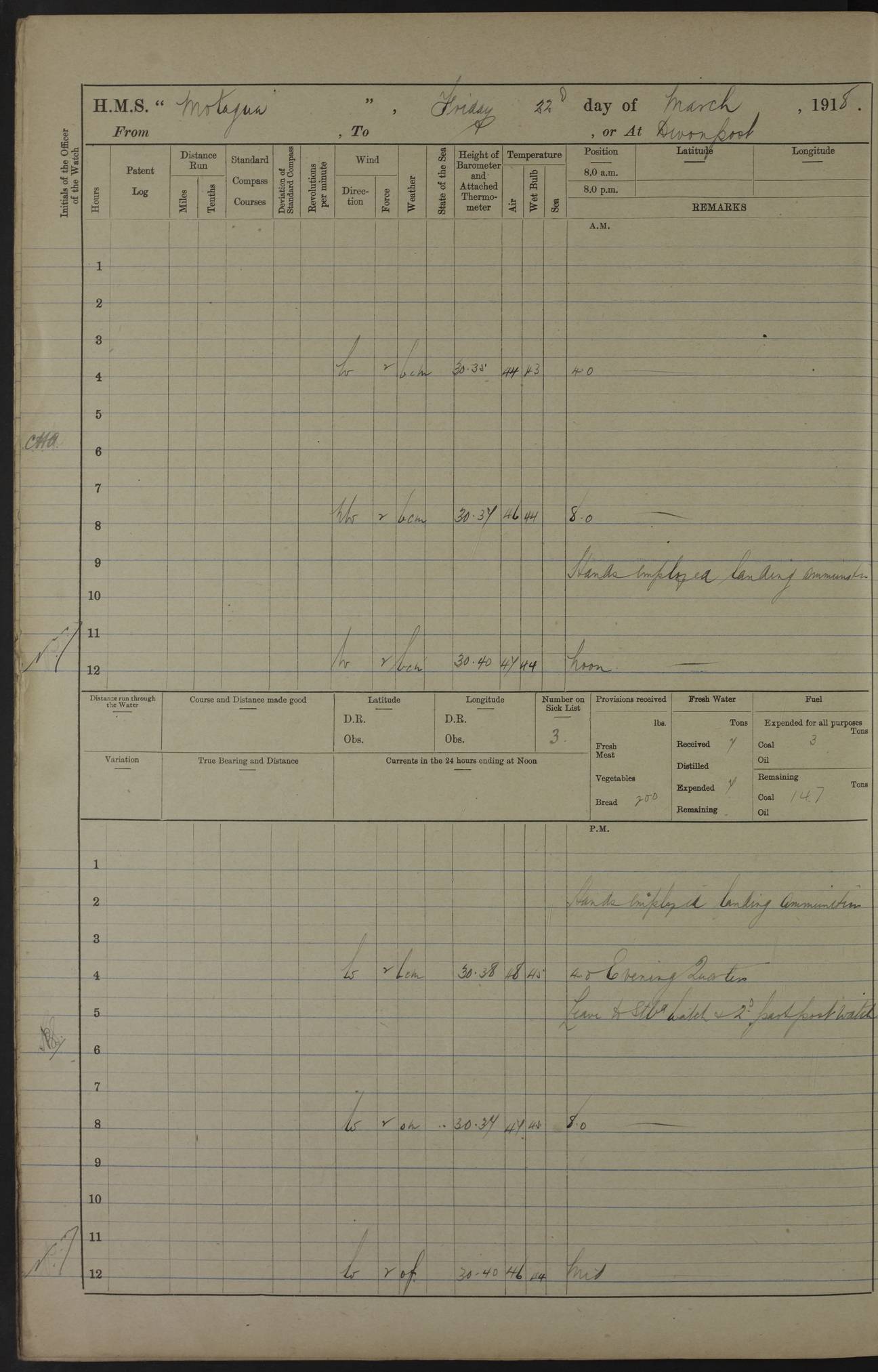
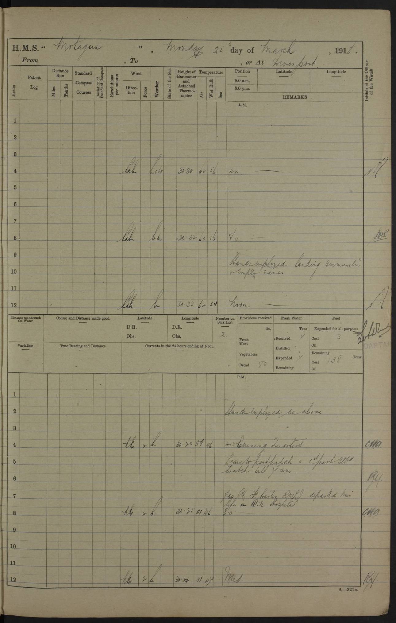
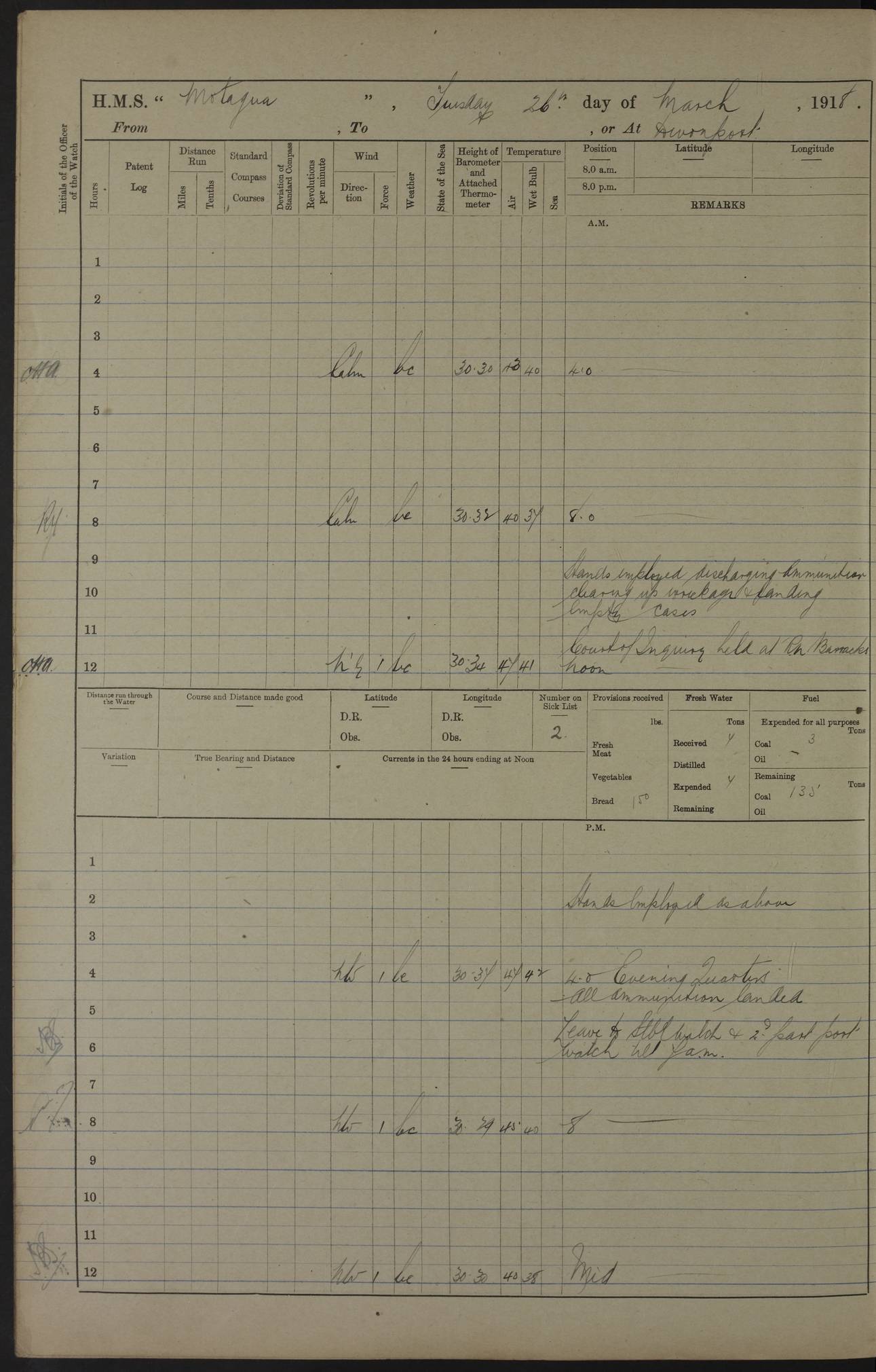
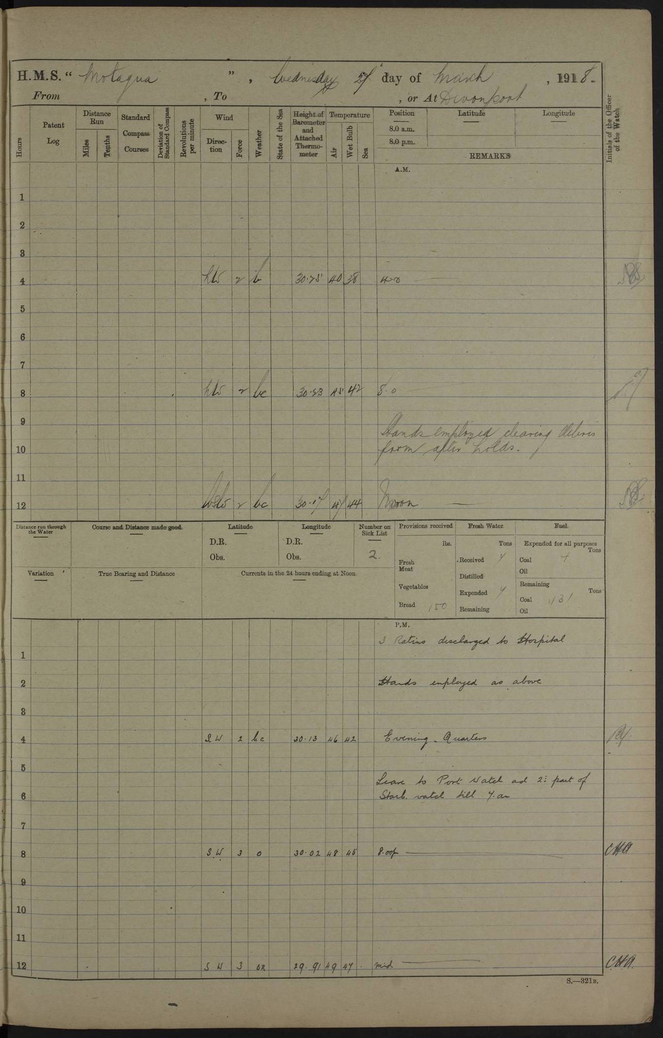
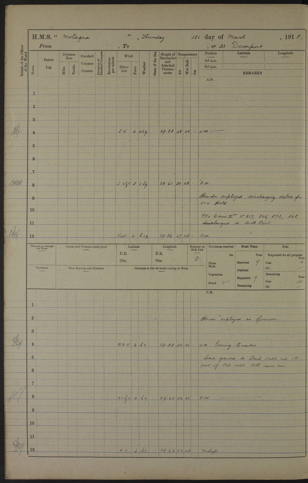
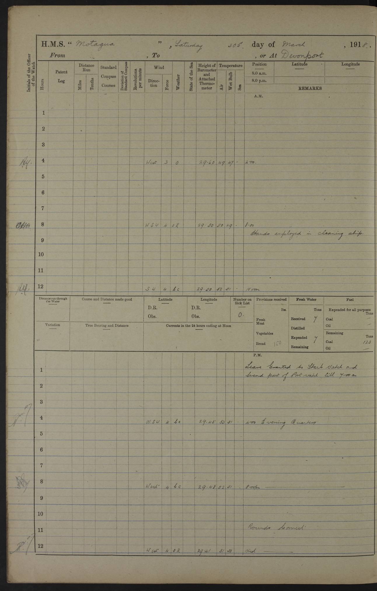
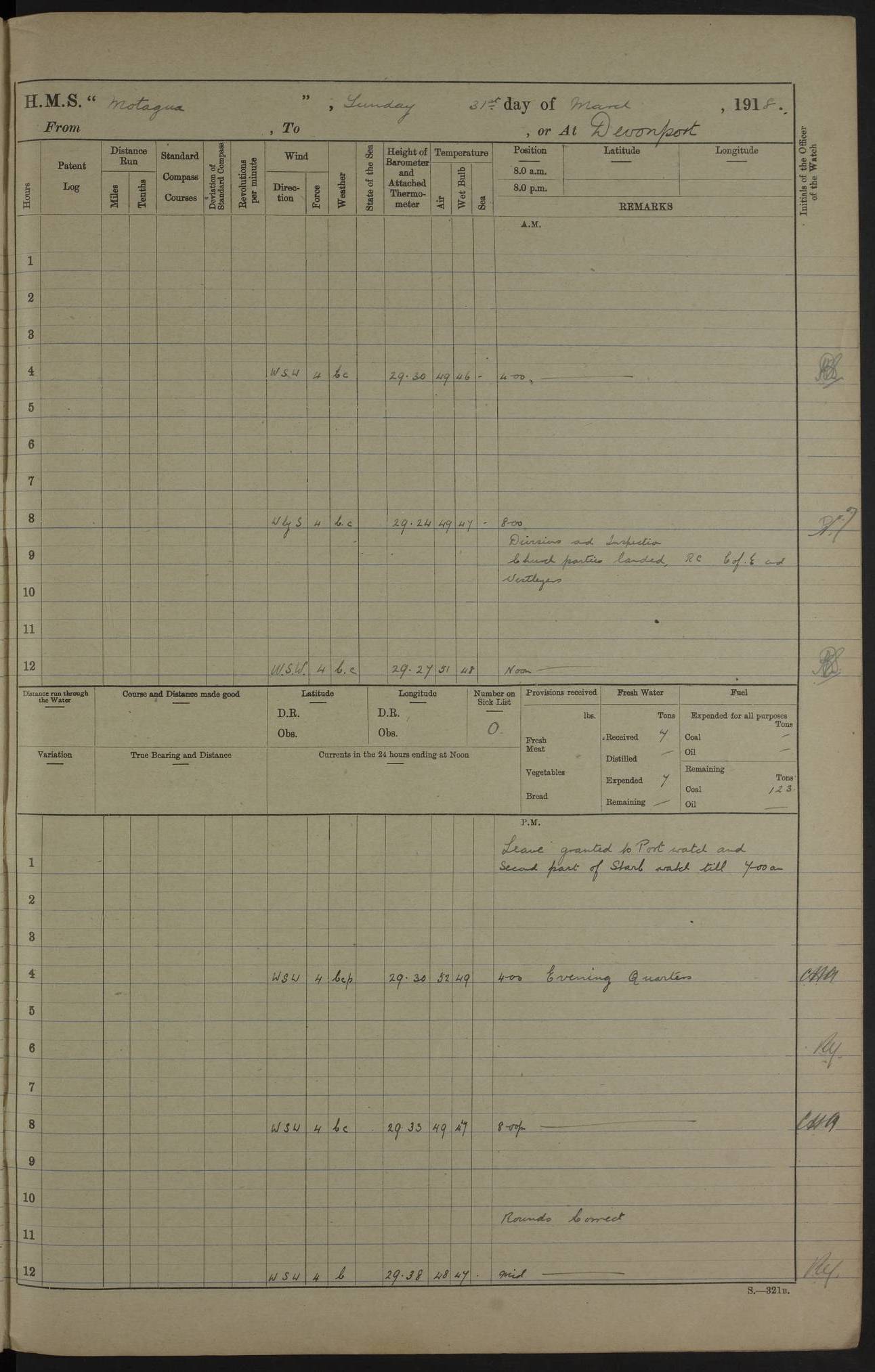
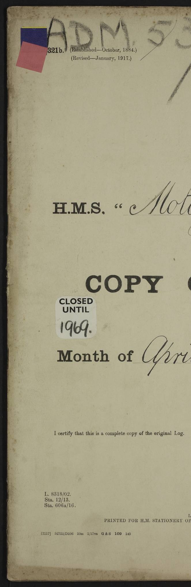
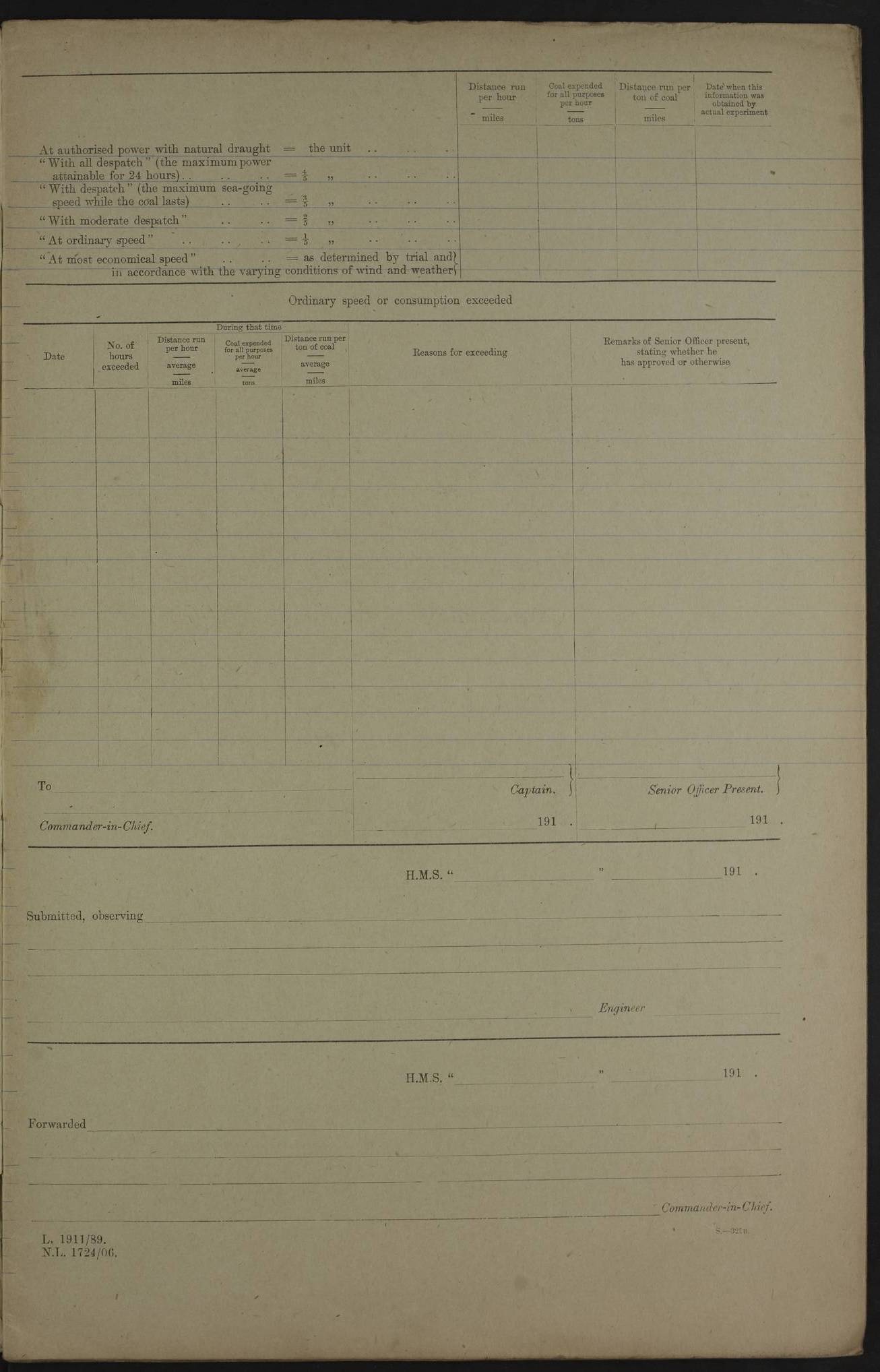
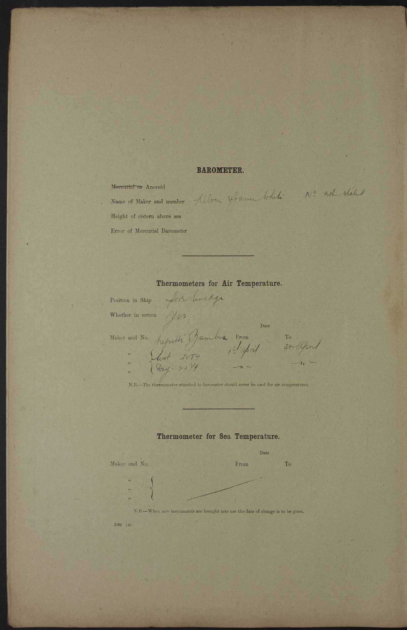
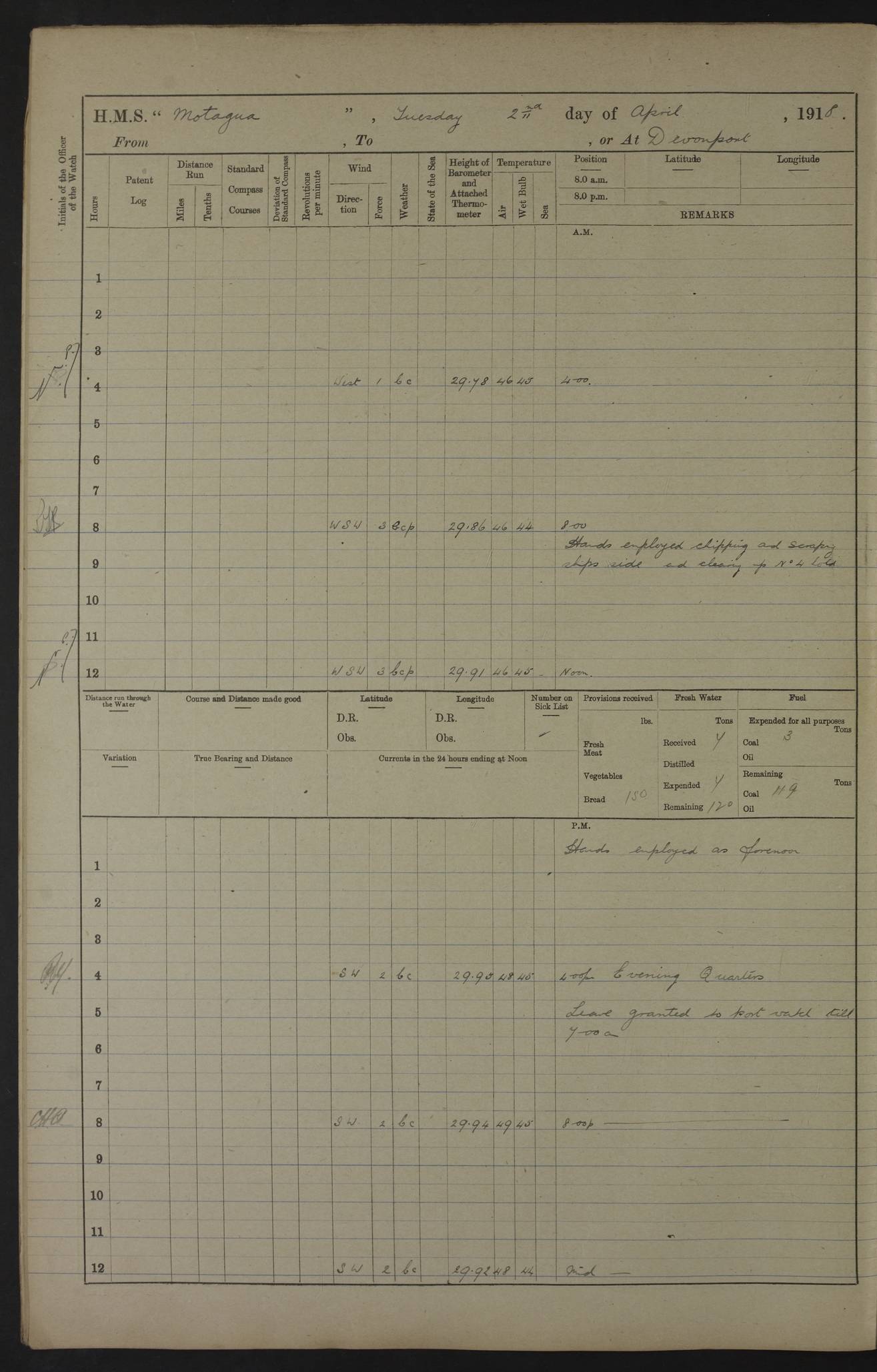
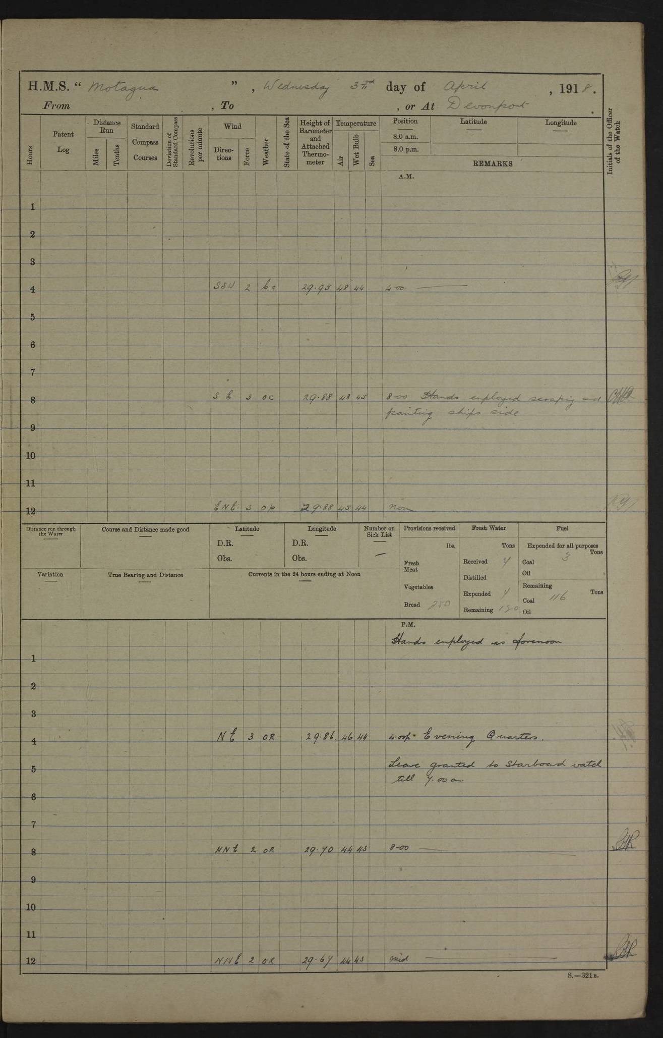
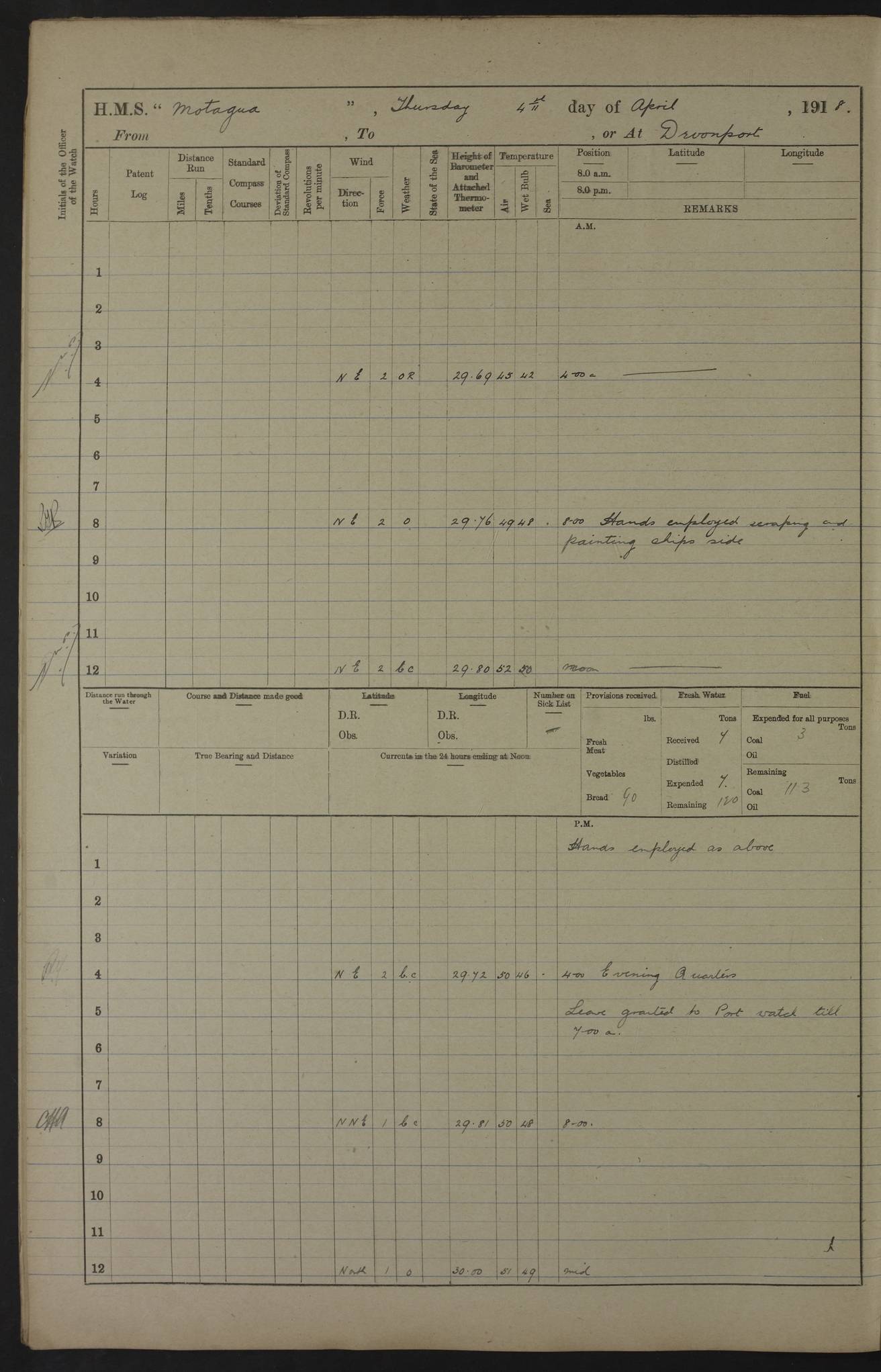
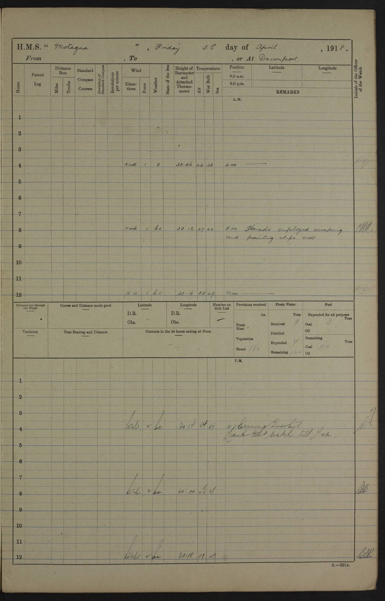
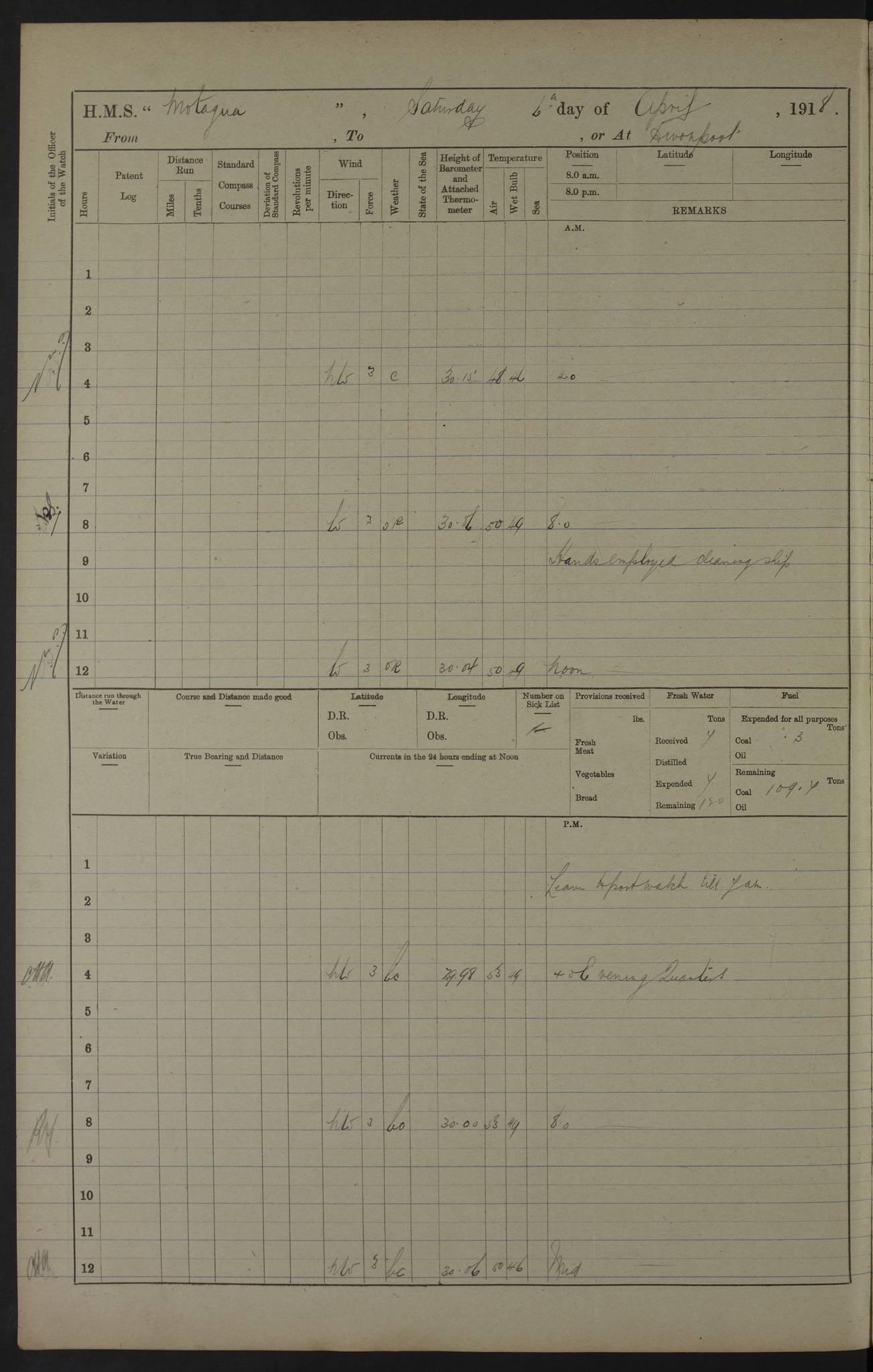
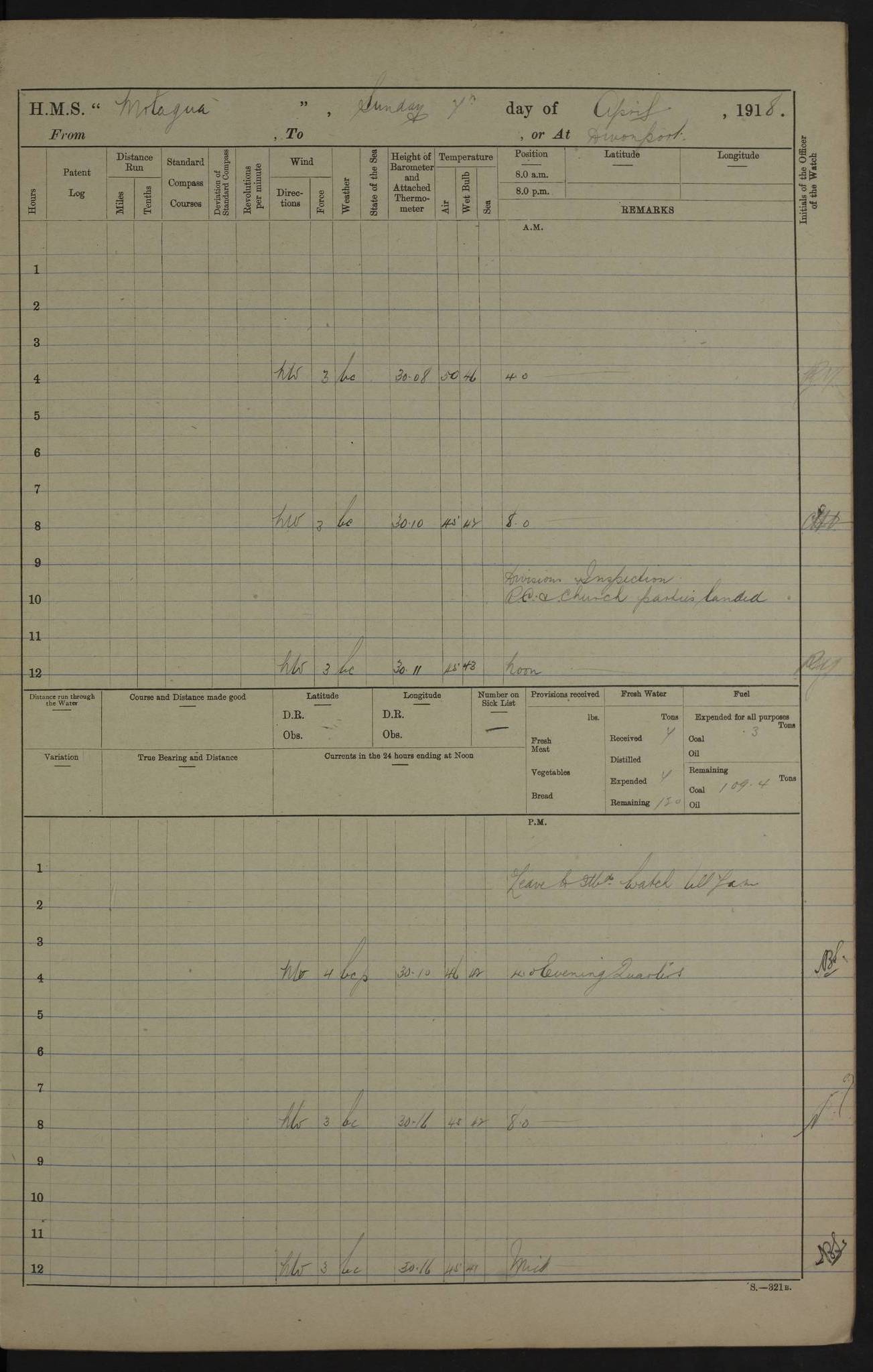
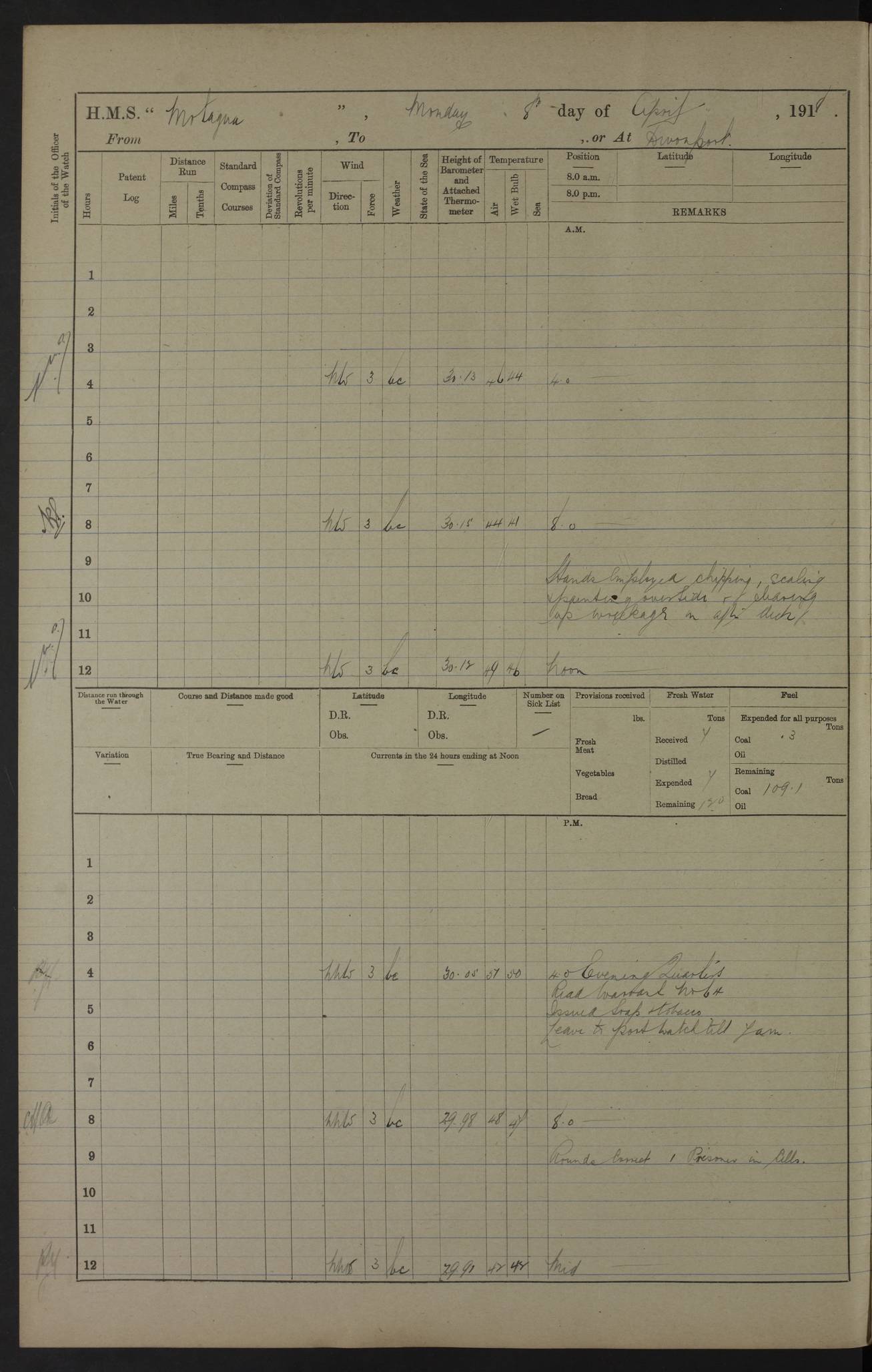
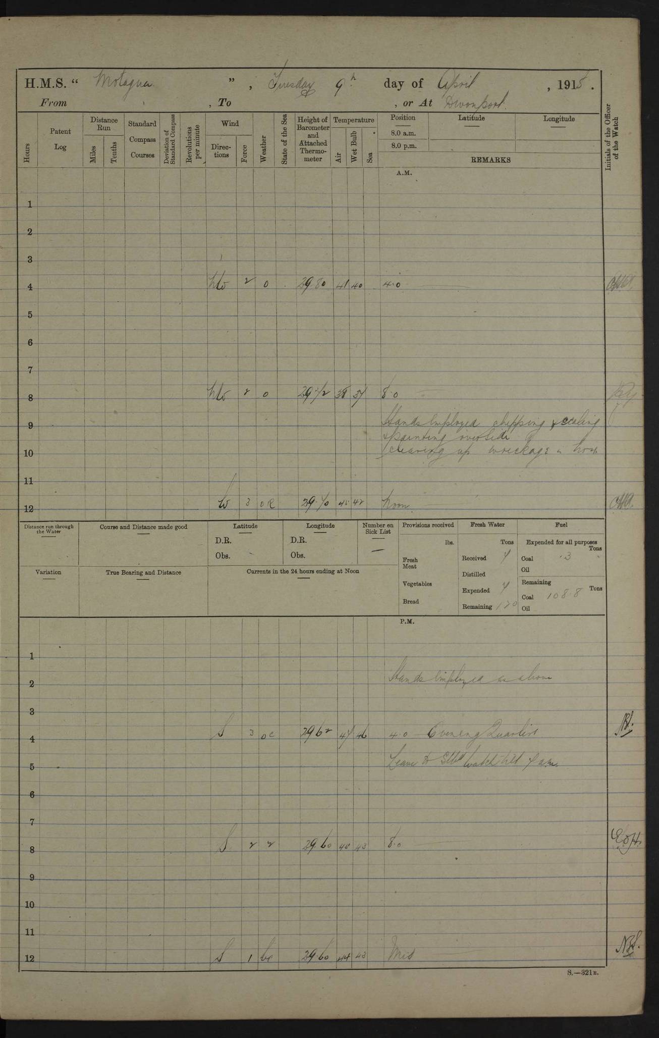
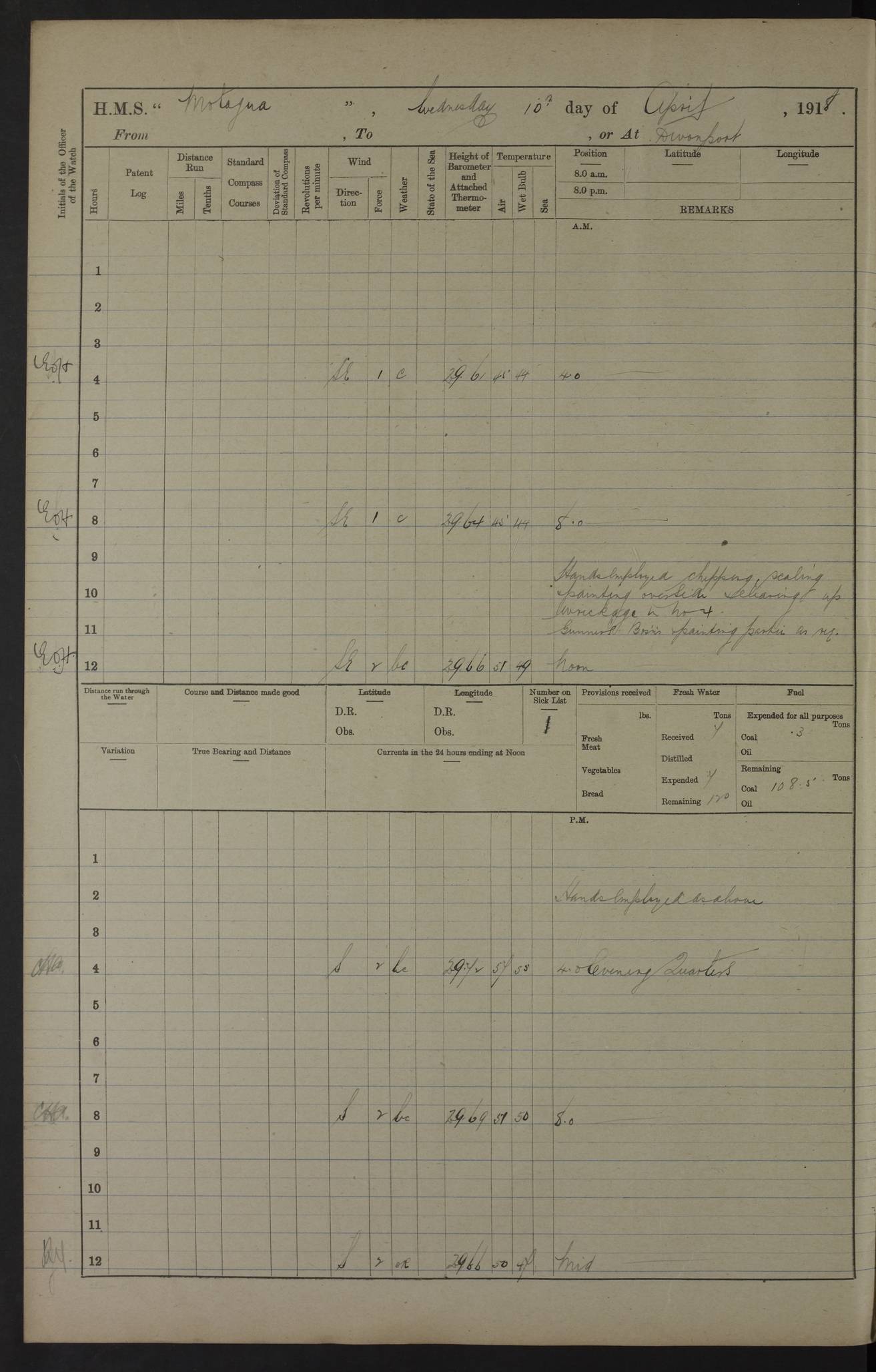
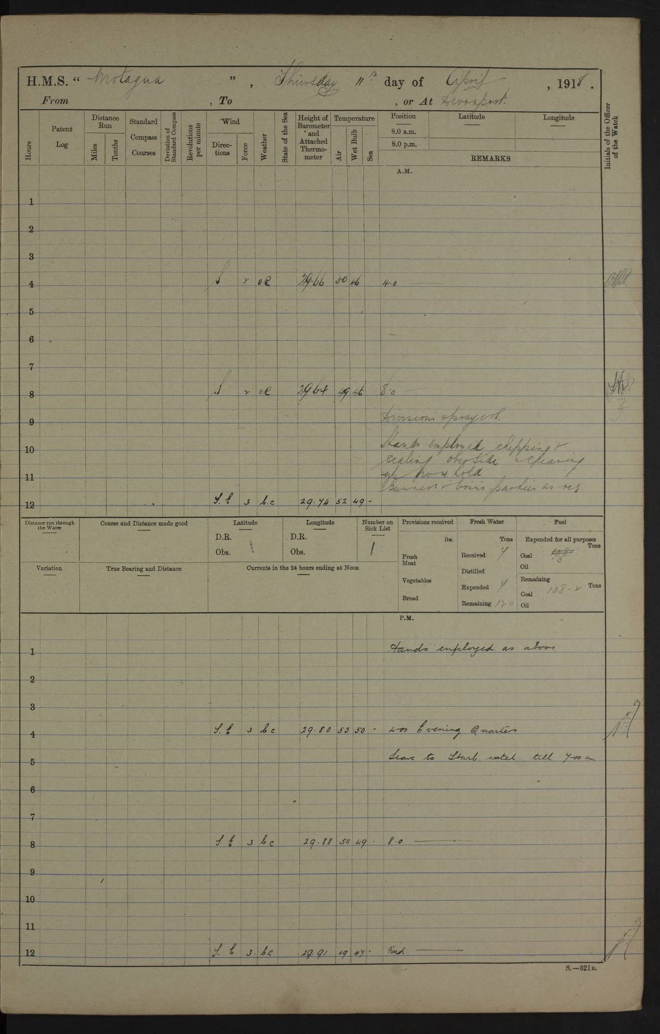
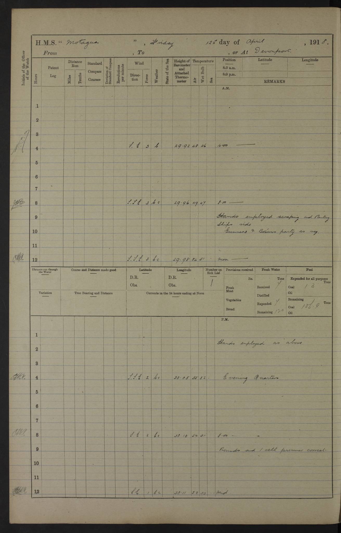
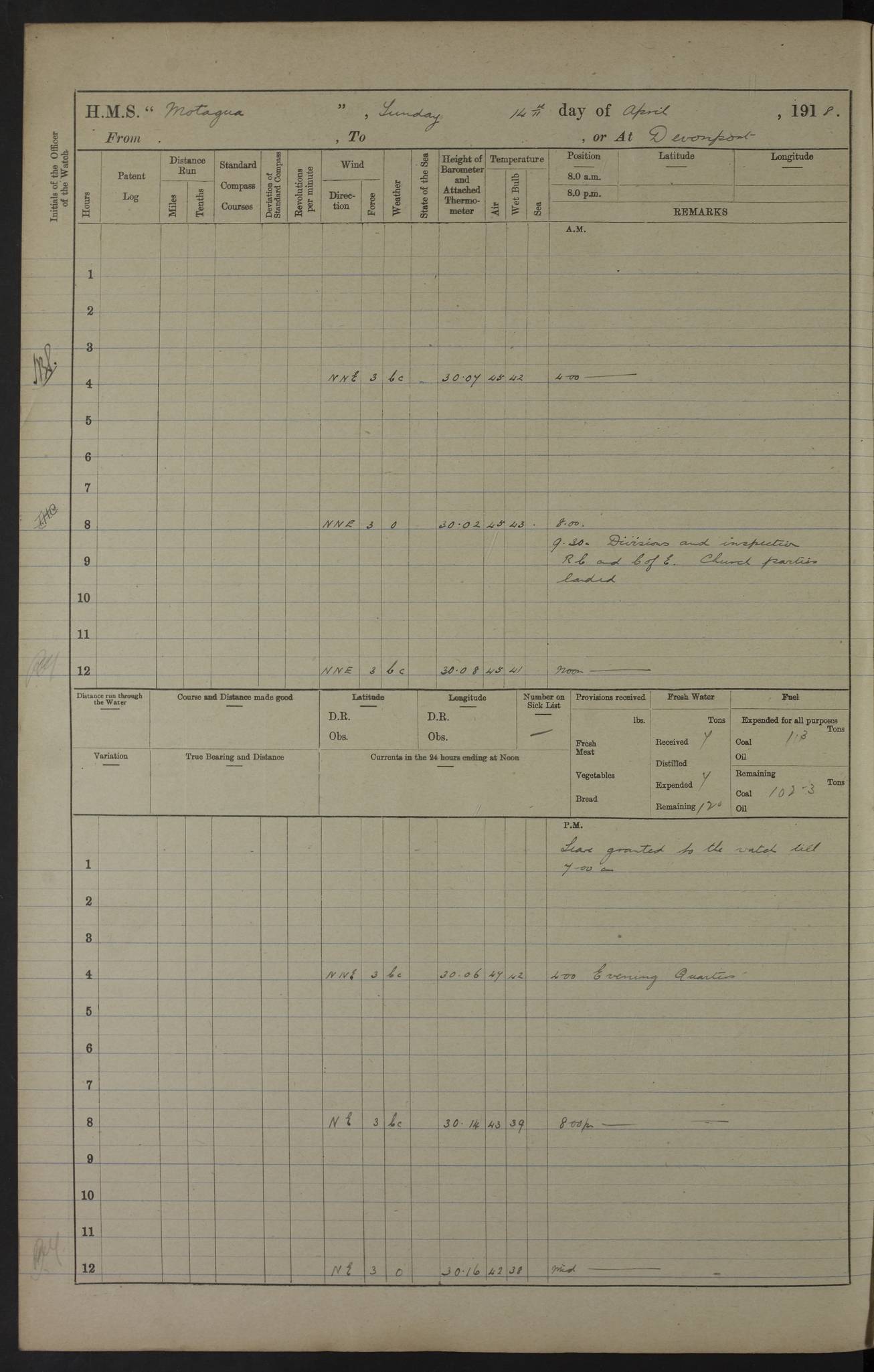
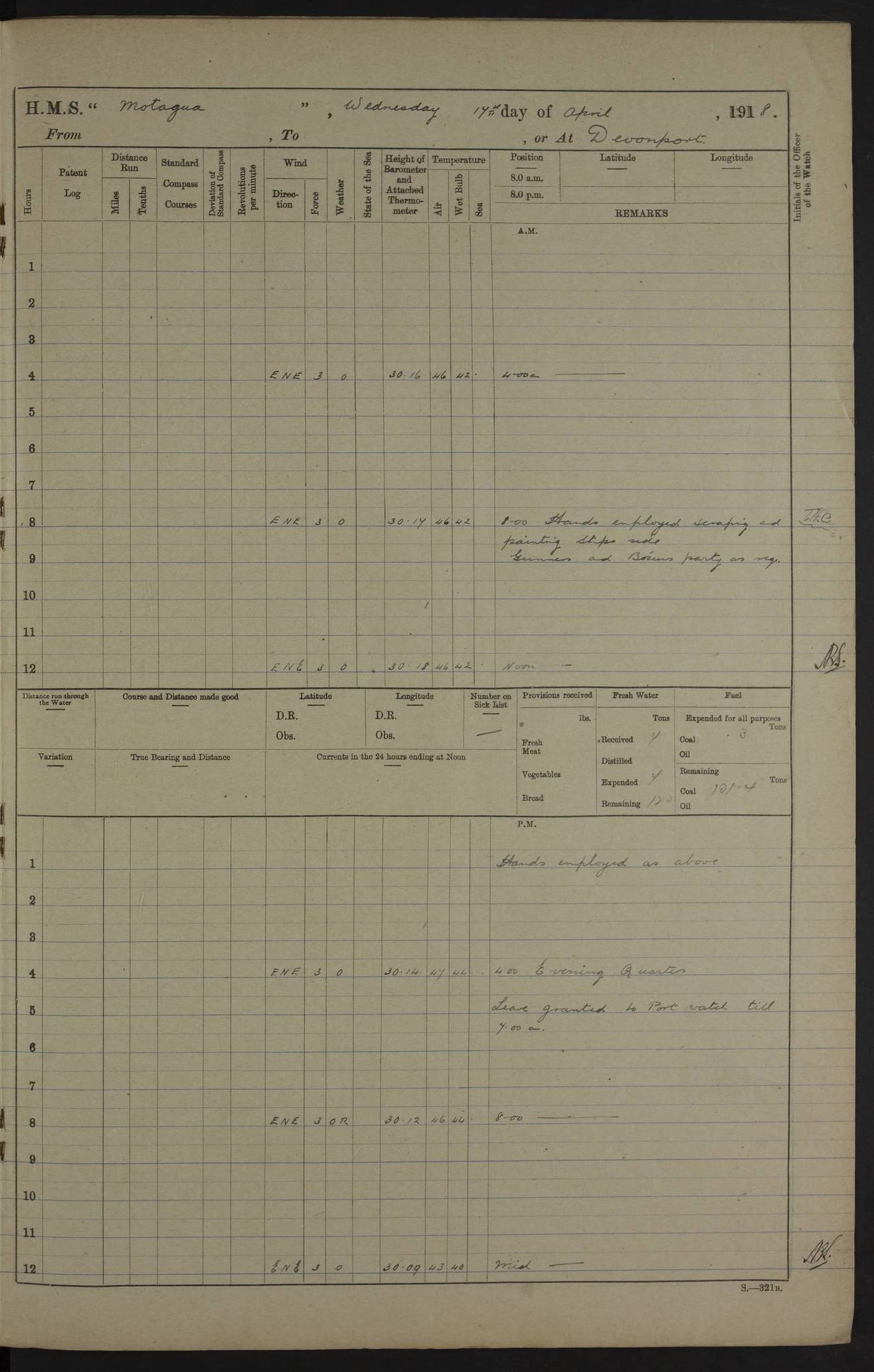
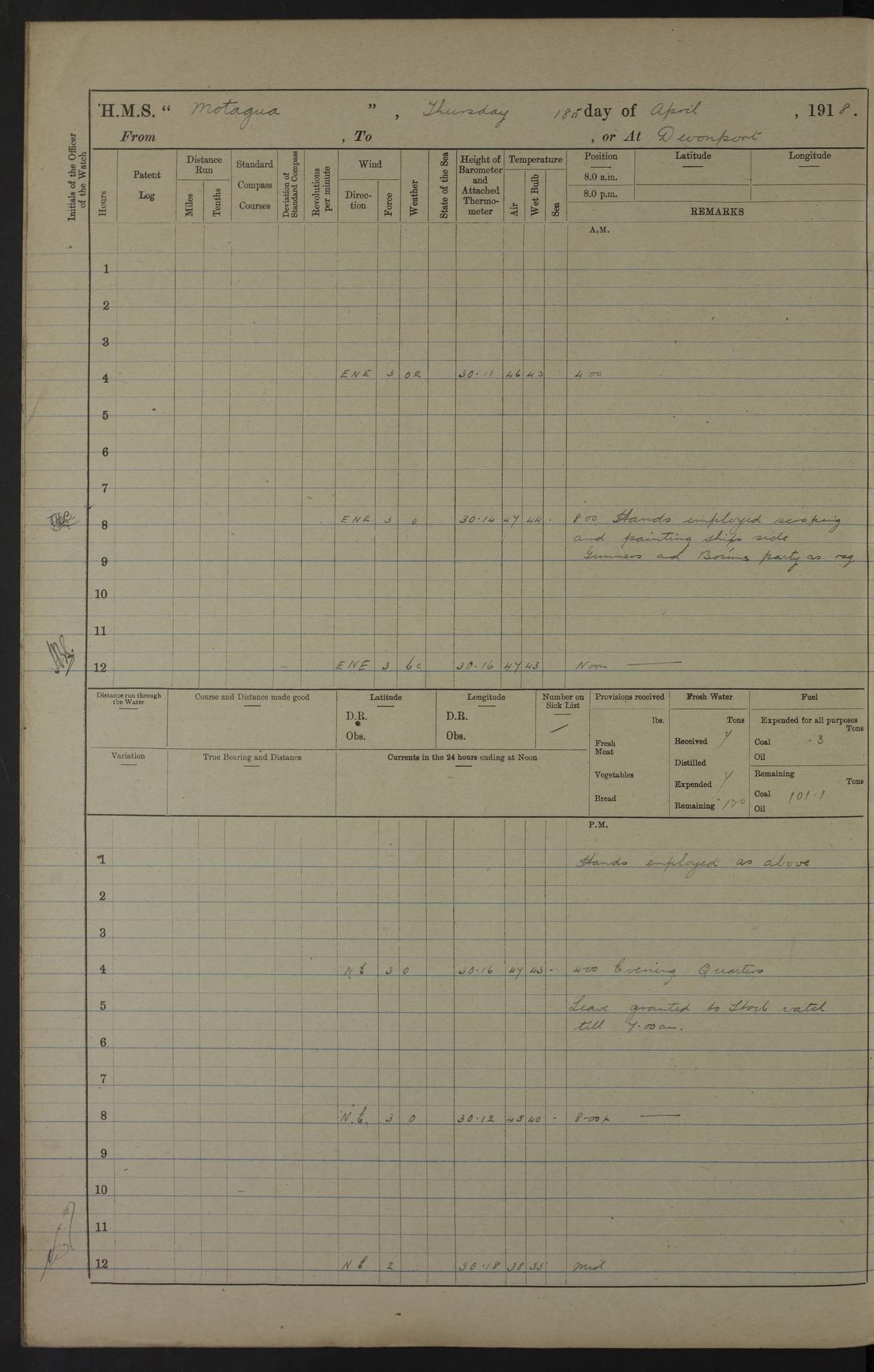
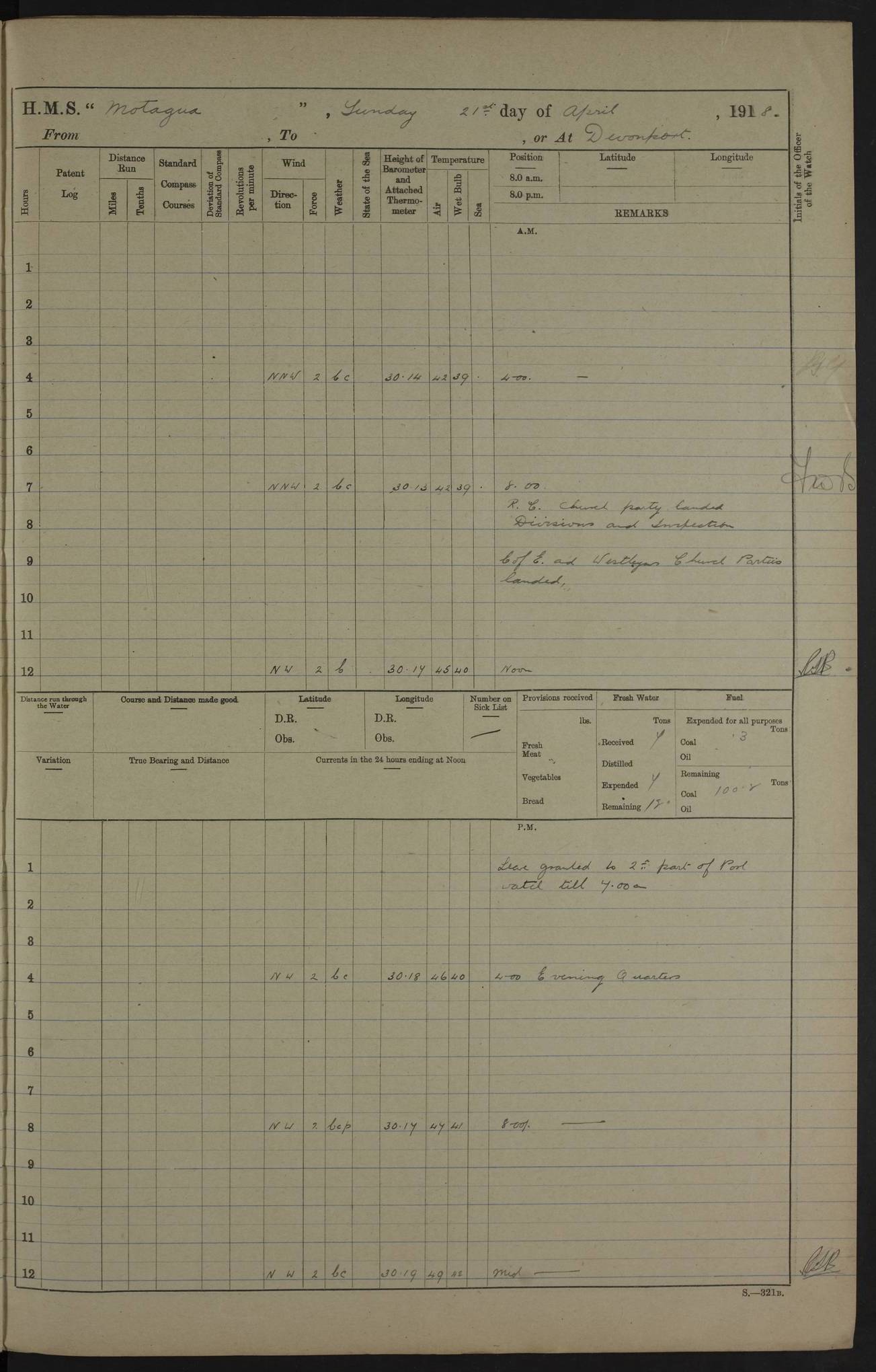
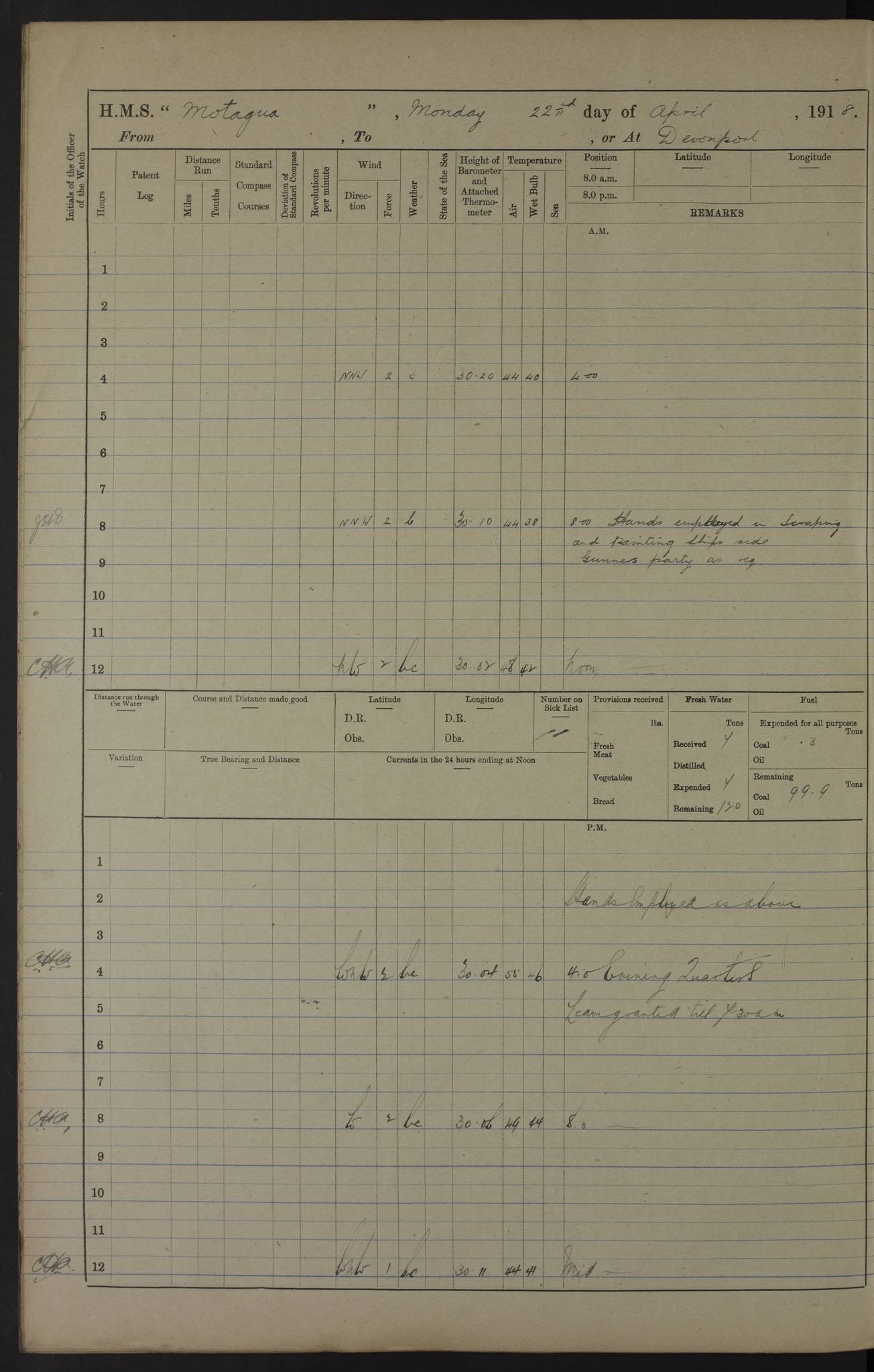
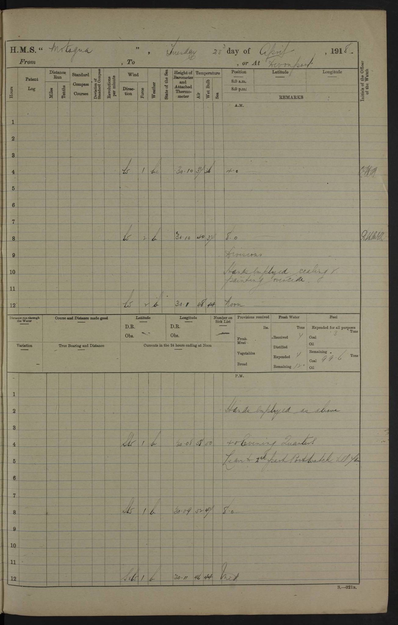
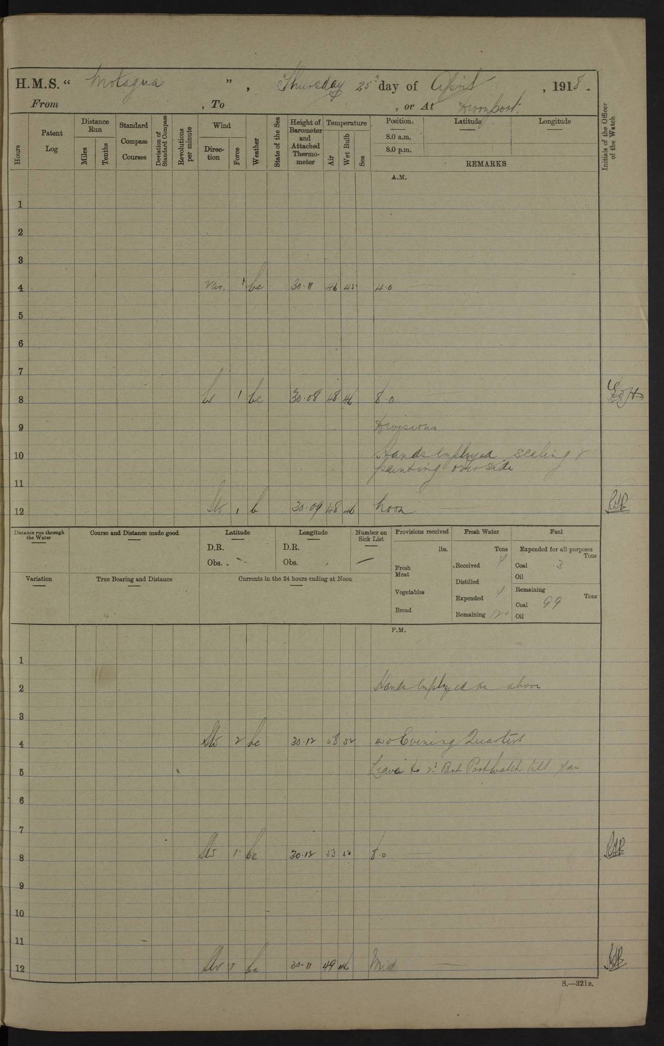
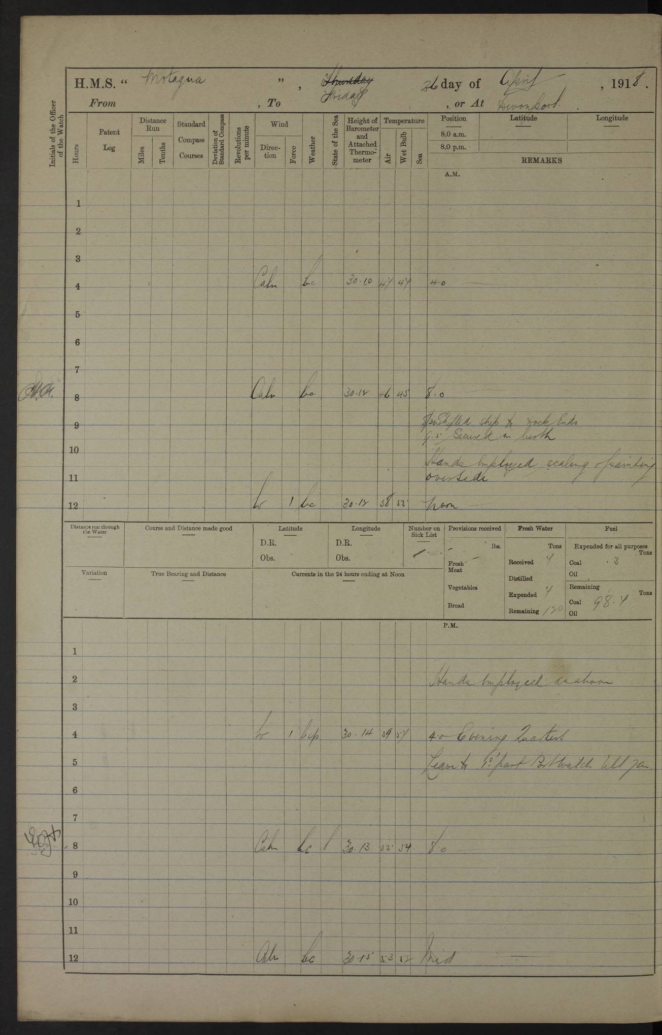
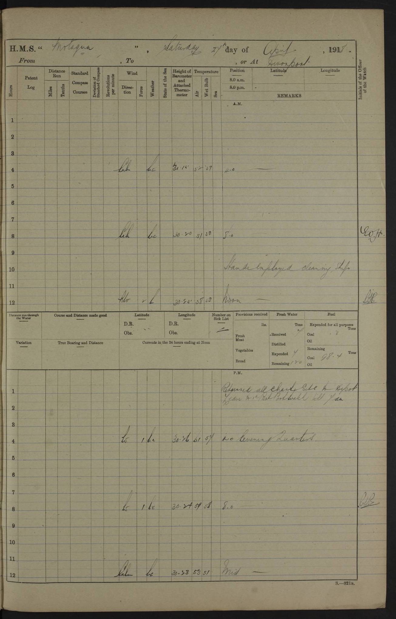
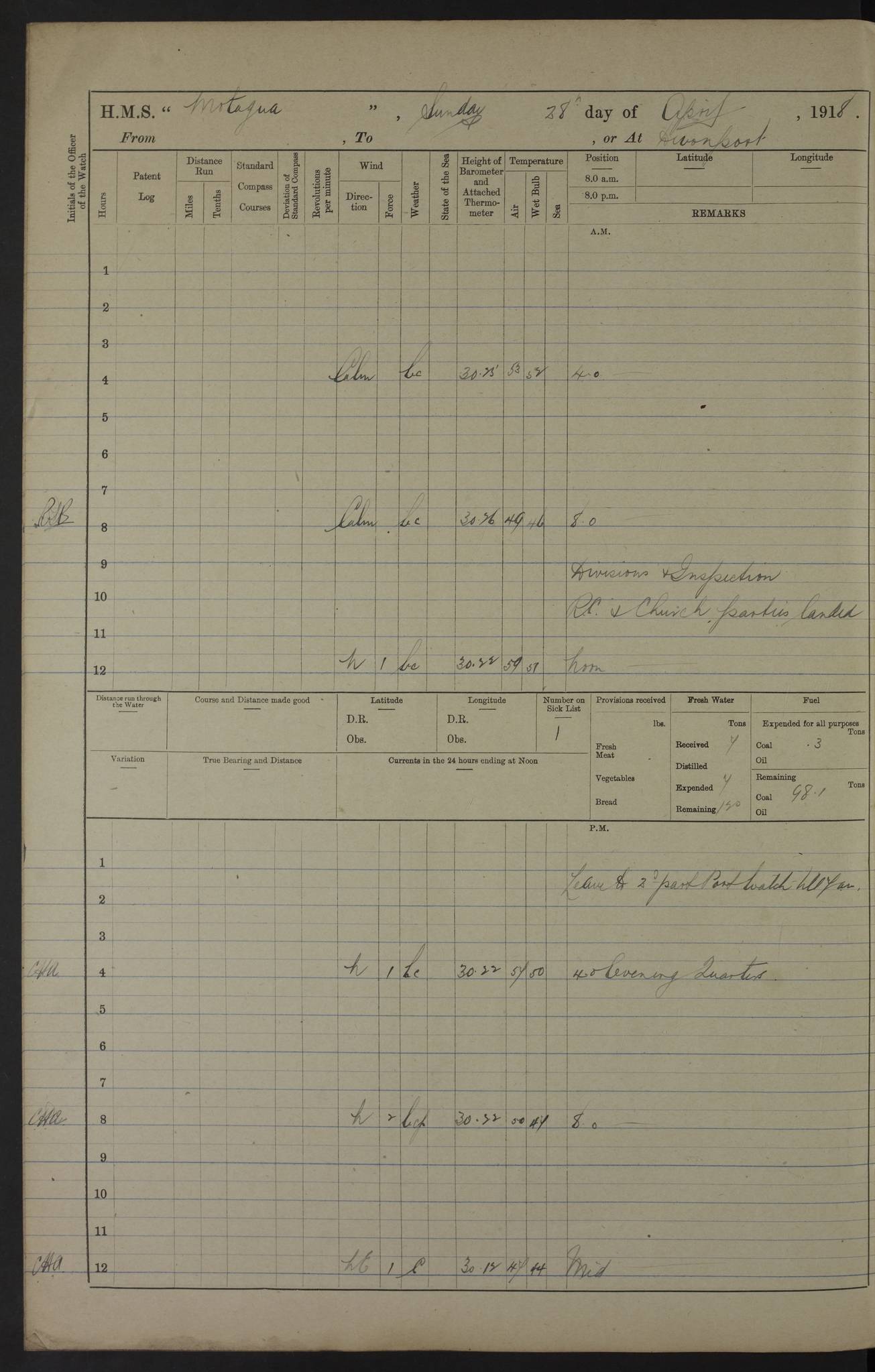
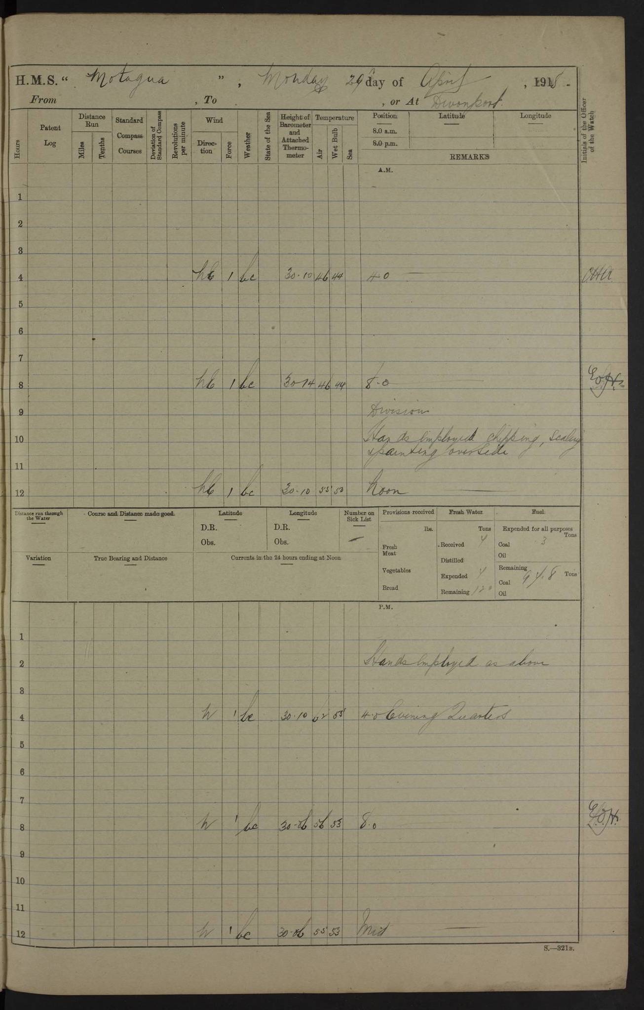
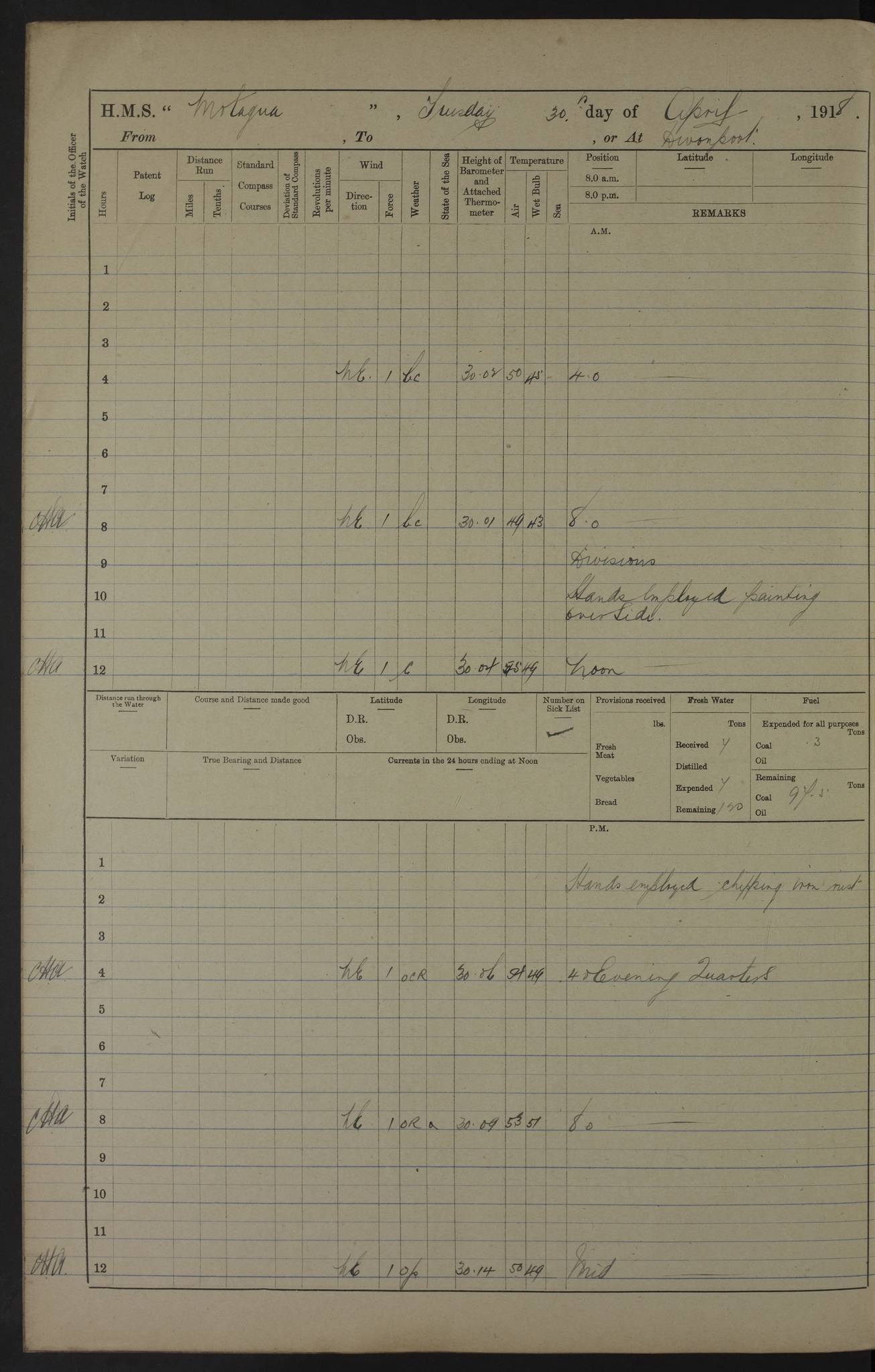
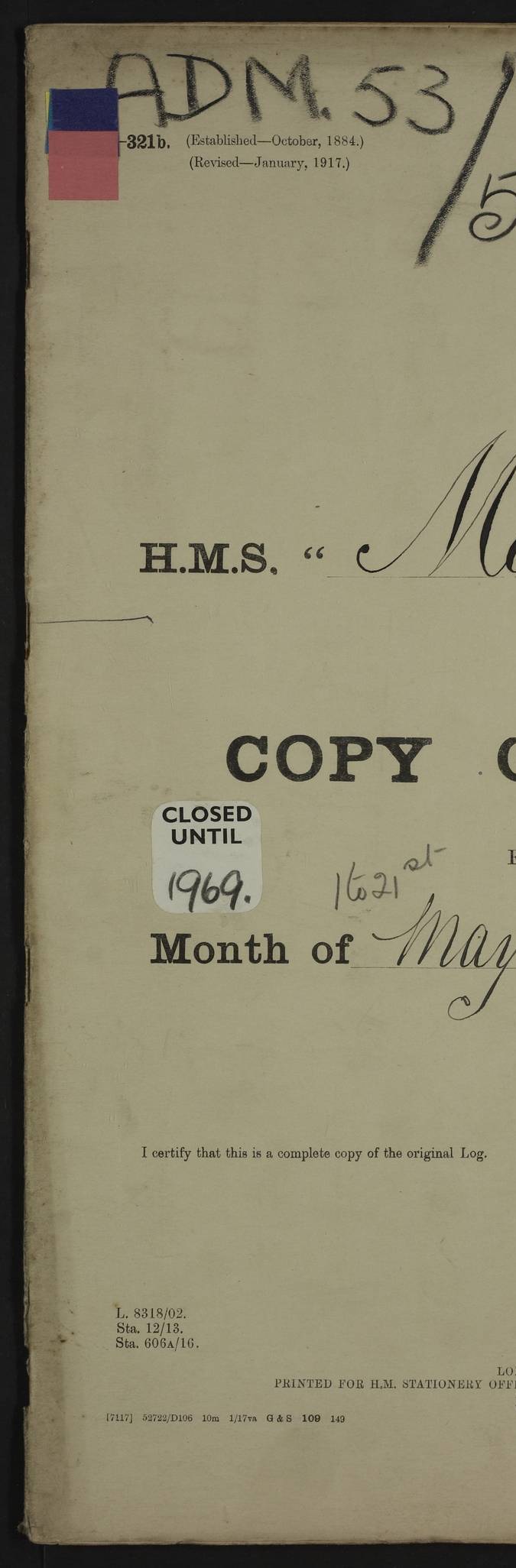
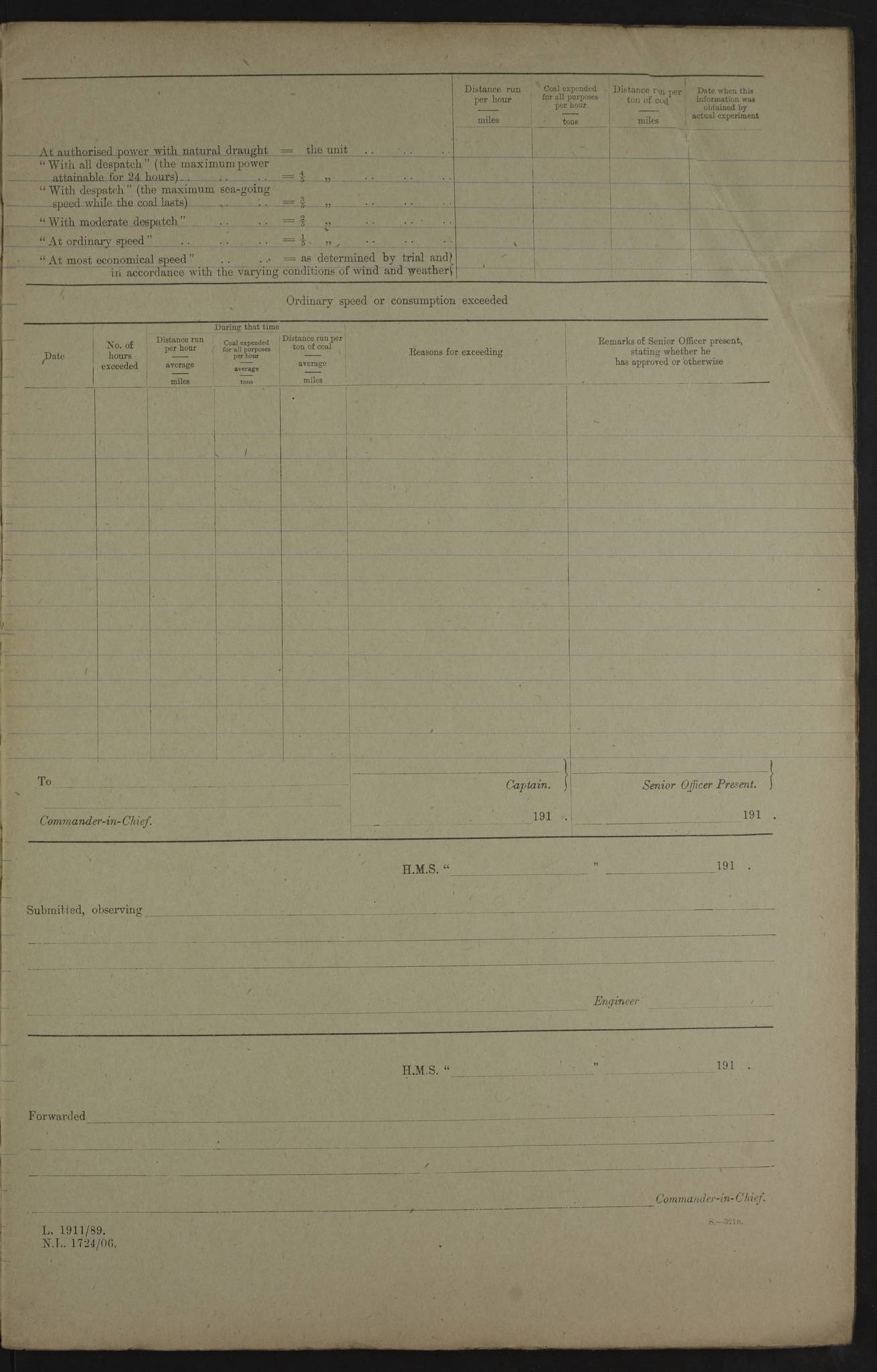
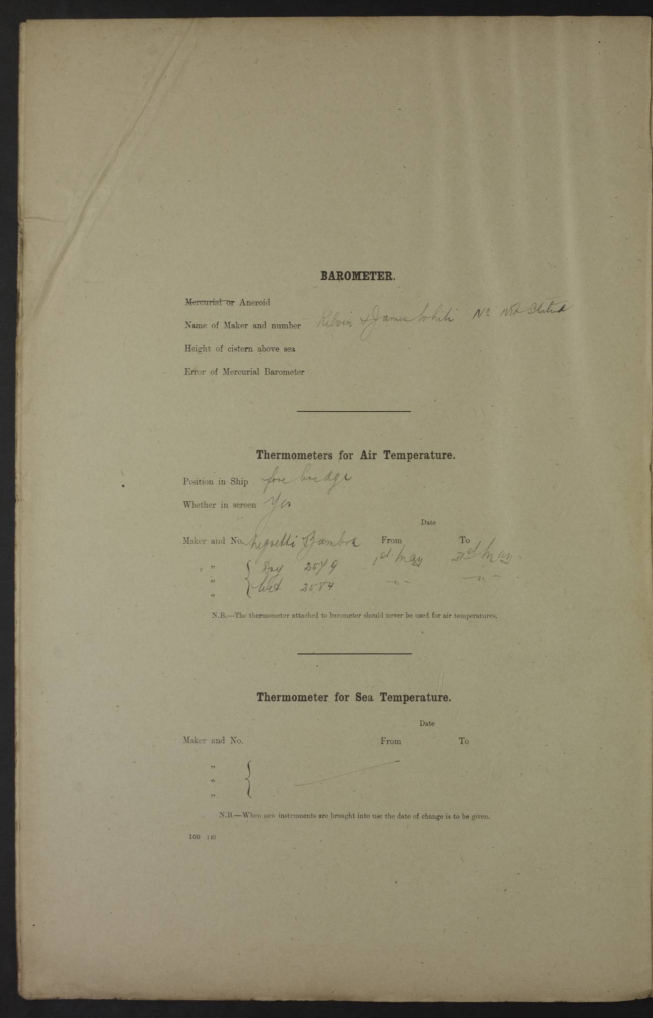
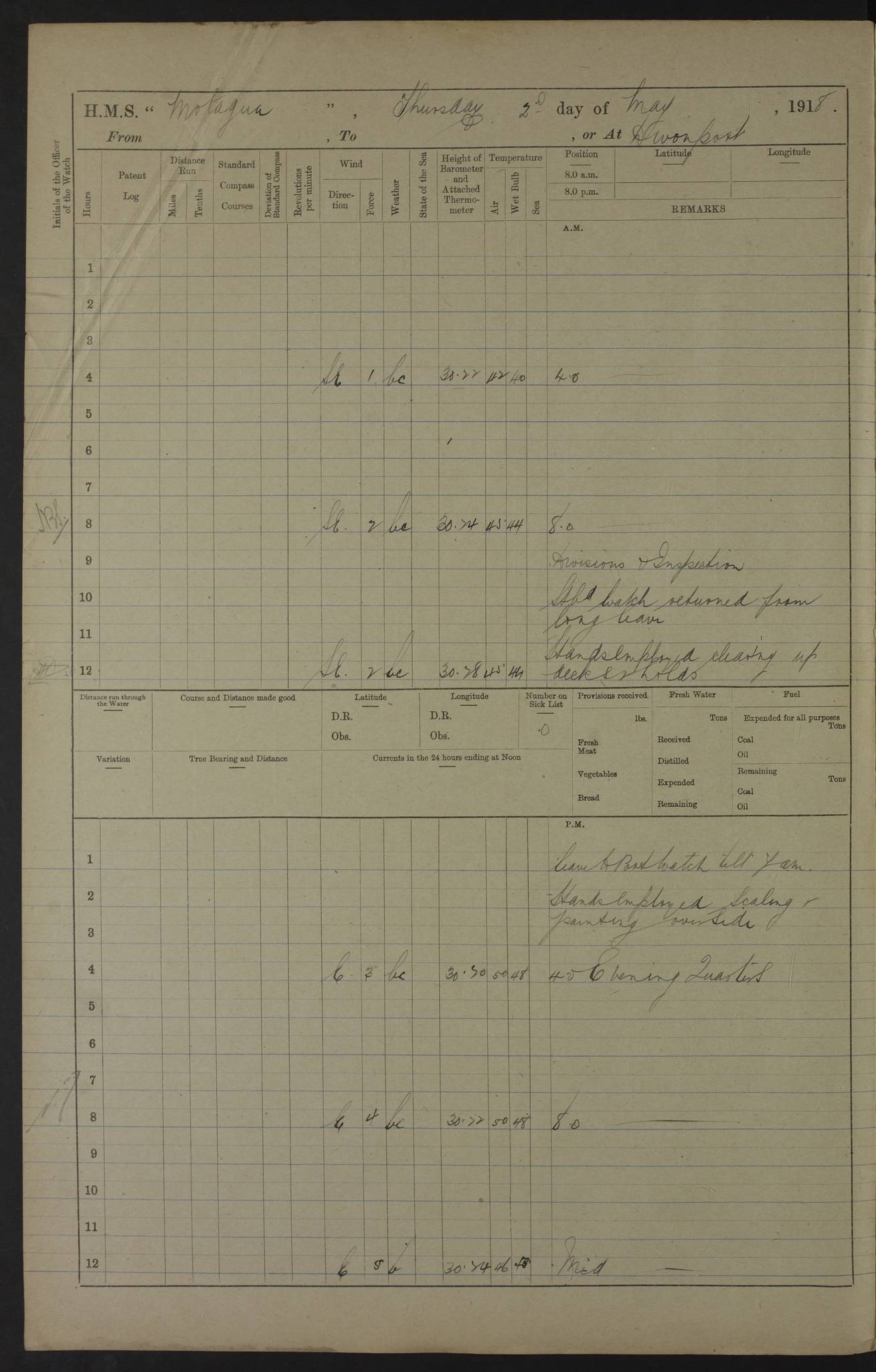
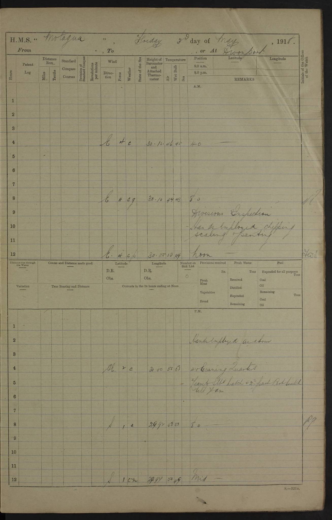
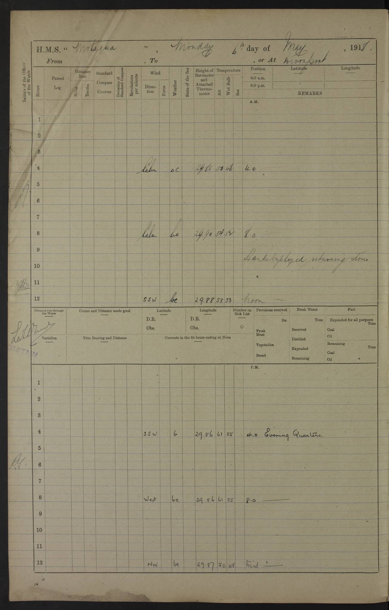
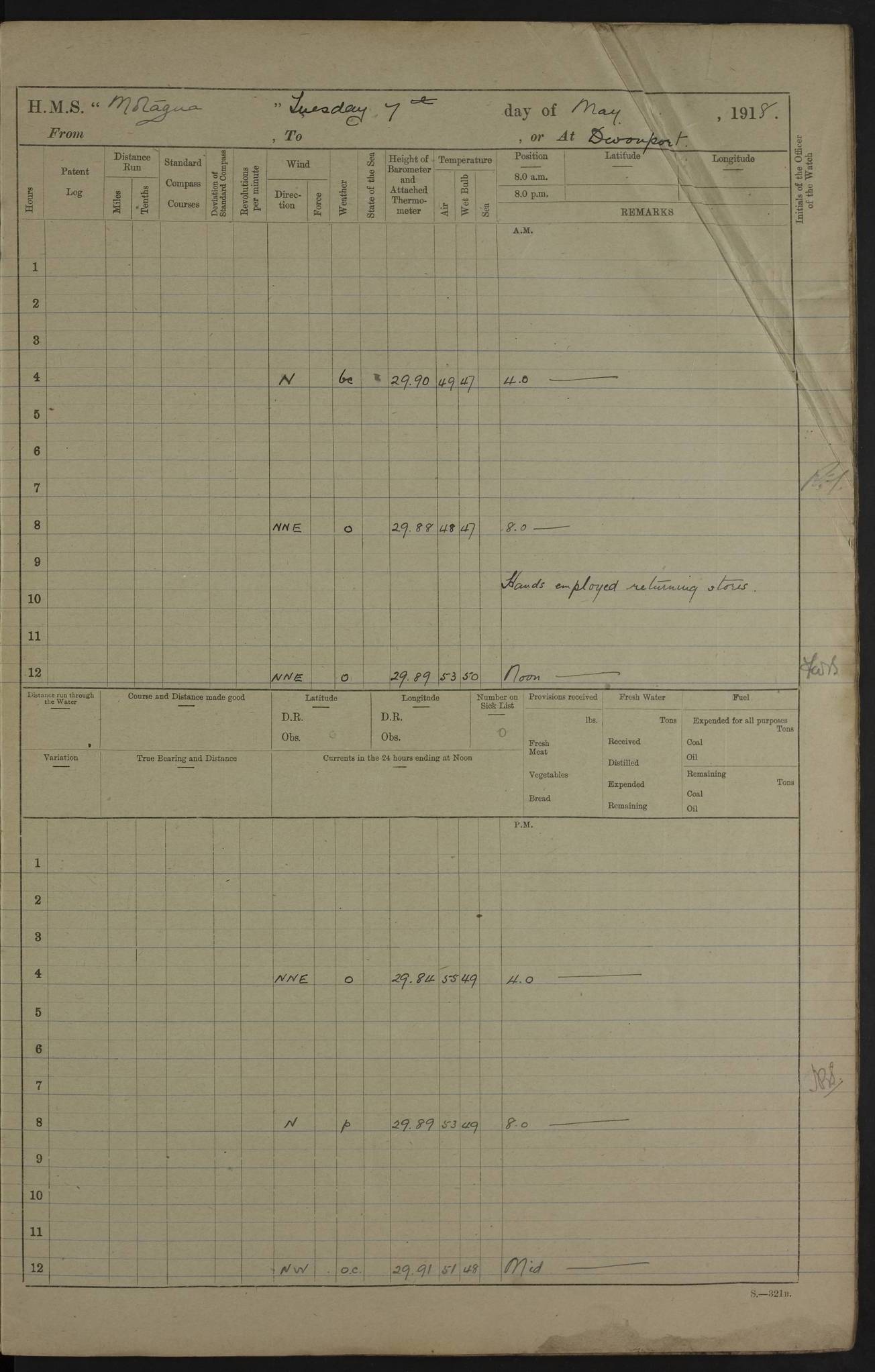
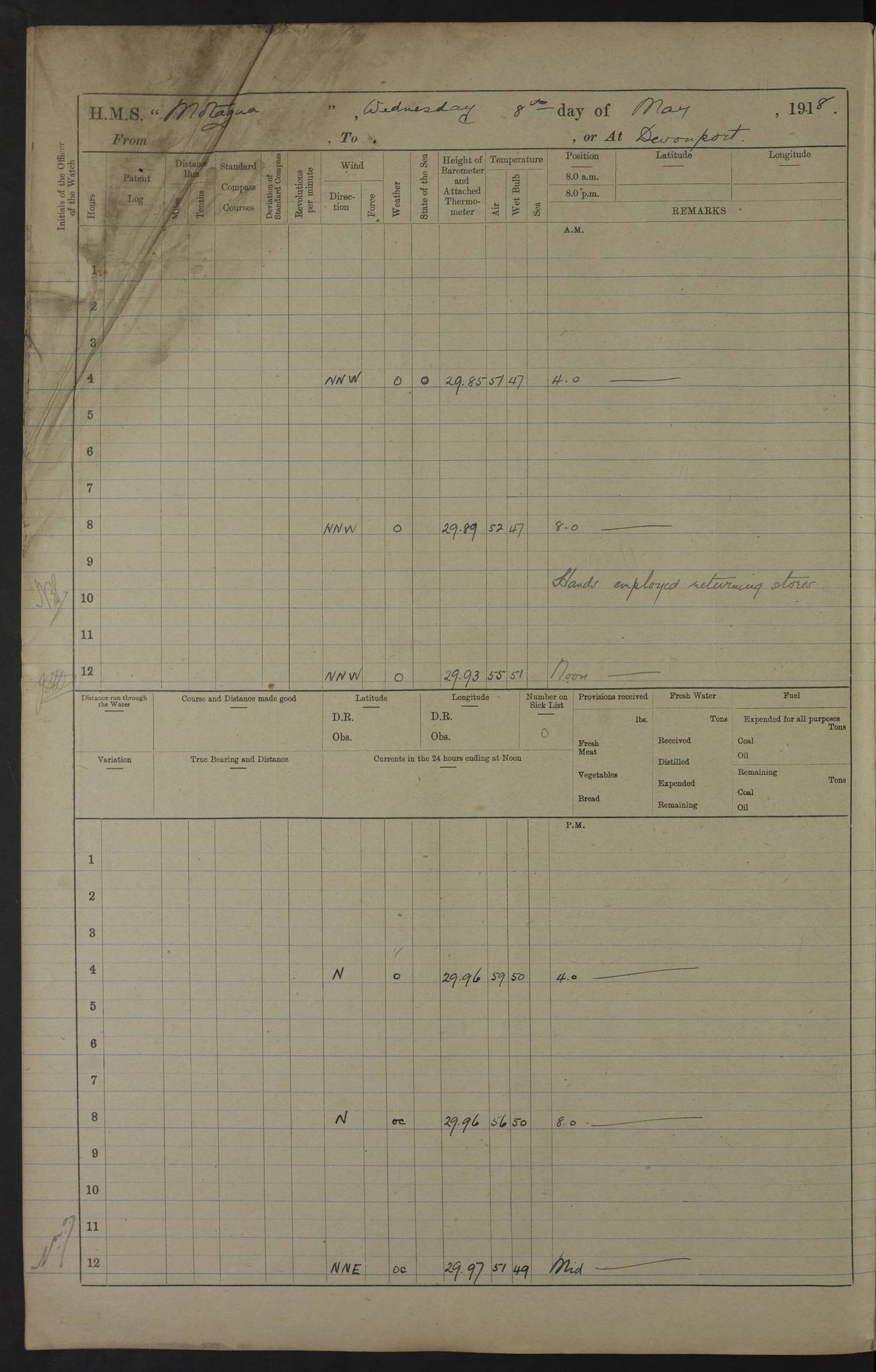
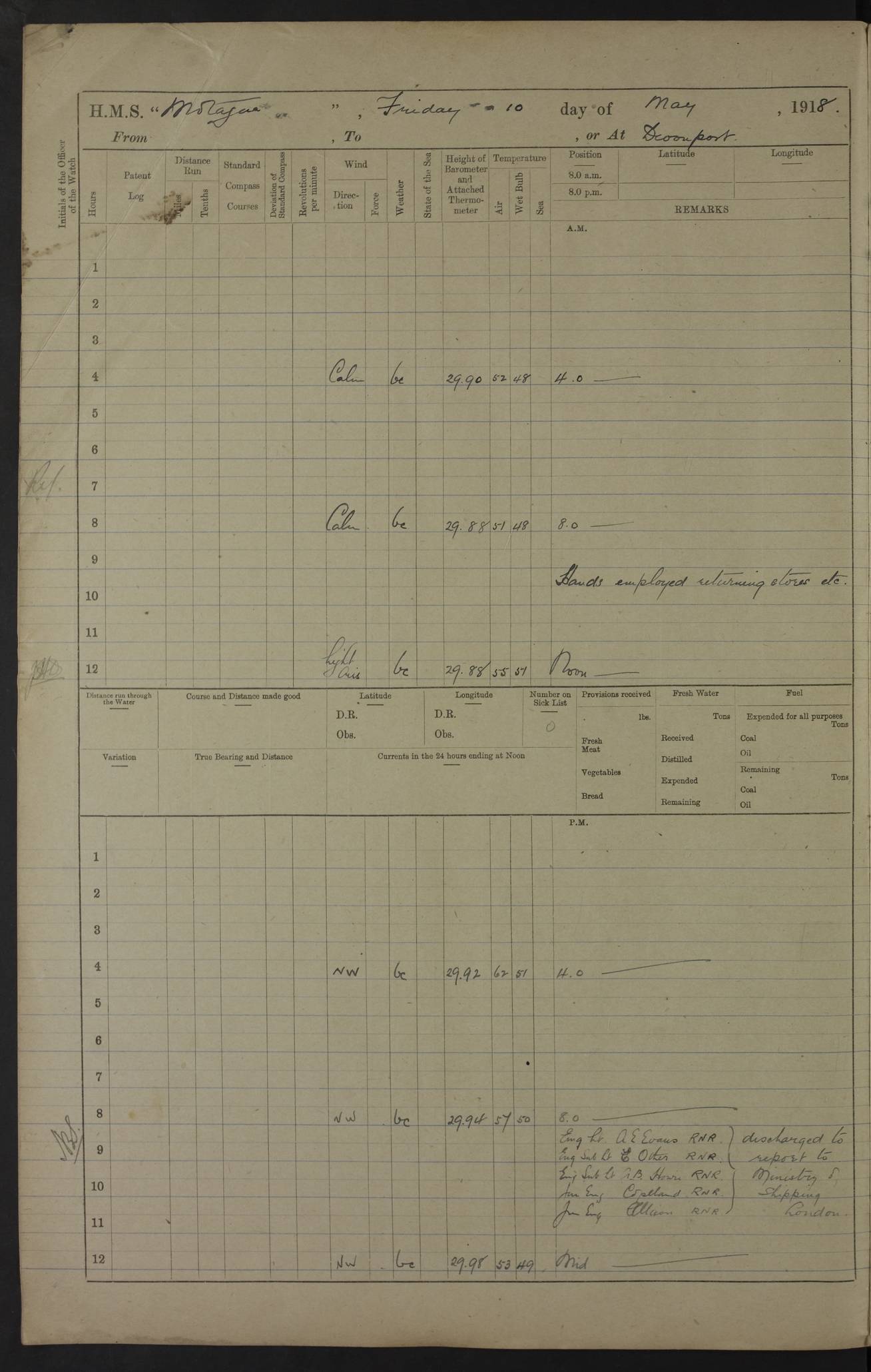
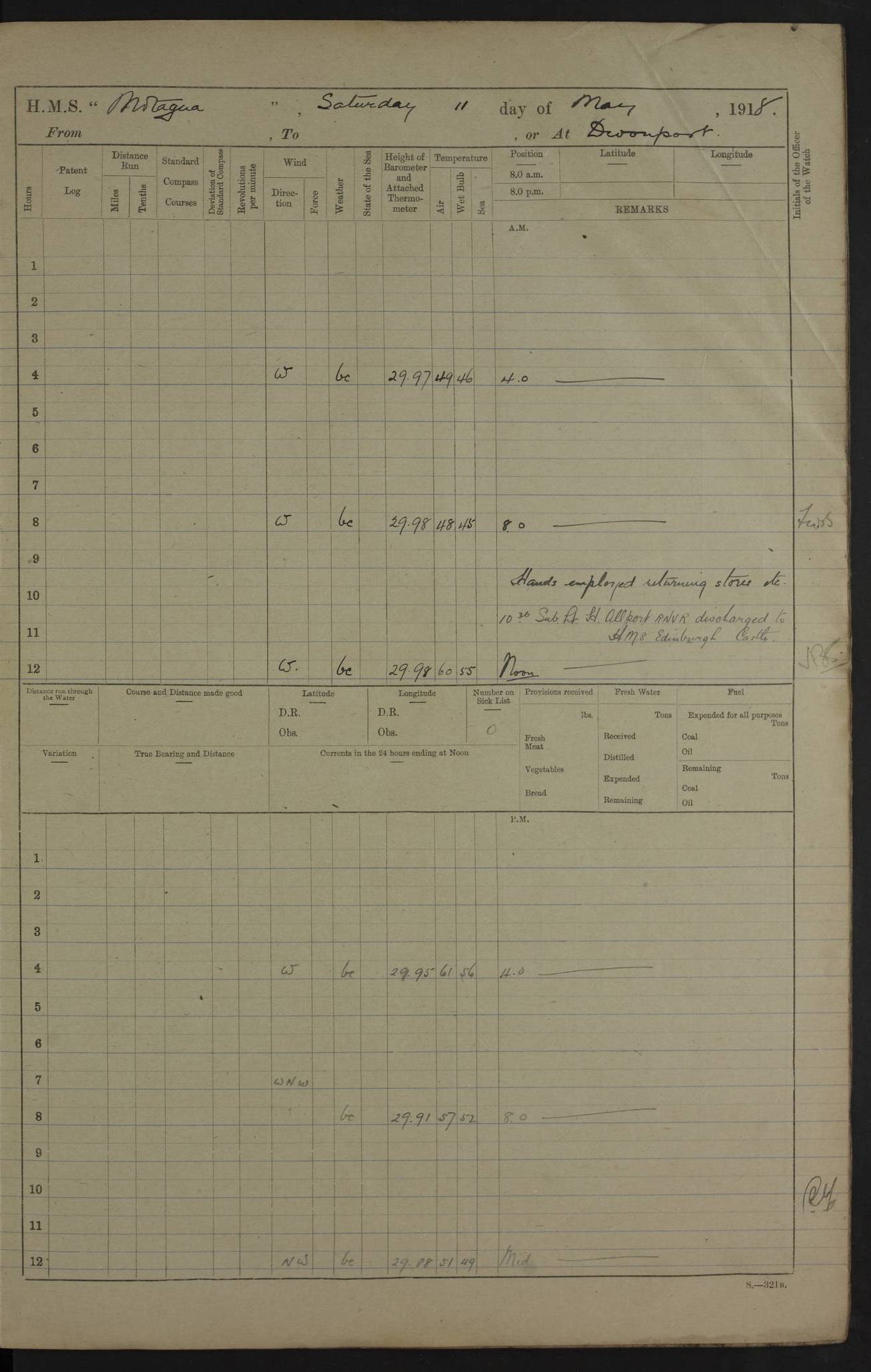
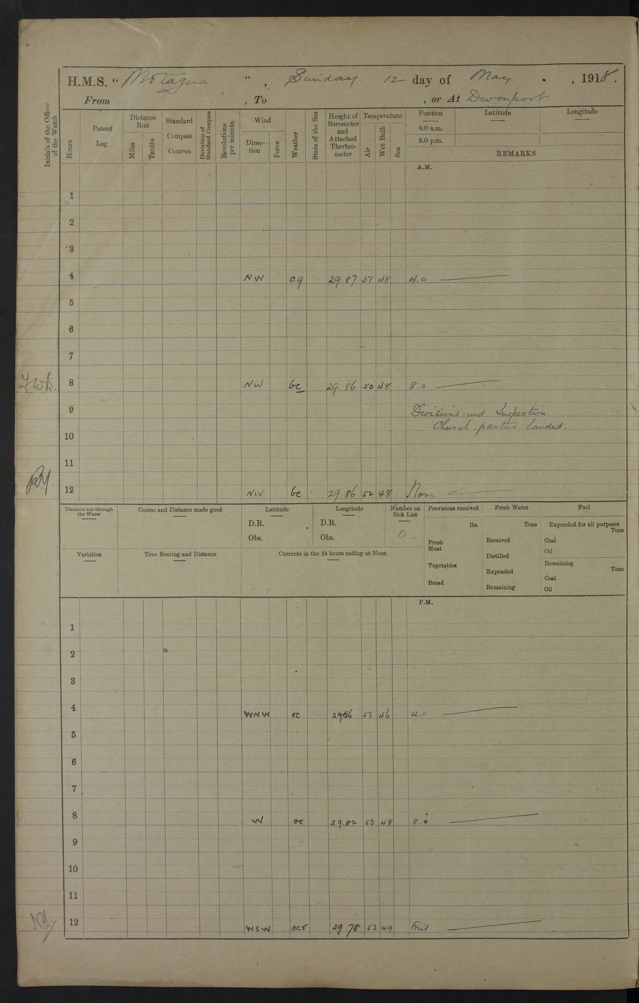
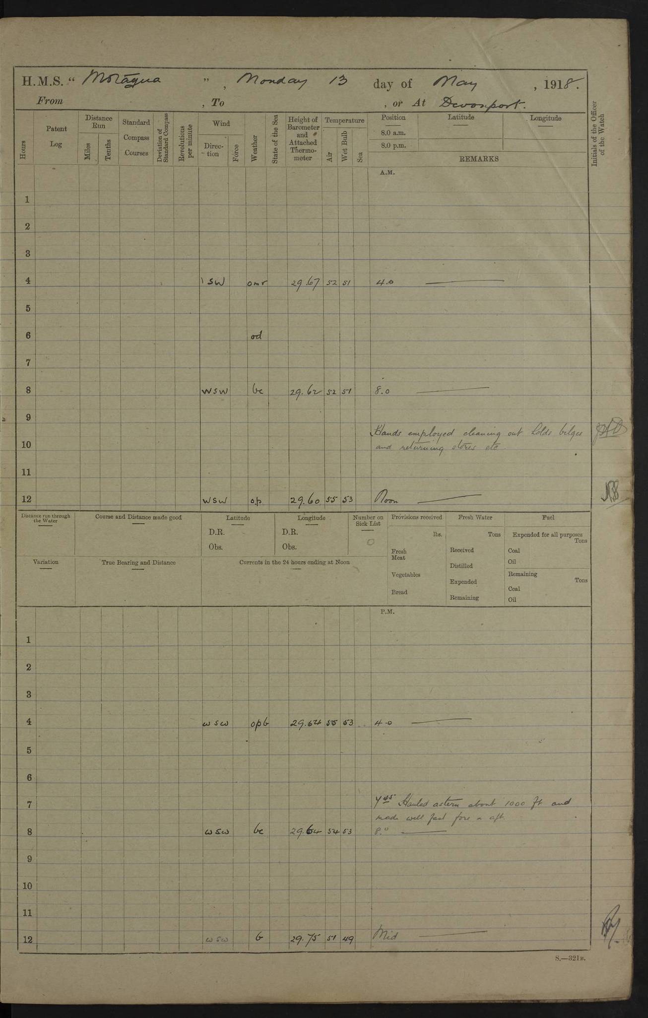
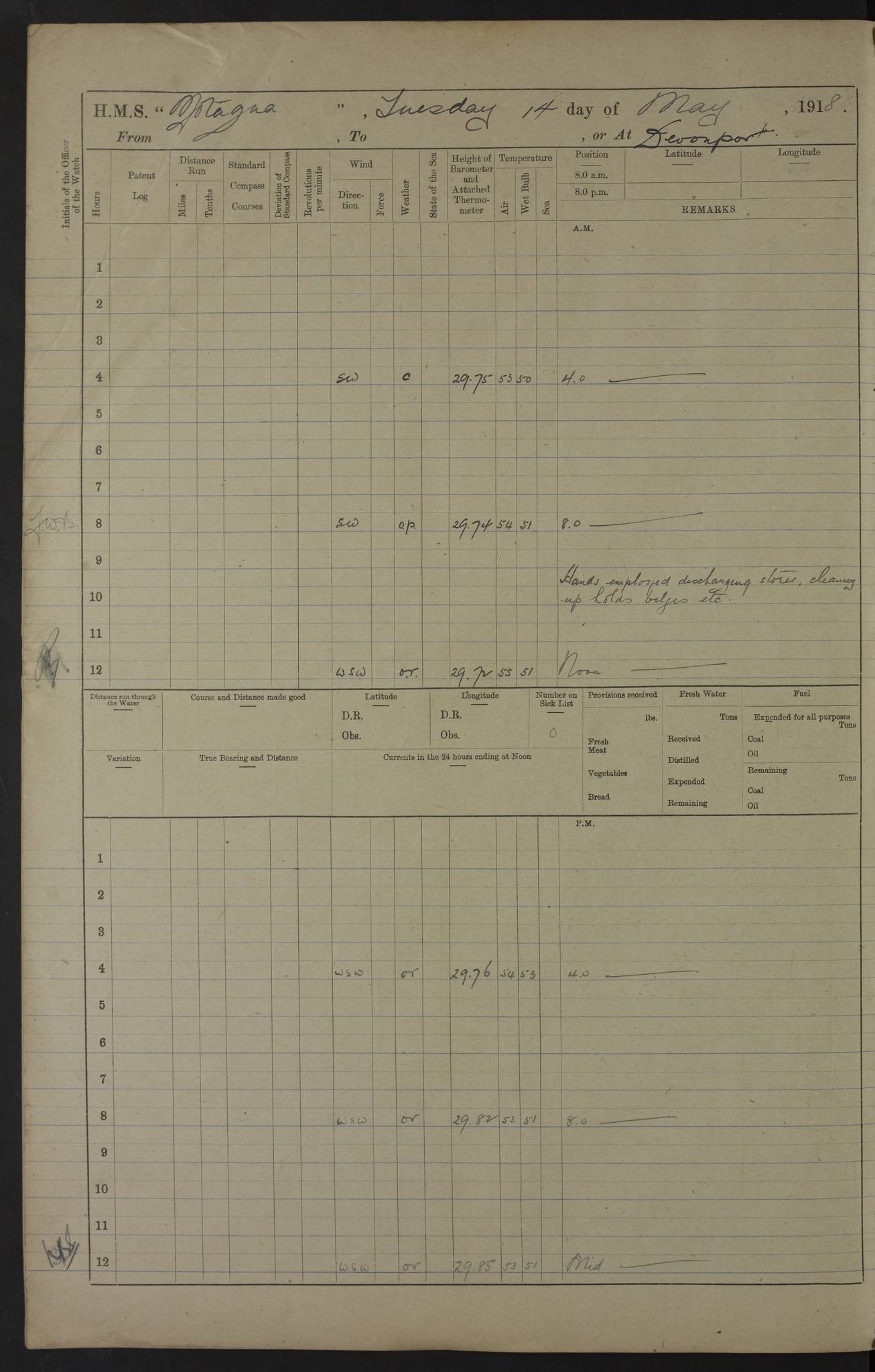
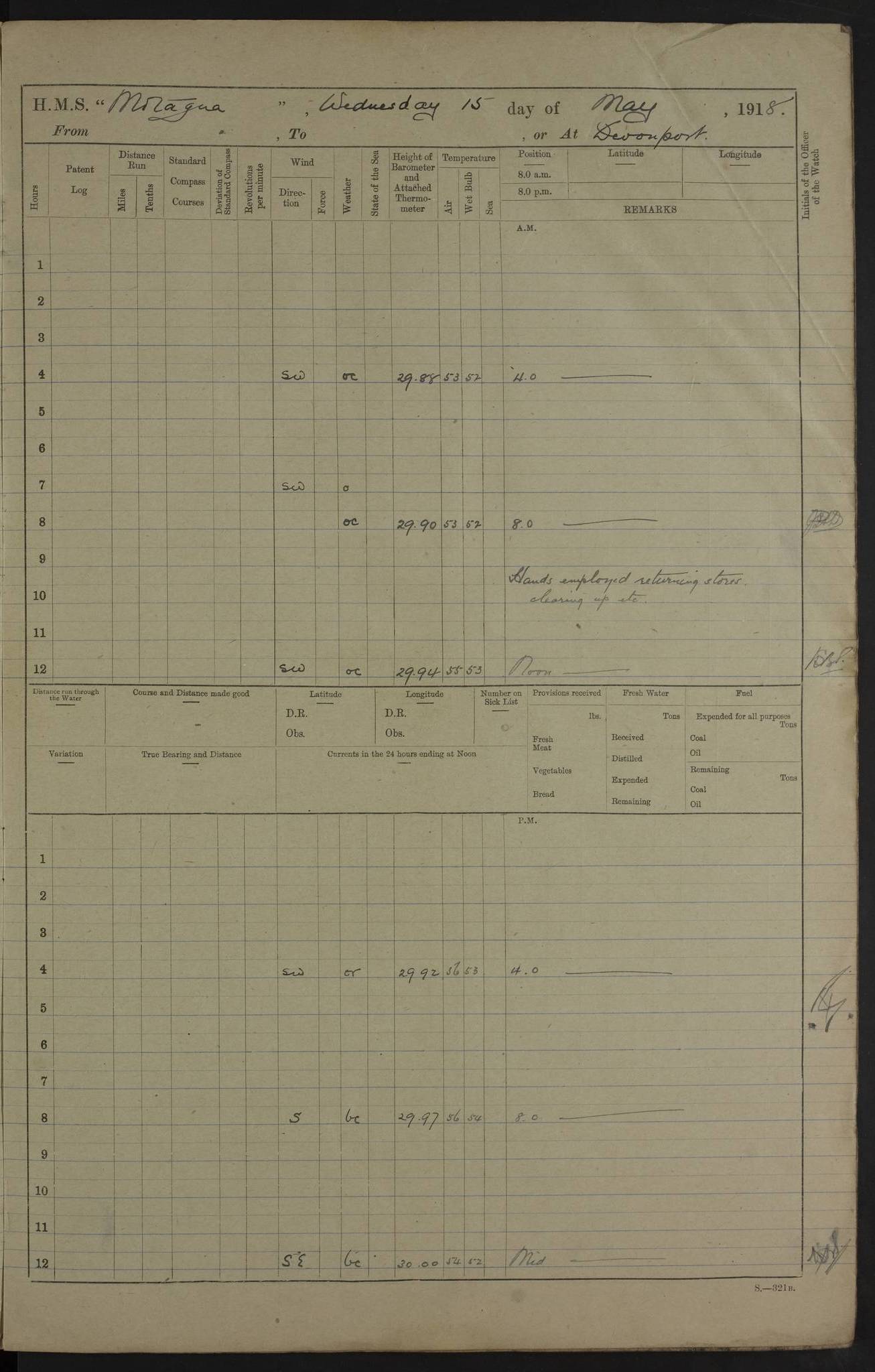
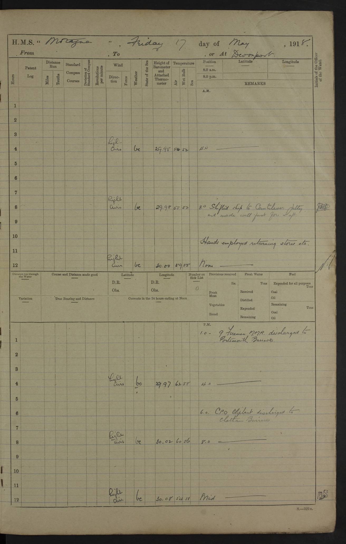
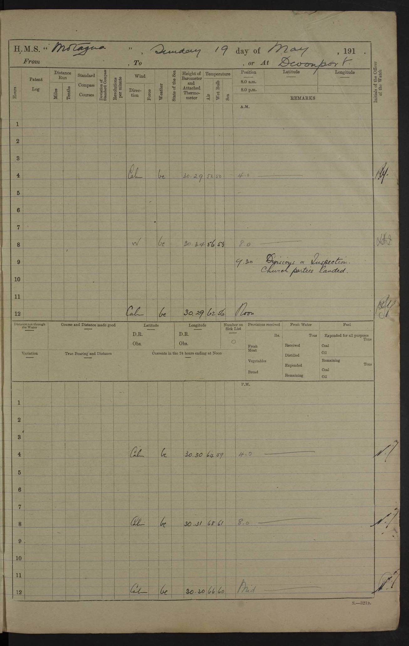
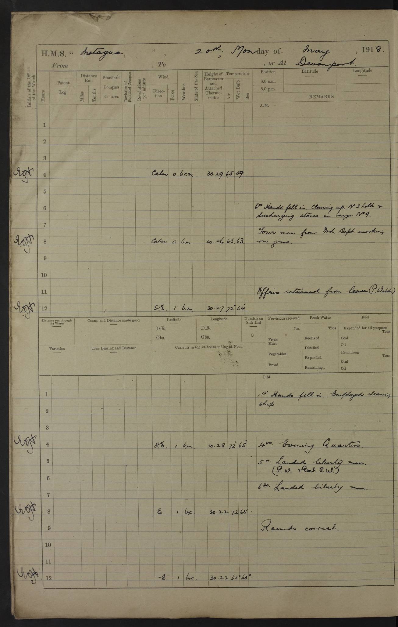
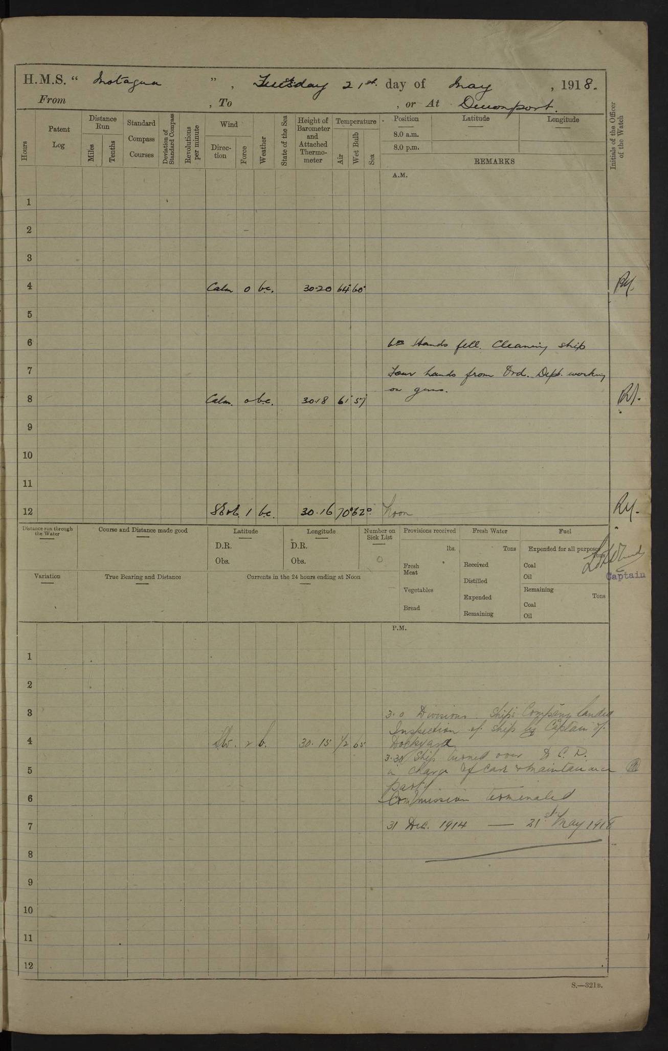